Tag: Greenbelt

  • A visit to GO Transit’s new Garage Mahal

    A visit to GO Transit’s new Garage Mahal

    Bloomington GO Station

    On Thursday, August 12, I rode the train to the very end of the Richmond Hill Line to check out GO Transit’s newest station.

    In 2017, I made a similar trip to Gormley Station, just to the south of Bloomington GO, soon after that station opened to the public. Four years ago, I was critical of Metrolinx’s failures to support the urban intensification of the Greater Toronto and Hamilton Area (GTHA) by building new stations on the Greenbelt, on lands that will not support transit-oriented development.

    Though I came away from Gormley Station disappointed, I wanted to see Bloomington Station for myself and give it an honest assessment. I came away with mixed feelings.

    Most GO Stations outside the old City of Toronto put free car parking ahead of all other considerations. Some stations, such as Unionville, were even moved to sites where large surface lots could easily be built. Hamilton GO Centre, opened in 1996, was an exception: an urban station that combined a restored heritage building with a large bus terminal. A few other newer stations, such as Mount Pleasant in Brampton and Mount Joy in Markham, still had large surface parking lots, but also had easy walking connections to adjacent neighbourhoods. In Guelph and Kitchener, GO Transit used existing downtown stations instead of suburban stations, and Allandale Waterfront Station is located right across the street from Barrie’s gorgeous Kempenfelt Bay.

    Gormley and Bloomington Stations represent a return to GO Transit’s old ways of putting parking ahead of all other considerations, despite Bloomington’s modern design.

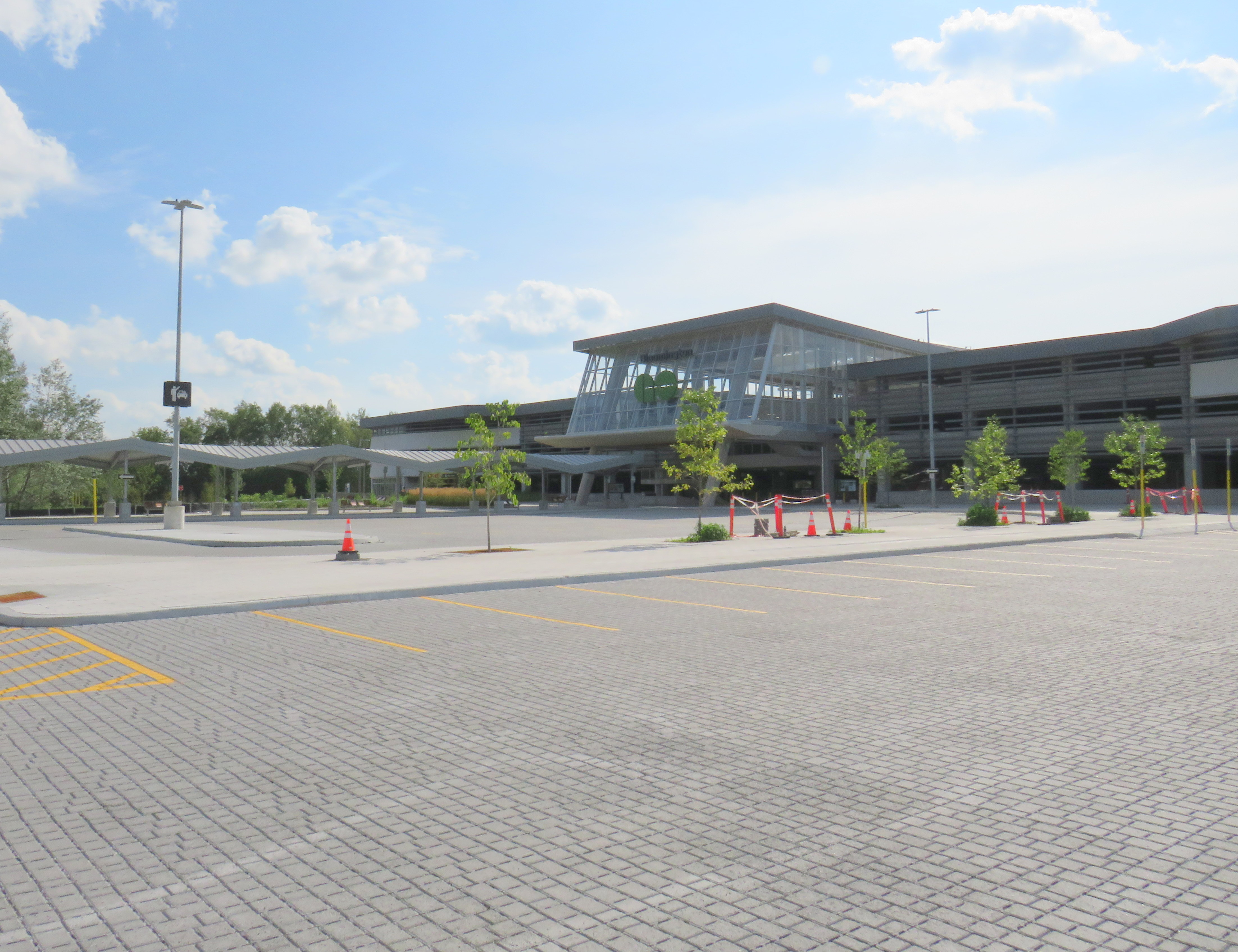
    Metrolinx, the provincial agency responsible for planning and constructing transit infrastructure in the GTHA and for operating GO Transit, opened Bloomington Station on June 28, 2021. The station is located on Bloomington Road, adjacent to Highway 404, on the boundary between Richmond Hill and Aurora.

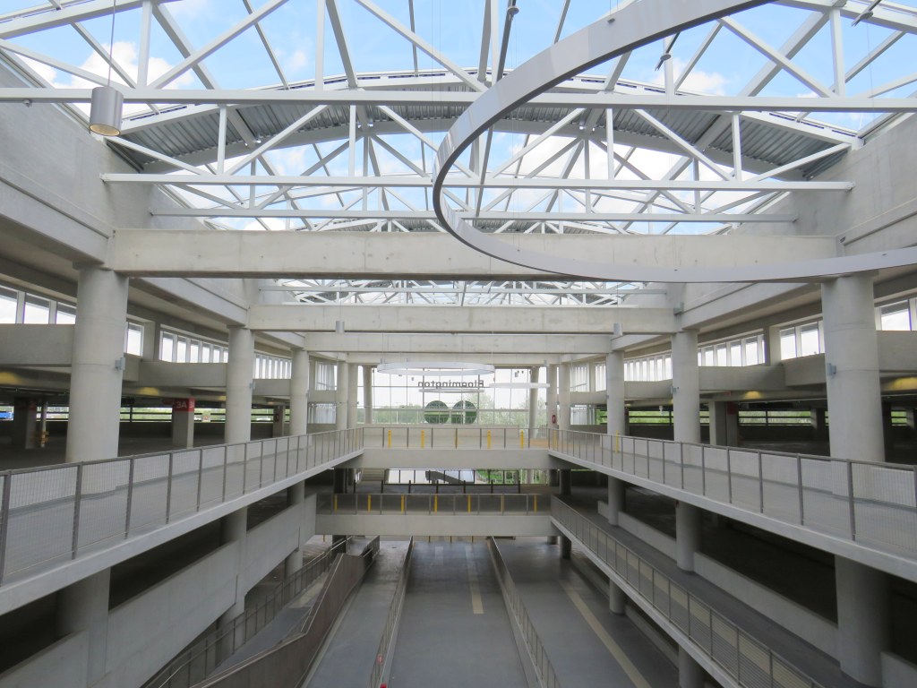
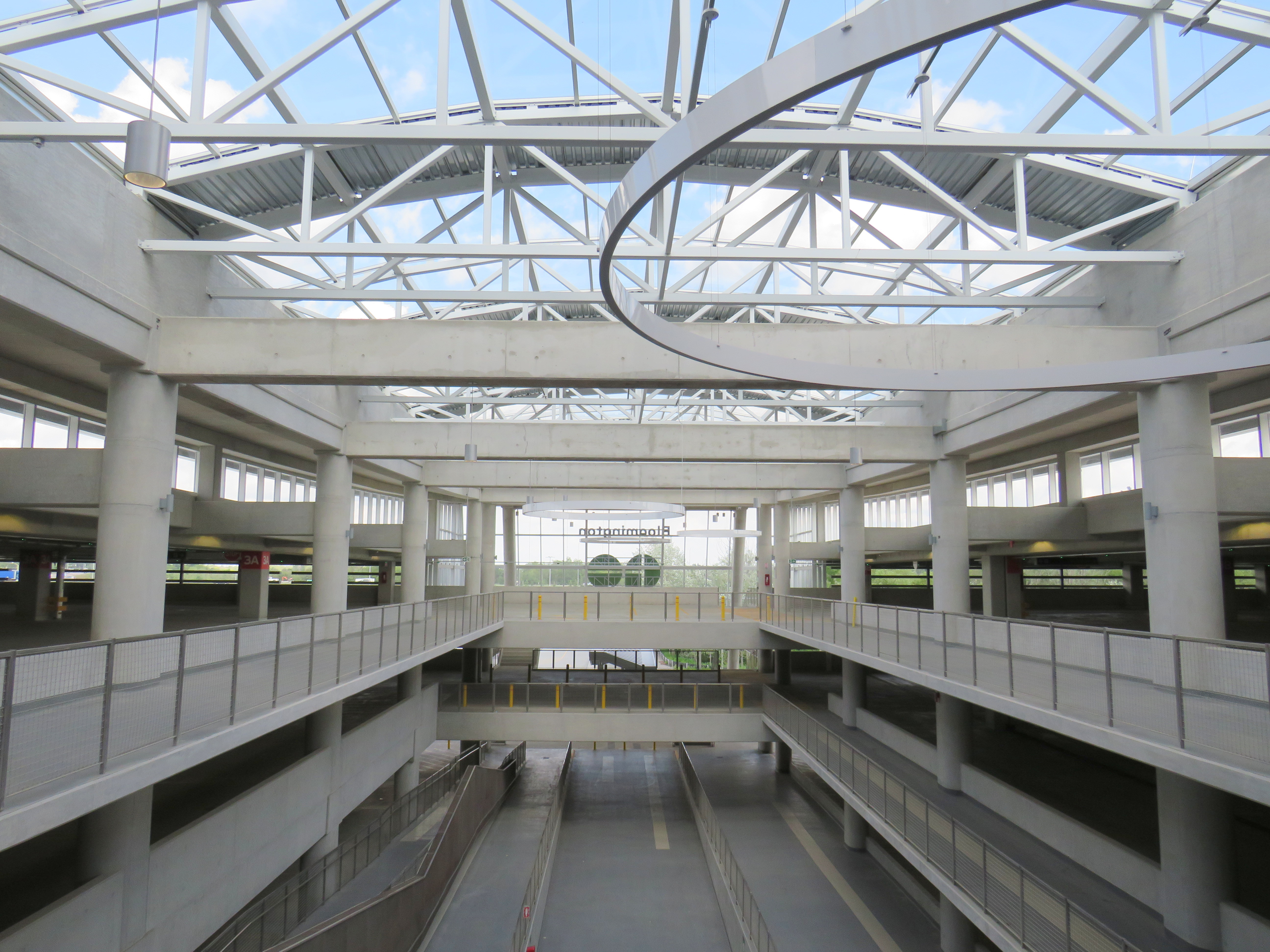
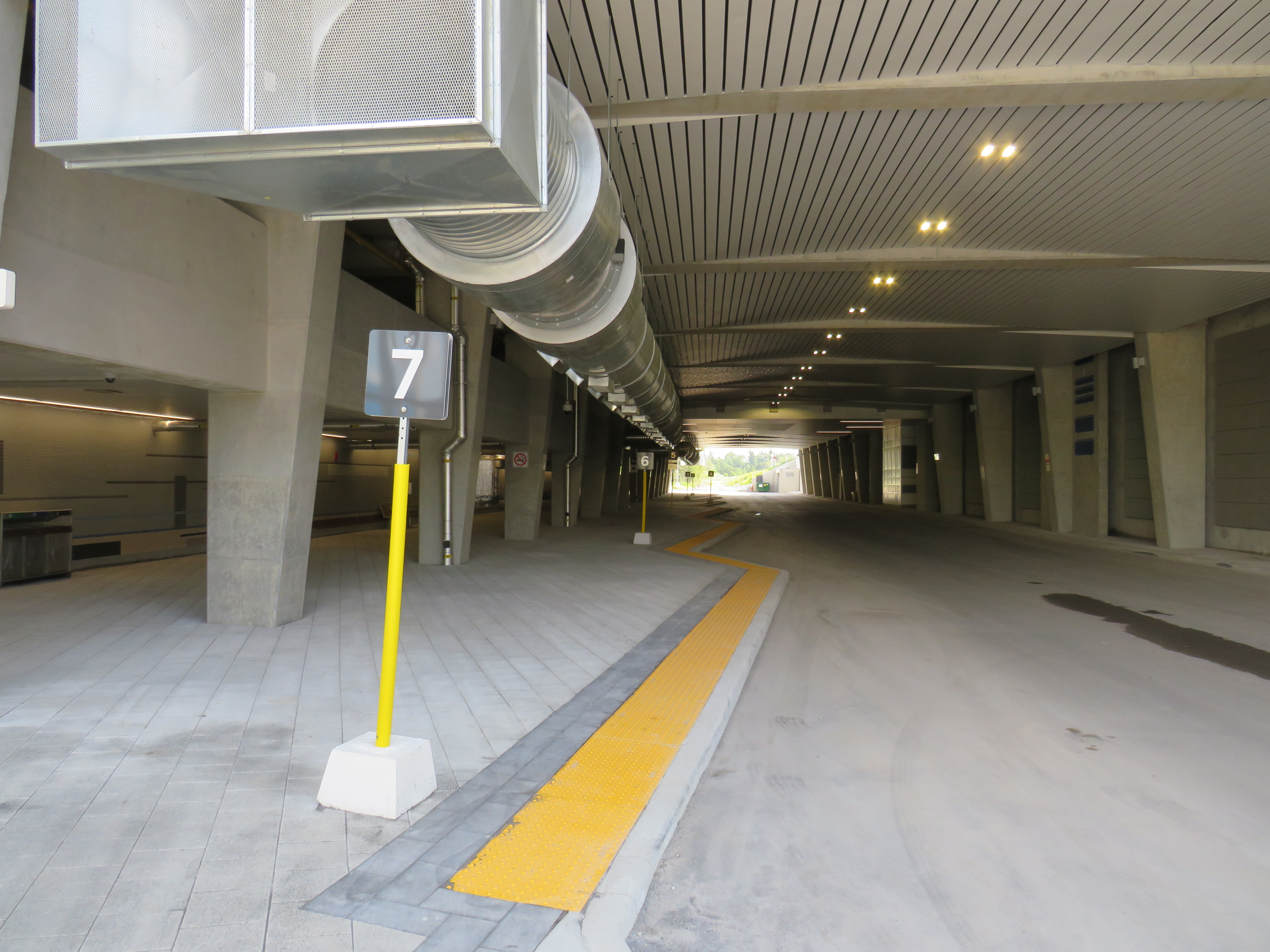
    The station is built around a three-storey parking garage tucked into a hill, with the train platform and station amenities (an enclosed waiting room with washrooms and a ticket counter) on the second level. At the lower level, there is a six-bay bus loop almost directly below the rail platform, minimizing the distance between train and bus. Elevators, stairs, and ramps connect the three levels of parking, the bus bays, and the train platform.

    The station’s central atrium, which contains the pedestrian passages between parking levels, station, and platforms, is the architectural highlight. Above the parking areas, solar panels collect some of the energy required to light and heat the station.

    Atrium at Bloomington Station, with parking spaces on both sides

    In its blog, Metrolinx expressed pride in the new station, noting it was built to achieve LEED Gold certification through features such as energy efficient lighting, a water-permeable surface lot, stormwater management, and a pond for local wildlife with an underground passage to help animals migrate away from the station complex. Like most new GO platforms, Bloomington’s train platform is heated to allow snow and ice to melt, reducing salt usage. Finally, as far as suburban GO stations go, Bloomington’s footprint is quite compact. It cost $82.4 million to build the new station.

    Plaque adjacent to wetland at Bloomington GO Station
    Permeable surface at Bloomington’s outdoor surface lot and passenger pick-up and drop-off area

    Despite these innovations, a LEED certification can only go so far when the GTHA’s newest transit station is only accessible by car, with over 1,000 parking spaces. Though transit ridership is down significantly during the ongoing pandemic, especially on GO’s Richmond Hill Line (which operates only in the weekday peak-period direction and currently uses four-car trains), there are no ongoing connections from Bloomington GO Station operated by GO buses or York Region Transit.

    Though several GO rail stations do not have any local transit connections only Bloomington and Gormley have no bus connections at all. (In April 2020, YRT discontinued the limited-service Route 15 that ran past Gormley Station). At Acton, Georgetown, and Lincolnville, which also do not have any local transit connections, passengers can still connect to GO buses for points beyond, or make a return trip.

    The only bus operating at Bloomington Station’s loop is GO Route 61, which provides supplemental weekday service between Union Station and Bloomington GO. But the last Route 61 bus leaves for Union at 1:55 PM.

    There was no bus connection to be found at Bloomington GO Station

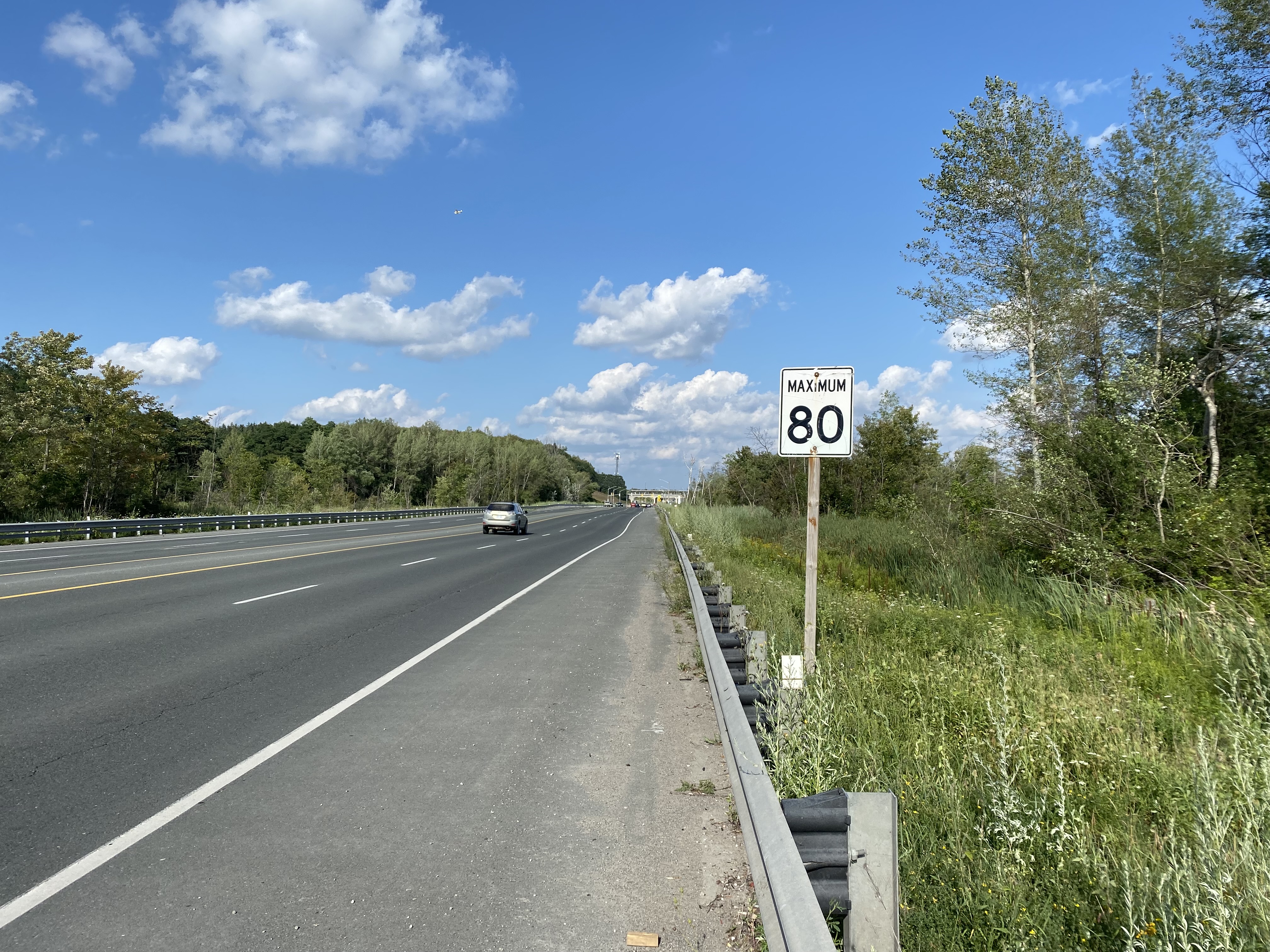
    The nearest in-service bus stop is over one hour’s walk away, near Bloomington Road and Yonge Street. At least there was a paved shoulder along the busy five-lane road between the GO station and Bayview Avenue, where motorists were driving well in excess of the 80 km/h speed limit.

    Looking east towards Bloomington GO at Leslie Street

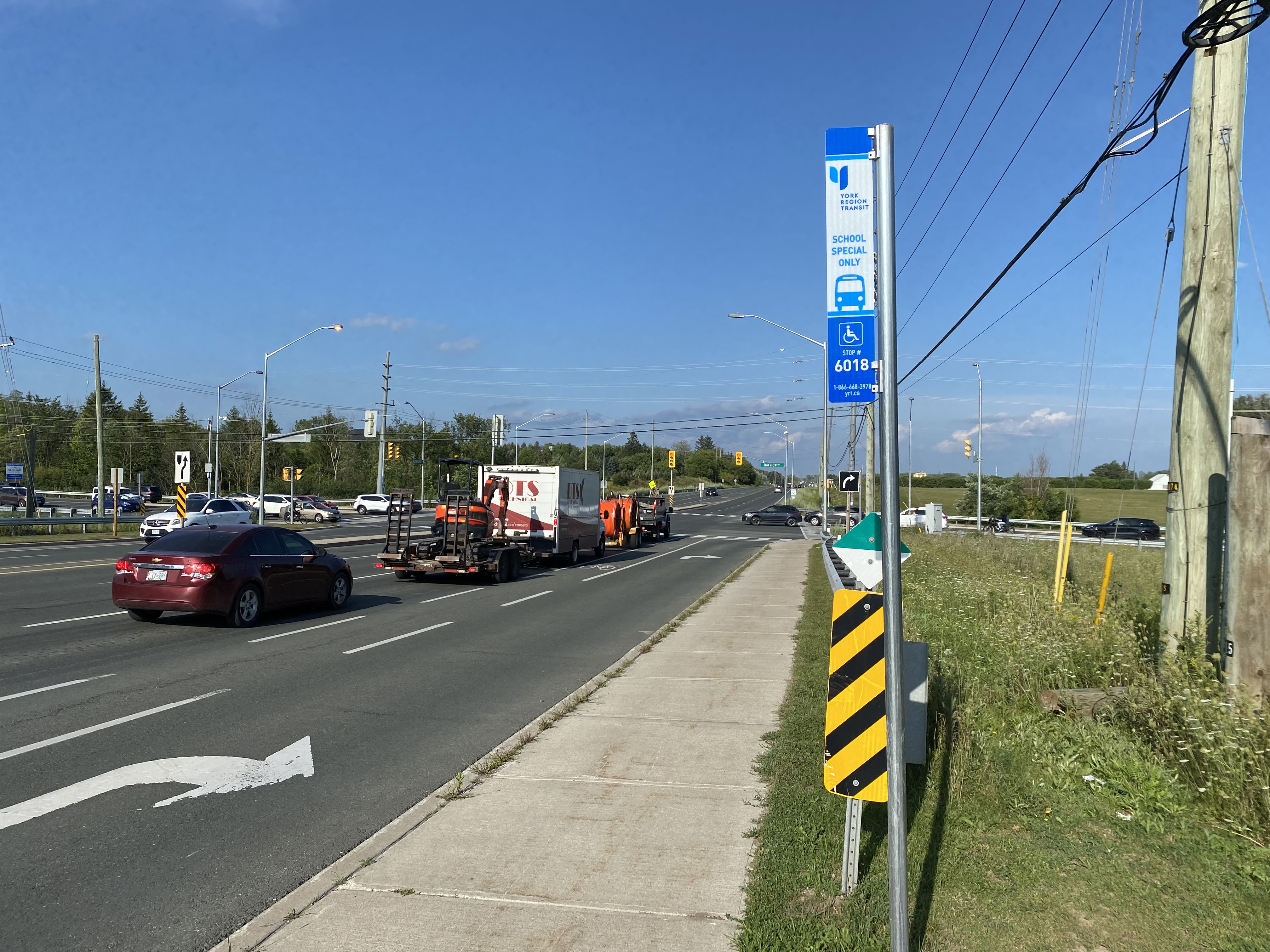
    At Bayview Avenue, a sidewalk leads westerly to Yonge Street, with new residential subdivisions lining the south side of Bloomington Road. I noted a bus stop as I was walking west towards Bayview Avenue; alas, it was only for a high school special route.

    YRT stop at Bloomington Road and Bayview Avenue signed “school special only”
    New residential development along Bloomington Road featuring large houses with three-car garages was clearly designed for cars, rather than people

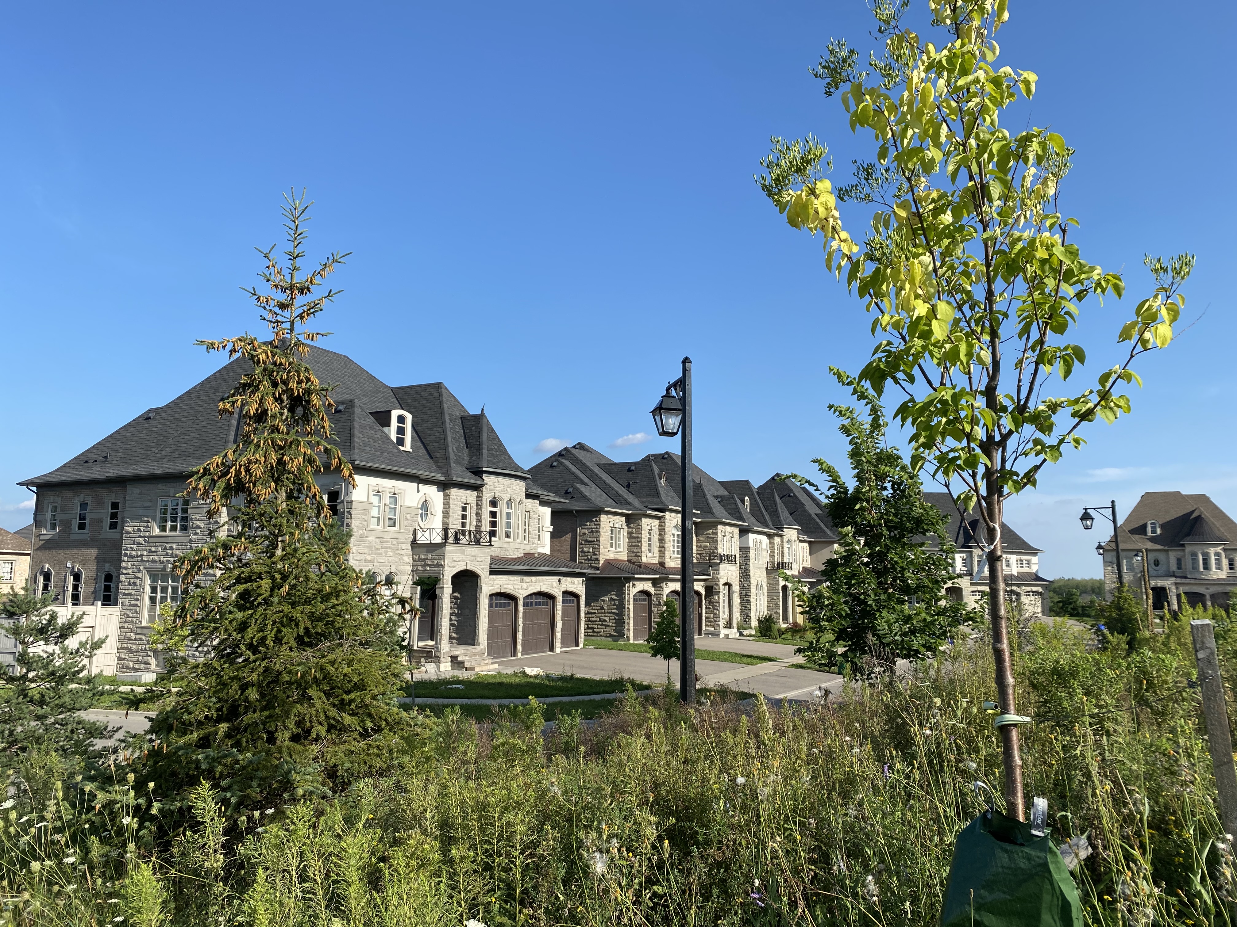
    As I was nearing Yonge Street, I noted that the new subdivisions were set back far from the road, with many of the houses built with three-car garages. Building enough transit ridership here to support even a limited service bus route is going to be very difficult.

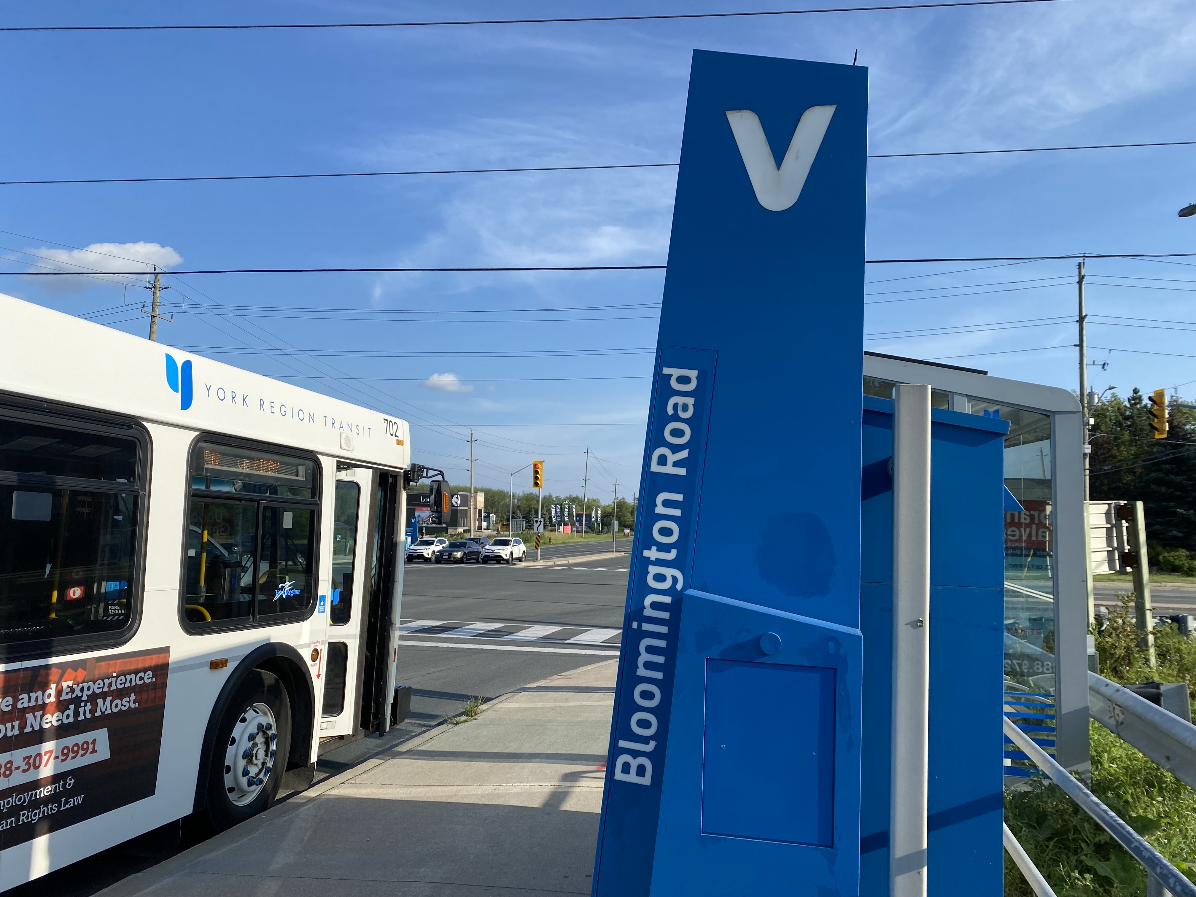
    One hour and 8 minutes later, I arrived at the bus stop at Yonge Street, the closest place to Bloomington GO Station where I could get a bus to continue my journey.

    The end of a long walk from Bloomington GO Station

    Bloomington Station’s small footprint and environmental features might actually make it an ideal basic station design for more urbanized locations in the GTHA, where the compact design and logical layout could support easy bus connections and short walks to residential and employment areas. I liked the simplicity of the bus connections at Bloomington — if only there were any buses to connect to.

    But Bloomington’s LEED Gold certification means little when it does not support sustainable development or sustainable access to the station.

    Though its location adjacent to Highway 404 may entice some commuters to switch to parking at Bloomington and commuting downtown by train, Gormley, just one station to the south, already achieves a similar purpose.

    For now, Bloomington Station is just a Garage Mahal — a grand monument to the old way of doing things at GO Transit.

  • GO Transit’s 404 Error?

    IMG_8969-001GO Train at Gormley Station

    Previously on this blog, I wrote about how new public institutions like hospitals and university campuses are built in isolated, auto-dependent areas without regard to provincial land use policies. In St. Catharines, a new modern hospital on the city’s western outskirts replaced two urban sites, despite available opportunities that would be more accessible to at-need populations. In Orillia, Lakehead University built its campus on the edge of that small city, far from other institutions or its charming downtown core. Similar decisions are being made for new hospitals and university campuses in Niagara Falls, Windsor, and Milton.

    But Metrolinx and GO Transit, its regional transit subsidiary, often fail too to meet the provincial goals of intensification of urban centres and major transit nodes, containing urban sprawl, and promoting sustainable transportation. In Downtown Brampton, an anchor mobility hub, Metrolinx plans to build a new surface parking lot — demolishing several houses and two office buildings in the process — to satisfy commuters’ demands for free parking.

    This failure is especially evident on the newly extended Richmond Hill Line, where one new station — Gormley — opened late last year, and another — Bloomington — is now under construction. Both stations do not support any evident land use policy (both are located on the environmentally sensitive Oak Ridges Moraine); they continue GO Transit’s heritage of building stations that serve car owners, but remain largely inaccessible to pedestrians, cyclists, or local transit users.

    I recently took the train north to Gormley to inform my critique of GO Transit’s new stations. I came away even more disappointed than I had expected.

    (more…)

  • Ontario’s land use scandal: Another greenfield hospital for Niagara

    IMG_8728 (2)-001

    Recently, I discussed the greenfield locations of new hospital and post-secondary institutions in Ontario, focusing on the new St. Catharines Hospital site and the Orillia campus of Lakehead University, but also mentioning the proposed sites of a new hospital for Windsor, and an university campus in Milton. Hospitals and educational institutions are primarily funded by the province, which likes to promote sustainable development policies such as the Greenbelt, and mobility hubs at major transit nodes.

    The trouble with these new sites, located far from each city’s urban centre, is that they are difficult to reach by walking, cycling, or public transit. They don’t support downtown businesses, they ignore other potential urban land parcels (often former industrial sites), and are not in accordance with the province’s own land use policies.

    I recently returned to Niagara Region to examine Niagara Health’s plan to consolidate health services outside of St. Catharines (where it already merged two urban hospital sites to a single suburban location). It proposes consolidating most health services located in five municipalities (Niagara Falls, Welland, Port Colborne, Fort Erie, and Niagara-on-the-Lake) into one site, at the corner of Biggar and Montrose Roads, south of Niagara Falls’ urban area, but adjacent to an interchange with the Queen Elizabeth Way (QEW).

    Niagara Falls, like most of urbanized Niagara Region, is de-industrializing, with modest population growth. Employment is largely dependent on public sector jobs, such as the education and health services, and the city’s tourism industry. As a large employer, the hospital should be as accessible to its employees, as well as its patients, as possible.


    Map of current Niagara Health sites and proposed new hospital

    The proposed hospital site is at the corner of two two-lane country roads, in an area without sidewalks. To the north and west is a golf course; to the south is a Hungarian community hall, farm fields, and a few exurban ranch houses. The land was donated in 2013 by a local business family, but last fall, Niagara Falls City Council was considering purchasing an additional 20 acres for staff parking. (more…)

  • Mapping Toronto’s population growth

    Data geeks across Canada were eagerly awaiting this day — February 8, 2017 — the first release of the 2016 Canadian Census of the Population. Today’s release only covers population and dwelling counts, further information on age, sex, household characteristics, as well as language, immigration status, employment, income, and other variables will be released later in 2017. The 2016 Census included the mandatory long-form census, which will provide a robust snapshot on the socioeconomic status of all 36 million Canadians.

    I created three quick maps showing the population growth in the City of Toronto by census tract. The City of Toronto grew by 116,511 people over five years to 2,731,571 in 2016, a 4.45% increase. Some suburban municipalities grew much faster, like Brampton  (13.3%, with a 2016 population of 593,638), but Toronto has been able to absorb one-third of the Toronto Census Metropolitan Area’s growth.

    Toronto’s population makes up 46.1 % of the Toronto CMA (population 5,928,040). The rest of that growth was found in mature suburbs such as Brampton, Mississauga, and Markham, but also in quickly-growing towns such as Milton (population 110,128, up 30.5% from 2011). While some suburbs — Mississauga and Markham in particular — have been establishing higher-density urban centres with mid and high rise condominiums, most of the suburban growth has come from single-family homes and townhouses on formerly agricultural lands. If the Greenbelt is to continue being successful in containing sprawl and preserving productive farms and natural areas, Toronto needs to absorb even more growth in the next few decades. Land developers, speculators and the real-estate industry, however, are pushing back.

    The first of the three maps shows the percentage increase or decrease in population by census tract. Areas with higher growth are concentrated in Downtown (particularly along Yonge Street and in the Entertainment District, City Place, Liberty Village-Fort York and St. Lawrence-Distillery-Corktown), as well as Etobicoke Centre, on Humber Bay, Midtown, and along the Sheppard Subway corridor in North York. Not surprisingly, these are areas in which new housing developments, particularly condo towers, are being built. Other neighbourhoods, for the most part, are seeing minor increases or decreases in population, likely related to changes in household/family size.

    gta-2016-census
    Population change between 2011 and 2016 by percentage by census tract, Toronto
    (Alternate colour scheme available here and here)

    But more interesting is the map showing absolute population increases or decreases between 2011 and 2016. It better illustrates areas of high population growth and neighbourhoods with population decline. The inner suburbs, especially parts of Scarborough and North York, clearly show slight a population decline compared to the high-growth areas described above.

    gta-2016-census-absolute-change
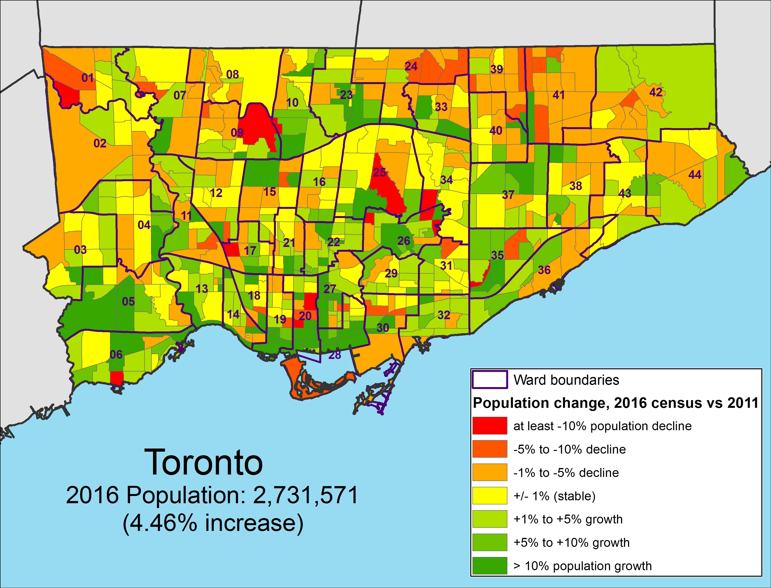
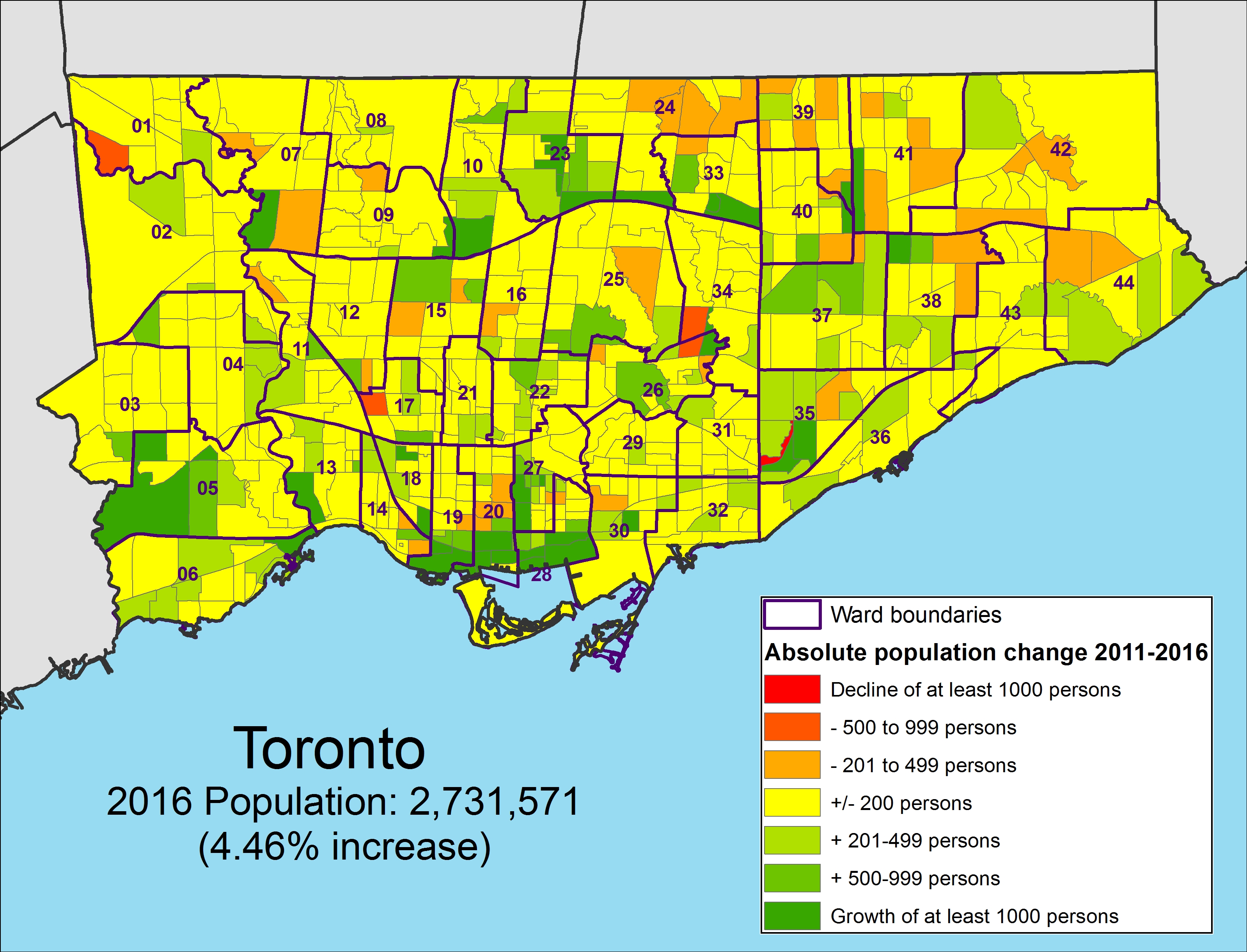
Population change between 2011 and 2016 by absolute numbers by census tract, Toronto
    (Alternate colour scheme available here and here)

    The final map shows the 63 census tracts (out of a total of 1,426 CTs) with growth of at least 2,000 persons. It very clearly shows where high population growth has taken place.

    GTA 2016 Census Toronto High Growth.jpg
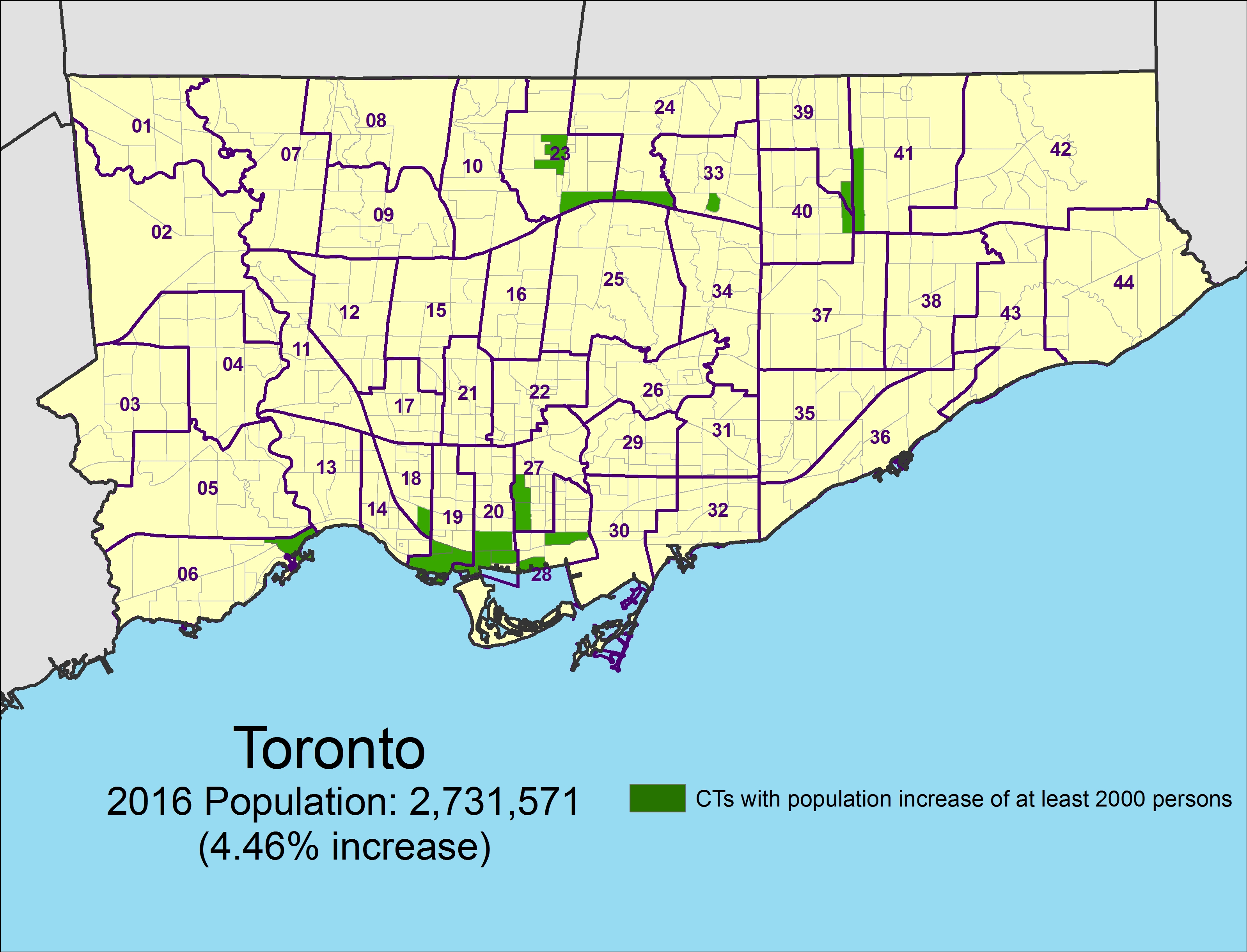
Census tracts that grew by at least 2,000 persons between 2011 and 2016