 Mount Pleasant Square, Brampton
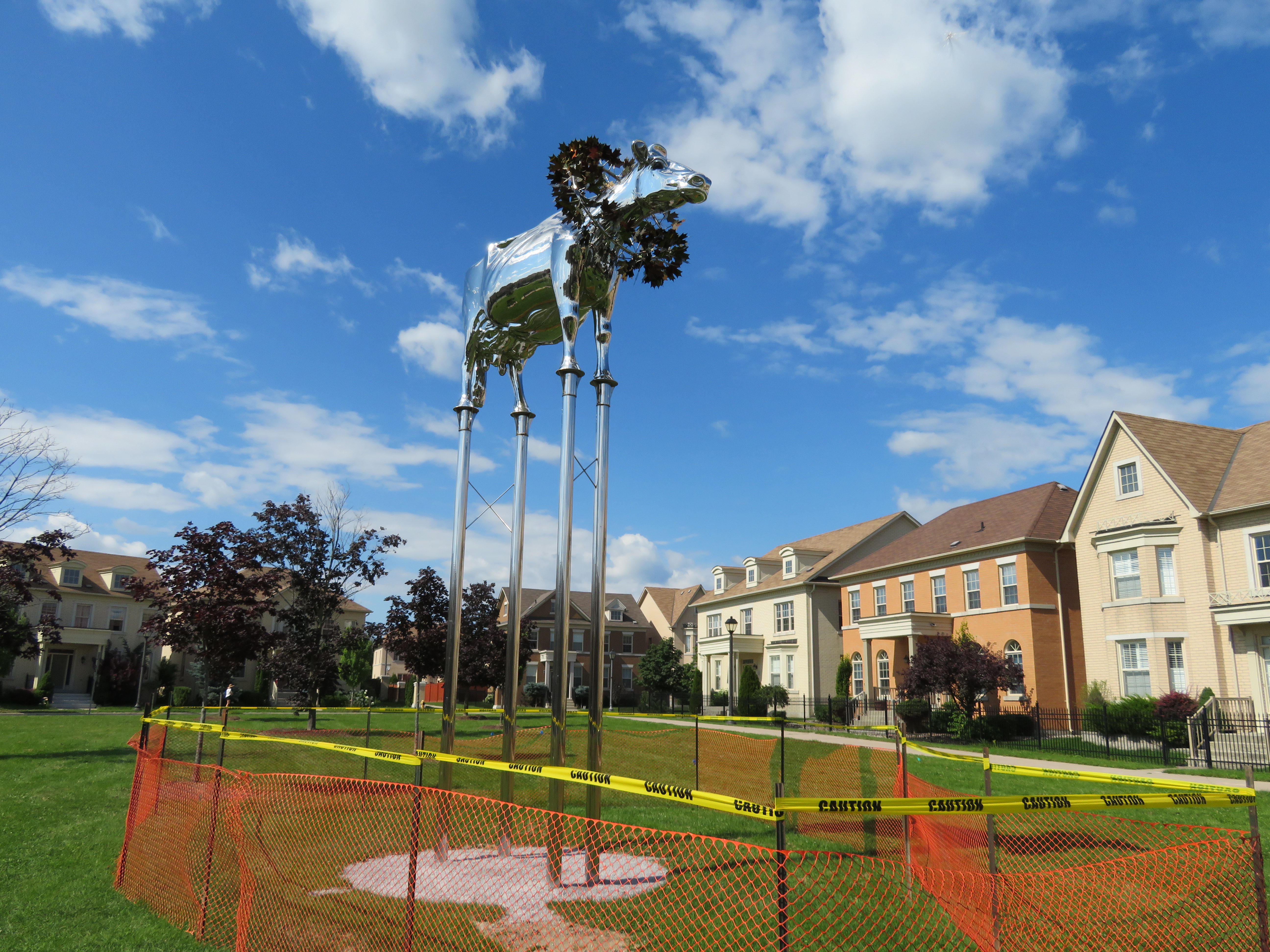
A few weeks ago, I visited Cathedraltown, a subdivision in north Markham built in the new urbanist style. Cathedraltown made the news thanks to a controversial metallic sculpture of a cow installed in a parkette. (Last week, Markham City Council voted to move the sculpture.)
I came away disappointed by Cathedraltown. Despite a dense built form, and a main street lined with storefronts, it did not live up to the new urbanist promise: it was still a very car-centric subdivision, without the retail, nor the density required to make it a walkable community. The central focus is a Slovak-Catholic cathedral, recently re-opened after lengthy dispute between the development company and religious leadership. “No trespassing” signs still stand in front of the imposing church. Transit connections are poor, making a car virtually necessary to get even to nearby employment areas.
Mount Pleasant, in Brampton, fares somewhat better, despite some similar issues to Cathedraltown. What distinguishes it though are superior transit connections, and a better-programmed central focus.
Satellite view of Mount Pleasant via Google Maps
Mount Pleasant started off as a small settlement between Brampton and Georgetown, where Highway 7 and 3rd Line West (later Creditview Road) crossed the Canadian National railway line between Toronto and Guelph. For most of its existence, it was little more than a collection of houses, two churches, a motel and a service station. By the 1960s, the local trains no longer served the flag stop there, and Highway 7 — now Bovaird Drive — bypassed the hamlet on a new railway overpass in the 1960s, also severing Creditview Road.
A few buildings — two houses and a former Presbyterian church, now a mosque — remain at the former crossroads. New subdivisions now surround the historical community.
 Mount Pleasant’s old Presbyterian church is now a mosque.
Mount Pleasant GO Station opened in 2006, just as northwest Brampton was transforming from farmland to new subdivisions. The GO Station was built like any other in Toronto’ suburbs: a large parking lot, bus loop, and pick-up and drop-off area, with easy access to Bovaird Drive. But on the north side of the tracks, the City of Brampton, and the developer, Mattamy, tried something different.
At the core, the City of Brampton built a new library branch that incorporates the dismantled Canadian Pacific Railway station that used to stand on Queen Street in Downtown Brampton. (The station was moved in 1980 to a then-rural site on Creditview Road when it was threatened by demolition by the CPR. But the station building was left to rot before heritage conservationists carefully dismantled the structure.) Behind the library is a public school. In front, there’s a public square that includes a small playground, as well as a reflecting pond that’s a skating rink in the winter.
 The Brampton Public Library incorporates the former Brampton CPR Station, rebuilt here at Mount Pleasant Village
To the west of the square are several low-rise apartment buildings, the sort of “missing middle” housing needed in Toronto’s established urban neighbourhoods. To the east are several retail/residential blocks, the sort of mixed use buildings that are uncommon in new subdivisions. The storefronts are all mostly occupied with businesses serving the local neighbourhood, such as hair salons and spas, a convenience store, a dentist’s office, and a restaurant. To the south are entrances to the GO Station and the bus loop for GO and Brampton Transit buses.
 Woodward Avenue at Mack Avenue, August 2017
 A mostly empty Cathedral High Street
 A “no trespassing” sign still stands outside the recently re-opened Cathedral of the Transfiguration
 Storefronts on Cathedral High Street…
 …While a nearby auto-centric plaza is busy
 Empty streetscape on a sunny Saturday afternoon
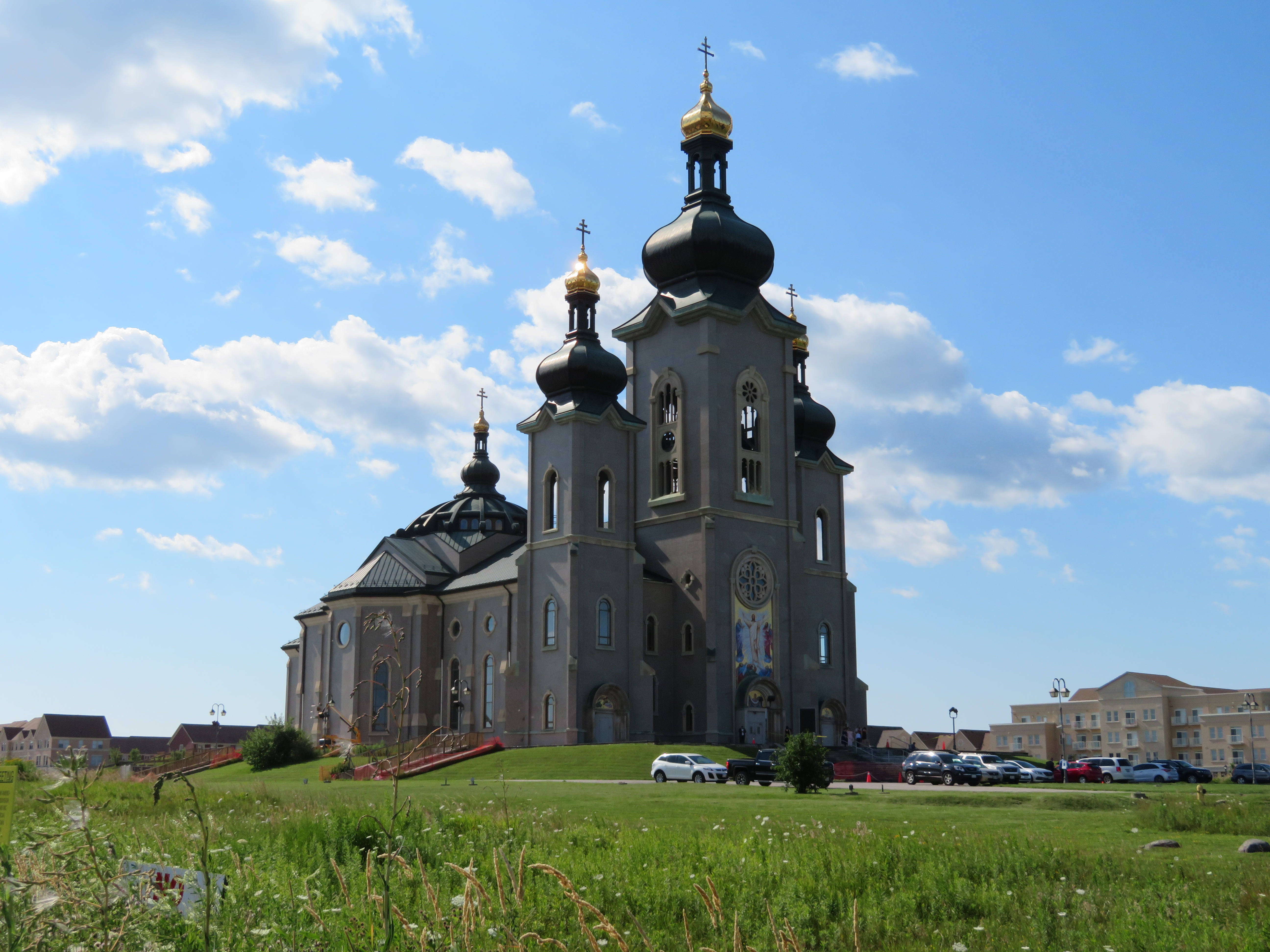


 Population change between 2011 and 2016 by absolute numbers by census tract, Toronto
 Census tracts that grew by at least 2,000 persons between 2011 and 2016
 The abandoned Goodman’s China store