Tag: Chicago

  • Chicago’s 606: an urban rail trail

    Chicago’s 606: an urban rail trail

    Earlier this year, I had the opportunity to travel to the US Midwest. My spouse had a business meeting to attend in Chicago, so we made the most of our trip. I spent time in a few interesting cities, including Milwaukee, Madison, and Minneapolis-St. Paul.

    Having been to Chicago many times now, I sought out new and interesting places to visit off the tourists’ beaten paths. One of these places was The 606/Bloomingdale Trail, located a few miles northwest of Chicago’s downtown Loop.

    Though Chicago is famous for its elevated railway transit system (known as the “L”) it is also crisscrossed by hundreds of miles of mainline and spur railways, most of which is grade-separated from the local street network. These rail corridors were built by over a dozen railroad companies, whose vast networks converged on Chicago, bringing in, among many other things, grain, cattle, metals, and sending out cereals, meat products, industrial goods, and merchandise purchased from Sears, Roebuck and Montgomery Ward. Chicago’s dominance as a rail centre allowed it to grow into America’s second-largest city (it is now the third-largest).

    There are still many railways and yards throughout the city, along with an expansive commuter rail network, but many of the industrial spurs and branch lines became redundant with the decline of heavy industry and the shift to trucking. The Bloomingdale line, once a busy freight corridor owned by the Chicago, Milwaukee, St. Paul and Pacific Railroad (known as the Milwaukee Road, later part of Canadian Pacific’s network) was just one of these routes.
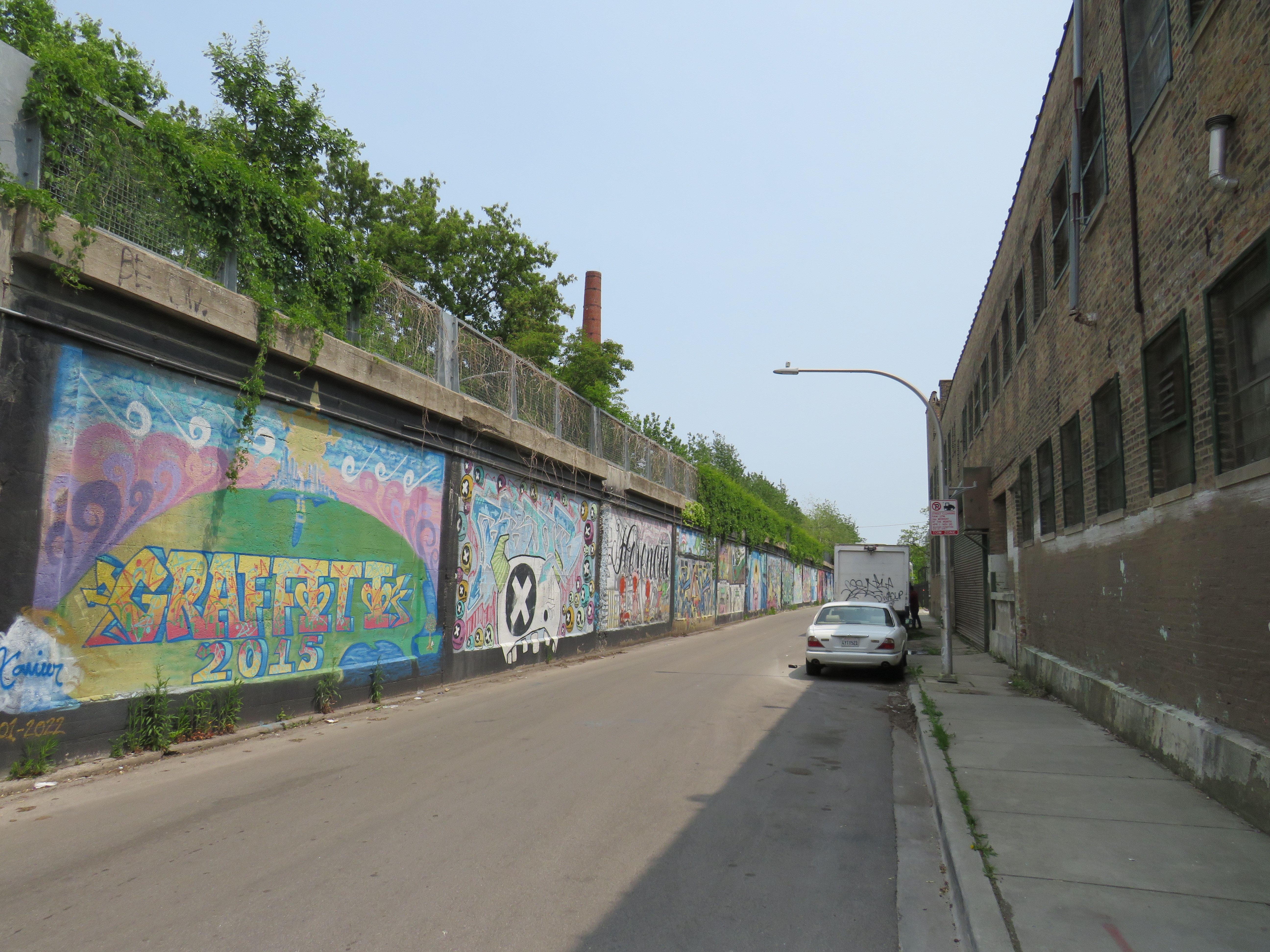
    Some local industries still stand on Bloomingdale Avenue next to the abandoned rail corridor

    The trail, built as a partnership between the local Friends of Bloomingdale Trail group, the federal non-profit Trust for Public Land, and the City of Chicago, opened in June 2013. Ten years later, the corridor is kept in excellent shape, and still looks fresh. The 4.3 kilometre (2.7 mile) trail is the longest elevated greenway in North America, longer even than New York’s High Line.

    On the day I visited, I rode the entire length of the trail in one direction on a Divvy bikeshare bike and walked most of the distance on the way back.

    The Bloomingdale Trail crosses Central Park Avenue, near the western terminus of the public corridor

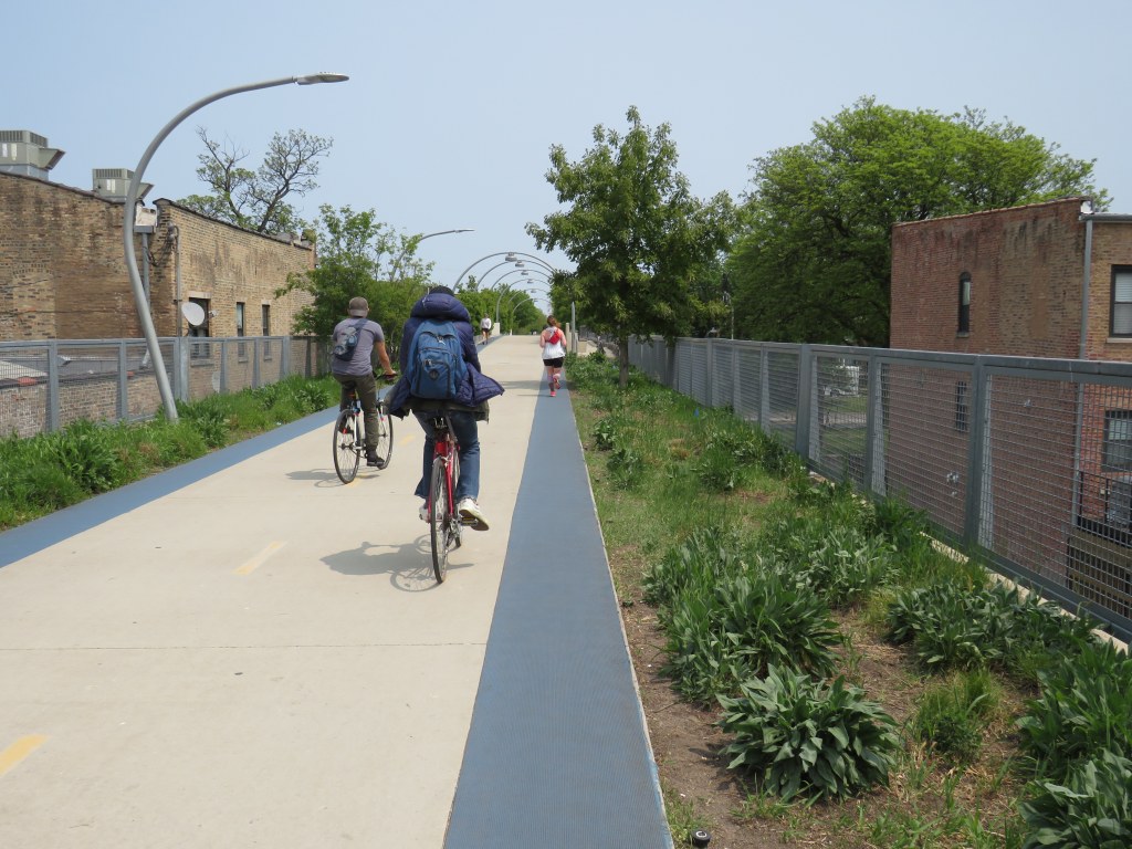
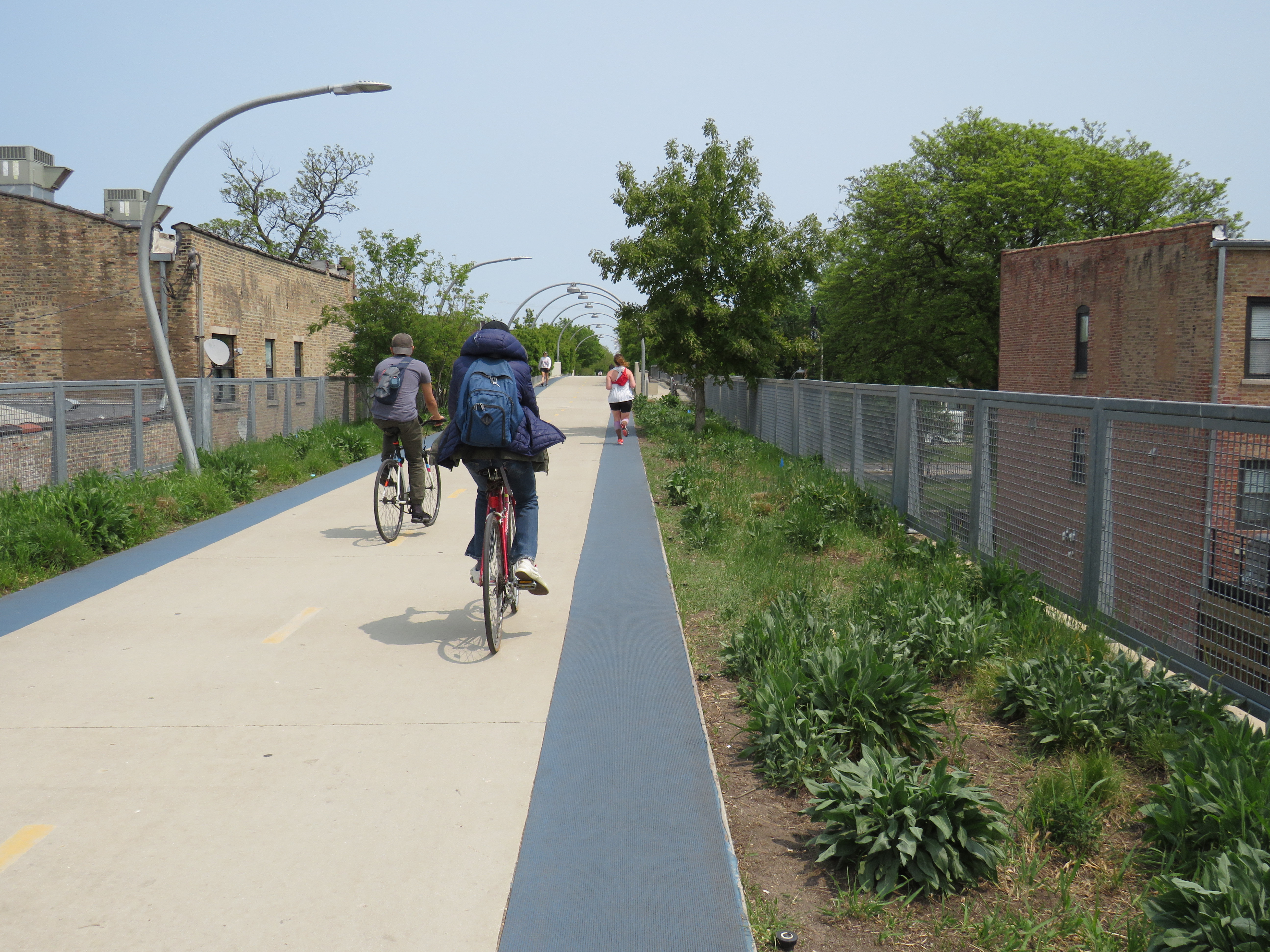
    Unlike the High Line, the Bloomingdale Trail is open to cyclists, and is much less programmed, catering more to the surrounding neighbourhoods than tourists. The pathway is quite wide, making it quite suited to multiple uses. On each side of the pathway is a rubberized track, providing an incentive to walkers and runners to keep to the right. The trees are well maintained, providing plenty of shade. Benches and working water fountains are found throughout.
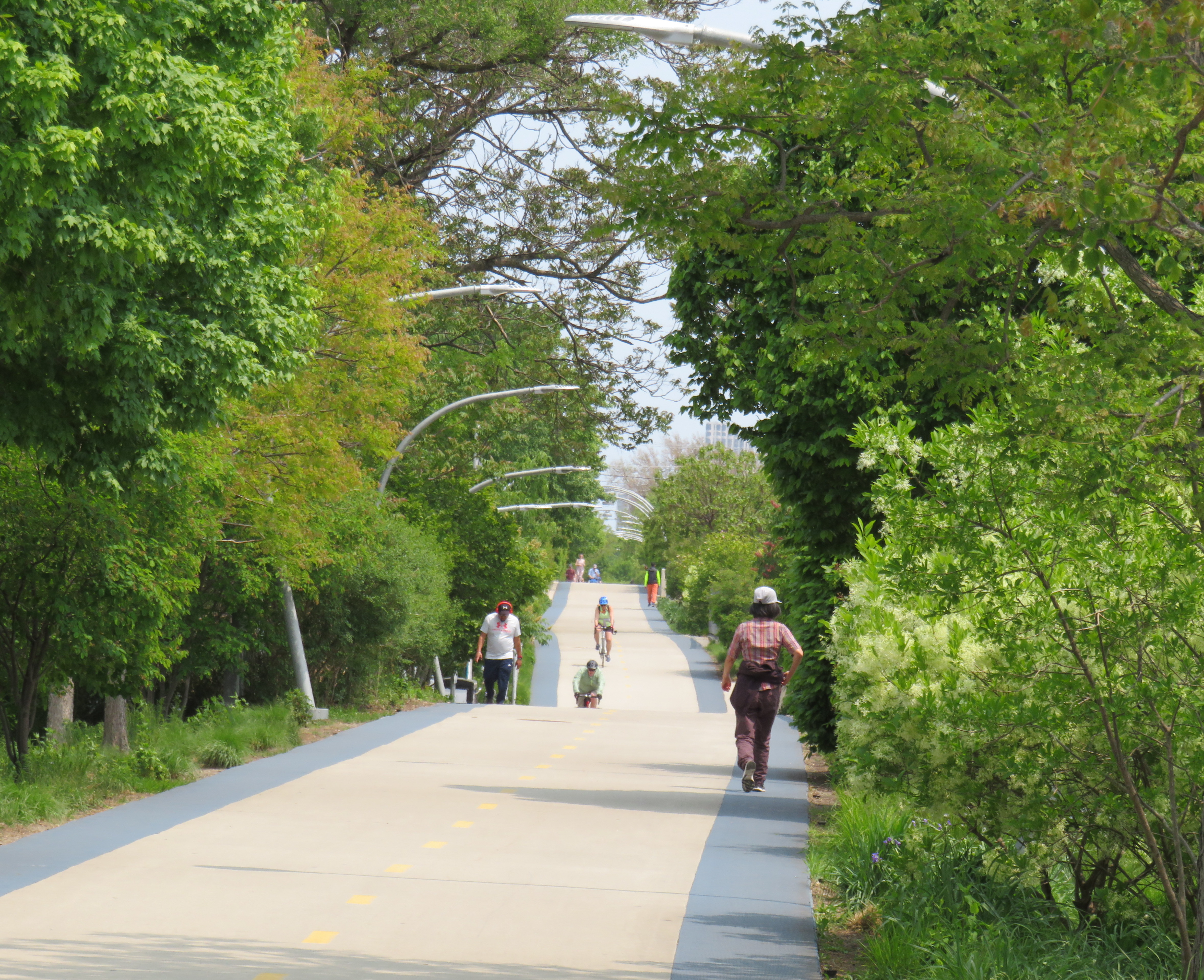
    Rubberized edges on both sides of the pathway
    One of many water fountains along the route
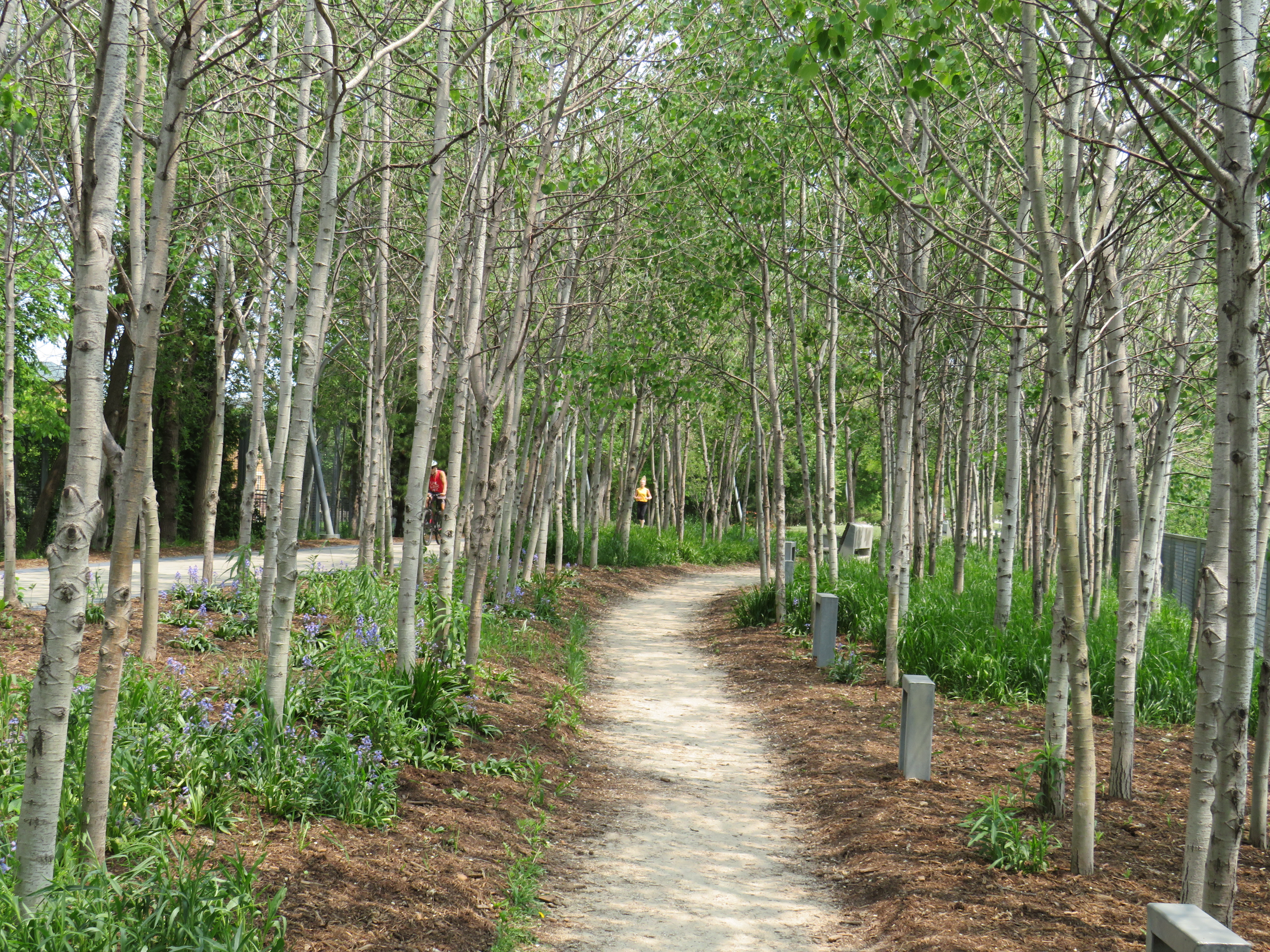
    A stand of poplars and a walking path at a wider part of the elevated right-of-way

    As the path follows an elevated rail corridor, not every intersecting street has an entrance to The 606/Bloomingdale Trail. However, fully accessible ramps are offered every 3-4 blocks, with stairwells installed at other locations. Wayfinding signage is good too, indicating the distances to local highlights and the nearest exits.
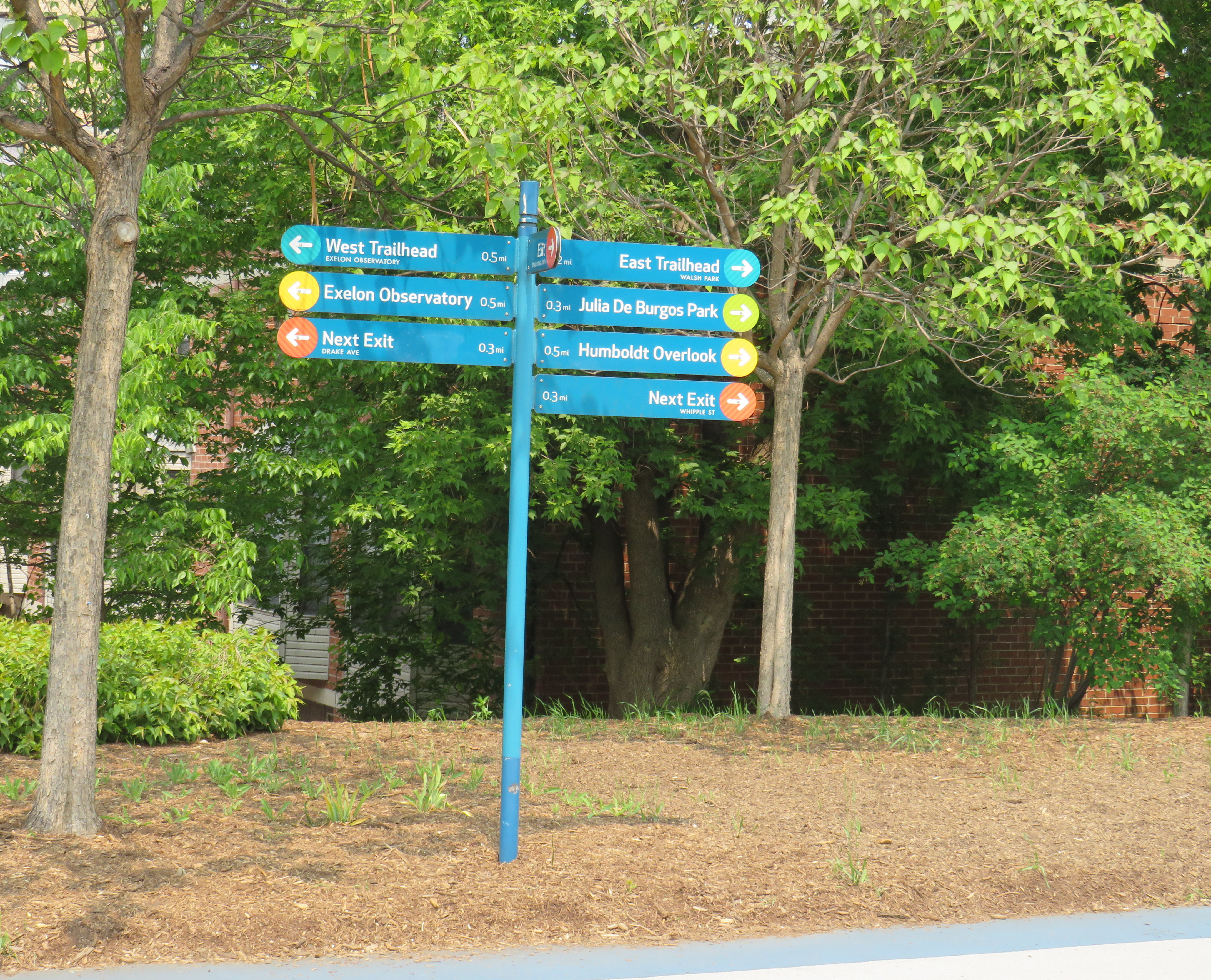
    Wayfinding sign, indicating trail highlights, connecting parks, and the next exits

    One thing I really appreciated about the Bloomingdale Trail are the unique vantage points. Milwaukee Avenue offers a lovely view towards Wicker Park and the Loop, while other parts of the trail pass by neighbourhood parks, backyards, and old warehouses.

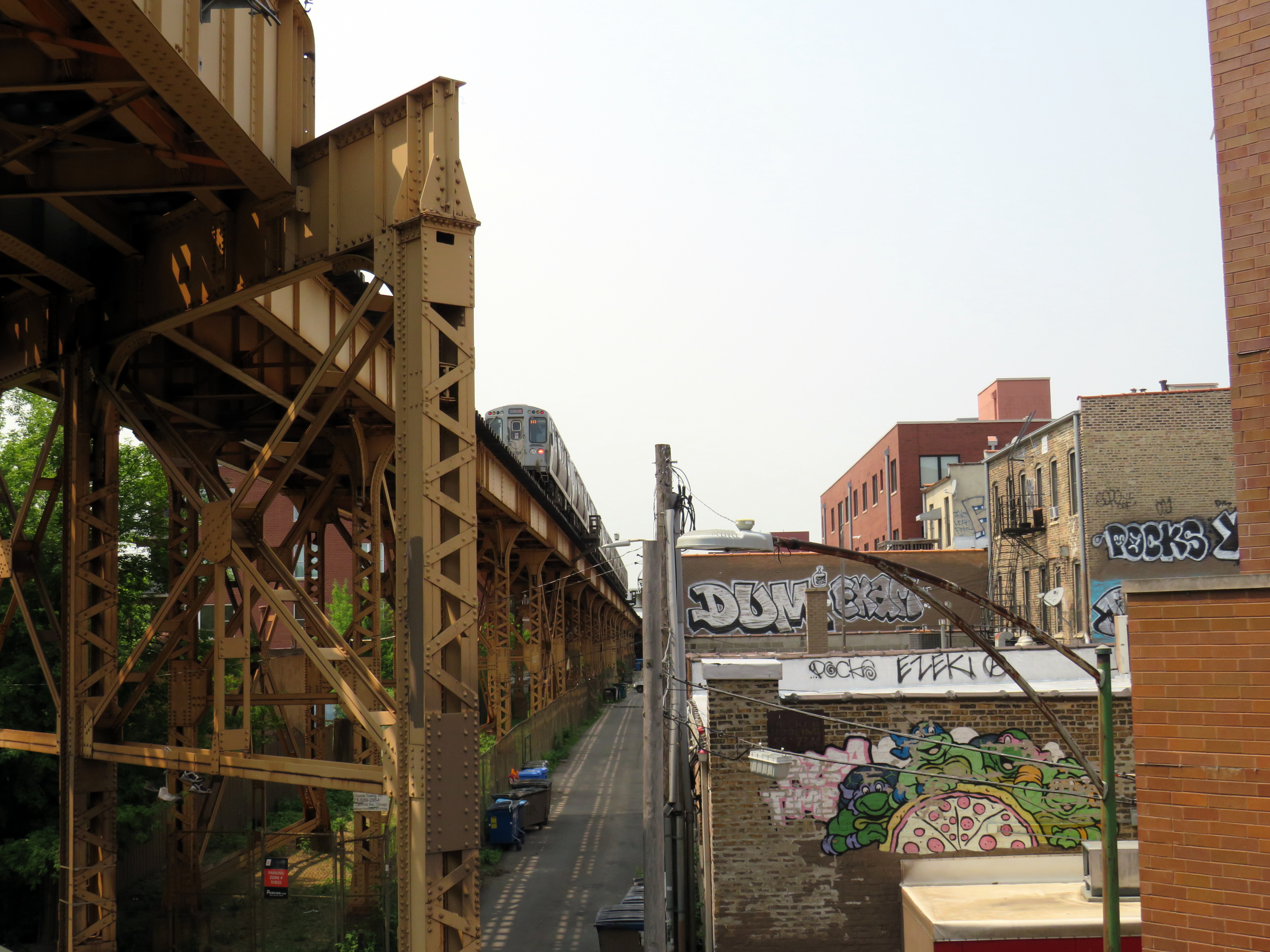
    Looking southeast down Milwaukee Avenue towards Wicker Park
    View looking northwest to the Blue Line L and the alley behind Milwaukee Avenue

    At several intersecting streets, benches have been strategically placed to provide gathering places called “overlooks.” Where it crosses Humboldt Boulevard, part of the parkway ring surrounding central Chicago, over hundred people could sit and watch the traffic below. at once
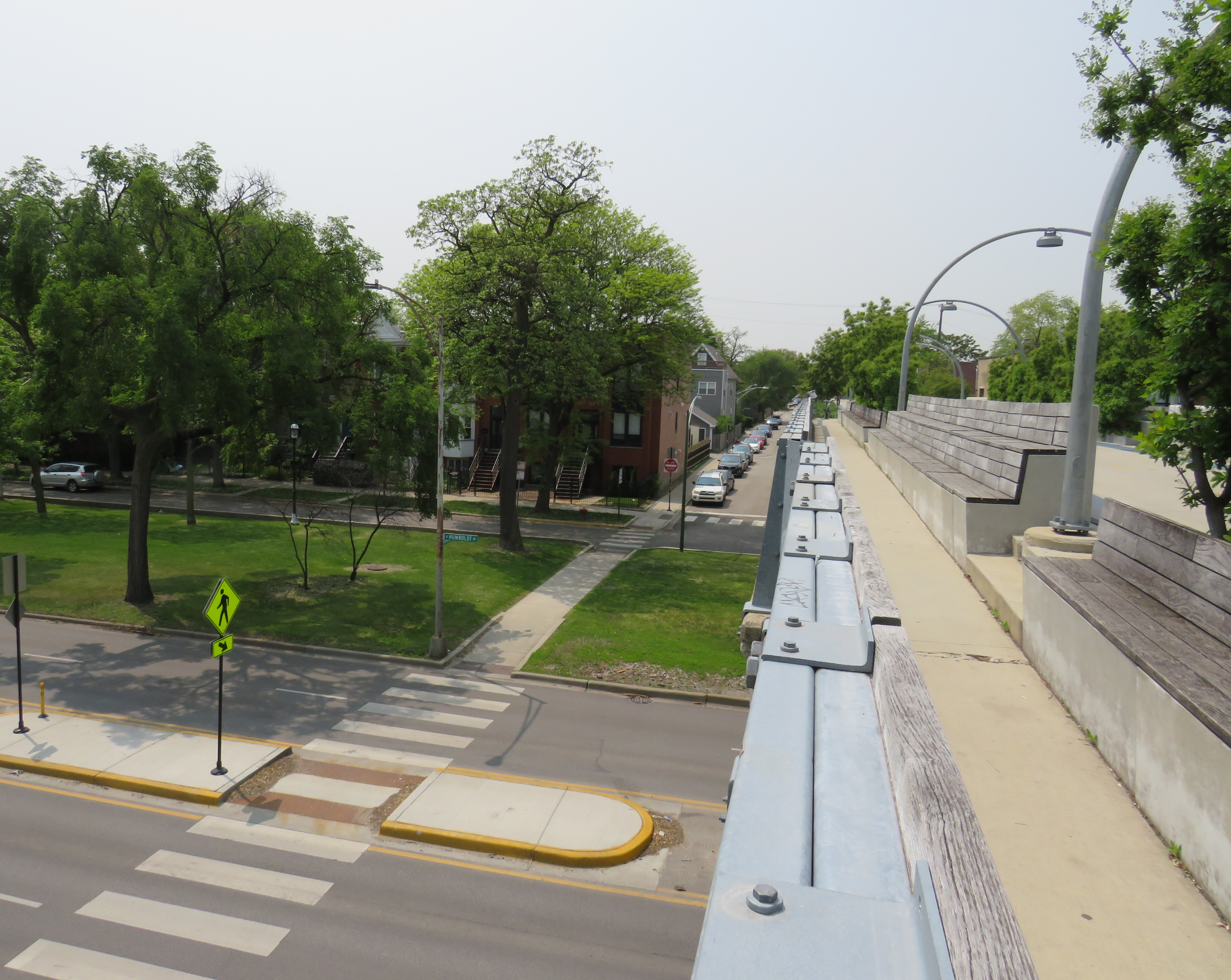
    Lookout to Humboldt Boulevard

    Though the circumstances that allowed for the great elevated parks like Chicago’s 606 or New York’s High Line are unique to their locations, there are lessons that can be learned for other projects, as in Toronto.

    The presence of shade helps to make Chicago’s Bloomingdale Trail a success, as does the very wide pathway that accommodates all active transport users. (On a pleasant Thursday afternoon, the trail was about as busy as the Lower Don Trail here in Toronto, but the wide spaces reduced conflict between walkers, runners, and cyclists.) There need not be a lot of special features to animate the space, though thoughtful places to sit, hydrate, and connect to intersecting public spaces and streets are important.

    There are opportunities for Toronto to expand and improve upon its off-street greenways like the West Toronto Rail Path, the ravine trails, the Greenway, and possibilities for the Green Line and East Toronto; this is just one example of the concept done well.
  • Toronto can do better for cyclists at construction sites

    For years, cyclists in Toronto have not been getting enough respect. In 2011, City Council voted to remove bike lanes on three streets — Jarvis Street, Pharmacy Avenue, and Birchmount Avenue. Major off-road cycling routes are closed for months or years at a time, while additional funds are found to accelerate road closures and construction on the Gardiner Expressway. Mayor Tory is committed to spending $1 billion to maintain the eastern section of the Gardiner, despite low traffic volumes and lost opportunities for the revitalization of the eastern Harbourfront. Yet funding for a comprehensive grid of safe cycling routes remains hard to come by.

    There have been some positive news, however. The new Bloor Street bike lanes — officially a pilot project — between Avenue Road and Shaw Street were recommended for retention by the Public Works and Infrastructure Committee this month. New bike lanes were added on Woodbine Avenue this year. And the Toronto Police Services’ parking enforcement officers have been targeting cars and trucks stopped in bike lanes.

    But one problem that still needs to be addressed is proper messaging at construction sites where bike lanes or general-traffic curb lanes are closed for construction. Too often, cyclists are told to dismount and walk their bikes, despite their status as vehicles, entitled to use the road as any other vehicle. (There are, of course, exceptions such as freeways and some high-speed roads where pedestrians and cyclists are expressly not permitted.)

    For example, cyclists heading west from Danforth Avenue over the Prince Edward Viaduct were greeted with a sign reading “bicycle lane closed – cyclists dismount and use sidewalk.” Next to that sign was a “sidewalk closed” sign, directing pedestrians to the south side of the viaduct.

    https://twitter.com/andreabodkin/status/903318305192247296

    The Ontario Highway Traffic Act says that cyclists are to ride as close to the right of the roadway as practicable. But this does not necessarily mean cyclists must ride right next to the curb either, especially if there are blockages, debris, or other hazards. Motorists must also pass cyclists at a distance of at least one metre, and must wait for a safe opportunity to pass.

    147 (1) Any vehicle travelling upon a roadway at less than the normal speed of traffic at that time and place shall, where practicable, be driven in the right-hand lane then available for traffic or as close as practicable to the right hand curb or edge of the roadway.  R.S.O. 1990, c. H.8, s. 147 (1).

    4) Every person in charge of a vehicle on a highway meeting a person travelling on a bicycle shall allow the cyclist sufficient room on the roadway to pass.  R.S.O. 1990, c. H.8, s. 148 (4).

    (6.1) Every person in charge of a motor vehicle on a highway who is overtaking a person travelling on a bicycle shall, as nearly as may be practicable, leave a distance of not less than one metre between the bicycle and the motor vehicle and shall maintain that distance until safely past the bicycle. 2015, c. 14, s. 42.

    After several complaints, new signage directing cyclists and motorists to yield and share the lane was installed on Danforth Avenue approaching the viaduct.

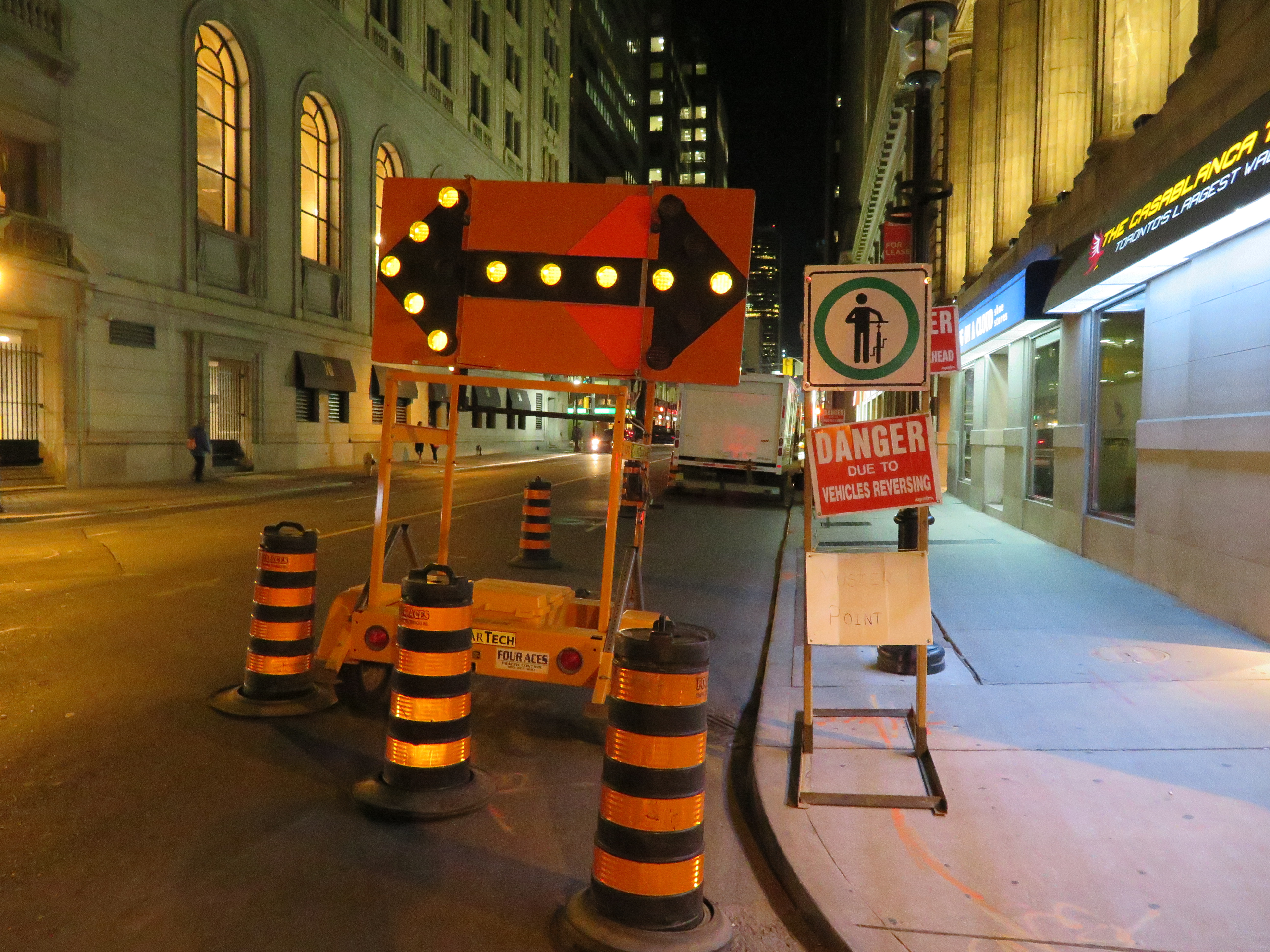
    On Yonge Street, where construction between Wellington and Richmond Streets has reduced the road to two lanes, “cyclists dismount” signs have appeared as well. While this part of Yonge does not have bike lanes, the signage is still wrong. Cyclists have the same right to take the lane. I complained to a construction worker nearby after spotting these signs, who complained about cyclists riding through anyway, not getting my point.

    IMG_3940.JPGConstruction signage on Yonge Street, south of King Street
    Signs telling cyclists to dismount are generally ignored, like those on multi-use paths in suburban Toronto. They’re placed at intersections and at narrow pinch-points for safety (drivers not expecting cyclists to cross; conflicts with pedestrians on sidewalks), but they are poor substitutes for solutions such as traffic calming, painted cross-rides at road crossings, and gentler, more effective measures to slow fast-moving cyclists, such as speed humps and barriers where necessary. At construction sites, it is far better to remind motorists to yield to cyclists and share the road, than expect cyclists to get off their bikes and walk around the construction zone. That said, “cyclists dismount” signs and enforcement is necessary and useful in pedestrianized zones, such as street festivals and pedestrian malls.

    Signage telling cyclists to dismount at construction areas is lazy, de-legitimatizes cycling, and sends the wrong message to motorists. I hear enough complaints about “cyclists who break all the rules.”

    Of course, it’s best to provide a safe passage for cyclists at construction zones, such as detouring a bike lane around the construction. On Richmond and Adelaide Streets, some building construction sites have shifted the separated bike lane around the site, an encouraging development. Where it’s not possible or feasible to maintain a bike lane through the construction zone, the signage still can be improved.

    At a construction site on Simcoe Street, confusing signage and a poorly marked diversion endangered northbound cyclists, forced out of the separated northbound lane and into oncoming traffic. This resulted in at least one close call.

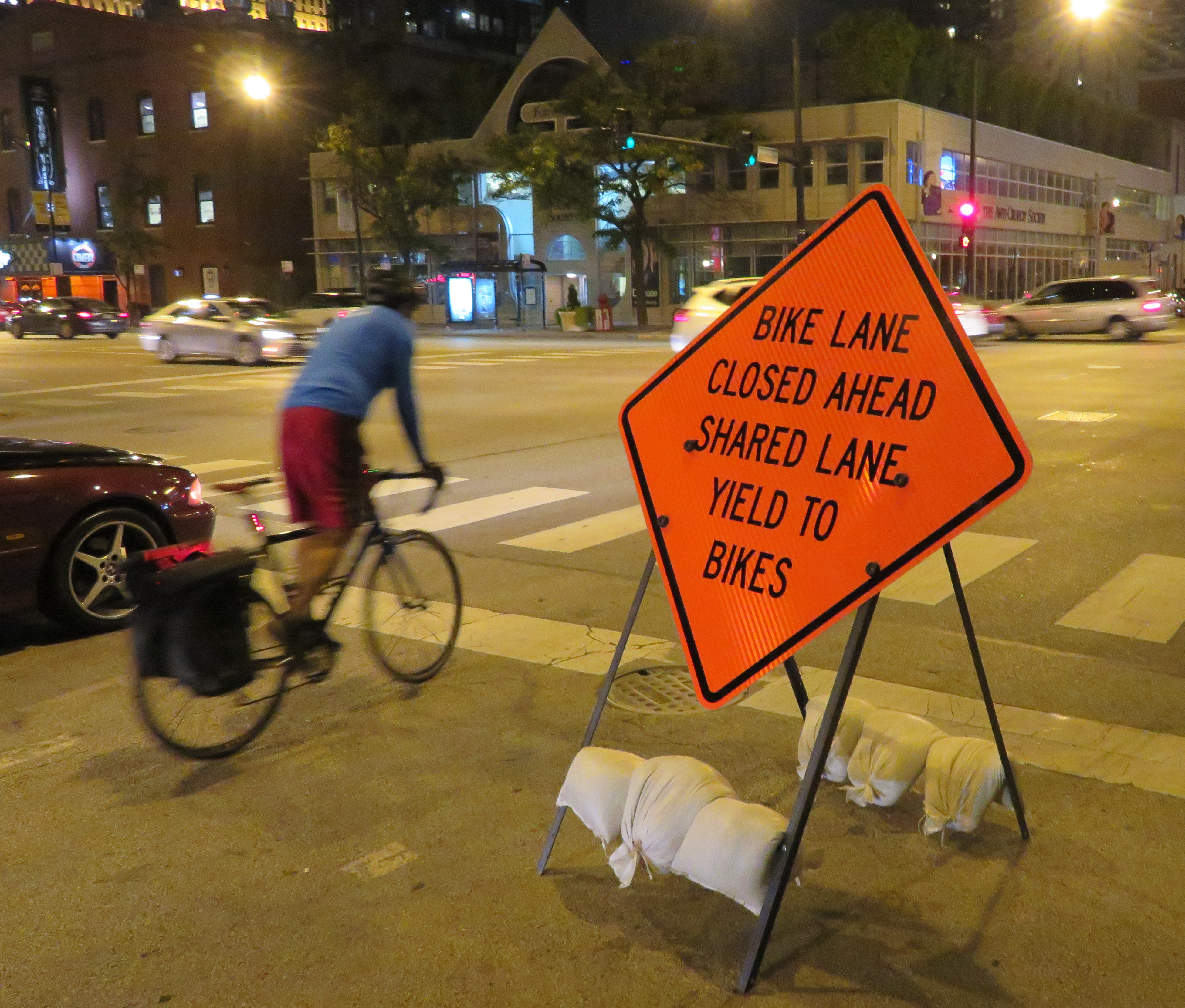
    On a recent visit to Chicago, I came across a sign that delivers the right message. It read: “bike lane closed ahead — shared lane — yield to bikes.” The large orange sign was mounted in the road, in a way that it would be seen by motorists. It also makes it very clear that cyclists not only have the right to use the general traffic lane, it also makes it clear that motorists must give way to cyclists detouring around the closed bike lane. Toronto would do well to follow this example.

    The City needs to develop mandatory standards for bike lane and curb lane blockages, in order to reduce confusion, as well as promote the safety and legitimacy of cycling in this city. It must also enforce those standards vigorously.

    IMG_2904-001.JPGSign in Chicago sends the right message