Author: Sean Marshall

  • Mapping the results of the 2014 Toronto municipal election: Part I

    2014 Election - Mayor Votes by Ward Solid Colours
    Immediately after John Tory was elected as the 65th mayor of Toronto*, maps were produced in the media, similar to the one above, that advanced a narrative of a divided city. A city divided between the downtown and suburbs, divided by class and income, and by political leanings. The wisdom was that Ford Nation retreated to the northeast and northwest corners of the city, but remains still a potent political force. But mapping which mayoral candidate (John Tory, Doug Ford, or Olivia Chow) ‘won’ which ward completely misses the bigger picture.

    I started this website after I began producing maps of the local council races and ward-level results of the 2014 municipal election and sharing them on Twitter. This was something that I was doing entirely for my own interest, but was related to work I have done with Ryerson Professor Myer Siematycki for the Maytree Foundation studying voter turnouts in the last three municipal elections.

    Once the full official results were released by the City of Toronto, along with geographic files of poll locations and boundaries (as part of the city’s wonderful Open Data Initiative), it became possible to dig deeper than just looking at ward-level maps. I was pleased — and a bit surprised — by how popular my maps were.
    (more…)

  • A visit to the Toronto Islands

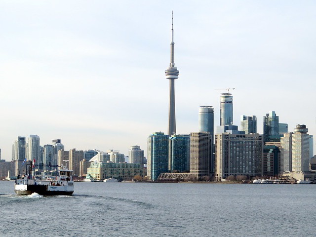
     Ferry Ongiara returns to the cityToday, December 7, was bright and sunny, despite a chilly high of -2 C. On a whim, I decided to explore the Toronto Islands during the off-season. It was well worth it.
    After Thanksgiving weekend, the Toronto Island ferry schedule is reduced to a single ferry to and from Ward’s Island operating on a rather irregular schedule. Sometimes, the service is every 30 minutes, even on Sundays (it takes just under 15 minutes to get between Ward’s Island the central ferry terminal), but at other times, the single ferry runs every 45 or 60 minutes. The round trip fare is $7, or $90 for an adult monthly pass.

    The views of the downtown skyline, are the best thing about taking the ferry to the islands; the night time views are as amazing as the daytime postcard views. During the off season, there are no crowds, no waits, no hassles. The pen-like holding area of the recently re-named Jack Layton Ferry Terminal isn’t so bad when there aren’t large crowds headed to various organized picnics or concerts at Olympic Island or the Centreville amusement park, or to one of several public beaches.

    I’d like to see a new, modern ferry terminal built that doesn’t feel like a holding pen (and which would be more fitting for a terminal named in Layton’s honour). I’m hopeful that the city will finally see this happen, as well as figure out how to better manage the long summertime ticket lines.

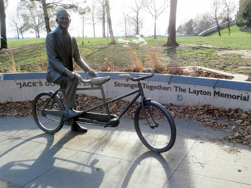
    The Jack Layton Memorial

    The “Jack’s got your back” statue near the entrance to the ferry terminal (more…)

  • Welcome!

    So, this is my first post on my new website. Welcome!

    I guess I was born to be a geographer. I’ve been collecting and studying maps since I was three years old. I always loved cities and their transportation networks as well. I ended up becoming a geographer by training (I have both a BA and a Masters’ degree in geographic/spatial analysis); today my day job has me creating maps and analyzing data.

    I’ve also had an interest in politics for many years, though my participation has been limited to involvement with my student union and volunteering for a few municipal and federal election campaigns. I am also involved in advocating for pedestrian and transit issues here in Toronto.

    But I’m hoping to do more. Recently, I have been busy posting maps on Twitter showing poll-by-poll results of the recent municipal election here in Toronto. While many election observers were closely following the mayoral race, I was more interested in the wards. In 2018, I predict Mayor John Tory will be re-elected easily, so it’s the local races that will matter.

    I was most interested in having a permanent place to make those maps available to a wider audience; this is why I started this blog. I also intend to post photos and thoughts about all sorts of things that I find interesting as well. I go on occasional long-distance bike rides, as well as the occasional road trip, so you’ll find all sorts of articles posted here.

    I hope you enjoy!