Marshall’s Musings

  • Why Wasaga Beach needs to be open to all

    Why Wasaga Beach needs to be open to all

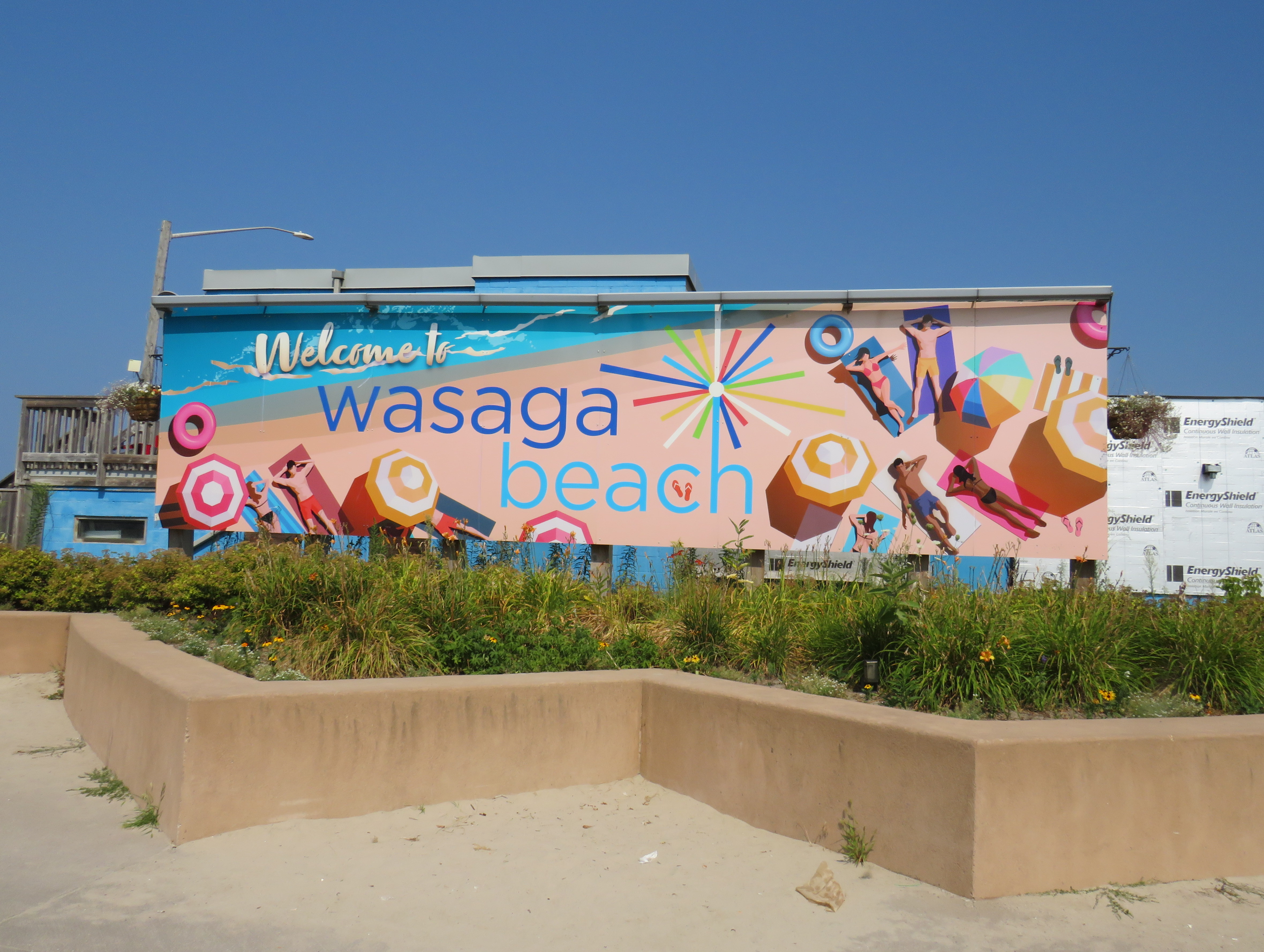
    "Welcome to Wasaga Beach" billboard

    In late July, online news outlet PressProgress reported on the provincial government’s plans to divest itself of 60 percent of the beach areas of Wasaga Beach Provincial Park, transferring the waterfront lands to the Town of Wasaga Beach. This report raised a number of concerns, including environmental issues (the beach is an important habitat for the piping plover, an endangered species of shorebird which breeds on sandy shorelines), as well as continued public access to the world’s longest freshwater beach. By amending legislation to transfer these lands from provincial to local control without future votes in the legislature, future provincial park lands could also be sold off to municipalities or to the private sector.
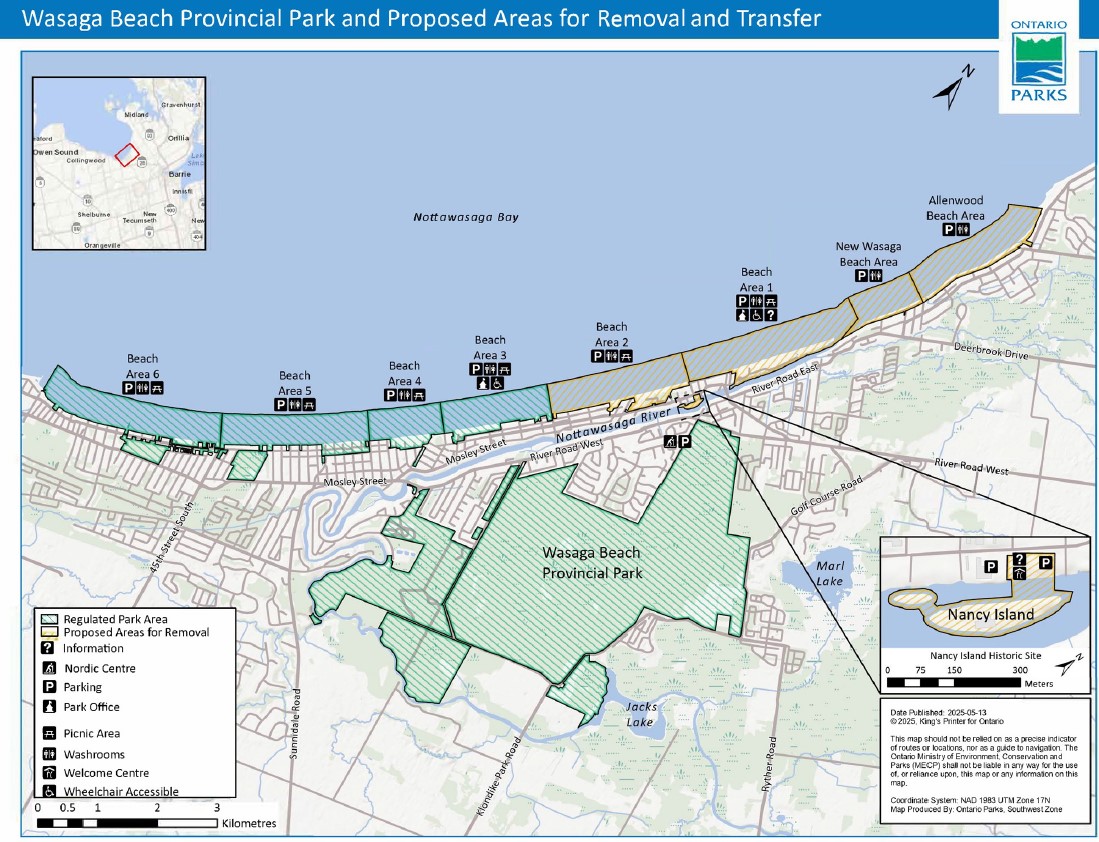
    Wasaga Beach Provincial Park and proposed areas for removal and transfer to the municipality

    For its part, the province claims that this will only be a one-time transfer, intended entirely to promote economic development in Wasaga Beach and Simcoe County. It is also providing money to redevelop existing commercial areas, partially destroyed by arson in 2007, and rebuilding a road that borders the beach.
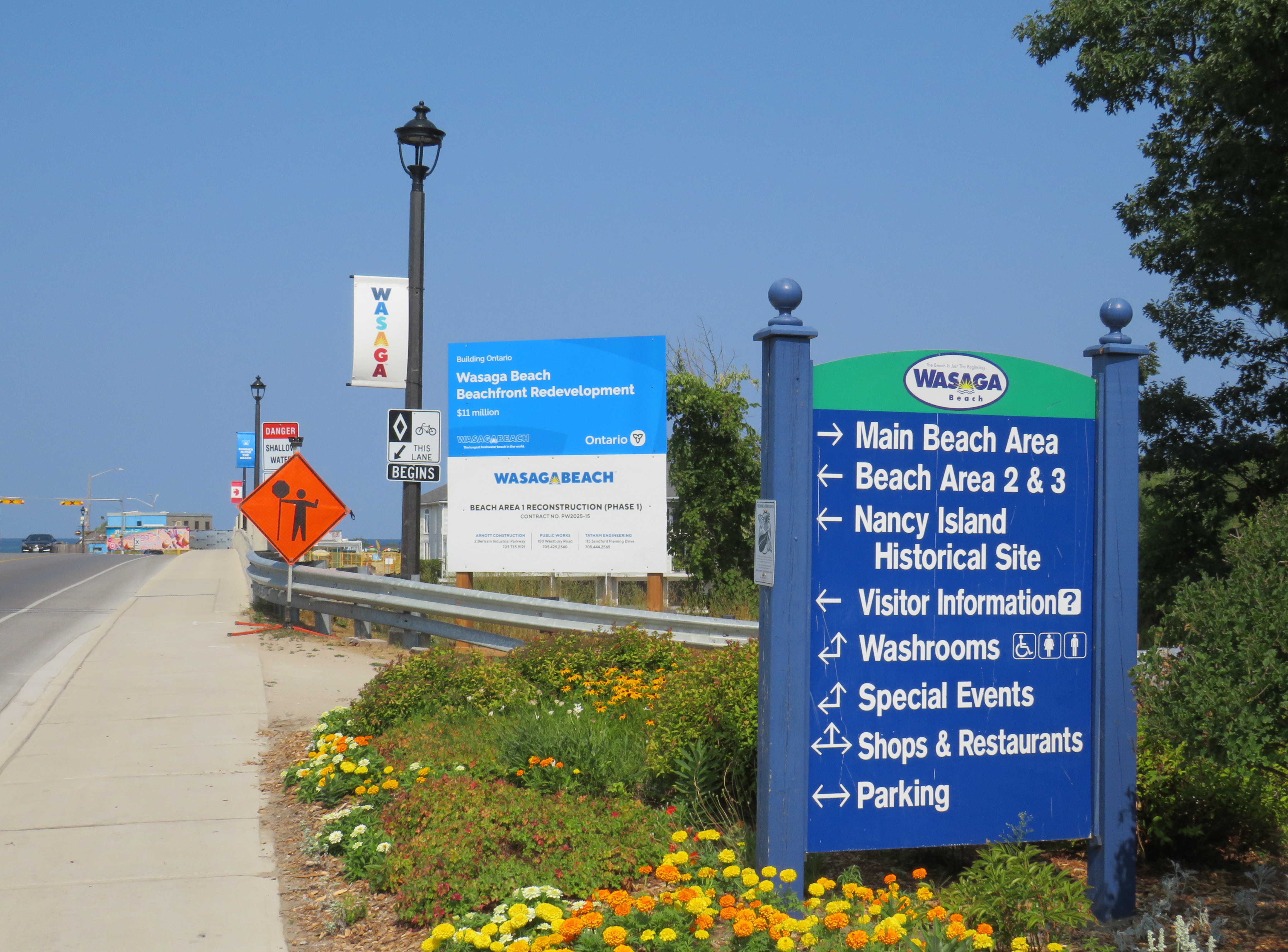
    Sign touting provincial funding for Wasaga Beach's beachfront redevelopment
    Sign touting provincial funding for Wasaga Beach’s beachfront redevelopment

    Amending the Act to permit the divestment of protected lands is a bad precedent, though arguably it was already set by the privatization of much of Ontario Place for the troubled Therme spa development. The closed Ontario Science Centre grounds remain in limbo as well.

    As Shawn Micallef recently pointed out in the Toronto Star, much of Ontario’s prime lakefronts are privatized or purposely made inaccessible to outside residents — not just the popular Muskoka Lakes, but also much of the Great Lakes shores, such as in Tiny Township near Midland. The big, popular, beach areas are worth preserving and expanding, not only to meet current demand, but also provide sustainable and affordable getaways for a growing population in Southern Ontario.

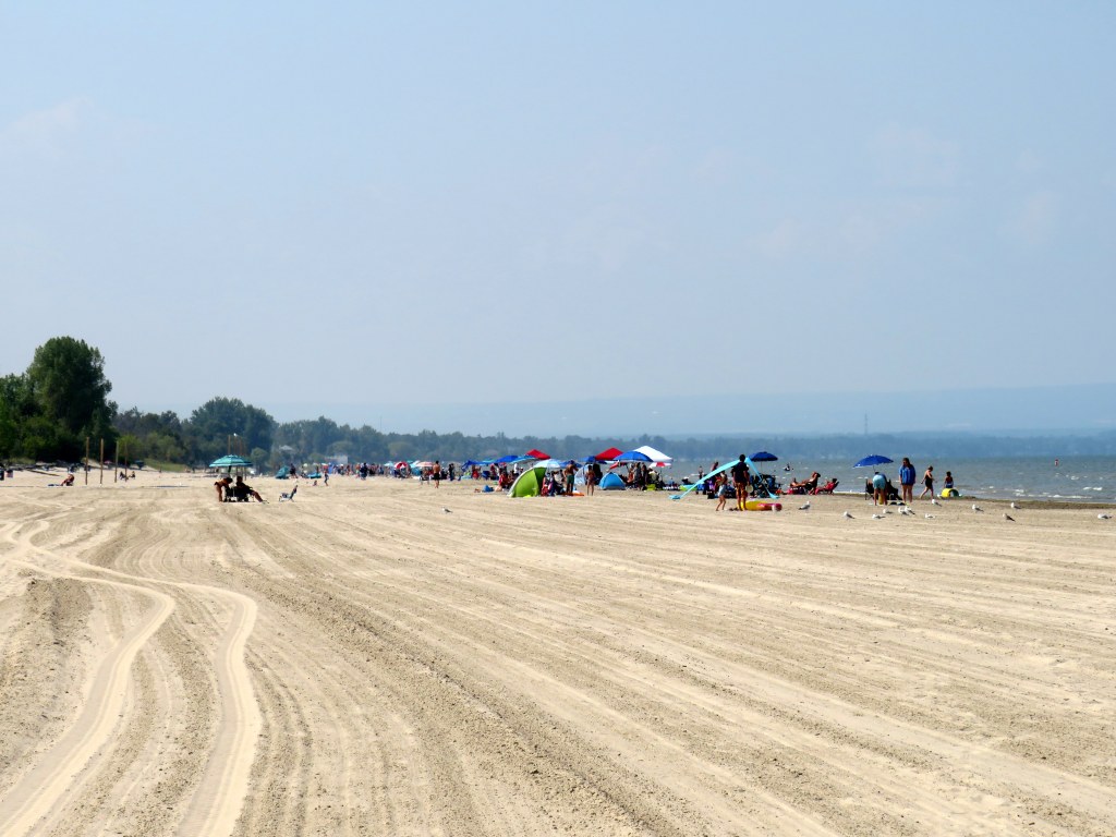
    The beautiful sand at Wasaga Beach Provincial Park on Thursday, August 14

    That demand for summer lake access brings up another challenge — how to get people to and from beach destinations. In Toronto, the lineups for the Island ferries are notorious in the summer. The compound where ferry-goers are forced to wait only adds to the inhospitable atmosphere, though temporary shade structures were added for 2025. The beach at Ontario Place, one of the cleanest on Lake Ontario, has been closed off for the controversial Therme spa construction.

    For those living in Toronto’s suburbs, or anyone looking to avoid the downtown congestion, to get to a good beach will probably mean a road trip to somewhere like Wasaga Beach, Sauble Beach, Grand Bend, Port Dover, Long Point, or Prince Edward County. Many of these places are completely inaccessible without a car, or at best, have limited bus options. Furthermore, even where there is a transit link, the best beach areas are nowhere near where the bus or train makes its stops. Even though Brampton is a straight shot up Airport Road to Georgian Bay, driving is the only reasonable way to get to Wasaga Beach (as I will get into in the second half of this post).

    Right now, Wasaga Beach and Collingwood – a four-season resort town – are connected to Toronto, Barrie, and elsewhere only by two-lane roads: Highway 26, Airport Road, and Sunnidale Road. These roads are often congested with both visitors and with regular traffic. Highway 400 up to Barrie is already being widened, but it too will face additional traffic from population growth in Simcoe County and additional leisure travel.

    If Wasaga Beach goes ahead and develops transferred provincial parklands for more intensive economic development, it will have to contend with these transportation challenges. That will mean wider roads and new highways, improved transit links, or both.
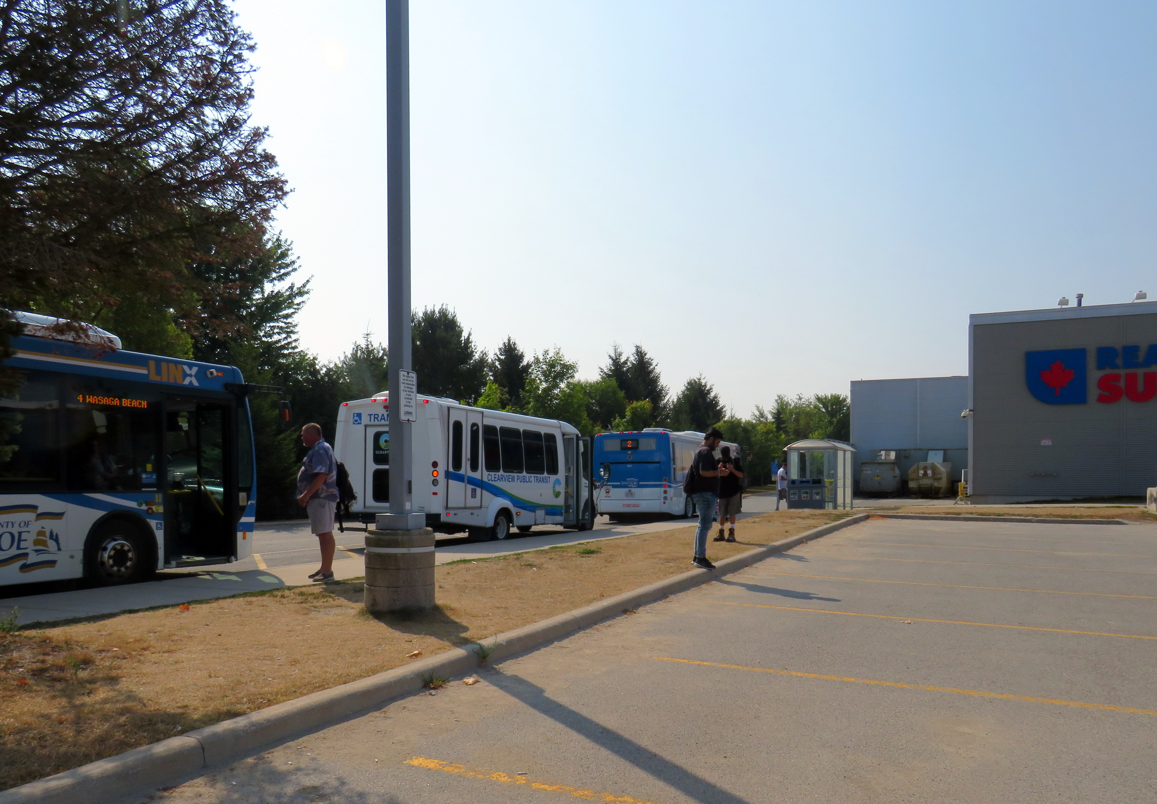
    Local and regional buses behind a Loblaws superstore parking lot in Wasaga Beach

    The way to Wasaga

    There are currently two ways of getting to Wasaga Beach without a personal vehicle or a taxi ride.

    There is one daily Flixbus coach trip from Downtown Toronto and Pearson Airport to Wasaga Beach, continuing onwards to Collingwood, Owen Sound, and Port Elgin. Northbound, the bus leaves Union Station Bus Terminal at 7:30 in the morning and arrives in Wasaga Beach at 10:00. The return bus leaves Wasaga Beach at 4:20 PM and arrives at Union Station at 6:50 PM, though traffic conditions can certainly impact those times. This bus is often nearly or completely sold out.
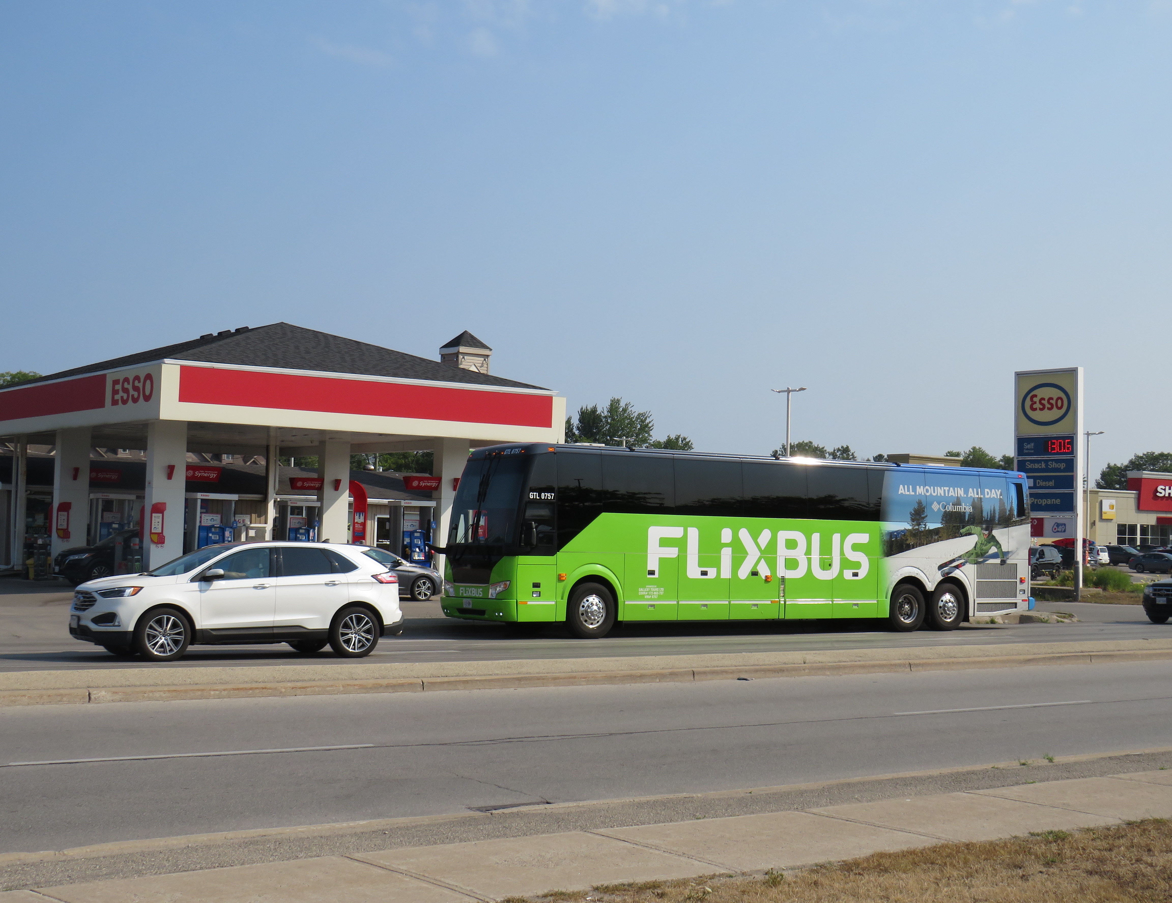
    Flixbus loads in front of an Esso gas station on Mosley Street at 45th Street

    A cheaper and more frequent option is Simcoe County Linx, a regional bus service provided by the County of Simcoe. Linx Route 2, which connects Wasaga Beach to Allandale Waterfront GO Station, connects with GO buses and trains as well as local Barrie Transit buses. Unfortunately, the Simcoe County Linx system has limited service hours, and routes do not necessarily connect with each other. The last buses on Route 2 leave Wasaga Beach and Barrie at 6:30 PM, and there is no weekend or holiday service. (The sole exception is Linx Route 4, which runs between Collingwood and Wasaga Beach seven days a week.)

    Both Flixbus and Simcoe County Linx stop on the west side of town, seven kilometres from the main tourist area at Beach Area 1. There are two Wasaga Beach Transit routes connecting these two points, but service is every 60-90 minutes. The limited bus options, combined with a lengthy transfer to get to the main beach areas, makes for an unpleasant trip. The early shutdown of Simcoe County Linx limits the time one can spend in Wasaga Beach, especially if it means a local bus transfer back to the west end of the town.
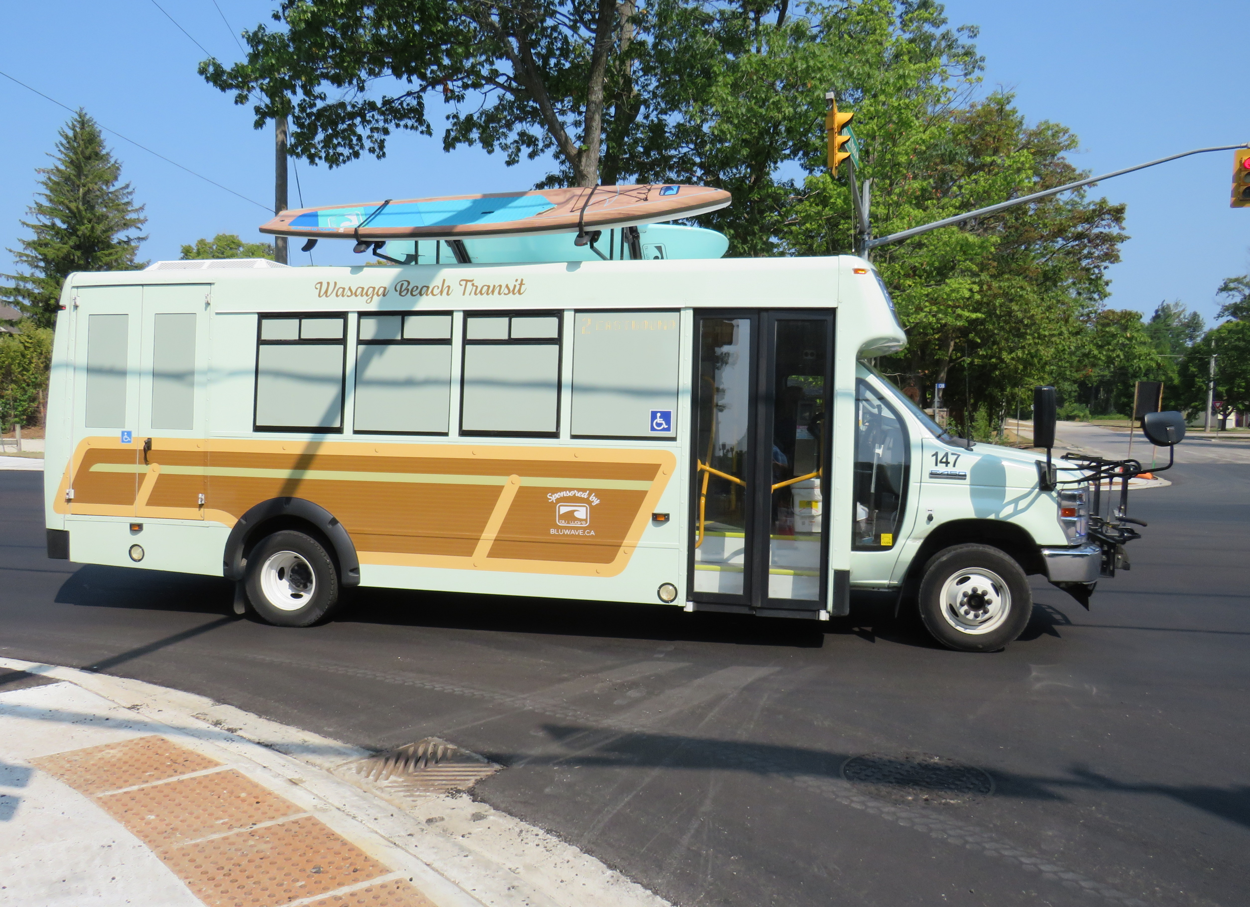
    Wasaga Beach Transit
    Wasaga Beach Transit minibus, decorated with vinyl wrap and stand-up paddleboards affixed to the roof

    From Brampton or Mississauga, travellers must get to either Union Station or Pearson Airport to get the direct Flixbus service or get to the Barrie GO Corridor in order to make the transfer to Simcoe Linx. If there was only a direct bus up Airport Road from Peel Region, Wasaga Beach would be more accessible to another 1.5 million residents.

    Furthermore, the only connections to Wasaga Beach are via Airport Road from the south and via Highway 26, a mostly two-lane highway between Barrie and Owen Sound. Wasaga Beach has never had rail access, and the former Barrie-Collingwood Railway through Stayner has been torn up. Both roads are increasingly congested due to both tourist travel and regular commuter traffic; the towns of Collingwood, Wasaga Beach, and Stayner are all growing with new residential subdivisions. Costco is constructing a new retail warehouse at Mosley Street and Highway 26 on the Wasaga Beach’s west side.

    This is not just a Wasaga Beach problem. Access to most of Ontario’s other great beaches and resort towns is even more limited. Prince Edward County has a weekday-only bus service between Belleville, Bloomfield, and Picton, but it does not serve Wellington (home of the Drake Devonshire Hotel) or Sandbanks Provincial Park. Port Dover only has a weekday-only on-demand transit service accessible from Simcoe; Sauble Beach is only served by the same Flixbus route that runs through Wasaga Beach. At least Huron Shores Area Transit provides daily service to Grand Bend from both Sarnia and London.

    Port Stanley used to have regular electric train service from London — where the municipality owned the railway — until 1956. Even though bus services took over from the L&PS, the only way to get there these days is to drive.

    Though several Ontario cities have good urban beaches, accessible by transit — Ottawa’s Britannia Beach and Petrie Island, Hamilton Beach, and Toronto’s many beaches certainly count — there really should be better access for all to the great summer destinations like Wasaga Beach. That not only means protecting the land for public use and environmental preservation, but it also means providing accessible, sustainable, and equitable access by bus and rail. As Wasaga Beach and Collingwood seek to grow their populations and their economy, more transit is needed to connect residents to those additional jobs.

    To start, Simcoe County Linx should operate Route 2 evenings and weekends. In the longer term, Simcoe County, its constituent towns, and the cities of Barrie and Orillia should merge their transit systems, focusing on fare integration and facilitating easier transfers between its routes and with GO Transit. There is also room for more intercity bus services between the Greater Toronto Area — particularly Mississauga and Brampton — with Wasaga Beach and Collingwood, offering more capacity and faster, more direct options. On my way home on Thursday, August 14, it took me over four hours to get back to Toronto Union Station via Simcoe County Linx and GO Transit buses; driving takes less than half that time, even with traffic.

    Wasaga Beach is a treasure of provincial significance. It deserves to remain owned by the public and fully open to all, with better access to those who can’t or don’t want to drive.
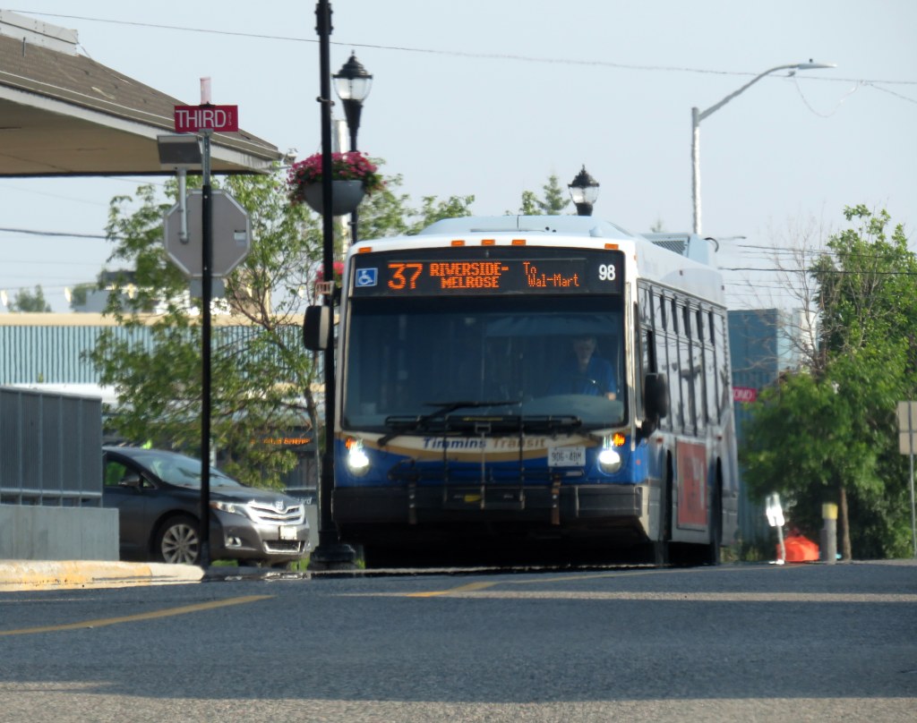
  • Buses to the big box

    Buses to the big box

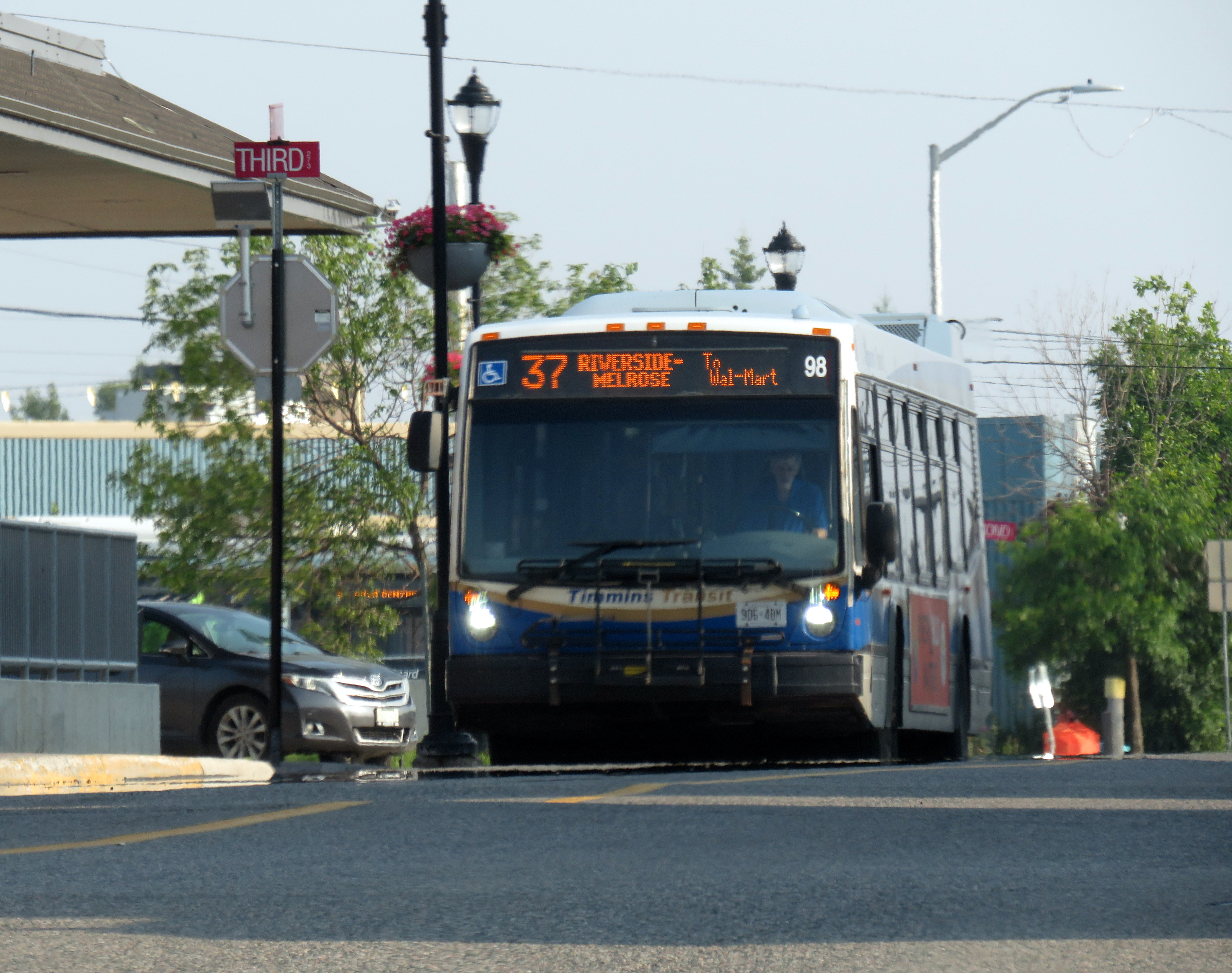
    Timmins Transit bus headed west from downtown to Wal-Mart

    Last month, I found myself intrigued by American transit consultant Jarrett Walker’s observations about the difficulties of getting to Walmart stores by public transit in US cities. On Bluesky, Walker examined the long walks through hostile environments between Walmart stores and the nearest bus stops, and it is an interesting thread.

    In many US cities, Walmarts are often some of the busiest transit destinations.Here is the typical relationship between a Walmart (far right) and its nearest bus stop (far left).Note the details of the pedestrian experience between one and the other. 1/🧵

    — Jarrett Walker (@humantransit.bsky.social) 2025-07-19T18:33:32.331Z
    Jarrett Walker’s BlueSky thread on US Walmart locations

    In response, I noted the more typical experience in midsized Ontario cities. Though American and Canadian land use policies are similar in many ways, complete with the post-1990s proliferation of “big box” retail developments, there are some significant differences. For example, local transit systems will often make an effort to serve big box retail clusters, particularly Walmart stores.

    This is something we do a bit better here in Canada. Below are Google Map screenshots of four Walmarts in small Ontario cities.

    — Sean Marshall (@seanyyz.bsky.social) 2025-07-19T18:48:29.558Z
    BlueSky post that shows Walmart stores and bus stops in four small Ontario cities: Orillia, St. Thomas, Belleville, and Brockville

    Walmart stores are important to transit riders, especially in smaller urban centres that have few or no other major shopping centres. Most Walmart stores now have an in-store pharmacy, carry a full selection of groceries, and have ancillary services, such as medical clinics, haircutters, and opticians. Walmart itself will typically anchor a larger commercial development with other big-box retailers such as Home Depot or Canadian Tire. These commercial developments and surrounding areas will have up to have several hundred employees, some of which may also rely on transit.
    From the 1960s to the early 2000s, regional shopping malls were often major transit hubs in mid-sized cities and suburban municipalities in Canada, typically located in space set aside in the mall parking lot. For the most part, Canadian commercial landlords were willing to provide the space; in some cases, the terminal was even right outside one of the main entrances.

    In my hometown of Brampton, for example, two of the three major transit terminals were Bramalea City Centre and Shoppers World. Mississauga’s main transit hub is at Square One mall; Hamilton has large bus loops at Limeridge and Eastgate malls, and London has transit hubs at Masonville Place and White Oaks Mall. Smaller cities and towns such as Belleville, Orillia, and Peterborough would also be sure to serve the local shopping mall with at least one route stopping on the mall property, typically in a space set aside on a mall driveway.

    Sometimes, these mall terminals become too small or too difficult for buses to get in and out of. Brampton Transit grew, the Shoppers World and Bramalea City Centre terminals were moved to larger facilities off-site with better road access, but still close to the malls. In smaller cities, where the importance of enclosed shopping malls (anchored by traditional retailers such as Sears Canada, Zellers, and Hudson Bay) declined in favour of big-box retail, often located on the urban outskirts, the buses followed where their passengers needed to go.

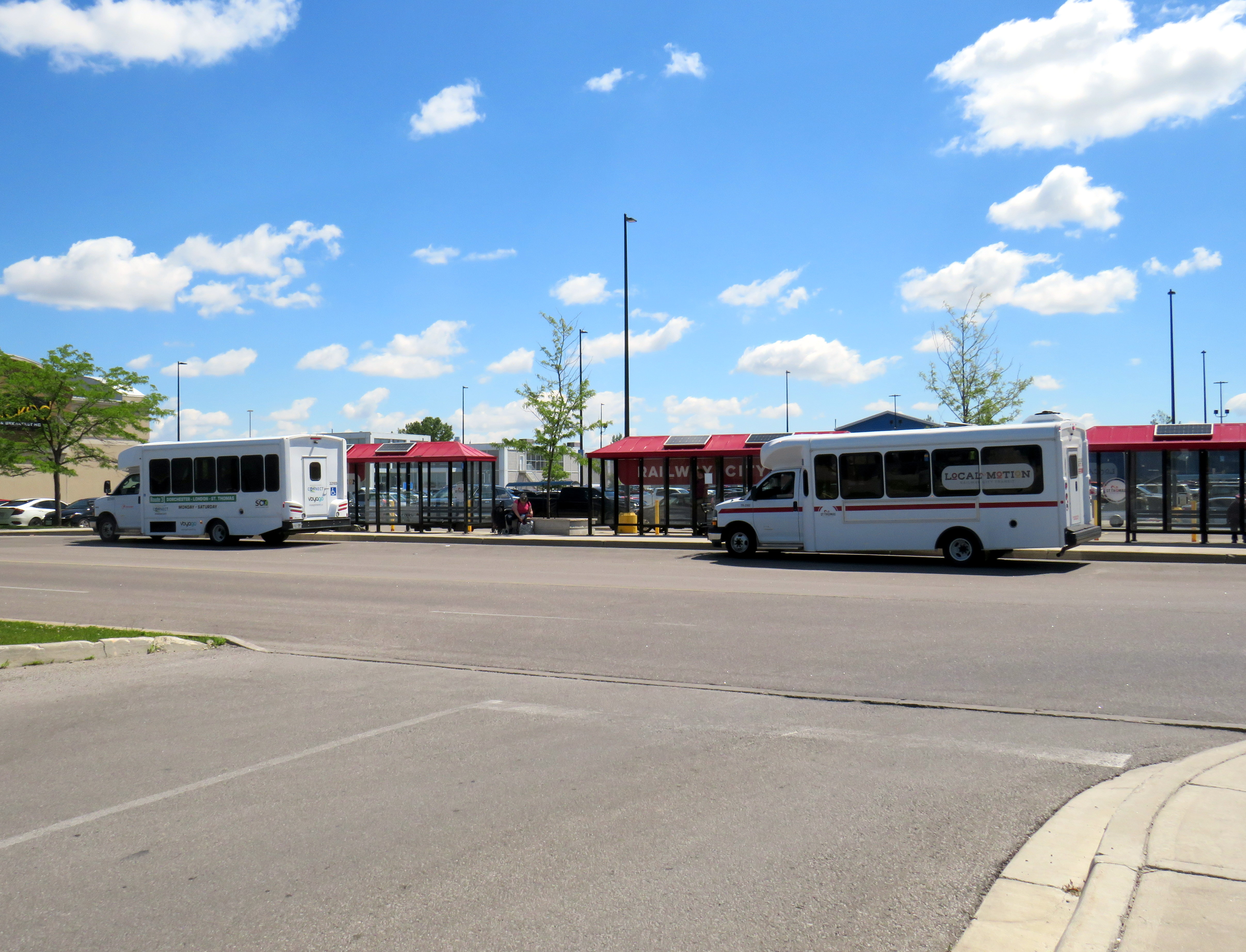
    St. Thomas (Railway City Transit) and Middlesex County Connect minibuses wait for passengers in front of Walmart and Real Canadian Superstore

    In St. Thomas, a small city of about 45,000 people, the main transfer point is in front of the Walmart store parking lot, meaning that every bus rider gets a one-seat ride to the SmartCentres-managed property, which also includes a Loblaws grocery store, Canadian Tire, and over a dozen smaller stores, restaurants, and banks. The recent relocation of the transit hub from a struggling downtown to the big box centre to the west — which is actually closer to the city’s geographic centre — makes sense. It now also serves as the transfer point to the regional bus service to London.

    In Brockville, another small city in Eastern Ontario, the two transfer points are in the downtown and at “Box Stores Transfer” in the northeastern corner of the municipality. The latter is also the transfer point to the inter-municipal River Route to Prescott and Cardinal. In other smaller Ontario cities, including Belleville, Chatham, Orillia, Sarnia, and Timmins, there is at least one bus route extending to the end of the urbanized area to serve the Walmart and/or other large big box retailers. Often the stop will simply be called “Walmart” or “SmartCentres.”

    Sometimes, larger cities will have transit terminals in the middle of big box parking lots. On the south end of Sudbury, GOVA’s Route 1 Mainline terminates in front of a Walmart parking lot, with connections to three local feeder routes. A similar set up can be found in the north end of Guelph. In Waterloo, a large big box complex on the edge of the region’s urban boundary, Boardwalk, was designed with a central transit hub.

    Though the examples here are all Ontario examples, the pattern generally holds across Canada, from St. John’s, Newfoundland to Nanaimo, British Columbia, though there are many exceptions. It also helps that many Canadian Walmart stores are located in shopping malls as they are in renovated and/or expanded former Woolco or Zellers stores.

    Despite these attempts to provide transit services to retailers like Walmart, these are not ideal set ups. Shopping malls were designed as pedestrian environments within large parking lots. As long as there is a convenient, safe, and short walkway to the mall entrance, transit riders could be well-served. This is much harder with contemporary big box retail, as they are designed completely different. With malls, parking lots surround a cluster of stores. Most big box developments have the stores surround gigantic parking lots. Even if walkways and bus facilities were included in the site plan, there are still long, unsheltered walks between the bus stops and store entrances.

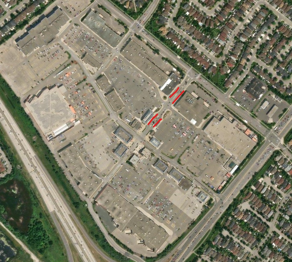
    Trinity Common Shopping Centre at Highway 410 and Bovaird in Brampton. The red lines mark where the buses stop.

    An early attempt to create a more transit and pedestrian site plan in a big box centre was Trinity Common in Brampton, which opened in stages in the early 2000s. There were distinct roadways, complete with sidewalks and street lighting; in the centre, surrounded by restaurant pads, were several bus bays and a transit terminal office. Several busy Brampton Transit bus routes converge here rather than simply stop on the adjoining multi-use roadways. Even so, the distances between retailers — which include Canadian Tire, a Metro supermarket, Home Depot and Brampton’s only multiplex cinema — make walking unpleasant.

    But at least, unlike the American examples Jarrett Walker highlighted, there’s an attempt at doing better. Hopefully, the next generation of retail centres — mixed use developments with residential uses on upper levels — do better with incorporating the needs of pedestrians, cyclists, and transit users.

  • Deadly by design: Burnhamthorpe Road

    Deadly by design: Burnhamthorpe Road

    A dented light pole is the only indicator of a deadly collision in Mississauga City Centre

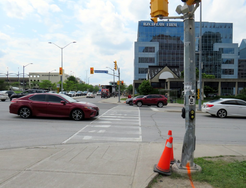
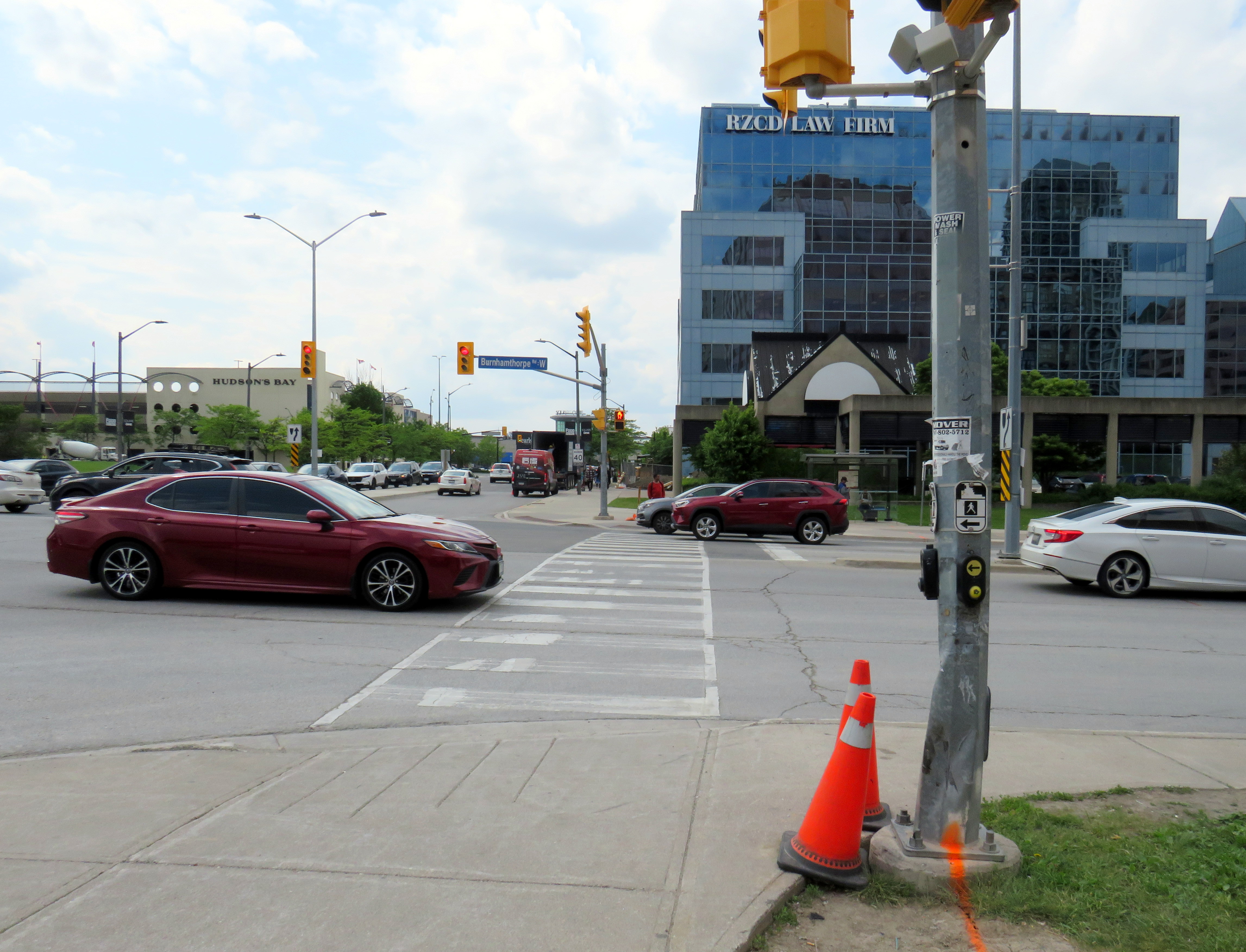
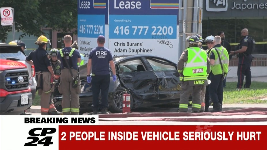
    On Saturday, June 7, around 10:20 AM, the drivers of two vehicles collided in the intersection of Burnhamthorpe Road and Kariya Drive in central Mississauga. One of the two cars that collided, a Tesla sedan, slid onto the sidewalk on the southeast corner, hitting a traffic pole, and then colliding with two pedestrians waiting at the corner to cross the street. One of the two pedestrians, a man in his forties, was killed; the other was taken to hospital with serious injuries. CBC Toronto, CP24/CTV News and the Toronto Star covered the collision.

    Unfortunately, there has been no follow-up reporting so far, and there is no press release or statement on the Peel Regional Police website.

    Screenshot of CP24 news report showing the badly damaged Tesla that crashed into two pedestrians

    A few days later, I visited the area to take note of the intersection and the surroundings.

    The intersection of Burnhamthorpe and Kariya is within the busy, urbanizing Mississauga City Centre (MCC) neighbourhood. MCC, also known as Downtown Mississauga, is the political, commercial, and cultural centre of the sprawling suburb of 750,000. The area is centred around Square One Shopping Centre, which opened in 1973, expanding several times in the next four decades to become one of Canada’s largest malls. Immediately to the west of Square One is Mississauga’s post-modern city hall, which is one of the most interesting and walkable civic centres in Ontario. Nearby is a performing arts theatre, a Sheridan College campus, several office buildings, a YMCA, central library, parks, a transit hub, as well as many high-rise residential towers. Newer residential development includes streetfront retail, oriented to the community with local restaurants, cafes, pharmacies, and grocery stores. Despite its greenfield suburban origins, Mississauga City Centre has become a true 15-minute city.

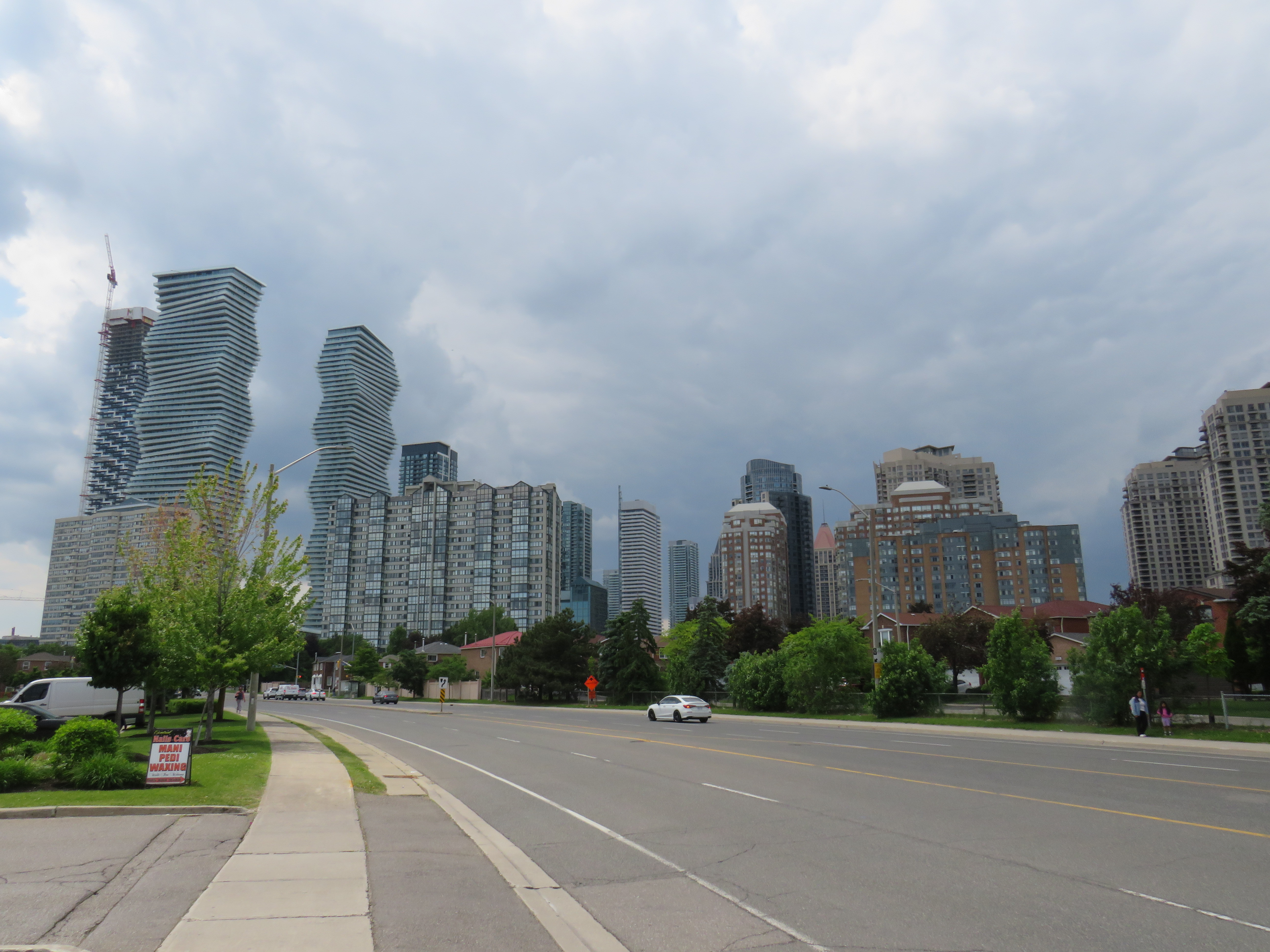
    Looking north on Confederation Parkway towards MCC
    Looking north on Confederation Parkway near Central Parkway, where MCC’s high-rise condominiums tower over older single-family homes

    The problem, though, is despite its impressive growth, MCC’s built infrastructure still has the trappings of a suburban speedway. Though some collector streets and minor arterials, like Living Arts Drive and Confederation Boulevard, are more human-scaled, with bicycle lanes, wider sidewalks, benches, and street trees, other streets have not been updated to suit the emerging urban environment. Burnhamthorpe Road is the best example of this.

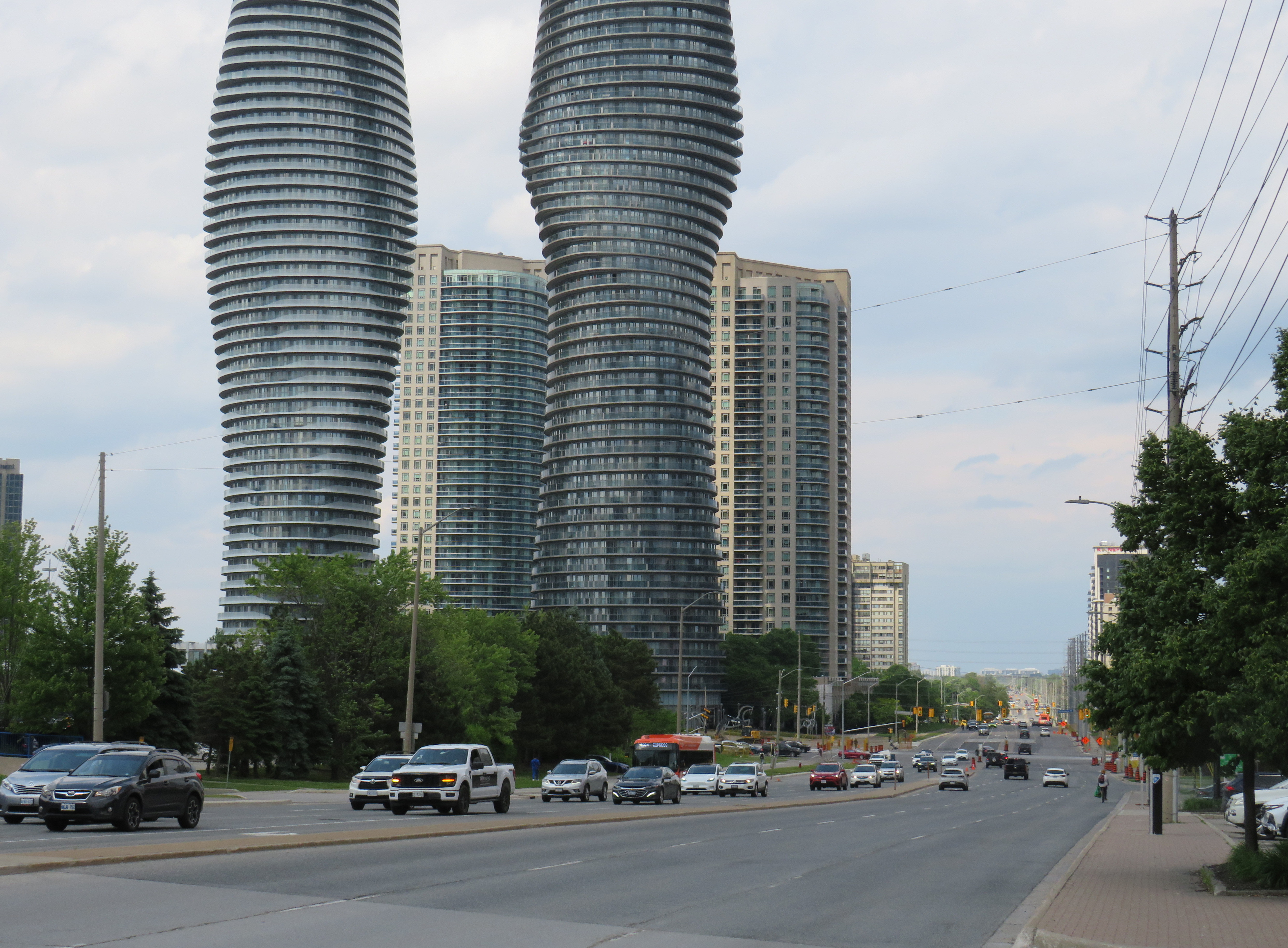
    Looking east on Burnhampthorpe
    Looking east on Burnhampthorpe Road from Kariya Drive, towards Hurontario Street and the landmark Absolute condo towers

    Burnhamthorpe Road is six lanes wide, with an additional left turn lane at every intersection. Though there is a sidewalk on the south side and a designated multiuse path (MUP) on the north side, it is not a pleasant place to walk.

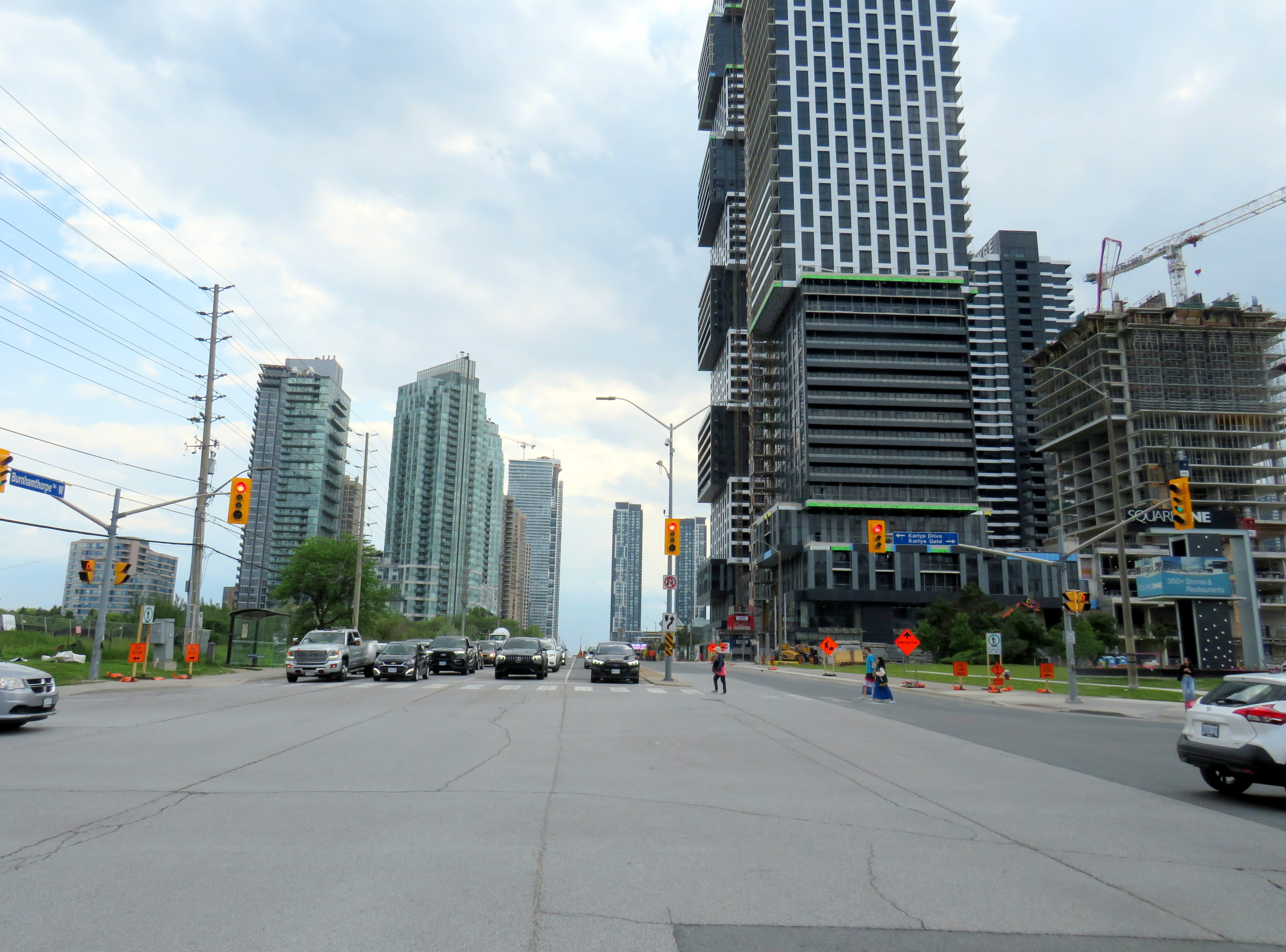
    Looking west on Burnhamthorpe
    Looking west on Burnhamthorpe Road, towards newly built and under-construction high-rise residential towers

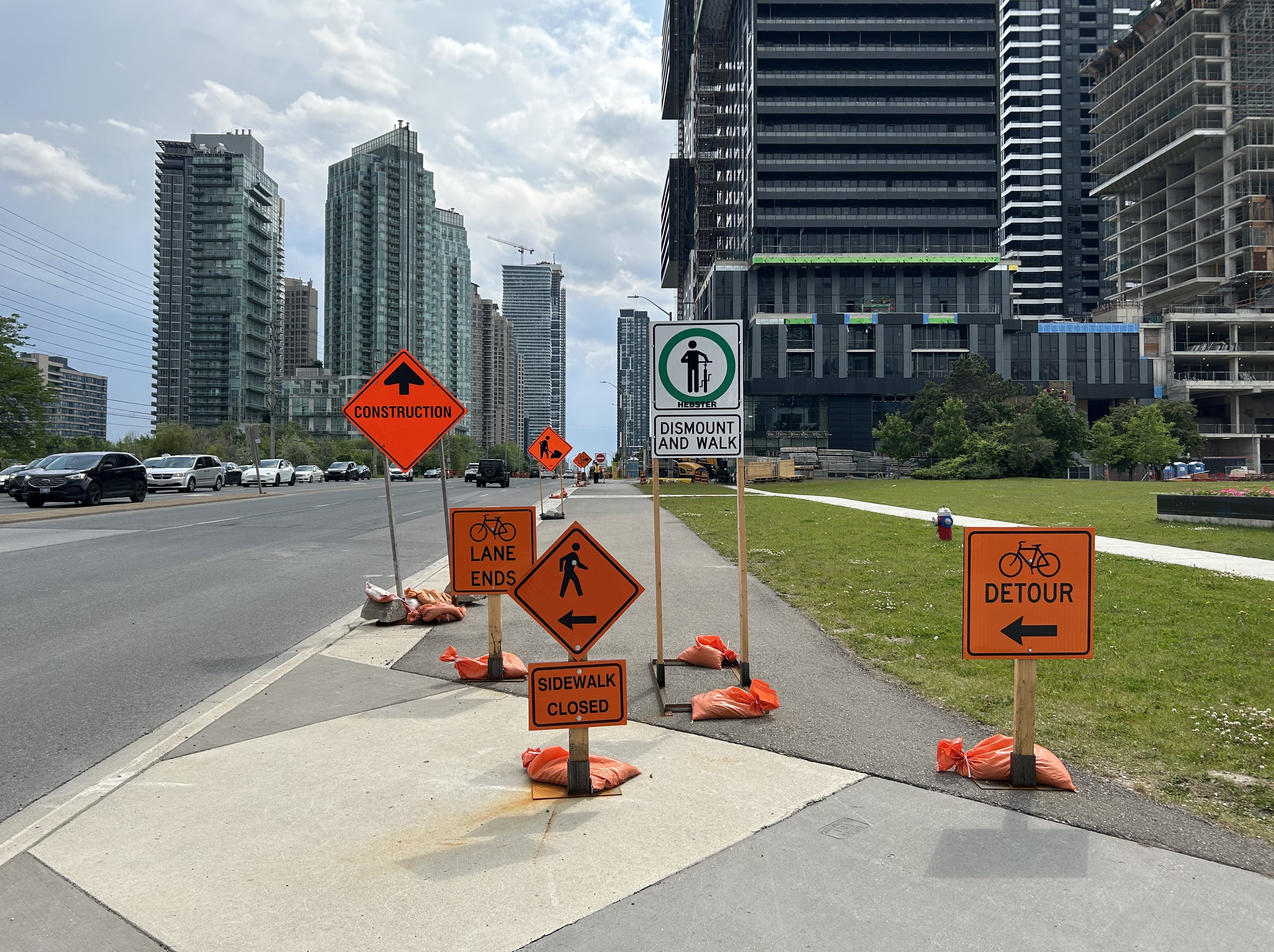
    While I visited The MUP on the north side of Burnhamthorpe west of Kariya Drive was also closed off for the convenience of the builders of the Exchange District Condos development, one of many new mixed-use projects in the area. This forces pedestrians to cross the intersection to continue west, and no thought was made to closing one of the three westbound traffic lanes to provide a continuous path.

    Signs blocking path
    Multiple “sidewalk closed” bike lane detour, and “dismount and walk” signs blocking the asphalt MUP on the north side of Burnhamthorpe Road. Note that no traffic lanes were blocked to provide a continuous route for vulnerable road users.

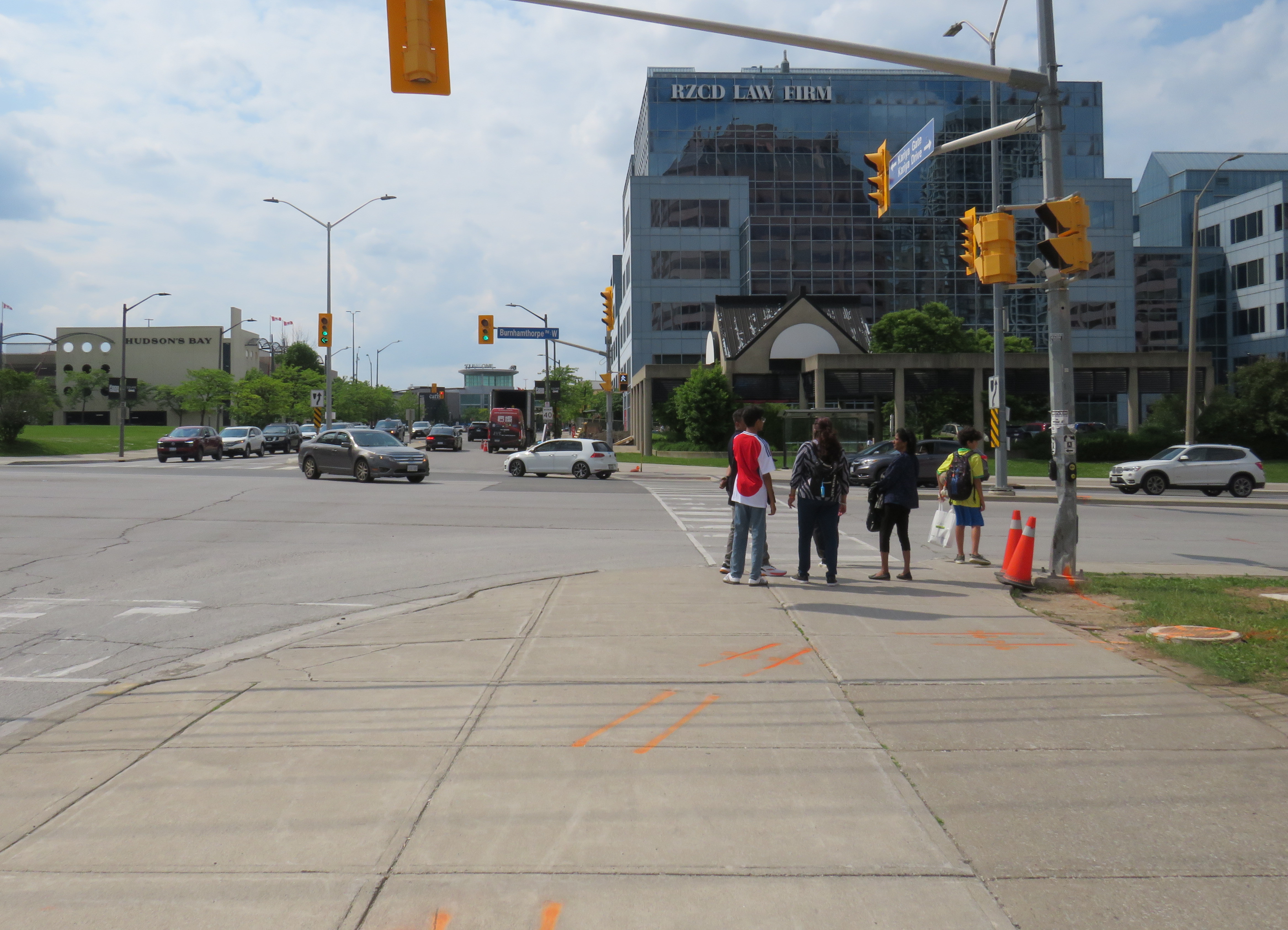
    The intersection of Kariya and Burnhamthorpe is quite busy; at every light cycle, there were multiple pedestrians crossing here on mid Tuesday afternoon, including students walking to the mall or to home from nearby schools, couples and young families out for a stroll. (Kariya Park, named for a Japanese city that was twinned with Mississauga in 1981, is a lovely oasis.) Burnhamthorpe has a 60 km/h speed limit, though Kariya has a 40 km/h limit.

    Five pedestrians, standing where a man was struck and killed last Saturday, about to cross Burnhamthorpe Road on a Tuesday afternoon

    The corner is also a busy transfer point. Miway route 26 Burnhamthorpe is a major east-west bus corridor that connects with the TTC subway at Kipling Station; Kariya Drive is the best stop to get to Square One as Route 26 doesn’t serve the main terminal. Routes 3 Bloor and 8 Cawthra, which do continue to the City Centre Terminal, stop here as well.

    Route 26 Burnhamthorpe is one of MiWay’s busiest

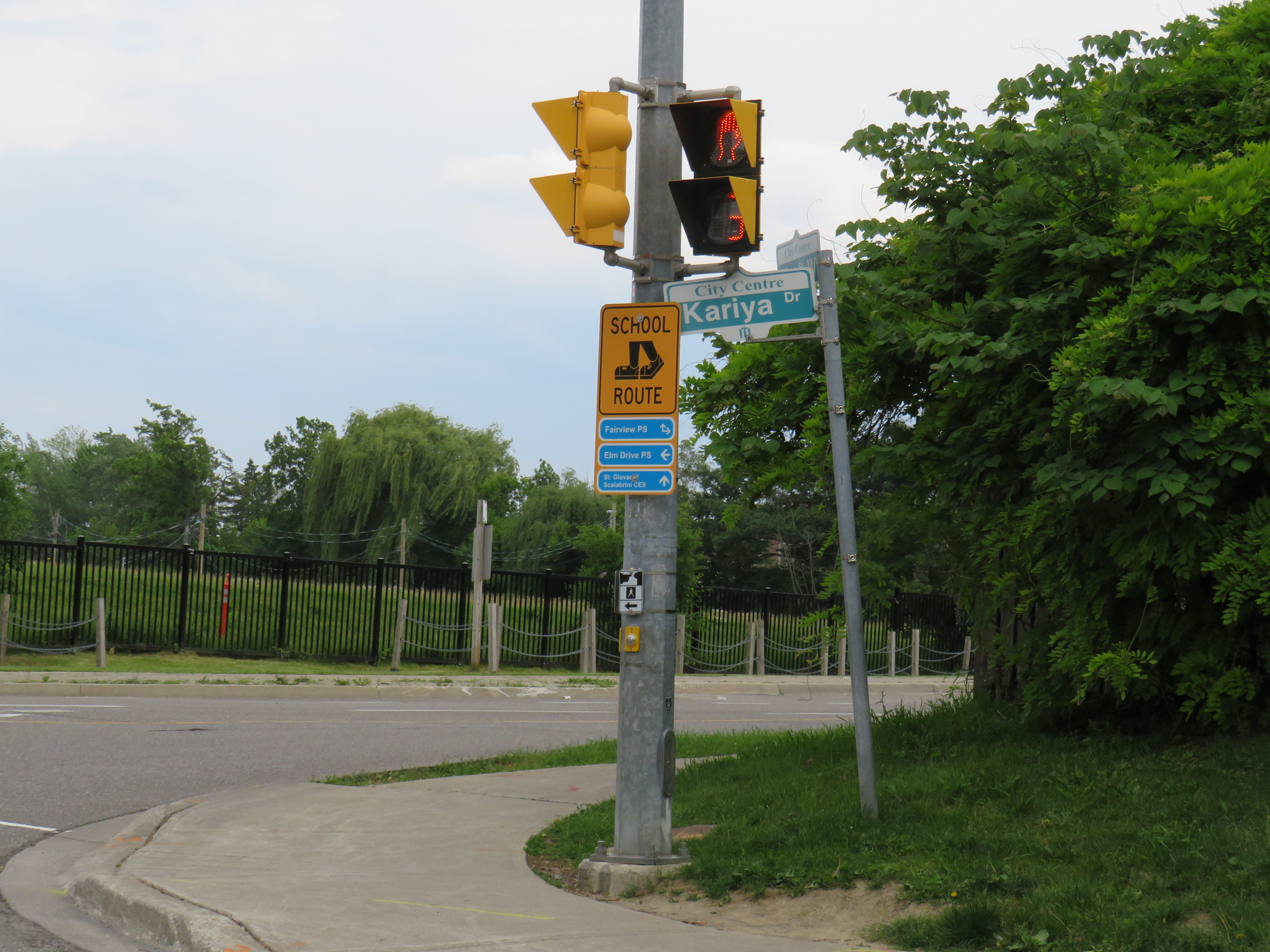
    Also worth noting is that Kariya Drive is a signed school route. MCC itself does not have any elementary or secondary schools, but there are several schools within a short walk to the south of Burnhamthorpe, including Fairview Public School, Elm Drive Public School, St. Giovanni Scalabrini Catholic School, and Fr. Michael Goetz Catholic High School. The more people move into MCC, the more necessary safe walking routes will be.

    School route sign at Kariya Drive
    A school route sign with walking paths to three nearby elementary schools at Kariya Drive and Fairview Boulevard

    There is nothing particularly remarkable about the intersection of Burnhamthorpe Road and Kariya Drive itself that makes it deadly, but that is the problem here. To make walking safer and more attractive, there is much that should be done. Reducing Burnhamthorpe to four lanes in each direction, along with more street trees, could help to reduce speeds (the speed limit should also be dropped to at least 50 km/h), and with several nearby schools, parks, and YMCA, there’s a case for Burnhamthorpe to be designated a community safety zone, with increased enforcement, along with automated traffic cameras. Perhaps dedicated bus lanes could supplant the third traffic lane in each direction, as the nearby Hurontario LRT nears completion.

    Right now, drivers race through the intersection, making left turns against oncoming traffic and crossing pedestrians after the advance arrow signal disappears, as seen in the video below. Wide lanes and a 60 km/h speed limit encourage unsafe driving.

    Three motorists continue to make left turns from Kariya to Burnhamthorpe (behind the FedEx truck) after the advance turn arrow disappears and the green light for opposing traffic and walk signal turn on. Note several pedestrians waiting to cross as drivers rush through.

    To make Mississauga City Centre a complete urban hub, it needs to be safe for pedestrians and cyclists of all ages and abilities to get around. Six-lane arterials like Burnhamthorpe have no place in a dense, multi-use neighbourhood, especially when nearby Highway 403 can handle goods movement and through traffic. One death is too many.

  • Downtown Brampton’s next chapter

    Garden Square, at Main and Queen Streets, will be one of the two public spaces downtown to be rejuvenated

    After nearly two decades of little change, Downtown Brampton may finally be turning the corner from being a sleepy town centre to becoming the proper hub for a city of nearly 800,000.

    The Riverwalk, an ambitious plan to enhance flood protection from nearby Etobicoke Creek and create new public space, will break ground later this year. The extension of the Hurontario LRT into Downtown Brampton, by way of a deep-mined tunnel, was approved and funded by the provincial and federal governments. There will also be a new transportation hub to accommodate additional tracks at Brampton GO Station and support Brampton Transit ridership growth. City of Brampton is also hoping to get started on a new Centre for Innovation at the corner of Nelson and George Streets; it will contain a new central library as well as space for Toronto Metropolitan University and Rogers.

    Private sector development is also waking up. The first of a new wave of mixed-use high-rise developments, Rose Garden Residences, has started construction.

    Demolition is complete and shoring is starting at Rose Garden Residences

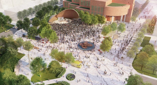
    These are exciting times for Brampton. The city, looking to attract more people to the downtown core, is planning to improve both Ken Willians Square, in front of City Hall, and Garden Square, in front of the Rose Theatre. The municipal government is looking for feedback on four proposed designs for the two square.

    For Urban Toronto, I wrote more about Brampton’s plans to rejuvenate its downtown public realm.

    Proposed design for Ken Willians Square, Downtown Brampton
  • Live from the CBC mothership

    Live from the CBC mothership

    Walking towards the CBC Broadcasting Centre at 6:00 am

    Yesterday, on Wednesday, May 7, I had the privilege of appearing on the long-running CBC Radio program Metro Morning. Though I have been interviewed on the radio a few times before – generally about pedestrian safety or transit issues – this was the first time I was asked to come into the studio.

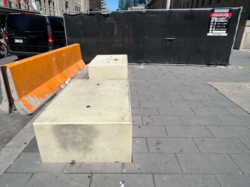
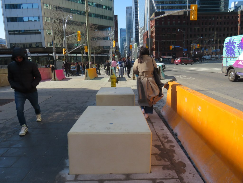
    I spoke about the new permanent barriers that have gone up around Union Station in the last few weeks, seven years after temporary Jersey barriers were installed. I take exception to the size and placement of new barriers – which needlessly restrict pedestrian flow around the busy transport hub – as well as their unappealing appearance.

    The new barriers are already scuffed up and are not appealing to sit on

    I arrived around 6:10 for a short interview at 6:40. After checking in with security, I was let up to the CBC Toronto newsroom, which has a radio studio for local programs including Metro Morning and the afternoon drive time show Here And Now. I met with one of the producers and with host David Common before the segment. They were all great. David is a great interviewer, and it was nice to go see where the magic of radio happens.

    You can listen to me speak with David Common here.

  • BRT comes to London

    BRT median under construction on Wellington Street at South Street, London

    The City of London, Ontario has been quietly constructing a new bus rapid transit (BRT) system over the last few years, which will extend south and east of the downtown core. By the end of April 2025, the first major section of this network will begin operation.

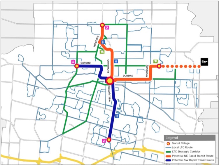
    The Wellington Road and Fanshawe College segments are two of the four rapid transit routes originally proposed under London’s SHIFT. At first, a north-to-east line, connecting Masonville Place Mall, Western University, Downtown London, and Fanshawe College, was to be a light rail corridor, featuring a short tunnel under Richmond Street to avoid a busy freight railway crossing. A BRT line would have connected the west end of London, at Oxford Street and Wonderland Road, continued downtown, and head south towards the Victoria Hospital campus and White Oaks Mall near Highway 401. The map below shows the initial proposal.

    The original rapid transit proposal called for a light rail (orange route) connecting Western University, downtown, and Fanshawe College and a BRT (blue) corridor to the west and south of downtown

    Due to budget constraints, the project was revised to a BRT-only scheme. The Richmond Street leg, leading north to Western University, was cut when the bus tunnel under the CPKC railway and the Oxford Street intersection was deemed to cost $220 million in 2017. Business owners along Richmond Street, a busy restaurant, nightlife, and shopping district known as Richmond Row, were also opposed to the reduction in traffic lanes that the transit tunnel would have required.

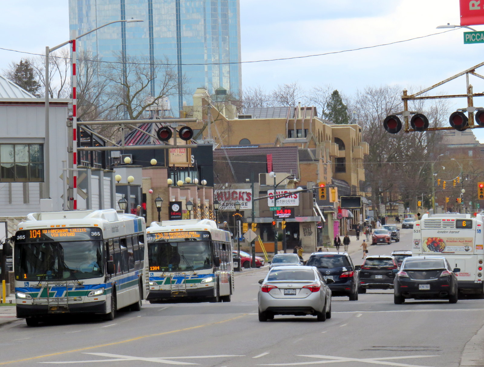
    This section of Richmond Street — used by eight London Transit routes — is a severe bottleneck as it is not only a busy traffic corridor, it crosses CPKC’s mainline connecting Toronto, Windsor, and the US Midwest.

    Several buses cross Richmond Street north of Downtown London
    Several buses cross the CPKC tracks on Richmond Street north of Downtown London

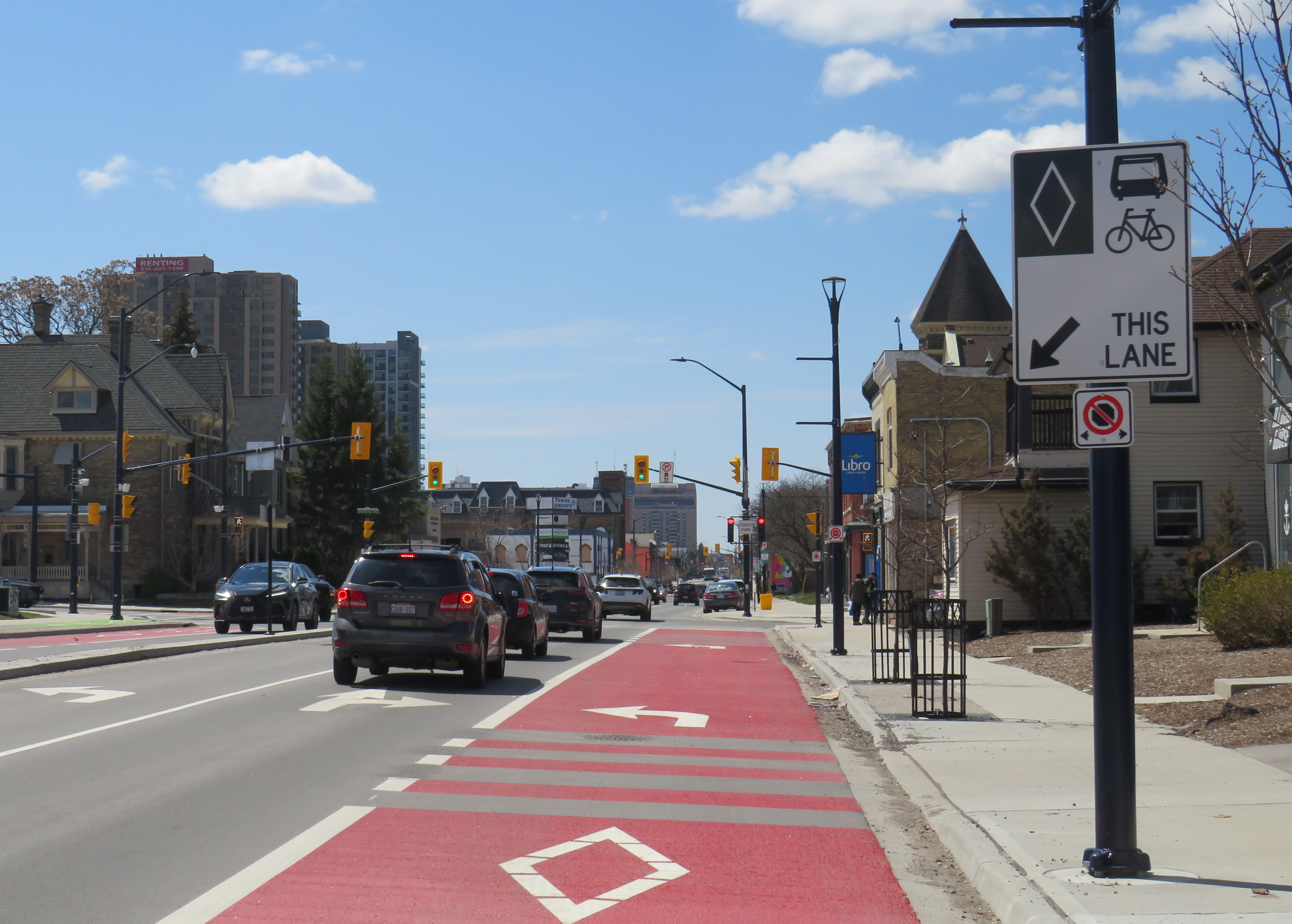
    The pared-down BRT project consists of a curbside bus-only lane encircling the downtown core, following King Street, Wellington Street, Queen’s Avenue, and Ridout Street. At each turn, buses must wait for a dedicated signal to make the left turn to continue on the loop. Right now, buses do not have any signal priority, and can wait a full light cycle (up to two minutes) to get the dedicated left turn signal.

    Example of a left turn from the right curb lane in London. The dedicated transit signals allow left-turning buses to remain in the right lane without traffic conflicts.

    New enlarged shelters and long platforms allow multiple buses to pick up and drop off at each stop; most routes heading through downtown will serve at least one of these new bus stops on their routes. All buses were removed from Dundas Street, which has been re-landscaped to create a more pedestrian-friendly commercial environment called Dundas Place.

    New enlarged bus shelters along the BRT corridors; this is at Wellington and King Streets

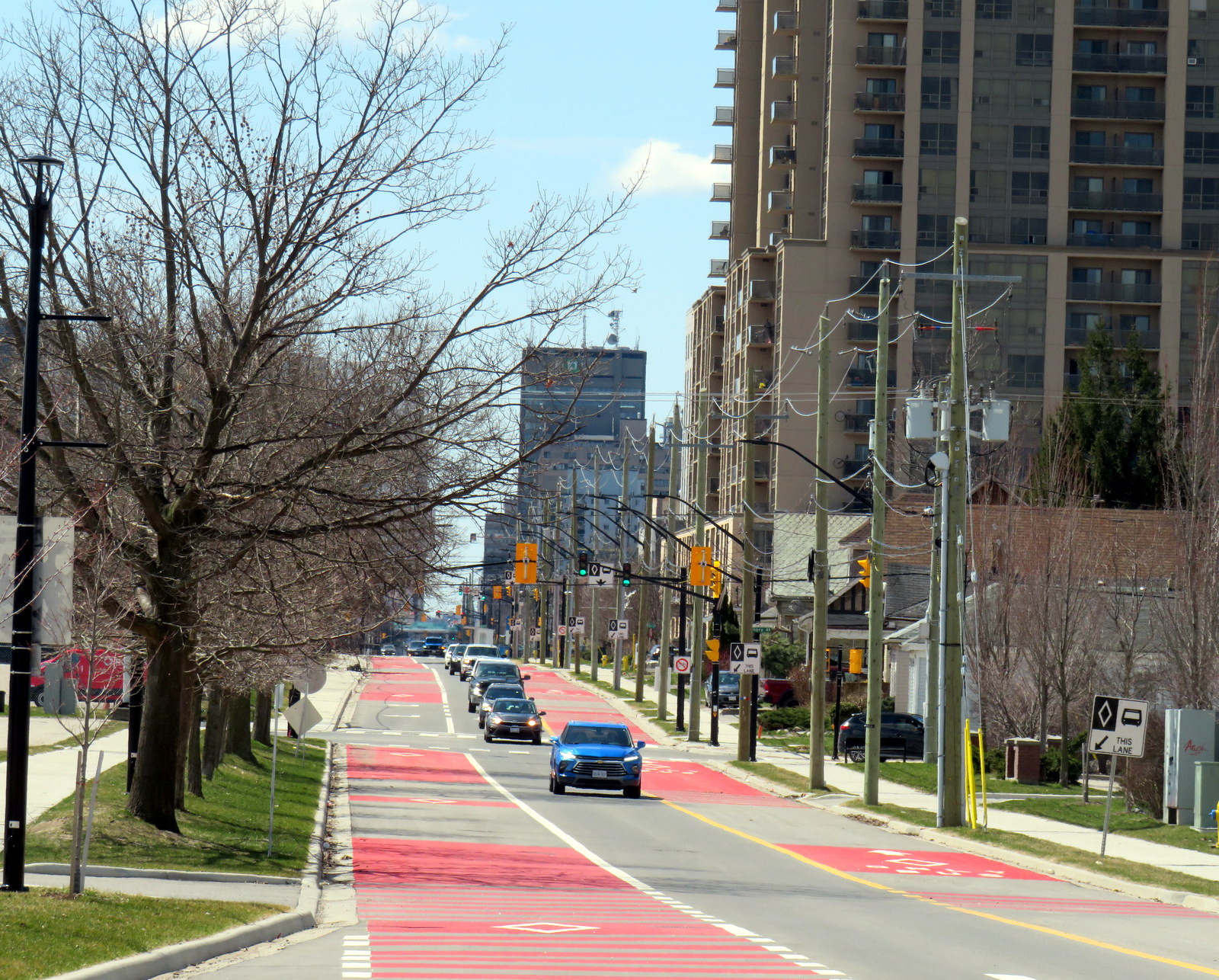
    On April 28, Route 94, a weekday express route between Argyle Mall in London’s east end, Downtown London, and Western University, will begin operating in both directions on King Street, and will be the first route using the bus infrastructure outside the downtown loop. King Street was originally a one-way, two-lane-wide roadway east of Downtown London, but was recently widened to allow for painted bus lanes in both directions.

    Contraflow bus lane on King Street, previously a two-lane, one-way street

    Work is far from complete. Utility work and road reconstruction continues on Dundas east of Ontario Street (at the Western Fairgrounds) and on Highbury Avenue north to Oxford. Construction of the BRT median on Wellington Street/Wellington Road south is also ongoing.

    Looking south on Wellington Street at the South Thames River bridge crossing, which is being widened as part of the BRT project

    The cost of the BRT project has risen to at least $454 million, and that does not include the north or west segments. Service levels have yet to be determined, along with transit route restructuring once the east and south segments are complete. The new station shelters will not have off-board fare payment equipment, so unless policy changes, all transit riders will still have to enter the bus from the front door.

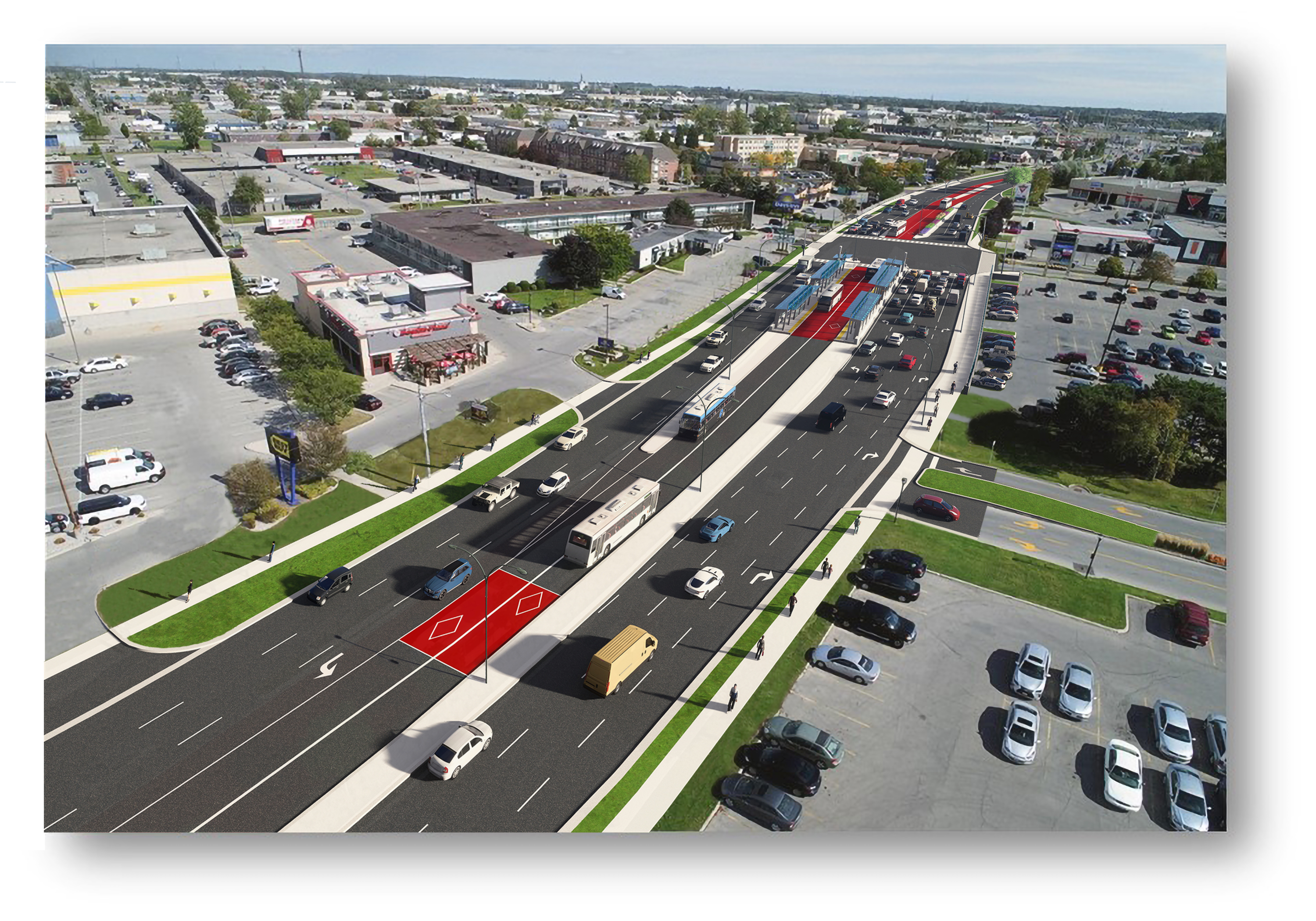
    Concept rendering of Wellington Road with new BRT median lanes near White Oaks Mall

    Entering and leaving downtown along Wellington Street, south BRT buses will still have to squeeze through an older four-lane railway underpass in mixed traffic, limiting bus throughput. The lack of a northern segment between Downtown, Western University, and Masonville Place Mall is another major downfall.

    Bottlenecks, like Richmond Street North, will limit how fast and how attractive transit will be to prospective riders

    Though it is hoped that London’s Rapid Transit project will help shape development — much in the same way Waterloo Region’s Ion LRT has — the cost-cutting will limit this potential. The Wellington Road BRT median might help improve bus reliability along a congested traffic corridor, but the lack of signal priority — plus the railway underpass bottleneck — will not help. Western University students will still have to endure a slow ride north from downtown, reducing the attractiveness of Wellington Street, currently littered with big-box stores and strip plazas, as a place to build up with private mixed-use development. Perhaps the eastern segment on King and Dundas Streets, serving the regenerating Old East Village neighbourhood, will be more successful.

  • Intercity map updates for April 2025

    Intercity map updates for April 2025

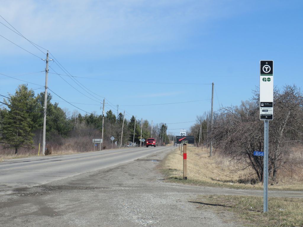
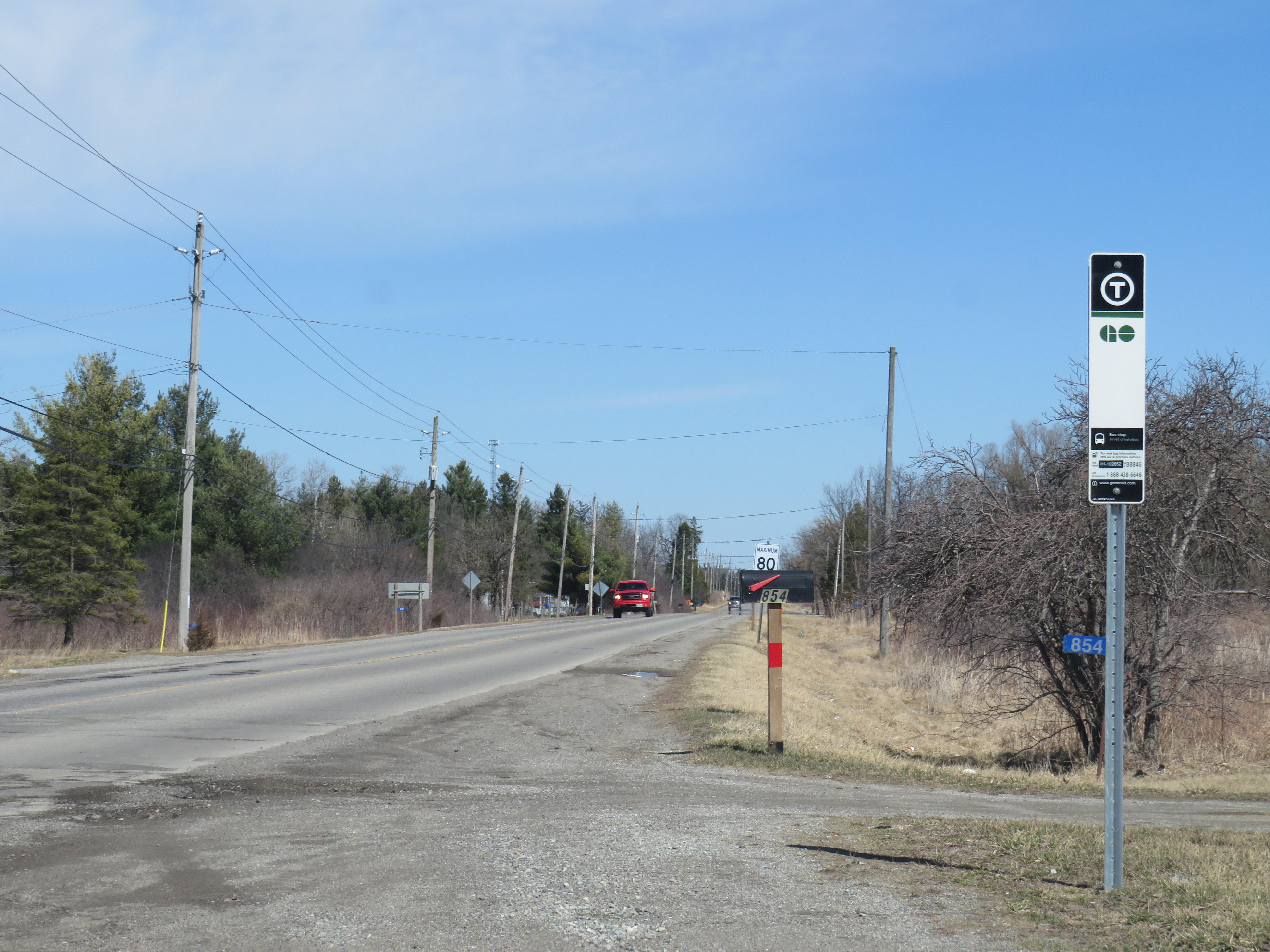
    New GO Transit bus stop on Chiefswood Road at Six Nations

    As we enter Spring 2025, there are a few significant changes in Ontario’s intercity transportation services. A new daily GO Transit route will now connect Six Nations and the Mississaugas of the Credit First Nation with Brantford, Hamilton, and Greater Toronto. A new seasonal Waterloo-Burlington weekend express could foreshadow more direct service between Kitchener/Waterloo and Hamilton in the future. Flixbus moved its Ottawa terminal stop to the VIA Rail station, joining Ontario Northland and Orleans Express.

    However, there are also some cuts, triggered by the end of the Ontario Intercommunity Transportation Grants. Grey County will terminate all GTR services with the exception of Route 1 between Dundalk, Shelburne, and Orangeville. T:GO is ending its intercommunity services outside of Tillsonburg, including routes that connect with Woodstock and London. PC Connect is cutting its rural route that serves places like Mitchell and Milverton (though routes connecting Listowel, Stratford, and St. Marys to Kitchener/Waterloo and London will continue).

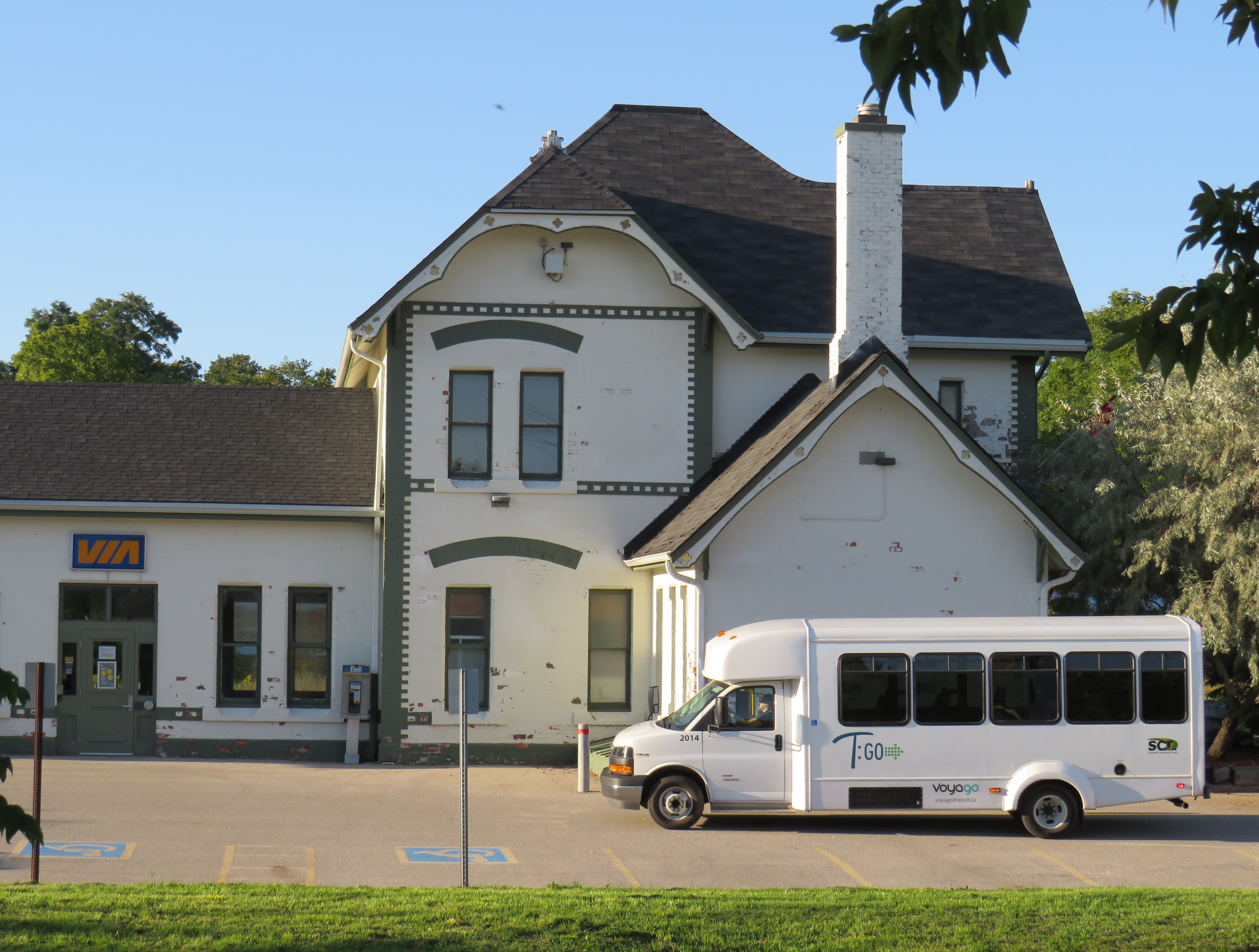
    Unfortunately, T:GO will end all intercommunity bus routes outside of Tillsonburg, including the link to Woodstock

    Recently, I provided my expertise mapping Canada’s intercity transit links to Transport Canada, which allowed me to enhance and update the interactive map. I am also working with Transport Action Canada to support their efforts advocating improved intercity transport across the country.

    I will be retiring my older Ontario and Canada intercity maps; a new version of my Canada Intercity Map for 2025 can be found here. I will make all updates to a single map for now on. The new map depicts discontinued bus routes, shown in light grey.

    Preview of the new Canada Intercity Transport Map

    As always, please contact me with feedback, corrections, or updates. It is a challenge continually maintaining a Canada-wide map given how frequently things change.

  • Dysfunction junction: permanent obstructions at Union Station

    Dysfunction junction: permanent obstructions at Union Station

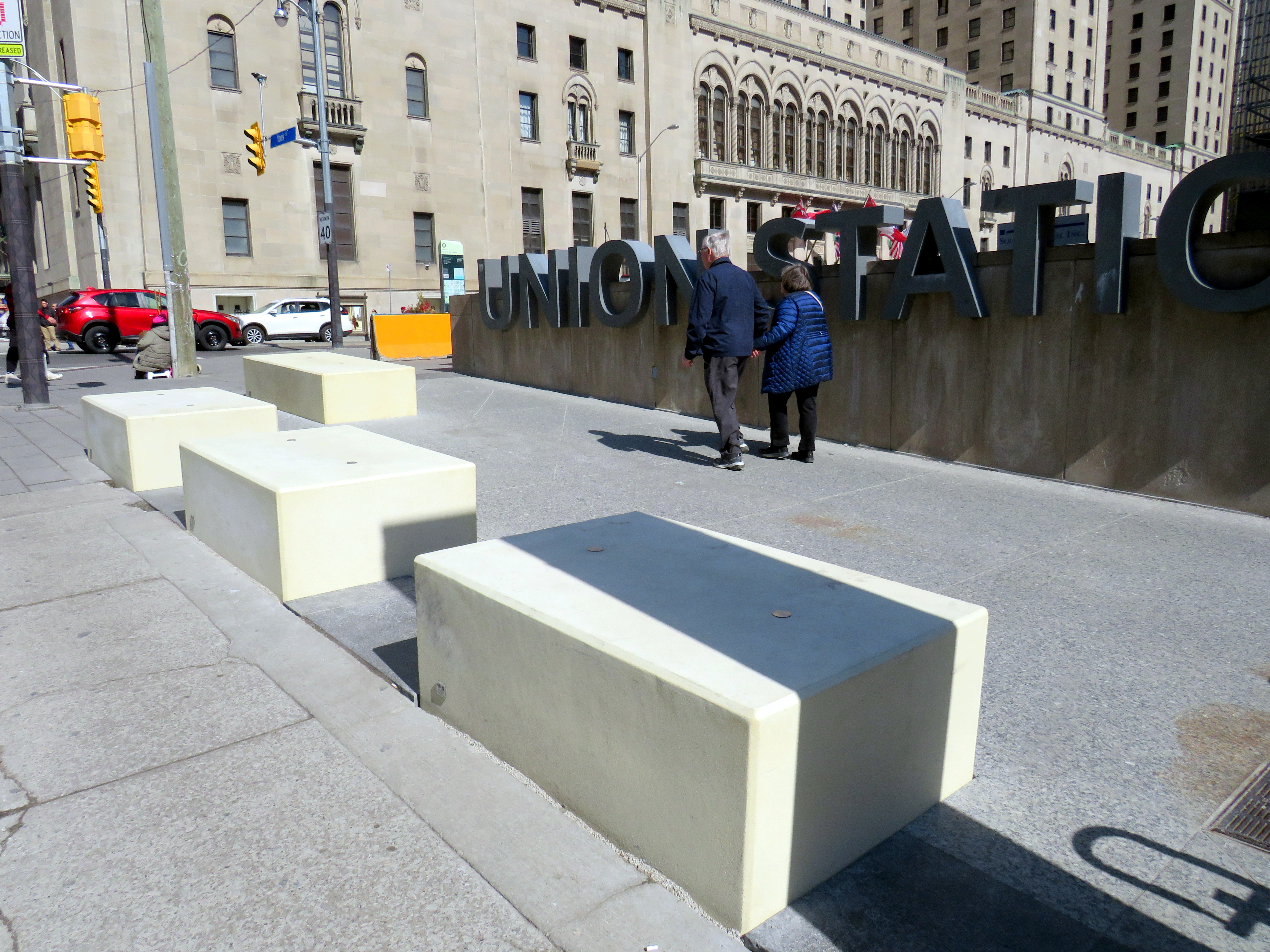
    New blocks installed in front of Union Station at Front and York Streets

    When I learned that Union Station was finally getting permanent bollards to replace the haphazardly-placed Jersey barriers that have sat in front of the transport hub since 2018, I was relieved. I wrote about these barriers several times on this website, criticizing their appearance and their placement, blocking the way for the thousands of people who cross Front Street every day. But when I went to see them in person, after seeing criticism online, I was dismayed.

    The new permanent barriers might even be worse than the temporary obstructions they are meant to replace.

    The Jersey barriers were hastily placed after a tragic attack on Yonge Street in North York, where a man intentionally drove a rented van on to the sidewalk, killing ten pedestrians and injuring and traumatizing many more.

    Vehicular assaults on crowds of pedestrians are a major concern; tactics used at mass gatherings — such as the winter light show and New Years Eve events at Nathan Phillips Square and major concerts and playoff games at Skydome and Scotiabank Arena — now include blocking closed streets with heavy vehicles such as snow plows, dump trucks, and city buses. However, Union Station is the only place in the city where officials have decided that new permanent barriers were necessary.

    Union Station is one of the busiest pedestrian areas in the city

    The new permanent barriers are not the sturdy, yet narrow, bollards that are used elsewhere. Instead, they are large, undecorated concrete blocks anchored into the ground and are knee-high. The plain concrete colour does not match the stone sidewalks or plaza. They are placed very close together, impeding access for those using large carts, strollers, or wheeled mobility devices. Despite all the money spent renovating Union Station, these blocks look cheap.

    Concrete blocks at the corner of York and Front Street at Union Station

    The total cost of installing the “Custom Anti-Terror Concrete Barriers,” as the city described the bid, was $2,438,238, including HST. The lowest bid, by South Central Inc., came over a $1 million cheaper than the other two bids. It is worth noting that there are no public documents that describe the city’s specifications for the contract, nor was there any public consultation before the city solicited bids.

    The result? An esthetic failure and an accessibility challenge.

    Video showing pedestrians going around the concrete blocks in front of Union Station

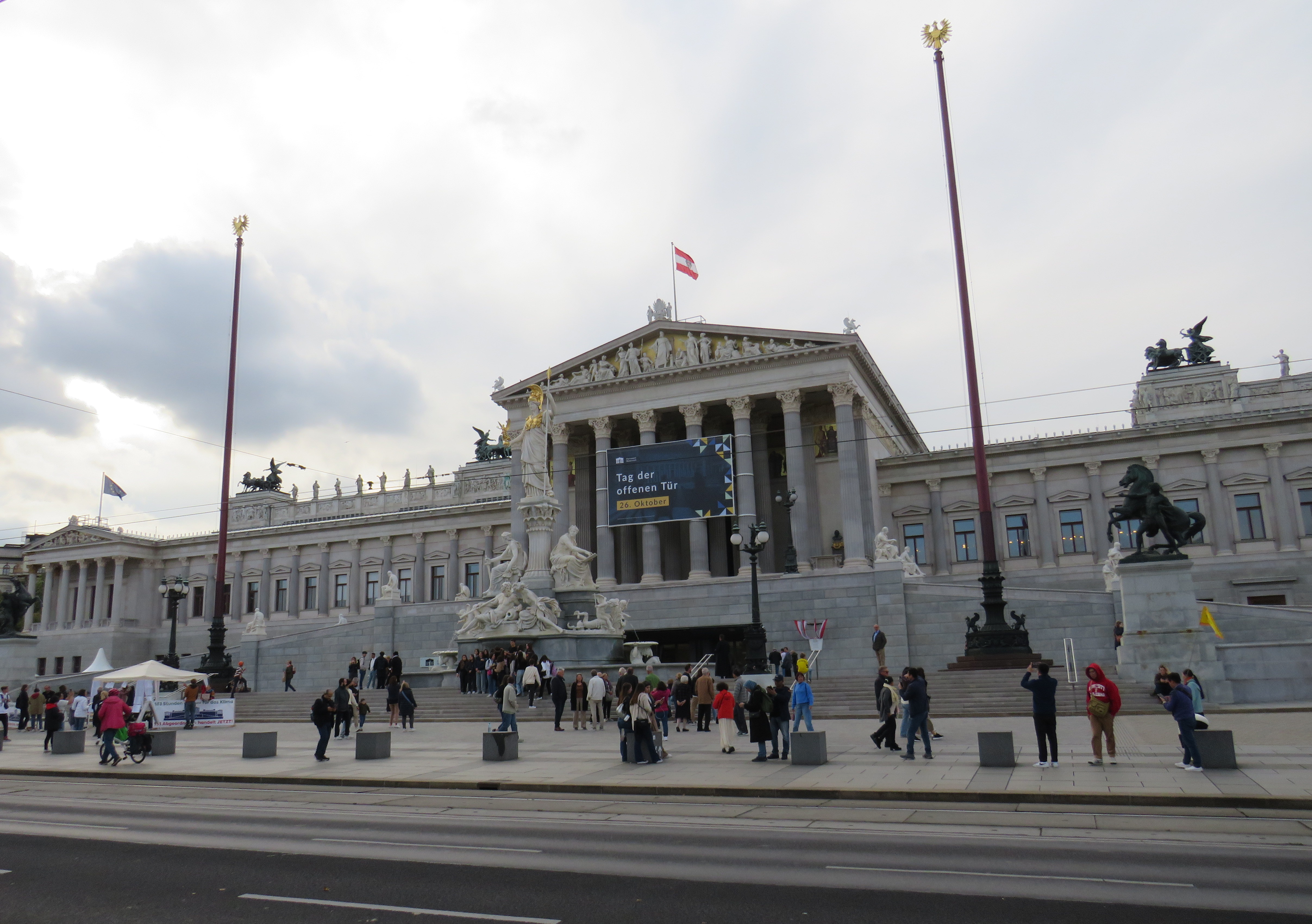
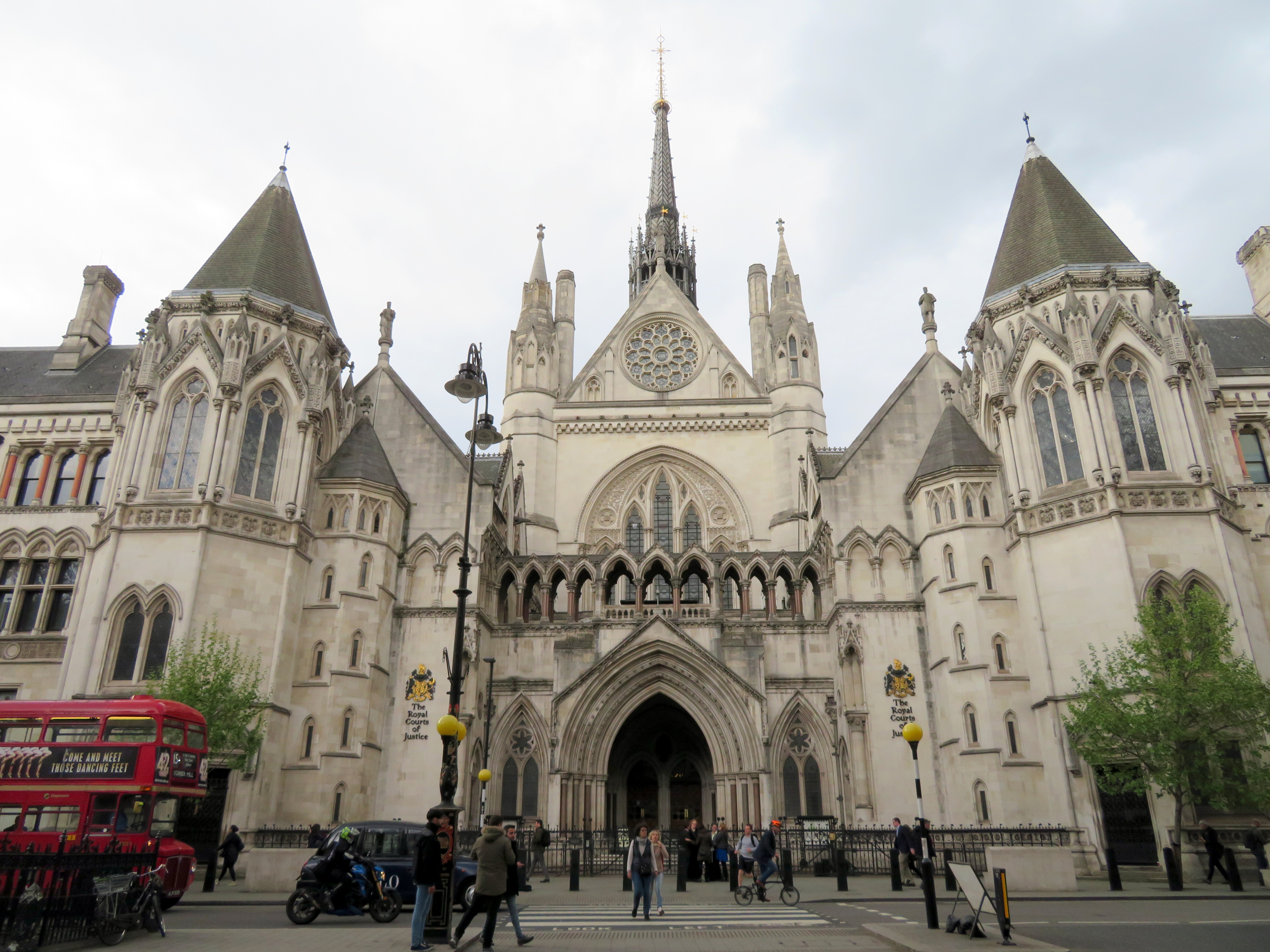
    I cannot understand the city’s decision to go with these blocks where more elegant and pedestrian-friendly alternatives are typically used elsewhere. For example, the Austrian Parliament Building in Vienna, which faces the famous and busy Ringstrasse, is protected by smaller concrete bollards, which are also more widely separated, making it much more pleasant for pedestrians to get by. In Great Britain, metal bollards are common on busy commercial streets and in front of important buildings, but they are easy for pedestrians to pass, and generally blend in.

    Thick concrete bollards in front of the Austrian Parliament Building, 2023
    Metal bollards in front of the Royal Courts of Justice in London

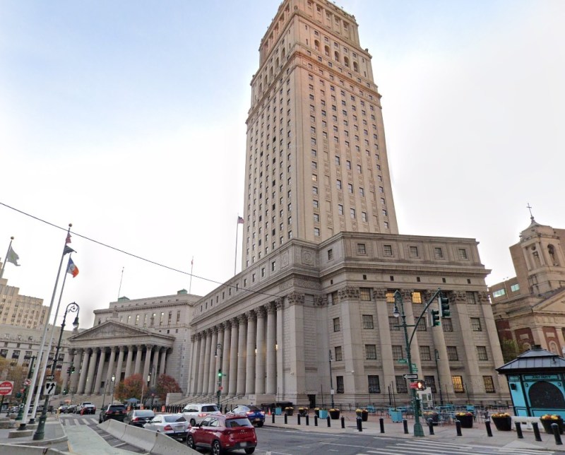
    In the United States, government buildings are also protected by heavy anti-vehicular barricades (especially since the 1995 Oklahoma City bombing), but they are generally more permeable for pedestrians.

    Metal bollards protect the federal courthouse in Downtown Manhattan (Google Streetview)

    It is also worth noting that other popular pedestrian areas, such as the Yonge-Dundas intersection, are not protected from a potential vehicular attack — or an unintentional collision. It is beyond comprehension why the city only focused on protecting one pedestrian area, using such a poorly thought-out design. Toronto can — and should — do better.

  • The fall of an empire

    The fall of an empire

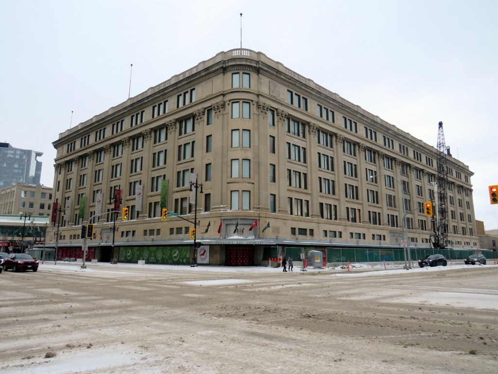
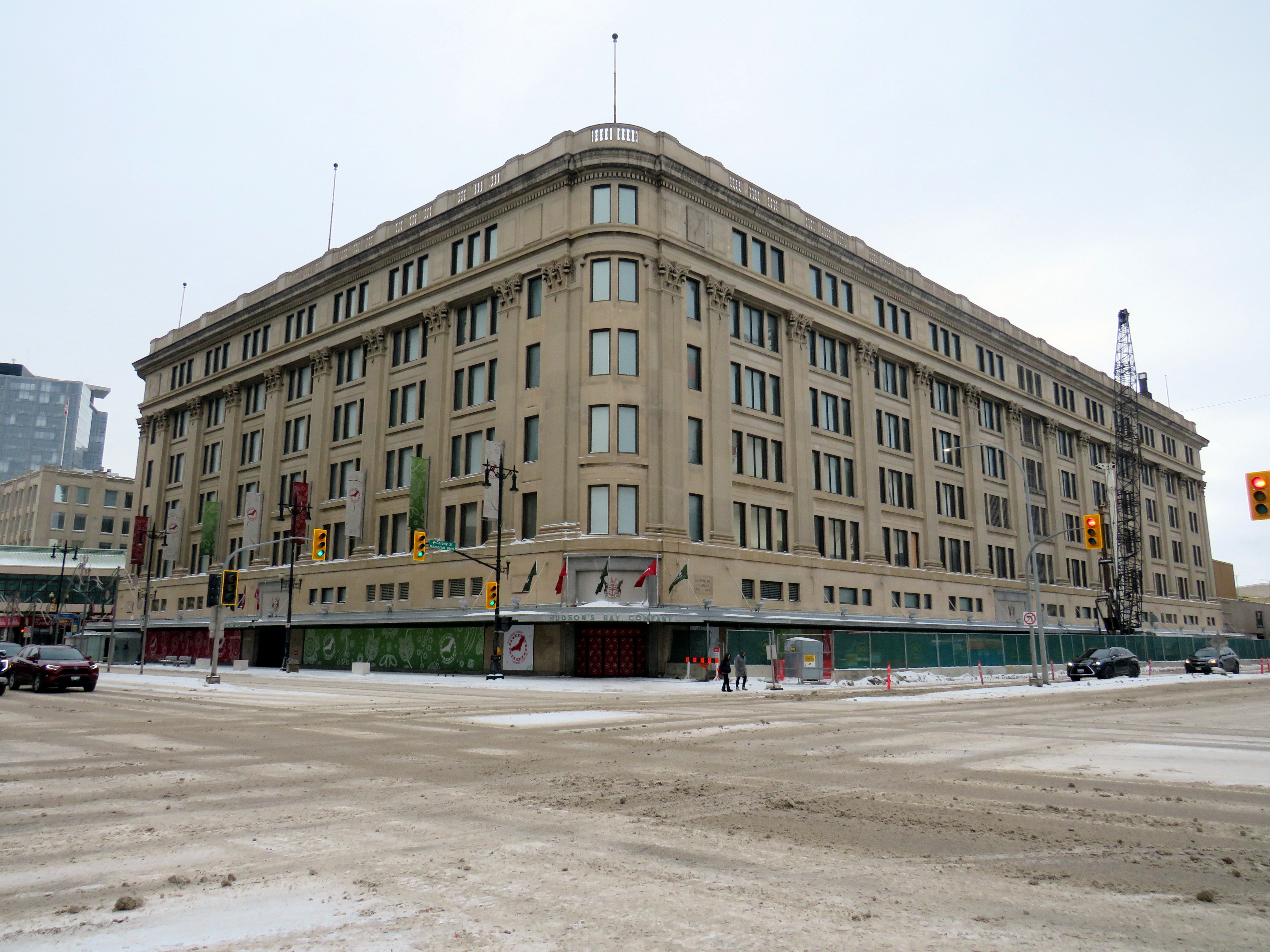
    The former Hudson’s Bay Store in Downtown Winnipeg, one of its western flagship stores. After years of decline, the store closed in November 2020 and is now being transformed into a centre for Manitoba’s First Nations.

    There’s a touch of irony that in the same year Canadian sovereignty is increasingly threatened by an American president, the Hudson’s Bay Company — one of the world’s oldest corporations — has filed for bankruptcy protection. It will likely close at least half of its 80 stores, but with no guarantee it will emerge in a healthy state, able to rebound.

    On May 2, 1670, The Governor and Company of Adventurers of England, trading into Hudson’s Bay, was given a royal charter to trade in all lands that drained into Hudson’s Bay, 3.9 million km2 of land in the heart of the North American continent, in order to compete with the lucrative French fur trade in the St. Lawrence basin. The new company had monopolistic commercial control of what was then called Rupert’s Land: the entirety of present-day Manitoba, most of Saskatchewan and Northern Ontario, a significant part of present-day Quebec, Alberta, and Nunavut, and even parts of what eventually became Minnesota and North Dakota.

    Of course, this new monopoly, which quickly became known as simply the Hudson’s Bay Company (HBC), was created without consent or consultation with the many First Nations and Inuit communities. In the early days of trade, however, HBC relied on trading with First Nations for the valuable fur trades. It established forts and factories (trading posts) throughout the northwest, establishing places such as Moose Factory and Fort Albany that remain to this day.

    In later years, HBC claimed a trading monopoly on lands draining into the Pacific Ocean; it also brought in missionaries to convert Indigenous peoples. (Its monopoly was challenged by new entrants such as the North West Company, which eventually merged with HBC after violent skirmishes over trading territorial rights.)

    HBC’s vast networks of forts and trading posts, particularly Fort Garry (now Winnipeg) led towards the full colonization of western and northern Canada. In 1870, with the decline of the fur trade HBC relinquished control of Rupert’s Land to the new Dominion of Canada, which led immediately to the creation of the Northwest Territories, followed quickly by the Red River Rebellion and the creation of the Province of Manitoba.

    HBC continued as a fur and goods trading company and it was still the only retailer in remote western and northern communities. In larger cities like Vancouver, Winnipeg, Edmonton, and Calgary, it established new department stores. In smaller communities, especially in the north, it took full advantage of its dominant position, and Northern Stores became notorious for high prices (in 1987, HBC sold off its Northern Stores division). HBC continued to exploit Canada’s natural resources — it even had an oil and gas subsidiary between 1926 and 1982.

    In 1960, HBC focused almost entirely on its department store empire, acquiring the Montreal-based Morgan’s chain, competing head-on with Eaton’s and Simpsons-Sears. In the 1970s and 1980s, it also scooped up discount chain Zellers, Simpson’s stores (after its split from Sears Canada), Ottawa-based Freimans, and Hamilton-based Robinson’s, eventually rebranding those stores as “The Bay.” Finally in 1993, it acquired Vancouver-based Woodward’s. During this time, it sold off the Northern stores and the oil company. In the late 1990s, it launched the Home Outfitters big-box chain. The Zellers chain expanded under HBC ownership, first acquiring the competing Towers discount chain in 1991 and K-Mart’s Canadian stores in 1998.

    Though the flagship stores still proudly proclaimed the May 2, 1670 incorporation date, few thought about the long and checkered history of the company. My first memories of The Bay’s retail empire were of the Simpson’s store close to where we lived in Brampton. Simpson’s was the flagship anchor of Shoppers World, a once-vibrant mall. I also knew Simpson’s from the flagship Queen Street store in Downtown Toronto, famous for its toy section, Christmas window displays, and of course, the TVO children’s program Today’s Special. (The most memorable episodes for me, a young, budding urbanist, dealt with a fictionalized closure and demolition of the store, before a heritage plaque uncovered during the move out saved the day.)

    Opening sequence of “Today’s Special,” set in the downtown Simpson’s Queen Street store

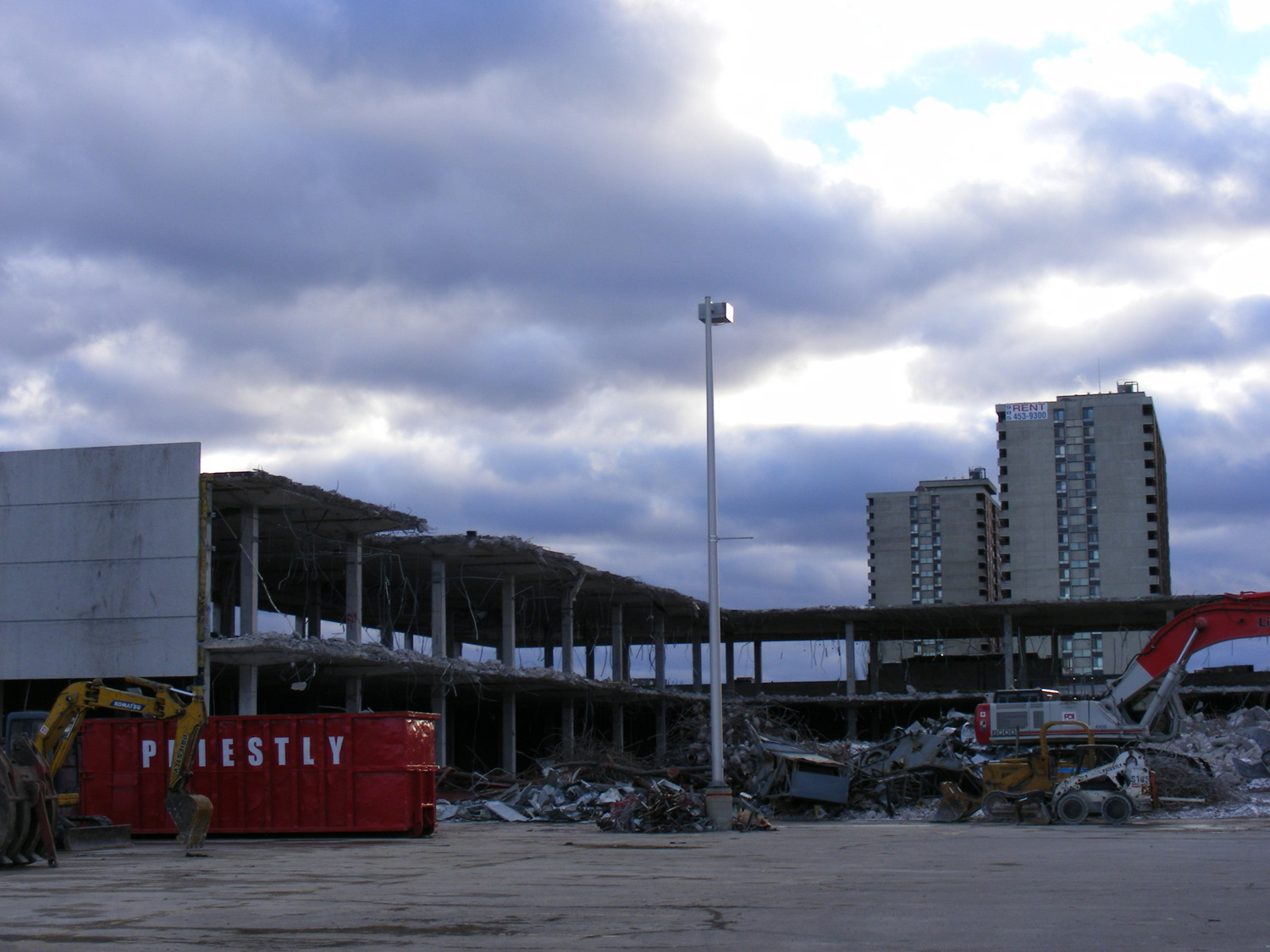
    The Shoppers World Simpson’s store, like the rest of the banner, was converted to “The Bay” in 1991. In 2007 the store closed, not long after I moved to my own apartment in Toronto. (I still have some of the chinaware I purchased at that Bay store before I moved to my own place.) But as I worked, and later lived, in Downtown Toronto, I found the Queen Street store very useful for casual clothes shopping and the occasional big-ticket item.

    Demolition of the Shoppers World Simpson’s/The Bay department store in 2010

    Though HBC was sold to a private equity firm in 2008, under CEO Bonnie Brooks’ leadership, there was still life in the department store, with leading stores like the Queen Street flagship upgraded. The fifth floor was a great place to browse for men’s clothes; the seventh floor had an excellent kitchenware department. HBC persisted through the bankruptcy of Eaton’s in 1997-1999 as well the wind-down of Sears Canada that began in 2012 (when it began selling the leases of its urban flagships, including former Eaton’s stores) and concluded in 2018.

    But private equity did what private equity does best: it began selling off the assets and closing down stores, just as Sears did in its last decade. The Zellers discount department store chain was discontinued, with the majority of store leases sold to the ill-fated Target Canada operation in 2011. The Home Outfitters stores were closed in 2019. Real estate was sold off, with HBC leasing back the properties. For example, the Queen Street store was sold to real estate developer Cadillac Fairview — who owns the adjacent Eaton Centre mall — for $650 million in 2014.

    In the last few years, it became clear that the department store chain was in decline. Though pandemic restrictions in 2020 and 2021 had a major effect, the downtown stores also lost office worker patronage. Suppliers were having trouble getting paid and were seizing merchandise at several stores; escalators and elevators were put out of service, and store hours were reduced at most locations.

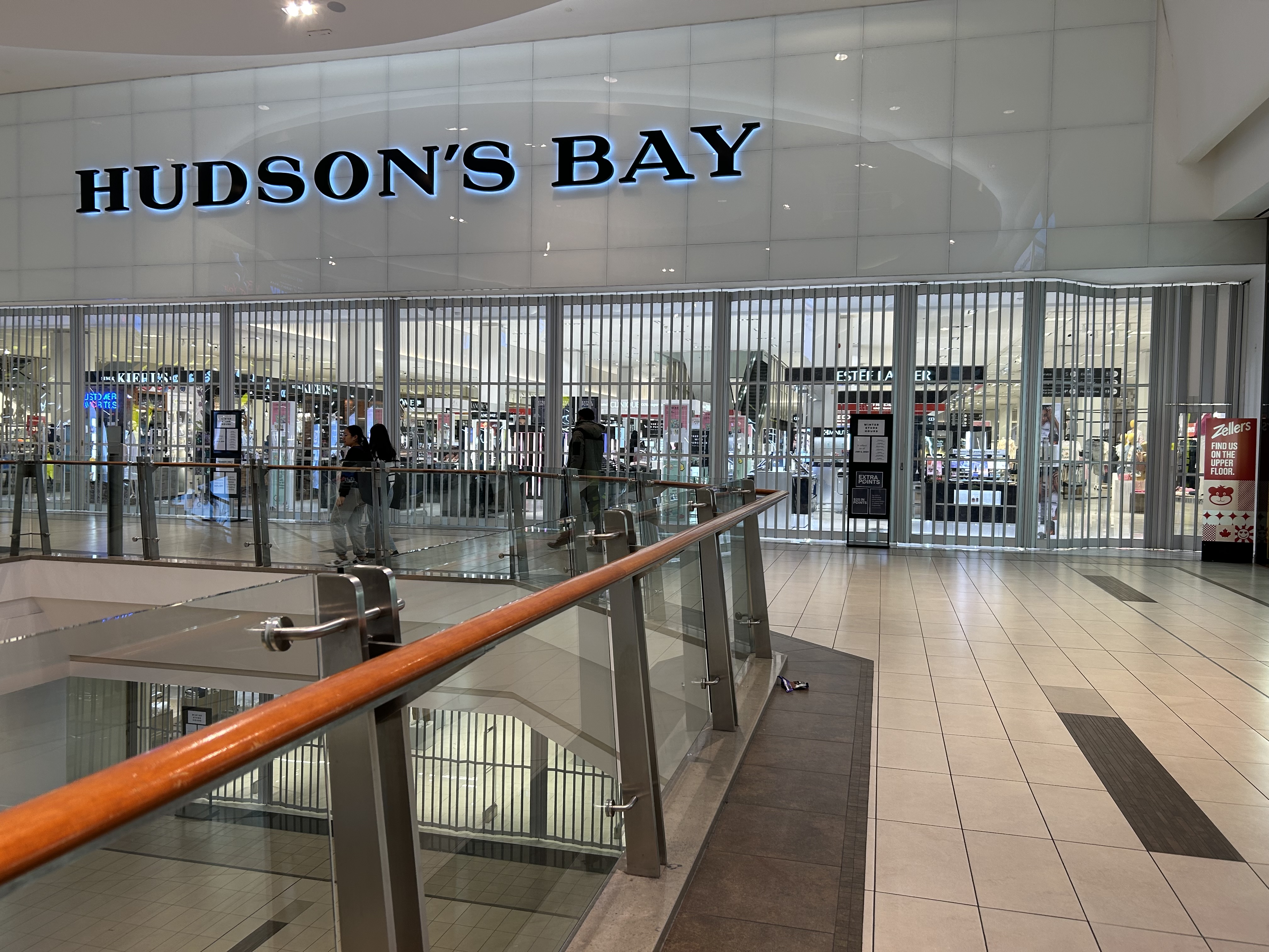
    The Hudson’s Bay store at Scarborough Town Centre closed at 7:00 on a weekday evening in March 2024, even though the rest of the mall remained open for another two hours

    The loss of Canada’s last department store is unfortunate, but it comes as no surprise given the way private equity sucks once-proud businesses dry. The evidence was impossible to miss. How could customers be lured back when escalators were blocked off, marketing non-existent, and store opening hours scaled back? Not even Sears turned off the escalators in its last years.

    I suspect, given the company’s 355-year history, a vestige of HBC will live on, especially in an era of renewed Canadian nationalist. Another business will certainly purchase the name and brand to continue selling the famous point blankets. Though the Queen Street store will certainly be redeveloped by Cadillac Fairview, strict heritage considerations will prevent its complete demolition. The Downtown Winnipeg store, closed in 2020, is already being repurposed into a new hub for Manitoba’s First Nations.

    But it will remain a true shame, as I have always felt there was still a place for a full-service department store in Canada. It only needed to be well managed, relevant, and cared for.

  • North by northwest: a short winter jaunt

    North by northwest: a short winter jaunt

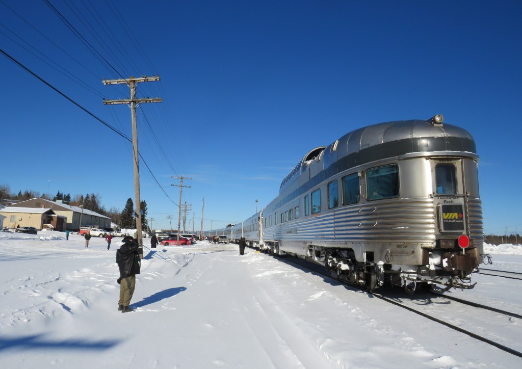
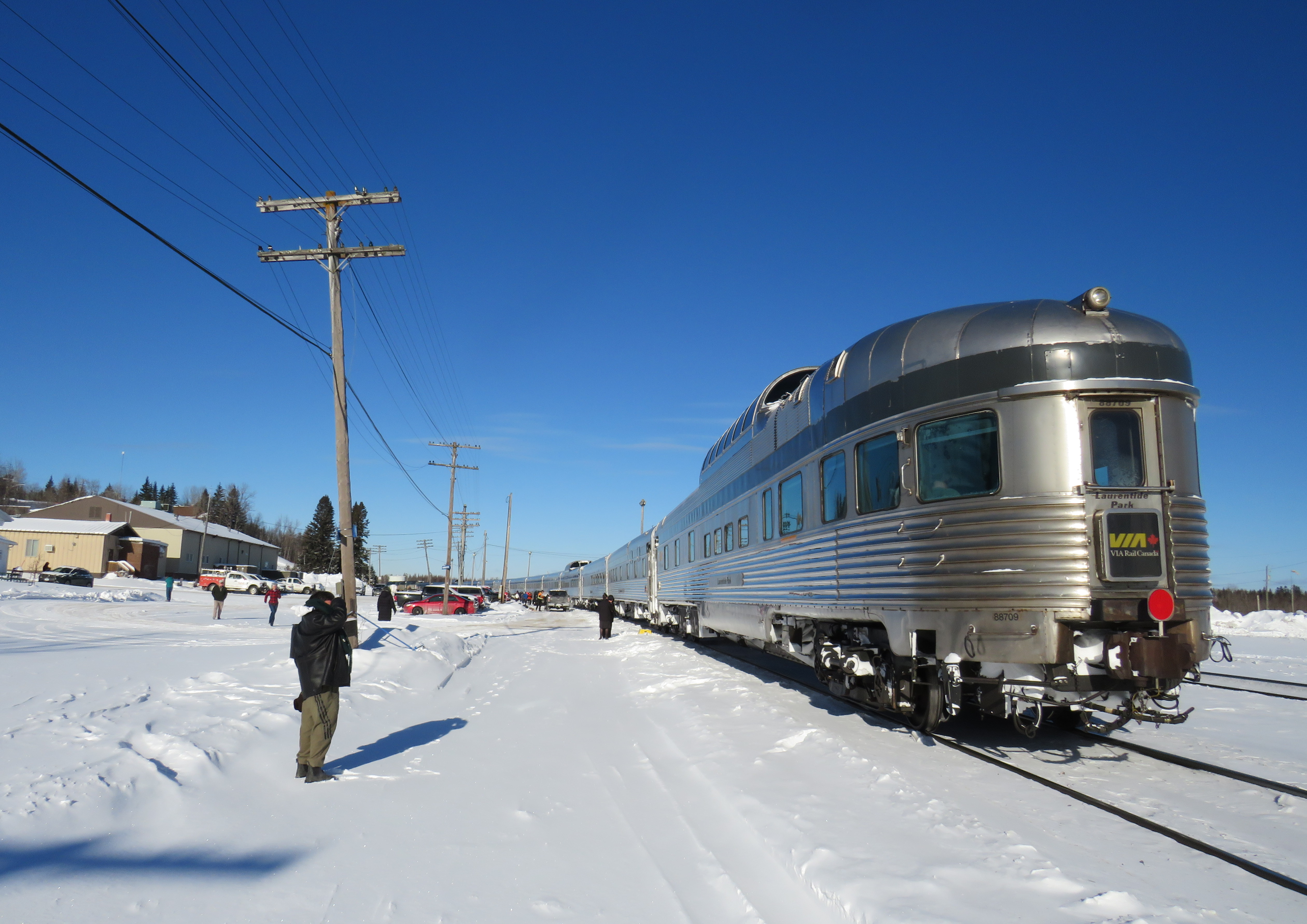
    VIA Train #1 at Hornepayne, Ontario. Normally this stop would be made overnight.

    In late January, I went on a short vacation. Many people, given the short days and cold weather, opt for warmer climes. I, on the other hand, decided to travel to the infamously cold city of Winnipeg, Manitoba. Back in November, VIA Rail offered great deals on winter travel as part of its “Black Friday” sale; a berth in a sleeping car from Toronto to Winnipeg cost $271, with meals included. Winter travel by train can be beautiful, and I had fond memories of my February 2014 trip aboard the Algoma Central Railway between Sault Ste. Marie and Hearst.

    I planned to spend two nights in Winnipeg, including taking in my first NHL game since the pandemic. The Jets were playing on Friday night against the original Winnipeg Jets, the Utah Hockey Club (which moved to Salt Lake City from Phoenix in 2024). I would then travel back east by bus, with a stopover in Kenora, flying home from Thunder Bay.

    Unfortunately, my train from Toronto was delayed by eleven hours, a new record in my rail travel setbacks. The train from Vancouver faced several setbacks due to extreme cold conditions in the Prairies and Northern Ontario, arriving in Toronto over 15 hours late, around 8AM on Wednesday morning. (VIA Rail’s communications were subpar, and though I got two emails advising of a 5:00 PM departure on Wednesday, we did not actually leave until 8:00 PM, about 10 hours late from Toronto.)

    Despite the delays, it was a very pleasant train ride across Northern Ontario in the snow. The cooked-to-order meals served aboard the Canadian, as always, were very good, and service was friendly. The lights in the dome car for our section were turned off, allowing passengers to gaze into the wilderness, even at night.

    As it turned out, I was able to cancel my first night’s stay in Winnipeg without penalty, which was fortunate as the train arrived at 7AM Friday, nearly 12 hours late. But for me, it was fortunate, as by then, coffee shops were opening up in Downtown Winnipeg. An earlier arrival, had the train made up time, would have forced me to find a 24-hour restaurant to wait at, and there aren’t any in the downtown area.

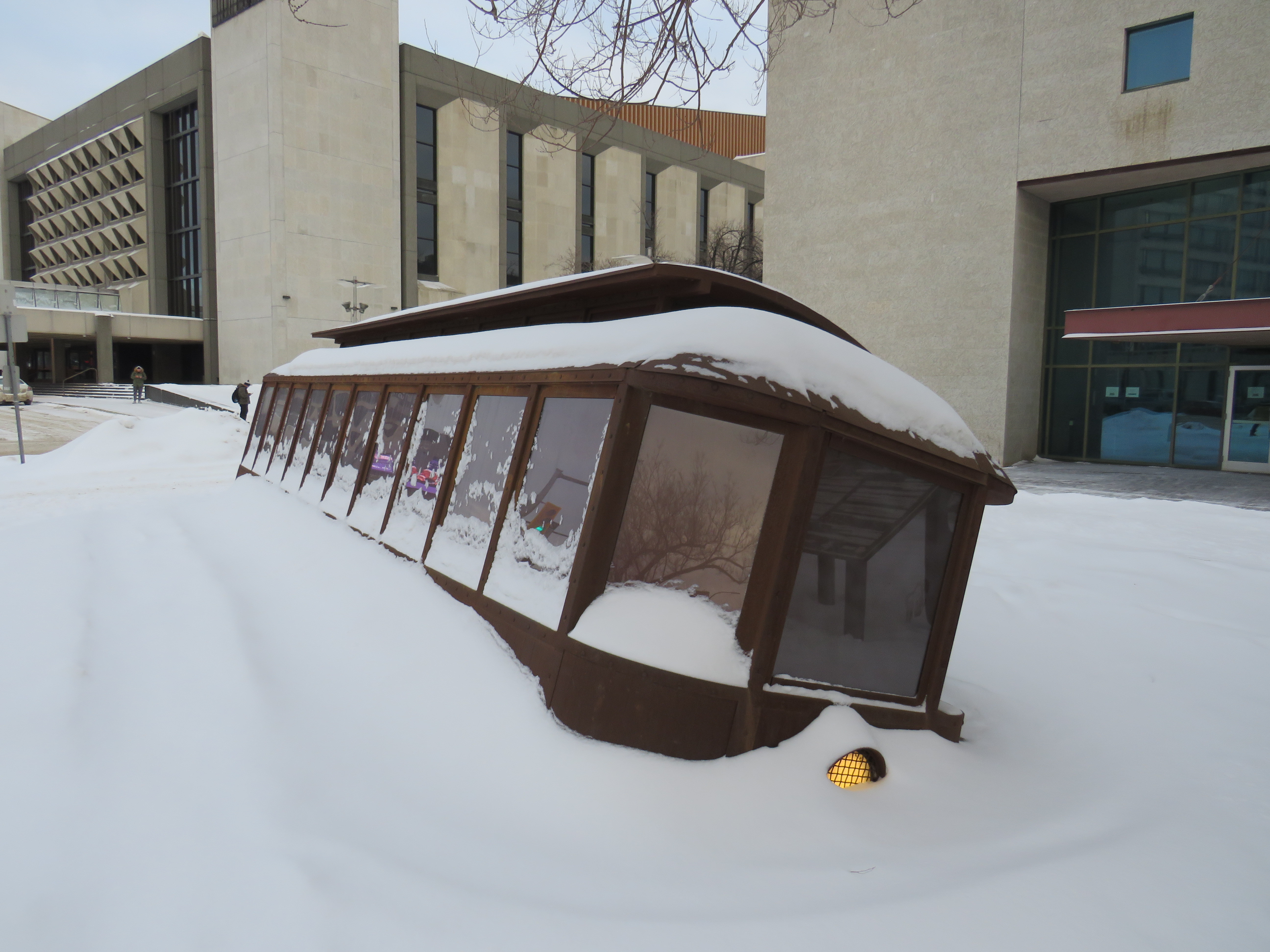
    The monument to the 1919 Winnipeg General Strike; a Corten steel replica of a toppled streetcar, covered in snow
    The monument to the 1919 Winnipeg General Strike; a Corten steel replica of a toppled streetcar across the street from Winnipeg City Hall. It was especially compelling partially buried in snow.

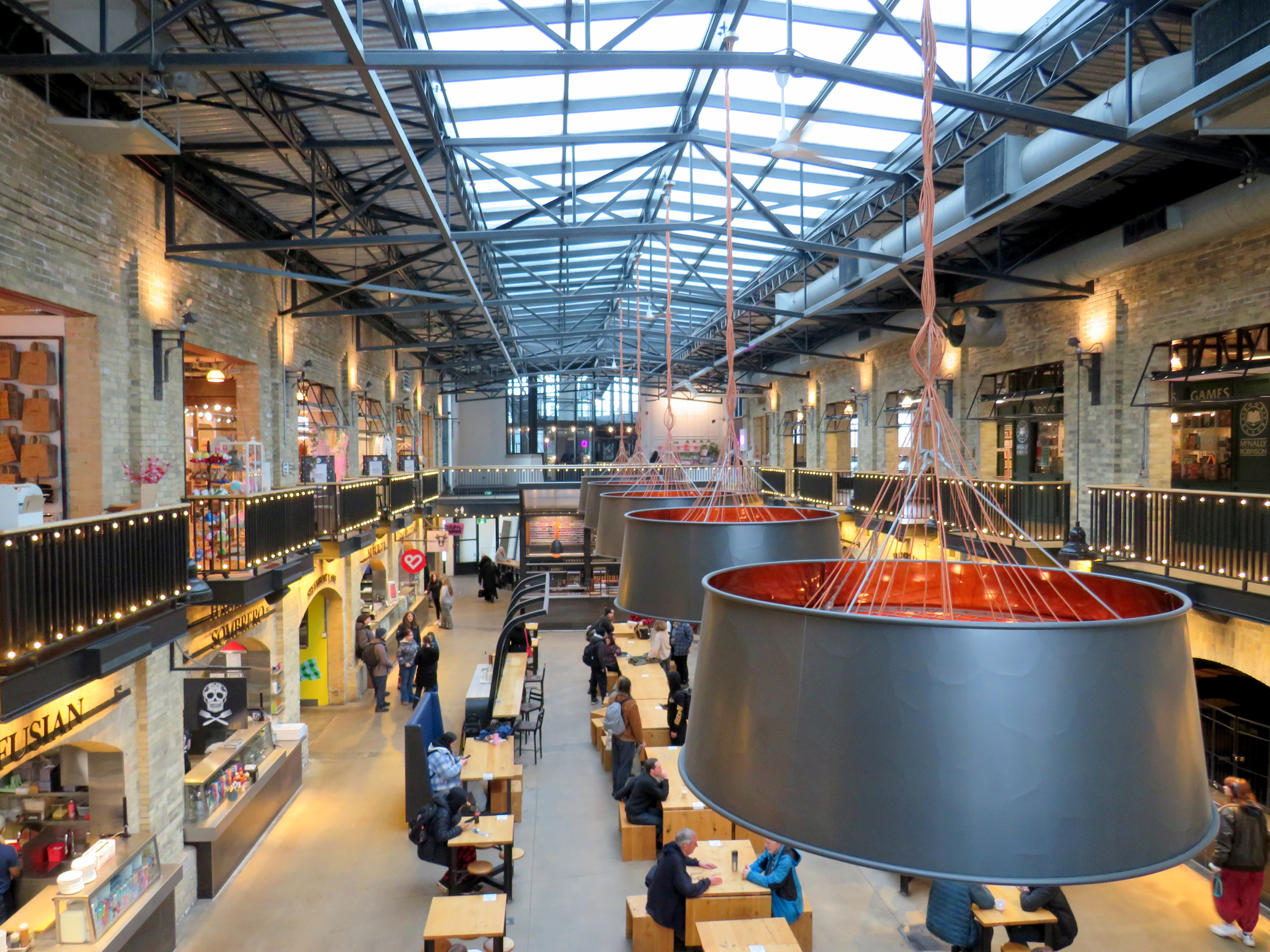
    Though I have been to Winnipeg several times before, this was my first time visiting the city in winter. I was pleased to see how the city embraced the short, dark, cold days. Out at The Forks, where the Assiniboine River joins the Red River, there is a lively marketplace located in former railway maintenance and freight buildings behind Union Station. The complex includes a branch of the local McNally-Robinson bookstore chain, restaurants, cafes, art shops, and other local businesses. There are plenty of tables and seating, with water dispensers and plenty of public washrooms. It is one of Canada’s great public spaces.

    An old two-story brick industrial building with a great skylight, with tables and seating below
    Inside one of the market buildings in the Forks, a former railway maintenance building

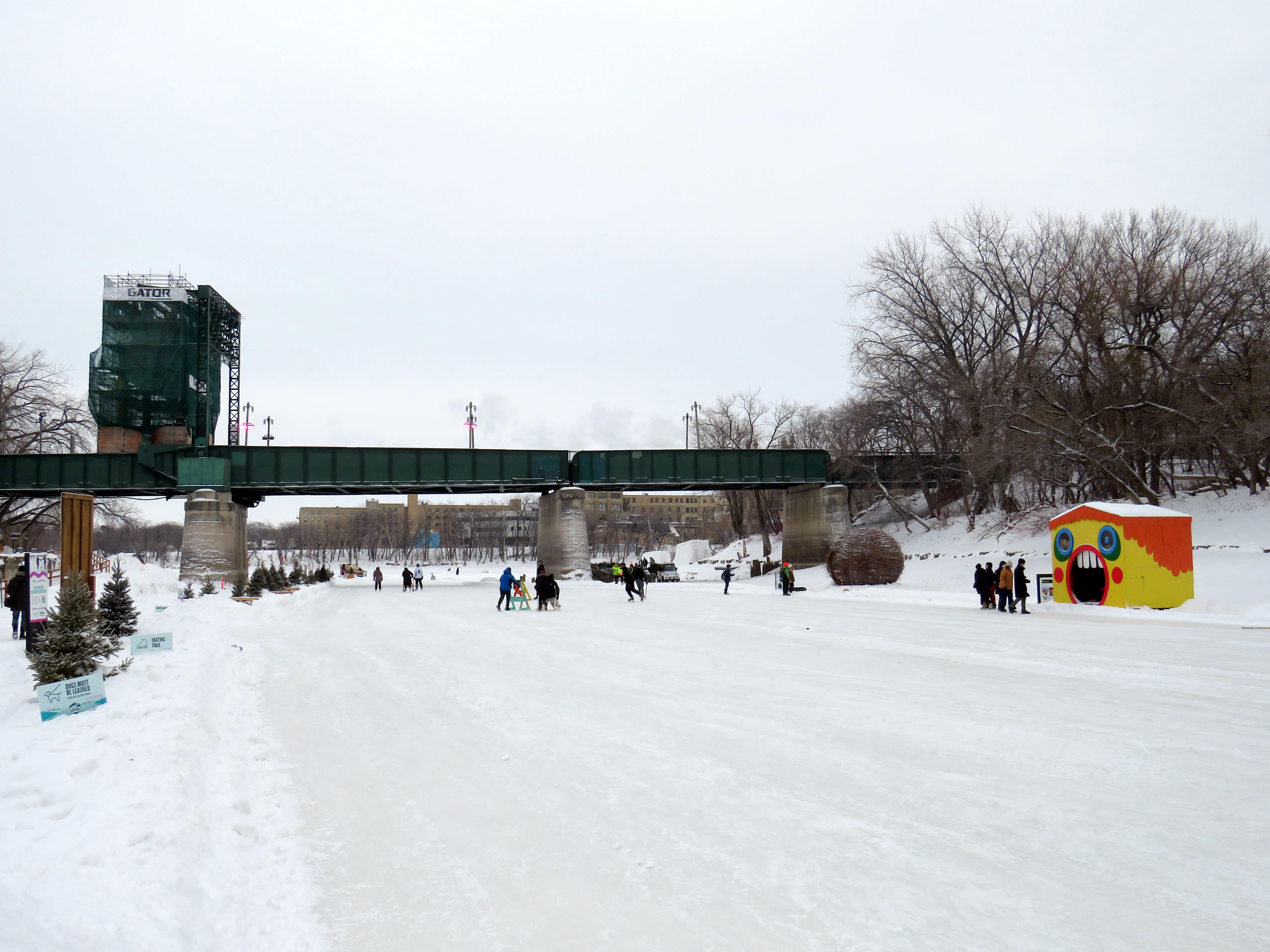
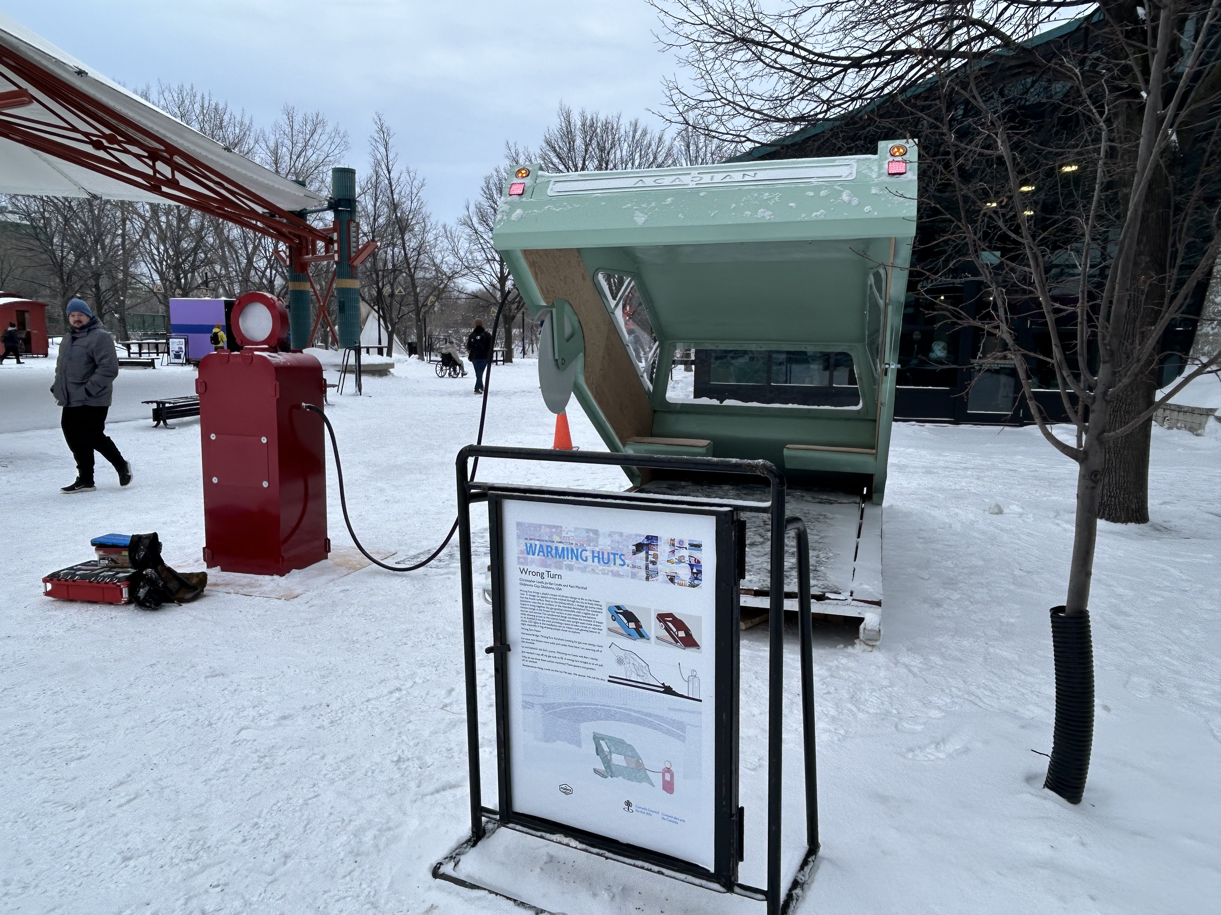
    Outside, there were Warming Huts art stations, many of which were very compelling. Ice skaters have a choice of an artificial ice rink, covered by a tent-like canopy, or getting out on to a cleared natural path along the Assiniboine River.

    Skaters on the Assiniboine River; warming huts along the ice give skaters a place to sit
    One of the Warming Huts, titled “Wrong Turn,” representing a car sinking into an icy river

    After 24 hours in Winnipeg, capped by a great hockey game in a lively arena, I made my way west towards Kenora and Thunder Bay. Kasper, which I last rode in 2019, has an early morning departure from Downtown Winnipeg, at the Balmoral bus terminal, stopping at Kenora, Dryden, and Sioux Lookout. Among the six passengers were a First Nations woman and her companion, returning home from a medical visit. Intercity buses are a lifeline. The Kasper bus was a 12-passenger van, and despite the poor winter weather conditions, it was a safe, comfortable, and friendly service.

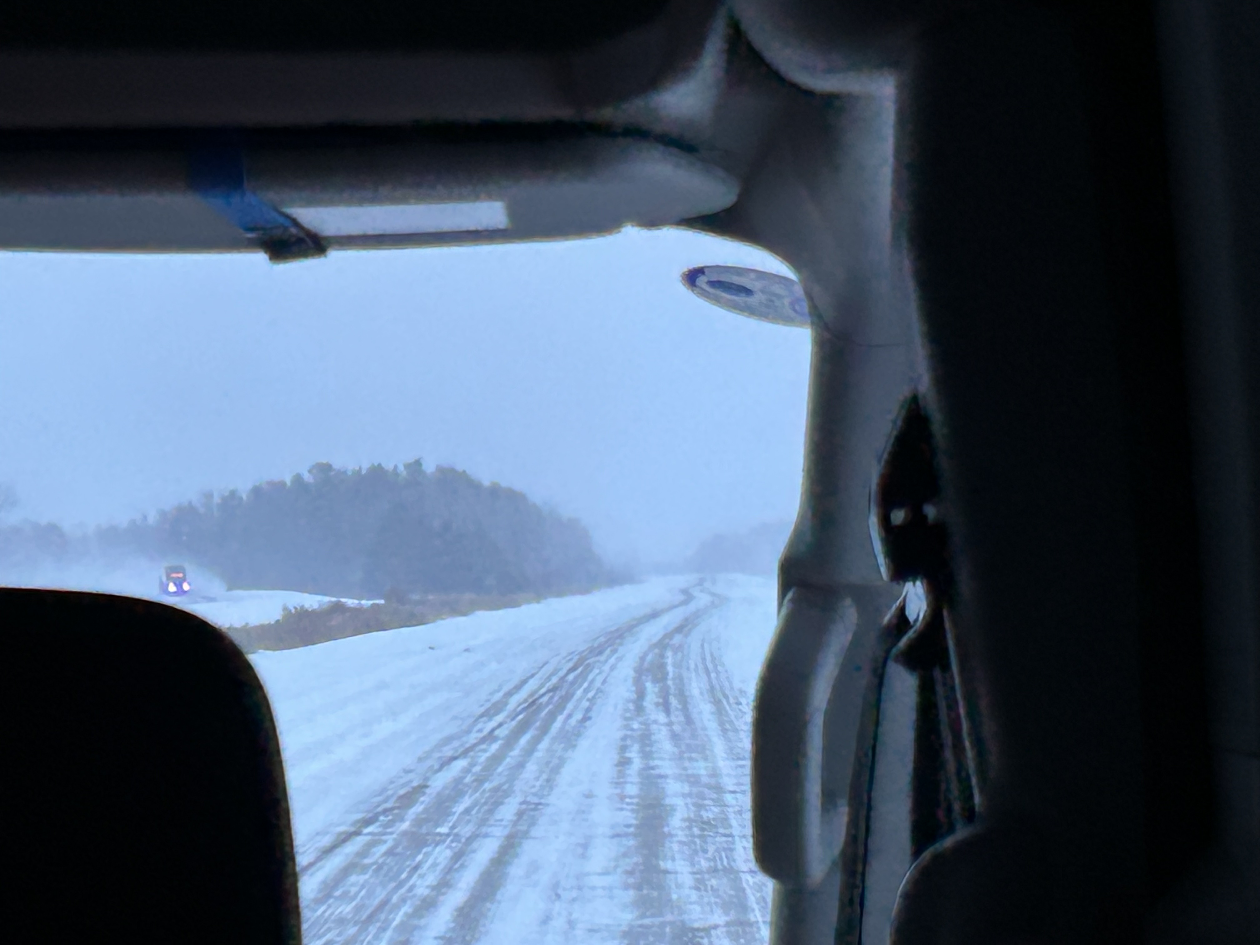
    View out the front window of the Kasper minibus to a snow-covered highway
    Snowy conditions on the Trans-Canada Highway headed east from Winnipeg

    Taking the morning Kasper trip allowed me to spend a few hours in Kenora, population 15,000. The community on the Lake of the Woods is a popular summer vacation spot; this was my first time visiting Ontario’s most westerly city. Kasper’s Kenora stop is at a McDonalds just east of downtown; this gives passengers a chance to stretch, use the washroom, and grab food.

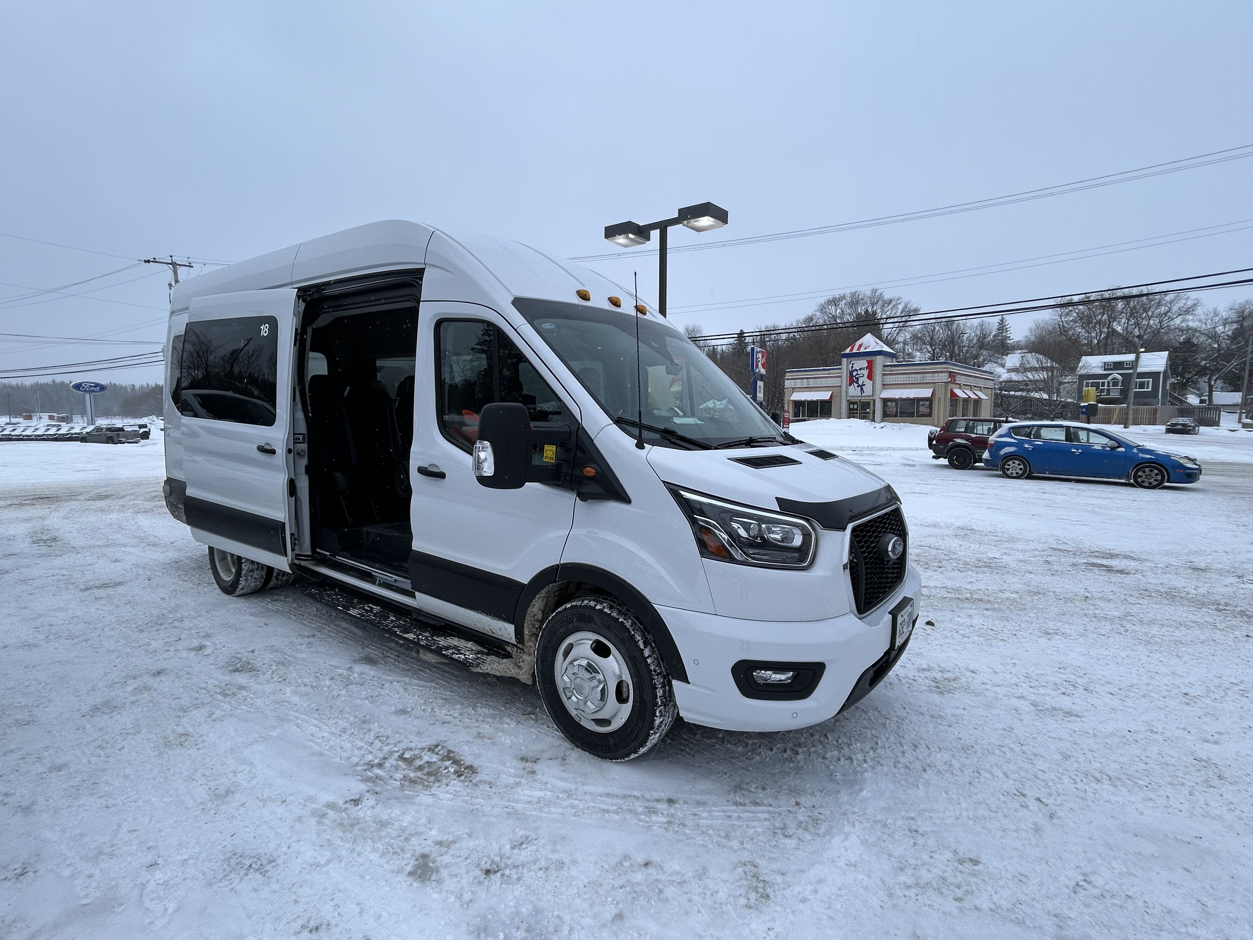
    Kasper minibus - a white van with the side door slid open - in a parking lot
    Kasper Minibus at the Kenora McDonald’s

    The walk from the McDonald’s back towards downtown was pleasant. I was greeted by several deer, in their winter coats, comfortable wandering in a residential neighbourhood.

    Three deer standing in the snow adjacent to a house in Kenora
    Northern white-tailed deer in their heavy winter coats

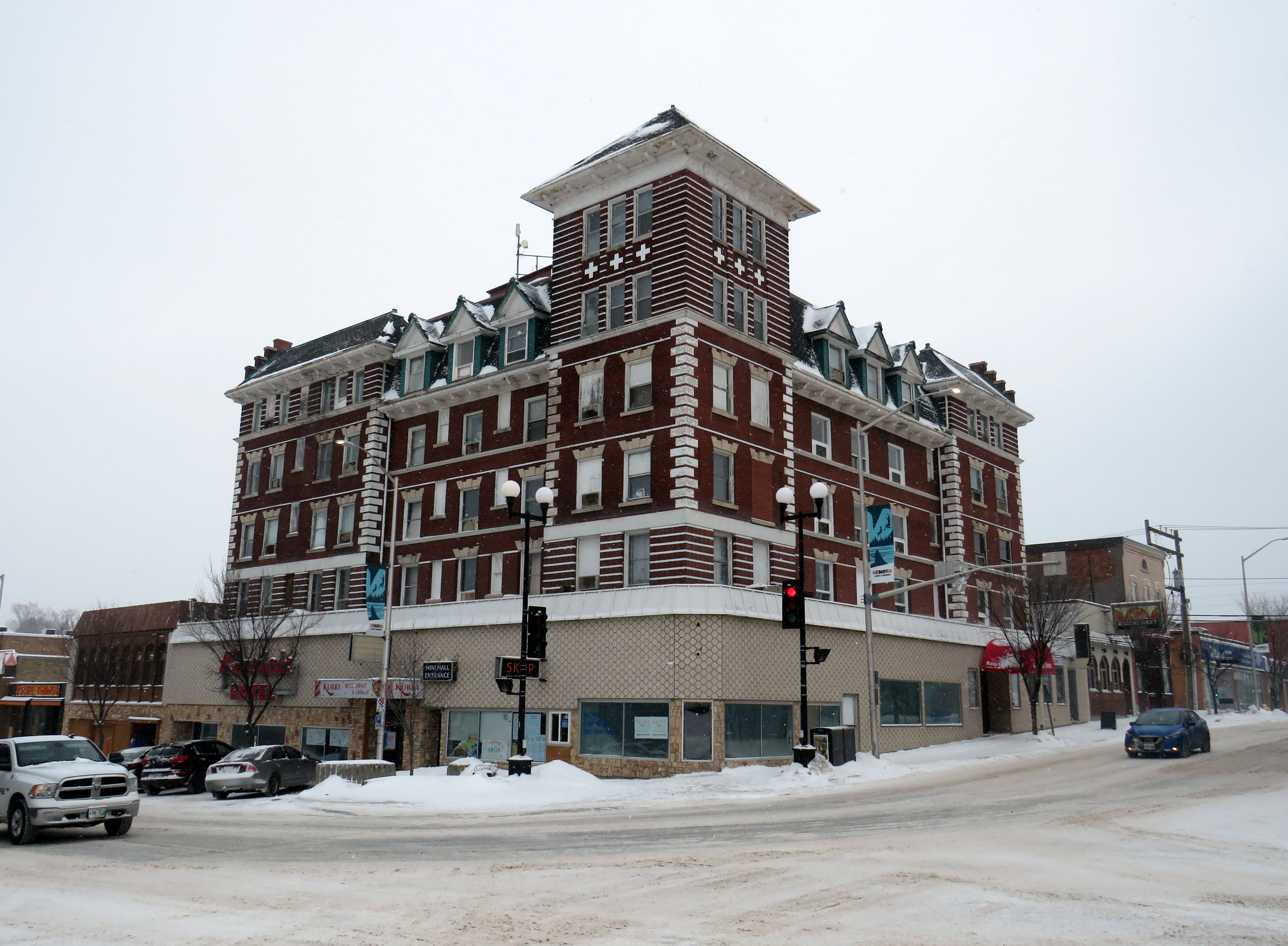
    Kenora’s downtown is small, but blessed with a solid collection of historic buildings, including the old post office (now city hall), the district courthouse, a two-storey Canadian Pacific railway station (which served VIA until 1990), and the five-story Kenrica Hotel. The hotel has seen better days — the ground floor defaced by an unfortunate 1950s-era streetfront — but it still has good bones.

    Kenrica Hotel, on the main corner in Downtown Kenora

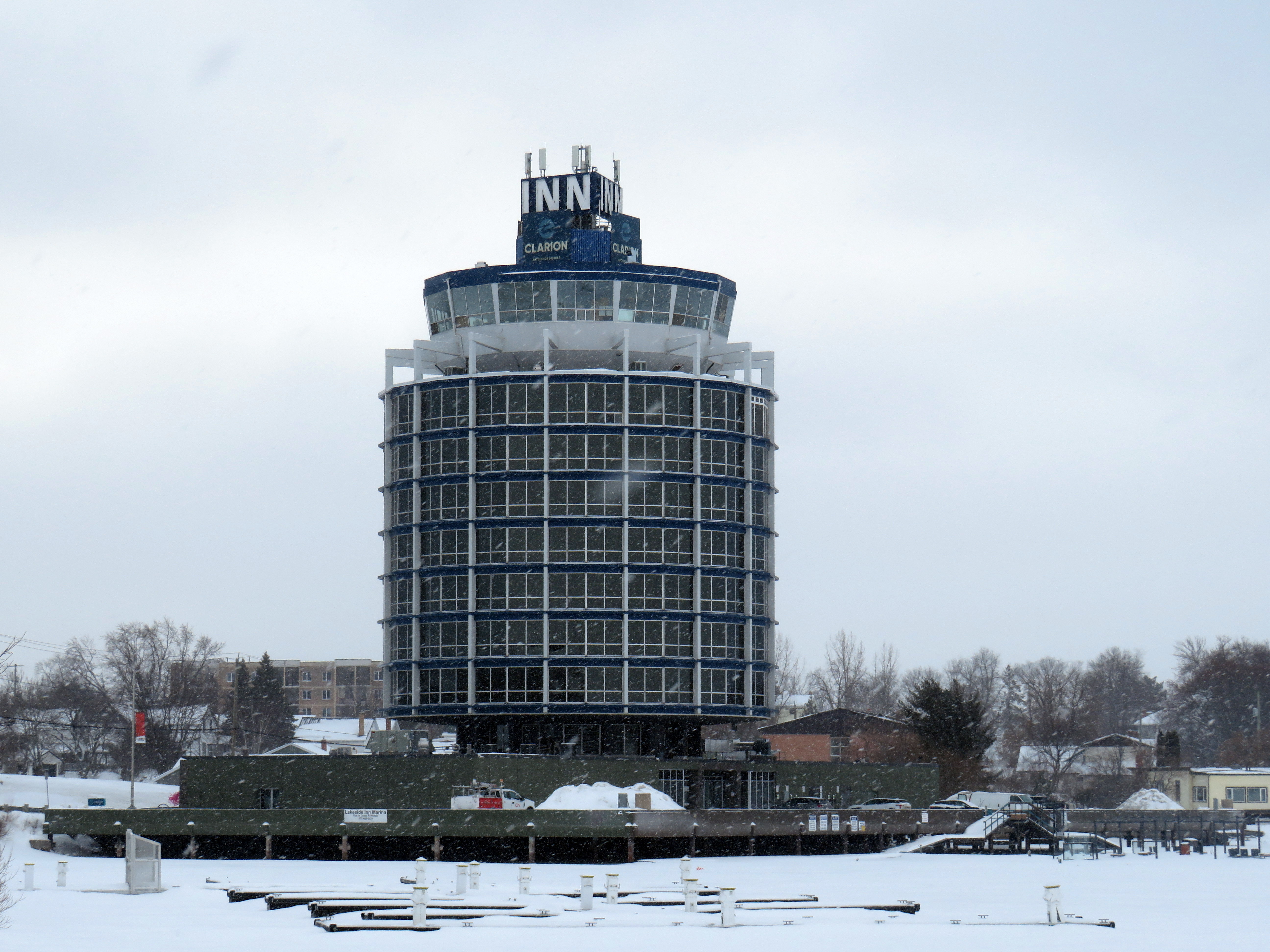
    South of Downtown Kenora, on the lakefront, a cylindrical hotel, ten storeys high, overlooks Lake of the Woods, with a marina at its base. The hotel’s mid-century modernist form is unusual for Ontario, which makes it stand out even more.

    The Clarion Inn on Lake of the Woods

    Many towns and cities in Northern Ontario feature a roadside attraction. Sudbury has the Big Nickel, Wawa has a giant goose, and White River has Winnie-the-Pooh. Kenora’s is a giant sculpture of a muskie fish, called “Husky.”

    “Husky the Muskie” – Kenora’s roadside attraction

    Ontario Northland operates a bus six days a week between Winnipeg, Thunder Bay, Sault Ste. Marie, and Sudbury, with operator changes at Thunder Bay and Sault Ste. Marie. Between Kenora and Thunder Bay, the route alternates, with service to Fort Frances and Atikokan three days a week and to Dryden and Ignace the other three days. Passing through Fort Frances (where the bus stopped at a McDonald’s there for a rest break), I finally visited every county, district, and region in Ontario, with Rainy River District being the final one.

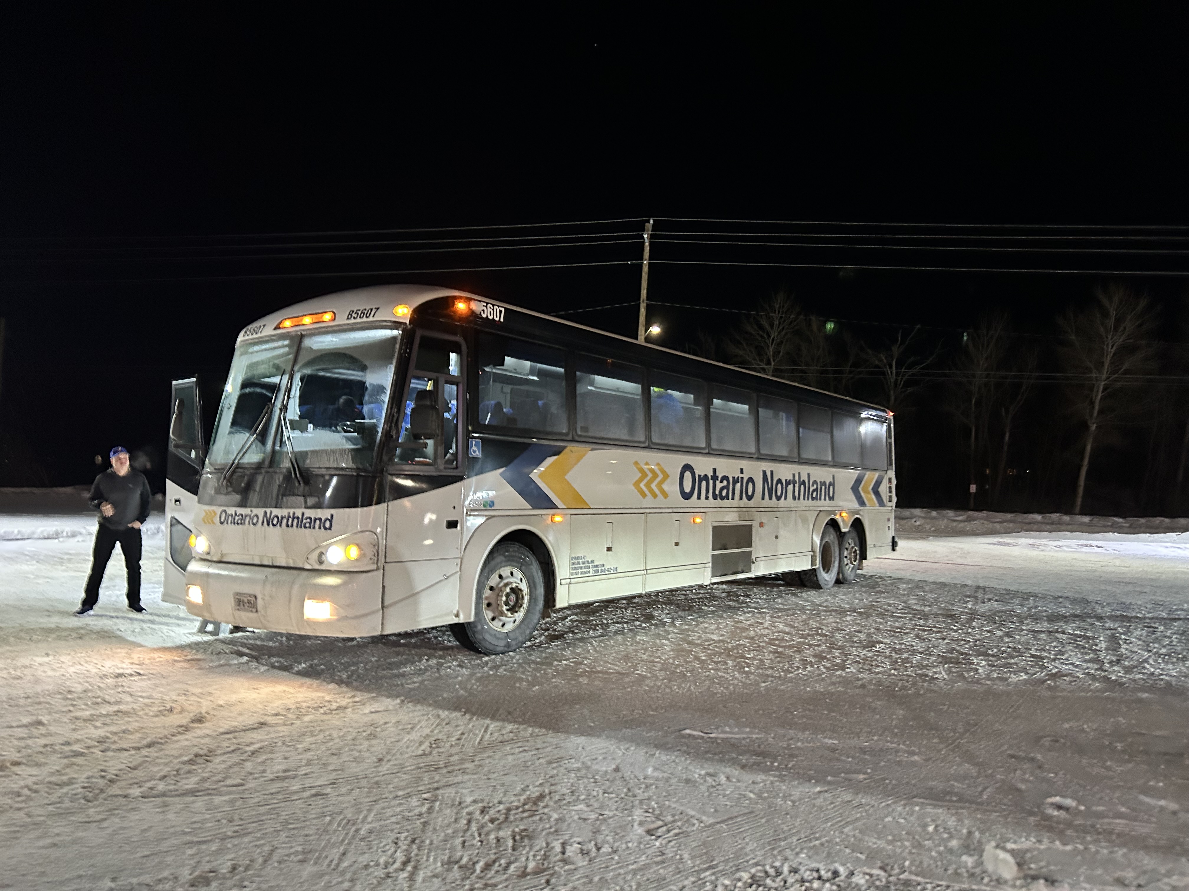
    Ontario Northland coach bus in a snow-covered McDonald's in Fort Frances, Ontario
    Ontario Northland bus in a snow-covered McDonald’s in Fort Frances, Ontario

    The Ontario Northland bus driver that day was exceptional; because of a winter storm, Highway 17 was closed near Batchewana Bay; as such, the bus would not continue past Thunder Bay. Though we were nearly an hour late arriving into Thunder Bay due to road conditions, the operator was willing to continue past the Thunder Bay Ontario Northland depot to drop anyone off continuing to the hospital campus. I was also able to get off the bus by my hotel.

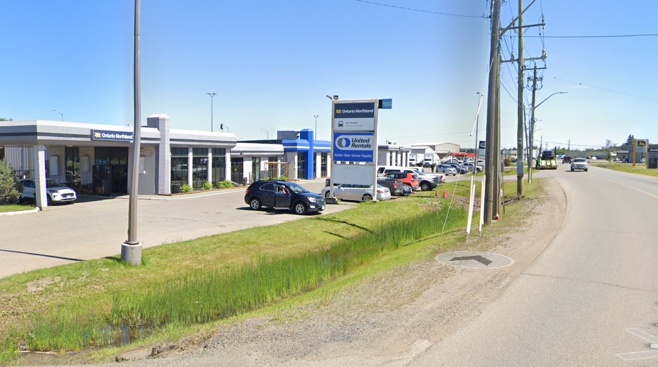
    The Ontario Northland depot at Thunder Bay is not in a very good location, in an industrial area off Highway 61 near the Thunder Bay airport, without direct local transit connections or adjacent amenities. At least a stop at Thunder Bay Regional Health Sciences Centre (which has local transit and is near Lakehead University) is also provided.

    Google Streetview capture of a small bus station in an industrial area
    Ontario Northland Thunder Bay depot, located in an industrial area on a road without sidewalks (Google Streetview)

    Difficult winter road conditions make travel across the North a challenge; this is why professional and safe bus and train operators are so important for getting around.