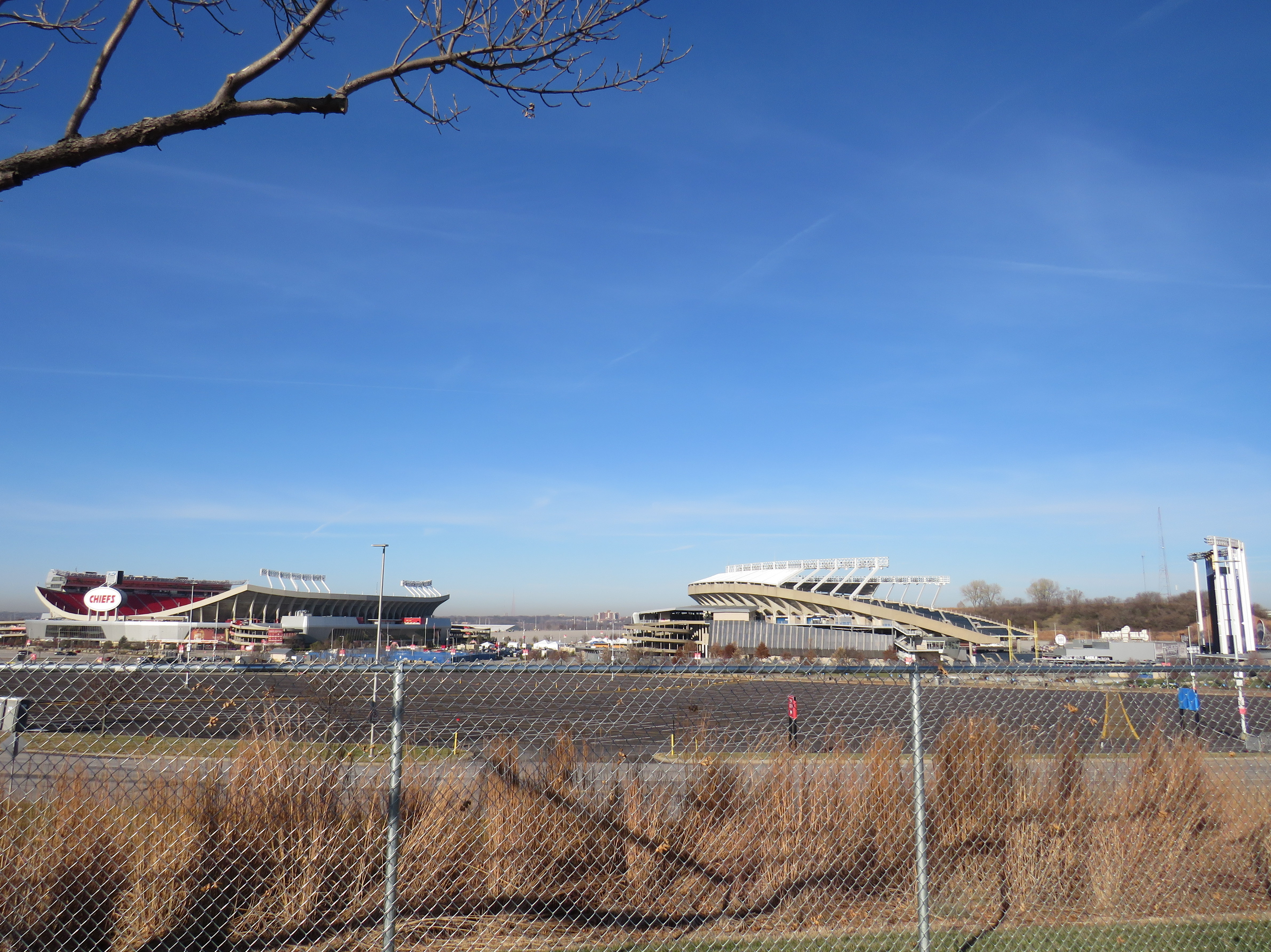
Truman Sports Complex, Kansas City, Missouri. Kauffman Stadium (MLB Royals) on right, Arrowhead Stadium (NFL) on left. Kauffman Stadium has the lowest Walk Score in the league. Both sports venues have especially poor transit access, even for Kansas City.
One of the best — or worst — experiences in North America can be going to see a ball or hockey game, concert, or other special event at a sports arena or stadium. Perhaps you want to make a day of it, taking in the city, going for a meal or drinks first and meeting up with friends or family. Or maybe you want just to park in a lot hours before game time and have a cookout.
But the trip to and from that venue can make or break the experience. Does it involve hours in gridlock? Does it mean a long line in the outdoors for a shuttle bus? Or can it mean a short walk to a transit stop and quickly getting on your way?
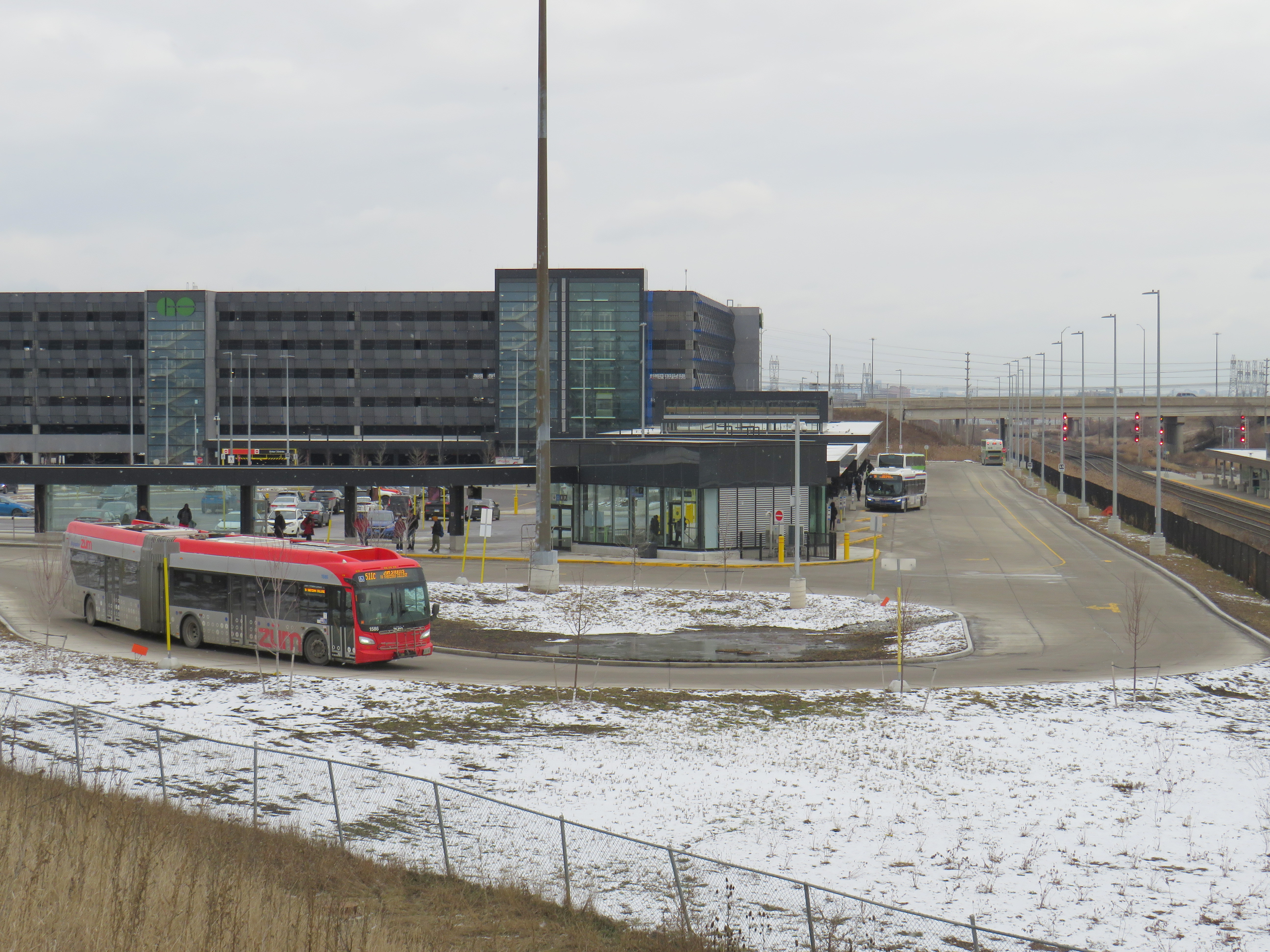
Target Field, in Downtown Minneapolis. Both light rail lines stop right next door.
Last summer, I got to see the Toronto Blue Jays play at Target Field in Downtown Minneapolis. The Jays have a Canada-wide fan base, and the Twin Cities have the closest baseball venue to places like Thunder Bay, Winnipeg, and even Regina and Saskatoon. It felt like a home game with a very pro-Toronto crowd.
Earlier that day, I noticed plenty of people wearing Jays hats and jerseys that were making the most of their road trip. They flooded local restaurants and bars. They checked out museums and the city’s signature parks. The Mall of America, at the other end of the Metro Blue Line LRT, was also full of Canadians. Minneapolis has a lively downtown, with very good bus and rail connections to the airport, the malls, St. Paul, and elsewhere.
Walkability and transit access are the key fostering a great fan experience, for promoting safe, accessible, and sustainable travel to and from the venue, and for supporting local businesses. Though economists and urban experts will — rightly — dispute the economic benefits of subsidizing new sports stadiums, if they must be built, they should allow spectators to get around without a car as much as possible to reduce congestion, curtail impaired driving, and create a vibrant urban environment that everyone can enjoy.
I used Redfin’s Walk Score tool to rank the venues of six major leagues in Canada and the United States: the CFL, MLB, MLS, NBA, NHL, and NFL; I also comment on their transit connections. Toronto’s three venues do very well, as do NBA/NHL venues in major cities like New York, Washington, and Los Angeles. Not surprisingly, football stadiums — especially NFL venues — do poorly.
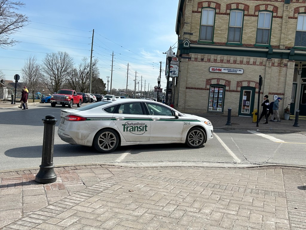
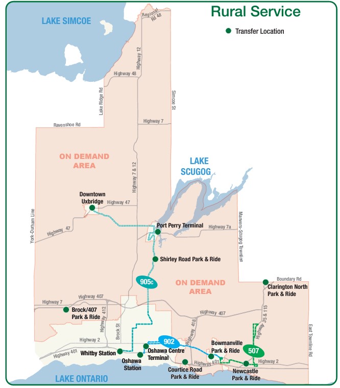
Earlier in March, as part of my quest to visit every town, city, and regional government office in the Greater Toronto and Hamilton Area (GTHA) without a car, I took my first on-demand transit rides in a decade. This was necessary to visit Brock Township’s municipal offices, located in the village of Cannington, north of Port Perry. (I will discuss more about this project in the coming weeks.)
Brock Township’s municipal offices, at right, sits in the heart of the village of Cannington
Brock Township is the GTHA’s most rural and least populated municipality, home to just over 12,000. Until April 2023, GO Transit ran a daily bus service between Whitby GO Station, Port Perry, Cannington, and Beaverton (Brock’s largest community), but was cancelled after a ridership review. (GO has quietly cancelled several other bus routes that don’t cross county or regional boundaries in the last decade.) However, Durham Region Transit (DRT) offered an alternative: on demand transit.
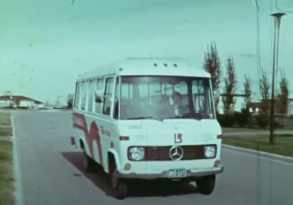
On-demand transit is not a new idea. In the 1970s, GO Transit operated experimental dial-a-bus services in suburban parts of Toronto, offering door-to-door service to and from the nearest subway station or a designated transfer point to frequent fixed-route bus services. In Bramalea, Chinguacousy Township operated Bramalea Dial-a-Bus, which brought residents to local employers, schools, and Bramalea City Centre. The service was replaced by fixed-route services when Brampton Transit was established shortly after amalgamation, merging the dial-a-bus operation and a privately contracted transit service in the old town of Brampton.
Still image from “People on the GO,” a 1973 film by the Ontario Ministry of Transportation and Communications. Bramalea’s Dial-a-Bus’ pink “lazy-b” logo was adopted by the successor transit agency, Brampton Transit during its first decade.
“Trans-Cab” services continue to be used in outlying areas of communities such as Hamilton, Peterborough, and Sudbury, where transit agencies partner with local taxi companies to allow transit riders to begin or end their journey outside of urban or regional fixed-route areas, often at a premium fare.
My first on-demand transit experience was taking Oakville Transit’s “zone bus” service in 2005. At the time, there was no fixed-route Sunday bus service in Oakville, but there were four zones for which you could call and request a ride, with a bus picking you up at the nearest bus stop. If your destination was in a different zone, you would transfer to another bus at Oakville GO Station. Today, Oakville offers on-demand service during late evenings from the Oakville GO Station and in new and outlying subdivisions where there are no nearby scheduled services.
My other previous on-demand transit experience was in Winter and early Spring 2012, after I suffered a broken knee cap and had to rely on Toronto’s Wheel-Trans paratransit system. Though I was fortunate to be able to get around using Wheel-Trans during a temporary disability, it was often a frustrating experience trying to book trips, especially for social or leisure purposes. I quickly came to prefer the conventional system and used it as much as I could while recovering from that injury.
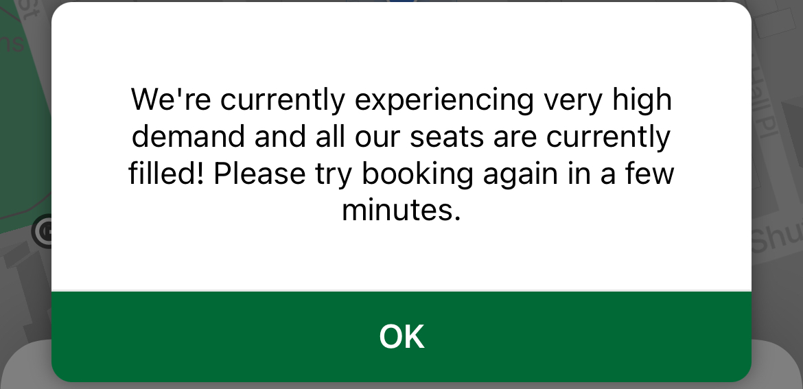
A common message while trying to book rides on DRT On-Demand
In 2024, there are over a dozen transit agencies providing on-demand transit services in Ontario and Quebec, either as standalone operations or in conjunction with fixed-route systems. You can find them in my interactive transport maps.
Modern on-demand services, though they are typically accessed by mobile apps these days, present some of the same challenges, including cumbersome booking processes as well as high demand and limited availability for next-day and same-day trips.
DRT offers on-demand transit trips for customers with disabilities (who are eligible for door-to-door service anywhere in the region), rural areas, and in designated urban areas (where pickups and drop offs are made at signed bus stops).
DRT rural services, showing the rural on-demand service area and transfer points to fixed-route services (including GO buses at Downtown Uxbridge, Brock/407 and Clarington North)
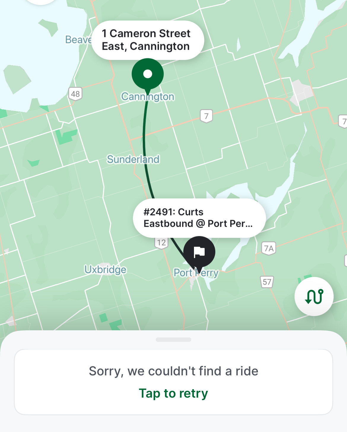
As Brock Township was the most distant and most difficult town hall in the GTHA to reach by public transport, I tried to book for the first day of my visits: Monday, March 11. After downloading the DRT app and inputting my information (name, email address, mobile phone number) I tried to book a return trip from Port Perry (which has a scheduled route connecting it to Uxbridge, Oshawa, and Whitby) the day before.
At one point, I was able to get an outbound trip around 12:00 PM, but I could not get a return trip after multiple attempts. After failed attempts to book each ride, the app would go back to the beginning, requiring the user to input most of the same information multiple times. I gave up and went to northern York Region instead. After midnight, early Monday morning, when one could book trips for the following day, I tried again and managed to get a return trip that met my needs for Tuesday the 12th.
Unable to book a return trip from Cannington to Port Perry for Monday, March 11, 2024
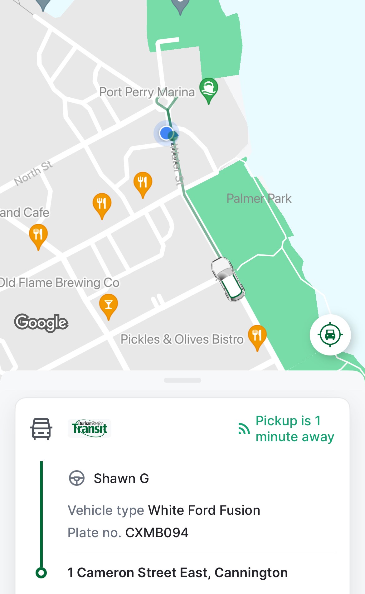
Once I booked my trip, the rest of the experience was smooth. I got a text reminder of my upcoming trips, and on the app, I could track my upcoming ride, much like Uber or Lyft, with the driver’s name, vehicle description, and location. Each time, I paid with my Presto card, with DRT charging the same fare for on-demand as for conventional bus service. Drivers were professional and friendly. I was the only passenger for both trips, though they are often shared, and minibuses — such as accessible paratransit vehicles — are used for passengers with disabilities or larger groups.
Notice of pickup
I learned that the service could be quite busy and the app sometimes problematic — there is also a toll-free number that passengers can call, and that sometimes the telephone agent would be able to find matching rides that the app would not show.
I was lucky that my trip was discretionary, but I could see how on-demand transit can be difficult and/or frustrating to use.
Though DRT has restored most urban bus routes (many were suspended during pandemic-related restrictions), it still struggles to meet demand on its busiest corridors, especially those serving colleges and universities in Oshawa, Whitby, and Scarborough. A fire in one of DRT’s garages last summer hasn’t helped either. As a result, some urban areas in Ajax, Pickering, Whitby, and Bowmanville still have on-demand areas where fixed-route services have yet to be restored.
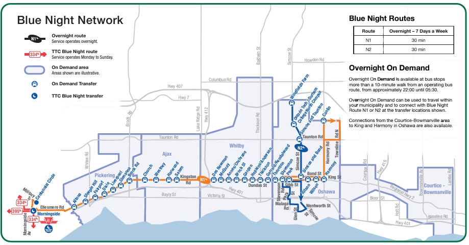
On-demand transit has its place, especially in rural and outlying suburban areas, or during times of low demand. If done right, it provides affordable mobility to people who might otherwise go without, and as an alternative to driving a car or paying an expensive taxi fare for those with travel options. Durham Region has done a good job covering the entire region with fixed-route and on-demand services, especially at night, where the urban south enjoys 24-hour transit access.
DRT overnight services, which includes two scheduled buses and five on-demand zones in the urbanized part of the region.
Despite Durham’s efforts, on-demand services can be costly to operate, less flexible for prospective passengers, and be frustrating to use, though they can cover much larger areas than line haul routes. Scheduled, fixed-route buses offer predictable, simple, and often faster service than point-to-point bespoke services. On-demand transit has its place, but it is only one tool in a vast toolbox of mobility solutions. This was true in the 1970s and remains true today.
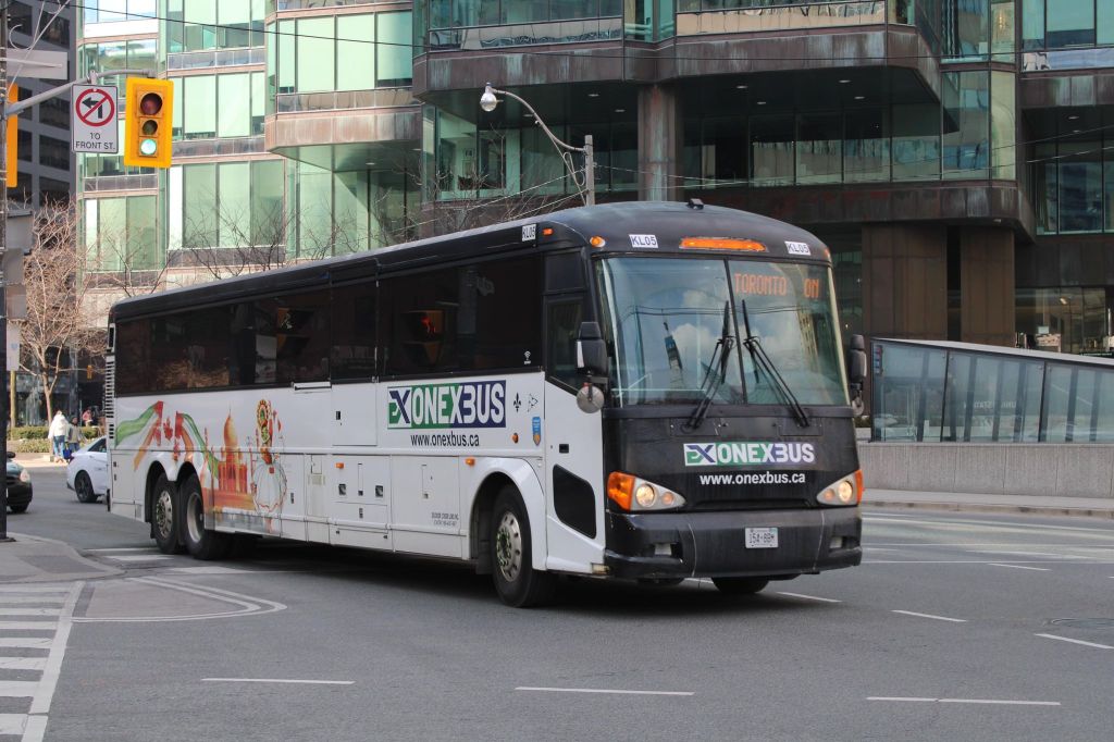
Intercity Bus minibus on York Street at Royal York Hotel, February 13, 2024
In late 2023, yet another intercity bus operator started serving the busy Toronto-London corridor, operating between Toronto and London. With the rather unimaginative name of “Intercity Bus,” this new company operates up to four trips a day between Toronto and London. It has since added a route between London and Sarnia; it also plans to run the much-needed link between London and St. Thomas.
There are now five bus companies on the Toronto-London route: Intercity Bus, Onex Bus, Trailways, and Megabus (in a partnership with local coach operator Badder Bus). Those five companies compete with VIA Rail, which operates up to six daily trips between the two cities, with up to 28 round trips daily between them.
Onex Bus departing Downtown Toronto, photo kindly provided by Chris Whitfield
VIA Rail remains the fastest and most comfortable option, with full-service staffed stations in Downtown London and Downtown Toronto, but its fares are typically the most expensive. The private coach companies offer cheaper fares, and several of them directly serve Western University and/or Fanshawe College. Megabus has partnered with Trailways; its booking website includes both the Toronto-London-Detroit Trailways trips and the Toronto-London trips operated by Badder Bus. Otherwise, one must go to the individual companies’ websites to figure out the complete schedule and where each service stops at.
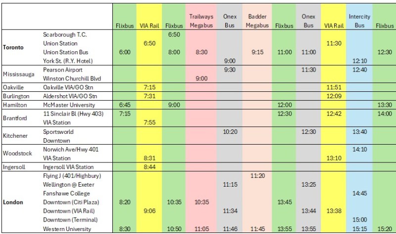
The schedule below, saved as a PDF, includes all regular weekday trips between Toronto and London along with intermediate stops.
In Toronto, Flixbus, Trailways and Megabus/Badder call at the Union Station Bus Terminal, where connections can be made to other Flixbus and Megabus services, along with GO Transit and VIA Rail in the adjacent railway hub. Onex and Intercity Bus make use of a curbside stop on York Street next to the Royal York Hotel, which is shared with the Toronto Island Airport shuttle. These three stops are all within a few minutes’ walk from each other. Some Flixbus runs to London begin and end in Scarborough, and many buses also make a stop at Pearson Airport.
In London, every bus carrier makes a curbside stop at Western University, the terminus of all bus trips from Toronto except Trailways, which continues to Windsor and Detroit. All carriers except Badder/Megabus also serve Downtown London. However, each has a different stopping location, with Flixbus and Trailways opting for a curbside stop on York Street near CitiPlaza (London’s downtown mall), and Onex utilizing the driveway at the VIA Rail station.
Curbside stops are convenient for bus operators, as they’re easy to pull up to and depart from, there’s no rent, staffing, or maintenance costs. With smartphones and online ticketing, there is no need for a ticket agent, and passengers can be notified by text and/or email of any delays or changes. But curbside stops have no shelter and no washrooms.
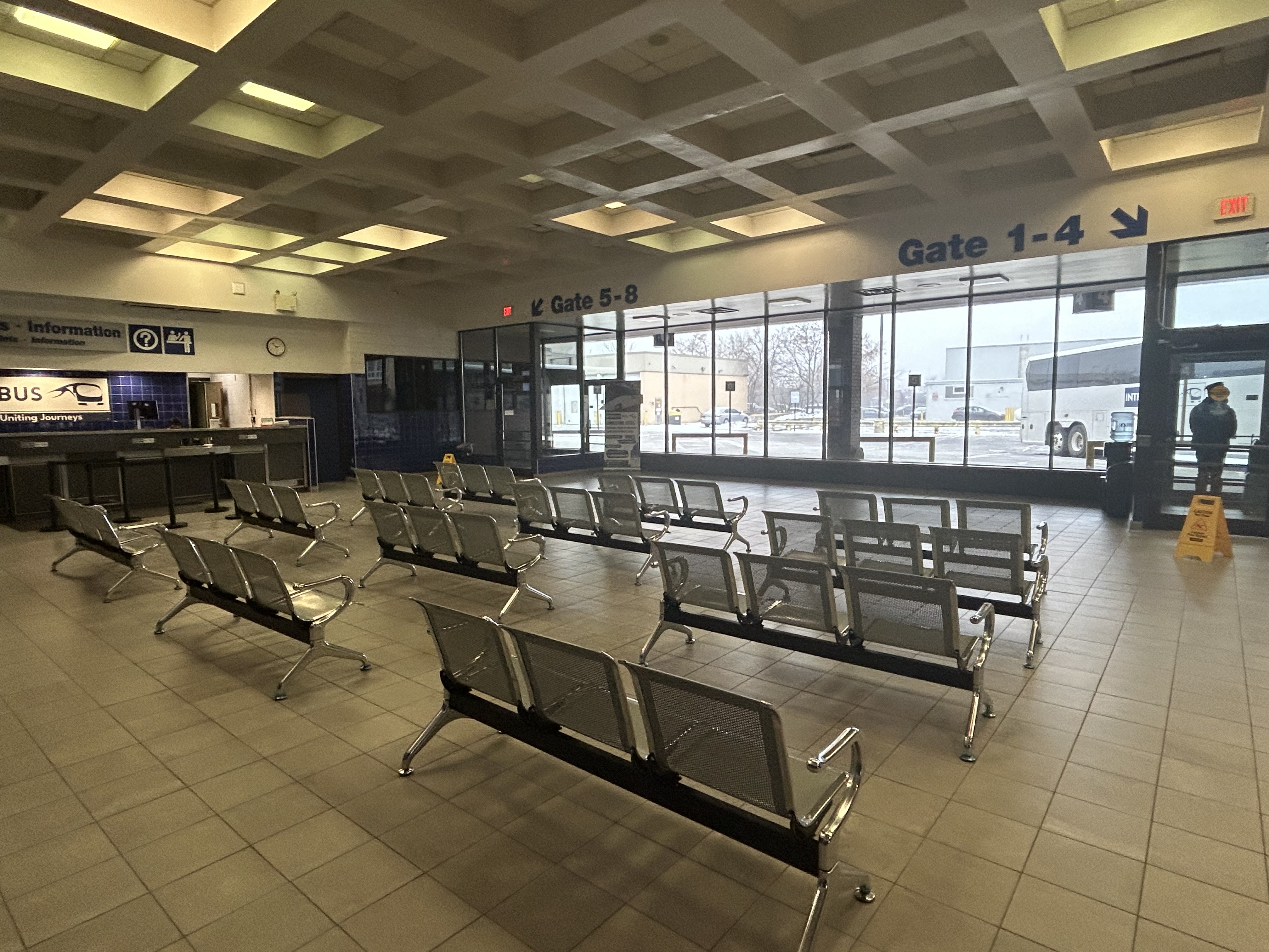
Interestingly, Intercity Bus has taken over the old Greyhound terminal in Downtown London. At its peak, London’s terminal had dozens of daily departures to cities and towns all over Southwestern Ontario, serving multiple carriers at a time when intercity carriers acted more like a unified network.
The old London Greyhound terminal
The terminal offers seating, washrooms, and is staffed by an agent, a rarity in the post-Greyhound world. The washrooms are especially essential if — as on my recent trip — the bus does not have an on-board lavatory. These new smaller carriers save fuel and labour costs by operating smaller vehicles and matching capacity with demand. They often operate older coaches and minibuses.
Inside the Intercity Bus terminal
I recently took Intercity Bus from Toronto to London to try out Ontario’s newest carrier. Though the 12:10 departure from Toronto was on a minibus similar to those used by rural transit operators (there were only 10 passengers on that Tuesday afternoon run), the ride was comfortable enough, with cloth bucket seats. It was a fast trip: it skipped stops in Woodstock and Fanshawe College, and the driver made very good time on Highway 401, at times exceeding the posted speed limit by 25 or 30 kilometres per hour. Even with a stop for fuel (the driver asked if it was okay), we arrived 15 minutes early at the London terminal.
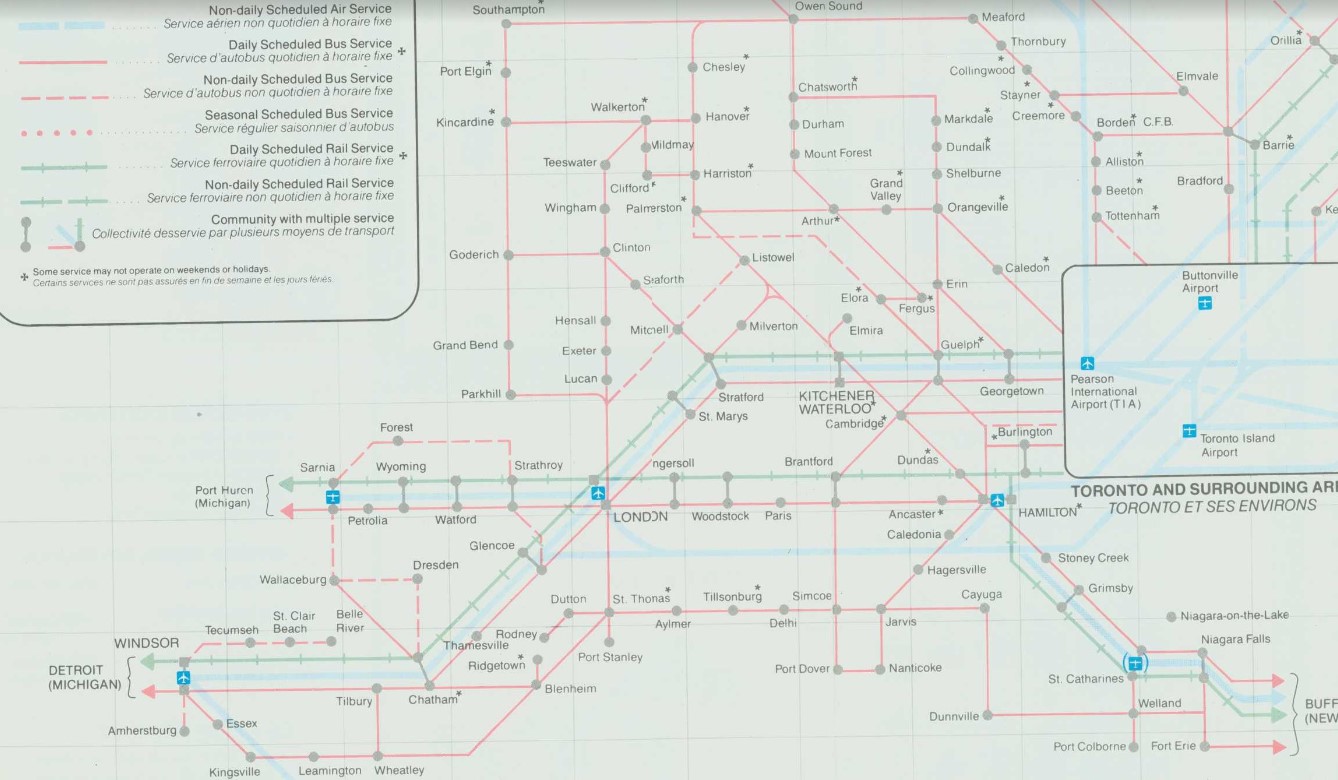
At its peak in the 1980s, there were over two dozen daily departures from the London bus terminal. There were frequent Greyhound routes to Toronto via Kitchener and via Brantford and Hamilton as well as to Chatham, Windsor, and Detroit; there were also daily Greyhound routes to Niagara Falls via St. Thomas, Simcoe, and Welland and to Strathroy, Sarnia and into Michigan. Regional coach operators also ran from the Greyhound terminal to Stratford, Goderich, Rodney, Walkerton, Leamington, and Port Stanley. Today, there are just four — three to Toronto and one to Sarnia.
Detail from 1990-1991 Ontario Intercity Transportation Guide, showing bus routes from London to points throughout Southwestern Ontario
My hope for the next year is for more stability in the intercity bus industry, perhaps even mergers between some of the smaller players. Onex and Intercity Bus, which compete on the Toronto-London route and offer a similar service, could be beneficial, especially if it results in a network of routes radiating out of London, starting with Intercity Bus’s London-Sarnia service, its planned St. Thomas route, and Onex’s London-Stratford-Kitchener run.
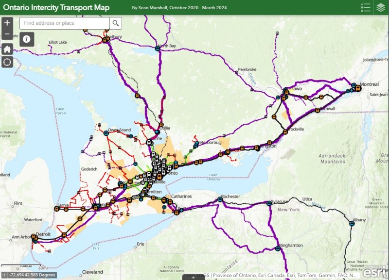
I updated my map of Ontario’s intercity transport services for March 2024, including the new Onex Bus and Intercity Bus routes in Southwestern Ontario. There are new services in East Zorra-Tavistock, connecting to Stratford and Woodstock, and in North Grenville. Unfortunately, Lindsay and Haliburton lost their TOK coach service, Prescott & Russell ended its on-demand service, and gaps remain in Bruce, Elgin, and Haldimand Counties.
On Monday, February 26, the new Ontario One Fare Program will take effect. Transit riders who previously had to pay a second fare when transferring from GO Transit or suburban transit agencies (York Region Transit, MiWay, etc.) to the TTC, will now benefit from a free transfer. Passengers will also be able to transfer free from the TTC to suburban buses or get the TTC fare discounted if transferring to GO Transit.
The new fare program, subsidized by the provincial government, is only available to customers who pay using a Presto card or other contactless payment options (credit card, debit card, mobile app). It is also not applicable to and from UP Express.
This is good news for many transit users, and it fixes several flaws in the existing fare structure. For example, when GO Transit moved its Highway 407 buses — originally designed to ferry commuters to York University — to Highway 407 Station in Vaughan, students and staff had to pay the TTC fare just to go two stops or endure an unfriendly walk. For a short time, there was a $1.50 discount for GO-TTC transfers, but that was allowed to expire under the Ontario PC government.
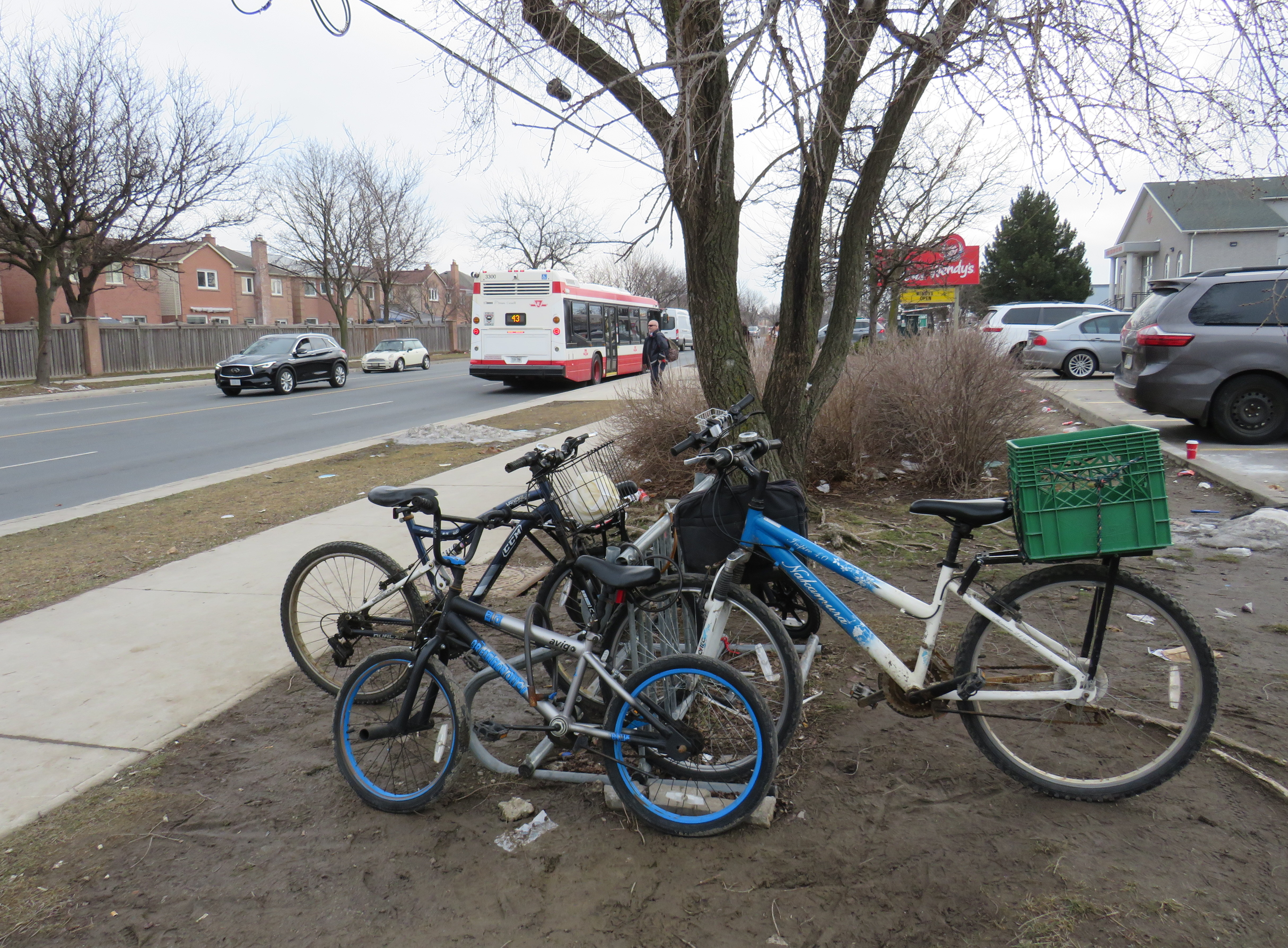
The elimination of the double fare will also benefit transit passengers who live or work near the border of Toronto and York, Peel, and Durham Regions. On the boundary between Markham and Toronto, it is common to see lots of bicycles locked up at bus stops along or near Steeles Avenue at TTC stops. These bicycles are owned by York Region residents who ride south to avoid the double fare and benefit from one less transfer. Once the new free transfer comes into effect, it will be interesting to see if there is a bump in YRT ridership.
Bicycles parked on the south side of Steeles Avenue, February 2024
Though the new free TTC transfer should — at least in theory — eliminate a barrier to integrating GO Transit with local transit, the TTC really isn’t set up to feed the GO Transit rail network, nor are many GO stations set up to serve TTC riders. There are historical reasons for these poor connections, but they will need to be fixed.
GO Transit started off in 1967 as a commuter rail pilot project, with the Government of Ontario (the “GO” in GO Transit) looking to keep costs down in case the three-year experiment was unsuccessful. Many station sites were selected for their proximity to major roads and highways and parking access. As the service was intended to attract suburban commuters from their cars and mitigate the need for expensive highway widenings, transit access was only a secondary consideration. The initial Lakeshore Line exceeded expectations and so GO added new lines to Georgetown (1974), Richmond Hill (1978), Milton (1981) and took over CN commuter operations to Bradford/Barrie and Stouffville.
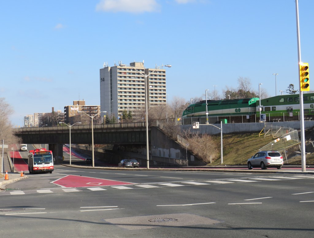
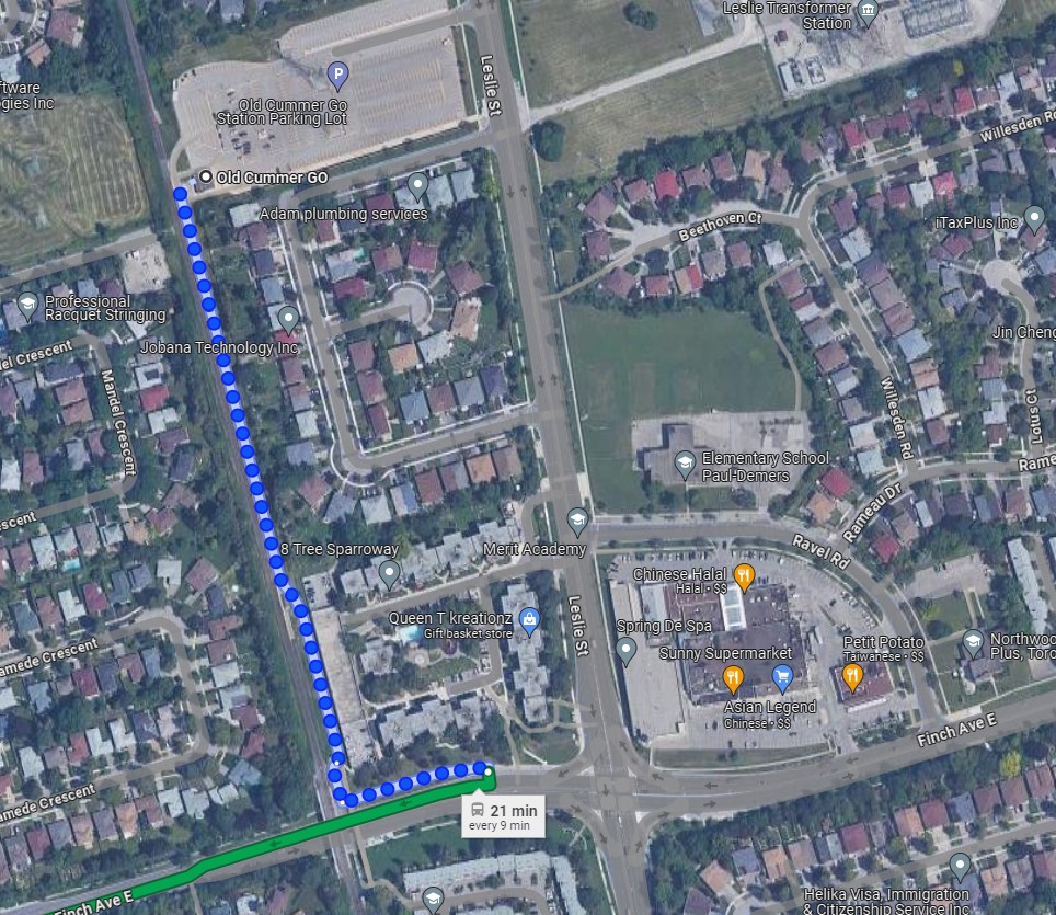
An example of this era of GO Transit station placement is Old Cummer Station, which opened in 1978. It was built where the Richmond Hill Line crossed the Finch hydro corridor, with land underneath the transmission lines easily paved over for parking. A walkway leads south to Finch Avenue, where one can connect to TTC buses, but the station building and the platform are oriented towards the parking.
As the Richmond Hill Line only operates during the peak periods, and is the only GO train service not destined for service expansion, this is not a major problem.
In the 905 suburbs, such as Mississauga, Brampton, Oakville, and Whitby, local transit connections are often quite good. For decades, commuters in those cities have benefitted from discounted or free fares on local transit when heading to or from GO rail stations (with Presto, connections to and from GO buses are now also free). Many transit agencies, particularly Durham Region, Oakville, and Burlington along the Lakeshore Line, centre their bus systems around the GO stations. Brampton built its downtown bus terminal adjacent to the GO station in 1989, and in 2023, Metrolinx opened a new bus terminal at Bramalea Station, allowing for easy transfers between buses and trains.
Bramalea GO Stationbus loop
On the other hand, the TTC bus network was designed around the subway network, with nearly every route serving at least one rapid transit station. Though TTC buses would pass by GO stations, transfers between the two were limited because of the extra fare and the infrequent GO services compared to the subway. The only TTC loop on GO station property is at Rouge Hill Station, though Exhibition Loop and Long Branch Loop are short walks to GO station entrances.
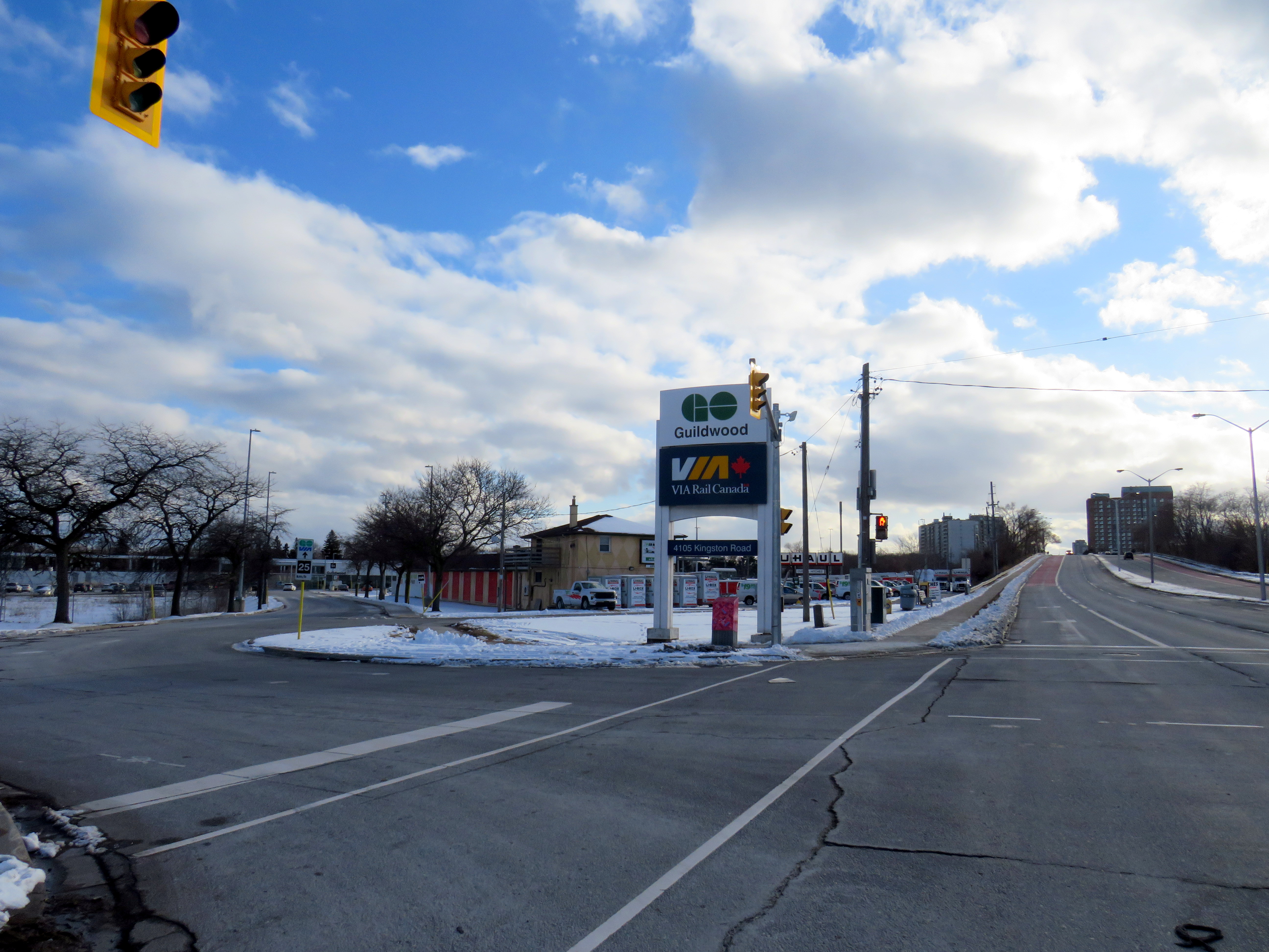
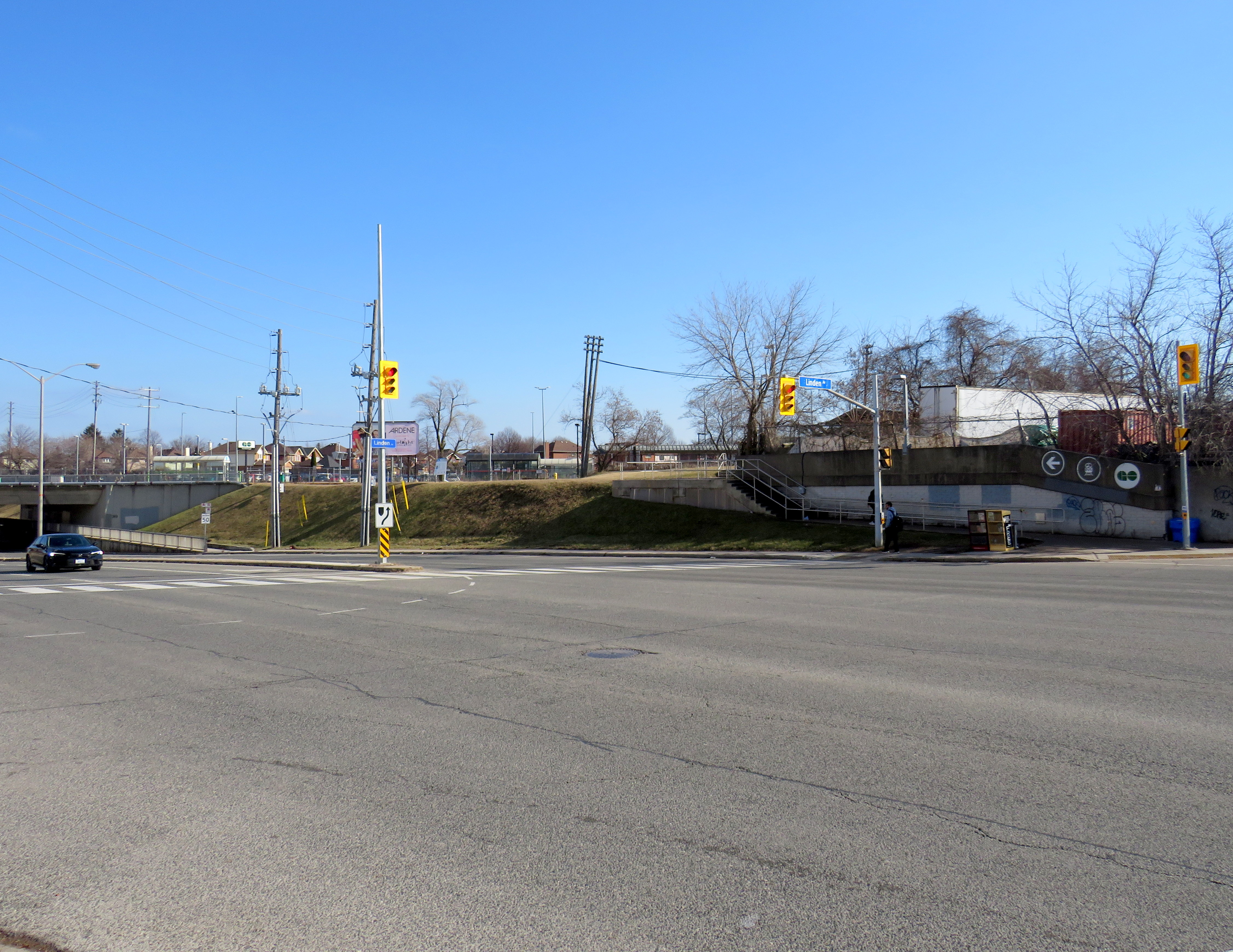
Entrance to Guildwood GO Station at Kingston Road. TTC passengers looking to connect with GO trains must cross a busy intersection than then walk through a parking lot to reach the station building.
As GO Transit continues to expand, and fare integration finally becomes a reality, there is both an opportunity and a need to change. Though there are plenty of examples of poor GO-TTC connections, there are also some promising moves towards physical integration between the two systems.
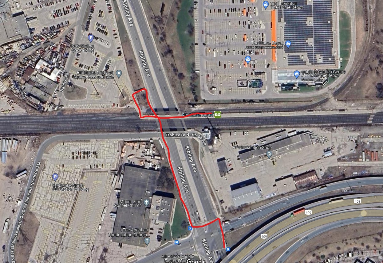
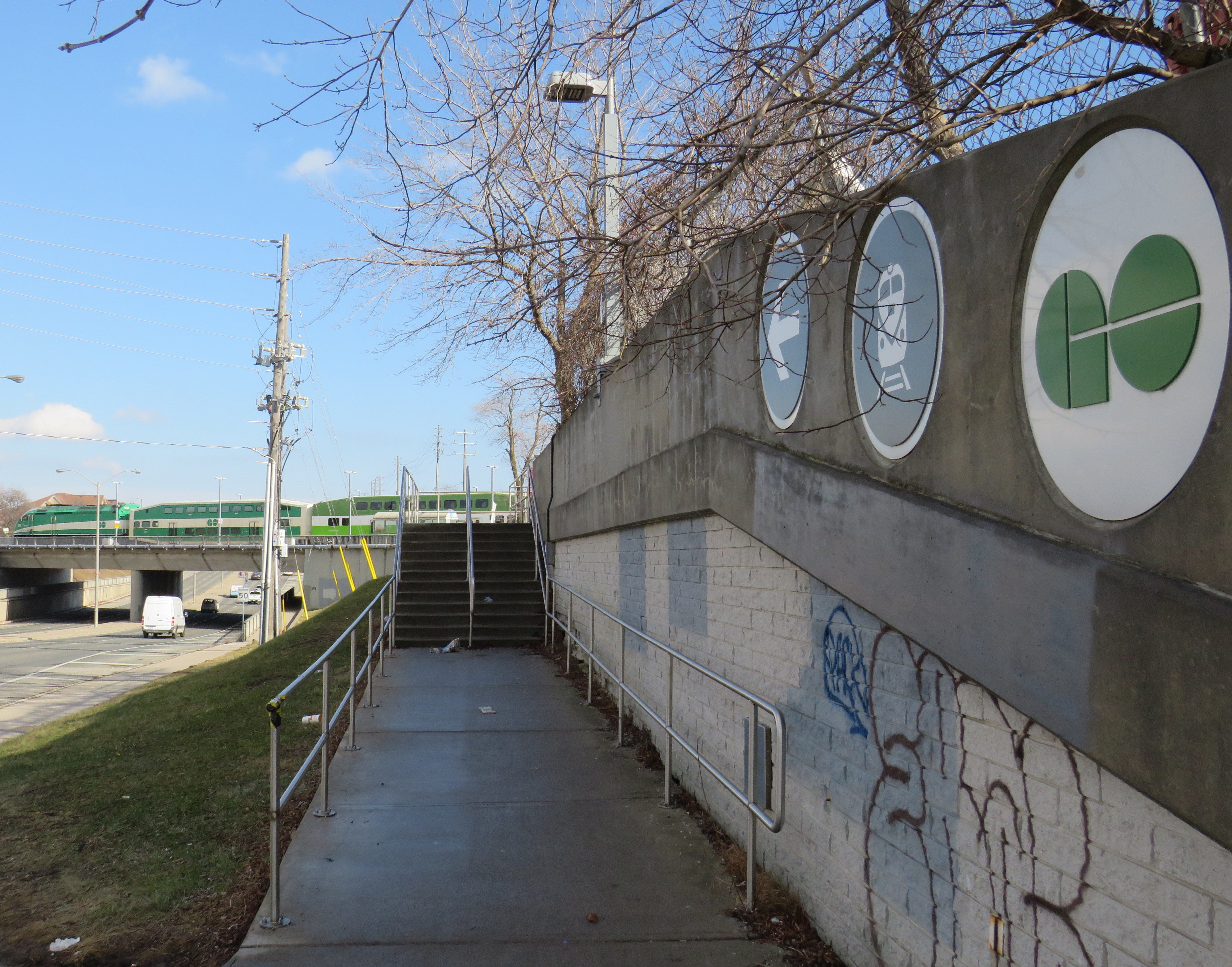
The worst GO-TTC connection: Etobicoke North
Red path shows walking route between northbound 45 Kipling bus stop and Etobicoke North GO platform
Etobicoke North station opened in 1974 as part of the Georgetown (now Kitchener) GO Line. The station and parking lot were built on Ministry of Transportation property and in a hydro corridor. Though the frequent 45 Kipling bus passes under the rail corridor, the transfer between bus and train requires crossing two sides of the busy Kipling/Belfield/Highway 409 off-ramp intersection, continuing on a narrow sidewalk, and climbing a flight of stairs before reaching the main walkway to the station platform. Though a passenger could save a lot of time by transferring to the train (especially as it now runs seven days a week), the long and uncomfortable transfer makes this very uninviting.
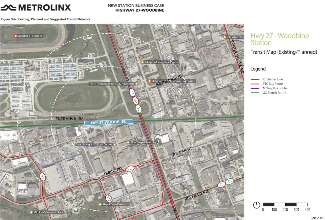
A new station at Woodbine Racetrack is proposed, but work has yet to begin. The station at Etobicoke North will eventually have to be closed and demolished to make way for track expansion required for 15-minute GO service. There’s an opportunity to build a great transit hub at Woodbine, especially with an extension of the Finch West LRT.
Metrolinx map of the potential Highway 27-Woodbine Station
An accessibility failure: Scarborough GO
Scarborough GO Station, from St. Clair Avenue East
Scarborough GO Station, near St. Clair Avenue East and Kennedy Road, is located where the GO Stouffville Line splits off from the Lakeshore Line; the station was originally known as Scarborough Junction, as it was the point where the Midland Railway of Canada met the Grand Trunk Railway. (This is where Midland Avenue gets its name from.) The station building and parking lot is located on the south side of the tracks, accessible from Midland and Reeve Avenues. A walkway on the north side of the station leads to St. Clair Avenue East, but it involves several staircases and is not fully accessible to the street, where the 9 Bellamy and 102 Markham Road buses stop.
The Scarborough Junction Masterplan development proposal includes a new connection to St. Clair Avenue as part of a transit-oriented mixed-use community. It promises to better integrate GO and TTC services but will likely be several years before construction begins and even longer until a fully accessible connection is possible.
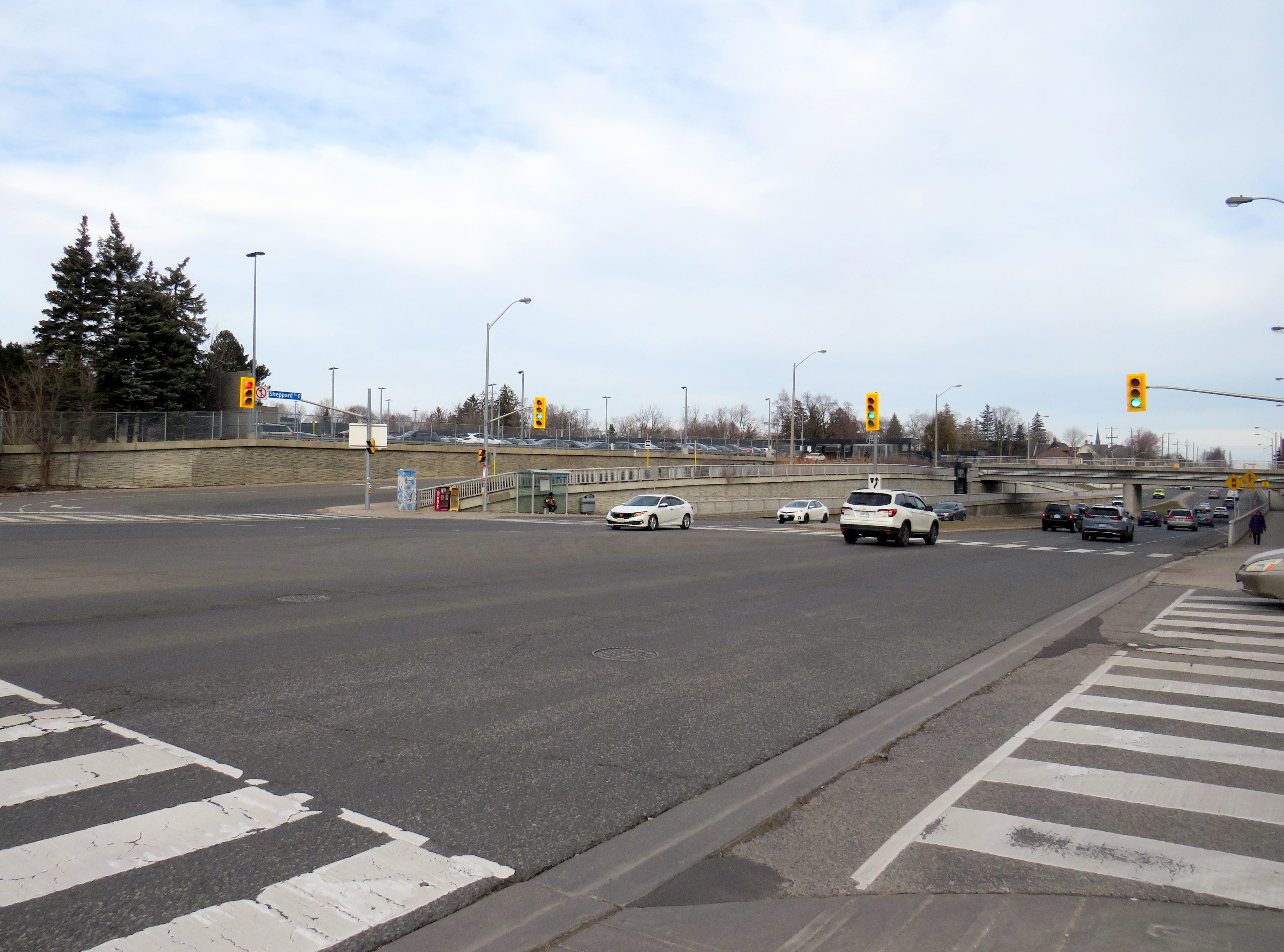
A more typical transfer: Agincourt GO
Agincourt GO Station, looking northeast from the south side of Sheppard Avenue East
Agincourt Station, in service since 1871, was taken over by GO Transit in 1982. The station building was always located several hundred metres north of Sheppard Avenue, and even in CN commuter rail days, featured a small parking lot. In 2012, an overpass was built separating Sheppard Avenue from the tracks; this allowed for a future Sheppard East LRT as well as train service expansion (a grassy median marks where the light rail line was planned to go). The TTC bus stops are located where the parking lot driveway exits onto Sheppard at a signalized intersection.
Unfortunately, the station platforms were not moved south on the overpass, reducing the walking distance between the train and bus stops and sidewalks on Sheppard Avenue. Though there’s a proper walkway between the TTC stops and the station itself, the station remains oriented mainly to the surface parking lot. Transfers are definitely possible, but not particularly easy.
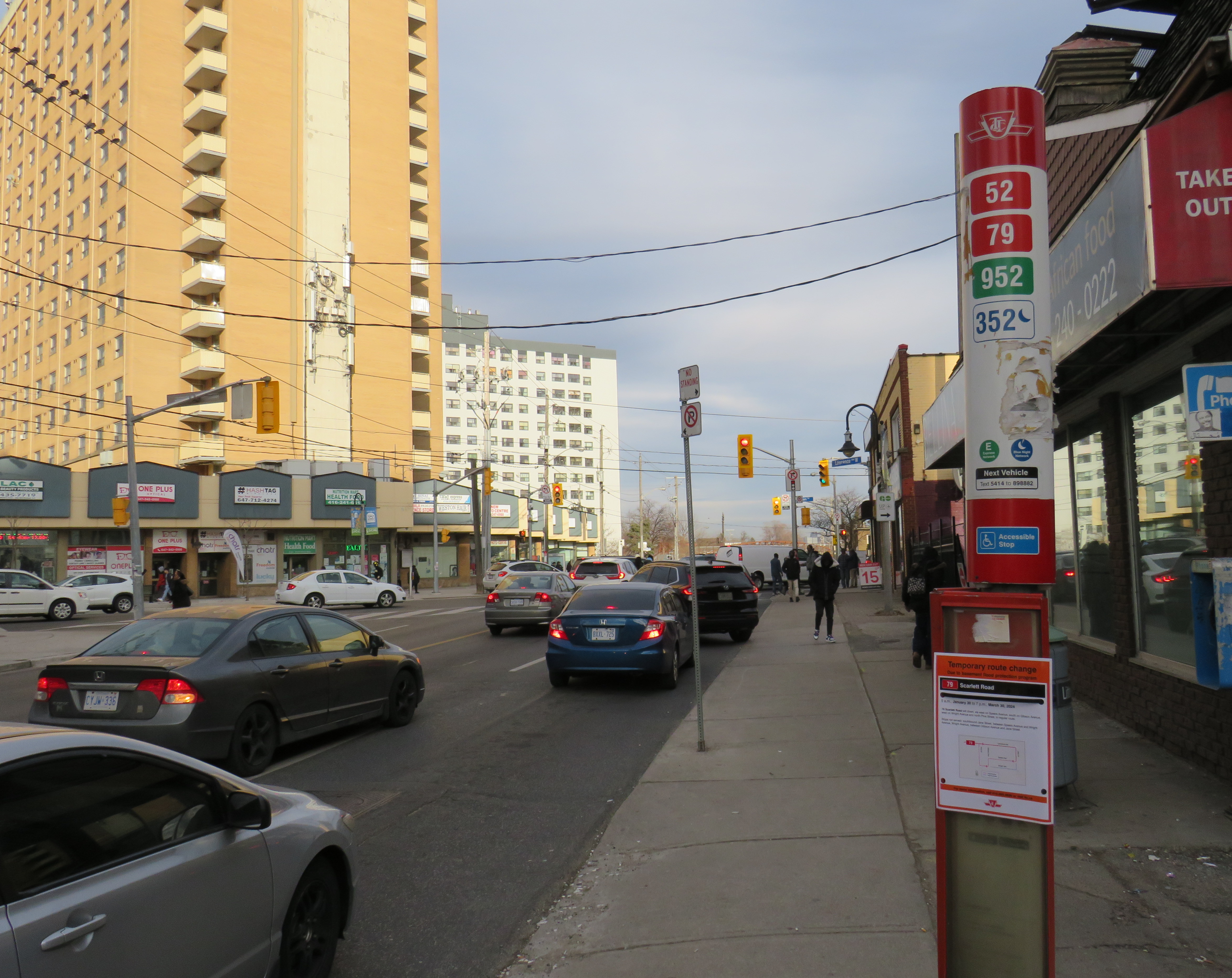
The nearest eastbound TTC bus stop to Weston GO/UPX Station, located a five-minute walk to the east
Similar situations exist at Weston GO/UP Express station, where the TTC stops are several hundred metres away from the GO platforms at Weston Road and Lawrence Avenue, and at Oriole Station, where the walk from the GO platform to Leslie subway station is still unnecessarily lengthy and also requires crossing a busy intersection.
Milliken GO: A promising direction
A Steeles East TTC bus stops at Milliken GO Station
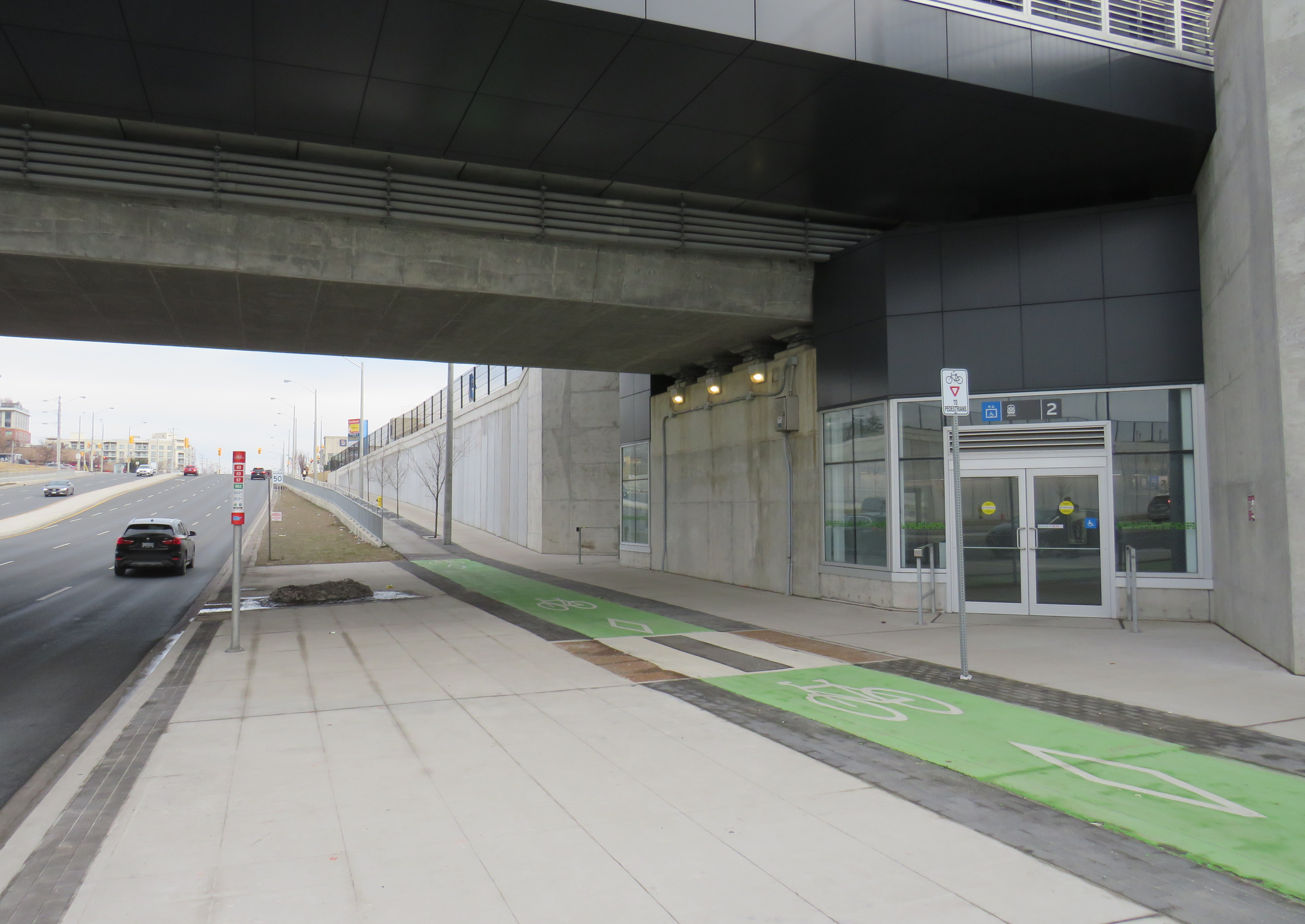
As part of the Stouffville Line corridor upgrades (which includes double-tracking the line between Scarborough Junction and Unionville) Milliken GO Station was recently rebuilt. It now features a new grade separation over Steeles Avenue, along with two new pedestrian overpasses on either side of the tracks. Though the station building is still oriented to the parking lot south of Steeles Avenue, the new layout provides excellent connections to buses on Steeles Avenue, including TTC routes 53/953 Steeles East, 43A Kennedy, and 57 Midland. Entrances on both sides of Steeles Avenue offer stairs and elevators to platform level.
TTC bus stop, separated bike lane, and access to GO trains
The one issue at Milliken Station — as with many GO stations — is that the wayfinding from platform level to TTC buses is completely missing. Ideally, signage should indicate not only the route to TTC buses, but the connecting bus routes as well.
Unfortunately, signage at Milliken Station does not indicate TTC bus connections
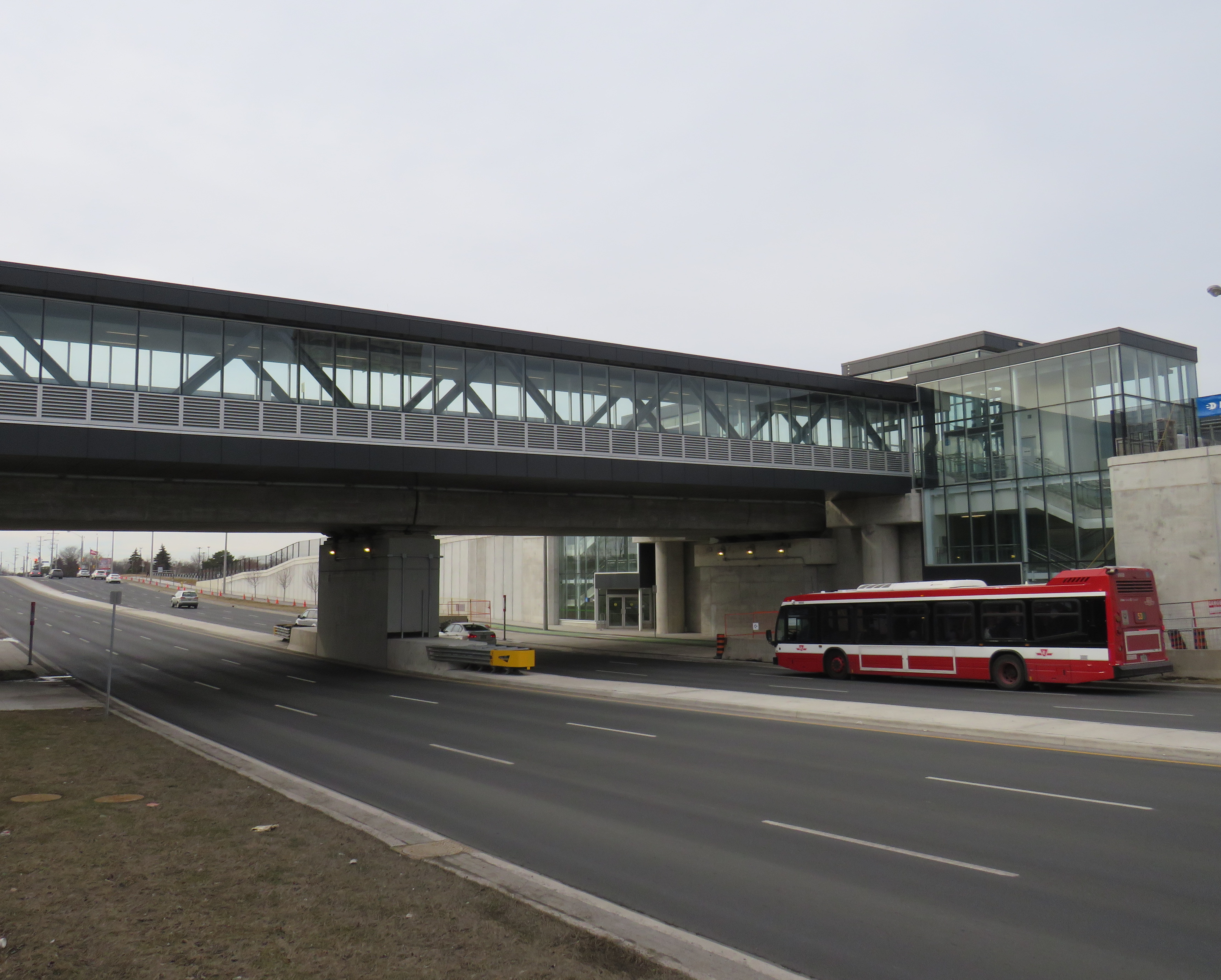
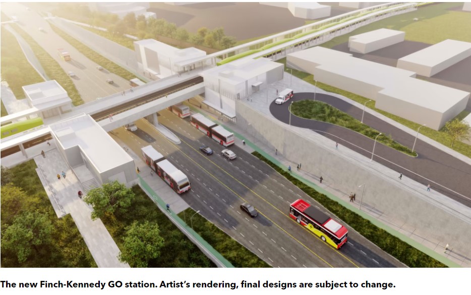
A new GO Station, nearly three kilometres to the south, will feature a similar layout. As platforms will extend over Finch Avenue, transfers between train and bus will be even more convenient at Finch-Kennedy as they are at Milliken. With minimal parking and optimized transit connections, this should be the norm as GO Transit transforms into a frequent, regional rail network. As of February 2024, preliminary work has started on the grade separation.
Rendering of the future Finch-Kennedy GO Station
Concluding thoughts
The new Ontario One Fare Program is a long-overdue step towards integrating the Greater Toronto and Hamilton Area’s disparate transit agencies and addressing unfair tariff boundaries at Steeles Avenue and elsewhere. It also recognizes GO Transit’s future as a regional rapid transit network that not only connects the suburbs to Toronto, but a solution to providing better transit within the city as well.
Most importantly, TTC-GO transfers should be simple, easy, and direct. Happily, there is some momentum to making this happen — Downsview Park Station, opened in December 2017, is a great example of physical integration between GO and TTC — but as shown above, there is much work to be done.
Though much of the information I received was redacted, I was able to learn that the Cities of Brampton and Mississauga had already come up with a brand for the new transit line. Metrolinx and the provincial government had to reimburse them for the costs once the Minister of Transportation intervened to force a new name upon the project, which cumulated with a love-in photo op on February 14, 2022.
Among the information redacted in the information package sent to me, six months after my initial Freedom of Information request, was the LRT line’s colour and number. They were redacted under Section 18(1) of the provincial Freedom of Information and Privacy Protection Act, citing economic and other interests of Ontario.
Redacted line colour, number, and logo
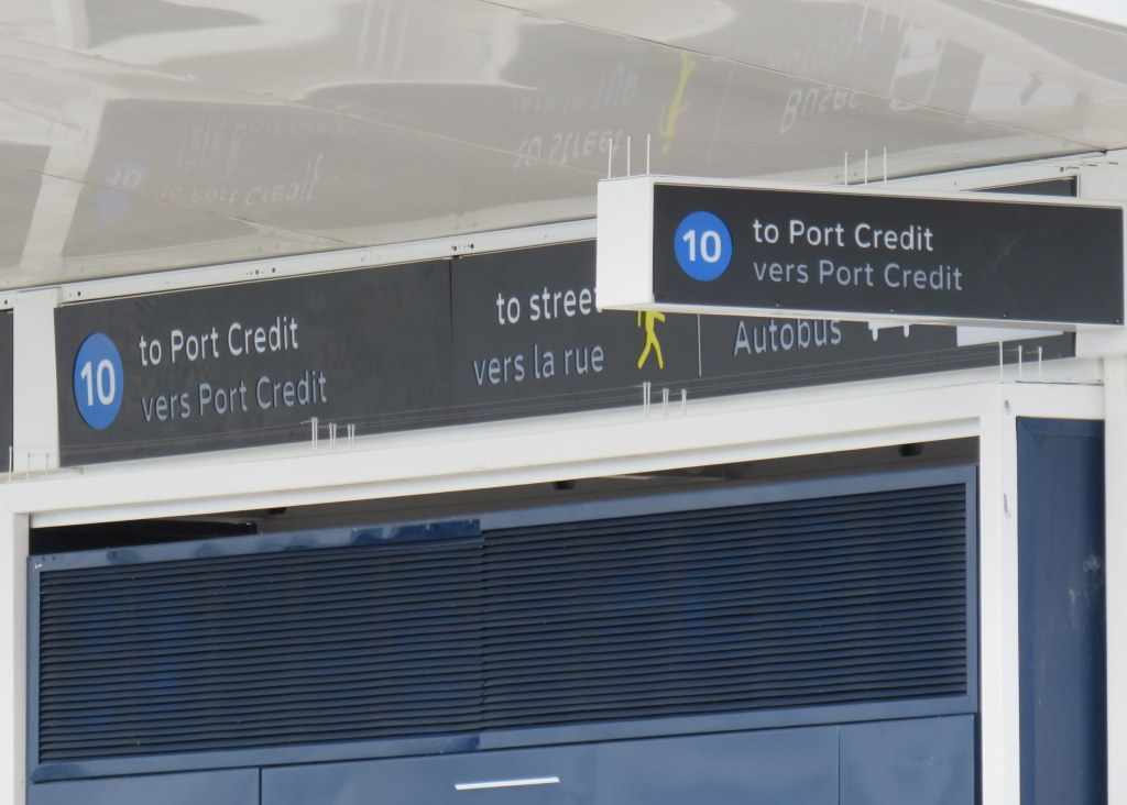
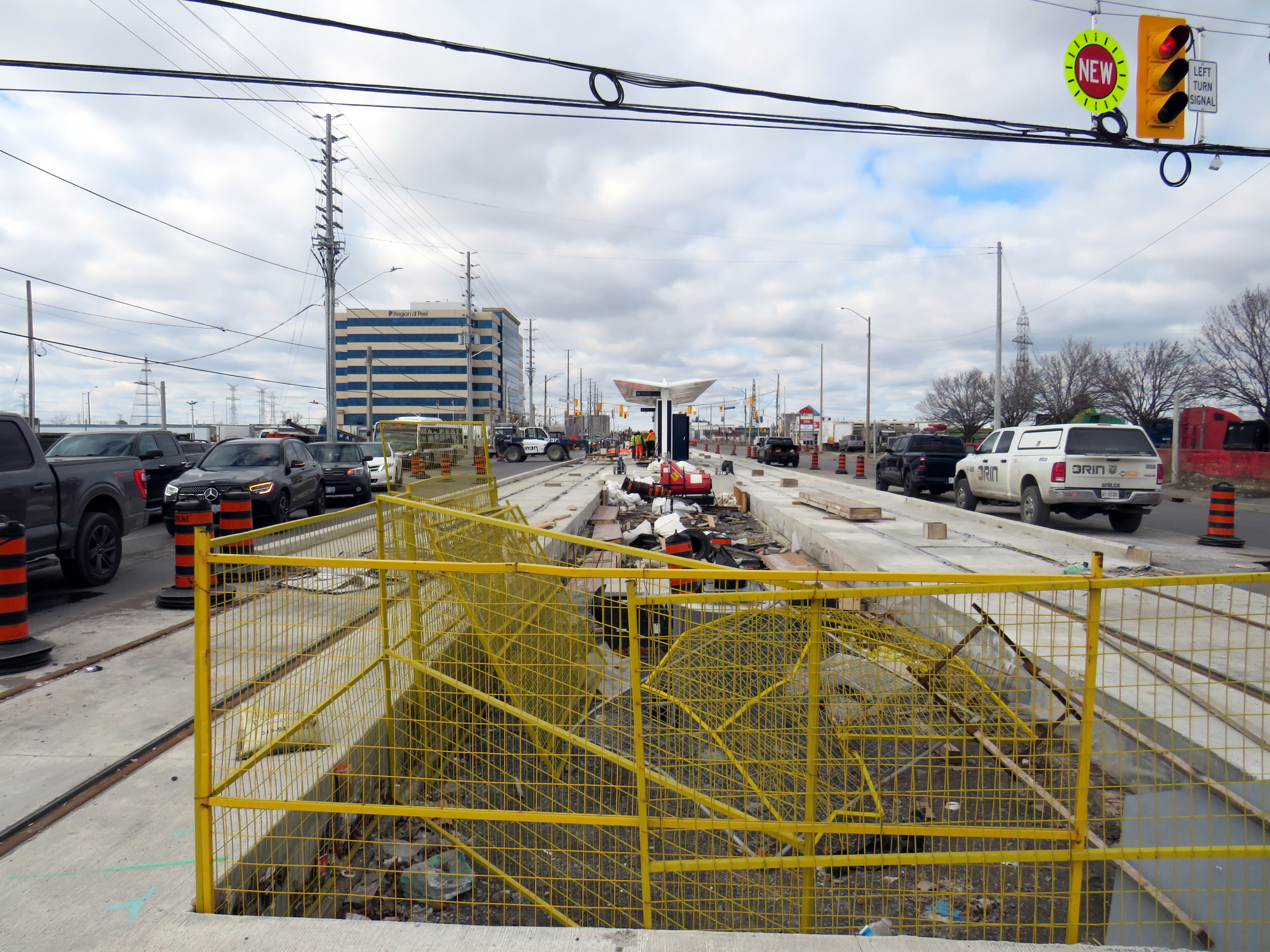
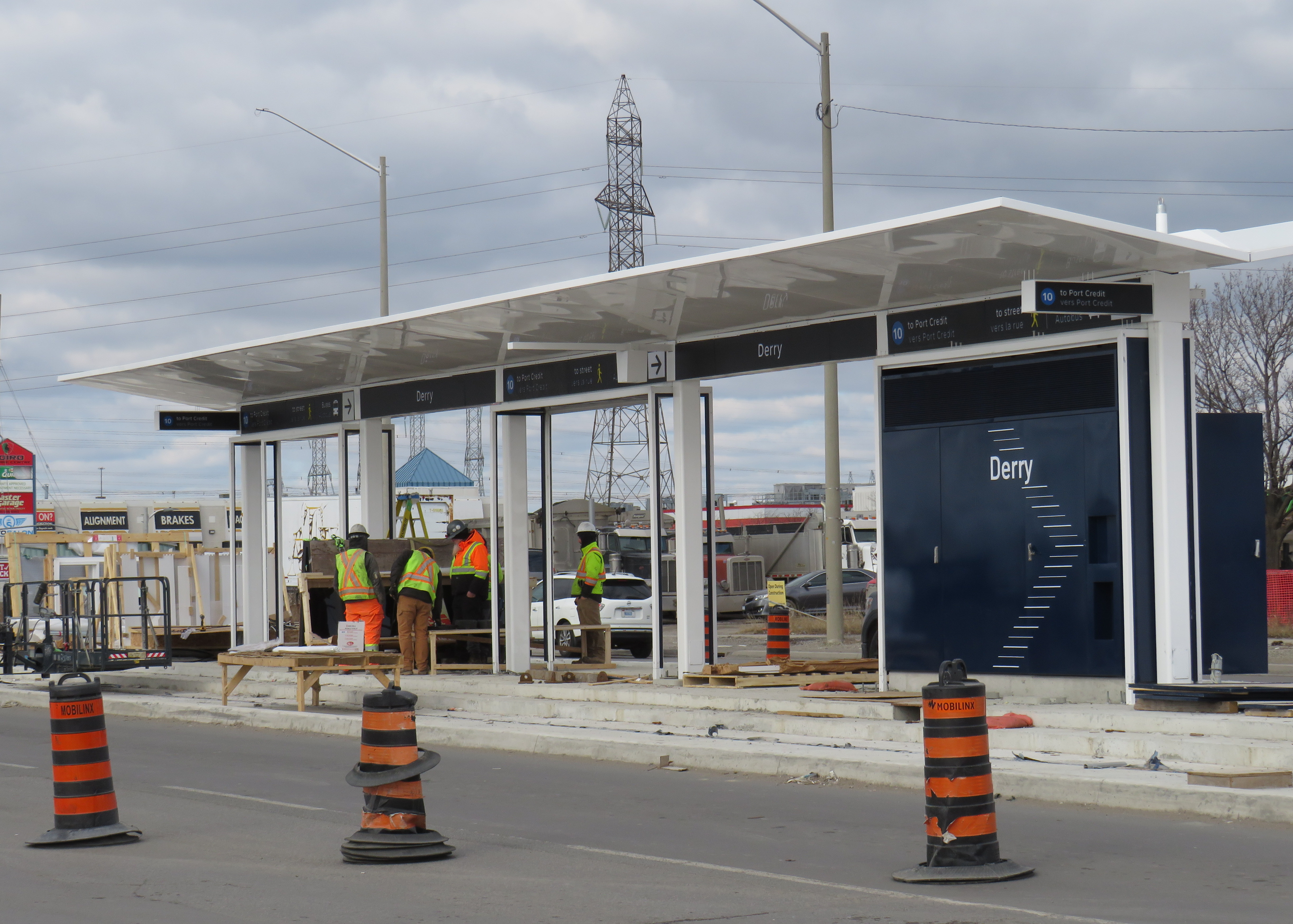
At Derry Road, though, the secret is out. The Hurontario Line will be Line 10, represented by a bright blue colour similar to the former Line 3 Scarborough RT.
Derry LRT station under construction
Line 10 is a good choice for this corridor. Hurontario Street and Main Street through Mississauga and Brampton used to be part of provincial Highway 10, which was later bypassed by Highway 410 and downloaded to the two cities between the 1980s and the 2000s. It will also be the first Metrolinx-managed rapid transit project completely outside the City of Toronto, where Lines 1 through 6 are already assigned to the existing subway and the Eglinton-Crosstown and Finch West LRTs (with Line 3 reused for the Ontario Line when it opens).
Brampton Transit and Miway currently operate bus services with that route number (10 South Industrial and 10 Bristol-Britannia), but those should be easy to change in advance of the LRT’s opening, which will take place in late 2025 or early 2026, given the construction progress so far.
I remain puzzled and somewhat annoyed that this information was kept secret, and for what reasons. Revealing a line number and colour in a freedom of information request should not have been important. If it was to protect for another government photo opportunity, then that is now moot. Who is the Hurontario LRT for? The Doug Ford-led provincial government, or the people who will ride it?
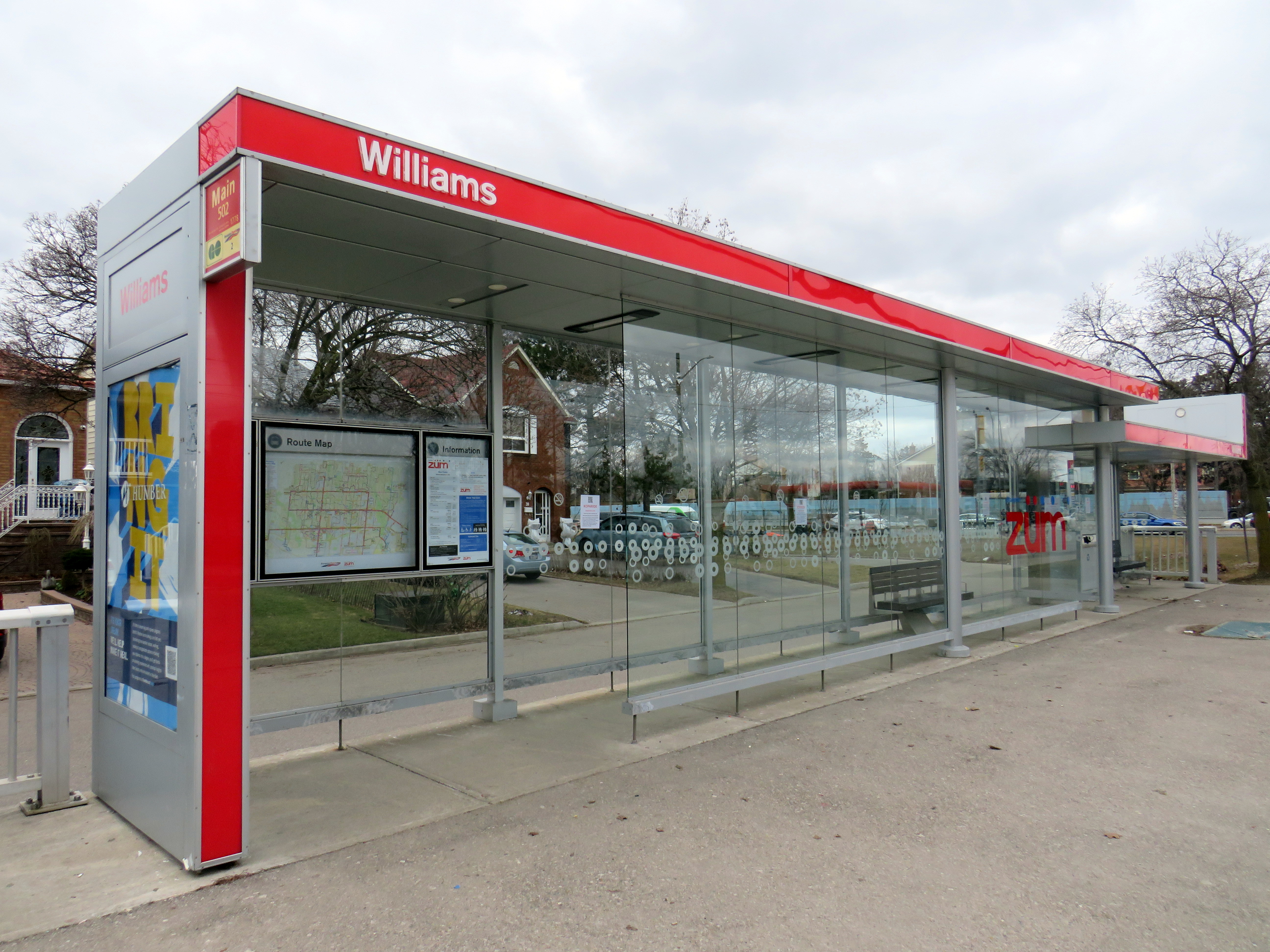
Finally, I note that like the shelters going up for the Finch West LRT and the surface stops of the Eglinton LRT, there is very little protection from the elements at the Hurontario LRT stops, with only a canopy and a single wall supplying shade and cover from the rain or snow. Compare the Derry Road LRT stop with older Brampton Züm shelters, which include enclosed waiting areas, benches, and even winter heating.
Brampton Züm stop with full glass enclosure, benches, and a button to activate a heater in the winter
One more thing…
To my longtime followers as well as my occasional readers, thank you for your interest and support. Last year’s FOI request cost me $525.00. Sadly, freedom of information isn’t free. If you like my work and want to contribute to my online mapping and webhosting costs, please consider buying me a coffee.
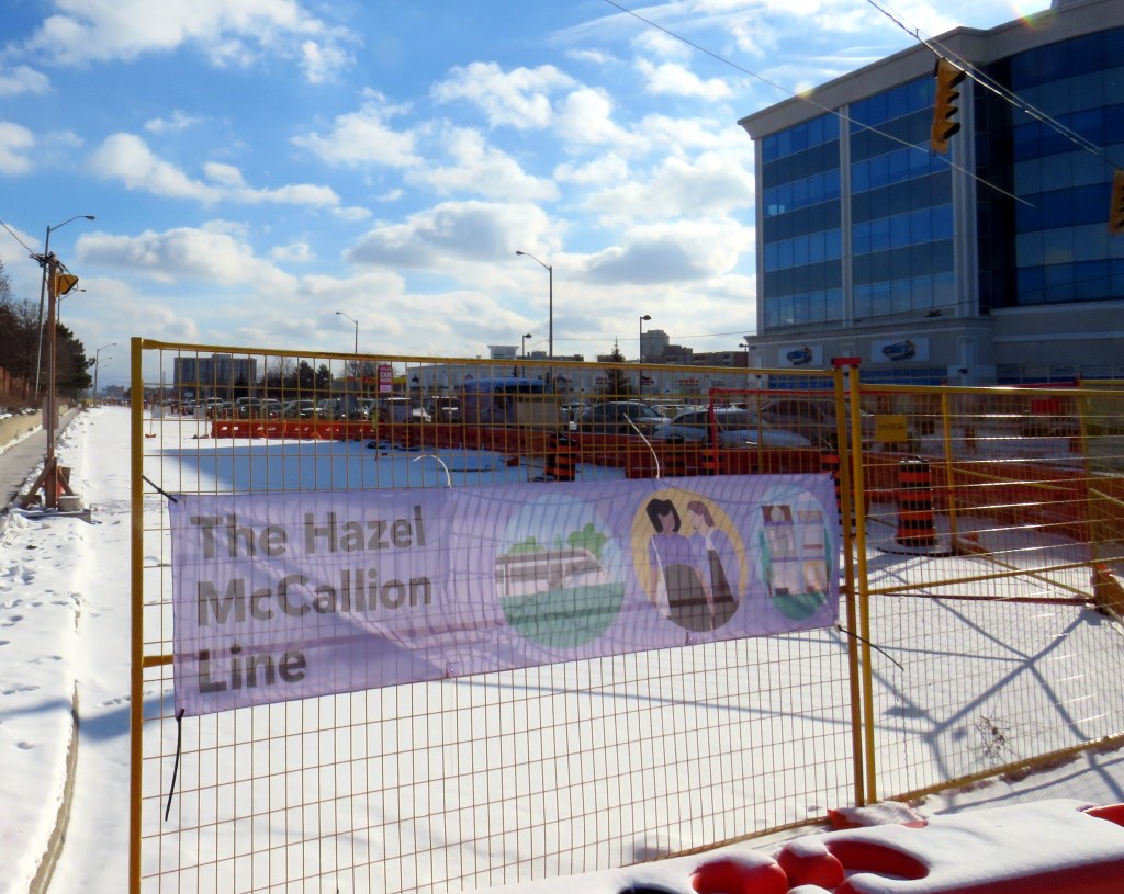
Banner promoting “The Hazel McCallion Line” on Hurontario Street in Brampton, January 2024
Previously on this website, I wrote about the renaming of two GO Transit stations: Oshawa and Brampton. I explained why renaming transit infrastructure is problematic, especially when they violate wayfinding standards, which call for simple, accurate, unique, and self-locating names.
Both GO Transit stations were renamed by provincial agency Metrolinx, on behalf of the provincial government. Metrolinx operates GO Transit buses and trains, the UP Express airport link, administers the Presto fare payment system, and oversees the construction of new rapid transit projects in the Greater Toronto and Hamilton Area. The Hurontario LRT, which is currently under construction between Port Credit GO Station in Mississauga and Steeles Avenue in Brampton, is just one of many transit projects managed by Metrolinx.
On February 14, 2022, at Cooksville GO Station, Premier Doug Ford, then Transportation Minister Caroline Mulroney, then Mississauga Mayor Bonnie Crombie, and Metrolinx CEO Phil Verster joined former Mississauga mayor Hazel McCallion announcing the name change from the Hurontario LRT to the Hazel McCallion LRT. The occasion also marked McCallion’s 101st birthday.
Hazel McCallion with Metrolinx CEO Phil Verster, February 14, 2022 (Metrolinx photo)
This is the first rapid transit line in North America to be named for a person, contradicting established standards for transit projects.1 Though McCallion was a formidable and popular mayor whose political career spanned seven decades, she was also very close to the Ford government in the last few years of her life. She also had many other public facilities named in her honour — a senior public school in Mississauga’s Streetsville neighbourhood, the library at University of Toronto’s Mississauga campus, the City of Mississauga’s central public library, a walkway leading to Square One Shopping Centre, and the Mississauga campus of Sheridan College. There is also the Hazel McCallion Auditorium at Mississauga Valley Community Centre and the Hazel McCallion Hall at Vic Johnston Community Centre. There was no need for yet another civic asset to be renamed for her.
In Toronto, most former mayors have just one public asset named for them: David Crombie, Art Eggleton, June Rowlands, and Barbara Hall have parks dedicated in their honour. Mel Lastman — mayor of North York for 24 years before being elected mayor of amalgamated Toronto for another six — and Nathan Phillips have major public squares.2 In Mississauga, there was no need to rename yet another piece of civic infrastructure for the same person.
Furthermore, there was no public consultation about the name change — even officials at the cities of Brampton and Mississauga were kept in the dark — while the name itself contravenes Metrolinx’s own naming conventions.
In July, 2023, I submitted an access to information request to Metrolinx, the second time I went through the freedom of information process to find out more about the light rail transit project. There were several delays, and I did not receive my requested documents and communications until late January 2024.
A deep dive into the background of the Hurontario LRT project, the person it is being renamed for, and my findings and impressions follow.
A VIA Rail train in Stratford, Ontario. In 1989, there were five trains a day connecting Stratford to Toronto. In 2024, there is only one.
July 2024: Map edited to include one new daily intercity train: Amtrak’s Borealis, an extension of an existing Chicago-Milwaukee train to St. Paul, Minnesota, offering a second daily train on the eastern section of the Empire Builder route.
Unlike in Europe or Asia, the story of passenger rail in North America the last seventy-five years has generally been one of decline. There are exceptions: service on the Northeast Corridor between Boston and Washington is frequent and relatively speedy. Commuter rail services have expanded in most major metro areas. And a new privately-owned intercity rail service in Florida offers frequent, dependable, and fast service between Miami and Orlando, with expansion on the way.
The development of new interstate highways, the loss of mail contracts and express freight to trucking, more affordable air travel, and competition from coach operators all contributed to the decline in North America. Though Canada and the United States both established national rail passenger services in the 1970s in an attempt to halt — or at least manage — the disappearance of intercity rail, the two countries had vastly different operating environments. Mexico, which had a nationalized railway network, privatized its assets and wound down intercity rail in 1995; today there is now only a commuter train in Mexico City and a new tourist-focused Tren Maya service in the Yucatan Peninsula.
Canada had only two major railway systems since the 1920s: privately-owned and profitable Canadian Pacific, and government-owned Canadian National. There were only several smaller railways owned by provincial governments and industrial concerns, along with a few American connections such the New York Central (NYC) line through southwestern Ontario, and the Toronto, Hamilton and Buffalo Railway, a joint venture of CP and NYC.
In the United States, there were dozens of medium and large railroads, all competing for fewer passengers and depleting natural resources. In the Northeast and Midwest, mergers between one-time rivals like NYC and Pennsylvania Railroad (Penn Central) and the Erie and Delaware, Lackawanna and Western Railroads (Erie Lackawanna) failed, leading to the creation of federally-backed Conrail. (Today, there are only six Class I railroads in the US, including CN and CP-Kansas City Southern)
In the midst of failing railroads and declining passenger services, Amtrak was formed in 1971 and took over the operation of most remaining intercity trains. (Commuter trains, often subsidized by local or state governments, remained operated by the freight railroads before being absorbed by transit agencies.) Amtrak purchased new rail cars for regional services to replace decrepit rolling stock (Amfleet); eventually new long-distance cars were also acquired one it was clear it would maintain those routes (Superliners)
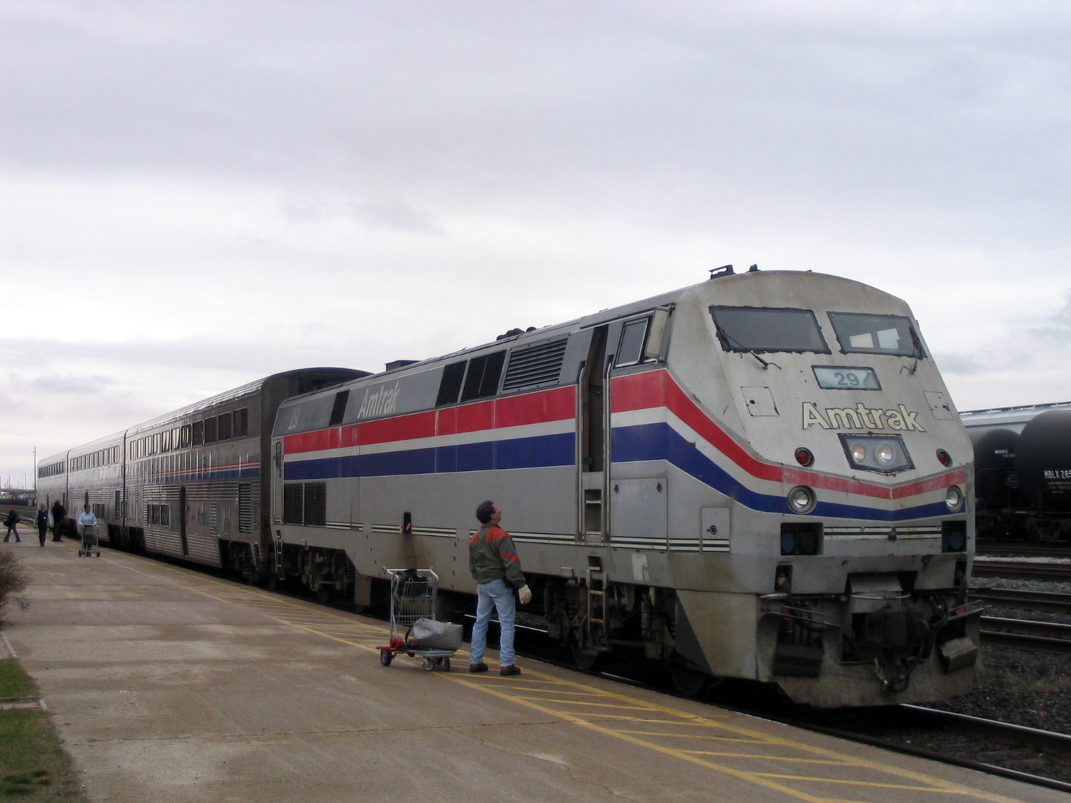
Amtrak’s “International” in Sarnia, Ontario in 2004, equipped with Superliner coaches
In Canada, VIA Rail started off in 1976 as a passenger rail brand of CN, which, as a Crown corporation, was still committed to passenger services. In 1977, it became a separate agency and in 1978, it took over CP’s remaining rail services. The 1980 map shows what VIA Rail’s system looked like in the early years. VIA did not take over everything; CN and CP retained ownership of commuter trains in the Montreal area, which were not yet assumed by the regional transit agency there. Railways not owned by CN and CP also maintained their own passenger services, usually with government support or direct provincial operation (i.e., GO Transit, Ontario Northland, BC Rail, Algoma Central).
Both Amtrak and VIA saw major funding cuts from federal governments in the first decade of their existence. In the United States, poorly-performing routes such as the Mountaineer (Norfolk-Cincinnati-Chicago), the Floridian (Chicago-Nashville-Miami), the Lone Star (Chicago-Kansas City-Oklahoma City-Houston) and the National Limited (Washington-Columbus-Kansas City) were eliminated between 1977 and 1979; deteriorating track conditions on insolvent host railroads were a contributing factor.
VIA Rail also saw several service cuts after its formation. Though the trains eliminated between 1977 and 1980 were generally marginal services in Western Canada and Northern Ontario and Quebec, 1981 saw more drastic cuts across the country, including the elimination of CN’s transcontinental train through Saskatoon and Edmonton. Though those cuts were partially reversed in 1985, in 1990, nearly half of VIA’s trains were wiped from the timetable, including nearly every train in the Maritime Provinces and the famed Canadian on the CP route from Montreal and Ottawa through Thunder Bay, Regina, Calgary and Banff.
Amtrak, despite its challenges, never saw cuts as drastic as those made to VIA Rail. Unlike VIA, Amtrak enjoys more autonomy from the federal government. Many of its services are funded by state governments rather than the federal government. Powerful senators will lobby to maintain services or add new trains in their state. (Canadian federal politicians generally enjoy less influence and autonomy in our parliamentary system, with power increasingly centralized in the Prime Minister’s Office.)
Amtrak routes added since 1980 and depicted in the map below include the restoration of previously eliminated services. The Heartland Flyer (Oklahoma City-Fort Worth) is a partial restoration of the Lone Star, while Amtrak Regional service to Roanoke, Virginia, restores part of the cancelled Mountaineer. There are three daily transcontinental trains between Chicago and the West Coast and two between New York, Washington, and Florida. Daily service means these long-distance trains are much more useful for regular and casual travelers than VIA’s remaining long-distance trains.
Over a dozen states contribute to the operation of many daily trains. California goes even further, with a distinct Amtrak California brand with a dedicated fleet owned by that state’s department of transportation. If such a model existed in Canada, one might expect the continuation of services such as Toronto-Peterborough, Montreal-Sherbrooke, or even Calgary-Edmonton.
Bucking the trend: commuter rail
Unlike intercity passenger rail, commuter rail services have expanded in Canada and the United States. In 1980, there were only 11 metropolitan areas with commuter rail services (and in Pittsburgh and Detroit, those would soon disappear). In 2024, there were 23. Though systems in the New York and Chicago areas barely expanded (and in Philadelphia, commuter rail coverage actually shrunk), there was impressive growth in commuter services in the Greater Toronto Area, the San Francisco Bay Area, and in Southern California, to the point that GO Transit and Caltrain are evolving towards becoming true regional rail systems.
Interactive map
An interactive map, linked below, shows what the Amtrak and VIA Rail systems looked like in 1980 and in 2024, along with independent railways and commuter services. The 1980 map includes notable routes (in grey) that were cut since 1976, the year of America’s bicentennial and the Summer Olympics in Montreal. Use the slider to compare the two maps and click on any line for more details on each route.
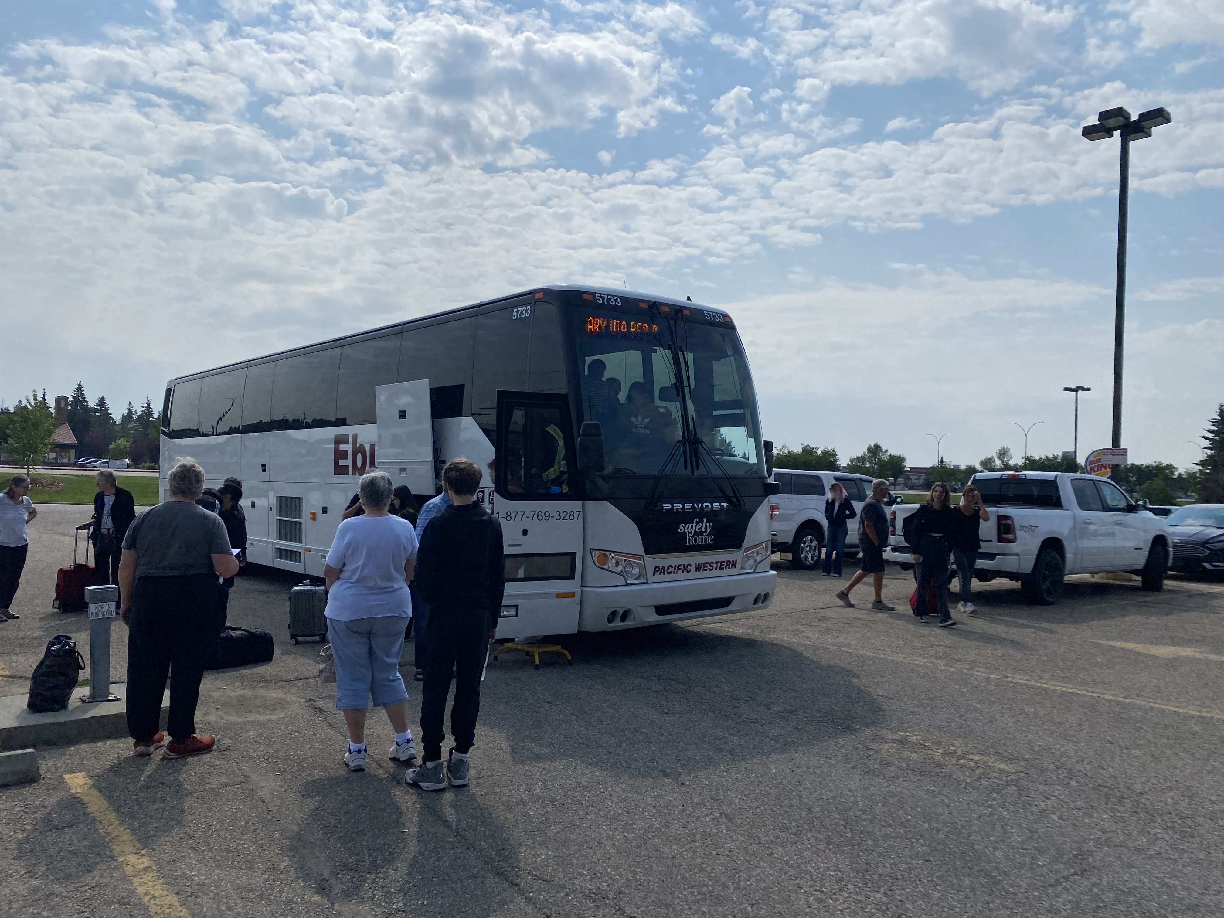
A Calgary-bound Pacific Western Ebus Coach loads at Red Deer, Alberta
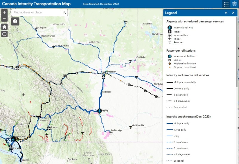
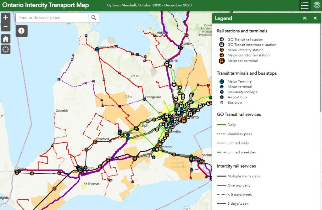
NOTE: Previous versions of the Ontario and Canada maps are retired; please see the new Canada Intercity Transport Map, launched March 30, 2025. This will now be the only interactive map that I will update.
In 2022, I was approached by staff at Infrastructure Canada who were interested in compiling information on intercity bus services across the country. Unfortunately, no repository had existed for a very long time, especially as transit and intercity coach services are primarily under provincial and municipal jurisdiction. Ontario’s provincial government last published a map of intercity carriers in 1990-1991, while Saskatchewan abolished its provincial bus service in 2017. The withering of Greyhound Canada’s once-extensive network left many communities from Ontario west to British Columbia and the Yukon without any service, while new private operators like Ebus and Rider Express filled in to serve the most lucrative routes.
Though the Federal Government operates VIA Rail and oversees air, marine, and long-distance rail transport, for road and city transport, its role has been more limited to helping to fund transit projects and some major road infrastructure improvements. Knowing that, I was excited to learn that there was interest in understanding the state of the country’s rural and intercity transport initiatives. I completed the project for Infrastructure Canada in June 2023, but I have recently updated a version of the map I completed, which I am excited to share.
A simplified methodology of how I completed this map can be found below.
GO Transit’s new Route 17 between Kitchener-Waterloo, Guelph, and Hamilton was one of the good news stories of 2023
At the end of 2023, there have been several changes reflected in my Ontario Intercity Transit Map. Intercity Bus, a London-based company that took over the closed Greyhound bus terminal there, launched a second route, offering three daily trips between London and Sarnia; they plan to launch a London-St. Thomas route as well. In January 2024, Deseronto Transit will start running a new fixed-route service between Belleville, Tynendiaga Mohawk Territory, Deseronto, and Napanee, with a route designed to serve major employers, shopping centres, and health services.
This year, GO Transit finally began service connecting Kitchener-Waterloo, Guelph, and Hamilton and improved rail and bus service on the Kitchener Corridor. This was one of the most important changes in 2023, though, as I argued here, they could do even more.
Unfortunately, some routes disappeared, including Grey Transit Route’s Walkerton-Flesherton Route 6, and Northumberland County’s service between Cobourg and Campbellford. At the end of January 2024, TOK Coachline’s bus serving Lindsay and Haliburton will also be gone for good. On-demand services have replaced fixed routes in parts of Durham Region and Norfolk County, while all service came to an end in Prescott & Russell and Manitoulin Island.
Keeping track of the changes continues to be challenging, given the lack of a central repository of transport services in Ontario. For this reason, I have made the choice to not map services provided by Book-a-Ride, whose schedules, routes, and locations change frequently, as that company acts more like a charter airline (changing routes and schedules regularly to meet expected demand) than a traditional motor coach operator (which has more consistent schedules and routes). I tried doing that once, and I will not attempt to do so again.
For now, gaps remain between London and St. Thomas, while Haldimand, and Elgin Counties remain entirely disconnected. Bruce County has just two bare threads connecting Saugeen Shores, Kincardine, and Goderich to the outside world, and Lindsay/Kawartha Lakes and Haliburton will soon lose their only public transport option.
As always, please message me with any corrections, changes, comments, or suggestions.
This interactive map has been migrated to a newer ArcGIS Online account, on account of ESRI suddenly changing its monthly service account to charge for bandwidth. I previously hosted my maps on a pay-as-you go account that helped me get re-acquainted with the ESRI ArcGIS Online platform before I set up a full online subscription to support a small business I co-founded in 2021.
What once cost me approximately US $8 a month to post maps such as my Ontario Intercity Map and these historical interactive maps cost me over US $1000 for November 2023. Though I got one email from ESRI US advising of the change in the billing, there was no way to expect that a monthly fee would go up over 1000%. As of December 27, I am still trying to get that addressed after several calls and emails and an unsuccessful attempt to contest the charge to my credit card.
Nearly three years ago, I wrote about the complicated history of Toronto’s Dundas Street. Calls to rename the street, which honours Henry Dundas, 1st Viscount Melville, came during a time of reckoning in Canada and the United States with racism, colonialism, and our ongoing relationships with First Nations. Ryerson University (my alma mater) changed its name to Toronto Metropolitan University (TMU) in 2022, in acknowledgement of Egerton Ryerson’s role in developing Canada’s system of residential schools.
Retain the legal street names with additional interpretation and recognitions
Retain the legal street names but rename those civic assets with Dundas in their name, except TTC facilities (there are three parks and one library branch that include the Dundas name, and Yonge-Dundas Square; there are two TTC subway stations and one streetcar line that also bear the Dundas name)
Rename the streets and all other civic assets now carrying the Dundas name (including Dundas Street East, Dundas Street West, Dundas Square, and Old Dundas Street).
In 2021, Toronto City Council voted 17-7 in favour of the fourth option, renaming Dundas Street and all associated city assets, such as the library, the two subway stations, Yonge-Dundas Square, and three city parks. At the time, the estimated cost was $8.6 million, but by Fall 2023, it had grown to $12.7 million. There was also a significant backlash to the renaming, which included several conservative city councillors.
In the end, council voted to approve a compromise that would include renaming Yonge-Dundas Square, Dundas and Dundas West subway stations, and the Jane-Dundas library, but retain the name Dundas Street itself. There would also be a public education campaign “to acknowledge the historical impact of Henry Dundas’s actions and that of slavery more generally.”
Yonge-Dundas Square would be renamed Sankofa Square, while Dundas Station, directly below, would be renamed with financial support from TMU. “Sankofa” was one of four shortlisted names considered by the Recognition Review Community Advisory Committee (CAC), which was made up of Black and Indigenous leaders, including business owners and residents along Dundas, with the participation of local city councillors.
Sankofa, a concept that originates with the Akan people of Ghana, “refers to the act of reflecting on and reclaiming teachings from the past which enables us to move forward together.” The CAC’s short list notes the concept’s connection to West Africa, which represented a major portion of the origins of Africans trafficked to the Americas — including Upper Canada — during the slave trade.
Dundas Street, looking east from Dovercourt Road
This compromise will not make anyone especially happy, but Mayor Olivia Chow will have to make many more compromises to properly address the fiscal and social crises Toronto is facing. But this is one compromise I mostly agree with. At first I thought Yonge-Dundas Square should have an Indigenous name, but after reading the background materials, I learned that the First Nations elders on the CAC preferred a name that focuses on the Black historical experience.
Until recently, few people gave the name “Dundas Street,” named over 200 years ago, much thought. Now more people are aware that there were slaves here, in Ontario, despite Governor John Graves Simcoe’s abolitionist leanings. Our understanding of history evolves as we as people evolve — this is the reason why we have historians.
Nearly three years ago, I wrote about the history of Dundas Street. It’s a really interesting one, by the way, as it continued to change and grow right up until the 1950s. In 2023, we continue to add to the history of the colonial-era road.