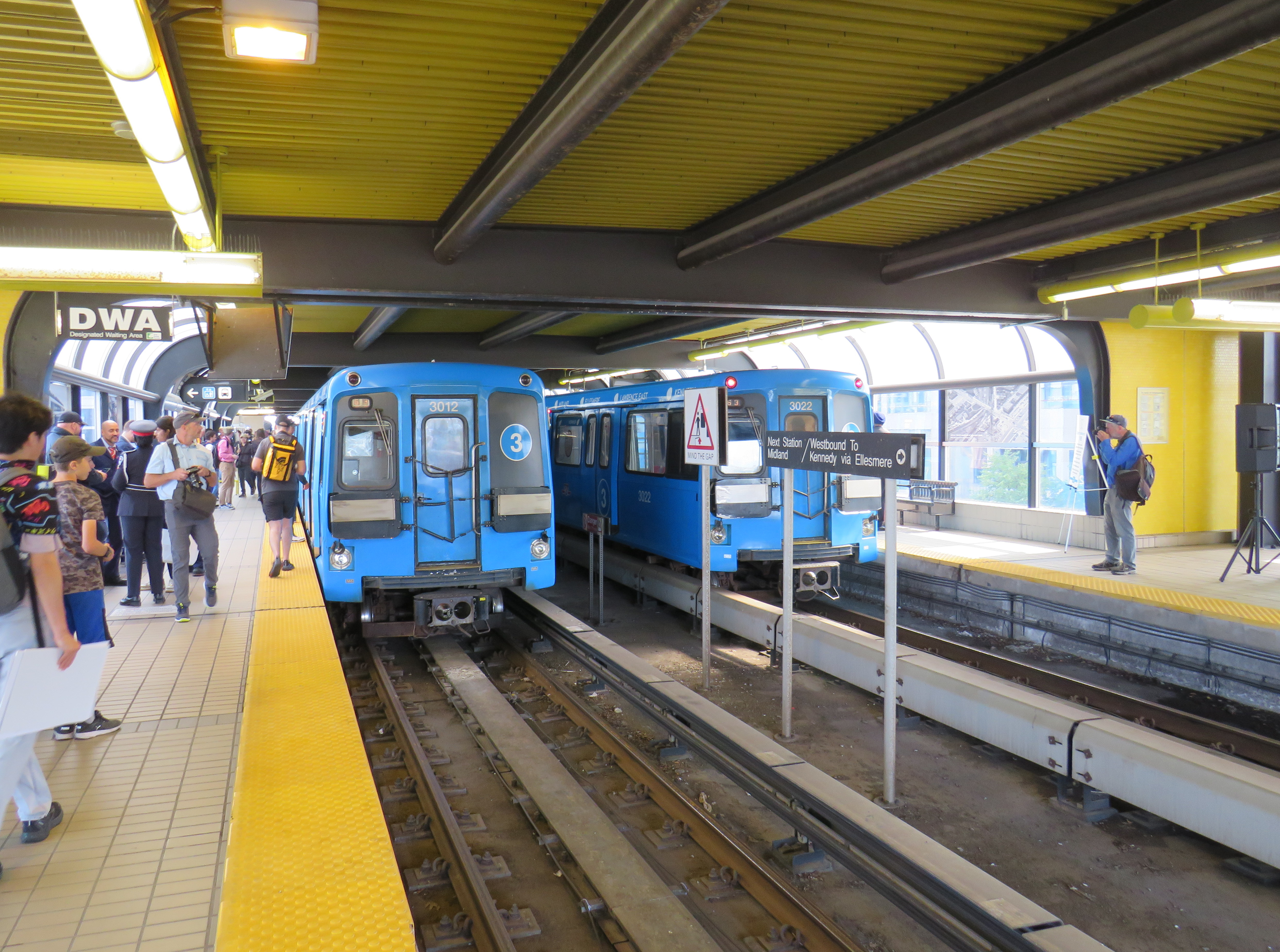
On July 24, 2023, 38 years of Line 3, the Scarborough RT, came to an ignoble end when a car came off the tracks just south of Ellesmere Station, four months ahead of the scheduled closure of the deteriorating line. Though the City of Toronto and the Toronto Transit Commission (TTC) were hesitant to say so at the time, it was apparent that the July derailment meant Line 3’s permanent closure. A farewell party, with two SRT cars, was held at Scarborough Centre Station on September 23, 2023, allowing the public to have one last sit in the venerable cars.
I went to check out the new temporary bus lanes on Midland and Kennedy, installed ahead of a planned busway between Kennedy and Ellesmere Stations. The busway, which will open in 2025 after the old SRT right-of-way is decommissioned, will include a new stop at Tara Avenue, at the Meadoway trail.
In the meantime, most drivers appear to be respecting the new painted lanes, even on busy Kennedy Road. With several bus routes from north and east Scarborough diverted to Kennedy Station to provide a more pleasant ride, the bus lanes are very well used.
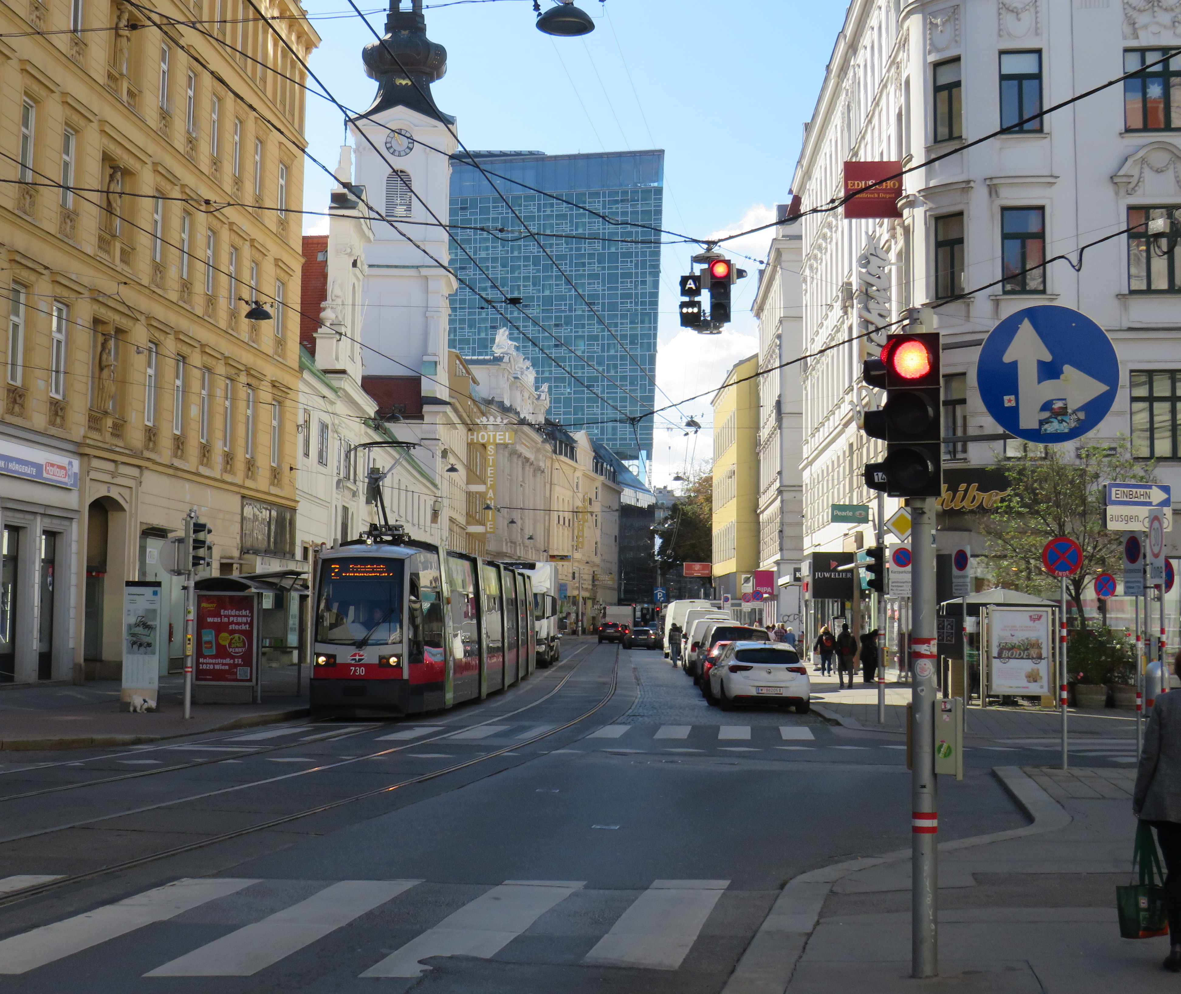
Streetcars backed up eastbound at King and University, November 28, 2023
On Tuesday, November 28, the University of Toronto’s School of Cities released their report that looked at vehicle movement and traffic violations on the King Street Transit Priority Corridor. They found that there are, on average, 6,800 illegal turns and through movements at intersections on the corridor, and less than 0.3% of offenders are stopped by Toronto Police and ticketed. Traffic enforcement was heaviest between November 2017 (when the pilot began) and March 2020 (when the COVID-19 pandemic restrictions began). Enforcement has not caught up since then.
The U of T School of Cities has provided invaluable quantification of what many Torontonians have suspected for years: the King Street Transit Priority Corridor is broken, and that there is little being done to fix it.
The transit priority corridor, which runs between Bathurst Street in the west and Jarvis Street in the east, has restrictions on through vehicle movements, where motorists must turn right at most intersections. Until 10 PM daily, only TTC buses and streetcars, emergency vehicles, and bicyclists are exempt. After 10 PM, taxis may also continue through the corridor.
The pilot program launched on November 12, 2017. The initial pilot, in which signs were erected, Jersey barriers placed to restrict the curb lane, and TTC stops moved to the far side of most intersections, was intended to optimize permanent streetscaping improvements, streetcar stop placement and transit optimization, get motorists acquainted with the new rules (at first, only warnings were issued by police) and allow time for Toronto City Council to decide on whether the pilot should be made permanent. Council approved making the transit priority corridor permanent on April 16, 2019.
Though Toronto City Council voted to transform King Street permanently, no work has started on the streetscape or public realm to do so. Just like Union Station, temporary Jersey barriers remain in place. The relocated TTC streetcar stops are left at road level, without transit shelters or accessible curbs. Drivers routinely ignore restrictions, with only a 0.3% chance of getting a $85 or $110 ticket. Meanwhile streetcars get stuck and transit riders get nowhere. On Wednesday, November 8, a Toronto police officer decided to enforce congestion on King Street… by ticketing a streetcar operator stuck in the intersection at University Avenue.
A motorist, ignoring several signs, proceeds straight through on King Street eastbound at Spadina Avenue
The problem is not just limited to through movements on King Street, though. On Tuesday, November 28, I stood at the corner of King and Spadina between 4:00 PM and 4:20 PM. The backup of cars and trucks headed southbound towards the Gardiner Expressway extended into the south side crosswalk and into the eastbound lanes at times. Motorists are not permitted to enter an intersection on a green light if they cannot clear it before the light turns red; this causes gridlock. But on more than one occasion, streetcars and pedestrians were impeded by illegal intersection blocks.
At Spadina and King, a truck and three passenger vehicles block the south side crosswalk and prevent a streetcar from proceeding straight on a green light
After standing at King and Spadina, I walked over to King and University, where the Toronto Police charged a streetcar operator earlier this month. At 5 PM, eastbound streetcars were lining up between University and John Street, unable to proceed.
Traffic jammed at King Street eastbound at University Avenue
However, motorists were able to turn right and left from University Avenue to eastbound King, blocking the east side crosswalk to pedestrians and ensuring that no streetcar could continue across. I spoke to one operator, who told me that the day before, he was stuck there for a half hour before he could move across.
The University and King intersection, at 5:00 PM on Tuesday, November 28. Note the blocked crosswalk and the line of streetcars, all with their hazard lights blinking. Eventually, one streetcar operator decides they had enough, and occupies the intersection.
While there, I counted several motorists who passed to the right of the stopped streetcar, and instead of turning right as permitted, they went straight, only contributing to the blockage ahead.
Two eastbound cars pass a stopped streetcar on the right to join the congestion ahead
The problem downtown is exasperated by several road closures. Queen Street is closed between Bay and Victoria Streets for Ontario Line construction; this will last for at least five years. Adelaide Street, which is one-way eastbound is closed at York Street due to the delayed Adelaide Street diversion track installation that is supposed to allow Queen Streetcars to divert around the Ontario Line closure. York Street is also closed at Adelaide. There are several other lane closures on Bay, Yonge, and Richmond Streets and University Avenue for utility work.
Adelaide Street is likely to remain closed at York until early 2024
Yet, one would hope that something was done to allow transit riders to get through the downtown core, especially as the city has been aware of the severe congestion for weeks at this point. The city needs to move ahead on permanent streetscape changes to further discourage through traffic on King Street by closing the curb lanes at the far side of each intersection.
It is also clear that the Toronto Police are not too interested in ticketing motorists on King Street. Even if they were, it wouldn’t be enough, as it takes 10-15 minutes to stop and ticket a driver; automatic ticketing, similar to red light cameras, would be more effective, though traffic officers can still be strategically deployed at congestion hotspots.
It’s beyond time for this city to take transit seriously again. King Street would be a great place to start.
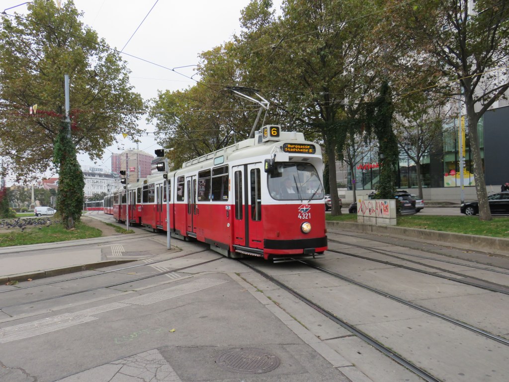
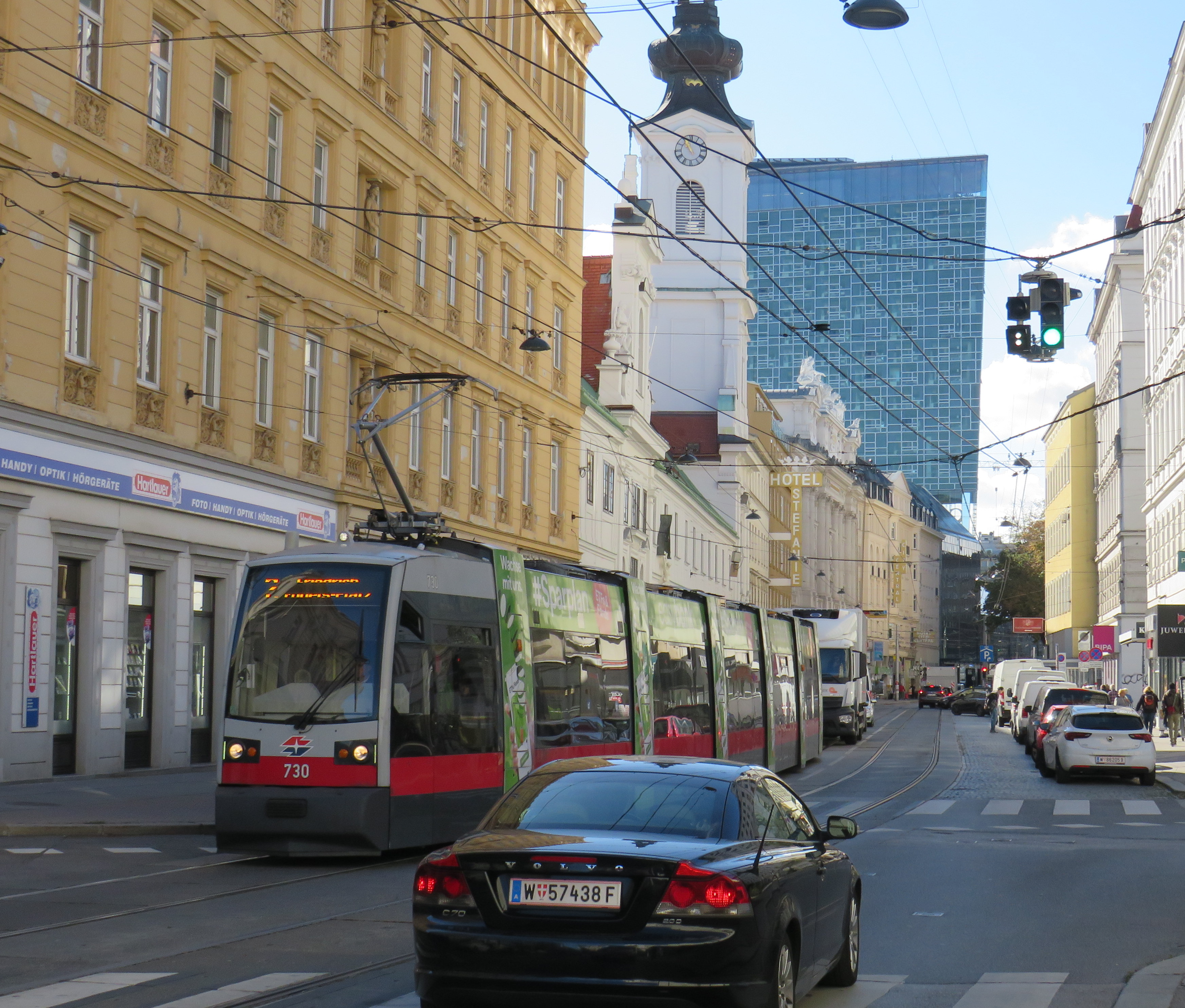
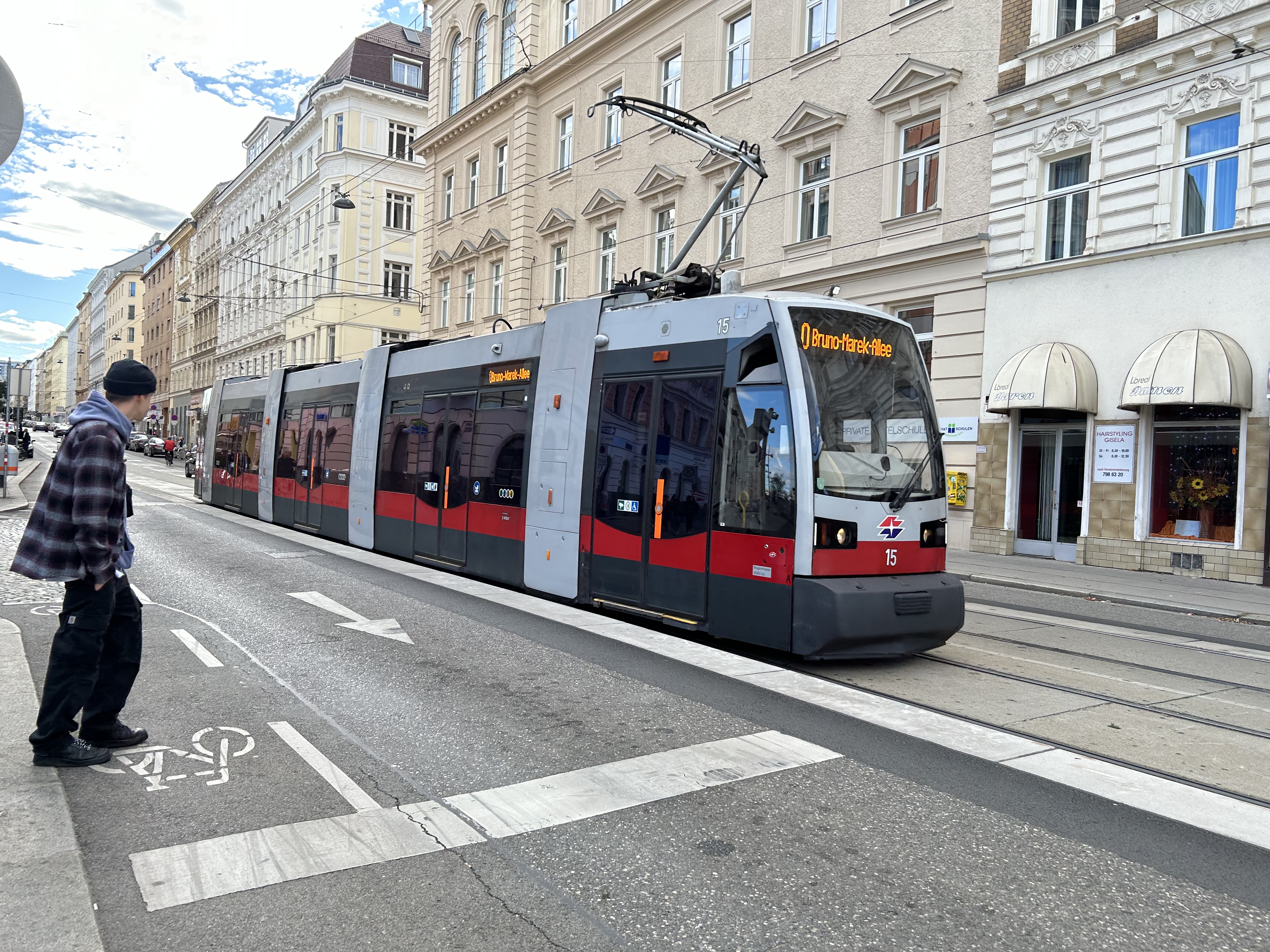
Vienna low-floor tram in the Leopoldstadt district
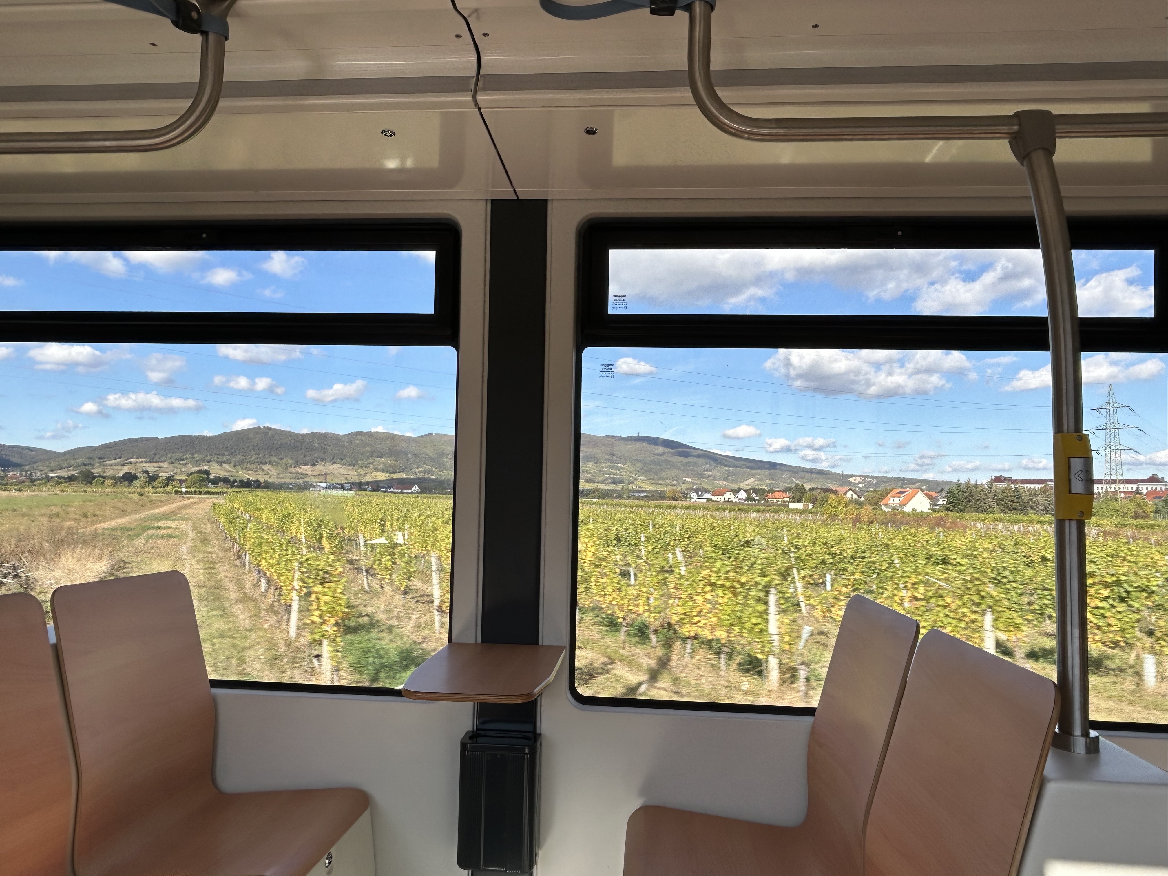
Back in October, my spouse and I had the opportunity to visit several countries in Central Europe: Austria, Slovakia, Hungary, and the Czech Republic, though we spent the majority of our time in and around Vienna, as that is where my spouse attended business meetings for several days; we also took time to explore the city and surrounding areas together.
While there, I experienced how serious cities operate trams seriously. In Bratislava, I saw how a streetcar priority corridor can work in a busy downtown core. In Prague, trams made it through watermain construction zones without detours or unreliable bus shuttles. In Budapest, I rode the world’s longest trams that move more people per hour than many metro lines. In Vienna, where I spent the most time, I experienced a city where transit passengers are treated with respect, and where the trams are reliable, despite no discernable signal priority and plenty of mixed-traffic operations.
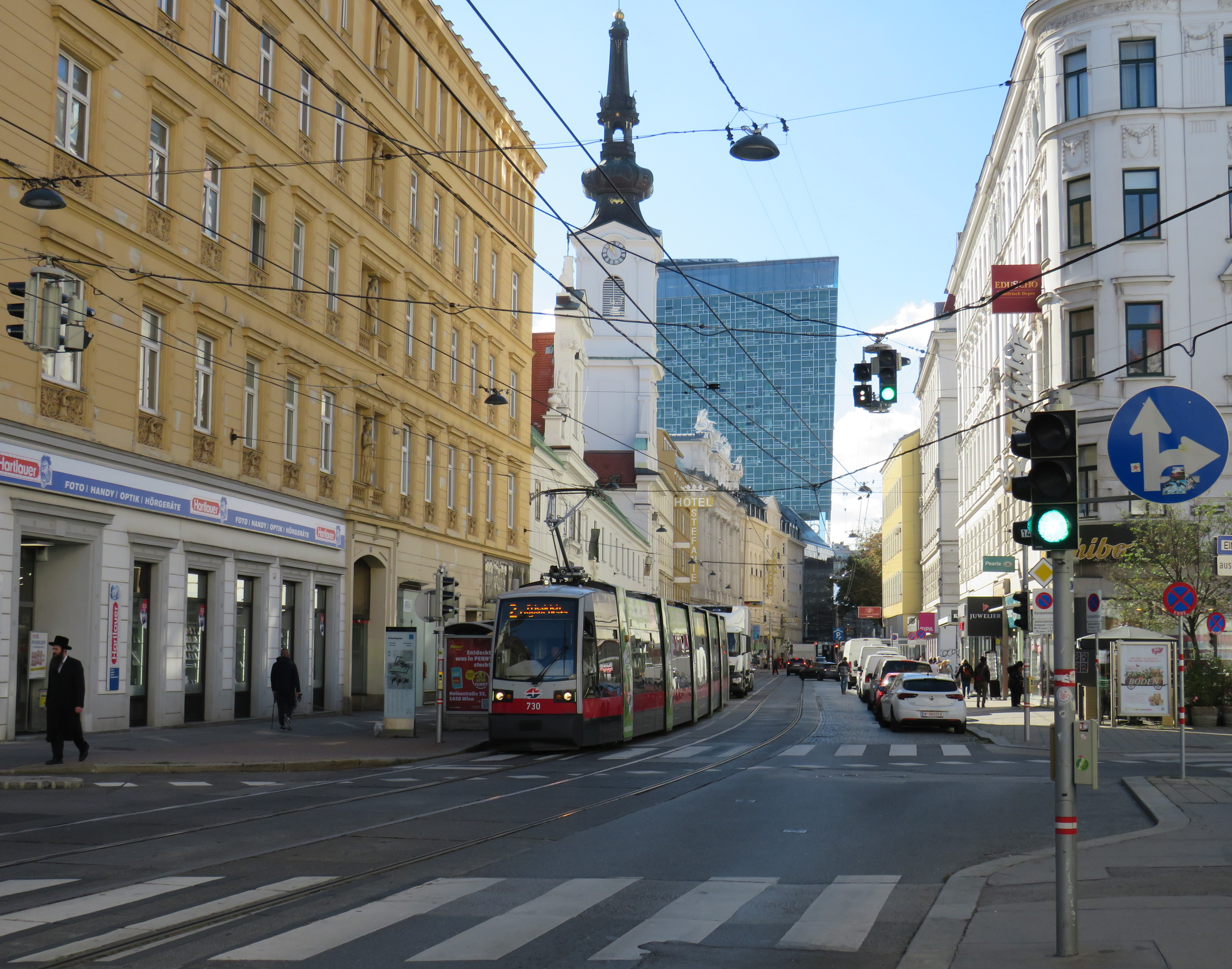
Vienna is an amazing city to visit. It’s been described to me as “what people think Paris is.” That’s pretty much true. It’s a very walkable city with a fantastic café culture full of independent konditorei cafés (which offer sit-down service), with an assortment of rich, tasty cakes and great coffee. It has great art galleries and grand imperial palaces, but without the crushing crowds of Paris and Versailles. As the original Music City, it’s easy to find shows and performances to suit your tastes. (We attended the famous Wiener Staatsoper, where I took in my first live opera, ever, at a surprisingly reasonable price). It’s also a compact city, easy to walk, though the transport system is excellent. Vienna is also a great base for visiting other cities in Central Europe, where Salzburg, Bratislava, Budapest, and Prague are only a few hours away by (frequent and relatively speedy) train.
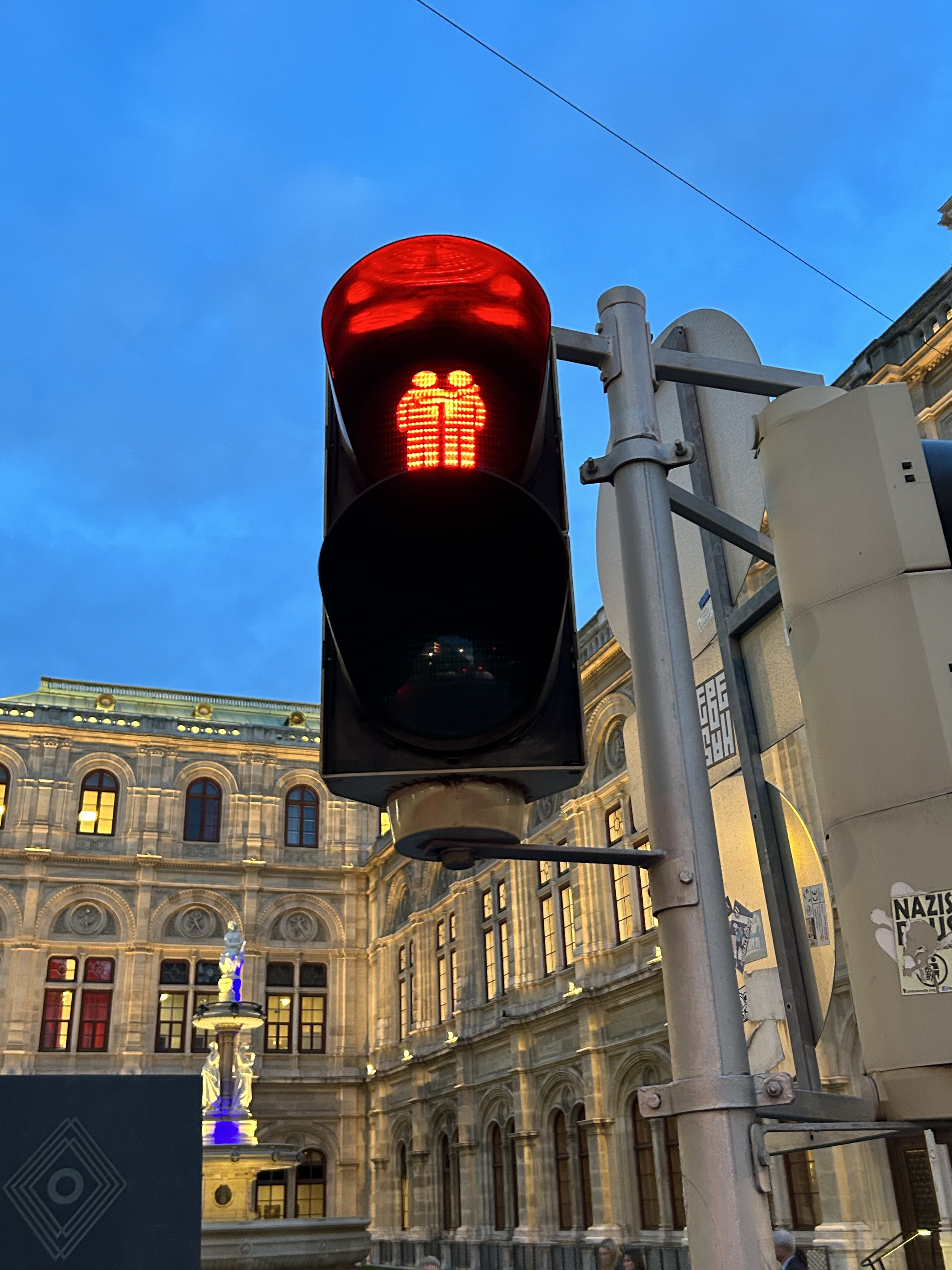
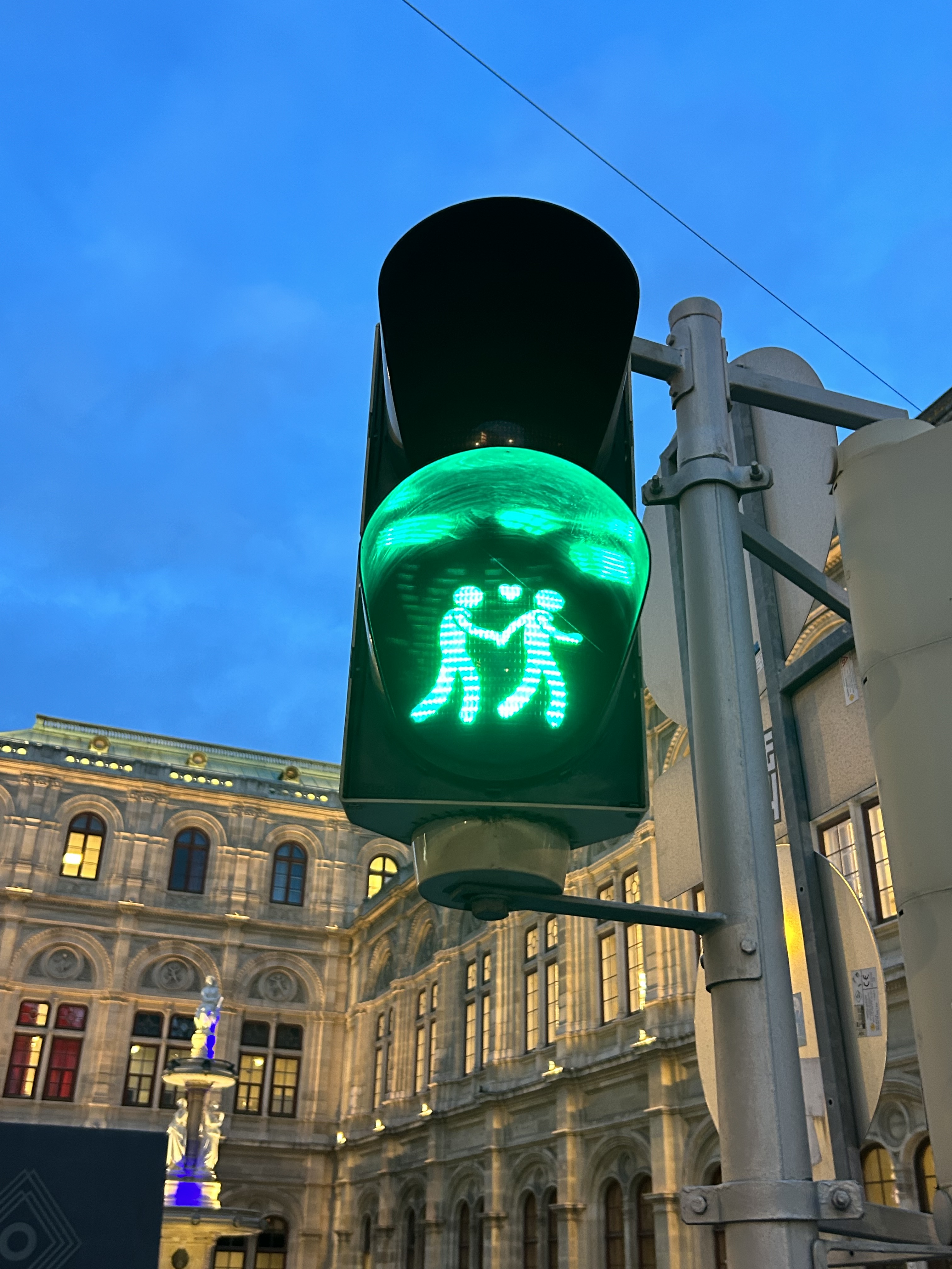
We noticed several pedestrian signs showing loving couples, rather than the standard, like this one in front of the Wiener Staatsoper (Opera House)
Vienna has one of the largest tram systems in Europe, with 30 lines over 176.9 kilometres, and a fleet of 525 cars, including modern articulated LRVs and older trams and trailers. In Vienna, trams alone carry approximately 300 million passengers a year. They run in many different environments: on-street in mixed traffic, reserved lanes, dedicated median and side-of-street rights-of-way; there is also a tram tunnel south of the city centre. Until the 1980s, Straßenbahnen (the German name for trams) were the backbone of Vienna’s transport network, with a small Stadtbahn system (now incorporated into the modern U-Bahn) and regional and suburban (S-Bahn) trains providing limited rapid transit services. Though there are now five U-Bahn lines (two of which evolved from the Stadtbahn), the tram system remains robust and very useful for getting around.
Like all four cities mentioned in this post, Vienna operates a mix of low-floor trams built in the last 25 years, as well as older high-floor trams, many of which are accompanied by an unstaffed trailer. Vienna’s entire network — trams, buses, U-Bahn, and S-Bahn — is a proof-of-payment system. Fare inspections appeared to be infrequent; neither my spouse nor I were checked during our eight days in Vienna. Tickets and passes can be purchased from a machine (found at every U-Bahn entrance and at many tram stops) or on the WienMobil app.
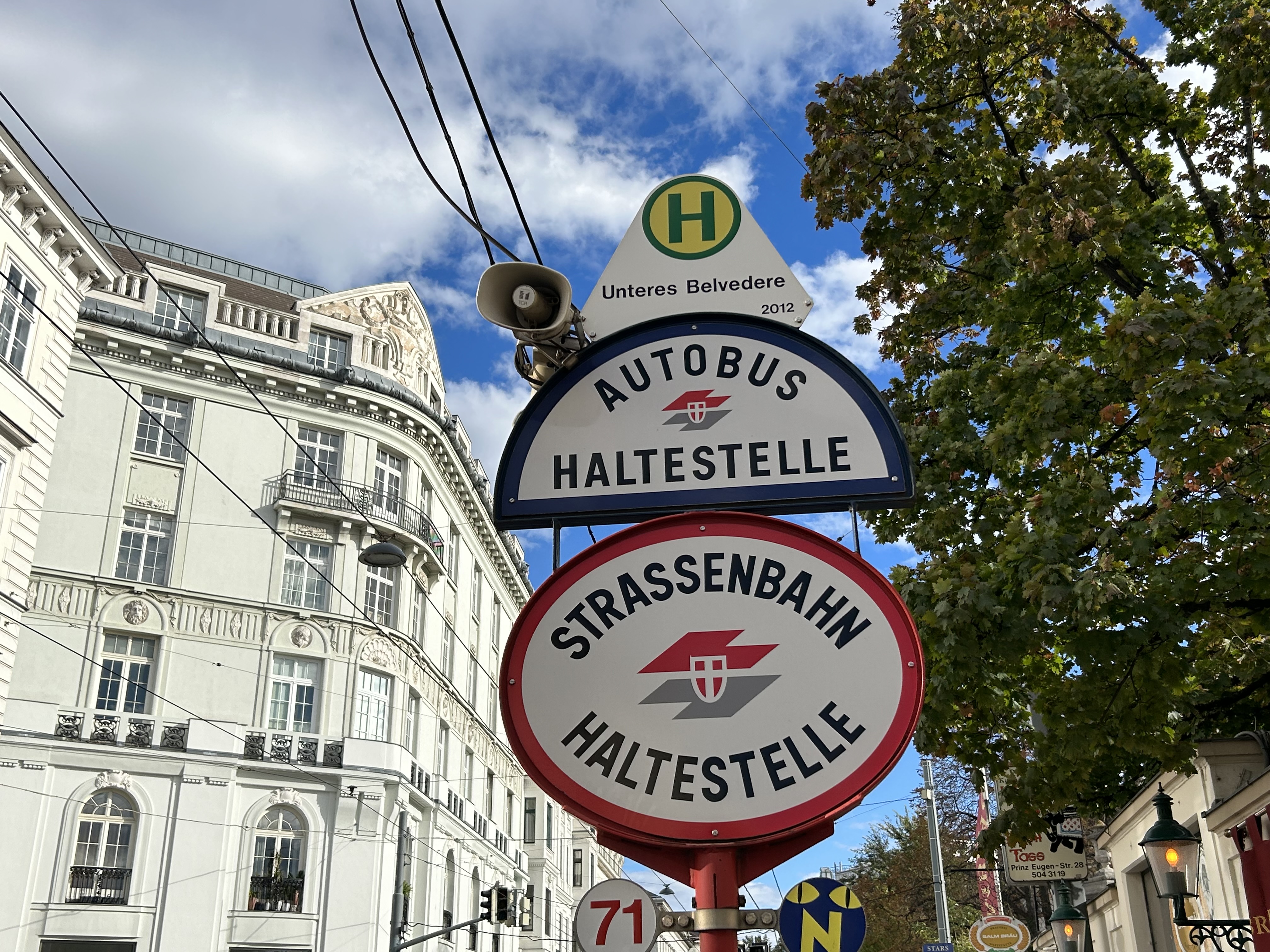
An older Type E2 high-floor tram and trailer at Gumpendorfer Straße. Behind is the old Stadtbahn viaduct, which is now part of Line U6. Note the large red “Strassenbahn Haltestelle” sign to the left, a classic Viennese icon that indicates a tram stop.
There is also a separate interurban tram service called Badner Bahn, which extends to the historic spa town of Baden bei Wien, an hour south of Vienna’s city centre.
Badner Bahn tram, laying over at Josefsplatz in Baden bei Wien
The modernized interurban originates in the heart of Vienna — across the street from the Wiener Staatsoper (Opera House) — then along local tram tracks and through the tunnel before entering its own right-of-way through the southern suburbs, and onwards through small towns, farms, and vineyards before arriving in Baden. There are several spurs leading to local industries; the regular passenger service shares the tracks with local freight trains.
View of the vineyards from Badner Bahn
A sample of the journey aboard Badner Bahn. Arriving southbound at Guntramsdorf, heading towards Baden bei Wien.
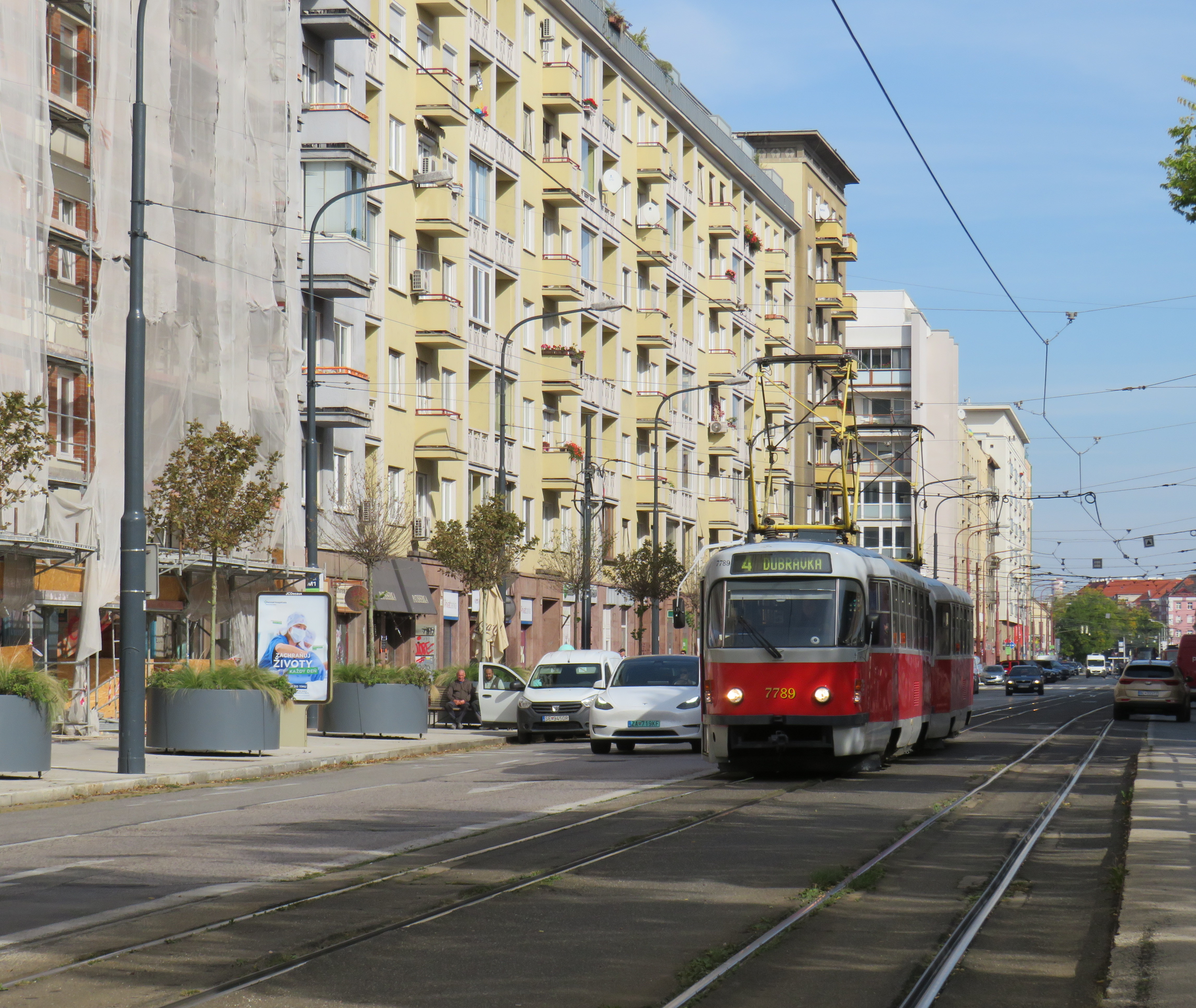
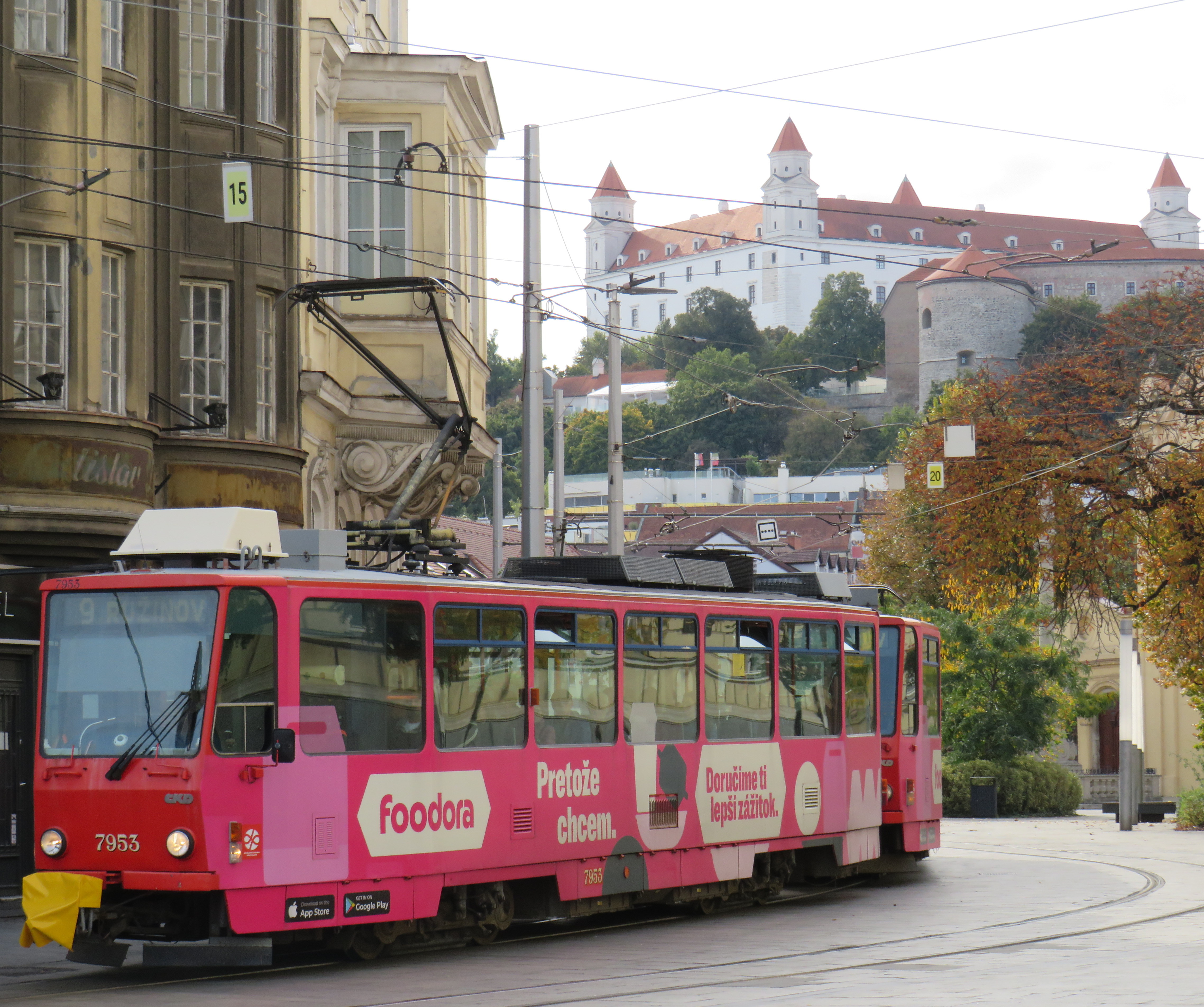
Bratislava, just over one hour away from Vienna by train (or by catamaran), is served by a network of metre-gauge trams, trolley buses, and diesel buses, though trams predominate in the city centre. On Obchodná, several tram lines, pedestrians, cyclists, and the occasional delivery or emergency services vehicle share a narrow, but busy shopping street. It just works.
Obchodná, Bratislava
Outside the congested urban core, trams are afforded reserved lanes, sometimes separated from general traffic with curbs (and even grass medians), sometimes just painted lines. Bratislava’s tram system is smaller than Toronto’s, with 211 cars and 42 kilometres of revenue track, carrying around 70 million riders a year in 2019 (Toronto’s streetcars carried 108 million that year). It is also a much smaller city, with a population of around 660,000. I only visited Bratislava for a day, but I got to ride much of the tram network; I found it an easy and convenient way to get around.
Reserved, painted tram lanes just outside Bratislava’s city centre
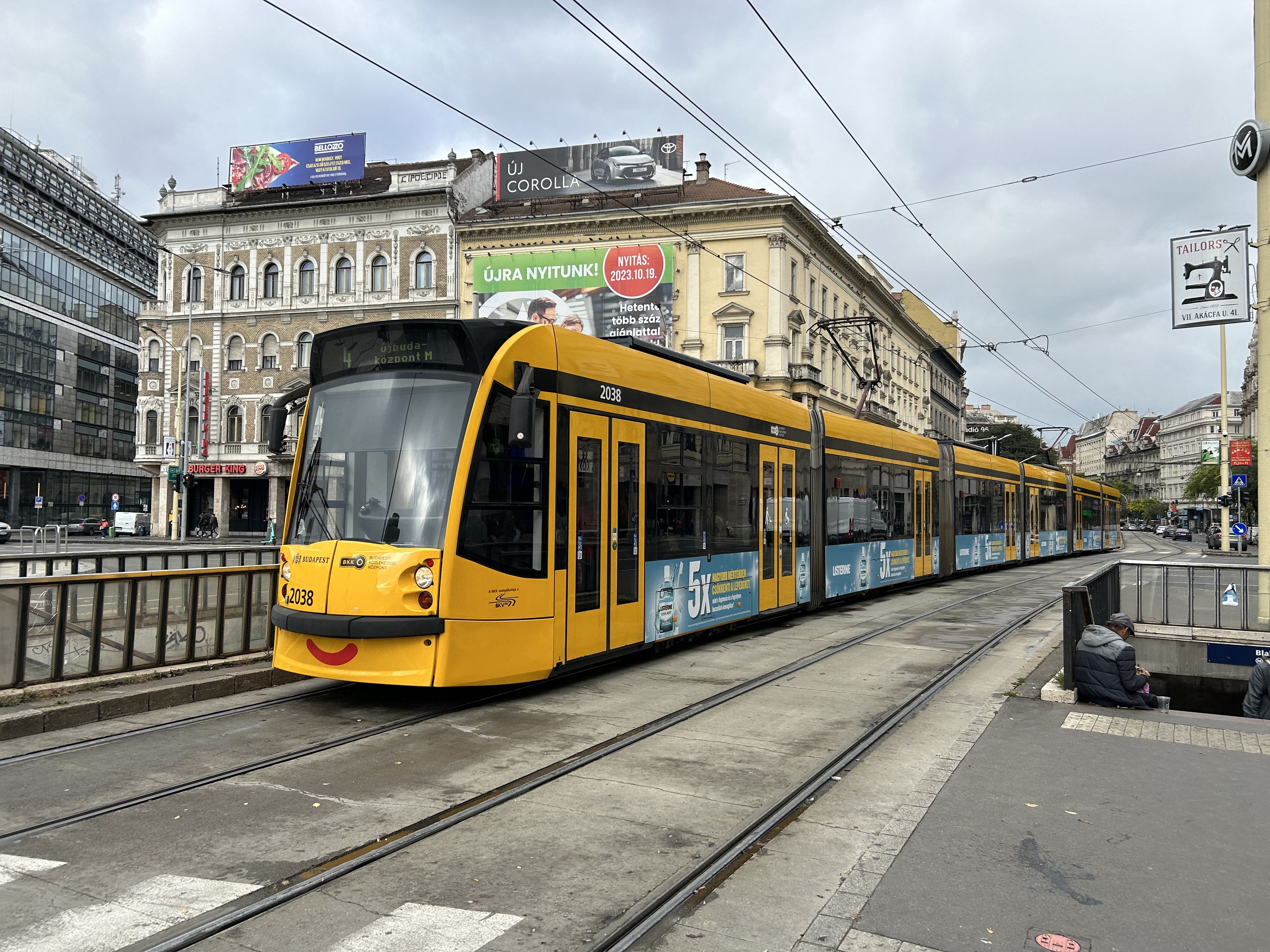
Budapest, Hungary has the largest street railway system in the world by ridership, with Route 4/6 on Budapest’s Grand Boulevard (Hungarian: Nagykörút), often cited as the world’s busiest tram line. Route 4/6 also operates 53.99 metre long Combino Plus trams, which, when introduced in 2006, were the world’s longest. The Combinos are almost twice the length of Toronto’s new Bombardier Flexity cars, which are 28 metres long. Even with the huge capacity these trams have (they require two pantographs to draw enough power to operate), they operate on Line 4/6 every few minutes, all day long, every day.
A Combino Plus tram on Line 4 traverses Budapest’s Nagykörút (Grand Boulevard)
Through the 1970s and 1980s, Budapest’s tram network was slowly cut back in favour of buses, trolley buses, and metro construction. By the 1990s, however, there was a street railway renaissance in Hungary’s capital because of the capacity and economy trams offered. With high frequencies, a private median, and high-capacity low-floor vehicles, Line 4/6 easily matches the capacity of a metro, at comparable speeds. Elsewhere, dedicated lanes and private rights-of-way make it clear that transit riders come first.
Older trams running along the Danube dip under road bridges on a private right-of-way
Though Budapest has a large metro network, most of it was not constructed until the l970s and 1980s. However, Line M1 was opened in 1896 as a shallow subway under Andrássy Avenue, the first electric underground metro in the world, and only the second subway, after London’s initial Underground line. Uniquely among urban transit routes, it it is listed as part of an UNESCO World Heritage Site.
Budapest Line M1 stations, restored to their original appearance, look like miniature New York stations, only cleaner
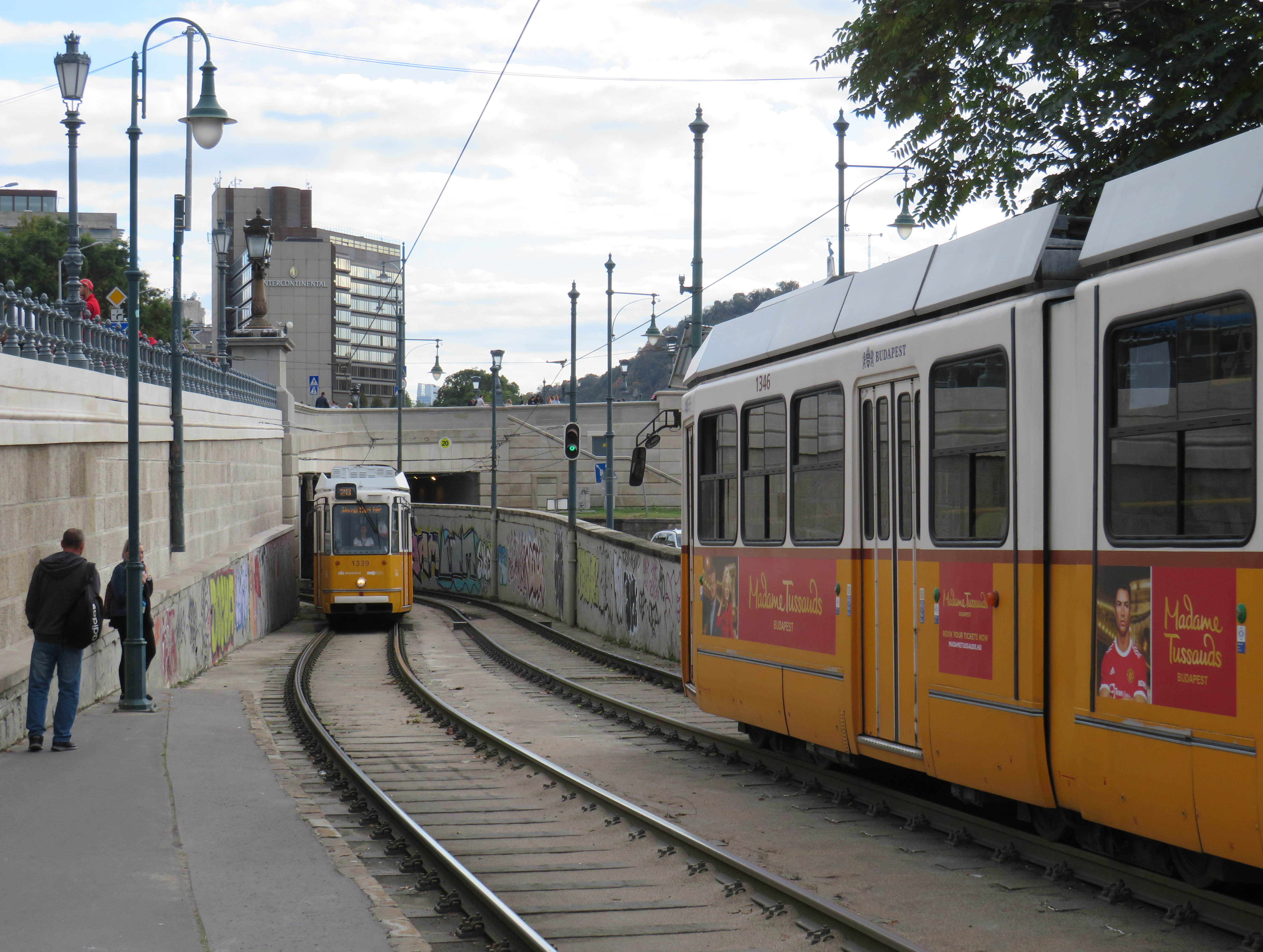
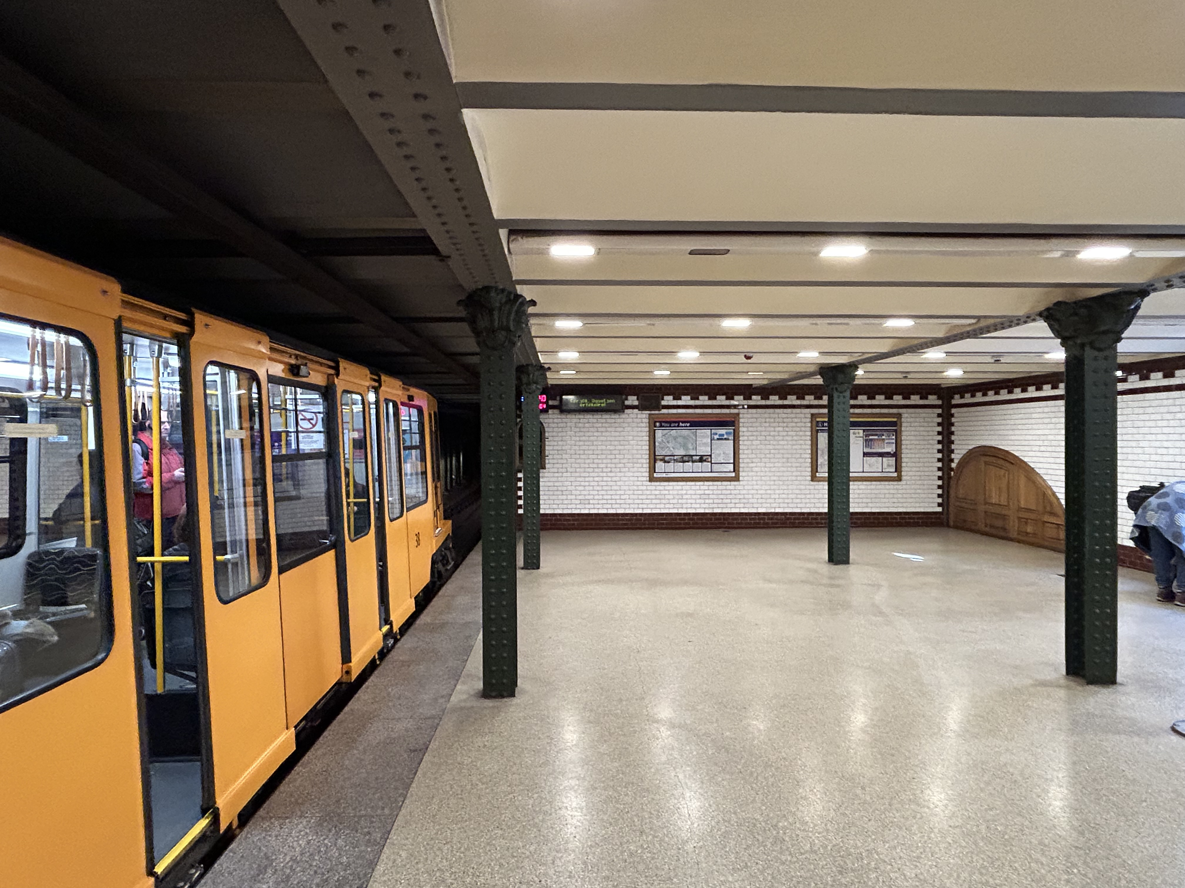
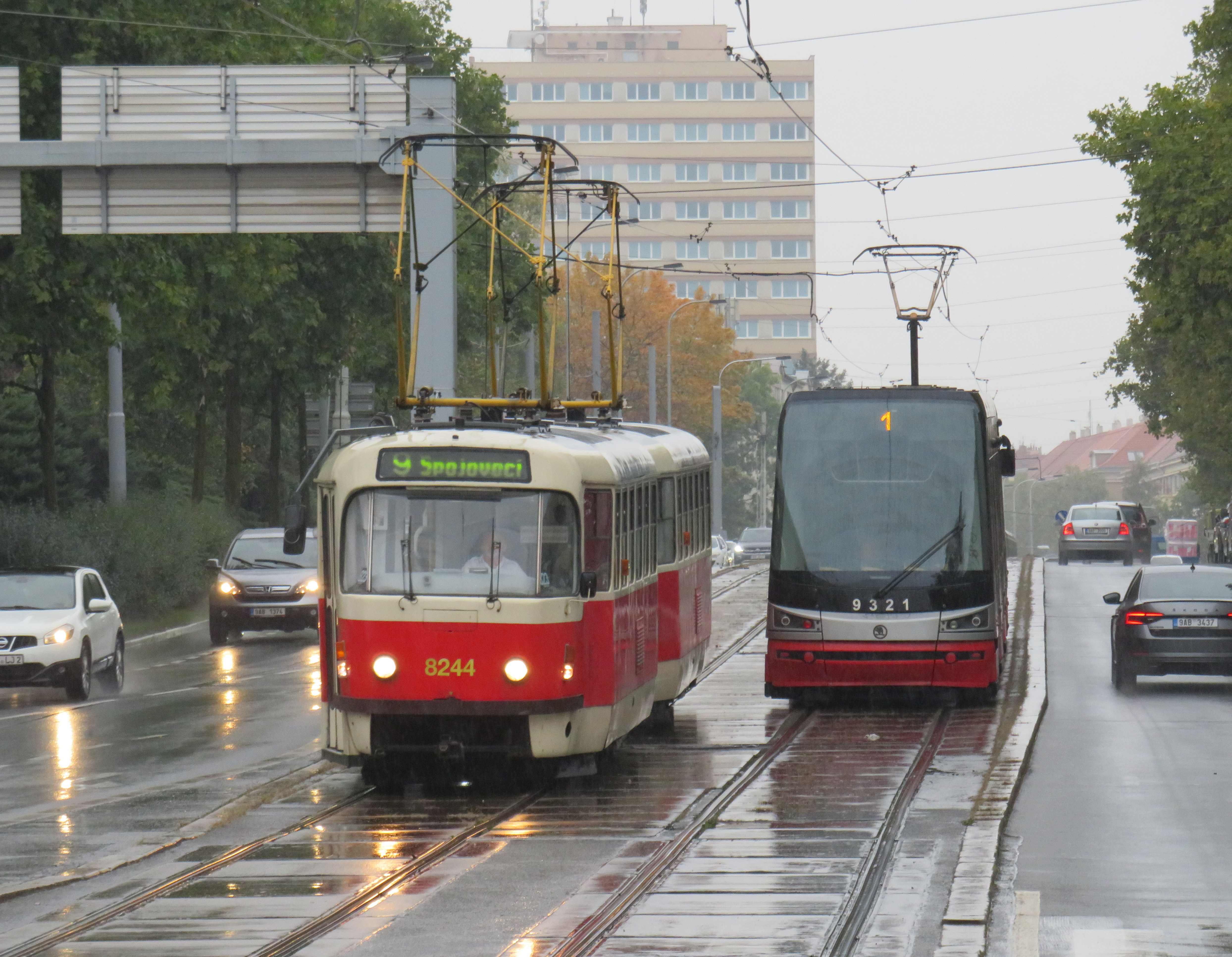
Finally, in Prague, we took several trams to take shelter from the rains that greeted us after arriving from Budapest, but also to see the city outside the crowded tourist spots. We took Line 1 from the city centre to the suburban district of Hrdlořezy, and returned via Line 9, taking a slightly different route back. Like Budapest, a metro system was planned and built in the 1970s and 1980s, but trams remained important, often providing local services parallel to deep underground metro lines.
Old two-car tram train on Line 9, passing a newer low-floor tram on Line 1, Sokolovská, Prague. Most trams run on reserved rights-of-way.
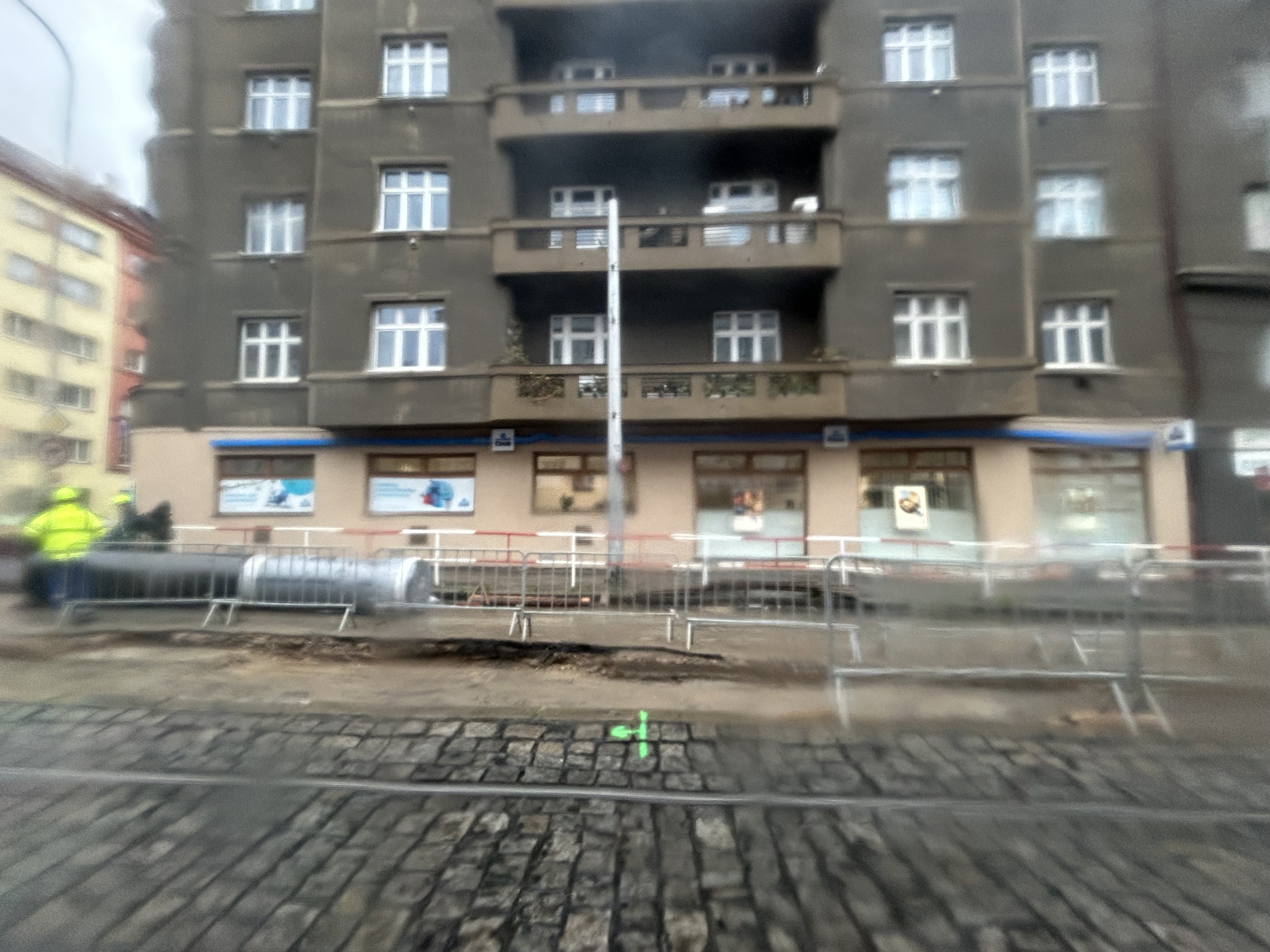
What interested me was seeing major watermain work along the line. Through trams slowed where work was adjacent, there were no diversions or shuttle buses. The trams ran through.
Watermain replacement in Prague, with trams still running(taken on a rainy morning)
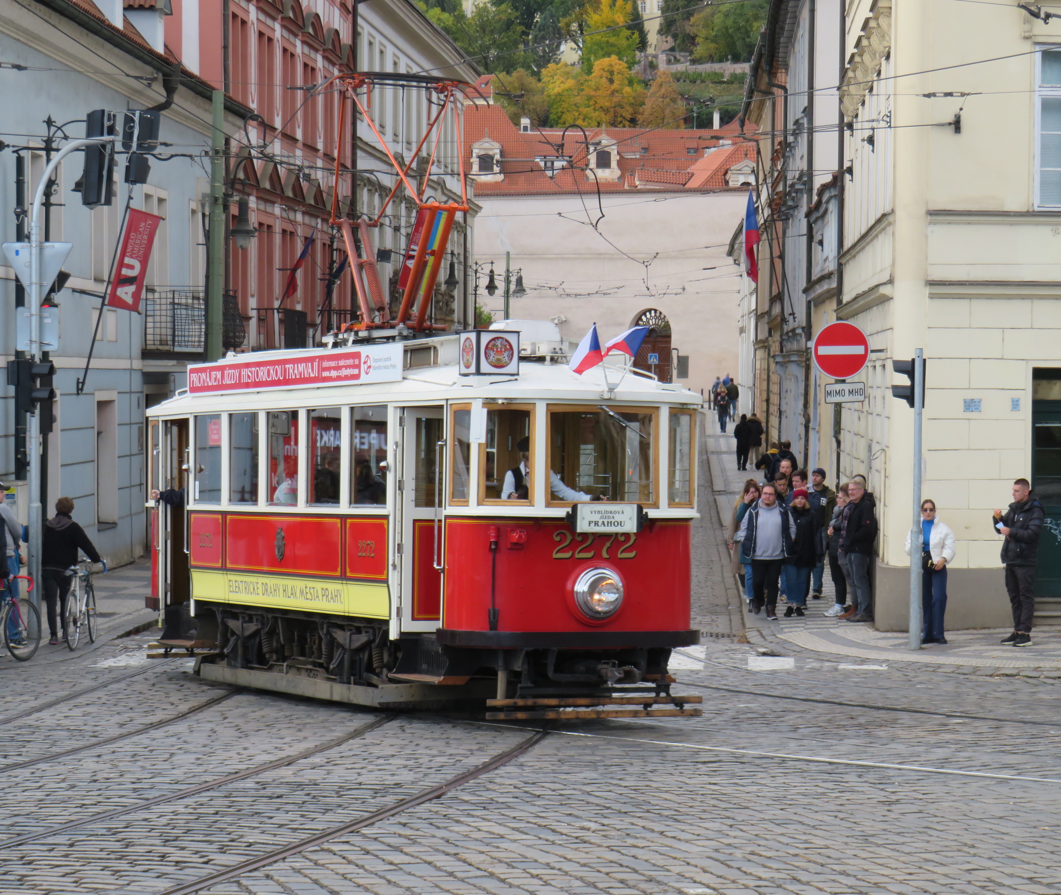
Like Vienna, Bratislava, and Budapest, Prague operates a mixed fleet of older high-floor trams and modern low-floor light rail vehicles, similar to Toronto’s new fleet. But in Prague, heritage trams could often be spotted in service, especially on the west bank of the Vltava near Prague Castle.
Heritage tram #2272 in Prague
Lessons for Toronto
After travelling, it can be easy to spot one’s hometown flaws and faults. But I spent a lot of time riding Vienna’s metros, trams, and buses, and mindfully experiencing the transport networks in Bratislava, Budapest, Prague, and Salzburg (which does not run trams, but has a large trolleybus network), I was left with some key takeaways on how to do transit here.
First and foremost, transit riders were respected. Not necessarily in terms of personable customer service, but the feeling that the next tram or bus was going to arrive on time, and a reliable interval. If there was a delay, it was very well communicated.
For instance, while waiting for a tram in Vienna, we experienced an unusually long wait. The next tram display kept showing the next two arrivals at 3 and 4 minutes. Not long after, a voice came on a loudspeaker posted above the tram stop sign announcing (in German, translated in English to us by one of my spouse’s colleagues) a delay because of a collision along the route. The blockage cleared after a few minutes, and we boarded a crowded tram. I appreciated the audio announcement, especially as it was a basic tram stop.
The classic Vienna tram stop. Note the loudspeakers atop the blue bus stop sign (at night, buses take over, hence the Strassenbahn and Autobus stop signs).
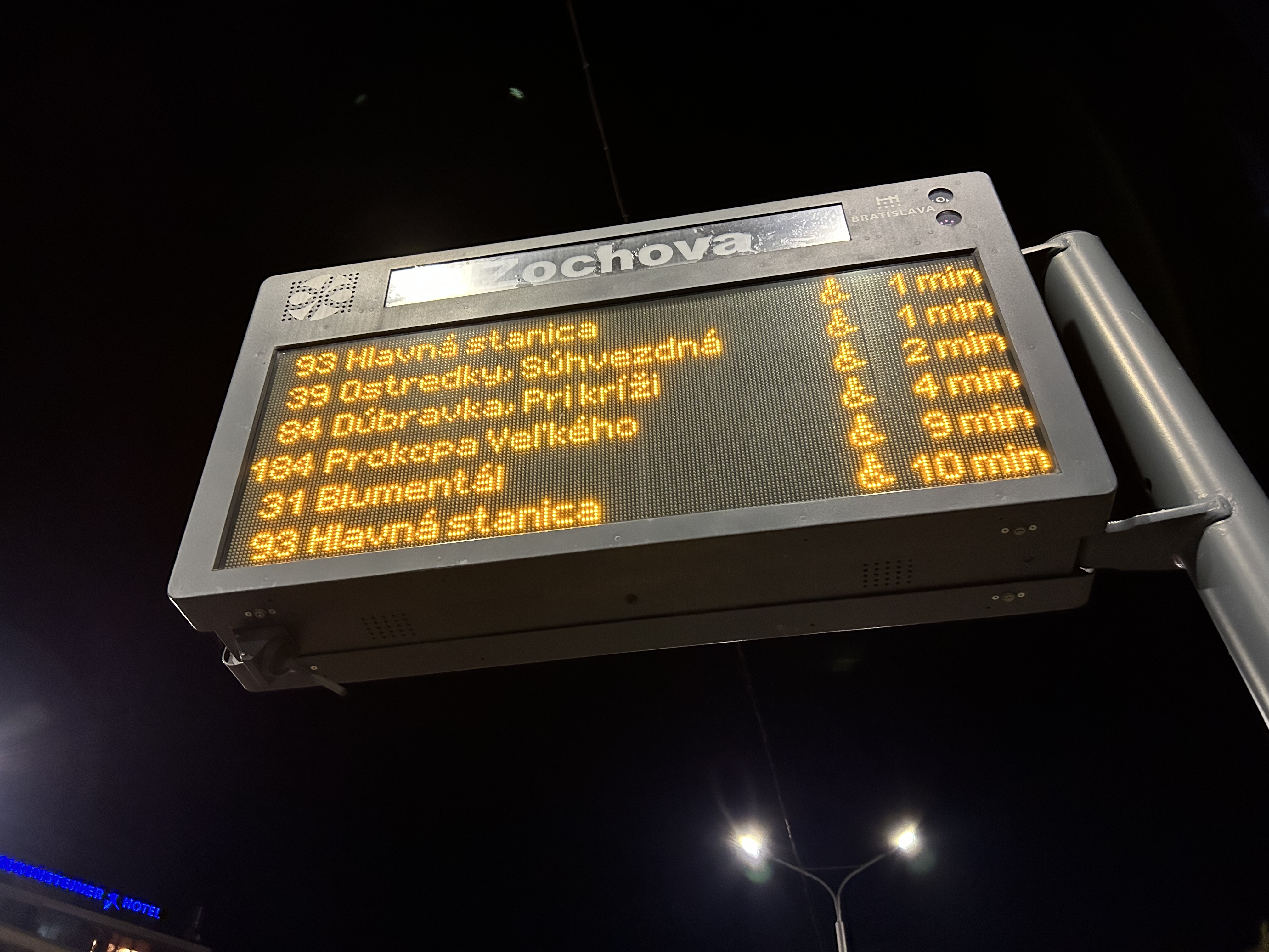
Next vehicle displays were common in every city we visited. They would list — in real time — the next several buses or trams, as well as if the vehicle was low-floor accessible or not with a wheelchair symbol. All buses are now fully accessible, but the information is useful for the tram lines, where there are still many older high-floor vehicles.
Next vehicle display at a bus stop in Bratislava
I also noted that in Vienna, and for the most part elsewhere, vinyl advertisement wraps did not cover passenger windows on trams and buses. Bratislava’s wrapped trams had some ads that used window areas, but these were kept to a minimum.
In Vienna, advertisement wraps kept windows completely free of obstructionsAdvertisement wraps in Bratislava had minimal window coverage
It was also clear that trams had dedicated signals on their routes, if not necessarily signal priority. But with smaller intersections and relatively short signal timings, the waits at each signalized intersection were generally minimal.
Note the white tram signals next to the overhead traffic signal. The “A” indicates that a proceed signal will soon appear, and the operator can cancel the door release, so that no more passengers can enter or exit.
Tram signaling in Vienna and other Central European cites also includes remotely operated electric switches. Overhead signals indicate which direction the switch is set to; operators can pass through junctions at speed. While this is how trams operate in most places around the world, in Toronto, streetcar operators are required to stop before each switch and then crawl.
Trams pass through a track junction, along with an ambulance and a transit maintenance van. The overhead horizontal signal indicates the switch direction.
Though many tram stops are in private rights-of-way, in-street tram stops are designed for passenger safety and accessibility. These stops, depicted by the photograph below, have the curb lane raised to the level of the low-floor trams. This increases the visibility of passengers boarding and egressing, and also simplifies ramp deployment. Operators need not exit the cab and manually deploy the accessibility ramp, a timesaver versus the TTC’s ramp deployment on major streets. In the winter, this also helps keep the slush away from the tram stops.
The raised on-street curb lane at an on-street tram stop in Vienna.
Though Toronto is a very different city than Vienna, Budapest, or Prague, there are some clear takeaways. Keep the tram windows free of advertisements. Improve communications. Fix the track switches and signalize them. Raise the curb lanes at streetcar stops for safety, convenience, and accessibility. Fix the King Street Transit Priority corridor with a permanent streetscape and tighter vehicle restrictions. If it can be done on a narrow commercial street in Bratislava’s historic centre, there’s no reason why it can’t be done in a world financial capital.
These can even be done incrementally, but they need to be done if transit riders are deserving of respect and reliable surface transit.
On Monday, October 30, the new Old Elm GO Station opened in the town of Whitchurch-Stouffville, northeast of Toronto. Located two kilometres away from Stouffville’s small downtown core, Old Elm is focused on park-and-ride passengers arriving from nearby communities such as Goodwood, Uxbridge, Port Perry, Beaverton, and from within Stouffville itself.
The new station is relatively simple, with a covered platform, a bus loop with several bays directly adjacent to the single platform, heated shelters, and a 673-spot parking lot. As a relatively quiet station with limited train service, there is no indoor waiting room or ticket office.
The bus loop is directly adjacent to the train platform
Though train service is limited to weekday rush hours and a few evening and weekend departures, there is regular GO Transit bus service connecting Uxbridge and Goodwood to Old Elm Station, and onwards to midday and weekend train connections at Mount Joy or continuing to Toronto Union Station. There are no York Region Transit connections at Old Elm.
The Lincolnville layover yard, which was also the Lincolnville/Old Elm station location until October 2023
Previously, Old Elm Station was located a few hundred metres away, northeast of the Tenth Line/Bethesda Side Road intersection at the Lincolnville layover yard, where Stouffville Line trains continue to be stored overnight and weekends. That station, originally named Lincolnville for a nearby hamlet, was opened in 2008 to accommodate service expansion and relieve the small station at Stouffville, which had no room for a bus loop or additional parking. Since Lincolnville was a yard terminus, passengers had to walk across tracks to reach the next departing train, and each departing and arriving train had to crawl through the yard before reaching the mainline. (As Georgetown GO Station is also within a layover yard, trains passing through on their way to and from Kitchener must also crawl through. A new layover yard near Heritage Road in Brampton will allow for a rebuilt Georgetown Station with faster arrivals and departures.)
Lincolnville Station was confusingly renamed Old Elm in 2021, even though that new name referred to a tree on the new station site that didn’t open for two more years. Had the new name taken effect with the location change, it would have made more sense.
The new station site, located outside of the Lincolnville yard, allows for smoother and faster arrivals and departures, shaving several minutes off the trip for passengers to and from Lincolnville.
The station’s namesake, an old elm tree on the south end of the GO Transit property
Though Lincolnville/Old Elm is located in the Greenbelt, and the station is unable to support transit-oriented urban development, there was a need for the layover yard. Adding a small, auto-focused station was quite sensible. This is no Garage Mahal.
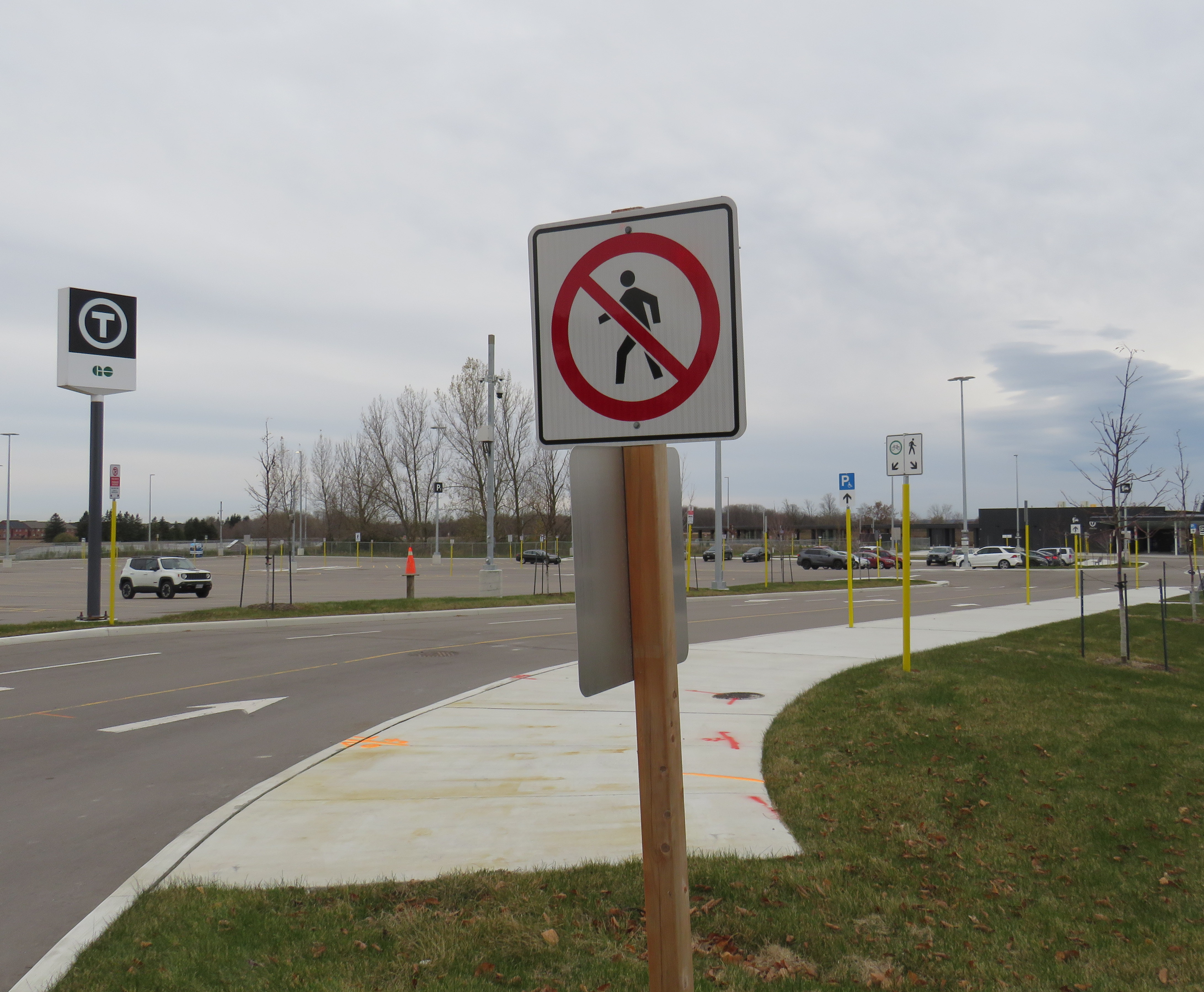
The one unfortunate feature is the complete lack of active transportation access beyond the station property. Though Metrolinx built a wide concrete walkway from Tenth Line to the station platforms, there are no sidewalks, no crosswalks, and no pedestrian signals at either the main entrance or the bus loop entrance, which are both signalized intersections. Instead, there are “no pedestrians” signs facing all directions.
“No pedestrians” sign placed in front of the new concrete pathway into Old Elm Station
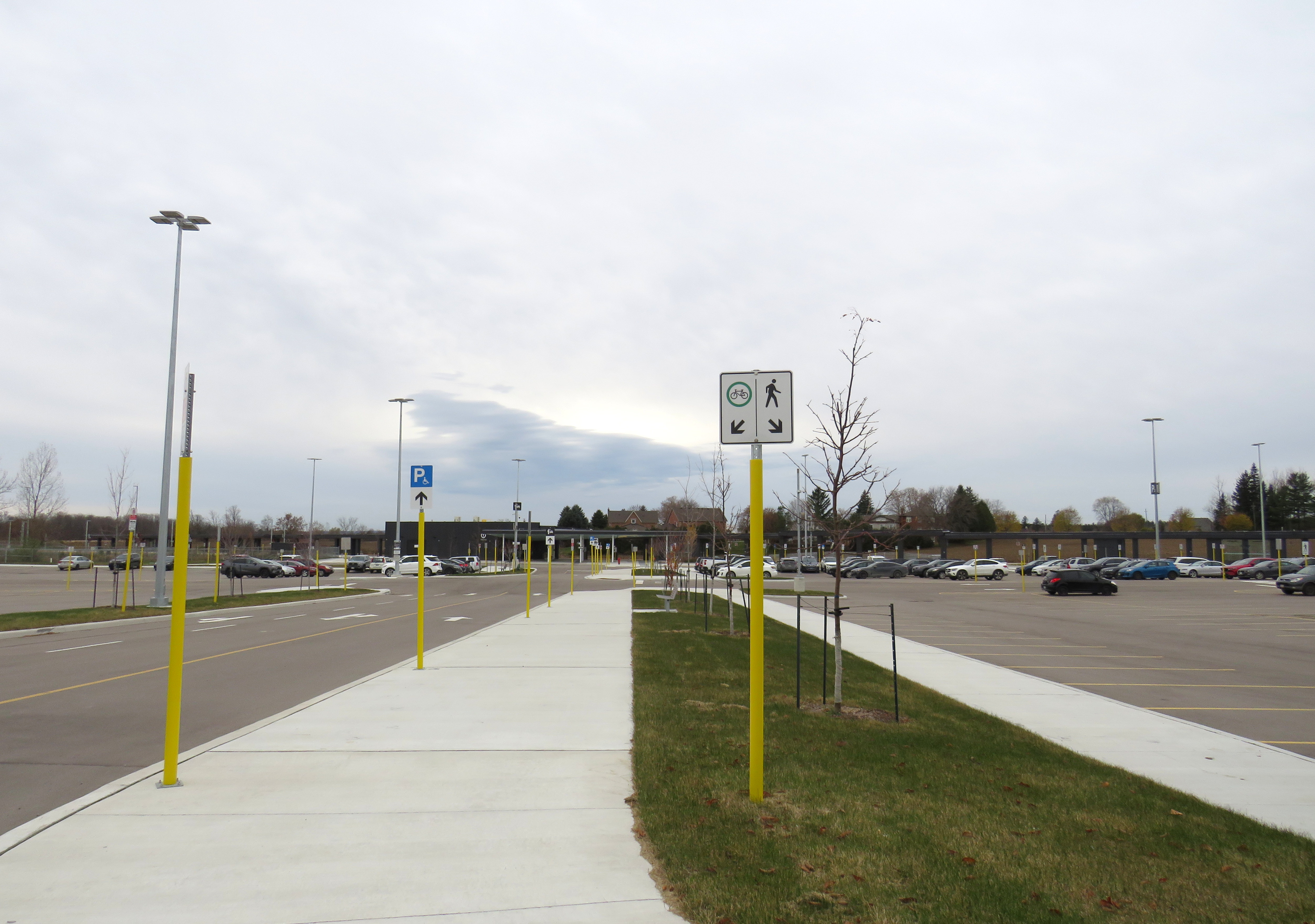
Once on Metrolinx property, though, there is a wide pathway, presumably for cyclists and pedestrians. Interestingly, the sign below shows that cyclists should keep to the left, on the wide pathway, while pedestrians are directed into the grass to the right.
Beyond the “no pedestrians” sign at the intersection, another sign instructs cyclists to keep to the left and pedestrians to the right – into the grass
I doubt Metrolinx intended for the hostile intersections to forbid any pedestrian activity. I note too that despite the rural locale, there are several neighbouring homes and businesses along Tenth Line and Bethesda Side Road. The nearest subdivision is less than a 15-minute walk away, a healthy stroll’s distance. A new residential development, Elm Villa, is planned for the site immediately to the south of the bus loop. Tenth Line is maintained by the Town of Whitchurch-Stouffville, so it is likely they are responsible for the oversight. Still, it is not a great look.
It is no secret that I am fascinated by Ontario’s failed downtown malls. Over the last decade, I have visited most of these half-dead shopping centres, from Thunder Bay to Sarnia to Peterborough. All of these malls were built in smaller centres hoping to revitalize their urban cores, especially after the successes of the Toronto Eaton Centre and Ottawa’s Rideau Centre.
A majority of downtown shopping centres in Ontario counted Eaton’s as an anchor, starting with London’s Wellington Square in 1960. New malls in Sudbury (1970), Hamilton (Jackson Square, 1972-1975) and Kitchener (Market Square, 1974) followed, with the pace of downtown mall openings quickening in the late 1970s and 1980s as the provincial government provided assistance through the Ontario Downtown Redevelopment Program (ODRP).
A few downtown malls did not secure Eaton’s as the lead anchor. These malls, which were anchored by Sears, included King Centre (Downtown Kitchener’s second indoor mall), Cornwall Square, and Downtown Chatham Centre. I visited the latter mall in late September 2023.
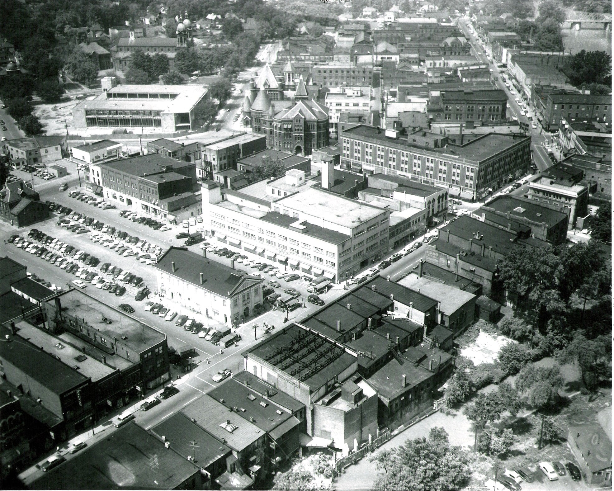
Chatham, a small city located halfway between London and Windsor, has had bad luck ever since the 1950s. City growth was curtailed when neighbouring townships fought the city’s annexation efforts to develop new industrial lands on the urban outskirts. Political pressure from exurban residents kept the city rather isolated from the new Highway 401, which passes south of the old city limits; residents of the hamlet of Charing Cross opposed a highway interchange that would have provided direct access into Downtown Chatham. Meanwhile, a new Multi-Malls shopping development was approved for a site north of Chatham; an appeal to the Ontario Municipal Board by the city was dismissed, and the new Woolco and Loblaw-anchored plaza helped to draw customers — and tax revenues — from the city proper.
This unfortunate situation was only rectified in 1998, when the City of Chatham was amalgamated with not just its neighbouring townships, but the entire county, creating the new municipality of Chatham-Kent, coming far too late for the industrial and commercial development Chatham had hoped for. In the meantime, a new downtown mall that would not only retain shoppers but hopefully attract new visitors to the city, was seen as the solution.
While most downtown malls built during the ODRP era were led by Eaton’s and Cadillac Fairview, the Downtown Chatham Centre (DCC) was managed by Cambridge Shopping Centres. The city of Chatham conducted the land assembly (using its powers of expropriation where necessary), and cleared two city blocks, including the Garner Hotel, the old market square, the Romanesque Harrison Hall, and several commercial blocks, including a shuttered Eaton’s store.
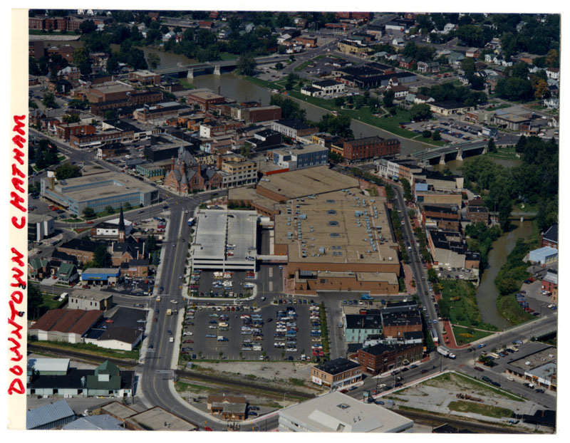
Downtown Chatham in the 1950s. Most of the buildings in the foreground and midground have since been demolished. The old market square became a parking lot by the 1950s; to the immediate left of the old market is the 3-4 storey Eaton’s store. Harrison Hall, with its conic tower, stands behind Eaton’s.The Downtown Chatham Centre soon after opening in 1983(Chatham-Kent Museum)
Instead of Eaton’s — which closed its Chatham store in 1974 — the lead anchor would be Sears, which was expanding its Canadian footprint at the time, as it just pulled out from its 25-year partnership with Simpson’s. Unlike most downtown malls built in Ontario, DCC had always offered ample customer parking, located in a garage linked to both of the mall’s two shopping levels, as well as an adjacent surface lot, with mall visitors able to get their parking validated. On the south side of the mall, there was a Miracle Food Mart, along with a food court on the second floor. Downtown Chatham offered the only full-line department store in town; the mall also had the city’s only escalators. The plaza out front featured a fountain in the summer and a public skating rink in the winter.
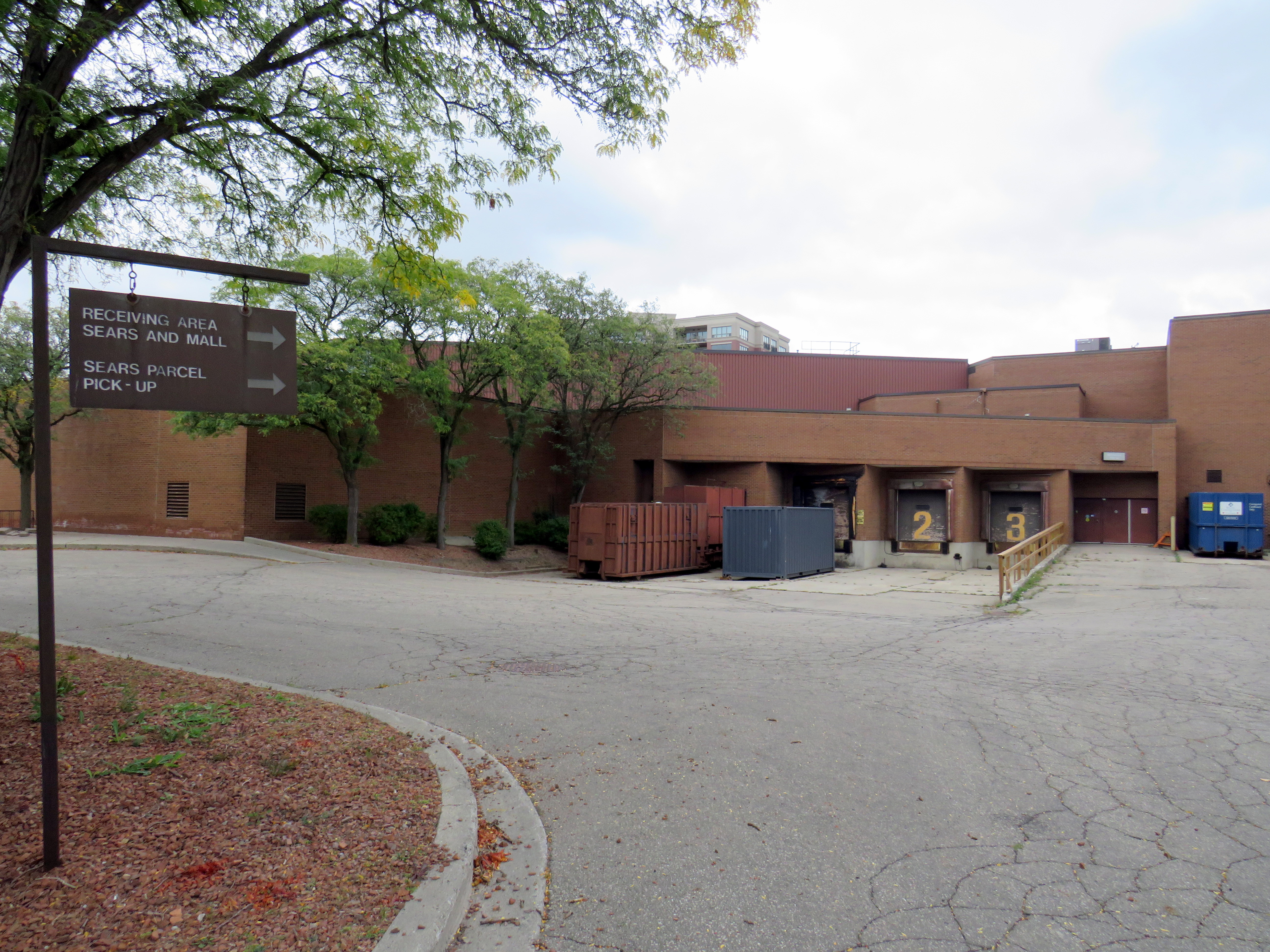
Harrison Hall, which was home to both the City of Chatham and Kent County before demolition in 1978 to make way for the Downtown Chatham Centre. (Chatham-Kent Museum)The site of demolished Harrison Hall in 2023. Asign still directs drivers to the Sears receiving area and the parcel pick-up.
For a time, DCC held its own. Sears was a much more suitable department store for a smaller industrial/agricultural city like Chatham than Eaton’s would have been. Though the Multi-Mall development north of the city on Highway 40 and the Thames-Lea plaza in the suburbs provided competition, the downtown mall’s regional market dominance was undisputed in the 1980s and most of the 1990s. Unlike Eaton’s, Sears Canada was particularly healthy until the early 2000s as it catered to the suburban middle class; in 1999, it purchased the remains of the bankrupt T. Eaton Company, converting many better performing Eaton’s stores to its own brand.
Unlike Chatham’s peer cities like Brantford and Sarnia, the mall’s tenant mix stayed relatively healthy well into the new millennium (see the 1992 and 2014 tenant lists below). Though Miracle Food Mart closed, that space was remised into a Sport Chek and a Goodlife Fitness gym. It wasn’t until the last decade that serious decline began to set in.
What happened?
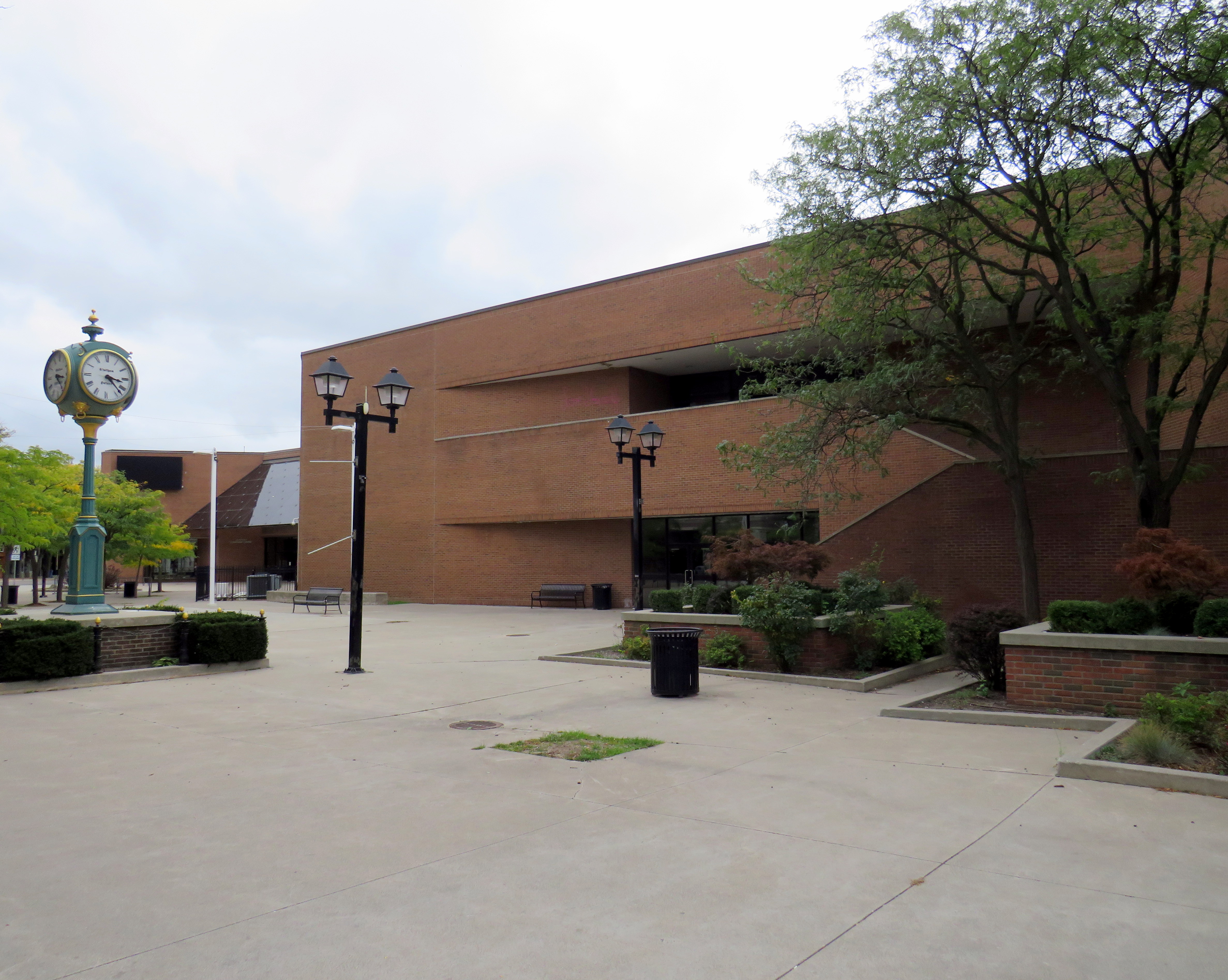
The empty public plaza outside the vacant Sears store
There were several factors that led towards the decline of Downtown Chatham Centre, similar to the reasons why most downtown malls failed. The main difference is that the decline came later than most others.
Chatham’s economy, like most smaller Ontario centres, was in flux, particularly in the 1990s and early 2000s. Free trade agreements affected the local industrial economy, which was already weaker than neighbouring cities like Sarnia, Windsor, and London-St. Thomas.
Factory closures included the Navistar plant. For nearly a century, International Harvester was one of Chatham’s largest employers. The Chatham plant, which assembled International truck tractors and employed 2400 workers in 2001, closed for good in 2011. The rise of Walmart, which moved into the old Woolco store on Highway 40 along with other big-box retailers, also hurt the downtown mall. But Sears Canada entered its own death spiral in the mid-2000s. In 2005, the company was taken over by the private equity firm Pershing Square, whose CEO, Edward Lampert, was already slowly sucking the American parent company dry. Sears Canada sold off its credit card division, its Downtown Toronto headquarters, and eventually the leases for its most attractive stores in 2012 and 2013, including the former Eaton’s flagship in Toronto Eaton Centre.
By 2014, the DCC Sears was converted to an outlet store, foreshadowing its eventual closure in 2017, less than year before the entire chain disappeared from Canada.
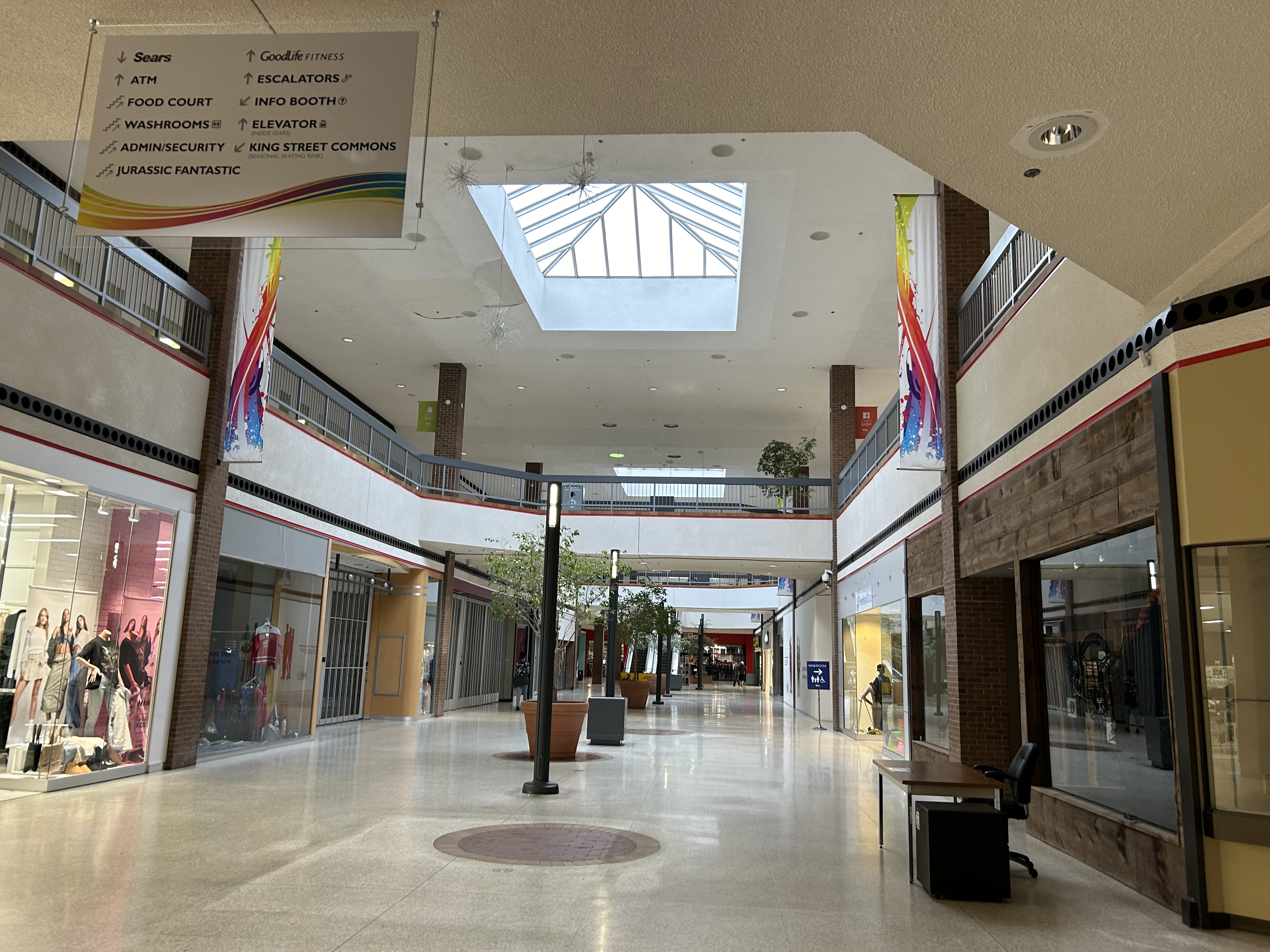
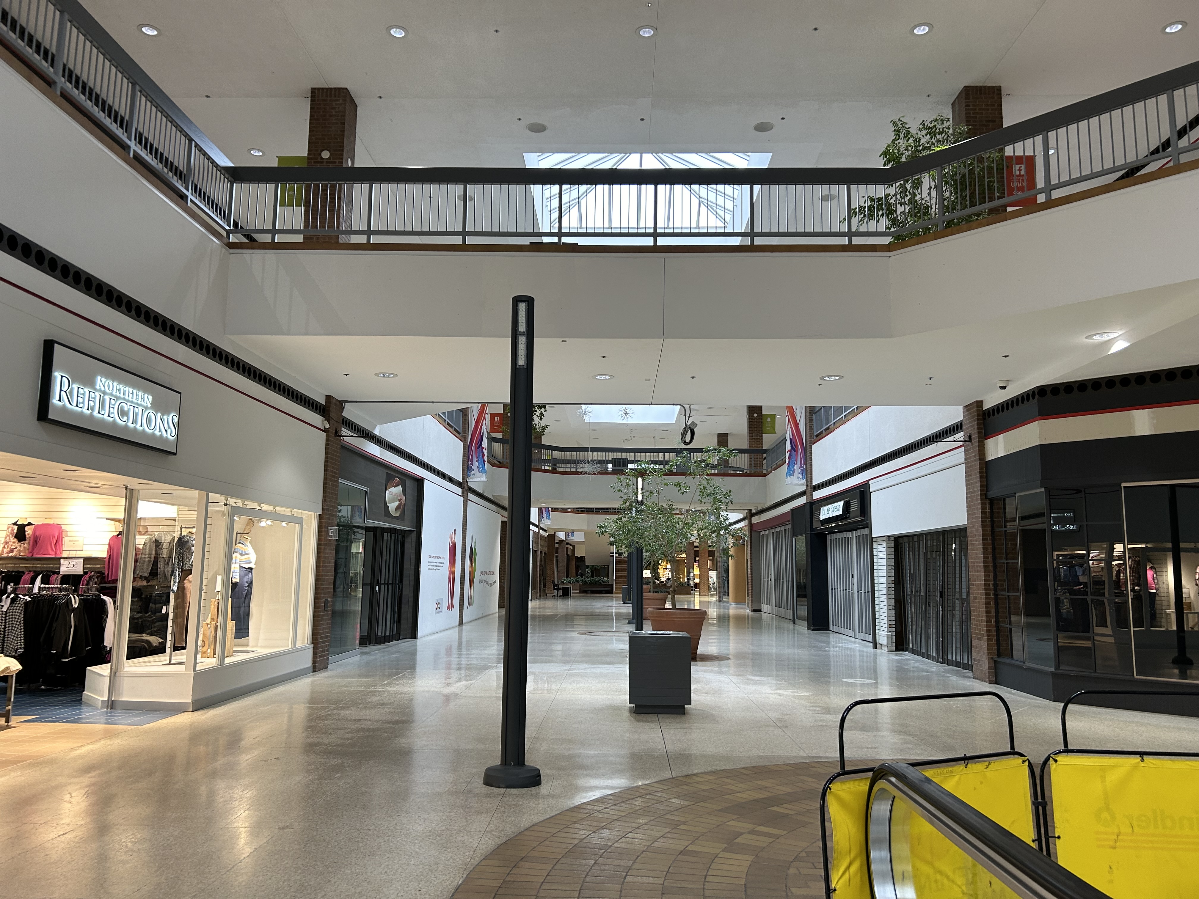
Mall interior looking east, September 2023
In September 2023, there were only a handful of open stores left inside DCC, including Northern Reflections, a Dollarama, Fit4Less (a budget brand of Goodlife Fitness), Ardene, an independent jewellery store, and a Hart discount department store located in the old Miracle Food Mart/Sport Chek space. All open retail spaces were on the first floor; the escalators were completely blocked off. The Ardene store was already in the process of moving to the Thames-Lea plaza.
Security guards were stationed at both public entrances, likely to ensure the mall did not become a hangout for Chatham’s unhoused.
Mall interior, looking west
The mall also has a pharmacy and medical office, but since 2015, they are accessed only from the outside, in a storefront facing King Street.
What’s next?
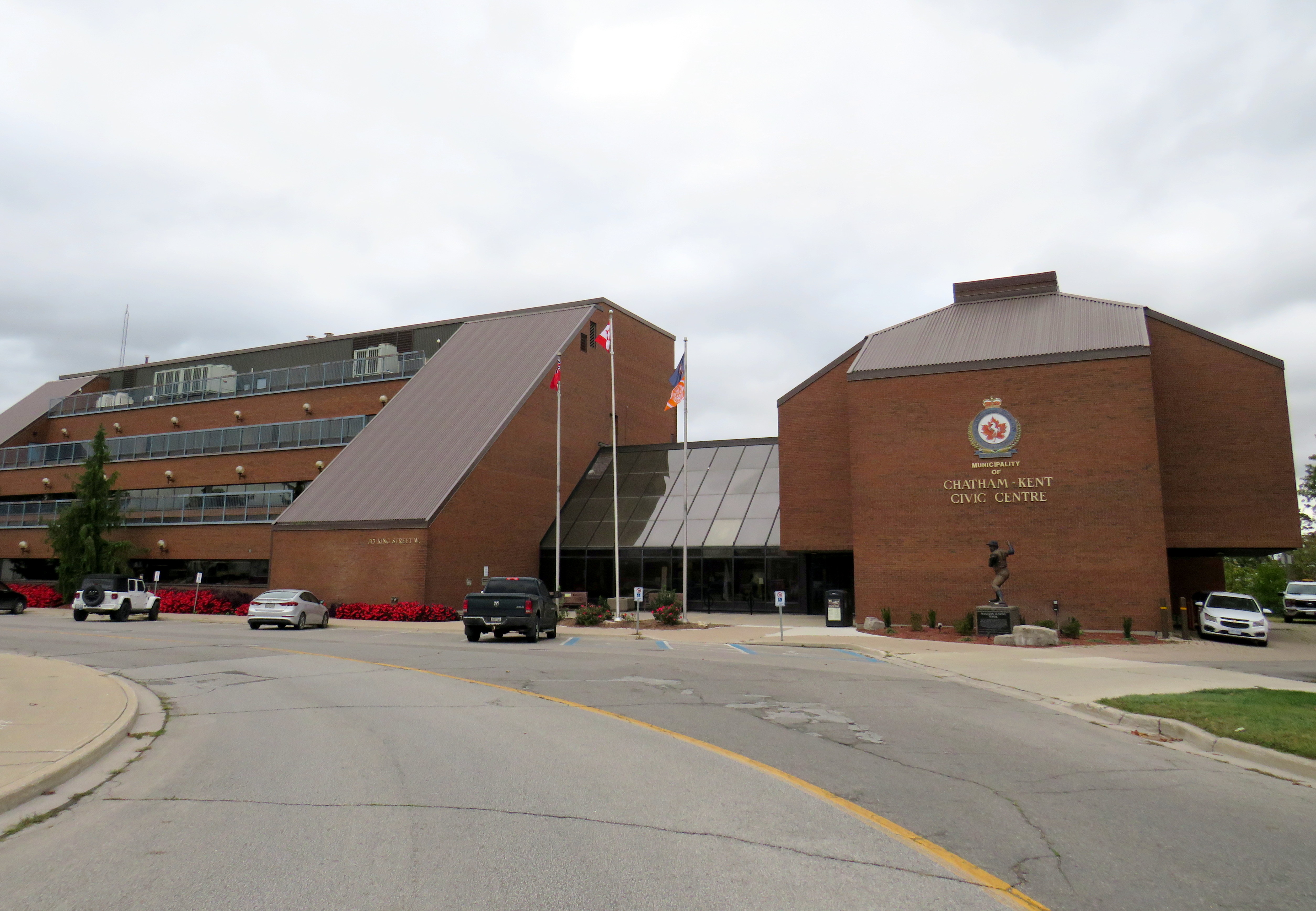
Chatham-Kent Civic Centre, built in 1975-1976
The Municipality of Chatham-Kent currently occupies the Chatham Civic Centre, which was built in the late 1970s on the site of a former gas works on the Thames River. The Civic Centre requires major renovations or replacement, and the municipal government is considering purchasing part of the Downtown Chatham Centre, and moving the municipal government, the main library, and the art gallery/museum into the Sears store, which would be heavily renovated. Staff report that the cost of purchasing and renovating part of the DCC ($42,387,400) was similar to renovating the existing Civic Centre, library, and museum ($38.7 million to $45.8 million) and nearly half the cost of building brand new.
Earlier plans also included a new entertainment centre to host concerts and the Chatham Maroons minor hockey team, replacing an existing municipal arena constructed in 1949. Those plans were later dropped by the mall’s owners.
If Chatham-Kent agrees to purchase and renovate the vacant Sears store, they will relocate to nearly the same site as the old Harrison Hall.
The proposed relocation of the civic centre and library to a central location, adjacent to the RideCK transit terminal (which serves the old City of Chatham as well as many smaller population centres within the municipality) is certainly a more sustainable and equitable outcome than building a new civic centre outside the downtown core. It repurposes an existing building and helps to support downtown business. However, more housing, both on the surface lot and on any vacated civic properties would help bring even more people into the downtown core, which can use the boost. Though retailers may not flock back into the mall once renovations are complete, the storefronts offer flexible space for community programs and small business incubators.
For a small city like Chatham, this is likely the best outcome.
1992 Tenants
Below is the list of tenants at Downtown Chatham Centre in 1992, obtained from the 1993 Canadian Directory of Shopping Centres, published by Maclean-Hunter.
Fashions and footwear Children’s wear: Just Kids Unisex/family wear: Cotton Ginny, Le Château, Pantorama, Stitches, Work World Ladies’ wear: Addition-Elle, Born Free, D’Allairds, Fairweather, Irene Hill, Just Petites, Lady Foot Locker, The Lady’s a Champ, Mariposa, Northern Reflections, Pennington’s, Personally Yours, Reitman’s, Ricki’s, Station Cotton, Suzy Shier, Thyme Maternity Menswear: Tip Top Footwear & leather goods: Foot Locker, Joggers, Kinney, The Shoe Place Jewellery/accessories: Lady Jewellery Company, Ostranders, Young’s Jewellers
Other retailers Books: Classic Bookshop, Coles Drugs/health & beauty: Pharma Plus, The Soap Emporium Department/mass merchandiser: A Buck or Two Electronics: Radio Shack Gift: Den For Men, Things Engraved Hardware/paint & paper: Tool Den Housewares: Junor’s, Stokes Music/Records: Sam the Record Man Pet: Pet Paradise Photo/Camera: Black’s, Japan Camera 1 Hour Photo. Restaurant/fast food: A&W, Crumbles Muffins, Frankfurters, Lumberjack Restaurant, Manchu Wok, Mulligan’s Roadhouse, Sorrento Specialty Food & Drink: Bright’s Wines, Laura Secord, The Gourmet Cup Stationery/Card: Carlton Cards, Hallmark, Willson Stationers Toy: Toys & Wheels Variety/Convenience: News Room Dry Cleaners: La Moderna Dry Cleaning. Hairstyling/Esthetics: The Golden Razor Theatre/Entertainment: Fun & Games Miscellaneous: Infoplace
2014 Tenants
The 2015 Canadian Directory of Shopping Centres tenant list was shorter, though still much more robust than former Eaton’s-anchored downtown malls in comparably-sized cities like Sarnia, Brantford, or Peterborough at the time.
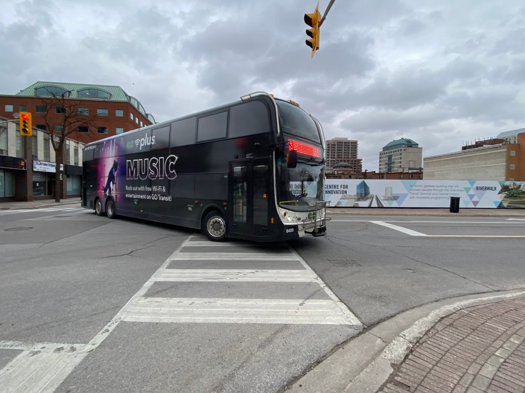
A Go Transit double decker bus completely covered by a vinyl wrap, with the exception of the front windows and entrance door. The wrap advertises the transit agency’s wifi and music streaming gimmick.
Apart from unscheduled short-turns, lengthy delays, or missed transfers, the thing that bothers me most about riding buses or streetcars is an obstructed view caused by a vinyl advertisement wrap.
Though transit advertisements have been around almost as long as there have been transit services, these advertisements have generally been limited to posters and cards mounted outside the vehicles, or placed inside, above the windows or beside doors. Advertisements have long been placed inside train and subway stations, and in outdoor transit shelters.
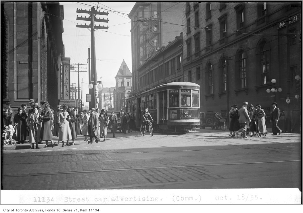
TTC photograph of streetcar advertising, 1935. The advertisement can be found below the left dash window of the streetcar. City of Toronto Archives Fonds 16, Series 71, Item 11134.
For advertisers, transit ads provide an ideal vehicle for promoting their goods and services: they can be targeted to specific neighbourhoods that a bus, streetcar, or train passes through; the advertisements move around unlike static billboards, potentially drawing more eyeballs. For transit operators, advertising provides an easy revenue source. Most transit agencies outsource their advertising to larger firms, who are responsible for maintaining accounts and installing and removing ads from vehicles and transit facilities. These companies typically provide an annual payment for the right to advertise on transit vehicles, and at stations and stops.
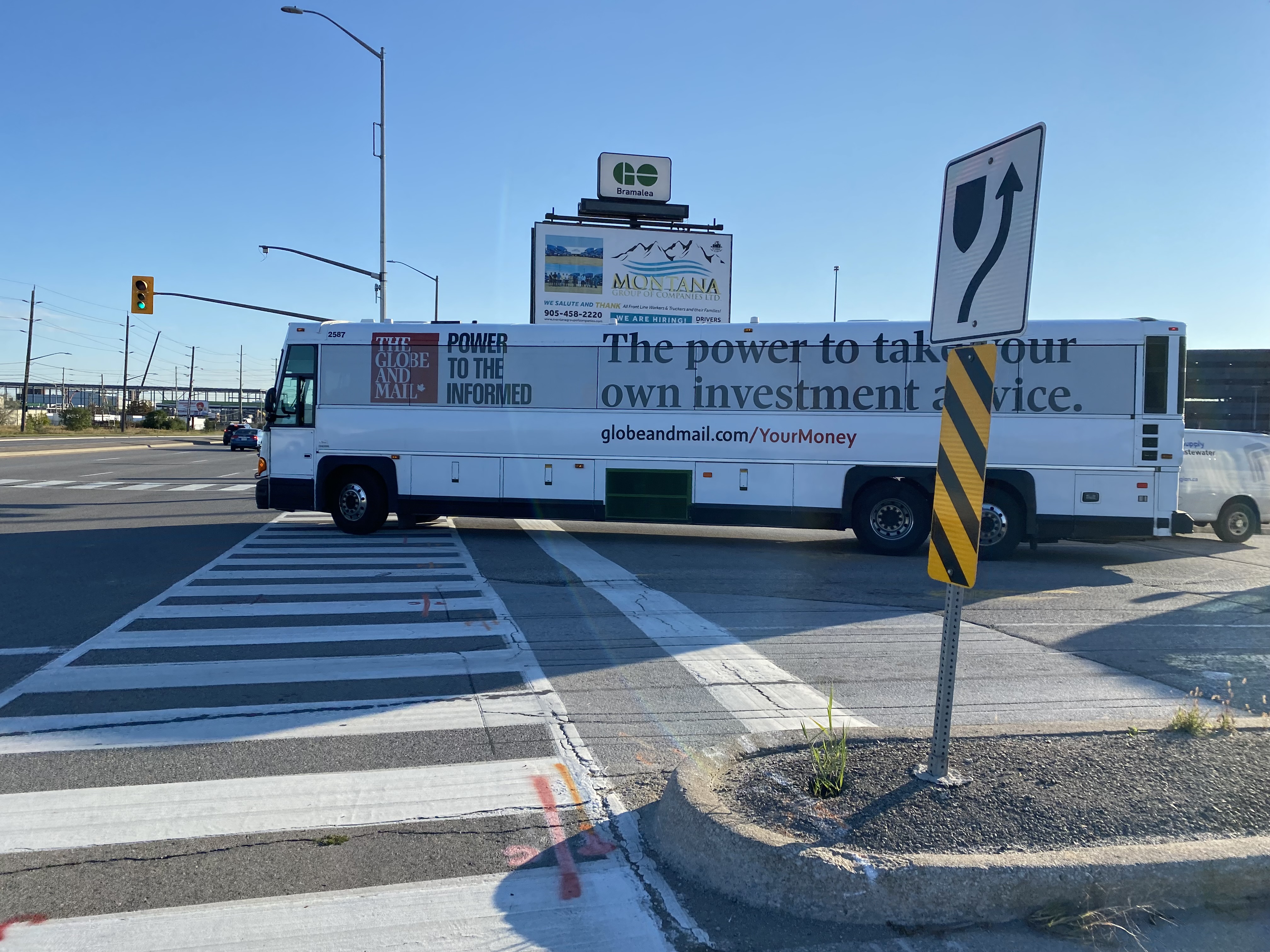
A GO Transit coach bus departing Bramalea Station, wrapped for a newspaper’s investment news service; all passenger windows are obscured by the advertising wrap
Though vinyl decals on transit vehicles are not a new innovation (advertisements in the late 1980s and early 1990s were typically opaque, sometimes covering parts of passenger windows) more recent technology has allowed for perforated vinyl wraps that fully cover windows, while providing an obscured outside view through small dots. While the vehicle is moving, a passenger inside may be able to see where they are, but not be able to read signage or see details. For some, not having a clear view of forward motion can contribute to motion sickness.
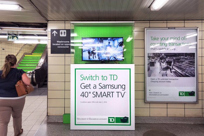
In TTC subway stations and some GO Transit stations, surfaces such as walls, floors, pillars, faregates and even stairways have also become advertising surfaces, a tactic called “station domination.”
An example of Pattison Outdoor’s “station domination” advertising, with a traditional ad poster at right, an installed video screen and ad pillar at centre, and stairs covered in ads, at left.
On occasion, vehicle wraps are used for public relations, rather than advertising. GO Transit and the TTC’s Pride buses are a good example of this. A more shameful example was the TTC’s messaging about fare evasion which took place in late 2019 and early 2020, just before the COVID-19 pandemic.
“Forgot to tap” – part of a TTC streetcar wrap used in late 2019 and early 2020
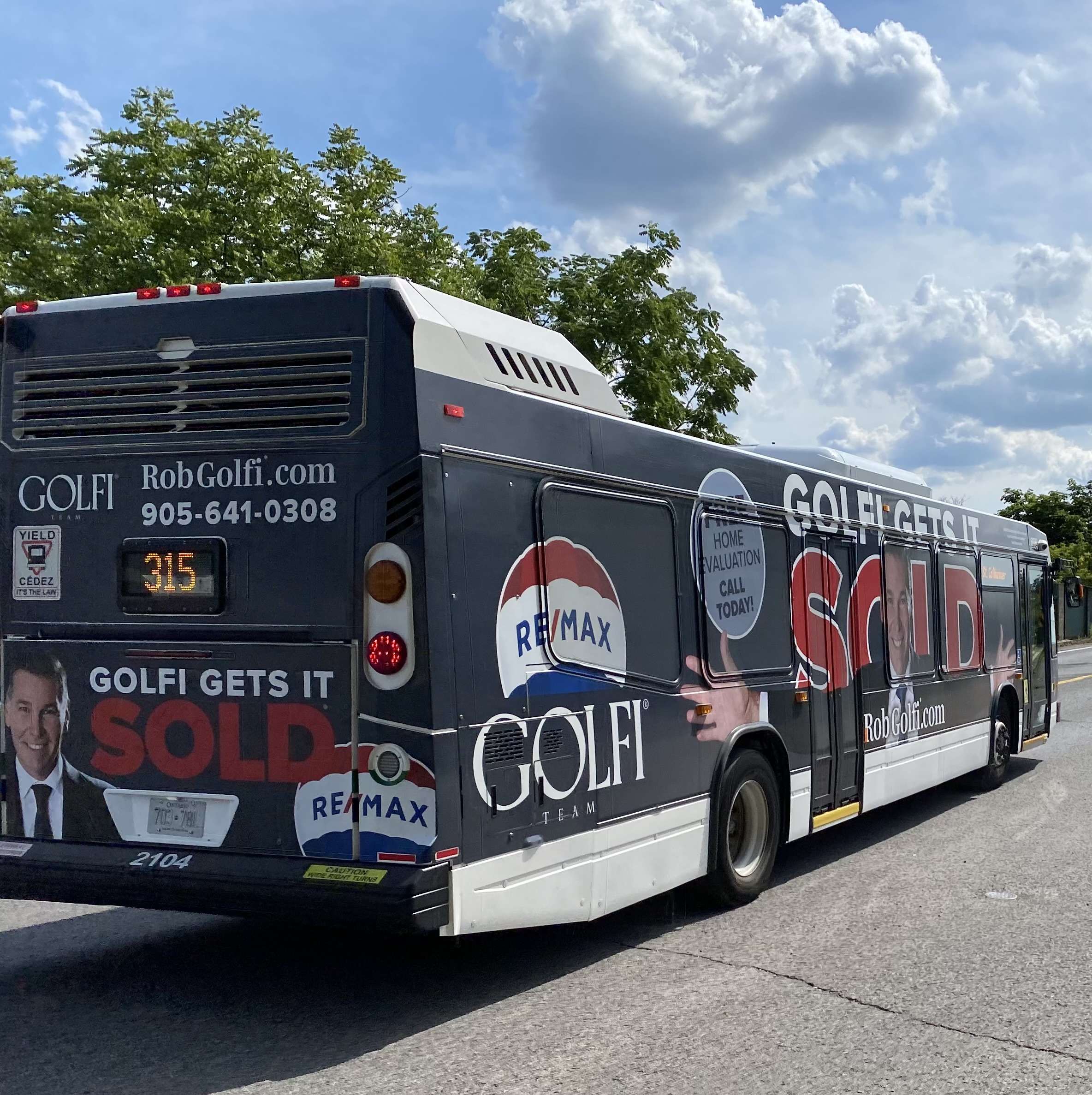
For the most part, the TTC does not allow ad wraps to completely obscure bus and streetcar windows, but allows up to 70 percent of the passenger windows to be covered, either in a “strip” format (where only the lower parts of the windows are kept uncovered) or “mural” format (where three of five sections of a streetcar are fully covered). Other agencies, like the Hamilton Street Railway, allow for complete vehicle wraps.
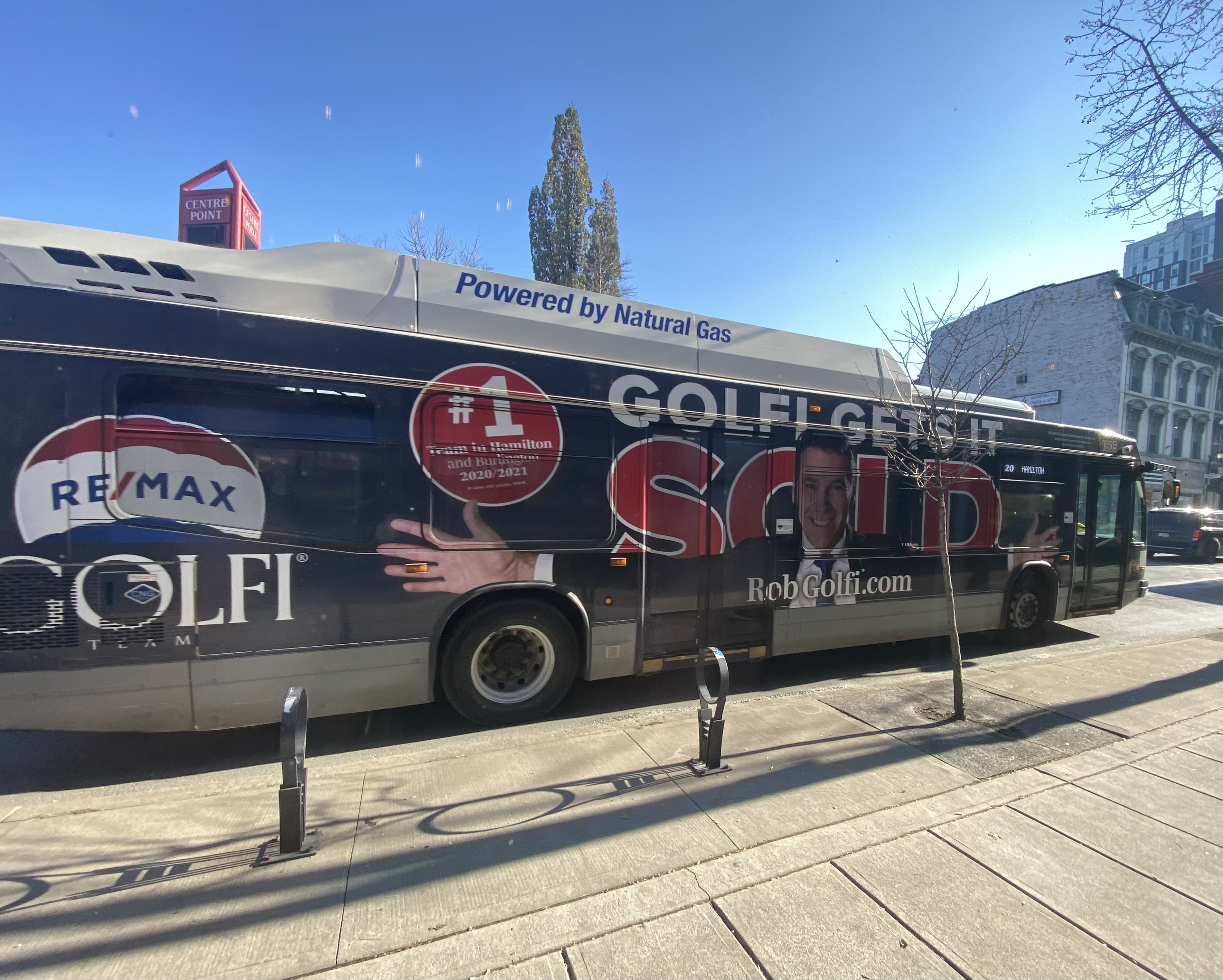
St. Catharines/Niagara Region TransitHamilton Street RailwayIt is difficult to get on a bus in Burlington, Hamilton, Niagara, or Brantford without your view being blocked by a certain real estate agent
In Waterloo Region, Regional Councillors just considered a motion to increase the number of wrapped Grand River Transit buses and — for the first time — on ION LRT cars. The appendix to the staff report recommending the increased number of advertising wraps depicts a rail car in a Tropicana wrap, with the windows partially obscured.
According to the report, the Region of Waterloo/Grand River Transit has a contract with Pattison Outdoor — one of Canada’s largest advertising firms — that allows for a total of five buses to be wrapped at any one time. GRT and Pattison want to increase this to ten percent of the total bus fleet, which numbers over 250. It also seeks to wrap one ION rail car at a time, with the promise that windows would not be fully covered and convert some static back-lit shelter ads to digital ads.
Currently, Waterloo Region receives guaranteed revenue from its contract with Pattison, averaging $1,546,500 a year, though the total revenue is projected to reach $1,800,000 for 2023, as ridership increases. Allowing for wraps on 20 more buses and one ION railcar is estimated to net an additional amount up to $500,000.
It’s worth noting that the report notes a 2018 recommendation against advertising on the exterior of LRT vehicles “due to concerns of diminishing the ION brand.” This restriction was also carried to ION-branded buses that follow the planned LRT extension between Fairway Station and Cambridge. It also notes strong public feedback against covering windows, and proposes to do so, “to maintain the customer experience.”
The Region of Waterloo’s entire Transit Services budget — including paratransit — for 2023 is $207,203,000, with transit fares bringing $46,143,000 of that – a 22.3% farebox ratio (property tax and provincial grants cover the difference). $2.3 million brought in from all advertising revenue — traditional poster ads and transit wraps — is not an insignificant sum, but it makes up just over 1% of the entire transit operating budget. In Toronto, the TTC’s 12-year, $324-million contract — also with Pattison Outdoor — brings in a total of $27 million a year, or 1.1% of the entire TTC budget.
At least Waterloo Region staff recognize that transit customers don’t like advertisements that obscure windows. They also acknowledge that transit wraps diminish the transit brand. For a revenue source that represents a mere drop in the bucket, why do transit agencies keep allowing them on their vehicles?
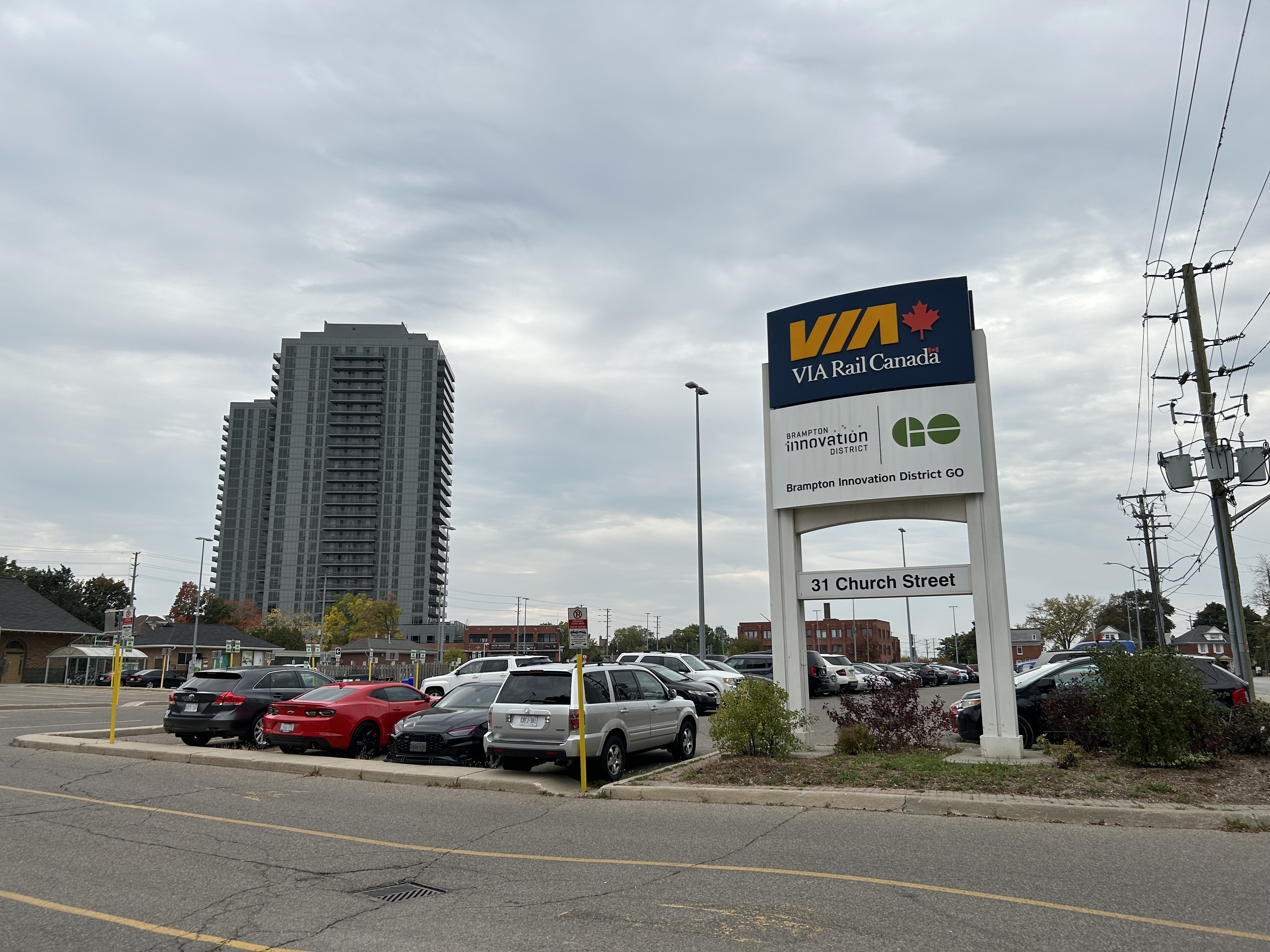
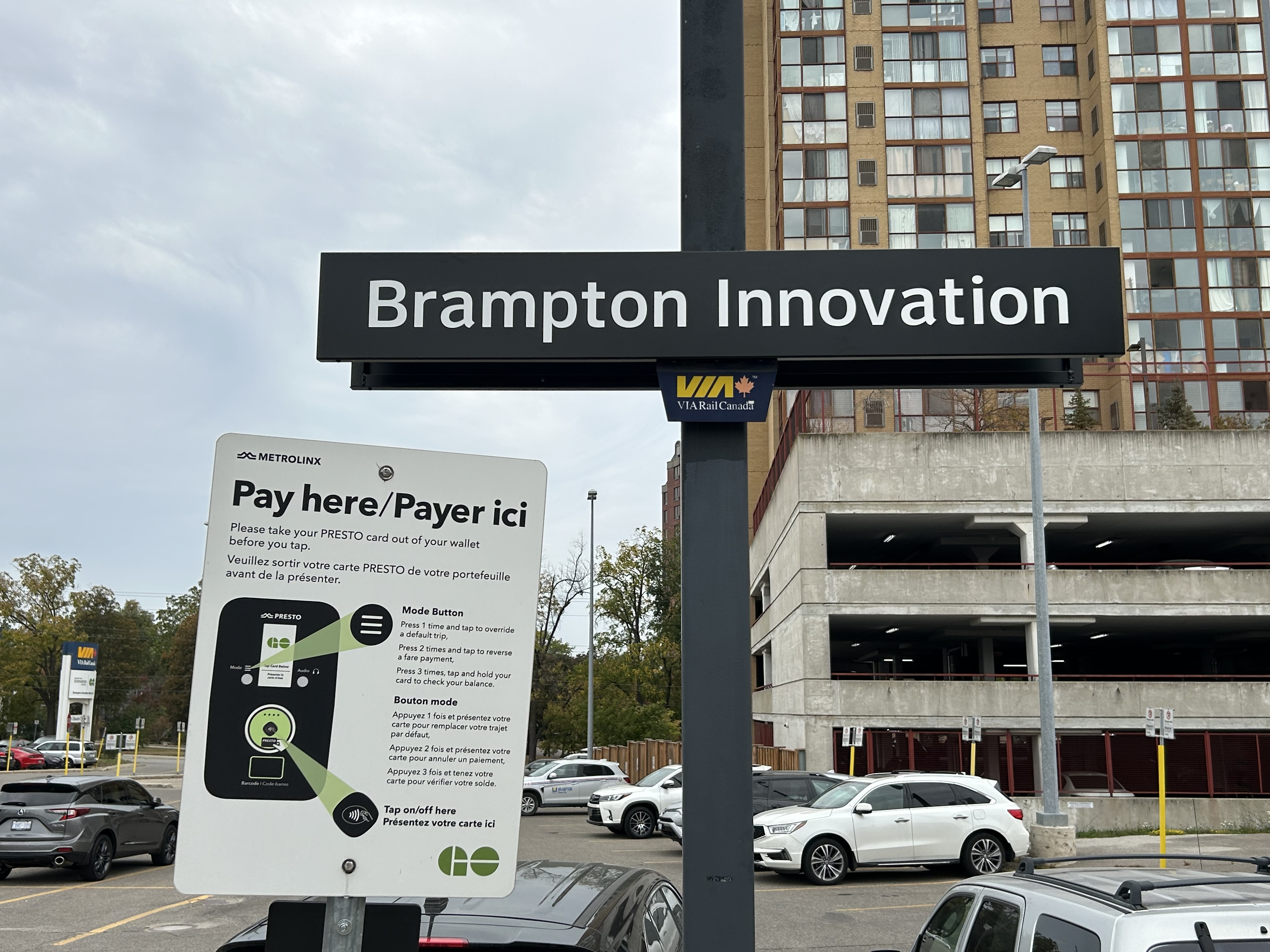
On June 29, 2023, the City of Brampton announced a naming rights agreement with Metrolinx to rename the Brampton GO Station to “Brampton Innovation District GO” for a 10-year period. This was Metrolinx’s second naming rights agreement, after renaming Oshawa GO Station for Durham College in 2022. The name change took effect in September, with new signs installed.
The Brampton Innovation District is a city-led project in Downtown Brampton to support higher education and entrepreneurship. It includes co-working spaces such as BHive and the Brampton Enterprise Centre incubator, the Rogers Cybersecure Catalyst, as well as partnerships with Sheridan College, Toronto Metropolitan University, and Algoma University. Rogers has committed to relocating its Brampton offices to the downtown core, while the city is planning the Brampton Centre for Innovation, which will include a new central library. There are a lot of interesting things happening in Downtown Brampton, though without the exposure more established tech hubs enjoy.
Through increased awareness of the Brampton Innovation District, this partnership with Metrolinx will further enhance Brampton’s position as an innovation and technology event destination to host tech sector events and international delegations, and enhance Brampton’s unique ability to attract highly skilled tech talent from both Toronto and Waterloo.
Unlike “Durham College Oshawa GO,” at least “Brampton Innovation District GO” is at the place it is named for. Having the name show up on maps, signage, and announced by GO Transit staff will raise awareness of the district’s current and future potential, especially once some of the built infrastructure, such as the Centre for Innovation, the new downtown transit hub, and the new Rogers campus, is constructed.
The “GO Brampton” sign has been replaced by “Brampton Innovation”
But at the same time, I still feel uneasy about renaming stations and transit lines. The new, longer names are harder to fit on maps and signage. They can lead to confusion, and in this case speak more to the city’s ambitions than what most travelers are actually looking for. It’s also interesting that the only two naming rights deals made by Metrolinx so far are with public-sector organizations: a provincially funded college, and a municipality.
I also note that VIA Rail, which also uses the station, still refers to it simply as “Brampton,” just as it still simply refers to “Oshawa.”
A busy GO Transit Route 88C bus loads passengers in front of the Peterborough Bus Terminal in the city’s downtown core
Peterborough, Ontario, a city of 84,000 people, is about a 90-minute drive from Downtown Toronto, without heavy traffic. A regional centre for central-east Ontario, Peterborough is home to Trent University, a mid-sized liberal arts institution with about 10,000 full time students, and Fleming College, which has over 6,000 full time students and 10,000 part time students.
Given its relative importance and its proximity to the Greater Toronto Area, especially Durham Region, one might expect to find good transit links from Peterborough to not only Toronto, but elsewhere in Ontario. Unfortunately, this is not really the case.
Prior to the COVID-19 pandemic and the closure of Greyhound Canada’s remaining service in Ontario and Quebec, there were four daily Greyhound buses between Peterborough and Toronto (three on Saturdays and Sundays), with one of those daily runs continuing east on Highway 7 to Ottawa, with stops in towns such as Havelock, Madoc, and Perth.
The scheduled time between the old Toronto Coach Terminal at Bay and Dundas Streets and Downtown Peterborough was between one hour and 45 minutes (making only an intermediate stop at Scarborough Centre Station) and two hours, 15 minutes (making local stops in Ajax, Oshawa, and Orono).
2019 Greyhound timetable for Ottawa-Peterborough-Toronto service. Note the overnight 5757/5790 runs that also followed Highway 7, but only stopped at Madoc for a rest break.
In September 2009, GO Transit first started a bus service between Oshawa GO Station, Downtown Peterborough, and Trent University, following the success of other bus services to universities and colleges in the region. Before 2020, that route made only four stops between Oshawa Station and Downtown Peterborough; all were park-and-ride lots adjacent to Highway 35/115; the bus would take just over an hour between the station and Downtown Oshawa.
Despite GO Transit’s competition, the Greyhound service remained popular, as it offered a direct, faster, one-seat ride between Downtown Toronto and Downtown Peterborough, with most buses only stopping at Scarborough Town Centre along the way. Three days a week, there were connections to Bancroft and Pembroke. GO Transit’s advantage was a slightly cheaper fare, connections to local transit and other GO services, and a more convenient service for passengers travelling between Durham Region and Peterborough. Unlike Greyhound, GO Transit continued to Trent University. Apart from the Newcastle (Hwy 2 at Hwy 35/115) park-and-ride, where passengers could connect to GO Transit routes 90/91 to Newcastle, Bowmanville, Courtice, and Downtown Oshawa, the park-and-ride stops were little-used.
GO Transit Route 88 map, January 2020. There were only four stops between Oshawa GO Station and Peterborough Bus Terminal
In mid-2020, with the COVID-19 pandemic causing major reductions in bus and rail ridership, GO Transit cut and consolidated several services, particularly in areas where local transit agencies operate. Route 90 was reduced to early morning and late-night service between Union Station and Oshawa GO when trains were not operating. The remainder of Route 90 through Courtice, Bowmanville, and Newcastle was cut entirely. Route 91 was merged into Route 88, which added new stops in Courtice and Bowmanville.
Route 88B, which includes stops at park-and-ride lots at proposed new GO Stations in central Oshawa and Courtice, takes up to 120 minutes to get from Trent University to Oshawa Station. The regular 88 bus takes 105 to 115 minutes to complete the trip. That is a very long time to sit on a bus, especially one not equipped with a lavatory.
GO Transit’s Route 88 bus timetable, including connecting train service from Toronto Union Station (click for larger size)
On Thursdays and Fridays, during regular school days between September and April, there are several express 88C buses, that only stop at Trent University, Peterborough Bus Terminal, and Oshawa GO. They make the complete trip in 1 hour 20 minutes; from Union Station to Downtown Peterborough is 2 hours, 20 minutes, not much slower than the slowest Greyhound bus.
The Route 88 route map in September 2023
Granted, for anyone living in Bowmanville and headed to Peterborough, the route is an improvement, with a new one-seat-ride now possible. While travelling to Peterborough earlier in September, I noted several passengers getting on in Downtown Bowmanville. But for through passengers, the backtrack to get to the Clarington Boulevard Park & Ride (the proposed location for the Bowmanville GO Station) and then the local stops to Newcastle are a bit annoying. Once on the highway, the bus has to get off at the Highway 35/115 split near Pontypool, and again at County Road 10 near Cavan and Millbrook, despite the very occasional time a passenger wants to get on or off (which has never happened when I rode Route 88). These diversions add 2-3 minutes each to the trip.
Pulling up to a deserted GO bus stop at County Road 10 near Cavan
These carpool stops might be useful if there were connecting transit services, rather than just a parking lot and a bus shelter. The 35/115 lot near Pontypool is 34 kilometres to Lindsay, a town of nearly 20,000 people, but whose only transit connection is a 3 day/week TOK coach bus between Haliburton and Toronto. A shuttle connection to Lindsay (which has a local transit service) would provide new links to Toronto, Durham Region, and Peterborough. Meanwhile, the Highway 2 carpool lot does not have direct Durham Region Transit service either.
Since Greyhound Canada’s withdrawal from the Canadian market, GO was the only intercity operator serving Peterborough until earlier this year, when Rider Express and Flixbus resumed service on the Toronto-Peterborough-Ottawa route. Both companies offer express, one-seat rides to downtown Toronto, but they have two major disadvantages over GO or even the old Greyhound service: frequency and in-town connections.
Flixbus offers one daily round trip, leaving the Union Station Bus Terminal at 11:00 AM and arriving at a Tim Hortons parking lot (at 1200 Lansdowne Street West, on the southwest side of Peterborough), at 1:05 PM, with stops near Scarborough Town Centre and at Thickson Road and Highway 401 in Whitby. The return trip leaves Peterborough at 9:05 PM, arriving in Toronto at 11:05 PM.
Boarding a Flixbus coach in a parking lot behind a Tim Horton’s in Peterborough’s suburbs
Rider Express runs on the same route four days a week, leaving Union Station at 12:00 PM, arriving at a different Tim Horton’s parking lot (on Ashburnham Road, on the southeast side of Peterborough) at 1:45 PM, making one stop in Scarborough. The return trip leaves Peterborough at 10:05 PM and arrives in Toronto at 11:35 PM. The map below shows where GO, Flixbus, and Rider Express stop in Peterborough.
While GO stops at Trent University, Downtown Peterborough, and a park-and-ride lot on the south end of the city, Flixbus and Rider Express only stop at locations close to the main highway on the south side of Peterborough, pulling into parking lots with nowhere to sit and no real amenities, unless waiting passengers had a car to wait in or paid for a coffee or snack at the Tim Horton’s. The old Greyhound terminal, which was located on the same block as the downtown transit terminal, has since been sold, and is now converted for local community services. Though they offer a much faster ride to downtown Toronto, the private operators are neither frequent enough nor convenient enough to compete with GO.
One day, Peterborough may get intercity rail service again thanks to the federal High Frequency Rail project, still in the early procurement phase, which would provide the speedy, frequent intercity service Peterborough needs. Until then, Metrolinx should revise the entire Peterborough bus service, including working with Durham Region and the City of Kawartha Lakes to make the service more useful for more riders, with a mix of daily express buses and enhanced local connections. The Selwyn Link bus service, which connects GO and Peterborough Transit with Selwyn Township and Curve Lake First Nation at Trent University, is great example to build upon.
I have updated the Ontario Intercity Transport Map for September 2023 with new and revised routes right across the province. The notable losses include Prescott-Russell’s abandonment of its rural on-demand service, the closure of Grey Transit Route’s service between Walkerton and Flesherton, and Trailways’ stop in Chatham. The London-to-St. Thomas gap remains unfilled, and there’s a clear gap in Huron and Bruce Counties, especially with the loss of service to Walkerton. For the most part, it is good to see most regional transit services continuing, with mostly minor adjustments.
I look forward to sharing my Canada Intercity Transit Map, based on work I recently completed for Infrastructure Canada, in the near future.
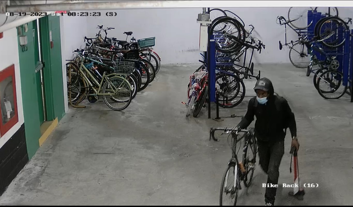
On Saturday August 19, while my spouse and I were paying a visit to the renewed AKG Art Gallery in Buffalo, a thief broke into our building and made off with my bicycle. The well-equipped thief broke into our building’s front entrance using a pry bar, and then used a heavy-duty bolt cutter to cut the rack my bicycle was attached to, taking care to watch for any activity in the garage by hiding in an adjacent stairwell. He spent nearly an hour in the building in total.
This was the second time my bicycle was stolen. This time, I thought I had a better lock. The old spot I had was hidden from the cameras and out of view of most people in the garage — the new spot was in a more prominent location.
The thief, walking away with my bicycle.
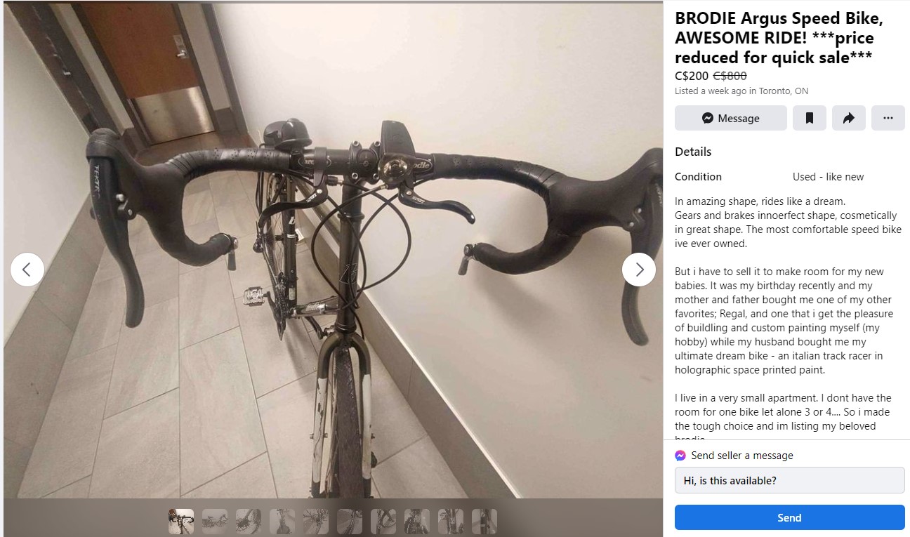
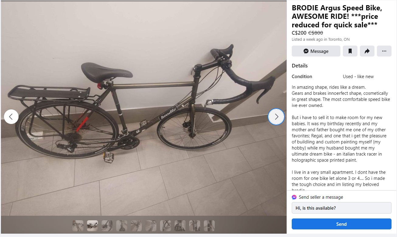
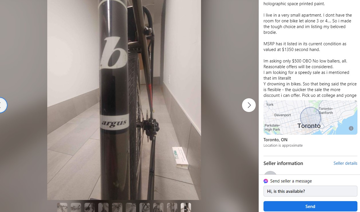
My Brodie touring bicycle was quite distinguishable, with dual-sided pedals (flat on one side, clipless on the other), additional handlebar-mounted brake pedals, fenders and a rear rack, Marathon tires, reflective tape on the forks and seat stays, and the dealer’s original decal on the frame. When I bought it from Bateman’s Bicycle Company in March 2015, I had the extra brake pedals installed as I was unused to having a bike with drop bars, and I wanted a more upright position when riding on city streets.
It took over a week before I discovered the bike missing as I had been really busy in August. When I discovered the theft, I informed the building management, and was able to get still photos and video of the thief. He was dressed in a black hoodie, with a black baseball cap and a surgical mask covering part of his face. His backpack had several tools, so he came in with a specific purpose. He did not cut the Kryptonite lock; instead he cut the rack and left with the lock still attached to the frame.
I reported the theft to Toronto Police, firstly by going on their website, as I had registered my bicycle. (The last time I had a bicycle stolen, the police actually recovered the frame, which I later donated to Bike Sauce.) I saved a service receipt with the bicycle’s make, model, and serial number, and had photos to provide. However, since it involved a break-and-enter, I learned that I actually had to call the police and make a verbal report. After calling, I learned that I had to wait for an officer to arrive so I could give him a narrative. Our building maintenance manager expected it to take a few days; the officer arrived within a few hours, which impressed me. I posted the still photos to social media, including the Cycling in Toronto Facebook group, with the hope that someone might know something.
I was able to provide a detailed timeline to the police based on the security videos, and provided still photos. A week later, a different police officer called me as he wasn’t able to meet the manager to review the videos; I was able to make a copy and dropped off a USB stick to 51 Division the next day. That was the extent of communications from Toronto Police.
On Monday, September 18, I got a Facebook message from a friend of a friend telling me they found a Facebook Marketplace listing with a bike that matched my bike’s description. It looked like a match, with the extra brake pedals, the red and white tape, the dual pedals, and the Bateman’s dealer sticker. Missing were the fenders and water bottle cage, and cheap new lights were added, replacing the bare mounts.
I had not thought of looking at Facebook Marketplace, but it appears to be a popular place to sell stolen goods. After my spouse searched Kijiji, there was a similar listing. But seeing one’s prized procession taken, and then put up for sale elsewhere felt like it added insult to injury. We had checked these sites before, with no matches.
Screenshot of FB Marketplace listingScreenshot of FB Marketplace listingScreenshot of FB Marketplace listing
I brought this to the police’s attention, hoping for at least advice. I emailed the officer assigned to the case, and heard nothing. I went down to 51 Division again with printed screenshots. I heard nothing.
Back on the Cycling in Toronto Facebook Group, members suggested posting to another FB group, called Stolen Bikes – Toronto. After my membership was approved, I posted about the theft, and a member there quickly messaged me saying that they had just acquired the bike. I could meet him the next day, and I could get it from him. The person who purchased the bike said he followed the listing, feeling especially suspicious. Originally, it was listed for $400, but the person I met was able to get it for $150.
I was so happy to get the bike back, after three weeks of anxiety, especially when I learned of the sale listing. I was worried I wouldn’t see it again, and that an unsuspecting or predatorial buyer would pick it up.
Though I am not out a bike anymore, I will still need new locks and a safe place to store it. I will probably get new fenders when I take it in for an inspection. Until then, my bicycle is safe in our apartment. Luckily, our building allows bikes in the elevators and hallways.
Having distinguishable characteristics helped to identify the bike when I shared the theft on social media; keeping a record of the make, model and serial number also helped. I also choose to secure the wheels with custom locks, which kept the bike intact. Finally, the cycling groups on Facebook proved to be an invaluable resourse for getting people to watch out, and eventually, getting the bike back. I am grateful for the people who kept an eye out and especially to the person who got it back in my possession.
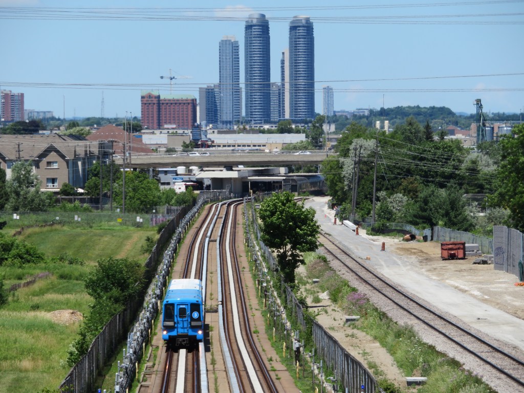
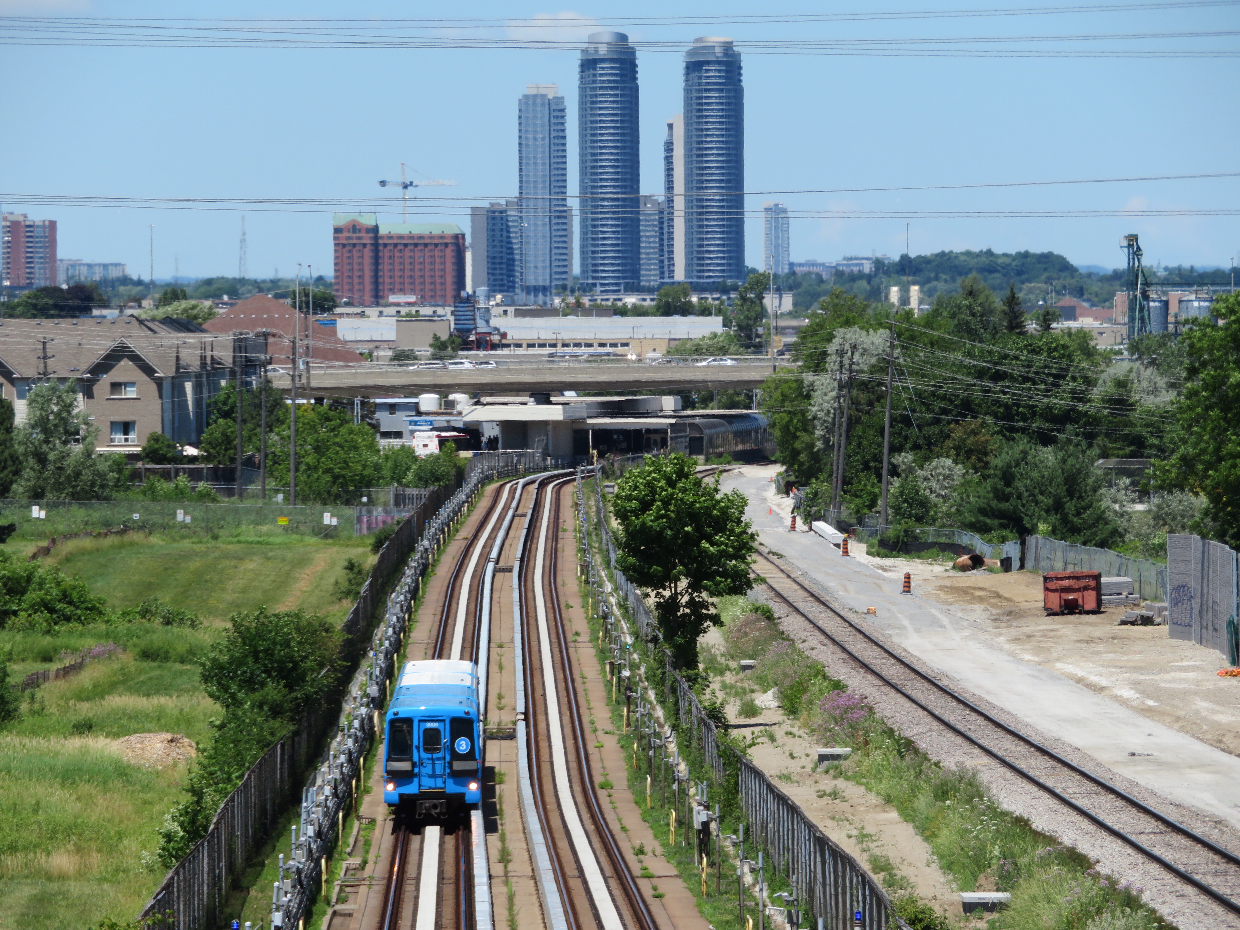
2018 view of the Scarborough RT, looking north towards Ellesmere Station
On Monday July 24, at 6:45 AM, a Scarborough RT car on Line 3 derailed soon after departing Ellesmere Station. Forty-five passengers were on board, and five suffered minor injuries. The Scarborough RT, which opened in March 1985, was suspended, and then permanently closed, four months ahead of its planned shutdown on November 18, 2023. For the first time in its history, Toronto’s rapid transit map has shrunk.