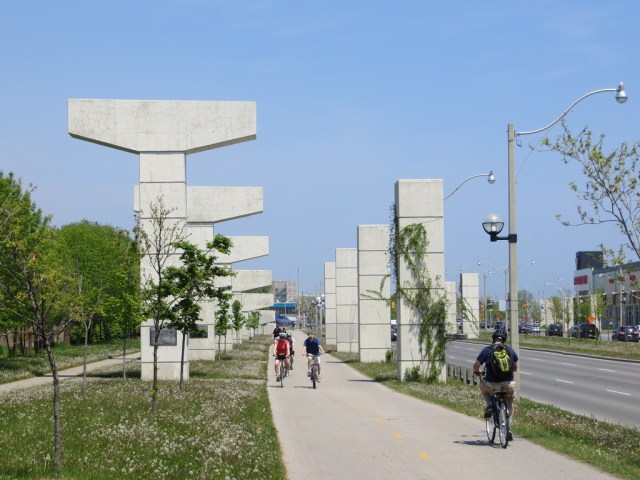
 A snapshot I took back in March 2001 of the Gardiner Expressway’s demolition at Carlaw Avenue.
In June, 1999, Toronto City Council, after much debate, voted 44-8 to demolish the eastern section of the Gardiner Expressway. The section of elevated freeway from the Don River to Leslie Street, which opened in 1966, was underused and in need of serious repair.
The East Gardiner extension was built to connect with the Scarborough Expressway, part of a larger network of freeways proposed by Metropolitan Toronto that were never built. The Scarborough Expressway would have connected to Highway 401 near Port Union Road, cancelled in the aftermath of the June 3, 1971 decision of the Ontario Government overturning an Ontario Municipal Board decision permitting construction of the Spadina Expressway.
Council debated the merits of maintaining the 1.3 kilometre section of the Gardiner Expressway; several members resisted removal. Tom Jakobek, representing the Beaches neighbourhood and later disgraced in the MFP computer leasing scandal, was its most vocal defender.
“Cars are an important necessity in this society. Why would anyone want to eliminate road capacity anywhere, when it’s located in the middle of an industrial area and people use it?”
But the pro-demolition side won out. Of the 50 public deputations before that June 1999 vote, those in favour of demolition outnumbered opponents by a 2:1 ratio. Automobile groups and some Scarborough and Beaches residents were the most opposed as two new traffic lights would be added to their westward commutes.
Nine of the councillors who voted for demolition still serve today: Maria Augimeri, Raymond Cho, John Filion, Giorgio Mammoliti, Pam McConnell, Joe Mihevc, Denzil Minnan-Wong, Frances Nunziata, and David Shiner. Also voting with the majority were councillors Jack Layton, David Miller, and Olivia Chow. Mayor Mel Lastman did not vote on the final motion.
Among the eight opposed to the demolition were Jakobek and Sandra Bussin (both councillors represented the Beaches neighbourhood), along with conservatives Doug Holyday and Norm Kelly, both who would become Rob Ford’s deputy mayors.
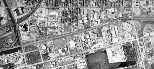 Aerial photograph of the Gardiner Expressway eastern extension in 1992. the Leslie Street ramps are on the far right, the Unilever lands to the right of the Don Valley Park way flyover ramps. Image from Toronto Archives
Demolition began on April 28, 2000, a year later, it was gone, part from a few pillars left over near Leslie Street. A new bike path, and an improved Lake Shore Boulevard were built in the Gardiner’s place, and the traffic jams never materialized. In fact, parallel routes — Dundas Street and Eastern Avenue — were reduced to two lanes from four to accomodate new bike lanes. East-end residents coped.
Now, once again, we’re debating the future of the eastern Gardiner Expressway, this time the section between Jarvis Street and the Don Valley Parkway (DVP). Like the demolished section east of the DVP, city council is facing a crucial decision on whether to maintain the crumbling structure, or demolish it in favour of a widened Lake Shore Boulevard. Like the demolished section east of the DVP, the Jarvis-DVP section is underused and in need of major repairs.
The consultants in charge of the environmental assessment (EA) fr the Gardiner Expressway & Lake Shore Boulevard Reconfiguration Environmental Assessment & Urban Design Study have a website where you can find out more about the options and the process.
At first, four alternative solutions were considered:
- Maintain the elevated expressway (spend money only to rehabilitate the structure, this is the status quo option)
- Improve the urban fabric while maintaining the existing expressway (basically the status quo with some ground-level improvements for pedestrians and cyclists
- Replace with a new above-or-below grade expressway; and
- Remove the elevated expressway and build a new [wider Lake Shore Boulevard.]
It’s worth noting that the EA consultants recommended the remove option, replacing the six-lane Gardiner east of Jarvis Street with an eight-lane Lake Shore Boulevard.
But after feedback from the Public Works and Infrastructure Committee (PWIC) and First Gulf, the owners of the massive former Unilever lands at the foot of the Don River, there were two options carried forward for further public review: the “hybrid” option and the remove option. Both options would allow First Gulf to redevelop the 30 acre parcel, part of a larger 60 acre plan for up to 12 million square feet of commercial (office and retail) space. The public presentation [PDF] can be found here.
The remove option (as illustrated on Pages 23-29 of the presentation) results in the demolition of 2.2-kilometres of the Gardiner, replacing it with a eight-lane Lake Shore Boulevard. There would be signalized at-grade intersections at Jarvis, Sherbourne, Parliament, and Cherry Streets (with more intersections possible as the East Harbourfront lands develop), and flyover ramps connecting the widened Lake Shore Blvd with the Don Valley Parkway. The removal option would cost $326 million in up-front capital costs (demolition and the construction of new ramps) and $135 million in ongoing maintenance over a 100-year lifecycle. The study’s traffic models claim that removal would only increase travel times by 3-5 minutes.
It’s also worth noting that most commuters headed to the downtown core take transit: nearly half take the TTC, another 19 percent take GO Transit. Only 28 percent of downtown-bound commuters drive, and of those, 3% use the section of the Gardiner Expressway in question.
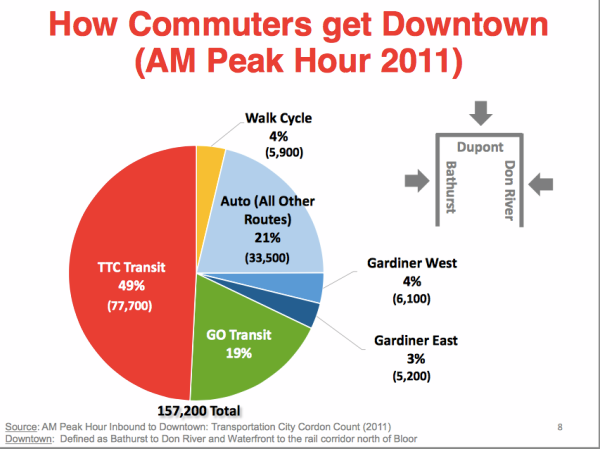
Page 8 of the Gardiner East presentation
The “hybrid” option, (as illustrated on Pages 36-42 of the presentation) maintains the Gardiner as-is west of Cherry Street, with new off-ramps to Lake Shore Boulevard east of Cherry and fly-over ramps to the DVP, elevated. It would cost $414 million in up-front capital costs, and $505 million in maintenance over a 100-year lifecycle. There would be no increase in travel times, all other variables remaining the same.
This is why I place quotation marks around “hybrid” — except for a short section east of Cherry, the hybrid option pretty much preserves the status quo. The pedestrian experience isn’t improved, fewer parcels between Yonge and Cherry streets are available for development, and the long-term capital costs are higher. Really, the remove option is a hybrid. It cements the retention of the Gardiner west of Jarvis Street for the long term, it includes expensive flyovers to the DVP, and it widens Lake Shore Boulevard to absorb auto capacity. Calling what almost amounts to the status quo as a “hybrid”option is a brilliant stroke of marketing, or simply a cynical attempt to push through a more expensive, auto-friendly scheme.
Opposition to the Gardiner removal is led by the Gardiner Coalition, which includes the Canadian Automobile Association (which promoted freeway expansion in Toronto before), the Canadian Courier & Logistics Association, the Ontario Trucking Association, Redpath Sugar and the Toronto Industry Network. The coalition of motorists and industry commissioned a separate report by the University of Toronto’s Eric Miller, that claimed that travel times would increase by 10 minutes. Why does Eric Miller’s name sound familiar? He was the lead transportation adviser to Tory’s campaign and a supporter of Tory’s SmartTrack platform.
On May 11, 2015, ahead of council debate, John Tory spoke in favour of the “hybrid” option, sounding a lot like Tom Jakobek in 1999: “no matter how much transit we get built, and I intend to try and get a lot built during my time as mayor, we are still going to have people driving around in cars and trucks, it’s a reality.” Tory echoed comments made earlier in April by Tory’s Deputy Mayor, Denzil Minnan-Wong:
“I did not get elected to increase congestion, I did not,” Minnan-Wong insisted. “The residents in the area that I represent in Don Mills are going to be negatively impacted. I was elected to solve congestion problems.”
It’s interesting how self-styled fiscal conservatives prefer to spend more money on roads when given the choice, isn’t it? Remember Minnan-Wong’s rants against pink umbrellas at popular Sugar Beach or washrooms at waterfront parks? If there’s money to throw at unnecessary expressway construction, what about the TCHC public housing repair backlog? Or accelerating work to make the TTC more accessible? Why worry about a small number of commuters to the downtown core?
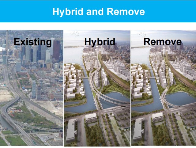 Existing, hybrid, remove: Page 47 of the Gardiner East presentation
It’s worth noting that John Duffy, former Policy Director for John Tory’s mayoral campaign, is a registered lobbyist for First Gulf. Duffy is also planning a $1-million public-relations blitz to promote Tory’s SmartTrack transit plan, which would have a stop right at the Unilever site’s front door. Eric Miller’s and John Duffy’s names coming keep coming up. I’ll talk more about that in an upcoming post.
To be fair, First Gulf has stated several times that either the remove or the hybrid option for the East Gardiner suits their needs for developing the site, and denies supporting either option.
I strongly support the remove option. It’s the cheapest alternative, but it offers the most opportunities to develop the East Harbourfront. Yes, an eight-lane Lake Shore Boulevard won’t be the most pleasant street to cross, but it won’t be much different than University Avenue. If designed right, it could be a Grand Boulevard.
Council will be making a once-in-a-lifetime decision. There’s plenty of other, better ways that money spent on rebuilding the East Gardiner could be spent on. Hopefully council sees the wisdom of the remove option despite the myopic desires of the Mayor and Deputy Mayor.
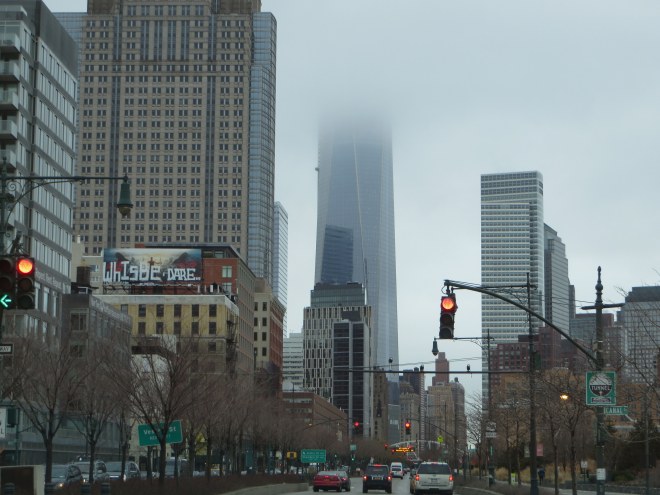 Manhattan’s West Side Drive, which replaced an elevated freeway. New York is doing fine.
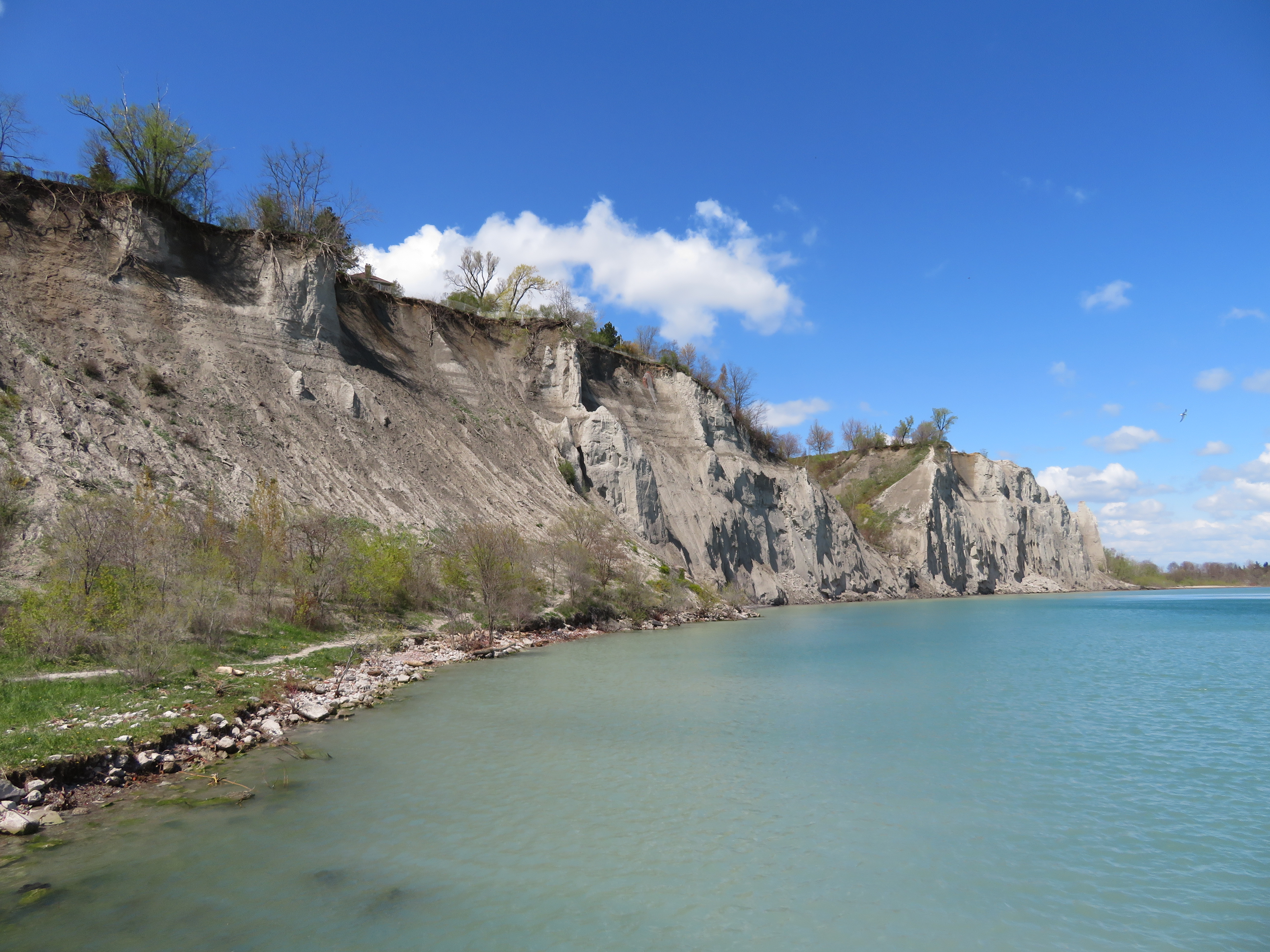 The Scarborough Bluffs will soon become more accessible
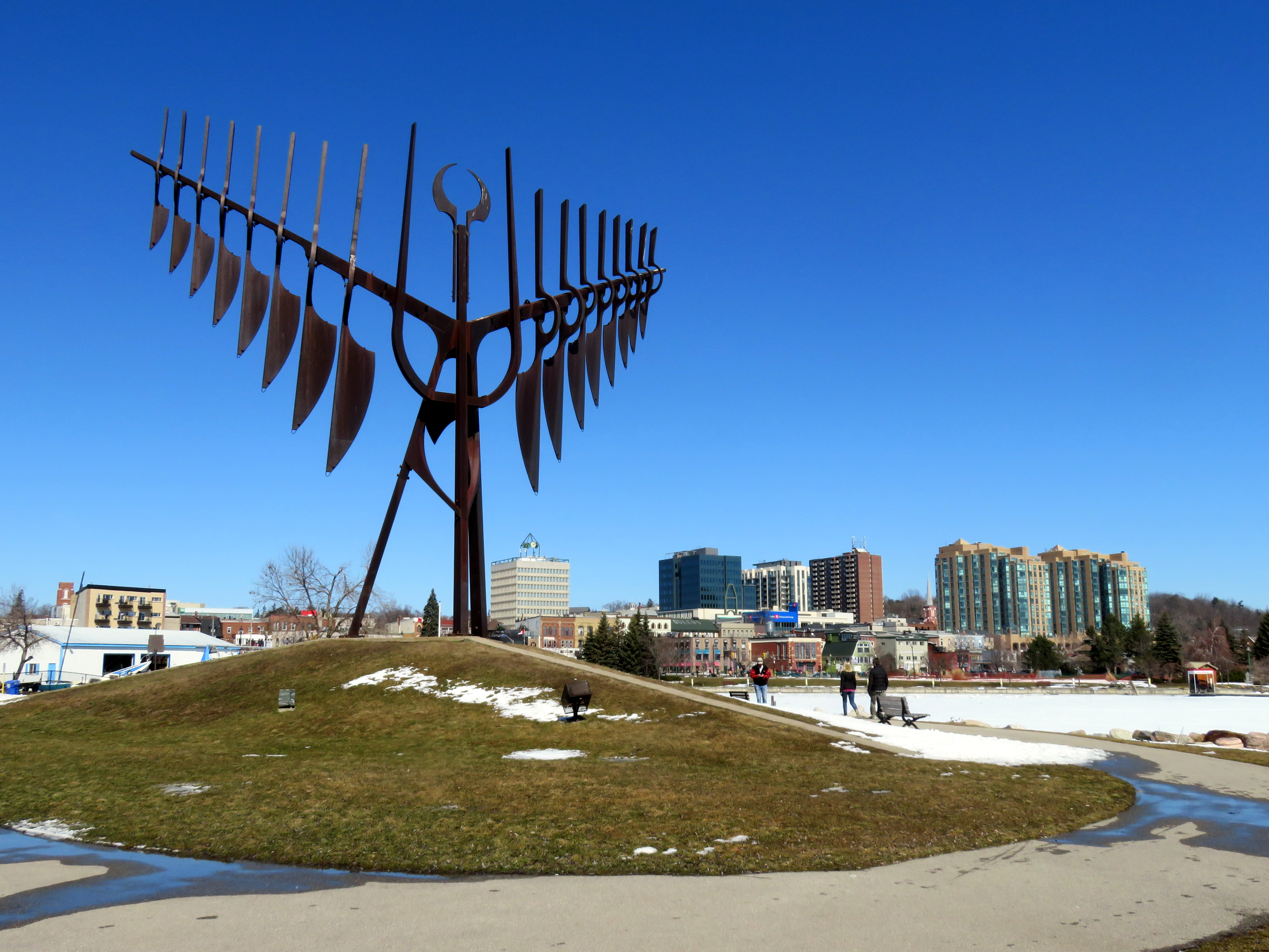
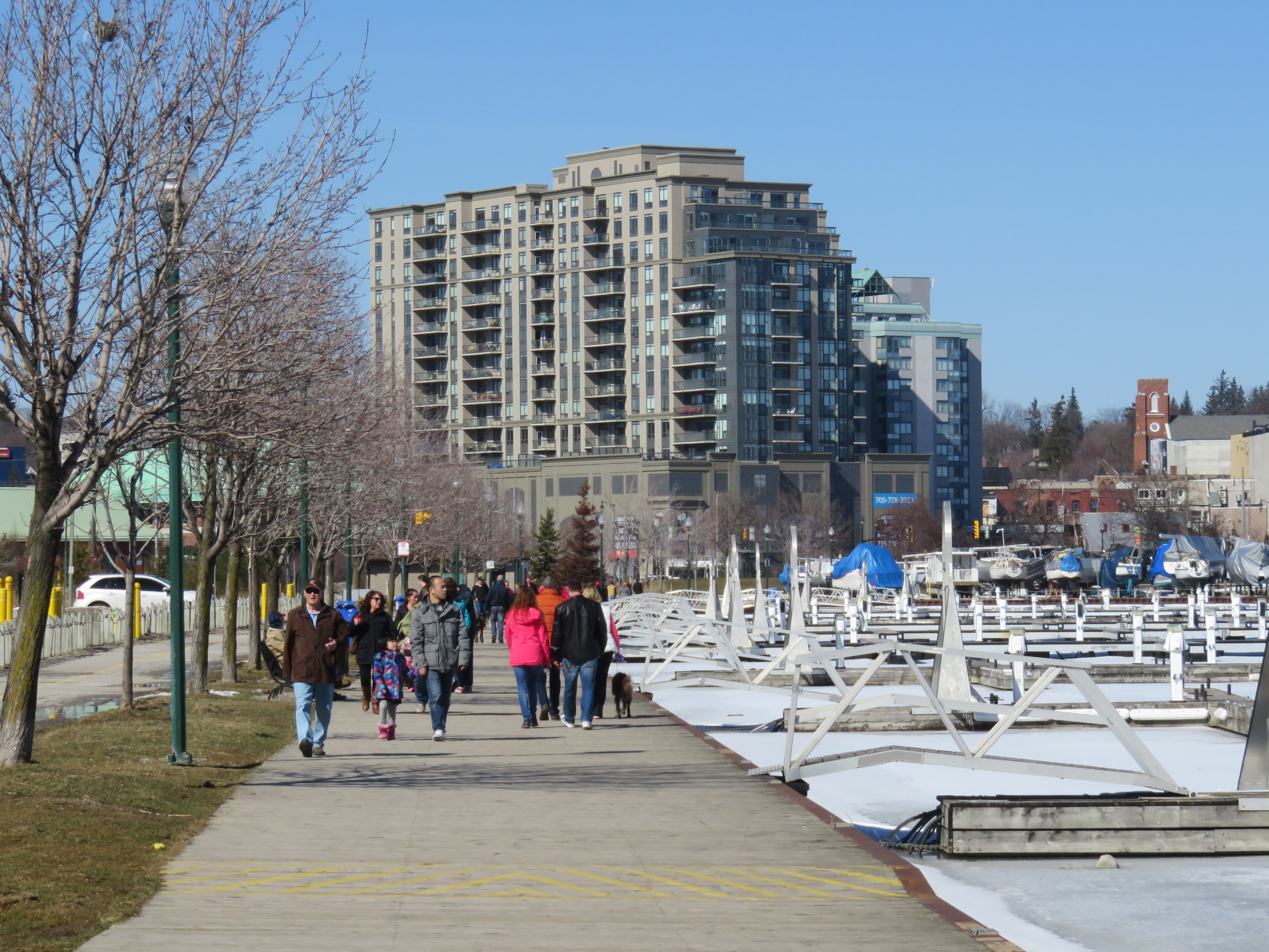 A busy March Sunday on Barrie’s waterfront
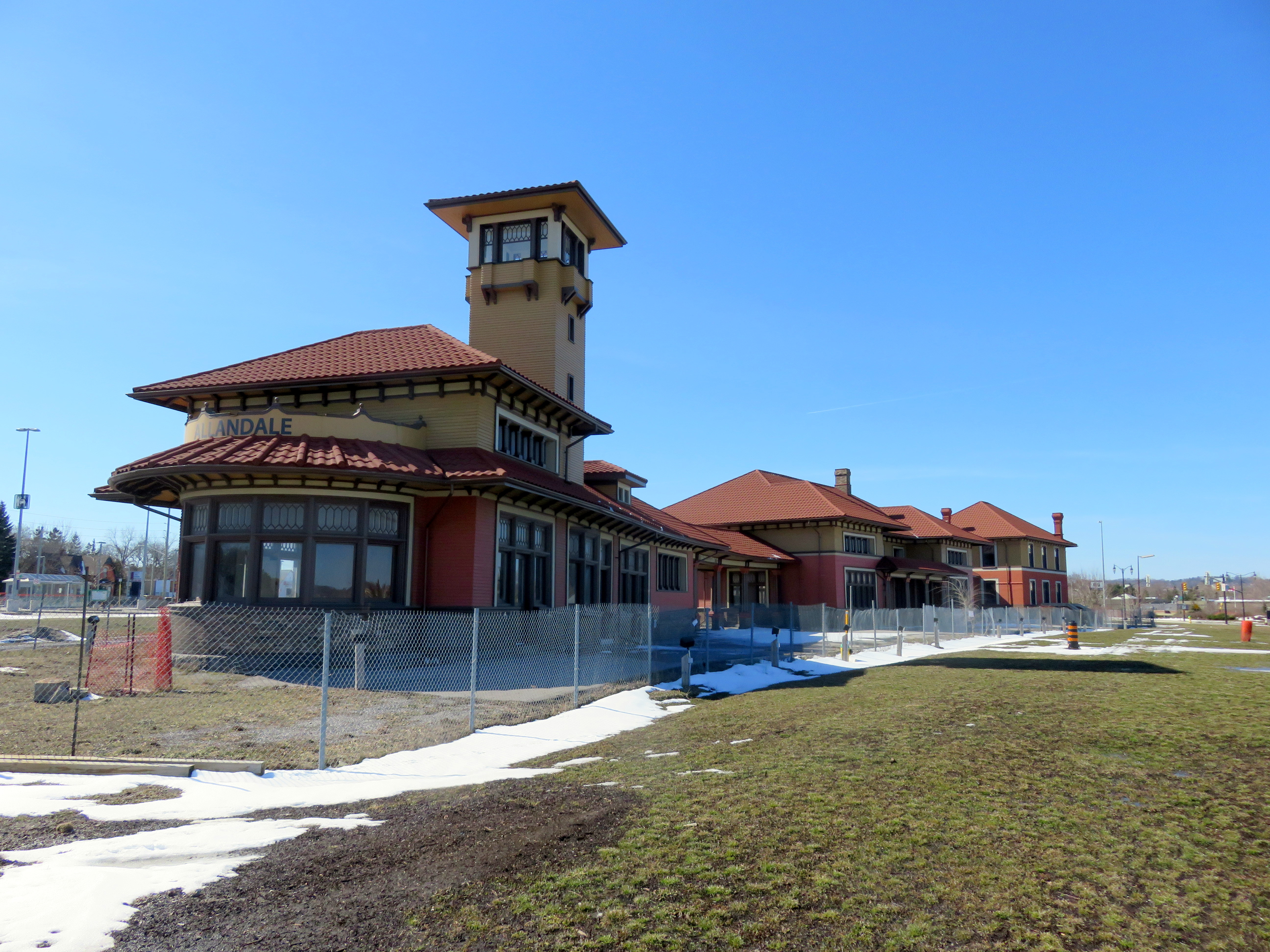 Allandale Station is fully restored on the outside, but remains fenced off. The GO Station is to the far left.
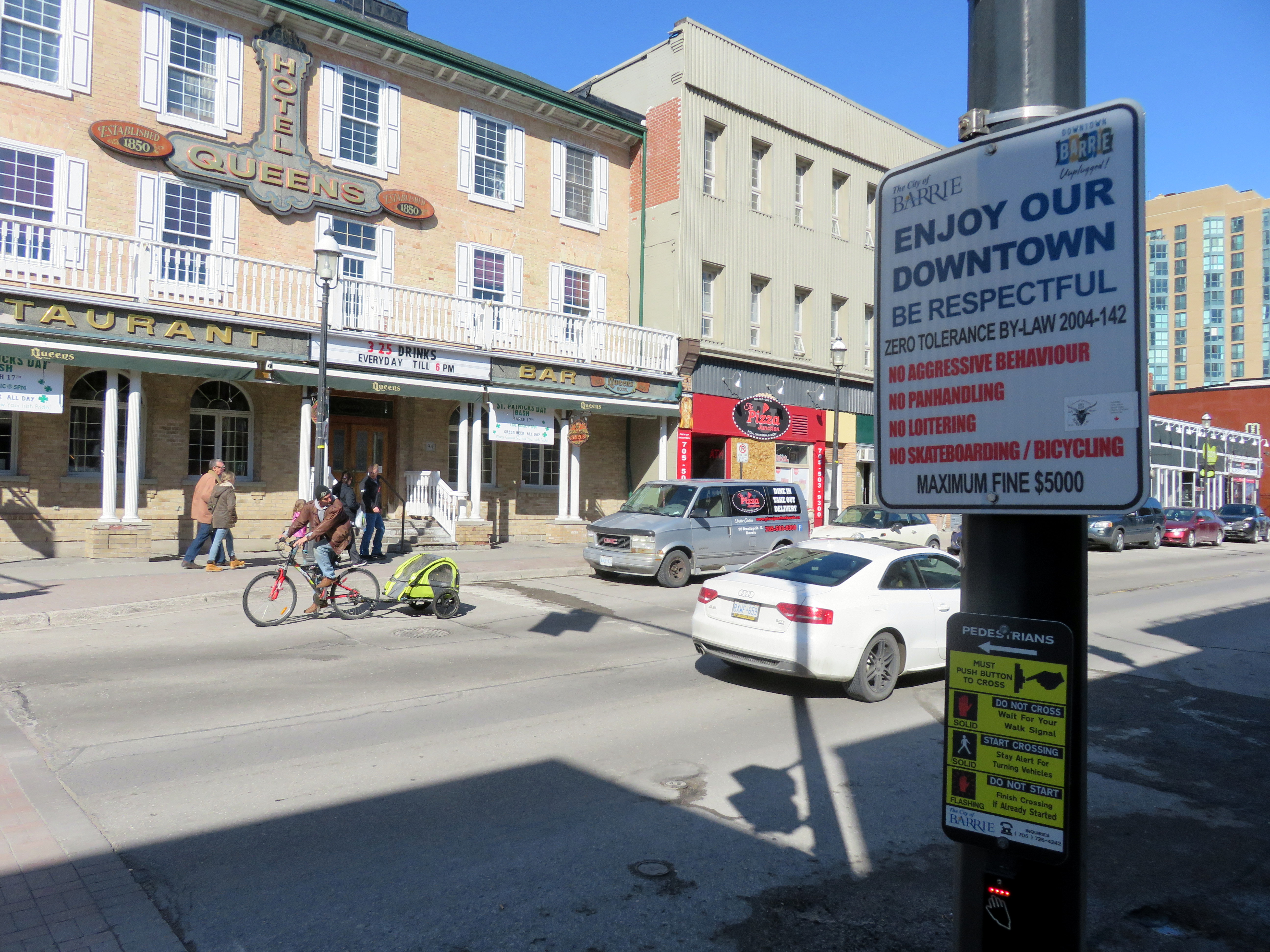 Sign reminding of Downtown Barrie’s Zero Tolerance Bylaw. The historic Queen’s Hotel is in the background.
 “No loitering” in Brampton’s parks


