Marshall’s Musings

  • What’s going on in Downtown Brampton?

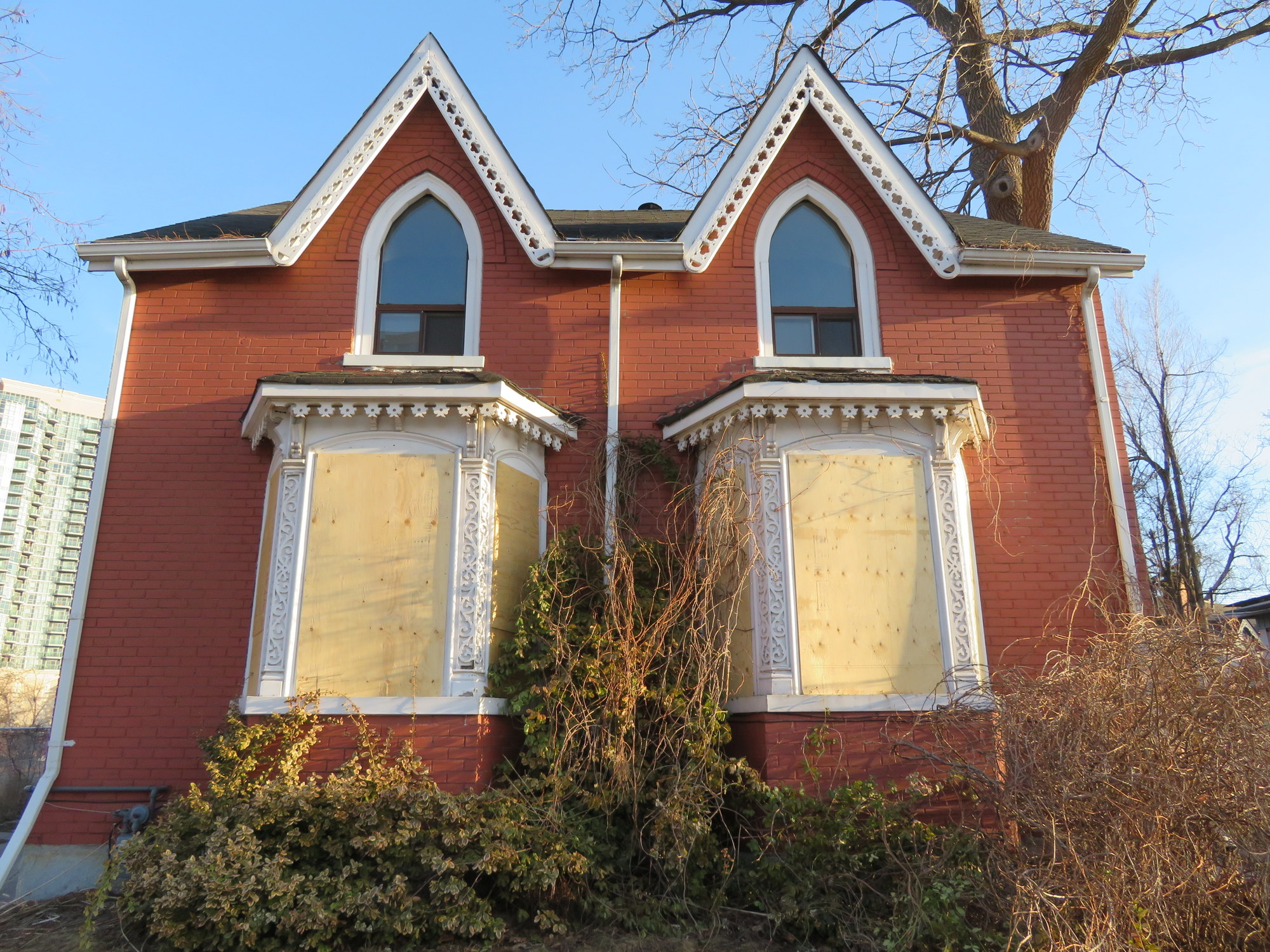
    IMG_6139-0015 Railroad Street, on the City of Brampton’s heritage registrar, is one of several houses recently boarded up in Downtown Brampton

    Update April 19, 2018: the location for Ryerson’s new Brampton campus was announced this morning. The 2000-student campus, which will be a partnership between Ryerson University and Sheridan College, will be built at the corner of Mill and Church Streets, on the GO Transit parking lot. This explains Metrolinx’s (GO Transit’s parent agency) purchase and demolition of properties south of the rail corridor, on Nelson, George, Railroad, and Elizabeth Streets, which I wrote about below.

    While it remains unfortunate that surface parking will replace housing and offices, at least in the short-to-medium term, at least we now know what’s going on in Downtown Brampton. The downtown campus site, with excellent transit links, is the right location.


    Nearly two years ago, I wrote about how Metrolinx, the Province of Ontario’s regional transportation authority, had purchased several houses and two office buildings in Downtown Brampton. The intention at the time was to build a new surface lot to accommodate GO Transit commuters, a symptom of the commuter transit system’s dependence on providing parking.

    Metrolinx is responsible for GO Transit, the UP Express airport rail link, the Presto farecard, and planning and constructing transit infrastructure in the Greater Toronto and Hamilton Area.

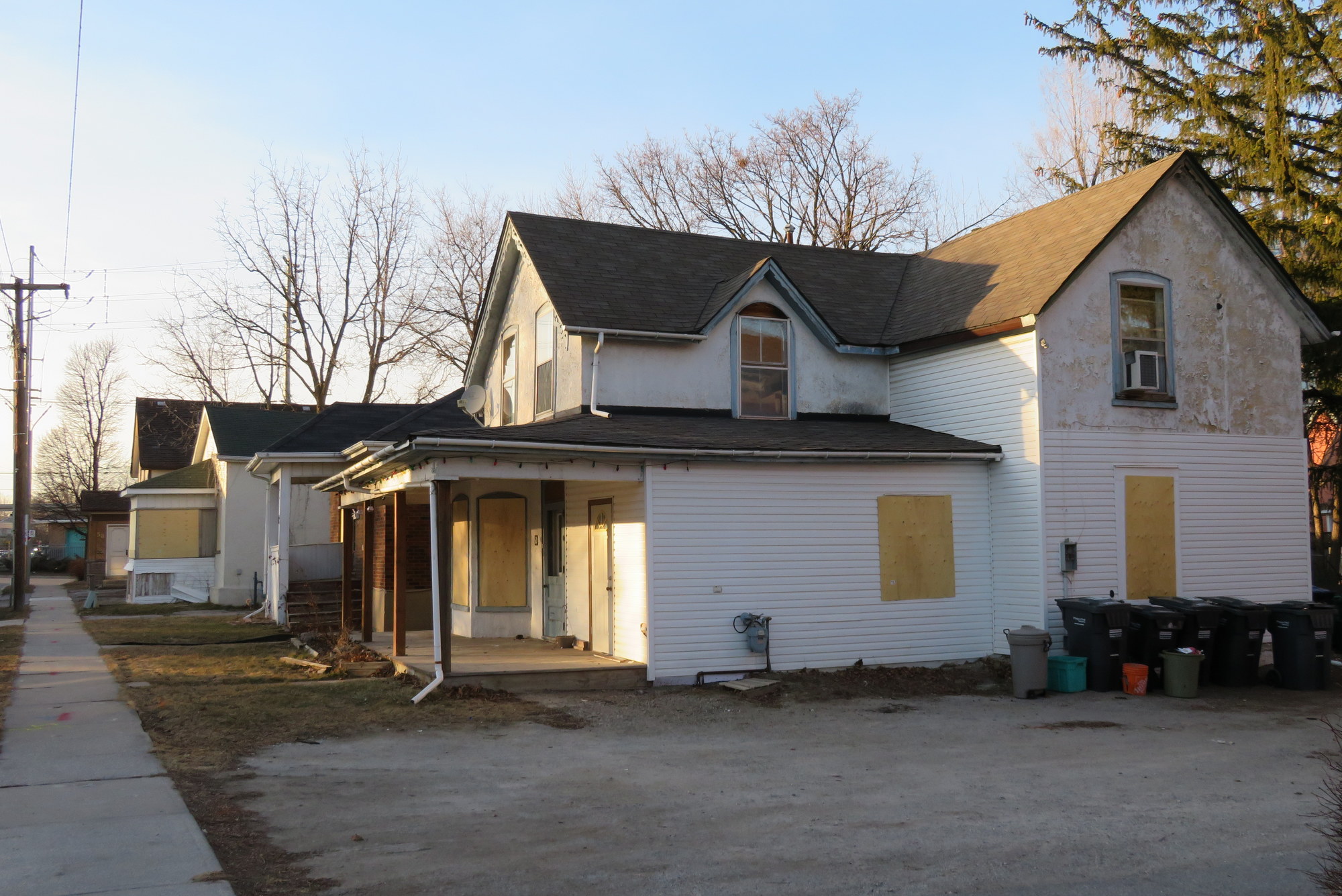
    Since my 2016 blog post, three dwellings — 28A and 28B Nelson Street West, a semi-detached house, and 42 Elizabeth Street North — were demolished, but there was little other visible change until this month. Now eight more houses — on Elizabeth Street and Railroad Street have been boarded up and their electricity disconnected, including at least one rooming house that was occupied until very recently. The two office buildings — 29 and 37 George Street — are also emptying out.

    Four of these properties — 30 Nelson Street West, 46 and 50 Elizabeth Street North, and 5 Railroad Street — are listed by the City of Brampton as containing heritage resources.
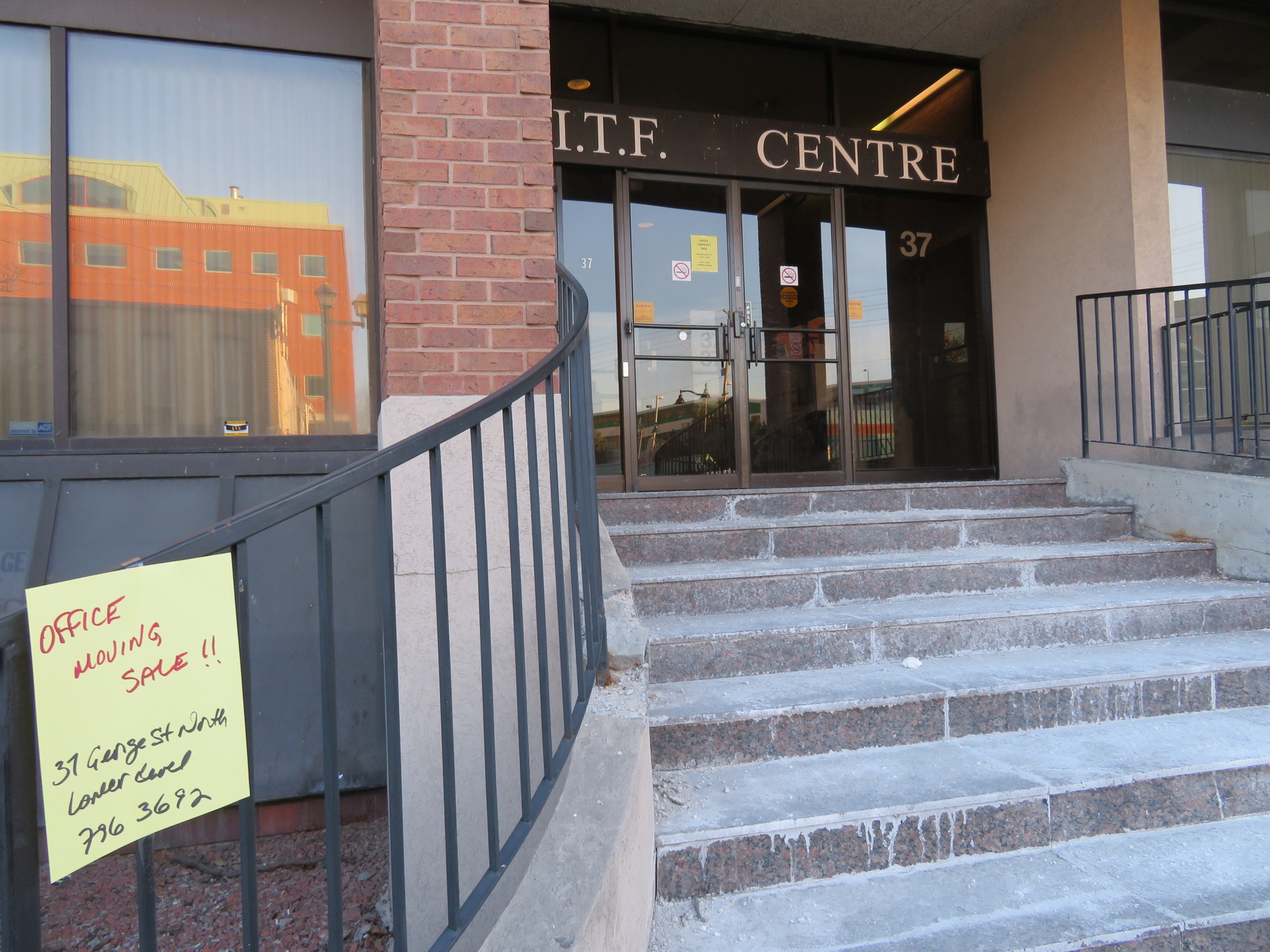
    IMG_6153-001Offices at 37 George Street are moving out

    So what exactly is going on? Why has Metrolinx purchased twelve homes and two offices in Downtown Brampton? Is it for a surface parking lot as previously reported in 2016? Or does this have to do with recent plans for a new Brampton campus of Ryerson University?

    The City of Brampton has been assembling land and buildings nearby, including 8 Nelson Street West, a six-storey office building above the downtown bus terminal. The city also owns the old Loblaws store on the southeast corner of George and Nelson Street. As Bramptonist‘s Divyesh Mistry found, Metrolinx noted “…continued collaboration between Metrolinx staff […] with the City of Brampton and Ryerson University on the Brampton Station redevelopment.”
    IMG_6148-001
    Houses on Elizabeth Street North recently vacated and boarded up. 

    If this land assembly is, in fact, to support a yet unannounced Ryerson University campus site on this block or on the existing Brampton GO Station parking lot, then this is on the whole very good news, though I remain concerned about the loss of downtown housing, particularly rooming houses and affordable apartments that some of older homes in the area have been divided into. A downtown campus with excellent transit links — GO Transit and several Brampton Transit bus routes — makes more sense than Milton’s plans for a greenfield campus for Wilfrid Laurier University distant from GO Transit’s bus and rail lines.
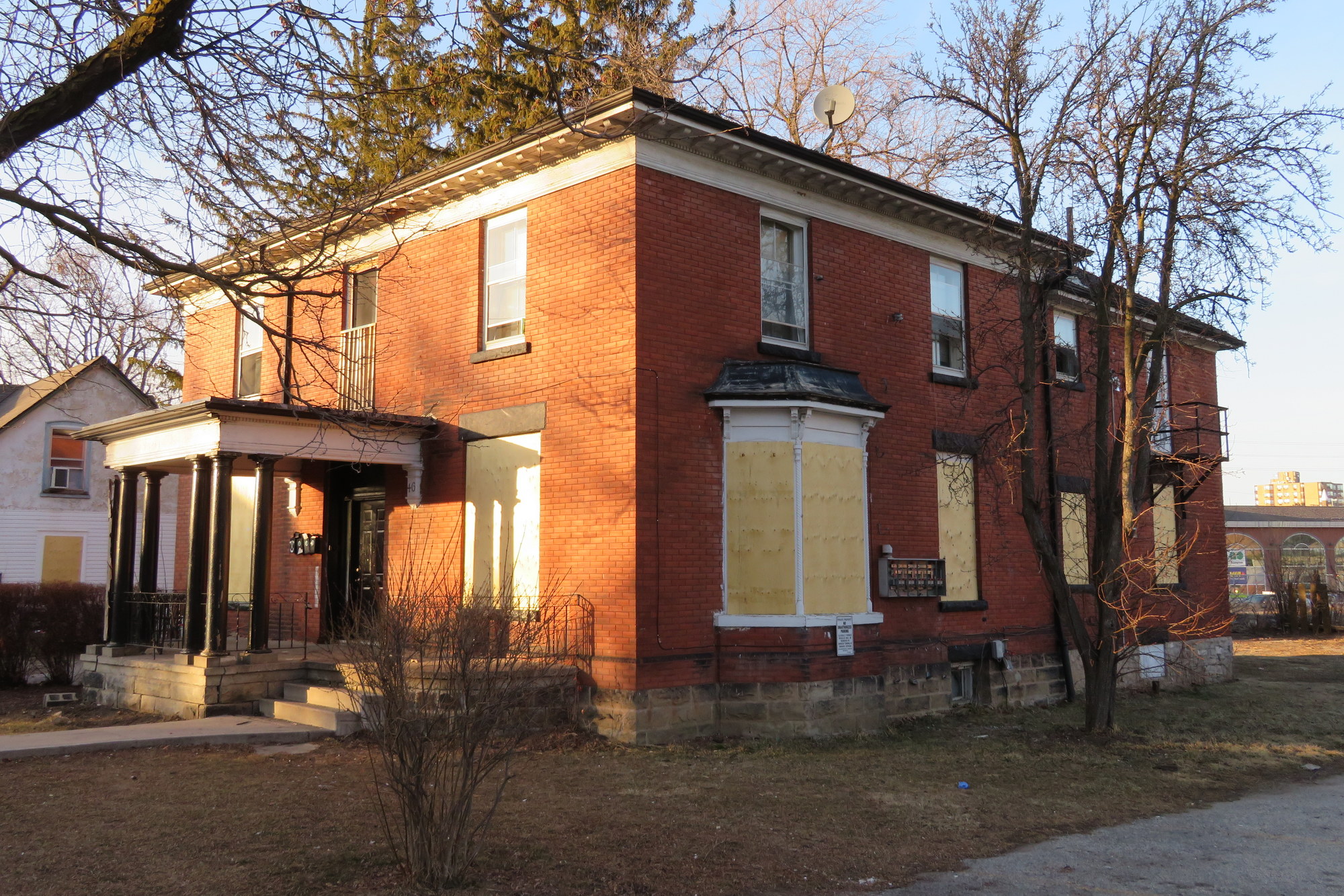
    IMG_6149-00146 Elizabeth Street North, a rooming house with heritage status, is now boarded up, with the electricity disconnected. 

    Unlike a competing university campus site near Etobicoke Creek backed by New Brampton (a politically influential group of local business and landowners who also opposed the Hurontario-Main LRT route), the GO Station and the Nelson/Railroad/Elizabeth Street buildings are outside the historical floodplain and can be built quicker.

    If the existing GO Transit parking lot were to be used for Ryerson’s Brampton campus, then an alternative parking site would be required — hence the recent purchase and the demolition of these homes and offices. The construction of a new surface lot in an designated “anchor hub” — where rapid transit lines meet and urban intensification is encouraged — would be most unfortunate, but I hope that it will not be a long-term solution. On the other hand, a new university campus is exactly the type of land use that should be located at an “anchor hub.”

    So far, local officials have kept very quiet about the land assembly on the block surrounded by George, Nelson, Elizabeth and Railroad Streets, perhaps waiting for approvals from the province and Ryerson University before making a public announcement. But with residents and office tenants displaced and houses boarded up suddenly, confirmation of these plans should come soon.
  • Pedestrian flags at crosswalks are not a solution

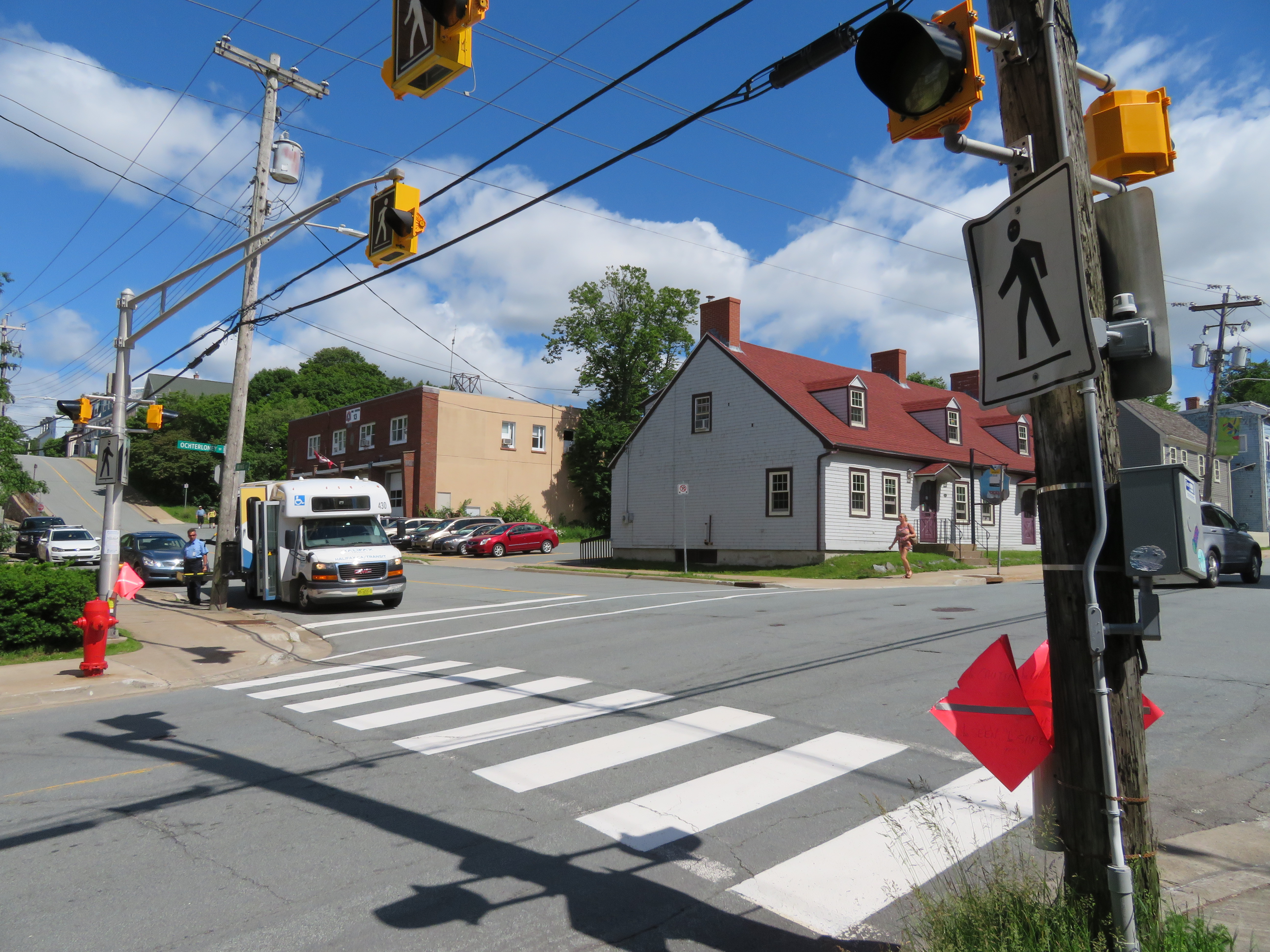
    IMG_0772-001Pedestrian crossing in Dartmouth Nova Scotia equipped with pedestrian flags
    A Toronto Star article this weekend profiled three elementary school students installing pedestrian flags at local residential intersections near their school in Leaside. Pedestrian flags are not a new idea; they have been common in Halifax and other communities in Nova Scotia for several years. (I wrote about this before on my blog after visiting Halifax this past summer.)

    On the surface, it sounds like a good idea. Eleven-year old Arnav Shah describes their use in the Star: “what happens is when a pedestrian comes to cross, they look both ways, the regular stuff, maintaining eye contact with the drivers, and then they put the flag up and walk across. Not only does this make them more visible, but makes them (the drivers) more aware of the problem at hand.”

    Residents have complained about additional traffic in the neighbourhood as impatient drivers use residential streets to avoid transit construction on nearby Eglinton Avenue. Photos in the article show the flags being used at the corner of Rumsey Road and Donlea Drive, near the school. The intersection is already controlled by a four-way stop, it is located in a signed school zone, and the local speed limit is 40 km/h.

    The local councillor, Jon Burnside,  rightly praised the children for taking initative. But he added that “…it’s also a sad commentary on the state of our roads and the way people drive.” He’s right. Burnside further adds that adults “can take some cues from the kids’ creativity.”

    If we need bright flags to cross the street at a designated crosswalk because motorists wouldn’t see pedestrians otherwise, then we’ve failed to provide safe infrastructure. The adults — namely Toronto’s mayor and city council — have resisted investing in safe pedestrian and cycling infrastructure.

    The city has put up signs on wide five-lane and seven-lane roads designating them as “Seniors Safety Zones” but has done little to actually make those roads safer for the pedestrians using them. The mayor and the committee responsible for roads and infrastructure rejected making Yonge Street in North York safer and more pleasant to walk and cycle, deferring to motorists instead. And last week, it responded to a child killed while crossing the street in a residential area by closing a walkway to the school yard and not doing anything to slow down motorists speeding in a school zone.

    Simply installing flags at crosswalks for pedestrians to carry would be in line with Toronto’s ineffectual Vision Zero program. While I can admire the children’s action, I would really like to see this taken much farther by the leaders in charge.


    Correction: the local councillor quoted in the Toronto Star is Jon Burnside, not John Campbell. I regret the error

  • The wrong answer to a tragic death of a boy walking home from school

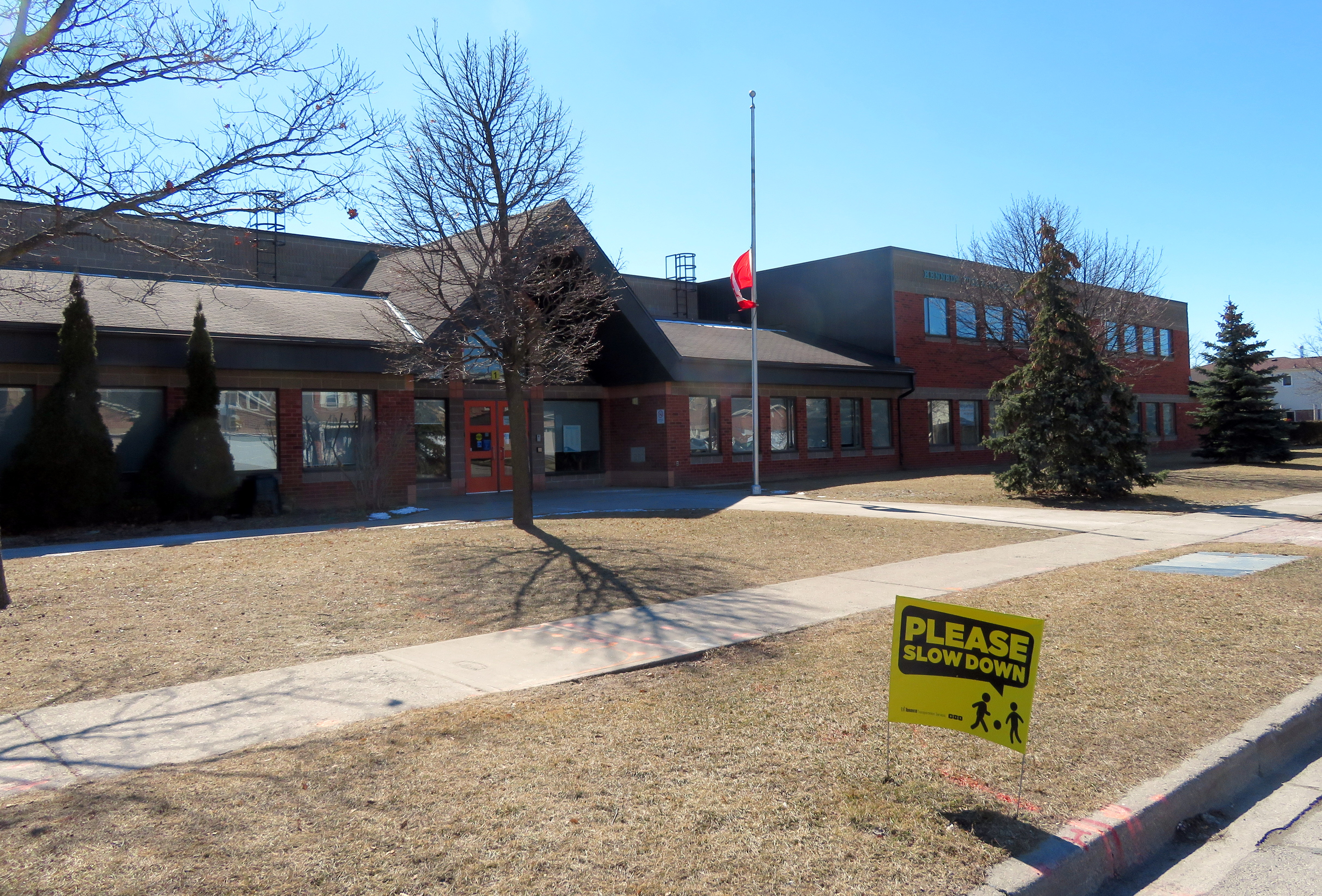
    IMG_6001-001.JPGKennedy Public School, where 11-year old Duncan Xu was in Grade 6. He was struck and killed on an adjacent residential street while walking home on Tuesday, February 27. 
    On Tuesday, February 27, around 3:30 PM, Duncan Xu, an 11-year old boy, was struck and killed by a motorist in a residential neighbourhood in north Scarborough. He was the tenth pedestrian killed on Toronto’s streets in 2018, and the second child killed on their way home from school.

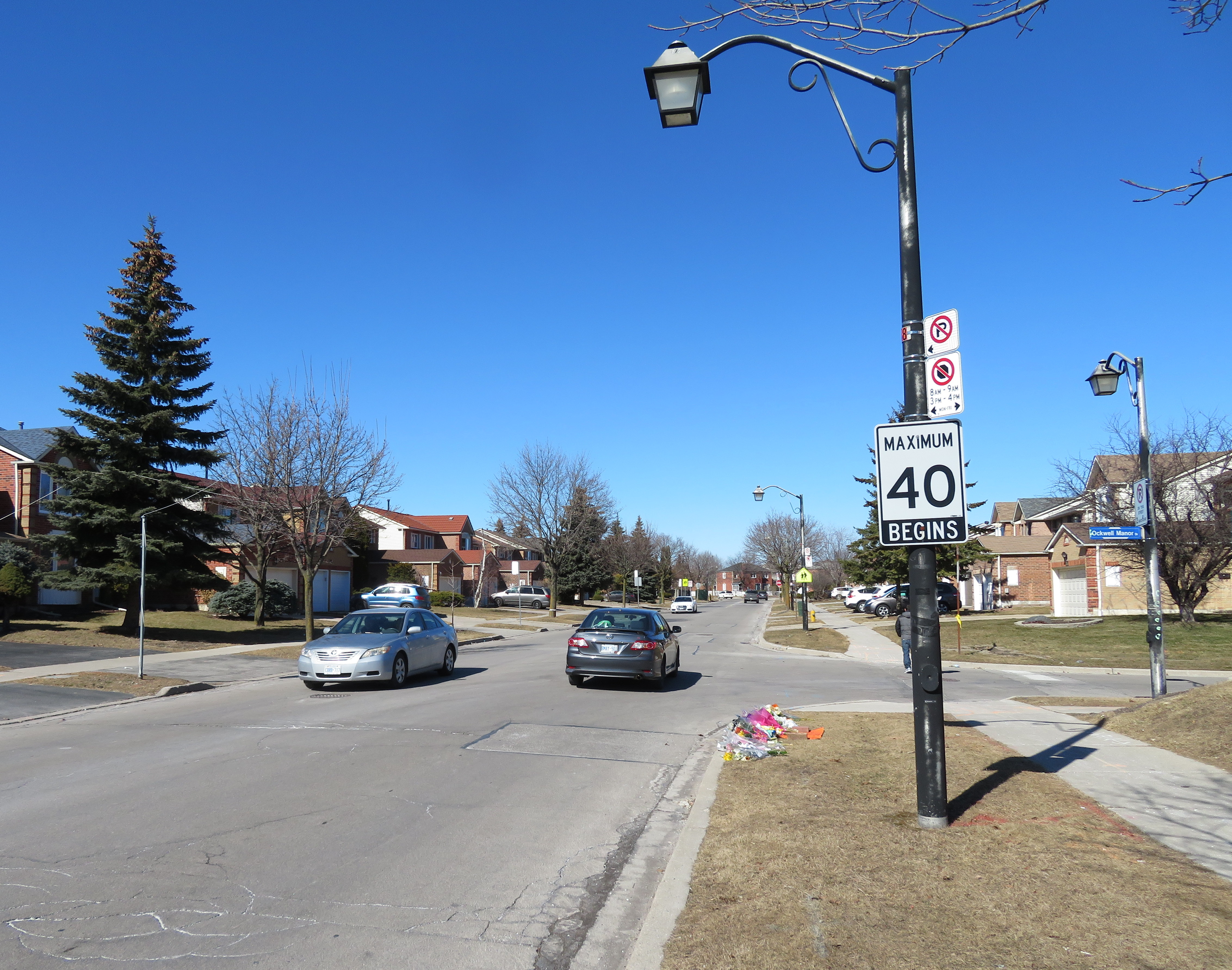
    Duncan Xu was crossing Canongate Trail at Ockwell Manor Drive, near the school, when he was hit by a motorist driving north on Canongate. The intersection does not have a crosswalk, but is only 70 metres north of an intersection controlled by a four-way stop. Canongate Trail a residential street lined with houses, and has a 40 km/h speed limit. The collision occurred right in front of a school zone sign.  Despite its residential nature, Canongate Trail acts as shortcut for non-local traffic avoiding the busy intersection of Steeles Avenue and Kennedy Road.

    I visited the neighbourhood today to better understand the conditions in which a child is killed crossing the street on his way home to school, and the local councillor’s “solution” to that problem.


    Map of the neighbourhood surrounding Kennedy Public School, including the location where Duncan Xu was hit, and the walkway that will close on Monday morning.

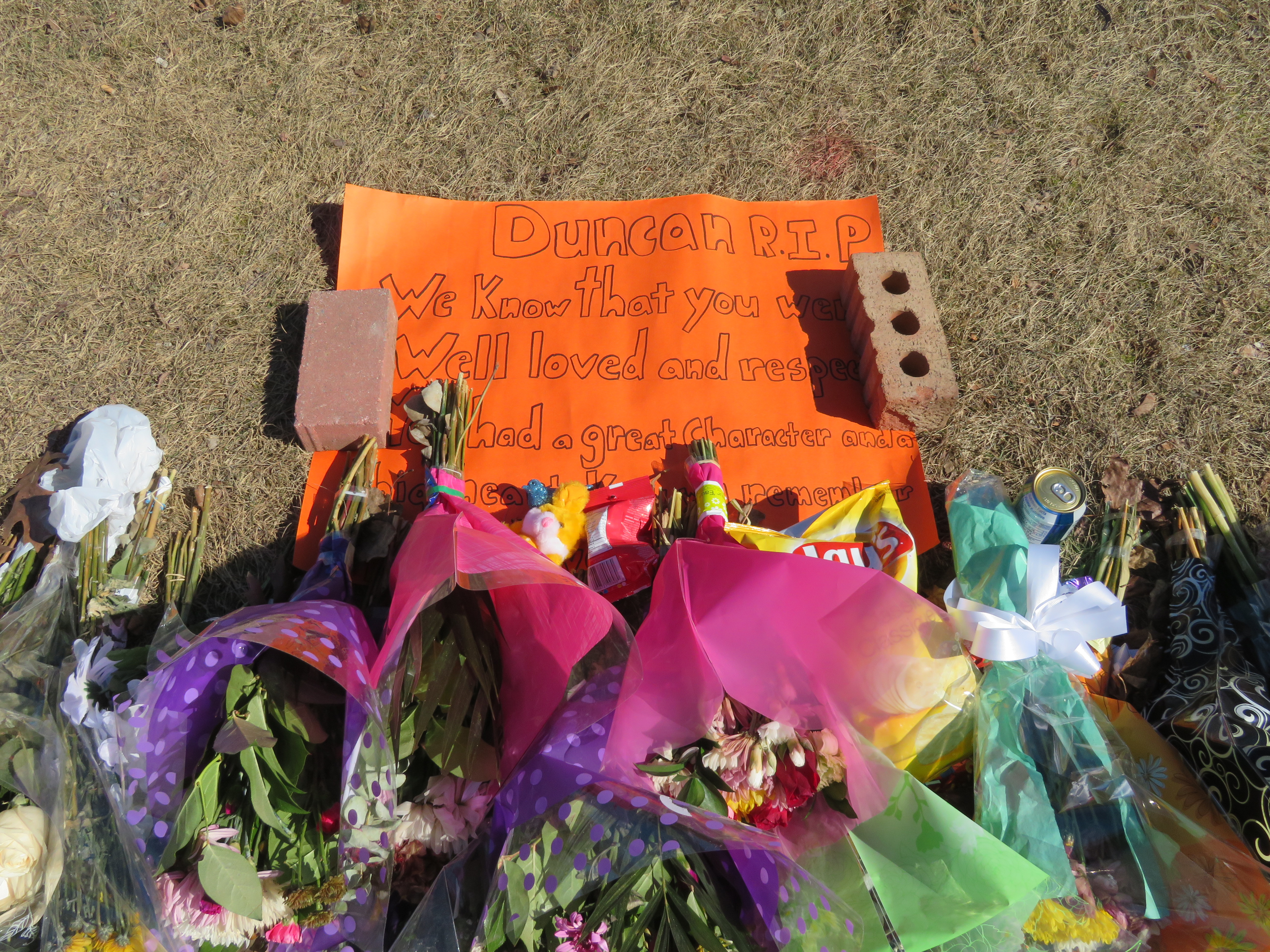
    IMG_6027-001Looking north on Canongate Trail at Ockwell Manor Drive, where Duncan Xu was killed. A memorial is at the curb. Note the speed limit sign, as well as the school zone sign, and also the heavy traffic on Canongate. 

    In the Toronto Star, school principal Kevin Liu described the traffic on Canongate as a problem: “I think we’re getting some thorough traffic, not necessarily residents, cutting through this neighbourhood to avoid a left-hand turn at Kennedy and Steeles during rush hours.”

    The school has long had concerns about their students’ safety.  Initiatives implemented in 2017 included new turning restrictions onto Elmfield Crescent, onto which the school fronts, and parking and stopping restrictions to better manage traffic from parents dropping off and picking up their children. A crossing guard is stationed at the corner of Canongate and Elmfield.

    Canongate is wide as far as local residential streets go. There are no attempts at traffic calming, such as speed humps, bump-outs or curb extensions, or effective traffic enforcement. There are several all-way stop signs on Canongate, but these on their own are not effective in slowing down motor traffic; rolling stops are common as well. When I visited the area today, I found that motorists accelerate quickly headed northbound from the Percell Square/Canongate intersection, and the 40 km/h speed limit is often not adhered to.

    Speeding motorist passes memorial to Duncan Xu on Sunday, March 4

    Sadly, the local councillor, Jim Karygiannis (Ward 39), has not championed measures to reduce and slow down traffic on Canongate Drive, despite local concerns. Instead, the councillor decided to unilaterally close a walkway linking the rear schoolyard with Canongate Trail, close to where Duncan was killed. Duncan used the walkway before trying to cross the street.

    Duncan Xu might not have crossed the street at a crosswalk, but he would still be alive had all motorists driven with the due care and speed befitting a school zone as children are heading home.

    The walkway is a convenient route for students to walk to school. It also connects residents to a nearby park. Councillor Karygiannis claimed that he proposed it earlier, but that local residents and the school refused it. Principal Liu said that he never heard about the proposal.

    The walkway Councillor Karygiannis will unilaterally close on Monday morning after Duncan Xu’s death

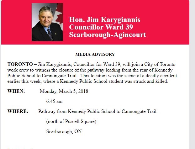
    On Monday morning, Councillor Karygiannis will make a show of closing the path and put out a media advisory indicating his intent. Orange plastic netting was already placed at both entries to the path, which cuts between two houses in preparation of the closure. But this is a classic case of “Zero Vision,” rather than Vision Zero, measures to improve road safety, such as improved pedestrian and cycling infrastructure and re-engineered roads that the city is at least nominally committed to.

    Councillor Jim Karygiannis media advisory

    Media advisory from Ward 39 Councillor Jim Karygiannis’ office announcing the closure of the pathway

    Closing the walkway will only serve to reduce walking to school, and increase traffic. It will do nothing to solve the problem of fast-moving cars in a residential area, nor will it necessarily prevent children from unsafely crossing the street. It’s the type of inexpensive, easy fix that make politicians look like they’re doing something, but without making the necessary changes to prevent future fatalities.

    Traffic calming measures, such as speed humps, tighter curbs at intersections, extending the curbs out at intersections, and planters would force motorists to slow down, and would be more effective than stop signs. More should be done to discourage impatient drivers from using the residential area as a shortcut. More should be done to encourage students to walk to school, rather than discouraged by closing walkways. Walking audits would allow the community to provide input. And this should be done around every school.

    The safety of pedestrians, especially children, should not be left to half-measures.

    IMG_6036-001

    Updated map of pedestrian fatalities on Toronto’s streets.

  • The John Tory Way

    32267768383_8c2f20d0d5_k
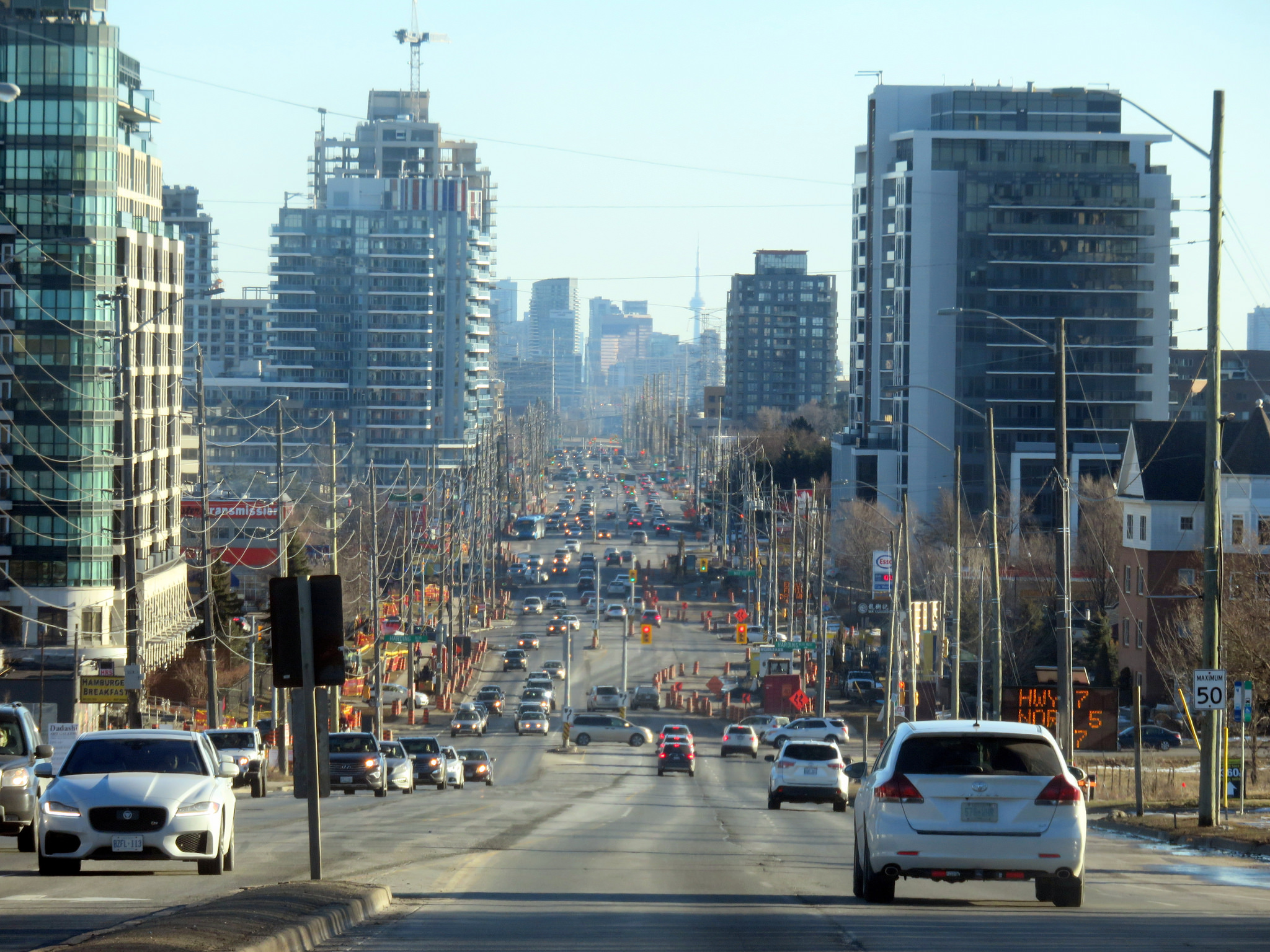
    Yonge Street looking south from Richmond Hill

    There’s an episode of The Simpsons where Homer Simpson changes his name to Max Power, after he’s ridiculed for sharing the name with a buffoonish television character. It’s not a great episode — it came out at the time the show was in transition from its glory years to the “Zombie Simpsons” era — but it has a few good laughs.

    There’s one good memorable quote:

    — “There’s the right way, the wrong way, and the Max Power way!”
    — “Isn’t that the wrong way?”
    — “Yeah, but faster!”

    On important transportation projects, the John Tory way is the wrong way, but costlier. We’ve seen this several times during his mayoralty.

    When it came time to replace the underused eastern section of the Gardiner Expressway, Tory and his suburban allies on council voted in favour of a more expensive “hybrid” option that maintains much of the elevated highway, instead of a cheaper at-grade option that would provide a better pedestrian realm on the Eastern Waterfront and better support new development.

    In Scarborough, Tory stubbornly supports building a one-stop subway extension that was last estimated to cost $3.35 billion dollars, instead of supporting a seven stop LRT route from Kennedy Station that would extend the existing grade-separated Scarborough RT route to Centennial College and Sheppard Avenue. A proposed SmartTrack station at Lawrence East (whose estimated construction cost has risen from $26 million to $155 million) may not be able to be built while the Scarborough RT is still in operation.

    And on February 27, Toronto’s Public Works and Infrastructure Committee (PWIC) voted against plans backed by city staff, the local councillor, John Filion, and many residents and road safety advocates, to transform Yonge Street in North York Centre between Sheppard and Finch Avenues. This section of Yonge Street is due for reconstruction, hence the opportunity to rethink the street to better serve the community.

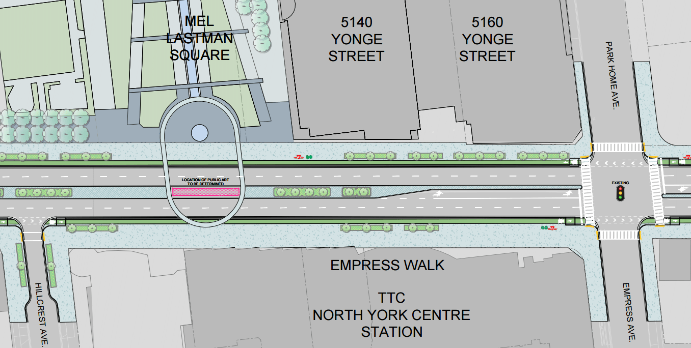
    The REimagining Yonge Street plan seeks to improve the pedestrian realm with widened sidewalks, would add new cycling infrastructure. To make room for these improvements, two traffic lanes — used for street parking outside of weekday rush hours — would be removed. This stretch of Yonge Street has seen many new condominium towers built over the last decade, and there are three subway stations serving this stretch of Yonge Street.

    Mayor Tory, who has the power to select committee chairs and members, stated his preference for the status quo on Yonge Street, suggesting that the bike lanes be moved one block west, to Beecroft Avenue. PWIC moved for this alternative option as well, even though city staff reported that the change would cost an additional $20 million.

    YongeCrossSectionYonge Street between Sheppard and Finch Avenues would have seen new separated bike lanes, wider sidewalks, and new public art. (From the EA materials.)

    The decision to maintain the status quo on Yonge Street benefits commuters outside of Toronto more than local residents, so it is puzzling why Mayor Tory has declared his support — once again — for an option that puts drivers first. Nearly three-quarters of rush-hour drivers on Yonge Street through North York come from York Region. A majority of residents take transit, walk, or cycle; they would benefit from a safer, more pleasant street. Moving the bicycle route to Beecroft Avenue serves to move cyclists out of the way of cars, rather than providing a direct route with better access to transit, shops, and homes.

    With Doug Ford focused on the Ontario Progressive Conservative party leadership race, there are — as of yet — no high-profile challengers to Mayor Tory’s re-election bid. There is no need to pander to a voting bloc angered by a so-called “war on the car” unless Tory actually supports suburban commuters over his own constituents. And this decision will only cost more money.

    Once again, Mayor John Tory has chosen the wrong way.

  • Ontario’s failed downtown malls

    IMG_0392.JPG
    Bayside Mall, formerly the Sarnia Eaton Centre, on a Saturday morning in 2013. Most stores are vacant or occupied by non-profits or independent businesses.

    The Toronto Eaton Centre, large, famous, and vital, is only one of many malls built in the downtown cores of Ontario cities between the 1960s and 1990s. From Thunder Bay to Cornwall, the construction of new enclosed shopping centres were seen as a necessary tool to keep the old city centres vibrant and relevant in the face of competition from new suburban malls. But only in the province’s two largest cities did the concept work. Elsewhere, these urban shopping complexes were left largely vacant within ten years of opening, when leases expired. When the Eaton’s department chain went bankrupt in 1997, huge voids were left behind that developers and municipalities struggled to fill.

    The Toronto Eaton Centre was opened in two phases between 1977 and 1979. It added hundreds of shops and new office space to Downtown Toronto, anchored by a new Eaton’s flagship and was connected to the Simpson’s store across Queen Street. Today, the Eaton Centre is Canada’s second largest mall (including the Hudson’s Bay/Saks Fifth Avenue building) and the Toronto region’s second most productive shopping centre in terms of sales per square metre. In Ottawa, the downtown Rideau Centre, opened in 1983, is the busiest and most productive mall in that region (Retail Council of Canada, 2016).

    But elsewhere in Ontario, downtown malls — mostly built with municipal and/or provincial government support — have been, without exception, commercial and urban development failures. Not only did they suffer from high vacancy rates, they helped to wreck the downtown cores they are located in rather than foster the economic revitalization they once promised.

    (more…)
  • Mapping Toronto’s approved new ward boundaries

    18506683800_6c96dcc66b_k

    On Monday, October 22, 2018, Torontonians will be electing a new city council. And for the first time since 2000, Toronto’s ward boundaries will be changing.

    When the new council is formed on December 1, 2018, there will be 47 wards, up from 44. Downtown Toronto will gain three new seats, and North York will gain one, but one seat is lost in Toronto’s west end, in an area currently represented by Wards 14, 17, and 18. Seven wards in Etobicoke, North York, and Scarborough will remain unchanged.

    Earlier this week, the City of Toronto added the new boundaries to its open data catalogue, so I used the data to create an interactive Google map. This map, embedded below, shows both the current 44 wards, and the approved new 47 wards. Each of the two ward boundary layers can be turned on and off.


    Google map showing current and approved new ward boundaries

    These new ward boundaries are the result of a long four-year study and consultation process, and represent a compromise that improves representation in high-growth areas, while minimizing the loss of council representation elsewhere. Several other options were explored, including reducing the number of councillors to 25, but they were rejected by the consultants hired by the city to draw the new wards; they were also unpopular among members of the public who attended the consultations.

    While Toronto City Council approved the new boundaries in November 2016 (despite Mayor John Tory’s opposition), Councillors Justin Di Ciano (Ward 5) and Giorgio Mammoliti (Ward 7) appealed the new boundaries to the Ontario Municipal Board. Happily, the OMB dismissed the two councillors’ complaints last month. Both councillors are likely to run for re-election in modified versions of their existing wards.

    I will update the interactive map, adding candidate names for each of the new wards. Nominations are open from May 1, 2018 through July 27, 2018.

    Thanks to Gil Meslin (@g_meslin), who altered me to the fact that the new ward boundaries were available on the city’s website. 

  • The same tired pedestrian safety campaign ignores the real issues

    IMG_2560

    After five pedestrians were killed on Toronto’s streets during the two weeks of 2018, Toronto Police have announced another pedestrian safety campaign promising increased enforcement and education efforts. Sadly, I do not have faith that the local police service will properly address the safety of vulnerable road users.

    Police are once again advising pedestrians to avoid crossing mid-block, to make eye contact with motorists before crossing the street, remove earphones and hoods when crossing, put away mobile devices, and be visible. These are all generally good ideas, but they ignore the larger issue — aggressive and inattentive motorists are most at fault.  Most collisions in which pedestrians are seriously injured and killed are in the suburbs, and not in the downtown core, where most pedestrian safety blitzes take place. And some of the advice the police gives pedestrians is not that helpful.

    Previous pedestrian safety campaigns have targeted downtown pedestrians crossing with a flashing hand countdown signal or distracted by their phones. The message is usually the same: in 2012, Toronto police were also saying to “cross the street as if your life depends upon it,” the same as this year’s message. Targeting downtown walkers is an easy way to get a message across, but it is not a very effective one, yet we see it every year.

    Statistics collected by the City of Toronto show that most pedestrians hit by motorists were crossing legally in a crosswalk, with the right of way. This latest campaign ignores that very fact.

    On January 7, Jessica Renee Salickram was killed trying to cross the street after getting off a TTC bus at Steeles Avenue East and Eastvale Drive, on Toronto’s border with Markham. The intersection does not yet have a traffic signal, and it is nearly 300 metres from the nearest signalized crossing, at Tapscott Road. The eastbound TTC bus stop does not even have a sidewalk, one of many inaccessible bus stops in suburban Scarborough. This was not a mid-block crossing, as it was at an intersection. The TTC has since suspended service at this stop, but that is not an acceptable solution.


    Pedestrian fatalities in Toronto in 2018

    The Toronto Police’s advice to make eye contact with motorists is often difficult — persons with visual impairments have as much right to cross as anyone else. It is also very difficult to make eye contact with distracted motorists, and drivers in cars and trucks with deep-tint windows. Police are advising pedestrians to cross at crosswalks, yet they are often blocked by vehicles.

    IMG_1801.jpg
    It’s pretty much impossible to cross the street safely when the crosswalk is blocked. 

    Global News has found that the Toronto Police Service has been issuing far fewer traffic tickets in recent years. Last November, Global reported that Toronto police issued half the number of Highway Traffic Act infractions — fines for speeding, running red lights and stop signs and other unsafe driving — were down by half between 2011 and 2016, as well as a significant drop in impaired driving charges during the same time. It seems wrong that pedestrians are once again being targeted while bad drivers are let off the hook.

    https://twitter.com/sean_yyz/status/953343384122355712

    As I have written here before, civic leaders have not taken pedestrian and cyclist safety seriously enough. There are a few token gestures to Vision Zero, but “Senior Safety Zones” and reduced speed limits on a few streets are not enough to send the message that we truly value the lives of all vulnerable road users — particularly children and seniors, who are disproportionately at risk. One more quick and easy police blitz on pedestrians at busy downtown intersections does not address the problem.

  • Brampton Transit’s evolution from a laggard to a leader

    5010657604_d3cd2c355a_o.jpg
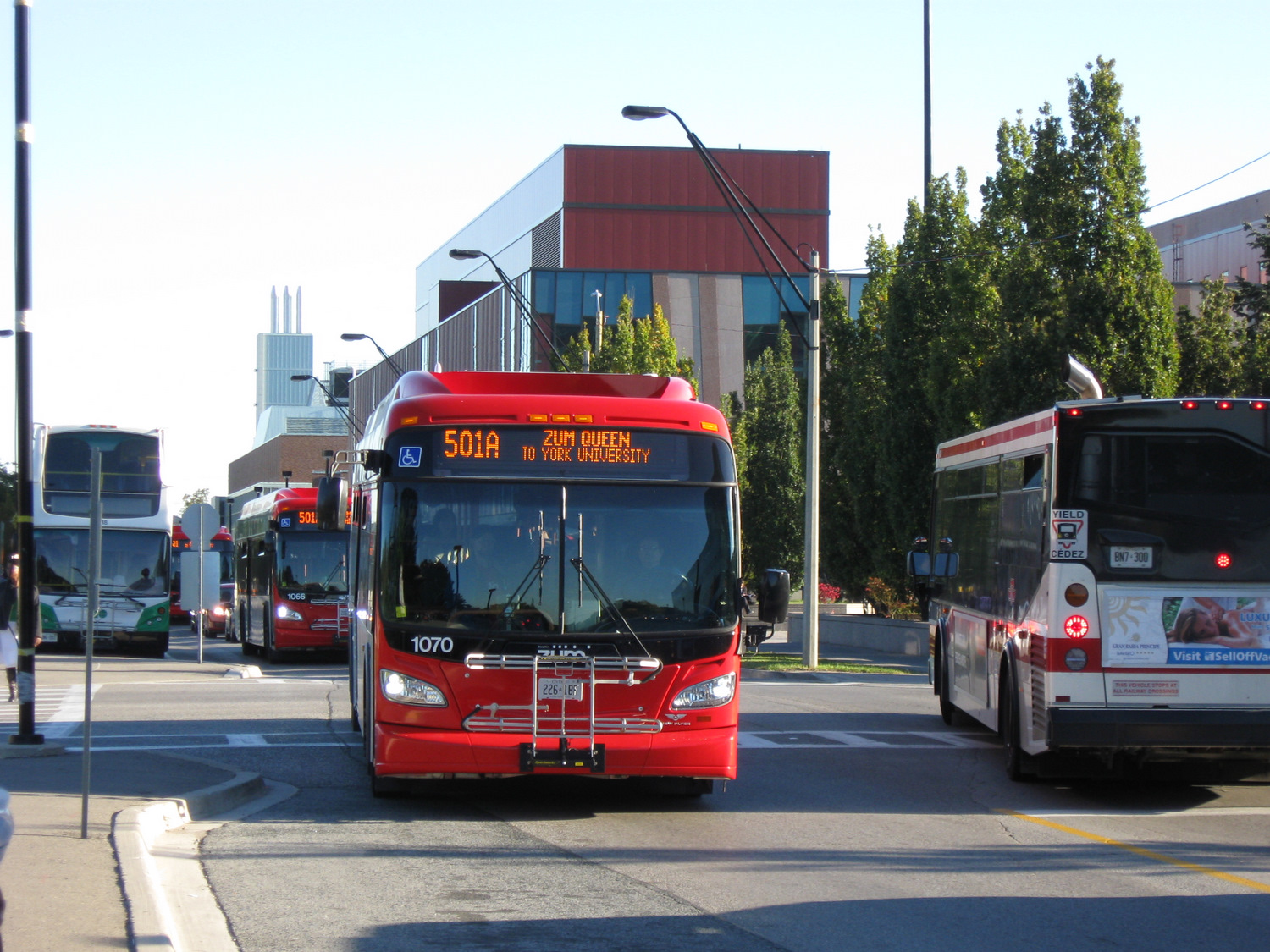
    The introduction of Brampton Transit’s Zum service in 2010, serving York University, was a major turning point for the suburban transit agency

    For TVO this week, I discuss Brampton Transit’s impressive ridership growth. In the last five years, Brampton Transit has bucked the trend of stagnant ridership numbers encountered elsewhere in the Greater Toronto Area and North America in general. I argue that Brampton’s success in improving transit ridership comes from sustained investment over many years, the move to a grid-based route structure, and the introduction of Züm, a basic network of semi-frequent, limited-stop bus routes, many of which extend outside of Brampton’s boundaries.


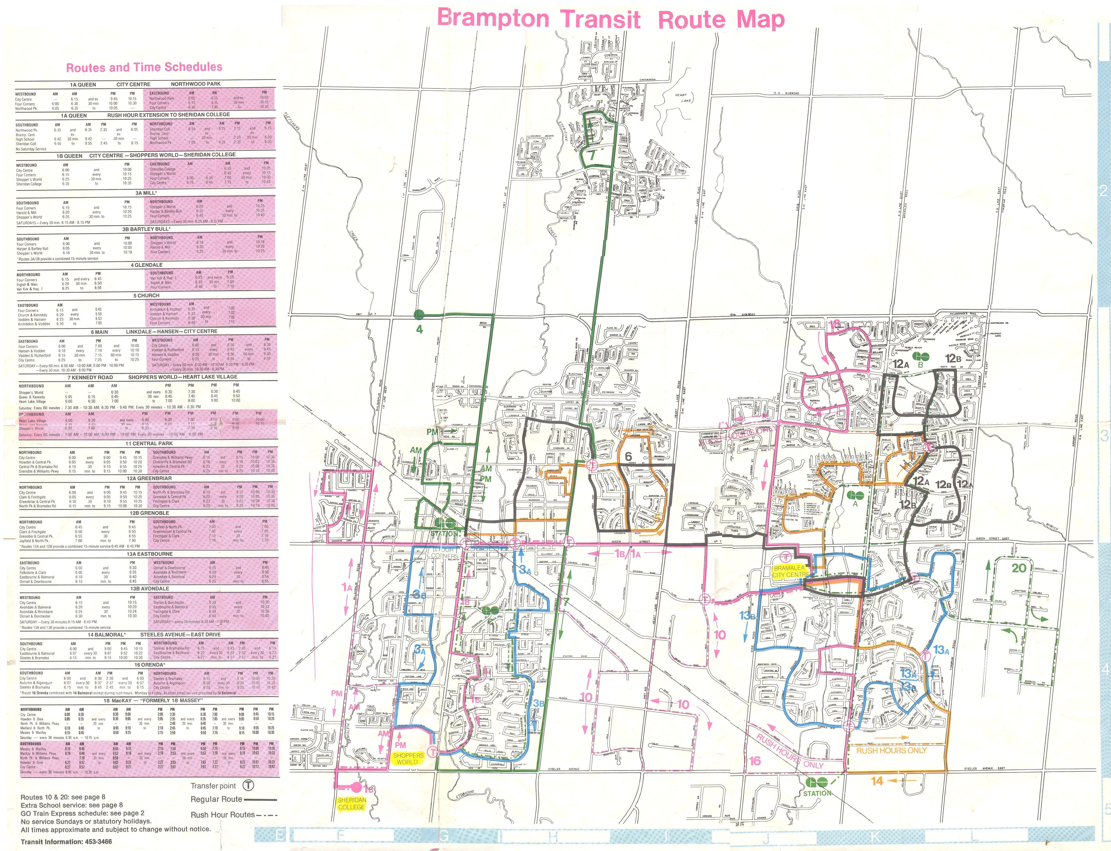
    I grew up in Brampton, and I have collected maps since kindergarten; my collection includes several old Brampton Transit maps. These maps help to illustrate the progress made since the 1980s, when the level of service provided was quite basic.

    Brampton Transit began operations in 1976 after the old Town of Brampton’s local bus service was amalgamated with the dial-a-bus service operated in Bramalea. (Brampton amalgamated with most of Chinguacousy Township in 1974, including Bramalea.) In 1980, Brampton Transit operated 14 routes, serving a community of just under 150,000 people. Buses operated no later than 9:00 or 10:00 PM, Mondays through Saturdays, and many routes operated with long, meandering loops. Apart from GO Transit, there were no connections to nearby communities.

    Brampton Transit - December 1980 front
    December 1980 Brampton Transit map

    By 1988, service was offered on Steeles Avenue to Humberline Drive in Etobicoke, where connections could be made to TTC buses on the 96 Wilson and 73 Royal York buses, but didn’t continue east to Humber College. Brampton Transit Route 14 Torbram served Westwood Mall in Mississauga, and connections to Mississauga Transit could be made at Shoppers World. But still, service levels were poor — you were lucky to get a bus every 30 minutes outside of rush hours. Permanent Sunday service wouldn’t come for another ten years. Notable are the four lettered bus routes — A, B, C, and D — that made direct connections to the four weekday GO train round trips to and from Toronto.

    Brampton Transit’s maps of the era are also historically notable because of their advertising: only one of the Burger King locations shown on the 1988 map still exists. Other restaurants advertised — the Old Beef Market, O’Henry’s, and Queen’s Pizzeria — are no longer in business.

    Brampton Transit - 1988
    September 1988 Brampton Transit Map


    Brampton Transit Maps published in the 1990s and early 2000s were printed on newsprint, and used only a two-colour scheme: blue for regular routes, and orange for rush-hour routes. Service to new subdivisions was often provided by way of long one-way loops, which is an inexpensive way of serving new areas, but are inconvenient and slow for potential riders.

    Notable in the 2001 map below is Route 77, launched in the 1990s as a joint Brampton Transit/Vaughan Transit route between Bramalea City Centre and Finch Station along Highway 7. Route 77 was a very slow way to get to the subway from Brampton, but it operated until Züm began service in 2010. In 2001, bus service on 11 Steeles was finally extended to Humber College’s main campus.

    Brampton Transit, 2002
    September 2001 Brampton Transit map

    2005 marked an important turning point for Brampton Transit, as it introduced a grid-based route system on major arterials. Route 14 Torbram, for example, no longer served Bramalea City Centre, but continued north, providing a core north-south route; many other routes were straightened, including Route 2 Main north of Downtown. Changes since May 2005 saw service frequencies improved, more local routes added, and improved connections.

    Brampton Transit - 2005 front
    May 2005 Brampton Transit map

    The current system map, dated September 2017, can be found on Brampton Transit’s website.

  • King Street complainers need to remember why they’re on King Street

    26777810469_e87676d219_k

    On Friday, CBC Toronto ran a story on several King Street West businesses that have claimed that the new King Street Pilot have caused them to lose customers in December.  The three business owners mentioned in the article were Laleh Larijani of Forno Cultura, a bakery on King east of Bathurst, and two Restaurant Row restaurateurs: Jesse Warfield, whose family owns the Gabby’s chain of restaurants, and Fred Luk, owner of Fred’s Not Here and The Red Tomato.

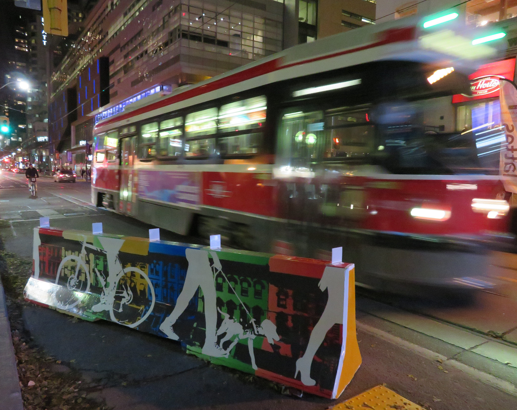
    The King Street Pilot was launched by the City of Toronto on November 12, 2017. At many intersections between Bathurst and Jarvis Streets, cars and trucks are required to turn right off of King Street, prioritizing streetcar traffic. Most on-street parking spots were removed from King Street through this section, but designated areas allow for deliveries, passenger pick-ups and drop-offs, and access to local properties, including parking garages. Despite some [predictable] hyperbole from suburban politicians and reactionary journalists, cars are not in fact banned from any section of King Street. And there are many public and privately-owned garages adjacent to the pilot corridor for motorists to park at.

    For transit riders, the King Street Pilot is working. In December, the TTC reported travel time reductions for the busy 504 King and 514 Cherry Streetcars of up to 24 percent. However, it still struggles to keep up with demand. The continuing delays in the new streetcar deliveries from Bombardier have not helped matters; and streetcars still often run overcrowded, leaving some passengers behind at streetcar stops. There are some necessary tweaks to be made: TTC schedules should take advantage of improved travel times, and transit signal priority is also necessary with the new far-side stop locations at intersections. Signal priority will help to ensure streetcars don’t have to stop at a red light at the near side of the intersection and again to load passengers at the far side.

    But since it’s a year-long pilot project, these tweaks can be made.

    Unfortunately the CBC article was weak in that it presented only the business owners’ complaints about the King Street Pilot, without hard data to back up the claims of lost business. Only one Toronto city councillor was quoted, John Campbell, who represents Ward 4, Etobicoke Centre. Ward 4 is an affluent, suburban part of the city that does not have any streetcar lines. Councillor Campbell, who also sits on the Toronto Transit Commission, would like to see street parking permitted during evenings and weekends:

    “I would like to see people able to park here in the evening, park here on the weekends, because listen, when it’s –15 C people don’t want to walk a block-and-a-half to get to a restaurant. They want to park within 100 metres. I think that would bring more vibrancy back,” [Campbell] explained.

    It’s worth pointing out that motorists will walk much further than 100 metres when parking at busy suburban malls like Sherway Gardens or Yorkdale; it’s also the distance from many GO Transit parking spots to the train platform. The walk between the front doors of the Royal Alexandra Theatre and Princess of Wales Theatre on King Street is nearly 200 metres.

    Watering down the King Street Pilot would doom it to failure: as any King Street transit rider knows, traffic congestion didn’t suddenly disappear at 6:30 PM. It’s an unreasonable expectation to find ample parking 100 metres from many downtown businesses and institutions.

    It’s worth noting that a suburban councillor has taken so much interest in watering down a downtown initiative championed by downtown councillors, and that as a member of the TTC board, Campbell wishes to reduce the benefit to many of the transit agency’s customers.

    Fred Luk, profiled in the CBC article, has a long history of complaining to Toronto media, as pointed out by urbanist and writer Shawn Micallef on Twitter. In the last few years, Luk has complained about the increase in the minimum wage, higher energy costs, the effects of the 2003 SARS outbreak and the 2010 G20 Summit, even the 1999 municipal indoor smoking ban. Yet Luk’s King Street restaurants persisted.

    There are many factors that can influence the success of restaurant businesses. Obviously, the quality of food and service should be examined. It’s worth noting that Toronto is bearing with unseasonably cold temperatures, it’s the low season for tourism, and there aren’t any blockbuster musicals currently playing at the Royal Alex or Princess of Wales. Motorists still have to get used to the new arrangements and change their habits; it’s only been seven weeks so far. Once the weather improves, the curb lane in front of Restaurant Row can be used for wider sidewalks, even enlarged front patios.

    The smart thing for a business owner concerned about a decline in patronage would be to use the free publicity to promote the restaurants, rather than complain about a loss of business. Businesses in the Entertainment District are largely driven by walk-up traffic; there’s a reason why menus are posted by the doors and in the summertime, you can’t walk past Restaurant Row without having a representative out front trying to get you to look at their menu.

    Locating a restaurant on King Street West has lots of advantages: the proximity to thousands of residents, many nearby offices, hotels, entertainment and sports venues, and excellent transit access and ever increasing pedestrian activity. It is not realistic to expect ample street parking to be one those advantages.

    If access to parking were the chief concern, it would be wise to set up in a suburban plaza somewhere else, like in John Campbell’s Etobicoke. Complaining about a major improvement to the travel times of thousands of commuters, without offering any incentives for potential customers to visit your restaurants isn’t productive. Instead, doom and gloom messaging may only damage business further, resulting in a self-fulfilling prophecy.

  • A farewell to 2017

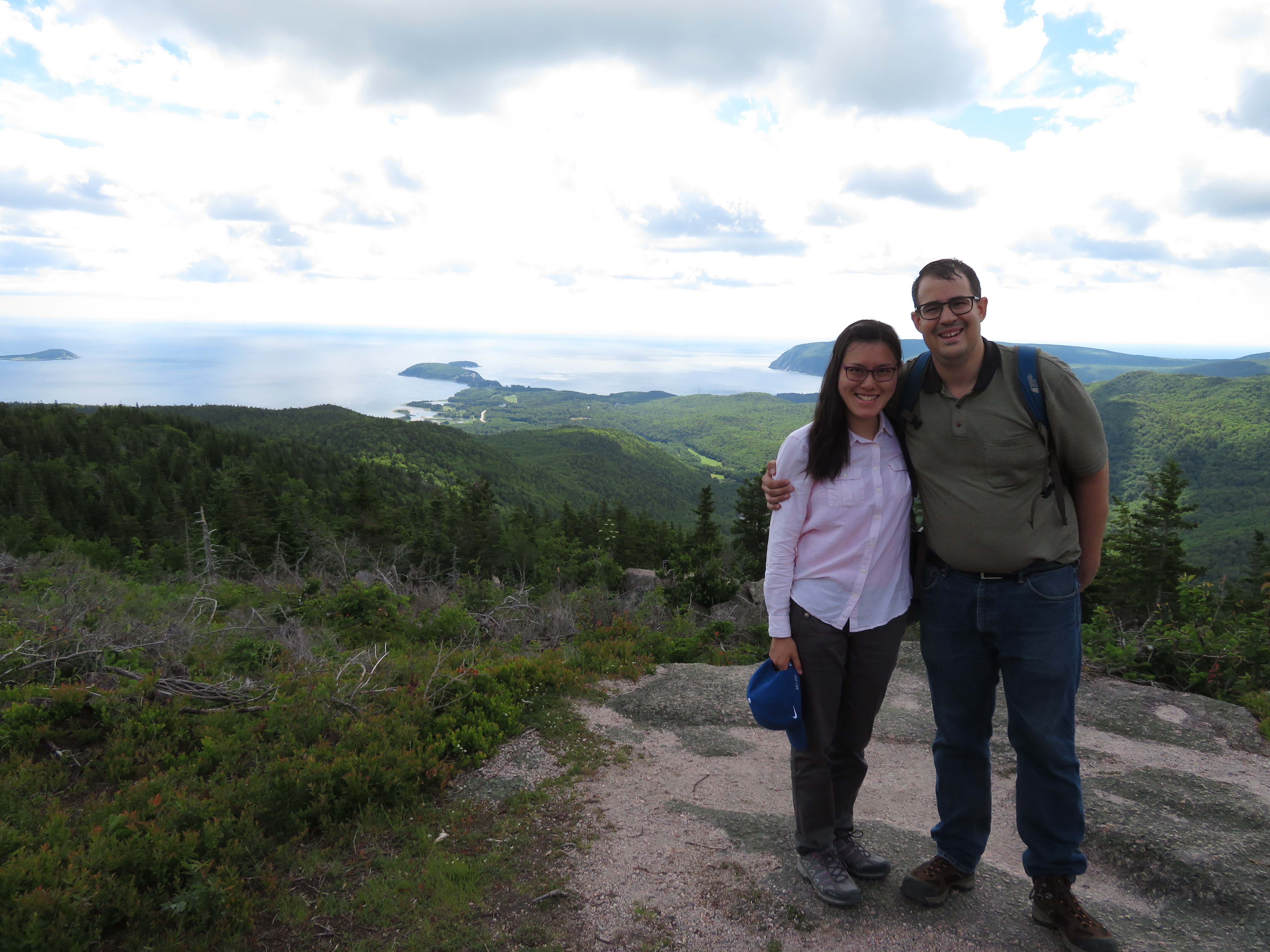
    IMG_0129-001At the top of the Franey Trail, Cape Breton National Park
    For me, 2017 was a great year. In June, I wrote about my life up to that point, looking back at some of the challenges I faced over the years, my ability to overcome them, and my accomplishments. I wrote that shortly before I got married to an amazing life partner, and together, we look forward to many great things.

    Elisa and I honeymooned out East, touring the Cabot Trail, Prince Edward Island, and Halifax before taking the train back home. We also visited Point Pelee for the first time, and made trips to Detroit, Chicago, and across Ontario, to places like Southampton, Sudbury, and Collingwood.

    I met a few new friends in 2017, and I also got to know some great people even better. Along with our own wedding, Elisa and I got to help celebrate three others this year.

    In Brockville, exploring the newly re-opened historic railway tunnel, I spent a few hours catching up with a high school friend who moved from Brampton to a town in Eastern Ontario. That was one of this year’s nice simple highlights. Day trips with friends and groups walks with others were another thing that made this year good. But also in 2017, I lost contact with a few people I knew, including another of my best friends from high school. I regret not keeping in closer contact; social media has its limitations.

    At my full time job, I stood up in front of an audience at an industry event, presenting the work that I did on an interesting interactive map that I developed. This year was one of  the most challenging years I had at work, but also one of the most fulfilling.

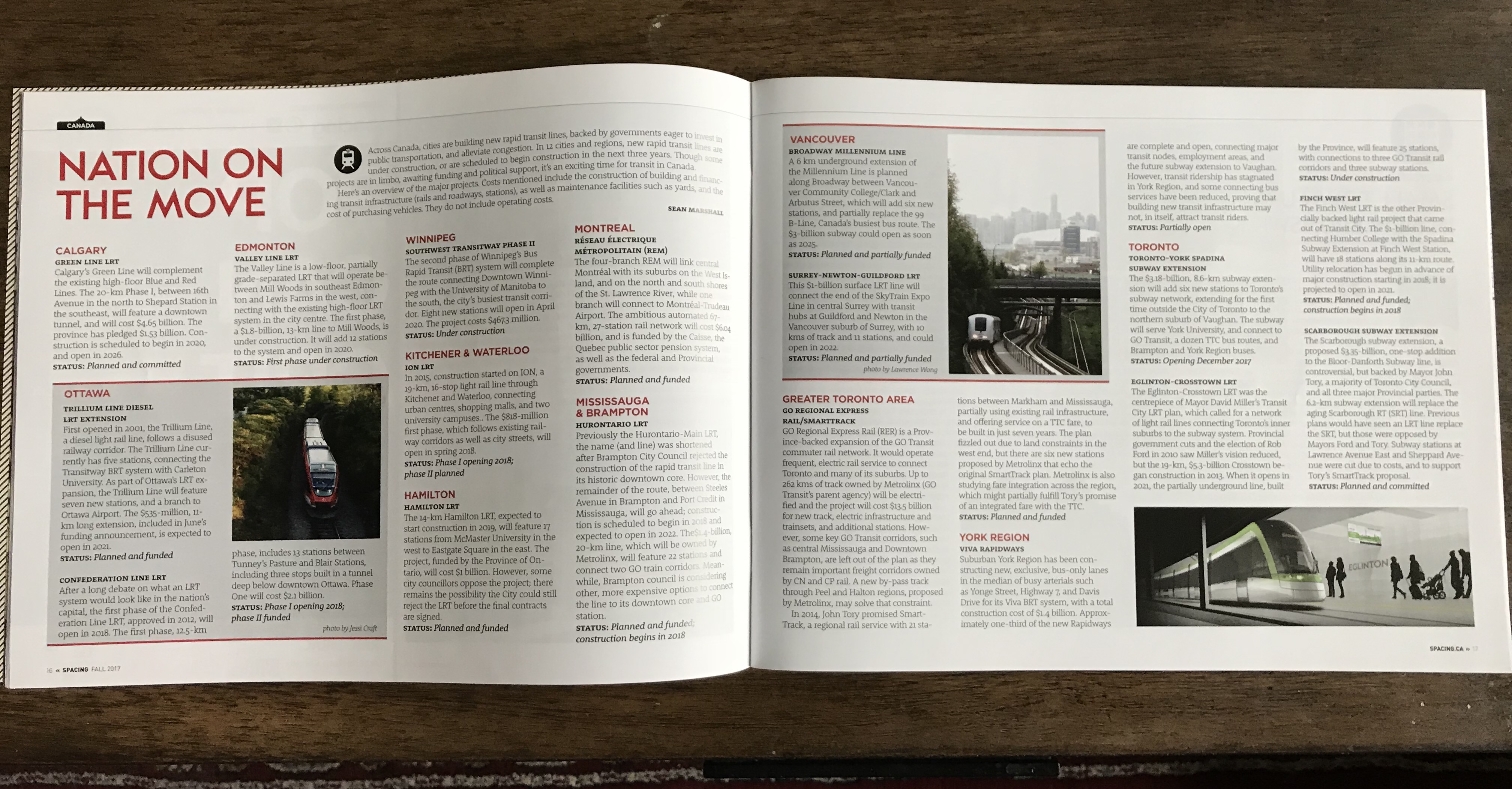
    2017 also marks the tenth year since I started writing on urban issues and transportation for fun. Spacing is one of my favourite publications, and it has been an honour to write for them on occasion. My first blog post described some of the places where Toronto’s old streetcars were sent to once they were retired by the TTC; my latest contribution, a full-page spread in the Fall 2017 issue of the print magazine, highlighted all the major transit projects across Canada planned or in progress. This year, I also wrote for Torontoist and TVO, and of course, in my own blog.

    IMG_1524.jpgNation on the move: my latest article in Spacing

    In 2018, I look forward to many things: a trip to see family and new places in Europe, catching up with friends, having some more writing opportunities, new challenges at work, and a municipal election, where three new wards will help deliver some new faces to Toronto City Council. Maybe, too, there will be a strong mayoral candidate worth supporting.

    My top six posts of 2017

    These six articles might not be the most read, but they are among my favourite posts in 2017. They all deal with some of my favourite subjects: urban planning, transit, and local history.

    • Ontario’s land use scandal: Another greenfield hospital for Niagara: A commentary on poor land use planning decisions (which I have discussed previously on this blog) which puts major health and educational institutions far from where people live, on sites difficult to serve by transit.
    • Hallam Street and the Harbord Streetcar: The history of Hallam Street in west end Toronto and the Harbord Streetcar, which was one Toronto’s most interesting carlines until it was abandoned in 1966.
    • How intercity bus service is failing Ontarians: my first article for TVO, I examine how the intercity bus network in Ontario declined since the 1980s, and how many communities in the province have since become disconnected.
    • A need for high speed rail reality: an article I posted to Spacing, as I express my skepticism for the province’s proposal for a high speed rail line between Toronto, Kitchener-Waterloo, and London, with a possible extension to Windsor. It’s an interesting contrast to the neglect paid to rural bus services.
    • Toronto’s Zero Vision and the folly of Seniors Safety Zones: Putting up a few new signs as part of a reluctant response to an unacceptable level of road violence isn’t  Vision Zero, it’s Zero Vision. As a pedestrian advocate and co-founder of Walk Toronto, I believe that the city does a lousy job of protecting its residents from injury and death on its roads.
    • Rosedale NIMBYs Push Back Against Four-Storey Condo: There are few things more fun than writing about entitled, unreasonable NIMBYs.