Marshall’s Musings

  • The ravine run around

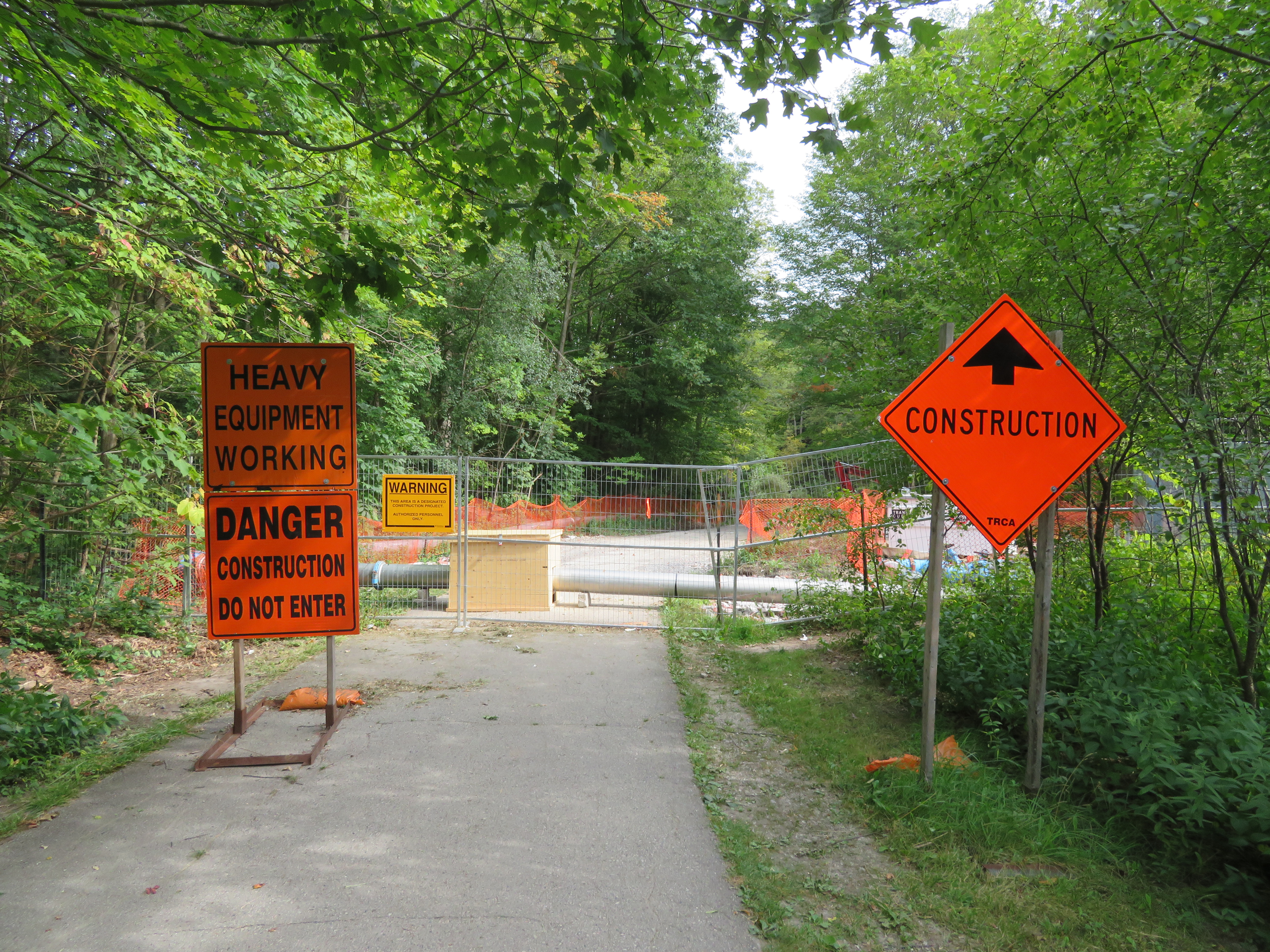
    IMG_2475-001Wilket Creek trail closure, September 2017

    Last week,  my wife and I went for a walk through the Toronto Botanical Gardens, Edwards Gardens, and Wilket Creek Park, all part of Toronto’s wonderful and extensive ravine system. The ravines are one of Toronto’s greatest assets, and many are connected by multi-use trails, allowing pedestrians and cyclists to experience nature, close to home. Some trails, like the Lower Don, are also important commuter routes for those who walk or cycle to school or work.

    Unfortunately, several of these trails are closed for long periods for construction, and they do not get the same attention that roads and highways get.

    The Wilket Creek Trail, between Edwards Gardens and Sunnybrook Park, has been closed since Spring 2017, and will remain closed until Spring 2018. The Toronto Region Conservation Authority (TRCA) is repairing damage caused by erosion, and restoring the local ecosystem. The same trail was closed two years ago for similar construction work.

    The pedestrian detour on Leslie Street is straightforward, and does not deviate too far from the route. However, Leslie Street is busy and motorists drive at high speeds, so it is not a good safe route for cyclists. To the City of Toronto and TRCA’s credit, at least, the detours are well mapped and construction notices are signed well in advance. (I’ve experienced trail closures without any warnings or suitable marked detour routes.)
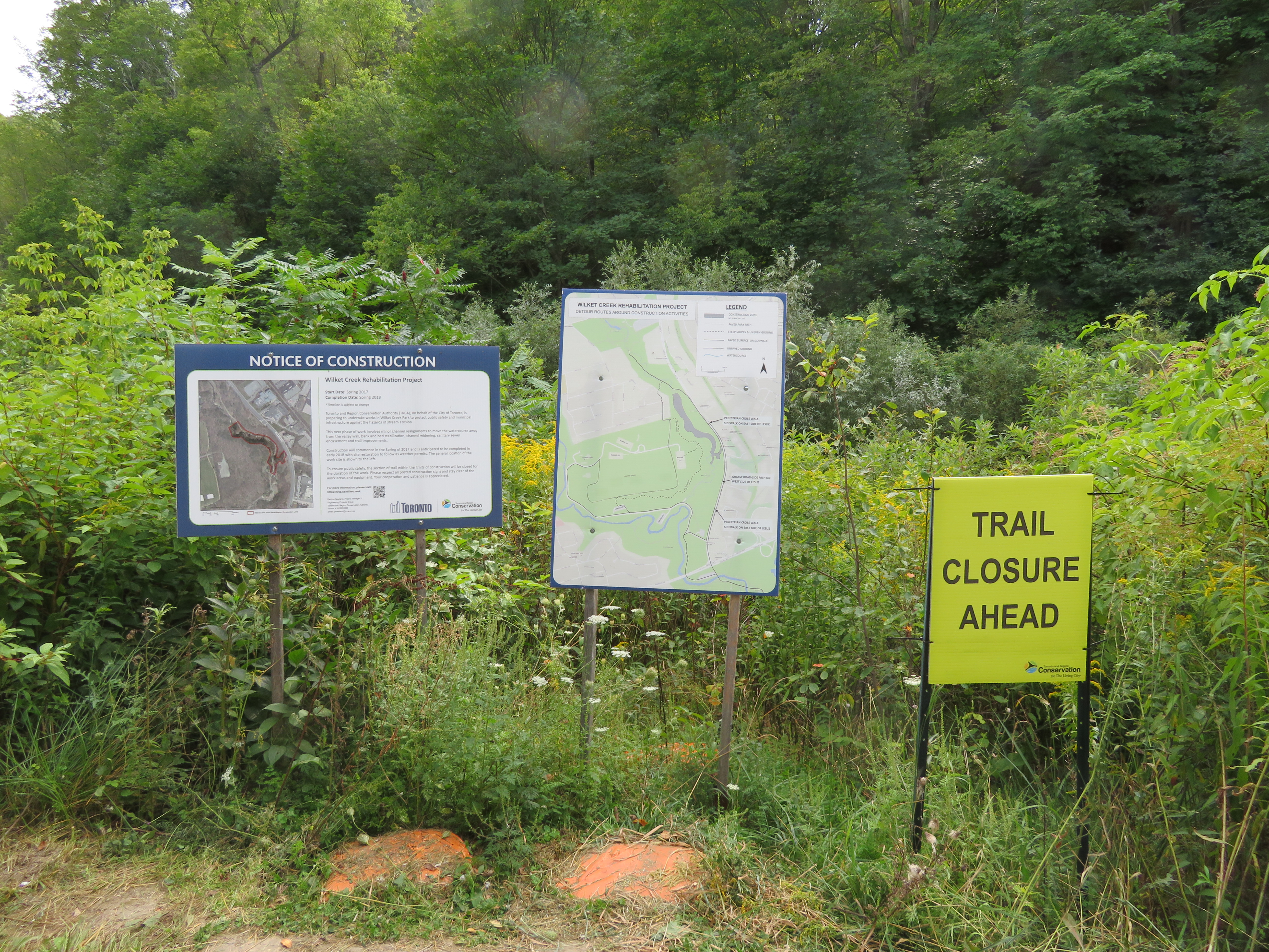
    IMG_2476-001Advance warnings and a detailed detour map on the Wilket Creek Trail

    Further south, the Lower Don Trail between Pottery Road and the footbridge at Riverdale Park will re-open on September 23, 2017, fourteen months late. That work was done to replace an underpass at a disused rail corridor owned by Metrolinx.

    As Metro reporter David Hains points out, that re-opening was re-scheduled several times between July 2016 and August 2017 — unexpected soil conditions and wet weather were blamed for the delays.  Pedestrians and cyclists were directed to use either Broadview Avenue or Bayview Avenue to get around the closure; both are busy roads, and Broadview Avenue is at the top of a steep grade from the Don Valley.

    Other major closures included the Humber River Trail under Highway 401 near Weston Road, which was closed for several months in 2016 so that trail users would not be in the way of construction vehicles. The suggested detour, a 3 kilometre long circuitous route, followed Wilson Avenue, a busy suburban road.

    This year, the Etobicoke Creek Trail under Highway 401 in Mississauga is also closed for two years for bridge work. There are no safe alternatives for crossing Highway 401 in that area.
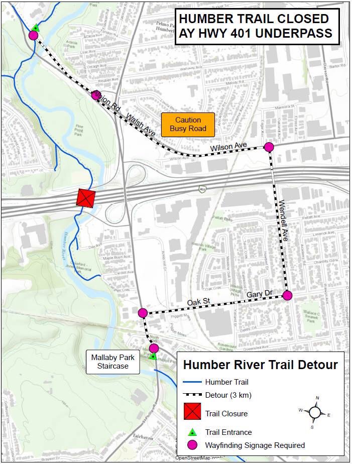
    Humber.jpgThe circuitous and dangerous 2016 Humber River Trail detour at Highway 401. Source: MTO.

    The long and dangerous closures of major pedestrian and cycling routes can be compared to the way road repairs are prioritized. Mayor John Tory announced $3.4 million to speed up construction on the Gardiner Expressway in 2015, when the elevated highway was reduced to two lanes in each direction from three. In August, Tory announced additional funds to speed up watermain and streetcar track construction on Dundas Street between Yonge and Church Streets, perhaps not coincidentally a route many city councillors drive to get to City Hall.

    If only there were some additional money and attention given to projects affecting pedestrians and cyclists in Toronto. It would also be nice to ensure any detours were well signed, and made as safe and comfortable as possible.
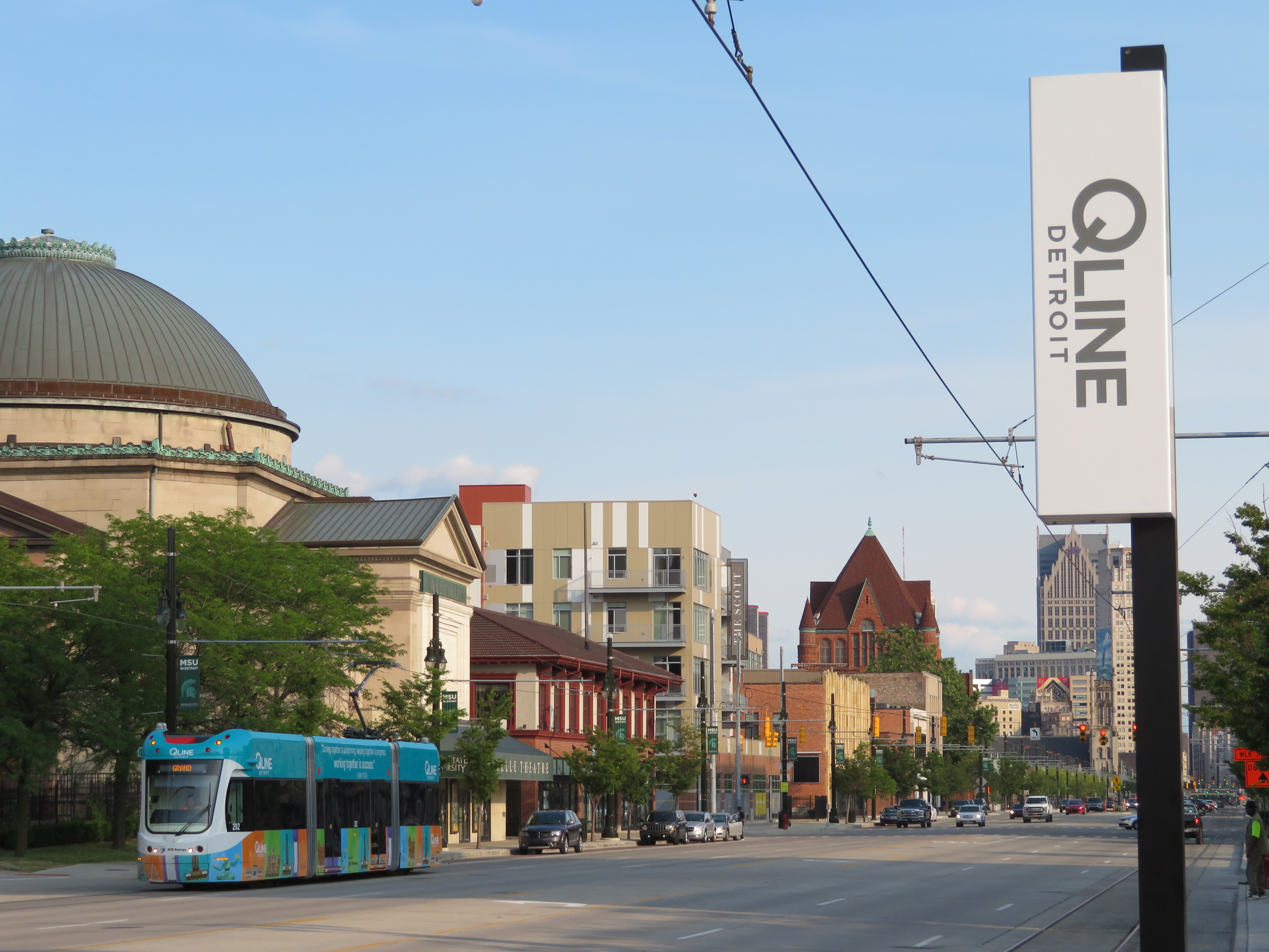
  • The streetcar returns to Detroit – but who benefits?

    IMG_1489-001Woodward Avenue at Mack Avenue, August 2017

    I grew up in Brampton, a suburb of Toronto. Our family could not justify long, expensive vacations, but we did make several trips to Detroit and the region, usually to visit the Henry Ford Museum and Greenfield Village. We’d stay at a hotel outside Detroit, usually one with a swimming pool. Besides the museum visit and the pool, my parents would usually include a stop at an outlet mall. We’d also drive through Detroit itself, sparking my enduring fascination with the city.

    Since my first visit in the mid-1980s, the Hudson’s Department Store has been demolished, the Michigan Central Station has been permanently closed and allowed to deteriorate, and several downtown skyscrapers have closed and been abandoned. The city itself continued to lose population as more auto plants closed in the city and surrounding suburbs, and city services declined.

    But on recent trips, on my own or with friends, we started to see the beginnings of what looked like a comeback. New downtown baseball and football stadiums, followed by new office buildings, the re-opening of the long-abandoned Book-Cadillac and Fort Shelby Hotels, the opening of the Detroit Riverwalk and Dequindre Cut multi-use paths, and new residential development Downtown and Midtown.

    On the last trip to Detroit, my wife and I stayed downtown, at a hotel in the David Whitney Building, a formerly-abandoned office tower. We walked around Downtown Detroit and Eastern Market, visited the famous Art Deco Fisher Building, and went to several museums, including the Charles H. Wright Museum of African-American History, and the Detroit Historical Museum, both of which had special exhibitions marking the 50th anniversary of the 1967 Detroit Rebellion (also known as the 12th Street Riot). We ate at great local restaurants as well.

    And I went back to the Henry Ford Museum and Greenfield Village, both of which were as fun and as interesting as I remember.

    We also took the new QLine Streetcar. It was a fun ride, and I’m happy to report that the service was well used by both residents and tourists alike. But I have some serious concerns as well.

    (more…)

  • We came for the cow, but we had no reason to linger in Cathedraltown

    IMG_1226-001

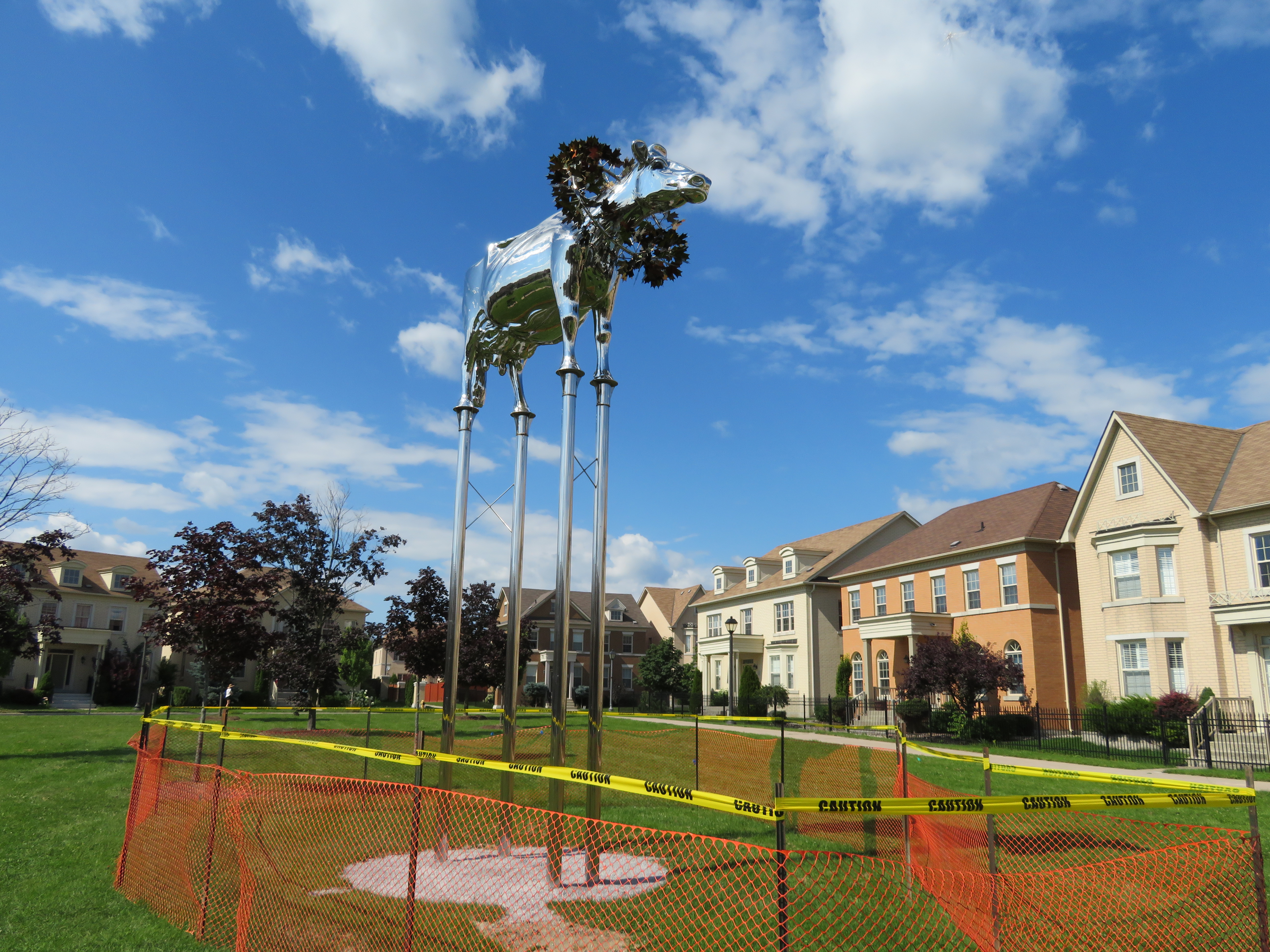
    Last weekend, a few of us visited Cathedraltown, a newer subdivision near Highway 404 and Elgin Mills Road in northern Markham. We came to see ‘Brookview Tony Charity,’ a new chrome sculpture of a prize-winning dairy cow that was once the pride of a hobby farm that was on the site before it was developed. The metallic bovine made the news as local residents opposed the sculpture, located in an otherwise empty and unremarkable Cathedraltown parkette.

    One homeowner objected as the cow, raised on stilts and wearing a prize garland, faced the nearby cathedral, likening it to the golden calf from The Ten Commandments: “I come from a Christian background and this is actually one of the worst things you can do, is to raise a calf; it’s facing the cathedral.”

    IMG_1230-001

    Ironically, the NIMBY rage only drew attention to the statue; later that week, it became a local tourist attraction. On Saturday, my wife, a good friend, and I went up to Markham to have a look at it ourselves.


    Cathedraltown

    Markham, on Toronto’s northern boundary, isn’t simply a cookie-cutter 905 suburb. The city of over 325,000 people is known for its high-technology sector, Pacific Mall and many other Chinese-Canadian shopping districts, and several heritage districts. The historic settlements of Unionville and Markham are well-preserved and vital, with interesting shops and restaurants. North of the old village of Markham, Markham Heritage Estates is a surreal subdivision dedicated to preserving old houses that would otherwise be demolished; it looks a little bit like a Tim Burton movie set.

    In recent years, Markham has tried to urbanize some of its suburban landscape. Highway 7 is lined with midrise condominium towers and office buildings. Cornell, on Markham’s eastern edge, was Canada’s first “new urbanist” subdivision, intended to promote a less car-dependent lifestyle with higher densities, local retail and mixed use development, and street-focused parks. The new Downtown Markham development, a work in progress, is a mix of office, higher-density residential, retail, and institutional development near GO Transit’s Stouffville corridor and a new VIVA bus rapid transit line.

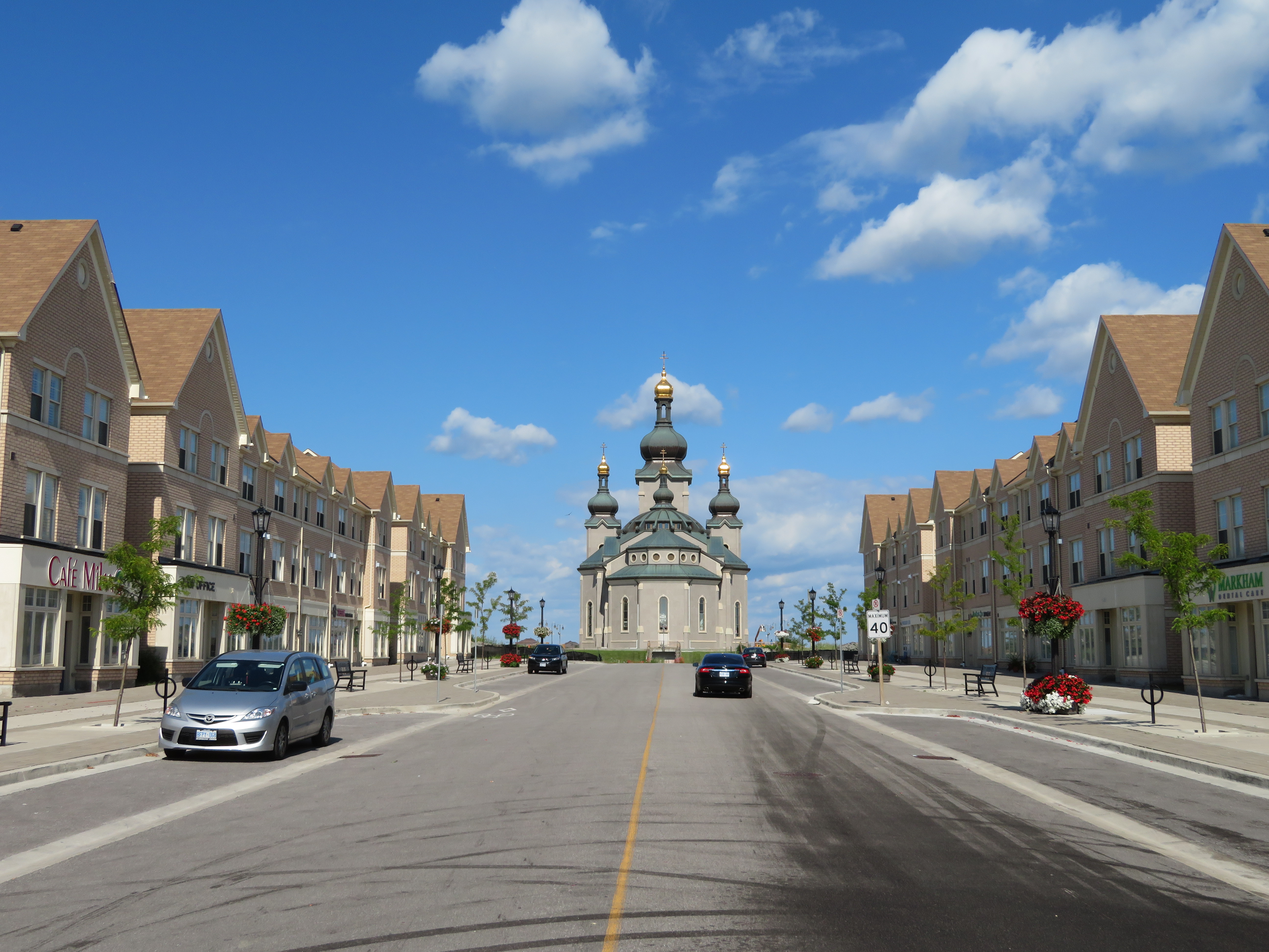
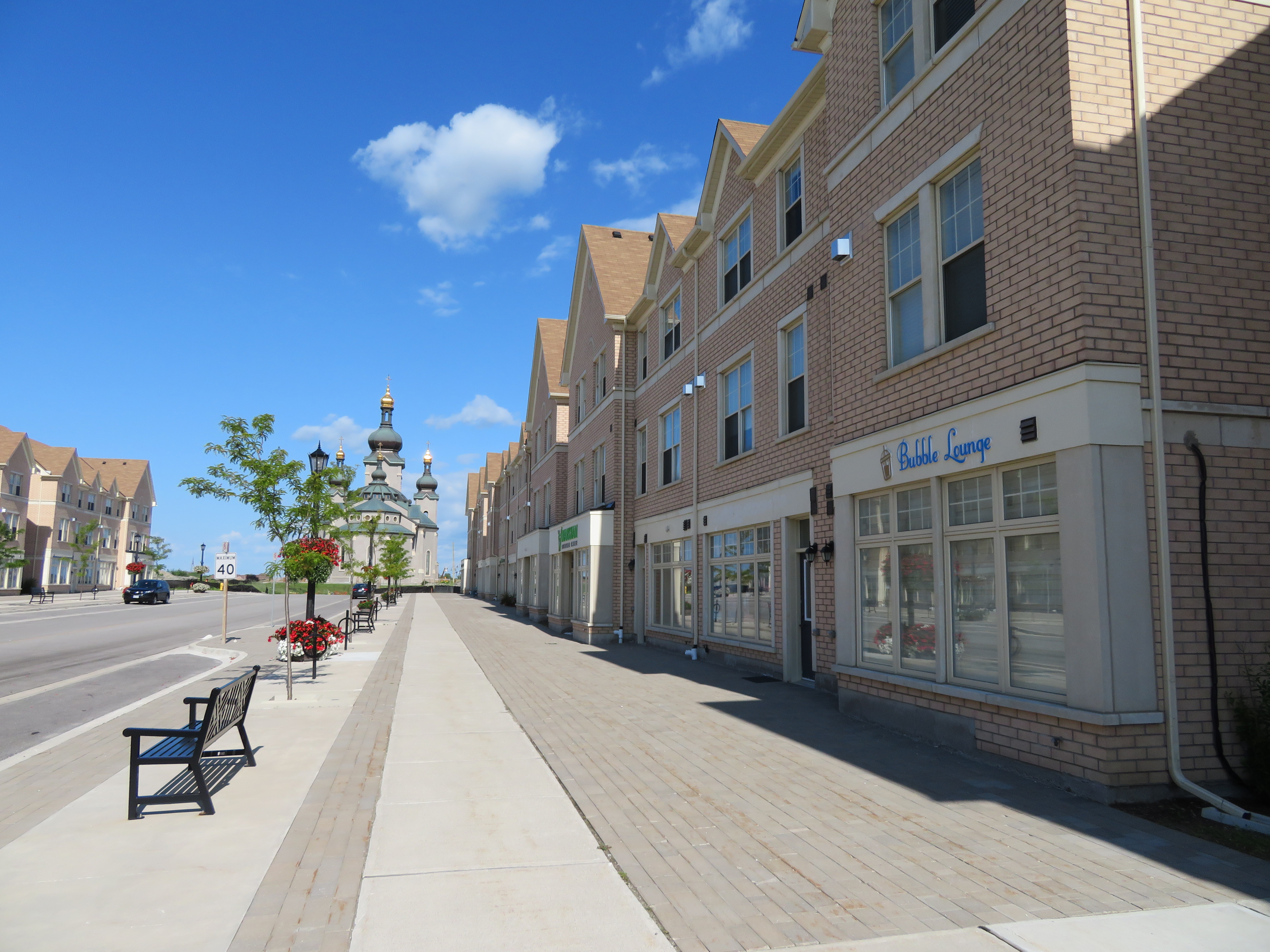
    And then there’s Cathedraltown. Like Cornell, it’s a “new urbanist” development; it even has a main street lined with storefront. But it doesn’t quite work, at least not yet.

    IMG_1251-001A mostly empty Cathedral High Street

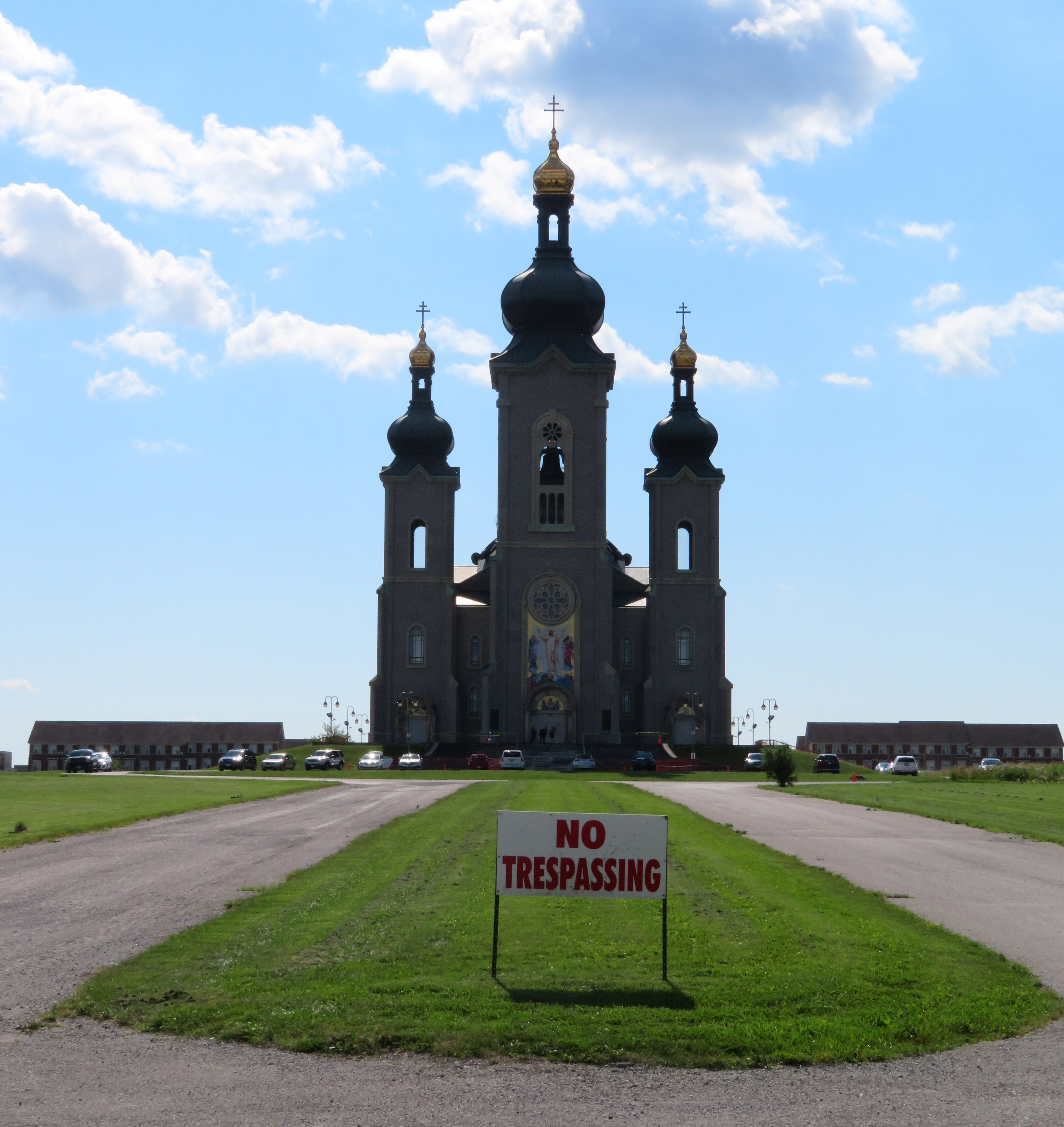
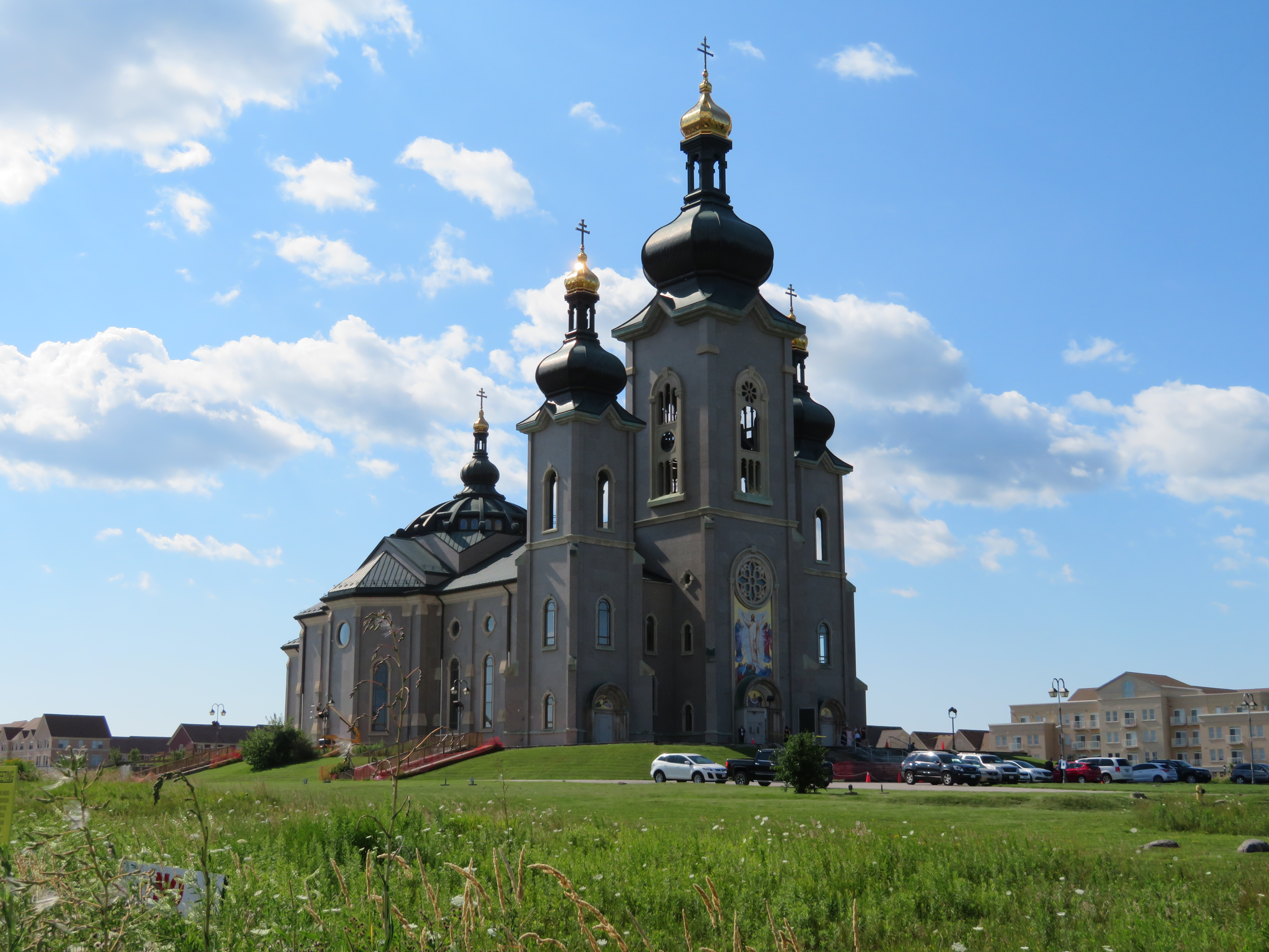
    Cathedraltown was the idea of Stephen Roman, who made a fortune in mining and had a a farm on Woodbine Avenue in Markham to build upon. The new community, on a family owned hobby farm, would have a spectacular new Slovak-Catholic cathedral as its centrepiece, with houses, parks, and stores surrounding the landmark. Stephen Roman’s daughter, Helen Roman Barber, took over the development in 1988.  The church — which remains incomplete — was opened for a while, but the building was the subject of a dispute between the development company and religious leadership and was closed from 2006 through 2016.

    Meanwhile, the residential community was slowly built around the Cathedral in the last ten years.


    IMG_1242-001A “no trespassing” sign still stands outside the recently re-opened Cathedral of the Transfiguration
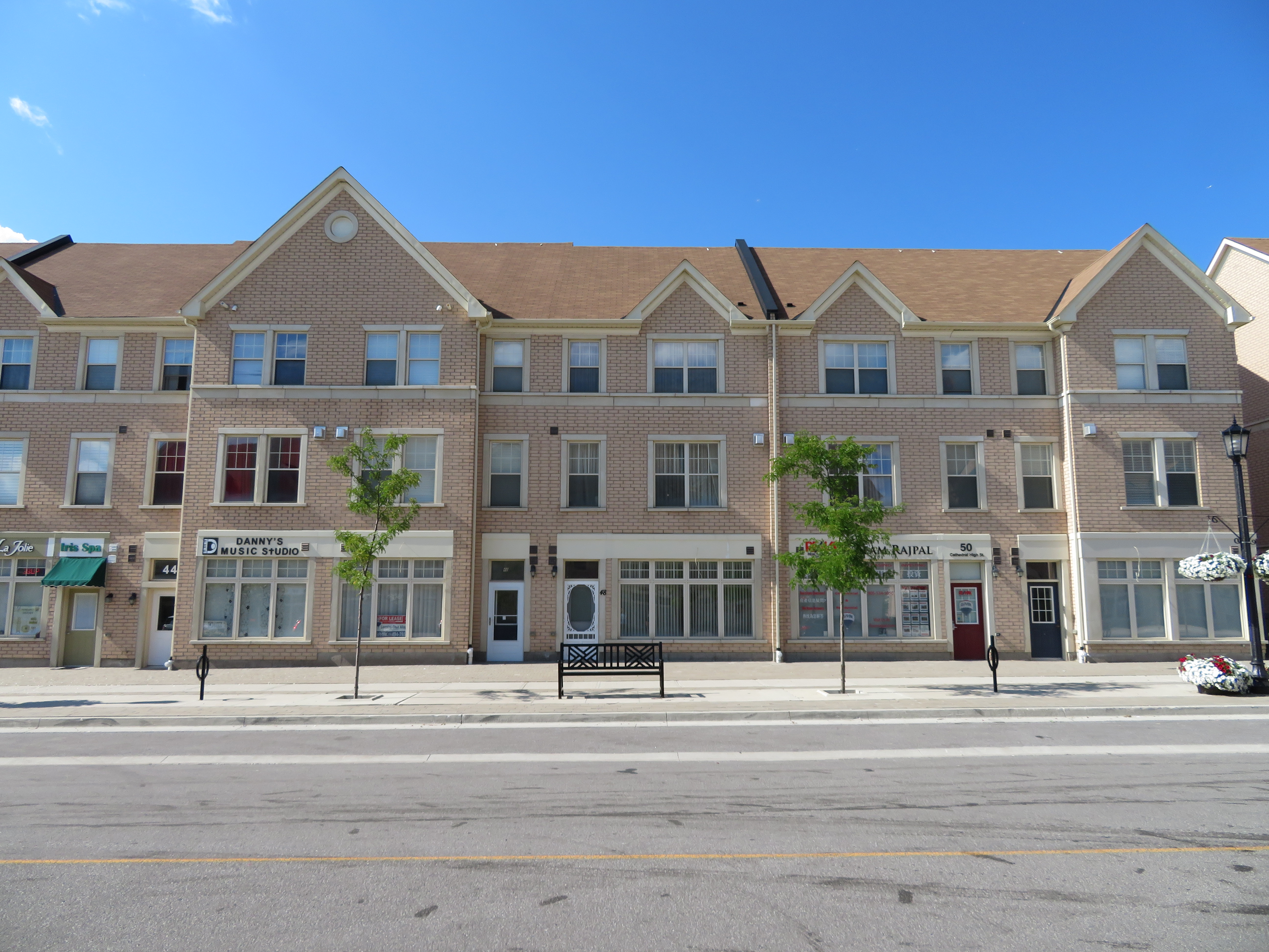
    Like other “new urbanist” developments, the garages and service areas are found not on the residential streets themselves, but in back alleys. Parkettes and playgrounds face the street, rather than behind houses. Dwellings are built close together, for higher densities than traditional suburban tract housing. There are townhouses, as well as semi-detached and fully detached homes, as well as some low-rise condominium apartments.

    There’s a Main Street, which is called Cathedral High Street. It is lined with storefronts, but many are empty. Those that are occupied host dental offices, real estate agents, an insurance broker, beauty and nail salons, and after-school tutoring companies. Only one store, a nail salon, was visibly open on our visit on a Saturday afternoon.

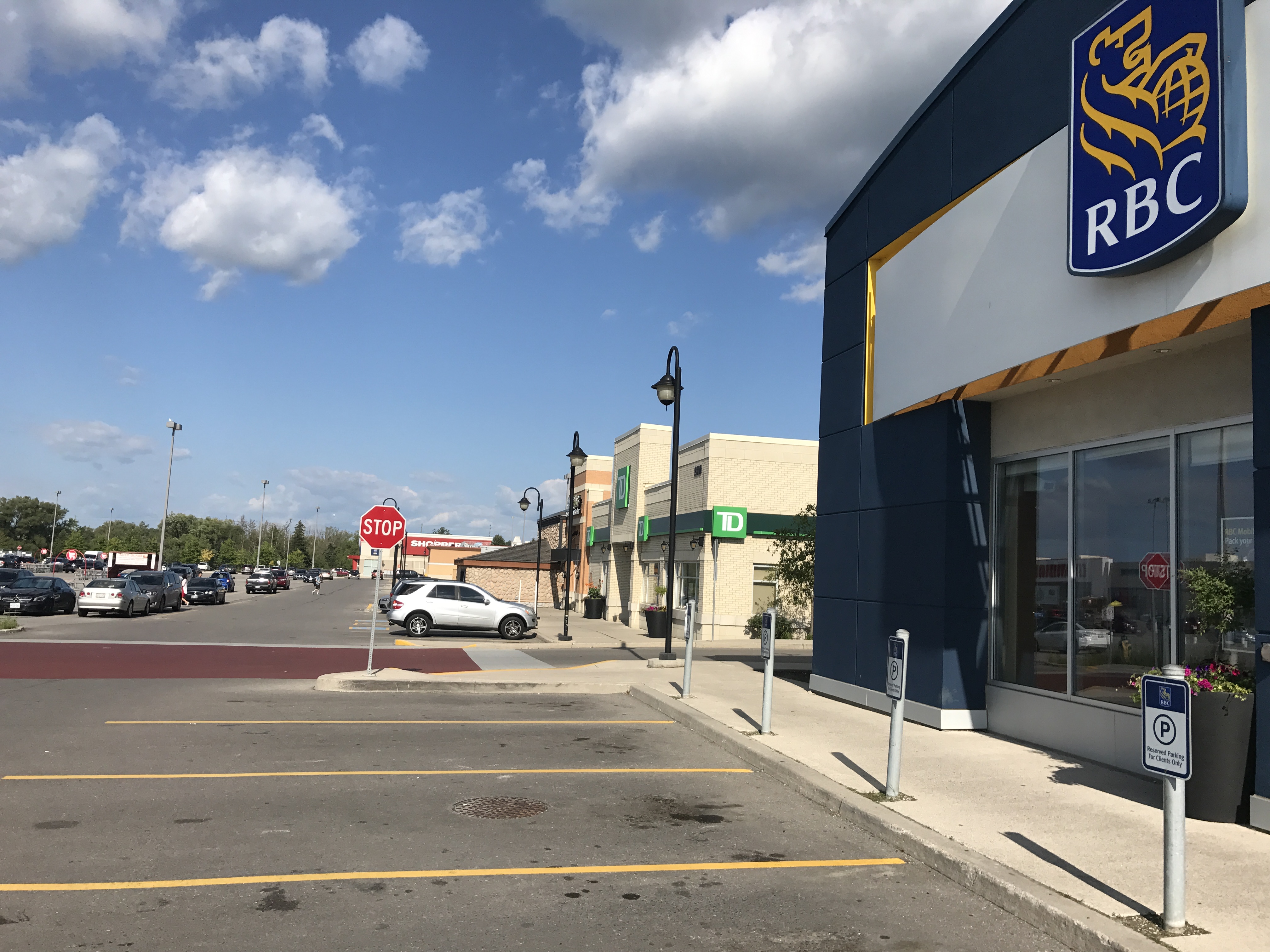
    A few thousand more residents might help. Building the retail along Woodbine Avenue itself, which gets far more traffic, might have also helped support sustainable retail. Nearby, however, is a pedestrian-unfriendly plaza on Major Mackenzie Drive that’s fully leased, anchored by banks, a Canadian Tire, a Shoppers Drug Mart, Starbucks, and Boston Pizza.

    IMG_1253-001Storefronts on Cathedral High Street…

    IMG_5598.JPG…While a nearby auto-centric plaza is busy
    Despite its new urbanist ideals, Cathedraltown is as auto-dependent as any other suburb. Only two bus routes serve the centre of the development: York Region Transit bus routes 24 and 80. Route 24, which goes to the TTC Don Mills Subway Station, operates every 51 minutes on Saturdays, and only until about 6:30 at night (Sunday service is similar; weekday service is slightly better). Route 80, which goes west to Yonge Street, operates every 45 minutes on weekends, until about 8:00 or 9:00 PM. Getting to GO Transit trains requires a car or a YRT bus ride involving a transfer between two infrequent routes.

    IMG_1254-001Empty streetscape on a sunny Saturday afternoon
    Without transit, and without places to walk to (apart from a church, a few parks, and an elementary school), the ideals of new urbanism aren’t matched by reality. Unless things change drastically, it will still be a place where residents will get in their cars to go anywhere. Better transit could be a start, but so would adding more people, and jobs.

    IMG_1250-001
    Maybe one day, this community will be completed

  • The Halifax Department of Silly Walks

    IMG_0772-001.JPG

    As part of our trip through the Maritime Provinces a few weeks ago, we visited Halifax. Nova Scotia’s capital and largest city is the economic, cultural and transportation hub for Atlantic Canada. In 1996, the City of Halifax was merged with surrounding towns and suburbs, as well as rural Halifax County; the Halifax Regional Municipality is now 5,490 square kilometres, nearly nine times the size of the City of Toronto.

    Like many amalgamated cities in Canada, Halifax has a historic, densely populated inner core, surrounded by urban neighbourhoods. Beyond the old cities of Halifax and Dartmouth is a ring of suburban homes and businesses, such as Bedford, Cole Harbour, and Bayer’s Lake. And like Hamilton and Ottawa, there’s another, even larger ring of rural farms, woodlands, small villages, and exurban estates. Peggy’s Cove, for example, is near Halifax’s eastern boundary. Councils of these amalgamated cities must reconcile the needs and desires of the urban centre with those of suburban and exurban residents. In Toronto, bike lanes are held up, or even removed, for the benefit of motorists living outside the urban core. The debate over Hamilton’s LRT has pitted suburban councillors against those representing the lower city. Halifax is no exception.

    Halifax’s urban core is worth exploring, despite construction detours around the new convention centre, the waterfront, and new condominium development. Downtown includes the historic Citadel, Province House, and the Art Gallery of Nova Scotia, among other museums. Halifax Common and the Public Gardens are welcoming public spaces in the classic New England style.

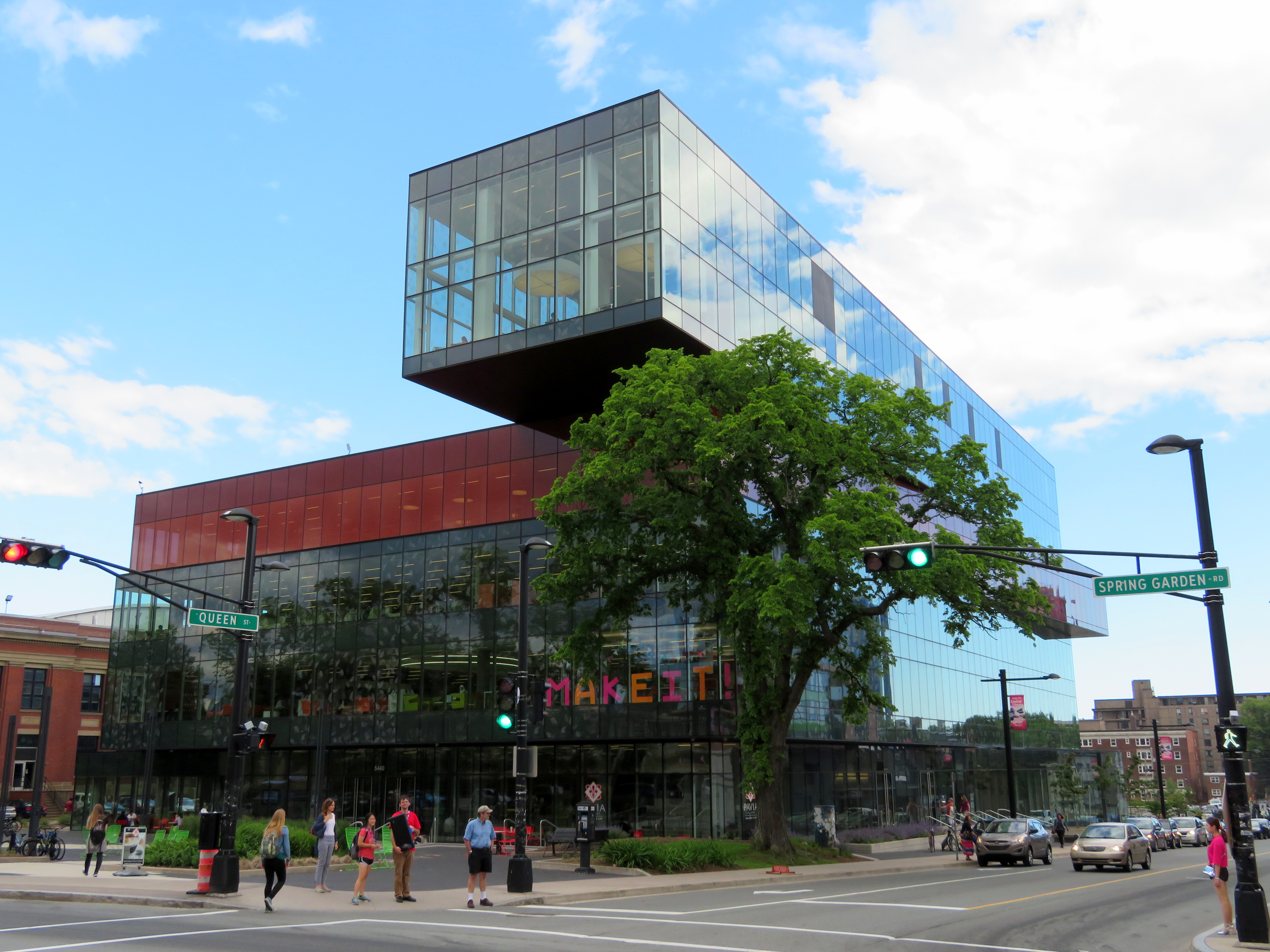
    Halifax Transit operates a ferry service to Dartmouth — only $2.50 per person, with the return trip free if taken within 90 minutes — which offers great views of the city and the various commercial and naval ships in the harbour. The ferry is also fully integrated with the local bus system. The new Halifax Central Library is one of Canada’s greatest new public buildings: the five storeys are bright and user-friendly, and there is even a rooftop patio and café to visit.

    Downtown is compact and a pleasure to walk abound.

    IMG_0903-001.JPGThe spectacular new Halifax Central Library

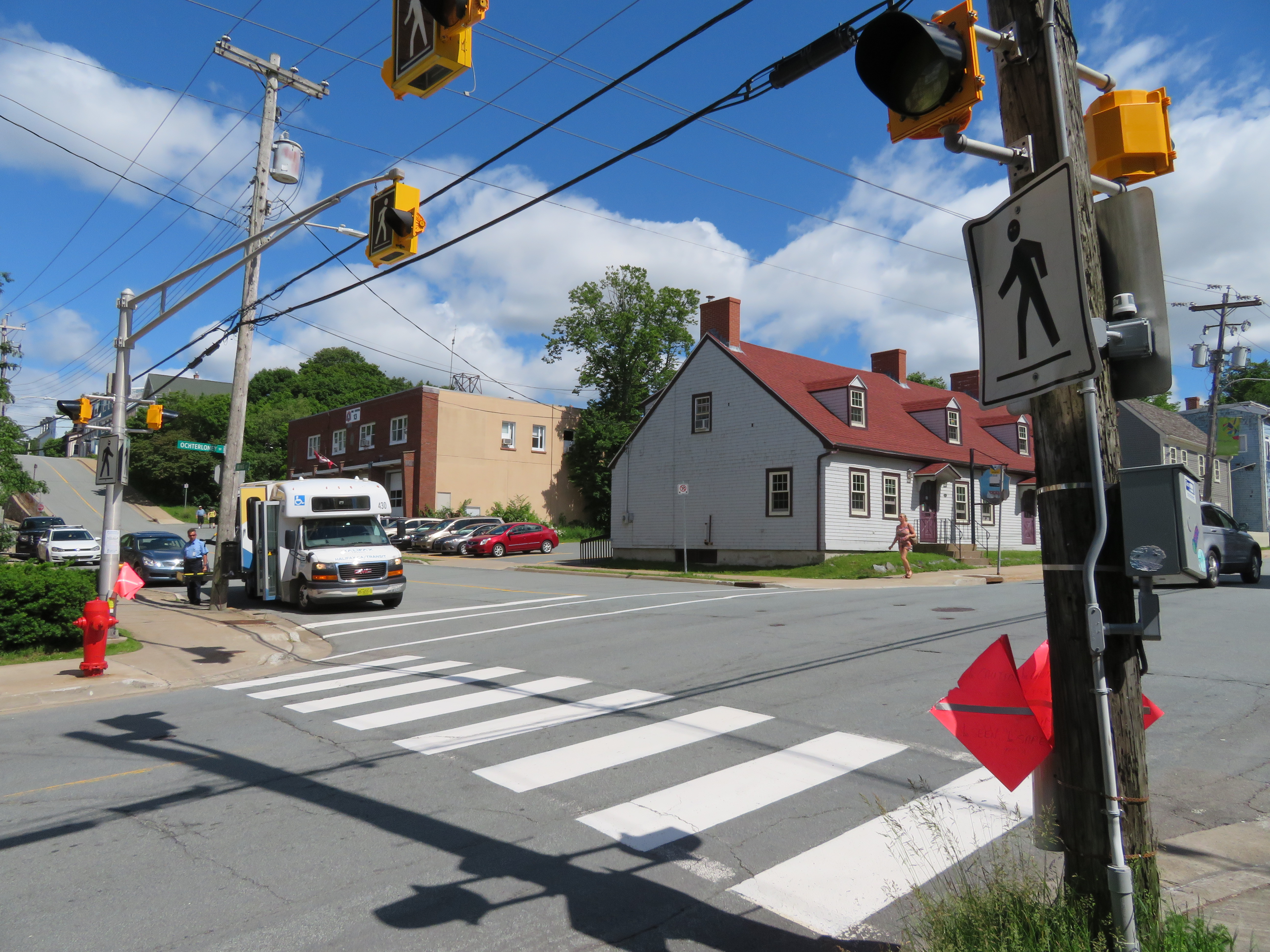
    But once you stroll beyond Halifax’s urban core, the landscape changes. Signed crosswalks are fewer and farther between, even in older residential neighbourhoods.

    Maritimers are famously courteous to pedestrians; most motorists will slow or stop if they see a pedestrian about to cross the street, whether or not there’s a marked crosswalk. But that slower pace of life in itself does not prevent collisions. As in any North American city, Halifax’s arterial roads and suburban streets are built to move cars through quickly and efficiently.

    That’s where the flags come in. What was intended as a well-meaning, inexpensive measure to promote pedestrians’ safety at crosswalks has become one of the most ridiculous pedestrian initiatives.

    Crosswalk flags were the idea of just one man, Norm Collins, a Dartmouth retiree. The flags and buckets only cost $200 per crosswalk, compared to $15,000-25,000 per crosswalk for proper signal lights. In 2015, municipal staff were cool to pedestrian flags, though the idea enjoyed support from HRM councillors, particularly suburban politicians, and the flags were approved by council.

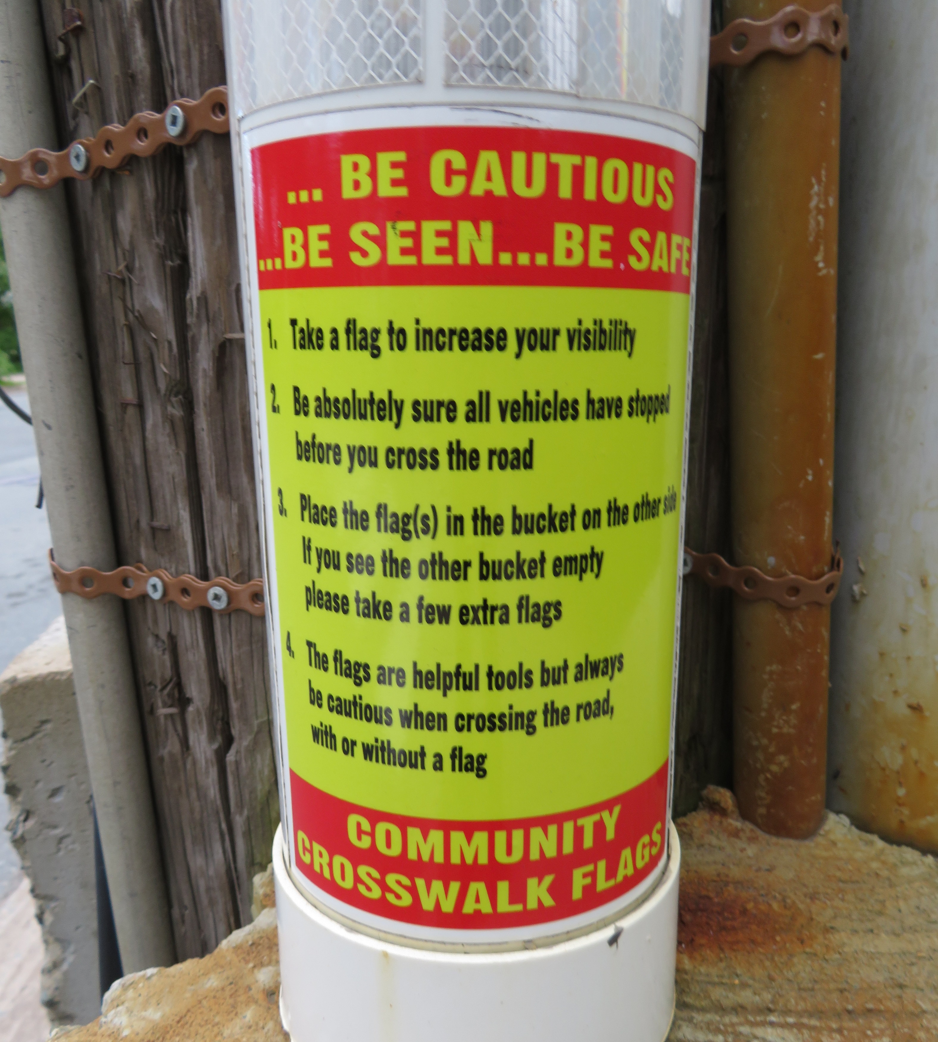
    Now, at most crosswalks outside Halifax’s urban core, there are buckets of bright orange flags for pedestrians to take when crossing the street. These buckets and flags can even be found at signalized crossings with flashing amber lights activated by pressing a button. Each bucket has instructions printed on how to “be cautious…be seen…be safe.”

    IMG_0966-002.JPG
    One of the buckets, with instructions on how to use the flags left inside

    Yes, even when there are flashing lights at an intersection, Halifax Regional Council expects pedestrians to use these flags (even if city staff disagree). The instructions above clearly indicate that the onus for safety is entirely on the pedestrian crossing the street, not on motorists taking care by driving safely and attentively.

    Vision Zero is the Swedish road safety philosophy that seeks to end traffic fatalities by minimizing the effects of mistakes made my all road users. Lower speed limits, enforced by road re-engineering works (such as bump-outs, speed humps, and tighter corners at intersections) that slow down cars and trucks is one such effective measure. So are complete streets, designed to improve the safety and comfort of pedestrians and cyclists. Cheap pedestrian flags, which do not address the root problem, are not within the spirit of Vision Zero.

    If Halifax Council — or any municipal government — was serious about improving pedestrian safety, features that would help include improved lighting, narrowing the roadways at pedestrian crossings, and raising the crosswalks closer to the curb level, forcing motorists to slow down (and also improving drainage. Flags and high-visibility clothing are useful for temporary conditions and for traffic control personnel, but not for everyday conditions and everyday people. The onus should always be first on the licensed motorist to be attentive to the road and drive according to the conditions.

    A ridiculous pedestrian safety measure deserves a ridiculous walk, as I demonstrated in Dartmouth.


  • A visit to New Glasgow, Nova Scotia

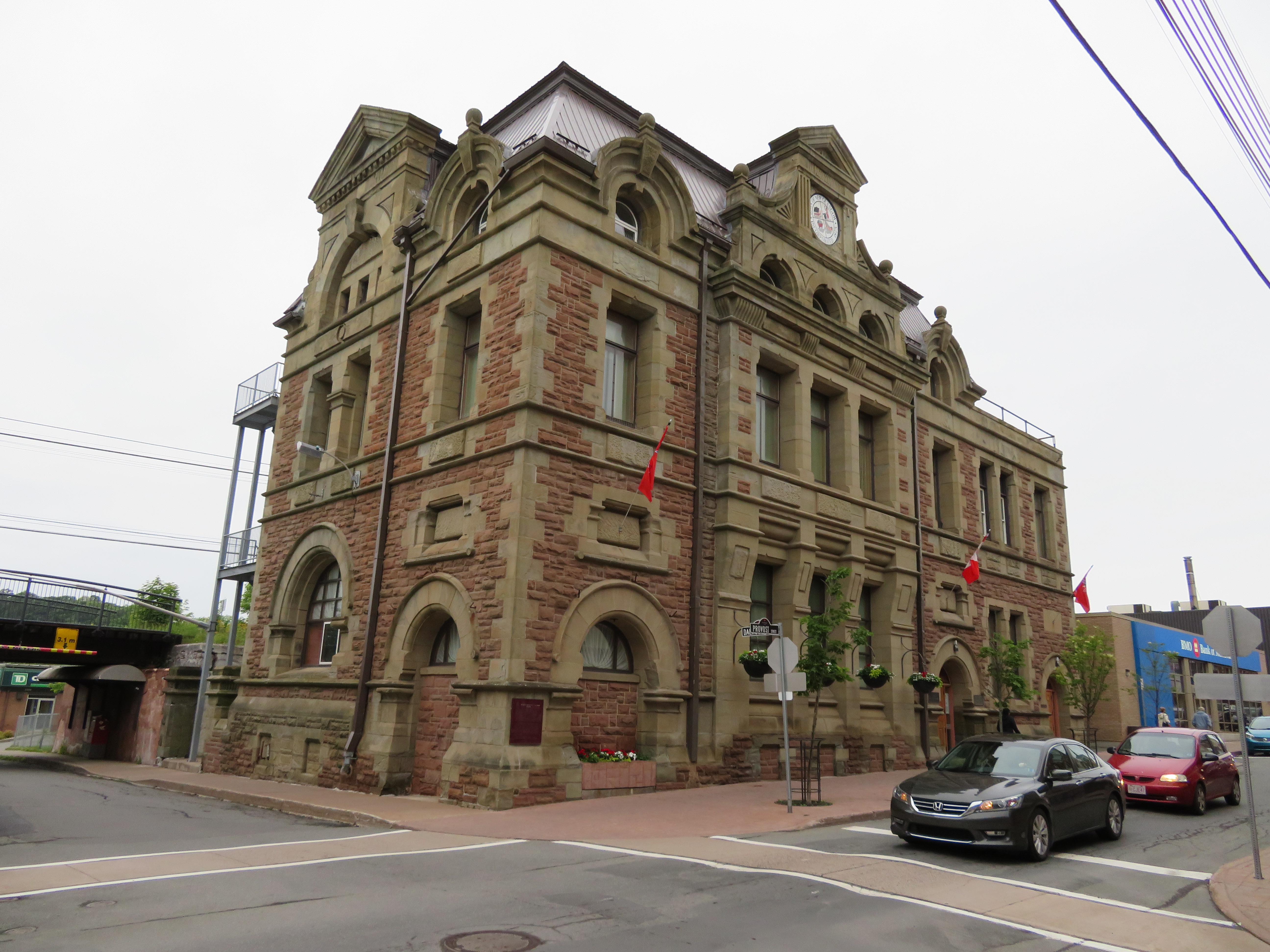
    IMG_0319-001New Glasgow City Hall

    After our wedding, we went away to Nova Scotia and Prince Edward Island. I’ve been to Halifax and the Annapolis Valley once before, in April 2004, but I’ve never been to Cape Breton (which has become one of my favourite places in Canada), or PEI.

    It was a wonderful trip. We drove the Cabot Trail, hiked several trails in Cape Breton Highlands National Park, enjoyed great meals featuring local seafood, visited restored historic sites such as the Fortress of Louisbourg, and spent some time wandering around Halifax and Charlottetown. I’ll write more on those adventures later.

    Driving through Nova Scotia on the way to Cape Breton, you must pass through Pictou County on Highway 104, part of the Trans-Canada Highway. Most travelers pass through, or stop off the highway for gas or food. But the region has an interesting history, and we visited two historic sites there which are off most tourists’ radar.

    Once an industrial powerhouse, settlements such as New Glasgow, Stellarton, and Trenton have been hit by the closures in the steel industry and in coal mining. Trenton had a large steel mill; the TrentonWorks plant produced rail cars until 2007. Coal mining was also important to both northern Nova Scotia and in Cape Breton, but today, only one surface coal mine remains in the province near Stellarton. Today, Stellarton might be most known as the hometown of and headquarters for the Sobeys supermarket chain and its parent company, Empire Corp. The town of Pictou was known for its shipbuilding industry.

    New Glasgow, which we visited, is the largest community in Pictou County, and the regional centre for central Nova Scotia. We stayed in New Glasgow overnight, as we were to take the Northumberland Ferry to PEI early the next morning.


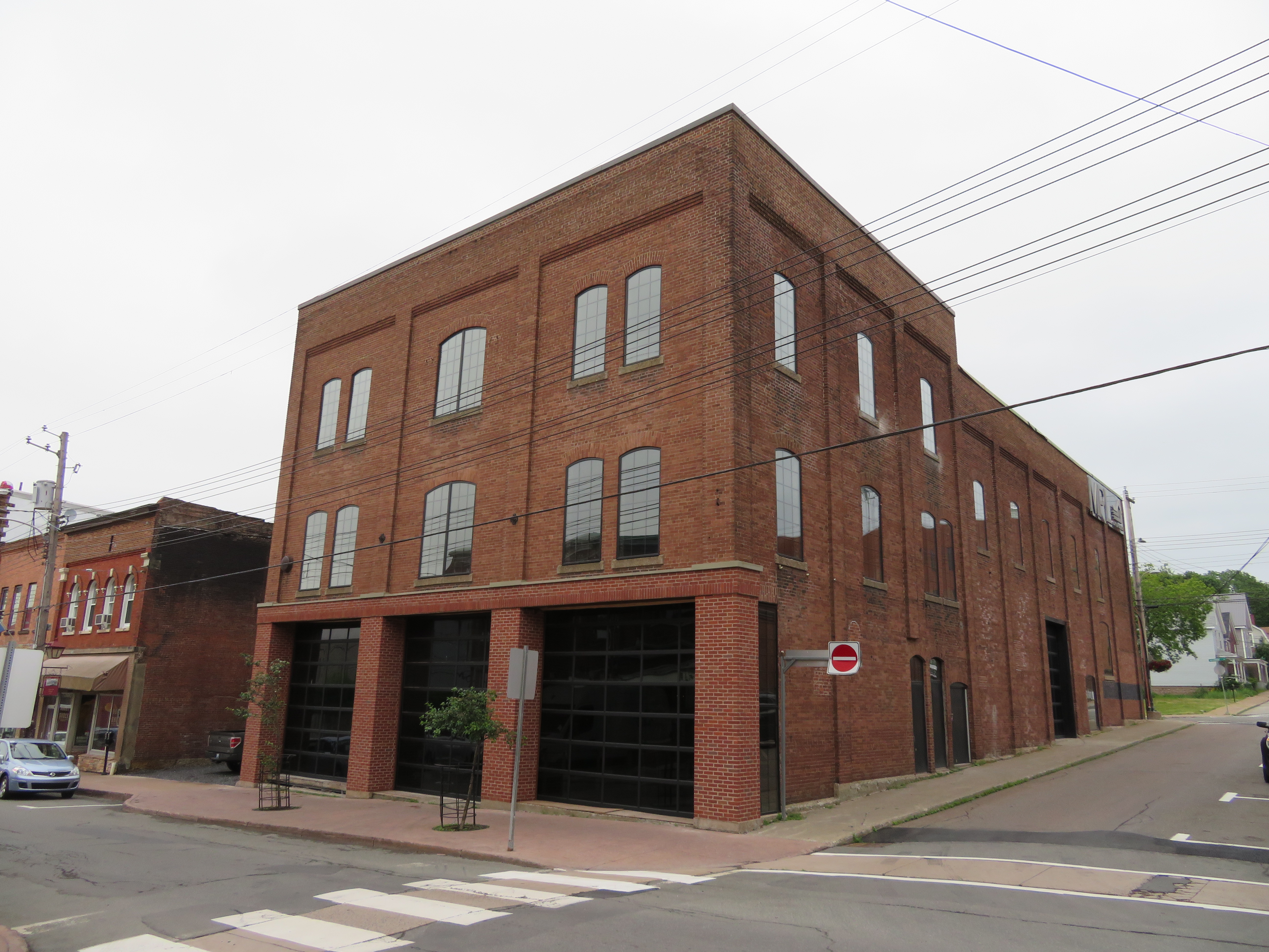
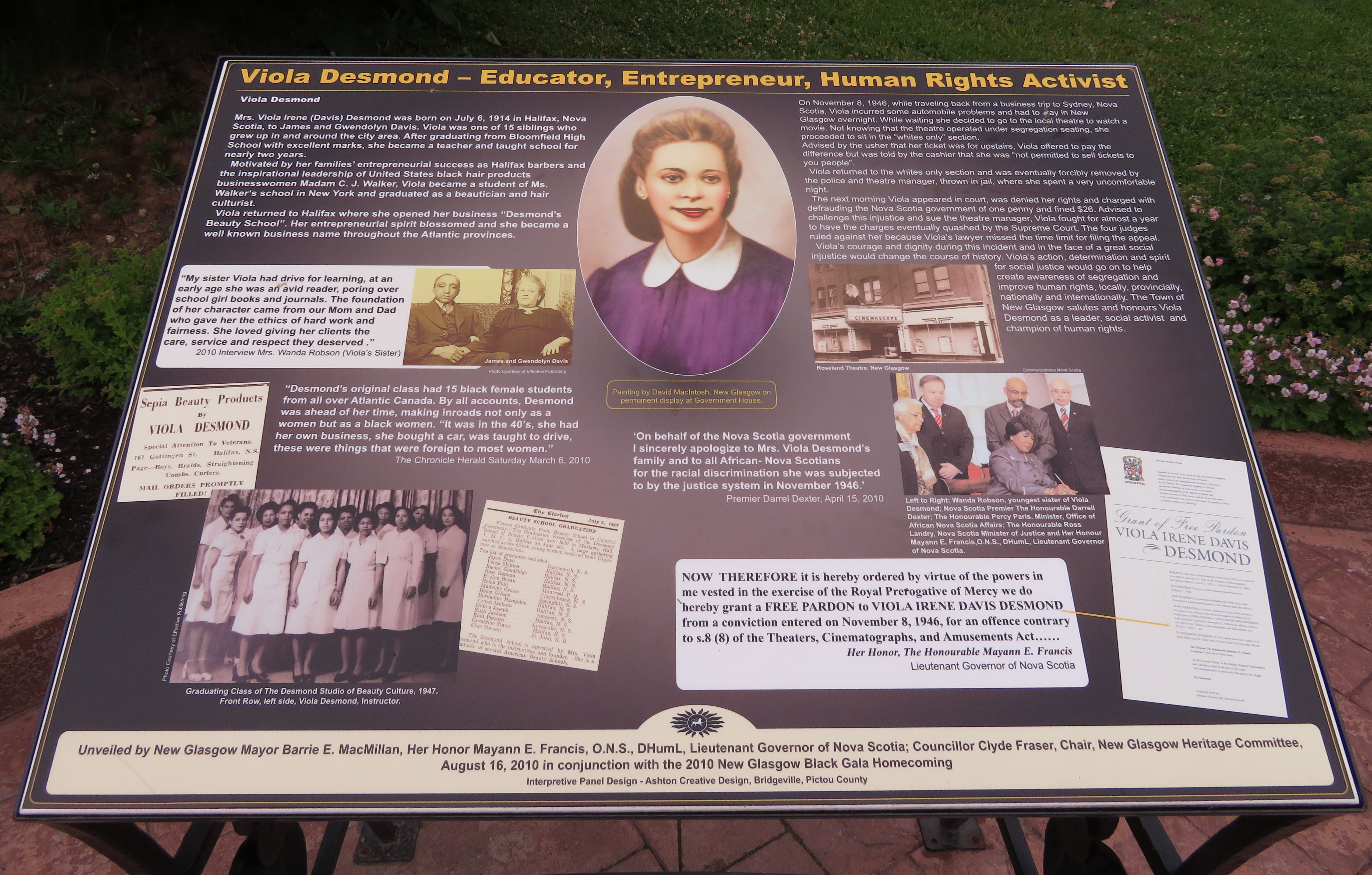
    In 1947, Viola Desmond, a successful Black entrepreneur, was removed by police from the Roseland Theatre for refusing to sit in the upper segregated seating area, but in the ‘whites only’ section. She was charged and convicted for tax evasion – the one cent difference in the provincial amusement tax between the ticket she was sold and the lower level seating. Despite this injustice, the apology and pardon from the Nova Scotia government didn’t come until 2010. That year, a plaque was unveiled in New Glasgow. Since then, there has been more recognition of this injustice and of Desmond’s importance — a new ferry was named for her in Halifax, and she will appear on the next issue of the $10 bank note.

    IMG_0318-001
    Roseland Theatre building, June 30, 2017

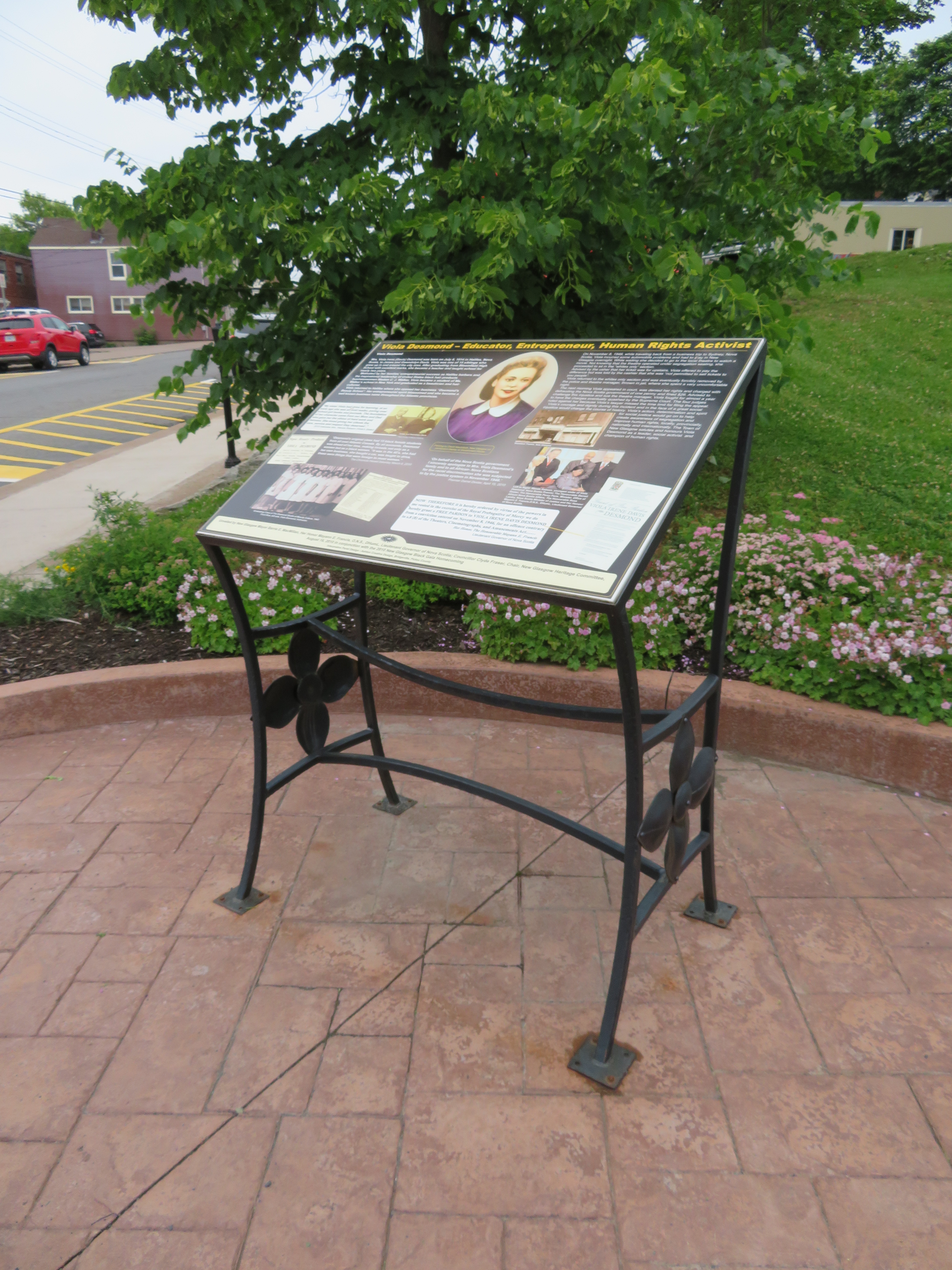
    Today, the Roseland Theatre is closed (the theatre later became a club). I found the building (which is being renovated, and the marquee removed), but I had trouble finding the plaque. I found out it was located two blocks away from the theatre building, next to the public library.

    IMG_0323-001
    The plaque commemorating Viola Desmond is located two blocks away from the Roseland Theatre

    IMG_0321-001


    On May 9, 1992, sixteen miners were killed in a methane and coal gas explosion at the nearby Westray Mine. News of the explosion, and coverage of the attempted rescue efforts was one of the first major news stories I clearly remember, and the first I really understood. I was eleven when it happened. (Though I also remember the 1989 fall of the Berlin Wall, I was eight years old at the time, and I couldn’t understand the significance. Westray was the first news story that I remember and which I could understand clearly.)

    Tragically, eleven bodies remain underground. The mining company ignored unsafe working conditions, and the government was complicit in knowing about the problems but not forcing changes — the Westray mine promised jobs, not only in the mine, but in other local industries, such as TrentonWorks, which was contracted to supply rail cars for shipping coal to a nearby power generation station. The mine had lots of support at all three levels of government; this likely contributed to pressure to keep it open despite serious safety concerns. Furthermore, criminal proceedings against the company and its management were botched.

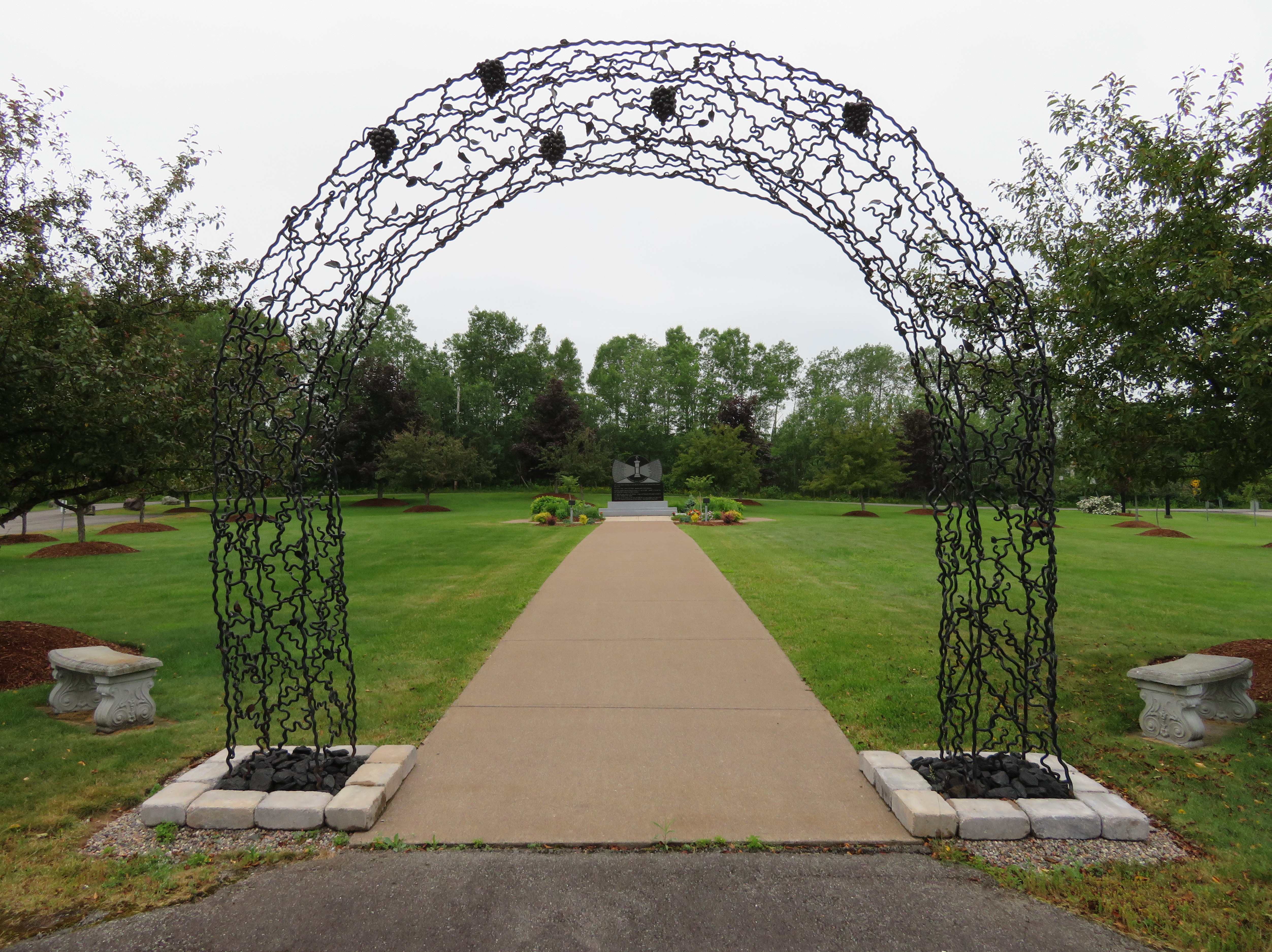
    IMG_0316-001Their Light Shall Always Shine Memorial Park, New Glasgow

    Though the main Westray Mine site and shaft were located at Plymouth, to the south of New Glasgow, the explosion took place north of Highway 104, within the city limits. Their Light Shall Always Shine Memorial Park is located close to the site. Besides a garden and a monument with all sixteen men’s names, there are several interpretative plaques on the history of the Westray Mine, the explosion, and the aftermath.

  • My life, so far

    Sketch

    I’ll be taking a break from writing on this blog and elsewhere for a few weeks. I will be preoccupied, as I’m getting married, then leaving for my honeymoon in Nova Scotia and Prince Edward Island.

    For many years, I never thought that I would become as happy as I am now. During my three dozen years on this planet, I have struggled through two bouts of life-threatening childhood illness, and their long-term side effects, bullying, depression, low self-confidence, criminal intimidation and civil litigation, and not knowing where I stood in life.

    On the positive side, I have always benefited from a loving and supportive family and a small core of wonderful friends. And I have found an amazing life partner.

    Growing up, I was a socially awkward child, a true nerd. At the age of three, I was collecting and studying maps. By four, I was drawing maps and creating fantasy cities. I bugged my parents to take me to Toronto to ride streetcars and even the Scarborough RT when it was still new in the 1980s. I was destined to be a geographer or an urban planner.

    bike.jpg
    I was also clearly destined to go on long bike rides, exploring southern Ontario. 

    (more…)

  • Province to look at hydrogen-powered GO trains, but it is it simply hot air?

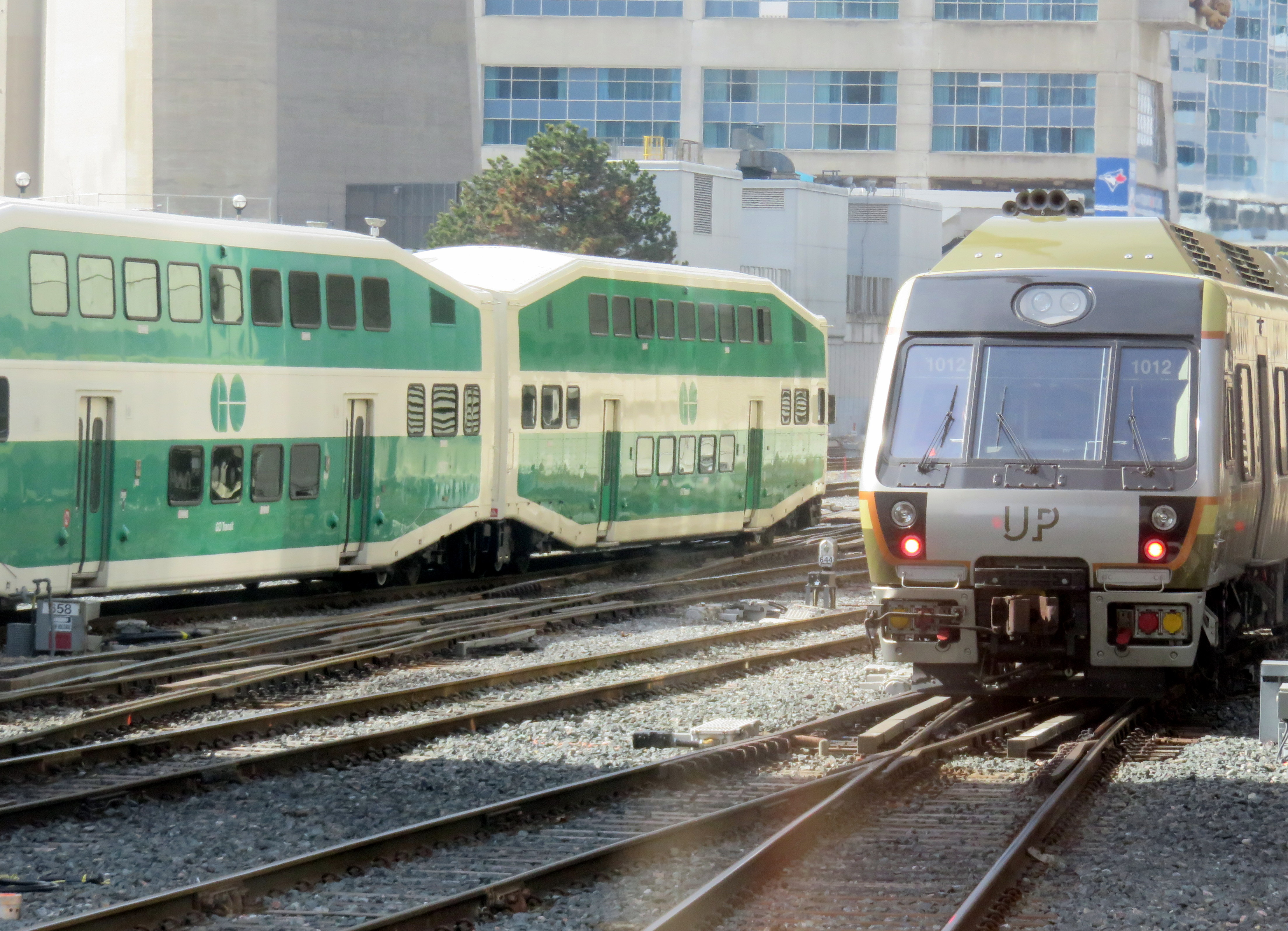
    IMG_0268-001Electrification for GO Transit and UP Express has been proposed for years

    At GO Transit’s Willowbrook Maintenance Centre in Mimico today, the Ontario Minister of Transportation, Steven Del Duca,  announced the start of the transit project assessment process (TPAP) that will allow GO to move forward with its plans for electrification. GO RER, the $13.5-billion regional rail network plan, is dependent on a new fleet of electric trainsets to provide rapid transit across the Greater Toronto and Hamilton Area.

    But Del Duca introduced a new twist to the plot. Along with the electrification TPAP, the province will also look into the feasibility of hydrogen-powered trains. Hydrogen-powered trains are being tested in Germany by Alstom, a French rail manufacturer.

    Quoted in the Toronto Star, Del Duca said that “this is a decision that we’re making that will have to last for a generation and beyond, so we want to make sure that we’re at the leading edge of the technology.”

    The Alstom experimental train, a Cordelia LINT, is a similar model to the one used in Ottawa for the O-Train Trillium Line, a diesel light rail operation. The hydrogen-powered model has yet to be tested in revenue service; hydrogen propulsion also has yet to be tested on heavier rail equipment. The Cordelia LINTs are light rail vehicles, and under current railway regulations, cannot share the same tracks with heavier freight and passenger trains.

    My fear is that this is yet another distraction from transportation needs in the here and now. Further, I worry that the “fuel cell technology symposium” will not only distract from the GO RER project, it will give credence to NIMBYs opposing electrification – be it the construction of gantries and overhead wires, or those worried about the effects of electromagnetism.

    I have more faith in building sound, tested and true, transit systems than pursuing the newest technology there is. Electric trains have been around for over 100 years. Electric multiple unit regional rail as we know it is used in scores of cities worldwide, including Montreal, New York, and Philadelphia. Electric multiple unit trains (EMUs), which can be purchased from at least a half-dozen firms, are reliable, quick, and suitable for GO RER.

    The provincial government has an unfortunate history of promoting new technologies that end either in failure — the 1970s-era GO-ALRT plans, for example, or the promotion of Ontario-made compressed natural gas (CNG) buses to replace electric trolley buses in Toronto and Hamilton in the early 1990s. (Those buses were either scrapped early, or converted to conventional diesel propulsion.) The Scarborough RT, originally planned as the nucleus of a conventional light rail network, was replaced by a propitiatory linear induction system heavily promoted by the province.

    The idea of hydrogen-powered trains is attractive: they have zero at-source emissions; the Alstom train is train is exceptionally quiet, and only emits steam and condensed water. Electrification requires overhead gantries and wires, along with substations at regular intervals; hydrogen-powered trains require none of these expenses. What isn’t clear is whether hydrogen powered trains offer the other advantages of electric train operation, namely quick acceleration and deceleration needed for a frequent-stop regional rail service.

    I want GO RER to be built, and I want it to be built right. I just fear that the attention given to an emerging technology will be yet another distraction, especially going into an election year.

  • Wandering the Waterfront Trail in Scarborough

    IMG_8897-001At the bottom of the Scarborough Bluffs, west of Bluffer’s Park
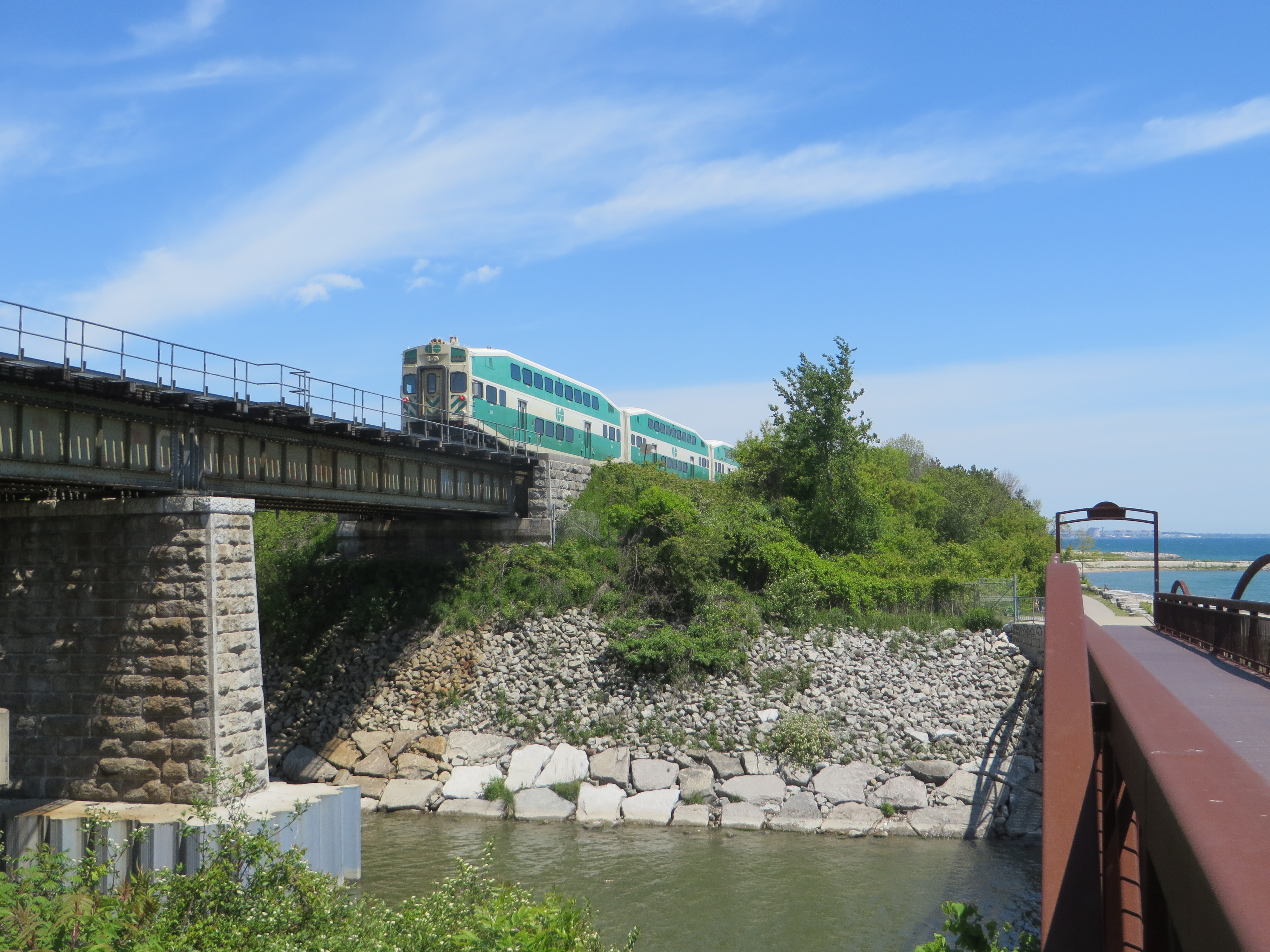
    Lake Ontario, like all five of the Great Lakes, is more a freshwater sea than merely a lake. It’s over three hundred kilometres long, from Hamilton to Kingston, bordering two countries, with several inhabited islands, and features a varied and fascinating landscape. Lake Ontario’s vastness is best appreciated from its shore, whether it be the Toronto Islands, on the east side, on the beaches at Presqu’ile or Sandbanks Provincial Parks, or from the top of the Scarborough Bluffs.

    The Waterfront Trail, at least in theory, is a wonderful way to explore these varied shorelines of Ontario’s vast Great Lakes on foot or by bicycle. Founded in 1995, the trail now extends from the Quebec border, west along the St. Lawrence River, through Niagara, along the north shore of Lake Erie, and up the Detroit and St. Clair Rivers to Lake Huron. I cycle the Waterfront Trail between Toronto and Hamilton several times a year, an 85-kilometre trip. GO Transit’s trains and buses follow the Waterfront Trail from Durham Region to the Niagara River, making it easy to walk or cycle one-way, returning by train and/or bus.

    IMG_0834-001.JPG
    The Waterfront Trail crosses Highland Creek in eastern Scarborough. (2015 photo)

    But the Waterfront Trail is dependent on municipal infrastructure, or the lack of it. Most of the trail’s route winds through rural areas, following country roads and highways where segregated multi-use trails aren’t built: in many places, the Waterfront Trail is neither close to the water, nor is it a ‘trail’ of any kind. At least in Northumberland County and Niagara Region, paved shoulders and bike lanes are found along the busier country roads. But this is not always the case.

    In urban areas, though, like the City of Toronto, there is both the demand and the resources for safe pedestrian and cycling infrastructure along the waterfront. In the old city of Toronto, the Waterfront Trail follows the Martin Goodman Trail, and is nearly completely segregated from motor traffic.

    But in Etobicoke and in Scarborough, much of the trail is routed via on-street sections; in sections, pedestrians must follow sidewalks next to busy sections of Lake Shore Boulevard and Kingston Road; for cyclists, there aren’t even any bike lanes — they have the choice of either riding with traffic, or illegally riding on the sidewalks.


    Route of the Waterfront Trail within the City of Toronto

    (more…)

  • The TTC double-charged me again when I used Presto

    14840286353_4aaff50047_k.jpg
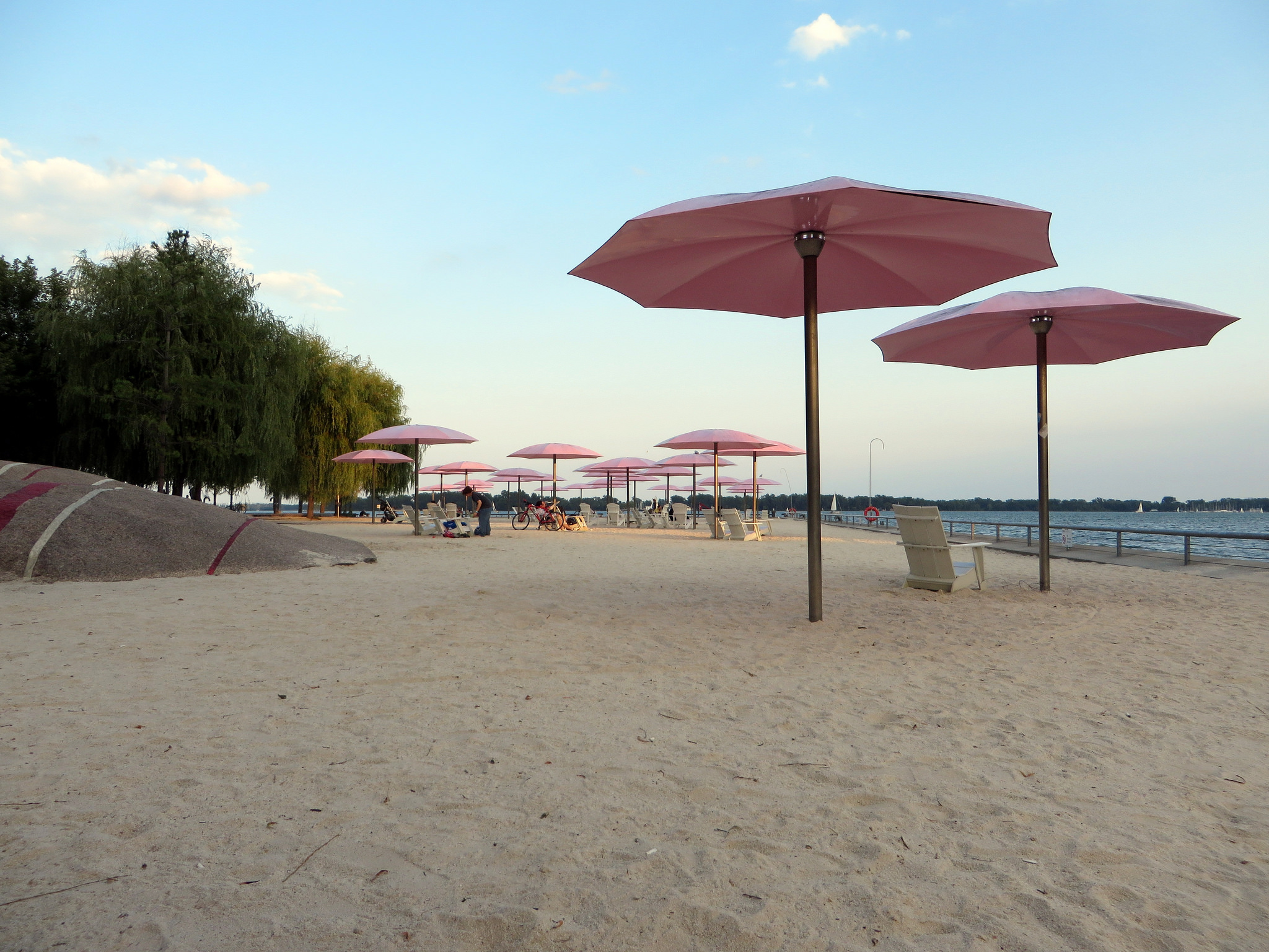
    Sugar Beach

    The weekend of May 26-27 in Toronto was a lovely one. My fiancée and I spent the Saturday and Sunday walking around Toronto, visiting some of the Doors Open sites and Harbourfront. Among the highlights were the new Daniels School of Architecture at 1 Spadina Crescent, a beautiful heritage re-use of the original Knox College (the neo-gothic building that looms over Spadina Avenue), and the Toronto Railway Museum, located at Toronto’s Roundhouse.

    After the Doors Open sites closed at 5:00 PM, we walked along the waterfront as far east as Sugar Beach, before heading west to the High Park neighbourhood for dinner. With the Bloor-Danforth Subway (Line 2) closed for maintenance between Broadview and St. George Stations, we opted to take a local bus on Queen’s Quay to Union Station, transfer to the subway there, and transfer again at St. George to Keele.

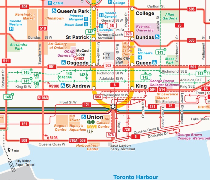
    Route 72B Pape operates between Pape Station and Union Station via Commissioners Street and Queen’s Quay, a valid and long-standing transfer with the subway at Union. The 509 and 510 streetcars serve Union via a direct, underground connection, but buses — the 6 Bay, the 72 Pape, and the 121 Fort York-Esplanade — have on-street stops at Front and Bay Streets; a transfer is required.

    Union Connections.jpg
    The surface route network at Union Station, from the 2017 TTC system map

    I made the assumption that the transfer would be recognized by Presto when we tapped on the 72B Pape bus, and again when we got into the station. That turned out to be a mistake, as I found out a few days later when I checked my Presto activity online. At 6:27 PM, the TTC $3.00 Presto fare was paid on the bus (Queen’s Quay East at Jarvis Street West Side), and again at 6:41 PM at Union Station.  (more…)

  • A call for a progressive Toronto

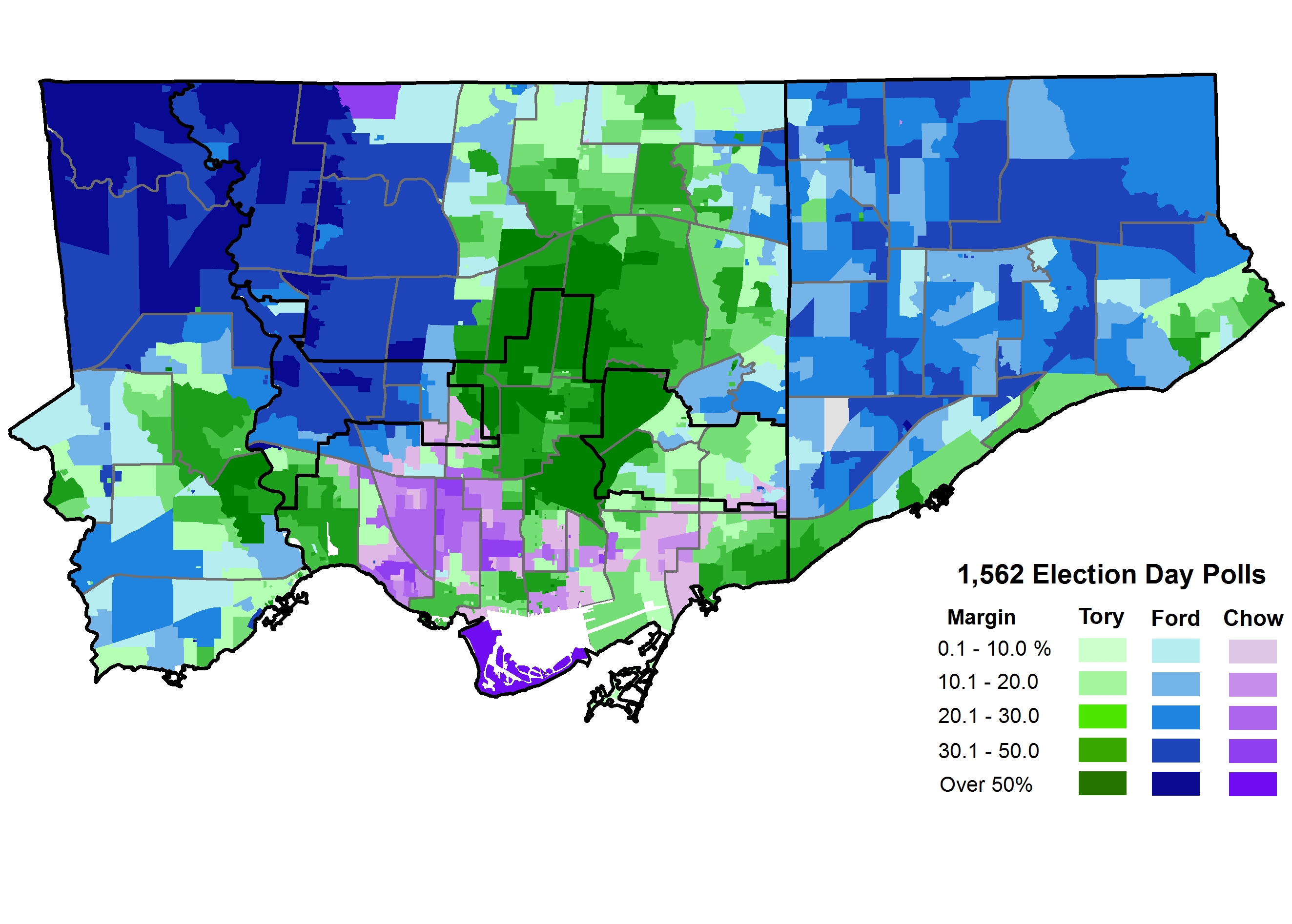
    18506683800_6c96dcc66b_k.jpgI created this website two and a half years ago as a repository for the series of maps I created documenting the results of the 2014 municipal election. Unlike many political observers, I focused not just on the mayoral race, but also on each of the 44 council races; I created poll-by-poll maps illustrating how each ward voted, for both mayor and councillor. I thought that the information might be useful for the 2018 election.
    I kept this blog going by sharing my thoughts on public transit, land use planning, electoral reform, as well as other diversions, such as out-of-town bike rides and my trip on Cuba’s Hershey Train. It has been a lot of fun sharing those thoughts. Yet I remain interested in city politics, especially in electing better people to Toronto City Hall.

    The last municipal election was very disappointing. I originally supported Olivia Chow, before turning my attention to David Soknacki, who ran on a campaign of ideas and honesty, but dropped out in early September 2014. I was repulsed by the incumbent mayor, Rob Ford, and his brother, Doug, yet I couldn’t trust John Tory, who ran on a centre-right platform of low tax increases, a since-discredited transit plan called “SmartTrack” and not being Rob or Doug Ford.

    Tory won that election, of course, beating Doug Ford and Olivia Chow. Tory’s support came from his midtown base of relatively affluent, mostly white, home-owning voters. Tory also did well in other affluent neighbourhoods, such as Etobicoke’s Kingsway, Swansea, the Beaches, and Cliffside, and in neighbourhoods where condominium apartments are a common housing type. As Chow’s campaign floundered, Tory picked up the votes from progressive electors afraid of a Doug Ford win. In the end, Olivia Chow did best in west-end, older downtown neighbourhoods like the Annex, Seaton Village, Parkdale, and Trinity-Bellwoods.

    2014 Election - Mayor Votes by Sub 2014How Toronto voted in 2014

    Giving Tory some benefits of my doubts, I had hoped that he would push a strong city-building agenda, balancing business interests with the needs of disadvantaged residents. Instead, Toronto got an austerity agenda with the top goal of keeping property taxes low, leaving essential city services underfunded and public housing units falling apart. He resisted police reform, including flip-flopping on the elimination of the racist carding program. His signature transit plan, SmartTrack, was watered down to a point where it’s nearly unrecognizable, wasting valuable time and capital that could have been spent developing the Relief Line subway. It’s almost as if we re-elected Rob Ford, but without the homophobia, overt racism, and self-destructive behaviour.

    Tory is backed by a council that has mostly supported his agenda. Had a few council races gone another way, the mayor would have had a harder time freezing or cutting budgets for housing and shelters, transit, libraries, planning services, and other essential programs. Last week, Tory and his council allies endorsed a budget freeze for 2018, defeating motions to exempt homeless shelters, poverty-reduction programs, and long-term care homes. Accounting for inflation, this is in effect, another budget cut of two percent.

    John Tory will run for re-election in 2018, and he is already in campaign mode, targeting the province for funds to repair TCHC housing and the Relief Line. It’s possible that Doug Ford will run for mayor again, on a right-wing populist message. So far, no one has indicated that they will run to the left. At least there’s still city council, with 44 members, which is difficult, but possible to change. Council, not the mayor, holds the power.

    In 2014, only one incumbent —John Parker, in Ward 26 — was defeated. Parker, a thoughtful and reasoned conservative, lost his seat to Jon Burnside, a former Toronto police officer endorsed by John Tory. In total, only seven new councillors were elected to City Council that year, though there were two by-elections since.

    But each of those newcomers were elected either on a second run for city council, came from another level of political office, or had family political ties. There’s hope for next year.

    Right-leaning councillors Burnside and Justin Di Ciano (Ward 5) ran unsuccessful campaigns in 2010 and won office on the second try. John Campbell (Ward 4) was the previous Chair of the Toronto District School Board, and Jim Karygiannis (Ward 39) was a Liberal MP. Stephen Holyday (Ward 3) is the son of former Etobicoke mayor and councillor Doug Holyday, and Joe Cressy (Ward 20) is also the son of two former Toronto city councillors. Christin Carmichael Greb is the daughter of defeated Conservative MP John Carmichael. Carmichael Greb also enjoyed John Tory’s endorsement; Tory’s robocalls supporting her campaign  helped her win in a hotly contested open race.

    To win a seat on Toronto City Council, especially without a party system, you need name recognition or you need connections. Having political connections makes it a lot easier to raise money and attract talent to run a campaign. That name recognition gives you attention from the media and helps at the ballot box. It’s a lousy system that shuts out too many fine, talented people who are unable to spend the money and time to run a serious campaign, and it creates political dynasties, for better or for worse.

    With only 18 months before the 2018 municipal election, it’s time for anyone who opposes the Ford/Tory agenda to organize.

    It’s likely that Mayor Tory will likely win re-election, but we still need a strong, progressive candidate for mayor, willing to take Tory to task for the consequences of his budget cuts, his dithering on transit infrastructure, and his resistance to police reform. If nothing more, it will make the mayor accountable, and energize progressive voters.

    But even more importantly, it’s necessary to back progressive candidates for city council, ideally replacing weak representatives on City Council, and especially against unreasonable and uncooperative politicians like Giorgio Mammoliti (Ward 7), and councillors who actively resist change, like Tory ally Justin Di Ciano (Ward 5),who blocked municipal voting reform and is now fighting Toronto’s new ward boundaries.

    Council, too, needs even more diversity. It needs more women and people of colour to better reflect the city it is supposed to represent. And there are good people working towards that. For example, on Wednesday, June 7, Women Win Toronto, will launch.

    I will be backing several progressive candidates next year — some of whom will be running a second time — by contributing my time and money in key races. (I’ll share my endorsements next year.) Only a few new faces need to be elected to change the dynamic at City Hall. And even if you doubt your chances of winning in 2018, run anyway. You will have the chance to have your voices heard, and set the stage for running again in 2022. That’s how politicians get elected.

    Good luck!