Marshall’s Musings

  • They call this a “SmartCentre”

    img_7608-001

    The word “smart,” like many buzzwords, is thrown around a lot, to the point that it has lost meaning. SmartTrack, for instance, might have been a catchy name for a transit plan, but in the end, it didn’t turn out to be all that smart.

    There’s also the case of SmartCentres, the retail arm of SmartREIT, a real estate investment trust. SmartCentres are ubiquitous in suburban Canada; the firm owns retail properties in all ten provinces and is Wal-Mart Canada’s largest landlord.

    I was recently in St. Catharines, a mid-sized city of 125,000 on the Niagara Peninsula. I’ll have more to say about my visit there in a few upcoming posts.

    I was walking from the VIA Rail station, on the west side of Twelve Mile Creek, opposite downtown, towards the new St. Catharines hospital on the city’s western outskirts. My route to the hospital (more on that later) took me through a SmartCentre big-box retail complex at Louth Street and Fourth Avenue. Tenants include Real Canadian Superstore (a large supermarket part of the Loblaws group), Wal-Mart Supercentre, Canadian Tire, Best Buy, and LCBO.


    Google map of the big box complex in west St. Catharines

    Like most big box centres, the stores are laid out surrounding a large parking lot. Pedestrians are an afterthought – there are few walkways or connections to surrounding sidewalks.

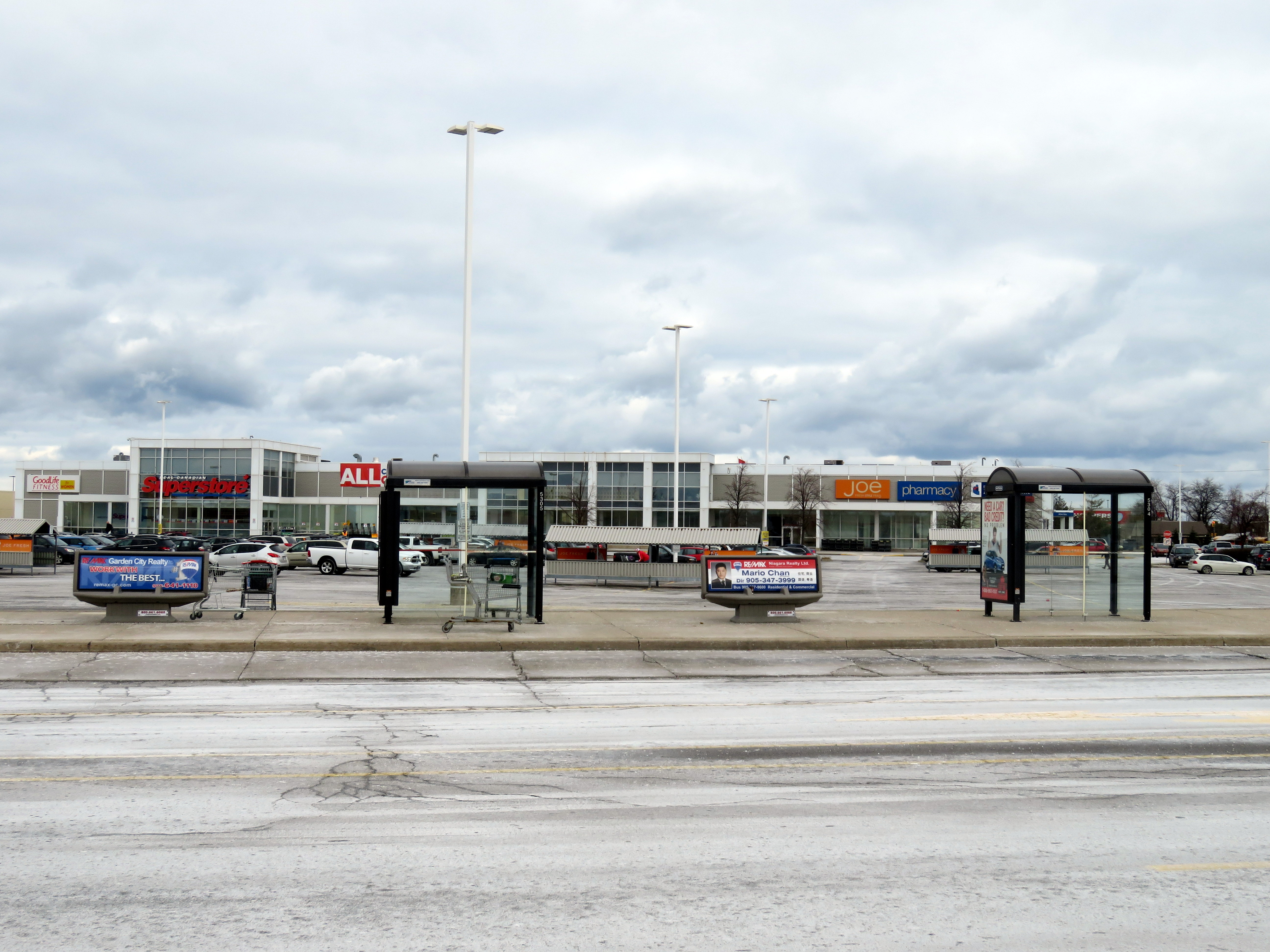
    A token measure — a bus stop — is located within the property. The bus stop is on the main driveway, but a considerable distance from the front entrances of Wal-Mart or the supermarket, especially for anyone carrying groceries, using a mobility device and/or with young children. Shopping carts are left next to the bus shelters, and there are no other supermarkets in western St. Catharines. Anyone without a car must either visit Superstore, Walmart, or shop at higher-priced local convenience stores. The property owner is SmartREIT, a real estate investment trust with retail properties in all ten provinces.
    stcatharinestransit
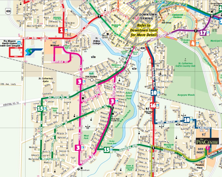
    Excerpt from St. Catharines Transit daytime map. Only route 3 serves the big box centre from the south. 

    Only one St. Catharines Transit bus route, 3 Pelham Road, serves the SmartCentre stop (evenings and weekends, route 115 replaces route 3), and only from the south. Traditional shopping areas, such as Downtown St. Catharines and the Pen Centre mall, are much better served by local transit. Route 1, which directly connects downtown and the new hospital and serves neighbourhoods to the north, runs nearby, but it doesn’t enter the property.

    St. Catharines, once an industrial powerhouse, has struggled with de-industrialization and poverty. The census metropolitan area has the lowest median family income in Ontario; the city also has one of the highest obesity rates. Access to fresh, affordable food, especially for those without automobiles, should be a priority. It’s a shame that the built form isn’t smart enough to help.
  • Mapping Toronto’s population growth

    Data geeks across Canada were eagerly awaiting this day — February 8, 2017 — the first release of the 2016 Canadian Census of the Population. Today’s release only covers population and dwelling counts, further information on age, sex, household characteristics, as well as language, immigration status, employment, income, and other variables will be released later in 2017. The 2016 Census included the mandatory long-form census, which will provide a robust snapshot on the socioeconomic status of all 36 million Canadians.

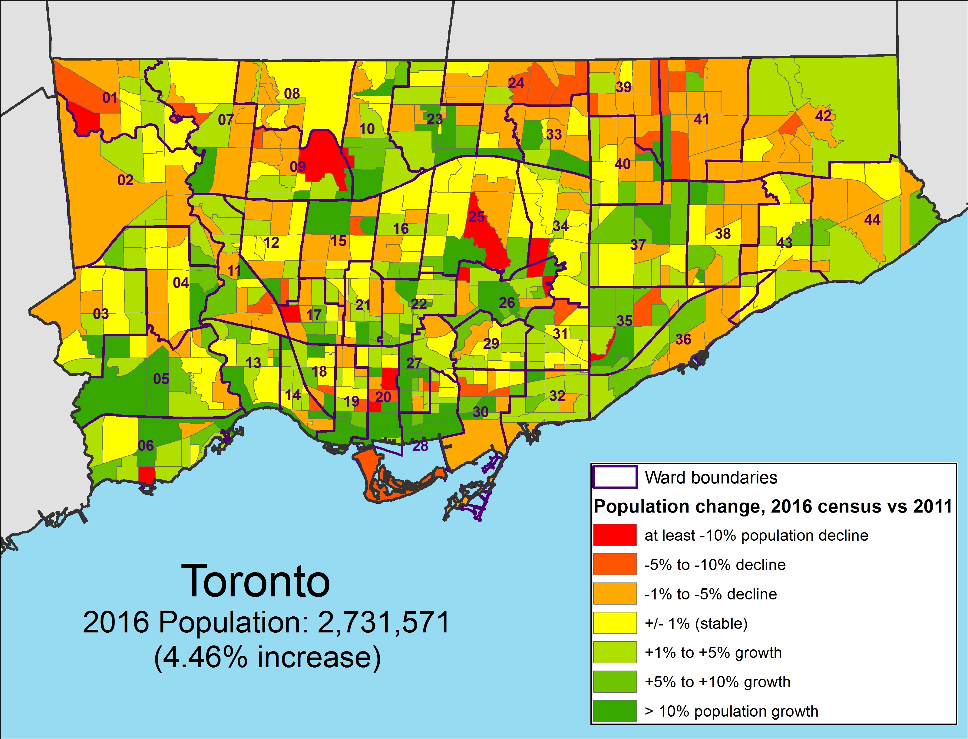
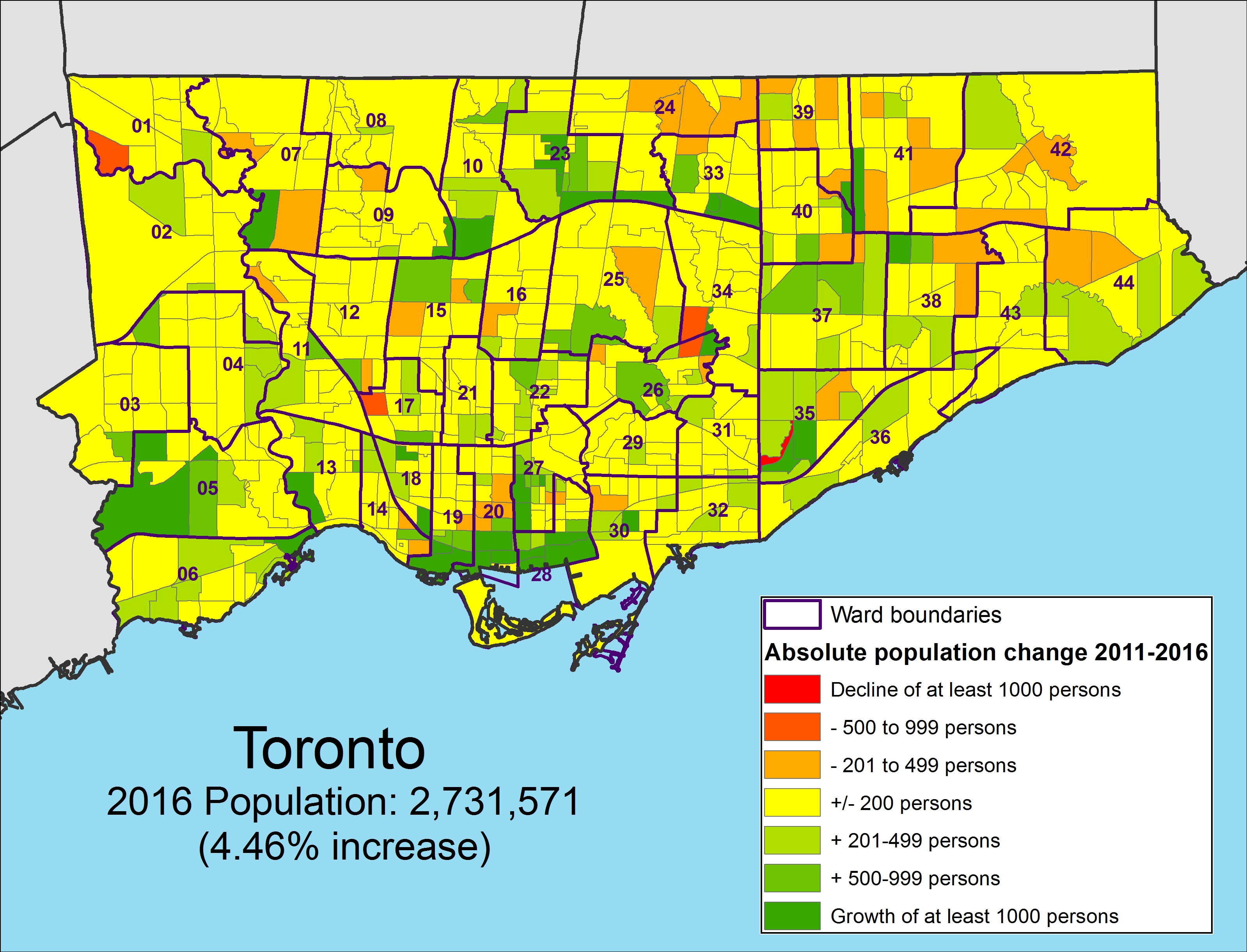
    I created three quick maps showing the population growth in the City of Toronto by census tract. The City of Toronto grew by 116,511 people over five years to 2,731,571 in 2016, a 4.45% increase. Some suburban municipalities grew much faster, like Brampton  (13.3%, with a 2016 population of 593,638), but Toronto has been able to absorb one-third of the Toronto Census Metropolitan Area’s growth.

    Toronto’s population makes up 46.1 % of the Toronto CMA (population 5,928,040). The rest of that growth was found in mature suburbs such as Brampton, Mississauga, and Markham, but also in quickly-growing towns such as Milton (population 110,128, up 30.5% from 2011). While some suburbs — Mississauga and Markham in particular — have been establishing higher-density urban centres with mid and high rise condominiums, most of the suburban growth has come from single-family homes and townhouses on formerly agricultural lands. If the Greenbelt is to continue being successful in containing sprawl and preserving productive farms and natural areas, Toronto needs to absorb even more growth in the next few decades. Land developers, speculators and the real-estate industry, however, are pushing back.

    The first of the three maps shows the percentage increase or decrease in population by census tract. Areas with higher growth are concentrated in Downtown (particularly along Yonge Street and in the Entertainment District, City Place, Liberty Village-Fort York and St. Lawrence-Distillery-Corktown), as well as Etobicoke Centre, on Humber Bay, Midtown, and along the Sheppard Subway corridor in North York. Not surprisingly, these are areas in which new housing developments, particularly condo towers, are being built. Other neighbourhoods, for the most part, are seeing minor increases or decreases in population, likely related to changes in household/family size.

    gta-2016-census
    Population change between 2011 and 2016 by percentage by census tract, Toronto
    (Alternate colour scheme available here and here)

    But more interesting is the map showing absolute population increases or decreases between 2011 and 2016. It better illustrates areas of high population growth and neighbourhoods with population decline. The inner suburbs, especially parts of Scarborough and North York, clearly show slight a population decline compared to the high-growth areas described above.

    gta-2016-census-absolute-changePopulation change between 2011 and 2016 by absolute numbers by census tract, Toronto
    (Alternate colour scheme available here and here)

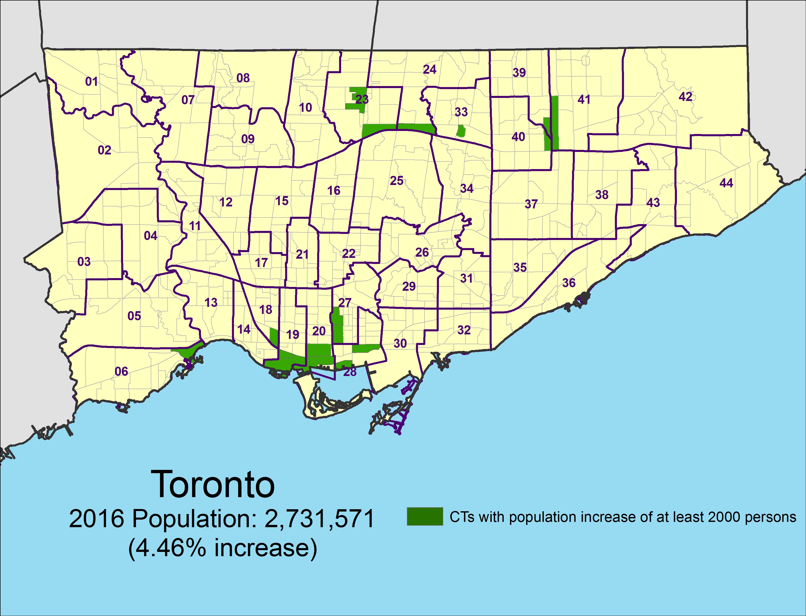
    The final map shows the 63 census tracts (out of a total of 1,426 CTs) with growth of at least 2,000 persons. It very clearly shows where high population growth has taken place.

    GTA 2016 Census Toronto High Growth.jpgCensus tracts that grew by at least 2,000 persons between 2011 and 2016
  • Hallam Street and the Harbord Streetcar

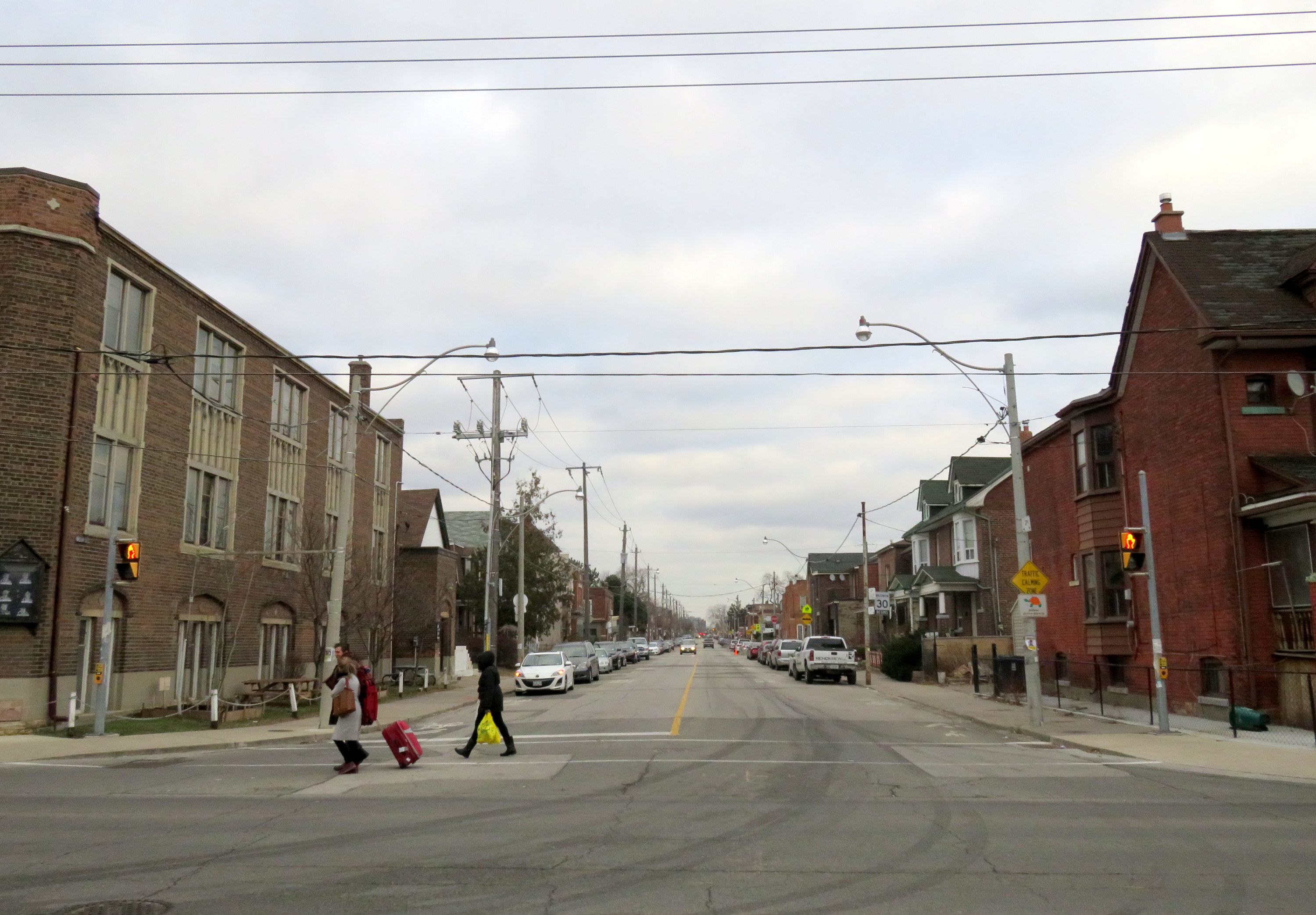
    img_7439-001Hallam Street looking east from Dufferin Street, January 2017
    Hallam Street, which runs east-west from Shaw to Dufferin, north of Bloor Street, is unusually wide for such a quiet, short road. Hallam Street doesn’t provide a convenient thoroughfare for motorists, and nearly every storefront is either vacant, or converted to other uses. Despite being located in a dense urban area of Toronto, Hallam Street has a ghostly feeling when walking or cycling across it.

    So why is Hallam Street so wide? And why does it have so many vacant or former storefronts?

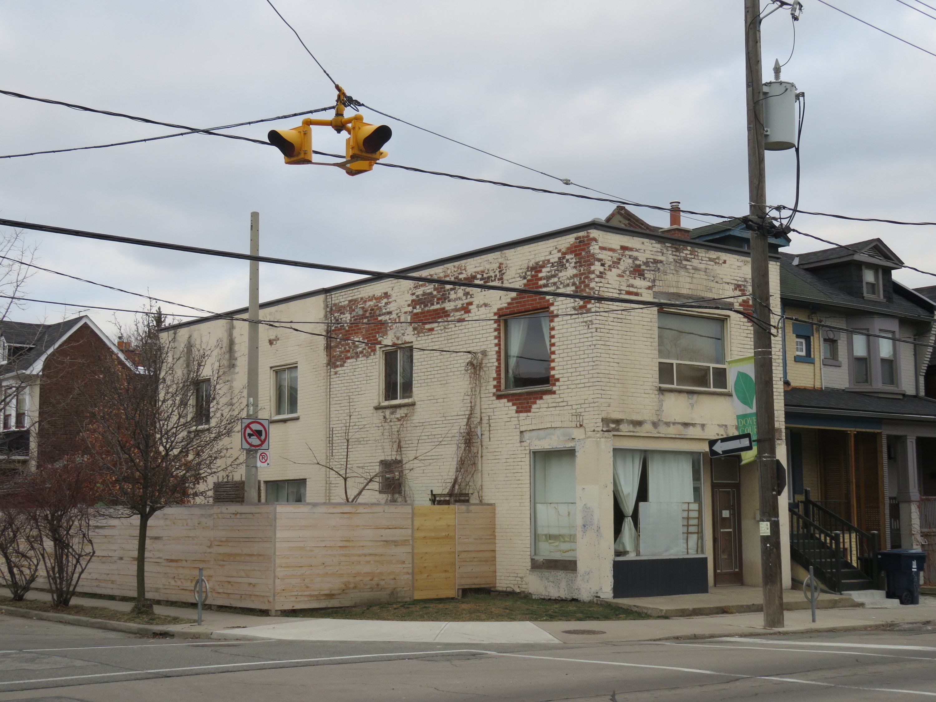
    img_7428-001
    Former storefront on Hallam Street at Delaware Avenue, one of several on Hallam that were converted to residential uses

    For thirty-one years, from 1916 to 1947, Hallam and Lappin Streets hosted the Harbord Streetcar, an interesting and circuitous route that served the northwest portion of the City of Toronto, and later, the east end of the city. Unlike most streetcar routes in Toronto, the Harbord Car refused to follow a grid. It wound its way through several working class neighbourhoods, tying together parts of Toronto otherwise underserved by its transit network.

    The Harbord Car was re-routed from Hallam Street and Lappin Avenue to Dovercourt and Davenport Roads in 1947, as part of a re-organization of transit services in Toronto’s west end (more on that below). The streetcar was fully abandoned in 1966, when the first phase of the Bloor-Danforth Subway opened. (more…)

  • Mapping Toronto’s street railways in the TTC era (1921-2016)

    Yonge and St Clair, north-west
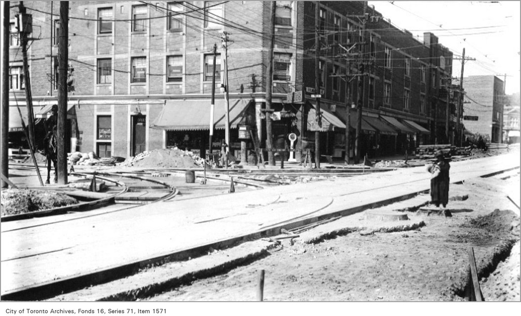
    Yonge Street at St. Clair Avenue, 1922. The TTC was busy in its first few years joining together the various street railway systems together and expanding services. Here, work is underway to extend city streetcar service to Glen Echo Loop and connect with the former Toronto Civic Railway’s St. Clair line.  City of Toronto Archives Fonds 16, Series 71, Item 1571

    Third in a three-part series — also see Part 1 (1861 to 1891) and Part 2 (1891 to 1921)

    In 1921, the Toronto Transportation Commission was established to provide all transit services within the City of Toronto, on a complete cost-recovery basis. Within the City, there would be a single fare for all regular services, including free transfers, with additional fares for services outside the city limits.

    The TTC immediately took over the operations of the Toronto Railway Company and the city-owned Toronto Civic Railways and began to unify the two systems. It bought new equipment, and replaced worn-out rail, carhouses, and other facilities. It introduced the first transit buses to Torontonians, and three decades later, Canada’s first subway.

    Toronto’s streetcar system expanded through the 1920s, but stagnated through the 1930s, including the loss of almost all of Toronto’s radial railways. But it wasn’t until 1947-1948 that Toronto’s street railway network entered an era of decline, as trolley coaches, diesel buses, and subways chipped away at the streetcar’s dominance.

    By the late 1960s, the TTC was looking to eliminate streetcars entirely by 1980, once the Queen Street Subway opened. Of course, that subway line never opened, and the streetcars remained. It wasn’t until the 1990s, though, that the network entered a renaissance.

    1923

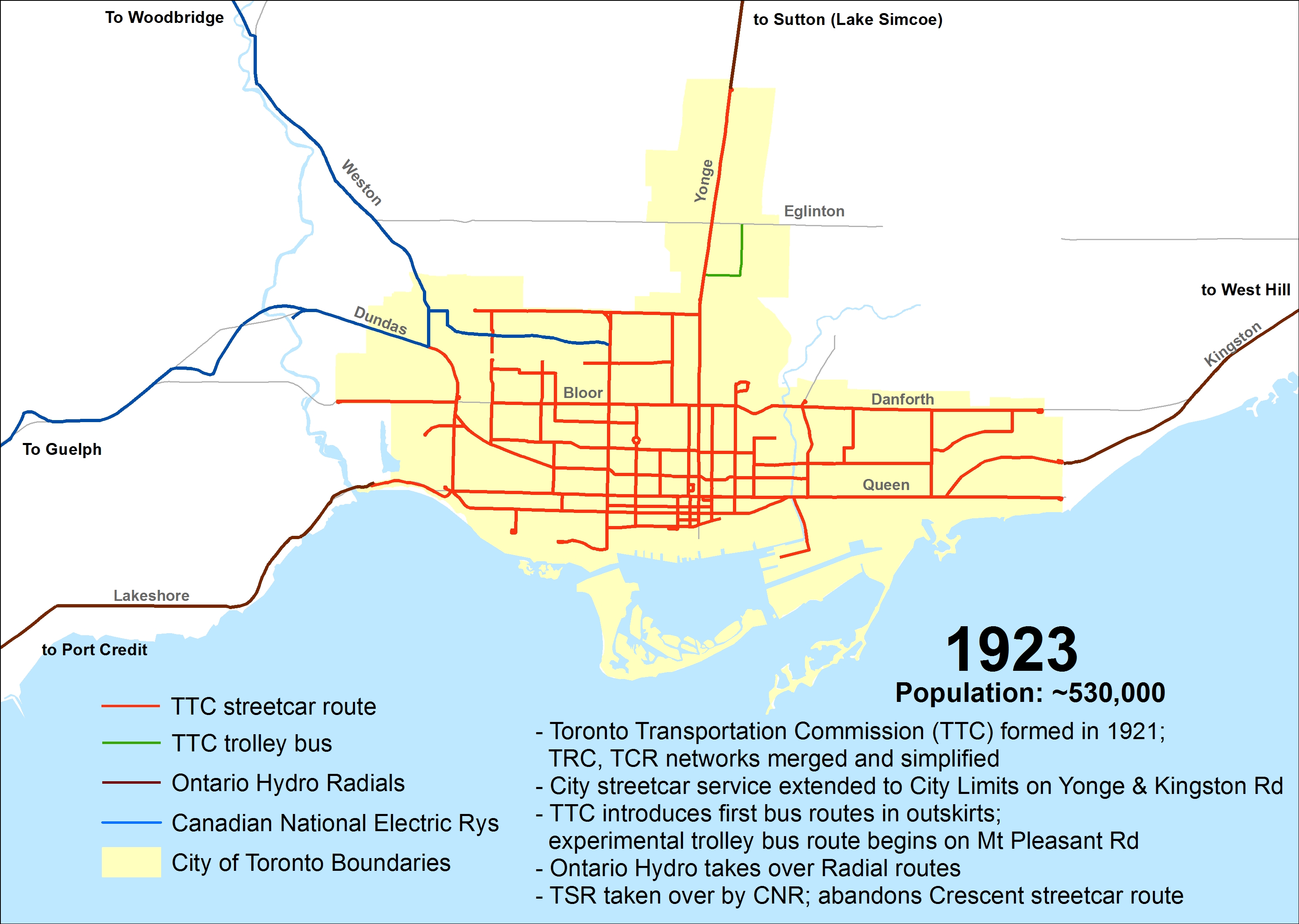
    Within two years, the TTC quickly modernized the streetcar system. New streetcars — known as Peter Witts — were ordered and the oldest of the Toronto Railway Company’s cars were immediately scrapped. The TTC unified the TRC and Civic systems, replaced the radial railways within city limits with city services, and added new routes such as Coxwell and Bay. The City took over the Toronto & York radials as well, but handed their operation over to Ontario Hydro. The TTC also replaced much of the worn out rails, and built new turning loops at the end of streetcar lines replaced crossovers and wyes. This improved operations and allowed for larger, single-ended streetcars to operate on more routes.

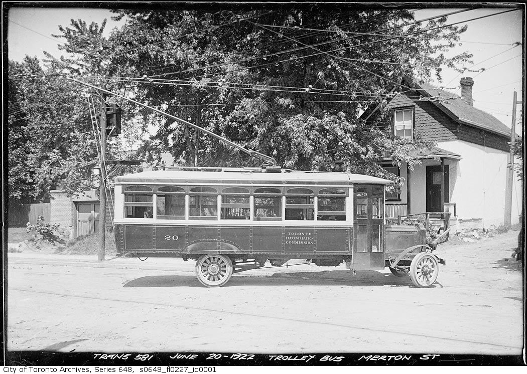
    The TTC also introduced buses. In the early 1920s, buses were were slow, small and less comfortable than streetcars, but they had their advantages. The TTC’s first bus route, 1 Humberside, provided a direct, single-fare ride through the South Junction neighbourhood to TTC streetcars at Dundas Street; the Toronto Suburban’s Crescent streetcar line couldn’t compete and was soon abandoned. The TTC also experimented with a trolley bus route on Merton Street and Mount Pleasant Road between 1922 and 1925; it was replaced by an extension of the St. Clair streetcar.

    ttc-streetcars-1923

    s0648_fl0227_id0001Trolley bus on Merton Street, June 20, 1922. City of Toronto Archives, Series 648, Fonds 227, Item 1
    (more…)

  • Thoughts on Newmarket’s new Rapidway (updated)

    IMG_1778-001

    Updated January 4 2017

    Effective Sunday, January 8, York Region Transit will impose new service cuts on several of its routes, including Viva Yellow, which I describe below. One bus will be removed from the route, reducing headways from every 15 minutes to every 22 minutes. Service after 10:30PM-11:00PM will also be eliminated.

    One wonders why, on one hand, there’s money to be hand to build fancy new bus infrastructure when there’s no willingness to fund transit that would make such capital expenditures useful.

    As York Region gets set to welcome the Spadina Subway extension to Vaughan Metropolitan Centre [sigh] and continues to lobby for a Yonge Subway extension to Richmond Hill, it’s worth questioning whether York Region is really committed to operating a quality transit service, and if it is serious about reducing its dependence on the single-occupant automobile.


    Original post, dated June 24, 2016

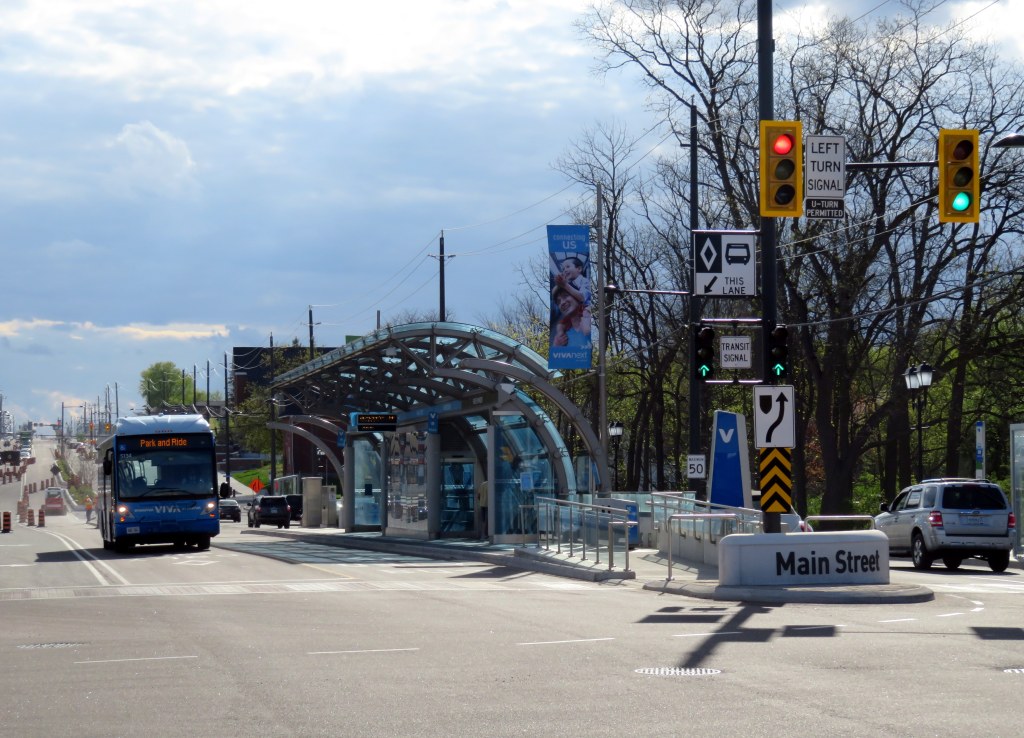
    In September, 2013, I wrote a post in Spacing Toronto called “York Region’s Rapidways: the good, the bad and the ugly.” I went out to Markham to ride the first of York Region’s VivaNext Rapidways. With the recent opening of a similar Rapidway in Newmarket, and a new Viva Route on Davis Drive, I made a trip north a few weeks ago to check it out.

    Viva is the brand used by York Region Transit for its network of limited-stop, proof-of-payment bus routes. When first launched in September, 2005, Viva was strictly a “BRT-lite” operation. Unlike regular YRT routes, the buses are fancier and more comfortable, the stops less frequent, and to speed up service, Viva operates on a proof-of-payment system where fares are purchased in advance from machines at Viva stops. and limited stops. A decade ago, all Viva corridors were supposed to be served by buses operating every 15 minutes or better, 7 days a week.

    But a few years later, the cutbacks began to happen as York Region reduced funding for transit operations. Viva Green, connecting Markham to the TTC’s Don Mills Station, became a rush hour only route. Viva Orange, connecting Vaughan to Downsview Subway via York University was cut back as well and now only operates every 30 minutes outside of rush hour. Even Viva Purple (York University – Markham) had its operating times cut back. Worse yet, YRT reduced service on connecting conventional bus routes that feed the Viva system.

    But while the region was reducing its spending on transit operations and raising fares, it was spending hundreds of millions of dollars on VivaNext, the region’s rapid transit plan. The plan calls for separated median right-of-ways on Highway 7, Yonge Street and Davis Drive, known as Rapidways, as well as two TTC subway extensions. York Region lobbied for, and got, a subway extension to Highway 7 in Vaughan which will open next year; it has also lobbied for an extension to the Yonge Subway from Finch Station to Richmond Hill. York Region, with its political clout, may just get that too.

    Spending billions of dollars on building transit, without properly funding the services that use and feed into that fancy new infrastructure is a problem. This is what’s wrong with York Region Transit.  (more…)

  • Mapping Toronto’s streetcar network: The age of electric – 1891 to 1921

    People & Historic shots. - [1920?]-1987

    TRC streetcars on Queen Street, c. 1910. Note the old TSR horsecars used as trailers behind the electric cars. City of Toronto Archives, Series 1465, File 722, Item 18

    This post continues from The Horsecar Era: 1861 to 1891 

    In 1891, after obtaining a new 30-year franchise, the Toronto Railway Company went to work electrifying Toronto’s streetcar system. The TRC was a private company, led by William Mackenzie and James Ross. Mackenzie made his fortune in railway construction; together with Donald Mann, he would go on to build a railway empire before it collapsed by the end of the First World War. Mackenzie would also control other street railway and interurban lines in Ontario, including the Toronto and York, the Toronto Suburban, and the Niagara, St. Catharines, and Toronto.

    By 1894, the TRC became fully electrified, providing quicker and more reliable service. In the twenty-five years that followed, new electric railways radiated out of Toronto to points such as West Hill in Scarborough, Port Credit, Woodbridge, and even as far away as Lake Simcoe and Guelph. But after a short sprint of service expansion within the City of Toronto, the TRC refused to extend its services beyond Toronto’s city borders of 1891. The City of Toronto was forced to form its own public streetcar company in 1911, and became determined to take complete control over urban transportation services once the TRC’s franchise came to an end.

    Maps presented only show revenue routes, including peak period variations and some seasonal routes, such as Exhibition services. I omit some minor service and route changes. I welcome constructive feedback as I plan to re-publish these maps elsewhere.

    1894

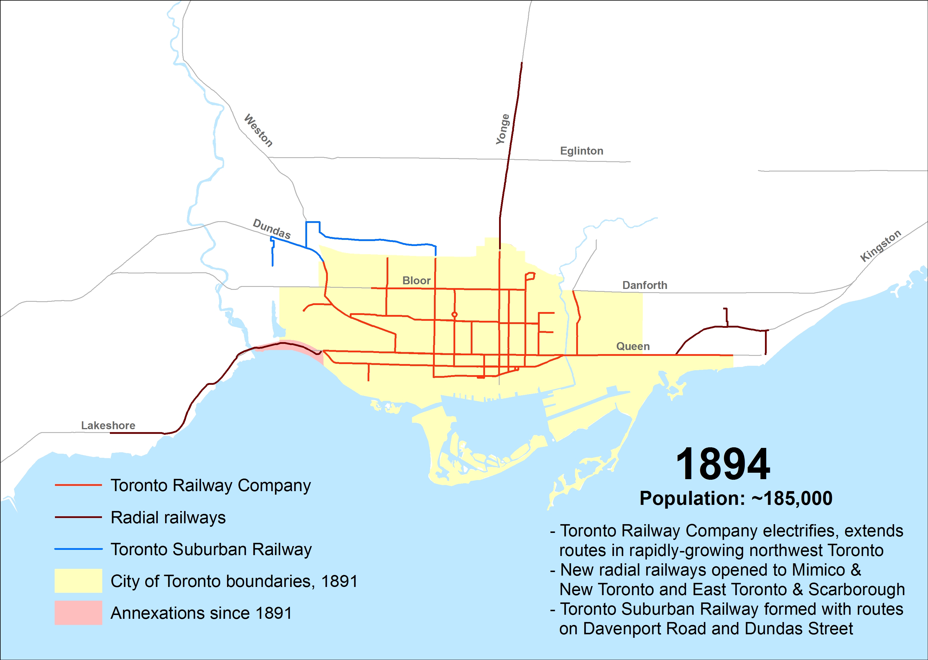
    Electrification of the Toronto Railway Company began when the Church Street line was converted on August 16, 1892. The last horsecar made its trip on McCaul Street on July 18, 1894. The TRC extended several routes in Toronto’s west end, including King, Dovercourt, Bloor, Dundas and Carlton.

    The Davenport Street Railway Company began operations on September 6, 1892 between Toronto Junction at Keele and Dundas Streets, and Bathurst Street at the CPR tracks, a short walk to TRC Bathurst Cars. The Weston, High Park & Toronto Street Railway Company began operating the same year within the Junction, from Evelyn Crescent to Keele Street, later extending east to the Toronto City Limits at Humberside Avenue. These two companies merged in 1894 to create the Toronto Suburban Railway.

    The Toronto and Mimico Railway was the city’s second radial. After a troubled start in 1892, it extended west to New Toronto by 1894. The Toronto and York built east from Queen Street and Kingston Road to Blantyre Avenue in Scarborough Township. Two short spurs served the town of East Toronto (near today’s Main/Gerrard intersection) and down to the Beach.

    ttc-streetcars-1894

    (more…)

  • Suburban stations for urban needs: accessing GO Transit’s proposed new stations

    21505188673_1d34d85175_kGO Transit train from the Pape Avenue footbridge, near the proposed site of Gerrard Station
    At its last board meeting on December 8
    , Metrolinx presented an update on the status of twelve new GO Transit rail stations, all located on existing lines. Eight of these proposed new stations are located in the City of Toronto; and six of those are station locations once promised as part of John Tory’s SmartTrack proposal. Unfortunately, the proposed new station designs (all available in this Metrolinx report) appear to be similar to existing GO stations in the suburbs, with needlessly large bus loops, PPUDOs, and parking lots. Development opportunities are limited.

    Transit connections at some proposed stations, like St. Clair West, are poor or practically non-existent. This is rather unfortunate, as SmartTrack was originally proposed as a frequent, subway-like service between Mississauga and Markham, with full TTC fare integration. Today, it’s merely six additional stations on existing GO Transit rail corridors. Without quick and seamless connections to the subway and surface TTC routes, the ability to provide any transit relief is compromised.

    I have more to say on this at Spacing Toronto.


  • Mapping Toronto’s streetcar network: The horsecar era – 1861 to 1891

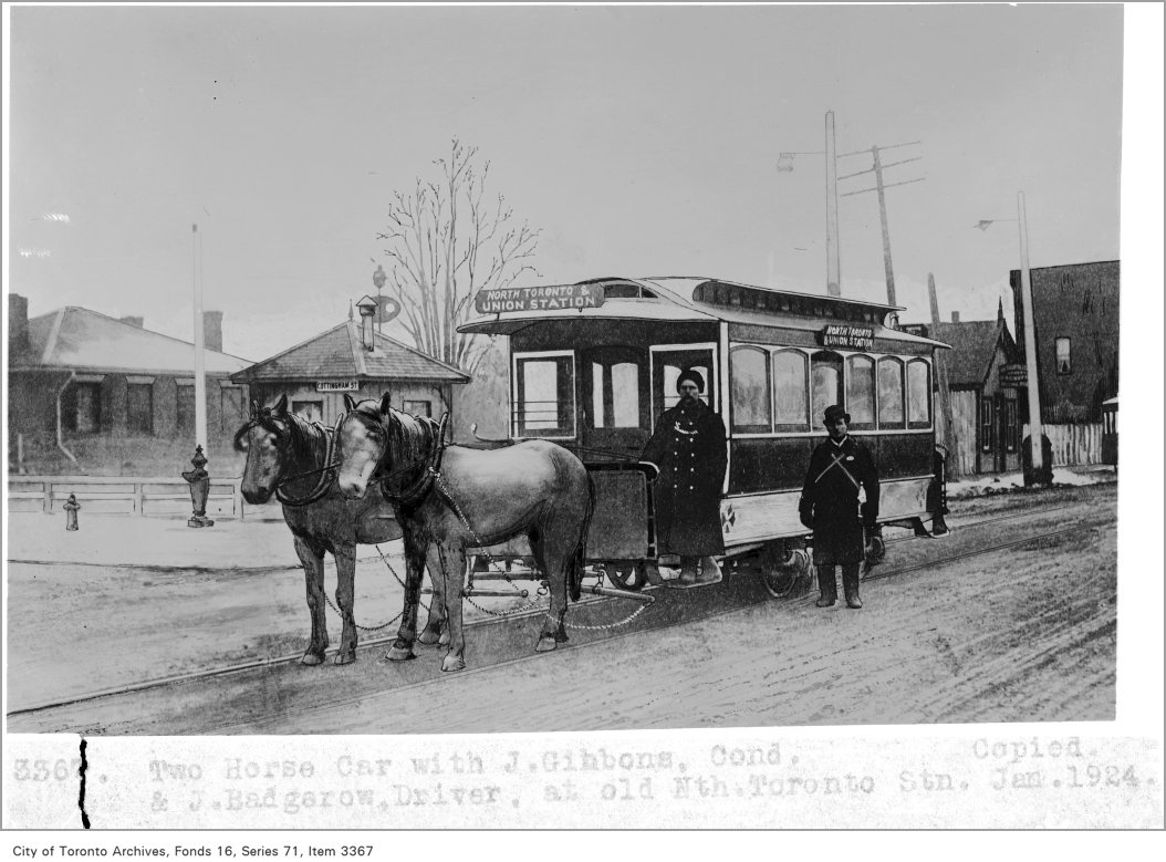
    Horse car, with J. Gibbons, conductor, and J. Badgerow, driver, at Old North Toronto StationToronto Street Railway horse car on Yonge Street at the Canadian Pacific Railway crossing, after 1885. From City of Toronto Archives, Fords 16, Series 71, Item 3367
    Over the last few months, I have researched many books and maps and created a series of maps that attempt to illustrate the history of Toronto’s street railways, from 1861 to the present. Toronto is one of only a few cities in North America to continually operate a street railway network (others include Boston, Philadelphia, San Francisco, and New Orleans), which remains one of the busiest and most expansive tram systems in the world.

    Before the Toronto Transportation Commission was created in 1921, Toronto was served by several private streetcar firms. The Toronto Street Railway, which began operations in 1861, built Canada’s first streetcar system; two routes were opened that year, with small railcars pulled by horses. The TSR’s successor, the Toronto Railway Company, electrified the network, but with few exceptions, refused to expand it beyond Toronto’s 1891 borders. Only with the creation of the publicly owned TTC was Toronto’s streetcar system unified and modernized to be the envy of cities across the continent.

    Creating these 38 maps was a challenge, because published materials covering the pre-TTC era (before 1921) are sparse. William Hood’s Street Railways : Toronto: 1861 to 1930 provides some history of Toronto’s earliest transit services, but with only some details. I also consulted Transit Toronto’s route histories and other books such as Robert M. Stamp’s Riding the Radials and John F. Bromley’s Fifty Years of Progressive Transit which covers the years from 1921 to 1971.

    This post, the first of three, will cover the years from 1861 to 1891, the era of the Toronto Street Railway (TSR), when horse power ruled the streets. I do not cover every year, and I omit some minor service and route changes. But this, I hope, accurately illustrates the rise, fall, and renaissance of Toronto’s streetcar system.

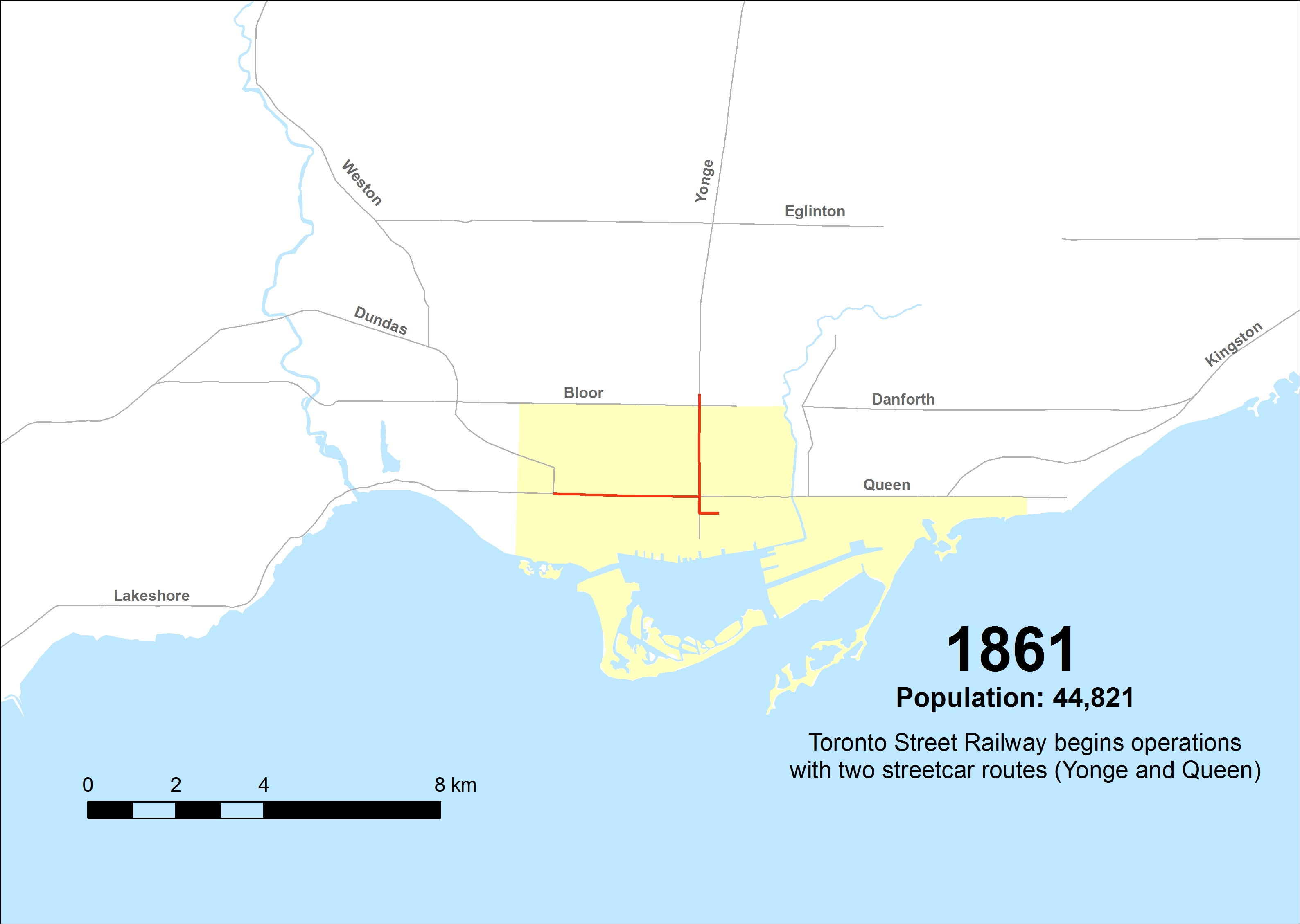
    1861
    The TSR begins operations on September 10, 1861, serving a small provincial city of less than 50,000 people. The first route, Yonge, operates from Yorkville Town Hall, just north of the city limits, to St. Lawrence Market at King and Jarvis. A second route, Queen, was established in December of 1861, running between the market and the Ontario Hospital at the corner of Dundas Street, now Ossington Avenue.

    ttc-streetcars-1861

    (more…)

  • Unanswered questions about Toronto’s next subway extension

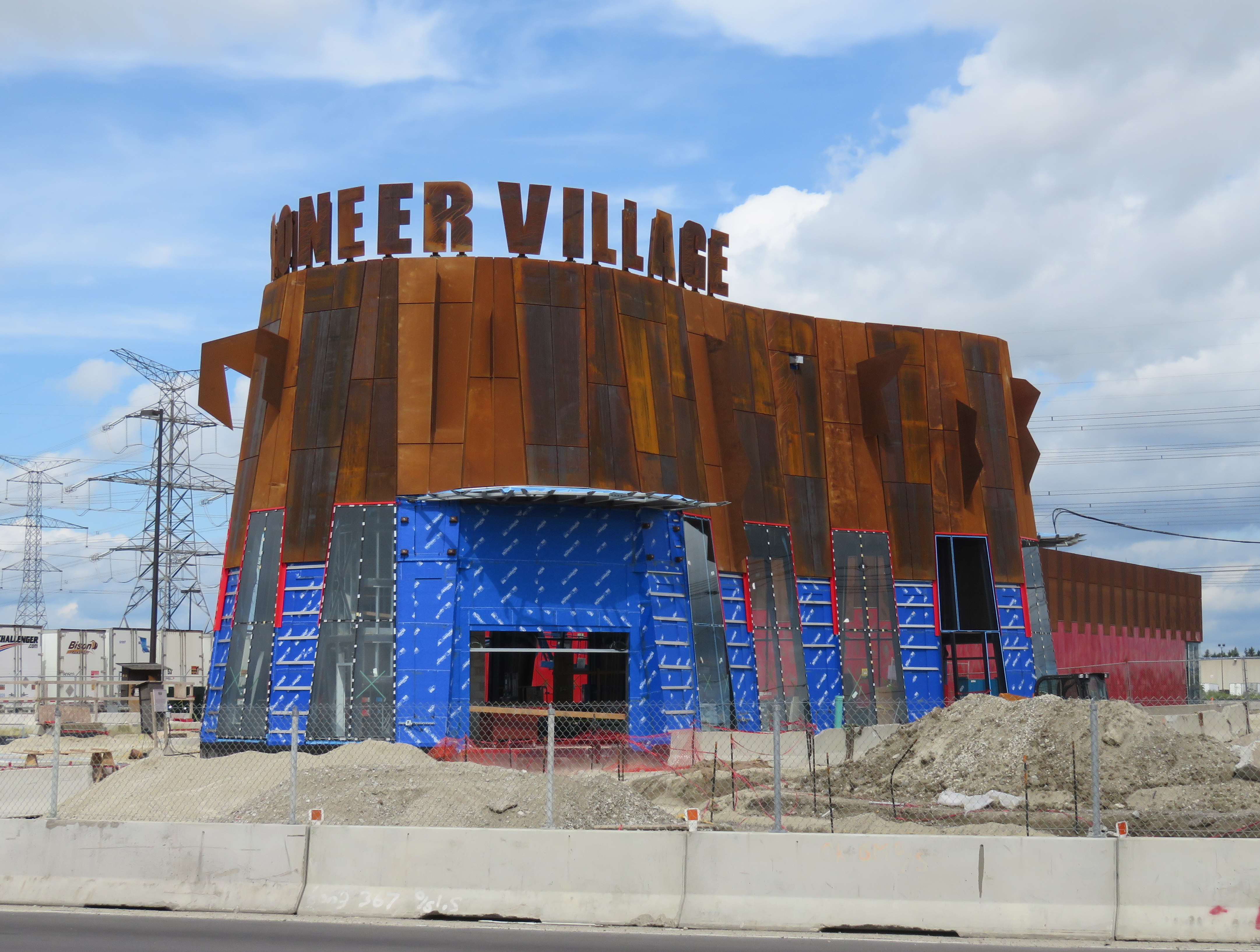
    IMG_4677-001.JPGPioneer Village Station under construction, August 2016
    Note: I posted an update to this article on October 4, 2017 

    By the end of next year, the Toronto Transit Commission (TTC) Line 1 subway extension to Vaughan will finally open, two years later than originally planned. The line will provide relief for thousands of York University students and employees and improve service to transit-starved northwest Toronto. It will terminate at Highway 7 in Vaughan, at the ambitiously (and in my view, ridiculously) named Vaughan Metropolitan Station, posing a challenge to cartographers and designers everywhere.

    When the $3.2 billion subway extension begins operating in December 2o17, it will be the first new major subway project since the opening of the five stop Sheppard Subway in 2002. It is also the first subway line to cross the City of Toronto boundary. (Coincidentally, this subway extension will cost the same as the proposed one-stop extension of Line 2 to Scarborough Centre.)

    Aside from the delays, the big price tag, and the silly Vaughan station name, there are two more issues that will arise, and which have yet to be completely figured out: how four separate transit agencies will re-route their buses once the subway opens, and the necessary question of fare integration once that happens.

    (more…)

  • From the vaults: the end of Yonge Street

    5608188561_bf233bac9d_o

    Note: This article was previously published in Spacing Toronto on April 13, 2011.

    One of Toronto’s greatest debates concerns Yonge Street’s controversial claim as “the World’s Longest Street.” Indeed, the Guinness Book of World Records published Yonge Street’s status as the true record until 1999; a bronze art installation in front of the Eaton Centre at Yonge and Dundas has a map of Yonge Street extending to Rainy River.

    This claim rests on the rather tenuous claim that that the 1,896 kilometre length of Yonge Street from Queen’s Quay on Toronto’s Harbourfront to Rainy River via Highway 11, at the Minnesota-Ontario border is in fact, the longest continuous “street.”

    While a popular claim, I’ve been a skeptic of this local legend. Highway 11 and Yonge Street have never been one and the the same, especially after the downloading of Highway 11 south of Barrie by the Harris government in the late 1990s.

    In 1920, Yonge Street was added to the Ontario provincial highway systemas Highway 11, which extended from Downtown Toronto as far as the end of Simcoe County, at the Severn River north of Orillia, where an unnumbered highway continued through the unincorporated Districts of Muskoka, Parry Sound and Nipissing to North Bay. In 1937, Highway 11 assumed the Severn River-North Bay portion and the newly-completed North Bay-Hearst section.

    During the Second World War, the section between Nipigon and Hearst was completed; it finally provided a complete provincial highway link between the Manitoba and Quebec borders and formed a crucial part of the Trans-Canada Highway until the more direct Highway 17 link from Sault Ste. Marie to Wawa was completed in the 1960s. Indeed, Highway 11 could still claim as the longest signed route within a sub-national entity but several national routes, such as US Interstates and US highways, are longer. In fact, the last reference to Yonge Street on Highway 11 north of Holland Landing is a short section of former Highway 11 in south Barrie.

    (more…)