Category: Toronto

  • Disappearing GO-TTC fare discount a major blow to regional transit in Toronto

    4902983182_d89c675230_b

    Updated January 22, 2020

    The TTC-GO fare discount will officially come to an end on Tuesday March 31, 2020, with the TTC and Metrolinx unable to come to agreement to keep the fare subsidy going without provincial support.

    As I argue below, this is a major blow to any hopes for an integrated regional transit system throughout the Greater Toronto and Hamilton Area. Subsidized transfers reduce the need to build expensive parking lots and garages, encourage more passengers to ride transit, especially in off-peak periods, and reduce the potential of major GO Transit expansion projects planned or underway.


    Originally published July 12, 2019:

    Earlier this week, transit riders learned that the fare discount for connecting between GO Transit and the TTC would soon come to an end.

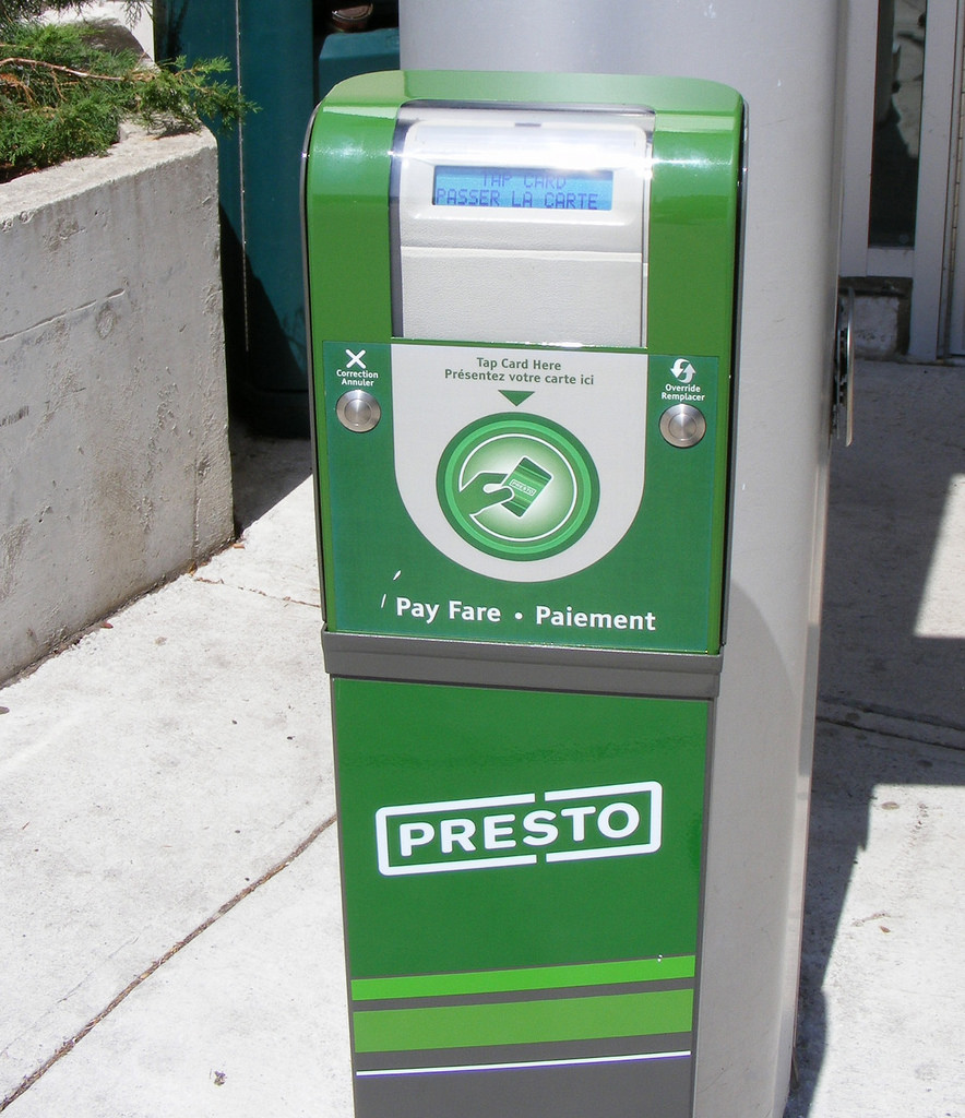
    The provincial Liberal government introduced the discounted double fare in 2017. It reduced the cost of a trip taken on both GO and TTC by $1.50 if the fare was paid on a Presto fare card. For many years, there were discounted transfers between GO and suburban transit agencies, but this was the first time such a discount was offered to TTC passengers.

    The Liberals also planned discounts for transferring between suburban bus systems such as York Region Transit and Miway, subsidies that would have been covered by the provincial carbon pricing scheme. This would have reduced the impact of another fare barrier. (A short bus trip across Steeles Avenue costs nearly $7.)

    When the Doug Ford-led Progressive Conservative government was elected, the provincial climate change plan was scrapped, along with those planned fare changes. Now, the province will not renew the $18.5 million annual subsidy for linked GO-TTC fares, though it did introduce free fares for children on GO Transit.

    This will especially affect commuters to York University, who previously enjoyed a one-seat ride to the heart of the campus on YRT and GO buses. When the subway extension opened, YRT retreated to terminals north of Steeles Avenue, forcing a transfer to the subway or a long walk across six lanes of traffic and campus parking lots. GO Transit, too, moved to a new terminal at Highway 407, two subway stops from campus. While GO commuters at least saved $3.00 a day with the discounted double fare, YRT commuters got nothing. (Of all the suburban agencies, only Brampton Transit continues to serve the campus.)

    This is also a blow to what’s left of SmartTrack, Mayor John Tory’s signature transit plan that was once pitched as “London-style surface rail.” At first, SmartTrack was a 53-kilometre heavy-rail line, mostly piggybacking on existing GO Transit corridors, but including a problematic western branch to the Airport Corporate Centre in Mississauga, all on an integrated TTC fare. Eventually SmartTrack just consisted of more frequent, electric GO service, along with additional station stops and fare integration. This was much more realistic, but it distracted from other needs such as the Relief Line and GO’s own RER regional rail plan.

    Lower GO fares for short trips and the TTC-GO fare discount were all part of this scaled-back version; as late as last year, Tory called additional fare integration a “critical component” of his pitch. Eliminating the fare discounts is yet another blow to SmartTrack.

    As Jonathan English points out in Urban Toronto, the GO rail network represents “tremendous infrastructure that could greatly improve the lives of hundreds of thousands of Torontonians.” But it lies “letting it lie mostly dormant because we won’t make the comparatively small operating funding investments required to improve the service and make the fares fair.”

    The $18.5 million annual cost is a small price to pay for improving transit accessibility and utilization of our existing corridors. Increasing that annual subsidy to reduce the cost of transfers between the TTC , York Region, Brampton, and Mississauga would, too be a worthwhile investment.

    Sadly, the current provincial government does not see the value in promoting fairer fare systems, nor regional transit in general. In response to budget cuts, Metrolinx reduced or eliminated service on five GO bus routes last month, and more may be to come. While there may be enthusiasm for building a new “Ontario Line” and a subway extension to Richmond Hill, there’s little regard for the actual transit rider.

  • Unfair GO fares on the Highway 407 Corridor

    GO bus with bicycle

    Since 1967, GO Transit’s primary focus has been its commuter rail lines radiating from Downtown Toronto, sometimes to the detriment of other transit needs in the Greater Golden Horseshoe, with bus routes complementing and supplementing that rail network. But twenty years ago, the regional transit service launched a new bus route that connected York University with suburban GO stations and bus terminals, filling in a gap and setting a precedent for expansion to other university and college campuses.

    Late last year, I analysed the GO Transit rail fare structure that centres on Toronto Union Station, following up on previous work. GO Transit claims to operate on a fare-by-distance structure, this is not quite the case. Generally, the longer one travels, the less the passenger pays per distance traveled. 

    Though the GO Transit fare structure was recently improved with new lower fares for short trips, there are still significant fare inequities and discrepancies, with Barrie and Richmond Hill Corridor passengers paying the least per kilometre traveled, and Kitchener Corridor passengers paying the most. 

    The fare discrepancies on the Highway 407 corridor — which is made up of eight bus routes that serve the Highway 407 bus terminal and TTC subway station in Vaughan — are even greater than that on the rail network. A passenger going from Markham GO Station, 27 kilometres from Highway 407 Station, will only pay $3.70 with a Presto card. A passenger from Bramalea GO Station, just 18.7 kilometres from Highway 407 Station, will pay over two dollars more. 

    (more…)

  • A farewell to Toronto’s CLRV streetcars

    IMG_6892-001.JPG

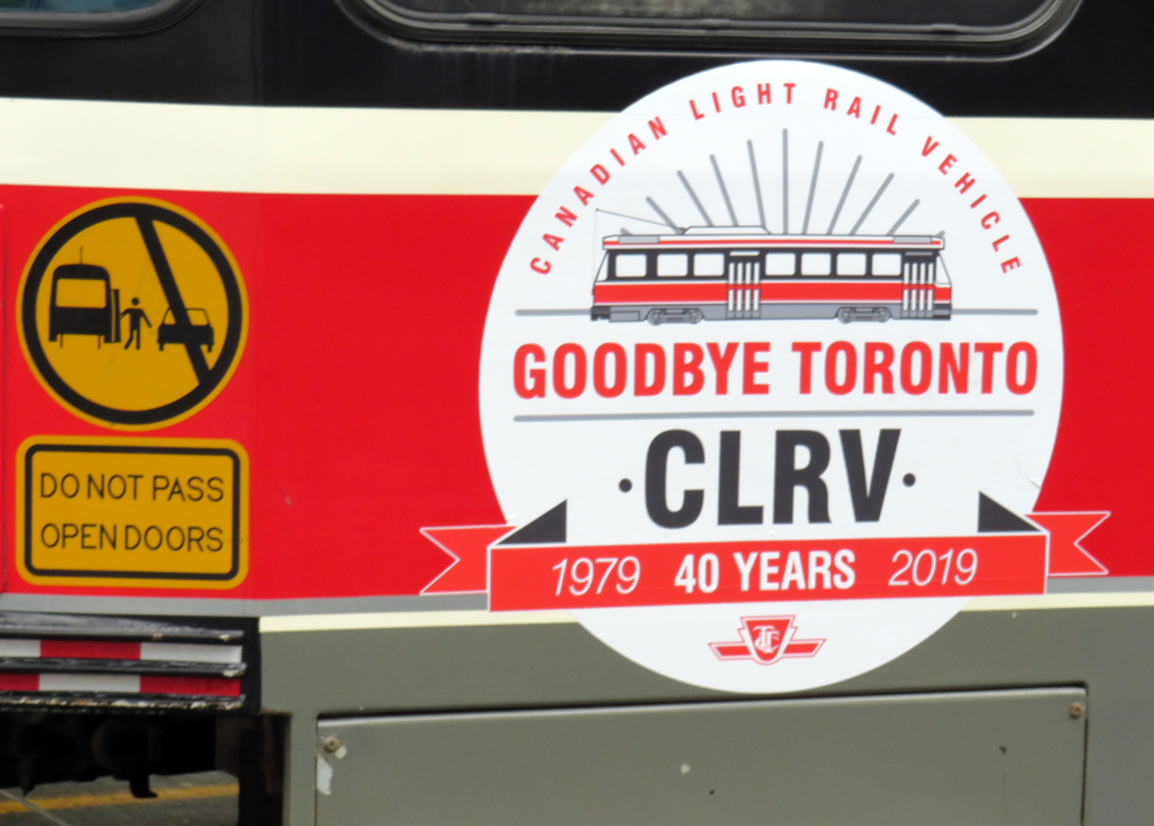
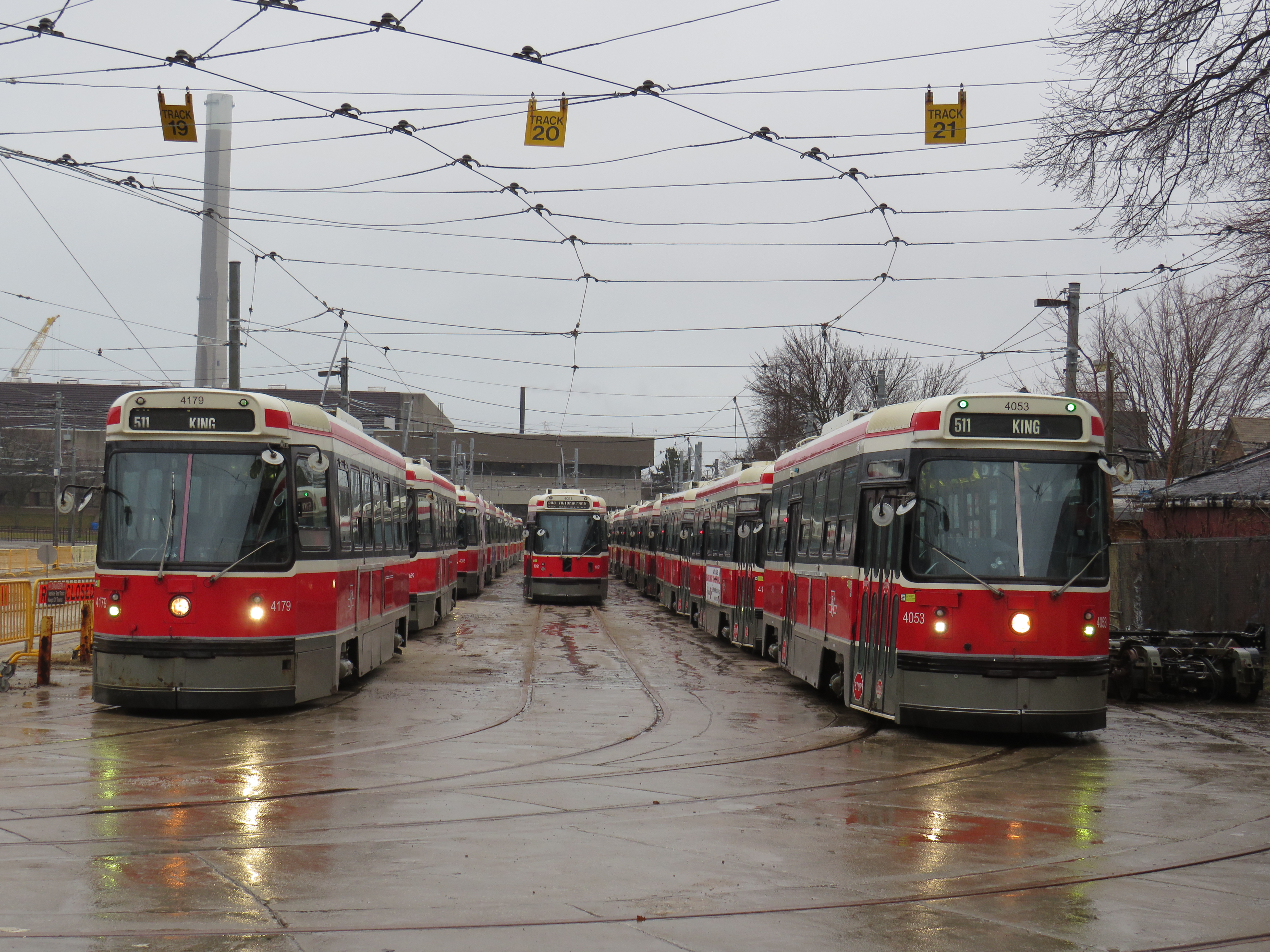
    On December 29, 2019, the Toronto Transit Commission’s venerable Canadian Light Rail Vehicles disappeared from the city’s streets. To mark the occasion, six CLRVs, offering free rides, were put into service on Queen Street between 10:00 AM and 2:00 PM before a ceremonial last run to Russell Carhouse in Toronto’s east end.

    The first six CLRVs, 4000-4005, were built by SIG in Switzerland, and entered service on the 507 Long Branch route on September 30, 1979. An additional 190 streetcars were built by Hawker-Siddeley in Thunder Bay, with the last cars arriving in 1981. Those were followed by 52 articulated ALRV streetcars, which were delivered between 1987 and 1989, and retired earlier this year.

    The CLRVs were unique to Toronto, designed by and for the TTC. Other North American cities that still operated streetcars in the 1970s opted for different designs to replace their ageing PCCs, though Boston have the CLRVs a try.

    Several CLRV and ALRV streetcars will be preserved at transit museums, including the Halton County Radial Railway near Rockwood, Ontario; two CLRVs will remain on TTC property for special events.

    With the arrival of the last of the 204 Bombardier Flexity low floor streetcars this month and the retirement of the CLRVs, the entire TTC fleet is now 100% wheelchair accessible and fully air-conditioned. Gone, too, with the CLRVs are back-lit vinyl destination signs, treadle rear doors that open by stepping on the stairs, and windows that open at face level and the warnings to keep arms inside.

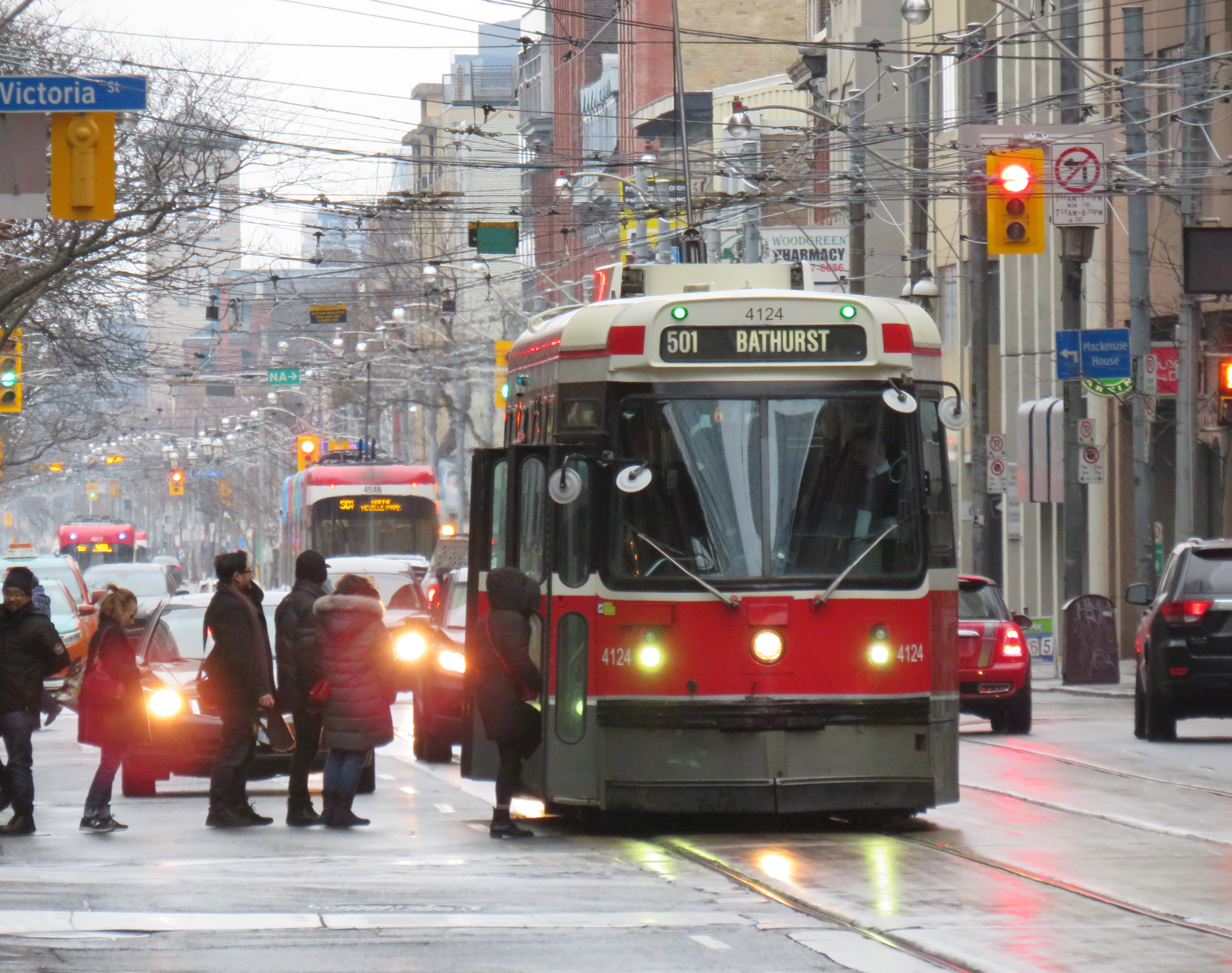
    Streetcar 4124 on December 29, 2019Streetcar 4124 picks up passengers at Yonge Street, December 29, 2019

    Though the accessibility and the capacity of the new Flexity streetcars represent major improvements, I will miss the old CLRVs, and not just because they’re the last transit vehicle in Toronto that are older than I am. I was fascinated by Toronto’s streetcars at an early age. As a child growing up in Brampton, I would lobby hard to ride Toronto’s subways and streetcars whenever we went downtown as a family. My parents took me on a ride on the 501 Streetcar between downtown and Parkdale (with lunch at Harry’s Charbroiled Burgers when it was across from the Gladstone Hotel) when I was seven.

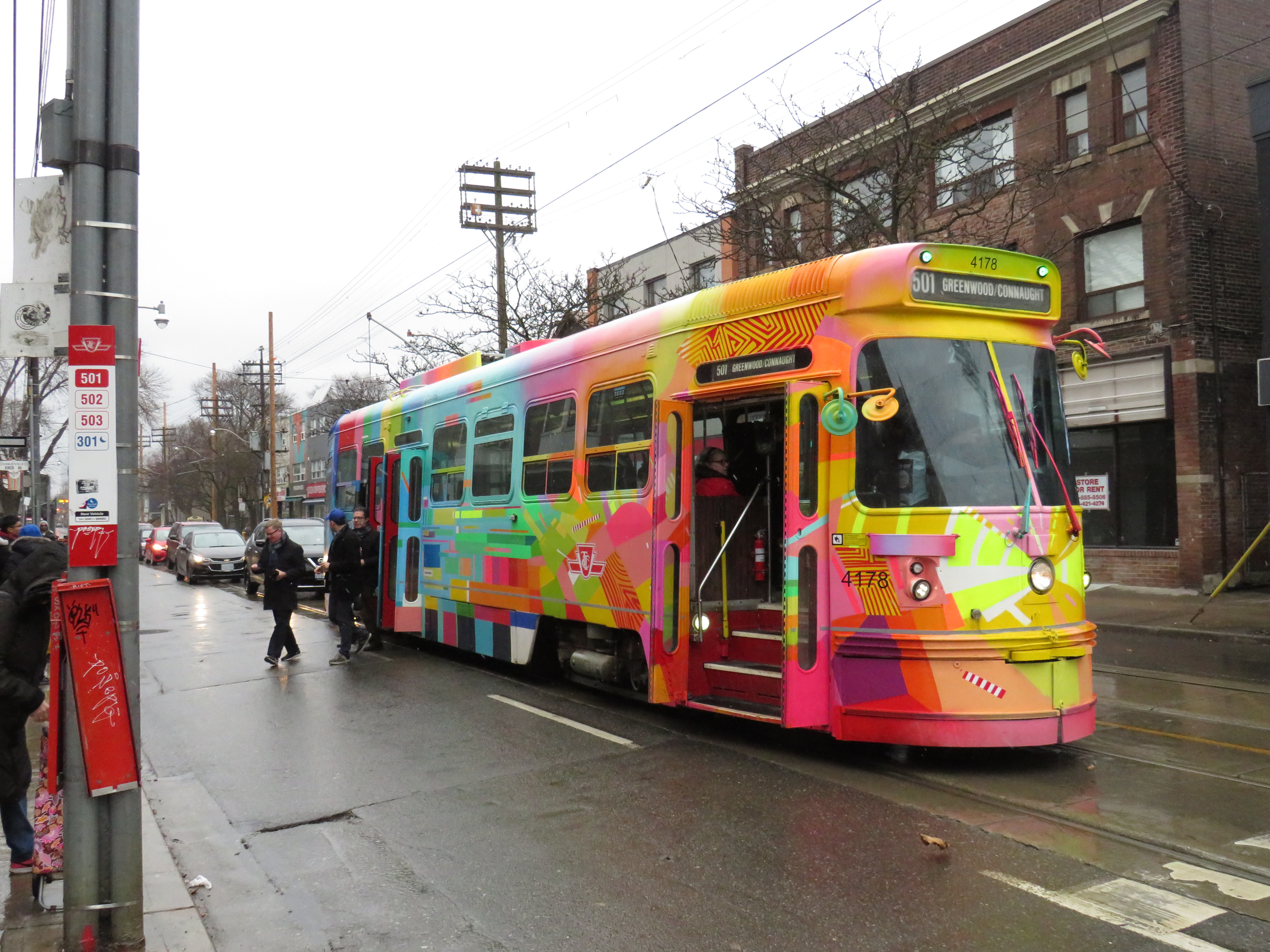
    IMG_6907-001Streetcar 4178, A Streetcar Named Toronto, at Greenwood Avenue, December 29, 2019

    Once I was old enough, at age thirteen, I was making my own trips to Toronto, taking GO Transit trains from Downtown Brampton or Mississauga Transit buses from Shoppers World and Square One to the subway, buying a day pass, and then spending a day wandering the city. The high floor CLRV and ALRV streetcars with their open windows offered great views of the city rolling by.

    I continued to ride the rocket regularly when I attended university, taking advantage of breaks between classes to ride further out into the suburbs, eventually riding nearly every bus route in the city. Even after I moved to Toronto, a streetcar ride was an affordable delight (as long as I wasn’t in a rush).

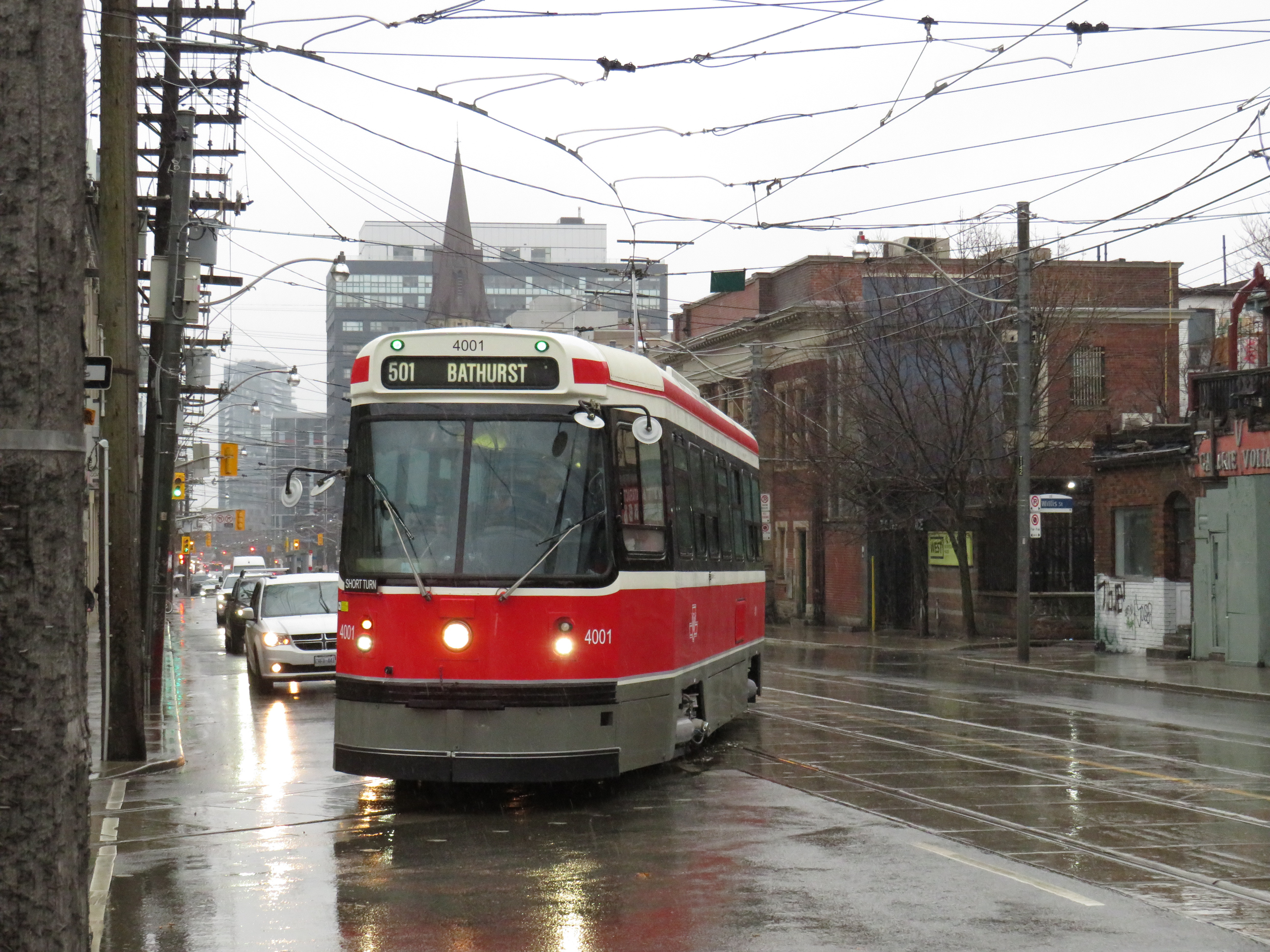
    IMG_6927-001.JPGShort turn: Swiss-built CLRV 4001 turns into Wolesley Loop at Bathurst and Queen
    My favourite seats were right at the back, with the curved rear with great views on three sides, similar to the bullet lounge at the end of VIA Rail’s Canadian and Ocean trains. The single seats on the operator’s side of the streetcar were also favourites.

    Though the last of Bombardier’s 204 new Flexities have finally arrived, there is still a streetcar shortage in Toronto. The 505 Dundas and 502/503 Kingston Road routes continue to be operated with buses. Many of the new vehicles planned for Dundas and Kingston have been reallocated to King Street, where the transit priority project resulted in a significant increase in ridership. The TTC wishes to purchase 60 more streetcars to fully furnish the existing demand and support expansion on the waterfront, but funding isn’t yet available.

    Unfortunately, buses will have to fill in those gaps as the CLRVs disappear.

    IMG_6936.JPG
    Retired streetcars at Russell Carhouse await their fates

    Thanks for the memories!

  • Islington Avenue: deadly by design

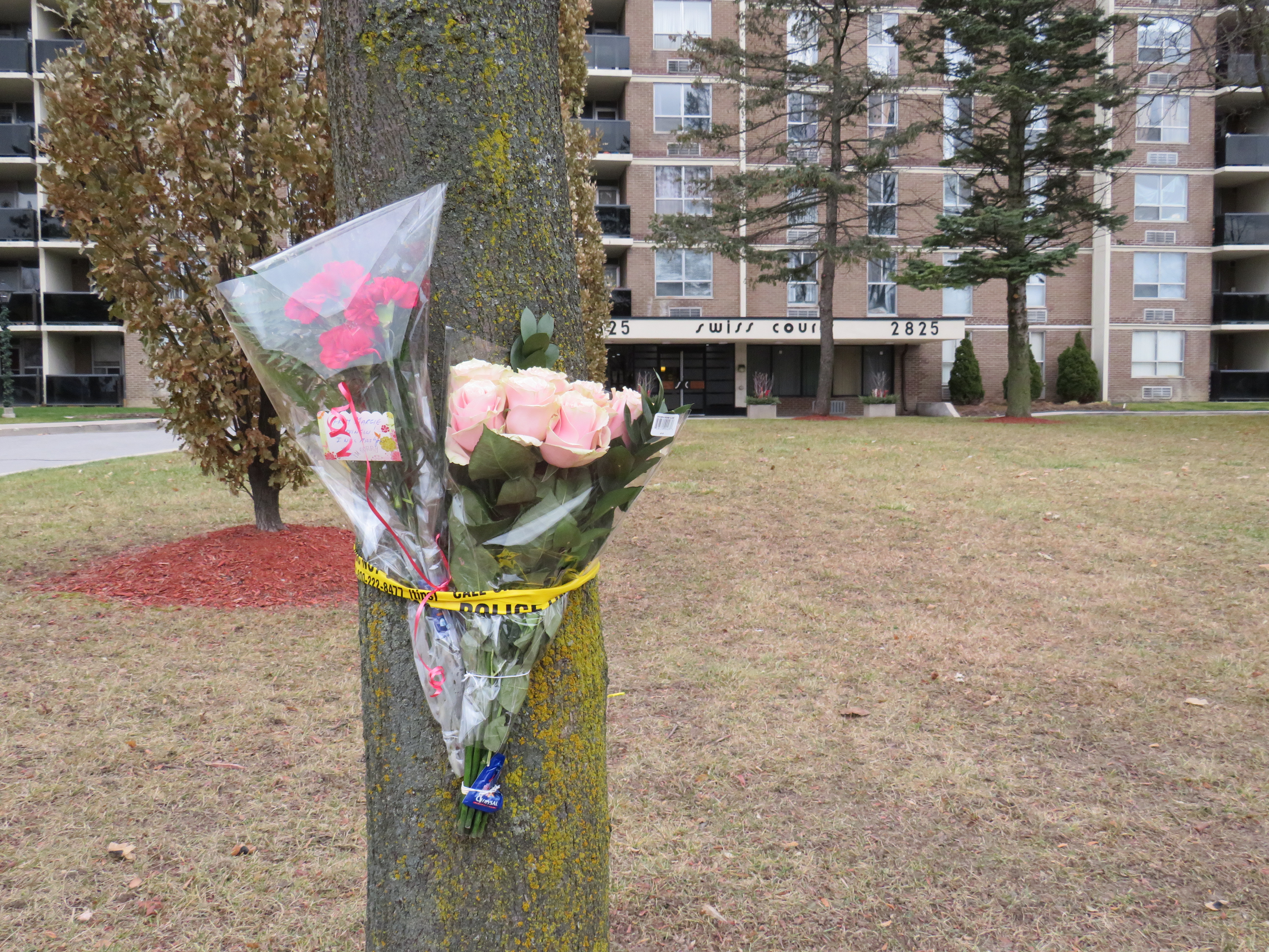
    IMG_6266-001Memorial to 77-year old Pasquina Lapadula in front of her apartment building on Islington Avenue north of Finch
    On Thursday, November 29 at 6:30AM, Pasquina Lapadula left her Islington Avenue apartment building and crossed the street in front of her home. Soon after stepping out, she was struck and killed by the driver of an SUV traveling northbound. The driver then fled the scene. Sadder still, drivers passed the scene without stopping to help.

    Toronto police are looking for a dark coloured SUV with bright headlights and fog lights. They have yet to find the driver and lay charges.

    According to the Toronto Star, 37 pedestrians have been killed on Toronto’s streets. Of those, 24 were 60 years old or over. Since 2007, 410 pedestrians were killed on Toronto’s streets; 238 of those were aged 60 or older. November 2019 was an especially deadly month; Lapadula was the third older pedestrian killed in Toronto in just three days.

    Though blame can be laid at the driver, who despite having ultra-bright headlights and fog lights, struck Lapadula and sped away afterwards, this part of Islington Avenue, like many other suburban roads in Toronto, is deadly by design.

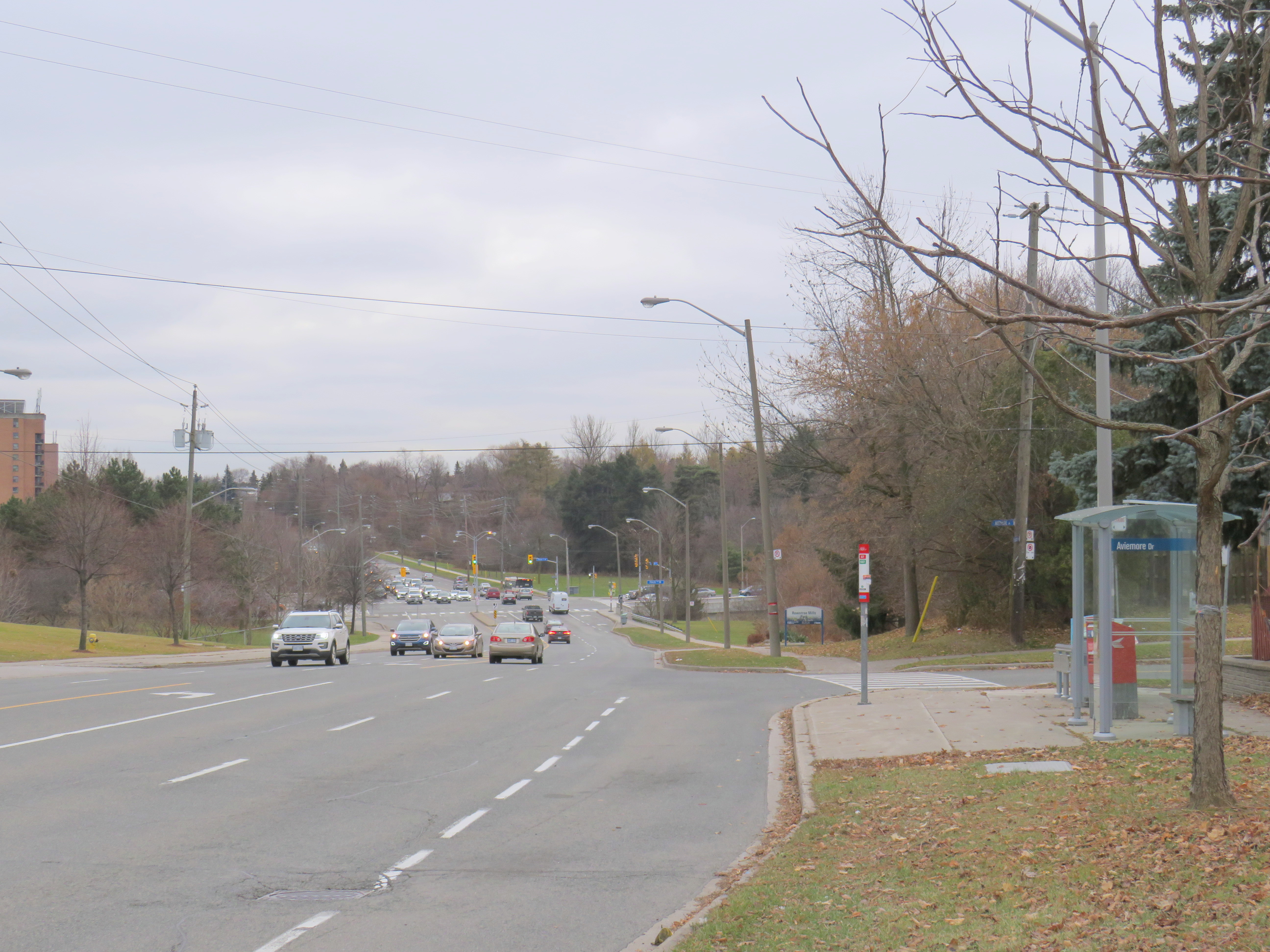
    IMG_6283-001Islington Avenue looking south from Aviemore Drive towards Finch Avenue
    The collision took place at Aviemore Drive in Humber Summit, in Toronto’s northwestern corner, near the boundary between the former cities of Etobicoke and North York. The area was developed in the 1960s and 1970s, when automobile-centric planning was at its peak.

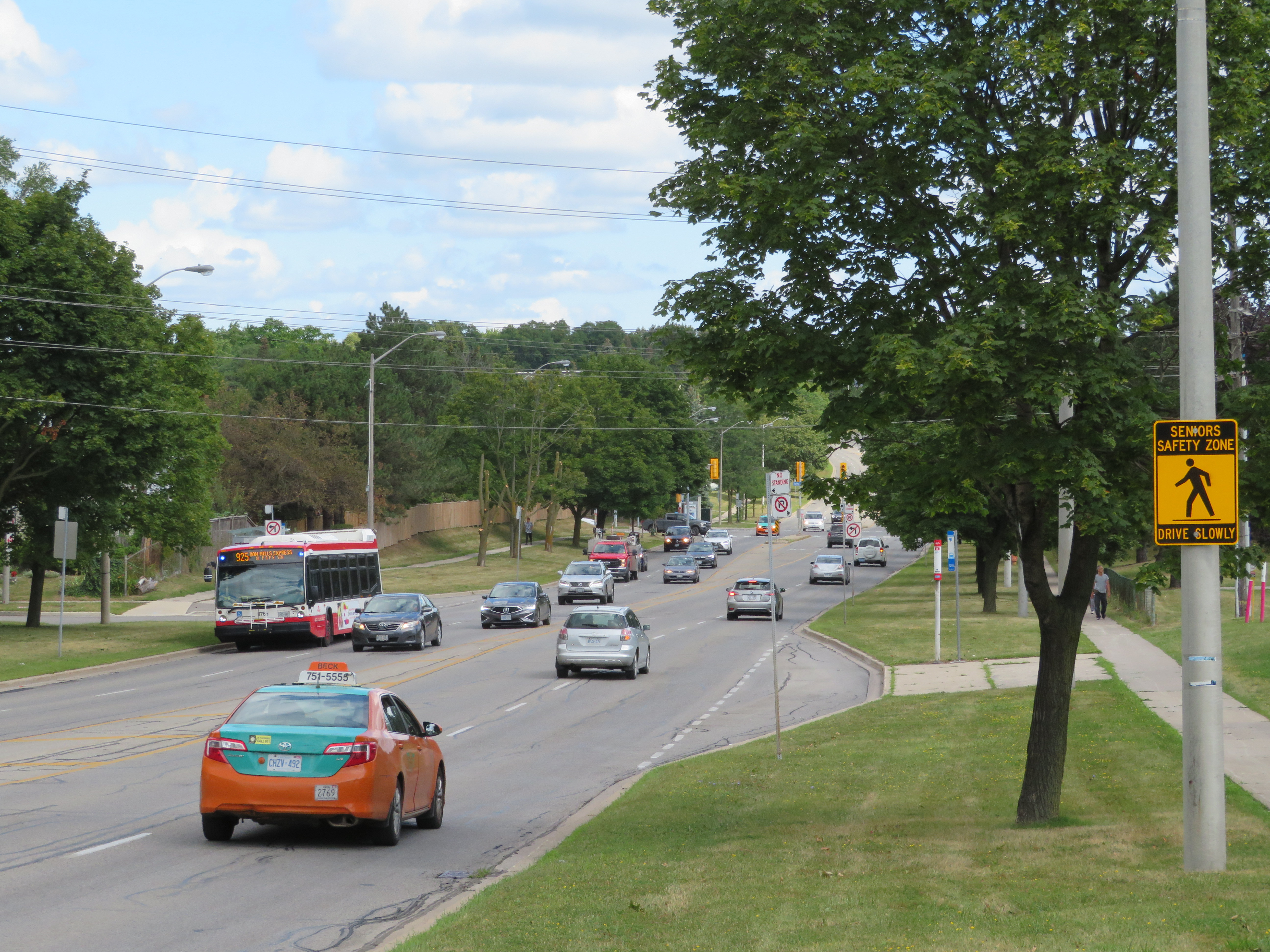
    Islington Avenue is five lanes wide between intersections, including a striped middle lane that turns into left turn lanes at intersections. Sidewalks are separated by wide boulevards, and there are long distances between traffic signals.

    The road has a slight curve north of Finch Avenue, with a hill down towards the East Humber River at Finch. From Aviemore Drive, it is a 220 metre walk south to the crosswalk at Finch Avenue and 430 metres north to the traffic signals at Milady Road. Just south of Aviemore Drive are entrances to Gord and Irene Risk Park and Recreation Centre and Rowntree Mills Park.

    As the speed limit is unposted on this section of Islington Avenue, by law, vehicles may only go a maximum of 50 kilometres per hour. However, the road design encourages speeds far greater than the limit.

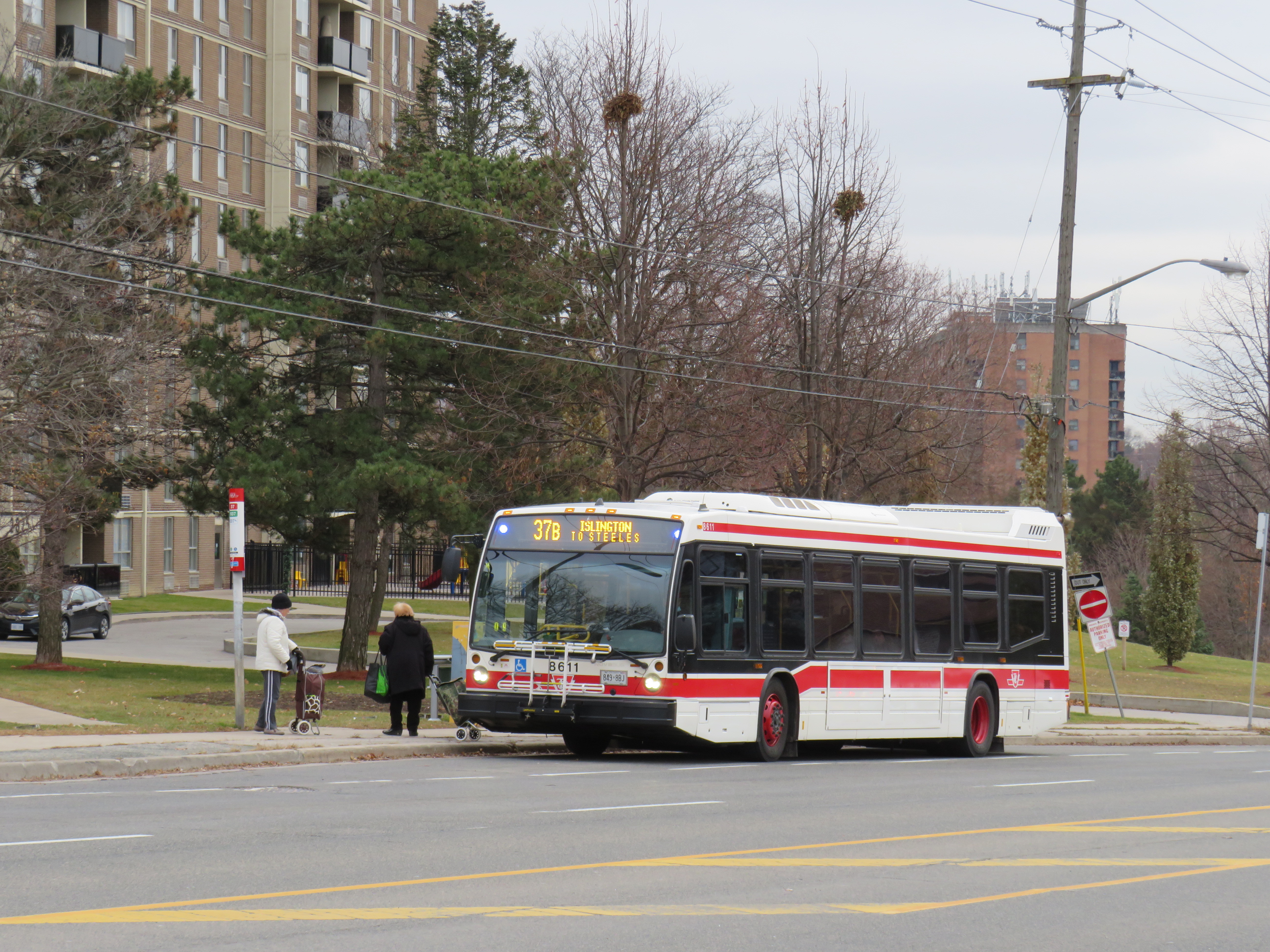
    IMG_6299-001TTC bus stopped in bay in front of Pasquina Lapadula’s apartment building
    As on Don Mills Road north of Finch, TTC buses stop in bus bays instead of on the street itself. These bus bays were not designed for the benefit of transit, but instead for the convenience of private motorists. Buses stopping get out of the way of traffic, and then must merge back in. (A law requiring other motorists to do so exists, but is never enforced.)

    Everything about the road design is designed for high vehicle throughput, with little consideration for pedestrian safety.

    IMG_6248-001Islington and Finch Avenues

    It is true that Pasquina Lapadula could have walked 220 metres down to Finch Avenue, and depending on her destination, another 220 metres back up the hill. The traffic signals and painted crosswalks would have provided additional safety. But the intersection of Finch and Islington itself is problematic.

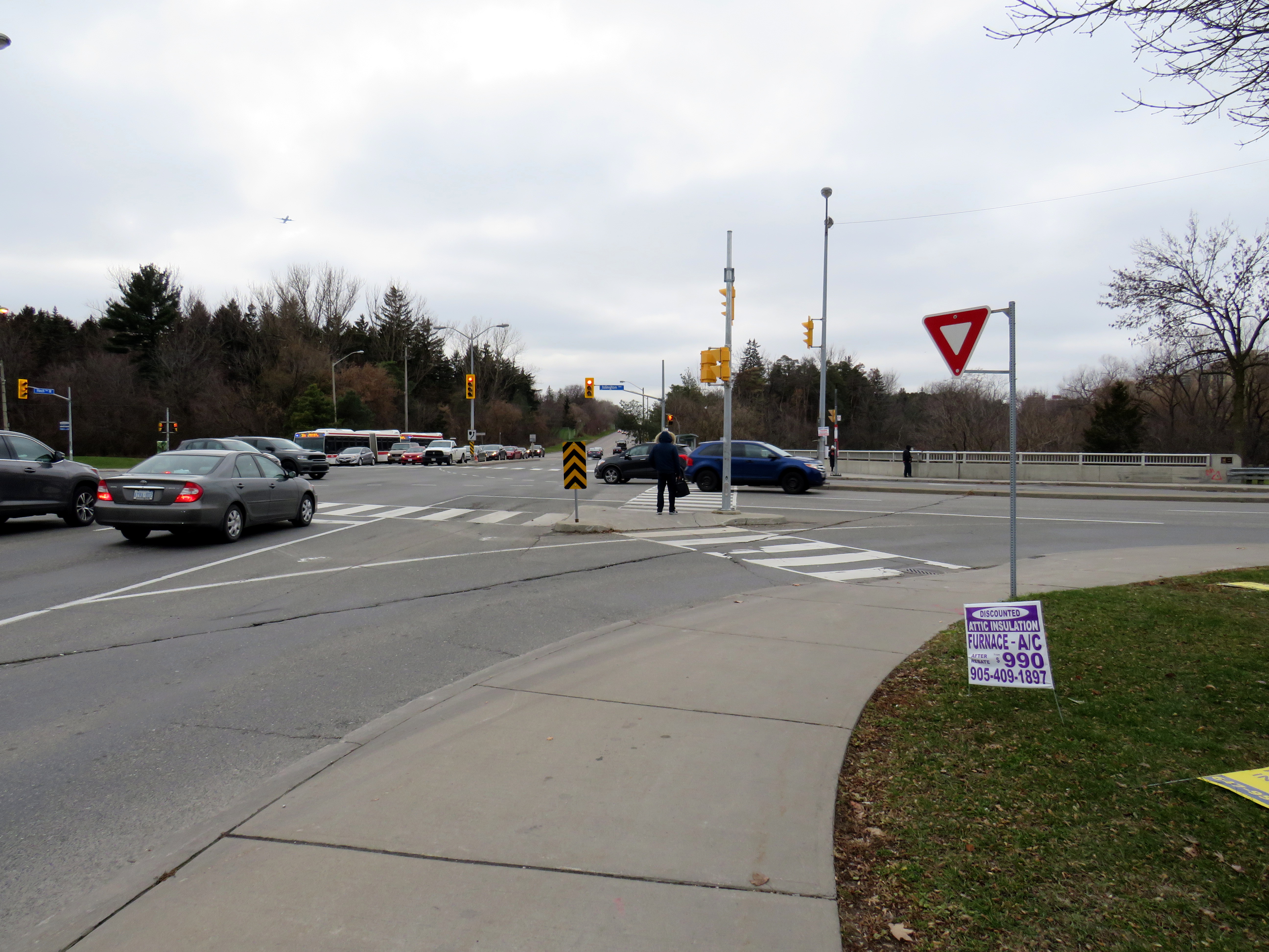
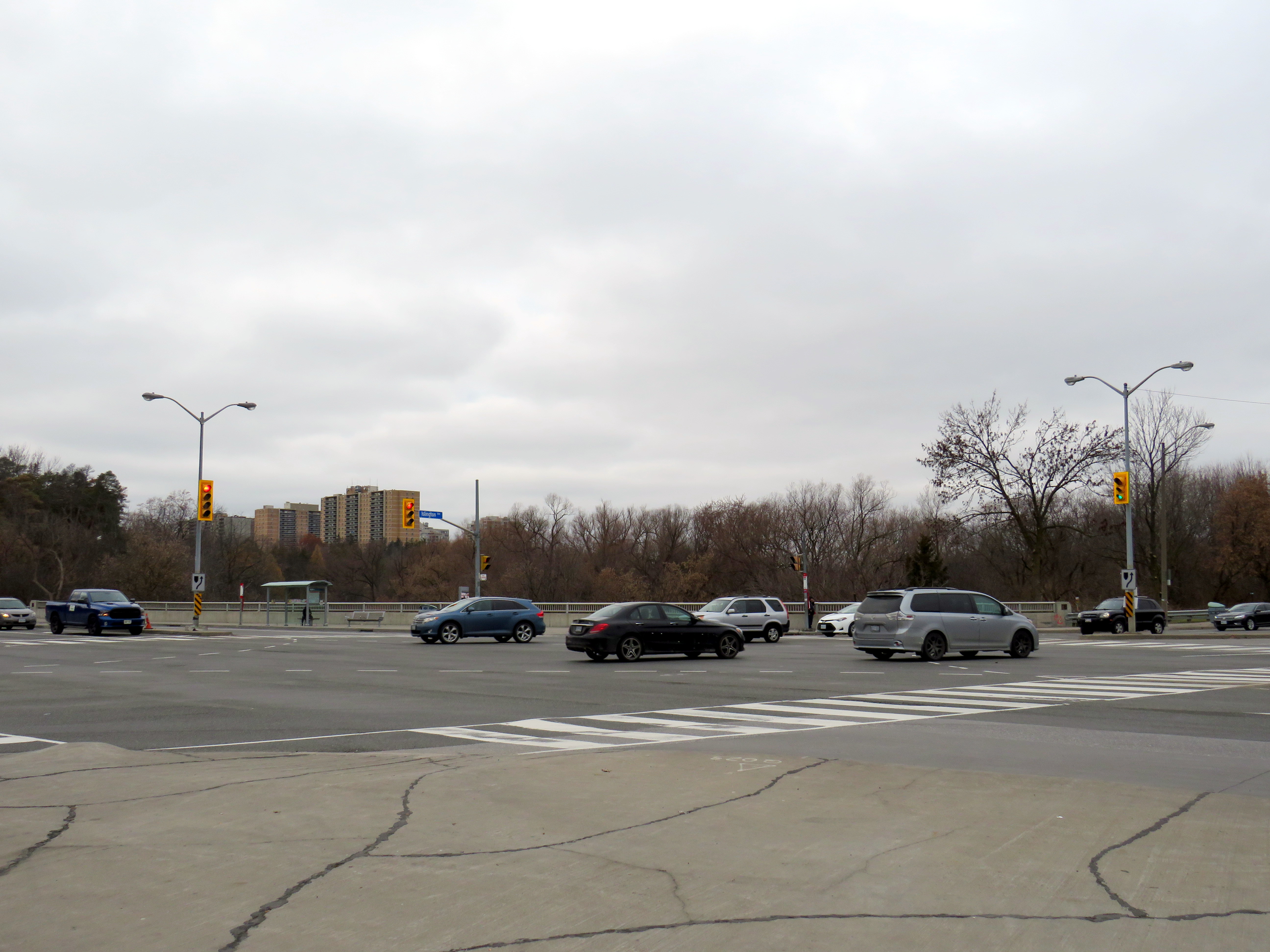
    The intersection sits on a large viaduct over the East Humber River. Right turn slip lanes are found on the southwest and northeast quadrants, allowing right-turning traffic to pass by quickly while requiring pedestrians to cross an additional lane of traffic governed only by a yield sign. Buses on Finch stop at bus bays at the far side of the intersection, further lengthening the distance pedestrians must cross.

    IMG_6255-001Slip lane from Finch to Islington

    I was frustrated when two Toronto councillors advocate giving out reflective armbands for pedestrians to wear, especially as one of those councillors opposed road safety initiatives in her own ward. I was angered the Toronto Star’s editorial board ignore city data, their own reporters and columnists, and pedestrian and cycling advocates to back those two suburban councillors.

    This was especially tone deaf given the Toronto Police Service’s abandonment of traffic enforcement, the epidemic of pedestrians being killed in the last two years, and the disturbing number of hit-and-runs. Armbands would not have saved Pasquina Lapadula’s life when she was confronted by the driver of a speeding SUV, with blindingly bright headlights and fog lights.

    This is why we need real Vision Zero measures like lower speed limits, more safe pedestrian crossings, road re-engineering to slow down vehicles, complete streets, and effective police enforcement.

  • Zero vision in suburban Toronto

    IMG_3684-001

    Though the city of Toronto has made some progress towards safer streets recently, the lack of police enforcement of traffic laws, the reluctance to spend serious money on road redesign, and the attitudes of some city officials continue to be obstacles towards making Toronto a safe place to walk and cycle.

    As part of the city’s Vision Zero 2.0 Plan, City Council voted in July to reduce speed limits from 60 km/h to 50 km/h on 37 sections of arterial roadways across the city, and from 50 km/h to 40 km/h on five more roads. Councillors Ana Bailão and Jim Karygiannis moved to extend several of these sections. However, rookie councillor Cynthia Lai (Ward 23-Scarborough North) moved to amend the item to remove three sections of arterial roads in her ward:

    • Brimley Road from Sheppard Avenue East to Steeles Avenue East,
    • Markham Road from Milner Avenue to Steeles Avenue East, and
    • McCowan Road from Milner Avenue to Steeles Avenue East.

    Councillor Lai claimed that her constituents were concerned about gridlock in her ward and opposed the speed restrictions. Scarborough is especially dangerous for pedestrians as it has the most kilometres of high-speed arterial roads in the city and the longest distances between crosswalks.

    High speeds and dangerous driving are major problems in Ward 23, a part of the city that I visit a few times a month. Brimley, Markham, and McCowan Roads are designed solely for car traffic: they are lined by plazas, warehouses, and backyard fences. Traffic signals are often far apart. Markham and McCowan Roads are also high-speed thoroughfares connecting Markham to Highway 401.

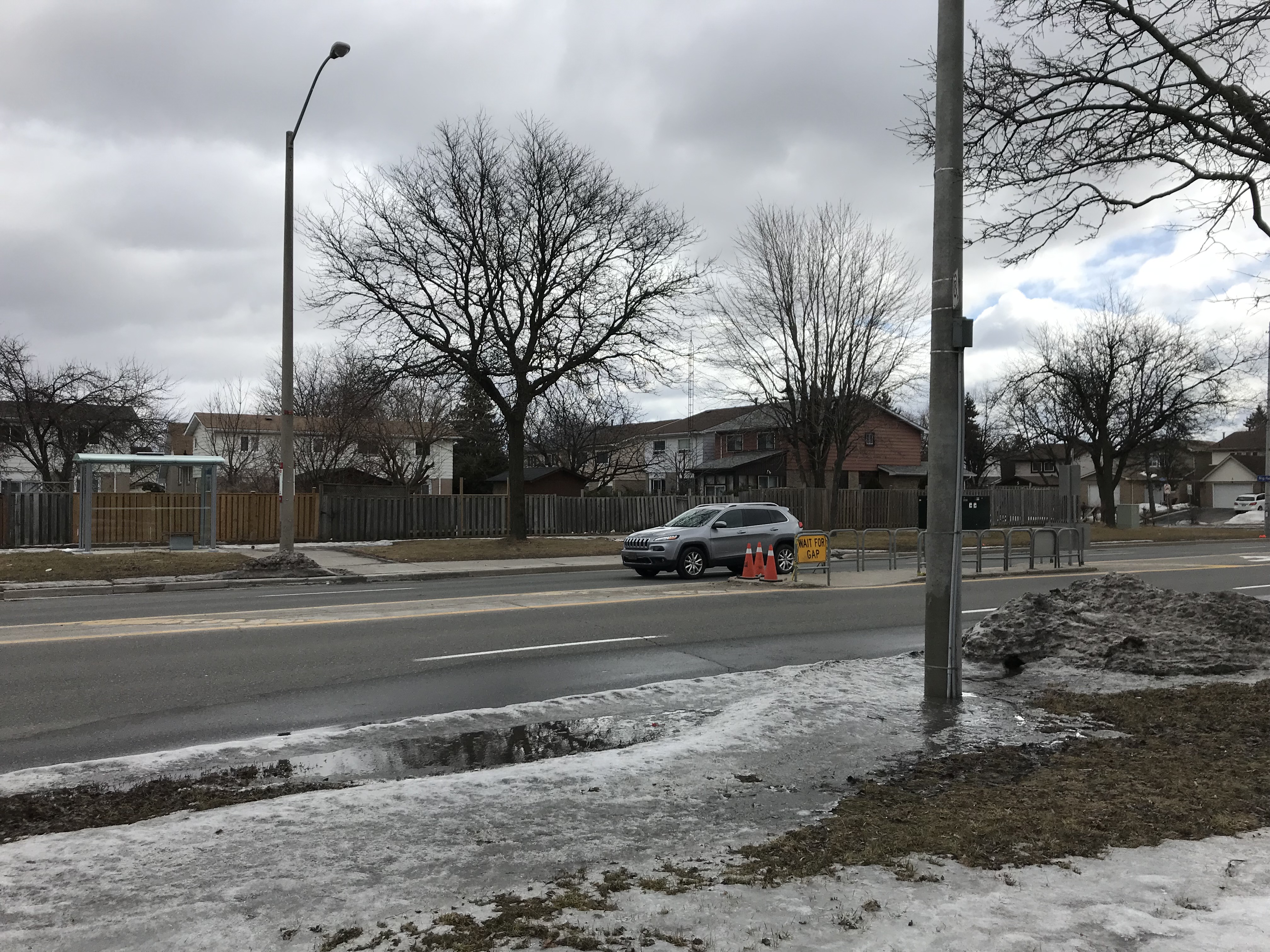
    Walking along McCowan Road between Finch and Steeles earlier this year, my spouse and I encountered a pedestrian refuge smashed in by a motorist. The refuge island was protected by reflective signage, as well as metal barriers, and was installed to help pedestrians cross at a TTC bus stop, though pedestrians are not given the right of way.

    IMG_1644Smashed pedestrian refuge island on McCowan Road
    This is why it was so disappointing to see Councillor Lai organize a “Senior Pedestrian Safety Initiative” with Toronto Police at Woodside Square, a community mall at the corner of McCowan Road and Finch Avenue. Councillor Lai, her staff, and local police were “educating” seniors about pedestrian safety, while giving out reflective armbands. Councillor Lai claimed it was part of the city’s Vision Zero strategy, and she doesn’t “think we should blame anybody.”

    This was just days after a police report showed a severe decline in traffic tickets issued and extremely limited police enforcement of unsafe driving in Toronto. On the Friday before, two seniors were seriously hurt when crossing the street.

    https://twitter.com/cynthiaToronto/status/1198323383538204673

    Needless to say, Councillor Lai and the Toronto Police taken to task by road safety advocates and even fellow councillors. Jessica Spieker of Friends and Families for Safe Streets called it a “form of victim blaming.”

    Supporting Councillor Lai’s position, on Monday November 25, Councillor James Pasternak said “wearing high visibility clothing or reflective gear is a key part of keeping everyone safe, including pedestrians, construction workers, cyclists, police officers and crossing guards. Let’s make VisionZeroTO work.” Councillor Pasternak is Mayor John Tory’s handpicked chair of the Infrastructure and Environment Committee, which among its duties is ensuring the safety of Toronto’s road infrastructure.

    Vision Zero 2.0 says nothing about armbands. Instead, the plan includes reducing speeds, road design improvements, and safer crossings at TTC stops.

    Though it is always a good idea for pedestrians to be aware of their surroundings and be predictable when crossing the street, most of the responsibility falls on the city, which designs the roads, the police, who have abandoned their duty to protect road users, and drivers, who are licensed and insured to operate multi-tonne vehicles. The rash of hit-and-runs after pedestrians were struck is especially alarming.

    In Waterloo, a crossing guard performing her duties was struck and seriously injured by the driver of a F-150 truck, who then fled the scene. This was the despite the school guard wearing a reflective vest, carrying a stop sign, in a marked school crosswalk. No amount of high-visibility clothing will protect pedestrians from dangerous drivers, who in Toronto this year, killed pedestrians walking on sidewalks, and injured pedestrians in transit shelters.

    Ironically, Woodside Square itself was hit twice by drivers in the last two years. In December 2017, a motorist crashed through both sets of doors at the mall entrance closest to Shoppers Drug Mart. In February 2018, a motorist, possibly dealing with medical problems, crashed into several cars and into a Subway restaurant at the mall. High-visibility clothing would not have helped in either of those cases.

    It’s unfortunate that a city councillor will choose giving out reflective armbands over effective speed reductions, road redesign, and traffic enforcement. Hopefully, Councillor Lai will take the criticism to heart and do better for Ward 23.

    Post script: A staff report to the Infrastructure and Environment Committee in October 2019 continued the recommendation for speed reductions in Ward 23, citing minimal impacts to travel times, and the dangerous conditions on Brimley, Markham, and McCowan Roads. Staff noted that there have been 6 fatalities and 20 serious injuries incidents on those three road segments. On October 29, Council voted to lower the speed limits on Brimley, Markham, and McCowan Roads against Councillor Lai’s objections.

  • Addressing the Toronto Police Services Board

    IMG_2922.PNG

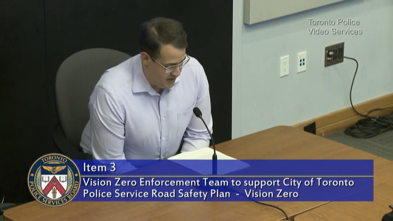
    Earlier today, on behalf of Walk Toronto, I made a deputation to the Toronto Police Services Board addressing the lack of traffic enforcement in the City of Toronto. After criticism from organizations such as Walk Toronto, Cycle Toronto, and Friends and Families for Safe Streets, the Toronto Police now plans to initiate a “Vision Zero enforcement team,” with the city funding the annual $1 million cost.

    As anyone who walks or cycles in the City of Toronto knows, aggressive, distracted, and careless driving is commonplace. They also know that apart from the well-publicized blitz, the Toronto Police Service (TPS) have not responded to the carnage on our streets.

    I spoke to express our disappointment of how the TPS completely failed vulnerable road users by not engaging in meaningful traffic enforcement and calling for a return to making this a priority. Similar deputations were made by John Sewell, former mayor and police critic, Keagan Gartz from Cycle Toronto, and Jessica Spieker from Families and Friends for Safe Streets.

    I found it was a bit intimidating. it was my first formal deputation in a long time, and I sat at a table in front the board, including Chief Mark Saunders and Mayor John Tory. But I did it! Next time I depute, I should find it easier.

    Mayor Tory, to his credit, convinced fellow police board members that the traffic enforcement team be made permanent, and funded from the Toronto police budget, starting in 2020. This motion passed unanimously.

    It is not enough, of course, but it’s an acknowledgement that we desperately needed. Walk Toronto and our partners will continue to push for safer streets.

    Unfortunately, Chief Saunders chose to blame airpods for the epidemic of pedestrian injuries and deaths, ignoring experts and the city’s own data:

    Chief Saunders and the board had the opportunity to ask questions of any member of the public who took the time to craft and make deputations today at Police Headquarters. Regretfully, they chose not to do so.

    Below is the complete text of my deputation to the Toronto Police Services Board. You can watch the whole meeting here (I speak just after the 1:00 mark).

    Vision Zero is an internationally recognized set of road safety tenets that aims to reduce all fatalities and severe injuries in a municipality to zero over the course of a year, while increasing safe, healthy, equitable mobility for all, especially vulnerable road users such as pedestrians.

    Road design, engineering controls and enforcement are all essential pillars for reducing road violence on our streets. Road improvements force vehicle operators to slow down and take notice, while improving the visibility and safety of vulnerable road users, especially pedestrians and cyclists.

    In the meantime, the City of Toronto has focused on reducing speed limits, adding traffic signals, and designating school safety zones and senior safety zones. But this has been more about putting up signs. Signs have no effect If there are no consequences for disobeying them.

    At Walk Toronto, we have noted the lack of police enforcement of safe speeds, red light running, illegal turns, and distracted driving. There may be the occasional well-publicized blitz, but for the most part, motorists in Toronto know that they can get away with risky and dangerous behaviour because the likelihood of being caught is negligible. At best, Toronto’s response to road violence has been reactive, rather than proactive.

    To date, 34 pedestrians were killed on Toronto’s streets in 2019; in 2018, 42 pedestrians were killed. Not just on city streets, but on sidewalks, at bus stops, and even inside a bus shelter. Earlier this year, a home was struck in East York. Meanwhile, police are being deployed downtown not to protect pedestrians, but to ensure traffic isn’t impeded at busy intersections during rush hours.

    We were outraged – but not shocked – by a recent Toronto Star report that found that the number of traffic tickets issued dropped from 700,000 in 2010 to just 200,000 in 2018, and that there are no officers assigned to full-duty local traffic enforcement. This is despite a growing city, an ageing population, and enhanced provincial penalties for distracted, reckless, and impaired driving introduced over the last few years.

    The Toronto Police Service has failed the city’s most vulnerable road users.

    Though red-light cameras, photo radar, and automated school bus “stop” signs are useful tools, there is no substitute for old-fashioned police enforcement. Additional new dedicated officers are a good step in recognizing this failure, as long as enforcement does not target indigenous, racialized, and other communities that are already disproportionately affected by policing. In the end, we need both better designed streets and a renewed direction that the Toronto Police Service will have no tolerance for unsafe driving in Toronto.

    Thank you.

  • A review of GO Transit’s fare structure

    IMG_8969-001

    Four years ago, I wrote about GO Transit’s problematic fare structure. Though GO Transit claims to charge passengers based upon a fare-by-distance structure, fares for travelling short distances were disproportionately high compared to long-distance rides from outer suburban stations. In 2015, I also found significant fare differences between corridors, with Kitchener Line passengers paying the most per distance traveled.

    Since my original post, some changes were made to the GO Transit fare system:

    • In 2016, a tiered fare increase was applied, with the lowest fares frozen (for example, Union Station to Mimico, Bloor, or Danforth), with fare increases between  40 and 60 cents per ride dependent on distance traveled. Those fare increases applied to Presto fares, though with a discount (11.15% less than the cash fare).
    • In January 2018, a $1.50 fare discount was introduced for Presto card users transferring between TTC and GO. However, the Ford government announced it would no longer subsidize the TTC-GO fare discount, threatening its continuation.
    • In April 2019, GO fares for trips less than 10 kilometres were reduced, with the minimum cash fare going from $5.30 to $4.40, with the minimum Presto fares reduced from $4.71 to $3.70. A passenger headed from Union Station to Exhibition Place could choose to take a local TTC streetcar fare ($3.10 with a Presto Card) or the direct GO train ride (just 60 cents more). At the same time, the cash fares for trips longer than 10 kilometres were increased by 4%, while Presto fares were increased by 3%. 

    The good news is the eventual reduction of short-distance fares have gone a long way towards flattening the fare/distance curve.

    There were also some major service changes over the last four years. Two new GO stations were opened: Downsview Park (which offers a direct connection to the new TTC subway extension to York University and Vaughan), and Gormley, a station built next to Highway 404 on the Oak Ridges Moraine. Additional trains were added to Kitchener, new peak-period trains to and from Niagara Falls were introduced, evening trains added on the Kitchener Line, and this month, weekend trains were introduced on the Stouffville Line. But connecting bus routes to Cambridge, Bolton, and between Milton and Oakville were eliminated, with other bus trips cancelled across the system. (more…)

  • Let’s rock out for Vision Zero

    IMG_4345.JPG
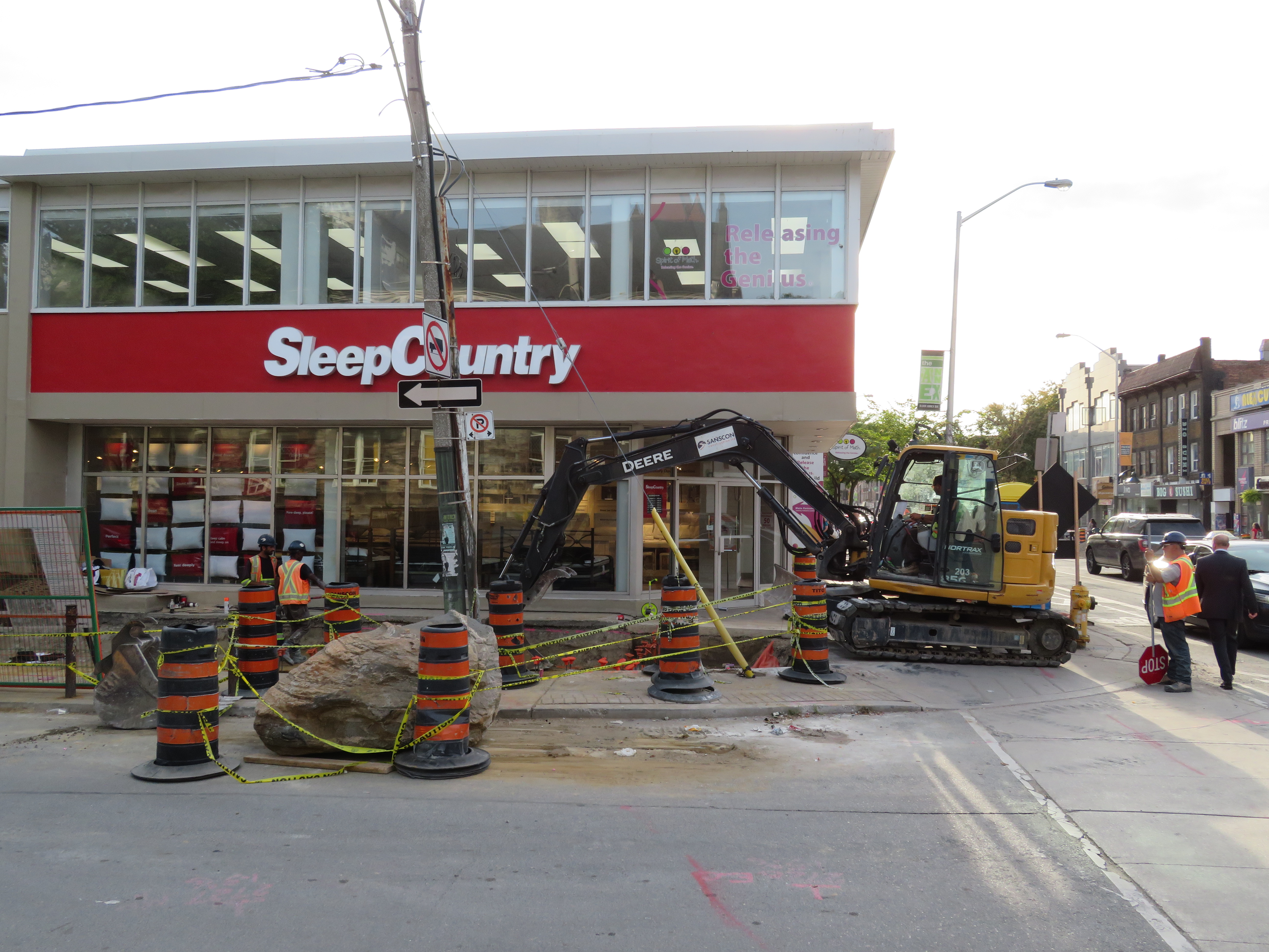
    The Major Street Boulder

    On September 18, Toronto Star columnist Jack “The Fixer” Lakey wrote about a boulder that was dug up during construction in the Annex. Bloor Street is currently being dug up between Bathurst Street and Spadina Avenue as the city replaces watermains and reconstructs the roadway. New parkettes at Major Street and Howland Street are also part of the work. As this is going on, bike lanes and parking spaces have been removed, and traffic is rerouted to one side of Bloor Street.

    The billion-year old boulder (its age is unremarkable; the Canadian Shield is older than that) will be incorporated into a nearby parkette. For now, it sits on the side of Major Street immediately south of Bloor. When I visited Thursday evening, the boulder was moved slightly south by a construction crew that was working on the parkette.

    Major Street, despite its grand name, is a minor residential road that leads one-way south from Bloor towards Sussex Street. It is part of a one-way maze of local streets intended to discourage through traffic and permit on-street parking (while frustrating cyclists looking to cut through quiet local streets instead of taking Bathurst or Spadina).

    Lakey was informed about the Major Street boulder by a motorist complaining of turning right onto Major from Bloor and scraping the passenger side as she passed the boulder. She said she couldn’t see the rock because it was below the height of her windows, though there were pylons adjacent to the rock. Lakey visited the site and found two pylons next to the boulder. The city’s response was to ensure that pylons be secured to the rock with caution tape, and to block it off if necessary, as it can not easily be moved.

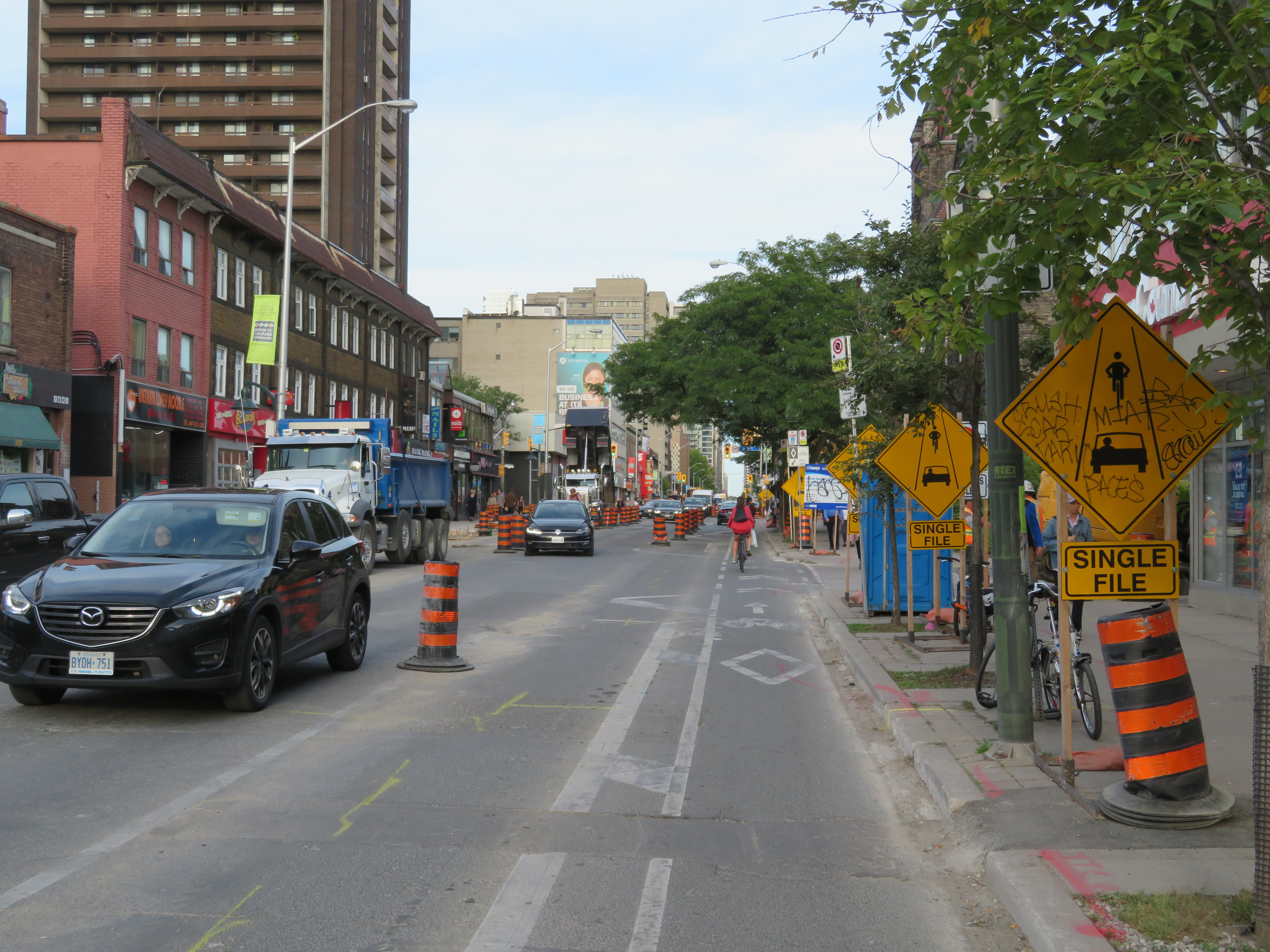
    IMG_4347-001Bloor Street is a mess of construction and signage as construction continues through September

    Though the city was right to improve the visibility of the boulder, placed in a spot where it wouldn’t be expected, I can’t say I have too much sympathy for drivers who miss it and scratch their cars. Bloor Street is a mess, but it is an active construction site. The bike lanes have been closed off, with cyclists expected to travel with traffic, single file with motor vehicles. The lane configuration has changed, and pedestrians must navigate the construction clutter, signs, and fencing on sidewalks and crosswalks. Such an environment calls for slow and considerate driving.

    The motorist quoted in Lakey’s column said that she could not see the 80-centimetre tall boulder as it was below her line of sight. Other things that might be below a driver’s line of sight at close proximity include pylons, knock-down posts, mailboxes, garbage bins, dogs, cats, recumbent bicycles, strollers, small children, wheelchairs, and other mobility devices. As the average vehicle size has become larger (with Ford and General Motors phasing out sedans in favour of SUVs and light trucks), the line of sight has become higher as well.

    But this gives me an idea that can balance the City of Toronto’s supposed commitment to Vision Zero with the mayor’s desire to keep property taxes too low to pay for the implementation of true Vision Zero across the city. Just add rocks. Lots and lots of rocks.

    Boulders can take a pounding, unlike plastic knock-down poles that motorists can just drive over to get into a cycle track. They can be used to narrow wide residential streets at strategic points and discourage fast turns at intersections. Of course, they can be marked with metal reflective signs, but they’d be cheap to install and very effective.

    Boulders are easy and cheap to source with of all the construction going on in Toronto, with foundations being dug for high rise offices and apartment buildings. But if we’re stuck, we can source rocks from Northern Ontario, where the Canadian Shield is blasted away for resource extraction and the twinning of Highway 69.

    Vision Zero on a zero-vision budget.

  • A departure from TTC wayfinding improvements

    IMG_3566-001.JPG
    TTC stops have improved with the addition of route numbers, but this bus stop is deceiving 

    In the last few years, the TTC has made significant improvements in its maps, signage, and wayfinding standards. It also introduced new streetcar and subway fleets, retrofitted elevators into older stations (all but one streetcar line and a majority of subway stations are now fully accessible), and opened a new subway extension. Though overcrowding, bunching, and weekend closures continue to be aggravations, it is important to recognize where the TTC has improved.

    Specific changes to TTC wayfinding include a new simplified system map, better signage at subway stations, introducing standard signage for diversions, scheduled closures and construction notifications, and revising the classic TTC bus stop.

    However, two recent changes represent an unfortunate departure from these improvements. (more…)

  • How TIFF lost the plot

    IMG_4193-001.JPG504 King Streetcar diverting onto Spadina on Thursday, September 5

    For the sixth year in a row, King Street between University and Spadina Avenues was closed for four straight days. This closure was for the Toronto International Film Festival (TIFF) “Festival Street,” which took place between Thursday September 5 and Sunday September 8. In addition, King Street was closed during the afternoon rush hours the following Monday and Tuesday for “Red Carpet Events.”

    TIFF has been recognized among the world’s most important film festivals, and one where the public has the opportunity to take part (albeit at increasingly inaccessible prices for many screenings). It offers tremendous economic and cultural value to Toronto. It compliments and helps to support many other annual film festivals, such as Hot Docs and Inside Out.

    But TIFF’s clout and influence has also led to entitlement, with “Festival Street” being the most disruptive result. While King Street is closed off to traffic during the film festival, it has severe effects for the 84,000 daily riders of the 504 King Street, as well as riders on the busy 501 Queen and 510 Spadina cars.

    IMG_4191-001.JPG
    501 Queen and 504 King Streetcars stuck in traffic westbound at Queen and Spadina

    Several major TIFF screening locations are located on or near King Street West, including Roy Thomson Hall, the Princess of Wales Theatre, the TIFF Bell Lightbox, and two blocks north, the Scotiabank Cinemas. Industry parties and galas are held at nearby hotels and restaurants. It’s natural that King Street would be a hub of activity for the film festival. But it is also the third busiest transit route in Toronto, after the Yonge-University and Bloor-Danforth subways.

    The King Street Pilot, which began in late 2017, prohibits through motor vehicle traffic on King Street between Jarvis and Bathurst Streets through the downtown core, though all vehicles are permitted to use King Street for short segments. Despite spotty enforcement, the pilot project allowed the TTC to operate much more reliably through the busy corridor, with an increase of capacity and ridership. In early 2017, daily ridership on the 504 King was 72,000. By March 2018, it grew to 84,000. In April, council voted to make the pilot permanent. This will allow for streetscape improvements along the corridor and wider sidewalks, with improved physical measures to further restrict through traffic.

    A lot of political capital went into making King Street work better, so it is disappointing to see all that advocacy for a proper transit corridor go to waste while TIFF is in town. Torontonians are promised each year would be the last year streetcar service would be wrecked for TIFF, but every mid-August, we find out otherwise.  (more…)