Over the past few years, I have been involved with the YongeTOmorrow project on behalf of Walk Toronto. It has been a very interesting and worthwhile experience being part of a stakeholder advisory group. Allied organizations working towards a more exciting and sustainable Yonge Street include Cycle Toronto, 8 80 Cities, and the David Suzuki Foundation.
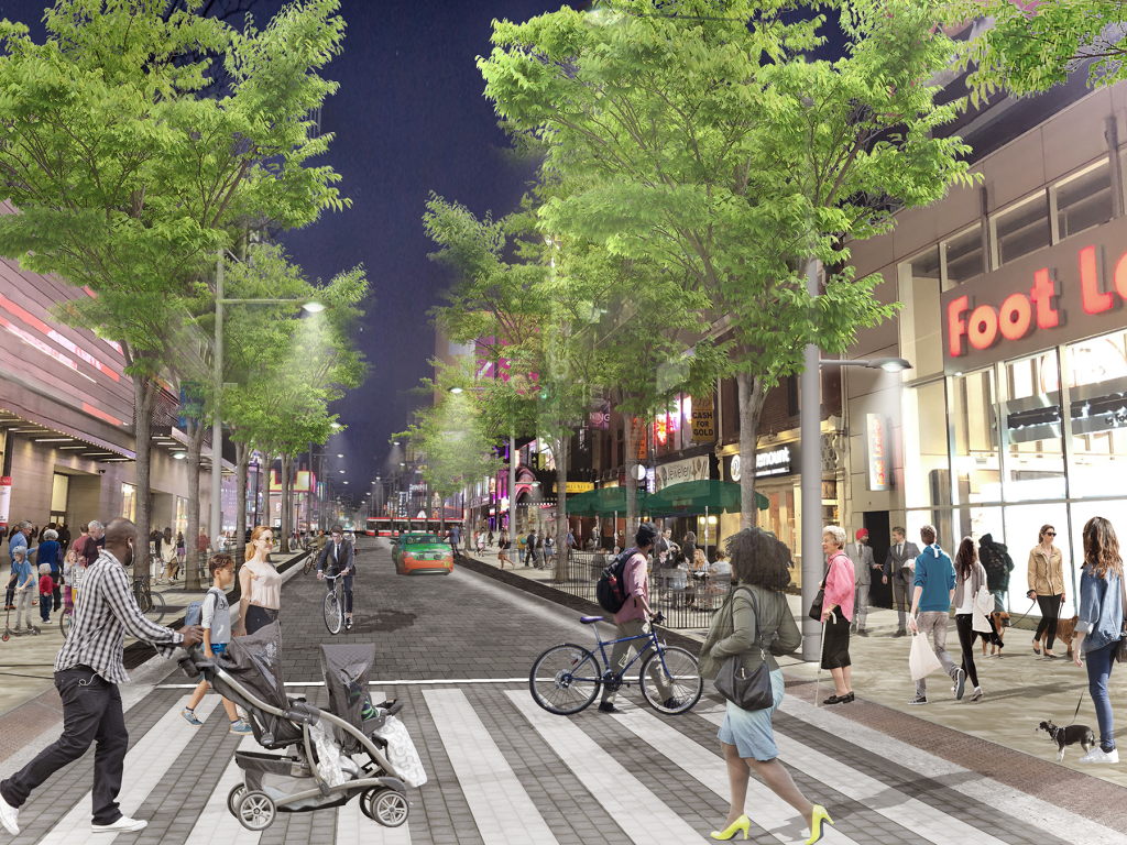
Rendering of proposed changes to Yonge Street , looking north towards Dundas Square. In this section, northbound traffic is permitted, with two-way cycling, and much wider sidewalks, along with new trees and improved street furniture.
Though the selected concept is not perfect, the proposed changes will provide significant improvements to Yonge Street between Queen and College Streets. These include wider sidewalks, patio space, bike facilities, and a pedestrianized zone between Dundas Square and Edward Street, allowing for better circulation, more flexibility for special events, and a more pleasant street.
With more high-rise development on the way (including the redevelopment of the Chelsea Hotel on Gerrard Street), it is only right that more space be given to residents, students, employees, and visitors. Compromises in the plan allow for access to parking garages, permit taxi and other vehicle drop-offs and pick-ups, as well as business deliveries.
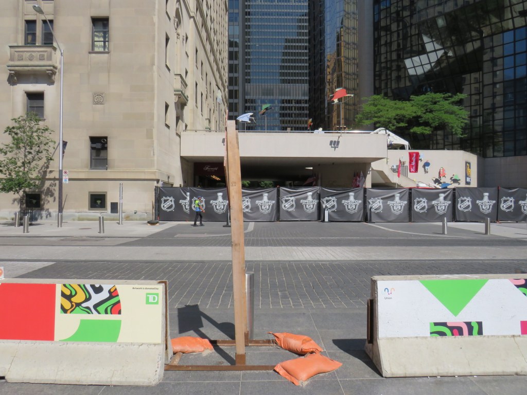
Over two years later, concrete Jersey barriers continue to disrupt pedestrians in front of Union Station
A year ago, I wrote about the unsightly Jersey barriers that were plopped down in front of Toronto’s Union Station in April 2018, creating bottlenecks at two of Toronto’s busiest pedestrian intersections. Though the city promised improvements in 2018and in 2019, the only changes were the application of decals to the existing Jersey barriers.
Though the front of Union Station looks slightly better, and the bottlenecks have been lessened by the ongoing COVID-19 pandemic, this is not a satisfactory solution, especially for Toronto’s busiest and most important transportation hub.
The Jersey barriers were hastily plopped down on Front Street after the April 23, 2018 van attack, where one man steered a rented cargo van onto busy sidewalks in North York, killing 10 and injuring 16 more before he was apprehended by police. As an iconic and crowded pedestrian area, it was felt that special protection was necessary. At the time, the assumption was that the van attack was an act of terrorism, requiring such drastic measures. (It was soon found the motives were not terrorist related.)
In 2018, city councillor John Campbell likened the front of Union Station to “a war zone” while a city spokesperson said that a broader security plan was “in the works,” including for protecting the station has been in the works for some time, including interim measures that would fit into the streetscape.
In March 2019, nearly a year after Jersey barriers were added, the Toronto Star’s Jack Lakey dismissed complaints about their awkwardness and appearance, calling them “effective in stopping a driver bent on another deadly attack.” However, Lakey noted that another city spokesperson said that “city is finalizing the design of permanent vehicle barriers around Union Station”, that would “be smaller, more aesthetically pleasing and easier to navigate for pedestrians.” Those barriers would be installed later in 2019.
Afternoon rush hour crowds navigate around the Jersey barriers at Front and Bay Streets, August 2019
It is now August 2020, and the concrete barriers are still there, creating a mess for anyone using a wheeled mobility device, or for anyone in a hurry.
Bay and Front Streets, August 2020
The only thing that has changed are new artistic vinyl stickers covering the bare concrete, with messages saying that “artwork is donated by TD [Bank].”
TD is the “premier sponsor and exclusive financial services partner” of Union Station, most of which is owned and operated by the City of Toronto. (Some sections used by GO Transit are owned by Metrolinx.) TD enjoys exclusive branding rights, ATM locations, and sponsors Union Station’s wifi and charging stations.
“Artwork is donated by TD”
Perhaps TD was embarrassed by the Jersey barriers (after all, it has its headquarters just up Bay Street). Or perhaps the city decided that something needed to happen here., after two years of unfilled promises.
While examining the barriers, I noticed construction signage wedged within the gaps, creating a trip hazard. I also saw the original metal bollards installed when Front Street was rebuilt for a more pedestrian-friendly streetscape in 2014-2015.
Construction signage creates a trip hazard in the gaps between Jersey barriers. Note the original metal bollard behind.
Though the inconvenience caused by the lingering “temporary” concrete barriers has been lessened as there are fewer pedestrians entering and leaving Union Station right now, it also makes it a good time to finally make the necessary renovations by installing permanent sturdy bollards.
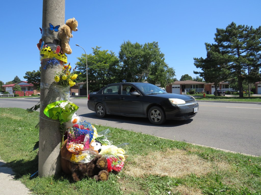
Roadside memorial to a three year old boy at The East Mall and Montebello Gardens, near Burnhamthorpe Road, Etobicoke
On Tuesday, August 11, just after 11AM, a father and his two children were attempting to cross The East Mall north of Burnhamthorpe Road. They were crossing from the west side of the minor arterial street, where there is the main entrance to a long term care home, to the corner of Montebello Gardens, a short residential street on the east side.
As the three pedestrians were crossing, an 81-year-old woman driving a black SUV turned left from Montebello Gardens to go south on The East Mall, crashing directly into the family.
All three pedestrians were rushed to hospital. A three-year-old boy was soon pronounced dead, while a seven-year-old girl was taken to a trauma centre. The driver remained on scene. It is not certain if charges will be laid.
The three-year-old’s death came only a day after the Toronto Star’s Ben Spurr reported that 2020 has been the safest year for pedestrians and cyclists since at least 2007. There were 63 collisions resulting in serious injury or death in the period from January 1 through July 1, down from an average of 99. The decline can be explained by considerably reduced traffic since COVID-19 lockdowns began in mid March, and by fewer pedestrians on city streets.
As traffic picks up with the loosening of restrictions and as people go out for strolls and exercise for physical and mental health, the need for improved road safety and a commitment for real Vision Zero implementation, especially in Toronto’s suburbs, remains crucial. The area near where the young boy was killed last week just shows how much further we need to go.
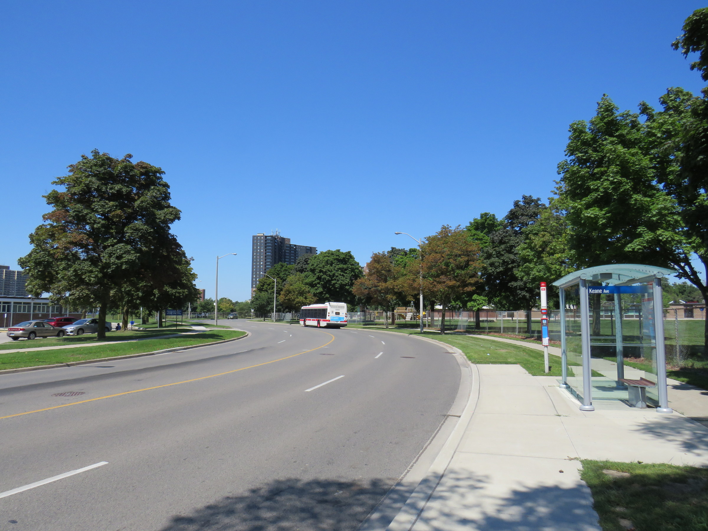
TTC bus stop on The East Mall, north of Keene Avenue
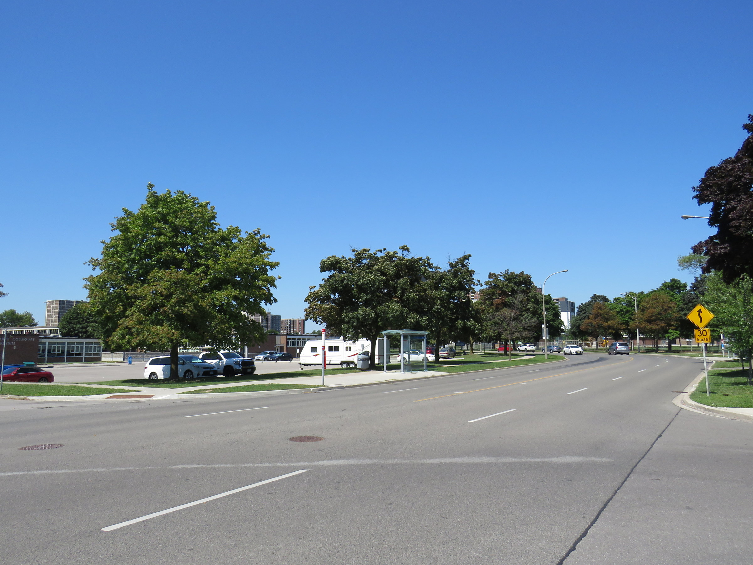
I visited The East Mall on a sunny Friday afternoon. I took the 111 East Mall bus from Kipling Station to Keane Avenue, the first stop north of Burnhamthorpe Road. The bus stop has a nice, clean shelter and a large concrete pad, but no where safe to cross the street. On the other side, there is a southbound stop for buses heading towards Cloverdale Mall and the subway, and Burnhamthorpe Collegiate Institute, a high school specializing in programs for mature students and adult learners.
The intersection of The East Mall and Keene Avenue, looking north. Burnhamthorpe CI is behind the southbound bus stop A sign warns drivers of a winding road, with an advisory speed of 30 km/h.
A signalized pedestrian crossover exists further north, in front of West Glen Junior Public School, but the next TTC stop, at Capri Road, is at yet another unsignalized intersection. The distance between Burnhamthorpe Road to the south, and the pedestrian crossover is over 550 metres, and neither designated crossing is visible from Keene Avenue nor Montebello Gardens due to the winding nature of The East Mall.
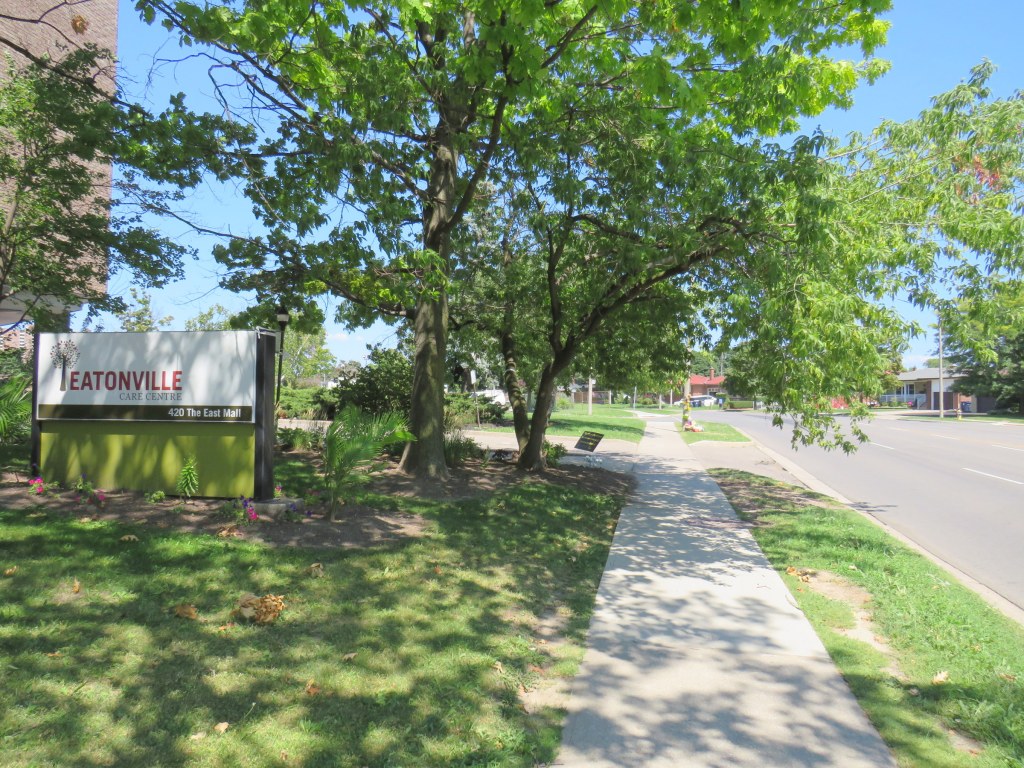
This part of Toronto has seen plenty of tragedy this year. The Eatonville Care Centre was one of several long term care homes where the Canadian Armed Forces were deployed due to deadly outbreaks of COVID-19 amidst poor working and sanitary conditions documented by CAF medical staff. Forty-two residents died during that outbreak.
Eatonville Care Centre, with the roadside memorial in the background
The presence of a long term care home, a library branch at the southeast corner of The East Mall and Burnhamthorpe Road, two nearby schools, and a large Loblaws supermarket and pharmacy on the southwest corner should have made this area a priority for improved, safer road infrastructure. Speeds along The East Mall are much higher than the posted 40 km/h limit, while the winding, roadway limits both drivers’ and pedestrians’ fields of vision. There should be no excuse for such long distances between safe pedestrian crossings, especially with the vulnerable populations living in this area.
Though the driver who killed the three-year-old boy was carelessly turning from a side street, and not speeding along The East Mall, another tragedy is inevitable without significant changes. Meanwhile, The East Mall is similarly laid out south of Burnhamthorpe, where there are older rental towers and townhomes and new condominium towers going in, yet nothing is done to calm traffic along a winding, busy street.
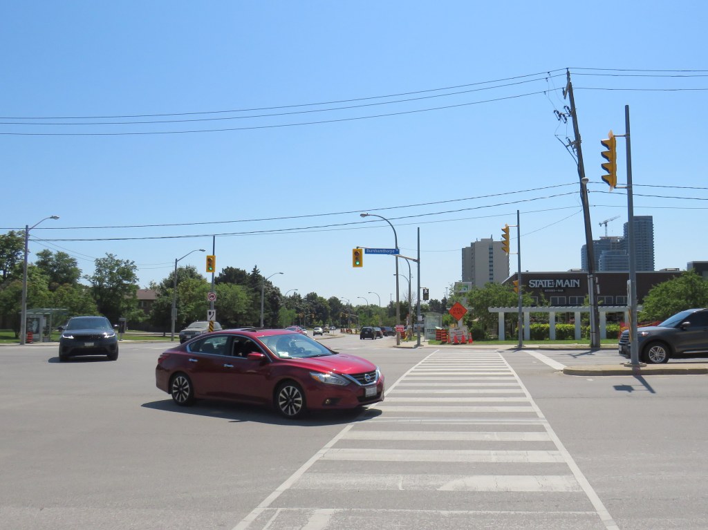
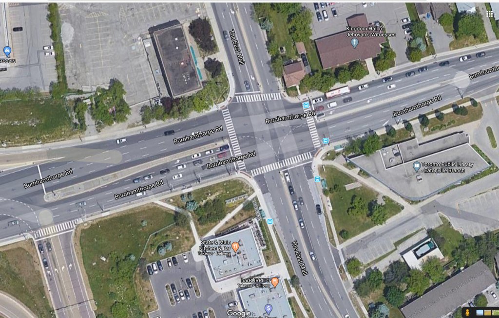
Though the intersection of The East Mall and Burnhamthorpe Road is signalized, it is also a dangerous intersection to cross. Burnhampthorpe Road widens to four westbound lanes leading towards Highway 427, while wide turning radii make it easy for motorists to turn right at all four corners. Drivers, rushing on and off Highway 427 take little notice or care for pedestrians, as I experienced trying to cross the street.
An Uber/Lyft driver in a red Nissan sedan and a Land Rover SUV driver turn left from The East Mall to Burnhamthorpe Road towards Highway 427 after the advance green signal disappears and the walk signal turns on, with me starting my crossing
While motorists are treated to generous geometries and easy turns, pedestrians are only an afterthought, despite the library, supermarket, offices, and several bus stops used by TTC and Mississauga bus routes. Meanwhile, a new townhouse complex on the northwest corner will add even more pedestrians to this area.
The intersection of Burnhamthorpe and The East Mall encourages high speeds, with pedestrians only an afterthought
This week, I appeared on two podcasts, talking about municipal open data, crowdsourced mapping projects, and Brampton’s success in building suburban transit ridership.
For Spacing Radio’s Future Fix series, I spoke about a recent Walk Toronto initiative to map sidewalk pinch points during the early days of the COVID-19 pandemic. We used Google Maps to pinpoint specific locations where queues to enter grocery stores, pharmacies, and other essential businesses and services made physical distancing difficult or impossible.
Through Walk Toronto’s social media accounts, we asked Torontonians where these locations were, then submitted a list to city staff and public health officials. Not long afterwards, CurbTO was announced to address this specific problem, the first of several initiatives that recognized the need to get outside.
Also on the podcast are Shabnem Afzal, road safety manager for Surrey, British Columbia, speaking about that city’s Vision Zero plan, and Halifax City Councillor Waye Mason, who spoke about that city’s interactive map that allows its citizens identify spots where safe street interventions are needed.
Just before the pandemic hit, I spoke with Helen Lee and Vincent Puhakka of the new podcast The Next Stop about Brampton Transit’s success, and the implications for other suburban transit agencies. Also on the podcast are Brampton Transit General Manager Alex Milojevic and Mayor Patrick Brown.
I hope you have a listen to each of these podcasts, and consider subscribing.
Kingston Road is one of Toronto’s oldest and most important thoroughfares. Sections of the road were first laid out by Asa Danforth in 1799, though a straighter, more direct route was established by the early 1800s. By the 1830s, it was a busy stagecoach route, connecting Toronto with Cobourg, Belleville, and Kingston.
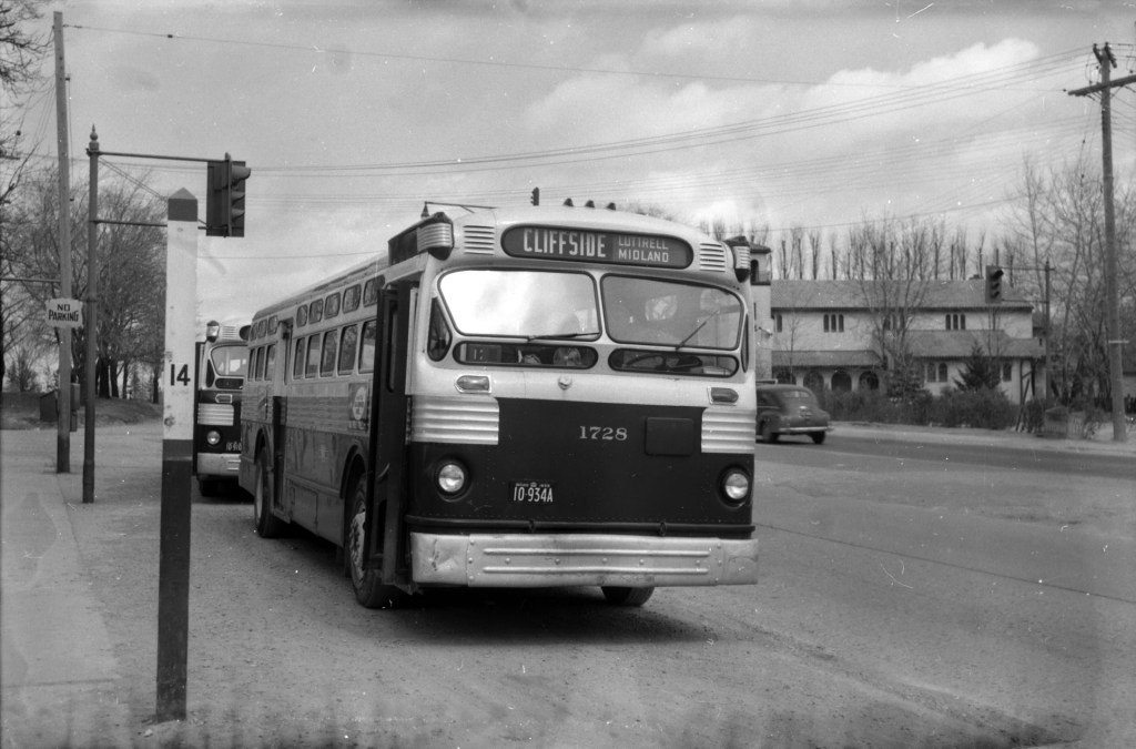
As Toronto grew into a major city, Kingston Road was an obvious route for a radial railway line serving Scarborough Township; by 1906, radial cars extended as far east as West Hill, near Morningside Avenue. The radial line’s stops were numbered from the beginning of the line, first at Queen Street and Kingston Road, then at Kingston and Victoria Park Avenue after the TTC took over city operations.
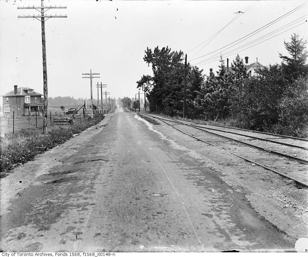
Kingston Road, east of Bellamy Road, 1918: a rural scene. This siding, Mason’s Switch, was Stop 22. The house on the far left of the photograph still stands at the corner of Kingston and Mason Roads. From Toronto Archives, Fonds 1568, Item 148.
Stop 0 was at the city limits at Victoria Park (with connections to TTC streetcars). Stop 14 was Halfway House at Midland Avenue. Stop 26 was the Scarborough Post Office, near today’s Scarborough Golf Club Road, and Stop 35 was the end of the line, at West Hill.
With increasing automobile ownership and new intercity bus lines in the 1920s, Kingston Road was busier than ever, becoming part of the new provincial highway system, but ridership on the radials declined, especially after the TTC extended city streetcars east to Birchmount Avenue in 1928, leaving behind a mostly-rural service. Radial service was cut back to Stop 26 in 1931, and completely replaced by buses in 1936 (the 86 Scarborough bus route is the modern legacy).
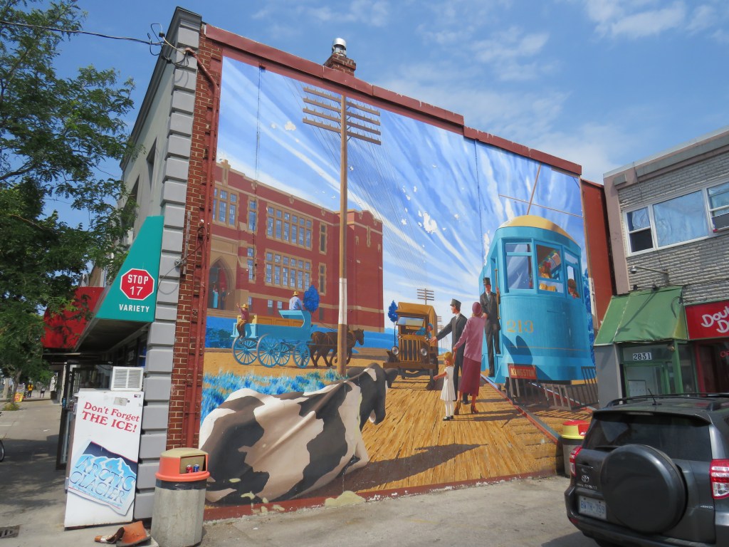
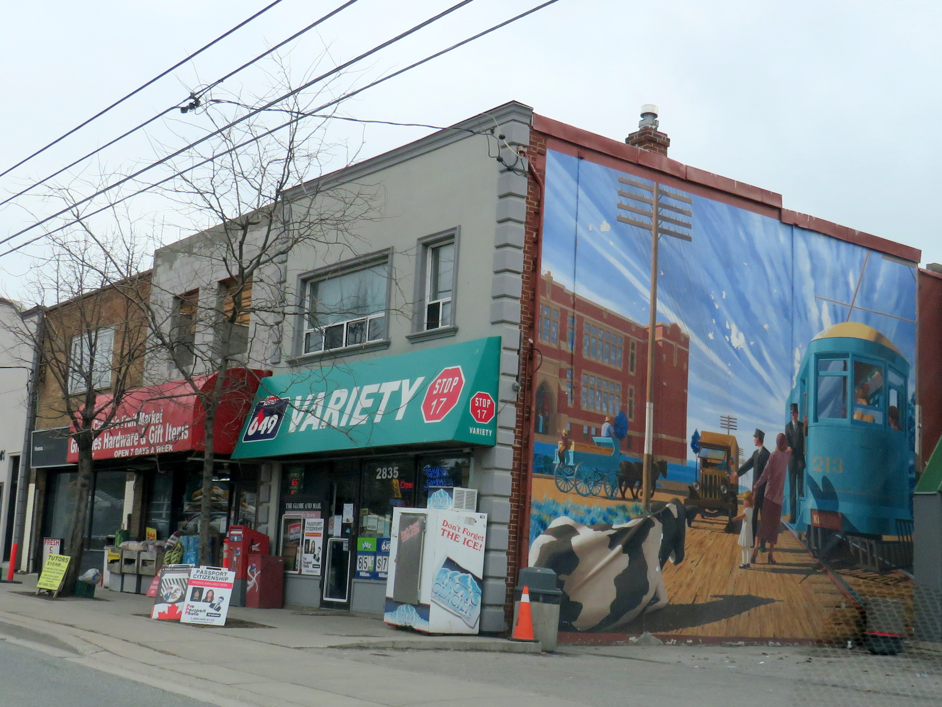
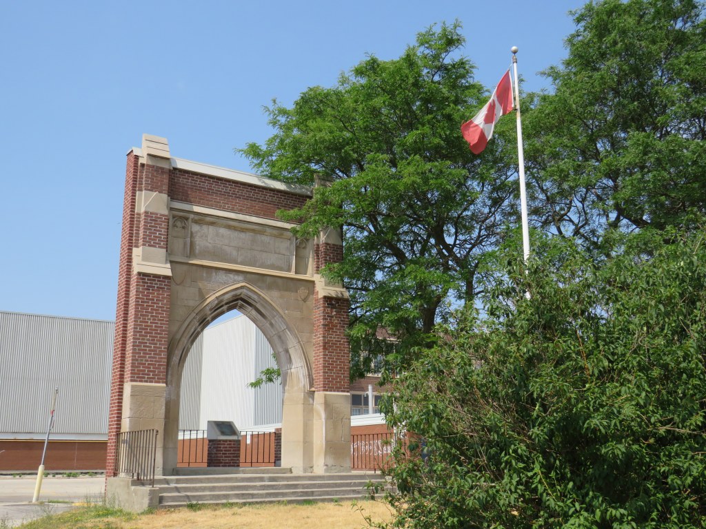
Despite the switch to buses, the stop numbers carried on for many years, listed in TTC timetables through the 1950s. Locals would often refer to stop numbers instead of street intersections. Stop 17, at Kingston Road and St. Clair Avenue East, is one example that has lingered on. A mural on the side of Stop 17 variety depicts a green radial car in front of the Scarborough High School), with a cow blocking the way of a truck looking to pass.
Mural at Stop 17 Variety
Scarborough High School, on the opposite corner of the variety store, was built in 1922, expanded several times, and later renamed R. H. King Academy. The original building was torn down in 1976, but the entrance way, depicted in the mural, was retained.
Arched entrance way to the demolished original section of Scarborough High School
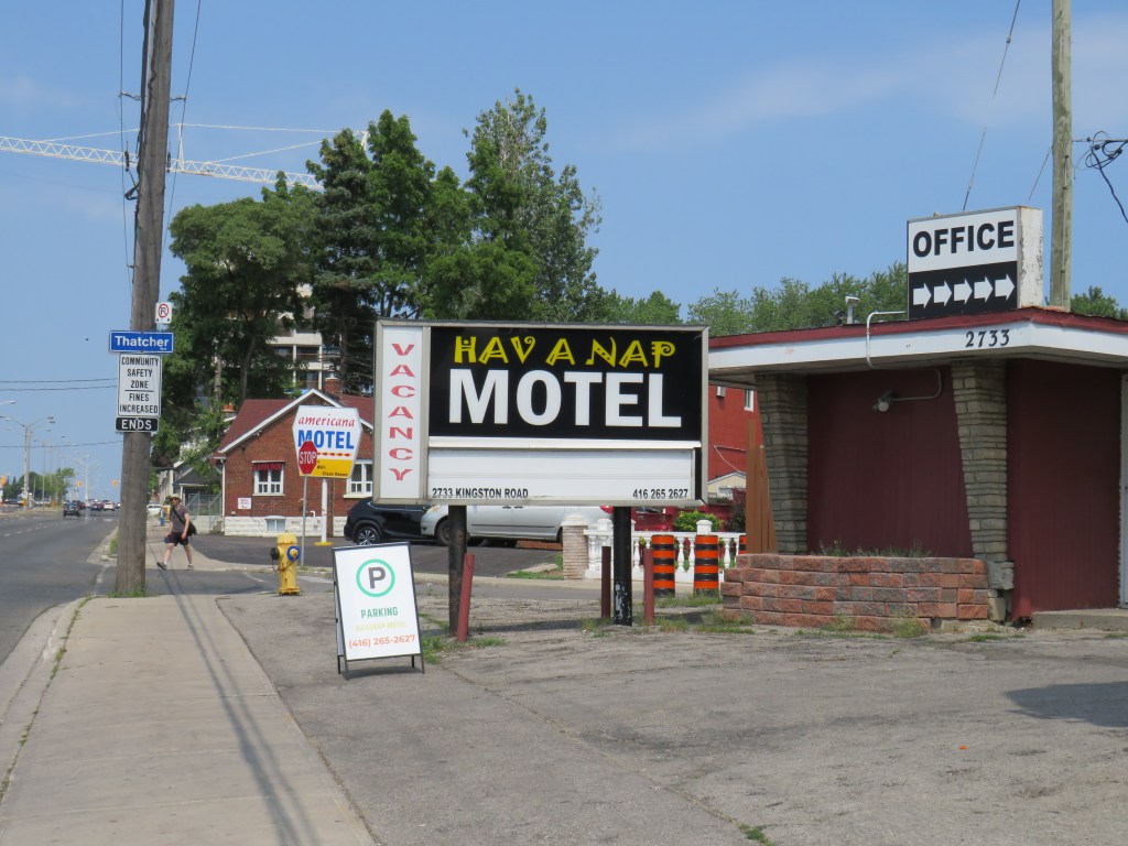
Nearby, towards Brimley Road, several older motels date from the motoring era, when Highway 2 was the main route into the city. Though Highway 401 drew some of the traffic away in the 1950s, it wasn’t until the completion of the Don Valley Parkway (which provided a direct route downtown) and the rise of chain hotels saw a decline in independent motels along Kingston Road and Lake Shore Boulevard. Some have been repurposed as shelters, while others, like the Hav-A-Nap, diversified by offering paid parking for nearby Bluffers Park.
Hav-a-Nap Motel, with the Americana Hotel just behind
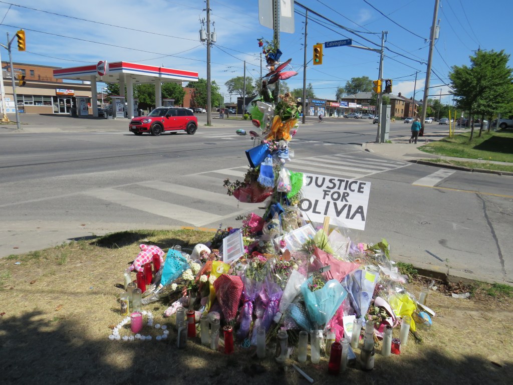
On Sunday, June 7, Olivia and Julia Sarracini were crossing Calvington Drive at Keele Street. It was 12:15 in the morning. The walk sign turned on, and the two sisters, aged 17 and 19, entered the crosswalk, walking north. Behind them, the driver of a black SUV waited for southbound traffic to clear the intersection before turning left, directly into the two young women, who were already halfway across the intersection.
Julia suffered leg injuries and was sent to hospital. Olivia, who was just finishing Grade 12, was pronounced dead at the scene. The driver of the SUV did not stop, but fled westbound on Calvington Drive.
Two days later, Toronto Police arrested 46-year-old Shawn Ramsey. He was charged with two criminal offences: fail to stop at the scene of an accident causing death and fail to stop at the scene of an accident causing bodily harm.
The driver was definitely at fault for striking the two women, who were walking with the right of way and all due care necessary. But it remains quite possible that if the motorist remained at the scene that night might only be facing minor Highway Traffic Act charges. (Without a vulnerable road users’ law, justice for pedestrians and cyclists injured or killed on Ontario’s streets is terribly inadequate.) Yet road design and a poor transportation network in Toronto’s inner suburbs played a significant role here.
Memorial for Olivia Sarracini
This section of Keele Street provides a link between Highway 401 and Humber River Regional Hospital to the south, and Finch Avenue, York University, and several industrial areas to the north. Downsview Park is just to the north of Calvington Avenue, and along with the large parkspace, new residential development is well underway, with more planned.
The area around Keele and Calvington was developed in the 1950s and 1960s, though visages of the old village of Downsview can be found close by, towards Wilson Avenue to the south. Between Wilson and Sheppard, Keele Street is five lanes wide, with a centre left-turn lane. Traffic is heavy throughout the day and evening, with many trucks headed to and from industrial lands and nearby construction sites. Even in heavy traffic, motorists regularly exceed the 50 km/h speed limit.
Pedestrians are provided only with narrow sidewalks, close to the road. These sidewalks are not separated from strip plaza parking spaces. Despite a major hospital, nearby elementary and secondary schools, a library, Downsview Park, and urban intensification taking place in the area, there are no cycling facilities. Cyclists, therefore, usually take the sidewalk. While cyclists avoid heavy traffic on Keele’s narrow lanes, they infringe on the little bit of space given to pedestrians.
Strip plaza across Keele Street from Calvington Avenue
Calvington runs west from Keele, with a strip plaza and gas station on the east side of the intersection. Though most traffic off Calvington turns south, pedestrians are prohibited from crossing at the north side, lest they slow down left-turning motorists off of Calvington. Furthermore, an advance left turn signal gives priority to northbound motorists turning on to Calvington from Keele, though the advance signal is only triggered by a queue of several left-turning vehicles.
Though neither the advance signal nor the crossing restriction were factors in the collision on June 7, they are just further reminders of who the streetscape was designed for.
Pedestrians are prohibited from crossing at the north side of the Keele and Calvington intersection. Note the sidewalk cyclist, likely headed to nearby Downsview Park.
Soon after Olivia Sarracini’s death, Councillor James Pasternak moved to request a traffic safety review of the Keele and Calvington intersection at the June 16 meeting of North York Community Council. Pasternak suggested that street lighting, traffic signal synchronization, traffic signage, and “the feasibility of installing advance green traffic lights” be included in the review.
The trouble with that motion is that it too narrow. There are dozens of similar intersections in Toronto’s post-war suburbs. The intersection already has an advance green traffic signal. I would suggest that a review of the whole district is necessary in the the context of new and upcoming urban development, poor access to Downsview Park from the south and west, and inadequate and unsafe active transportation infrastructure. Nearby Highway 401 and the GO Transit Barrie Line both create significant barriers to pedestrians and cyclists in the area.
Olivia Sarracini was killed and Julia Sarracini was injured by a dangerous and callous driver who did not have the humanity to stay and offer assistance and take responsibility. This tragedy shouldn’t warrant a narrow safety review. Without changing the built environment, tragedies like these will continue.
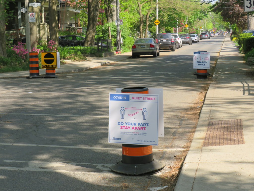
Pylons and Quiet Street signage left in the gutter, Crawford Street, Toronto
Toronto took its time recognizing the need for pedestrian space during the ongoing COVID-19 pandemic. It wasn’t until late April that the mayor and the medical officer of health considered limited curb lane closures to accommodate crowded sidewalks in front of supermarkets, drug stores, and other essential businesses.
But those curb lane closures — called CurbTO — later expanded to ActiveTO, which includes hundreds of kilometres of “Quiet Streets” for pedestrians and cyclusts and regular weekend road closures on Lake Shore Boulevard and Bayview Avenue. By June, CurbTO and ActiveTO were joined by CafeTO — which would expedite restaurant patio licences and even allow temporary patio space in parking lanes — as well as CampTO and SwimTO, programs to safely open up public pools and day camps for the summer.
Most significantly, new cycle tracks and bike were approved by a wide margin at Council in May, including the entire stretch of Bloor-Danforth between Runnymede Road and Dawes Road.
Map of ActiveTO Quiet Streets, weekend closures, and new cycling routes
Through the weekend road closures are closed off with metal barriers and enforced by police, the Quiet Streets are protected only by pylons and temporary signage. On Shaughnessy Boulevard, one of the first Quiet Street implementations, pylons were removed by angry motorists. Elsewhere, residents rearranged pylons to block half the street, doing more to discourage through traffic.
In Kensington Market, pylons were moved by drivers onto the sidewalk, creating additional barriers to pedestrians, especially those with disabilities.
Kensington Market, where many of the share-the-road pylons have been moved to the gutter or onto the sidewalk pic.twitter.com/ylnx0ZrfDa
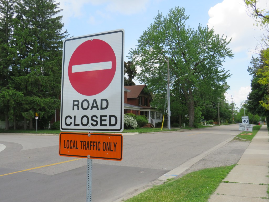
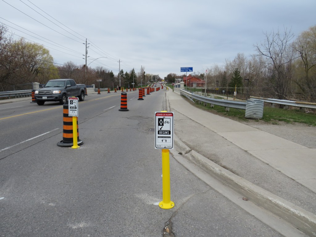
While I was in Brampton recently, I noticed a more effective approach. On Scott Street, just east of the city’s downtown core, a narrow bridge was closed to motor traffic in order to provide a quiet and safe crossing of Etobicoke Creek to connect two sections of the Etobicoke Creek Trail. Instead of moveable pylons, rigid plastic bollards were bolted to the roadway, with a compliant “road closed” sign posted in the middle.
Closely spaced yellow bollards on Scott Street
Signage approaching the closed bridge was also also quite clear.
Road closed sign on Scott Street
I also noted that bolted bollards were also used to mark the interim bike lanes on Vodden Street and Howden Boulevard at every intersection, precluding their use by through traffic. On that early weekday afternoon, only one vehicle was illegally parked in the lane along the entire four-kilometre route. Not one pylon was out of place either.
While Brampton was one of the first cities in Ontario to implement improved active transportation infrastructure during the COVID-19 pandemic, it has done little else since. However, Brampton has an ambitious new active transportation master plan to fix many gaps in its cycling infrastructure and expand its paths system; hopefully it will able to accelerate parts of its plan as Toronto is now doing.
But what Brampton did right was putting in effective barriers and signage to protect its temporary walking and cycling routes. This is something Toronto could learn from.
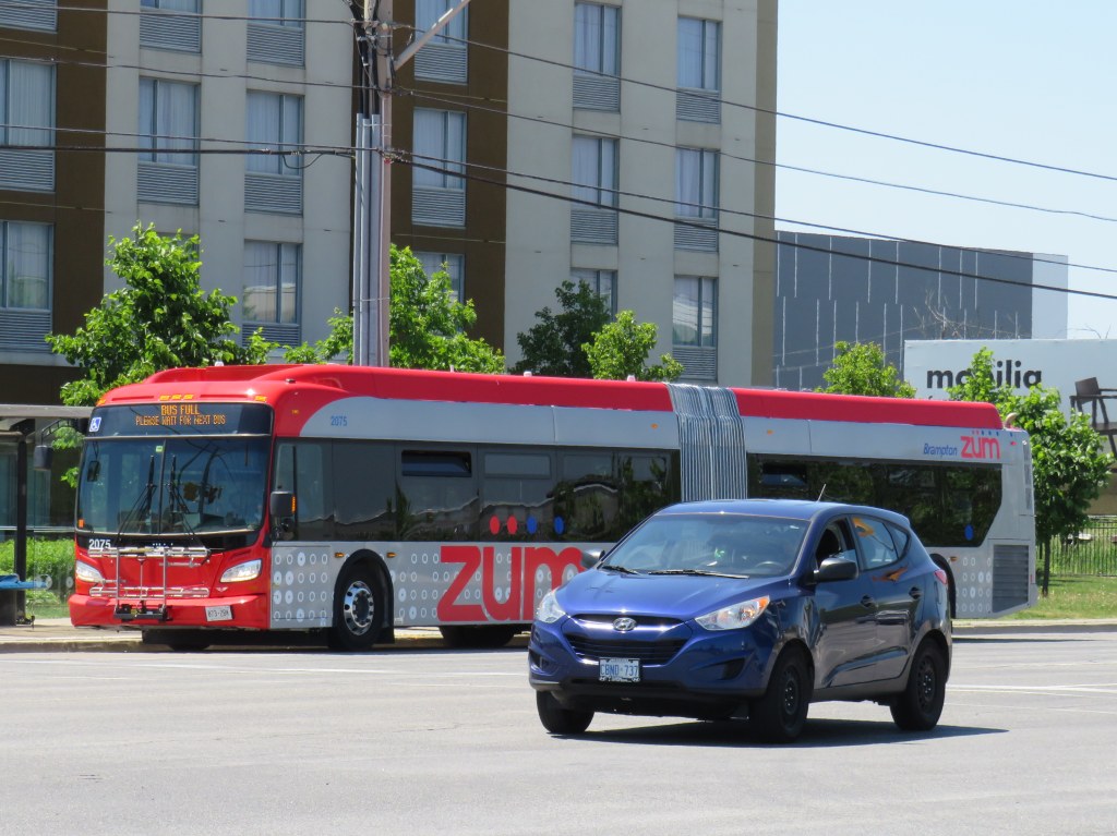
Brampton Transit bus on route 502 Zum with “bus full” displayed
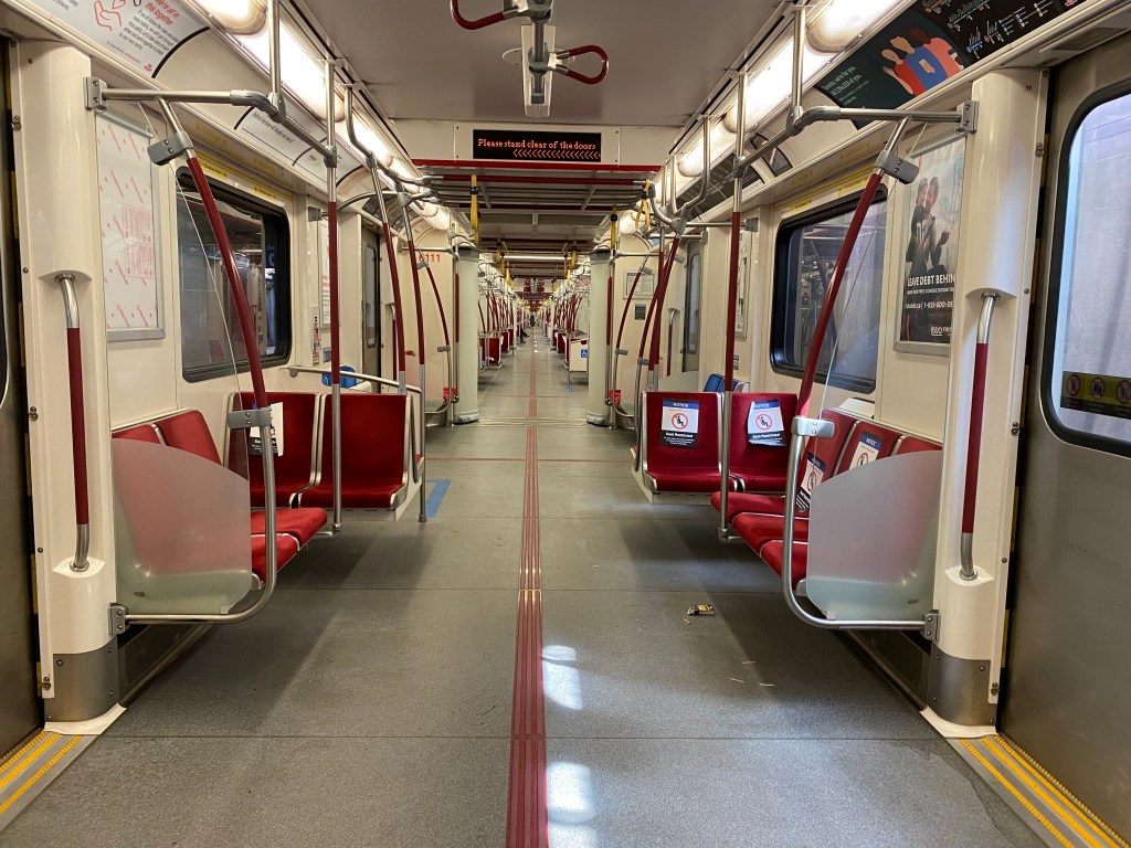
On Thursday, I took the subway for the first time since Ontario declared a state of emergency in March. I entered Queen Station at 9:45 that morning, and rode to Wilson Station. The subway ride north was noticeably quiet, and I had a good choice of seats, even though most were marked as restricted for physical distancing.
Empty subway train northbound on Line 1, June 11, 2020
On my return home, at 4:00 PM, the subway was busier, but still quiet enough to take a seat in the middle of the train, while just about everyone had a non-restricted seat through the downtown core. That never happened prior to March 13.
As I am used to crowded subway trains — even on Sunday mornings — my first subway rides in months proved to be a surreal experience. Though as most passengers were wearing face coverings and keeping distance, it felt safer and more comfortable than many of my recent supermarket trips.
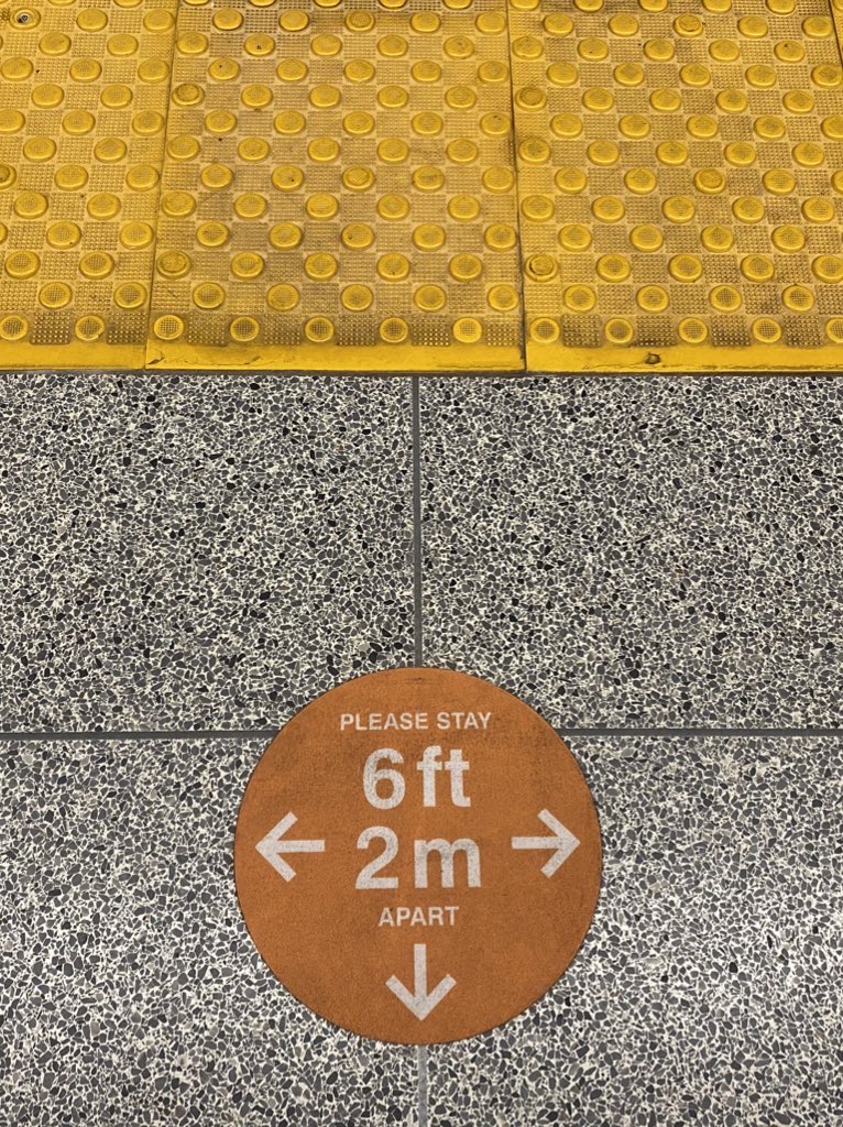
Platform edge marker, Queen Station
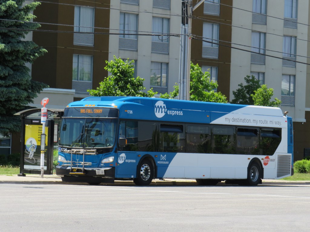
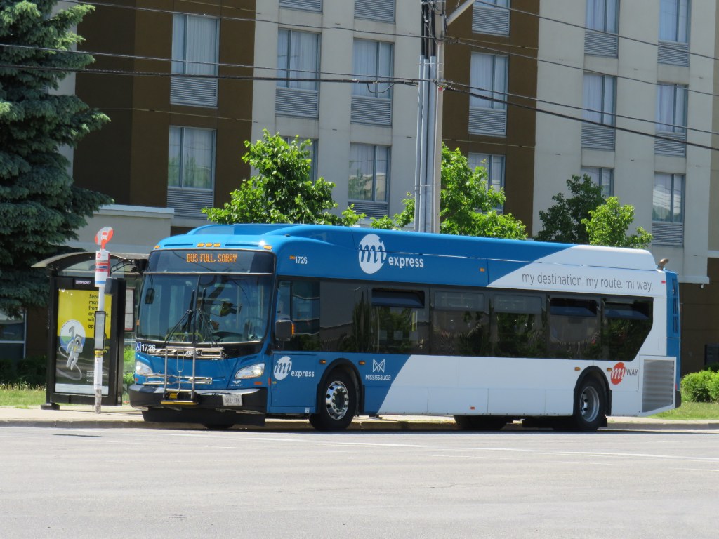
Though subways are mostly empty, and streetcars pass through downtown with only twenty percent of their normal ridership, things are very different on the buses. In Toronto, Brampton and Mississauga, vehicles regularly bypass crowds of waiting passengers while displaying a “sorry bus full” sign.
Miway bus full on Hurontario Street, on the same corridor as the Zum bus pictured above
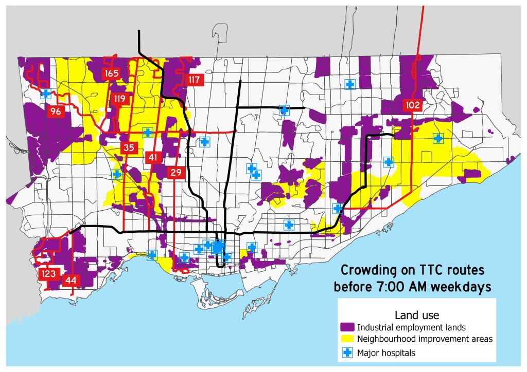
Back in March, I mapped the TTC’s most crowded early morning routes. These ten routes were generally located in Toronto’s suburbs, serving employment lands and neighbourhoods with lower incomes and higher proportions of racialized persons. Brampton and Mississauga, which also have large food production and warehousing industries and significant immigrant and racialized populations, are experiencing similar problems with crowding.
All buses only allow passengers to enter through the rear doors, with many seats marked restricted with paper signs similar to those on the subway. The area behind the driver is closed off as well. While the TTC expect riders to tap their Presto cards at the rear or pay by cash or ticket at a subway station, Brampton, Mississauga, and other systems are permitting free rides for now.
A typical TTC bus contains only 33-36 passenger seats; an articulated (“bendy”) bus has 46. The TTC operators’ union instructed its members to allow only 10 customers aboard a standard bus (though the operator has discretion), and 15 aboard an articulated bus. Transporting that few people on each bus is unsustainable, and with tens of thousands of essential workers relying on the TTC to get to work — many of those jobs difficult and poorly-paying — it’s yet another inequity laid bare by this pandemic.
Crowding on ten TTC bus routes in late March 2020
With loosening restrictions, the demand for transit has already begun to increase. By early July, local transit agencies will require all passengers to wear masks or face coverings. At the same time, passengers will be directed to enter buses through the front doors, while reinstating mandatory fare payment.
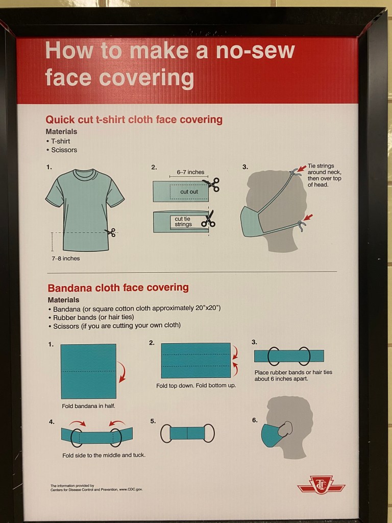
Poster in the TTC subway with instructions on how to make a no-sew fabric face covering.
Front-door boarding and mandatory mask use will help with some of the capacity issues on buses. Offering free masks is a welcome acknowledgement that many who have taken transit may not have money or time to purchase or make their own face coverings. (The TTC has instructions on how to make rudimentary masks posted in subway stations.)
Even then, bus capacity will continue to be limited to ensure physical distancing, and buses will likely still pass by crowds of waiting customers.
While central Toronto benefits from walkable neighbourhoods, existing and new cycling infrastructure, and subways and streetcars with more capacity to spare, suburban residents will still have to rely on buses. Though I see mandatory mask use as a necessary step towards mitigating the risk of viral transmission, I fear it may not be enough for those who work at hospitals and clinics, food plants and warehouses, and grocery stores, restaurants, nursing homes, and daycares.
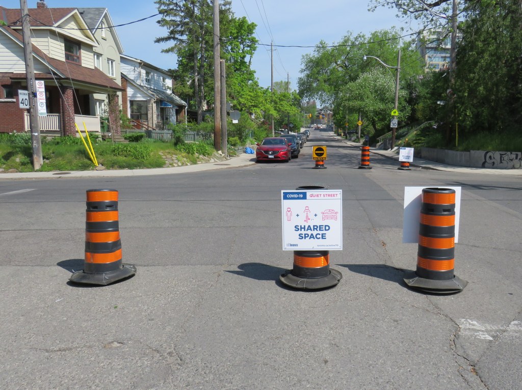
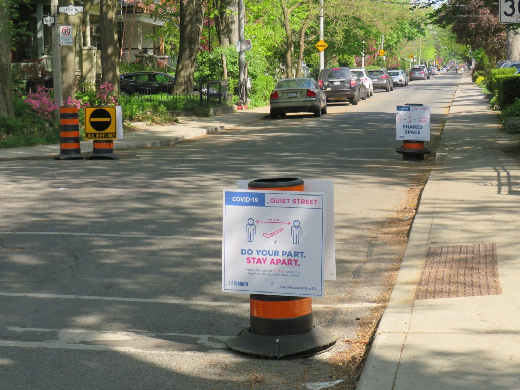
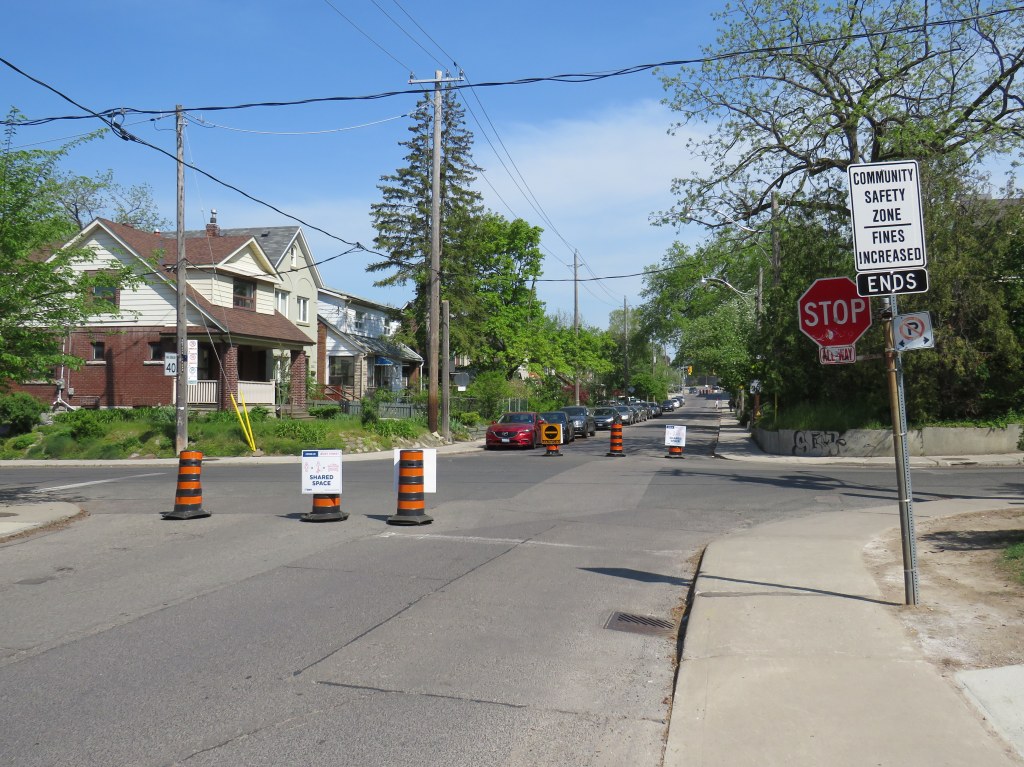
Typical Quiet Street signage and pylon placement, Crawford Street
Earlier this month, as part of Toronto’s long-overdue response to the ongoing COVID-19 pandemic, the city introduced ActiveTO. ActiveTO includes several measures addressing the need for safe active transportation and recreation routes as summer approaches and businesses slowly reopen.
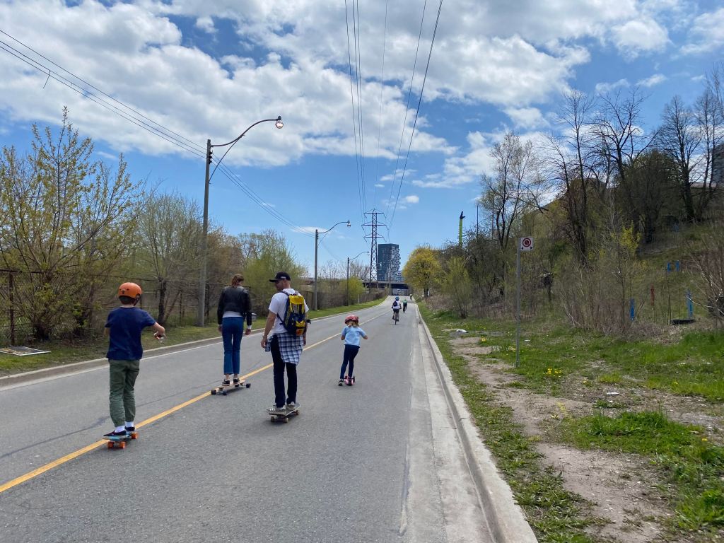
Current ActiveTO initiatives include weekend traffic closures of sections of Lake Shore Boulevard and Bayview Avenue to take pressure off narrow and busy multi-use paths, designating specific “quiet streets” to provide safer cycling and pedestrian corridors, and the construction of new bike lanes and cycle tracks, accelerating work on the painfully slow implementation of the city’s cycling network plan.
One of many families enjoying the Bayview Avenue extension closure on May 16. The weekend closure provides a safe, spacious alternative to the crowded Lower Don Trail
I visited two Toronto streets this week included in the initial list of ActiveTO quiet streets that were announced on May 14, 2020.
On Winona Drive, the pylons and signs placed by city work crews were moved by residents to block an entire lane of traffic at each intersection. This enhances their effectiveness in reminding motorists that the space is for local traffic only and that the roadway is shared with pedestrians and cyclists.
Winona Drive at Benson Avenue, May 25, 2020Close-up of relocated pylons on Winona Drive
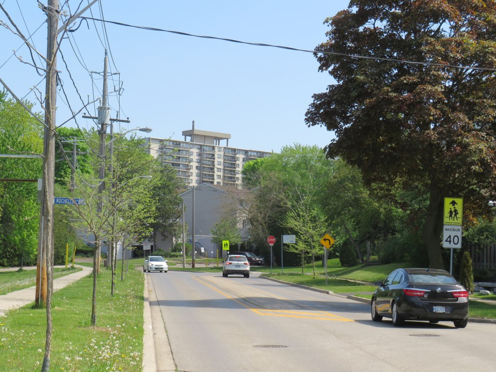
Shaughnessy and Havenbrook Boulevards, near Sheppard Avenue and Don Mills Road, connect the densely populated Fairview Mall and Don Valley Village neighbourhoods with the Betty Sutherland Trail, part of the Don River ravine system. Though Shaughnessy is mostly fronted by comfortable, midcentury homes, it borders several apartment buildings and townhouse complexes, including several Toronto Community Housing properties.
Shaughnessy Boulevard looking north at Rochelle Crescent
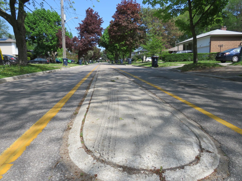
In 2012, some road calming measures were undertaken on Shaughnessy to slow down traffic, particularly near local schools and parks. A four-lane section between Sheppard Avenue and Glenworth Road was narrowed, including a very short section of bike lanes. A shallow concrete median was added between Glenworth and Esterbrooke Avenue. However, the street remained problematic.
The shallow median on Shaughnessy Boulevard does nothing to slow down aggressive motorists
In a recent Toronto Star article, resident Robin Sacks noted that the street was unsafe as motorists used it as a bypass of parallel Don Mills Road. She, and many of her neighbours, supported Shaughnessy’s designation as an ActiveTO quiet street.
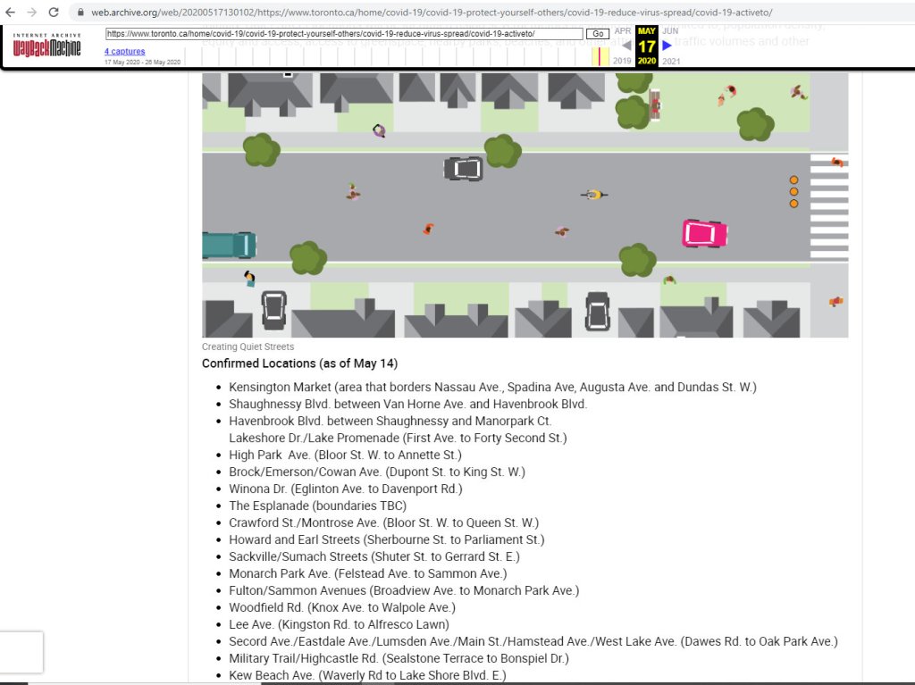
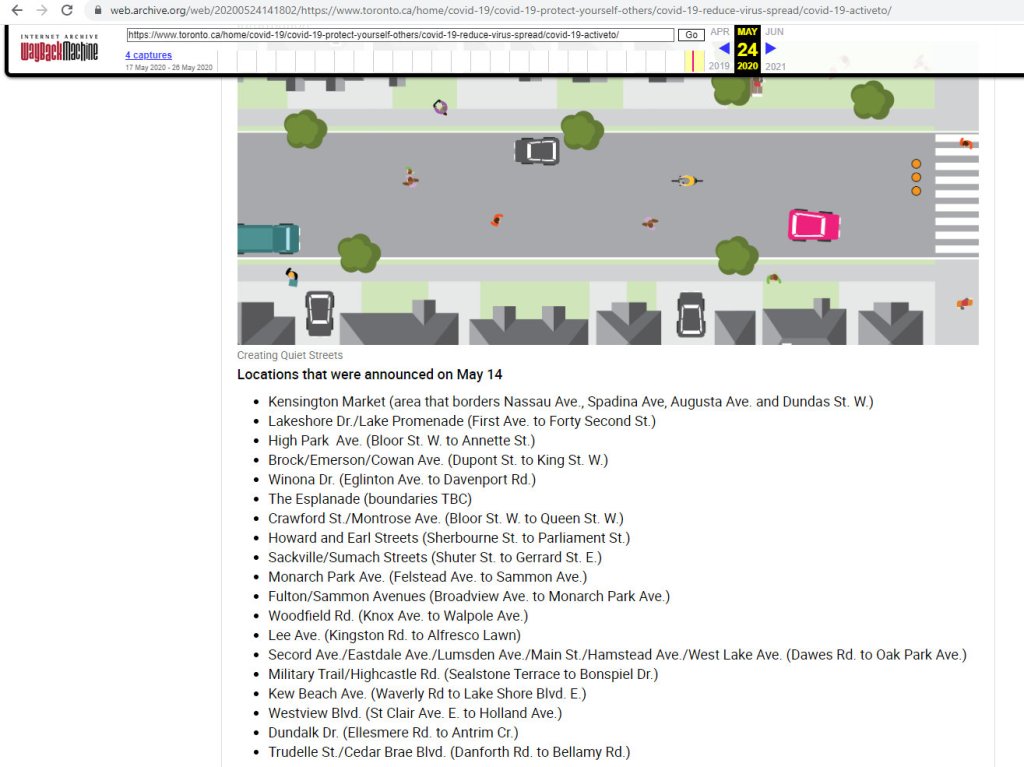
Unfortunately, other residents took it upon themselves to remove the pylons and signs and complain to their local city councillor as soon as they were installed. By the weekend, they — along with concrete barriers placed in the median — were removed, and the street wiped from the city’s website.
City of Toronto ActiveTO web page on May 17, 2020 and May 24, 2020 on the Internet Archive Wayback Machine. Shaughnessy and Havenbrook Boulevards were wiped from the list of ActiveTO quiet street locations.
Councillor Shelley Carroll, a progressive, was quoted in the Star article that she felt those who objected to the traffic calming measures were on “solid ground,” as there were no community consultations before the measures were introduced. She also noted that Shaughnessy is “a safe street with ample sidewalks and, unlike denser parts of downtown, ‘no one’s having any trouble distancing.’”
To Carroll’s credit, a consultation is planned for Wednesday, May 27. Overall, her track record has been supportive of safer streets in her community and in Toronto as a whole, so I was surprised by her comments. Hopefully, Shaughnessy, like many other suburban streets, will see improvements shortly.
Quiet streets, if planned as a network, are helpful for encouraging active transportation, especially where wider sidewalks and cycle lanes are unable to be installed on parallel major roads (due to streetcar lines, for example), or where they can connect major parks, off-road trails, and other cycling corridors.
To make such quiet streets permanent, curb extensions at intersections and other physical cues should be used to slow down traffic. Traffic circles and well-marked crosswalks could also take the place of four-way stops, which are easily ignored by motorists while frustrating cyclists.
The COVID-19 pandemic has exposed severe inequities; between those who work in the logistics, healthcare, and food service industries, and those who are able to work at home; between those who have comfortable homes with access to ample green space and those who do not, and those can rely on their own automobiles, and those who must walk, cycle, or take transit. This is why expanding public space and providing safe routes to travel is so important.
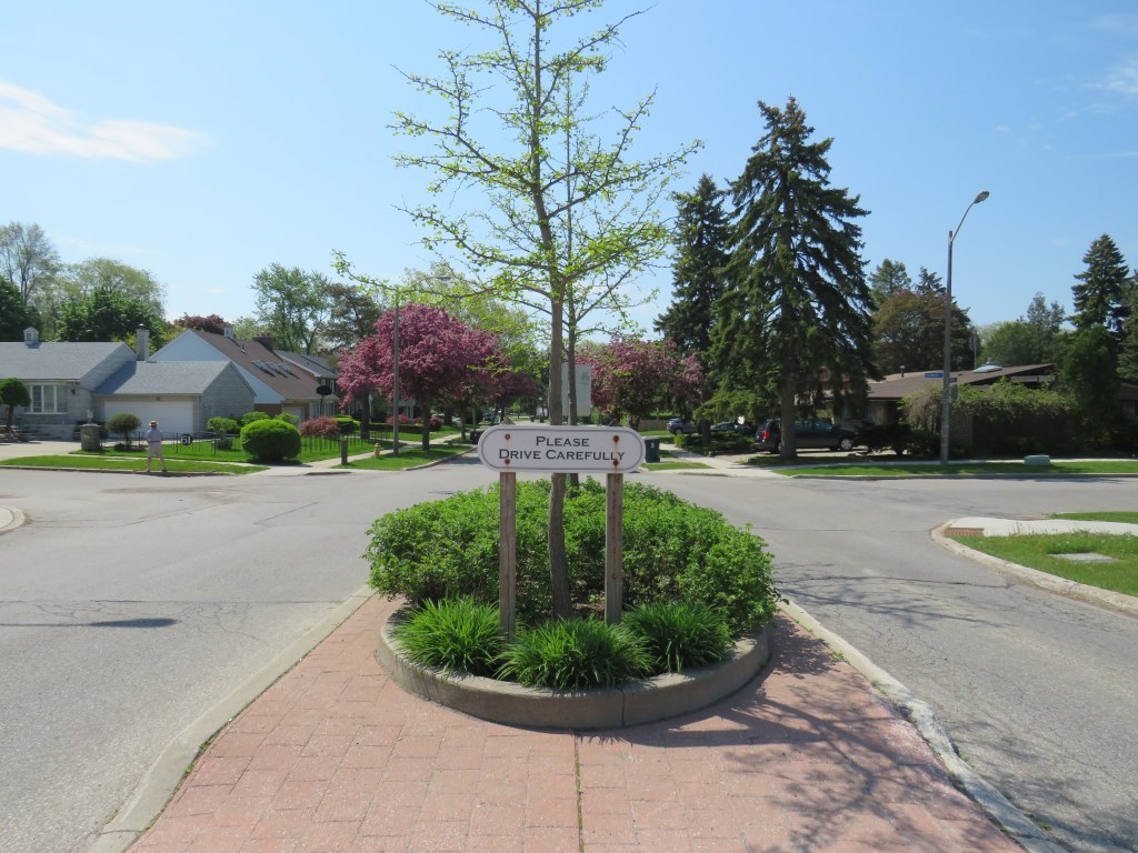
“please drive carefully” – sign in median of Shaughnessy Boulevard
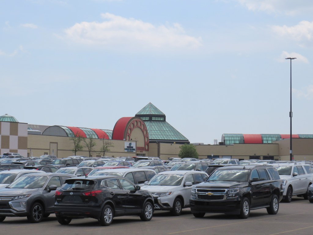
Un-plated rental cars stored in the Woodbine Centre parking lot
In a distant corner of Woodbine Centre’s parking lot, dozens of late model cars and trucks sit with their licence plates removed. These are all rental cars, left idle due to the collapse of demand during the ongoing COVID-19 pandemic. Friday, Hertz — the United States’ second-largest car rental company — filed for bankruptcy. Hertz’s brands include Dollar and Thrifty.
Woodbine Centre, a once-vibrant mall in northwest Toronto is a short drive from Toronto-Pearson International Airport, making it an ideal place to store the suddenly surplus fleets. Though in the 1980s and 1990s, Woodbine boasted cinemas, two-full line department stores, Zellers, and dozens of national chain stores, it has lost most of its cachet, with both Sears and Zellers gone, and Hudson’s Bay barely hanging on. Its parking lot was typically half-empty in recent years.
Though the demand for rental cars, especially at the airport, have dried up, many neighbourhood car rental branches remain open, offering attractive rates for daily and weekly rentals. I have taken advantage of the low prices right now (often as cheap as $25 a day on a multi-day rental) to run errands, go for short drives, conduct some field research for future articles and projects, and visit nearby provincial parks and regional forests for physically-distant nature hikes. I am also able to help family members by delivering groceries and medications. With the surplus of available cars, upgrades from the intermediate or standard car booking can be expected. (I was given a Mercedes-Benz E-class a few weeks ago, though I had booked a standard sedan.)
Though we live downtown, my partner and I prefer to shop at a Chinese grocery store in Scarborough, which is calmer, better organized, and better stocked than our local stores (flour, rice, and meat are plentiful). Having a car makes it easy to carry a large load, reducing the number of grocery trips required.
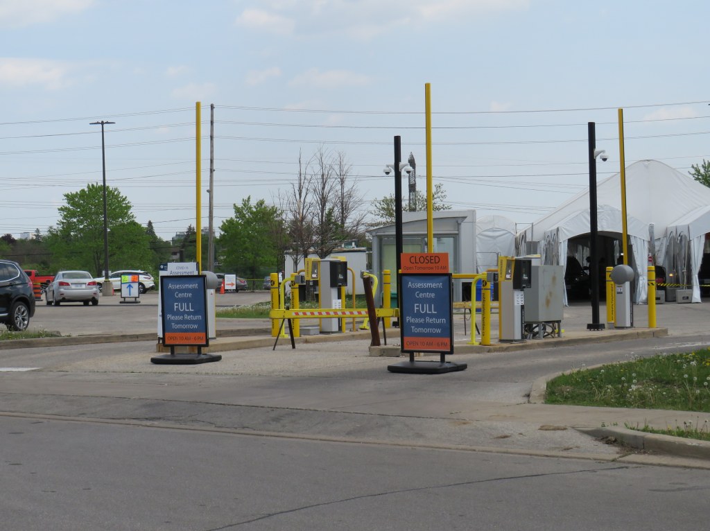
Across the street from Woodbine Centre, in another parking lot, there is another sign of the times: an overflow lot for Humber College has been transformed into a drive-through COVID-19 assessment centre. At 12:30 on Monday, May 25, the centre, which is normally open daily from 10:00 AM to 6:00 PM, was already full, and not accepting any more patients who were looking to be tested.
While Premier Doug Ford urged anyone worried about having COVID-19 or being in contact with anyone with it last Sunday, it’s not surprising to see the huge demand. While the change in eligibility is good news, it is troubling that actually getting tested may take so long.
Full COVID-19 assessment centre in North Etobicoke