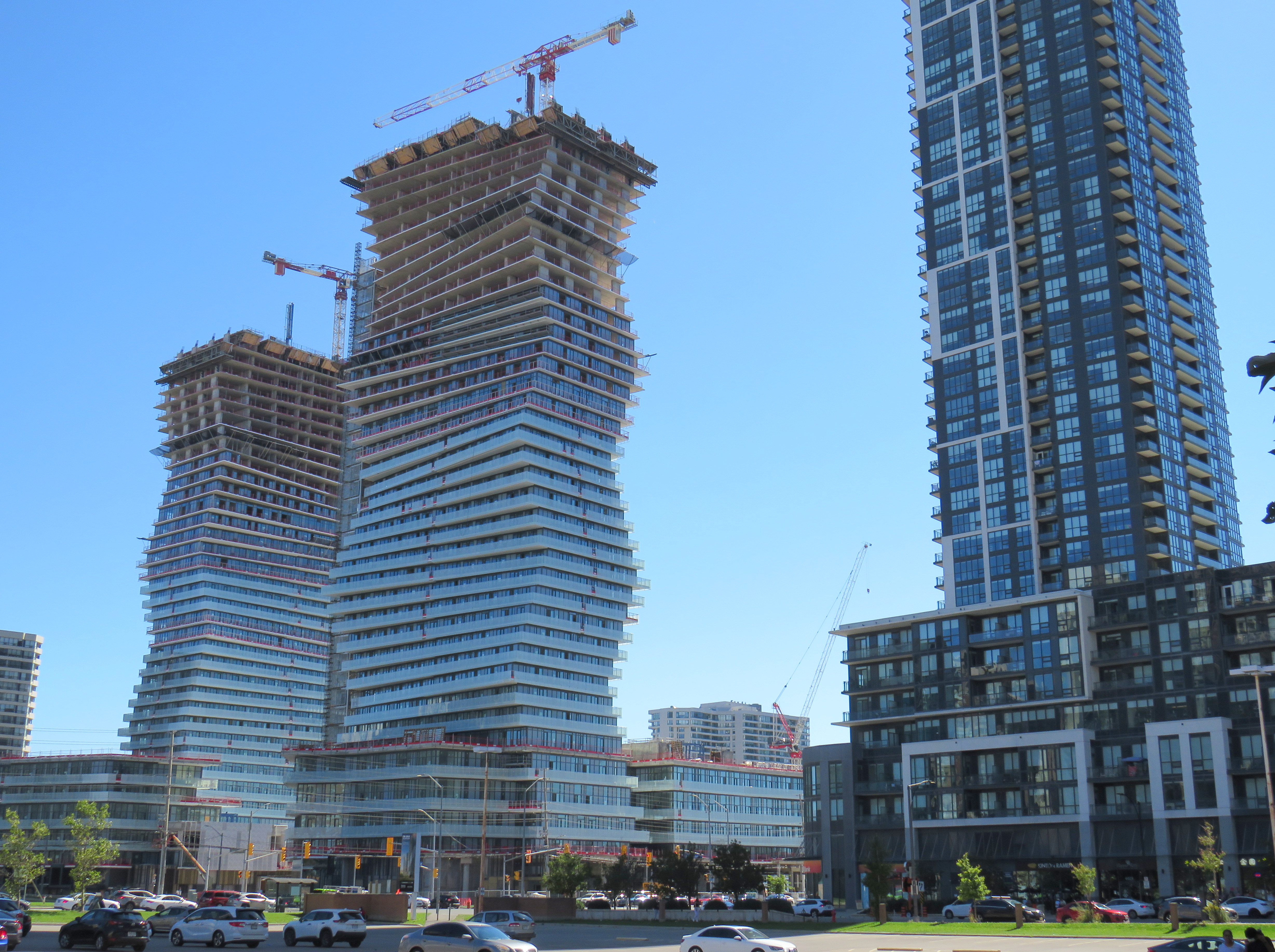
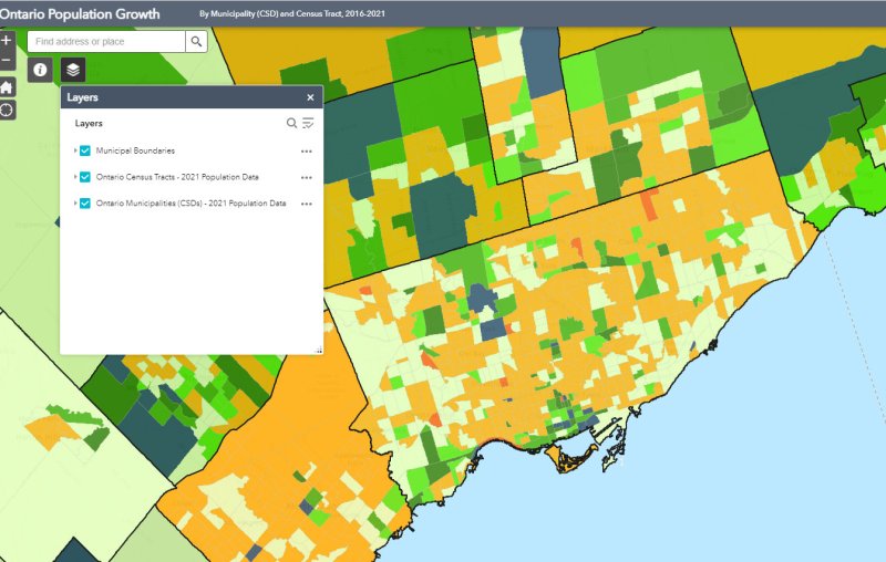
Despite new highrise development in its city centre, Mississauga lost 3,368 residents between 2016 and 2011
On February 9, data geeks across Canada rejoiced when Statistics Canada released the first round of data from the 2021 Census of the Population.
The data was released at all levels of geography made available by Statscan. At the federal level, Canada grew by 5.2% since the 2016 Census, with a total population of 36,991,981. Immigration, rather than natural growth (births vs. deaths) drove Canada’s population increase.
Of course, this growth did not occur evenly across the country. Newfoundland and Labrador lost residents, while Prince Edward Island and British Columbia saw the biggest population increases.
Within the Greater Toronto and Hamilton Area, Mississauga experienced population decline (-0.5%) for the first time since it became a city in 1974. Outer suburbs, such as Milton, East Gwillimbury, and areas just beyond the GTHA, such as New Tecumseth and Bradford saw population growth over 20%, driven by new greenfield development.
In older Toronto suburbs, including much of Etobicoke, North York, Scarborough, and even Mississauga, population losses at the local census tract level can be explained by ageing households, where Millennial and older Gen Z children moved out on their own, particularly into fast-growing downtown areas. These areas, dominated by single-family housing, could accommodate much of the GTHA’s growth with gentle density, including secondary suites (such as basement apartments), garden suites, and zoning policies that would make it easier and more economical to build “missing middle” housing such as walkup apartments and multiplex homes.
Toronto grew by 62,785 residents in the last five years, with only a few areas accommodating all that growth: the downtown core between Dufferin Street and Broadview Avenue, South Etobicoke, Yonge-Eglinton, and former industrial, instructional, and commercial lands stretching along the Highway 401 corridor through North York and West Scarborough. This corridor includes the Downsview Park development, a new condominium cluster at Wilson Subway Station, the former Canadian Tire lands near Sheppard Avenue and Leslie Street, and the intensification of the Fairview Mall area.
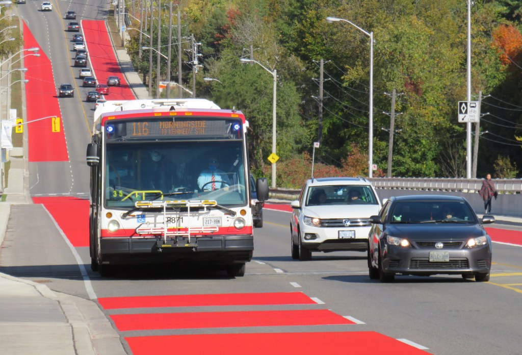
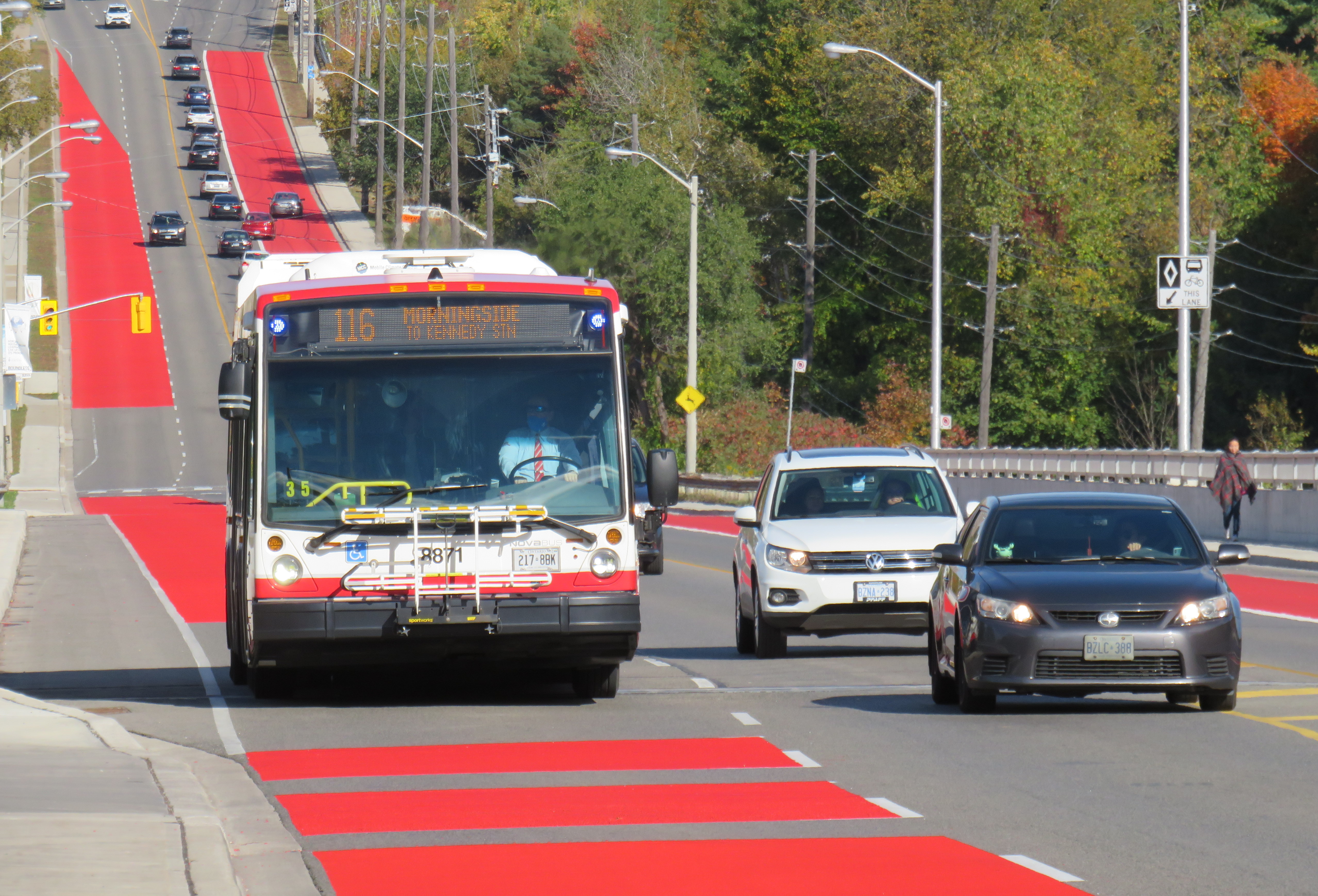
Route 116 Morningside was created in 1989, replacing a branch of Route 34 Eglinton East
On Sunday, June 20, the TTC will renumber two bus routes, Route 5 Avenue Road and 6 Bay. This change comes ahead of the opening of the Crosstown LRT and the Finch West LRT, which will be assigned those numbers, as they added to the city’s rapid transit network in the next few years.
Route 5 Avenue Road, in service since 1954, will become Route 13 Avenue Road. 6 Bay, which has existed since 1963, will be renumbered 19 Bay. Those follow similar measures in 2001, when the 2 Anglesey and 4 Annette routes were renamed to 48 Rathburn and 26 Dupont, respectively.
Though there are over 150 bus routes operated by the TTC, including express routes and all-night routes, the TTC was relatively late numbering all of its services. A consistent system for numbering bus routes did not exist until the late 1950s (though they did not appear on system maps until 1964), while streetcar lines were not assigned numbers until 1979.
Later, new series of route numbers were assigned to the overnight “Blue Night” network in the late 1980s, rapid transit lines in 2001 (just prior to the Sheppard Subway’s opening), and express bus routes only a few years ago. But for the regular service lines (those between 7 and 189), the numbers seem random — not grouped by geography, service type, or year each route was established.
In the late 1950s, though, when bus routes were numbered for the first time in 30 years, there was a system: numbers would be assigned in alphabetical order, with north-south routes given odd numbers, and east-west routes assigned even numbers.
Bus on Route 34 Eglinton East, in the late 1950s. City of Toronto Archives Series 648, File 29, Item 1.
Route 1, Armour Heights, was a short shuttle that ran along Avenue Road between the fare zone boundary at Roe Avenue (the end of the frequent 61 Nortown trolley coach) and Bombay Avenue, north of Highway 401. Route 2 Anglesey served several neighbourhoods in central Etobicoke. Route 96 Wilson remains a busy east-west route in North York, and Route 97 Yonge was originally a very frequent trolley coach route between the north end of the subway at Eglinton Station and the City of Toronto limits at Glen Echo Loop.
In 1964, the numbering system was still mostly intact, with two notable exceptions: 6 Bay, introduced one year earlier in 1963, was a north-south route. Route 17 Birchmount, introduced in 1960, broke the alphabetical order after Route 15 Brimley.
The opening of the Bloor-Danforth Subway in 1966 and major extensions in 1968 resulted in major route restructurings, and while the TTC tried to maintain the odd numbers for north-south routes and even numbers for east-west routes, that eventually came to an end, especially when further expansion required the use of three-digit numbers in the mid 1970s.
The interactive map below shows the full extent of the TTC’s service area in 1964, along with the municipal boundaries of that era, before Metro went from thirteen cities, towns, and townships to just six.
Link to interactive map
Though today’s regular service bus route numbers do not follow a specific pattern, recent changes to the night bus and express bus numbering systems have restored order to the numbering scheme.
Number
Route Type
1-6
Rapid transit lines (subway, LRT).
7-189
Regular local bus service
300-396
Night bus and streetcar routes, with numbers often echoing the daytime service (for instance, 329 Dufferin night buses follows the daytime 29 Dufferin bus’s route)
400-407
Community buses, offering ultra-local accessible services in selected parts of the city.
501-512
Streetcar routes. Streetcar route numbers were introduced in 1979, coincident with the introduction of the CLRV streetcars. The small area for destination signs in the new vehicles required numbers to be displayed instead of names for information to be legible.
600-699
Subway operations, internal use only. Previously, rapid transit routes were numbered in the 600-series, with Yonge-University-Spadina numbered 601, Bloor-Danforth 602, and Scarborough RT 603. Briefly, the Harbourfront Streetcar was branded as a rapid transit route and assigned number 604.
900-996
Express network bus routes, with numbers often echoing the regular service (for instance, 996 Wilson Express follows the local 96 Wilson bus’s route)
Replacement high pressure sodium lamp on left, the white glow of Toronto’s classic “acorn” lamp on right.
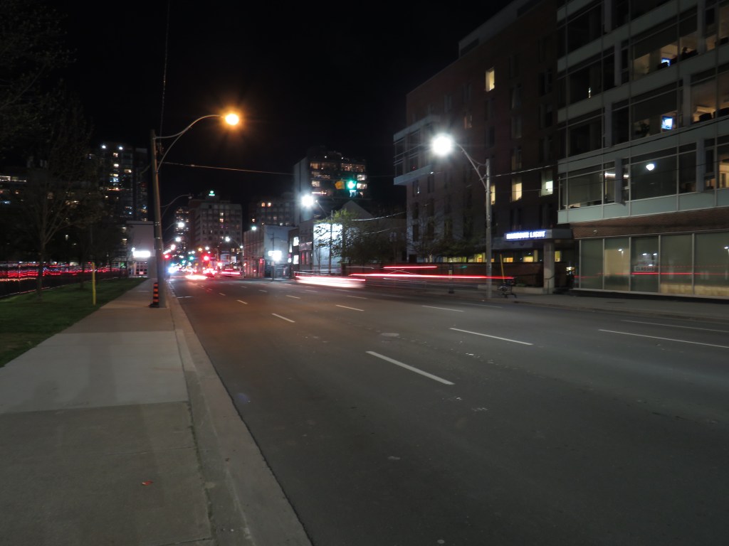
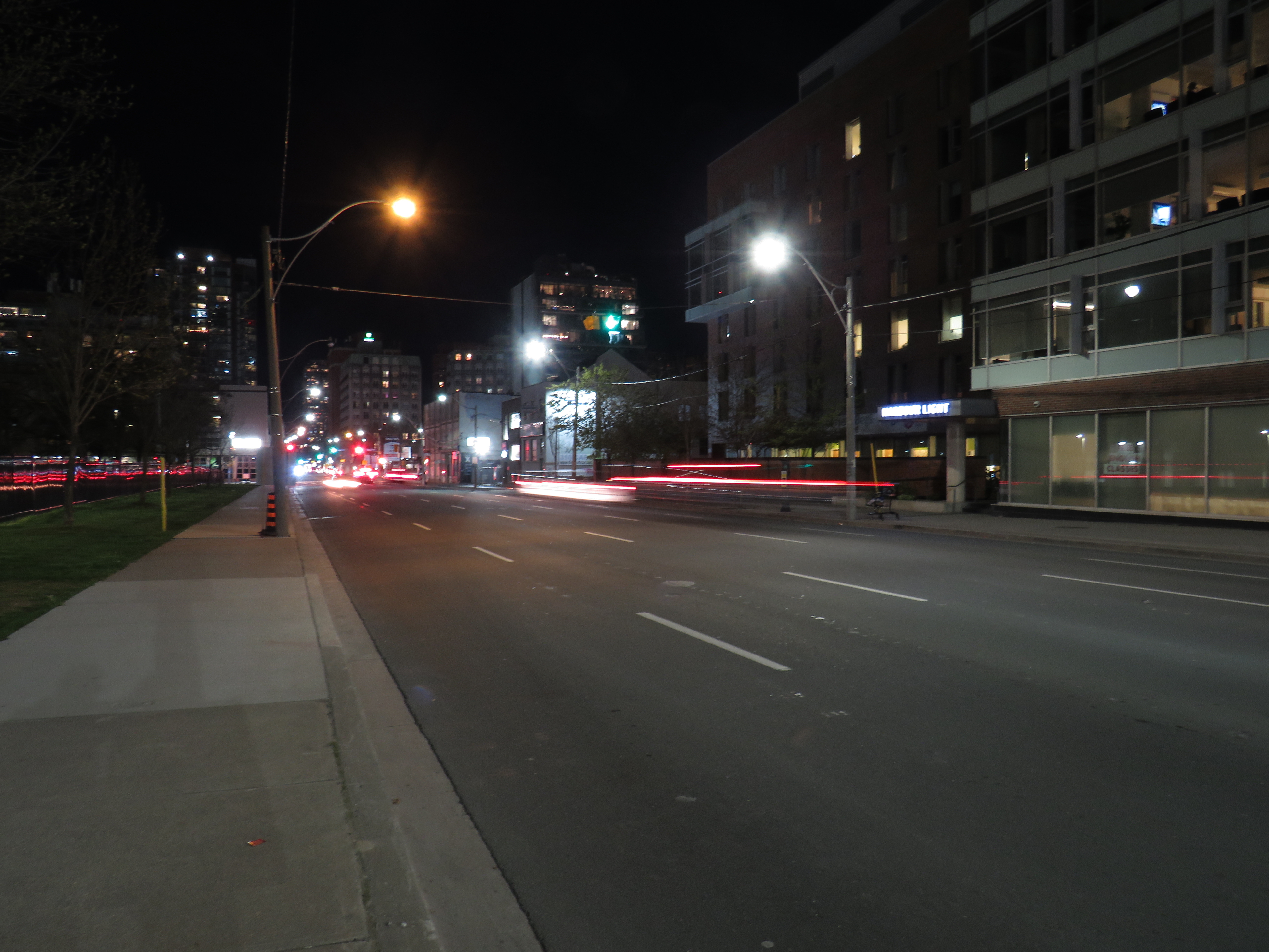
Street lighting is an important, yet overlooked, part of any city’s standard infrastructure. For over seventy years, Toronto’s streets were lit with an elegant and increasingly unique streetlamp design. But modern standards and a desire for standardization will see this change, just as Toronto’s streetcars and street signs have.
Toronto Hydro, which is responsible for Toronto’s street lighting, is replacing the older “acorn” lamps with high pressure sodium (HPS) cobra head lamps (so-called due to their shape when seen from the top or bottom). While surrounding municipalities are switching to white-burning LED lights, Toronto Hydro is installing the older beige-orange glowing lamps.
I asked Toronto Hydro what their long-term plans were for the city’s street lighting infrastructure. Read more on Spacing’s website.
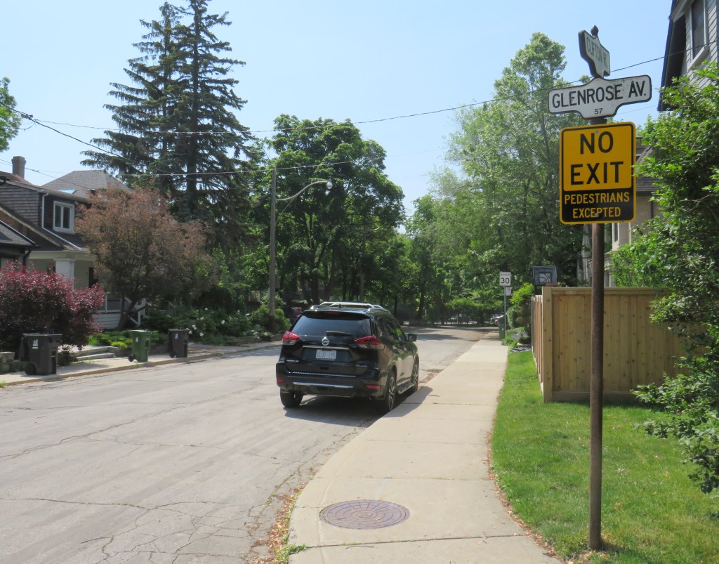
On April 8, Toronto City Council approved a motion brought forward by Councillor Paula Fletcher to change that. Councillor Fletcher’s motion was titled “I’m Walking Here.” Only two months later, new signs are already appearing across Toronto — in Scarborough, Monarch Park, and Swansea. For a city that often takes years to adopt what may seem like simple, easy solutions, this was implemented impressively quickly. The new signs look like standard yellow “no exit” signs, but with a “pedestrians excepted” note at the bottom.
My hope is that these signs will entice Torontonians to get outside, go for a walk, and check out some new streets and parks, enticed by these signs inviting through passage.
In related news, this week Toronto Council approved the expansion of sidewalk slow clearance to all of Toronto’s streets, a service that was previously provided only to suburban areas, where unobstructed sidewalks made municipal slow clearance easy to do. With new snow equipment able to navigate narrow urban sidewalks, Toronto is now finally able to provide universal snow clearance services, a boon for full accessibility.
As public health restrictions ease and stores and restaurant patios reopen this Friday (supported by the city’s willingness to reallocate road space on streets like Yonge and Danforth), there’s never been a better time to for a walk.
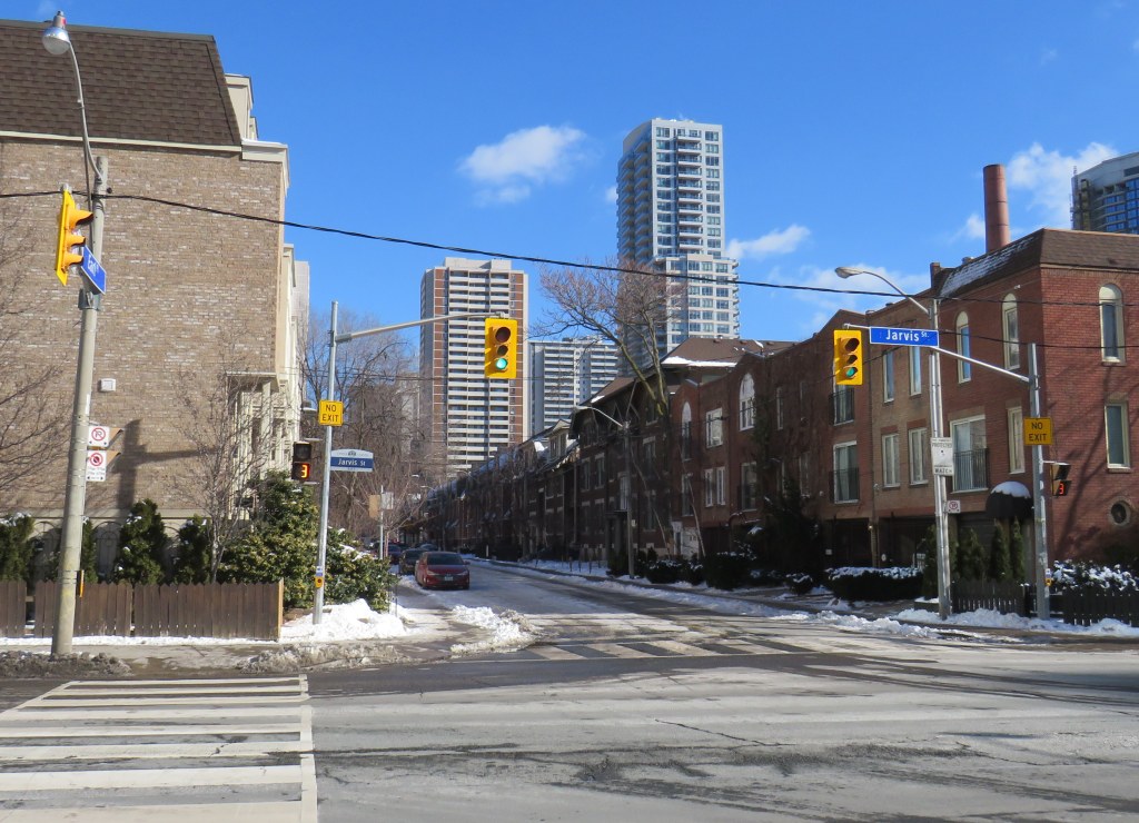
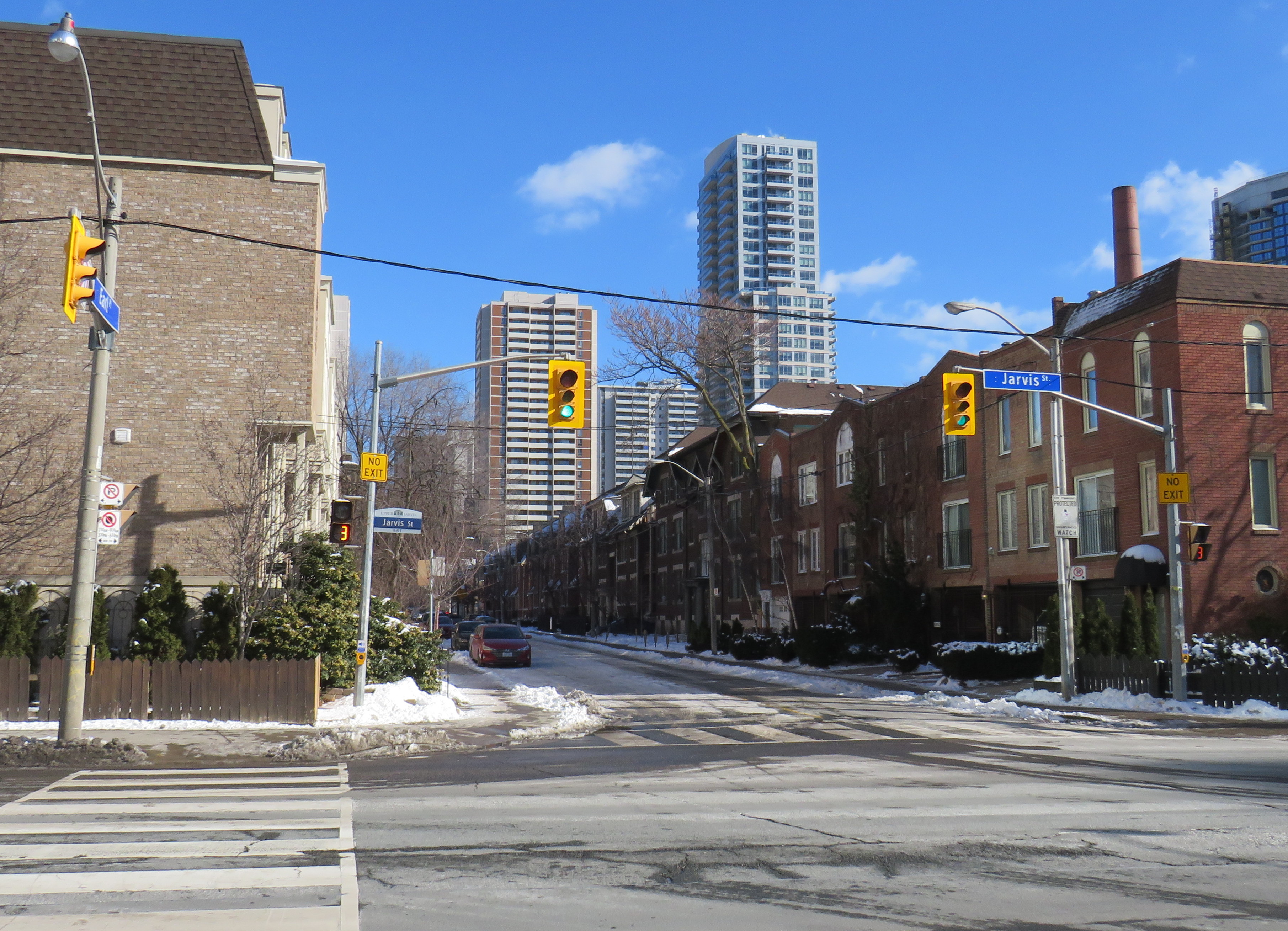
Misleading “no exit” signs, like these on Maitland Place at Jarvis Street, will soon be changed by the City of Toronto to indicate that indeed, pedestrians can continue through
Though these signs are required under traffic codes and regulations, they do not reflect that in many cases, there is an exit for pedestrians.
I quickly created a Google map of all locations in the City of Toronto marking such locations. Through a social media campaign led by Walk Toronto, we were quickly able to map over 450 locations where a pathway, sidewalk, or staircase allows a pedestrian to continue their way where motor vehicles are forced to turn around.
The motion, which was amended to strengthen the wording, requests city staff to develop a new signage standard to indicate where “no exit” signage betrays a pedestrian passage, and to begin installing these new signs this year.
Councillor Paula Fletcher’s motion (inspired by @Walk_TO) to have staff modify “No Exit” signage in places where there are, in fact, exits for pedestrians carries via show of hands, with some amended wording. https://t.co/owNfqtPgNUpic.twitter.com/eevn2bMwkN
The map that I created based on Dylan’s initial suggestion will be used to help identify these locations.
Given the ongoing pandemic, where we are all subjected to yet another lockdown, walking is one of the few permitted ways for each of us to get outside, enjoy the fresh spring air, and get much needed exercise. Knowing where one can walk, especially away from heavy traffic or busy sidewalks and paths, will only help unlock the city for more Torontonians.
I want to thank everyone who submitted locations for the map to Walk Toronto or to myself via Twitter or directly to me on this website. This couldn’t have happened without the help of fellow Torontonians.
The starting wage for an Amazon fulfillment centre employee is $17.00 an hour, despite notoriously tough working conditions. With most professional and office workers at home, and with ongoing pandemic restrictions, Amazon has enjoyed significant sales increases. But those workers picking and packing orders are not able to work from home – and workplace spread has been a significant factor in COVID-19 transmission in Ontario.
Brampton, home to two of the GTA’s fulfilment centres, and close to Amazon’s Mississauga, Milton and Bolton warehouses, has been a COVID-19 hotspot. Like Toronto, Peel Region has been under lockdown and stay-at-home orders since November.
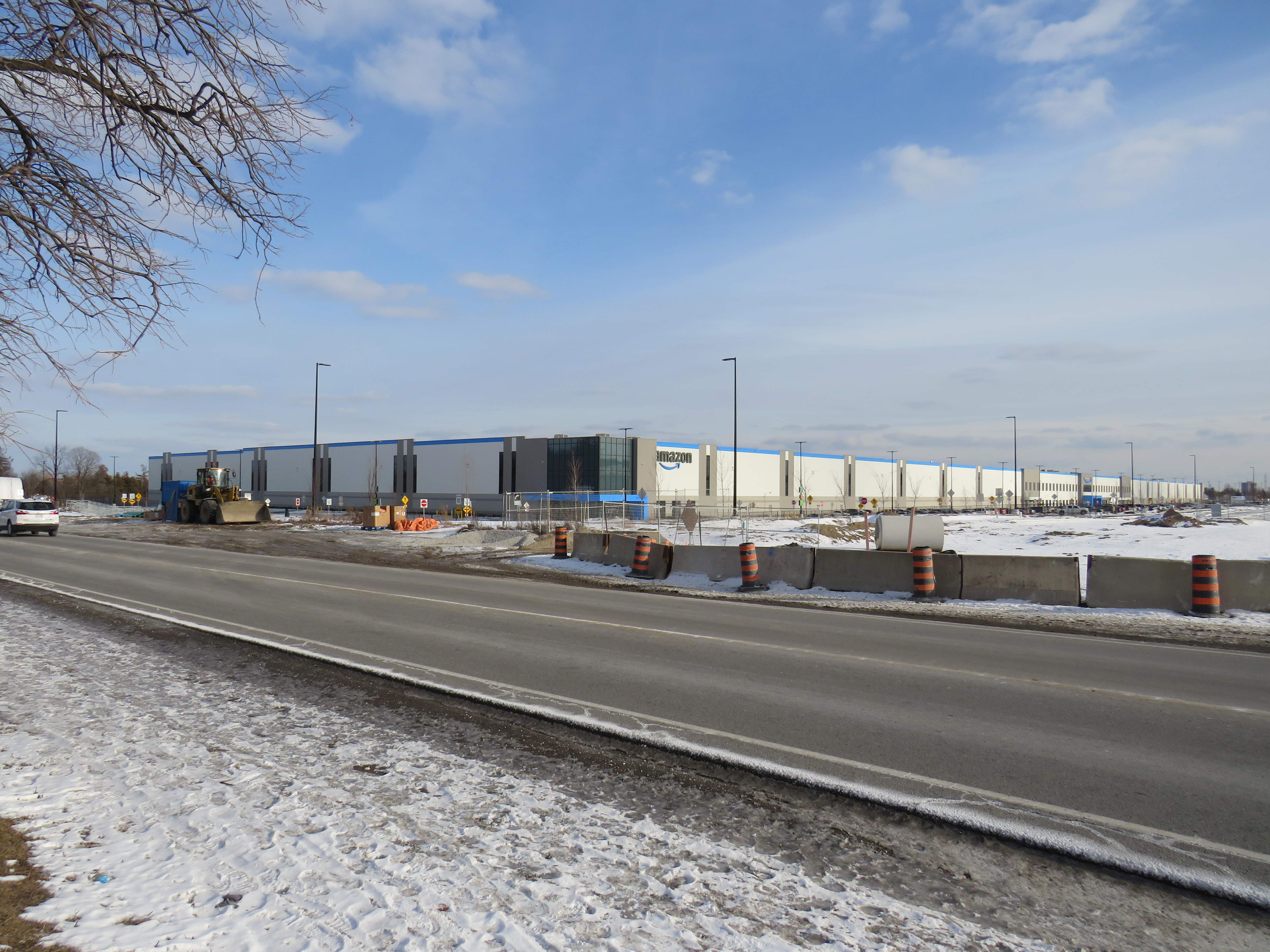
Like most new logistics facilities, the new Scarborough warehouse, like the other five GTA Amazon fulfillment centres, is in an industrial area on the city’s outskirts, where land is plentiful, but transit and pedestrian access is lacking. East of Tapscott Road, Steeles Avenue narrows from four lanes to two, and there are no designated pedestrian crossings at the intersection with Eastvale Drive. The eastbound TTC stop at Eastvale Avenue was removed in 2018 after a passenger was struck and killed trying to cross the street after disembarking from a 53 Steeles East bus. The next nearest stop, at Tapscott Road, is 300 metres west.
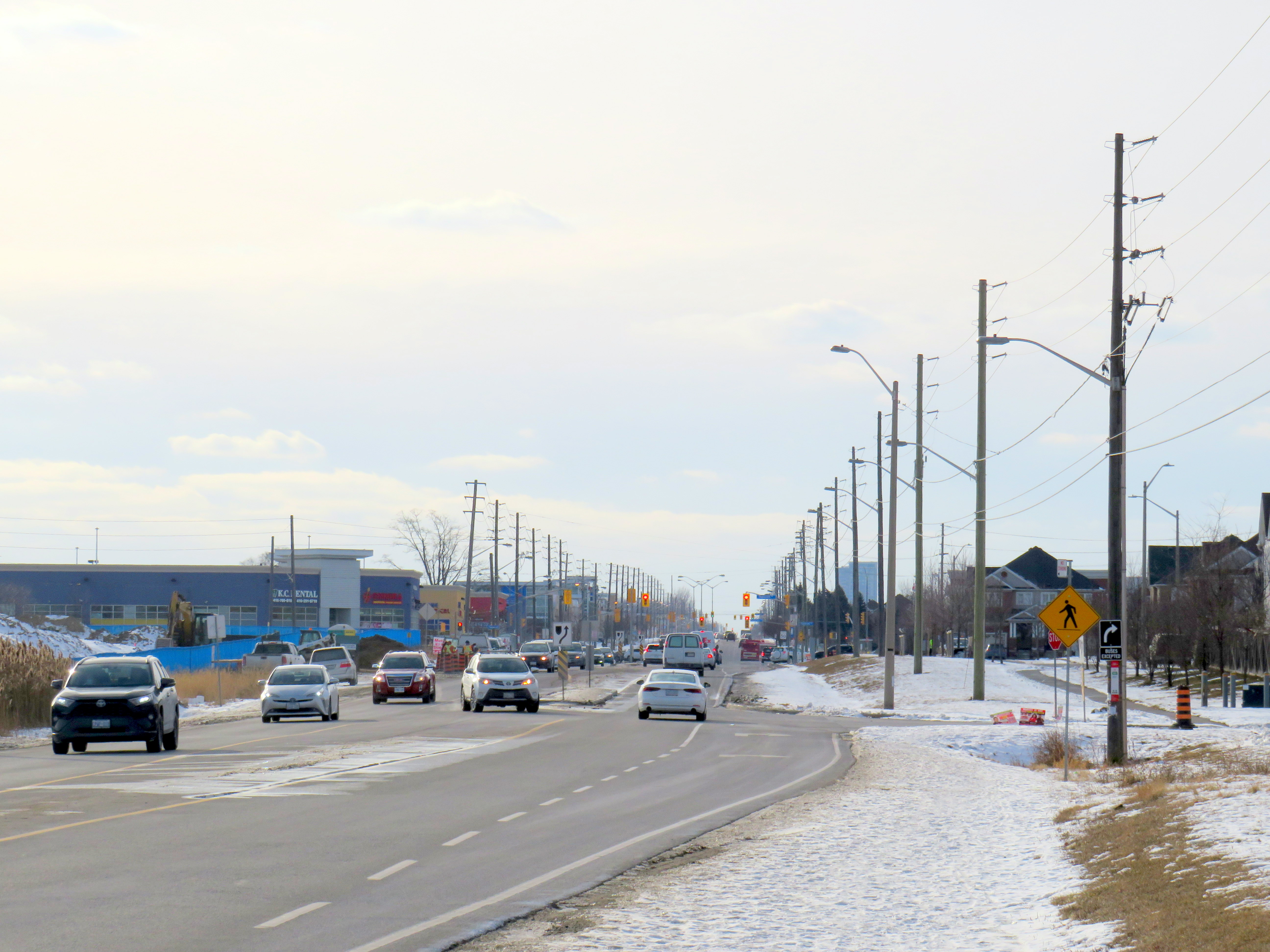
Steeles Avenue, looking west towards Eastvale Drive and the signalized intersection beyond, at Tapscott Road
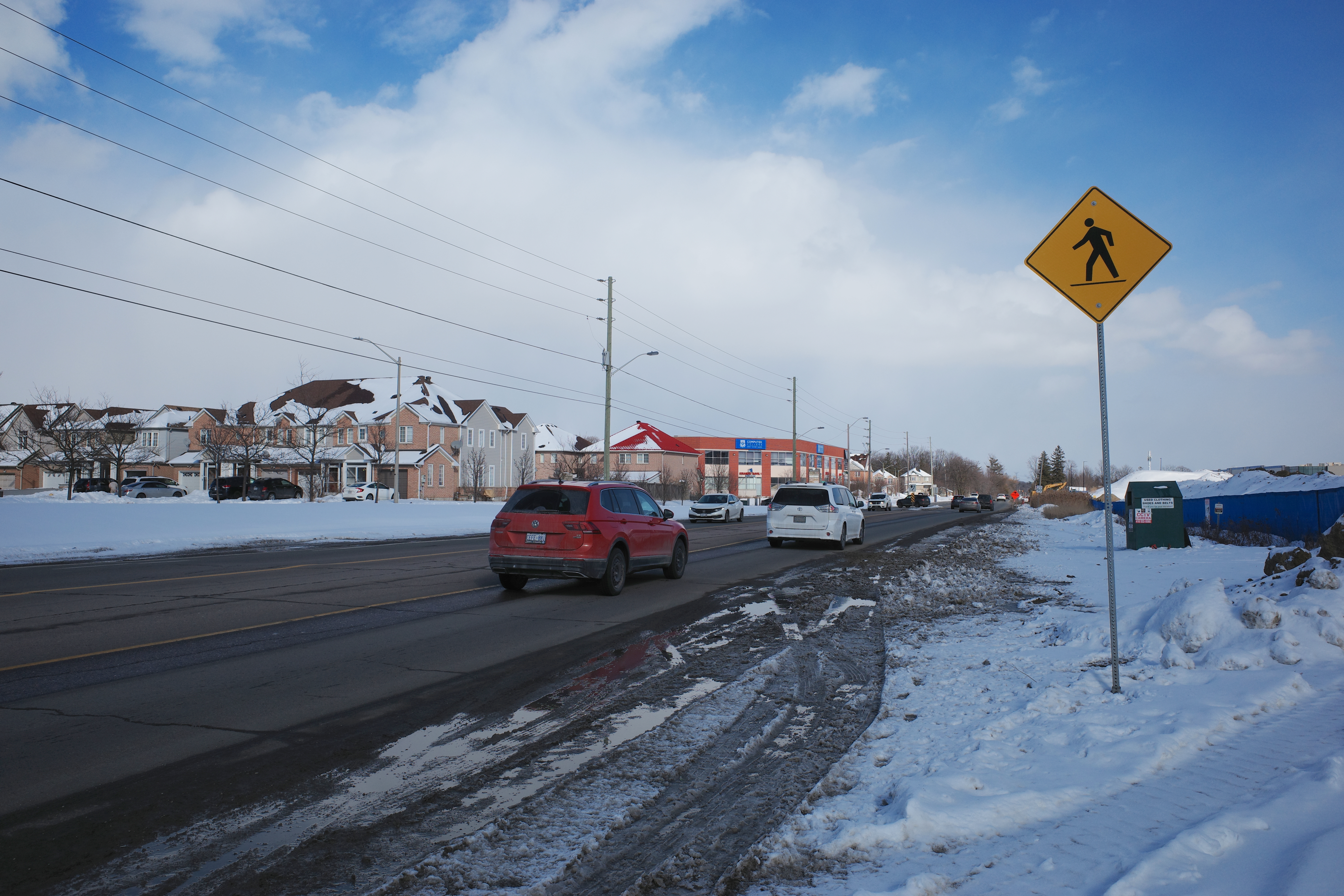
The sidewalk on the south side of Steeles Avenue ends at Tapscott, a few hundred metres west of the Amazon fulfilment centre. On the north side, the sidewalk ends at Ferncliffe Crescent in Markham. Despite a new residential area in Morningside Heights, to the east, there is no sidewalk along Steeles to connect to it. Pedestrians heading to Amazon or towards Staines Road must choose whether to walk in the mud, or on the busy roadway. Though the posted speed limit is 50 km/h, motorists regularly travel at 60 km/h or faster.
Looking east on Steeles from Tapscott Road – despite the sign advising motorists of pedestrian activity, there are no sidewalks leading east towards the new Amazon fulfillment centre (Sonali Praharaj)
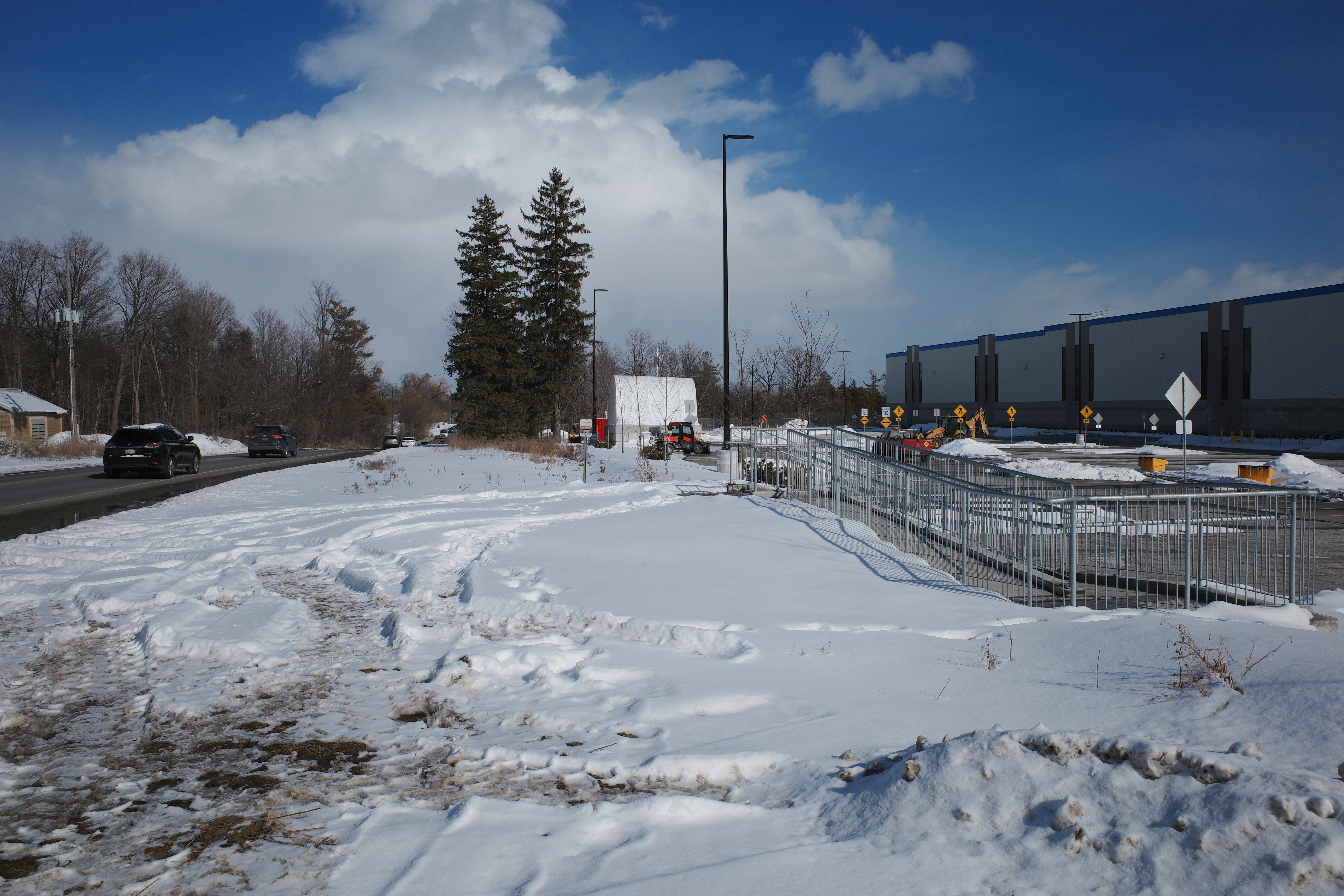
A stairway and ramp were built on the north end of the Amazon property, likely with the expectation that a sidewalk on the south side of Streeles Avenue would soon be installed. This would provide improved pedestrian access to the fulfillment centre. But without a safe and logical way to get to it from the street, it remains largely unused.
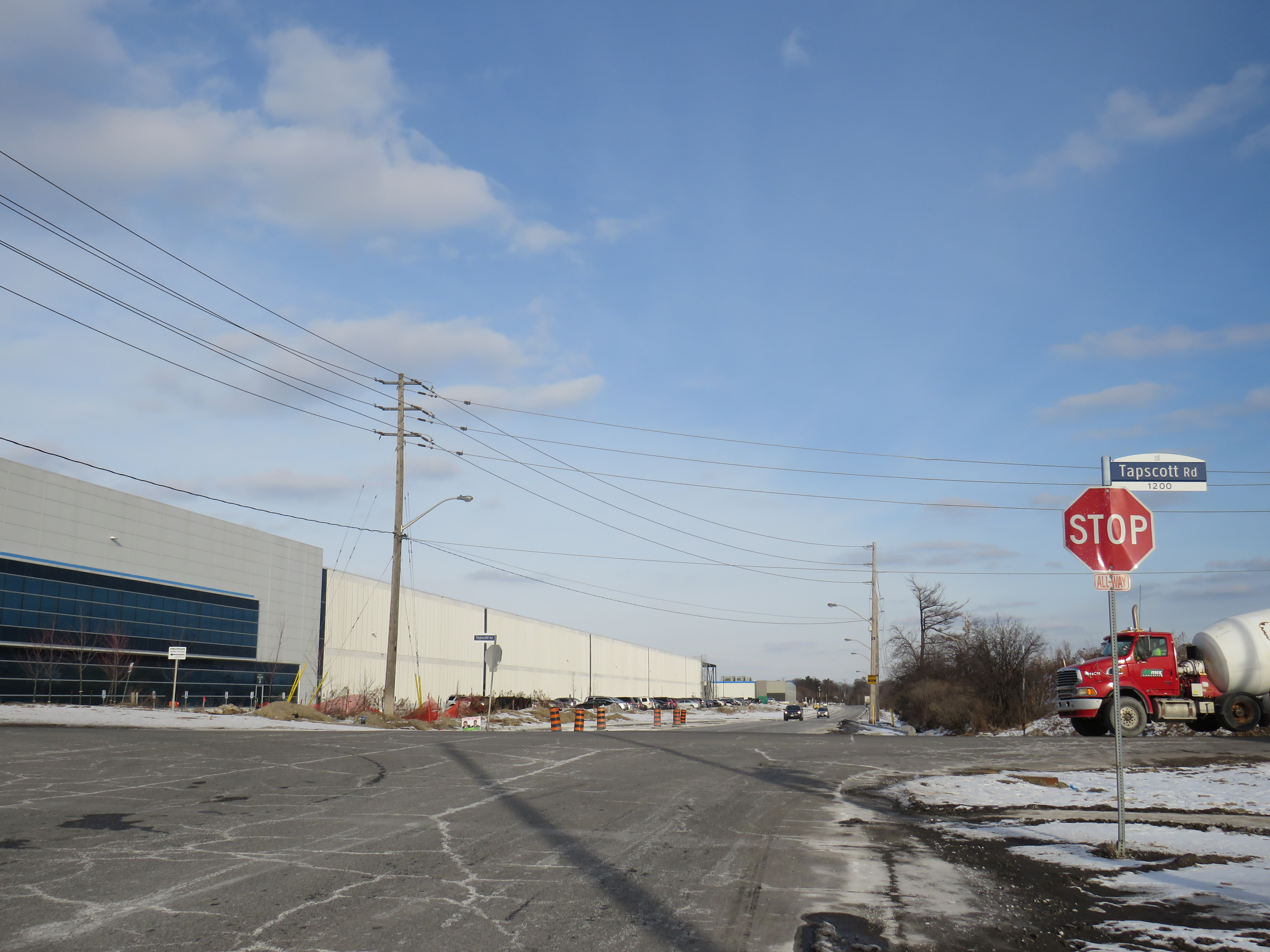
Passmore Avenue, on the south side of the fulfillment centre, was rebuilt with a sidewalk in the late fall of 2020, months after Amazon opened. However, it requires a lengthy walk north to Steeles Avenue up Tapscott, and there are no sidewalks on Tapscott from Passmore south, towards McNicoll Avenue. The intersection of Passmore and Tapscott itself – controlled by an all-way stop – still does not feature proper crosswalks.
Looking east on Steeles from Tapscott Road – despite the sign advising motorists of pedestrian activity, there are no sidewalks leading east towards the new Amazon fulfillment centre (Sonali Praharaj)
Though there are two TTC bus routes that operate to the corner of Tapscott Road and Passmore Avenue – 53B/953B Steeles East and 102B/C Markham Road – for months, workers had to walk on the roadway, through a construction site to access those buses. Anyone looking to go east, towards Morningside Heights, or southeast, towards Malvern, still face a long, dangerous walk or a lengthy bus commute.
The corner of Tapscott Road and Passmore Avenue
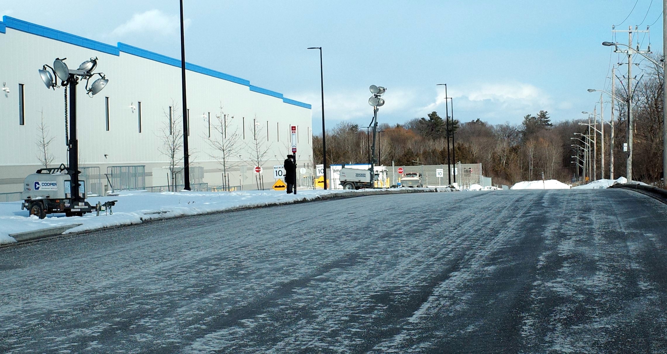
The TTC, starting January 11, 2021, began diverting the 53B Steeles East bus to directly serve the Amazon fulfillment centre, finally serving a major industrial trip generator and reducing essential workers’ travel times. Even still, the new sidewalk on Passmore ends at the warehouse entrance – anyone waiting for a bus must still walk and wait in the snow or mud.
Eventually, Steeles Avenue will be widened, with new sidewalks and bike lanes, and Morningside Avenue will be extended north to Steeles Avenue. However, these improvements have been planned for years and completion is still several years away. Though new warehouses have opened here, civic infrastructure has not caught up.
New TTC bus stop serving the Amazon Fulfillment Centre on Passmore Road (Sonali Praharaj)
The TTC’s service change, adding a new bus stop on Passmore Avenue, was a welcome – yet overdue – acknowledgement that essential workers, especially racialized and lower-paid workers, deserve better. It is inexcusable that new employment uses are planned, approved, and constructed before the appropriate pedestrian infrastructure and transit services are in place. It is also inexcusable that after a TTC customer was killed that a nearby bus stop was removed, rather than safety improvements added instead. This is not just a matter of ensuring a basic level of safety for pedestrians – this is a matter of justice for those we consider essential workers.
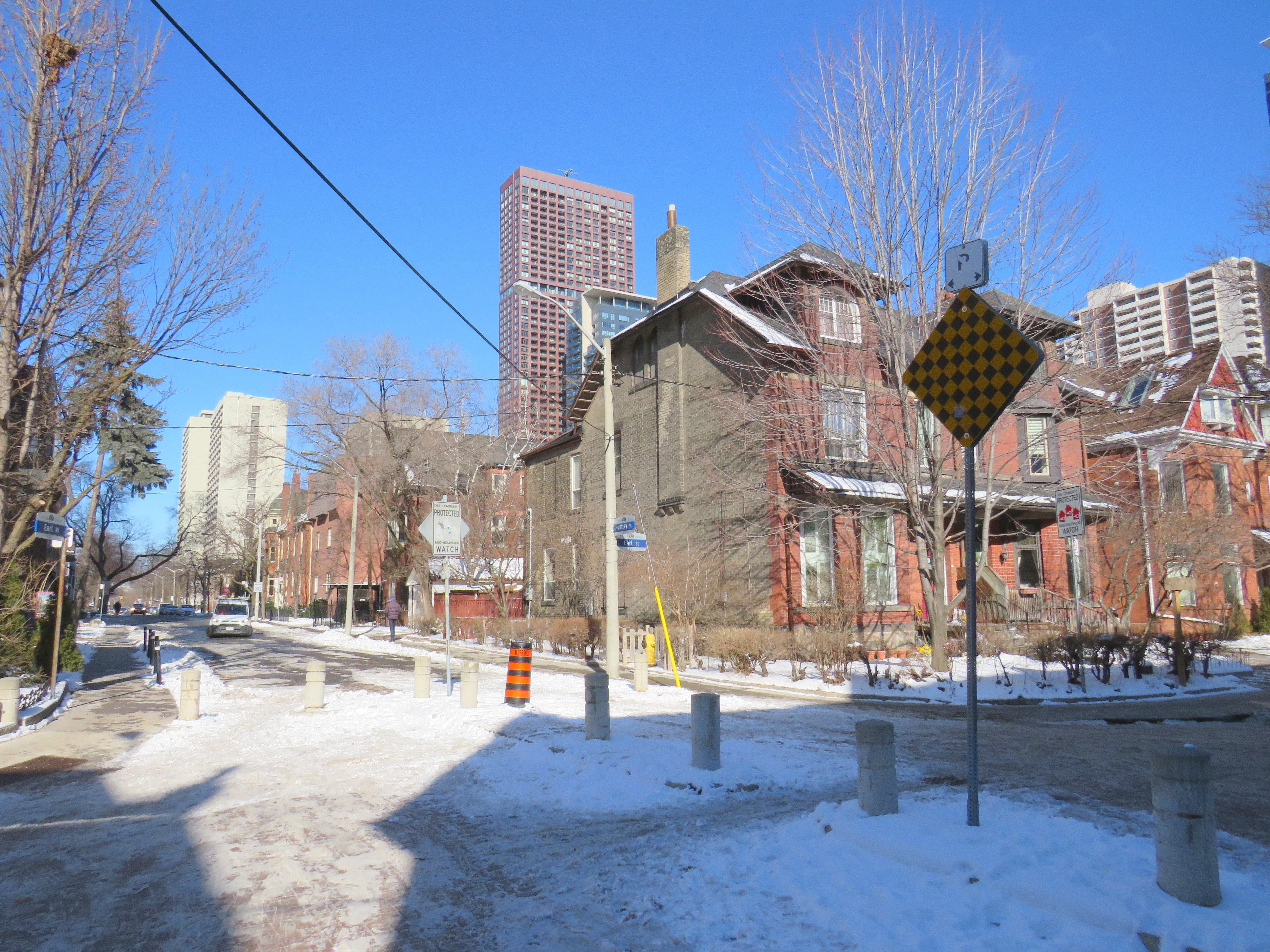
Earl Place, where “No Exit” signs betray through access for pedestrians and cyclists
Last week, Dylan Reid and I, both co-founders of Walk Toronto, decided to create an inventory of all instances in the city where “No Exit” signs do not apply to all road users. Though these signs are required under traffic codes and regulations, they do not reflect that in many cases, there is an exit for pedestrians. Some of those offer through passage for cyclists as well. We were inspired by a Twitter thread that expressed the frustration of getting around the city by foot, where signage is designed entirely for motorists.
Instances where pedestrians or cyclists may continue past a “No Exit” sign include traffic calming measures meant to keep out through motor vehicles on once-continuous roads. The intersection of Earl Place, Earl Street, and Huntley Street is just one example: curbs and bollards restrict motorists from continuing through, though a narrow passage allows cyclists to continue past; sidewalks also allow through pedestrian movement.
Earl Place and Huntley Street
In many other cases, suburban street designs, such as cul-de-sacs, limit vehicular movement though residential subdivisions, but narrow public walkways allow pedestrians access to parklands and neighbouring streets. In other cases, changes in grade between streets allow for a staircase, but not a through roadway down a steep hill. These are common in the Swansea, Baby Point, Silverthorn, and East Toronto neighbourhoods.
As of January 30, 2021, I have mapped over 250 misleading “No Exit” signs throughout the City of Toronto, though I know there are many more. Please send them to me via Twitter or via a direct message, and I will be sure to add your submission.
Our goal is to convince the City of Toronto to add signage recognizing where pedestrians and cyclists do have an exit. Perhaps too, this might inspire you to get outside, and walk around the neighbourhood, checking out passageways you might have not known about.
In June 2020, Toronto-based artist and activist Andrew Lochhead launched a petition to rename Dundas Street, one of Toronto’s oldest, longest and best-known arterial roads. Lochhead states that Henry Dundas, 1st Viscount Melville “actively participated in obstructing the abolition of slavery in the British Empire from 1791 to the end of his political career in 1806.” While some historians may argue that Dundas was a pragmatic moderate, rather than an anti-abolitionist (unlike slave-owning Torontonians like William Jarvis or Peter Russell, who have streets named after them), it’s still worth wondering why Toronto has a street named after the Scottish politician, who had nothing to do with Toronto’s colonial history.
Until recently, I gave Dundas Street little thought. Years ago, I wrote about how the street was pieced together in the late 19th and early 20th century to provide a new through east-west route across central Toronto. Though I was aware that Dundas Street began at the present-day corner of Queen Street West and Ossington Avenue, I had long thought the road was named for the town of Dundas, to which it leads.
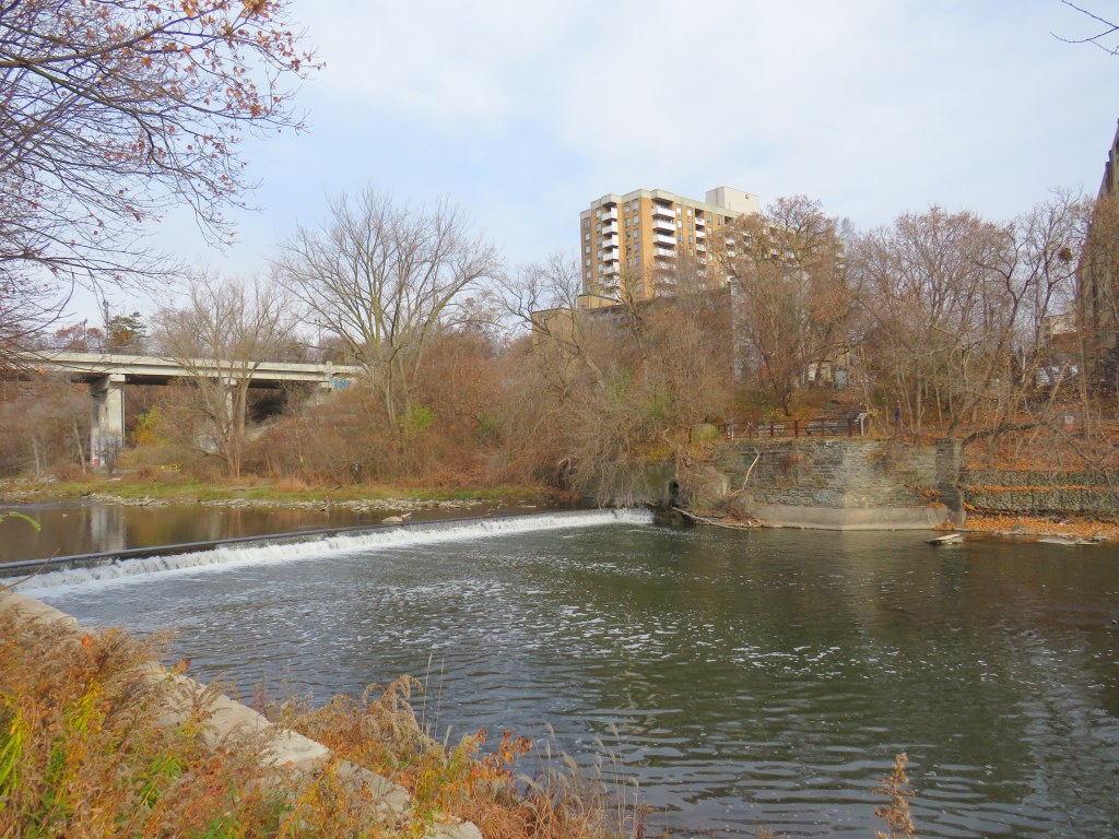
The end of Desjardins Canal, in the old Town of Dundas
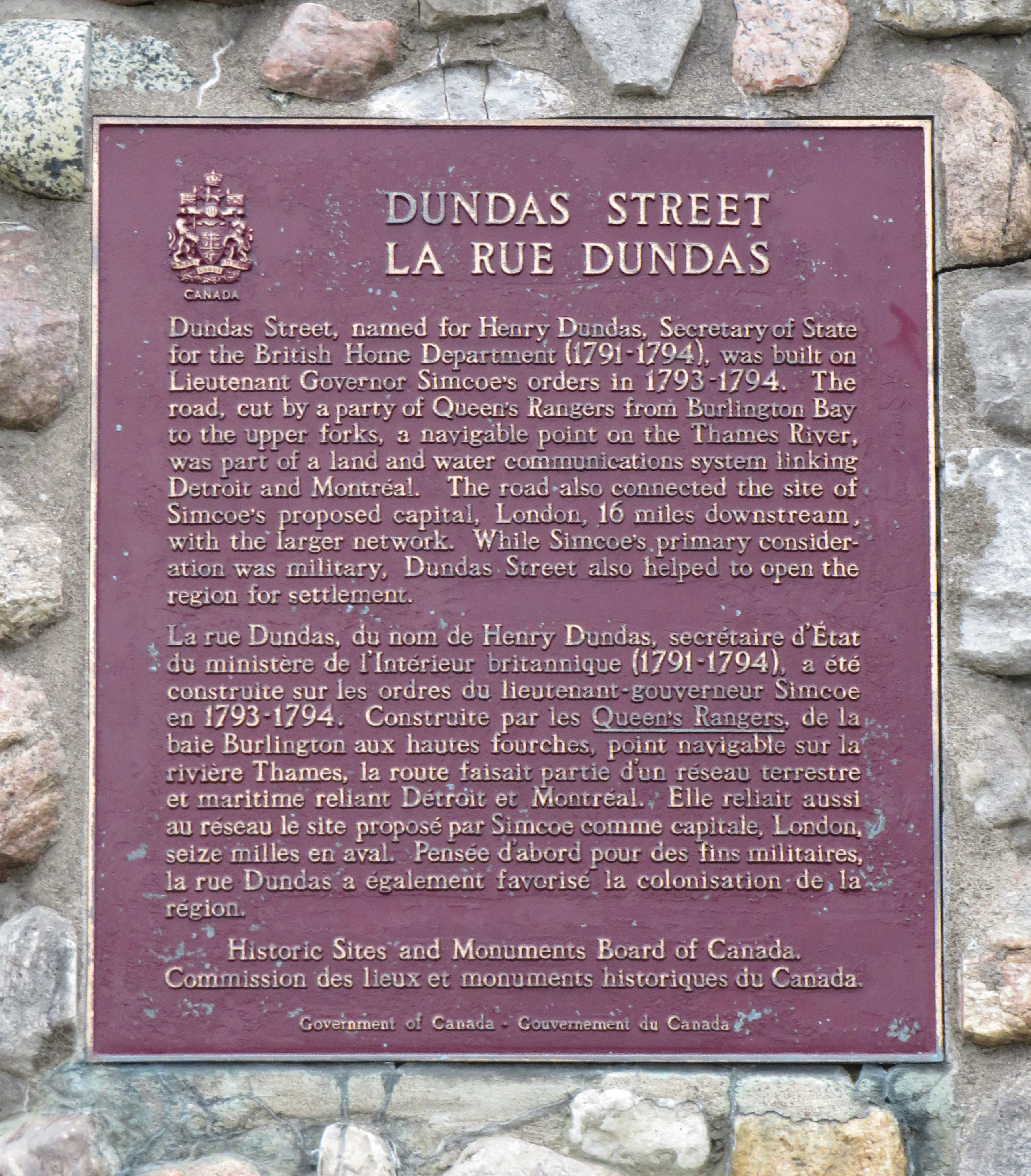
Dundas Street was established as a military supply route by order of John Graves Simcoe, the first British governor of Upper Canada. At first, it was surveyed and cleared in 1794 and 1795 between Cootes Paradise (at the very end of Lake Ontario, beyond Burlington Bay) and the Upper Forks of the Thames River, at what is now Woodstock. From there, small boats could be used to travel downriver to London and to Lake St. Clair. Though there were several Indigenous trails connecting Lake Ontario and the Thames River (the western part of Mohawk Road in Hamilton follows one such route), the new British colonial government favoured a straight, direct road.
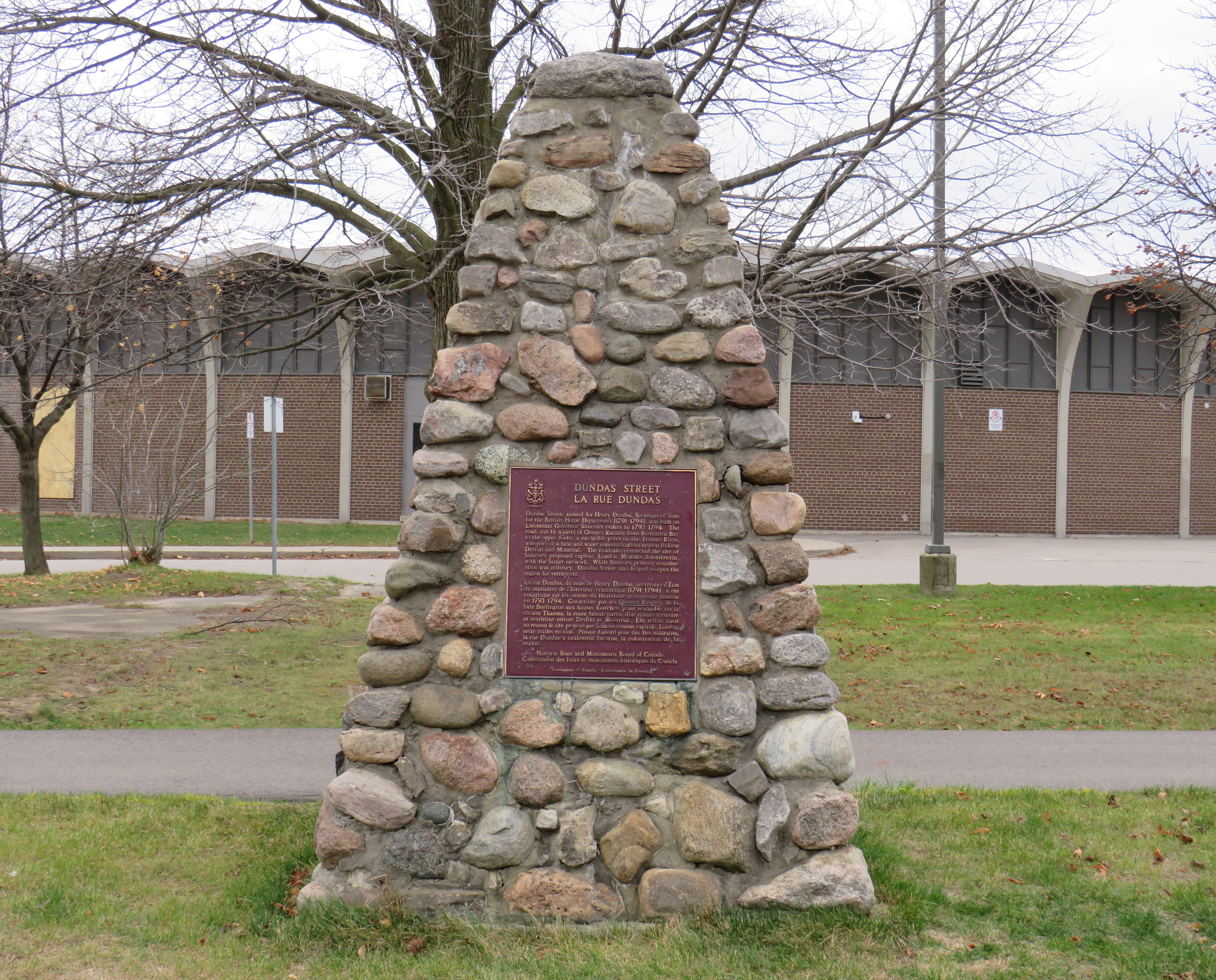
A federal plaque on a cairn in front of Dundas Valley Secondary School in Dundas
Though Dundas Street (which is known as Governor’s Road between Dundas and Paris) features a gentle climb up the Niagara Escarpment, detours were quickly established to get around challenging terrain, such as the confluence of Grand and Nith rivers near Paris. Dundas Street was soon extended westward, to Simcoe’s preferred capital site at London, and extended eastward, to York (Toronto).
Yonge Street, which was originally surveyed and cleared between Lake Ontario and the Holland River near Lake Simcoe, served a similar purpose as Dundas Street. Combined with Penetanguishine Road, Yonge Street provided a military supply route to Lake Huron, though bypassing the established Toronto Carrying Place trail. Though Dundas and Yonge Streets were built with military goals in mind, they, like many other early colonization roads, helped to promote new settlement of lands claimed from local First Nations. Like Dundas Street, Yonge Street was named for a senior British official — George Yonge, who was the British Secretary of War in 1793.
In its early years, Dundas Street’s position inland from Lake Ontario was advantageous as it provided an alternate route in case of invasion. The winding route through Etobicoke and West Toronto to Ossington Avenue allowed travellers to avoid deep ravines and Grenadier Pond.
Lambton House, Old Dundas Street
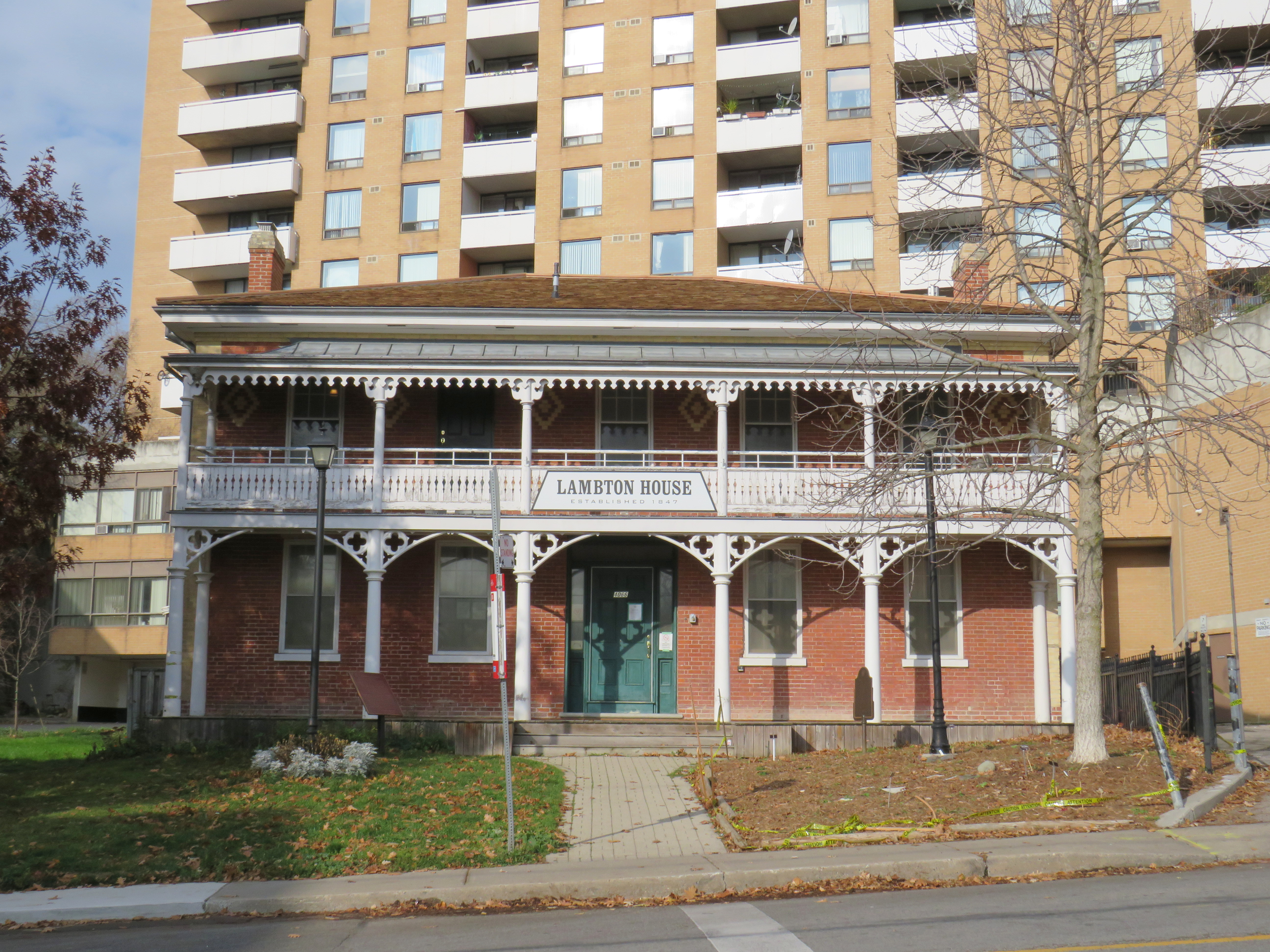
Other early settlement routes, such as Weston Road, branched off of Dundas Street, leading to newly settled lands to the north and northwest of Toronto. Taverns dotted the route, providing accommodation and libation to travelers, several of which — including Lambton House and Montgomery’s Inn — survive to this day.
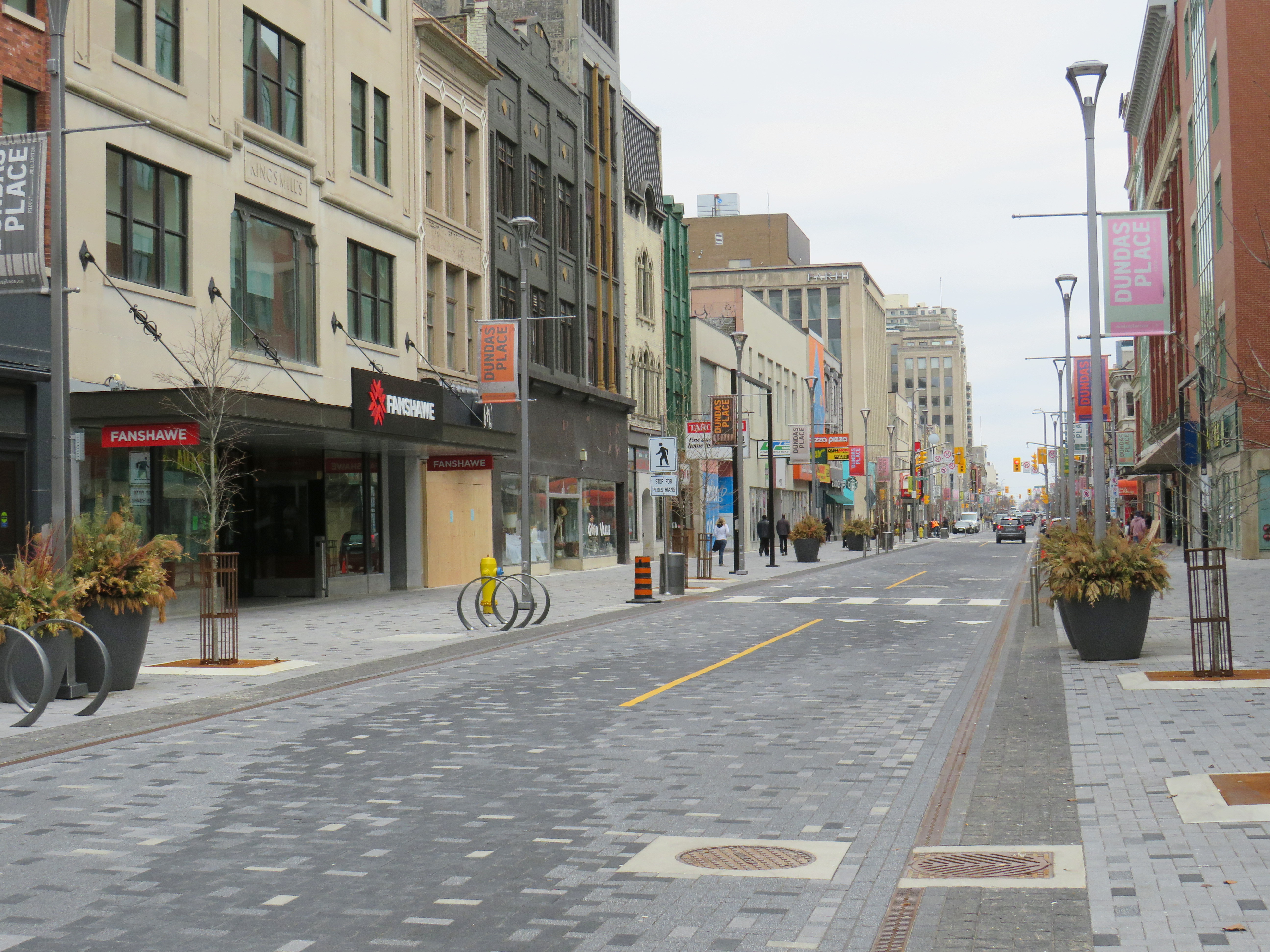
In London and Woodstock, Dundas Street formed the basis for each city’s downtown core. In London, it was recently rebuilt as a two-lane flexible street called Dundas Place, intended to host public events and revitalize the street, which has seen a loss of business to suburban malls and big box stores and to trendier bars and restaurants on Richmond Street, closer to Western University.
Dundas Street in Downtown London was recently rebuilt as a flexible street
Outside the cities, though, other routes surpassed Dundas Street in importance by the mid 1800s. The Lakeshore Road soon became the preferred route between Toronto and Hamilton (which overtook the town of Dundas in size and importance), while the railways, established between Toronto, Hamilton, and London in the 1850s, further eroded Dundas Street’s importance as a major through route until the automobile gained in popularity.
Much of the road between Paris and London became part of interprovincial Highway 2, which extended across Eastern Canada from Windsor, Ontario to Halifax, Nova Scotia. The Waterdown-Etobicoke section became part of Highway 5, while the lesser-travelled section between Paris and Dundas (which today is known as Governor’s Road) was established first as Highway 5B in 1938, then as Highway 99 in 1940.
The remains of the old Dundas Street bridge over the Humber, removed in 1928, looking west to the former settlement of Lambton Mills. The replacement high level bridge is seen to the left. The approaches to the old bridge are named Old Dundas Street.
The Dundas-Waterdown section, which winded its way up the escarpment (only to descend it again a short distance east), became a minor road, with part of the original alignment abandoned by the 1850s.
Though it never held the status of Toronto’s main street, Dundas Street would gain in importance and length in the 19th and early 20th centuries. As Toronto grew beyond its early street grid, it came up against the park lot system devised by Governor Simcoe and other officials to establish a landed gentry in the new colony (including the slaveholding Jarvis and Russell families, who worked to prevent Simcoe from instituting a complete abolition in Upper Canada). These lots which were long and narrow, extended north from Lot (now Queen) Street, and each were developed independently. This resulted in a mess of east-west streets that did not necessarily meet each other. Though College Street was laid out with minimal difficulty, there was no continuous east-west street between College and Queen Streets east of Ossington Avenue.
Dundas Street West, looking southeast from Dovercourt Avenue towards the downtown skyline. This is part of the 220-year old western extension of Dundas Street from the head of lake to York (Toronto).
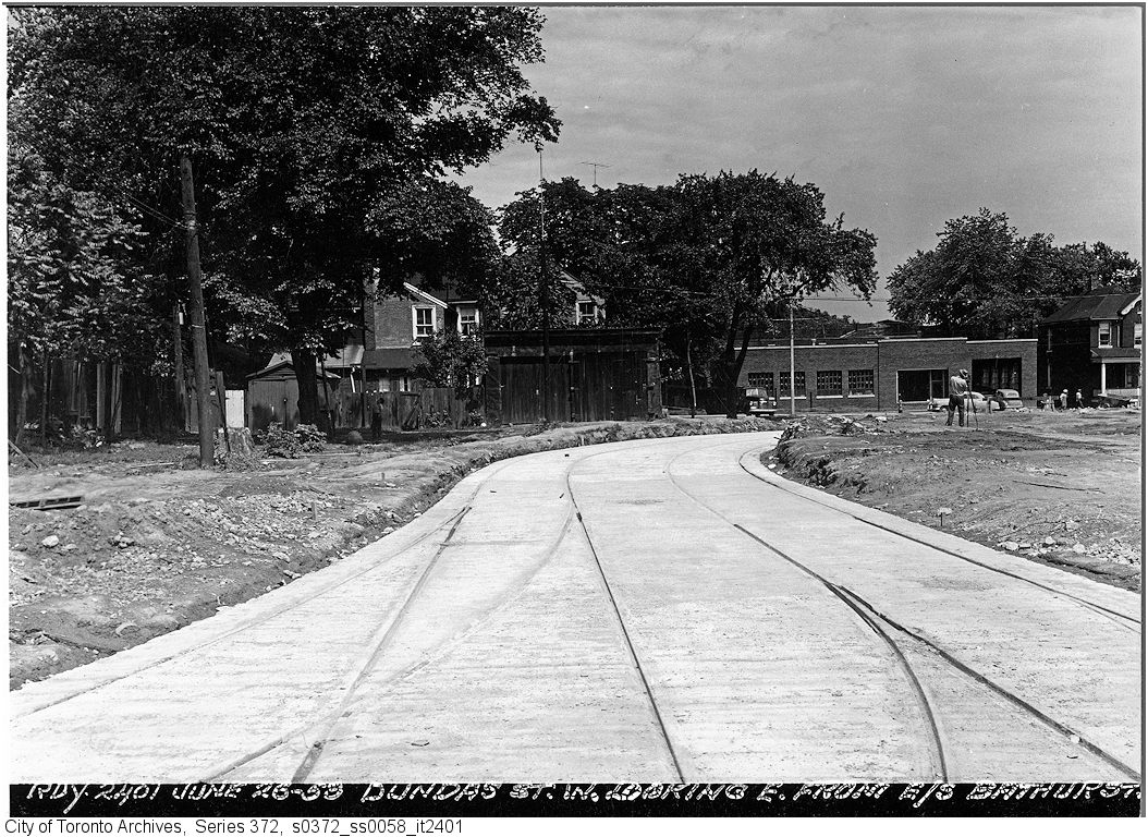
But by the early 1910s, Dundas Street was extended eastward, at first to Bathurst Street, following Arthur Street — which was widened to permit Toronto Railway Company streetcars — and then east to Yonge via St. Patrick, Anderson, and Agnes Streets. Jogs between these streets were slowly realigned, starting with the St. Patrick-Anderson-Agnes jogs between McCaul Street and University Avenue. However, it wasn’t until 1953 that the jog between former Arthur and St. Patrick Streets at Bathurst Street was eliminated. Scadding Court Community Centre now sits on the old roadway, though a small part survives as the centre’s staff parking lot.
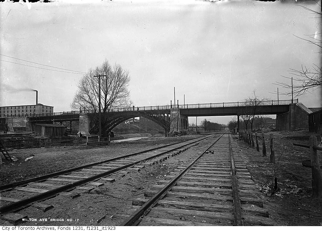
East of Yonge Street, Wilton Avenue was extended across the Don River in 1911, extending just east of Broadview Avenue, incorporating Elliot and Crawford Streets. Though the new bridge was built with streetcar tracks and overhead poles, through service did not begin until 1923, as part of a major TTC route restructuring.
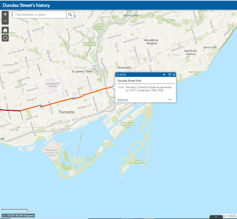
By 1920, Wilton Avenue was renamed Dundas Street East, though the through connection across Yonge Street was not completed until 1922, with the block long section east of Yonge left over from the realignment renamed Dundas Square.
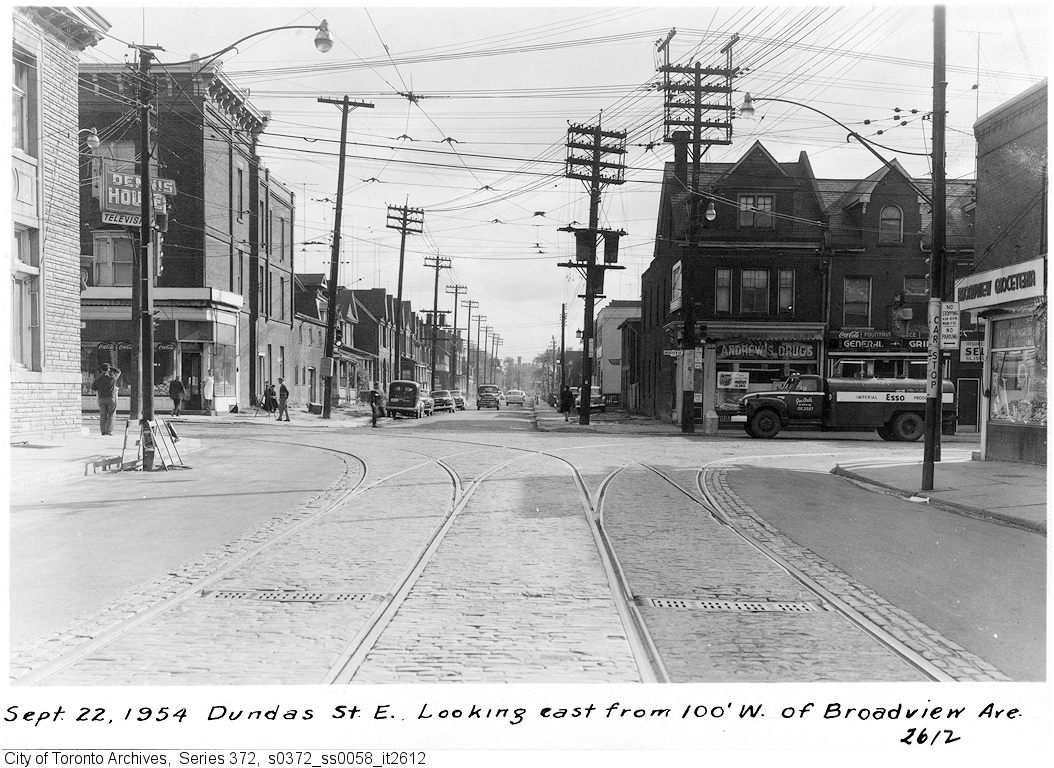
Though the early extensions of Dundas Street through the city simplified the street grid and allowed for through streetcar service between West Toronto and Broadview Avenue, the eastern extension built in the 1950s was done entirely for the benefit of the automobile.
Though Dundas Street extended east of Broadview for one block to Boulton Avenue, it was as a narrow residential street, and did not continue beyond (this is why the Harbord Streetcar took a convoluted route via Dundas, Broadview, and Gerrard to get to Carlaw and Pape Avenues). New roadways were planned to expand traffic access to Downtown Toronto from the burgeoning suburbs, including a new extension of Dundas Street east to Kingston Road.
From Boulton Avenue, a new alignment was built east to Pape Avenue, resulting in the demolition of over a dozen houses on Boulton Avenue, De Grassi Street, West Avenue, and Wardell Street, before ducking under the Canadian National mainline in a new underpass built in 1953, and through an industrial area, avoiding major factory buildings.
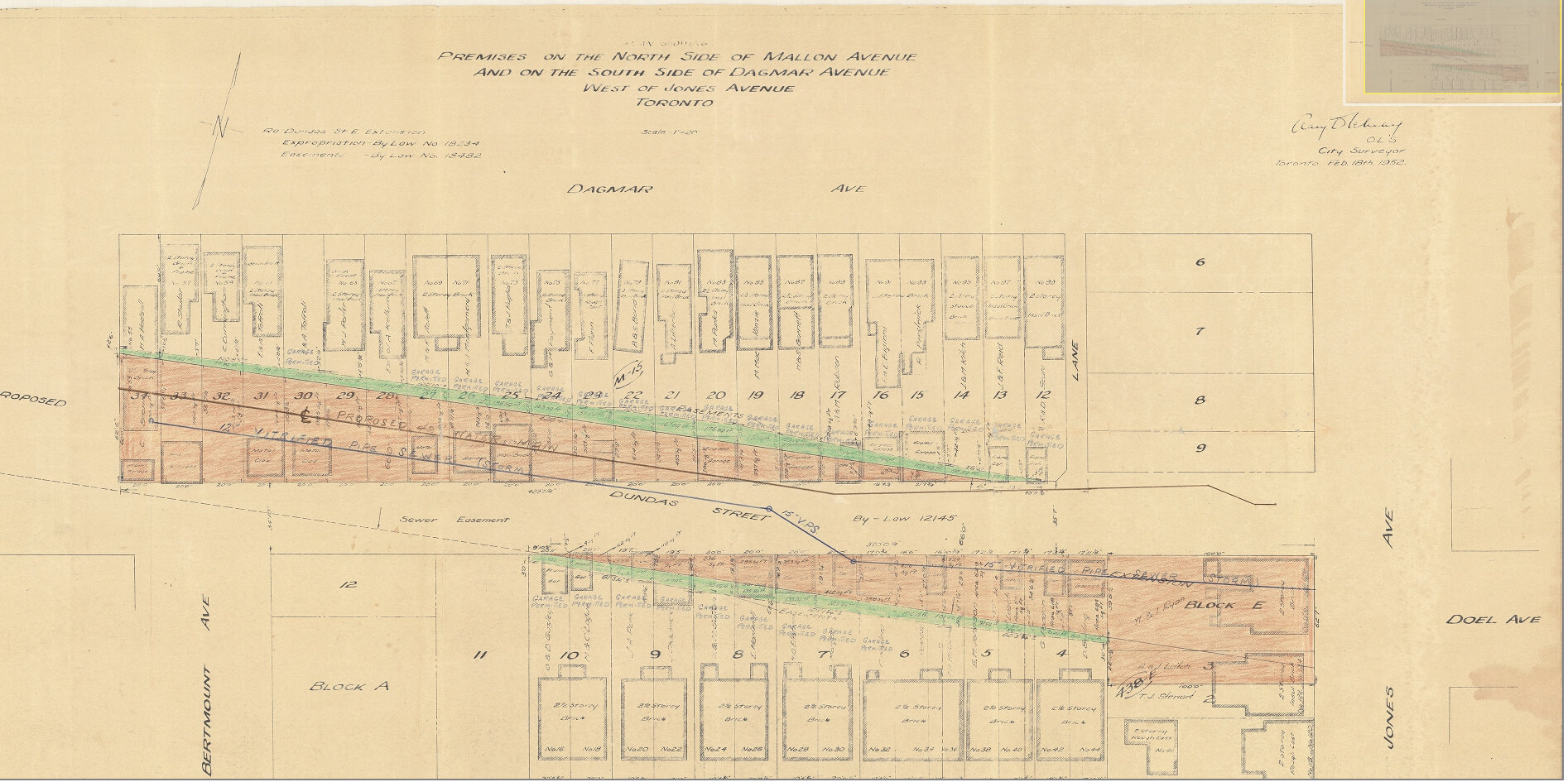
East of Pape Avenue, the new roadway followed a widened Dagmar Avenue, before bending south though a former alley to Jones Avenue to connect with former Doel Avenue to Alton Avenue. Between Alton and Woodfield Road, another new section of roadway was built, through an old brickyard in the late 1940s, connecting with Applegrove Avenue to Coxwell Avenue. The final section, between Coxwell Avenue and Kingston Road, was built through a minor ravine, connecting with, and replacing part of, Maughan Crescent and Edgewood Avenue.
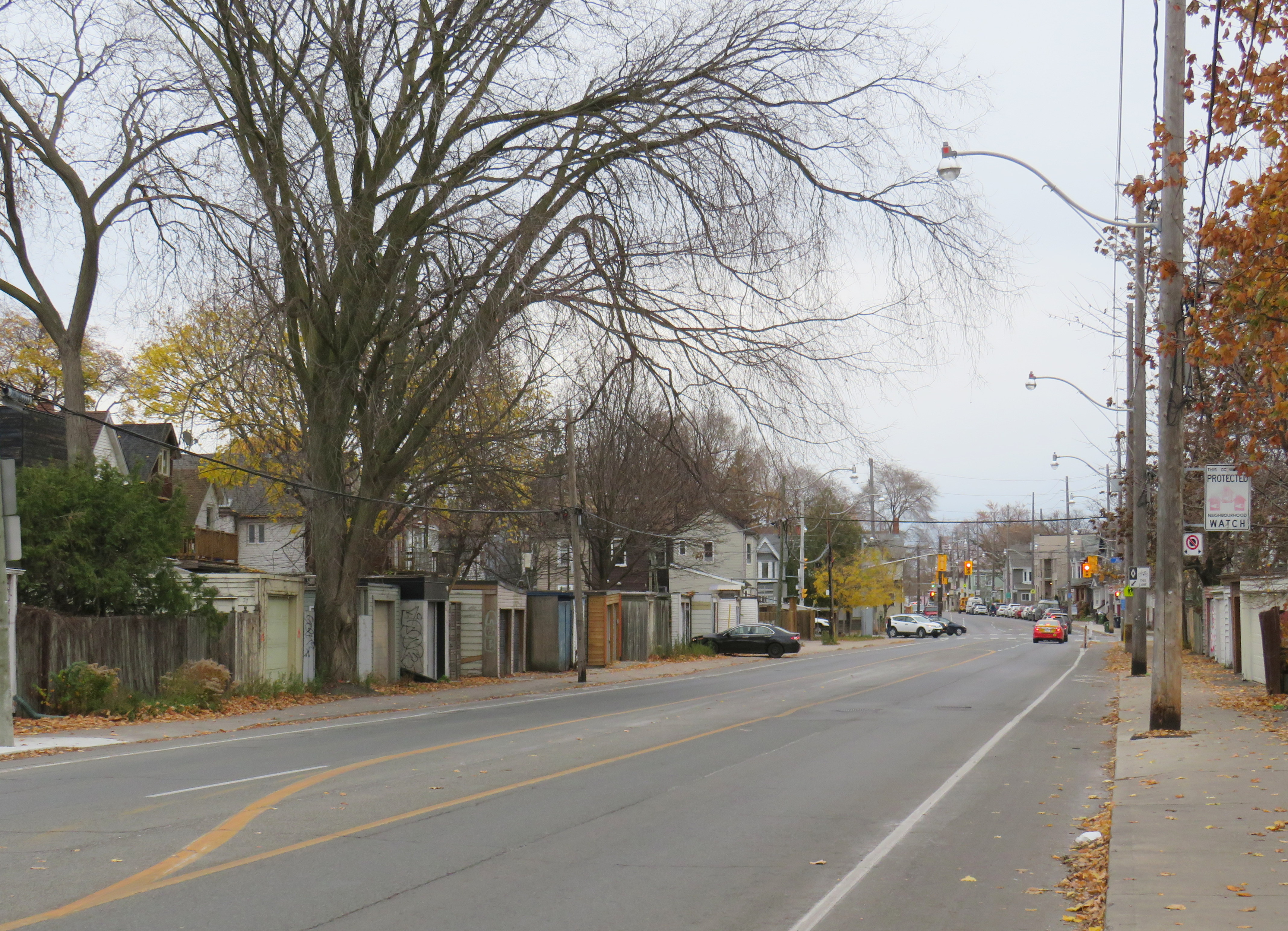
Plan for Dundas Street extension through the rear yards and laneway between Dagmar and Mallon Avenues. From City of Toronto Archives, Fonds 200, Series 2277, Item 32.Just west of Jones Avenue, Dundas Street East is lined with garages, as it passes through an old alley between Dagmar and Mallon Avenues.
Though Dundas Street East was shoehorned into several east-end neighbourhoods through the 1940s and 1950s to provide a new route for automobile traffic, over fifty years later it became an important cycling route. In 2003, the speed limit was reduced to 40 kilometres per hour, and the four traffic lanes reduced to two, with new bike lanes and a centre turning lane. Without streetcar tracks (unlike neighbouring Queen and Gerrard Streets), and with few storefronts, Dundas Street was simple to reconfigure. In 2020, the bike lanes were extended west across the Don River and into Regent Park, as part of the new ActiveTO measures.
Within Toronto, Dundas Street has gone by many names: Arthur, St. Patrick, Anderson, Agnes, Wilton, Elliot, Crawford, Dagmar, Doel, Applegrove, Maughan, and Edgewood. At various times in the first half of the last century, city officials have decided to change their names to Dundas Street.
It would not be without precedent to change Dundas Street’s name as well. Henry Dundas has no connection to local history, and even the historic road that bears his name did not extend any further east than Ossington Avenue.
Retain the legal street names with additional interpretation and recognitions
Retain the legal street names but rename those civic assets with Dundas in their name, except TTC facilities (there are three parks and one library branch that include the Dundas name, and Yonge-Dundas Square; there are two TTC subway stations and one streetcar line that also bear the Dundas name)
Rename the streets and all other civic assets now carrying the Dundas name (including Dundas Street East, Dundas Street West, Dundas Square, and Old Dundas Street).
I would agree with at least the third option, and likely the fourth option, even in part. As one of the city’s most famous and popular meeting places, a better name can be found for Yonge-Dundas Square. As Dundas Street East is a 20th century construct, and less than half the age of the historical road, it too, would be a great candidate for renaming to something meaningful. There are many other streets, towns, and parks in Toronto and elsewhere in Ontario that carry names given by early colonial officials, eager to leave their mark on newly claimed lands. Some are also worthy candidates for renaming.
Other municipalities, including Mississauga, Oakville, Burlington, Woodstock, and London, will also have to decide what they will do with their sections of Dundas Street. There is also the matter of the former Town of Dundas, the Dundas Valley, the United Counties of Stormont, Dundas, and Glengarry in Eastern Ontario (and two townships within it). There are also Dundas Streets in Belleville, Trenton, and Napanee along Highway 2, but otherwise unrelated to the historic road.
But the process must be thoughtful and considerate, and not just a another feel-good exercise that distracts from the real economic and racial inequities in our city.
The interactive map below illustrates the history of Dundas Street, from London to Kingston Road.
Update December 14, 2020: With outdoor skating rinks fully opened for the season, I have added the washrooms located at each of these facilities open this winter. Though many rinks will have to be pre-booked to use (to limit crowds during the pandemic) the city has provided access to adjacent indoor washrooms. I also noted the addition of a portable toilet at Guild Park, something I commented on previously.
Please note, though, that many portable toilets have not been kept in good service. I suggest bringing hand sanitizer on your walks in case you need to use one of these temporary facilities.
Update November 28, 2020: I have added the list of 51 temporary portable toilets that the city has or will be adding to its parks this winter as part of an effort to encourage Torontonians to get outside for winter walks. Many of these locations are along the major ravine paths, including the Don and Humber Rivers. Most location descriptions were easy to locate, though others were quite vague. I did the best I could with the information given. I also added the toilet locations at Tommy Thompson Park, which is operated by the Toronto and Region Conservation Authority.
There remain some critical gaps, including the absence of Guild Park in Scarborough and along the waterfront between Humber Bay Shores and Marie Curtis Park, but on the whole, this is a positive development. The city also announced new winter maintenance of additional park paths, though ideally, this service would be extended along the entire ravine network.
As of Monday, November 23, Toronto and Peel Region will be in another lockdown. Non-essential businesses and services will close or be open only for take-out and curbside pickup. Gyms, patios, and salons will all be closed. Though we may not be able to socialize with friends and extended family, we can still go for walks, runs, and bike rides to maintain our physical and mental heath.
But with indoor dining prohibited since October in Toronto, and most malls closing down, finding a washroom has become much more difficult. Many outdoor park washrooms are not winterized, so they must close as well. For many of us, having access to open and accessible washrooms is a necessary when leaving the home for long periods of time.
Though there is a list of washrooms open (or soon to open) on the city’s website, they are listed in alphabetical order, without easily-accessible location information. I took the liberty of mapping each park washroom location, as well as selected other city-owned public washrooms accessible seven days a week.
Though winterized public washrooms can be found across the city, there are a few areas left unserved, including the Etobicoke waterfront between Humber Bay Shores and Long Branch, the eastern Scarborough waterfront parks, including Guild Park and the Port Union/Rouge Beach area, and northwestern Etobicoke. Ideally, every Torontonian should live within walking distance of a four-season park.
Even with the impending lockdown, there are some other washrooms that will remain available when necessary. GO Transit has kept washrooms at its stations accessible even during the Spring 2020 lockdown. On the Lakeshore Line, stations are open seven days a week, including Guildwood and Rouge Hill. Many supermarkets have public washrooms as well.
I hope that there will be improved four-season access to public washrooms this year, and every year going forward. Simple outdoor activity, including long walks, are one of the safest and easiest things we can do to keep ourselves happy and busy.
I will update the map as more washroom facilities open.
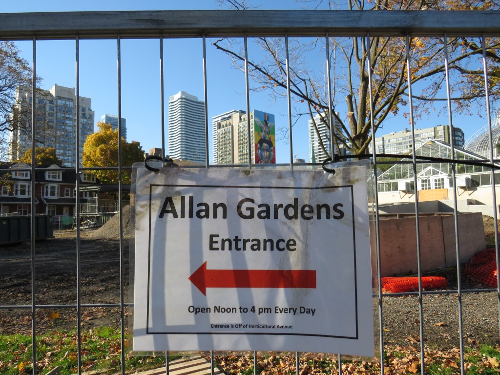
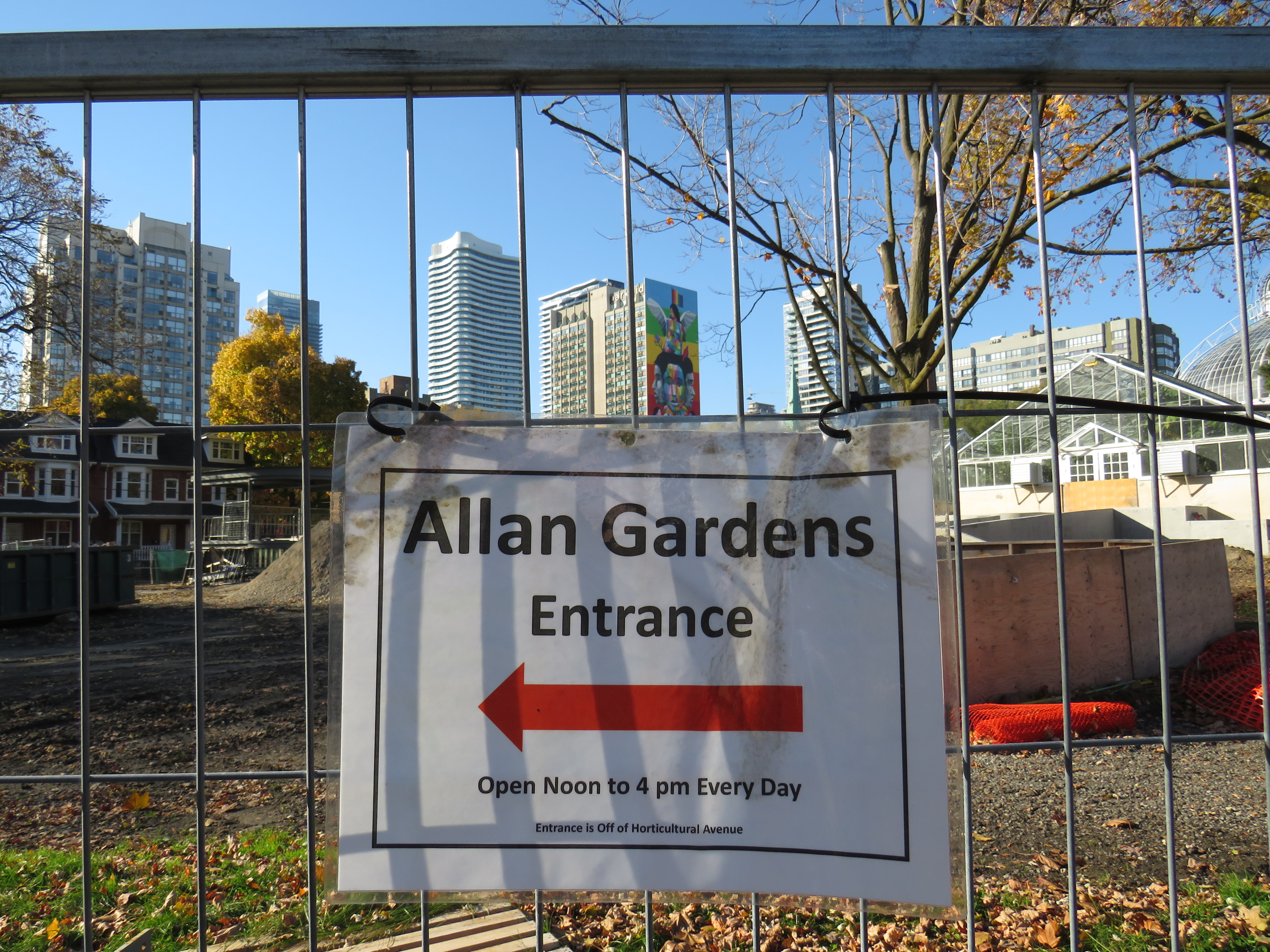
On November 4, signage scattered around Allan Gardens leads visitors to locked doors
The ongoing pandemic, to quote the prime minister, “really sucks.” Ontario has been subjected to various levels of lockdowns and restrictions for nearly eight months now as COVID-19 case counts continue to be high. Restaurants, bars, cinemas, and gyms are currently closed in Toronto, as are most other indoor venues. Many of us are — if we’re lucky — working from home, but shut off from meaningful socializing from family, friends, colleagues, and allies. Many are left unemployed with few job openings out there. Those still working in factories, warehouses, public institutions, kitchens, and stores face increased pressures without many of their supports.
That leaves only a few outlets for selfcare: the support of immediate family, outdoor exercise, and passive entertainment such as streaming shows and movies online. Though I am working on several interesting projects here at home, I can attest that Zoom calls, Facebook chats, and occasional phone-calls are no substitute for in-person social interaction. Regular walks have been essential to my mental health, which has suffered during the pandemic. With so much construction in my neighbourhood, there has been one nearby oasis: the conservatory at Allan Gardens.
Sadly, that’s no longer an option, and I found that out the hard way. Though it is a minor complaint given the much larger failure to control the virus here in Ontario and properly communicate important public health information and advice, it’s just a microcosm of the mixed messaging from all levels of government that we have been enduring since February.
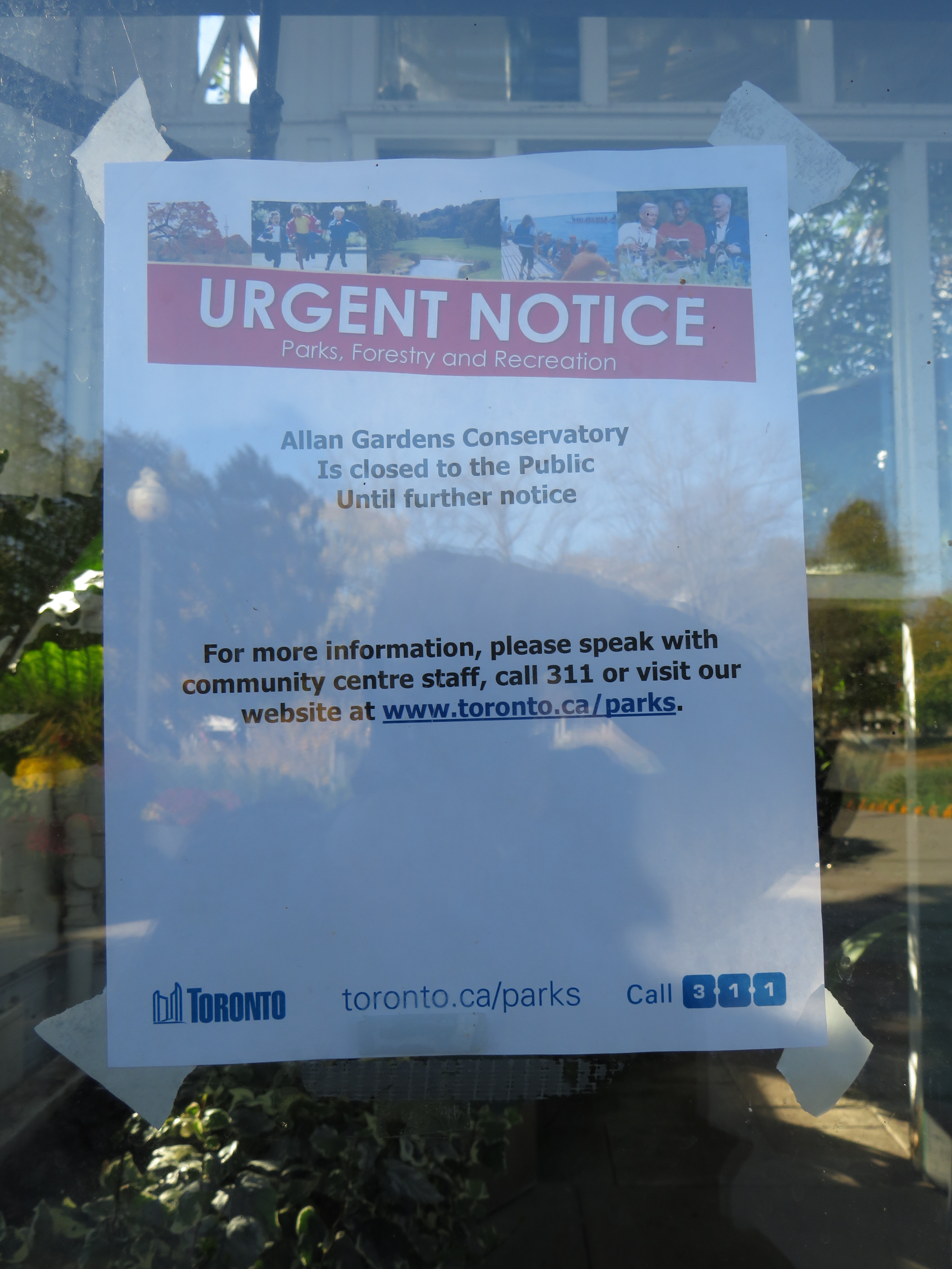
“Urgent notice” – anyone who continues past the signs directing visitors to the designated entrance to the Allan Gardens Conservatory is greeted with this notice indicating that the building is closed until further notice(more…)