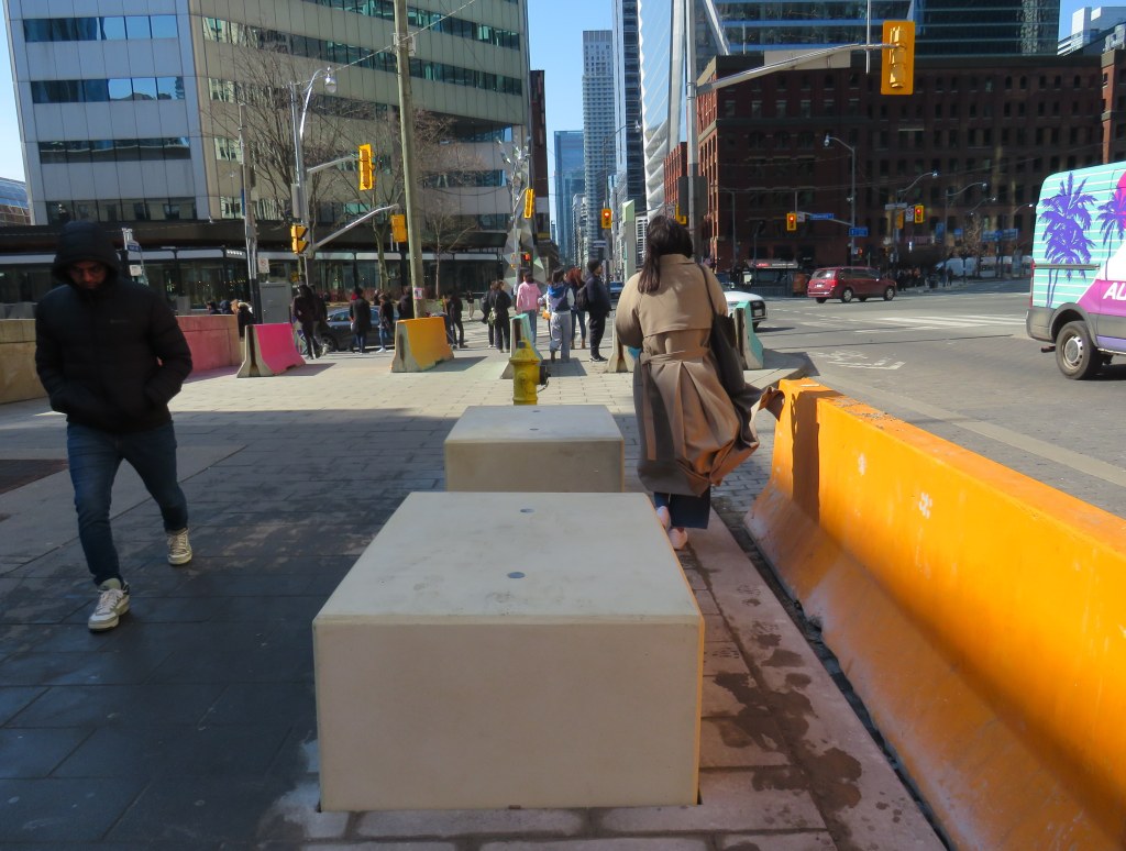
New blocks installed in front of Union Station at Front and York Streets
When I learned that Union Station was finally getting permanent bollards to replace the haphazardly-placed Jersey barriers that have sat in front of the transport hub since 2018, I was relieved. I wrote about these barriers several times on this website, criticizing their appearance and their placement, blocking the way for the thousands of people who cross Front Street every day. But when I went to see them in person, after seeing criticism online, I was dismayed.
The new permanent barriers might even be worse than the temporary obstructions they are meant to replace.
The Jersey barriers were hastily placed after a tragic attack on Yonge Street in North York, where a man intentionally drove a rented van on to the sidewalk, killing ten pedestrians and injuring and traumatizing many more.
Vehicular assaults on crowds of pedestrians are a major concern; tactics used at mass gatherings — such as the winter light show and New Years Eve events at Nathan Phillips Square and major concerts and playoff games at Skydome and Scotiabank Arena — now include blocking closed streets with heavy vehicles such as snow plows, dump trucks, and city buses. However, Union Station is the only place in the city where officials have decided that new permanent barriers were necessary.
Union Station is one of the busiest pedestrian areas in the city
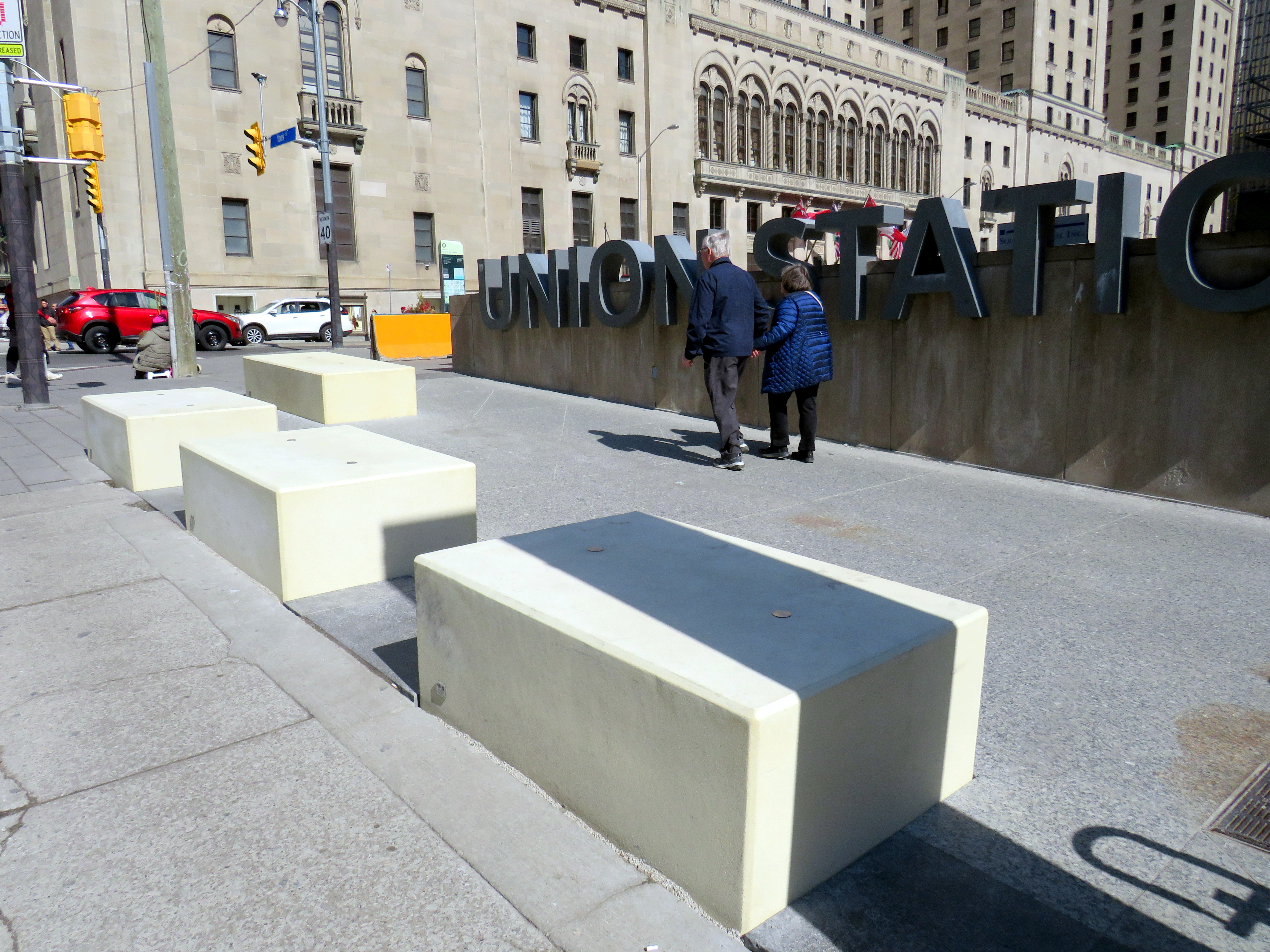
The new permanent barriers are not the sturdy, yet narrow, bollards that are used elsewhere. Instead, they are large, undecorated concrete blocks anchored into the ground and are knee-high. The plain concrete colour does not match the stone sidewalks or plaza. They are placed very close together, impeding access for those using large carts, strollers, or wheeled mobility devices. Despite all the money spent renovating Union Station, these blocks look cheap.
Concrete blocks at the corner of York and Front Street at Union Station
The total cost of installing the “Custom Anti-Terror Concrete Barriers,” as the city described the bid, was $2,438,238, including HST. The lowest bid, by South Central Inc., came over a $1 million cheaper than the other two bids. It is worth noting that there are no public documents that describe the city’s specifications for the contract, nor was there any public consultation before the city solicited bids.
The result? An esthetic failure and an accessibility challenge.
Video showing pedestrians going around the concrete blocks in front of Union Station
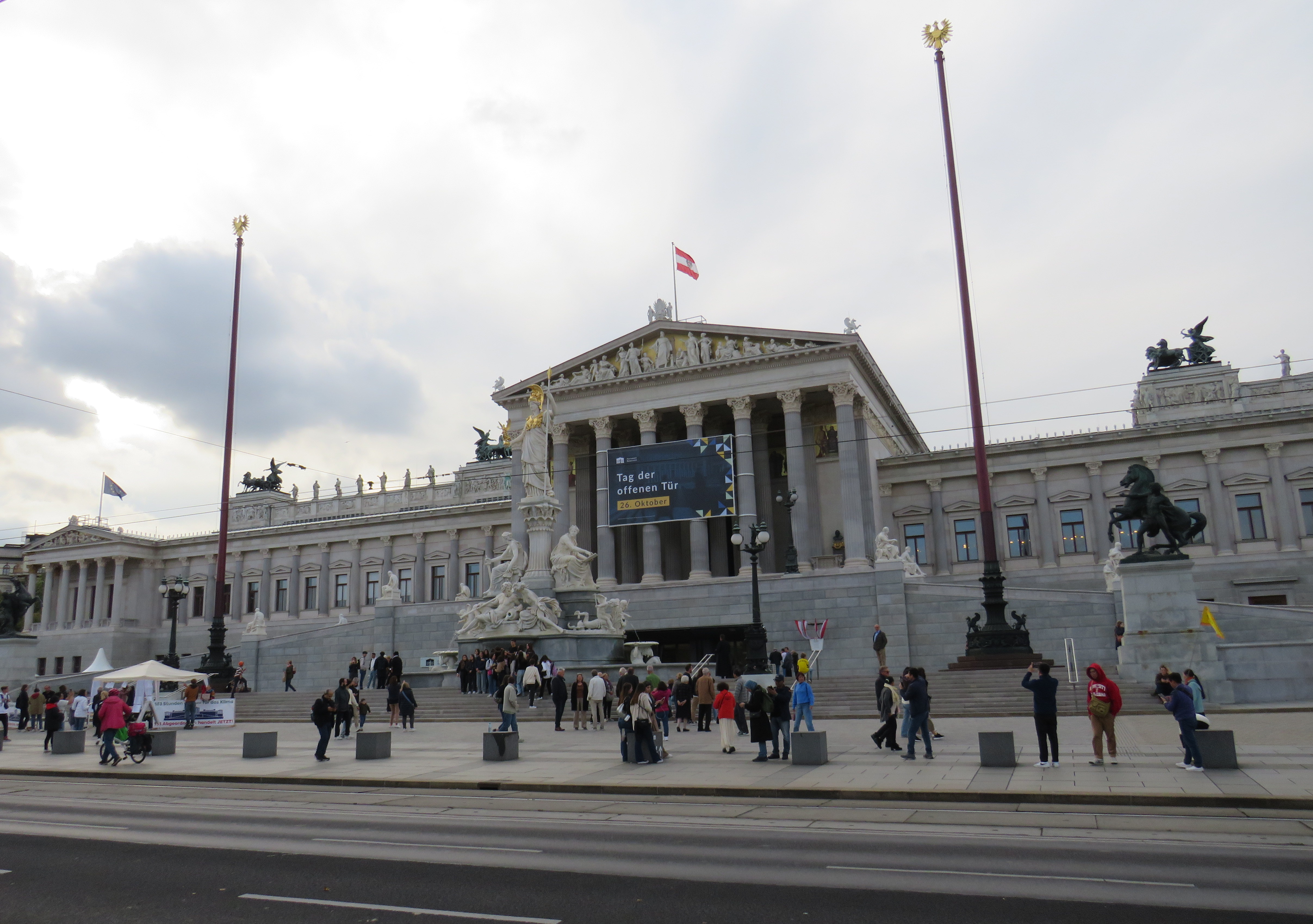
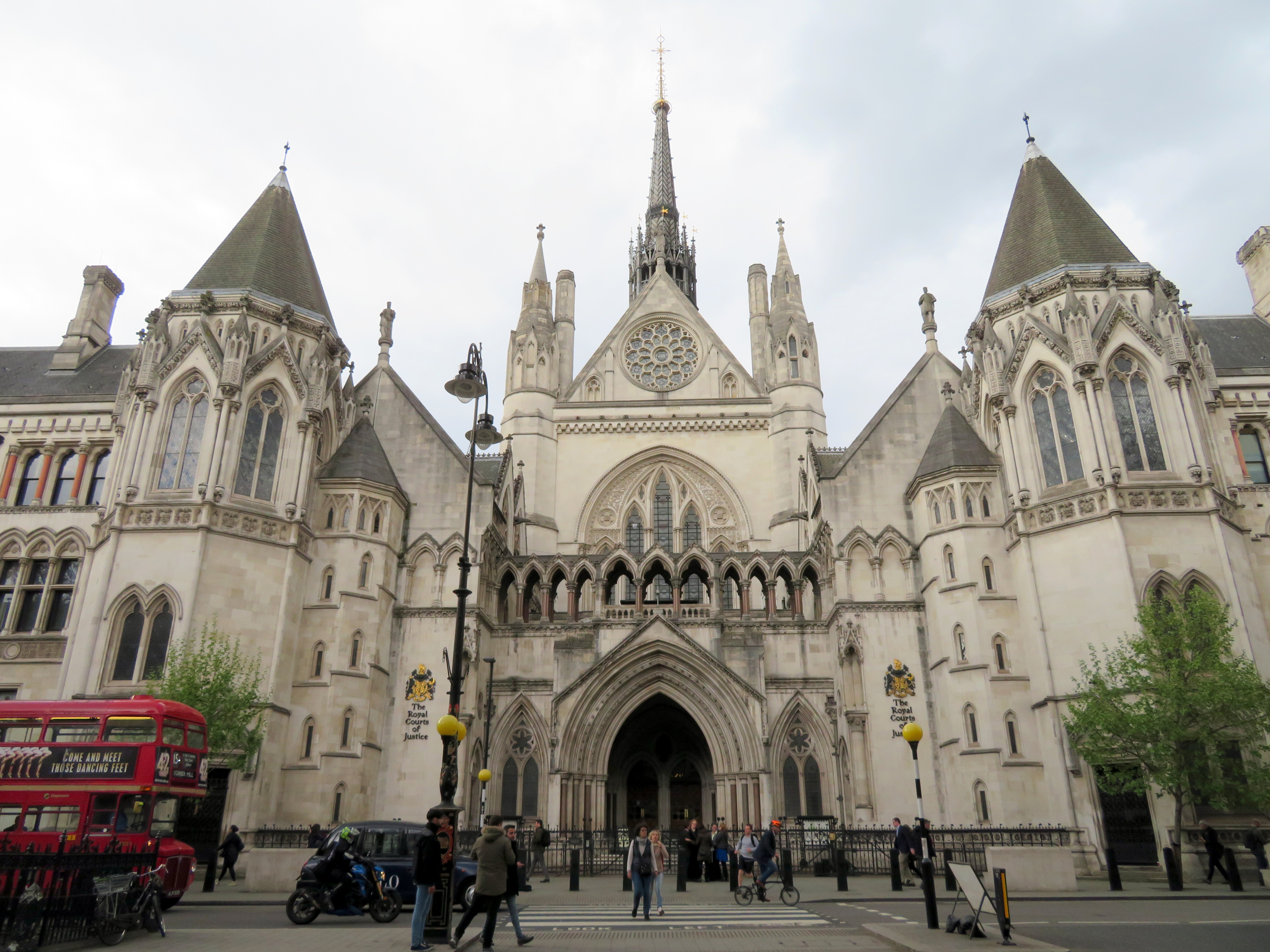
I cannot understand the city’s decision to go with these blocks where more elegant and pedestrian-friendly alternatives are typically used elsewhere. For example, the Austrian Parliament Building in Vienna, which faces the famous and busy Ringstrasse, is protected by smaller concrete bollards, which are also more widely separated, making it much more pleasant for pedestrians to get by. In Great Britain, metal bollards are common on busy commercial streets and in front of important buildings, but they are easy for pedestrians to pass, and generally blend in.
Thick concrete bollards in front of the Austrian Parliament Building, 2023Metal bollards in front of the Royal Courts of Justice in London
In the United States, government buildings are also protected by heavy anti-vehicular barricades (especially since the 1995 Oklahoma City bombing), but they are generally more permeable for pedestrians.
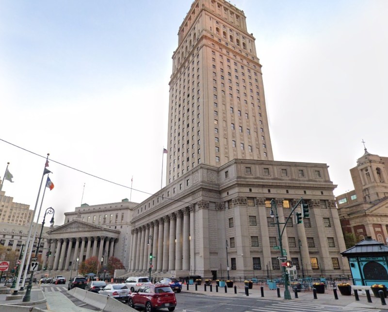
Metal bollards protect the federal courthouse in Downtown Manhattan (Google Streetview)
It is also worth noting that other popular pedestrian areas, such as the Yonge-Dundas intersection, are not protected from a potential vehicular attack — or an unintentional collision. It is beyond comprehension why the city only focused on protecting one pedestrian area, using such a poorly thought-out design. Toronto can — and should — do better.
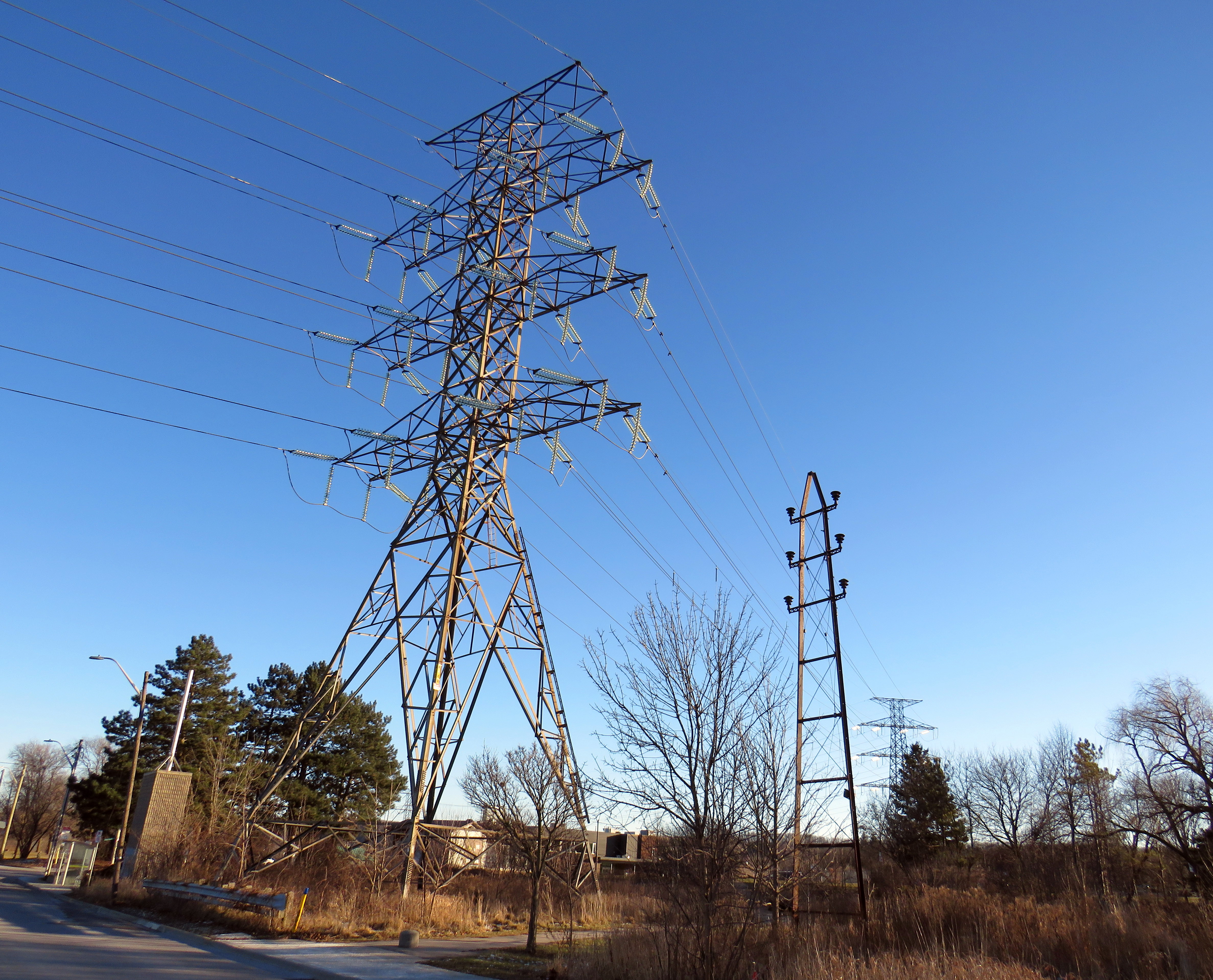
A modern electric tower looms over an early hydro pole
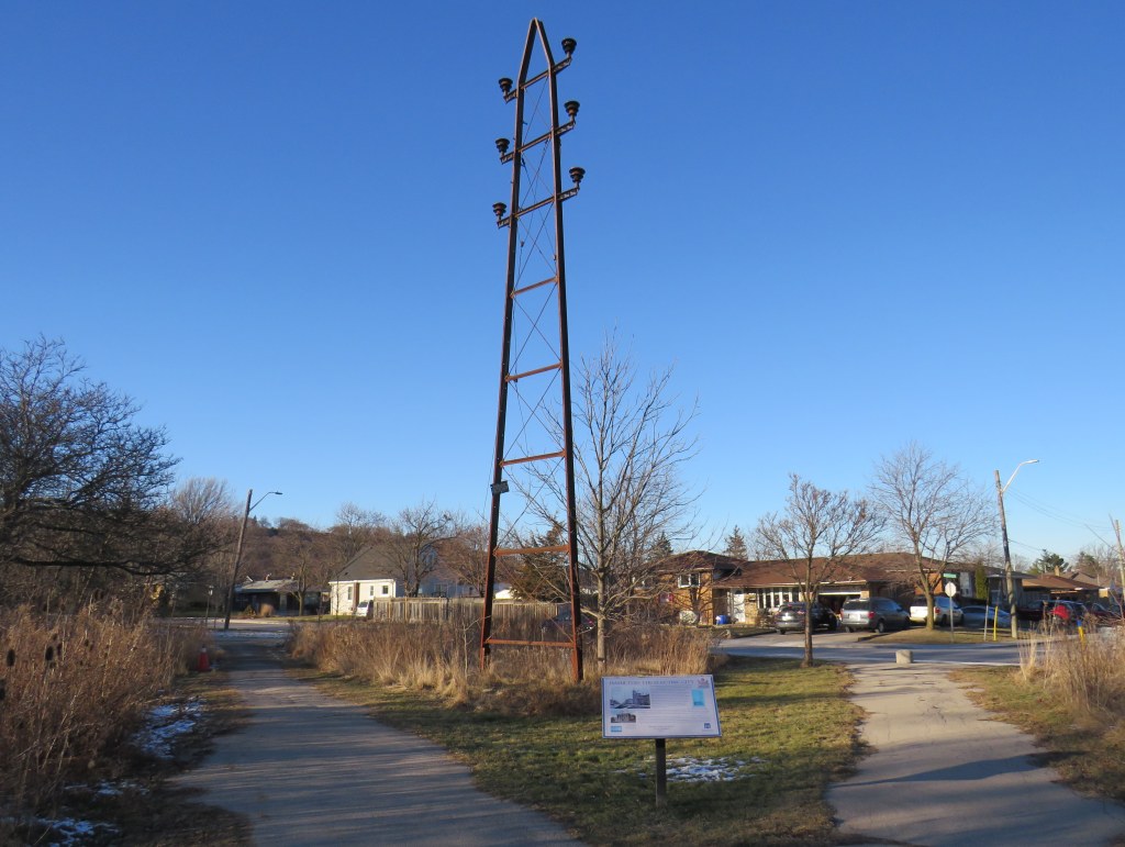
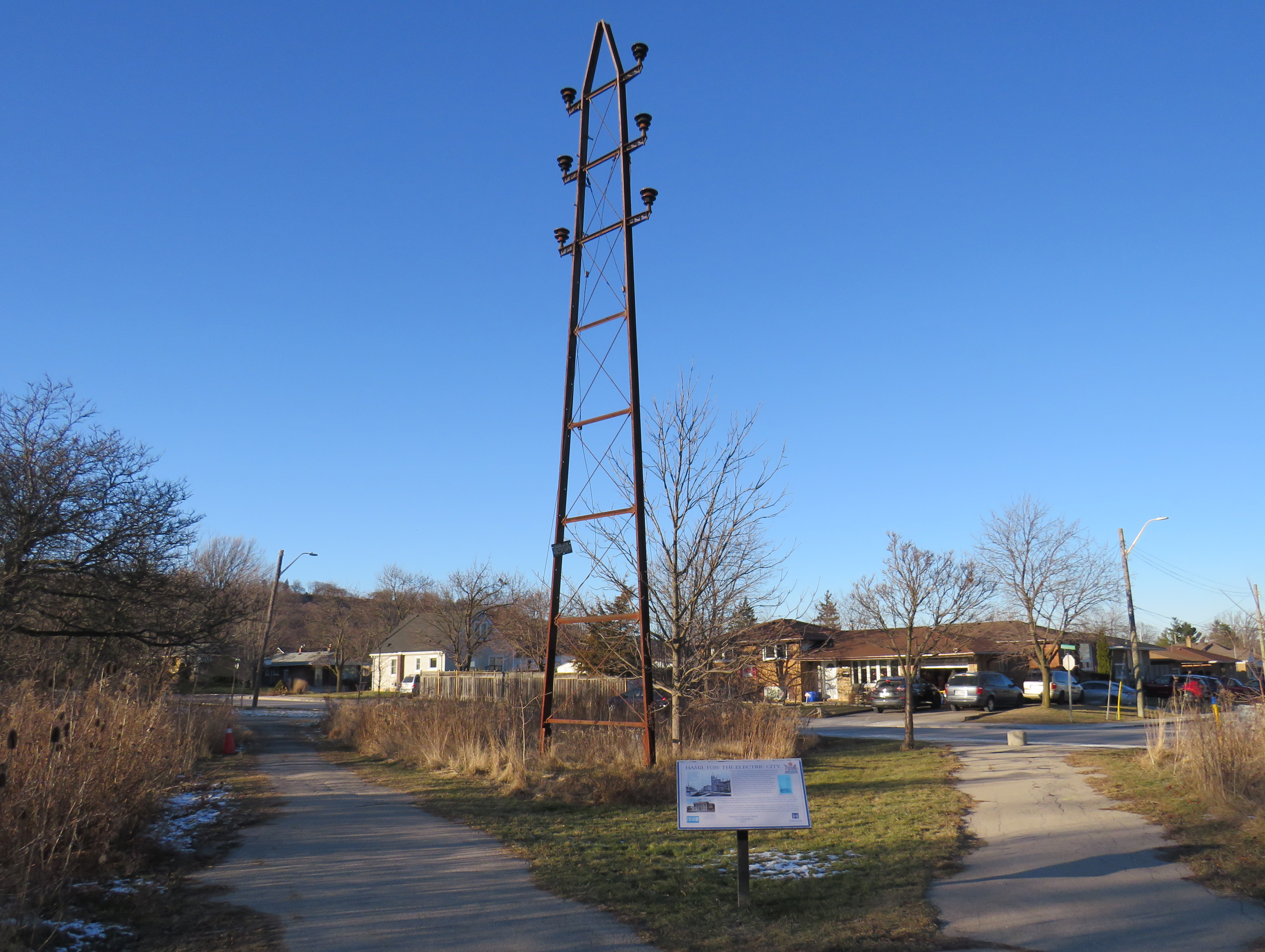
On the edge of a quiet postwar neighbourhood in Hamilton, Ontario, there is a remarkable remnant of a time gone by, preserved in situ, accompanied by an interpretive plaque. A small steel hydro-electric transmission tower stands in a park, once part of a pioneering 43-kilometre corridor that connected Hamilton with a new hydro-electric generating station at DeCew Falls, near St. Catharines. Next to the old pylon stands a much taller tower carrying electric lines along the same corridor.
Looking south, with the old tower facing the Rosedale neighbourhood
Both the DeCew Falls plant and the transmission corridor were constructed by the Cataract Power Company, an organization founded by five Hamilton businessmen, who all had the first name John. “The Five Johns” took control of the city’s power generation and distribution, electric lighting, as well as the Hamilton Street Railway (HSR) and electric interurban railways (known as radials) to nearby cities and towns including Dundas, Oakville, Brantford, and Beamsville. The HSR began electrified streetcar service on June 29, 1892, several months before the first electric streetcar operated in Toronto.
The tower was erected by the Dominion Power Company (the successor company that absorbed the Cataract) in 1913, as part of an upgrade of the corridor between Hamilton and DeCew Falls, and it is the only one of its vintage to survive. Beside the old tower, a modern hydro-electric corridor follows the same route south, up the Niagara Escarpment.
Access to cheap, reliable hydro-electric power was one reason why Hamilton was able to thrive as a major industrial centre, attracting steel producers, tire and auto manufacturers, textile mills, and electrical equipment suppliers. That, along with excellent water, rail, and road access helped to make the “Golden Horseshoe” at the western end of Lake Ontario shine.
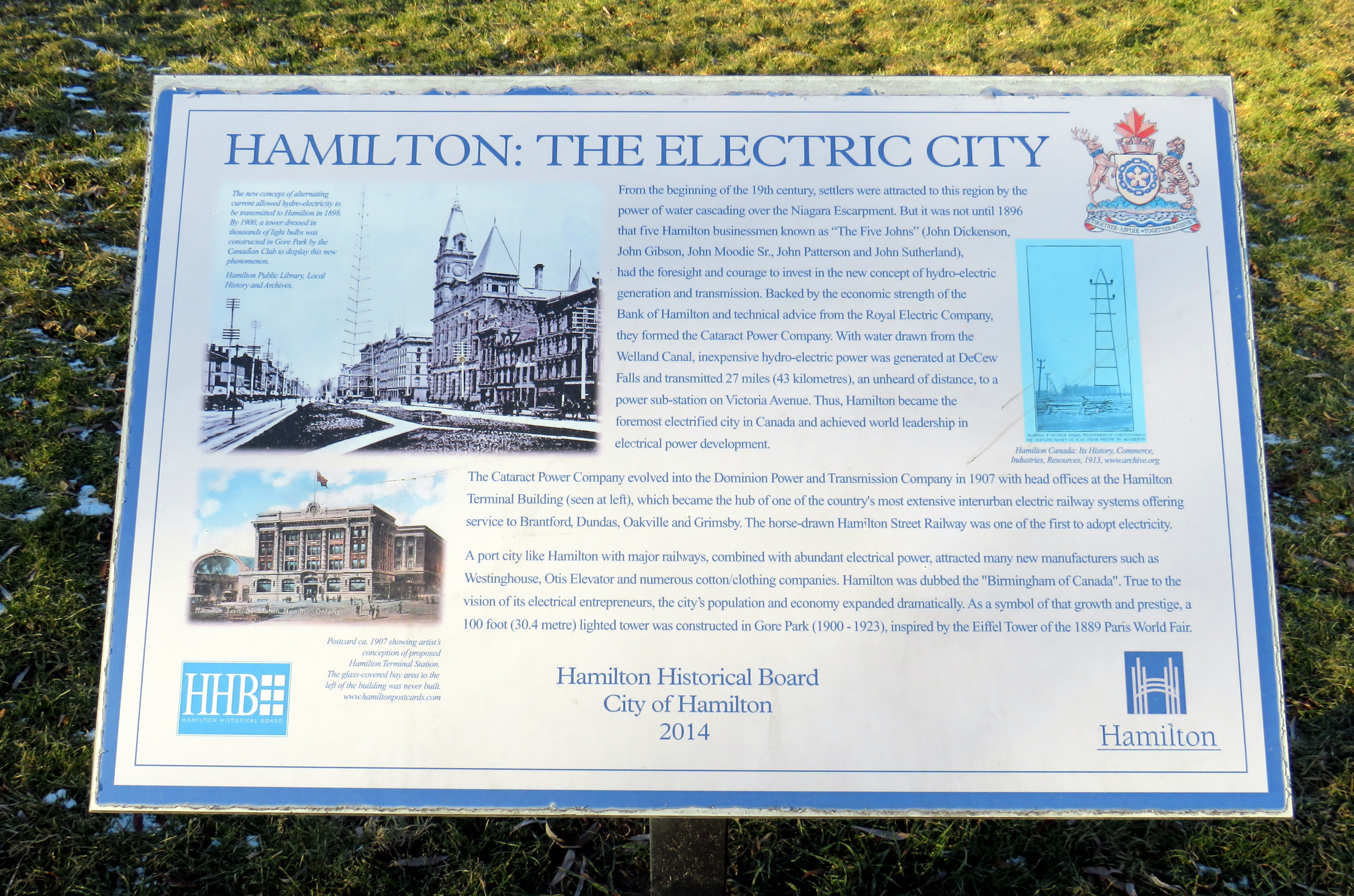
Plaque installed by the Hamilton Historical Board in 2014 titled Hamilton: The Electric City
Eventually the hydro dam, the transmission corridor, the HSR, and the radials were taken over by the Hydro-Electric Power Commission of Ontario, which consolidated the many private power companies throughout the province and putting them under public control. Adam Beck, who headed the commission, was also an advocate for interurban railways, so control of the HSR and the radials was a natural fit. Unfortunately, Ontario’s radial railways were never fully consolidated, and most disappeared by the early 1930s. Hydro, however, kept control of the HSR until 1946, when it was sold to Canada Coach Lines, a Hamilton-based intercity carrier whose routes followed several of the old radial lines. Under private CCL ownership, the last streetcar lines were replaced with diesel and electric trolley buses by 1951.
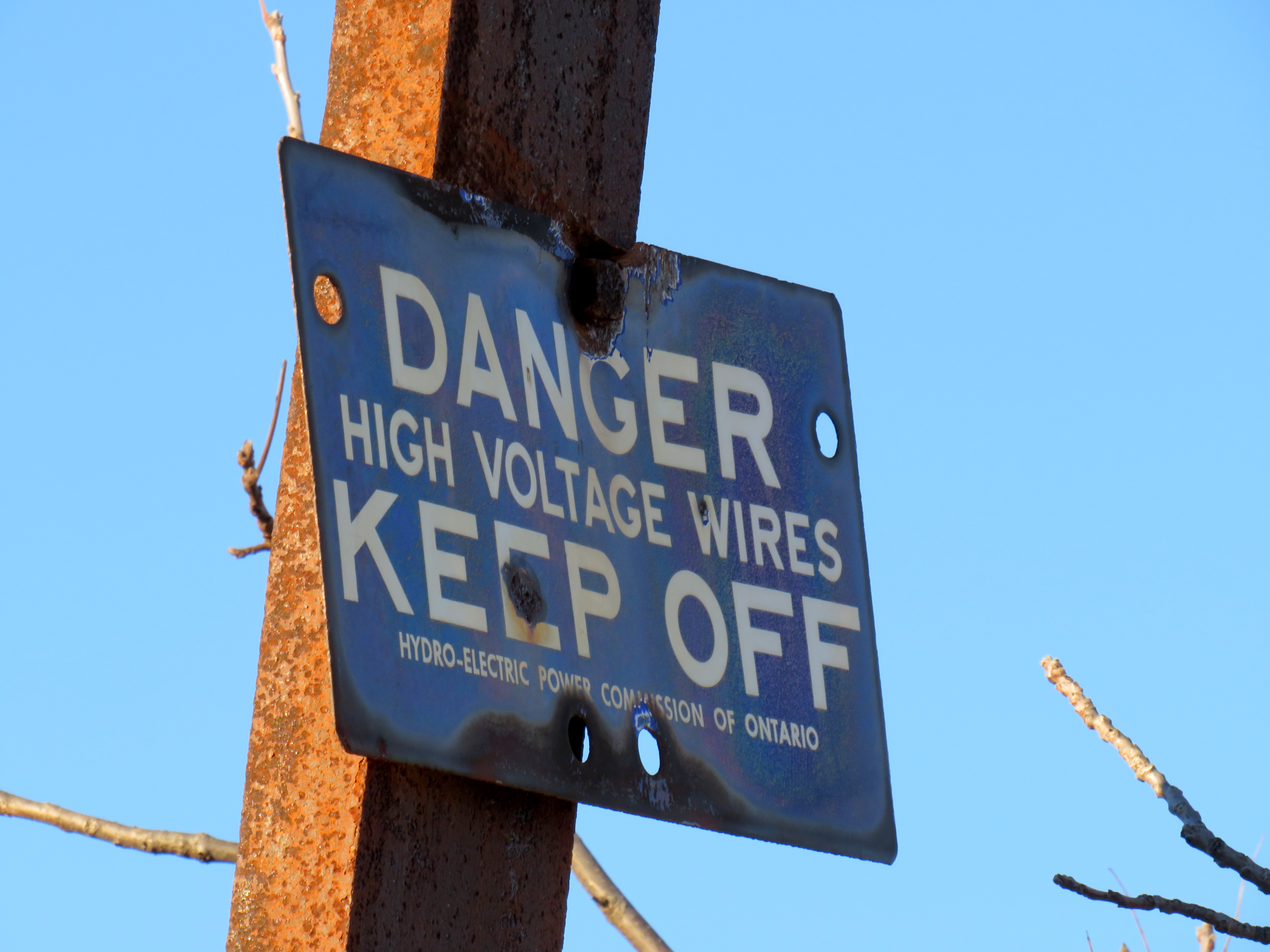
The “danger – high voltage wires” sign on the old tower bears the Hydro-Electric Power Commission of Ontario name. HPEC, later known as Ontario Hydro, took over the corridor from the private Dominion Power Company.
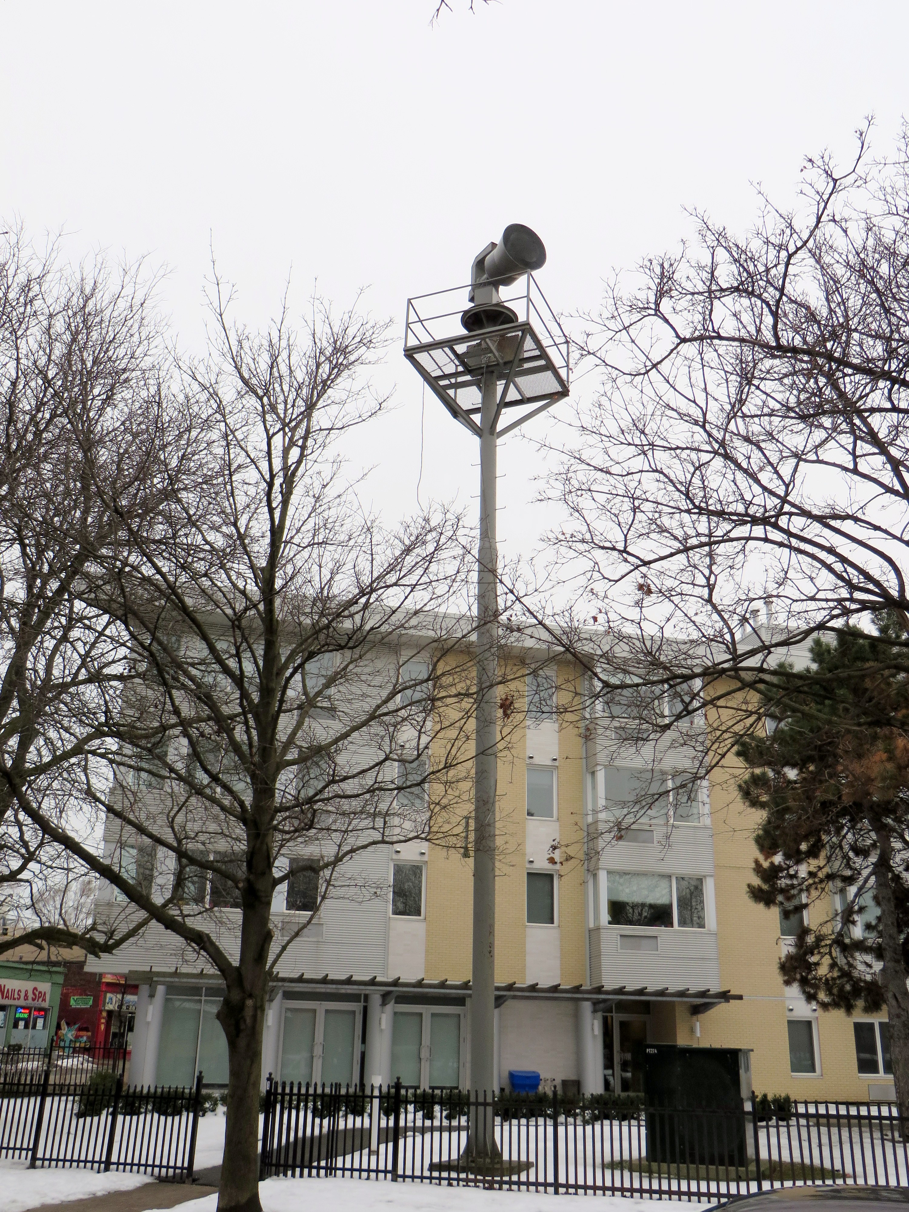
Heritage preservation need not be concerned only with major landmarks and grand buildings. Sometimes the seemingly mundane details matter too, and tell us about the history of our built environment. In Toronto, at Dundas Street West and Shaw Street, an old air raid siren still stands at the top of a long metal tower. These sirens were common place from the 1950s to 1980s, but they were mostly taken down as they became redundant due to modern missile technology (rendering evacuation and “duck and cover” measures useless) and the eventual end of the Cold War.
Today, the remaining siren tower is also a reminder of those times.
Disused air raid siren still stands at Dundas and Shaw
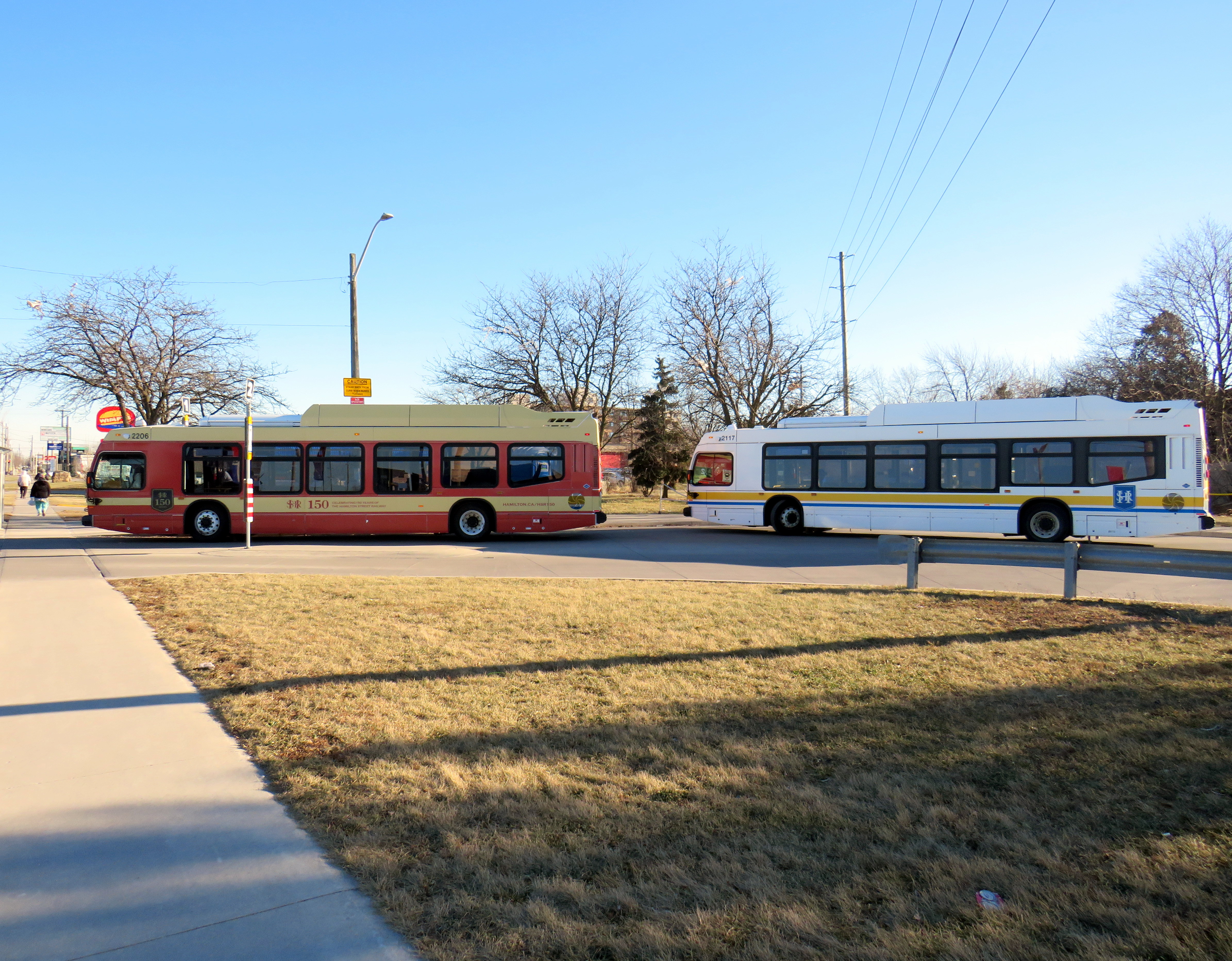
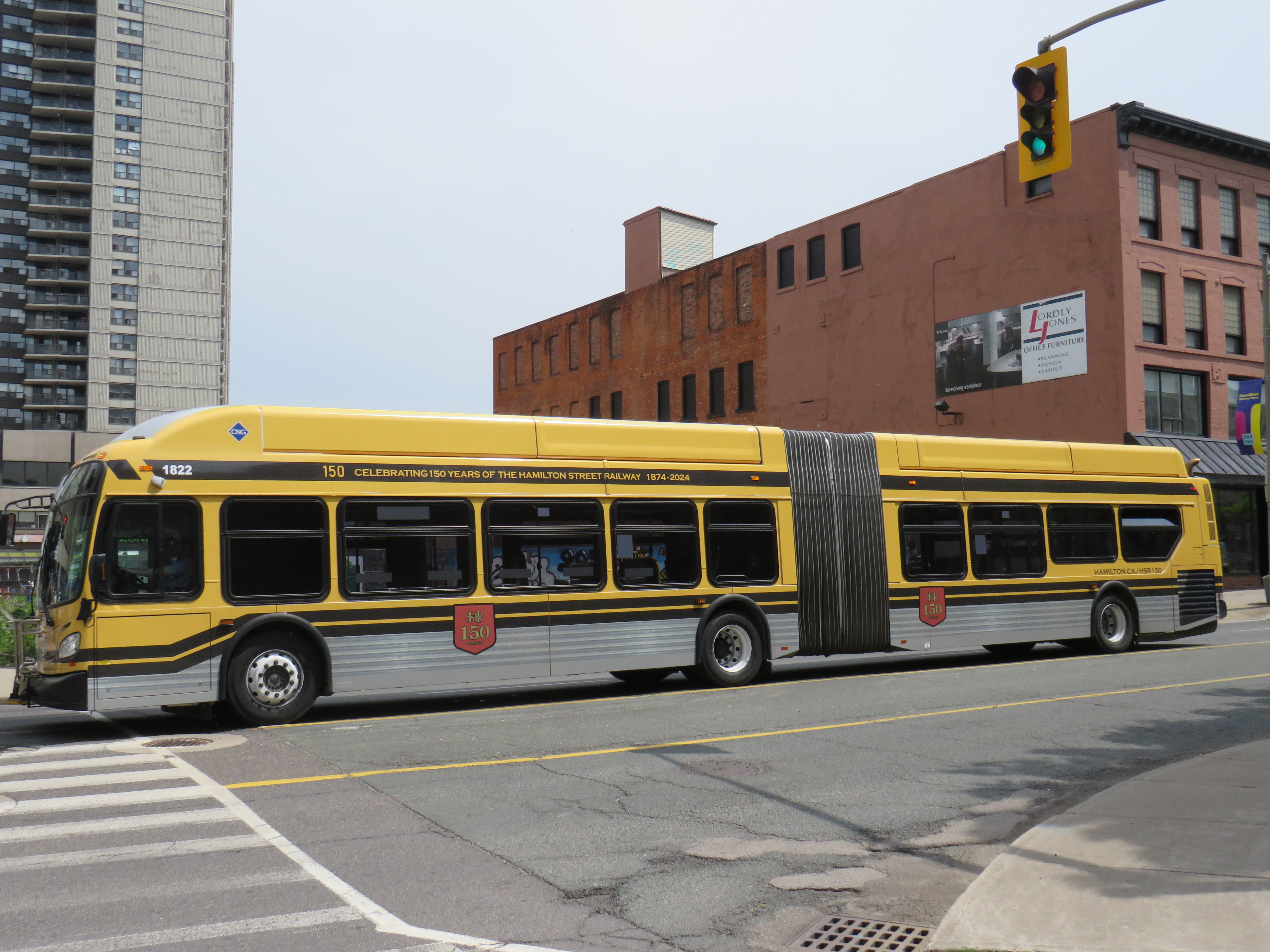
One more thing that the City of Hamilton has done in the last year is paint two of its buses in retro liveries, celebrating the 150th year of the Hamilton Street Railway Company. Though the HSR hasn’t actually operated streetcars since 1951 (and abandoned trolleybus service in 1992), the name persists through multiple ownership changes, even after municipal ownership starting in 1960.
One bus sports the 1950s-1960s-era colour scheme of burnt red and cream, while a second bus has the classic yellow and black “Ti-Cats” look used in the 1970s and 1980s. Though modern buses still have a prominent yellow stripe and the long-running interlaced HSR letters-in-a-shield logo, there’s nothing quite as says “Hamilton” quite like classic yellow and black scheme.
Two modern Nova low-floor buses layover at the end of the Barton Street route, with one in the 1950s-era red-and cream colours, and the other in the current colour schemeA New Flyer articulated bus in the prominent “Ti-Cats” colours of black and yellow, which match the colours of the venerable CFL franchise (as well as the traffic signals used in Hamilton)
It would be great for other agencies, such as the TTC, GO, and Brampton Transit to bring out their old colours. I would like to see a modern low-floor bus or Flexity streetcar in the classic maroon and cream colours, or a GO bus with the 1970s GO Transit wordmark. I would love to see a Brampton Transit bus sporting the old pink stripe and “b” logo.
Last month, I wrote about the challenges getting around Toronto’s Union Station, Canada’s busiest transportation hub, particularly for passengers using mobility devices or carrying luggage. Only one poorly-marked elevator directly links the Great Hall and the UP Express platform with the subway station/PATH level, which is located two floors down.
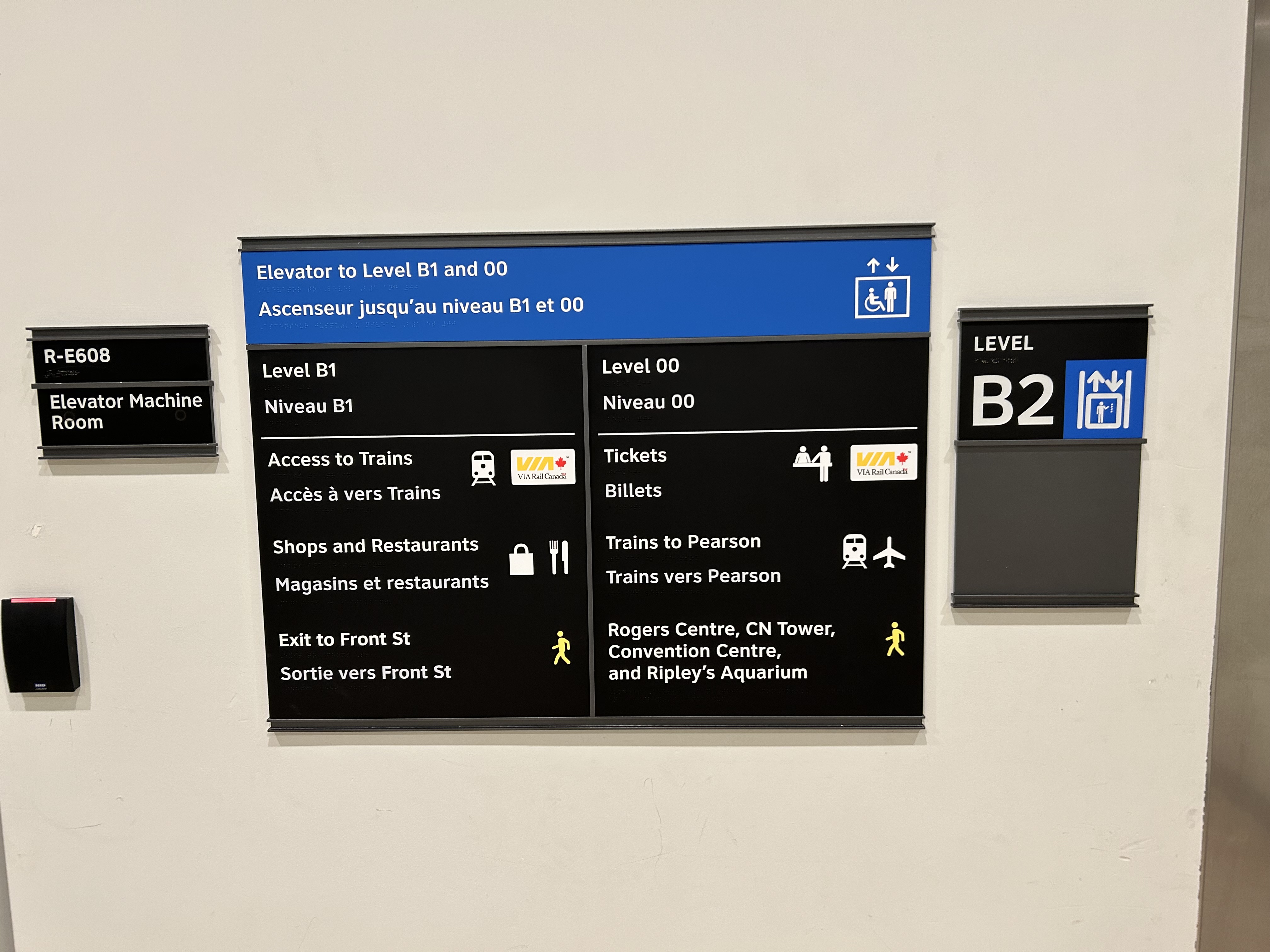
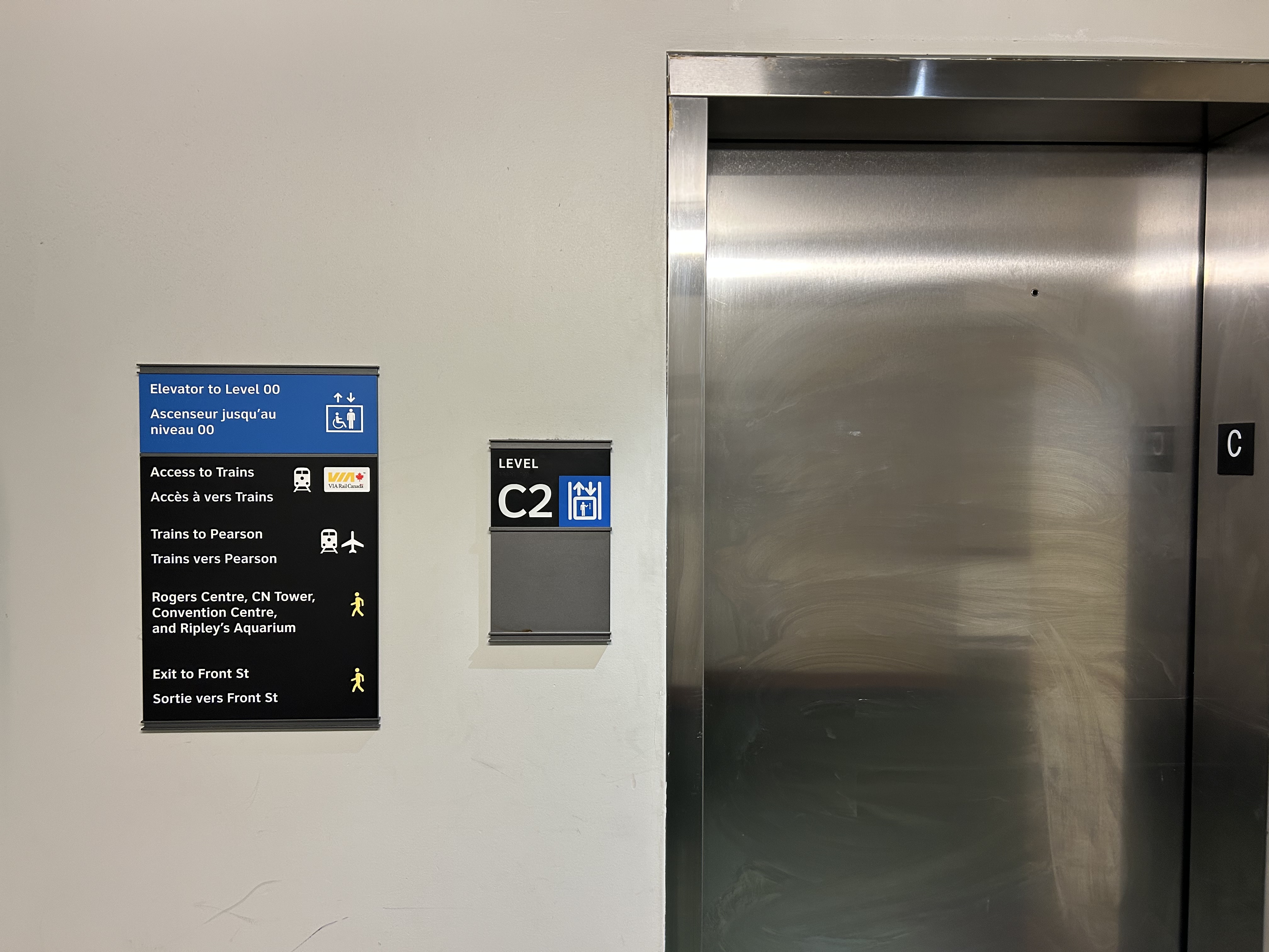
I returned to Union Station on Tuesday, January 7, to see if any improvements were made since I wrote my initial post. Somewhat surprisingly, new signs were installed beside the elevators, indicating which floor goes where.
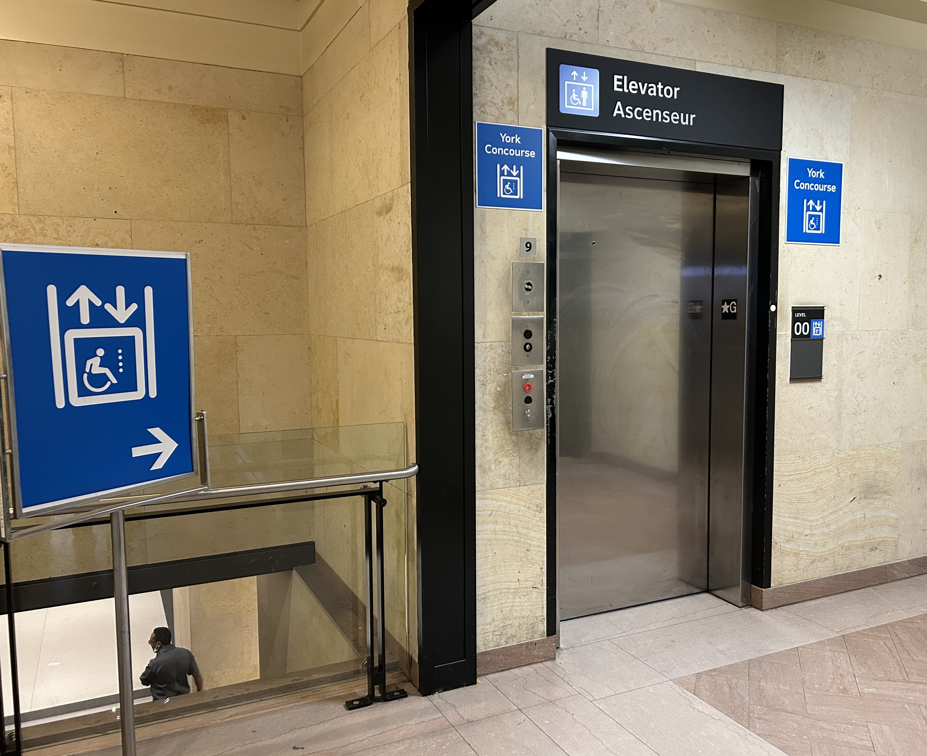
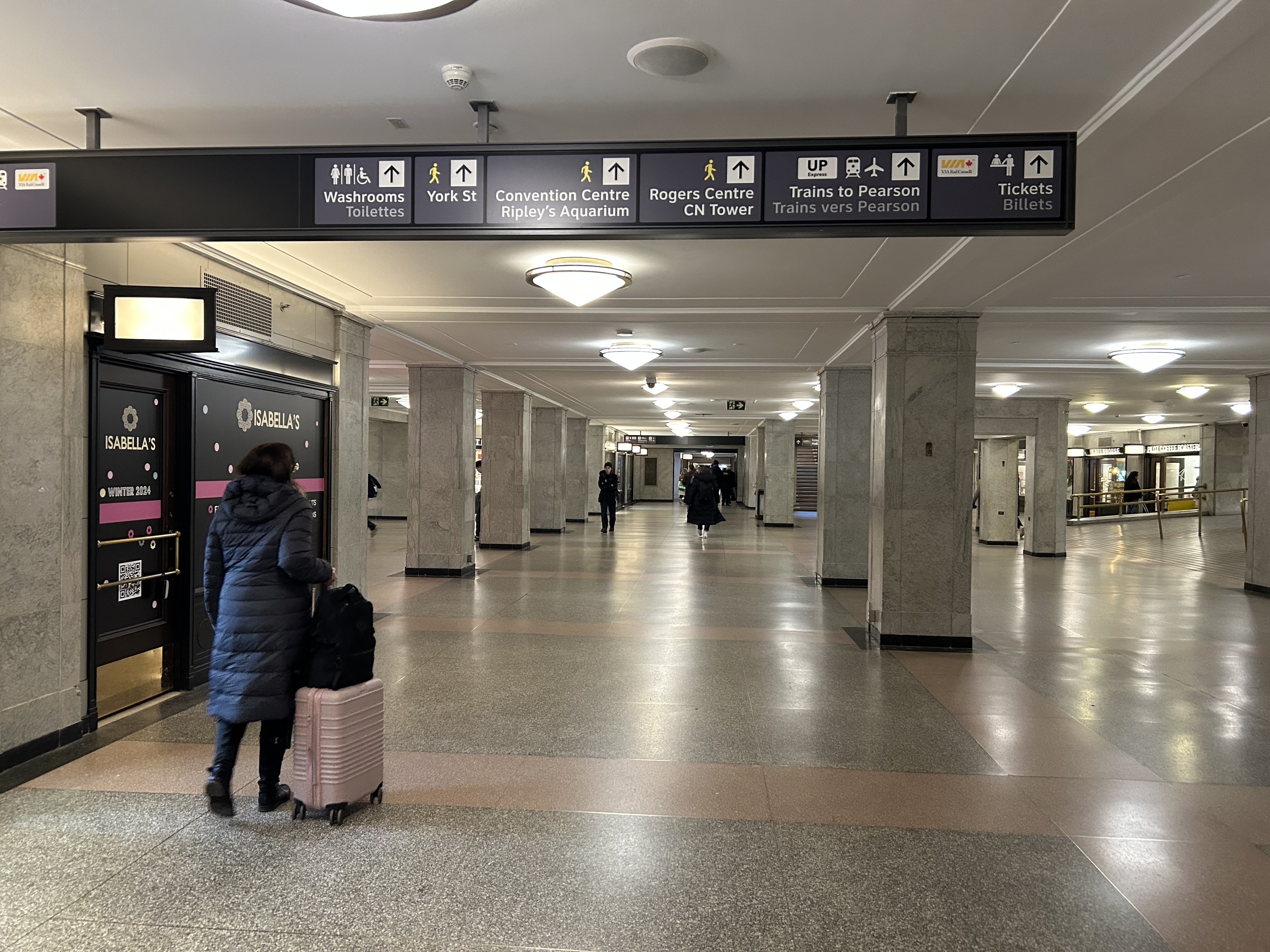
Elevator signage at B2 level (subway concourse/PATH level by Bay Street) that indicates where the other floors lead to: Level B1 for VIA trains, shops and restaurants, and exit to Front Street, and Level 00 for VIA ticketing, UP Express trains, and access to the Skywalk to Rogers Centre, CN Tower et al.In the GO York Concourse, the elevator leads to Level 00 (The Great Hall) only.
These signs are a notable improvement, but there is still no signage inside the elevator cars themselves, so the traveler must note the directory signage before entering the elevator. Furthermore, the Great Hall, the historic centrepiece of the Union Station complex, is not noted, even though it is a logical meeting place from where access to all GO, VIA, and UP Express train services can be made, or where taxis can be found right outside.
Unfortunately, the elevators themselves are still difficult to locate, and the decision to have just one slow elevator connect the Great Hall/UP Express floor with the subway station entrance remains unfortunate. There is still so much more to be done.
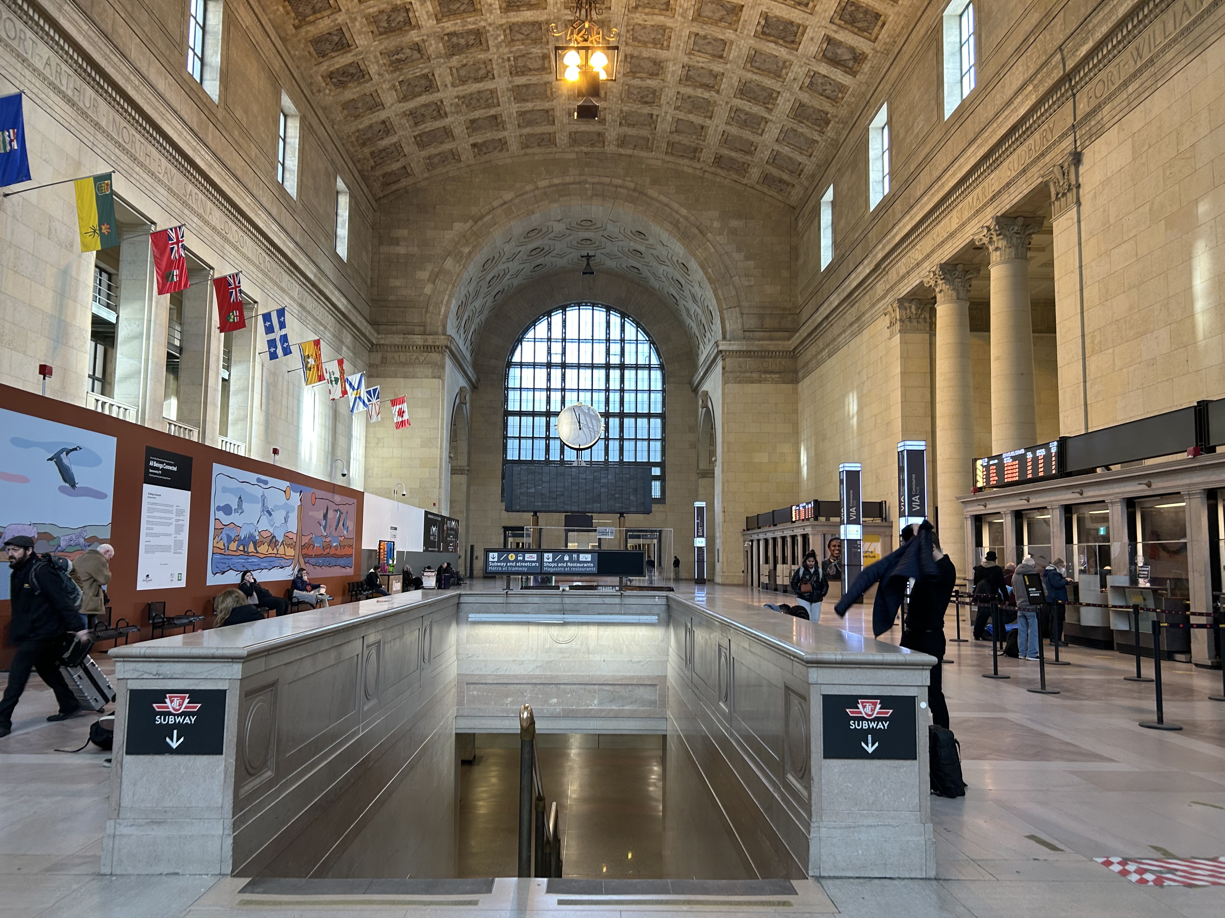
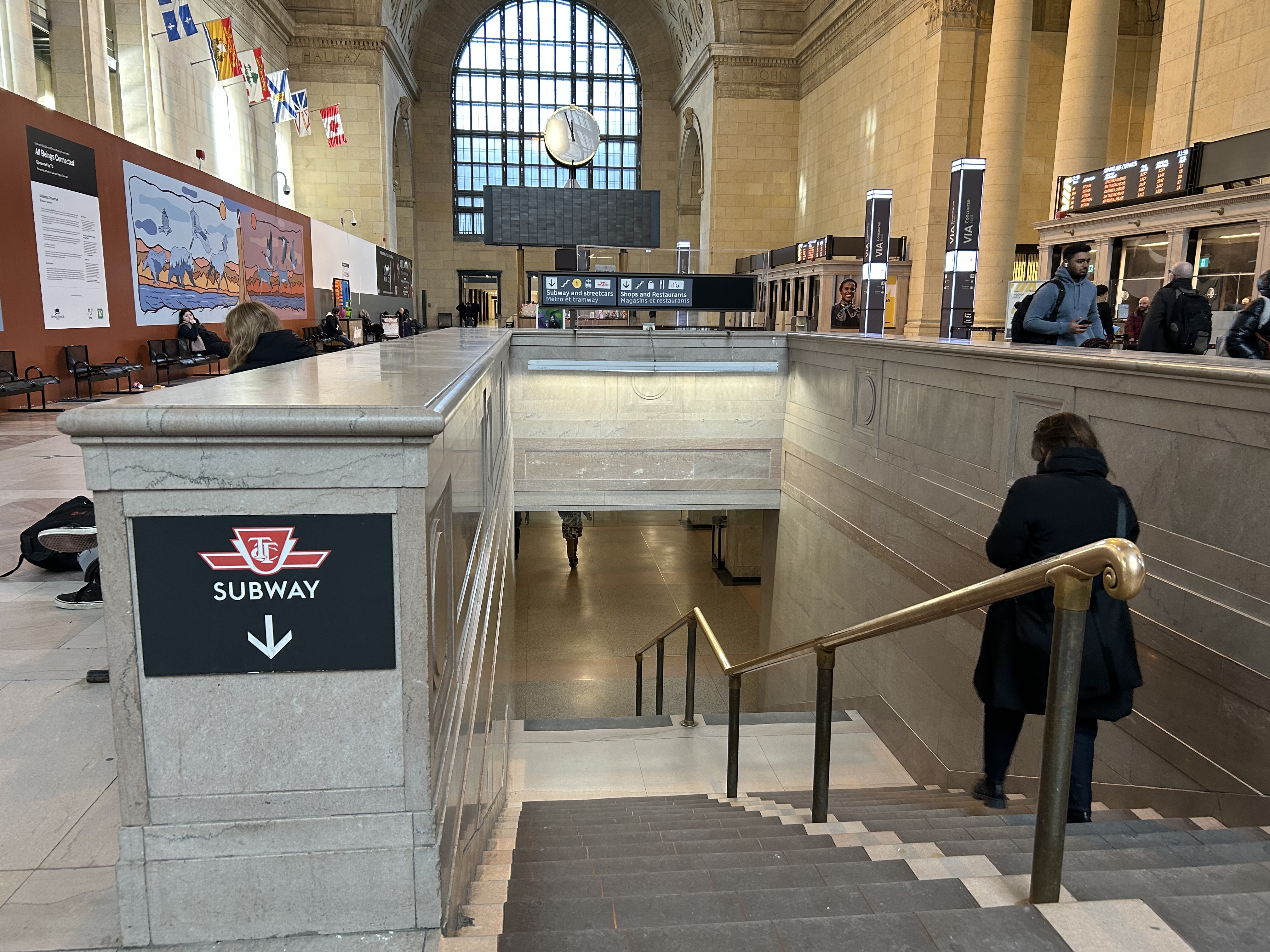
In the Great Hall, there are clear signs directing passengers towards the subway, but there are no indications on where a barrier-free passage can be found. A supplementary sign pointing towards the one elevator, located at the far end of the Great Hall, could be useful here.
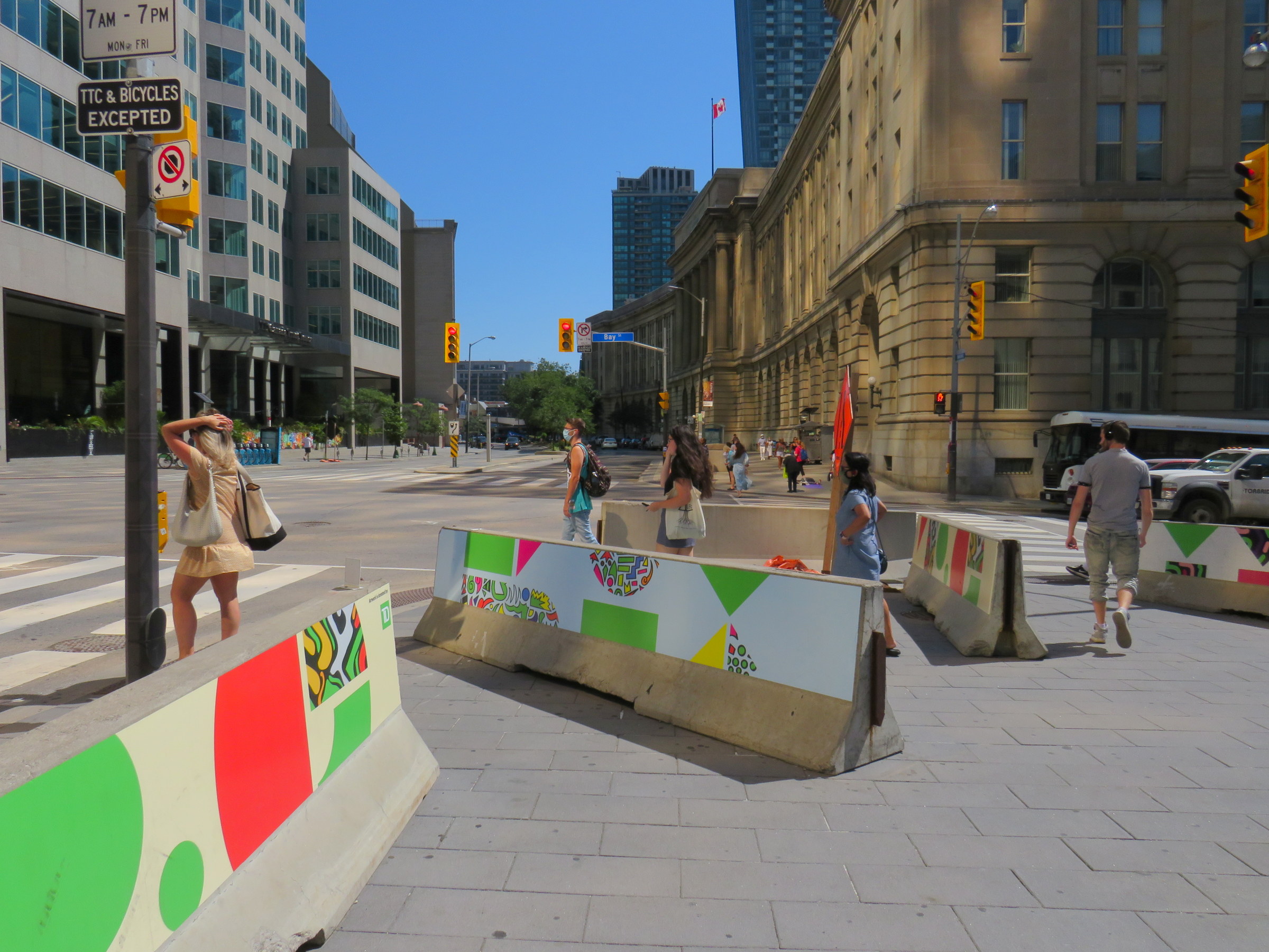
Previously on this website, I discussed the problems with the unsightly, intrusive, and poorly thought-out mess of Jersey barriers plopped in front of Union Station along Front Street. They have not only been an eyesore unbefitting a signature heritage structure, but they have also been difficult for pedestrians to navigate around, especially at the corners of Front and Bay and Front and York.
Inside Union Station, however, a lot has changed in the last few years. In general, pedestrian flow within the station building has improved, especially with the opening of the GO Transit York Concourse, which provides a second access point for regional trains. Flow between subway, train, and shops is considerably improved; there are also a lot more food and retail options befitting a central transport hub.
Despite new escalators and elevators, accessibility in Union Station remains poor. Though technically, the station is fully accessible to anyone using a wheelchair or other mobility device, the wayfinding is absent in key areas. There is only one small elevator that directly connects the subway level with the Great Hall, UP Express trains, and Front Street. An accessible route is also difficult to find.
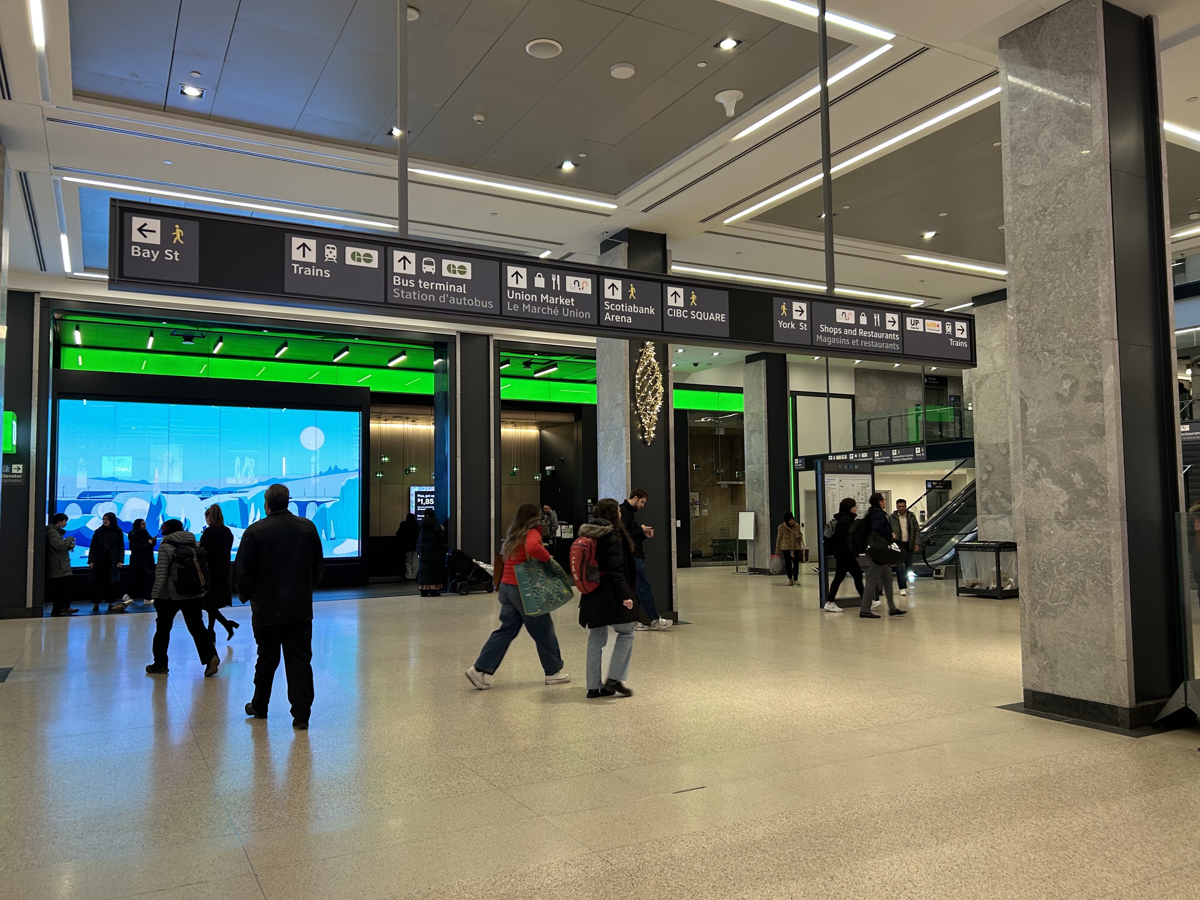
The view after entering the Union Station complex from the TTC subway. The overhead sign shows the way to GO trains, the bus terminal, the Union Market shopping area, Scotiabank Arena, CIBC Square (an office building), York Street, more shops and restaurants, and VIA and UP Express trains.
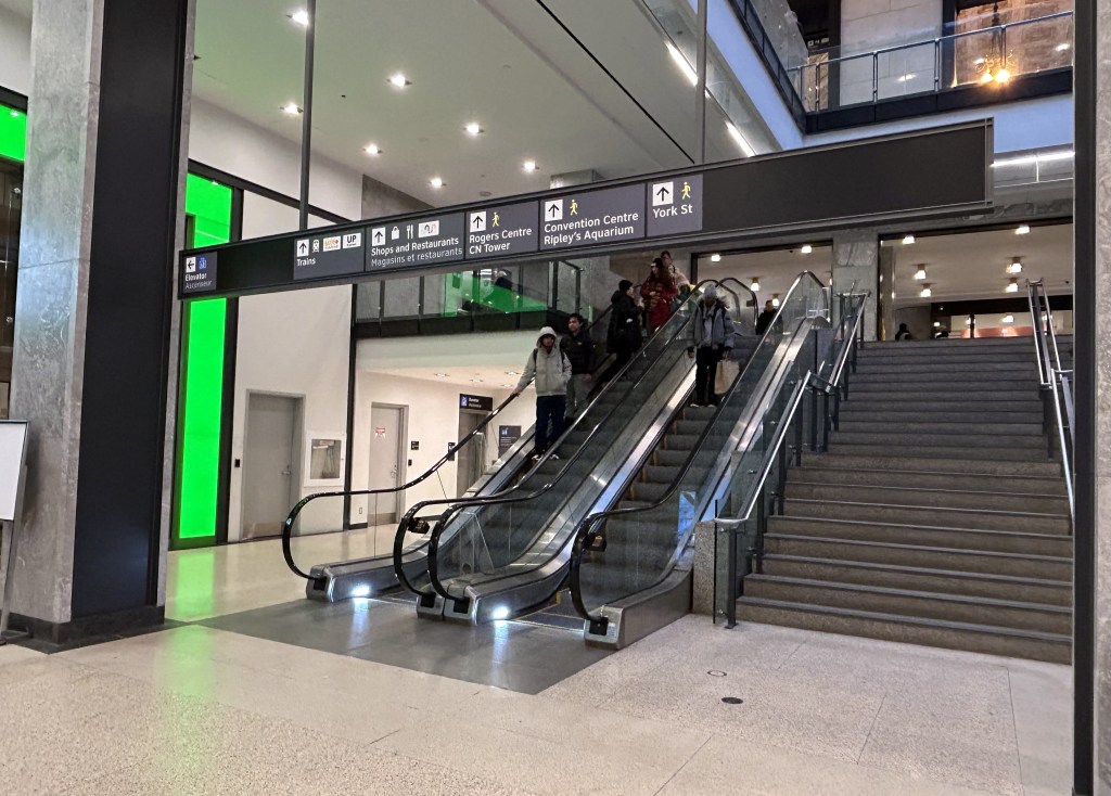
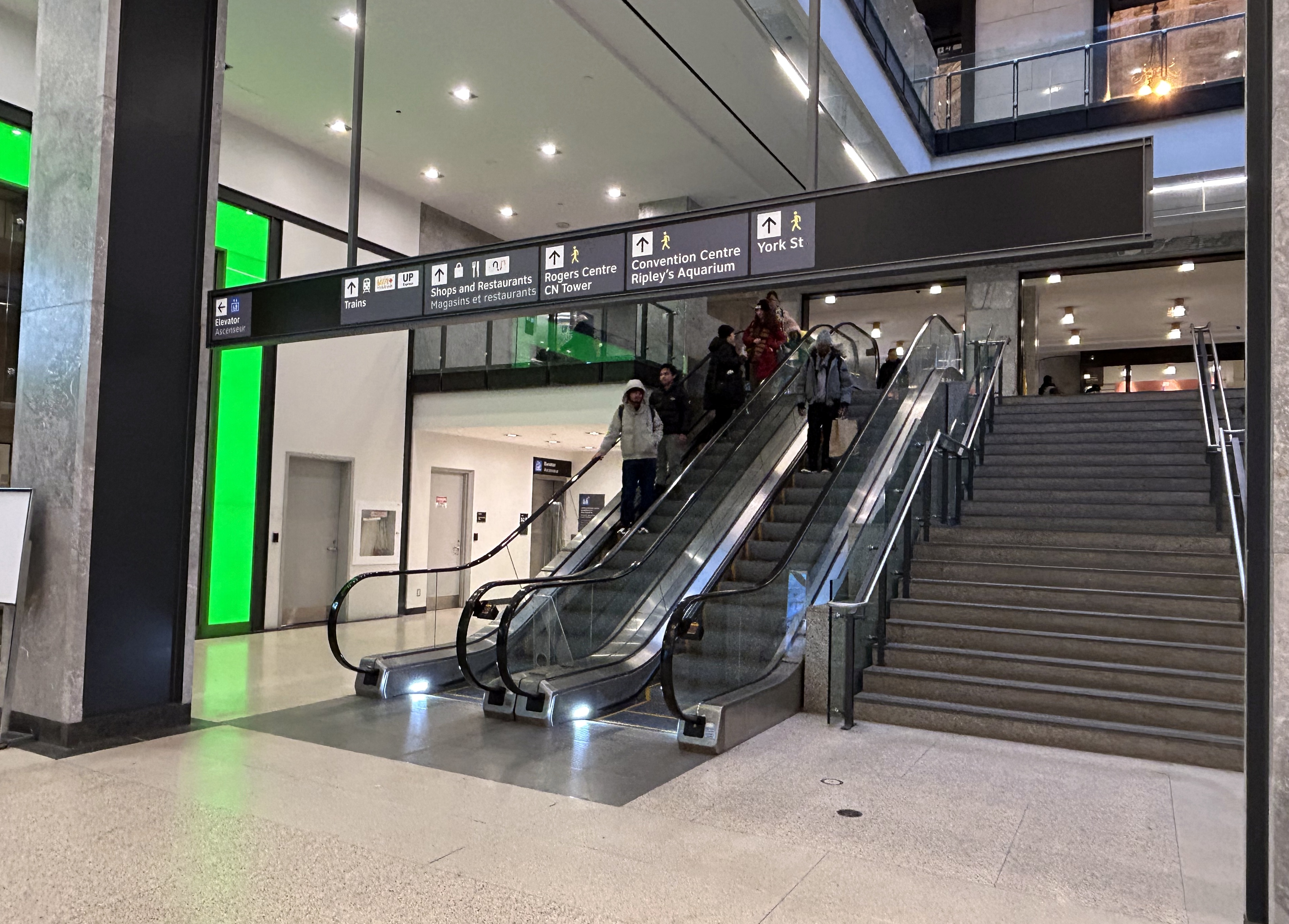
Imagine entering Union Station from the adjacent TTC subway station with a wheeled device or a mobility aid. There is a large concourse with signs leading forward towards the GO Transit York Concourse along with Scotiabank Arena, the bus terminal, and Union Station shops and food kiosks. To the left is Bay Street, and to the right are a set of escalators and stairs leading up towards VIA Rail and UP Express trains. Behind the stairs and escalators is a single elevator, hidden away.
To the right is a set of escalators, stairs, and hidden behind, a poorly marked single elevator.These lead towards UP Express and VIA trains, York Street, and attractions such as the CN Tower, the Convention Centre, and Rogers Centre.
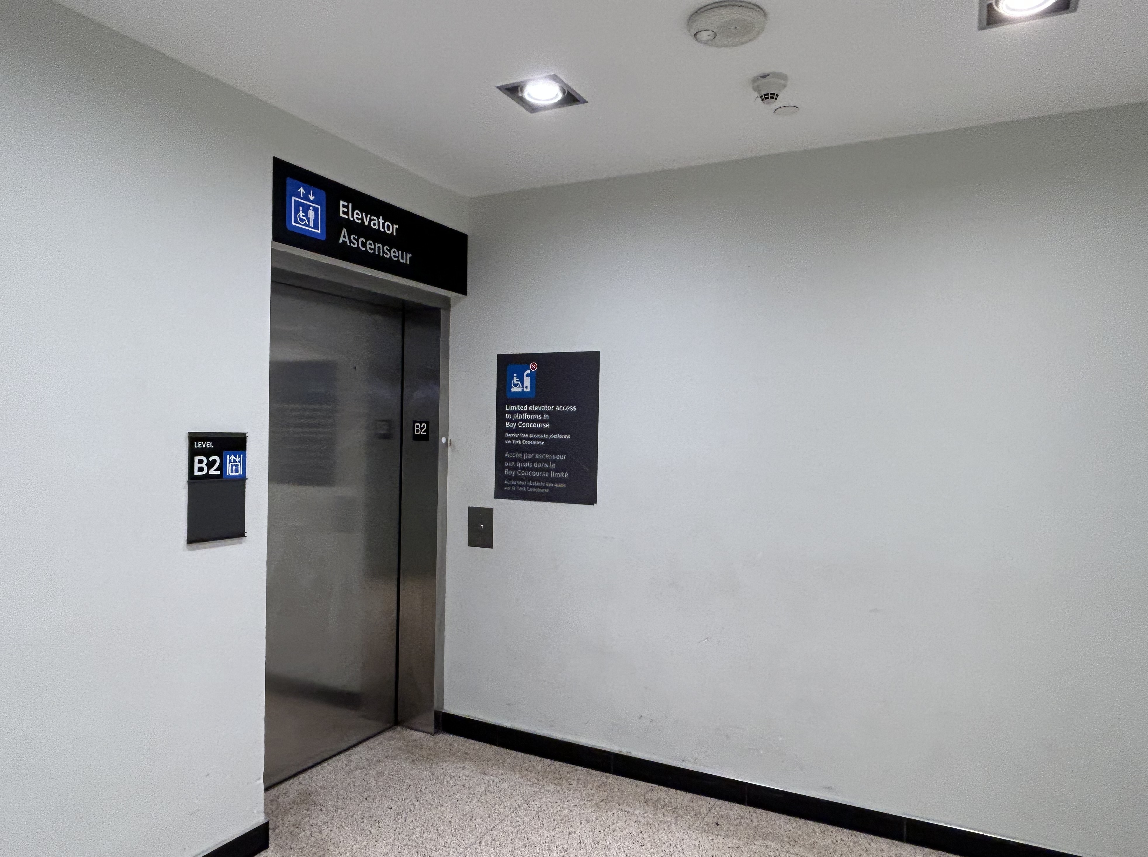
The elevator provides no information other than a sign that indicates that this is, in fact, an elevator, and this is the B2 level. This is a single, small elevator, which operates slowly.
The elevator at the B2 (subway) level
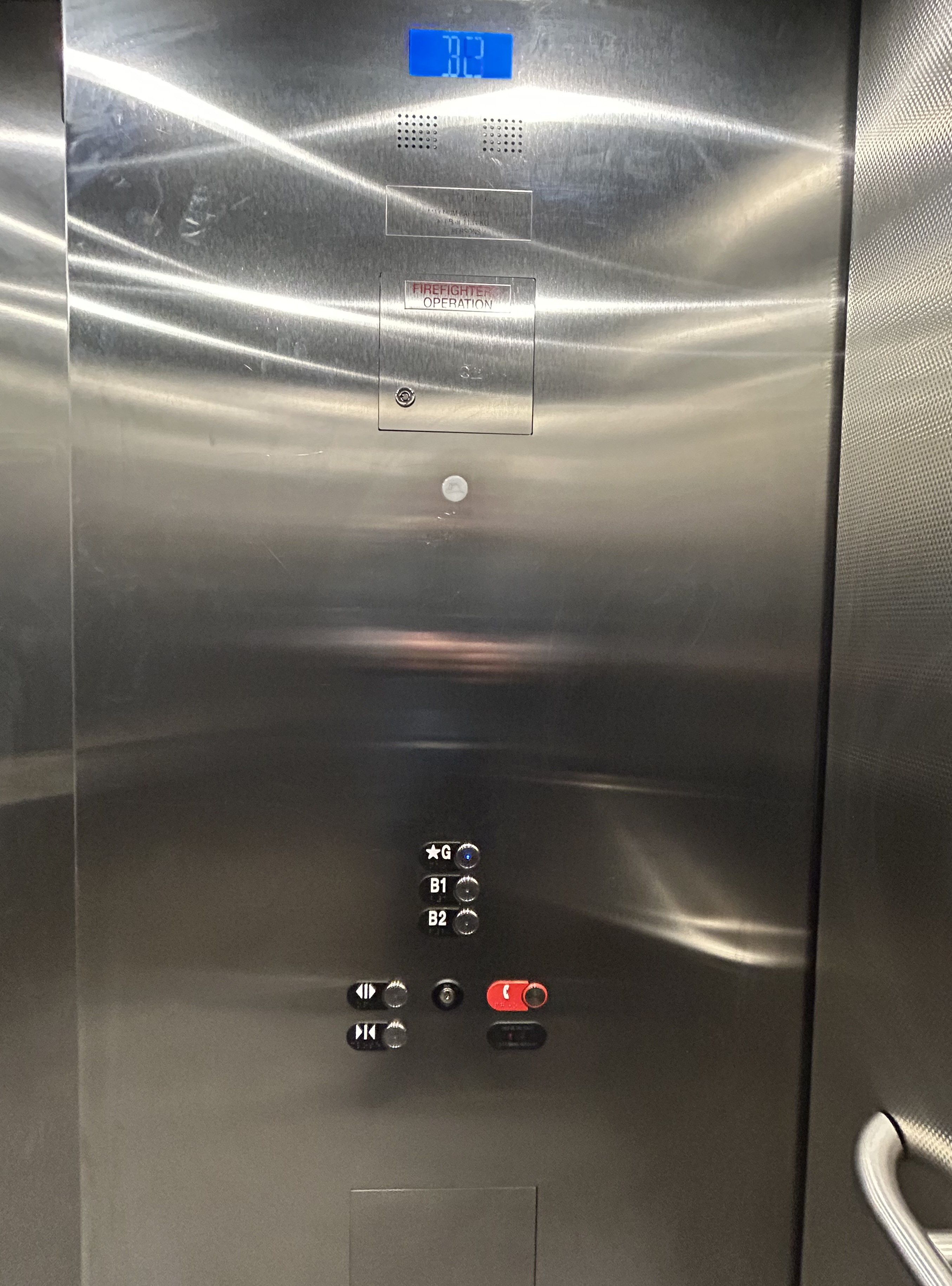
Once inside the elevator, there is no information other than buttons marked “G”, “B1”, and “B2”. There is nothing to tell the elevator user what is accessible from each floor.
Confusingly, the official Union Station map directory calls the three levels “Street Level” (G, the Heritage structure including the Great Hall, West and East Wings, along with the path towards UP Express and the Skywalk), “Lower Level” (B1, the GO York and Bay Concourses, the concourse beneath the Great Hall, and the VIA departure area) and “Retail Level” (B2, including the food court, food hall, and connections to the subway). In the elevators, the audio prompts only mention the three level names.
Inside the elevators, there is no indication what each level is, or where they lead to — the buttons and empty spaces beside them just show G, B1, and B2 levels
At G level, which includes the Great Hall, VIA Rail departures and business class lounge, and the passage west towards UP Express trains and the Skywalk to the CN Tower and Rogers Centre, the elevator is also hidden behind a wall.
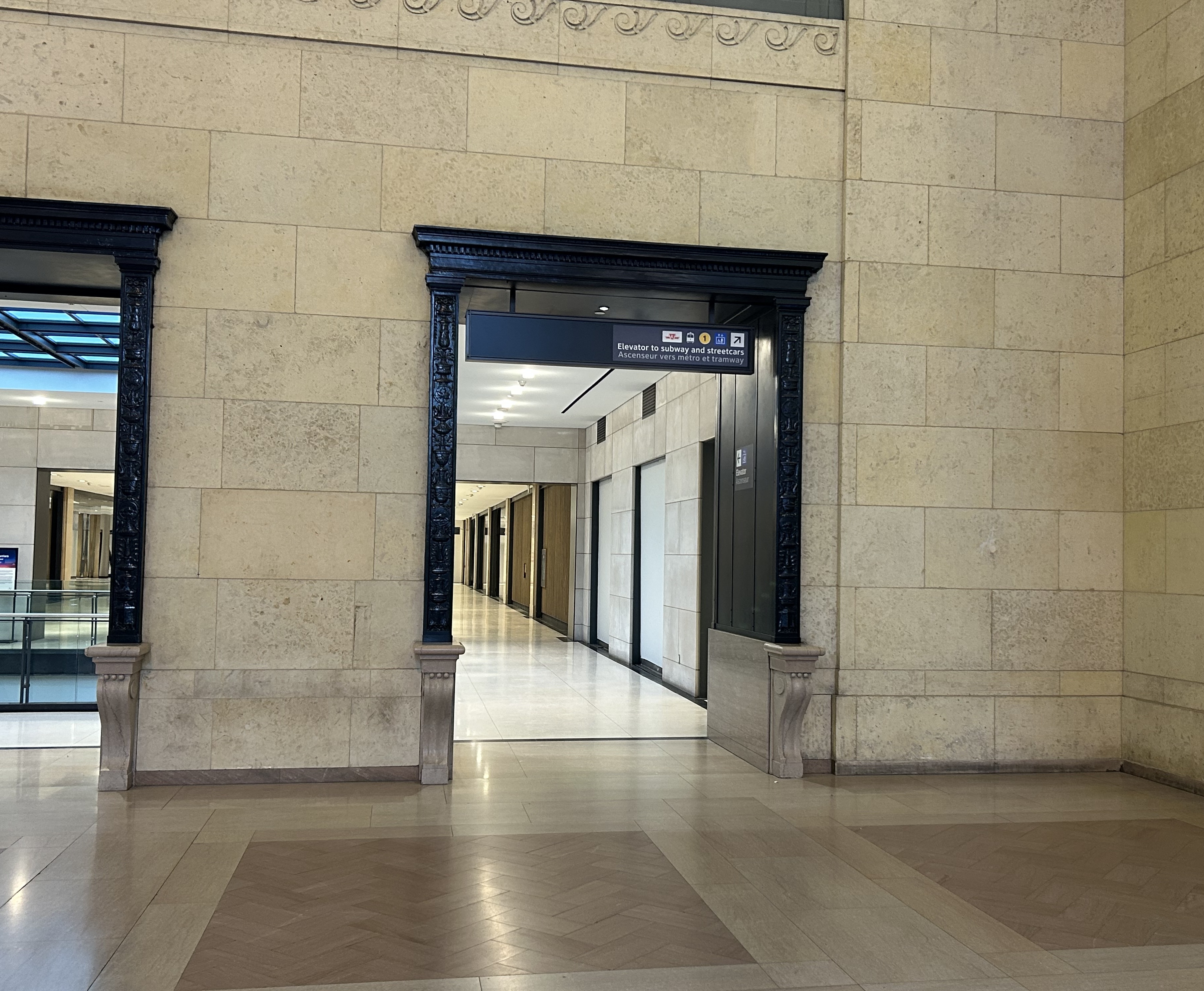
The only elevator connecting the Great Hall, the lower concourse, and the subway level is hidden, with tiny signage directing travelers to it
On the west side of The Great Hall, there is also an elevator, beside the stairway down to the GO Transit York Concourse. This elevator does not serve level B2.
York Concourse elevator, on the west side of Union Station’s Great Hall
If the traveler was only connecting from subway to UP Express with a heavy bag, and not using a mobility device, they might decide to take an escalator from the subway B2 level to the B1 level, the lower Union Station concourse originally intended as an arrivals area for intercity trains. However, there is no elevator or upwards escalator to be seen.
Looking west in the lower concourse, towards York Street and UP Express trains
If one knew Union Station well, they could make a lengthy detour through the ramps in the VIA Rail area to get to the Great Hall or go around through the GO York Concourse to reach the elevator or up escalator to the Great Hall. But these routes are not marked from the lower concourse area.
To show how difficult it can be to navigate the station while using a wheeled device (be it a wheelchair, stroller, or wheeled luggage), I shot this video showing how a first-time visitor getting off an UP Express train from Union Station would try to find the TTC subway entrance.
Video depicting 9-minute trip at a normal walking speed between the UP Express area and TTC subway station entrance, using first available elevators each time.
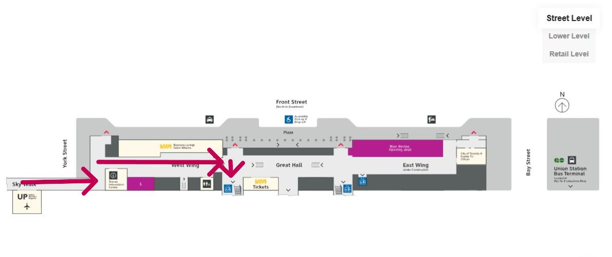
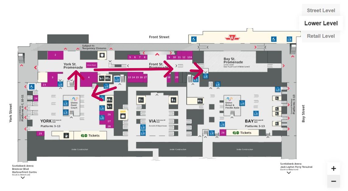
At no point was there any visible signage showing the most direct route for someone requiring a barrier-free path from UP Express to the subway. The maps below show the route I took:
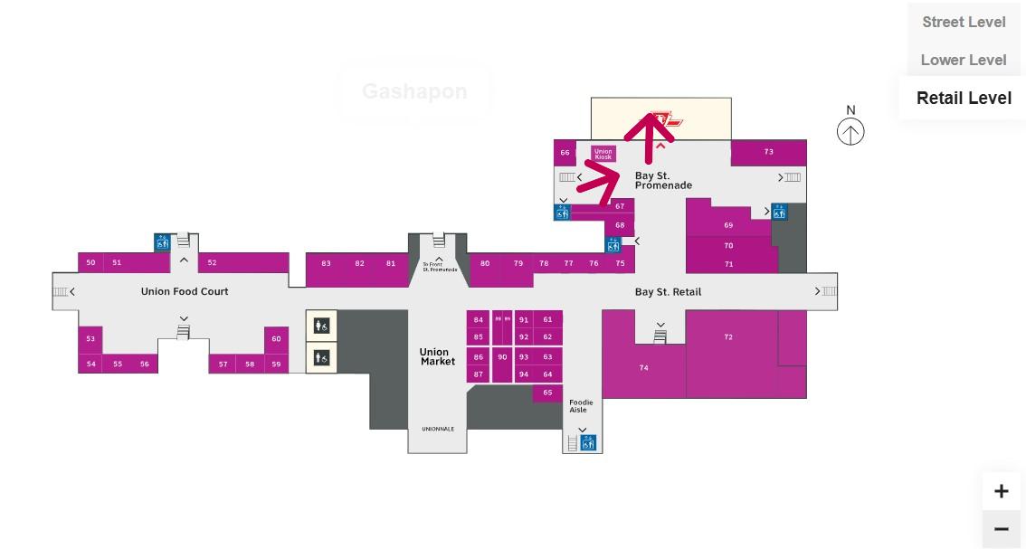
Route from UP Express to the Great Hall and York Concourse Elevator (Street Level, or G). Arrows are added to mark the route I took in the video.Path through York Concourse, lower Union Station concourse (Front St. Promenade) – the B1 Level, and to the second elevator to the Bay St. Promenade (subway level). Arrows are added to mark the route I took in the video.Last part of the trip on the Retail Level (B2) to the subway station entrance. Arrows are added to mark the route I took in the video.
Whenever I travel through an international airport — Toronto Pearson is a good example — I never have to think too hard about where the accessible routes are. Escalators are easy to find. There are banks of two or three large elevators in strategic locations on the ground side of airports, connecting departure and arrival areas, as well as ground transportation facilities. As Canada’s busiest transport hub — busier than Toronto Pearson Airport even — Union Station’s elevators and escalators should be plentiful and easy to find.
I am aware that there are particular challenges at Toronto Union Station — the City of Toronto controls only the common areas, such as the Great Hall, the retail areas, and the main entrances. Metrolinx, the agency responsible for GO Transit and UP Express, controls the York and Bay Concourses, as well as the UP Express station area. VIA Rail maintains its departures area. There are also heritage elements that need to remain intact, such as the Great Hall. But these issues of ownership and heritage preservation do not excuse the difficulty of getting around with a mobility device or even a wheeled bag.
Why weren’t multiple elevators installed connecting all three levels, to improve capacity, speed, and provide redundancy in the case of an elevator outage? Why are there not easy-to-find elevators in the West Wing near the UP Express area?
Judging by the condition of the signature Great Hall itself, there is work yet to be done before Union Station is fully restored to its 1920s grandeur. It should not be too hard to improve accessibility and wayfinding as well. Not just for Torontonians, but for international travelers too.
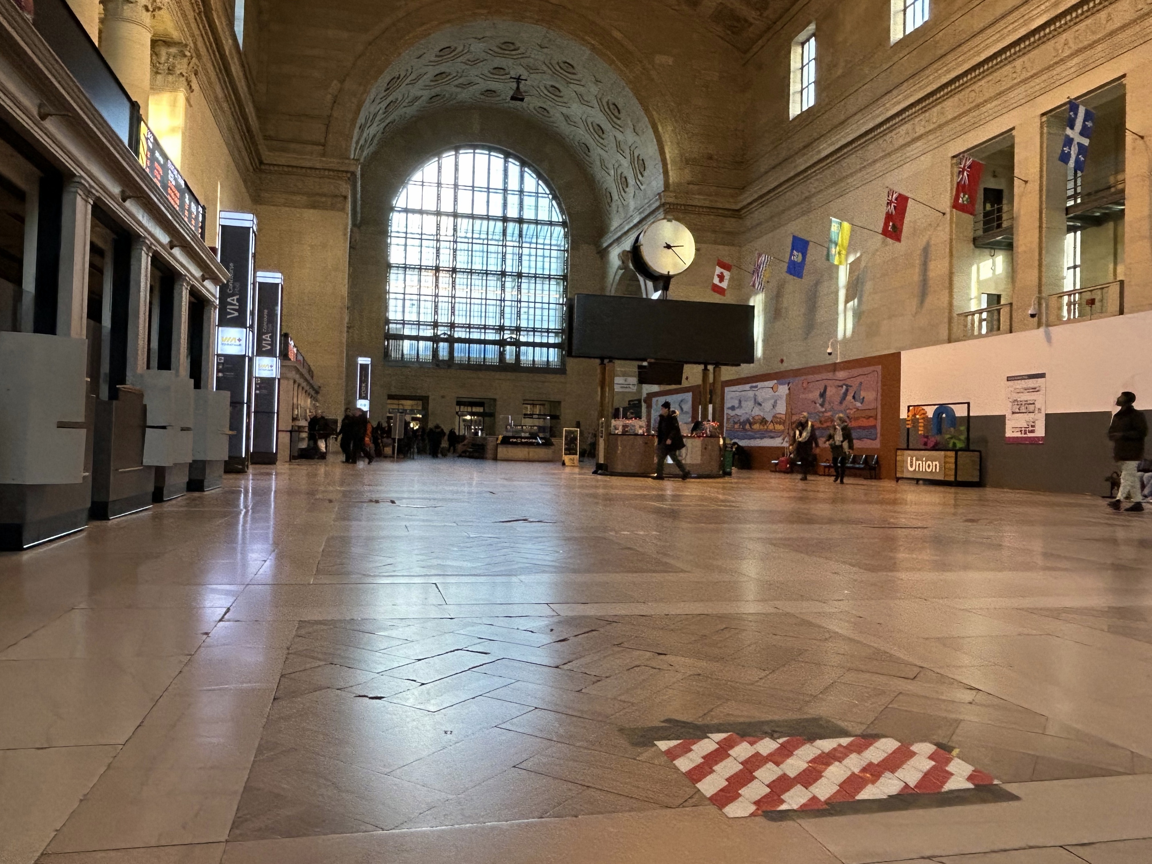
The Great Hall floor is still cracked and patched, with electrical tape covering some of the damaged sections
There are buses to more destinations in 2024, but a few major gaps persist
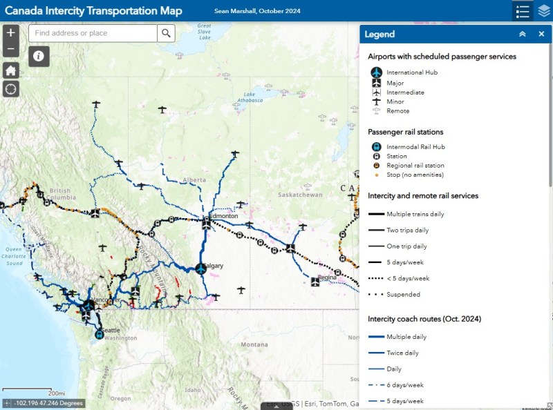
NOTE: Previous versions of the Ontario and Canada maps are retired; please see the new Canada Intercity Transport Map, launched March 30, 2025. This will now be the only interactive map that I will update.
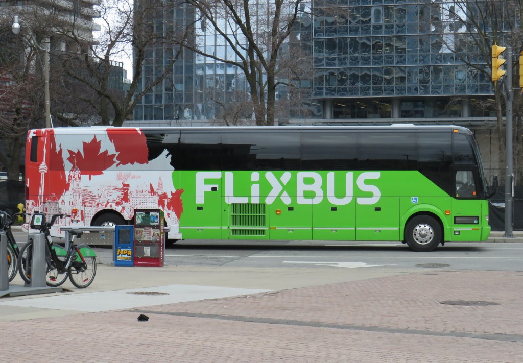
Unfortunately, outside of Ontario, there not that many updates to make. On Vancouver Island, at least, there is now daily service all the way to Port Hardy in the north and Tofino and Ucluelet to the west, with additional runs between Comox, Nanaimo, and Victoria. There are more buses between Vancouver and Seattle; FlixBus is now operating on the busy Calgary-Edmonton and Calgary-Banff routes. There is also a new twice-weekly Edmonton-Camrose service, thanks to work by the University of Alberta’s student union; it partnered with FlixBus to provide the service.
Also new to the map is Mountain Man Mike’s bus service between Vancouver, Nelson, Kaslo BC, and Calgary, as well as Mobilité Charlevoix, a regional service that connects several towns east of Québec City including Baie-Saint-Paul, La Malbaie, and Clermont.
Unfortunately, several wide gaps remain. Despite plenty of competition on the busiest routes in Southern Ontario and Alberta, there is no bus service between Calgary and Regina, leaving cities like Medicine Hat and Moose Jaw without intercity connections, apart from airport shuttle services, despite once-frequent Greyhound service. Between Winnipeg and Regina, it is still just one bus a week. Maritime Bus, for whatever reason, still has not restored service across the New Brunswick-Québec provincial line.
Without comprehensive government-led coordination and support, these gaps are likely to remain unfilled.
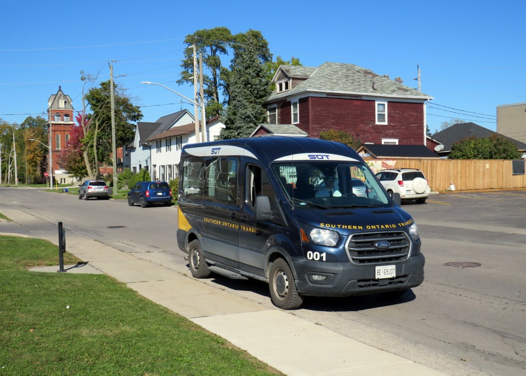
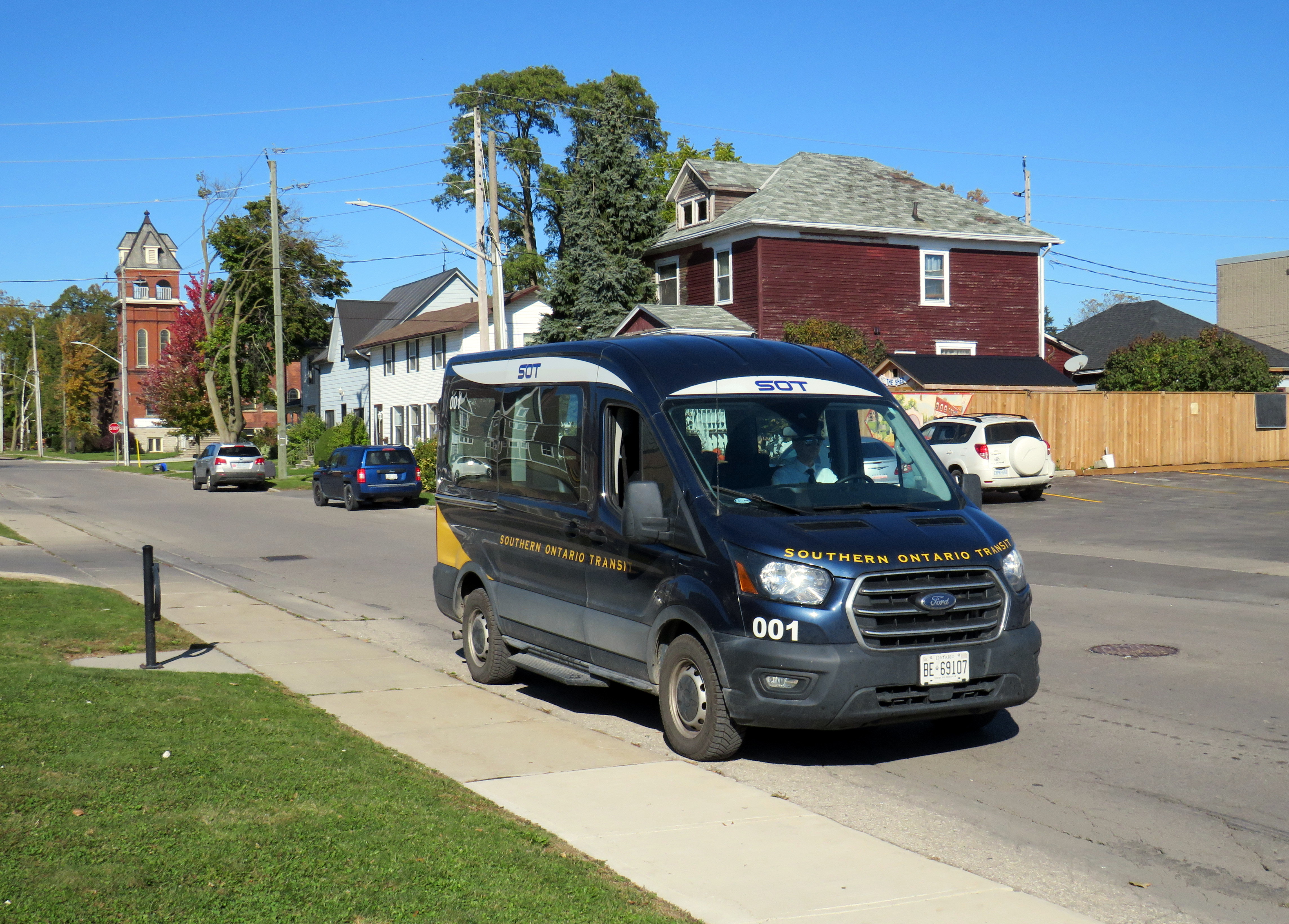
Southern Ontario Transit minibus in Dunnville, October 2024
Earlier in October, I got to meet Rae Rivard, owner-operator of Southern Ontario Transit (SOT), a new intercity transit operator currently serving Hamilton and Haldimand County. The route, which launched on September 16th, offers three weekday round trips between Downtown Hamilton and Dunnville, serving the communities of Caledonia, Hagersville, and Cayuga.
Haldimand County, along with the neighbouring Six Nations and Mississaugas of the Credit First Nation reserves, remained unserved by intercity or local bus services since the early 2000s; in 1990, United Trails operated a daily bus between Port Dover, Hagersville, Caledonia, and Hamilton. Cayuga and Dunnville were served by a Greyhound route on Highway 3 between Niagara and London. More recently, as Niagara Region was building a regional transit service and Norfolk County successfully applied for provincial funding for a new service between Simcoe and Brantford, Haldimand County refused to take part. Enter SOT.
SOT, which charges a $10 one-way fare, operates without the support of the municipal government, and is unable to put up bus stop signs or actively promote its service at municipal facilities such as libraries or community centres. For this reason, ridership remains low, despite growing populations in Caledonia and Hagersville and convenient links to Hamilton Airport, Mohawk College, St. Joseph’s Hospital, and to GO Transit and HSR services.
Rivard will tell you that “the primary challenge we face today is slow uptake. Due to a number of limitations and challenges currently out of our control, the number of regular and new riders trends up every week, but not as fast as we need to cover expenses…. Many of the limitations we are dealing with right now can easily be addressed at no expense, but these choices are out of our control.”
Rivard reached out to businesses and social service organizations, but was turned away, adding that “the entire operation has been entirely funded out of me and my wife’s savings, and we are really struggling to keep up with expenses at this rate.”
Without approved bus stop locations with curb access, SOT is not able to provide fully-accessible service, though it already has a wheelchair-accessible vehicle. The lack of physical bus stops and publicity has made it difficult to attract riders, though while riding with Rivard on a beautiful October afternoon, it was clear that a demand exists as several residents came up to the minibus to find out more information.
My hope is that word spreads about this unique and essential operation and that the local communities provide the needed support to make this service work. If this initial route succeeds, SOT would like to expand service in Haldimand and take on other gaps in the Ontario network.
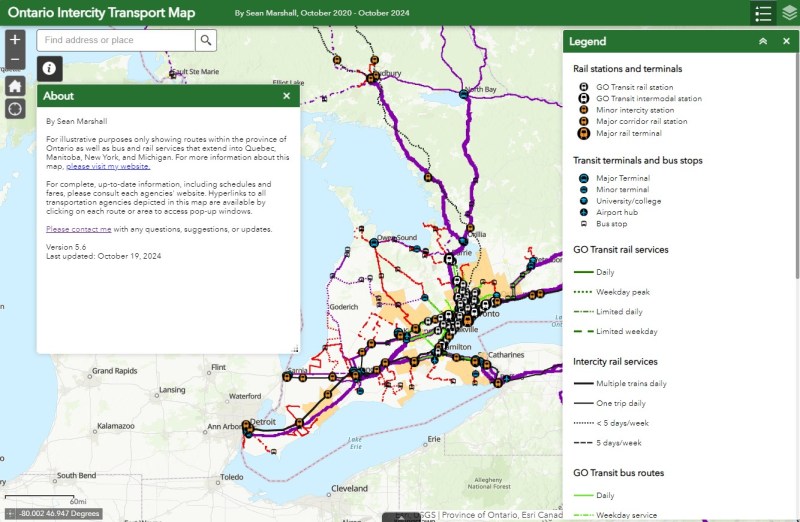
I updated my Ontario Intercity Transport Map to add Southern Ontario Transit’s route. Commuter Connect in Northumberland County ended service not long after VIA Rail finally resumed its early morning train from Kingston to Toronto. East Zorra-Tavistock Transit in Oxford County did not last long either, and service there has ended.
Added to the map:
Southern Ontario Transit between Hamilton, Caledonia, and Dunnville
Red Arrow’s daily Toronto-Western University express, which replaces its Toronto-Niagara Falls run
A new daily Flixbus route between Toronto, Hamilton, and St. Thomas
A new OnexBus route between London, Goderich, and Port Elgin, operating Friday through Monday
OnexBus’s London-Pearson Airport-Brampton route, which operates several trips a day
Ourbus’s Toronto-Ottawa route
Kasper’s daily Winnipeg-Kenora-Sioux Lookout service
Revisions to on-demand services in Niagara Region
Some revised routings and service levels across the province
Removed from the map:
Commuter Connect in Northumberland County
East Zorra-Tavistock Transit
Kasper’s on-demand service to Red Lake/Balmerton
Though it is good to see Bruce County — particularly rapidly growing Saugeen Shores — get another link, that part of Ontario is still poorly served; there should be daily services between larger Bruce County communities like Saugeen Shores, Kincardine, and Walkerton at least to Owen Sound and Hanover. Lindsay is also left without any intercity services, after TOK ended service from Toronto to Haliburton last year. where a Peterborough-Lindsay-Pontypool service, perhaps extending to Durham College/Ontario Tech University in Oshawa could prove to be a very useful route.
If you like this post and you would like to help out with my online mapping and webhosting costs, consider buying me a coffee.Thank you!
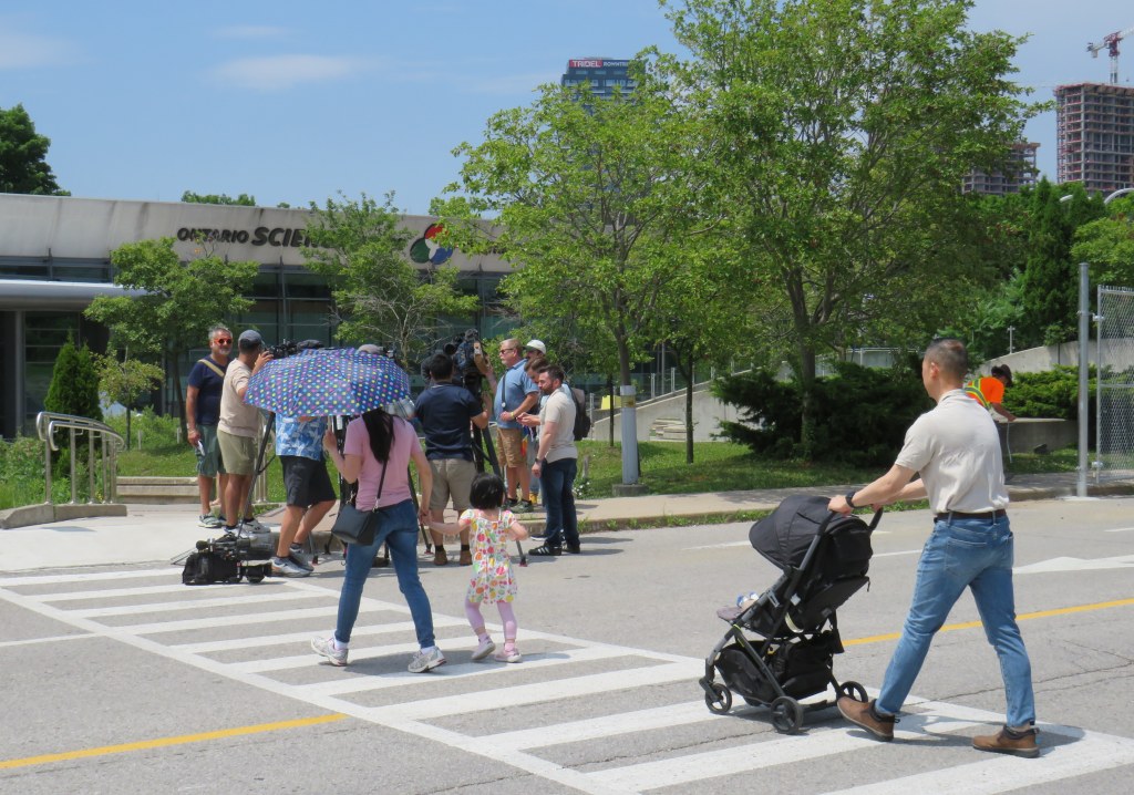
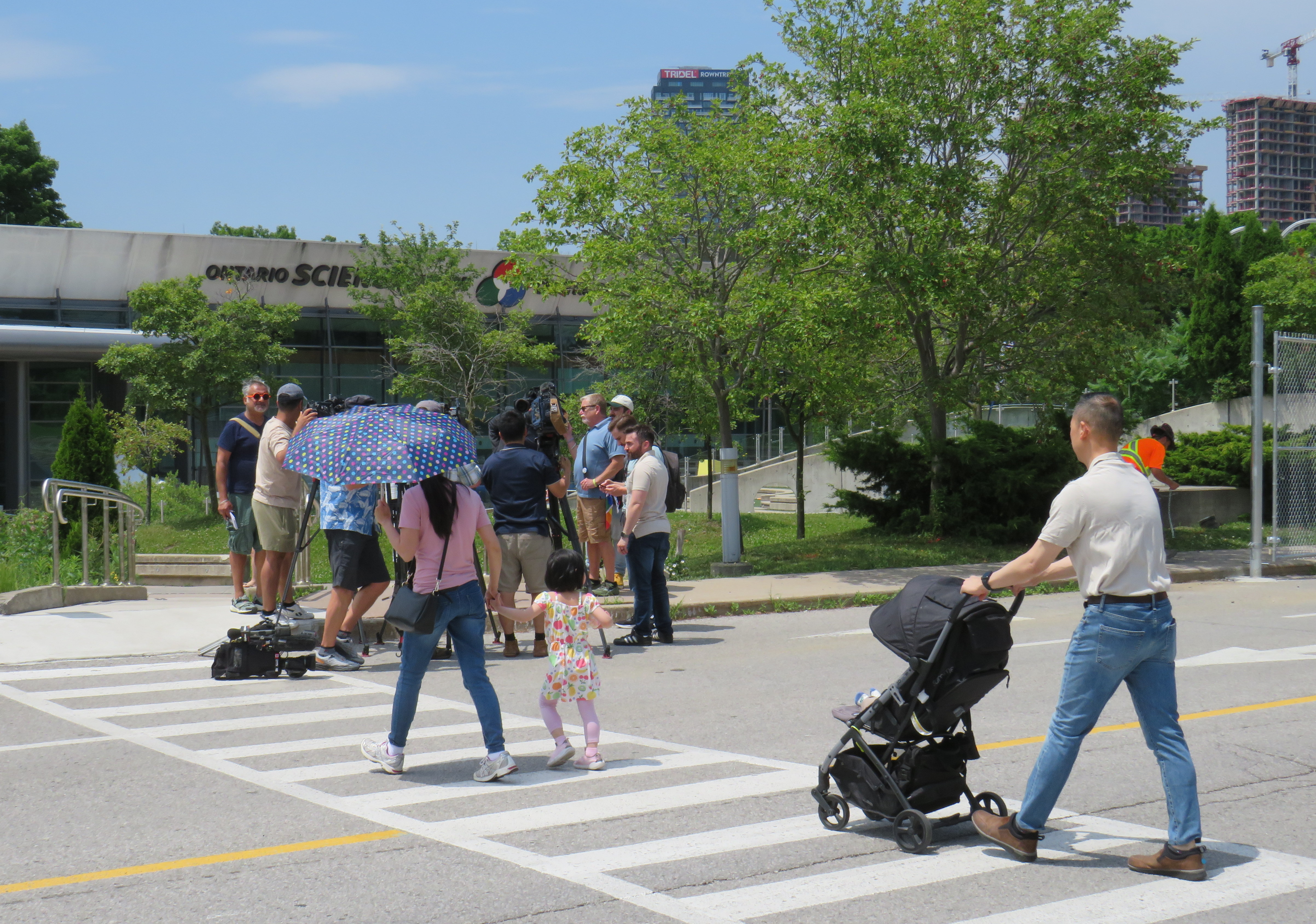
A family enters the Science Centre for the last time on Friday June 21, 2024
When I was growing up, our family would make a trip every year to the Ontario Science Centre, a 45-minute car drive from our home in suburban Brampton. Invariably, these trips would take place on the first PA day of the school year, typically on a Friday in late September or early October, when the ravine was still lush and green, with only the first hints of the changing season.
Because it was early in the school year, and since the Toronto school boards typically had different PA days than the Dufferin-Peel Catholic board, the Science Centre would be mostly empty; my father would run with my brothers and I along the corridor over the ravine between the entrance hall and the great hall. At the end of our visit would be an hour spent at the Science Arcade, the highlight of any child’s visit to the once-great institution. I marveled at Raymond Moriyama’s wonderful harmony of concrete, glass, and natural beauty as one descended into the West Don Ravine by means of glass walkways and escalators.
Later visits in high school and in my early adulthood, however, were not as great. The exhibits were getting old, and the place started feeling worn out. The Dalton McGuinty and Kathleen Wynne-led governments did not value the Science Centre enough to invest in its relevance or its long-term maintenance. Doug Ford’s PC government continued the neglect, favouring a private redevelopment of Ontario Place (closed under the previous Liberal government) with a new, downsized Science Centre to take its place.
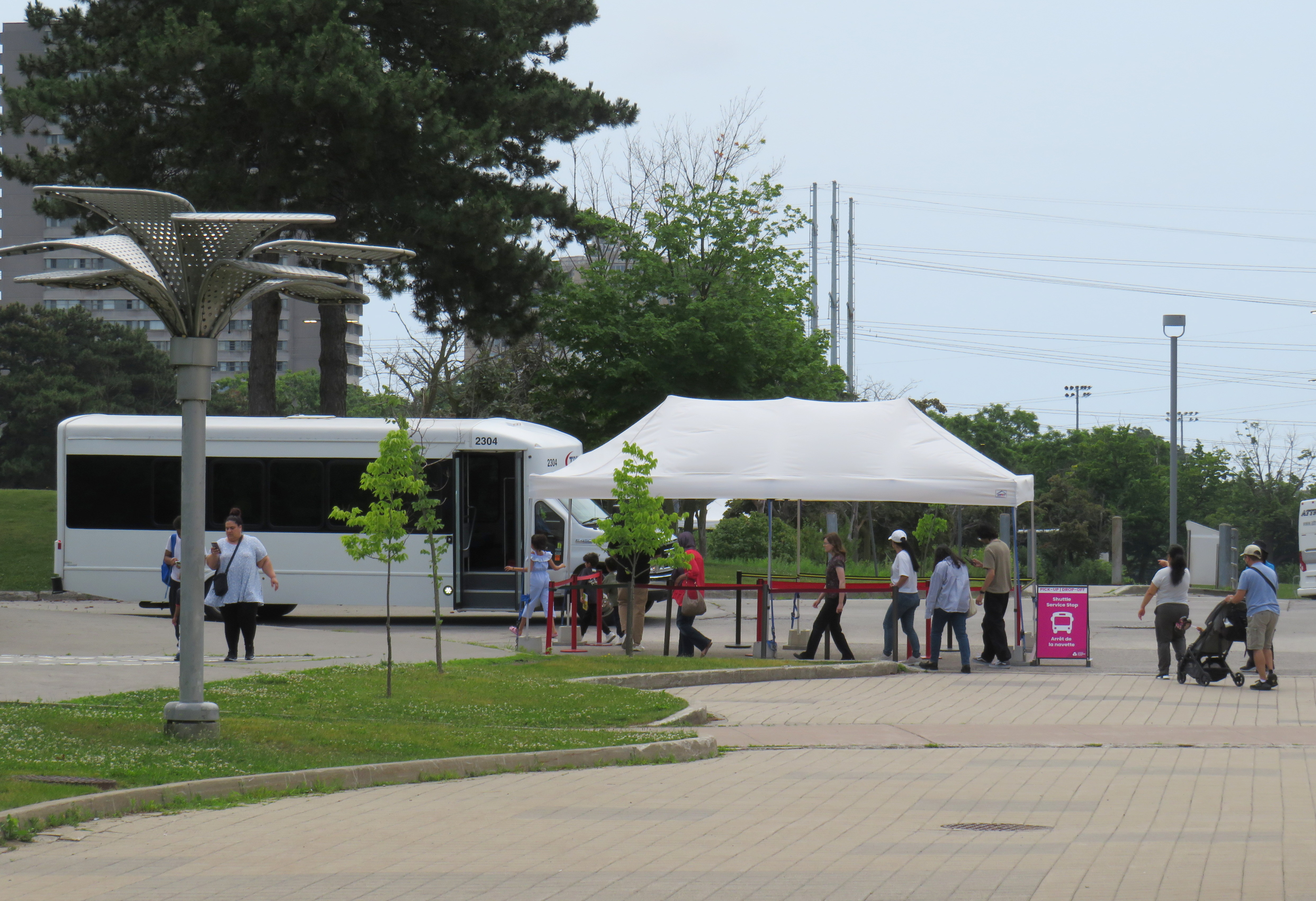
In 2022, that once-wonderful double-deck bridge between the entrance hall and the exhibition space was closed due to the risk of structural failure, with no plans to fix or restore the link. Instead, $2 million a year was spent on shuttle buses ferrying visitors between the upper parking lot (after they paid admission) and the lowest level at the bottom of the ravine. That year, the planetarium (a smaller version of the McLaughlin Planetarium that operated next to the Royal Ontario Museum until the 1990s) also closed due to deterioration.
A December 2023 report from the provincial Auditor General’s office took issue with the government’s management of the Ontario Science Centre and the flawed business case for moving it to a new location on Toronto’s waterfront, in a location much less accessible to school groups.
Loading Ontario Science Centre visitors on shuttle buses, June 21, 2024
The most recent development in which engineers warned of sections of the roof in danger of failure and collapse in a report to Infrastructure Ontario (linked in full on the CBC Toronto website) after October 31, 2024, with repairs costing between $22 million and $40 million. The immediate closure, announced on a Friday afternoon, would provide time to allow the exhibits to be removed, possibly to an interim location. However, most of the roof was found to be in good or fair condition in an the engineer’s report, making the immediate closure suspect.
The Ontario government is shutting the Science Centre today citing an engineer’s report – which does *not* say the place must close or that all work is urgent. What a betrayal. pic.twitter.com/qp21sEjYBn
Globe and Mail architecture critic Alex Bozilkovic questioning the government’s sudden closure on X/Twitter.
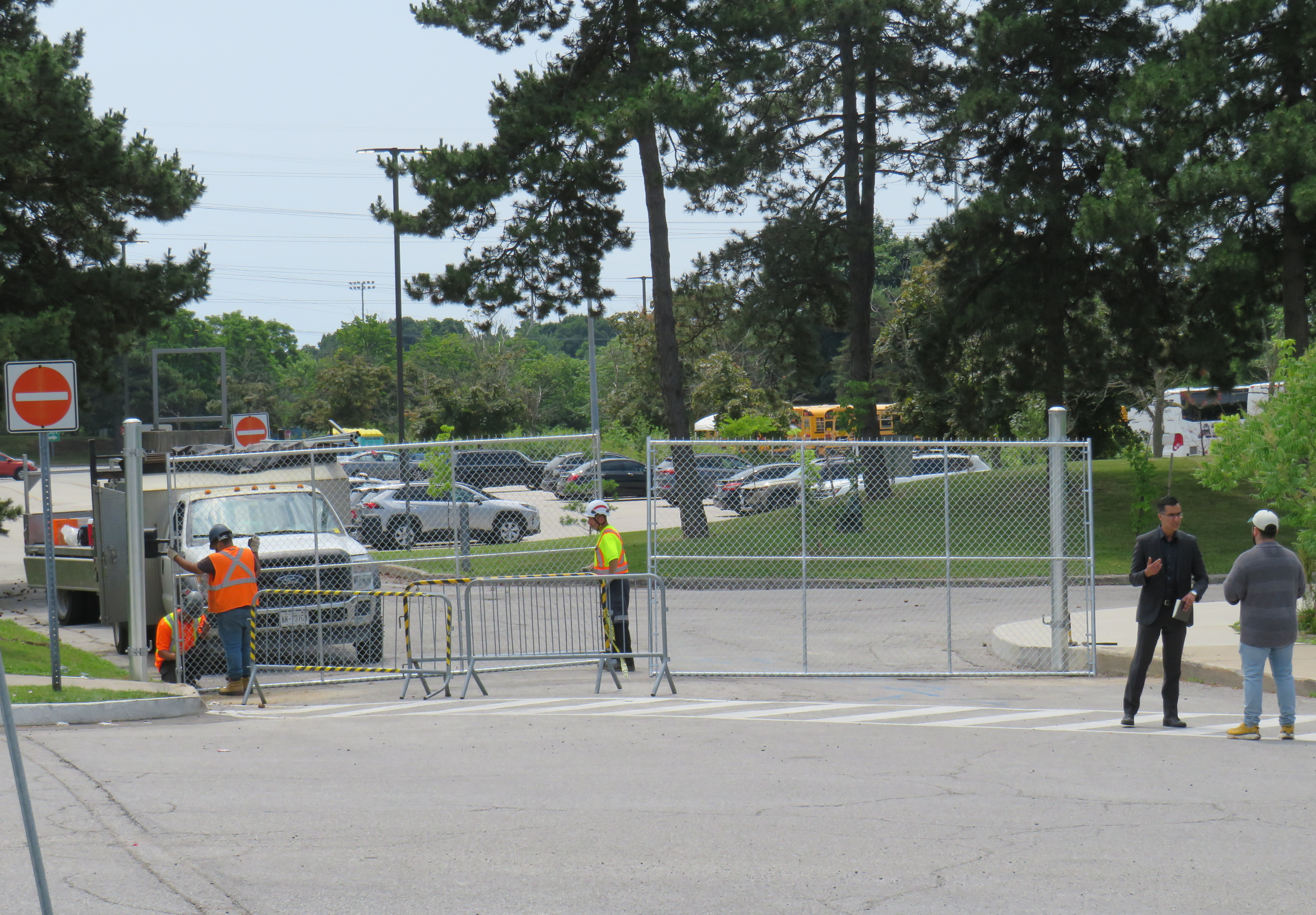
On Friday morning, gates were already being installed at the parking lot entrances to the Science Centre, before the official announcement, even before the Toronto Star published the first story about the closure on its website around noon.
Workers install rigid gates at the staff parking and bus exit at Ontario Science Centre. Local Liberal MPP Dr. Adil Shamji speaks to a reporter in front.
One cannot help but be skeptical about the sudden decision to close the Science Centre, despite the demolition by neglect by the Liberal and PC governments. Had an announcement been made, but with the closure taking effect two weeks later after the long weekend, it would have given visitors one last time to appreciate the Science Centre and its unique architecture. But that might also be the point. By making the closure a done deal without the opportunity for the community to rally to save the Ontario Science Centre, Doug Ford’s PCs have shut down debate. By the time the legislature meets again in October, their hope is that opposition to the destruction of Ontario Place and the Ontario Science Centre will have dissipated. The Friday afternoon news dump also fits this strategy.
Though I made it up on Friday to document the closure, I am sad that I did not make it for one last visit, just as with the sudden closure of the Scarborough RT last year.
The most heartbreaking thing for me was watching a young family walk from Flemingdon Park into the Science Centre just as the news media was assembling for a press conference with Don Valley East MPP Dr. Adil Shamji and Floyd Ruskin of SaveOSC. The young child looked so excited for a day at the science centre, unaware that it would be the last day it would ever be open.
A VIA Rail train in Stratford, Ontario. In 1989, there were five trains a day connecting Stratford to Toronto. In 2024, there is only one.
July 2024: Map edited to include one new daily intercity train: Amtrak’s Borealis, an extension of an existing Chicago-Milwaukee train to St. Paul, Minnesota, offering a second daily train on the eastern section of the Empire Builder route.
Unlike in Europe or Asia, the story of passenger rail in North America the last seventy-five years has generally been one of decline. There are exceptions: service on the Northeast Corridor between Boston and Washington is frequent and relatively speedy. Commuter rail services have expanded in most major metro areas. And a new privately-owned intercity rail service in Florida offers frequent, dependable, and fast service between Miami and Orlando, with expansion on the way.
The development of new interstate highways, the loss of mail contracts and express freight to trucking, more affordable air travel, and competition from coach operators all contributed to the decline in North America. Though Canada and the United States both established national rail passenger services in the 1970s in an attempt to halt — or at least manage — the disappearance of intercity rail, the two countries had vastly different operating environments. Mexico, which had a nationalized railway network, privatized its assets and wound down intercity rail in 1995; today there is now only a commuter train in Mexico City and a new tourist-focused Tren Maya service in the Yucatan Peninsula.
Canada had only two major railway systems since the 1920s: privately-owned and profitable Canadian Pacific, and government-owned Canadian National. There were only several smaller railways owned by provincial governments and industrial concerns, along with a few American connections such the New York Central (NYC) line through southwestern Ontario, and the Toronto, Hamilton and Buffalo Railway, a joint venture of CP and NYC.
In the United States, there were dozens of medium and large railroads, all competing for fewer passengers and depleting natural resources. In the Northeast and Midwest, mergers between one-time rivals like NYC and Pennsylvania Railroad (Penn Central) and the Erie and Delaware, Lackawanna and Western Railroads (Erie Lackawanna) failed, leading to the creation of federally-backed Conrail. (Today, there are only six Class I railroads in the US, including CN and CP-Kansas City Southern)
In the midst of failing railroads and declining passenger services, Amtrak was formed in 1971 and took over the operation of most remaining intercity trains. (Commuter trains, often subsidized by local or state governments, remained operated by the freight railroads before being absorbed by transit agencies.) Amtrak purchased new rail cars for regional services to replace decrepit rolling stock (Amfleet); eventually new long-distance cars were also acquired one it was clear it would maintain those routes (Superliners)
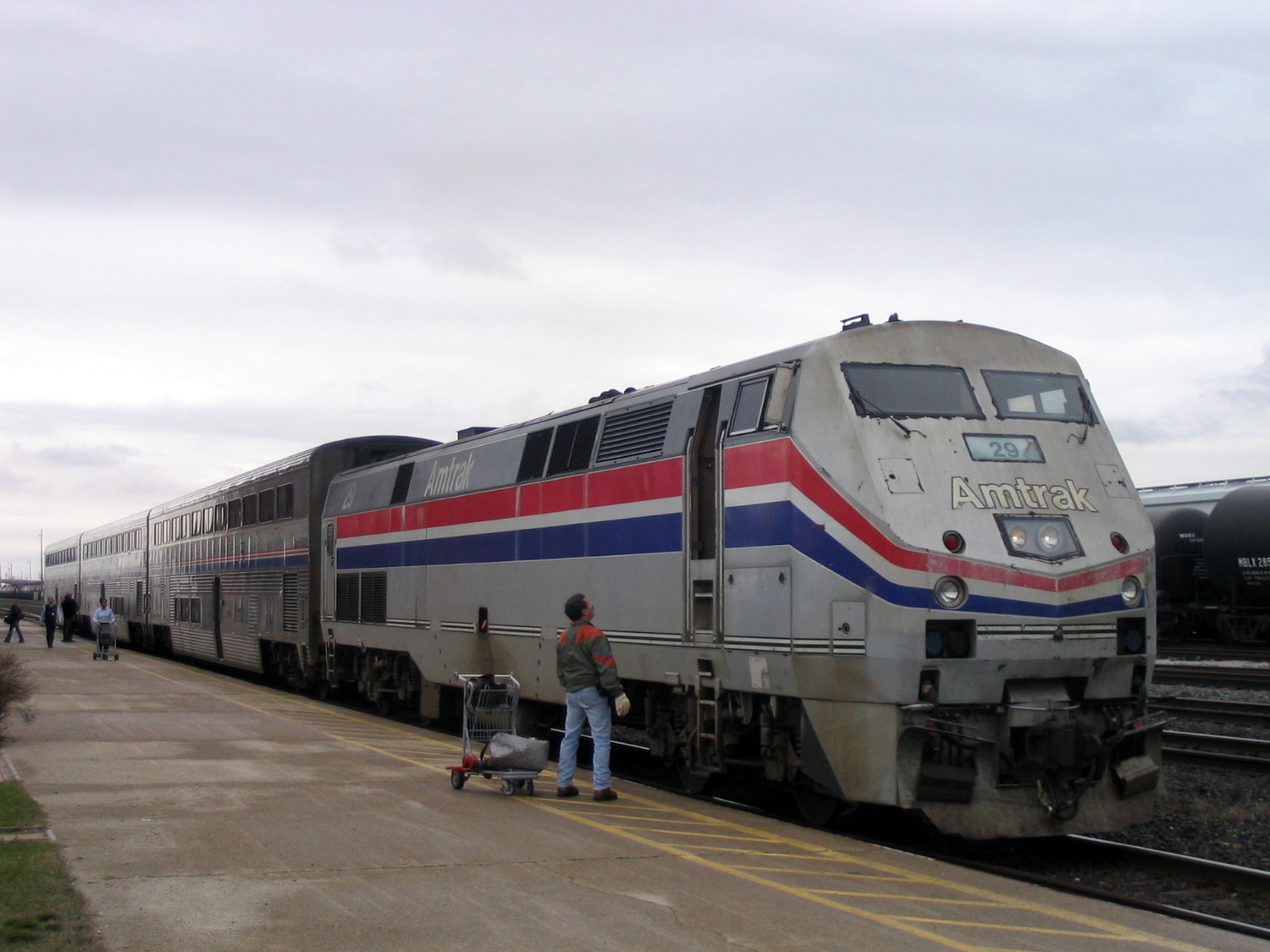
Amtrak’s “International” in Sarnia, Ontario in 2004, equipped with Superliner coaches
In Canada, VIA Rail started off in 1976 as a passenger rail brand of CN, which, as a Crown corporation, was still committed to passenger services. In 1977, it became a separate agency and in 1978, it took over CP’s remaining rail services. The 1980 map shows what VIA Rail’s system looked like in the early years. VIA did not take over everything; CN and CP retained ownership of commuter trains in the Montreal area, which were not yet assumed by the regional transit agency there. Railways not owned by CN and CP also maintained their own passenger services, usually with government support or direct provincial operation (i.e., GO Transit, Ontario Northland, BC Rail, Algoma Central).
Both Amtrak and VIA saw major funding cuts from federal governments in the first decade of their existence. In the United States, poorly-performing routes such as the Mountaineer (Norfolk-Cincinnati-Chicago), the Floridian (Chicago-Nashville-Miami), the Lone Star (Chicago-Kansas City-Oklahoma City-Houston) and the National Limited (Washington-Columbus-Kansas City) were eliminated between 1977 and 1979; deteriorating track conditions on insolvent host railroads were a contributing factor.
VIA Rail also saw several service cuts after its formation. Though the trains eliminated between 1977 and 1980 were generally marginal services in Western Canada and Northern Ontario and Quebec, 1981 saw more drastic cuts across the country, including the elimination of CN’s transcontinental train through Saskatoon and Edmonton. Though those cuts were partially reversed in 1985, in 1990, nearly half of VIA’s trains were wiped from the timetable, including nearly every train in the Maritime Provinces and the famed Canadian on the CP route from Montreal and Ottawa through Thunder Bay, Regina, Calgary and Banff.
Amtrak, despite its challenges, never saw cuts as drastic as those made to VIA Rail. Unlike VIA, Amtrak enjoys more autonomy from the federal government. Many of its services are funded by state governments rather than the federal government. Powerful senators will lobby to maintain services or add new trains in their state. (Canadian federal politicians generally enjoy less influence and autonomy in our parliamentary system, with power increasingly centralized in the Prime Minister’s Office.)
Amtrak routes added since 1980 and depicted in the map below include the restoration of previously eliminated services. The Heartland Flyer (Oklahoma City-Fort Worth) is a partial restoration of the Lone Star, while Amtrak Regional service to Roanoke, Virginia, restores part of the cancelled Mountaineer. There are three daily transcontinental trains between Chicago and the West Coast and two between New York, Washington, and Florida. Daily service means these long-distance trains are much more useful for regular and casual travelers than VIA’s remaining long-distance trains.
Over a dozen states contribute to the operation of many daily trains. California goes even further, with a distinct Amtrak California brand with a dedicated fleet owned by that state’s department of transportation. If such a model existed in Canada, one might expect the continuation of services such as Toronto-Peterborough, Montreal-Sherbrooke, or even Calgary-Edmonton.
Bucking the trend: commuter rail
Unlike intercity passenger rail, commuter rail services have expanded in Canada and the United States. In 1980, there were only 11 metropolitan areas with commuter rail services (and in Pittsburgh and Detroit, those would soon disappear). In 2024, there were 23. Though systems in the New York and Chicago areas barely expanded (and in Philadelphia, commuter rail coverage actually shrunk), there was impressive growth in commuter services in the Greater Toronto Area, the San Francisco Bay Area, and in Southern California, to the point that GO Transit and Caltrain are evolving towards becoming true regional rail systems.
Interactive map
An interactive map, linked below, shows what the Amtrak and VIA Rail systems looked like in 1980 and in 2024, along with independent railways and commuter services. The 1980 map includes notable routes (in grey) that were cut since 1976, the year of America’s bicentennial and the Summer Olympics in Montreal. Use the slider to compare the two maps and click on any line for more details on each route.
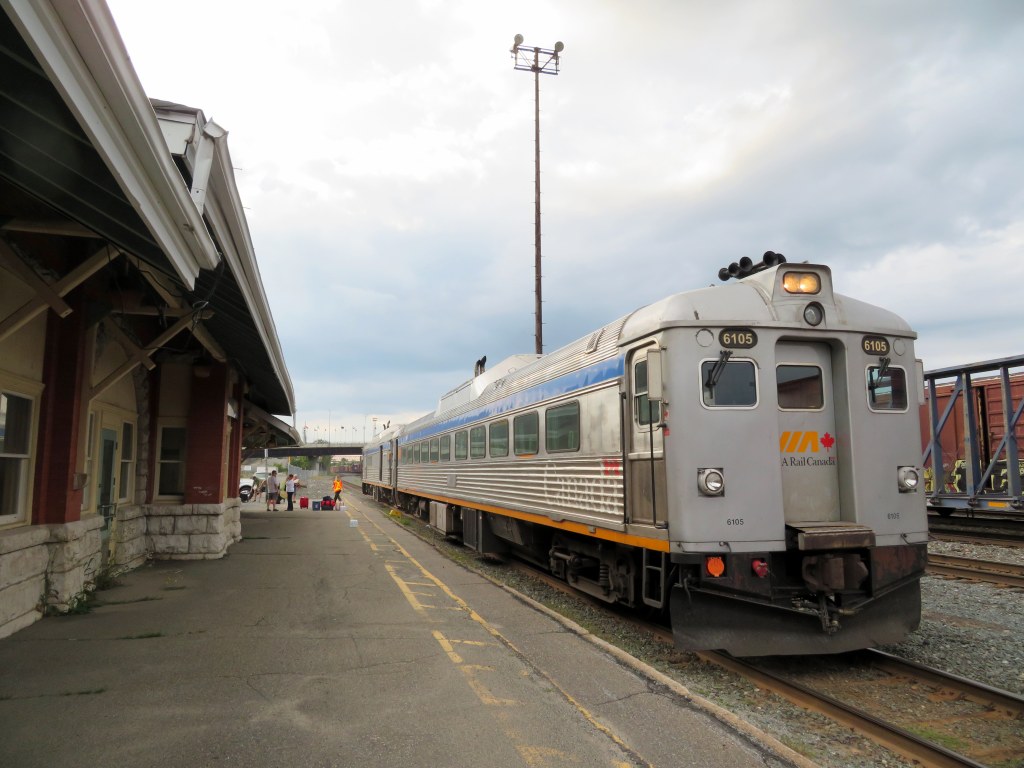
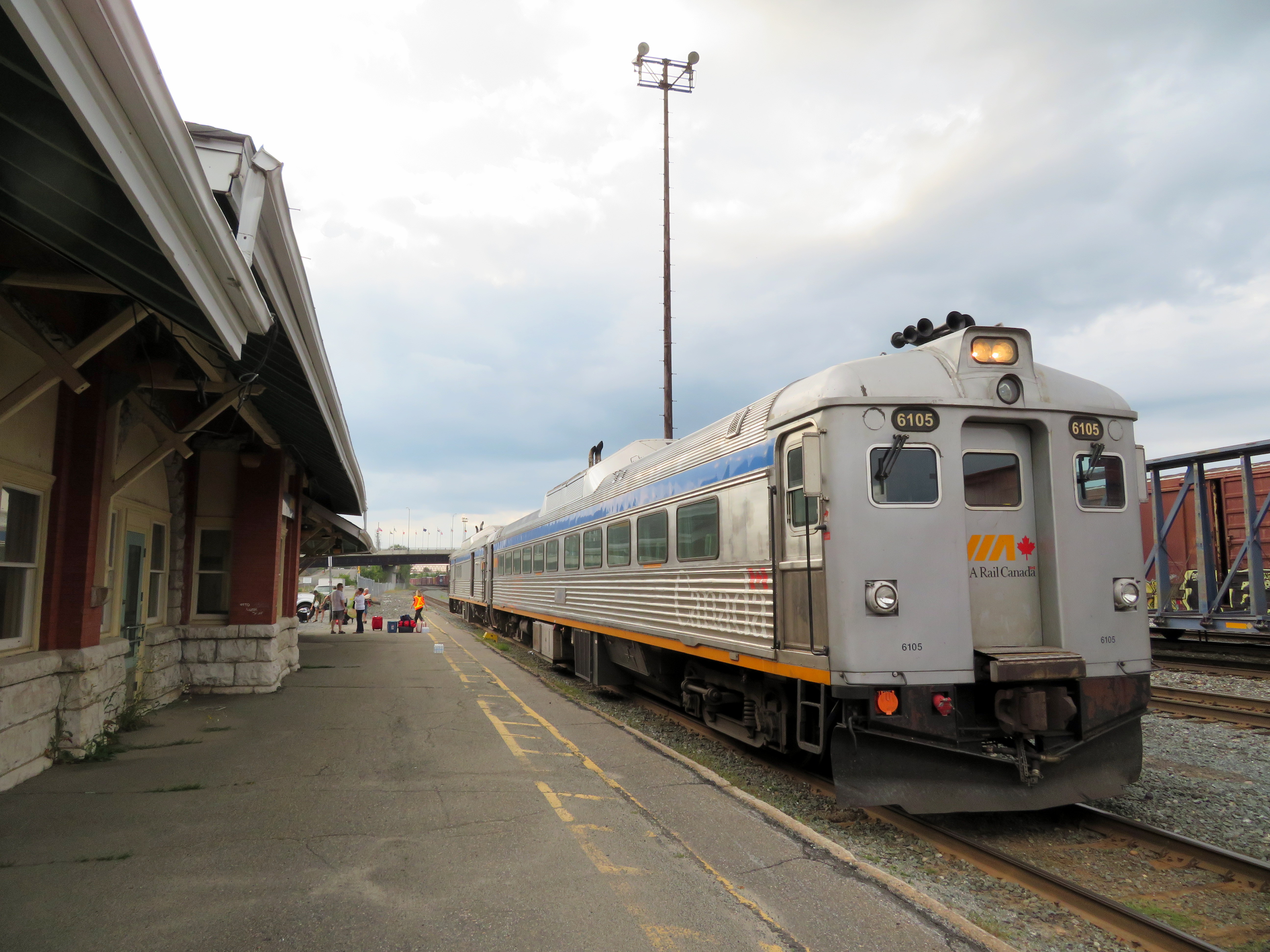
Rail diesel coaches (RDCs), introduced to Canada’s railways in the 1950s, were used on branch lines and in local service on busy mainlines through the 1980s. Today, they can only be found on VIA’s Sudbury-White River service, a remnant of the once-mighty CPR transcontinental network.
Updated December 18, 2023 as part of my interactive maps migration.
I recently completed a map of all Canadian passenger rail services that operated in 1955, from Whitehorse, Yukon, to St. John’s Newfoundland. As I wrote back in March, the decline in rail services in Canada can be attributed to a few factors: passenger train revenues were augmented by express cargo and mail, mixed trains, carrying both passengers and freight, were still justified in a time before trucks took over general industrial traffic. An incomplete highway network in northern Ontario, Newfoundland, and much of Western Canada also guaranteed healthy passenger demand in an era before jet travel became accessible to the masses.
The introduction of rail diesel coaches (RDCs), with their lower labour costs compared to conventional trains kept some branch lines going through the 1960s, but by the mid 1970s, neither Canadian National nor Canadian Pacific were interested in running passenger trains anymore; both were increasingly focused on bulk freight (grains, minerals, chemicals, finished automobiles) and intermodal container traffic.
VIA Rail took over most of CN and CP’s passenger trains in 1978, with direct government subsidies helping to fund its operations and capital expenses. By then, passenger train service was concentrated in the highly populated Quebec City-Windsor Corridor, but there were still three trains a day between Halifax and Moncton, two trains daily between Montreal and Atlantic Canada, between Winnipeg and Vancouver, and between Calgary and Edmonton. Scheduled bus connections, some even operated by VIA Rail, provided connections to places such as St. John’s, Fredericton, Charlottetown, and the Okanagan Valley.
Cuts imposed in 1981, 1990, and 2012 devastated the network. By 2019, there were only three trains a week in Atlantic Canada, two trains a week between Toronto and Vancouver. Even the Corridor saw cuts: there were five trains a day between Toronto, Kitchener, and Stratford, in 2019, there were just two. The only bright spots were an increase in the number of trains between Toronto and Ottawa and growing commuter rail networks in Toronto and Montreal.
A revised map, linked to below, depicts the passenger network in 1955 and in 1980, just prior to the 1981 cuts. Routes operating between Canada and the United States are depicted (CN, CP, New York Central, Delaware & Hudson, Great Northern, Northern Pacific, and White Pass & Yukon in 1955, Amtrak and White Pass & Yukon in 1980). More information on each route is available by clicking on the lines.
High speed rail: it’s an idea that has been talked about in Canada since the 1960s. But sadly, in 2016, we’re still just talking about it.
I’m a big fan of passenger rail. I’ve rode on most of VIA’s network, from coast to coast, as well as several long distance Amtrak lines in the United States, as well as trains in Britain, Continential Europe, and China. I enjoyed riding high speed rail (HSR) trains between London, Paris, and Amsterdam, but I also appreciate a leisurely cross-country ride. In Canada, the train isn’t very fast, nor is it very reliable, but it’s a comfortable, peaceful, and social way to travel. It’s still my favourite way to travel to Ottawa or Montreal.
Passenger rail — excepting commuter services such as GO Transit — declined in this country in the last 40 years, in terms of ridership, speed, and reliability. There are thousands of kilometres of track in Canada that hosted passenger trains only a few decades ago that are now torn up, the land sold off or turned into rail trails. In 1989, there were five trains a day in each direction through Kitchener and Stratford. Today, there are just two.
In 1976, a year before VIA Rail Canada was formally established, the fastest trains between Toronto and Montreal, (CN Trains 66 and 67, the famous Turbo,) were scheduled to take 4 hours and 10 minutes, stopping only at Guildwood and Dorval.
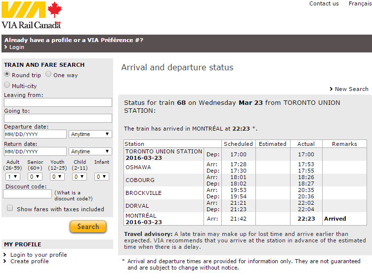
Today, the fastest train between Canada’s two largest cities, Train 68 from Toronto, takes 4 hours and 42 minutes, if it’s running on time. (It didn’t on Wednesday, March 23, arriving 41 minutes late into Montreal.) And there are only six direct trains in each direction between the two cities.
Delays, despite longer scheduled travel times, are common on the Corridor
While commuter rail services are expanding in Toronto and Montreal, passenger service has not. Since being formed in 1977, VIA Rail suffered through several major cutbacks in 1981 and 1990, and minor cuts in 2004 and 2012; but VIA held on despite the neglect – – or complete disdain — of both Liberal and Conservative governments. Ridership fell, not because people didn’t like riding trains, but because governments didn’t want to fund rail services, nor did freight railways like hosting them. Roads were seen as investment; passenger rail an expense.