How Toronto voted for mayor. Areas shaded in blue represent electoral subdivisions (polls) where John Tory placed first. Areas shaded in purple represent polls where Gil Penalosa placed first. Click here for the interactive version.
As has become my tradition after Toronto’s municipal elections, I mapped out the poll-by-poll results of the mayoral race and some of the more interesting council races. After creating maps for the 2014 election and sharing those on social media, it was suggested that I have a website to host these maps. That is how this website came to be.
This time, I created an interactive map showing the results of the mayoral race, along with six council races: Ward 3 Etobicoke-Lakeshore, Ward 4 Parkdale High-Park, Ward 5 York South-Weston, Ward 11 University-Rosedale, Ward 18 Willowdale, and Ward 20 Scarborough Southwest.
Dayton, Ohio is probably best known as the hometown of Wilbur and Orville Wright, the two bicycle mechanics who made the first successful controlled heavier-than-air flight. The city has remained a centre of the aviation industry. The US Air Force (and its predecessors) have operated a major base in Dayton for over a century, which includes an impressive museum of military aviation history.
But among transit buffs, Dayton is notable for another reason. It is one of only a handful of cities in North America that continues to operate and maintain an electric trolley bus system. The Greater Dayton RTA is also the smallest transit system to have operated trolleys since the mid 1970s.
Though there were early adopters of “trackless trolleys” in the late 1910s and early 1920s, the technology was particularly popular between the late 1930s and early 1950s. For street railway operators burdened with ageing streetcars and worn out infrastructure, electric trolleys offered several advantages. They could make continued use of electric substations, poles, and overhead wires, without the need for maintaining tracks and rights-of-way. Trolley buses were quiet and smooth-running, unlike gasoline and early diesel buses, and had larger capacities. They were cheap to operate and easy to maintain, and were especially adept at climbing steep grades.
TTC trolley bus on Ossington Avenue in the 1950s. The Ossington trolley was established as part of a major post-war route restructuring.
Most of the big cities in Canada and the US continued operating streetcars into at least the 1950s, as newer PCC streetcars helped keep those fleets going. But trolley buses were ideal for smaller and midsized cities that still had robust transit demand that buses could not yet meet. Even cities that retained streetcars into the 1950s — like Toronto — used trolley buses to replace marginal streetcar lines and allow for major route restructurings.
In Canada, fourteen cities established trolley bus fleets between 1936 and 1951. In Halifax, the Nova Scotia Light and Power Company replaced its decrepit streetcar system and its feeder bus network with an all-electric fleet in 1949; at the system’s peak, there was even a trolley route across the Macdonald Bridge to Dartmouth. Cities as small as Cornwall and Port Arthur/Fort William (now Thunder Bay) even replaced their streetcars with trolley buses.
By the 1970s, the coach bodies purchased 30 years earlier were showing their age, and many agencies had decided to simplify their fleets and go with modern diesel buses, which had improved in size, power, and capacity since the 1940s. In Canada, only Toronto, Hamilton, Edmonton, and Vancouver decided to renew their fleets, while only five cities in the United States (Boston, Dayton, Philadelphia, San Francisco, and Seattle) kept their electric trolley systems. Since then, Hamilton, Toronto, Edmonton — and most recently, Boston — gave up when the latest generation of trolleys were due for replacement.
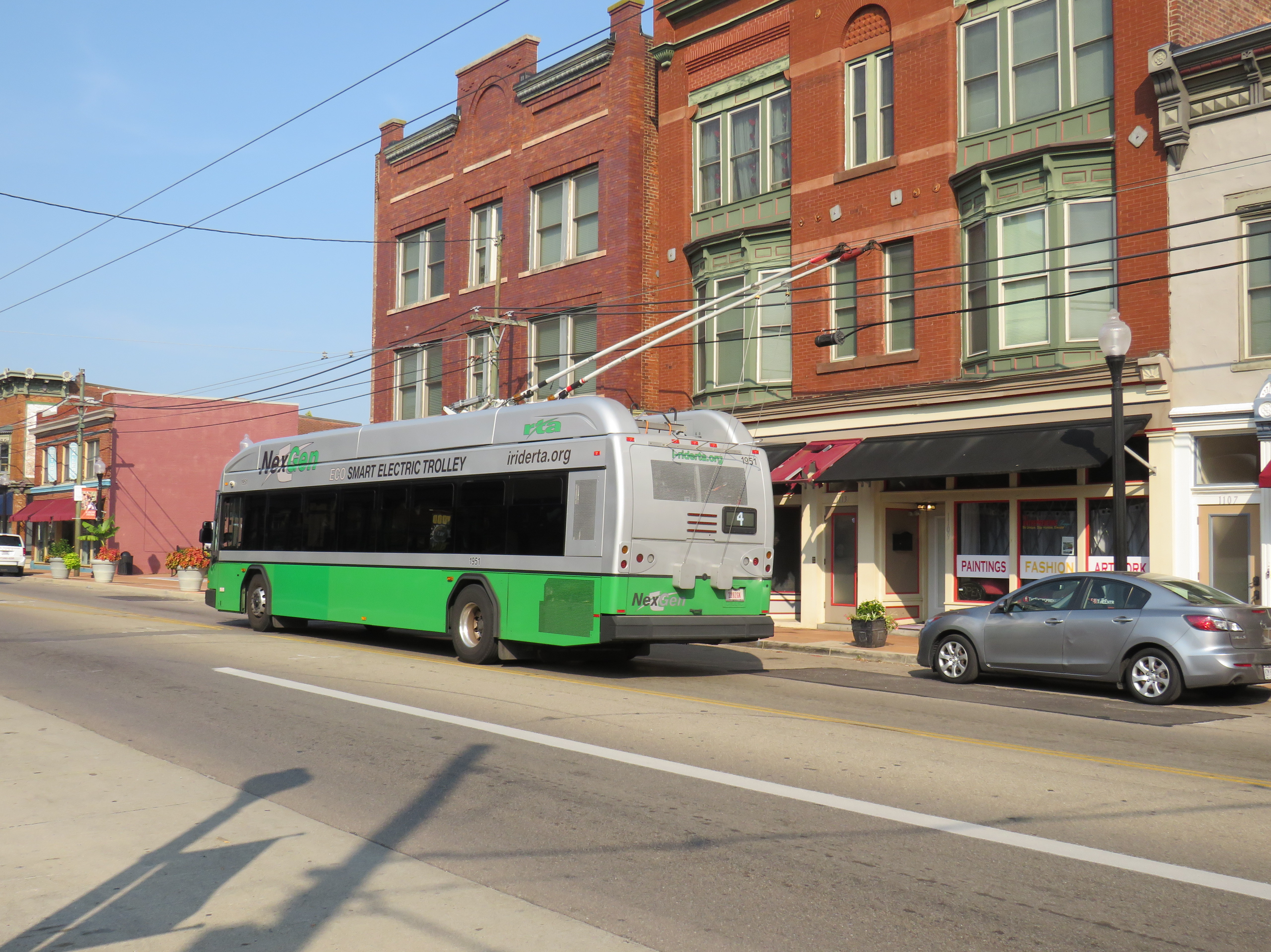
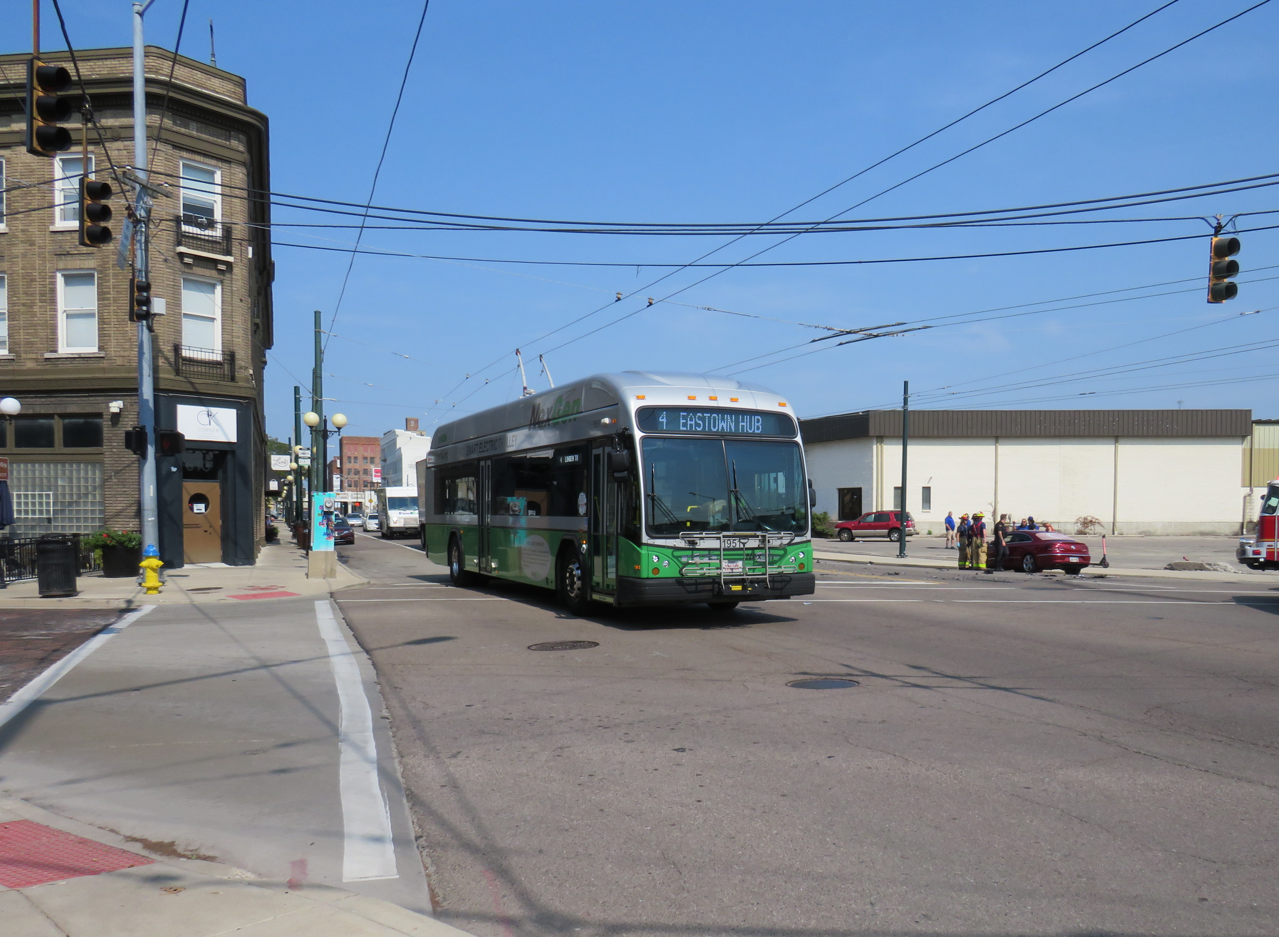
But of all places, the small, deindustrialized city of Dayton took a very different direction. In 2020, the Greater Dayton Regional Transit Authority (GDRTA) received the last of its 45 new Kiepe/Gillig Next Generation trolley buses, equipped with large, powerful battery packs and computer systems that allow for long-distance, full speed off-wire capability. (The previous generation of trolleys, like what Translink in Vancouver currently operates, allow only for limited, low-speed off-wire operation).
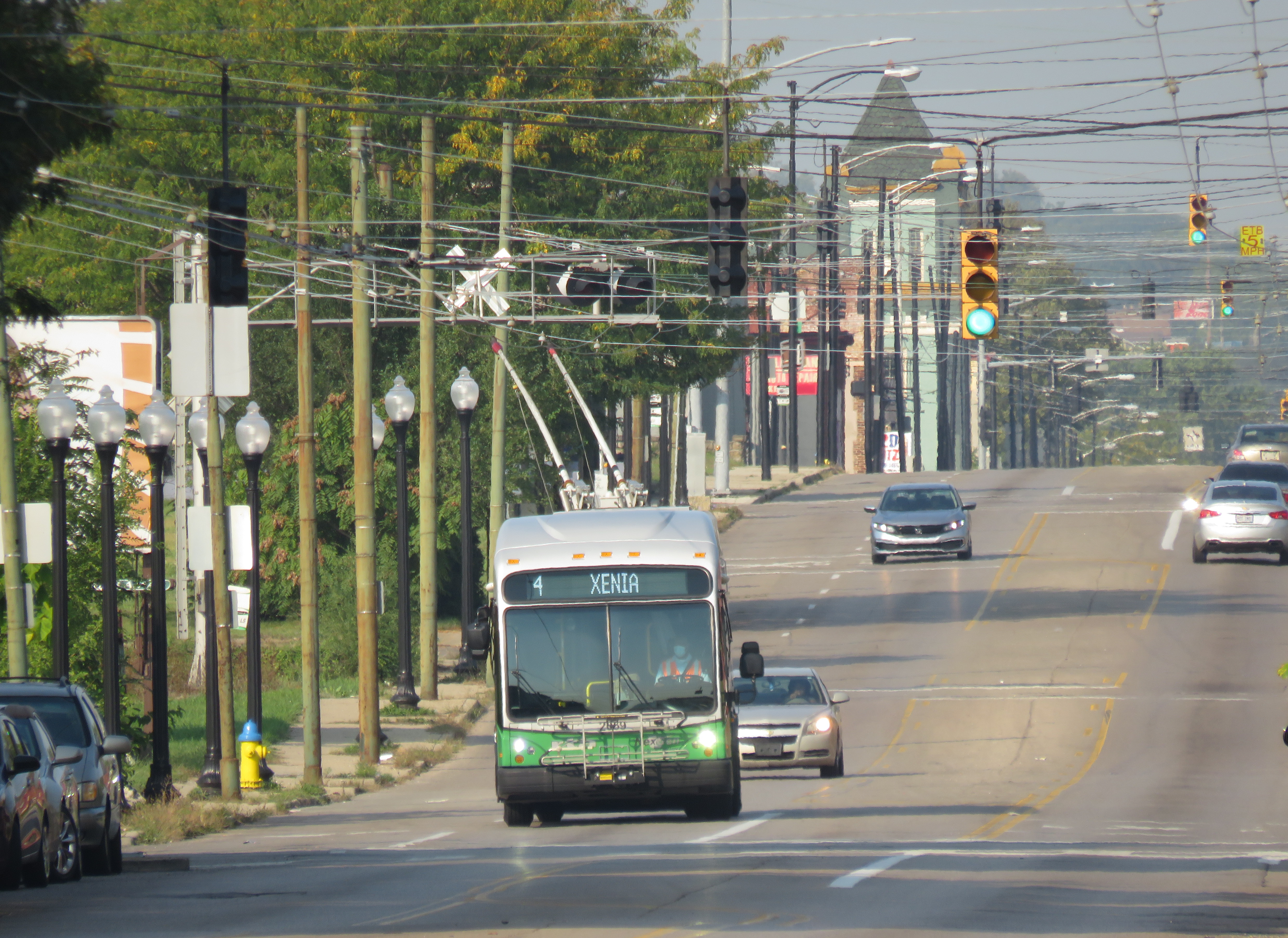
The new NexGen trolley on Third Street on Dayton’s West SideA trolley on Route 4 running with its poles down. I captured this photo just after getting off the bus on September 16, 2022.
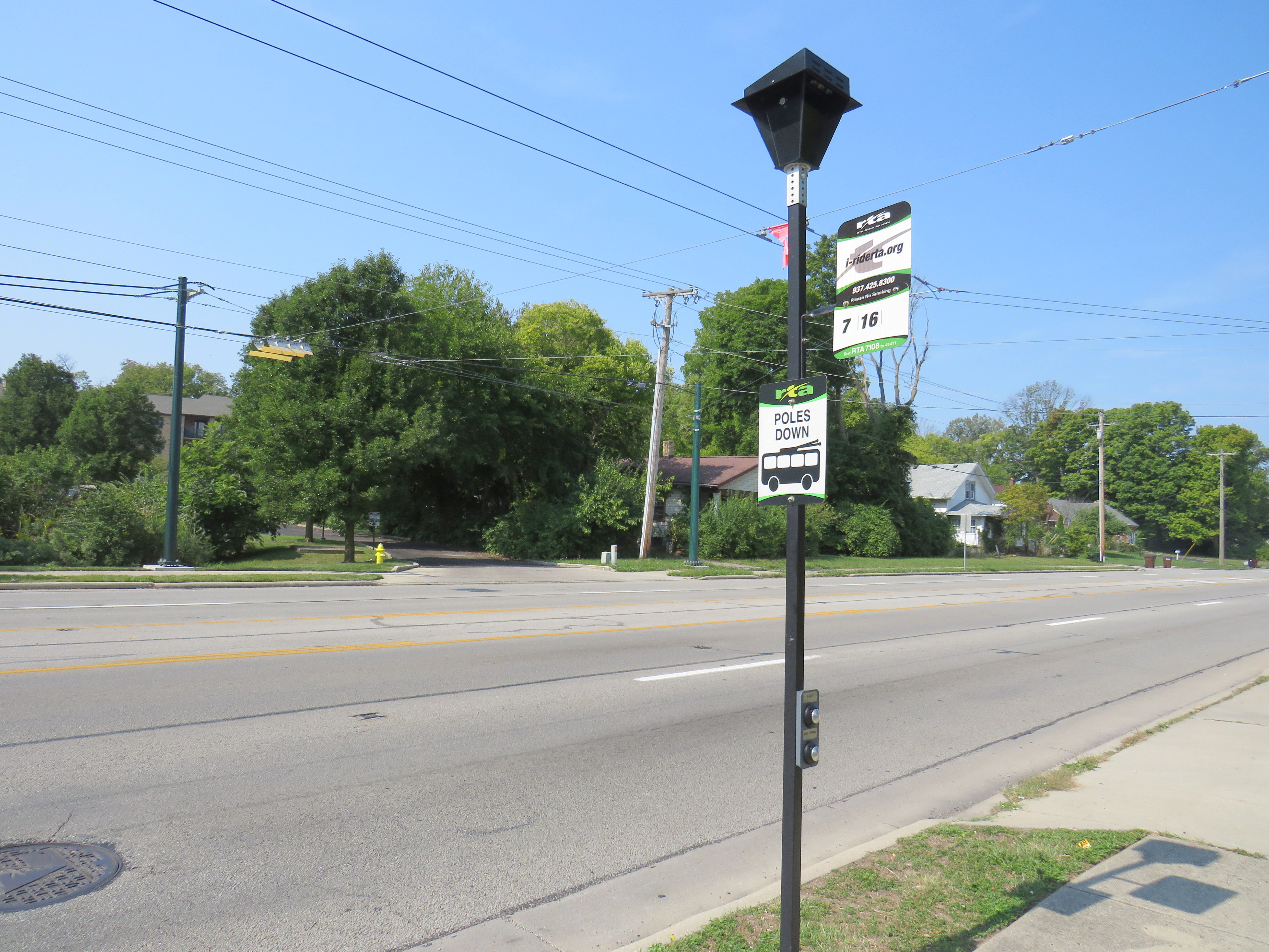
The extended off-wire capability has allowed the GDRTA to extend two of its trolley bus routes further into the suburbs without extending wire. Route 7 was extended 5 kilometres northwest, while Route 1 was extended 6 kilometres east to Wright State University. Though the corridors were already served by longer-distance diesel bus routes, it provided additional service to some of Dayton’s major suburban trip generators.
North Main Street at Elm Hill Drive, where the Route 7 trolley wire ends (note the “poles down” sign), but trolley buses can continue another 5 kilometres onward.
Unfortunately, despite the new fleet and plenty of wire to run it, the GDRTA has only been operating its trolley buses on a single route in the last few months, despite four routes being fully capable of electric service. When I visited Dayton on September 15, not a single trolley was out. Though I did go visit the US Air Force Museum and the Wright Brothers National Historic Site (where one of the brothers’ bicycle shops were preserved on site; the family home and another of their shops were moved to Henry Ford’s Greenfield Village), I was really disappointed. But having a car, and a hotel reservation less than an hour away, I went back the next morning to see these new vehicles in action and take a ride.
A line up of diesel buses, including the trolley-capable Route 7, in Downtown Dayton, just south of the main bus terminal on September 15, 2022. Note the trolley wire, completely unused.
Happily, Route 4 was operating with trolleys, though on a Saturday schedule, imposed by GDRTA because of an ongoing driver shortage that has plagued transit systems across North America. During the daytime, three buses offer 30 minute service on the route. Between Downtown Dayton and the West Side, my first ride that morning was interesting as the bus was operating with its poles down for some reason. But riding the bus, I couldn’t tell: it was a smooth, quiet, and quick jaunt. I took two more trips on Route 4 to the east end, to get the most out of my visit.
A NextGen trolley outbound on Wayne Avenue at East 5th Street, September 16
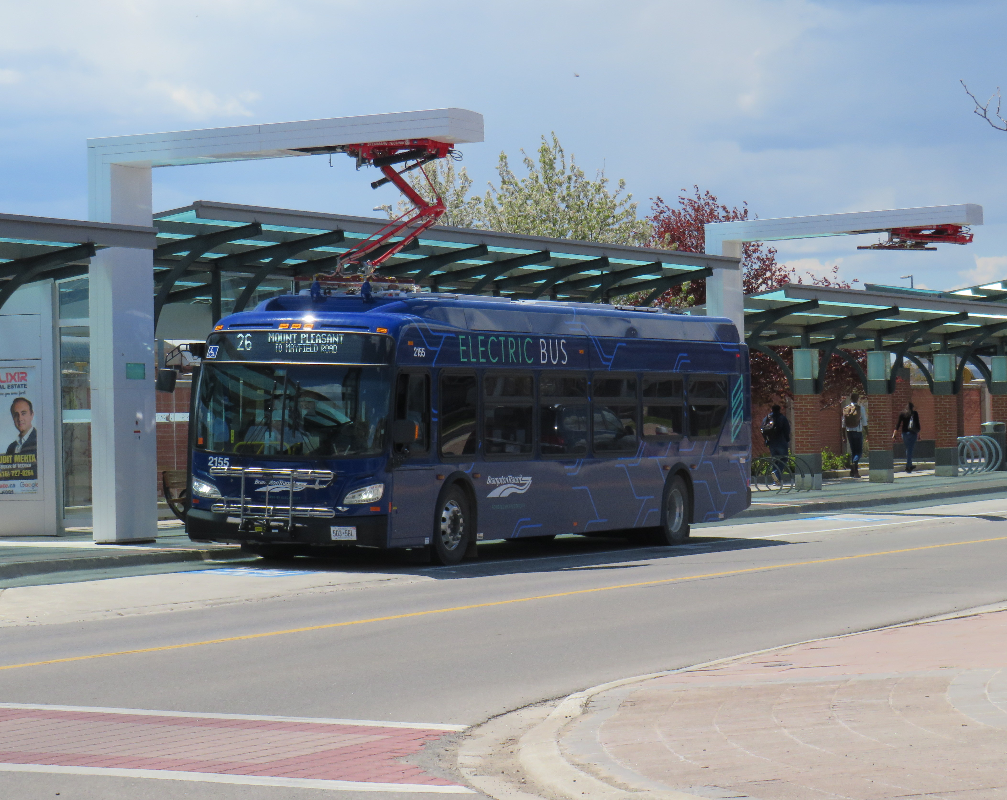
Despite my disappointment with the GDRTA’s utilization of its fleet, I came away still confident about the technology’s future. Though many transit systems are re-electrifying their bus fleets, they have been purchasing battery-electric fleets that do not have any in-motion charging, unlike Dayton’s advanced trolleys. Some agencies, like the TTC, have battery buses that are charged only at the garages. Other cities, like Brampton, Winnipeg, and Montreal have en-route charging stations at terminal points as well as garage charging points. But bus batteries are extremely heavy, and they have not yet gone through a complete life cycle yet in the harsh Canadian climate.
Brampton Transit electric bus charging at Mount Pleasant Village
The TTC in particular is suited to restoring its trolley network using modern on-wire charging buses like those used in Dayton, as it has much of the infrastructure already in place, including substations (that feed the subway and streetcar network) and existing overhead wire systems. With long-distance off-wire capability, there is no need for complex wire junctions and short-turn loops, unlike older trolleybus networks. Busy, straight routes such as Dufferin and Bathurst would be ideal.
Though Dayton isn’t using its new fleet of electric buses to its potential, it does show the way to renewing sustainable electric transit services for cities like Toronto.
November 5: I’m happy to report that my interactive maps are all online again.
In case you’ve been looking for my interactive maps, such as the Ontario Intercity Transportation Map, I apologize for the interruption.
I host my interactive maps on Esri’s ArcGIS Online, and I pay a monthly “pay as you go” for the service. It’s not a large sum, but it ensures that my maps are available and easily updatable. I have a second Esri account that I use for ArcGIS Pro and for new professional contracts.
But even after updating my credit card information and contacting Esri’s customer service many times now, my account is paused. I will let you know when it’s back up. As you’d think a very large IT corporation would be able to resolve this quickly, I’m disappointed and annoyed.
This coming Monday, October 24, Ontarians will be electing new city councils. In Brampton, Ottawa, and Hamilton, the mayoral races should prove to be interesting. For Ottawa in particular, with Jim Watson stepping down, voters have a clear choice (and I’ll be cheering for Catherine McKenney). Though Gil Penalosa offers a new vision of a sustainable, active, and safer city, it’s very likely John Tory will win an unprecedented third term, the first to do so since amalgamation in 1998.
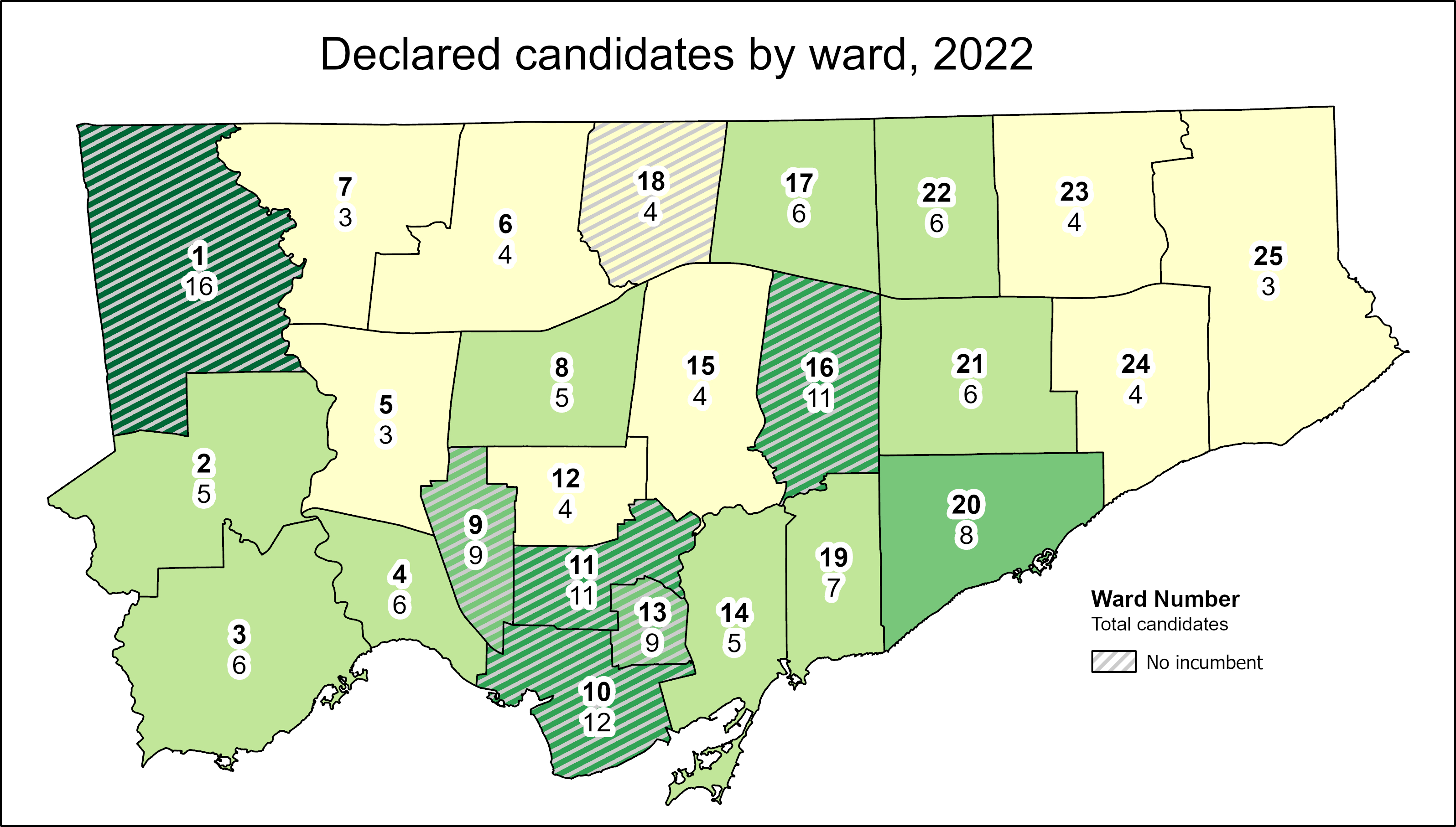
At Spacing Toronto, I have been offering some insights by mapping the state of our local democracy, ward by ward. Though there are seven wards in which no sitting councillor is running for re-election, the new council may not look too much different from the last one. That’s because two former councillors — Vincent Crisanti and Jon Burnside — will be looking to get back into office. Meanwhile, Mayor Tory has been busy campaigning for twelve candidates, including eight incumbents, that will help advance his agenda of incrementalism and austerity. Among Tory’s picks are Frances Nunziata, who has been in municipal office uninterrupted since 1988.
Here are the links to my posts at Spacing:
Open wards and the power of incumbency: The power of incumbency, and the mayor’s own influence, will weigh heavy on the final results. Though there may be seven “open” wards and a few more truly-competitive races, there is a lot happening behind the scenes to favour certain candidates.
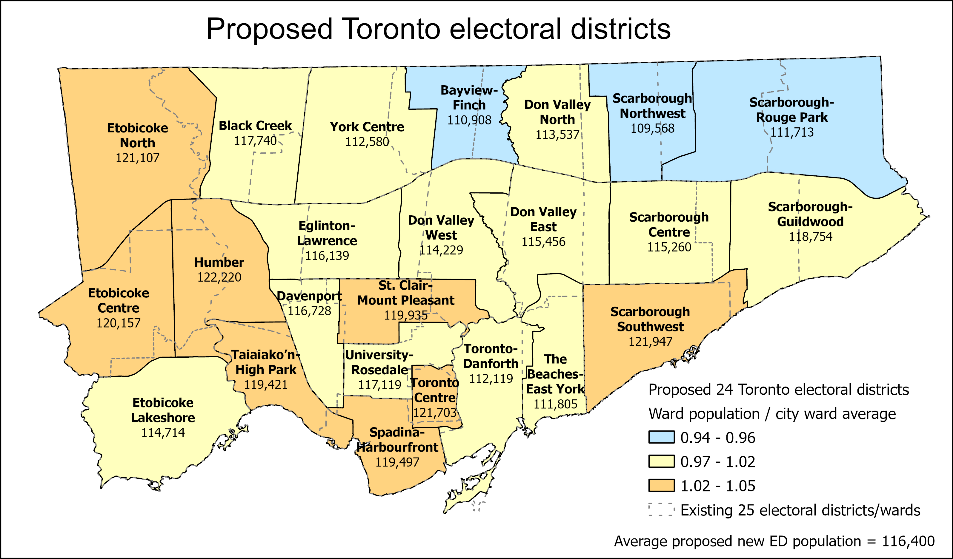
Population disparities between Toronto’s 25 wards: How ward boundaries that were drawn in 2013 have exasperated imbalances in population, leading to burnout in high-growth wards (with several downtown councillors deciding to move on). If Toronto continues to be forced to use federal/provincial riding boundaries, it will have just 24 wards in the 2026 election.
What Toronto’s new ward boundaries might look like
Toronto is a highrise, rental city – unlike City Council: Though nearly half of all Torontonians live in highrise dwellings and/or rent their homes, Toronto City Council is made up almost entirely of homeowners. In only a few wards, detached houses make up the vast majority of the housing stock and homeowners dominate. I ask why city council doesn’t reflect the way an increasing number of us live. The interest in this post had me on CBC Metro Morning for the first time, early on September 30.
Duelling campaign endorsements: Though Mayor John Tory has supported a few candidates before (most notably, Etobicoke councillor Mark Grimes), this time, he’s actively campaigning with twelve allies. Meanwhile Progress Toronto is backing nine challengers, focusing on races where it hopes to help get new faces elected.
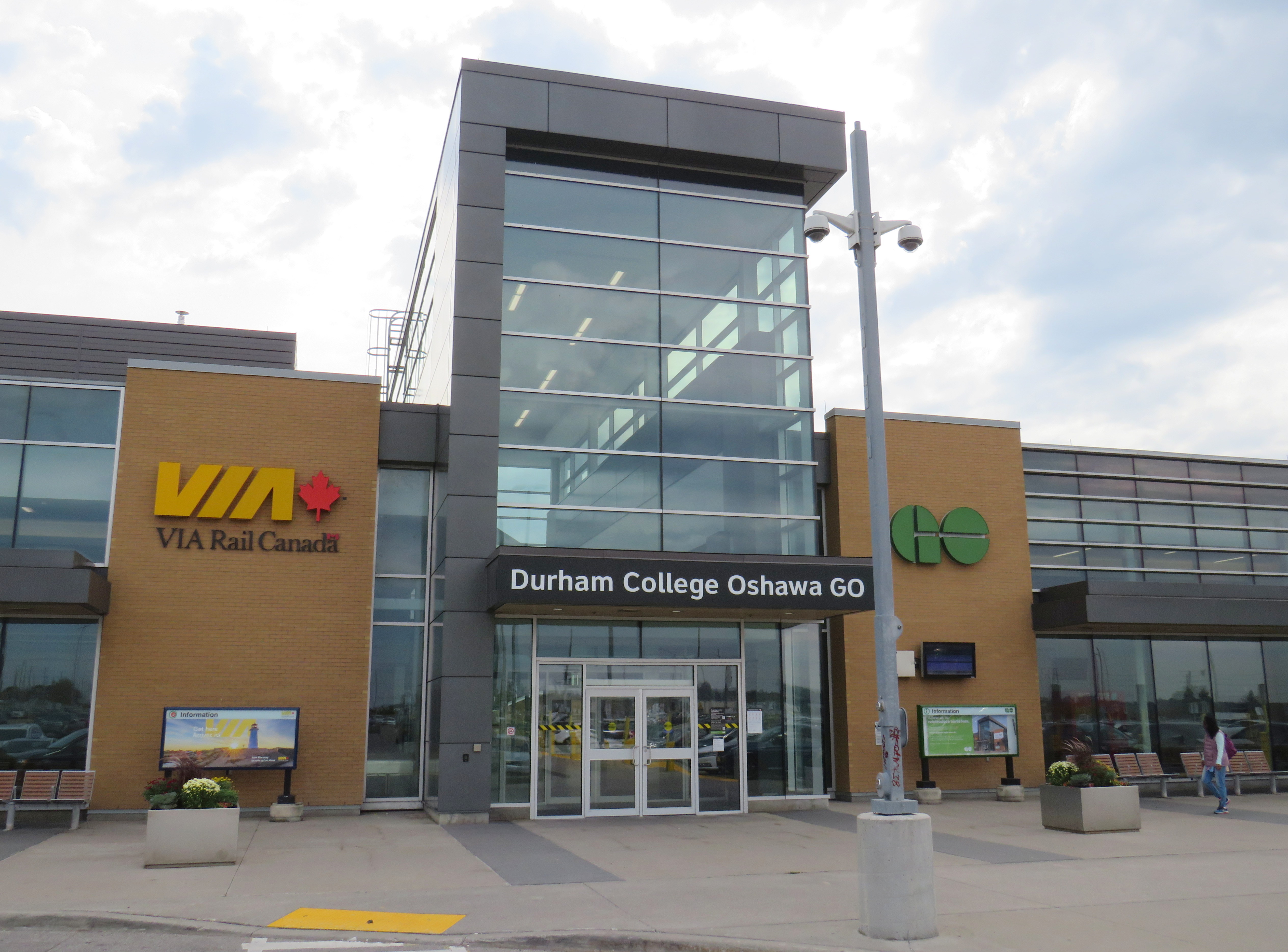
On Tuesday, October 4, Metrolinx announced a new name for Oshawa GO Station, the eastern terminus of its busy Lakeshore Corridor. In a ten-year agreement with Durham College, a publicly funded post-secondary institution, the station will now be known as “Durham College Oshawa GO.” This was announced on Metrolinx’s Twitter account, Durham College’s social media, and on the GO Transit Lakeshore East Twitter account, which usually advises passengers of train delays and cancellations.
📢 Oshawa GO is now Durham College Oshawa GO!
Customers will start see the new name on the station building itself and on assets throughout our system. pic.twitter.com/dAAvCjOz2e
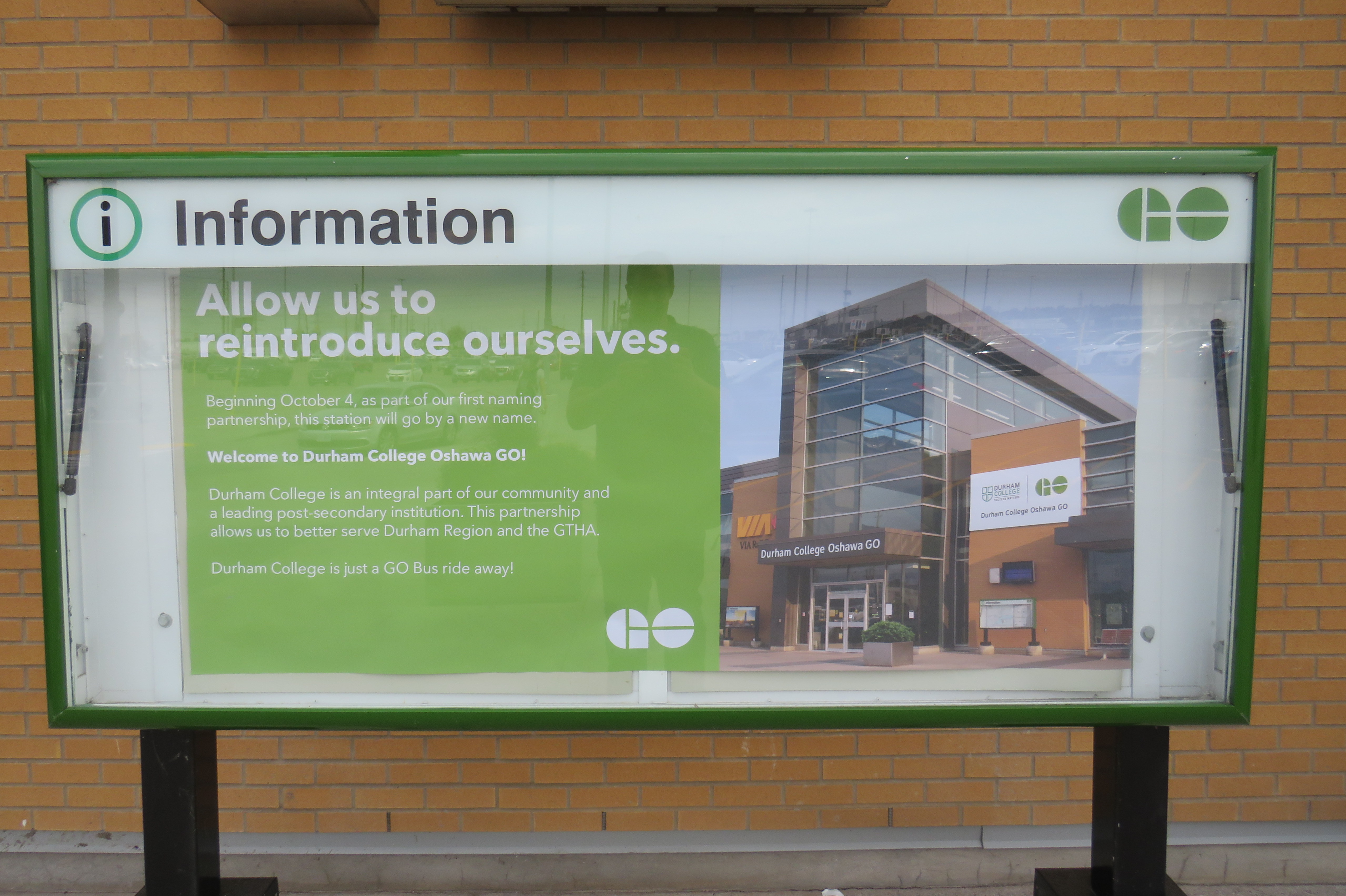
GO Transit Lakeshore East Train tweet on October 4“Allow us to reintroduce ourselves” – promotional poster at Oshawa Station proclaiming the new “Durham College Oshawa GO” name
Metrolinx, the regional transit agency that operates GO Transit, claims that “the partnership allows us to better serve Durham Region and the GTHA” in its communications, including an informational poster in front of the station building.
The news did not go over well with GO Transit customers and transit users across the Greater Toronto Area; Metrolinx later deleted its tweet after it was “ratioed” — meaning that negative comments and quote-tweets outnumbered the number of positive responses by a large margin. It is easy to understand why the station renaming was not popular.
Firstly, though “Oshawa” remains in the station name, Durham College comes first with the new moniker. Schedules, signs, and maps will be updated to reflect the new name, while announcements by on-board staff and digital schedule information already reflect the new name. VIA Rail, which shares the station with GO Transit, is not a party to the agreement, and will likely continue referring to the station as “Oshawa.”
Specific details of the agreement, such as how much Durham College is paying for the branding agreement, remain confidential.
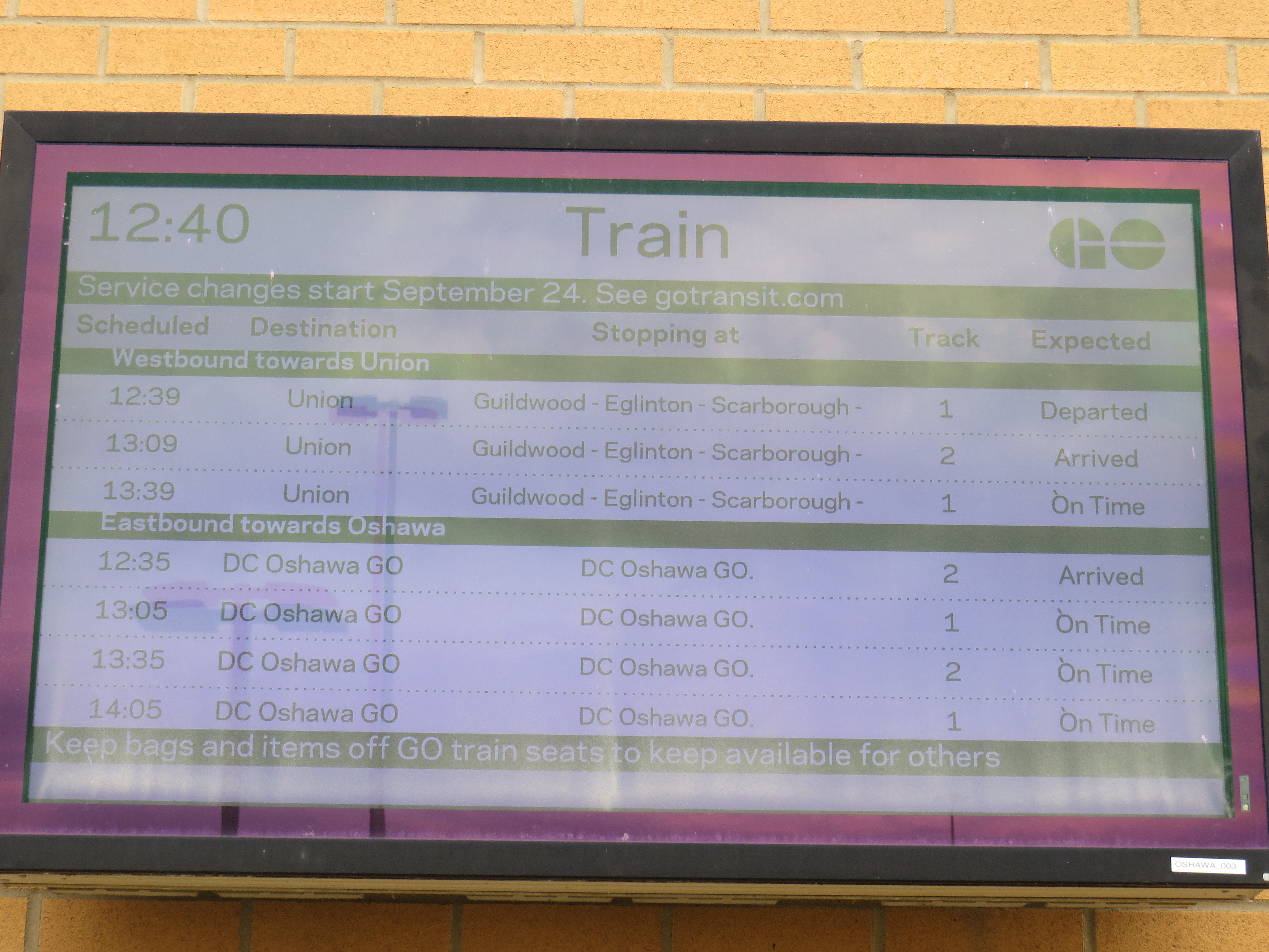
On GO Transit schedule boards, Oshawa Station now appears as “DC Oshawa GO”
The new policy of naming rights agreements goes against years of Metrolinx policy for naming stations. When planning the Eglinton-Crosstown LRT, it developed five standards for naming stations and stops:
1. Simple. Simple names are easier to remember
2. Logical. Logical names provide a mental link when trip planning: they should be relevant to the area they reside
3. Durable. Names should be relevant as long as the station exists
4. Self-Locating. Names should allow users to mentally locate themselves within the region
5. Unique. A unique name is one that cannot be confused with any other.
“Durham College Oshawa GO” violates most of the above principles. The name is now a mouthful, much like “Vaughan Metropolitan Centre” (another controversial station name that the TTC objected to, but was overruled due to political considerations), and is no longer simple. The agreement only lasts ten years, so it is not durable. As I will explain further, the name is also neither logical, self-locating, nor unique.
Durham College has three campuses. Its main campus is located in the north end of Oshawa, on a site shared with Ontario Tech University. GO Transit has a bus stop there called “Ontario Tech/Durham College” that is served by GO Transit Route 56 on weekdays, and Route 52 on weekends and holidays. The main Oshawa campus is a two hour walk from the GO station, a 25-35 minute GO bus ride, or a 20 minute drive from the station. This was the main reason why transit users were ridiculing the new station name on Twitter.
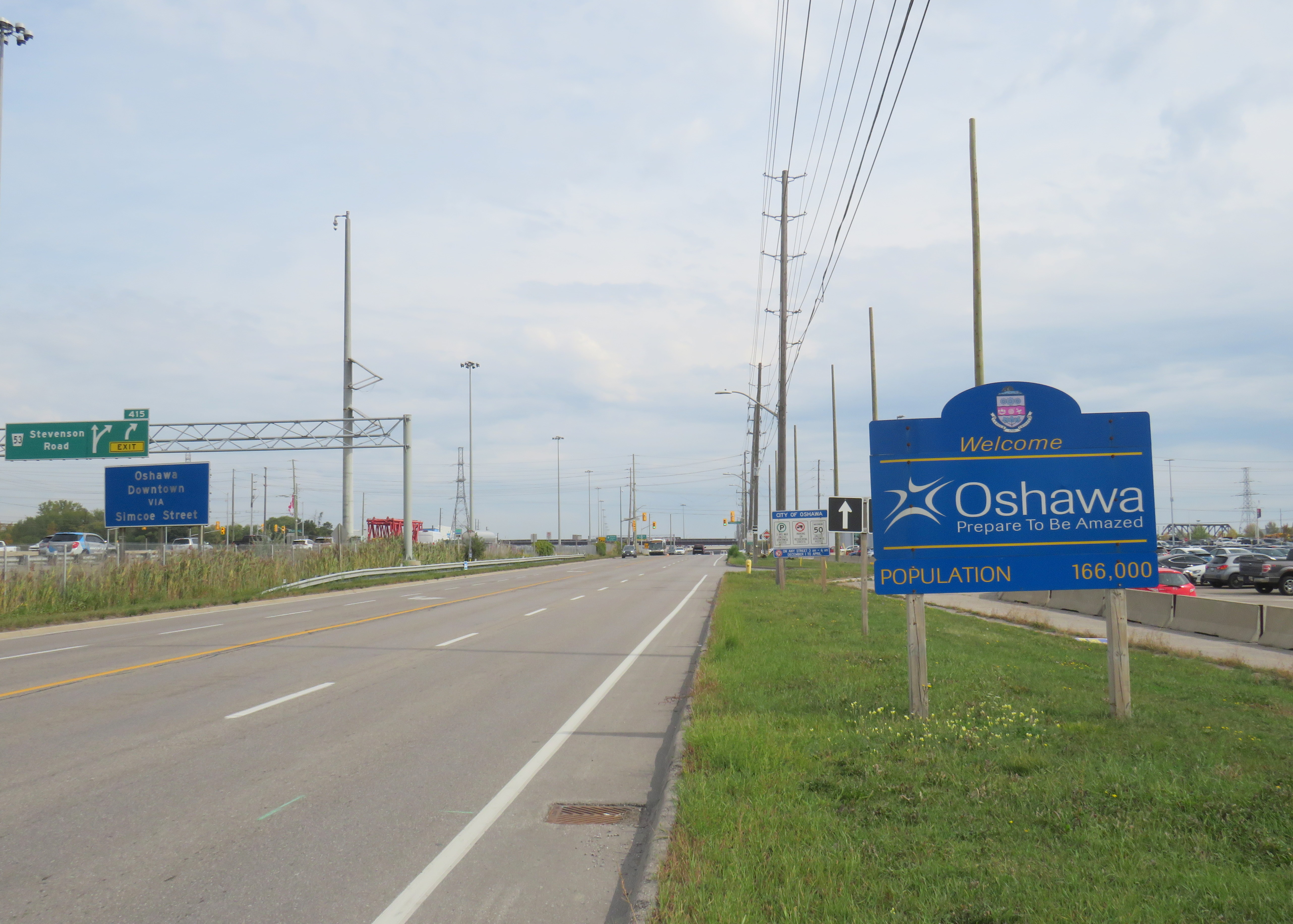
Durham College’s Whitby Campus is much closer to Oshawa GO Station, in fact, it is less than 500 metres from the Oshawa GO Station parking lot as the crow flies. Oshawa Station is actually right on the border of Oshawa and Whitby, with the “Welcome to Oshawa” signs next to the main GO Transit parking lot. The overflow lot for Oshawa GO is actually in the Town of Whitby.
The “Oshawa: Prepare To Be Amazed” sign marking the city limit sits next to the GO Station parking lot.
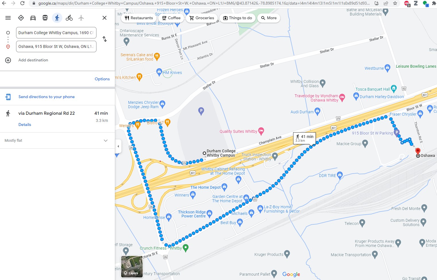
However, the Whitby campus is even harder to get to from Oshawa GO than the main Oshawa campus because it is separated by Highway 401. It is a 41 minute walk between the station and the Whitby college campus along Victoria Street (which has no sidewalks along most of its length), Thickson Road, Stellar Drive, and Champlain Avenue, though a footbridge over the highway would reduce the walking time to a more comfortable 15 minutes.
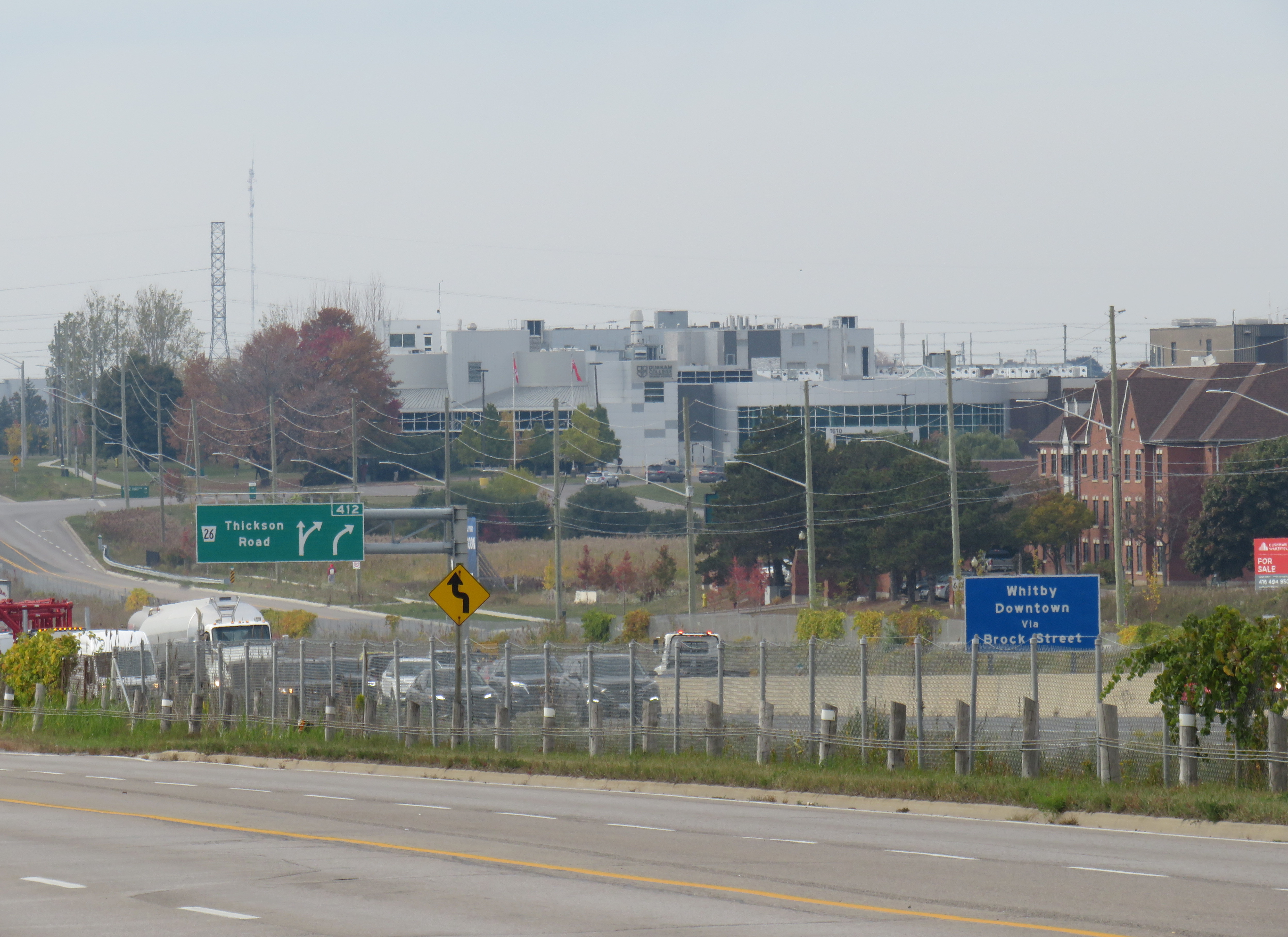
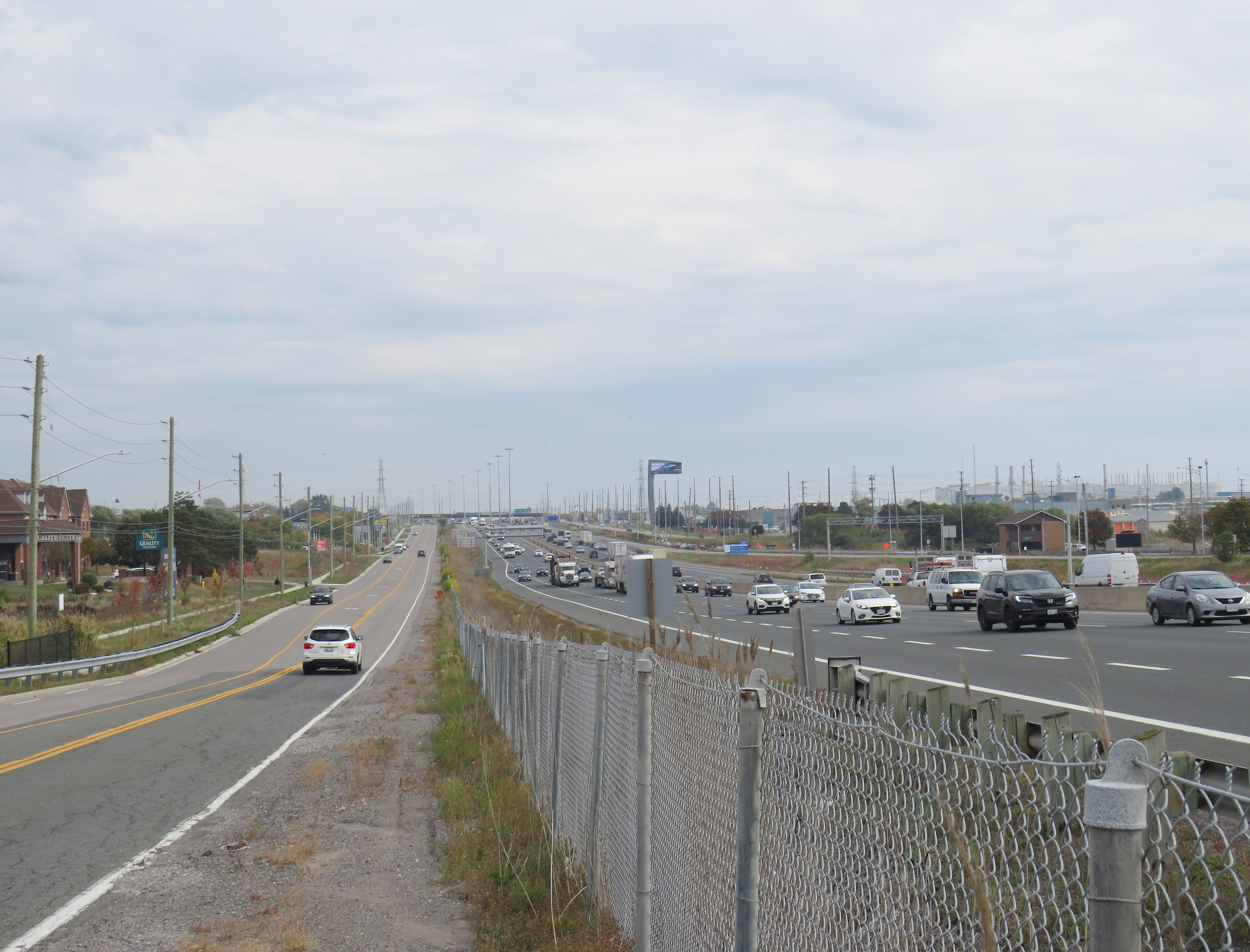
Google Maps directions from Oshawa Station to Durham College Whitby CampusLooking northwest from the Oshawa GO parking lot towards Durham College Whitby Campus, the large grey building above and to the right of the green Thickson Road exit signLooking east on Champlain Boulevard in front of the Whitby campus across Highway 401 towards Oshawa GO Station, which is marked by the tall digital billboard towering over the roadway
The irony is that both major Durham College campuses are better reached from Whitby Station than the newly named “Durham College Oshawa GO.” There are no direct buses to the Whitby Campus from Oshawa Station, but Durham Region Transit (DRT) Route 917 provides regular service from Whitby Station. Furthermore, DRT operates more frequent service on Route 905 between Whitby Station and the Oshawa Campus than GO Transit does from Oshawa Station. Google Transit itself recommends transferring at Whitby to DRT, rather than at Oshawa, because the connections are more convenient. GO Route 56 operates only every hour on weekdays, and Route 52 runs every two hours on weekends and holidays. Meanwhile Route 905 stops in front of the Oshawa campus every 15-30 minutes, 7 days a week.
The connection at Oshawa Station to Durham College’s main Oshawa Campus makes sense only when transferring from a VIA Train, or from GO Transit Route 88 from Peterborough and Clarington.
Excerpt from Durham Region Transit system map, with Oshawa and Whitby stations and both Durham College campus locations highlighted
Therefore, at this point, renaming Oshawa Station to “Durham College Oshawa GO” makes no sense. The new name violates basic wayfinding standards, while Durham College itself is better accessed from a different GO Station. Perhaps Durham College could operate a shuttle service to its campuses from the station, making the co-branding a more plausible.
Though I am critical of the process, I am sympathetic to Metrolinx’s position. I do not believe they were supportive of the province’s decision to rename a major LRT project for a political ally and paid advisor to Doug Ford’s Progressive Conservatives. I strongly believe there are many within the organization who are not happy about the station renaming agreements either. They must work with a very “hands on” government that is eager to promote new transit projects and benefit their supporters.
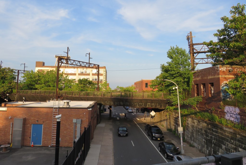
An abandoned railway signal towers over Philadelphia’s Rail Park
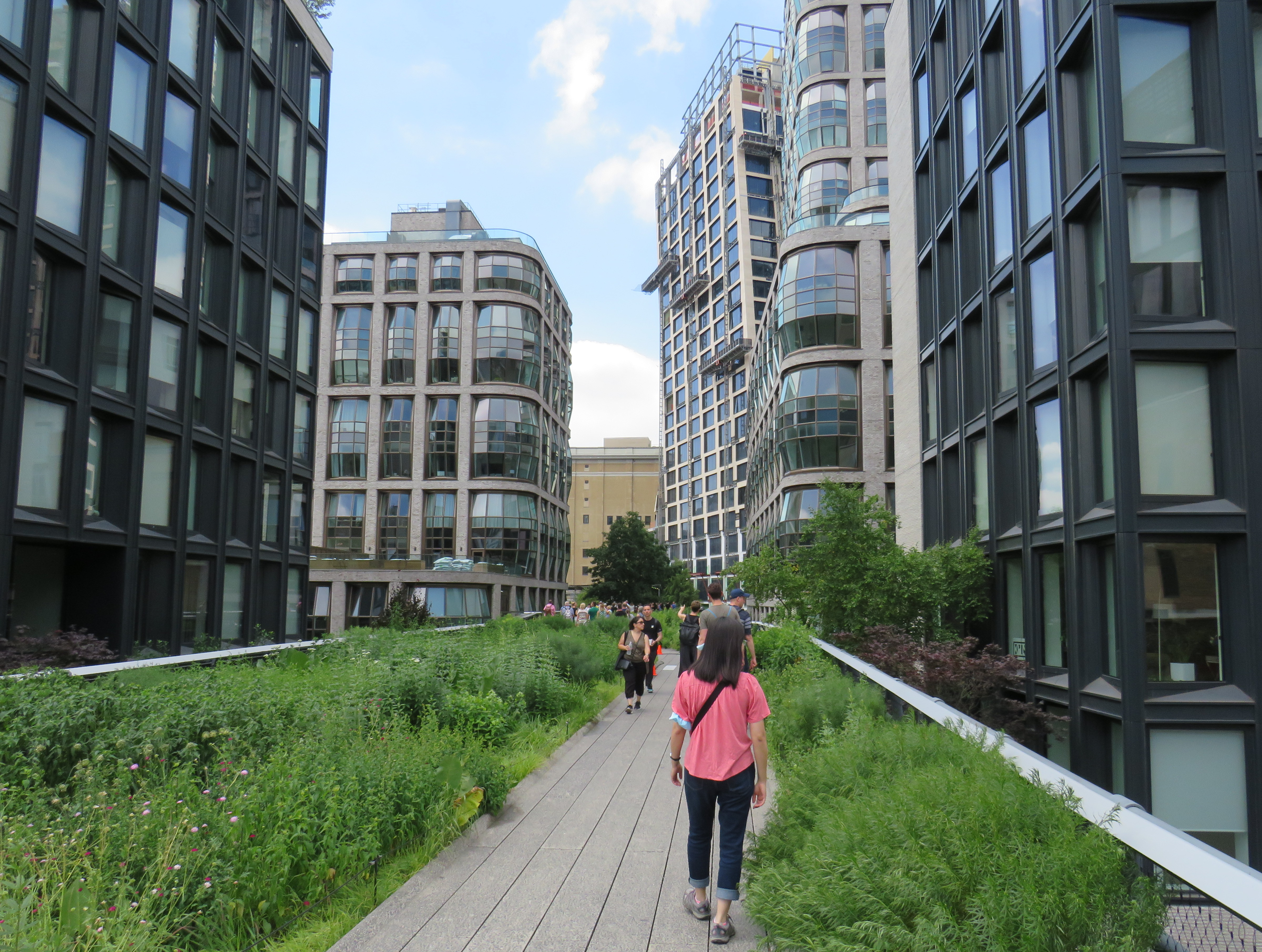
On a road trip early this summer, my spouse and I paid a visit to New York and Philadelphia. In New York, we walked the famous High Line, which revitalized an abandoned elevated freight railway corridor, transforming it into a popular grade-separated walking path on Manhattan’s Lower East Side.
New York’s High Line
While in Philadelphia, I made a point of visiting another abandoned rail viaduct — Rail Park. It’s as ambitious as New York’s famed public space, but — for now — it is much less known.
The viaducts, cuts, and tunnels that will make up Philadelphia Rail Park trace their origin to the golden age of railroading. The Philadelphia and Reading Railroad, which connected Philadelphia with its northern and western suburbs, industrial towns to the northwest, and the lucrative anthracite coal fields of northeast Pennsylvania. For many years, the Reading Railroad, as it was known, was one of the United States’ most profitable companies. In 1893, the railway opened its Philadelphia Terminal, which became famous for the public market that was established below the station platforms. To this day, the Reading Terminal Market remains a vital city landmark. In the 1930s, most of the commuter services were electrified.
The 1893 Reading Terminal headhouse, now the entrance to the Pennsylvania Convention Center
By the 1970s, both the Reading and PRR were bankrupt. PRR merged with its New York-Chicago rival New York Central in 1968, before it too went into insolvency. Conrail took over many failing railways in the US Northeast and Midwest, consolidating operations, abandoning or transferring redundant track, and transferring most remaining commuter train operations (which were not assumed by Amtrak) to regional and state transit authorities.
In the mid-1980s, the Southeast Pennsylvania Transit Authority (SEPTA), which assumed control of the regional rail services formerly operated by the PRR and the Reading undertook an ambitious project to unite the separate regional rail systems. A new four-track tunnel was constructed east from PRR’s Suburban Station, and a new station — Market East — built to replace the old Reading Terminal. For the first time, trains could run through central Philadelphia, providing improved regional rail services.
Though the historic Reading Terminal headhouse and the famous market were preserved, the station platforms were removed to make way for a new convention centre. For years, the abandoned viaducts and tunnels leading into Reading Terminal sat unused. At least they did, until June 2018.
Entrance to the first phase of Rail Park, at Noble and 13th Streets
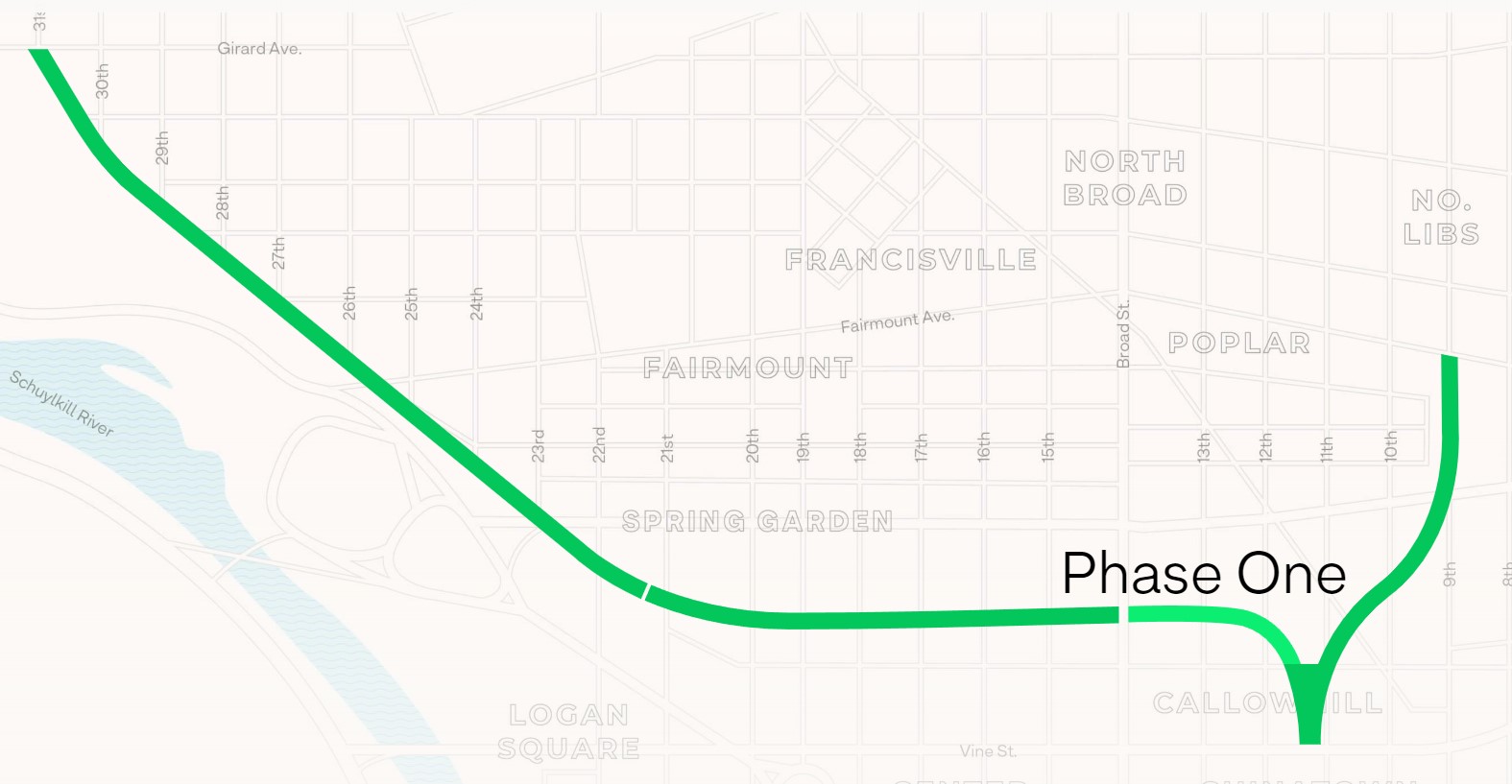
In 2018, a short, initial phase of Rail Park opened to the public. Spanning just two blocks, from Noble and 13th Streets to Callowhill and 11th Streets, it is still a remarkable public space. Like New York’s High Line, the short section of viaduct provides new viewpoints over gritty city streets, with temporary and permanent public art installations along the route.
A map of the proposed extensions of Rail Park, with the opened first phase marked. Interactive map here. Looking north up 13th Street, towards the gentrifying Spring Garden neighbourhood“Workshop of the World” – an interpretive plaque provides information on the industries that lined the Reading Company’s route through PhiladelphiaAn art map of local industries that existed immediately north of Reading Terminal, made from punched Corten steelLooking east to the intersection of Callowhill and 11th Streets. For now, the only fully accessible entrance to Rail Park is at Noble and 13th Streets. The viaduct from the north is visible at left; this will be part of a future phase of Rail Park.A stairway leading up from Callowhill Street. The metal frames at the right hold swings for the public to enjoy.
Future park extensions will continue westward from 13th Street to a below-grade cut starting at Broad Street. It will continue west to the Benjamin Franklin Parkway and the Philadelphia Museum of Art (where the Rocky statue can be found outside), where it will enter a tunnel before emerging at Girard Avenue near Fairmount Park, the greatest of Philadelphia’s urban green spaces. Another section will connect the existing Phase I to the abandoned north-south viaduct between Vine Street and Fairmount Avenue, where the old route to Reading Terminal meets the 1980s rail diversion to Market East Station. Eventually, it will reach 3 miles (5 kilometres) in length.
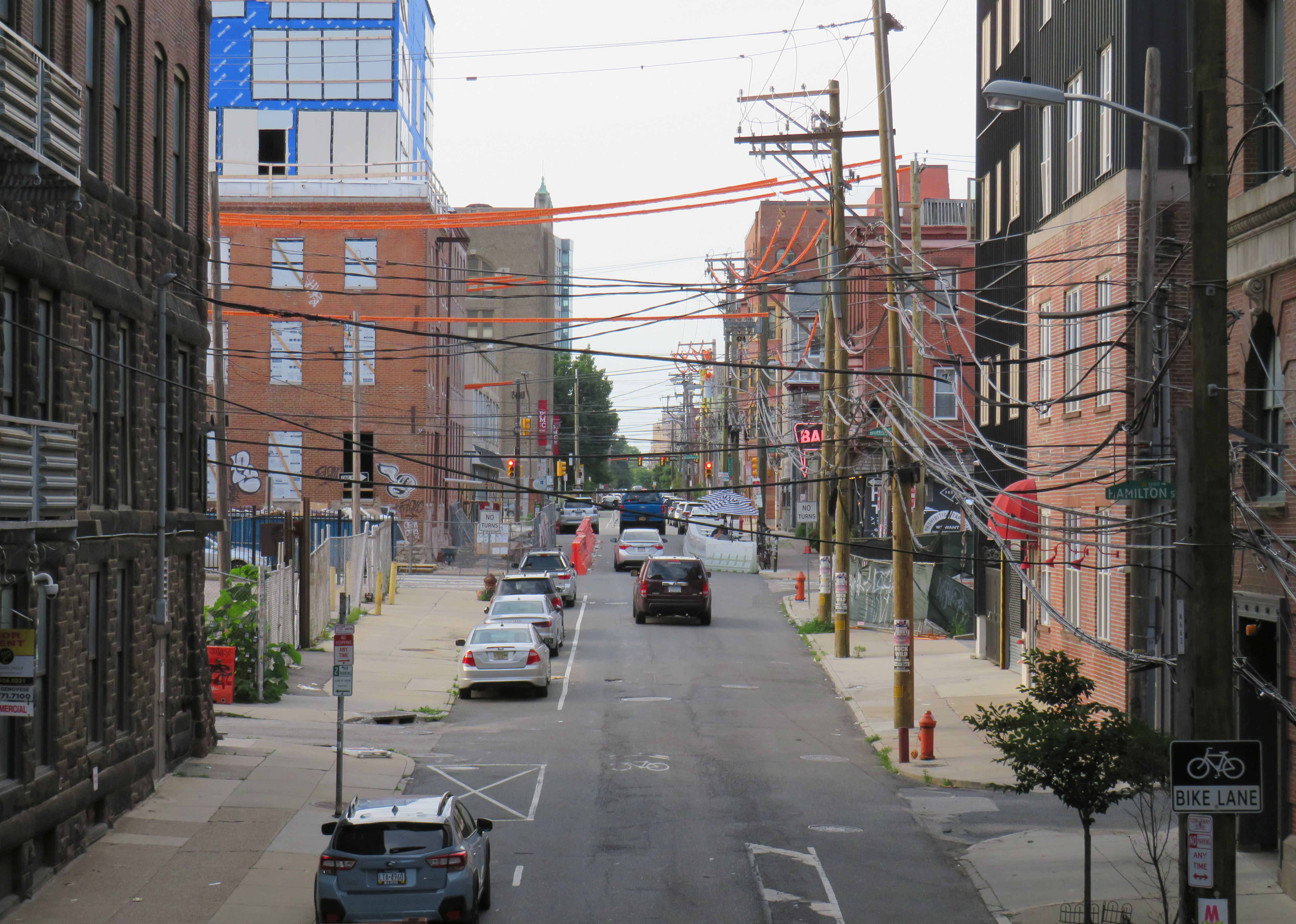
The formerly abandoned viaduct offers a view of more recently abandoned transit infrastructure: the remnant tracks of the 23-Germantown trolley route, once the longest streetcar line in North America. In the early 1990s, SEPTA was forced to abandon three of its legacy street railway lines due to budget pressures and deteriorating PCC equipment. (Newer Kawasaki-built streetcars were only deployed on the surface-subway routes in West Philadelphia and on the former Red Arrow suburban lines from 69th Street Station.) The 15-Girard Line was later rebuilt with refurbished streetcars, but the 23 and 56-Erie lines were left to rot in a state of “temporary suspension.”
SEPTA has a wealth of transit infrastructure, which I wrote about after my first visit to Philadelphia in 2009, but it hasn’t put enough of it to good use. It has a massive, fully electric regional rail network, yet trains operate only every hour on most routes outside of peak periods. There’s a four-track subway tunnel under Broad Street that’s grossly underused, and unlike Toronto, there are even a few active trolley bus routes. And sadly, it’s allowed much of its infrastructure, like its trolley network, to remain in disuse.
A view down from Rail Park to long-disused trolley tracks on 12th Street
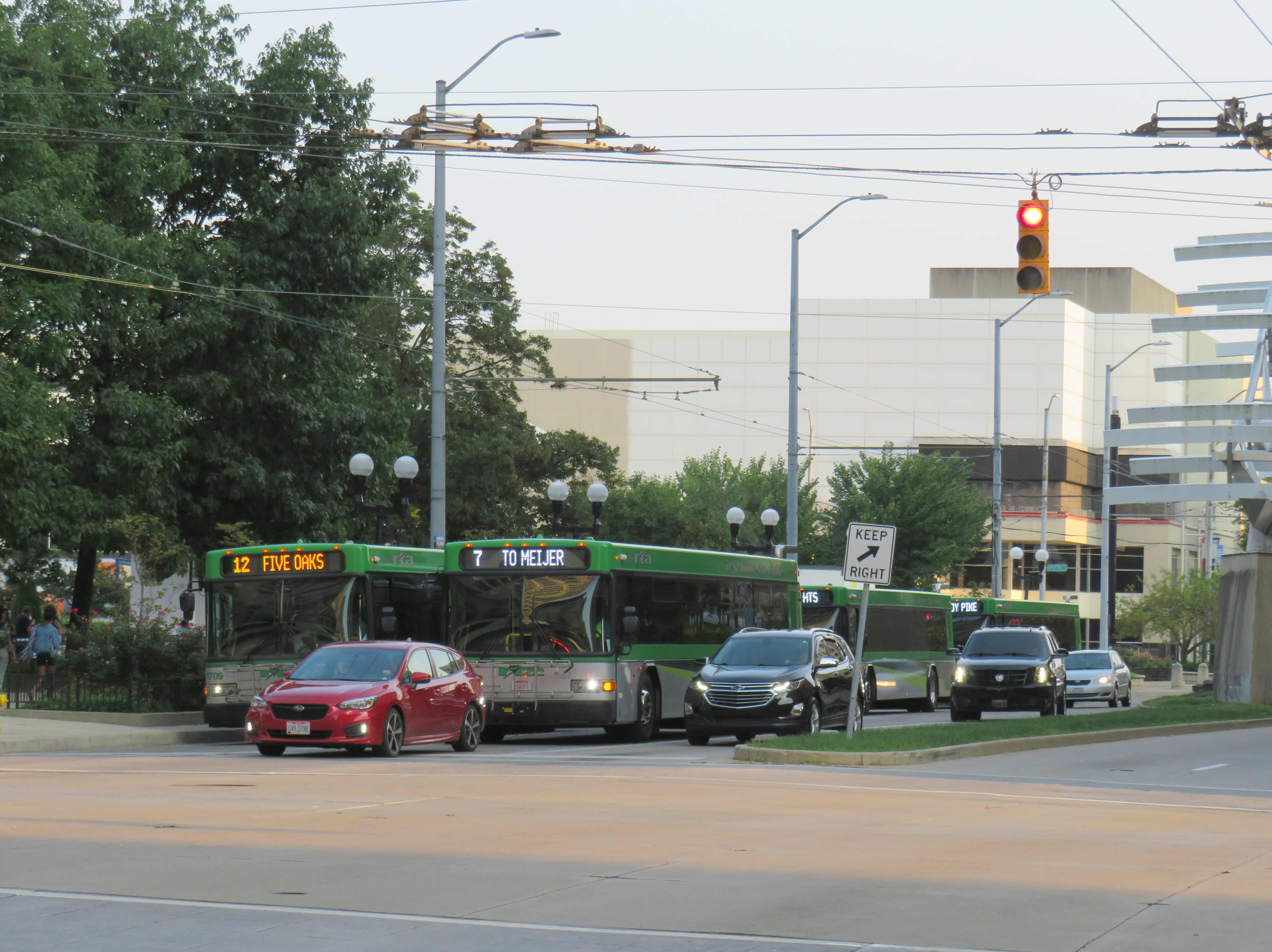
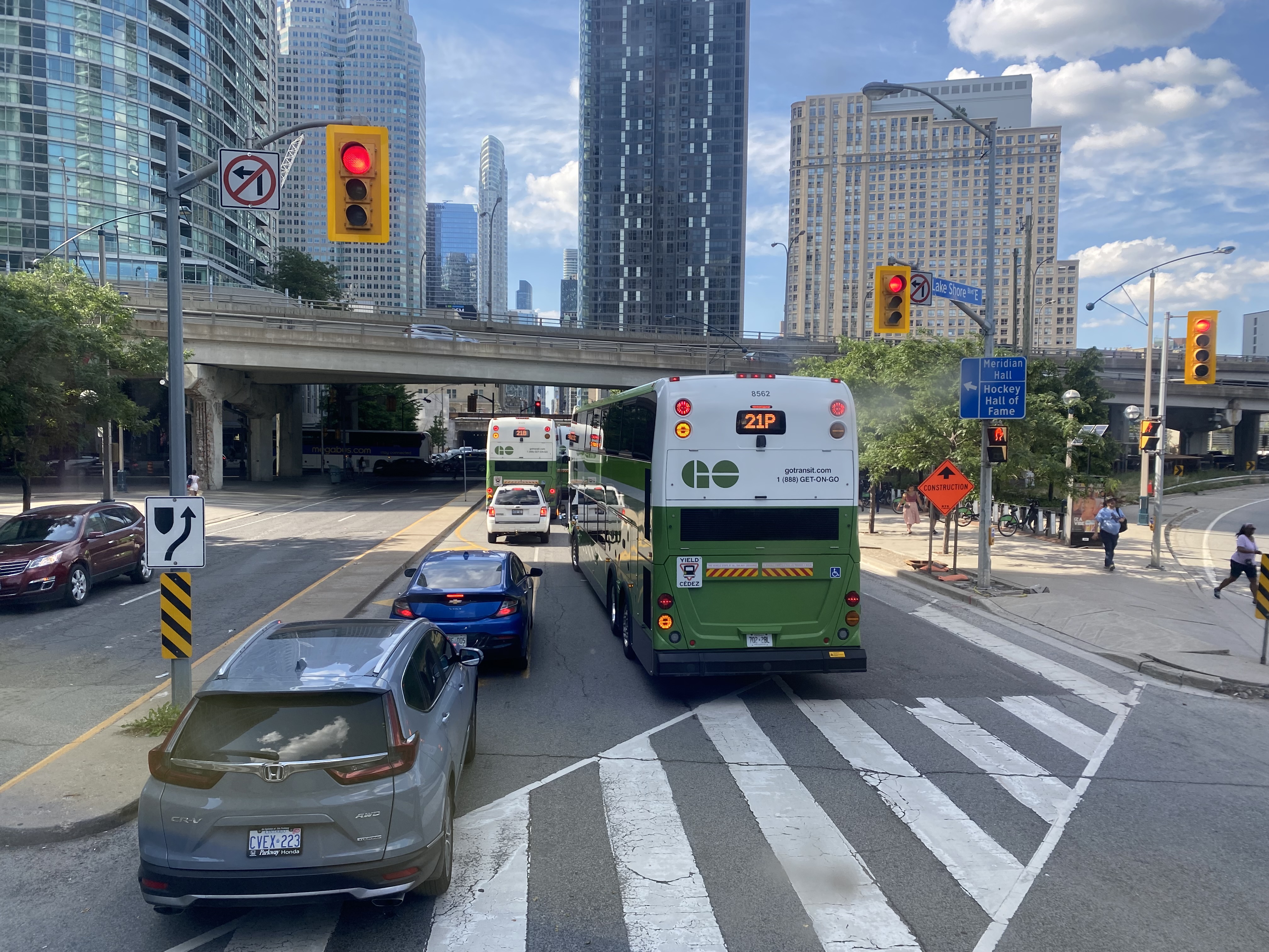
GO Transit buses stuck in Downtown Toronto gridlock in July, 2022
While travelling through the Northeastern United States this spring and summer, I found myself feeling lucky to be living in Toronto. Though the New York City Subway and the PATH trains between New Jersey and Manhattan were operating pretty much as I remember them, in other big cities, the mass transit systems were in rough shape. In Washington, underfunding and incompetence led to the long-term withdrawal of over half of its Metro cars. During our visit in April, we were treated to long waits and crowded trains, though at least the system was clean. When we visited Philadelphia in late June, it was clear that the Southeastern Pennsylvania Transit Authority (SEPTA) had given up: poor communications, lengthy waits, unsafe subway stations, and general apathy among staff and passengers made my spouse and I resort to driving on our last day there.
In Toronto, at least, the subway was still running frequently (with only minor service cuts due to the pandemic), the buses and streetcars as (un)reliable as ever, and despite more anti-social behaviour on some of its surface routes, I almost never felt afraid for my well-being when riding the Rocket, compared to my experience in Philly. GO Transit responded to the pandemic very well. Though it was forced to suspend many of its train and bus trips due to a sudden plunge in ridership, it maintained a basic service level on nearly all of its routes, slowly restoring certain services in 2021 as ridership slowly rebounded. Some corridors, like the Kitchener Line, had more service in the early Fall of 2021 than it did prior to the pandemic. As Metrolinx continued planning and construction of major transit projects like GO Expansion, the Ontario Line, and several LRT corridors, the future looked bright. In Spring 2022, GO Transit introduced a special weekend day pass for $10 per day or $15 per weekend, to help grow ridership.
Unfortunately by late June 2022, GO began to fall apart.
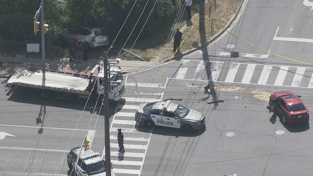
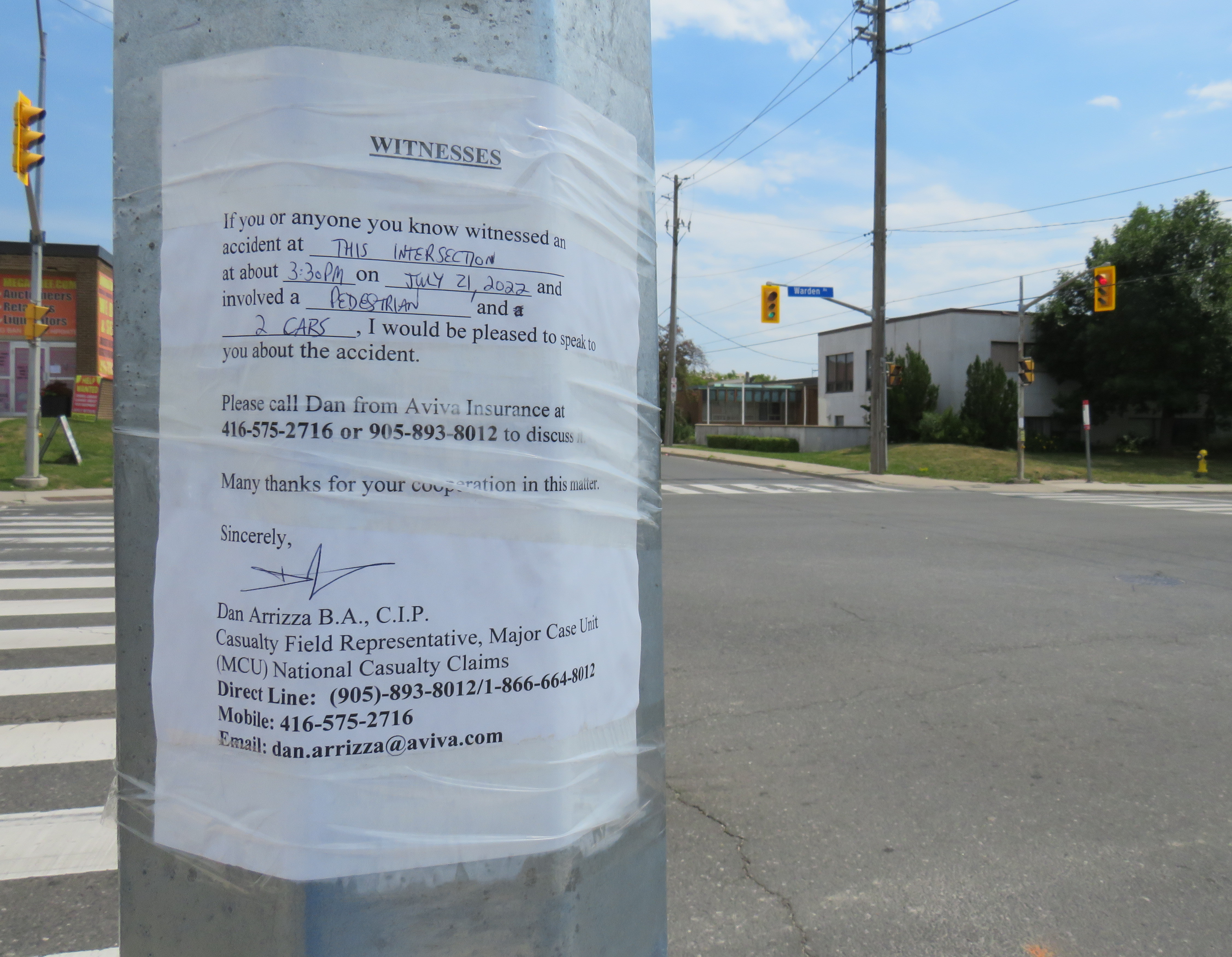
On Thursday, July 21, 2022, at 3:10 PM, a 38-year-old man was standing at a street corner in Scarborough, waiting for a signal to safely cross to the other side. Before he even had the chance to enter the intersection of Warden Avenue at Comstock Road, a driver of a 2009 silver Kia minivan heading south on Warden struck a 2012 red Lexus, whose driver was making a left turn from Warden to Comstock.
Aerial view of the collision, courtesy of CTV News. The Kia minivan struck a 38-year-old man waiting at the corner before plowing into a fence protecting a vacant lot.
A week after the deadly collision, I visited the intersection. On the southwest corner of Warden and Comstock, a roadside memorial was set up with flowers and a wooden cross. A temporary wooden pole held up a new pedestrian “beg button” for walkers to get across Warden Avenue. The Kia’s path into the sidewalk and the fence was very much visible, though all debris from the collision was cleaned up.
Appeal to witnesses following a deadly collision at Warden Avenue and Comstock Road
The collision was still being investigated. While the Toronto Police were looking for witnesses to the collision, an investigator from Aviva Insurance was also looking for witnesses; several notices were taped to nearby traffic poles.
Without knowing all the facts of the collision — which are unlikely to be reported in the news media — it would be fair to assume that speed and/or inattentive driving were at fault, but the design of the intersection — as well as Warden Avenue and Comstock Road themselves — are also to blame.
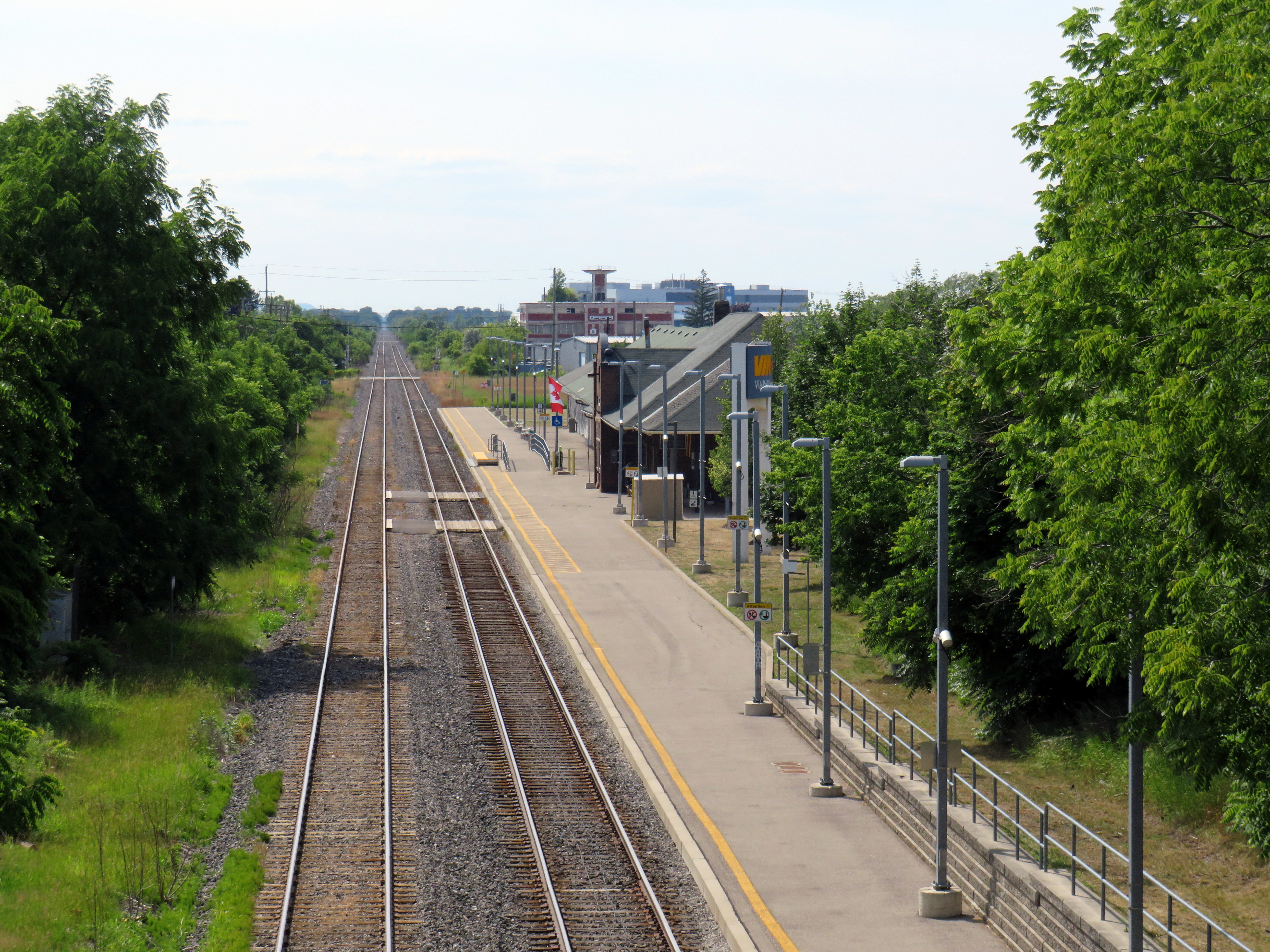
Looking east on the CN mainline from Merritt Street in St. Catharines towards the Welland Canal
The case for reviving Merritton Station
On the morning of Saturday, July 9, a GO Transit train filled with hundreds of passengers heading from Toronto to Niagara Falls, was stuck at St. Catharines when a lift bridge over the Welland Canal was unable to lower the deck to allow trains to pass.
After over an hour of holding at the St. Catharines VIA Station, GO Transit was forced to send the train back to Toronto. In an advisory on Twitter, GO informed customers that they “will need to make their own accommodations” for getting between St. Catharines and Niagara Falls, and would not be sending any shuttle buses.
Until further notice, due to a problem with the Seaway Bridge not coming down, all Niagara Falls train trips must start and finish at St. Catharines GO (VIA station). Any customers looking to make their way to or from Niagara Falls GO, will need to make their own accommodations. pic.twitter.com/E2UmphCy1E
— Lakeshore West Train (@GOtransitLW) July 9, 2022
Needless to say, this left many families disappointed. With GO Transit understandably unable to muster enough buses on a summer weekend to quickly transfer 1500 passengers (which would require at least 25 coaches), the decision not to provide alternate transportation is understandable, if unfortunate.
The summer weekend Toronto-Niagara train service is incredibly popular, especially the Saturday and Sunday morning departures from Union Station, and the evening return trip. Specially-outfitted bicycle coaches allow for dozens of bicycles to be transported by train; Niagara Region is an excellent cycling destination.
Recent fare innovations, including the $10 weekend day pass and a special GO Transit-Niagara Parks package have only contributed to the route’s success. As GO Transit is able to carry 1500 passengers on each train between Toronto and Niagara, it is invaluable not only for supporting the local tourism industry, it provides an alternative to driving on the congested Queen Elizabeth Way.
Unfortunately, the CN Grimsby Subdivision, which runs between Hamilton and Niagara Falls, is hardly ideal for frequent commuter and excursion service. Trains crawl through Hamilton, and much of the line is single-tracked, limiting capacity. Furthermore, trains to and from Niagara must back in to Hamilton’s West Harbour GO Station, which still does not have a direct connecting track to the east.
But the Welland Canal lift bridge is the greatest barrier for providing frequent and reliable rail service to Niagara Falls. During the Great Lakes shipping season, train traffic must yield to the busy St. Lawrence Seaway. Constructing a bridge or a tunnel is difficult and costly as railways are limited to typically no more than a 2% grade, and the freighters require a high clearance (as evident with the nearby QEW Garden City Skyway). Constructing a tunnel is also difficult, as the railway begins climbing the Niagara Escarpment just east of the canal, and would need to climb an even longer distance from canal. (A railway tunnel south of Welland has no such constraints as it is well above the escarpment.)
Looking east towards the Welland Canal lift bridge from Glendale Avenue. The disused CN Thorold Spur disappears into the weeds at right.
As a short-to-medium term measure, Metrolinx should look at constructing a new station at Merritton, located southeast of Downtown St. Catharines and approximately three kilometres east of St. Catharines Station. Until 1961, Merritton was an independent town, an industrial centre served by both the Grand Trunk/CN and the electric Niagara, St. Catharines and Toronto Railway. With amalgamation with St. Catharines, the closure of the passenger railway stations, and the loss of the historic paper and textile mills, Merritt Street has seen better days.
Merritt Street, just south of the CN Railway. The stone building at right is the former town hall.
Merritton’s CN Station was located on the east side of Merritt Street. Passenger service ended by the 1960s, and industrial switching activity between the former NS&T and CN’s Thorold spur line declined, so the building was eventually abandoned. It burned down in 1994, and there is little trace of its existence.
Unlike the active VIA station on the west side of St. Catharines, Merritton is quite close to the Welland Canal and the Niagara Circle Route. Merritt Trail, which follows the original Welland Canal route, is within a short walk from Merritton. It is also much easier for buses arriving from Niagara-On-The-Lake, Thorold, and Niagara Falls to access a station site at Merritton than the awkwardly-located St. Catharines Station, with four to five minutes saved, especially if there were direct access from Glendale Avenue.
St. Catharines VIA/GO Station, off of St. Paul Street West. Awkwardly located for bus access, the station platform is a 25 minute walk to Downtown St. Catharines.
Not too far from Merritton is St. Catharines Museum and Lock 3 Centre, which tells the history of the region and the Welland Canal; a platform provides excellent views of passing ships. Niagara College and the Outlet Collection are also close by, via Glendale Avenue. Whenever there’s a delay or failure at the lift bridge, there are more options at Merritton, especially if a proper bus transfer point is constructed.
Ideally, a grade-separated Welland Canal crossing would become an integral part of a frequent Toronto-Hamilton-Niagara-Bufffalo rail service. In the meantime, a stop at Merritton for GO commuter and excursion trains would provide new transit and cycling connections, while serving passengers in eastern St. Catharines, Niagara-on-the-Lake, and Thorold.
St. Catharines: where the Bruce Trail is at its least Bruce Trail-ish
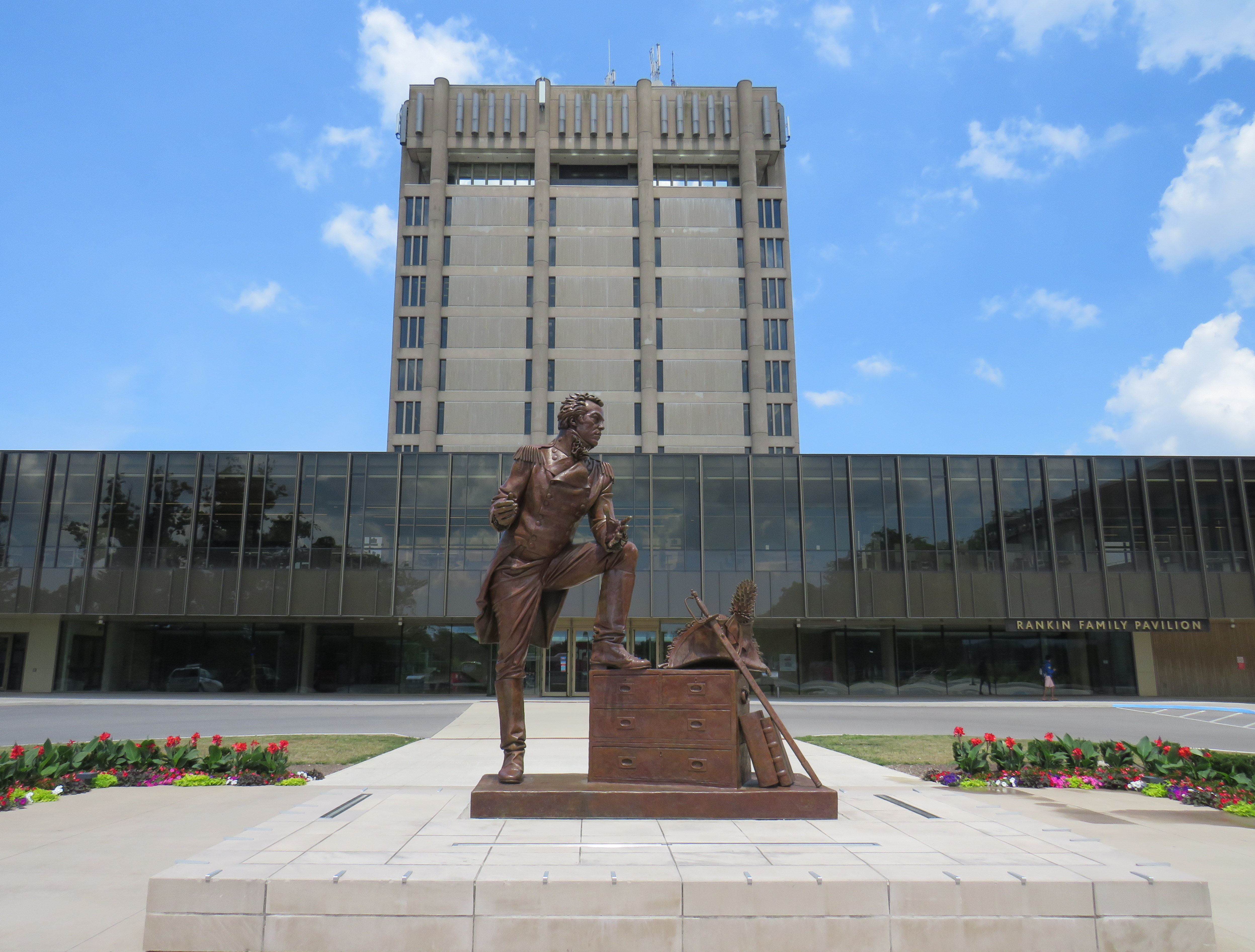
I travelled to St. Catharines on a lovely July Friday, taking GO Transit’s Route 18K bus from Aldershot Station through Hamilton, along the QEW, and to Brock University in St. Catharines. The university campus is at the top of the Niagara Escarpment, boasting direct connections with the Bruce Trail.
Statue of General Brock at the main university entrance
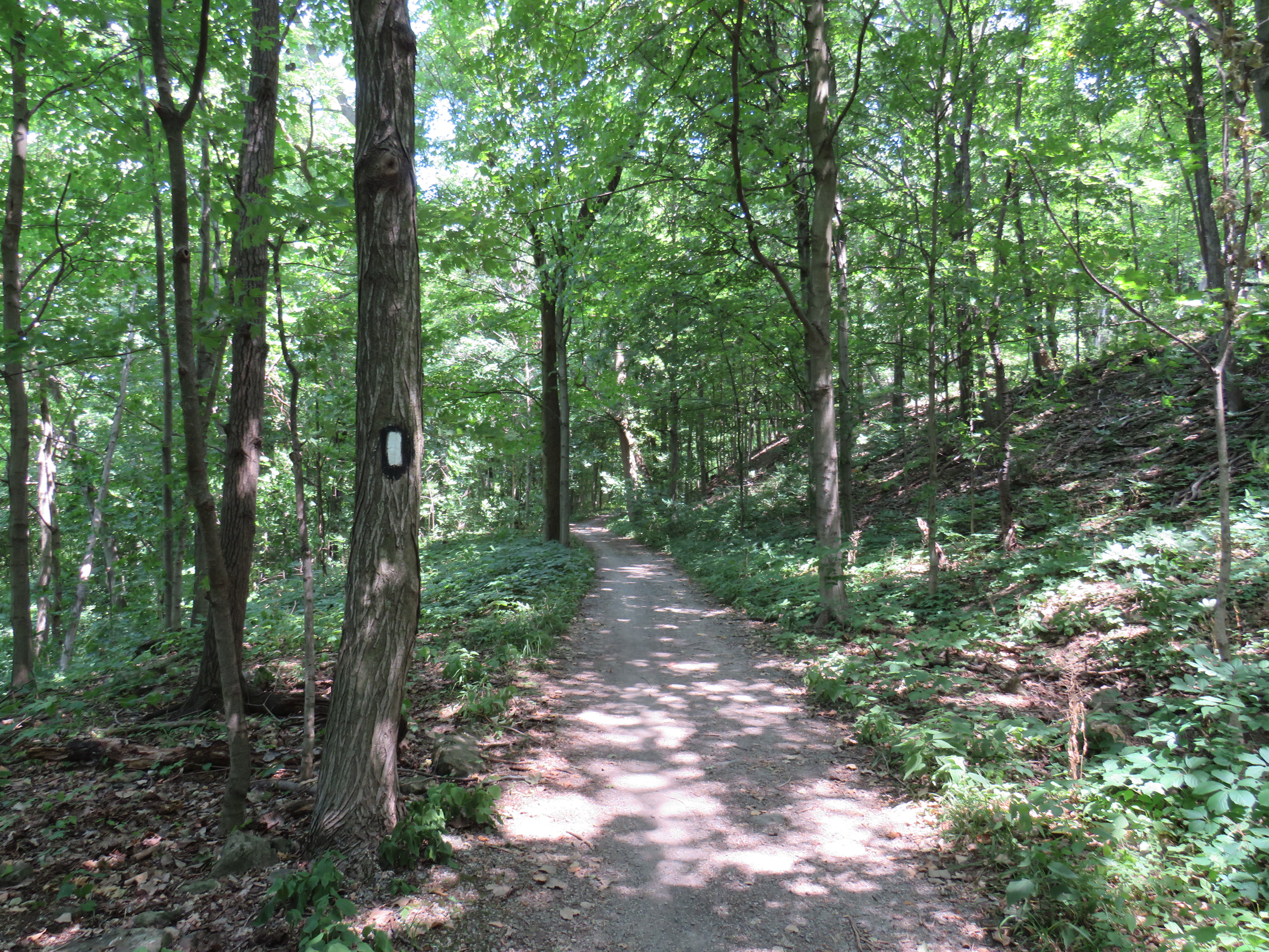
The walk eastwards towards Merritton from Brock University started out promising. The thick tree cover provided welcome shade, and apart from a rather dangerous crossing of Glenridge Avenue, felt little different than anywhere else on the southern part of the famous trail.
A promising startBeing watched by a young red-tailed hawk
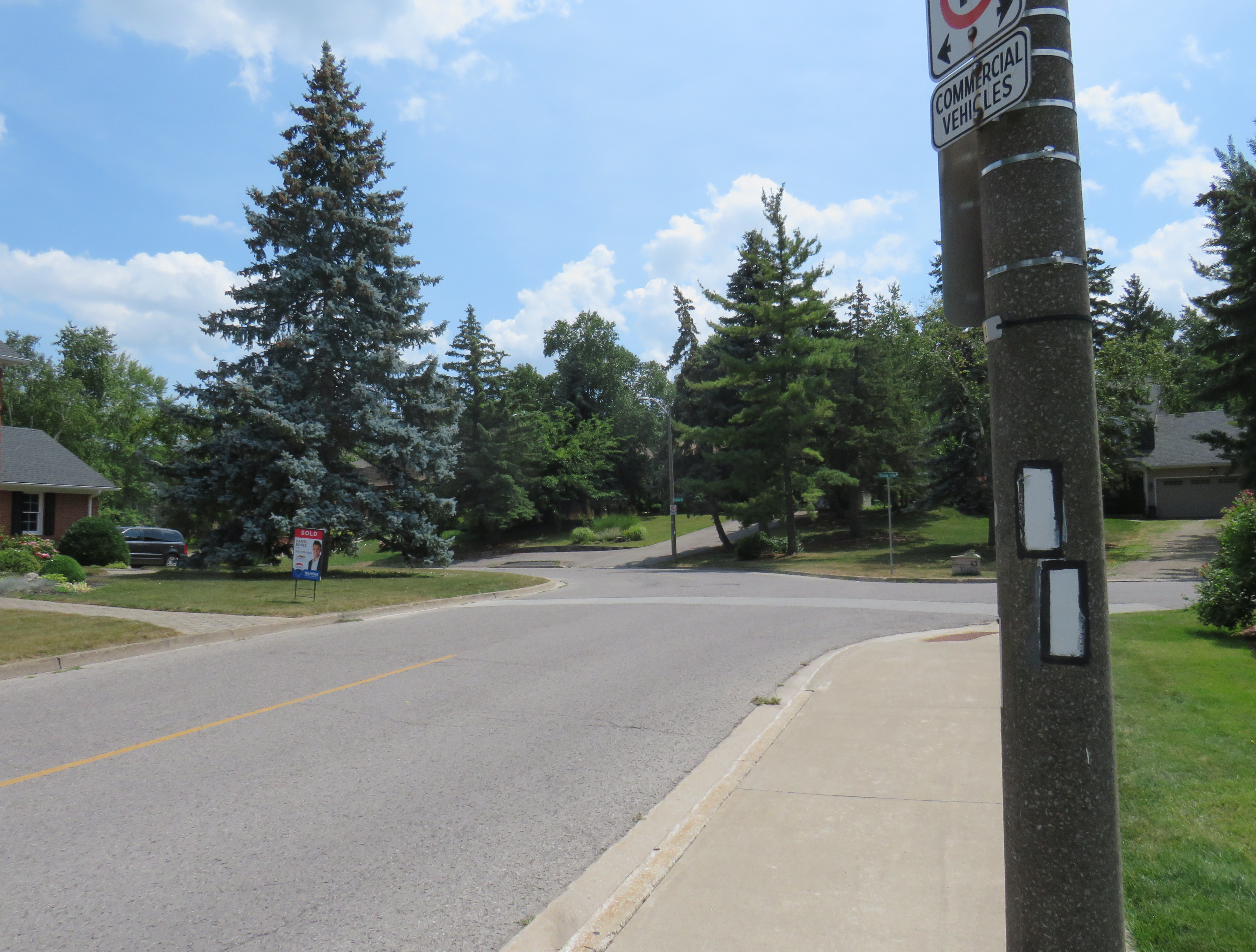
At Tremont Drive, the trail suddenly enters a subdivision, with only the tell-tale white blazers to assure hikers that yes, in fact, this is part of the Bruce Trail.
Bruce Trail blazers are the only hint that this is part of Ontario’s greatest hiking trail
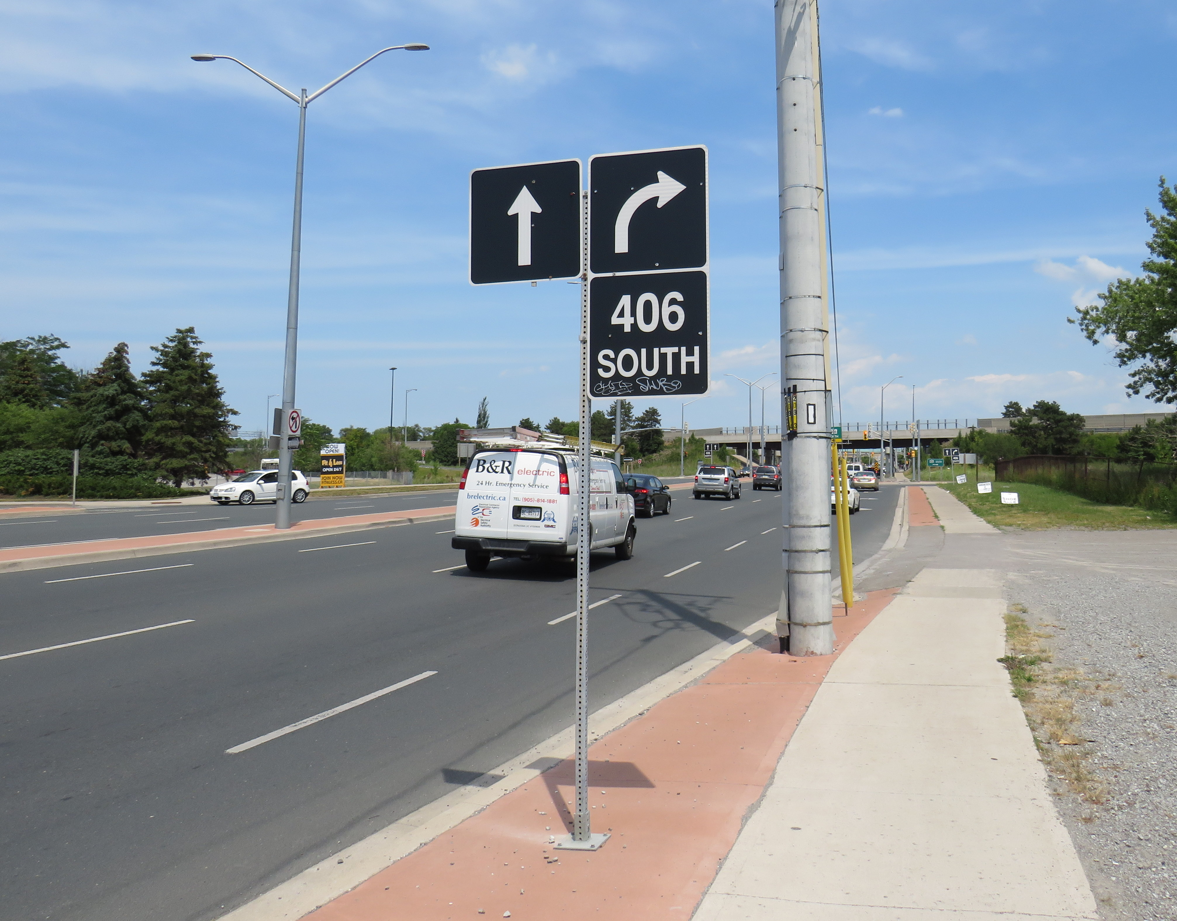
The trail continues to busy Glendale Avenue, and crosses Highway 406 at the interchange. At each traffic light, pedestrians are required to press the “beg button” to get a walk signal, even if one is crossing in the same direction as the through traffic. In most other places, the walk signal comes on automatically in conjunction with the dominant traffic flow.
Though the Bruce Trail also passes through Hamilton, a city nearly four times the size of St. Catharines, the trail there manages to remain separated from traffic and even from the city as a whole, much like Toronto’s ravine park systems.
Glendale Avenue at Highway 406: the lowpoint of the 900 kilometres of Bruce Trail
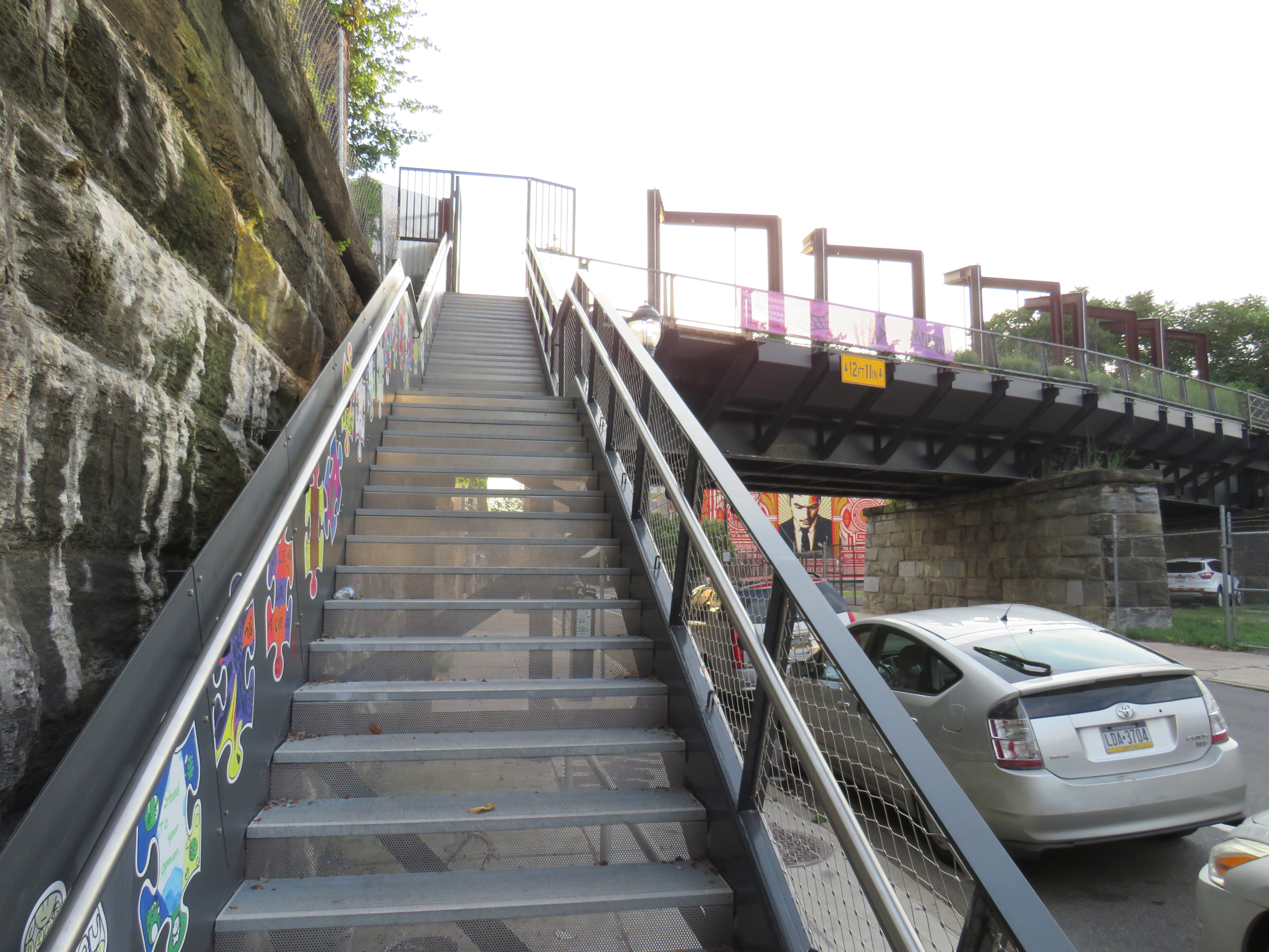
A partially hidden stairway on Dupont Street leads to the site of the lost CP West Toronto Station
Since 1853, the year that the Ontario, Simcoe & Huron Railway first laid track at the city’s waterfront, Toronto has been criss-crossed by rail corridors. With the exception of the Ontario & Quebec Railway (a subsidiary of Canadian Pacific), every rail line built converged on Toronto’s downtown waterfront, and radiated out across the province, with connections to neighbouring provinces and states. Though Toronto’s first Union Station was built in 1858 by the Grand Trunk Railway (which also hosted two competing railways that the GTR later acquired), there was still a need for smaller stations outside the downtown core.
Outlying stations within the city limits, such as East Toronto (Danforth), Riverdale, and Don Stations in the east, Parkdale, West Toronto, Davenport, and Sunnyside Stations in the west, were particularly important prior to modern dispatch and signalling systems. Station agents at stops outside the city centre were useful to commuters, while the station agent would deliver important messages to train crews entering the congested downtown railyards and passenger facilities. Mail could be collected, delivered, and processed for local residents and businesses. Passengers could purchase tickets without needing to go all the way downtown.
In the early 1900s, Canadian Pacific — tired of delays with constructing a new third Union Station — built a grand station where its original Ontario & Quebec mainline crossed Yonge Street. Though the station was popular with the area’s affluent residents, CP closed the station during the Depression. (Today, it’s a magnificent LCBO flagship store.)
Outside the old City of Toronto, there were staffed passenger stations at Long Branch, Mimico, Scarborough Junction, Port Union, Agincourt, Leaside, Downsview, Weston, and Islington.
By the end of the 1960s, many of these stations were closed. In southern Ontario, mail was being sent by truck instead of rail, sorted in large processing facilities. The loss of the mail contracts spelled the end of many rural passenger rail services. Modern centralized traffic control and wireless communication systems did away for the need for station staff to relay messages and orders to passing trains. Though there were still dozens of passenger trains arriving and departing Union Station, these trains, mostly on the Montreal-Windsor corridor, made fewer stops. In 1967, GO Transit replaced the remaining all-stops commuter service on CN’s line between Hamilton and Toronto; it eventually replaced most of CN’s stations on what are now the Lakeshore, Kitchener, and Stouffville Lines with new station stops or built new facilities at old station sites that better served suburban park-and-ride commuters. GO also added new stations such as Guildwood, Bloor, and Old Cummer.
Within the City of Toronto, there are only four passenger railway station buildings preserved: Union Station, CP North Toronto Station, Mimico Station, and Don Station. Mimico and Don Stations were moved off-site, while only Union Station remains in continuous passenger service. Other stations burned down, were demolished, or were simply left to rot. In a few places, though, old staircases provide clues to these long-lost stations.
Don Station
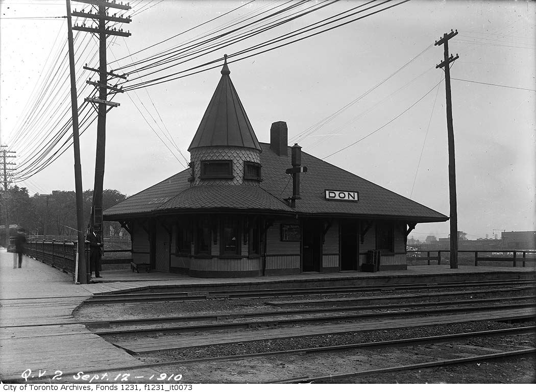
Don Station was built by CP in 1896 to serve its new branch to Union Station from the Ontario & Quebec mainline at Leaside. Located at Queen Street at the Don River, it was an important waystation for train crews to receive orders before arriving at Union Station or before departing northeastward on the long trestle towards Leaside and Montreal. When Canadian Northern built its mainline through the Don Valley in 1906, it shared the approach tracks with CP and also used Don Station.
Originally, the CP and CNoR tracks crossed Queen Street at grade. After a catastrophic streetcar-train crash further east on Queen Street, the City of Toronto pushed to grade-separate all major road crossings. In 1911, a higher-level bridge was built that spanned the Don River and the railway tracks. Today, it also spans the Don Valley Parkway.
The station closed in 1967 when the Toronto-Peterborough-Havelock train stopped serving Don, and the station building was moved to Todmorden Mills in 1969. In 2008, the station was moved again, to Roundhouse Park. It now hosts passenger trains again; albeit a miniature train operated by the Toronto Railway Museum.
The original wooden stairway from Queen Street that connected to Don Station was removed by the early 1960s and replaced by a metal staircase. The metal structure has since been refurbished and now connects Queen Street with the Lower Don Trail.
Stairway from the Lower Don Trail to Queen Street EastDon Station in 1910, before the higher-level Queen Street bridge was constructed –City of Toronto Archives Fonds 1231, Item 73
Parkdale CN Station
Sealed portal to CN Parkdale Station
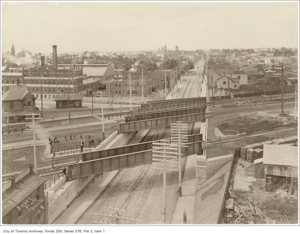
Until 1960, every train on the Toronto-Kitchener-London route made a stop at Parkdale, near the corner of Queen and Bathurst Streets. The Queen Street Subway, completed in 1898, was one of the first road-rail grade separations in the city. The underpass allowed streetcars and traffic to avoid the multiple Grand Trunk and Canadian Pacific mainline and service tracks that crossed Queen Street. Both Grand Trunk (later CN) and CP had stations at Parkdale, though the wooden GTR/CN station was located between the tracks and had to be accessed by a stairway from the south side of the Queen Street underpass.
A bricked up archway betrays the old passage to the now-demolished station.
The new Queen Street Subway, 1898. Parkdale CN Station is to the left of this image, but the stairway down to street level is clearly visible. –City of Toronto Archives Fonds 200, Series 376, File 2, Item 1Old streetcars headed to Haileybury, Ontario pass by the CN Parkdale Station on October 14, 1922. The streetcars, which were slated for scrapping, where being sent north to provide shelter after a disastrous forest fire. – City of Toronto Archives Fonds 16, Series 71, Item 1601
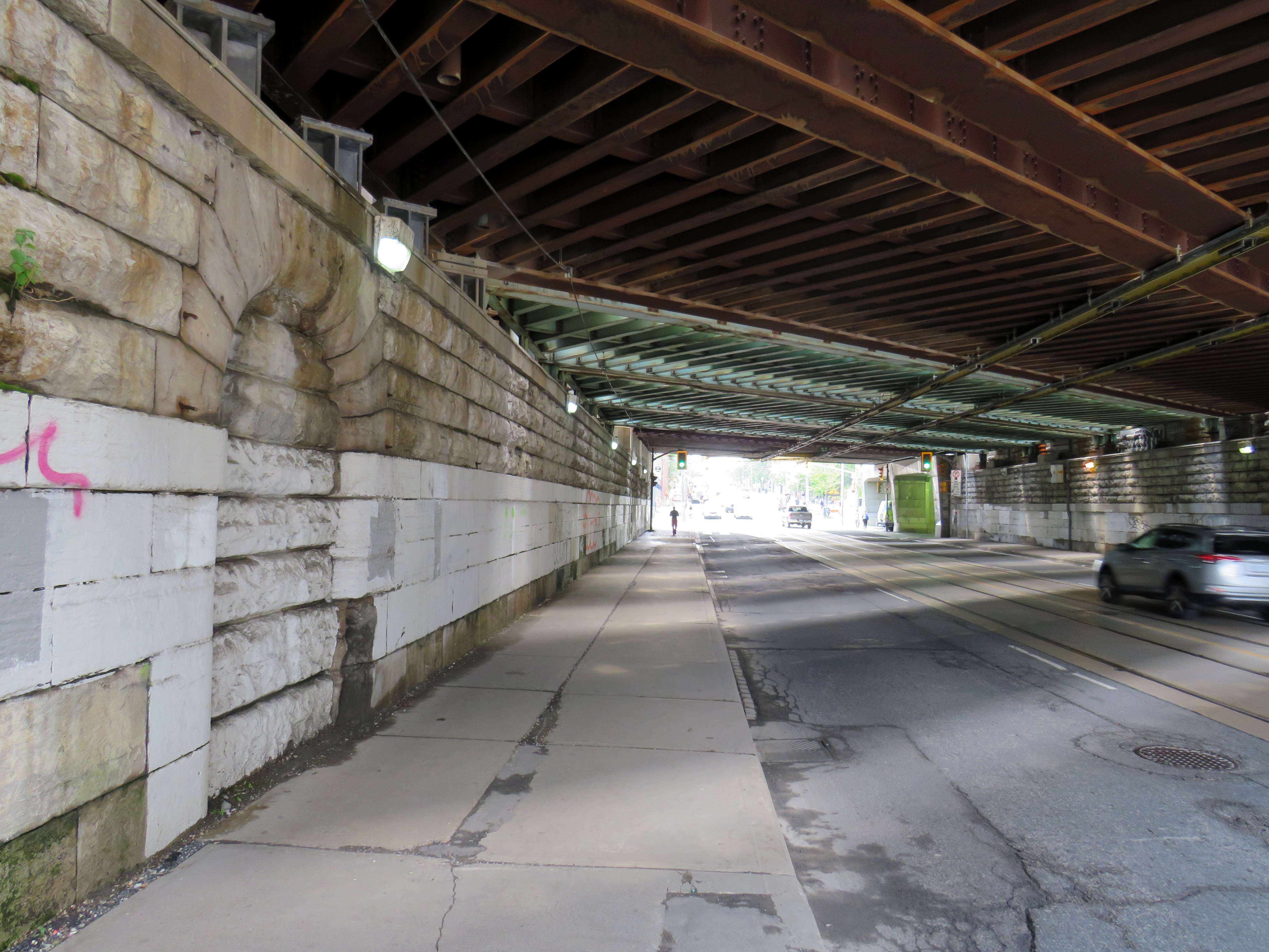
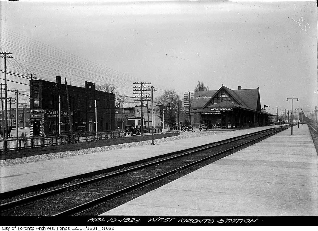
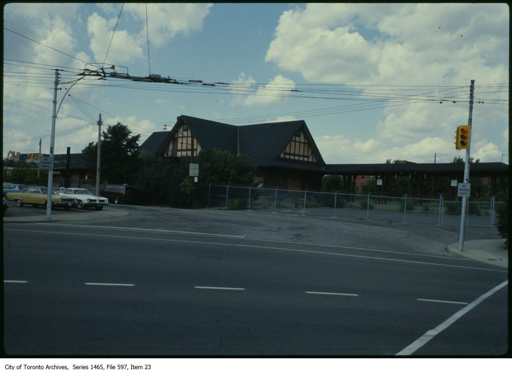
West Toronto CP Station
Both CN and CP had stations at West Toronto. The Grand Trunk (later CN) station was located on Old Weston Road near Davenport Road. The CN station closed in the early 1980s and was demolished in 1999 after being left abandoned to the elements and vandals.
The CP station was located to the south, on Old Weston Road just north of Dupont and Dundas Streets. As the town of West Toronto (originally known as Toronto Junction) built up around the junction between CP’s Ontario & Quebec, Credit Valley, and Toronto, Grey and Bruce Railways, the CP station was the pride of the community. The last station on the site, completed in 1911, was a large building in the Tudor style, with a long canopy. The last train to serve West Toronto, CP’s Canadian, departed in 1978, and CP controversially demolished the station under cover of darkness in 1982.
CP West Toronto Station, 1923 – City of Toronto Archives, Fonds 1231, Item 1092CP West Toronto Station just prior to demolition in 1982 – City of Toronto Archives, Series 1464, File 597, Item 23
At the south end of the station platform, a stairway led down to the north side of Dupont Street. Though it is fenced off, the stairway is still very much visible just west of the railway underpass. The concrete retaining wall has been brightened up by local graffiti artists.
Fenced-off stairway from the north side of Dupont Street, just east of Dundas Street, leads to the site of the now-demolished CP West Toronto Station
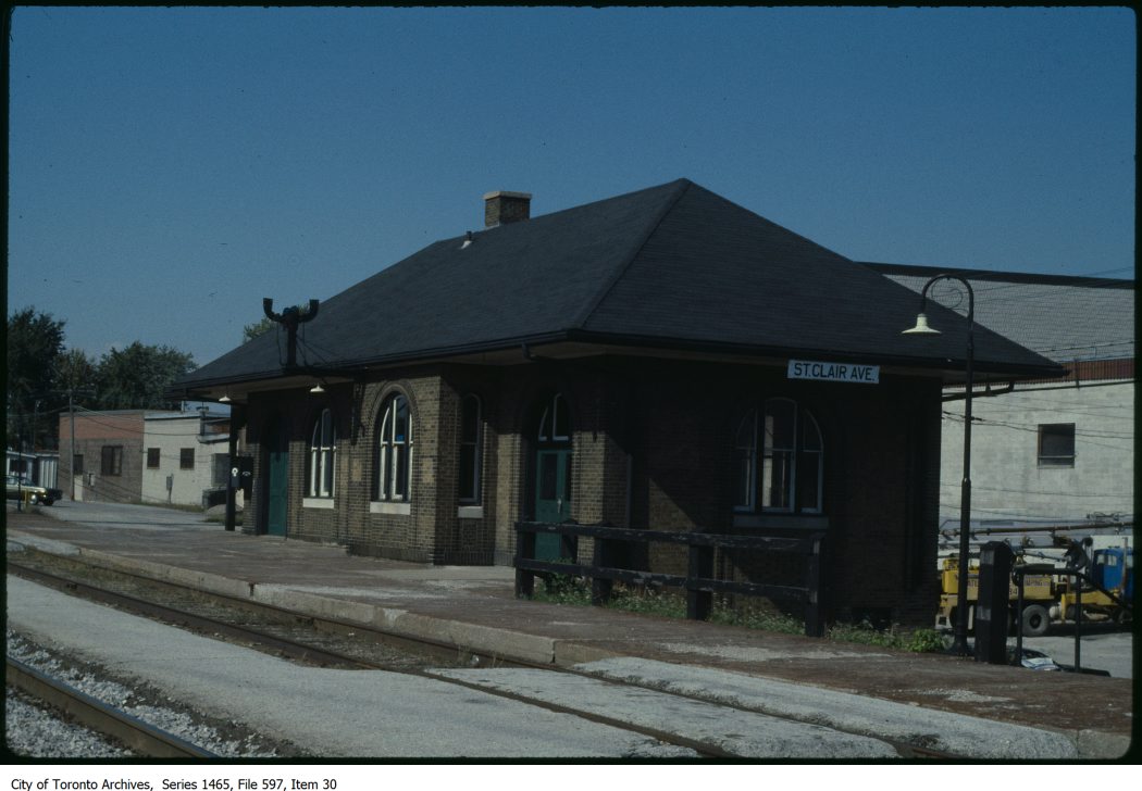
St. Clair Avenue Station
CN St. Clair Avenue Station just prior to its final closure, c. 1983 – City of Toronto Archives, Series 1465, File 597, Item 30
St. Clair Avenue Station was completed in 1931, as part of a grade separation project that finally allowed through streetcar service on St. Clair West. The small brick structure replaced an older station at Davenport Road, which was soon demolished.
St. Clair Avenue served CN trains between Toronto, Northern Ontario, and Western Canada, though passenger services declined through the 1960s and 1970s. When GO Transit took over the local Barrie train from VIA, it cut the stop at St. Clair Avenue. The station was closed for good when VIA’s Canadian was rerouted from the CN Newmarket Subdivision in 1985. Like other disused passenger stations, the building suffered from neglect, vandalism, and arson, before being demolished by CN in 1999.
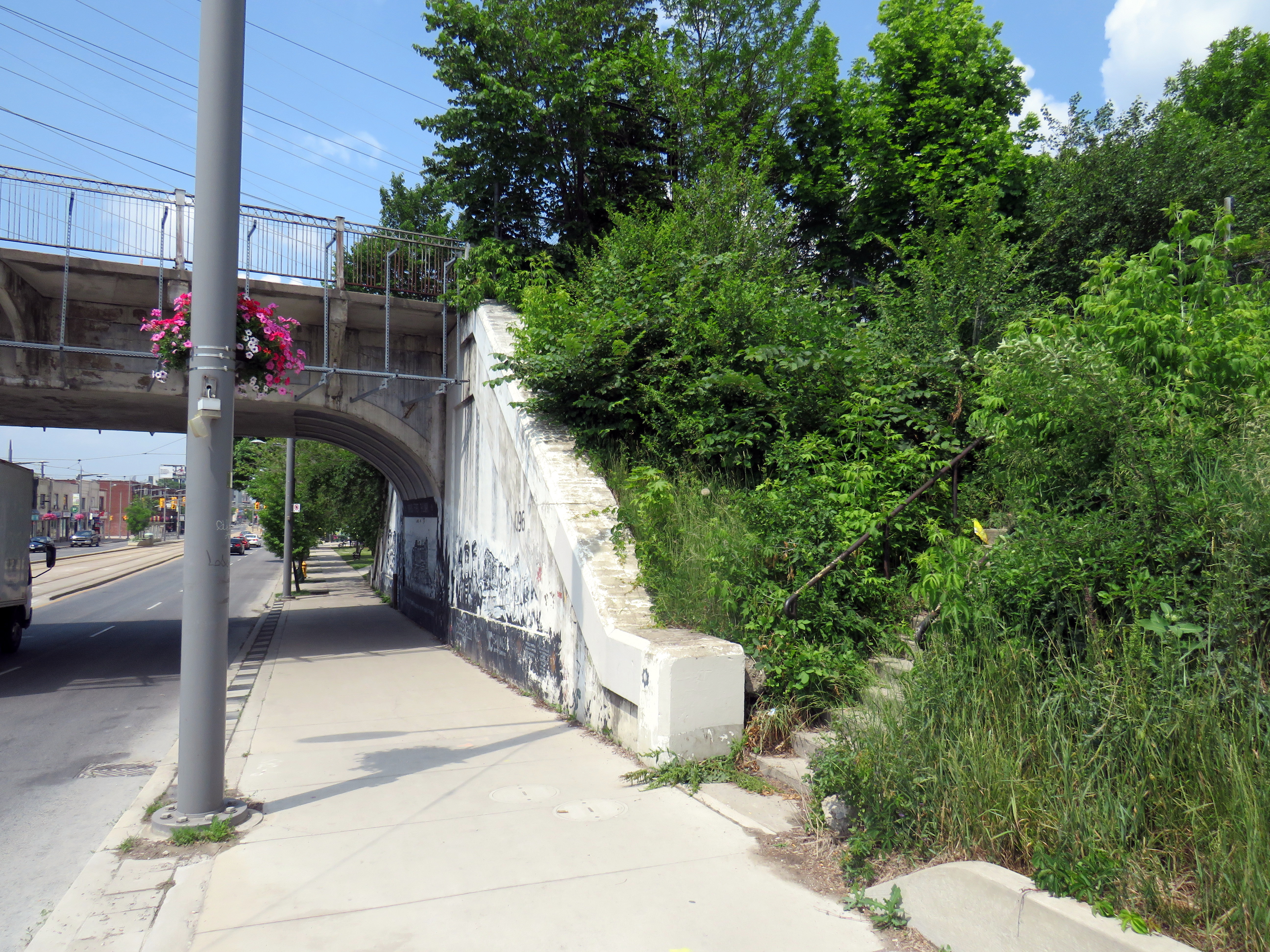
The remains of the station platform are still visible from the east side of GO trains on the north side of St. Clair, especially in winter and early spring. From St. Clair Avenue itself, a stairway, partially hidden by greenery, leads up to the old station site.
Abandoned stairway north from St. Clair Avenue West, near Caledonia Road, leads to the site of the CN St. Clair Avenue Station
Exhibition Station
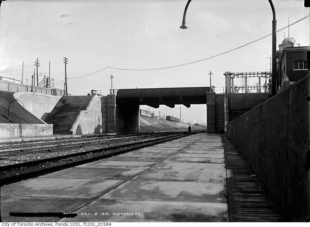
New Grand Trunk Railway Exhibition Station, 1912. City of Toronto Archives, Fonds 1231, Item 1584
In 1912, the Grand Trunk Railway opened a new station that was intended to see train service for only a few weeks a year. Exhibition Station, constructed at the foot of Dufferin Street, was an anomaly. It had no full-time station agent, but it featured wide platforms and staircases leading up to Exhibition Place’s Dufferin Gates. Special trains during the Canadian National Exhibition would quickly load and offload fairgoers. As CP, through its part-ownership of the Toronto, Hamilton & Buffalo Railway, had running rights on the GTR/CN tracks between Union Station and Hamilton, it too, could send trains direct to the CNE.
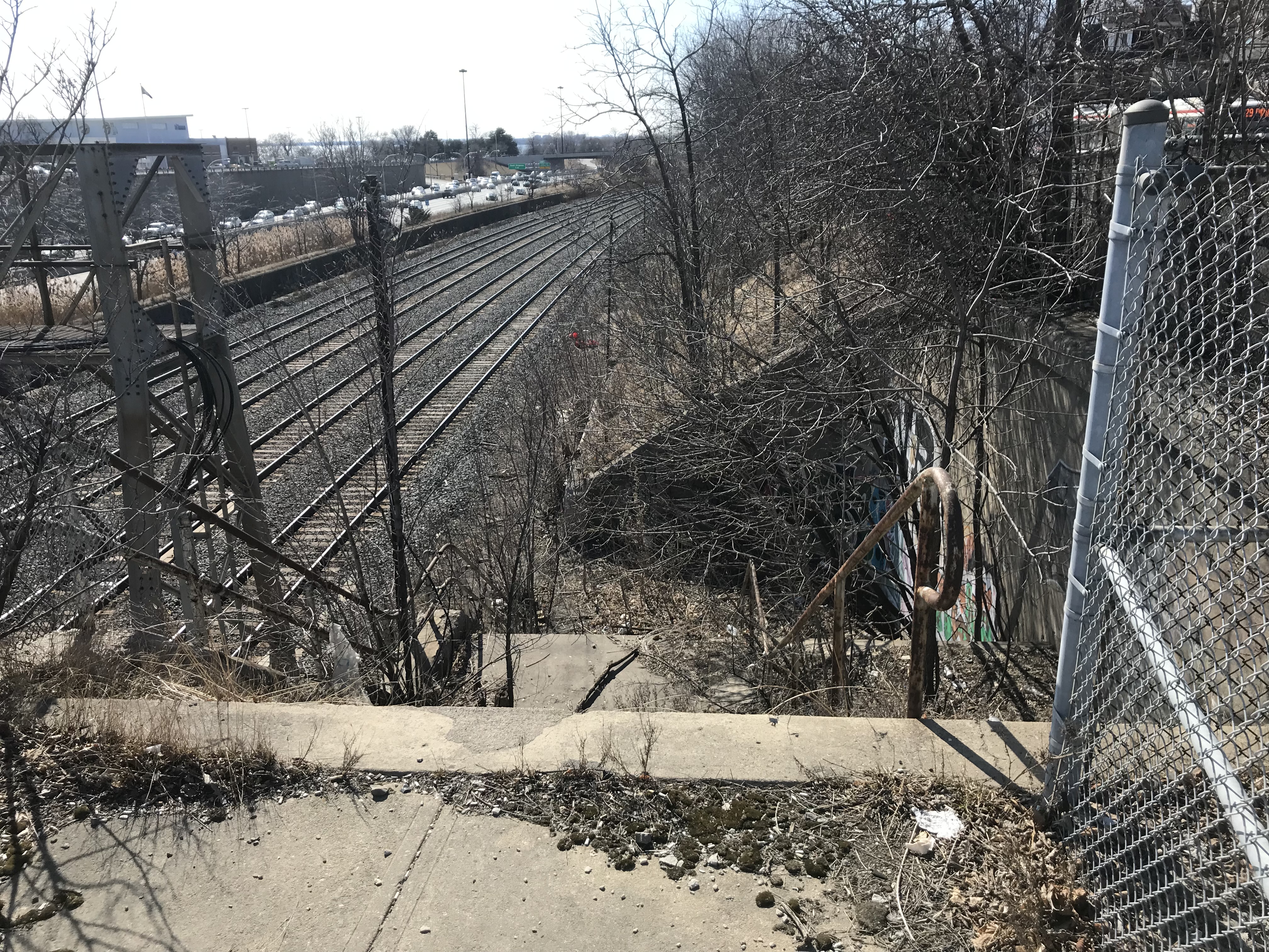
Exhibition Station remained in use until the early years of GO Transit, when it built a new station farther east in the early 1970s. Upgraded since then, the current Exhibition Station will become a multimodal hub with the construction of the Ontario Line. Meanwhile, the old stairways and platforms remain, though fenced off.
Stairway down to the westbound platform at the old CN Exhibition Station at Dufferin Street
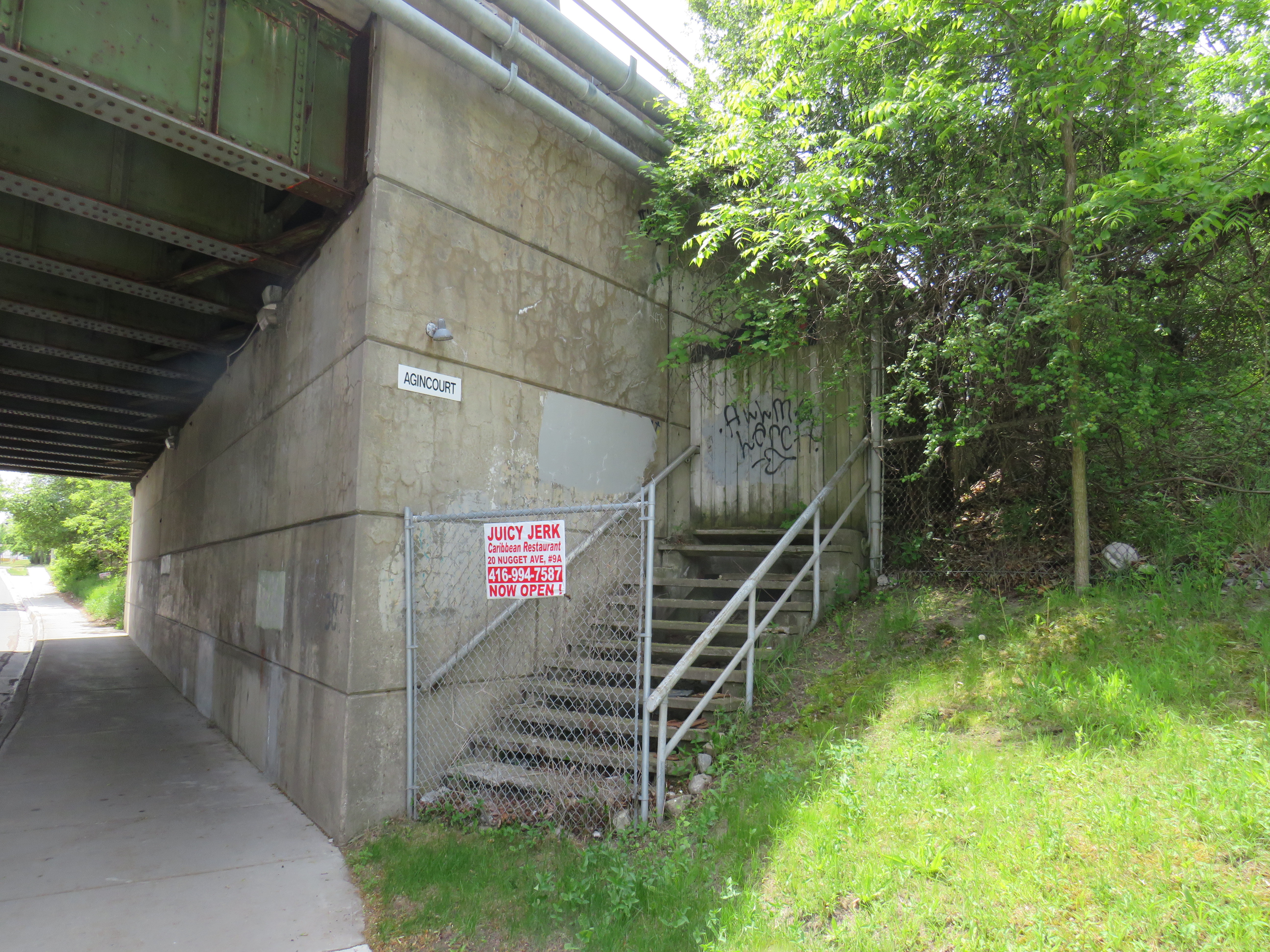
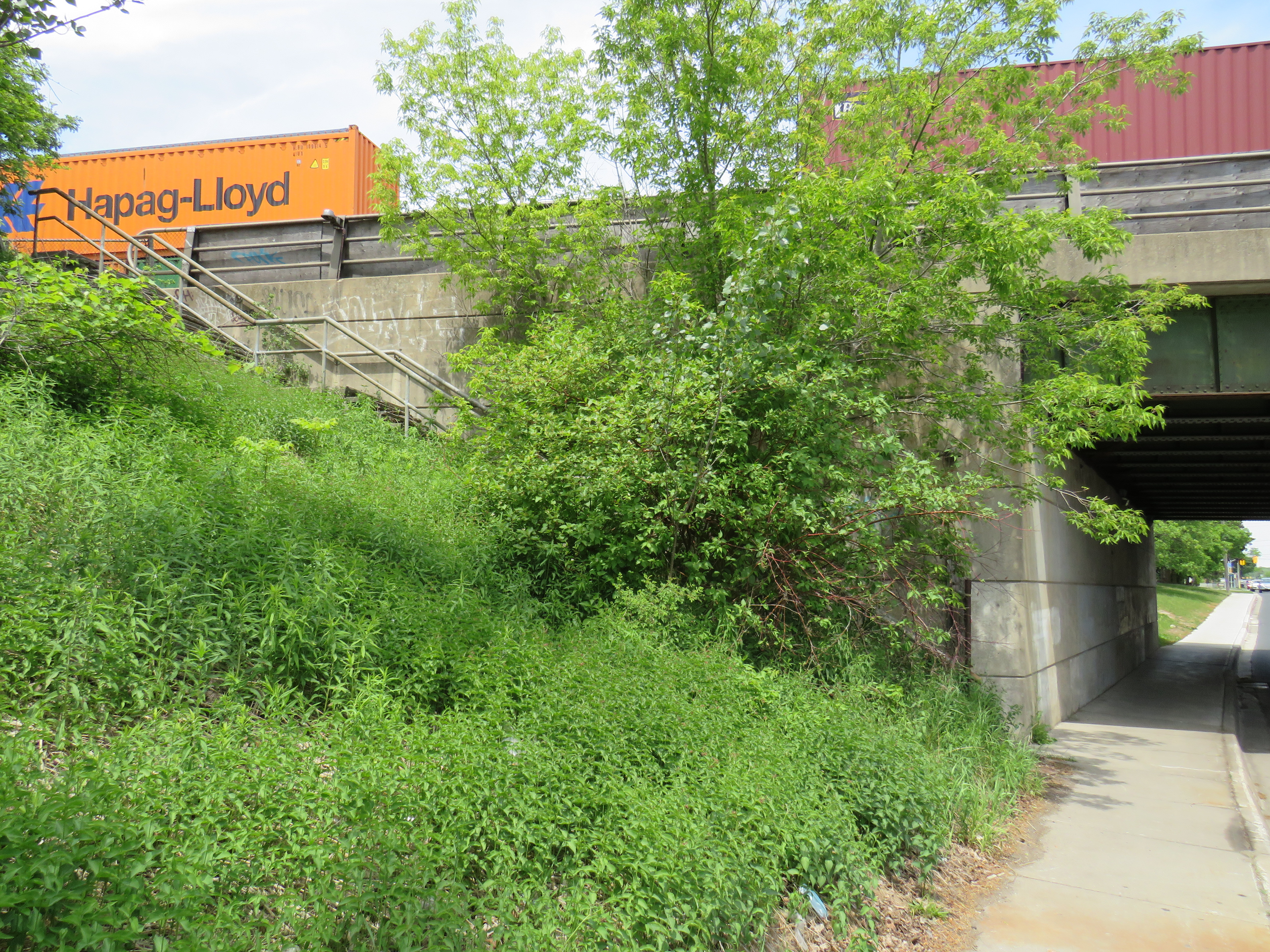
Agincourt CP Station
North side stairway at Brimley Avenue. Note the sign reading “Agincourt” on the underpass structure.
Both CN and CP had stations called Agincourt in North Scarborough, but neither of the historic station buildings remain. The CN station, now the location of Agincourt GO Station, was on Sheppard Avenue East near Kennedy Road, at the centre of the rural settlement. The CP station, originally built in 1884 for its Ontario & Quebec subsidiary, was farther east, located between Sheppard Avenue and Brimley Road. Though the CN station (built in 1871 for the Toronto & Nipissing Railway) was demolished in 1982, the station site remains in active use. Little remains of the CP station.
On the west side of a wide underpass on Brimley north of Sheppard, two fenced-off stairways lead to the north and south side of the CP tracks. In 1960, CP constructed a new freight classification yard in northern Scarborough; as part of that project, it built new underpasses at Sheppard, Brimley, and McCowan Road, and a large overpass for Markham Road. CP replaced the 1884 station with a smaller station building to serve its remaining passenger trains between Toronto, Peterborough, and Havelock. The station building was on the south side of the tracks, with a driveway leading off Sheppard Avenue to the station and a small parking lot, but CP built the stairways on Brimley for walk-up traffic and to provide a safe passage under the tracks between platforms.
Though the rail diesel coach service survived until the 1990 VIA Rail cuts, the station building was demolished in the late 1970s.