Author: Sean Marshall

  • A front row seat to Toronto’s Carmaggedon

    A front row seat to Toronto’s Carmaggedon

    On Saturday, my spouse and I decided to take advantage of the GO Transit weekend day pass and take the train to Hamilton for a short excursion. We did some shopping on James Street North in Downtown Hamilton and on Ottawa Street in the city’s east end, where there’s a great cluster of fabric, decor, and antique shops, as well as cafes and restaurants.

    The new weekend passes, which cost $10 for one day and $15 for two days, have been a major contributor to GO Transit’s ridership recovery. Though weekend ridership has recovered to 90 percent of pre-pandemic levels (despite lower service levels on many routes), weekday ridership is only half of what it was in 2019.

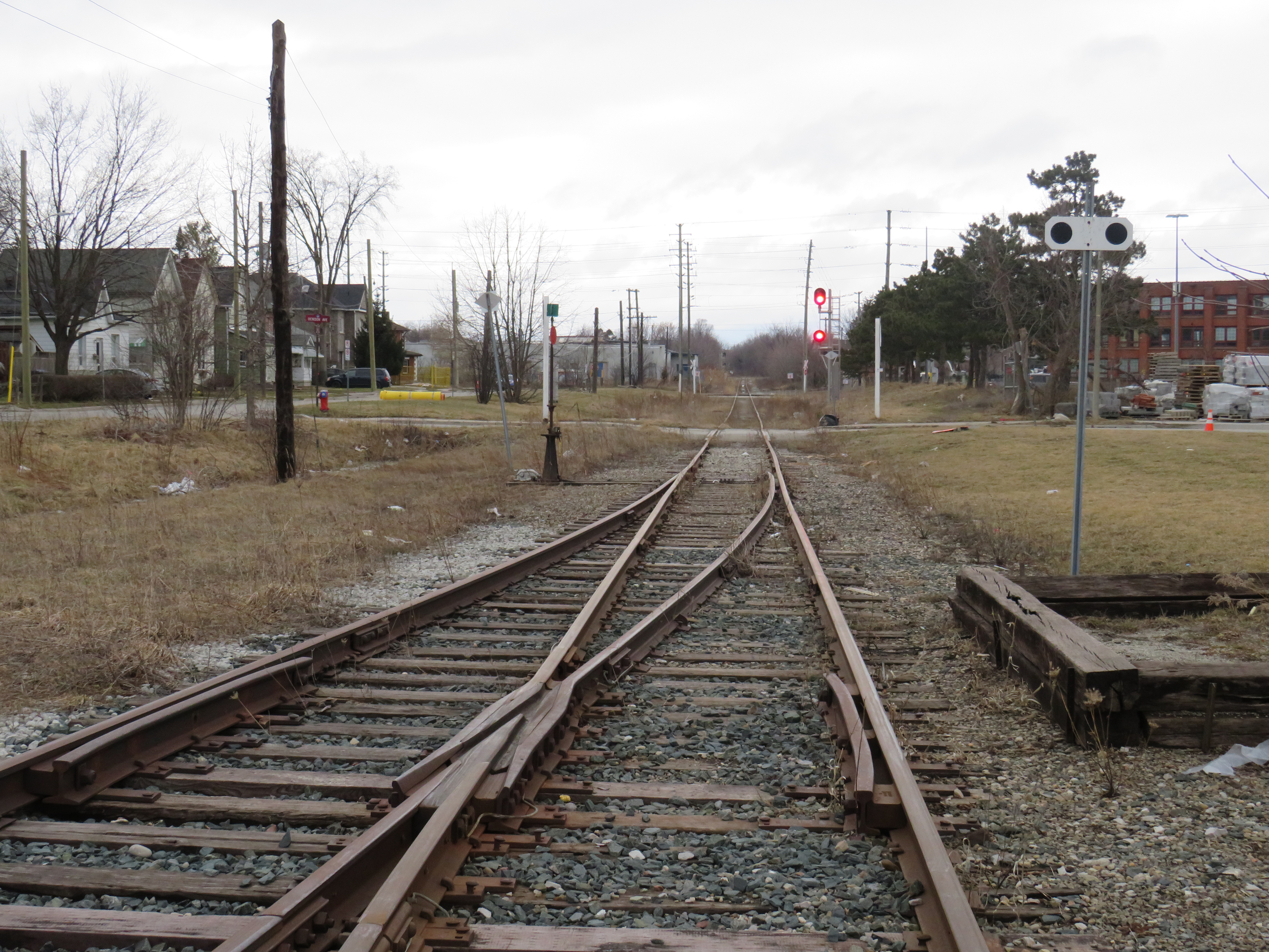
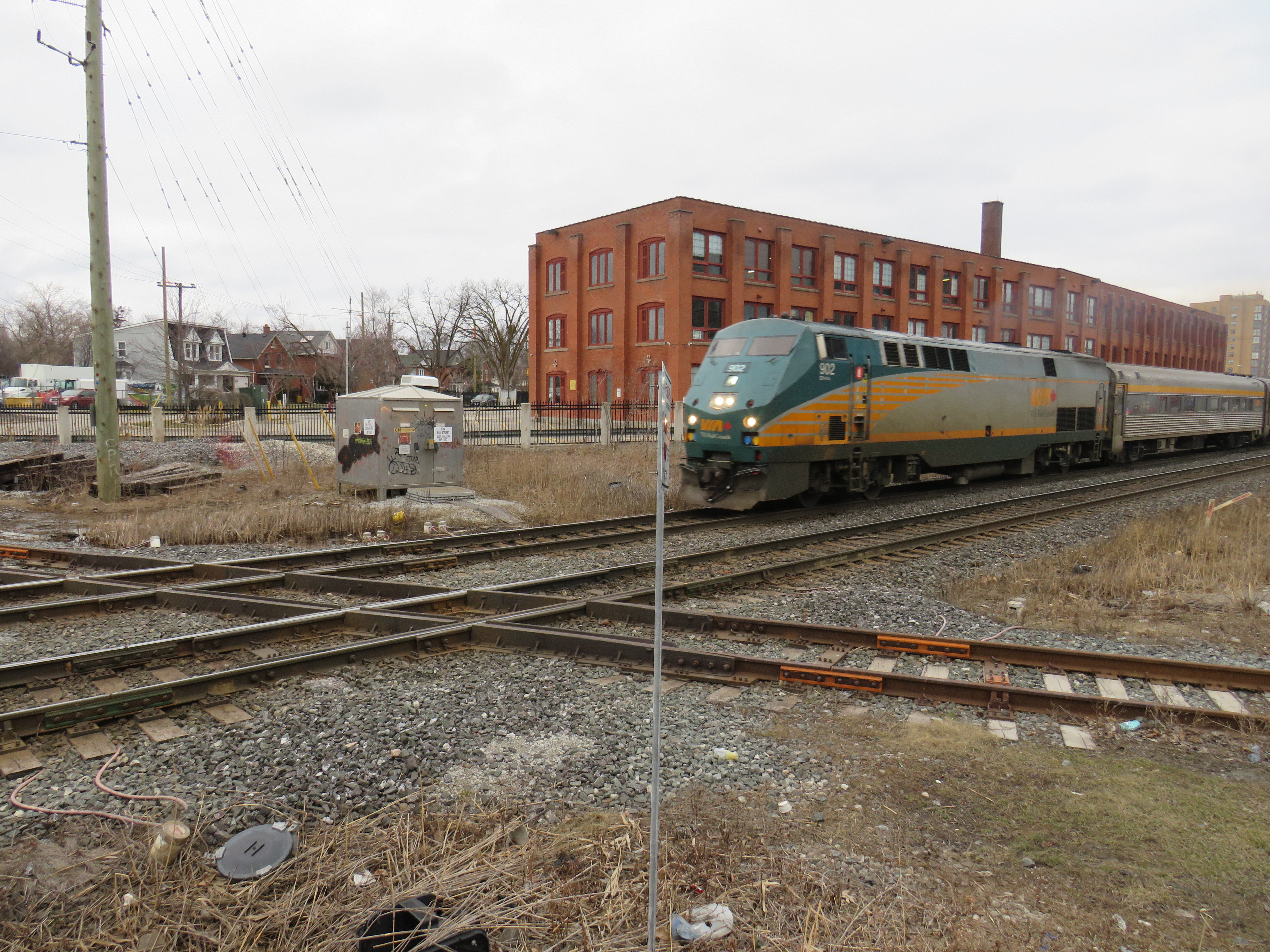
    On our return trip to Toronto, we decided to take the Route 16 express bus, departing from Hamilton GO Centre at 3:30. As the train between Union and Hamilton’s West Harbour Stations runs only every hour, it seemed that the express bus to Union Station would be the fastest and most convenient option. How wrong we were.

    A line of GO buses attempting to turn left from Lake Shore Boulevard to Yonge Street

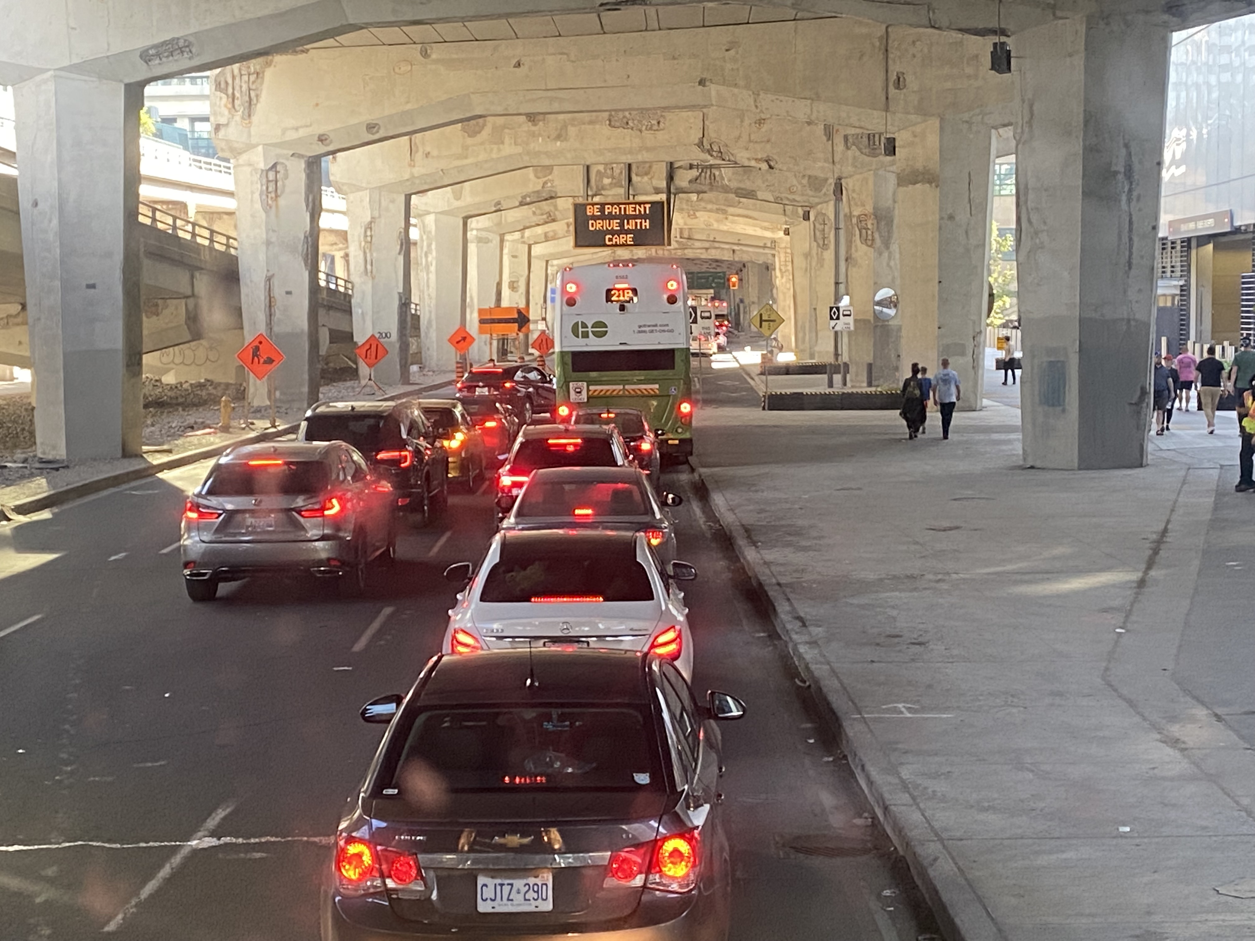
    As we were among the first to board the double-decker bus, we had front row seats to Toronto’s Carmageddon.

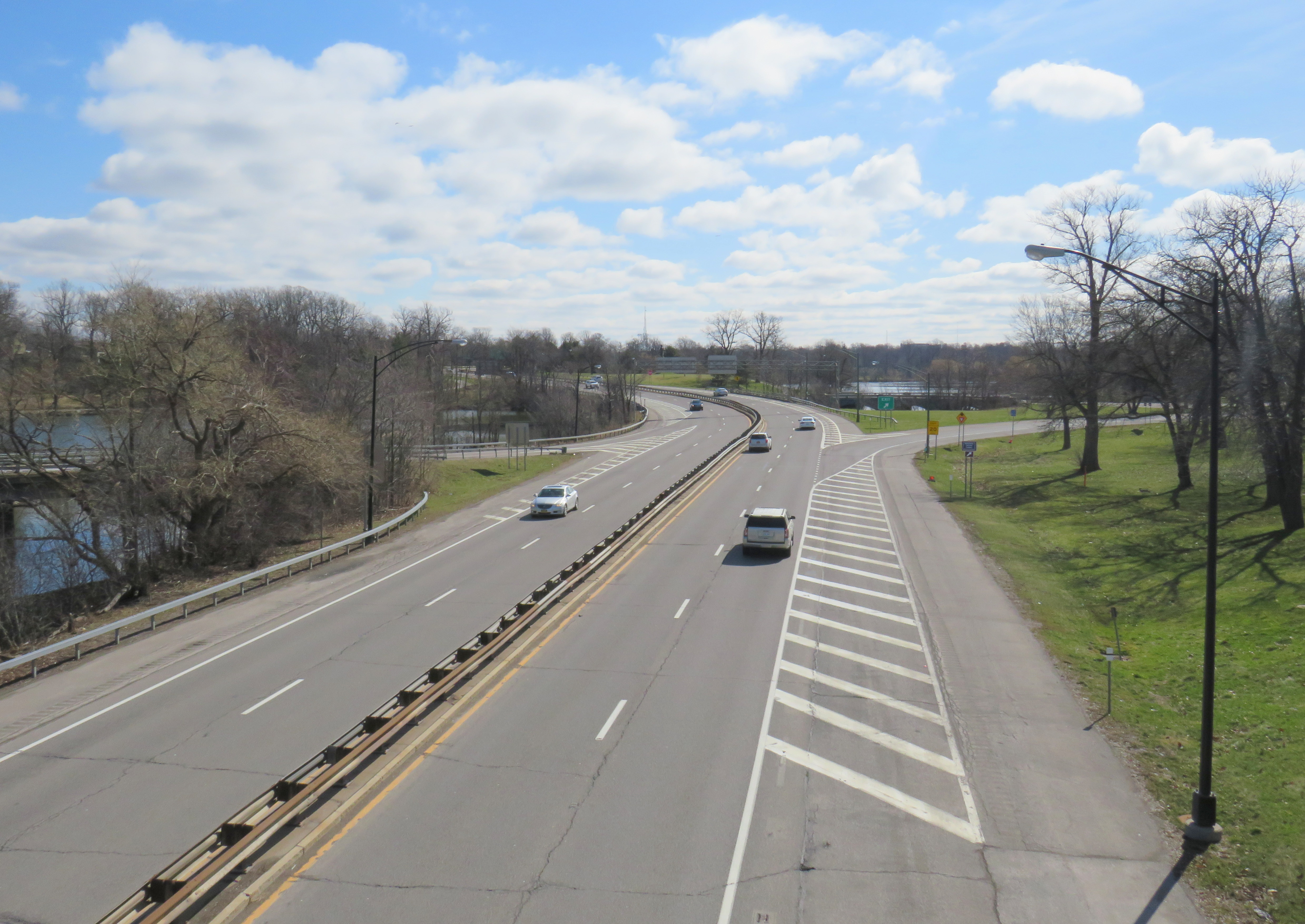
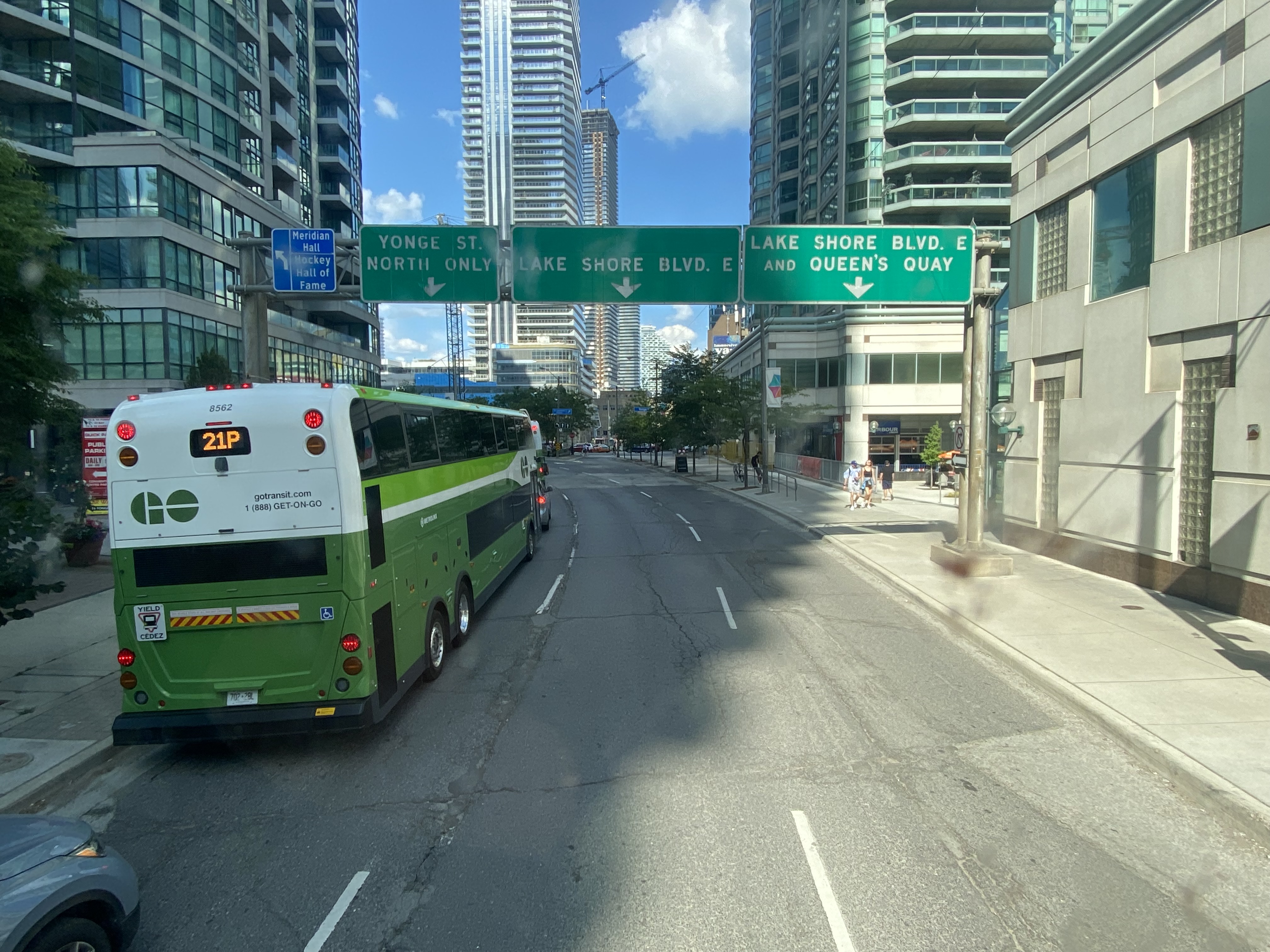
    Despite it being a beautiful afternoon on the long weekend, the ride on Highway 403, the Queen Elizabeth Way, and the Gardiner Expressway was uneventful, with only a few spots where traffic moved slowly. Until the bus got off the York-Bay-Yonge ramp, we were making decent time. That is when we were confronted with a long line of cars and trucks, all trying to turn north on York, Bay, and Yonge Streets.

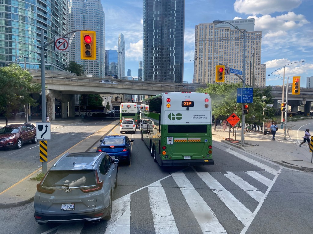
    The new Union Station Bus Terminal, located on the north side of the westbound Lake Shore Boulevard lanes, requires buses coming from the west to turn left on to Yonge Street from eastbound Lake Shore, and then turn left again onto westbound Lakeshore before turning right into the terminal itself.

    After finally turning north from eastbound Lake Shore Boulevard, private vehicles, a Rider Express bus, and GO Transit buses attempt to turn left onto a gridlocked westbound Lake Shore Boulevard

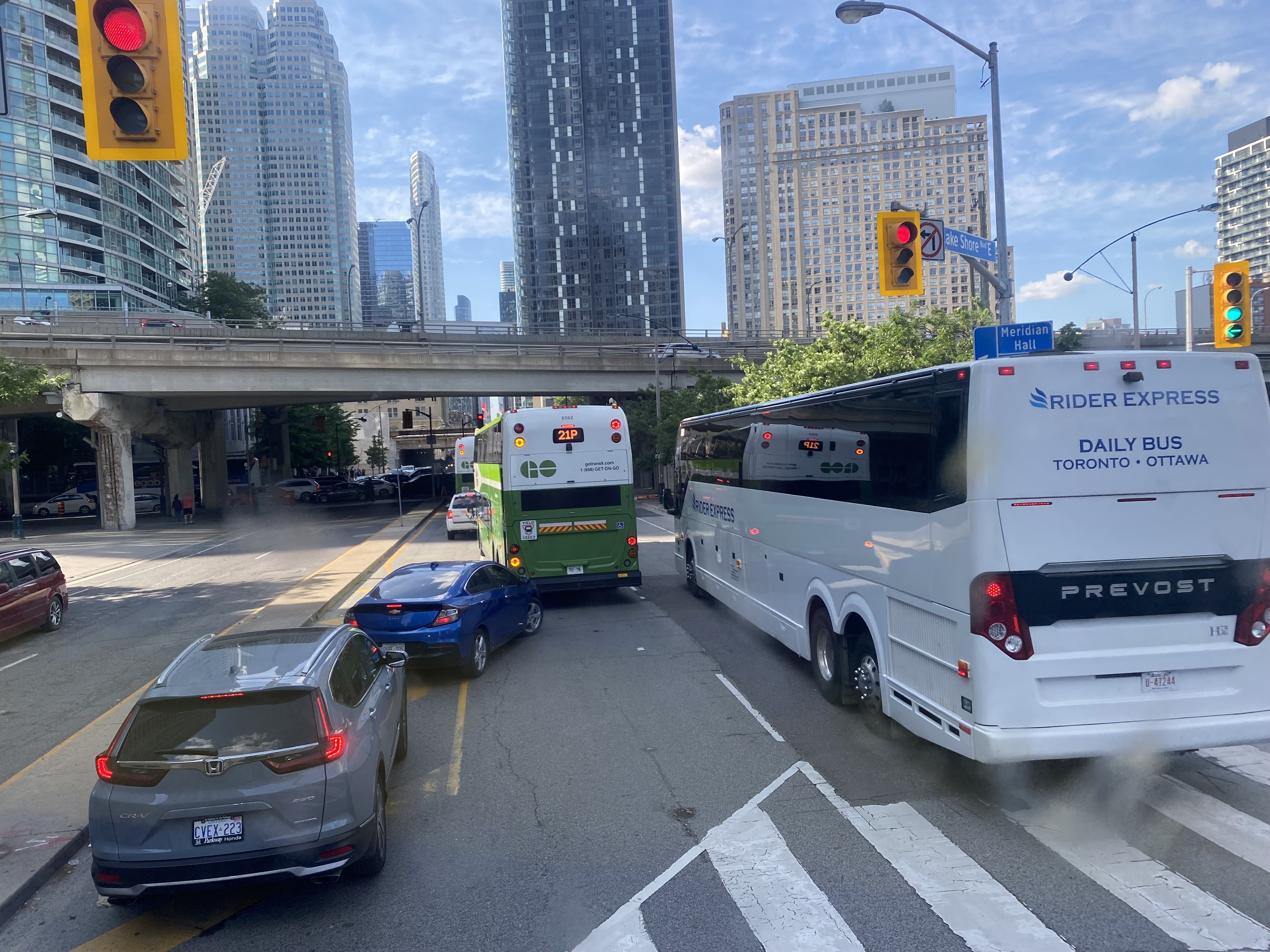
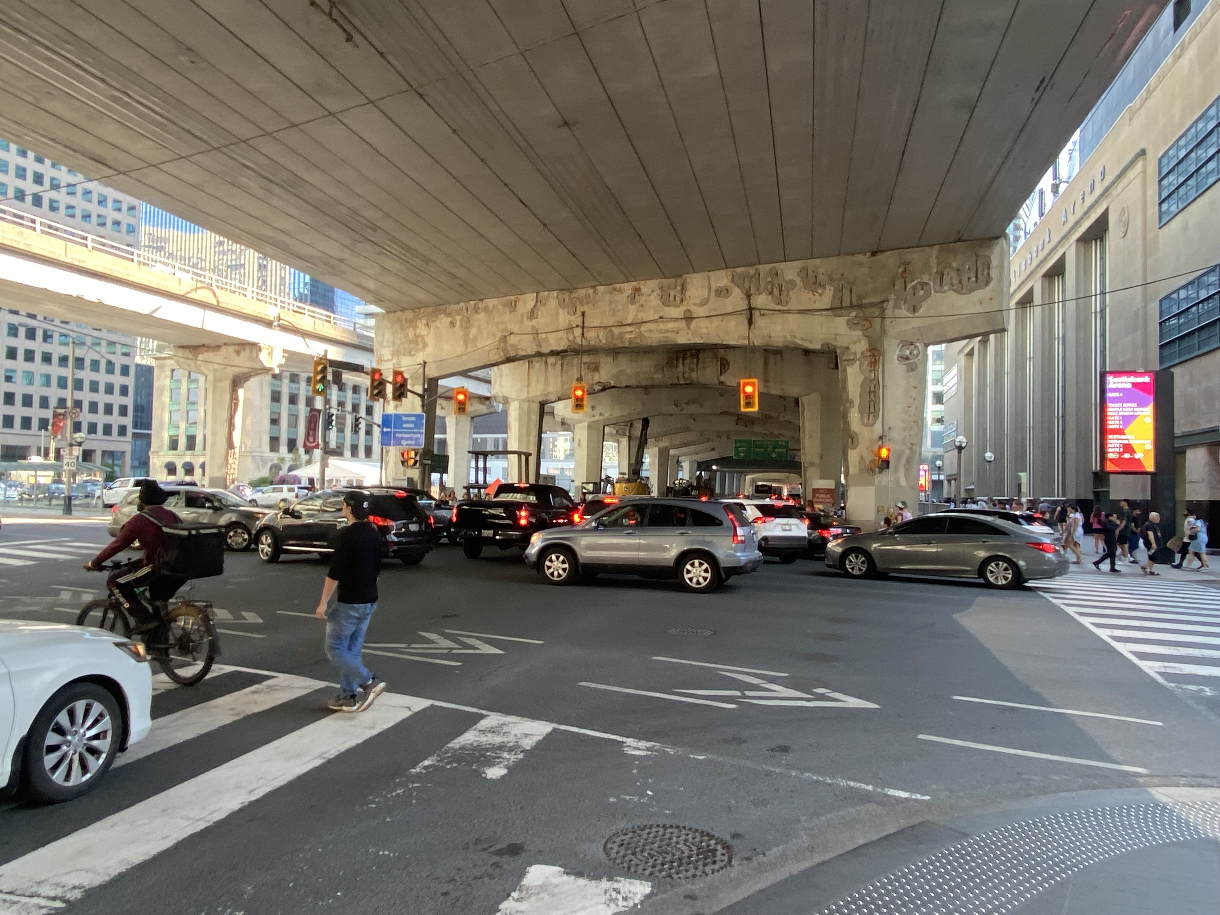
    But with construction obstructing two westbound lanes of Lake Shore at Bay Street, drivers leaving the first of two Blue Jays games that afternoon (a rare doubleheader hosting the Tampa Bay Rays), and other drivers arriving for the evening Jays game, an Eric Church concert at Scotiabank Arena, along with the usual weekend traffic, traffic could not move, creating literal gridlock. Police or traffic wardens that could monitor and manage the gridlock were nowhere to be seen.

    Motorists jam the intersection of Lake Shore Boulevard West and Yonge Street
    One driver expresses his frustration with the traffic

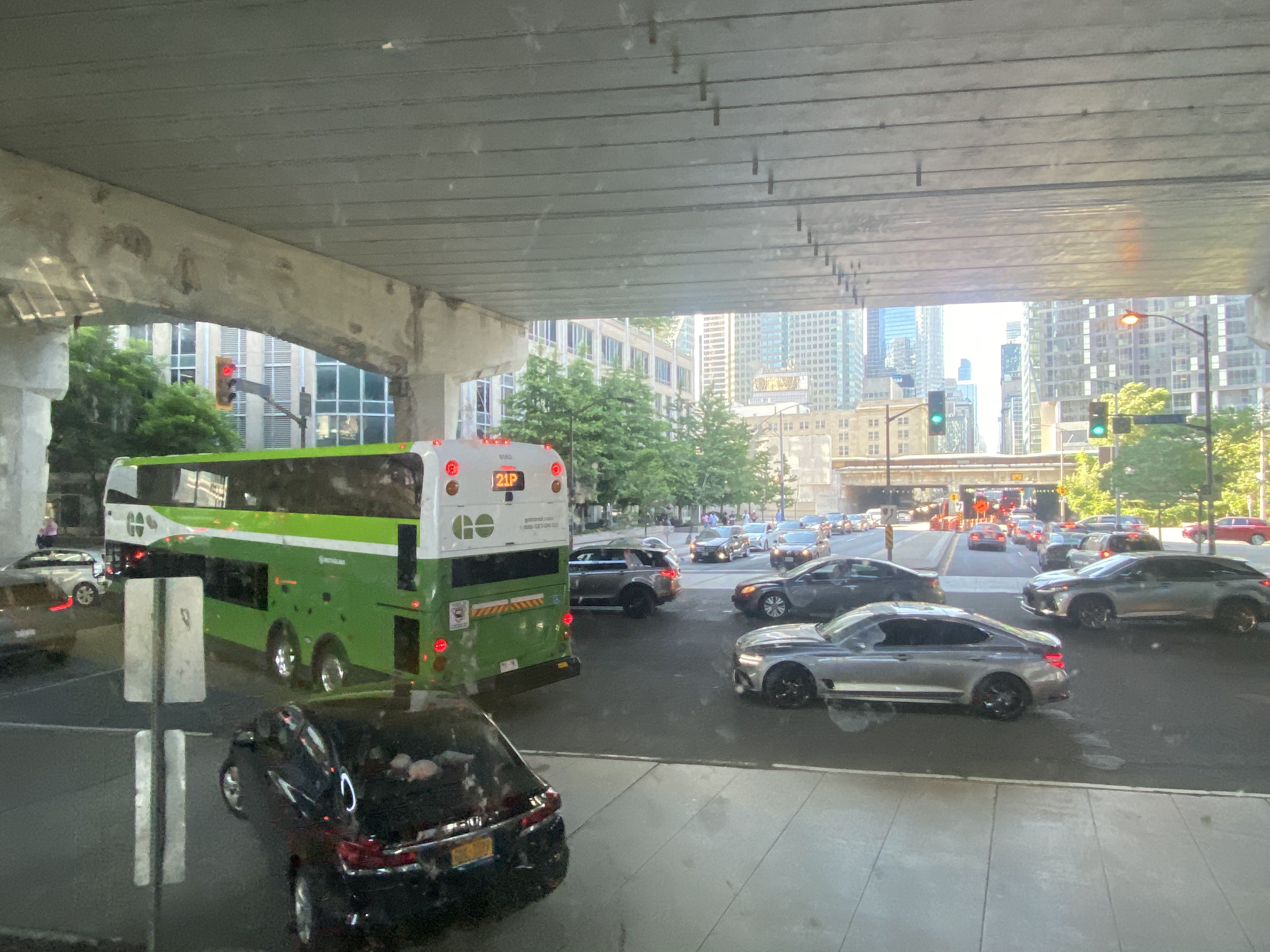
    At 5:50, 2 hours and 20 minutes after the bus departed Hamilton GO Centre, we were let out on the curb outside the terminal entrance. In response to the backlog of buses attempting to enter and exit the Union Station terminal, GO cut back the Route 16, meeting the half-hourly Lakeshore West train service at Aldershot Station (one stop short of West Harbour). Several Route 16, 21, and 31 trips were cancelled due to the traffic in the downtown core, requiring some customers in places like Milton and Georgetown to wait an entire hour for the next bus.

    After similar gridlock conditions on Sunday, July 3, Route 21 (Milton Corridor) and Route 31 (Kitchener Corridor) buses were rerouted to Port Credit GO, requiring a transfer to trains there.

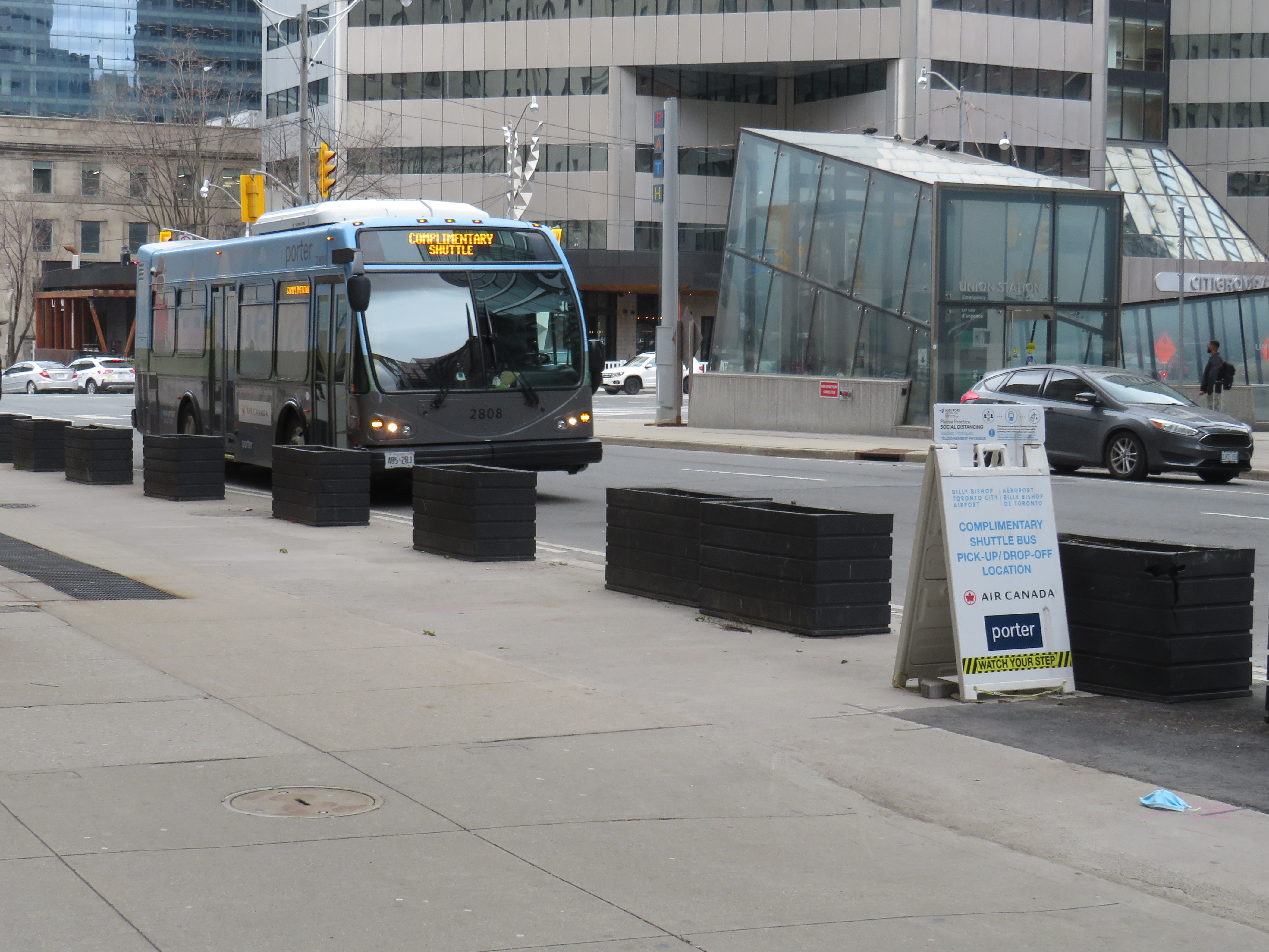
    The new terminal’s location is excellent for consolidating all intercity bus and rail services and is much safer than the old Union Station Terminal or the dilapidated Metro Toronto Coach Terminal at Bay and Dundas Streets. Direct, indoor connections can be made with the subway, several hotels, Scotiabank Arena, and to the vast PATH system of underground walkways. Its major failure, however, is the lack of dedicated bus lanes to speed highway coaches in and out of the facility.

    On Lake Shore Boulevard. The bus entrance to the Union Station terminal is at right

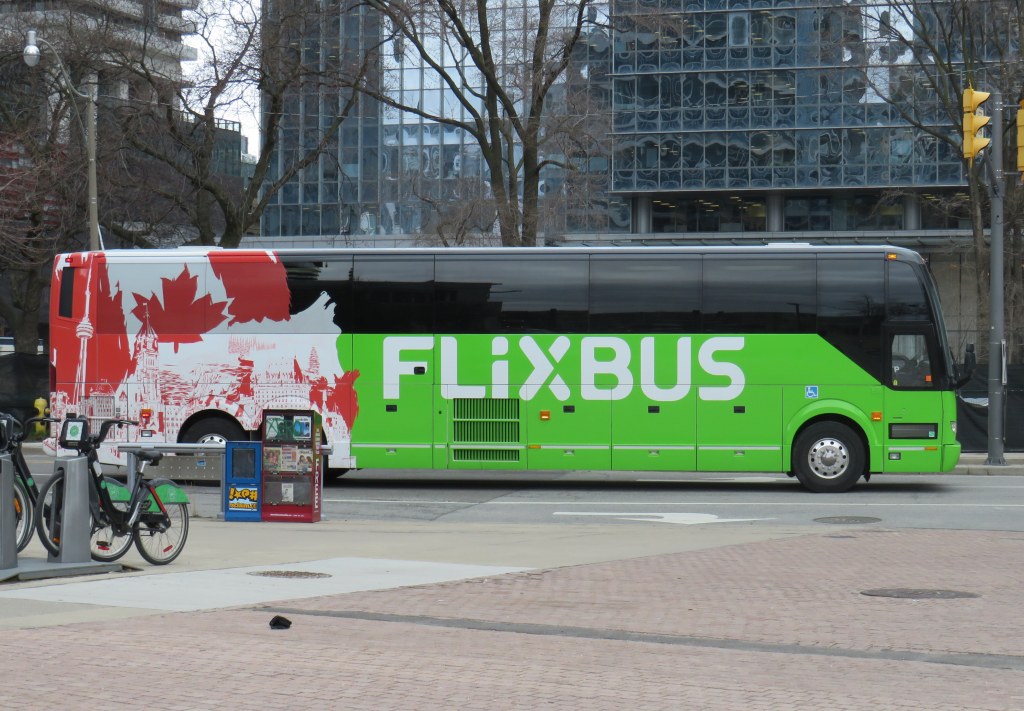
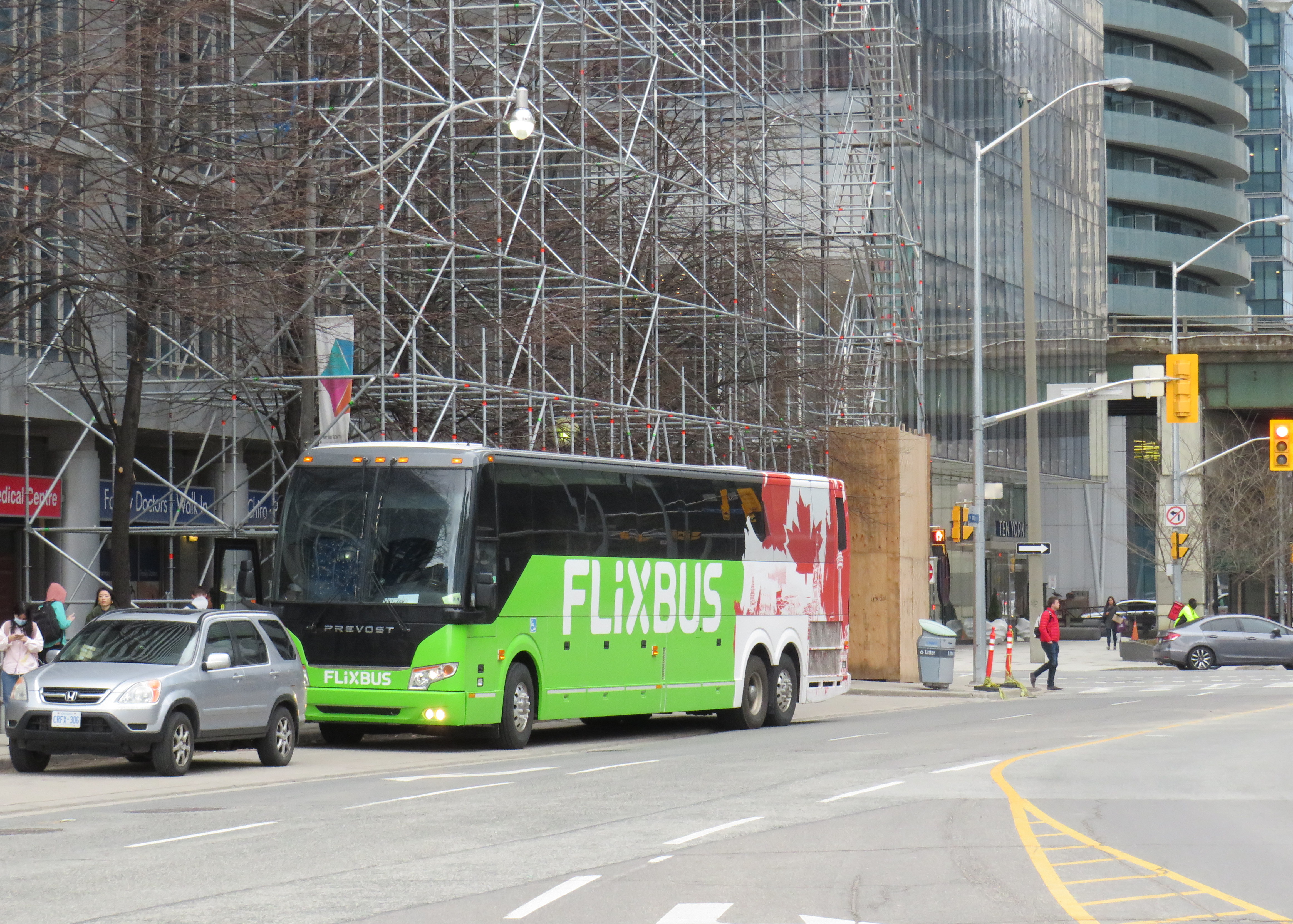
    There is an exceptionally wide sidewalk on the north side of Lake Shore approaching the bus entrance to the terminal, and an extremely short bus lane in front of the terminal’s entrance and exit. It is no wonder why some private coach operators, such as FlixBus and Onex, opt for on-street stops, rather than the terminal used by GO, Megabus, Rider Express, TOK, and Ontario Northland.

    Toronto’s shortest and least-effective bus lane, in front of the Union Station Bus Terminal. Note the sign reading “be patient – drive with care” above.

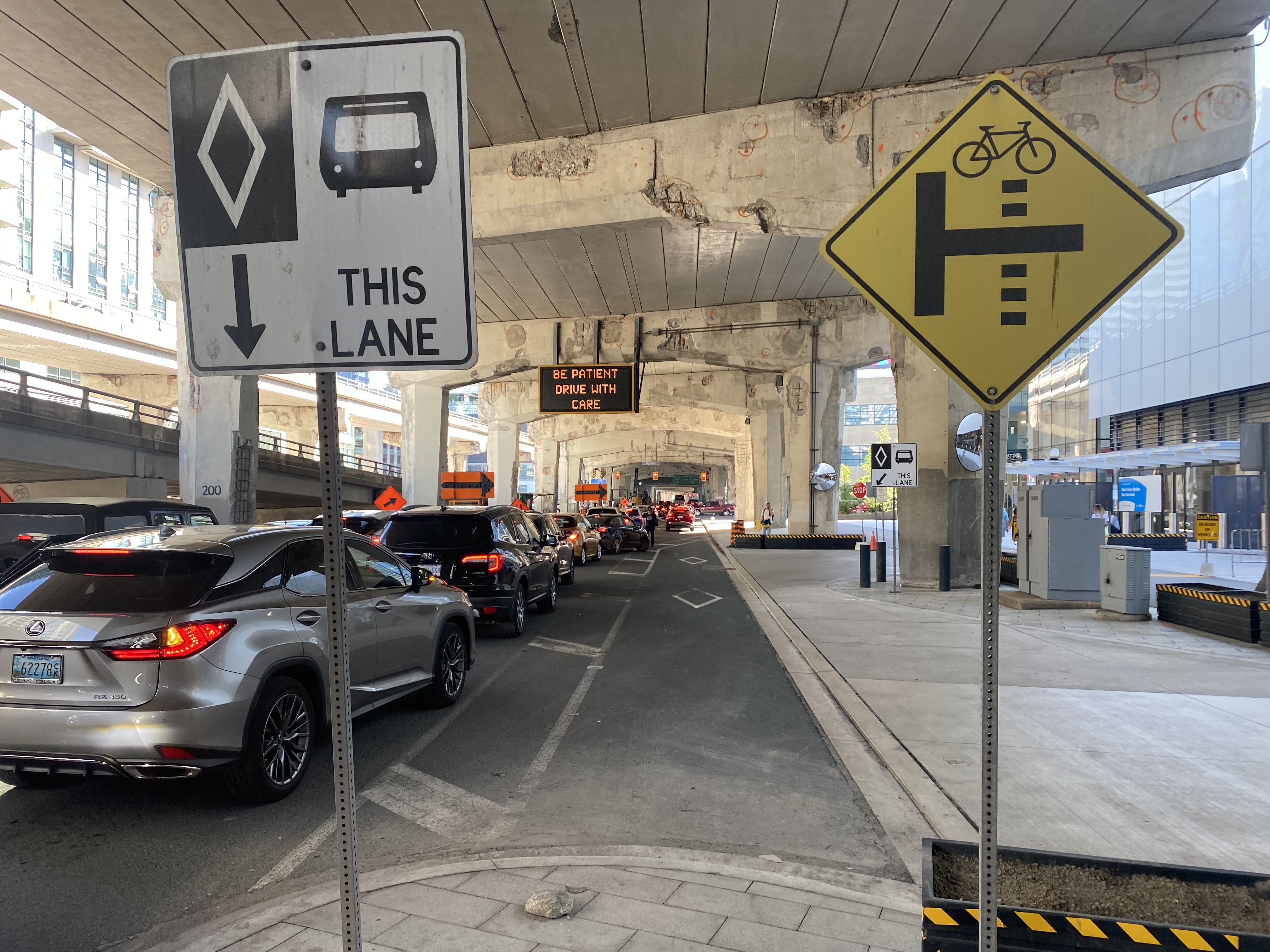
    A dedicated bus lane for the entire distance between Yonge and Bay Streets would undoubtedly improve operations. A dedicated left turn lane from Yonge to westbound Lakeshore would also allow easier access to the terminal from the west, where the majority of GO and intercity coach buses arrive from. Similar dedicated left turn lanes at Queen Street and Central Park Drive in Brampton allow Brampton Transit buses to quickly enter and exit the Bramalea Terminal. Better traffic management, including police enforcement, would help ensure a clear path for transit and coach buses.

    The gridlock continued west of Bay Street, as motorists lined up to get to the Gardiner Expressway or go west on Lake Shore Boulevard

    GO Transit’s reaction, to reroute buses to the already-crowded Lakeshore West Train, is not a sustainable solution, though it is the only effective tool it has at the moment. Though Route 16 passengers are not taken far out of their way with a transfer at Aldershot GO, the detour is more onerous for some Route 21 and all Route 31 passengers forced to backtrack to Port Credit GO for a forced transfer there.

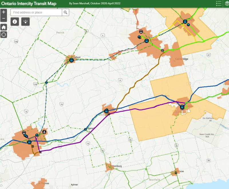
    Stouffville and Barrie Corridor passengers were spared the hassles with the return of weekend train service earlier this year. Unfortunately, Canadian Pacific’s control of almost the entirety of the Milton Corridor precludes midday, evening, and weekend train service, but there’s an opportunity to finally bring limited weekend train service to the Kitchener Corridor. GO Transit already offers an hourly midday and evening weekday train service to Mount Pleasant Station in Brampton, despite CN’s control of the corridor west of Bramalea Station.

    Track improvements completed nearly 20 years ago (an additional track between Bramalea and Mount Pleasant and a second platform at Brampton GO Station) provides the capacity for hourly GO trains and CN’s freight operations. Weekend Route 30 bus service between Kitchener and Bramalea can provide a reasonable and reliable bus link until corridor improvements, such as new passing tracks, are completed between Georgetown and Kitchener.

    As I was sitting in traffic for an hour, I found myself aggravated once again by Blue Jays CEO Mark Shapiro lobbying the city to end the Sunday closure of Lake Shore Boulevard West to allow for the city’s (much-diminished) Active TO program. In a letter addressed to Mayor John Tory, General Manager of Transportation Services Barbara Gray, and the city clerk, Shapiro argued that “removing one of the only ways into and out of the downtown core would be extremely challenging to our fans” claiming that “on the days when Active TO has been in effect on Lake Shore, our local fans have experienced significant transit delays because traffic is grinded to a halt on all downtown routes.” (It is worth noting that the Toronto Blue Jays baseball club is a wholly-owned subsidiary of Rogers Communications. The mayor of Toronto, a former Rogers executive, remains involved with the Rogers family trust.)

    The Lake Shore closure allowed cyclists and runners to bypass the overcrowded Martin Goodman Trail along Toronto’s Western Beaches, on a section of roadway paralleled by GO Transit’s Lakeshore Corridor. The traffic congestion last weekend was completely unrelated to ActiveTO (which is now suspended on Lake Shore Boulevard, partly due to Shaprio’s lobbying) and transit riders, who make up a large percentage of the Blue Jays’ fanbase, were left in the mess that motorists made.

  • From lake to lake: the story of Hurontario Street

    Looking north from Lake Ontario up Hurontario Street in Port Credit

    Ontario’s first roads were trade routes established by First Nations, including the Toronto Carrying Place, which linked Lake Ontario, Lake Simcoe, and Lake Huron. These routes followed the topology and existing water courses, making navigation simple and avoiding steep hills. Many modern streets, such as Toronto’s Davenport Road, follow these old trails.

    With the establishment of the British colony of Upper Canada, new roads were established that took straight lines, instead of following existing trails or the lay of the land. Governor John Graves Simcoe named two of these routes — Yonge Street and Dundas Street — after British officials. Though Yonge and Dundas Streets were established for military purposes, they soon became used for settlement.

    Hurontario Street — a portmanteau of “Huron” and “Ontario” — was among the first of a new wave of roads laid out by colonial officials, established for settlement purposes. These colonization roads were built across southwestern and south-central Ontario and became the basis for the concession land grant system that forms the grid of country roads and arterial avenues throughout Southern Ontario.

    Other roads surveyed and built in this period included Simcoe Street, which connected Lake Ontario (at Oshawa) with Lake Scugog (at today’s Port Parry); Brock Road, which ran between Hamilton Harbour and Guelph with branches towards Lake Huron near modern-day Port Elgin (Elora Road) and towards Owen Sound (Garafraxa Road). Huron Road led west from Guelph towards Goderich through lands held by the Canada Company.

    Hurontario Street followed a nearly straight line north from Lake Ontario, perpendicular to the shoreline, with only a slight bend near present-day Orangeville to reach Georgian Bay at a perpendicular angle. Together with the Toronto-Sydenham Road, which branched off northwest towards Owen Sound, it quickly became an important route.

    Taverns, villages, and towns were established along the way, including Cooksville, Buffy’s Corners (which incorporated as the Village of Brampton in 1853) and Collingwood. Collingwood proved to be an excellent harbour and became famous for its shipbuilding industry.

    Looking south from Georgian Bay up Hurontario Street in Downtown Collingwood

    But Hurontario’s straight trajectory was a problem. For the first 57 kilometres, the straight line was sufficient, as it followed a mostly flat route through present-day Mississauga and Brampton and climbed the Niagara Escarpment on a relatively gentle incline in Caledon. But through Dufferin and Simcoe Counties, the surveyed route went up and down several steep hills on the edge of the escarpment, including Hockley Valley and Boyne Valley. The final descent down the Niagara Escarpment towards Collingwood was very steep.

    Early settlers were granted low-cost or free land grants in exchange for clearing and improving their land and maintaining the new settlement roads being drawn across southern Ontario. They rerouted troublesome segments of the surveyed roadways and either abandoned the surveyed road allotments or designated new survey lines for through traffic. In Dufferin County, traffic switched to the first concession line to the west, which offered an easier path towards Owen Sound. The Town of Orangeville was established where the route deviated.

    Hurontario Street on the eastern outskirts of Orangeville, crossing the old alignment of Highway 9. Highway 10 curves on a bypass around Downtown Orangeville in the background.

    Like many early roads, Hurontario Street’s importance declined with the growing network of railways in Ontario. In 1855, the Ontario, Simcoe and Huron Railway reached Collingwood and the Great Western Railway opened between Toronto and Hamilton. The next year, the Grand Truck Railway opened its line through Brampton; the Toronto, Grey and Bruce Railway (TG&B) reached Orangeville 15 years later. Soon the TG&B built all the way to Owen Sound, closely following the Toronto-Sydenham Road.

    Hurontario Street is a discontinuous dirt road north of Island Lake at Orangeville.

    With the rise of motor vehicles in the 1920s, the Province of Ontario began establishing a highway network; the historical settlement roads became the foundation of this new system of roadways. Highway 10, one of the first 16 routes established by the province, followed the Toronto-Sydenham Road and Hurontario Street between Owen Sound and Port Credit, though it used the well-travelled First Line West through Mono Township, rather than the old, partially abandoned Hurontario Street alignment.

    Highway 10 increased in importance through the 20th century, especially when Toronto’s postwar growth reached Mississauga and Brampton. Highway 410 was built to relieve congestion on Highway 10 and other nearby routes; by 2019, the new highway connected with the old route north of Brampton, and Highway 10 through Mississauga and Brampton was no more, once-again simply known as Hurontario Street except in the older part of Brampton, where it remains Main Street.

    Meanwhile, the railways have fallen to the modern highway. The old TG&B, later acquired by Canadian Pacific, abandoned the Orangeville-Owen Sound line and its connecting branches by 1995. In 2021, the last train from Orangeville made its departure.

    As Mississauga and Brampton continue to grow, a new light rail transit line is being built on Hurontario Street. In a deviation from Metrolinx norms, instead of honouring the road on which this line is built, the PC-led government decided to name the LRT after Hazel McCallion, the former Mississauga mayor who, despite leaving some challenging legacies, has had many publicly funded spaces named for her. Time will tell whether residents will adopt the new name or, instead, favour a name that reflects the historical and contemporary importance of Hurontario Street. My hope is that transit users will continue to use the 200-year old name they’re most familiar with.

    What does First Line West or 2nd Line EHS mean?

    In Mono Township, the concession lines are numbered sequentially from how far east or west they are from Hurontario Street, which was the original basis for the land surveys. For example, 2nd Line EHS can be found two roads east of Hurontario Street. Highway 10 follows the first line west of Hurontario Street, a much gentler route than the original surveyed line. In the north half of Toronto Township (now the City of Mississauga), and in Chinguacousy and Caledon Townships (now Brampton and Caledon), these roads were similarly numbered before acquiring names. McLaughlin Road used to be known as First Line West, while Dixie Road used to go by Third Line East.

    As the centre line of several townships, Hurontario Street was often known as Centre Road, especially in Toronto Township (Mississauga) and Mulmur Township. In Mississauga, where Highway 10, Hurontario Street and Centre Road were once used interchangeably, it now goes exclusively by Hurontario Street.

    In Mono Township, north of Orangeville, 2nd Line E. H. S. can be found two survey lines east of Hurontario Street. Highway 10 follows 1st Line W. H. S. in Mono.

    Hurontario Street and other settlement roads

    As mentioned above, Hurontario Street was one of many early settlement and colonization roads established across the new colony, and later by the province. The first few roads, including Yonge and Dundas Streets, were surveyed and cleared by the colonial military as defensive routes first, but they quickly became important settlement roads. Roads such as Hurontario Street, established in the 1820s, had little military purpose, but became the basis for land surveys, which led to the establishment of townships and counties. Brock Road, Elora Road, and Durham Road are examples of these colonial settlement roads.

    In some cases, private companies or individuals who were given large land grants established their own roads to attract settlers and trade; Huron Road and Talbot Road are examples of these.

    Starting in the 1870s, the provincial government built new roads into less hospitable lands on the Canadian Shield, hoping to draw settlement further north as the supply of quality farming land was exhausted. In some cases, farmers were able to make a go of the marginal farmlands in northern Victoria, Hastings, and Lanark Counties, in other cases, the roads quickly fell into disuse. The Muskoka Road, built to Lake Nipissing, was a rare success: though there was little viable farmland along the route, it helped open up Northern Ontario for resource exploitation, tourism, and settlement. The Muskoka Road was upgraded in the 1920s and 1930s as the Ferguson Highway, before becoming part of Highway 11.

    The map below shows the routes of Hurontario Street and many other settlement and colonization roads in Southern and Central Ontario, along with the township system that followed these corridors.

    Map of settlement roads and townships in Ontario
  • The tragedy of East Buffalo

    The tragedy of East Buffalo

    Kensington Expressway, Buffalo

    Just two blocks away from the Jefferson Avenue Tops supermarket is Buffalo’s Kensington Expressway.

    The high-speed roadway, built with New York State funding, was built in the late 1950s to connect Downtown Buffalo with the New York State Thruway and the airport. The highway went through Buffalo’s East Side, historically Polish-American neighbourhoods that were becoming home to working-class and middle-class African-American families.

    Ironically, a parkway system planned by famed landscape architect Frederick Law Olmsted beginning in the 1860s helped highway planners 90 years later route their new highway. Olmsted had planned large park spaces throughout the city, with wide, treed parkways connecting the spaces together. Delaware Park, to the north, was the largest of these green spaces. In 1901, it was the site for the Pan-American Exposition (which became infamous as the location of the assassination of President William McKinley), while Humboldt Park, on the city’s east side, became a popular neighbourhood gathering place. Humboldt Parkway connected these two parks with a wide, gentle curve.

    Part of the Olmsted Parks and Parkways plan, Buffalo. Humboldt Parkway curves southeast from Delaware Park near the top of the map.

    Of course, city planners of the day, who were guided by the “City Beautiful” movement, never conceived of a time when automobiles would present a new challenge to urban places. From the opening of the Erie Canal in the 1830s to the exploitation of cheap, renewable hydro-electric power at nearby Niagara Falls in the 1890s and early 1900s, Buffalo was going to be a jewel of the Great Lakes, and it needed skyscrapers and public spaces to match its optimism and ambition.

    Humboldt Parkway in 1953, with a wide, treed median on the right (The Buffalo History Museum)

    By the 1950s, Buffalo’s growth had plateaued, and the city started losing population to the suburbs, as white middle class families took advantage of generous federal mortgage incentives, and the automobile made suburban living easy. Redlining — a practice in which banks and federal mortgage underwriters graded neighbourhoods based on their physical and socioeconomic statuses — made mortgages in “declining” or “hazardous” areas difficult or impossible to get. These resulting grades discouraged investment in the housing stock and made it especially difficult for Black families to purchase homes. Racism and xenophobia was embedded in the system: areas that Eastern European immigrants were seen to be “infiltrating” were typically marked as “definitely declining” and areas settled by Black households were marked as “hazardous.”

    In Buffalo, a 1937 redlining map reflected the segregation that would define the city to this day: most of the city east of Main Street was classified as “definitely declining” or “hazardous.” Houses facing Humboldt Parkway were marked as “still desirable” as it is “a small area which maintains its desirability because of location on both sides of an attractive parkway.” That parkway would disappear 20 years later.

    Though the Niagara branch of the New York State Thruway connected Downtown Buffalo to Niagara Falls, the main Thruway, and Canadian border crossings, mostly following rail corridors, city leaders felt that without additional urban highways, Buffalo would lose investment and that more residents and employers would leave the city for the suburbs.

    In 1954, City Planning Director Russell Tryon declared that the new ring highway “would be a major step forward in alleviating the traffic blight that has diseased our neighborhood communities” while believing that highway construction might help keep people in the city, rather than literally drive them to suburbia. “If we make Buffalo a better place in which to live, the people will stay and not move out.”

    The Scajaquada Expressway through Delaware Park

    To build the new highway, planners looked for the paths of least resistance: Olmsted’s parkway system and redlined neighbourhoods where properties could be bought up cheap. None of the parkways on Buffalo’s West Side (which was, and remains, mostly white and middle class) would be sacrificed, but the Humboldt Parkway, on the East Side, would be. The Scajaquada Expressway, across the city’s north side, ran right through the signature Delaware Park. The Kensington Expressway — New York State Route 33 — required the demolition of hundreds of homes. Many displaced residents moved into public housing towers on Fillmore Avenue — which were later abandoned and demolished.

    The abandoned Kensington Heights public housing buildings on Fillmore Avenue in 2010

    The highway only helped to destroy Buffalo’s urban fabric and contributed to the economic and population decline in the East End.

    Buffalo was not alone. In Detroit, Interstates 75 and 375 were routed right along Hastings Street, the commercial and cultural hub for the Motor City’s Black community. In Baltimore, Interstate 70 was to go right downtown through the city’s West Side. The section through a Black neighborhood was built, but the western extension through Baltimore’s western suburbs was never completed, leaving behind a scar known as the “Highway to Nowhere.”

    Baltimore’s Highway to Nowhere

    In Buffalo, the East Side community struggled for decades to get a full-service supermarket after A&P left in the 1960s after the new highway was built. It finally landed Tops Friendly Markets on the A&P site in 2003. This grocery store — the only one serving over 100,000 residents in Buffalo’s East End — became the site of Buffalo’s worst mass shooting, in which a white teenager targeted Black shoppers. The closure of that store only compounds the tragedy as fresh and affordable food has become, once again, even harder to access.

    Now, New York State is planning for the removal of several urban highways built through Black neighbourhoods, including Interstate 81 through Syracuse, the remainder of Rochester’s Inner Belt, and Buffalo’s Kensington Expressway. Reconnecting Buffalo’s East Side and investing in great public spaces could be a positive first step to living up to being “The City of Good Neighbors.”

  • The long way to London

    On Friday, May 13, I embarked on a day trip through Southwestern Ontario from Downtown Toronto. I wanted to ride more of Ontario’s new intercommunity transit services and try one of the new intercity bus operators that’s filling the vacuum left by Greyhound’s departure. I started my trip at Union Station, spent some time in Kitchener-Waterloo, then continued on to London, returning home that evening.

    Between Toronto and Kitchener, there are several options. VIA Rail is the fastest and most comfortable ride, but it now only operates one train a day between Toronto and Kitchener.

    GO Transit is the most frequent option, with several weekday trains between Toronto, Brampton, Guelph, and Kitchener, and connecting buses at Bramalea GO Station for Downtown Kitchener and Waterloo. The train and bus trip via Bramalea is just under 2 hours, costing $19.40. (Weekend GO service is much slower, requiring a change of bus at Square One, with a 2 hour, 33 minute ride.)

    The traveler might also choose one of the new private carriers. FlixBus has one daily departure at 7:45 AM from Downtown Toronto (on York Street, south of Union Station), with a second 2:15 PM trip departing Thursdays through Sundays. Though FlixBus is the cheapest option — only $14.24 with tax — it is slightly slower than GO Transit’s direct train or its Bramalea bus connection, as it deals with Downtown Toronto traffic and serves Guelph on its way to Kitchener. Onex Bus also stops at Kitchener on its Toronto-London route, but it stops at the Sportsworld Terminal near Highway 401, requiring a change to Grand River Transit’s buses.

    Because of the flexibility and convenience, I choose GO Transit, switching from train to bus at Bramalea. Because of continuing construction at Bramalea Station, I had trouble finding the bus stop for the Route 30 to Kitchener and University of Waterloo, but once work is complete on the bus loop, the transfer between modes will be quite easy.

    Route 30 is a fast bus route, stopping only at the Meadowvale Business Park in Mississauga, where connections can be made to several other GO Transit bus routes as well as Miway and Brampton Transit. In Kitchener-Waterloo, the GO bus stops at Downtown Kitchener, at Wilfrid Laurier University, and at a new terminal at University of Waterloo. This is in contrast to Route 25 between Square One and University of Waterloo, which exits the highway multiple times to make local stops, and is the only weekend GO service.

    The new bus terminal at University of Waterloo, serving local GRT routes, GO Transit, and the ION LRT.

    Between Kitchener and London, however, options are much more limited. Though the GO Transit Kitchener Line was recently extended to London, this is limited to one weekday train leaving London at 5:30 AM and returning to London at 8:37 PM. There is just one VIA train between the two cities as well. Onex Bus offers up to five trips daily between Sportsworld and Downtown London.

    The other option is PC Connect, a provincially-funded intercommunity service connecting Stratford and St. Marys with Kitchener-Waterloo and London, as well as towns within Perth County with each other. From Conestoga Mall in Waterloo, I took the 2:50 PC Connect trip to Stratford and St. Marys. At St. Marys, I changed to a connecting bus for Masonville Place Mall in London. Each ride cost $12 cash. Service was friendly and on-time.

    PC Connect Bus in St. Marys

    At London, PC Connect stops on Fanshawe Park Road, adjacent to Masonville Place Mall, but a ten-minute walk from the main LTC bus terminal where connections can be made to Western University and Downtown London. (Huron Shores Area Transit, with service to Exeter and Grand Bend, stops on the north side of Fanshawe Park Road).

    With VIA Rail’s service reduced between Windsor, London, and Toronto, the only trip back to Toronto after 5PM (on a Friday, a traditionally busy travel day) was an Onex Bus departure from the downtown VIA Rail station’s parking lot at 9:15 PM to Pearson Airport (the last trip of the evening continues to Bramalea City Centre, rather than Downtown Toronto). The VIA station at least is still open at that hour, with washrooms and an indoor waiting area.

    I expected a coach bus, but instead, the 13 people waiting were greeted with a 15-seater van. Though the seats were relatively comfortable given the size of the van, passengers had to sit in tight spaces and there was no on-board lavatory like those on Greyhound or Coach Canada coaches. The one-way fare was $38.

    The 15-seat van from London to Pearson Airport

    Though the van arrived late in London (helpfully, a text was sent out to passengers), the trip to Pearson was uneventful, though it arrived about 30 minutes later than scheduled. I still had an hour’s TTC ride home to look forward to, instead of a 20 minute walk from Union Station or the old Toronto Coach Terminal.

    As a private company operating in the newly deregulated intercity coach market, it made sense for OnexBus to utilize a smaller vehicle to minimize costs (the requirement for online advance booking makes this easier). But it was not up to the standards of legacy carriers such as Ontario Northland or Greyhound.

    As more Ontarians travel and as post-secondary institutions return to full on-site learning in September 2022, it will be interesting to see how intercity transit providers and customers adapt to the new normal. I certainly would look forward to taking the train again once VIA returns to its full schedule.

  • New carriers, old gaps: the state of Ontario’s intercity transportation network in 2022

    New carriers, old gaps: the state of Ontario’s intercity transportation network in 2022

    Flixbus is one of many intercity coach operators in Ontario right now

    With university and college campuses reopening for in-class instruction, white-collar workers slowly returning to the office, and pandemic restrictions receding, there are more intercity transport options in Ontario than at any time prior to March 2020.

    New operators, including Germany’s Flixbus, have arrived in Ontario (with routes between Toronto, Guelph/Kitchener, Niagara, and Ottawa), while Greyhound, which pulled out of Canada two years ago, restarted cross-border runs from Toronto, Montreal, and Vancouver. In Southern Ontario, intercommunity bus and van operations continued through the pandemic, with notable service improvements in Simcoe and Grey Counties, new routes in Eastern Ontario, as well as the expansion of “on-demand” services in rural communities and smaller urban centres, including parts of Niagara Region, as the regional government there slowly assumes responsibility for all municipal transit services.

    Link to interactive map
    New edition of the Ontario Intercity Transport Map

    Despite these advances, there are still many gaps in Ontario that need to be filled. The deregulation of Ontario’s motor coach industry has opened the highways up to more operators, but they are all chasing the same customers, rather than attracting new riders.

    For getting between Toronto and Ottawa, passengers have a plethora of choices. They may fly — the fastest, but most expensive option — on Air Canada, WestJet or Porter. They may choose VIA Rail, which is comfortable, but slower. Or they may choose to book a ticket on a Megabus, Rider Express, or Flixbus coach, the slowest, cheapest, and least frequent option. (As of May 2022, only Megabus will begin operating daily buses between Toronto and Ottawa.)

    Between London and Toronto, passengers can choose between a four-hour GO Transit train ride that departs at 5:33 AM, one of several daily VIA trains (approximately 2 hours), one of three daily Onex buses (2 hours, 35 minutes) or one of three daily non-stop Megabus trips (2 hours, 10 minutes).

    Not all bus operators serve the same locations, either, creating new disconnections. In Toronto, GO Transit, Megabus, Rider Express TOK Coach, and Greyhound USA use the new Union Station Bus Terminal, which is directly connected to VIA and GO trains at Union Station and the TTC subway and streetcar system.

    Flixbus stops at a curbside layby on York Street south of the Gardiner Expressway

    To save on terminal fees, Onex stops beside the Royal York Hotel on York Street, across the street from Union Station, sharing the layby with the Toronto Island Airport shuttle. Flixbus uses a different coach bus layby on York Street south of the Gardiner Expressway, in the Harbourfront area. Neither curbside stop is marked for either company. Though Ontario Northland still sends some buses downtown to Union Station, some of its buses to and from Sudbury and North Bay now terminate at the Yorkdale Bus Terminal in North York.

    The layby next to Royal York Hotel serves the Toronto Island Airport shuttle (which has a sign) and Onex bus (which has no bus stop sign)

    In Ottawa, Ontario Northland and Orleans Express use the VIA Rail station (which is on the O-Train LRT system), while Megabus terminates at the St. Laurent O-Train station. Autobus Maheux and Flixbus use curbside stops in Downtown Ottawa. The London-Toronto Megabus route bypasses Downtown London on its route from Western University, while Onex Bus and VIA Rail stop right downtown, along with Strathroy-Caradoc’s intercommunity route.

    Another issue is that apart from the Toronto-Kitchener-London, Toronto-Niagara, Toronto-Kingston-Ottawa, Toronto-Kingston-Montreal and Ottawa-Montreal corridors, there is still little choice in price, operator, or schedule.

    Rider Express suspended service to Windsor last year, so that the three or four VIA rail trains to London and Toronto (or a flight from Windsor airport) are the only option available for anyone travelling without a car. (Transit Windsor’s Tunnel Bus to Detroit remains suspended, despite the continued loosening of border crossing restrictions.) Peterborough, once a major destination for Greyhound Canada on its Toronto-Ottawa corridor, now only has a nearly two-hour-long GO bus connection to Oshawa GO Station.

    Gaps that I wrote about several years ago still remain on the map, which are only more evident as new intercommunity services start up and new carriers emerge. The City of St. Thomas and Elgin County remain the most visible of these gaps; St. Thomas is the only urban transit system in Ontario completely disconnected to any other community, despite its short distance to London. Haldimand County, despite its proximity to Brantford and Hamilton has also chosen to remain off the map. While neighbouring Perth, Lambton, Middlesex, and Grey Counties have developed useful transit connections, Huron and Bruce Counties have very limited links to the rest of the province.

    Finally, the gaps between Hamilton and Brantford to the south and Guelph and Kitchener-Waterloo to the north remain to be filled despite the growing population and multiple post-secondary institutions in each urban area. Though the Hamilton-Guelph-Kitchener triangle should be a natural expansion for GO Transit, it has yet to announce its intentions. Meanwhile, no private coach operator has filled this obvious need.

    The labour-backed Link the Watershed proposal would connect Guelph, Kitchener, Cambridge, and Brantford, but that plan requires the support of local government, but it still leaves the Hamilton corridor wide open.

    As more students return to school full time, and more workers return to the office, the need for reliable and attractive transportation options across Ontario will only continue to grow. As housing prices to continue to increase higher than the already-high inflation rate, intercity transport will be one way to ensure students can stay at home while going to school, and workers don’t have to move or endure long and expensive highway commuting.

    Hopefully by autumn, these gaps will finally close for good.

  • Off the rails

    Off the rails

    The tracks have been ripped out from the once-proud Orangeville-Brampton Railway

    Despite calls for the preservation of the Orangeville-Brampton Railway since its discontinuation in December 2021, the removal of rails on the 150-year old line that once connected Toronto with Owen Sound, Teeswater, and points between began this week.

    The Town of Orangeville aims to replace the tracks with a multi-use path through the municipality. The Region of Peel is likely to purchase most of the remaining section, with the right-of-way likely to become another recreational trail through Caledon and north Brampton. I will continue to document the railway’s demise and the route’s future.

    In the meantime, the rusty rails await their removal.

    Looking west at Centre Street, Orangeville, March 30, 2022
    The hi-rail excavator sitting in the Orangeville yard, March 30, 2022. A pile of removed rails sits in front.
    At Brampton, signals continue to protect the CN mainline despite the abandonment of the old CP route
    A Sarnia-bound VIA Train crosses the Brampton diamond, March 25, 2022. Who knows how long it will be before the diamond is removed for good?
    End of the line – video of track removal at Orangeville by Jeremy Williams
  • It’ll always be the Hurontario Line to me

    Metrolinx map of the Hurontario LRT route

    On Monday, February 14, Premier Doug Ford, Transportation Minister Carolyn Mulroney, and Mississauga Mayor Bonnie Crombie attended a photo-op at Cooksville GO Station to announce a new name for a transit project. With former mayor Hazel McCallion in attendance (who was celebrating her 101th birthday), it was no secret what the new name was going to be.

    It was disappointing that the Hurontario LRT, a provincially-funded transit project operating within Brampton and Mississauga and intended to be part of a regional transportation network, would be named for a divisive former mayor of only one of the two cities the Hurontario LRT is supposed to directly benefit. 

    In North America, and around the world, transit lines and stations are named (with a few misguided exceptions) to reflect the geography of the route it represents and to provide optimal wayfinding, especially to visitors and people new to transit. In Greater Toronto, bus, streetcar, commuter rail and subway routes are named based on the major street they run on (the 501 Queen Streetcar or Line 4 Sheppard), the neighbourhood they serve (the 56 Leaside bus) or the destination it runs to (the GO Milton Line or 900 Airport Express).

    Even new projects follow these conventions. The Crosstown LRT, which operates under and along Eglinton Avenue, is a crosstown route across the middle of the city. Even the Ontario Line partially gets its name from its two end points (Exhibition Place/Ontario Place and Ontario Science Centre). The Hurontario LRT reflected the name of the main street it operates along, even if it changes its name briefly though central Brampton.

    The “Hazel McCallion Line” does not accomplish any of these goals.

    Given Peel Region’s diverse population of over 1.4 million residents, it is also disappointing that a major project intended to unite the region is named for an affluent white public figure that already has two libraries, a public school and a college campus already bearing her name.

    Furthermore, McCallion’s legacy as a longtime mayor of Mississauga is tarnished by racist statements after visiting a local hospital in 2001two conflict of interest scandals, her recent involvement with a troubled for-profit long term care provider, and by land use policies that kept taxes low for decades, but did little to ensure a financially or environmentally sustainable future for the city. 

    I suspect Premier Ford wanted to celebrate a political ally a few months before the next provincial election, but naming the Hurontario LRT after Hazel McCallion sends the wrong message. 

    Post script: The Hurontario Line may not be the only Metrolinx transit facility that will see its name change. In a MERX posting dated February 15, 2022, Metrolinx is looking for Expressions of Interest for station naming rights opportunities for at least four existing GO Transit rail stations. The summary is quoted below:

    Expression of Interest

    Expression of Interest No. RFI-2021-CCMX-097

    Metrolinx is accepting Expressions of Interest for Station Naming Rights Opportunity.

    Metrolinx is an agency of the Government of Ontario, overseeing GO Transit, PRESTO, and UP Express. We are embarking on a massive transformation of the GO Rail network – the backbone of regional rapid transit in the region – to give customers a faster, more convenient way to connect with the things that matter.

    Metrolinx is seeking proposals from interested parties in any category for the Station Naming Rights Opportunity at the following stations:

    Whitby GO Station
    Exhibition GO Station
    Clarkson GO Station
    Oakville GO Station

    Metrolinx will consider proposals for other stations not listed here at the request of interested parties.

    For more information about the GO Transit network and stations, please visit www.gotransit.com. We are committed to working together to create a partnership that will meet shared objectives, such as increase revenue, increase market share for our partners and provide a positive customer experience on public transit.

    All four stations listed are on the Lakeshore Line, the backbone of the GO Transit rail network. Exhibition GO could be especially attractive for renaming, as it will become a major hub with the future connection to the Ontario Line and local TTC services. It is also worth noting that Metrolinx will entertain proposals for additional stations in the bid process.

    It is hard to blame Metrolinx for these specific transit naming decisions; it is very likely that the Ford government demanded the McCallion Line and is pushing for the sell-off of naming rights. But it is ironic that after hiring consultants and going though a complex naming process for the Crosstown LRT, that previously held principles are quickly abandoned at the whim of Metrolinx’s superiors.

  • Wards and ridings: not quite representation by population

    Wards and ridings: not quite representation by population

    When Statistics Canada released the first batch of 2021 Census data, it made the new population counts available for a wide variety of geographies, from provinces and cities, to local census tracts and even city blocks. It also released data for the 338 federal electoral districts, better known as ridings.

    Because of constitutional requirements, the seats in the federal House of Commons are not allocated equally by population. For example, Prince Edward Island, with a population of 154,331, has four seats. At the other extreme, four electoral districts in Alberta and one in Brampton, Ontario have larger populations than Canada’s smallest province.

    Electoral DistrictProvince/Territory2021 Population
    LabradorNewfoundland & Labrador26,655
    EgmontPrince Edward Island35,925
    NunavutNunavut36,858
    CharlottetownPrince Edward Island38,809
    MalpequePrince Edward Island39,731
    Average109,444
    Banff-AirdrieAlberta155,580
    Calgary SkyviewAlberta159,642
    Brampton WestOntario162,353
    Calgary ShepardAlberta163,447
    Edmonton-WetaskiwinAlberta209,431

    The federal electoral districts were last drawn in 2013, following the 2011 census. As a result, fast-growing ridings, particularly in Southern Ontario, Calgary, and Edmonton, have huge populations compared to the national average.

    In Ontario, the provincial government uses the same boundaries for its provincial electoral districts, with the exception of Northern Ontario, where two additional seats help to compensate for the area’s vast and remote regions, where local MPPs may have to travel hours by car, train, or plane to meet constituents. The province imposed the same boundaries on the City of Toronto in 2018, in the middle of a municipal election for which new, fairer boundaries were just approved.

    By 2021, the population differences based on decade-old data became stark, as shown in the map below.

    Map depicting disparities in Toronto’s ward populations

    Ward 23 Scarborough North, represented by Cynthia Lai, has a population of 94,717. Ward 23’s population dropped by over 4% since 2016, as households age and few new housing units built in that ward. Ward 16, Don Valley East, has just 95,039 residents, with a stable population.

    On the other extreme, Ward 3 Etobicoke-Lakeshore, represented by veteran councillor Mark Grimes, has a population of 141,751, growing by 9.82% since 2016. New condominium developments in the Humber Bay neighbourhood and along the Queensway have driven much of that growth. Ward 10, Spadina-Fort York, saw an even greater number of new residents move in, growing by nearly 18% in the last five years.

    As Toronto is stuck with these ward boundaries until 2026, the population disparities will only grow larger, with downtown and South Etobicoke residents becoming even more underrepresented. Compounding the unfairness is that councillors representing high-growth wards have much higher workloads, as they deal with mountains of planning applications while ensuring their existing constituents have access to essential local services like schools, transit, and park space.

    The ward boundaries initially set for the 2018 municipal election would have accounted for future growth, ensuring that workloads would be more fairly distributed, and that city residents would have equal access to their local councillor.

    The 2021 population counts will be used to set new federal riding boundaries, which will be drawn next year after a consultation period and used in the first federal election held after 2023. The province will likely adopt the new boundaries for the 2026 election (assuming a majority government is elected in June).

    Perhaps in four years, Toronto will be able to set its own ward boundaries again. That, of course, will depend on electing a better provincial government and a council committed to equity and good governance.

  • Mapping Toronto’s population growth

    Despite new highrise development in its city centre, Mississauga lost 3,368 residents between 2016 and 2011

    On February 9, data geeks across Canada rejoiced when Statistics Canada released the first round of data from the 2021 Census of the Population.

    The data was released at all levels of geography made available by Statscan. At the federal level, Canada grew by 5.2% since the 2016 Census, with a total population of 36,991,981. Immigration, rather than natural growth (births vs. deaths) drove Canada’s population increase.

    Of course, this growth did not occur evenly across the country. Newfoundland and Labrador lost residents, while Prince Edward Island and British Columbia saw the biggest population increases.

    Within the Greater Toronto and Hamilton Area, Mississauga experienced population decline (-0.5%) for the first time since it became a city in 1974. Outer suburbs, such as Milton, East Gwillimbury, and areas just beyond the GTHA, such as New Tecumseth and Bradford saw population growth over 20%, driven by new greenfield development.

    In older Toronto suburbs, including much of Etobicoke, North York, Scarborough, and even Mississauga, population losses at the local census tract level can be explained by ageing households, where Millennial and older Gen Z children moved out on their own, particularly into fast-growing downtown areas. These areas, dominated by single-family housing, could accommodate much of the GTHA’s growth with gentle density, including secondary suites (such as basement apartments), garden suites, and zoning policies that would make it easier and more economical to build “missing middle” housing such as walkup apartments and multiplex homes.

    Toronto grew by 62,785 residents in the last five years, with only a few areas accommodating all that growth: the downtown core between Dufferin Street and Broadview Avenue, South Etobicoke, Yonge-Eglinton, and former industrial, instructional, and commercial lands stretching along the Highway 401 corridor through North York and West Scarborough. This corridor includes the Downsview Park development, a new condominium cluster at Wilson Subway Station, the former Canadian Tire lands near Sheppard Avenue and Leslie Street, and the intensification of the Fairview Mall area.

    You can take a look at the changes for each municipality and each census tract in Ontario with an interactive map I created here.

    Population Change for GTHA Municipalities

    Municipality2021 Population2016 PopulationChange (%)Change (Total)
    Toronto 2,794,3562,731,5712.362,785
    Mississauga717,961721,599-0.5-3,638
    Brampton656,480593,63810.662,842
    Hamilton569,353536,9176.032,436
    Markham338,503328,9662.99,537
    Vaughan323,103306,2336.016,870
    Oakville213,759193,83210.319,927
    Richmond Hill202,022195,0223.67,000
    Burlington186,948183,3142.03,634
    Oshawa175,383159,45810.015,925
    Whitby138,501128,3777.910,124
    Milton132,979110,12820.722,851
    Ajax126,666119,6775.86,989
    Clarington101,42792,01310.29,414
    Pickering99,18691,7718.17,415
    Newmarket87,94284,2244.43,718
    Caledon76,58166,50215.210,079
    Halton Hills62,95161,1612.91,790
    Aurora62,05755,44511.96,612
    Whitchurch-Stouffville49,86445,8378.84,027
    Georgina47,64245,4184.92,224
    East Gwillimbury34,63723,99144.410,646
    King27,33324,51211.52,821
    Scugog21,58121,617-0.2-36
    Uxbridge21,55621,1761.8380
    Brock12,56711,6427.9925

  • A new twist in the story of a downtown parking lot

    The Metrolinx parking lot at Elizabeth and Railroad Street is nearly complete

    Over the last few years, I have followed the purchase and demolition of over a dozen houses in Downtown Brampton, in the block bounded by George, Nelson, Elizabeth, and Railroad Streets. Metrolinx, the provincial transit planning and operating agency, acquired the block for a new surface parking lot for the neighbouring GO Transit station.

    At first, the parking lot was intended to replace parking spaces lost due to construction of a new post-secondary education campus — a joint venture between Ryerson University and Sheridan College — on the main GO Station lands. Though the provincial government pulled funding for the campus in the fall of 2018, Metrolinx continued work on the parking lot, completing the demolition, clearing the land, and building the parking area.

    Now, it is possible that the parking lot will never open.

    At the Brampton City Council meeting on January 26, 2022, councillors considered a request by Rogers for two Minister’s Zoning Orders (MZOs) in order for it to relocate its existing Brampton offices at 8200 Dixie Road in Bramalea to a new build in Downtown Brampton. The particular property Rogers looks to acquire for its new campus is the same one Metrolinx acquired, cleared, and partly constructed its new parking lot.

    Part of the existing Rogers campus at 8200 Dixie Road

    The property at 8200 Dixie Road was built in the 1963 as a Northern Electric (later Northern Telecom) plant, which produced switchboards and other telecommunications equipment. In 1995, the plant closed, and the building was refurbished to become the headquarters for Nortel Networks. In 2005, during Nortel’s infamous fall into bankruptcy, the property was sold to Rogers, which uses it today for its business operations and technical offices, with 3,000 workers stationed there.

    Rogers is interested in the downtown site for several reasons. The new campus would be adjacent to several transit links, including the GO Transit Kitchener Line, with links to Downtown Toronto (where Rogers has its head office) and the Kitchener-Waterloo technology hub. In its submission to the city, Rogers also notes the proposed LRT extension into Downtown Brampton (now in the design phase, either as a tunnel or a surface route) and planned bus improvements. Though it is served by Brampton Transit, the 8200 Dixie Road site is almost entirely dependent on its employees driving to work.

    The new Rogers downtown site would support Brampton’s goals of becoming a cybersecurity centre of excellence and landing a major postsecondary education campus — Ryerson University continues to be interested in expanding in Brampton and the University of Guelph has expressed interest in relocating its Humber College presence to Brampton to better serve its student base.

    There are also several development proposals for Downtown Brampton. The City of Brampton is still planning to build a new Centre for Innovation to support education and business development. The new facility, located adjacent to the downtown transit terminal, will include a new central library. New highrise developments will bring thousands of new residential units to downtown Brampton, walkable to local businesses, the GO station, and Rogers’ planned new campus.

    Map of Metrolinx/Rogers lands in Downtown Brampton, with surrounding active development plans

    The new office campus — proposed to be 200,000 to 500,000 square feet — would have a smaller footprint than the Dixie Road site. By relocating its offices, Rogers would then be free to sell or redevelop the old Nortel lands for housing and new industrial uses, likely for warehousing and logistics. The development of the old land would certainly finance the new property.

    Proposed redevelopment of the Rogers lands at 8200 Dixie Road, with mixed residential development on the east side, towards Balmoral Drive, and new industrial uses on the west side.

    Rogers wanted municipal support for the MZOs so it could move quickly towards designing its new office complex. In response to a question from council, Rogers indicated that it had already been talking with Metrolinx about purchasing the land, and that Metrolinx itself was supportive. Mayor Patrick Brown indicated that he has been speaking with Metrolinx CEO Phil Verster, and that Metrolinx would submit its own letter of support.

    MZOs have a controversial reputation. In Ontario, the Minister of Municipal Affairs has the authority to issue a zoning order over any property that overrides the normal zoning process. Traditionally, MZOs have been used infrequently, often in an emergency situation (such as after a disaster, such as the collapse of the Algo Centre Mall in Elliot Lake), or to fast track the construction of a major employer or housing development, typically issued at the request of the municipality.

    The Doug Ford-led Progressive Conservative government have issued MZOs much more frequently, often for projects with significant opposition. This included the site of a proposed Amazon warehouse on the Pickering/Ajax border, which was strongly opposed by environmentalists and Ajax politicians, yet supported by Pickering officials. Meanwhile, a MZO requested by the City of Toronto, for an affordable housing project in North York, has yet to be issued. (It is worth noting that the project is in a PC-held riding, represented by Associate Minister of Transportation Stan Cho.)

    But, in this case, with a unanimous vote of endorsement from Brampton City Council, with support from Metrolinx and local business groups the new Rogers relocation should prove to be less contentious than other recent MZOs.

    There are still a few questions that will have to be answered in due time:

    • Will Metrolinx be able to provide all-day, two-way GO train service to Downtown Brampton by the time Rogers is ready to relocate its Brampton operations? Right now, the Kitchener Line is constrained through Brampton as it uses a busy CN freight corridor. A third track and platform at Downtown Brampton will be needed to support commuters arriving from Toronto in the morning. Though the planned new transit hub at Main and Nelson Streets will support this expansion, work has yet to begin on that project, including a temporary bus facility as the old terminal and office building above is demolished.
    • Will Brampton agree on the Main Street LRT extension, whether it will be in a tunnel or at-grade in Downtown Brampton? If so, will it be able to secure funding from the province and the federal government? As transit access is key for Rogers’ proposal, and for potential new educational instructions, closure on this long-running matter is important.
    • How many workers will be on site at Rogers’ new complex? Though 200,000 square feet will be enough space for about 1,000 employees, which is just one-third of its Brampton workforce. Perhaps Rogers is looking towards a hybrid model of work, where employees are on site only part-time.

    Finally, it is interesting how Metrolinx, a public agency, was determined to assemble land and build a new parking lot, only to see that land sold to a large private company. However, having major employers located adjacent to regional transit hubs is a good thing, especially as it represents a shift away from GO’s traditional model of transporting commuters to Union Station in the morning and back to the suburbs in the afternoon.

    For Downtown Brampton, Rogers’ plans for relocating to the urban core is a badly-needed shot in the arm. Locating a major employer to the core will support existing and new businesses. After many attempts to revitalize downtown, this latest plan might be the catalyst that changes everything.