Category: Transit

  • Reviewing GO Transit’s big April changes

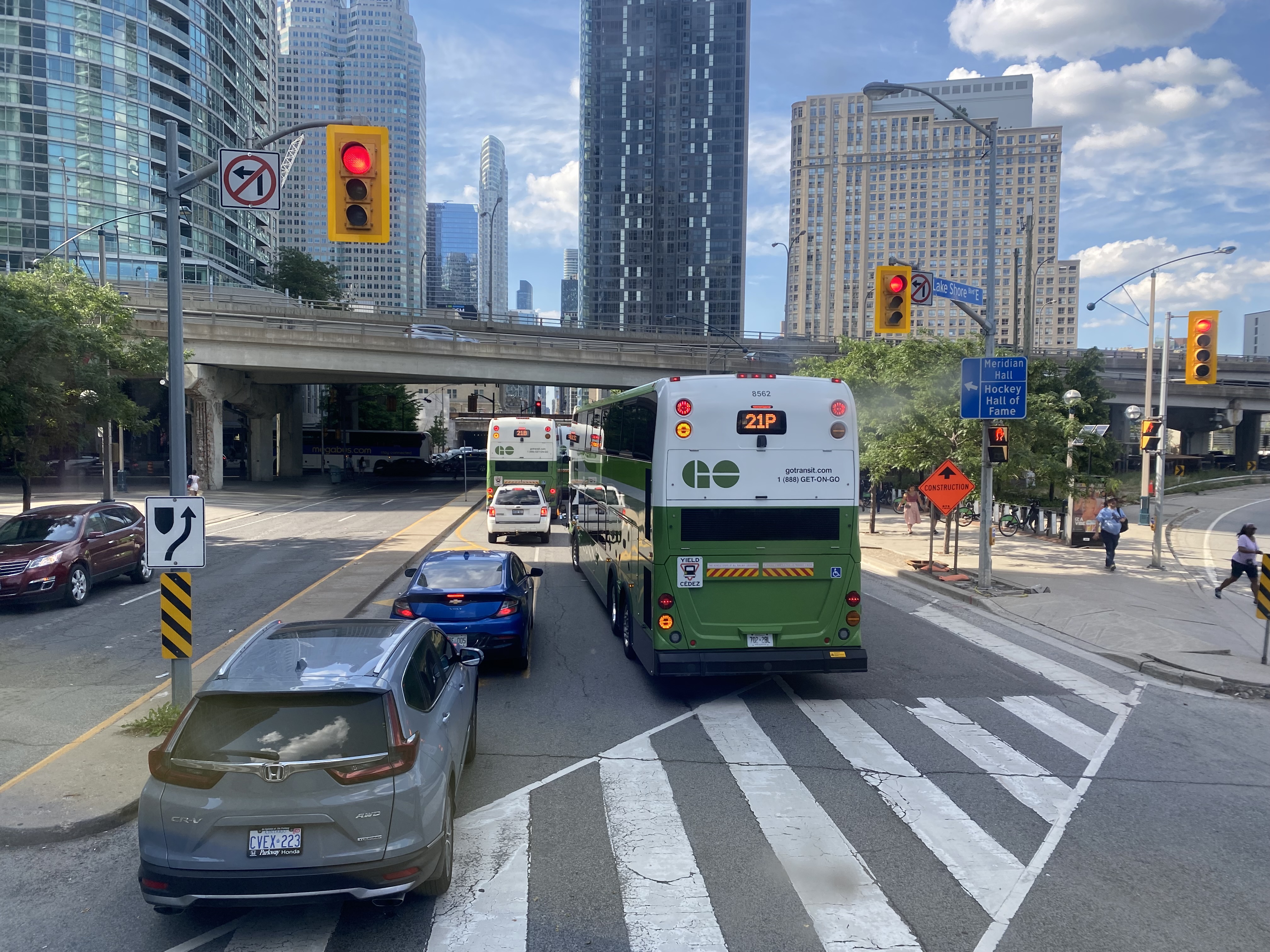
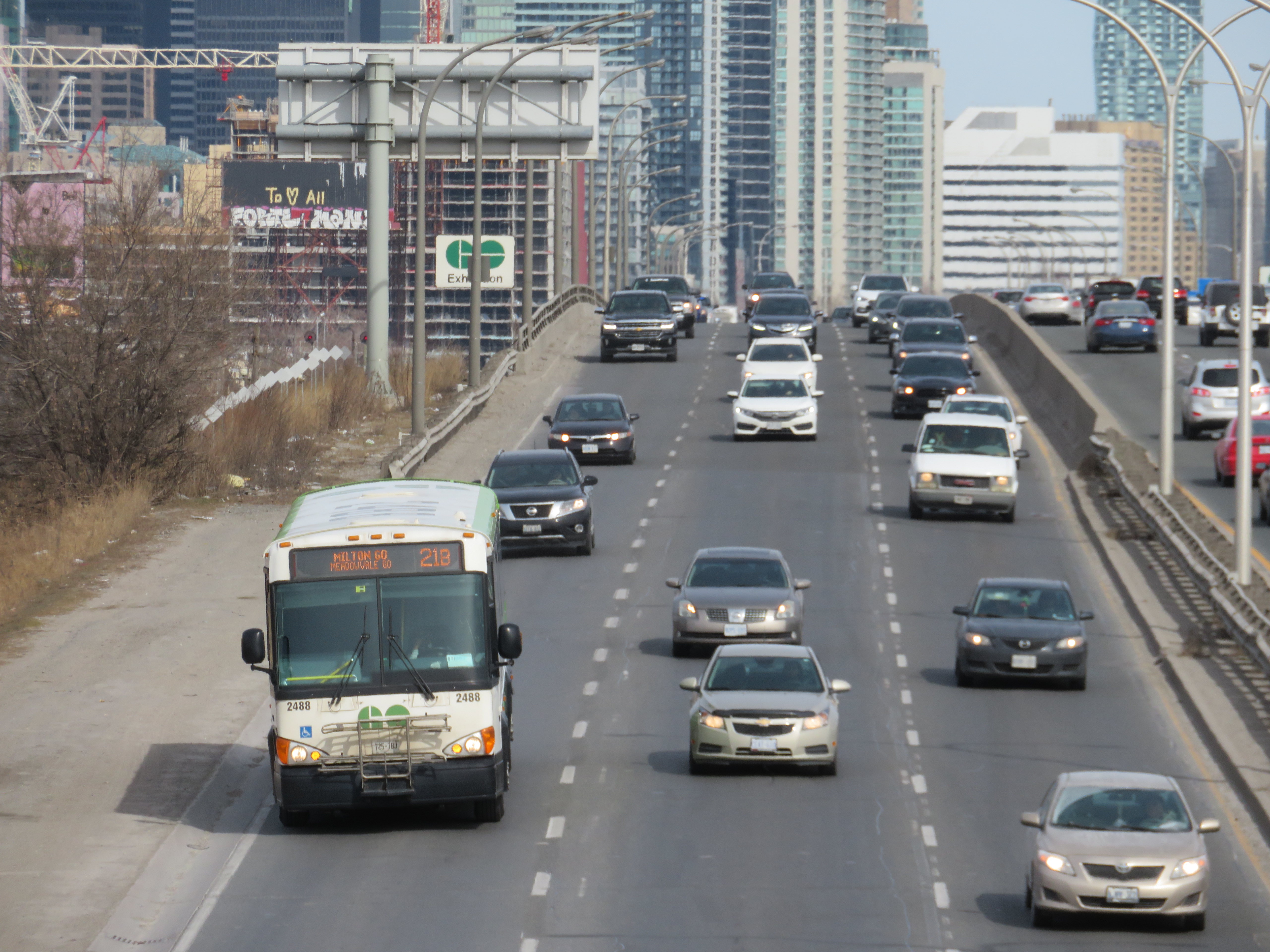
    GO Transit bus on the Gardiner Expressway. Route 21 will se major changes with the new schedules

    On Saturday, April 8, GO Transit will introduce big changes to its rail and bus services. Brampton and Waterloo Region will see the biggest benefits, while a major gap in Ontario’s intercity bus network will finally get filled.

    However, major construction work on the Barrie and Stouffville Lines will require the bustitution of most trains on those two corridors for at least a few months. Most buses serving the Milton Line will no longer operate to or from Union Station, but instead connect with the Lakeshore West Line. Finally, one of GO Transit’s oldest bus routes will finally disappear for good.

    Though the scale of these service changes is truly impressive, there are some drawbacks that hopefully will be addressed in the near future.

    Kitchener Line/Route 30

    Map of the GO Transit Kitchener Line, with bus routes 30, 31, and 33.
    From the official timetable.

    As part of the April 2023 changes, GO Transit will finally introduce hourly weekend service on the Kitchener Line between Union Station and Mount Pleasant GO in northwest Brampton. Most Route 31 “train-bus” trips will be cancelled, while Route 33 (Guelph-Brampton-North York) takes over the Guelph via Highway 7 service completely.

    With the exception of weekday counter-peak periods, early mornings, and late evenings (when Route 31 will still operate), Brampton finally has the all-way, two-way, every day train service it has been requesting for decades. Because of schedule constraints, and limited track space, weekend trains will not be stopping at Etobicoke North.

    Route 30, the Bramalea-Kitchener-Waterloo bus, will also operate 7 days a week, with an easy transfer at Bramalea GO Station. This is the fastest and most frequent service between Toronto and Kitchener-Waterloo (private intercity bus service to Kitchener are limited, and they only stop at Sportsworld, near Highway 401), and should help build ridership for future train service expansion.

    Unfortunately, there remains no quick GO bus service between Toronto, Brampton, and Guelph; passengers must still endure the Route 33 milk run on Highway 7 through Georgetown, Acton, and Rockwood. Weekend service on Route 48, the Guelph-Bramalea-Highway 407 route, timed to connect to Kitchener Line trains, could provide this useful link until track capacity is improved west of Bramalea and through Halton Region and Wellington County.

    But finally, Bramalea GO Station, with its new bus loop and easy transfers, fulfills its promise as a useful intermodal transit hub.

    Route 17: where GO Transit has never gone before
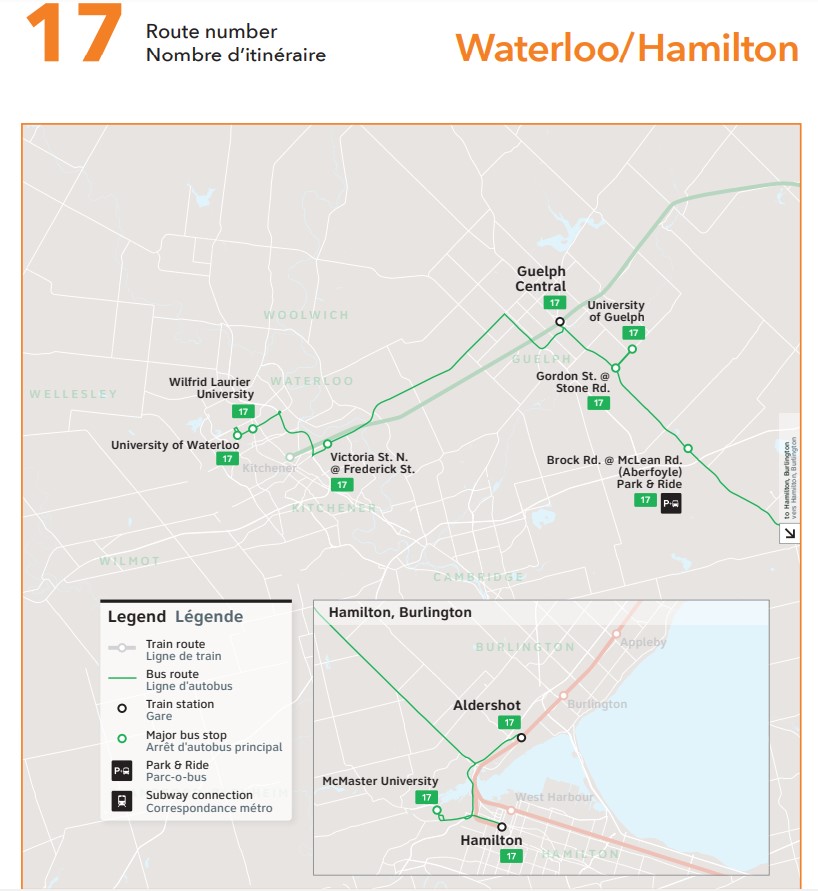
    Map of GO Transit Route 17, connecting Waterloo, Guelph, and Hamilton.
    From the official timetable.

    The introduction of GO Transit Route 17 between Kitchener-Waterloo, Guelph, and Hamilton is, in my view, even more significant than the new weekend train service on the Kitchener Line.

    This new bus route is the first time a GO Transit service has gone against its 55-year-old business model of a Toronto-centric system, where all train services converge on Union Station, and all bus services supplement the train corridors or connect to a suburban Toronto terminal. This might even be the most significant GO Transit service change since the first Highway 407/York University bus service began in September 2000. The 407 Corridor, originally a single bus route connecting Oakville, Mississauga Square One, Bramalea, York University, and Markham, has expanded into a multi-branched 24-hour/7-day corridor that now extends to Oshawa, Guelph, and Hamilton.

    Route 17, which will run hourly on weekdays, directly serves four university campuses (University of Waterloo, Wilfrid Laurier University, University of Guelph, and McMaster University), a record for any single bus route in Canada (only the TTC Yonge-University Subway serves as many university campuses in a one-seat ride). It also provides a direct Guelph-Kitchener-Waterloo link (which was only provided by infrequent Greyhound buses before 2020) and replaces former Coach Canada/Megabus routes abandoned prior to or during the COVID-19 pandemic.

    Though Route 17 finally fills several gaps in the Greater Golden Horseshoe, it is, at best, a first good step.

    For one thing, Route 17 is too slow to effectively serve as a great Kitchener-Waterloo/Hamilton connection. The travel time from University of Waterloo to Downtown Hamilton is between two hours and twenty minutes and two hours and thirty minutes. The typical driving time is about one hour. It is more competitive between Guelph and Hamilton, though the route diverts to Aldershot GO Station to connect with the GO Transit Lakeshore West corridor, adding 15-20 minutes of travel time over a direct McMaster/Downtown Toronto routing.

    Finally, there is no weekend service offered at this point, and the new route misses Downtown Kitchener, diverting via the Conestoga Parkway, though a stop at Victoria and Frederick Streets east of downtown provides connections to several GRT bus routes. There is also a need for better connections between Cambridge and Guelph, something that GRT, Wellington County, and Guelph should work together to fix.

    I am hopeful that the new hourly weekday service is attractive to students and commuters, and that ridership grows to a point that GO considers weekend service and either express runs, or a restructuring of the corridor to provide more direct services.

    On Wednesday, March 29, I spoke to Craig Norris on CBC Kitchener’s Morning Edition about new Route 17, weekend service on Route 30 and the implications for Waterloo Region and beyond.

    Untangling Route 21
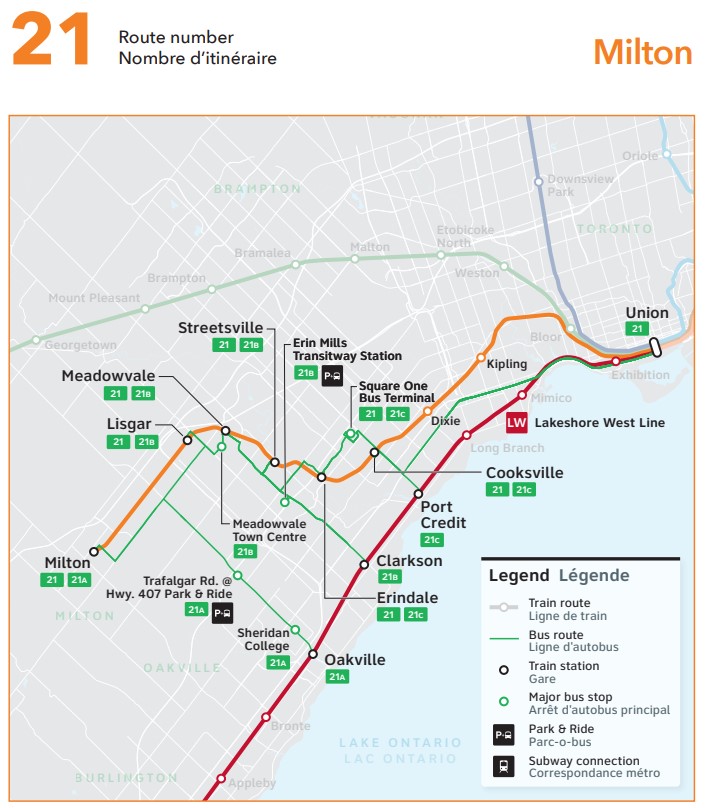
    Map of the Milton Line and Route 21, after the April 8 2023 service change.
    From the official timetable.

    Route 21, the Milton GO bus corridor, provides Milton-Mississauga-Toronto service at all times except the weekday peak period direction, when GO operates seven trains between Milton and Union Station. Unfortunately, the busy Milton Corridor is Canadian Pacific’s mainline between Toronto and Chicago. Unlike CN (whose mainline is used by GO’s Kitchener Line between Bramalea and Georgetown), CP has been less amiable to GO service expansion outside the peak period window.

    Because of passenger demand in central Mississauga, Route 21 has traditionally been one of GO Transit’s most complex routes, with ten distinct branches, with service to each station every 15-30 minutes at most times. With increasing traffic into and within Downtown Toronto, especially on summer weekends, Route 21 can be very slow and unreliable, with GO Transit forced to divert its buses on Route 21 and 31 away from its Union Station Bus Terminal to Port Credit GO.

    Though weekend train service on the Kitchener Line solves the problem for Route 31, without access to CP’s tracks, Milton Line passengers must ride buses, which have to go somewhere.

    The solution, then, was to permanently divert Milton Line buses to the Lakeshore West rail corridor. Route 21A will operate between Milton GO Station and Oakville GO Station, serving Sheridan College’s Oakville campus and the 407 Corridor at Trafalgar Road (allowing for new transfers from Milton to Hamilton/McMaster and Mississauga/Pearson Airport). Route 21B will run from Lisgar GO, serving Meadowvale GO, Streetsville GO, and Erin Mills Transitway Station before connecting to trains at Clarkson GO. Route 21C runs between Erindale GO, Square One, Cooksville GO, and Port Credit GO. Only during early mornings and late evenings will Route 21 serve Union Station, making all stops to and from Milton.

    Dixie Station also loses its weekday Route 21 service. The station is not well connected with local transit nor is it in a walkable area, so it is completely dependent on drive-up traffic. That should be fine for commuters who can rely on the regular train schedules, and who don’t need to leave Toronto early or late, but it worth pointing out.

    These changes simplify Route 21, and provide a reliable and predictable, albeit slower, connection to Downtown Toronto. They provide new connections to the busy Highway 407 bus corridor, and allow GO to divert buses and drivers to other services.

    One thing GO can do to improve the utility of its realigned bus service is operate the new branches at all time periods to maximize ridership. For example, Route 21A, while providing new useful links between Milton, the Highway 407 corridor, and Sheridan College, does not run in the peak direction when the Milton Line trains are running, with no southbound buses from Milton to Oakville between 5:03 AM and 9:28 AM. A similar gap exists northbound in the late afternoon on weekdays.

    Other changes

    The Stouffville Line, which enjoys hourly train service seven days a week, goes down to just peak period rail service starting April 8. Work to double-track the corridor through Scarborough has been continuing, albeit slowly, so hopefully the suspension of off-peak trains will help speed up construction. Work to expand the Lakeshore East/Stouffville corridor through Toronto’s east end has also forced train service reductions between Toronto and Oshawa.

    On the Barrie Line, there is similar ongoing work to double track sections of that line continue, including a new viaduct over the CP mainline near Dupont Street. Off-peak trains that normally go as far north as Aurora are being replaced by buses, with limited weekend trains to Allandale Waterfront Station in Barrie continuing in service.

    Route 81, one of the older bus routes in GO Transit’s network, will finally disappear. The bus route, connecting Whitby GO Station, Port Perry, and Beaverton, has seen low ridership, with alternative service provided by Durham Region Transit’s Route 905 to Port Perry and DRT’s rural on-demand service.

    Finally, though they are not amongst the major upcoming changes, GO Transit’s services to Orangeville and Peterborough remain inadequate. Route 37, between Brampton and Orangeville, still does not operate on weekends, nor is there a morning northbound bus from Brampton. Ironically, there is better service leading north from Orangeville towards Shelburne, Dundalk, and Owen Sound operated by Grey County’s rural bus system.

    Meanwhile, Route 88, which connects Oshawa GO Station with Peterborough and Trent University, was diverted several years ago to serve Bowmanville, replacing since-cancelled Route 90. Unfortunately, this results in a long, nearly two-hour bus ride between Oshawa and Trent University, or four hours between Toronto Union Station and Trent. The drive, with moderate traffic, is less than half that. Though Rider Express now operates a bus from Toronto to Ottawa via Peterborough, it only runs once a day, four days a week.

    It would be great if GO Transit could speed up Route 88 to make it a viable and attractive option between Toronto, Durham Region, and Peterborough.

    Finally

    On the whole, I am pleasantly surprised by GO Transit’s April service changes. Weekend service on Route 30 and the new Route 17 between Hamilton, Guelph, and Kitchener-Waterloo close some major gaps in that part of the province. The Route 21 changes make a lot of sense and open up new connections, though many bus passengers will not be happy with the new forced transfer to get to or from Downtown Toronto. Though bustitutions on the Barrie and Stouffville Lines are not ideal, they will allow for important work to improve rail service on those two corridors. Finally, attention to bringing faster and fuller service on some bus routes – like 21A, 37, and 88 will help build a complete transit network across the Greater Golden Horseshoe.

  • Montreal: a tale of two busways

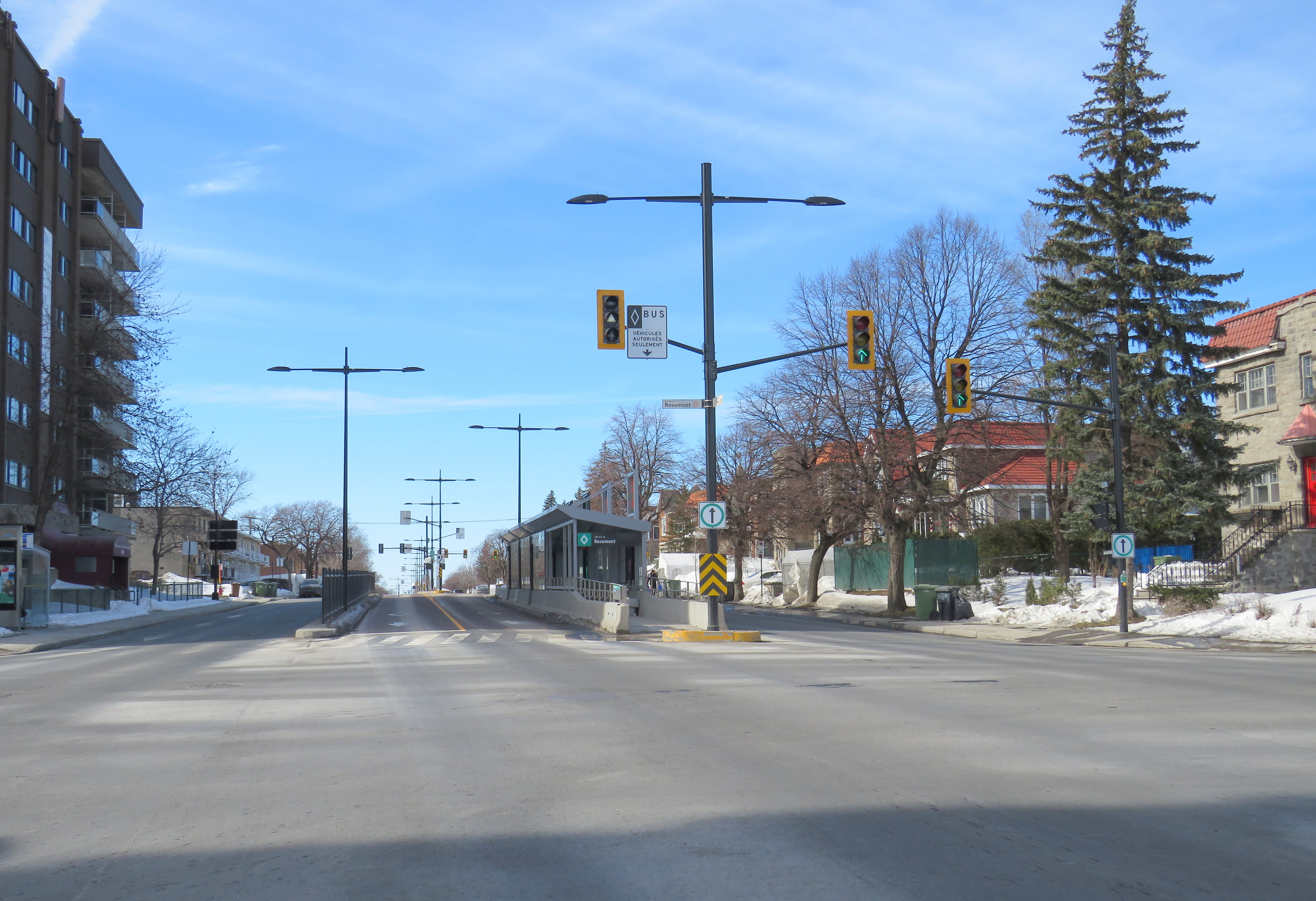
    The new Pie-IX SRB (BRT) corridor, at Rosemont

    Across Canada, our biggest cities are building new transit. Here in Toronto, the Crosstown and Finch West LRTs are well underway (though the first phase of the Eglinton-Crosstown is already three years late), as well as the Scarborough subway expansion, the Ontario Line, and GO Transit corridor improvements. Vancouver is building a major expansion to its Skytrain network, the Broadway Subway. Ottawa, Calgary, and Edmonton are all expanding their LRT networks. And in Montreal, the first phase of the Réseau express métropolitain (REM) will open for service, while major work on the Blue Line Métro extension has just begun.

    While Greater Montreal has been busy with rail transit projects, it has also opened two new busways: on Boulevard Le Corbusier in Laval, and on Boulevard Pie-IX on Montreal’s east side. The Laval busway was completed in late 2017. The SRB Pie-IX corridor was mostly completed by the end of 2022, though a section near Boulevard Jean-Talon remains under construction for the Blue Line Métro extension.
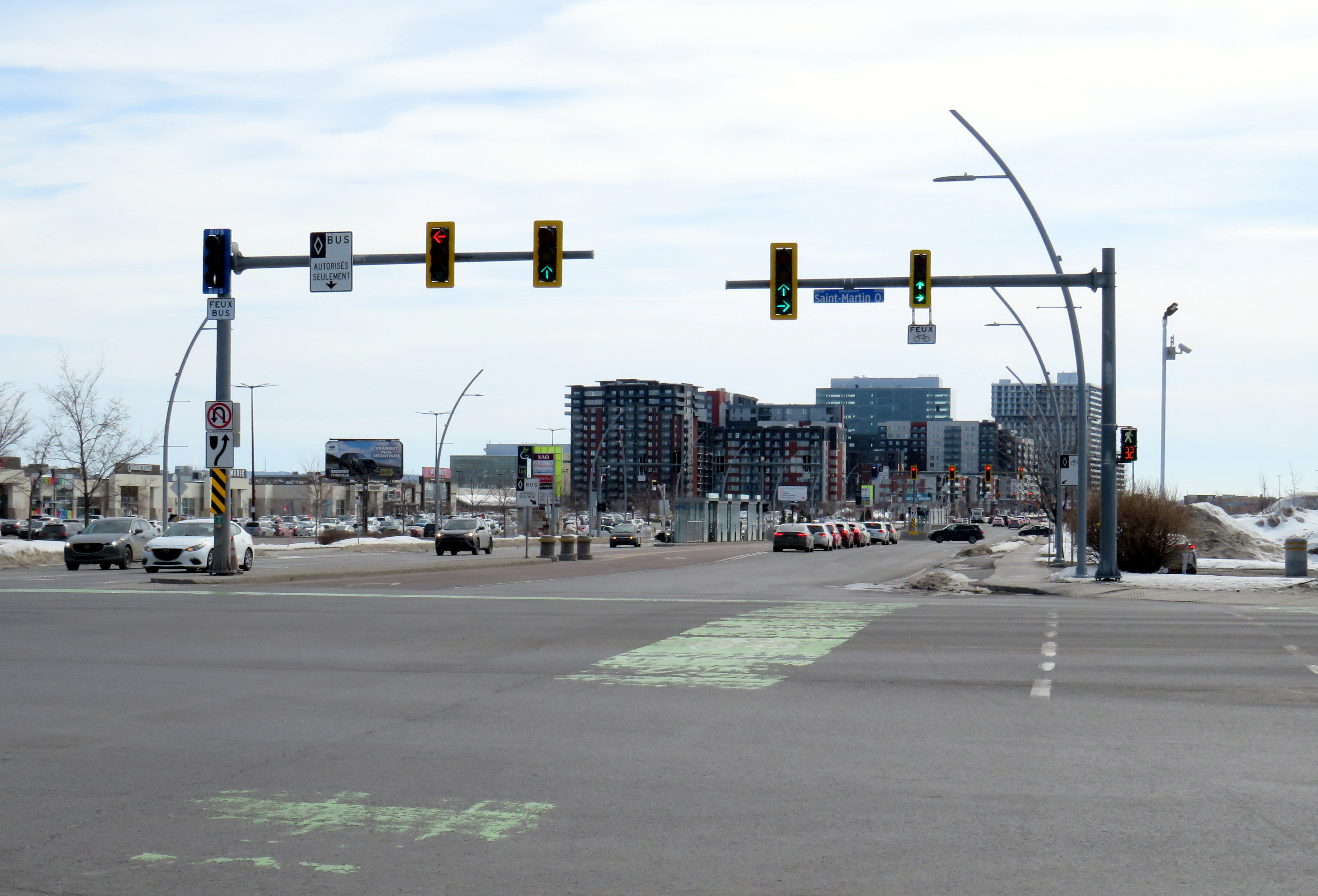
    Laval’s Boulevard Le Corbusier

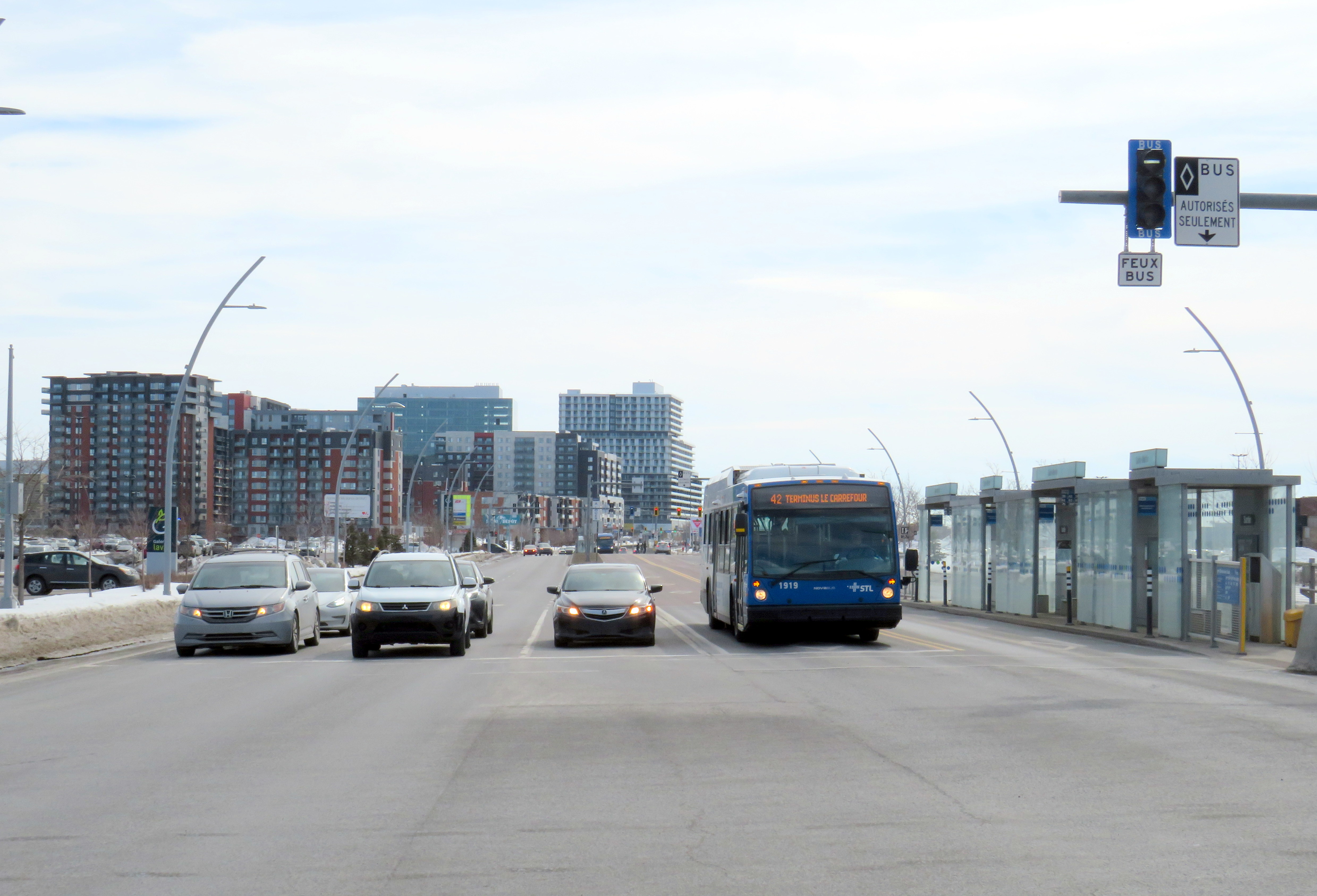
    Looking south on Le Corbusier at Boul. Saint-Martin

    Laval, a sprawling suburban municipality immediately north of Montreal Island, has a population of over 400,000. Though the large island has several historical town and village centres, the municipality is mostly made up of suburban subdivisions, shopping centres, low-rise apartment buildings, crisscrossed by several autoroute highways, including the A-13, A-15, A-19, A-25, and A-440. Despite the post-war sprawl and auto infrastructure, the far eastern end of the island remains largely agricultural.

    After the extension of the Orange Line Métro into Laval in 2007, the city of Laval has worked towards urbanizing its geographical centre into “Centre-Ville Laval.” Laval’s new downtown core would consist of new and expanded educational institutions, new cultural and entertainment venues, office and high-tech employment, along with new higher-density, urban-scaled residential development. The new city centre would be focused on Boulevard Le Corbusier northward from Montmorency Métro Station, in an area lined with aging commercial properties.

    During my March visit to Laval, some of the progress on Centre-Ville Laval was evident. A new sports and concert venue, Place Bell, opened in 2017, luring the Montreal Canadiens’ AHL affliate from St. John’s. (Place Bell should not be confused with Centre Bell, the home of the Canadiens, also located on the Orange Line). The Université de Montréal also opened a suburban campus next to the Métro station. Slowly, mid-ride condo buildings were built on the south end of Le Corbusier, within walking distance from the campuses and transit links.

    New residential development on the south end of Boul. Le Corbusier, in the near distance

    To support the planned growth of Laval’s city centre, a new busway was built northward, towards the massive Carrefour Laval shopping centre, a Cadillac Fairview-owned mall that dominates Montreal’s north suburbs. The busway passes between older, smaller shopping malls, such as Centre Laval and Galleries Laval, which will one day get redeveloped. Building the new busway, along with semi-protected cycling lanes, was clearly a way of indicating the municipality’s urban planning goals.

    Unfortunately, the Laval busway reminded me of the things I disliked most about York Region’s Viva Rapidways. For one, the Laval busway doesn’t speed up bus service. It is only one kilometre long, and does not properly connect with either the bus terminal at Montmorency Métro or the bus terminal across the street from Carrefour Laval. Buses must re-enter mixed traffic at both ends of the route. As in Toronto and York Region, left-turning cars are prioritized at each traffic light, and there was no apparent transit priority.

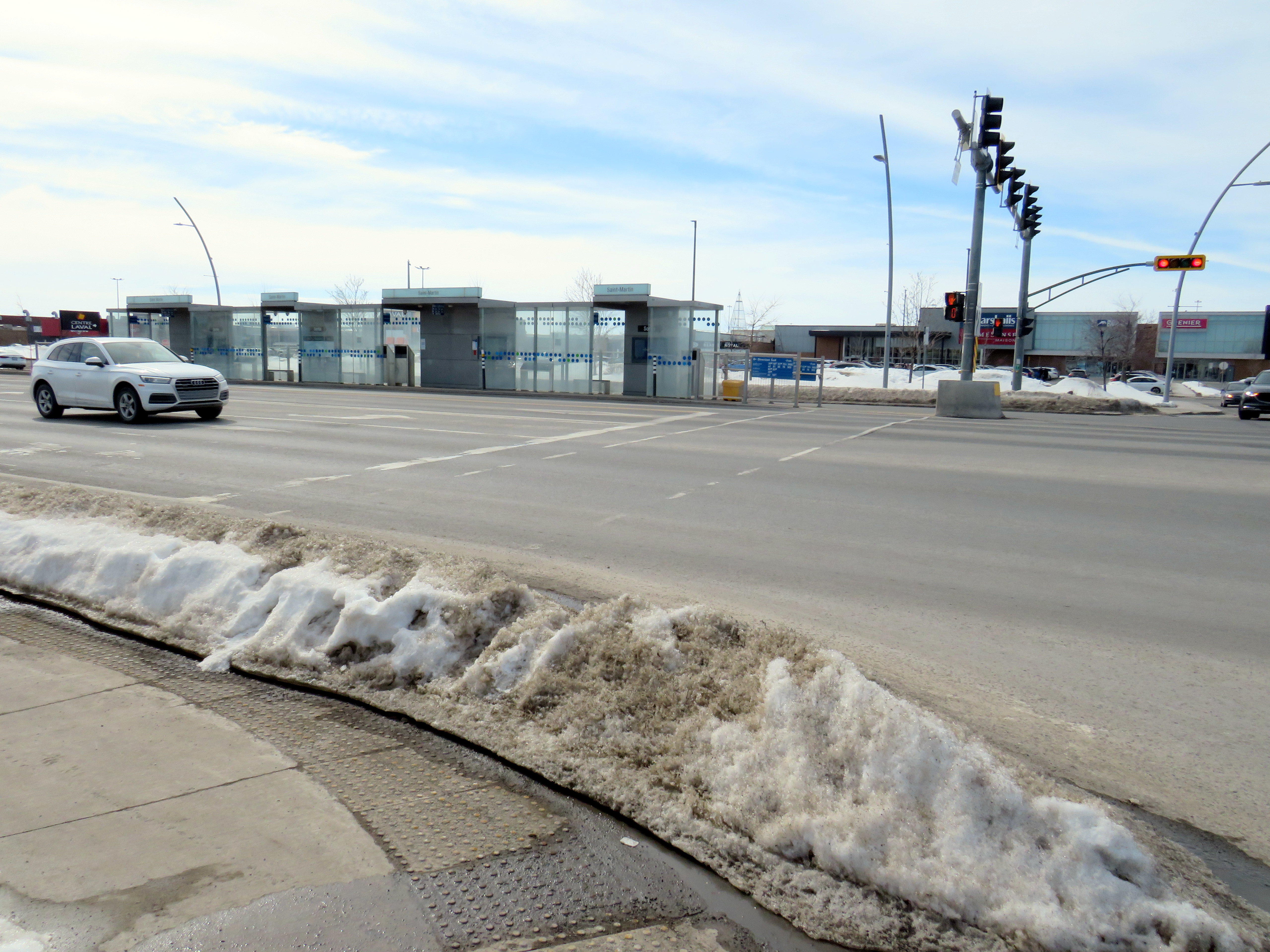
    The median bus stops are also difficult to get to. Despite many days since Montreal’s last significant snowfall, and bone-dry sidewalks and roadways, the curbs and crosswalks were left uncleared. This forces pedestrians to either mount the piles of old, packed, crusty snow, or divert into the roadways to cross the street. The bike lanes were merely a convenient snow storage space.

    Laval should be embarrassed by its inaccessible crosswalks and bus infrastructure

    For a Saturday morning, transit service on the busway was adequate, but not especially impressive. The Société de transport de Laval, the municipal transit agency, operates a free shuttle bus on weekends, holidays, and summer weekdays between Montmorency Métro and Carrefour Laval every 20 minutes. Otherwise, bus service was sporadic despite multiple routes using the busway: two or three buses would come at once, followed by a gap of 10 or 15 minutes.

    Quebec’s unique traffic signals were both interesting for out-of-province visitors and frustrating for pedestrians. In Ontario and most other jurisdictions, a right green arrow indicates absolute right-of-way for right-turning motorists. In Quebec, it merely indicates that motorists have a green signal to turn right, regardless of conflicting movements. Outside of Montreal, motorists are permitted to turn right on a red light, unless signed otherwise. This is not great signalization, especially on high-speed suburban roadways.

    Right-turning motorists have the green arrow to turn right, conflicting with pedestrians (which have the walk signal) and cyclists

    However, bus signals are unmistakable from general traffic signals, with white bar aspects (and a white triangle instead of an amber light). That’s one thing that is done better than here in Ontario.

    Montreal’s SRB Pie-IX

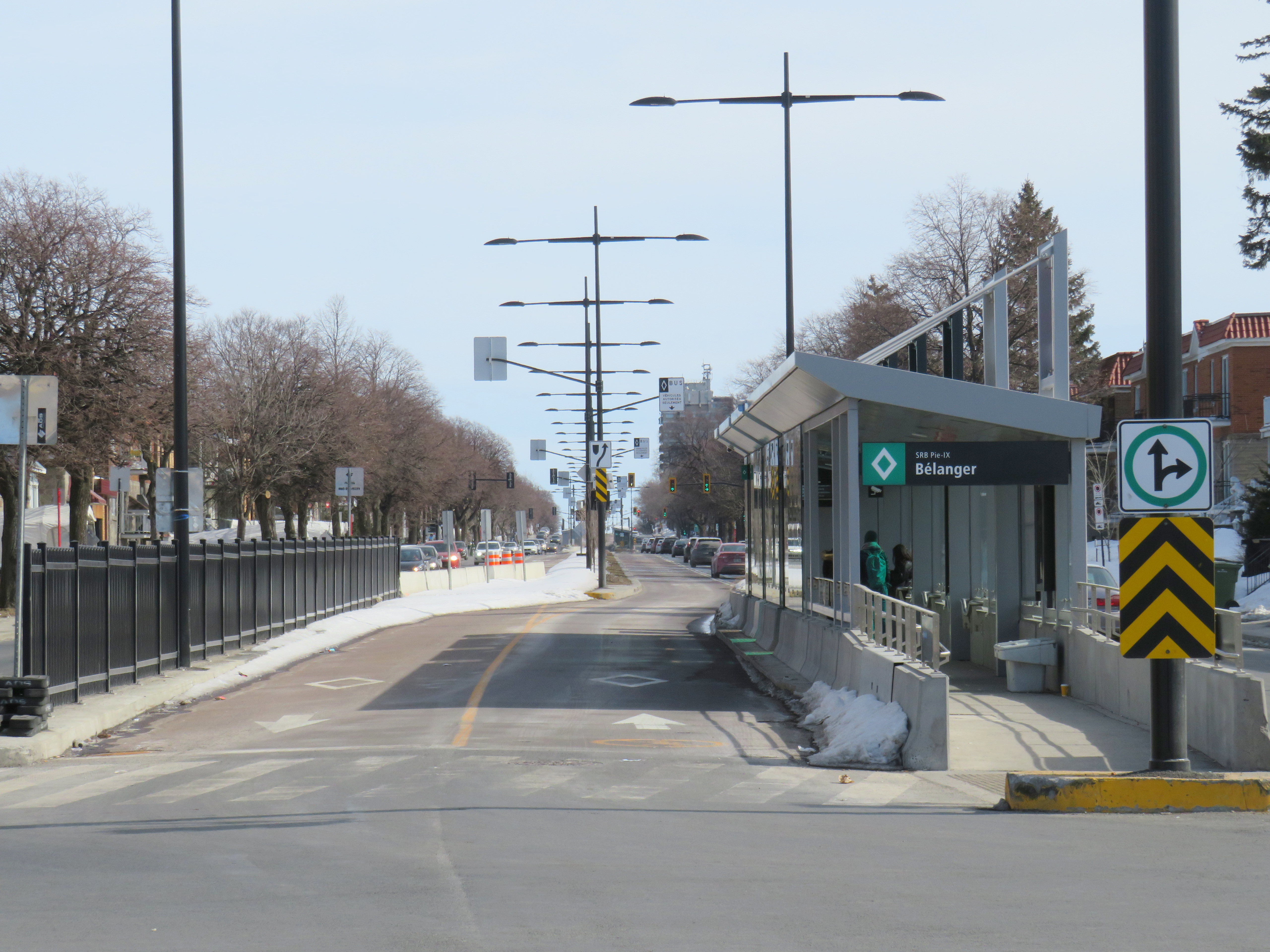
    Looking south on Boul. Pie-IX from Rue Bélanger

    The SRB (BRT) corridor on Montreal’s Boulevard Pie-IX, which I visited later the same day, was a welcome contrast to Laval’s implementation. Boulevard Pie-IX (named for Pope Pius IX, the founder of the dogma of papal infallibility), is a wide north-south boulevard on Montreal’s east side, passing through Hochalaga, past Olympic Stadium and the Botanical Gardens, all the way into Laval. It’s a busy bus corridor, feeding into the Métro Green Line as well as the future extension of the Blue Line to Anjou.

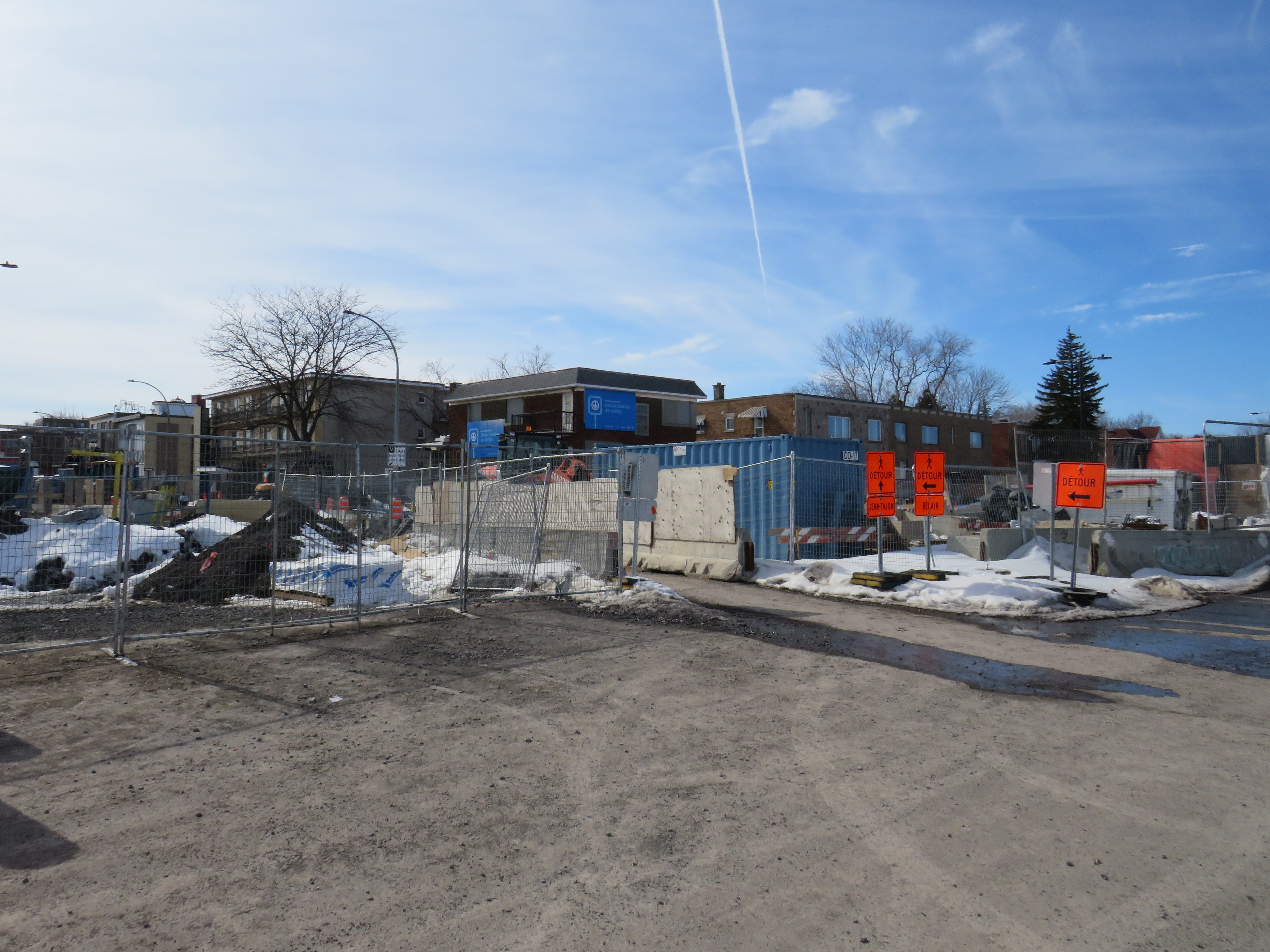
    The intersection of Pie-IX and Jean-Talon, where a new Métro station is under construction

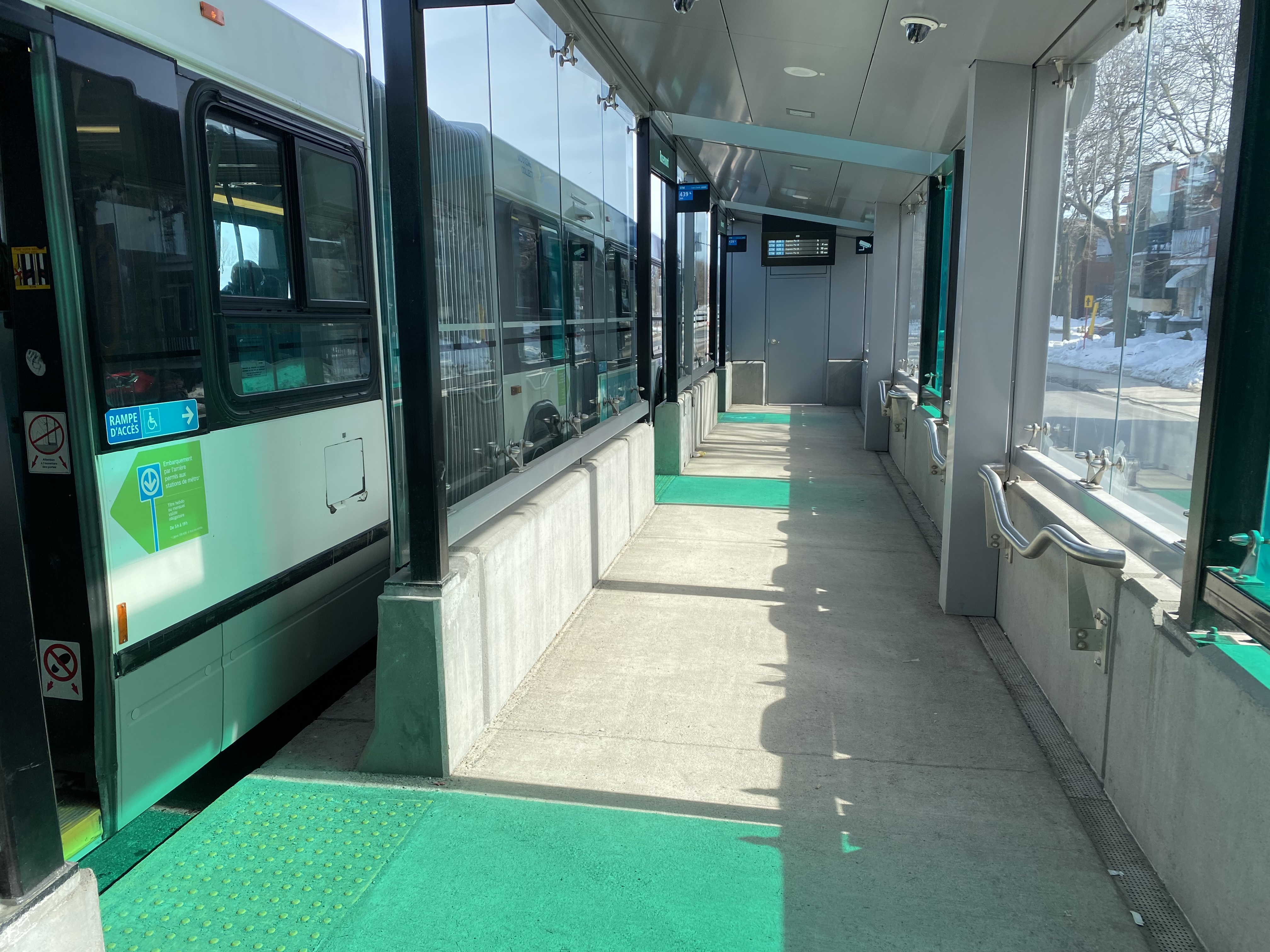
    The 439 SRB route parallels the local 139 Pie-IX bus, and like other median busways, passengers board and exit at stops at the far side of the intersection. Though there is no fare pre-payment, passengers are permitted to board at rear doors with a valid Opus card or ticket. Shelters are simple, but the stained green glass lines up nicely with the gaps where the bus doors open.

    Inside a SRB shelter

    Unlike median busways elsewhere in Ontario or Quebec, buses are not slowed down by left-turning motorists as left turns are prohibited along the entire SRB corridor. This simplifies operations, allows for easier transit priority, and reduces the space required at intersections for dedicated left turn lanes. Unlike Laval, the crosswalks in Montreal were cleared and easy to traverse in winter.

    Left turns are banned along the entire SRB corridor. Note the triangle light on the bus signal.

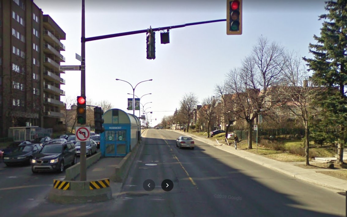
    The current bus rapid transit alignment replaces an older, more dangerous set up where there was a central median where the inner lane was dedicated to buses in the opposite peak (contraflow) direction during weekday rush hours. Buses assigned to Pie-IX were equipped with special flashing arrows to warn oncoming motorists, along with overhead lights indicating the lane restriction. After several serious collisions, the arrangement was abandoned.

    2009 Google Streetview image of the old Pie-IX express bus arrangement, where buses in the AM peak used the leftmost northbound lane to travel south, stopping at the median shelter. In the PM peak, northbound buses used the rightmost southbound lane.

    Once again, Montreal shows how buses can be sped up without compromising safety or road space. Restricting left turns along the entire corridor was the right choice, and a solution that should be considered along some of Toronto’s busiest bus corridors as well.

    Finally, rapid transit corridors on arterial roads are reliant on walk-up traffic, and should therefore be as easy and safe as possible to walk up to the transit service. This means effective and quick snow removal at crosswalks, pedestrian priority (there should be no beg buttons to push to access BRT/LRT stops), and proper pedestrian infrastructure and a walkable realm. The Viva Rapidways and the Laval Boul. Le Corbusier fail this basic criteria, while Montreal does a better job.

    As Greater Toronto area plans more arterial LRT and BRT corridors, such as on Dundas Street in Mississauga/Oakville, and on Queen Street in Brampton, it would be wise to put transit and active transportation first, even if it means sacrificing a few left turn lanes.

  • A transit tour of Southwestern Ontario

    Huron Shores Transit bus stop in Grand Bend

    In January 2023, while visiting the site of the now-demolished Sarnia Eaton Centre, I took advantage of two new rural transit services serving Southwestern Ontario: Strathroy-Caradoc Transit and Huron Shores Area Transit. While both services connect London and Sarnia, they operate as separate services with different fares; they also have different terminals.

    Strathroy-Caradoc Inter-Community Transit bus at Lambton Mall in Sarnia

    Strathroy-Caradoc Transit offers the most direct service between London and Sarnia, with stops at London International Airport, Downtown London (on York Street near the VIA Station), Komoka, Mount Brydges, Strathroy, Lambton Mall, and Downtown Sarnia.

    The regular cash fare between London and Sarnia is $20, though from London or Sarnia to Strathroy, the fare is $10. On my westbound trip on Sunday, January 29, the schedule allowed for a quick washroom and coffee break in Downtown Strathroy, a necessity given the long ride on a small minibus.

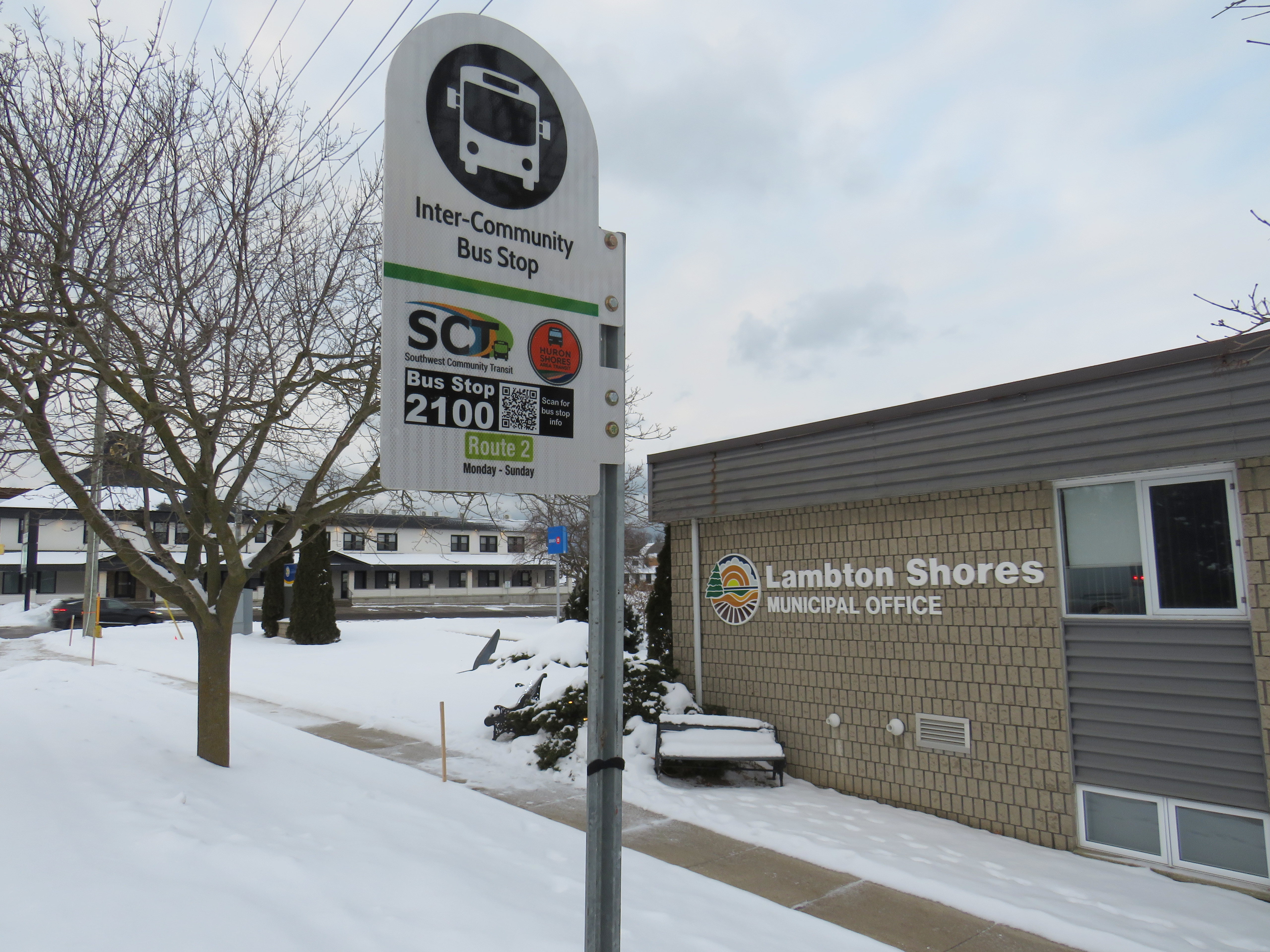
    Returning the next day from Sarnia, I opted to ride Huron Shores Area Transit (HSAT) back to London. HSAT, which is also contracted to Voyago, connects several communities in Lambton, Huron, and Middlesex Counties. All four HSAT routes converge in the summer resort town of Grand Bend. Two routes operate seven days a week (Route 1, connecting Sarnia, Forest, Thedford, and Kettle Point & Stoney Point First Nation, and Route 2, serving Exeter, Lucan, Centralia, and London). There are two additional routes operating two days a week from Grand Bend to Goderich and to Parkhill and Strathroy.

    Unlike Strathroy-Caradoc, HSAT operates on a flat $5 cash fare. Even though I was traveling the long way between Sarnia and London, with an hour-long layover in Grand Bend, I was offered a slip of paper marked by the driver that allowed me to board the second bus without a second fare. Huron Shores buses have bike racks, though the operator recommends calling ahead to ensure their availability.

    While Strathroy-Caradoc Transit serves downtown London and Sarnia, HSAT’s buses go only as far as the first major destination in both cities. The Sarnia stops for Route 1 are at Lambton College and nearby Lambton Mall, while the London stops on Route 2 are on London’s north end, near Masonville Place and at the University Hospital on the Western University campus. Getting downtown requires a transfer to Sarnia or London Transit.

    Huron Shores Area Transit bus at London’s University Hospital. Note the bike rack.

    Though VIA Rail still operates one daily train between Toronto, London, and Sarnia, it is not on a convenient schedule for most passengers (it leaves Sarnia early in the morning and arrives late in the evening), so the new bus services fill a key role in providing mobility options. Though it is more expensive, the Strathroy-Caradoc route is the direct and the fastest connection. But Huron Shores trip is the more scenic and cheaper ride.

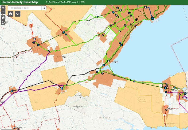
    I updated my Ontario intercity transportation map for April 2023 to include the major GO Transit service changes, the gradual resumption of some Ottawa commuter bus routes, the start of Travelways bus service between Detroit, London, and Toronto, and minor route and service changes elsewhere in the province.


    The hour-long layover in Grand Bend gave me a chance to wander the town. On the main street, almost every business was closed for the season. There was very little traffic on Main Street, so it had a bit of a ghost town feel. On Highway 21 and to the east, however, typical chain stores like Tim Hortons, Sobey’s, and Shoppers Drug Mart serve the year-round population.

    Grand Bend’s famous beach — in January
    Hello Sunshine
  • A better Bramalea Station, finally

    A better Bramalea Station, finally

    I have written a lot about Bramalea GO Station on this website. In 2016, I wrote about the poor pedestrian, cycling, and transit access to the station; in 2020 I was stranded at the station because of poor train-bus connections, and in 2021, I compared the construction of a new parking garage at Bramalea to a new parking lot at nearby Brampton GO Station.

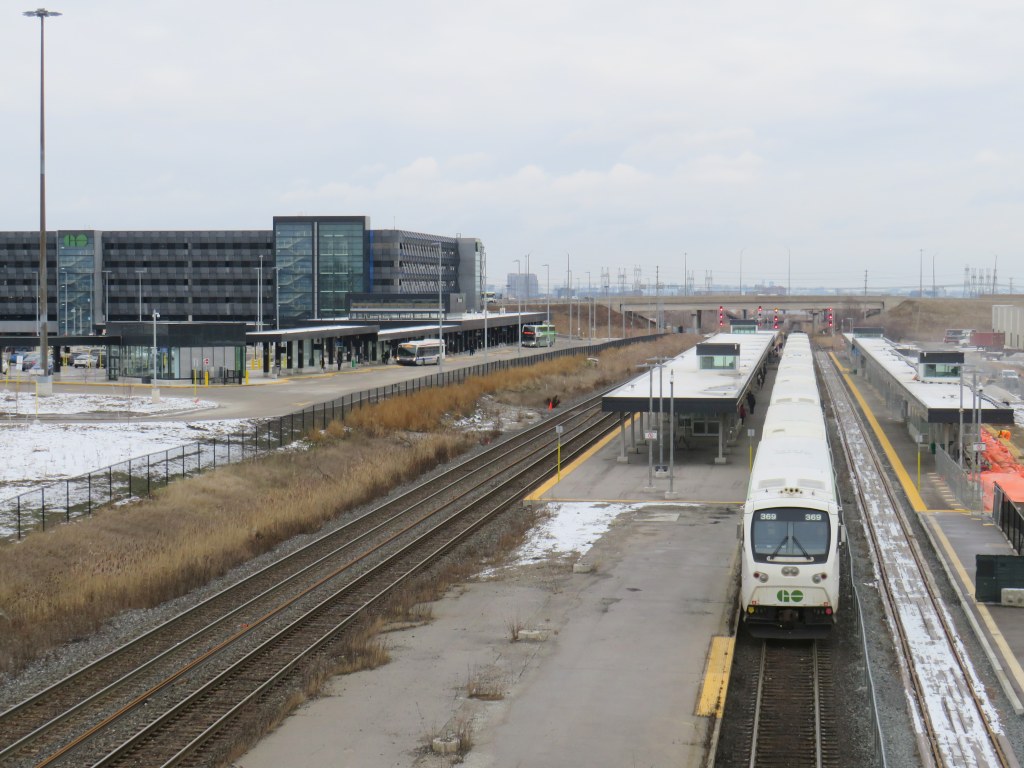
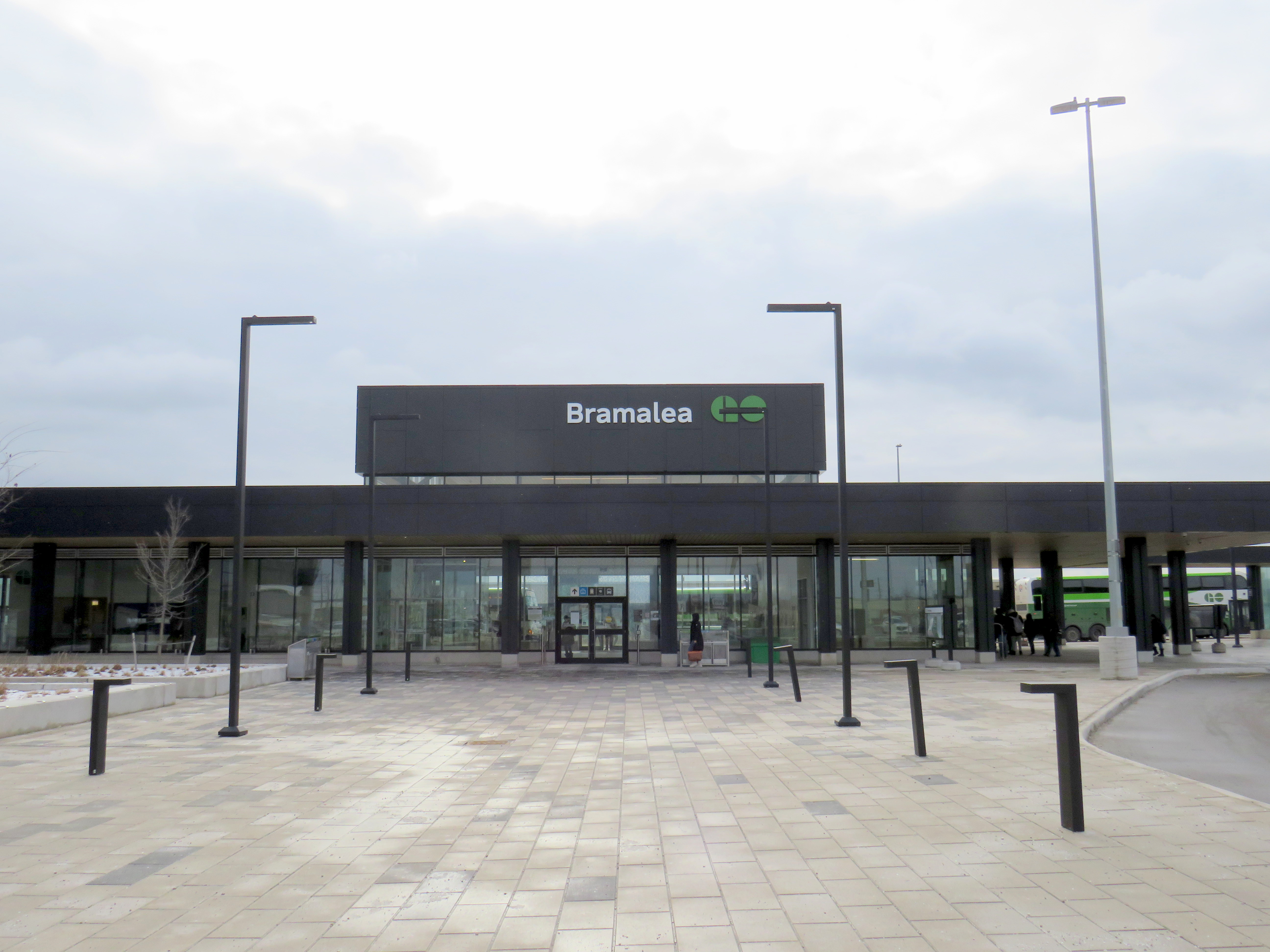
    But in January 2023, I returned to Bramalea GO Station and came away feeling satisfied. Metrolinx has finally built a Bramalea GO Station that works. Now it is time to use the rebuilt station to its full potential.

    (more…)
  • Middle America’s transit oddities

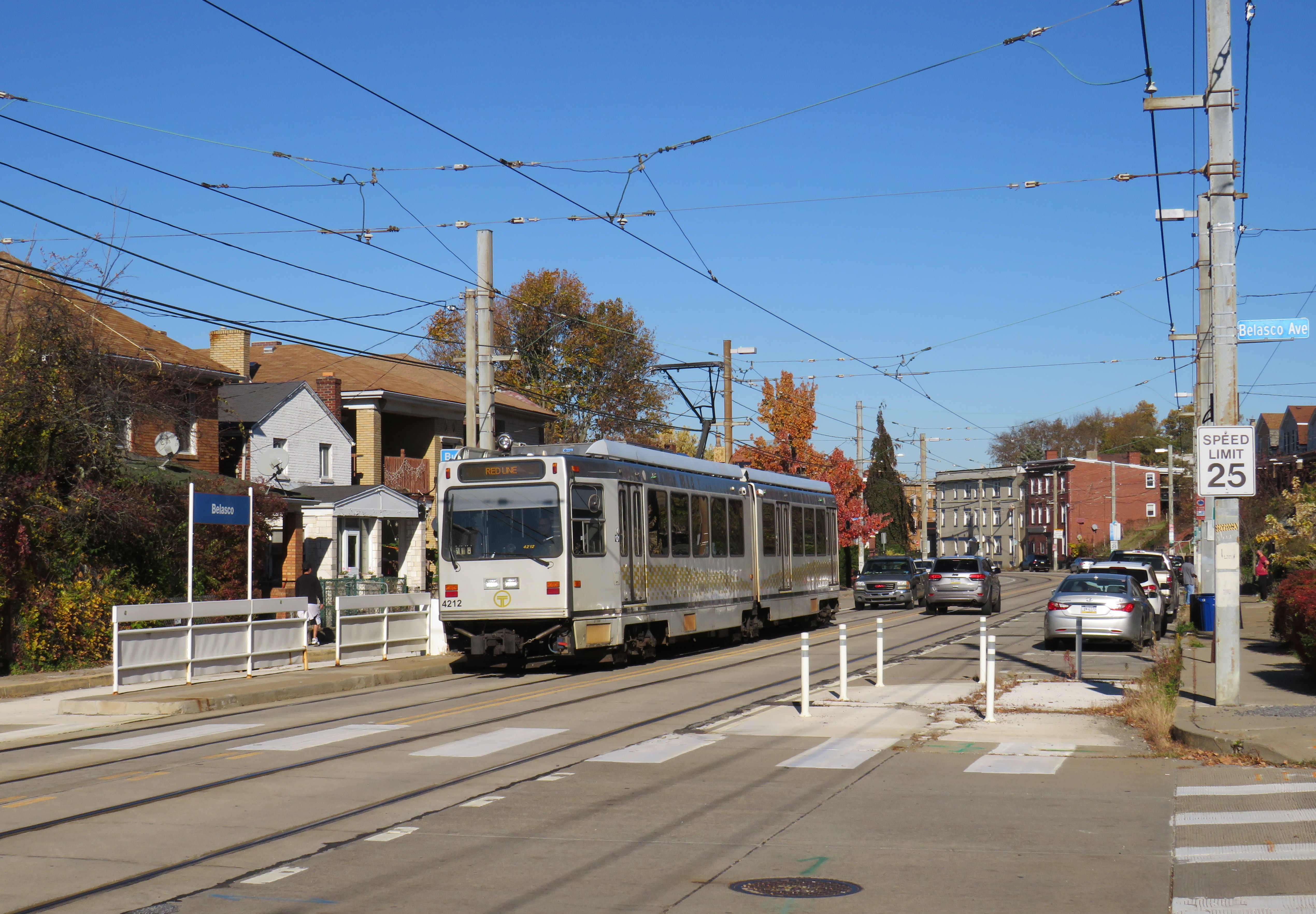
    Pittsburgh Regional Transit Red Line train in the Brookline neighbourhood

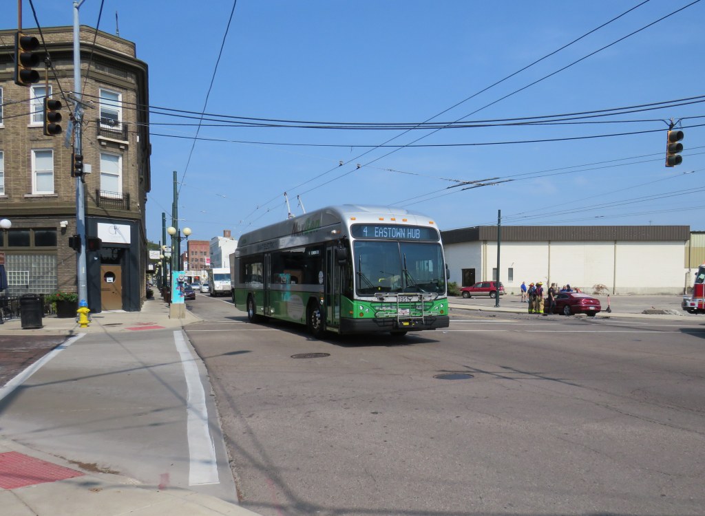
    In 2022, with travel restrictions eased, I had the opportunity to take several road trips throughout the Northeast and Midwestern states, from New York and Maryland to Kentucky and Michigan. Previously on this site, I wrote about my visit to Philadelphia’s Rail Park, a lesser-known, yet ambitious project to repurpose former Reading Railroad corridors in the city’s north end. I also wrote about Dayton’s trolley bus network, which, if operated to its full potential, could be a model for electrifying transit across North America.

    In this post, I write about some of the other interesting transit services in Pennsylvania, Ohio, and West Virginia that I visited on my travels late last year, including a personal rapid transit prototype, the remnants of a huge legacy streetcar system transformed into a modern light rail line, bus rapid transit lines, and a new streetcar service I last visited while under construction in 2015. I even got to ride TANK.

    Cleveland

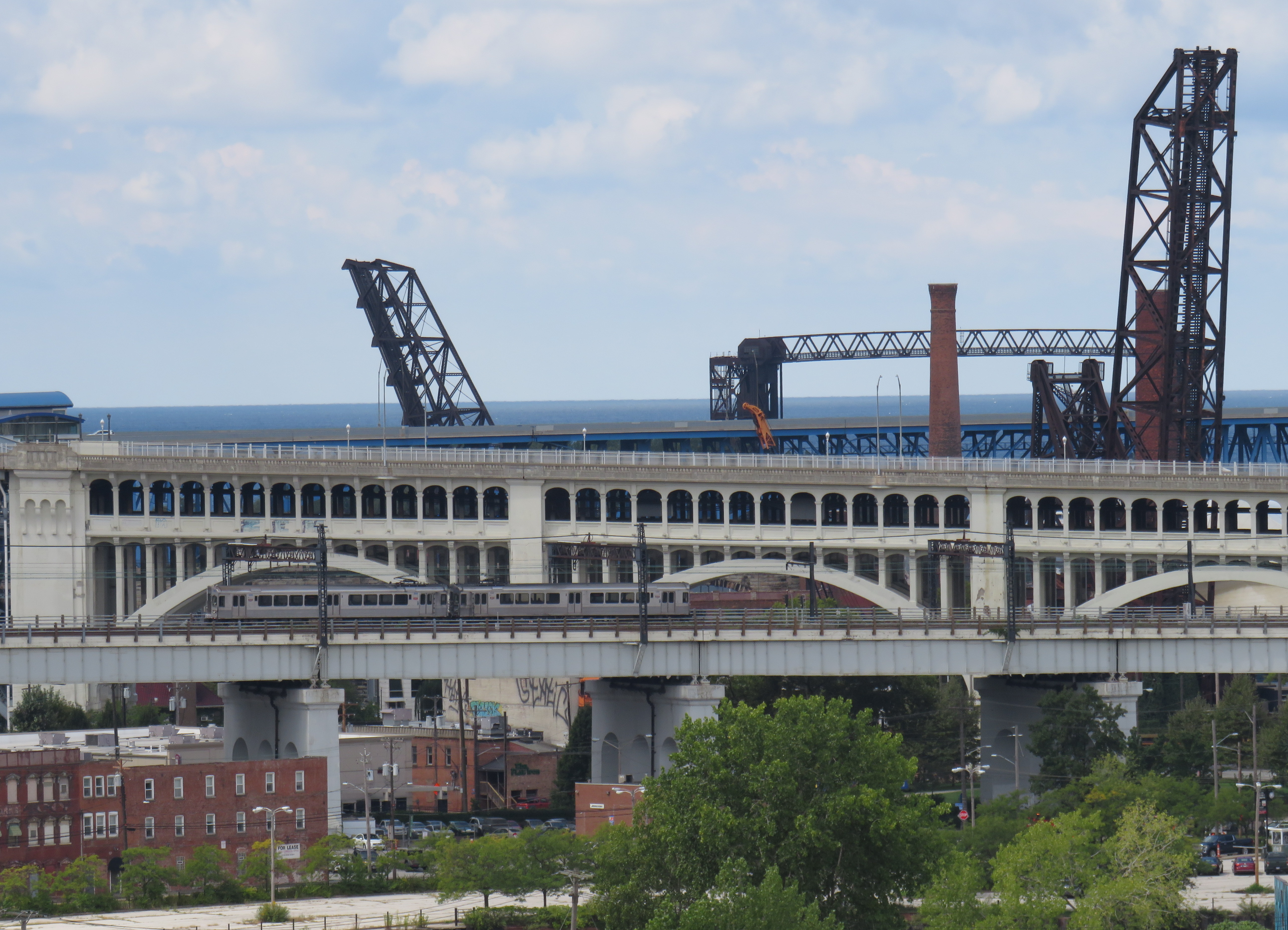
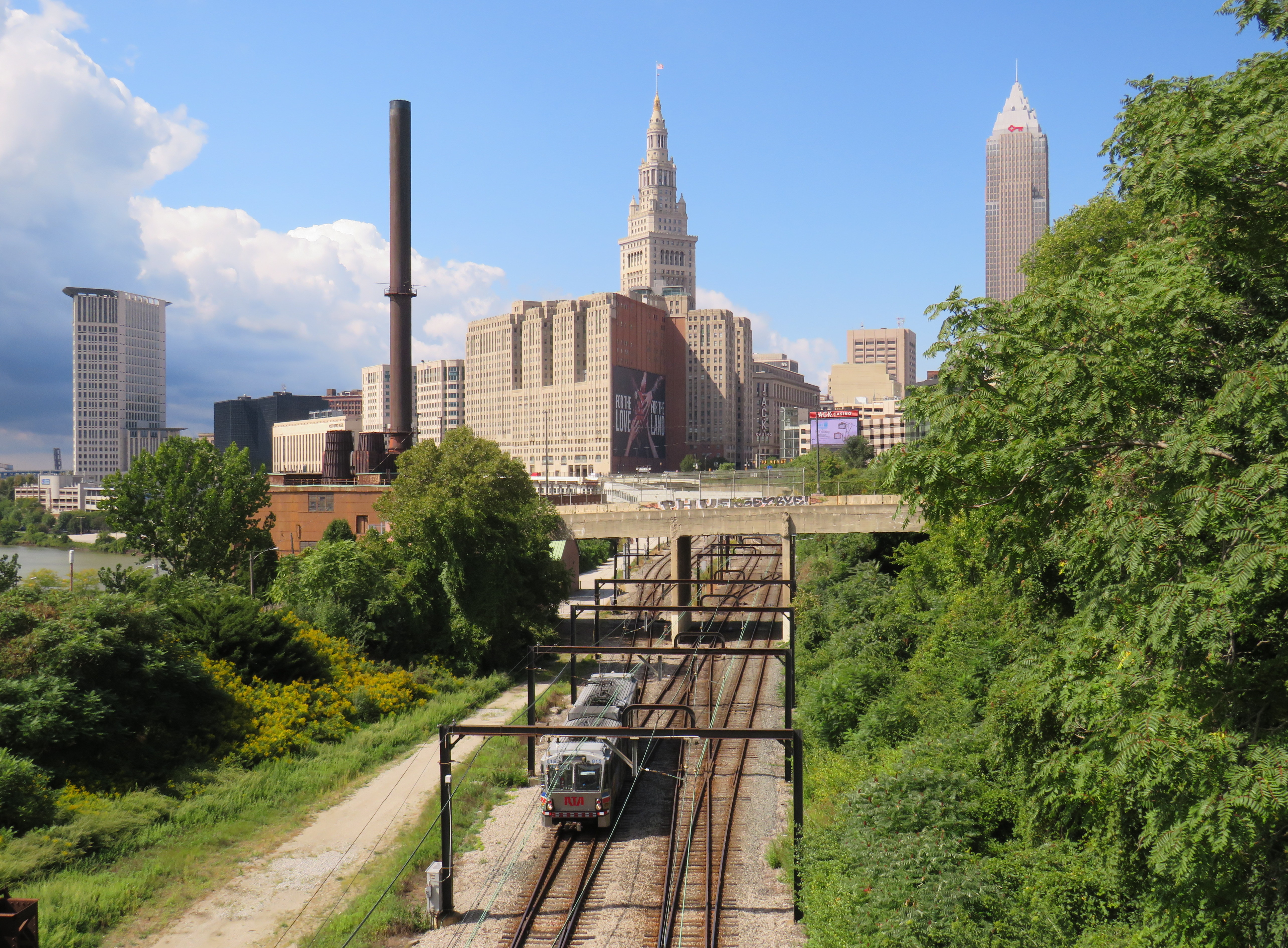
    Cleveland Red Line train on one of the many bridges spanning the Cuyahoga River and the Flats. The arched double-decked bridge beyond the Rapid train once carried a streetcar subway into Downtown Cleveland from the west.

    I visited Cleveland, Cincinnati, and Dayton in September 2022.

    Cleveland, like most American cities, once had an expansive streetcar and interurban tram network. The city streetcars lasted until the early 1950s (its PCCs were acquired by the TTC), though the separate Shaker Heights Rapid Transit, which also used PCCs, continued in service.

    The Cleveland system, made up of the heavy-rail Red Line, and the light-rail Blue and Green Lines (the former Shaker Heights services), run almost entirely on the surface, largely adjacent to railway rights-of-way. The Red Line, built between the 1930s and 1960s, was North America’s first airport rail link when that extension opened in 1968. Unfortunately, the service suffers from low ridership, so it operates in two-car trains, every 15 minutes during daytime hours.

    A Greater Cleveland RTA light rail vehicle heads eastbound from Downtown Cleveland, headed towards Shaker Heights. Terminal Tower in the centre background.

    The Red Line follows an old passenger railway alignment into Terminal Tower, the massive transportation hub, office tower, and commercial development on Public Square. The complex included a hotel, Higbee’s Department Store (made famous by its appearance in A Christmas Story) and local and intercity train platforms. With the decline of passenger rail, the trains moved to a much smaller station on the waterfront, and the Higbee’s store later became a casino.

    Both the Red Line and the former Shaker Heights light rail lines share the same tracks east of Downtown Cleveland, and both services run on overhead catenary.

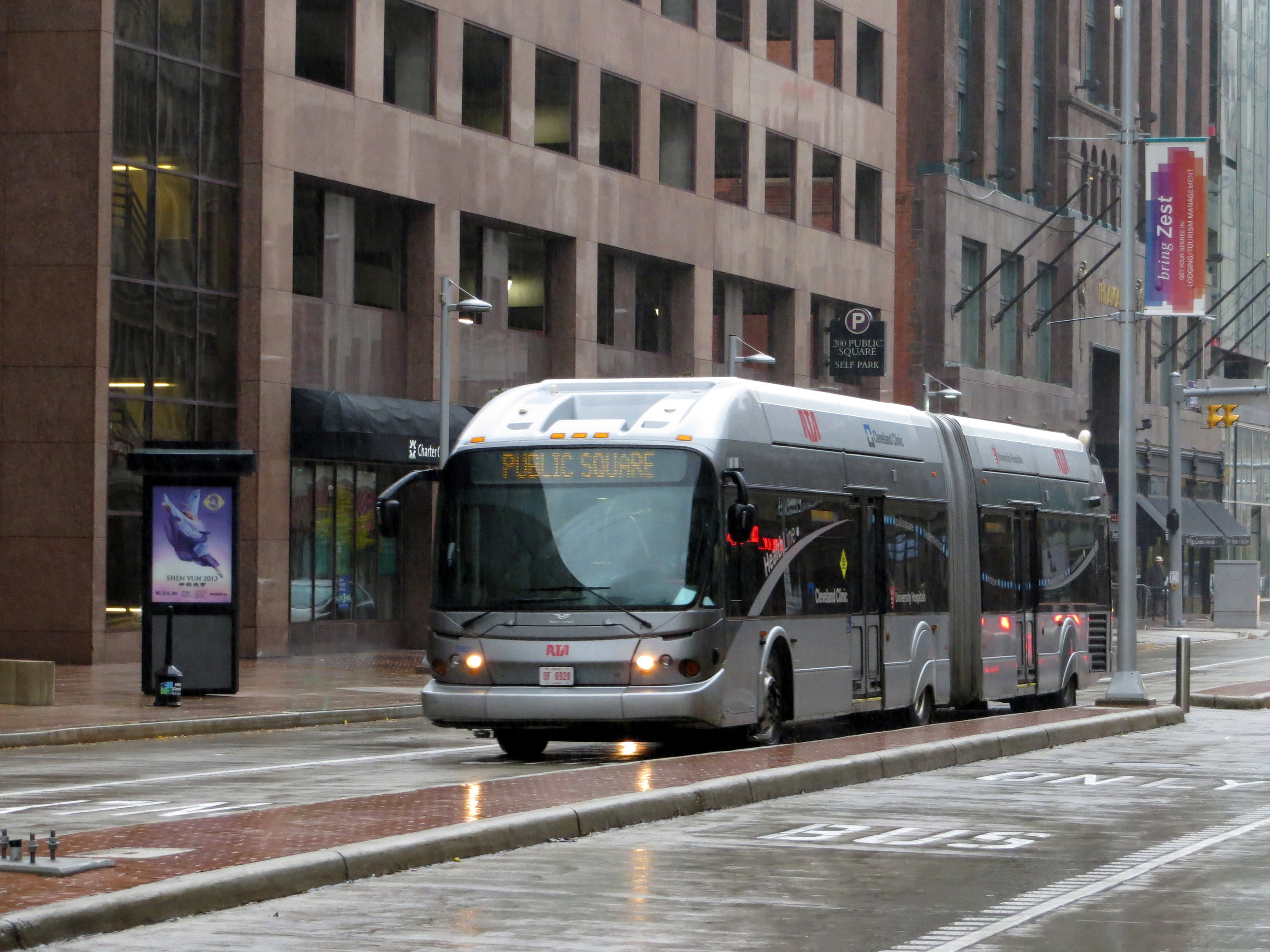
    As the Red Line doesn’t follow city streets, Cleveland built a bus rapid transit line, branded “The HealthLine” on Euclid Avenue between Public Square and East Cleveland. The HealthLine is sponsored by the University Hospital and Cleveland Clinic health care corporations which it serves along with Case Western University and the art and cultural institutions clustered east of Downtown.

    HealthLine bus with left-side doors

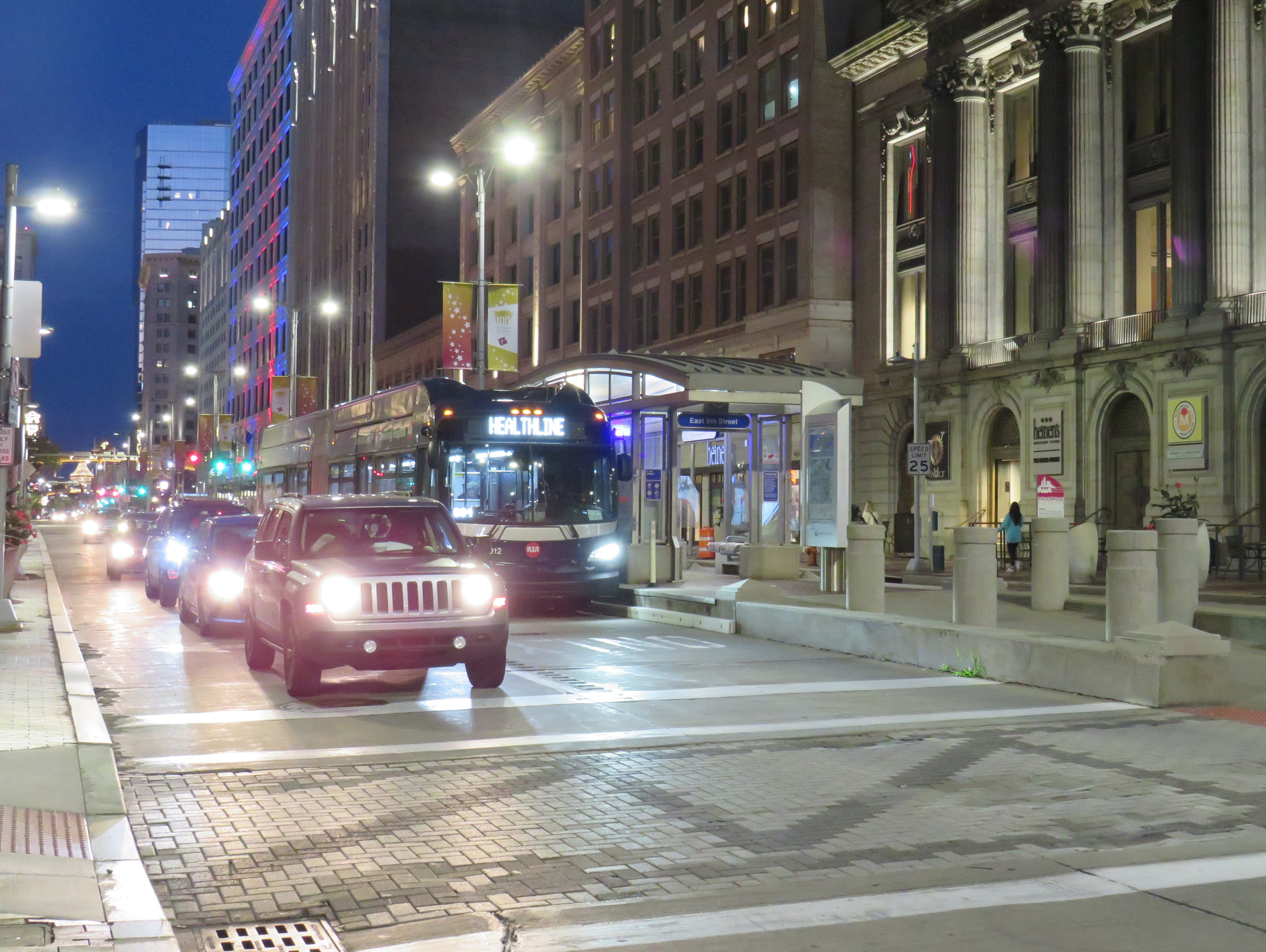
    Though the HealthLine operates with special articulated buses with doors on both sides (to serve dedicated median stations, like that shown below), dedicated bus lanes are limited, and buses do not enjoy signal priority. However, the route is frequent and reliable, which is better than most urban bus services in the United States.

    HealthLine bus on Euclid Avenue in Downtown Cleveland

    Cincinnati

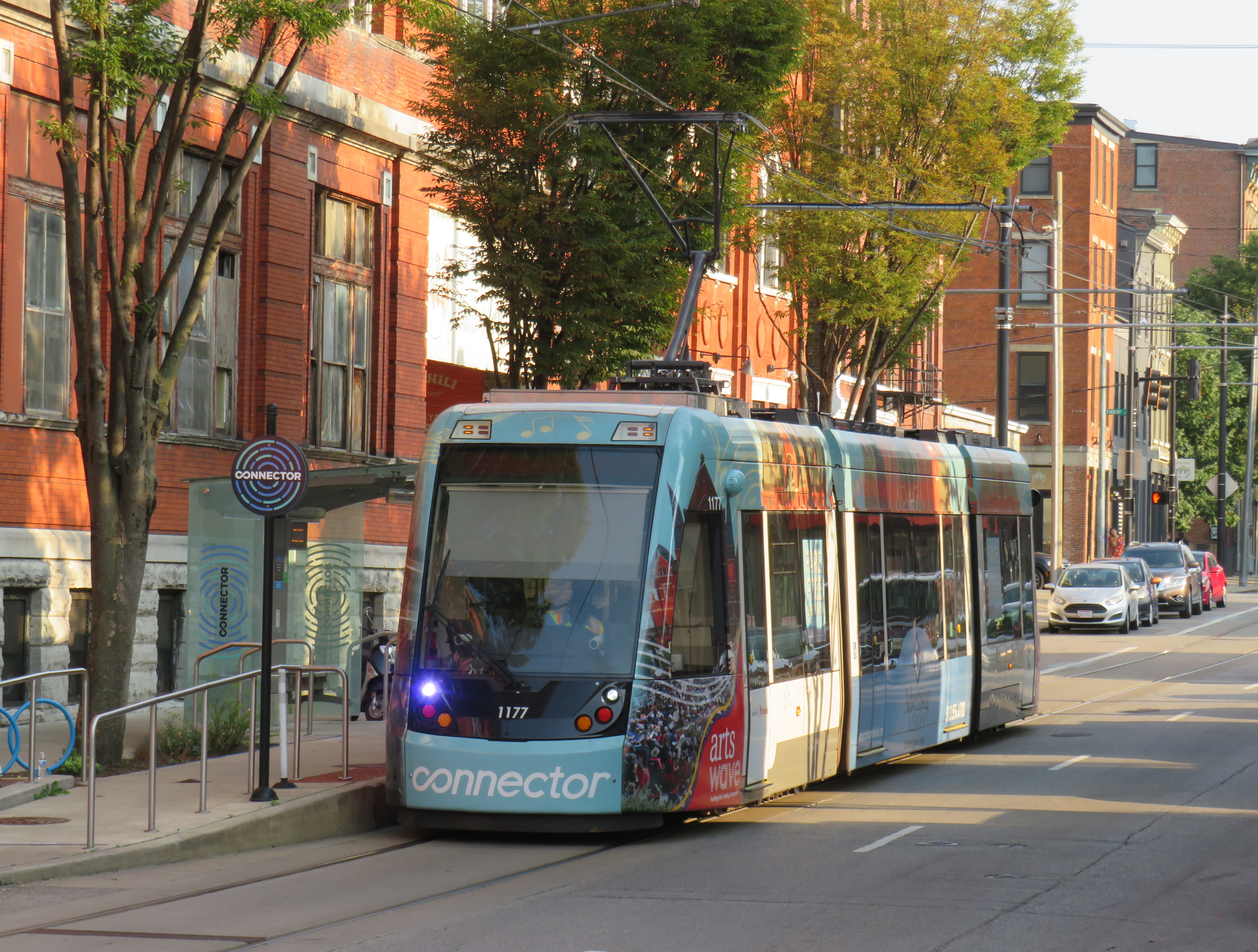
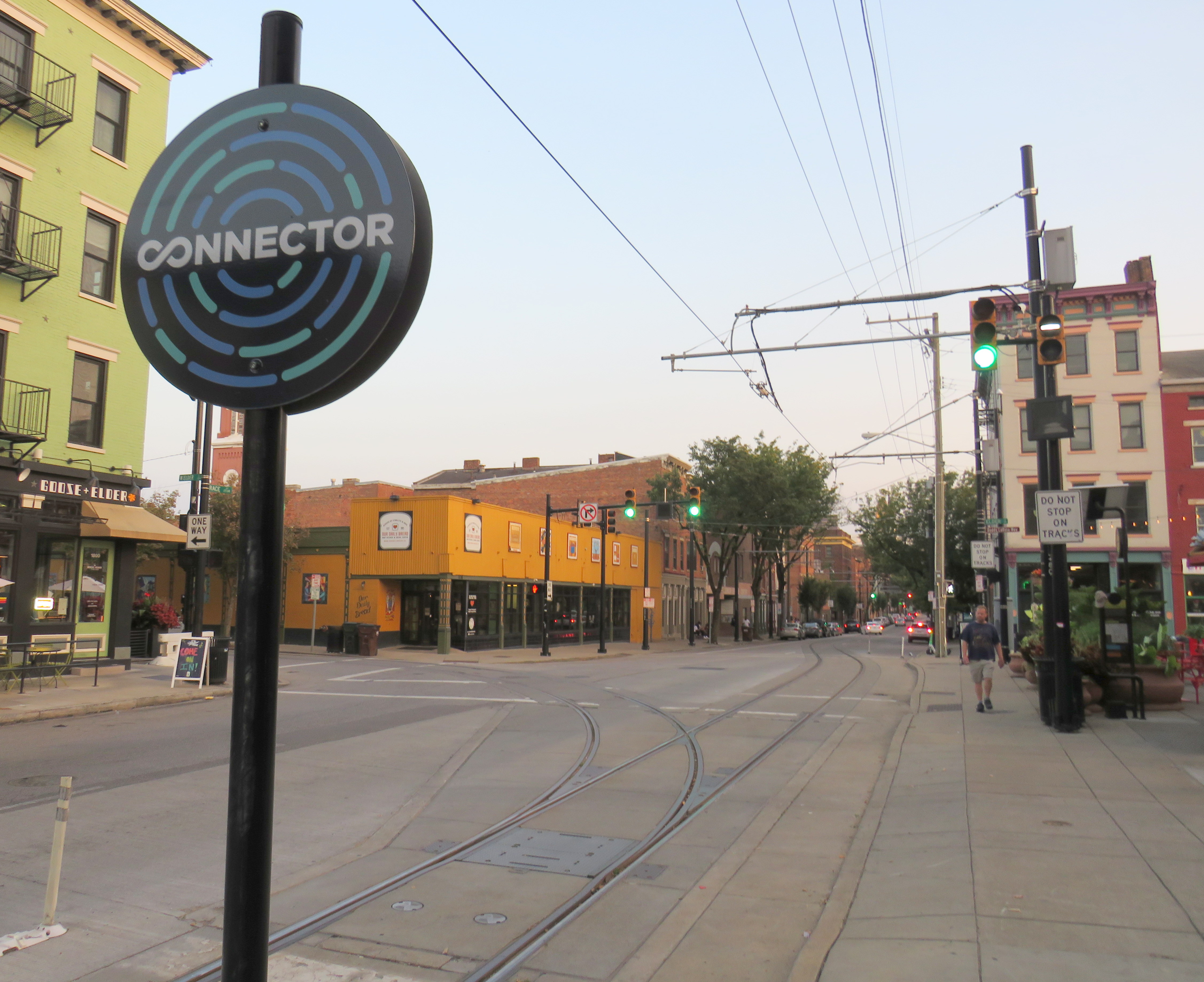
    Cincinnati Connector

    Like Cleveland, Cincinnati once had a large streetcar network, with trams also feeding into the city from communities in Northern Kentucky. Cincinnati abandoned its streetcars in the early 1950s, with the TTC acquiring its old PCC fleet.

    The last time I visited Cincinnati, in January 2015, work had started on a new urban streetcar line that would connect its waterfront, the sports stadiums, the central downtown core, and the Over-the-Rhine area, a gentrifying neighbourhood north of the city core.

    Like the modern urban streetcars in Atlanta, Detroit, Kansas City, and Portland, Cincinnati’s Connector serves a small area on a route practically geared to young urban residents and visitors. Though I came away with positive impressions of Kansas City’s streetcar (which is undergoing a lengthy extension), I felt that Cincinnati’s streetcar — like Atlanta’s and Detroit’s — was too slow, too infrequent, and too short to be of great use. At least the service was free to use.

    Junction to yet-to-be-built extension to University of Cincinnati

    One thing I did note is that, unlike Toronto’s busy — and useful — legacy streetcar network, the small Cincinnati Connector loop was built with modern tram standards. The few switches (like the one shown above) are double-point switches, with dedicated signals. This allows streetcars to pass intersections at normal speed, unlike the TTC’s insistence on stopping and then proceeding at a dead slow pace over its manual, single-point track switches.

    Switches were even installed to the proposed, but postponed, extension to University of Cincinnati (a cutback due to Republican opposition to transit projects at the State Capitol), shown in the photo above.

    As a Torontonian, where streetcars form the backbone of transit in the dense, urban downtown area, it’s frustrating to see a small, novelty streetcar line build proper track infrastructure, while our crowded trams are forced to crawl at every intersection because of indifference at the TTC and at City Hall.

    A Cincinnati Bell Connector Streetcar, followed by a SORTA bus

    One of the amusing oddities of transit in the Cincinnati area are the acronyms used by the two local agencies. Cincinnati and the surrounding Ohio municipalities are served by the Southwest Ohio Regional Transit Authority, or SORTA. The agency wisely uses “Metro” as its public brand. Covington and other Kentucky communities are served by the Transit Authority of Northern Kentucky, or TANK. To their credit, the two agencies cooperate on fares, a $5 day pass purchased on one bus is good for all regular services on both agencies. Many TANK routes enter Downtown Cincinnati as well.

    Pittsburgh

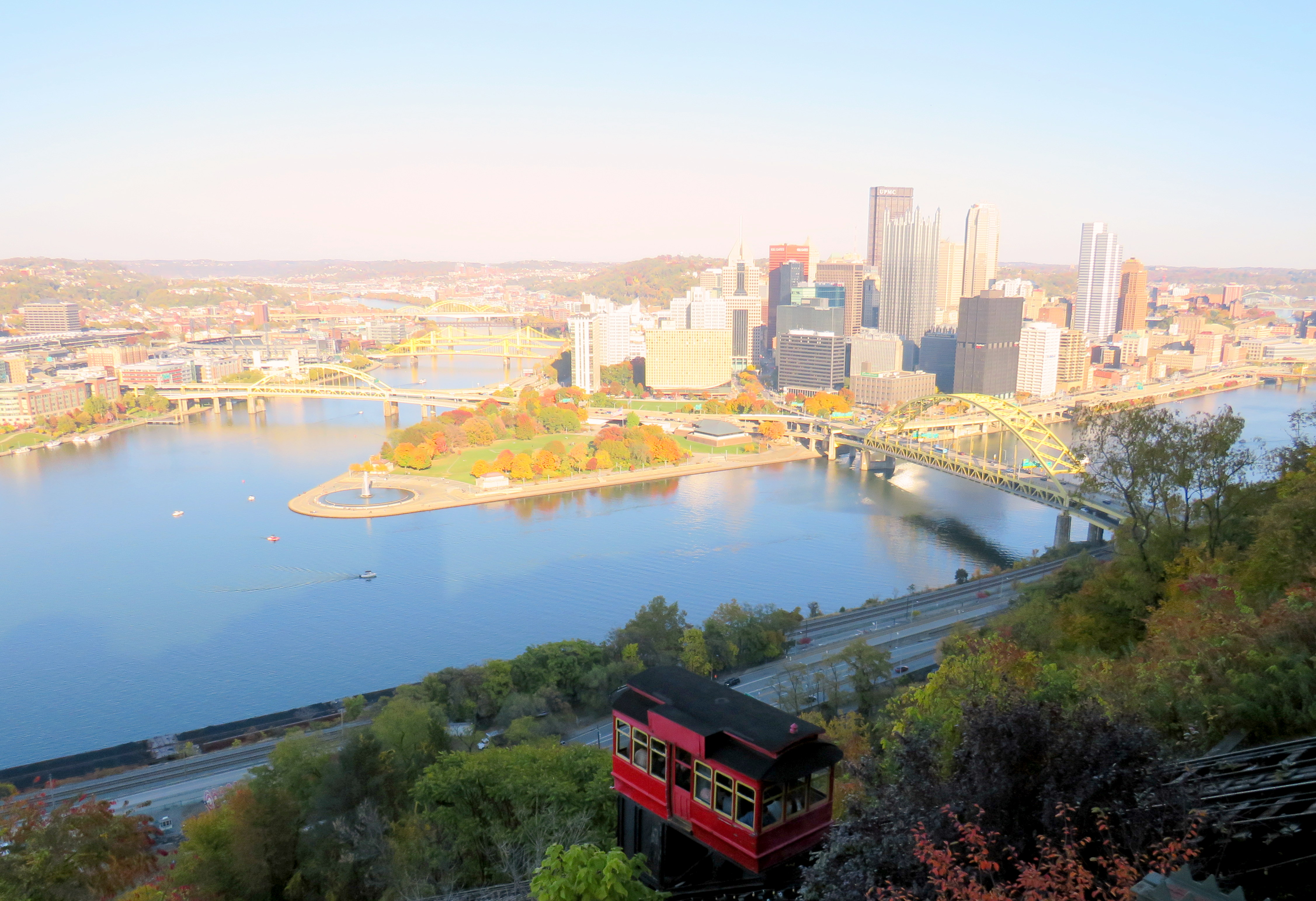
    In late October, my spouse and I visited Pittsburgh to attend a conference. Pittsburgh has one of North America’s most fascinating cityscapes, with the downtown core situated where the Allegheny and Monongahela join to form the Ohio River, with steep hills immediately to the north and south. The steep topography is the main reason why Pittsburgh maintained two historic incline railways, where many other cities (including Hamilton) abandoned theirs.

    The Duquesne Incline, on a very bright autumn afternoon

    Pittsburgh was also a leading operator of PCC streetcars until the late 1960s, with a fleet of 666 PCCs — North America’s third-largest — at its peak. Because of Pittsburgh’s many hills, often requiring private rights-of-way or tunnels for streetcars to serve outlying areas, Pittsburgh was late to abandoning its street railway, but with highway projects in the 1950s, a public takeover in the 1960s, declining ridership, and a desire to modernize, most of the lines were abandoned and replaced by buses by 1971. Only a few South Hills lines, which used a lengthy tunnel to access Downtown Pittsburgh, remained.

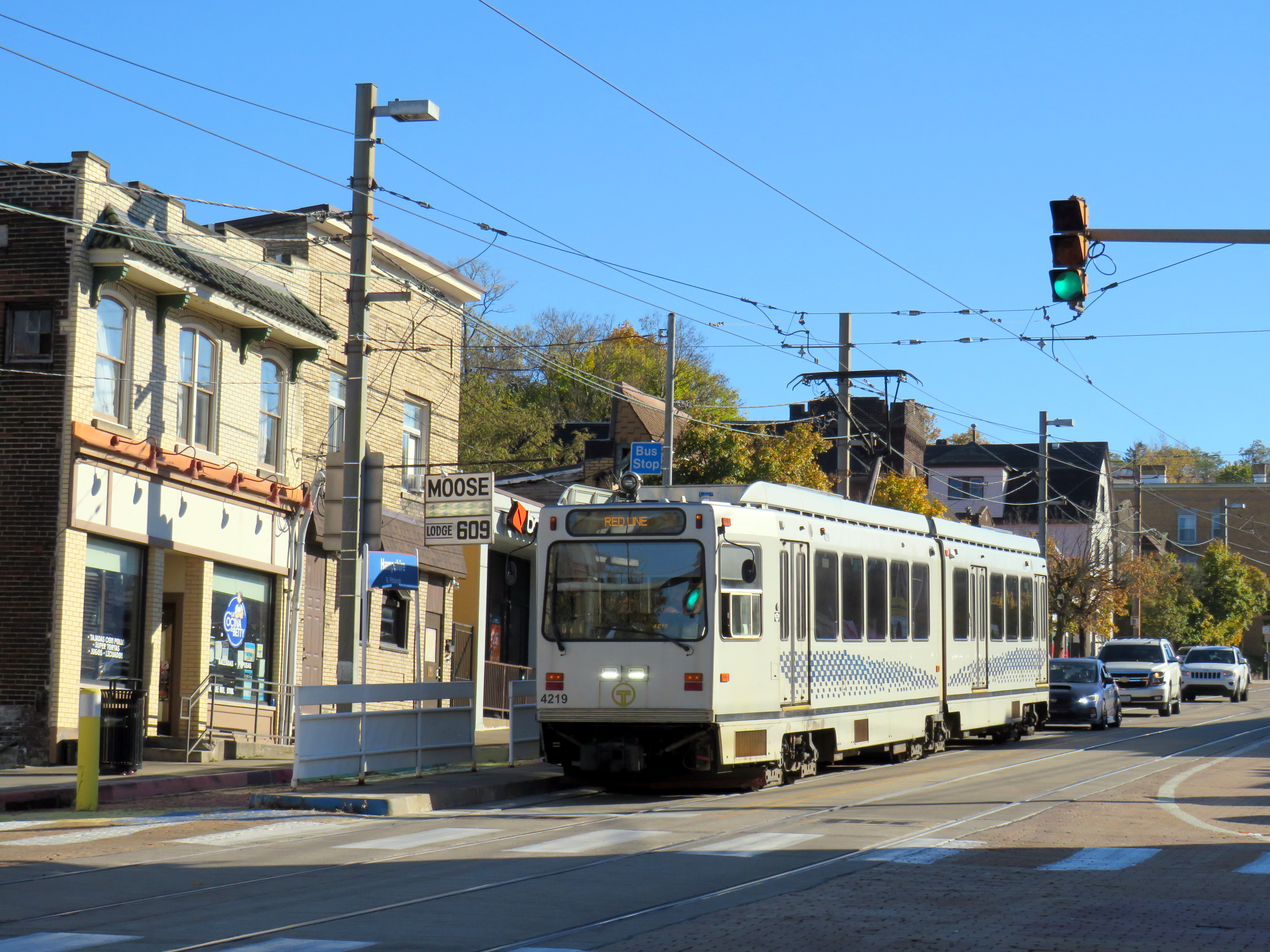
    Red Line train in Beechview

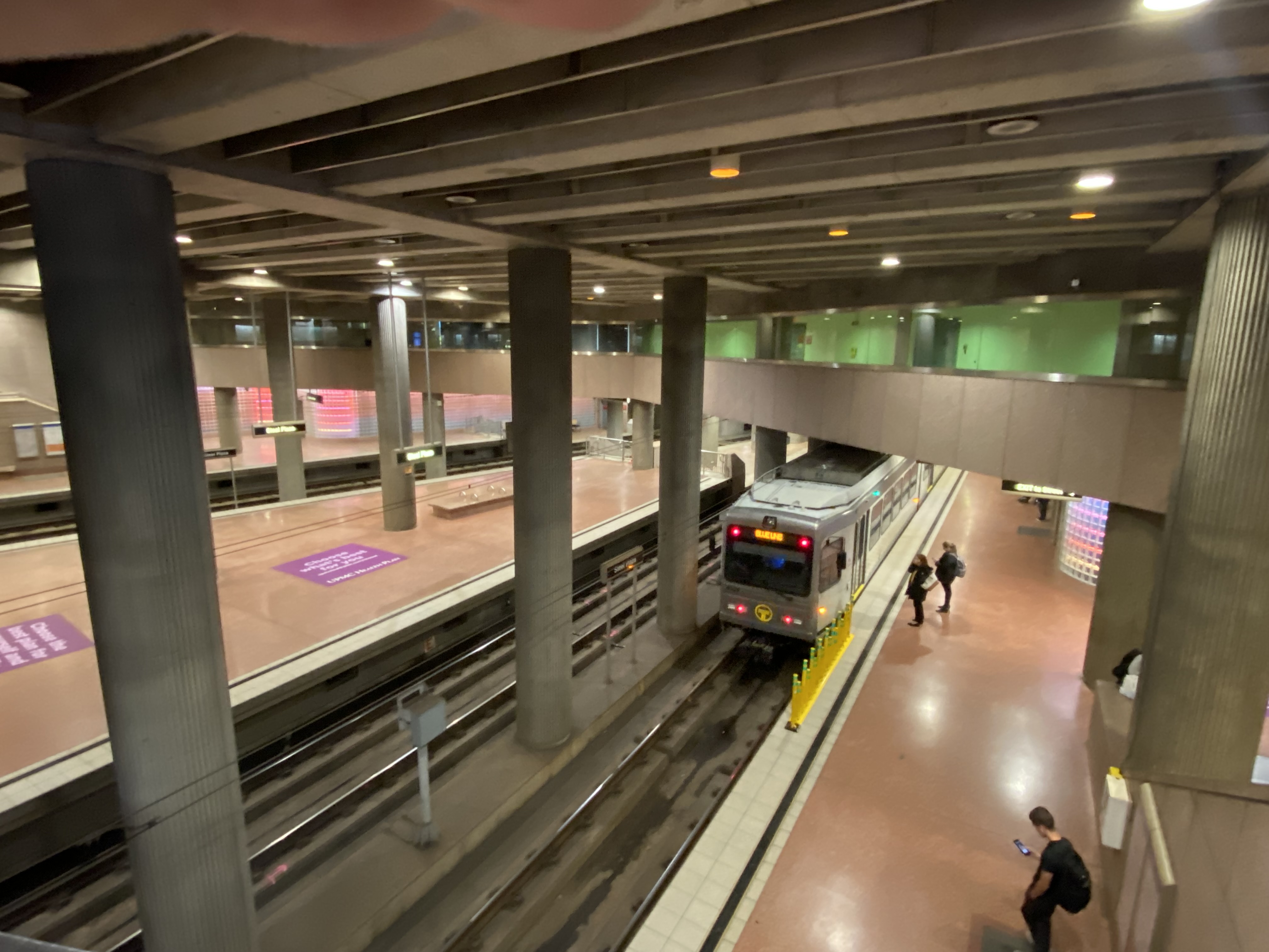
    The two core southern lines were gradually upgraded to light rail standards, with a downtown tunnel replacing the on-street trackage there. Only a short section of Red Line in Beechview still operates on-street, betraying the service’s streetcar legacy. In 2012, the downtown subway was extended north under the Allegheny River to serve the North Shore, particularly the baseball and football stadiums.

    Steel Plaza Station, part of the Downtown Subway

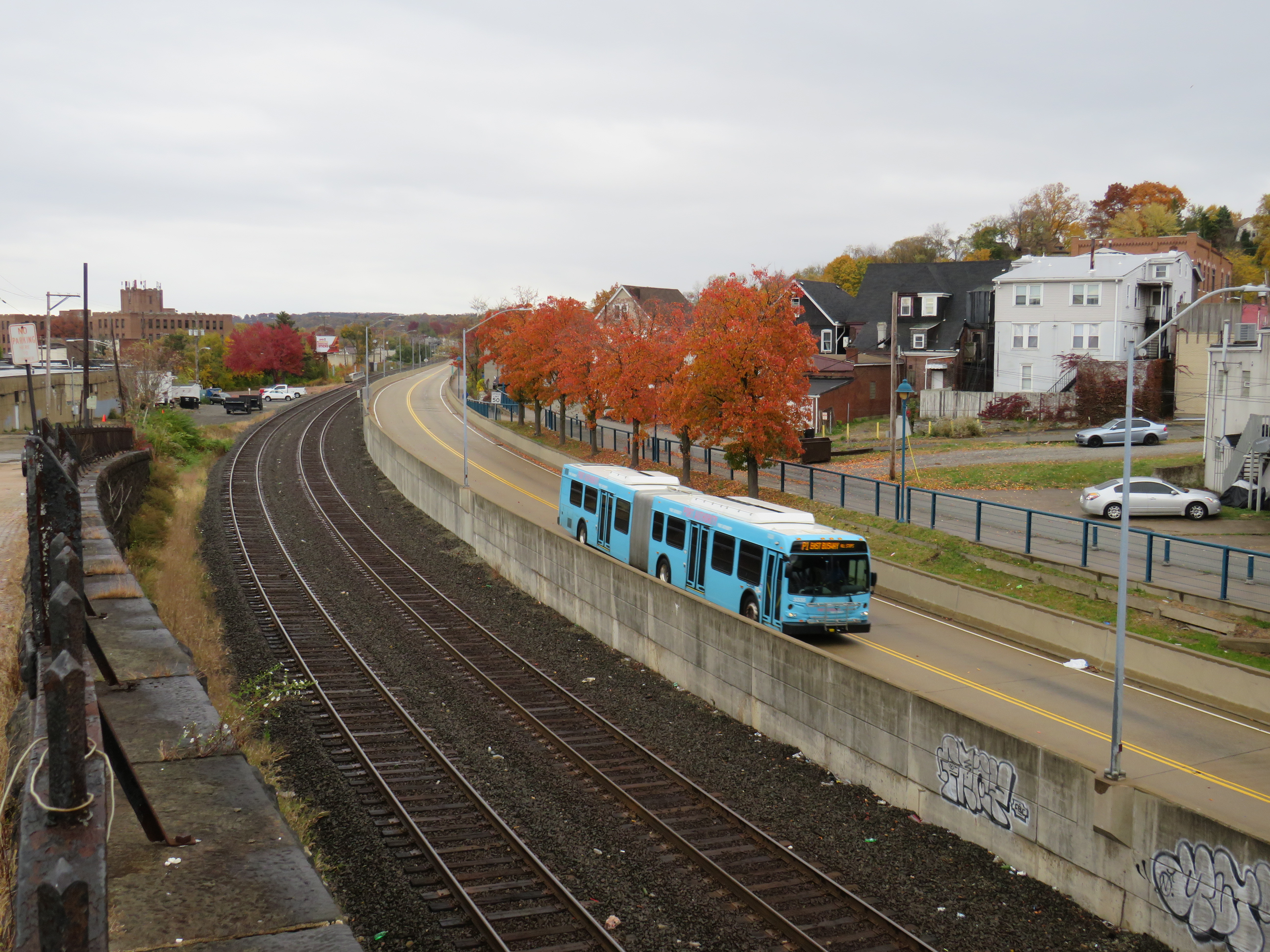
    In the 1980s, the Port Authority of Allegheny County, the public agency tasked with operating the city’s transit system, designed and built several busways radiating out of the city centre. Like Ottawa’s Transitway before construction of the Confederation Line LRT, the Pittsburgh busways follow former or current railway rights-of-way, with grade-separated road crossings, and with on-street operation in the downtown core. The busways offer rapid transit service, though stations are quite simple, with at-grade pedestrian crossings at most locations and basic shelters.

    Dr. Martin Luther King Jr. (East) Busway, Swissvale

    Pittsburgh’s problem though is that the busways and LRT managed to avoid the main university campuses and many of the city’s most vibrant neighbourhoods. Oakwood, the home of University of Pittsburgh, Carnegie Mellon University, many of the city’s arts and cultural institutions and some of its densest neighbourhoods, has only local bus service. Not coincidentally, Oakwood was one of the last parts of Pittsburgh to lose its streetcars in 1967.

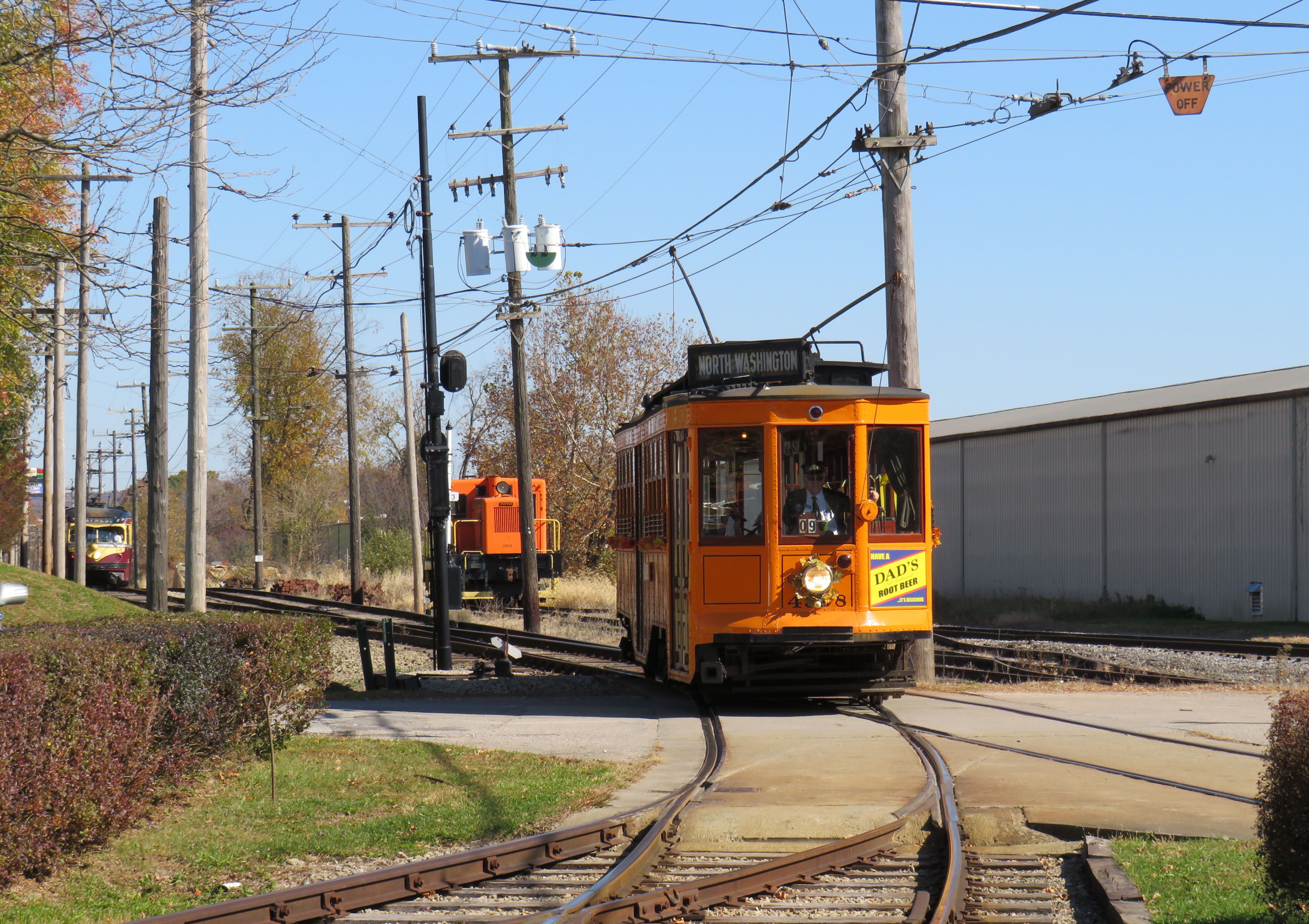
    South of Pittsburgh, streetcars operate on an abandoned interurban line near Washington, Pennsylvania. Unlike the Halton County Radial Railway, the Washington interurban line’s tracks were not yet removed when the Pennsylvania Trolley Museum was formed. The museum, which operates several streetcars and hosts a large collection of static displays, is well worth the visit.

    Former Pittsburgh Railway Company trolley #4398 carries autumn crowds at the museum in Washington, PA. Behind is a former Philadelphia Suburban Lines (Red Arrow) trolley.

    Morgantown, West Virginia

    Only a 90-minute drive south of Pittsburgh is the city of Morgantown, West Virginia, home of the sprawling West Virginia University. What makes the public university especially unique is the automated transit system that serves the university and connects it to Downtown Morgantown.

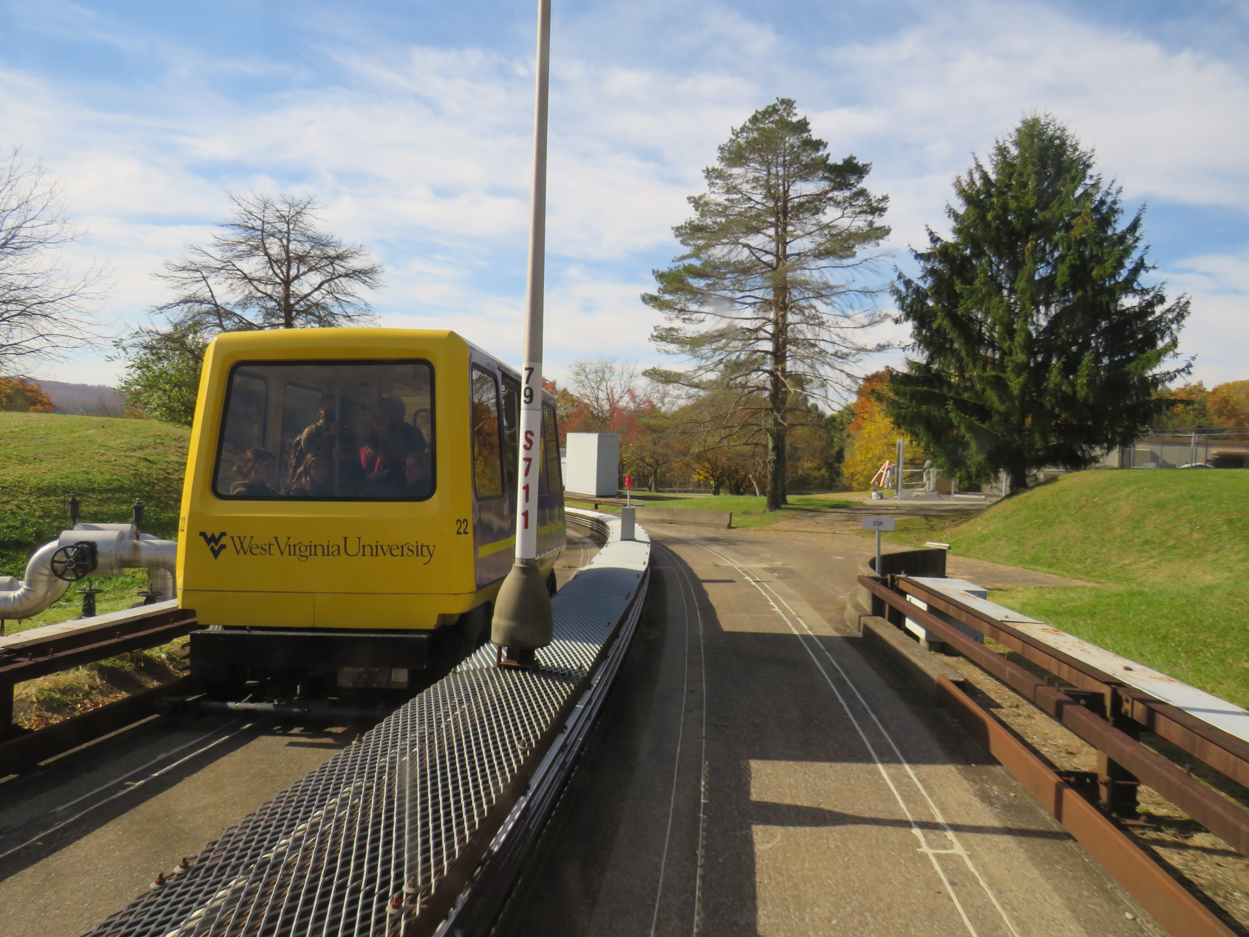
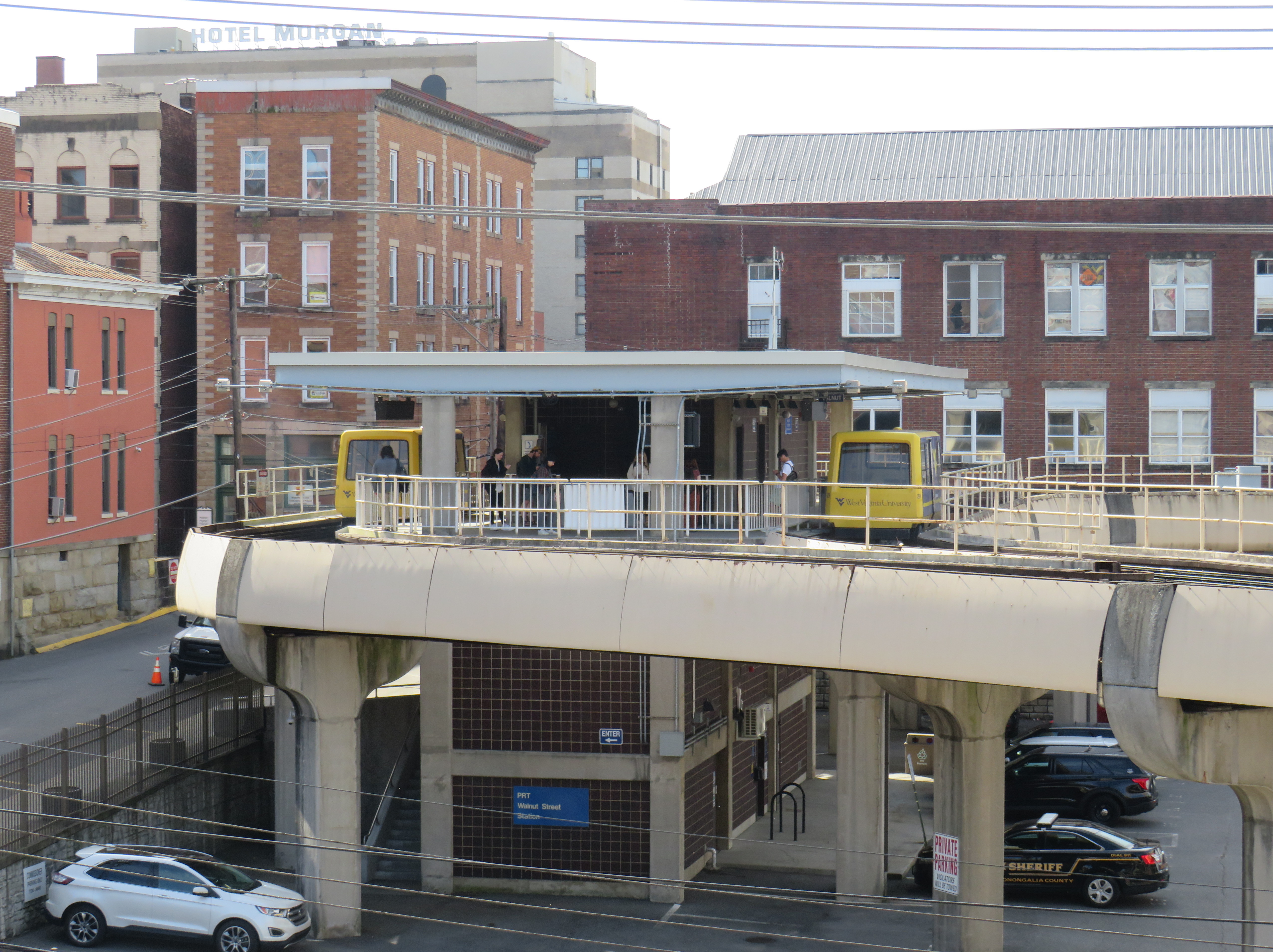
    The one-of-a-kind Morgantown PRT, opened in 1975, has five stations between Downtown Morgantown and the main campus to the north. What makes the line a “personal” rapid transit system is passengers, upon paying the fare or swiping their university ID card, select their destination station, and wait for a car that will take them to their desired point, skipping any stations in between. Though the technology can be described as a “gadgetbahn” it fills a unique niche, and still runs with the original rolling stock and guideways, though software and motor upgrades were required. Because of the limited road space between Morgantown and the university facilities to the north and the mountainous topology of West Virginia, traditional bus service gets caught in traffic, especially on game days.

    Walnut Street Station in Downtown Morgantown

    Each car has eight seats and allows for twelve standees, so despite the name, the service isn’t precisely “personal.” As it is operated by the university mostly for staff and students, it does not run on Sundays, holidays, or when classes are not in session. During off-peak periods, the PRT usually runs in an all-stops configuration.

    The video below shows how the PRT operates, including the bypass of Towers Station.

    Part of the nine-minute ride on the Morgantown PRT at the University of West Virginia

    I will follow up with posts covering my return to Toronto, Ohio (which is just an hour’s drive west of Pittsburgh), and some thoughts after visiting a local history museum.

  • Ontario intercity transportation at the end of 2022: More choices, fewer routes

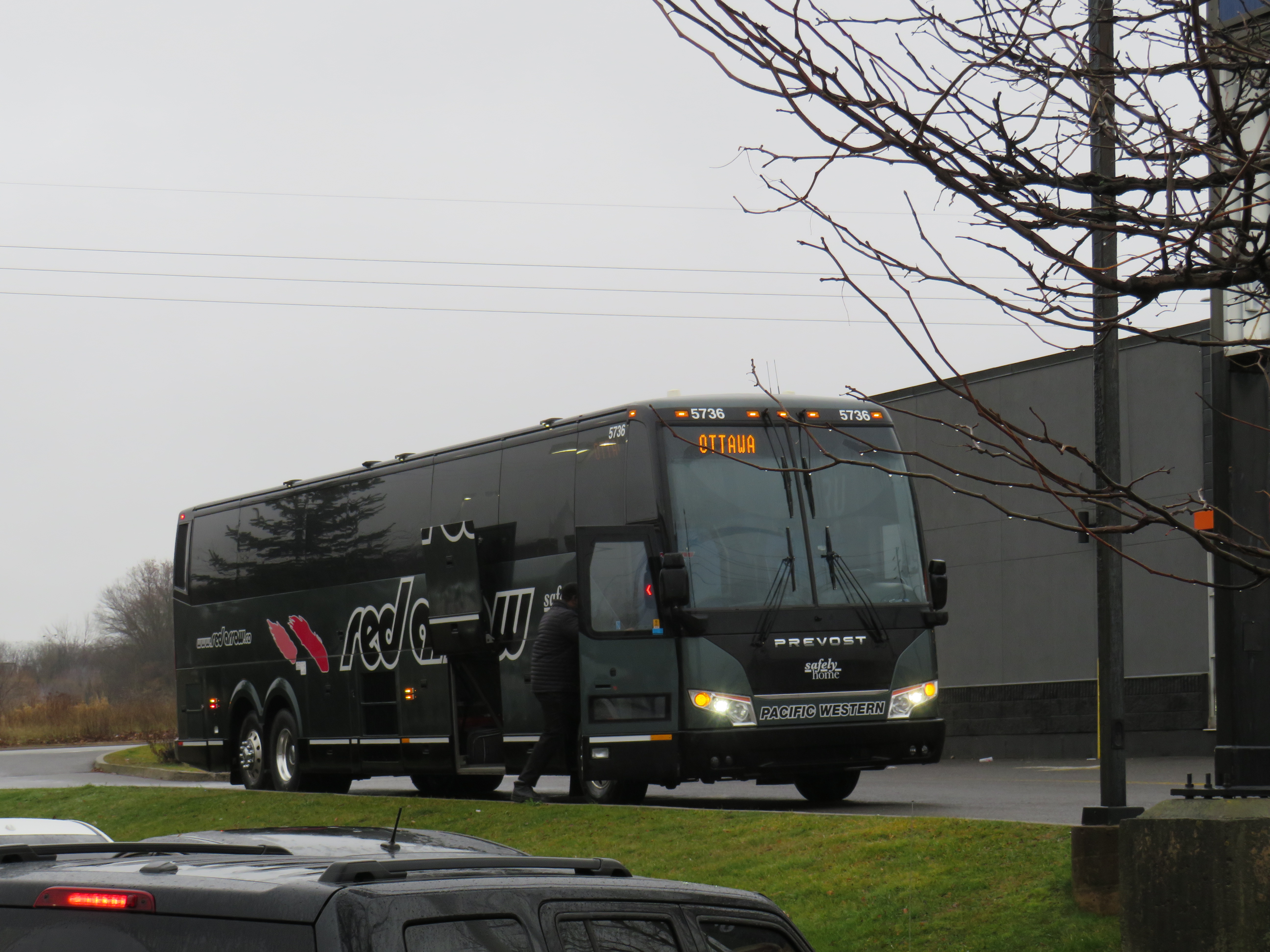
    A Red Arrow coach lays over at a Harvey’s restaurant in Kingston on the way to Ottawa

    On December 7, I took a trip out to Kingston to ride the newest coach operator to arrive in Ontario: Red Arrow. A division of Pacific Western, Red Arrow is the latest carrier to stake a claim to the busy Toronto-Kingston-Ottawa route, which is now served by five private companies.

    Between Toronto and Ottawa, five intercity coach carriers–Megabus, Rider Express, Flixbus, Book-A-Ride, and Red Arrow–compete for the same passengers, along with VIA Rail and three airlines (Air Canada, WestJet, and Porter).

    There is also fierce competition for the Toronto-London route. Passengers have the choice of taking Megabus, Rider Express, Onex, Flixbus, Book-A-Ride, VIA Rail, or a very slow weekday-only GO train. Along with VIA, Flixbus also continues west, to Windsor (where the Tunnel Bus connection to Detroit has finally been restored). The Toronto-St. Catharines-Niagara route is also served by multiple bus and rail services.

    Red Arrow coach seating

    Despite new intercity coach players like Red Arrow (which provides a high-end coach service, with comfortable seating in a 2+1 arrangement, along with complimentary soft drinks and light snacks) and Book-A-Ride (which operates like a charter airline, with schedules that change frequently based on demand), many other routes still have limited or no service. Flixbus quietly dropped its Kitchener-Hamilton-Niagara route earlier this year, eliminating service on a corridor that once had frequent Canada Coach Lines buses; that route had been sold in 1990 to Trentway-Wagar/Coach Canada. Flixbus also ended service to Guelph, instead concentrating on its other corridors. Early next year, Megabus will end its route between Toronto, Buffalo, Philadelphia, and Washington DC.

    The deregulation of motor coach services within the Province of Ontario may have made some sense. The old bargain of providing exclusive franchises for busy, profitable routes made sense when operators would use those cash cows to help subsidize less-trafficked rural services. But as Greyhound, Stagecoach, and other large companies bought up smaller carriers (such as Gray Coach, Canada Coach Lines, and PMCL) in the 1980s and 1990s, they were allowed to slowly abandon the smaller routes. Greyhound itself divested most of its network before disappearing altogether. As the franchising scheme didn’t work, there was no point keeping it.

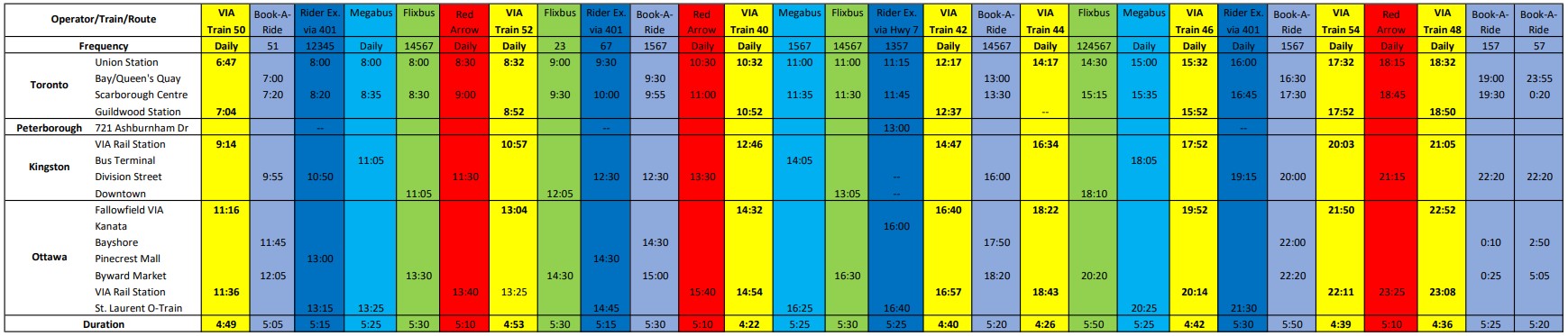
    But now, there’s the absurd situation where there are up to 25 daily buses and trains between Toronto and Ottawa (see table below). In contrast, there is not a single daily bus service connecting Hamilton and Kitchener-Waterloo–two urban centres of over 500,000 people each, just an hour apart, with three large universities (Waterloo, Wilfrid Laurier, and McMaster) and two major colleges (Conestoga and Mohawk) between them.

    Available trips from Toronto to Ottawa, December 2022, with times for Kingston and Peterborough. Bus and rail tips to Montreal via Kingston are not included.
    A PDF version can be found here.

    Elsewhere, where GO Transit and government-subsidized regional connections have filled gaps, the services are often slower and less direct than the old coach bus service. PMCL used to operate daily bus service between Owen Sound and Toronto via Collingwood and Barrie. Today, the same trip is possible via Grey Transit Route, Colltrans, Simcoe County Linx, and GO Transit, but the trip will take the better part of a day. Meanwhile, other gaps remain. Elgin County (Aylmer and St. Thomas) and Haldimand County (Caledonia, Dunnville, Hagersville, and Jarvis) are left without any outside connections.

    Such is the state of the intercity transportation network (if you can call it that) in Ontario.


    Though I enjoyed the trip on Red Arrow to Kingston (especially as I took advantage of a special $25 fare), I wondered how well the service will do here in Ontario. Its base price is over $100 one-way to Ottawa, more expensive than other coach operators and priced more like VIA Rail, which itself is slightly faster (as long as CN freight trains do not get in the way). Red Arrow uses the same locations in Ottawa (the VIA Rail Station itself) and Toronto (Union Station Bus Terminal) as the train. Red Arrow does well in Alberta, where there is no useful passenger rail service (Pacific Western also offers a no-frills coach bus service on the same Calgary-Edmonton route).

    The latest version of my interactive intercity transit map is below:

    Link to the newest version of my map of Ontario’s Intercity bus and rail connections

  • Why the future of transit might be found in Dayton, Ohio

    Why the future of transit might be found in Dayton, Ohio

    Dayton, Ohio is probably best known as the hometown of Wilbur and Orville Wright, the two bicycle mechanics who made the first successful controlled heavier-than-air flight. The city has remained a centre of the aviation industry. The US Air Force (and its predecessors) have operated a major base in Dayton for over a century, which includes an impressive museum of military aviation history.

    But among transit buffs, Dayton is notable for another reason. It is one of only a handful of cities in North America that continues to operate and maintain an electric trolley bus system. The Greater Dayton RTA is also the smallest transit system to have operated trolleys since the mid 1970s.

    Though there were early adopters of “trackless trolleys” in the late 1910s and early 1920s, the technology was particularly popular between the late 1930s and early 1950s. For street railway operators burdened with ageing streetcars and worn out infrastructure, electric trolleys offered several advantages. They could make continued use of electric substations, poles, and overhead wires, without the need for maintaining tracks and rights-of-way. Trolley buses were quiet and smooth-running, unlike gasoline and early diesel buses, and had larger capacities. They were cheap to operate and easy to maintain, and were especially adept at climbing steep grades.

    TTC trolley bus on Ossington Avenue in the 1950s. The Ossington trolley was established as part of a major post-war route restructuring.

    Most of the big cities in Canada and the US continued operating streetcars into at least the 1950s, as newer PCC streetcars helped keep those fleets going. But trolley buses were ideal for smaller and midsized cities that still had robust transit demand that buses could not yet meet. Even cities that retained streetcars into the 1950s — like Toronto — used trolley buses to replace marginal streetcar lines and allow for major route restructurings.

    In Canada, fourteen cities established trolley bus fleets between 1936 and 1951. In Halifax, the Nova Scotia Light and Power Company replaced its decrepit streetcar system and its feeder bus network with an all-electric fleet in 1949; at the system’s peak, there was even a trolley route across the Macdonald Bridge to Dartmouth. Cities as small as Cornwall and Port Arthur/Fort William (now Thunder Bay) even replaced their streetcars with trolley buses.

    By the 1970s, the coach bodies purchased 30 years earlier were showing their age, and many agencies had decided to simplify their fleets and go with modern diesel buses, which had improved in size, power, and capacity since the 1940s. In Canada, only Toronto, Hamilton, Edmonton, and Vancouver decided to renew their fleets, while only five cities in the United States (Boston, Dayton, Philadelphia, San Francisco, and Seattle) kept their electric trolley systems. Since then, Hamilton, Toronto, Edmonton — and most recently, Boston — gave up when the latest generation of trolleys were due for replacement.

    But of all places, the small, deindustrialized city of Dayton took a very different direction. In 2020, the Greater Dayton Regional Transit Authority (GDRTA) received the last of its 45 new Kiepe/Gillig Next Generation trolley buses, equipped with large, powerful battery packs and computer systems that allow for long-distance, full speed off-wire capability. (The previous generation of trolleys, like what Translink in Vancouver currently operates, allow only for limited, low-speed off-wire operation).

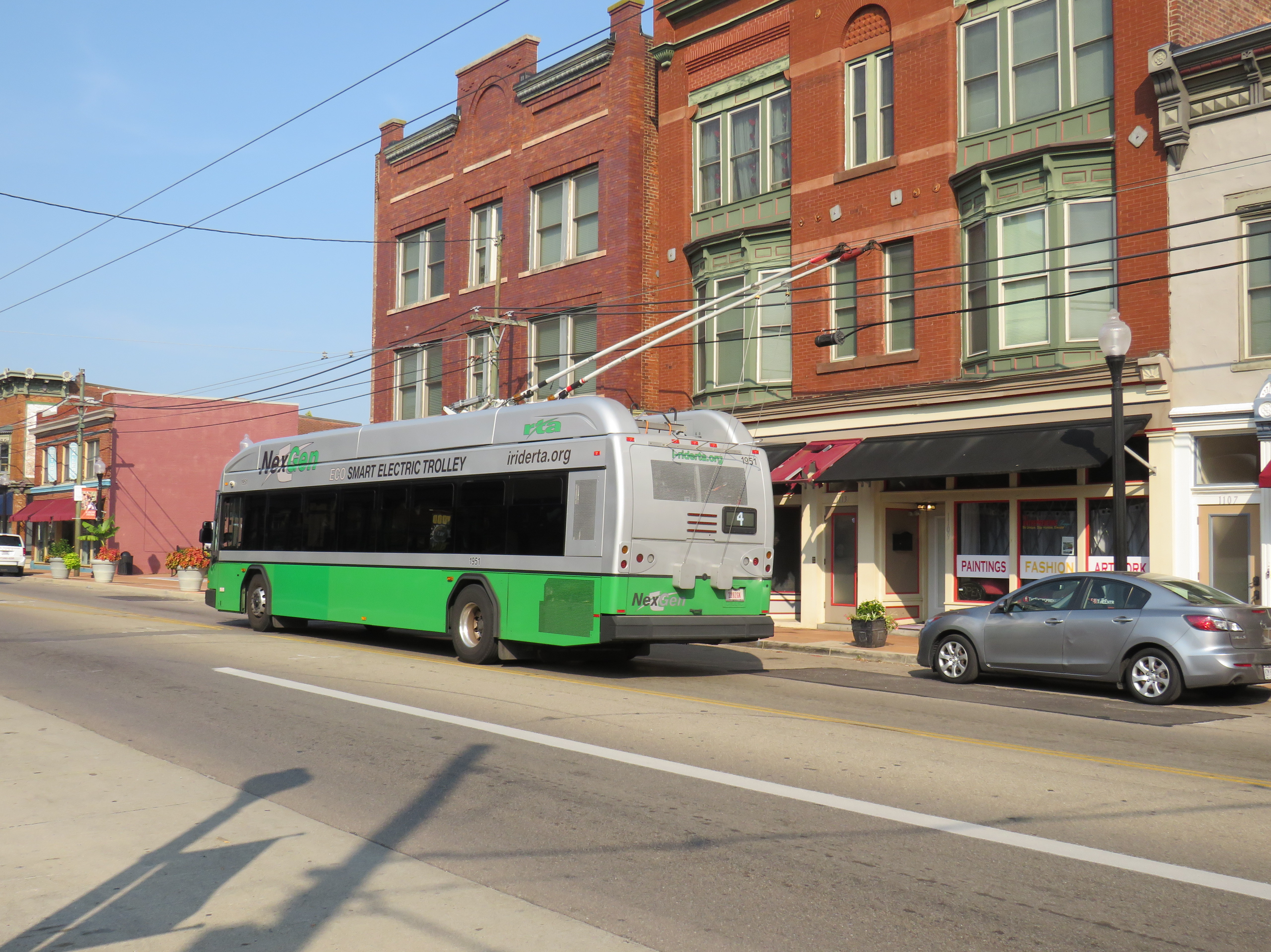
    The new NexGen trolley on Third Street on Dayton’s West Side
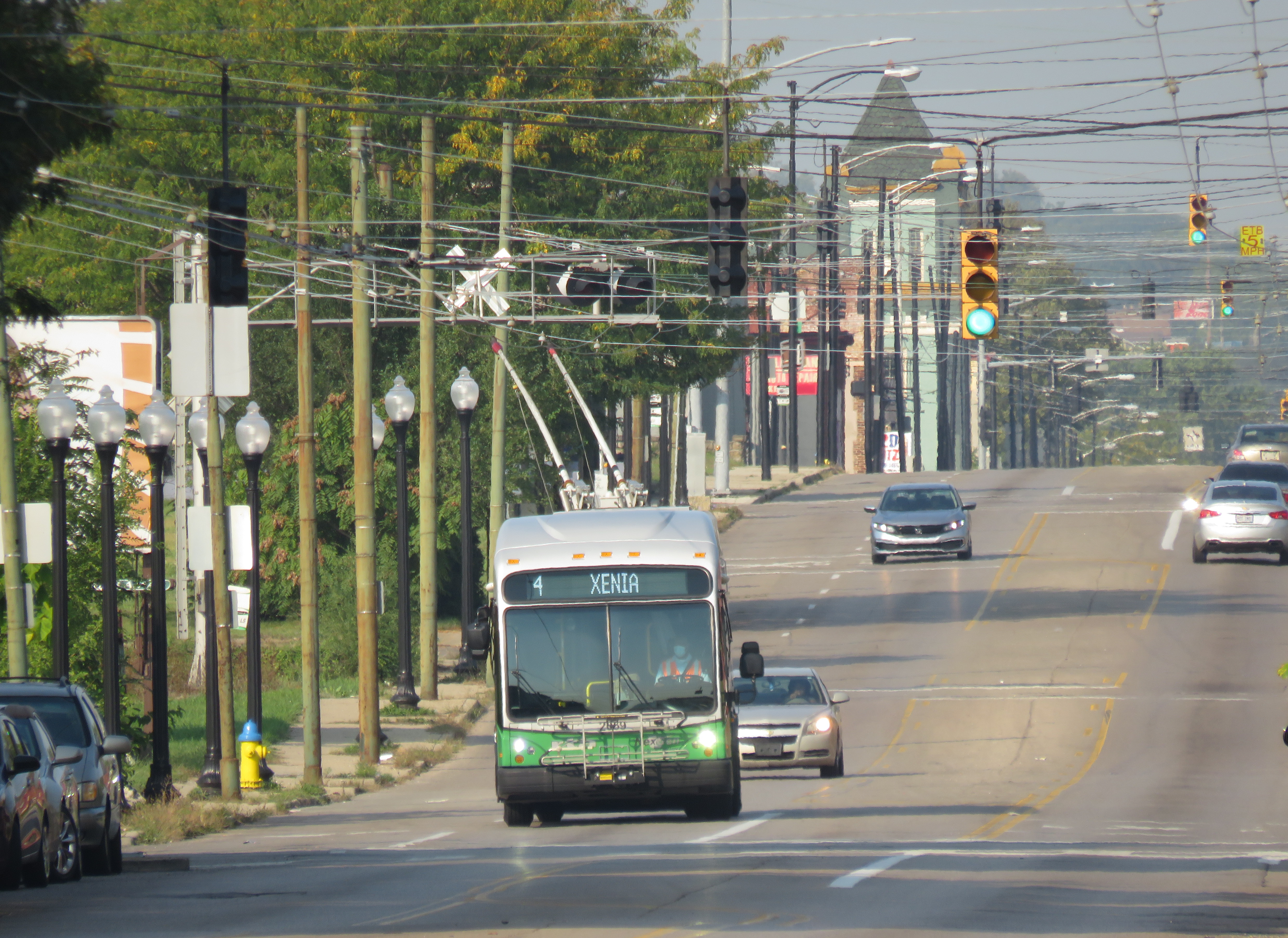
    A trolley on Route 4 running with its poles down. I captured this photo just after getting off the bus on September 16, 2022.

    The extended off-wire capability has allowed the GDRTA to extend two of its trolley bus routes further into the suburbs without extending wire. Route 7 was extended 5 kilometres northwest, while Route 1 was extended 6 kilometres east to Wright State University. Though the corridors were already served by longer-distance diesel bus routes, it provided additional service to some of Dayton’s major suburban trip generators.

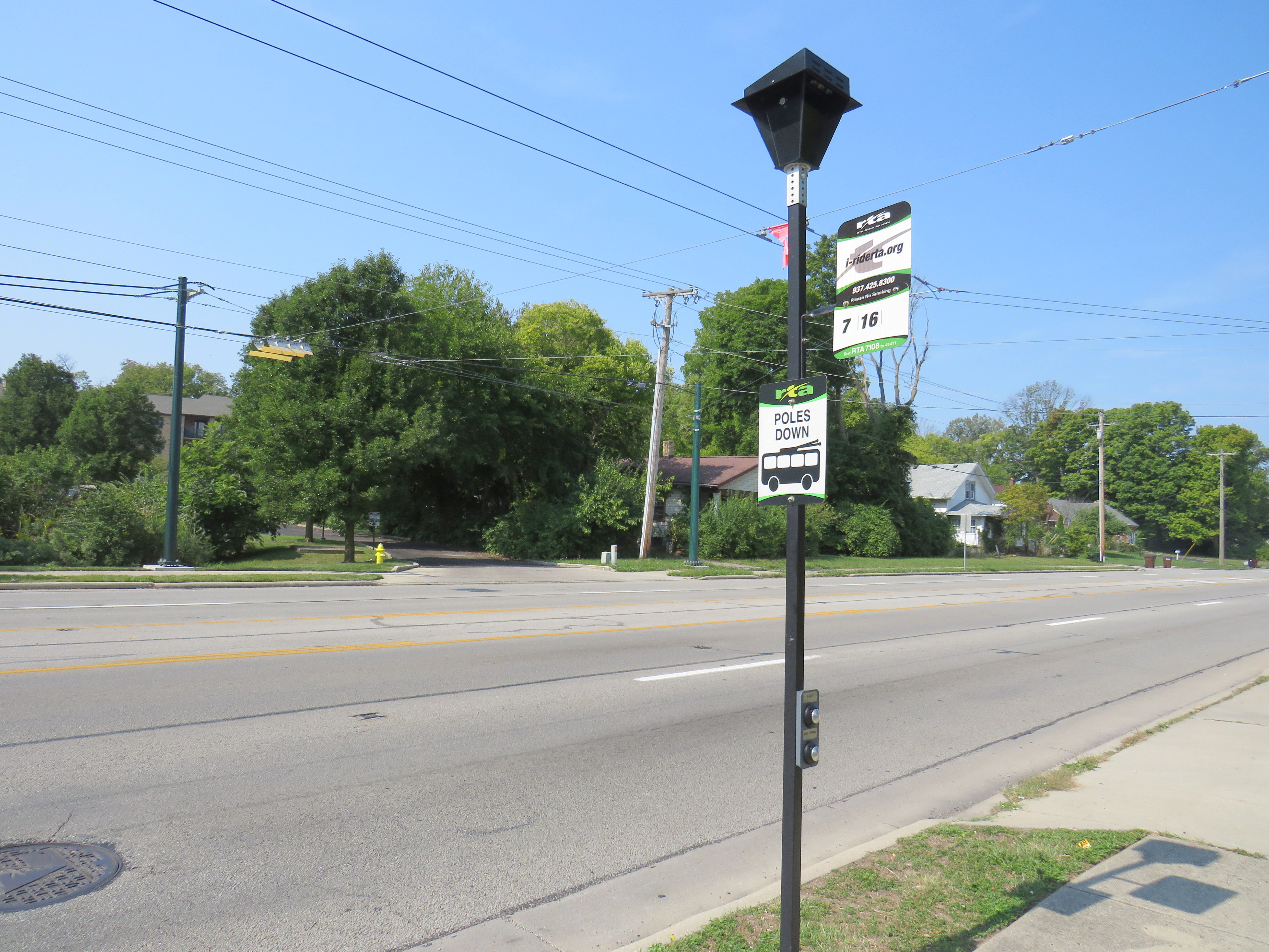
    North Main Street at Elm Hill Drive, where the Route 7 trolley wire ends (note the “poles down” sign), but trolley buses can continue another 5 kilometres onward.

    Unfortunately, despite the new fleet and plenty of wire to run it, the GDRTA has only been operating its trolley buses on a single route in the last few months, despite four routes being fully capable of electric service. When I visited Dayton on September 15, not a single trolley was out. Though I did go visit the US Air Force Museum and the Wright Brothers National Historic Site (where one of the brothers’ bicycle shops were preserved on site; the family home and another of their shops were moved to Henry Ford’s Greenfield Village), I was really disappointed. But having a car, and a hotel reservation less than an hour away, I went back the next morning to see these new vehicles in action and take a ride.

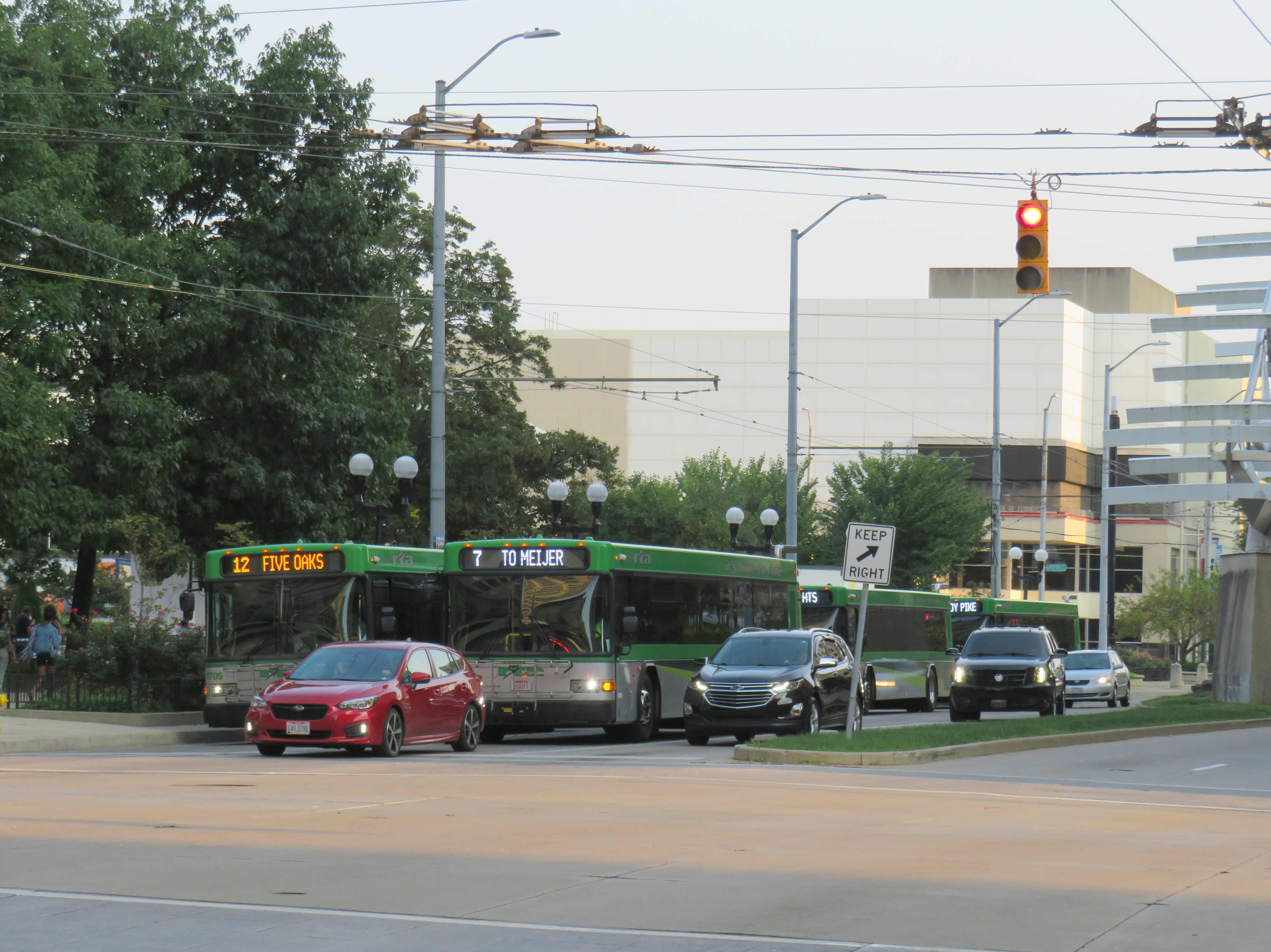
    A line up of diesel buses, including the trolley-capable Route 7, in Downtown Dayton, just south of the main bus terminal on September 15, 2022. Note the trolley wire, completely unused.

    Happily, Route 4 was operating with trolleys, though on a Saturday schedule, imposed by GDRTA because of an ongoing driver shortage that has plagued transit systems across North America. During the daytime, three buses offer 30 minute service on the route. Between Downtown Dayton and the West Side, my first ride that morning was interesting as the bus was operating with its poles down for some reason. But riding the bus, I couldn’t tell: it was a smooth, quiet, and quick jaunt. I took two more trips on Route 4 to the east end, to get the most out of my visit.

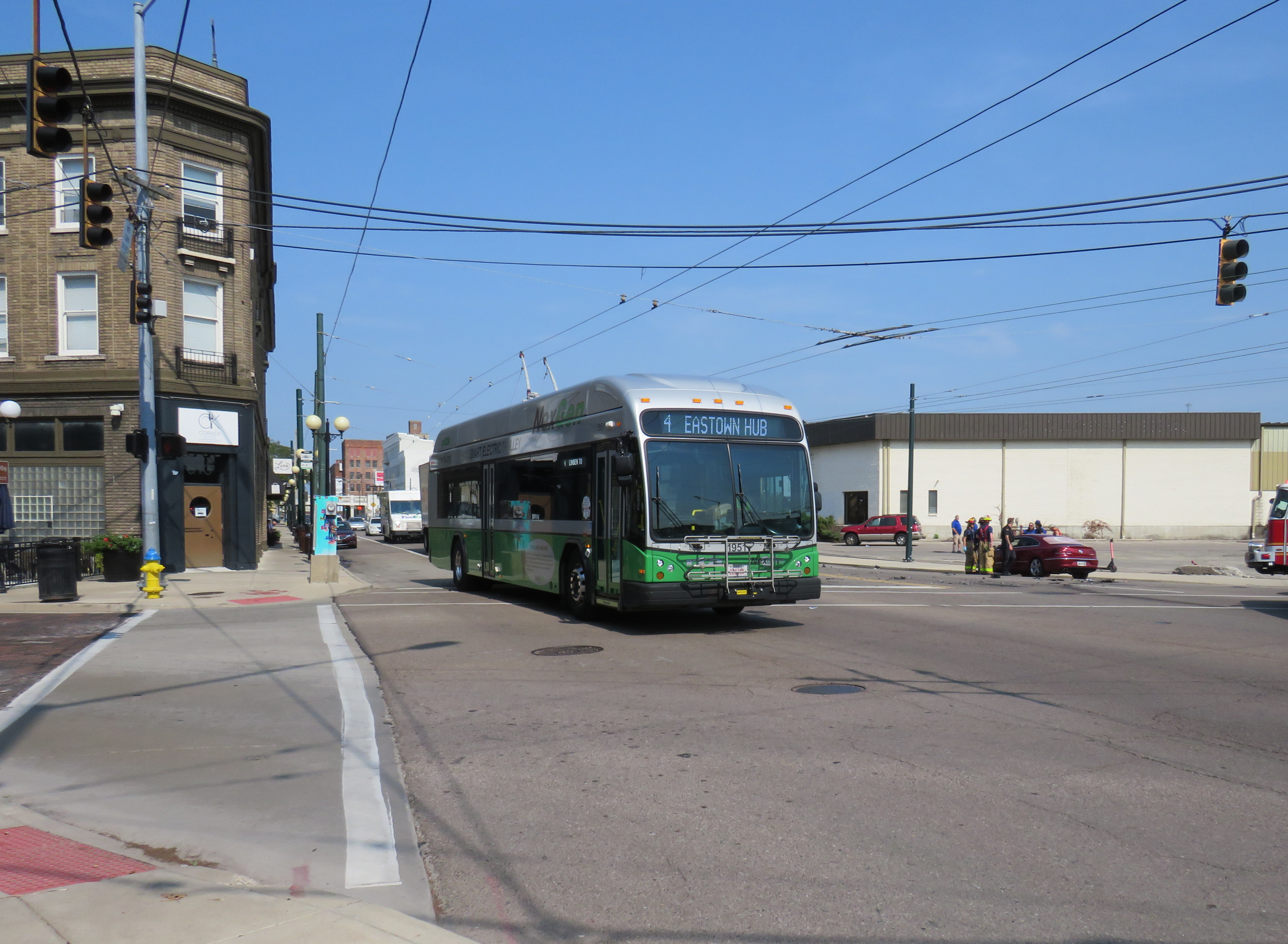
    A NextGen trolley outbound on Wayne Avenue at East 5th Street, September 16

    Despite my disappointment with the GDRTA’s utilization of its fleet, I came away still confident about the technology’s future. Though many transit systems are re-electrifying their bus fleets, they have been purchasing battery-electric fleets that do not have any in-motion charging, unlike Dayton’s advanced trolleys. Some agencies, like the TTC, have battery buses that are charged only at the garages. Other cities, like Brampton, Winnipeg, and Montreal have en-route charging stations at terminal points as well as garage charging points. But bus batteries are extremely heavy, and they have not yet gone through a complete life cycle yet in the harsh Canadian climate.

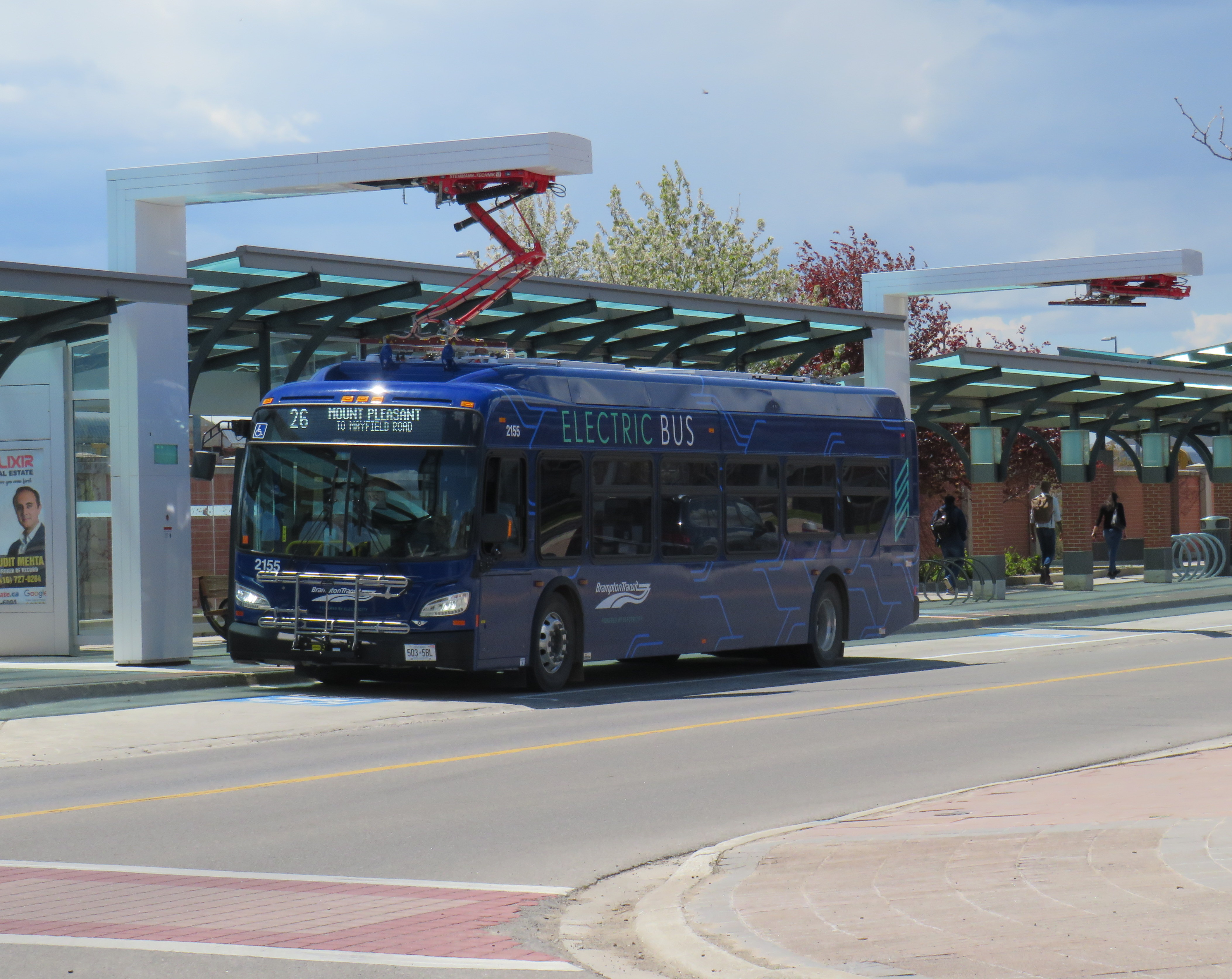
    Brampton Transit electric bus charging at Mount Pleasant Village

    The TTC in particular is suited to restoring its trolley network using modern on-wire charging buses like those used in Dayton, as it has much of the infrastructure already in place, including substations (that feed the subway and streetcar network) and existing overhead wire systems. With long-distance off-wire capability, there is no need for complex wire junctions and short-turn loops, unlike older trolleybus networks. Busy, straight routes such as Dufferin and Bathurst would be ideal.

    Though Dayton isn’t using its new fleet of electric buses to its potential, it does show the way to renewing sustainable electric transit services for cities like Toronto.

  • Neither here, nor there: the folly of transit naming rights

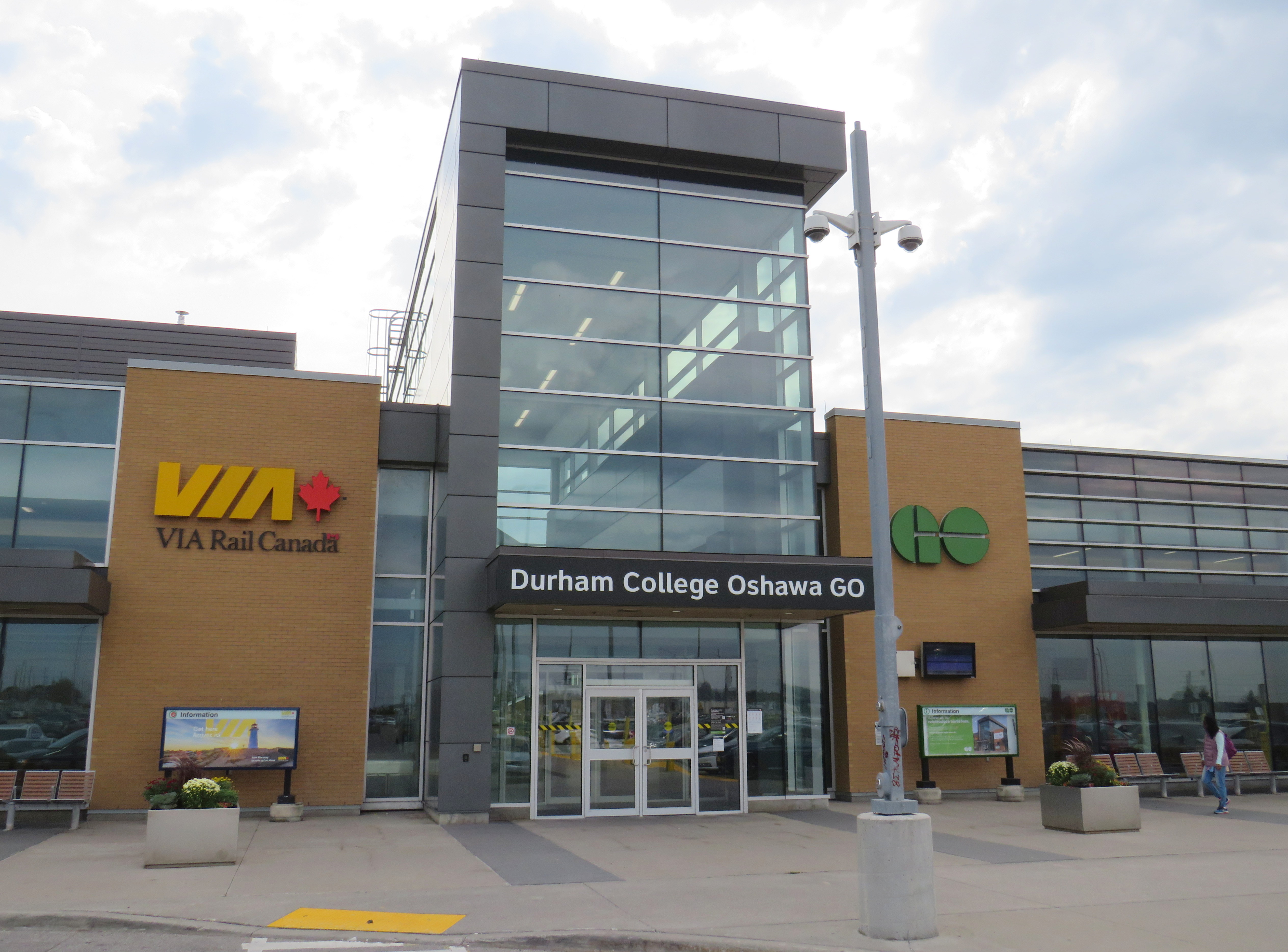
    On Tuesday, October 4, Metrolinx announced a new name for Oshawa GO Station, the eastern terminus of its busy Lakeshore Corridor. In a ten-year agreement with Durham College, a publicly funded post-secondary institution, the station will now be known as “Durham College Oshawa GO.” This was announced on Metrolinx’s Twitter account, Durham College’s social media, and on the GO Transit Lakeshore East Twitter account, which usually advises passengers of train delays and cancellations.

    GO Transit Lakeshore East Train tweet on October 4
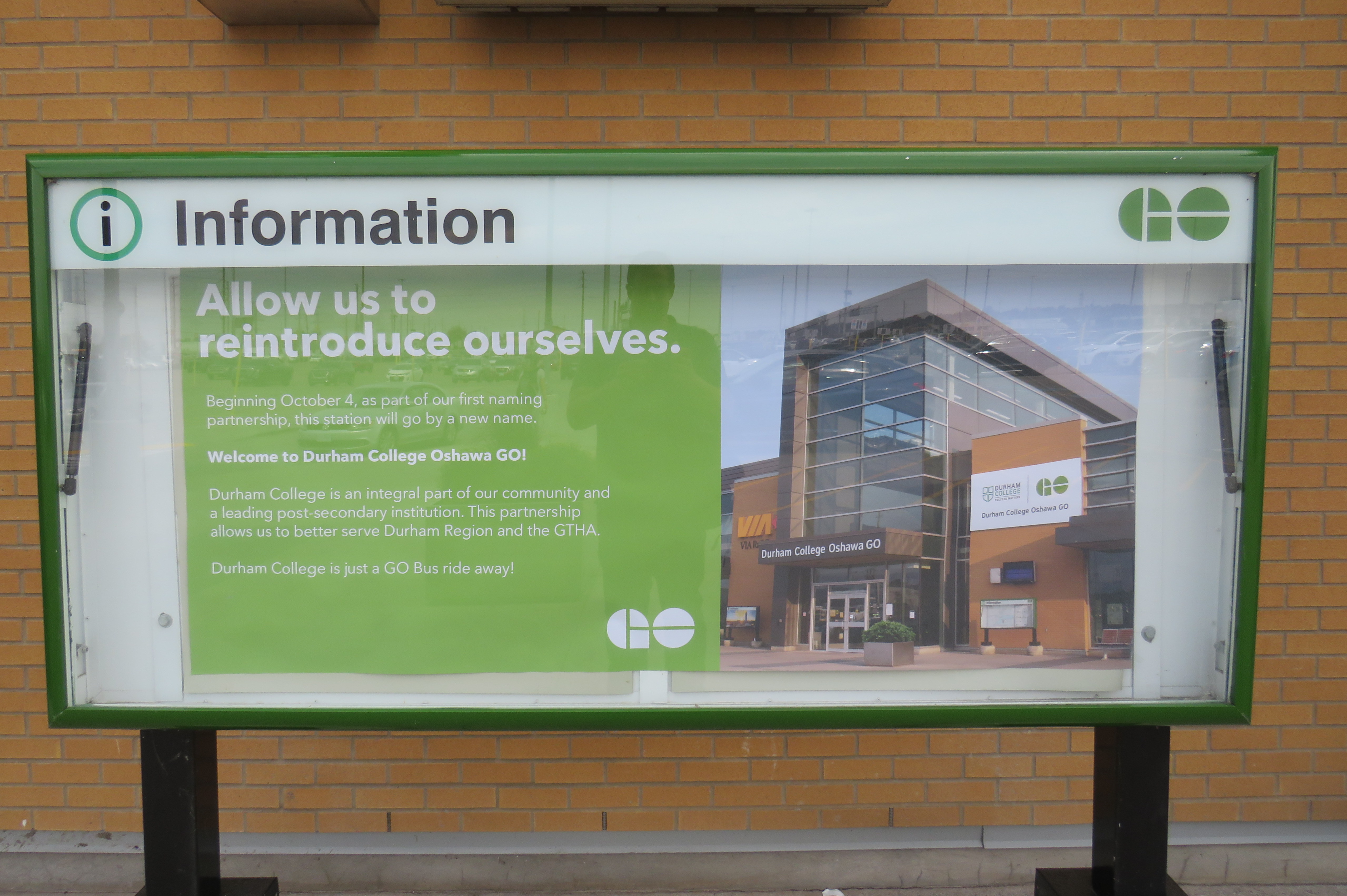
    “Allow us to reintroduce ourselves” – promotional poster at Oshawa Station proclaiming the new “Durham College Oshawa GO” name

    Metrolinx, the regional transit agency that operates GO Transit, claims that “the partnership allows us to better serve Durham Region and the GTHA” in its communications, including an informational poster in front of the station building.

    The news did not go over well with GO Transit customers and transit users across the Greater Toronto Area; Metrolinx later deleted its tweet after it was “ratioed” — meaning that negative comments and quote-tweets outnumbered the number of positive responses by a large margin. It is easy to understand why the station renaming was not popular.

    Firstly, though “Oshawa” remains in the station name, Durham College comes first with the new moniker. Schedules, signs, and maps will be updated to reflect the new name, while announcements by on-board staff and digital schedule information already reflect the new name. VIA Rail, which shares the station with GO Transit, is not a party to the agreement, and will likely continue referring to the station as “Oshawa.”

    Specific details of the agreement, such as how much Durham College is paying for the branding agreement, remain confidential.

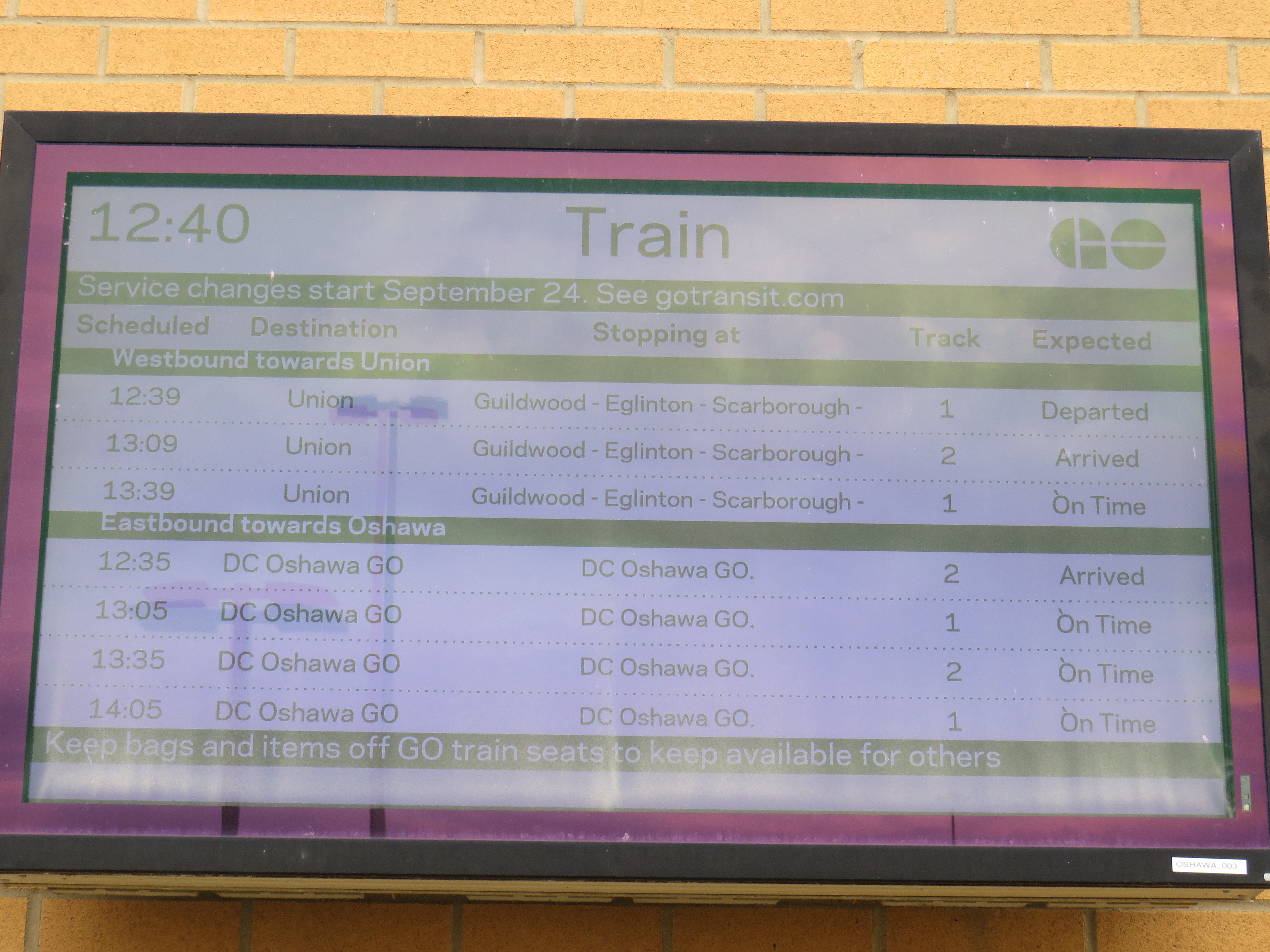
    On GO Transit schedule boards, Oshawa Station now appears as “DC Oshawa GO”

    The new policy of naming rights agreements goes against years of Metrolinx policy for naming stations. When planning the Eglinton-Crosstown LRT, it developed five standards for naming stations and stops:

    1. Simple. Simple names are easier to remember

    2. Logical. Logical names provide a mental link when trip planning: they should be relevant to the area they reside

    3. Durable. Names should be relevant as long as the station exists

    4. Self-Locating. Names should allow users to mentally locate themselves within the region

    5. Unique. A unique name is one that cannot be confused with any other.

    Metrolinx principles for determining new names

    “Durham College Oshawa GO” violates most of the above principles. The name is now a mouthful, much like “Vaughan Metropolitan Centre” (another controversial station name that the TTC objected to, but was overruled due to political considerations), and is no longer simple. The agreement only lasts ten years, so it is not durable. As I will explain further, the name is also neither logical, self-locating, nor unique.

    Durham College has three campuses. Its main campus is located in the north end of Oshawa, on a site shared with Ontario Tech University. GO Transit has a bus stop there called “Ontario Tech/Durham College” that is served by GO Transit Route 56 on weekdays, and Route 52 on weekends and holidays. The main Oshawa campus is a two hour walk from the GO station, a 25-35 minute GO bus ride, or a 20 minute drive from the station. This was the main reason why transit users were ridiculing the new station name on Twitter.

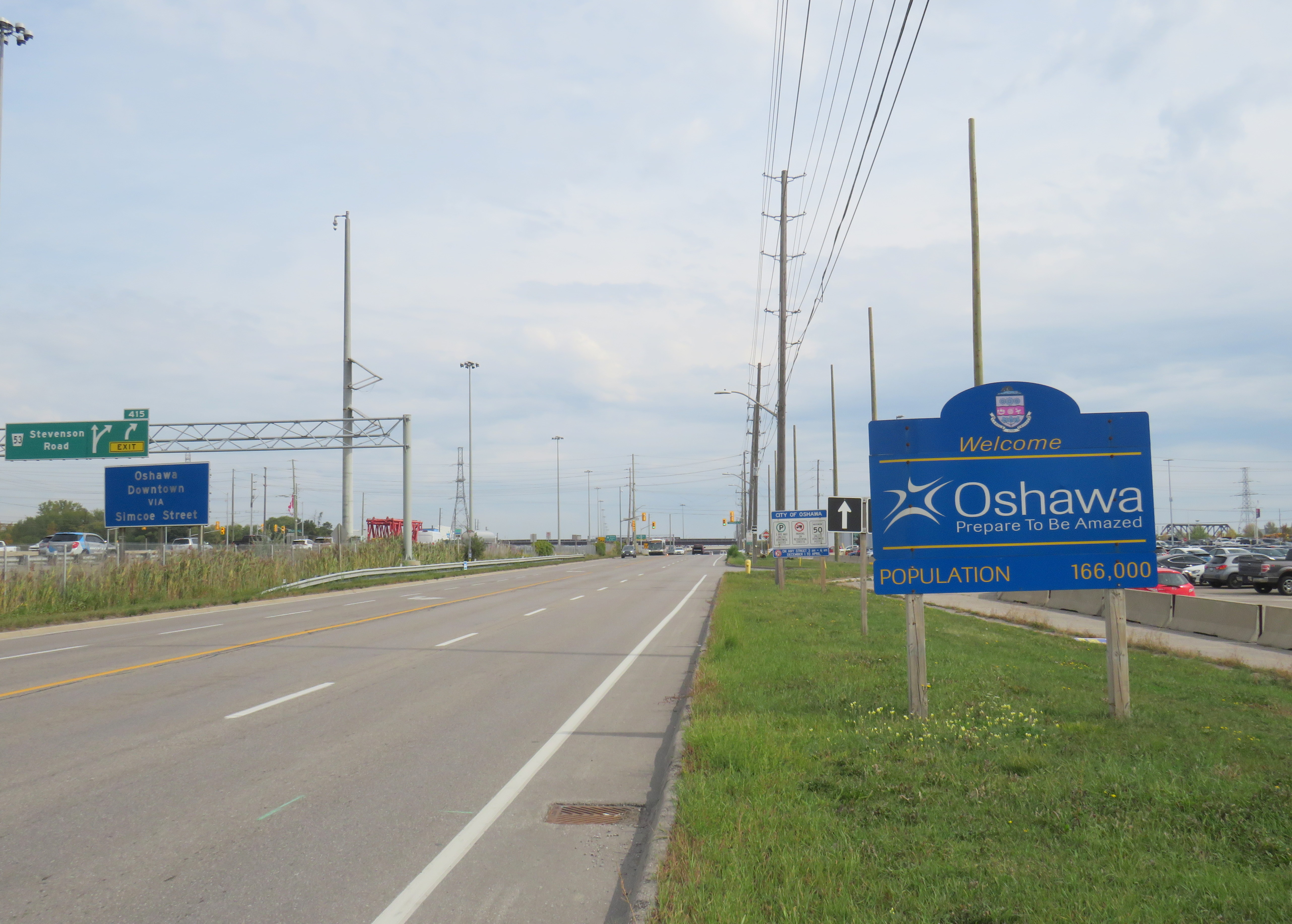
    Durham College’s Whitby Campus is much closer to Oshawa GO Station, in fact, it is less than 500 metres from the Oshawa GO Station parking lot as the crow flies. Oshawa Station is actually right on the border of Oshawa and Whitby, with the “Welcome to Oshawa” signs next to the main GO Transit parking lot. The overflow lot for Oshawa GO is actually in the Town of Whitby.

    The “Oshawa: Prepare To Be Amazed” sign marking the city limit sits next to the GO Station parking lot.

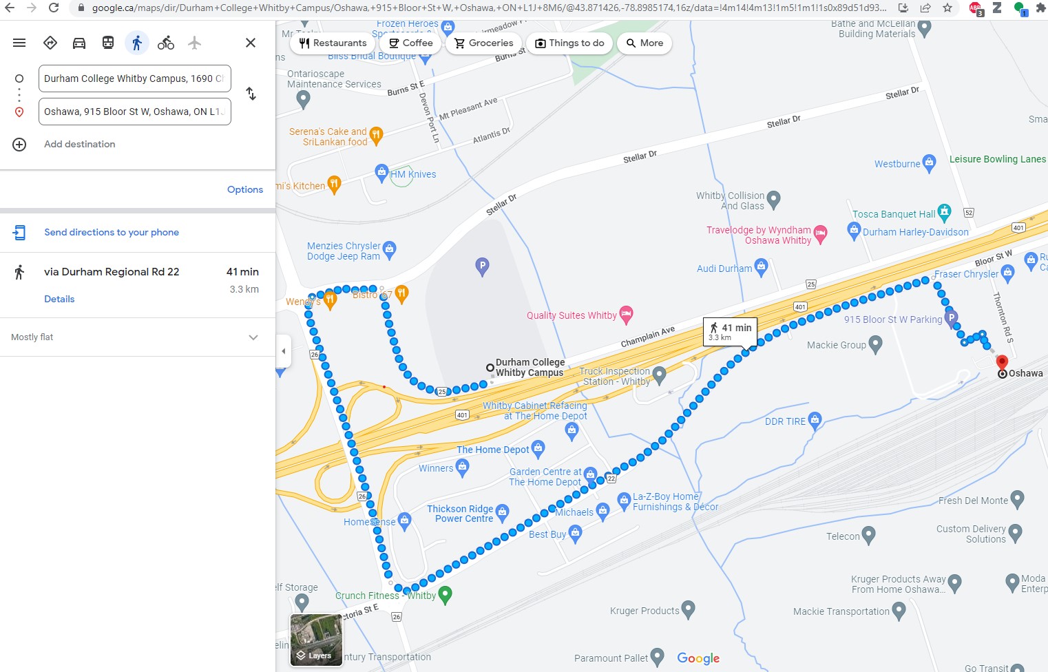
    However, the Whitby campus is even harder to get to from Oshawa GO than the main Oshawa campus because it is separated by Highway 401. It is a 41 minute walk between the station and the Whitby college campus along Victoria Street (which has no sidewalks along most of its length), Thickson Road, Stellar Drive, and Champlain Avenue, though a footbridge over the highway would reduce the walking time to a more comfortable 15 minutes.

    Google Maps directions from Oshawa Station to Durham College Whitby Campus
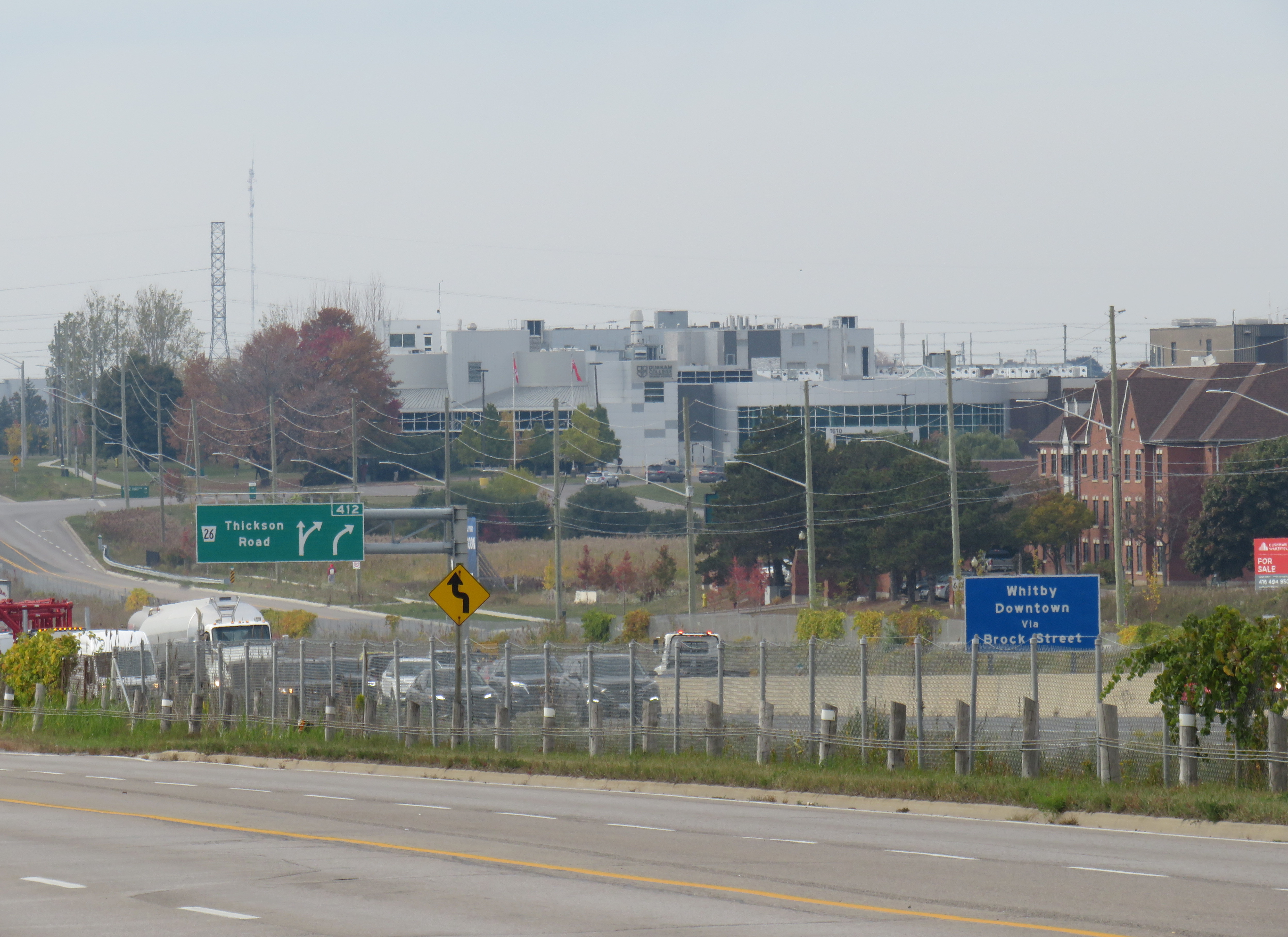
    Looking northwest from the Oshawa GO parking lot towards Durham College Whitby Campus, the large grey building above and to the right of the green Thickson Road exit sign
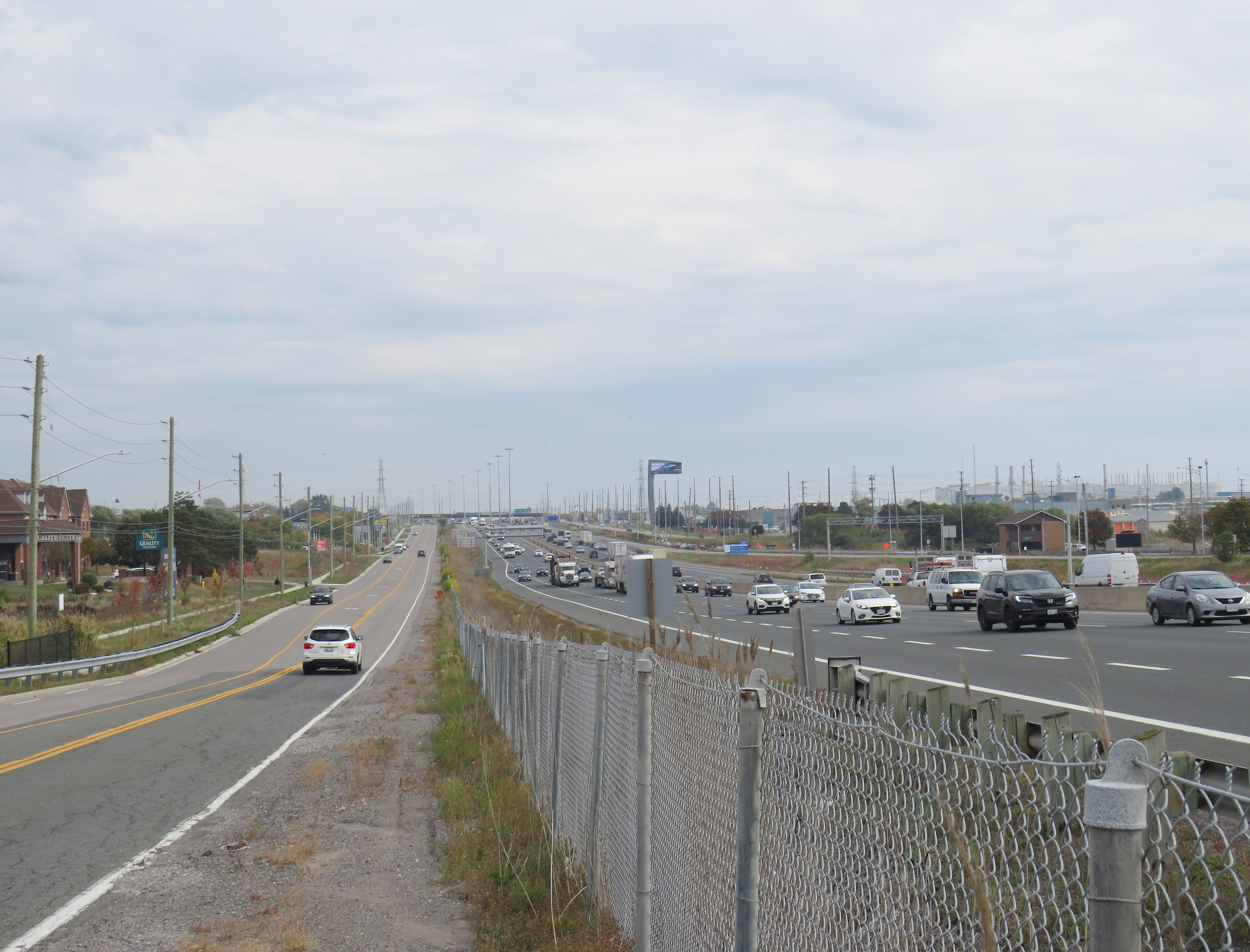
    Looking east on Champlain Boulevard in front of the Whitby campus across Highway 401 towards Oshawa GO Station, which is marked by the tall digital billboard towering over the roadway

    The irony is that both major Durham College campuses are better reached from Whitby Station than the newly named “Durham College Oshawa GO.” There are no direct buses to the Whitby Campus from Oshawa Station, but Durham Region Transit (DRT) Route 917 provides regular service from Whitby Station. Furthermore, DRT operates more frequent service on Route 905 between Whitby Station and the Oshawa Campus than GO Transit does from Oshawa Station. Google Transit itself recommends transferring at Whitby to DRT, rather than at Oshawa, because the connections are more convenient. GO Route 56 operates only every hour on weekdays, and Route 52 runs every two hours on weekends and holidays. Meanwhile Route 905 stops in front of the Oshawa campus every 15-30 minutes, 7 days a week.

    The connection at Oshawa Station to Durham College’s main Oshawa Campus makes sense only when transferring from a VIA Train, or from GO Transit Route 88 from Peterborough and Clarington.

    Excerpt from Durham Region Transit system map, with Oshawa and Whitby stations and both Durham College campus locations highlighted

    Therefore, at this point, renaming Oshawa Station to “Durham College Oshawa GO” makes no sense. The new name violates basic wayfinding standards, while Durham College itself is better accessed from a different GO Station. Perhaps Durham College could operate a shuttle service to its campuses from the station, making the co-branding a more plausible.

    More concerning is that future renamings are in the work. In February, I noted that Metrolinx was looking for expressions of interest for station naming opportunities, specifically four Lakeshore Corridor stations: Whitby GO Station, Exhibition GO Station, Clarkson GO Station and Oakville GO Station, but noted that they would be willing to consider other proposals as well.

    Though I am critical of the process, I am sympathetic to Metrolinx’s position. I do not believe they were supportive of the province’s decision to rename a major LRT project for a political ally and paid advisor to Doug Ford’s Progressive Conservatives. I strongly believe there are many within the organization who are not happy about the station renaming agreements either. They must work with a very “hands on” government that is eager to promote new transit projects and benefit their supporters.

    Such is the state of things in Ontario.

  • GO Transit is broken – and other transit updates

    GO Transit buses stuck in Downtown Toronto gridlock in July, 2022

    While travelling through the Northeastern United States this spring and summer, I found myself feeling lucky to be living in Toronto. Though the New York City Subway and the PATH trains between New Jersey and Manhattan were operating pretty much as I remember them, in other big cities, the mass transit systems were in rough shape. In Washington, underfunding and incompetence led to the long-term withdrawal of over half of its Metro cars. During our visit in April, we were treated to long waits and crowded trains, though at least the system was clean. When we visited Philadelphia in late June, it was clear that the Southeastern Pennsylvania Transit Authority (SEPTA) had given up: poor communications, lengthy waits, unsafe subway stations, and general apathy among staff and passengers made my spouse and I resort to driving on our last day there.

    In Toronto, at least, the subway was still running frequently (with only minor service cuts due to the pandemic), the buses and streetcars as (un)reliable as ever, and despite more anti-social behaviour on some of its surface routes, I almost never felt afraid for my well-being when riding the Rocket, compared to my experience in Philly. GO Transit responded to the pandemic very well. Though it was forced to suspend many of its train and bus trips due to a sudden plunge in ridership, it maintained a basic service level on nearly all of its routes, slowly restoring certain services in 2021 as ridership slowly rebounded. Some corridors, like the Kitchener Line, had more service in the early Fall of 2021 than it did prior to the pandemic. As Metrolinx continued planning and construction of major transit projects like GO Expansion, the Ontario Line, and several LRT corridors, the future looked bright. In Spring 2022, GO Transit introduced a special weekend day pass for $10 per day or $15 per weekend, to help grow ridership.

    Unfortunately by late June 2022, GO began to fall apart.

    (more…)
  • An idea with merit

    An idea with merit

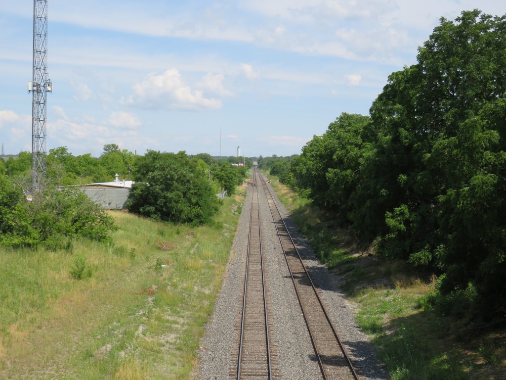
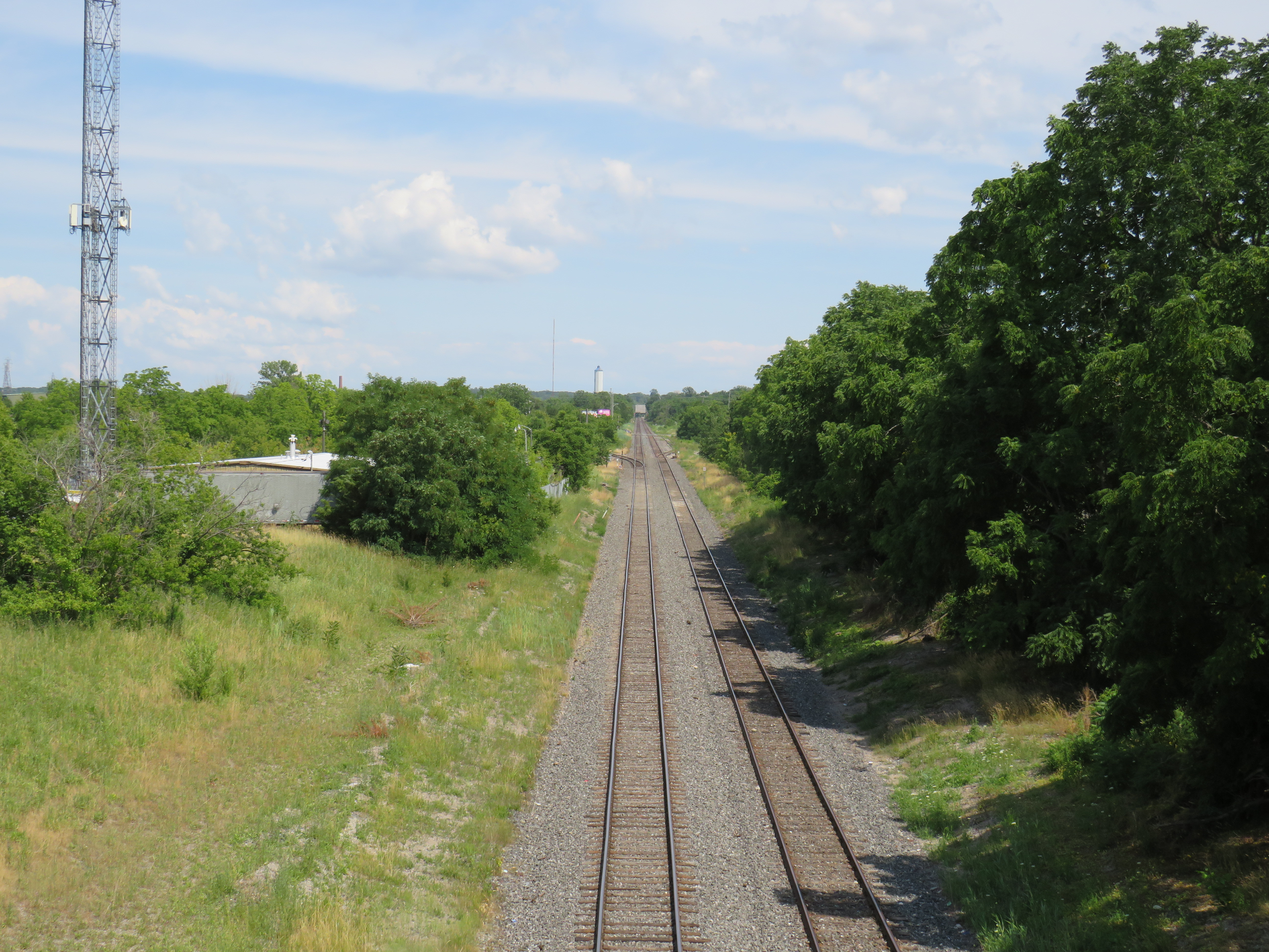
    Looking east on the CN mainline from Merritt Street in St. Catharines towards the Welland Canal

    The case for reviving Merritton Station

    On the morning of Saturday, July 9, a GO Transit train filled with hundreds of passengers heading from Toronto to Niagara Falls, was stuck at St. Catharines when a lift bridge over the Welland Canal was unable to lower the deck to allow trains to pass.

    After over an hour of holding at the St. Catharines VIA Station, GO Transit was forced to send the train back to Toronto. In an advisory on Twitter, GO informed customers that they “will need to make their own accommodations” for getting between St. Catharines and Niagara Falls, and would not be sending any shuttle buses.

    Needless to say, this left many families disappointed. With GO Transit understandably unable to muster enough buses on a summer weekend to quickly transfer 1500 passengers (which would require at least 25 coaches), the decision not to provide alternate transportation is understandable, if unfortunate.

    The summer weekend Toronto-Niagara train service is incredibly popular, especially the Saturday and Sunday morning departures from Union Station, and the evening return trip. Specially-outfitted bicycle coaches allow for dozens of bicycles to be transported by train; Niagara Region is an excellent cycling destination.

    Recent fare innovations, including the $10 weekend day pass and a special GO Transit-Niagara Parks package have only contributed to the route’s success. As GO Transit is able to carry 1500 passengers on each train between Toronto and Niagara, it is invaluable not only for supporting the local tourism industry, it provides an alternative to driving on the congested Queen Elizabeth Way.

    Unfortunately, the CN Grimsby Subdivision, which runs between Hamilton and Niagara Falls, is hardly ideal for frequent commuter and excursion service. Trains crawl through Hamilton, and much of the line is single-tracked, limiting capacity. Furthermore, trains to and from Niagara must back in to Hamilton’s West Harbour GO Station, which still does not have a direct connecting track to the east.

    But the Welland Canal lift bridge is the greatest barrier for providing frequent and reliable rail service to Niagara Falls. During the Great Lakes shipping season, train traffic must yield to the busy St. Lawrence Seaway. Constructing a bridge or a tunnel is difficult and costly as railways are limited to typically no more than a 2% grade, and the freighters require a high clearance (as evident with the nearby QEW Garden City Skyway). Constructing a tunnel is also difficult, as the railway begins climbing the Niagara Escarpment just east of the canal, and would need to climb an even longer distance from canal. (A railway tunnel south of Welland has no such constraints as it is well above the escarpment.)

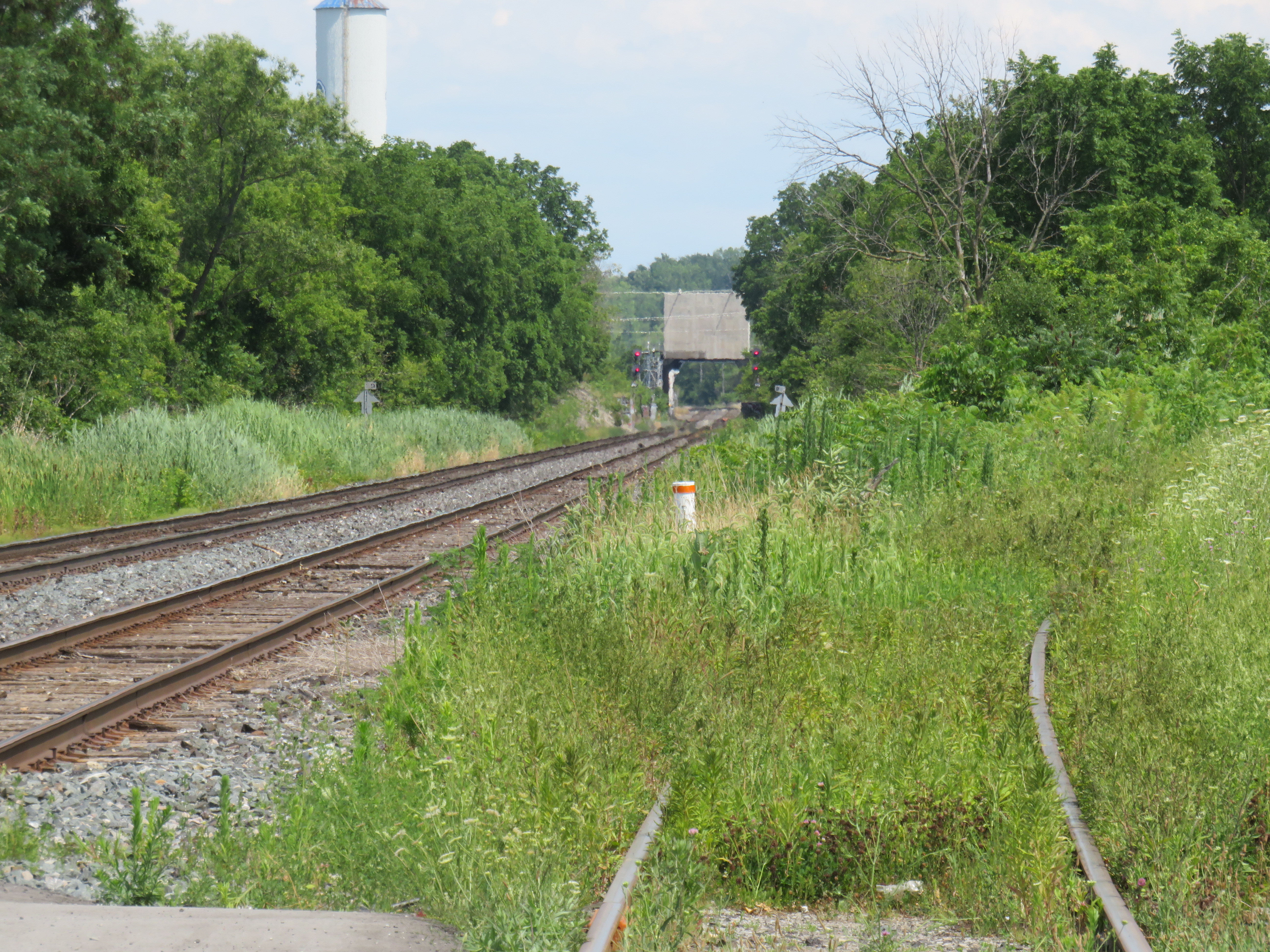
    Looking east towards the Welland Canal lift bridge from Glendale Avenue. The disused CN Thorold Spur disappears into the weeds at right.

    As a short-to-medium term measure, Metrolinx should look at constructing a new station at Merritton, located southeast of Downtown St. Catharines and approximately three kilometres east of St. Catharines Station. Until 1961, Merritton was an independent town, an industrial centre served by both the Grand Trunk/CN and the electric Niagara, St. Catharines and Toronto Railway. With amalgamation with St. Catharines, the closure of the passenger railway stations, and the loss of the historic paper and textile mills, Merritt Street has seen better days.

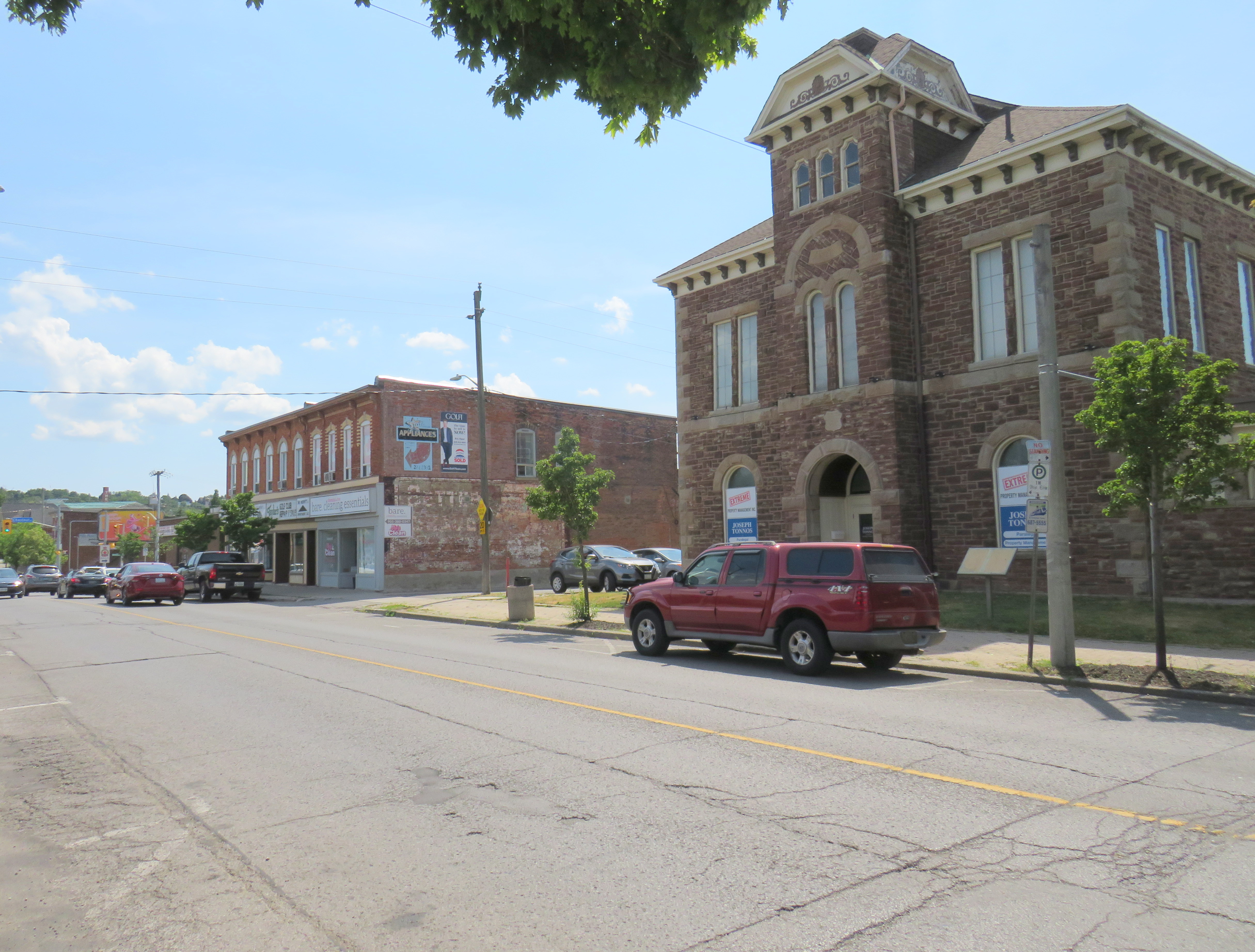
    Merritt Street, just south of the CN Railway. The stone building at right is the former town hall.

    Merritton’s CN Station was located on the east side of Merritt Street. Passenger service ended by the 1960s, and industrial switching activity between the former NS&T and CN’s Thorold spur line declined, so the building was eventually abandoned. It burned down in 1994, and there is little trace of its existence.

    Unlike the active VIA station on the west side of St. Catharines, Merritton is quite close to the Welland Canal and the Niagara Circle Route. Merritt Trail, which follows the original Welland Canal route, is within a short walk from Merritton. It is also much easier for buses arriving from Niagara-On-The-Lake, Thorold, and Niagara Falls to access a station site at Merritton than the awkwardly-located St. Catharines Station, with four to five minutes saved, especially if there were direct access from Glendale Avenue.

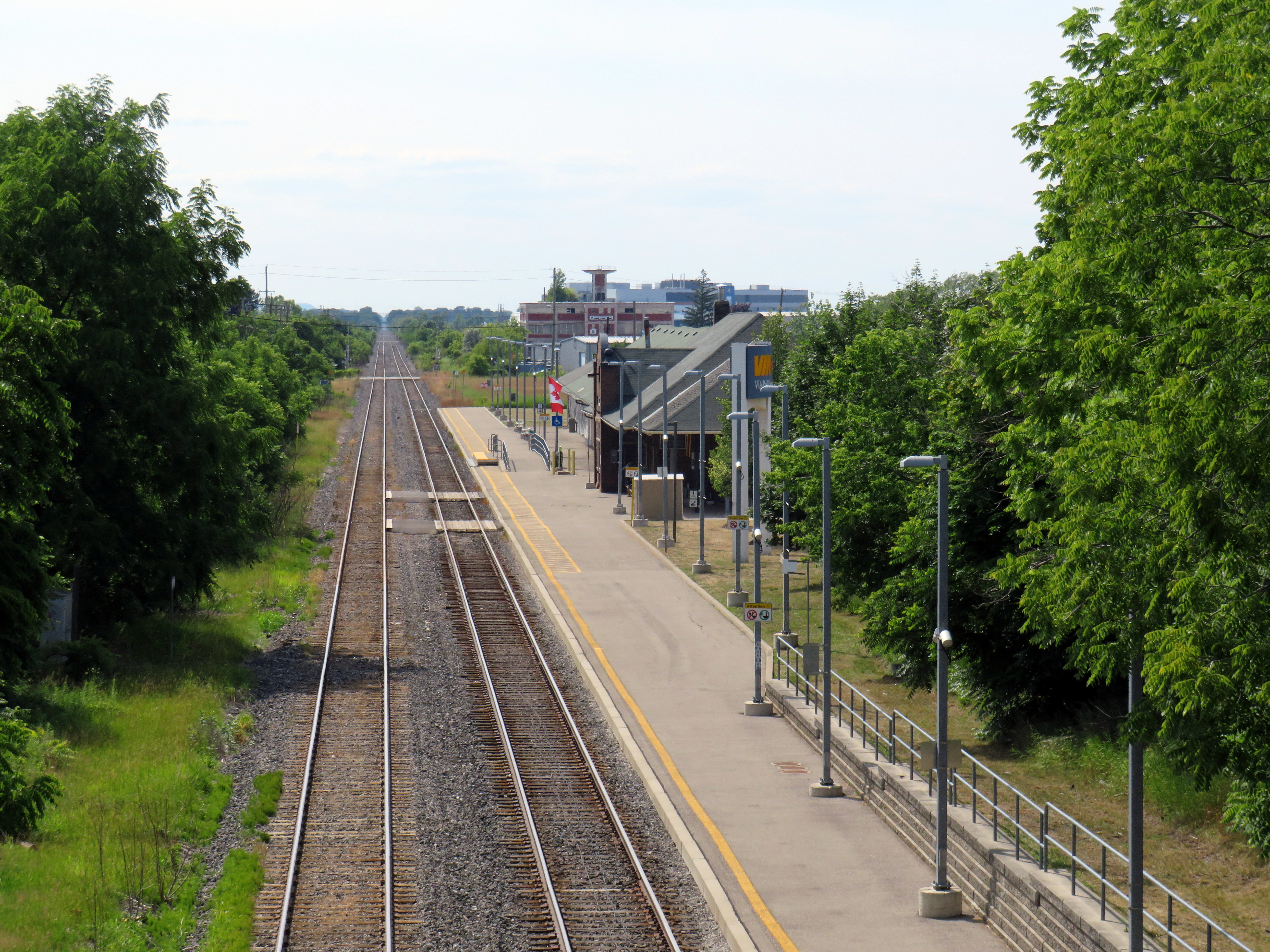
    St. Catharines VIA/GO Station, off of St. Paul Street West. Awkwardly located for bus access, the station platform is a 25 minute walk to Downtown St. Catharines.

    Not too far from Merritton is St. Catharines Museum and Lock 3 Centre, which tells the history of the region and the Welland Canal; a platform provides excellent views of passing ships. Niagara College and the Outlet Collection are also close by, via Glendale Avenue. Whenever there’s a delay or failure at the lift bridge, there are more options at Merritton, especially if a proper bus transfer point is constructed.

    Ideally, a grade-separated Welland Canal crossing would become an integral part of a frequent Toronto-Hamilton-Niagara-Bufffalo rail service. In the meantime, a stop at Merritton for GO commuter and excursion trains would provide new transit and cycling connections, while serving passengers in eastern St. Catharines, Niagara-on-the-Lake, and Thorold.

    St. Catharines: where the Bruce Trail is at its least Bruce Trail-ish

    I travelled to St. Catharines on a lovely July Friday, taking GO Transit’s Route 18K bus from Aldershot Station through Hamilton, along the QEW, and to Brock University in St. Catharines. The university campus is at the top of the Niagara Escarpment, boasting direct connections with the Bruce Trail.

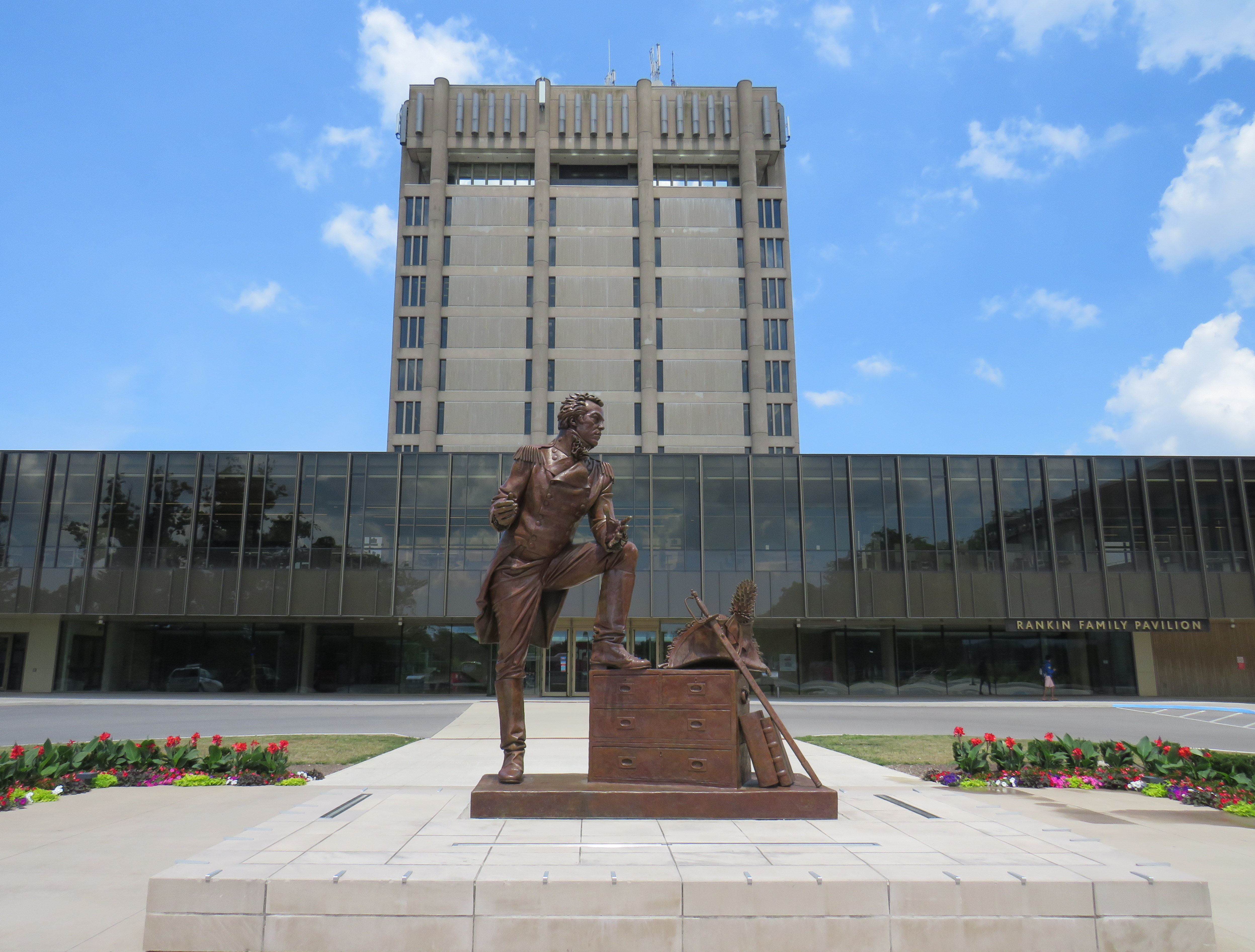
    Statue of General Brock at the main university entrance

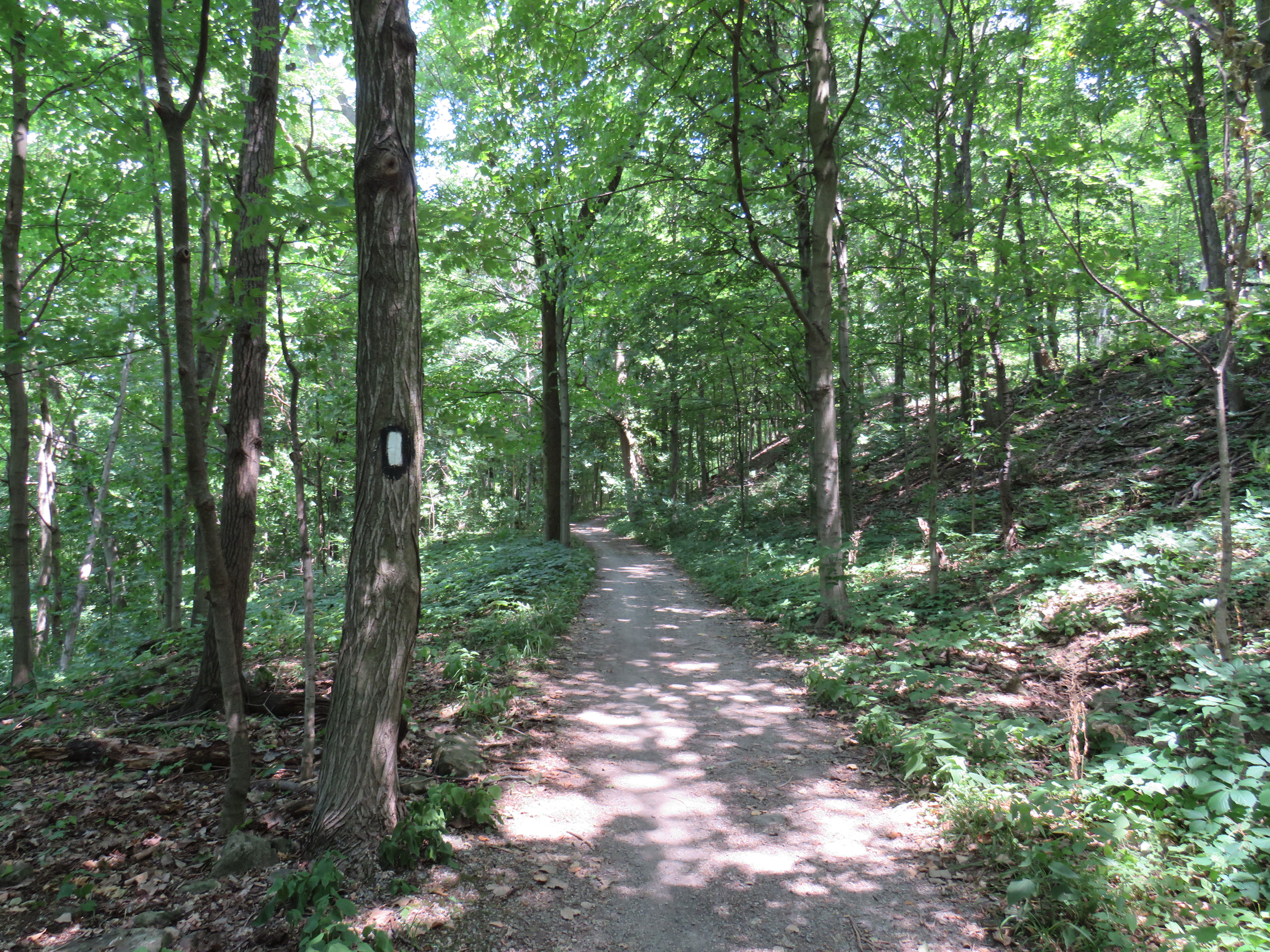
    The walk eastwards towards Merritton from Brock University started out promising. The thick tree cover provided welcome shade, and apart from a rather dangerous crossing of Glenridge Avenue, felt little different than anywhere else on the southern part of the famous trail.

    A promising start
    Being watched by a young red-tailed hawk

    At Tremont Drive, the trail suddenly enters a subdivision, with only the tell-tale white blazers to assure hikers that yes, in fact, this is part of the Bruce Trail.

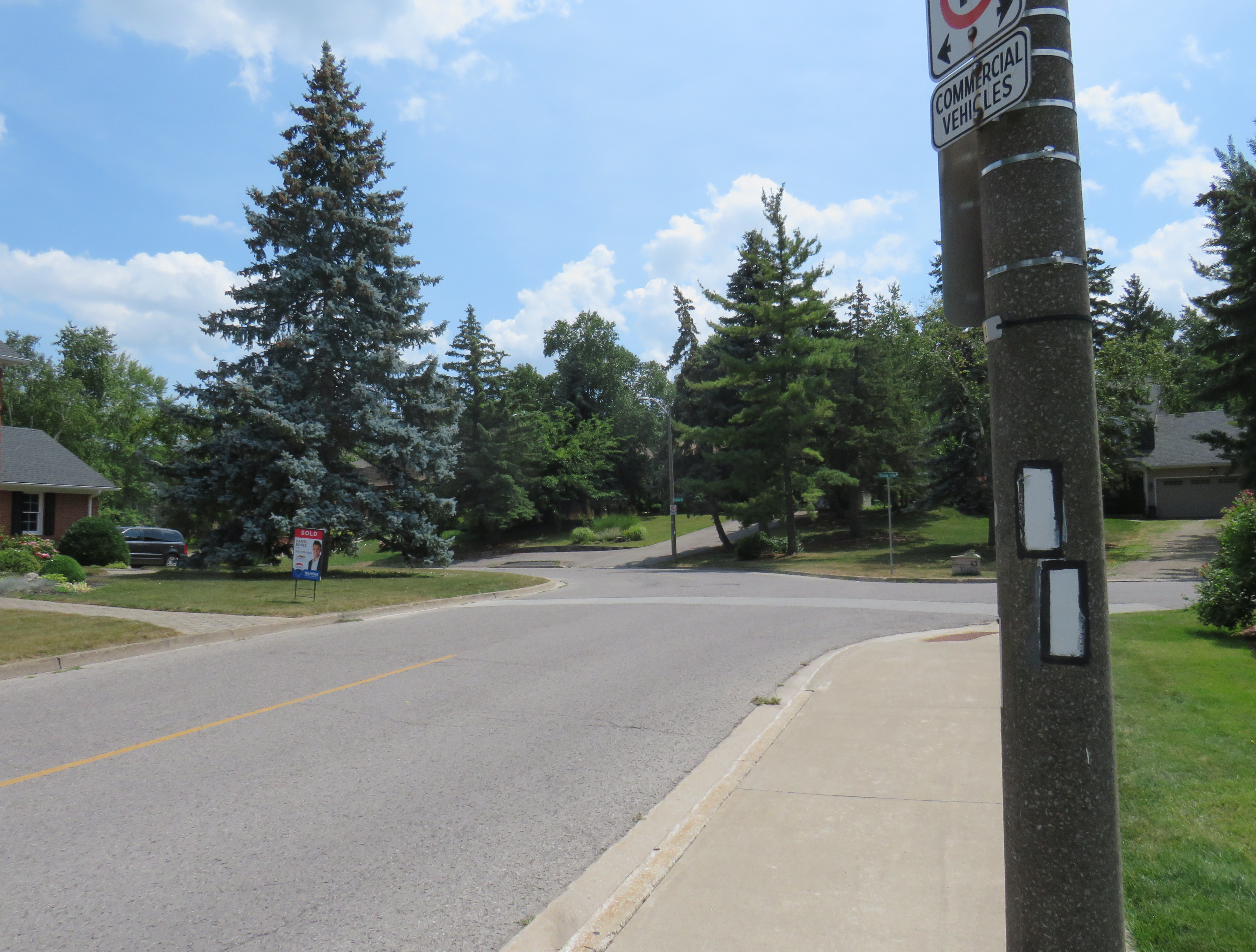
    Bruce Trail blazers are the only hint that this is part of Ontario’s greatest hiking trail

    The trail continues to busy Glendale Avenue, and crosses Highway 406 at the interchange. At each traffic light, pedestrians are required to press the “beg button” to get a walk signal, even if one is crossing in the same direction as the through traffic. In most other places, the walk signal comes on automatically in conjunction with the dominant traffic flow.

    Though the Bruce Trail also passes through Hamilton, a city nearly four times the size of St. Catharines, the trail there manages to remain separated from traffic and even from the city as a whole, much like Toronto’s ravine park systems.

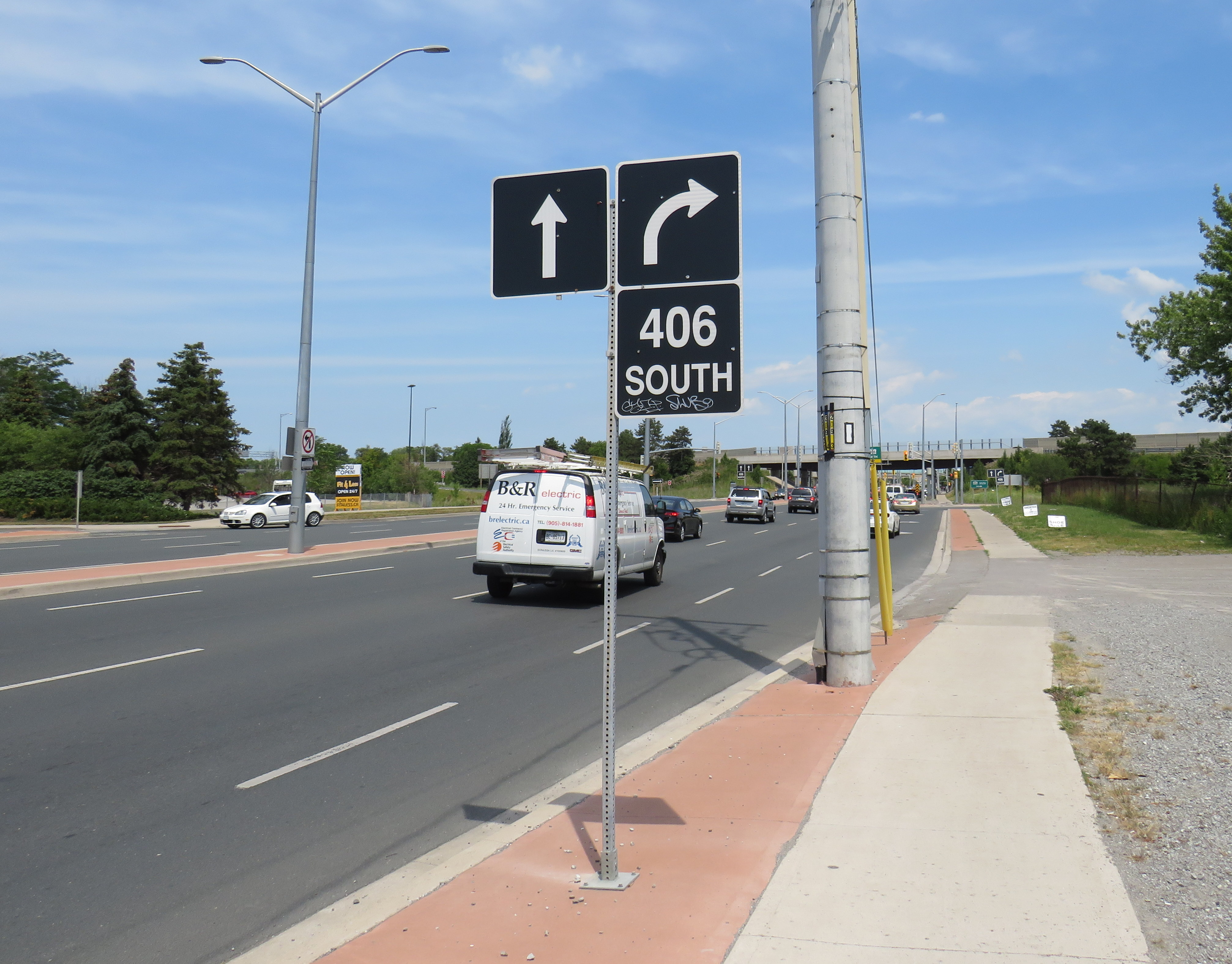
    Glendale Avenue at Highway 406: the lowpoint of the 900 kilometres of Bruce Trail