Category: Transit

  • The TTC, by the numbers

    The TTC, by the numbers

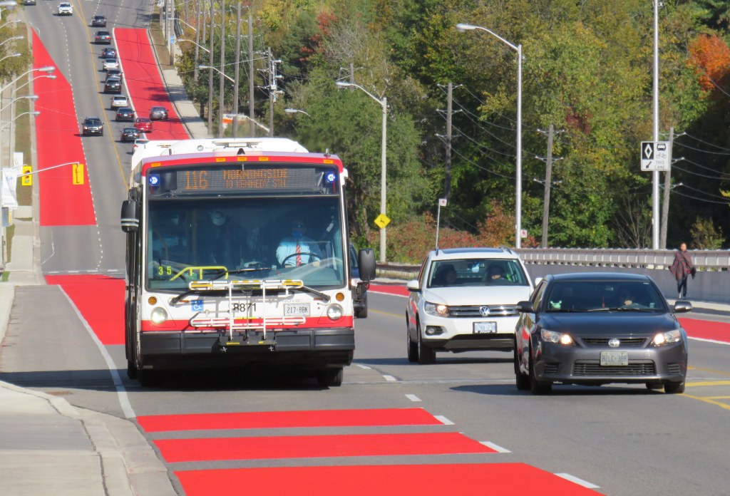
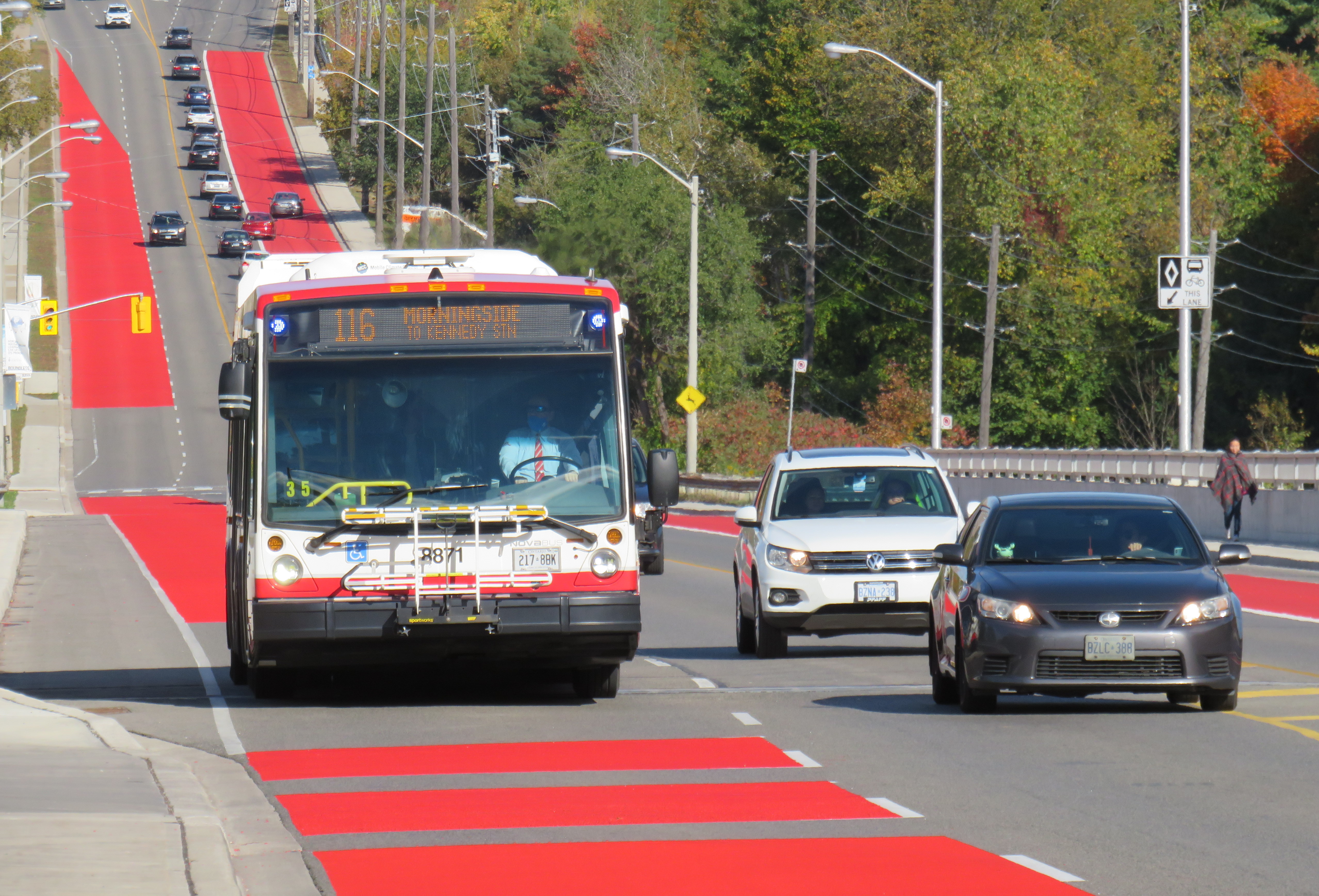
    Route 116 Morningside was created in 1989, replacing a branch of Route 34 Eglinton East

    On Sunday, June 20, the TTC will renumber two bus routes, Route 5 Avenue Road and 6 Bay. This change comes ahead of the opening of the Crosstown LRT and the Finch West LRT, which will be assigned those numbers, as they added to the city’s rapid transit network in the next few years.

    Route 5 Avenue Road, in service since 1954, will become Route 13 Avenue Road. 6 Bay, which has existed since 1963, will be renumbered 19 Bay. Those follow similar measures in 2001, when the 2 Anglesey and 4 Annette routes were renamed to 48 Rathburn and 26 Dupont, respectively.

    Though there are over 150 bus routes operated by the TTC, including express routes and all-night routes, the TTC was relatively late numbering all of its services. A consistent system for numbering bus routes did not exist until the late 1950s (though they did not appear on system maps until 1964), while streetcar lines were not assigned numbers until 1979.

    Later, new series of route numbers were assigned to the overnight “Blue Night” network in the late 1980s, rapid transit lines in 2001 (just prior to the Sheppard Subway’s opening), and express bus routes only a few years ago. But for the regular service lines (those between 7 and 189), the numbers seem random — not grouped by geography, service type, or year each route was established.

    In the late 1950s, though, when bus routes were numbered for the first time in 30 years, there was a system: numbers would be assigned in alphabetical order, with north-south routes given odd numbers, and east-west routes assigned even numbers.

    Bus on Route 34 Eglinton East, in the late 1950s.
    City of Toronto Archives Series 648, File 29, Item 1.

    Route 1, Armour Heights, was a short shuttle that ran along Avenue Road between the fare zone boundary at Roe Avenue (the end of the frequent 61 Nortown trolley coach) and Bombay Avenue, north of Highway 401. Route 2 Anglesey served several neighbourhoods in central Etobicoke. Route 96 Wilson remains a busy east-west route in North York, and Route 97 Yonge was originally a very frequent trolley coach route between the north end of the subway at Eglinton Station and the City of Toronto limits at Glen Echo Loop.

    In 1964, the numbering system was still mostly intact, with two notable exceptions: 6 Bay, introduced one year earlier in 1963, was a north-south route. Route 17 Birchmount, introduced in 1960, broke the alphabetical order after Route 15 Brimley.

    The opening of the Bloor-Danforth Subway in 1966 and major extensions in 1968 resulted in major route restructurings, and while the TTC tried to maintain the odd numbers for north-south routes and even numbers for east-west routes, that eventually came to an end, especially when further expansion required the use of three-digit numbers in the mid 1970s.

    The interactive map below shows the full extent of the TTC’s service area in 1964, along with the municipal boundaries of that era, before Metro went from thirteen cities, towns, and townships to just six.

    Link to interactive map

    Though today’s regular service bus route numbers do not follow a specific pattern, recent changes to the night bus and express bus numbering systems have restored order to the numbering scheme.

    Number Route Type
    1-6Rapid transit lines (subway, LRT).
    7-189Regular local bus service
    300-396Night bus and streetcar routes, with numbers often echoing the daytime service (for instance, 329 Dufferin night buses follows the daytime 29 Dufferin bus’s route)
    400-407Community buses, offering ultra-local accessible services in selected parts of the city.
    501-512Streetcar routes. Streetcar route numbers were introduced in 1979, coincident with the introduction of the CLRV streetcars. The small area for destination signs in the new vehicles required numbers to be displayed instead of names for information to be legible.
    600-699Subway operations, internal use only. Previously, rapid transit routes were numbered in the 600-series, with Yonge-University-Spadina numbered 601, Bloor-Danforth 602, and Scarborough RT 603. Briefly, the Harbourfront Streetcar was branded as a rapid transit route and assigned number 604.
    900-996Express network bus routes, with numbers often echoing the regular service (for instance, 996 Wilson Express follows the local 96 Wilson bus’s route)
  • Greyhound Canada’s inevitable decline leaves a few gaps to fill

    Greyhound Canada’s inevitable decline leaves a few gaps to fill

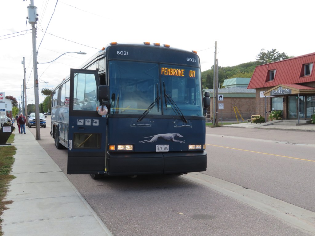
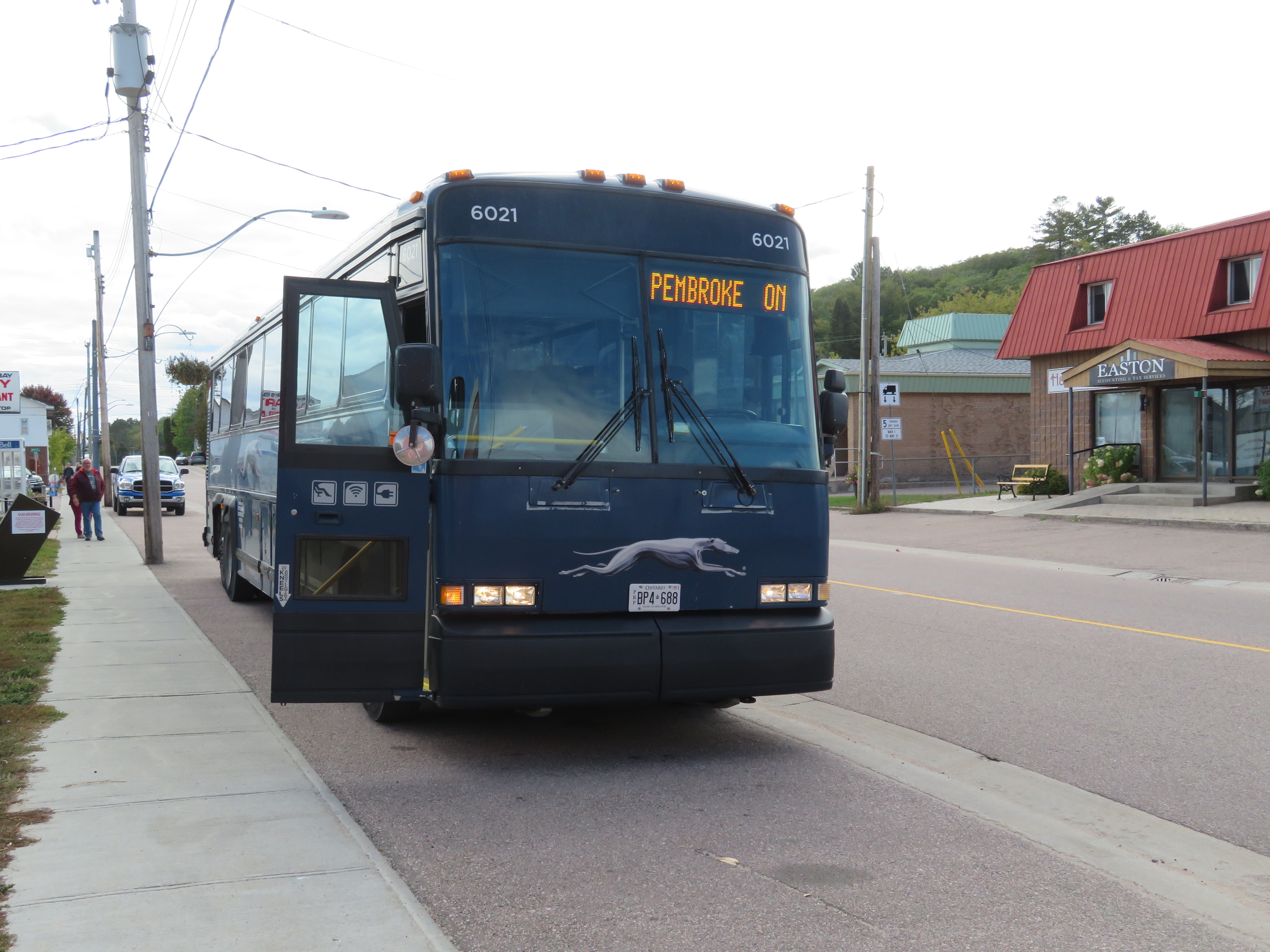
    Barry’s Bay, on Greyhound’s Peterborough-Pembroke route, is one of many smaller towns and villages that permanently lost all intercity bus connections since the COVID-19 pandemic

    On Thursday, May 13, Greyhound Canada announced that it was permanently ceasing operations. This should not have come as a shock to anyone following the intercity transport industry: for over three decades, intercity bus carriers in this country were privatized (Gray Coach and Canada Coach Lines in Ontario, shut down (Saskatchewan Transportation Corporation), or strangled by continued cutbacks and poor customer service (Greyhound). In 2018, Greyhound Canada ended all its remaining services between Vancouver and Sudbury. The loss of commuter and student traffic — Greyhound’s bread-and-butter in Ontario and Quebec — due to the pandemic led to a temporary, then permanent shutdown.

    The next day, on Friday, May 14, Megabus — operated by Coach Canada, a subsidiary of UK-based Stagecoach — announced that it would begin service on the Toronto-Ottawa and Toronto-Kingston routes abandoned by Greyhound. Two buses a day will soon operate between Toronto, Scarborough Town Centre, Kingston, and Ottawa, daily except Tuesdays and Wednesdays, terminating at St-Laurent Shopping Centre, a stop on Ottawa’s new LRT. Though this provides a new option for travelers between the big three cities (VIA Rail continues to serve this route), it does not fill the gaps left by years of decline by private intercity bus operators.

    (I updated my map of Ontario’s intermunicipal carriers to include Megabus’ new route).

    Before Greyhound’s website disappeared, I downloaded the PDF schedules for Ontario and Quebec. In 2019, Greyhound operated three routes between Toronto and Ottawa: an express bus, with stops only in Scarborough, Belleville, Peterborough, Madoc, and/or Kanata, a local bus, making stops in cities and towns along Highway 7 between Peterborough and Carleton Place, and a Kingston-Ottawa bus via Smiths Falls. You can view and download the schedules below:

    Peterborough loses two buses a day to and from Ottawa and express bus service to Downtown Toronto (which made the trip in less than two hours off-peak.) Though Peterborough is still connected to Toronto via GO Transit bus Route 88, it can take nearly three hours to go between Union Station and Downtown Peterborough, including a train connection at Oshawa, and many local stops in Clarington and along Highway 115. Other towns, such as Norwood, Marmora, Madoc, Perth, and Carleton Place, lose all bus services, except for a commuter-oriented weekday run between Ottawa and Carleton Place.

    Greyhound has chosen to become irrelevant to most Canadians long before the final shutdown announcement. Northern Ontario, at least, still has Ontario Northland (which has expanded its reach), and the Greater Toronto and Hamilton Area has GO Transit (though gaps continue to exist in that network). If your rural community is lucky, your local or regional municipality launched a new, subsidized bus or microtransit service. There is also VIA Rail, which serves most larger communities that lost Greyhound services in 2020-2021 (Windsor, Chatham, Belleville, Ottawa, etc.), though it is typically more expensive.

    Despite these continued and emerging services, there remains a need for government support of those crucial links left behind by Megabus, VIA, and GO Transit.

  • A tale of two stations: Brampton and Bramalea

    A tale of two stations: Brampton and Bramalea

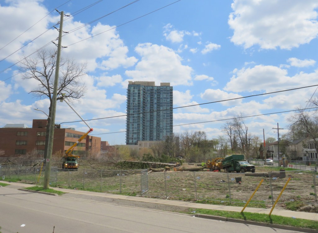
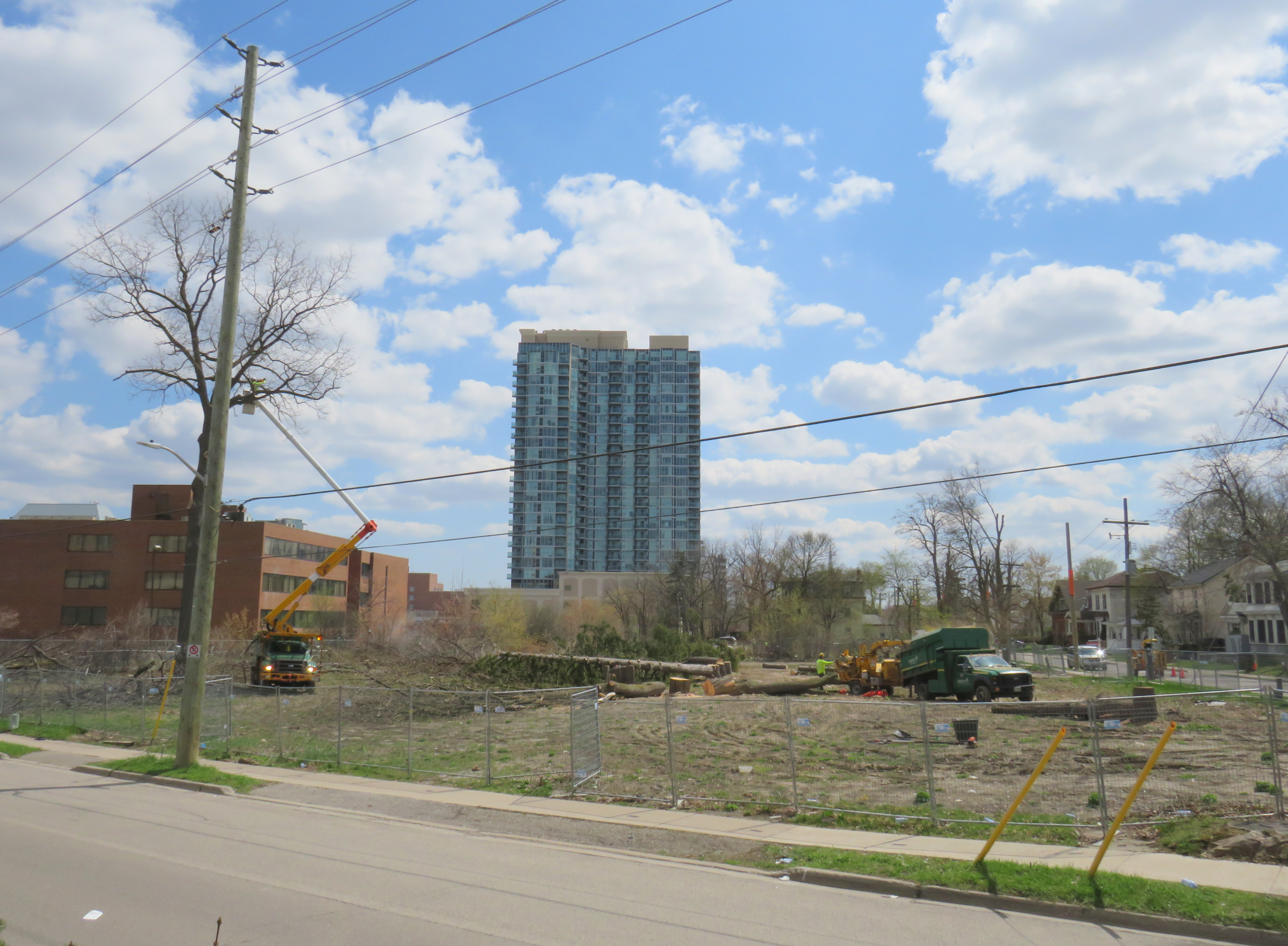
    Cutting down trees to make way for a surface parking lot in Downtown Brampton

    Earlier this April, contractors hired by Metrolinx cut down trees on its Downtown Brampton property, where twelve houses once stood. The work, originally scheduled for the week of March 22, did not begin until April 12.

    The tree removal brings Greater Toronto’s regional transit operating and planning authority one step closer to building a new 200-plus surface parking lot in a city that hopes to renew its downtown core.

    Starting in 2016, Metrolinx purchased over a dozen homes along with two four-storey office towers in an area bounded by Railroad, Nelson, and Elizabeth Streets, immediately south of the Brampton GO Station. It vacated and demolished the houses between 2016 and 2019, and left the two office buildings vacant. Metrolinx’s plan was to build a new surface parking lot to expand parking capacity, though in early 2018, the Liberal provincial government announced a new Ryerson University/Sheridan College campus on the existing main parking lot on the north side of the station. Metrolinx’s acquisition of occupied homes — including heritage-listed buildings and a rooming house — made more sense.

    After the election of a new Progressive Conservative government led by Doug Ford, funding for the educational campus was pulled, though the City of Brampton and Ryerson University continued to advance plans for the downtown area. The city bought up more of the downtown core, including the southeast corner of George and Nelson Streets, across from the vacated office buildings, as well as the thirty-year old office building at 2 Nelson Street West, below which is the Brampton Transit downtown terminal. These newly acquired lands would be home to a larger bus terminal that would link to an expanded GO station and a proposed extension of the Hurontario LRT, and an Innovation Centre that would serve the education campus and include a new central library.

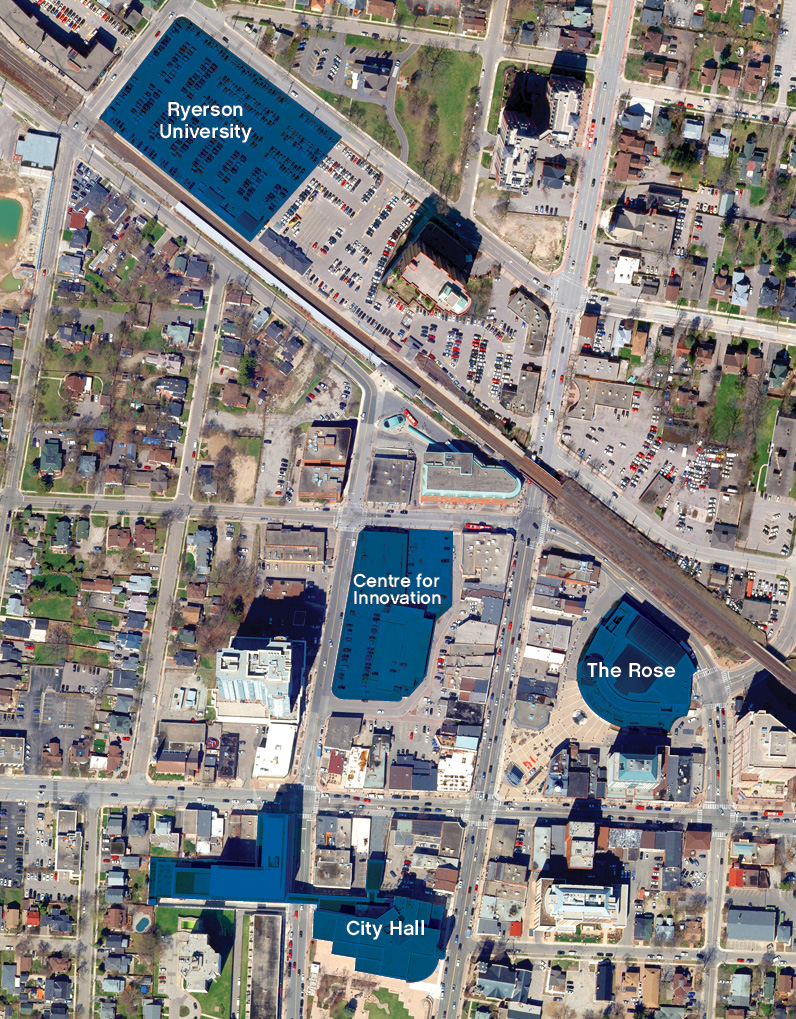
    The old plans for the Ryerson Unversity/Sheridan College building on the GO Transit parking lot, and a Centre for Innovation on the southeast corner of George and Nelson Streets. The Metrolinx lands are in the block between the Centre for Innovation and the GO Station/proposed Ryerson building

    As part of its Vision 2040 inspirational guidelines, Brampton now seeks to focus new midrise and highrise development in and around the downtown core, along Queen Street eastwards towards Bramalea City Centre, and in the Main and Steeles area, where the Hurontario LRT will terminate, and where RioCan, owners of Shoppers World, plan to redevelop the mall.

    Already, there are several high-rise developments in the downtown area under construction or in the planning phase. More development lands will be unlocked with the Riverwalk project, which will improve flood protection along Etobicoke Creek while providing an improved public space.

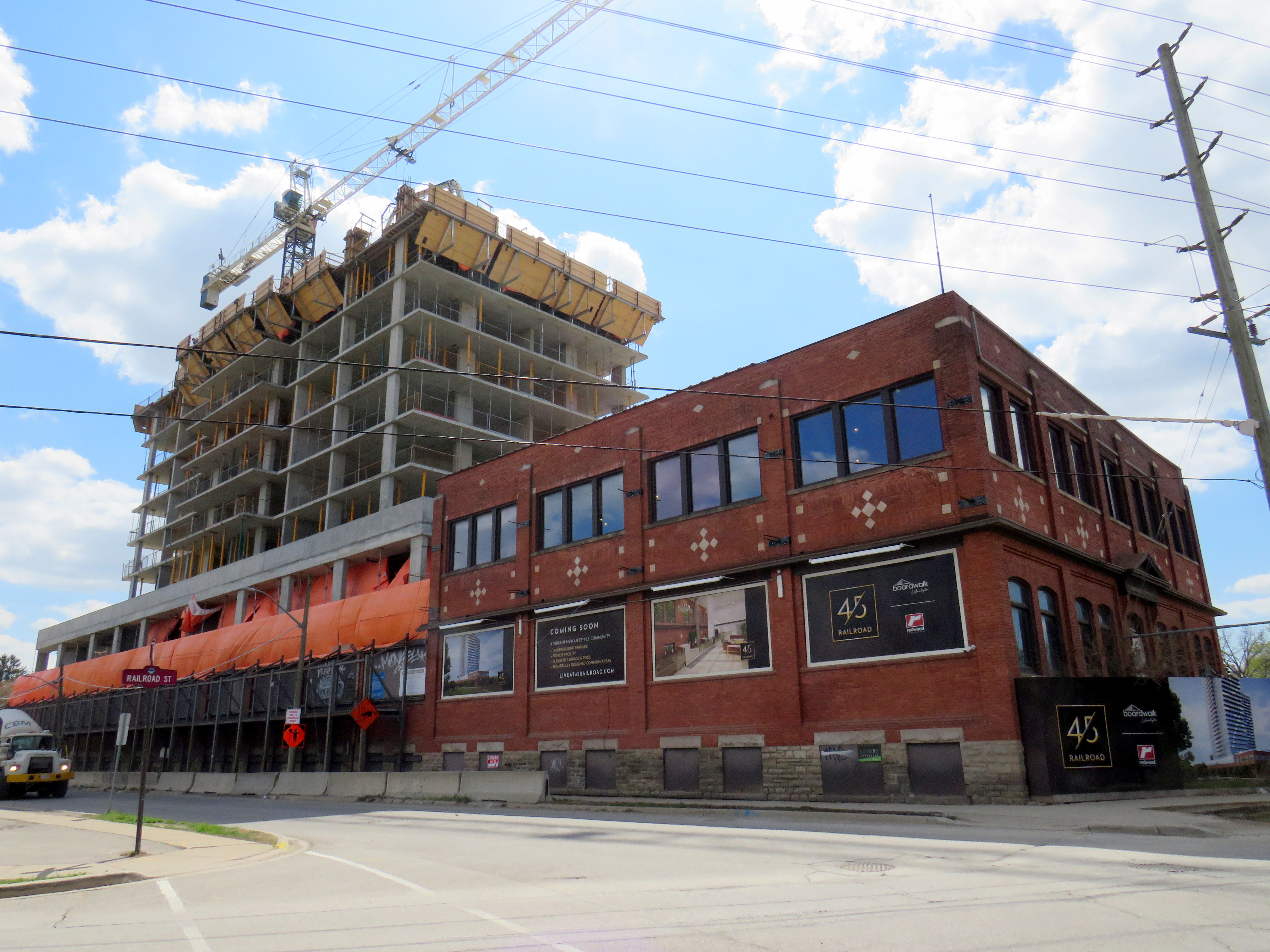
    A two-tower rental highrise development is progressing on the old Dominion Skate Factory lands, across the tracks from the GO Station, bringing hundreds of new residents to the downtown core and right to the station.

    Given Brampton’s urban aspirations for its downtown core, another surface parking lot — adding 200 spots to the existing 861 spaces — is not the right idea.

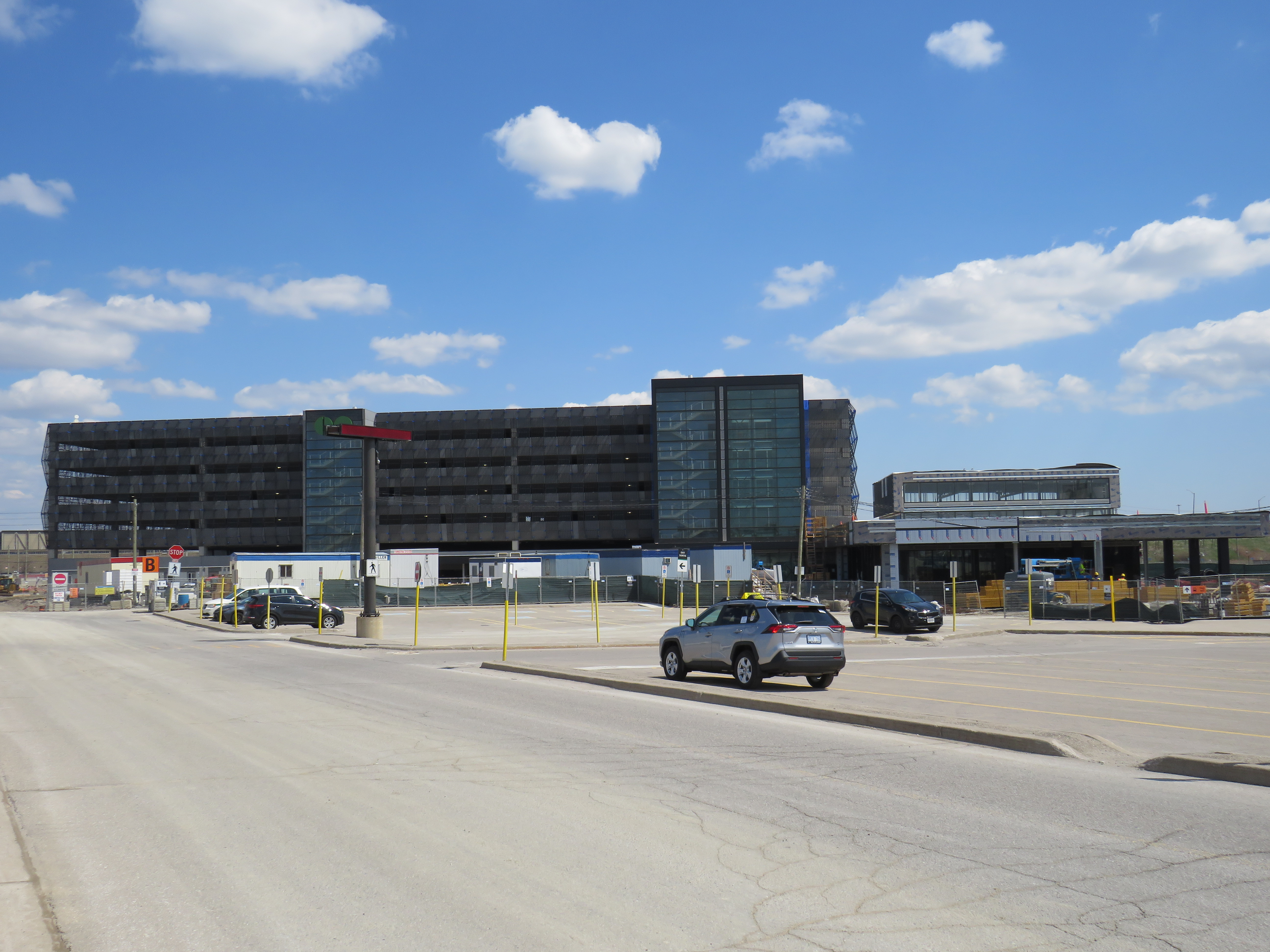
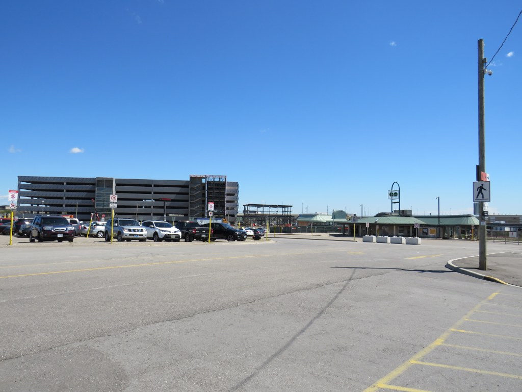
    At Bramalea Station, construction has nearly finished on a 1,300 spot parking garage, part of a larger project that also includes a new, larger station building, a larger bus terminal, additional pedestrian tunnels, and improved platforms and security features. Bramalea already has over 2500 parking spaces, but unlike in Downtown Brampton, this is a logical space for parking expansion. The station is surrounded by warehouses and factories, at the intersection of two major truck routes, and close to highways. It is not a place that is easily urbanized. However, improved pedestrian and cycling access is very much warranted.

    New garage nearly complete at Bramalea GO Station

    With the expansion of parking at Bramalea GO, why is Metrolinx eager to add another parking lot in Downtown Brampton, especially with Ryerson’s downtown plans on hold?

    Hopefully we will learn more shortly.

  • Why pedestrian safety is a matter of justice for essential workers

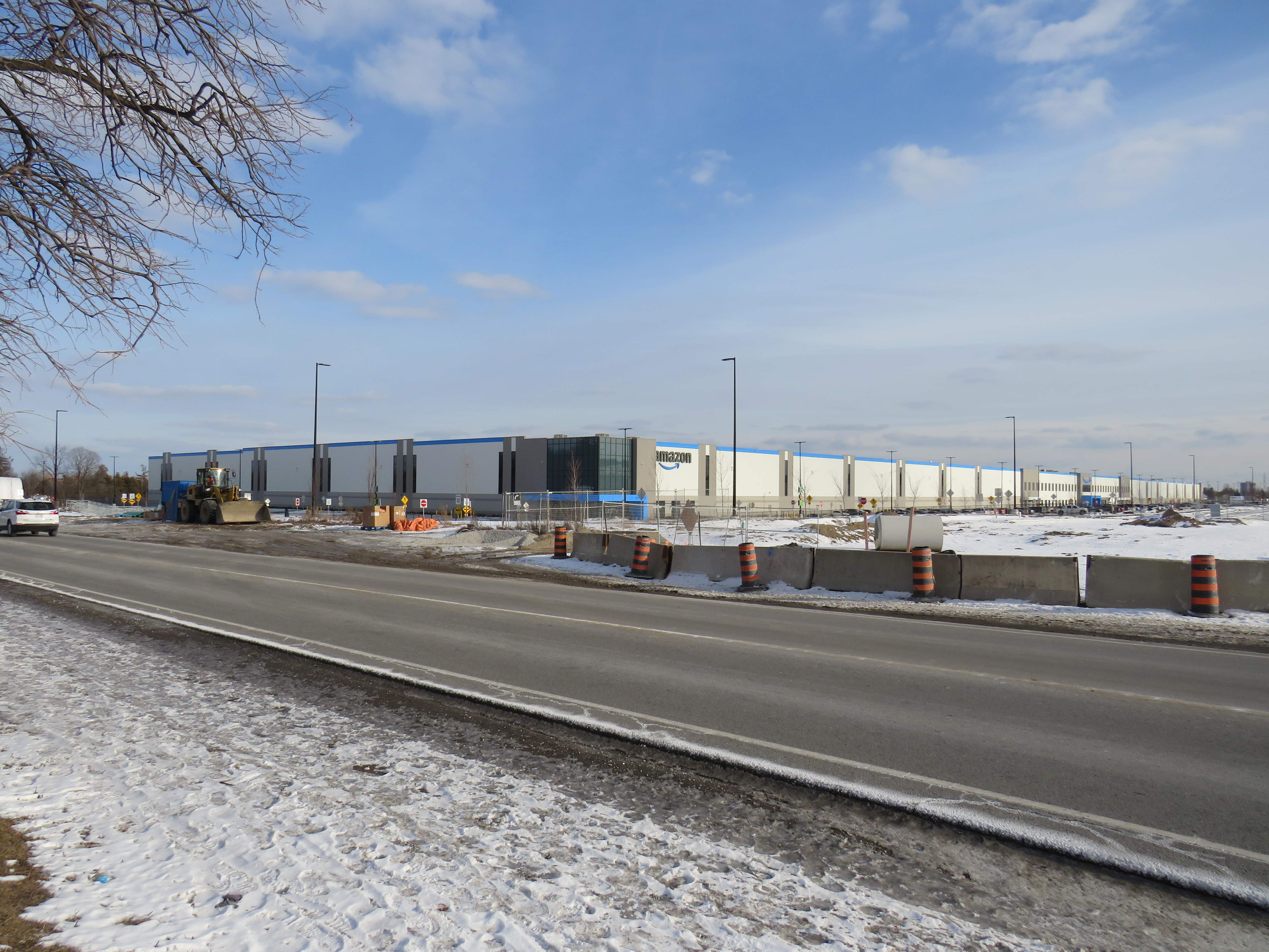
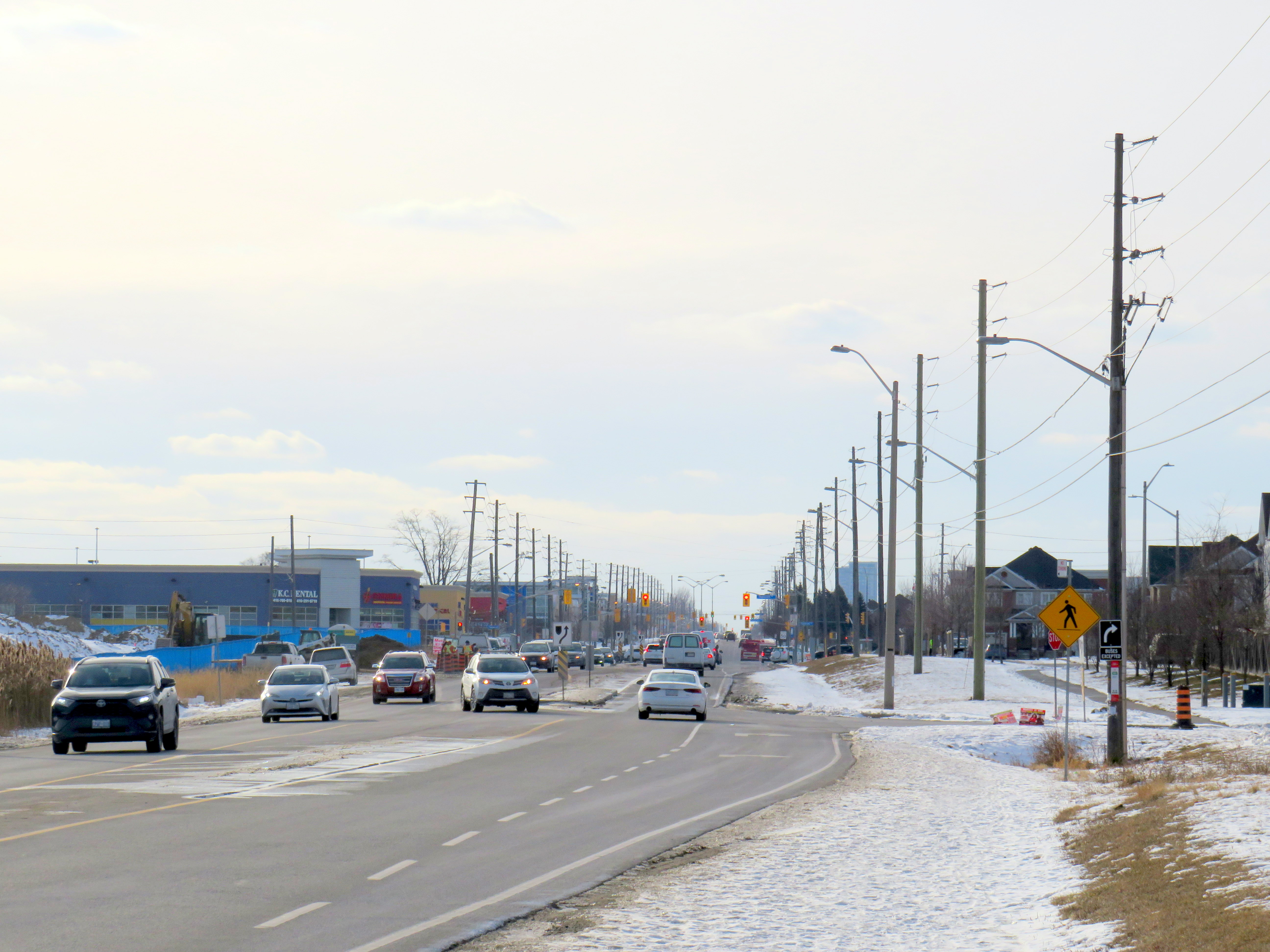
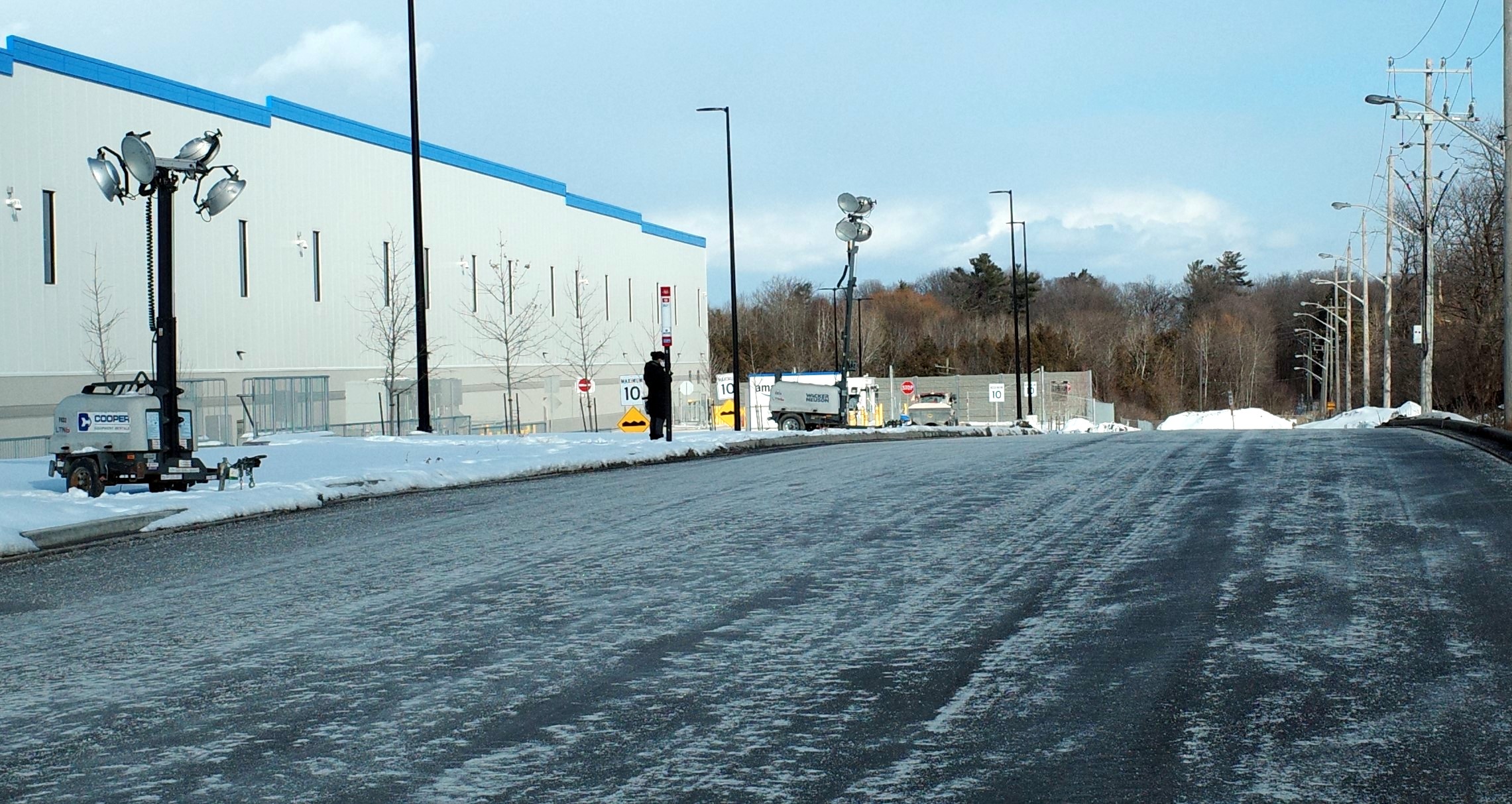
    The new YYZ9 Fulfillment Centre in Northeast Scarborough, looking across Steeles Avenue

    In August 2020, in the midst of an ongoing COVID-19 pandemic, Amazon opened its sixth fulfillment centre in the Greater Toronto Area near Steeles and Tapscott Road in northeast Scarborough. Upon opening, the new warehouse, where consumer orders are packed for delivery, employed 700 workers, 100 more than Amazon initially planned due to high order volumes.

    The starting wage for an Amazon fulfillment centre employee is $17.00 an hour, despite notoriously tough working conditions. With most professional and office workers at home, and with ongoing pandemic restrictions, Amazon has enjoyed significant sales increases. But those workers picking and packing orders are not able to work from home – and workplace spread has been a significant factor in COVID-19 transmission in Ontario.

    Brampton, home to two of the GTA’s fulfilment centres, and close to Amazon’s Mississauga, Milton and Bolton warehouses, has been a COVID-19 hotspot. Like Toronto, Peel Region has been under lockdown and stay-at-home orders since November.

    Like most new logistics facilities, the new Scarborough warehouse, like the other five GTA Amazon fulfillment centres, is in an industrial area on the city’s outskirts, where land is plentiful, but transit and pedestrian access is lacking. East of Tapscott Road, Steeles Avenue narrows from four lanes to two, and there are no designated pedestrian crossings at the intersection with Eastvale Drive. The eastbound TTC stop at Eastvale Avenue was removed in 2018 after a passenger was struck and killed trying to cross the street after disembarking from a 53 Steeles East bus. The next nearest stop, at Tapscott Road, is 300 metres west.

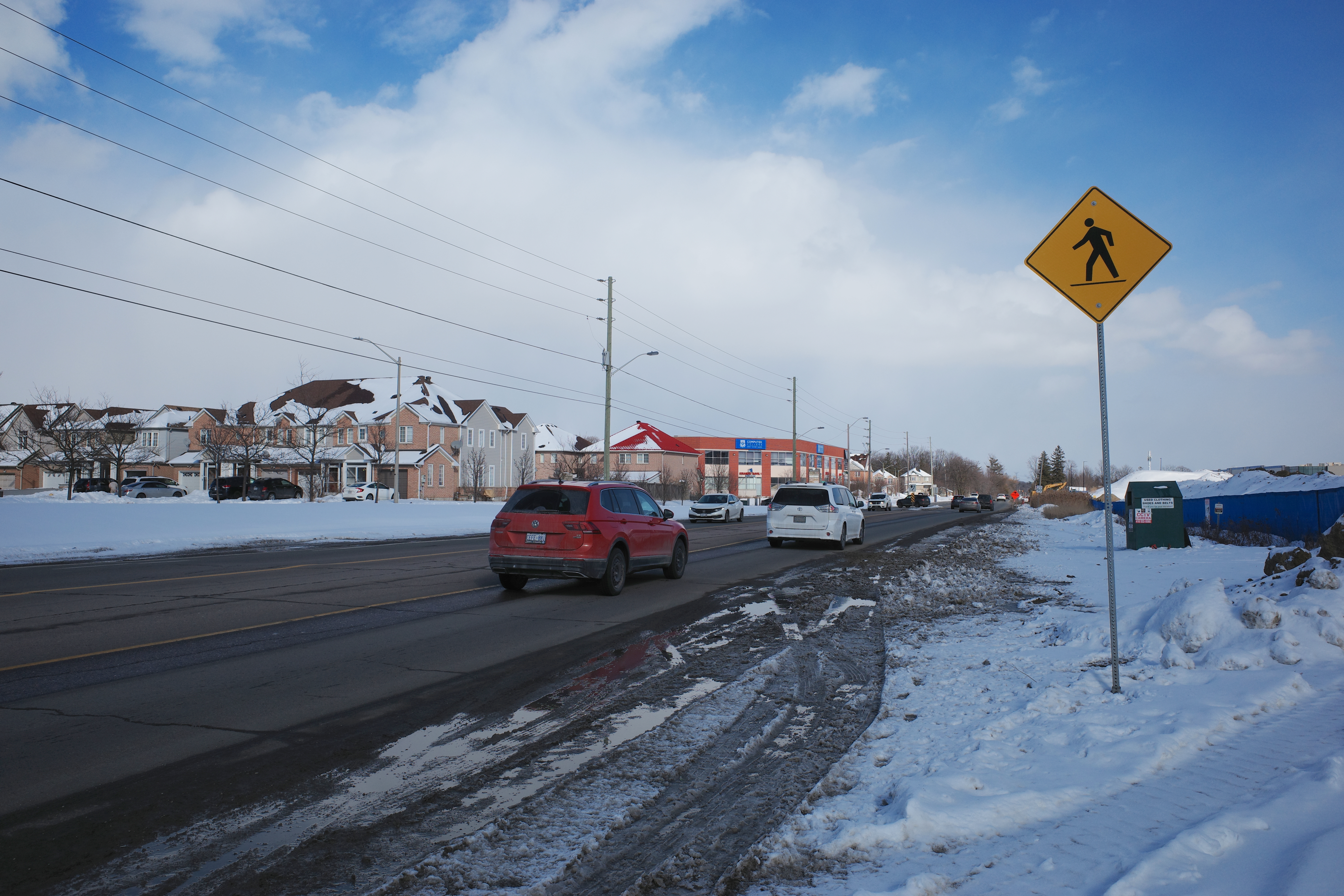
    Steeles Avenue, looking west towards Eastvale Drive and the signalized intersection beyond, at Tapscott Road

    The sidewalk on the south side of Steeles Avenue ends at Tapscott, a few hundred metres west of the Amazon fulfilment centre. On the north side, the sidewalk ends at Ferncliffe Crescent in Markham. Despite a new residential area in Morningside Heights, to the east, there is no sidewalk along Steeles to connect to it. Pedestrians heading to Amazon or towards Staines Road must choose whether to walk in the mud, or on the busy roadway. Though the posted speed limit is 50 km/h, motorists regularly travel at 60 km/h or faster.

    Looking east on Steeles from Tapscott Road – despite the sign advising motorists of pedestrian activity, there are no sidewalks leading east towards the new Amazon fulfillment centre (Sonali Praharaj)

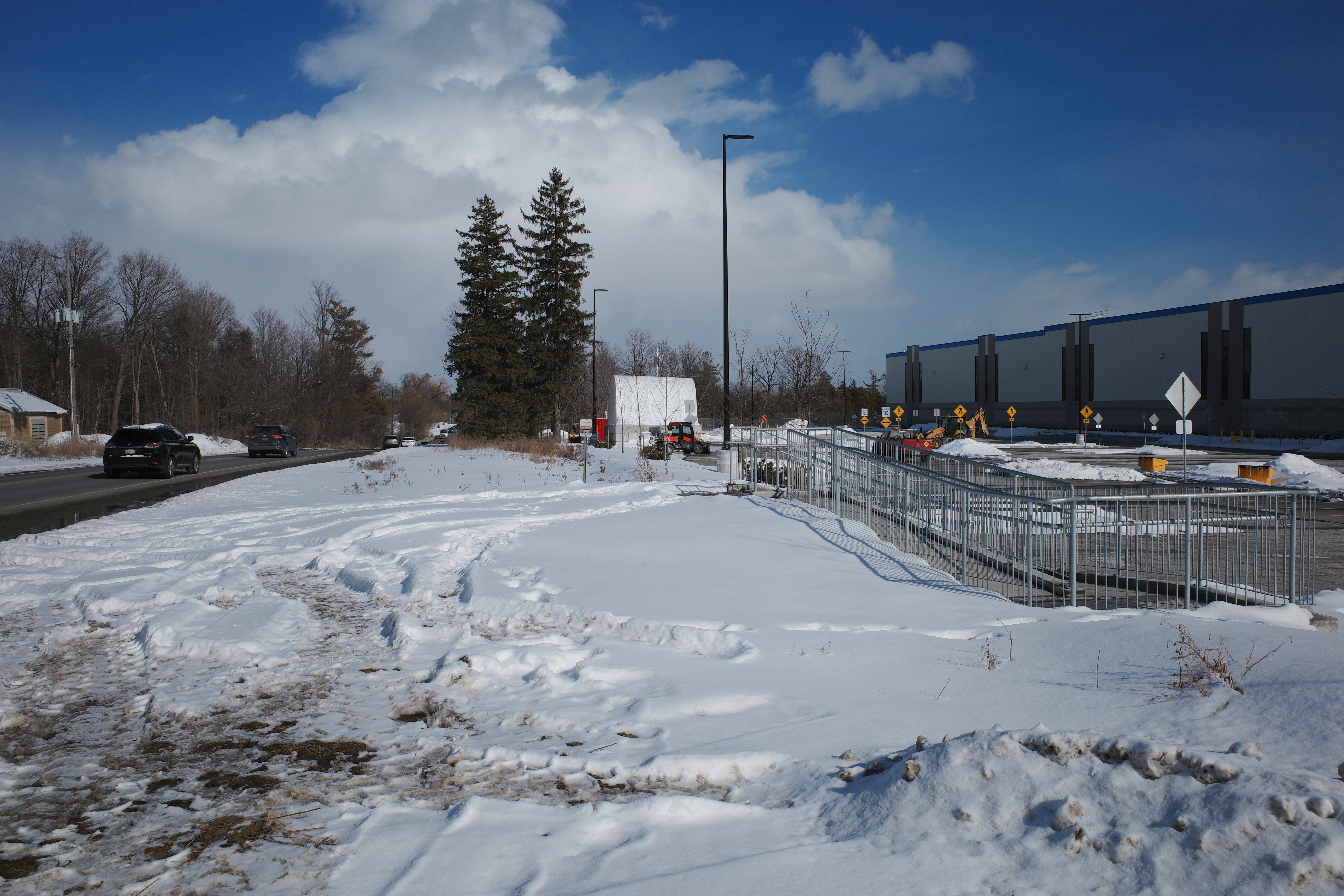
    A stairway and ramp were built on the north end of the Amazon property, likely with the expectation that a sidewalk on the south side of Streeles Avenue would soon be installed. This would provide improved pedestrian access to the fulfillment centre. But without a safe and logical way to get to it from the street, it remains largely unused.

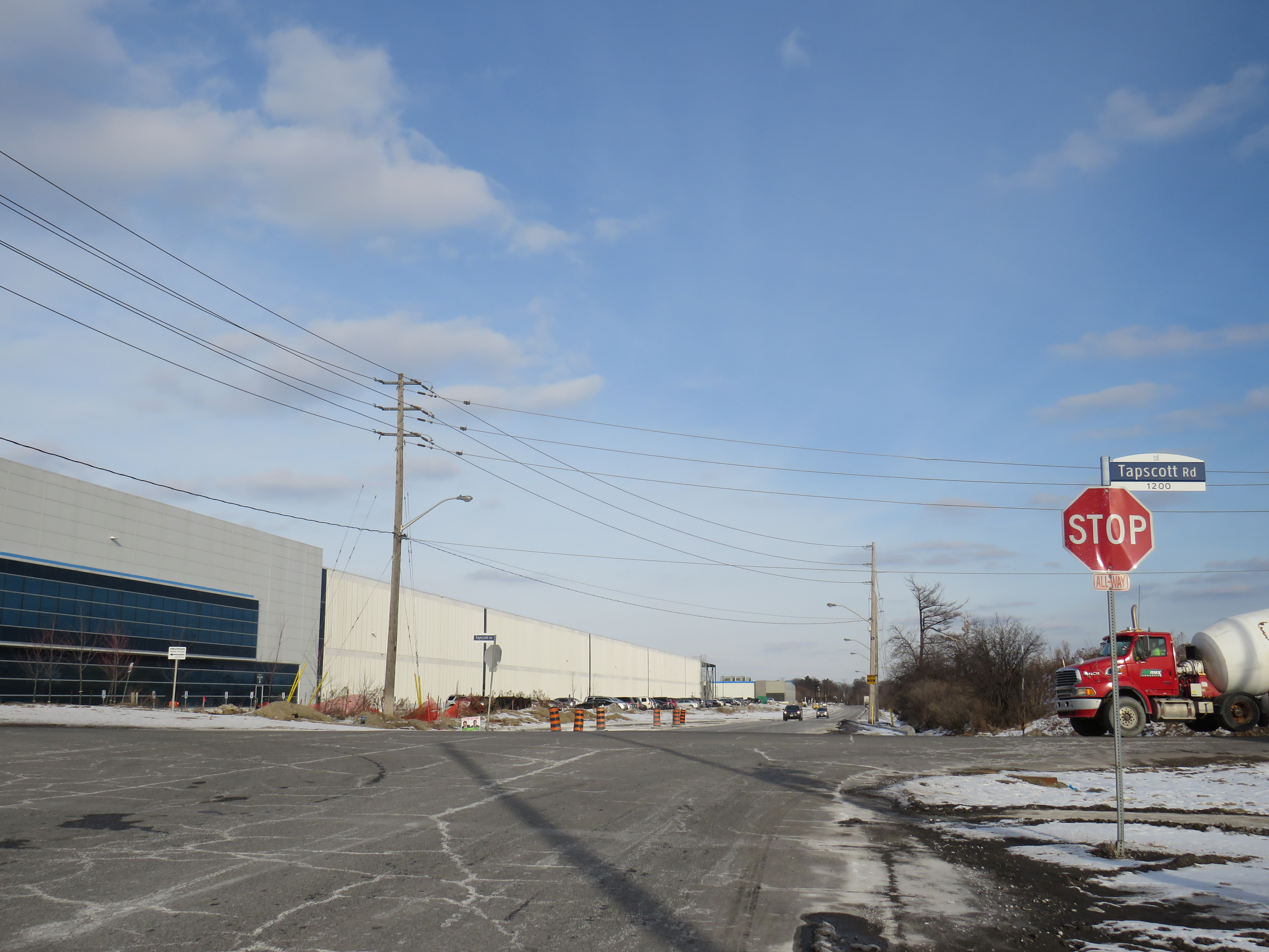
    Passmore Avenue, on the south side of the fulfillment centre, was rebuilt with a sidewalk in the late fall of 2020, months after Amazon opened. However, it requires a lengthy walk north to Steeles Avenue up Tapscott, and there are no sidewalks on Tapscott from Passmore south, towards McNicoll Avenue. The intersection of Passmore and Tapscott itself – controlled by an all-way stop – still does not feature proper crosswalks.  

    Looking east on Steeles from Tapscott Road – despite the sign advising motorists of pedestrian activity, there are no sidewalks leading east towards the new Amazon fulfillment centre (Sonali Praharaj)

    Though there are two TTC bus routes that operate to the corner of Tapscott Road and Passmore Avenue – 53B/953B Steeles East and 102B/C Markham Road – for months, workers had to walk on the roadway, through a construction site to access those buses. Anyone looking to go east, towards Morningside Heights, or southeast, towards Malvern, still face a long, dangerous walk or a lengthy bus commute.

    The corner of Tapscott Road and Passmore Avenue

    The TTC, starting January 11, 2021, began diverting the 53B Steeles East bus to directly serve the Amazon fulfillment centre, finally serving a major industrial trip generator and reducing essential workers’ travel times. Even still, the new sidewalk on Passmore ends at the warehouse entrance – anyone waiting for a bus must still walk and wait in the snow or mud.

    Eventually, Steeles Avenue will be widened, with new sidewalks and bike lanes, and Morningside Avenue will be extended north to Steeles Avenue. However, these improvements have been planned for years and completion is still several years away. Though new warehouses have opened here, civic infrastructure has not caught up.

    New TTC bus stop serving the Amazon Fulfillment Centre on Passmore Road (Sonali Praharaj)

    The TTC’s service change, adding a new bus stop on Passmore Avenue, was a welcome – yet overdue – acknowledgement that essential workers, especially racialized and lower-paid workers, deserve better. It is inexcusable that new employment uses are planned, approved, and constructed before the appropriate pedestrian infrastructure and transit services are in place. It is also inexcusable that after a TTC customer was killed that a nearby bus stop was removed, rather than safety improvements added instead. This is not just a matter of ensuring a basic level of safety for pedestrians – this is a matter of justice for those we consider essential workers.

  • A major malfunction at Major Mackenzie Drive

    A major malfunction at Major Mackenzie Drive

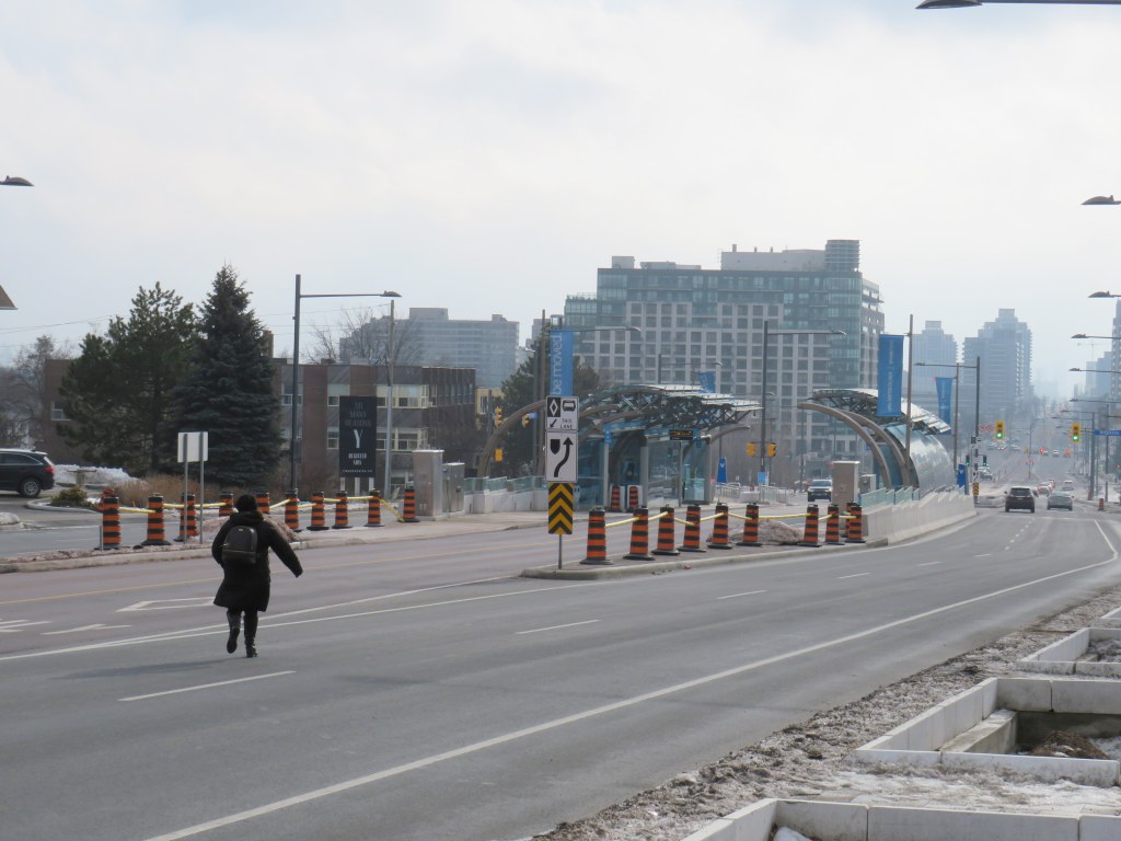
    Viva Blue buses on the new Yonge Street Rapidway, February 2021

    On December 20, 2020, the newest section of York Region’s Viva Rapidways opened for service on Yonge Street between Highway 7 and Major Mackenzie Drive. I have been critical of York Region’s rapid transit projects for several reasons: they are underutilized, they are poorly designed for pedestriansand without frequent service and convenient connecting routes, the money spent on fancy new infrastructure ends up becoming a questionable investment.

    At least the new Yonge Street Rapidway would serve York Region’s busiest transit corridor, supporting new high-density development in Richmond Hill. Unlike on Highway 7 or in Newmarket, there are no two-phase pedestrian crossings on this part of Yonge. Unfortunately, a botched connection between the new Rapidway at Major Mackenzie Drive created a new problem for the YRT/Viva transit network.

    This issue — along with the other problems with York Region’s Rapidways that I discussed previously — should be held up as lessons on what not to do when building new transit rights-of-way in street medians, be it on Hurontario Street in Mississauga and Brampton, planned BRT lines on Dundas Street in Mississauga, or Queen Street in Brampton.

    (more…)
  • Mapping Ontario’s transit connections

    Mapping Ontario’s transit connections

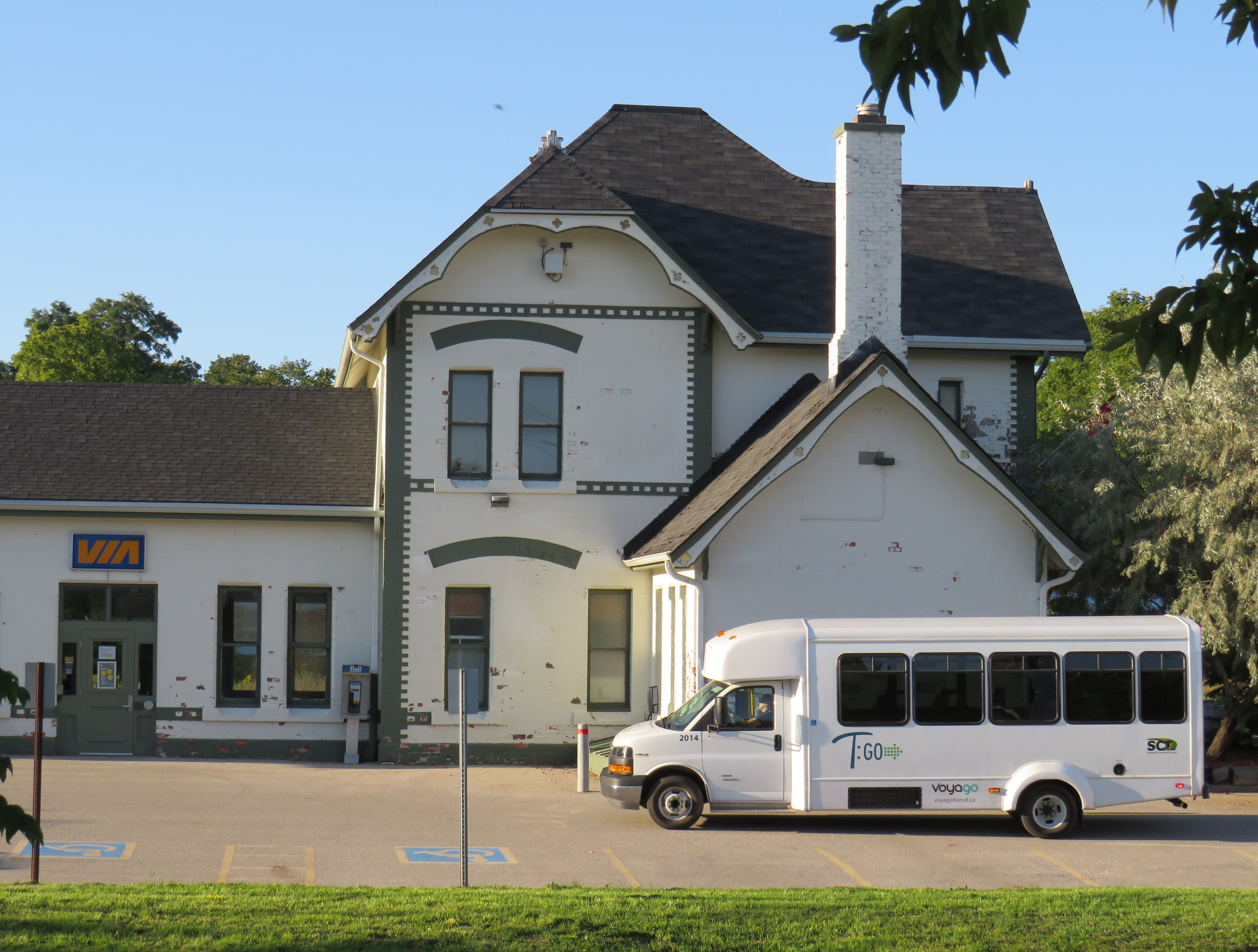
    T:GO inter-community transit van at Woodstock VIA Rail station, September 2020

    October 2021

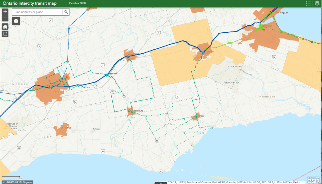
    I made several changes to the interactive map, including a complete update of the GO Transit bus and rail network, including the most recent rail corridor extensions to Bloomington and London, and a new weekday bus route to Brock University in St. Catharines.

    Over the summer, Quinte Transit added a new route between Trenton and Belleville, Simcoe County Linx added a new route between Midland and Orillia, serving Tay Shores and Coldwater, and a new service launched between Brockville, Prescott, and Cardinal in Eastern Ontario.

    Meanwhile, several towns and cities in Southwestern Ontario remain off the map.

    The updated map can be found here.


    June 29, 2021/July 6, 2021: Beginning Monday, June 28, Rider Express, an intercity coach company based in Western Canada (which picked up several routes formerly operated by Greyhound Canada and the Saskatchewan Transportation Company), began service in Ontario. Rider Express is looking to fill some of the gaps left by the recent announcement that Greyhound will cease all domestic routes in Eastern Canada.

    That’s the good news. The bad news is that its first route in Ontario, connecting Toronto Station, Kingston, and Ottawa, replicates Megabus’ new route (which I have also added) and competes against VIA Rail’s Corridor rail service. Several of Greyhound’s daily Toronto-Ottawa buses ran through Peterborough and along Highway 7 through Eastern Ontario, leaving towns such as Norwood, Havelock, and Perth off the map. Though Peterborough is connected to Toronto by GO Transit, it is a long train and bus ride, while Greyhound offered a direct, express service to Downtown Toronto.

    Two steps forward, one step back.

    I made additional changes to the interactive map to show new GO Transit, Can-Ar Coach, Megabus, and Ontario Northland routings to the new Union Station Bus Terminal, which replaces the old GO bus terminal and the Toronto Coach Terminal on Bay Street. Meanwhile Ontario Northland moved from the now-closed Ottawa Central Bus Station to the VIA Station on Tremblay Road.

    Meanwhile, starting July 8, Orléans Express will expand into Ontario, with a new Gatineau-Ottawa-Montréal route, operating twice daily. It will join Rider Express and Ontario Northland at the VIA Rail Station in Ottawa.


    May 2, 2021: On Monday, May 3, “The Link” begins operations on two routes in Selwyn Township and Curve Lake First Nation, connecting several communities with Peterborough Transit and GO Transit at Trent University. The service, which is operated by Peterborough Transit, will run on weekdays, with five trips in each direction on both routes. Fares on “The Link” buses include a free transfer to and from Peterborough city bus routes at Trent, with direct service to downtown, major shopping centres, the hospital and Sir Stanford Fleming College.


    February 15, 2021: A few small updates, including the addition of two community routes in Muskoka District Municipality, a bus connection between North Bay and northern Quebec, and a revised bus stop location for Ontario Northland in Orillia.


    December 14, 2020: I made several updates to the interactive map, including the addition of Huron Shores Area Transit, which launches today. I made a few changes suggested by one of my readers, and added Niagara Region Transit’s on-demand service in Niagara-on-the-Lake, which replaces a fixed route that was cancelled earlier this year.


    November 9, 2020: I made several updates to the interactive map, including the addition of PC Connect in Perth County, which launches next Monday. I mapped Port Hope’s transit connection to Cobourg, as suggested by one of the readers, and corrected a few minor errors.


    October 15, 2020

    Despite the ongoing COVID-19 pandemic, several new inter-community transit services launched in Ontario during the last few months.

    Last August, T:GO began service on four routes radiating from Tillsonburg, where there was already an in-town circulator service. Mondays through Fridays, twenty-seater vans operate between Tillsonburg, Norwich, Woodstock, Ingersoll, and other communities, offering connections to Woodstock Transit, the hospital, and the VIA Rail Station.

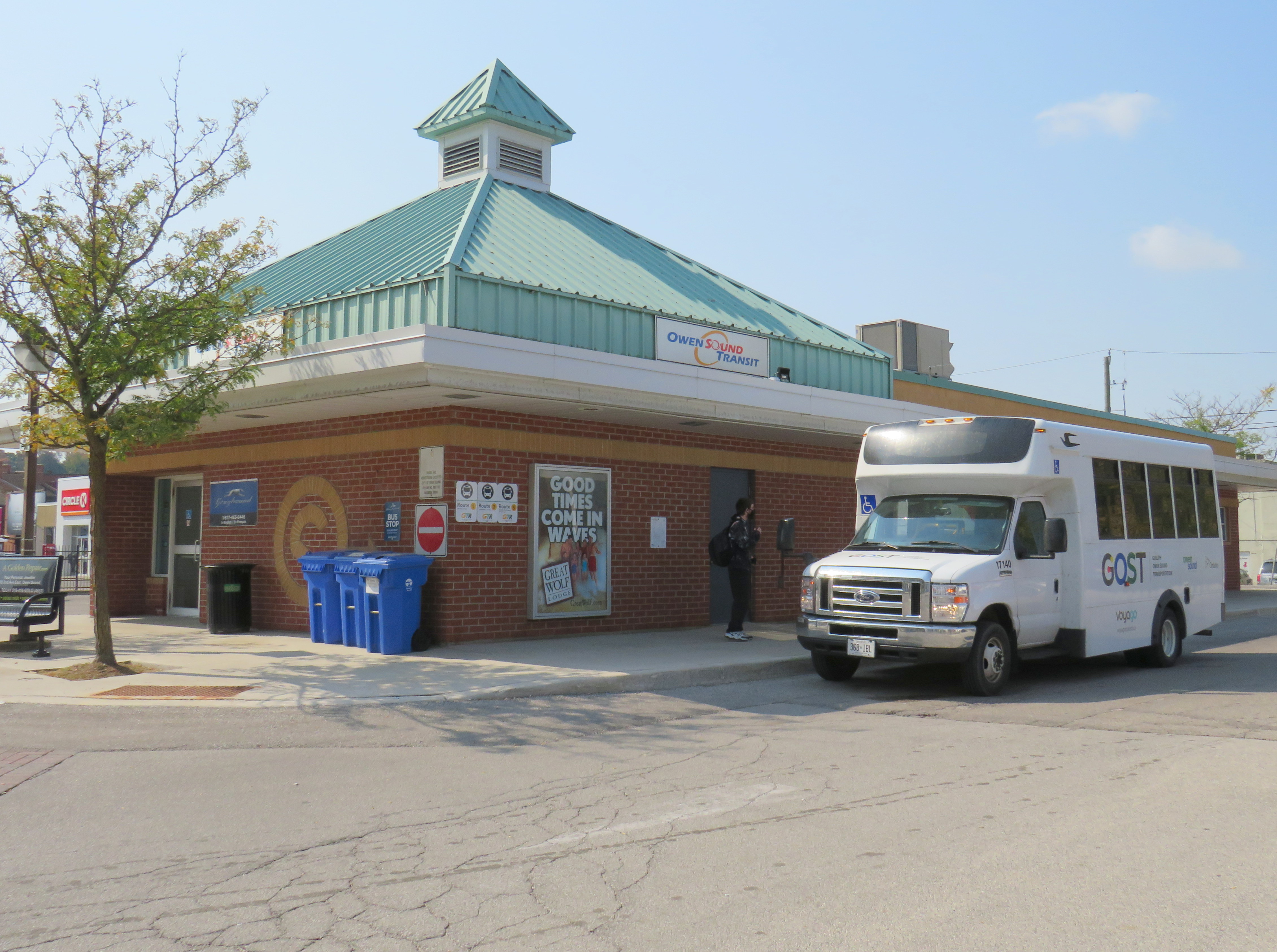
    In September, the City of Owen Sound, Grey County, Middlesex County, the town of Strathroy-Caradoc, and Prince Edward County all launched their own services, connecting rural communities and small towns to larger centres such as London, Guelph, and Belleville. In addition, Simcoe County expanded its Linx bus service to serve Alliston and Beeton, and other services, suspended during the early days of the pandemic, resumed operations. Also this year, Niagara and Durham Regions expanded their rural on-demand transit services.

    GOST minibus at Owen Sound Transit Terminal

    All these new services help to fill the gaps left behind by private coach companies; these have become especially vital as Greyhound Canada suspended all operations in Ontario and Quebec this year (after abandoning Western Canada in 2018), and Coach Canada (operating as Megabus) cut service on some of its routes.

    While these new intercommunity routes help to serve local needs, there is a wide variety of service provided in rural and small town Ontario. But without provincial coordination, it is nearly impossible to keep track of them all, never mind plan a trip.

    So I went ahead and mapped them all the best I could. Clicking on each route brings up a pop-up window containing further information, including a link to each agency’s website, where available.

    Link to interactive map

    (more…)
  • Why Durham Region is going the microtransit route during the pandemic – and what it means for other transit systems

    Why Durham Region is going the microtransit route during the pandemic – and what it means for other transit systems

    Durham Region Transit and GO Transit buses meeting at Durham College/Ontario Tech University

    Previously on this site, I expressed my skepticism about Durham Region’s commitment to improving transit service. But in the five years since, the region east of Toronto has done exactly that by creating a route grid along major corridors, fusing together a network from four separate municipal systems.

    While the ongoing COVID-19 pandemic has seen transit ridership plummet across the province, followed by service cuts to match the reduced demand, Durham is doing two interesting things: firstly, it is adding additional service on its main corridors, and it is replacing twenty-five low ridership routes with on-demand transit.

    In my latest article for TVO.org, I take a closer look at Durham Region Transit’s response to shifting ridership during a pandemic and the benefits and pitfalls of microtransit as a potential solution.

  • Stranded at Bramalea GO: Metrolinx’s missed connections

    Stranded at Bramalea GO: Metrolinx’s missed connections

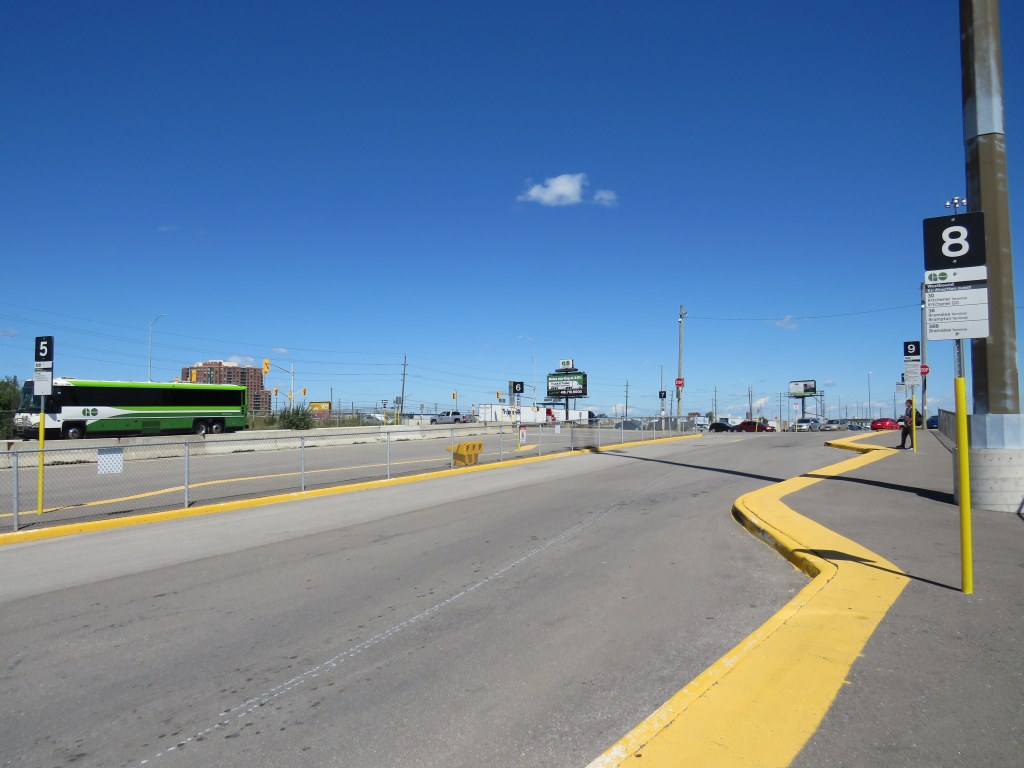
    Temporary bus terminal, Bramalea GO Station
    The inhospitable temporary bus terminal at Bramalea GO Station

    On Tuesday, August 25, I paid a visit to Kitchener.

    Greyhound suspended all operations in Eastern Canada on May 13, 2020 due to low ridership during the COIVD-19 pandemic. Meanwhile VIA Rail reduced its operations, including Train 85, which departed Union Station at 10:55 AM for Guelph, Kitchener, Stratford, and London. Therefore, GO Transit became the only way to get between Toronto and Kitchener-Waterloo for a day trip without a car.

    From boarding the 11:53 Kitchener Line train from Union Station, it should have taken just under two hours to get to Downtown Kitchener. Instead, because of a minor train delay, and a failure of the connecting bus to hold for transferring passengers, it took me three and a half hours.

    If we value transit users, passengers must not be left behind when making these transfers, especially when connecting between posted connections.

    (more…)
  • Dysfunction junction: Union Station’s continued disruption

    Dysfunction junction: Union Station’s continued disruption

    Over two years later, concrete Jersey barriers continue to disrupt pedestrians in front of Union Station

    A year ago, I wrote about the unsightly Jersey barriers that were plopped down in front of Toronto’s Union Station in April 2018, creating bottlenecks at two of Toronto’s busiest pedestrian intersections. Though the city promised improvements in 2018 and in 2019, the only changes were the application of decals to the existing Jersey barriers.

    Though the front of Union Station looks slightly better, and the bottlenecks have been lessened by the ongoing COVID-19 pandemic, this is not a satisfactory solution, especially for Toronto’s busiest and most important transportation hub.

    The Jersey barriers were hastily plopped down on Front Street after the April 23, 2018 van attack, where one man steered a rented cargo van onto busy sidewalks in North York, killing 10 and injuring 16 more before he was apprehended by police. As an iconic and crowded pedestrian area, it was felt that special protection was necessary. At the time, the assumption was that the van attack was an act of terrorism, requiring such drastic measures. (It was soon found the motives were not terrorist related.)

    In 2018, city councillor John Campbell likened the front of Union Station to “a war zone” while a city spokesperson said that a broader security plan was “in the works,” including for protecting the station has been in the works for some time, including interim measures that would fit into the streetscape.

    In March 2019, nearly a year after Jersey barriers were added, the Toronto Star’s Jack Lakey dismissed complaints about their awkwardness and appearance, calling them “effective in stopping a driver bent on another deadly attack.” However, Lakey noted that another city spokesperson said that “city is finalizing the design of permanent vehicle barriers around Union Station”, that would “be smaller, more aesthetically pleasing and easier to navigate for pedestrians.” Those barriers would be installed later in 2019.

    Afternoon rush hour crowds navigate around the Jersey barriers at Front and Bay Streets, August 2019

    It is now August 2020, and the concrete barriers are still there, creating a mess for anyone using a wheeled mobility device, or for anyone in a hurry.

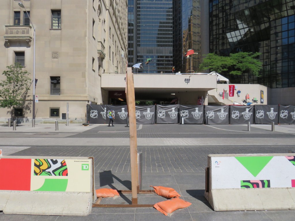
    Bay and Front Streets, August 2020

    The only thing that has changed are new artistic vinyl stickers covering the bare concrete, with messages saying that “artwork is donated by TD [Bank].”

    TD is the “premier sponsor and exclusive financial services partner” of Union Station, most of which is owned and operated by the City of Toronto. (Some sections used by GO Transit are owned by Metrolinx.) TD enjoys exclusive branding rights, ATM locations, and sponsors Union Station’s wifi and charging stations.

    “Artwork is donated by TD”

    Perhaps TD was embarrassed by the Jersey barriers (after all, it has its headquarters just up Bay Street). Or perhaps the city decided that something needed to happen here., after two years of unfilled promises.

    While examining the barriers, I noticed construction signage wedged within the gaps, creating a trip hazard. I also saw the original metal bollards installed when Front Street was rebuilt for a more pedestrian-friendly streetscape in 2014-2015.

    Construction signage creates a trip hazard in the gaps between Jersey barriers. Note the original metal bollard behind.

    Though the inconvenience caused by the lingering “temporary” concrete barriers has been lessened as there are fewer pedestrians entering and leaving Union Station right now, it also makes it a good time to finally make the necessary renovations by installing permanent sturdy bollards.

  • Podcast News

    Podcast News

    This week, I appeared on two podcasts, talking about municipal open data, crowdsourced mapping projects, and Brampton’s success in building suburban transit ridership.

    For Spacing Radio’s Future Fix series, I spoke about a recent Walk Toronto initiative to map sidewalk pinch points during the early days of the COVID-19 pandemic. We used Google Maps to pinpoint specific locations where queues to enter grocery stores, pharmacies, and other essential businesses and services made physical distancing difficult or impossible.

    Through Walk Toronto’s social media accounts, we asked Torontonians where these locations were, then submitted a list to city staff and public health officials. Not long afterwards, CurbTO was announced to address this specific problem, the first of several initiatives that recognized the need to get outside.

    Also on the podcast are Shabnem Afzal, road safety manager for Surrey, British Columbia, speaking about that city’s Vision Zero plan, and Halifax City Councillor Waye Mason, who spoke about that city’s interactive map that allows its citizens identify spots where safe street interventions are needed.

    Just before the pandemic hit, I spoke with Helen Lee and Vincent Puhakka of the new podcast The Next Stop about Brampton Transit’s success, and the implications for other suburban transit agencies. Also on the podcast are Brampton Transit General Manager Alex Milojevic and Mayor Patrick Brown.

    I hope you have a listen to each of these podcasts, and consider subscribing.