Category: Transit

  • Why transit users shouldn’t beg to cross the street

    IMG_8372.jpg

    With consistently high ridership growth over the last few years, Brampton Transit has proven to be one of the Canada’s greatest transportation success stories. The Flower City has proven that transit can be successful and popular in North American suburbs.

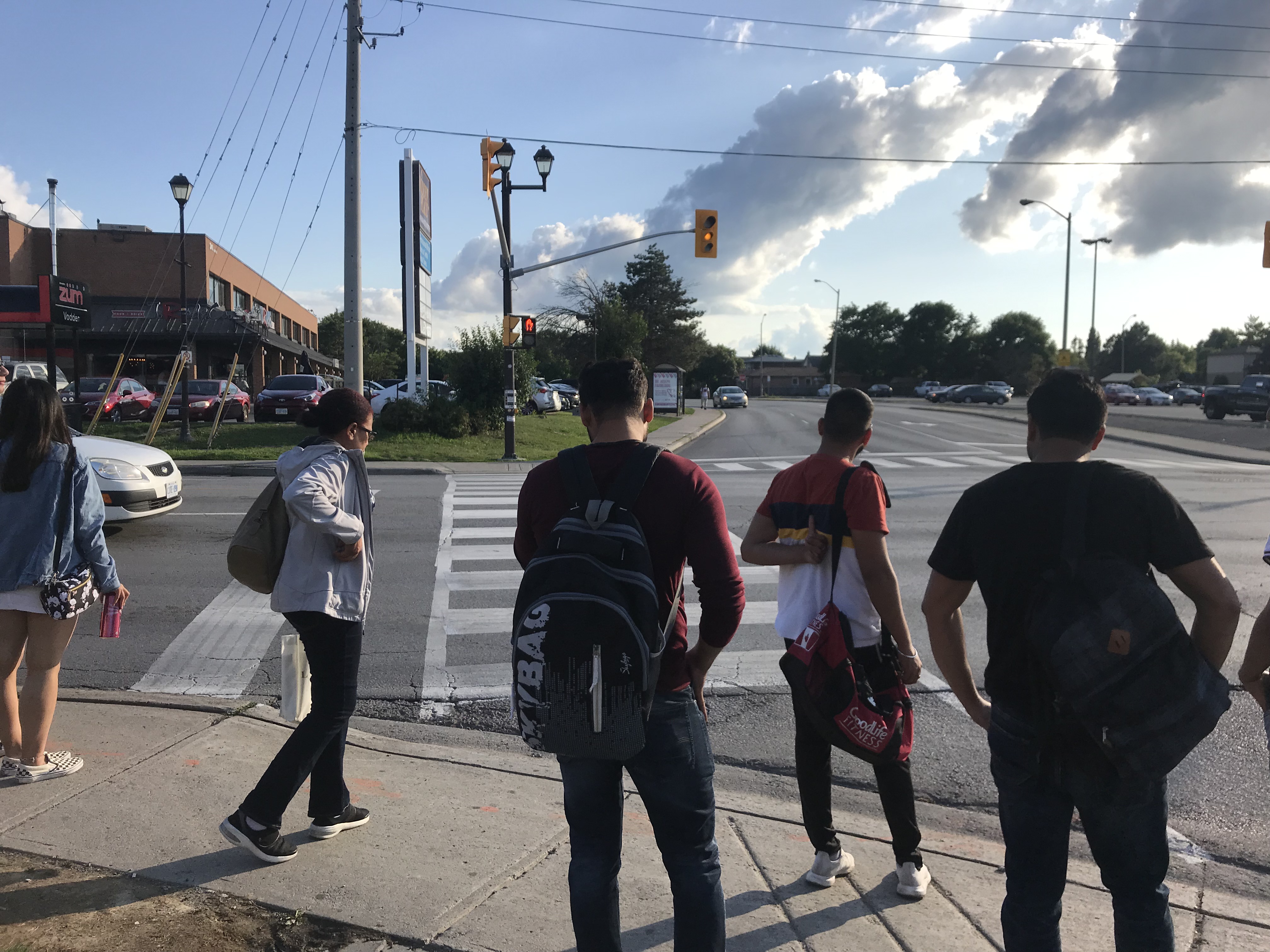
    Despite the success at improving transit and building ridership, Brampton has also prioritized motor traffic at intersection, making it unnecessarily difficult to cross the street at major bus stops. The intersection of Vodden and Main Streets, just north of Downtown Brampton, illustrates this problem.

    If the beg button is pushed in time, the walk signal to cross Main Street will appear for just seven seconds before the countdown begins, giving just 11 seconds to cross five lanes. Anyone who misses that light will have to wait over two minutes to legally cross.

    What Brampton — and cities like it — should do is remove the beg buttons at transit stops with the assumption that pedestrians will want to cross. It’s just one step towards building a transit culture and attracting new riders.

    I write more about this problem in Bramptonist.


  • Goin’ to Kansas City

    IMG_5800-001.JPG
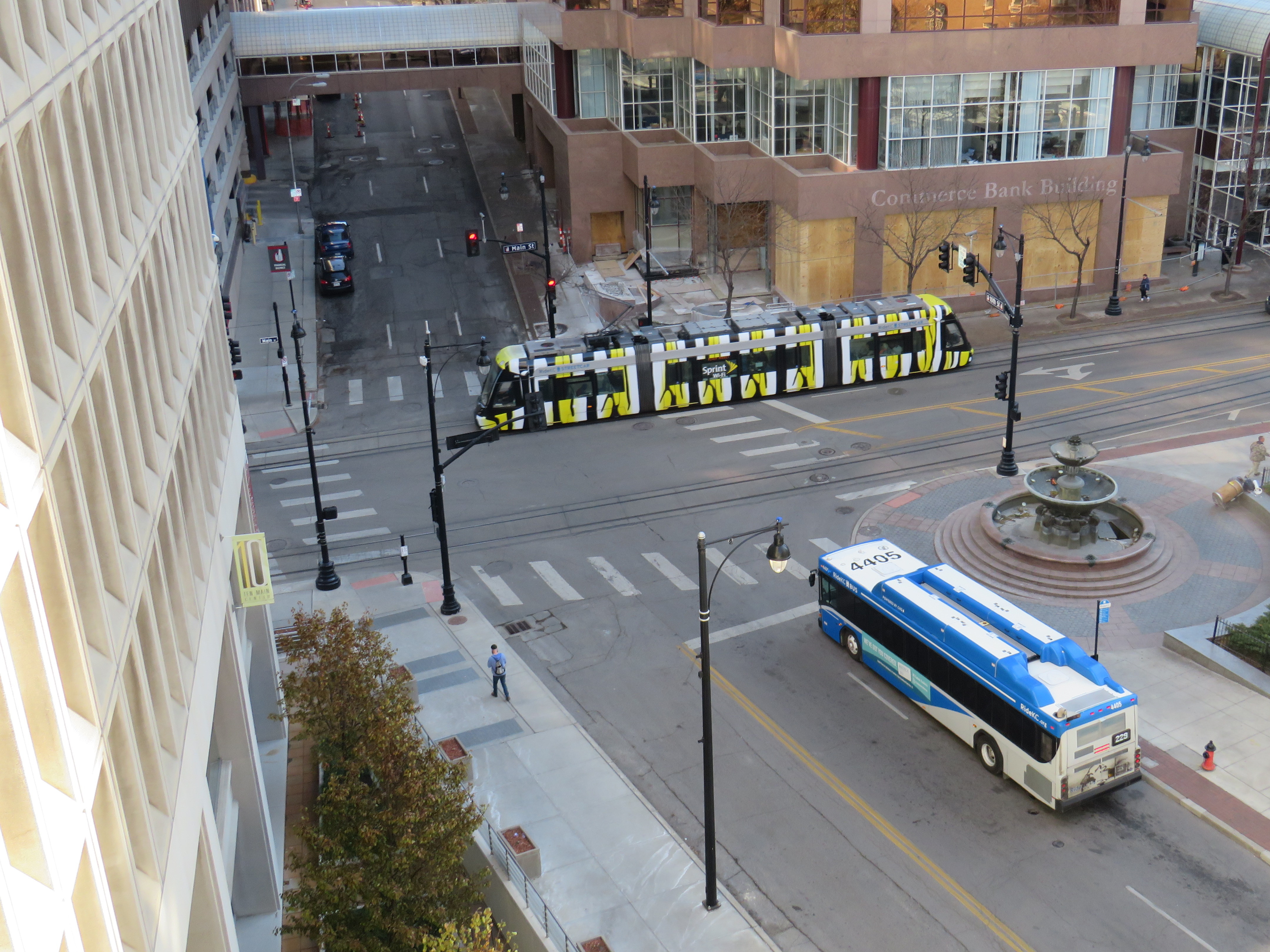
    Bus and streetcar, Downtown Kansas City

    Kansas City, Missouri made news this month when its City Council voted unanimously to include a plan for free fixed-route public transit in the next city budget. Though that budget would still have to be passed in the New Year, the mayor’s support for the measure is a promising sign. Though it will cost $8 million, local politicians support the idea as it will benefit low income riders.

    It is worth noting that Kansas City Area Transit Authority’s 2016 annual ridership was just over 14 million a year, while the cost recovery rate was just 12 percent. It would be much harder to offer free transit in Toronto. The TTC’s cost recovery rate is 68%, with transit fares bringing in over $1.2 billion a year. Though a two-hour transfer and free children’s fares were recently introduced, there’s little chance that the City of Toronto would agree to funding fare-free transit. In any case, Kansas City’s experiment will be interesting to watch.

    Kansas City was a more interesting city than I expected; I am glad I made the impromptu trip. There are a few Toronto connections, including a streetcar that traveled the continent, a restored Union Station, and a 1920s shopping plaza whose concept was imitated 80 years later in Don Mills.

    I enjoyed an evening at a jazz club at the 18th and Vine Historic District and local barbecue. Besides transit, I also got around on an electric pedal assist bike that’s part of the local bike share. It’s friendly, urban city, definitely worth a visit.
    (more…)

  • A review of GO Transit’s fare structure

    IMG_8969-001

    Four years ago, I wrote about GO Transit’s problematic fare structure. Though GO Transit claims to charge passengers based upon a fare-by-distance structure, fares for travelling short distances were disproportionately high compared to long-distance rides from outer suburban stations. In 2015, I also found significant fare differences between corridors, with Kitchener Line passengers paying the most per distance traveled.

    Since my original post, some changes were made to the GO Transit fare system:

    • In 2016, a tiered fare increase was applied, with the lowest fares frozen (for example, Union Station to Mimico, Bloor, or Danforth), with fare increases between  40 and 60 cents per ride dependent on distance traveled. Those fare increases applied to Presto fares, though with a discount (11.15% less than the cash fare).
    • In January 2018, a $1.50 fare discount was introduced for Presto card users transferring between TTC and GO. However, the Ford government announced it would no longer subsidize the TTC-GO fare discount, threatening its continuation.
    • In April 2019, GO fares for trips less than 10 kilometres were reduced, with the minimum cash fare going from $5.30 to $4.40, with the minimum Presto fares reduced from $4.71 to $3.70. A passenger headed from Union Station to Exhibition Place could choose to take a local TTC streetcar fare ($3.10 with a Presto Card) or the direct GO train ride (just 60 cents more). At the same time, the cash fares for trips longer than 10 kilometres were increased by 4%, while Presto fares were increased by 3%. 

    The good news is the eventual reduction of short-distance fares have gone a long way towards flattening the fare/distance curve.

    There were also some major service changes over the last four years. Two new GO stations were opened: Downsview Park (which offers a direct connection to the new TTC subway extension to York University and Vaughan), and Gormley, a station built next to Highway 404 on the Oak Ridges Moraine. Additional trains were added to Kitchener, new peak-period trains to and from Niagara Falls were introduced, evening trains added on the Kitchener Line, and this month, weekend trains were introduced on the Stouffville Line. But connecting bus routes to Cambridge, Bolton, and between Milton and Oakville were eliminated, with other bus trips cancelled across the system. (more…)

  • Transit Summit in Guelph this Saturday, November 9

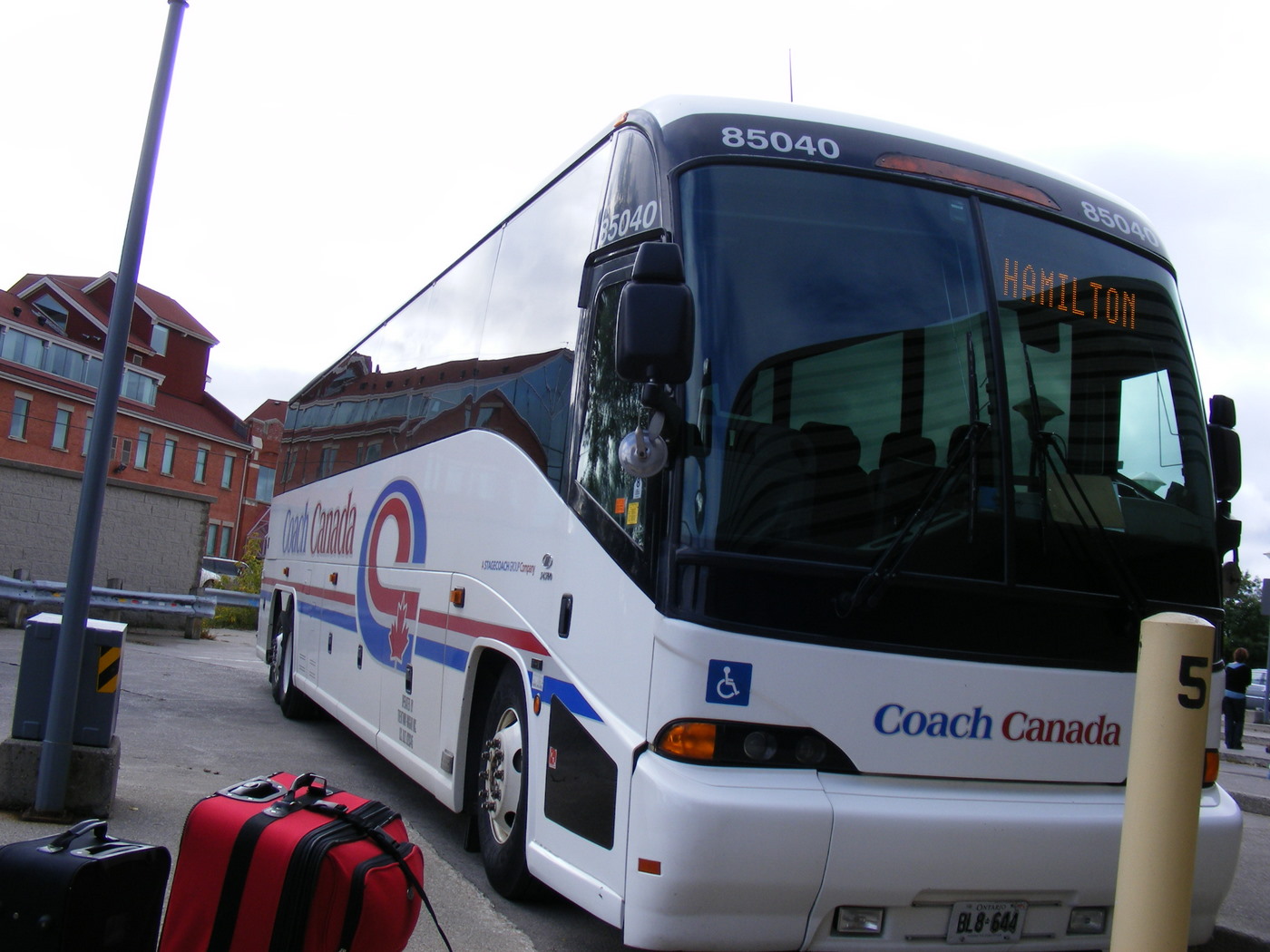
    4003585727_e8125d19a3_o.jpgCoach Canada bus to Hamilton, September 2009

    This Saturday, I will be joining fellow transportation advocates and experts in Downtown Guelph for the First Annual Transit Summit & Town Hall organized by Transit Action Alliance of Guelph (TAAG).  I’ll be speaking about the gaps in regional and intercity transit in Guelph and Southwestern Ontario.

    In the 1980s, there were direct buses from Guelph to Toronto, Brampton, Kitchener, Hamilton, Fergus and Elora, and Owen Sound. There were five VIA trains a day in each directions between Toronto, Guelph, Kitchener, and London. Though there are far more buses departing from Guelph than in the 1980s, they are mostly operated by GO Transit, all leading east towards Brampton and Mississauga. GO Transit rail service has improved, but it is still geared towards Toronto-bound commuters. Getting between Guelph and Hamilton by bus requires a transfer at Square One in Mississauga.

    I wrote about these gaps before on my own blog and for TVO. I will be speaking more about them — and possible solutions to the problem — on Saturday.

    Intercity bus links in Midwestern Ontario in 1983 and 2019.
    The 1983 map is an excerpt from Ontario Intercity Guide published by Ontario Ministry of Transportation; the 2019 is an edited version of the same image. 

    Other speakers at the Transit Summit include representatives from TTCRiders, TransportAction, and officials from the City of Guelph and Guelph Transit. The summit and town hall will be held at St. Andrew’s Presbyterian Church in Downtown Guelph on Saturday November 9 from 12:00 to 5:30 PM.

    You can register on TAAG’s website until Friday November 8.

  • Suburban Toronto’s transit past and future on north Yonge Street

    IMG_4846-001
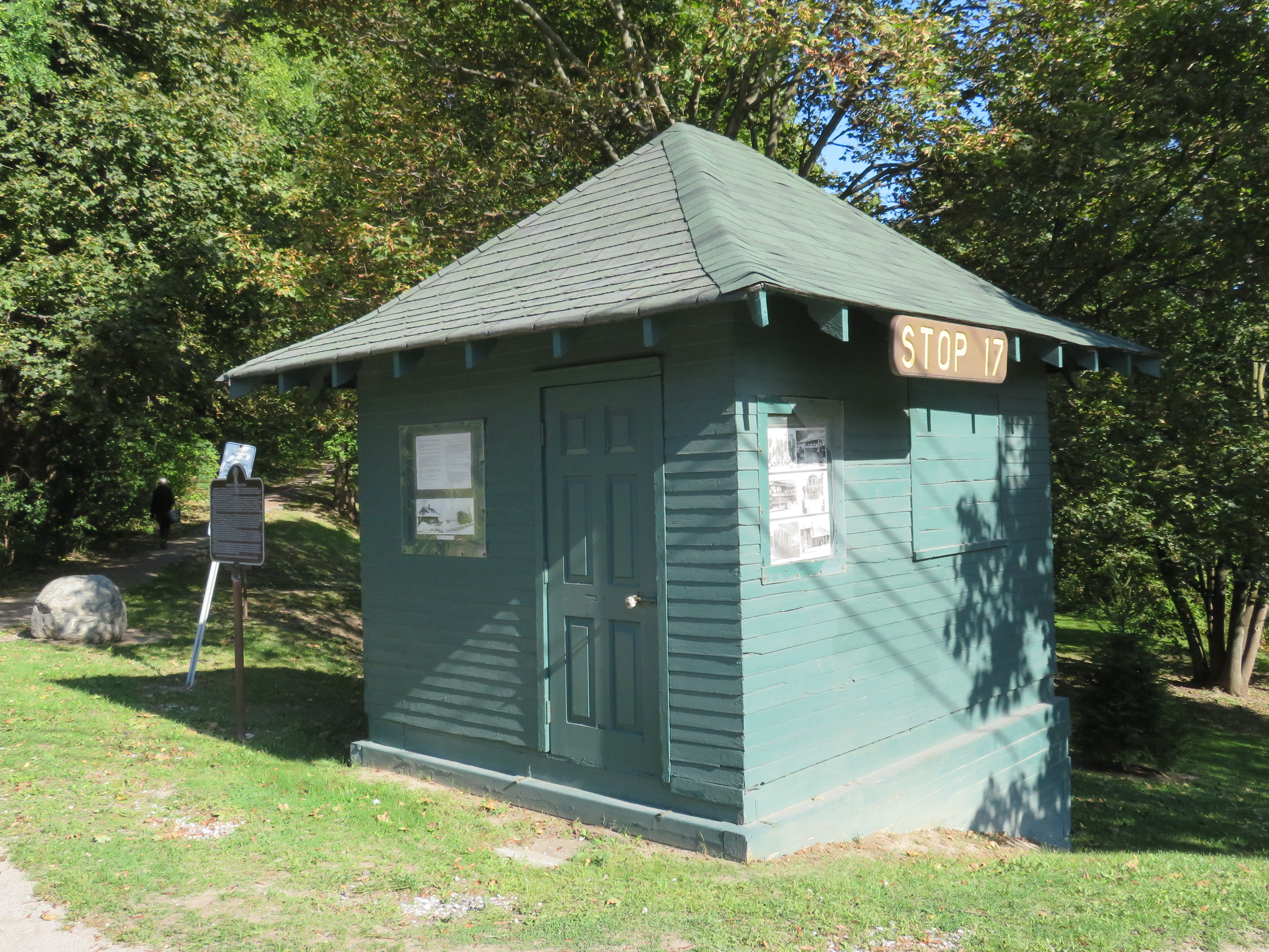
    Stop 17 shelter in Thornhill

    On Yonge Street in Thornhill, a small green hut sits beside the busy roadway at the entrance to Cricklewood Park. On the side of the small building, a wood sign says “Stop 17.” Hundreds of buses and thousands of cars pass by this hut daily, yet few may know about the transit history it represents.

    Stop 17 was a stop on the Toronto & York Radial Railway line that extended north from a terminal at Toronto’s city limits at Yonge Street and Glen Echo Avenue (now the location of a Loblaws supermarket) all the way to Sutton, via Richmond Hill and Newmarket. Electric radial service to Thornhill and Richmond Hill began in 1897. By 1908, radial service reached Lake Simcoe.

    Stop 17 was one of two stops in Thornhill, located at the present-day intersection of Yonge Street and Royal Orchard Boulevard. The TTC, the eventual owner of most of Toronto’s radial lines, closed the Lake Simcoe route in 1930. Soon afterwards, the wooden shelter was moved to a nearby golf club, where it served as a snack bar and rain shelter. (The radial line was resurrected in late 1930 as a suburban streetcar service to Richmond Hill until 1948.)

    f1568_it0441
    Yonge Street looking south in Thornhill, September 1931. City of Toronto Archives, Fonds 1568, Item 441.

    In November 2000, the Stop 17 shelter was moved back to Yonge Street and restored. It stands as a historical building in Thornhill, and as a monument to early suburban transit in Greater Toronto. Only a few other structures exist from the radial railway era including the Newmarket Radial Arch, the footings of a Toronto Suburban Railway trestle over the Humber River, and a radial power station in Guelph.

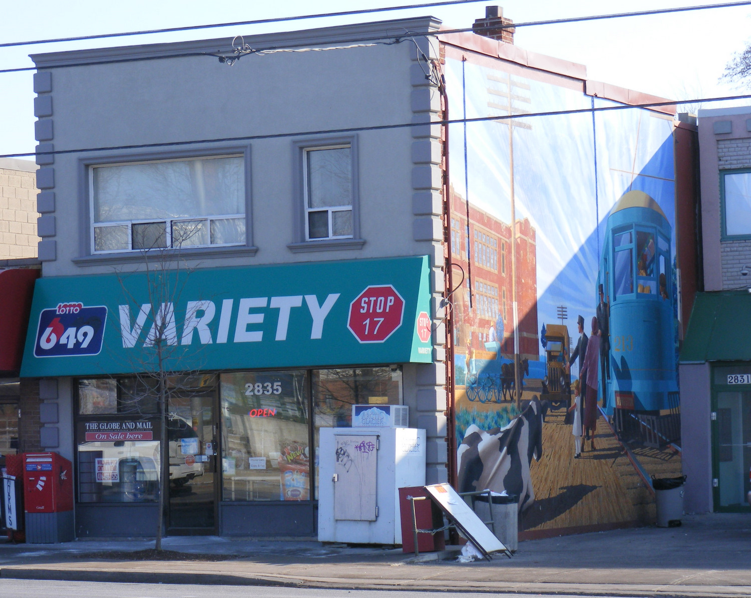
    There was another Stop 17, on the Scarboro Radial Line between Toronto and West Hill.  By coincidence, it is also memorialized in the name of a variety store (Stop 17 Variety), which also sports a mural depicting a T&Y radial car stopped in front of the Scarborough High School (now R.H. King Academy).

    Stop 17 VarietyStop 17 Variety on Kingston Road at St. Clair Avenue in Scarborough
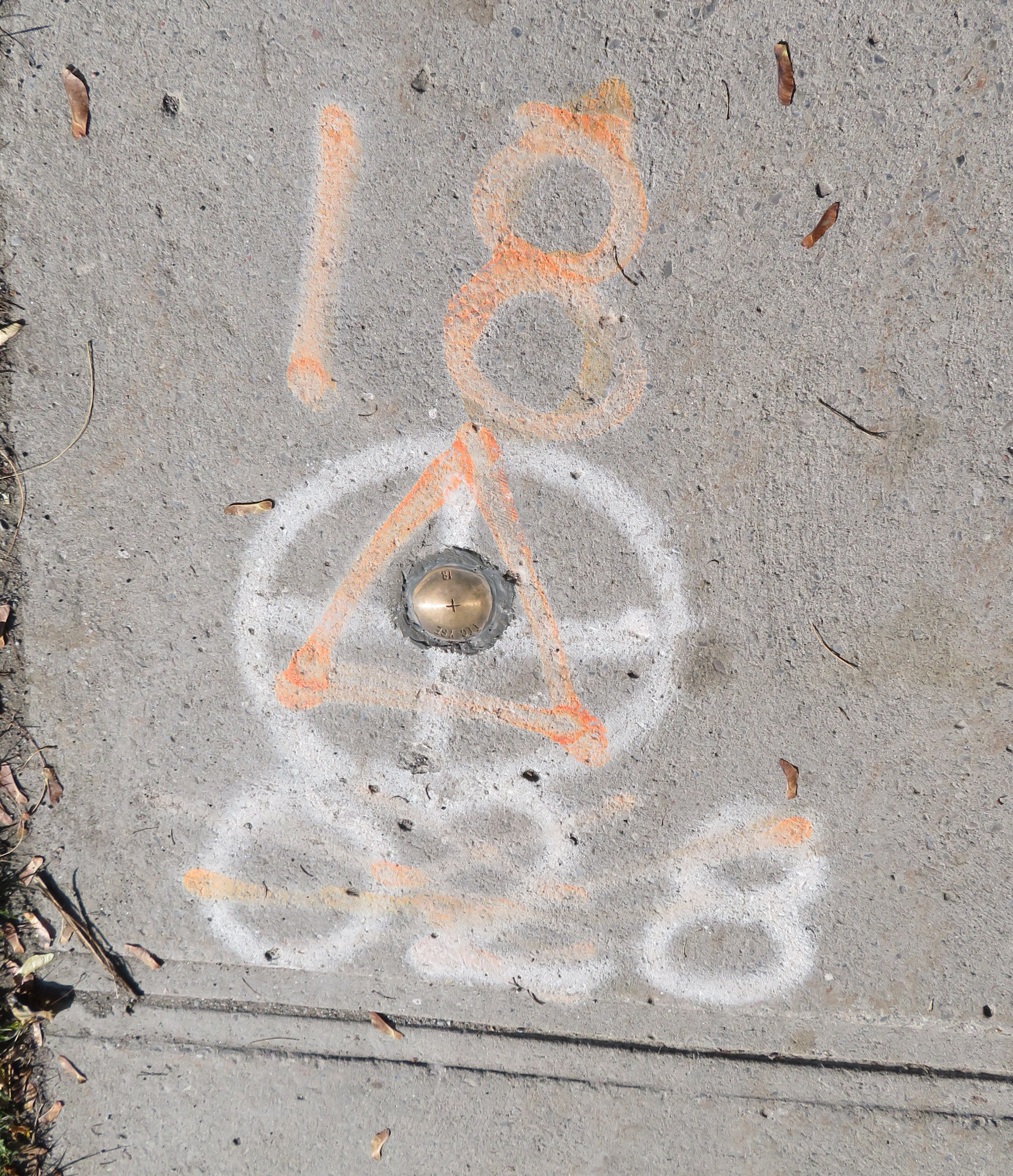
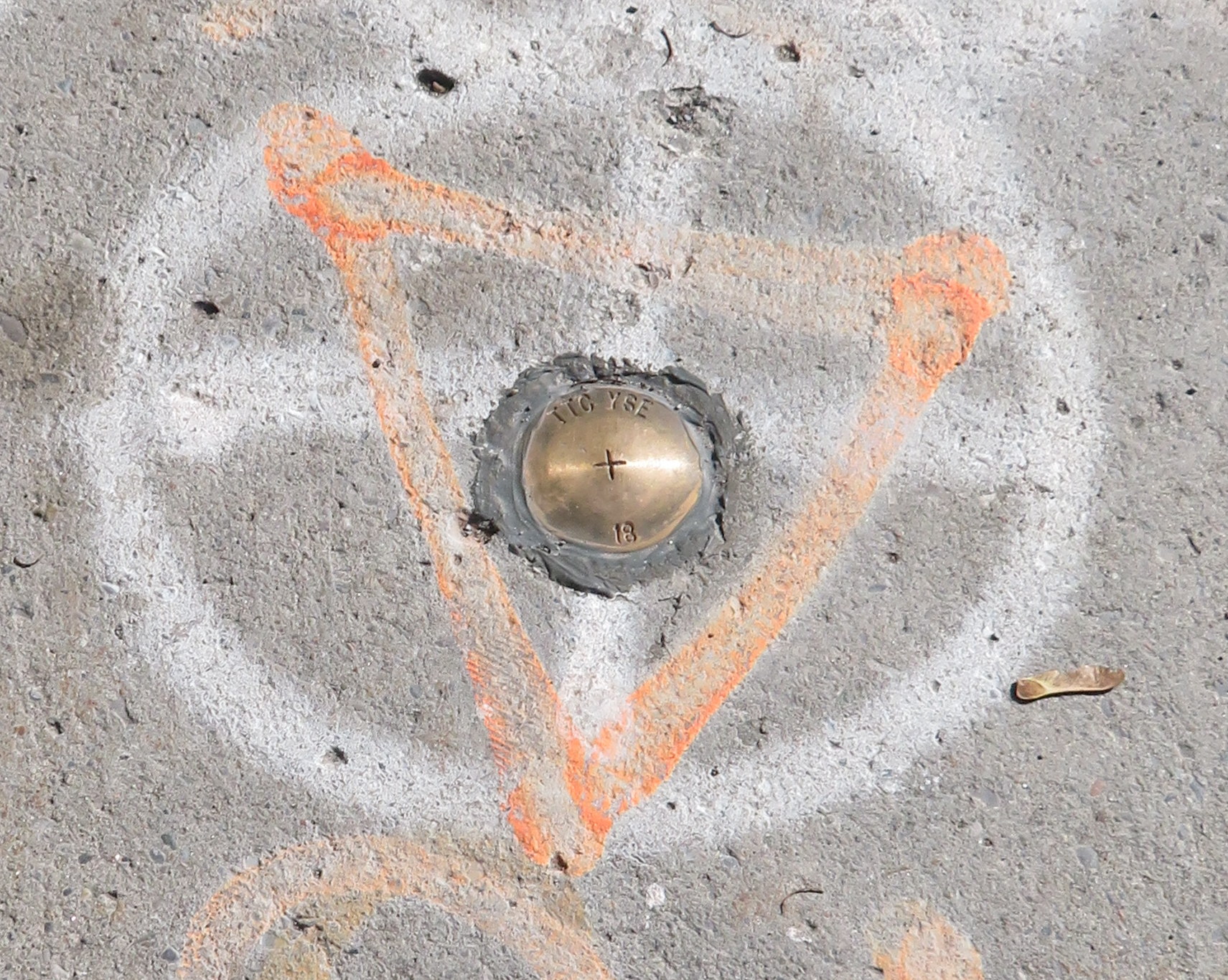
    Nearby the Stop 17 shelter in Thornhill, I noticed several markings in the sidewalk. After a closer look, I noticed that they were survey markers, indicating a location where holes were drilled for preliminary core samples for the planned Yonge North Subway Extension from Finch Station to Richmond Hill.

    One day, the subway will be extended north into York Region, a sensible project given the ridership potential, especially as Yonge Street sees urban intensification through Thornhill and Richmond Hill. The City of Toronto has been resistant to the extension, as the Yonge Subway is already operating over capacity, with a relief subway required to handle the loads.

    The politics of subway building aside, it is fascinating to find the history and future of Toronto’s suburban transit in such close proximity.

    IMG_4848-001
    Sidewalk markings on Yonge Street

    IMG_4848-002
    “TTC YSE” marker

  • O-Train impressions: this is what LRT looks like

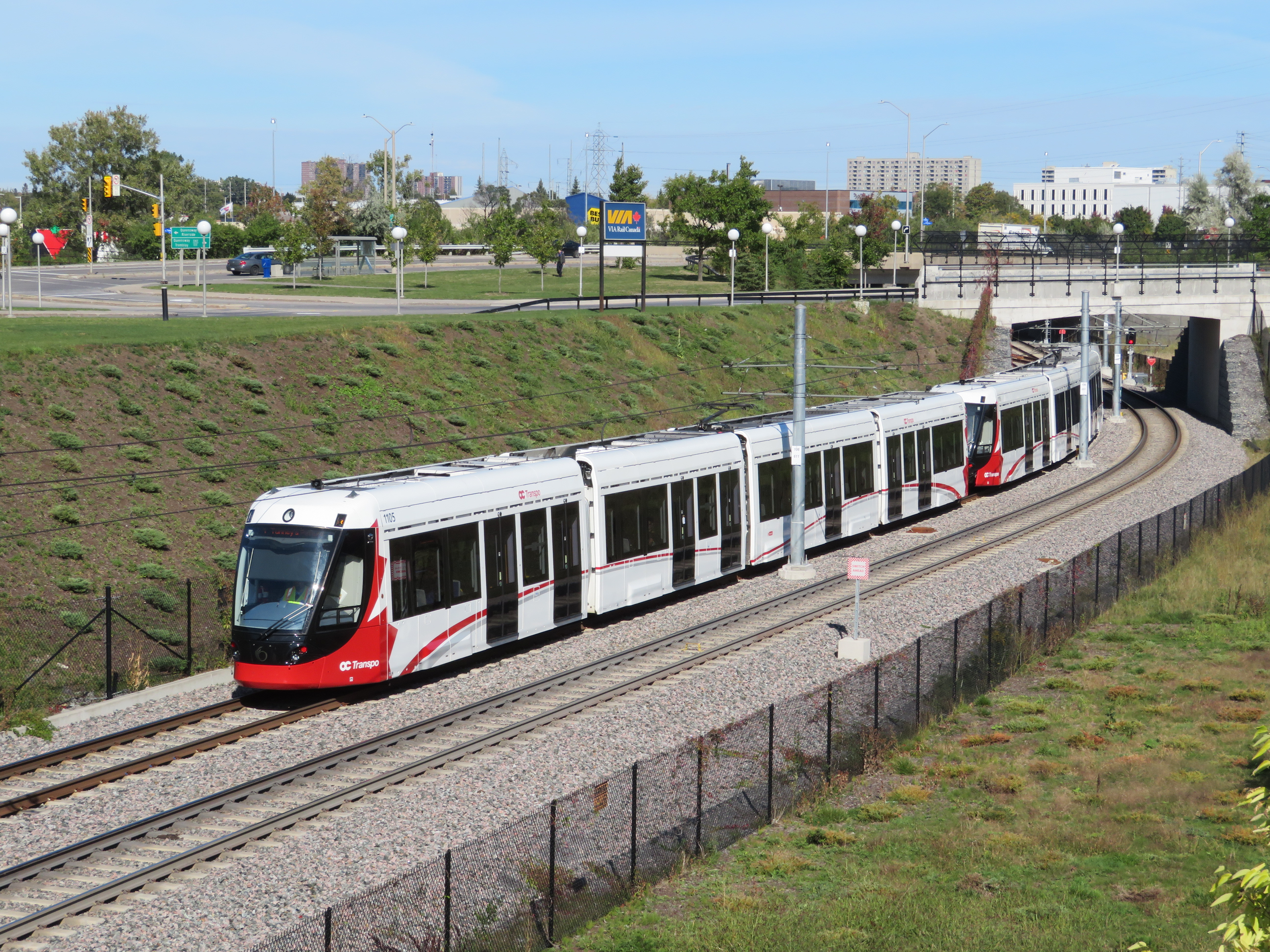
    IMG_4614-001Confederation Line train approaching Tremblay Station
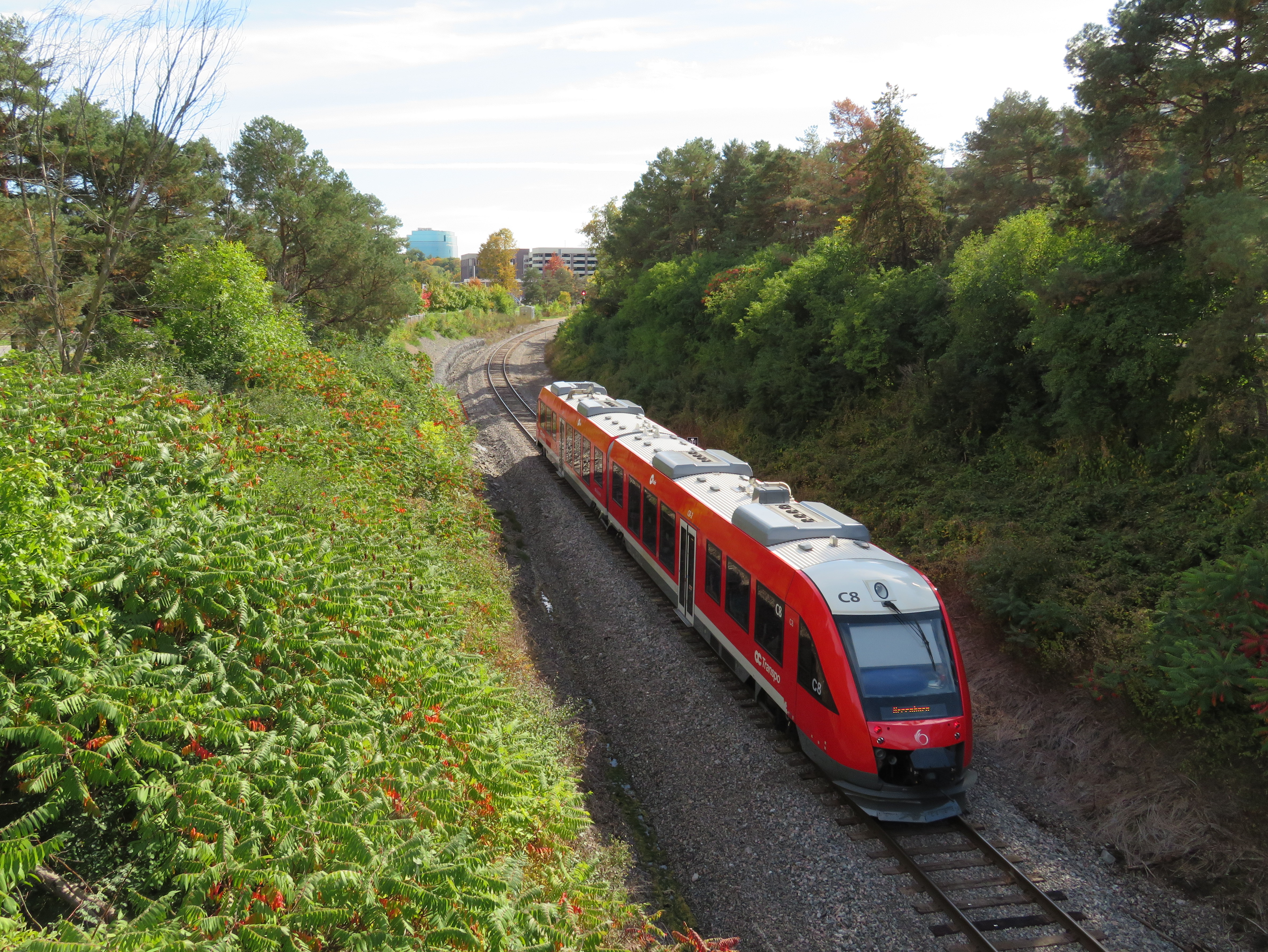
    Last weekend, I visited Ottawa to check out the new Confederation Line LRT. Canada’s newest rapid transit line, delayed by two years, finally opened on Saturday, September 14. It is the second LRT to open in Ontario this year; Waterloo Region’s ION service opened in June.

    The new 13-station Confederation Line includes a 2.5-kilometre tunnel under Downtown Ottawa, with three stations deep underground. Phase 2 will add 15 more stations to the Confederation Line. I was impressed with the speed, accessibility, and capacity of the new LRT, though I noticed a few flaws, some of which hopefully will be corrected.

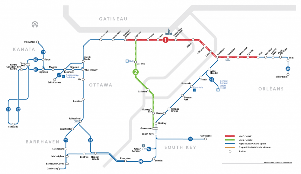
    The Confederation Line is not the Ottawa Region’s first rapid transit project, however. The Transitway first opened in 1983, one of the world’s first true bus rapid transit systems. Rapibus, a BRT corridor in Gatineau similar to the Transitway, opened in 2013. In 2001, the Trillium Line, a diesel light rail service, opened. It operates on a disused Canadian Pacific Railway corridor through Carleton University. Collectively, the Confederation Line (Line 1) and the Trillium Line (Line 2) are marked at the O-Train.

    IMG_4567-001.JPG
    Trillium Line DMU train approaching Carleton University

    2018_Network_R.png

    O-Train and bus rapid transit map from the OC Transpo website. The Confederation Line is marked on maps and signs as Line 1; the diesel Trillium Line as Line 2.

    The first phase of Line 1 replaces the busiest section of the Transitway, including the congested on-street downtown section on Albert and Slater Streets. Though most sections of the Transitway are grade-separated — following the Queensway (Highway 417) on the east end and an abandoned railway corridor on the west end — the downtown section was the weak link. As OC Transpo, Ottawa’s transit agency operated dozens of suburban express routes into the Transitway during weekday peak periods, lines of buses would often stretch for blocks, an especially inefficient transit operation.

    6205682867_7d38a920b6_o.jpgBus congestion on the Mackenzie King Bridge in Downtown Ottawa in 2011

    With most buses gone from the downtown core, the LRT allows for much more efficient operations, even if many commuters no longer enjoy a one-seat ride to work.

    At several stations, including the Transitway connections at Blair, Tunney’s Pasture and Hurdman, fare-paid areas allow passengers to move between bus and train without having to tap at faregates or show fare payment to the bus operator, like many TTC subway stations. This helps to ensure the LRT is a backbone to a strong feeder bus network, rather than a stand-alone operation.

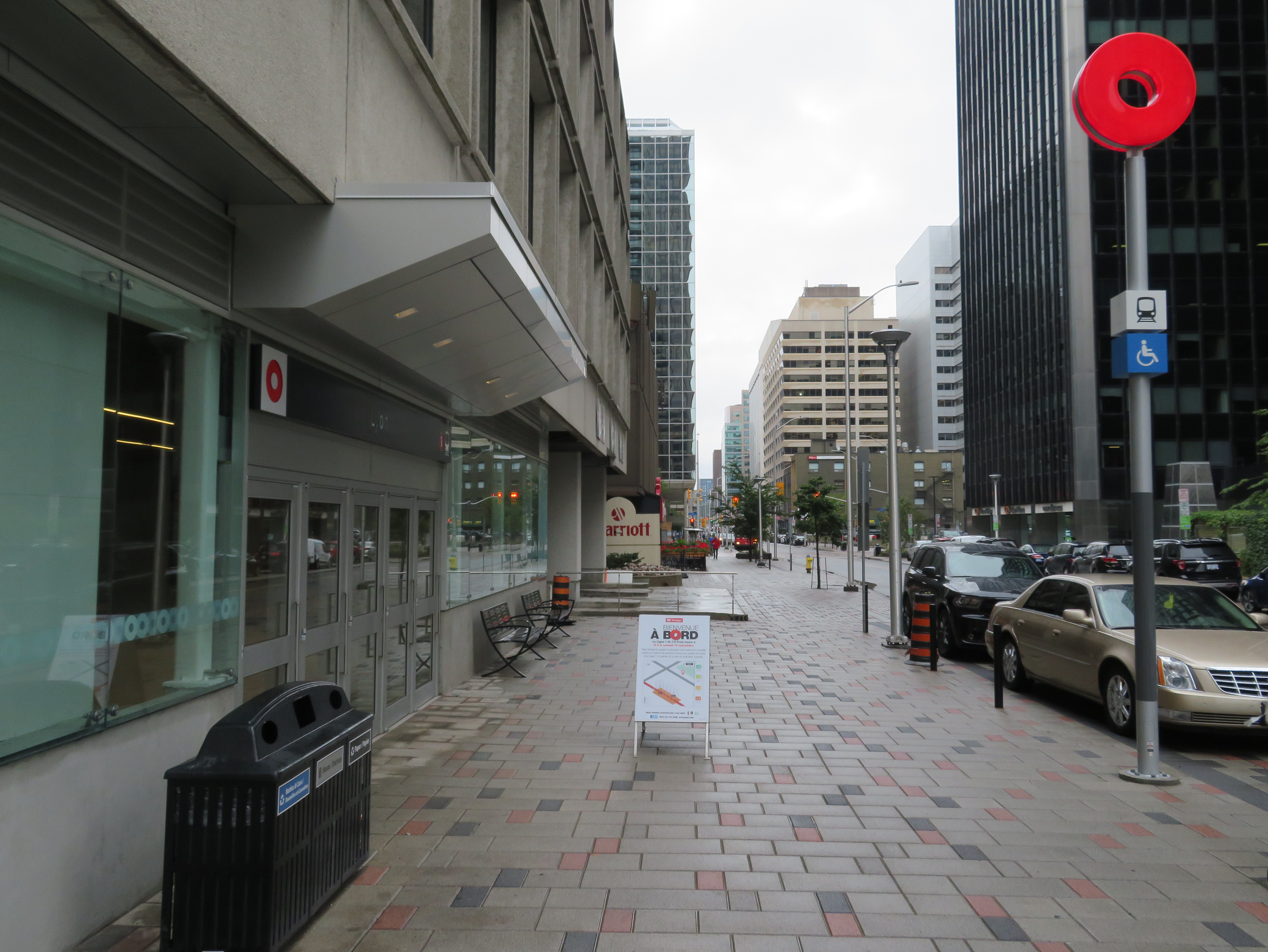
    Most stations are equipped with escalators as well as multiple stairways. There were two side-by-side elevators at most points, providing the necessary redundancy to ensure full barrier-free accessibility. Access is controlled with fare gates like those in Toronto, where Presto cards, paper tickets, and transfers provide access to platform level. All O-Train stations are identified by a simple red circle at each entrance that looks similar to a Lifesaver candy.

    IMG_4483-002.JPGDowntown entrance to Lyon Station, with the O-Train “Lifesaver” totem
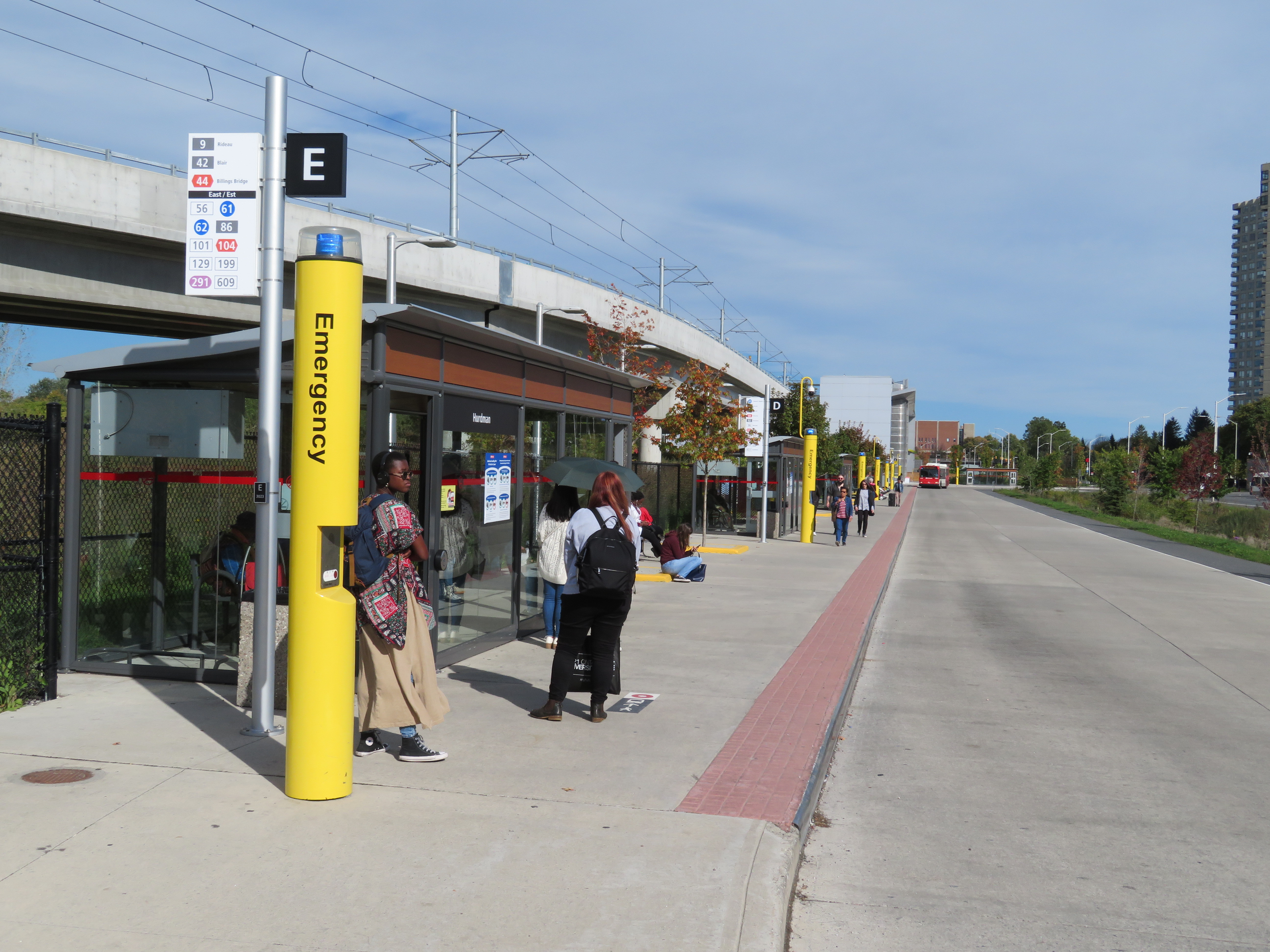
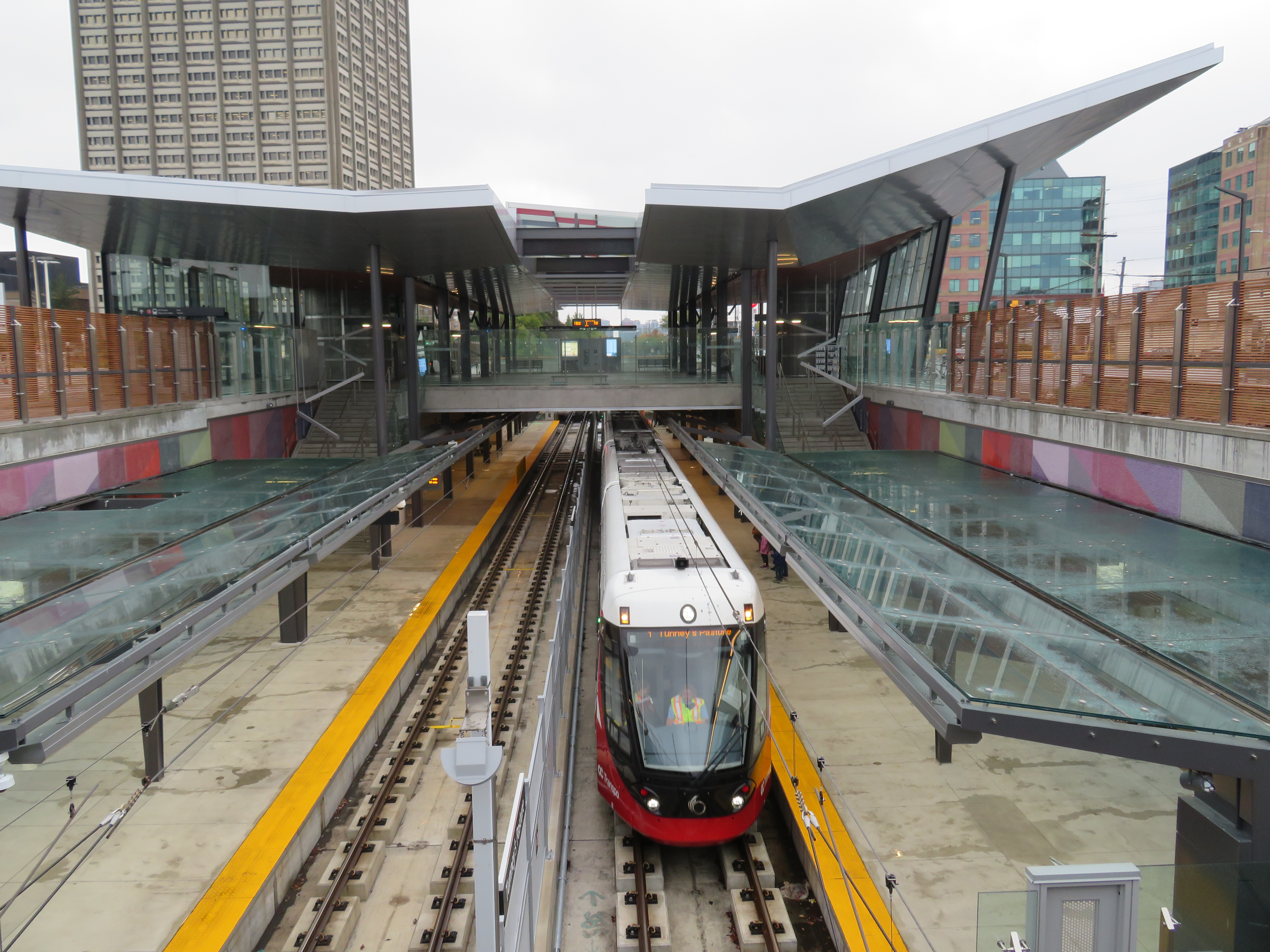
    Unfortunately, some of those rail-bus connections require a long walk outside, such as at Hurdman Station. This was probably the greatest flaw I experienced during my visit last week. Though it was tolerable on a sunny September afternoon, it would be extremely unpleasant in winter or during a rainstorm. It’s unfortunate that the bus terminal was not better thought out to minimize distances between buses and train platforms.

    Ottawa - Hurdman Station
    Bus bay E at Hurdman Station. The bus in the distance is in front of the entrance to the train platforms

    A long-term challenge for the Confederation Line is the ability to direct transit-oriented development around many of the new stations. Though Hurdman Station is major transfer point with the Southeast Transitway, it is located in a floodplain next to the Rideau River. Iris and Blair Stations are located within highway interchanges. There is more potential around Pimisi Station (in the Lebreton Flats, which are already seeing new urban development), St-Laurent (where a second-tier mall could be urbanized), and possibly Cyrville. But all east-end stations are limited by the Queensway.

    These bus transfer and land use concerns were also raised by Alex Bozikovic at the Globe and Mail.


    Vicinity of Hurdman Station
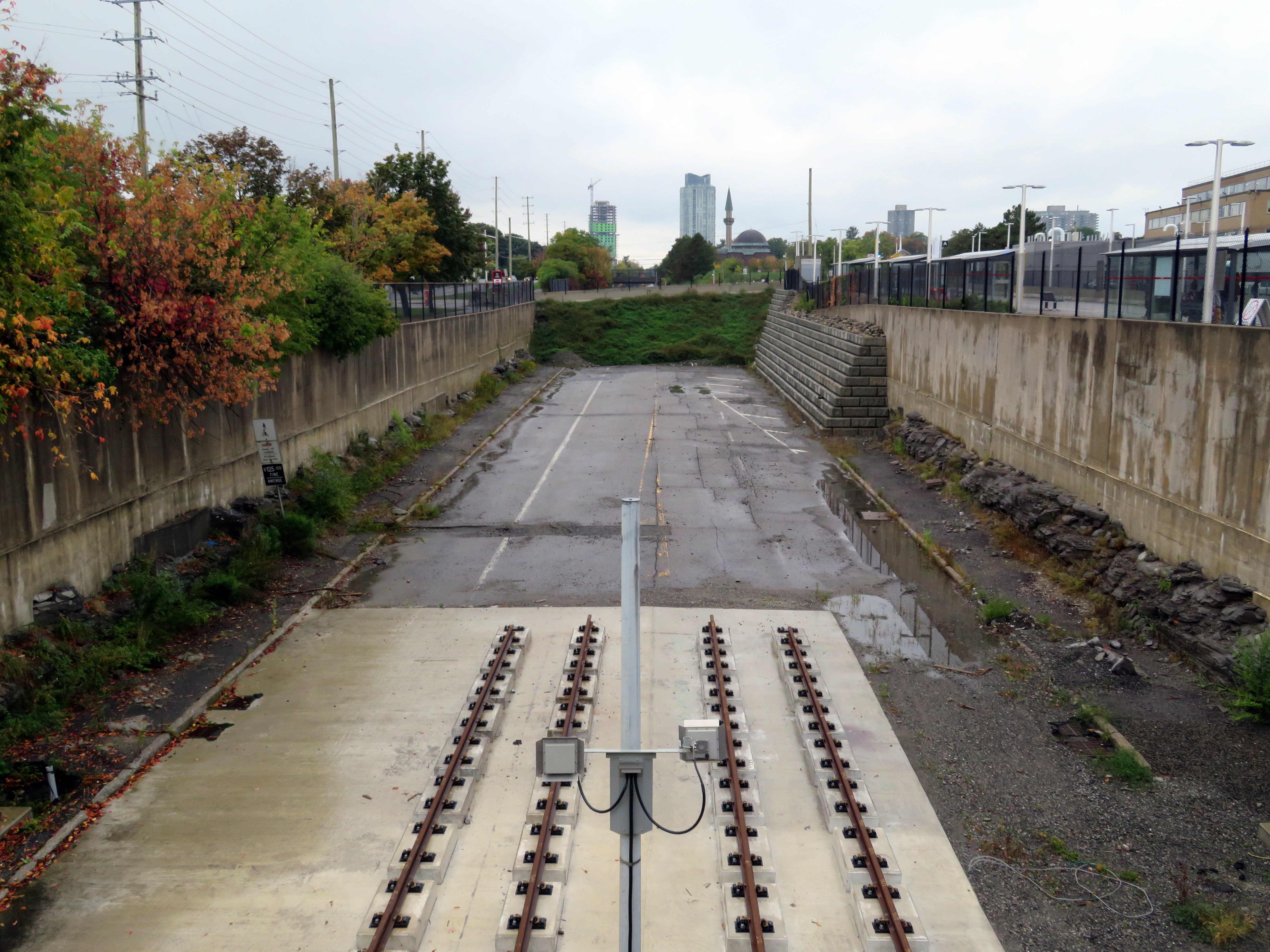
    To the west, however, there is lots of potential for the government office complex at Tunney’s Pasture, which is surrounded by thousands of surface parking lots, as well as eastern Phase 2 stations, which will follow former railway and streetcar corridors, allowing for infill development and urbanization.

    IMG_4502-001Train arriving at the Tunney’s Pasture terminal
    Light rail transit is misunderstood in Toronto, where it is often equated with streetcars, rather than a flexible rapid transit solution. Indeed, light rail covers a wide spectrum, from traditional streetcars, like the TTC’s legacy street railway, to fully grade-separated high-speed LRTs, like Ottawa’s new line. (The Waterloo ION LRT, with a mix of reserved lanes, median operation, and off-road segments, fits somewhere in between.)

    The Confederation Line’s average speed is 31 km/h, with a top speed of 80 km/h. In comparison, TTC Line 1 has a weekday average speed of 28 km/h, and the 501 Queen Streetcar has an average speed of just 9.9 km/h during the morning rush hour. The Waterloo ION LRT currently has an average speed of 21 km/h.

    It is worth noting that the Scarborough RT replacement, once fully funded and ready to start construction six years ago, would have been just as fast and smooth as the Confederation Line. Instead, our local and provincial politicians continue to spin their wheels on planning a subway extension that’s going nowhere. Meanwhile, Ottawa has already started work on Phase 2 of its light rail network.

    IMG_4493-001The end of the beginning: the old Transitway is visible west of Tunney’s Pasture, where Phase 2 of the Confederation Line will continue towards Baseline and Moodie Stations

    The Eglinton-Crosstown LRT will have a long underground segment, with two-car LRT trains similar to those used in Ottawa. When that opens — planned for late 2021 — Torontonians will finally get a taste of high-order light rail transit.

  • A departure from TTC wayfinding improvements

    IMG_3566-001.JPG
    TTC stops have improved with the addition of route numbers, but this bus stop is deceiving 

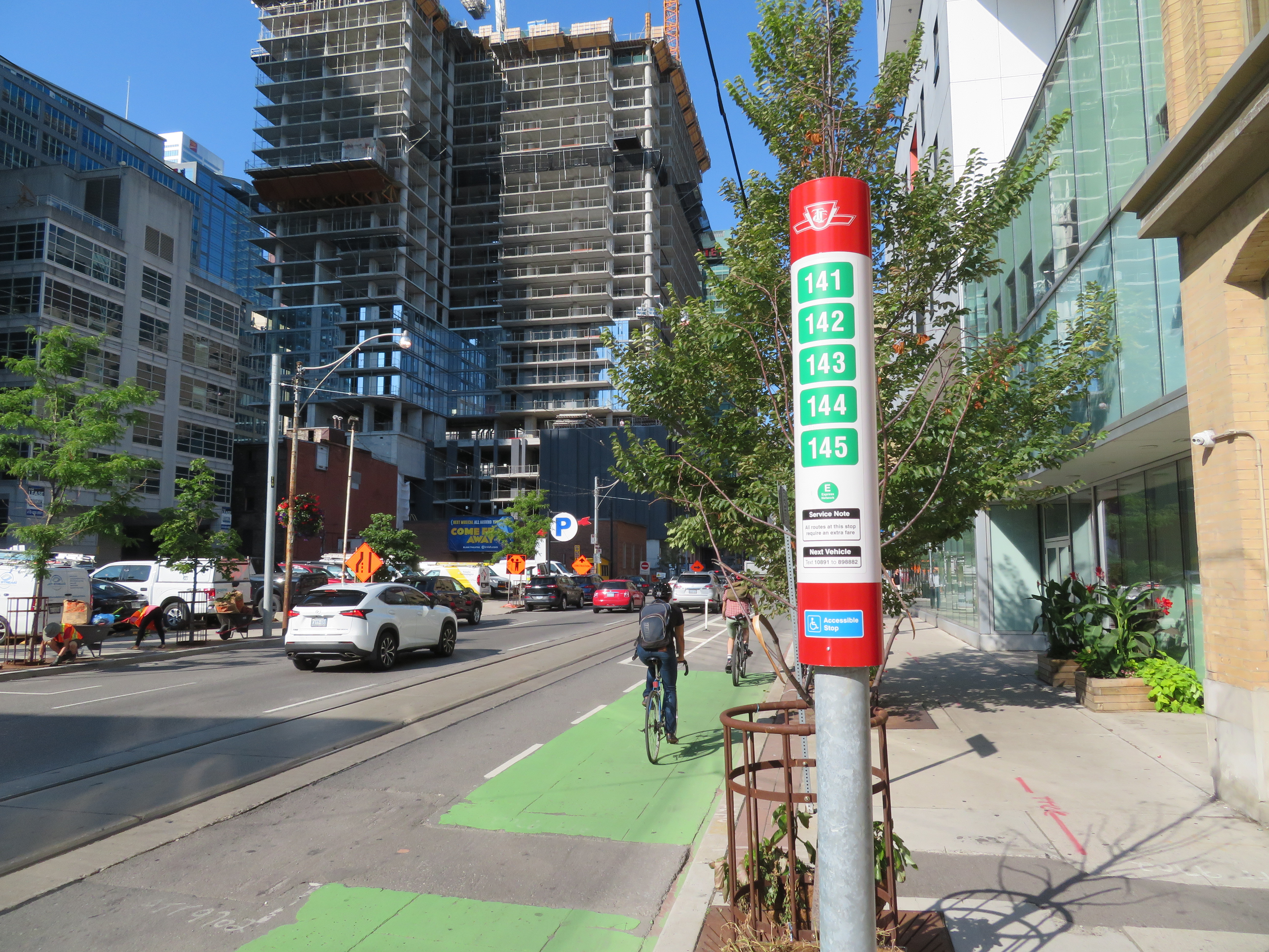
    In the last few years, the TTC has made significant improvements in its maps, signage, and wayfinding standards. It also introduced new streetcar and subway fleets, retrofitted elevators into older stations (all but one streetcar line and a majority of subway stations are now fully accessible), and opened a new subway extension. Though overcrowding, bunching, and weekend closures continue to be aggravations, it is important to recognize where the TTC has improved.

    Specific changes to TTC wayfinding include a new simplified system map, better signage at subway stations, introducing standard signage for diversions, scheduled closures and construction notifications, and revising the classic TTC bus stop.

    However, two recent changes represent an unfortunate departure from these improvements. (more…)

  • How TIFF lost the plot

    IMG_4193-001.JPG504 King Streetcar diverting onto Spadina on Thursday, September 5

    For the sixth year in a row, King Street between University and Spadina Avenues was closed for four straight days. This closure was for the Toronto International Film Festival (TIFF) “Festival Street,” which took place between Thursday September 5 and Sunday September 8. In addition, King Street was closed during the afternoon rush hours the following Monday and Tuesday for “Red Carpet Events.”

    TIFF has been recognized among the world’s most important film festivals, and one where the public has the opportunity to take part (albeit at increasingly inaccessible prices for many screenings). It offers tremendous economic and cultural value to Toronto. It compliments and helps to support many other annual film festivals, such as Hot Docs and Inside Out.

    But TIFF’s clout and influence has also led to entitlement, with “Festival Street” being the most disruptive result. While King Street is closed off to traffic during the film festival, it has severe effects for the 84,000 daily riders of the 504 King Street, as well as riders on the busy 501 Queen and 510 Spadina cars.

    IMG_4191-001.JPG
    501 Queen and 504 King Streetcars stuck in traffic westbound at Queen and Spadina

    Several major TIFF screening locations are located on or near King Street West, including Roy Thomson Hall, the Princess of Wales Theatre, the TIFF Bell Lightbox, and two blocks north, the Scotiabank Cinemas. Industry parties and galas are held at nearby hotels and restaurants. It’s natural that King Street would be a hub of activity for the film festival. But it is also the third busiest transit route in Toronto, after the Yonge-University and Bloor-Danforth subways.

    The King Street Pilot, which began in late 2017, prohibits through motor vehicle traffic on King Street between Jarvis and Bathurst Streets through the downtown core, though all vehicles are permitted to use King Street for short segments. Despite spotty enforcement, the pilot project allowed the TTC to operate much more reliably through the busy corridor, with an increase of capacity and ridership. In early 2017, daily ridership on the 504 King was 72,000. By March 2018, it grew to 84,000. In April, council voted to make the pilot permanent. This will allow for streetscape improvements along the corridor and wider sidewalks, with improved physical measures to further restrict through traffic.

    A lot of political capital went into making King Street work better, so it is disappointing to see all that advocacy for a proper transit corridor go to waste while TIFF is in town. Torontonians are promised each year would be the last year streetcar service would be wrecked for TIFF, but every mid-August, we find out otherwise.  (more…)

  • The last run of the Rogers Road Streetcar

    f1526_fl0072_it0061-600x418.jpg
    Westbound Rogers Road Streetcar at Old Weston Road, 1972. Photograph from Toronto Archives – Fonds 1526, File 72, Item 61

    Forty-five years ago today, on Friday, July 19, 1974, the Rogers Road Streetcar made its last run. The route ran from a loop at St. Clair and Oakwood Avenue to Bicknell Loop, located on Rogers Road just west of Keele Street.

    The Toronto Transit Commission (TTC) had only recently abandoned its policy of eliminating the streetcar network in favour of buses and the planned Queen Street Subway. By the early 1970s, there were still nine streetcar lines in Toronto, along with two extra rush hour services.

    The TTC had to maintain a core fleet of streetcars to continue service until a new fleet could be delivered, and there was a shortage of streetcars in good condition. Despite the new commitment to continue operating a street railway, one more line would have to go. Rogers Road, the last of four streetcars operated for the Township (later Borough) of York, would be sacrificed. (It would not be the last streetcar route to disappear, however.)

    For nearly thirty years, service on Rogers Road was provided by trolley buses, a branch of the 63 Ossington route. While the TTC promised to extend the trolley bus to Jane Street (which was one of the reasons why York politicians supported the streetcar abandonment), it never happened. Instead, a shuttle bus route provided service along Alliance Avenue to Jane. Once the trolley bus network was scrapped in 1993, the TTC restructured several west-end routes. In 1994, the 161 Rogers Road bus finally provided the through service York had demanded for twenty years.

    In July 2014, before I started this blog, I wrote an article about the Rogers Road Streetcar for Spacing’s website, with the assistance of Steve Munro and author John F. Bromley. Five years later, it remains one of my favourite writing assignments.

    You can read the Spacing full article on here.

  • Ontario’s new ride: ION LRT opens in Kitchener-Waterloo

    1-IMG_2377.JPG

    On June 21, 2019, Ontario’s first modern light rail transit (LRT) system opened to the public. The launch of ION in Kitchener-Waterloo represents an important milestone for both the region and for the province as a whole: additional light rail systems in Ottawa and Toronto will open in the next few years, while other systems are planned for Hamilton and Mississauga-Brampton.

    There are several things that make ION particularly remarkable.

    Kitchener-Waterloo’s population is much smaller than other cities that have adopted rail transit in Canada and the United States. In 2016, the combined population of the cities of Kitchener and Waterloo was less than 350,000, making Kitchener-Waterloo the smallest urban area in North America to boast such a system (Waterloo Region, which also includes the City of Cambridge and three rural townships, has a population of nearly 550,000). Kitchener and Waterloo were connected by streetcar until 1946, then by a trolley bus until 1973. Kitchener Transit, then Grand River Transit (GRT) continued to serve the two cities.

    Despite the small population, LRT makes sense here, as many of the region’s trip generators line up along a single corridor, including Downtown Kitchener, Uptown Waterloo, the University of Waterloo, several high schools, and the main hospital. It is also within walking distance of Wilfrid Laurier University. ION is also fully integrated with the connecting bus system, which was re-organized in conjunction with the opening of the new LRT to provide more direct routing and better connect with the rail service.

    By operating on dedicated corridors and alongside regular traffic, the ION route also demonstrates the flexibility unique to light rail systems. Where it runs on private rights of way, crossings are protected by railway-style lights, bells, and gates. Where it operates in reserved lanes at street level, there are dedicated signals and transit priority at most intersections. This isn’t just a streetcar.

    2018-route-ION-LRT-map
    ION LRT route map, from the GRT website

    Torontonians may be forgiven for confusing LRT with traditional streetcars; ION uses Bombardier-built light rail vehicles similar to Toronto’s new low-floor streetcars, and the TTC has marketed streetcars on Spadina Avenue, Queen’s Quay, and St. Clair Avenue as “streetcar rapid transit” before. The difference, though, is that ION LRT stops are spaced further apart than local streetcar stops in Toronto, they take advantage of signal priority, and they partially run off-street.

    LRT, of course, fills a wide spectrum. At its slowest and simplest is the typical streetcar, such as Toronto’s legacy street railway, or some of the new streetcars being built in the United States, such as Detroit’s QLine or the Atlanta Streetcar. Streetcars in private right-of-ways, such as on Spadina or St. Clair Avenues in Toronto, provide additional reliability and speed. On the other end are metro-style LRT systems completely separated from traffic, often featuring tunnels or elevated structures. Ottawa’s Confederation Line, once it finally opens, will be an example of LRT built to the highest standards. The Ctrain in Calgary comes close to this standard as well, though trains are forced to crawl through downtown on a congested Seventh Avenue transit mall.

    I had the opportunity to ride ION twice in the opening week: the first time, on Monday June 24 (on the way home from a weekend in Stratford) and again with a few friends on Saturday June 29. Trains were consistently packed; GRT reported that over 73,000 passengers rode the LRT during opening weekend.

    1-IMG_2411-001
    ION train at Charles and Benson Streets, wrapping around Oktoberfest headquarters

    Operations were not yet perfected. On Saturday June 29, there were noticeable gaps in service, with workers doing switch repairs at the northern terminal at Conestoga Mall. This caused long waits at the northern end of the line. The automatic train control system was disabled, reducing speeds along sections of track where operators had to operate by line-of-sight.

    The schedules could also be a little faster, with reduced station dwell times. Trains must also crawl through tight corners in Downtown Kitchener, Uptown Waterloo, and at Haywood Avenue. But it was nice to see transit priority working: trains ran through many intersections without having to stop, and speeds were impressive (up to 70 kilometres per hour) on the off-road sections of track.

    1-IMG_2199ION train on Duke Street in Downtown Kitchener

    Along the entire corridor, travel times have improved only slightly over the old express bus, the Route 200 iXpress. Between Conestoga and Fairview Park terminals, the scheduled bus time ranged from 45 to 59 minutes, depending on the time of day. The LRT has a consistent 43-minute scheduled travel time between the two terminals. But it still promises to be more reliable.

    The greatest improvements in travel time are between University of Waterloo and Conestoga Mall, Uptown Waterloo, and Downtown Kitchener, where travel times have been reduced by 5-7 minutes.

    A promised second phase will extend ION LRT south to Cambridge. For now, an express bus serves the planned corridor.

    There is certainly room for improvement,  though these at least can be made slowly and incrementally. Hopefully, as passengers and drivers get more used to LRT operations, travel times can be tightened up a bit. But the system will be successful if it attracts more riders (without turning away existing passengers with overcrowding or longer travel times due to transfers from buses), and encourages higher-density, transit-oriented development along the route.

    I will return to Kitchener-Waterloo later this summer once ION is “broken in” and the novelty wears out. Offering free fares during the opening week was a nice way to encourage residents to check out the new service, but overcrowding and inexperience were problems.

    I am hopeful that ION helps to change local attitudes towards light rail and encourages other mid-sized cities and suburban municipalities to follow Waterloo Region’s example.

    1-IMG_2391-001ION train approaching Fairway Terminal. The speed limit on this section of track is 70 km/h.