Category: Transit

  • Two-hour transfers are finally coming to the TTC

    IMG_3898

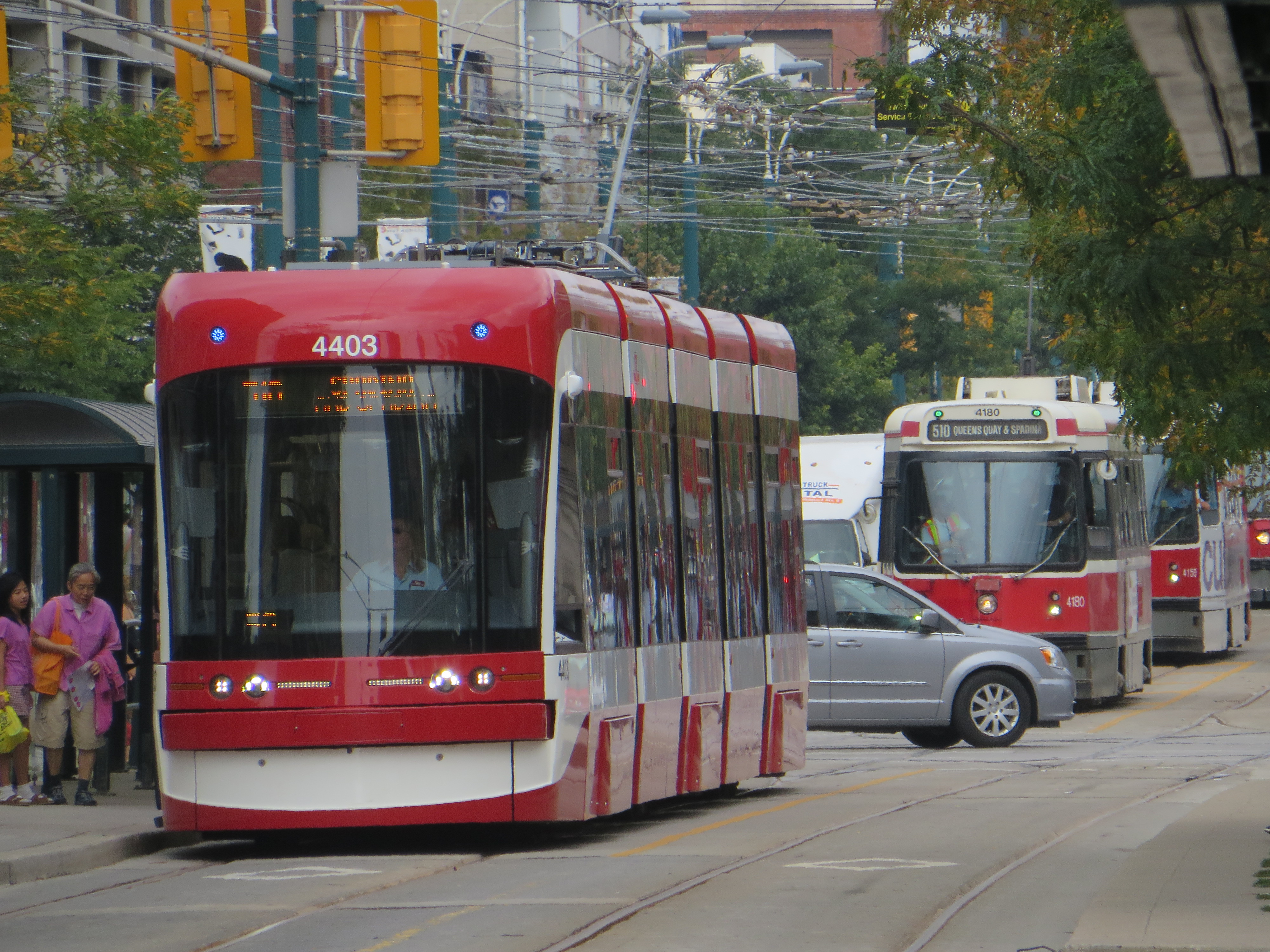
    At its board meeting on July 10, the Toronto Transit Commission finally approved two hour transfers for passengers paying by Presto. This is great news that has been a long time coming.

    The TTC expects that the new policy will cost $21 million a year by 2020, but it will also boost ridership by 5 million passengers. The new two-hour transfer policy will allow a passenger using a Presto card to board any vehicle or enter any subway station within two hours of the first tap without paying a second fare. This will allow anyone to make a short return trip on one fare, or make a stopover before transferring to another route. Customers of most suburban transit systems such as MiWay, Brampton Transit, and YRT have enjoyed the same privileges for over a decade.

    The policy takes effect Sunday, August 26.

    I’ve argued here before why two-hour transfers are necessary. If a passenger taps onto another vehicle on the same route, a common occurrence due to delays, short-turns, and diversions/shuttles, the Presto Card will deduct a second fare. That has happened to me several times, even when making a valid transfer between a bus and Union subway station. It’s often confusing when the TTC tells its passengers to take a paper transfer when a diversion takes place, or tells its customers not to tap again on a bus or streetcar when they’re short-turned. The new policy finally fixes those errors for good.

    However, the transfer policy does not apply to customers paying by cash, tickets, or tokens, so the old archaic paper transfer rules will still apply to many TTC customers.

    The TTC is slowly phasing out paper media and passes, but still has yet to implement daily, weekly or monthly caps that will effectively replace day, weekly and Metropasses. There will also need to be a paper Presto card equivalent developed for occasional and one-time customers, such as tourists or anyone who doesn’t want to pay the $6 fee for a plastic card. Hopefully the details of how these will be implemented will be decided and communicated in the near future.

  • Toronto’s Transit Secrets

    img_6063.jpg

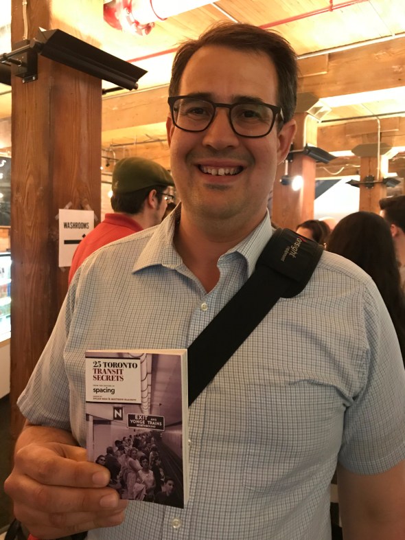
    Earlier this week, I attended a book launch at the Spacing Store at 401 Richmond Street West here in Toronto. While I have been to numerous book launches, often to support friends and colleagues, it was the first time it was for a book that I contributed to.

    As some of you may know, I am an occasional contributor to Spacing Magazine and Spacing’s website. My writing has allowed me to think and learn more about Toronto, and meet fellow engaged Torontonians. Spacing’s latest book, 25 Toronto Transit Secrets, contains stories, photographs, and maps that detail both the history and the operations of the TTC. For my part, I wrote about the ghostly reminders of abandoned streetcar routes, the history of the convoluted Harbord Streetcar, and what happens to the TTC’s streetcars when they’ve reached the end of the line.

    There are many other great stories as well. Read about the TTC’s safety mascot, Barney the Beaver, Toronto’s two ghost stations (Lower Bay and the lesser-known Lower Queen) and a history of the ferry service to Toronto Islands.

    25 Toronto Transit Secrets is edited by Dylan Reid and Matthew Blackett, who both deserve a lot of credit. Any writer knows that their work is dependent on editors not only proof-reading their work, but also providing guidance and support. I am always grateful for their encouragement and providing the opportunity to be published.

  • What’s going on in Downtown Brampton?

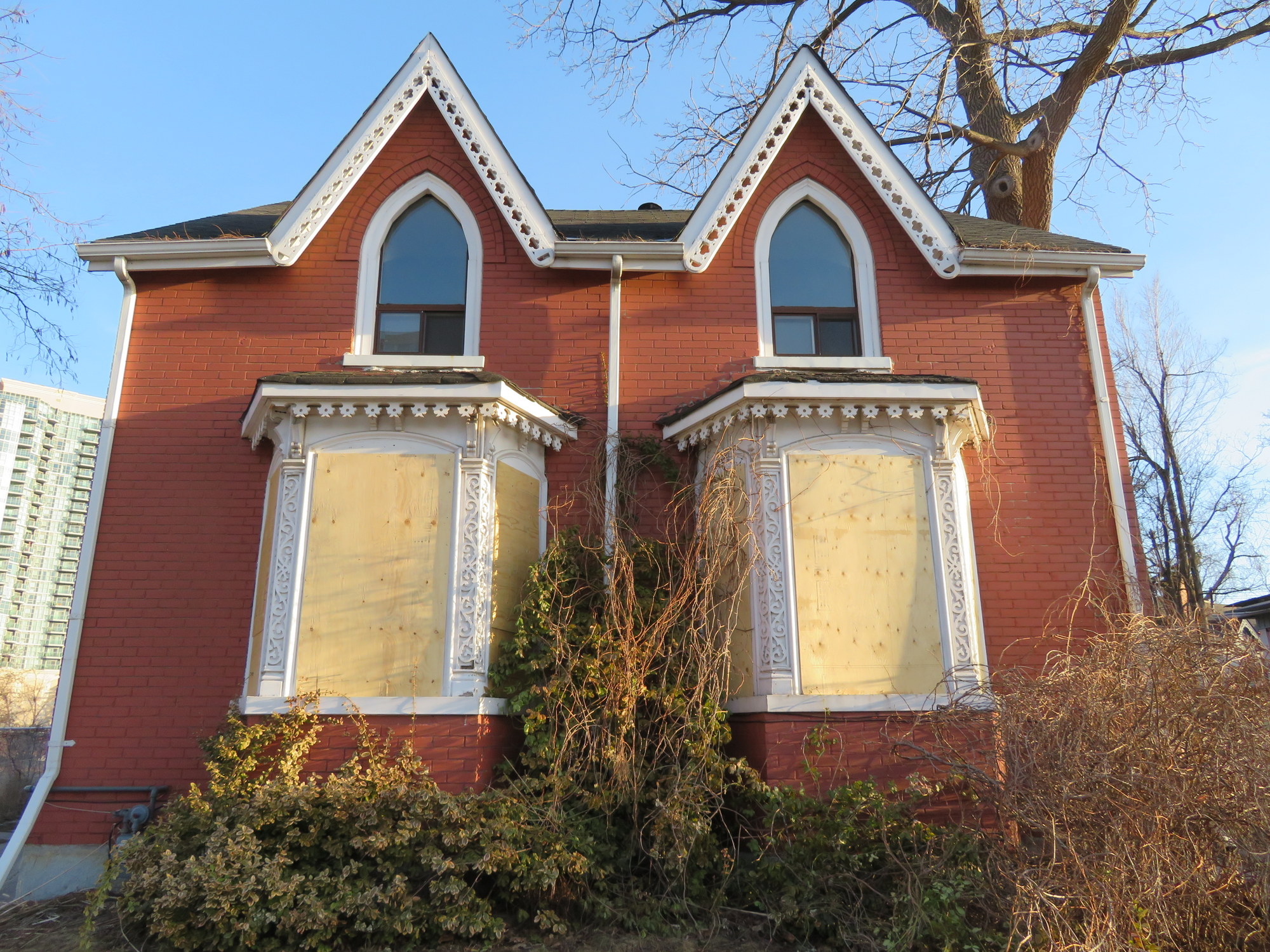
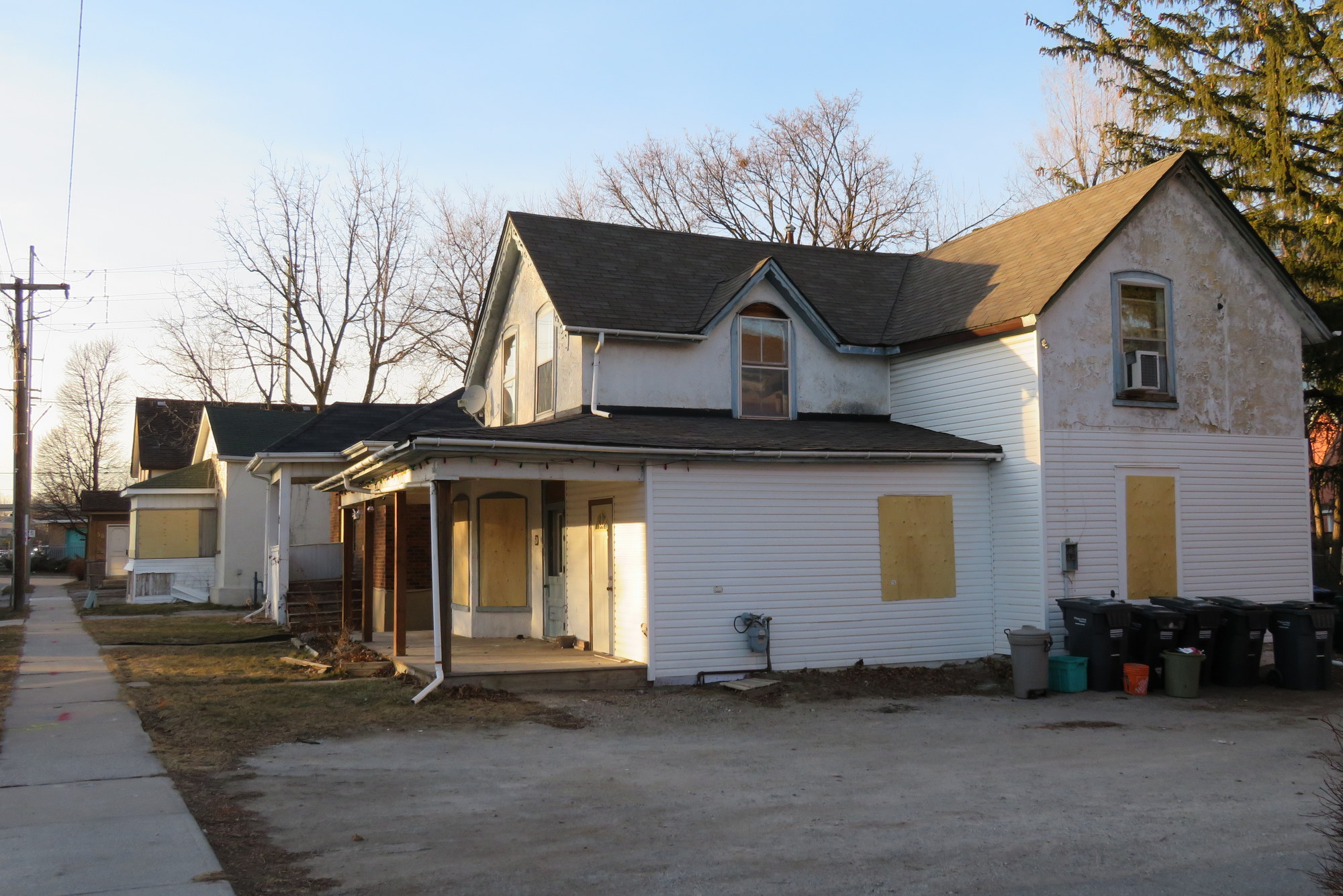
    IMG_6139-0015 Railroad Street, on the City of Brampton’s heritage registrar, is one of several houses recently boarded up in Downtown Brampton
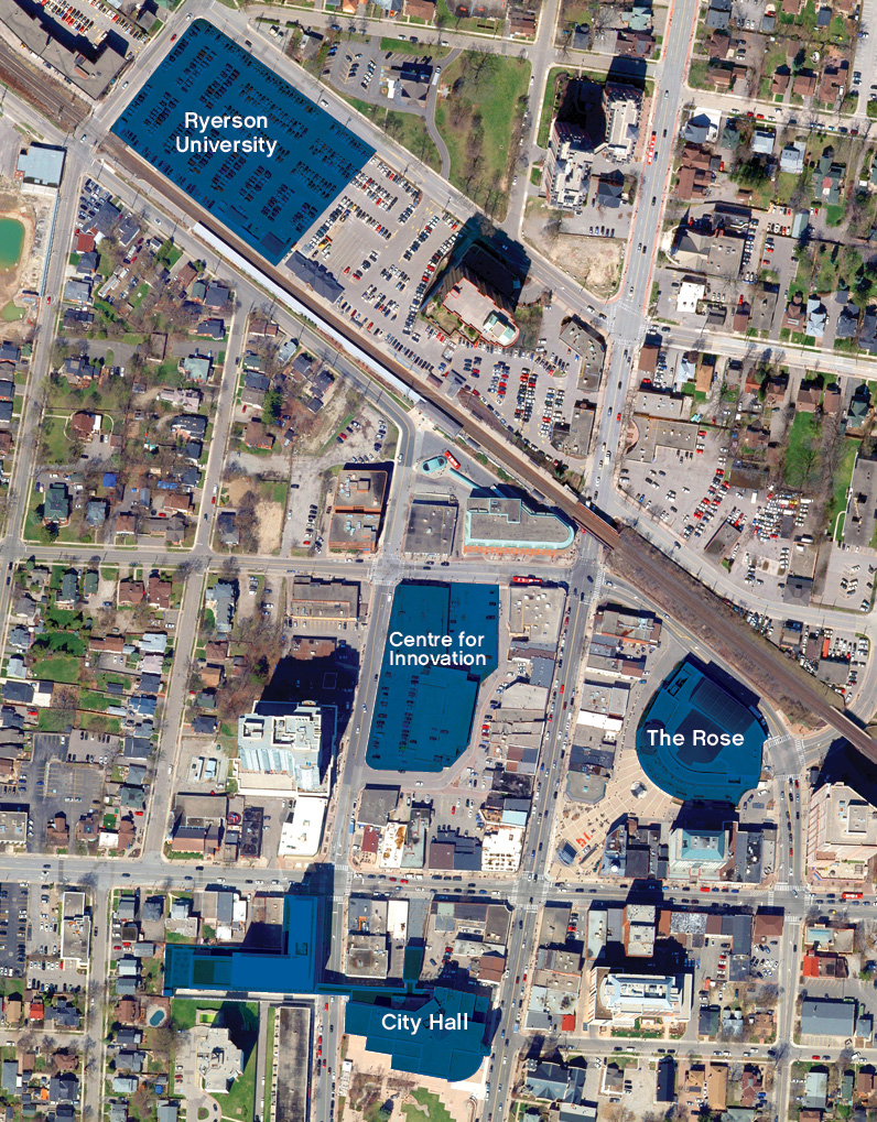
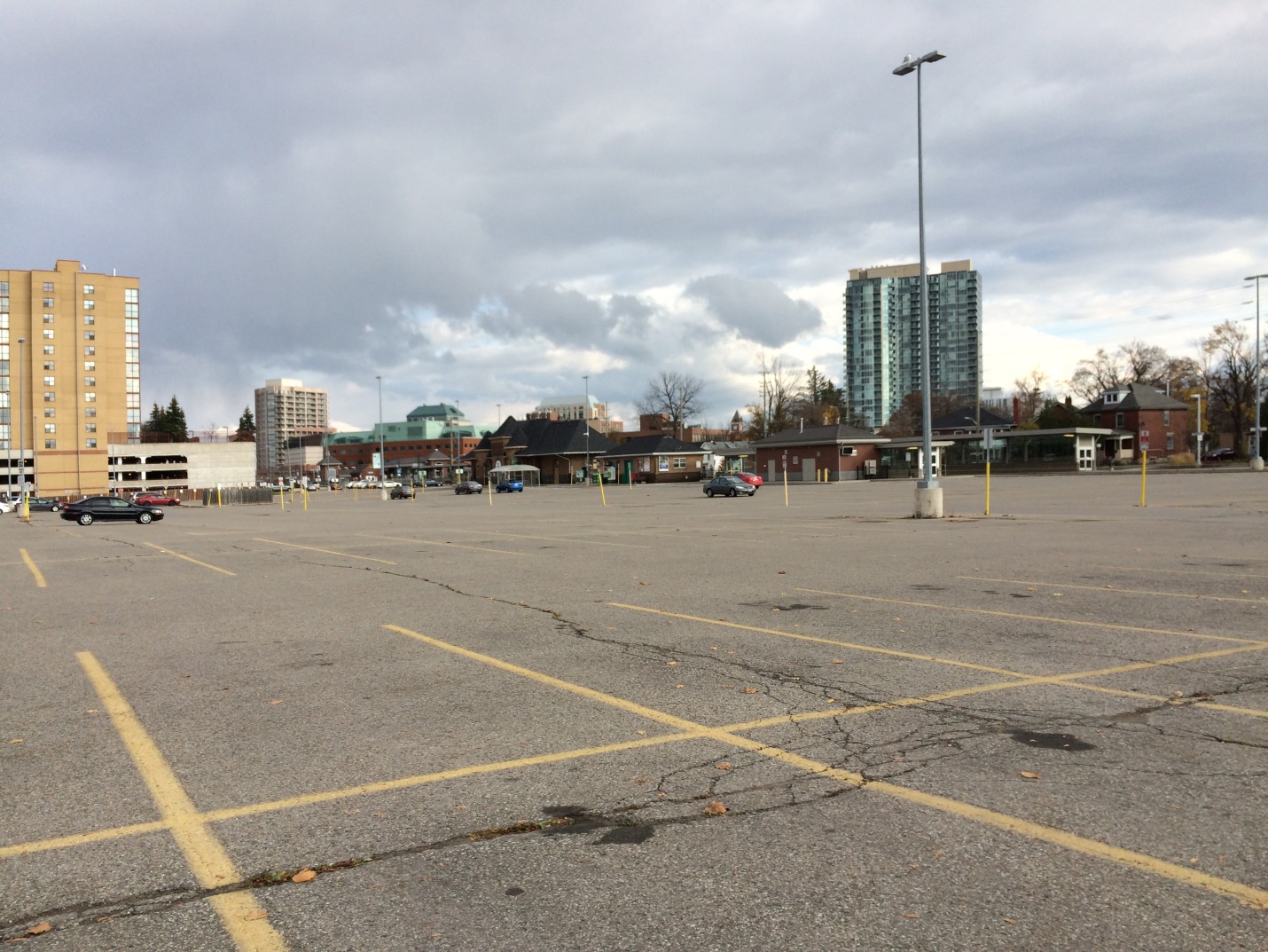
    Update April 19, 2018: the location for Ryerson’s new Brampton campus was announced this morning. The 2000-student campus, which will be a partnership between Ryerson University and Sheridan College, will be built at the corner of Mill and Church Streets, on the GO Transit parking lot. This explains Metrolinx’s (GO Transit’s parent agency) purchase and demolition of properties south of the rail corridor, on Nelson, George, Railroad, and Elizabeth Streets, which I wrote about below.

    While it remains unfortunate that surface parking will replace housing and offices, at least in the short-to-medium term, at least we now know what’s going on in Downtown Brampton. The downtown campus site, with excellent transit links, is the right location.


    Nearly two years ago, I wrote about how Metrolinx, the Province of Ontario’s regional transportation authority, had purchased several houses and two office buildings in Downtown Brampton. The intention at the time was to build a new surface lot to accommodate GO Transit commuters, a symptom of the commuter transit system’s dependence on providing parking.

    Metrolinx is responsible for GO Transit, the UP Express airport rail link, the Presto farecard, and planning and constructing transit infrastructure in the Greater Toronto and Hamilton Area.

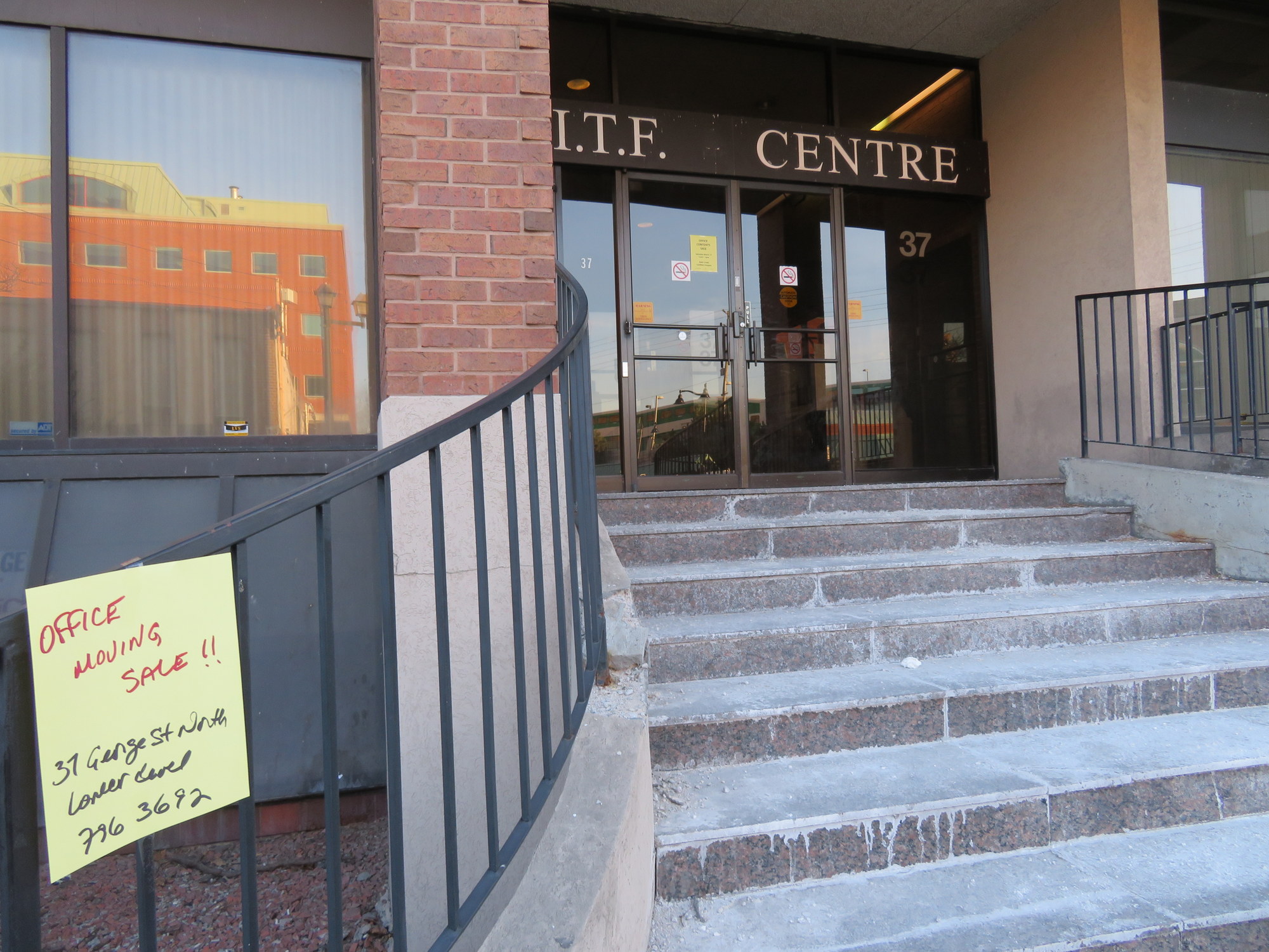
    Since my 2016 blog post, three dwellings — 28A and 28B Nelson Street West, a semi-detached house, and 42 Elizabeth Street North — were demolished, but there was little other visible change until this month. Now eight more houses — on Elizabeth Street and Railroad Street have been boarded up and their electricity disconnected, including at least one rooming house that was occupied until very recently. The two office buildings — 29 and 37 George Street — are also emptying out.

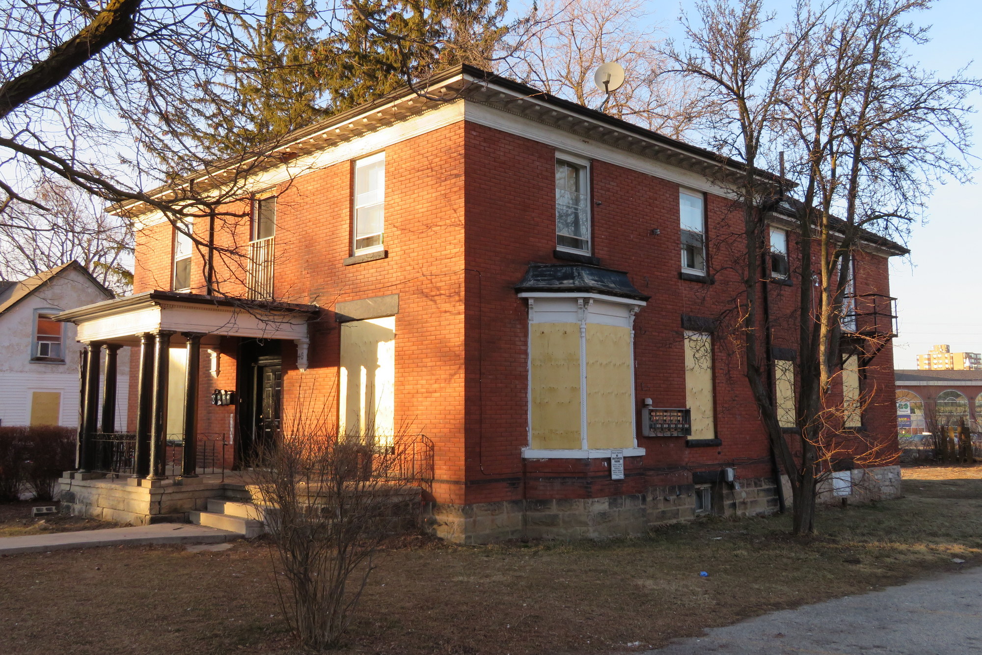
    Four of these properties — 30 Nelson Street West, 46 and 50 Elizabeth Street North, and 5 Railroad Street — are listed by the City of Brampton as containing heritage resources.

    IMG_6153-001Offices at 37 George Street are moving out
    So what exactly is going on? Why has Metrolinx purchased twelve homes and two offices in Downtown Brampton? Is it for a surface parking lot as previously reported in 2016? Or does this have to do with recent plans for a new Brampton campus of Ryerson University?

    The City of Brampton has been assembling land and buildings nearby, including 8 Nelson Street West, a six-storey office building above the downtown bus terminal. The city also owns the old Loblaws store on the southeast corner of George and Nelson Street. As Bramptonist‘s Divyesh Mistry found, Metrolinx noted “…continued collaboration between Metrolinx staff […] with the City of Brampton and Ryerson University on the Brampton Station redevelopment.”

    IMG_6148-001
    Houses on Elizabeth Street North recently vacated and boarded up. 

    If this land assembly is, in fact, to support a yet unannounced Ryerson University campus site on this block or on the existing Brampton GO Station parking lot, then this is on the whole very good news, though I remain concerned about the loss of downtown housing, particularly rooming houses and affordable apartments that some of older homes in the area have been divided into. A downtown campus with excellent transit links — GO Transit and several Brampton Transit bus routes — makes more sense than Milton’s plans for a greenfield campus for Wilfrid Laurier University distant from GO Transit’s bus and rail lines.

    IMG_6149-00146 Elizabeth Street North, a rooming house with heritage status, is now boarded up, with the electricity disconnected. 
    Unlike a competing university campus site near Etobicoke Creek backed by New Brampton (a politically influential group of local business and landowners who also opposed the Hurontario-Main LRT route), the GO Station and the Nelson/Railroad/Elizabeth Street buildings are outside the historical floodplain and can be built quicker.

    If the existing GO Transit parking lot were to be used for Ryerson’s Brampton campus, then an alternative parking site would be required — hence the recent purchase and the demolition of these homes and offices. The construction of a new surface lot in an designated “anchor hub” — where rapid transit lines meet and urban intensification is encouraged — would be most unfortunate, but I hope that it will not be a long-term solution. On the other hand, a new university campus is exactly the type of land use that should be located at an “anchor hub.”

    So far, local officials have kept very quiet about the land assembly on the block surrounded by George, Nelson, Elizabeth and Railroad Streets, perhaps waiting for approvals from the province and Ryerson University before making a public announcement. But with residents and office tenants displaced and houses boarded up suddenly, confirmation of these plans should come soon.

  • Brampton Transit’s evolution from a laggard to a leader

    5010657604_d3cd2c355a_o.jpg
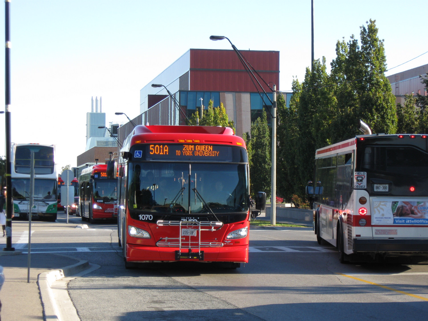
    The introduction of Brampton Transit’s Zum service in 2010, serving York University, was a major turning point for the suburban transit agency

    For TVO this week, I discuss Brampton Transit’s impressive ridership growth. In the last five years, Brampton Transit has bucked the trend of stagnant ridership numbers encountered elsewhere in the Greater Toronto Area and North America in general. I argue that Brampton’s success in improving transit ridership comes from sustained investment over many years, the move to a grid-based route structure, and the introduction of Züm, a basic network of semi-frequent, limited-stop bus routes, many of which extend outside of Brampton’s boundaries.


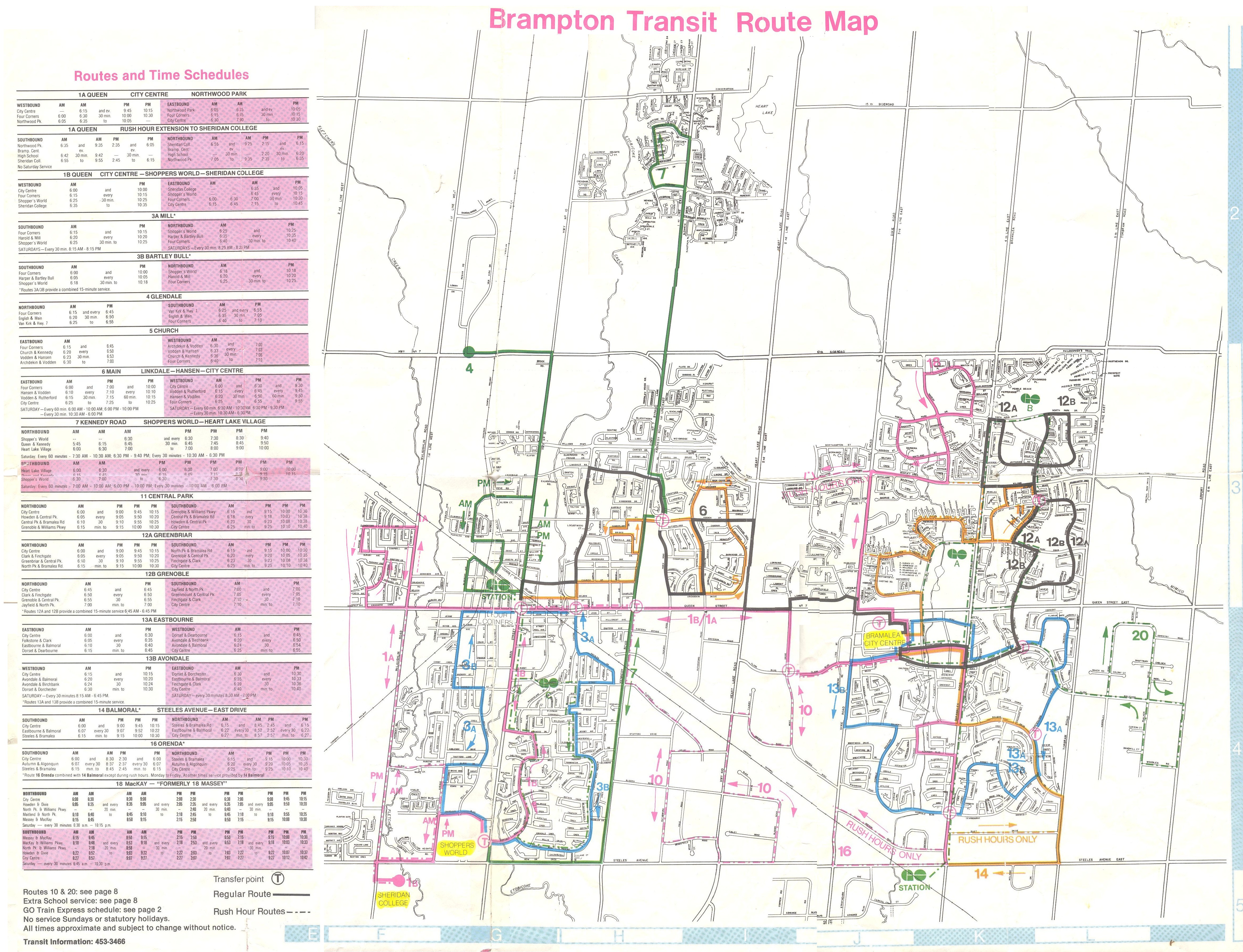
    I grew up in Brampton, and I have collected maps since kindergarten; my collection includes several old Brampton Transit maps. These maps help to illustrate the progress made since the 1980s, when the level of service provided was quite basic.

    Brampton Transit began operations in 1976 after the old Town of Brampton’s local bus service was amalgamated with the dial-a-bus service operated in Bramalea. (Brampton amalgamated with most of Chinguacousy Township in 1974, including Bramalea.) In 1980, Brampton Transit operated 14 routes, serving a community of just under 150,000 people. Buses operated no later than 9:00 or 10:00 PM, Mondays through Saturdays, and many routes operated with long, meandering loops. Apart from GO Transit, there were no connections to nearby communities.

    Brampton Transit - December 1980 front
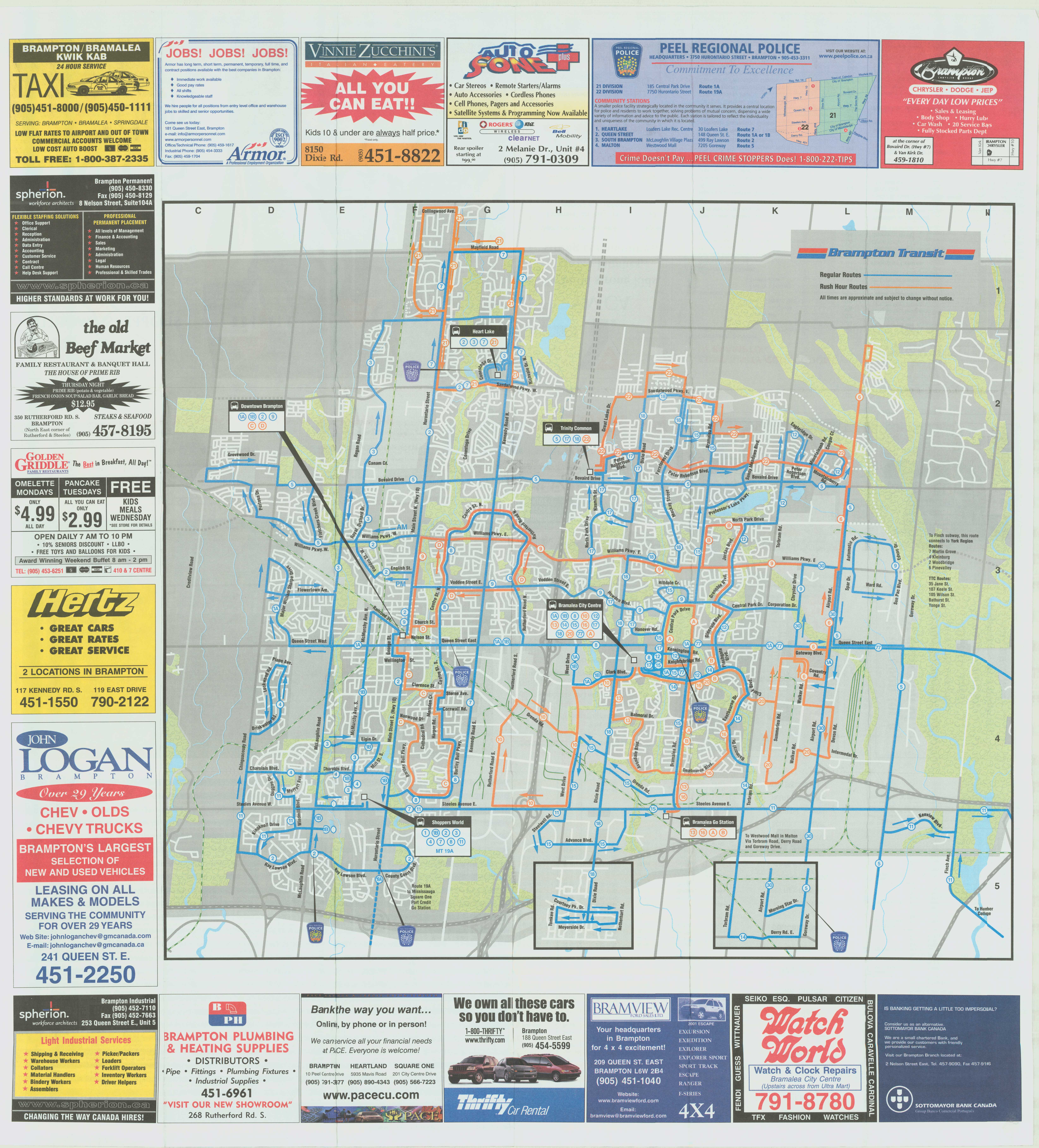
    December 1980 Brampton Transit map

    By 1988, service was offered on Steeles Avenue to Humberline Drive in Etobicoke, where connections could be made to TTC buses on the 96 Wilson and 73 Royal York buses, but didn’t continue east to Humber College. Brampton Transit Route 14 Torbram served Westwood Mall in Mississauga, and connections to Mississauga Transit could be made at Shoppers World. But still, service levels were poor — you were lucky to get a bus every 30 minutes outside of rush hours. Permanent Sunday service wouldn’t come for another ten years. Notable are the four lettered bus routes — A, B, C, and D — that made direct connections to the four weekday GO train round trips to and from Toronto.

    Brampton Transit’s maps of the era are also historically notable because of their advertising: only one of the Burger King locations shown on the 1988 map still exists. Other restaurants advertised — the Old Beef Market, O’Henry’s, and Queen’s Pizzeria — are no longer in business.

    Brampton Transit - 1988
    September 1988 Brampton Transit Map


    Brampton Transit Maps published in the 1990s and early 2000s were printed on newsprint, and used only a two-colour scheme: blue for regular routes, and orange for rush-hour routes. Service to new subdivisions was often provided by way of long one-way loops, which is an inexpensive way of serving new areas, but are inconvenient and slow for potential riders.

    Notable in the 2001 map below is Route 77, launched in the 1990s as a joint Brampton Transit/Vaughan Transit route between Bramalea City Centre and Finch Station along Highway 7. Route 77 was a very slow way to get to the subway from Brampton, but it operated until Züm began service in 2010. In 2001, bus service on 11 Steeles was finally extended to Humber College’s main campus.

    Brampton Transit, 2002
    September 2001 Brampton Transit map

    2005 marked an important turning point for Brampton Transit, as it introduced a grid-based route system on major arterials. Route 14 Torbram, for example, no longer served Bramalea City Centre, but continued north, providing a core north-south route; many other routes were straightened, including Route 2 Main north of Downtown. Changes since May 2005 saw service frequencies improved, more local routes added, and improved connections.

    Brampton Transit - 2005 front
    May 2005 Brampton Transit map

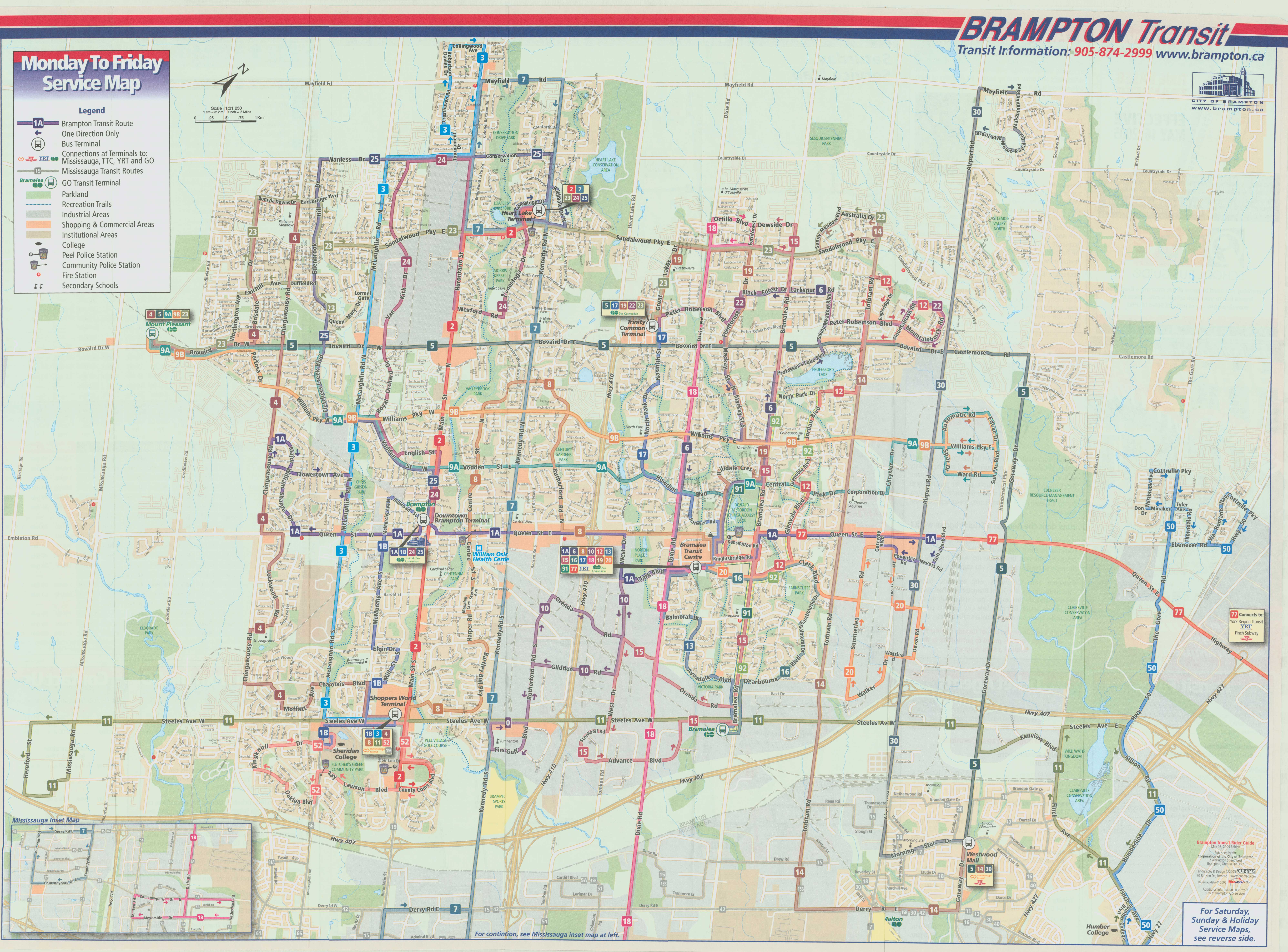
    The current system map, dated September 2017, can be found on Brampton Transit’s website.

  • King Street complainers need to remember why they’re on King Street

    26777810469_e87676d219_k

    On Friday, CBC Toronto ran a story on several King Street West businesses that have claimed that the new King Street Pilot have caused them to lose customers in December.  The three business owners mentioned in the article were Laleh Larijani of Forno Cultura, a bakery on King east of Bathurst, and two Restaurant Row restaurateurs: Jesse Warfield, whose family owns the Gabby’s chain of restaurants, and Fred Luk, owner of Fred’s Not Here and The Red Tomato.

    The King Street Pilot was launched by the City of Toronto on November 12, 2017. At many intersections between Bathurst and Jarvis Streets, cars and trucks are required to turn right off of King Street, prioritizing streetcar traffic. Most on-street parking spots were removed from King Street through this section, but designated areas allow for deliveries, passenger pick-ups and drop-offs, and access to local properties, including parking garages. Despite some [predictable] hyperbole from suburban politicians and reactionary journalists, cars are not in fact banned from any section of King Street. And there are many public and privately-owned garages adjacent to the pilot corridor for motorists to park at.

    For transit riders, the King Street Pilot is working. In December, the TTC reported travel time reductions for the busy 504 King and 514 Cherry Streetcars of up to 24 percent. However, it still struggles to keep up with demand. The continuing delays in the new streetcar deliveries from Bombardier have not helped matters; and streetcars still often run overcrowded, leaving some passengers behind at streetcar stops. There are some necessary tweaks to be made: TTC schedules should take advantage of improved travel times, and transit signal priority is also necessary with the new far-side stop locations at intersections. Signal priority will help to ensure streetcars don’t have to stop at a red light at the near side of the intersection and again to load passengers at the far side.

    But since it’s a year-long pilot project, these tweaks can be made.

    Unfortunately the CBC article was weak in that it presented only the business owners’ complaints about the King Street Pilot, without hard data to back up the claims of lost business. Only one Toronto city councillor was quoted, John Campbell, who represents Ward 4, Etobicoke Centre. Ward 4 is an affluent, suburban part of the city that does not have any streetcar lines. Councillor Campbell, who also sits on the Toronto Transit Commission, would like to see street parking permitted during evenings and weekends:

    “I would like to see people able to park here in the evening, park here on the weekends, because listen, when it’s –15 C people don’t want to walk a block-and-a-half to get to a restaurant. They want to park within 100 metres. I think that would bring more vibrancy back,” [Campbell] explained.

    It’s worth pointing out that motorists will walk much further than 100 metres when parking at busy suburban malls like Sherway Gardens or Yorkdale; it’s also the distance from many GO Transit parking spots to the train platform. The walk between the front doors of the Royal Alexandra Theatre and Princess of Wales Theatre on King Street is nearly 200 metres.

    Watering down the King Street Pilot would doom it to failure: as any King Street transit rider knows, traffic congestion didn’t suddenly disappear at 6:30 PM. It’s an unreasonable expectation to find ample parking 100 metres from many downtown businesses and institutions.

    It’s worth noting that a suburban councillor has taken so much interest in watering down a downtown initiative championed by downtown councillors, and that as a member of the TTC board, Campbell wishes to reduce the benefit to many of the transit agency’s customers.

    Fred Luk, profiled in the CBC article, has a long history of complaining to Toronto media, as pointed out by urbanist and writer Shawn Micallef on Twitter. In the last few years, Luk has complained about the increase in the minimum wage, higher energy costs, the effects of the 2003 SARS outbreak and the 2010 G20 Summit, even the 1999 municipal indoor smoking ban. Yet Luk’s King Street restaurants persisted.

    There are many factors that can influence the success of restaurant businesses. Obviously, the quality of food and service should be examined. It’s worth noting that Toronto is bearing with unseasonably cold temperatures, it’s the low season for tourism, and there aren’t any blockbuster musicals currently playing at the Royal Alex or Princess of Wales. Motorists still have to get used to the new arrangements and change their habits; it’s only been seven weeks so far. Once the weather improves, the curb lane in front of Restaurant Row can be used for wider sidewalks, even enlarged front patios.

    The smart thing for a business owner concerned about a decline in patronage would be to use the free publicity to promote the restaurants, rather than complain about a loss of business. Businesses in the Entertainment District are largely driven by walk-up traffic; there’s a reason why menus are posted by the doors and in the summertime, you can’t walk past Restaurant Row without having a representative out front trying to get you to look at their menu.

    Locating a restaurant on King Street West has lots of advantages: the proximity to thousands of residents, many nearby offices, hotels, entertainment and sports venues, and excellent transit access and ever increasing pedestrian activity. It is not realistic to expect ample street parking to be one those advantages.

    If access to parking were the chief concern, it would be wise to set up in a suburban plaza somewhere else, like in John Campbell’s Etobicoke. Complaining about a major improvement to the travel times of thousands of commuters, without offering any incentives for potential customers to visit your restaurants isn’t productive. Instead, doom and gloom messaging may only damage business further, resulting in a self-fulfilling prophecy.

  • Why Finch West is the best of Toronto’s new subway stations

    IMG_4738-001.JPG
    The dream is finally a reality for thousands of York University students

    On Sunday, December 17, six new TTC subway stations opened, and tens of thousands of excited people crowded the new extension to York University and Vaughan (the free TTC fares, courtesy of the provincial government, might also have had something to do with it). I also took the opportunity to explore the new subway stations, and get a second sense of their layout and their ridership potential.

    While Pioneer Village Station remains my favourite architecturally, I have found myself liking the simplicity of Finch West Station.

    As I have argued here before, I expect that Finch West and Pioneer Village Station will be well used – mostly due to the TTC surface route connections. York University Station will do well during the academic term, and Vaughan Metropolitan Centre has potential — but only if York Region commits to operating a decent transit system with convenient and frequent service to the new subway. I also suggested that the main GO Transit connections — Downsview Park and Highway 407 — will see very little usage. Both stations rely on GO Transit connections, and at the time, GO did not make their plans public.

    We now know that GO Transit service to Downsview Park Station will begin December 30. The Barrie Line will see new midday and evening service, and all trains will call at the new stop. Existing rush hour trains will also continue to stop at York University Station. All GO Transit buses on Highway 407 that terminate on the York University campus will also continue to do so, instead of taking full use of the new bus terminal at Highway 407 Station. (Only GO bus routes 25F, 46, 47, 47F, 48, 48B and 48F, along with route 40, will call at the fancy new terminal, adding up to 10 minutes to existing travel times.)

    I predict that GO Transit will abandon York University Station and direct all its bus services to Highway 407 Station after the end of the 2017-2018 academic year, and after the provincial election is over. It would not be the first time that GO Transit abandoned one of its railway stations, either. In 1969, train service at Lorne Park was abandoned, in favour of nearby Clarkson.

    The province announced a $1.50 TTC fare discount for Presto card transfers to and from GO Transit and UP Express in October, to take effect January 7, 2018. But without further fare integration for transfers to and from York University, students and staff who currently arrive on campus directly might have to get used to paying an additional $3.00 a day. But at least Highway 407 Station will be useful.


    In a previous post, I also explained that Pioneer Village Station was architecturally my favourite of the six new stations. That is still true. But in terms of functionality, my favourite is now Finch West.

    IMG_4764
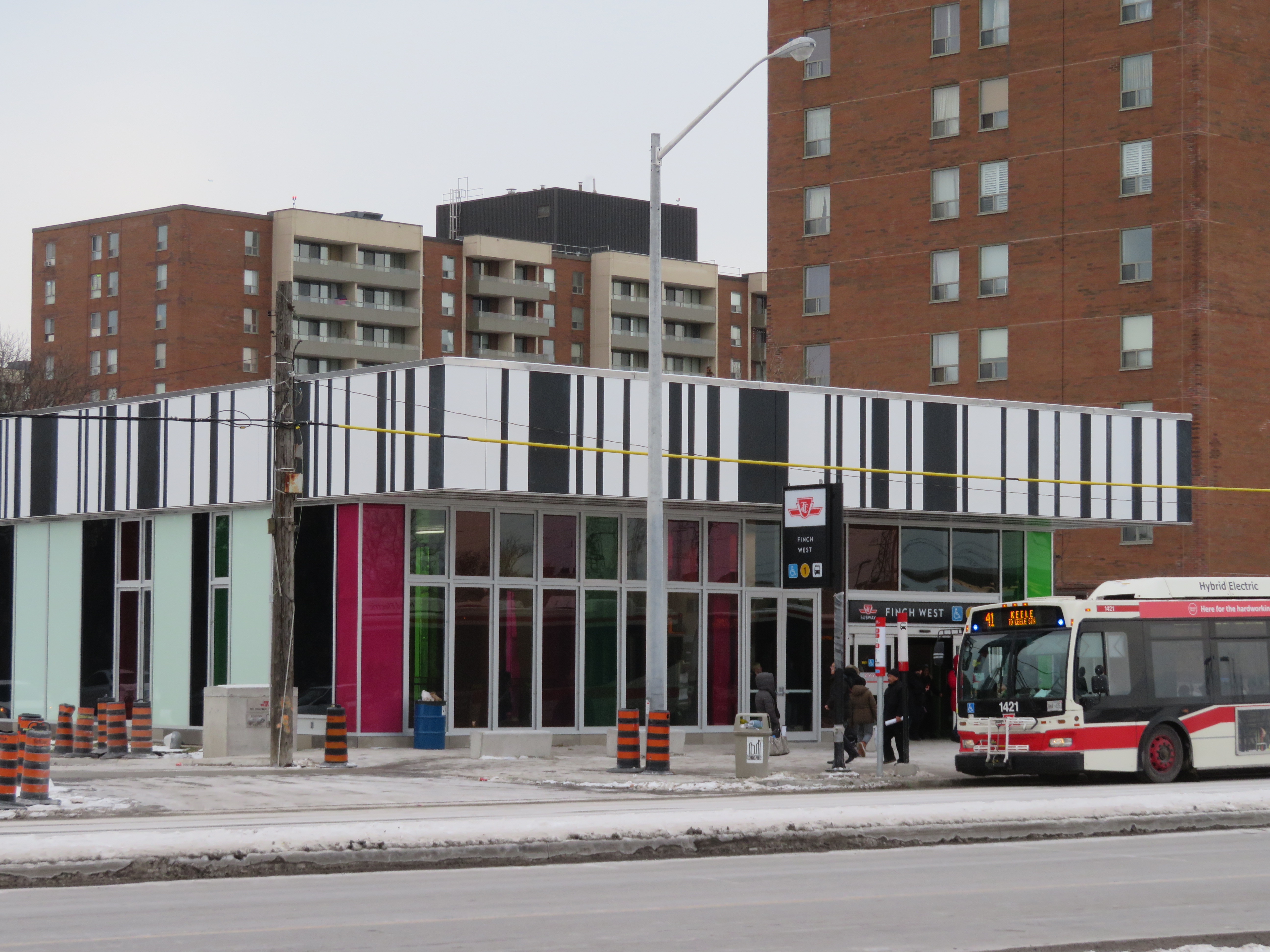
    Southbound 41 Keele bus loads in front of the new Finch West Station. Note the nearby apartment buildings.

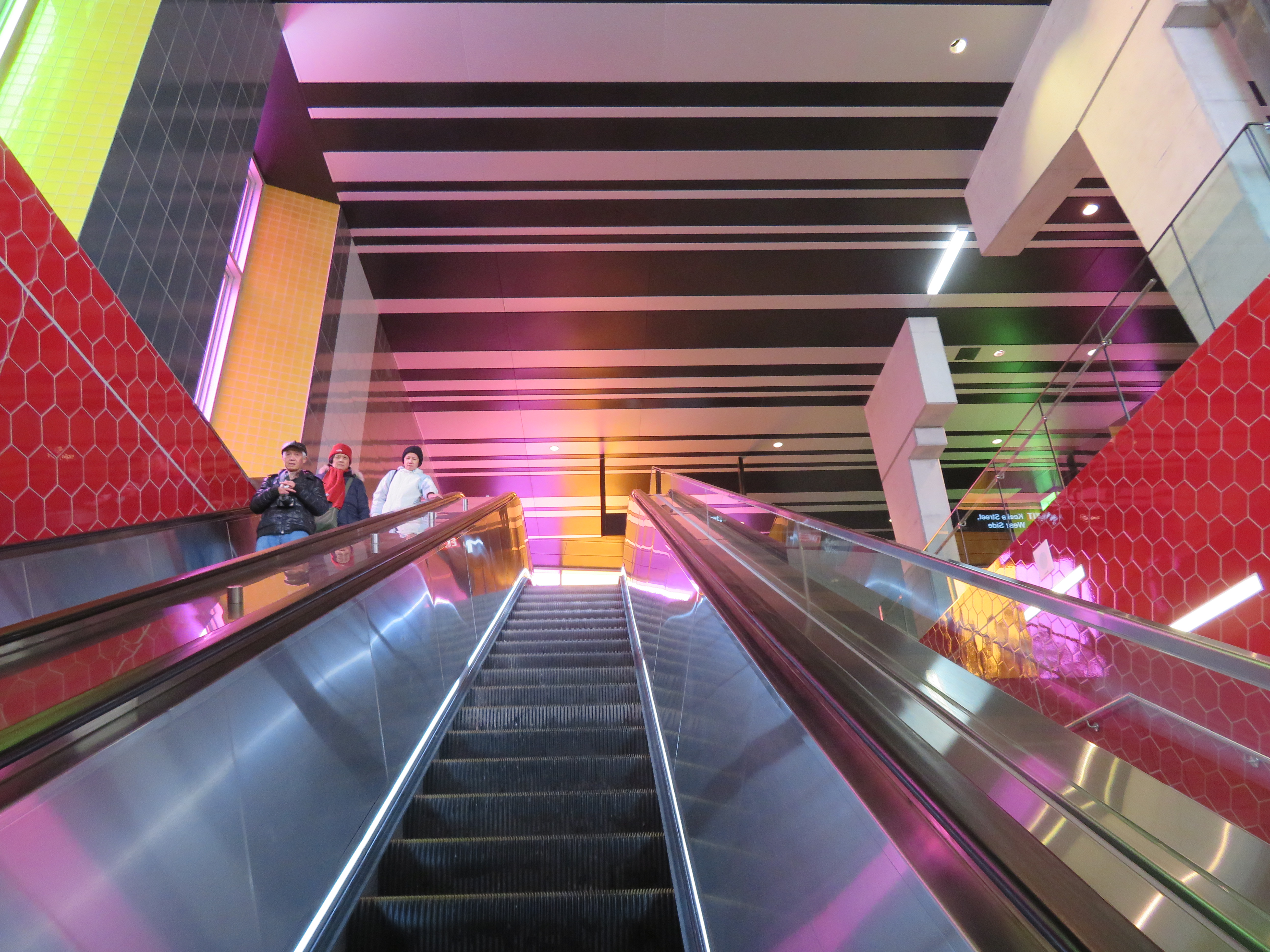
    Finch West Station, like Pioneer Village, was designed by  aLL Design, a global firm led by Will Alsop. The various tile patterns used in the design are a bit jarring, but to me, they recall those used in older TTC stations in North York.

    IMG_4759
    Ascending the escalator at Finch West

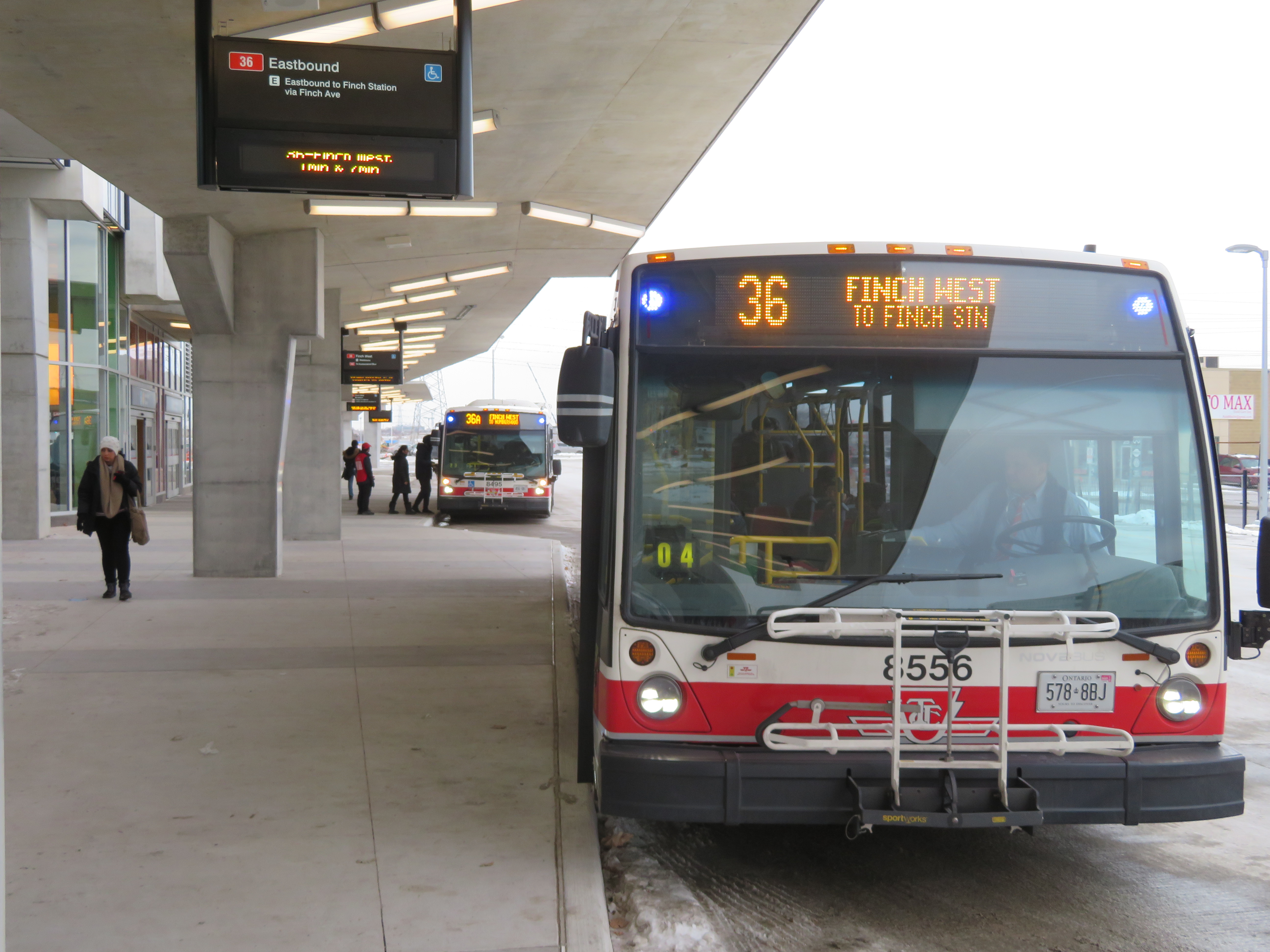
    The station serves buses on routes 36 Finch West — the TTC’s third busiest surface route in 2016 — along with Route 41 Keele, 107 St. Regis, and 199B Finch Rocket. Only Routes 36 and 199B enter the 3-bay bus terminal, all others (along with the 36 bus) stop on the street. This simplicity is in contrast to the Highway 407 Station terminal, which will be little-used for quite some time.

    Route 36 serves neighbourhoods such as Jane-Finch and Rexdale. These large, lower-income communities of Toronto will benefit from a much shorter ride to the subway.

    IMG_4754
    Simple new TTC bus terminal at Finch West Station

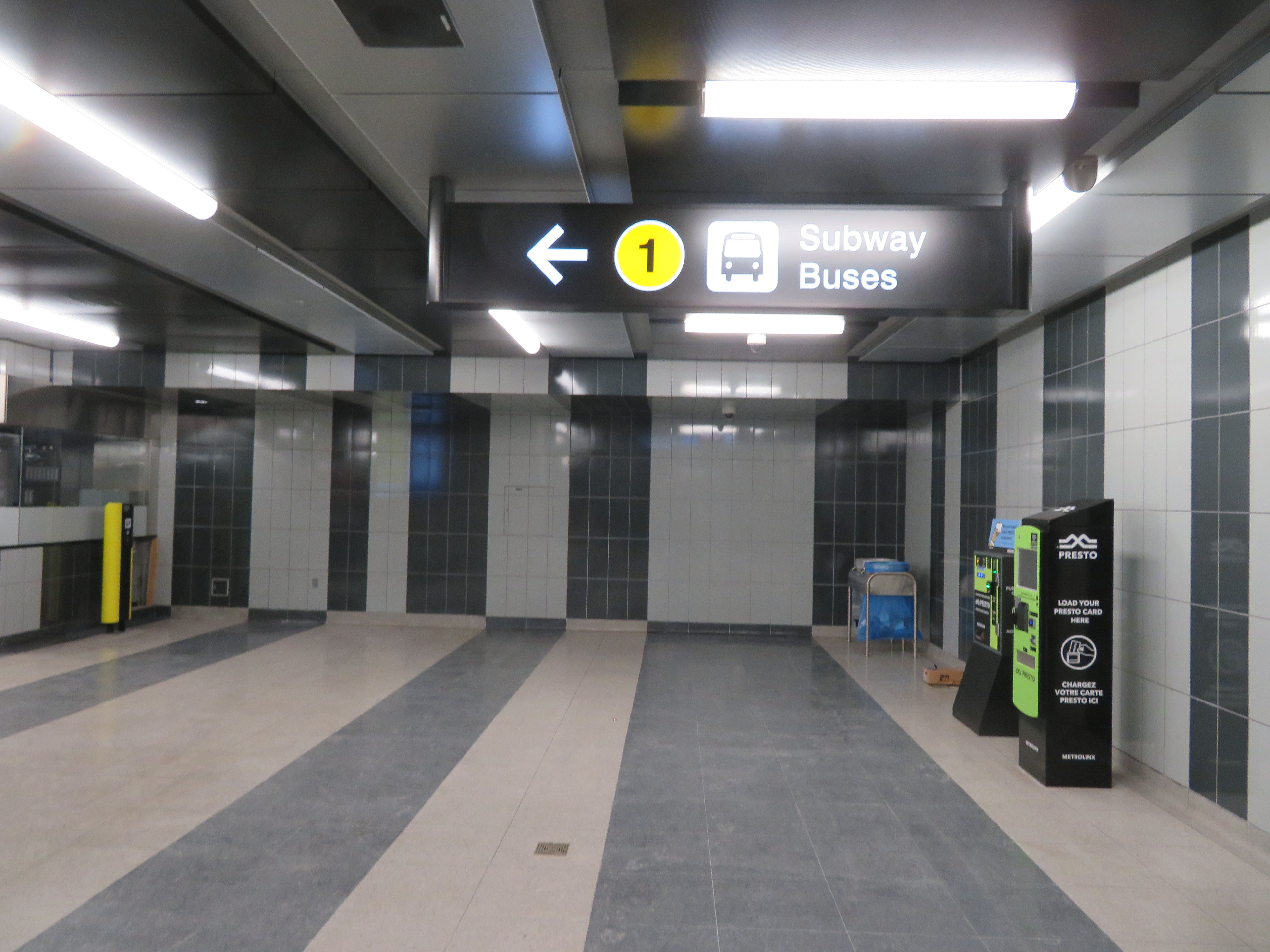
    In 2022, the Finch West LRT is scheduled to open, connecting Finch West Station with Humber College. On the mezzanine level, a temporary wall, as seen in the photo below, can be knocked out for a passage to a yet-to-be-built underground LRT station. Major construction is scheduled to begin in 2018.

    IMG_4755
    Looking towards the temporary wall that will lead to the Finch West LRT

    Finch West might not be the most stunning of all the new stations that opened on the Line 1 extension, but it might be the most useful and the most functional. In design, and in function, Finch West is a throwback, recalling a simpler time in TTC subway construction.

  • How intercity bus service is failing Ontarians

    4003585727_e8125d19a3_o.jpg
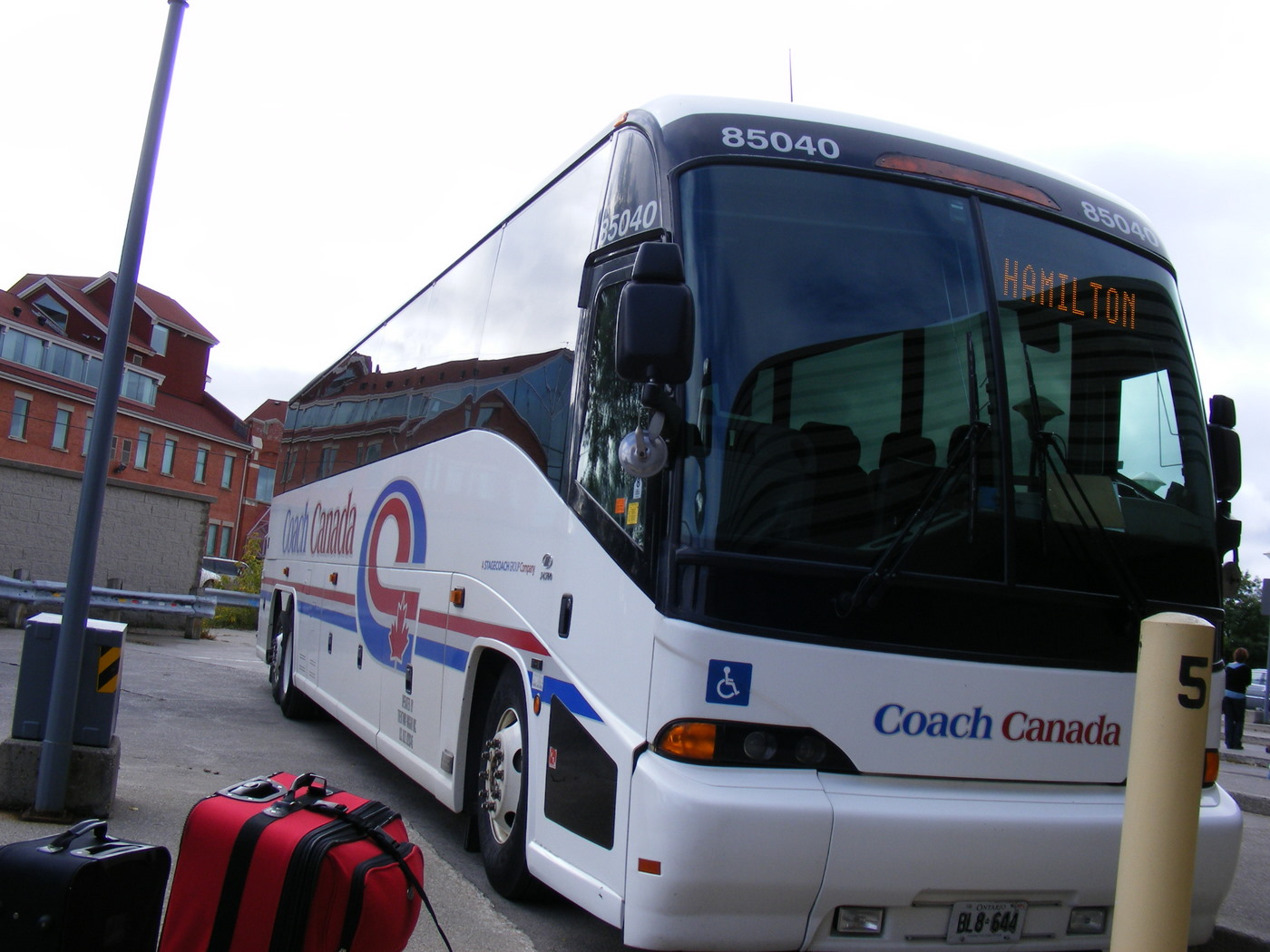
    Coach Canada bus at the Guelph Terminal, three weeks before it abandoned the Guelph-Hamilton service in 2009

    The state of intercity bus travel in Ontario is bleak. While there are still many bus options if you’re travelling between large cities, since the 1980s, hundreds of weekly bus trips and dozens of routes have been cut in Ontario, leaving many small cities and towns with minimal or no intercity transportation options. St. Thomas, a city of 45,000 located a mere 25 kilometres south of London, once had daily buses going in every direction. Today, it has none. Although studies on the modernization of the province’s beleaguered, skeletal bus system got underway in 2016, bus travel remains an afterthought.

    I wrote more about the sorry state of the intercity bus network in Ontario for TVO, my first contribution to the network’s great digital presence.

  • New TTC subway stations have great architecture, but they may not attract enough riders

    IMG_4071-001.JPGVaughan Metropolitan Centre Station

    On Saturday, October 28, the Toronto Transit Commission (TTC) held open houses at three of the six new subway stations set to open on December 17, 2017 when the Line 1 subway is extended to York University and Vaughan. It was a fun afternoon with friends, checking out the architecture and the layout of Vaughan Metropolitan Centre,* Highway 407, and Pioneer Village Stations.

    Some of the station architecture was stunning, and I came away feeling much less skeptical about Vaughan’s commitment to building a new urban district around its station. Most stations along the subway corridor will be well-used. However, I remain critical about the issue of transfers between transit agencies, and the usefulness of at least one station.

    (more…)

  • Some answered questions about Toronto’s next subway extension (updated)

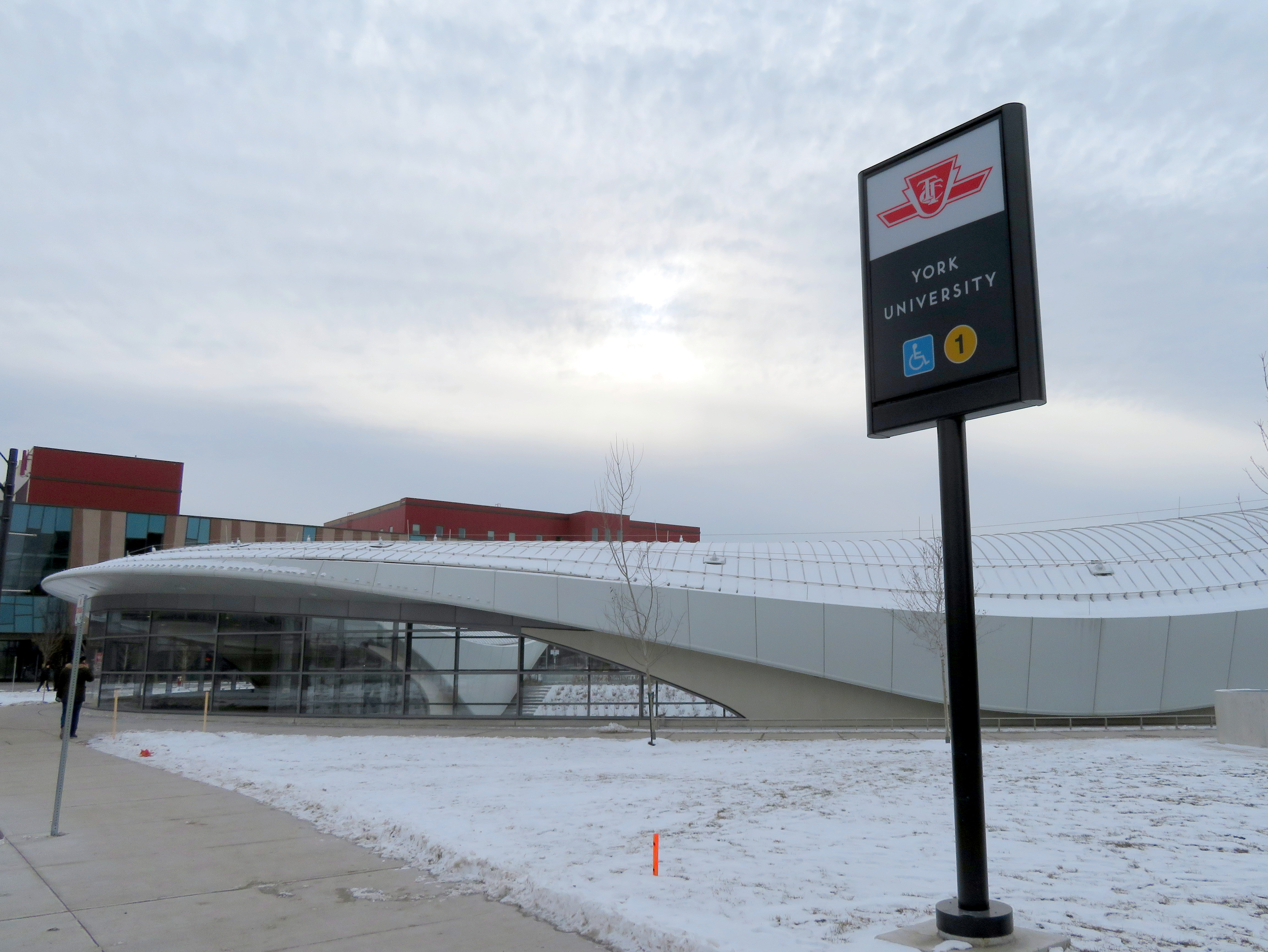
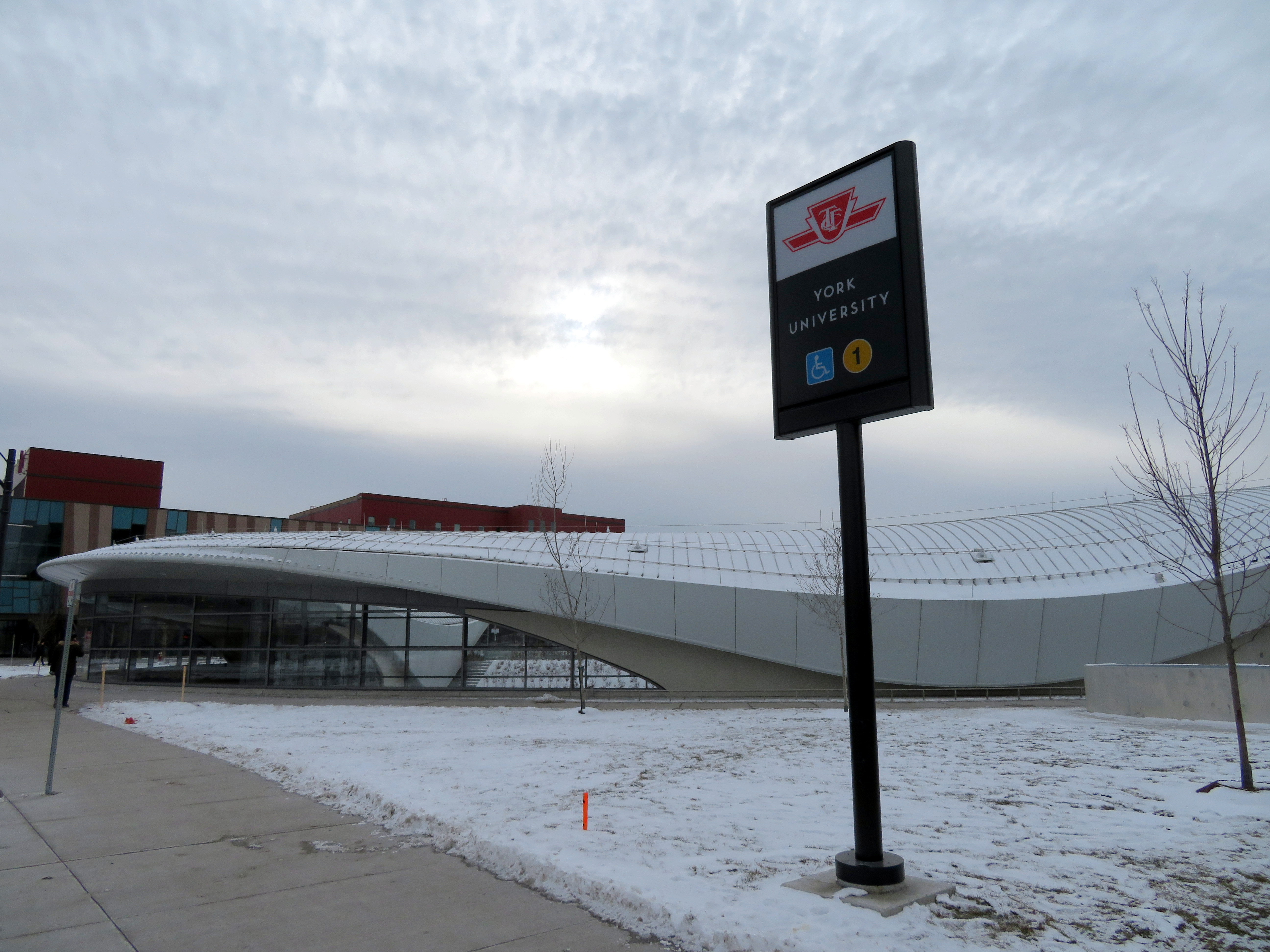
    36354175911_632dc72411_o.jpgYork University Station, August 2017

    Updated October 10, 2017

    Ten months ago, I wrote about some of the unanswered questions about the Toronto Transit Commission’s Line 1 subway extension to York University and Vaughan. At the time, I was concerned about fare integration once the subway opened, especially if suburban GO, YRT, or Brampton Transit passengers headed to York University were required to make new transfers to the subway at Vaughan Centre or Highway 407 Stations.

    We now know the day the six new subway stations will open: Sunday, December 17, 2017. We also know how the TTC, York Region Transit, and Brampton Transit will serve the new extension and York University. And today, we also have some indication of how GO Transit passengers will be affected by the changes.

    YRT Subway Map.jpg
    How YRT and Brampton Transit will serve the Line 1 subway extension
    (from the YRT website)

    On Friday, Premier Kathleen Wynne and Transportation Minister Stephen Del Duca will announce a new co-fare between the TTC and Metrolinx services (GO Transit and Union Pearson Express), to take effect in January 2018. (The Star previously reported that the fare change will take place as soon as the subway extension opens.)

    Transfers from GO Transit or UPX to the TTC will cost $1.50 for passengers using Presto cards, a 50% reduction from the full adult fare of $3.00. Passengers transferring from the TTC to GO or UPX will get a $1.50 fare discount. It is expected that the new co-fare subsidies will cost the provincial government $18 million a year. The fare discount will not apply to passengers using fare media other than Presto cards, including TTC tokens, Metropasses, or paper one-way tickets or day passes.

    These are similar to the co-fares offered between GO Transit and transit agencies outside the City of Toronto, including MiWay, York Region Transit, Brampton Transit, and Hamilton Street Railway. However, these co-fares are generally more generous — ranging from $0.60 in Hamilton to $1.00 in York Region.

    There was no news on reducing the fare penalty for transferring between the TTC and connecting local bus systems such as York Region Transit and MiWay.

    For many commuters, the new TTC co-fare is great news, and it represents a good first step towards proper fare integration. It helps to make GO Transit more useful for trips within the City of Toronto, and it helps suburban commuters who use the TTC for part of their trip, such as University of Toronto students, who are located too far a walk to Union Station.

    (John Tory is also claiming a victory, calling it “a step in the right direction” for his SmartTrack proposal. At this point, “SmartTrack” is little more than a GO/TTC fare agreement and a few new proposed GO stations.)

    However, this could also affect York University students as well. Previous plans for the Line 1 subway extension saw GO Transit buses serve the Highway 407 station, requiring a transfer to the subway to get to campus. York University has been long eager to remove the buses from the York Commons area, which GO and the TTC use as their campus terminals.

    York Region Transit will continue to operate many bus routes into York’s campus, on the Ian Macdonald Boulevard ring road, and Brampton Transit’s Queen Züm bus route will remain on campus. Their university-bound passengers won’t be required to transfer to the subway and pay an additional fare. But it appears, for now, that GO Transit passengers will have to make a connection, costing $1.50 each way. (This will not be the case for in the short term, see update below.) This will also apply to GO train customers on the Barrie Line who currently use York University Station, if that station closes as planned when the subway connection at Downsview Park opens.

    This will be a blow for GO Transit customers who commute to and from York University, accustomed to a one-seat ride direct to campus. But it will be an improvement for GO operations on the Highway 407 corridor, with buses no longer stuck in traffic in the Keele Street and Steeles Avenue area. It will also benefit GO Transit passengers who aren’t headed to York University. Providing good public transit is not be about giving everyone a one-seat ride.

    Despite these benefits, if GO Transit serves Highway 407 Station as planned, it will impact many passengers with a new transfer and an additional $3.00 cost per day. I’m curious what GO Transit’s messaging and final plans will be, because they have yet to communicate their new schedules and connections when the subway extension opens. Hopefully, we will learn the answers to the rest of those questions soon.


    Update: According to the CBC and Metrolinx’s Anne Marie Aikins, there are now no immediate plans to re-route GO Transit buses from York University. at least in the short term. This is a short-term solution, however, because the Highway 407 station was designed with a large terminal for GO Transit buses, and York University has been vocal about wanting the hundreds of GO and TTC buses a day out of the York Commons area.

    I don’t see this as a long-term solution, however. Hopefully Metrolinx and the TTC can figure out how to best serve York University passengers, though that should have been figured out a long time ago. After all, the subway was originally supposed to open by the end of 2015.

  • Mount Pleasant: New Urbanism that almost works

    IMG_2706-001Mount Pleasant Square, Brampton

    A few weeks ago, I visited Cathedraltown, a subdivision in north Markham built in the new urbanist style. Cathedraltown made the news thanks to a controversial metallic sculpture of a cow installed in a parkette. (Last week, Markham City Council voted to move the sculpture.)

    I came away disappointed by Cathedraltown. Despite a dense built form, and a main street lined with storefronts, it did not live up to the new urbanist promise: it was still a very car-centric subdivision, without the retail, nor the density required to make it a walkable community. The central focus is a Slovak-Catholic cathedral, recently re-opened after lengthy dispute between the development company and religious leadership. “No trespassing” signs still stand in front of the imposing church. Transit connections are poor, making a car virtually necessary to get even to nearby employment areas.

    Mount Pleasant, in Brampton, fares somewhat better, despite some similar issues to Cathedraltown. What distinguishes it though are superior transit connections, and a better-programmed central focus.


    Satellite view of Mount Pleasant via Google Maps 

    Mount Pleasant started off as a small settlement between Brampton and Georgetown, where Highway 7 and 3rd Line West (later Creditview Road) crossed the Canadian National railway line between Toronto and Guelph. For most of its existence, it was little more than a collection of houses, two churches, a motel and a service station. By the 1960s, the local trains no longer served the flag stop there, and Highway 7 — now Bovaird Drive — bypassed the hamlet on a new railway overpass in the 1960s, also severing Creditview Road.

    A few buildings — two houses and a former Presbyterian church, now a mosque — remain at the former crossroads. New subdivisions now surround the historical community.

    IMG_6725Mount Pleasant’s old Presbyterian church is now a mosque.

    Mount Pleasant GO Station opened in 2006, just as northwest Brampton was transforming from farmland to new subdivisions. The GO Station was built like any other in Toronto’ suburbs: a large parking lot, bus loop, and pick-up and drop-off area, with easy access to Bovaird Drive. But on the north side of the tracks, the City of Brampton, and the developer, Mattamy, tried something different.

    At the core, the City of Brampton built a new library branch that incorporates the dismantled Canadian Pacific Railway station that used to stand on Queen Street in Downtown Brampton. (The station was moved in 1980 to a then-rural site on Creditview Road when it was threatened by demolition by the CPR. But the station building was left to rot before heritage conservationists carefully dismantled the structure.) Behind the library is a public school. In front, there’s a public square that includes a small playground, as well as a reflecting pond that’s a skating rink in the winter.

    IMG_2709-001The Brampton Public Library incorporates the former Brampton CPR Station, rebuilt here at Mount Pleasant Village

    To the west of the square are several low-rise apartment buildings, the sort of “missing middle” housing needed in Toronto’s established urban neighbourhoods. To the east are several retail/residential blocks, the sort of mixed use buildings that are uncommon in new subdivisions. The storefronts are all mostly occupied with businesses serving the local neighbourhood, such as hair salons and spas, a convenience store, a dentist’s office, and a restaurant. To the south are entrances to the GO Station and the bus loop for GO and Brampton Transit buses.

    (more…)