Category: Transit

  • Thoughts on Newmarket’s new Rapidway (updated)

    IMG_1778-001

    Updated January 4 2017

    Effective Sunday, January 8, York Region Transit will impose new service cuts on several of its routes, including Viva Yellow, which I describe below. One bus will be removed from the route, reducing headways from every 15 minutes to every 22 minutes. Service after 10:30PM-11:00PM will also be eliminated.

    One wonders why, on one hand, there’s money to be hand to build fancy new bus infrastructure when there’s no willingness to fund transit that would make such capital expenditures useful.

    As York Region gets set to welcome the Spadina Subway extension to Vaughan Metropolitan Centre [sigh] and continues to lobby for a Yonge Subway extension to Richmond Hill, it’s worth questioning whether York Region is really committed to operating a quality transit service, and if it is serious about reducing its dependence on the single-occupant automobile.


    Original post, dated June 24, 2016

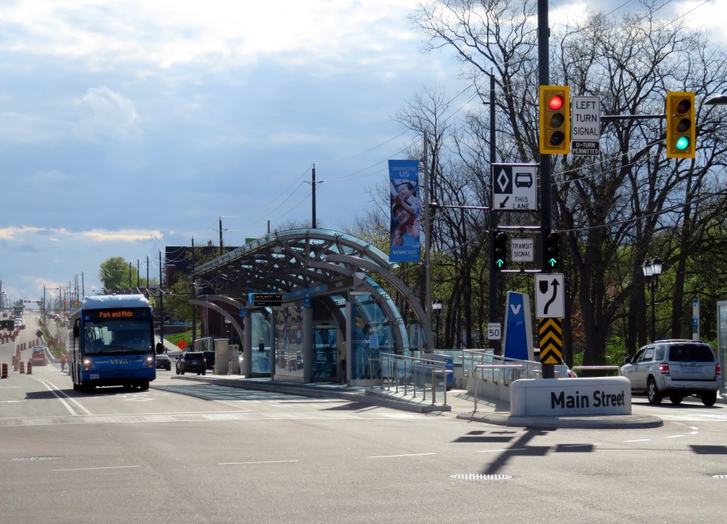
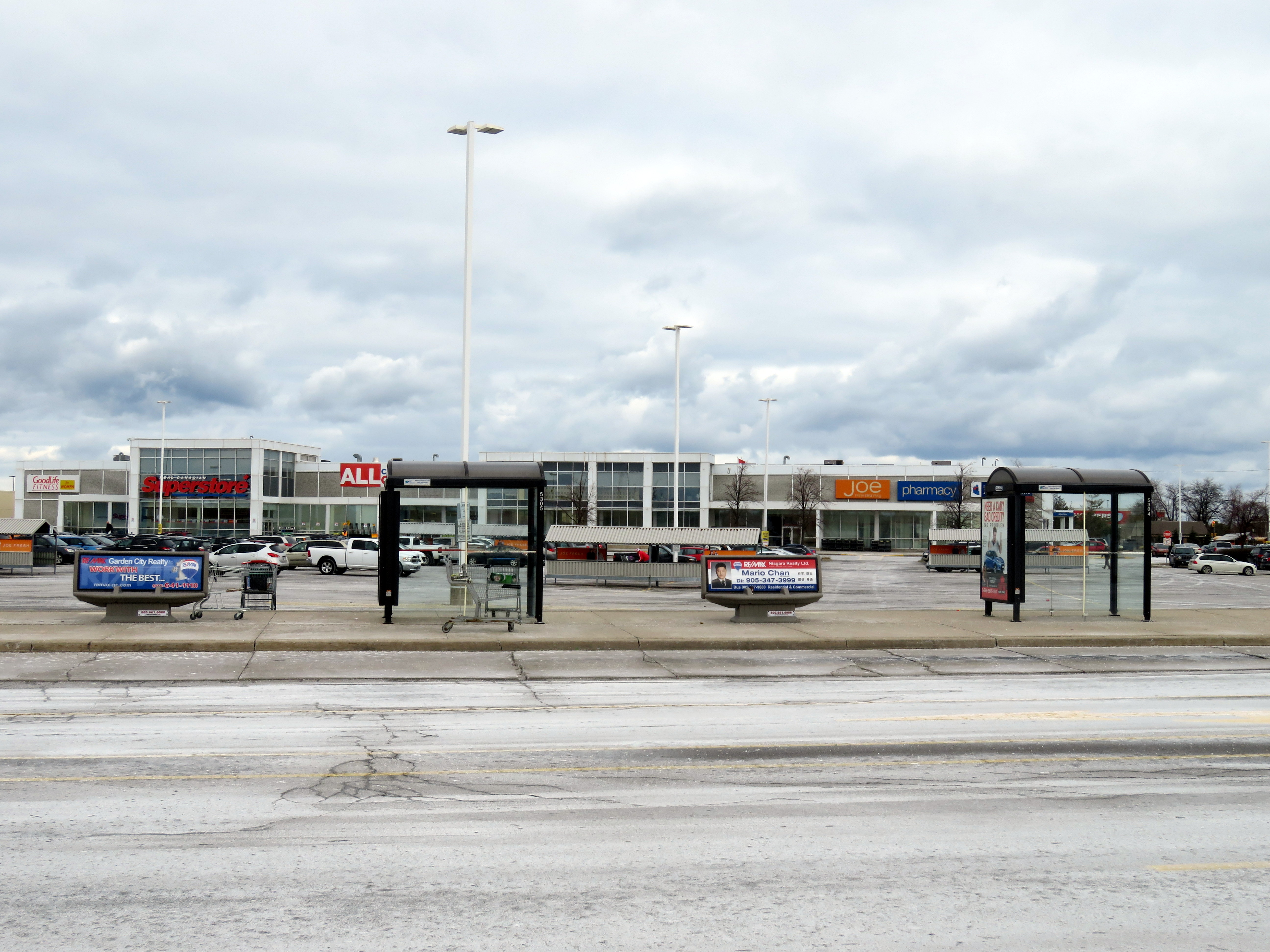
    In September, 2013, I wrote a post in Spacing Toronto called “York Region’s Rapidways: the good, the bad and the ugly.” I went out to Markham to ride the first of York Region’s VivaNext Rapidways. With the recent opening of a similar Rapidway in Newmarket, and a new Viva Route on Davis Drive, I made a trip north a few weeks ago to check it out.

    Viva is the brand used by York Region Transit for its network of limited-stop, proof-of-payment bus routes. When first launched in September, 2005, Viva was strictly a “BRT-lite” operation. Unlike regular YRT routes, the buses are fancier and more comfortable, the stops less frequent, and to speed up service, Viva operates on a proof-of-payment system where fares are purchased in advance from machines at Viva stops. and limited stops. A decade ago, all Viva corridors were supposed to be served by buses operating every 15 minutes or better, 7 days a week.

    But a few years later, the cutbacks began to happen as York Region reduced funding for transit operations. Viva Green, connecting Markham to the TTC’s Don Mills Station, became a rush hour only route. Viva Orange, connecting Vaughan to Downsview Subway via York University was cut back as well and now only operates every 30 minutes outside of rush hour. Even Viva Purple (York University – Markham) had its operating times cut back. Worse yet, YRT reduced service on connecting conventional bus routes that feed the Viva system.

    But while the region was reducing its spending on transit operations and raising fares, it was spending hundreds of millions of dollars on VivaNext, the region’s rapid transit plan. The plan calls for separated median right-of-ways on Highway 7, Yonge Street and Davis Drive, known as Rapidways, as well as two TTC subway extensions. York Region lobbied for, and got, a subway extension to Highway 7 in Vaughan which will open next year; it has also lobbied for an extension to the Yonge Subway from Finch Station to Richmond Hill. York Region, with its political clout, may just get that too.

    Spending billions of dollars on building transit, without properly funding the services that use and feed into that fancy new infrastructure is a problem. This is what’s wrong with York Region Transit.  (more…)

  • Mapping Toronto’s streetcar network: The age of electric – 1891 to 1921

    People & Historic shots. - [1920?]-1987

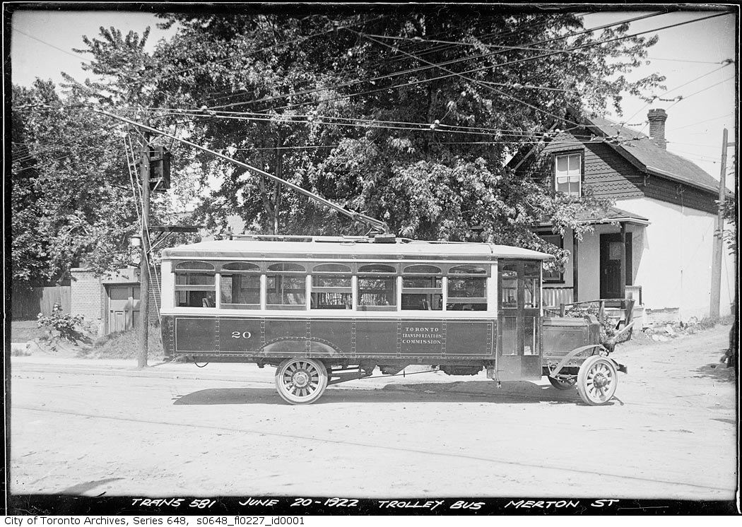
    TRC streetcars on Queen Street, c. 1910. Note the old TSR horsecars used as trailers behind the electric cars. City of Toronto Archives, Series 1465, File 722, Item 18

    This post continues from The Horsecar Era: 1861 to 1891 

    In 1891, after obtaining a new 30-year franchise, the Toronto Railway Company went to work electrifying Toronto’s streetcar system. The TRC was a private company, led by William Mackenzie and James Ross. Mackenzie made his fortune in railway construction; together with Donald Mann, he would go on to build a railway empire before it collapsed by the end of the First World War. Mackenzie would also control other street railway and interurban lines in Ontario, including the Toronto and York, the Toronto Suburban, and the Niagara, St. Catharines, and Toronto.

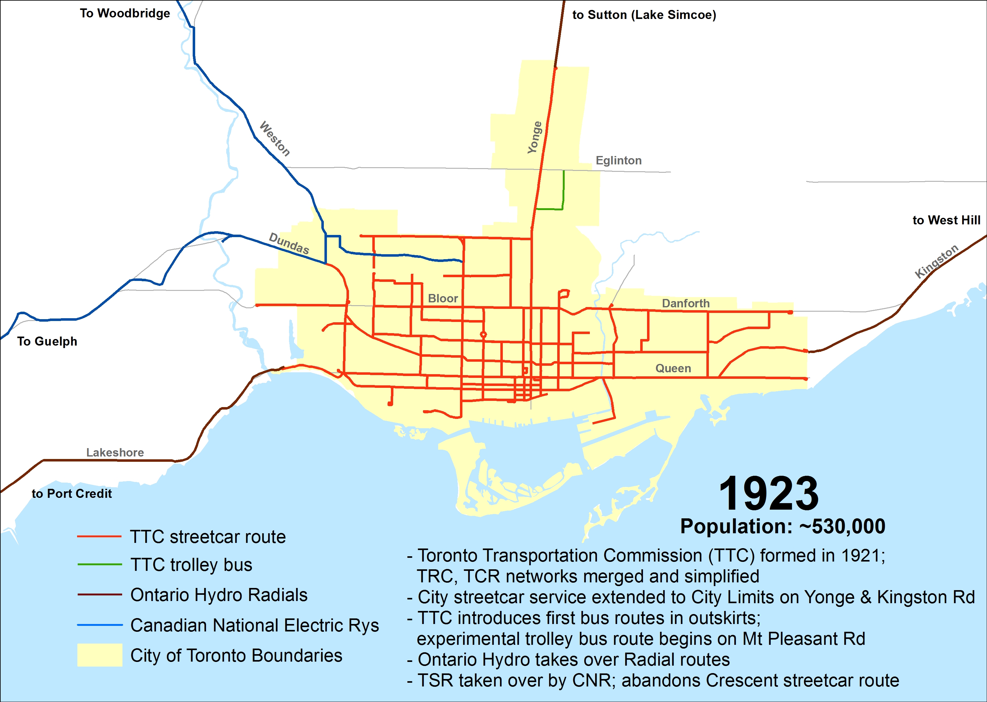
    By 1894, the TRC became fully electrified, providing quicker and more reliable service. In the twenty-five years that followed, new electric railways radiated out of Toronto to points such as West Hill in Scarborough, Port Credit, Woodbridge, and even as far away as Lake Simcoe and Guelph. But after a short sprint of service expansion within the City of Toronto, the TRC refused to extend its services beyond Toronto’s city borders of 1891. The City of Toronto was forced to form its own public streetcar company in 1911, and became determined to take complete control over urban transportation services once the TRC’s franchise came to an end.

    Maps presented only show revenue routes, including peak period variations and some seasonal routes, such as Exhibition services. I omit some minor service and route changes. I welcome constructive feedback as I plan to re-publish these maps elsewhere.

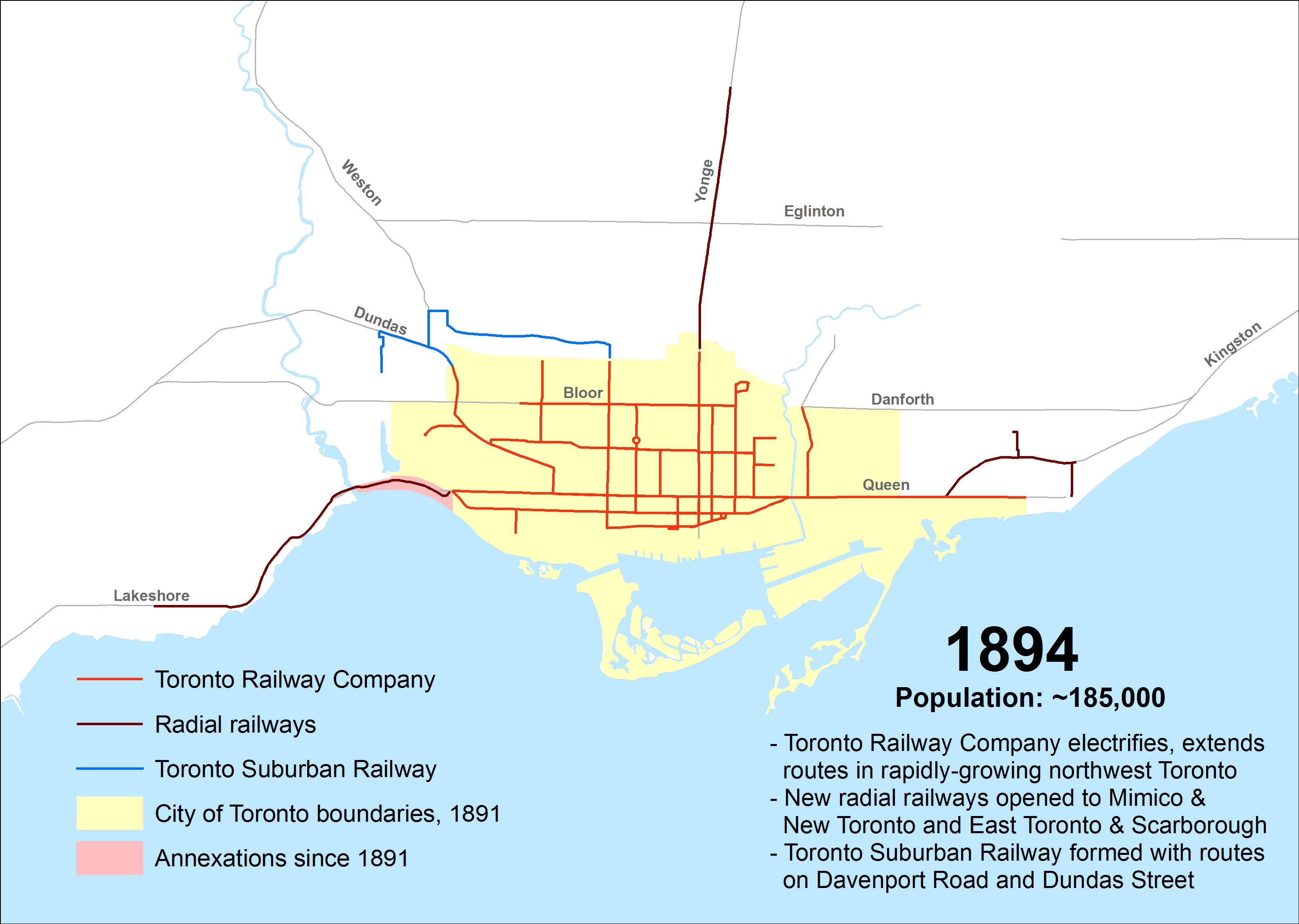
    1894

    Electrification of the Toronto Railway Company began when the Church Street line was converted on August 16, 1892. The last horsecar made its trip on McCaul Street on July 18, 1894. The TRC extended several routes in Toronto’s west end, including King, Dovercourt, Bloor, Dundas and Carlton.

    The Davenport Street Railway Company began operations on September 6, 1892 between Toronto Junction at Keele and Dundas Streets, and Bathurst Street at the CPR tracks, a short walk to TRC Bathurst Cars. The Weston, High Park & Toronto Street Railway Company began operating the same year within the Junction, from Evelyn Crescent to Keele Street, later extending east to the Toronto City Limits at Humberside Avenue. These two companies merged in 1894 to create the Toronto Suburban Railway.

    The Toronto and Mimico Railway was the city’s second radial. After a troubled start in 1892, it extended west to New Toronto by 1894. The Toronto and York built east from Queen Street and Kingston Road to Blantyre Avenue in Scarborough Township. Two short spurs served the town of East Toronto (near today’s Main/Gerrard intersection) and down to the Beach.

    ttc-streetcars-1894

    (more…)

  • Suburban stations for urban needs: accessing GO Transit’s proposed new stations

    21505188673_1d34d85175_kGO Transit train from the Pape Avenue footbridge, near the proposed site of Gerrard Station
    At its last board meeting on December 8
    , Metrolinx presented an update on the status of twelve new GO Transit rail stations, all located on existing lines. Eight of these proposed new stations are located in the City of Toronto; and six of those are station locations once promised as part of John Tory’s SmartTrack proposal. Unfortunately, the proposed new station designs (all available in this Metrolinx report) appear to be similar to existing GO stations in the suburbs, with needlessly large bus loops, PPUDOs, and parking lots. Development opportunities are limited.

    Transit connections at some proposed stations, like St. Clair West, are poor or practically non-existent. This is rather unfortunate, as SmartTrack was originally proposed as a frequent, subway-like service between Mississauga and Markham, with full TTC fare integration. Today, it’s merely six additional stations on existing GO Transit rail corridors. Without quick and seamless connections to the subway and surface TTC routes, the ability to provide any transit relief is compromised.

    I have more to say on this at Spacing Toronto.


  • Mapping Toronto’s streetcar network: The horsecar era – 1861 to 1891

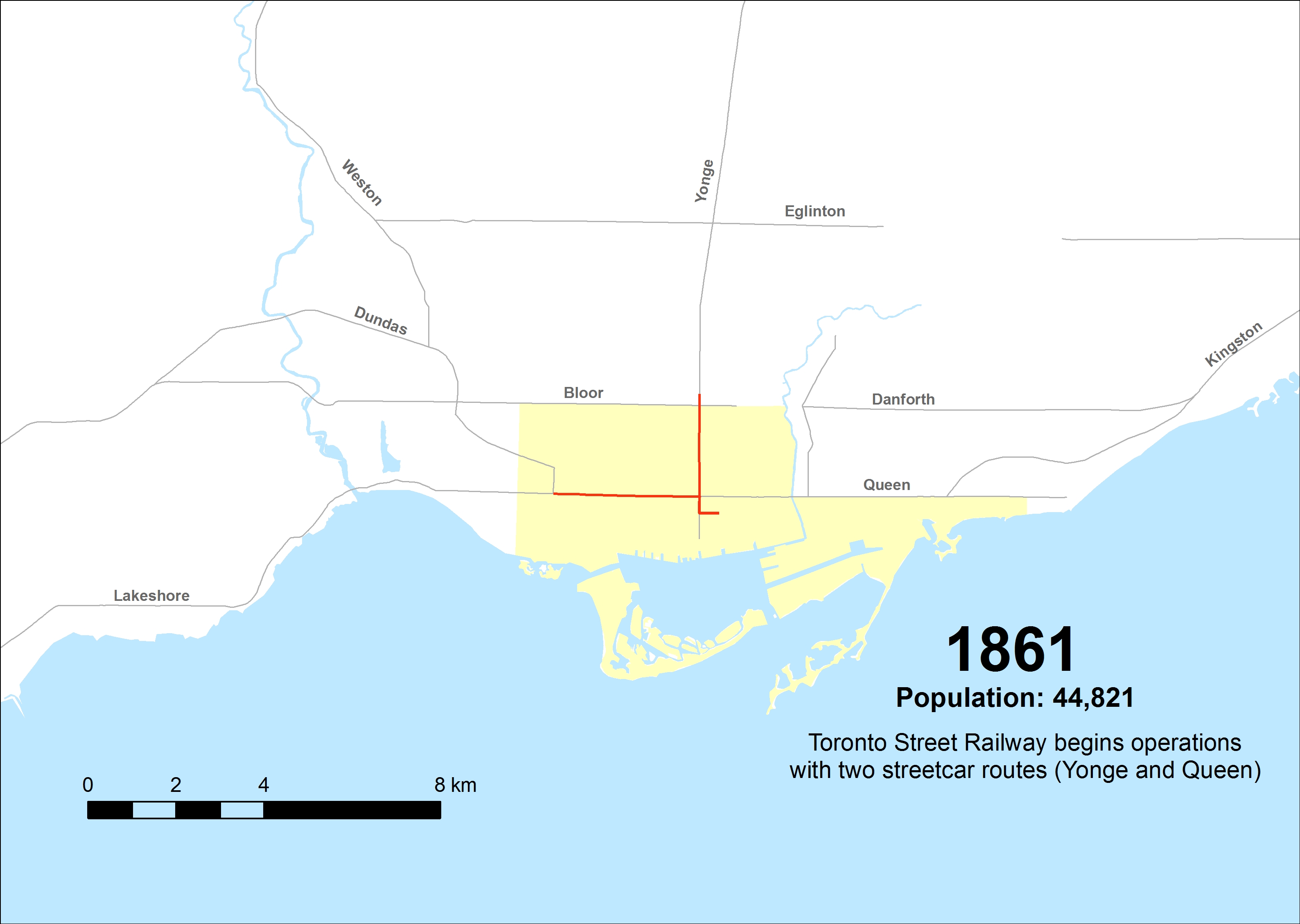
    Horse car, with J. Gibbons, conductor, and J. Badgerow, driver, at Old North Toronto StationToronto Street Railway horse car on Yonge Street at the Canadian Pacific Railway crossing, after 1885. From City of Toronto Archives, Fords 16, Series 71, Item 3367
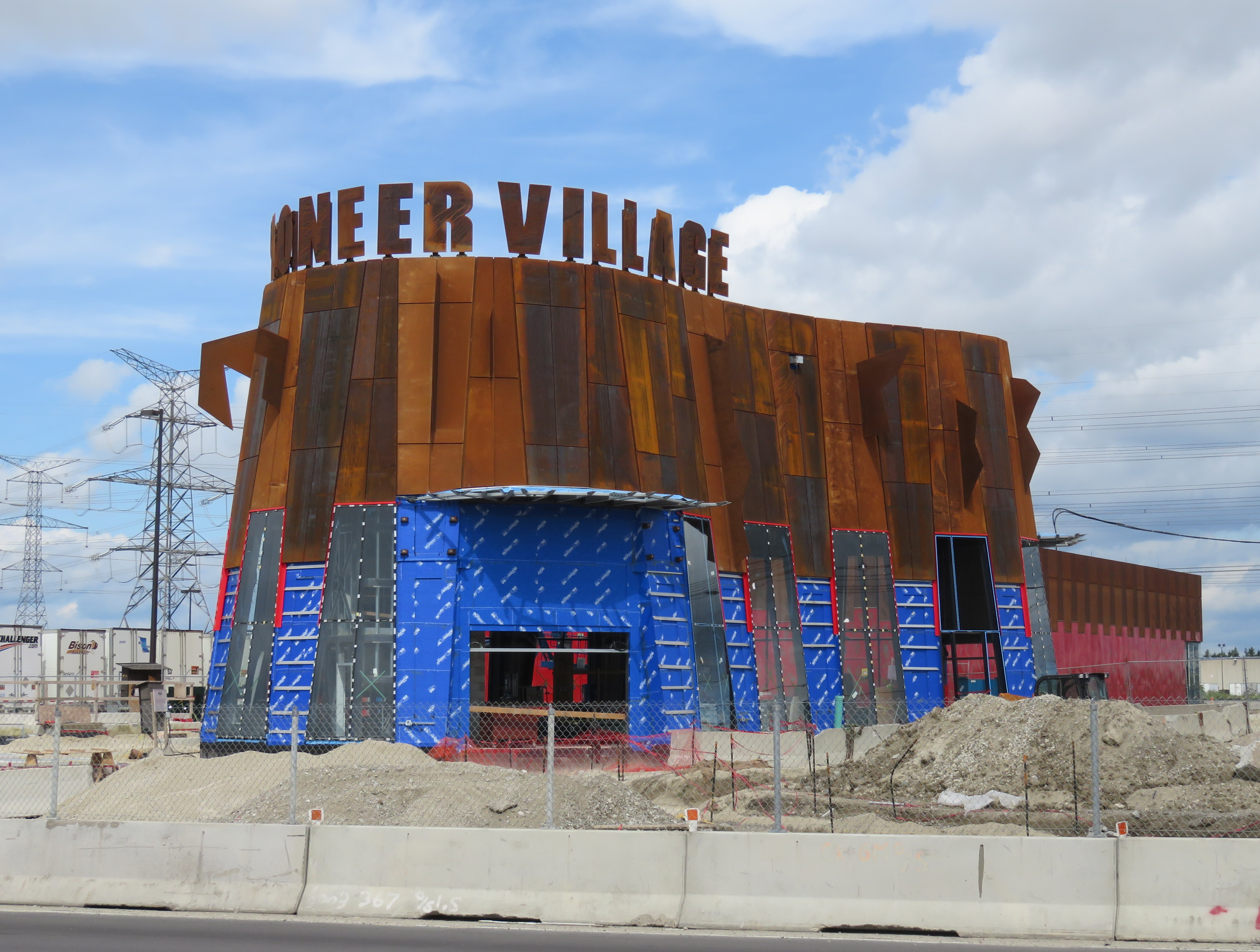
    Over the last few months, I have researched many books and maps and created a series of maps that attempt to illustrate the history of Toronto’s street railways, from 1861 to the present. Toronto is one of only a few cities in North America to continually operate a street railway network (others include Boston, Philadelphia, San Francisco, and New Orleans), which remains one of the busiest and most expansive tram systems in the world.

    Before the Toronto Transportation Commission was created in 1921, Toronto was served by several private streetcar firms. The Toronto Street Railway, which began operations in 1861, built Canada’s first streetcar system; two routes were opened that year, with small railcars pulled by horses. The TSR’s successor, the Toronto Railway Company, electrified the network, but with few exceptions, refused to expand it beyond Toronto’s 1891 borders. Only with the creation of the publicly owned TTC was Toronto’s streetcar system unified and modernized to be the envy of cities across the continent.

    Creating these 38 maps was a challenge, because published materials covering the pre-TTC era (before 1921) are sparse. William Hood’s Street Railways : Toronto: 1861 to 1930 provides some history of Toronto’s earliest transit services, but with only some details. I also consulted Transit Toronto’s route histories and other books such as Robert M. Stamp’s Riding the Radials and John F. Bromley’s Fifty Years of Progressive Transit which covers the years from 1921 to 1971.

    This post, the first of three, will cover the years from 1861 to 1891, the era of the Toronto Street Railway (TSR), when horse power ruled the streets. I do not cover every year, and I omit some minor service and route changes. But this, I hope, accurately illustrates the rise, fall, and renaissance of Toronto’s streetcar system.

    1861
    The TSR begins operations on September 10, 1861, serving a small provincial city of less than 50,000 people. The first route, Yonge, operates from Yorkville Town Hall, just north of the city limits, to St. Lawrence Market at King and Jarvis. A second route, Queen, was established in December of 1861, running between the market and the Ontario Hospital at the corner of Dundas Street, now Ossington Avenue.

    ttc-streetcars-1861

    (more…)

  • Unanswered questions about Toronto’s next subway extension

    IMG_4677-001.JPGPioneer Village Station under construction, August 2016
    Note: I posted an update to this article on October 4, 2017 

    By the end of next year, the Toronto Transit Commission (TTC) Line 1 subway extension to Vaughan will finally open, two years later than originally planned. The line will provide relief for thousands of York University students and employees and improve service to transit-starved northwest Toronto. It will terminate at Highway 7 in Vaughan, at the ambitiously (and in my view, ridiculously) named Vaughan Metropolitan Station, posing a challenge to cartographers and designers everywhere.

    When the $3.2 billion subway extension begins operating in December 2o17, it will be the first new major subway project since the opening of the five stop Sheppard Subway in 2002. It is also the first subway line to cross the City of Toronto boundary. (Coincidentally, this subway extension will cost the same as the proposed one-stop extension of Line 2 to Scarborough Centre.)

    Aside from the delays, the big price tag, and the silly Vaughan station name, there are two more issues that will arise, and which have yet to be completely figured out: how four separate transit agencies will re-route their buses once the subway opens, and the necessary question of fare integration once that happens.

    (more…)

  • GO Transit’s Grimsby problem

    IMG_6615-001.JPG
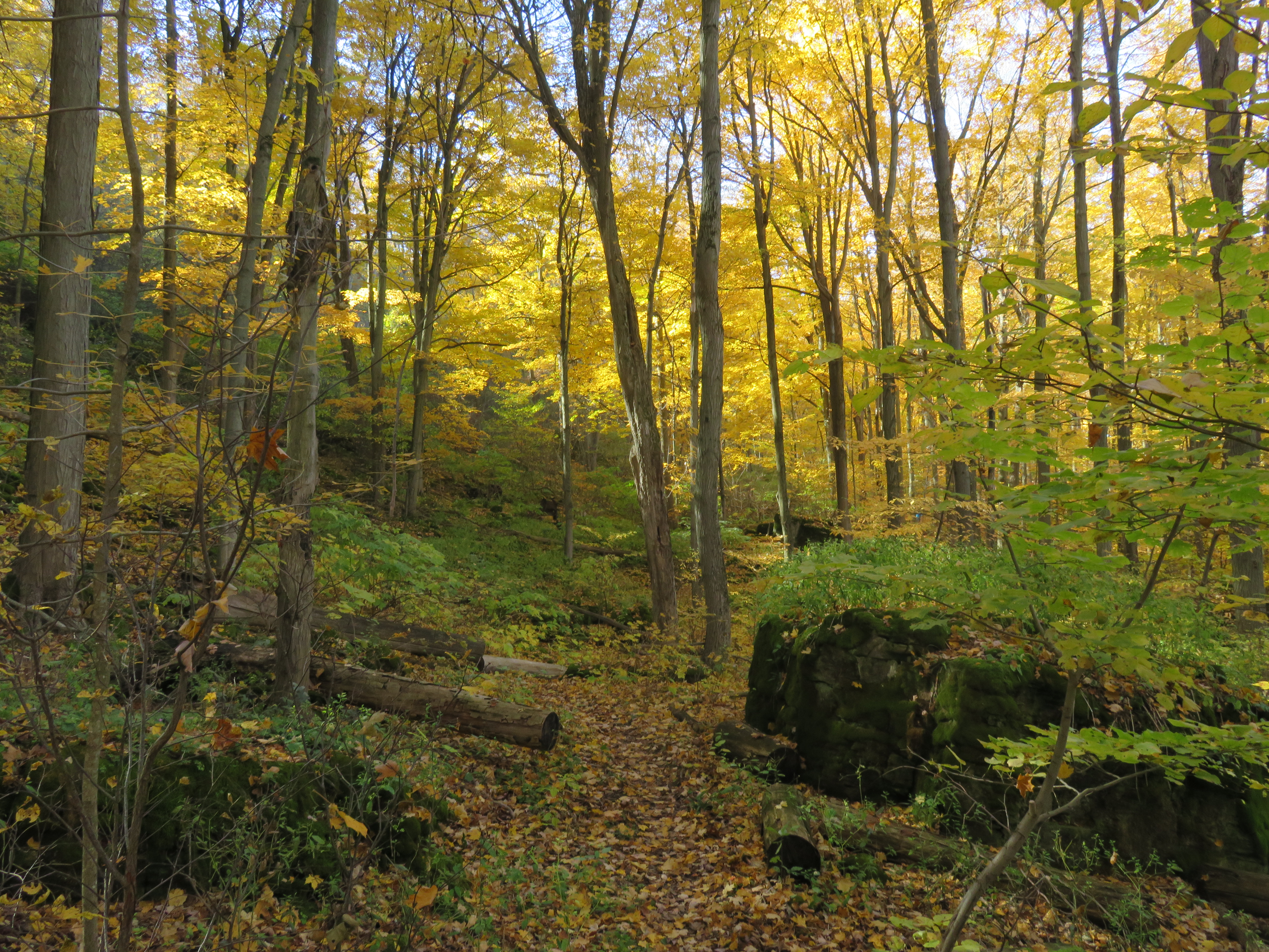
    The Bruce Trail near Fifty Road, November 6, 2016

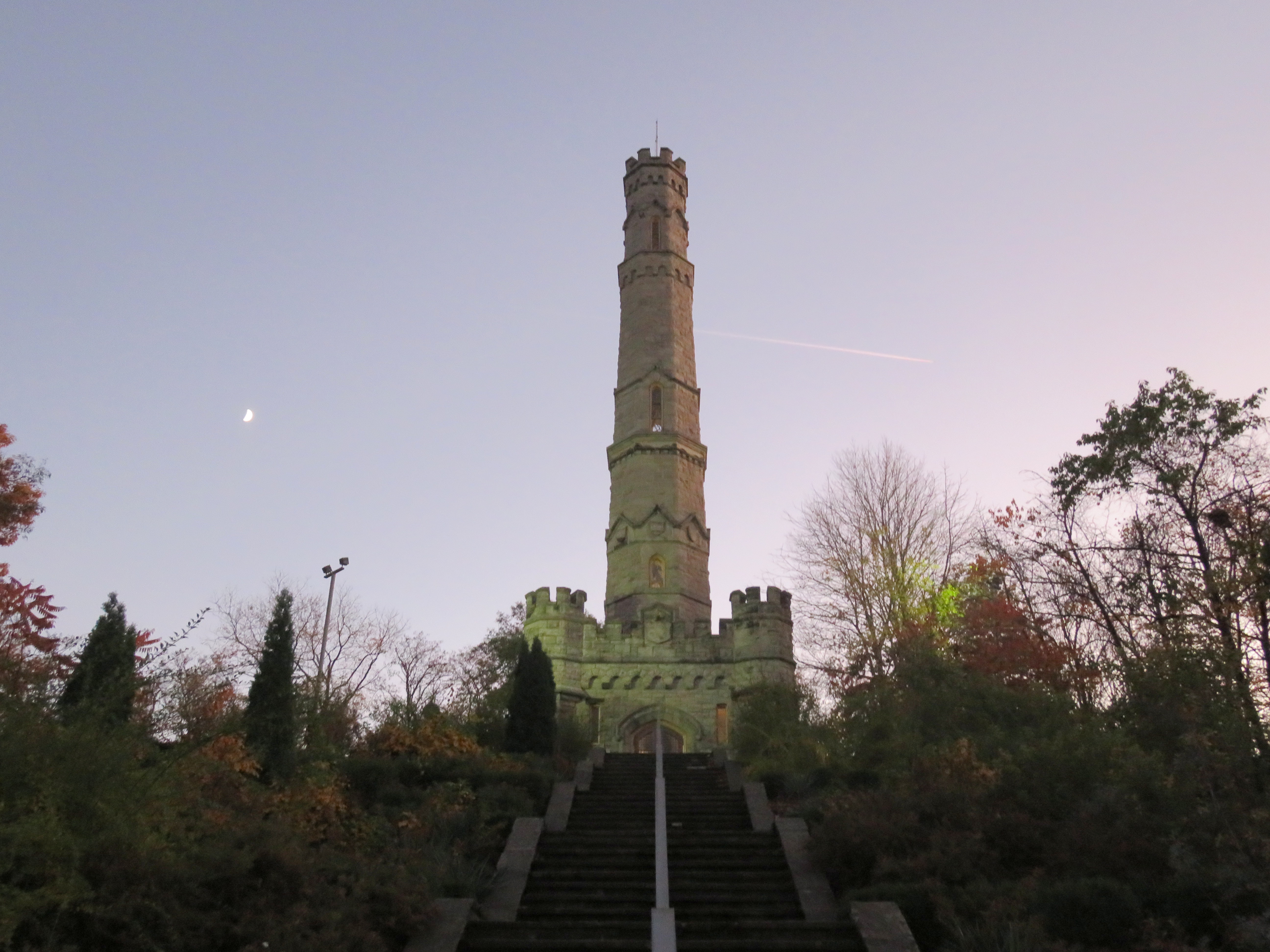
    On Sunday, November 6, I took advantage of an unseasonably warm November day to go hiking on the Bruce Trail. I started in Grimsby and hiked for 23 kilometres west to the Stoney Creek Battlefield Monument in Hamilton. The hike was lovely as there was still some fall foliage left to enjoy, and the views above the Escarpment over Niagara vineyards and Lake Ontario were spectacular.

    img_6559-001
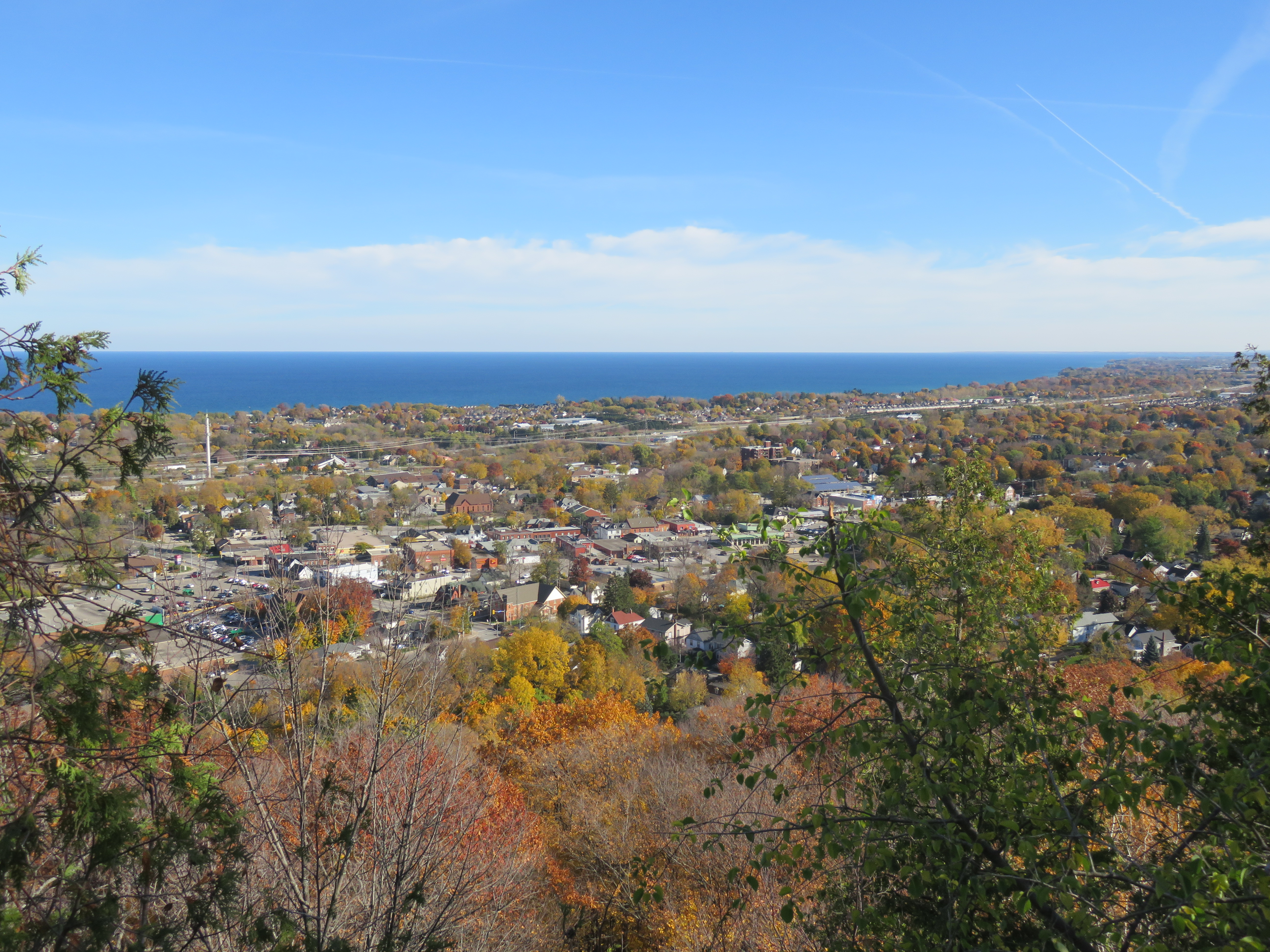
    View of Downtown Grimsby and Lake Ontario from the top of the Niagara Escarpment

    In order to do this six hour, one-way hike, I took the train to Grimsby, and began my trip from there (enjoying a coffee and snack at a great local coffee shop first). Upon arriving at Stoney Creek, I took a Hamilton Street Railway bus downtown for dinner before taking a GO bus back to Toronto.

    IMG_6650-001.JPG
    View from the lookout at Devil’s Punch Bowl Conservation Area towards Hamilton Harbour

    img_6686-001
    The Stoney Creek Battlefield Monument, where I ended my hike as the sun began to set


    When I go for a bike ride or a hike, whether it be a solo trip or a hike with friends, I like to plan the trip in advance, and to think about the transportation options for getting there. And so I come once again to thinking about Grimsby, GO Transit, VIA Rail, and local transit.

    There is currently only one train each way between Toronto and Niagara Region — Amtrak’s Maple Leaf, which is operated by VIA crews on the Canadian side of the border. The Maple Leaf takes 12 hours and 30 minutes to get from Toronto’s Union Station to New York’s Penn Station, including a stop at the border for customs and immigration checks. Other delays, such as freight traffic and even ship traffic on the Welland Canal, make this train commonly late for Niagara passengers headed to Toronto in the evening. There was once a second daily VIA train between Toronto and Niagara Falls, scheduled to serve commuters, but it was cut by the Stephen Harper-led Conservative government in 2012.

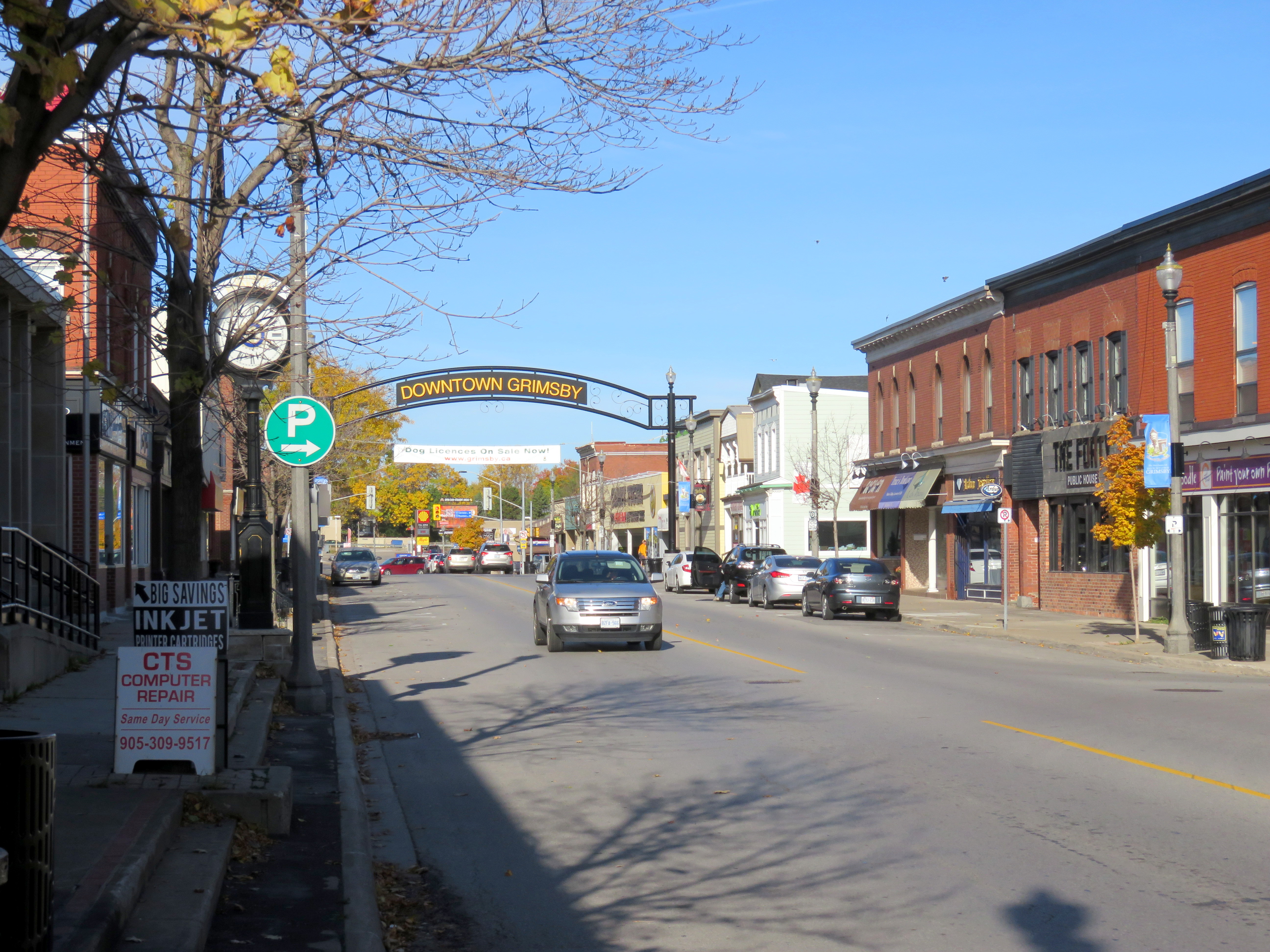
    img_6547-001Downtown Grimsby

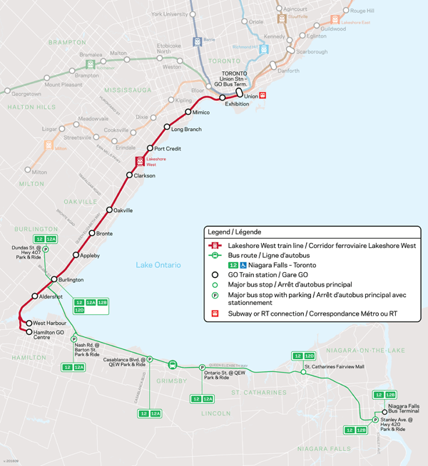
    GO Transit operates a summer weekend train service between Toronto and Niagara Falls, making stops at Port Credit, Oakville, Burlington, and St. Catharines, but not at Grimsby. GO Transit also operates a year-round bus service — Route 12 — that follows the QEW between Burlington GO Station and Downtown Niagara Falls, stopping at several park and ride lots and at Fairview Mall in St. Catharines, a secondary hub for local transit in that city.

    The Maple Leaf Train leaves Union Station at 8:20 AM, 7 days a week, and arrives at Grimsby just after 9:30 AM, stopping only at Oakville and Aldershot. Taking GO Transit, it takes nearly two hours to get to the park and ride at Casablanca Boulevard, including the transfer time at Burlington Station.

    niagara_bus_600
    GO Transit Route 12

    The Grimsby Amtrak/VIA station is located on Ontario Street, at a site picked by the Great Western Railway in 1853. It is a mere 5-10 minute walk to Downtown Grimsby, located in the centre of that community’s population. The GO Transit park and ride is located at the west end of town, at Casablanca Boulevard. The planned GO Transit Rail Station is located nearby. The bus stop and proposed rail station is located 3.5 kilometres from Downtown Grimsby, or a 45 minute walk.

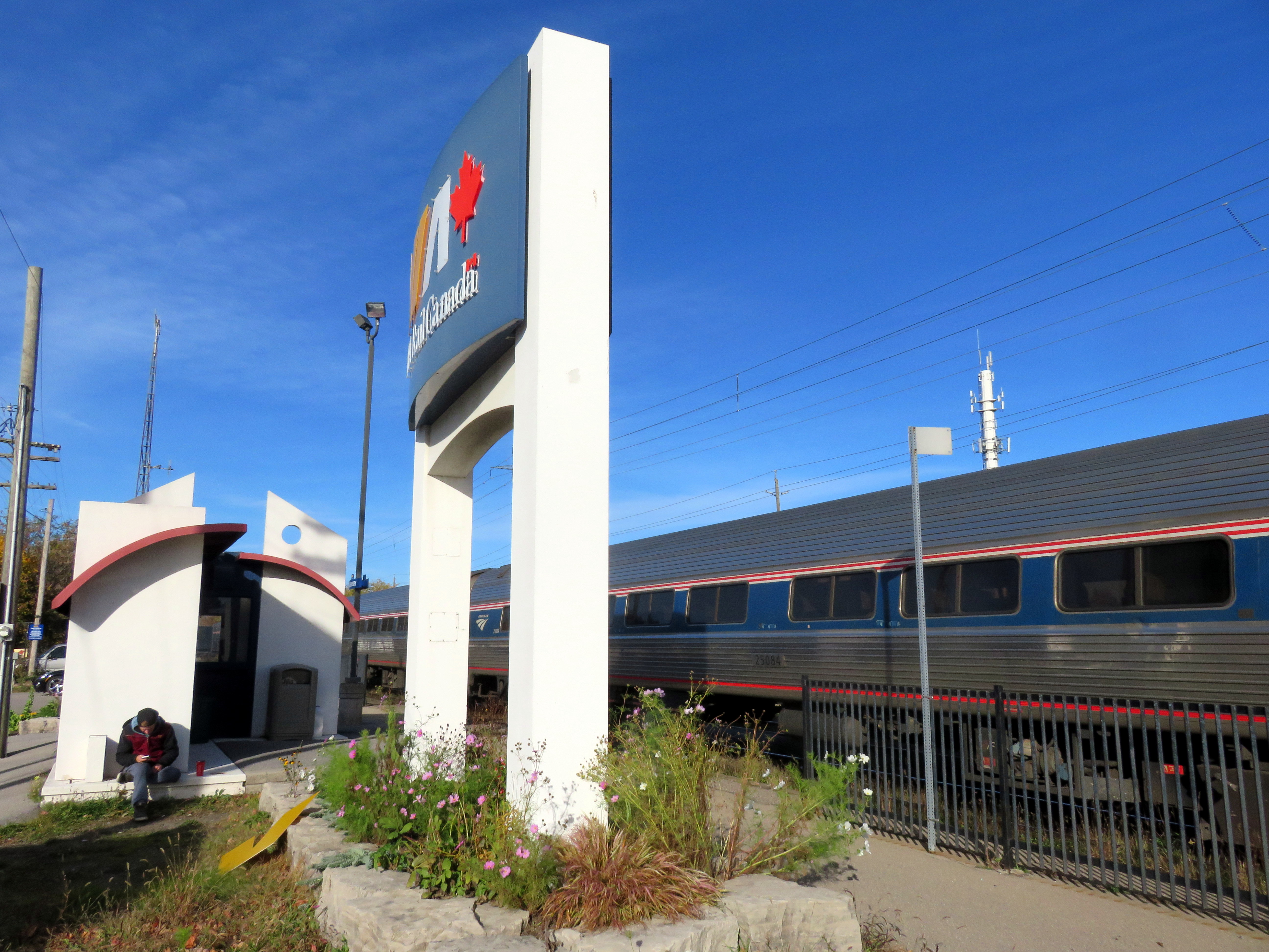
    img_6544-001Grimsby Station

    The current railway station at Grimsby consists of only a small shelter and indoor waiting area, along with a small parking lot for VIA customers. The platform is small, about one rail car’s length. The VIA Rail Canada sign is almost as large as the station building itself. But for me, the railway station’s location was far more convenient than the GO bus stop at Casablanca Boulevard.

    A new station at Casablanca Boulevard offers several advantages for GO Transit: easy access to the Queen Elizabeth Way, plenty of undeveloped land for a parking lot, and room for a platform for GO Transit’s 10-car and 12-car trains. But the location is not friendly for customers who wish to walk or cycle to the train, and without a local transit system, it’s inaccessible for many potential Grimsby commuters unless they were to take a taxi, get a ride, or drive their own car.

    img_6595-001
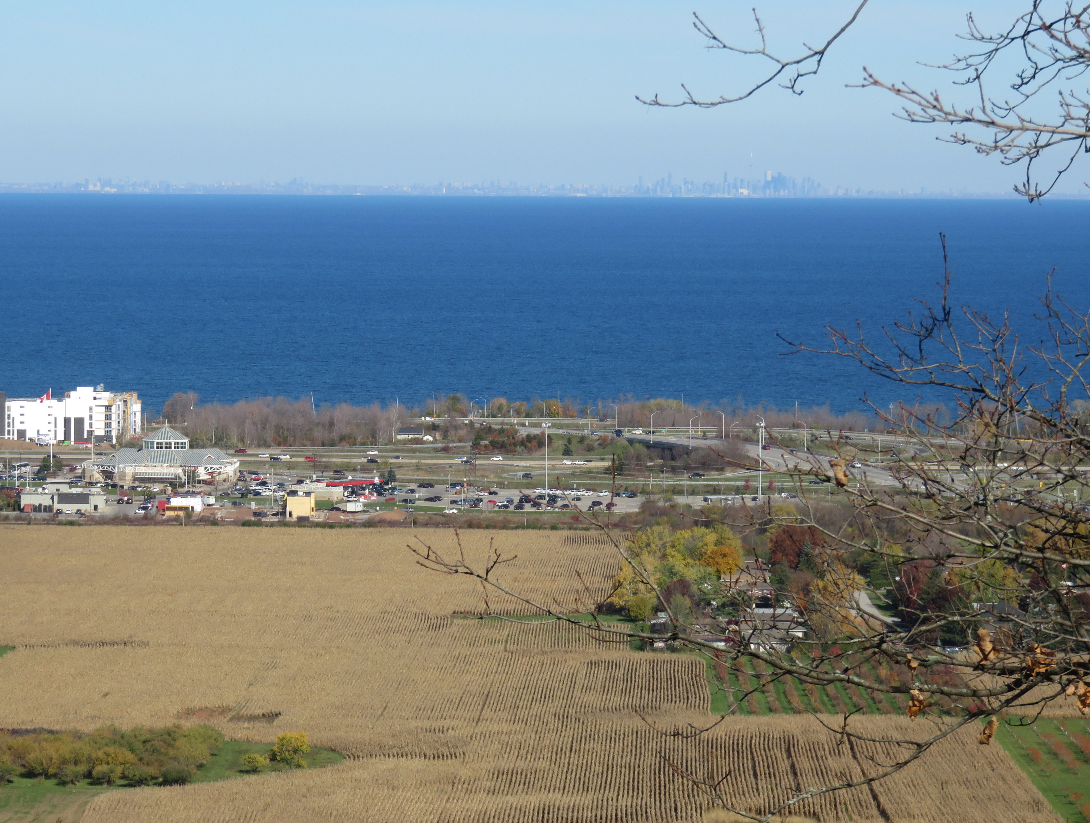
    Overlooking the QEW/Casablanca Boulevard interchange and the proposed location of the Grimsby GO Station. GO buses serve the park-and-ride lot in the middle ground. Note the clear view across the lake to Toronto.

    I have argued here before that GO Transit has an unfortunate record of catering to motorists while mostly ignoring the needs of many of its current and potential customers. GO Transit’s need for large parking lots often precludes locating stations in more urban locations. By providing ‘free’ parking, GO forces all passengers to subsidize those who drive alone to its stations.

    Of course, GO Transit is going to build Grimsby Station at Casablanca Boulevard; it was announced earlier this year as part of a GO service expansion project. But a useful local transit system, scheduled to connect with GO trains and buses, offering fare integration, can mitigate this problem. Transit riders shouldn’t be told to take a hike.

  • Leadership, John Tory style (part 2)

    We’ve seen it before: when cornered on an issue, Mayor John Tory will get defensive, flustered, and counter with disingenuous remarks. Police carding was one such issue, so was the Gardiner East. Today, as Mayor Tory defends his SmartTrack proposal, he’s doing the same thing.

    After a staff report on SmartTrack — originally planned for a week ago at the scheduled Executive Committee — became public, we learned more details about the watered-down transit plan that was Tory’s signature campaign promise. (Read Steve Munro’s article in Torontoist for more details.)

    • In 2014, John Tory promised that his “London Style” surface rail subway would open in just seven years. Now, we find out that it won’t be completed until 2025-2026.
    • Only six new stations will be added to GO Transit’s existing stops on the Kitchener and Stouffville corridors; the GO RER system planned by Metrolinx will stop at the same stations as SmartTrack, blurring the lines further between the province’s plans and Tory’s promises.
    • The City of Toronto will be on the hook for all LRT operating expenses, while the Province/ Metrolinx will continue to own the infrastructure.
    • The City of Toronto would be on the hook for some of the GO RER expenses, such as 15 percent of required grade separations, such as at Steeles and Finch Avenues in Scarborough.
    • The Eglinton-Crosstown LRT west extension to Pearson International Airport, which replaced part of the original SmartTrack alignment planned using outdated Google Maps satellite imagery, may not be built beyond the planned Renforth Gateway Hub, the eastern end of the Mississauga Transitway.
    • Tax Increment Financing (TIF) will not be enough to fund the construction of SmartTrack and the LRT extension; development charges and a property tax hike would be required to fund SmartTrack’s construction.

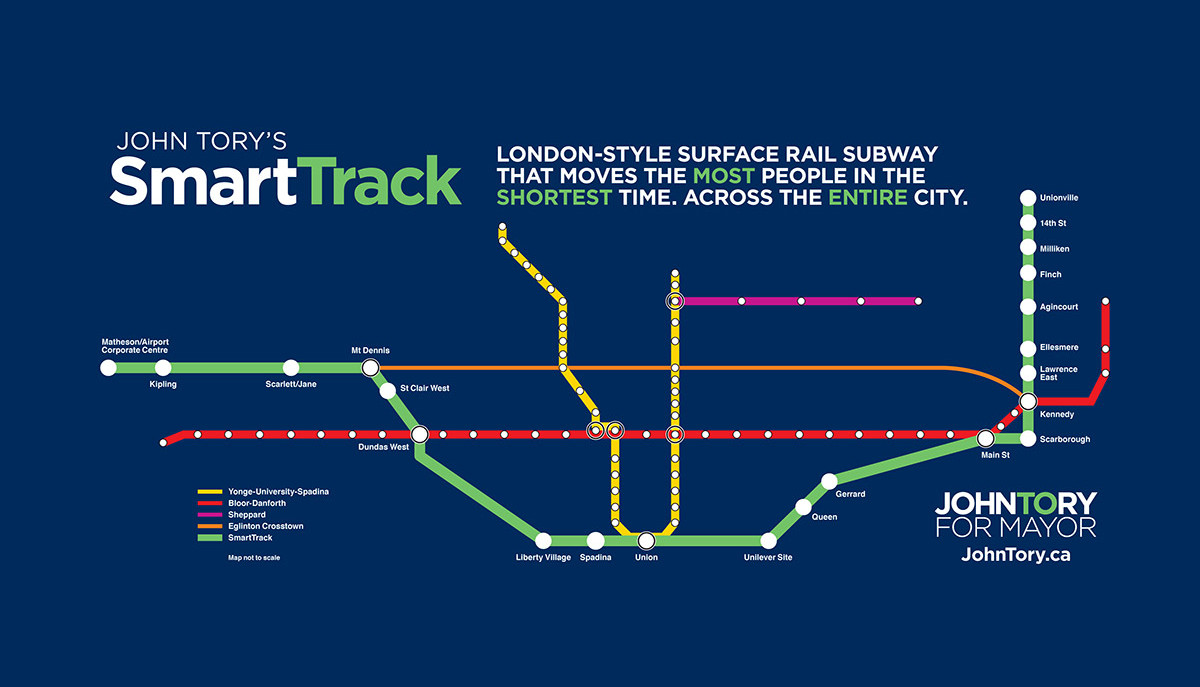
    smarttrack_fbThe original SmartTrack plan that John Tory campaigned on in 2014

    These are serious concerns, and it is worth asking whether Toronto should remain committed to this plan. After all, the Relief Line Subway remains unfunded, even though it is a top priority for city planning staff. And there’s that $3.2 billion one-stop subway extension to Scarborough Centre, which might become even more expensive if so-called “Subway Champions” Councillor Glenn De Baeremaeker and Liberal MPP Brad Duguid get their way with a proposed realignment.

    (Interestingly, a SmartTrack/RER stop at Lawrence East may not be able to be built before the one-stop subway extension is opened — a Scarborough RT station is in the way. This isn’t good news for transit riders on the 54 Lawrence East bus, which will lack a rapid transit connection in Scarborough.)

    Mayor John Tory’s response is to ask “what’s their plan?” instead of listening and responding to critics. It’s certainly not a productive or mature reaction to very valid concerns.

    There were several alternative plans made by rival candidates in 2014 — Olivia Chow and David Soknacki backed returning to the cheaper and longer Scarborough LRT replacement, and building the Downtown Relief Line subway. Chow also proposed additional bus services, which was mocked by Tory’s campaign as no real plan for transit. Once Tory was elected, the TTC ended up implementing much of Chow’s bus plan, including restoring most of Rob Ford-mandated service cuts and adding new express and night routes.

    Last week, John Tory also rejected — yet again — the new ward boundaries recommended by the Ward Boundary Review Team, independent consultants who came up –twice — with a 47-ward solution meant to reflect population growth (especially downtown and in central North York) and imbalances in ward populations and councillors’ workloads. The Executive Committee voted against the mayor, backing the 47-ward option, but staff warn it might be too late now for the 2018 election. That might suit Tory’s political agenda, but it’s a blow against local democracy.

    Bottom line: Olivia Chow has no plan for transit. She is not a leader.
    – John Tory, 2014

    So no, John Tory, you’re not a leader. You have failed to acknowledge your errors, you haven’t listened to critics, you’re stubborn, and you lash out when things don’t go your way. And you won’t listen to experts because you don’t like what they have to say. At one point, you claim your critics don’t have any alternative plans to SmartTrack, at other times, you mock the very plans that critics suggest.

    So far, John Tory’s critics have been correct about his transit plan. Maybe it’s time to listen.

  • Ridership has tripled on UP Express, but we can do even better

    19008325386_9c321ac7ab_k

    When UP Express — Toronto’s rail link to Toronto Pearson International Airport – -launched on June 6, 2015, the one-way fare between Union Station and Pearson Airport was set at $27.50, or $19.00 with a Presto card. At the time, Metrolinx, the provincial agency charged with planning and integrating transportation services in the Greater Toronto and Hamilton Area and the parent agency of GO Transit, expected that ridership would hit 5,000 passengers a day in a year. But after its launch, ridership sunk instead. 

    By January 2016, only an average of 1,967 passengers a day rode UP Express, so Metrolinx cleaned house and lowered the fares. The one-way cash fare was reduced from $27.50 to $12, and from $19 to $9 with a Presto card, and fares between Union and Bloor and Weston stations were reduced to match the GO Transit fares for the same trips. Since the new fare structure was introduced, UP Express ridership has more than tripled. By June 2016, the daily average ridership increased to 7,657.

    Despite the ridership growth, and the utility of the rail service for local residents near Bloor and Weston Stations, there’s still more that can be done to make the most of the $456 million spent to build the line.

    The airport region is a major employment centre, yet is difficult to serve by public transit. Fare integration between UP Express, GO Transit, MiWay and Brampton Transit could be an important a first step in creating a full regional rail network, a concept that Mayor John Tory pitched as “SmartTrack.”

    Airport LinksTransit connections at Pearson Airport. UP Express, if it offered fare integration with the TTC, MiWay and Brampton Transit, would be an invaluable part of the Toronto area’s transit network

    UP Express’s ridership increase is a good news story. But there’s so much more utility that can be leveraged.

    I discuss the UP Express ridership trends further in Torontoist

  • Why Presto and the TTC don’t mix

    In an earlier post, I explained why the Toronto Transit Commission should ditch its archaic transfer policies and adopt a two-hour unlimited transfer system like those in Mississauga, Brampton, York Region, and elsewhere in the Greater Toronto and Hamilton Area.

    When I made the argument last year, the TTC had just introduced proof-of-payment on all streetcar lines and had just started to adopt the Presto Card for fare payments. Sometime in 2o17, the TTC will eliminate all tickets, tokens, and passes, instead relying on Presto and new limited use media (LUM) paper cards for single-ride payments and day passes. (LUMs are common on some systems that have gone to smart card technology; Montréal, for example, has the L’occasionnelle card, augmenting the plastic Opus Card.)

    About half the buses and over one third of all TTC subway stations now accept Presto as payment (for regular adult and student/senior fares, deducting the same fare as the applicable token or ticket price); according to the TTC, the full roll-out of Presto machines on the bus network is supposed to be complete by the end of the year. But the TTC likes to remind its passengers that they should carry alternative forms of payment in case Presto is not available (for example, when shuttle buses replace subway or streetcar services).

    That said, I’ve been happy with using Presto when it’s available. Presto is all-but-necessary to ride GO Transit, OC Transpo, UP Express and suburban transit agencies; with Presto, transfers and GO Transit/suburban bus co-fares are automatically figured out. I set up the autoload feature on my Presto account, so I never have to worry about not having enough funds on the card. I can always review my account, which accurately keeps track of my transit fare payments and transfers. There are times when Presto is not an option, such as when I travel to Scarborough, so I always keep a few tokens or cash for those instances.

    But on Sunday, September 18, Presto finally didn’t work for me. But I blame this on how the TTC insists on making Presto work with its interpretation of its outdated transfer policies, rather than making its fare policies work for Presto.

    presto-overchargeScreenshot from my Presto transaction history, September 20, 2016

    After a wonderful evening visiting the In/Future arts festival at Ontario Place, I boarded a 509 Harbourfront shuttle bus at the Exhibition Grounds at 9:22 PM. The streetcar that normally operates from the Exhibition to Union Station was not running due to maintenance in the Bay Street tunnel. The shuttle bus was equipped with a Presto machine, and I tapped my card. The bus let off its passengers at the corner of Bay and Front Streets, just outside of Union Station, and I transferred to the subway, a completely valid transfer, at 9:49PM. But that resulted in a second charge of $2.90.

    My mistake was expecting that the transfer from the 509 shuttle bus to the subway would be recognized by Presto as a valid transfer. Normally, the 509 streetcar has a direct connection to the subway platforms, without the need to pass through fare gates. Elsewhere, the transfer between streetcar and subway at downtown stations is not a problem using Presto (like the transfer from the 505 Dundas Streetcar to Dundas Station on September 10).

    Luckily, I checked my transaction history on Monday, where I caught the error. I immediately went on Twitter to complain. The TTC Helps account told me me to give TTC customer service a call, and they apologized (though reminding me that I should always get a paper transfer when paying with Presto), and promised to mail me a token to compensate. I got the token in the mail five days later, “in the interest of good public relations.” Mailing a token out is one way to refund an improper charge, but it’s not efficient.

    I will say that the TTC customer service staff are great people who sometimes deal with unreasonable customers. The agent I spoke with was very understanding and agreed with some of the specific issues that frustrated me that day.

    image1-1

    Had I not checked my balance, and not immediately complained, I would not have received this refund. How many customers, acting in good faith, get double-charged using their Presto Cards and don’t even know it? The TTC’s Presto fare machines don’t provide fare balance or transaction data, unlike those used by GO or suburban transit operators (see photo below).

    4902983182_d89c675230_b.jpgGO Transit Presto fare machine, which displays card balance and time left to complete ride/transfer

    Even when Presto is fully rolled out, the TTC’s transfer rules are unclear and they are prone to unfair double-charges for completely reasonable one-way continuous trips.

    Last year, I warned about the troubles that could result in forcing Presto on top of the TTC’s archaic transfer system: “if a passenger taps onto another vehicle on the same route, which is quite a common occurrence due to delays, short-turns, and diversions/shuttles, the Presto Card will deduct a second fare.”

    As I mentioned before, the TTC already considered time-based transfers in 2014 as it planned for the transition to Presto for fare collection. At the time, the Commission estimated that it would cost $20 million in annual revenue, as some passengers would take advantage of making stopovers en route or quick return trips on one fare. Another excuse I heard is that the TTC is waiting for Metrolinx to finalize its regional fare integration strategy.

    But a modern transfer policy would bring the TTC in line with other transit agencies in the Greater Toronto and Hamilton Area, would make the Presto Card much easier to use, and would buy a lot of goodwill, especially if it was introduced to coincide with a fare increase. It’s also worth noting that when the TTC eliminates transfers, tickets, and passes, its customers will be required to pay $6 for a new Presto Card. It’s only right to incentivize its loyal customers to make the switch.

    I’m happy to get a token refund and acknowledgment of my predicament. But I had to notice the charge and complain, and tokens will soon be phased out. A better solution is needed.

  • The subway is coming. Let’s improve Scarborough Centre

    As the readers of my blog probably know, I am not a fan of the Scarborough Subway extension. Even though the subway will be expensive and less useful than a fully-funded light rail replacement of the ageing Scarborough RT, politicians from all three major parties have backed the subway, promising “respect” and “fairness” for Scarborough.

    Neethan Shan, the New Democratic Party’s candidate in Thursday’s provincial by-election in Scarborough-Rouge River, has been pushing this messaging hard, though all three candidates — including City Councillor Raymond Cho, running for the Progressive Conservatives — are all in favour of the extension. That conveniently ignores the fact that the subway won’t even stop in Scarborough-Rouge River — though the LRT would have.

    But it’s now time to move on. Scarborough is going to get a six kilometre long, one-stop subway extension, which was confirmed by a vote at city council in July. The focus should now be on getting the best value out of the $3.2 billion project. That must include improving Scarborough Centre.

    The subway extension is currently in the environmental assessment/detailed design stage. I expect that construction will actually begin probably just before the next provincial election is called in 2018. It won’t open for another four to five years after that, in 2022 or 2023. That is plenty of time to make some necessary changes to the street grid, the built form, and the public realm.

    A few weeks ago (during a rare summer rain storm), I explored Scarborough Centre. With too many surface parking lots and a hostile road network, there’s a lot of work that has to be done to make the improve this suburban hub. Employment and residential growth is currently stagnant; that has to be addressed. All that said, there are also a lot of great community assets already in place, and there are some opportunities to make it better.

    (more…)