Tag: Cycling

  • More thoughts on cycling infrastructure

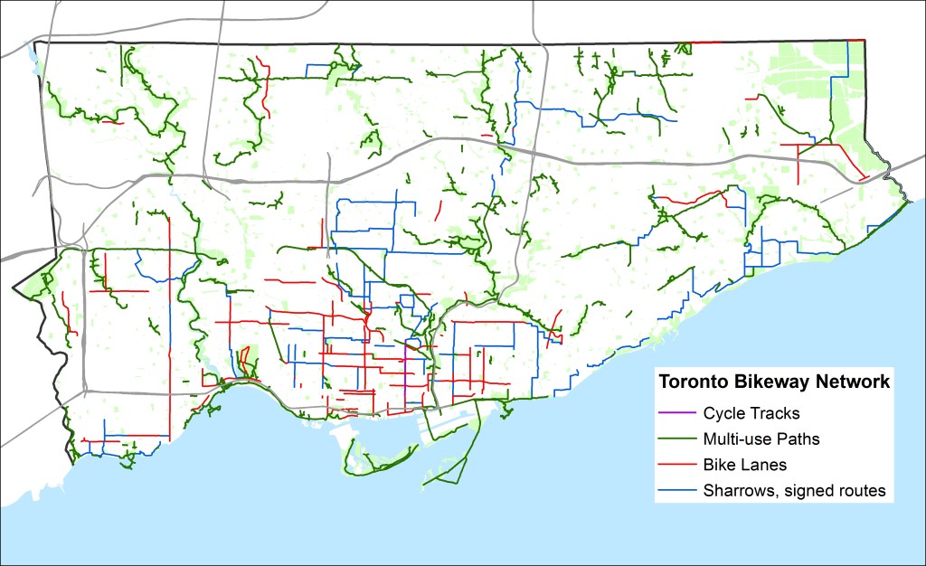
    In Torontoist last week, I mapped the new and improved bike lanes proposed for 2016. There are some great new additions – more contraflow lanes in the east end and through Kensington Market allow cyclists to take direct routes along quieter residential streets. There will finally be a pilot of the long-demanded Bloor Street bikeway; at least between Shaw Street and Avenue Road. And, as I write this post, work is being completed on separated bike lanes along Adelaide and Richmond Streets east to Parliament Street. The popularity of the lanes added last year (University Avenue to Bathurst) pretty much guarantees that these new bike corridors, still officially pilots, are permanent.

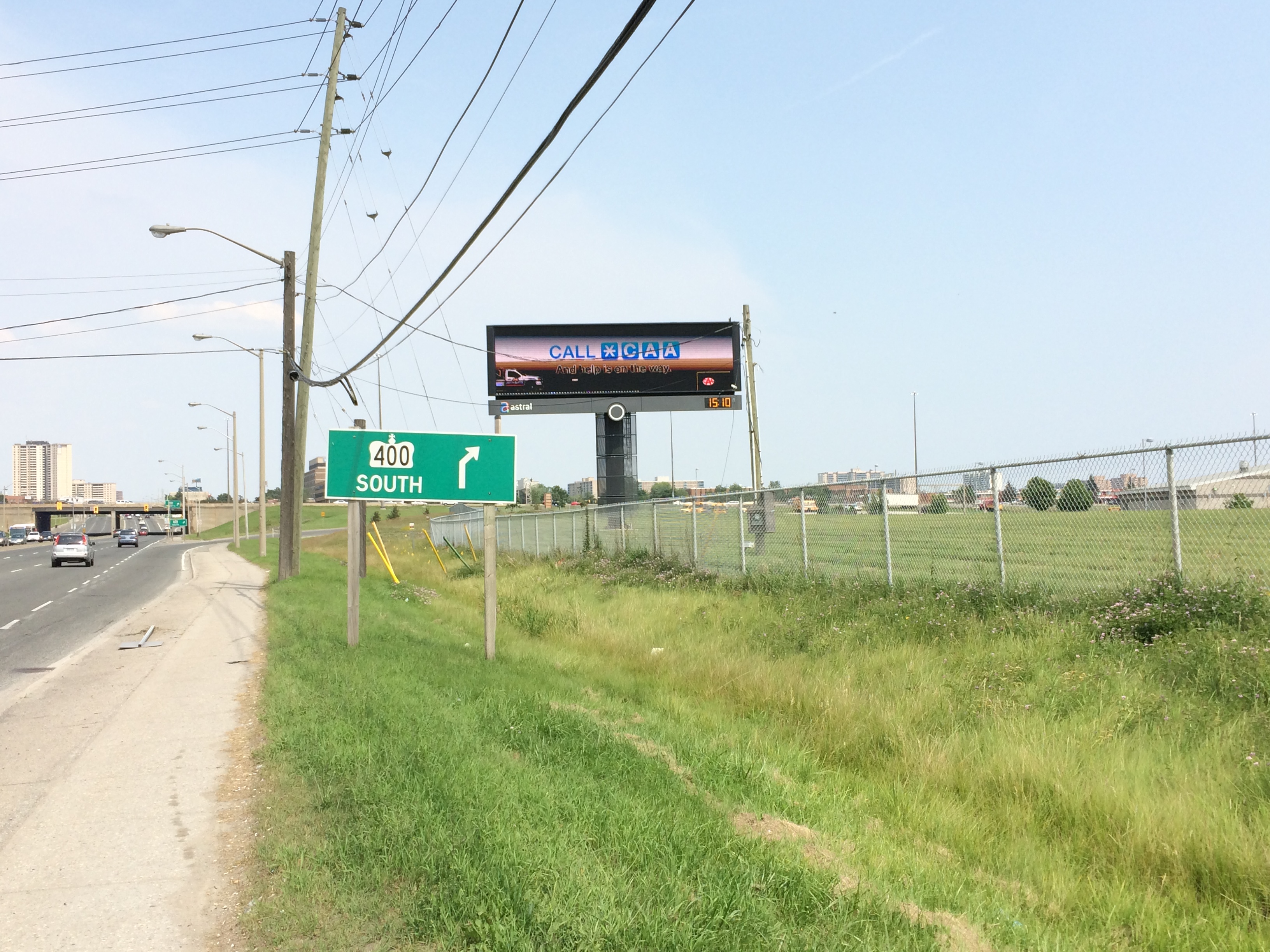
    But the map below – created for the Torontoist post – shows many gaps, even with the new 2015 and 2016 additions. Note the long north-south lane in the top centre of the map. That’s Willowdale Avenue, the longest planned addition. It ends at Sheppard, just before Highway 401; there’s no easy and safe way for cyclists to cross North America’s widest and busiest auto route anywhere near where the new Willowdale bike lane ends. Freeways and railways remain nearly impenetrable barriers for pedestrians and cyclists; this prevents the true implementation of a minimum grid.

    Bike Routes - Sept17

    But even bike lanes are only good if they aren’t blocked by ignorant or ill-intended motorists. Simple barriers like knock-down bollards or curbs are helpful, but they aren’t always effective.

    Last Sunday, I cycled from my home in east Downtown Toronto to Downtown Hamilton, following the Martin Goodman Trail, Lakeshore Road, and the Hamilton Beach trail for an 84-kilometre ride. Through Oakville and Burlington, the Waterfront Trail is nearly non-existent, so I ride on Lakeshore Road itself, which has bike lanes in only a few sections. But motorists are, almost without exception, courteous and patient; it’s the one place in the suburbs where I really enjoy cycling.

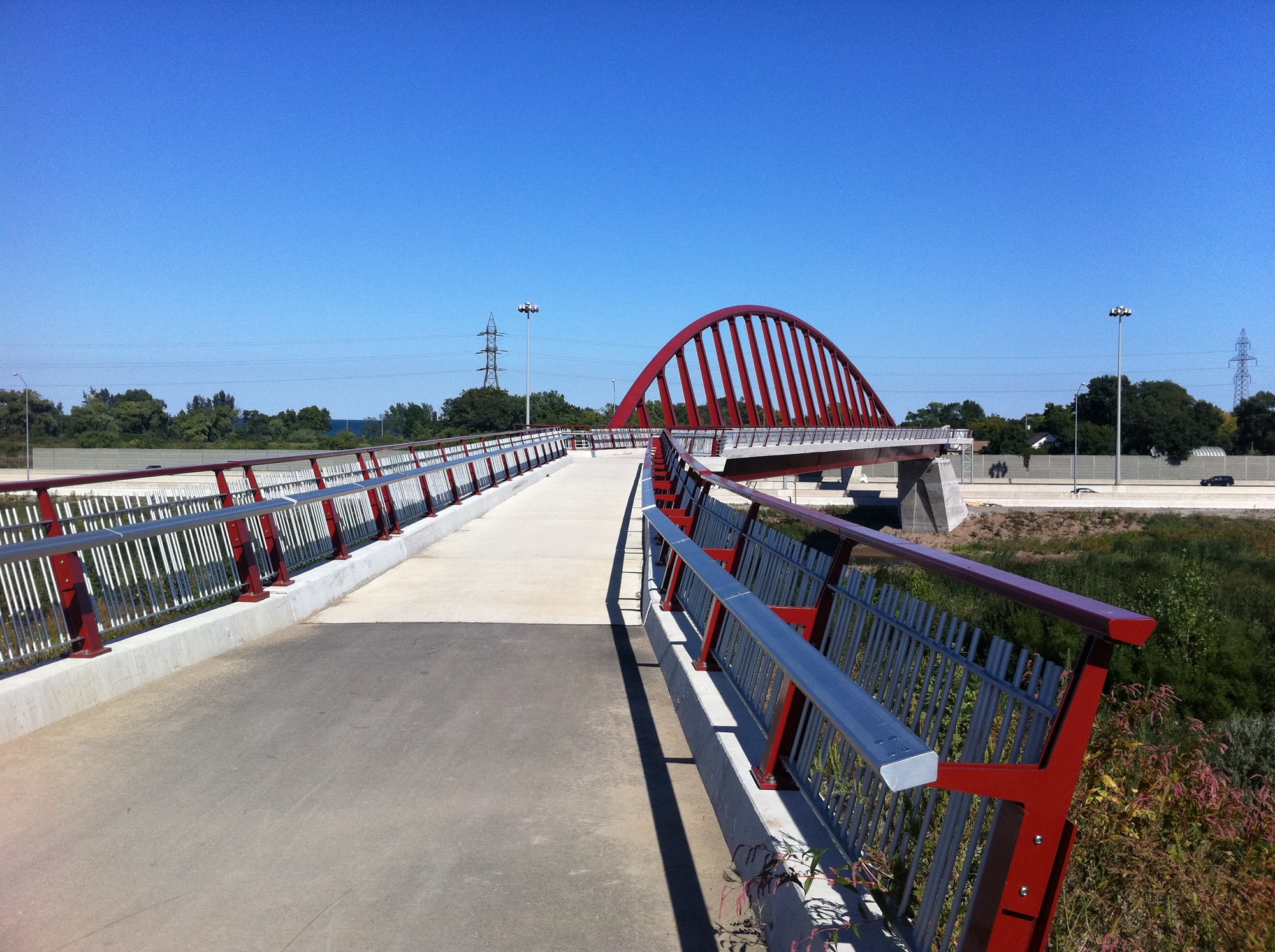
    In Hamilton, after crossing the Queen Elizabeth Way on a spectacular bridge that also spans the Red Hill Creek, I again take minor streets to make my way west towards downtown, where I usually visit a favourite pub on Augusta Street before loading my bike on a GO Transit bus rack and returning to Toronto.
    6164718675_1ac3950080_o

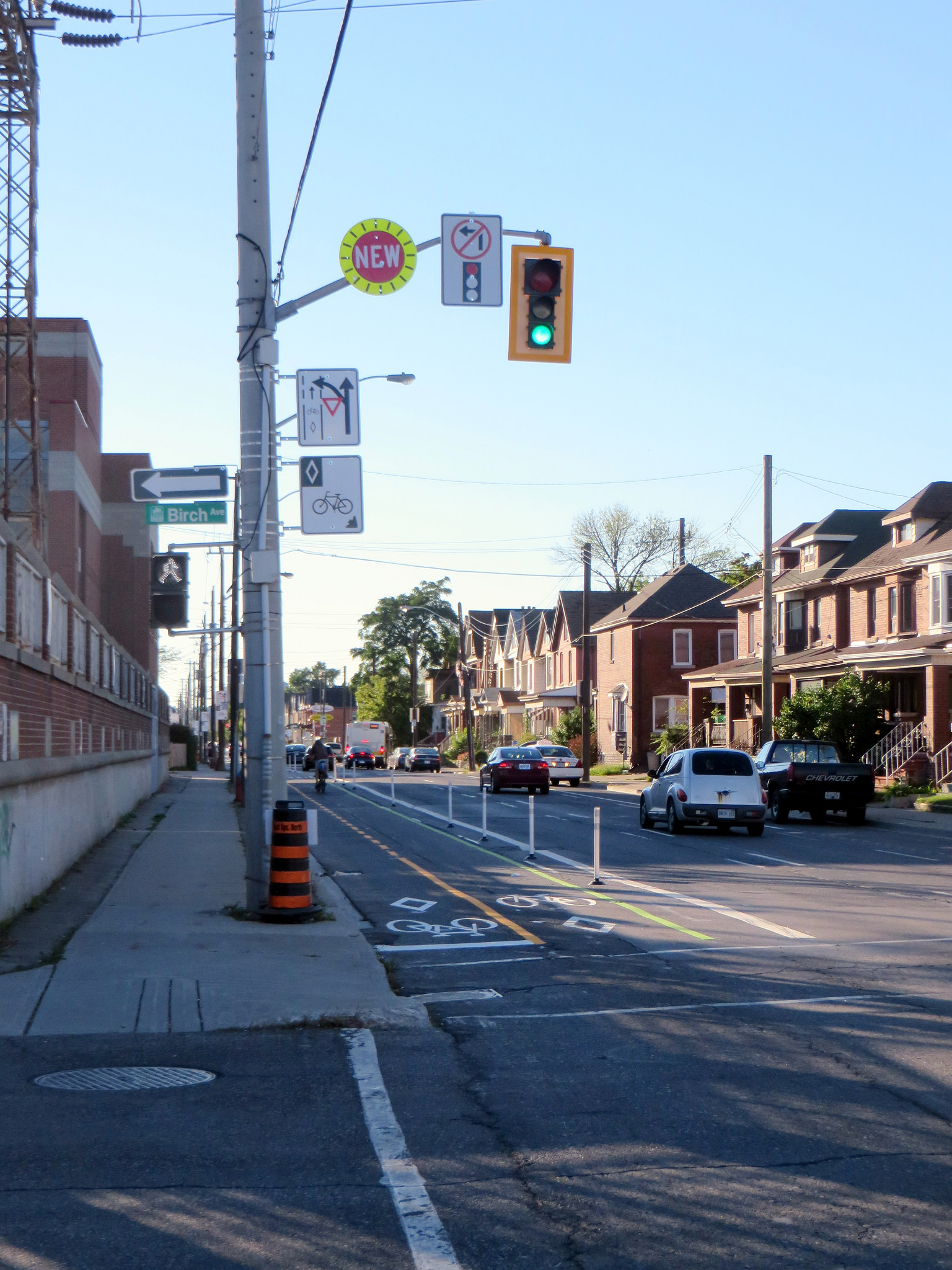
    Hamilton, like Toronto, has started to add some great new cycling infrastructure. It has a bike share program, called SoBi Hamilton, it has great trails leading out to Brantford and Caledonia (as well as the Waterfront Trail), and some new bike lanes and cycletracks. The most impressive is Cannon Street, where a lane on a one-way arterial was transformed into a two-way separated cycletrack last year.
    14988034160_c541a52410_k

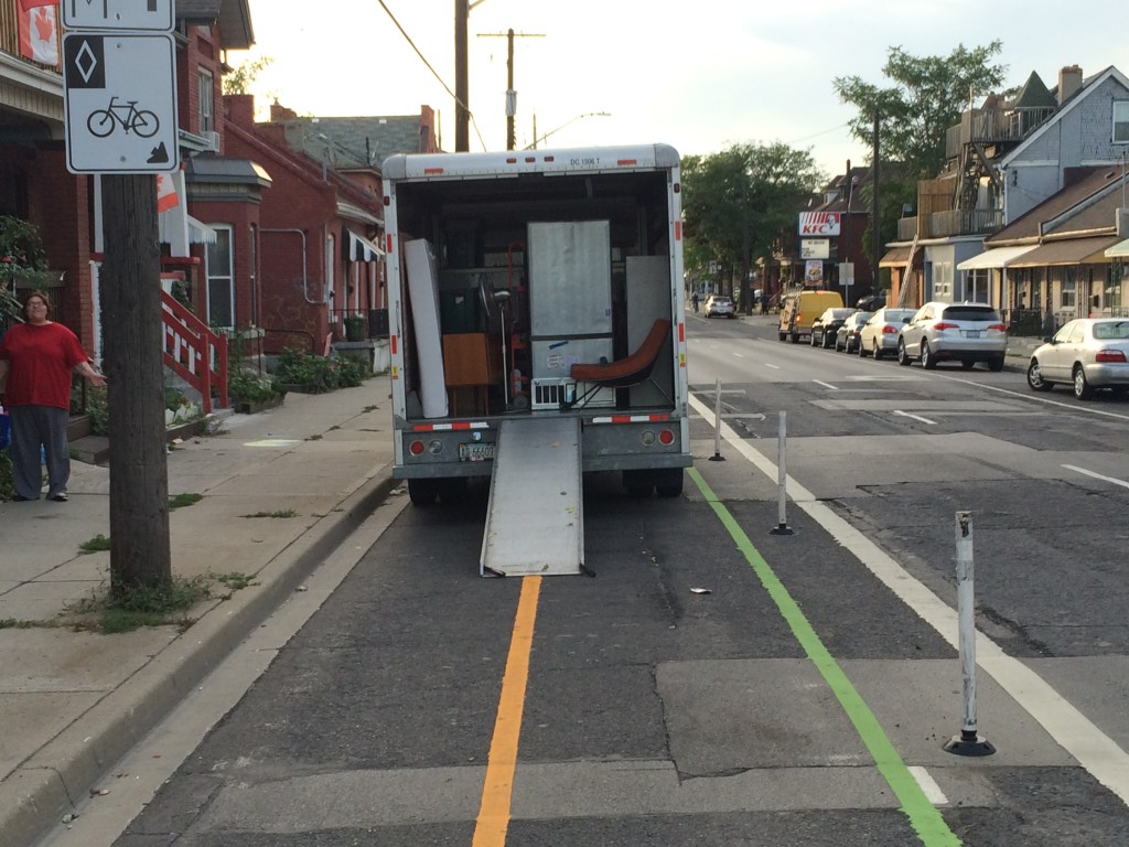
    But even green paint, knock-down bollards, and plenty of signage wasn’t enough on Sunday, when I encountered this:
    IMG_9624

    IMG_9625

    The woman in the red shirt and grey trackpants started screaming at me as I took these photos, claiming she had the right to stop here as she was moving out of the house. She threatened to call the cops on me (!) for taking photos of her stuff, saying I could be looking to steal it. (On my bike, of course.) Cyclists encountering this from the west would be forced into oncoming traffic; in any event it’s dangerous and illegal. (Taking photos of this type, on public property, certainly is not.)

    https://twitter.com/Sean_YYZ/status/645726388310396928


    There’s still a lot of ignorance out there; not by the woman with the U-Haul that I mentioned; but by at least one reaction:

    Sidewalk riding is itself illegal and dangerous (sidewalk riding cyclists are a pet peeve of mine). Happily, there were plenty of others willing to correct that user about the safety of vulnerable road users and the various laws and by-laws applicable in this case.

    But this is all a long and winding way to say that more cycling infrastructure is great. And places like Toronto and Hamilton are doing great work on that front. But the infrastructure is only as strong as its connectivity, and as long as they’re not blocked by ignorant and/or hostile motorists. Education and enforcement need to go along with the buckets of green paint, signage, and barriers now being added in our cities.

     

  • Exploring Toronto by bike: A circle tour around the city

    IMG_4182-001A friendly deer passes me as I make my up the Humber River trail

    One of my favourite things to during the summer s taking long weekend bicycle rides. A few of these rides have been multi-day trips, such as the Niagara Region Circle Route tour I took on Victoria Day weekend, or my ride from Hamilton to Port Dover and return last summer, but many have been day trips. Hamilton is one of my favourite destinations; it’s about 85 kilometres from my home to Downtown Hamilton via the Waterfront Trail, Burlington Beach and the Cannon Street cycletrack. I’m not a terribly fit cyclist, and I take many breaks (for a late lunch, to take photos, or for rest) but if I leave home by 11 AM, I’ll be in Hamilton around 6 or 7 PM. For me, it’s all about enjoying the ride; when I ride alone, I find that it’s great alone time.

    But you can stay in the city and enjoy a long, leisurely ride. There are many reasons why you might want to stay in Toronto: there’s no need to carry a repair kit; you’re never too far from a TTC bus route (all buses are equipped with bike racks) if you need to end the ride early for any reason. And it’s a great way to explore the city.

    I recently spent a Sunday afternoon going for a nearly five-hour ride, a circle route from my downtown apartment back downtown, following the Humber River, the new Finch Hydro Corridor path, and the Don River, a 73-kilometre ride in total. I stayed away from Lake Ontario, avoiding the PanAm Games-related detour and general chaos near Exhbition Place.

    I passed by historical landmarks, made multiple crossings of the Humber and Don Rivers, rode through dozens of parks and swallowed at least a few flies. The Humber Trail even makes use of the long-abandoned Toronto Suburban Railway; it makes use of the piers that once supported that electric railway’s trestle over the Humber River.

    The map below illustrates the route that I took, which brought me through five of the six former municipalities that were joined to create the City of Toronto (sorry, Scarborough).

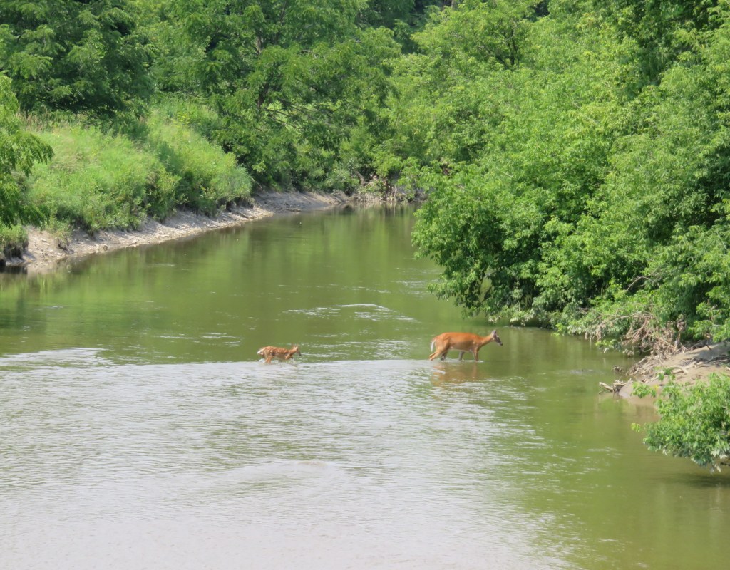
    I often see wildlife when I ride outside Toronto, but I did not expect come so close to it on this trip. But along the Humber River Trail, north of Highway 401 and Albion Road, a youngish deer was wandering down the path, grazing. I stopped my bicycle and just watched, the deer kept coming closer, cautiously walking right past me. Only a few hundred metres north at one of many trail crossings of the river, I spotted a doe and a fawn crossing.

    IMG_4187-002Deer fording the Humber River
    With the completion of the Martin Goodman Trail on Queen’s Quay, it’s almost possible to complete this circle route without riding on city streets. But there are several minor gaps (such as the Lower Humber Trail at Stephen Avenue in Etobicoke) and some very aggravating gaps.

    One of the worst gaps in Toronto’s recreational cycling network is between the Humber River trail and the Finch Hydro trail, where there is simply no safe cycling route to bridge this 3.5 kilometre distance. I survived cycling under Highway 401 on Finch Avenue, but it is not an experience that I advise doing on your own. However, the newly-constructed connection between the Finch corridor and the East Don River trail was seamless and pleasant.  There’s a gap on the East Don trail between Duncan Mill Road and Don Mills, but it is well signed; happily, this will be partially fixed with an extension of the Don Mills trail to York Mills Road.

    The Humber Trail-Finch Hydro Corridor Trail gap in North York

    IMG_6836
    One of the scariest places that I have ever cycled. 

    Happily, these gaps that I mention are on the City of Toronto’s radar. The city is in the process of updating its cycling network plan; city staff, along with consultants IBI group and Vélo Québec, are looking for comments on the new draft cycling project map. There are many other opportunities to improve cycling connections for recreational and utilitarian cycling; I encourage you to have your say.

    Below, a few more photos on my ride around Toronto.

  • Mapping the City’s Bike Network Gaps

    Bike-Routes-WO-GapsToronto’s Bikeway Network, as of January, 2015
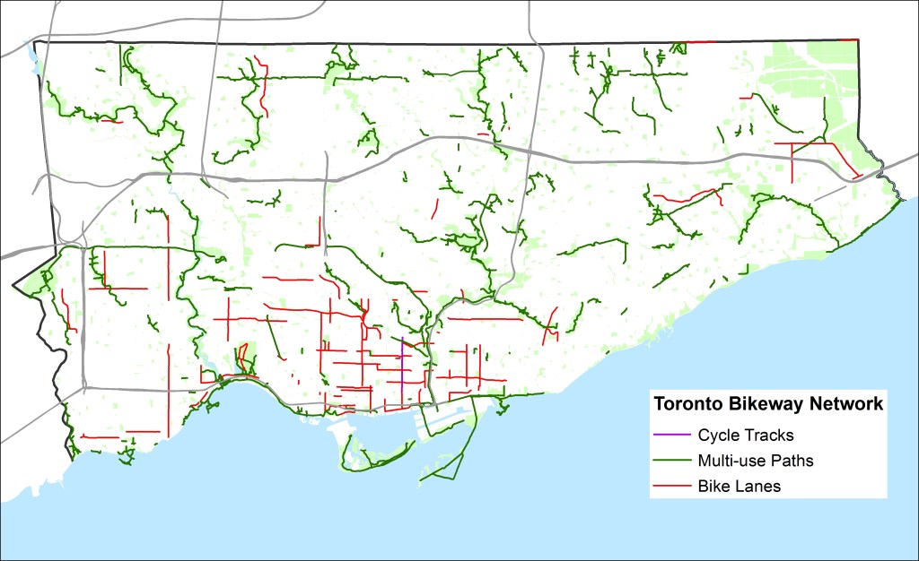
    Over at Torontoist, I posted a short article about the gaps in Toronto’s cycling infrastructure. You can read it here. What follows is a quick summary and some more thoughts (and another map, showing the bikeway network without the sharrows and signed routes without bike infrastructure).

    Toronto’s bikeway network is composed of multi-use paths (off road trails in parks and ravines, shared with pedestrians), cycle tracks (separated bike lanes like those on Sherbourne), bike lanes and contra-flow bike lanes (painted bike lanes without separation; I don’t consider the flex-posts on Adelaide, Richmond and Wellesley to be proper separations — see this Metro Toronto article about a garbage truck entering the bike lane and destroying these flimsy plastic markers). The city also considers other signed bike routes (usually quiet residential and collector streets without heavy traffic) and sharrows to be part of its bikeway network, but I don’t.

    Bike Routes - WO Gaps, sharrowsToronto’s Bikeway Network, as of January, 2015, with the sharrows and signed routes removed
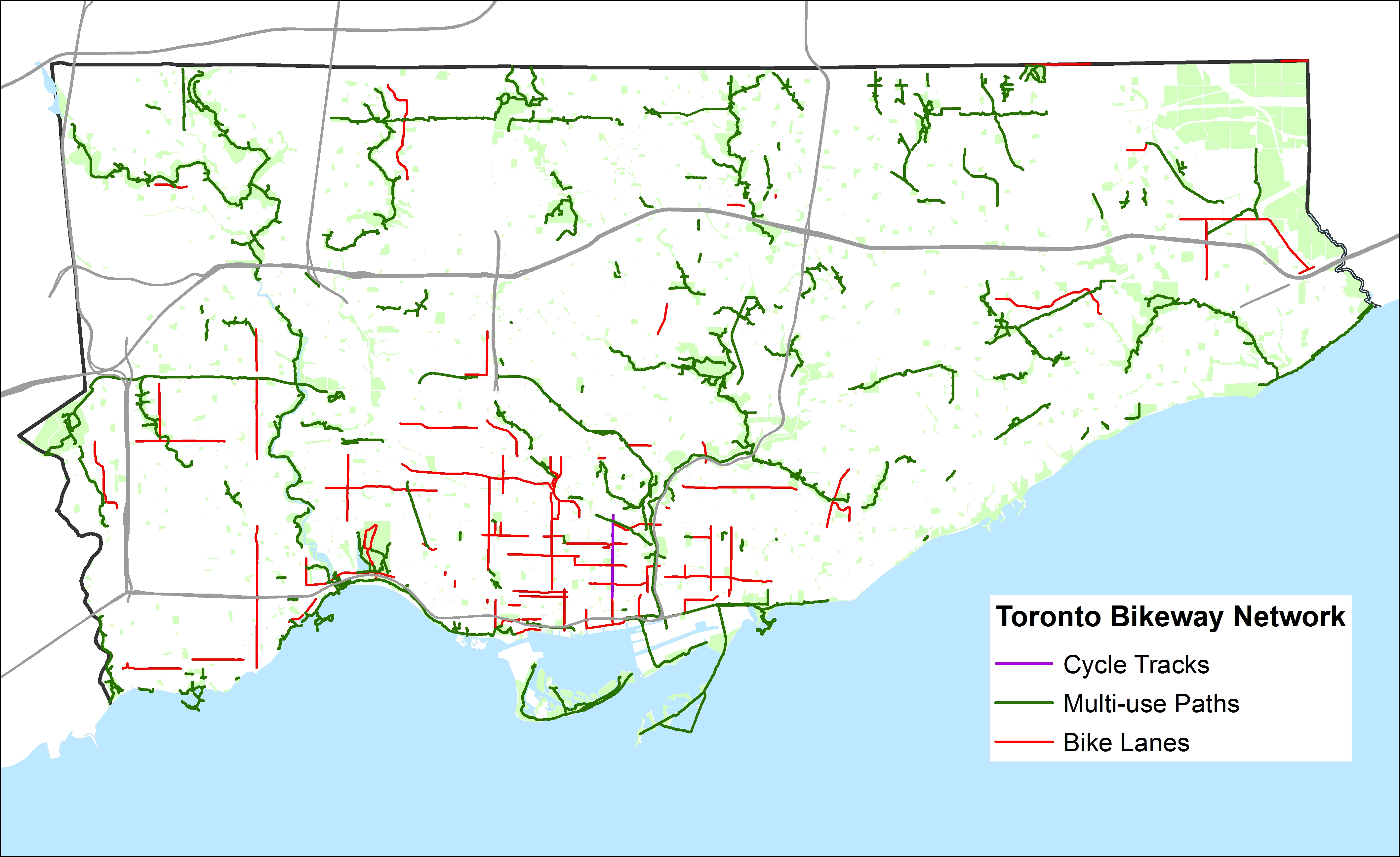
    When the sharrows and signed routes are eliminated, Toronto’s bikeway network looks very thin, especially outside the downtown core. Furthermore, most multi-use trails (shown in green) are not cleared in the winter (the Martin Goodman Trail the only exception) and many are unlit; they are not the safest options for women or vulnerable users.

    Below, I show some of the gaps in the existing network; where bike lanes and multi-use trails should be connected to create at least a complete network of bike-friendly routes across the city. Several circle routes are slowly coming together (via the Humber, Don, Rouge, Highland Creek and east-west hydro corridors) but there are many gaps that need to be closed to complete these circuits. The Waterfront trail is a disconnected labyrinth in Scarborough; I’d like to see a new multi-use trail beneath the beautiful Scarborough Bluffs to connect the trail to the parks below otherwise isolated and inaccessible without a car.

    The gaps in the existing bikeway network show the shortcomings in cycling infrastructure to support a minimum grid of safe bike routes in the suburbs, which would be mostly built on city streets, not in ravines or hydro corridors. Note that there are only three designated places to cross Highway 401, which is a much greater barrier to more Torontonians than the Gardiner Expressway is downtown.

    For his part, during the 2014 campaign John Tory said that he would support bike lanes where it was “sensible.” But he did not define what that meant or provide a timeline for specific goals. Given the number of bike-unfriendly councillors returned to city hall; one of whom is now John Tory’s deputy mayor, I don’t have too much confidence in seeing much more than a few downtown projects and more multi-use trails constructed in the next four years.

    Bike-Routes-Gaps
    Some of the many gaps in the existing bikeway network