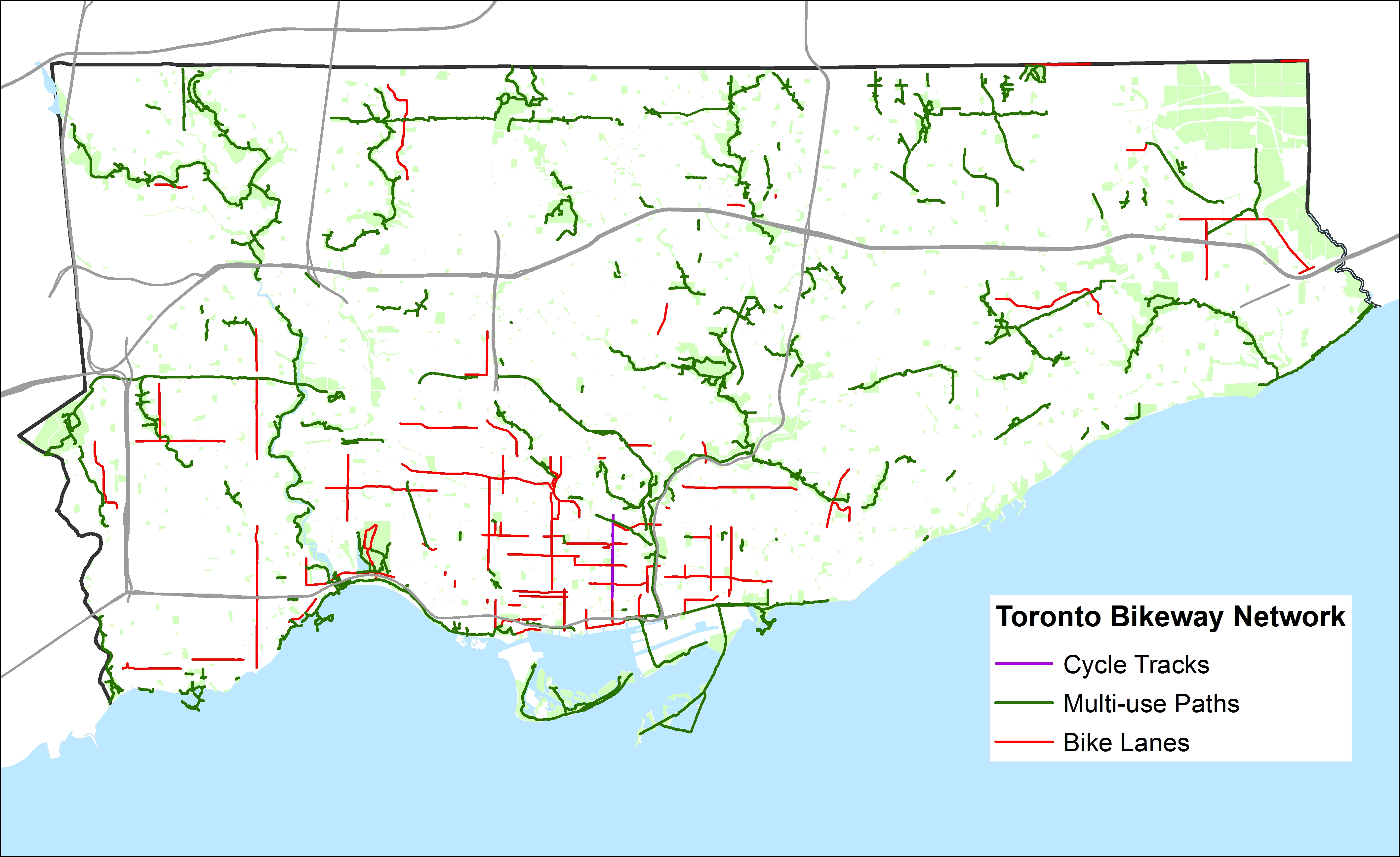
 Toronto’s Bikeway Network, as of January, 2015
Over at Torontoist, I posted a short article about the gaps in Toronto’s cycling infrastructure. You can read it here. What follows is a quick summary and some more thoughts (and another map, showing the bikeway network without the sharrows and signed routes without bike infrastructure).
Toronto’s bikeway network is composed of multi-use paths (off road trails in parks and ravines, shared with pedestrians), cycle tracks (separated bike lanes like those on Sherbourne), bike lanes and contra-flow bike lanes (painted bike lanes without separation; I don’t consider the flex-posts on Adelaide, Richmond and Wellesley to be proper separations — see this Metro Toronto article about a garbage truck entering the bike lane and destroying these flimsy plastic markers). The city also considers other signed bike routes (usually quiet residential and collector streets without heavy traffic) and sharrows to be part of its bikeway network, but I don’t.
 Toronto’s Bikeway Network, as of January, 2015, with the sharrows and signed routes removed
When the sharrows and signed routes are eliminated, Toronto’s bikeway network looks very thin, especially outside the downtown core. Furthermore, most multi-use trails (shown in green) are not cleared in the winter (the Martin Goodman Trail the only exception) and many are unlit; they are not the safest options for women or vulnerable users.
Below, I show some of the gaps in the existing network; where bike lanes and multi-use trails should be connected to create at least a complete network of bike-friendly routes across the city. Several circle routes are slowly coming together (via the Humber, Don, Rouge, Highland Creek and east-west hydro corridors) but there are many gaps that need to be closed to complete these circuits. The Waterfront trail is a disconnected labyrinth in Scarborough; I’d like to see a new multi-use trail beneath the beautiful Scarborough Bluffs to connect the trail to the parks below otherwise isolated and inaccessible without a car.
The gaps in the existing bikeway network show the shortcomings in cycling infrastructure to support a minimum grid of safe bike routes in the suburbs, which would be mostly built on city streets, not in ravines or hydro corridors. Note that there are only three designated places to cross Highway 401, which is a much greater barrier to more Torontonians than the Gardiner Expressway is downtown.
For his part, during the 2014 campaign John Tory said that he would support bike lanes where it was “sensible.” But he did not define what that meant or provide a timeline for specific goals. Given the number of bike-unfriendly councillors returned to city hall; one of whom is now John Tory’s deputy mayor, I don’t have too much confidence in seeing much more than a few downtown projects and more multi-use trails constructed in the next four years.

Leave a comment