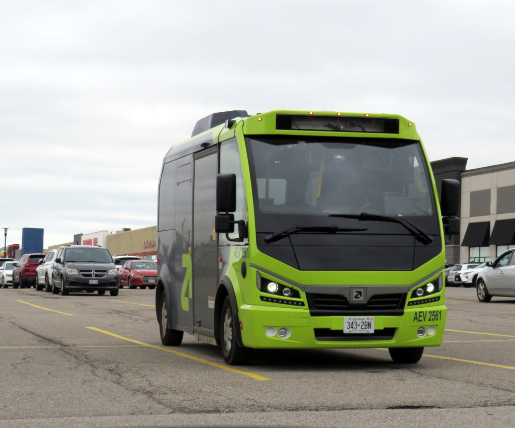
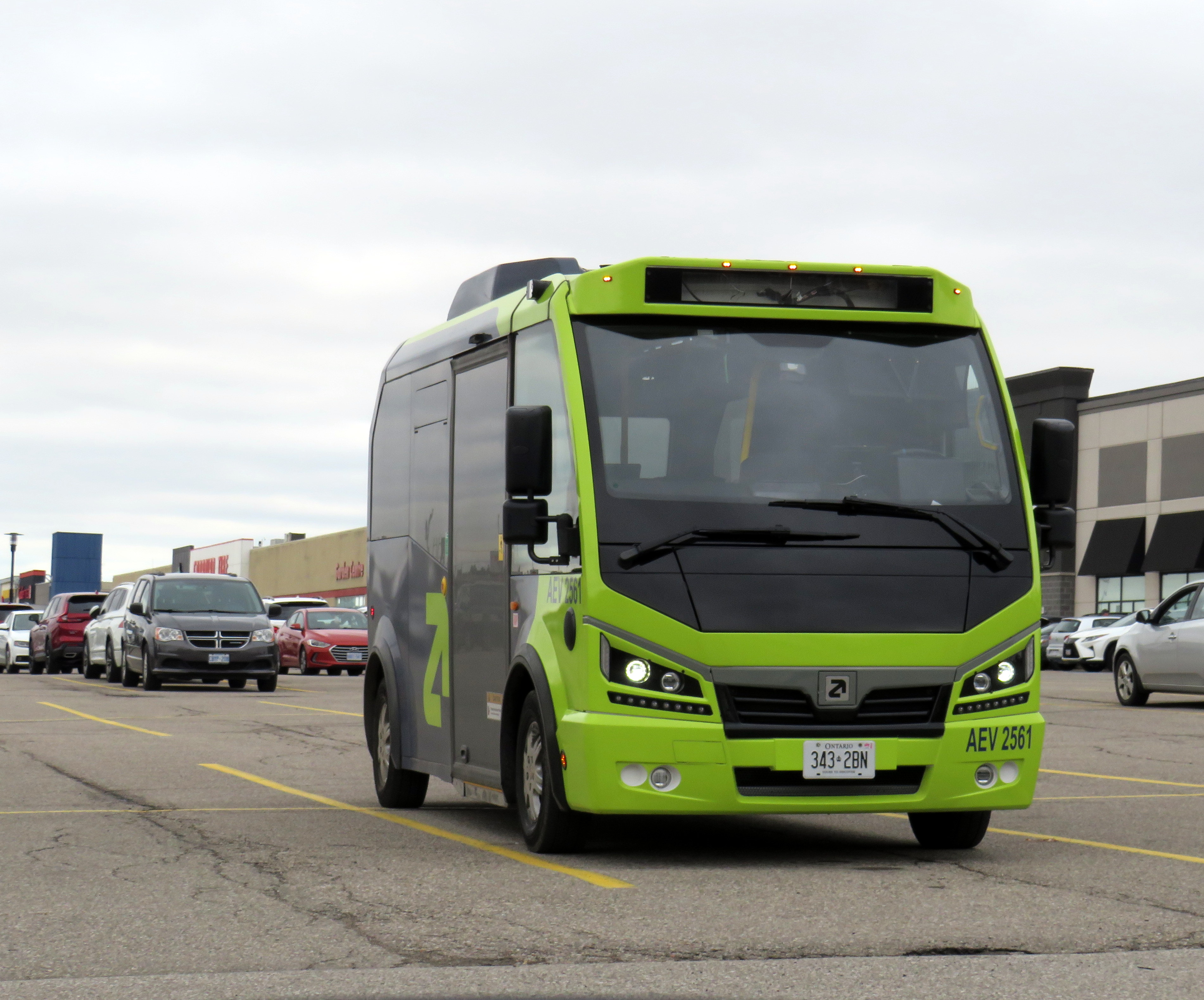
An Argo minibus lays over at Shoppers World Brampton
In an interesting staff report presented to Caledon Town Council, that municipality is planning to enter into a 15-month On-Demand Micro-Transit Pilot Agreement with Argo Transit, a Brampton-based provider of electric minibus services. This new on-demand transit service would replace most of the contracted Brampton Transit services in the Town of Caledon, including Routes 41, which serves Bolton, and 81, which runs along Kennedy Road north of Mayfield Road. Extensions of Route 30 Airport Road and 18 Dixie would continue under Brampton Transit, as they are limited-service extensions directly serving specific employers.
Argo already provides on-demand service in Bradford-West Gwillimbury, replacing a fixed-route service there last year It also operates a supplemental door-to-door on-demand service in central Brampton on top of the fixed route Brampton Transit service. In Brampton, and as expected in Caledon, the same fares at Brampton’s regular service are charged, paid through a Presto card or app.
The benefits for Caledon include new service to and within Caledon East, which is currently without transit, as well as midday, early evening, and weekend service not currently provided through Caledon’s contract with Brampton Transit. The proposed service times will be Monday to Friday from 5:30 AM to 8:00 PM, and Saturday and Sunday from 7:00 AM to 7:00 PM. If implemented, Argo service would begin October 1, 2026.
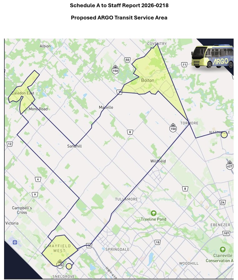
The map, included as an appendix to the staff report, shows connections to Brampton Transit on Mayfield Road and to York Region Transit in Kleinburg.
Map of proposed Argo service areas in Caledon, with connecting links.
There are some questions that should be addressed before October. Currently, Route 41 provides service to employment areas in south Bolton and provides connections to several Brampton Transit and YRT routes at Highway 50 and Queen Street, with easy transfers to the TTC subway in Vaughan and Humber College in Etobicoke. Would Brampton maintain a shortened route to Mayfield Road and Highway 50 that could make this link? Would transfers be permitted to other Brampton Transit routes along Mayfield Road, including Routes 15, 18, and 30, or would stops outside the on-demand areas be restricted to those in the map?
For Caledon, on-demand transit looks like an attractive option to replace Brampton Transit-contracted routes with low ridership and limited service hours. For it to succeed — and even build ridership for new fixed-route service in the future — connections to other transit will be necessary.
Despite population growth, Brampton Transit ridership is in decline
Meanwhile, Brampton Transit, after several years of dramatic ridership growth after the end of COVID-19 restrictions, is cutting back as ridership has taken a sudden dip in 2025-2026. Four minor routes — 33 Peter Robertson, 36 Gardenbrooke, 55 Elbern Markell and 56 Kingknoll — will be discontinued. These four neighbourbood routes provide local service in areas where other routes are within walking distance or operate in the opposite direction, so the effects are minor and the cuts justifiable if it keeps service going elsewhere.
However, Route 5 Bovaird, a major local route between Westwood Mall and Mount Pleasant GO Station, will see significant cuts: in the weekday peak from 13 minutes to 20 minutes and evenings from 30 to 40 minutes, and weekend evenings from every 30 to 50 minutes. The 505 Zum route that parallels the 5 does not operate weekend evenings, resulting in very poor service along the Bovaird corridor during those times.
This is a disappointing setback for transit in my hometown, which up to now has been a model for promoting ridership growth in a suburban edge city. For years, I have wrote about its success in growing demand by operating good service, especially to destinations well beyond its boundaries to places like York University (later the subway terminal in Vaughan), Mississauga City Centre, Humber College, and Pearson International Airport.
It would be very unfortunate if transit were allowed to enter a “death spiral” of ridership decline, fare hikes, and service cuts in response to this dip, largely due to a decline in international student enrollment at colleges and universities. Brampton has shown before that good service, with incremental growth is a great way of boosting ridership. This means operating buses at least every 20-30 minutes at all times on major corridors like Bovaird.
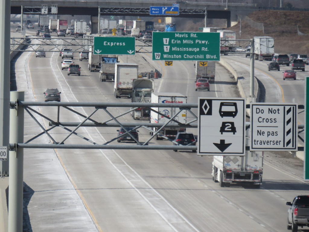
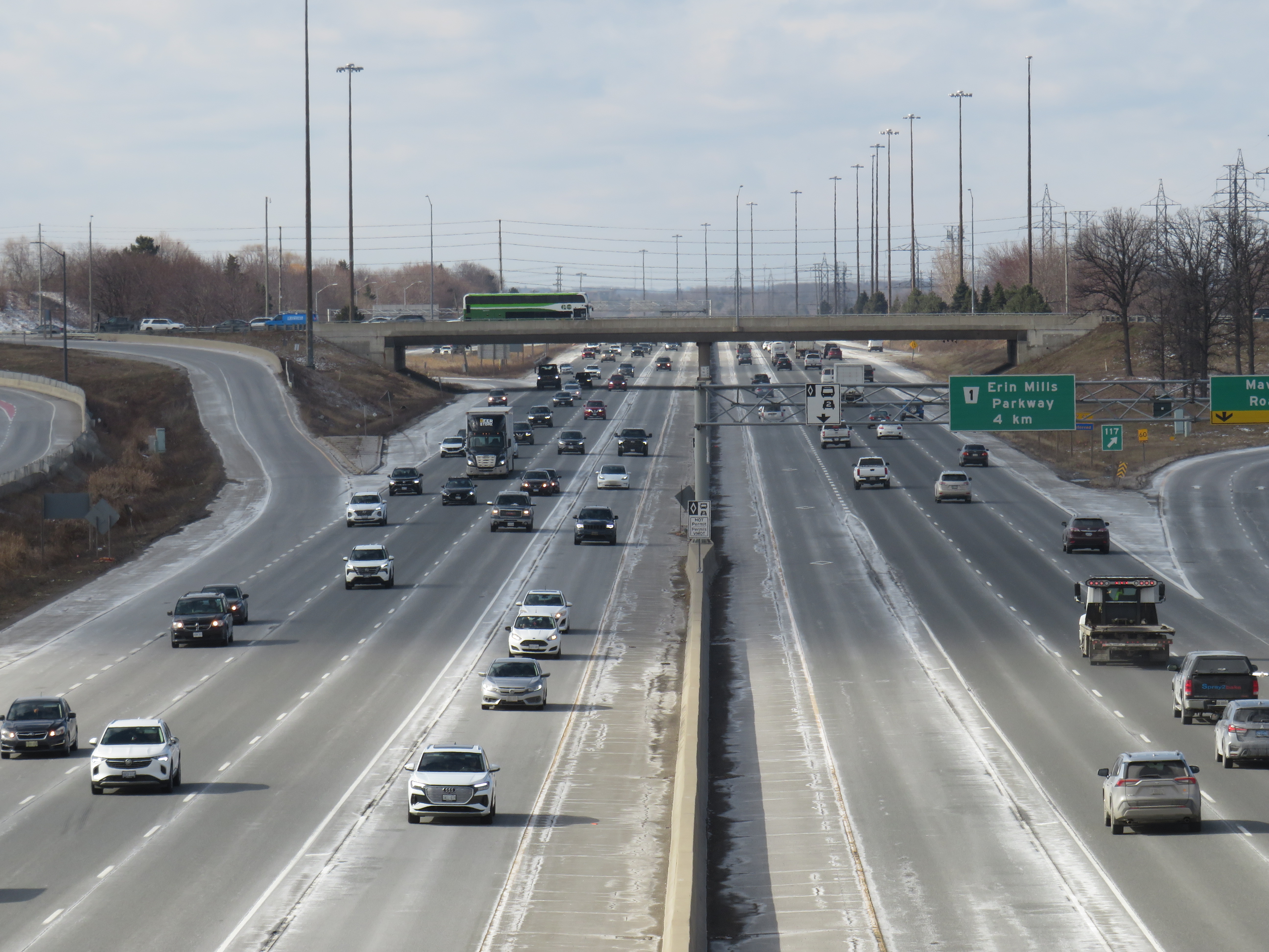
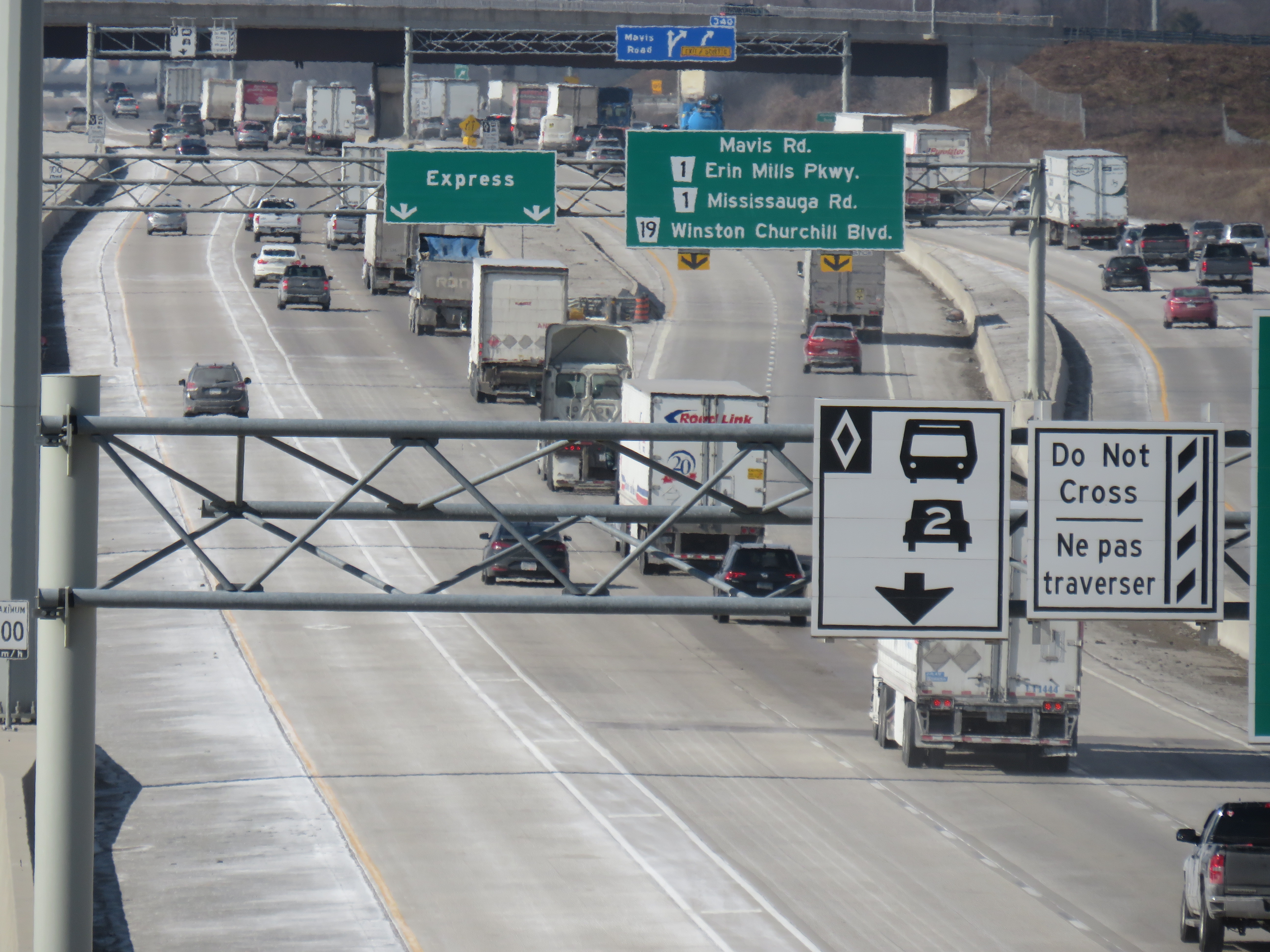
Highway 403 in Mississauga, with HOV lanes in the centre
In the last year, making the occasional car trip to visit family in Northeastern Ontario or just to get out of the city for a day or two, I kept wondering what the point of those new high occupancy vehicle (HOV) lanes were on the Queen Elizabeth Way, Highway 400, or Highway 401. At first, they seemed like a real time saver for anyone riding on a transit bus or driving with a few family members, friends, or carpool colleagues in the car. As time went on, with new exceptions, minimal or no police enforcement, and increasingly aggressive driving post-pandemic, one is left wondering why the province even bothers adding them to more highways.
Now, amongst a flood of moves and musings by our oft-Trumpian premier, it appears that the province has given up on even the veneer of sustainability with these highway widenings throughout the Greater Golden Horseshoe and Ottawa regions. On Tuesday, March 17 — St. Patrick’s Day — Transportation Minister Prabmeet Sarkaria announced a proposed regulatory amendment that would allow all cars and light trucks in the HOV lanes, during off-peak periods. The change would “help keep drivers moving across the province, so they can spend less time in traffic and more time with their families and friends.”
This announcement is part of a stream of messages from Doug Ford and his government clearly seeking the attention of the news media and the public. The week prior, Ford was talking about expanding the Toronto Island airport, even seizing control of the City of Toronto’s interest to ensure that jets could land on the waterfront. Before that, Ford mused about a new convention centre built on Lake Ontario near Exhibition Place. This week, Ford was on a law-and-order kick, attacking a fair and impartial judiciary, promoting the idea of “Bail TV,” and praising a homeowner that shot an intruder during a home invasion. Maybe this is to distract from scandal and a new proposed law to shield the premier, ministers, and staff from journalists using freedom of information requests to keep the government accountable.
The legislative assembly will finally reconvene next week, starting Monday, March 23, after a 14-week break.
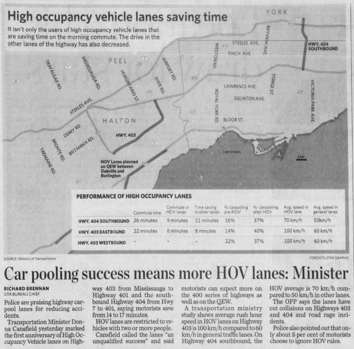
The first HOV lanes were introduced on Highway 403 through Mississauga and on Highway 404 southbound from Highway 7 to Highway 401/Don Valley Parkway in 2005. A year later, the HOV lanes were touted as an “unqualified success,” with the minister of transportation at the time, Liberal Donna Cansfield, promising more reserved lanes to follow, with the QEW through Oakville and Burlington to be the next implementation. With the Ontario Provincial Police (OPP) conducting active enforcement on those two sections, they found that only 5 percent of motorists in the HOV lanes were violating the law.
GO Transit was an especially keen user of the new HOV lanes. In 2005, only the Lakeshore Line had regular off-peak train service, and buses filled in the gaps in between. The 404 lanes saved valuable minutes for buses on the 70/71 Stouffville Line route between Union Station and Markham; the City of Toronto designated sections of the inner paved median on the DVP as well for GO buses that could be used to bypass traffic congestion.
Clip from the Toronto Star on Thursday, Dec 14, 2006
At the time, the HOV lanes saved carpoolers and transit riders up to 17 minutes on the initial segments on Highways 403 and 404. The additional capacity created with the new lane (no existing lanes were to be converted to HOV-only under provincial policy) also led to time savings for all drivers, at least in the short term. Increased traffic caused by suburban growth and induced demand eventually negated those time savings for general traffic.
HOV lanes were included in more highway expansion projects. The QEW HOV lanes through Oakville and Burlington were added in 2011. Lanes on Highways 400, 410, and 427 and Highway 417 in Ottawa followed, and when Highway 401’s express/collector system was expanded through western Mississauga and Milton, HOV lanes were part of that too.
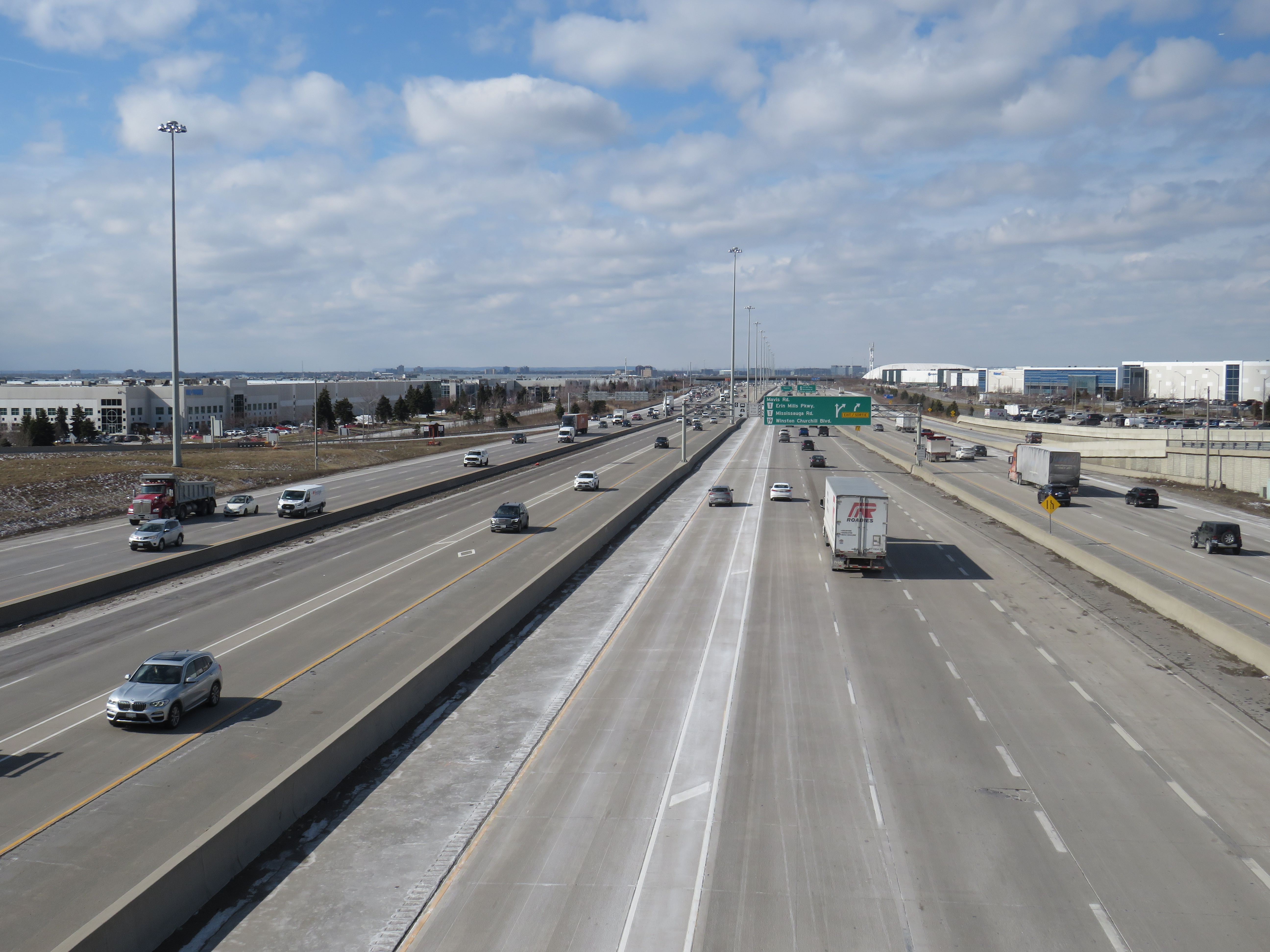
“One more lane should do it,” Highway 401 in Mississauga, with HOV lanes in the middle of a recently widened highway
Regulations on the use of HOV lanes were relaxed over the years too. Motorcyclists were permitted, as were any vehicle with a “green” license plate (available to any battery-electric or plug-in hybrid car, SUV, or light truck). HOT permits were also added, for anyone willing to pay and enter a lottery for the right to use the lanes while driving alone. Taxis and airport limos were also allowed, even when not carrying a passenger.
Poor driving habits, which seemed to have gotten worse since the COVID-19 pandemic, have made a mockery of the initial intentions of the HOV lanes. Without enforcement, the HOV lanes are essentially treated by some drivers as fast lanes, with sudden swerving in and out despite double solid lines and “Do Not Cross” signs consistently posted along the highway, intended to reduce weaving. Solo drivers regularly use the lanes without consequence to get around slower drivers or trucks.
Despite “Do Not Cross” signs, and a double solid line between the HOV lane and general traffic, this regulation is regularly ignored
For now, we do not know what “off-peak hours” would mean when the provincial government finally legalizes another bit of the selfish and aggressive driving behaviour the rest of us have sadly gotten accustomed to. The QEW is frequently jammed most weekends between May and October, when families and tourists travel between Toronto, Hamilton, and Niagara. Highway 400 is notorious on Friday evenings and Sunday afternoons during Cottage Country commutes.
This is yet another motorist-friendly move by this government eager to hold onto seats in suburban ridings and please its wealthy backers, along with permanent gas tax breaks, abandonment of license plate renewal fees, the prohibition on speed enforcement cameras, and the construction of destructive new highways like the 413. But at least this latest move is an acknowledgement of something I have felt for years about the HOV lanes in Ontario: a simple greenwashing of highway expansion, making us feel better about laying more concrete and asphalt.
In 1998, the new City of Toronto was created when the Progressive Conservative government led by Mike Harris forced the merger of Metropolitan Toronto and its six constituent cities and borough. Dubbed the Megacity, it was part of a new round of municipal restructurings that affected much of the province, with Hamilton and Ottawa getting the same treatment three years later. Making less news in 1998 was the abolition of Kent County and the amalgamation of all 21 of its towns, villages and townships with the City of Chatham, creating the new municipality of Chatham-Kent.
Over 25 years later, there are challenges remaining from amalgamation. The new, larger municipality must administer a large mostly rural area but where nearly half the population lives in just one urban centre. But there are benefits, such as a consolidated library system that provides rural residents with more materials and services. Importantly too, is that Chatham-Kent was one of the first municipalities to introduce a rural transit service to connect outlying communities with the city centre, expanding the reach of Chatham’s existing urban bus system.
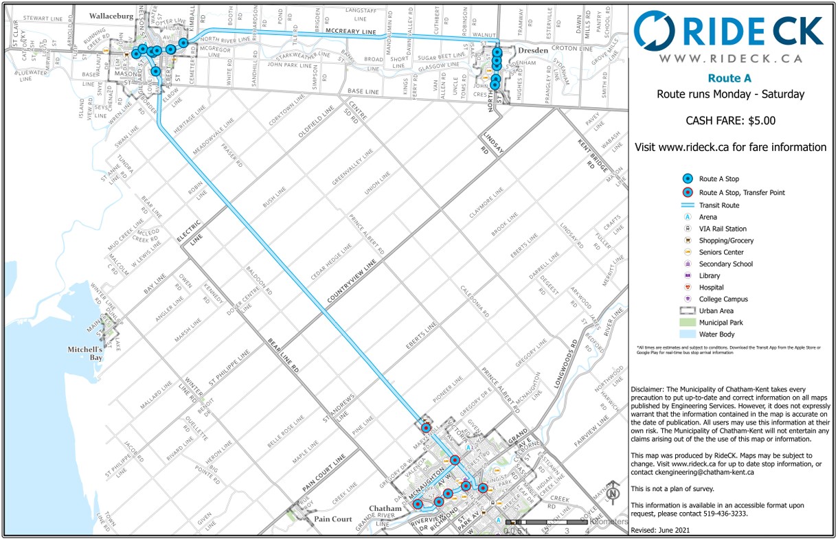
Three Ride CK routes — A, C, and D — extend from the bus terminal in Downtown Chatham to Wallaceburg (the second-largest community in Chatham-Kent), Dresden, Blenheim, Ridgetown, and Tilbury, covering most of the former towns that made up Kent County. (A fourth route, B, was proposed to serve Thamesville and Bothwell, but has not been implemented.) There is also a seasonal summer bus that serves the lakeside communities of Erieau and Mitchell’s Bay, echoing the former Chatham, Wallaceburg, and Lake Erie electric interurban service.
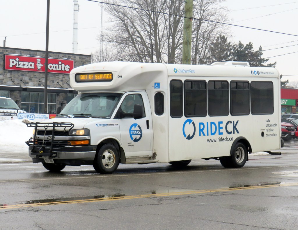
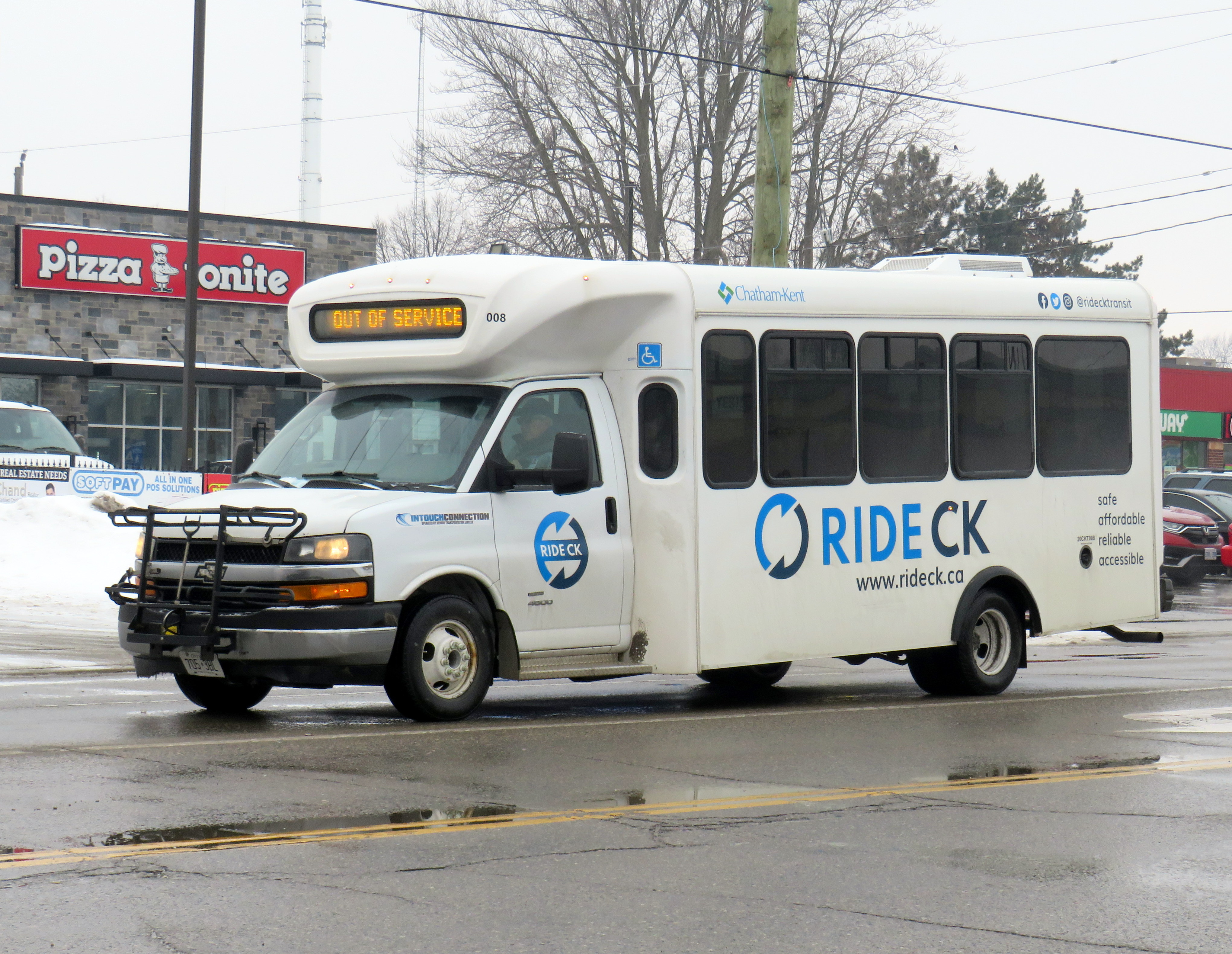
Most RideCK buses — local and intercommunity — are cutaways, meaning that the passenger seating area is in a separately-built body added to a cab and truck chassis. Though these vehicles are popular for paratransit services, low-ridership rural routes, and in smaller communities like Brockville, they do not offer a particularly smooth ride. However, they are an economical option for smaller communities.
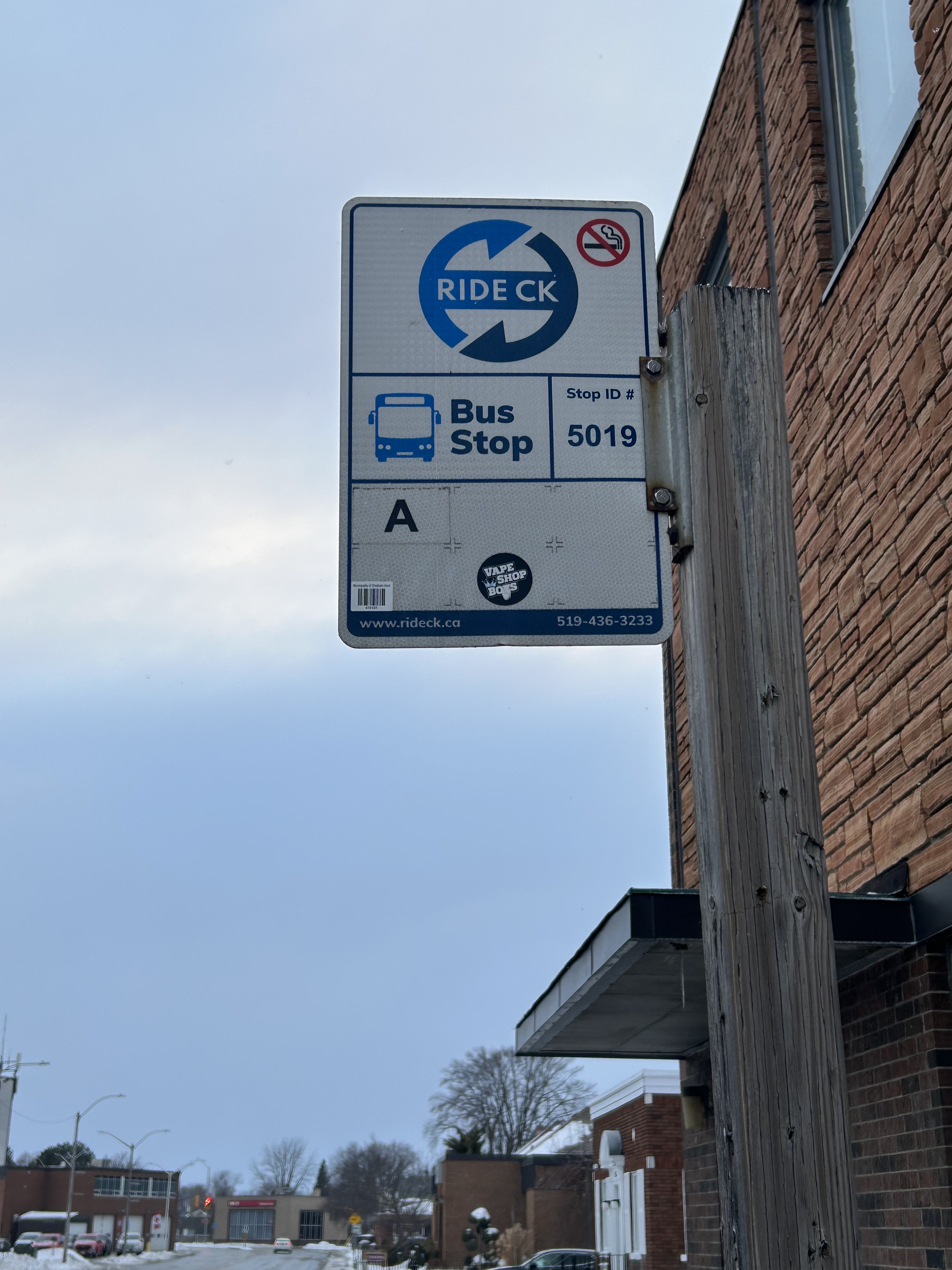
Bus stop in Wallaceburg
Each of the three intercommunity routes operate Monday through Saturday, with two morning and two evening round trips, with an additional midday run that leaves Downtown Chatham at 12:15 PM on weekdays; this additional trip was added several years after service began. There is a timed transfer to the local Chatham routes, allowing for onward connections to shopping, schools, medical services, employment, or social activities. All three rural routes also stop at the hospital in Chatham. The midday trip was added to provide an early return home for anyone taking the bus from outlying areas, such as for a medical appointment, and not then stuck waiting an entire day in Chatham.
I rode RideCK between Chatham and Wallaceburg and back in early February 2026; the midday 12:15 departure had decent ridership with six other passengers leaving the bus terminal (a seventh got on at the big box retail cluster north of Chatham’s urban area); there were five other passengers on the way back south on the first evening bus (5:45 PM leaving Chatham). Given that Chatham-Kent has maintained the service for so long is indicative of how the rural buses are seen as a necessity in the municipality. In Wallaceburg, on-demand local transit is also available, a recent improvement by the municipality.
Intercommunity routes have a flat cash fare of $5.25 (though online materials still show the older $5 fare), though transfers to local transit are provided.
Ride CK Route A between Chatham, Wallaceburg, and Dresden
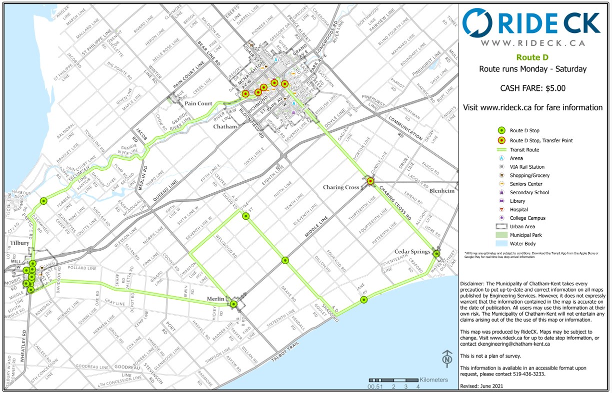
Though Routes A and C are fairly direct, Route D involves a long one-way loop to serve several small communities (including Cedar Springs, Buxton, and Merlin) before continuing to the former town of Tilbury and then back to Chatham. The route passes near, but does not stop at, Pain Court, and completely misses Wheatley.
The circuitous Ride CK Route D making a one-way loop through Cedar Springs and Tilbury
Though Chatham-Kent should be commended on identifying the need for rural transit and maintaining it for over two decades, it still demonstrates the challenges and gaps of operating a municipally provided rural transit service. Ideally, Chatham-Kent would be able to partner with neighbouring Lambton and Essex Counties to provide direct service to more communities. Tilbury should be part of an east-west service between Chatham and Windsor along the Highway 2 corridor, serving towns along Lake St. Clair such as Belle River. That would open connections to the University of Windsor and the main St. Clair College campus, along with other destinations, while improving service to Tilbury.
Route D, then, could be straightened and routed to serve Wheatley, even continuing west to make a connection to Leamington (which sadly, is losing its bus service to Windsor). With good scheduling, such connections could allow passengers to continue on VIA Rail service to London and Toronto.
Ontario needs a province-wide rural transit strategy with long-term funding and strong incentives to get reluctant municipalities (such as Halidmand County) on board. Until then, it is up to each local area to determine what, if any, transit service could look like, and up to residents to demand — and make use — of these services.
Unfortunately, the costs of maintaining this website and the ArcGIS Online portal to my maps continue to rise, especially as the amount of information provided and the number of views grow. If you enjoy my work and find the maps useful, please consider buying me a coffee to help with those costs. Thank you!
December 7, 2025 may be a day that will live in transit infamy. That was the day Line 6, the Finch West LRT, opened to the public, and it did not go well.
First off, any discussion on the initial failure of Line 6 should acknowledge that was never designed to be a rapid, regional transit link. The LRT, serving Northwestern Toronto, was intended to be an upgrade to the slow, congested, and busy 36 Finch West bus, feeding into the rapid transit network at Finch West Station. Line 6 is a legacy of Transit City, a LRT plan proposed under previous mayor David Miller intended to connect the inner suburbs of Etobicoke, North York, and Scarbrorough to the subway and to each other.
As with all proposed Transit City routes (with the exception of the tunneled central section of the Eglinton-Crosstown LRT), there were always going to be compromises on Finch that would not make it a true rapid transit service. Situated almost entirely on the surface, Line 6 trains are easier for residents to access than subways in deep tunnels; closer stop spacing was intended so the new transit line continues to serve the needs of those who live, work, go to school, and frequent the corridor, without the necessity of a parallel local bus. Anyone expecting subway speeds were in for disappointment.
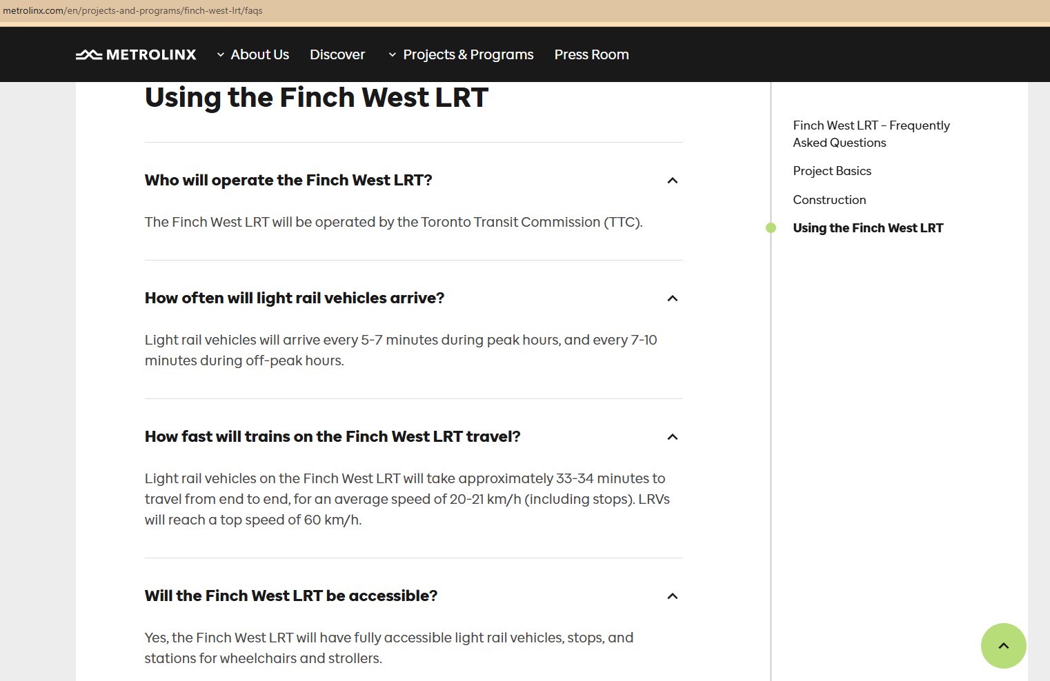
Still, the LRT was supposed to improve travel times over the existing bus, with wider stop spacing than the legacy streetcar network, a congestion-free right of way, signal priority, and decent operating speeds. With a promised average speed of 20-21 kilometres per hour, a total trip time of 33-34 minutes each way, it would have been a bit faster, more comfortable, and certainly more reliable than the bus. It was never going to be as fast as a subway, but for Finch Avenue West, that was okay.
Screen capture of a Metrolinx FAQ webpage, with frequent and relatively speedy transit service promised for the Finch West LRT. The webpage was still up as of December 18, 2025.
As the first modern LRT to open in the Greater Toronto and Hamilton Area (GTHA), Line 6 was to be a preview of additional lines planned and under construction elsewhere in the Golden Horseshoe, including the yet-to-open Line 5 Crosstown LRT, the Hurontario Line, the Hamilton LRT, and a proposed Line 7 on Eglinton Avenue East towards the University of Toronto Scarborough Campus and Malvern. Delivered by Metrolinx, the provincial transit agency, each line would be constructed and maintained by a P3 consortium, though the Toronto LRTs would be operated by TTC employees.
The hoped-for narrative that the provincial government, Metrolinx, the city of Toronto, and the TTC all touted — a smooth new ride, worthy of including on the subway maps — quickly fell apart on Sunday December 7, though there were plenty of warning signs of slower-than-promised operations.
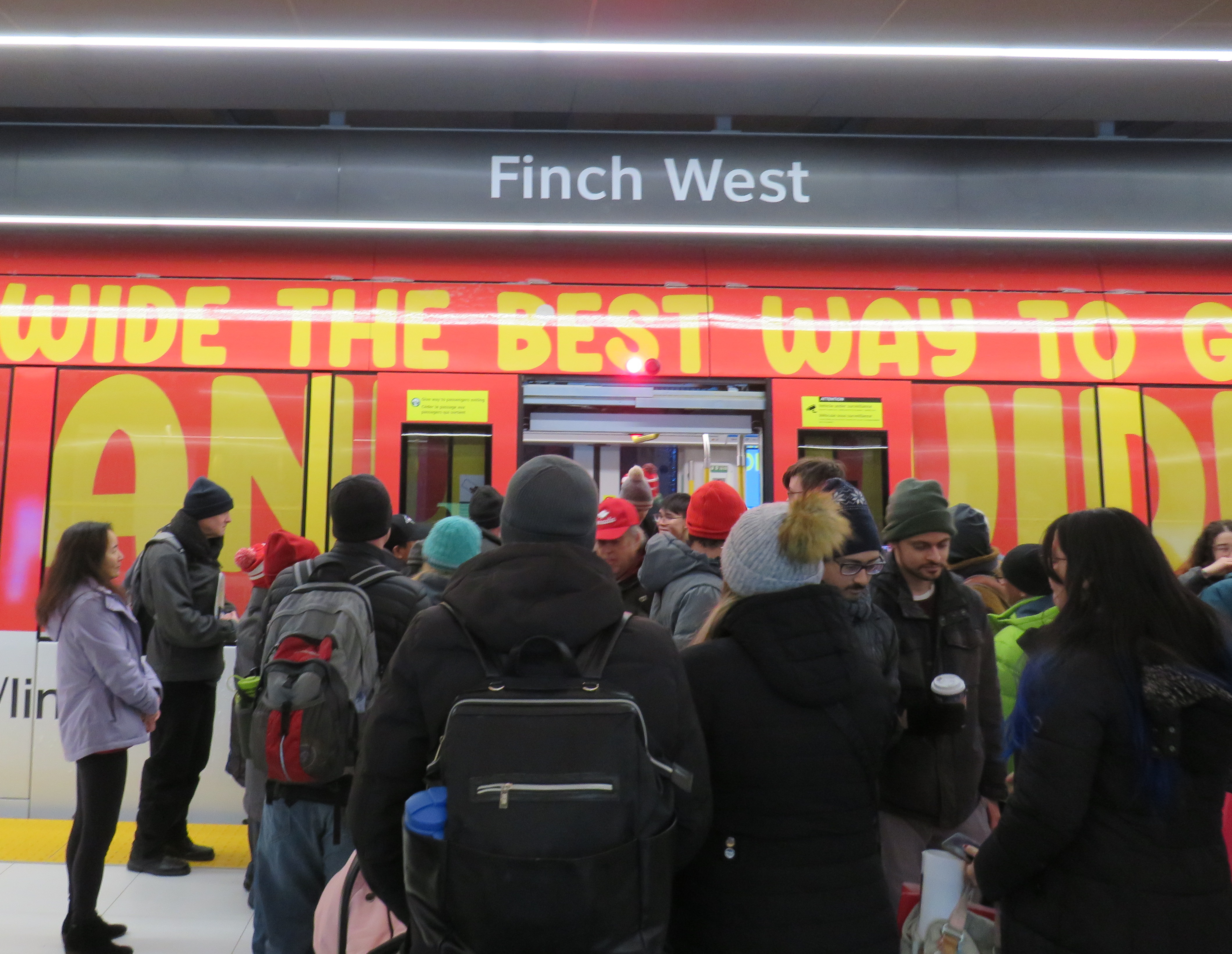
Opening day crowds on December 7. Passengers disembark from a wrapped LRV that touts Line 6 as “far and wide the best way to go far and wide.”
On Sunday, December 7, there were plenty of people eager to try the new LRT: railfans and urbanists, curious families, and local residents, lured by free fares on the opening day. Though I was there and took several trips, I wasn’t going to make too many judgements on opening day. There would be inevitable hiccups with the large crowds and cold, snowy temperatures. Still, there were visible problems.
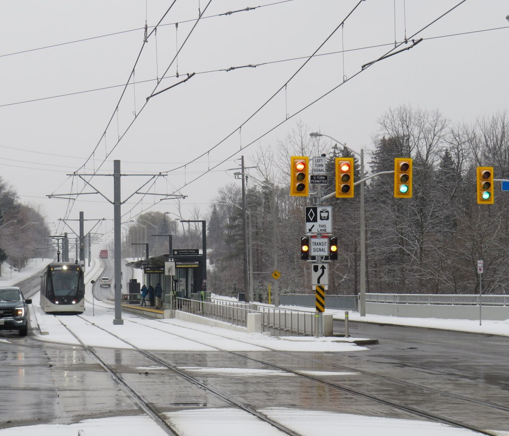
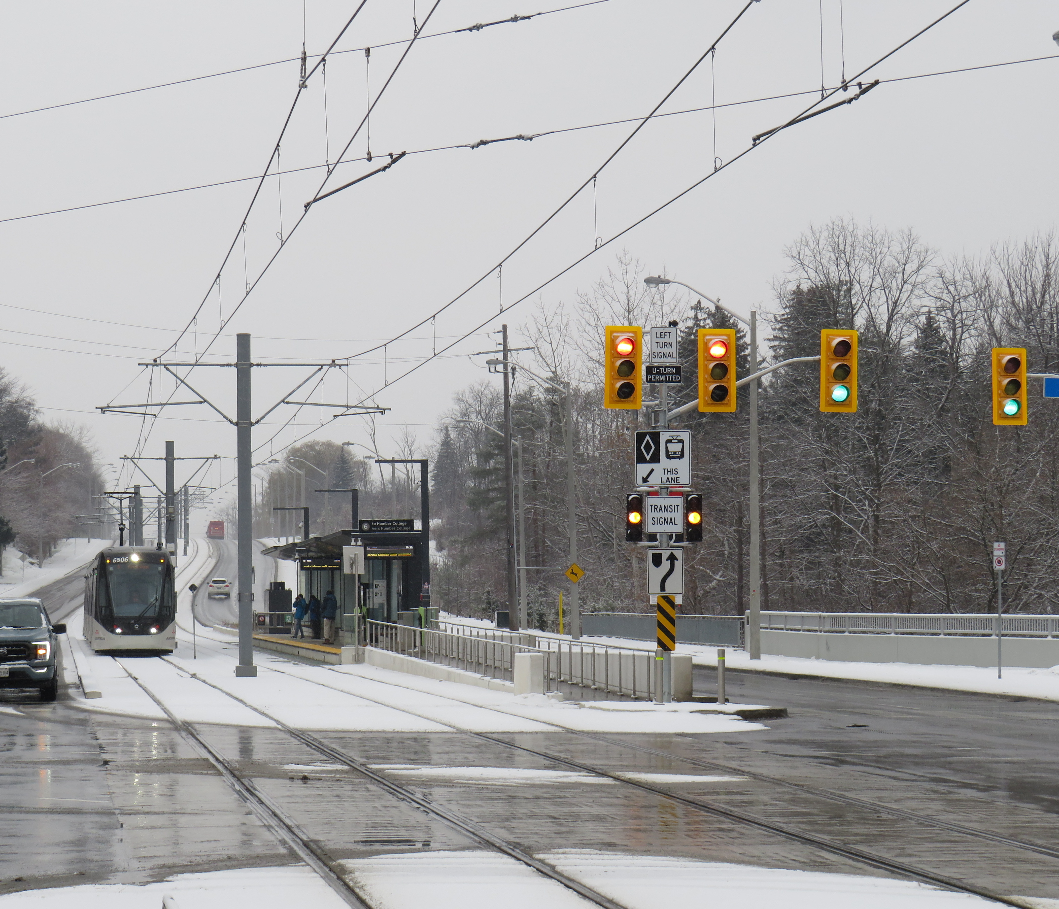
An eastbound LRV approaches Islington Avenue (Mount Olive Station) as the transit signal switches from green to amber. The traffic signals are still green.
So far, a lot of the post-opening discourse has been on operating speeds and traffic operations. Instead of 33-34 minutes, as claimed by Metrolinx, trips were taking 55 minutes each way. Additionally, the transit signal priority (TSP) system has not been activated, causing light rail vehicles (LRVs) to wait entire light cycles, even for private vehicles to turn left before proceeding. The dedicated transit signals turn red about 10-20 seconds before general traffic gets a red light, even as LRVs approach the intersections. On December 16, Toronto City Council approved a motion to implement “more aggressive” TSP on Finch West and the surface portion of the Line 5 Eglinton-Crosstown LRT, as well as on the legacy streetcar network.
The problem on Finch West is not just a matter of transit signal priority. The number of stops along the line, also criticized by several critics, is also not a problem, as Finch West was never intended to be a high-speed regional line. (That said, Mount Olive and nearby Stevenson could have been consolidated into a single stop west of Kipling Avenue.) The other problems are poorly managed schedules and streetcar-style slow zones on a modern LRT alignment.
Right now, LRVs are forced to slow to 25 km/h at all intersections, even though all conflicting traffic has a red light. This is an inexplicable restriction given that motor traffic, including TTC buses, have a 50 km/h limit, and many drivers will proceed at significantly above the posted limit. These restrictions are not found elsewhere in North America; in Calgary and Edmonton, LRTs are protected at many at-grade intersections with railway-style lights and gates. In places like Minneapolis-St. Paul and Phoenix, additional LED flashing signs warn drivers of an approaching LRV, which glides through the signalized intersection at higher speeds than on Finch. (There is also a lot less sign clutter, with intuitive signals for left turns and transit).
Transit schedules are also needlessly padded, with too much time for lower speeds and lengthy station stops. On a repeat visit to Finch West, on Wednesday December 17, 2025, travel times were inconsistent and slower then either 36C bus I took a few days before the LRT opened. (Even the trip with the long Starbucks pitstop.)
Line 6 travel times on Wednesday Dec. 17
Eastbound (read down)
Stop/station
Westbound (read up)
12:59 PM (dep.)
Humber College LRT Station
12:31 PM (arr.)
1:03
Westmore Dr.
12:25
1:05
Martin Grove Rd.
12:22
1:10
Kipling Ave. (Mt. Olive)
12:13
1:14
Islington Ave. (Rowntree Mills)
12:09
1:26
Weston Rd. (Emery)
11:57
1:29
Arrow Rd./Signet Dr.
11:54
1:33
Jane and Finch
11:46
1:37
Tobermory Dr.
11:35
1:45
Sentinel Rd.
11:32
1:48 PM (arr.)
Finch West Stn. (LRT Terminal)
11:27 AM (dep.)
49 minutes
Total time
1 h 4 minutes
It took eleven minutes to go two stops, less than a kilometre, from Tobermory Drive to Jane Street on the westbound trip. Lengthy station dwell times at Tobermory (five minutes) and Mount Olive (three minutes) on that westbound ride, with no onboard announcements was especially frustrating. The return eastbound trip from Humber College was 15 minutes faster, even with much of the same slow zones at intersections and switches, the 10 km/h curve near Humber College Station, and lengthy stops.
With such unpredictable and unreliable service, Line 6 is running at least as badly as the downtown streetcar routes. Without immediate fixes, people will completely lose faith in the TTC and future LRTs, including Eglinton-Crosstown. We can not just rely on tweaks to signal times; we need a complete review and overhaul of streetcar and LRT operating practices.
At least we know what can and should be fixed before the Eglinton-Crosstown line opens, a much longer LRT route that will have a regional transit role.
One more thing…
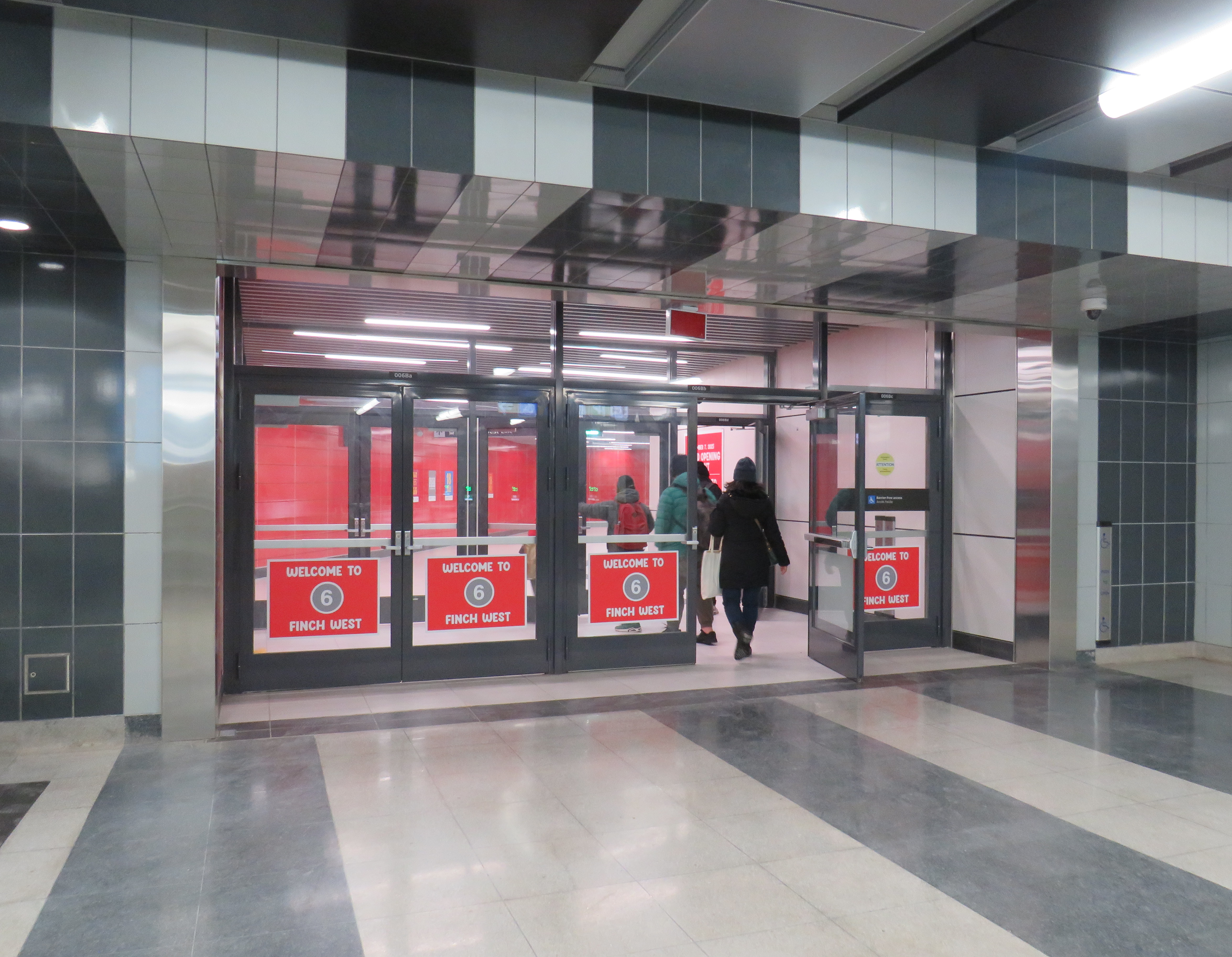
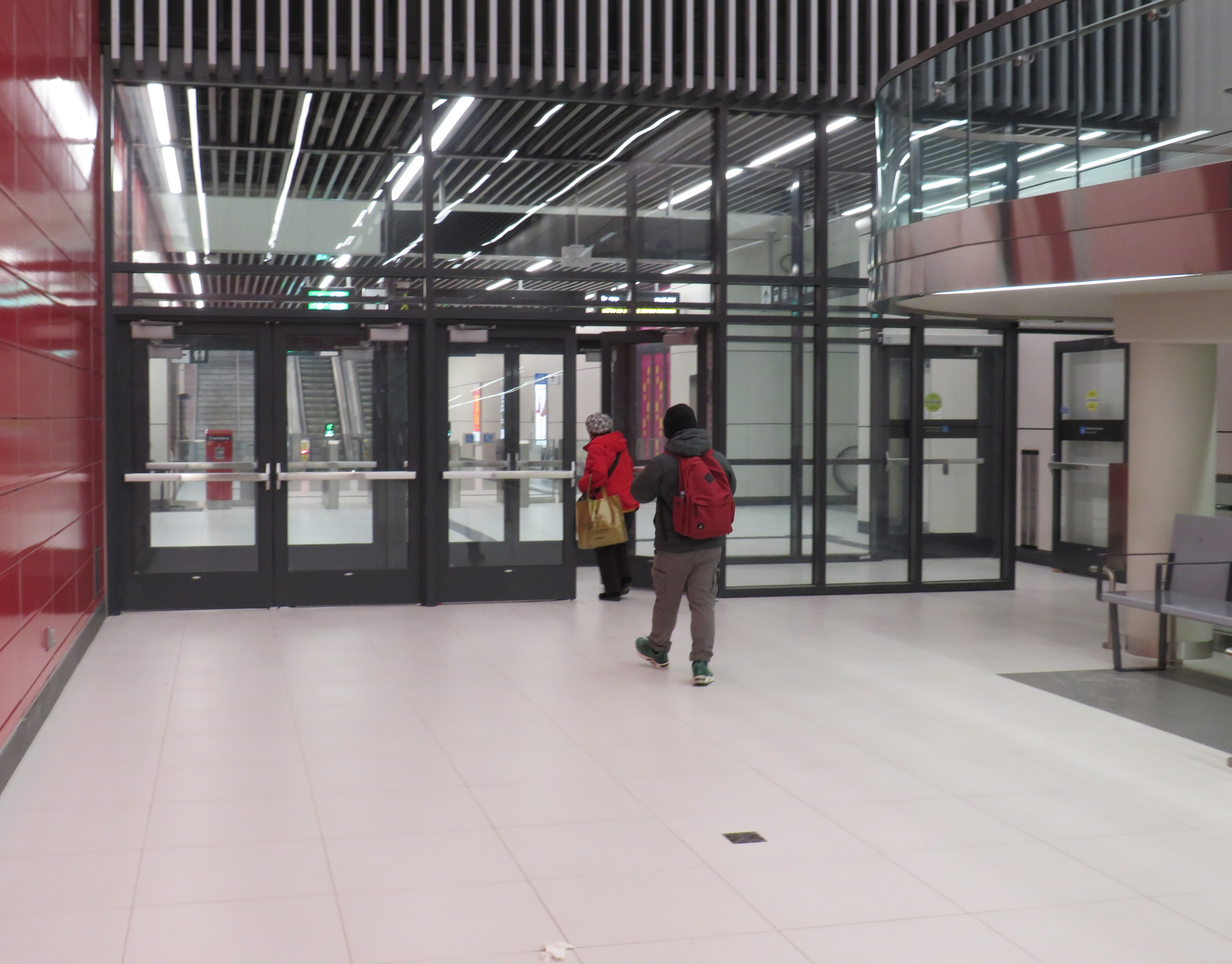
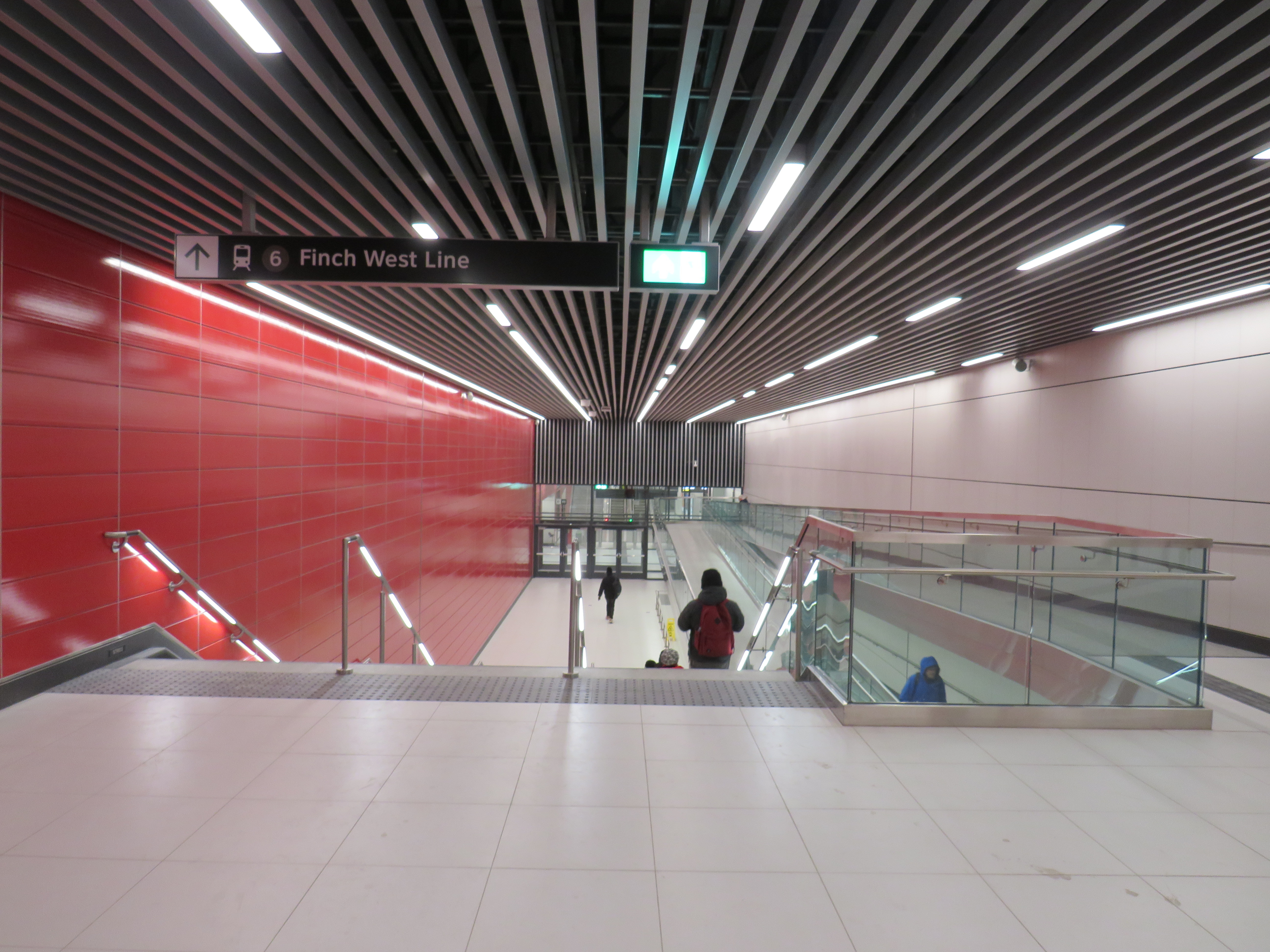
What is with all the doors between the Line 1 subway station and the LRT terminal at Finch West. Passengers have to pass through four sets of doors to transfer between two TTC services, as well as ascend one escalator or elevator, walk down one set of stairs (or navigate a long and circuitous ramp) and then ascend another escalator or elevator to get to the other platform.
Stairs or a long, circuitous ramp between the doors from subway to LRT
Though transfers can be tricky, at the very least, these doorways should be kept open, and shut only during station closures or during fire alarms, as done in hospitals or shopping centres. Other TTC stations have no such barriers between modes or may have a single door to exit a subway station terminal to the bus platform. Automatic sliding doors could have also been an option. Instead, the powered doors are left to one side, with the button against the wall. It’s not an ideal design from an accessibility point of view.
Over the last six years, Greyhound Canada disappeared after years of decline, the COVID-19 pandemic hit with travel restricted, the Ontario provincial government set up one-time funding for intercommunity transport links while deregulating the intercity coach industry, and many municipalities dipped their toes into providing rural transit services.
At the end of 2025, there was some good news to note — several rail transit lines opened in Toronto, Montreal, Ottawa, and Edmonton, while a few new rural services opened in Eastern Ontario. Unfortunately, there were also some major losses in Ontario, particularly in Grey County, Oxford County, Napanee-Deseronto, and the impending cancellation of a major route in Essex County. Unlike in Ontario, however, rural transport links remain stable in Quebec and British Columbia.
Stable funding is essential to keep these intercommunity and intercity links alive, particularly where private operators have not filled a need. For example, Flixbus recently cut back their once-a-day route from Toronto to the Lake Huron coast and will not serve rapidly-growing Saugeen Shores during the colder months. That part of Ontario is left only with a three-days-a-week TOK coach despite potential demand. A well-funded regional transport service coordinated by Grey, Bruce, and other adjacent counties could address this, but there needs to be political will to ensure stable and predictable service needed to grow ridership over the long term.
I just completed a round of edits to my intercity map, noting changes to routes, service levels, and in some cases, stop locations. A few new scheduled air shuttles in Atlantic Canada and Manitoba are included; these types of services are only mapped if they also provide non-airport service or at least connect to urban transport.
There are also more grey lines. Starting with edits in mid 2024, I have chosen to grey out abandoned routes, rather than just eliminating them. It is well worth noting where transport links have disappeared, and where replacement service might be worth planning.
Hopefully 2026 will see better service than the end of 2025.
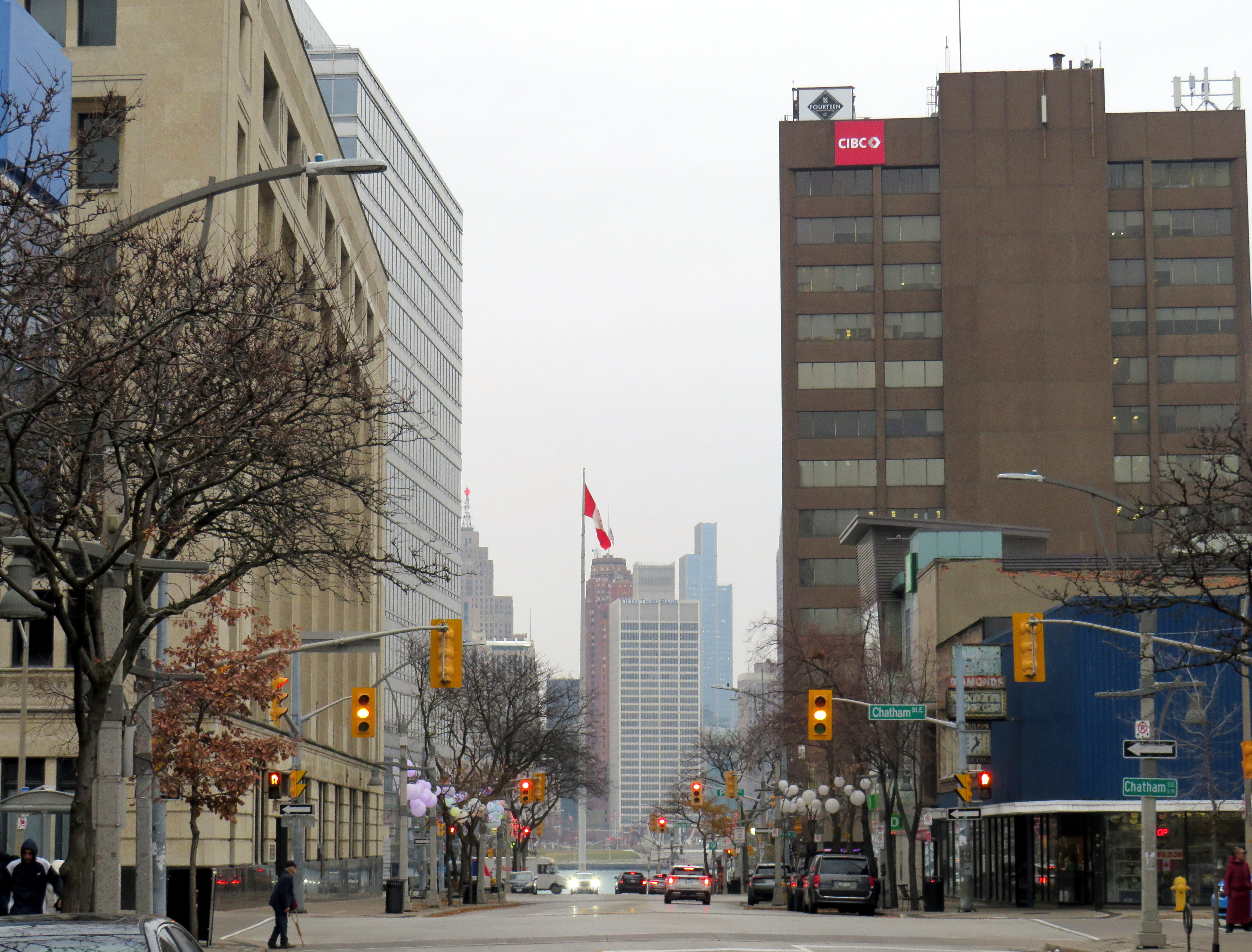
Downtown Detroit, as seen from Downtown Windsor, on a gloomy November morning
Windsor, Ontario, is built on transportation. The city’s position, right across the river from Detroit, has shaped the region ever since French settlers made their home on the wide, short, slow-moving river between Lake Erie and Lake St. Clair. (The river’s name, Detroit, is the French word for strait.) The narrow river made it a hub for shipping and for railways, followed by rail and road tunnels and highway bridges.
As the American auto industry got its start in Detroit, propelling it from a minor regional centre to the fourth-largest city in the United States, Windsor was a natural spot for companies like Ford, General Motors, and Chrysler to set up their first international operations. Canadian distillers and brewers also made Windsor their home and independent towns and cities lined the river, with names like Walkerville and Ford City. (These locales amalgamated with Windsor in 1935). The city had two electric railways: the Sandwich, Windsor, and Amherstburg (SW&A), a local streetcar and bus operation that also ran suburban lines to Amhertsburg and Tecumseh and the Windsor, Essex, and Lakeshore Rapid Railway (WE&L), which extended to Lake Erie at Leamington.
Today, Windsor has a population of 230,000, while neighbouring towns and townships in Essex County add another 200,000 people to the region. Though Windsor’s auto industry has been in flux since the 1980s thanks first to free trade agreements and now by US tariffs and protectionism, the region’s population continues to grow.
However, despite the region’s history and growth shaped by water, rail, and road links, public transport is lacking in Windsor-Essex, with several routes in peril. This is despite the presence of the University of Windsor, St. Clair College, two major hospital campuses, and a large built-up prewar urban area. Windsor was also the only large urban municipality to completely cease transit operations during the COVID-19 pandemic, where others continued to provide basic services subject to health and safety restrictions.
On August 30, 2025, Transit Windsor’s Tunnel Bus service was cancelled, after Windsor Mayor Drew Dilkens vetoed a council decision to maintain the service (funded partly by an increase in the one-way fare from $10 to $20). Even though the historic cross-border relationship is strained by threats of annexation, tariffs, and an authoritarian president, the Tunnel Bus still provides an essential link for business and leisure, with many fans of Detroit’s sports teams on the Canadian side of the river, and hundreds of workers crossing daily to Detroit’s offices and hospitals. Without access to an automobile or an expensive cross-border taxi ride, the bus is the only year-round way to get to the United States between Fort Erie and Walpole Island, as neither the tunnel or the Ambassador Bridge allow pedestrians or cyclists.
The new Gordie Howe Bridge will include a new multiuse path. However, it is not convenient to Windsor or Detroit destinations, nor is it close to decent transit options on either side of the soon-to-open crossing, including the Q-Line Streetcar, D-DOT and SMART buses, or intercity links such as VIA Rail, Amtrak, or Greyhound.
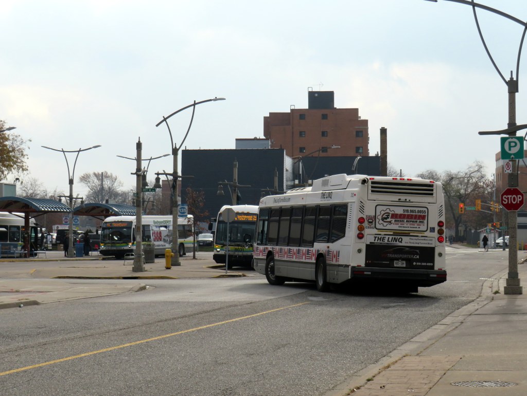
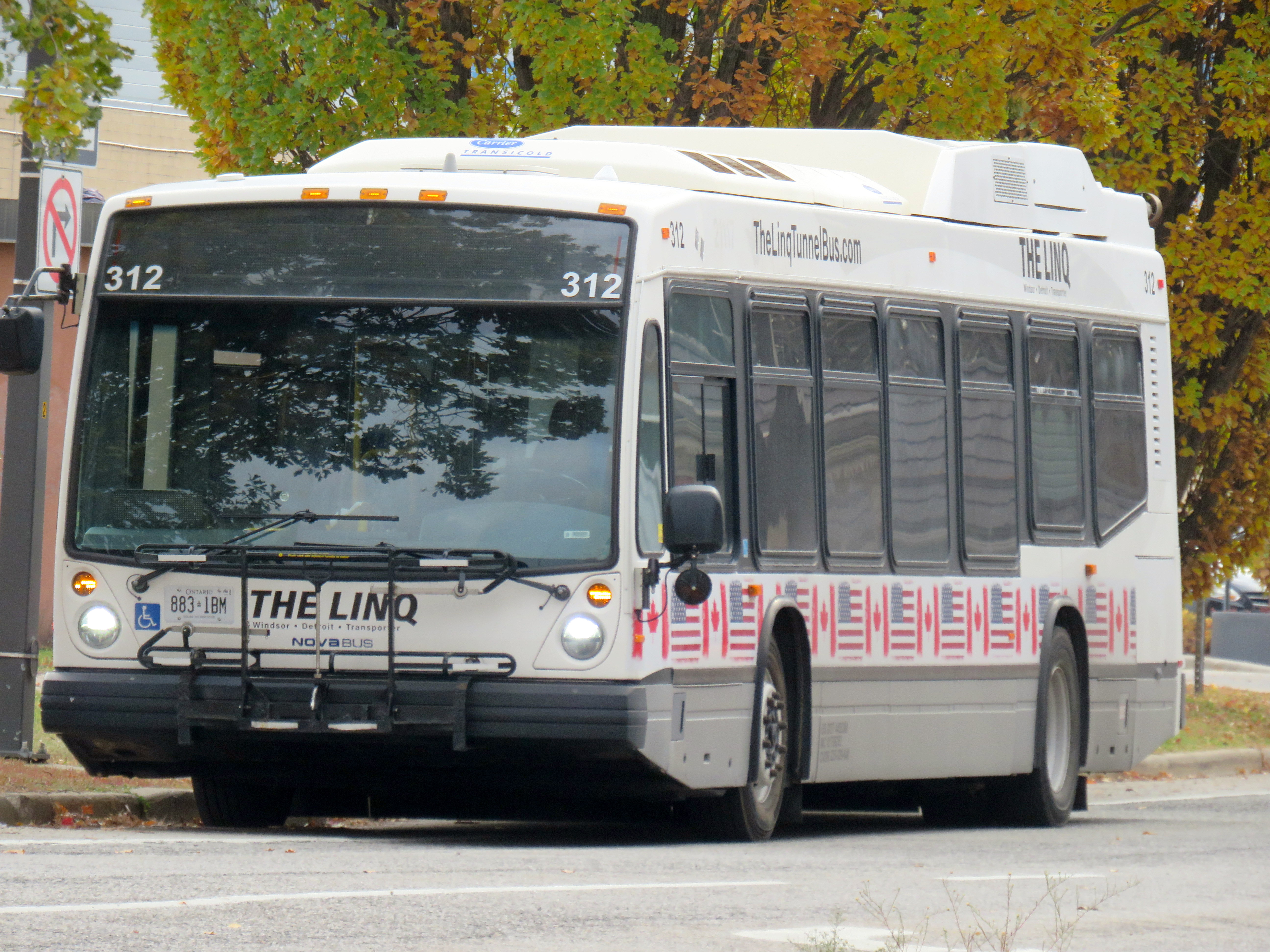
The Linq, the new privately-operated Tunnel bus between Windsor and Detroit
There is, however, a new privately-operated bus service, called The Linq. It has several used transit buses with bike racks and offers trips every two hours for a $15 one-way fare. It is a downgrade from the Transit Windsor-provided service, but the connection is still there.
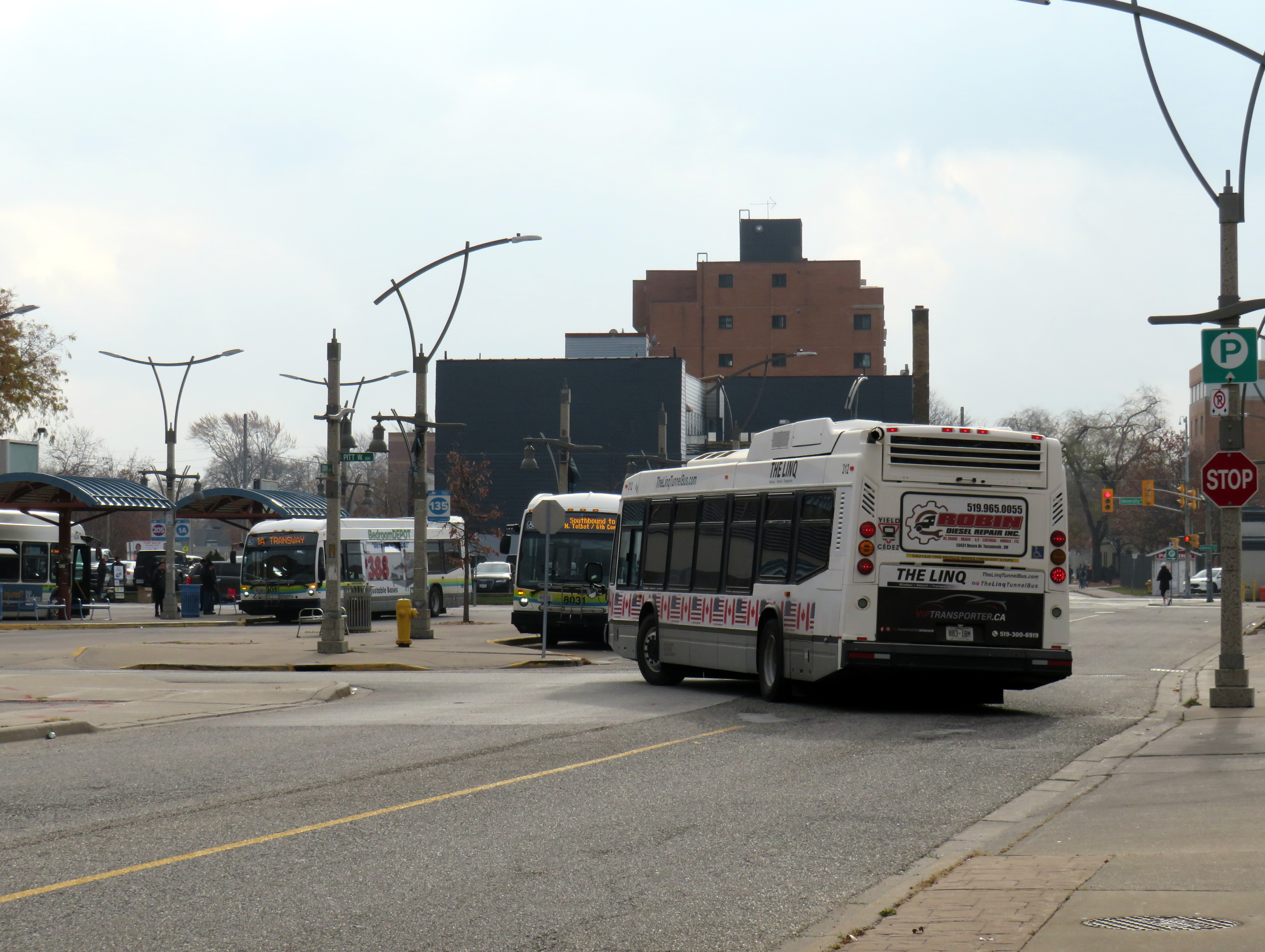
Though the Linq tunnel bus passes by the Windsor transit terminal, it doesn’t stop close by
Unfortunately, there is no direct connection between Linq and Transit Windsor. The only pickup location in Windsor is at the corner of Bruce Avenue and Riverside Drive, a five-minute walk from the transit terminal where the former city-operated bus departed from. Though the Linq bus passes by the Windsor terminal, it does not stop right there. The route still serves the Rosa Parks Transit Terminal on the Detroit side, along with the stop by the tunnel entrance next to Mariners’ Church.
Regional (dis)connections
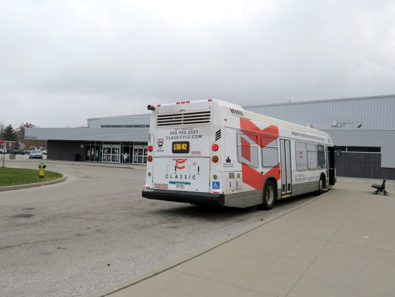
LTW 42 bus at Essex Sports Centre
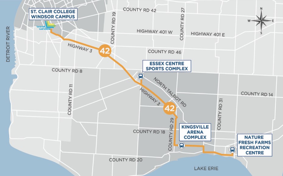
While visiting Windsor, I wanted to ride Route 42, the bus service linking Windsor with the towns of Essex, Kingsville, and Leamington. Operated by Transit Windsor using urban transit vehicles, the service got funding from the province, the County of Essex, and the Town of Leamington. It operates three weekday and two Saturday round trips, charging a flat $10 one-way fare or a $15 same day return fare, with free transfers to Leamington’s LTGO on-demand service and Transit Windsor’s urban routes at St. Clair College.
The service began in 2019, replacing a long-discontinued intercity coach route operated by Greyhound Canada and Chatham Coach Lines, along the old route of the WE&L Rapid Railway that ran until 1932. The bus only makes four stops: St. Clair College in Windsor, and sports and recreation centres in the three towns. The route’s number is not inspired by Douglas Adams but by the 42nd parallel, which runs a few hundred metres south of Leamington.
LTW Route 42 route map
Unfortunately, the three sports centres are poor locations for promoting transit ridership. In Essex, the arena is a 10-to-15-minute walk to the town centre, a reasonable stroll for many. In Kingsville, the arena complex northeast of the built-up area is 2.5 kilometres from the town centre, a 35-45 minute walk with no local transit options. Without access to a car ride, the Route 42 service becomes inaccessible to many potential users.
Previous coach service operated by Greyhound and Chatham Coach Lines stopped in the town centres.
Essex Town Centre, a 10-15-minute walk from Route 42 at the sports centre
As of April 30, 2026, the LTW Transit service connecting Windsor with Essex, Kingsville, and Leamington will come to an end. This was a matter of funding. The provincial rural transport funding program came to an end, and neither the County of Essex nor the Town of Leamington were willing to continue subsidizing the service beyond the end of the academic year.
Though the province is willing to fund expensive new highway and transit projects in the Greater Toronto and Hamilton Area, including new subways and light rail and sprawl-inducing freeways, it is unwilling to back the provision of small town and rural transit services that connect residents to larger centres, whether it be for work, school, health appointments, shopping or social connections. Without a province-wide strategy and a sustainable funding program, services that started up with much promise are disappearing in places like Grey and Oxford Counties and Napanee and Deseronto.
It also does not help that Windsor-Essex does not have a regional level of government or even a degree of cooperation between the various municipalities. In York, Waterloo, Durham, and Niagara, regional governments have taken over transit services and are working to connect their entire regions together, even rural communities. Even Simcoe County provides a regional transit service to its smaller towns. The suburban Town of Tecumseh has a limited transit service separate from Windsor’s, while LaSalle and Amherstburg contract Transit Windsor for limited service within their communities. A regional transit service, subsidized by the entire Windsor-Essex tax base, could go a long way.
That’s a wrap
To conclude this post, I have few other observations of riding Transit Windsor over two days in late November. There are several ways that transit service can be improved, including better wayfinding, better connections between modes, and giving passengers a better view.
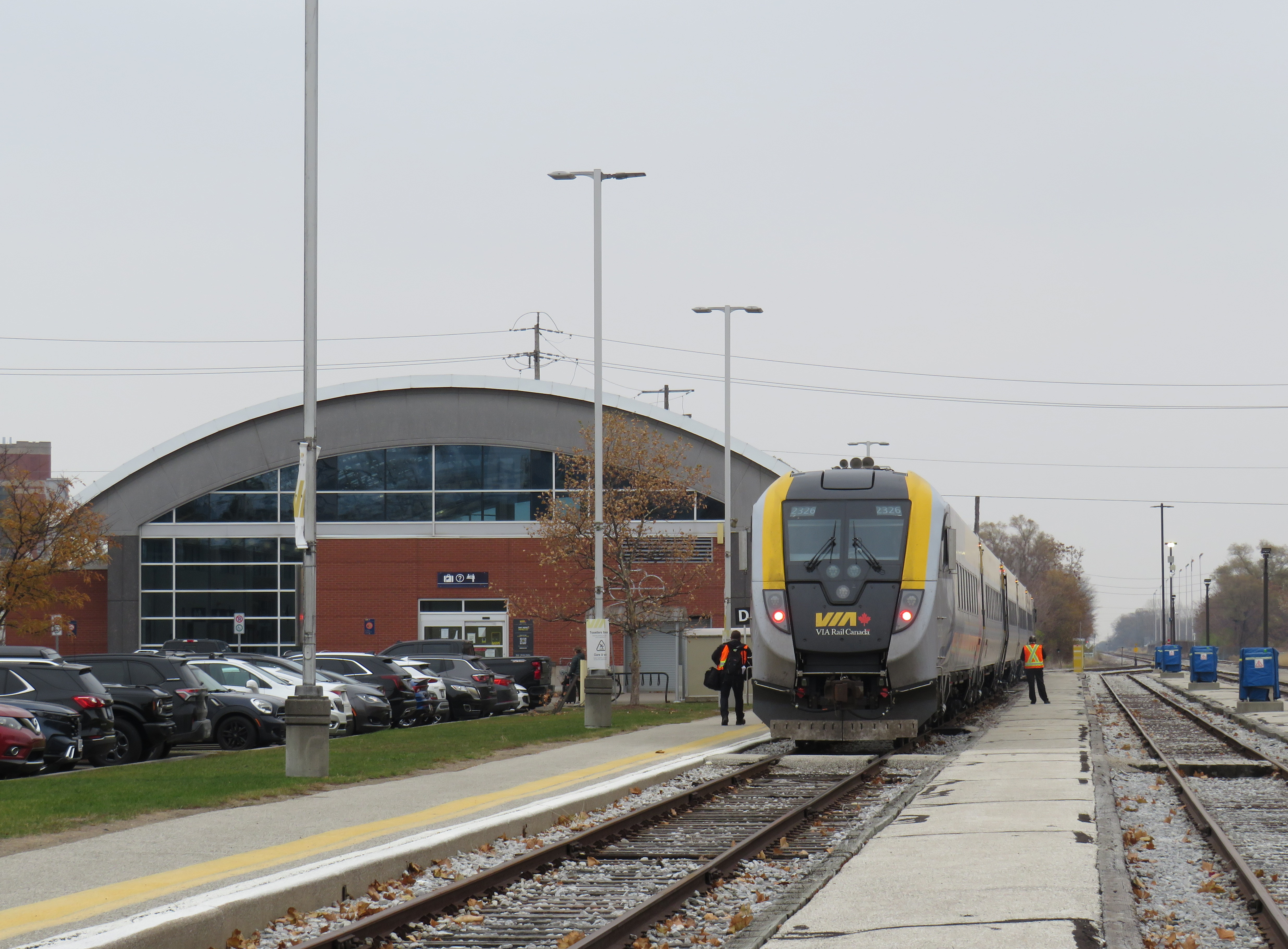
VIA Rail runs four daily trains between Toronto and Windsor, from a station in the Walkerville neighbourhood, three kilometres east of the downtown core. Passenger trains on the CN line used to continue to the downtown waterfront until the 1960s, when service was cut back to Walkerville, which had a wye to turn trains around. Eventually, all the CN, CP, and Michigan Central tracks and docks were removed from the riverside, which allowed Windsor to develop a lovely waterfront park system.
The Crosstown Route 2 along Wyandotte Street stops nearby the VIA Station off Walker Road, about a five-minute walk between bus and train. But getting between the two modes is not clear. Apart from a VIA Rail logo on the transit map, there is little indication of this useful connection at the station or at the bus stops on Wyandotte. Route 2 offers decent service during daytime hours, every 10-15 minutes on weekdays from 6:00 AM to 6:00 PM, but it quickly drops to every 30 minutes at 6:30 PM. Saturday daytime service is every 20 minutes, and on Sundays, every 40 minutes. Frequencies on other core routes, including the 1A and 1C Transway buses, is similar.
Compare this with Kingston, a city less than half of Windsor’s size, which provides direct transit service onto the VIA station grounds. In London, the downtown station is a more prominent landmark, and easy to get to by multiple routes.
As a regular transit passenger used to fare cards, transit apps, and open payment systems, I found myself annoyed by having to carry exact change — a toonie, a loonie, and three quarters — every time I rode. Transit Windsor does have plastic fare cards, but they can only be loaded up with individual fares or a 15-day or 30-day pass, not a declining balance that could be used on regional routes. As cash is less common as a payment type (with some smaller businesses going cashless), larger transit agencies should catch up.
The typical view from a Transit Windsor bus
Finally, I became annoyed by how many buses in Transit Windsor’s fleet are fully covered by vinyl advertising wraps, excepting only the windshield, front door, and driver’s side window. Even the LTW 42 bus, which goes a long distance at higher speeds, was fully wrapped. I took six different buses in two days and only one wasn’t wrapped. It makes for a miserable time as a rider, especially one who wants to see the neighbourhoods the buses pass through; I explained why advertising wraps are a bad idea before. At the very least, ad wraps should limit how much of the passenger window area is covered, as the TTC does.
Windsor has all the essentials for building a good transit system: a large pre-war urban area, post-secondary institutions, hospitals, and a well-populated and growing exurban and rural periphery. It just needs the leadership to recognize its potential.
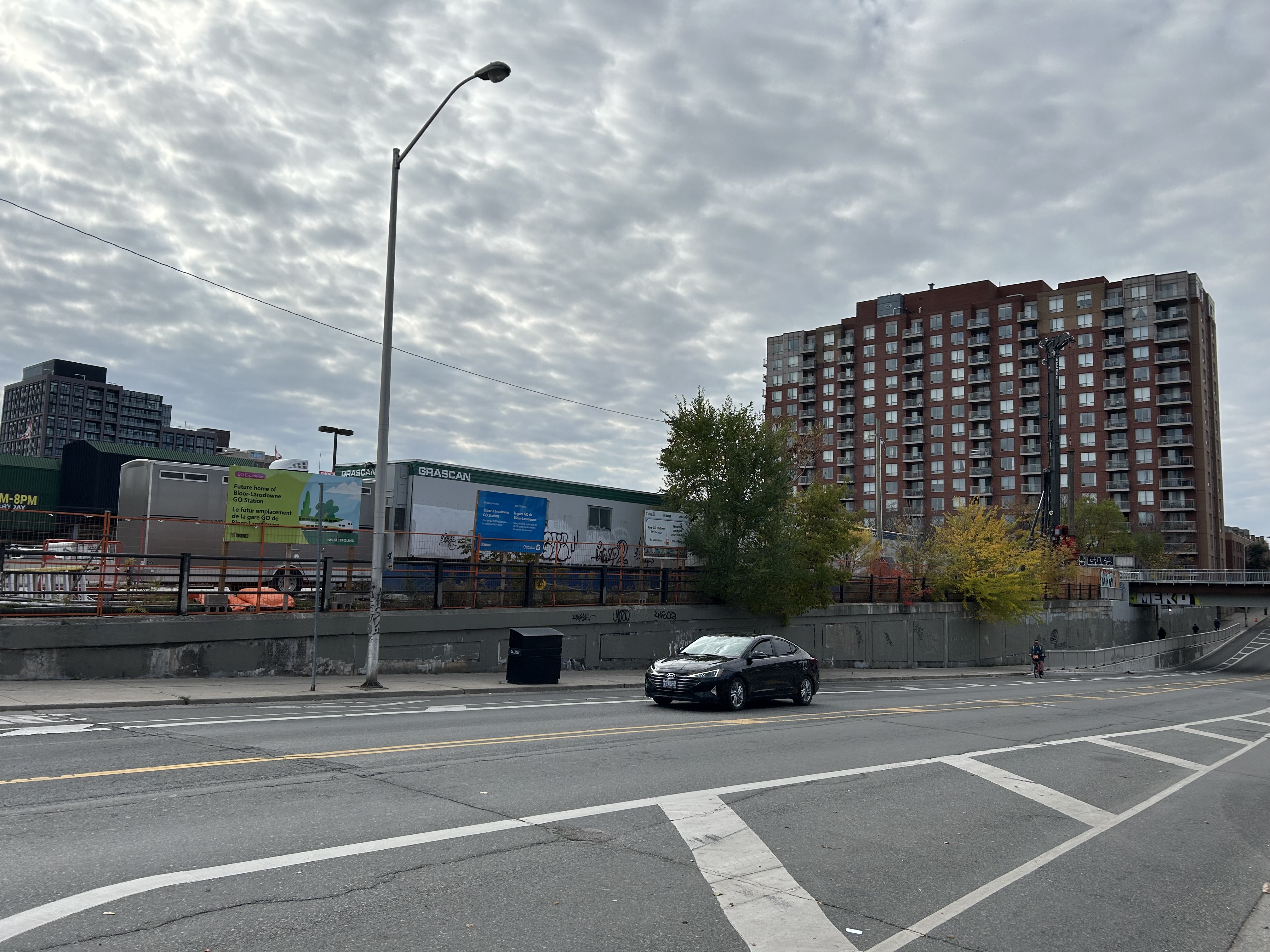
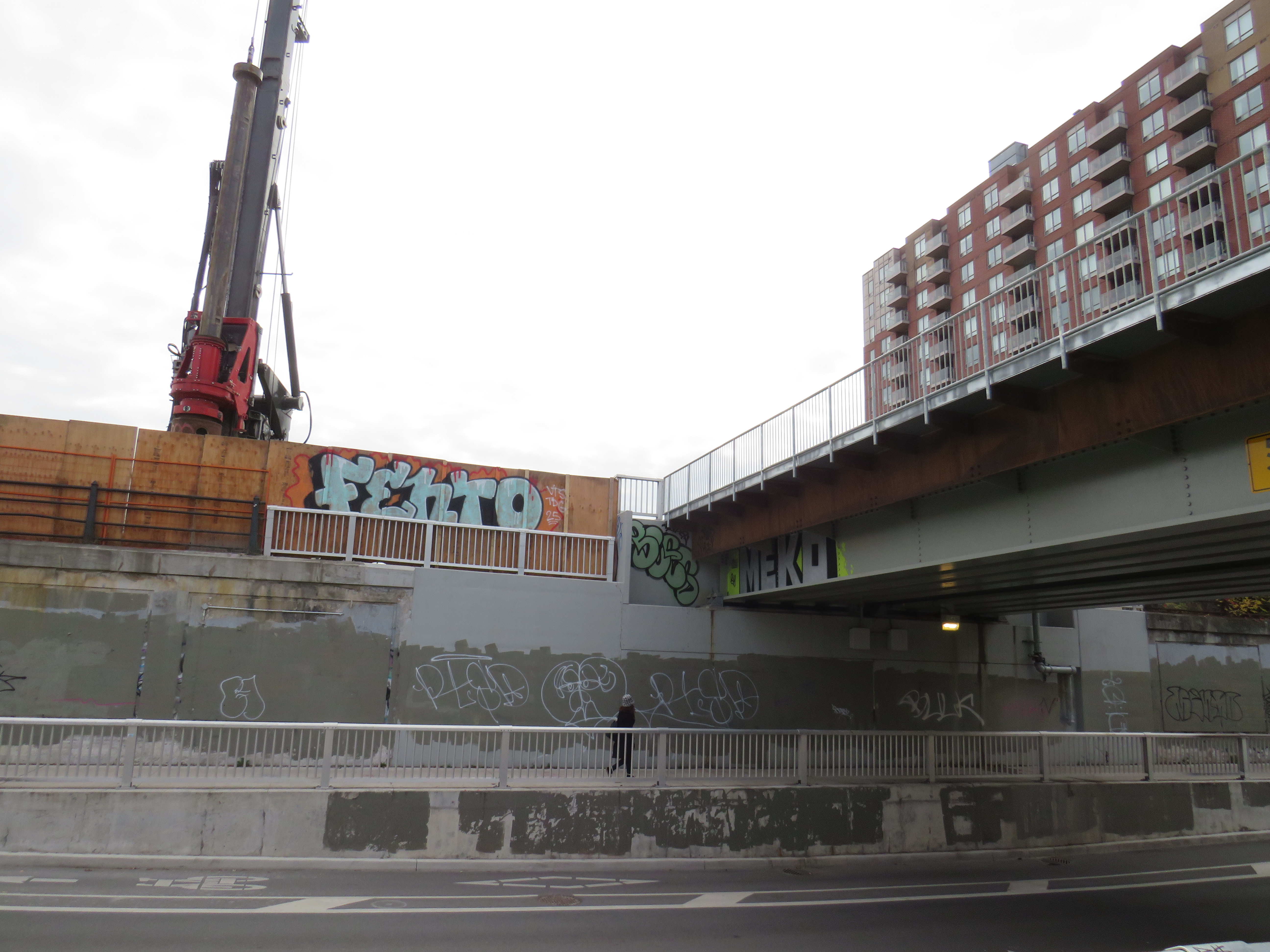
Bloor-Lansdowne Station construction, November 2, 2025
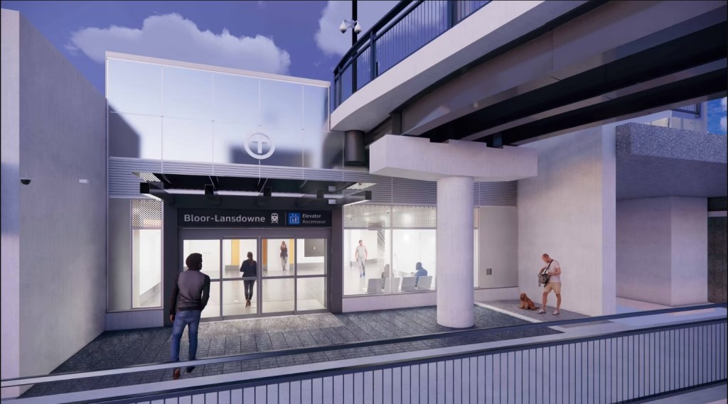
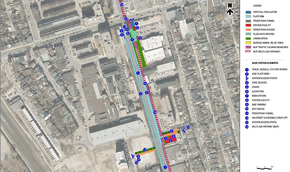
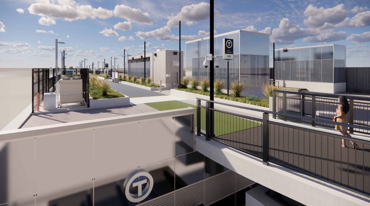
Bloor-Lansdowne Station, one of five “SmartTrack” stations planned for existing GO Transit rail lines in the City of Toronto, is located just south of Bloor Street West on the GO Barrie Line, and south of the Davenport Diamond grade-separation. The purpose of this new two-platform GO station is to provide a new connection between GO trains and the TTC subway, similar to existing stations like Bloor/Dundas West, Danforth/Main Street, or Downsview Park. Unfortunately, it will not be an easy transfer.
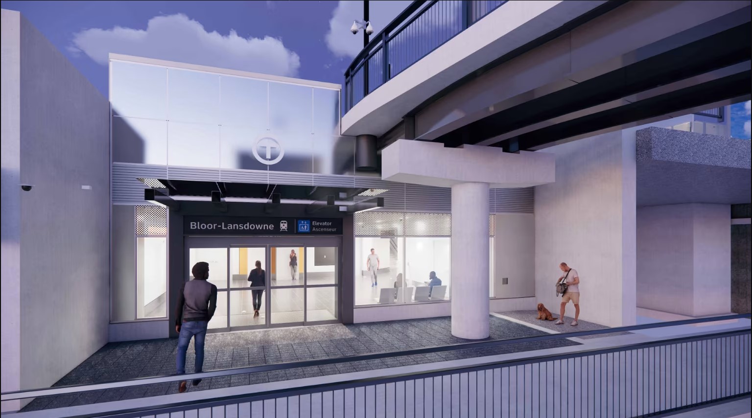
The future Bloor-Lansdowne station entrance, 2025Rendering of Bloor-Lansdowne Station entrance (from Metrolinx web page)
When GO Transit began operations on the Lakeshore Line in 1967, it was built on a shoestring, meant to be a three-year experiment to see if commuter rail would work in the growing Greater Toronto Area. Stations were built cheaply, with asphalt platforms with bus shelters, constructed on easily purchased land for suburban parking lots. At stations like Long Branch and Danforth, connections to TTC subways and streetcars were on-street; most connections would be made at Union Station. When the Georgetown (now Kitchener) Line opened in 1974, Bloor Station was accessed only by narrow stairways down to the sidewalk, with a 4-5 minute walk to Dundas West Station (a direct subway connection is finally nearing completion). Newer GO rail stations, like Kipling (1980-1981), Kennedy (GO platform opened 2005), and Downsview Park (2015), were built with direct intermodal connections, befitting GO’s increasing importance. When it opens on November 16, Mount Dennis GO/UP station will have a direct connection to the future Line 5 Crosstown LRT.
Though Lansdowne subway station is north of Bloor Street and two blocks to the east, the new GO station will be located entirely south of Bloor Street
But Bloor-Lansdowne, located next to a former Value Village, will feature a subway-train transfer worse than the current connection between Bloor GO and Dundas West subway station. It took me nearly 7 minutes to get from the Lansdowne subway platform to the planned main entrance below the rail overpasses, including waiting at the Bloor-Lansdowne intersection for a walk signal, and crossing an unsignalized intersection at St. Helens Avenue. (See video below.)
The construction of a new pedestrian overpass connected with the long-delayed Davenport Greenway will provide a slightly more pleasant walking path between the subway and GO train, avoiding a busy signalized intersection. But it will not reduce walking times or the amount of time without shelter from the elements.
Proposed Davenport Greenway
Granted, for some commuters, Bloor-Lansdowne will significantly reduce travel times, especially for those travelling between parts of York Region and western Toronto. But nearby Bloor Station on the GO Kitchener Line will have much better TTC connections and more frequent service with both GO and UP Express service and will be a much more attractive route towards Downtown Toronto. Compared to the benefits to riders on the 39/939 Finch East — the TTC’s busiest bus corridor — that Finch-Kennedy Station will offer, or the benefit of King-Liberty’s GO and UP Express service to riders in Liberty Village, Parkdale, and West Queen West with King-Liberty, Bloor-Lansdowne has limited ridership potential.
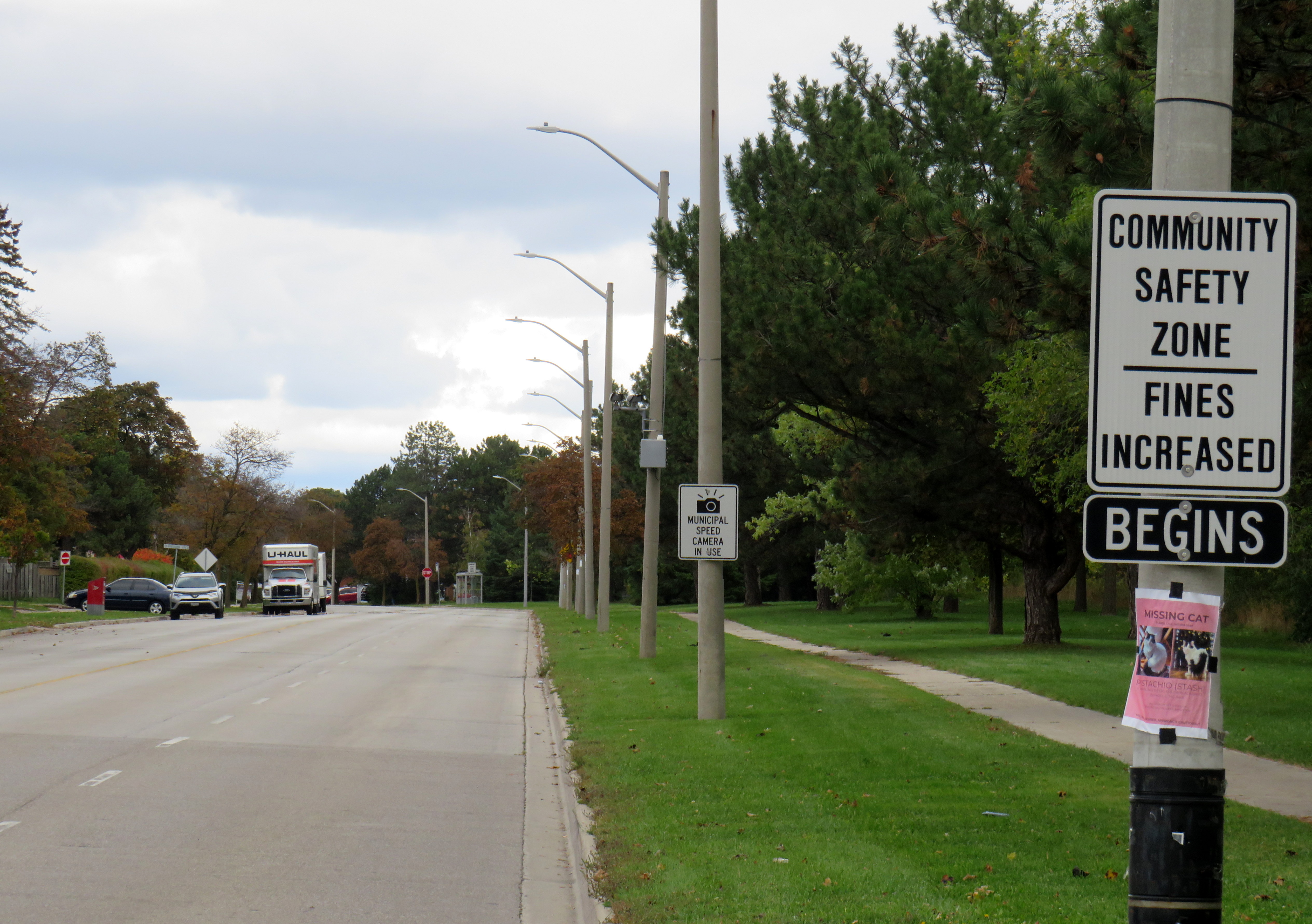
Dearbourne Boulevard, a four-lane collector street designated a community safety zone
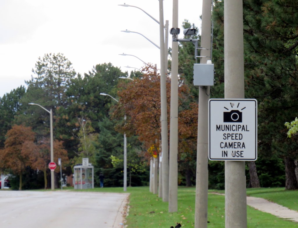
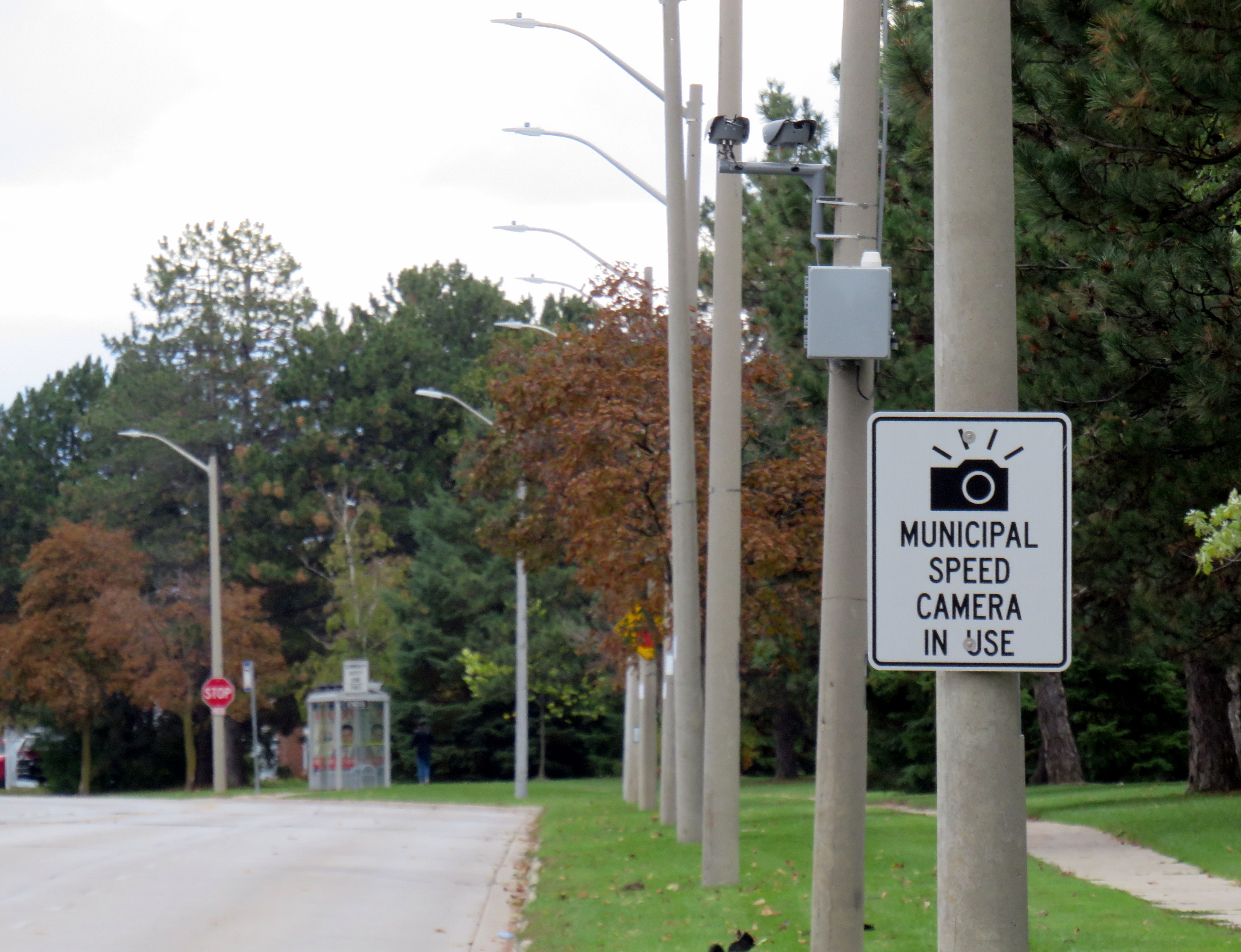
Last week, while visiting Brampton, I came across one of the hundreds municipal speed enforcement cameras that Premier Doug Ford’s government wants to rip out across the province. The camera, on a four-lane collector street in Bramalea, is in a residential area, adjacent to several parks, including a pathway to a local public school, in an area designated a community safety zone. This is precisely the type of place that the government intended speed enforcement cameras would go when they were permitted under provincial legislation in 2019.
In a September 2025 government press release touting the move as “protecting taxpayers,” Ford, whose government was in power when these cameras were permitted, claimed that the program became “a cash grab;” supporting quotes included those from former Liberal leader and current Vaughan mayor Steven Del Duca, a representative of the province’s municipal police unions, and a spokesperson from the right-wing Canadian Taxpayers Federation.
If only there was a simple, effective way for taxpayers to avoid the so-called “cash grab.”
It was interesting who was not quoted in that press release, including doctors, educators, safety advocates, and even police brass. Ontario police chiefs support automated speed enforcement. It is also worth noting most municipalities support the cameras; Vaughan is one of only a few municipalities that recently rejected the road safety program; Del Duca was joined by just two other conservative-leaning mayors.
Of course, the arguments against the cameras, which in Toronto, were repeatedly vandalized or stolen, never held water. There were no tickets mailed out to drivers going just a few kilometres over the limit. Furthermore, speed enforcement was never a “cash grab” as the fines collected went to pay for the administration of the program, to “Vision Zero” works, such as the installation of speed cushions and improved pedestrian crossings, and to the province, which the collects the victim surcharges added to every Highway Traffic Act fine. The City of Brampton found that not only were the cameras effective in reducing speeds, they had the support of a majority of its residents.
Municipal speed camera
That said, while visiting Dearbourne Boulevard, I realized that speed enforcement cameras on their own are not effective in creating safer streets.
Dearbourne Boulevard serves one of the oldest parts of Bramalea, established in the early 1960s as a self-contained satellite town, where residents were expected to drive to most destinations. After amalgamation into the City of Brampton, traffic increased and more transit became available. Nearby, several newer high-rise apartment buildings were built, walking distance to Bramalea GO Station. A bus route, 16 Dearbourne, runs along the street, connecting the neighbourhood with several shopping plazas, the GO Station, and the transit hub adjacent to Bramalea City Centre.
Despite having low traffic and serving a residential area (an industrial area is just to the south, but it is inaccessible from Dearbourne), it is still a wide four lane street. The only traffic signal is at Bramalea Road; there are two all-way stops at Delamere Drive and Dorchester Road. At the east end of Dearbourne, the T-intersection with Balmoral Drive is controlled only be a stop sign, with two long and gentle right turn slip lanes. The speed limit is 50 km/h, and there are no speed cushions, curb extensions, or even painted buffers to indicated that drivers should go slower. In October 2022, a pedestrian was struck and seriously injured at one of the two all-way stop intersections; the driver fled the scene.
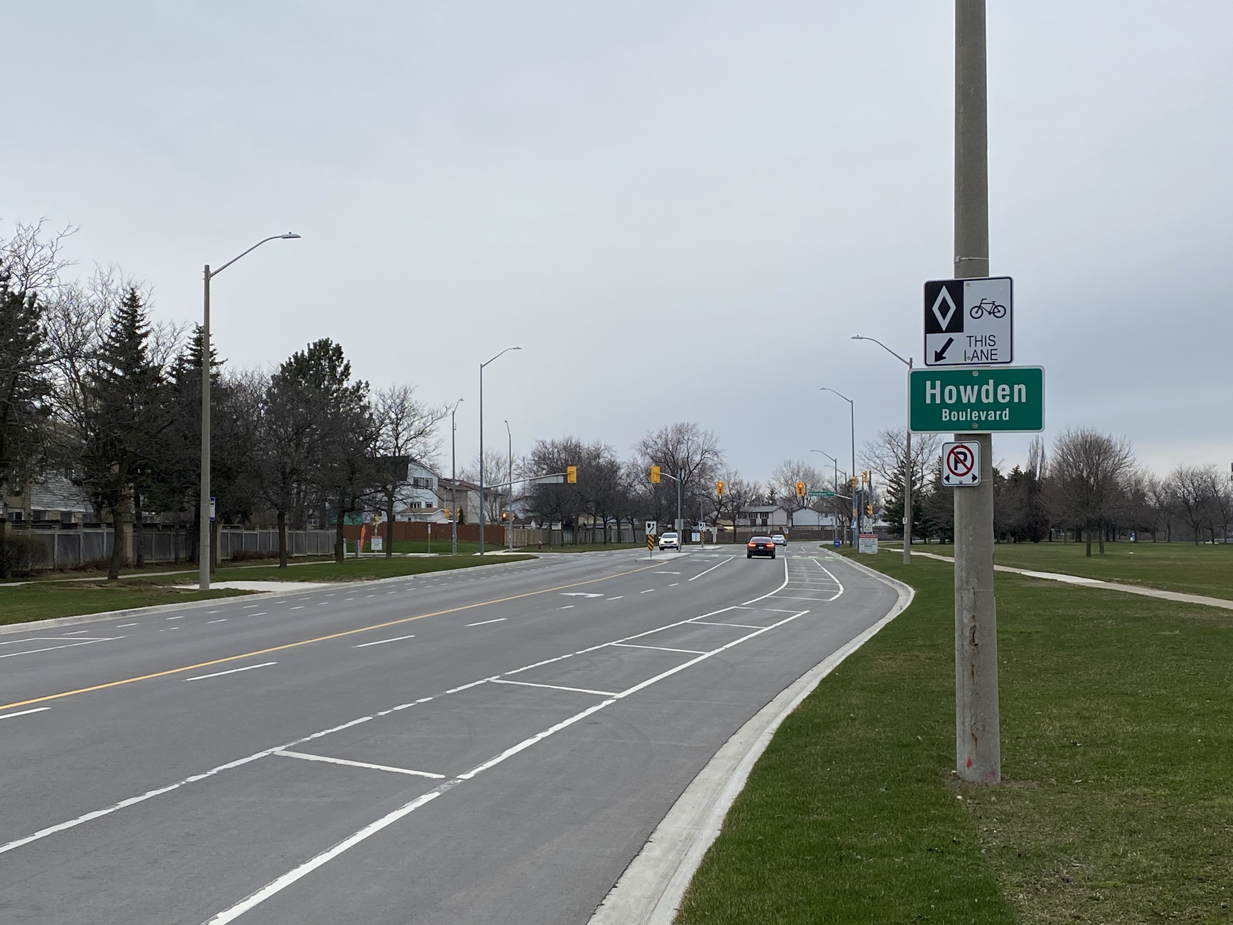
Though to its credit, the City of Brampton has been improving many suburban streets and roads to reduce speeds and promote walking and cycling. Charolais Drive, Vodden Street, Central Park Boulevard, and Vodden Road saw traffic lanes replaced by new cycling lanes, with little pushback from residents. Dearbourne Boulevard was also slated for improvements in 2021-2022, but that work was not yet started.
Central Park Boulevard, Howden Boulevard, and Vodden Street were among several four-lane collector roads tamed with new cycling infrastructure in the last five years, creating a new through east-west cycle route
Now, it might be too late. Not only will the speed camera be prohibited under a bill being rushed through the provincial legislature (going around the consultation process where concerned citizens, advocates, or safety experts could depute to MPPs), but another omnibus bill was just introduced, which if passed, would prohibit all Ontario municipalities from removing general traffic lanes to install cycling infrastructure, or even transit lanes and on-street patios.
Given the provincial government’s increasing hostility to anything that inconveniences drivers, be it road tolls, vehicle license renewal fees, automated speed enforcement, or bike lanes, it leaves municipalities fewer options to protect their most vulnerable road users and promote sustainable and healthy transport options. Though Doug Ford claims that alternatives like flashing lights and more signs would do the trick, they do not do much to deter aggressive and dangerous drivers, unlikely to get caught.
For streets like Dearbourne Boulevard, there are a few options. Lowering the speed limit to 40 km/h should be a first step. The redundant outer two lanes could be converted to parking-only spaces, with curb extensions and bollards at intersections. The slip lanes at Balmoral Drive should be ripped out.
Roads designed in the 1960s and 1970s for traffic that never really materialized need to be rethought, with or without Queen’s Park’s support.
A few weeks ago, I wrote about several new intercommunity transit services in Eastern Ontario. I went out to Brockville to ride River Route, which follows the St. Lawrence River between Brockville and Cardinal. I also noted the introduction of a new bus service between Kemptville and Ottawa, as well as services in Pembroke and Loyalist Township.
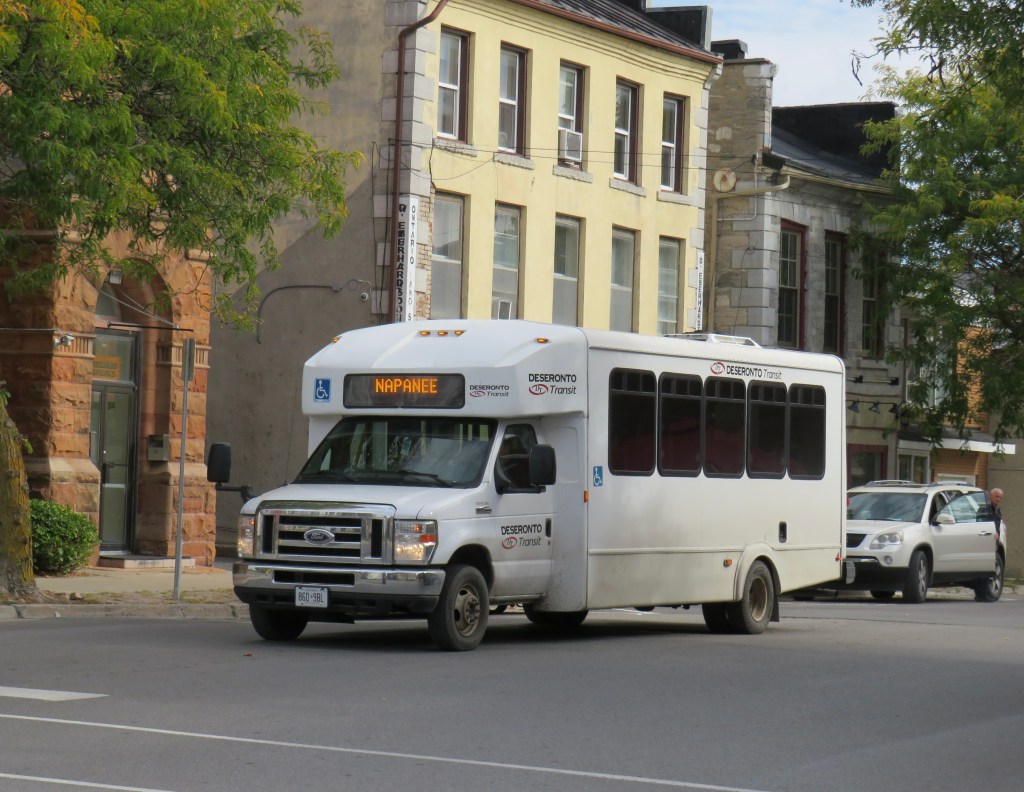
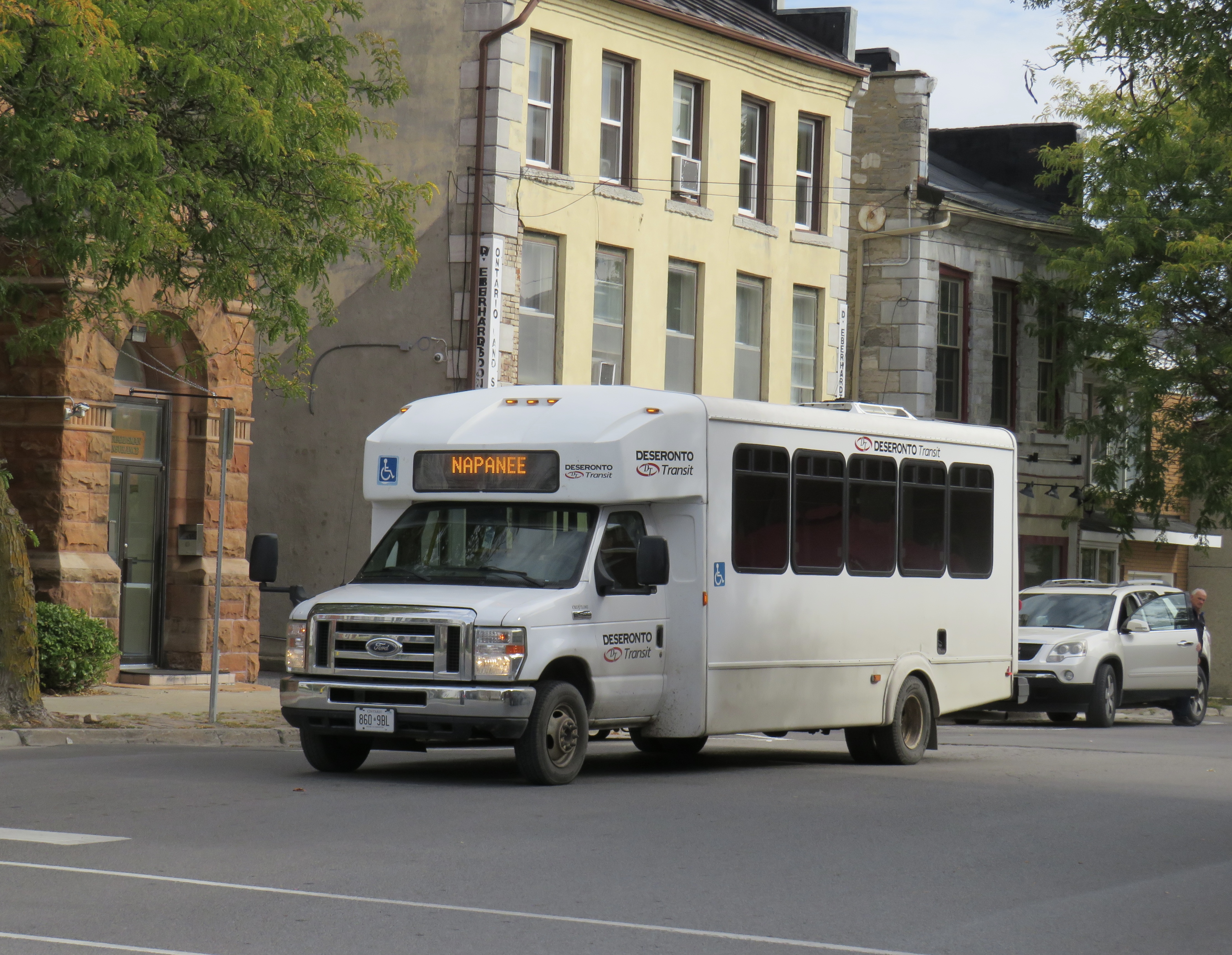
Unfortunately, another Eastern Ontario service, Deseronto Transit, will come to an end on November 28, 2025. Deseronto Transit is operated by the small town located on the Bay of Quinte between Belleville and Napanee; its single route runs between these three communities, while also stopping at Tyendinaga Mohawk Territory and Shannonville.
Early in 2025, the Town of Deseronto moved to end service by December 1, 2025, citing increasing expenses and ageing equipment and the end of provincial grant funding. As Deseronto is a very small town, population 1,750, the continued operation of a regional bus service is especially challenging. Despite the planned closure of service, it is commendable that the town was willing to give it a go, connecting its residents to employment areas in Belleville, as well as medical, educational, and shopping destinations in both Napanee and Belleville.
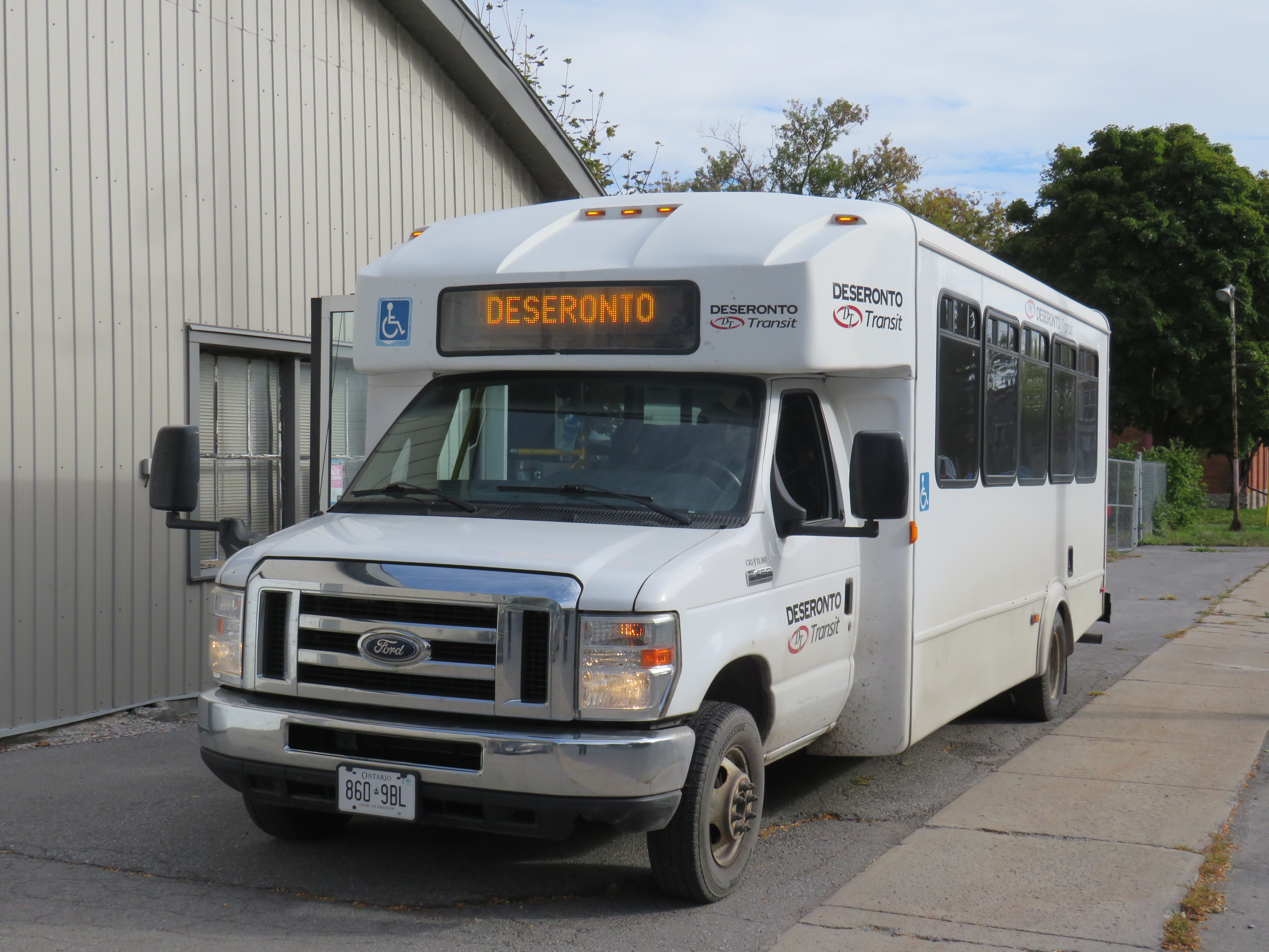
Laying over at Deseronto Transit’s garage
At its peak, Deseronto Transit was able to average 12-15 passengers per trip, thanks largely to its schedule and route that operates to important destinations in Belleville including Quinte Mall, Belleville General Hospital, and an industrial park in the northeast part of that city. But with the wind-down, ridership has fallen; I was one of only two passengers headed west to Belleville from Napanee and Deseronto on Friday, October 17.
In Belleville, there are still connections to Prince Edward County (which introduced a summer weekend service in 2025) at the Downtown Terminal, and to Trenton via Quinte Transit at Loyalist College. There is also an informal on-demand service to various communities north of Belleville within Hastings County.
One of the challenges operating small inter-community services is that they need long-term, dedicated funding, rather than a one-time grant. They also need to be publicized better, with proper bus stop signage, integrated websites, and easy connections to local transit and other intercity services.
A smart provincial government would not only ensure that these connections are funded and maintained; it would help to better integrate, brand, and advertise inter-community services, touting their benefits to residents and visitors alike. It already does this in the Greater Toronto and Hamilton Area (GO Transit) and in Northern Ontario (Ontario Northland); there really should be more to ensure rural and small town connections are sustainable and sustained in Southern Ontario.
Why going to Napanee is so complicated
To get to Napanee and to take a ride on Deseronto Transit, I had to take the only weekday morning departure from Toronto: a Maple Bus trip from Yorkdale Station to a gas station drop off north of Highway 401 in Napanee. The town is also served by Megabus (on the Pearson Airport-Kingston Route) and two daily VIA Rail trains, but these all leave the city in the PM hours. Maple Bus, a new entry not yet added to my intercity map, operates several buses a day between the Toronto area and Ottawa, with stops at most cities and towns along Highway 401 between Oshawa and Brockville.
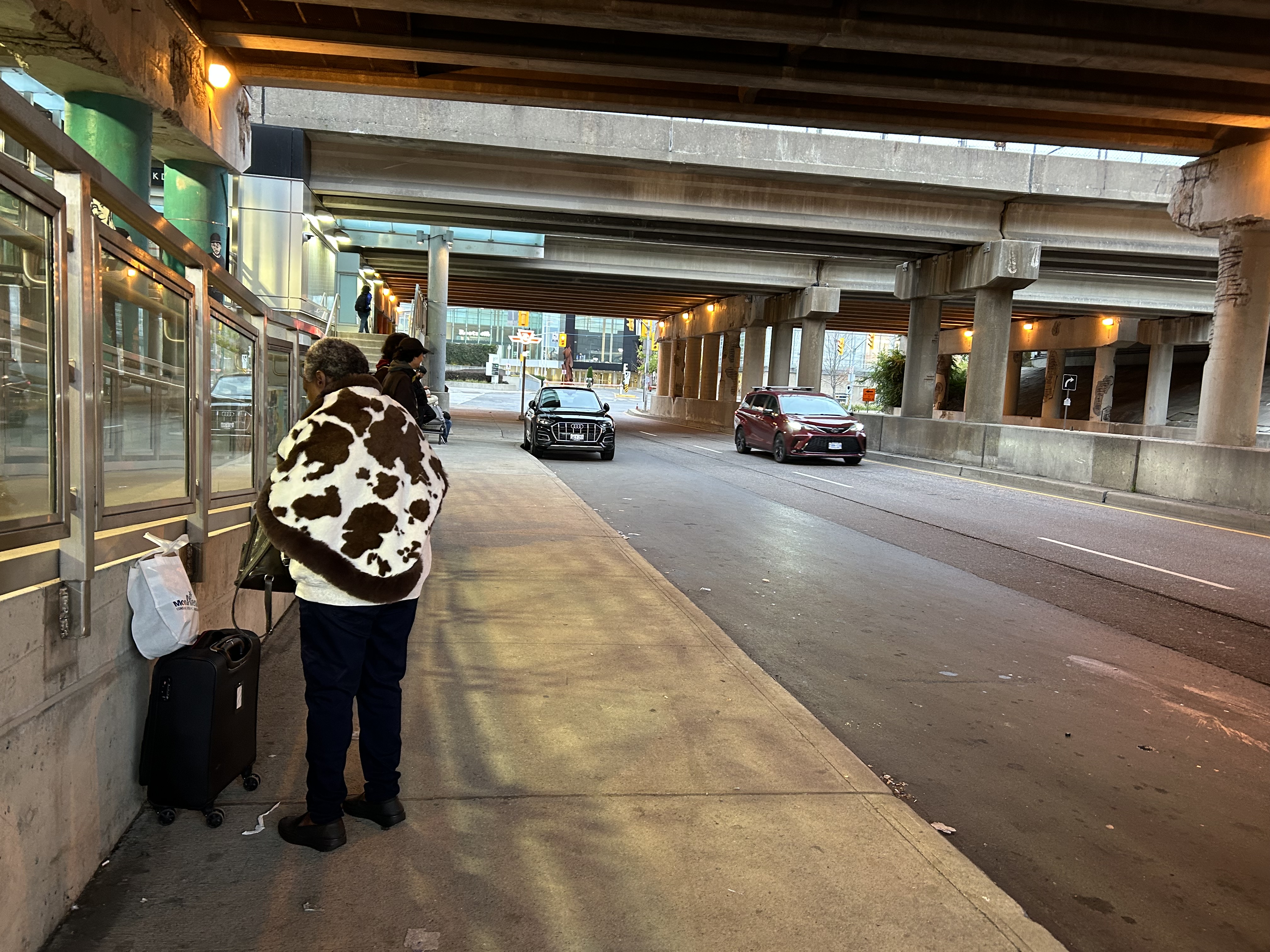
The main Toronto stop for Maple Bus and Flixbus is the passenger pick-up/drop-off area of Yorkdale Station, a curbside stopping zone under the Allen Road/Highway 401 ramps next to Yorkdale Subway Station. GO Transit, Megabus, and Ontario Northland use a nearby purpose-built bus terminal. Though the area is sheltered from rain by the overpasses, there is only one small bench to sit at. It is not a great place to wait for a bus, especially when it is nearly 40 minutes late, as my bus was.
Waiting under highway ramps at Yorkdale Station
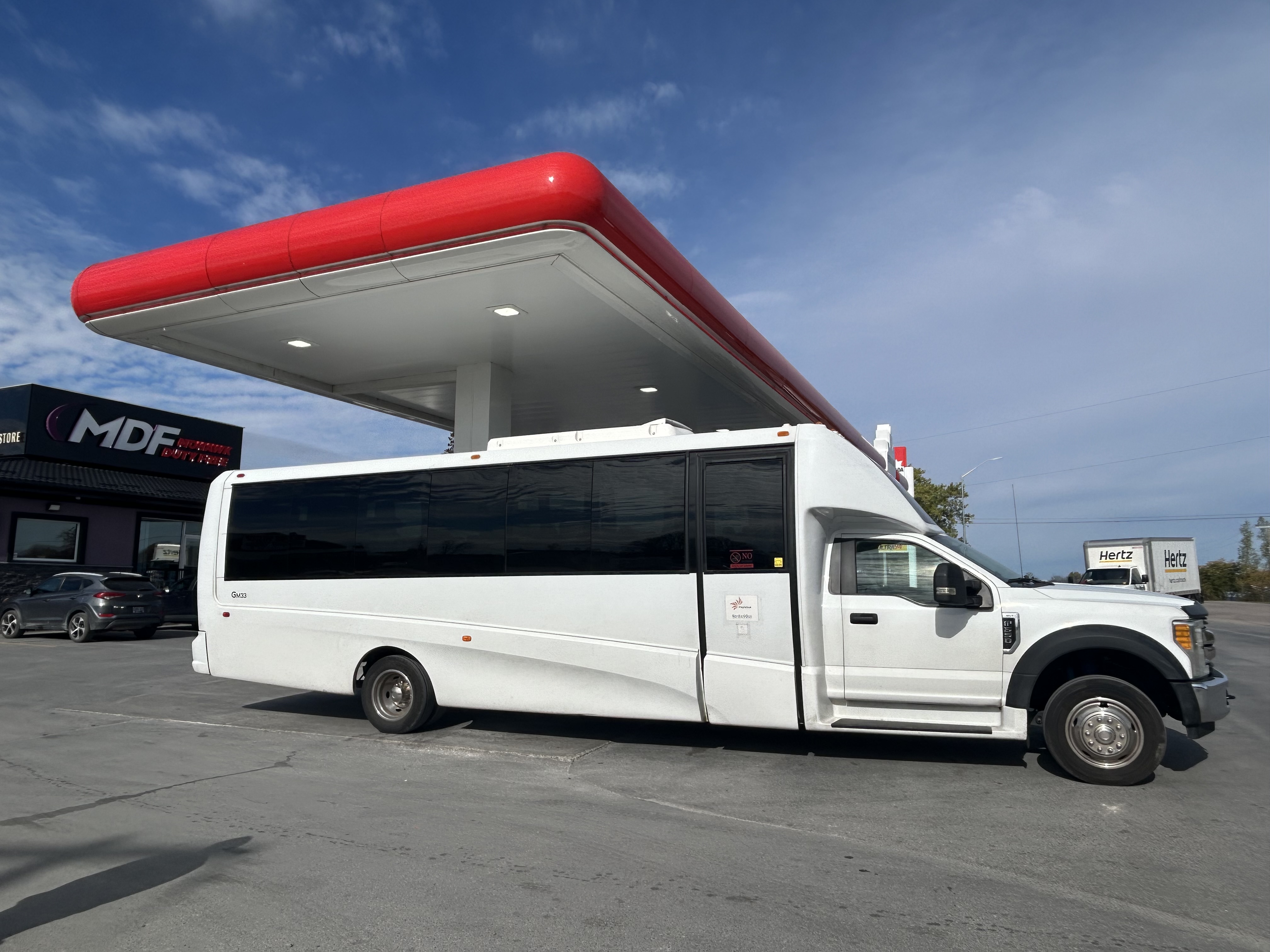
At least the Maple Bus vehicle was comfortable. The bus assigned was a mid-sized body-on-truck-chassis coach, which sits 25 in comfortable bucket seats (I have rode in smaller, less comfortable vehicles before). However, it does not have a toilet on board, and food and beverages are not allowed to be consumed. There was a rest stop, where the driver also refueled, at Tyendinaga First Nation off Highway 401 between Belleville and Napanee. When we made this stop, we were only ten minutes from my destination.
Maple Bus vehicle, during a rest break/refueling stop at Tyendinaga First Nation near Belleville
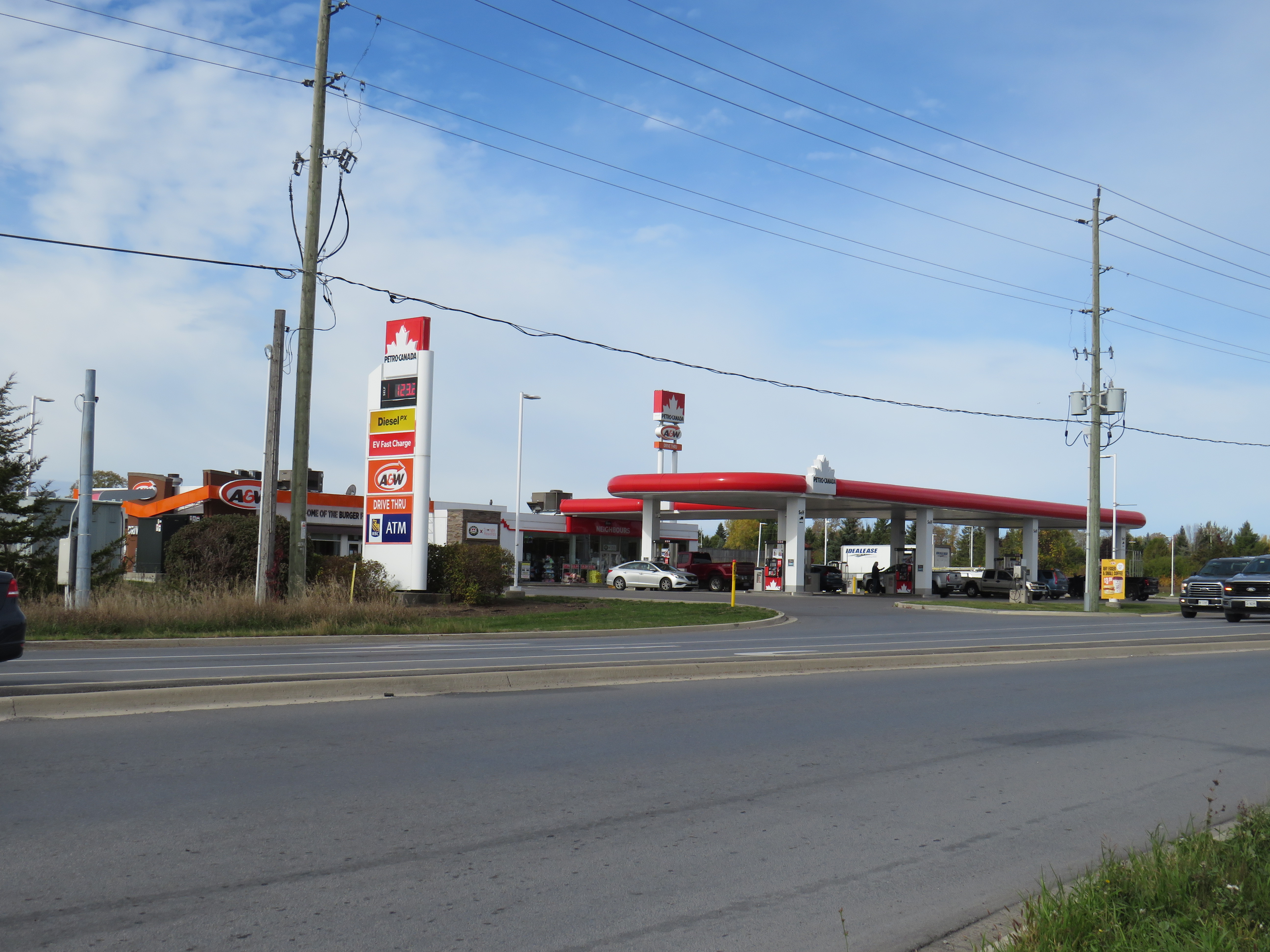
The most challenging part was the walk from the Maple Bus stop at a Petro-Canada/A&W north of Highway 401 towards the town centre. Megabus stops across the street at a Flying J truck stop. Presumably, these bus stop locations are chosen because of their ease of access on and off the highway, and because the property operators are cooperative with the bus operators, but they make things difficult for anyone without a pre-arranged ride.
The Maple Bus route stops at a Petro-Canada north of Highway 401
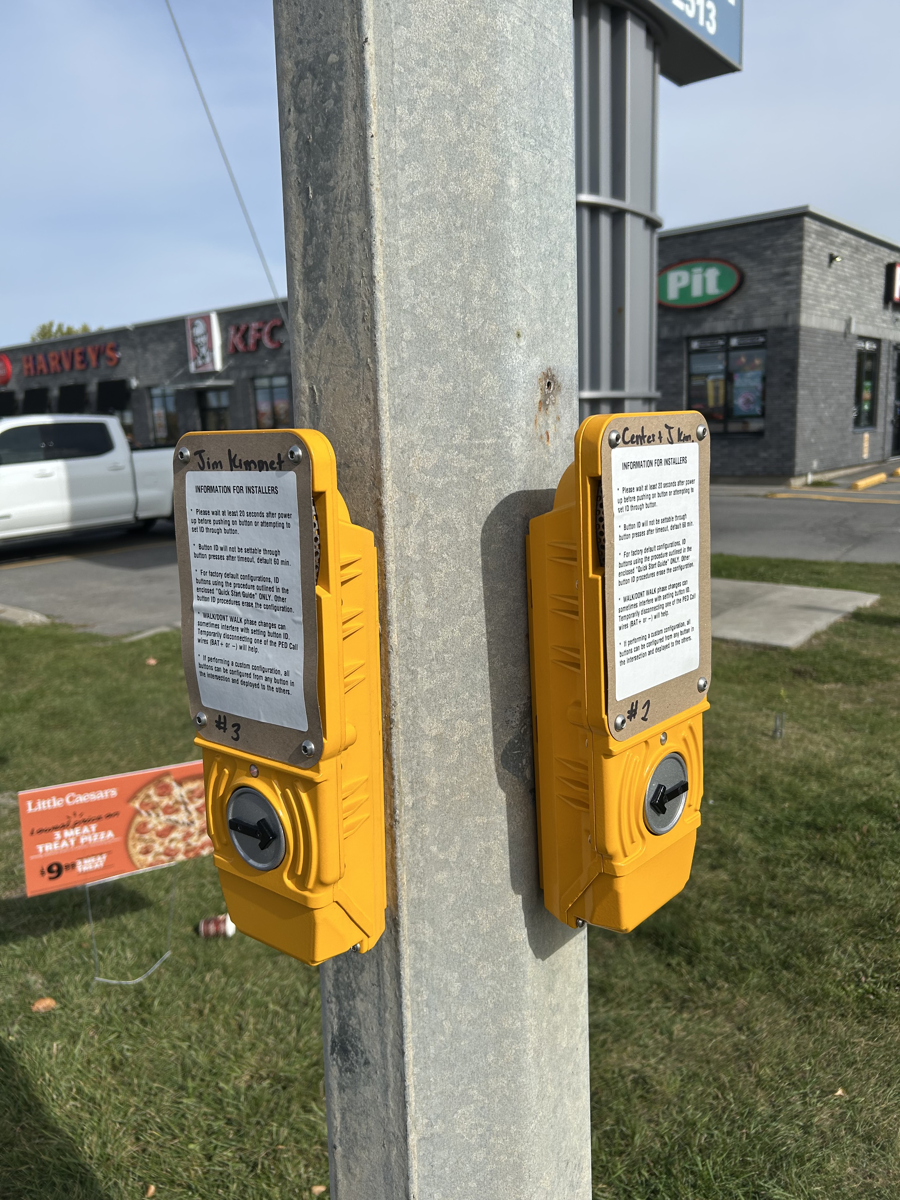
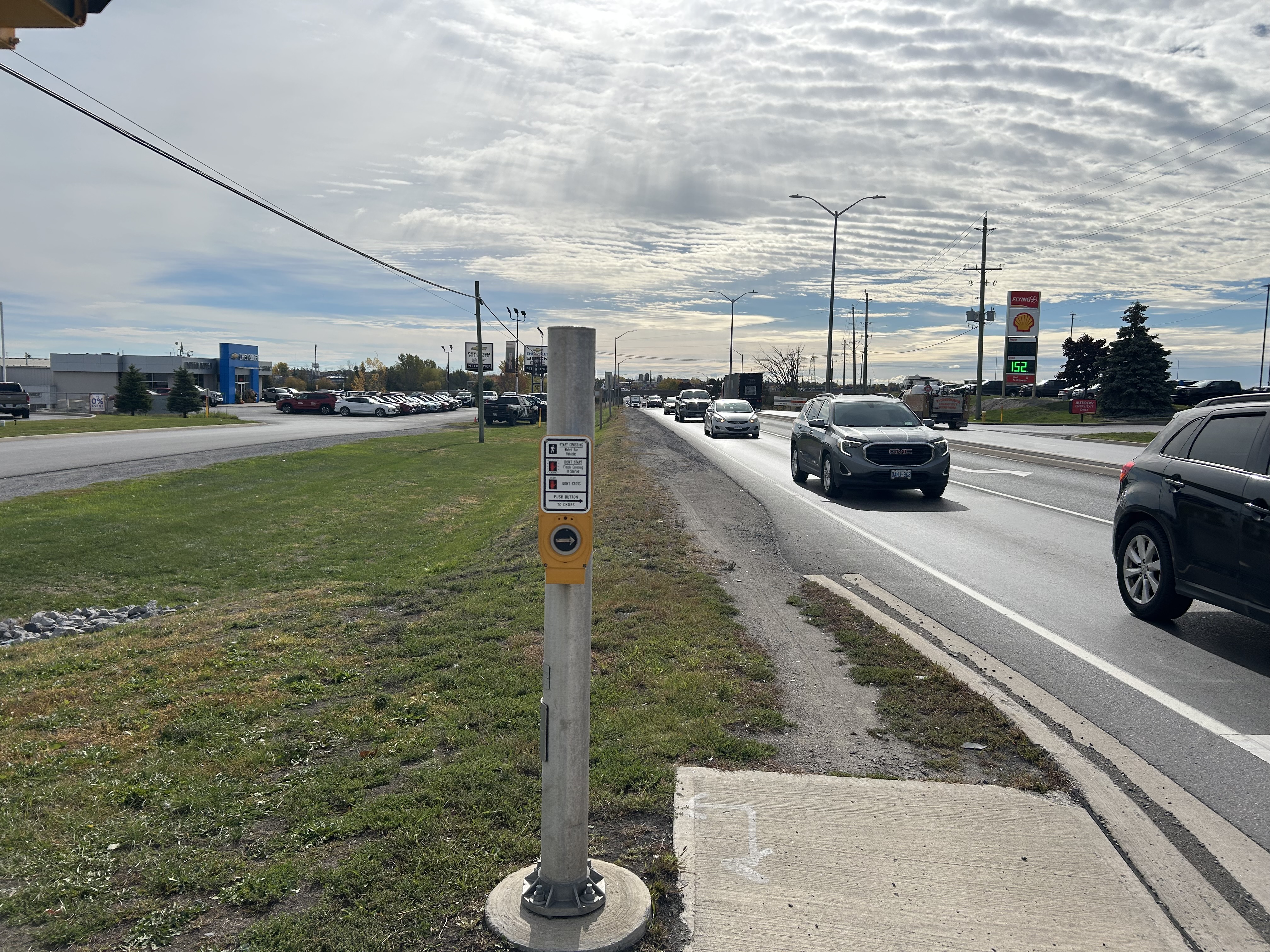
Though there are signalized pedestrian crossings at Highway 41 and Community Road, next to the Flying J and Petro-Canada, complete with crosswalks and “beg” buttons, there are no sidewalks continuing in any direction. Many push-button panels still have their installation instructions visible, rather than a “push button to cross” message.
Instructions for beg button installation still visible on two panels in NapaneeA dirt path continues south where there should be a paved sidewalk. The Flying J truck stop is on the right.
My walk south into the town centre required a precarious crossing of Highway 401 in a dark underpass alongside four lanes of traffic with very little clearance, as seen in the video below. Just further south of the interchange, there was another squeeze point at a drainage culvert. In snow, ice, or wet conditions, this would be especially dangerous.
Navigating the walk along Highway 41 south towards Napanee
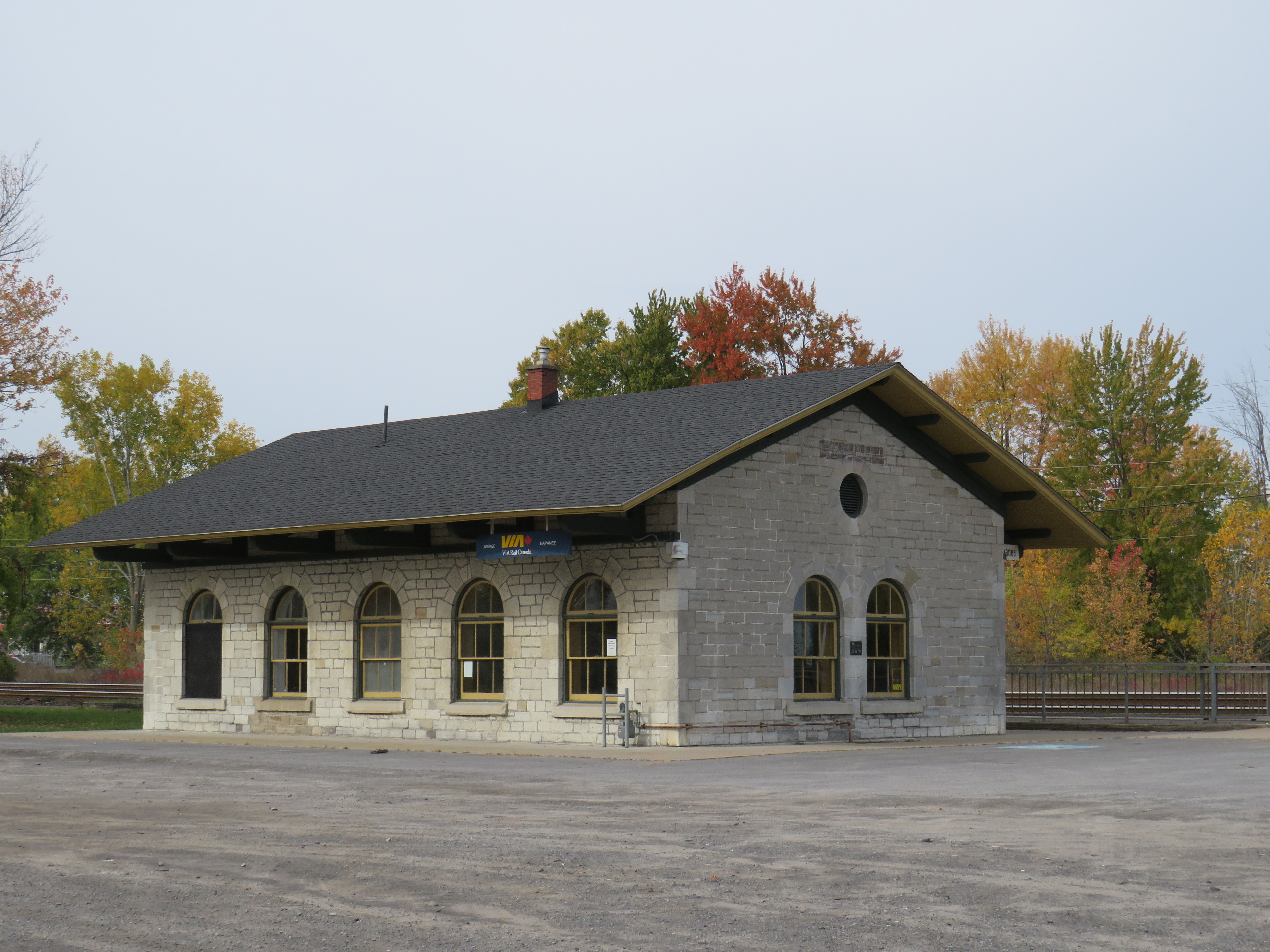
The VIA Rail station, located at a historic Grand Trunk Railway structure, is a short walking distance to Napanee’s downtown core, and to much of the populated urban centre. However, with a very limited train schedule and higher fares, many will still opt for the bus.
Napanee Railway Station
Unfortunately, the last-mile problem is common with intercity bus services, where bus stops are chosen out of convenience rather than passenger access and comfort, with distant truck stops favoured in places like Napanee, Chatham, and Cornwall. In major centres such as Toronto and Ottawa, carriers will choose more central, transit-accessible stops, but in smaller cities and rural areas, passengers are left on their own.
The end of the line for the restored Northlander train
Timmins, a resource town of 40,000 in Northeastern Ontario, is known for a few things: gold mines, beer parlours, the birthplace of country musician Shania Twain, and the place where folk musician Stompin’ Tom Connors got his start. If Connors — a travelling musician who delighted small town crowds with songs about their communities (like the hard working and hard drinking times of a “Sudbury Saturday Night”) — was still around, he’d probably write and perform a new song about getting kicked off an overnight train in the sparse environs of Porcupine, Ontario. After all, the song would quickly rhyme itself.
Porcupine is a small community of about 1,000 on the far eastern edge of the populated area in the geographically gigantic City of Timmins. Before the wave of municipal amalgamations across Ontario in the 1990s and early 2000s, Timmins was the largest city or town in the province by geographic area; it was formed through the amalgamation of the smaller City of Timmins with adjoining Mountjoy and Tisdale Townships (along with the town of South Porcupine) in the 1970s.
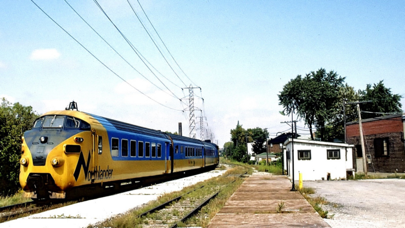
Until 1990, when the devastating cuts to VIA Rail took place, there were two daily trains between Toronto, North Bay, and Northeastern Ontario. The Northlander, a daytime train operated by Ontario Northland Railway, terminated at a downtown station in Timmins. The Northland, a joint VIA/ONR train, ran overnight between Kapuskasing and Toronto, with a bus connection to downtown Timmins. Famously, for a short period the daytime Northlander operated using former Trans-Europ-Express (TEE) cars, purchased used from Dutch and Swiss rail operators.
After 1990, Timmins was only connected by bus, with one daily bus to North Bay (and onwards to Toronto), and one bus, six days a week, to Sudbury (with connections to Toronto). The new daily overnight train — discussed earlier on this site — promises to restore a new daily trip, along with a more comfortable journey, even if sleeping accommodations will not be provided.
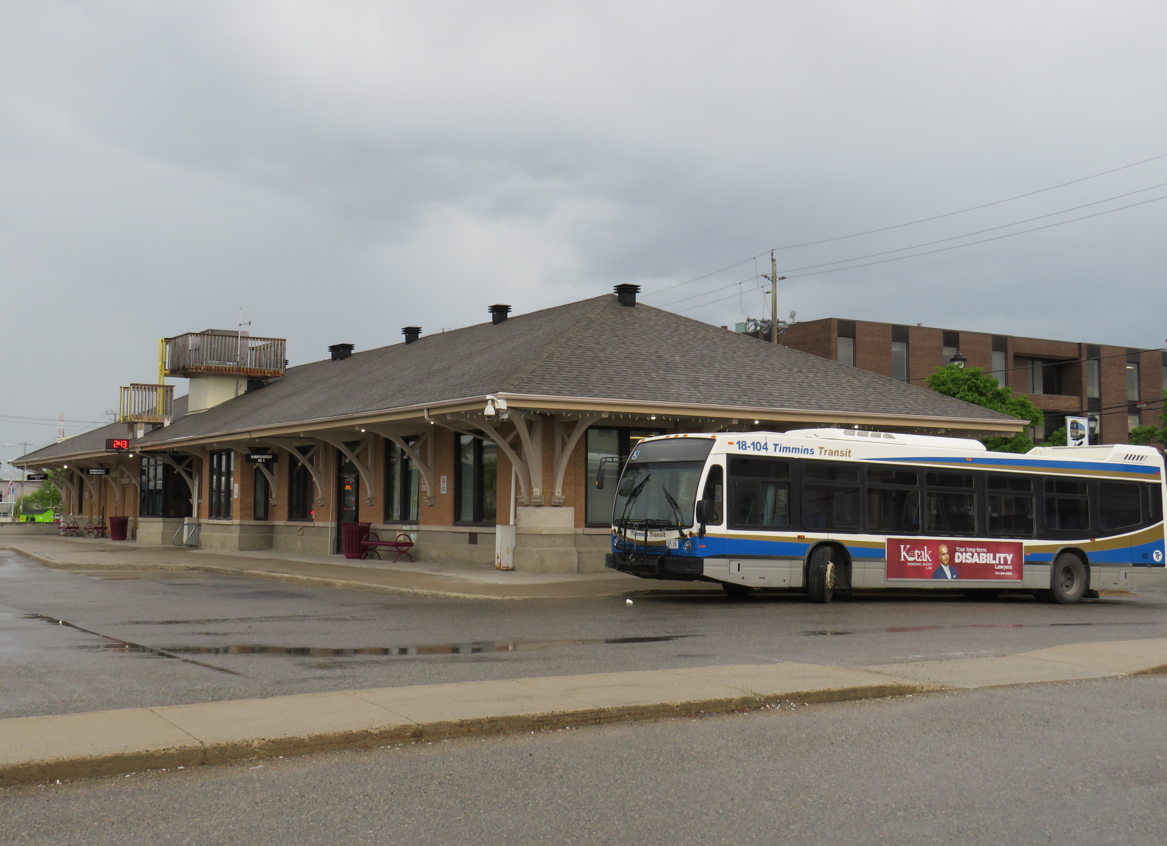
The Timmins Station is now a bus terminal serving local transit and Ontario Northland intercity coaches
Unfortunately, the train will not be returning to Downtown Timmins. The end of rail is at Highway 101 at Porcupine, 13 kilometres to the east. Since abandonment of the passenger rail service, the railway was torn out west of South Porcupine; the railway overpass over Algonquin Boulevard (Highway 101) near the old Timmins Station was removed last year. Ore collected at the open-pit gold mines, previously loaded onto railcars, is now sent on massive dump trucks for processing at a plant at Hoyle, east of Porcupine.
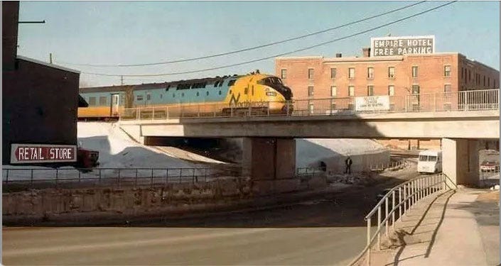
The Northlander train departs Timmins on the now-demolished railway bridge over Algonquin Boulevard in the early 1980s
Happily, the Timmins station building remains in use as a transit terminal and Ontario Northland coach stop; it will likely serve a bus shuttle to the new Timmins-Porcupine Station now under construction.
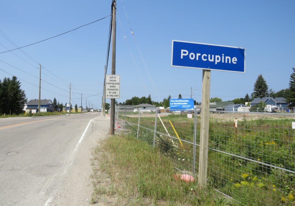
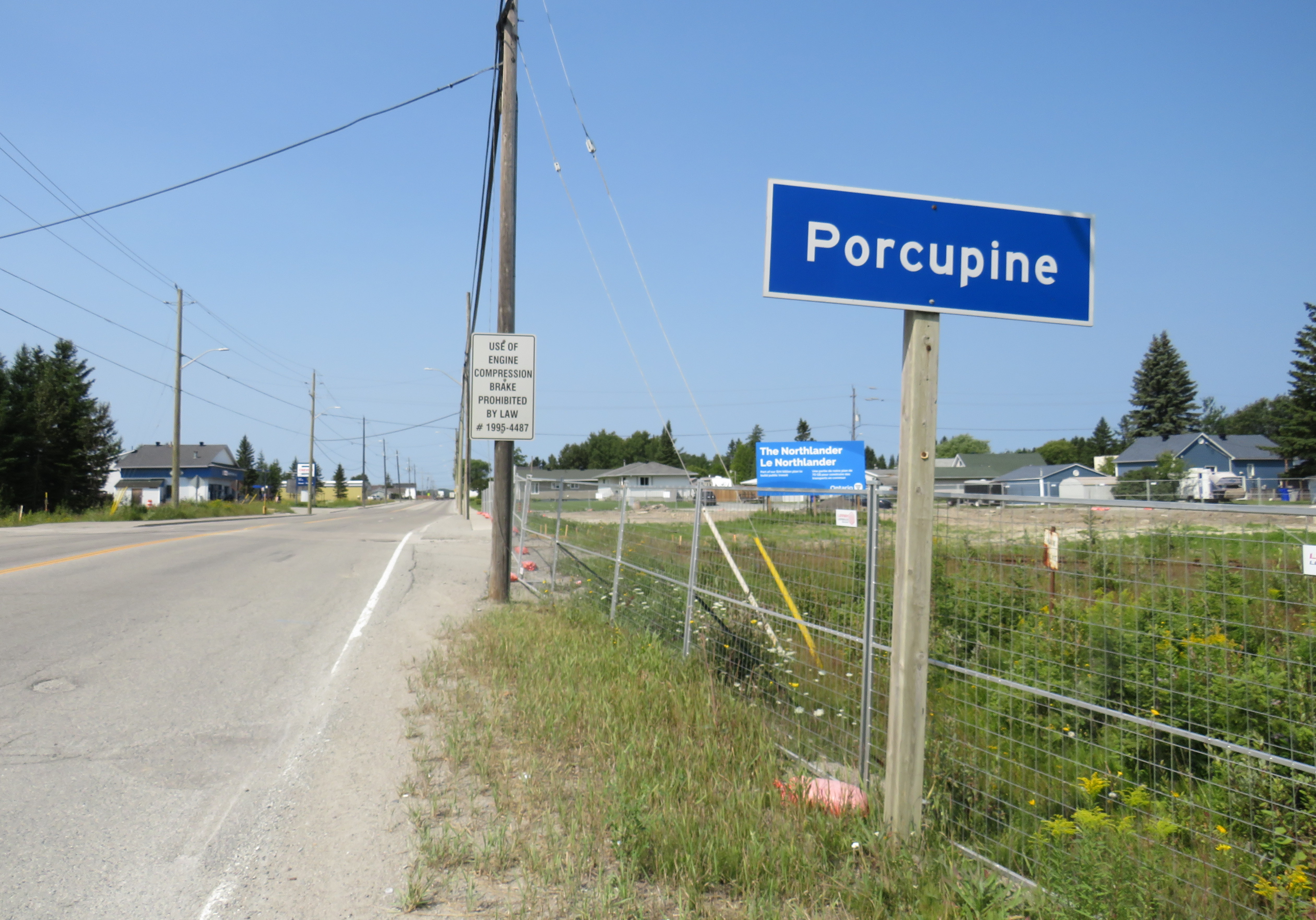
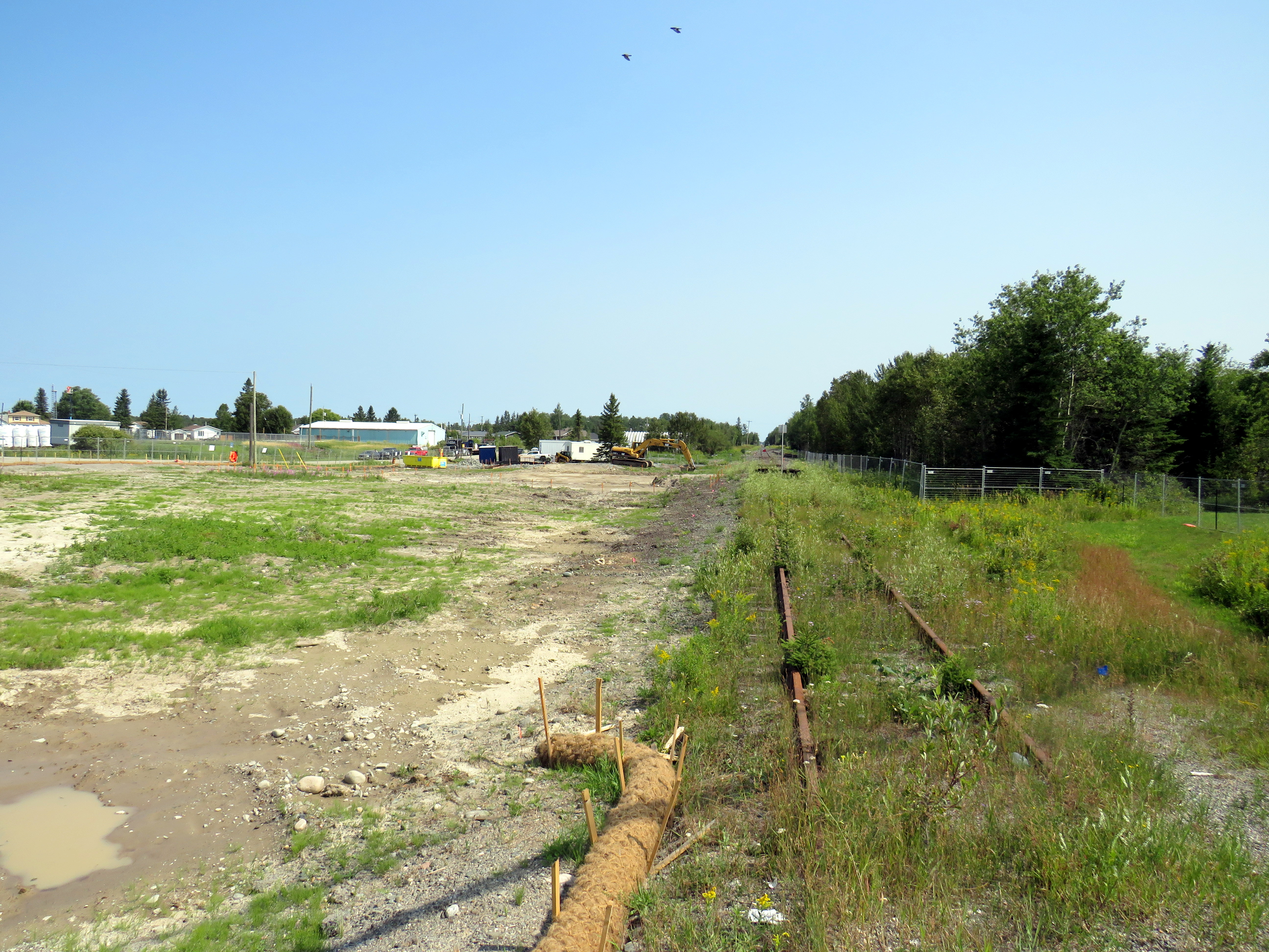
The end of track at Highway 101 in Porcupine; construction has started on the new terminal station for the Northlander
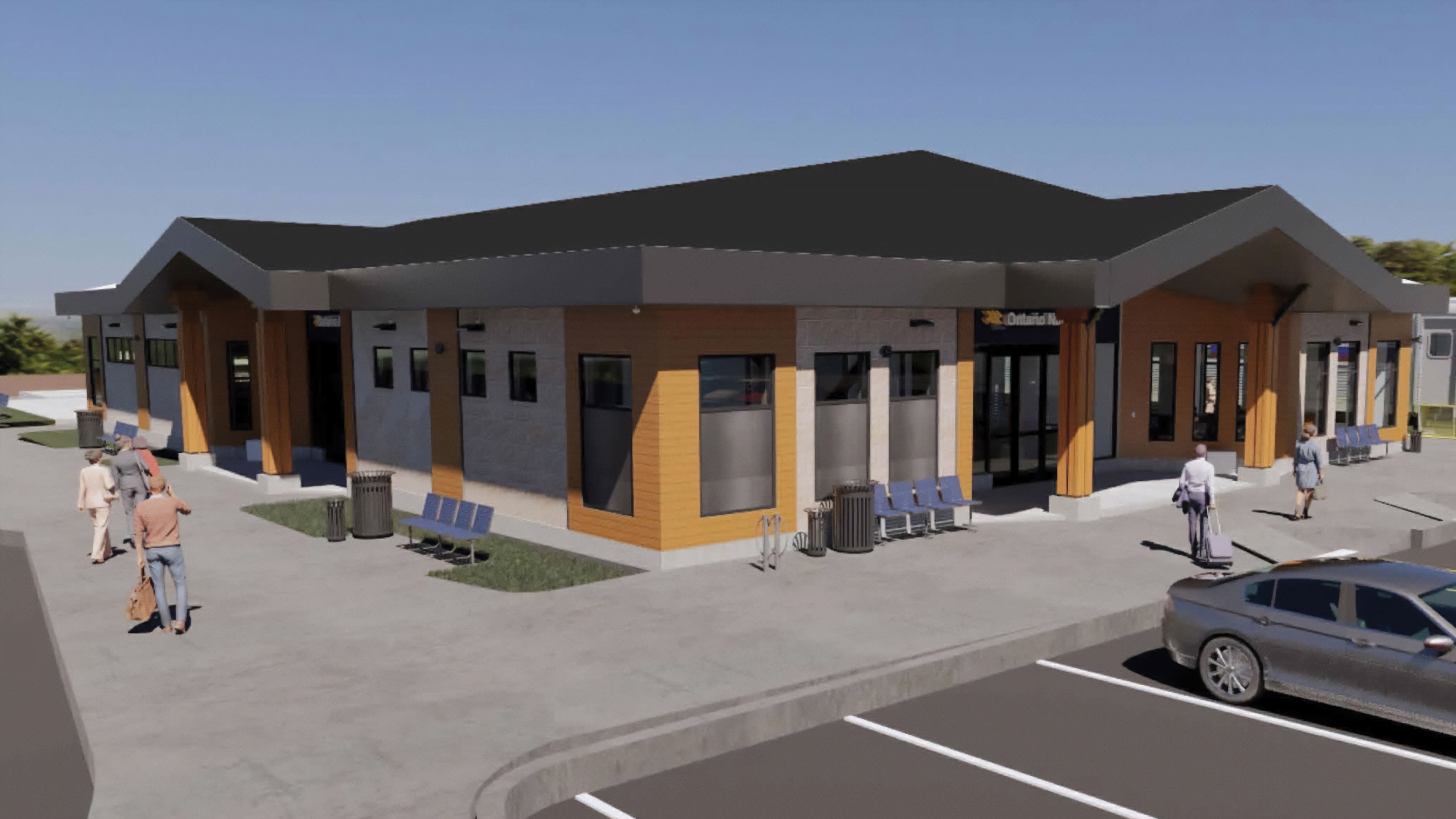
Since I last wrote about the promised return of the Northlander, there have been a few updates. The new station building will be somewhat more substantial than first proposed; it will include washrooms, a waiting area, and a service counter for ticket sales and bus parcels. This is welcome, as there is very little around the Porcupine station site. Nearby, there are only a few dozen houses, a propane depot, a small park, and a gas station across the street.
Rendering of new Timmins-Porcupine Station
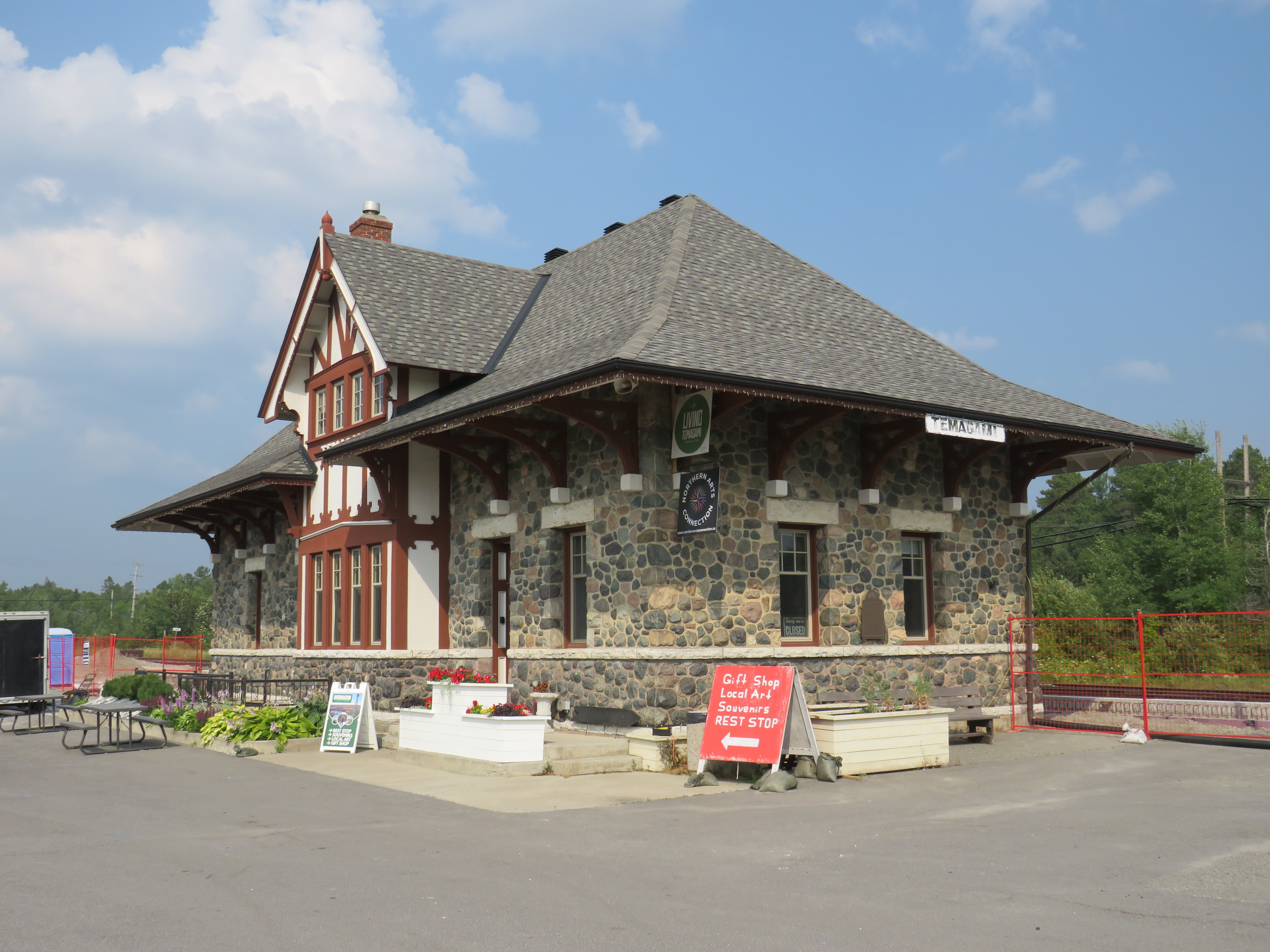
Most other stations will still just get enclosed shelters, though at Matheson, Swastika, New Liskeard, and Temagami, the construction of new platforms is well underway. Even though there are heritage passenger stations at Matheson (which just escaped demolition), Temagami, South River, Huntsville, and Gravenhurst, there will just be shelters for Northlander passengers at these stops. Shelters depicted on the Ontario Northland website resemble those at BRT stops or GO Transit station platforms, with lighting and overhead heat.
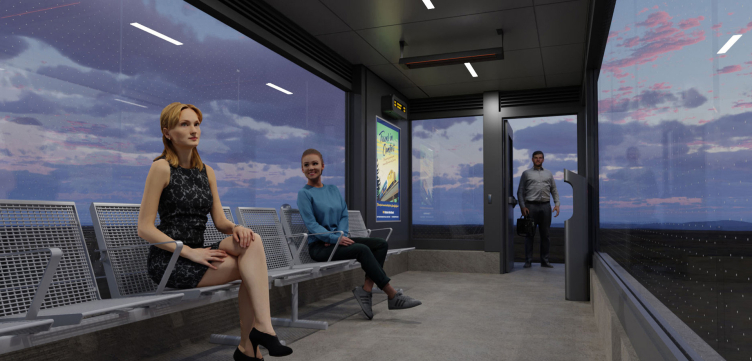
Fencing protects the construction of a new platform beside the handsome Temagami ONR Station. The station building will not be used for passenger services; it currently hosts a café and gift shop. Rendering of passenger shelter for Northlander stops
It will be nice to see the return of passenger rail to Northeastern Ontario when it launches in two years. Unfortunately, I remain unsure whether it will attract enough riders to be seen as viable after a year or two of service.