On February 26, 1920, Ontario’s provincial highway network was born. That year, 16 highways were established across southern Ontario, between the Ottawa and Detroit Rivers. These highways, previously maintained by townships and counties, connected the province’s largest cities and provided important links to Quebec and the United States.
In 1925, these highways were assigned numbers 2 through 17, in rough order from west to east. There was no Highway 13; instead, the Port Hope-Peterborough Highway was assigned Route 12A. Highway 2, alternatively known as the Trans-Provincial Highway, extended from Windsor to the west to the Quebec border in the east, continuing eastwards as Quebec Highway 2. (That province renumbered its entire highway system in the 1960s and 1970s.) Meanwhile, Highway 15, connecting Kingston and Ottawa, took a deviating “S” shaped route via Perth. Highway 7 only went as far east as Brampton. While the province used triangular highway markers at the time, in 1930, they were renamed “King’s Highways” and assigned crowned highway shields still in use today.
The map below illustrates the highway system at the time.
Several of Ontario’s first highways no longer exist. Highway 12A was later renumbered to Highway 28; that first section was later downloaded to Northumberland and Peterborough Counties. The first section of Highway 14, which originally ran between Foxboro and Picton via Belleville, was later integrated with the longer and more important Highway 62. The short stub of Highway 14 between Foxboro and Marmora was also downloaded in the 1990s.
Unfortunately, there have also been some setbacks. Wroute, a shared taxi service in the Kitchener-Guelph-Hamilton triangle, was operational for less than a year. Though GO Transit added new weekday trains between Guelph and Kitchener, none allow for Kitchener-bound commutes, and there has not been interest in serving those gaps identified by Wroute.
Outside of Northern Ontario and the Golden Horseshoe, many cities and towns remain disconnected from nearby communities and larger centres. Though every city and town in Ontario had daily bus and/or rail service in the 1980s, many communities are now completely inaccessible for anyone without access to a car. Though GO Transit expanded to Peterborough, Brantford, Niagara, and Kitchener in the last fifteen years, they are extensions of GO’s radial network from Toronto rather than a true intercity network.
St. Thomas, population 41,000, is the largest city in the province without any passenger links, despite being a short drive to London. Many other cities and towns — particularly in Midwestern and Eastern Ontario — find themselves in similar situations. A few other cities, such as Sarnia (which has just one train a day each way to London and Toronto), are grossly under-served.
But thanks to municipal innovation and a new provincial grant program, this is finally changing. Though several municipalities addressed this problem early on, three new inter-municipal bus systems began operations in 2019, with many more launching this year.
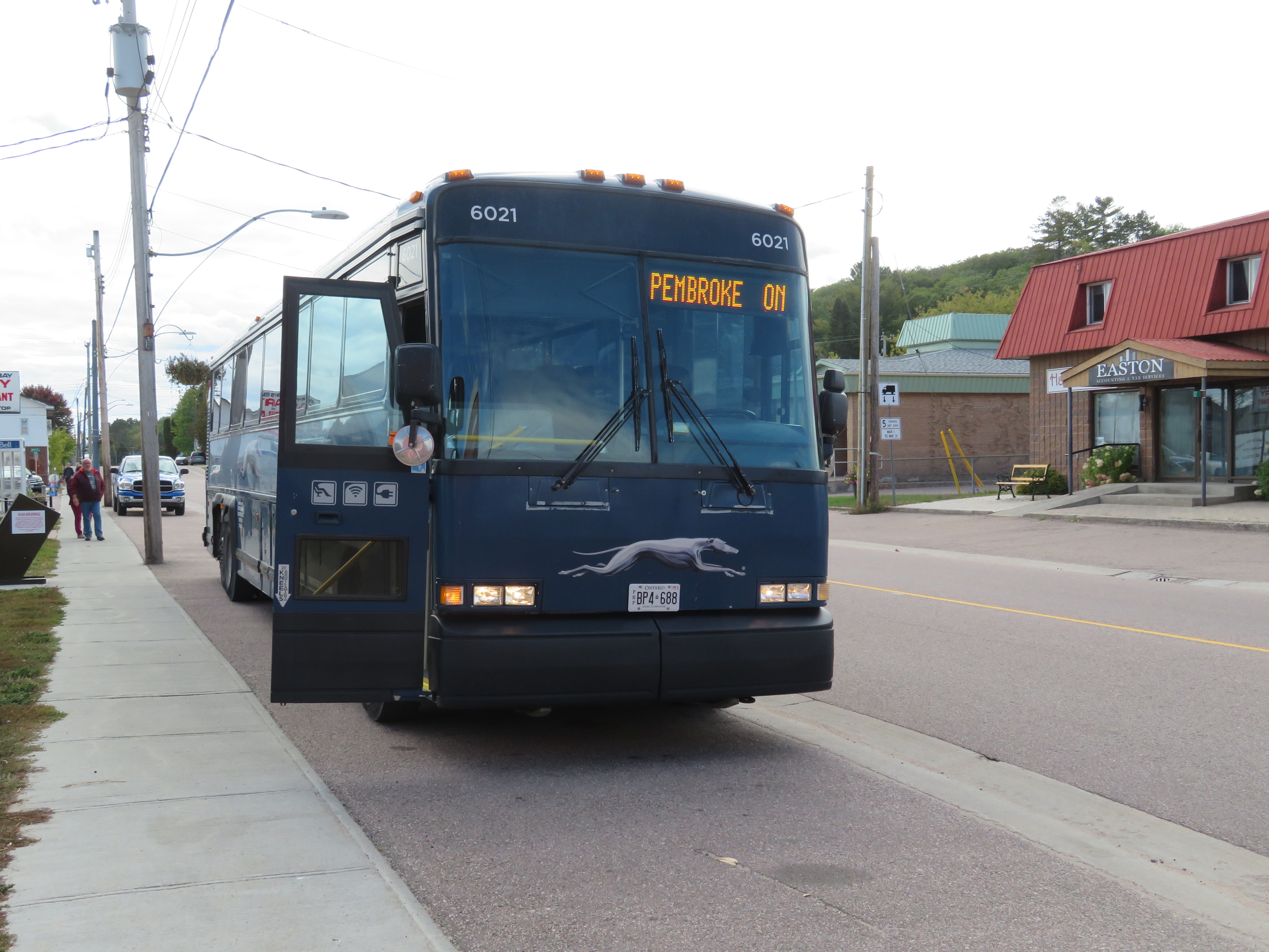
A few weeks ago, I went for another long-distance bus trip. I started my journey in Downtown Toronto, and continued on to Peterborough and Pembroke, before arriving in Ottawa late in the evening. Apart from the Toronto-Peterborough leg aboard a packed, delayed bus, this was the most pleasant of all my long-distance bus trips.
Greyhound’s Peterborough-Pembroke route only operates a few days a week, on Friday, Saturday, and Sunday. It is one of the last rural bus routes operated by Greyhound Canada as most remaining routes operate on highways between large urban centres. The bus follows Highways 28, 62, and 60, stopping at small towns such as Bancroft, Maynooth and Barry’s Bay. North of Lakefield, the route passes through the Canadian Shield, with its lakes, rocks, and trees.
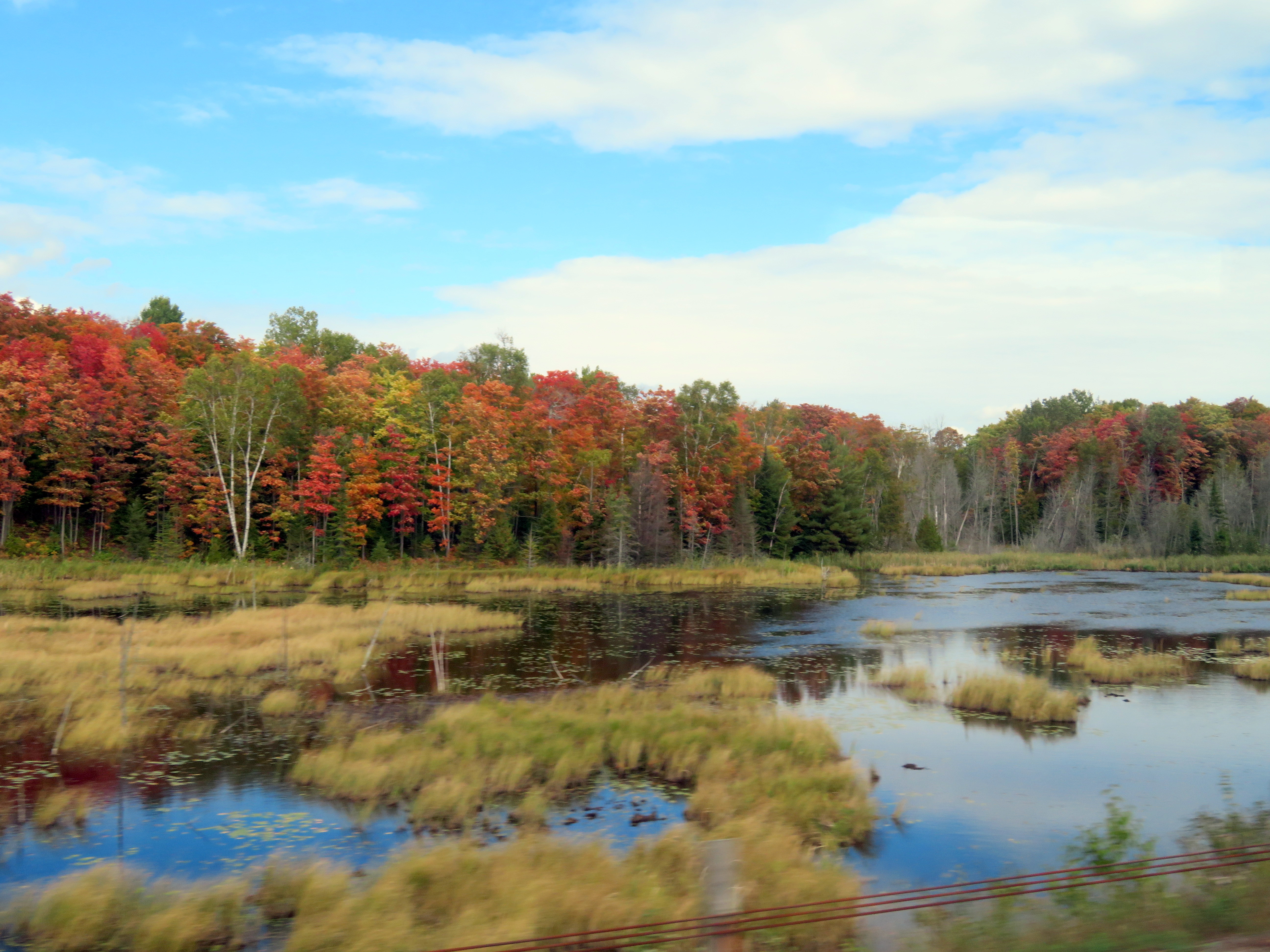
As I traveled on last Friday in September, the fall colours were almost at their peak in the Haliburton Highlands, making this an especially scenic ride. There was an informal fifteen-minute stop in Barry’s Bay, enough time to get a decent coffee and a snack.
The view from Highway 28 near Bancroft, September 27
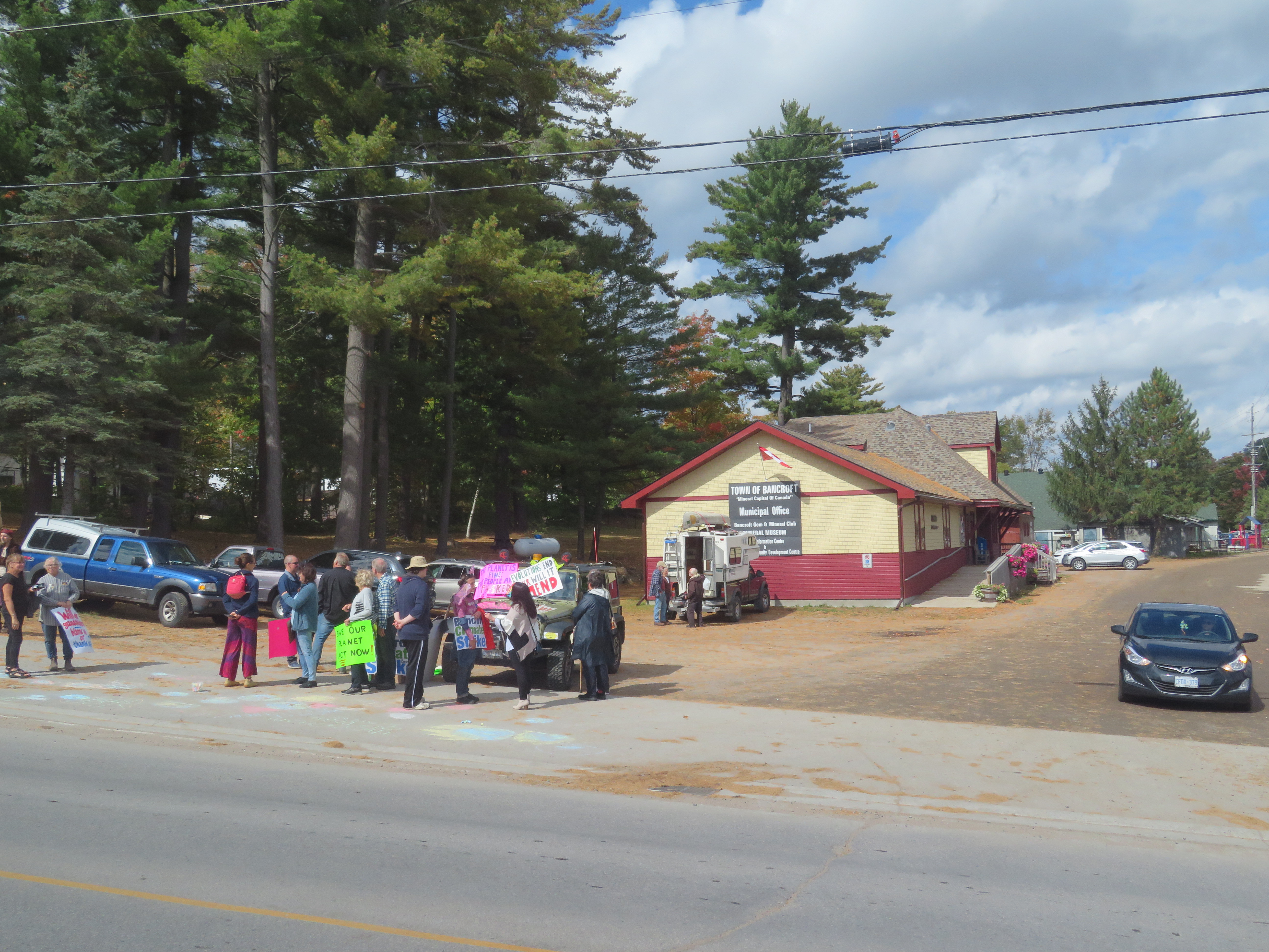
At Bancroft, we passed by the old Central Ontario Railway Station. Passenger service ended in the 1950s, while the tracks were torn up in the 1980s. The station was preserved and is now a local museum. In front, a dozen citizens took part in a local climate strike that took place across Canada, part of the Global Week for Future. It was nice to see residents take part, even in small town Ontario.
Climate strikers in Bancroft. The former railway station stands behind
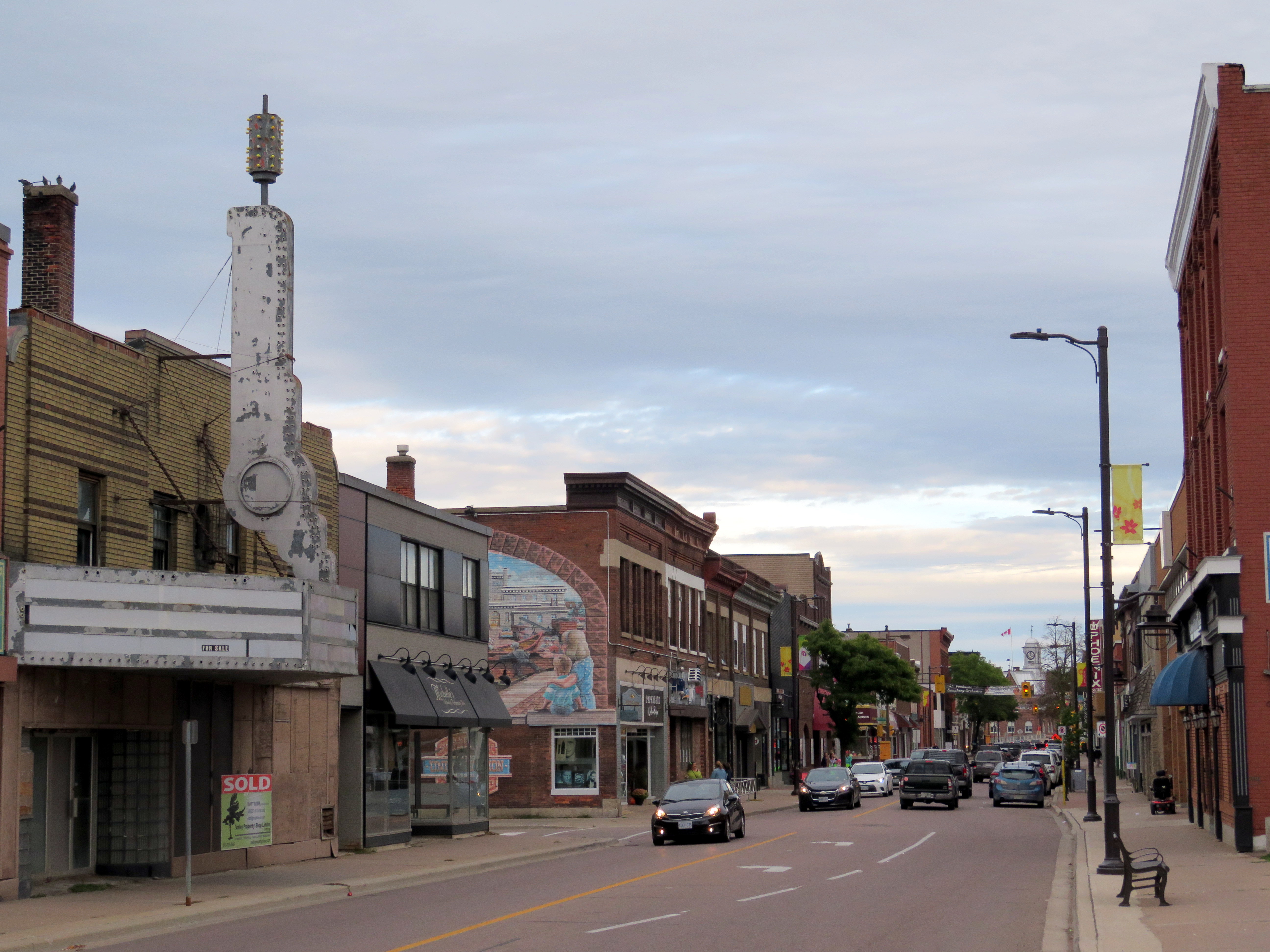
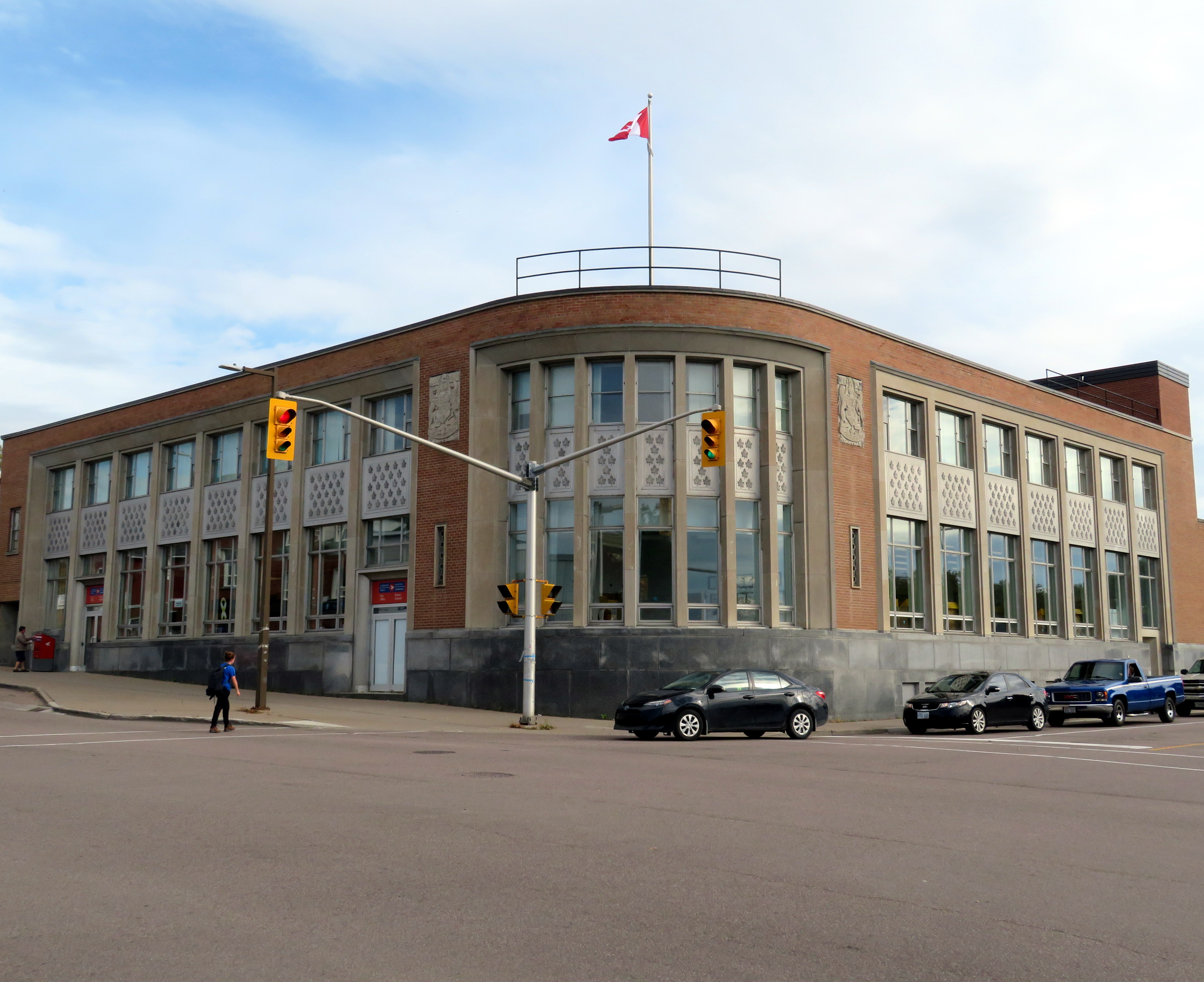
At Pembroke, I had several hours before the Ontario Northland bus departed for Ottawa. While Pembroke’s downtown core could use some TLC, it has great bones and a great collection of heritage buildings, including a late Victorian post office, its late Art Moderne replacement, the historic Renfrew County courthouse, solid commercial blocks, and a fascinating library.
Downtown Pembroke
Pembroke’s post offices. The 1888 building, designed by Thomas Fuller, is now City Hall. The 1950s replacement, on the left, still houses Canada Post.
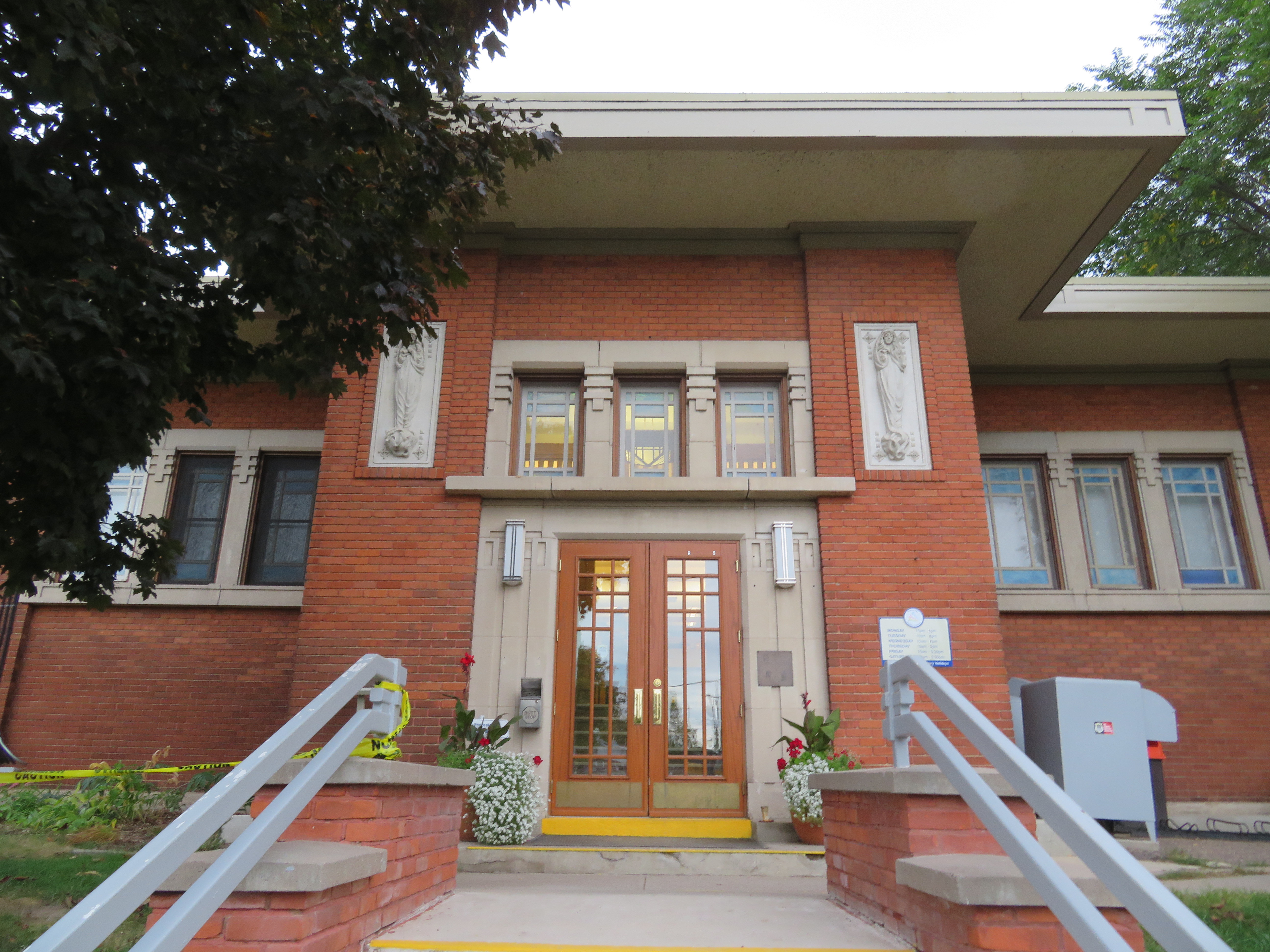
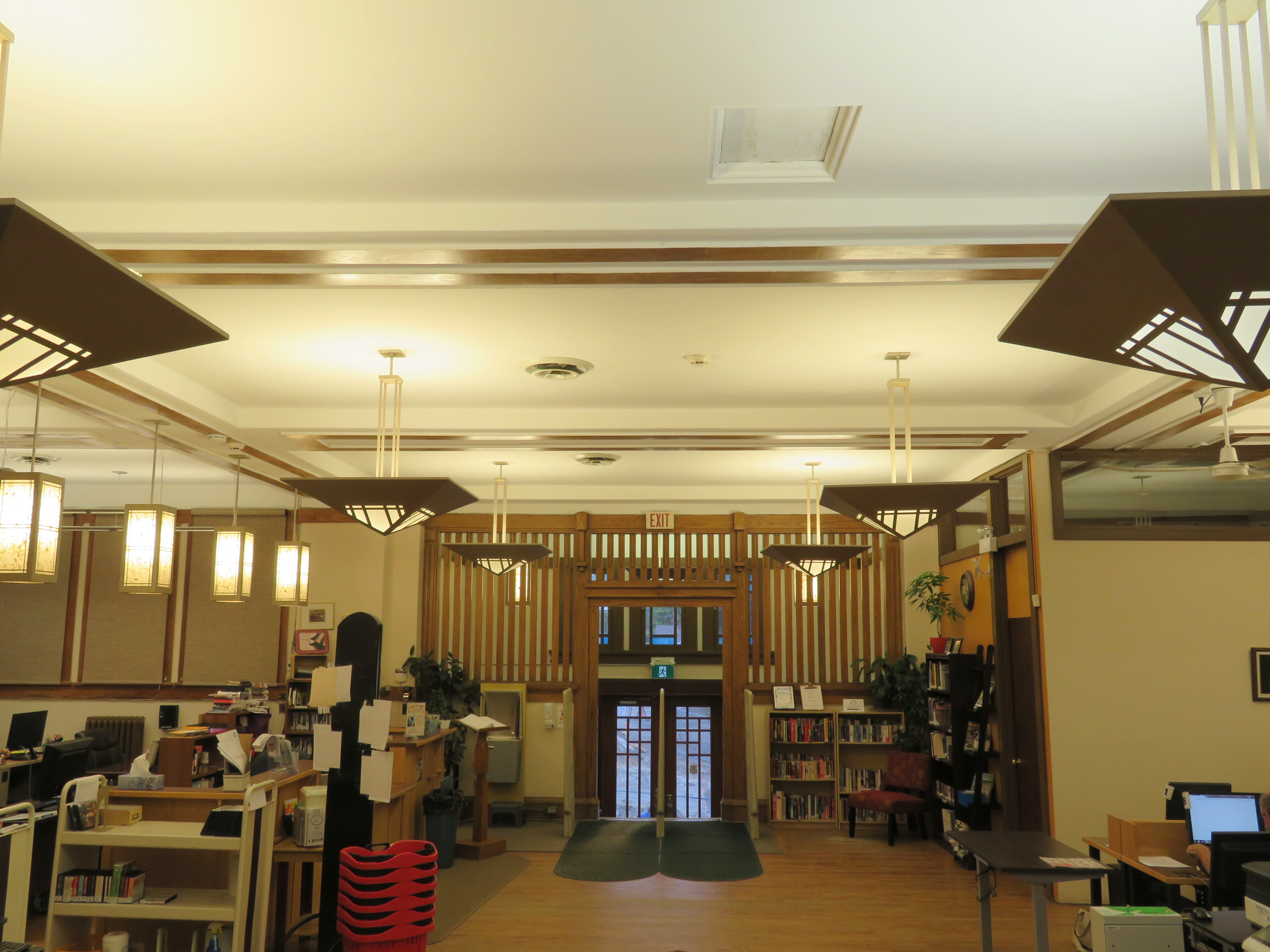
Pembroke’s public library is especially unique, as it looks like it could have been designed by Frank Lloyd Wright. Built in 1914, it was designed by Francis Conroy Sullivan, a Canadian-born architect who studied under Wright in Chicago before establishing his firm in Ottawa. Expansions and renovations have remained faithful to the Prairie Style architecture.
Entrance to the Pembroke Public Library
Library interior
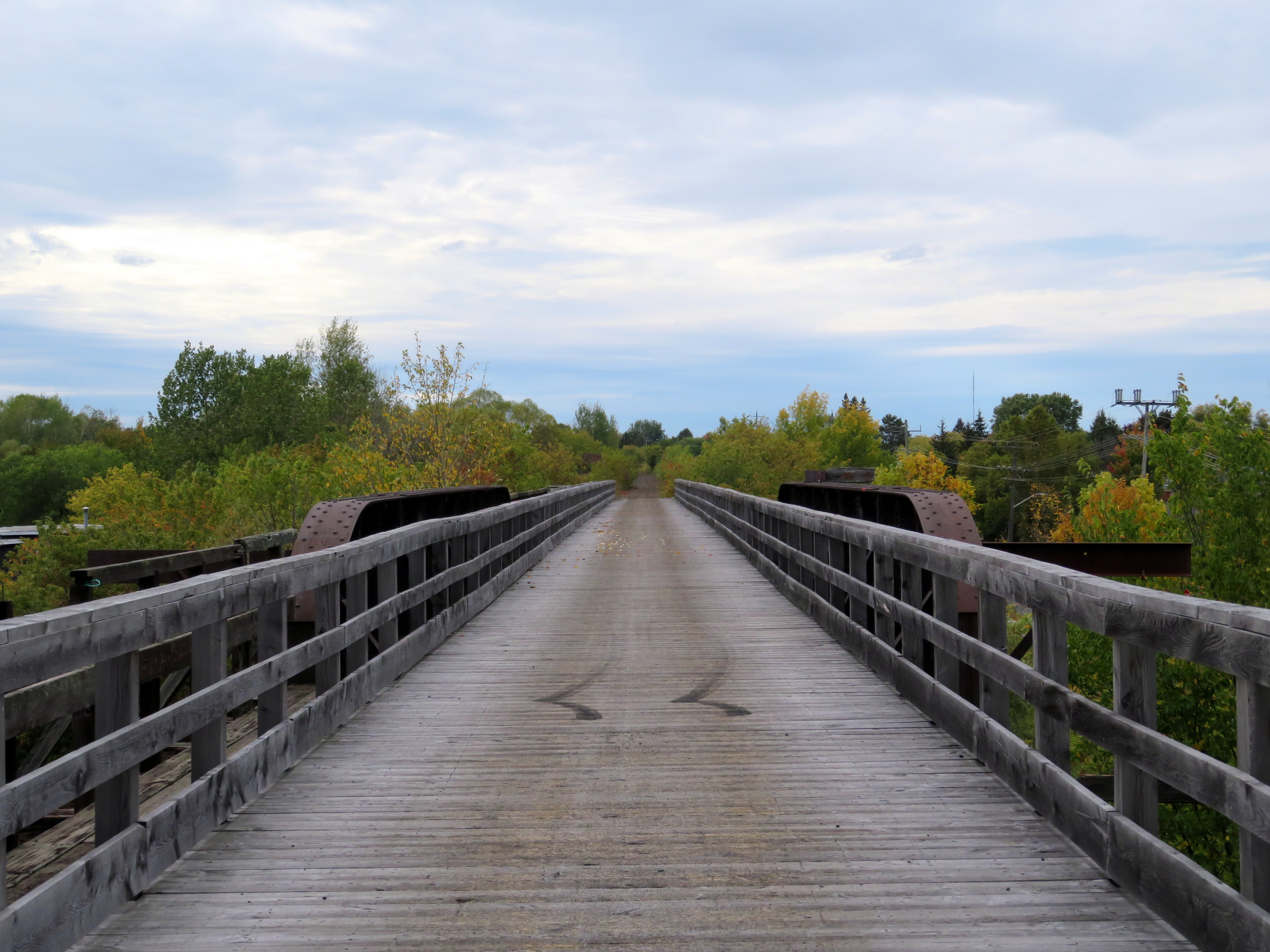
Though Pembroke was served by three different railways — the Canadian Pacific transcontinental mainline, a branch of the Canada Atlantic that operated between Montreal and Parry Sound, and the Canadian Northern — all tracks were removed by 2013, when Canadian National ripped up the Beachburg Subdivision. None of the station buildings survive, but the abandoned rights-of-way are still intact. At the west end of town, a long trestle now carries a snowmobile trail where the CN mainline once crossed the Indian River.
Former CN trestle, Pembroke
The removal of the CN and CP routes through the Ottawa Valley were especially unfortunate, as all through freight and passenger traffic across Canada must now pass through Greater Toronto. This was the result of cost-cutting and the loss of local rail customers, such as lumber and pulp industries. The Commonwealth Plywood plant in Pembroke still stands as a reminder of the industrial past of the Upper Ottawa Valley.
Abandoned Commonwealth Plywood plant
The last passenger train, VIA’s Canadian, called at Pembroke in 1990. But there are two daily bus trips in each direction between Ottawa and North Bay/Sudbury, one operated by Greyhound, the other by Ontario Northland. From Pembroke, I was able to take a Northland bus that left at 9:00 PM, arriving in Ottawa by 11:00 PM. This gave me plenty of time for dinner after a long walk around town.
My trip to Pembroke made for a pleasant detour, giving me a chance to see another part of Ontario.
Early European settlers to Ontario were not very imaginative when they came up with local place names. Although some towns and townships have First Nations names (Toronto, Chinguacousy, Niagara), or named for First Nations leaders allied with the British (Tecumseh, Brant), most cities, towns, and townships were given the names of European settlements, British royals and nobility, or the names of those settlers.
The list of Ontario towns and cities includes no less than ten world capitals: Athens, Brussels, Delhi, Dublin, London, Paris, Vienna, Warsaw, Wellington, and Zurich. Other towns and cities across the province include the names of British royalty and nobility (Cobourg, Hanover, Port Arthur, Fort William, Richmond Hill) or the towns settler arrived from. These towns can be found throughout the province.
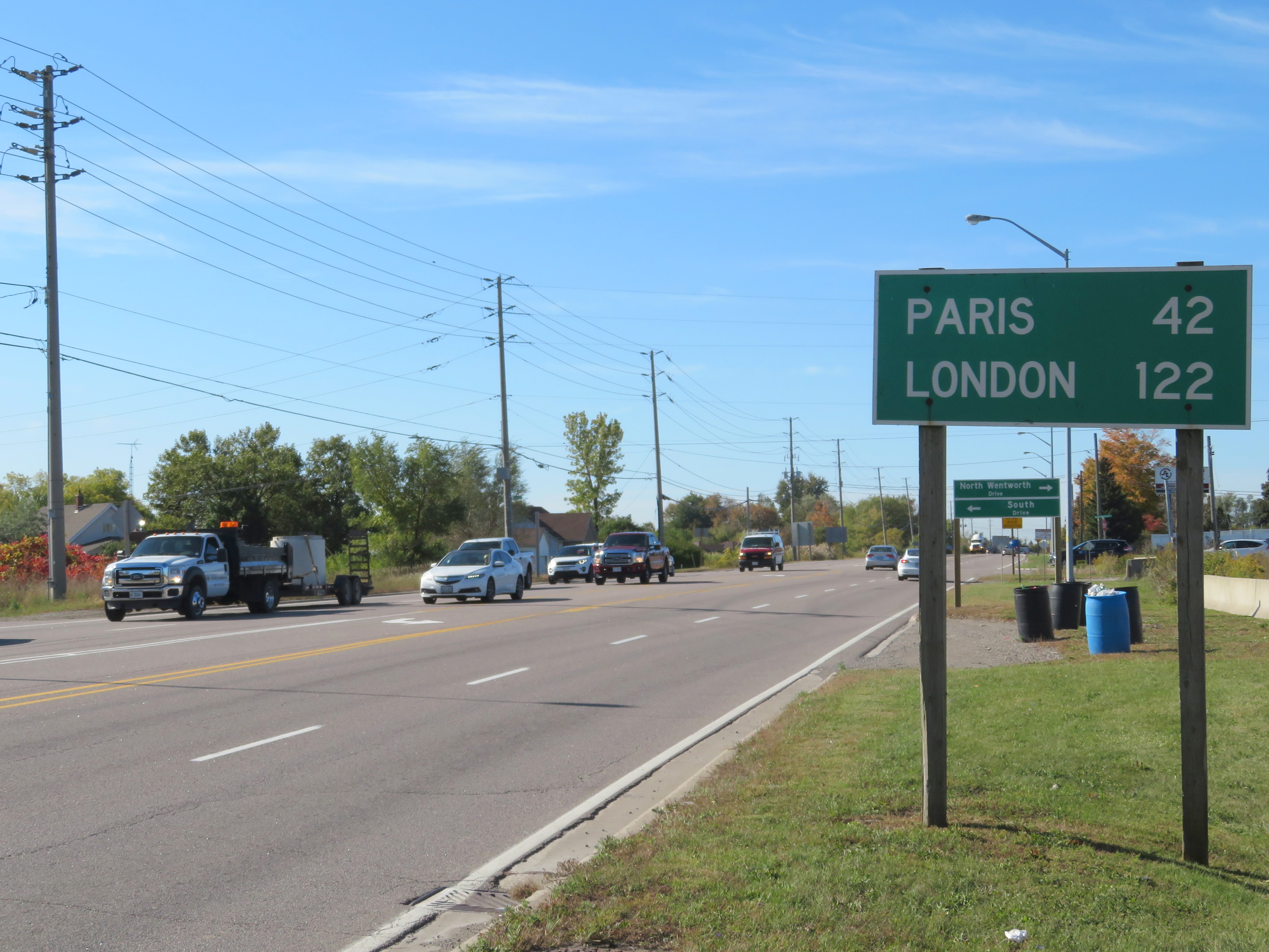
At Clappison’s Corners, a busy intersection outside of Hamilton, Paris and London appear on the same sign, amusing the occasional visitor. By driving west on Highway 5, Paris is just 42 kilometres away, with London an additional 80 kilometres’ drive via Highway 2.
The other Covent Garden Market, London
London was named for the British city in 1793, and was chosen as the site of the new capital of Upper Canada by governor John Graves Simcoe. He felt that the interior location, on the banks of the Thames River (Simcoe named that, too), would be safe from American attack. However, York (now Toronto), became the capital. But London became the regional centre for Western Ontario, and is now the world’s second-largest London with over 350,000 residents.
Paris, Ontario’s main street backs onto the Grand River
Paris was named in the 1840s not for the French capital, but for the large gypsum deposits in the area, used to make plaster of Paris. In 2000, the town of Paris was amalgamated with rural Brant County. The community has a population of just 12,000, the third-largest Paris (between Paris, Texas and Paris, Tennessee).
Before the provincial government downloaded thousands of highways to local municipalities in the late 1990s, Highway 5 ran from Highway 2 (Kingston Road) in Scarborough to Highway 2 again at Paris. At Paris, a motorist could continue on Highway 2 west to London and beyond. New freeways, such as Highway 403, offered a faster trip, while local roads, such as Highways 2 and 5, were downloaded as a cost-cutting measure. Today, Highway 5 runs for just 13 kilometres connecting Highways 6 and 8.
Today, the route to Paris and London is merely an anachronism of an earlier time, when King’s Highways covered the province and when motorists passed through many small towns on their way to places like Toronto, Detroit, and Montreal. At some point, the sign at Clappison’s Corners will be removed to make way for a new interchange. Until then, this humble monument to European settlement and rural King’s Highways will stand guard.
The French River at Highway 69, where Northern Ontario truly begins
Last week, the leaders of the three major provincial parties (Liberals, Progressive Conservatives, and the New Democrats) met in Parry Sound, at a debate dedicated to issues specific to Northern Ontario. It was the second of three debates scheduled ahead of the June 7, 2018 general election.
But is Parry Sound, a town that’s only a two hour’s drive north of Toronto (when free of weekend Cottage Country traffic) really a part of Northern Ontario? That depends on who you ask. Even government agencies disagree. In my opinion, though, Parry Sound isn’t in Northern Ontario, even though the district it’s located in shares some characteristics of this vast part of the province.
Despite living my entire life in the Greater Toronto Area, I have an affinity for Northern Ontario, particularly the northeastern part of the province. My father’s hometown is Timmins, one of my siblings lives in Sudbury, and I have visited both cities many times. I made a trip up to Sault Ste. Marie to ride the Algoma Central Railway passenger train between Sault Ste. Marie and Hearst and back before it was cancelled, and I still lament the loss of the Northlander, Ontario Northland Railway’s passenger train between Toronto and Cochrane that was terminated in 2012. I even made it all the way to Moosonee, on the James Bay coast.
The northern part of this province covers a huge area — over 800,000 square kilometres, larger than France, Belgium, and the Netherlands combined — but has a population of just over 750,000. It is even crossed by a time zone boundary. Despite my connection to the region, I had yet to make a proper visit to Thunder Bay and Northwestern Ontario (I finally paid a visit in August 2019).
The North includes many First Nations communities accessible only by plane or ice road. Other communities, with names like Dryden, Kapuskasing, Iroquois Falls, and Kirkland Lake, were established to serve mines or pulp mills — resulting in a very different economic landscape than the agricultural and industrial south. In recent decades, many of those mines and mills have closed, eliminating many towns’ only major employer.
In a province dominated by the urban centres in the Greater Golden Horseshoe, Ottawa, and London, it’s too easy to ignore the North.
So how do people actually define Northern Ontario?
Traditionally, Northern Ontario begins at the French River, Lake Nipissing, and at the Mattawa River. North Bay, which calls itself the “Gateway to the North” sits right on this line. For administrative purposes, this includes the entirety of Sudbury and Nipissing Districts, which extend south of the French and Mattawa Rivers, and includes most of Algonquin Park. It also includes Manitoulin Island, which can only be reached year-round from the north, through Sudbury District.
The Canadian Shield, the defining landscape of most of Northern Ontario, starts further south. Driving north from Toronto on Highways 400 or 11, the shield starts about where Simcoe County ends and Muskoka District starts. But the Canadian Shield also encompasses large sections of the City of Kawartha Lakes and Peterborough, Hastings, Frontenac, and Lanark Counties and the entirety of Haliburton County.
The various definitions of Northern Ontario, including the county, regional and district boundaries.
But the provincial and federal governments both have special economic development funding programs whose boundaries take a more liberal definition of Northern Ontario. FedNor, the Government of Canada’s economic development agency, includes Parry Sound and Muskoka Districts. The Northern Ontario Heritage Fund Corporation, a provincial agency, includes Parry Sound District, but not Muskoka District.
Whether Parry Sound and Muskoka are considered part of Northern Ontario is very much a political question. In 2004, the newly elected Liberal government chose to remove Muskoka from the areas eligible for provincial grants meant for northern communities — Muskoka being a reliable Progressive Conservative seat, and the riding of the previous PC premier, Ernie Eves.
Parry Sound District, while not, in my view, part of Northern Ontario, at least shares some similar characteristics with neighbouring Sudbury and Nipissing Districts. It includes many isolated communities, and apart from the Town of Parry Sound itself, it has a very sparse population. Muskoka, on the other hand, is more urbanized with three larger towns, and is much more popular for recreation, particularly during the summer. Muskoka also has a regional government — the District Municipality — while much of Parry Sound District’s land is unorganized — meaning lands without any municipal government.
And if one considers Muskoka to be part of Northern Ontario, why not also include Haliburton County, which also has a sparse population and is relatively isolated from the urbanized south? A line needs to be drawn somewhere, and there is no valid reason why Muskoka should ever be considered a part of Northern Ontario. There might be a case for Parry Sound District, but definitely not cottage country.
Last week, the provincial government announced two new post-secondary educational campuses in Toronto’s fast-growing western suburbs, due to open in 2022. Wilfrid Laurier University will be partnering with Conestoga College on a new facility in Milton. Brampton will be getting a new Ryerson University campus in partnership with Sheridan College. Both new campuses, each receiving $90 million in provincial capital funding, will be focused on undergraduate STEAM (science, technology, engineering, arts, and mathematics) programs. Both will host up to 2,000 students once the new facilities are fully operational.
Bayside Mall, formerly the Sarnia Eaton Centre, on a Saturday morning in 2013. Most stores are vacant or occupied by non-profits or independent businesses.
The Toronto Eaton Centre, large, famous, and vital, is only one of many malls built in the downtown cores of Ontario cities between the 1960s and 1990s. From Thunder Bay to Cornwall, the construction of new enclosed shopping centres were seen as a necessary tool to keep the old city centres vibrant and relevant in the face of competition from new suburban malls. But only in the province’s two largest cities did the concept work. Elsewhere, these urban shopping complexes were left largely vacant within ten years of opening, when leases expired. When the Eaton’s department chain went bankrupt in 1997, huge voids were left behind that developers and municipalities struggled to fill.
The Toronto Eaton Centre was opened in two phases between 1977 and 1979. It added hundreds of shops and new office space to Downtown Toronto, anchored by a new Eaton’s flagship and was connected to the Simpson’s store across Queen Street. Today, the Eaton Centre is Canada’s second largest mall (including the Hudson’s Bay/Saks Fifth Avenue building) and the Toronto region’s second most productive shopping centre in terms of sales per square metre. In Ottawa, the downtown Rideau Centre, opened in 1983, is the busiest and most productive mall in that region (Retail Council of Canada, 2016).
But elsewhere in Ontario, downtown malls — mostly built with municipal and/or provincial government support — have been, without exception, commercial and urban development failures. Not only did they suffer from high vacancy rates, they helped to wreck the downtown cores they are located in rather than foster the economic revitalization they once promised.
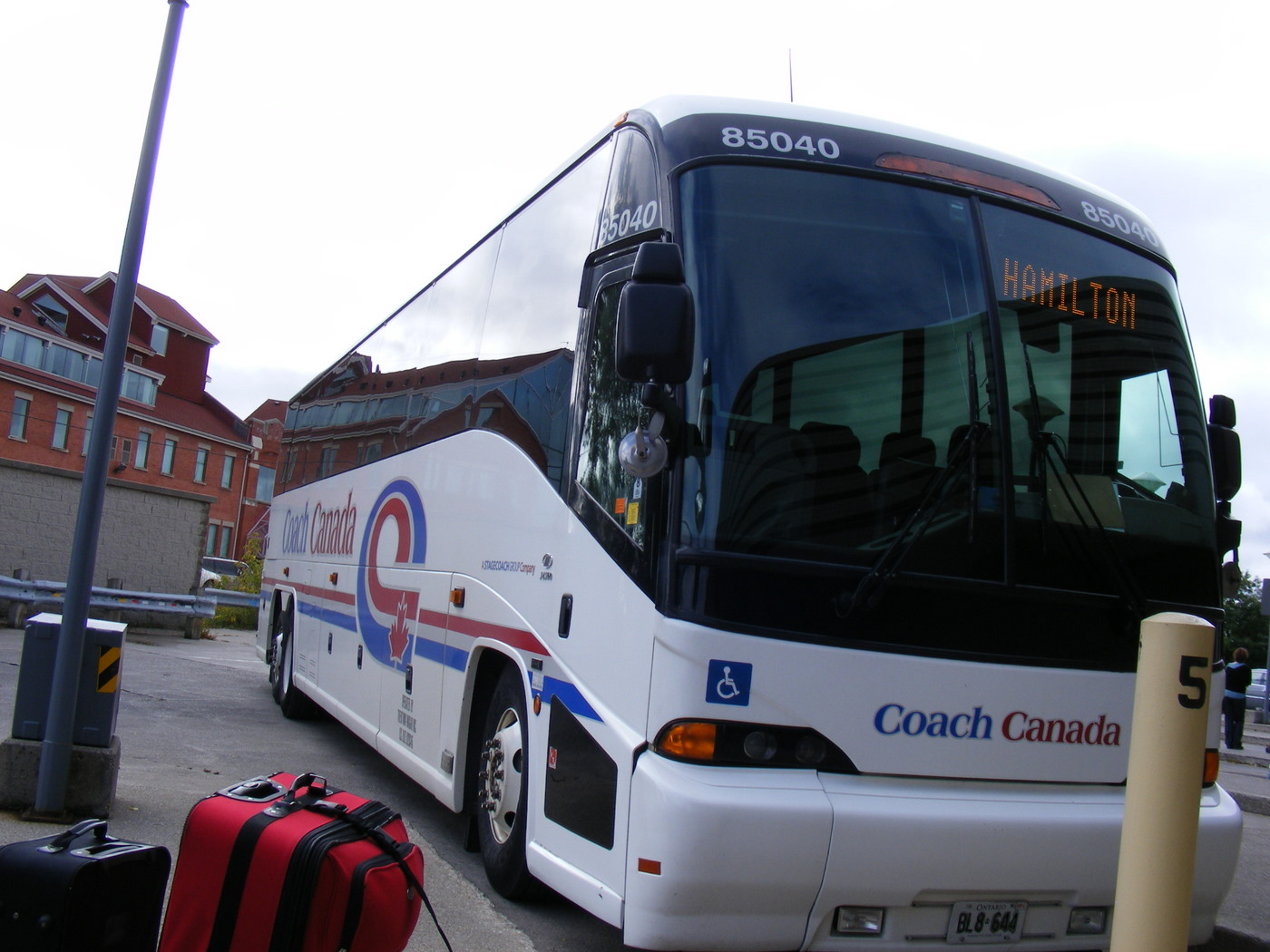
Coach Canada bus at the Guelph Terminal, three weeks before it abandoned the Guelph-Hamilton service in 2009
The state of intercity bus travel in Ontario is bleak. While there are still many bus options if you’re travelling between large cities, since the 1980s, hundreds of weekly bus trips and dozens of routes have been cut in Ontario, leaving many small cities and towns with minimal or no intercity transportation options. St. Thomas, a city of 45,000 located a mere 25 kilometres south of London, once had daily buses going in every direction. Today, it has none. Although studies on the modernization of the province’s beleaguered, skeletal bus system got underway in 2016, bus travel remains an afterthought.
Brockville and St. Thomas are two small Ontario industrial cities that wouldn’t normally attract much attention. But both communities are working on remarkable projects that re-purpose former railway infrastructure to create interesting public spaces that don’t just lure out-of-town visitors, but add a significant asset to be enjoyed by the entire community. The St. Thomas Elevated Park and the Brockville Railway Tunnel are the type of local, community-driven projects that I can get excited about.
St. Thomas likes to call itself the Railway Capital of Canada. One hundred years ago, five separate railway companies served the city. The Canada Southern (CASO) Railway, later purchased by the Michigan Central Railroad (which became part of the New York Central empire), built its headquarters and shops here; its double-tracked corridor was the fastest route between Buffalo and Detroit. St. Thomas was a stop on the London and Port Stanley Railway, a busy electric railway that ran regular passenger services until 1957. On the edge of town is the Jumbo monument, near the site where the famous Barnum and Bailey circus elephant was killed during a train stop.
Jumbo Monument, at the westerly entrance to Downtown St. Thomas
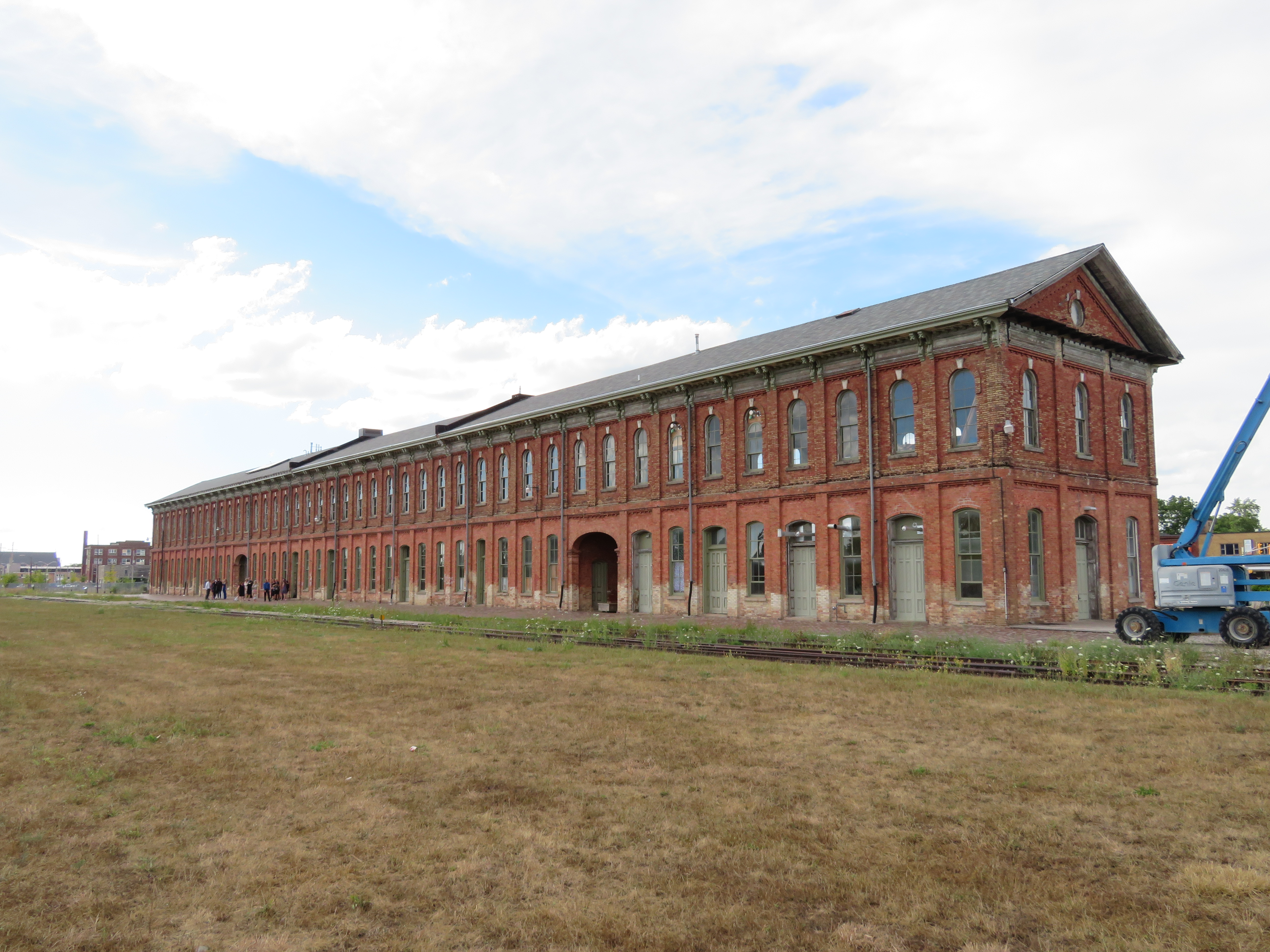
The 1873 Canada Southern Station. The tracks it once served have disappeared.
Today, most lines into St. Thomas are abandoned, including the once-mighty Canada Southern; major rail customers such as Ford Motor Company closed local factories. The last passenger train, Amtrak’s Niagara Rainbow, departed from St. Thomas in 1979. The Port Stanley Terminal Railway runs tour trains along part of the old L&PS route, but its trains — for now — only board in Port Stanley.
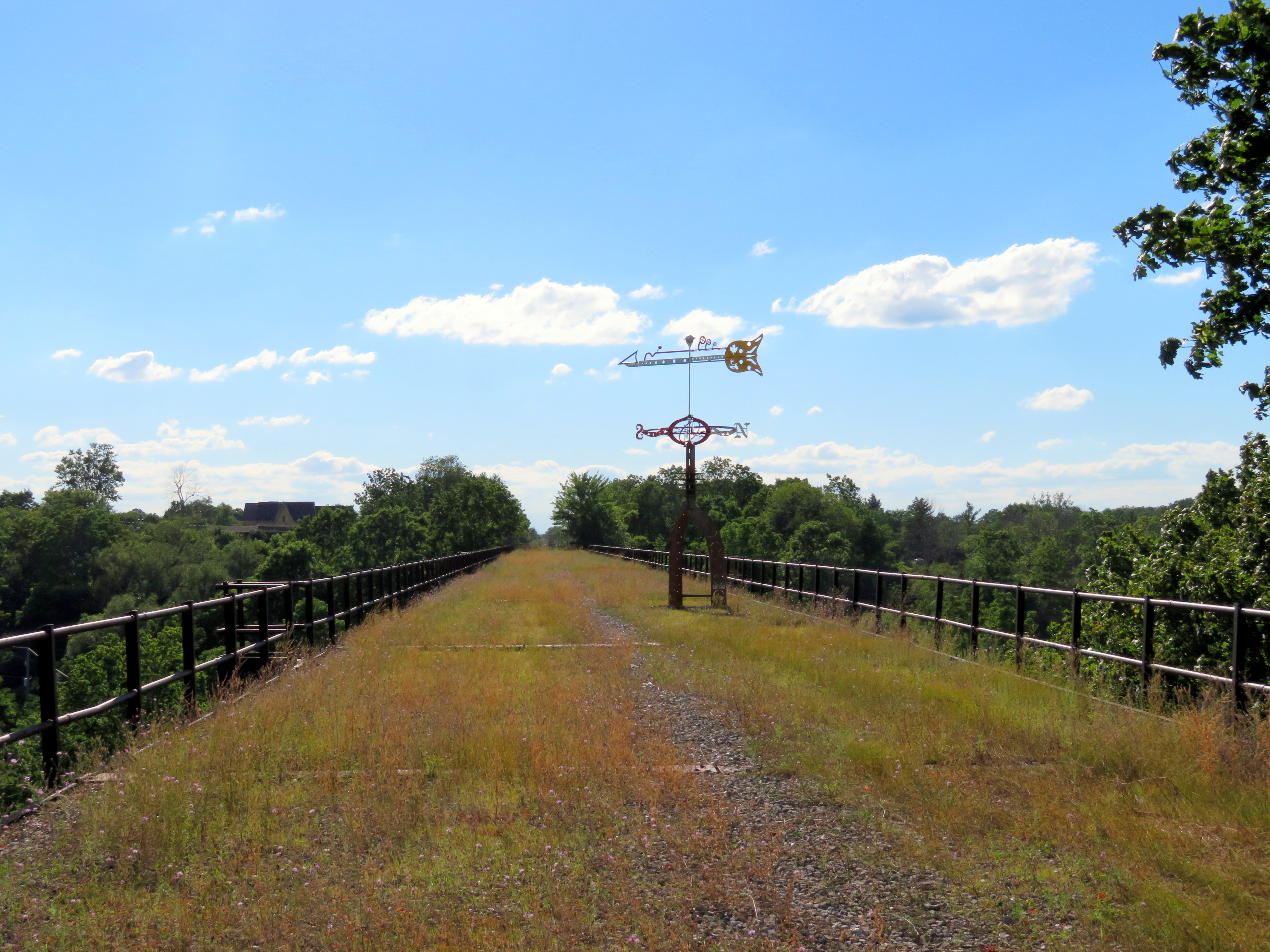
Despite the loss of the railways, St. Thomas has retained much of its railway heritage. The Elgin County Railway Museum has made its home in the old Michigan Central shops. The station building still stands too — built in 1873, it is one of the longest stations in Canada, extending 108 metres. It was recently renovated and houses offices and retail businesses. A replica of the LP&S station was built downtown, with the hopes of accommodating Port Stanley-bound tour trains. Just west of Downtown St. Thomas is the Kettle Creek Viaduct, which is slated to become a new signature park.
VIA Rail train at Brampton Station, on the Toronto-Kitchener rail corridor
Updated Friday May 19, 2017:
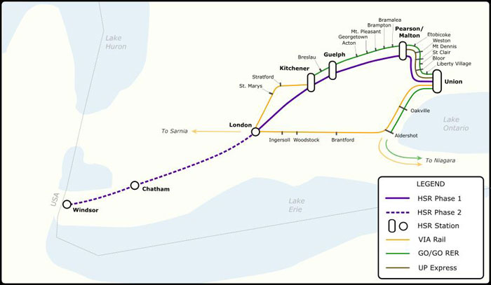
Today, Premier Kathleen Wynne announced the commencement of an Environmental Assessment on bringing high-speed rail to Southwestern Ontario, connecting Toronto and Pearson Airport with Guelph, Kitchener, and London, with Phase II continuing to Windsor, with a potential stop in Chatham.
Former federal Transport Minister David Collenette was assigned to write a report on building the corridor; it is now public on the Ministry of Transportation’s website. It proposes operating speeds up to 250 km/h, making it a true high speed line (though slower than many lines in Europe and East Asia, which have cruising speeds between 270 and 320 km/h). The estimated cost of the project is estimated to be $21-billion, reducing travel times from Toronto to Windsor to a mere two hours.
Proposed High Speed Rail system for Southwestern Ontario
An option for a 300 km/h HSR service was studied, but found to be even more expensive, requiring more dedicated tracks. The 250 km/h option will allow it to use most of the existing Toronto-London and London-Windsor corridors.
For southwestern Ontario, high speed rail could be a boon. Kitchener-Waterloo is a major educational and technological hub; faster and more frequent rail service will benefit university students, tech workers, and other commuters, perhaps those priced out of the Toronto housing market. London’s economy has taken some hits in recent years, so bringing it within commuting distance to Toronto and K-W gives residents there more options.
Between Toronto and Kitchener, the report assumes two off-peak HSR trains an hour, and one GO train every hour, making local stops. It also assumes that GO RER service will continue to terminate at Bramalea, a poor location to terminate regional rail services; Downtown Brampton is one stop away. Building the “missing link” along Highway 407 will allow many more trains to pass through Downtown Brampton, which would allow for local RER trains to be extended to west Brampton, at Mount Pleasant GO. It would be a shame if the HSR plans (which, in principle, I support) pushed aside regional and local needs.
Statford and St. Marys, which are only served by VIA trains (and no intercity coach service) will also have to be considered, as they will be bypassed by HSR. As well, towns and cities elsewhere in southwest Ontario, such as Simcoe, Tillsonburg, Wallaceburg, and St. Thomas, have no bus or rail access. For less than the $15 million pledged for the HSR EA, the province could fund several years’ worth of basic intercity bus service to connect these communities together.
Unless assumptions change, Brampton residents will see twice as many trains speed by their downtown core than stop, which I think is unfortunate. In the original post below, I was worried that high speed rail dreams would distract from more immediate needs. I’m now afraid that I was right.
Original post dated April 26, 2017
When have I heard this one before?
According to CTV News, the provincial government is looking to build a new high-speed rail line between Toronto, Kitchener, and London. The new plan, to be announced next month, is based on the work of former federal Transport Minister David Collenette.
During his time as Transport Minister under Prime Minister Jean Chretien, Collenette backed incremental VIA Rail improvements, as well as VIA-FAST, a higher-speed train service between Toronto, Ottawa, and Montreal. Those proposed improvements were cancelled when Paul Martin became prime minister; currently VIA is pushing for a revised version of that previous plan. Collenette also pushed hard for a rail link between Toronto Pearson International Airport and Union Station, a fundamentally flawed proposal known as “Blue 22.” That airport rail link proposal was later relaunched as a provincial project and opened as UP Express in 2015.
Ontario Transportation Minister Steven Del Duca was not especially clear about the plans for such as high-speed rail service, saying “…there are multiple definitions for high-speed rail depending on what you’re looking at.” Del Duca cited “geographical limitations,” while hoping that the federal government would contribute funds towards the project.
Interestingly, only a week ago, Deputy Minister Deb Matthews (and London MPP) was downplaying the province’s plans, saying the province only promised to study, but not necessarily build, the high-speed rail corridor.
I worry that high-speed rail is a distraction. In Canada, we have an abysmal record of proposing high-speed rail projects, but never following through. Even VIA’s less ambitious plan for dedicated tracks and new equipment to provide more frequent and reliable service, with somewhat faster travel times, is not yet secure.
There is already a Toronto-Kitchener-London service; two VIA trains operate daily in each direction along the entire route, while GO Transit operates more frequent weekday trains to Brampton and four weekday round trips to Kitchener. Before the 1990 Brian Mulroney-era VIA cuts, there were five round trips on this line. In the 1980s, the fastest VIA train between Toronto, Kitchener, and London took 3 hours, 2 minutes; today, the fastest train is 3 hours, 22 minutes.
This Rick Mercer Report video will never get old
All that I want for the Toronto-Kitchener-London corridor in the short-to-medium term is the same as what VIA is proposing between Toronto and Montreal:
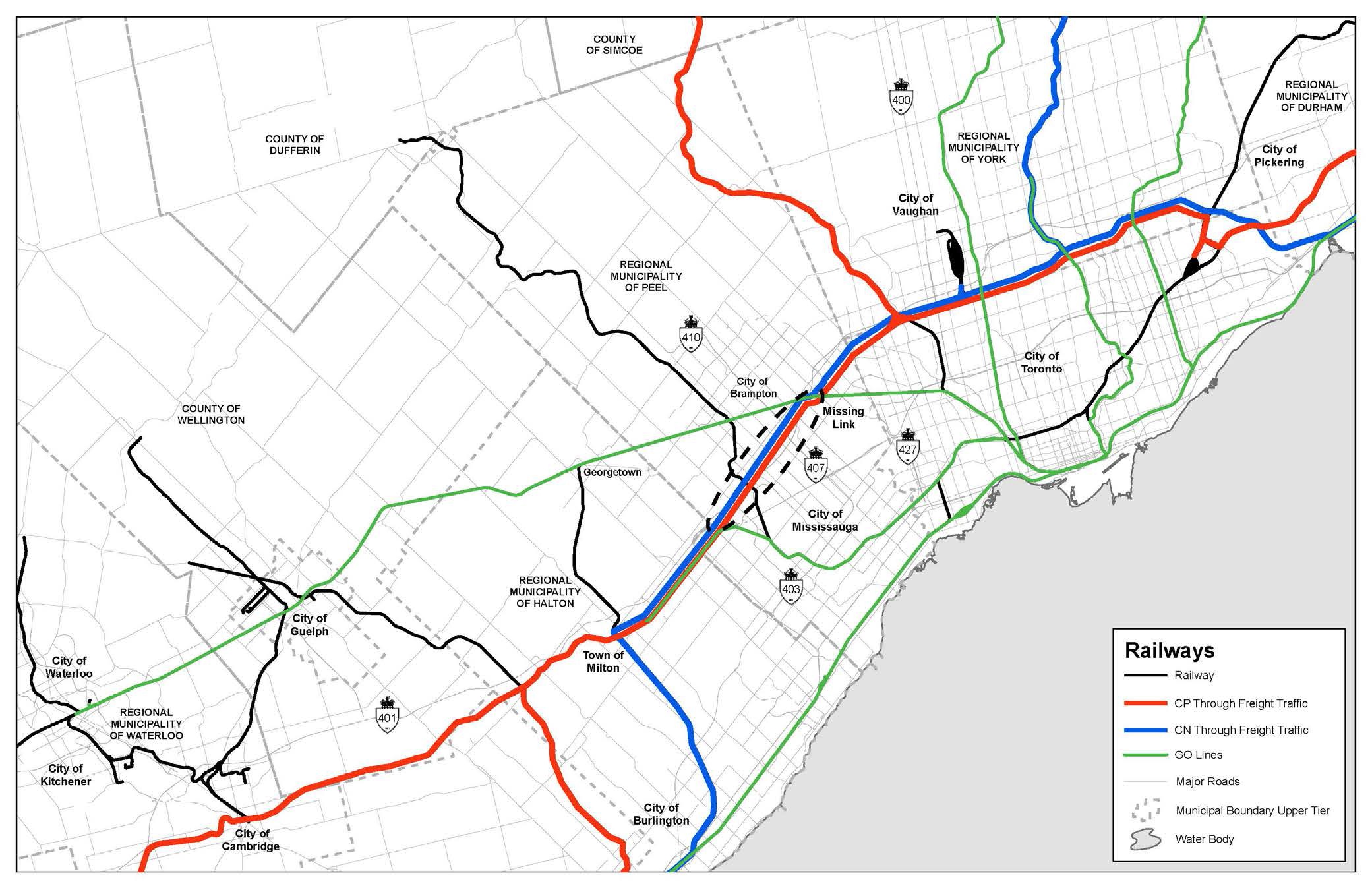
Dedicated tracks. On the Toronto-Kitchener-London corridor, this means building a new rail corridor, known as “The Missing Link” for freight trains between Halwest (near Bramalea GO Station) and Milton. This new route would divert Canadian National (CN) freight trains that currently pass through Brampton and Georgetown on the Toronto-Chicago mainline. Potentially, Canadian Pacific (CP) trains passing through Toronto and Mississauga could also be diverted, freeing up capacity on GO Transit’s Milton Line. CN freight traffic limits the frequency and speed of GO Transit rail service to Brampton and Kitchener; moving the through freight trains would allow for frequent, electrified, GO RER service beyond Bramalea, as currently proposed. CN is interested in partnering with the province to build this link; CP has not expressed interest. Map of the “Missing Link” from a 2015 IBI Group report
Rail improvements. Between Georgetown and Kitchener, the railway is owned by Metrolinx, and hosts four weekday GO Transit trains in each direction, two daily VIA trains in each direction, and several Goderich-Exeter Railway (GEXR) freight trains. Track is in good shape, but has several slow sections, including a two-kilometre section west of Guelph Central Station where trains crawl at 10 miles an hour (16 km/h).
Improving rail speeds in central Guelph will be expensive, especially where the railway runs in the middle of residential Kent Street, but it will be worth it. Beyond Kitchener, the track is leased and maintained by GEXR, which has allowed the rails to deteriorate. Slow speeds are acceptable by a no-frills short line freight operator, determined to minimize maintenance costs, but not so for passenger rail. VIA trains are consistently late because of the condition of track, especially between Stratford and London. Purchasing the track, installing welded rail, and improving grade crossings will substantially improve reliability and speeds on this corridor.Incremental improvements, such as grade separations, improved signalling, and new passing tracks, would permit frequent, reliable, and faster rail service.
A new train fleet. Via Rail’s coaches are nearing the end of their useful lives; among the rolling stock used on the Toronto-Kitchener-London service are HEP-I and HEP-II coaches built in the 1950s and refurbished several times since. GO Transit’s commuter coaches are acceptable for shorter trips, but are uncomfortable for long-distance travel. With the completion of the “Missing Link” and the acquisition of the Kitchener-London rails, it would be possible to electrify the entire corridor. Electric trains benefit from faster acceleration times, especially electric multiple units.
Some of these improvements can be started within the next year, before the 2018 provincial election. If the province wants to show that it’s serious about providing effective rail service to Kitchener and London, there’s no need for another high-speed rail study. Simply continue the work on the “Missing Link,” plan for GO RER to continue west of Bramalea GO, improve the existing rail infrastructure, and acquire the optimal fleet for medium-distance rail services. Once that is complete, planning for even higher speeds, possibly with a new purpose-built alignment, should begin.
Canadians have been teased with high-speed rail proposals that never get anywhere, meanwhile existing rail infrastructure is neglected and intercity services are cut. It’s time to get moving with a sensible plan that can start right now.
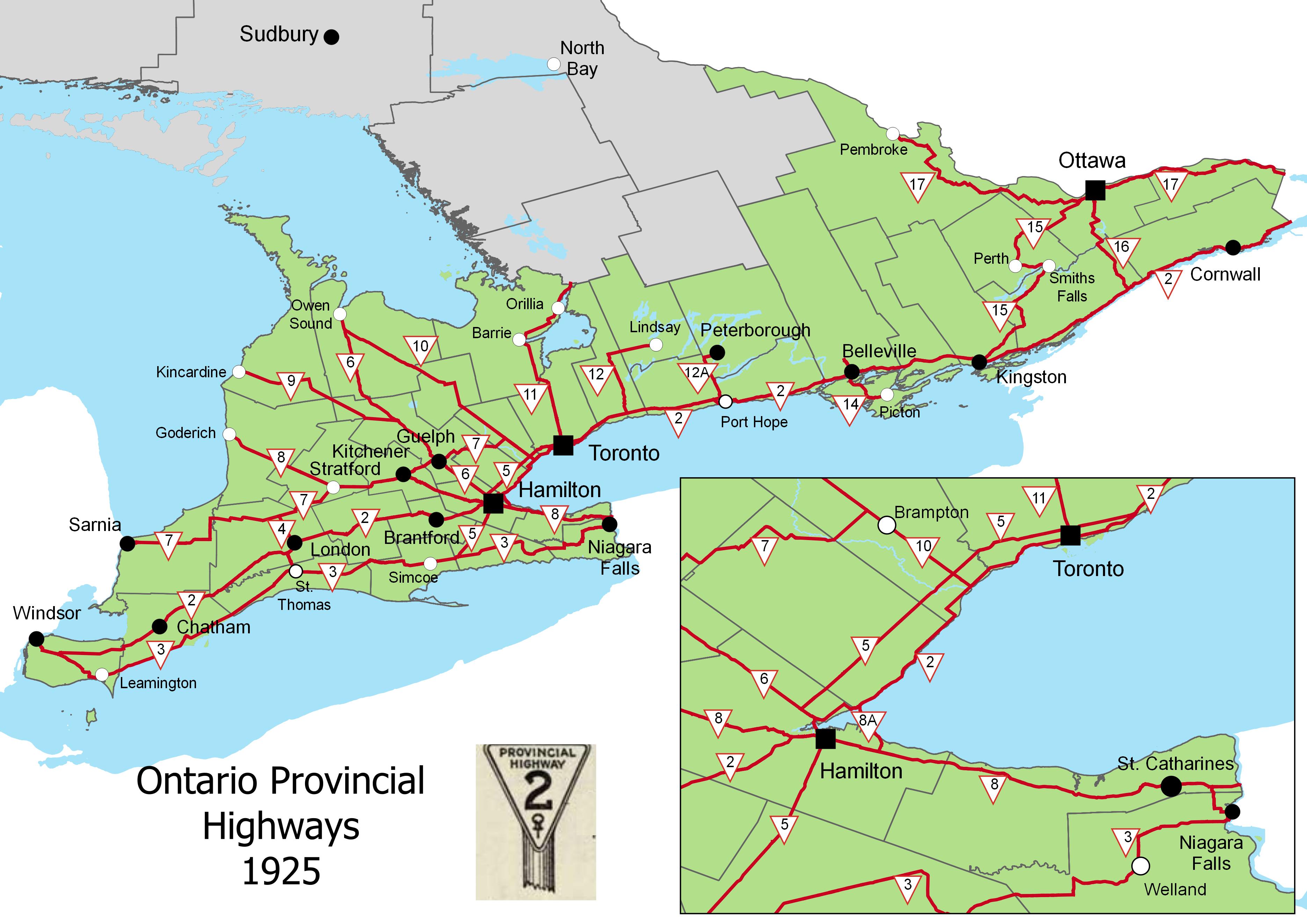 Ontario Provincial Highways, 1925 (click for larger version)
 Downtown Pembroke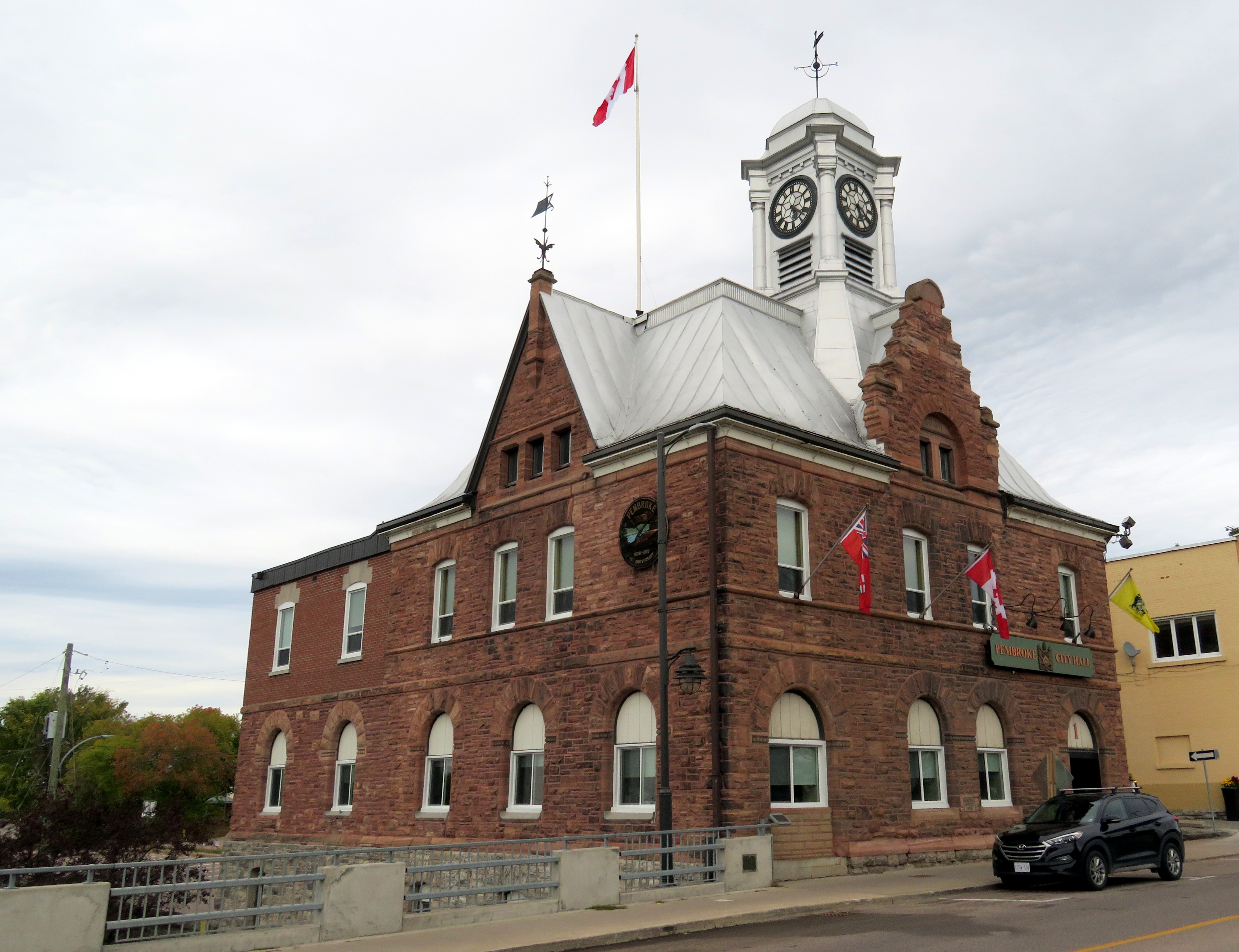
 Entrance to the Pembroke Public Library
 Library interior
 Former CN trestle, Pembroke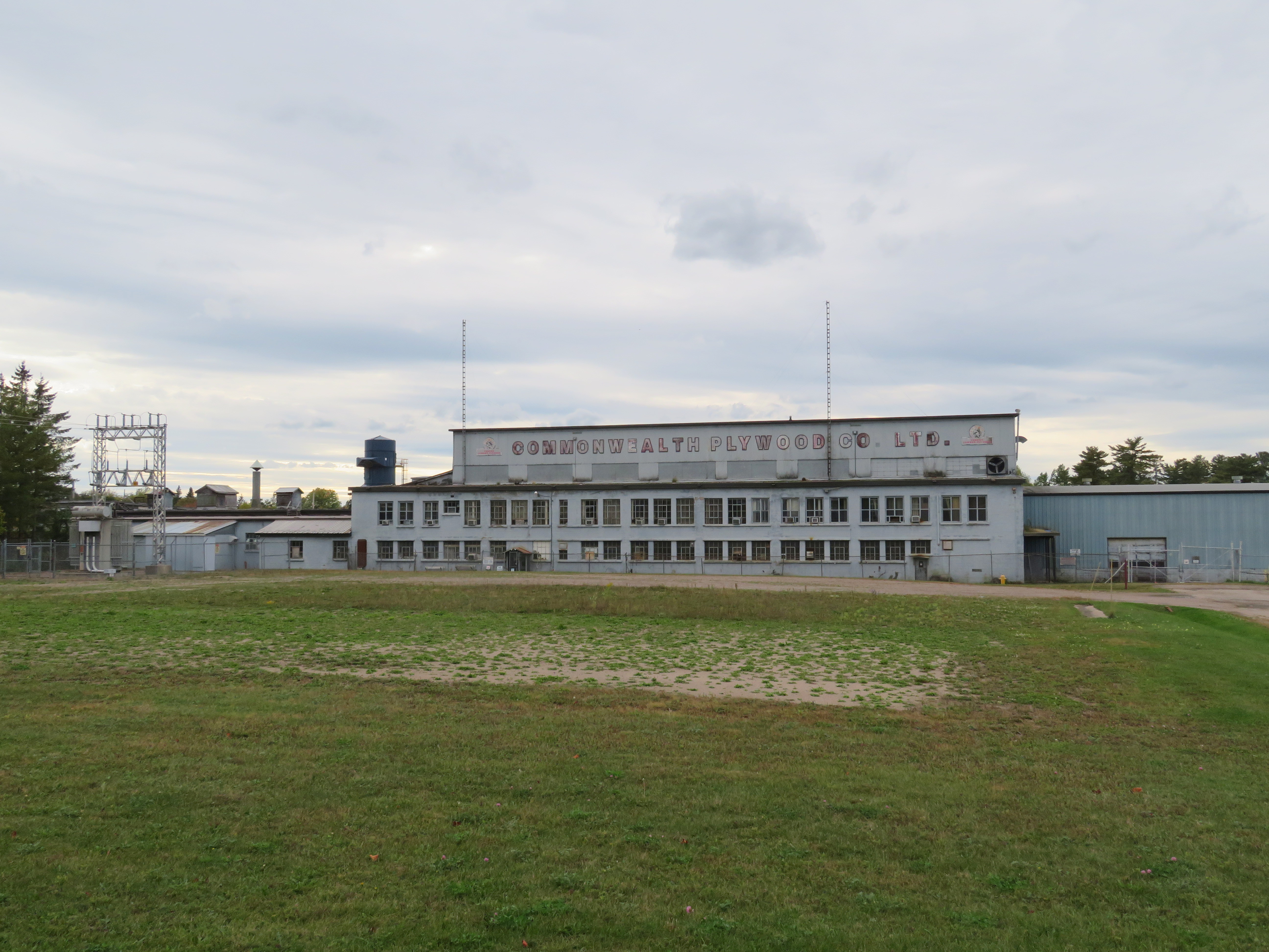
 Distance Sign on Highway 5, Clappison’s Corners
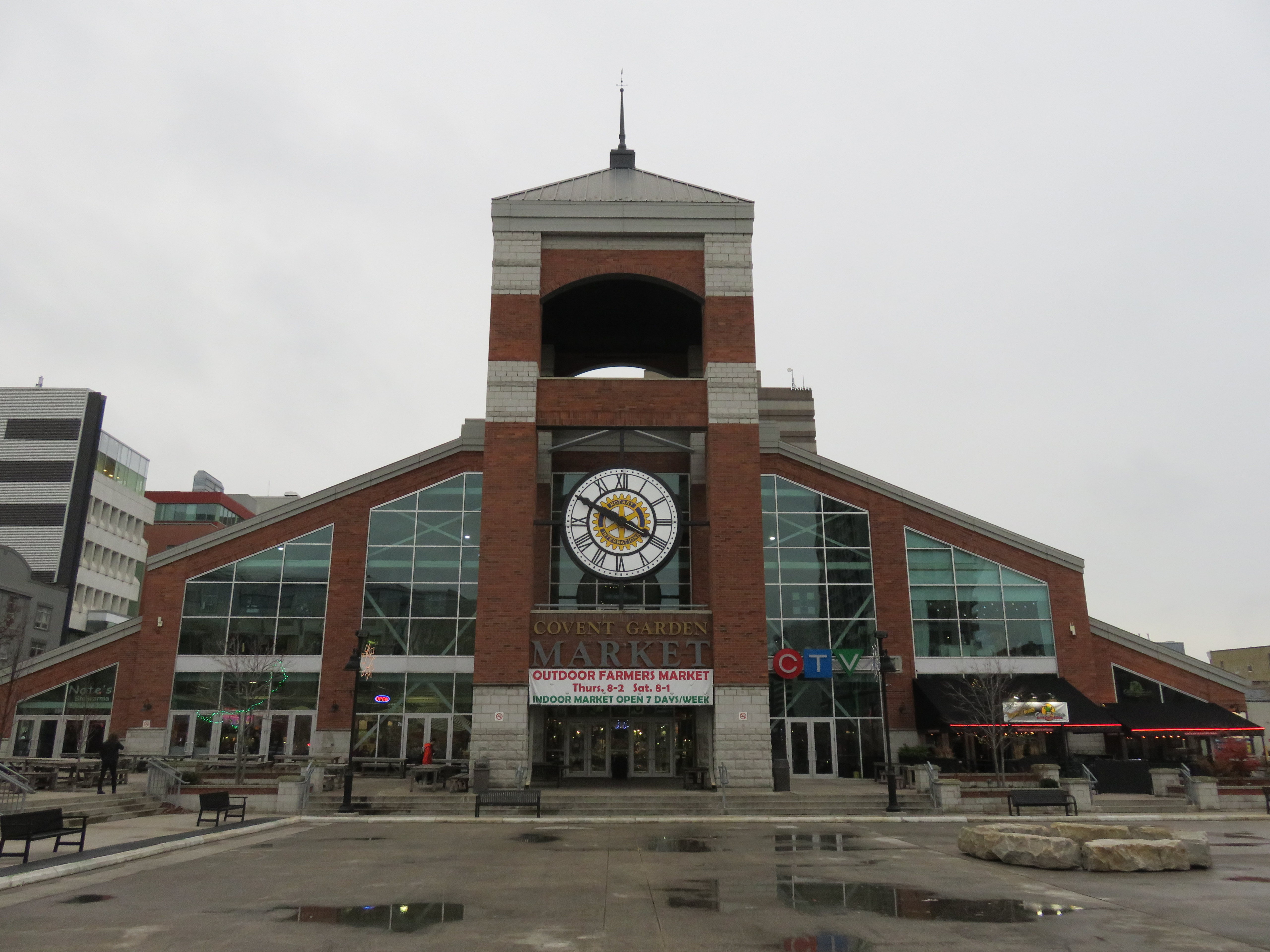 The other Covent Garden Market, London
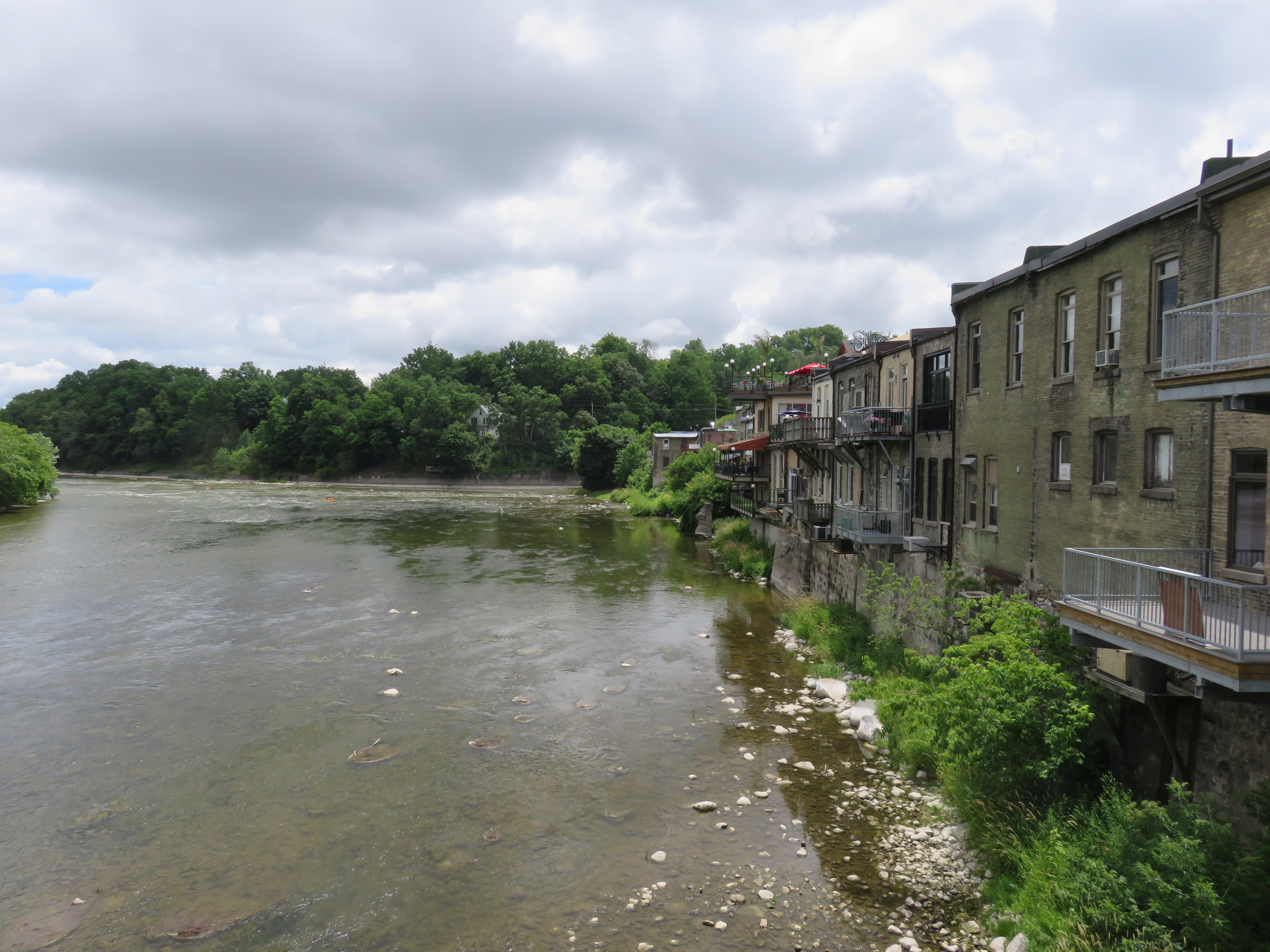 Paris, Ontario’s main street backs onto the Grand River
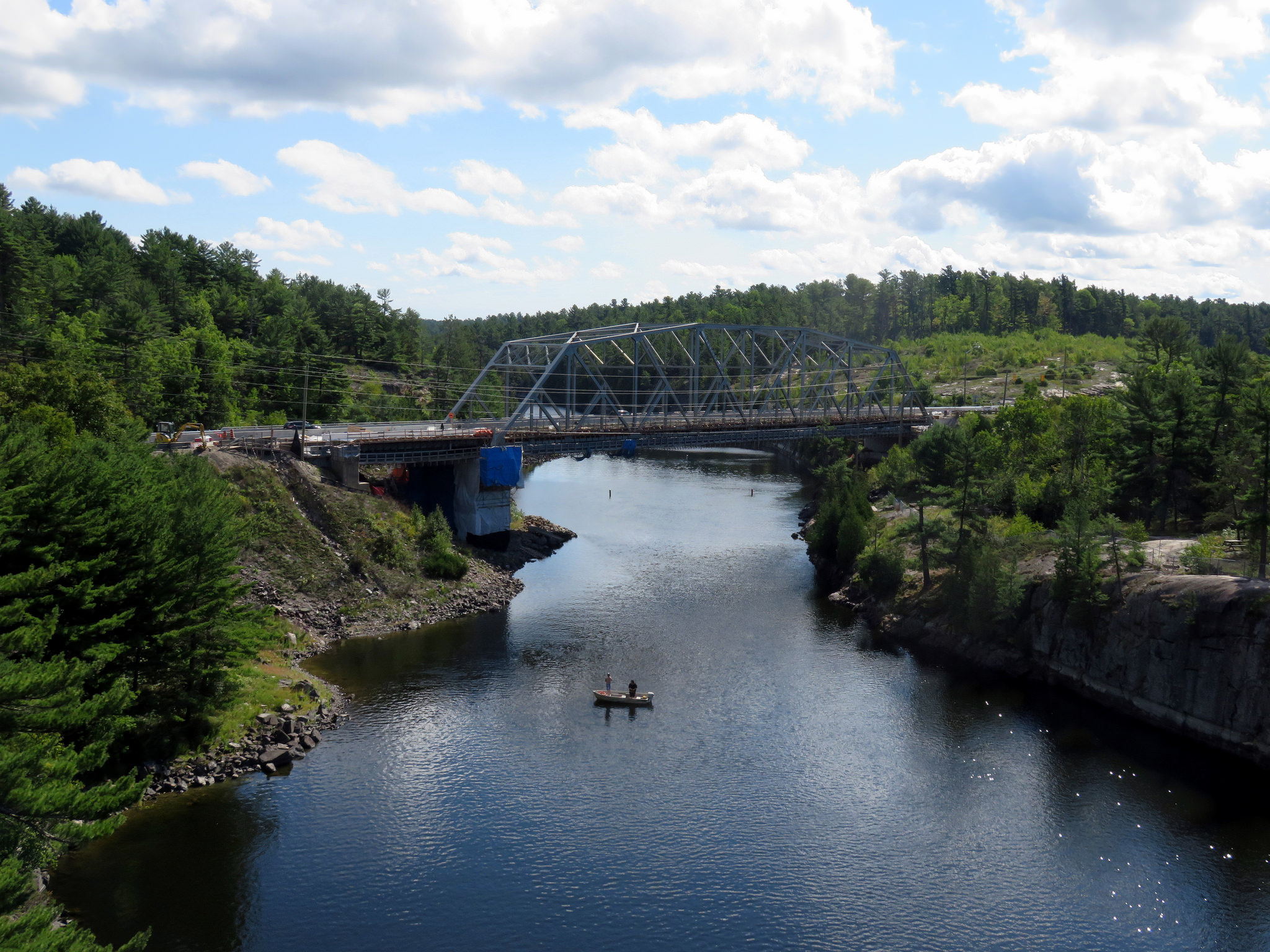 The French River at Highway 69, where Northern Ontario truly begins

 Jumbo Monument, at the westerly entrance to Downtown St. Thomas
 The 1873 Canada Southern Station. The tracks it once served have disappeared.
 Kettle Creek Viaduct, the future
  VIA Rail train at Brampton Station, on the Toronto-Kitchener rail corridor
 Proposed High Speed Rail system for Southwestern Ontario