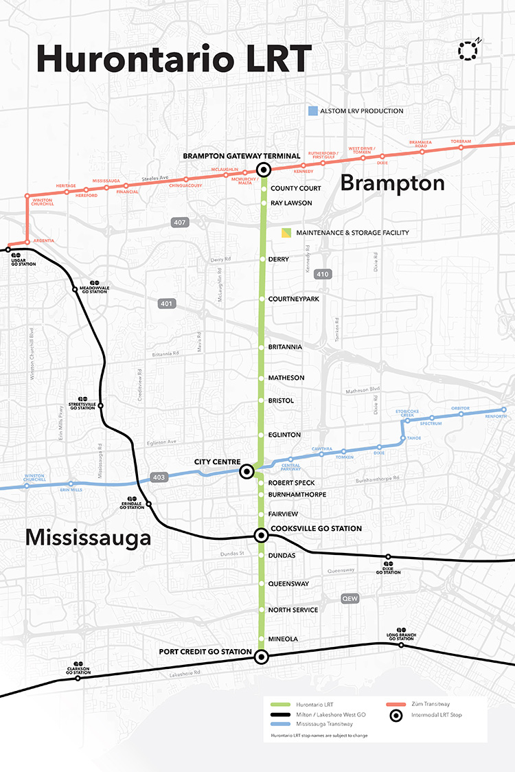
On Monday, February 14, Premier Doug Ford, Transportation Minister Carolyn Mulroney, and Mississauga Mayor Bonnie Crombie attended a photo-op at Cooksville GO Station to announce a new name for a transit project. With former mayor Hazel McCallion in attendance (who was celebrating her 101th birthday), it was no secret what the new name was going to be.
It was disappointing that the Hurontario LRT, a provincially-funded transit project operating within Brampton and Mississauga and intended to be part of a regional transportation network, would be named for a divisive former mayor of only one of the two cities the Hurontario LRT is supposed to directly benefit.
In North America, and around the world, transit lines and stations are named (with a few misguided exceptions) to reflect the geography of the route it represents and to provide optimal wayfinding, especially to visitors and people new to transit. In Greater Toronto, bus, streetcar, commuter rail and subway routes are named based on the major street they run on (the 501 Queen Streetcar or Line 4 Sheppard), the neighbourhood they serve (the 56 Leaside bus) or the destination it runs to (the GO Milton Line or 900 Airport Express).
Even new projects follow these conventions. The Crosstown LRT, which operates under and along Eglinton Avenue, is a crosstown route across the middle of the city. Even the Ontario Line partially gets its name from its two end points (Exhibition Place/Ontario Place and Ontario Science Centre). The Hurontario LRT reflected the name of the main street it operates along, even if it changes its name briefly though central Brampton.
The “Hazel McCallion Line” does not accomplish any of these goals.
Given Peel Region’s diverse population of over 1.4 million residents, it is also disappointing that a major project intended to unite the region is named for an affluent white public figure that already has two libraries, a public school and a college campus already bearing her name.
I suspect Premier Ford wanted to celebrate a political ally a few months before the next provincial election, but naming the Hurontario LRT after Hazel McCallion sends the wrong message.
Post script: The Hurontario Line may not be the only Metrolinx transit facility that will see its name change. In a MERX posting dated February 15, 2022, Metrolinx is looking for Expressions of Interest for station naming rights opportunities for at least four existing GO Transit rail stations. The summary is quoted below:
Expression of Interest
Expression of Interest No. RFI-2021-CCMX-097
Metrolinx is accepting Expressions of Interest for Station Naming Rights Opportunity.
Metrolinx is an agency of the Government of Ontario, overseeing GO Transit, PRESTO, and UP Express. We are embarking on a massive transformation of the GO Rail network – the backbone of regional rapid transit in the region – to give customers a faster, more convenient way to connect with the things that matter.
Metrolinx is seeking proposals from interested parties in any category for the Station Naming Rights Opportunity at the following stations:
Whitby GO Station Exhibition GO Station Clarkson GO Station Oakville GO Station
Metrolinx will consider proposals for other stations not listed here at the request of interested parties.
For more information about the GO Transit network and stations, please visit www.gotransit.com. We are committed to working together to create a partnership that will meet shared objectives, such as increase revenue, increase market share for our partners and provide a positive customer experience on public transit.
All four stations listed are on the Lakeshore Line, the backbone of the GO Transit rail network. Exhibition GO could be especially attractive for renaming, as it will become a major hub with the future connection to the Ontario Line and local TTC services. It is also worth noting that Metrolinx will entertain proposals for additional stations in the bid process.
It is hard to blame Metrolinx for these specific transit naming decisions; it is very likely that the Ford government demanded the McCallion Line and is pushing for the sell-off of naming rights. But it is ironic that after hiring consultants and going though a complex naming process for the Crosstown LRT, that previously held principles are quickly abandoned at the whim of Metrolinx’s superiors.
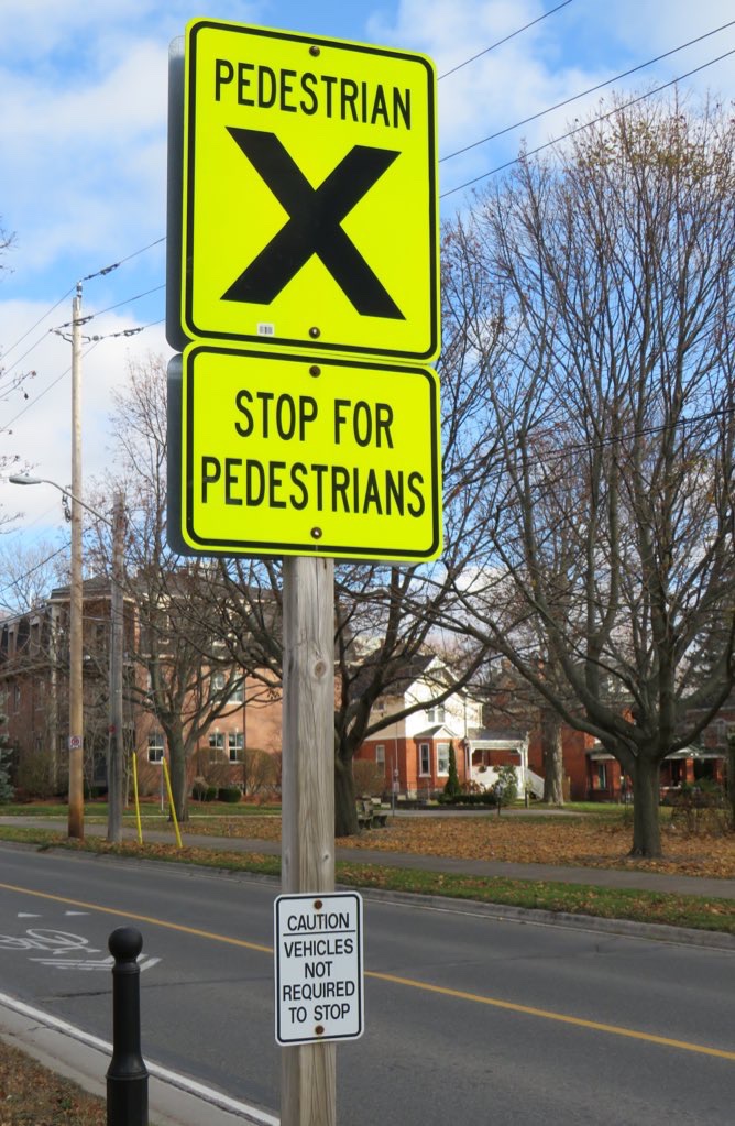
At the corner of King Street (former Highway 2) and College Street in Cobourg, adjacent to Victoria Park on the eastern edge of Downtown Cobourg, there’s a marked pedestrian crossing, with clear “zebra” road markings on the pavement.
The sign, in bright fluorescent yellow, reads “PEDESTRIAN X.” Below, a second sign, also in bright yellow, reads “STOP FOR PEDESTRIANS.” The message is clear enough.
However, a smaller white sign below, facing the sidewalk, reads “CAUTION – VEHICLES NOT REQUIRED TO STOP.”
Following Greyhound Canada’s inevitable final departure, several other companies have begun to take over Greyhound’s busiest routes in Ontario and Quebec.
In May, Megabus Canada began service between Toronto, Kingston, and Ottawa, operating out of the new Union Station Bus Terminal. Megabus’ terminal in Ottawa is the St. Laurent Shopping Centre, with easy connections to Ottawa’s O-Train LRT and several bus routes.
In June, Rider Express, a new intercity carrier based out of Western Canada (where it picked up many of Greyhound’s abandoned routes there), began operating its own Toronto-Kingston-Ottawa route, in competition with Megabus.
Québec-based Orleans Express took over Greyhound’s former Ottawa-Montréal route, joining Ontario Northland and Rider Express at the Ottawa VIA Station. The VIA Station, like St. Laurent, offers a safe, enclosed waiting area, passenger amenities, and easy connections to the O-Train LRT.
While Ottawa has many options for getting to and from Toronto: VIA Rail, Megabus, Rider Express, and two frequent airlines, connections to other cities and towns are limited at best. Ontario Northland’s single daily bus from Sudbury and North Bay through Renfrew County arrives in Ottawa in the late evening, a time not convenient for most passengers. Commuter routes to nearby communities such as Perth, Carleton Place, and Cornwall remain suspended during the ongoing pandemic.
But at least there’s some bus service again, providing new capacity on some of Canada’s busiest intercity routes.
On Thursday, July 15, intercity coach service returns to Southwestern Ontario, with a new Toronto-London service operated through a partnership between Megabus and St. Thomas-based Badder Bus. The route will run non-stop twice daily between the Flying J Truck Stop at Highway 401 and Highbury Avenue and the Union Station Bus Terminal in Downtown Toronto.
Unfortunately, the Flying J truck stop, while convenient for truckers and other motorists, is a terrible place for a bus stop. The map below illustrates the truck stop’s location, on the southeastern outskirts of London.
The truck stop was likely chosen for its proximity to Badder Bus’ operations centre in nearby St. Thomas, and for the space available to park and load a bus in the RV/trailer parking area. The truck stop operates 24 hours, with an on-site convenience store, washrooms, and restaurant, so there are amenities for bus drivers and waiting passengers.
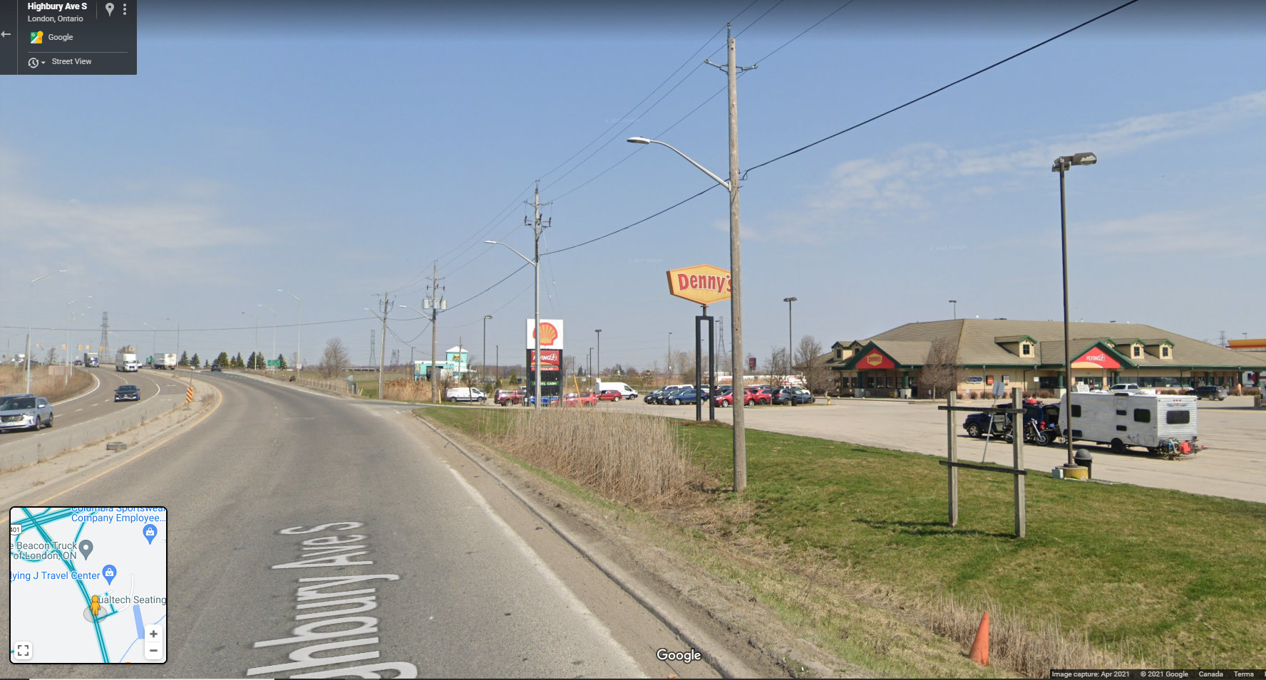
Unfortunately, Megabus and Badder Bus could not pick a less accessible place to catch a bus. The truck stop is surrounded by warehouses, light industry, and agricultural lands. Highbury Avenue is a high-speed highway connecting Highway 401 and central London, with a 100 km/h speed limit. Pedestrians and cyclists are prohibited from using Highbury Avenue (which, until the 1990s, was provincial Highway 126). There are no sidewalks leading south to Wilton Grove Road.
Looking north on Highbury Avenue towards Highway 401, with the Flying J truck stop on the right. Note no sidewalks — pedestrians and cyclists are prohibited from Highbury Avenue at and north of the 401. (Google Streetview – April 2021)
The only transit route within walking distance is London Transit Route 30, a rush-hour only service that serves the industrial area south of Highway 401. Downtown London is easily a 45 minute bus ride (when route 30 is operating), and Western University — a major market for Greyhound when it operated — is over an hour away by bus or a $50 taxi ride. Ironically, the northern outskirts of St. Thomas — that city remains disconnected to nearby London — are closer to the Flying J than Western University.
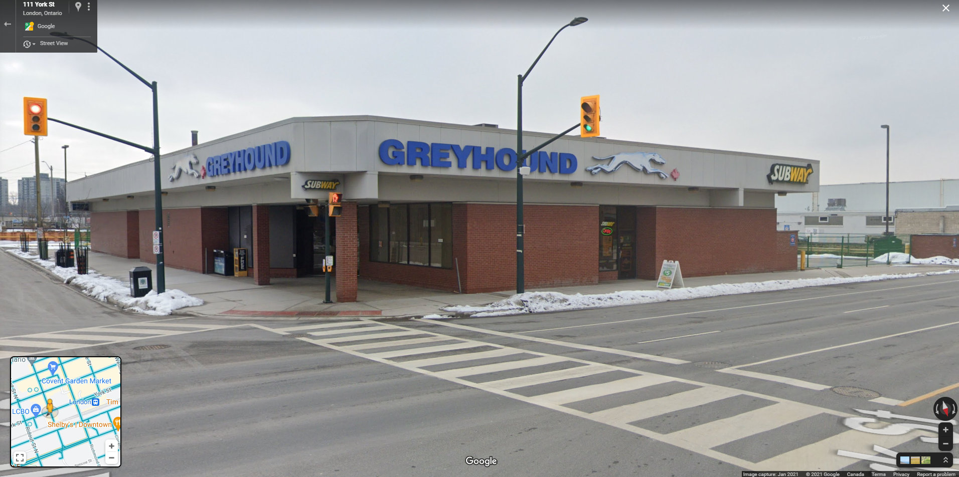
The Greyhound Terminal in downtown London, two blocks from the VIA Station. At its peak in the 1980s, the terminal served Greyhound, Gray Coach, Erie Coach, and Cha-Co Coach, with buses departing for Toronto, Detroit, Niagara Falls, Buffalo, and cities and towns throughout Southwestern Ontario. (Google Streetview – January 2021)
Greyhound Canada operated out of a terminal in Downtown London, two blocks west of the VIA Rail station. Greyhound shared its building with other carriers in the 1970s, 1980s, and 1990s, including Gray Coach, Cha-Co Trails, and Erie Coach Lines. From Downtown London, there were direct buses to Toronto, Detroit, Niagara and Buffalo, and cities and towns throughout Western Ontario. The terminal was a short walk to nearly all of London Transit’s bus routes, making connections to Western University, Fanshawe College, and the major hospitals easy.
Choosing a truck stop at the far edge of town, nearly inaccessible by public transit reminds me of the final years of Greyhound’s operations in Western Canada. Greyhound abandoned downtown terminals in Winnipeg, Edmonton, Regina, and Saskatoon in favour of new stops in outlying area.
In Edmonton, the downtown Greyhound terminal was expropriated for a new hockey arena, but Greyhound moved for the VIA station in the city’s northwest, which had no public transit access. (Red Arrow, a competing coach operator, maintained a downtown office and stop). In Regina, Greyhound moved from the downtown STC terminal to the airport, which has no public transit connection, and in Saskatoon, Greyhound moved to a truck stop — similar to London’s Flying J — in the northern outskirts of that city. It was clear that Greyhound Canada had no interest in attracting customers and was planning for an eventual withdrawal.
Given Greyhound’s experience, why would a new carrier choose such a poor location for an intercity bus stop, especially in a city as large and important as London? The terminal need not even be in Downtown London to be a major improvement; a stop at White Oaks Mall, just one interchange to the west at Wellington Street, would provide good local transit connections to Downtown London and even Western University while remaining close to the highway.
For now, Ontario’s newest bus stop might also be its worst bus stop.
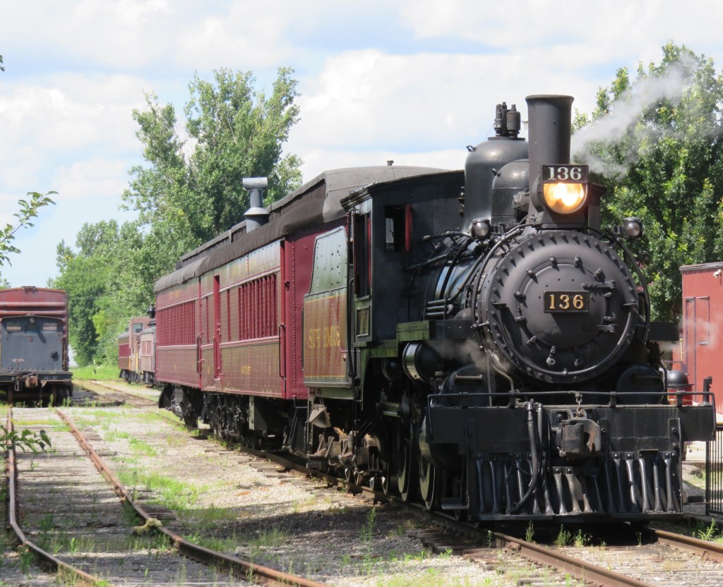
Former Canadian Pacific locomotive #136 hauls excursion trains at the South Simcoe Railway in Tottenham, Ontario
December 17, 2023: The complete map has been migrated to a newer ArcGIS Online account, on account of ESRI suddenly changing its monthly service account to charge bandwidth. That was a pay-as-you go account that helped me get re-acquainted with the ESRI ArcGIS Online platform before I set up a full online subscription to support a small business I co-founded in 2021.
However, I am happy to announce that I completed updates to the Ontario Intercity Transport Map and the 1955 Canada Passenger Rail Map, and that they are safely on a new subscription server at ESRI Canada. Please let me know if you have any suggestions or corrections to the maps, especially during the migration phase.
Sadly, passenger rail has faced a long, slow decline in Canada. Though commuter and regional rail systems in the Toronto and Montreal metropolitan areas have expanded tremendously over the last fifty years, rail service in general has declined in frequency, reliability, and even in speed. Prior to the COVID-19 pandemic, just six trains a day in each direction operated direct between Canada’s two largest cities, the fastest of those trains taking 4 hours 48 minutes to go 539 kilometres to get from Toronto to Montreal.
Seventy years ago, 28 trains on a typical weekday called at CN’s Hamilton Station, departing for Toronto, Niagara Falls, London, Guelph, Barrie, and Simcoe, with another 12 trains calling at the TH&B station on Hunter Street. In 2019, just six GO trains departed Hamilton for Toronto each weekday, with no direct connections even to Niagara, London, or Guelph.
There are several causes for the decline in passenger rail. In 1955, which the map below depicts, passenger train revenues were augmented by express cargo and mail, with the mail contracts alone helping to subsidize many branch lines. Lightly-travelled branch lines were served by mixed trains, which carry both passengers and freight. In Northern Ontario and Quebec, many highways were still of poor quality or unfinished — Highway 17 along the Lake Superior coast was not complete until September 1960. Construction of Highway 401 was just getting underway in 1955. In addition, the airline industry was still new, and air travel was expensive.
Improved highways drew more passengers to coach buses, while the move to trucks for cargo and mail deliveries made many branch lines unprofitable. Larger jet aircraft made air travel cheaper and more convenient for long distances. The major railways concentrated their energies on modernizing their freight networks, with CN and CP building new freight classification and intermodal yards outside of central Toronto, while focusing on bulk freight and shipping containers.
Though CN made efforts to win passengers back in the 1960s and early 1970s with new fare structures and equipment like the Turbo train between Toronto and Montreal, the government of Canada stepped in and took over most intercity passenger rail services in 1977. Though VIA Rail Canada acquired new modern locomotives and rail cars for the Ontario-Quebec corridor services, cuts to government subsidies made in 1981, 1989-1990, and 2012 forced further service cutbacks. British Columbia and Ontario also cut passenger services on their own rural railways.
I mapped the year 1955 for several reasons. I have CN and CP schedules for those years in my collection, while I found contemporary Ontario Northland and New York Central schedules online. It was also the year both railways inaugurated new transcontinental trains: CP launched the Canadian, while CN launched the Super Continental, luxurious diesel-hauled trains with modern sleeping cars and lounges. There were six trains a day leaving Montreal and Toronto for Vancouver that year. In 2019, there were just two trains a week.
In 1955, there were still many branch passenger and mixed trains in Ontario and Quebec, most of which were gone by 1965. Mixed trains were notoriously slow, though, but in many cases, there was a faster parallel highway coach. 1955 was also the last year for CP’s electric trains between Kitchener and Lake Erie, with the London & Port Stanley and Montreal & Southern Counties railways ending passenger runs a year later.
For Ontario and Quebec, I used Paul Delamere’s amazing Ontario Railway Map Collection and Quebec Railway Map Collection, adapting his work to identify those routes used by passenger trains in 1955, then mapping them on my own server. Mapping other routes was much more labourous.
Original version of interactive map
Please contact me if you have any suggestions, corrections, or other feedback.
In June 2020, Toronto-based artist and activist Andrew Lochhead launched a petition to rename Dundas Street, one of Toronto’s oldest, longest and best-known arterial roads. Lochhead states that Henry Dundas, 1st Viscount Melville “actively participated in obstructing the abolition of slavery in the British Empire from 1791 to the end of his political career in 1806.” While some historians may argue that Dundas was a pragmatic moderate, rather than an anti-abolitionist (unlike slave-owning Torontonians like William Jarvis or Peter Russell, who have streets named after them), it’s still worth wondering why Toronto has a street named after the Scottish politician, who had nothing to do with Toronto’s colonial history.
Until recently, I gave Dundas Street little thought. Years ago, I wrote about how the street was pieced together in the late 19th and early 20th century to provide a new through east-west route across central Toronto. Though I was aware that Dundas Street began at the present-day corner of Queen Street West and Ossington Avenue, I had long thought the road was named for the town of Dundas, to which it leads.
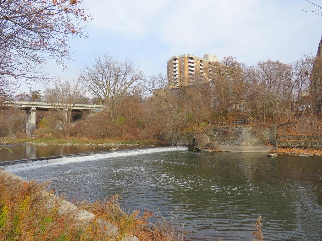
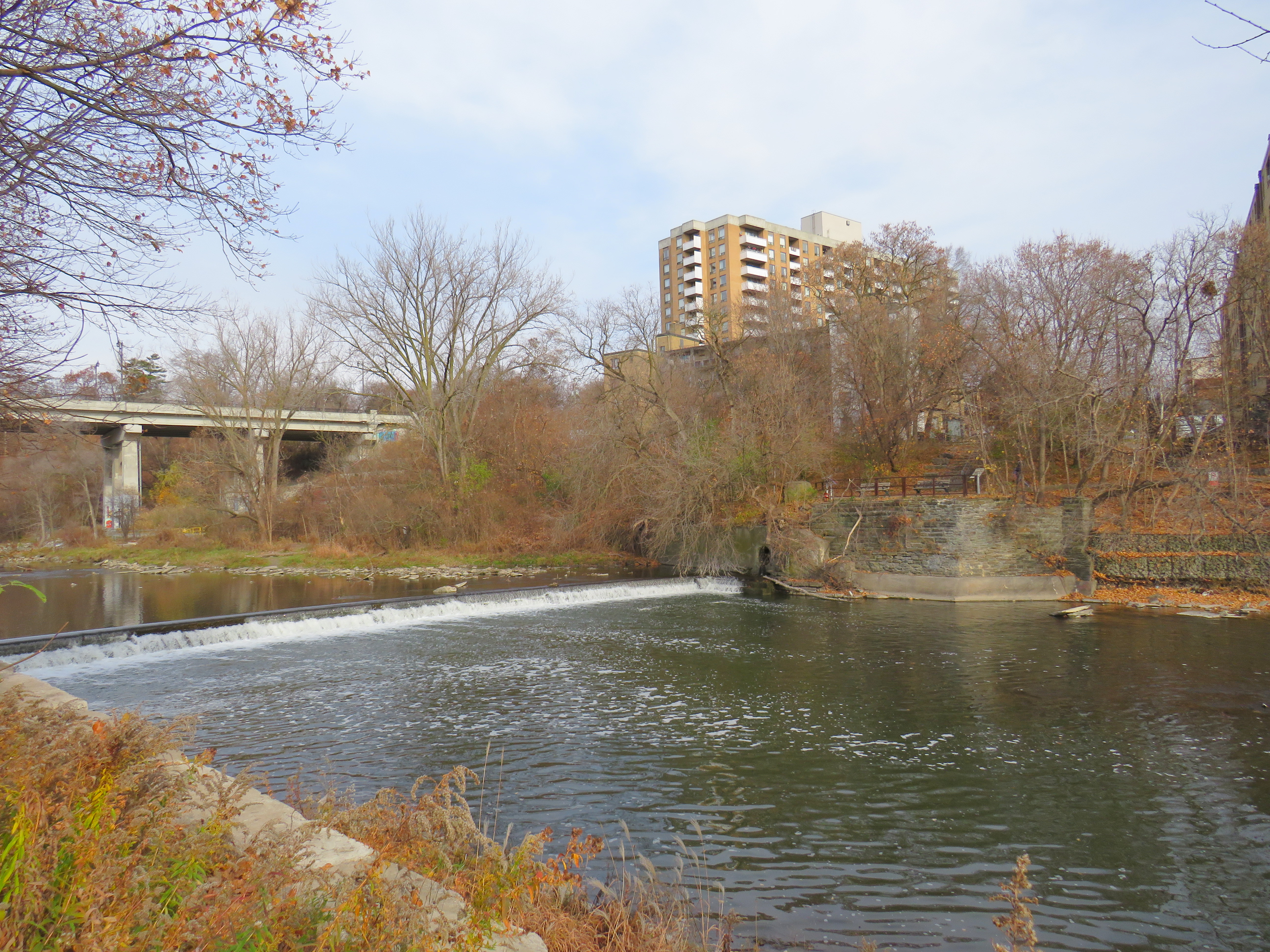
The end of Desjardins Canal, in the old Town of Dundas
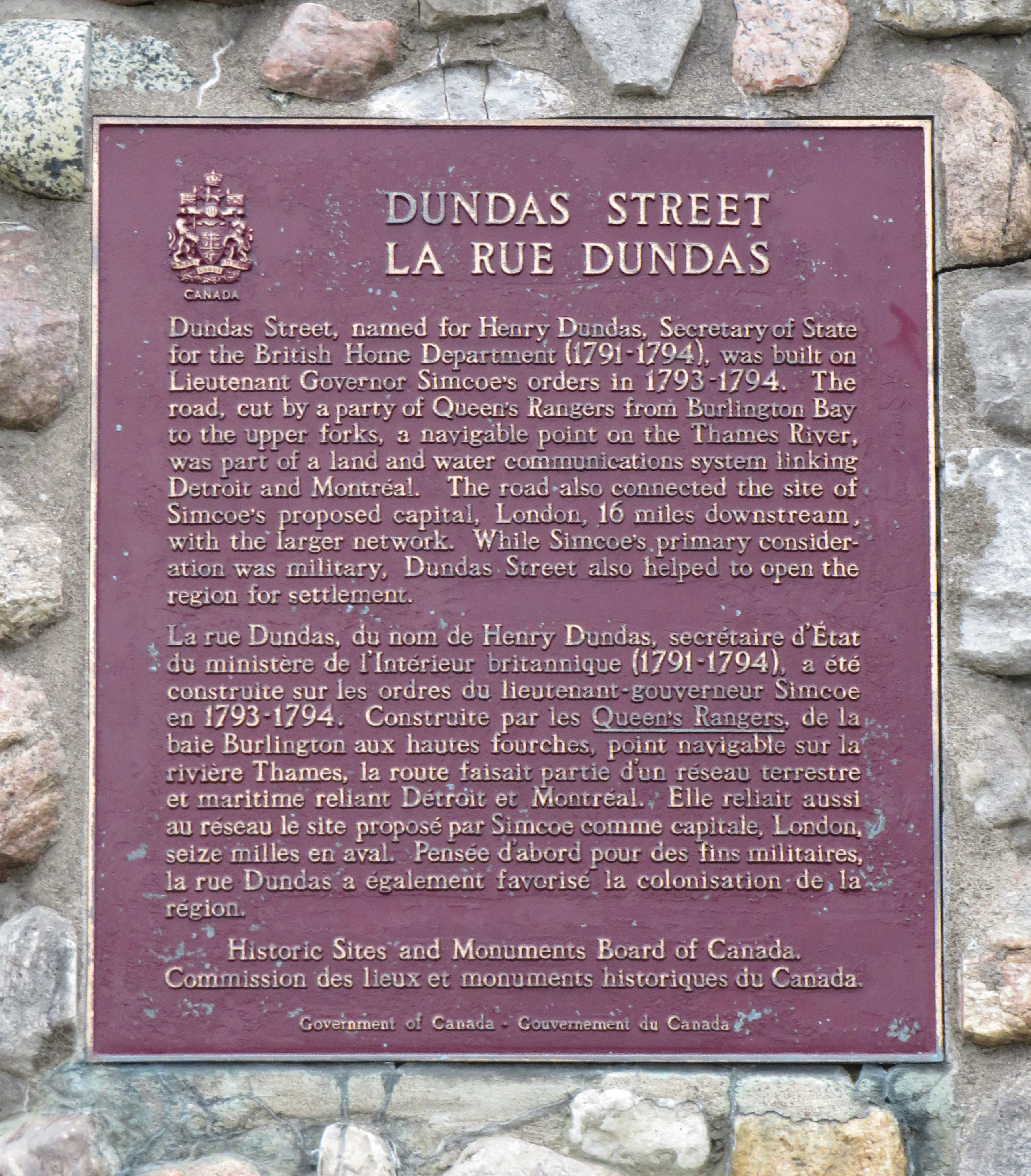
Dundas Street was established as a military supply route by order of John Graves Simcoe, the first British governor of Upper Canada. At first, it was surveyed and cleared in 1794 and 1795 between Cootes Paradise (at the very end of Lake Ontario, beyond Burlington Bay) and the Upper Forks of the Thames River, at what is now Woodstock. From there, small boats could be used to travel downriver to London and to Lake St. Clair. Though there were several Indigenous trails connecting Lake Ontario and the Thames River (the western part of Mohawk Road in Hamilton follows one such route), the new British colonial government favoured a straight, direct road.
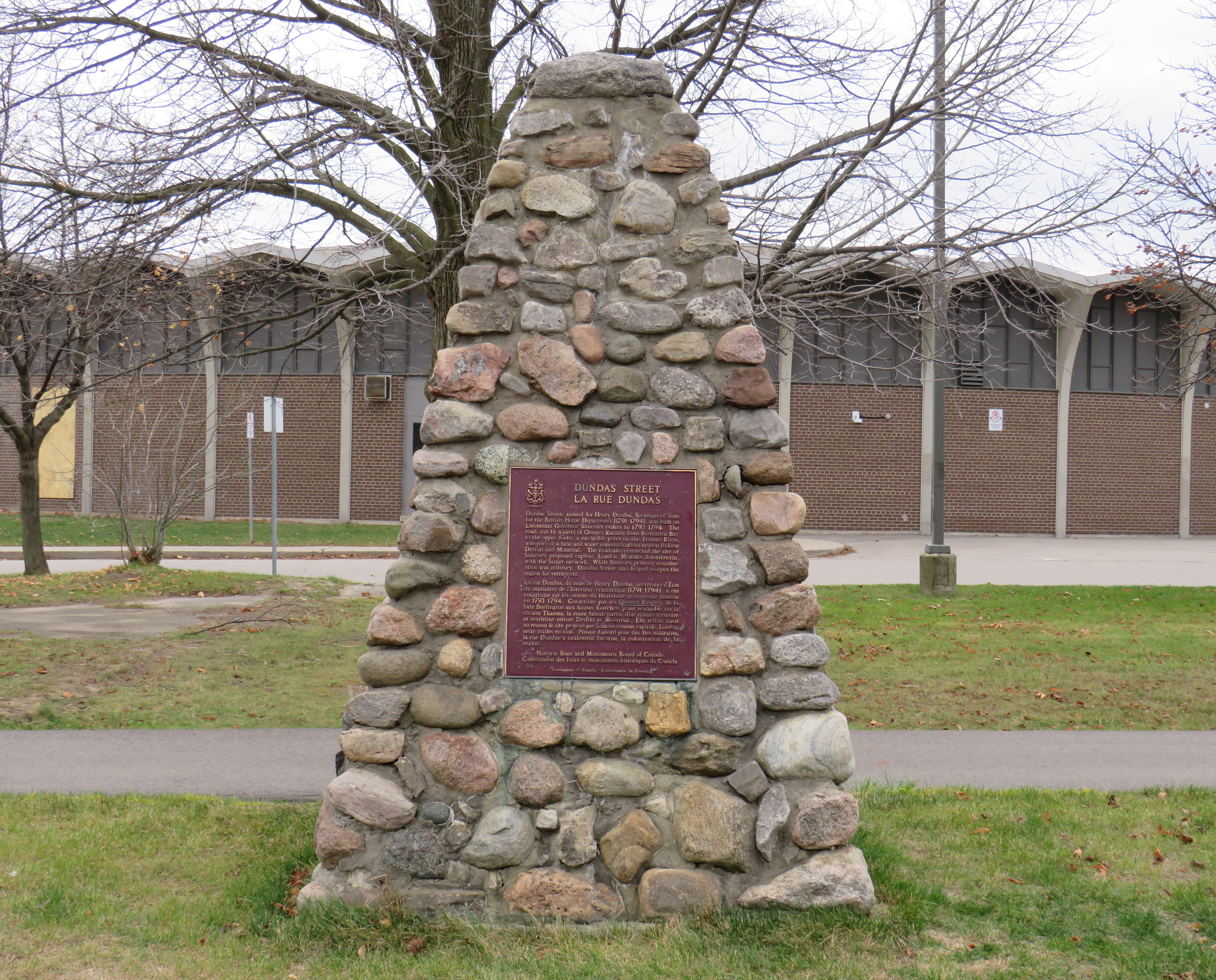
A federal plaque on a cairn in front of Dundas Valley Secondary School in Dundas
Though Dundas Street (which is known as Governor’s Road between Dundas and Paris) features a gentle climb up the Niagara Escarpment, detours were quickly established to get around challenging terrain, such as the confluence of Grand and Nith rivers near Paris. Dundas Street was soon extended westward, to Simcoe’s preferred capital site at London, and extended eastward, to York (Toronto).
Yonge Street, which was originally surveyed and cleared between Lake Ontario and the Holland River near Lake Simcoe, served a similar purpose as Dundas Street. Combined with Penetanguishine Road, Yonge Street provided a military supply route to Lake Huron, though bypassing the established Toronto Carrying Place trail. Though Dundas and Yonge Streets were built with military goals in mind, they, like many other early colonization roads, helped to promote new settlement of lands claimed from local First Nations. Like Dundas Street, Yonge Street was named for a senior British official — George Yonge, who was the British Secretary of War in 1793.
In its early years, Dundas Street’s position inland from Lake Ontario was advantageous as it provided an alternate route in case of invasion. The winding route through Etobicoke and West Toronto to Ossington Avenue allowed travellers to avoid deep ravines and Grenadier Pond.
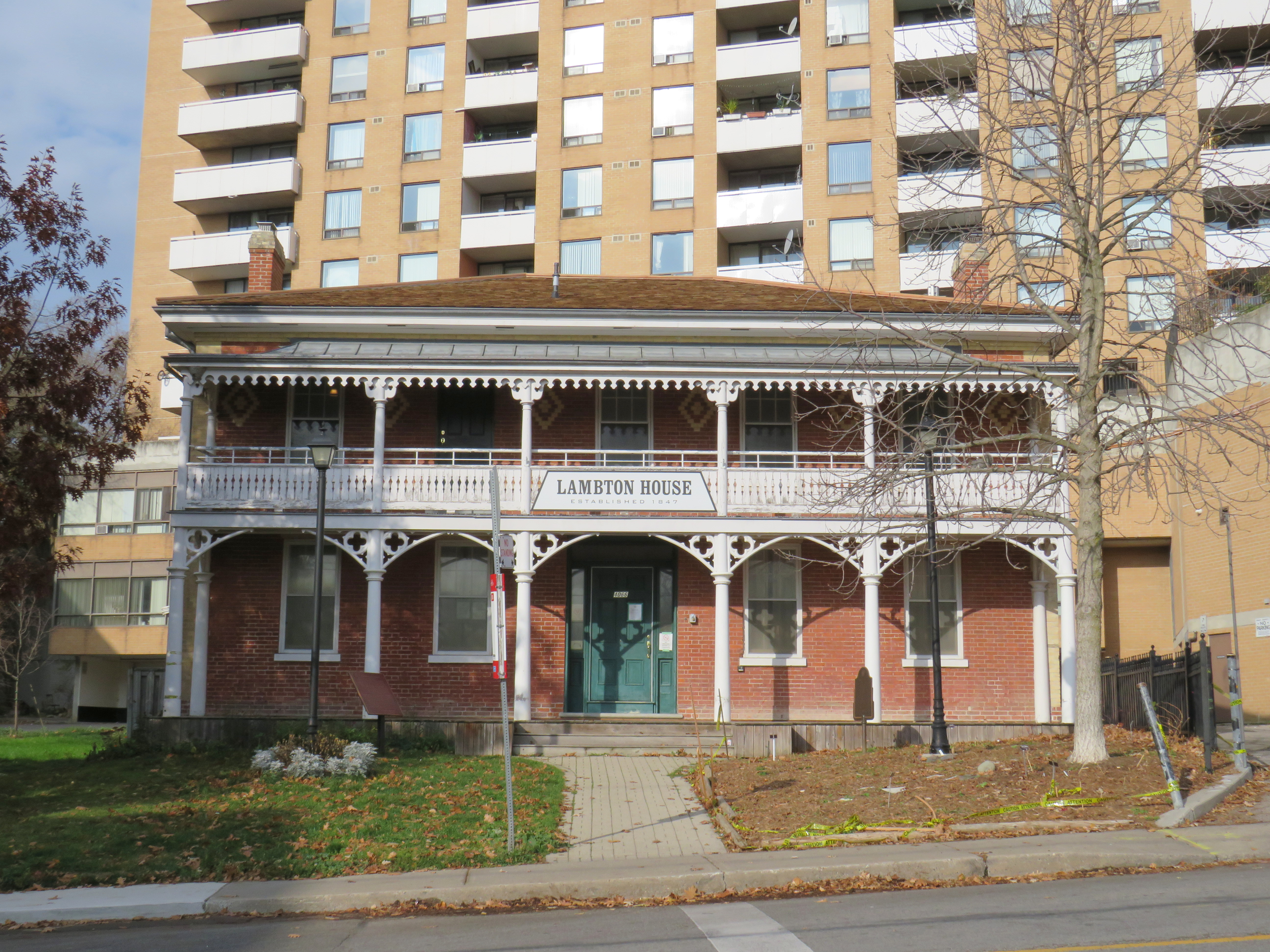
Lambton House, Old Dundas Street
Other early settlement routes, such as Weston Road, branched off of Dundas Street, leading to newly settled lands to the north and northwest of Toronto. Taverns dotted the route, providing accommodation and libation to travelers, several of which — including Lambton House and Montgomery’s Inn — survive to this day.
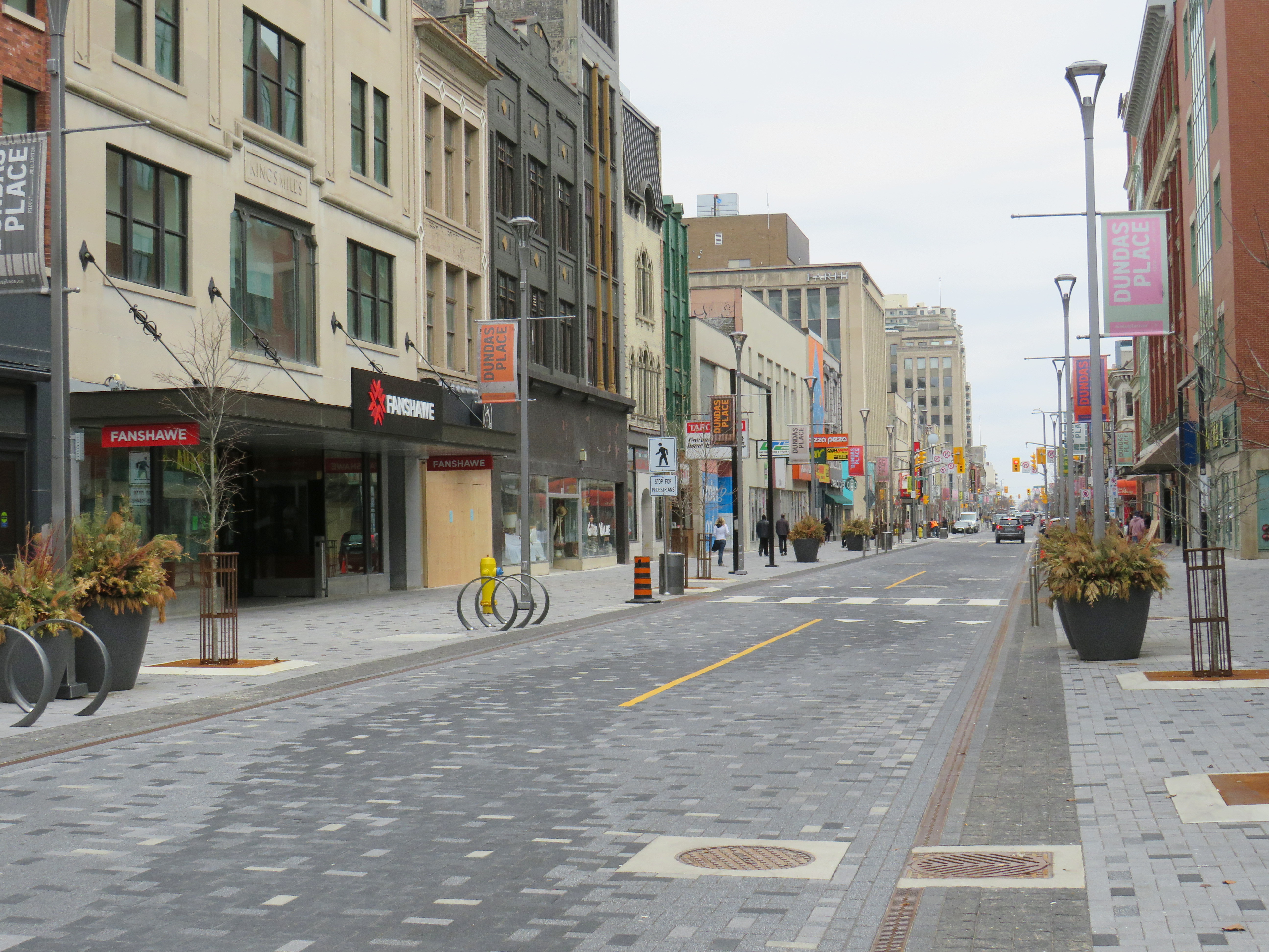
In London and Woodstock, Dundas Street formed the basis for each city’s downtown core. In London, it was recently rebuilt as a two-lane flexible street called Dundas Place, intended to host public events and revitalize the street, which has seen a loss of business to suburban malls and big box stores and to trendier bars and restaurants on Richmond Street, closer to Western University.
Dundas Street in Downtown London was recently rebuilt as a flexible street
Outside the cities, though, other routes surpassed Dundas Street in importance by the mid 1800s. The Lakeshore Road soon became the preferred route between Toronto and Hamilton (which overtook the town of Dundas in size and importance), while the railways, established between Toronto, Hamilton, and London in the 1850s, further eroded Dundas Street’s importance as a major through route until the automobile gained in popularity.
Much of the road between Paris and London became part of interprovincial Highway 2, which extended across Eastern Canada from Windsor, Ontario to Halifax, Nova Scotia. The Waterdown-Etobicoke section became part of Highway 5, while the lesser-travelled section between Paris and Dundas (which today is known as Governor’s Road) was established first as Highway 5B in 1938, then as Highway 99 in 1940.
The remains of the old Dundas Street bridge over the Humber, removed in 1928, looking west to the former settlement of Lambton Mills. The replacement high level bridge is seen to the left. The approaches to the old bridge are named Old Dundas Street.
The Dundas-Waterdown section, which winded its way up the escarpment (only to descend it again a short distance east), became a minor road, with part of the original alignment abandoned by the 1850s.
Though it never held the status of Toronto’s main street, Dundas Street would gain in importance and length in the 19th and early 20th centuries. As Toronto grew beyond its early street grid, it came up against the park lot system devised by Governor Simcoe and other officials to establish a landed gentry in the new colony (including the slaveholding Jarvis and Russell families, who worked to prevent Simcoe from instituting a complete abolition in Upper Canada). These lots which were long and narrow, extended north from Lot (now Queen) Street, and each were developed independently. This resulted in a mess of east-west streets that did not necessarily meet each other. Though College Street was laid out with minimal difficulty, there was no continuous east-west street between College and Queen Streets east of Ossington Avenue.
Dundas Street West, looking southeast from Dovercourt Avenue towards the downtown skyline. This is part of the 220-year old western extension of Dundas Street from the head of lake to York (Toronto).
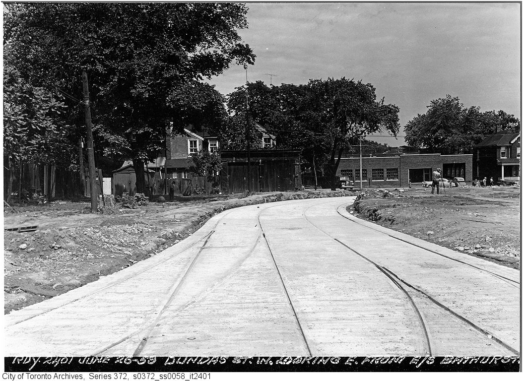
But by the early 1910s, Dundas Street was extended eastward, at first to Bathurst Street, following Arthur Street — which was widened to permit Toronto Railway Company streetcars — and then east to Yonge via St. Patrick, Anderson, and Agnes Streets. Jogs between these streets were slowly realigned, starting with the St. Patrick-Anderson-Agnes jogs between McCaul Street and University Avenue. However, it wasn’t until 1953 that the jog between former Arthur and St. Patrick Streets at Bathurst Street was eliminated. Scadding Court Community Centre now sits on the old roadway, though a small part survives as the centre’s staff parking lot.
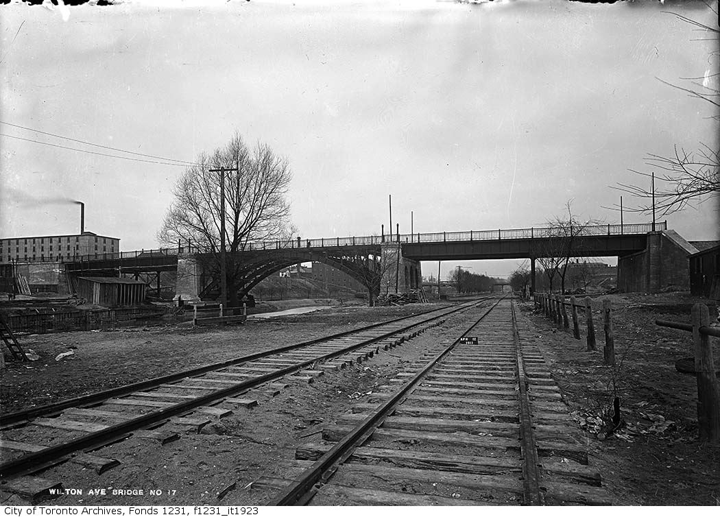
East of Yonge Street, Wilton Avenue was extended across the Don River in 1911, extending just east of Broadview Avenue, incorporating Elliot and Crawford Streets. Though the new bridge was built with streetcar tracks and overhead poles, through service did not begin until 1923, as part of a major TTC route restructuring.
By 1920, Wilton Avenue was renamed Dundas Street East, though the through connection across Yonge Street was not completed until 1922, with the block long section east of Yonge left over from the realignment renamed Dundas Square.
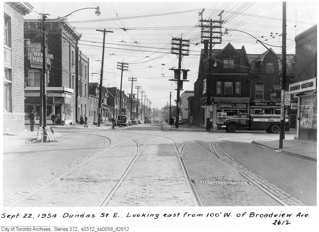
Though the early extensions of Dundas Street through the city simplified the street grid and allowed for through streetcar service between West Toronto and Broadview Avenue, the eastern extension built in the 1950s was done entirely for the benefit of the automobile.
Though Dundas Street extended east of Broadview for one block to Boulton Avenue, it was as a narrow residential street, and did not continue beyond (this is why the Harbord Streetcar took a convoluted route via Dundas, Broadview, and Gerrard to get to Carlaw and Pape Avenues). New roadways were planned to expand traffic access to Downtown Toronto from the burgeoning suburbs, including a new extension of Dundas Street east to Kingston Road.
From Boulton Avenue, a new alignment was built east to Pape Avenue, resulting in the demolition of over a dozen houses on Boulton Avenue, De Grassi Street, West Avenue, and Wardell Street, before ducking under the Canadian National mainline in a new underpass built in 1953, and through an industrial area, avoiding major factory buildings.
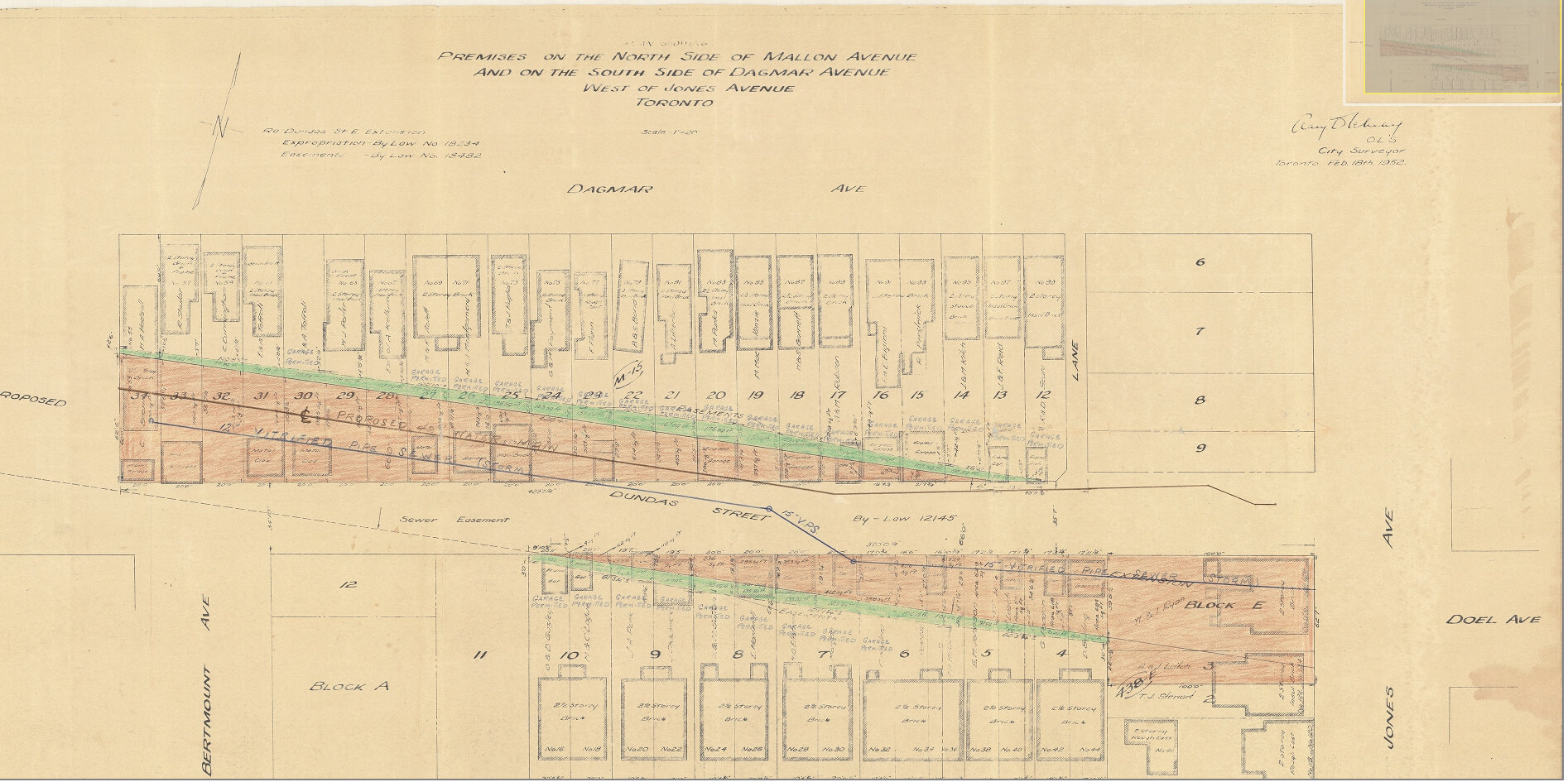
East of Pape Avenue, the new roadway followed a widened Dagmar Avenue, before bending south though a former alley to Jones Avenue to connect with former Doel Avenue to Alton Avenue. Between Alton and Woodfield Road, another new section of roadway was built, through an old brickyard in the late 1940s, connecting with Applegrove Avenue to Coxwell Avenue. The final section, between Coxwell Avenue and Kingston Road, was built through a minor ravine, connecting with, and replacing part of, Maughan Crescent and Edgewood Avenue.
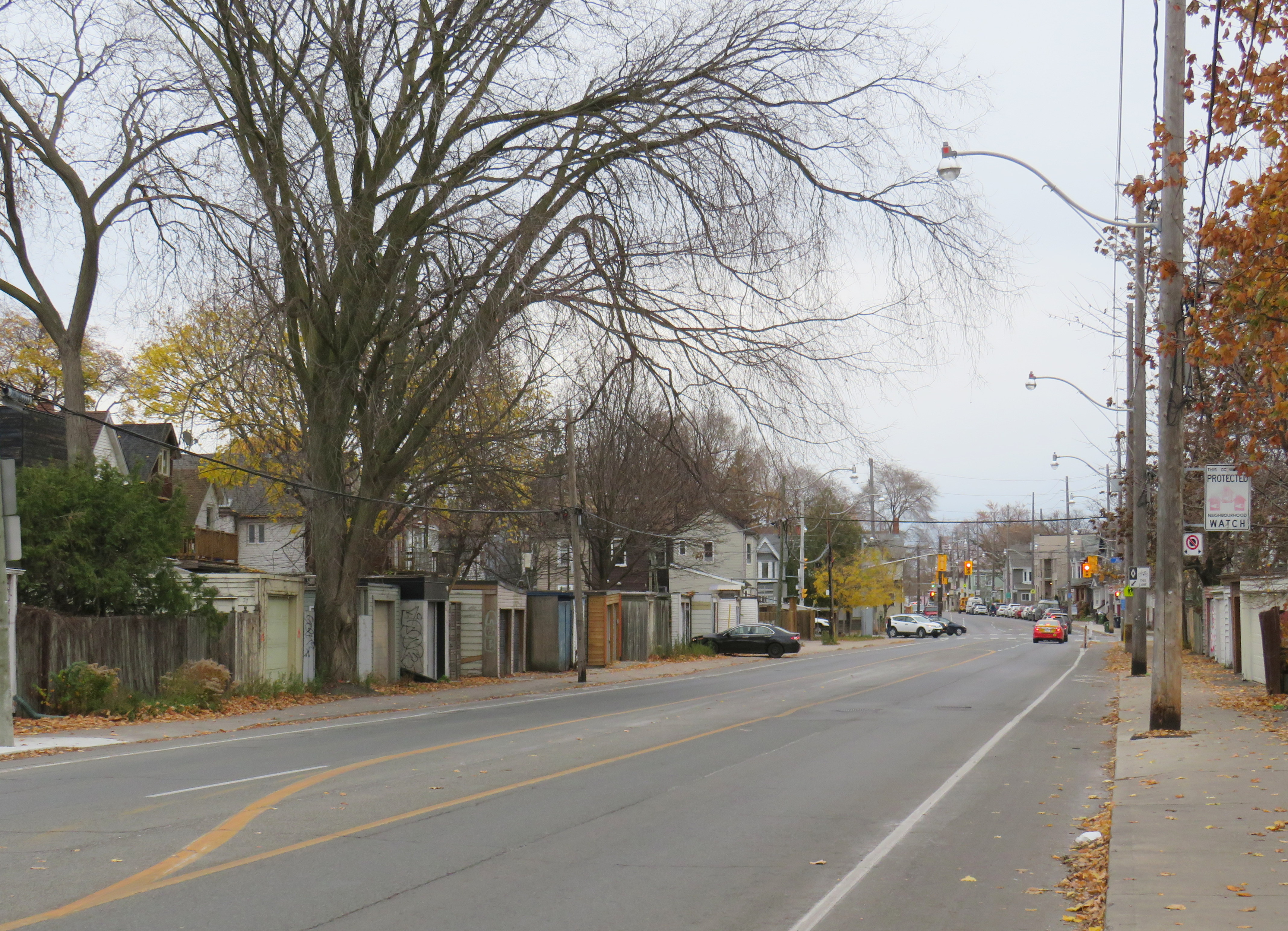
Plan for Dundas Street extension through the rear yards and laneway between Dagmar and Mallon Avenues. From City of Toronto Archives, Fonds 200, Series 2277, Item 32.Just west of Jones Avenue, Dundas Street East is lined with garages, as it passes through an old alley between Dagmar and Mallon Avenues.
Though Dundas Street East was shoehorned into several east-end neighbourhoods through the 1940s and 1950s to provide a new route for automobile traffic, over fifty years later it became an important cycling route. In 2003, the speed limit was reduced to 40 kilometres per hour, and the four traffic lanes reduced to two, with new bike lanes and a centre turning lane. Without streetcar tracks (unlike neighbouring Queen and Gerrard Streets), and with few storefronts, Dundas Street was simple to reconfigure. In 2020, the bike lanes were extended west across the Don River and into Regent Park, as part of the new ActiveTO measures.
Within Toronto, Dundas Street has gone by many names: Arthur, St. Patrick, Anderson, Agnes, Wilton, Elliot, Crawford, Dagmar, Doel, Applegrove, Maughan, and Edgewood. At various times in the first half of the last century, city officials have decided to change their names to Dundas Street.
It would not be without precedent to change Dundas Street’s name as well. Henry Dundas has no connection to local history, and even the historic road that bears his name did not extend any further east than Ossington Avenue.
Retain the legal street names with additional interpretation and recognitions
Retain the legal street names but rename those civic assets with Dundas in their name, except TTC facilities (there are three parks and one library branch that include the Dundas name, and Yonge-Dundas Square; there are two TTC subway stations and one streetcar line that also bear the Dundas name)
Rename the streets and all other civic assets now carrying the Dundas name (including Dundas Street East, Dundas Street West, Dundas Square, and Old Dundas Street).
I would agree with at least the third option, and likely the fourth option, even in part. As one of the city’s most famous and popular meeting places, a better name can be found for Yonge-Dundas Square. As Dundas Street East is a 20th century construct, and less than half the age of the historical road, it too, would be a great candidate for renaming to something meaningful. There are many other streets, towns, and parks in Toronto and elsewhere in Ontario that carry names given by early colonial officials, eager to leave their mark on newly claimed lands. Some are also worthy candidates for renaming.
Other municipalities, including Mississauga, Oakville, Burlington, Woodstock, and London, will also have to decide what they will do with their sections of Dundas Street. There is also the matter of the former Town of Dundas, the Dundas Valley, the United Counties of Stormont, Dundas, and Glengarry in Eastern Ontario (and two townships within it). There are also Dundas Streets in Belleville, Trenton, and Napanee along Highway 2, but otherwise unrelated to the historic road.
But the process must be thoughtful and considerate, and not just a another feel-good exercise that distracts from the real economic and racial inequities in our city.
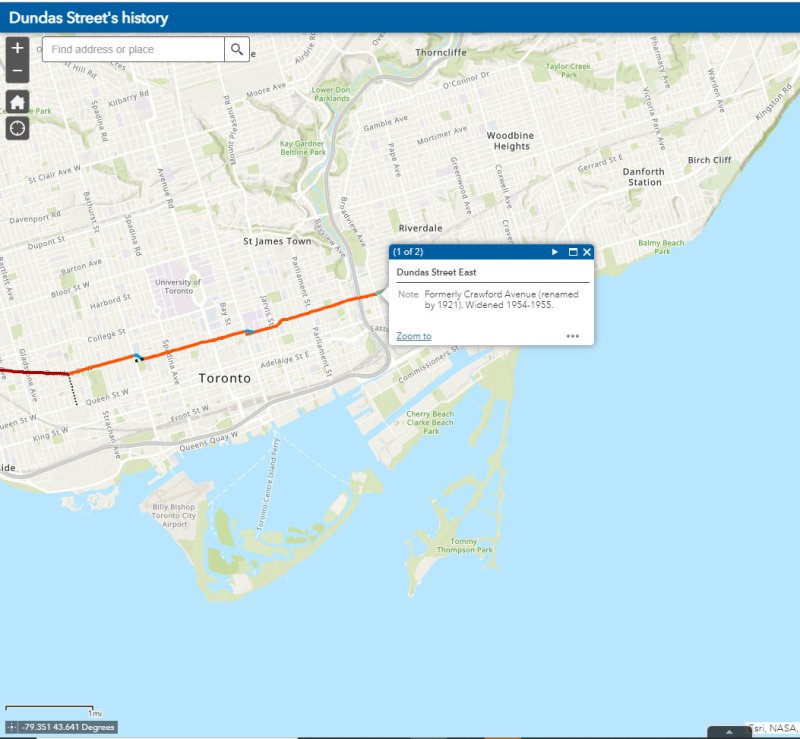
The interactive map below illustrates the history of Dundas Street, from London to Kingston Road.
A classic Brewers Retail Store in South River, Ontario featuring the 1980s-era branding
While taking a geographic analysis program during my undergraduate years at university, I developed a fascination with retail geography. My 2005 Masters’ paper examined the geographic distribution of payday lenders — which combined my interests in retail geography, urban planning, and social justice. Though my career took me in a different direction, I have maintained my interest in the role of geography in the success — or failure — of retail businesses.
Despite being one of Ontario’s oldest and most influential retailers, there is very little written about the history of The Beer Store. Contrary to common belief, The Beer Store is a private company — not a government monopoly. Following the end of prohibition in 1927, the provincial government established a crown corporation to distribute wine and spirits — the Liquor Control Board of Ontario, or LCBO. However, the province’s breweries were granted authorization to establish their own corporation — the Brewers Warehousing Company Ltd. — to distribute their own products. At first, alcoholic beverages were only permitted to be sold for at-home consumption (while customers were required to obtain licenses to purchase beer, wine, and spirits). Gradually, rules were slowly relaxed to permit drinking in hotels, restaurants, and taverns. Eventually, the company became known as Brewers Retail.
Though the number of breweries declined since the 1930s due to consolidations and bankruptcies, Brewers Retail expanded its retail operations in the 1960s and 1970s. It produced highway maps showing all the locations where thirsty Ontarians could buy “ale & beer.” Customers, freed from having to write out and sign purchase orders by 1971, would place their order with a clerk, then wait for their case(s) of beer to roll out from the cold storage in the back. Though a self-serve store was introduced in December 1971, it proved to be an unpopular concept, especially as the beer was kept warm, rather than in a cold warehouse in the back.
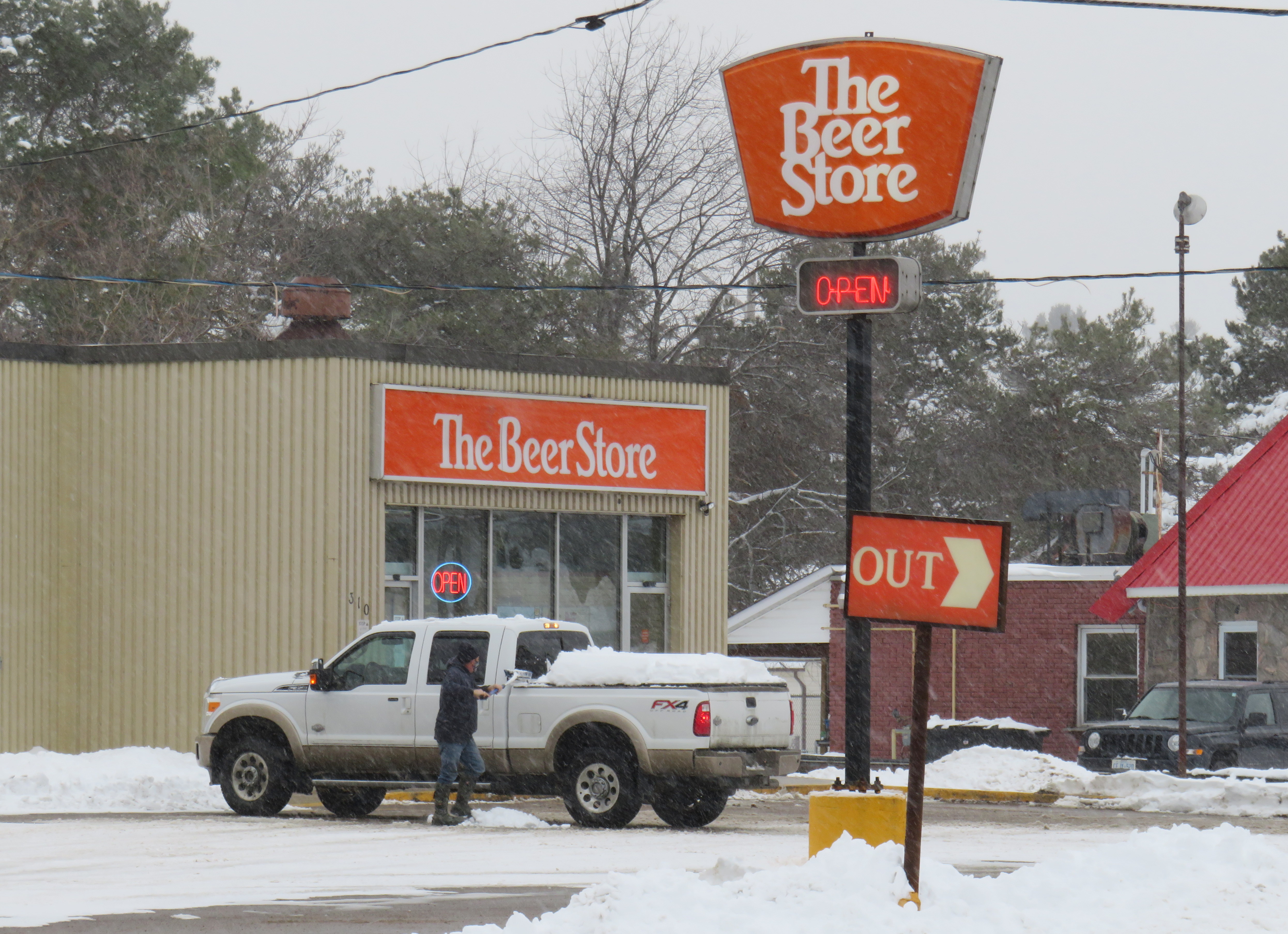
In 1985, Brewers Retail began rebranding its stores as “The Beer Store” with bright orange signage. Two further rebrands have occurred since (it now uses a grey and black colour scheme), yet the 1980s look can still be seen at many stores, especially in northern Ontario.
Though the rise of small independent craft breweries in Ontario, the LCBO’s expanded beer selection, and the recent moves to allow supermarkets to sell beer in limited quantities (singles and six-packs) have made it easier to purchase beer, The Beer Store remains the dominant player in the distribution of suds.
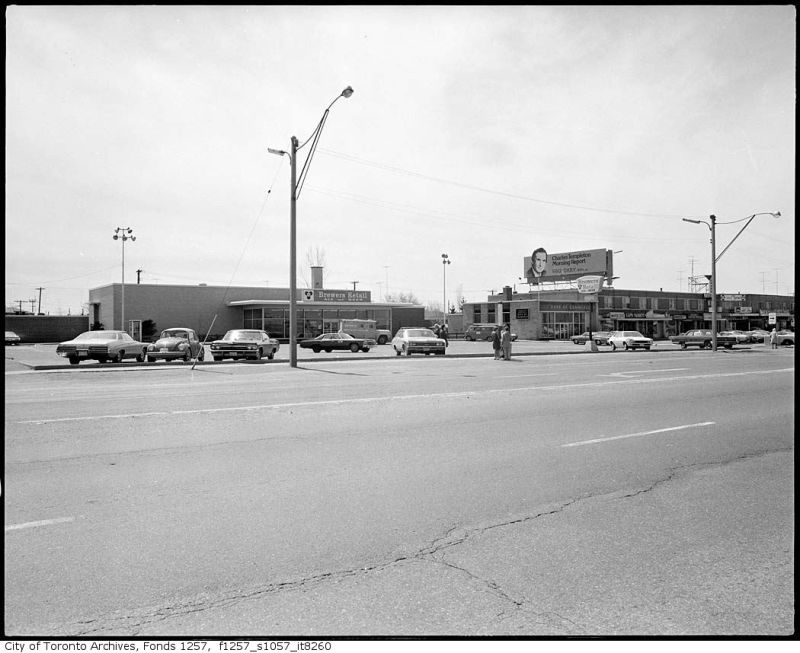
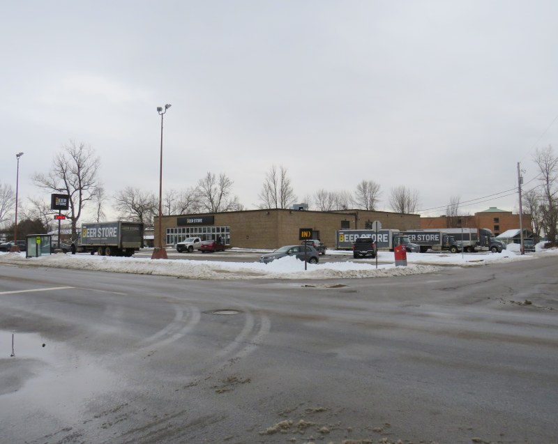
Brewer’s Retail, Eglinton Avenue East, 1974. Though the location has seen several renovations and rebrandings, this beer store still stands near the corner of Eglinton and Brimley in Scarborough. Toronto Archives Fonds 1257, Series 1057, Item 8260.
Not only does Brewers Retail sell direct to consumers, it also delivers bottles and kegs to businesses, so it had to establish a distribution network across the province. Most of the large breweries were located in Toronto or in southwestern Ontario, though there were smaller, regional brands such as Soo Falls Brewing and Sudbury’s Northern Brewery. Those products had to be shipped hundreds or even thousands of kilometres. Empty bottles had to be returned to the breweries for cleaning, re-labelling and refilling. Most large breweries, like Labatt’s in London and Molson’s Fleet Street plant, were located next to rail lines for easy shipping.
This is why, in Northern Ontario, many beer stores are found adjacent to rail lines. Though rail shipments to local beer stores have ceased — with one notable exception — this legacy can still be seen, from Pembroke to Kenora.
A thread on old Brewers Retail locations in Northern Ontario.
Unlike the south, most Beer Store locations in the North still have the retro orange signs.
But there’s something more interesting about these stores…
In some cases, such as in New Liskeard, The Beer Store is out of the way, an unusual strategy for a consumer-focused retailer. But since Brewers Retail holds a monopoly on bulk beer sales (not needing an especially visible location), and since rail access was important for the chain until the 1970s, the location makes sense.
In larger cities, such as North Bay, Sudbury, and Sault Ste. Marie, one Brewers Retail store would handle rail shipments, distributing products to restaurants and bars and to nearby beer stores. Thunder Bay had its own dedicated distribution centre in Port Arthur, next to the railway.
Since the 1960s, refrigerated trucks took the place of dedicated box cars. The railway spurs are gone and the loading docks have since been covered or bricked up. Yet in many cases they remain visible, especially during this time of year, such as North Bay’s Main Street store, below.
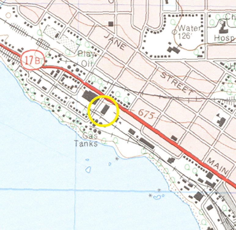
The Main Street beer store in North Bay has a large warehouse in the back, with the old rail docks still very visible. A 1964 topographic map shows the spur serving the store.
There were a few regional warehouses in Southern Ontario that had rail loading docks. Ottawa’s Bank Street Brewers Retail location, built in 1958, was designed by John B. Parkin and Associates and backed on to a Canadian Pacific freight spur. The warehouse was moved to a modern suburban location and the rail line was removed, though the building survives, with a beer store still operating at the front.
Similarly, the Ritson Road store in Oshawa was built next to the Canadian Pacific Railway, and saw rail service in its early years as it also functioned as a regional distribution centre. The store has since moved to a new big-box plaza built on an old General Motors plant to the north, with the old location now a local craft brewery.
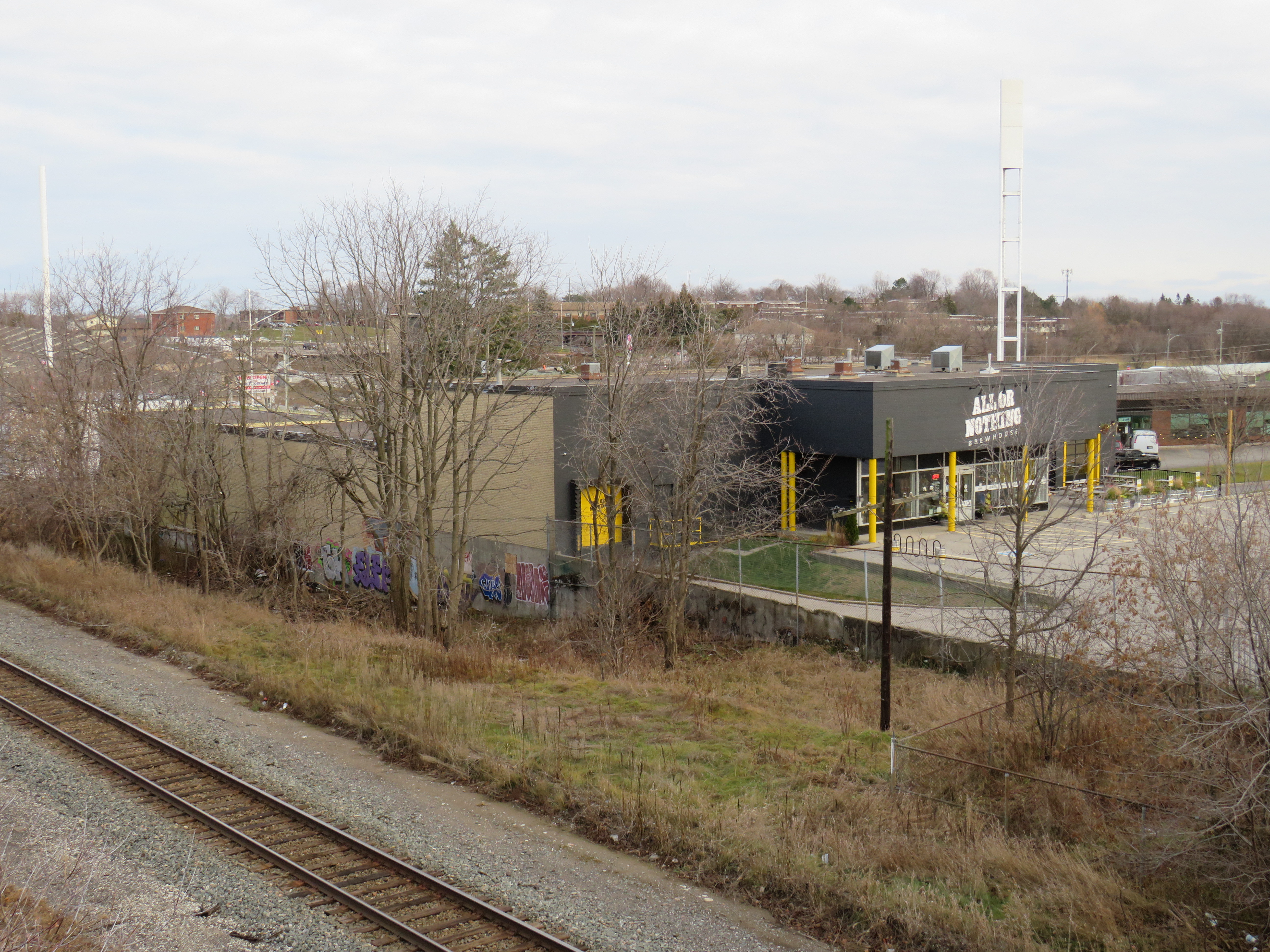
In Oshawa, the old railside Brewers Retail store and warehouse is now a craft brewery. The shuttered rail docks -covered with metal sheeting – are barely visible behind the trees to the rear.
Interestingly, one Brewers Retail store still ships beer by rail — the Cochrane, Ontario location. Mike Robin kindly sent me photographs of Ontario Northland Railway box cars parked on the beer store’s spur. This allows for beer bottles and kegs to be shipped north to Moosonee, which is accessible only by rail or by plane for most of the year.
Cochrane Beer Store, November 21, 2020 – Courtesy Mike Robin
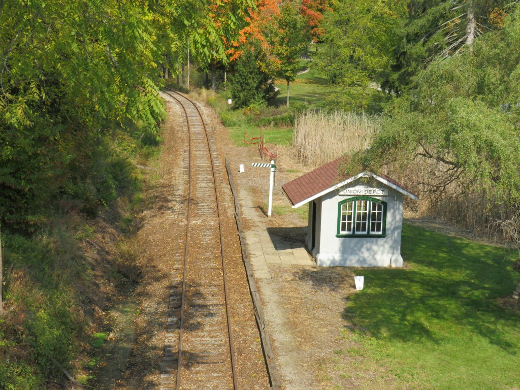
Just south of St. Thomas — Ontario’s Railway City — sits a small stucco-clad shelter, just below the Sparta Road bridge. Until 1957, electric trains of the London & Port Stanley Railway would regularly pass this little, unstaffed station serving the nearby community of Union.
There are dozens of union stations across North America, several of which are still in regular passenger service. Toronto’s Union Station is the continent’s second-busiest railway station, surpassed only by New York’s Penn Station. Union Stations in Chicago, Washington, and Los Angeles are among the top fifteen in Canada and the United States, while other grand union station buildings still greet rail passengers in Winnipeg, Kansas City, and Denver.
Kansas City’s Union Station, with downtown skyline backdrop
Union stations, by definition, are passenger facilities used by two or more railways. They allowed for shared services and passenger convenience, though they required ample access to each railway’s tracks. Toronto’s Union Station, for example, was built for the Grand Trunk and Canadian Pacific Railways, which both had rail corridors following the waterfront into Downtown Toronto. Ottawa, too had a Union Station that was used by CN and CP until 1966 (and in earlier years, New York Central trains called at Ottawa’s Union Station).
In some cases, a union station might be a small depot at the junction of two railways. The small Inglewood Station in Caledon was technically a union station as it was used by Canadian National and Canadian Pacific.
Great Hall, Chicago’s Union Station
Of course, the little Union Station in rural Elgin County was never a true union station. It was merely a flag stop for the L&PS, where awaiting passengers would signal their intention to board by lowering a wooden board affixed to a pole next to the station shelter.
The L&PS Railway opened in 1856 to connect London to nearby St. Thomas and to Port Stanley, giving the growing city access to Lake Erie. In 1913, the City of London, which owned the line, upgraded and electrified the railway under the direction of then-mayor Adam Beck, who championed public hydro electricity and a proposed network of electric railways across the province.
Though bulk freight was the railway’s bread-and-butter — it connected with a train ferry service to Ohio — the L&PS operated regular local passenger service connecting two cities, four separate railways (CN at London and the Wabash, Michigan Central, and Pere Marquette Railroads at St. Thomas), and the popular summer resorts and cottages at Port Stanley.
With improved highways and increased auto ownership, the L&PS ceased passenger service in 1957, though there was regular bus service until the 1990s. Today, it is impossible to get between London, St. Thomas, and Port Stanley without a car. The railway was sold to CN in the early 1960s. CN used the railway to access a new Ford assembly plant as well as local industry in London and St. Thomas, but eventually ceased freight service south of St. Thomas.
The abandoned track south of St. Thomas was acquired by the Port Stanley Terminal Railway, which today operates family-friendly excursions from the former L&PS station in Port Stanley. Though you can no longer board a train at Union, you can still watch trains go by. A restored LP&S interurban passenger car can be found at the Halton County Radial Railway museum near Rockwood.
Passing by Union Station, riding the PTSR excursion train
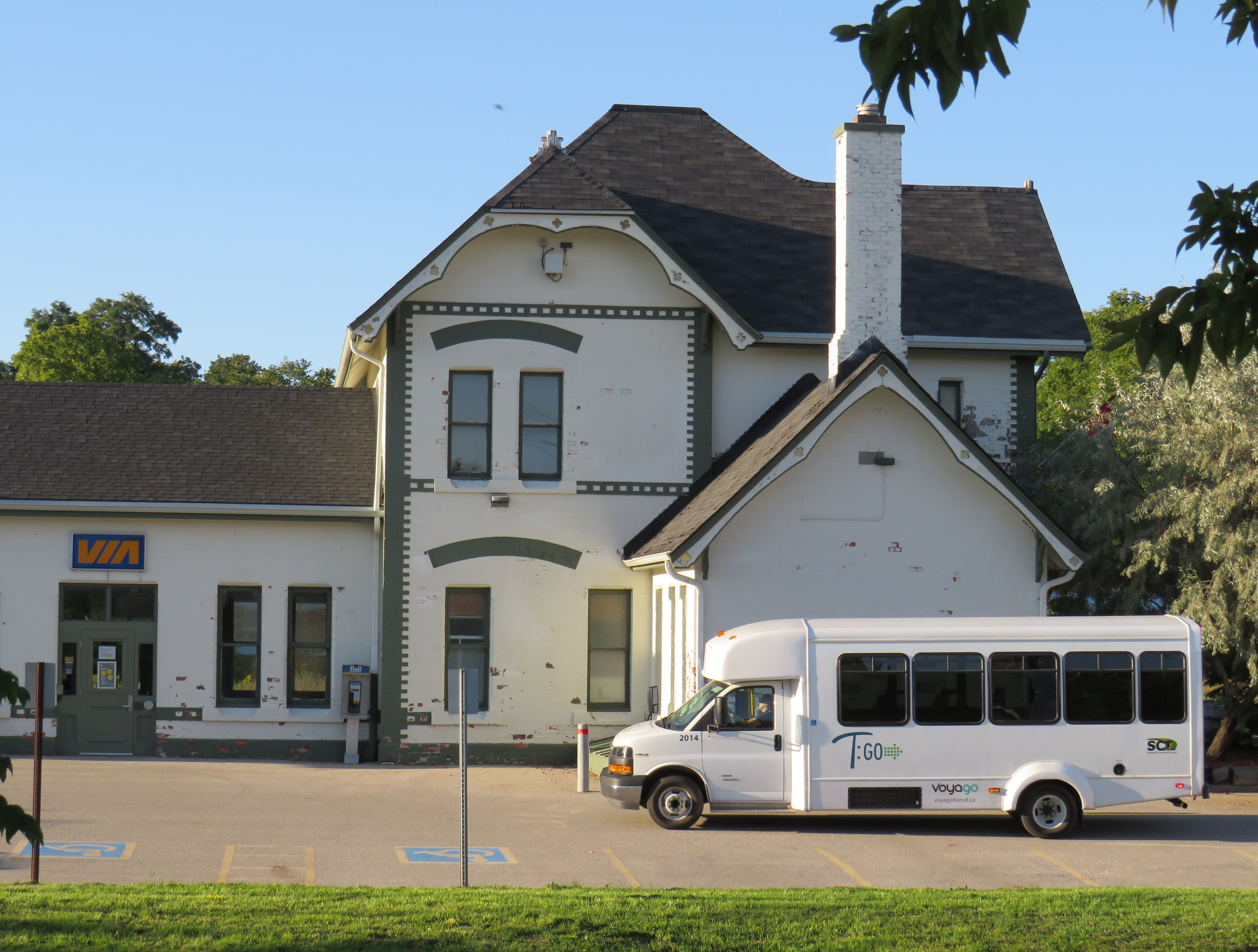
T:GO inter-community transit van at Woodstock VIA Rail station, September 2020
October 2021
I made several changes to the interactive map, including a complete update of the GO Transit bus and rail network, including the most recent rail corridor extensions to Bloomington and London, and a new weekday bus route to Brock University in St. Catharines.
Over the summer, Quinte Transit added a new route between Trenton and Belleville, Simcoe County Linx added a new route between Midland and Orillia, serving Tay Shores and Coldwater, and a new service launched between Brockville, Prescott, and Cardinal in Eastern Ontario.
June 29, 2021/July 6, 2021: Beginning Monday, June 28, Rider Express, an intercity coach company based in Western Canada (which picked up several routes formerly operated by Greyhound Canada and the Saskatchewan Transportation Company), began service in Ontario. Rider Express is looking to fill some of the gaps left by the recent announcement that Greyhound will cease all domestic routes in Eastern Canada.
That’s the good news. The bad news is that its first route in Ontario, connecting Toronto Station, Kingston, and Ottawa, replicates Megabus’ new route (which I have also added) and competes against VIA Rail’s Corridor rail service. Several of Greyhound’s daily Toronto-Ottawa buses ran through Peterborough and along Highway 7 through Eastern Ontario, leaving towns such as Norwood, Havelock, and Perth off the map. Though Peterborough is connected to Toronto by GO Transit, it is a long train and bus ride, while Greyhound offered a direct, express service to Downtown Toronto.
Two steps forward, one step back.
I made additional changes to the interactive map to show new GO Transit, Can-Ar Coach, Megabus, and Ontario Northland routings to the new Union Station Bus Terminal, which replaces the old GO bus terminal and the Toronto Coach Terminal on Bay Street. Meanwhile Ontario Northland moved from the now-closed Ottawa Central Bus Station to the VIA Station on Tremblay Road.
Meanwhile, starting July 8, Orléans Express will expand into Ontario, with a new Gatineau-Ottawa-Montréal route, operating twice daily. It will join Rider Express and Ontario Northland at the VIA Rail Station in Ottawa.
May 2, 2021: On Monday, May 3, “The Link” begins operations on two routes in Selwyn Township and Curve Lake First Nation, connecting several communities with Peterborough Transit and GO Transit at Trent University. The service, which is operated by Peterborough Transit, will run on weekdays, with five trips in each direction on both routes. Fares on “The Link” buses include a free transfer to and from Peterborough city bus routes at Trent, with direct service to downtown, major shopping centres, the hospital and Sir Stanford Fleming College.
February 15, 2021: A few small updates, including the addition of two community routes in Muskoka District Municipality, a bus connection between North Bay and northern Quebec, and a revised bus stop location for Ontario Northland in Orillia.
December 14, 2020: I made several updates to the interactive map, including the addition of Huron Shores Area Transit, which launches today. I made a few changes suggested by one of my readers, and added Niagara Region Transit’s on-demand service in Niagara-on-the-Lake, which replaces a fixed route that was cancelled earlier this year.
November 9, 2020: I made several updates to the interactive map, including the addition of PC Connect in Perth County, which launches next Monday. I mapped Port Hope’s transit connection to Cobourg, as suggested by one of the readers, and corrected a few minor errors.
October 15, 2020
Despite the ongoing COVID-19 pandemic, several new inter-community transit services launched in Ontario during the last few months.
Last August, T:GO began service on four routes radiating from Tillsonburg, where there was already an in-town circulator service. Mondays through Fridays, twenty-seater vans operate between Tillsonburg, Norwich, Woodstock, Ingersoll, and other communities, offering connections to Woodstock Transit, the hospital, and the VIA Rail Station.
In September, the City of Owen Sound, Grey County, Middlesex County, the town of Strathroy-Caradoc, and Prince Edward County all launched their own services, connecting rural communities and small towns to larger centres such as London, Guelph, and Belleville. In addition, Simcoe County expanded its Linx bus service to serve Alliston and Beeton, and other services, suspended during the early days of the pandemic, resumed operations. Also this year, Niagara and Durham Regions expanded their rural on-demand transit services.
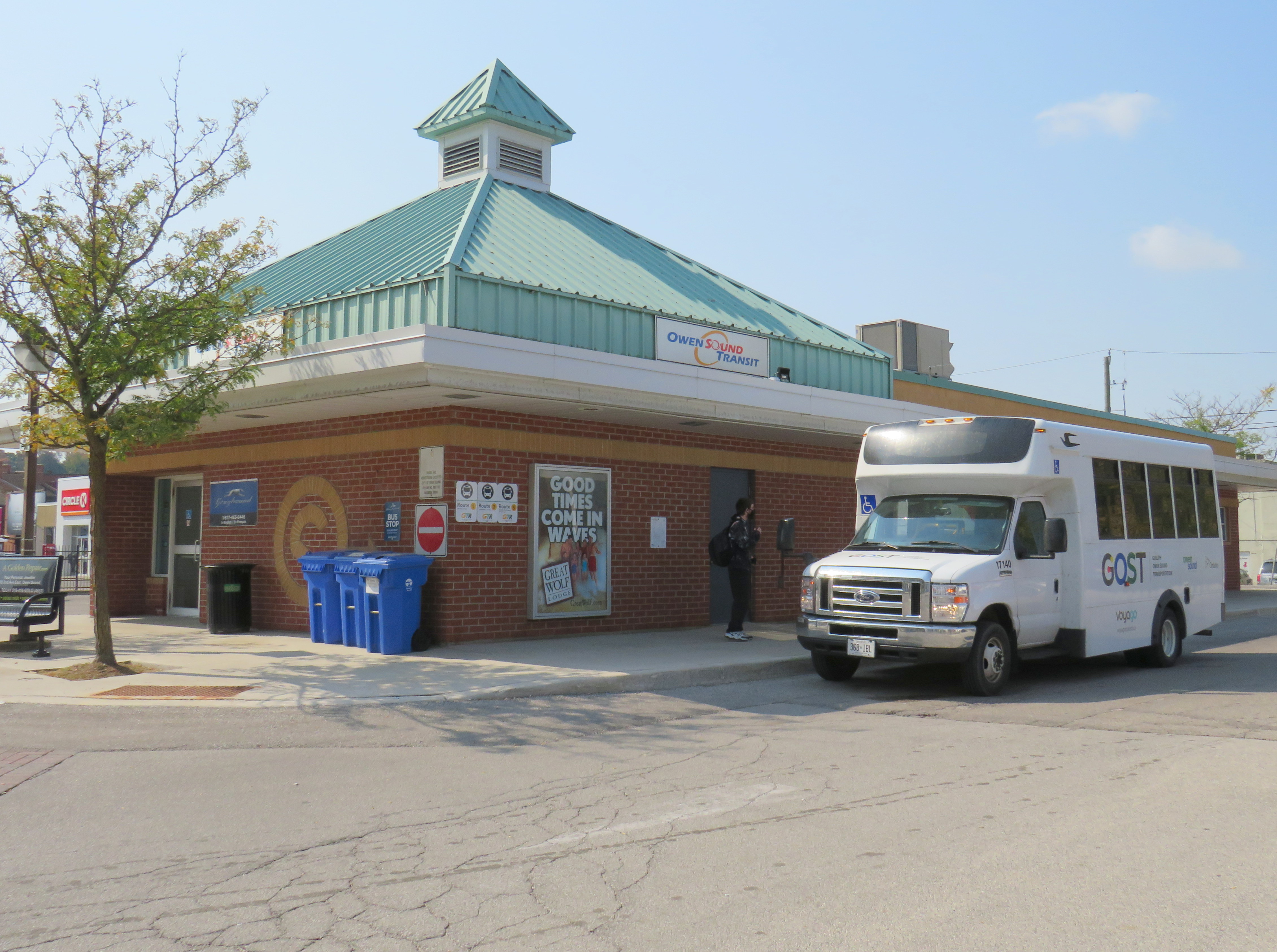
GOST minibus at Owen Sound Transit Terminal
All these new services help to fill the gaps left behind by private coach companies; these have become especially vital as Greyhound Canada suspended all operations in Ontario and Quebec this year (after abandoning Western Canada in 2018), and Coach Canada (operating as Megabus) cut service on some of its routes.
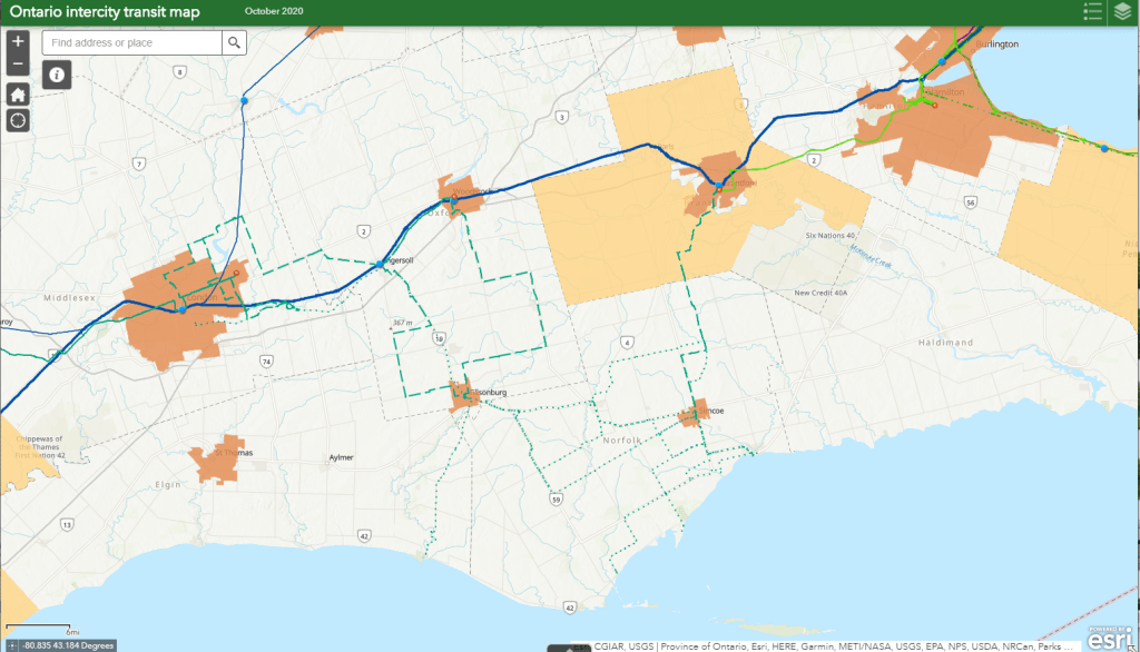
While these new intercommunity routes help to serve local needs, there is a wide variety of service provided in rural and small town Ontario. But without provincial coordination, it is nearly impossible to keep track of them all, never mind plan a trip.
So I went ahead and mapped them all the best I could. Clicking on each route brings up a pop-up window containing further information, including a link to each agency’s website, where available.
Earlier in September, I paid a visit to Woodstock, Ontario, to check out one of several new intermunicipal transit services that launched across the province this year. While in Woodstock, I paid a visit to the Highway 401 interchange at Highway 59.
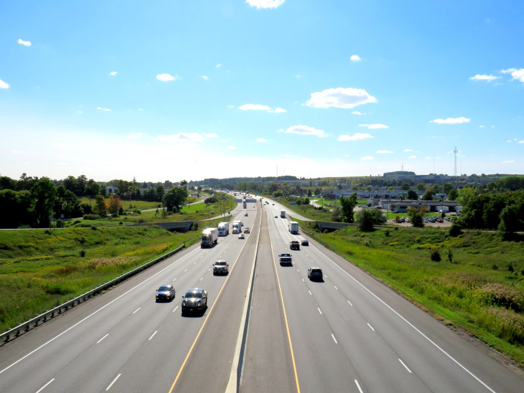
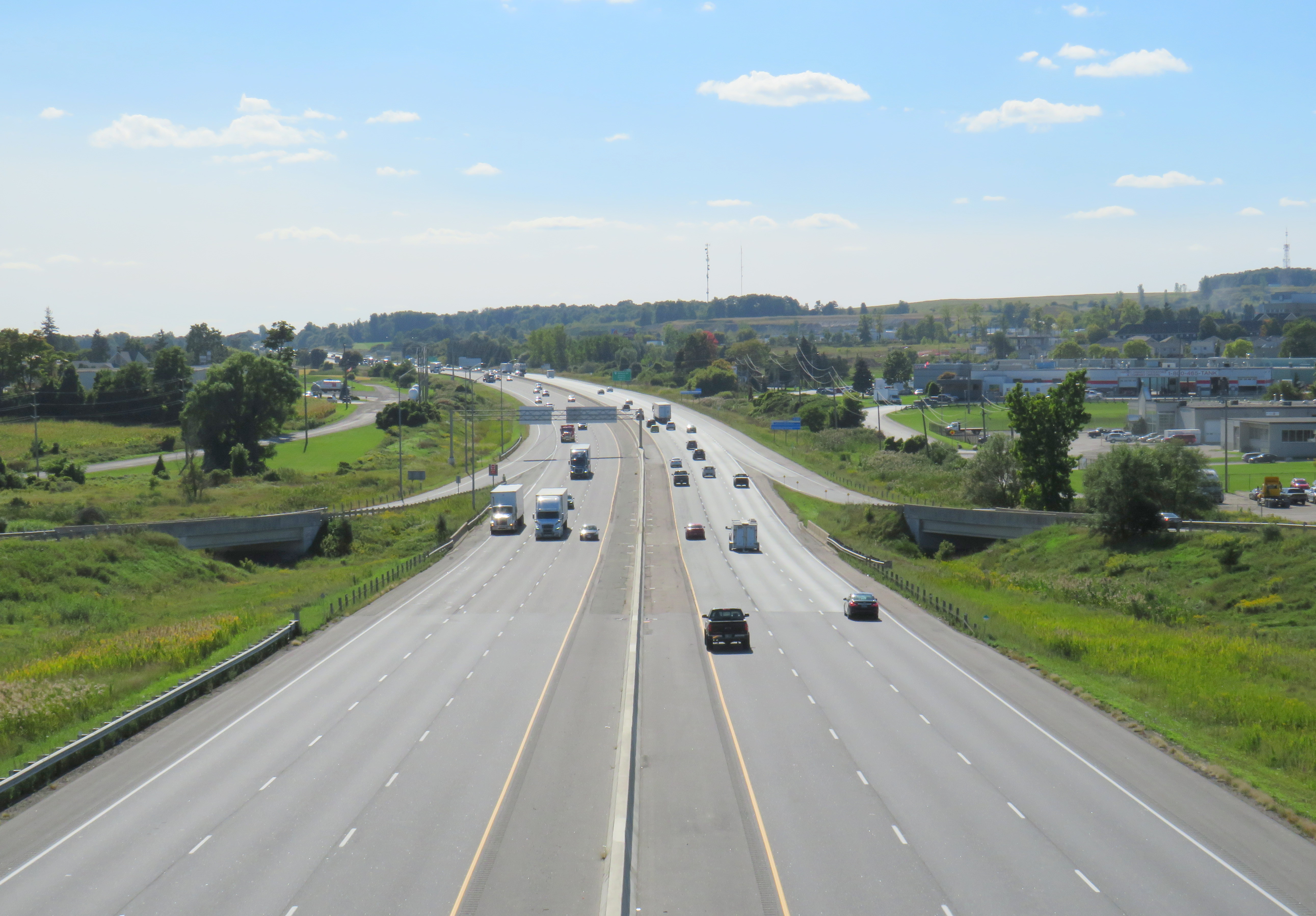
In 1968-1969, London, Ontario artist Jack Chambers painted 401 Towards London No. 1, which depicts a tranquil scene from the Highway 59 overpass, looking west. The highway, just two lanes in each direction, bends slightly to the southwest as it heads towards London and Windsor. On either side, autumn trees, farm fields, and gentle hills stretch out. The only buildings visible are farm silos, and two truck terminals on the north side of the highway. Only a few vehicles on Highway 401 are visible in the scene.
Chambers became well known for photorealism in his work. The scene in 401 Towards London No. 1 is slightly askew, as if this was a Kodachrome snapshot.
Highway 401 was only fully completed between Windsor and the Quebec border in 1968, the year the painting was started, though the section between Woodstock and London was completed in 1957, bypassing an especially congested section of Highway 2. Like many interchanges built by the province in the 1950s and early 1960s, the junction of Highways 59 and 401 was an eight-ramp cloverleaf.
A contemporary view towards London
By the 1990s, Highway 401 was widened to six lanes. The cloverleaf interchange, like most others in Ontario, was removed and replaced by a simpler interchange. (As traffic levels increased, the danger of vehicles entering and exiting the highway with little space to merge became apparent.)
Woodstock’s sprawl caught up to the highway, with new warehouses, motels, subdivisions, and a hospital joining the original freight terminals. Though the distant trees and hills are the same as those in Chambers’ painting, the gentle curve in the distance remains the easiest way to match the two views, fifty years apart. Highway 59 itself was downloaded by the province in 1997. To the south, the old highway is Oxford County Road 59. To the north, it is simply Norwich Street.
Breezewood, Ontario: former Highway 59 looking north towards central Woodstock, where chain hotels, restaurants, and gas stations line the road
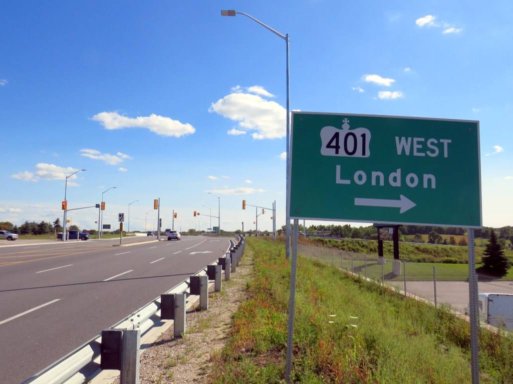
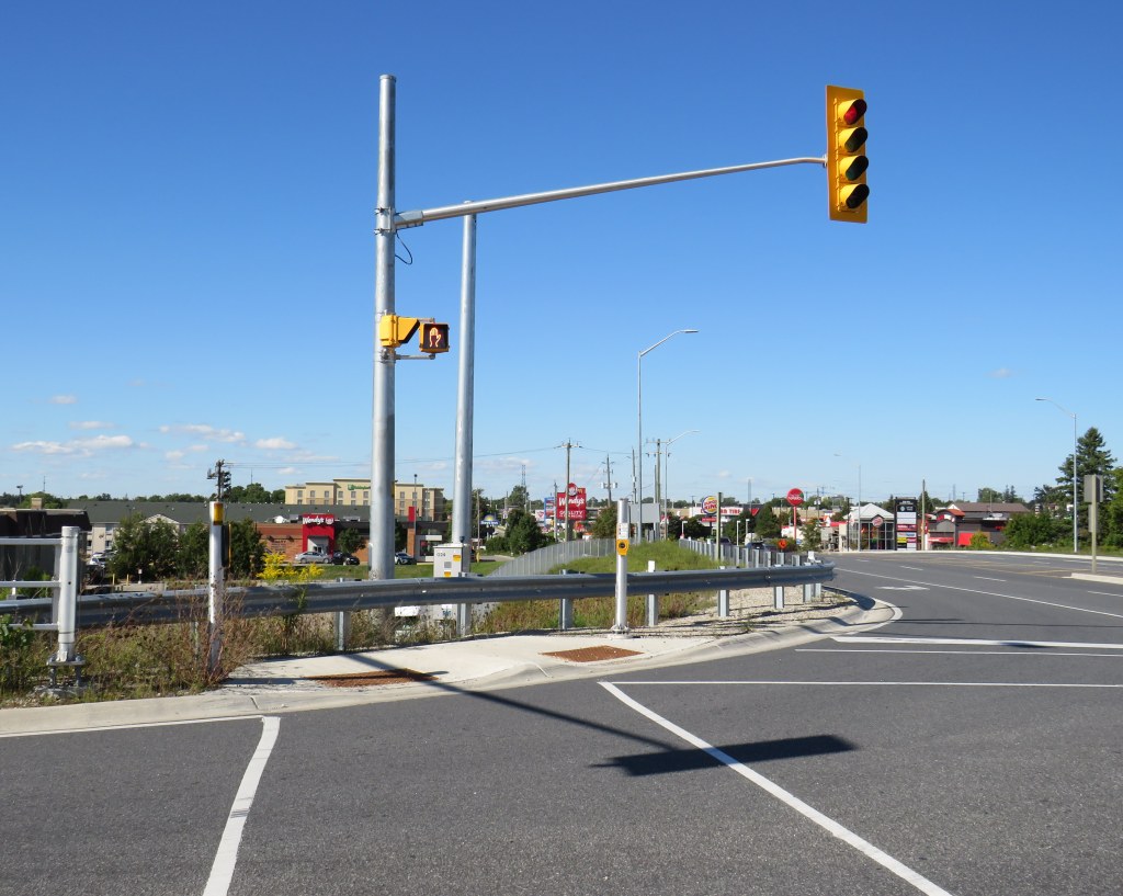
As I climbed over guardrails and navigated sidewalk-less embankments and road shoulders to capture the contemporary image of Jack Chambers’ painting, I was surprised by two things. The first were fully AODA-compliant crossing treatments at the highway ramps, despite there being no safe and marked way to get to those crosswalks.
I had to climb over the guardrail to get to this crosswalk at the westbound ramps to Highway 401
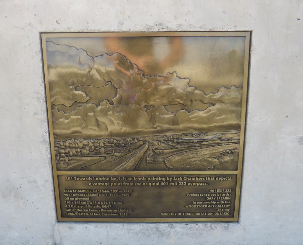
I was even more surprised to see an engraved version of the Jack Chambers painting embedded in the guardrail. When the Ministry of Transportation Ontario (MTO) rebuilt the overpass in 2017-2018, it thoughtfully included this nod to a local artist.
Plaque embedded in the guardrail at the Highway 59 overpass in Woodstock
Unfortunately, given the isolation of the plaque, few will actually see it, even if thousands pass by it daily. Larger signs mark the overpass as the Constable Jack Ross Memorial Bridge, in honour of a Ontario Provincial Police officer.
But it will always be the Jack Chambers bridge to me.
A larger sign right above the Jack Chambers plaque commemorates a different Jack
Though 401 Towards London No. 1 has long been one of my favourite Canadian paintings, it is not typically on display at the Art Gallery of Ontario. I would love to see this work put on permanent display, either at the AGO, or at another gallery that will appreciate the ode to Ontario’s mother road.
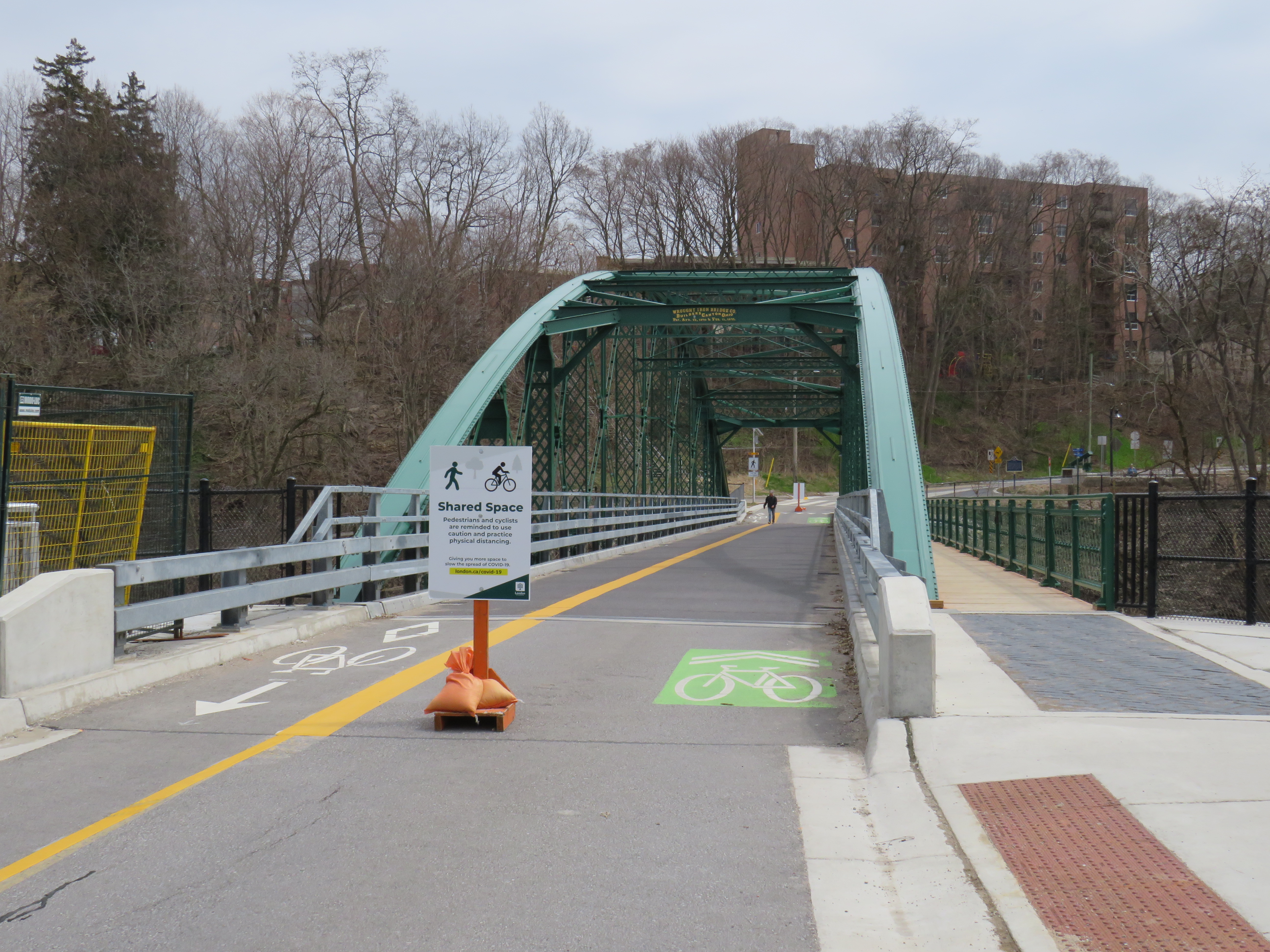
Blackfriars Bridge open to pedestrians and cyclists in London, Ontario
For my latest TVO article, I spoke with Councillor Shawn Menard in Ottawa, Councillor Rowena Santos in Brampton, and Ryerson University epidemiologist Anne Harris about how cities in Ontario are reallocating road space for pedestrians and cyclists during the ongoing COVID-19 pandemic, or why they may be hesitant to do so.
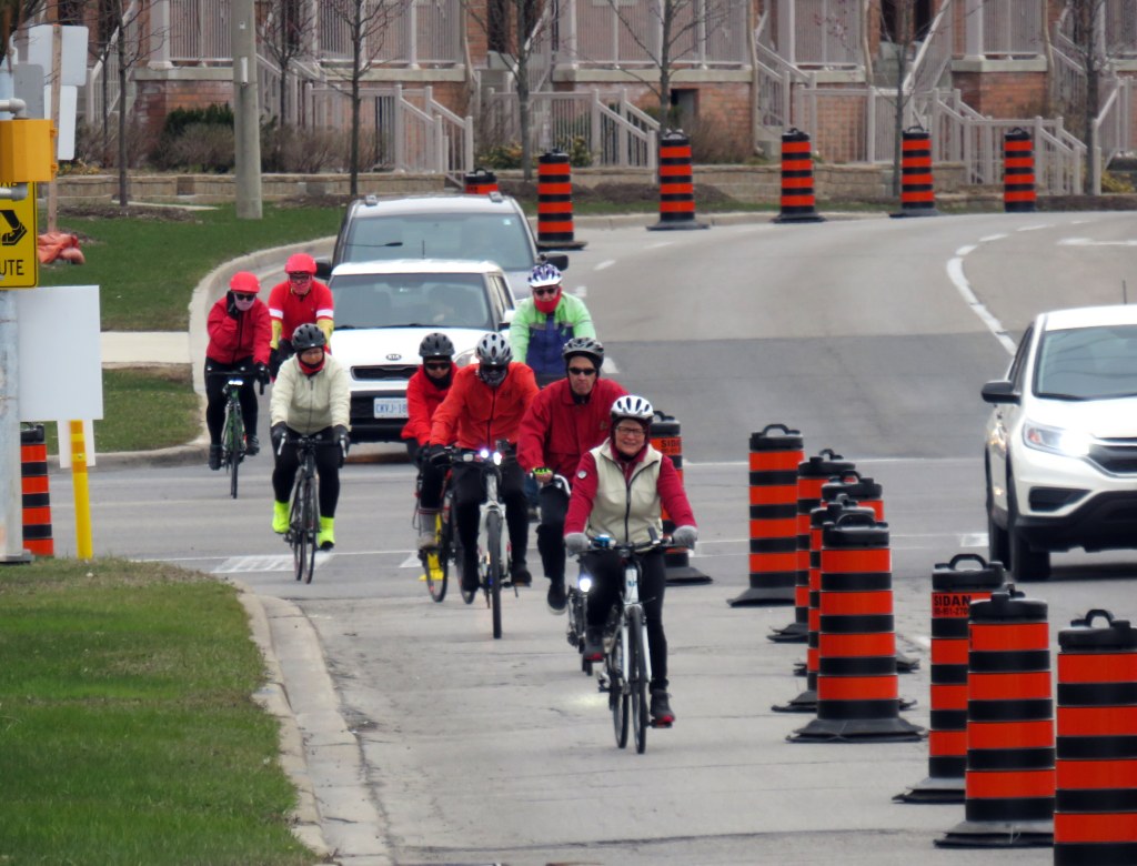
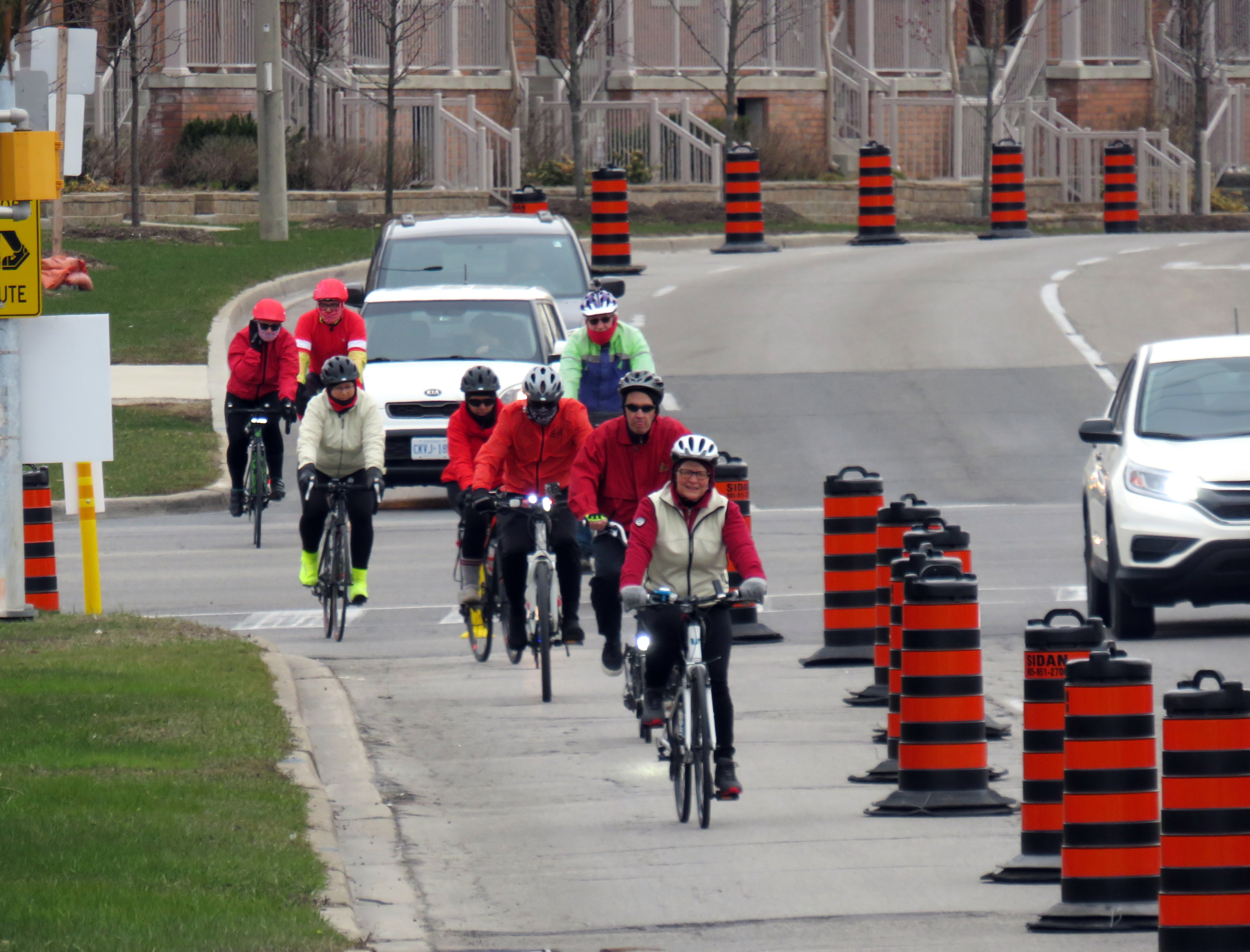
In Brampton, five kilometres of new bike lanes, proposed in that city’s new transportation plan, were quickly approved as part of its response to COVID-19. This benefits both pedestrians and cyclists by reducing conflicts on sidewalks, reducing congestion on city paths, and recognizing that cycling is an increasingly important mode of transportation.
Cyclists on Howden Boulevard, Brampton
In Ottawa, despite resistance from the the mayor and council, Shawn Menard, who represents an urban ward just south of Parliament Hill, was able to temporarily close two lanes of traffic on a narrow bridge on a major retail street, and worked with the National Capital Commission to re-allocate a section of parkway for active transportation.
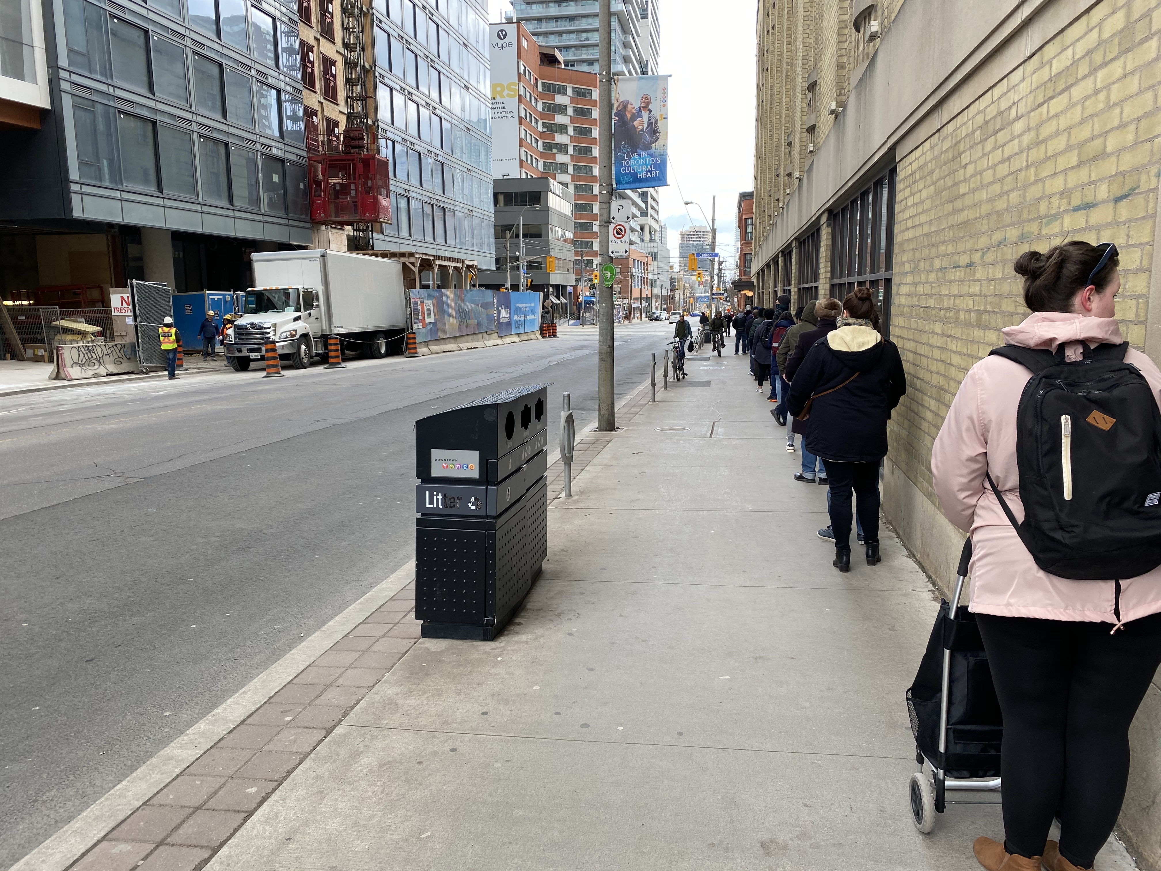
Meanwhile in Toronto, the mayor and medical officer of health were resistant to increasing calls for sidewalk expansions in congested urban areas, including where queues formed to enter grocery stores, pharmacies, hardware stores, and LCBO outlets.
Queue on Church Street at Carlton to enter Loblaws supermarket
With Walk Toronto, I have been involved with pushing the City of Toronto to take action, especially in pinch points where store queues, construction barriers, and other obstructions have made it difficult — if not impossible — to safely practice physical distancing when walking or cycling for essential purposes, or even getting a little bit of fresh air or light exercise in dense urban areas.
The good news is that ten problem areas — including the intersection of Carlton and Church — have finally been identified for curb lane closures, with potentially more on the way. This is a timid first step, made after weeks of advocacy, but it is welcome.