Tag: Ontario

  • Deadcatting: Doug Ford’s big dig

    We need a Highway 401 Tunnel like we need a dead cat on the dining room table

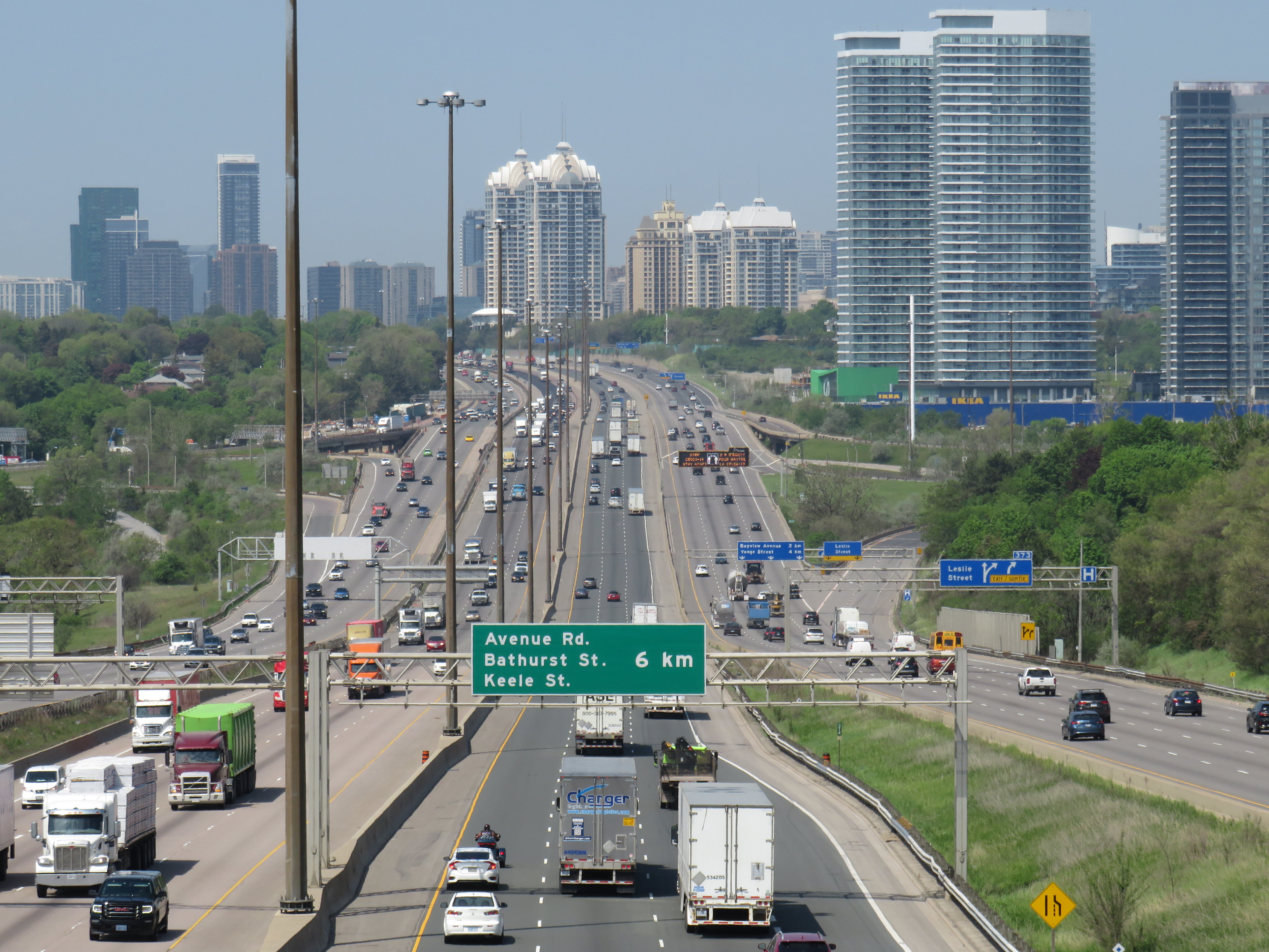
    On Wednesday, September 25, Ontario Premier Doug Ford, along with transportation minister Pradmeet Sarkaria, announced that the provincial government would fund a feasibility study on building a new highway tunnel under Highway 401 from Peel Region to Durham Region, along with an unspecified new transit facility.

    Earlier this week, Doug Ford exclaimed that those living in homeless encampments and anyone else without housing who he thought could work should “get off their a-s-s and start working like everyone else.” The day before that, we learned that Ford’s Progressive Conservative government would prohibit new bicycle infrastructure if it took road space away from motorists.

    The old Doug Ford — the angry bull-in-a-china-shop we remember from 2018-2019 — is back, and it is clear that governing, in fact, has not changed him. After six years, and a rumoured early provincial election, Doug Ford will need to run on something, because there’s little to show for his promises of getting housing built, transit projects completed, and hospitals fixed. An RCMP investigation continues to look at the government’s Greenbelt land swaps, and it is rare for provincial or federal governments in Canada to get elected with a majority three times in a row. So here we are.

    But after three straight days of political red meat policy announcements, the strategy has become clear: Doug Ford is “deadcatting.” Dead cat theory, popularized during the leadership of former London mayor and British prime minister Boris Johnson, is the practice of suddenly throwing down an outrageous policy or statement to divert attention away from an unpleasant topic. The shocked audience is suddenly compelled to talk about the metaphorical dead cat thrown on the table. In the United States in recent weeks, dead cats have become less metaphorical, with baseless and racist accusations against Haitian migrants in Ohio spread by Donald Trump, vice-presidential candidate J.D. Vance, and far-right commentators.

    The strategy is thought to come from Lynton Crosby, an Australian conservative strategist who worked on Johnson’s mayoral and UK Conservative leadership campaigns, as well as Canada’s Conservative Party in 2015.

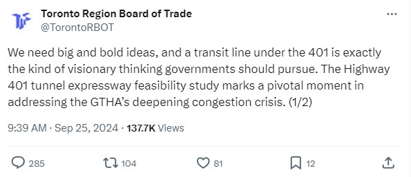
    There is no way a Highway 401 tunnel will be built. Not only would it be the longest road tunnel in the world, but the long on-ramps and off-ramps required to access a deep-bore urban highway tunnel will make it completely infeasible. The proposal also completely ignores the problem of induced demand, and it won’t solve the problem of where the traffic goes when it gets off that additional highway. For these reasons, it was especially disappointing to see the Toronto and Region Board of Trade (TRBoT) endorse the idea.

    TRBoT post on September 25, 2024

    There are things that can help alleviate traffic. One is ensuring that transit projects are completed, funded, and maintained. That doesn’t just mean building and completing projects like the Crosstown LRT and the Ontario Line, it’s also making sure the system remains in excellent condition to avoid problems like the persistent slow orders in the Toronto Subway. It also means making the best use of existing infrastructure, like Highway 407, for goods movement. Highway 407 passes by every major freight yard in Greater Toronto, but trucks clog Highway 401, Highway 7, and Steeles Avenue instead because of the high tolls. And it means active transportation improvements, like bike lanes and multi-use paths.

    What we don’t need are more dead cats to distract us from the real problems.

  • A heartbreaking end for the Ontario Science Centre

    A heartbreaking end for the Ontario Science Centre

    A family enters the Science Centre for the last time on Friday June 21, 2024

    When I was growing up, our family would make a trip every year to the Ontario Science Centre, a 45-minute car drive from our home in suburban Brampton. Invariably, these trips would take place on the first PA day of the school year, typically on a Friday in late September or early October, when the ravine was still lush and green, with only the first hints of the changing season.

    Because it was early in the school year, and since the Toronto school boards typically had different PA days than the Dufferin-Peel Catholic board, the Science Centre would be mostly empty; my father would run with my brothers and I along the corridor over the ravine between the entrance hall and the great hall. At the end of our visit would be an hour spent at the Science Arcade, the highlight of any child’s visit to the once-great institution. I marveled at Raymond Moriyama’s wonderful harmony of concrete, glass, and natural beauty as one descended into the West Don Ravine by means of glass walkways and escalators.

    Later visits in high school and in my early adulthood, however, were not as great. The exhibits were getting old, and the place started feeling worn out. The Dalton McGuinty and Kathleen Wynne-led governments did not value the Science Centre enough to invest in its relevance or its long-term maintenance. Doug Ford’s PC government continued the neglect, favouring a private redevelopment of Ontario Place (closed under the previous Liberal government) with a new, downsized Science Centre to take its place.

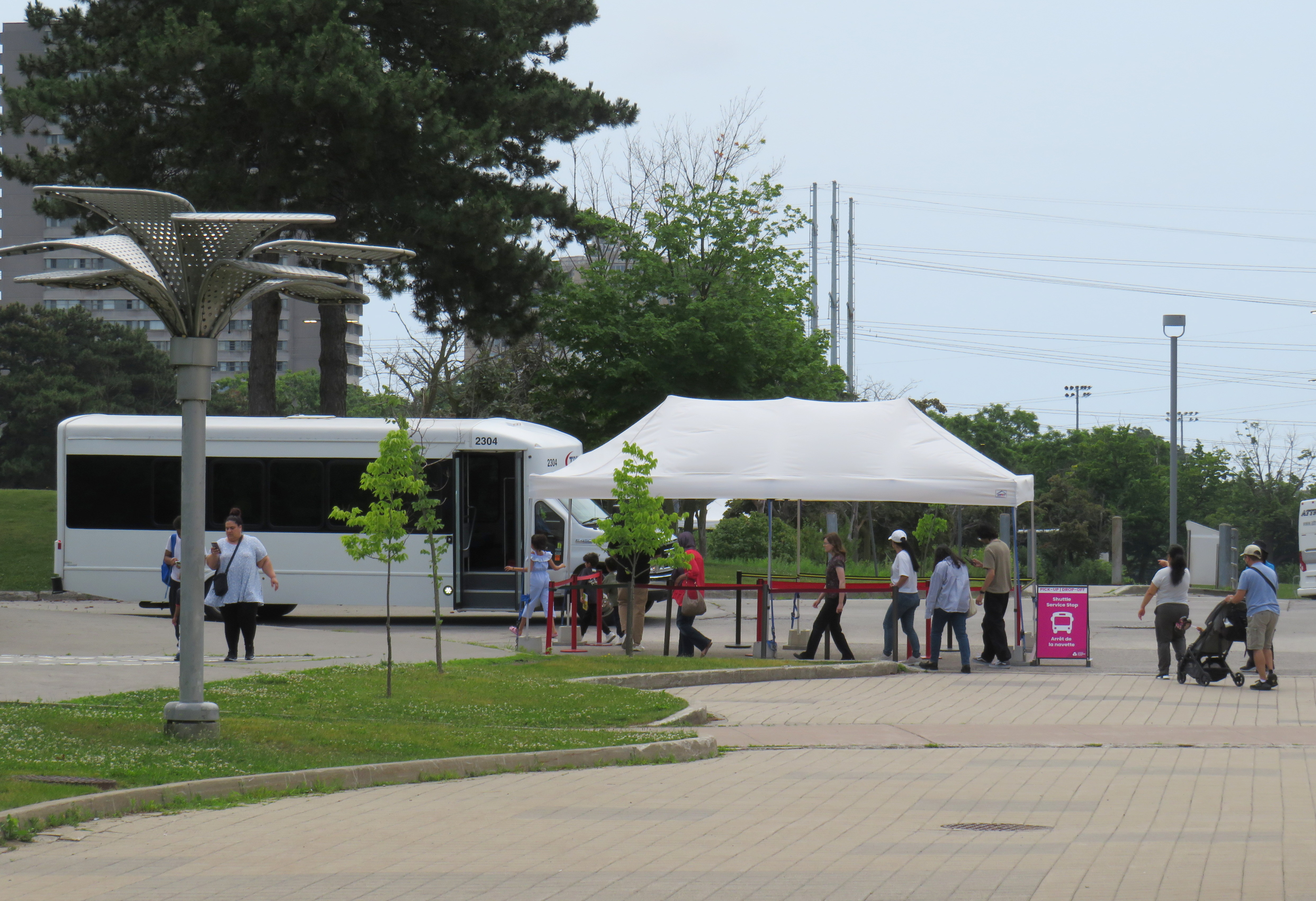
    In 2022, that once-wonderful double-deck bridge between the entrance hall and the exhibition space was closed due to the risk of structural failure, with no plans to fix or restore the link. Instead, $2 million a year was spent on shuttle buses ferrying visitors between the upper parking lot (after they paid admission) and the lowest level at the bottom of the ravine. That year, the planetarium (a smaller version of the McLaughlin Planetarium that operated next to the Royal Ontario Museum until the 1990s) also closed due to deterioration.

    A December 2023 report from the provincial Auditor General’s office took issue with the government’s management of the Ontario Science Centre and the flawed business case for moving it to a new location on Toronto’s waterfront, in a location much less accessible to school groups.

    Loading Ontario Science Centre visitors on shuttle buses, June 21, 2024

    The most recent development in which engineers warned of sections of the roof in danger of failure and collapse in a report to Infrastructure Ontario (linked in full on the CBC Toronto website) after October 31, 2024, with repairs costing between $22 million and $40 million. The immediate closure, announced on a Friday afternoon, would provide time to allow the exhibits to be removed, possibly to an interim location. However, most of the roof was found to be in good or fair condition in an the engineer’s report, making the immediate closure suspect.

    Globe and Mail architecture critic Alex Bozilkovic questioning the government’s sudden closure on X/Twitter.

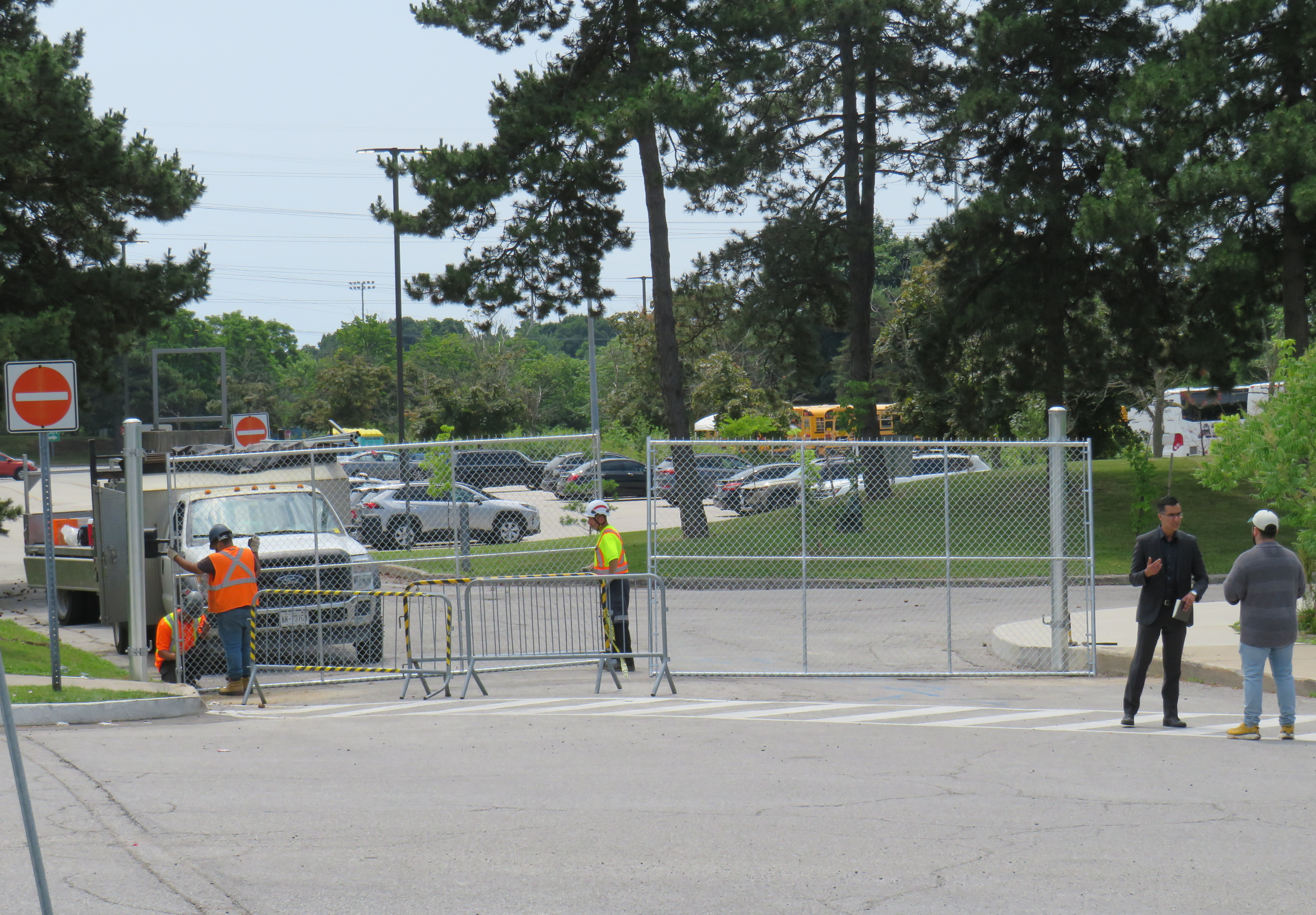
    On Friday morning, gates were already being installed at the parking lot entrances to the Science Centre, before the official announcement, even before the Toronto Star published the first story about the closure on its website around noon.

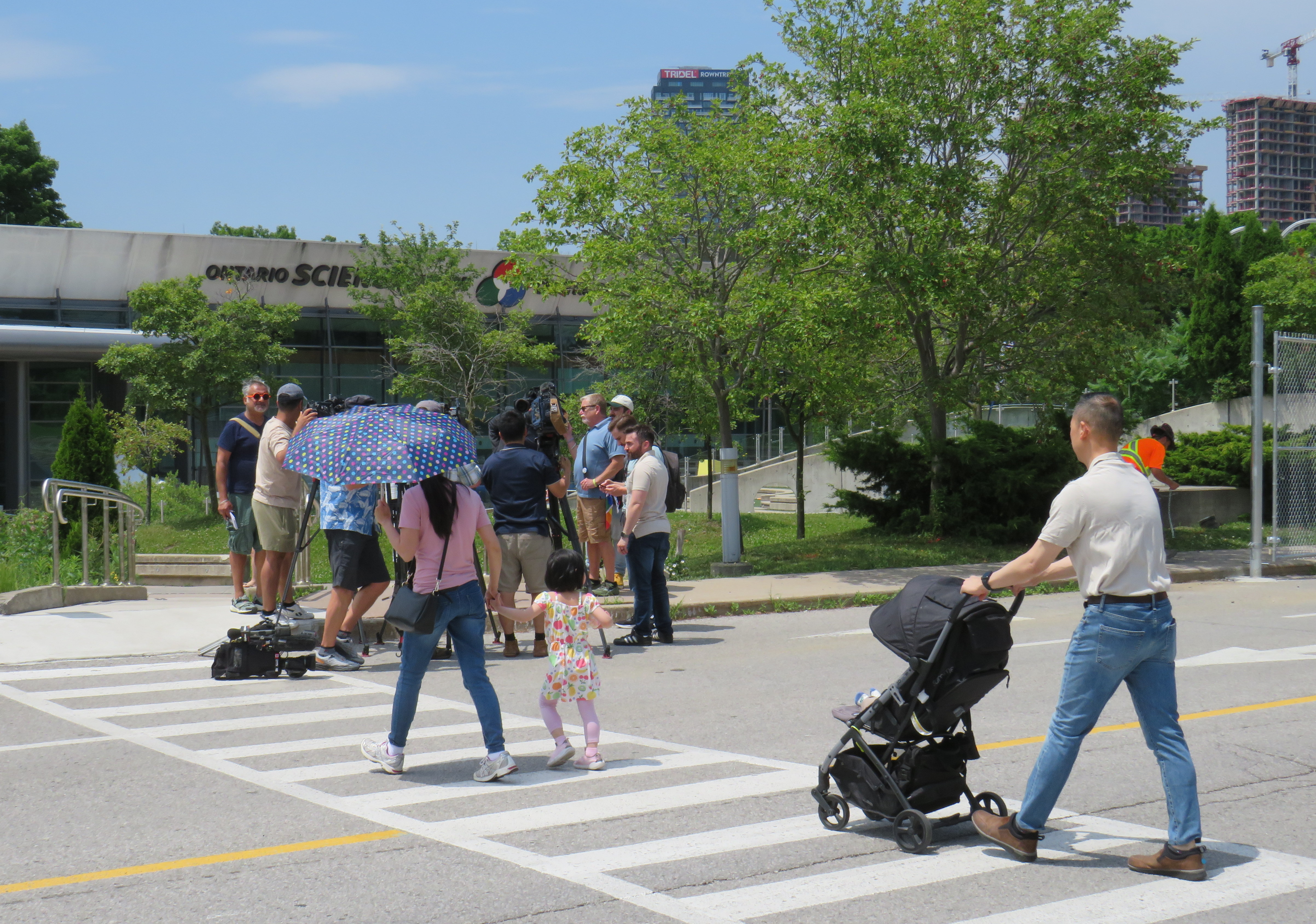
    Workers install rigid gates at the staff parking and bus exit at Ontario Science Centre. Local Liberal MPP Dr. Adil Shamji speaks to a reporter in front.

    One cannot help but be skeptical about the sudden decision to close the Science Centre, despite the demolition by neglect by the Liberal and PC governments. Had an announcement been made, but with the closure taking effect two weeks later after the long weekend, it would have given visitors one last time to appreciate the Science Centre and its unique architecture. But that might also be the point. By making the closure a done deal without the opportunity for the community to rally to save the Ontario Science Centre, Doug Ford’s PCs have shut down debate. By the time the legislature meets again in October, their hope is that opposition to the destruction of Ontario Place and the Ontario Science Centre will have dissipated. The Friday afternoon news dump also fits this strategy.

    Though I made it up on Friday to document the closure, I am sad that I did not make it for one last visit, just as with the sudden closure of the Scarborough RT last year.

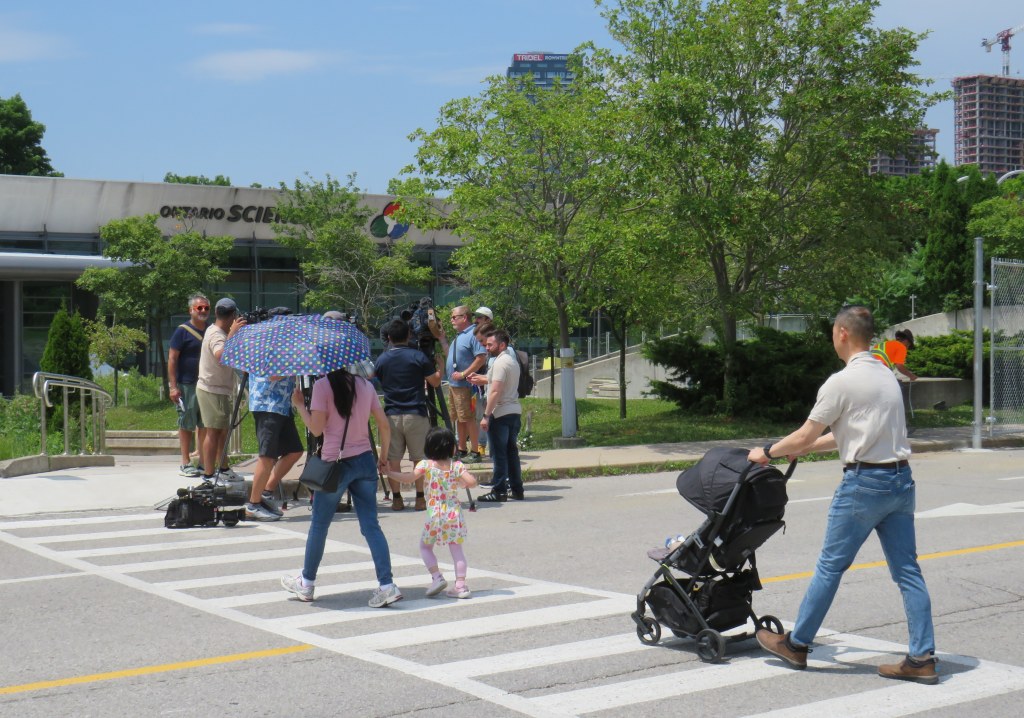
    The most heartbreaking thing for me was watching a young family walk from Flemingdon Park into the Science Centre just as the news media was assembling for a press conference with Don Valley East MPP Dr. Adil Shamji and Floyd Ruskin of SaveOSC. The young child looked so excited for a day at the science centre, unaware that it would be the last day it would ever be open.

  • Another bus to London

    Another bus to London

    Intercity Bus minibus on York Street at Royal York Hotel, February 13, 2024

    In late 2023, yet another intercity bus operator started serving the busy Toronto-London corridor, operating between Toronto and London. With the rather unimaginative name of “Intercity Bus,” this new company operates up to four trips a day between Toronto and London. It has since added a route between London and Sarnia; it also plans to run the much-needed link between London and St. Thomas.

    There are now five bus companies on the Toronto-London route: Intercity Bus, Onex Bus, Trailways, and Megabus (in a partnership with local coach operator Badder Bus). Those five companies compete with VIA Rail, which operates up to six daily trips between the two cities, with up to 28 round trips daily between them.

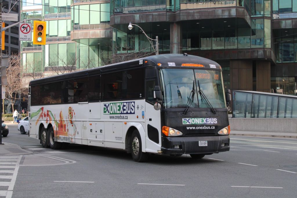
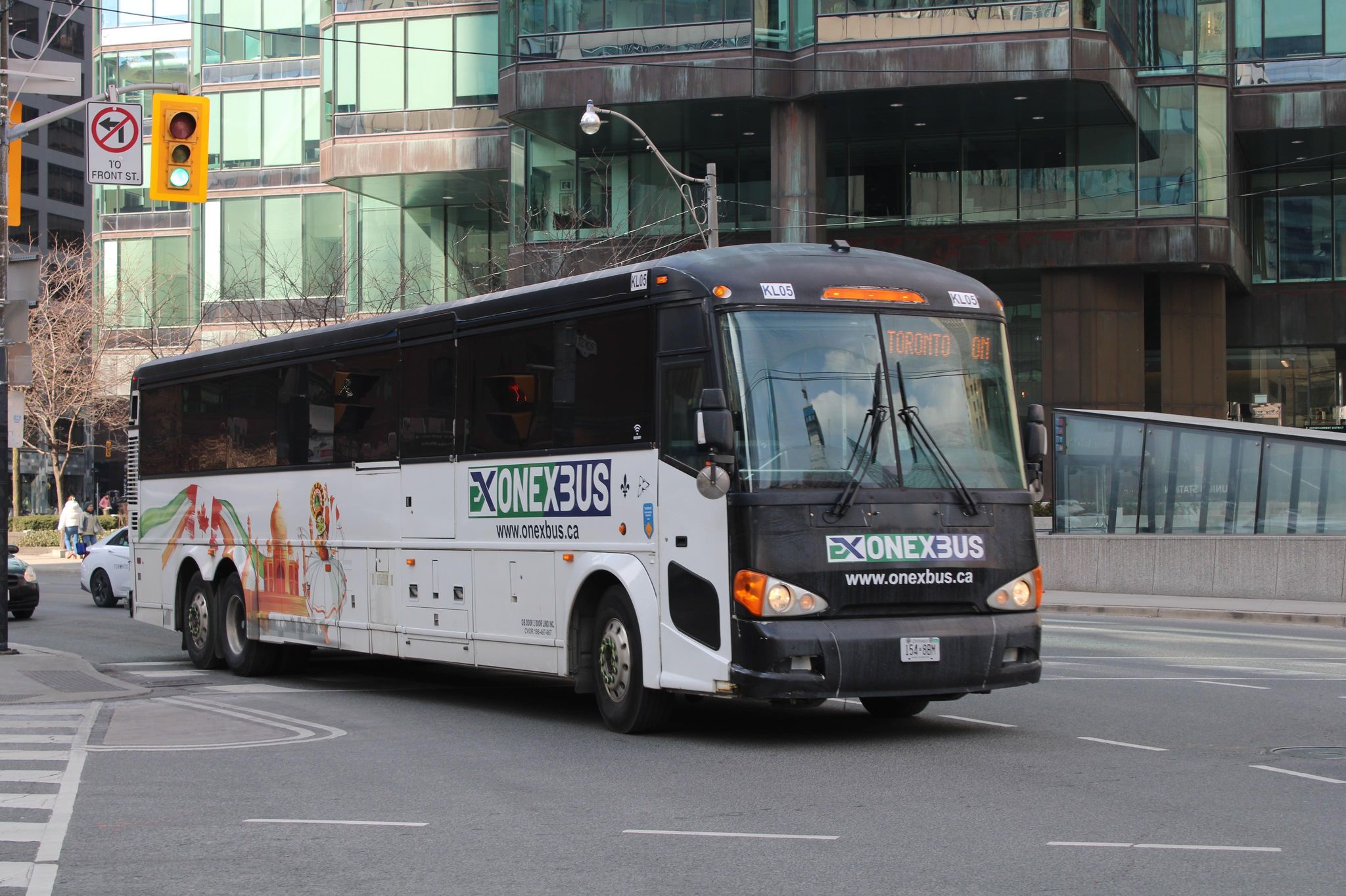
    Onex Bus departing Downtown Toronto, photo kindly provided by Chris Whitfield

    VIA Rail remains the fastest and most comfortable option, with full-service staffed stations in Downtown London and Downtown Toronto, but its fares are typically the most expensive. The private coach companies offer cheaper fares, and several of them directly serve Western University and/or Fanshawe College. Megabus has partnered with Trailways; its booking website includes both the Toronto-London-Detroit Trailways trips and the Toronto-London trips operated by Badder Bus. Otherwise, one must go to the individual companies’ websites to figure out the complete schedule and where each service stops at.

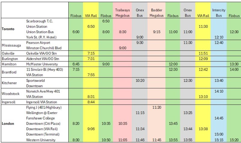
    The schedule below, saved as a PDF, includes all regular weekday trips between Toronto and London along with intermediate stops.

    Complete schedule showing all regular weekday trips between Toronto and London

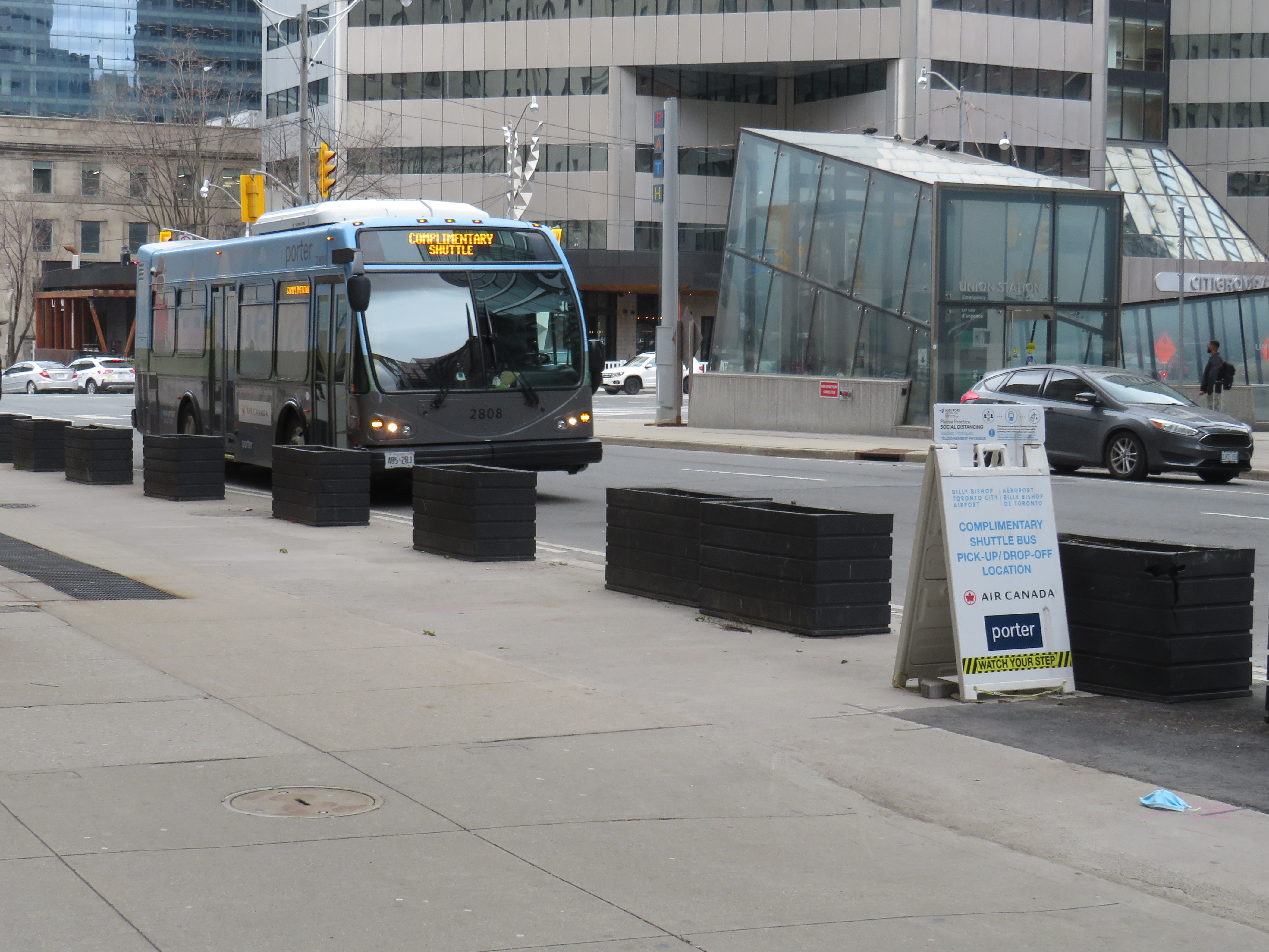
    In Toronto, Flixbus, Trailways and Megabus/Badder call at the Union Station Bus Terminal, where connections can be made to other Flixbus and Megabus services, along with GO Transit and VIA Rail in the adjacent railway hub. Onex and Intercity Bus make use of a curbside stop on York Street next to the Royal York Hotel, which is shared with the Toronto Island Airport shuttle. These three stops are all within a few minutes’ walk from each other. Some Flixbus runs to London begin and end in Scarborough, and many buses also make a stop at Pearson Airport.

    In London, every bus carrier makes a curbside stop at Western University, the terminus of all bus trips from Toronto except Trailways, which continues to Windsor and Detroit. All carriers except Badder/Megabus also serve Downtown London. However, each has a different stopping location, with Flixbus and Trailways opting for a curbside stop on York Street near CitiPlaza (London’s downtown mall), and Onex utilizing the driveway at the VIA Rail station.

    Curbside stops are convenient for bus operators, as they’re easy to pull up to and depart from, there’s no rent, staffing, or maintenance costs. With smartphones and online ticketing, there is no need for a ticket agent, and passengers can be notified by text and/or email of any delays or changes. But curbside stops have no shelter and no washrooms.

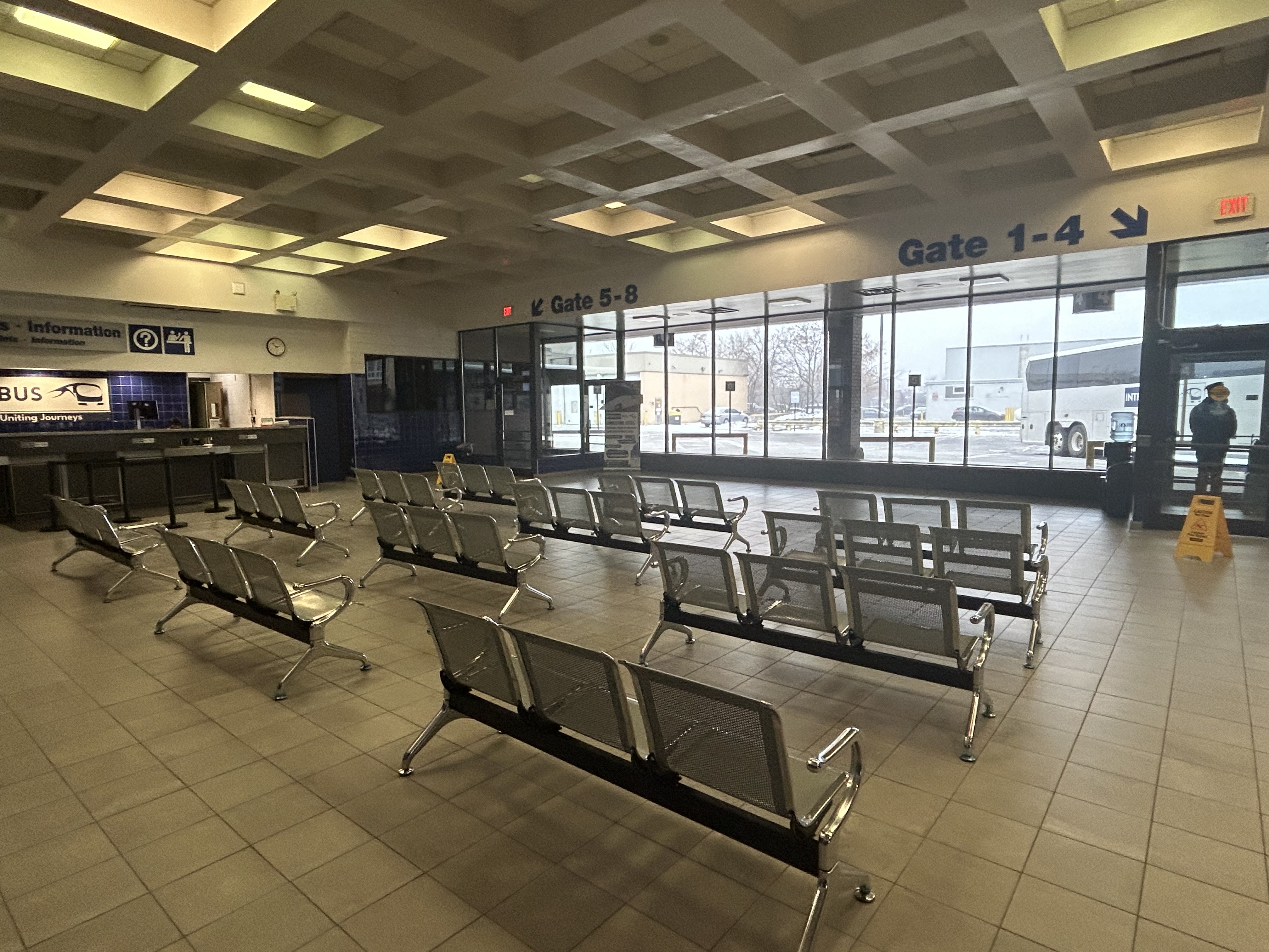
    Interestingly, Intercity Bus has taken over the old Greyhound terminal in Downtown London. At its peak, London’s terminal had dozens of daily departures to cities and towns all over Southwestern Ontario, serving multiple carriers at a time when intercity carriers acted more like a unified network.

    The old London Greyhound terminal

    The terminal offers seating, washrooms, and is staffed by an agent, a rarity in the post-Greyhound world. The washrooms are especially essential if — as on my recent trip — the bus does not have an on-board lavatory. These new smaller carriers save fuel and labour costs by operating smaller vehicles and matching capacity with demand. They often operate older coaches and minibuses.

    Inside the Intercity Bus terminal

    I recently took Intercity Bus from Toronto to London to try out Ontario’s newest carrier. Though the 12:10 departure from Toronto was on a minibus similar to those used by rural transit operators (there were only 10 passengers on that Tuesday afternoon run), the ride was comfortable enough, with cloth bucket seats. It was a fast trip: it skipped stops in Woodstock and Fanshawe College, and the driver made very good time on Highway 401, at times exceeding the posted speed limit by 25 or 30 kilometres per hour. Even with a stop for fuel (the driver asked if it was okay), we arrived 15 minutes early at the London terminal.

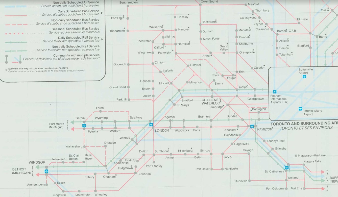
    At its peak in the 1980s, there were over two dozen daily departures from the London bus terminal. There were frequent Greyhound routes to Toronto via Kitchener and via Brantford and Hamilton as well as to Chatham, Windsor, and Detroit; there were also daily Greyhound routes to Niagara Falls via St. Thomas, Simcoe, and Welland and to Strathroy, Sarnia and into Michigan. Regional coach operators also ran from the Greyhound terminal to Stratford, Goderich, Rodney, Walkerton, Leamington, and Port Stanley. Today, there are just four — three to Toronto and one to Sarnia.

    Detail from 1990-1991 Ontario Intercity Transportation Guide, showing bus routes from London to points throughout Southwestern Ontario

    My hope for the next year is for more stability in the intercity bus industry, perhaps even mergers between some of the smaller players. Onex and Intercity Bus, which compete on the Toronto-London route and offer a similar service, could be beneficial, especially if it results in a network of routes radiating out of London, starting with Intercity Bus’s London-Sarnia service, its planned St. Thomas route, and Onex’s London-Stratford-Kitchener run.

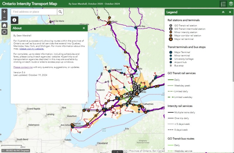
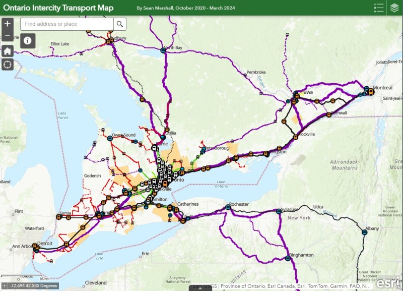
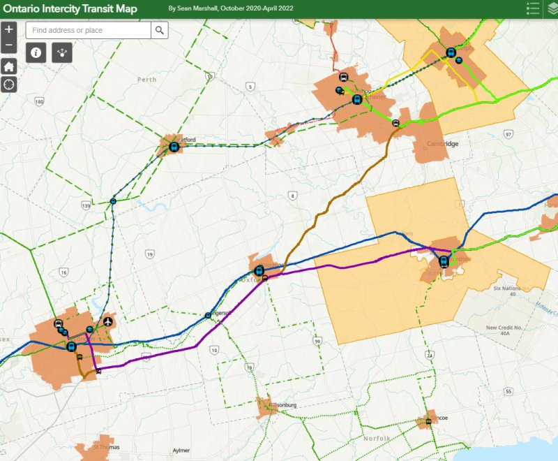
    I updated my map of Ontario’s intercity transport services for March 2024, including the new Onex Bus and Intercity Bus routes in Southwestern Ontario. There are new services in East Zorra-Tavistock, connecting to Stratford and Woodstock, and in North Grenville. Unfortunately, Lindsay and Haliburton lost their TOK coach service, Prescott & Russell ended its on-demand service, and gaps remain in Bruce, Elgin, and Haldimand Counties.

    Updated Ontario Intercity Map

    If you like this post and you would like to help out with my online mapping and webhosting costs, consider buying me a coffee. Thank you!

  • A transit tour of Southwestern Ontario

    Huron Shores Transit bus stop in Grand Bend

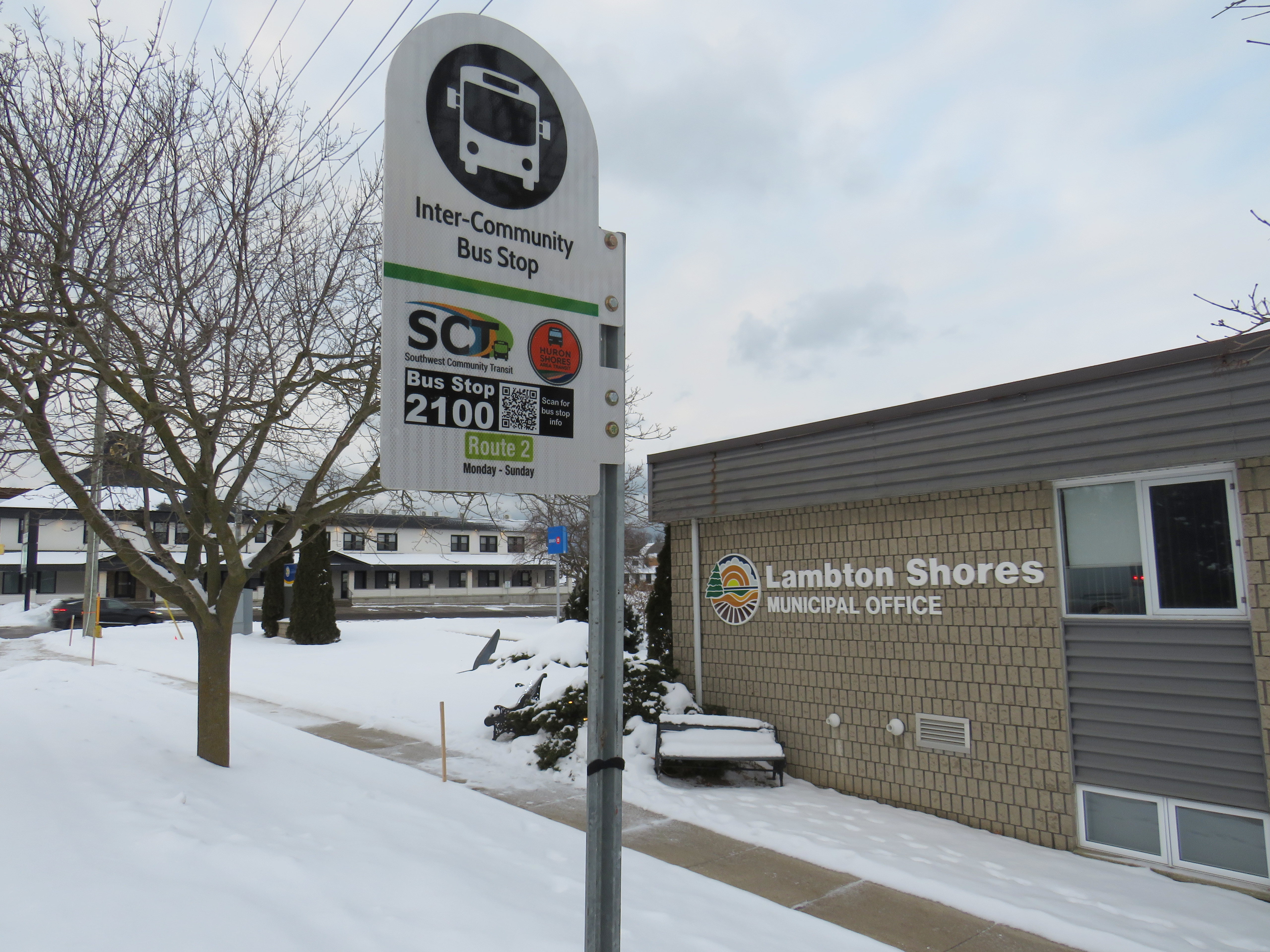
    In January 2023, while visiting the site of the now-demolished Sarnia Eaton Centre, I took advantage of two new rural transit services serving Southwestern Ontario: Strathroy-Caradoc Transit and Huron Shores Area Transit. While both services connect London and Sarnia, they operate as separate services with different fares; they also have different terminals.

    Strathroy-Caradoc Inter-Community Transit bus at Lambton Mall in Sarnia

    Strathroy-Caradoc Transit offers the most direct service between London and Sarnia, with stops at London International Airport, Downtown London (on York Street near the VIA Station), Komoka, Mount Brydges, Strathroy, Lambton Mall, and Downtown Sarnia.

    The regular cash fare between London and Sarnia is $20, though from London or Sarnia to Strathroy, the fare is $10. On my westbound trip on Sunday, January 29, the schedule allowed for a quick washroom and coffee break in Downtown Strathroy, a necessity given the long ride on a small minibus.

    Returning the next day from Sarnia, I opted to ride Huron Shores Area Transit (HSAT) back to London. HSAT, which is also contracted to Voyago, connects several communities in Lambton, Huron, and Middlesex Counties. All four HSAT routes converge in the summer resort town of Grand Bend. Two routes operate seven days a week (Route 1, connecting Sarnia, Forest, Thedford, and Kettle Point & Stoney Point First Nation, and Route 2, serving Exeter, Lucan, Centralia, and London). There are two additional routes operating two days a week from Grand Bend to Goderich and to Parkhill and Strathroy.

    Unlike Strathroy-Caradoc, HSAT operates on a flat $5 cash fare. Even though I was traveling the long way between Sarnia and London, with an hour-long layover in Grand Bend, I was offered a slip of paper marked by the driver that allowed me to board the second bus without a second fare. Huron Shores buses have bike racks, though the operator recommends calling ahead to ensure their availability.

    While Strathroy-Caradoc Transit serves downtown London and Sarnia, HSAT’s buses go only as far as the first major destination in both cities. The Sarnia stops for Route 1 are at Lambton College and nearby Lambton Mall, while the London stops on Route 2 are on London’s north end, near Masonville Place and at the University Hospital on the Western University campus. Getting downtown requires a transfer to Sarnia or London Transit.

    Huron Shores Area Transit bus at London’s University Hospital. Note the bike rack.

    Though VIA Rail still operates one daily train between Toronto, London, and Sarnia, it is not on a convenient schedule for most passengers (it leaves Sarnia early in the morning and arrives late in the evening), so the new bus services fill a key role in providing mobility options. Though it is more expensive, the Strathroy-Caradoc route is the direct and the fastest connection. But Huron Shores trip is the more scenic and cheaper ride.

    I updated my Ontario intercity transportation map for April 2023 to include the major GO Transit service changes, the gradual resumption of some Ottawa commuter bus routes, the start of Travelways bus service between Detroit, London, and Toronto, and minor route and service changes elsewhere in the province.


    The hour-long layover in Grand Bend gave me a chance to wander the town. On the main street, almost every business was closed for the season. There was very little traffic on Main Street, so it had a bit of a ghost town feel. On Highway 21 and to the east, however, typical chain stores like Tim Hortons, Sobey’s, and Shoppers Drug Mart serve the year-round population.

    Grand Bend’s famous beach — in January
    Hello Sunshine
  • From lake to lake: the story of Hurontario Street

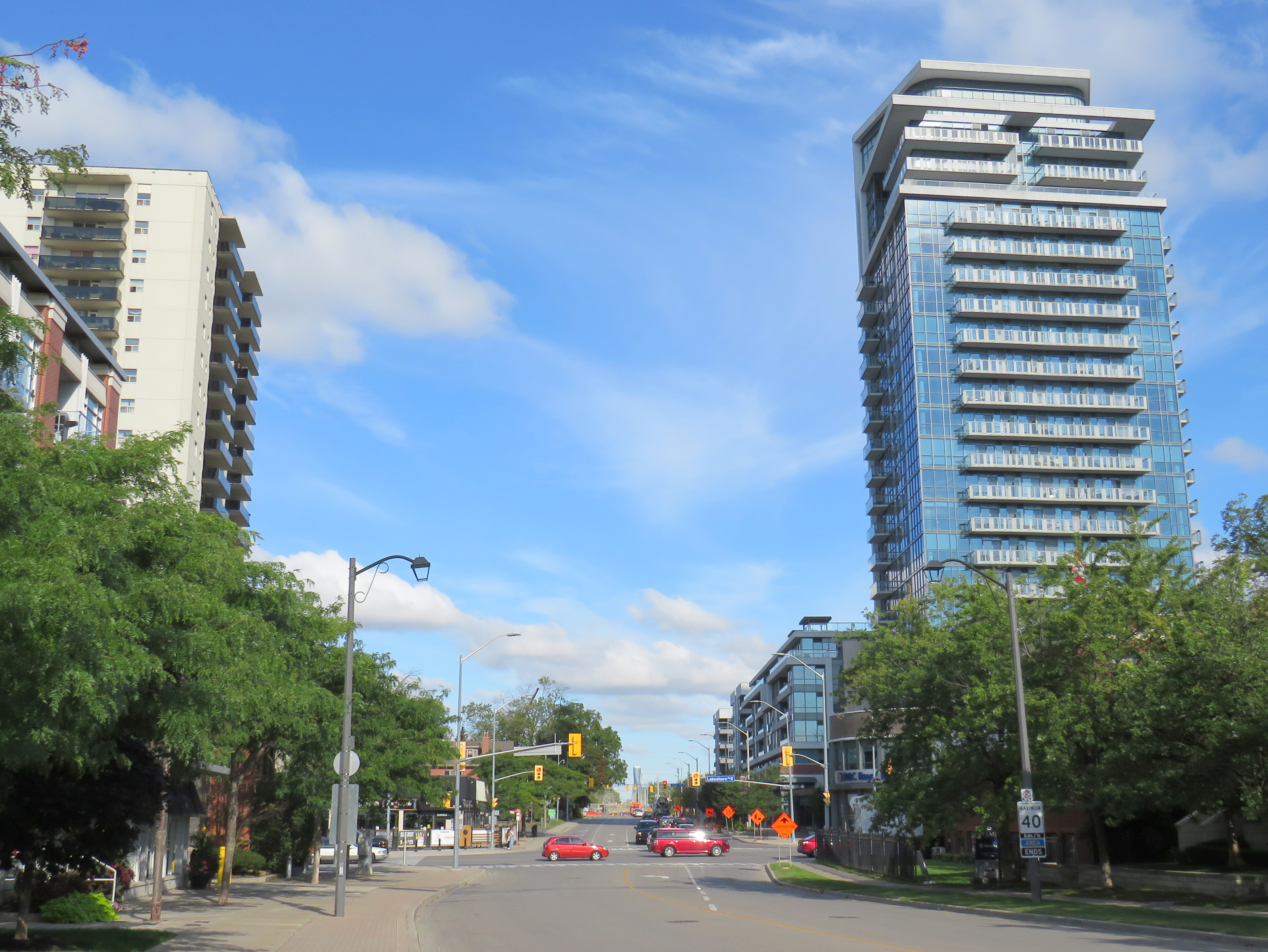
    Looking north from Lake Ontario up Hurontario Street in Port Credit

    Ontario’s first roads were trade routes established by First Nations, including the Toronto Carrying Place, which linked Lake Ontario, Lake Simcoe, and Lake Huron. These routes followed the topology and existing water courses, making navigation simple and avoiding steep hills. Many modern streets, such as Toronto’s Davenport Road, follow these old trails.

    With the establishment of the British colony of Upper Canada, new roads were established that took straight lines, instead of following existing trails or the lay of the land. Governor John Graves Simcoe named two of these routes — Yonge Street and Dundas Street — after British officials. Though Yonge and Dundas Streets were established for military purposes, they soon became used for settlement.

    Hurontario Street — a portmanteau of “Huron” and “Ontario” — was among the first of a new wave of roads laid out by colonial officials, established for settlement purposes. These colonization roads were built across southwestern and south-central Ontario and became the basis for the concession land grant system that forms the grid of country roads and arterial avenues throughout Southern Ontario.

    Other roads surveyed and built in this period included Simcoe Street, which connected Lake Ontario (at Oshawa) with Lake Scugog (at today’s Port Perry); Brock Road, which ran between Hamilton Harbour and Guelph with branches towards Lake Huron near modern-day Port Elgin (Elora Road) and towards Owen Sound (Garafraxa Road). Huron Road led west from Guelph towards Goderich through lands held by the Canada Company.

    Hurontario Street followed a nearly straight line north from Lake Ontario, perpendicular to the shoreline, with only a slight bend near present-day Orangeville to reach Georgian Bay at a perpendicular angle. Together with the Toronto-Sydenham Road, which branched off northwest towards Owen Sound, it quickly became an important route.

    Taverns, villages, and towns were established along the way, including Cooksville, Buffy’s Corners (which incorporated as the Village of Brampton in 1853) and Collingwood. Collingwood proved to be an excellent harbour and became famous for its shipbuilding industry.

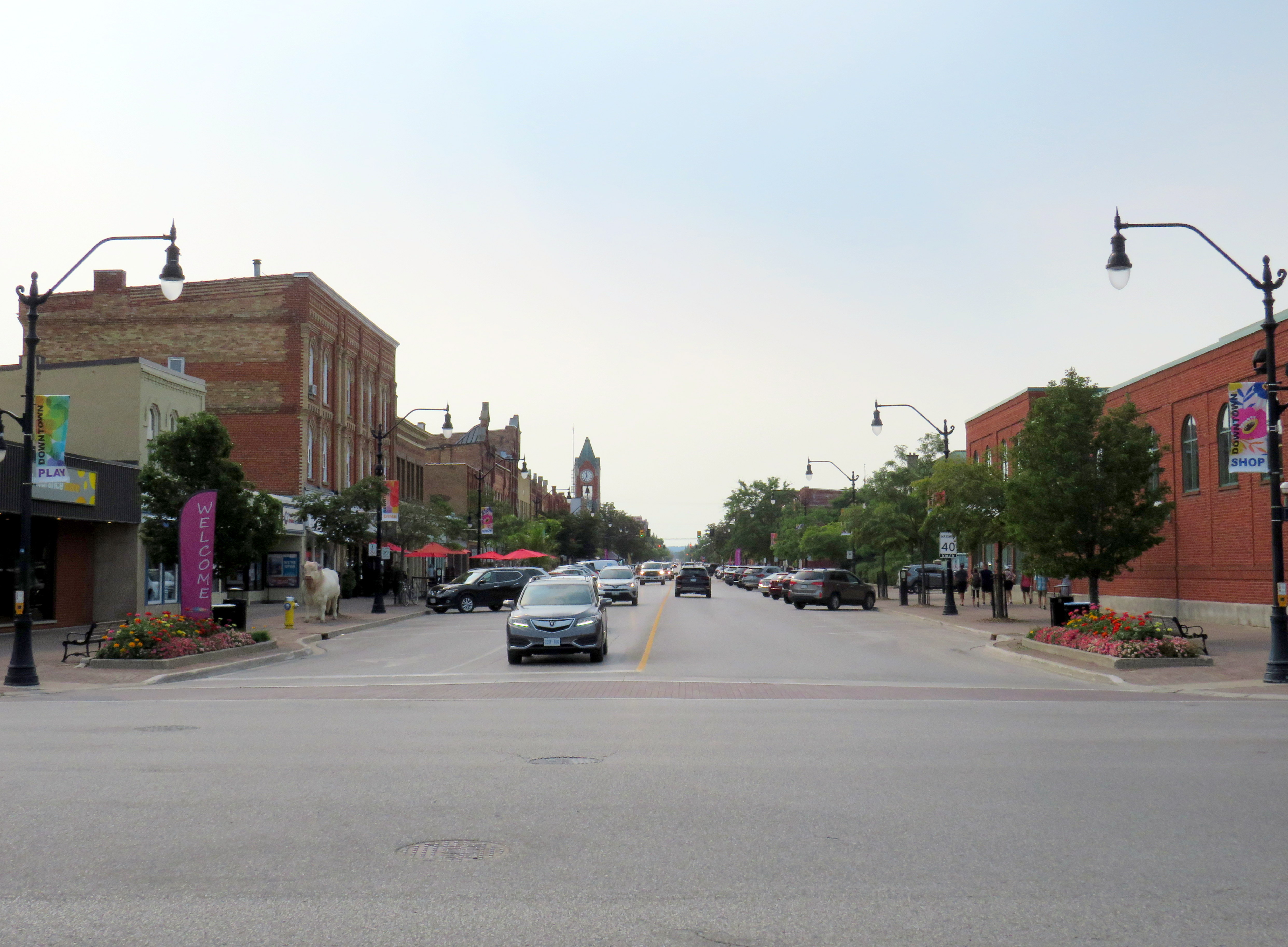
    Looking south from Georgian Bay up Hurontario Street in Downtown Collingwood

    But Hurontario’s straight trajectory was a problem. For the first 57 kilometres, the straight line was sufficient, as it followed a mostly flat route through present-day Mississauga and Brampton and climbed the Niagara Escarpment on a relatively gentle incline in Caledon. But through Dufferin and Simcoe Counties, the surveyed route went up and down several steep hills on the edge of the escarpment, including Hockley Valley and Boyne Valley. The final descent down the Niagara Escarpment towards Collingwood was very steep.

    Early settlers were granted low-cost or free land grants in exchange for clearing and improving their land and maintaining the new settlement roads being drawn across southern Ontario. They rerouted troublesome segments of the surveyed roadways and either abandoned the surveyed road allotments or designated new survey lines for through traffic. In Dufferin County, traffic switched to the first concession line to the west, which offered an easier path towards Owen Sound. The Town of Orangeville was established where the route deviated.

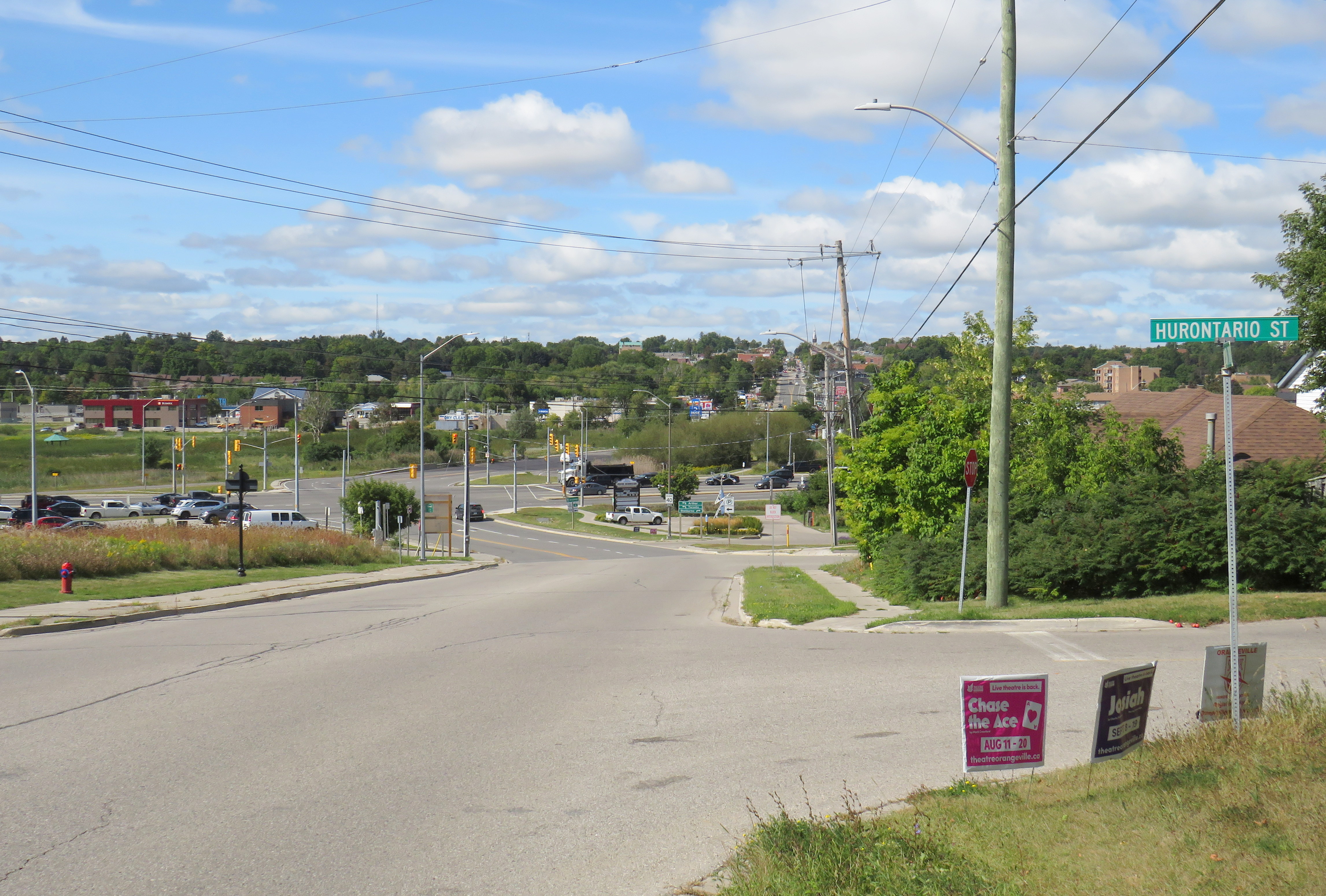
    Hurontario Street on the eastern outskirts of Orangeville, crossing the old alignment of Highway 9. Highway 10 curves on a bypass around Downtown Orangeville in the background.

    Like many early roads, Hurontario Street’s importance declined with the growing network of railways in Ontario. In 1855, the Ontario, Simcoe and Huron Railway reached Collingwood and the Great Western Railway opened between Toronto and Hamilton. The next year, the Grand Truck Railway opened its line through Brampton; the Toronto, Grey and Bruce Railway (TG&B) reached Orangeville 15 years later. Soon the TG&B built all the way to Owen Sound, closely following the Toronto-Sydenham Road.

    Hurontario Street is a discontinuous dirt road north of Island Lake at Orangeville.

    With the rise of motor vehicles in the 1920s, the Province of Ontario began establishing a highway network; the historical settlement roads became the foundation of this new system of roadways. Highway 10, one of the first 16 routes established by the province, followed the Toronto-Sydenham Road and Hurontario Street between Owen Sound and Port Credit, though it used the well-travelled First Line West through Mono Township, rather than the old, partially abandoned Hurontario Street alignment.

    Highway 10 increased in importance through the 20th century, especially when Toronto’s postwar growth reached Mississauga and Brampton. Highway 410 was built to relieve congestion on Highway 10 and other nearby routes; by 2019, the new highway connected with the old route north of Brampton, and Highway 10 through Mississauga and Brampton was no more, once-again simply known as Hurontario Street except in the older part of Brampton, where it remains Main Street.

    Meanwhile, the railways have fallen to the modern highway. The old TG&B, later acquired by Canadian Pacific, abandoned the Orangeville-Owen Sound line and its connecting branches by 1995. In 2021, the last train from Orangeville made its departure.

    As Mississauga and Brampton continue to grow, a new light rail transit line is being built on Hurontario Street. In a deviation from Metrolinx norms, instead of honouring the road on which this line is built, the PC-led government decided to name the LRT after Hazel McCallion, the former Mississauga mayor who, despite leaving some challenging legacies, has had many publicly funded spaces named for her. Time will tell whether residents will adopt the new name or, instead, favour a name that reflects the historical and contemporary importance of Hurontario Street. My hope is that transit users will continue to use the 200-year old name they’re most familiar with.

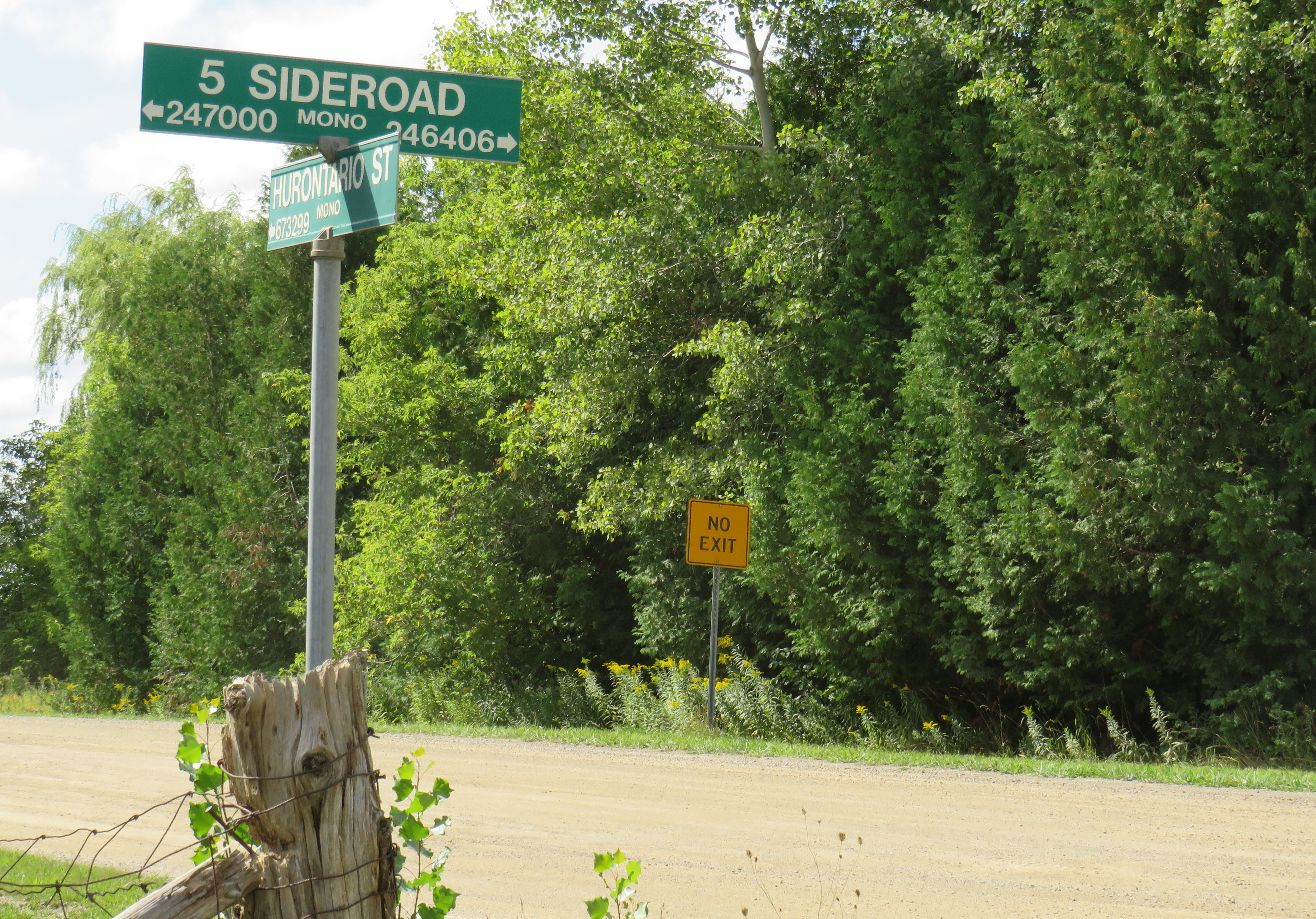
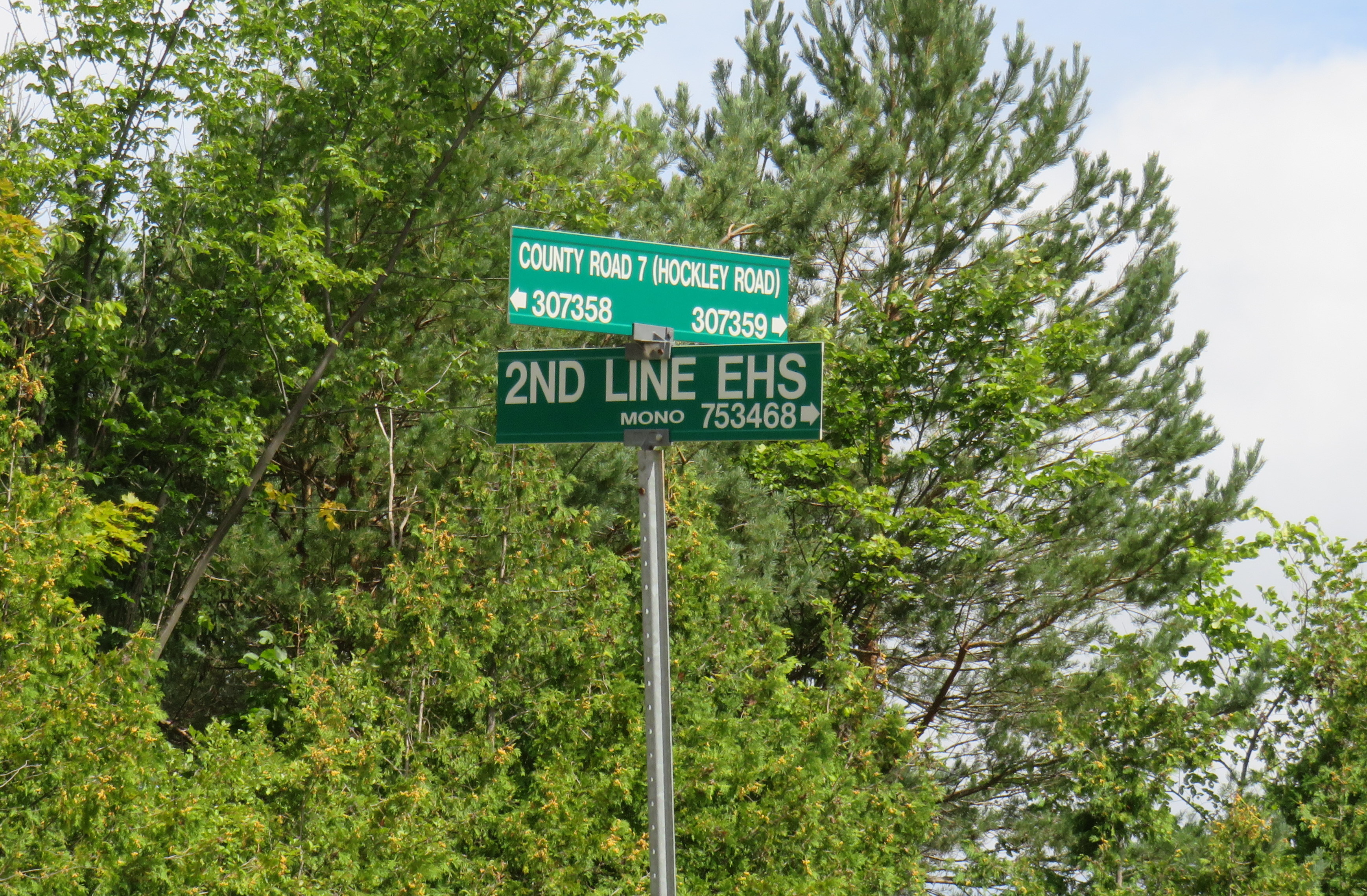
    What does First Line West or 2nd Line EHS mean?

    In Mono Township, the concession lines are numbered sequentially from how far east or west they are from Hurontario Street, which was the original basis for the land surveys. For example, 2nd Line EHS can be found two roads east of Hurontario Street. Highway 10 follows the first line west of Hurontario Street, a much gentler route than the original surveyed line. In the north half of Toronto Township (now the City of Mississauga), and in Chinguacousy and Caledon Townships (now Brampton and Caledon), these roads were similarly numbered before acquiring names. McLaughlin Road used to be known as First Line West, while Dixie Road used to go by Third Line East.

    As the centre line of several townships, Hurontario Street was often known as Centre Road, especially in Toronto Township (Mississauga) and Mulmur Township. In Mississauga, where Highway 10, Hurontario Street and Centre Road were once used interchangeably, it now goes exclusively by Hurontario Street.

    In Mono Township, north of Orangeville, 2nd Line E. H. S. can be found two survey lines east of Hurontario Street. Highway 10 follows 1st Line W. H. S. in Mono.

    Hurontario Street and other settlement roads

    As mentioned above, Hurontario Street was one of many early settlement and colonization roads established across the new colony, and later by the province. The first few roads, including Yonge and Dundas Streets, were surveyed and cleared by the colonial military as defensive routes first, but they quickly became important settlement roads. Roads such as Hurontario Street, established in the 1820s, had little military purpose, but became the basis for land surveys, which led to the establishment of townships and counties. Brock Road, Elora Road, and Durham Road are examples of these colonial settlement roads.

    In some cases, private companies or individuals who were given large land grants established their own roads to attract settlers and trade; Huron Road and Talbot Road are examples of these.

    Starting in the 1870s, the provincial government built new roads into less hospitable lands on the Canadian Shield, hoping to draw settlement further north as the supply of quality farming land was exhausted. In some cases, farmers were able to make a go of the marginal farmlands in northern Victoria, Hastings, and Lanark Counties, in other cases, the roads quickly fell into disuse. The Muskoka Road, built to Lake Nipissing, was a rare success: though there was little viable farmland along the route, it helped open up Northern Ontario for resource exploitation, tourism, and settlement. The Muskoka Road was upgraded in the 1920s and 1930s as the Ferguson Highway, before becoming part of Highway 11.

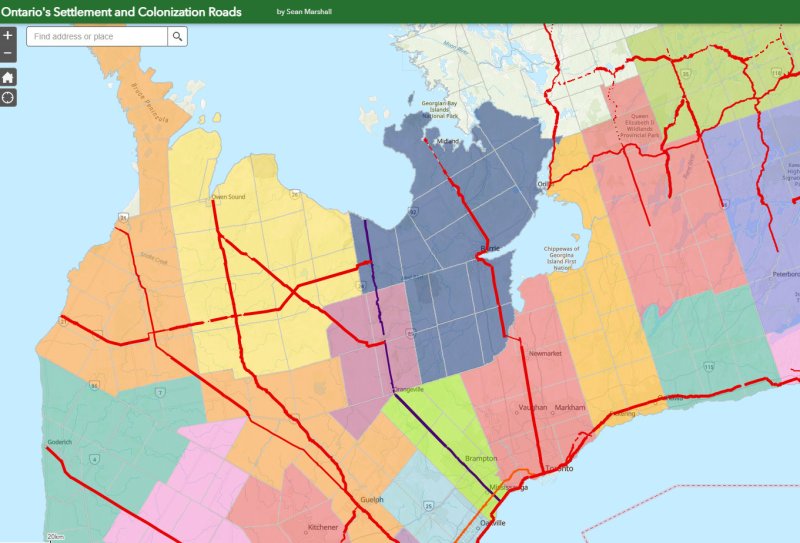
    The map below shows the routes of Hurontario Street and many other settlement and colonization roads in Southern and Central Ontario, along with the township system that followed these corridors.

    Map of settlement roads and townships in Ontario
  • New carriers, old gaps: the state of Ontario’s intercity transportation network in 2022

    New carriers, old gaps: the state of Ontario’s intercity transportation network in 2022

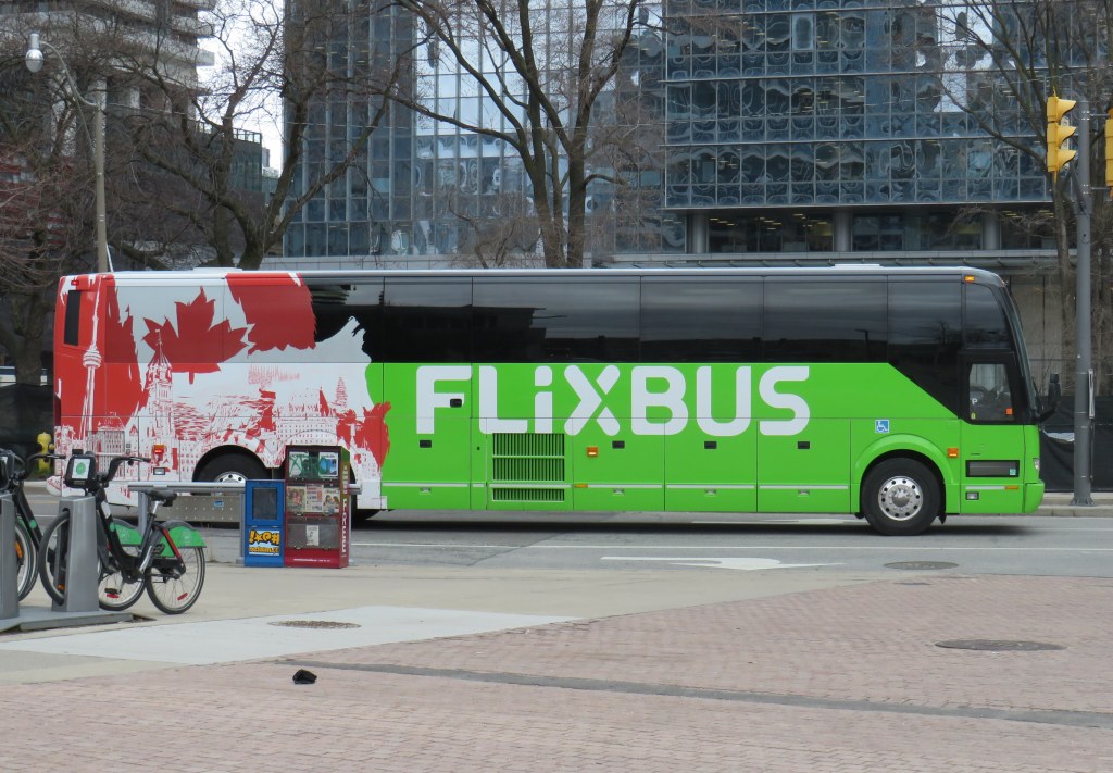
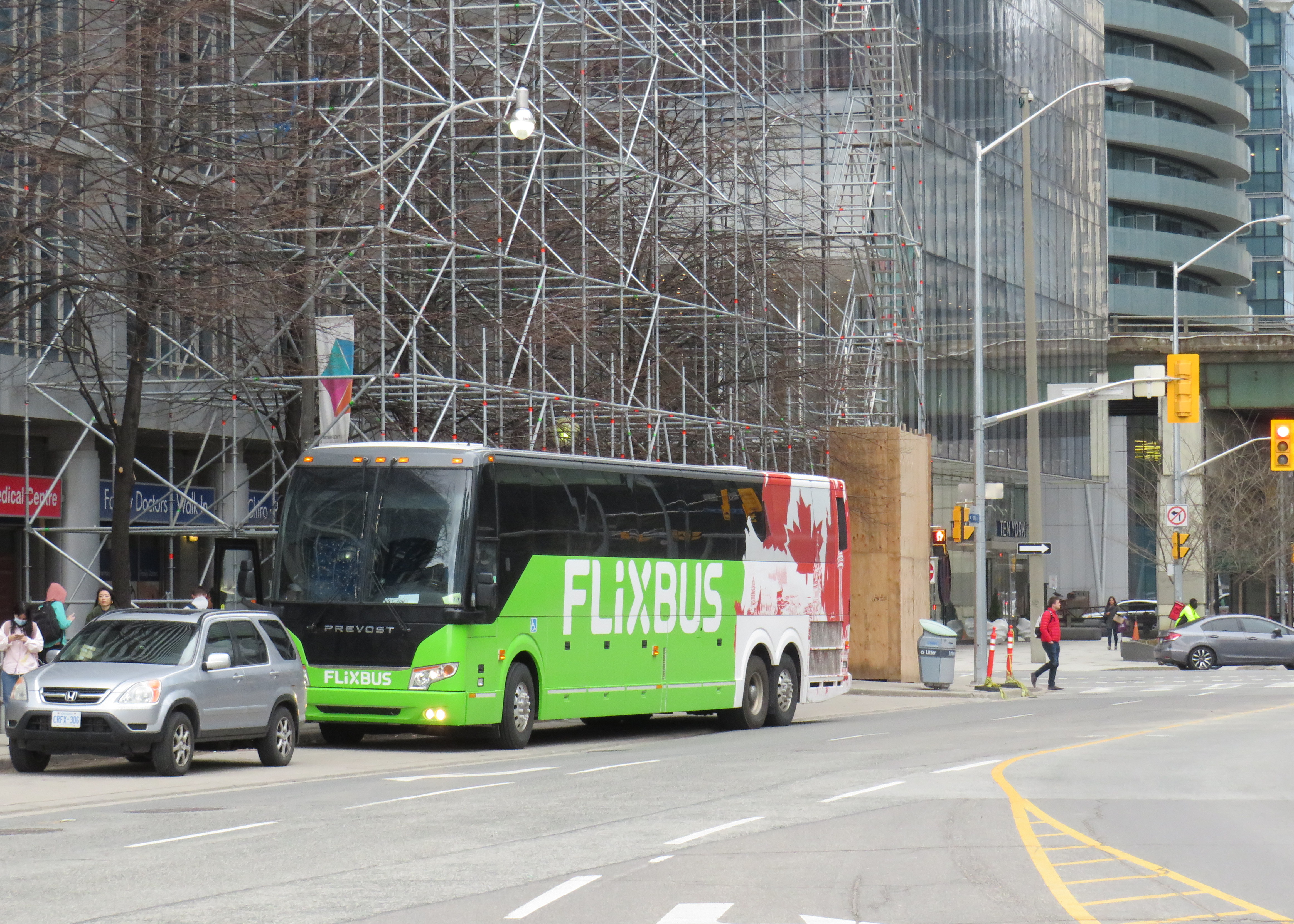
    Flixbus is one of many intercity coach operators in Ontario right now

    With university and college campuses reopening for in-class instruction, white-collar workers slowly returning to the office, and pandemic restrictions receding, there are more intercity transport options in Ontario than at any time prior to March 2020.

    New operators, including Germany’s Flixbus, have arrived in Ontario (with routes between Toronto, Guelph/Kitchener, Niagara, and Ottawa), while Greyhound, which pulled out of Canada two years ago, restarted cross-border runs from Toronto, Montreal, and Vancouver. In Southern Ontario, intercommunity bus and van operations continued through the pandemic, with notable service improvements in Simcoe and Grey Counties, new routes in Eastern Ontario, as well as the expansion of “on-demand” services in rural communities and smaller urban centres, including parts of Niagara Region, as the regional government there slowly assumes responsibility for all municipal transit services.

    Link to interactive map
    New edition of the Ontario Intercity Transport Map

    Despite these advances, there are still many gaps in Ontario that need to be filled. The deregulation of Ontario’s motor coach industry has opened the highways up to more operators, but they are all chasing the same customers, rather than attracting new riders.

    For getting between Toronto and Ottawa, passengers have a plethora of choices. They may fly — the fastest, but most expensive option — on Air Canada, WestJet or Porter. They may choose VIA Rail, which is comfortable, but slower. Or they may choose to book a ticket on a Megabus, Rider Express, or Flixbus coach, the slowest, cheapest, and least frequent option. (As of May 2022, only Megabus will begin operating daily buses between Toronto and Ottawa.)

    Between London and Toronto, passengers can choose between a four-hour GO Transit train ride that departs at 5:33 AM, one of several daily VIA trains (approximately 2 hours), one of three daily Onex buses (2 hours, 35 minutes) or one of three daily non-stop Megabus trips (2 hours, 10 minutes).

    Not all bus operators serve the same locations, either, creating new disconnections. In Toronto, GO Transit, Megabus, Rider Express TOK Coach, and Greyhound USA use the new Union Station Bus Terminal, which is directly connected to VIA and GO trains at Union Station and the TTC subway and streetcar system.

    Flixbus stops at a curbside layby on York Street south of the Gardiner Expressway

    To save on terminal fees, Onex stops beside the Royal York Hotel on York Street, across the street from Union Station, sharing the layby with the Toronto Island Airport shuttle. Flixbus uses a different coach bus layby on York Street south of the Gardiner Expressway, in the Harbourfront area. Neither curbside stop is marked for either company. Though Ontario Northland still sends some buses downtown to Union Station, some of its buses to and from Sudbury and North Bay now terminate at the Yorkdale Bus Terminal in North York.

    The layby next to Royal York Hotel serves the Toronto Island Airport shuttle (which has a sign) and Onex bus (which has no bus stop sign)

    In Ottawa, Ontario Northland and Orleans Express use the VIA Rail station (which is on the O-Train LRT system), while Megabus terminates at the St. Laurent O-Train station. Autobus Maheux and Flixbus use curbside stops in Downtown Ottawa. The London-Toronto Megabus route bypasses Downtown London on its route from Western University, while Onex Bus and VIA Rail stop right downtown, along with Strathroy-Caradoc’s intercommunity route.

    Another issue is that apart from the Toronto-Kitchener-London, Toronto-Niagara, Toronto-Kingston-Ottawa, Toronto-Kingston-Montreal and Ottawa-Montreal corridors, there is still little choice in price, operator, or schedule.

    Rider Express suspended service to Windsor last year, so that the three or four VIA rail trains to London and Toronto (or a flight from Windsor airport) are the only option available for anyone travelling without a car. (Transit Windsor’s Tunnel Bus to Detroit remains suspended, despite the continued loosening of border crossing restrictions.) Peterborough, once a major destination for Greyhound Canada on its Toronto-Ottawa corridor, now only has a nearly two-hour-long GO bus connection to Oshawa GO Station.

    Gaps that I wrote about several years ago still remain on the map, which are only more evident as new intercommunity services start up and new carriers emerge. The City of St. Thomas and Elgin County remain the most visible of these gaps; St. Thomas is the only urban transit system in Ontario completely disconnected to any other community, despite its short distance to London. Haldimand County, despite its proximity to Brantford and Hamilton has also chosen to remain off the map. While neighbouring Perth, Lambton, Middlesex, and Grey Counties have developed useful transit connections, Huron and Bruce Counties have very limited links to the rest of the province.

    Finally, the gaps between Hamilton and Brantford to the south and Guelph and Kitchener-Waterloo to the north remain to be filled despite the growing population and multiple post-secondary institutions in each urban area. Though the Hamilton-Guelph-Kitchener triangle should be a natural expansion for GO Transit, it has yet to announce its intentions. Meanwhile, no private coach operator has filled this obvious need.

    The labour-backed Link the Watershed proposal would connect Guelph, Kitchener, Cambridge, and Brantford, but that plan requires the support of local government, but it still leaves the Hamilton corridor wide open.

    As more students return to school full time, and more workers return to the office, the need for reliable and attractive transportation options across Ontario will only continue to grow. As housing prices to continue to increase higher than the already-high inflation rate, intercity transport will be one way to ensure students can stay at home while going to school, and workers don’t have to move or endure long and expensive highway commuting.

    Hopefully by autumn, these gaps will finally close for good.

  • It’ll always be the Hurontario Line to me

    Metrolinx map of the Hurontario LRT route

    On Monday, February 14, Premier Doug Ford, Transportation Minister Carolyn Mulroney, and Mississauga Mayor Bonnie Crombie attended a photo-op at Cooksville GO Station to announce a new name for a transit project. With former mayor Hazel McCallion in attendance (who was celebrating her 101th birthday), it was no secret what the new name was going to be.

    It was disappointing that the Hurontario LRT, a provincially-funded transit project operating within Brampton and Mississauga and intended to be part of a regional transportation network, would be named for a divisive former mayor of only one of the two cities the Hurontario LRT is supposed to directly benefit. 

    In North America, and around the world, transit lines and stations are named (with a few misguided exceptions) to reflect the geography of the route it represents and to provide optimal wayfinding, especially to visitors and people new to transit. In Greater Toronto, bus, streetcar, commuter rail and subway routes are named based on the major street they run on (the 501 Queen Streetcar or Line 4 Sheppard), the neighbourhood they serve (the 56 Leaside bus) or the destination it runs to (the GO Milton Line or 900 Airport Express).

    Even new projects follow these conventions. The Crosstown LRT, which operates under and along Eglinton Avenue, is a crosstown route across the middle of the city. Even the Ontario Line partially gets its name from its two end points (Exhibition Place/Ontario Place and Ontario Science Centre). The Hurontario LRT reflected the name of the main street it operates along, even if it changes its name briefly though central Brampton.

    The “Hazel McCallion Line” does not accomplish any of these goals.

    Given Peel Region’s diverse population of over 1.4 million residents, it is also disappointing that a major project intended to unite the region is named for an affluent white public figure that already has two libraries, a public school and a college campus already bearing her name.

    Furthermore, McCallion’s legacy as a longtime mayor of Mississauga is tarnished by racist statements after visiting a local hospital in 2001two conflict of interest scandals, her recent involvement with a troubled for-profit long term care provider, and by land use policies that kept taxes low for decades, but did little to ensure a financially or environmentally sustainable future for the city. 

    I suspect Premier Ford wanted to celebrate a political ally a few months before the next provincial election, but naming the Hurontario LRT after Hazel McCallion sends the wrong message. 

    Post script: The Hurontario Line may not be the only Metrolinx transit facility that will see its name change. In a MERX posting dated February 15, 2022, Metrolinx is looking for Expressions of Interest for station naming rights opportunities for at least four existing GO Transit rail stations. The summary is quoted below:

    Expression of Interest

    Expression of Interest No. RFI-2021-CCMX-097

    Metrolinx is accepting Expressions of Interest for Station Naming Rights Opportunity.

    Metrolinx is an agency of the Government of Ontario, overseeing GO Transit, PRESTO, and UP Express. We are embarking on a massive transformation of the GO Rail network – the backbone of regional rapid transit in the region – to give customers a faster, more convenient way to connect with the things that matter.

    Metrolinx is seeking proposals from interested parties in any category for the Station Naming Rights Opportunity at the following stations:

    Whitby GO Station
    Exhibition GO Station
    Clarkson GO Station
    Oakville GO Station

    Metrolinx will consider proposals for other stations not listed here at the request of interested parties.

    For more information about the GO Transit network and stations, please visit www.gotransit.com. We are committed to working together to create a partnership that will meet shared objectives, such as increase revenue, increase market share for our partners and provide a positive customer experience on public transit.

    All four stations listed are on the Lakeshore Line, the backbone of the GO Transit rail network. Exhibition GO could be especially attractive for renaming, as it will become a major hub with the future connection to the Ontario Line and local TTC services. It is also worth noting that Metrolinx will entertain proposals for additional stations in the bid process.

    It is hard to blame Metrolinx for these specific transit naming decisions; it is very likely that the Ford government demanded the McCallion Line and is pushing for the sell-off of naming rights. But it is ironic that after hiring consultants and going though a complex naming process for the Crosstown LRT, that previously held principles are quickly abandoned at the whim of Metrolinx’s superiors.

  • Do I stay, or do I go now?

    Pedestrian crossing at Victoria Park, Cobourg

    At the corner of King Street (former Highway 2) and College Street in Cobourg, adjacent to Victoria Park on the eastern edge of Downtown Cobourg, there’s a marked pedestrian crossing, with clear “zebra” road markings on the pavement.

    The sign, in bright fluorescent yellow, reads “PEDESTRIAN X.” Below, a second sign, also in bright yellow, reads “STOP FOR PEDESTRIANS.” The message is clear enough.

    However, a smaller white sign below, facing the sidewalk, reads “CAUTION – VEHICLES NOT REQUIRED TO STOP.”

    So which is it?

    (more…)
  • A good truck stop doesn’t make for a good bus stop

    Following Greyhound Canada’s inevitable final departure, several other companies have begun to take over Greyhound’s busiest routes in Ontario and Quebec.

    In May, Megabus Canada began service between Toronto, Kingston, and Ottawa, operating out of the new Union Station Bus Terminal. Megabus’ terminal in Ottawa is the St. Laurent Shopping Centre, with easy connections to Ottawa’s O-Train LRT and several bus routes.

    In June, Rider Express, a new intercity carrier based out of Western Canada (where it picked up many of Greyhound’s abandoned routes there), began operating its own Toronto-Kingston-Ottawa route, in competition with Megabus.

    Québec-based Orleans Express took over Greyhound’s former Ottawa-Montréal route, joining Ontario Northland and Rider Express at the Ottawa VIA Station. The VIA Station, like St. Laurent, offers a safe, enclosed waiting area, passenger amenities, and easy connections to the O-Train LRT.

    While Ottawa has many options for getting to and from Toronto: VIA Rail, Megabus, Rider Express, and two frequent airlines, connections to other cities and towns are limited at best. Ontario Northland’s single daily bus from Sudbury and North Bay through Renfrew County arrives in Ottawa in the late evening, a time not convenient for most passengers. Commuter routes to nearby communities such as Perth, Carleton Place, and Cornwall remain suspended during the ongoing pandemic.

    But at least there’s some bus service again, providing new capacity on some of Canada’s busiest intercity routes.

    On Thursday, July 15, intercity coach service returns to Southwestern Ontario, with a new Toronto-London service operated through a partnership between Megabus and St. Thomas-based Badder Bus. The route will run non-stop twice daily between the Flying J Truck Stop at Highway 401 and Highbury Avenue and the Union Station Bus Terminal in Downtown Toronto.

    Unfortunately, the Flying J truck stop, while convenient for truckers and other motorists, is a terrible place for a bus stop. The map below illustrates the truck stop’s location, on the southeastern outskirts of London.

    The truck stop was likely chosen for its proximity to Badder Bus’ operations centre in nearby St. Thomas, and for the space available to park and load a bus in the RV/trailer parking area. The truck stop operates 24 hours, with an on-site convenience store, washrooms, and restaurant, so there are amenities for bus drivers and waiting passengers.

    Unfortunately, Megabus and Badder Bus could not pick a less accessible place to catch a bus. The truck stop is surrounded by warehouses, light industry, and agricultural lands. Highbury Avenue is a high-speed highway connecting Highway 401 and central London, with a 100 km/h speed limit. Pedestrians and cyclists are prohibited from using Highbury Avenue (which, until the 1990s, was provincial Highway 126). There are no sidewalks leading south to Wilton Grove Road.

    Looking north on Highbury Avenue towards Highway 401, with the Flying J truck stop on the right. Note no sidewalks — pedestrians and cyclists are prohibited from Highbury Avenue at and north of the 401. (Google Streetview – April 2021)

    The only transit route within walking distance is London Transit Route 30, a rush-hour only service that serves the industrial area south of Highway 401. Downtown London is easily a 45 minute bus ride (when route 30 is operating), and Western University — a major market for Greyhound when it operated — is over an hour away by bus or a $50 taxi ride. Ironically, the northern outskirts of St. Thomas — that city remains disconnected to nearby London — are closer to the Flying J than Western University.

    The Greyhound Terminal in downtown London, two blocks from the VIA Station. At its peak in the 1980s, the terminal served Greyhound, Gray Coach, Erie Coach, and Cha-Co Coach, with buses departing for Toronto, Detroit, Niagara Falls, Buffalo, and cities and towns throughout Southwestern Ontario. (Google Streetview – January 2021)

    Greyhound Canada operated out of a terminal in Downtown London, two blocks west of the VIA Rail station. Greyhound shared its building with other carriers in the 1970s, 1980s, and 1990s, including Gray Coach, Cha-Co Trails, and Erie Coach Lines. From Downtown London, there were direct buses to Toronto, Detroit, Niagara and Buffalo, and cities and towns throughout Western Ontario. The terminal was a short walk to nearly all of London Transit’s bus routes, making connections to Western University, Fanshawe College, and the major hospitals easy.

    Choosing a truck stop at the far edge of town, nearly inaccessible by public transit reminds me of the final years of Greyhound’s operations in Western Canada. Greyhound abandoned downtown terminals in Winnipeg, Edmonton, Regina, and Saskatoon in favour of new stops in outlying area.

    In Edmonton, the downtown Greyhound terminal was expropriated for a new hockey arena, but Greyhound moved for the VIA station in the city’s northwest, which had no public transit access. (Red Arrow, a competing coach operator, maintained a downtown office and stop). In Regina, Greyhound moved from the downtown STC terminal to the airport, which has no public transit connection, and in Saskatoon, Greyhound moved to a truck stop — similar to London’s Flying J — in the northern outskirts of that city. It was clear that Greyhound Canada had no interest in attracting customers and was planning for an eventual withdrawal.

    Given Greyhound’s experience, why would a new carrier choose such a poor location for an intercity bus stop, especially in a city as large and important as London? The terminal need not even be in Downtown London to be a major improvement; a stop at White Oaks Mall, just one interchange to the west at Wellington Street, would provide good local transit connections to Downtown London and even Western University while remaining close to the highway.

    For now, Ontario’s newest bus stop might also be its worst bus stop.

  • What Canadian passenger rail looked like in 1955

    What Canadian passenger rail looked like in 1955

    Former Canadian Pacific locomotive #136 hauls excursion trains at the South Simcoe Railway in Tottenham, Ontario

    December 17, 2023: The complete map has been migrated to a newer ArcGIS Online account, on account of ESRI suddenly changing its monthly service account to charge bandwidth. That was a pay-as-you go account that helped me get re-acquainted with the ESRI ArcGIS Online platform before I set up a full online subscription to support a small business I co-founded in 2021.

    However, I am happy to announce that I completed updates to the Ontario Intercity Transport Map and the 1955 Canada Passenger Rail Map, and that they are safely on a new subscription server at ESRI Canada. Please let me know if you have any suggestions or corrections to the maps, especially during the migration phase.

    Link to Interactive Map

    Original post published March 25, 2021

    Sadly, passenger rail has faced a long, slow decline in Canada. Though commuter and regional rail systems in the Toronto and Montreal metropolitan areas have expanded tremendously over the last fifty years, rail service in general has declined in frequency, reliability, and even in speed. Prior to the COVID-19 pandemic, just six trains a day in each direction operated direct between Canada’s two largest cities, the fastest of those trains taking 4 hours 48 minutes to go 539 kilometres to get from Toronto to Montreal.

    Seventy years ago, 28 trains on a typical weekday called at CN’s Hamilton Station, departing for Toronto, Niagara Falls, London, Guelph, Barrie, and Simcoe, with another 12 trains calling at the TH&B station on Hunter Street. In 2019, just six GO trains departed Hamilton for Toronto each weekday, with no direct connections even to Niagara, London, or Guelph.

    There are several causes for the decline in passenger rail. In 1955, which the map below depicts, passenger train revenues were augmented by express cargo and mail, with the mail contracts alone helping to subsidize many branch lines. Lightly-travelled branch lines were served by mixed trains, which carry both passengers and freight. In Northern Ontario and Quebec, many highways were still of poor quality or unfinished — Highway 17 along the Lake Superior coast was not complete until September 1960. Construction of Highway 401 was just getting underway in 1955. In addition, the airline industry was still new, and air travel was expensive.

    Improved highways drew more passengers to coach buses, while the move to trucks for cargo and mail deliveries made many branch lines unprofitable. Larger jet aircraft made air travel cheaper and more convenient for long distances. The major railways concentrated their energies on modernizing their freight networks, with CN and CP building new freight classification and intermodal yards outside of central Toronto, while focusing on bulk freight and shipping containers.

    Though CN made efforts to win passengers back in the 1960s and early 1970s with new fare structures and equipment like the Turbo train between Toronto and Montreal, the government of Canada stepped in and took over most intercity passenger rail services in 1977. Though VIA Rail Canada acquired new modern locomotives and rail cars for the Ontario-Quebec corridor services, cuts to government subsidies made in 1981, 1989-1990, and 2012 forced further service cutbacks. British Columbia and Ontario also cut passenger services on their own rural railways.

    I mapped the year 1955 for several reasons. I have CN and CP schedules for those years in my collection, while I found contemporary Ontario Northland and New York Central schedules online. It was also the year both railways inaugurated new transcontinental trains: CP launched the Canadian, while CN launched the Super Continental, luxurious diesel-hauled trains with modern sleeping cars and lounges. There were six trains a day leaving Montreal and Toronto for Vancouver that year. In 2019, there were just two trains a week.

    In 1955, there were still many branch passenger and mixed trains in Ontario and Quebec, most of which were gone by 1965. Mixed trains were notoriously slow, though, but in many cases, there was a faster parallel highway coach. 1955 was also the last year for CP’s electric trains between Kitchener and Lake Erie, with the London & Port Stanley and Montreal & Southern Counties railways ending passenger runs a year later.

    For Ontario and Quebec, I used Paul Delamere’s amazing Ontario Railway Map Collection and Quebec Railway Map Collection, adapting his work to identify those routes used by passenger trains in 1955, then mapping them on my own server. Mapping other routes was much more labourous.

    Original version of interactive map

    Please contact me if you have any suggestions, corrections, or other feedback.