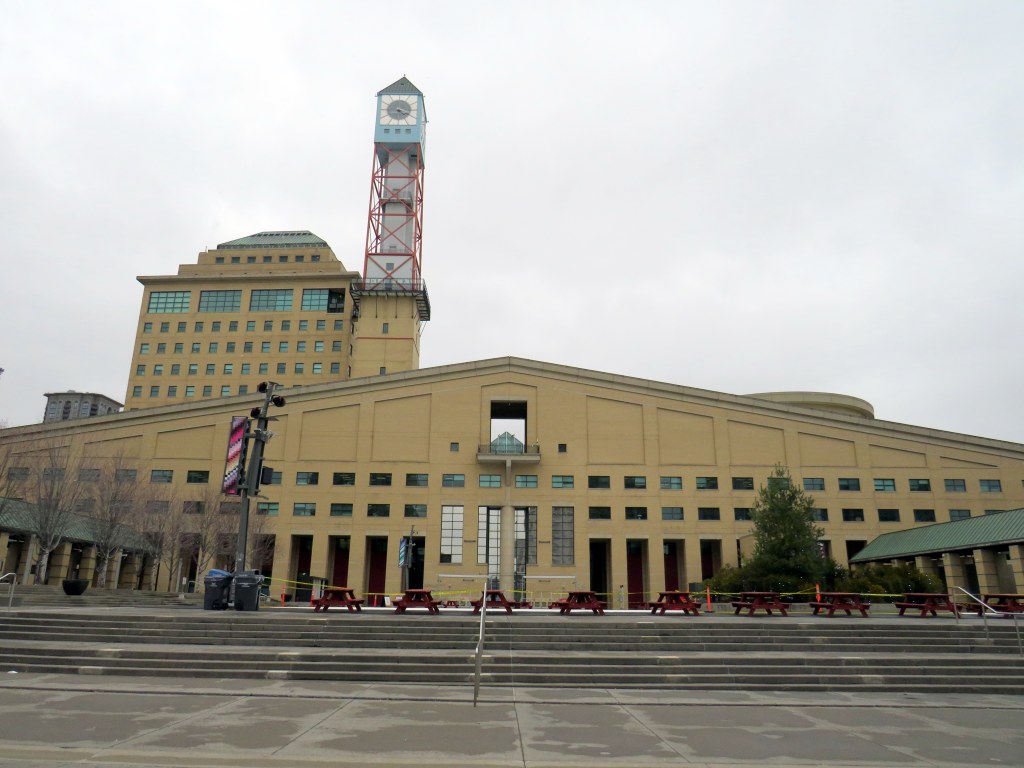
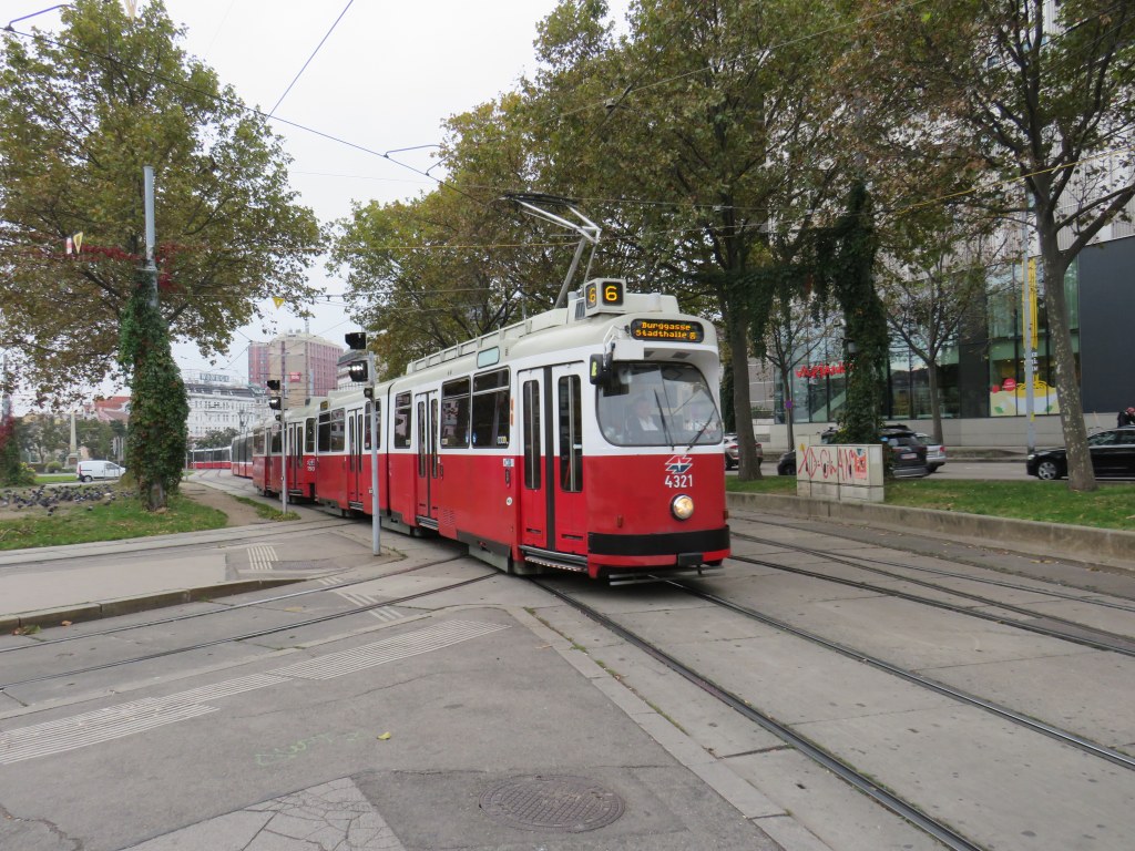
Mississauga City Hall, one of the most walkable municipal buildings in Ontario
In late March 2024, with a streak of mild, sunny days, I was eager to get outside and walk. As I have long been interested in local politics and planning issues, public transit, active transportation (especially walking advocacy), I thought I would try to get to every city, town, and township hall in the Greater Toronto and Hamilton Area (GTHA) without a car.
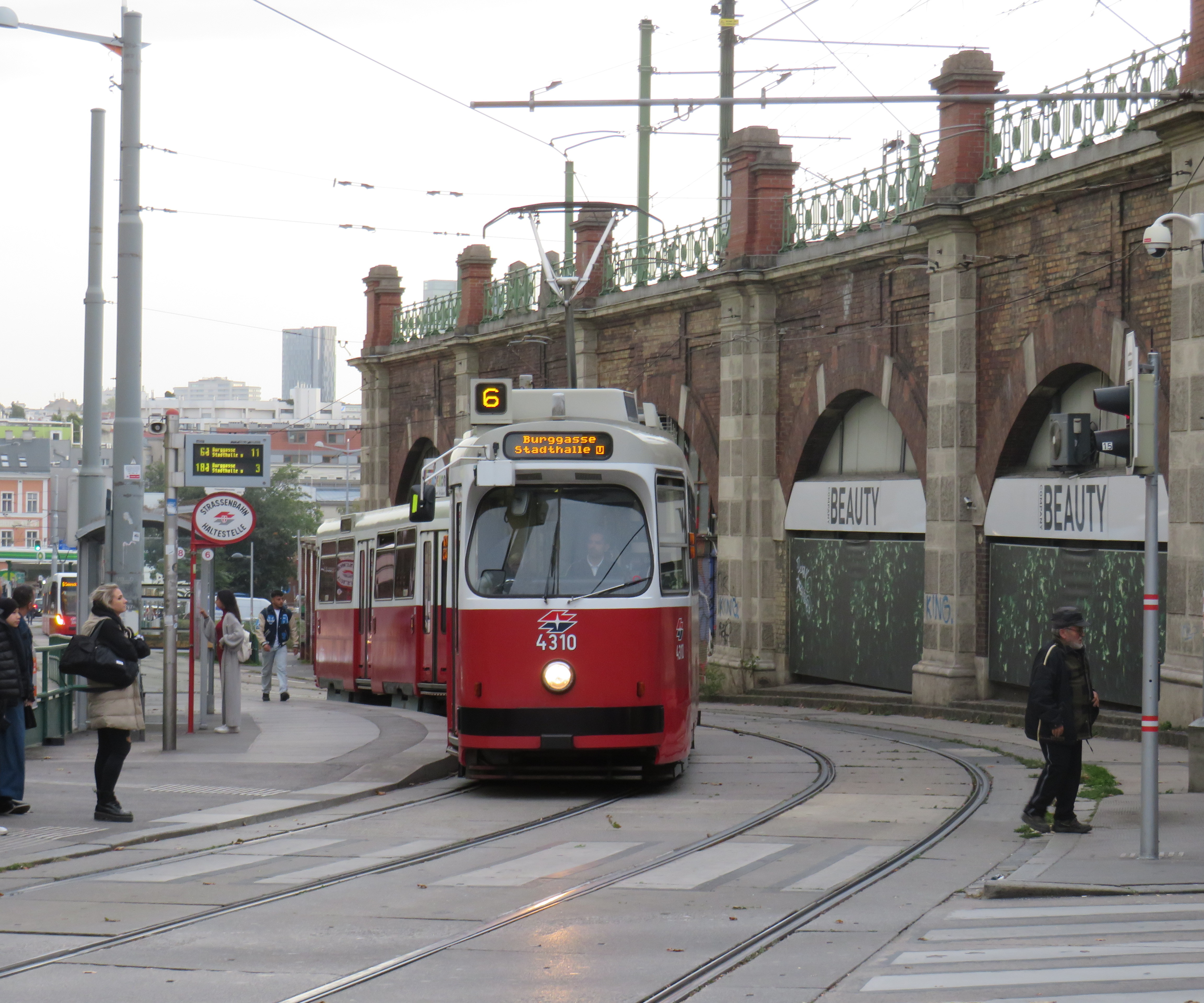
This was a fun project, even if there were times I felt really frustrated at times by poor transit and long hikes. The highlight of my quest was a tour of Mississauga City Hall from Councillor Joe Horneck. Mississauga’s civic centre is one of Ontario’s most iconic — and walkable — government buildings.
Mississauga Council Chambers
Of the three levels of government (federal, provincial, municipal), the municipal level has the most impact on the day-to-day lives of most Canadians; it is also the closest level of government to all. Residents can depute at committee meetings, get meetings with their local councillor and city staff, and obtain building permits, marriage licenses, or pay bills at city and town halls. Therefore, they should be as accessible as possible, especially to those without cars.
Only one GTHA town hall (Caledon) was completely inaccessible without a car, though several other town halls required long walks from the nearest transit stop, making them inaccessible to some residents. But I could get to Brock Township, the least-populated and most-rural municipality in the GTHA, thanks to Durham Region Transit’s On-Demand service, though I had some difficulty there.
The complete list of GTHA city and town halls, along with photographs and a map can be accessed here.
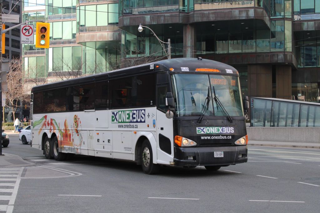
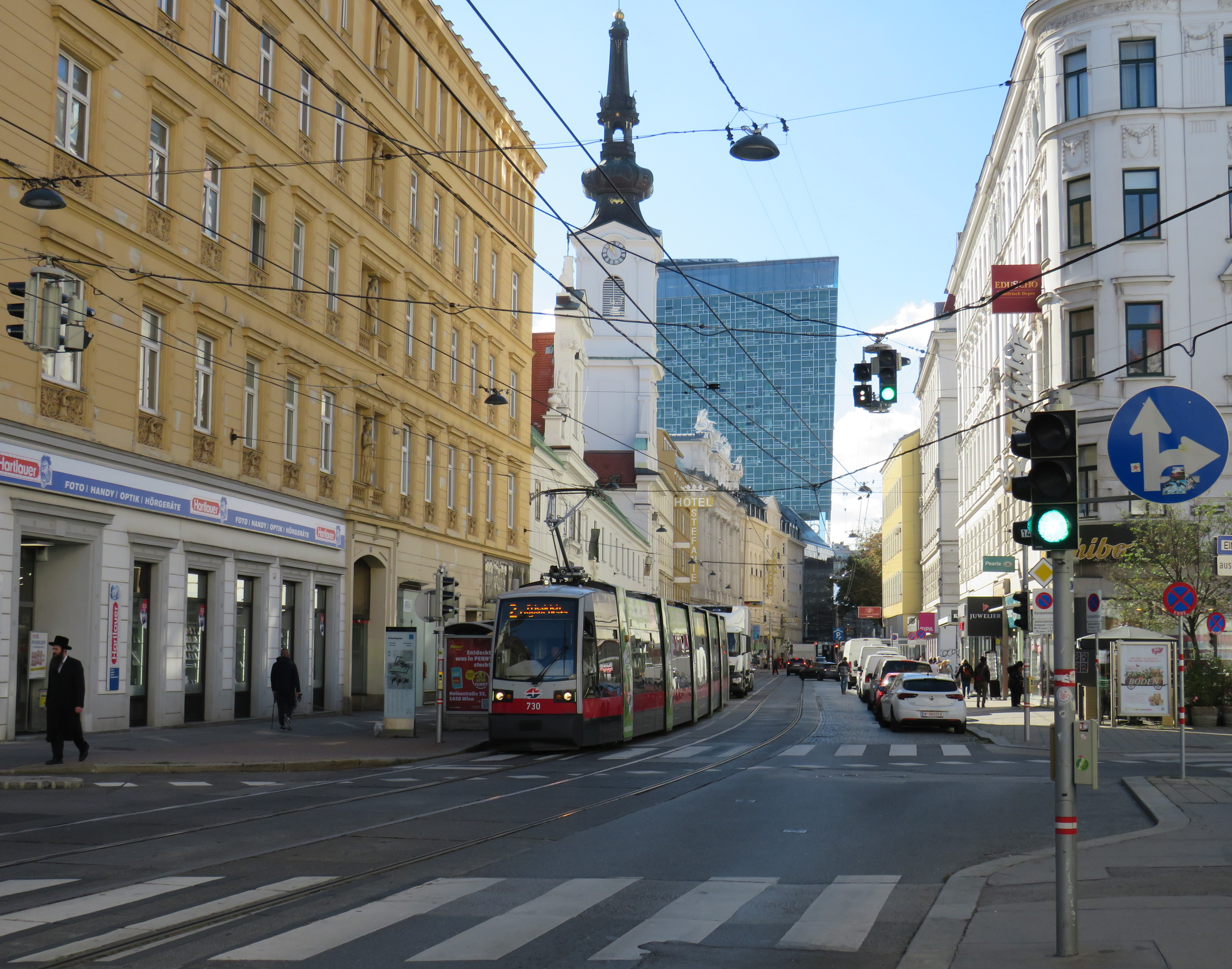
Intercity Bus minibus on York Street at Royal York Hotel, February 13, 2024
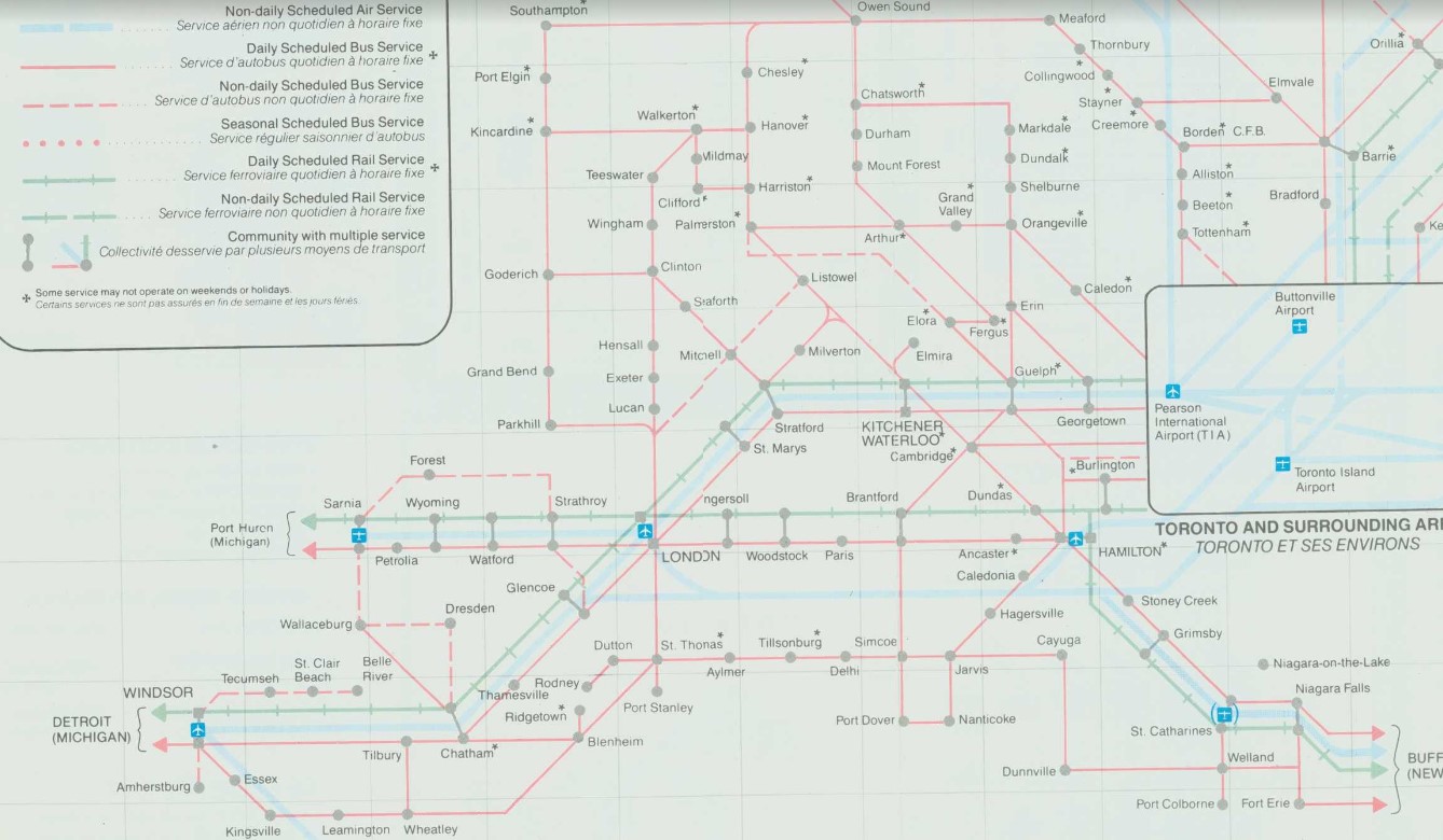
In late 2023, yet another intercity bus operator started serving the busy Toronto-London corridor, operating between Toronto and London. With the rather unimaginative name of “Intercity Bus,” this new company operates up to four trips a day between Toronto and London. It has since added a route between London and Sarnia; it also plans to run the much-needed link between London and St. Thomas.
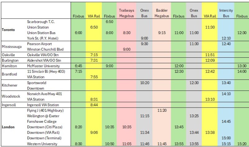
There are now five bus companies on the Toronto-London route: Intercity Bus, Onex Bus, Trailways, and Megabus (in a partnership with local coach operator Badder Bus). Those five companies compete with VIA Rail, which operates up to six daily trips between the two cities, with up to 28 round trips daily between them.
Onex Bus departing Downtown Toronto, photo kindly provided by Chris Whitfield
VIA Rail remains the fastest and most comfortable option, with full-service staffed stations in Downtown London and Downtown Toronto, but its fares are typically the most expensive. The private coach companies offer cheaper fares, and several of them directly serve Western University and/or Fanshawe College. Megabus has partnered with Trailways; its booking website includes both the Toronto-London-Detroit Trailways trips and the Toronto-London trips operated by Badder Bus. Otherwise, one must go to the individual companies’ websites to figure out the complete schedule and where each service stops at.
The schedule below, saved as a PDF, includes all regular weekday trips between Toronto and London along with intermediate stops.
In Toronto, Flixbus, Trailways and Megabus/Badder call at the Union Station Bus Terminal, where connections can be made to other Flixbus and Megabus services, along with GO Transit and VIA Rail in the adjacent railway hub. Onex and Intercity Bus make use of a curbside stop on York Street next to the Royal York Hotel, which is shared with the Toronto Island Airport shuttle. These three stops are all within a few minutes’ walk from each other. Some Flixbus runs to London begin and end in Scarborough, and many buses also make a stop at Pearson Airport.
In London, every bus carrier makes a curbside stop at Western University, the terminus of all bus trips from Toronto except Trailways, which continues to Windsor and Detroit. All carriers except Badder/Megabus also serve Downtown London. However, each has a different stopping location, with Flixbus and Trailways opting for a curbside stop on York Street near CitiPlaza (London’s downtown mall), and Onex utilizing the driveway at the VIA Rail station.
Curbside stops are convenient for bus operators, as they’re easy to pull up to and depart from, there’s no rent, staffing, or maintenance costs. With smartphones and online ticketing, there is no need for a ticket agent, and passengers can be notified by text and/or email of any delays or changes. But curbside stops have no shelter and no washrooms.
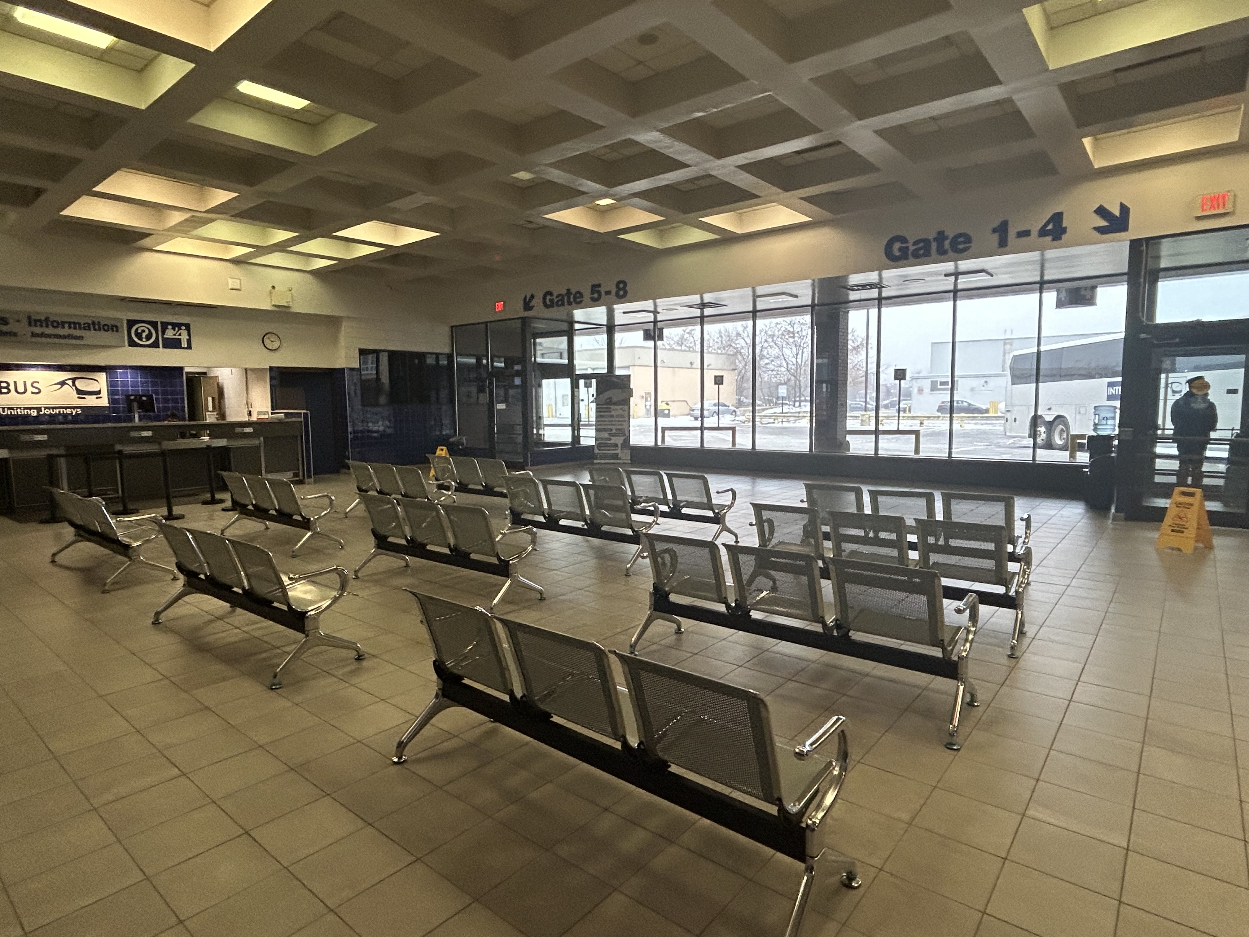
Interestingly, Intercity Bus has taken over the old Greyhound terminal in Downtown London. At its peak, London’s terminal had dozens of daily departures to cities and towns all over Southwestern Ontario, serving multiple carriers at a time when intercity carriers acted more like a unified network.
The old London Greyhound terminal
The terminal offers seating, washrooms, and is staffed by an agent, a rarity in the post-Greyhound world. The washrooms are especially essential if — as on my recent trip — the bus does not have an on-board lavatory. These new smaller carriers save fuel and labour costs by operating smaller vehicles and matching capacity with demand. They often operate older coaches and minibuses.
Inside the Intercity Bus terminal
I recently took Intercity Bus from Toronto to London to try out Ontario’s newest carrier. Though the 12:10 departure from Toronto was on a minibus similar to those used by rural transit operators (there were only 10 passengers on that Tuesday afternoon run), the ride was comfortable enough, with cloth bucket seats. It was a fast trip: it skipped stops in Woodstock and Fanshawe College, and the driver made very good time on Highway 401, at times exceeding the posted speed limit by 25 or 30 kilometres per hour. Even with a stop for fuel (the driver asked if it was okay), we arrived 15 minutes early at the London terminal.
At its peak in the 1980s, there were over two dozen daily departures from the London bus terminal. There were frequent Greyhound routes to Toronto via Kitchener and via Brantford and Hamilton as well as to Chatham, Windsor, and Detroit; there were also daily Greyhound routes to Niagara Falls via St. Thomas, Simcoe, and Welland and to Strathroy, Sarnia and into Michigan. Regional coach operators also ran from the Greyhound terminal to Stratford, Goderich, Rodney, Walkerton, Leamington, and Port Stanley. Today, there are just four — three to Toronto and one to Sarnia.
Detail from 1990-1991 Ontario Intercity Transportation Guide, showing bus routes from London to points throughout Southwestern Ontario
My hope for the next year is for more stability in the intercity bus industry, perhaps even mergers between some of the smaller players. Onex and Intercity Bus, which compete on the Toronto-London route and offer a similar service, could be beneficial, especially if it results in a network of routes radiating out of London, starting with Intercity Bus’s London-Sarnia service, its planned St. Thomas route, and Onex’s London-Stratford-Kitchener run.
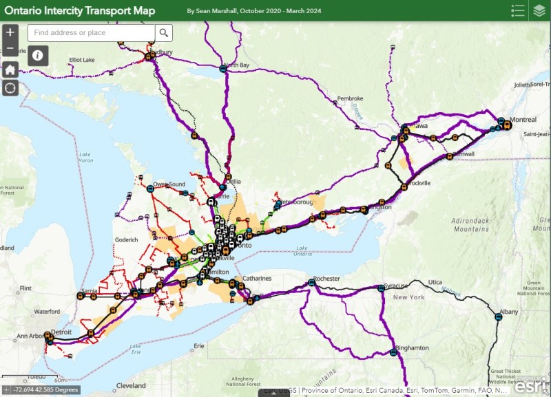
I updated my map of Ontario’s intercity transport services for March 2024, including the new Onex Bus and Intercity Bus routes in Southwestern Ontario. There are new services in East Zorra-Tavistock, connecting to Stratford and Woodstock, and in North Grenville. Unfortunately, Lindsay and Haliburton lost their TOK coach service, Prescott & Russell ended its on-demand service, and gaps remain in Bruce, Elgin, and Haldimand Counties.
On Monday, February 26, the new Ontario One Fare Program will take effect. Transit riders who previously had to pay a second fare when transferring from GO Transit or suburban transit agencies (York Region Transit, MiWay, etc.) to the TTC, will now benefit from a free transfer. Passengers will also be able to transfer free from the TTC to suburban buses or get the TTC fare discounted if transferring to GO Transit.
The new fare program, subsidized by the provincial government, is only available to customers who pay using a Presto card or other contactless payment options (credit card, debit card, mobile app). It is also not applicable to and from UP Express.
This is good news for many transit users, and it fixes several flaws in the existing fare structure. For example, when GO Transit moved its Highway 407 buses — originally designed to ferry commuters to York University — to Highway 407 Station in Vaughan, students and staff had to pay the TTC fare just to go two stops or endure an unfriendly walk. For a short time, there was a $1.50 discount for GO-TTC transfers, but that was allowed to expire under the Ontario PC government.
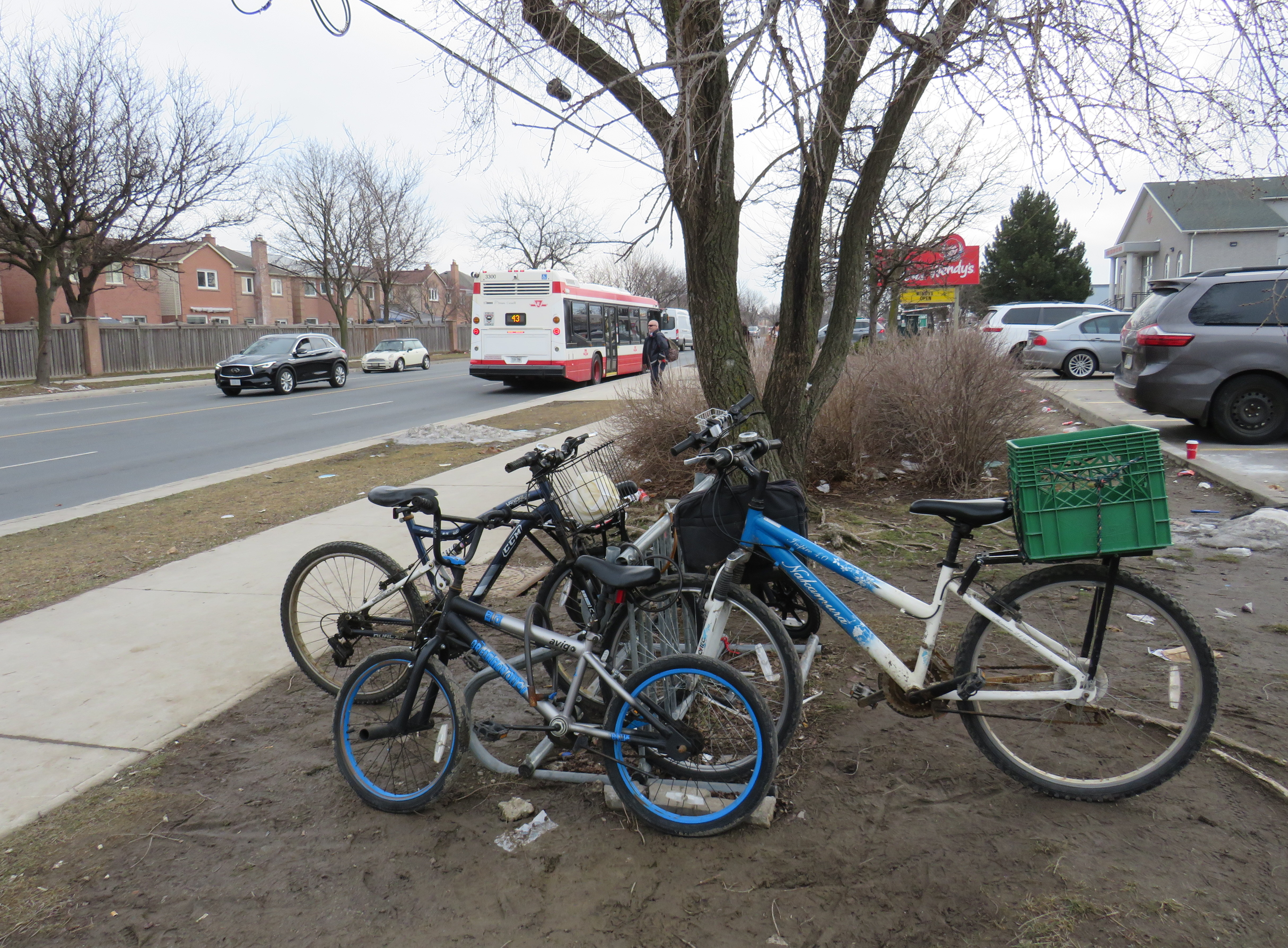
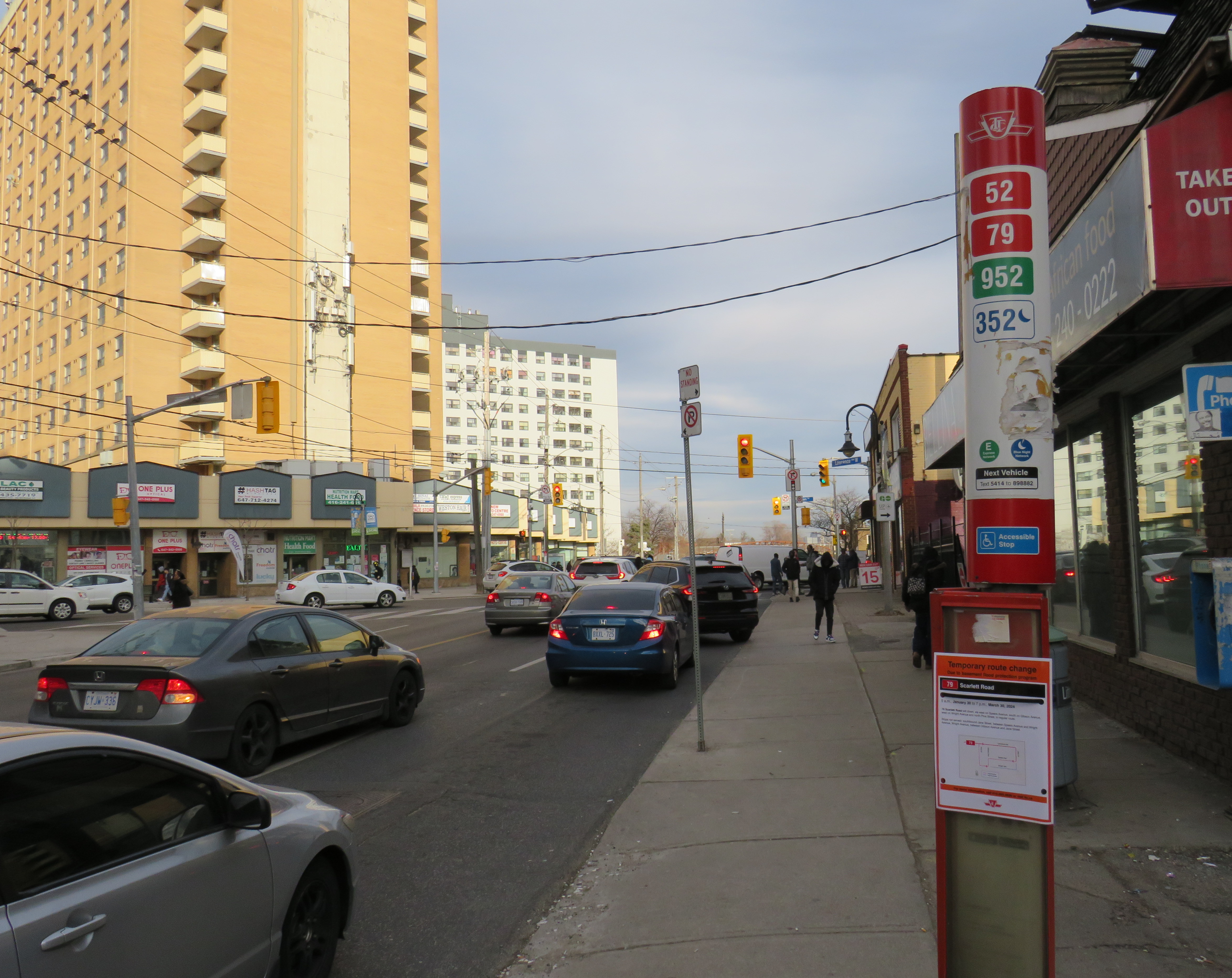
The elimination of the double fare will also benefit transit passengers who live or work near the border of Toronto and York, Peel, and Durham Regions. On the boundary between Markham and Toronto, it is common to see lots of bicycles locked up at bus stops along or near Steeles Avenue at TTC stops. These bicycles are owned by York Region residents who ride south to avoid the double fare and benefit from one less transfer. Once the new free transfer comes into effect, it will be interesting to see if there is a bump in YRT ridership.
Bicycles parked on the south side of Steeles Avenue, February 2024
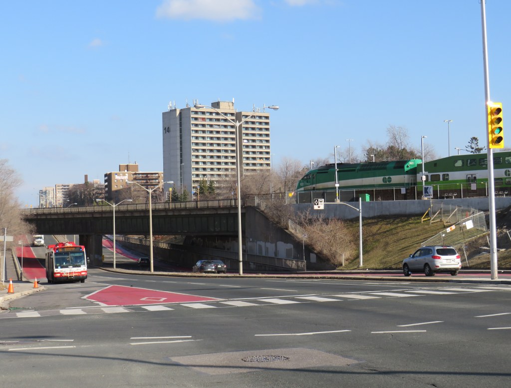
Though the new free TTC transfer should — at least in theory — eliminate a barrier to integrating GO Transit with local transit, the TTC really isn’t set up to feed the GO Transit rail network, nor are many GO stations set up to serve TTC riders. There are historical reasons for these poor connections, but they will need to be fixed.
GO Transit started off in 1967 as a commuter rail pilot project, with the Government of Ontario (the “GO” in GO Transit) looking to keep costs down in case the three-year experiment was unsuccessful. Many station sites were selected for their proximity to major roads and highways and parking access. As the service was intended to attract suburban commuters from their cars and mitigate the need for expensive highway widenings, transit access was only a secondary consideration. The initial Lakeshore Line exceeded expectations and so GO added new lines to Georgetown (1974), Richmond Hill (1978), Milton (1981) and took over CN commuter operations to Bradford/Barrie and Stouffville.
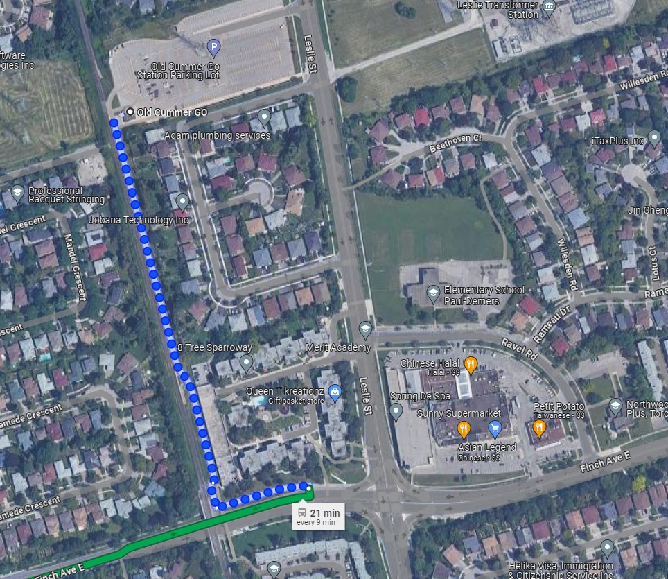
An example of this era of GO Transit station placement is Old Cummer Station, which opened in 1978. It was built where the Richmond Hill Line crossed the Finch hydro corridor, with land underneath the transmission lines easily paved over for parking. A walkway leads south to Finch Avenue, where one can connect to TTC buses, but the station building and the platform are oriented towards the parking.
As the Richmond Hill Line only operates during the peak periods, and is the only GO train service not destined for service expansion, this is not a major problem.
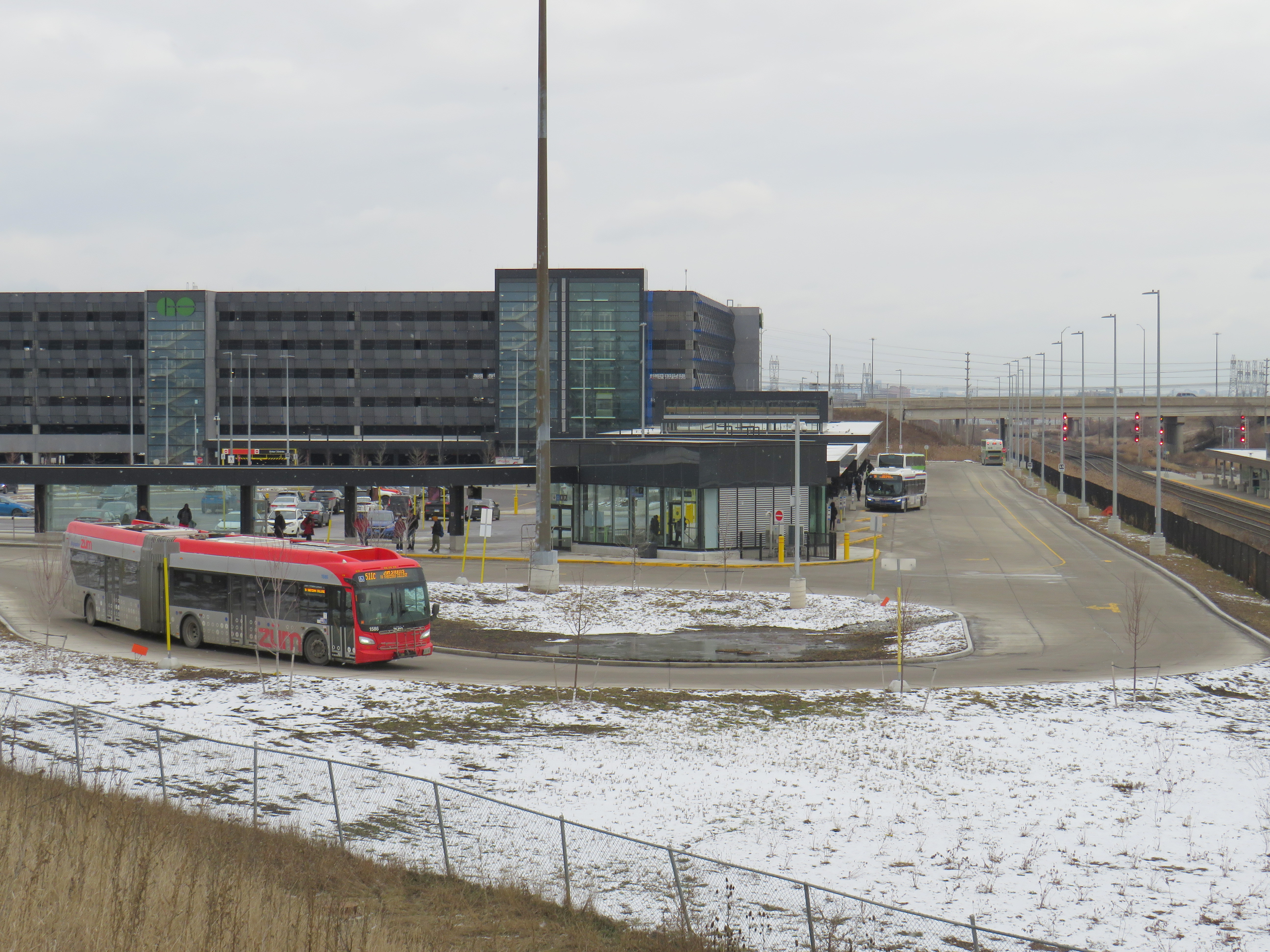
In the 905 suburbs, such as Mississauga, Brampton, Oakville, and Whitby, local transit connections are often quite good. For decades, commuters in those cities have benefitted from discounted or free fares on local transit when heading to or from GO rail stations (with Presto, connections to and from GO buses are now also free). Many transit agencies, particularly Durham Region, Oakville, and Burlington along the Lakeshore Line, centre their bus systems around the GO stations. Brampton built its downtown bus terminal adjacent to the GO station in 1989, and in 2023, Metrolinx opened a new bus terminal at Bramalea Station, allowing for easy transfers between buses and trains.
Bramalea GO Stationbus loop
On the other hand, the TTC bus network was designed around the subway network, with nearly every route serving at least one rapid transit station. Though TTC buses would pass by GO stations, transfers between the two were limited because of the extra fare and the infrequent GO services compared to the subway. The only TTC loop on GO station property is at Rouge Hill Station, though Exhibition Loop and Long Branch Loop are short walks to GO station entrances.
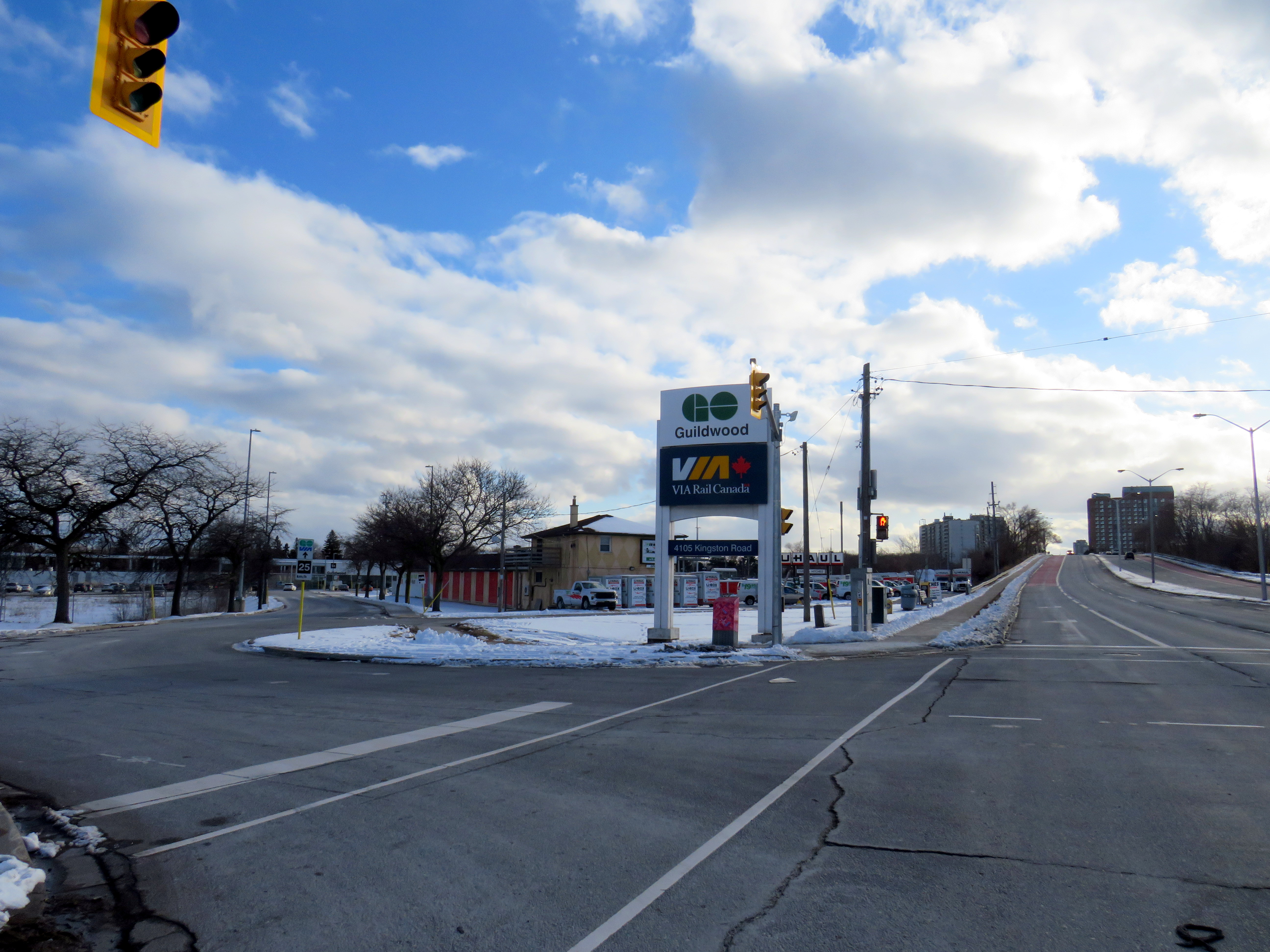
Entrance to Guildwood GO Station at Kingston Road. TTC passengers looking to connect with GO trains must cross a busy intersection than then walk through a parking lot to reach the station building.
As GO Transit continues to expand, and fare integration finally becomes a reality, there is both an opportunity and a need to change. Though there are plenty of examples of poor GO-TTC connections, there are also some promising moves towards physical integration between the two systems.
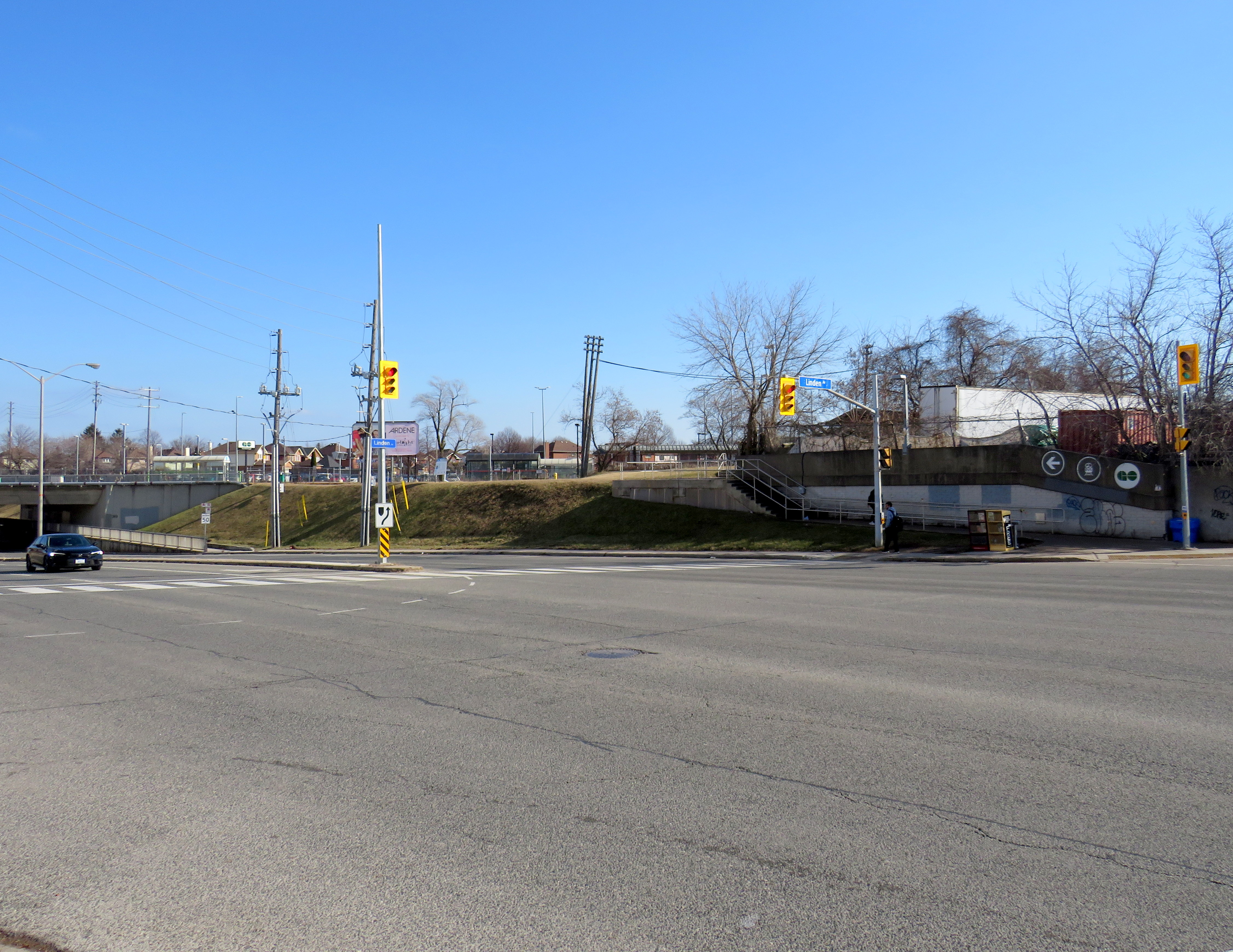
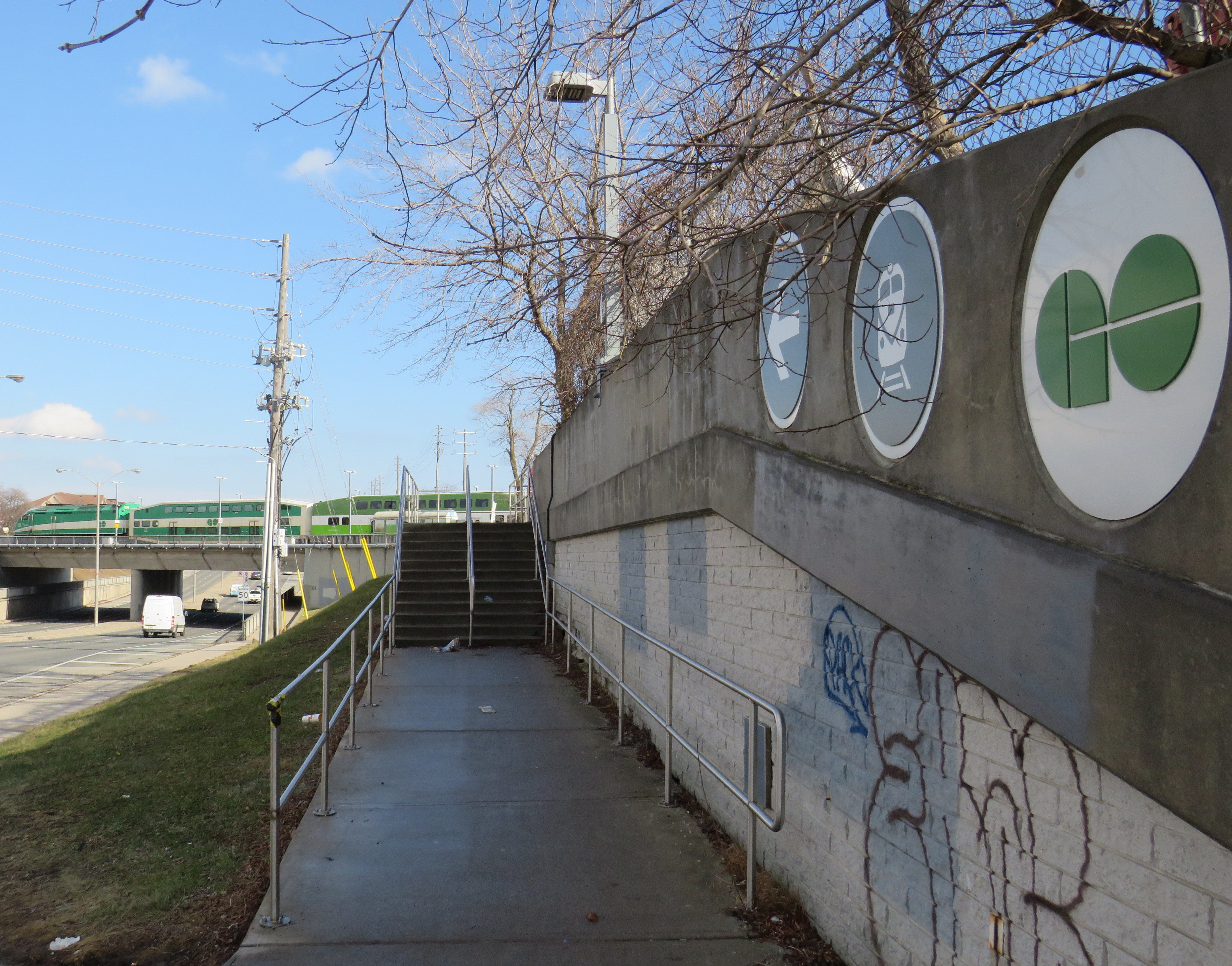
The worst GO-TTC connection: Etobicoke North
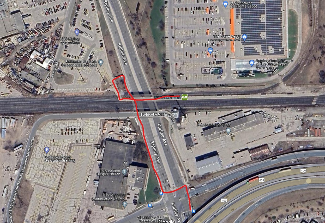
Red path shows walking route between northbound 45 Kipling bus stop and Etobicoke North GO platform
Etobicoke North station opened in 1974 as part of the Georgetown (now Kitchener) GO Line. The station and parking lot were built on Ministry of Transportation property and in a hydro corridor. Though the frequent 45 Kipling bus passes under the rail corridor, the transfer between bus and train requires crossing two sides of the busy Kipling/Belfield/Highway 409 off-ramp intersection, continuing on a narrow sidewalk, and climbing a flight of stairs before reaching the main walkway to the station platform. Though a passenger could save a lot of time by transferring to the train (especially as it now runs seven days a week), the long and uncomfortable transfer makes this very uninviting.
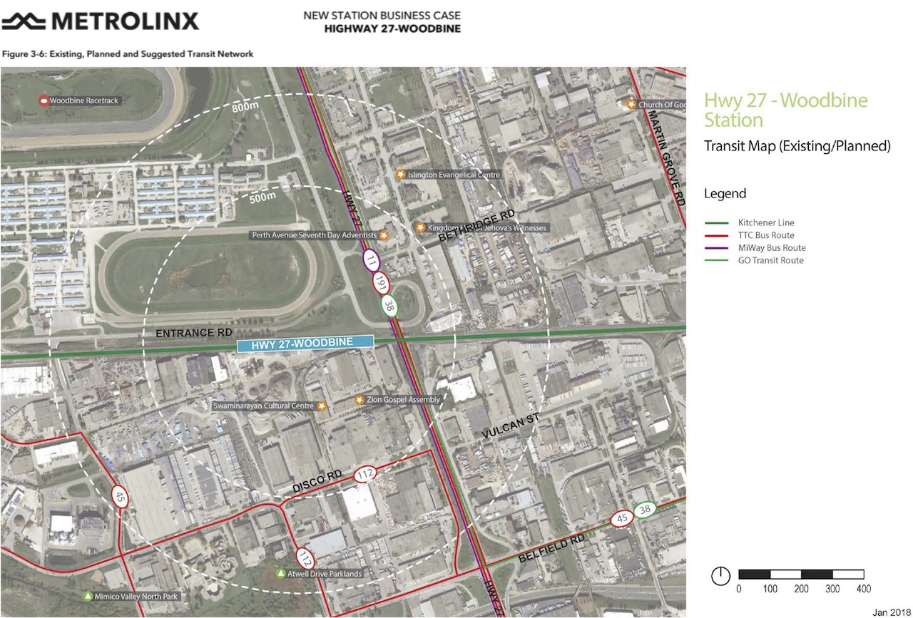
A new station at Woodbine Racetrack is proposed, but work has yet to begin. The station at Etobicoke North will eventually have to be closed and demolished to make way for track expansion required for 15-minute GO service. There’s an opportunity to build a great transit hub at Woodbine, especially with an extension of the Finch West LRT.
Metrolinx map of the potential Highway 27-Woodbine Station
An accessibility failure: Scarborough GO
Scarborough GO Station, from St. Clair Avenue East
Scarborough GO Station, near St. Clair Avenue East and Kennedy Road, is located where the GO Stouffville Line splits off from the Lakeshore Line; the station was originally known as Scarborough Junction, as it was the point where the Midland Railway of Canada met the Grand Trunk Railway. (This is where Midland Avenue gets its name from.) The station building and parking lot is located on the south side of the tracks, accessible from Midland and Reeve Avenues. A walkway on the north side of the station leads to St. Clair Avenue East, but it involves several staircases and is not fully accessible to the street, where the 9 Bellamy and 102 Markham Road buses stop.
The Scarborough Junction Masterplan development proposal includes a new connection to St. Clair Avenue as part of a transit-oriented mixed-use community. It promises to better integrate GO and TTC services but will likely be several years before construction begins and even longer until a fully accessible connection is possible.
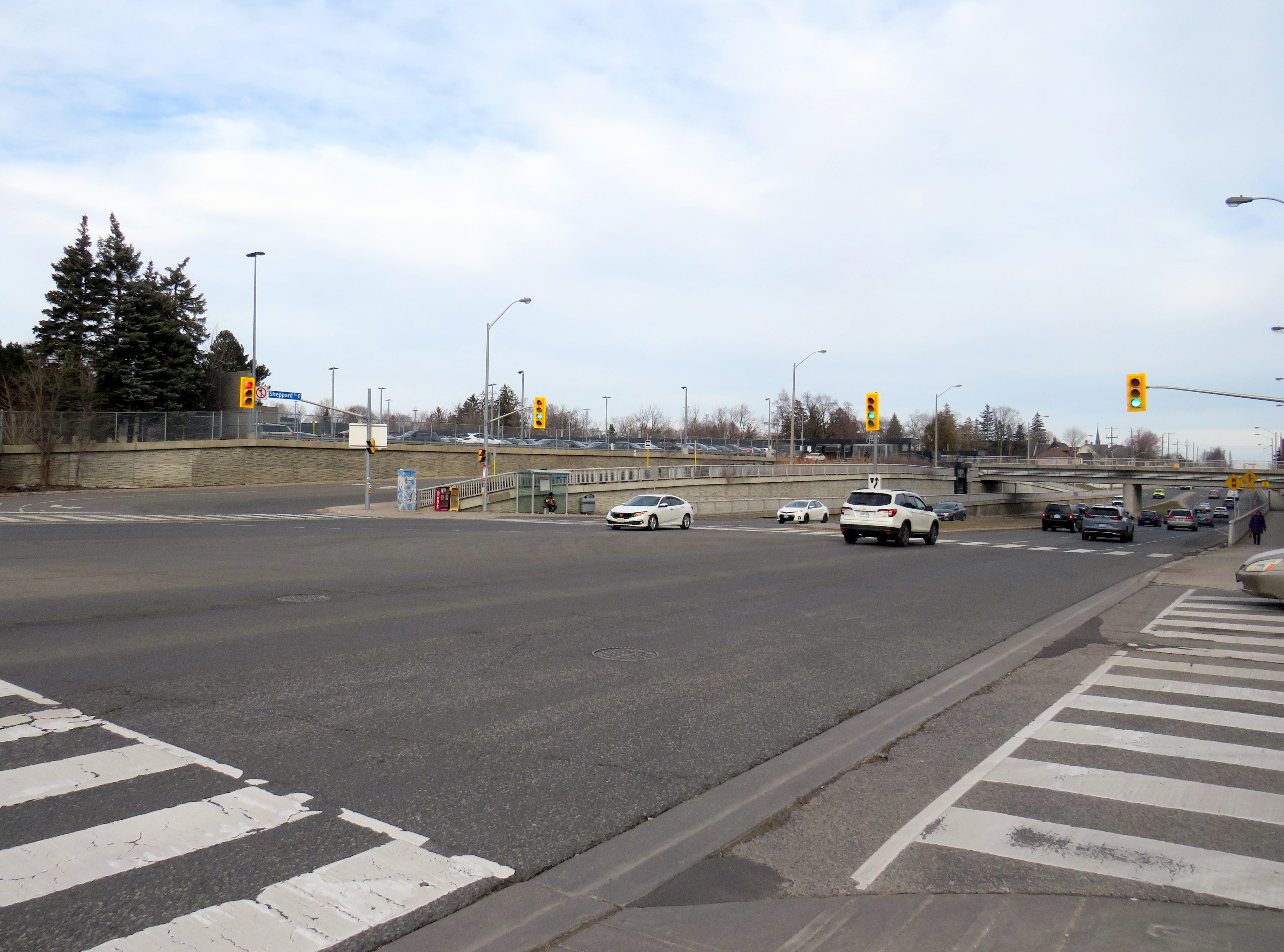
A more typical transfer: Agincourt GO
Agincourt GO Station, looking northeast from the south side of Sheppard Avenue East
Agincourt Station, in service since 1871, was taken over by GO Transit in 1982. The station building was always located several hundred metres north of Sheppard Avenue, and even in CN commuter rail days, featured a small parking lot. In 2012, an overpass was built separating Sheppard Avenue from the tracks; this allowed for a future Sheppard East LRT as well as train service expansion (a grassy median marks where the light rail line was planned to go). The TTC bus stops are located where the parking lot driveway exits onto Sheppard at a signalized intersection.
Unfortunately, the station platforms were not moved south on the overpass, reducing the walking distance between the train and bus stops and sidewalks on Sheppard Avenue. Though there’s a proper walkway between the TTC stops and the station itself, the station remains oriented mainly to the surface parking lot. Transfers are definitely possible, but not particularly easy.
The nearest eastbound TTC bus stop to Weston GO/UPX Station, located a five-minute walk to the east
Similar situations exist at Weston GO/UP Express station, where the TTC stops are several hundred metres away from the GO platforms at Weston Road and Lawrence Avenue, and at Oriole Station, where the walk from the GO platform to Leslie subway station is still unnecessarily lengthy and also requires crossing a busy intersection.
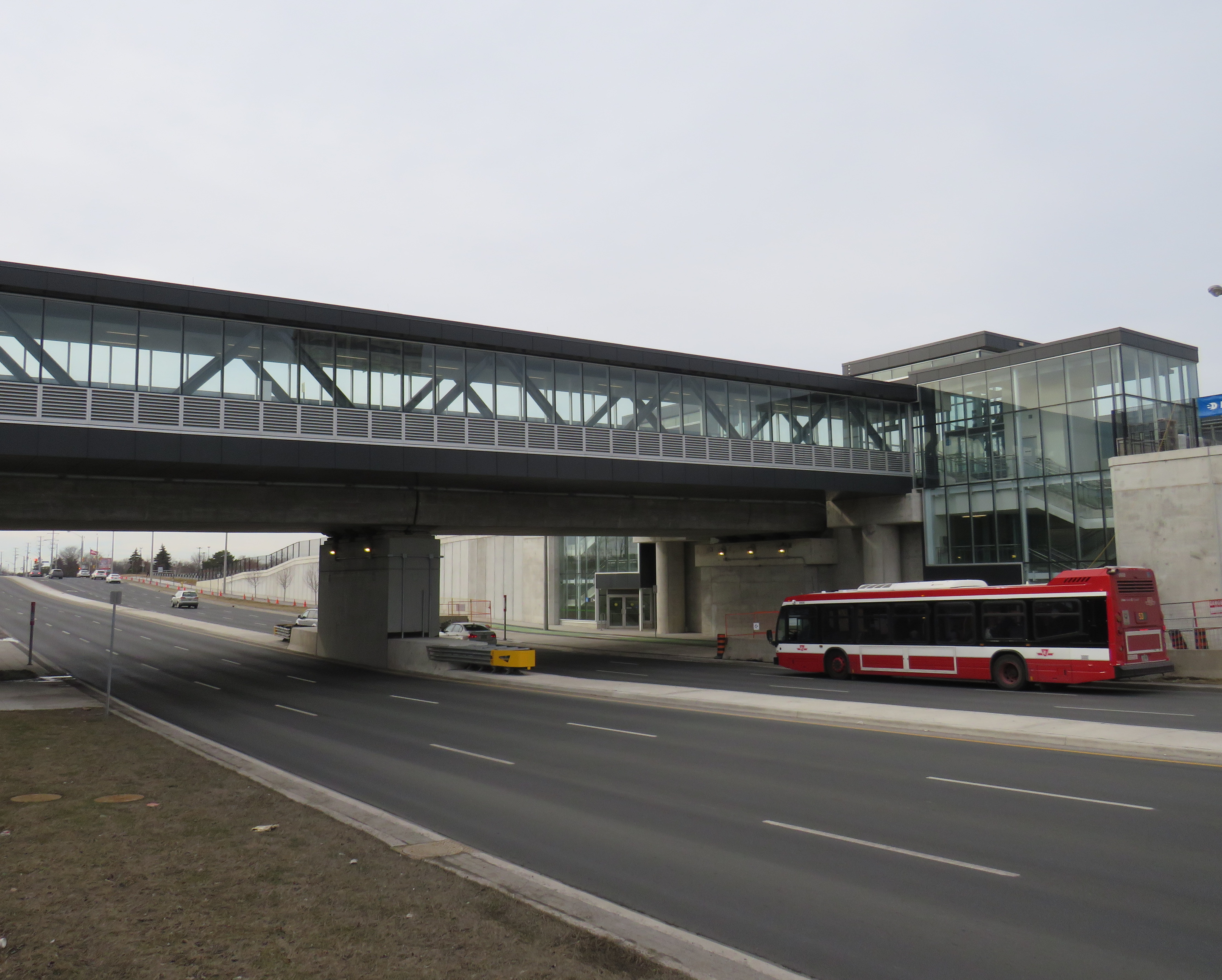
Milliken GO: A promising direction
A Steeles East TTC bus stops at Milliken GO Station
As part of the Stouffville Line corridor upgrades (which includes double-tracking the line between Scarborough Junction and Unionville) Milliken GO Station was recently rebuilt. It now features a new grade separation over Steeles Avenue, along with two new pedestrian overpasses on either side of the tracks. Though the station building is still oriented to the parking lot south of Steeles Avenue, the new layout provides excellent connections to buses on Steeles Avenue, including TTC routes 53/953 Steeles East, 43A Kennedy, and 57 Midland. Entrances on both sides of Steeles Avenue offer stairs and elevators to platform level.
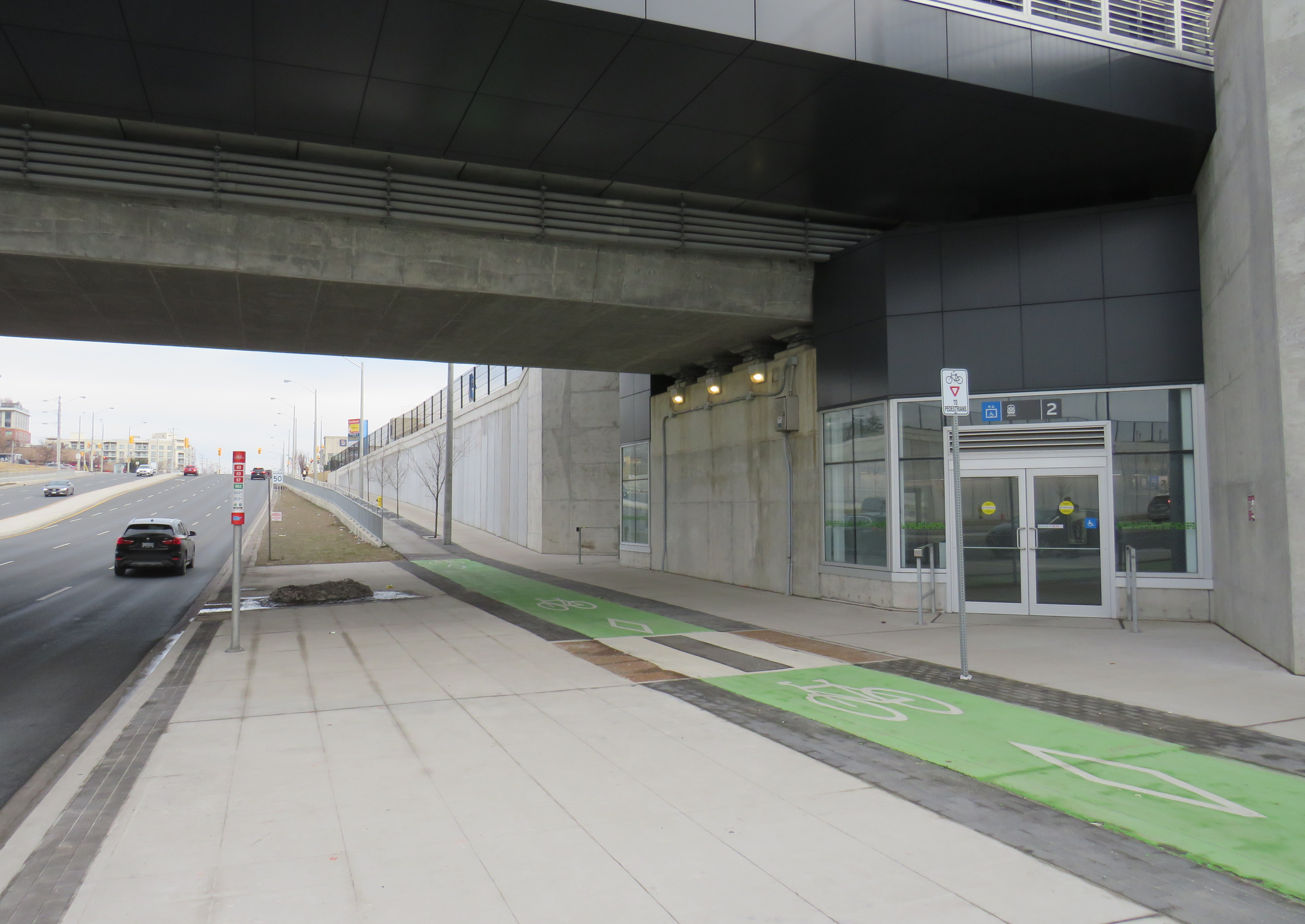
TTC bus stop, separated bike lane, and access to GO trains
The one issue at Milliken Station — as with many GO stations — is that the wayfinding from platform level to TTC buses is completely missing. Ideally, signage should indicate not only the route to TTC buses, but the connecting bus routes as well.
Unfortunately, signage at Milliken Station does not indicate TTC bus connections
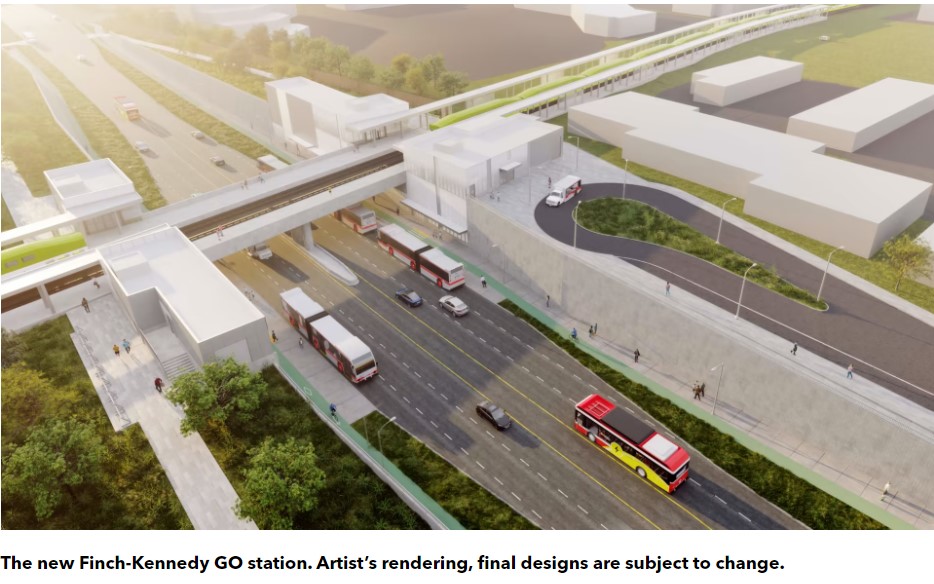
A new GO Station, nearly three kilometres to the south, will feature a similar layout. As platforms will extend over Finch Avenue, transfers between train and bus will be even more convenient at Finch-Kennedy as they are at Milliken. With minimal parking and optimized transit connections, this should be the norm as GO Transit transforms into a frequent, regional rail network. As of February 2024, preliminary work has started on the grade separation.
Rendering of the future Finch-Kennedy GO Station
Concluding thoughts
The new Ontario One Fare Program is a long-overdue step towards integrating the Greater Toronto and Hamilton Area’s disparate transit agencies and addressing unfair tariff boundaries at Steeles Avenue and elsewhere. It also recognizes GO Transit’s future as a regional rapid transit network that not only connects the suburbs to Toronto, but a solution to providing better transit within the city as well.
Most importantly, TTC-GO transfers should be simple, easy, and direct. Happily, there is some momentum to making this happen — Downsview Park Station, opened in December 2017, is a great example of physical integration between GO and TTC — but as shown above, there is much work to be done.
Nearly three years ago, I wrote about the complicated history of Toronto’s Dundas Street. Calls to rename the street, which honours Henry Dundas, 1st Viscount Melville, came during a time of reckoning in Canada and the United States with racism, colonialism, and our ongoing relationships with First Nations. Ryerson University (my alma mater) changed its name to Toronto Metropolitan University (TMU) in 2022, in acknowledgement of Egerton Ryerson’s role in developing Canada’s system of residential schools.
Retain the legal street names with additional interpretation and recognitions
Retain the legal street names but rename those civic assets with Dundas in their name, except TTC facilities (there are three parks and one library branch that include the Dundas name, and Yonge-Dundas Square; there are two TTC subway stations and one streetcar line that also bear the Dundas name)
Rename the streets and all other civic assets now carrying the Dundas name (including Dundas Street East, Dundas Street West, Dundas Square, and Old Dundas Street).
In 2021, Toronto City Council voted 17-7 in favour of the fourth option, renaming Dundas Street and all associated city assets, such as the library, the two subway stations, Yonge-Dundas Square, and three city parks. At the time, the estimated cost was $8.6 million, but by Fall 2023, it had grown to $12.7 million. There was also a significant backlash to the renaming, which included several conservative city councillors.
In the end, council voted to approve a compromise that would include renaming Yonge-Dundas Square, Dundas and Dundas West subway stations, and the Jane-Dundas library, but retain the name Dundas Street itself. There would also be a public education campaign “to acknowledge the historical impact of Henry Dundas’s actions and that of slavery more generally.”
Yonge-Dundas Square would be renamed Sankofa Square, while Dundas Station, directly below, would be renamed with financial support from TMU. “Sankofa” was one of four shortlisted names considered by the Recognition Review Community Advisory Committee (CAC), which was made up of Black and Indigenous leaders, including business owners and residents along Dundas, with the participation of local city councillors.
Sankofa, a concept that originates with the Akan people of Ghana, “refers to the act of reflecting on and reclaiming teachings from the past which enables us to move forward together.” The CAC’s short list notes the concept’s connection to West Africa, which represented a major portion of the origins of Africans trafficked to the Americas — including Upper Canada — during the slave trade.
Dundas Street, looking east from Dovercourt Road
This compromise will not make anyone especially happy, but Mayor Olivia Chow will have to make many more compromises to properly address the fiscal and social crises Toronto is facing. But this is one compromise I mostly agree with. At first I thought Yonge-Dundas Square should have an Indigenous name, but after reading the background materials, I learned that the First Nations elders on the CAC preferred a name that focuses on the Black historical experience.
Until recently, few people gave the name “Dundas Street,” named over 200 years ago, much thought. Now more people are aware that there were slaves here, in Ontario, despite Governor John Graves Simcoe’s abolitionist leanings. Our understanding of history evolves as we as people evolve — this is the reason why we have historians.
Nearly three years ago, I wrote about the history of Dundas Street. It’s a really interesting one, by the way, as it continued to change and grow right up until the 1950s. In 2023, we continue to add to the history of the colonial-era road.
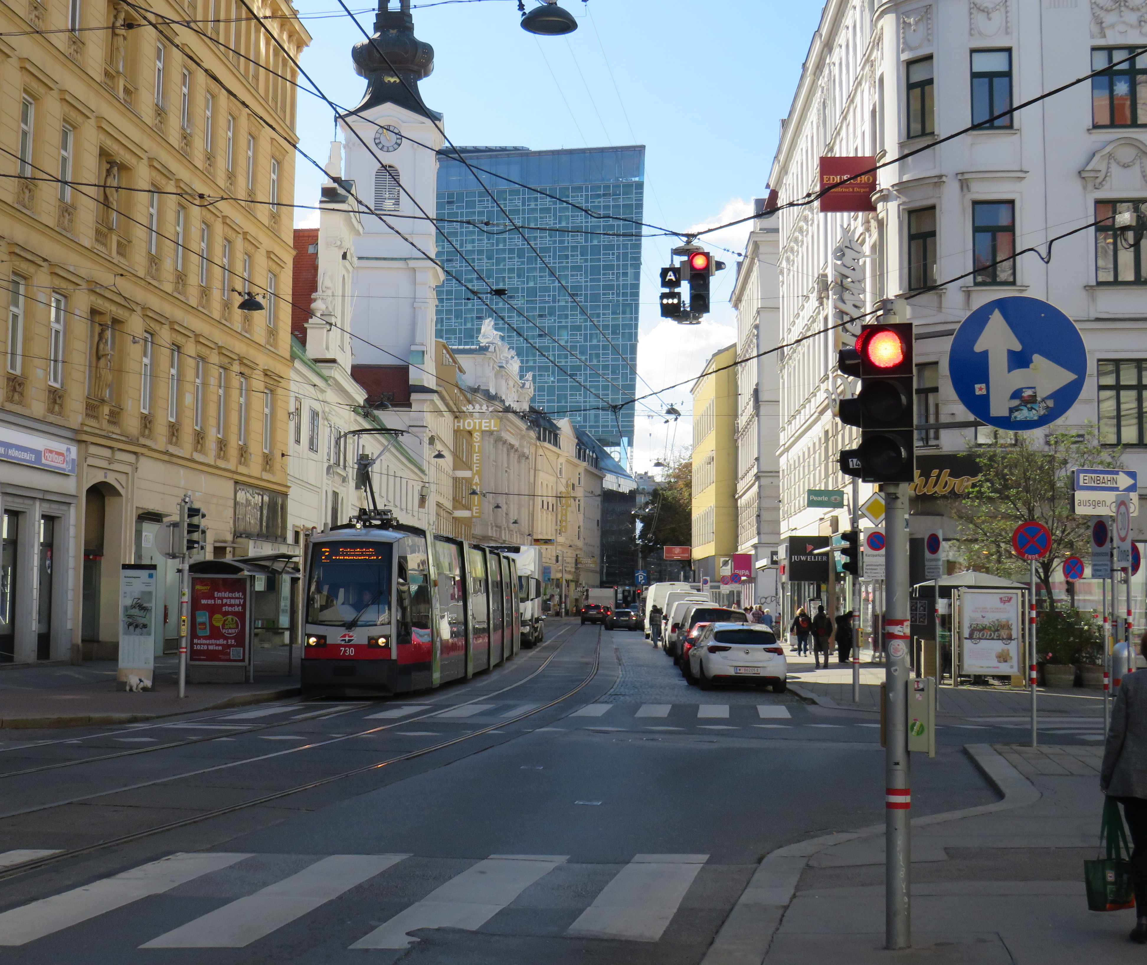
Streetcars backed up eastbound at King and University, November 28, 2023
On Tuesday, November 28, the University of Toronto’s School of Cities released their report that looked at vehicle movement and traffic violations on the King Street Transit Priority Corridor. They found that there are, on average, 6,800 illegal turns and through movements at intersections on the corridor, and less than 0.3% of offenders are stopped by Toronto Police and ticketed. Traffic enforcement was heaviest between November 2017 (when the pilot began) and March 2020 (when the COVID-19 pandemic restrictions began). Enforcement has not caught up since then.
The U of T School of Cities has provided invaluable quantification of what many Torontonians have suspected for years: the King Street Transit Priority Corridor is broken, and that there is little being done to fix it.
The transit priority corridor, which runs between Bathurst Street in the west and Jarvis Street in the east, has restrictions on through vehicle movements, where motorists must turn right at most intersections. Until 10 PM daily, only TTC buses and streetcars, emergency vehicles, and bicyclists are exempt. After 10 PM, taxis may also continue through the corridor.
The pilot program launched on November 12, 2017. The initial pilot, in which signs were erected, Jersey barriers placed to restrict the curb lane, and TTC stops moved to the far side of most intersections, was intended to optimize permanent streetscaping improvements, streetcar stop placement and transit optimization, get motorists acquainted with the new rules (at first, only warnings were issued by police) and allow time for Toronto City Council to decide on whether the pilot should be made permanent. Council approved making the transit priority corridor permanent on April 16, 2019.
Though Toronto City Council voted to transform King Street permanently, no work has started on the streetscape or public realm to do so. Just like Union Station, temporary Jersey barriers remain in place. The relocated TTC streetcar stops are left at road level, without transit shelters or accessible curbs. Drivers routinely ignore restrictions, with only a 0.3% chance of getting a $85 or $110 ticket. Meanwhile streetcars get stuck and transit riders get nowhere. On Wednesday, November 8, a Toronto police officer decided to enforce congestion on King Street… by ticketing a streetcar operator stuck in the intersection at University Avenue.
A motorist, ignoring several signs, proceeds straight through on King Street eastbound at Spadina Avenue
The problem is not just limited to through movements on King Street, though. On Tuesday, November 28, I stood at the corner of King and Spadina between 4:00 PM and 4:20 PM. The backup of cars and trucks headed southbound towards the Gardiner Expressway extended into the south side crosswalk and into the eastbound lanes at times. Motorists are not permitted to enter an intersection on a green light if they cannot clear it before the light turns red; this causes gridlock. But on more than one occasion, streetcars and pedestrians were impeded by illegal intersection blocks.
At Spadina and King, a truck and three passenger vehicles block the south side crosswalk and prevent a streetcar from proceeding straight on a green light
After standing at King and Spadina, I walked over to King and University, where the Toronto Police charged a streetcar operator earlier this month. At 5 PM, eastbound streetcars were lining up between University and John Street, unable to proceed.
Traffic jammed at King Street eastbound at University Avenue
However, motorists were able to turn right and left from University Avenue to eastbound King, blocking the east side crosswalk to pedestrians and ensuring that no streetcar could continue across. I spoke to one operator, who told me that the day before, he was stuck there for a half hour before he could move across.
The University and King intersection, at 5:00 PM on Tuesday, November 28. Note the blocked crosswalk and the line of streetcars, all with their hazard lights blinking. Eventually, one streetcar operator decides they had enough, and occupies the intersection.
While there, I counted several motorists who passed to the right of the stopped streetcar, and instead of turning right as permitted, they went straight, only contributing to the blockage ahead.
Two eastbound cars pass a stopped streetcar on the right to join the congestion ahead
The problem downtown is exasperated by several road closures. Queen Street is closed between Bay and Victoria Streets for Ontario Line construction; this will last for at least five years. Adelaide Street, which is one-way eastbound is closed at York Street due to the delayed Adelaide Street diversion track installation that is supposed to allow Queen Streetcars to divert around the Ontario Line closure. York Street is also closed at Adelaide. There are several other lane closures on Bay, Yonge, and Richmond Streets and University Avenue for utility work.
Adelaide Street is likely to remain closed at York until early 2024
Yet, one would hope that something was done to allow transit riders to get through the downtown core, especially as the city has been aware of the severe congestion for weeks at this point. The city needs to move ahead on permanent streetscape changes to further discourage through traffic on King Street by closing the curb lanes at the far side of each intersection.
It is also clear that the Toronto Police are not too interested in ticketing motorists on King Street. Even if they were, it wouldn’t be enough, as it takes 10-15 minutes to stop and ticket a driver; automatic ticketing, similar to red light cameras, would be more effective, though traffic officers can still be strategically deployed at congestion hotspots.
It’s beyond time for this city to take transit seriously again. King Street would be a great place to start.
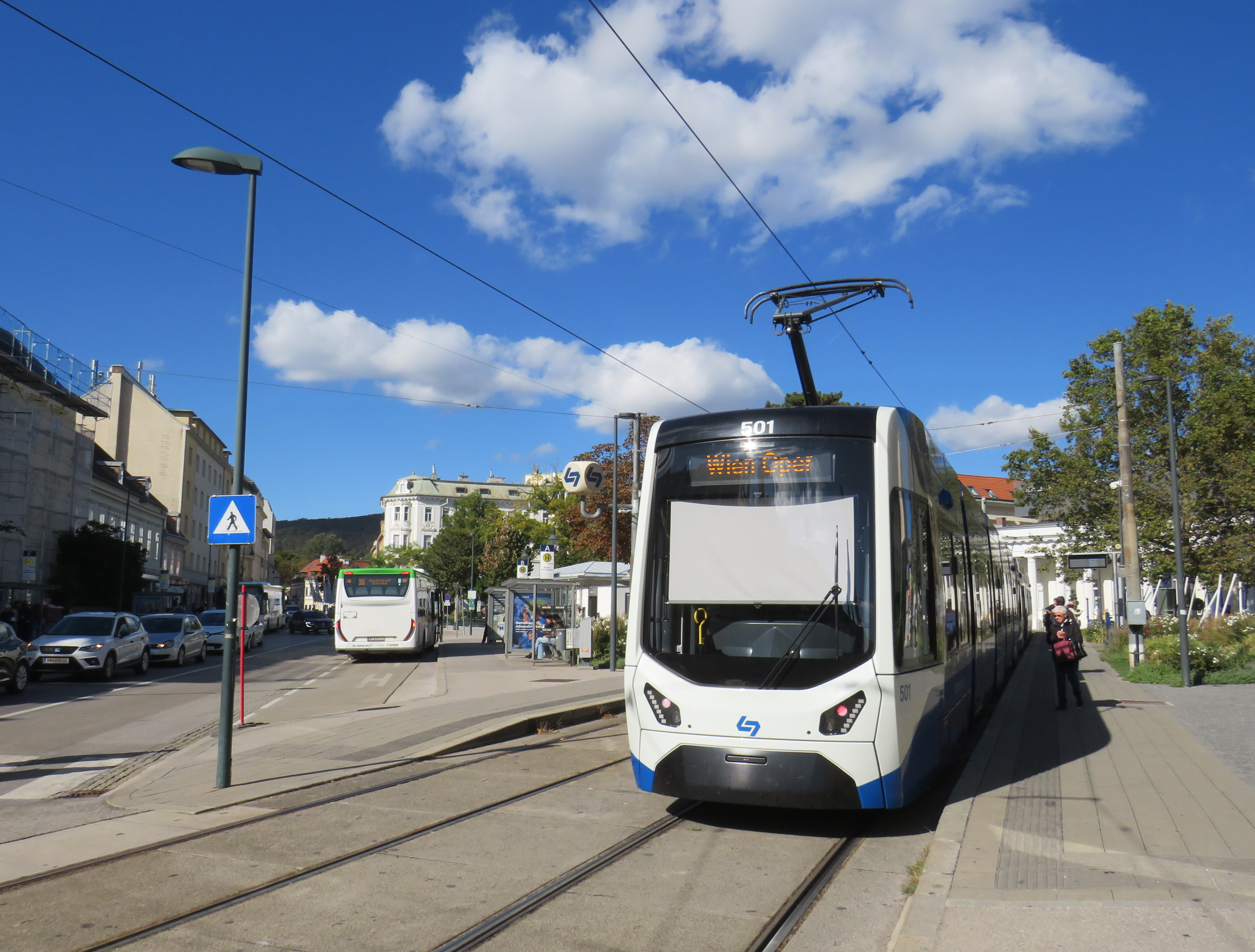
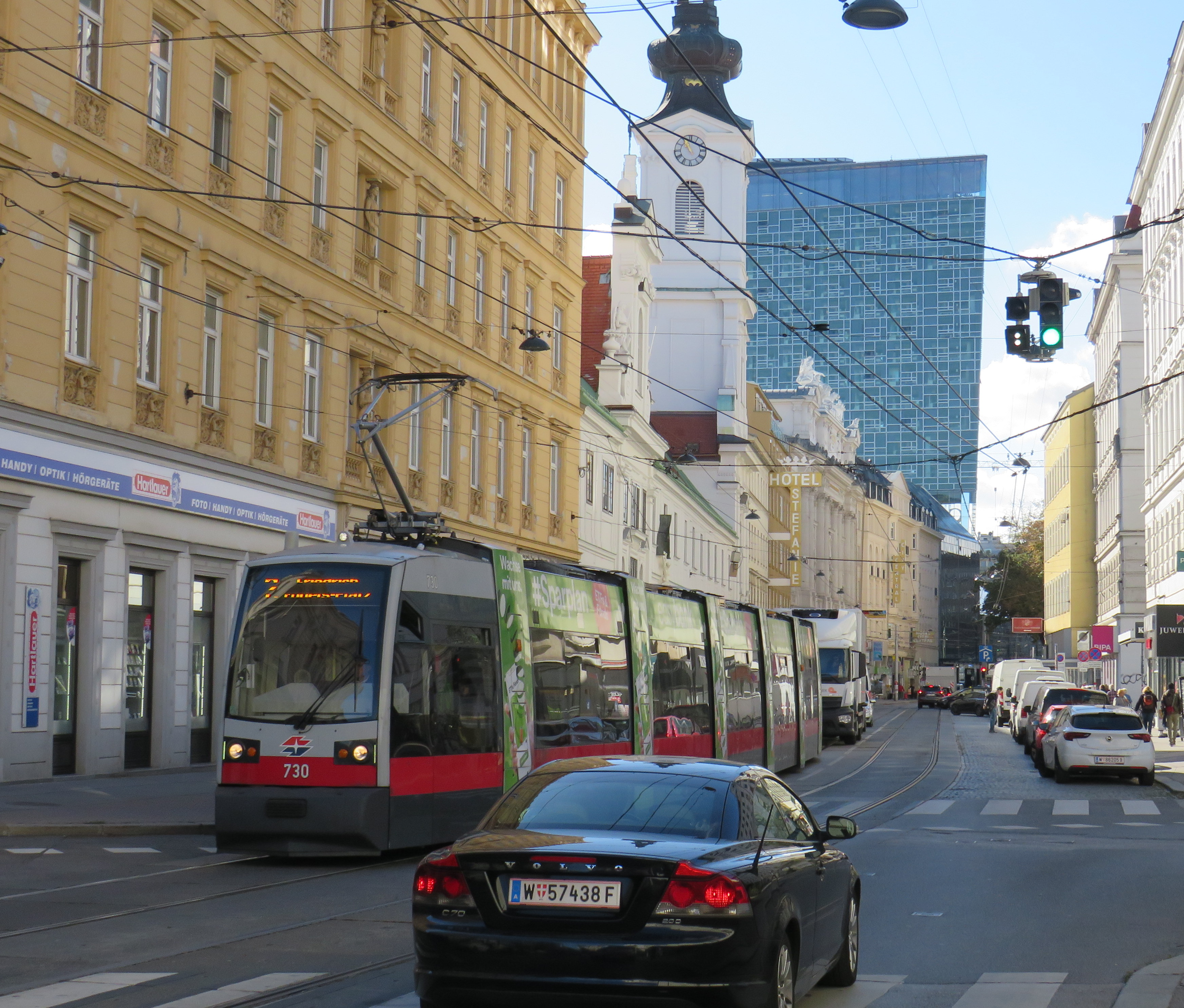
Vienna low-floor tram in the Leopoldstadt district
Back in October, my spouse and I had the opportunity to visit several countries in Central Europe: Austria, Slovakia, Hungary, and the Czech Republic, though we spent the majority of our time in and around Vienna, as that is where my spouse attended business meetings for several days; we also took time to explore the city and surrounding areas together.
While there, I experienced how serious cities operate trams seriously. In Bratislava, I saw how a streetcar priority corridor can work in a busy downtown core. In Prague, trams made it through watermain construction zones without detours or unreliable bus shuttles. In Budapest, I rode the world’s longest trams that move more people per hour than many metro lines. In Vienna, where I spent the most time, I experienced a city where transit passengers are treated with respect, and where the trams are reliable, despite no discernable signal priority and plenty of mixed-traffic operations.
Vienna is an amazing city to visit. It’s been described to me as “what people think Paris is.” That’s pretty much true. It’s a very walkable city with a fantastic café culture full of independent konditorei cafés (which offer sit-down service), with an assortment of rich, tasty cakes and great coffee. It has great art galleries and grand imperial palaces, but without the crushing crowds of Paris and Versailles. As the original Music City, it’s easy to find shows and performances to suit your tastes. (We attended the famous Wiener Staatsoper, where I took in my first live opera, ever, at a surprisingly reasonable price). It’s also a compact city, easy to walk, though the transport system is excellent. Vienna is also a great base for visiting other cities in Central Europe, where Salzburg, Bratislava, Budapest, and Prague are only a few hours away by (frequent and relatively speedy) train.
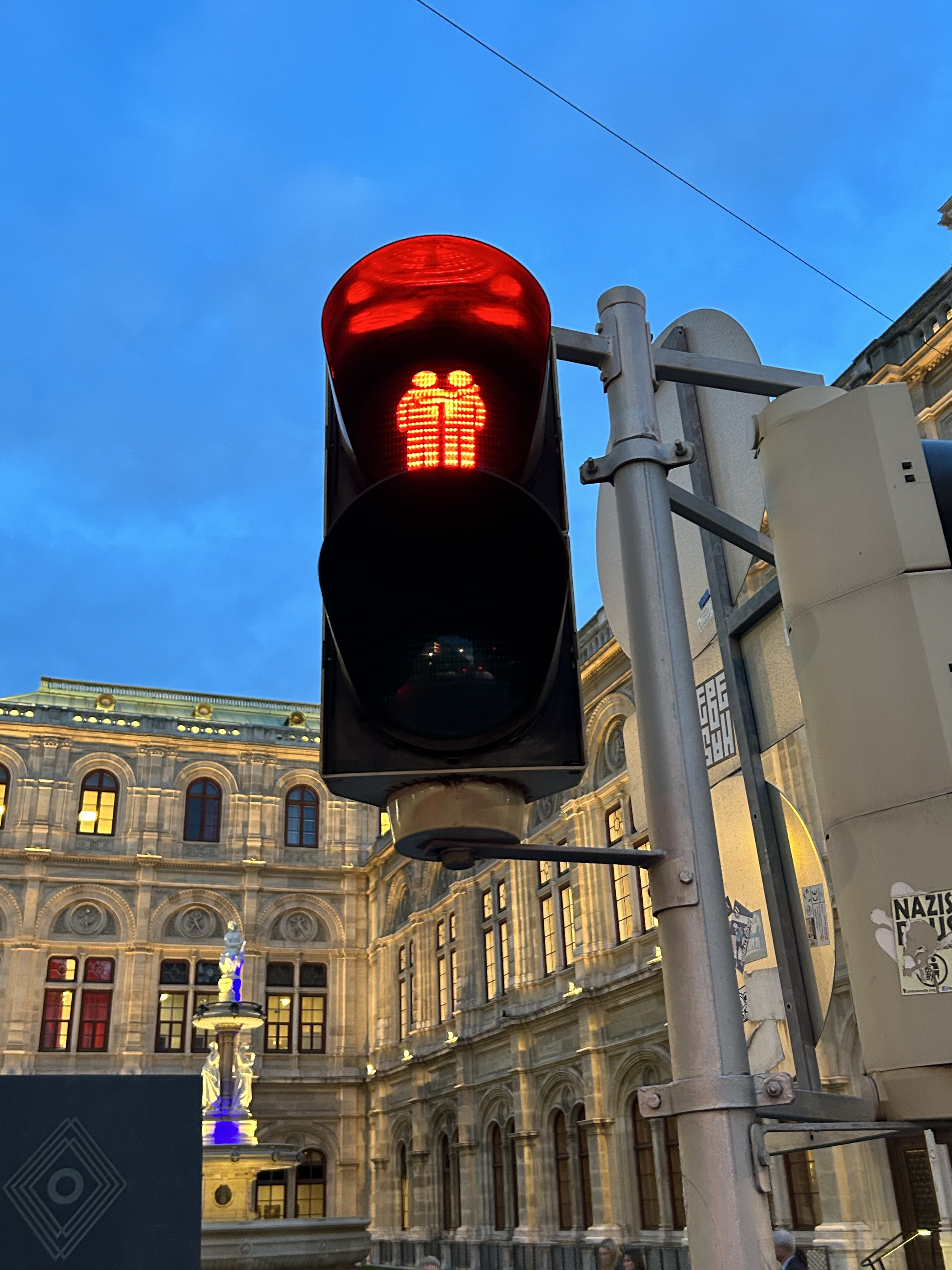
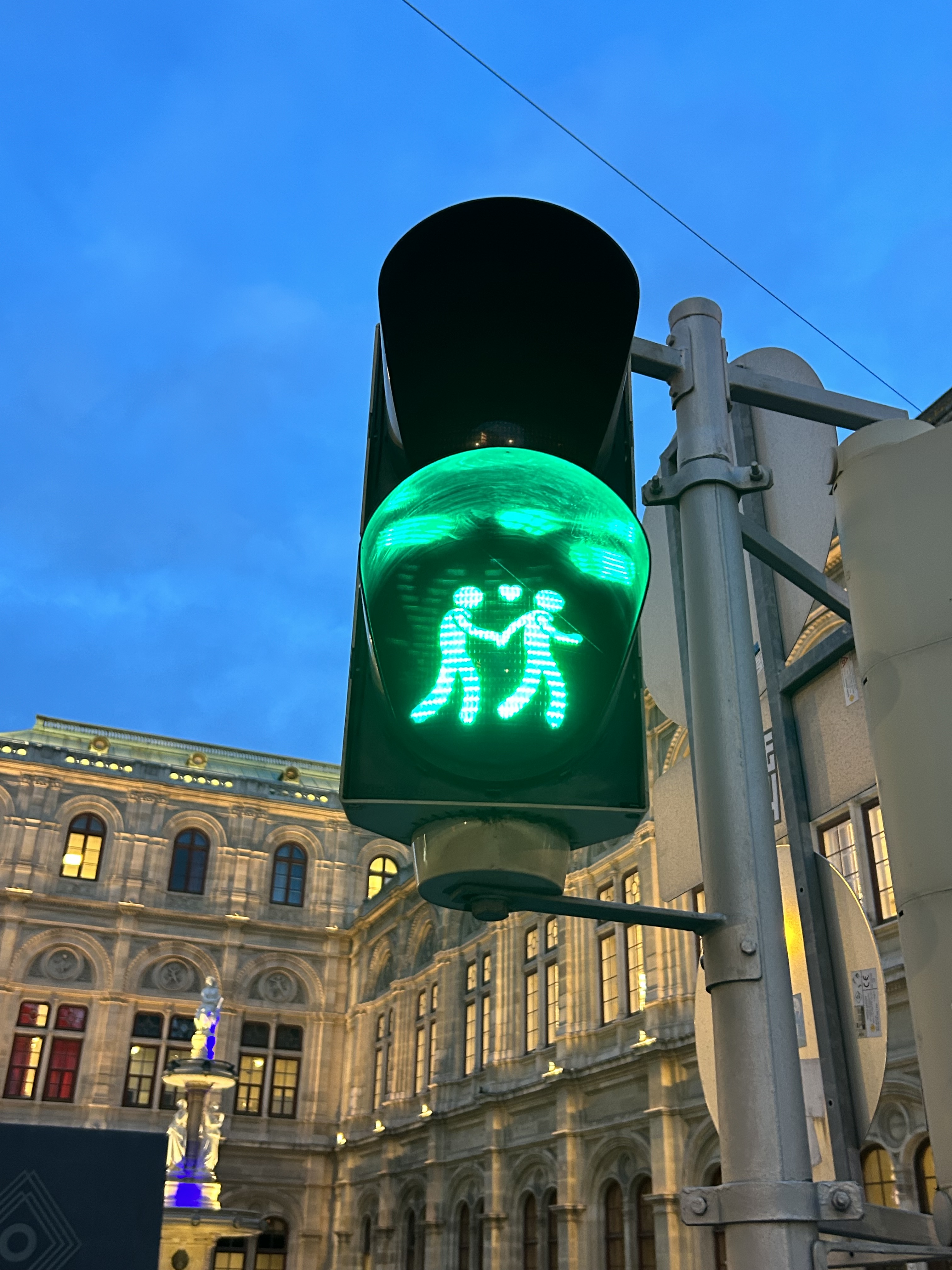
We noticed several pedestrian signs showing loving couples, rather than the standard, like this one in front of the Wiener Staatsoper (Opera House)
Vienna has one of the largest tram systems in Europe, with 30 lines over 176.9 kilometres, and a fleet of 525 cars, including modern articulated LRVs and older trams and trailers. In Vienna, trams alone carry approximately 300 million passengers a year. They run in many different environments: on-street in mixed traffic, reserved lanes, dedicated median and side-of-street rights-of-way; there is also a tram tunnel south of the city centre. Until the 1980s, Straßenbahnen (the German name for trams) were the backbone of Vienna’s transport network, with a small Stadtbahn system (now incorporated into the modern U-Bahn) and regional and suburban (S-Bahn) trains providing limited rapid transit services. Though there are now five U-Bahn lines (two of which evolved from the Stadtbahn), the tram system remains robust and very useful for getting around.
Like all four cities mentioned in this post, Vienna operates a mix of low-floor trams built in the last 25 years, as well as older high-floor trams, many of which are accompanied by an unstaffed trailer. Vienna’s entire network — trams, buses, U-Bahn, and S-Bahn — is a proof-of-payment system. Fare inspections appeared to be infrequent; neither my spouse nor I were checked during our eight days in Vienna. Tickets and passes can be purchased from a machine (found at every U-Bahn entrance and at many tram stops) or on the WienMobil app.
An older Type E2 high-floor tram and trailer at Gumpendorfer Straße. Behind is the old Stadtbahn viaduct, which is now part of Line U6. Note the large red “Strassenbahn Haltestelle” sign to the left, a classic Viennese icon that indicates a tram stop.
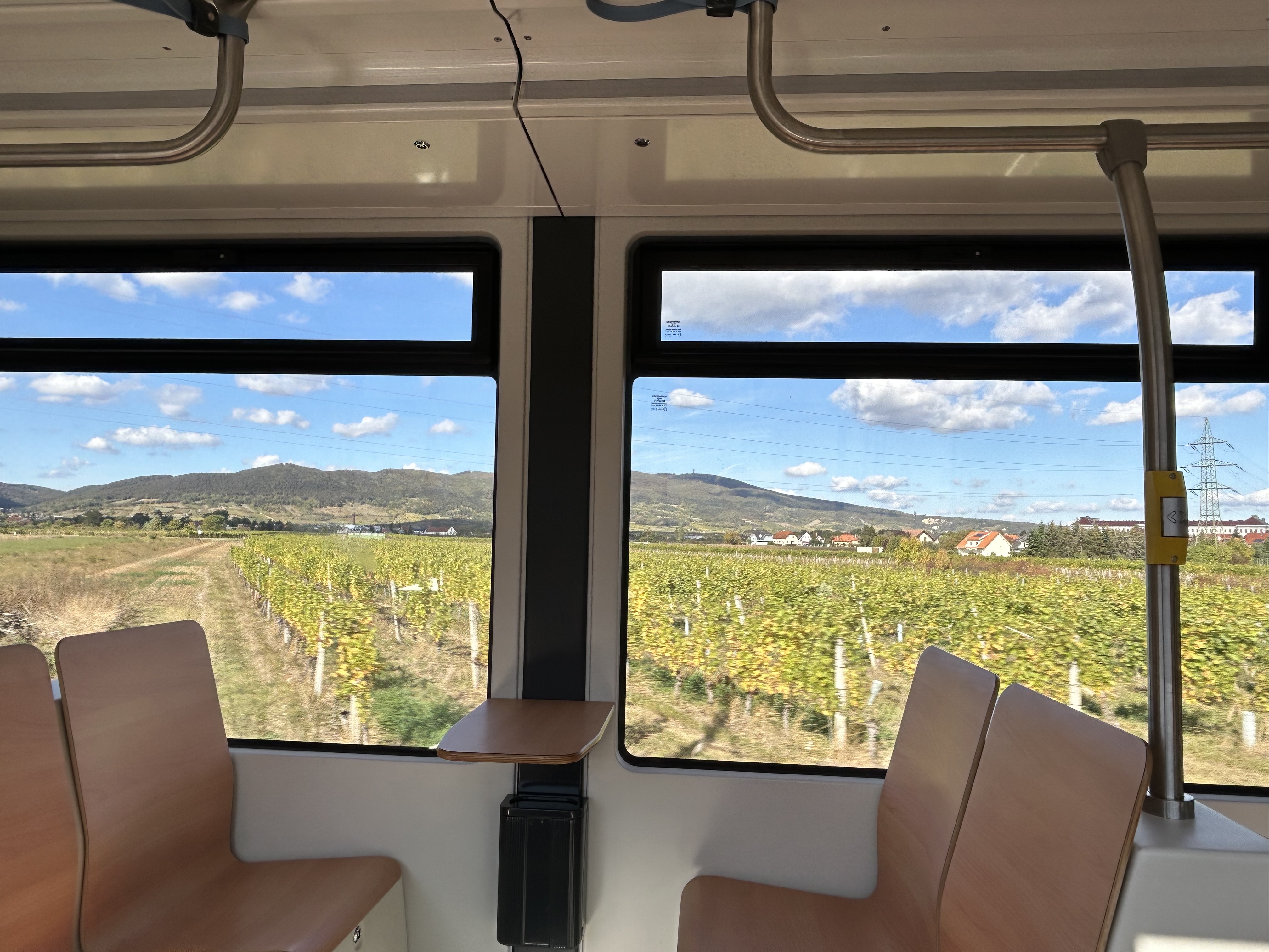
There is also a separate interurban tram service called Badner Bahn, which extends to the historic spa town of Baden bei Wien, an hour south of Vienna’s city centre.
Badner Bahn tram, laying over at Josefsplatz in Baden bei Wien
The modernized interurban originates in the heart of Vienna — across the street from the Wiener Staatsoper (Opera House) — then along local tram tracks and through the tunnel before entering its own right-of-way through the southern suburbs, and onwards through small towns, farms, and vineyards before arriving in Baden. There are several spurs leading to local industries; the regular passenger service shares the tracks with local freight trains.
View of the vineyards from Badner Bahn
A sample of the journey aboard Badner Bahn. Arriving southbound at Guntramsdorf, heading towards Baden bei Wien.
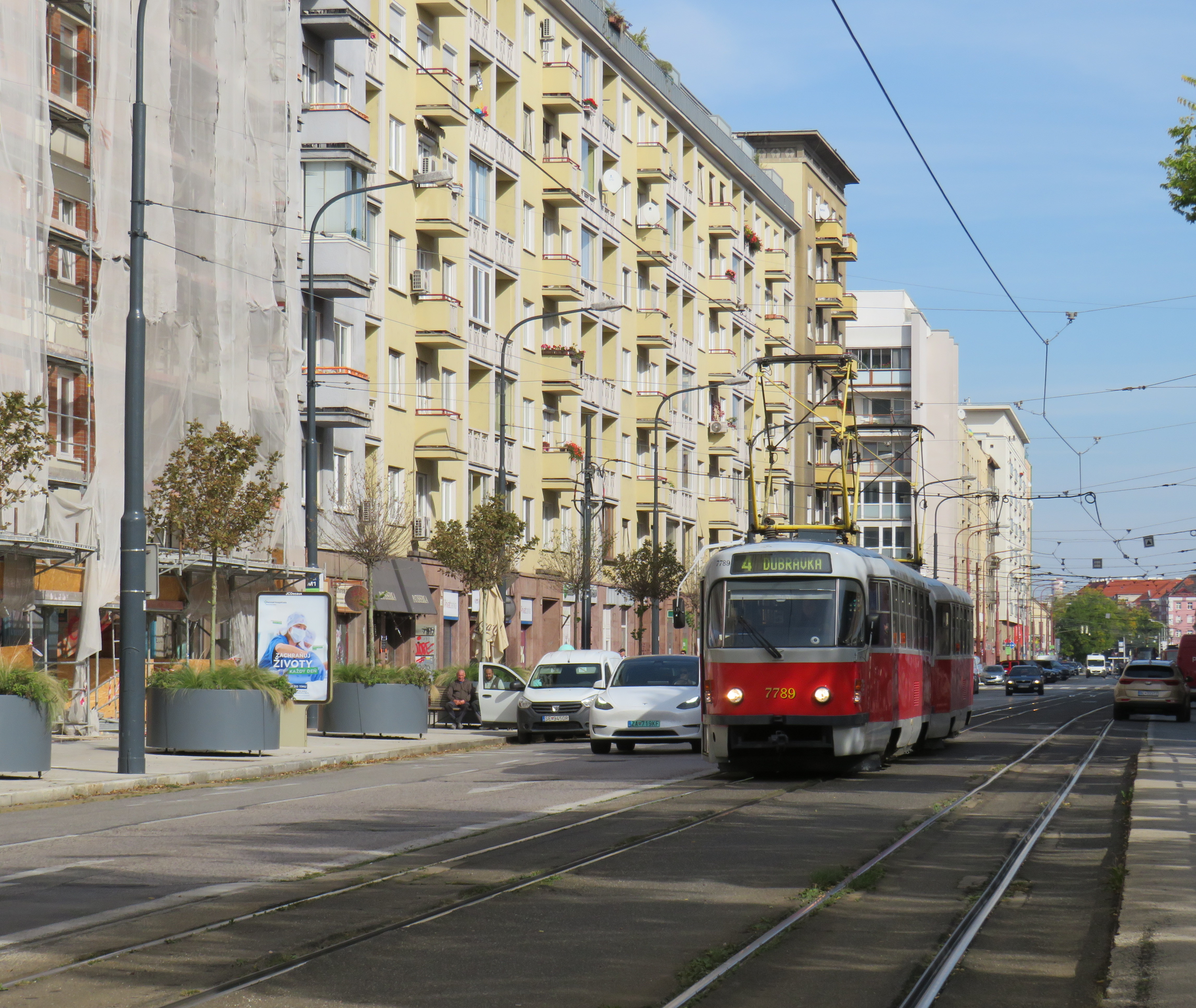
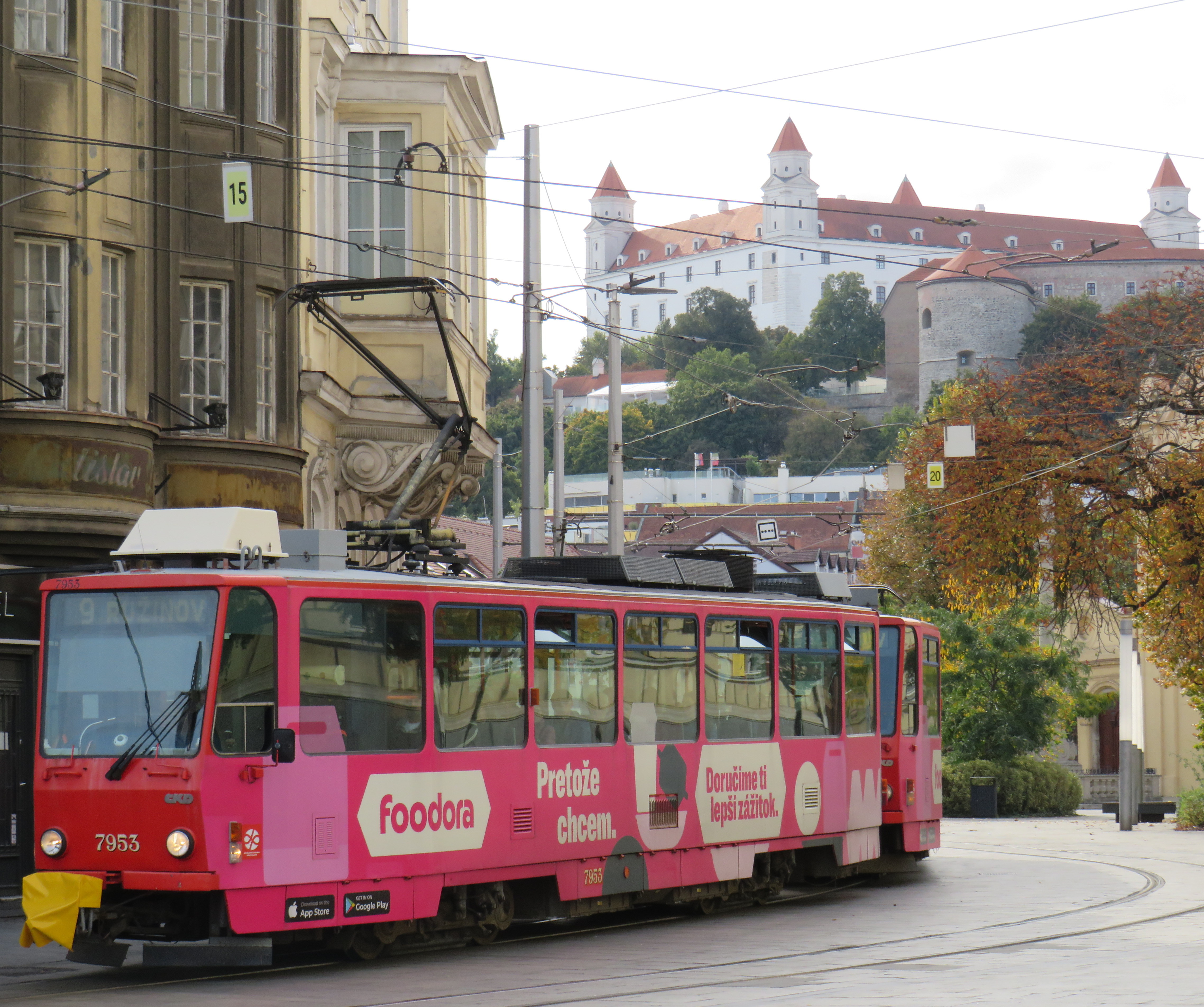
Bratislava, just over one hour away from Vienna by train (or by catamaran), is served by a network of metre-gauge trams, trolley buses, and diesel buses, though trams predominate in the city centre. On Obchodná, several tram lines, pedestrians, cyclists, and the occasional delivery or emergency services vehicle share a narrow, but busy shopping street. It just works.
Obchodná, Bratislava
Outside the congested urban core, trams are afforded reserved lanes, sometimes separated from general traffic with curbs (and even grass medians), sometimes just painted lines. Bratislava’s tram system is smaller than Toronto’s, with 211 cars and 42 kilometres of revenue track, carrying around 70 million riders a year in 2019 (Toronto’s streetcars carried 108 million that year). It is also a much smaller city, with a population of around 660,000. I only visited Bratislava for a day, but I got to ride much of the tram network; I found it an easy and convenient way to get around.
Reserved, painted tram lanes just outside Bratislava’s city centre
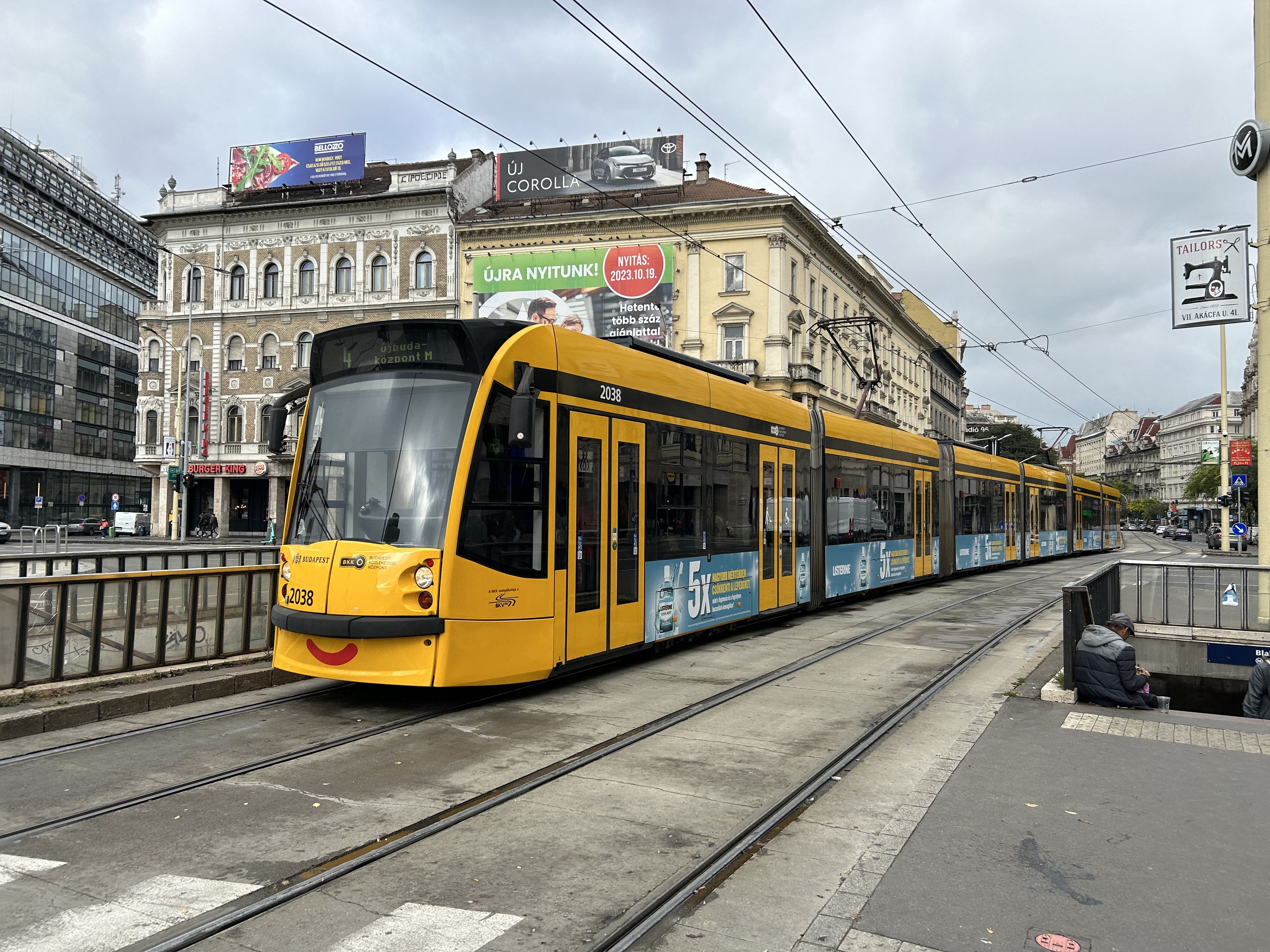
Budapest, Hungary has the largest street railway system in the world by ridership, with Route 4/6 on Budapest’s Grand Boulevard (Hungarian: Nagykörút), often cited as the world’s busiest tram line. Route 4/6 also operates 53.99 metre long Combino Plus trams, which, when introduced in 2006, were the world’s longest. The Combinos are almost twice the length of Toronto’s new Bombardier Flexity cars, which are 28 metres long. Even with the huge capacity these trams have (they require two pantographs to draw enough power to operate), they operate on Line 4/6 every few minutes, all day long, every day.
A Combino Plus tram on Line 4 traverses Budapest’s Nagykörút (Grand Boulevard)
Through the 1970s and 1980s, Budapest’s tram network was slowly cut back in favour of buses, trolley buses, and metro construction. By the 1990s, however, there was a street railway renaissance in Hungary’s capital because of the capacity and economy trams offered. With high frequencies, a private median, and high-capacity low-floor vehicles, Line 4/6 easily matches the capacity of a metro, at comparable speeds. Elsewhere, dedicated lanes and private rights-of-way make it clear that transit riders come first.
Older trams running along the Danube dip under road bridges on a private right-of-way
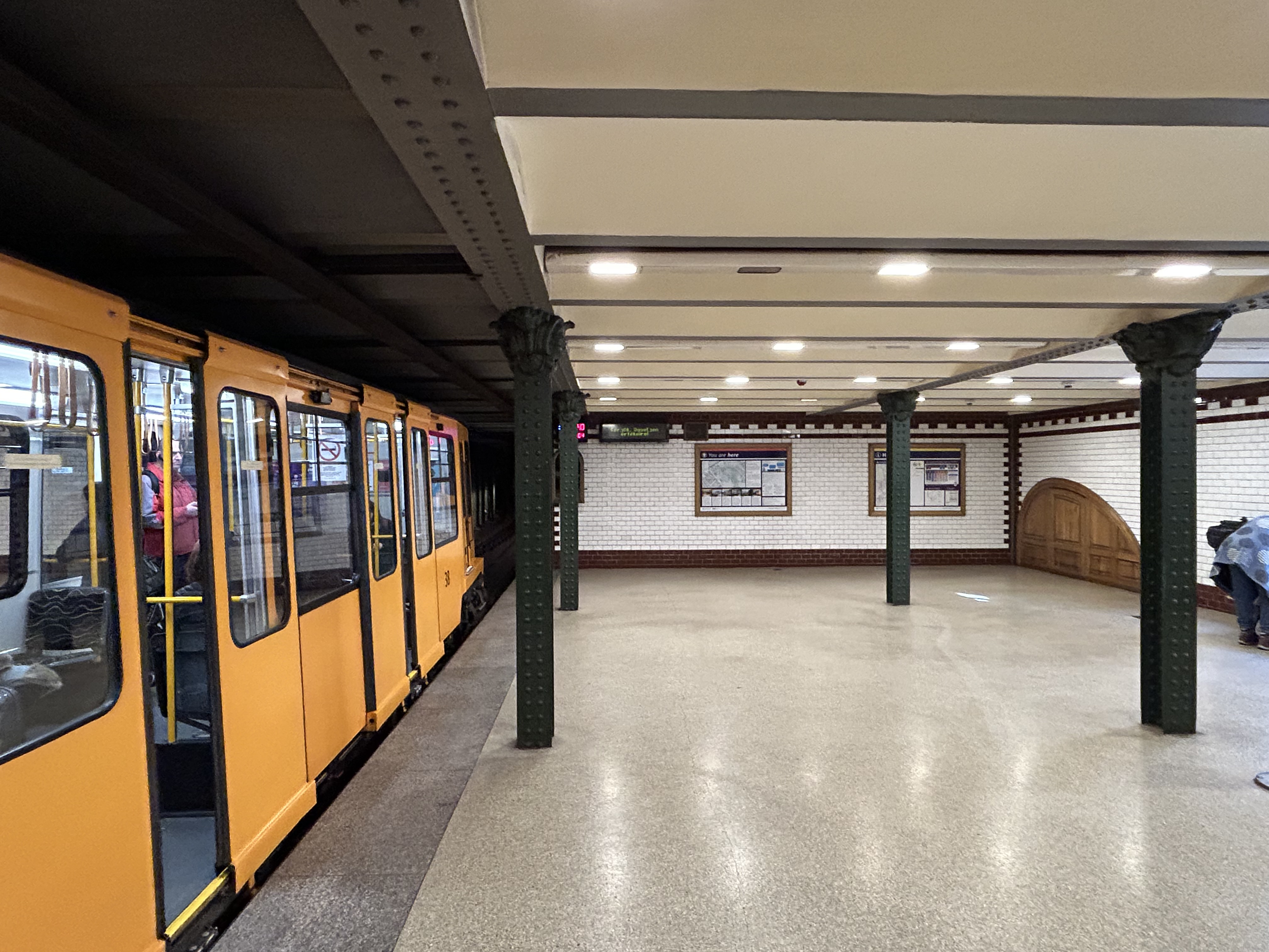
Though Budapest has a large metro network, most of it was not constructed until the l970s and 1980s. However, Line M1 was opened in 1896 as a shallow subway under Andrássy Avenue, the first electric underground metro in the world, and only the second subway, after London’s initial Underground line. Uniquely among urban transit routes, it it is listed as part of an UNESCO World Heritage Site.
Budapest Line M1 stations, restored to their original appearance, look like miniature New York stations, only cleaner
Finally, in Prague, we took several trams to take shelter from the rains that greeted us after arriving from Budapest, but also to see the city outside the crowded tourist spots. We took Line 1 from the city centre to the suburban district of Hrdlořezy, and returned via Line 9, taking a slightly different route back. Like Budapest, a metro system was planned and built in the 1970s and 1980s, but trams remained important, often providing local services parallel to deep underground metro lines.
Old two-car tram train on Line 9, passing a newer low-floor tram on Line 1, Sokolovská, Prague. Most trams run on reserved rights-of-way.
What interested me was seeing major watermain work along the line. Through trams slowed where work was adjacent, there were no diversions or shuttle buses. The trams ran through.
Watermain replacement in Prague, with trams still running(taken on a rainy morning)
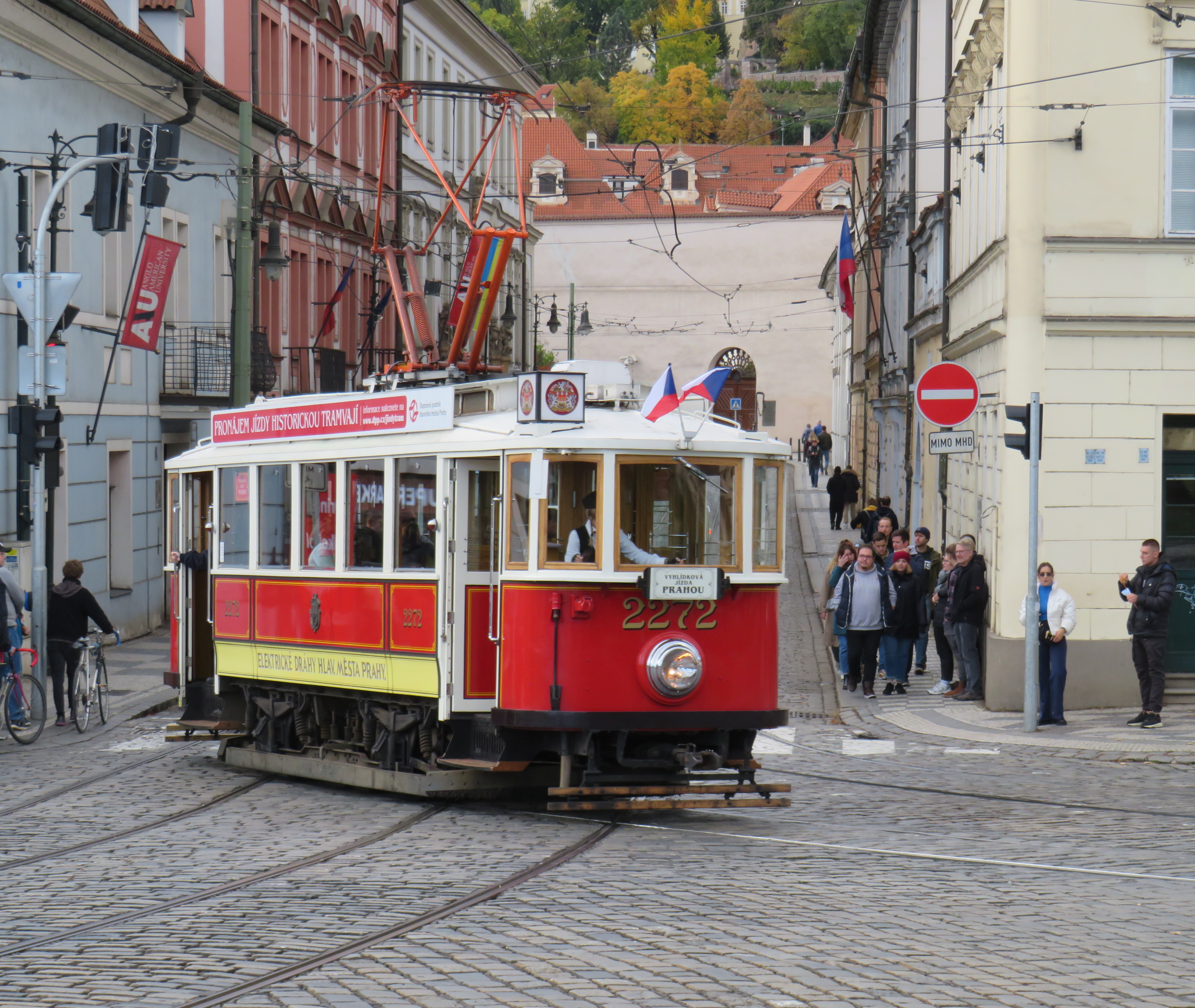
Like Vienna, Bratislava, and Budapest, Prague operates a mixed fleet of older high-floor trams and modern low-floor light rail vehicles, similar to Toronto’s new fleet. But in Prague, heritage trams could often be spotted in service, especially on the west bank of the Vltava near Prague Castle.
Heritage tram #2272 in Prague
Lessons for Toronto
After travelling, it can be easy to spot one’s hometown flaws and faults. But I spent a lot of time riding Vienna’s metros, trams, and buses, and mindfully experiencing the transport networks in Bratislava, Budapest, Prague, and Salzburg (which does not run trams, but has a large trolleybus network), I was left with some key takeaways on how to do transit here.
First and foremost, transit riders were respected. Not necessarily in terms of personable customer service, but the feeling that the next tram or bus was going to arrive on time, and a reliable interval. If there was a delay, it was very well communicated.
For instance, while waiting for a tram in Vienna, we experienced an unusually long wait. The next tram display kept showing the next two arrivals at 3 and 4 minutes. Not long after, a voice came on a loudspeaker posted above the tram stop sign announcing (in German, translated in English to us by one of my spouse’s colleagues) a delay because of a collision along the route. The blockage cleared after a few minutes, and we boarded a crowded tram. I appreciated the audio announcement, especially as it was a basic tram stop.
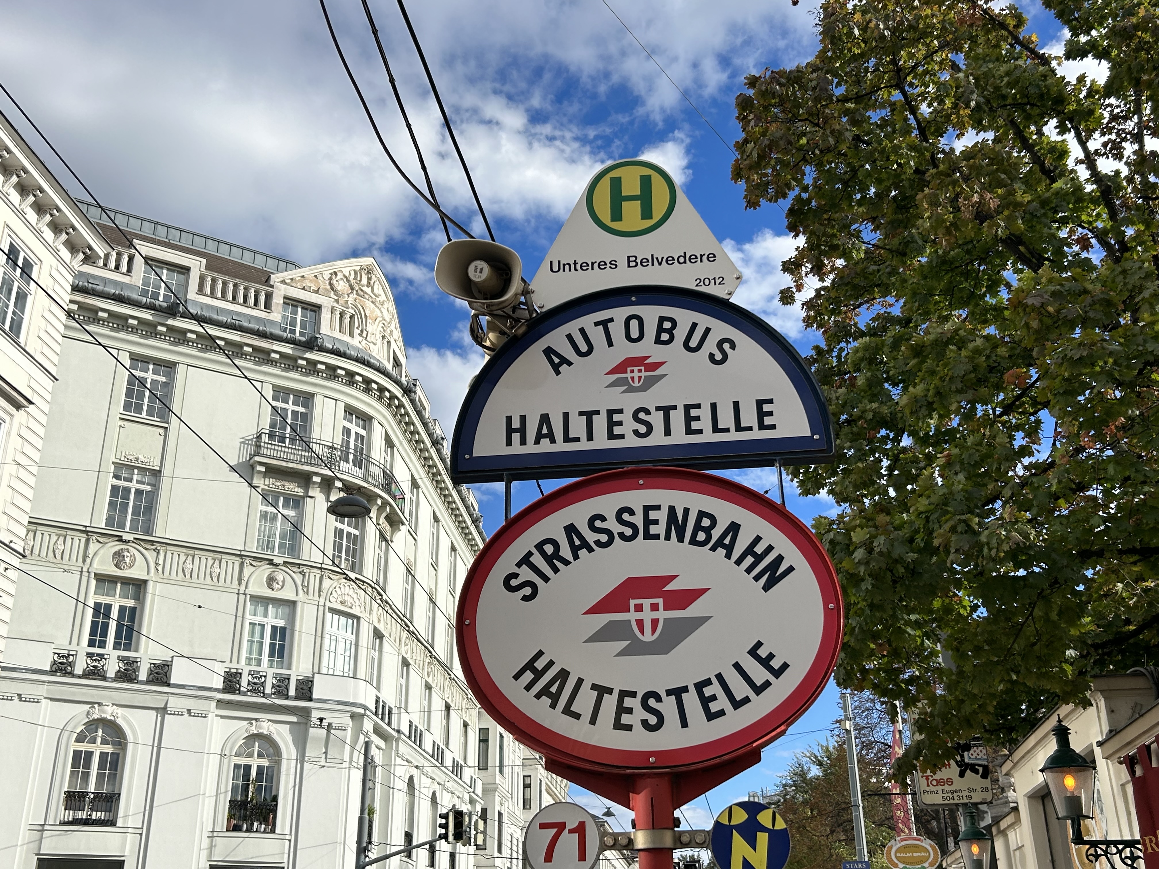
The classic Vienna tram stop. Note the loudspeakers atop the blue bus stop sign (at night, buses take over, hence the Strassenbahn and Autobus stop signs).
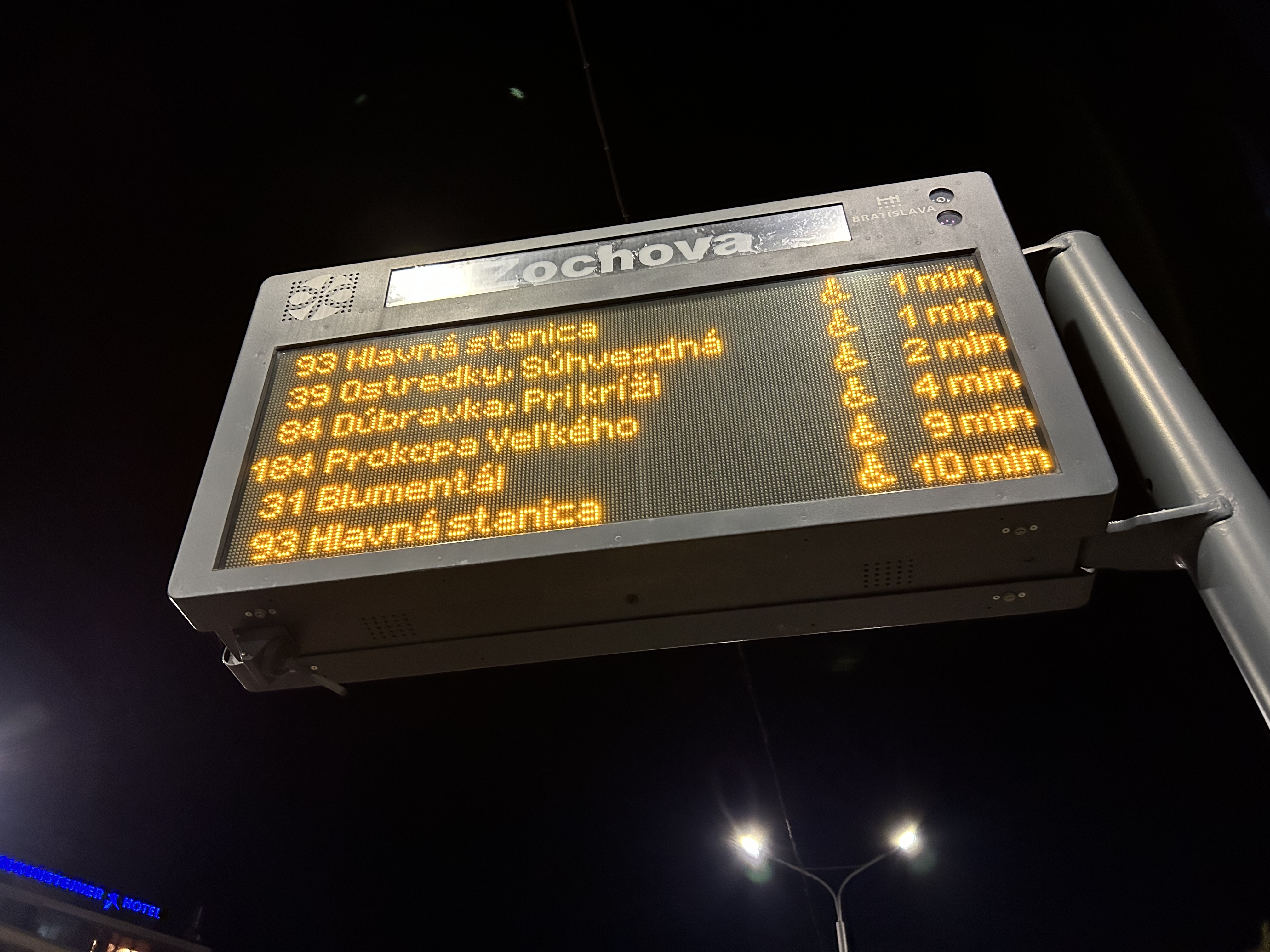
Next vehicle displays were common in every city we visited. They would list — in real time — the next several buses or trams, as well as if the vehicle was low-floor accessible or not with a wheelchair symbol. All buses are now fully accessible, but the information is useful for the tram lines, where there are still many older high-floor vehicles.
Next vehicle display at a bus stop in Bratislava
I also noted that in Vienna, and for the most part elsewhere, vinyl advertisement wraps did not cover passenger windows on trams and buses. Bratislava’s wrapped trams had some ads that used window areas, but these were kept to a minimum.
In Vienna, advertisement wraps kept windows completely free of obstructionsAdvertisement wraps in Bratislava had minimal window coverage
It was also clear that trams had dedicated signals on their routes, if not necessarily signal priority. But with smaller intersections and relatively short signal timings, the waits at each signalized intersection were generally minimal.
Note the white tram signals next to the overhead traffic signal. The “A” indicates that a proceed signal will soon appear, and the operator can cancel the door release, so that no more passengers can enter or exit.
Tram signaling in Vienna and other Central European cites also includes remotely operated electric switches. Overhead signals indicate which direction the switch is set to; operators can pass through junctions at speed. While this is how trams operate in most places around the world, in Toronto, streetcar operators are required to stop before each switch and then crawl.
Trams pass through a track junction, along with an ambulance and a transit maintenance van. The overhead horizontal signal indicates the switch direction.
Though many tram stops are in private rights-of-way, in-street tram stops are designed for passenger safety and accessibility. These stops, depicted by the photograph below, have the curb lane raised to the level of the low-floor trams. This increases the visibility of passengers boarding and egressing, and also simplifies ramp deployment. Operators need not exit the cab and manually deploy the accessibility ramp, a timesaver versus the TTC’s ramp deployment on major streets. In the winter, this also helps keep the slush away from the tram stops.
The raised on-street curb lane at an on-street tram stop in Vienna.
Though Toronto is a very different city than Vienna, Budapest, or Prague, there are some clear takeaways. Keep the tram windows free of advertisements. Improve communications. Fix the track switches and signalize them. Raise the curb lanes at streetcar stops for safety, convenience, and accessibility. Fix the King Street Transit Priority corridor with a permanent streetscape and tighter vehicle restrictions. If it can be done on a narrow commercial street in Bratislava’s historic centre, there’s no reason why it can’t be done in a world financial capital.
These can even be done incrementally, but they need to be done if transit riders are deserving of respect and reliable surface transit.
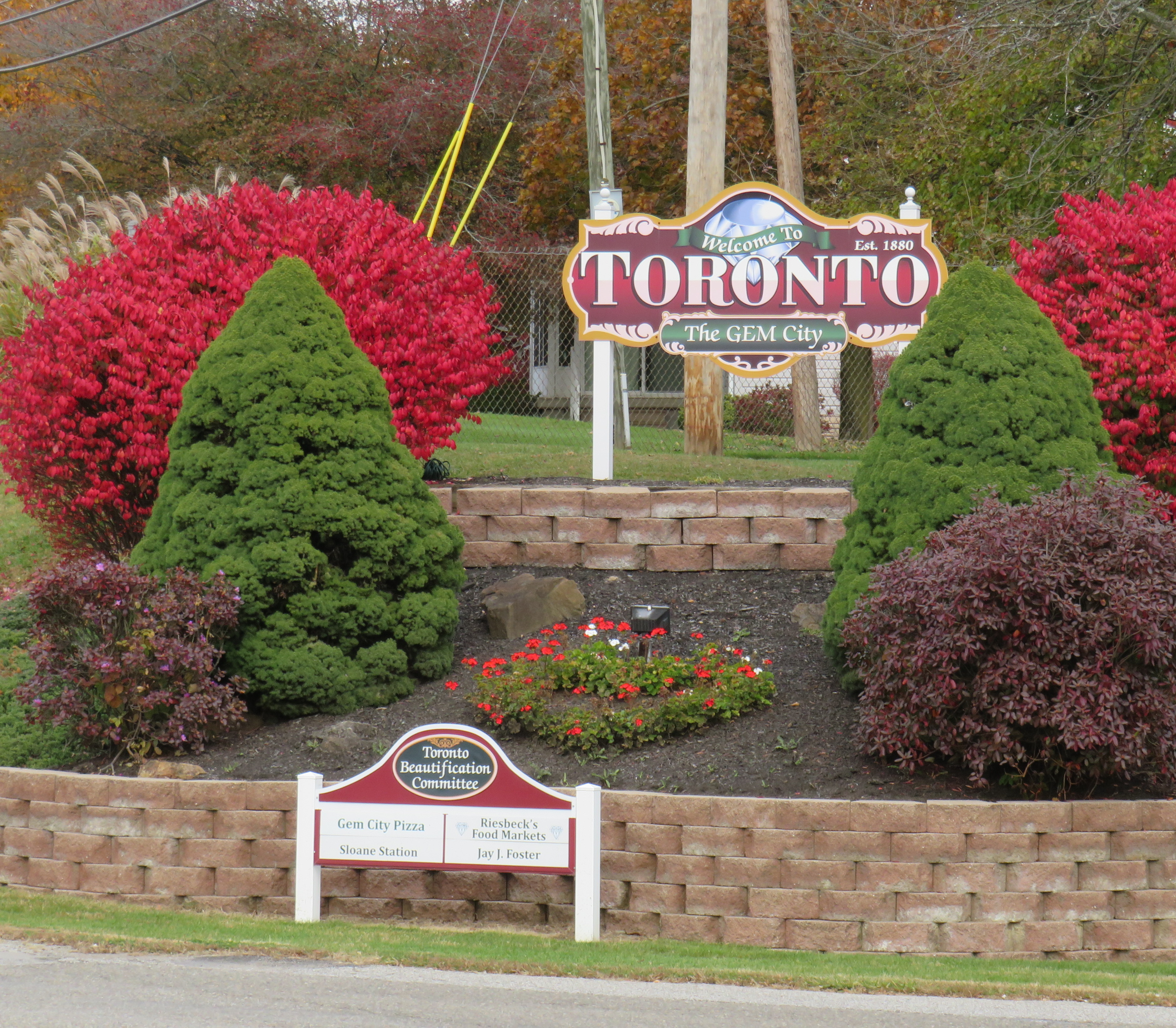
The small Ohio community was originally named Sloan’s Station, but when it was incorporated as a city, they chose “Toronto” because local businessman W.F. Dunspaugh, a Toronto (Ontario) native, thought his hometown was “a place worth emulating.” Toronto, Ohio is the only other city named Toronto, but other Torontos exist, including the town of Toronto, South Dakota (population 212) and the town of Toronto, New South Wales, Australia (population 5,161).
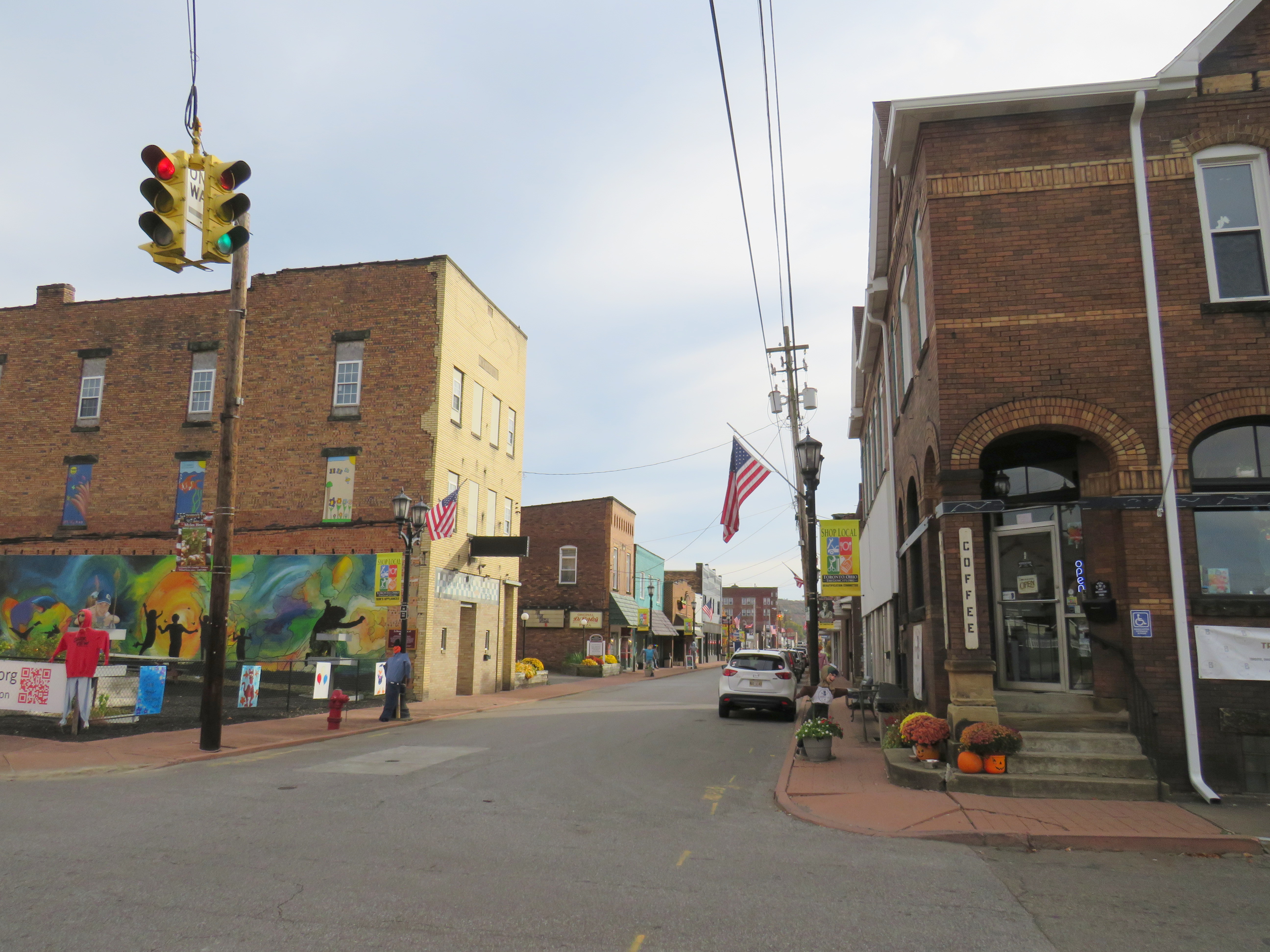
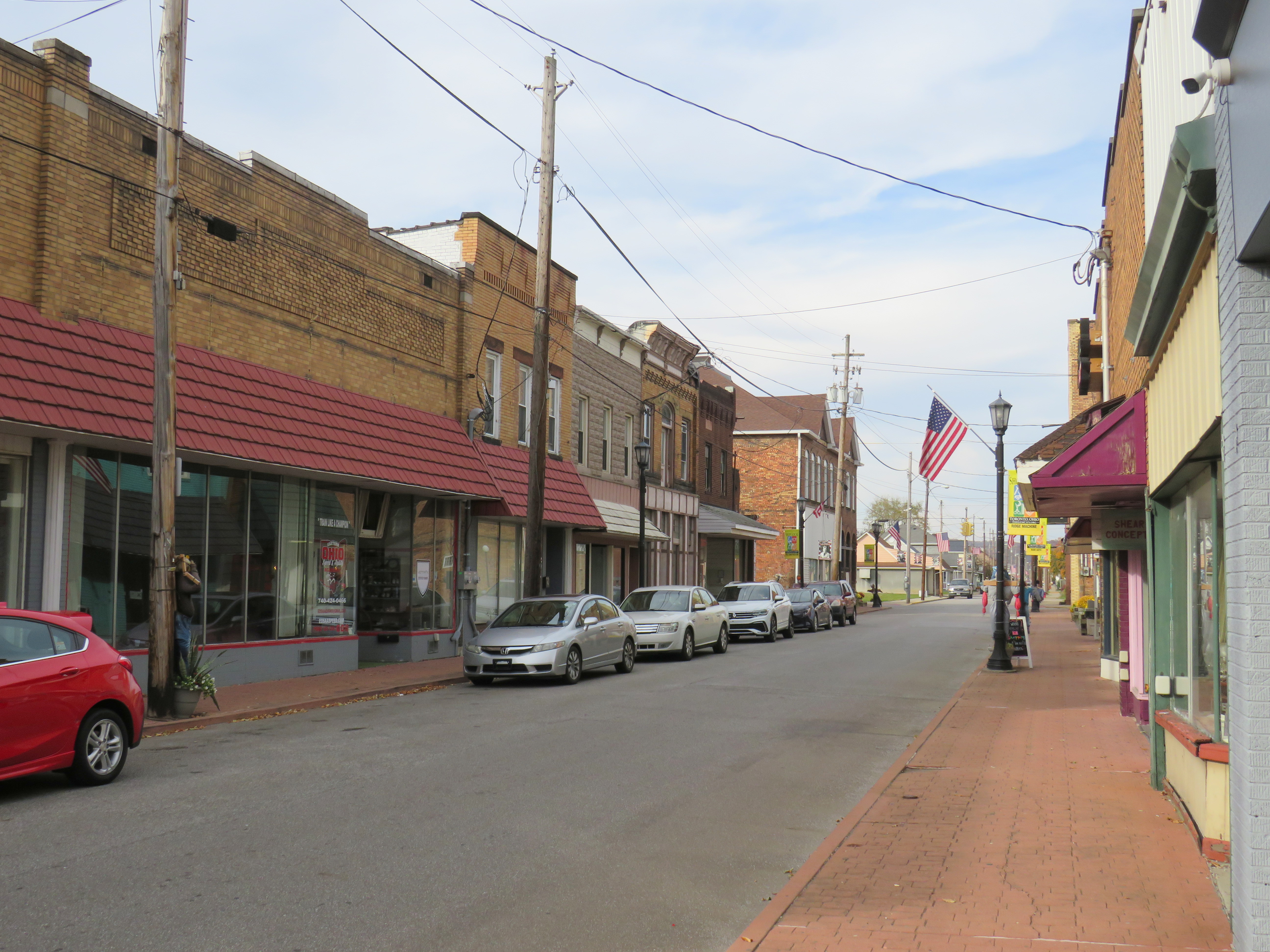
In 2012, Downtown Toronto had only a handful of stores, including a Dollar General, a bar, pizzeria, a Hallmark gift shop, and a hair salon. Apart from the bar (which I went into ten years ago), those businesses are still there today, but there was also a new barbecue restaurant, and a coffee shop. Up the street, a disused auto shop was transformed into a pretty good taco joint. Though downtown wasn’t especially busy, the parking spots along 4th Street were mostly full.
Downtown Toronto. A community garden sits on a vacant lot on the corner. 4th Street, Toronto’s main street The old hotel, now shops and apartments
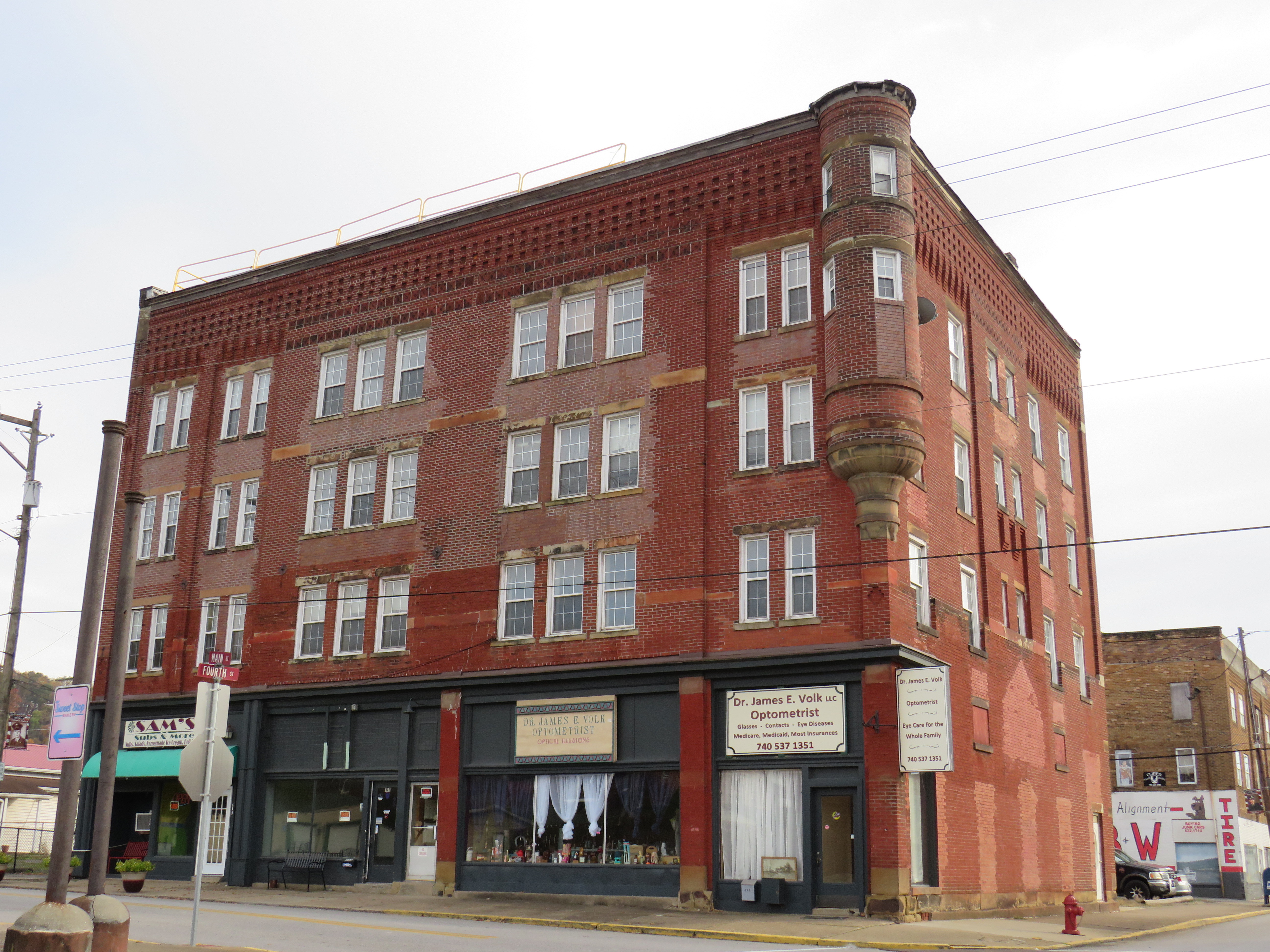
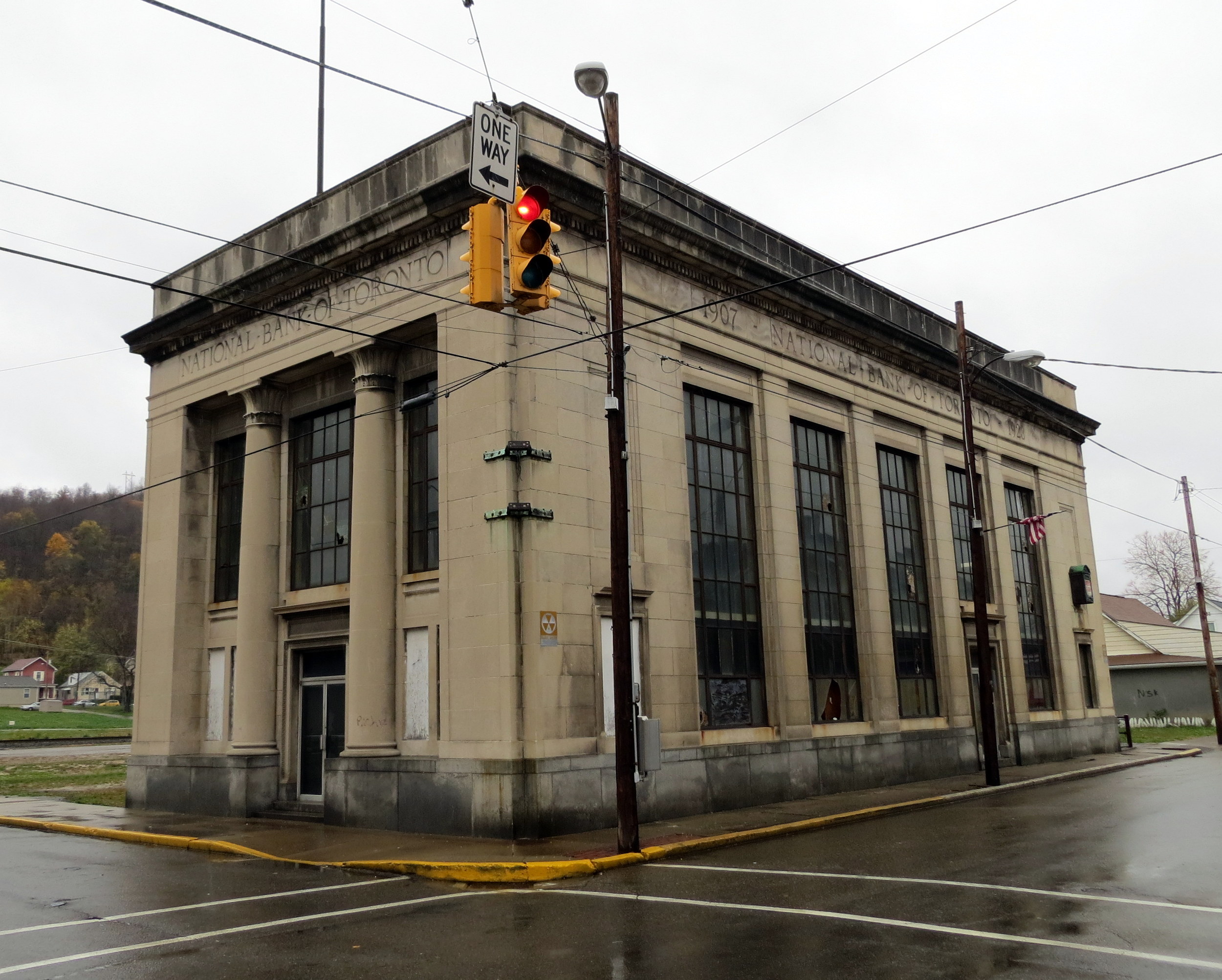
Sadly the abandoned, yet still handsome National Bank of Toronto building was torn down a few years ago. Otherwise, Toronto continues to hold its own, with a well-kept little downtown and more places to sit and eat than before.
Former National Bank of Toronto, October 2012Site of the former National Bank of Toronto, October 2022
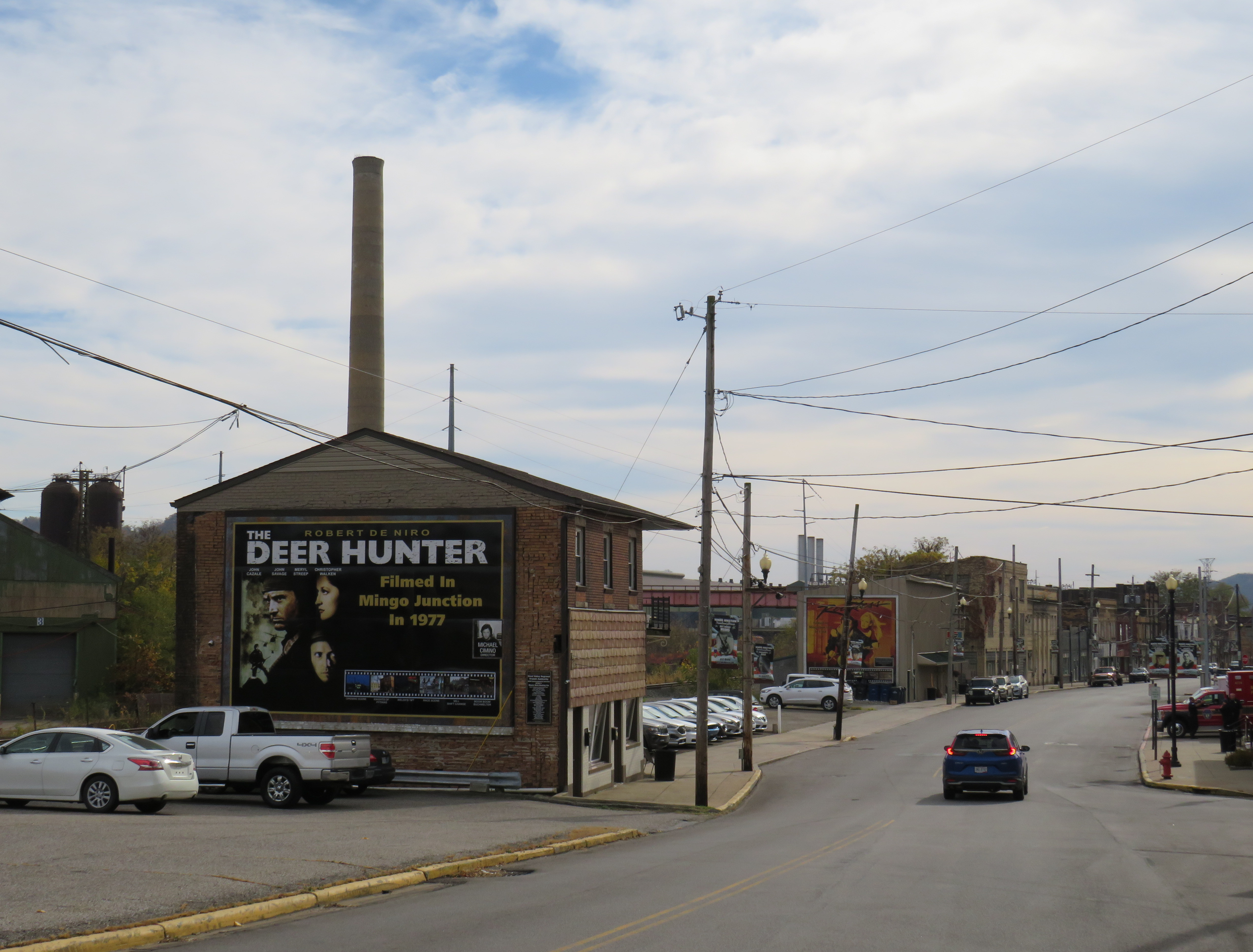
Just a few miles to the south is the town of Mingo Junction, Ohio, one of many industrial communities along the Ohio River in Pennsylvania, West Virginia, Ohio, and Kentucky. Mingo Junction is best known as a filming location for movies including the acclaimed 1977 film “The Deer Hunter.” The town now celebrates its cinematic history with large vinyl signs displayed on the north end of Mingo Junction’s main street.
Large sign celebrating the filming of “The Deer Hunter” in Mingo Junction, Ohio
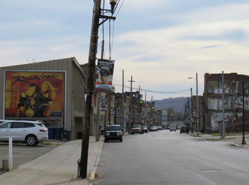
While Toronto’s economy is based on a still-busy titanium mill, Mingo Junction is a old steel town, hit hard by the deindustrialization of northeast Ohio in the 1970s and 1980s. The condition of its Main Street
Mingo Junction’s Main Street, bypassed by a newer expressway. Another mural celebrates “Reckless,” a 1984 film also filmed in town.
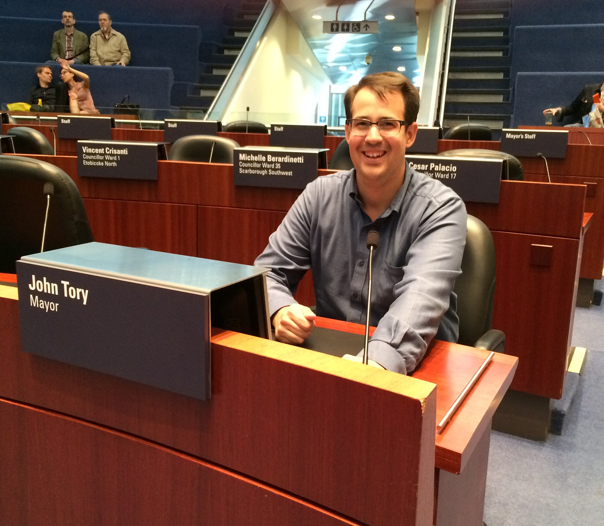
Who knew, just two weeks ago, that Torontonians would be returning to the polls to elect a new mayor of Toronto?
Looking back on John Tory’s last eight-and-a-half years in office, the biggest disappointment might have been that he spent so little of the political capital that he had accumulated after decades as a backroom power broker, corporate executive, provincial party leader, talk radio host, and supporter of NGOs such as CivicAction and the United Way. Despite his promise as a business-friendly, progressive conservative leader who knew how to build partnerships and work with other levels of government, there’s little to show for it. SmartTrack? That was always a fantasy which has now been mostly forgotten. An improved public realm, including a new Rail Deck Park? That never happened either. Heck, we can’t even get a decent WiFi connection in the subway, never mind a cell signal, despite the mayor’s close ties with the telecommunications industry.
To be fair, there are a few things one can point to that got done during Tory’s tenure: new bike routes on Bloor-Danforth, Yonge, and University Avenue, some improvements to the TTC surface network, the King Street transit priority pilot, and surprisingly good pandemic responses, including excellent city-run vaccine clinics, weekend street closures for active transportation, and new street-level patio space to help restaurateurs recover from pandemic shutdowns.
But in 2022, the ActiveTO street closures faded away, partially due to influence from the Toronto Blue Jays management (note: the baseball team and its stadium are owned by Rogers), the King Street transit priority corridor deteriorated from neglect. As the homelessness crisis worsened, Tory and his allies backed repressive and violent clearances of public parks, without supplying enough alternatives for housing or supporting the most vulnerable in this city. A series of municipal budgets in which property taxes were kept low while other expenses piled up has caused this city to become reliant on the support of the province and federal governments to bail us out.
With Tory gone — brought down by his own error in judgment — we will have thirteen lost years in which Toronto will have to catch up. That’s a tall order.
I can’t claim to have all the answers, but I have a few ideas to share to help make Toronto a safer, more fun, more comfortable, and more humane place to live. If I were a mayor with strong powers, here’s what I would do:
A progressive property tax system. An unfortunate reality for Ontario municipalities is that they have very limited tools for raising revenue: property taxes, user fees (like TTC fares and recreation fees), and in Toronto’s case, vehicle registration fees. Municipalities are also given grants from the province and federal government for specific purposes, such as providing mandated services. Unlike sales, income, and business taxes, property taxes do not grow with the economy, so municipalities must raise the property tax mill rate every year to keep up with inflation and/or fund new or expanded services. However, no matter the assessed worth of the property, the tax percentage remains the same.
A progressive property tax system can be used then to raise more money from higher-valued properties. For example, for residential properties, a basic tax rate could apply for the assessed value up to $1 million. Beyond that first $1 million, a higher bracket comes into effect. Such a policy could minimize tax increases for those in smaller or starter homes. To encourage the construction of secondary suites, high-value properties could then get tax breaks for every additional self-contained unit on site, provided they are inspected and meet fire code. A progressive property tax system could help raise revenue, encourage the construction of more housing units, and provide a more equitable revenue source.
A real Vision Zero plan. Putting up “Senior Safety Zone” signs and lowering speed limits on four and six lane streets does little when the roadway remains designed for high speeds, and motorists race through intersections with limited enforcement. To protect pedestrians and cyclists (as well as other drivers and their passengers), the roads themselves must be re-engineered for lower speeds. This means “daylighting” pedestrian crossings by ensuring crosswalks are always well-lit, crosswalks raised where possible to improve visibility and curbs extended to both reduce the amount of roadway that pedestrians must cross, and signal to drivers to slow down. Furthermore, a blanket right-turn-on-red prohibition, like those in New York, Montreal, and Mexico City, would eliminate a common cause of pedestrian-motorist collisions and make those new leading pedestrian intervals at Toronto’s street corners fully effective.
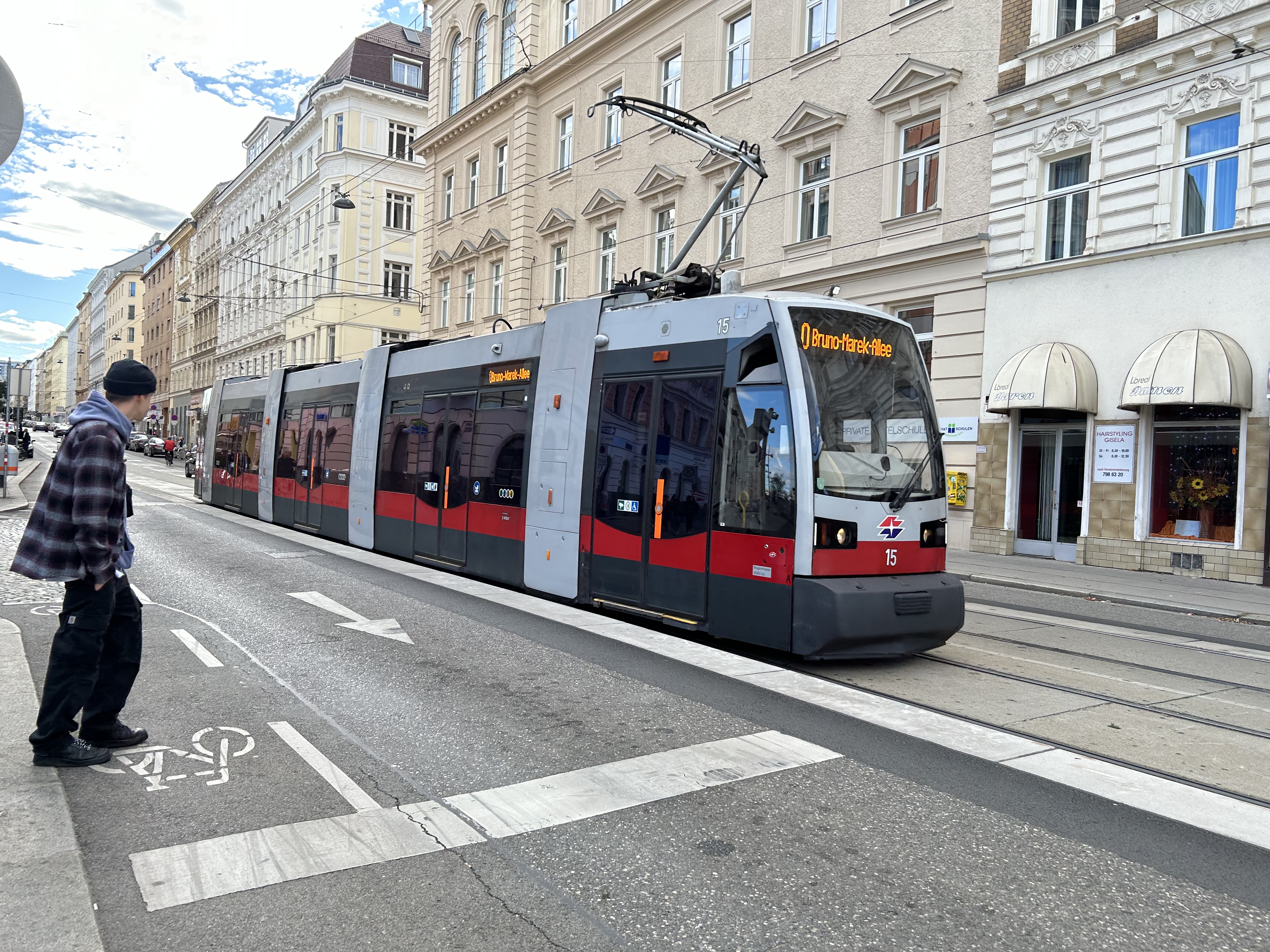
Prioritize transit and clean up the TTC. When I say “clean up the TTC” I don’t mean throwing more cops at the problem of safety on our subways, streetcars and buses. Under CEO Rick Leary’s leadership, it feels as if the TTC has given up on many of the gains brought forward by Andy Byford. Customer service has fallen by the wayside, wait times have increased, the streetcar network is faltering with trams running slower than ever before, communications have become unreliable, and customer confidence in the system has fallen. When customers no longer feel valued, they themselves give up.
After cancelling upcoming service cuts contained in Tory’s last budget, one of the easiest things to do to show that transit riders matter is making King Street great. This means installing permanent streetcar platforms in the curb lanes along the streetcar priority zones and making it even more clear that drivers are prohibited from using King as a throughway. Eliminate the night time taxi exception to simplify signage, and automate enforcement with video cameras mounted at intersections and on streetcars themselves, as is done on some Select Bus Service routes in New York.
Haffiz A., via Twitter, shows how King Street could look:
The TTC also needs to modernize its street railway infrastructure so that streetcars no longer have to stop and crawl across every track intersection. Electric dual-blade junctions and wayside signals — used just about everywhere else — allow streetcar operators to know which way the track is pointed ahead of the intersection and can allow streetcars to glide through junctions at regular traffic speed.
Finally, get TTC staff and all councillors riding the TTC on a regular basis. Meet passengers. Let them know they matter, and inform them of improvements, and be visible.
Build affordable housing. Lots of it. Use increased revenues from the progressive tax system proposed above to build more affordable housing directly (instead of just relying on market solutions like inclusionary zoning), including the co-operative home model. While doing so, shame the provincial and federal governments for pulling out of funding new construction in the 1990s. The city owns lots of land in good areas, such as Green P parking lots, TTC stations, works yards, suburban office spaces, and even on parts of municipal golf courses, which, of course, should be converted to general year-round public spaces.
Stand up to the bullies at Queen’s Park. One of Mayor Tory’s biggest failures was to ignore the province’s meddling in Toronto’s affairs and impose the province’s unpopular plans upon the city. This city should have the right to decide the composition of its own council; there was not nearly enough protest from city leadership when Doug Ford forced a cut in council from 47 to 25 (which will likely go down to just 24 in 2026) after an unprecedented level of public consultation in shaping the approved boundaries. Instead of waiting forever for a ministerial zoning order that was never going to come for a modular housing project in North York, real leadership would have gotten it built, the province be damned. Call their bluff.
Meanwhile, Premier Doug Ford — the man Tory beat to become mayor in 2014 — is imposing his own ideas on Ontario Place, provincially owned public lands on Lake Ontario. If one could not get Rail Deck Park built, Ontario Place could have been the site for a renewed public realm, much like some of New York City’s new waterfront parks. Some vision, some willingness to spend political capital, and a good advocacy campaign could have stopped the plans for an overbearing private megaspa that effectively closes off major portions of our public waterfront.
New York City’s “Little Island” could have been an inspiration for a renewed Ontario Place
There will be some people who will be happy that I am not serious about running for mayor. For one, I don’t have the people skills, the connections, nor the energy to make a serious bid. But if I see some of the ideas suggested above make it into a mayoral platform, I would not be above making a personal endorsement.
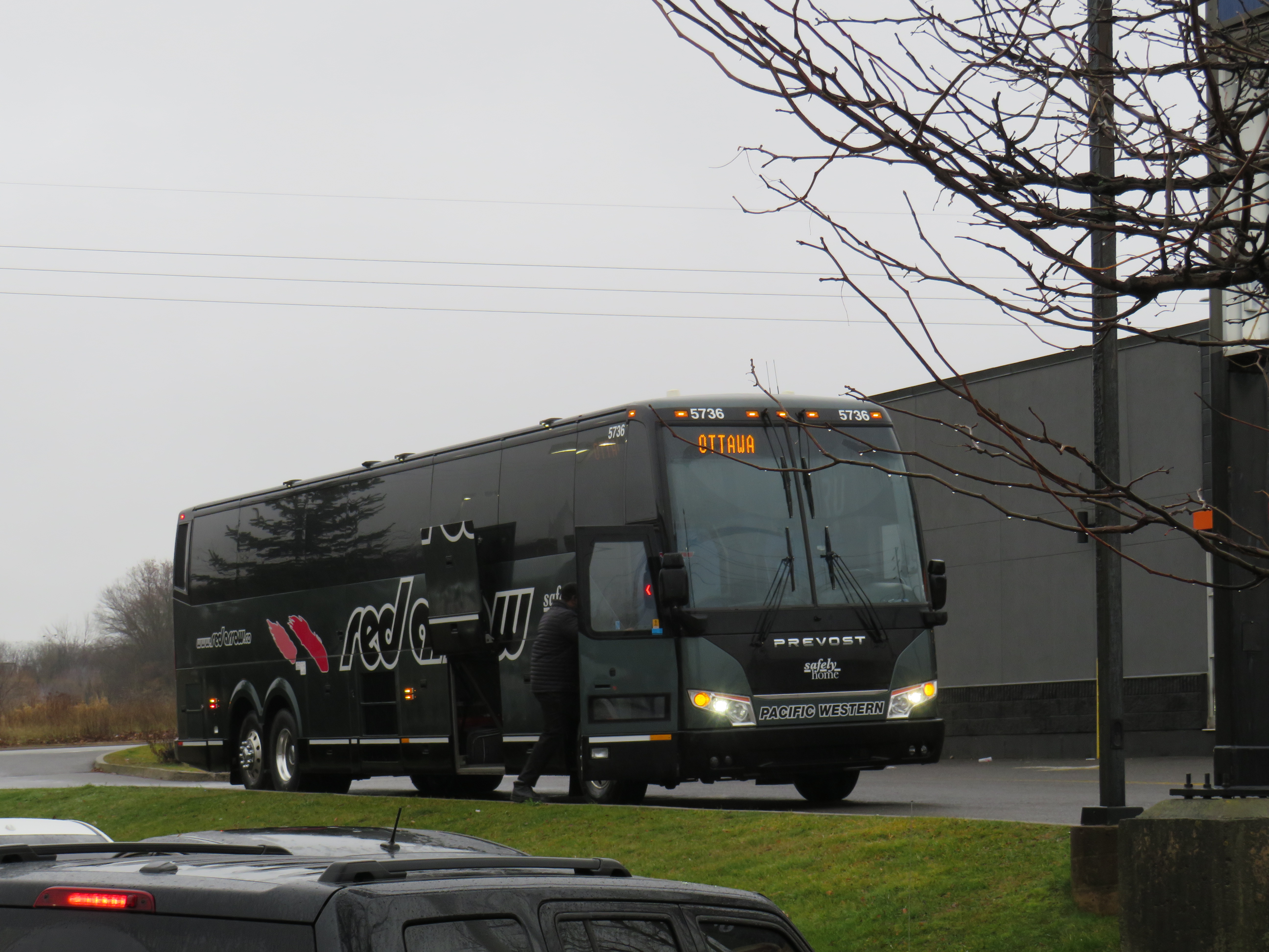
A Red Arrow coach lays over at a Harvey’s restaurant in Kingston on the way to Ottawa
On December 7, I took a trip out to Kingston to ride the newest coach operator to arrive in Ontario: Red Arrow. A division of Pacific Western, Red Arrow is the latest carrier to stake a claim to the busy Toronto-Kingston-Ottawa route, which is now served by five private companies.
Between Toronto and Ottawa, five intercity coach carriers–Megabus, Rider Express, Flixbus, Book-A-Ride, and Red Arrow–compete for the same passengers, along with VIA Rail and three airlines (Air Canada, WestJet, and Porter).
There is also fierce competition for the Toronto-London route. Passengers have the choice of taking Megabus, Rider Express, Onex, Flixbus, Book-A-Ride, VIA Rail, or a very slow weekday-only GO train. Along with VIA, Flixbus also continues west, to Windsor (where the Tunnel Bus connection to Detroit has finally been restored). The Toronto-St. Catharines-Niagara route is also served by multiple bus and rail services.
Red Arrow coach seating
Despite new intercity coach players like Red Arrow (which provides a high-end coach service, with comfortable seating in a 2+1 arrangement, along with complimentary soft drinks and light snacks) and Book-A-Ride (which operates like a charter airline, with schedules that change frequently based on demand), many other routes still have limited or no service. Flixbus quietly dropped its Kitchener-Hamilton-Niagara route earlier this year, eliminating service on a corridor that once had frequent Canada Coach Lines buses; that route had been sold in 1990 to Trentway-Wagar/Coach Canada. Flixbus also ended service to Guelph, instead concentrating on its other corridors. Early next year, Megabus will end its route between Toronto, Buffalo, Philadelphia, and Washington DC.
The deregulation of motor coach services within the Province of Ontario may have made some sense. The old bargain of providing exclusive franchises for busy, profitable routes made sense when operators would use those cash cows to help subsidize less-trafficked rural services. But as Greyhound, Stagecoach, and other large companies bought up smaller carriers (such as Gray Coach, Canada Coach Lines, and PMCL) in the 1980s and 1990s, they were allowed to slowly abandon the smaller routes. Greyhound itself divested most of its network before disappearing altogether. As the franchising scheme didn’t work, there was no point keeping it.
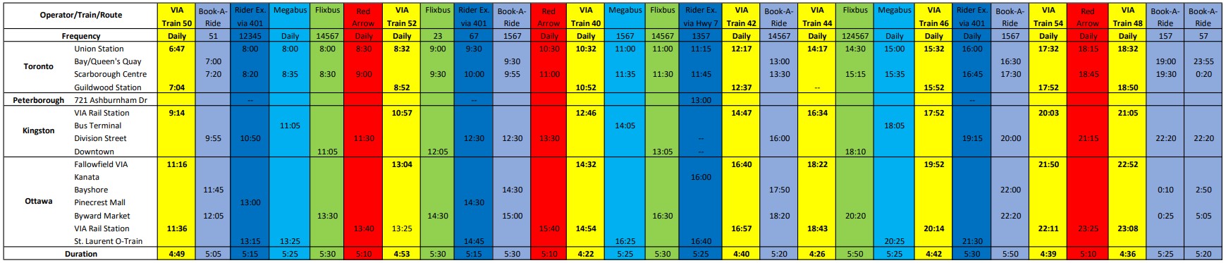
But now, there’s the absurd situation where there are up to 25 daily buses and trains between Toronto and Ottawa (see table below). In contrast, there is not a single daily bus service connecting Hamilton and Kitchener-Waterloo–two urban centres of over 500,000 people each, just an hour apart, with three large universities (Waterloo, Wilfrid Laurier, and McMaster) and two major colleges (Conestoga and Mohawk) between them.
Available trips from Toronto to Ottawa, December 2022, with times for Kingston and Peterborough. Bus and rail tips to Montreal via Kingston are not included. A PDF version can be found here.
Elsewhere, where GO Transit and government-subsidized regional connections have filled gaps, the services are often slower and less direct than the old coach bus service. PMCL used to operate daily bus service between Owen Sound and Toronto via Collingwood and Barrie. Today, the same trip is possible via Grey Transit Route, Colltrans, Simcoe County Linx, and GO Transit, but the trip will take the better part of a day. Meanwhile, other gaps remain. Elgin County (Aylmer and St. Thomas) and Haldimand County (Caledonia, Dunnville, Hagersville, and Jarvis) are left without any outside connections.
Such is the state of the intercity transportation network (if you can call it that) in Ontario.
Though I enjoyed the trip on Red Arrow to Kingston (especially as I took advantage of a special $25 fare), I wondered how well the service will do here in Ontario. Its base price is over $100 one-way to Ottawa, more expensive than other coach operators and priced more like VIA Rail, which itself is slightly faster (as long as CN freight trains do not get in the way). Red Arrow uses the same locations in Ottawa (the VIA Rail Station itself) and Toronto (Union Station Bus Terminal) as the train. Red Arrow does well in Alberta, where there is no useful passenger rail service (Pacific Western also offers a no-frills coach bus service on the same Calgary-Edmonton route).
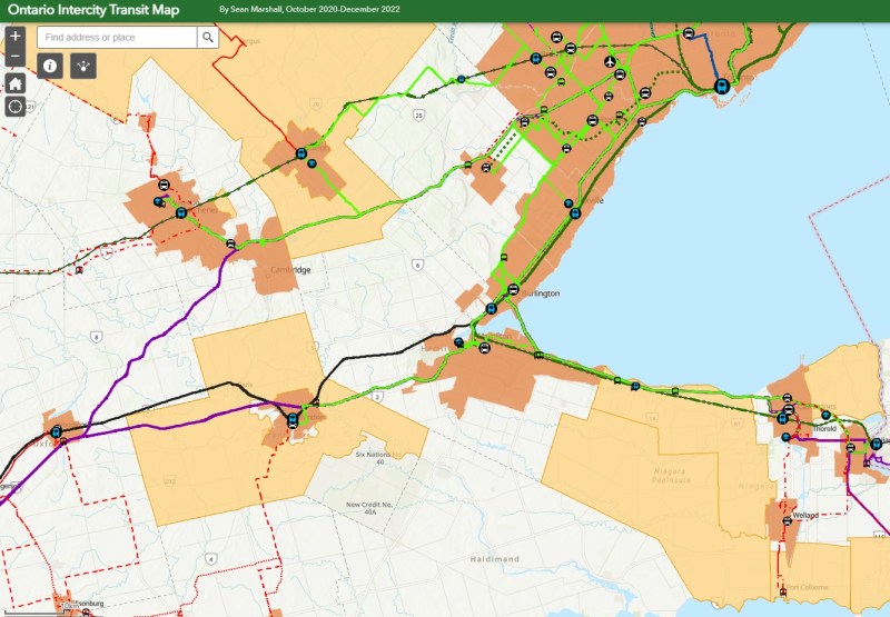
The latest version of my interactive intercity transit map is below:
How Toronto voted for mayor. Areas shaded in blue represent electoral subdivisions (polls) where John Tory placed first. Areas shaded in purple represent polls where Gil Penalosa placed first. Click here for the interactive version.
As has become my tradition after Toronto’s municipal elections, I mapped out the poll-by-poll results of the mayoral race and some of the more interesting council races. After creating maps for the 2014 election and sharing those on social media, it was suggested that I have a website to host these maps. That is how this website came to be.
This time, I created an interactive map showing the results of the mayoral race, along with six council races: Ward 3 Etobicoke-Lakeshore, Ward 4 Parkdale High-Park, Ward 5 York South-Weston, Ward 11 University-Rosedale, Ward 18 Willowdale, and Ward 20 Scarborough Southwest.