Dayton, Ohio is probably best known as the hometown of Wilbur and Orville Wright, the two bicycle mechanics who made the first successful controlled heavier-than-air flight. The city has remained a centre of the aviation industry. The US Air Force (and its predecessors) have operated a major base in Dayton for over a century, which includes an impressive museum of military aviation history.
But among transit buffs, Dayton is notable for another reason. It is one of only a handful of cities in North America that continues to operate and maintain an electric trolley bus system. The Greater Dayton RTA is also the smallest transit system to have operated trolleys since the mid 1970s.
Though there were early adopters of “trackless trolleys” in the late 1910s and early 1920s, the technology was particularly popular between the late 1930s and early 1950s. For street railway operators burdened with ageing streetcars and worn out infrastructure, electric trolleys offered several advantages. They could make continued use of electric substations, poles, and overhead wires, without the need for maintaining tracks and rights-of-way. Trolley buses were quiet and smooth-running, unlike gasoline and early diesel buses, and had larger capacities. They were cheap to operate and easy to maintain, and were especially adept at climbing steep grades.
TTC trolley bus on Ossington Avenue in the 1950s. The Ossington trolley was established as part of a major post-war route restructuring.
Most of the big cities in Canada and the US continued operating streetcars into at least the 1950s, as newer PCC streetcars helped keep those fleets going. But trolley buses were ideal for smaller and midsized cities that still had robust transit demand that buses could not yet meet. Even cities that retained streetcars into the 1950s — like Toronto — used trolley buses to replace marginal streetcar lines and allow for major route restructurings.
In Canada, fourteen cities established trolley bus fleets between 1936 and 1951. In Halifax, the Nova Scotia Light and Power Company replaced its decrepit streetcar system and its feeder bus network with an all-electric fleet in 1949; at the system’s peak, there was even a trolley route across the Macdonald Bridge to Dartmouth. Cities as small as Cornwall and Port Arthur/Fort William (now Thunder Bay) even replaced their streetcars with trolley buses.
By the 1970s, the coach bodies purchased 30 years earlier were showing their age, and many agencies had decided to simplify their fleets and go with modern diesel buses, which had improved in size, power, and capacity since the 1940s. In Canada, only Toronto, Hamilton, Edmonton, and Vancouver decided to renew their fleets, while only five cities in the United States (Boston, Dayton, Philadelphia, San Francisco, and Seattle) kept their electric trolley systems. Since then, Hamilton, Toronto, Edmonton — and most recently, Boston — gave up when the latest generation of trolleys were due for replacement.
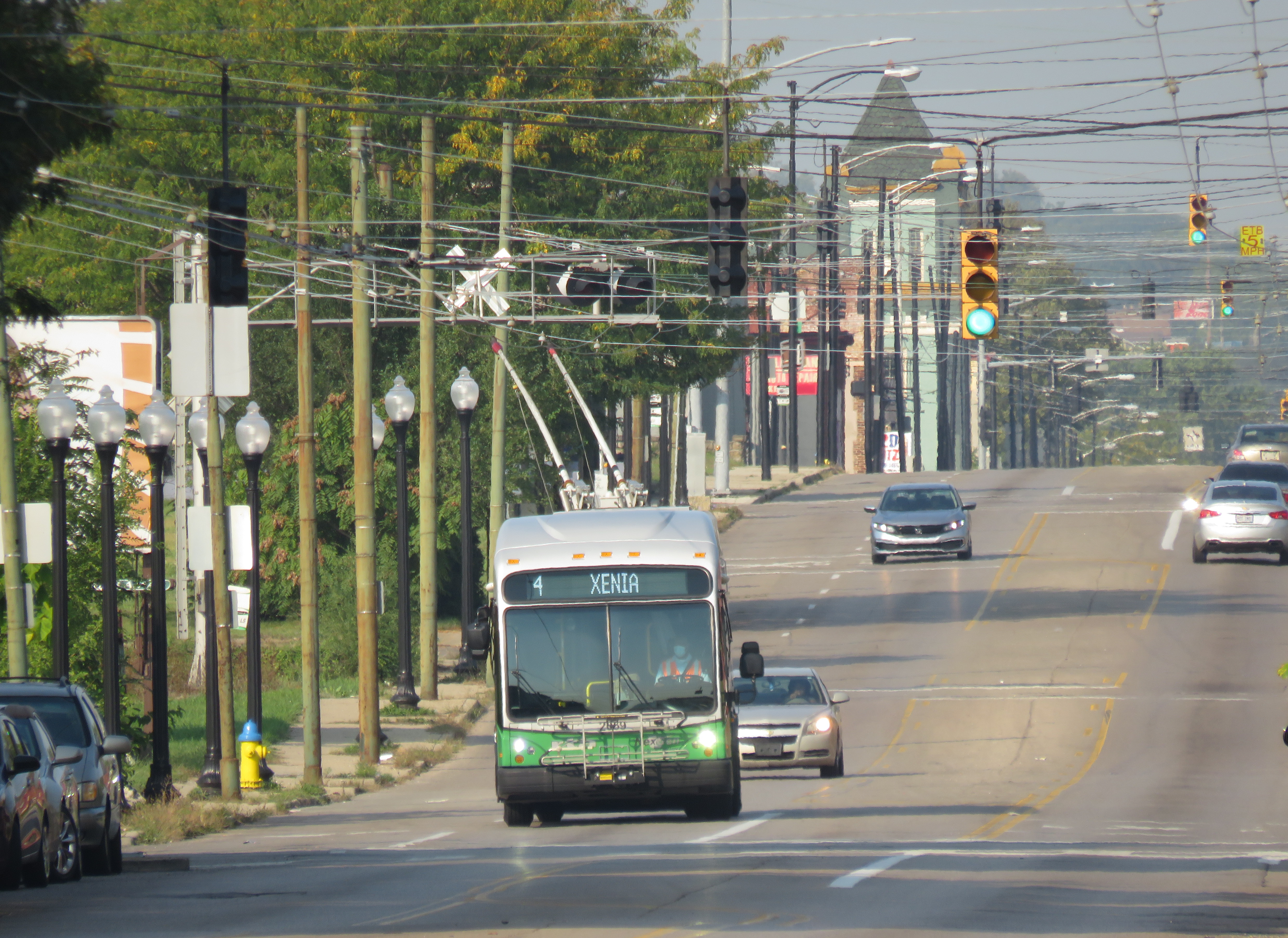
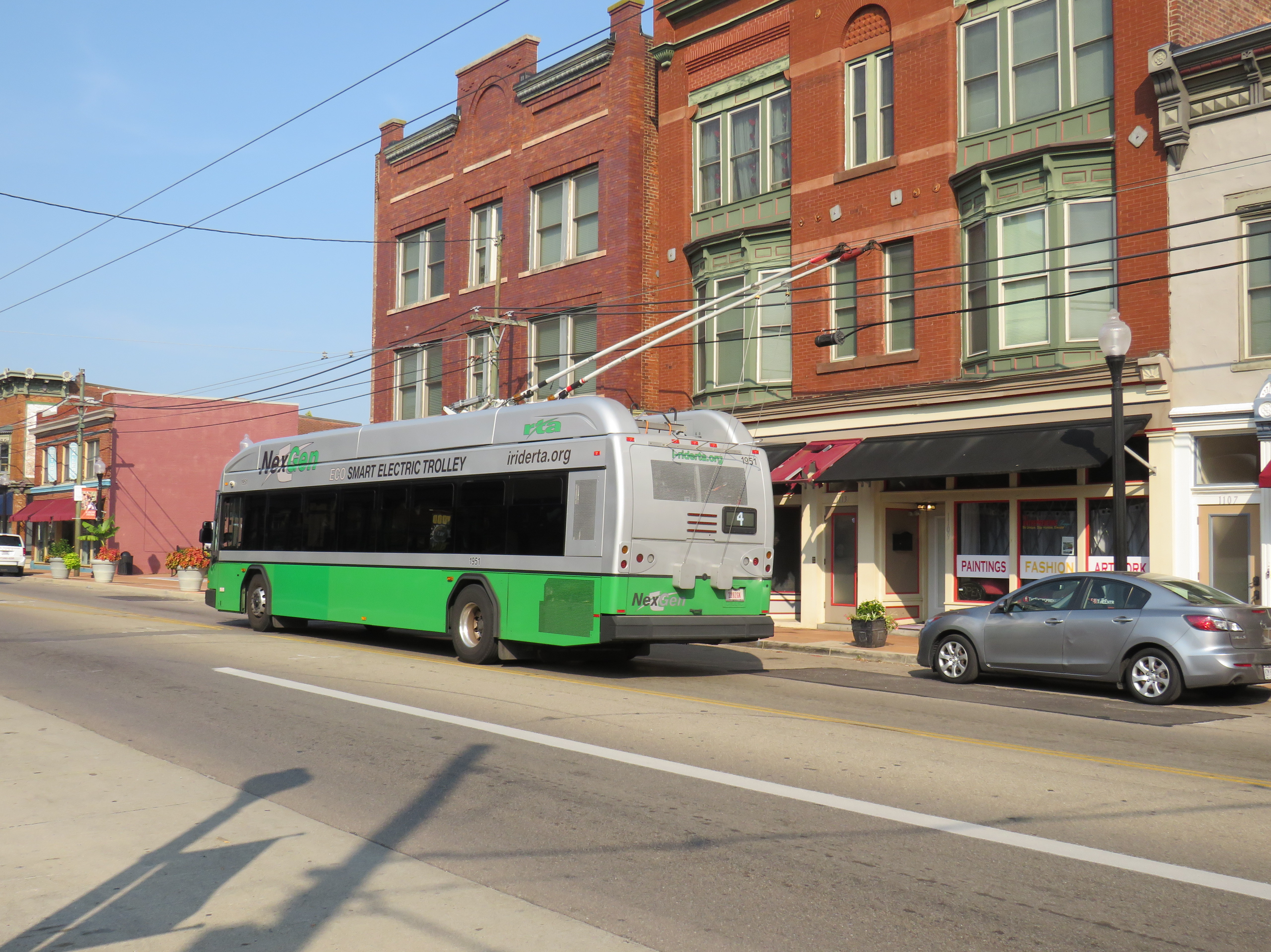
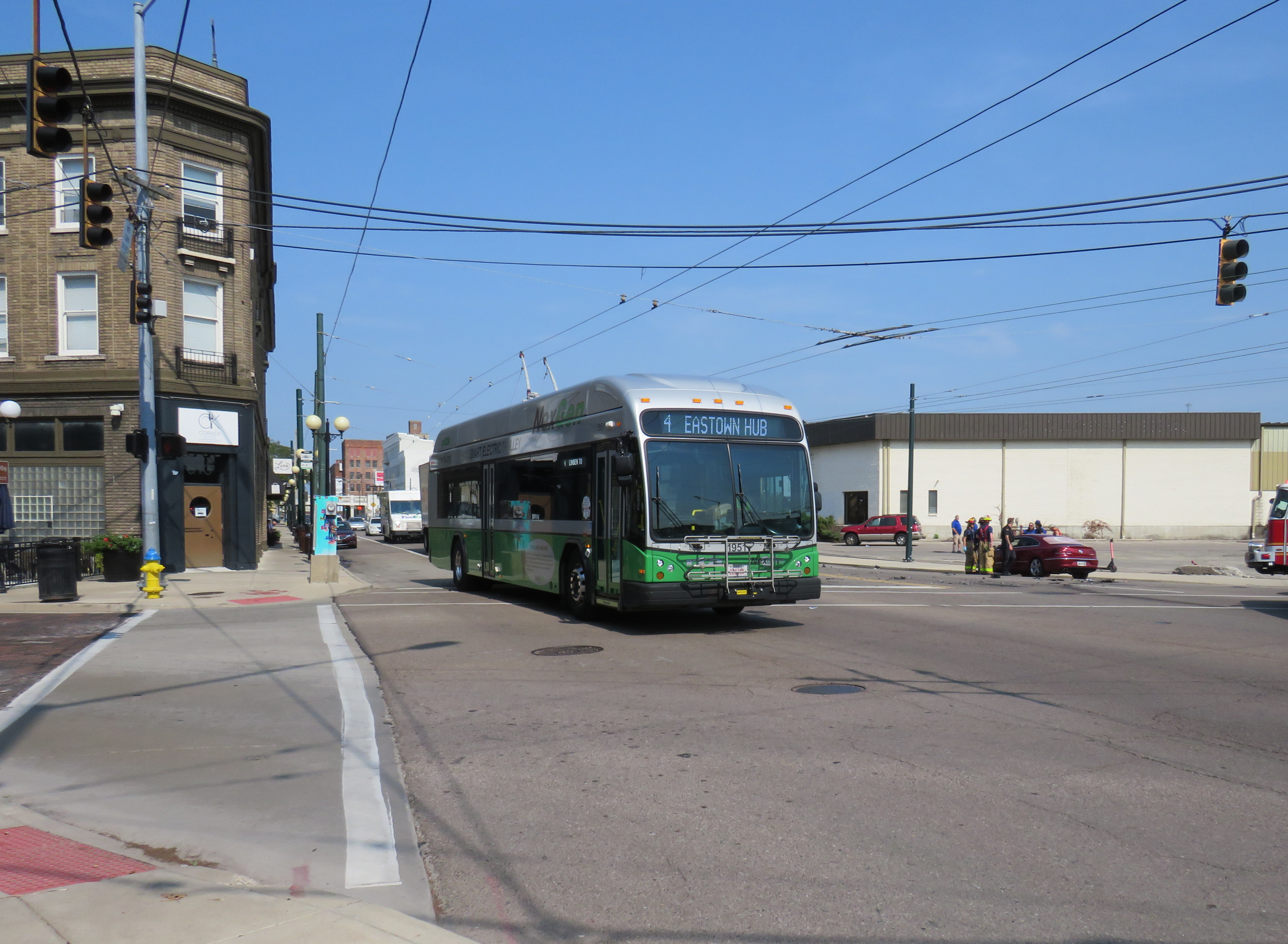
But of all places, the small, deindustrialized city of Dayton took a very different direction. In 2020, the Greater Dayton Regional Transit Authority (GDRTA) received the last of its 45 new Kiepe/Gillig Next Generation trolley buses, equipped with large, powerful battery packs and computer systems that allow for long-distance, full speed off-wire capability. (The previous generation of trolleys, like what Translink in Vancouver currently operates, allow only for limited, low-speed off-wire operation).
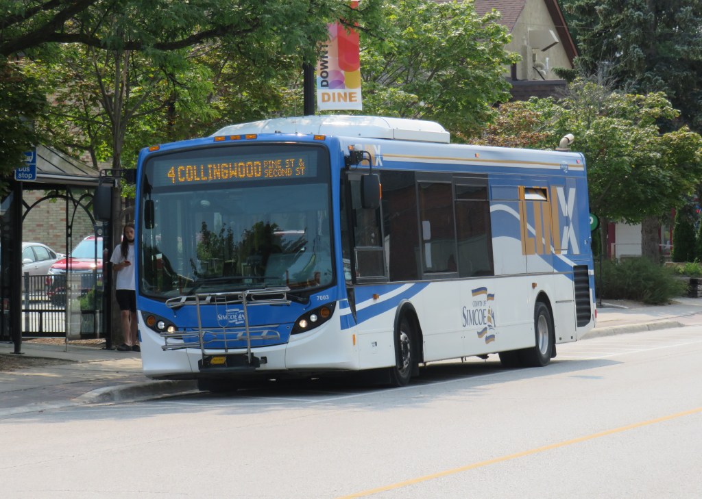
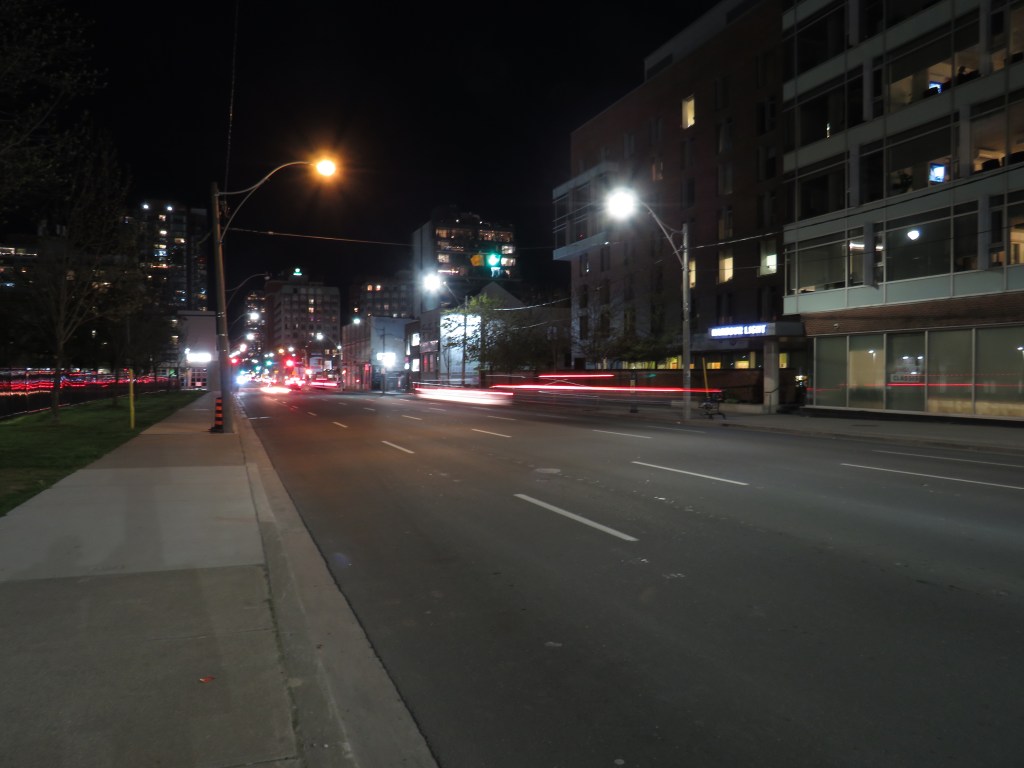
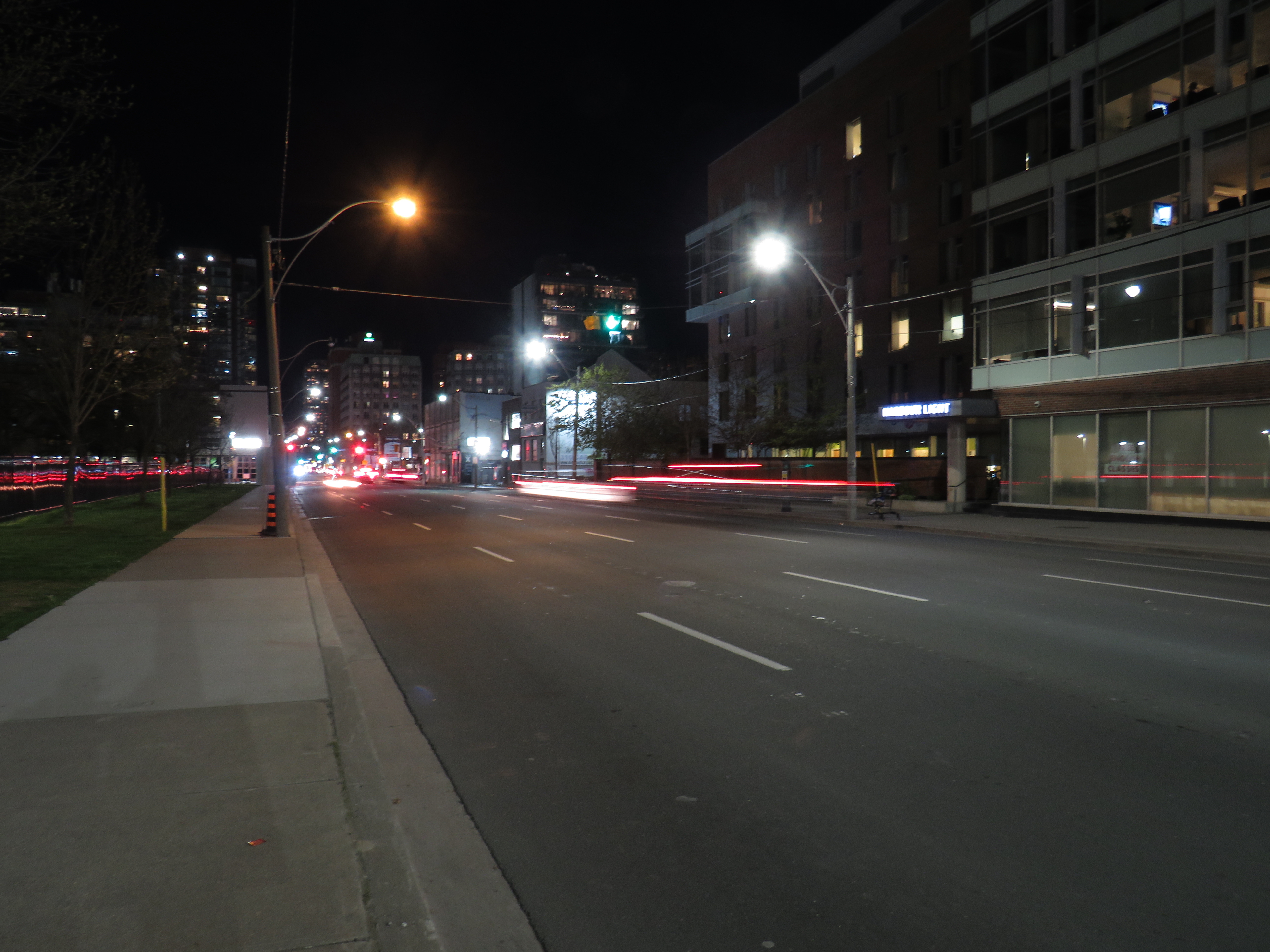
The new NexGen trolley on Third Street on Dayton’s West SideA trolley on Route 4 running with its poles down. I captured this photo just after getting off the bus on September 16, 2022.
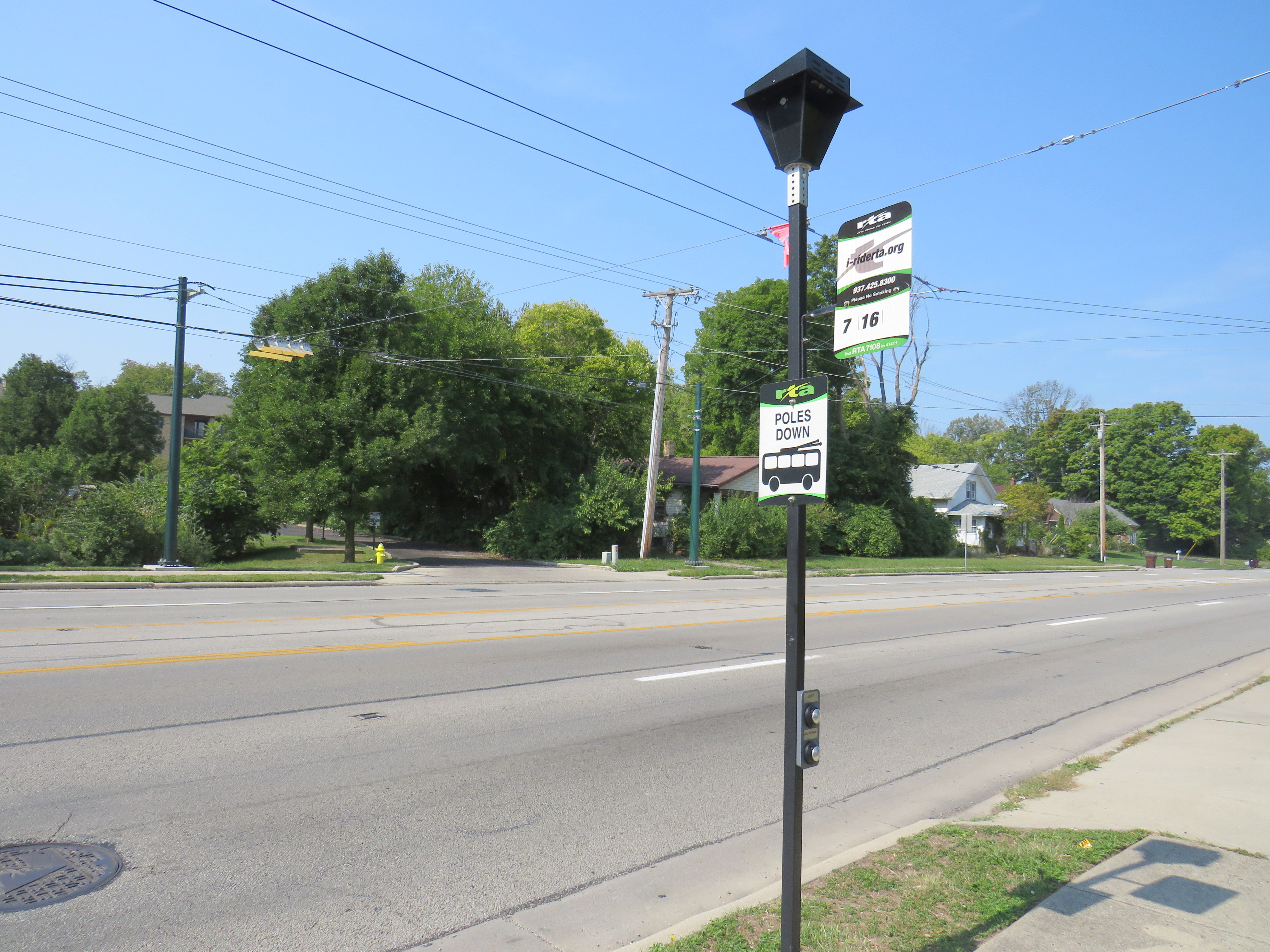
The extended off-wire capability has allowed the GDRTA to extend two of its trolley bus routes further into the suburbs without extending wire. Route 7 was extended 5 kilometres northwest, while Route 1 was extended 6 kilometres east to Wright State University. Though the corridors were already served by longer-distance diesel bus routes, it provided additional service to some of Dayton’s major suburban trip generators.
North Main Street at Elm Hill Drive, where the Route 7 trolley wire ends (note the “poles down” sign), but trolley buses can continue another 5 kilometres onward.
Unfortunately, despite the new fleet and plenty of wire to run it, the GDRTA has only been operating its trolley buses on a single route in the last few months, despite four routes being fully capable of electric service. When I visited Dayton on September 15, not a single trolley was out. Though I did go visit the US Air Force Museum and the Wright Brothers National Historic Site (where one of the brothers’ bicycle shops were preserved on site; the family home and another of their shops were moved to Henry Ford’s Greenfield Village), I was really disappointed. But having a car, and a hotel reservation less than an hour away, I went back the next morning to see these new vehicles in action and take a ride.
A line up of diesel buses, including the trolley-capable Route 7, in Downtown Dayton, just south of the main bus terminal on September 15, 2022. Note the trolley wire, completely unused.
Happily, Route 4 was operating with trolleys, though on a Saturday schedule, imposed by GDRTA because of an ongoing driver shortage that has plagued transit systems across North America. During the daytime, three buses offer 30 minute service on the route. Between Downtown Dayton and the West Side, my first ride that morning was interesting as the bus was operating with its poles down for some reason. But riding the bus, I couldn’t tell: it was a smooth, quiet, and quick jaunt. I took two more trips on Route 4 to the east end, to get the most out of my visit.
A NextGen trolley outbound on Wayne Avenue at East 5th Street, September 16
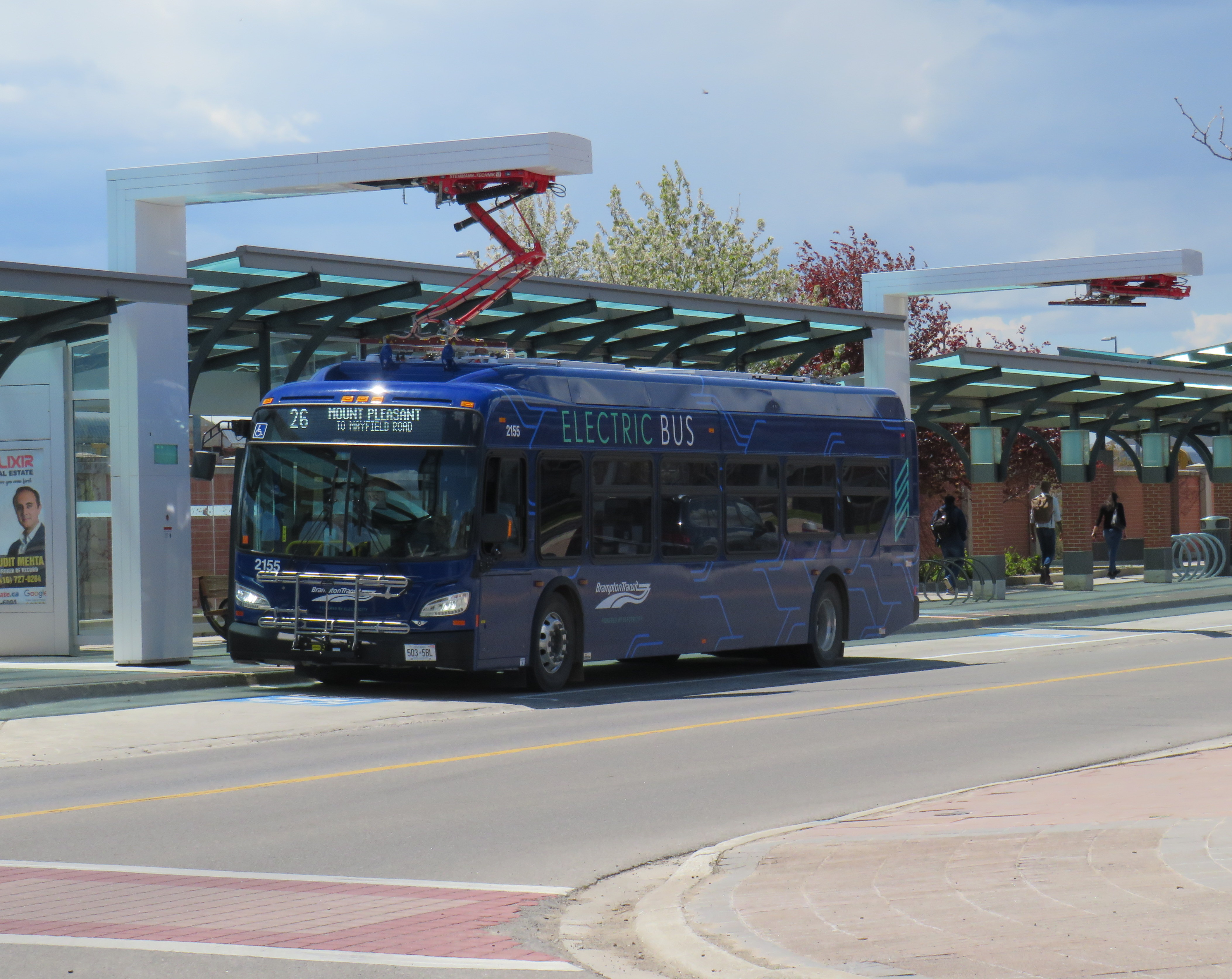
Despite my disappointment with the GDRTA’s utilization of its fleet, I came away still confident about the technology’s future. Though many transit systems are re-electrifying their bus fleets, they have been purchasing battery-electric fleets that do not have any in-motion charging, unlike Dayton’s advanced trolleys. Some agencies, like the TTC, have battery buses that are charged only at the garages. Other cities, like Brampton, Winnipeg, and Montreal have en-route charging stations at terminal points as well as garage charging points. But bus batteries are extremely heavy, and they have not yet gone through a complete life cycle yet in the harsh Canadian climate.
Brampton Transit electric bus charging at Mount Pleasant Village
The TTC in particular is suited to restoring its trolley network using modern on-wire charging buses like those used in Dayton, as it has much of the infrastructure already in place, including substations (that feed the subway and streetcar network) and existing overhead wire systems. With long-distance off-wire capability, there is no need for complex wire junctions and short-turn loops, unlike older trolleybus networks. Busy, straight routes such as Dufferin and Bathurst would be ideal.
Though Dayton isn’t using its new fleet of electric buses to its potential, it does show the way to renewing sustainable electric transit services for cities like Toronto.
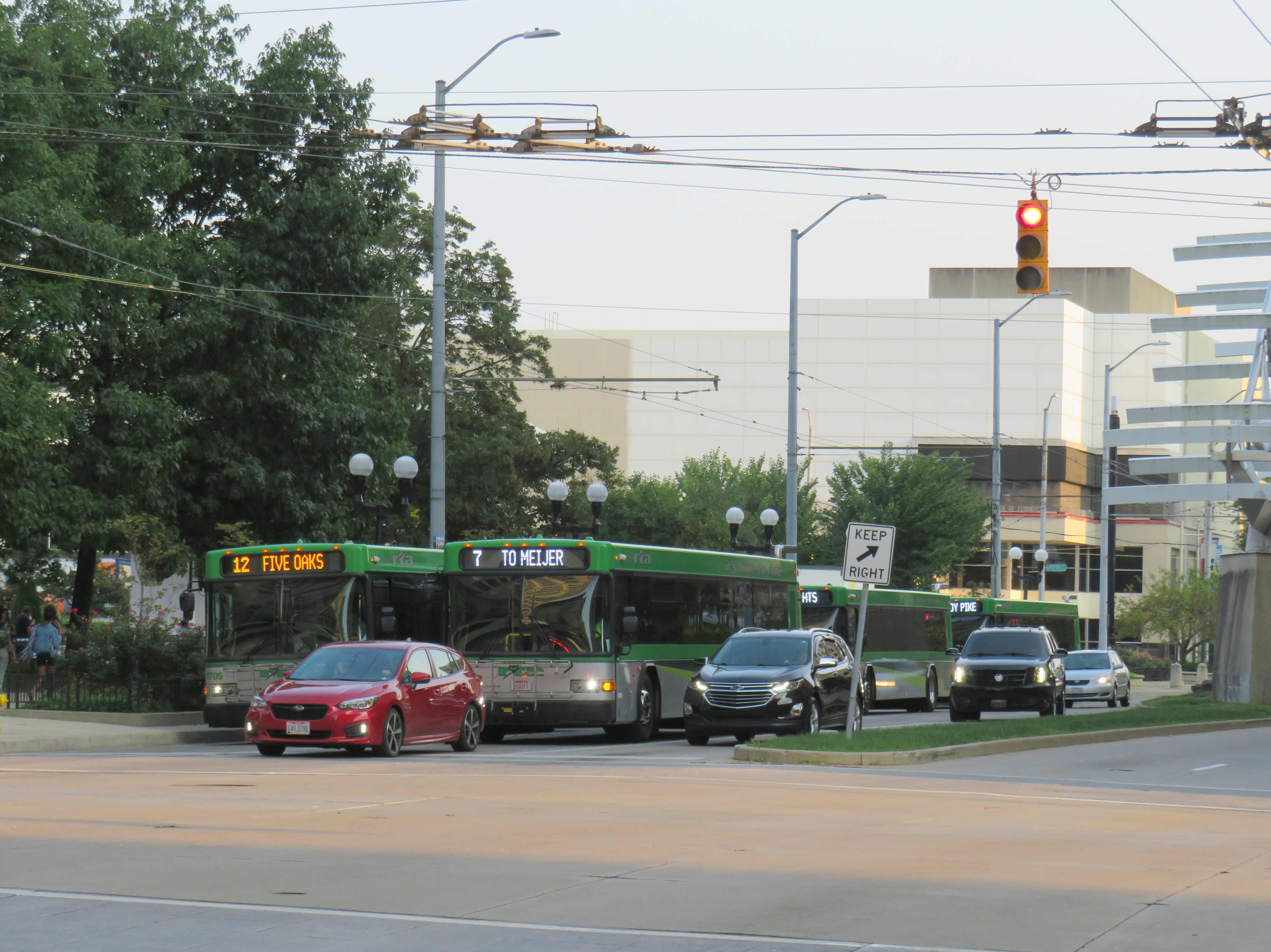
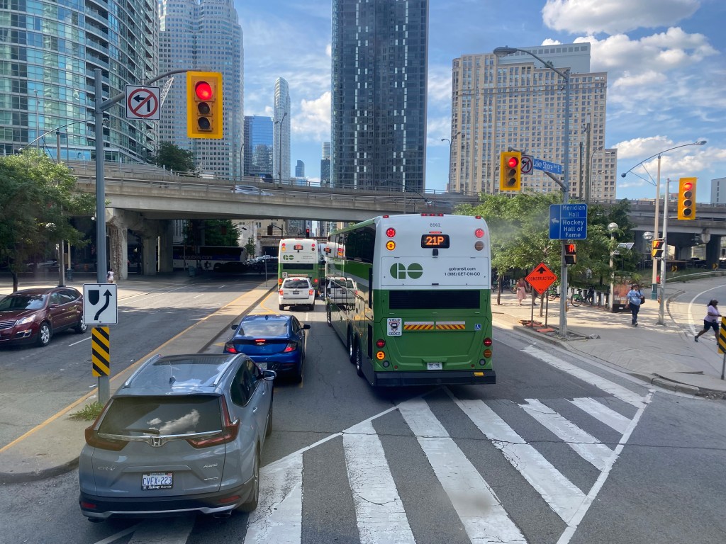
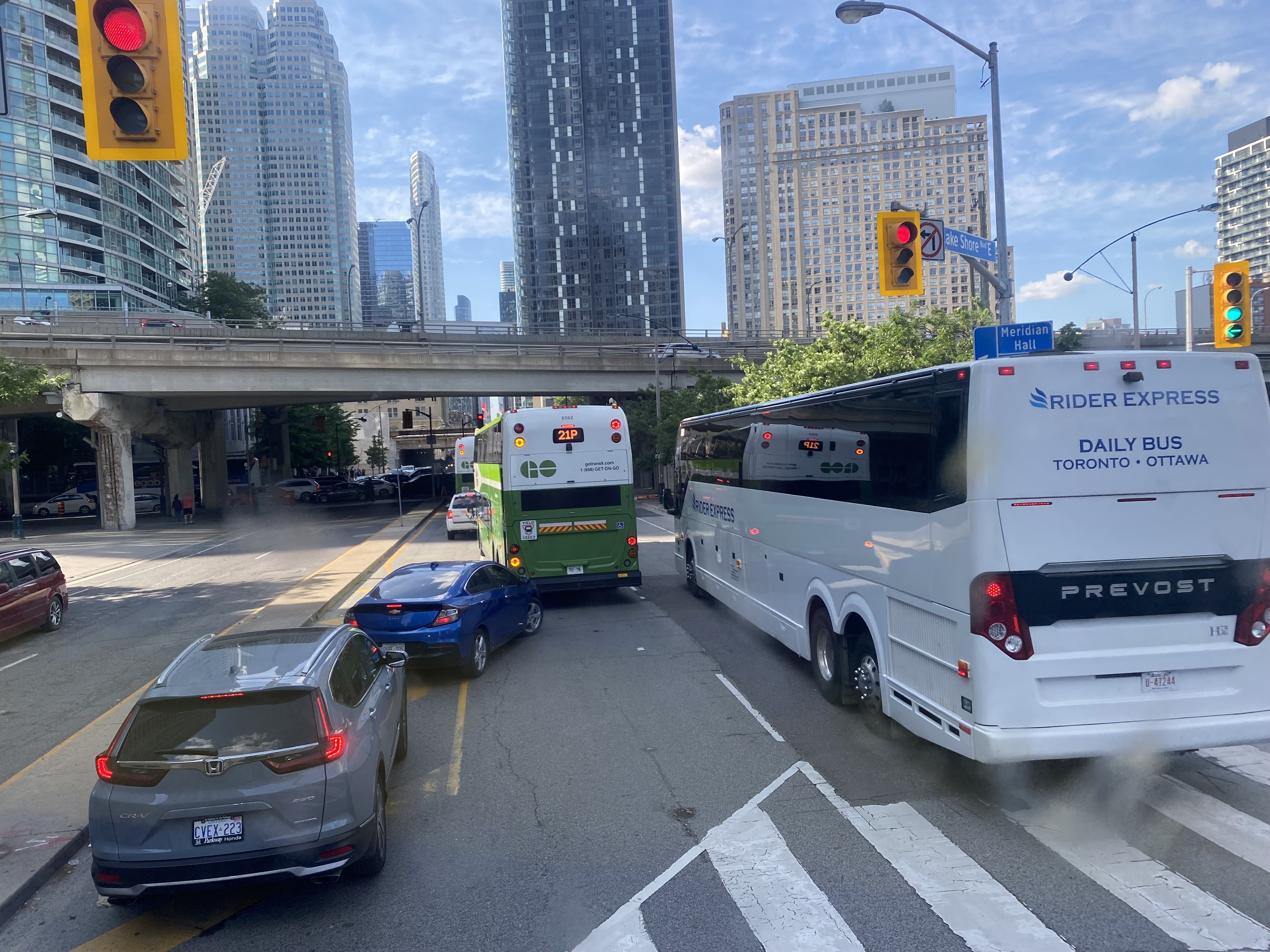
GO Transit buses stuck in Downtown Toronto gridlock in July, 2022
While travelling through the Northeastern United States this spring and summer, I found myself feeling lucky to be living in Toronto. Though the New York City Subway and the PATH trains between New Jersey and Manhattan were operating pretty much as I remember them, in other big cities, the mass transit systems were in rough shape. In Washington, underfunding and incompetence led to the long-term withdrawal of over half of its Metro cars. During our visit in April, we were treated to long waits and crowded trains, though at least the system was clean. When we visited Philadelphia in late June, it was clear that the Southeastern Pennsylvania Transit Authority (SEPTA) had given up: poor communications, lengthy waits, unsafe subway stations, and general apathy among staff and passengers made my spouse and I resort to driving on our last day there.
In Toronto, at least, the subway was still running frequently (with only minor service cuts due to the pandemic), the buses and streetcars as (un)reliable as ever, and despite more anti-social behaviour on some of its surface routes, I almost never felt afraid for my well-being when riding the Rocket, compared to my experience in Philly. GO Transit responded to the pandemic very well. Though it was forced to suspend many of its train and bus trips due to a sudden plunge in ridership, it maintained a basic service level on nearly all of its routes, slowly restoring certain services in 2021 as ridership slowly rebounded. Some corridors, like the Kitchener Line, had more service in the early Fall of 2021 than it did prior to the pandemic. As Metrolinx continued planning and construction of major transit projects like GO Expansion, the Ontario Line, and several LRT corridors, the future looked bright. In Spring 2022, GO Transit introduced a special weekend day pass for $10 per day or $15 per weekend, to help grow ridership.
Unfortunately by late June 2022, GO began to fall apart.
On Saturday, my spouse and I decided to take advantage of the GO Transit weekend day pass and take the train to Hamilton for a short excursion. We did some shopping on James Street North in Downtown Hamilton and on Ottawa Street in the city’s east end, where there’s a great cluster of fabric, decor, and antique shops, as well as cafes and restaurants.
The new weekend passes, which cost $10 for one day and $15 for two days, have been a major contributor to GO Transit’s ridership recovery. Though weekend ridership has recovered to 90 percent of pre-pandemic levels (despite lower service levels on many routes), weekday ridership is only half of what it was in 2019.
On our return trip to Toronto, we decided to take the Route 16 express bus, departing from Hamilton GO Centre at 3:30. As the train between Union and Hamilton’s West Harbour Stations runs only every hour, it seemed that the express bus to Union Station would be the fastest and most convenient option. How wrong we were.
A line of GO buses attempting to turn left from Lake Shore Boulevard to Yonge Street
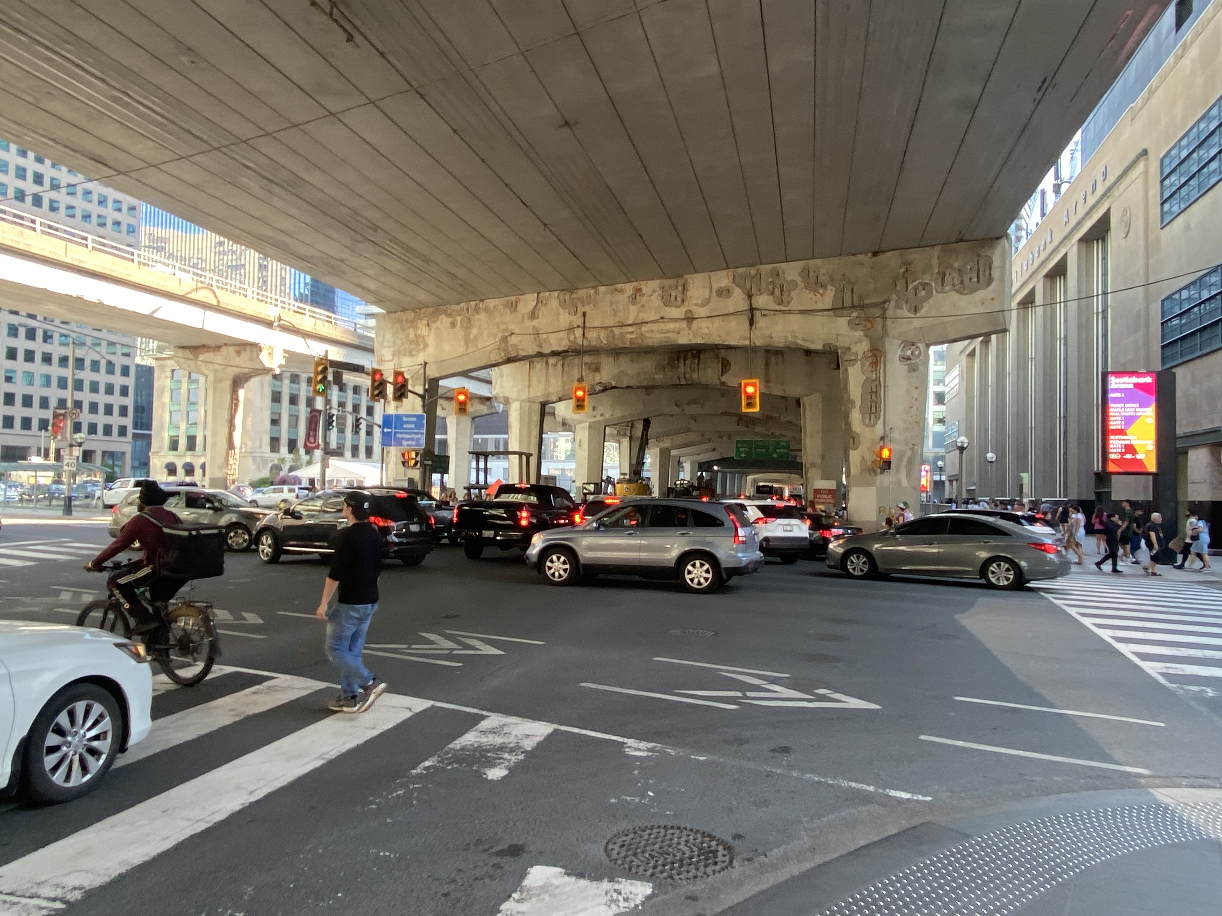
As we were among the first to board the double-decker bus, we had front row seats to Toronto’s Carmageddon.
Despite it being a beautiful afternoon on the long weekend, the ride on Highway 403, the Queen Elizabeth Way, and the Gardiner Expressway was uneventful, with only a few spots where traffic moved slowly. Until the bus got off the York-Bay-Yonge ramp, we were making decent time. That is when we were confronted with a long line of cars and trucks, all trying to turn north on York, Bay, and Yonge Streets.
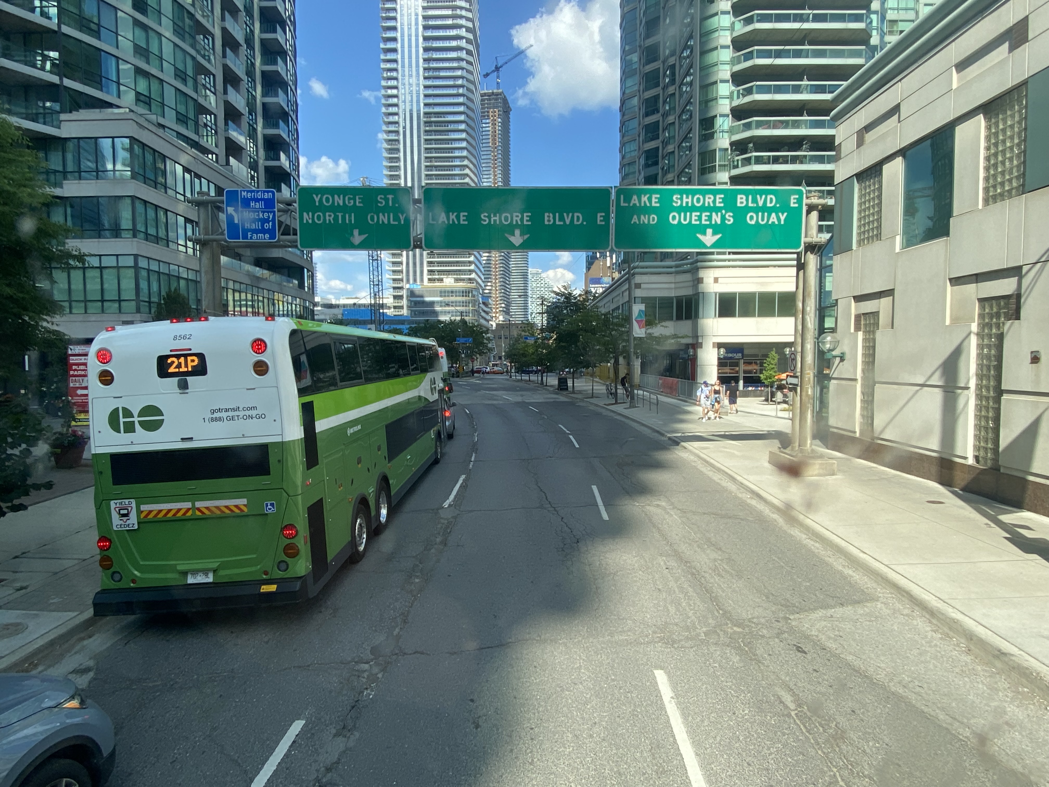
The new Union Station Bus Terminal, located on the north side of the westbound Lake Shore Boulevard lanes, requires buses coming from the west to turn left on to Yonge Street from eastbound Lake Shore, and then turn left again onto westbound Lakeshore before turning right into the terminal itself.
After finally turning north from eastbound Lake Shore Boulevard, private vehicles, a Rider Express bus, and GO Transit buses attempt to turn left onto a gridlocked westbound Lake Shore Boulevard
But with construction obstructing two westbound lanes of Lake Shore at Bay Street, drivers leaving the first of two Blue Jays games that afternoon (a rare doubleheader hosting the Tampa Bay Rays), and other drivers arriving for the evening Jays game, an Eric Church concert at Scotiabank Arena, along with the usual weekend traffic, traffic could not move, creating literal gridlock. Police or traffic wardens that could monitor and manage the gridlock were nowhere to be seen.
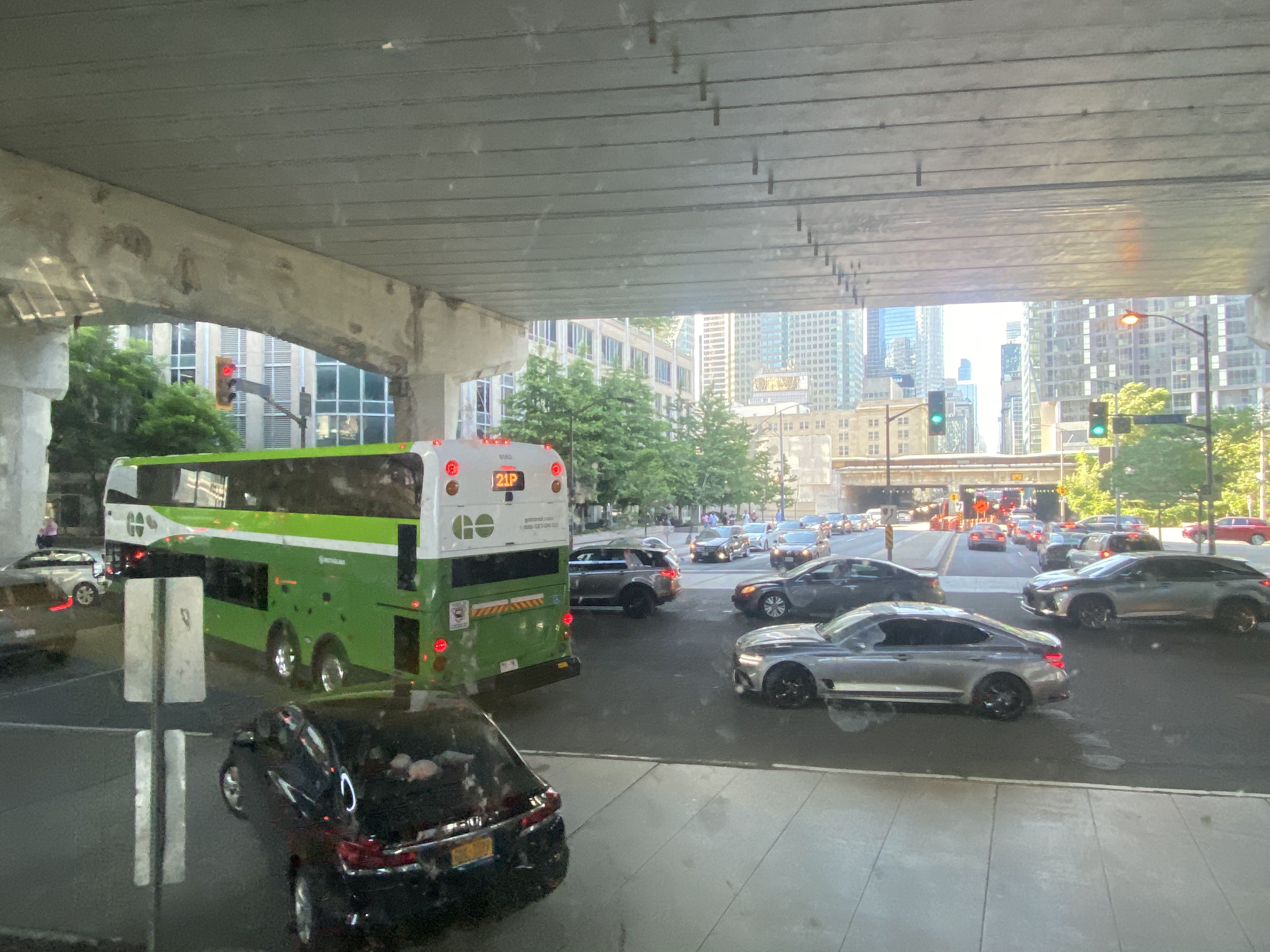
Motorists jam the intersection of Lake Shore Boulevard West and Yonge StreetOne driver expresses his frustration with the traffic
At 5:50, 2 hours and 20 minutes after the bus departed Hamilton GO Centre, we were let out on the curb outside the terminal entrance. In response to the backlog of buses attempting to enter and exit the Union Station terminal, GO cut back the Route 16, meeting the half-hourly Lakeshore West train service at Aldershot Station (one stop short of West Harbour). Several Route 16, 21, and 31 trips were cancelled due to the traffic in the downtown core, requiring some customers in places like Milton and Georgetown to wait an entire hour for the next bus.
After similar gridlock conditions on Sunday, July 3, Route 21 (Milton Corridor) and Route 31 (Kitchener Corridor) buses were rerouted to Port Credit GO, requiring a transfer to trains there.
Route 21 and 31 GO buses will begin and end at Port Credit GO due to heavy traffic into Toronto. Regular LSW train service will run between Port Credit and Union. Click https://t.co/QEMf9GRLsf for more into.
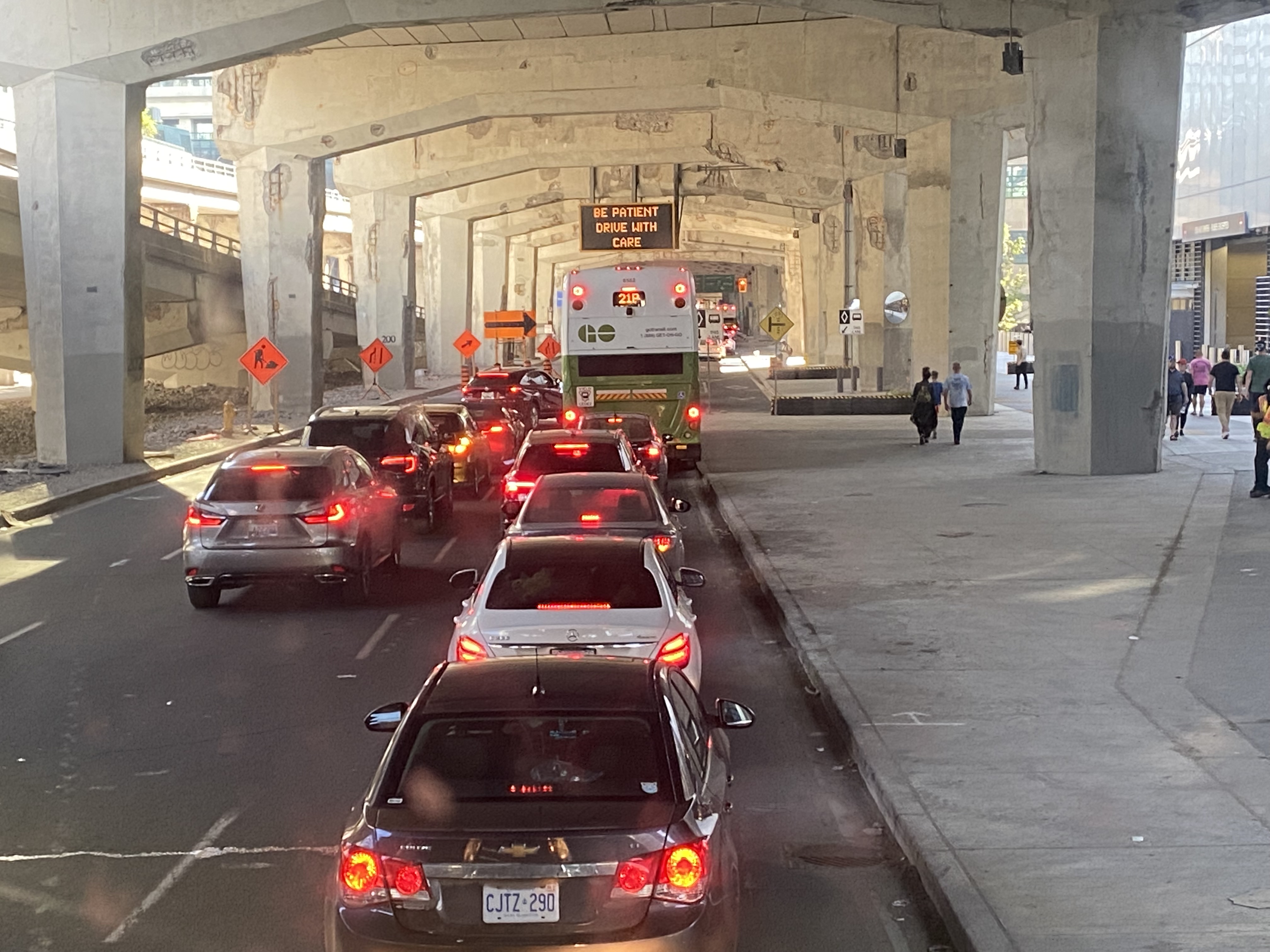
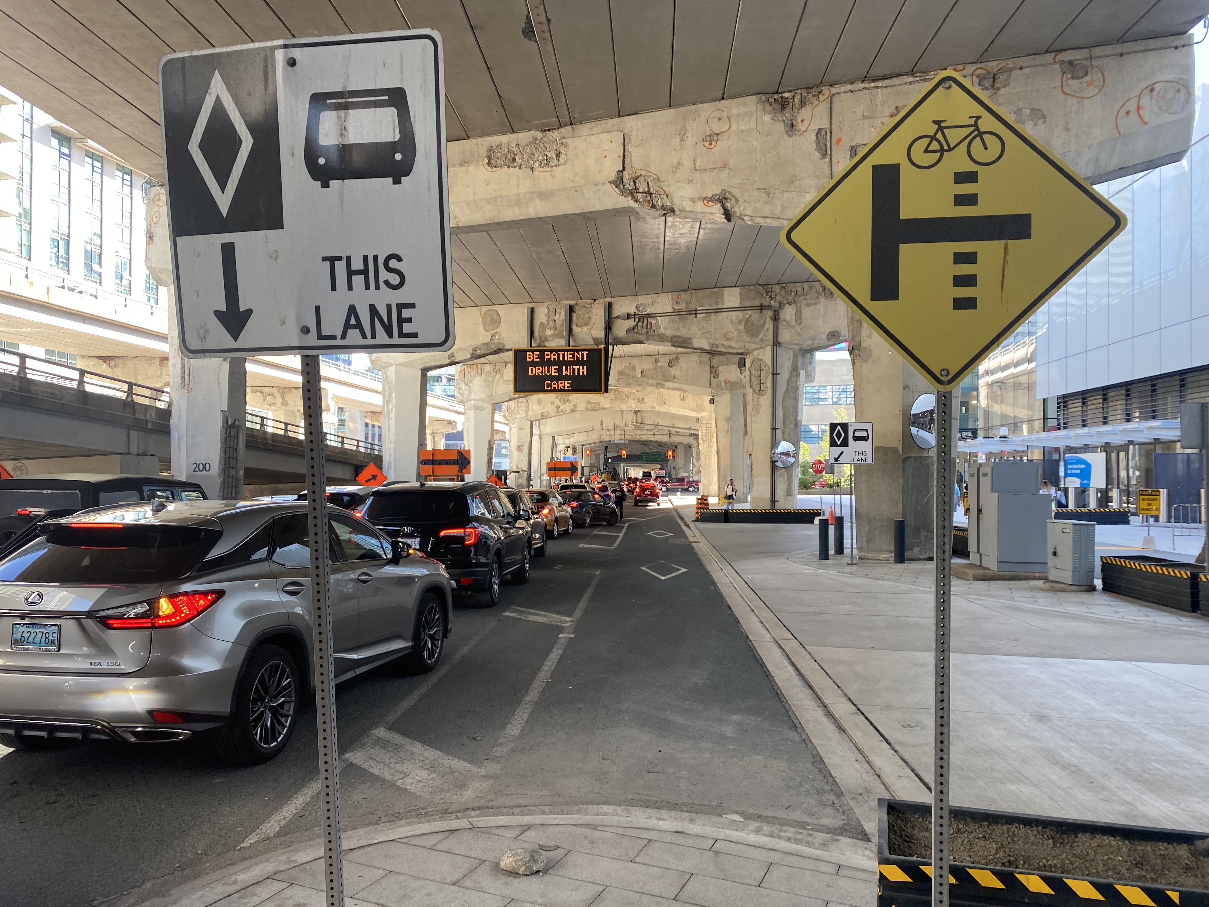
The new terminal’s location is excellent for consolidating all intercity bus and rail services and is much safer than the old Union Station Terminal or the dilapidated Metro Toronto Coach Terminal at Bay and Dundas Streets. Direct, indoor connections can be made with the subway, several hotels, Scotiabank Arena, and to the vast PATH system of underground walkways. Its major failure, however, is the lack of dedicated bus lanes to speed highway coaches in and out of the facility.
On Lake Shore Boulevard. The bus entrance to the Union Station terminal is at right
There is an exceptionally wide sidewalk on the north side of Lake Shore approaching the bus entrance to the terminal, and an extremely short bus lane in front of the terminal’s entrance and exit. It is no wonder why some private coach operators, such as FlixBus and Onex, opt for on-street stops, rather than the terminal used by GO, Megabus, Rider Express, TOK, and Ontario Northland.
Toronto’s shortest and least-effective bus lane, in front of the Union Station Bus Terminal. Note the sign reading “be patient – drive with care” above.
A dedicated bus lane for the entire distance between Yonge and Bay Streets would undoubtedly improve operations. A dedicated left turn lane from Yonge to westbound Lakeshore would also allow easier access to the terminal from the west, where the majority of GO and intercity coach buses arrive from. Similar dedicated left turn lanes at Queen Street and Central Park Drive in Brampton allow Brampton Transit buses to quickly enter and exit the Bramalea Terminal. Better traffic management, including police enforcement, would help ensure a clear path for transit and coach buses.
The gridlock continued west of Bay Street, as motorists lined up to get to the Gardiner Expressway or go west on Lake Shore Boulevard
GO Transit’s reaction, to reroute buses to the already-crowded Lakeshore West Train, is not a sustainable solution, though it is the only effective tool it has at the moment. Though Route 16 passengers are not taken far out of their way with a transfer at Aldershot GO, the detour is more onerous for some Route 21 and all Route 31 passengers forced to backtrack to Port Credit GO for a forced transfer there.
Stouffville and Barrie Corridor passengers were spared the hassles with the return of weekend train service earlier this year. Unfortunately, Canadian Pacific’s control of almost the entirety of the Milton Corridor precludes midday, evening, and weekend train service, but there’s an opportunity to finally bring limited weekend train service to the Kitchener Corridor. GO Transit already offers an hourly midday and evening weekday train service to Mount Pleasant Station in Brampton, despite CN’s control of the corridor west of Bramalea Station.
Track improvements completed nearly 20 years ago (an additional track between Bramalea and Mount Pleasant and a second platform at Brampton GO Station) provides the capacity for hourly GO trains and CN’s freight operations. Weekend Route 30 bus service between Kitchener and Bramalea can provide a reasonable and reliable bus link until corridor improvements, such as new passing tracks, are completed between Georgetown and Kitchener.
As I was sitting in traffic for an hour, I found myself aggravated once again by Blue Jays CEO Mark Shapiro lobbying the city to end the Sunday closure of Lake Shore Boulevard West to allow for the city’s (much-diminished) Active TO program. In a letter addressed to Mayor John Tory, General Manager of Transportation Services Barbara Gray, and the city clerk, Shapiro argued that “removing one of the only ways into and out of the downtown core would be extremely challenging to our fans” claiming that “on the days when Active TO has been in effect on Lake Shore, our local fans have experienced significant transit delays because traffic is grinded to a halt on all downtown routes.” (It is worth noting that the Toronto Blue Jays baseball club is a wholly-owned subsidiary of Rogers Communications. The mayor of Toronto, a former Rogers executive, remains involved with the Rogers family trust.)
The Lake Shore closure allowed cyclists and runners to bypass the overcrowded Martin Goodman Trail along Toronto’s Western Beaches, on a section of roadway paralleled by GO Transit’s Lakeshore Corridor. The traffic congestion last weekend was completely unrelated to ActiveTO (which is now suspended on Lake Shore Boulevard, partly due to Shaprio’s lobbying) and transit riders, who make up a large percentage of the Blue Jays’ fanbase, were left in the mess that motorists made.
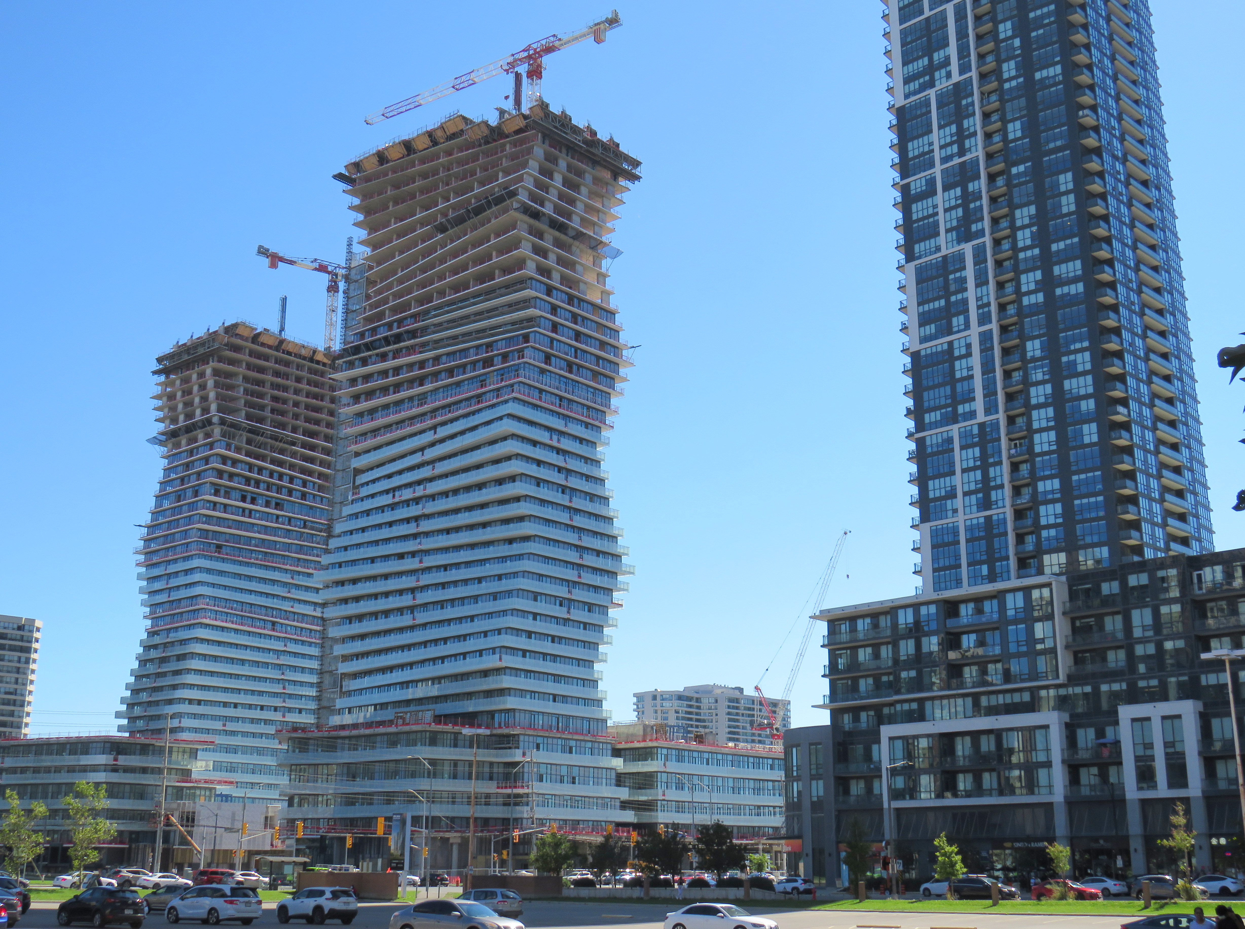
Despite new highrise development in its city centre, Mississauga lost 3,368 residents between 2016 and 2011
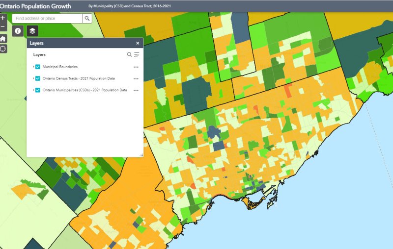
On February 9, data geeks across Canada rejoiced when Statistics Canada released the first round of data from the 2021 Census of the Population.
The data was released at all levels of geography made available by Statscan. At the federal level, Canada grew by 5.2% since the 2016 Census, with a total population of 36,991,981. Immigration, rather than natural growth (births vs. deaths) drove Canada’s population increase.
Of course, this growth did not occur evenly across the country. Newfoundland and Labrador lost residents, while Prince Edward Island and British Columbia saw the biggest population increases.
Within the Greater Toronto and Hamilton Area, Mississauga experienced population decline (-0.5%) for the first time since it became a city in 1974. Outer suburbs, such as Milton, East Gwillimbury, and areas just beyond the GTHA, such as New Tecumseth and Bradford saw population growth over 20%, driven by new greenfield development.
In older Toronto suburbs, including much of Etobicoke, North York, Scarborough, and even Mississauga, population losses at the local census tract level can be explained by ageing households, where Millennial and older Gen Z children moved out on their own, particularly into fast-growing downtown areas. These areas, dominated by single-family housing, could accommodate much of the GTHA’s growth with gentle density, including secondary suites (such as basement apartments), garden suites, and zoning policies that would make it easier and more economical to build “missing middle” housing such as walkup apartments and multiplex homes.
Toronto grew by 62,785 residents in the last five years, with only a few areas accommodating all that growth: the downtown core between Dufferin Street and Broadview Avenue, South Etobicoke, Yonge-Eglinton, and former industrial, instructional, and commercial lands stretching along the Highway 401 corridor through North York and West Scarborough. This corridor includes the Downsview Park development, a new condominium cluster at Wilson Subway Station, the former Canadian Tire lands near Sheppard Avenue and Leslie Street, and the intensification of the Fairview Mall area.
On the morning of Thursday, August 19, I departed Toronto’s Union Station. My destination: Union Station. I set out to travel the longest distance possible by local and regional transportation services, taking advantage of several new routes set up by local and county governments to fill the gaps left by traditional intercity coach operators.
The round trip from Union Station required two trains and seven buses, operating on five separate transportation agencies. In some cases, the transfers were smooth and reliable; in Owen Sound, I waited several hours between connecting trips. For a casual traveler like myself, this was not a problem, but for more frequent commuters, the patchwork of various schedules and fares is not ideal.
I left Union Station on a westbound Kitchener Line train at 7:34 AM on Thursday, August 19. I returned to Union Station at 9:34 PM Friday evening, staying in Meaford overnight. I made time for short visits to Owen Sound, Meaford, Collingwood, and Barrie, with short stopovers in Guelph and at the Blue Mountain resort.
The following is a travelogue of sorts, concluding with a few conclusions on how parts of this trip can be made better for future passengers.
Thursday: Toronto to Owen Sound and Meaford
Intending to catch the morning GOST (Guelph-Owen Sound Transportation) minibus from downtown Guelph, I boarded the first westbound Kitchener Line train at Union Station at 7:34 AM. The train only goes as far as Bramalea Station, requiring a transfer to a bus to continue westward. Happily, the train arrived at Bramalea on time, so there was no problem taking the connecting bus that departs at 8:18 AM. (I had bad luck on a previous trip through Bramalea.)
The connecting bus from Bramalea to Guelph is a slow, local service, winding its way through Brampton, Georgetown, Acton, and rural Wellington County before arriving at Downtown Guelph at 10:13. Through GO Transit’s buses are comfortable, they lack lavatories, so a two-hour trip may be difficult on some passengers’ bladders. Though the 7:34 train to Bramalea connects to an express bus via Highways 407 and 401 to Kitchener, anyone headed to Guelph gets to ride the scenic route.
Though an express bus would be welcome, I noted the importance of the local GO bus for workers living in Brampton getting to jobs in Halton Hills, and residents in Acton and Rockwood commuting to Guelph. There is a need for both services.
At least I got a spot at the front of the double decker bus and was able to enjoy the ride.
This first leg on GO Transit between Toronto and Guelph cost $14.06, deducted from my Presto card.
Brampton Transit used to operate a double-decker bus. GO Transit has brought them back to the Flower City. Due to a construction project on Highway 7 in Rockwood, the double-decker bus took a scenic, yet unexpected detour on country roads. This must have turned some heads.
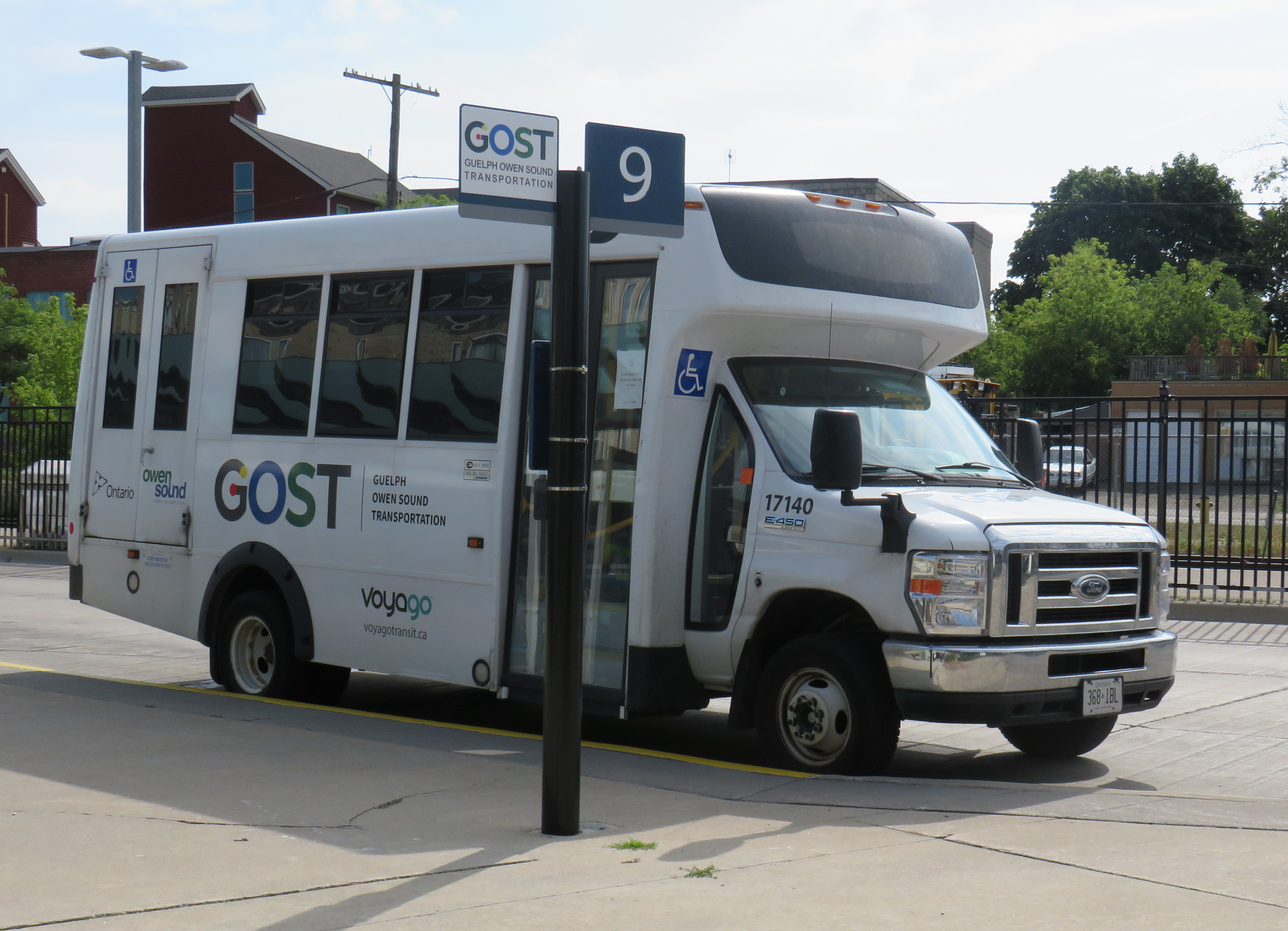
At Downtown Guelph, I had just under 20 minutes to use a washroom and have a quick coffee before switching to the GOST minibus. GOST serves the Guelph Central Station bus terminal, with easy connections to GO buses and trains and most Guelph Transit services.
A GOST minibus waiting for departure at Guelph Central Station
The GOST minibus service operates two round trips, seven days a week, between Guelph and Owen Sound, with stops in Elora, Fergus, Arthur, Mount Forest, Durham, Williamsford, and Chatsworth. Except for Fergus, all stops are located in or near each town’s commercial centre. The service is funded by Owen Sound and a provincial grant, and operated by London-based Voyago (which operates several other rural services in Western Ontario).
Until the mid 2000s, Greyhound ran buses six days a week between Toronto and Owen Sound via Highway 10 through Brampton and Orangeville or via Highway 6 through Guelph and Mount Forest, each route on alternating days. Gray Coach, the TTC-owned predecessor to Greyhound, ran several daily trips. The twice-daily GOST bus is a significant improvement over Greyhound’s schedule in its waning years.
On this Thursday midday northbound trip, there were two passengers going all the way up to Owen Sound, one getting off in Elora, one disembarking at Mount Forest, and one passenger who boarded at Williamsford for Owen Sound. The fare from Guelph to Owen Sound is $20 cash, with cheaper fares to ride shorter distances.
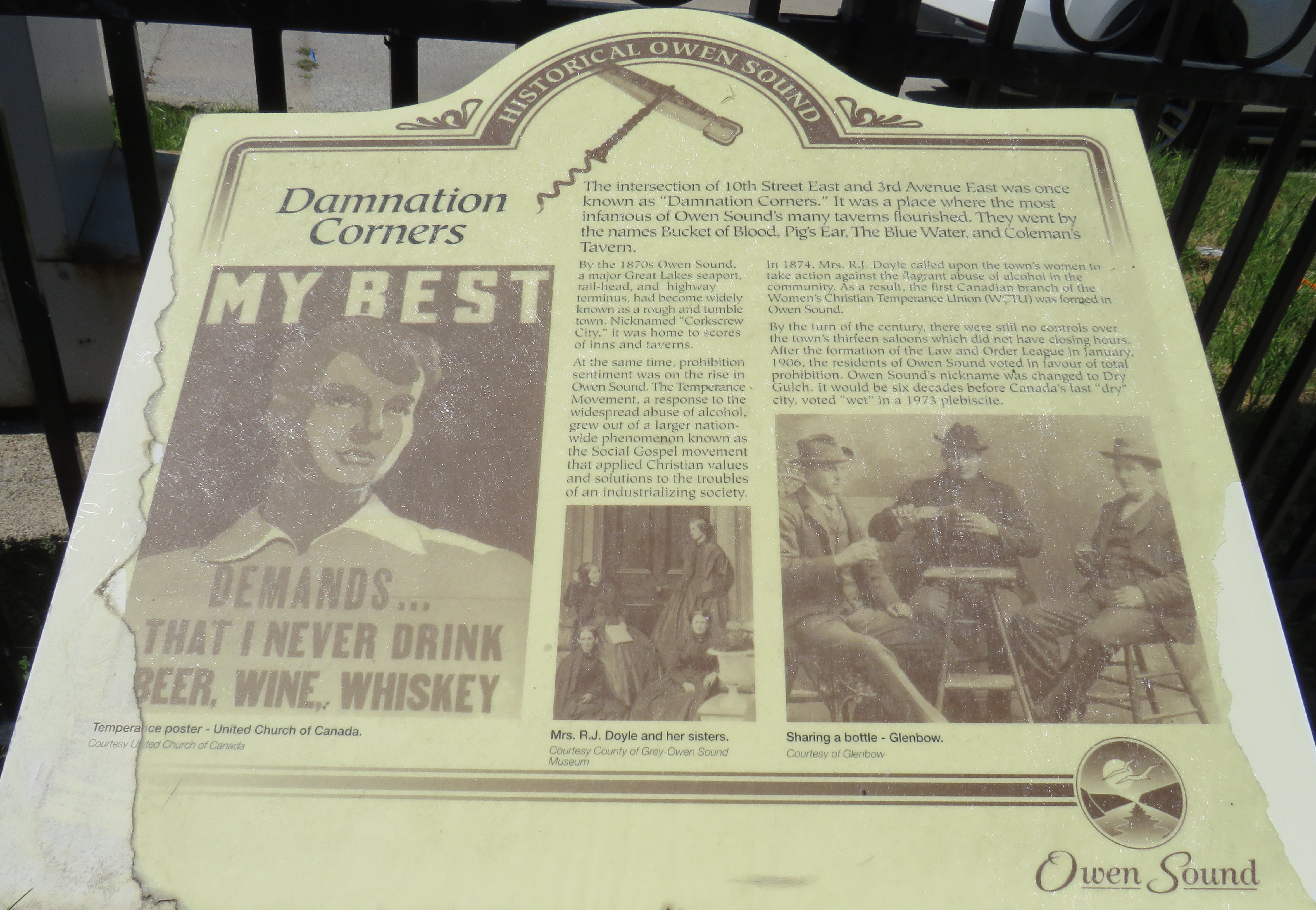
I arrived in Owen Sound a few minutes before 1:00 PM, with several hours to spend before my next ride to Meaford. Owen Sound, population 26,000, has an interesting history as a Great Lakes port and railhead for both the Canadian Pacific and Grand Trunk/Canadian National Railways. The maritime traffic and local industry gave Owen Sound a reputation as a hard drinking town; it became one of the first municipalities in Ontario to go “dry” in 1906. It remained that way until 1973.
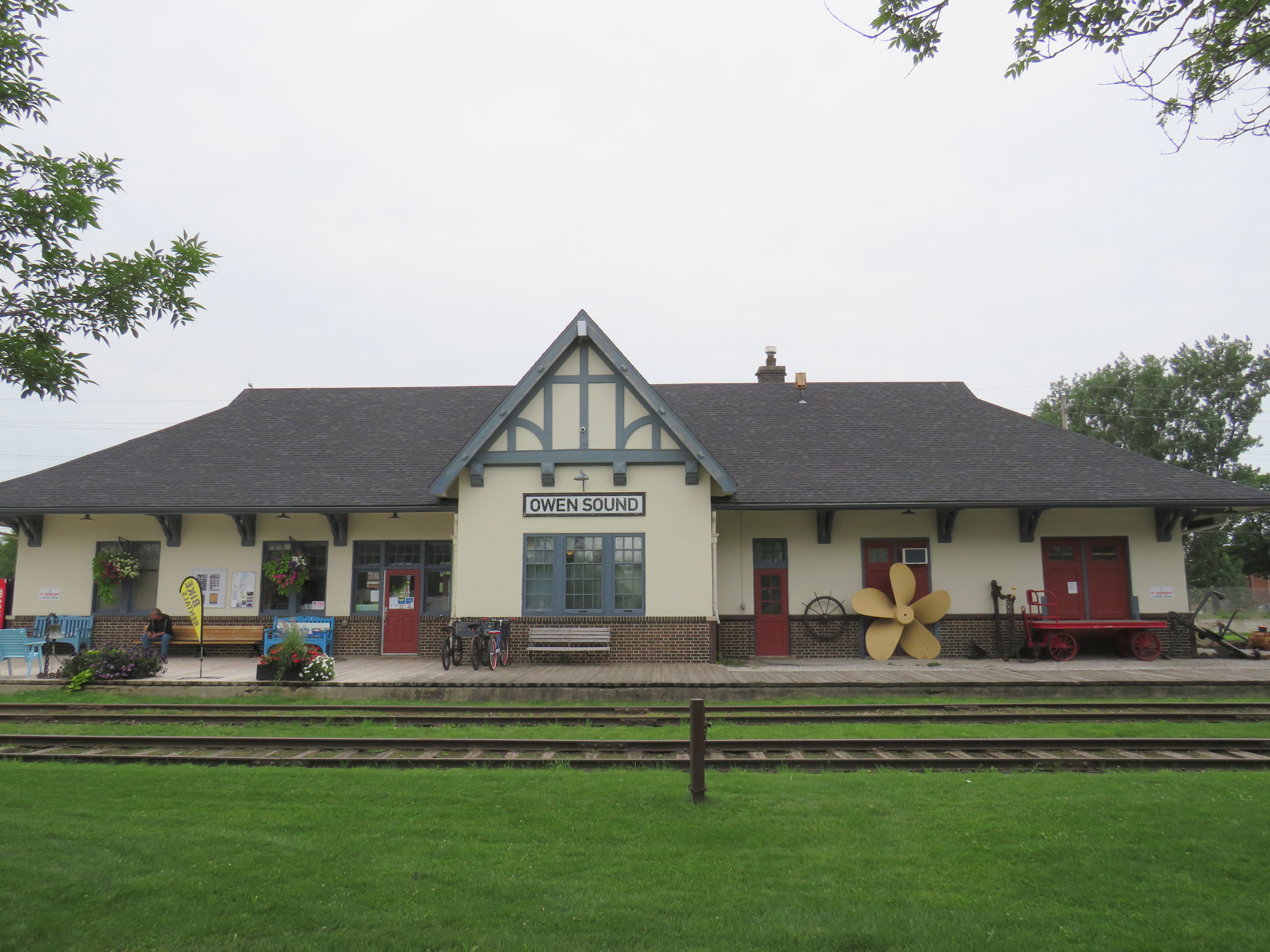
With the construction of the St. Lawrence Seaway and the decline of branch lines across Ontario, the city declined as a port and both railways were torn up in the late 1990s. However, both stations remain standing – the Grand Trunk Station on the west side of the harbour is now a local museum, while the modernist CP station, built after the Second World War, is now a brewpub.
With a lovely downtown, harbour, parks, and heritage neighbourhoods to wander through, Owen Sound was worth a three-and-a-half stopover.
Owen Sound Marine and Rail Museum, the former Grand Trunk/CN StationMudtown Station, the old CP Station in Owen SoundPlaque commemorating “Damnation Corners” where taverns once stood on all four corners. One block to the east was “Salvation Corners” where four Protestant churches still stand.
I decided to stay in Meaford overnight. Though I could get as far east as Wasaga Beach via Grey Transit Route, Colltrans, and Simcoe County Linx, I would not have been able to continue my trip back to Toronto that night, missing the last Linx bus from Wasaga Beach to Barrie by one hour.
Meaford had cheaper accommodations than Owen Sound or Collingwood, and by staying there overnight, it gave me plenty of time in Meaford and Collingwood the next day. Before Greyhound Canada suspended operations in April 2020, there was one daily bus between Toronto, Barrie, Collingwood, and Owen Sound. PMCL, which Greyhound purchased in the 1990s, used to run several buses a day on that route.
I departed Owen Sound on a pre-booked GTR minibus at 4:30 PM, which cost $5 for the trip into Meaford. As I was the only one on that departure, the driver was kind enough to drop me off right by my motel. There are six daily trips between Owen Sound and Meaford, with four of those trips offering a timed connection or direct run to Blue Mountain Resort, GTR’s eastern terminus.
GTR minibus at Owen Sound Terminal (October 2020)
Meaford itself is a charming little town, with several good restaurants, and a lovely harbour. Meaford is the western terminus of the Georgian Trail to Collingwood, one of Ontario’s first rail trails. As GTR minivans and Simcoe Linx and Colltrans buses all have bike racks, Meaford would make for a nice cycling trip.
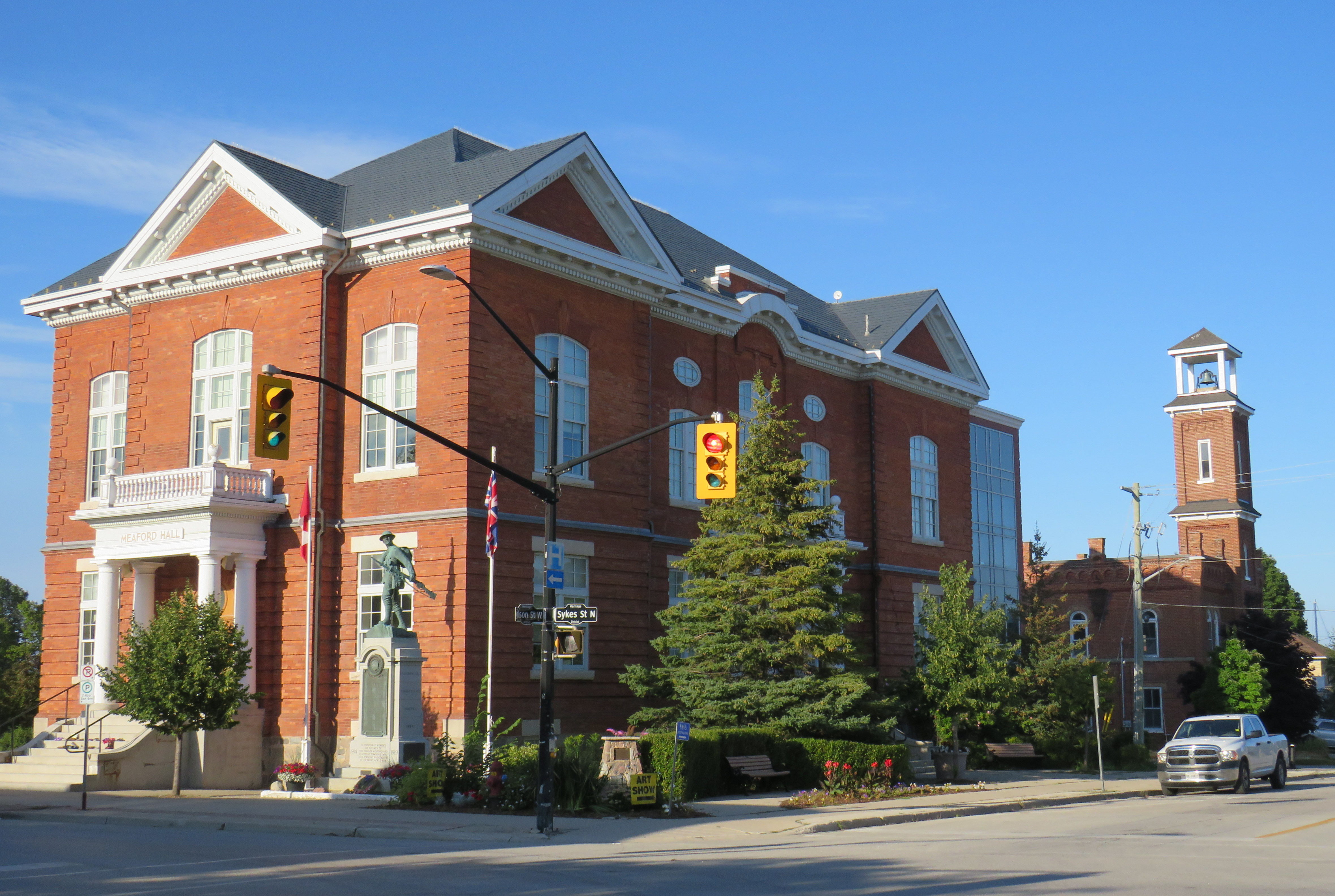
Meaford Hall, with the old fire station behindTerminus of the Georgian Trail, which continues to Collingwood, with connections beyond
Friday: Meaford to Collingwood and Toronto
The next morning, I departed Meaford on GTR Route 4 at 8:46AM, and arrived at Blue Mountain Village just after 9:30, another $5 pre-booked trip. The popular resort is also served by Colltrans’ Blue Mountain Link route to Downtown Collingwood, with connections to local buses and the Simcoe County Linx Route 4 to Wasaga Beach.
Approaching Blue Mountain, the driver helpfully asked me if I needed to catch the bus to Collingwood. Though the timetables between GTR Route 4 and Colltrans’ bus don’t permit an easy connection, if I got off at Craigleith, at the bottom of the escarpment, I would be sure to get the onward bus. I declined the offer, because I was curious to see Blue Mountain Village itself, and I needed a coffee.
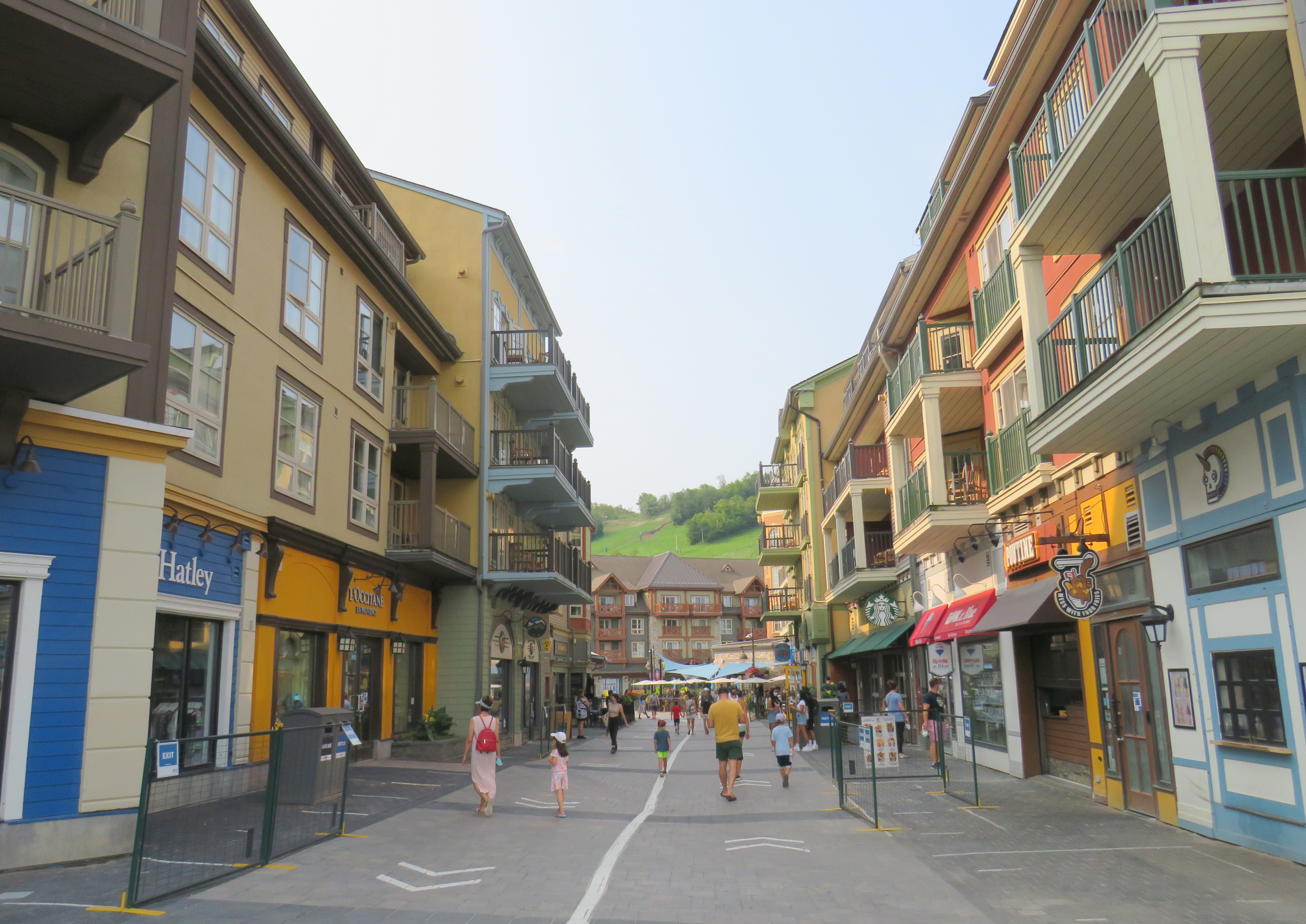
The Disneyland-like urbanity of Blue Mountain Village
Blue Mountain Village, the heart of the sprawling Blue Mountain resort, contains many shops, restaurants and bars, along with three hotels and timeshare apartment complexes with the architecture and walkways meant to invoke a European ski resort. Cars are not permitted in the internal streets, which gives it a somewhat surreal atmosphere. In the summer, tourists and vacationers are attracted by several golf courses, downhill mountain biking trails, rope courses, spas, nearby beaches, and, of course, the shops.
Having gotten my coffee and my morning walk, I paid my $2 fare and got on the 10:20 bus to Downtown Collingwood.
Colltrans and Simcoe County Linx buses at Downtown Collingwood
Like Owen Sound, Collingwood has a lovely and vibrant downtown core, with its own proud marine and railway history. Collingwood was the terminus of the Ontario Simcoe & Huron Railway, the province’s first rail connection, built in 1853-1854. The OS&H was built as a shortcut between the Upper Great Lakes and Toronto and prospered before merging with several other railways to become part of the massive Grand Trunk system. Sadly, passenger service to Collingwood ended in 1960, and the railway itself is abandoned and partially removed.
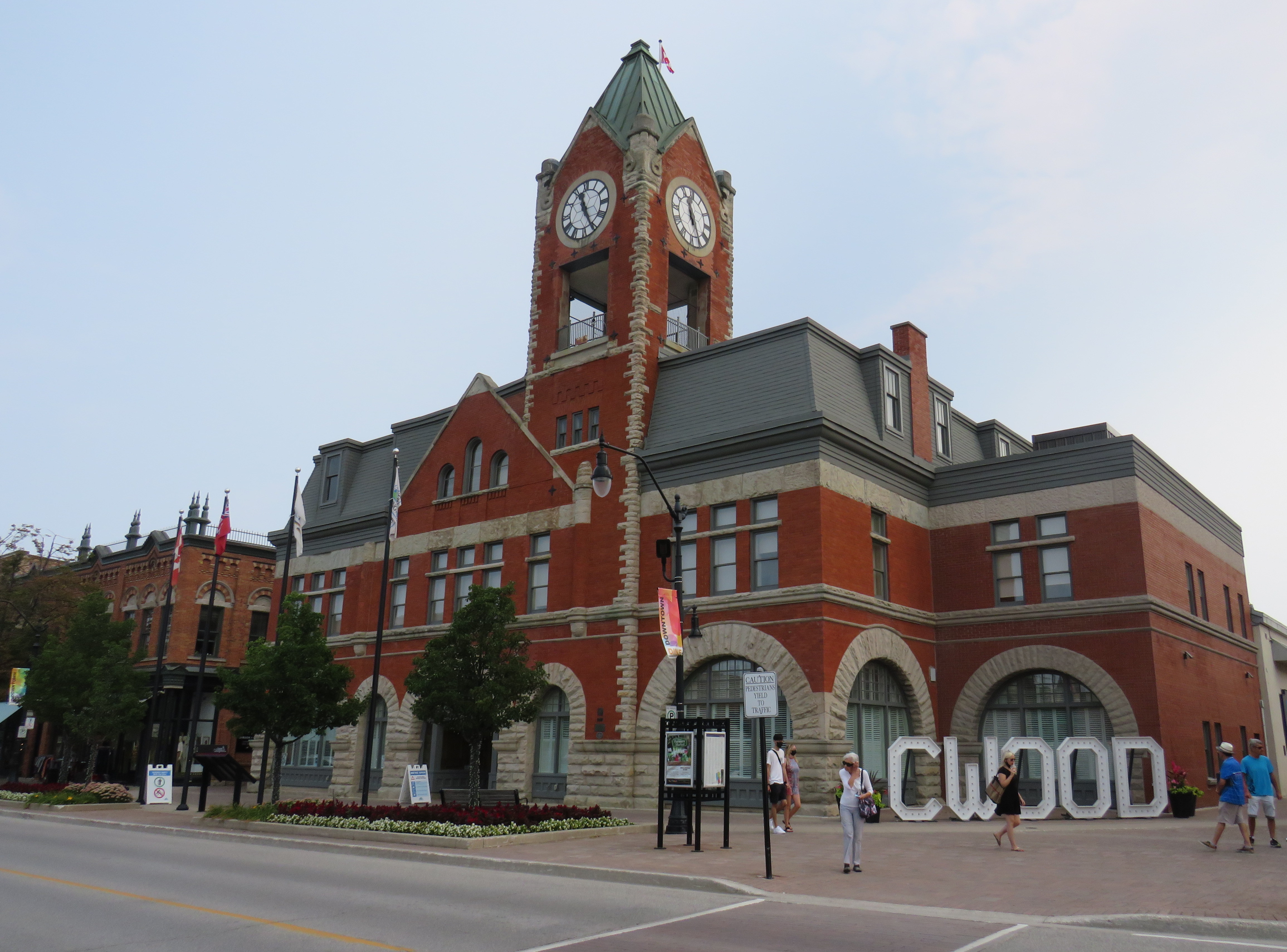
Collingwood Town Hall
After a hearty lunch in Downtown Collingwood and walk through the area, I paid another toonie and boarded Simcoe Linx Route 4 to Wasaga Beach.
In the back parking lot of a Loblaws Superstore in the west end of Wasaga Beach, two Simcoe County Linx buses, a Wasaga Beach Transit bus, and a Clearview Transit minibus meet to exchange passengers. The grocery store is distant from the main tourist area and the downtown commercial centre, but at least transfers between buses are easy. The Wasaga Beach Transit bus does pass by most motels, tourist traps, and beach areas. I changed to another Simcoe County Linx bus (Route 2) that passes through Stayner and Angus for Allandale Waterfront GO Station south of Downtown Barrie. The fare between Wasaga Beach and Allandale was $6.00 cash.
At a grocery store parking lot, Simcoe County Linx, Wasaga Beach Transit, and Clearview Township buses meetArrival at Allandale Waterfront GO Station
Allandale Waterfront GO Station, which hosts GO trains and buses and several Barrie Transit routes, is one of two Barrie terminal points for Simcoe County Linx’s buses. Buses to Orillia and Midland terminate at Georgian College and Royal Victoria Hospital in the northeastern corner of Barrie, with a Barrie Transit fare and a 30-minute local bus ride to get from one Linx route to another.
Kempenfelt Bay, Barrie
The ride back to Union Station, which included a bus to Aurora GO and a change to a train the rest of the way. That final trip cost me $13.76 on my Presto card.
In total, I paid $39.06 on Thursday and $28.76 on Friday to complete the round trip between Toronto and Georgian Bay.
Analysis and Conclusions
It is good to see Owen Sound, Grey County, and Simcoe County develop local solutions to replace and improve upon vanished coach services that ran on Highways 6, 10, and 26, better schedules and improved connections will only make their services better.
With limited schedules, particularly on Grey Transit Route and Simcoe County Linx, I could only do this exact trip by leaving Toronto on a Wednesday or Thursday. GTR’s Routes 3 and 4 between Owen Sound, Meaford, and Blue Mountain operates Wednesdays through Sundays. Though transit between Blue Mountain Village and Wasaga Beach runs 7 days a week, the Simcoe Linx bus between Wasaga Beach and Barrie only runs weekdays, with the last buses leaving Allandale GO and Wasaga Beach Superstore at 6:30 PM.
Later service hours and weekend service between Barrie and Wasaga Beach would allow GTHA residents to get to one of the Great Lakes’ great beaches without a car for a weekend getaway, without more congestion on Highways 400 and 26.
In addition, it would be good to see Simcoe County and municipal systems in Collingwood, Wasaga Beach, Barrie, Orillia, and Midland/Penetanguishene develop a coordinated fare structure, as transfers or fare discounts are not provided between each service, except between Linx and Midland/Penetanguishene. Simcoe County Linx already has its own farecard; if that were upgraded it would at least allow frequent riders to benefit from easy fare payments and transfer discounts.
These are relatively simple changes that can further drive ridership growth and improve mobility throughout fast-growing Simcoe County as well as attract more visitors from Toronto and beyond.
The Toronto-Guelph leg of my trip was unnecessarily slow, and will continue to be so until all-day, two way GO service is introduced on the entire Kitchener Corridor, or if express buses are added to the schedule. While all-day GO train service will take several years with several construction projects underway or necessary in Toronto, Brampton, and Guelph to provide the necessary capacity, improved bus service can provide a stopgap for the time being.
Without an express GO bus or competing services such as Greyhound (which used to operate multiple buses between Guelph and Toronto) or a morning VIA Rail train, it can take nearly three hours to get from Toronto to Guelph without a car.
Though GO Transit will introduce significant service improvements starting Labour Day, including new peak-direction express trains on the Kitchener Corridor. Unfortunately, there are no travel time improvements for getting between Toronto and Guelph weekday mornings. Given that there is currently no alternative access between the two cities, there’s a market that GO Transit is clearly missing right now.
Replacement high pressure sodium lamp on left, the white glow of Toronto’s classic “acorn” lamp on right.
Street lighting is an important, yet overlooked, part of any city’s standard infrastructure. For over seventy years, Toronto’s streets were lit with an elegant and increasingly unique streetlamp design. But modern standards and a desire for standardization will see this change, just as Toronto’s streetcars and street signs have.
Toronto Hydro, which is responsible for Toronto’s street lighting, is replacing the older “acorn” lamps with high pressure sodium (HPS) cobra head lamps (so-called due to their shape when seen from the top or bottom). While surrounding municipalities are switching to white-burning LED lights, Toronto Hydro is installing the older beige-orange glowing lamps.
I asked Toronto Hydro what their long-term plans were for the city’s street lighting infrastructure. Read more on Spacing’s website.
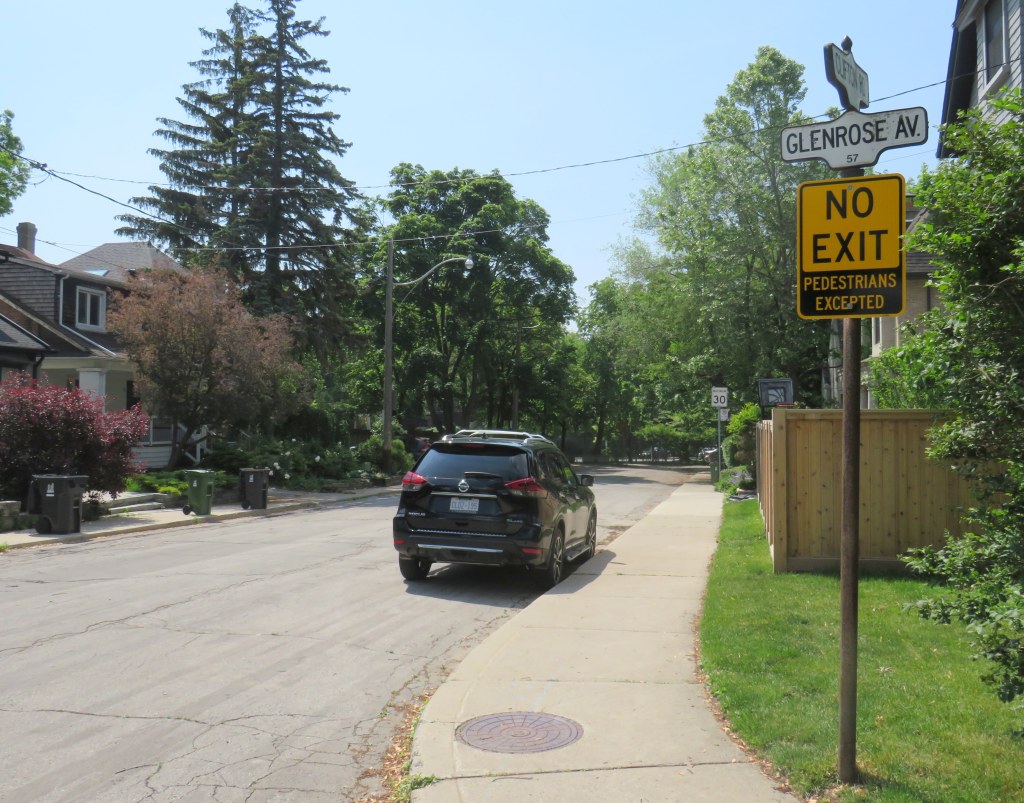
On April 8, Toronto City Council approved a motion brought forward by Councillor Paula Fletcher to change that. Councillor Fletcher’s motion was titled “I’m Walking Here.” Only two months later, new signs are already appearing across Toronto — in Scarborough, Monarch Park, and Swansea. For a city that often takes years to adopt what may seem like simple, easy solutions, this was implemented impressively quickly. The new signs look like standard yellow “no exit” signs, but with a “pedestrians excepted” note at the bottom.
My hope is that these signs will entice Torontonians to get outside, go for a walk, and check out some new streets and parks, enticed by these signs inviting through passage.
In related news, this week Toronto Council approved the expansion of sidewalk slow clearance to all of Toronto’s streets, a service that was previously provided only to suburban areas, where unobstructed sidewalks made municipal slow clearance easy to do. With new snow equipment able to navigate narrow urban sidewalks, Toronto is now finally able to provide universal snow clearance services, a boon for full accessibility.
As public health restrictions ease and stores and restaurant patios reopen this Friday (supported by the city’s willingness to reallocate road space on streets like Yonge and Danforth), there’s never been a better time to for a walk.
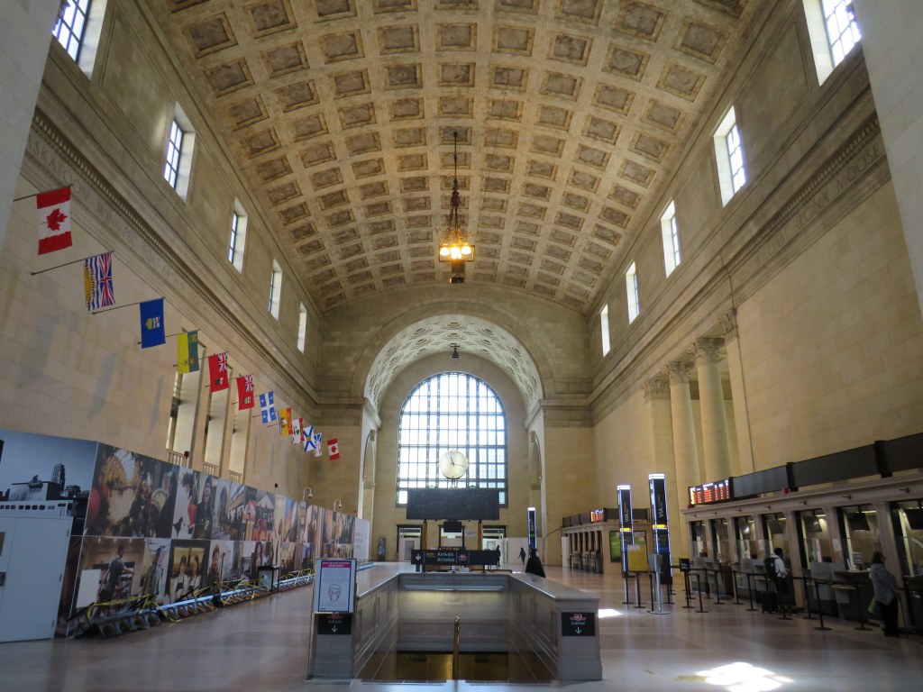
Union Station’s Great Hall is one of Toronto’s great indoor spaces. The station was constructed during Toronto’s first great building boom, in an era that began with E.J. Lennox’s Old City Hall (completed in 1899), and concluded with the completion of the Bank of Commerce Building, opened in 1931.
Work on Union Station, built for the Grand Trunk Railway and Canadian Pacific Railway, began in 1914, with the grand headhouse completed in 1920, construction delayed by the First World War.
Foreshadowing the long-delayed station renovations that are still ongoing, work on the elevated tracks and platforms connecting to the new station took nine more years, though a lavish official opening took place on August 6, 1927. By then, the Grand Trunk Railway was fully absorbed by Canadian National Railways (now CN).
Toronto’s Union Station became Canada’s busiest and most important railway hub, with direct trains to cities throughout six provinces and six American states, with through sleeper cars to even more US destinations via Buffalo. Though Montreal was Canada’s largest city until the early 1970s, CN and CP operated out of separate terminals.
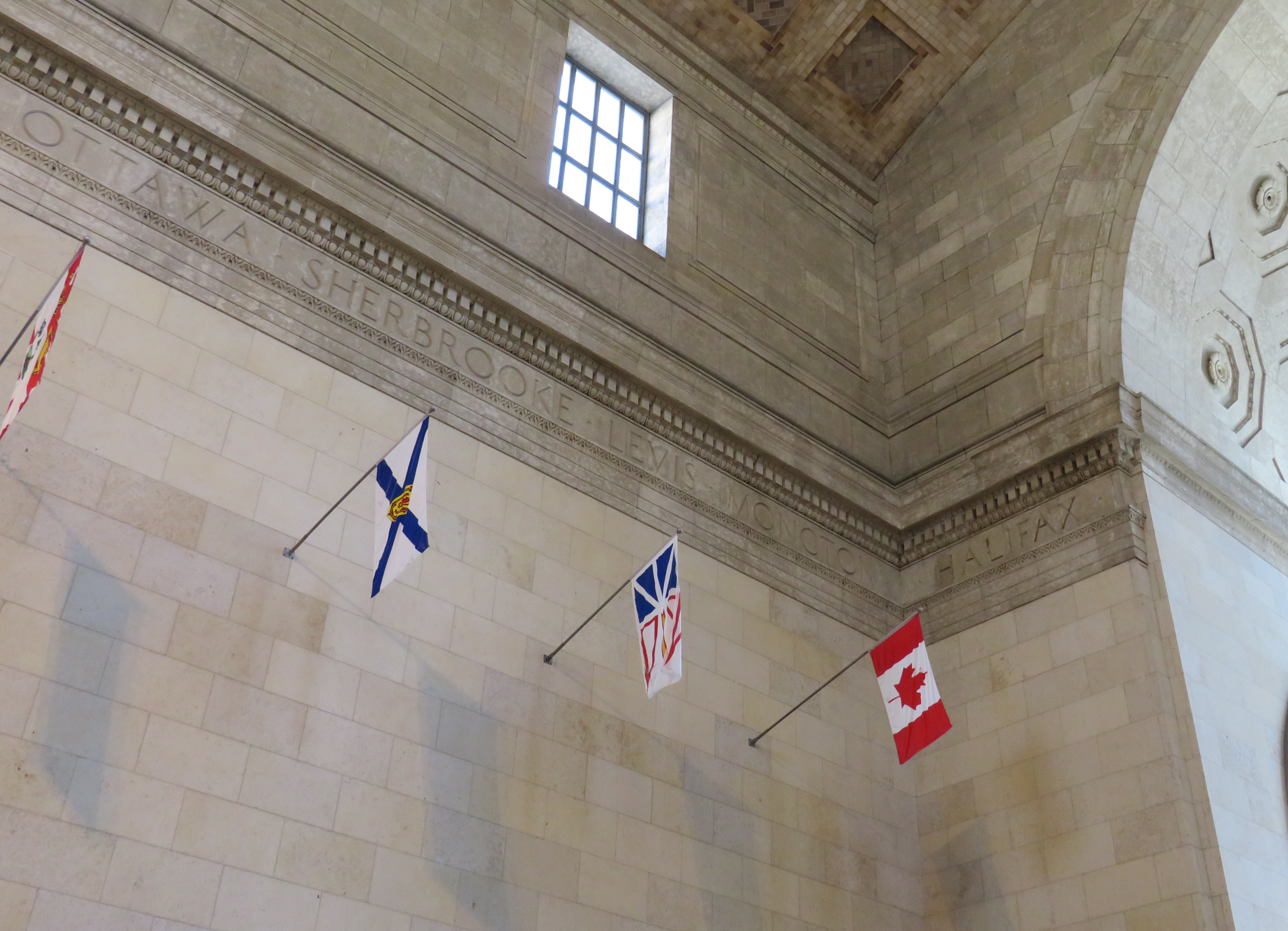
Up high, the names of 27 Canadian cities are carved into the walls. On the north side are the names of cities that were served primarily by the Canadian National Railway (the former Grand Trunk, Grand Trunk Pacific, National Transcontinental, Canadian Northern, and Intercolonial Railways, as existed in 1914-1918); on the south, were the names of cities served primarily by the Canadian Pacific Railway.
On the north side, from west to east, the cities read:
Prince Rupert – Edmonton – Saskatoon – Winnipeg – Port Arthur – North Bay – Sarnia – London – Toronto – Ottawa – Sherbrooke – Levis – Moncton – Halifax
Ottawa – Sherbrooke – Levis – Moncton – Halifax, on the northeast corner of Union Station’s Great Hall
On the south side, from east to west, the city names read:
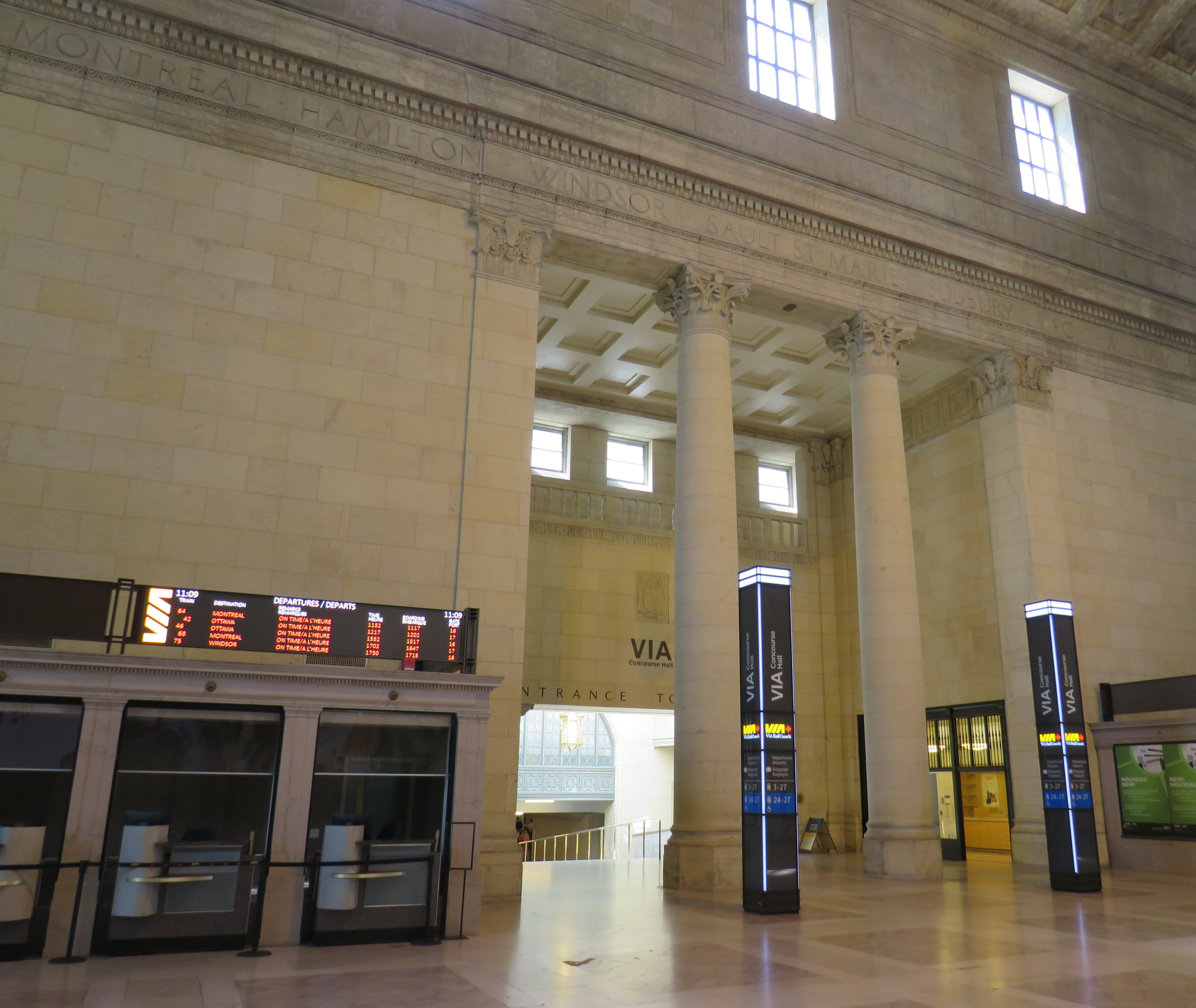
St. John [NB] – Fredericton – Quebec – Montreal – Hamilton – Windsor – Sault St. Marie [sic] – Sudbury – Fort William – Regina – Moose Jaw – Calgary – Vancouver
Montreal – Hamilton – Windsor – Sault St.-Marie – Sudbury – Fort William — names of cities over the entrance to the train concourse
Many, but not all, cities had direct train service from Union Station; the rest required a change of train at Montreal for points east, Sudbury for Sault Ste. Marie, or Jasper, Alberta, for Prince Rupert.
As rail passenger services declined after the Second World War, the number of destinations reachable from Union Station declined. Fredericton lost its rail service in the 1960s, with buses connecting it with the CPR Montreal-Saint John train. (A VIA-operated RDC restored service between Fredericton and Saint John for a few years in the 1980s.) Sault Ste. Marie lost its RDC service to Sudbury in early 1977, though an intrepid traveler could technically still get to Sault Ste. Marie by rail until 2014, by taking a VIA train to Franz or Oba, and then waiting for many hours in remote Northern Ontario for a southbound Algoma Central Train.
But it wasn’t until 1990, due to severe cuts made by Brian Mulroney’s PC government, that daily passenger service across the country came to an end. No longer could a rail passenger reach Calgary, Moose Jaw, Regina, or Thunder Bay (Fort William) by train. In 1994, with the rerouting of all Montreal-Halifax trains to the CN route though Lévis and Campbellton, stations in Sherbrooke and Saint John lost their remaining service. In 1998, CN abandoned its tracks through central Lévis, requiring the Ocean to be rerouted away from the ferry connection to Québec City. And in 2012, the Ontario government ordered the end to the Northlander, which ran through North Bay to Cochrane.
Today, just 14 of the 26 destinations proclaimed on the walls of Toronto’s Union Station can be reached by train. In Fredericton, there are not even any rails remaining.
Despite the decline in medium and long-distance passenger rail services in North America, Toronto’s Union Station is more relevant than ever. GO Transit began operating in 1967, and expanded throughout the 1970s and 1980s. Now, thanks to its role as hub for commuter and regional rail, regional and intercity buses, local transit, and the rail link to Canada’s busiest airport, Union Station became busier than ever. Today, most passengers are headed to places like Aurora, Mississauga, Pickering, or Burlington, despite the promises of far-flung destinations etched on the Great Hall’s walls.
Barry’s Bay, on Greyhound’s Peterborough-Pembroke route, is one of many smaller towns and villages that permanently lost all intercity bus connections since the COVID-19 pandemic
On Thursday, May 13, Greyhound Canada announced that it was permanently ceasing operations. This should not have come as a shock to anyone following the intercity transport industry: for over three decades, intercity bus carriers in this country were privatized (Gray Coach and Canada Coach Lines in Ontario, shut down (Saskatchewan Transportation Corporation), or strangled by continued cutbacks and poor customer service (Greyhound). In 2018, Greyhound Canada ended all its remaining services between Vancouver and Sudbury. The loss of commuter and student traffic — Greyhound’s bread-and-butter in Ontario and Quebec — due to the pandemic led to a temporary, then permanent shutdown.
The next day, on Friday, May 14, Megabus — operated by Coach Canada, a subsidiary of UK-based Stagecoach — announced that it would begin service on the Toronto-Ottawa and Toronto-Kingston routes abandoned by Greyhound. Two buses a day will soon operate between Toronto, Scarborough Town Centre, Kingston, and Ottawa, daily except Tuesdays and Wednesdays, terminating at St-Laurent Shopping Centre, a stop on Ottawa’s new LRT. Though this provides a new option for travelers between the big three cities (VIA Rail continues to serve this route), it does not fill the gaps left by years of decline by private intercity bus operators.
Before Greyhound’s website disappeared, I downloaded the PDF schedules for Ontario and Quebec. In 2019, Greyhound operated three routes between Toronto and Ottawa: an express bus, with stops only in Scarborough, Belleville, Peterborough, Madoc, and/or Kanata, a local bus, making stops in cities and towns along Highway 7 between Peterborough and Carleton Place, and a Kingston-Ottawa bus via Smiths Falls. You can view and download the schedules below:
Peterborough loses two buses a day to and from Ottawa and express bus service to Downtown Toronto (which made the trip in less than two hours off-peak.) Though Peterborough is still connected to Toronto via GO Transit bus Route 88, it can take nearly three hours to go between Union Station and Downtown Peterborough, including a train connection at Oshawa, and many local stops in Clarington and along Highway 115. Other towns, such as Norwood, Marmora, Madoc, Perth, and Carleton Place, lose all bus services, except for a commuter-oriented weekday run between Ottawa and Carleton Place.
Greyhound has chosen to become irrelevant to most Canadians long before the final shutdown announcement. Northern Ontario, at least, still has Ontario Northland (which has expanded its reach), and the Greater Toronto and Hamilton Area has GO Transit (though gaps continue to exist in that network). If your rural community is lucky, your local or regional municipality launched a new, subsidized bus or microtransit service. There is also VIA Rail, which serves most larger communities that lost Greyhound services in 2020-2021 (Windsor, Chatham, Belleville, Ottawa, etc.), though it is typically more expensive.
Despite these continued and emerging services, there remains a need for government support of those crucial links left behind by Megabus, VIA, and GO Transit.
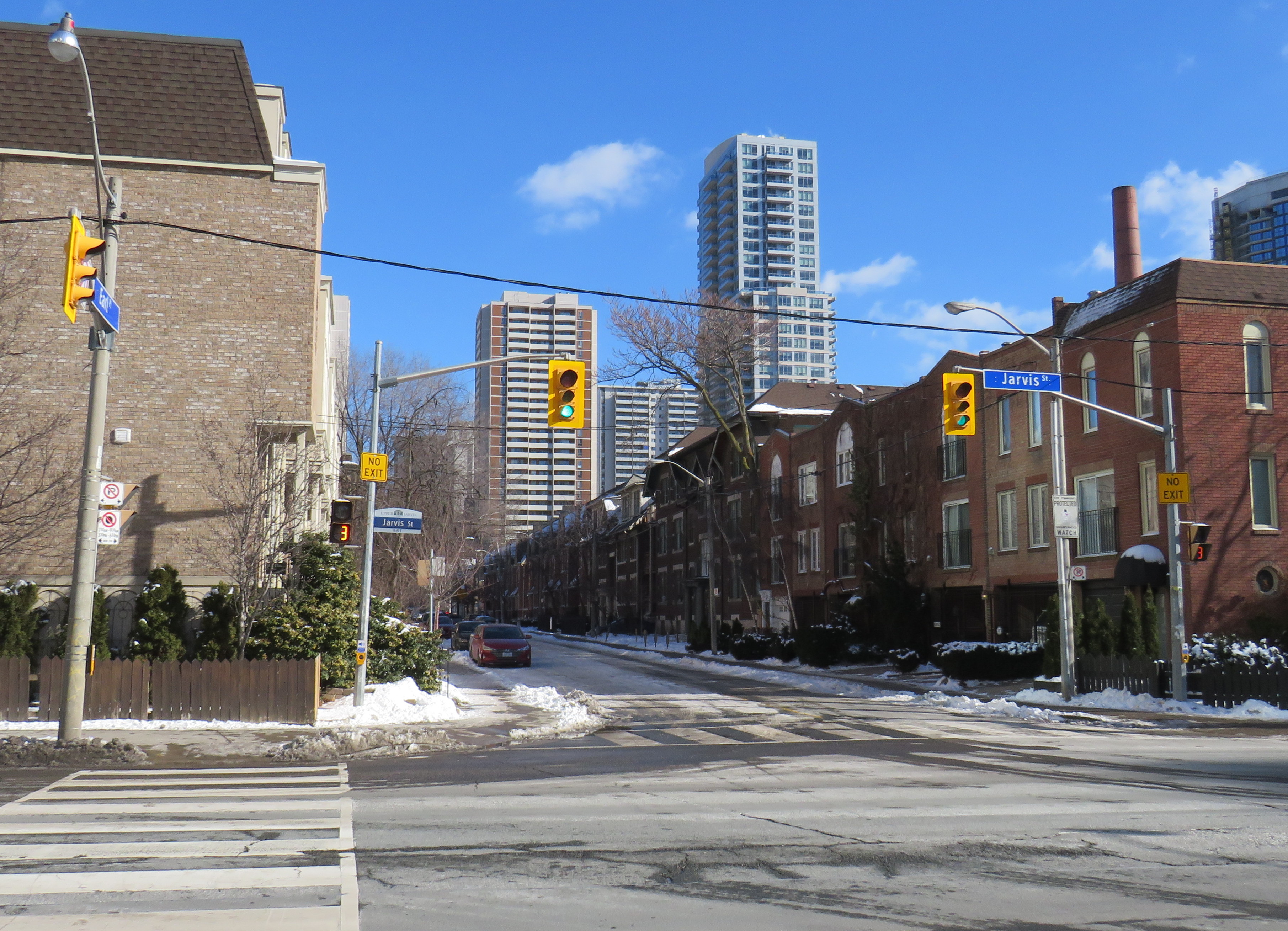
Misleading “no exit” signs, like these on Maitland Place at Jarvis Street, will soon be changed by the City of Toronto to indicate that indeed, pedestrians can continue through
Though these signs are required under traffic codes and regulations, they do not reflect that in many cases, there is an exit for pedestrians.
I quickly created a Google map of all locations in the City of Toronto marking such locations. Through a social media campaign led by Walk Toronto, we were quickly able to map over 450 locations where a pathway, sidewalk, or staircase allows a pedestrian to continue their way where motor vehicles are forced to turn around.
The motion, which was amended to strengthen the wording, requests city staff to develop a new signage standard to indicate where “no exit” signage betrays a pedestrian passage, and to begin installing these new signs this year.
Councillor Paula Fletcher’s motion (inspired by @Walk_TO) to have staff modify “No Exit” signage in places where there are, in fact, exits for pedestrians carries via show of hands, with some amended wording. https://t.co/owNfqtPgNUpic.twitter.com/eevn2bMwkN
The map that I created based on Dylan’s initial suggestion will be used to help identify these locations.
Given the ongoing pandemic, where we are all subjected to yet another lockdown, walking is one of the few permitted ways for each of us to get outside, enjoy the fresh spring air, and get much needed exercise. Knowing where one can walk, especially away from heavy traffic or busy sidewalks and paths, will only help unlock the city for more Torontonians.
I want to thank everyone who submitted locations for the map to Walk Toronto or to myself via Twitter or directly to me on this website. This couldn’t have happened without the help of fellow Torontonians.