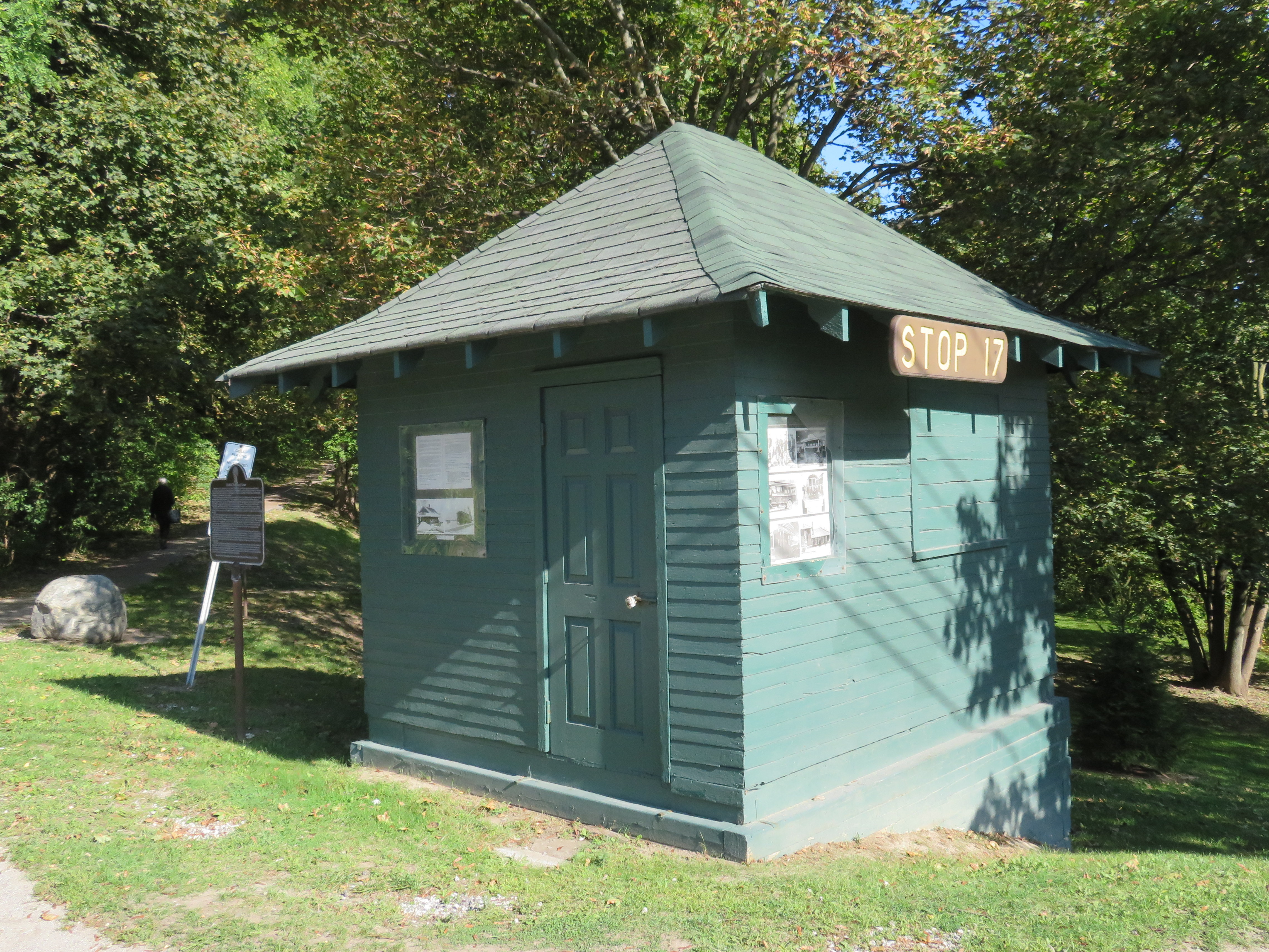
Stop 17 shelter in Thornhill
On Yonge Street in Thornhill, a small green hut sits beside the busy roadway at the entrance to Cricklewood Park. On the side of the small building, a wood sign says “Stop 17.” Hundreds of buses and thousands of cars pass by this hut daily, yet few may know about the transit history it represents.
Stop 17 was a stop on the Toronto & York Radial Railway line that extended north from a terminal at Toronto’s city limits at Yonge Street and Glen Echo Avenue (now the location of a Loblaws supermarket) all the way to Sutton, via Richmond Hill and Newmarket. Electric radial service to Thornhill and Richmond Hill began in 1897. By 1908, radial service reached Lake Simcoe.
Stop 17 was one of two stops in Thornhill, located at the present-day intersection of Yonge Street and Royal Orchard Boulevard. The TTC, the eventual owner of most of Toronto’s radial lines, closed the Lake Simcoe route in 1930. Soon afterwards, the wooden shelter was moved to a nearby golf club, where it served as a snack bar and rain shelter. (The radial line was resurrected in late 1930 as a suburban streetcar service to Richmond Hill until 1948.)
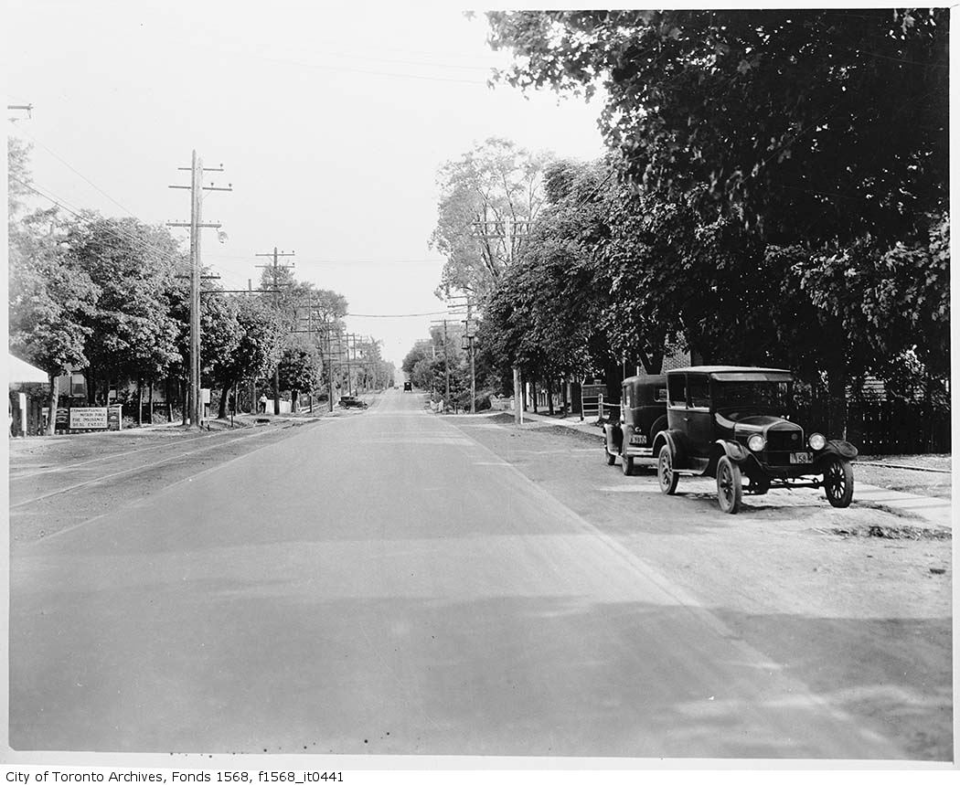
Yonge Street looking south in Thornhill, September 1931. City of Toronto Archives, Fonds 1568, Item 441.
In November 2000, the Stop 17 shelter was moved back to Yonge Street and restored. It stands as a historical building in Thornhill, and as a monument to early suburban transit in Greater Toronto. Only a few other structures exist from the radial railway era including the Newmarket Radial Arch, the footings of a Toronto Suburban Railway trestle over the Humber River, and a radial power station in Guelph.
There was another Stop 17, on the Scarboro Radial Line between Toronto and West Hill. By coincidence, it is also memorialized in the name of a variety store (Stop 17 Variety), which also sports a mural depicting a T&Y radial car stopped in front of the Scarborough High School (now R.H. King Academy).
 Stop 17 Variety on Kingston Road at St. Clair Avenue in Scarborough
Nearby the Stop 17 shelter in Thornhill, I noticed several markings in the sidewalk. After a closer look, I noticed that they were survey markers, indicating a location where holes were drilled for preliminary core samples for the planned Yonge North Subway Extension from Finch Station to Richmond Hill.
One day, the subway will be extended north into York Region, a sensible project given the ridership potential, especially as Yonge Street sees urban intensification through Thornhill and Richmond Hill. The City of Toronto has been resistant to the extension, as the Yonge Subway is already operating over capacity, with a relief subway required to handle the loads.
The politics of subway building aside, it is fascinating to find the history and future of Toronto’s suburban transit in such close proximity.
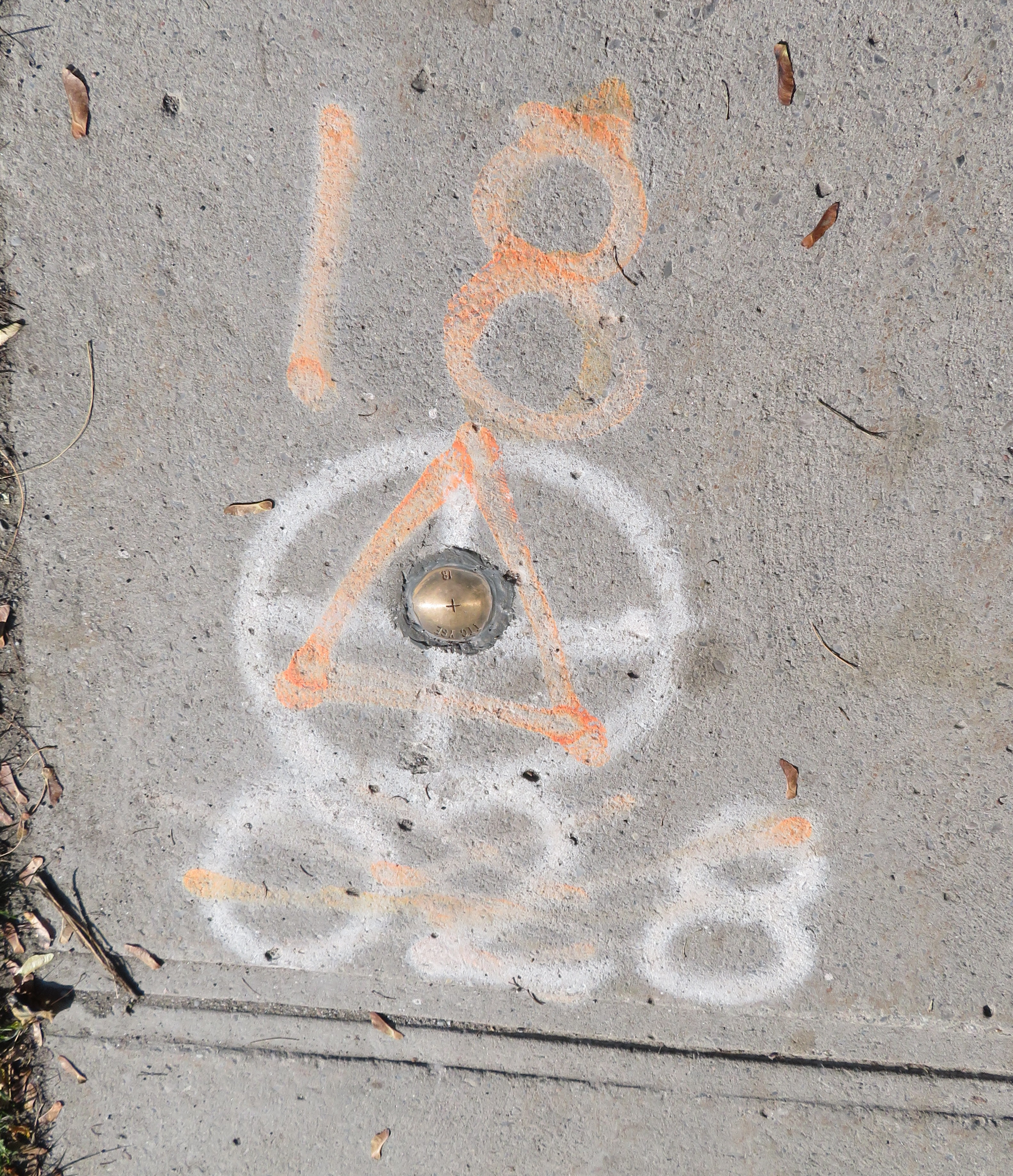
Sidewalk markings on Yonge Street
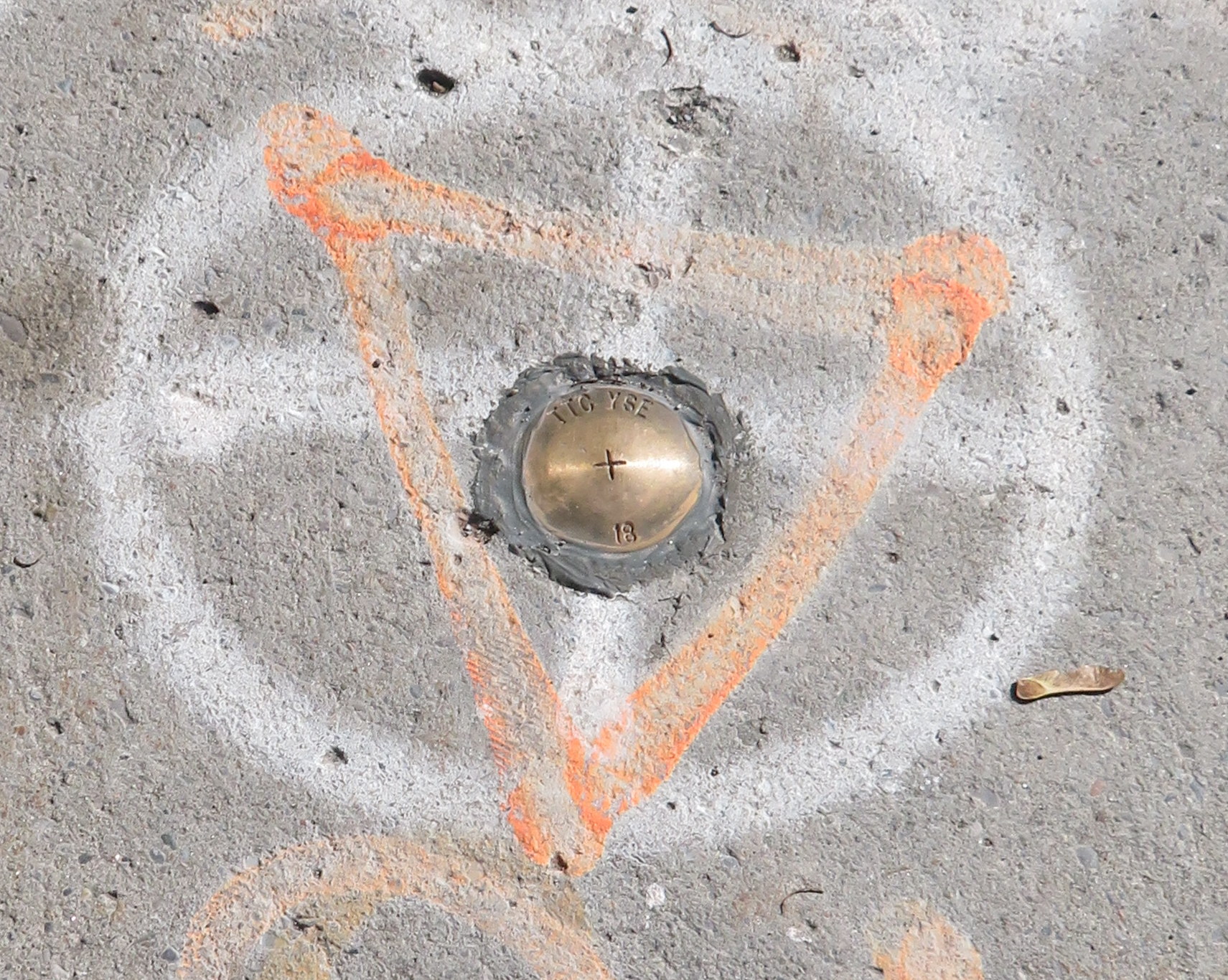
“TTC YSE” marker
 Distance Sign on Highway 5, Clappison’s Corners
 The other Covent Garden Market, London
 Paris, Ontario’s main street backs onto the Grand River
 Queen Elizabeth Way looking east towards Dixie Road in Mississauga
 Castle Kilbride
 986039 Oxford-Perth Road, a private residence with what is probably the highest numbered address in the world. Road markers for Oxford County Road 24 and Perth County Road 101 are in the background.

 Replica of Toronto Railway Company streetcar #327 operates at the Halton County Radial Railway museum, with the unique glass bulbs visible below the metal “Belt Line” sign. Photo taken June 2012
 TTC PCC Streetcar #4549 on Queen Street West in September 2018
 CLRV streetcar on Queen Street East, with two blue-green advance lights above the back-lit destination sign.
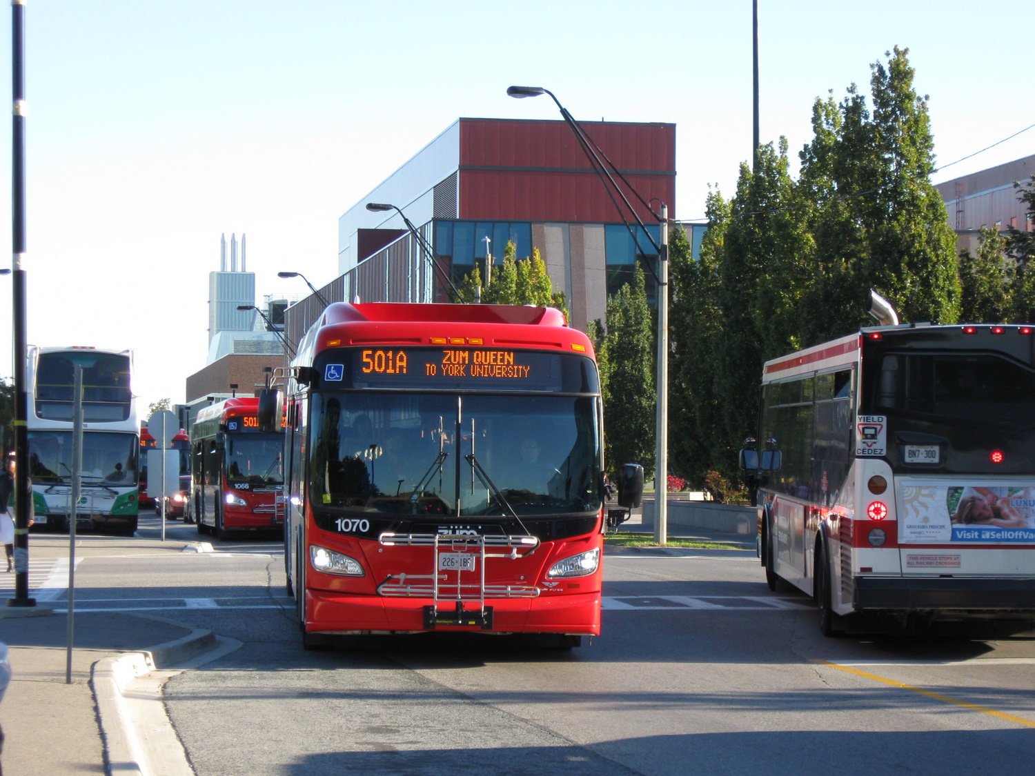
  Nova articulated bus with orange LED destination sign and blue LED advance lights indicating it is an accessible vehicle
 ION LRT vehicle undergoing testing in Kitchener, February 2019
 High Falls, Rochester
 Central Parkway in Cincinnati in January 2015, where new streetcar tracks run above the abandoned subway line
 A public walkway from the Genesee Riverway at the Broad Street Bridge allows visitors to get a glimpse of the abandoned Rochester Subway