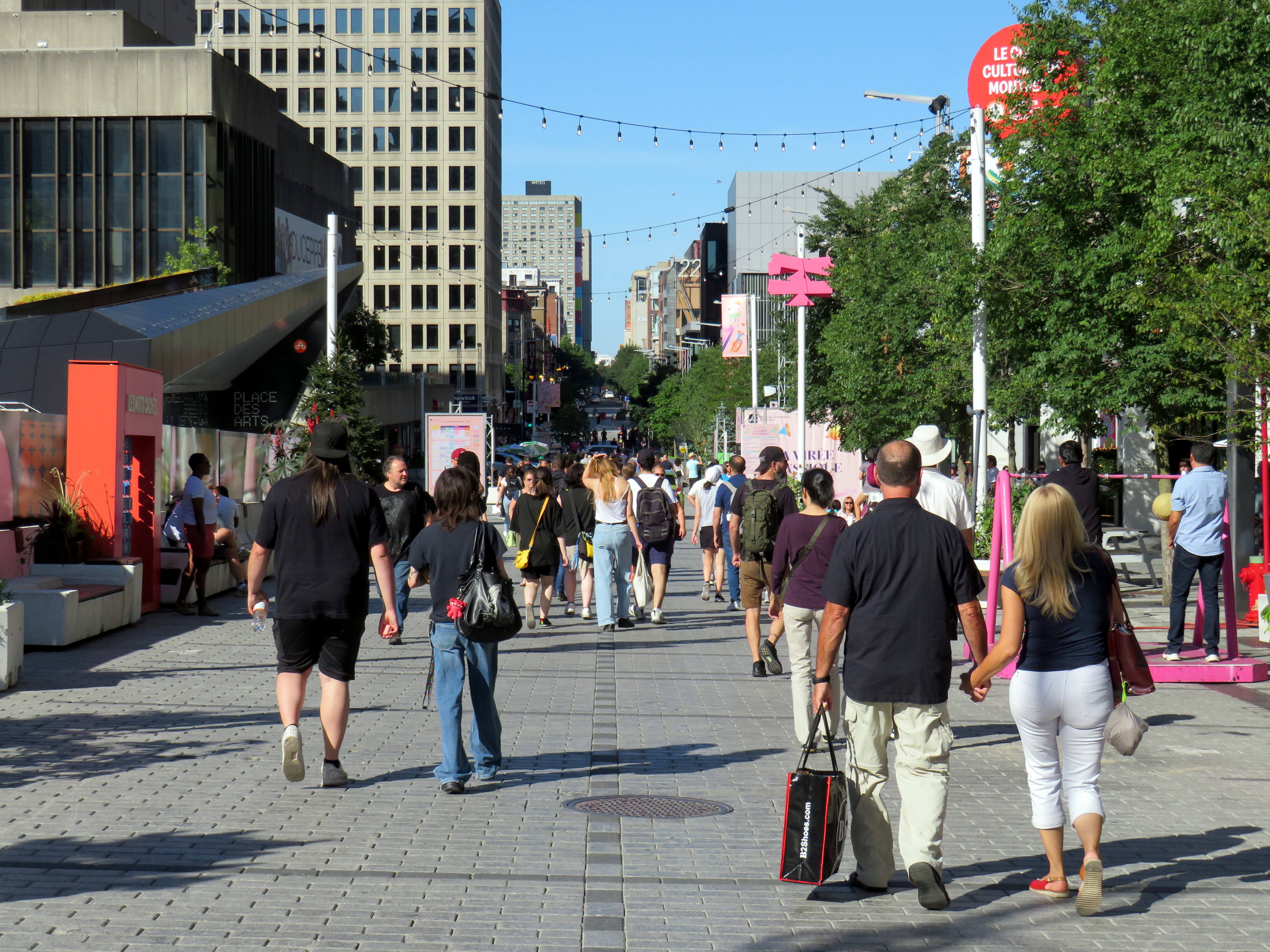
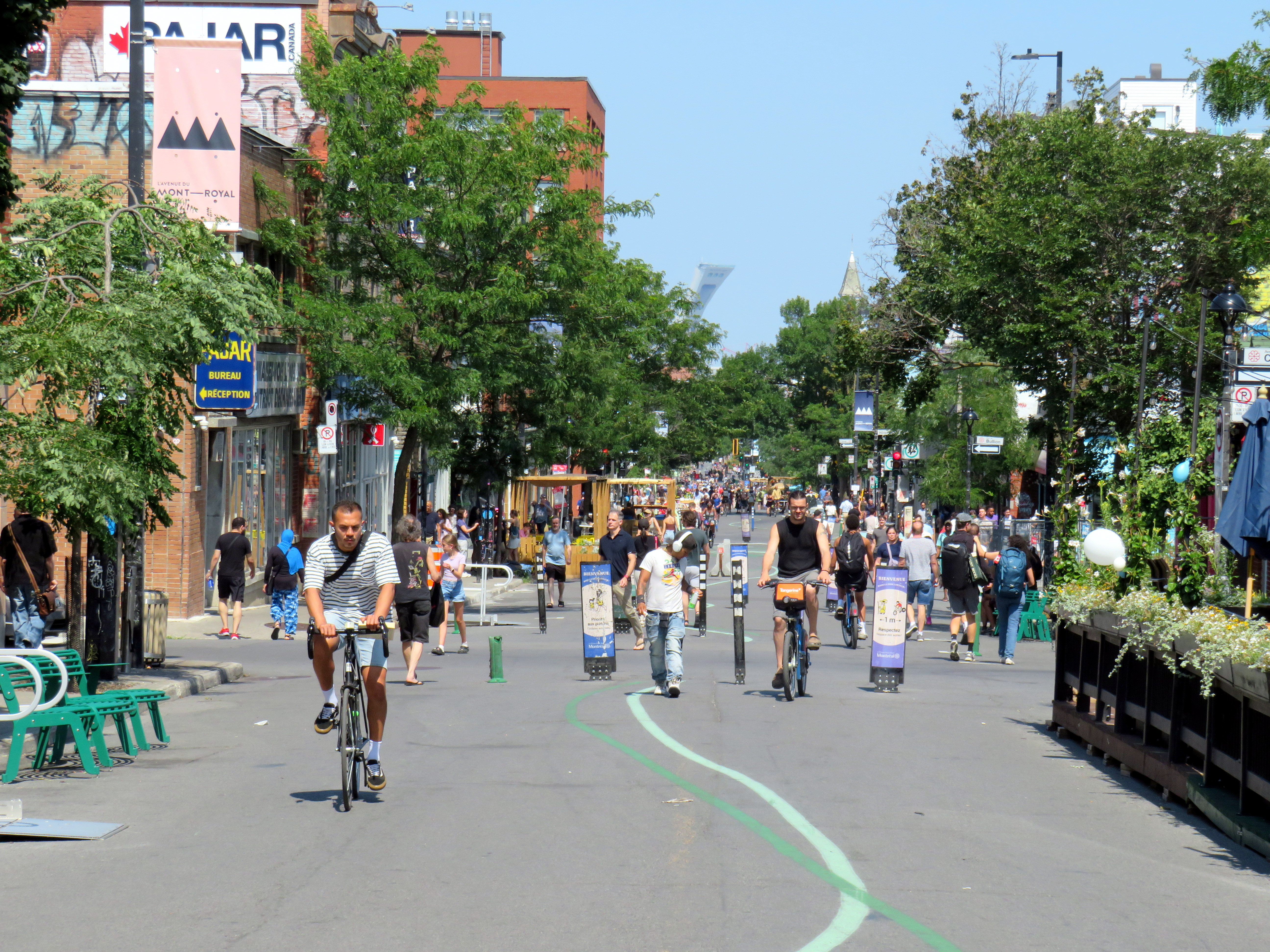
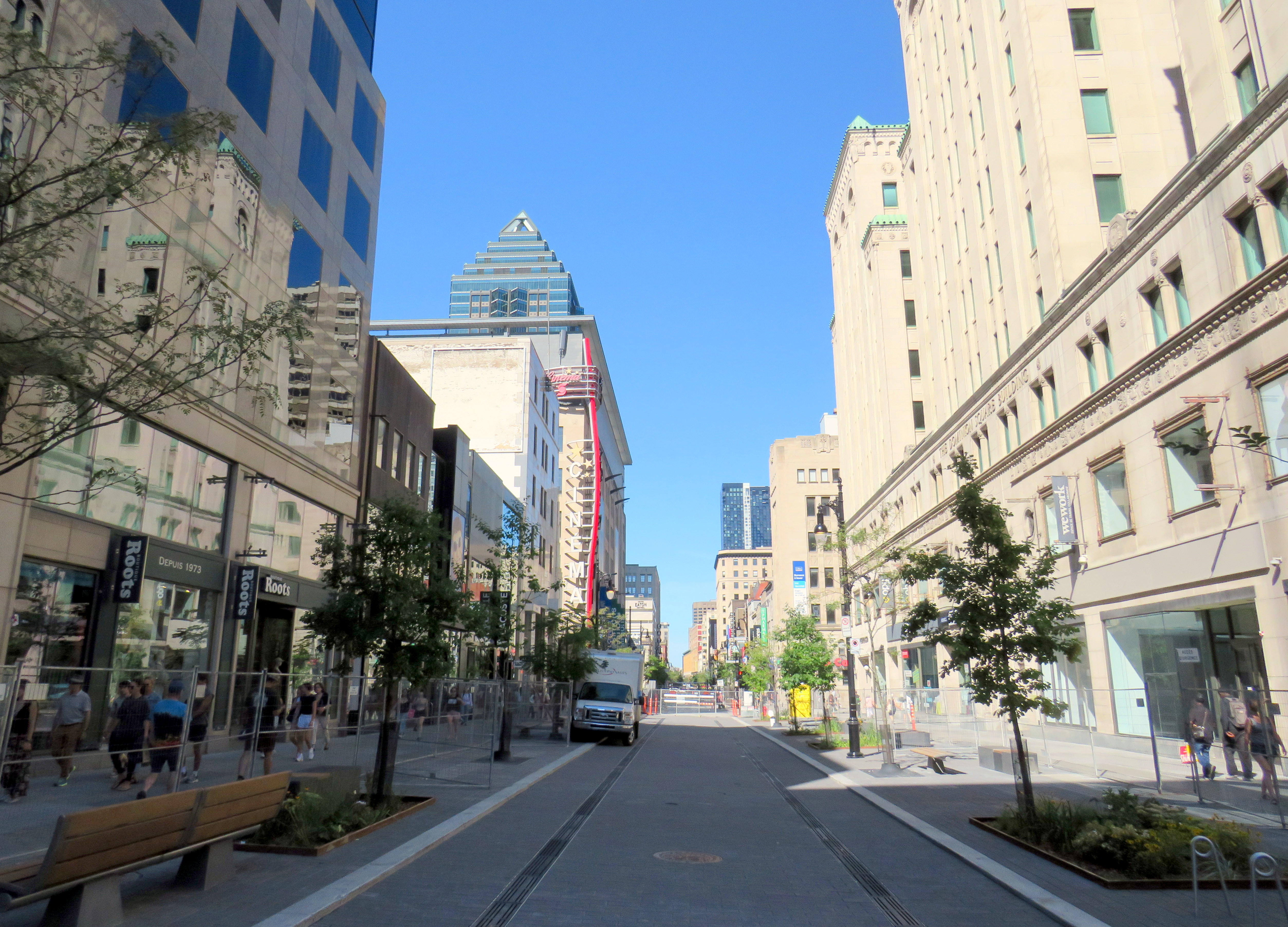
A visit to Montreal can make one jealous. Jealous of the city’s better street furniture, greater cycling infrastructure, great public spaces throughout the city, and an improved pedestrian realm. Entire streets are closed in the summer months to motor traffic, allowing pedestrians to spill out into the roadway, and patios to sprout without the need for concrete blocks to protect them (and less noise and pollution to those dining al fresco).
For example, Avenue Mont-Royal, was first closed in Summer 2020 as a “Corridor Sanitare” to encourage people to get outside during the first wave of the COVID-19 pandemic and support local businesses, which set up patios on the sidewalk and the street. My spouse and I rented a car and visited Montreal during this time, getting a lot of walking in a city that opened up as much as safely possible.
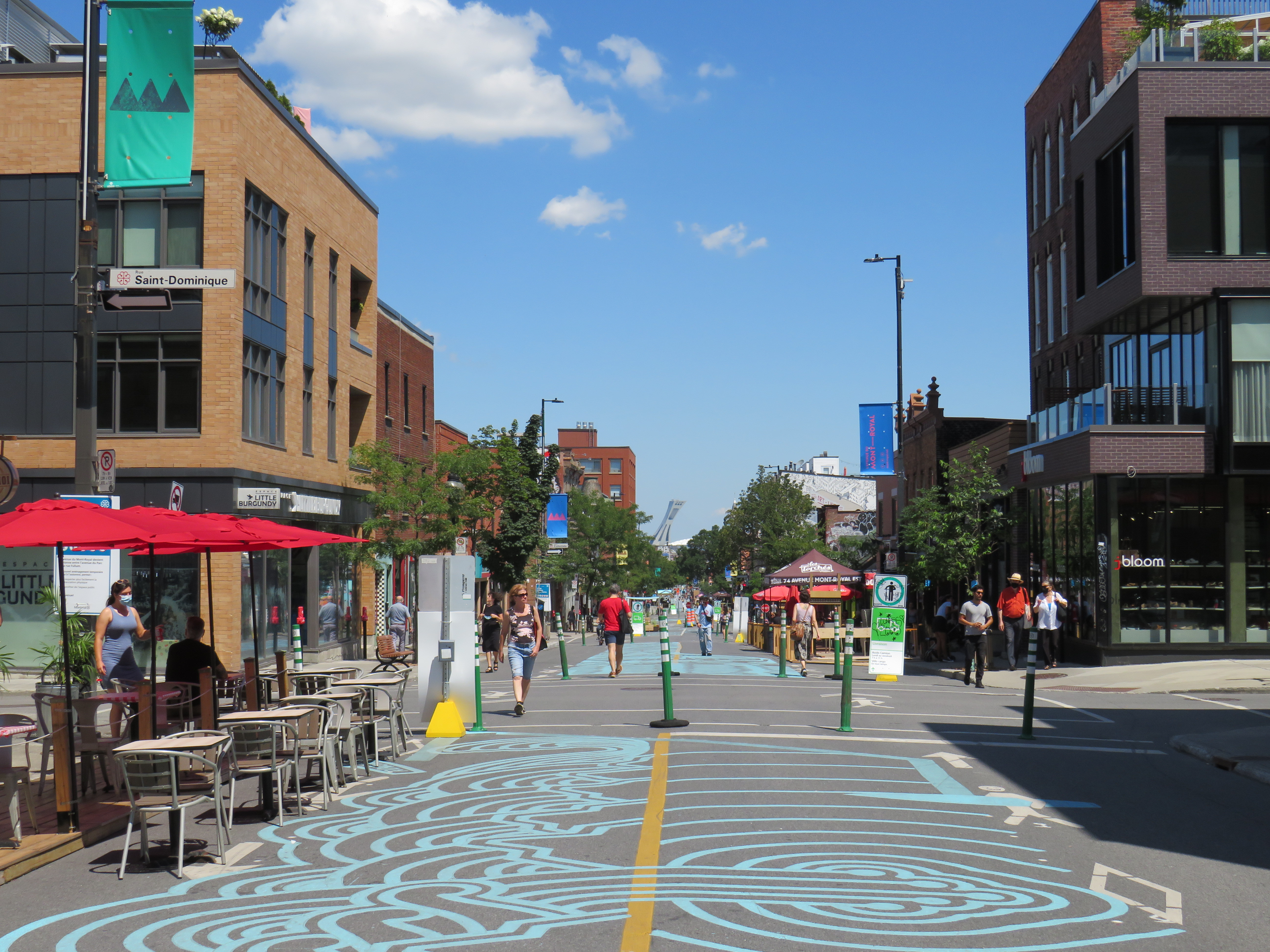
Happily, Montreal continued the tradition in the years since, even as pandemic restrictions eased, then disappeared entirely. Five years later, Avenue Mont-Royal was even more vibrant. Not only were there lots of patios on the street, there were public benches, shade structures, and water fountains, allowing anyone to sit, relax, and enjoy the outdoors. The annual summer closure is a hit.
Several public squares were also renewed in recent years. Phillips Square, on Rue Ste-Catharine across from the now-shuttered Hudson’s Bay department store, was renewed with new splash fountains along with small café-style tables and chairs, complete with shade umbrellas. The metal chairs are movable, allowing larger groups to sit around a single table. It’s a refreshed natural congregation point along the city’s main shopping street.
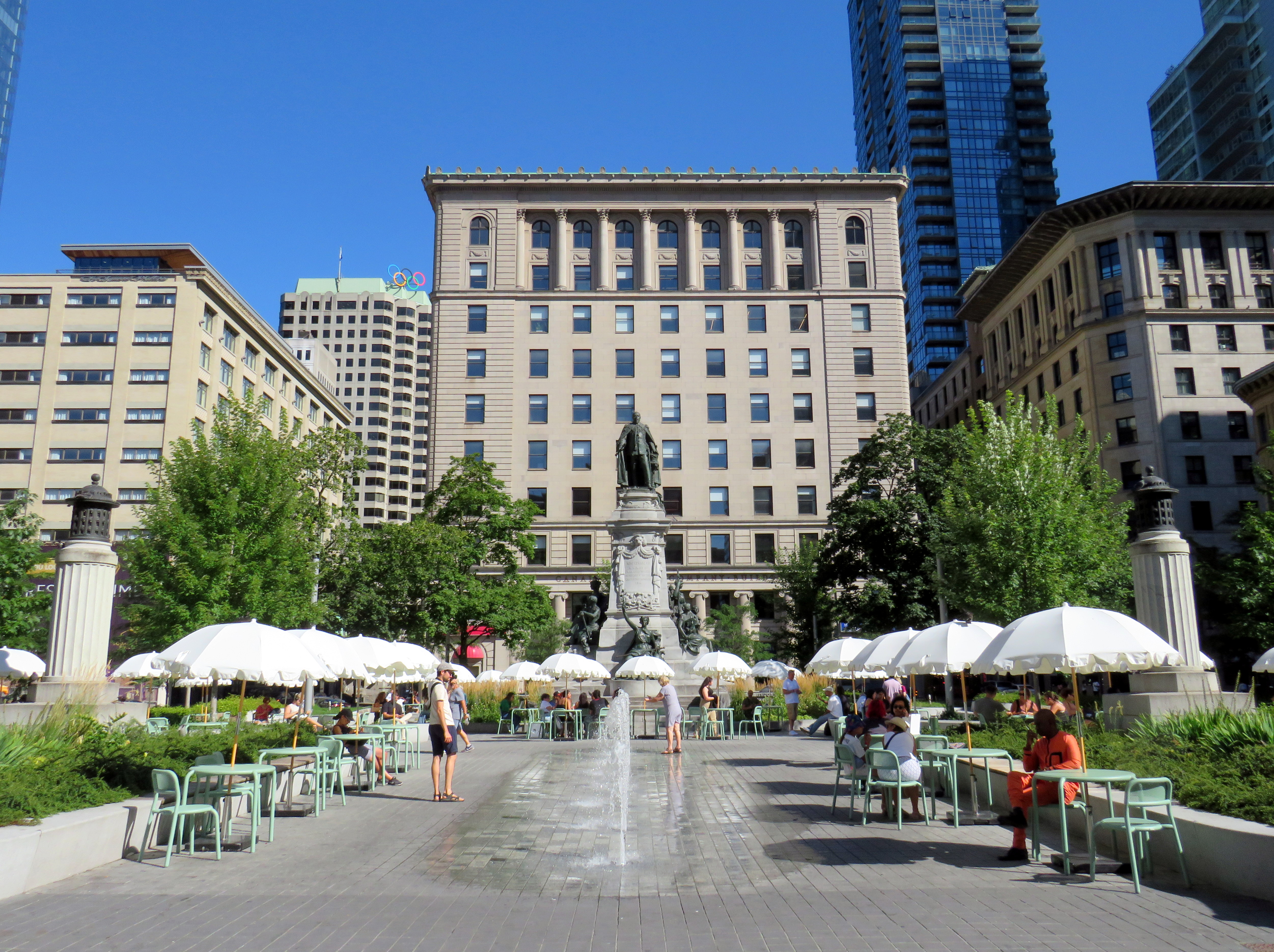
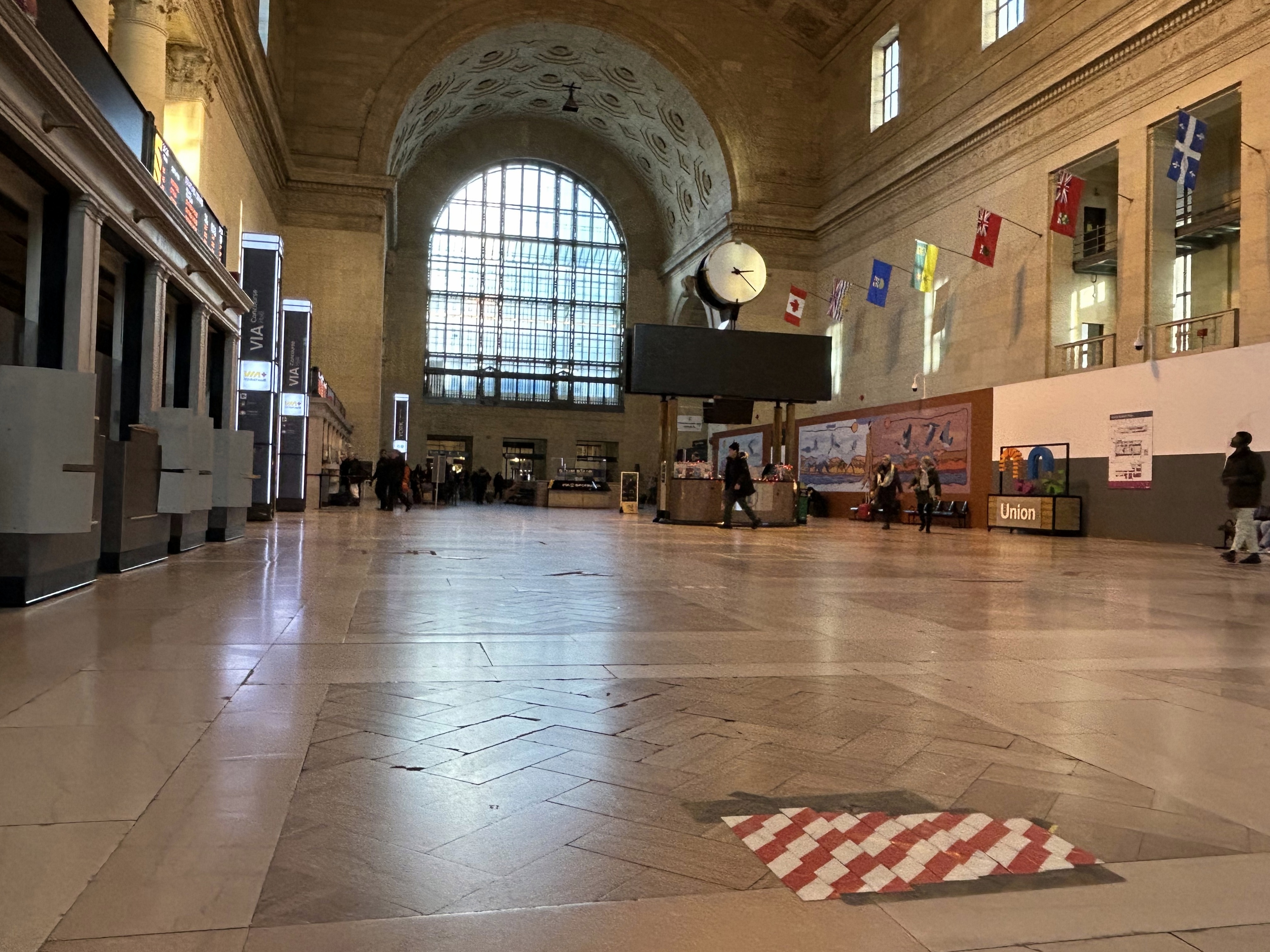
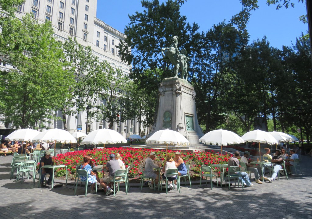
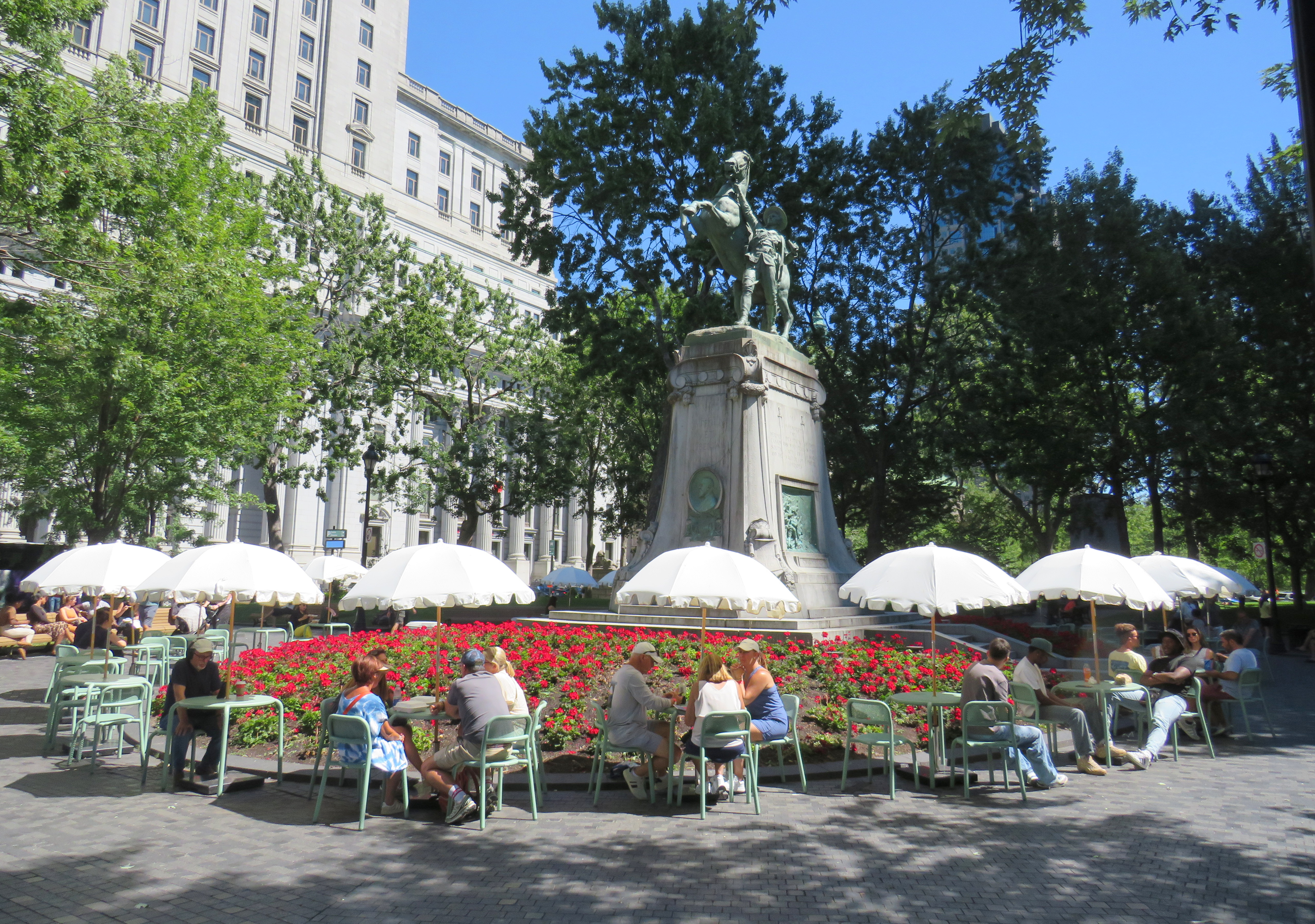
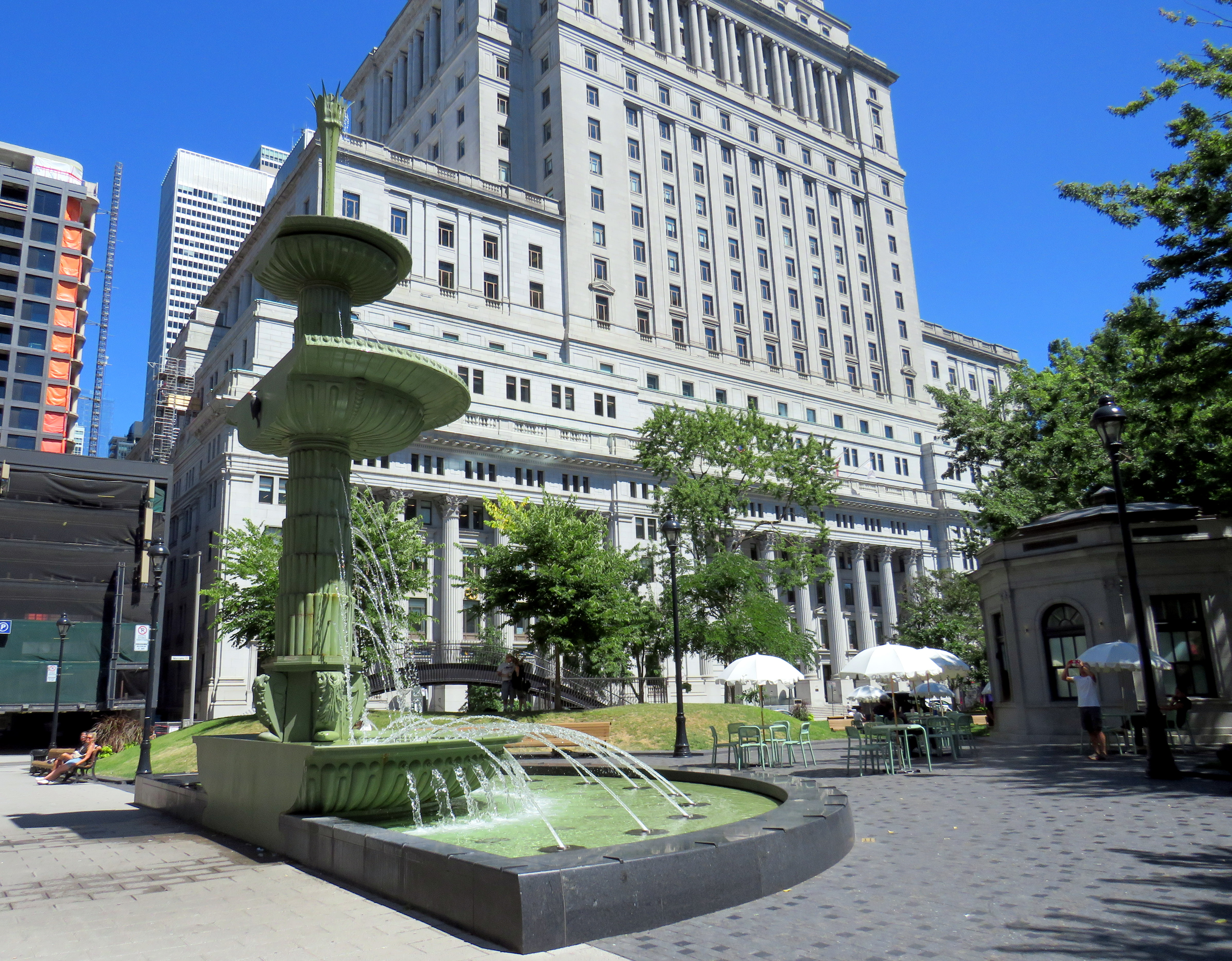
Similar tables and umbrellas were set up at Dorchester Square, several blocks to the west, near Mary, Queen of the World Cathedral and Central Station. Both squares were reimagined by the brilliant landscape architecture firm Claude Cormier + Associés. At Dorchester Square, a new water fountain, seemingly a classic installation, is cut in the rear, with a woodpecker behind. Such Easter eggs are features of Cormier park projects.
Furthermore, Montreal is rebuilding the western section of Rue St-Catharine towards Crescent. Though motor vehicles are permitted after reconstruction, they are limited to a single through lane, with lay-bys for deliveries, passenger pick-ups and drop-offs, and emergency vehicles. Sidewalks are widened considerably, with more benches, bicycle parking, and street trees.
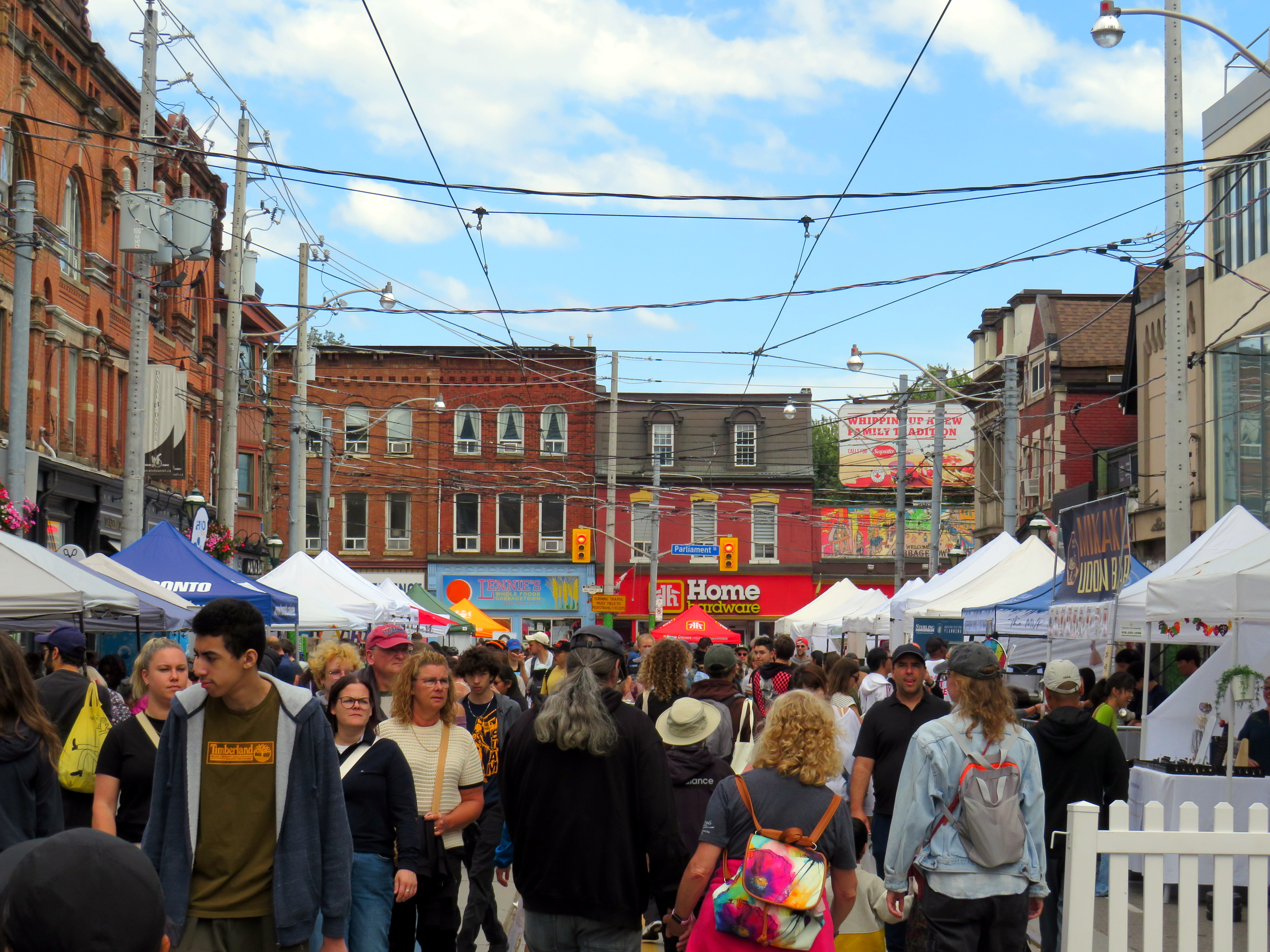
After returning to Toronto, it’s easy to feel down on this city. Montreal seems to do everything right. Meanwhile, ActiveTO, the open streets initiative following the pandemic restrictions here, quickly eroded, and was effectively ended in 2022. Open Streets, which closed sections of Yonge and Bloor Streets to motorists for two Sunday mornings, was last held in 2022. But there are still business improvement area-led weekend street festivals, which attract tens of thousands of pedestrians.
Torontonians want to walk, and pedestrianized streets, even when they’re just weekend events, are immensely popular. One downside, however, is a lack of seating outside of businesses’ patio areas. One is free to walk, enjoy live music, or just people watch, but to sit down, one is compelled to purchase something from one of the businesses with a sanctioned patio.
There are a few other successes. A small segment Gould Street at Toronto Metropolitan University was pedestrianized and rebuilt as a central plaza for that university campus. A short section of Willcocks Street at the University of Toronto was similarly pedestrianized.
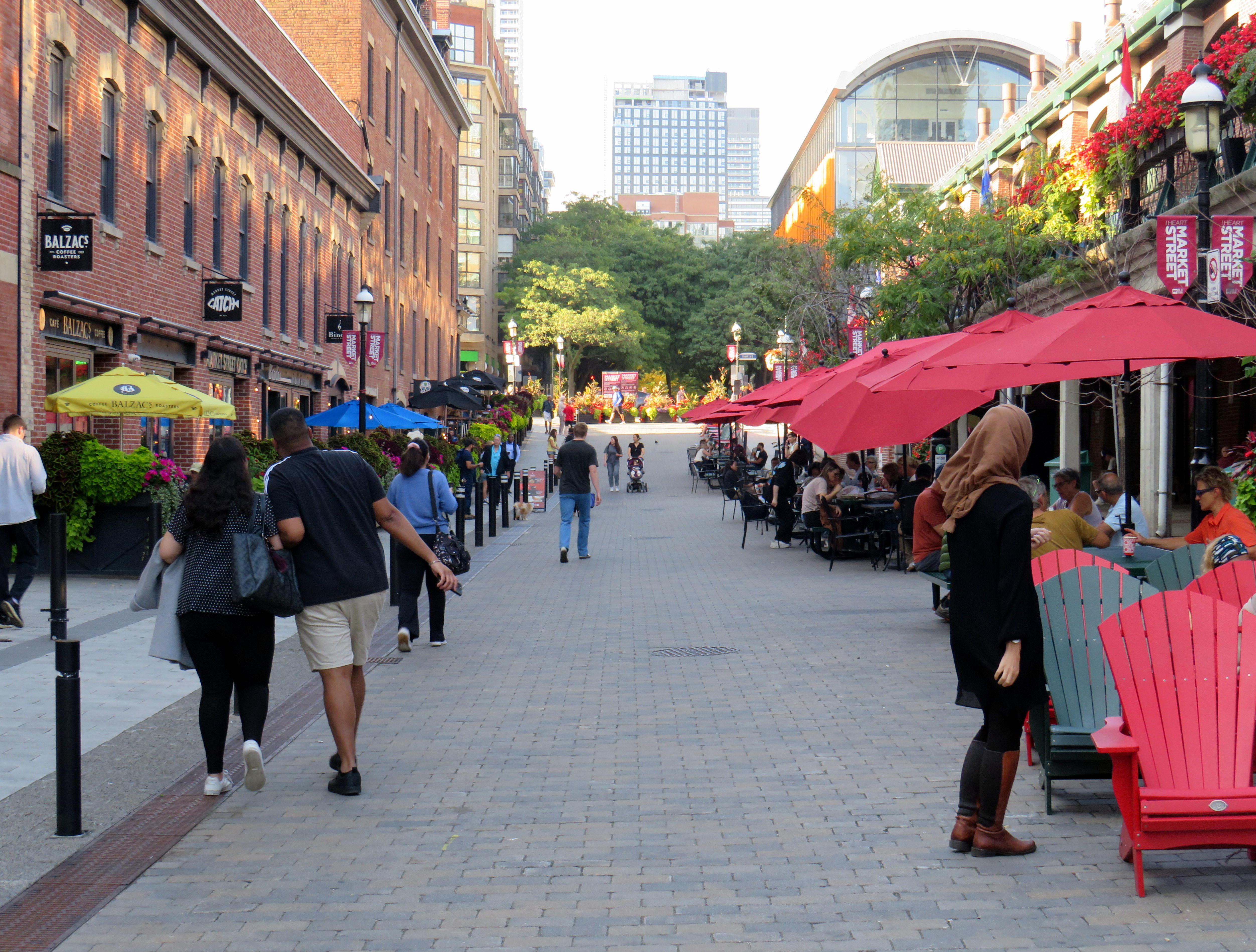
But the best example in Toronto is Market Street, which abuts St. Lawrence Market. Patio space and Muskoka chairs provide plenty of seating, without obligation to purchase anything (though it provides additional seating to those who picked up a snack or lunch inside the market). The shade umbrellas and high-quality surface materials and street furniture make this a wonderful oasis in Toronto’s downtown core.
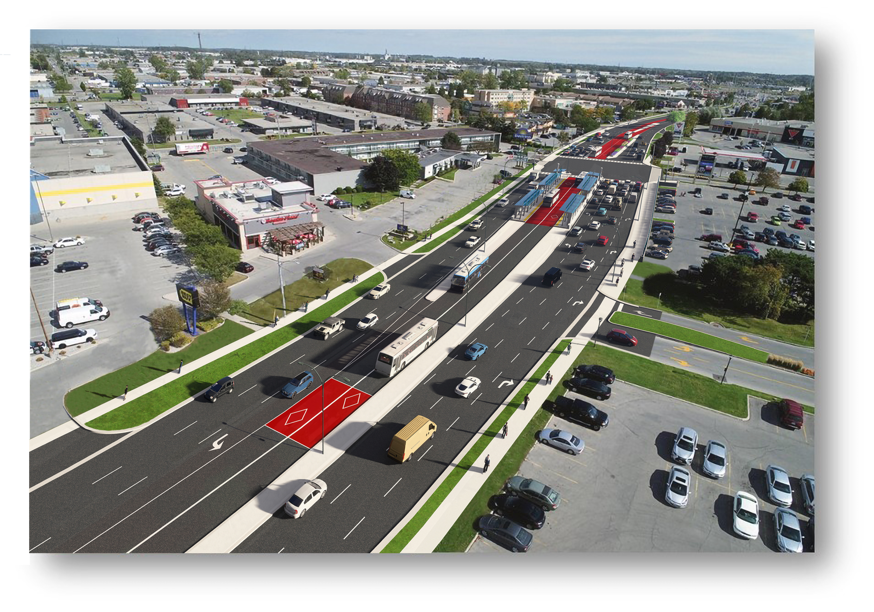
Planning for Yonge Street’s makeover, which will include narrowing the roadway, widening the sidewalks, improvements to the public realm, and seasonal closures of selected sections of the traffic lanes, is complete. Unfortunately, the YongeTOmorrow improvements will have to wait for another five years (work starting in 2030) due to Ontario Line construction.
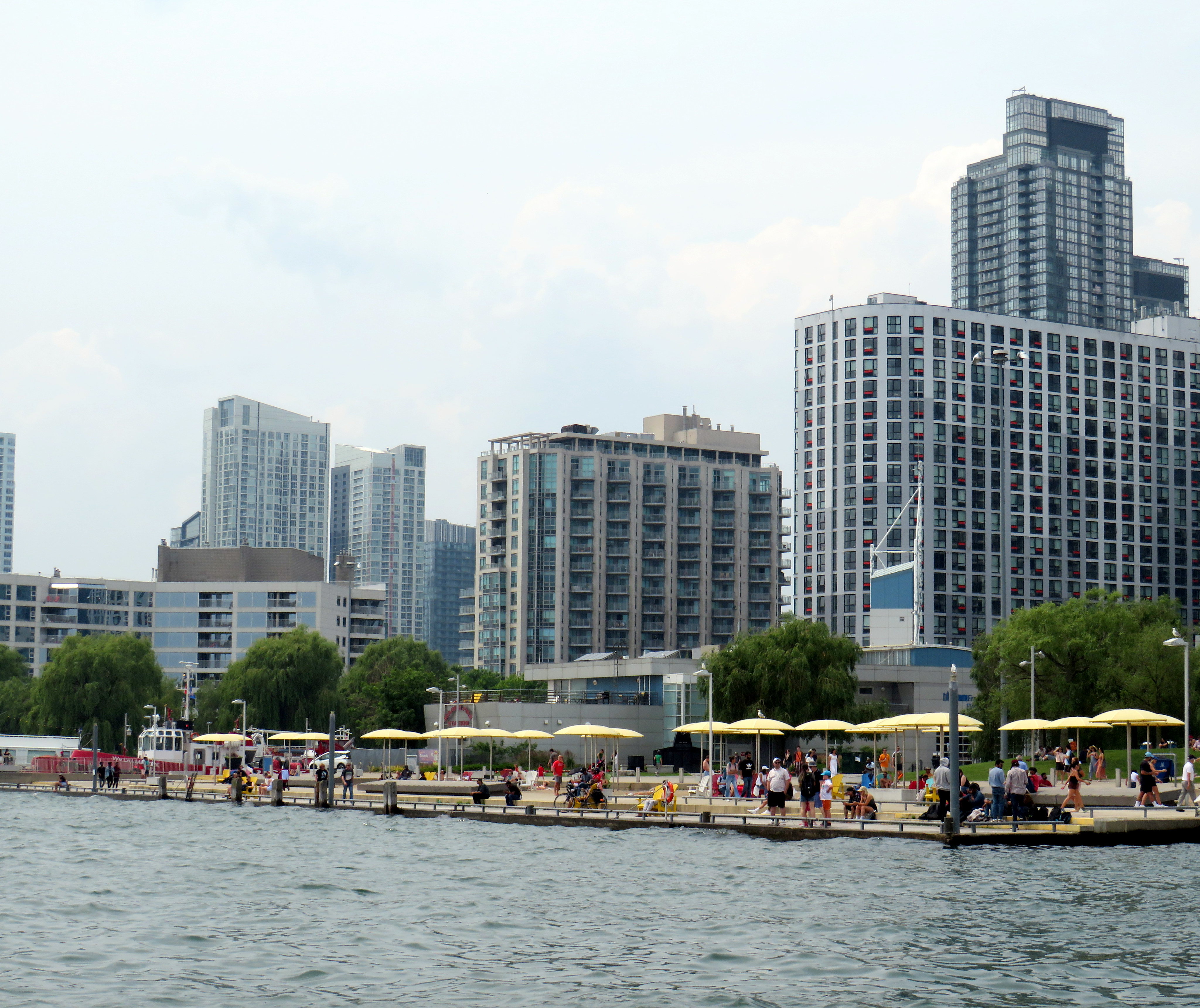
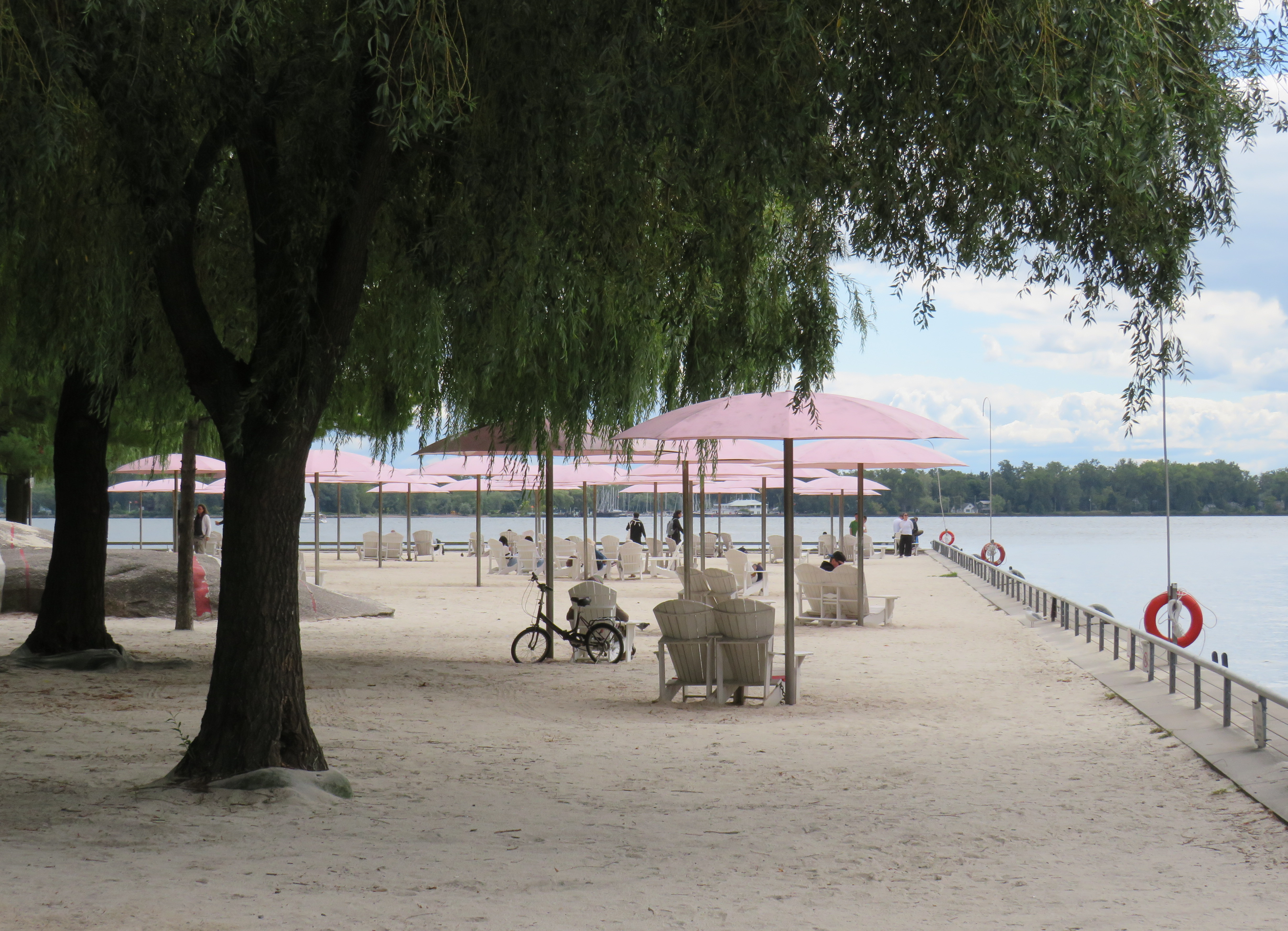
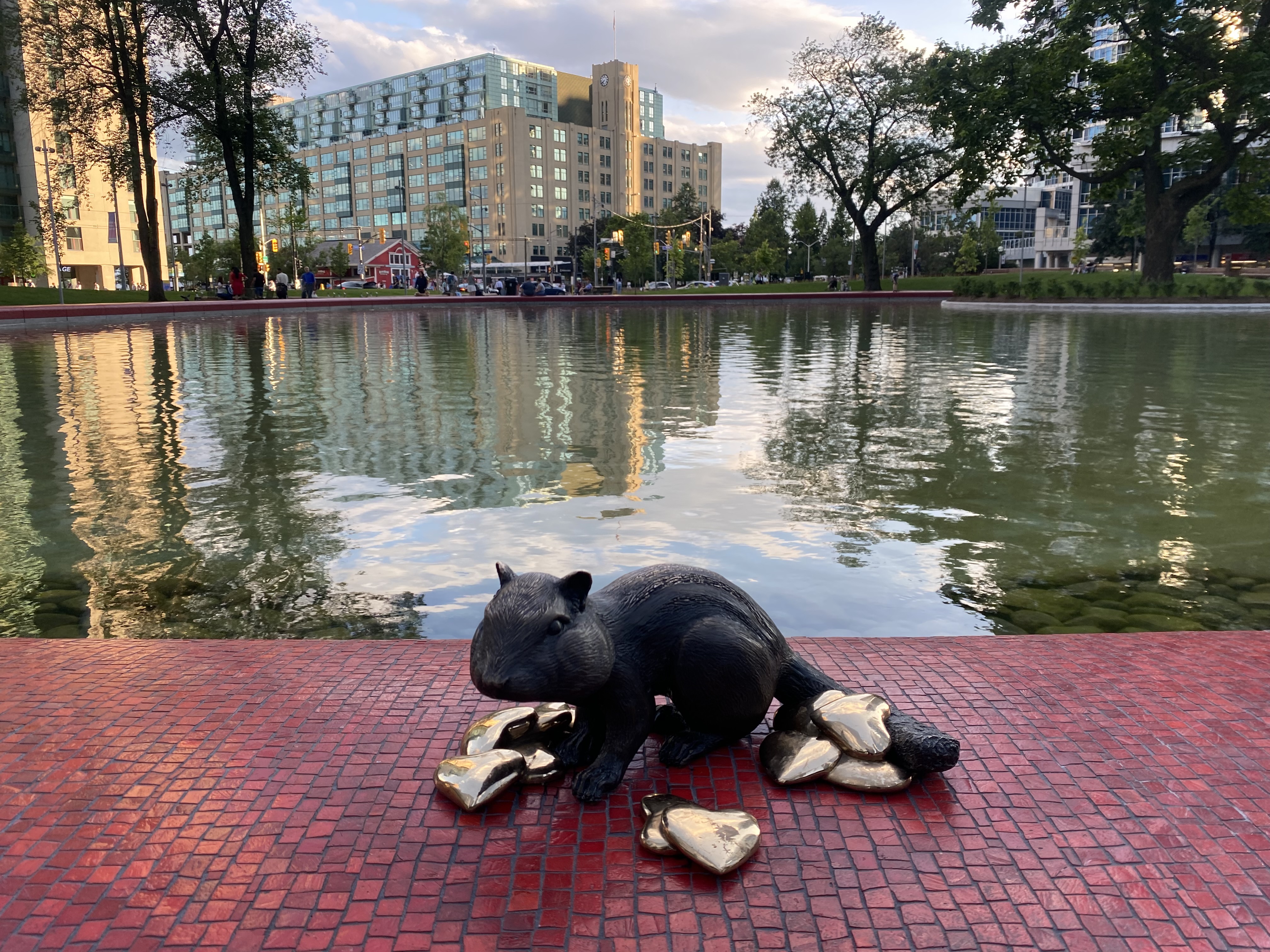
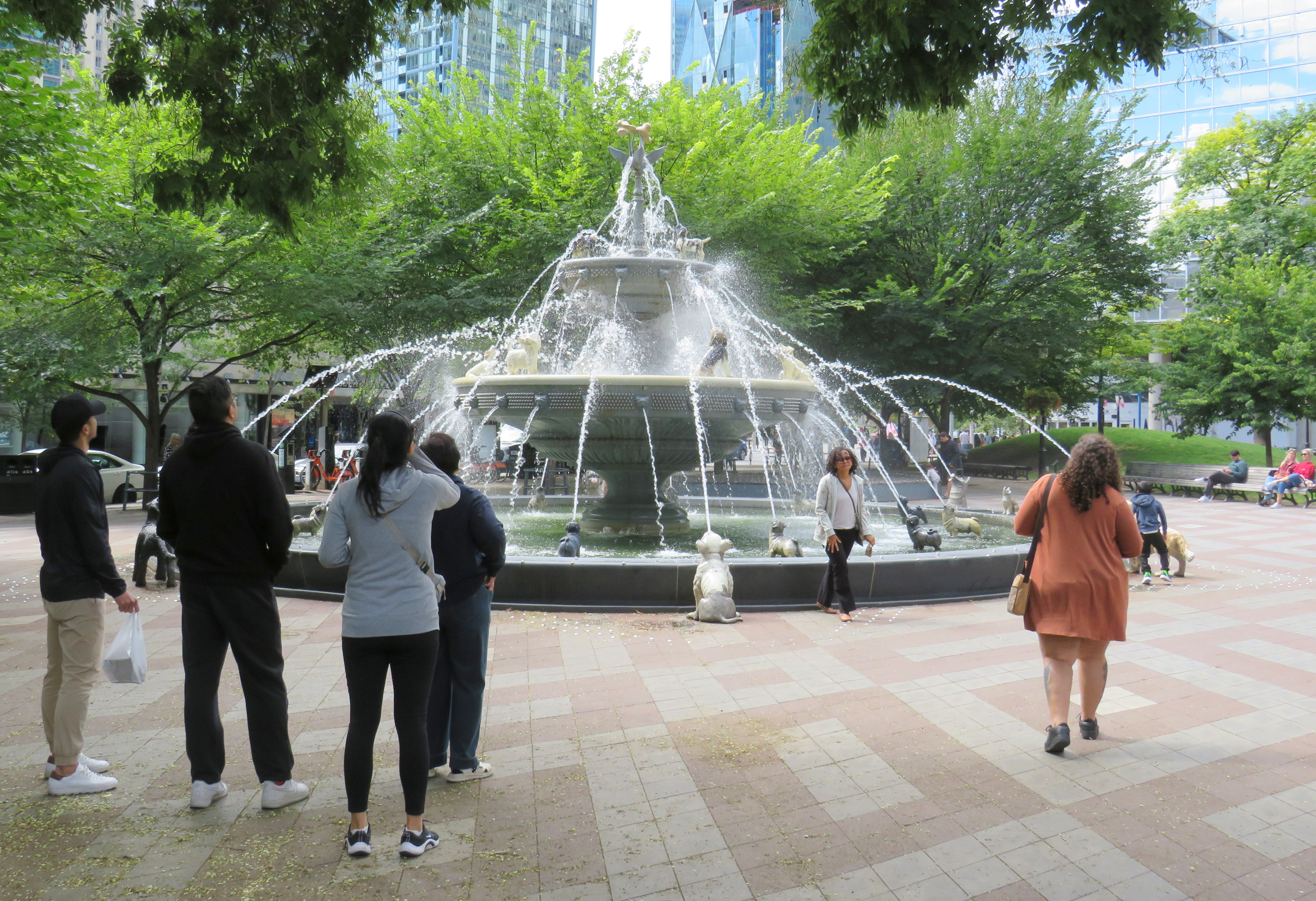
There are also other great things happening in Toronto. Claude Cormier was tapped to create new public spaces, such as HtO Park and Sugar Beach on the Harbourfront, but also reimagine existing places such as Love Park (previously a highway off-ramp) and Berczy Park, home of the popular Dog Fountain. At Love Park, not one of the 45 movable chairs have been taken (though one ended up in the pond). Torontonians have been shown to cherish great public spaces.
Toronto has made a lot of progress on improving its public realm, and it has shown that it is willing and able to close streets to traffic for the benefit of pedestrians and cyclists. Though it is so very easy to envy Montreal for its greater progress in the last two decades, it is up to us to continue the momentum Toronto does have, and work harder to push for change, even when there’s a car-focused provincial government. Streets can be narrowed, parks can be improved, and streets can be handed over to the people. Additional seating and more public washrooms will open up this city to many more residents and visitors.
This should all be a key pillar of a progressive agenda in next years’ municipal election. When certain candidates talk about tax cuts, austerity, and crime, there needs to be a focus on creating a better quality of life to provide an alternative. And that talk must be backed up with action, with quick wins that don’t require multi-year waits.