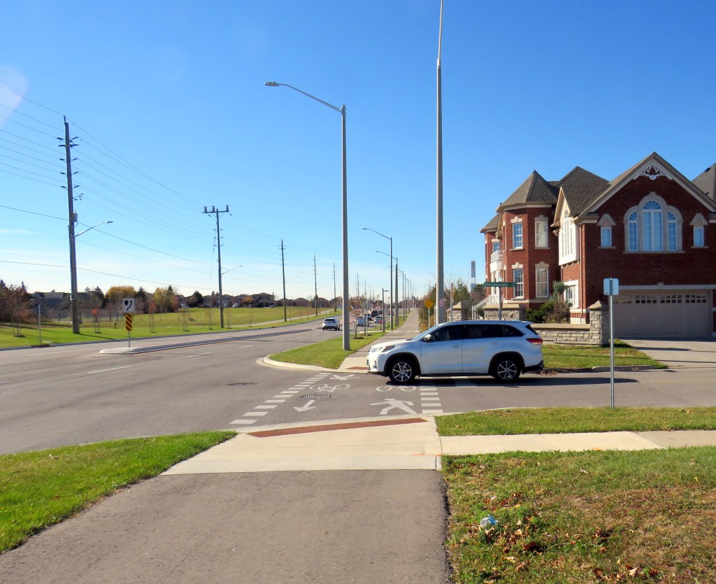
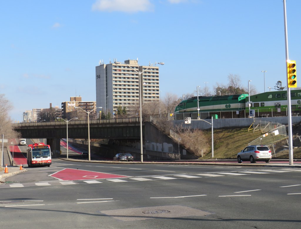
On Thursday, November 7, at approximately 7:35 AM, a 13-year-old girl was struck and killed by the driver of a Hyundai Santa Fe (a midsized crossover SUV) at Rossland Road and Stevensgate Drive. The girl was riding a bicycle in a marked crossride, a crossing designated for both pedestrians and cyclists along a multiuse path, when she was struck and pinned beneath the vehicle.
Multiuse paths (MUPs) are typically found in parks, particularly along waterbodies such as lakes, rivers, and creeks such as Lake Ontario or the Don River. They are shared by all sorts of people, including walkers, runners, cyclists, dog-walkers, rollerbladers, and wheelchair users, often coming into conflict on busy, narrow sections such as the Martin Goodman Trail or the Lower Don Trail.
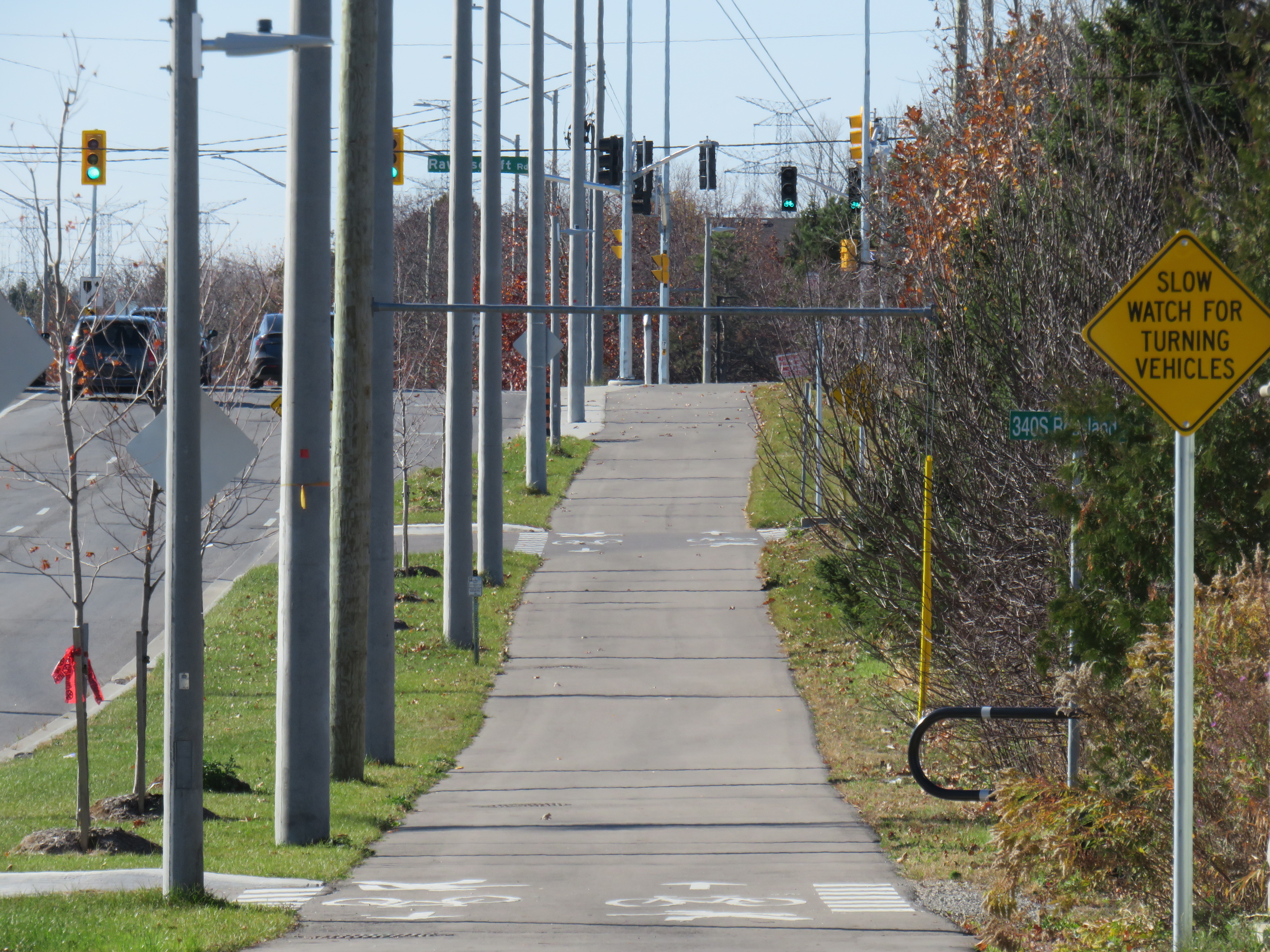
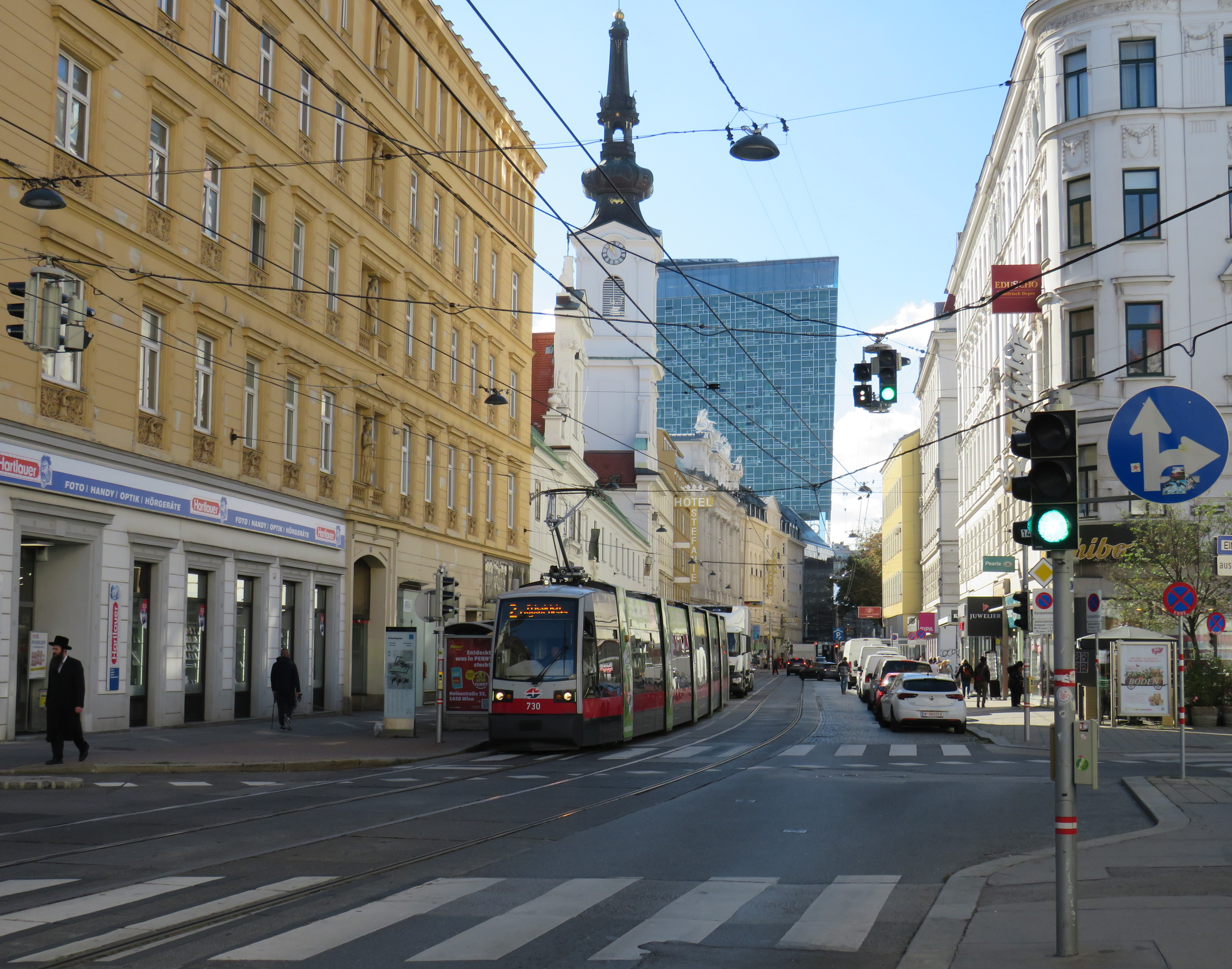
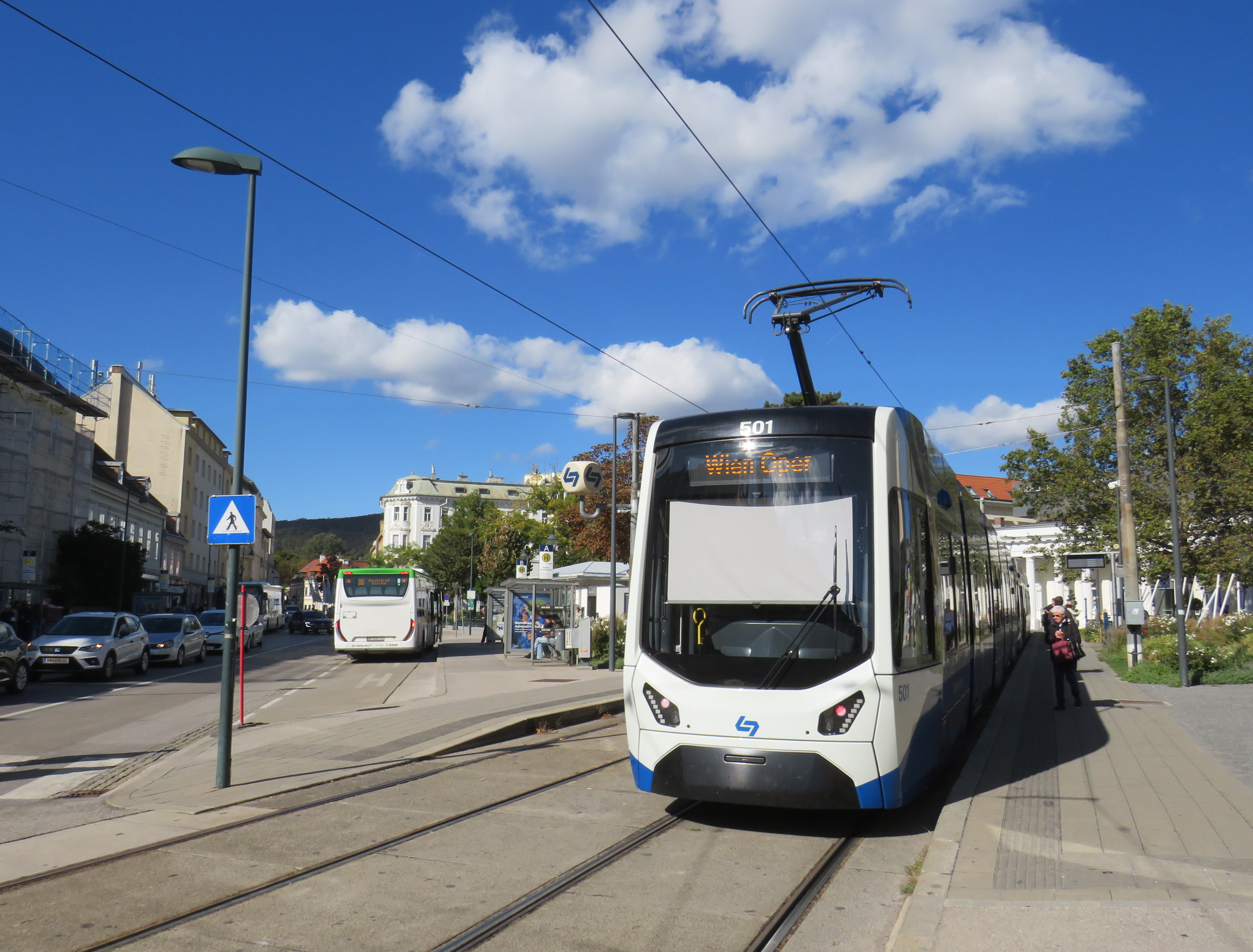
In the suburbs surrounding Toronto (and in a few locations within the city, such as on Lake Shore Boulevard East and Eglinton Avenue West), MUPs are a popular form of cycling infrastructure along busier roads with higher speed limits. Older boulevard MUPs required cyclists to stop and dismount at road crossings (though these instructions were usually ignored). Newer and upgraded MUPs allow cyclists to ride across intersecting roadways, at marked crossrides. Signage advises motorists to watch for cyclists and advises cyclists to slow and watch for motorists and to yield to pedestrians. At signalized intersections, most new MUPs include dedicated bicycle signals.
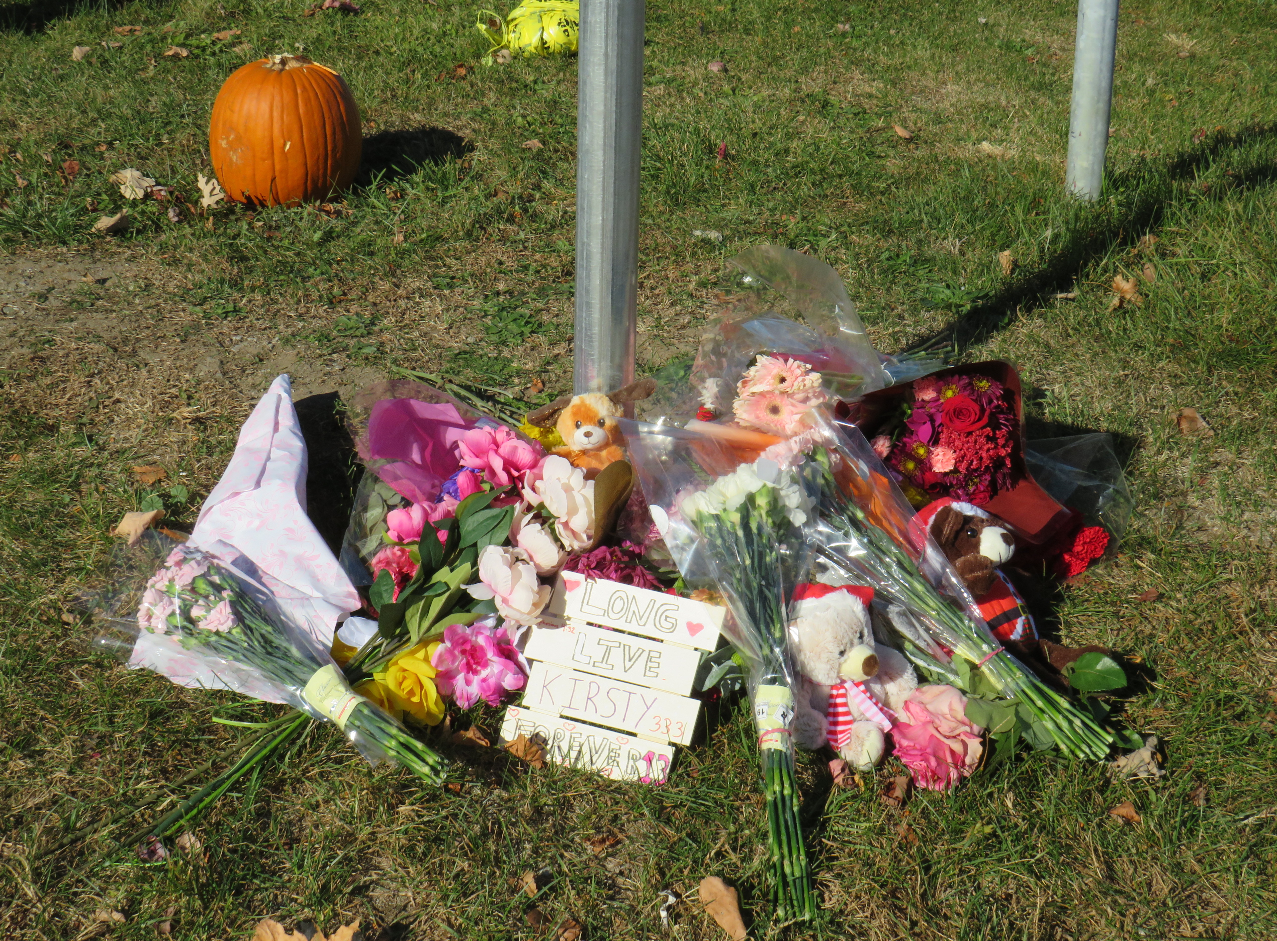
It was at one of these new crossrides that Kirsty was struck and killed. Though no official police press release or any follow-up news articles provided the girl’s name, that name was clearly visible at the makeshift memorial next to where she was killed.
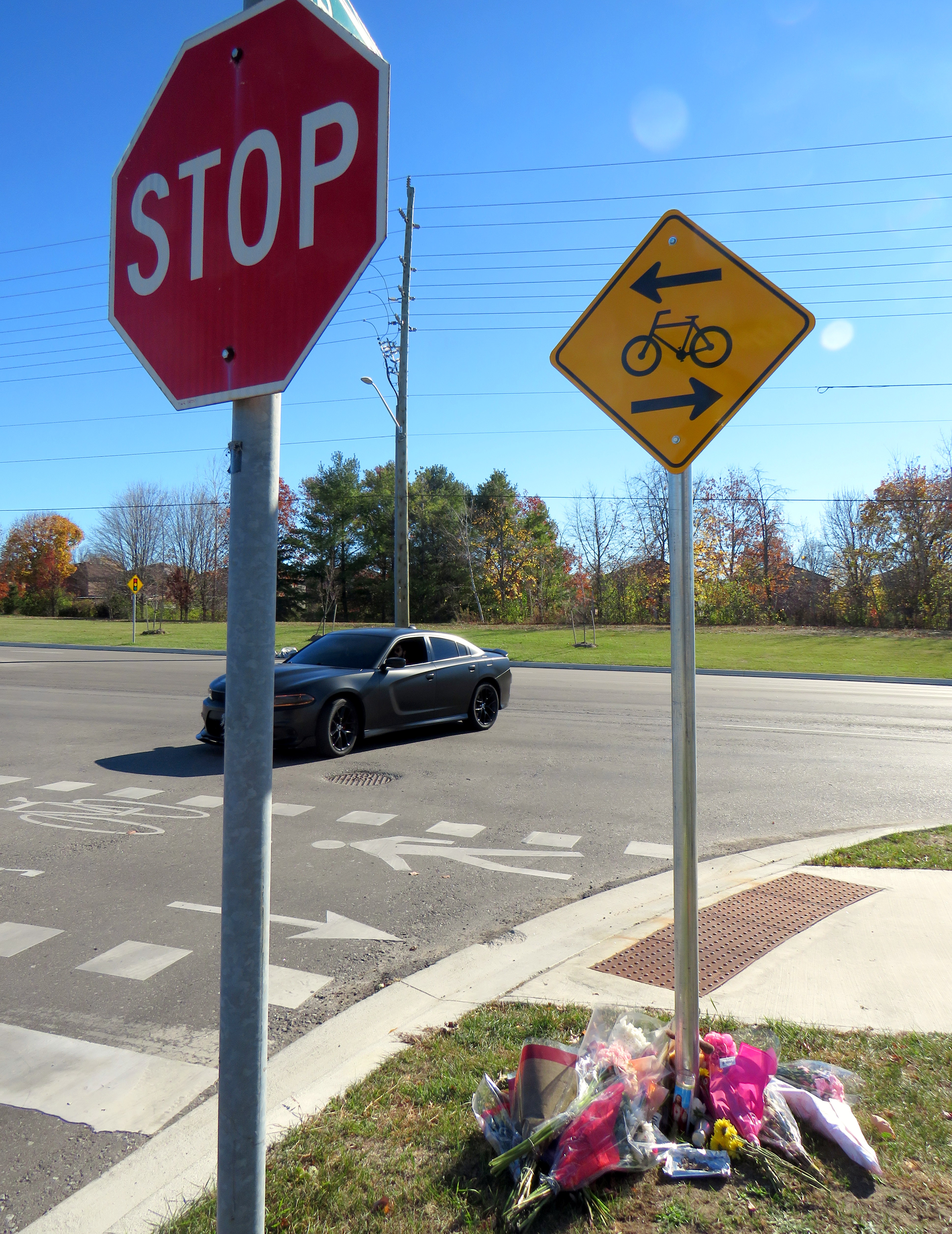
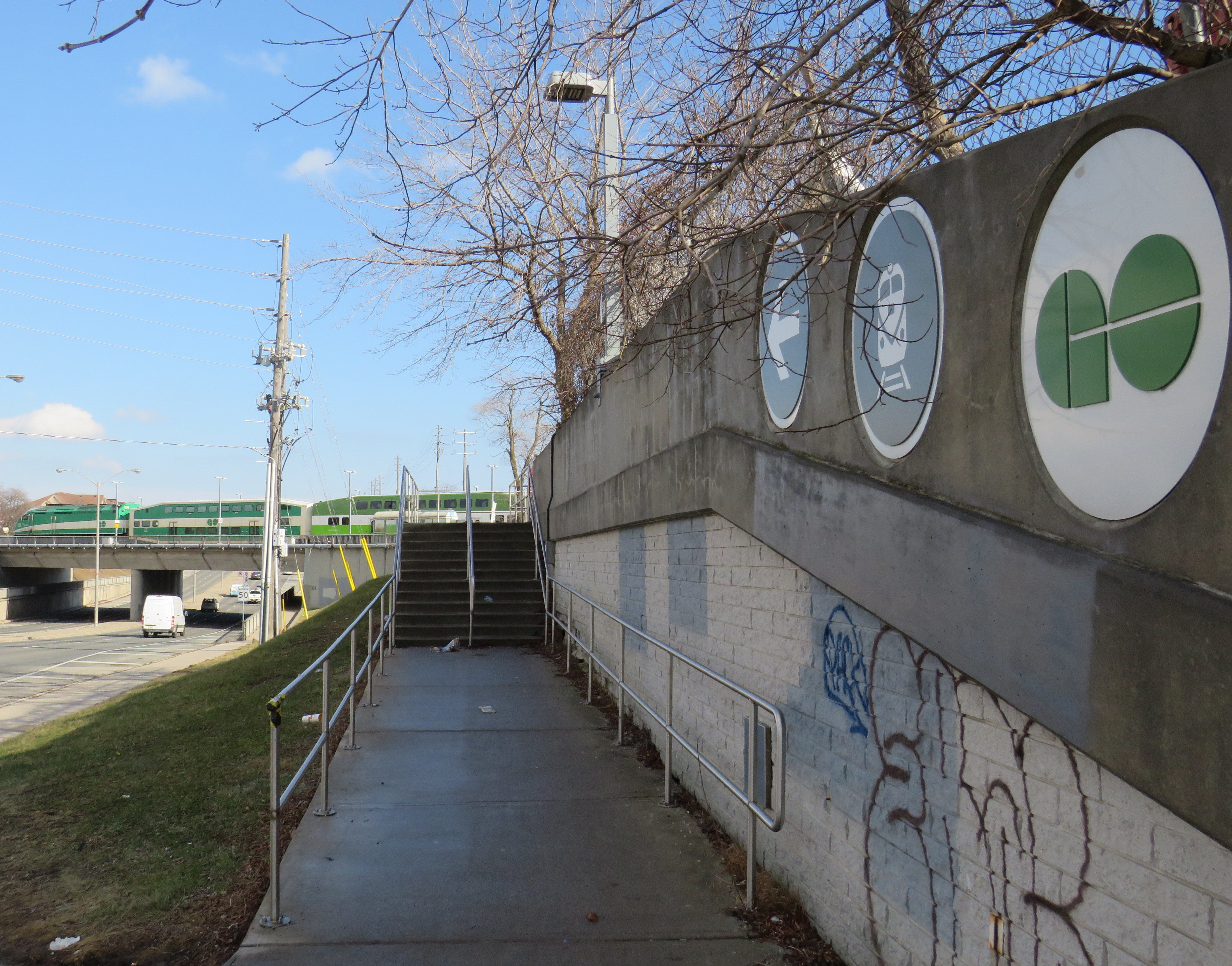
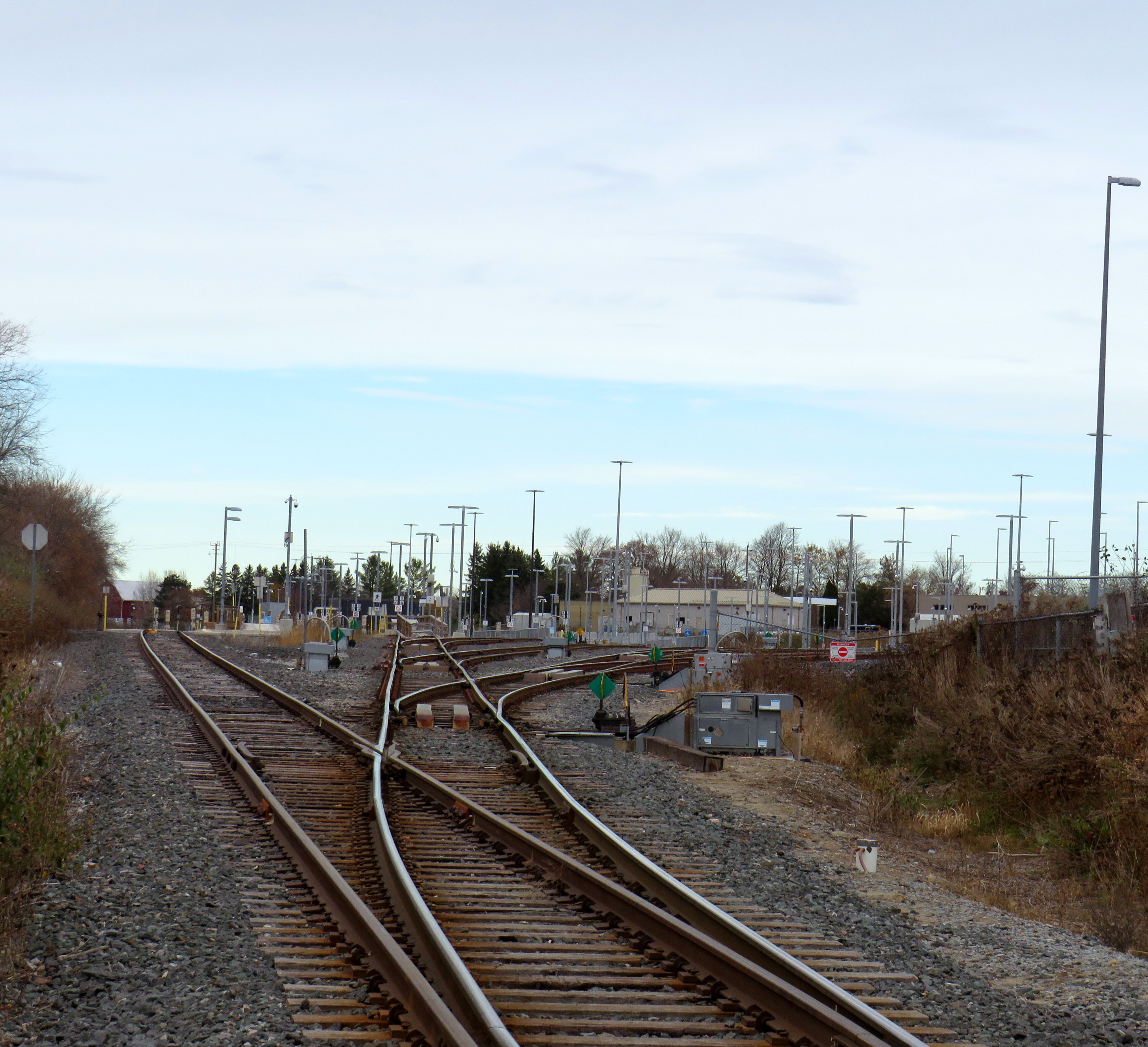
Crossride at Stevensgate Drive, where a driver pulled out ahead into the crossride without stopping at the stop sign/stop line first.
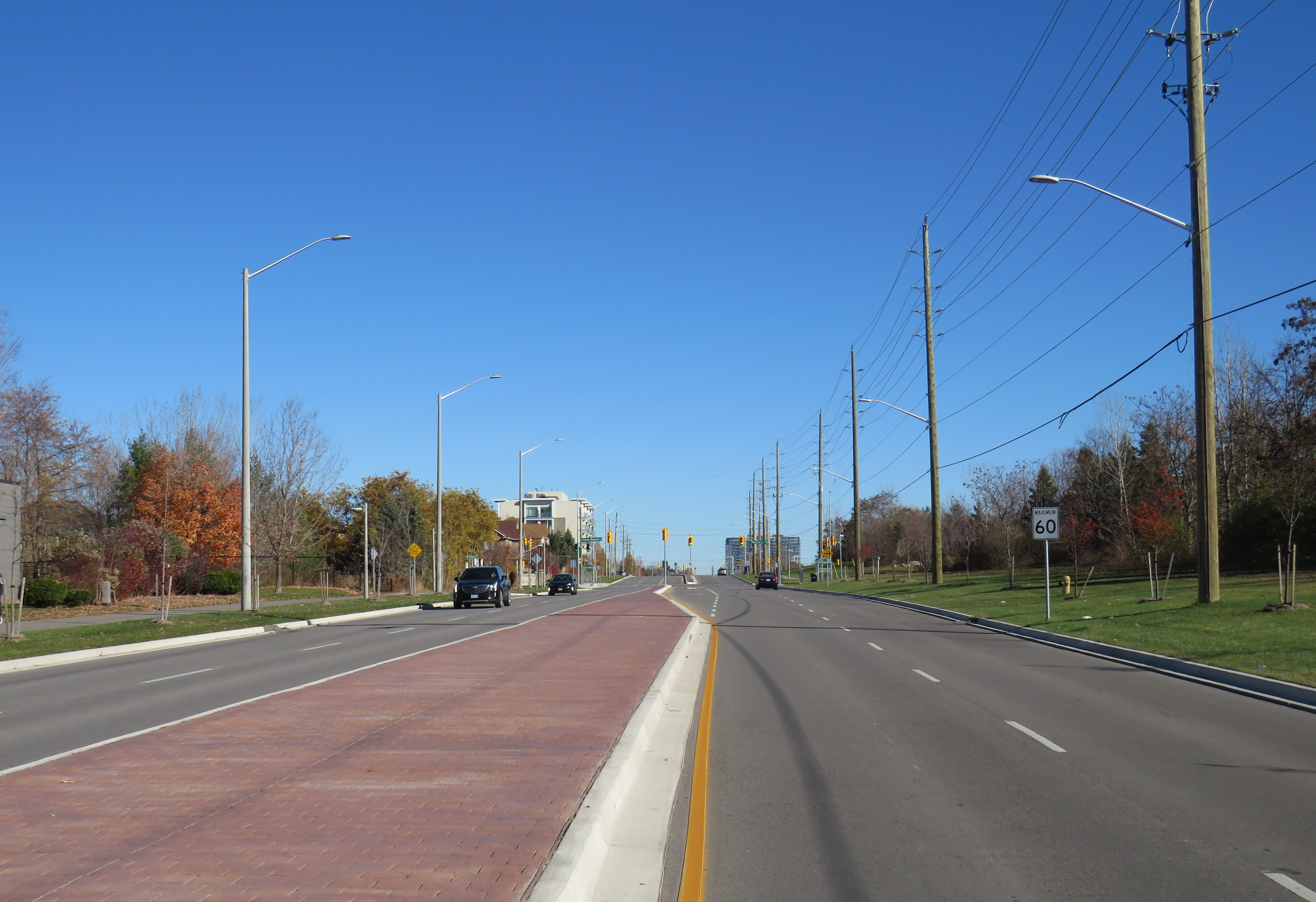
Rossland Road was recently widened from two to four through lanes; a new multiuse path was built on the north side of the roadway, complete with crossrides and cyclist signals. Rossland Road is very much a road. There are no houses fronting onto the roadway, while the few driveways on Rossland provide access only to church and commercial plaza parking lots.
Rossland Road in Ajax has two lanes in each direction, with a concrete median in between. The speed limit on Rossland is 60 km/h.
Stevensgate Drive, which leads north from Rossland Road, is a quiet residential street with about two dozen homes and an evangelical church. A stop sign controls traffic at Rossland Road. Though Stevensgate connects to a large subdivision to the north, there are several other streets with signalized intersections that also provide access to the community.
Motorists take wide turns pulling into Stevensgate Drive
When Kirsty was struck, it was by the southbound Santa Fe driver who would have passed a stop sign and a clearly painted stop line before entering the crossride. A CP24 news report clearly showed the vehicle being towed onto Rossland Road from the southbound direction. At 7:35 AM, it was daylight.
Drivers rolling through stop signs are a common occurrence, even though the law clearly states that a full and complete stop at the stop sign and painted stop line is required before proceeding. Had the driver done so, this tragedy most likely would have been prevented.
Looking west along the multiuse path, towards Ravenscroft Road
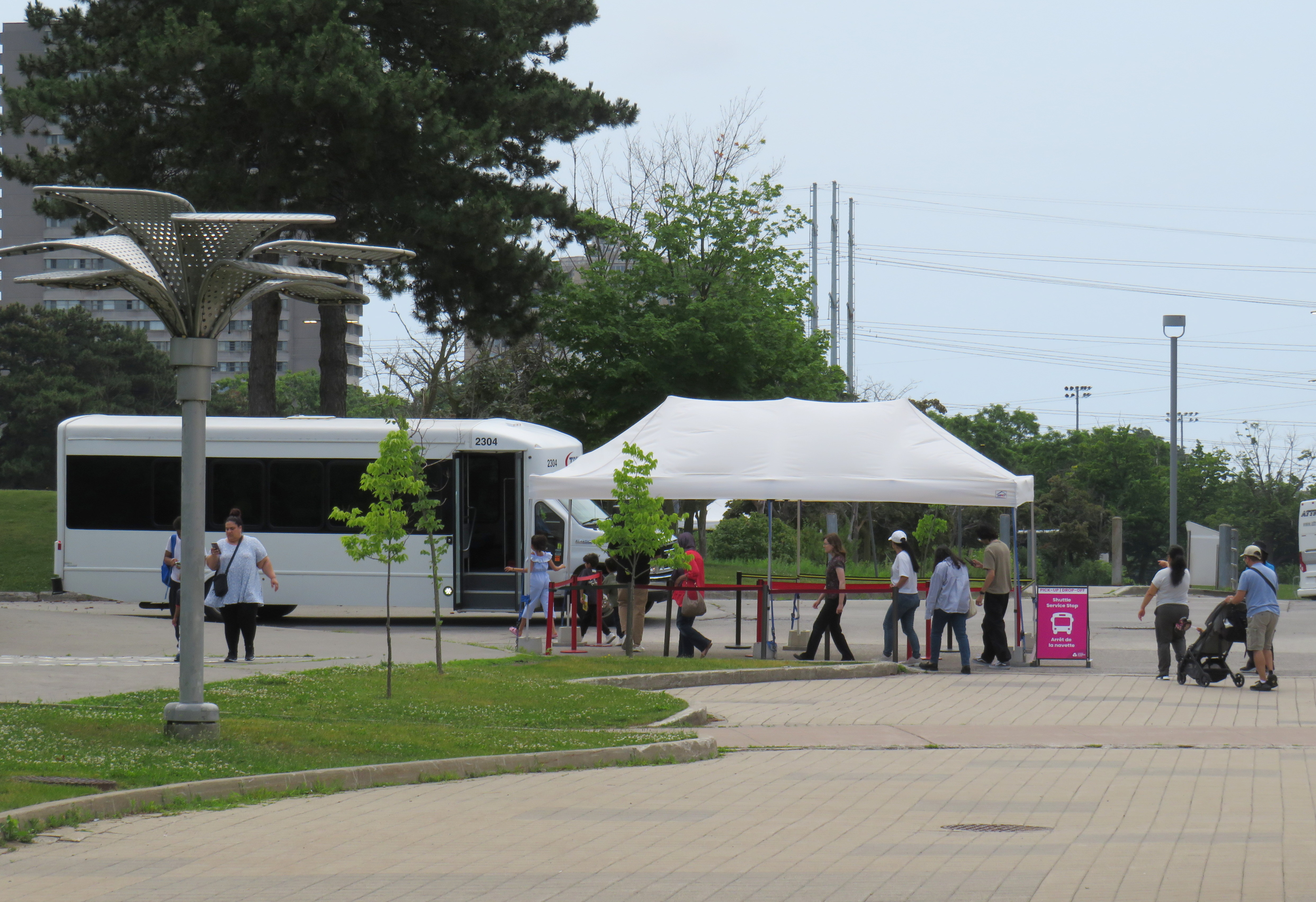
Two days later, on Saturday, November 9, I visited the scene. I noted the roadside memorial next to the stop sign facing Stevensgate Drive. While I was there, several people stopped to visit the memorial; at least two people left flowers and cards of sympathy.
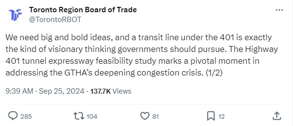
While there, I mounted a small digital camera on the trunk of a car parked on the west side of Stevensgate, about 75 metres north of the intersection, in a legal parking spot. The camera, mounted on a mini-tripod, was mostly inconspicuous. Within 25 minutes, five motorists improperly stopped after the stop line and into the crossride; two properly stopped before creeping up to make their turn. Two drivers also made fast, wide right turns into Stevensgate during that time. The edited video below shows motorists’ actions during that 25 minutes
Video taken on Saturday, November 9 showing motorists driving south on Stevensgate Drive towards Rossland Road(3 minutes, 7 seconds)
While taking photographs and recording the videos, a resident, who lived a few houses north of the intersection, came to talk to me, and asked if I knew the girl. I explained why I was there, and we had a short, but good chat, about the collision and road safety. He noted that it is hard to see traffic from the stop line, and that he has to pull forward before turning. But he agreed that the stop line was there for a reason, and that drivers often rush to get onto Rossland.
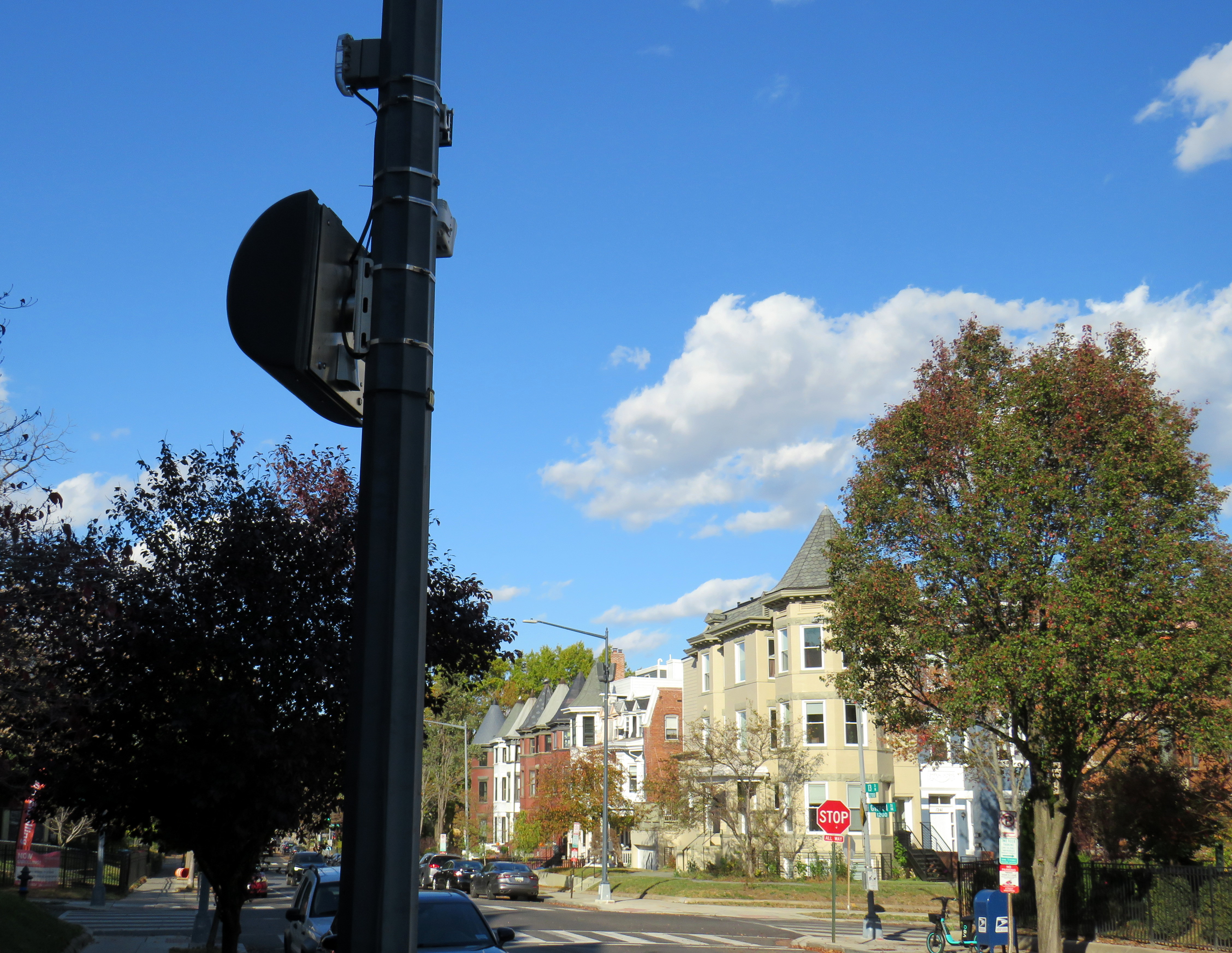
In Washington DC, there are stop sign cameras mounted at specific locations, though there are only about a dozen of those throughout the city at any given time. These could provide a useful tool for targeted automated enforcement on Ontario’s roads to reinforce proper driving behaviour.
A pole-mounted camera faces an all-way stop in Washington DC
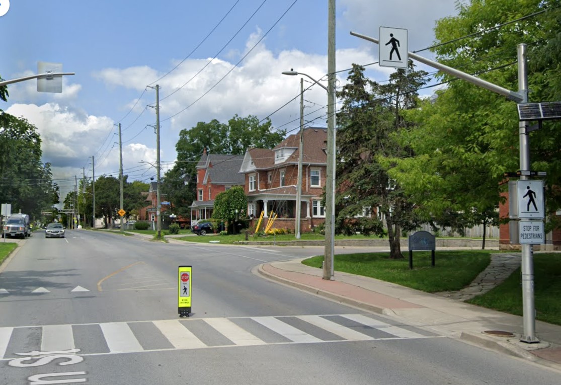
Intersections should also be redesigned to improve the visibility of pedestrians and cyclists at crosswalks and crossrides and act to slow down motorists; raised sidewalks and path crossings would act as a speed hump as well as enhance visibility. A concrete island or short median at the stop sign would force motorists to approach the stop at a slower speed and prevent wide turns on to and off the intersecting street. A quick and inexpensive (though less-effective) solution could be to place wide knock-down bollards with supplemental crossing and stop sign messages in the middle of the roadway at each stop bar and crosswalk/crossride. Though this is best as a short-term measure.
As the provincial government vindictively overrides municipalities’ ability to provide safer on-road cycling infrastructure, off-street infrastructure, such as MUPs, will remain an important tool for promoting active transportation, especially in suburban areas and high-traffic neighbourhoods. Though boulevard MUPs provide separation from traffic in most cases, they are particularly hazardous at intersections, especially when motorists are distracted, aggressive, or just merely careless. There is much more that can and should be done to make them safer for all road users.
The old Doug Ford — the angry bull-in-a-china-shop we remember from 2018-2019 — is back, and it is clear that governing, in fact, has not changed him. After six years, and a rumoured early provincial election, Doug Ford will need to run on something, because there’s little to show for his promises of getting housing built, transit projects completed, and hospitals fixed. An RCMP investigation continues to look at the government’s Greenbelt land swaps, and it is rare for provincial or federal governments in Canada to get elected with a majority three times in a row. So here we are.
But after three straight days of political red meat policy announcements, the strategy has become clear: Doug Ford is “deadcatting.” Dead cat theory, popularized during the leadership of former London mayor and British prime minister Boris Johnson, is the practice of suddenly throwing down an outrageous policy or statement to divert attention away from an unpleasant topic. The shocked audience is suddenly compelled to talk about the metaphorical dead cat thrown on the table. In the United States in recent weeks, dead cats have become less metaphorical, with baseless and racist accusations against Haitian migrants in Ohio spread by Donald Trump, vice-presidential candidate J.D. Vance, and far-right commentators.
There is no way a Highway 401 tunnel will be built. Not only would it be the longest road tunnel in the world, but the long on-ramps and off-ramps required to access a deep-bore urban highway tunnel will make it completely infeasible. The proposal also completely ignores the problem of induced demand, and it won’t solve the problem of where the traffic goes when it gets off that additional highway. For these reasons, it was especially disappointing to see the Toronto and Region Board of Trade (TRBoT) endorse the idea.
There are things that can help alleviate traffic. One is ensuring that transit projects are completed, funded, and maintained. That doesn’t just mean building and completing projects like the Crosstown LRT and the Ontario Line, it’s also making sure the system remains in excellent condition to avoid problems like the persistent slow orders in the Toronto Subway. It also means making the best use of existing infrastructure, like Highway 407, for goods movement. Highway 407 passes by every major freight yard in Greater Toronto, but trucks clog Highway 401, Highway 7, and Steeles Avenue instead because of the high tolls. And it means active transportation improvements, like bike lanes and multi-use paths.
What we don’t need are more dead cats to distract us from the real problems.
No matter how you get around Toronto, it’s feels like it’s more difficult than ever
Getting around Downtown Toronto can be an exercise in frustration, whether you drive, bike, take transit, or drive. Though necessary transit and road construction projects are the cause of much of the congestion, driver behaviour, poor management, and a lack of coordination between various municipal and provincial agencies have only added to the traffic quagmire.
North-south streets such as Spadina, York, Bay, and Jarvis are jammed by drivers headed south towards the Gardiner Expressway, with lane closures near Exhibition Place only making things worse. Motorists blocking intersections make it difficult for pedestrians, cyclists, streetcars, and through traffic to get across the city centre. Ontario Line construction has closed a portion of Queen Street, while work to rebuild streetcar tracks on York and Adelaide Streets to allow 501 cars to bypass the closure is still proceeding.
GO Transit is also expanding its rail corridors to allow for more off-peak and express trains, with the long-term goal of having an electrified, frequent, regional rail network that complements and supplements the web of subways, light rail and buses throughout the region. The TTC is also addressing a backlog of state-of-good repair works throughout the subway system, resulting in slow orders, early closures, and weekend shutdowns.
Meanwhile, people still need to get to places like work, school, conferences and trade shows, concerts, sporting events, social gatherings, festivals, museums, and all the other things that make a city a city. Eventually, with improved GO corridors, the Ontario Line, and the opening of the Crosstown LRT, there will be some redundancy in the transit system that will make planned service closures easier to navigate. But for now, we are stuck with an underbuilt transportation system in a rapidly growing city.
This makes the coordination of transit closures and projects especially essential so things don’t completely fall apart. Saturday, September 21 was just one example of the failure to do so.
On Saturday September 21 and Sunday September 22, GO Transit reduced service on the Lakeshore West Line to hourly service on the entire corridor because of work at Long Branch GO Station, where the station is being completely rebuilt for accessibility improvements and future expansion. It also shut down the entire Barrie Line for various construction works along the corridor, with rail replacement buses to Union Station, stuck in traffic on the Don Valley Parkway and Lake Shore Boulevard with all other motorists getting around the Gardiner closure.
Normally, there are hourly trains as far west as West Harbour Station in Downtown Hamilton, with half-hourly service to Aldershot Station in Burlington. Between Union and Oakville, rail service is as frequent as every 15 minutes during midday and early evenings on Saturday and Sunday. Hourly train service reduced capacity on the inner Lakeshore West line by 75%.
Compounding the problem was the total closure of the Gardiner Expressway between Highway 427 and the Don River between Friday evening and Sunday morning for routine maintenance (the Gardiner and the Don Valley Parkway are regularly closed twice a year for repairs). Many people who might have otherwise driven into the city would have taken GO Transit instead, normally a very good idea. Though none of Toronto’s professional sports teams were playing at home on Saturday, there was still a Shane Gillis stand-up comedy performance at Scotiabank Arena, and a Rainbow Kitten Surprise concert at Ontario Place.
Also, to add insult, the Lakeshore East trains between Toronto and Oshawa were not through-running with the Lakeshore West trains and were operating on a modified schedule. I was travelling east of Toronto on Saturday, making a few stops in Durham Region. As I arrived back from Whitby on Saturday afternoon on a train that normally connects onward westbound train at Union Station, we were treated to the sight of the hourly Lakeshore West train just pulling out. It couldn’t have even waited 2-3 minutes to allow passengers to make the cross-platform connection. That resulted in other passengers complaining to GO staff in the concourse, who were not that helpful.
I’m on the GO Train now. The CSR on the LW train is telling people at Long Branch to not board because the train is too full, so they now have to wait an hour. Lots of people heading to Budweiser Stage and Scotiabank concerts. Very poor planning/coordination between city and MLX. https://t.co/LXNATzYwoV
Tweet from Alan Deschamps, reporting on a full GO train arriving at Long Branch at 6:21 PM on Saturday Sept 21, with the customer service ambassador (CSR) telling waiting passengers to not board and to wait for the next train in an hour
In the early evening on Saturday, a jam-packed eastbound GO train on the Lakeshore East train was not accepting any passengers at Long Branch or Mimico station because of overcrowding. Waiting passengers were told to wait an hour for the next train.
One would think that Metrolinx (GO Transit’s parent agency) and the City of Toronto would coordinate their construction schedules to avoid such problems. However, not even the City of Toronto can figure this out. Back in June of this year, the TTC replaced the 509 Harbourfront and 511 Bathurst streetcars with buses for a week for minor overhead work on Fleet Street. The timing coincided with the massive Collision tech conference at Exhibition Place, which resulted in overcrowded shuttle buses and unreliable service. Had the TTC checked with anyone at the city’s economic development office or with Exhibition Place (another city agency), this work could have easily been rescheduled.
Overloaded 509 Harbourfront bus shuttle on Queen’s Quay in June 2024
Though coordination of transit closures and construction projects with major events and parallel roadworks will not solve Toronto’s road and transit congestion problems, it will at least reduce some of the frustration of getting around. The poor customer service at GO Transit will certainly make riders question if they will be able to rely on the service in the future.
Of course, there is one measure that won’t help but still will be implemented by the provincial government later this fall: a prohibition on new bicycle lanes if they take road space from motorists. Despite blocked bike lanes, aggressive drivers, and an incomplete cycling network, it is still the most reliable and fastest mode for many shorter city trips. Along with major transit improvements and construction coordination, cycling is one of the solutions to getting around Toronto.
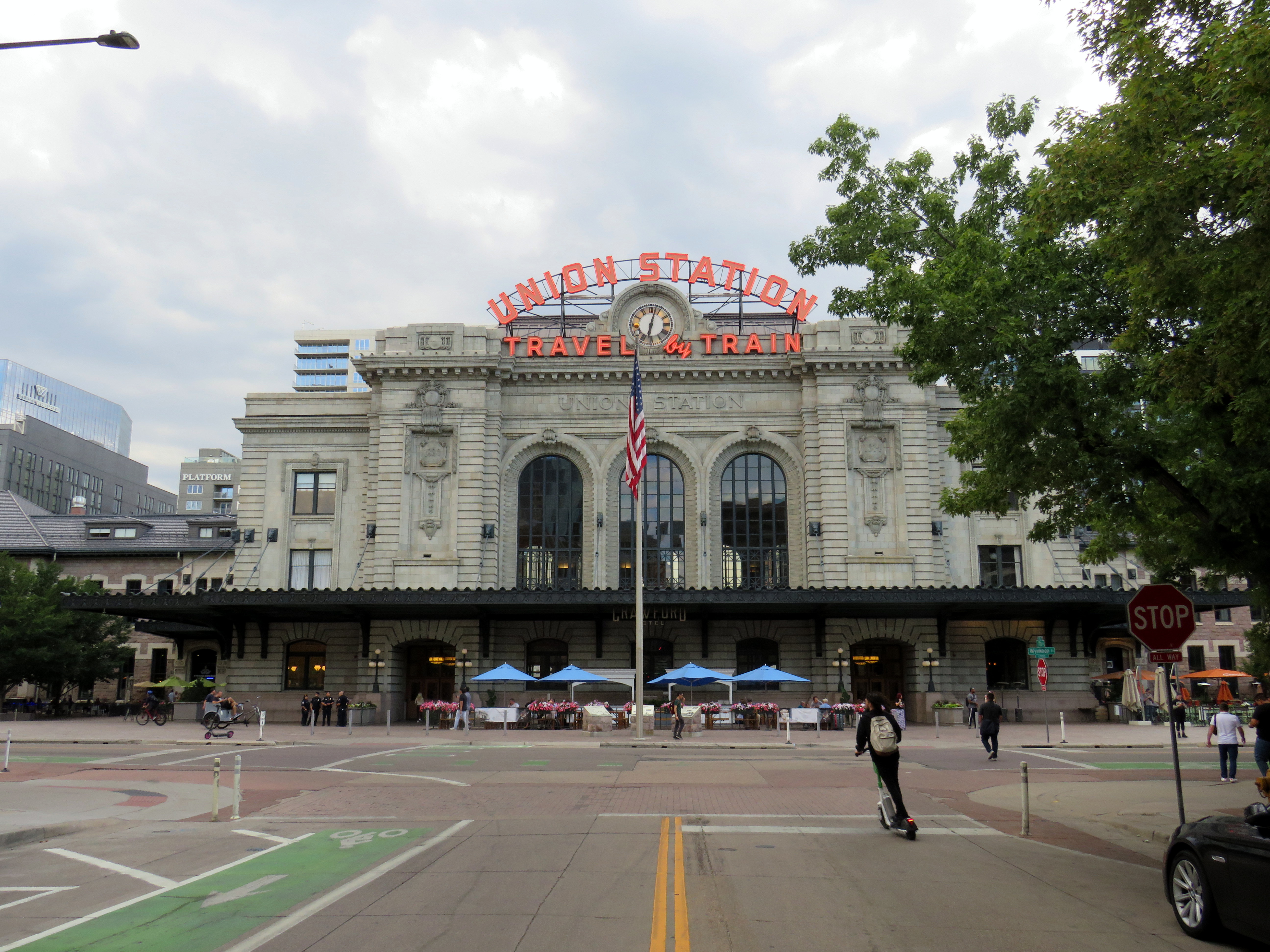
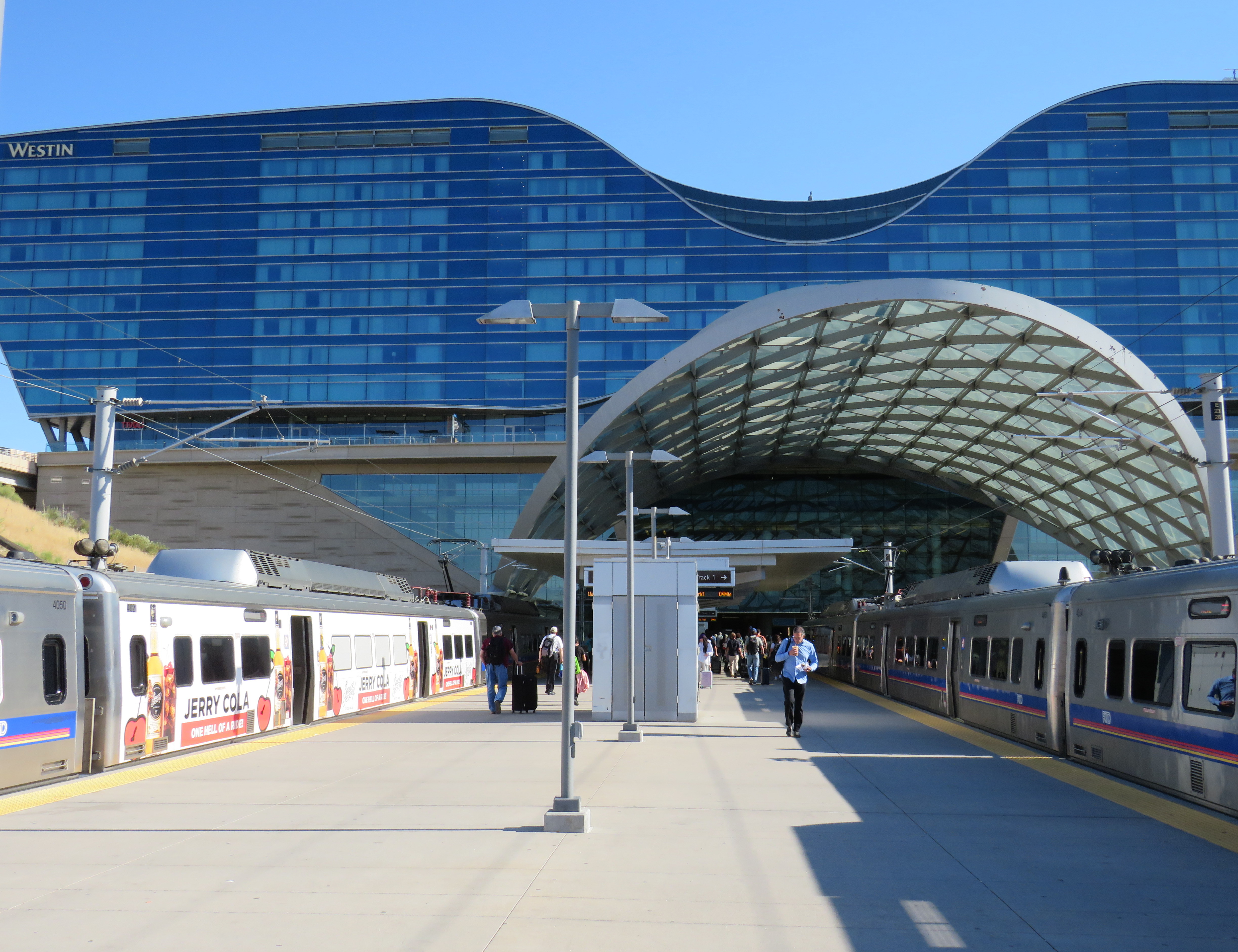
Denver’s Union Station, with the iconic “Travel by Train” neon signage
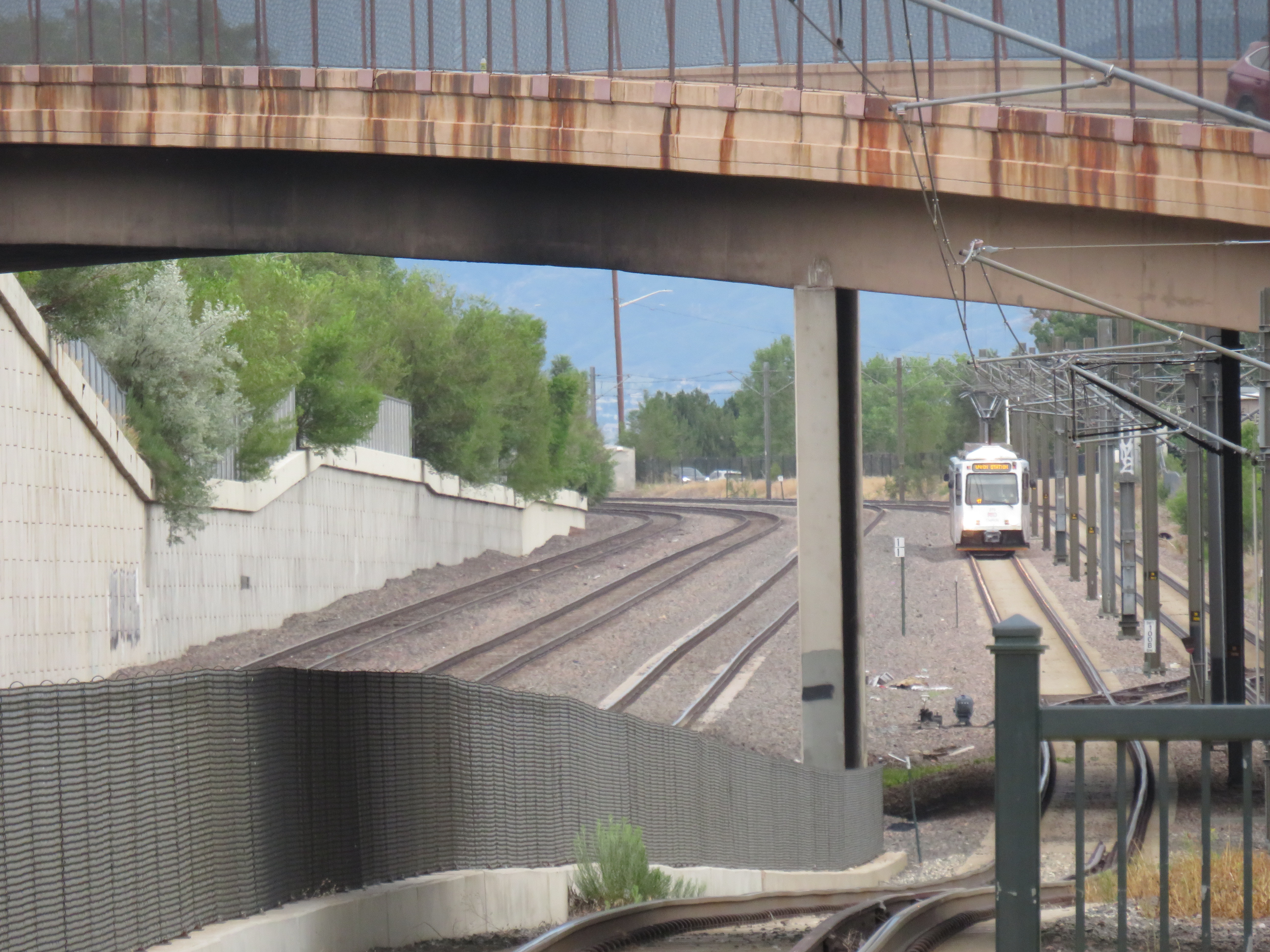
Earlier this summer, I had the privilege of travelling with my spouse to California. We started in San Diego (where my partner was attending a conference) and then made our way northwards, to Los Angeles, Santa Barbara, San Simeon, and finally the San Francisco Bay Area. I continued my trip an extra three days to ride Amtrak’s California Zephyr train east through Nevada and Utah to Denver, Colorado.
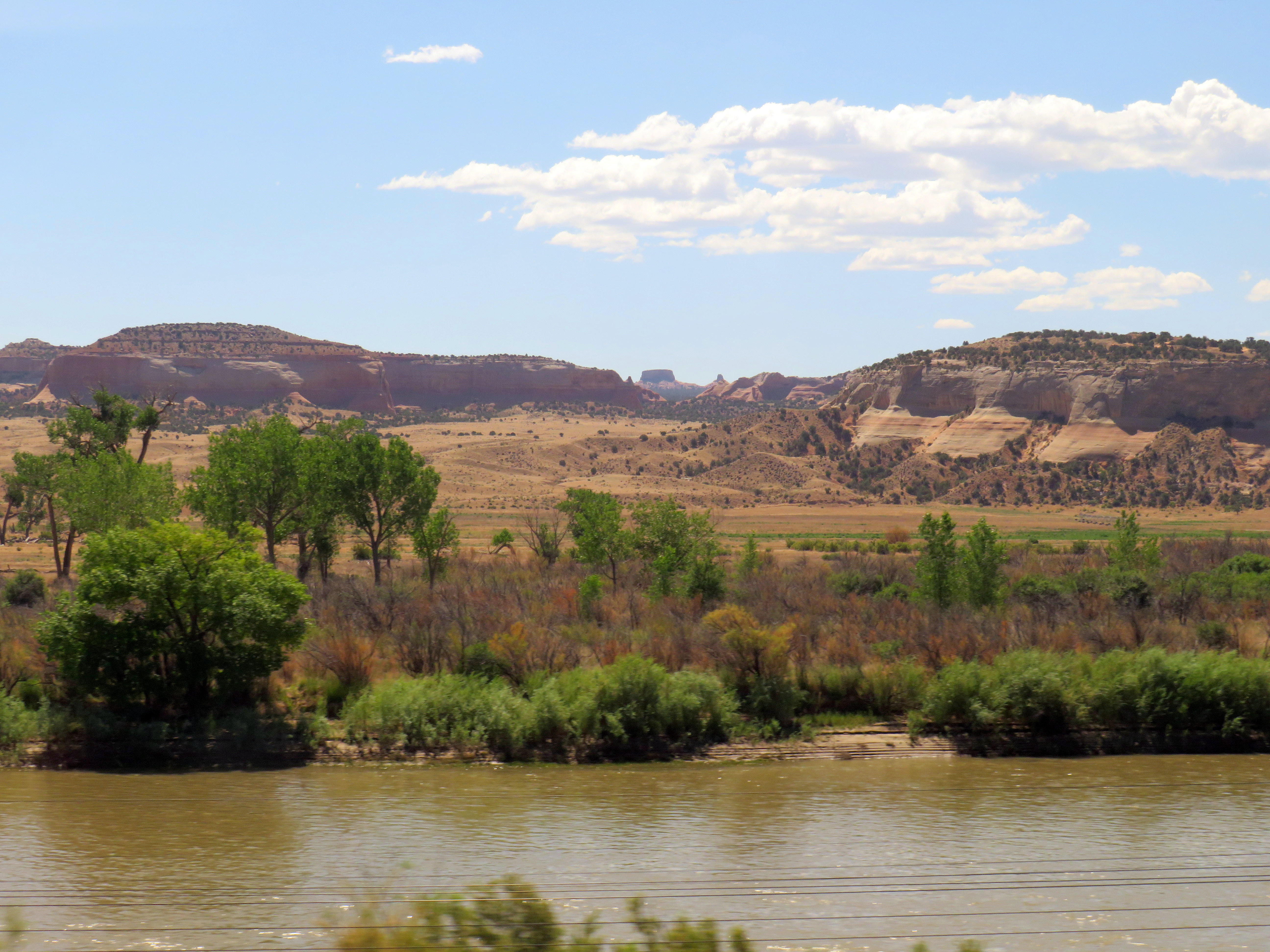
Looking south from the California Zephyr across the Colorado River near the Utah-Colorado border
Besides the breathtaking scenery through eastern Utah and western Colorado, I wanted to visit Denver itself, including its Union Station.
Denver’s Union Station was constructed in 1881 to serve the Denver Pacific Railway (the city’s connection to the Union Pacific transcontinental railroad at Cheyenne, Wyoming), as well as the Denver & Rio Grande, the Denver, South Park & Pacific and the Colorado Central Railroads. (Today, it is reached by tracks belonging to the Union Pacific or BNSF Railroads.) Renovated and expanded in 1914, one of the station’s most iconic features, rooftop neon signs beckoning customers to “Travel by train” were added in the 1950s, as interstate highways were being planned and constructed across the United States and air travel became more common.
The station was nearly closed in the 1980s with only Amtrak’s Oakland-Chicago California Zephyr calling once a day in each direction. Passenger train facilities would have been moved to a small “Amshack” building outside of the downtown core, with the station building incorporated into a proposed new convention centre. (This proposal is similar to the fate of St. Louis’ Union Station, which was turned into a hotel, shopping, and entertainment centre, with the Amtrak station moved into a small building off-site.) Luckily, this never took place.
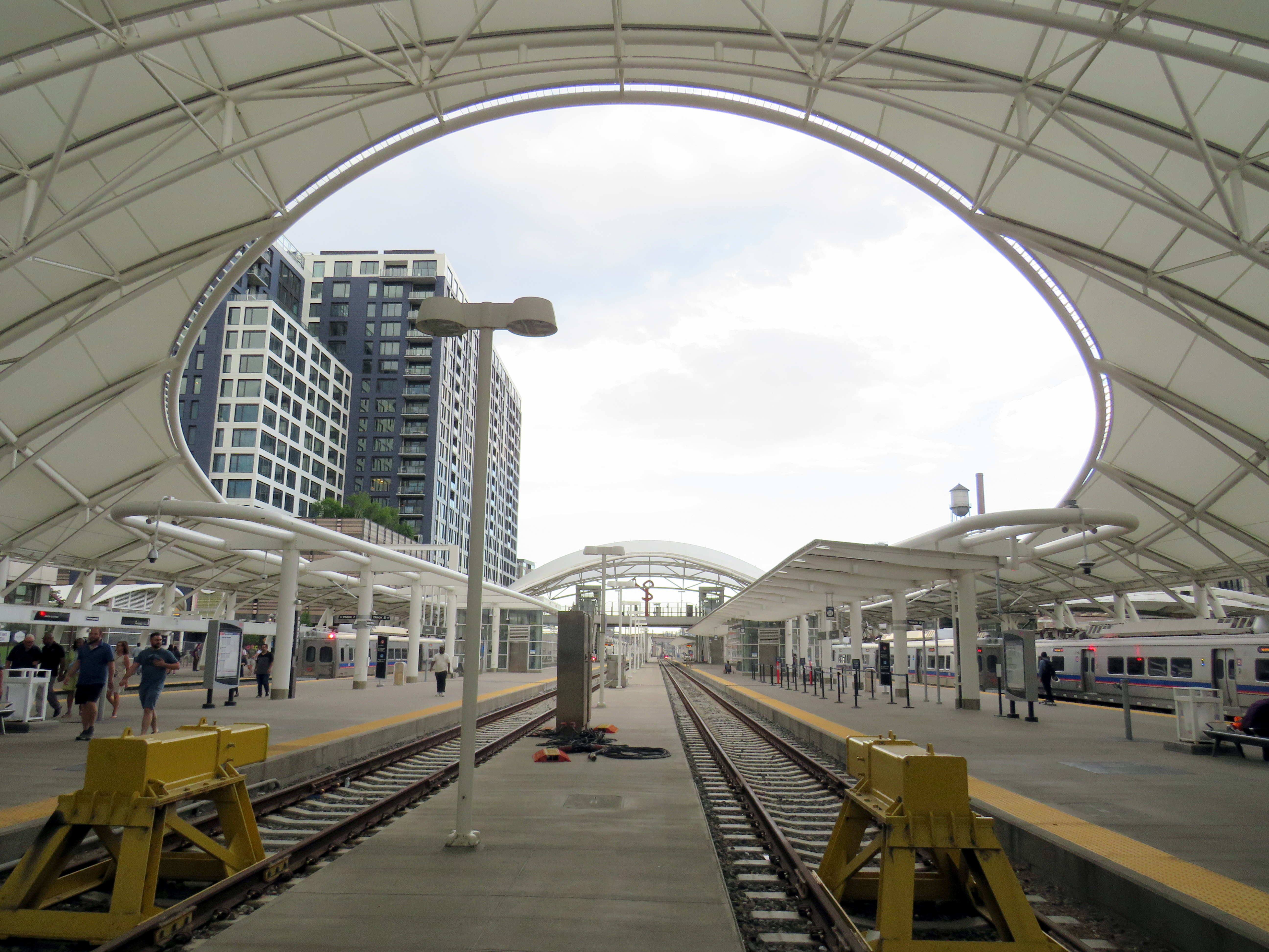
Denver’s Regional Transit District (RTD) purchased the station in 2001, with a new master plan developed for the station property and the vicinity in 2002, approved by voters in 2004 as part of the “FasTracks” program. Denver’s light rail system was extended to Union Station in 2002, while the immediate area was redeveloped with midrise apartment and office buildings. The train platforms were rebuilt with a new canopy, meant to accommodate both Amtrak and proposed new commuter and regional rail services.
Denver Union Station train platforms
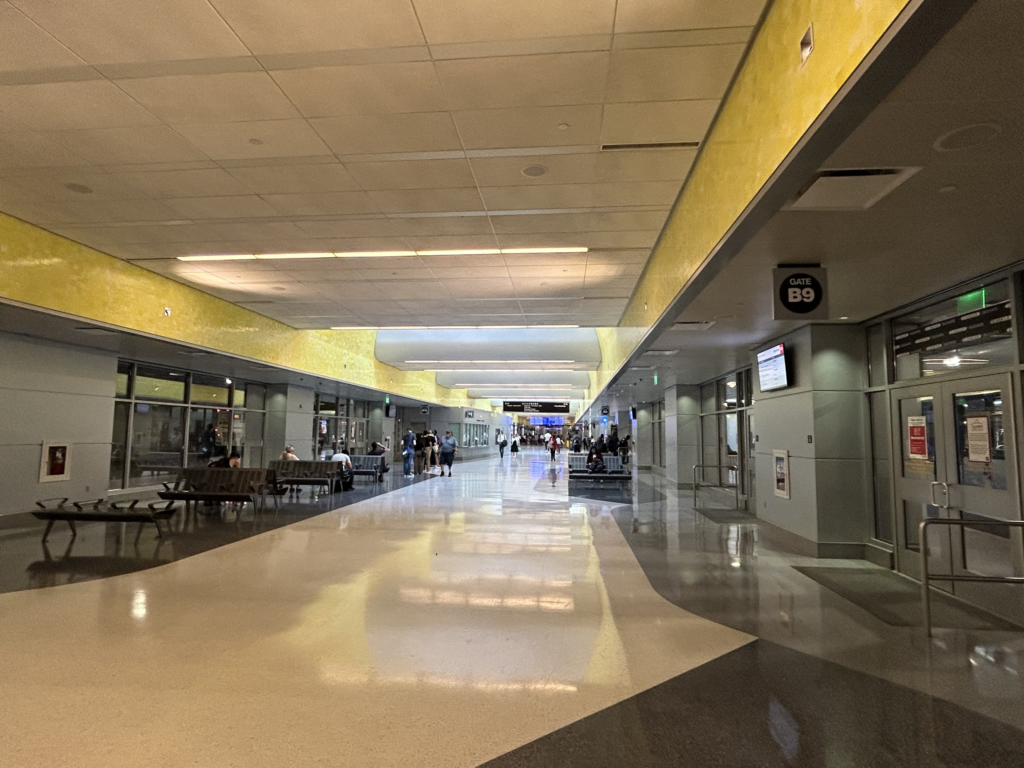
Connecting the historic Union Station building and train platforms with the LRT platforms two blocks north is a long underground bus concourse.
Denver Union Station’s underground bus terminal
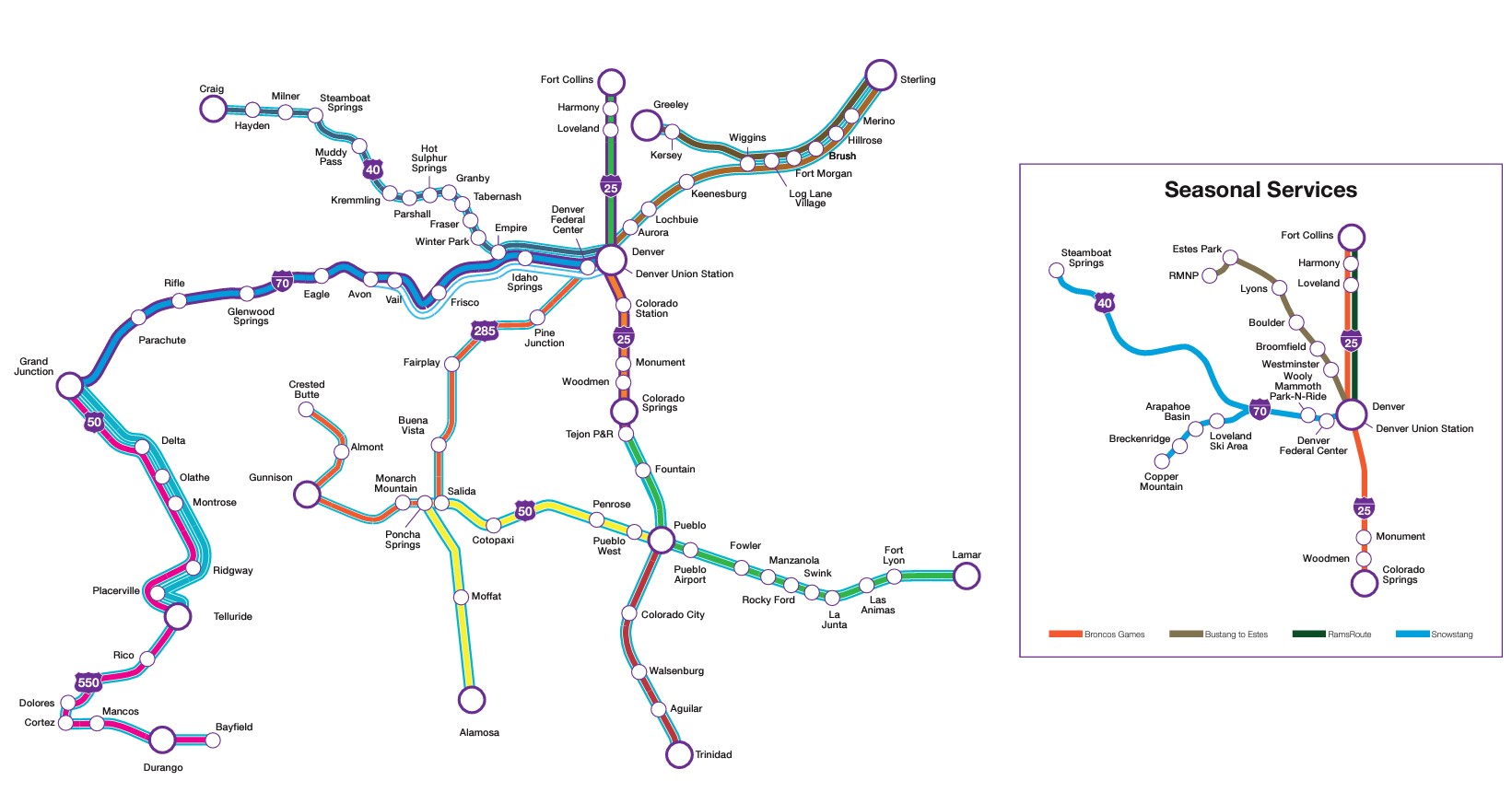
The underground bus terminal serves local and regional RTD services, as well as Bustang, the State of Colorado’s intercity coach service. Bustang offers multiple daily bus services to cities such as Colorado Springs, Fort Collins, Grand Junction, and Pueblo, connecting most of the state together. There are also seasonal ski buses from Denver, along with special runs for Denver Bronco games.
Bustang service map
There are also two free RTD bus services connecting Union Station with the rest of Denver’s downtown core: MallRide, a frequent, daily service along the 16th Avenue pedestrian mall (which was undergoing reconstruction in July 2024, and was on detour), and MetroRide, which operates during daytime hours on a parallel route.
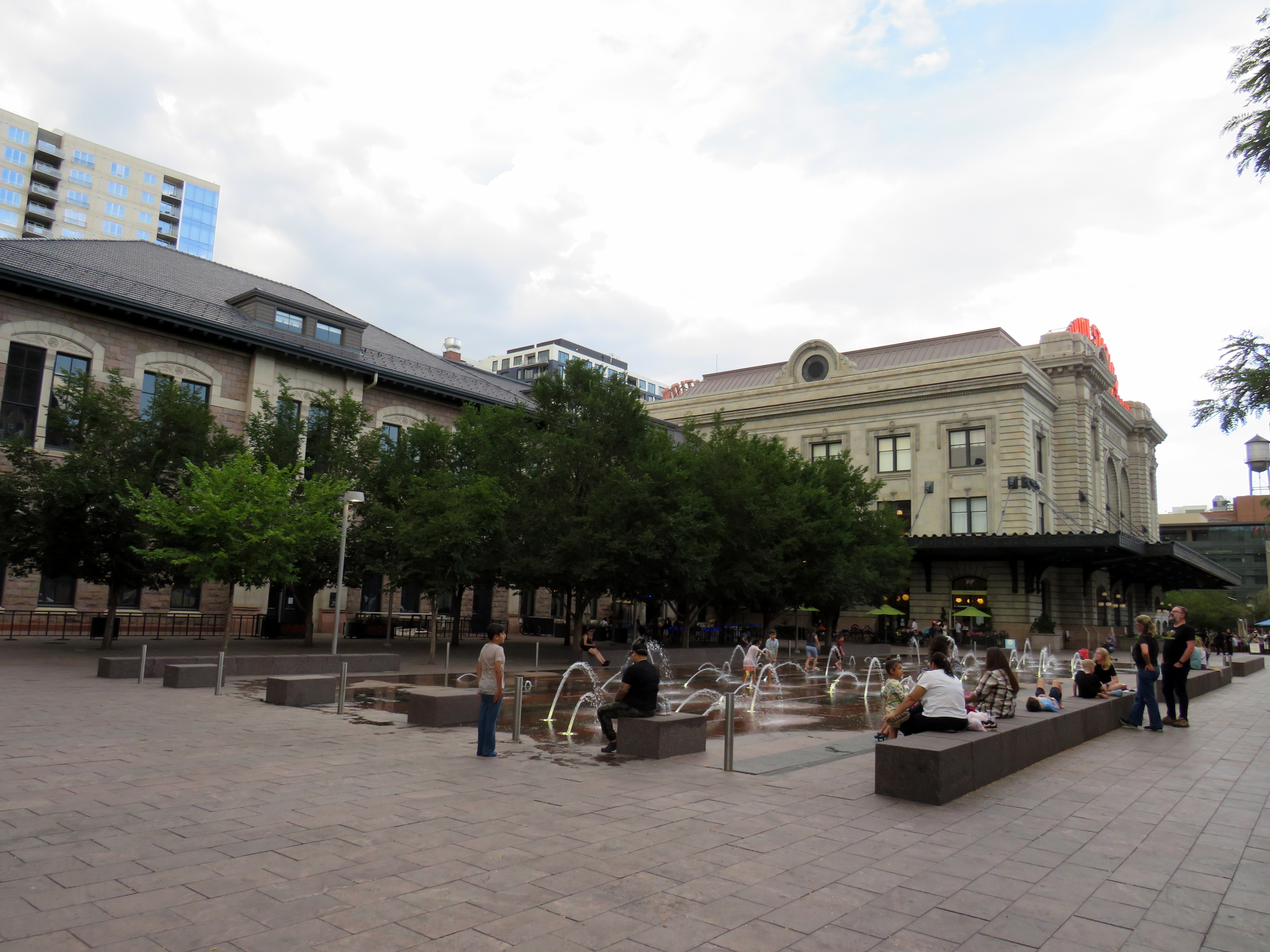
Splash fountains in the Union Station west plaza
Union Station now hosts a boutique hotel, several restaurants and bars, a branch of a local bookshop chain, and includes amenities such as public art and a splash fountain outside its main entrance. Though the main lobby was undergoing minor renovations, it was clear how much work went into the project.
Union Station lobby
Take the A-Train
Arriving at Denver International Airport
Like Toronto’s Union Station, Denver offers an airport rail link, operating every 15 minutes most of the day. The electric A-Line train runs from Union Station, making 7 intermediate stops. With the exception of the airport itself, the A-Line operates within the regular RTD fare zone, with free transfers between connecting buses and trains.
To enter or exit the airport station itself, occasional travelers must purchase a special $10 day pass (a standard day pass is $5.50), but that, of course, includes all rides taken before or after arriving at or departing from the airport. (By contrast, there are no transfers or fare discounts when connecting between UP Express and GO Transit, TTC, or suburban transit services.)
Because of the additional stops and the long distance between Downtown Denver and the international airport (25 miles or 40 kilometres), the trip takes 37 minutes versus UP Express’ 25 minutes.
Unfortunately, most RTD rail services, like the A-Line, follow existing or abandoned rail corridors. Though these routes offer limited obstructions to construction and allow for faster service than operating within roadways, they limit how much ridership can be generated by walk-on service. Even the Downtown Littleton station on the D-Line is distant from any commercial or residential uses, with a large commuter parking lot behind the historic station building.
At least many RTD stations offer convenient bus transfers, which draw much of the ridership.
The D-Line LRT at Littleton, Colorado
A lot was done right at Denver Union Station, which is well served by local, state, and national rail and bus connections, and is serves well as a model for developing a good intermodal hub in a midsized city like Denver. There are certainly aspects that could be replicated at some GO Transit stations, such as Brampton, Port Credit, or Unionville, which are poised to become important intermodal hubs, such as great public spaces, easy connections between nodes, and complementary retail spaces. At Brampton in particular, much can be done with the small historic station building there to make it a centrepiece of a great downtown redevelopment.
I am glad I visited Denver, and I am glad to have travelled by train.
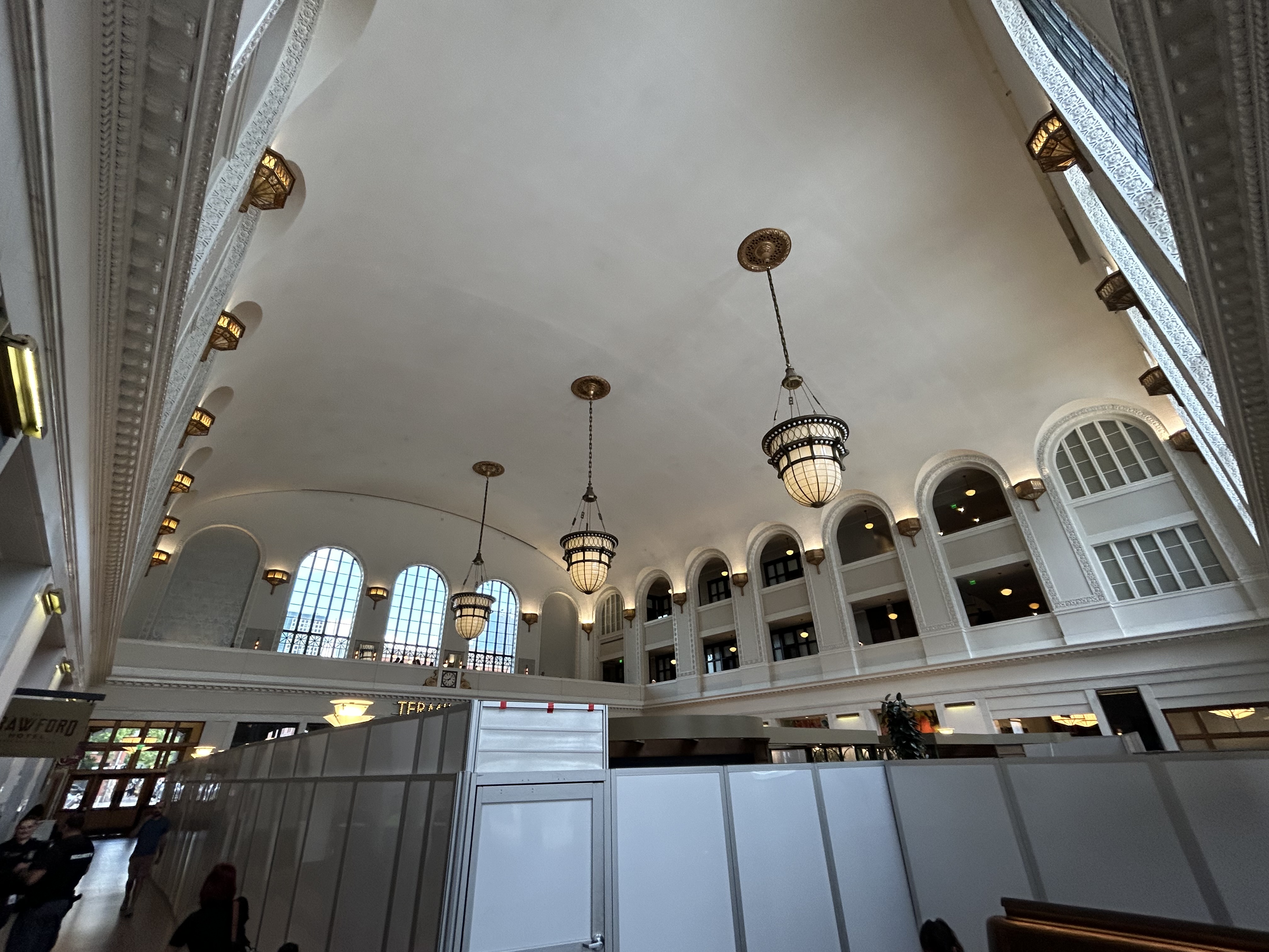
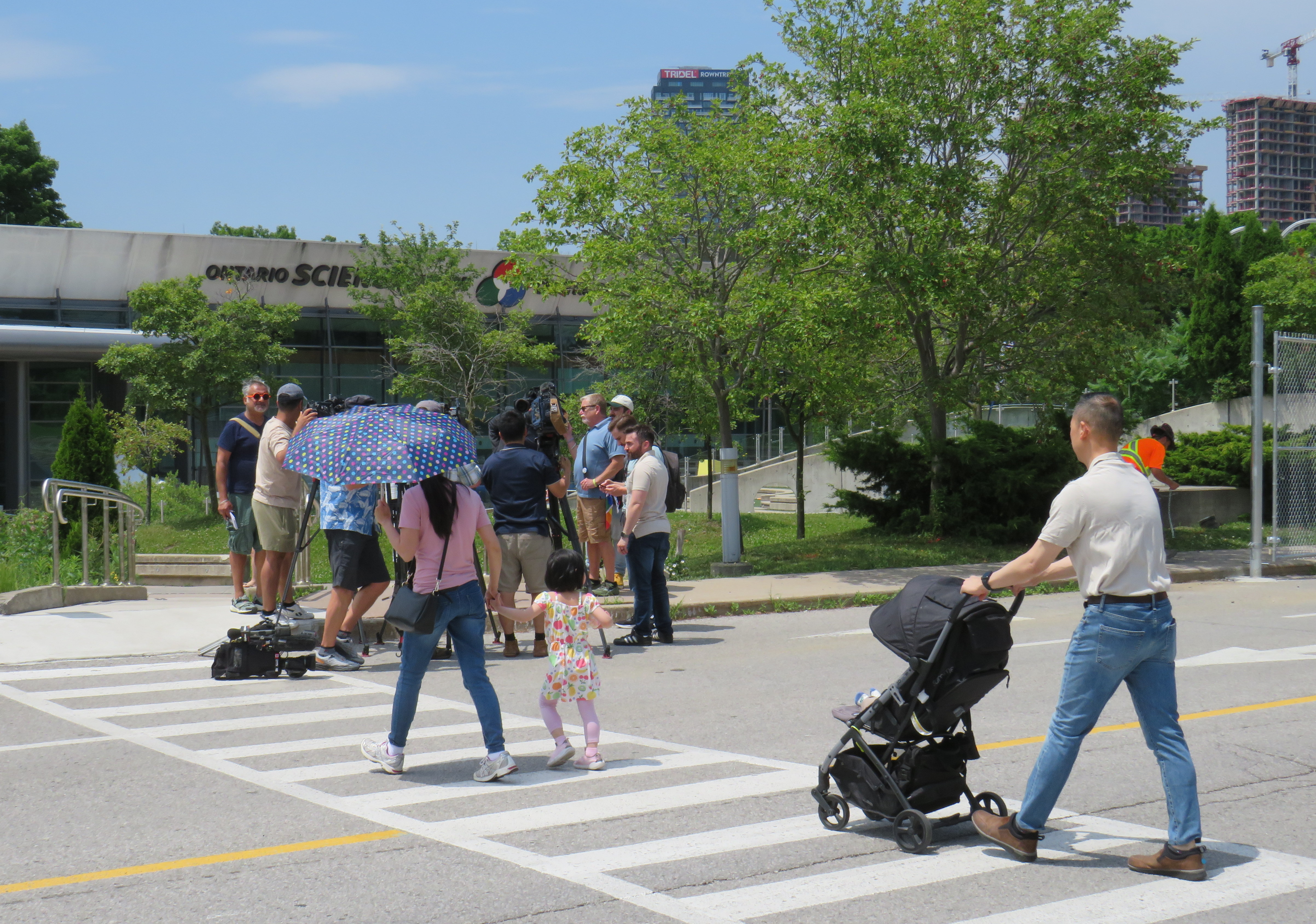
A family enters the Science Centre for the last time on Friday June 21, 2024
When I was growing up, our family would make a trip every year to the Ontario Science Centre, a 45-minute car drive from our home in suburban Brampton. Invariably, these trips would take place on the first PA day of the school year, typically on a Friday in late September or early October, when the ravine was still lush and green, with only the first hints of the changing season.
Because it was early in the school year, and since the Toronto school boards typically had different PA days than the Dufferin-Peel Catholic board, the Science Centre would be mostly empty; my father would run with my brothers and I along the corridor over the ravine between the entrance hall and the great hall. At the end of our visit would be an hour spent at the Science Arcade, the highlight of any child’s visit to the once-great institution. I marveled at Raymond Moriyama’s wonderful harmony of concrete, glass, and natural beauty as one descended into the West Don Ravine by means of glass walkways and escalators.
Later visits in high school and in my early adulthood, however, were not as great. The exhibits were getting old, and the place started feeling worn out. The Dalton McGuinty and Kathleen Wynne-led governments did not value the Science Centre enough to invest in its relevance or its long-term maintenance. Doug Ford’s PC government continued the neglect, favouring a private redevelopment of Ontario Place (closed under the previous Liberal government) with a new, downsized Science Centre to take its place.
In 2022, that once-wonderful double-deck bridge between the entrance hall and the exhibition space was closed due to the risk of structural failure, with no plans to fix or restore the link. Instead, $2 million a year was spent on shuttle buses ferrying visitors between the upper parking lot (after they paid admission) and the lowest level at the bottom of the ravine. That year, the planetarium (a smaller version of the McLaughlin Planetarium that operated next to the Royal Ontario Museum until the 1990s) also closed due to deterioration.
A December 2023 report from the provincial Auditor General’s office took issue with the government’s management of the Ontario Science Centre and the flawed business case for moving it to a new location on Toronto’s waterfront, in a location much less accessible to school groups.
Loading Ontario Science Centre visitors on shuttle buses, June 21, 2024
The most recent development in which engineers warned of sections of the roof in danger of failure and collapse in a report to Infrastructure Ontario (linked in full on the CBC Toronto website) after October 31, 2024, with repairs costing between $22 million and $40 million. The immediate closure, announced on a Friday afternoon, would provide time to allow the exhibits to be removed, possibly to an interim location. However, most of the roof was found to be in good or fair condition in an the engineer’s report, making the immediate closure suspect.
The Ontario government is shutting the Science Centre today citing an engineer’s report – which does *not* say the place must close or that all work is urgent. What a betrayal. pic.twitter.com/qp21sEjYBn
Globe and Mail architecture critic Alex Bozilkovic questioning the government’s sudden closure on X/Twitter.
On Friday morning, gates were already being installed at the parking lot entrances to the Science Centre, before the official announcement, even before the Toronto Star published the first story about the closure on its website around noon.
Workers install rigid gates at the staff parking and bus exit at Ontario Science Centre. Local Liberal MPP Dr. Adil Shamji speaks to a reporter in front.
One cannot help but be skeptical about the sudden decision to close the Science Centre, despite the demolition by neglect by the Liberal and PC governments. Had an announcement been made, but with the closure taking effect two weeks later after the long weekend, it would have given visitors one last time to appreciate the Science Centre and its unique architecture. But that might also be the point. By making the closure a done deal without the opportunity for the community to rally to save the Ontario Science Centre, Doug Ford’s PCs have shut down debate. By the time the legislature meets again in October, their hope is that opposition to the destruction of Ontario Place and the Ontario Science Centre will have dissipated. The Friday afternoon news dump also fits this strategy.
Though I made it up on Friday to document the closure, I am sad that I did not make it for one last visit, just as with the sudden closure of the Scarborough RT last year.
The most heartbreaking thing for me was watching a young family walk from Flemingdon Park into the Science Centre just as the news media was assembling for a press conference with Don Valley East MPP Dr. Adil Shamji and Floyd Ruskin of SaveOSC. The young child looked so excited for a day at the science centre, unaware that it would be the last day it would ever be open.
On Friday, May 10, Mississauga City Councillor and mayoral candidate Dipika Damerla posted a message and video on Twitter/X, stating that “it will be up to the residents to decide on who best represents the vision of the Mississauga they want.” She followed that by saying that she “will not be silenced in my opposition to remove two lanes from Bloor Street and create more gridlock in Mississauga.”
It will be up to the residents to decide on who best represents the vision of the Mississauga they want.
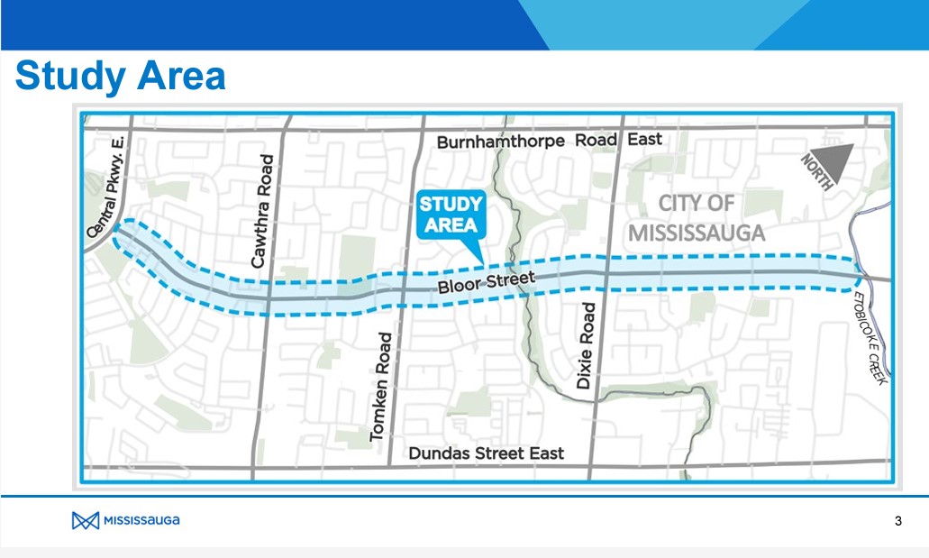
In the video, she is standing on Bloor Street West at Yonge Street in the heart of Toronto’s Bloor-Yorkville business district, 16 kilometres east of the Mississauga border at Etobicoke Creek. Needless to say, this is a very different built environment than anywhere in Mississauga.
Toronto’s Bloor-Danforth bike route, which stretches from Danforth Avenue and Dawes Road on the east to Bloor Street West at Aberfoyle Crescent (near Islington Avenue) is very well used by cyclists, including commuters, couriers, and casual riders. There is also a subway paralleling the entire corridor. Behind Councillor Damerla, there is heavy traffic, but it is unfair to blame the bike lanes for this congestion. The vehicles are stopped at a red light at Yonge Street, one of the busiest intersections for pedestrians and cyclists in the city. There’s a dedicated scramble crossing at the intersection, which does reduce the green light time for traffic on Bloor, though it makes it safer for pedestrians, who outnumber all other road users there.
There is also considerable construction in and around the intersection. Work continues on the troubled “The One” condominium tower, blocking off some of the southwest Yonge-Bloor corner. Just east of Yonge, pedestrians, cyclists, and motorists are squeezed as the TTC works to expand the Bloor-Yonge Subway Station below.
Furthermore, before the bike lanes were installed, the curb lanes were used by stopped cars and delivery trucks; Bloor Street was never a traffic clearway, and it is a ridiculous argument that the bike lanes have caused congestion.
Construction on Bloor Street is the cause of some of the congestion in the area
In Mississauga, Bloor Street is a minor arterial road that extends as far west as Central Parkway. Between Etobicoke Creek and Royal Orchard Drive (just west of Dixie Road), Bloor is lined with rental and condominium apartment buildings and townhouse complexes. From Royal Orchard to Cawthra, the street is lined with low-density dwellings, a shopping plaza, and a high school. The western-most section is lined with fences as the houses back onto Bloor, more typical of major suburban arterial roads.
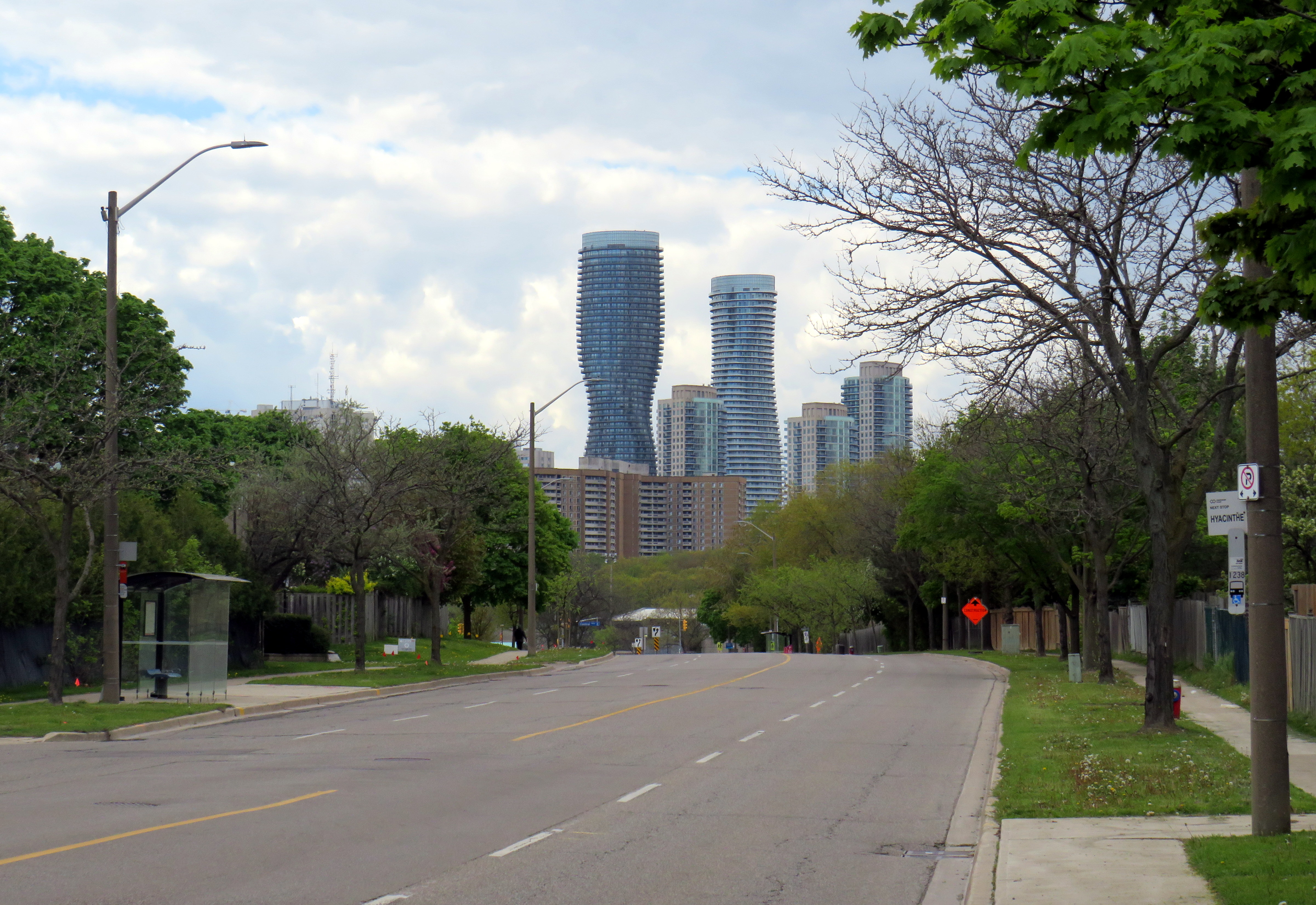
Bloor Street in MississaugaLooking west towards Central Parkway and the Mississauga City Centre skyline
The City of Mississauga was already planning to resurface Bloor Street, but took advantage of the timing to completely study the corridor with the goal of promoting active transportation and improving road safety while maintaining traffic flow.
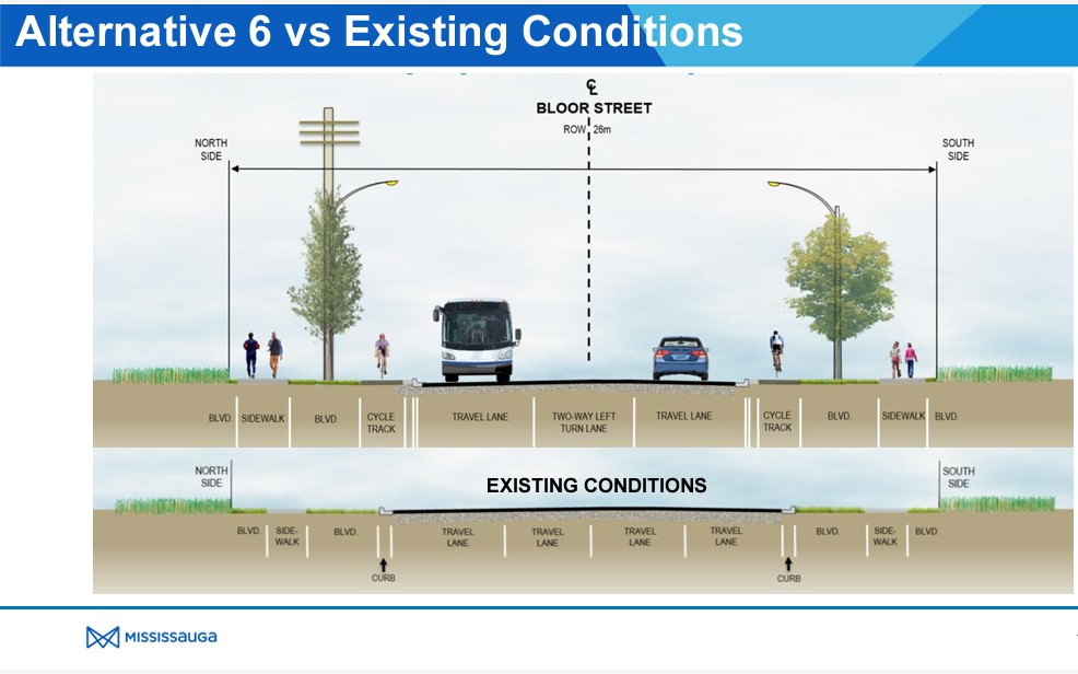
After extensive community consultation, Mississauga city staff recommended Alternative 6 for Bloor Street which widens the sidewalks, adds new separated cycle tracks, and a boulevard for trees and street lighting between the roadway and cycle tracks and the sidewalks and property lines. A continuous two-way left turn lane would allow motor vehicles to turn in and out of side streets and private driveways without conflicting with through traffic. This was approved by City Council in June 2023. Construction is scheduled to begin in October 2024.
This plan balances the needs of all road users, particularly students and seniors. It is great to see suburbs like Mississauga and Brampton rethink their streets to better serve all of their residents.
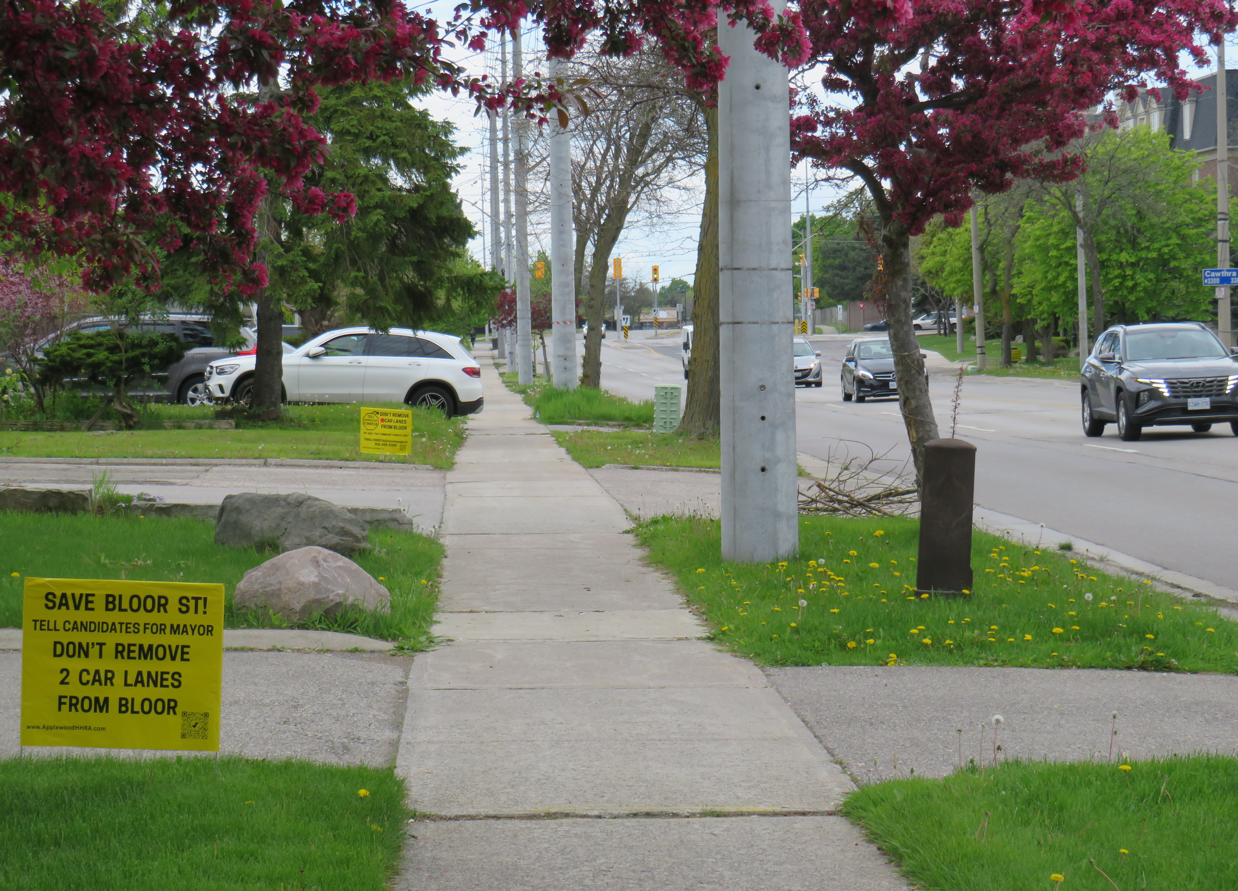
Bloor Street, looking east from Havenwood Drive. Note the “school route” sign and the cyclist using the sidewalk in the distance.Yellow lawn signs with the slogan “Save Bloor Street.” Note the SUV parked in a way that partially blocks the narrow sidewalk.
Bloor Street, whether it be a residential roadway in Mississauga, or a commercial street in Downtown Toronto, is not a place where drivers should expect nor be given ultimate priority over pedestrians, cyclists, or public transit riders.
Luckily, many Mississauga politicians already get it. Reporting for the Mississauga News, Steve Cornwell noted that fellow councillor and mayoral candidate Alvin Tedjo “stands by the approved Bloor project”, while Carolyn Parrish, another city councillor running for mayor declared that a reversal of last year’s council vote would not pass, saying that the “issue’s dead” at one mayoral debate. Ward 3 Councillor Chris Fonseca — whose ward covers most of Bloor Street — championed the changes.
Though Parrish has led several polls (with Damerla and Tedjo in second and third place), it is unfortunate to see a top-three candidate and sitting councillor using the Bloor Street redesign as a wedge issue. Mississauga is growing up. Some of its politicians should too.
On Monday, February 26, the new Ontario One Fare Program will take effect. Transit riders who previously had to pay a second fare when transferring from GO Transit or suburban transit agencies (York Region Transit, MiWay, etc.) to the TTC, will now benefit from a free transfer. Passengers will also be able to transfer free from the TTC to suburban buses or get the TTC fare discounted if transferring to GO Transit.
The new fare program, subsidized by the provincial government, is only available to customers who pay using a Presto card or other contactless payment options (credit card, debit card, mobile app). It is also not applicable to and from UP Express.
This is good news for many transit users, and it fixes several flaws in the existing fare structure. For example, when GO Transit moved its Highway 407 buses — originally designed to ferry commuters to York University — to Highway 407 Station in Vaughan, students and staff had to pay the TTC fare just to go two stops or endure an unfriendly walk. For a short time, there was a $1.50 discount for GO-TTC transfers, but that was allowed to expire under the Ontario PC government.
The elimination of the double fare will also benefit transit passengers who live or work near the border of Toronto and York, Peel, and Durham Regions. On the boundary between Markham and Toronto, it is common to see lots of bicycles locked up at bus stops along or near Steeles Avenue at TTC stops. These bicycles are owned by York Region residents who ride south to avoid the double fare and benefit from one less transfer. Once the new free transfer comes into effect, it will be interesting to see if there is a bump in YRT ridership.
Bicycles parked on the south side of Steeles Avenue, February 2024
Though the new free TTC transfer should — at least in theory — eliminate a barrier to integrating GO Transit with local transit, the TTC really isn’t set up to feed the GO Transit rail network, nor are many GO stations set up to serve TTC riders. There are historical reasons for these poor connections, but they will need to be fixed.
GO Transit started off in 1967 as a commuter rail pilot project, with the Government of Ontario (the “GO” in GO Transit) looking to keep costs down in case the three-year experiment was unsuccessful. Many station sites were selected for their proximity to major roads and highways and parking access. As the service was intended to attract suburban commuters from their cars and mitigate the need for expensive highway widenings, transit access was only a secondary consideration. The initial Lakeshore Line exceeded expectations and so GO added new lines to Georgetown (1974), Richmond Hill (1978), Milton (1981) and took over CN commuter operations to Bradford/Barrie and Stouffville.
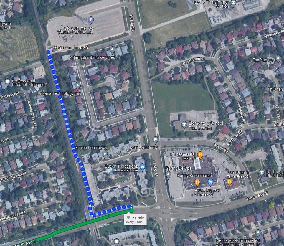
An example of this era of GO Transit station placement is Old Cummer Station, which opened in 1978. It was built where the Richmond Hill Line crossed the Finch hydro corridor, with land underneath the transmission lines easily paved over for parking. A walkway leads south to Finch Avenue, where one can connect to TTC buses, but the station building and the platform are oriented towards the parking.
As the Richmond Hill Line only operates during the peak periods, and is the only GO train service not destined for service expansion, this is not a major problem.
In the 905 suburbs, such as Mississauga, Brampton, Oakville, and Whitby, local transit connections are often quite good. For decades, commuters in those cities have benefitted from discounted or free fares on local transit when heading to or from GO rail stations (with Presto, connections to and from GO buses are now also free). Many transit agencies, particularly Durham Region, Oakville, and Burlington along the Lakeshore Line, centre their bus systems around the GO stations. Brampton built its downtown bus terminal adjacent to the GO station in 1989, and in 2023, Metrolinx opened a new bus terminal at Bramalea Station, allowing for easy transfers between buses and trains.
Bramalea GO Stationbus loop
On the other hand, the TTC bus network was designed around the subway network, with nearly every route serving at least one rapid transit station. Though TTC buses would pass by GO stations, transfers between the two were limited because of the extra fare and the infrequent GO services compared to the subway. The only TTC loop on GO station property is at Rouge Hill Station, though Exhibition Loop and Long Branch Loop are short walks to GO station entrances.
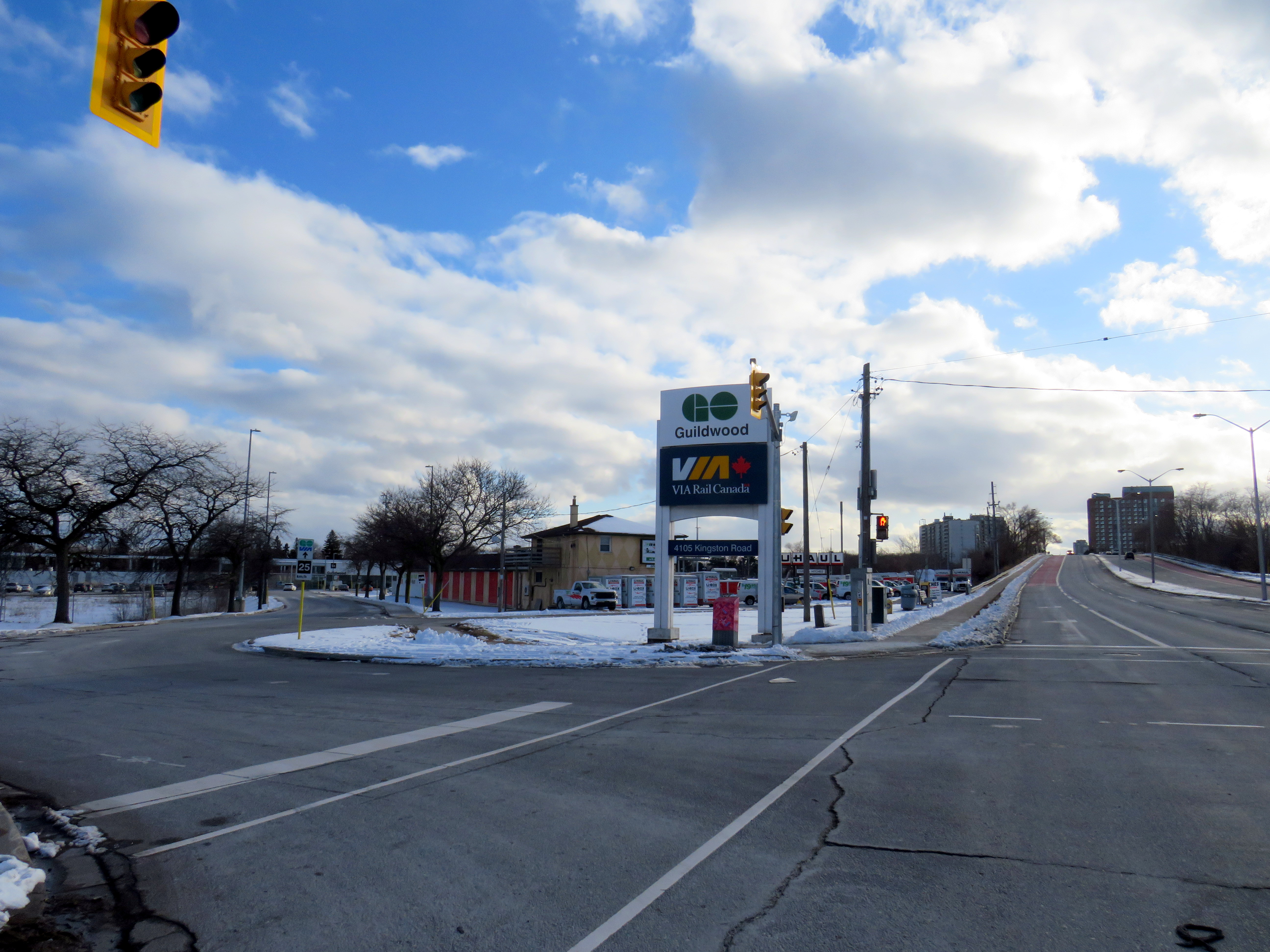
Entrance to Guildwood GO Station at Kingston Road. TTC passengers looking to connect with GO trains must cross a busy intersection than then walk through a parking lot to reach the station building.
As GO Transit continues to expand, and fare integration finally becomes a reality, there is both an opportunity and a need to change. Though there are plenty of examples of poor GO-TTC connections, there are also some promising moves towards physical integration between the two systems.
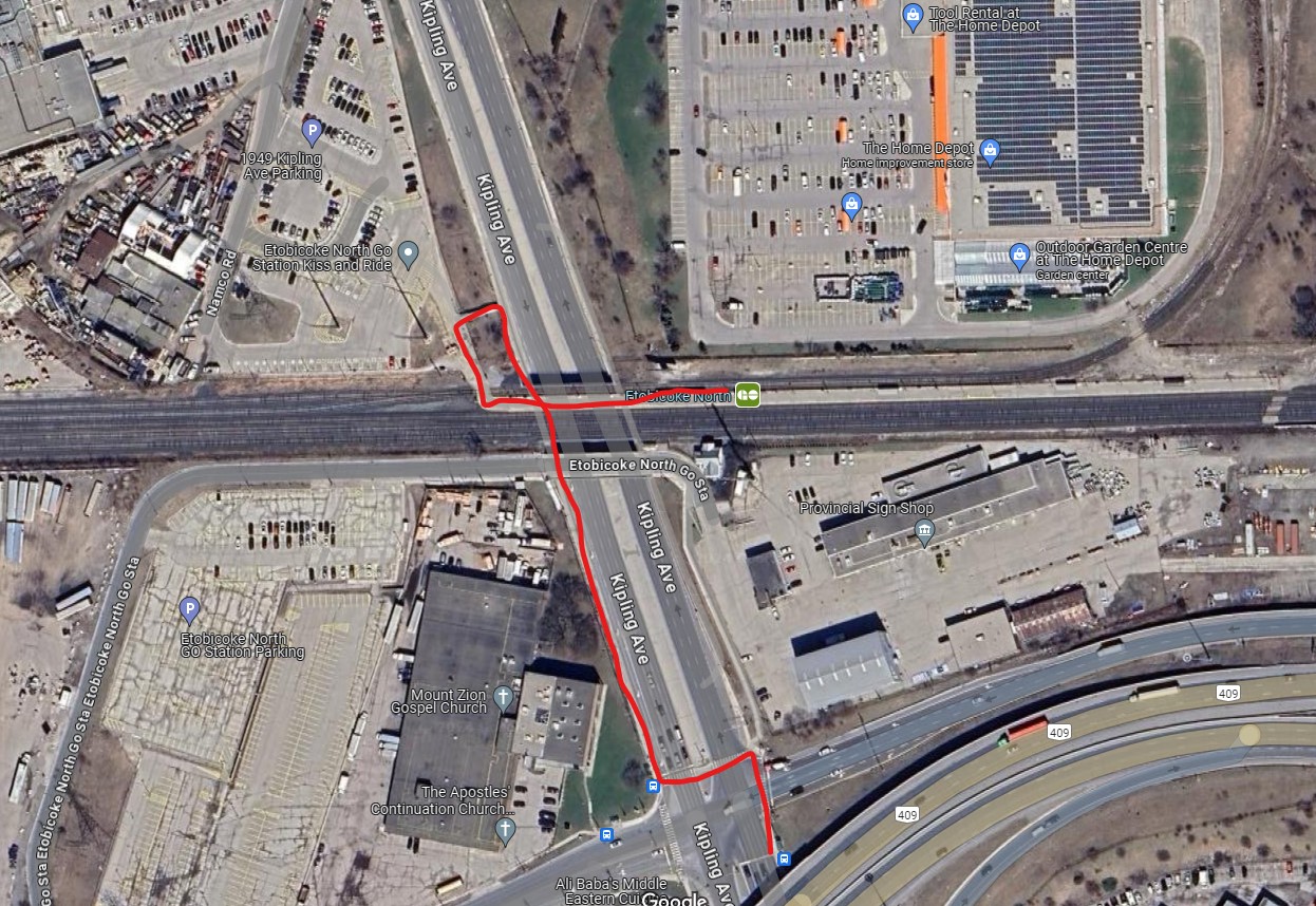
The worst GO-TTC connection: Etobicoke North
Red path shows walking route between northbound 45 Kipling bus stop and Etobicoke North GO platform
Etobicoke North station opened in 1974 as part of the Georgetown (now Kitchener) GO Line. The station and parking lot were built on Ministry of Transportation property and in a hydro corridor. Though the frequent 45 Kipling bus passes under the rail corridor, the transfer between bus and train requires crossing two sides of the busy Kipling/Belfield/Highway 409 off-ramp intersection, continuing on a narrow sidewalk, and climbing a flight of stairs before reaching the main walkway to the station platform. Though a passenger could save a lot of time by transferring to the train (especially as it now runs seven days a week), the long and uncomfortable transfer makes this very uninviting.
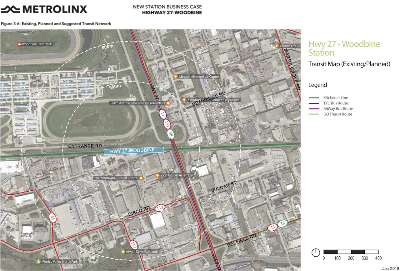
A new station at Woodbine Racetrack is proposed, but work has yet to begin. The station at Etobicoke North will eventually have to be closed and demolished to make way for track expansion required for 15-minute GO service. There’s an opportunity to build a great transit hub at Woodbine, especially with an extension of the Finch West LRT.
Metrolinx map of the potential Highway 27-Woodbine Station
An accessibility failure: Scarborough GO
Scarborough GO Station, from St. Clair Avenue East
Scarborough GO Station, near St. Clair Avenue East and Kennedy Road, is located where the GO Stouffville Line splits off from the Lakeshore Line; the station was originally known as Scarborough Junction, as it was the point where the Midland Railway of Canada met the Grand Trunk Railway. (This is where Midland Avenue gets its name from.) The station building and parking lot is located on the south side of the tracks, accessible from Midland and Reeve Avenues. A walkway on the north side of the station leads to St. Clair Avenue East, but it involves several staircases and is not fully accessible to the street, where the 9 Bellamy and 102 Markham Road buses stop.
The Scarborough Junction Masterplan development proposal includes a new connection to St. Clair Avenue as part of a transit-oriented mixed-use community. It promises to better integrate GO and TTC services but will likely be several years before construction begins and even longer until a fully accessible connection is possible.
A more typical transfer: Agincourt GO
Agincourt GO Station, looking northeast from the south side of Sheppard Avenue East
Agincourt Station, in service since 1871, was taken over by GO Transit in 1982. The station building was always located several hundred metres north of Sheppard Avenue, and even in CN commuter rail days, featured a small parking lot. In 2012, an overpass was built separating Sheppard Avenue from the tracks; this allowed for a future Sheppard East LRT as well as train service expansion (a grassy median marks where the light rail line was planned to go). The TTC bus stops are located where the parking lot driveway exits onto Sheppard at a signalized intersection.
Unfortunately, the station platforms were not moved south on the overpass, reducing the walking distance between the train and bus stops and sidewalks on Sheppard Avenue. Though there’s a proper walkway between the TTC stops and the station itself, the station remains oriented mainly to the surface parking lot. Transfers are definitely possible, but not particularly easy.
The nearest eastbound TTC bus stop to Weston GO/UPX Station, located a five-minute walk to the east
Similar situations exist at Weston GO/UP Express station, where the TTC stops are several hundred metres away from the GO platforms at Weston Road and Lawrence Avenue, and at Oriole Station, where the walk from the GO platform to Leslie subway station is still unnecessarily lengthy and also requires crossing a busy intersection.
Milliken GO: A promising direction
A Steeles East TTC bus stops at Milliken GO Station
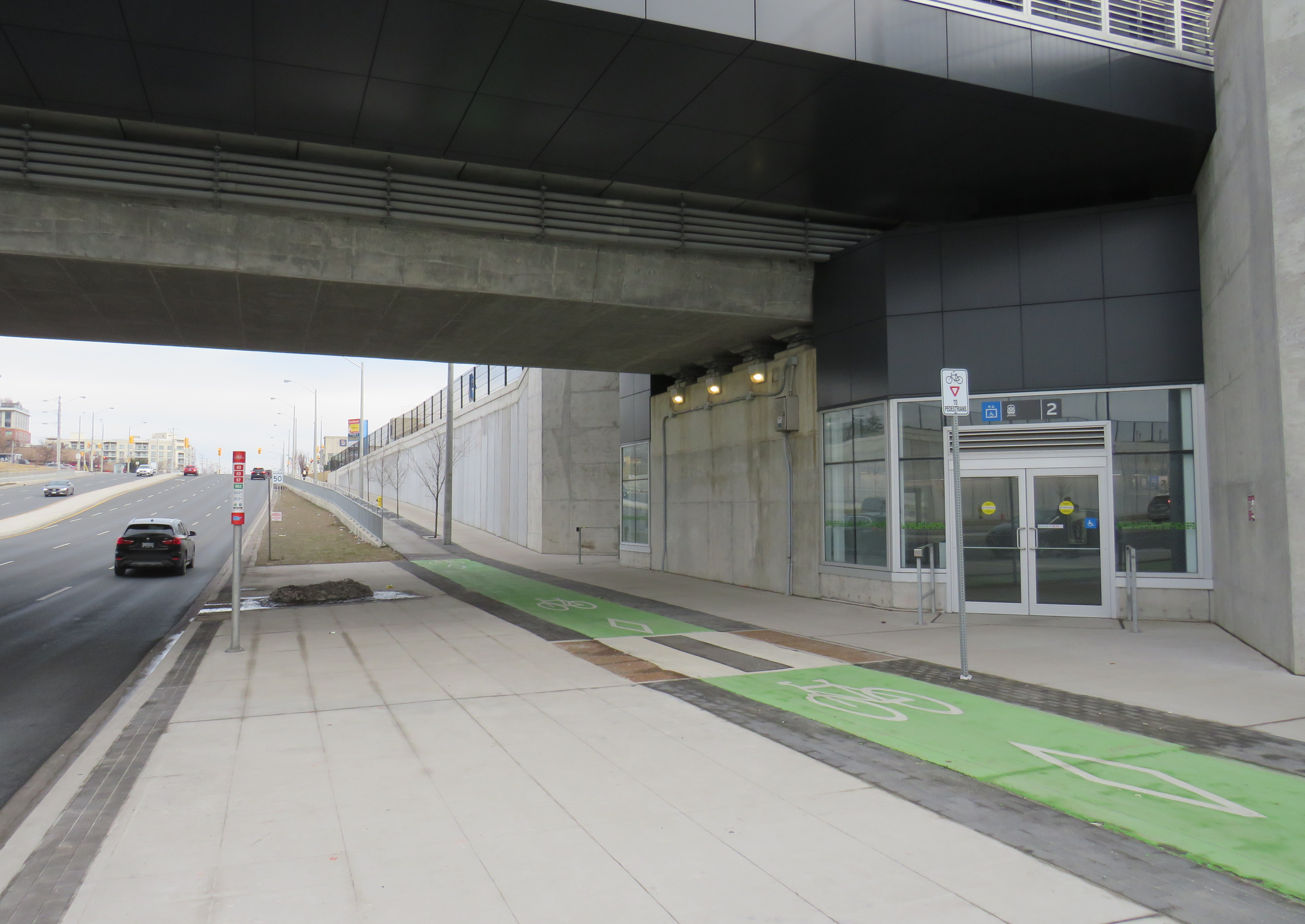
As part of the Stouffville Line corridor upgrades (which includes double-tracking the line between Scarborough Junction and Unionville) Milliken GO Station was recently rebuilt. It now features a new grade separation over Steeles Avenue, along with two new pedestrian overpasses on either side of the tracks. Though the station building is still oriented to the parking lot south of Steeles Avenue, the new layout provides excellent connections to buses on Steeles Avenue, including TTC routes 53/953 Steeles East, 43A Kennedy, and 57 Midland. Entrances on both sides of Steeles Avenue offer stairs and elevators to platform level.
TTC bus stop, separated bike lane, and access to GO trains
The one issue at Milliken Station — as with many GO stations — is that the wayfinding from platform level to TTC buses is completely missing. Ideally, signage should indicate not only the route to TTC buses, but the connecting bus routes as well.
Unfortunately, signage at Milliken Station does not indicate TTC bus connections
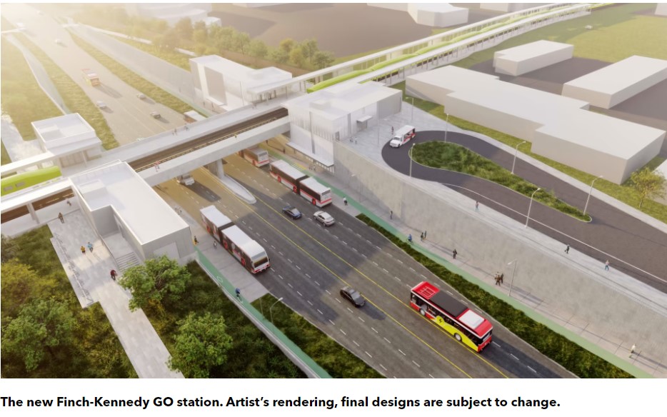
A new GO Station, nearly three kilometres to the south, will feature a similar layout. As platforms will extend over Finch Avenue, transfers between train and bus will be even more convenient at Finch-Kennedy as they are at Milliken. With minimal parking and optimized transit connections, this should be the norm as GO Transit transforms into a frequent, regional rail network. As of February 2024, preliminary work has started on the grade separation.
Rendering of the future Finch-Kennedy GO Station
Concluding thoughts
The new Ontario One Fare Program is a long-overdue step towards integrating the Greater Toronto and Hamilton Area’s disparate transit agencies and addressing unfair tariff boundaries at Steeles Avenue and elsewhere. It also recognizes GO Transit’s future as a regional rapid transit network that not only connects the suburbs to Toronto, but a solution to providing better transit within the city as well.
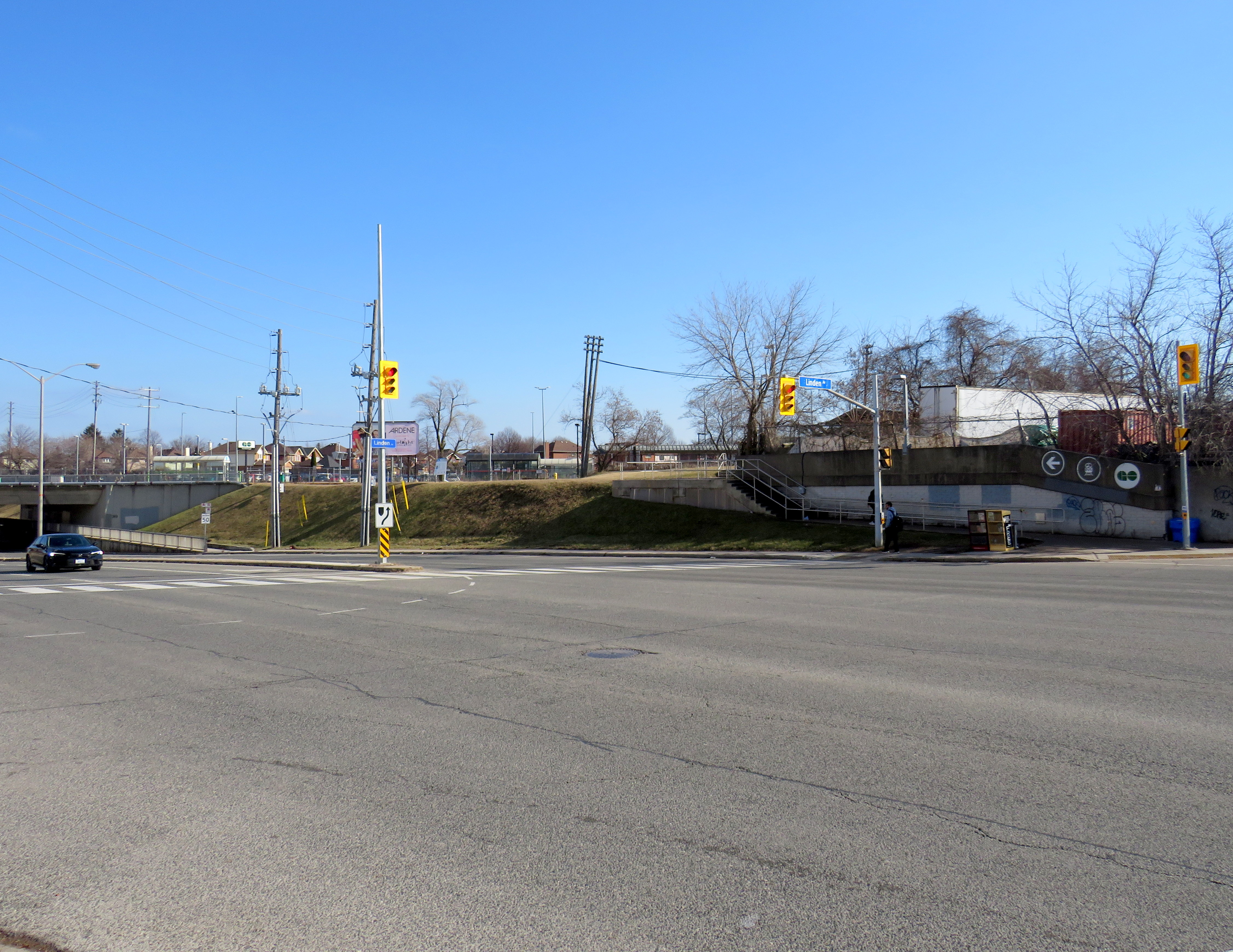
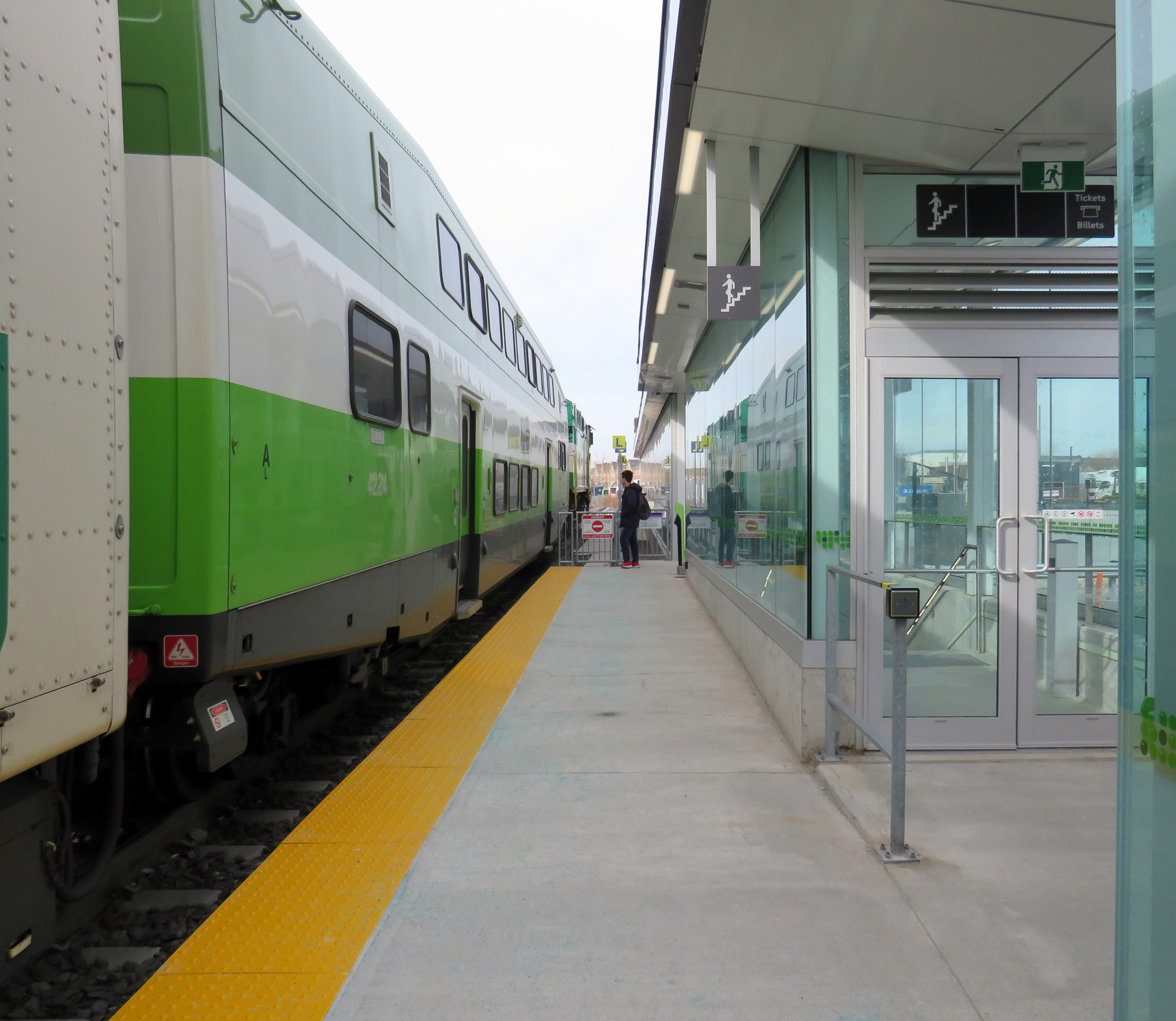
Most importantly, TTC-GO transfers should be simple, easy, and direct. Happily, there is some momentum to making this happen — Downsview Park Station, opened in December 2017, is a great example of physical integration between GO and TTC — but as shown above, there is much work to be done.
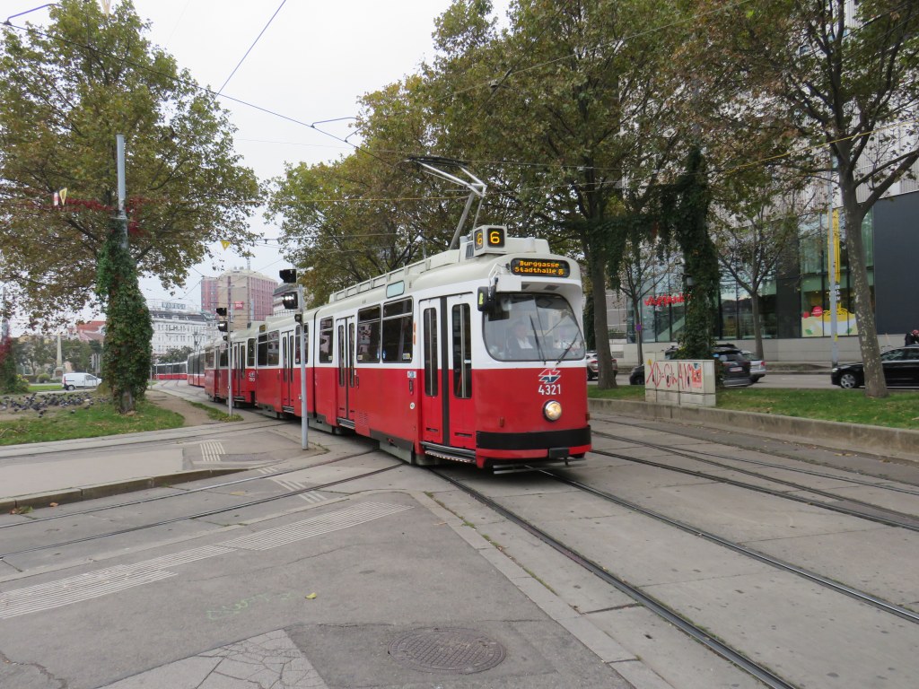
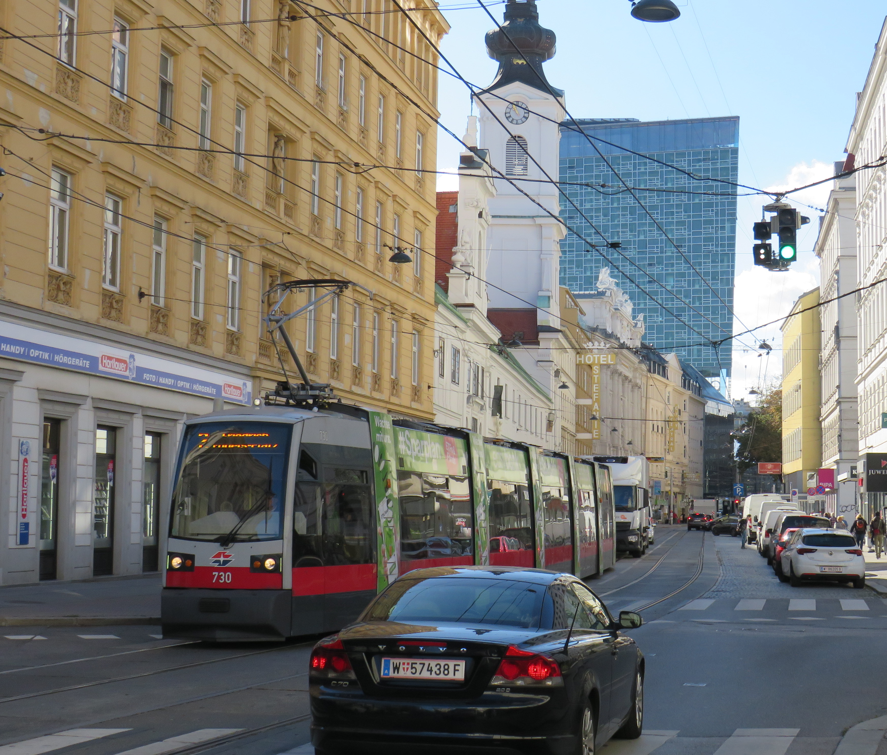
Vienna low-floor tram in the Leopoldstadt district
Back in October, my spouse and I had the opportunity to visit several countries in Central Europe: Austria, Slovakia, Hungary, and the Czech Republic, though we spent the majority of our time in and around Vienna, as that is where my spouse attended business meetings for several days; we also took time to explore the city and surrounding areas together.
While there, I experienced how serious cities operate trams seriously. In Bratislava, I saw how a streetcar priority corridor can work in a busy downtown core. In Prague, trams made it through watermain construction zones without detours or unreliable bus shuttles. In Budapest, I rode the world’s longest trams that move more people per hour than many metro lines. In Vienna, where I spent the most time, I experienced a city where transit passengers are treated with respect, and where the trams are reliable, despite no discernable signal priority and plenty of mixed-traffic operations.
Vienna is an amazing city to visit. It’s been described to me as “what people think Paris is.” That’s pretty much true. It’s a very walkable city with a fantastic café culture full of independent konditorei cafés (which offer sit-down service), with an assortment of rich, tasty cakes and great coffee. It has great art galleries and grand imperial palaces, but without the crushing crowds of Paris and Versailles. As the original Music City, it’s easy to find shows and performances to suit your tastes. (We attended the famous Wiener Staatsoper, where I took in my first live opera, ever, at a surprisingly reasonable price). It’s also a compact city, easy to walk, though the transport system is excellent. Vienna is also a great base for visiting other cities in Central Europe, where Salzburg, Bratislava, Budapest, and Prague are only a few hours away by (frequent and relatively speedy) train.
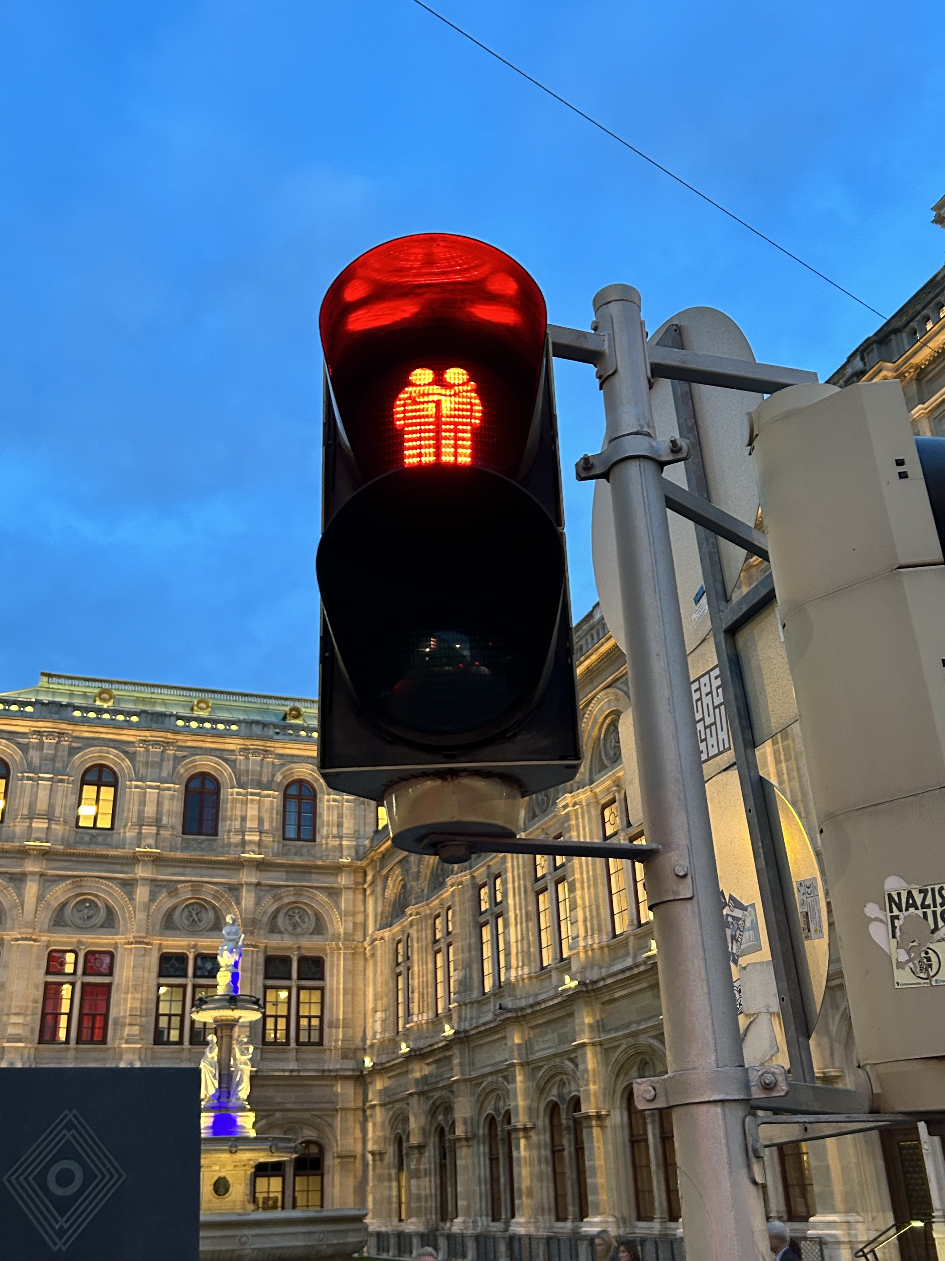
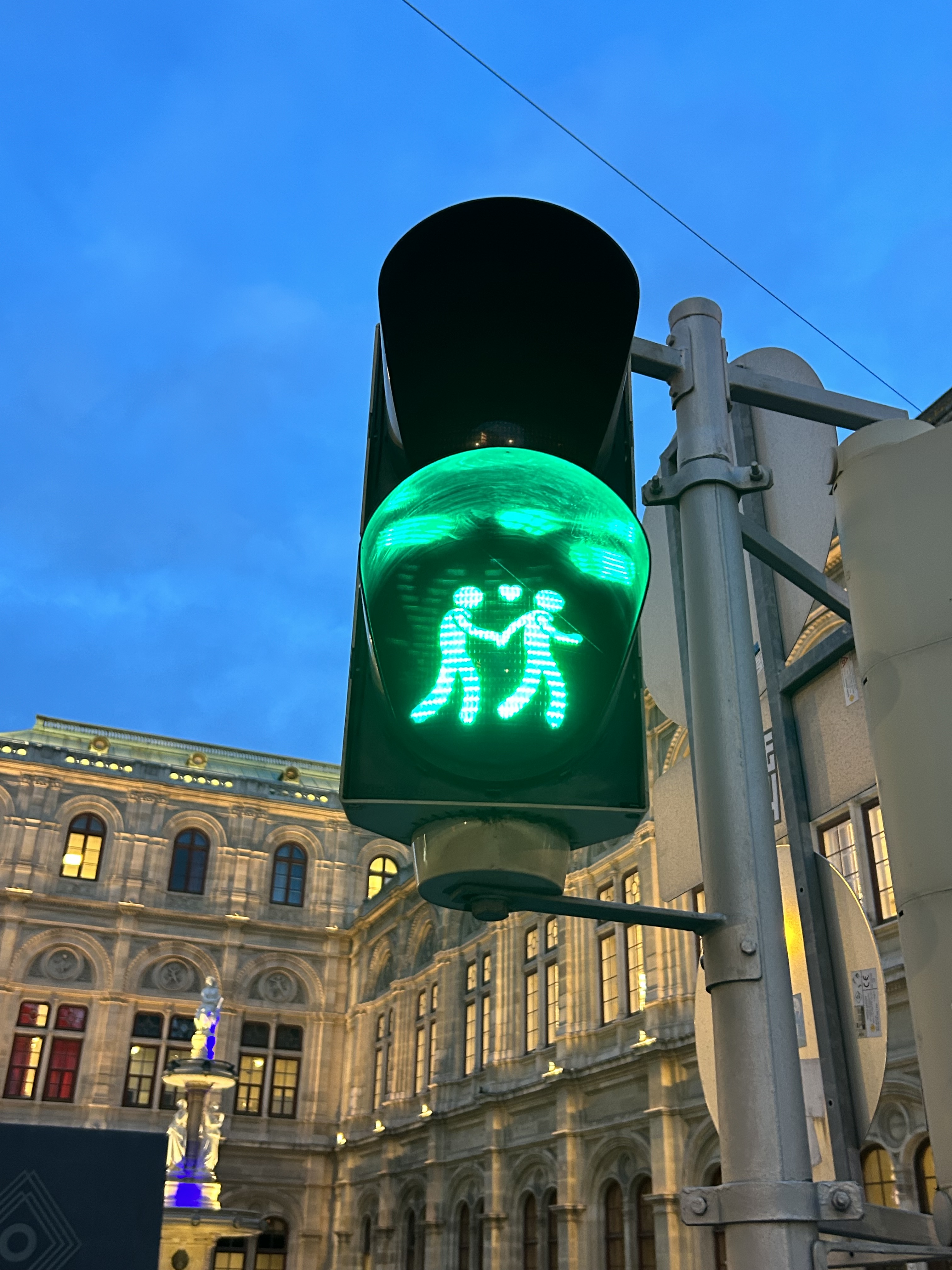
We noticed several pedestrian signs showing loving couples, rather than the standard, like this one in front of the Wiener Staatsoper (Opera House)
Vienna has one of the largest tram systems in Europe, with 30 lines over 176.9 kilometres, and a fleet of 525 cars, including modern articulated LRVs and older trams and trailers. In Vienna, trams alone carry approximately 300 million passengers a year. They run in many different environments: on-street in mixed traffic, reserved lanes, dedicated median and side-of-street rights-of-way; there is also a tram tunnel south of the city centre. Until the 1980s, Straßenbahnen (the German name for trams) were the backbone of Vienna’s transport network, with a small Stadtbahn system (now incorporated into the modern U-Bahn) and regional and suburban (S-Bahn) trains providing limited rapid transit services. Though there are now five U-Bahn lines (two of which evolved from the Stadtbahn), the tram system remains robust and very useful for getting around.
Like all four cities mentioned in this post, Vienna operates a mix of low-floor trams built in the last 25 years, as well as older high-floor trams, many of which are accompanied by an unstaffed trailer. Vienna’s entire network — trams, buses, U-Bahn, and S-Bahn — is a proof-of-payment system. Fare inspections appeared to be infrequent; neither my spouse nor I were checked during our eight days in Vienna. Tickets and passes can be purchased from a machine (found at every U-Bahn entrance and at many tram stops) or on the WienMobil app.
An older Type E2 high-floor tram and trailer at Gumpendorfer Straße. Behind is the old Stadtbahn viaduct, which is now part of Line U6. Note the large red “Strassenbahn Haltestelle” sign to the left, a classic Viennese icon that indicates a tram stop.
There is also a separate interurban tram service called Badner Bahn, which extends to the historic spa town of Baden bei Wien, an hour south of Vienna’s city centre.
Badner Bahn tram, laying over at Josefsplatz in Baden bei Wien
The modernized interurban originates in the heart of Vienna — across the street from the Wiener Staatsoper (Opera House) — then along local tram tracks and through the tunnel before entering its own right-of-way through the southern suburbs, and onwards through small towns, farms, and vineyards before arriving in Baden. There are several spurs leading to local industries; the regular passenger service shares the tracks with local freight trains.
View of the vineyards from Badner Bahn
A sample of the journey aboard Badner Bahn. Arriving southbound at Guntramsdorf, heading towards Baden bei Wien.
Bratislava, just over one hour away from Vienna by train (or by catamaran), is served by a network of metre-gauge trams, trolley buses, and diesel buses, though trams predominate in the city centre. On Obchodná, several tram lines, pedestrians, cyclists, and the occasional delivery or emergency services vehicle share a narrow, but busy shopping street. It just works.
Obchodná, Bratislava
Outside the congested urban core, trams are afforded reserved lanes, sometimes separated from general traffic with curbs (and even grass medians), sometimes just painted lines. Bratislava’s tram system is smaller than Toronto’s, with 211 cars and 42 kilometres of revenue track, carrying around 70 million riders a year in 2019 (Toronto’s streetcars carried 108 million that year). It is also a much smaller city, with a population of around 660,000. I only visited Bratislava for a day, but I got to ride much of the tram network; I found it an easy and convenient way to get around.
Reserved, painted tram lanes just outside Bratislava’s city centre
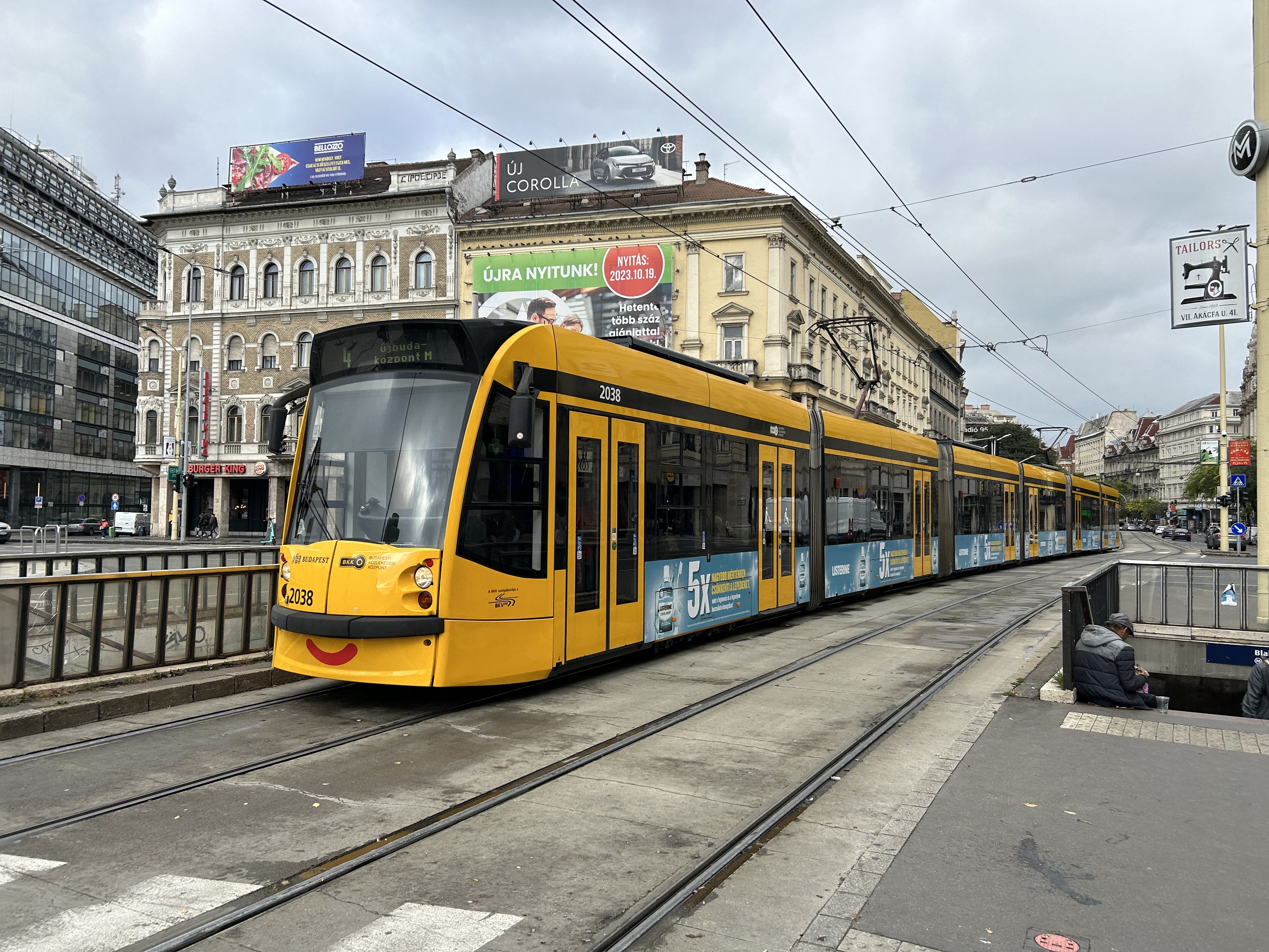
Budapest, Hungary has the largest street railway system in the world by ridership, with Route 4/6 on Budapest’s Grand Boulevard (Hungarian: Nagykörút), often cited as the world’s busiest tram line. Route 4/6 also operates 53.99 metre long Combino Plus trams, which, when introduced in 2006, were the world’s longest. The Combinos are almost twice the length of Toronto’s new Bombardier Flexity cars, which are 28 metres long. Even with the huge capacity these trams have (they require two pantographs to draw enough power to operate), they operate on Line 4/6 every few minutes, all day long, every day.
A Combino Plus tram on Line 4 traverses Budapest’s Nagykörút (Grand Boulevard)
Through the 1970s and 1980s, Budapest’s tram network was slowly cut back in favour of buses, trolley buses, and metro construction. By the 1990s, however, there was a street railway renaissance in Hungary’s capital because of the capacity and economy trams offered. With high frequencies, a private median, and high-capacity low-floor vehicles, Line 4/6 easily matches the capacity of a metro, at comparable speeds. Elsewhere, dedicated lanes and private rights-of-way make it clear that transit riders come first.
Older trams running along the Danube dip under road bridges on a private right-of-way
Though Budapest has a large metro network, most of it was not constructed until the l970s and 1980s. However, Line M1 was opened in 1896 as a shallow subway under Andrássy Avenue, the first electric underground metro in the world, and only the second subway, after London’s initial Underground line. Uniquely among urban transit routes, it it is listed as part of an UNESCO World Heritage Site.
Budapest Line M1 stations, restored to their original appearance, look like miniature New York stations, only cleaner
Finally, in Prague, we took several trams to take shelter from the rains that greeted us after arriving from Budapest, but also to see the city outside the crowded tourist spots. We took Line 1 from the city centre to the suburban district of Hrdlořezy, and returned via Line 9, taking a slightly different route back. Like Budapest, a metro system was planned and built in the 1970s and 1980s, but trams remained important, often providing local services parallel to deep underground metro lines.
Old two-car tram train on Line 9, passing a newer low-floor tram on Line 1, Sokolovská, Prague. Most trams run on reserved rights-of-way.
What interested me was seeing major watermain work along the line. Through trams slowed where work was adjacent, there were no diversions or shuttle buses. The trams ran through.
Watermain replacement in Prague, with trams still running(taken on a rainy morning)
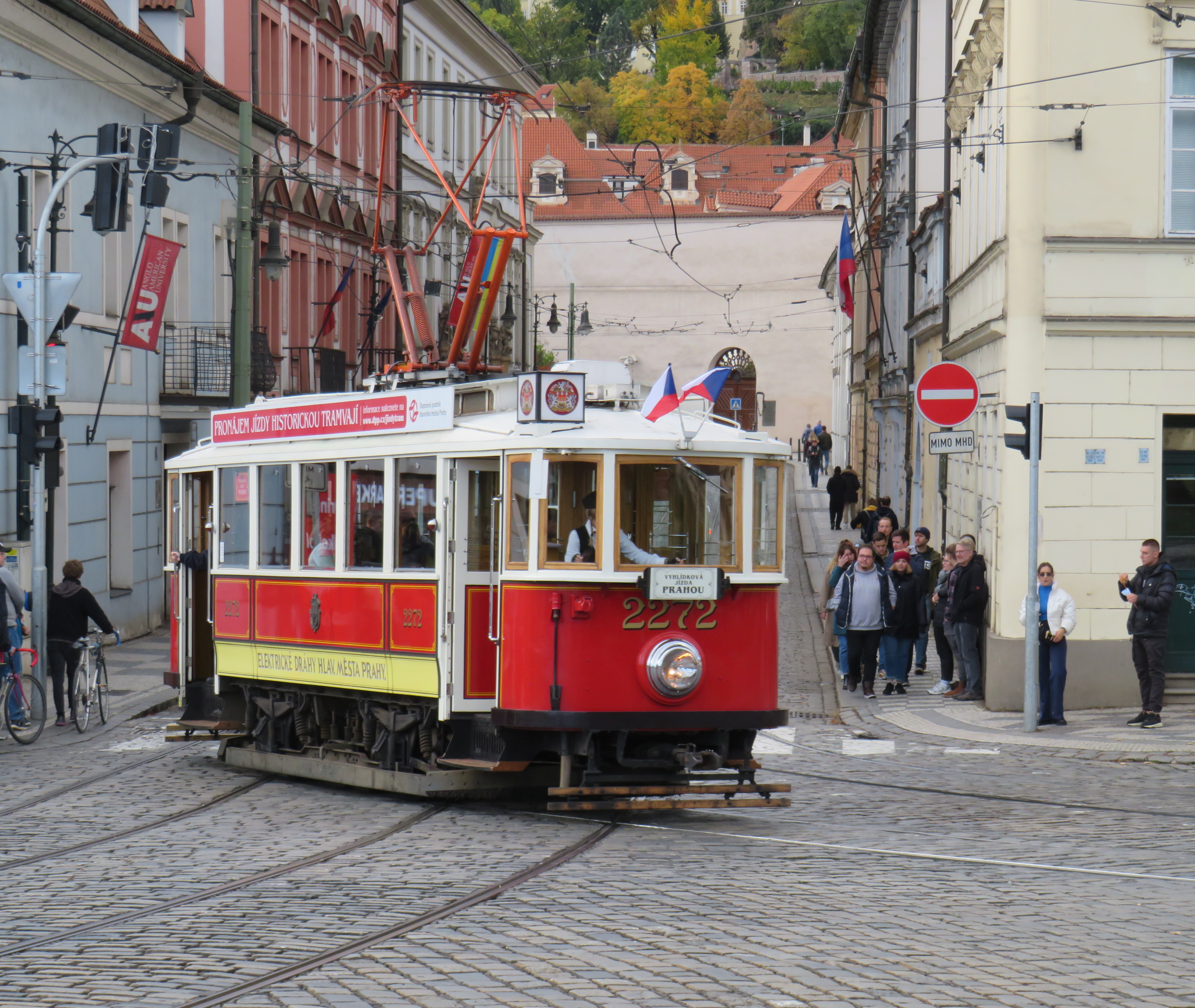
Like Vienna, Bratislava, and Budapest, Prague operates a mixed fleet of older high-floor trams and modern low-floor light rail vehicles, similar to Toronto’s new fleet. But in Prague, heritage trams could often be spotted in service, especially on the west bank of the Vltava near Prague Castle.
Heritage tram #2272 in Prague
Lessons for Toronto
After travelling, it can be easy to spot one’s hometown flaws and faults. But I spent a lot of time riding Vienna’s metros, trams, and buses, and mindfully experiencing the transport networks in Bratislava, Budapest, Prague, and Salzburg (which does not run trams, but has a large trolleybus network), I was left with some key takeaways on how to do transit here.
First and foremost, transit riders were respected. Not necessarily in terms of personable customer service, but the feeling that the next tram or bus was going to arrive on time, and a reliable interval. If there was a delay, it was very well communicated.
For instance, while waiting for a tram in Vienna, we experienced an unusually long wait. The next tram display kept showing the next two arrivals at 3 and 4 minutes. Not long after, a voice came on a loudspeaker posted above the tram stop sign announcing (in German, translated in English to us by one of my spouse’s colleagues) a delay because of a collision along the route. The blockage cleared after a few minutes, and we boarded a crowded tram. I appreciated the audio announcement, especially as it was a basic tram stop.
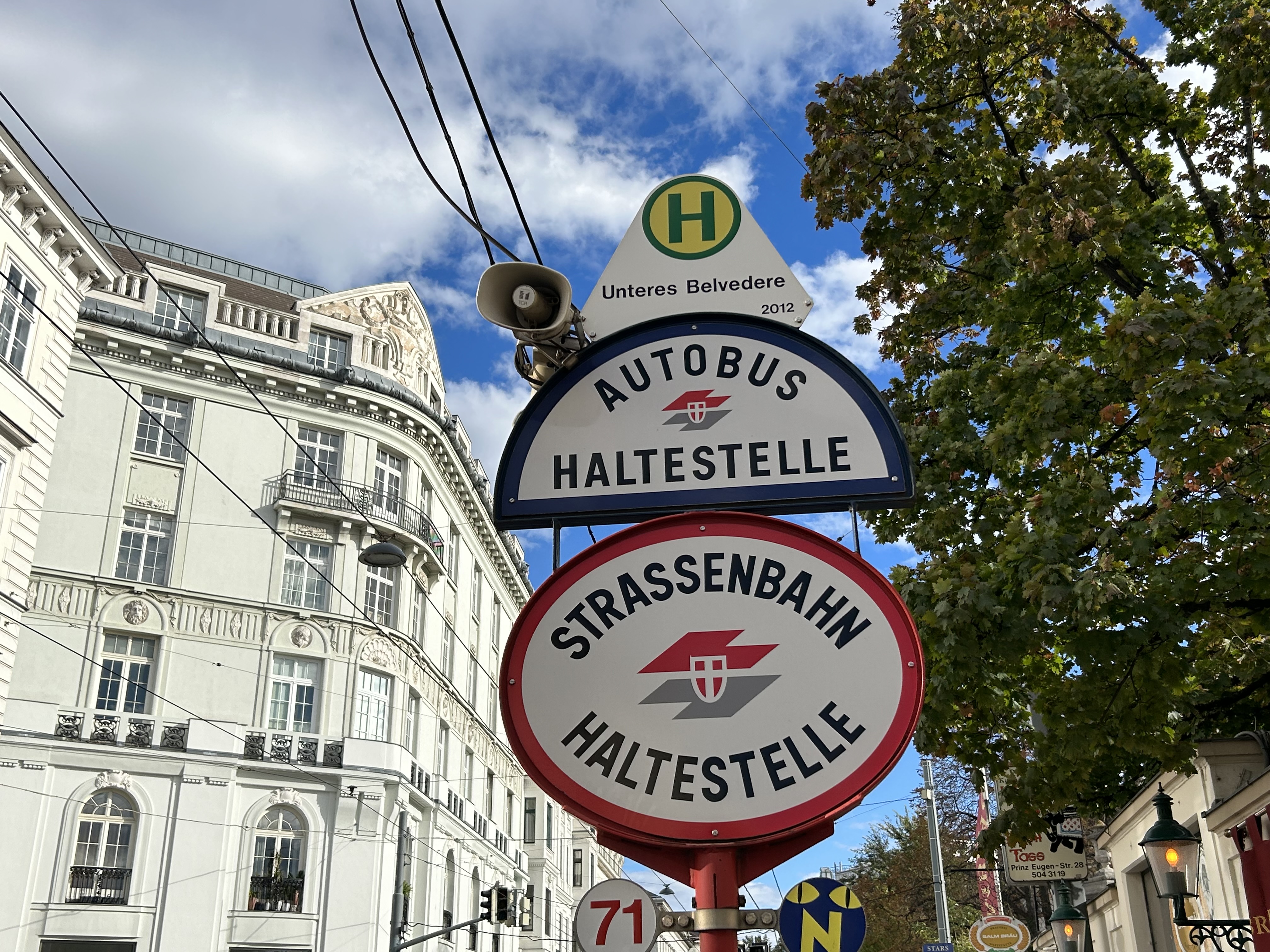
The classic Vienna tram stop. Note the loudspeakers atop the blue bus stop sign (at night, buses take over, hence the Strassenbahn and Autobus stop signs).
Next vehicle displays were common in every city we visited. They would list — in real time — the next several buses or trams, as well as if the vehicle was low-floor accessible or not with a wheelchair symbol. All buses are now fully accessible, but the information is useful for the tram lines, where there are still many older high-floor vehicles.
Next vehicle display at a bus stop in Bratislava
I also noted that in Vienna, and for the most part elsewhere, vinyl advertisement wraps did not cover passenger windows on trams and buses. Bratislava’s wrapped trams had some ads that used window areas, but these were kept to a minimum.
In Vienna, advertisement wraps kept windows completely free of obstructionsAdvertisement wraps in Bratislava had minimal window coverage
It was also clear that trams had dedicated signals on their routes, if not necessarily signal priority. But with smaller intersections and relatively short signal timings, the waits at each signalized intersection were generally minimal.
Note the white tram signals next to the overhead traffic signal. The “A” indicates that a proceed signal will soon appear, and the operator can cancel the door release, so that no more passengers can enter or exit.
Tram signaling in Vienna and other Central European cites also includes remotely operated electric switches. Overhead signals indicate which direction the switch is set to; operators can pass through junctions at speed. While this is how trams operate in most places around the world, in Toronto, streetcar operators are required to stop before each switch and then crawl.
Trams pass through a track junction, along with an ambulance and a transit maintenance van. The overhead horizontal signal indicates the switch direction.
Though many tram stops are in private rights-of-way, in-street tram stops are designed for passenger safety and accessibility. These stops, depicted by the photograph below, have the curb lane raised to the level of the low-floor trams. This increases the visibility of passengers boarding and egressing, and also simplifies ramp deployment. Operators need not exit the cab and manually deploy the accessibility ramp, a timesaver versus the TTC’s ramp deployment on major streets. In the winter, this also helps keep the slush away from the tram stops.
The raised on-street curb lane at an on-street tram stop in Vienna.
Though Toronto is a very different city than Vienna, Budapest, or Prague, there are some clear takeaways. Keep the tram windows free of advertisements. Improve communications. Fix the track switches and signalize them. Raise the curb lanes at streetcar stops for safety, convenience, and accessibility. Fix the King Street Transit Priority corridor with a permanent streetscape and tighter vehicle restrictions. If it can be done on a narrow commercial street in Bratislava’s historic centre, there’s no reason why it can’t be done in a world financial capital.
These can even be done incrementally, but they need to be done if transit riders are deserving of respect and reliable surface transit.
On Monday, October 30, the new Old Elm GO Station opened in the town of Whitchurch-Stouffville, northeast of Toronto. Located two kilometres away from Stouffville’s small downtown core, Old Elm is focused on park-and-ride passengers arriving from nearby communities such as Goodwood, Uxbridge, Port Perry, Beaverton, and from within Stouffville itself.
The new station is relatively simple, with a covered platform, a bus loop with several bays directly adjacent to the single platform, heated shelters, and a 673-spot parking lot. As a relatively quiet station with limited train service, there is no indoor waiting room or ticket office.
The bus loop is directly adjacent to the train platform
Though train service is limited to weekday rush hours and a few evening and weekend departures, there is regular GO Transit bus service connecting Uxbridge and Goodwood to Old Elm Station, and onwards to midday and weekend train connections at Mount Joy or continuing to Toronto Union Station. There are no York Region Transit connections at Old Elm.
The Lincolnville layover yard, which was also the Lincolnville/Old Elm station location until October 2023
Previously, Old Elm Station was located a few hundred metres away, northeast of the Tenth Line/Bethesda Side Road intersection at the Lincolnville layover yard, where Stouffville Line trains continue to be stored overnight and weekends. That station, originally named Lincolnville for a nearby hamlet, was opened in 2008 to accommodate service expansion and relieve the small station at Stouffville, which had no room for a bus loop or additional parking. Since Lincolnville was a yard terminus, passengers had to walk across tracks to reach the next departing train, and each departing and arriving train had to crawl through the yard before reaching the mainline. (As Georgetown GO Station is also within a layover yard, trains passing through on their way to and from Kitchener must also crawl through. A new layover yard near Heritage Road in Brampton will allow for a rebuilt Georgetown Station with faster arrivals and departures.)
Lincolnville Station was confusingly renamed Old Elm in 2021, even though that new name referred to a tree on the new station site that didn’t open for two more years. Had the new name taken effect with the location change, it would have made more sense.
The new station site, located outside of the Lincolnville yard, allows for smoother and faster arrivals and departures, shaving several minutes off the trip for passengers to and from Lincolnville.
The station’s namesake, an old elm tree on the south end of the GO Transit property
Though Lincolnville/Old Elm is located in the Greenbelt, and the station is unable to support transit-oriented urban development, there was a need for the layover yard. Adding a small, auto-focused station was quite sensible. This is no Garage Mahal.
The one unfortunate feature is the complete lack of active transportation access beyond the station property. Though Metrolinx built a wide concrete walkway from Tenth Line to the station platforms, there are no sidewalks, no crosswalks, and no pedestrian signals at either the main entrance or the bus loop entrance, which are both signalized intersections. Instead, there are “no pedestrians” signs facing all directions.
“No pedestrians” sign placed in front of the new concrete pathway into Old Elm Station
Once on Metrolinx property, though, there is a wide pathway, presumably for cyclists and pedestrians. Interestingly, the sign below shows that cyclists should keep to the left, on the wide pathway, while pedestrians are directed into the grass to the right.
Beyond the “no pedestrians” sign at the intersection, another sign instructs cyclists to keep to the left and pedestrians to the right – into the grass
I doubt Metrolinx intended for the hostile intersections to forbid any pedestrian activity. I note too that despite the rural locale, there are several neighbouring homes and businesses along Tenth Line and Bethesda Side Road. The nearest subdivision is less than a 15-minute walk away, a healthy stroll’s distance. A new residential development, Elm Villa, is planned for the site immediately to the south of the bus loop. Tenth Line is maintained by the Town of Whitchurch-Stouffville, so it is likely they are responsible for the oversight. Still, it is not a great look.
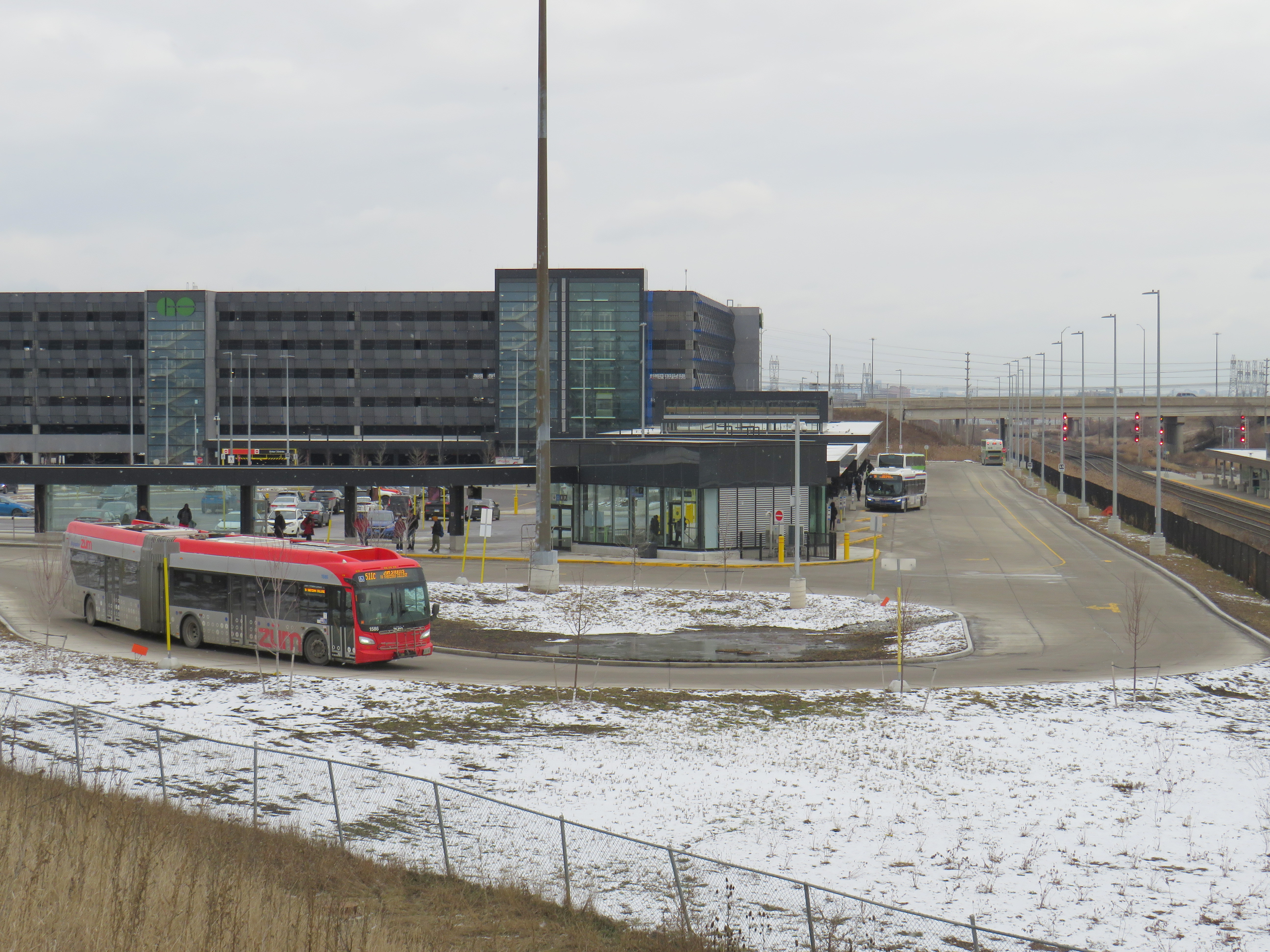
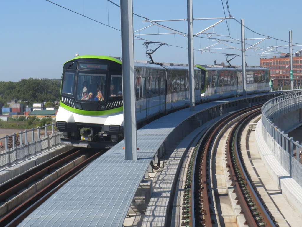
North America’s newest rapid transit service, the Réseau express métropolitain (REM), opened on Monday, July 31, 2023 after a weekend of free public rides. I took my first ride several weeks later, on August 22, 2023. The five stop, 16.6-kilometre line between Central Station and Autoroute 30 in Brossard, is the first of four phases of the initial REM network, with branches north and west of Downtown Montreal to open in the next few years.
Built by the CDPQ Infra, a division of Caisse de dépôt et placement du Québec (a provincial public pension fund), REM is a light metro network connecting suburban communities with Montreal’s urban core. With limited stops, a downtown-suburban focus, and frequent service, REM has similarities to Bay Area Rapid Transit (BART) in the San Francisco metro region, to S-Bahn systems in Germany and Austria, or RER in metropolitan Paris. Like Vancouver’s SkyTrain or the future Ontario Line here in Toronto, the trains are short, and operate fully automatically, running every 3.5 minutes during weekday peak periods, and every 7.5 minutes at all other times, from 5:30 AM until after midnight.
As REM is being built by a pension fund — which seeks to make an 8% return on building and operating the service — financing the line is a bit different. Though it received financing from the Canada Infrastructure Bank and support from the provincial government, much of the funding comes from other sources, such as development levees. It is also guaranteed a share of fare revenue from the provincial government.
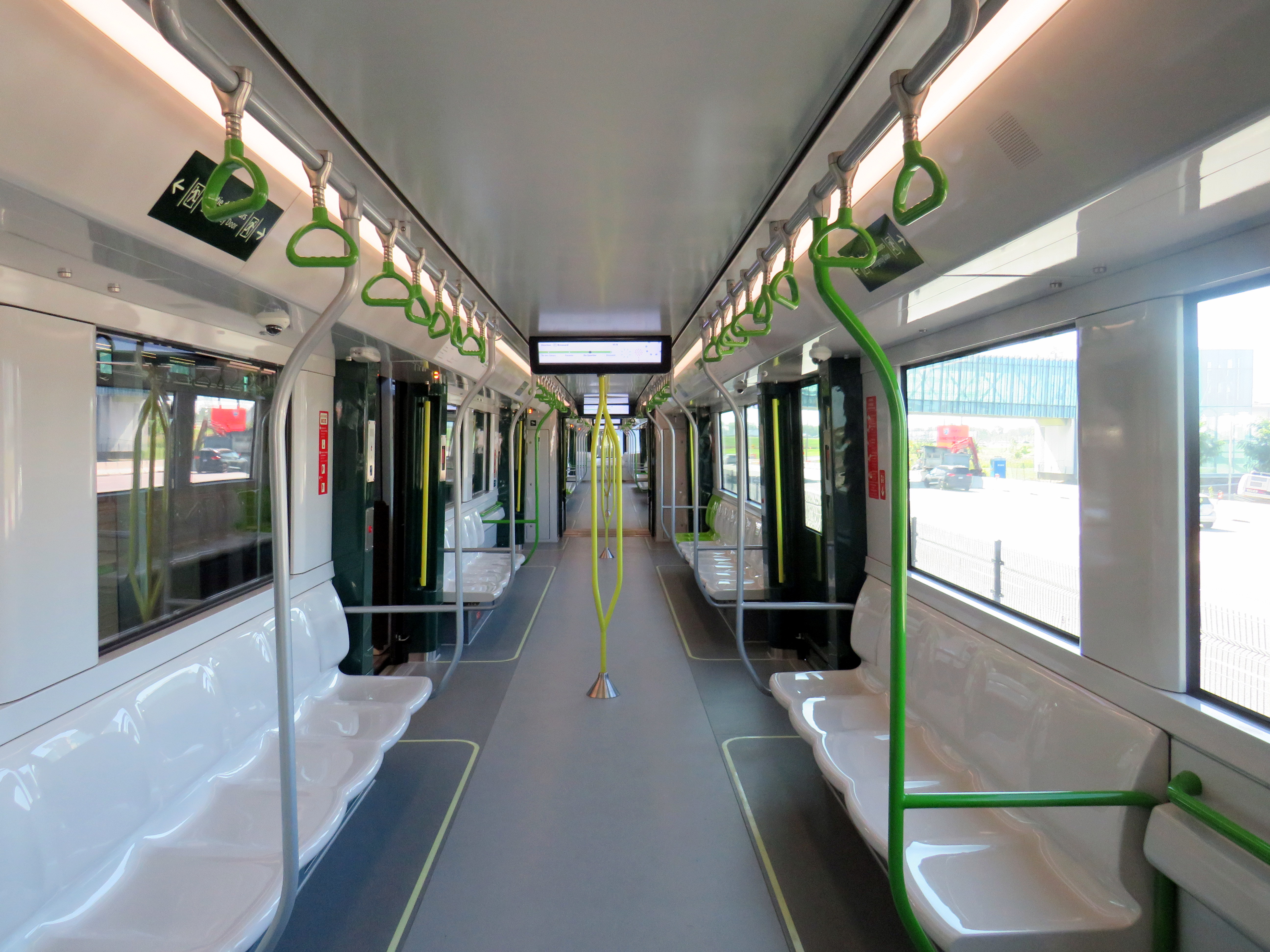
Rail car interior. All seats face inwards, there are 64 seats per car, with standing room for up to 300.
Though several notable transport enthusiasts have already documented the new REM during its opening weekend, I wanted to wait for some of the excitement to wane; I also wanted to experience the service from a regular passenger’s point of view, including checking out the stations and transfers to other transit operators.
For the most part, I came away satisfied. However, I encountered several shortcomings, particularly with service integration and transfers between modes.