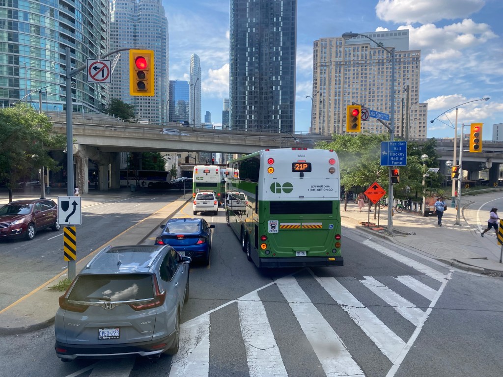
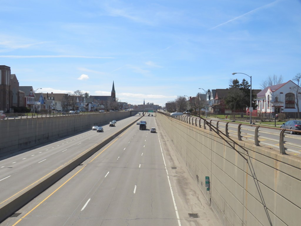
GO Transit buses stuck in Downtown Toronto gridlock in July, 2022
While travelling through the Northeastern United States this spring and summer, I found myself feeling lucky to be living in Toronto. Though the New York City Subway and the PATH trains between New Jersey and Manhattan were operating pretty much as I remember them, in other big cities, the mass transit systems were in rough shape. In Washington, underfunding and incompetence led to the long-term withdrawal of over half of its Metro cars. During our visit in April, we were treated to long waits and crowded trains, though at least the system was clean. When we visited Philadelphia in late June, it was clear that the Southeastern Pennsylvania Transit Authority (SEPTA) had given up: poor communications, lengthy waits, unsafe subway stations, and general apathy among staff and passengers made my spouse and I resort to driving on our last day there.
In Toronto, at least, the subway was still running frequently (with only minor service cuts due to the pandemic), the buses and streetcars as (un)reliable as ever, and despite more anti-social behaviour on some of its surface routes, I almost never felt afraid for my well-being when riding the Rocket, compared to my experience in Philly. GO Transit responded to the pandemic very well. Though it was forced to suspend many of its train and bus trips due to a sudden plunge in ridership, it maintained a basic service level on nearly all of its routes, slowly restoring certain services in 2021 as ridership slowly rebounded. Some corridors, like the Kitchener Line, had more service in the early Fall of 2021 than it did prior to the pandemic. As Metrolinx continued planning and construction of major transit projects like GO Expansion, the Ontario Line, and several LRT corridors, the future looked bright. In Spring 2022, GO Transit introduced a special weekend day pass for $10 per day or $15 per weekend, to help grow ridership.
Unfortunately by late June 2022, GO began to fall apart.
On Saturday, my spouse and I decided to take advantage of the GO Transit weekend day pass and take the train to Hamilton for a short excursion. We did some shopping on James Street North in Downtown Hamilton and on Ottawa Street in the city’s east end, where there’s a great cluster of fabric, decor, and antique shops, as well as cafes and restaurants.
The new weekend passes, which cost $10 for one day and $15 for two days, have been a major contributor to GO Transit’s ridership recovery. Though weekend ridership has recovered to 90 percent of pre-pandemic levels (despite lower service levels on many routes), weekday ridership is only half of what it was in 2019.
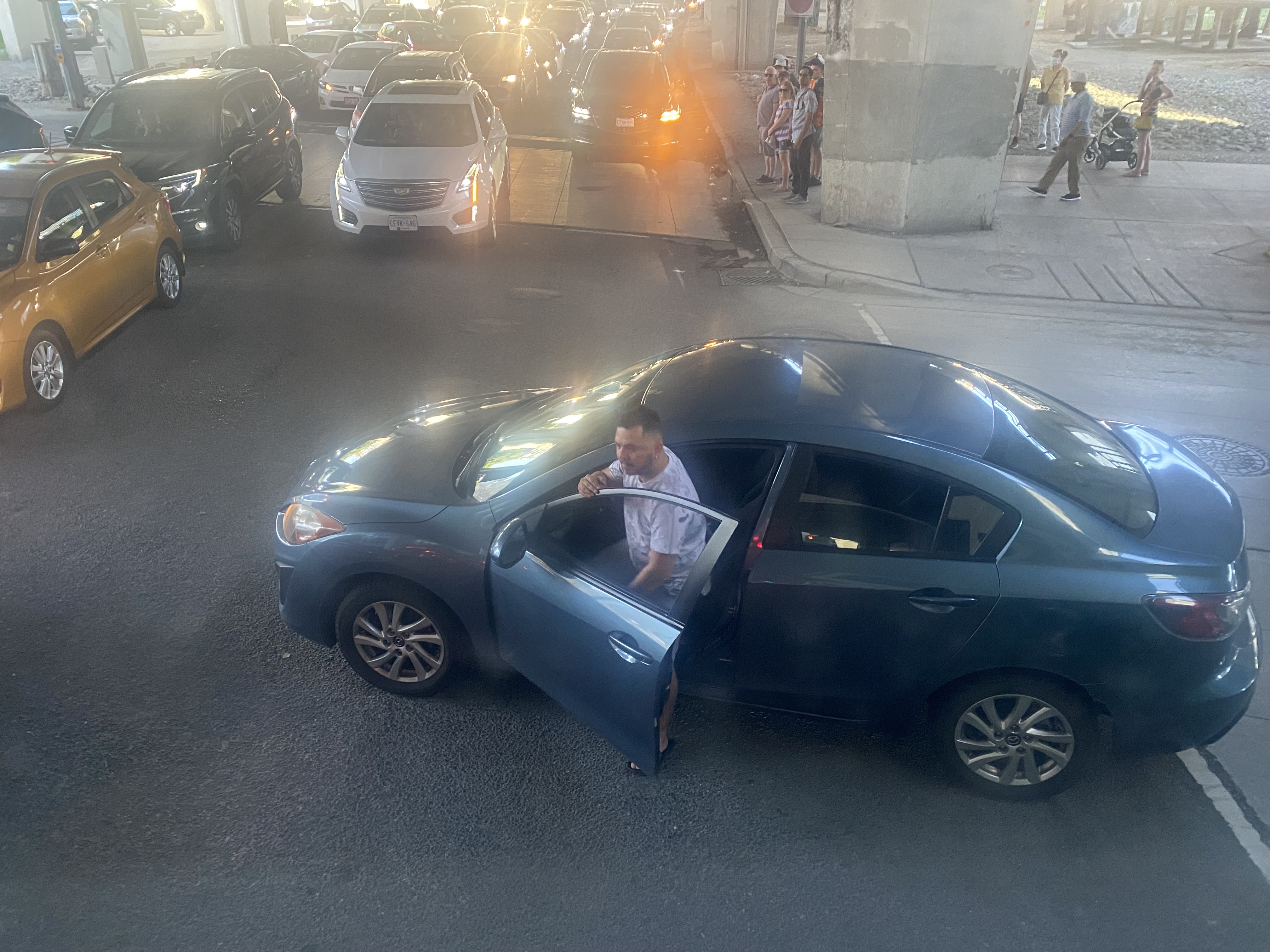
On our return trip to Toronto, we decided to take the Route 16 express bus, departing from Hamilton GO Centre at 3:30. As the train between Union and Hamilton’s West Harbour Stations runs only every hour, it seemed that the express bus to Union Station would be the fastest and most convenient option. How wrong we were.
A line of GO buses attempting to turn left from Lake Shore Boulevard to Yonge Street
As we were among the first to board the double-decker bus, we had front row seats to Toronto’s Carmageddon.
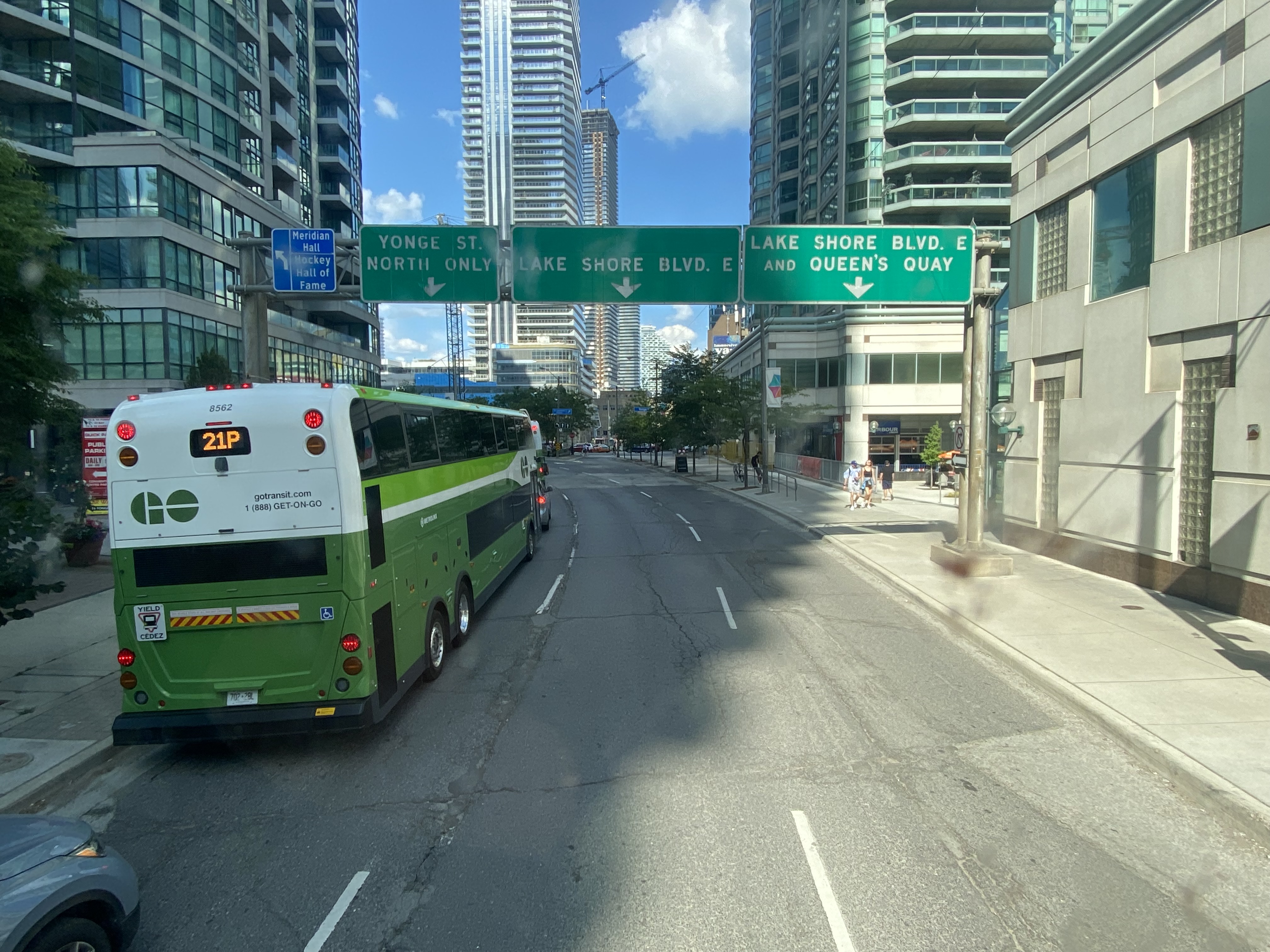
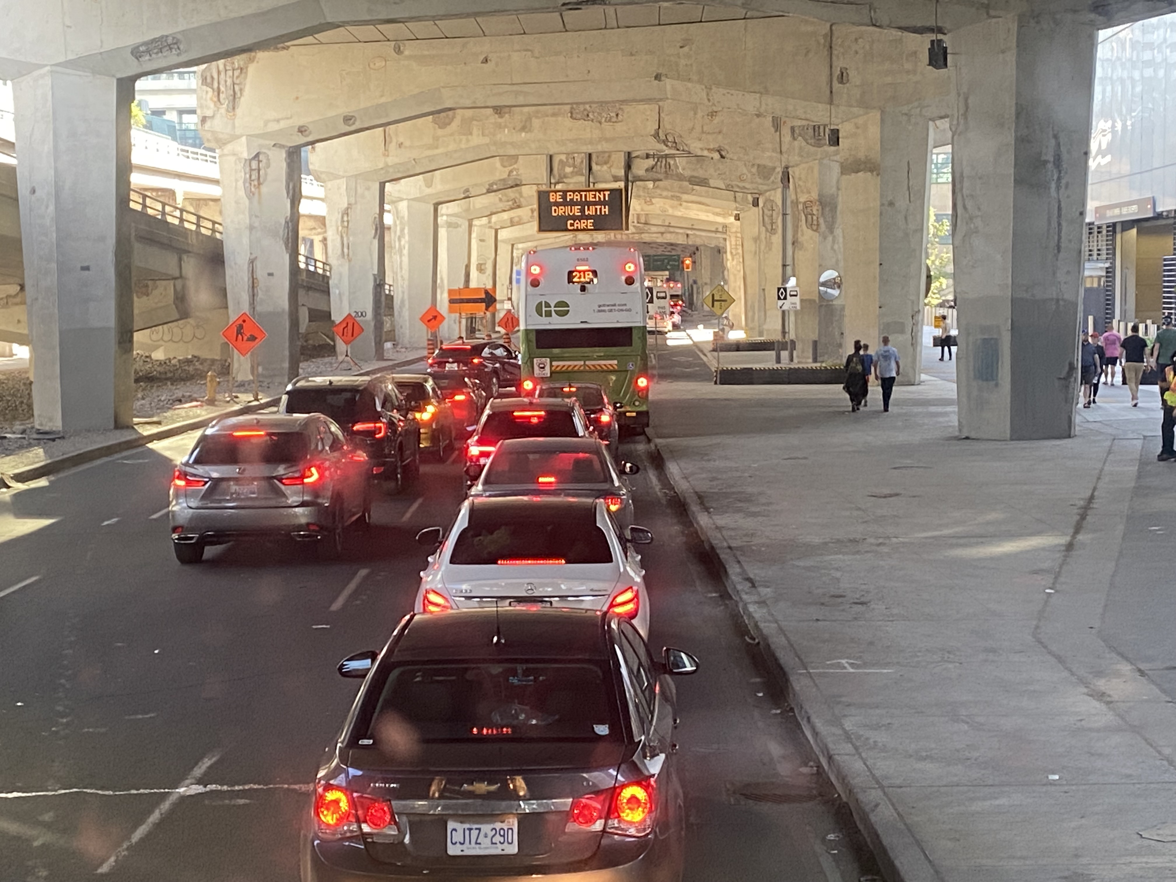
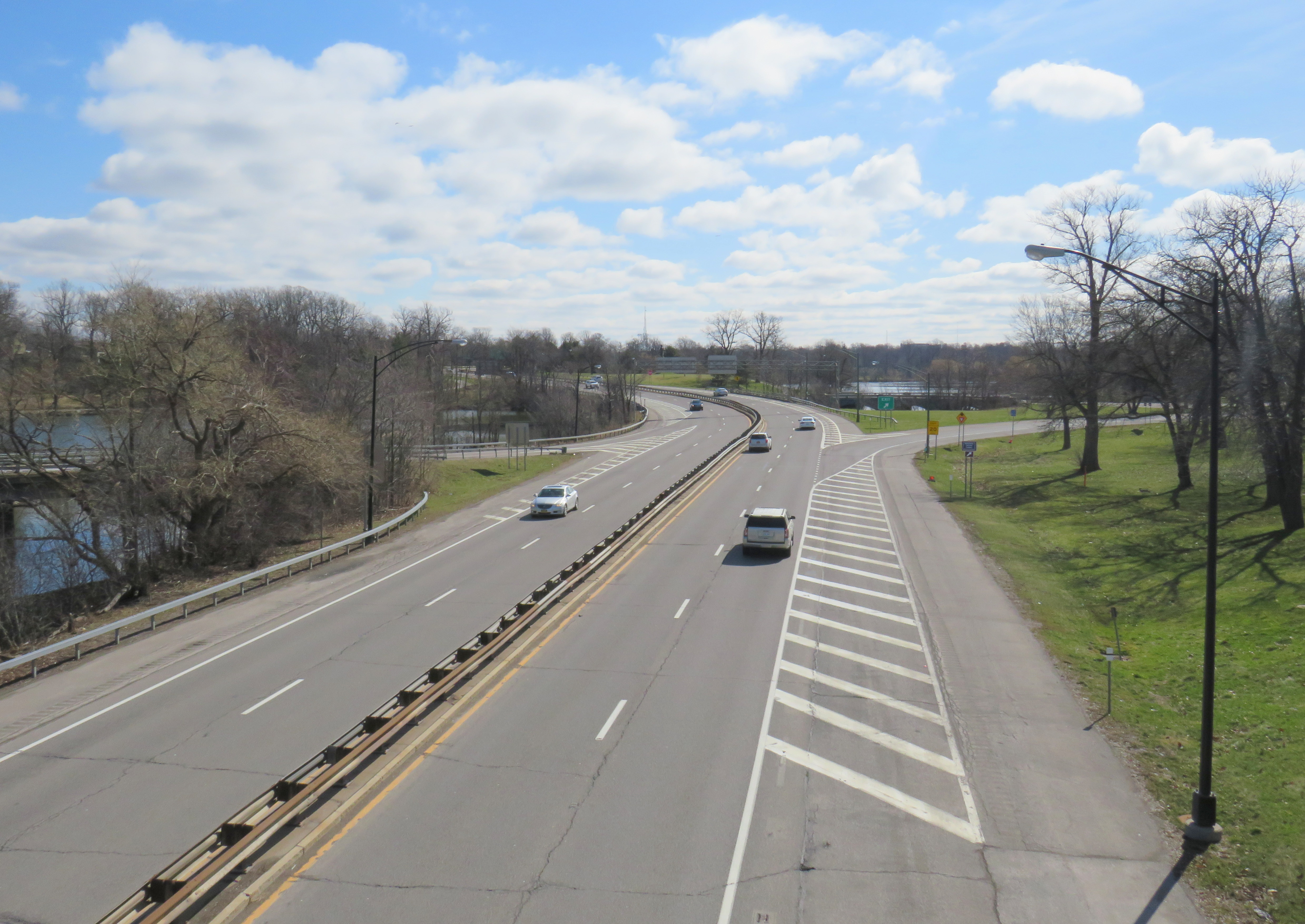
Despite it being a beautiful afternoon on the long weekend, the ride on Highway 403, the Queen Elizabeth Way, and the Gardiner Expressway was uneventful, with only a few spots where traffic moved slowly. Until the bus got off the York-Bay-Yonge ramp, we were making decent time. That is when we were confronted with a long line of cars and trucks, all trying to turn north on York, Bay, and Yonge Streets.
The new Union Station Bus Terminal, located on the north side of the westbound Lake Shore Boulevard lanes, requires buses coming from the west to turn left on to Yonge Street from eastbound Lake Shore, and then turn left again onto westbound Lakeshore before turning right into the terminal itself.
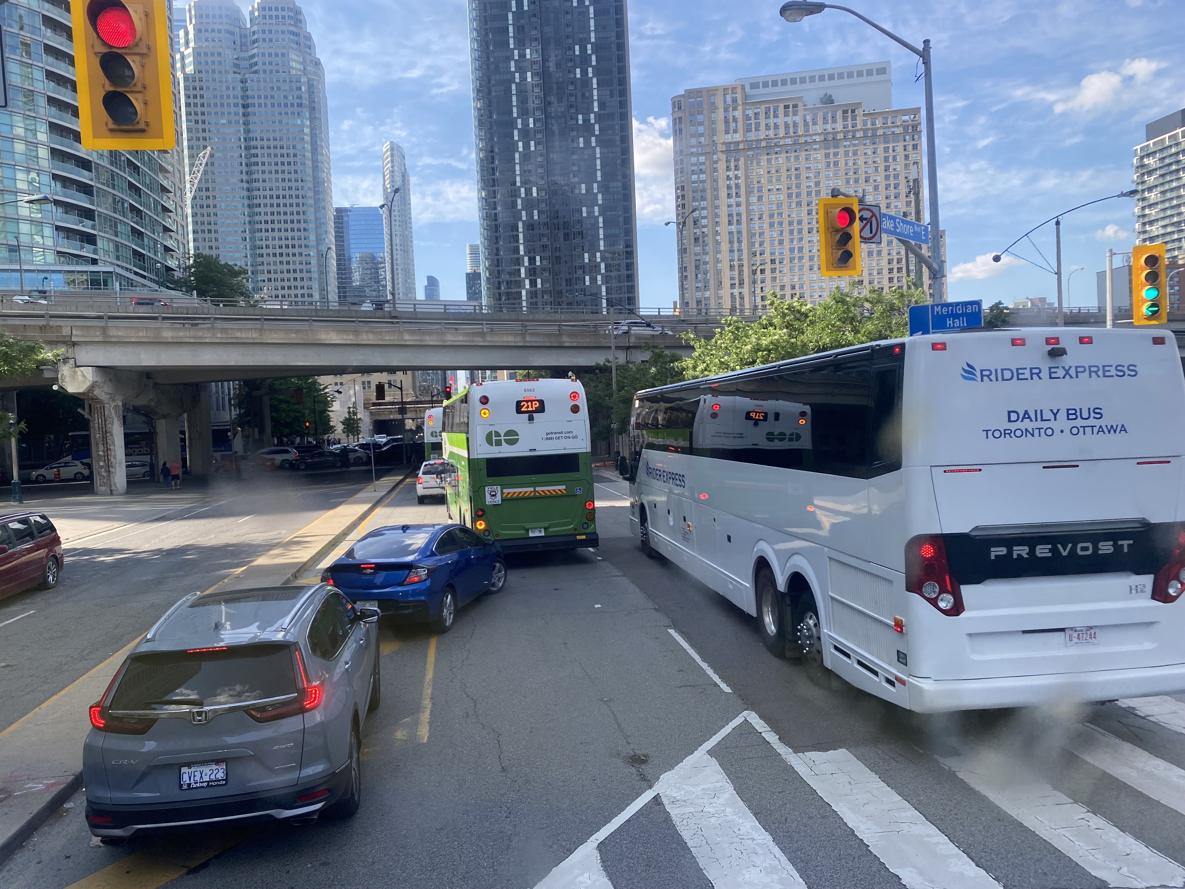
After finally turning north from eastbound Lake Shore Boulevard, private vehicles, a Rider Express bus, and GO Transit buses attempt to turn left onto a gridlocked westbound Lake Shore Boulevard
But with construction obstructing two westbound lanes of Lake Shore at Bay Street, drivers leaving the first of two Blue Jays games that afternoon (a rare doubleheader hosting the Tampa Bay Rays), and other drivers arriving for the evening Jays game, an Eric Church concert at Scotiabank Arena, along with the usual weekend traffic, traffic could not move, creating literal gridlock. Police or traffic wardens that could monitor and manage the gridlock were nowhere to be seen.
Motorists jam the intersection of Lake Shore Boulevard West and Yonge StreetOne driver expresses his frustration with the traffic
At 5:50, 2 hours and 20 minutes after the bus departed Hamilton GO Centre, we were let out on the curb outside the terminal entrance. In response to the backlog of buses attempting to enter and exit the Union Station terminal, GO cut back the Route 16, meeting the half-hourly Lakeshore West train service at Aldershot Station (one stop short of West Harbour). Several Route 16, 21, and 31 trips were cancelled due to the traffic in the downtown core, requiring some customers in places like Milton and Georgetown to wait an entire hour for the next bus.
After similar gridlock conditions on Sunday, July 3, Route 21 (Milton Corridor) and Route 31 (Kitchener Corridor) buses were rerouted to Port Credit GO, requiring a transfer to trains there.
Route 21 and 31 GO buses will begin and end at Port Credit GO due to heavy traffic into Toronto. Regular LSW train service will run between Port Credit and Union. Click https://t.co/QEMf9GRLsf for more into.
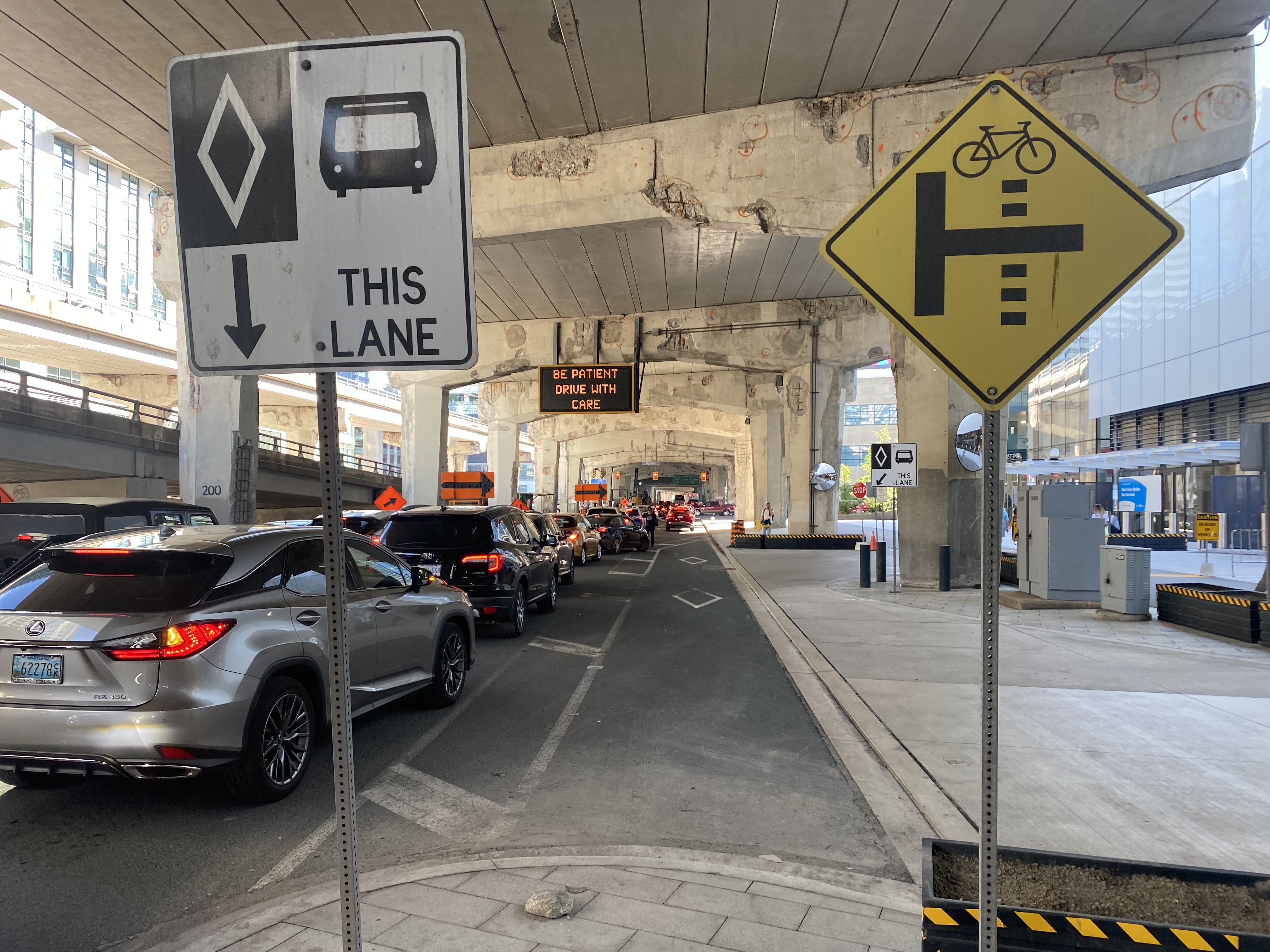
The new terminal’s location is excellent for consolidating all intercity bus and rail services and is much safer than the old Union Station Terminal or the dilapidated Metro Toronto Coach Terminal at Bay and Dundas Streets. Direct, indoor connections can be made with the subway, several hotels, Scotiabank Arena, and to the vast PATH system of underground walkways. Its major failure, however, is the lack of dedicated bus lanes to speed highway coaches in and out of the facility.
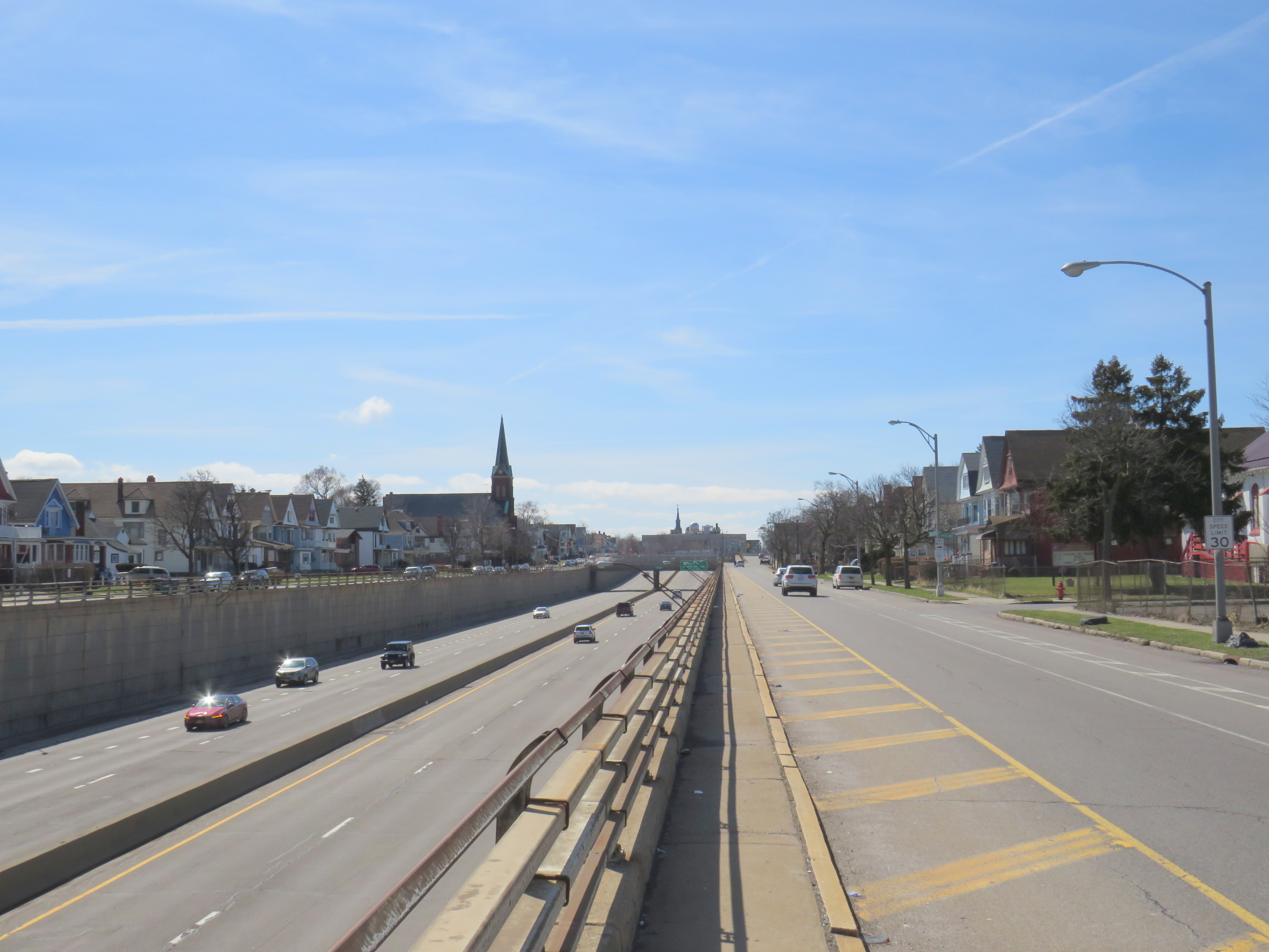
On Lake Shore Boulevard. The bus entrance to the Union Station terminal is at right
There is an exceptionally wide sidewalk on the north side of Lake Shore approaching the bus entrance to the terminal, and an extremely short bus lane in front of the terminal’s entrance and exit. It is no wonder why some private coach operators, such as FlixBus and Onex, opt for on-street stops, rather than the terminal used by GO, Megabus, Rider Express, TOK, and Ontario Northland.
Toronto’s shortest and least-effective bus lane, in front of the Union Station Bus Terminal. Note the sign reading “be patient – drive with care” above.
A dedicated bus lane for the entire distance between Yonge and Bay Streets would undoubtedly improve operations. A dedicated left turn lane from Yonge to westbound Lakeshore would also allow easier access to the terminal from the west, where the majority of GO and intercity coach buses arrive from. Similar dedicated left turn lanes at Queen Street and Central Park Drive in Brampton allow Brampton Transit buses to quickly enter and exit the Bramalea Terminal. Better traffic management, including police enforcement, would help ensure a clear path for transit and coach buses.
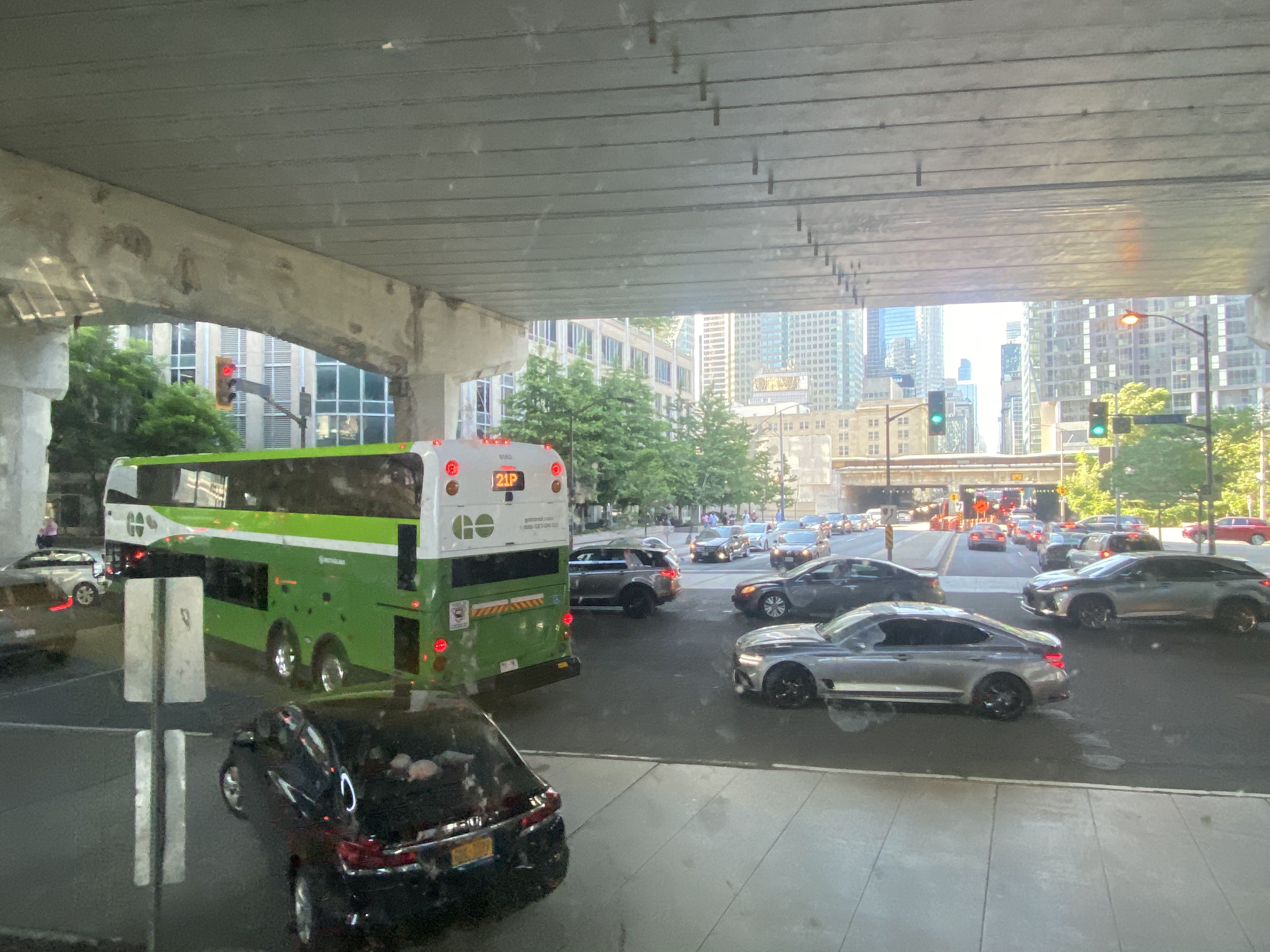
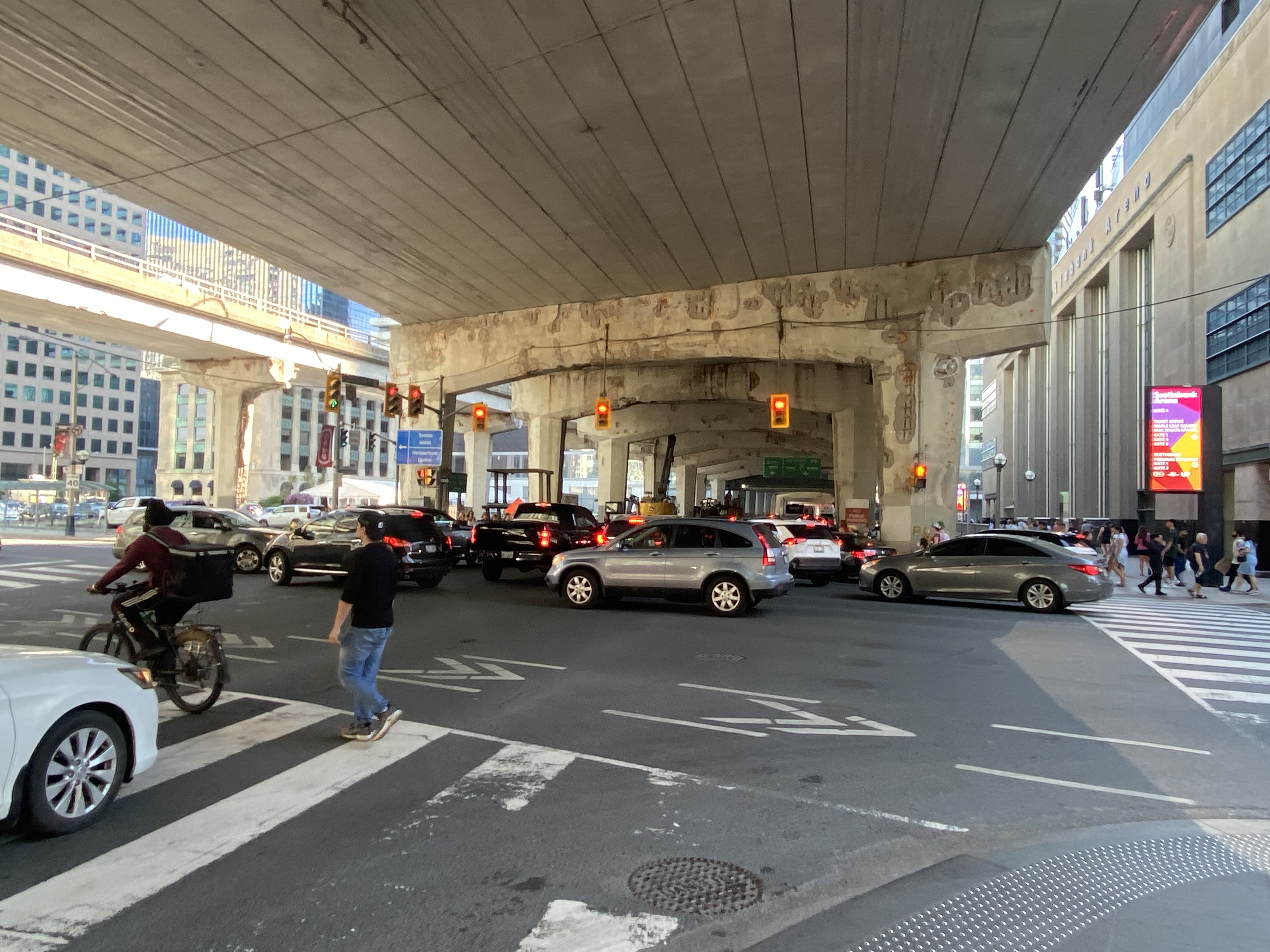
The gridlock continued west of Bay Street, as motorists lined up to get to the Gardiner Expressway or go west on Lake Shore Boulevard
GO Transit’s reaction, to reroute buses to the already-crowded Lakeshore West Train, is not a sustainable solution, though it is the only effective tool it has at the moment. Though Route 16 passengers are not taken far out of their way with a transfer at Aldershot GO, the detour is more onerous for some Route 21 and all Route 31 passengers forced to backtrack to Port Credit GO for a forced transfer there.
Stouffville and Barrie Corridor passengers were spared the hassles with the return of weekend train service earlier this year. Unfortunately, Canadian Pacific’s control of almost the entirety of the Milton Corridor precludes midday, evening, and weekend train service, but there’s an opportunity to finally bring limited weekend train service to the Kitchener Corridor. GO Transit already offers an hourly midday and evening weekday train service to Mount Pleasant Station in Brampton, despite CN’s control of the corridor west of Bramalea Station.
Track improvements completed nearly 20 years ago (an additional track between Bramalea and Mount Pleasant and a second platform at Brampton GO Station) provides the capacity for hourly GO trains and CN’s freight operations. Weekend Route 30 bus service between Kitchener and Bramalea can provide a reasonable and reliable bus link until corridor improvements, such as new passing tracks, are completed between Georgetown and Kitchener.
As I was sitting in traffic for an hour, I found myself aggravated once again by Blue Jays CEO Mark Shapiro lobbying the city to end the Sunday closure of Lake Shore Boulevard West to allow for the city’s (much-diminished) Active TO program. In a letter addressed to Mayor John Tory, General Manager of Transportation Services Barbara Gray, and the city clerk, Shapiro argued that “removing one of the only ways into and out of the downtown core would be extremely challenging to our fans” claiming that “on the days when Active TO has been in effect on Lake Shore, our local fans have experienced significant transit delays because traffic is grinded to a halt on all downtown routes.” (It is worth noting that the Toronto Blue Jays baseball club is a wholly-owned subsidiary of Rogers Communications. The mayor of Toronto, a former Rogers executive, remains involved with the Rogers family trust.)
The Lake Shore closure allowed cyclists and runners to bypass the overcrowded Martin Goodman Trail along Toronto’s Western Beaches, on a section of roadway paralleled by GO Transit’s Lakeshore Corridor. The traffic congestion last weekend was completely unrelated to ActiveTO (which is now suspended on Lake Shore Boulevard, partly due to Shaprio’s lobbying) and transit riders, who make up a large percentage of the Blue Jays’ fanbase, were left in the mess that motorists made.
Just two blocks away from the Jefferson Avenue Tops supermarket is Buffalo’s Kensington Expressway.
The high-speed roadway, built with New York State funding, was built in the late 1950s to connect Downtown Buffalo with the New York State Thruway and the airport. The highway went through Buffalo’s East Side, historically Polish-American neighbourhoods that were becoming home to working-class and middle-class African-American families.
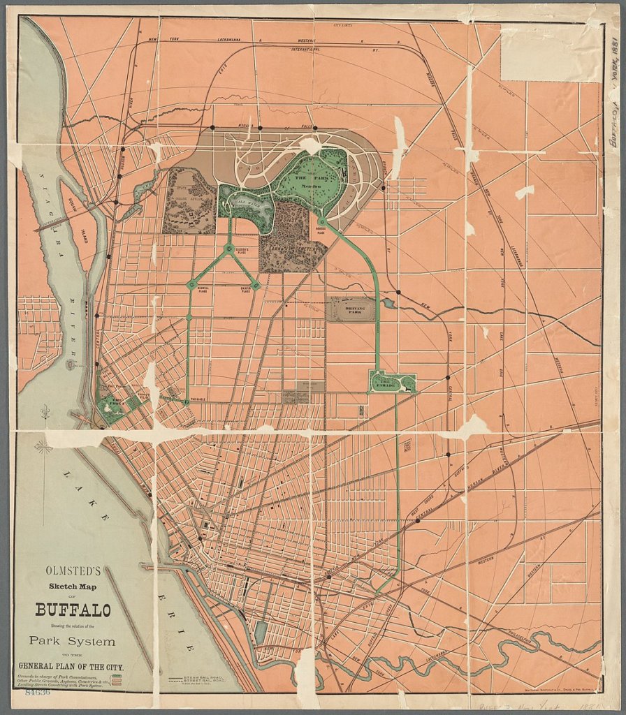
Ironically, a parkway system planned by famed landscape architect Frederick Law Olmsted beginning in the 1860s helped highway planners 90 years later route their new highway. Olmsted had planned large park spaces throughout the city, with wide, treed parkways connecting the spaces together. Delaware Park, to the north, was the largest of these green spaces. In 1901, it was the site for the Pan-American Exposition (which became infamous as the location of the assassination of President William McKinley), while Humboldt Park, on the city’s east side, became a popular neighbourhood gathering place. Humboldt Parkway connected these two parks with a wide, gentle curve.
Part of the Olmsted Parks and Parkways plan, Buffalo. Humboldt Parkway curves southeast from Delaware Park near the top of the map.
Of course, city planners of the day, who were guided by the “City Beautiful” movement, never conceived of a time when automobiles would present a new challenge to urban places. From the opening of the Erie Canal in the 1830s to the exploitation of cheap, renewable hydro-electric power at nearby Niagara Falls in the 1890s and early 1900s, Buffalo was going to be a jewel of the Great Lakes, and it needed skyscrapers and public spaces to match its optimism and ambition.
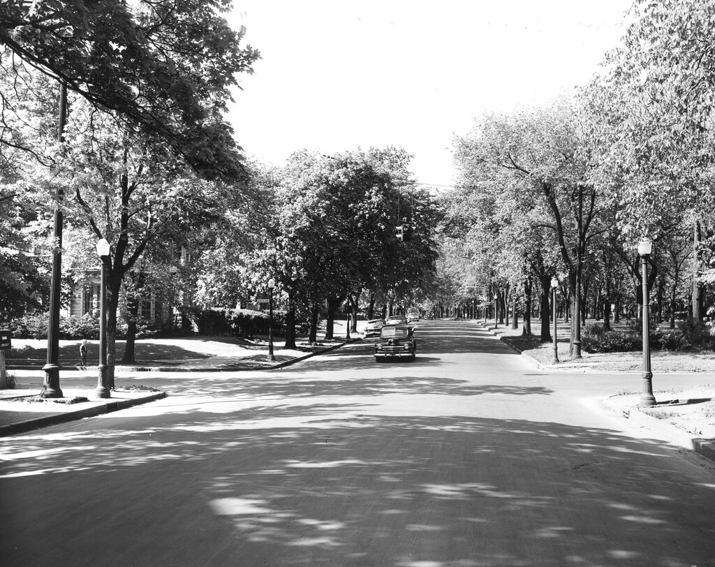
Humboldt Parkway in 1953, with a wide, treed median on the right (The Buffalo History Museum)
By the 1950s, Buffalo’s growth had plateaued, and the city started losing population to the suburbs, as white middle class families took advantage of generous federal mortgage incentives, and the automobile made suburban living easy. Redlining — a practice in which banks and federal mortgage underwriters graded neighbourhoods based on their physical and socioeconomic statuses — made mortgages in “declining” or “hazardous” areas difficult or impossible to get. These resulting grades discouraged investment in the housing stock and made it especially difficult for Black families to purchase homes. Racism and xenophobia was embedded in the system: areas that Eastern European immigrants were seen to be “infiltrating” were typically marked as “definitely declining” and areas settled by Black households were marked as “hazardous.”
In Buffalo, a 1937 redlining map reflected the segregation that would define the city to this day: most of the city east of Main Street was classified as “definitely declining” or “hazardous.” Houses facing Humboldt Parkway were marked as “still desirable” as it is “a small area which maintains its desirability because of location on both sides of an attractive parkway.” That parkway would disappear 20 years later.
Though the Niagara branch of the New York State Thruway connected Downtown Buffalo to Niagara Falls, the main Thruway, and Canadian border crossings, mostly following rail corridors, city leaders felt that without additional urban highways, Buffalo would lose investment and that more residents and employers would leave the city for the suburbs.
In 1954, City Planning Director Russell Tryon declared that the new ring highway “would be a major step forward in alleviating the traffic blight that has diseased our neighborhood communities” while believing that highway construction might help keep people in the city, rather than literally drive them to suburbia. “If we make Buffalo a better place in which to live, the people will stay and not move out.”
The Scajaquada Expressway through Delaware Park
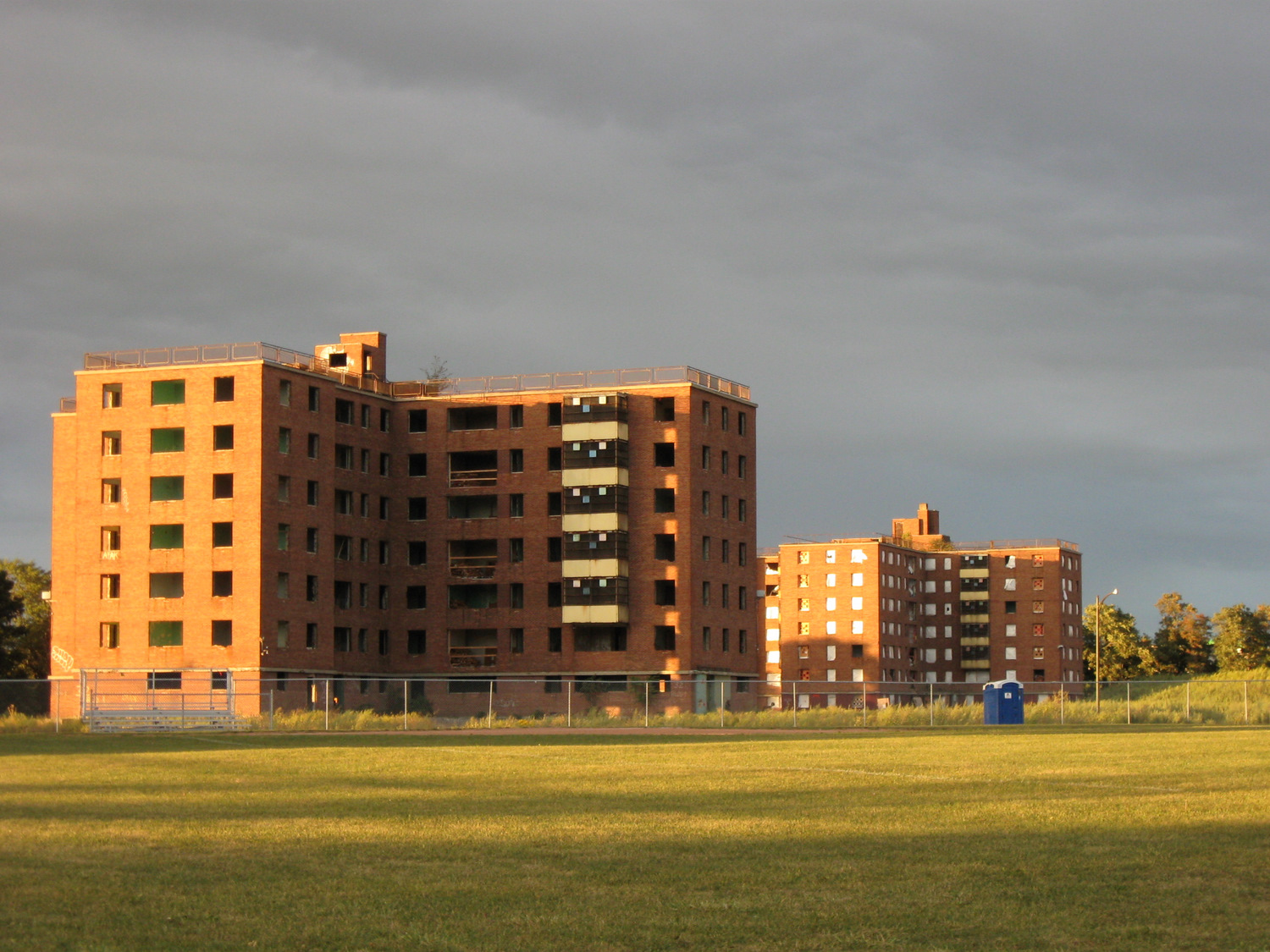
To build the new highway, planners looked for the paths of least resistance: Olmsted’s parkway system and redlined neighbourhoods where properties could be bought up cheap. None of the parkways on Buffalo’s West Side (which was, and remains, mostly white and middle class) would be sacrificed, but the Humboldt Parkway, on the East Side, would be. The Scajaquada Expressway, across the city’s north side, ran right through the signature Delaware Park. The Kensington Expressway — New York State Route 33 — required the demolition of hundreds of homes. Many displaced residents moved into public housing towers on Fillmore Avenue — which were later abandoned and demolished.
The abandoned Kensington Heights public housing buildings on Fillmore Avenue in 2010
The highway only helped to destroy Buffalo’s urban fabric and contributed to the economic and population decline in the East End.
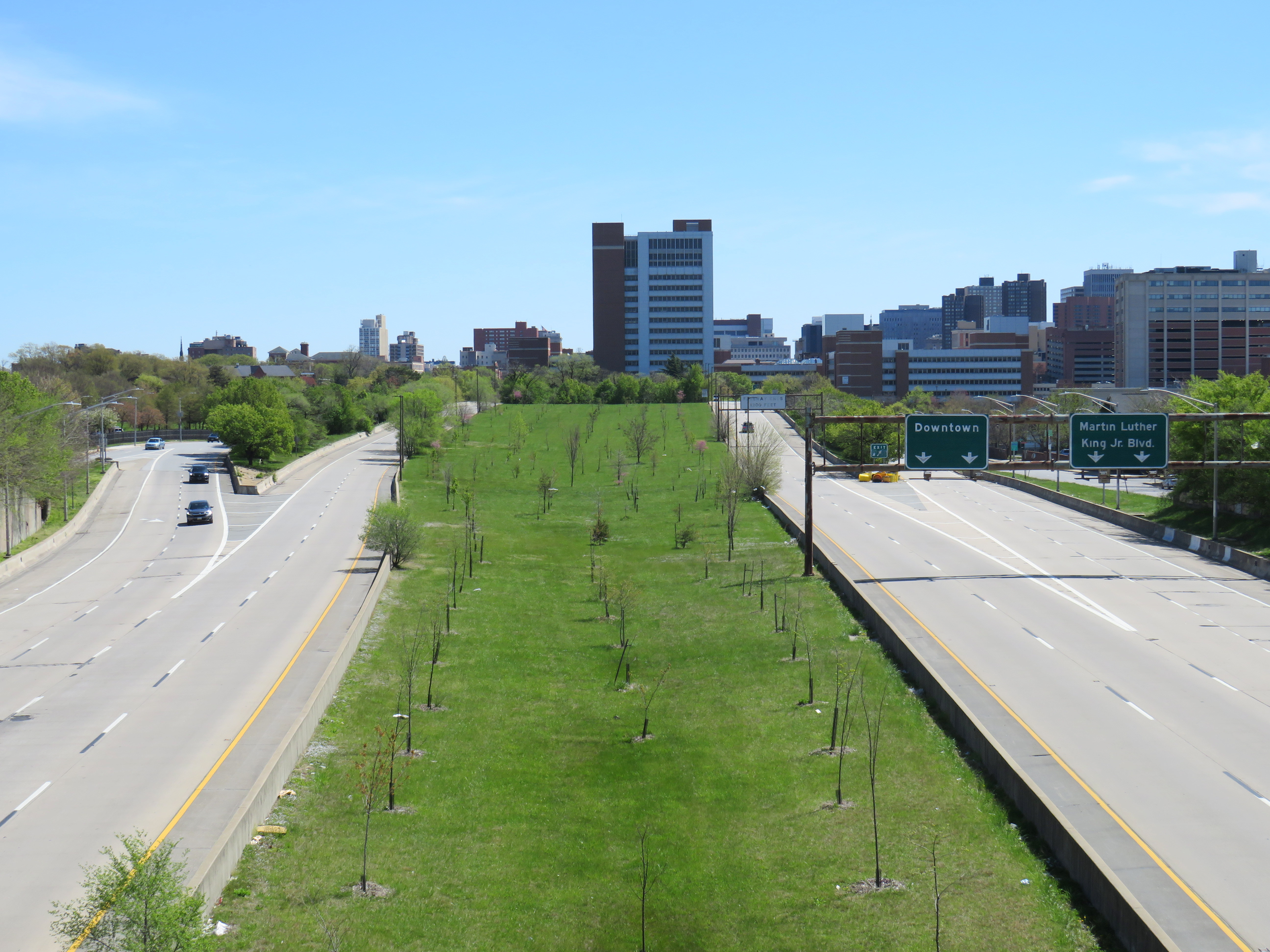
Buffalo was not alone. In Detroit, Interstates 75 and 375 were routed right along Hastings Street, the commercial and cultural hub for the Motor City’s Black community. In Baltimore, Interstate 70 was to go right downtown through the city’s West Side. The section through a Black neighborhood was built, but the western extension through Baltimore’s western suburbs was never completed, leaving behind a scar known as the “Highway to Nowhere.”
Baltimore’s Highway to Nowhere
In Buffalo, the East Side community struggled for decades to get a full-service supermarket after A&P left in the 1960s after the new highway was built. It finally landed Tops Friendly Markets on the A&P site in 2003. This grocery store — the only one serving over 100,000 residents in Buffalo’s East End — became the site of Buffalo’s worst mass shooting, in which a white teenager targeted Black shoppers. The closure of that store only compounds the tragedy as fresh and affordable food has become, once again, even harder to access.
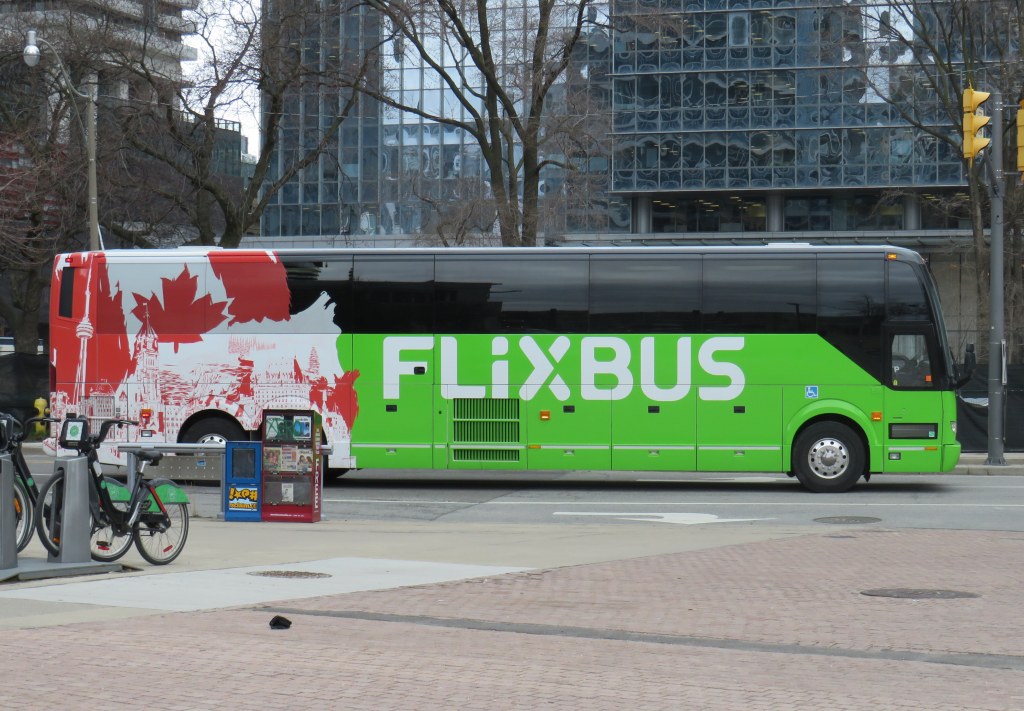
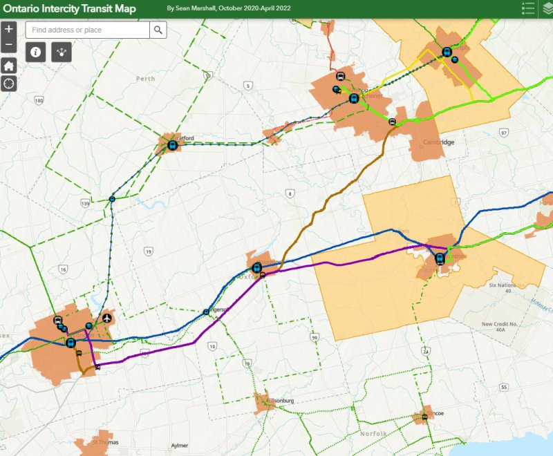
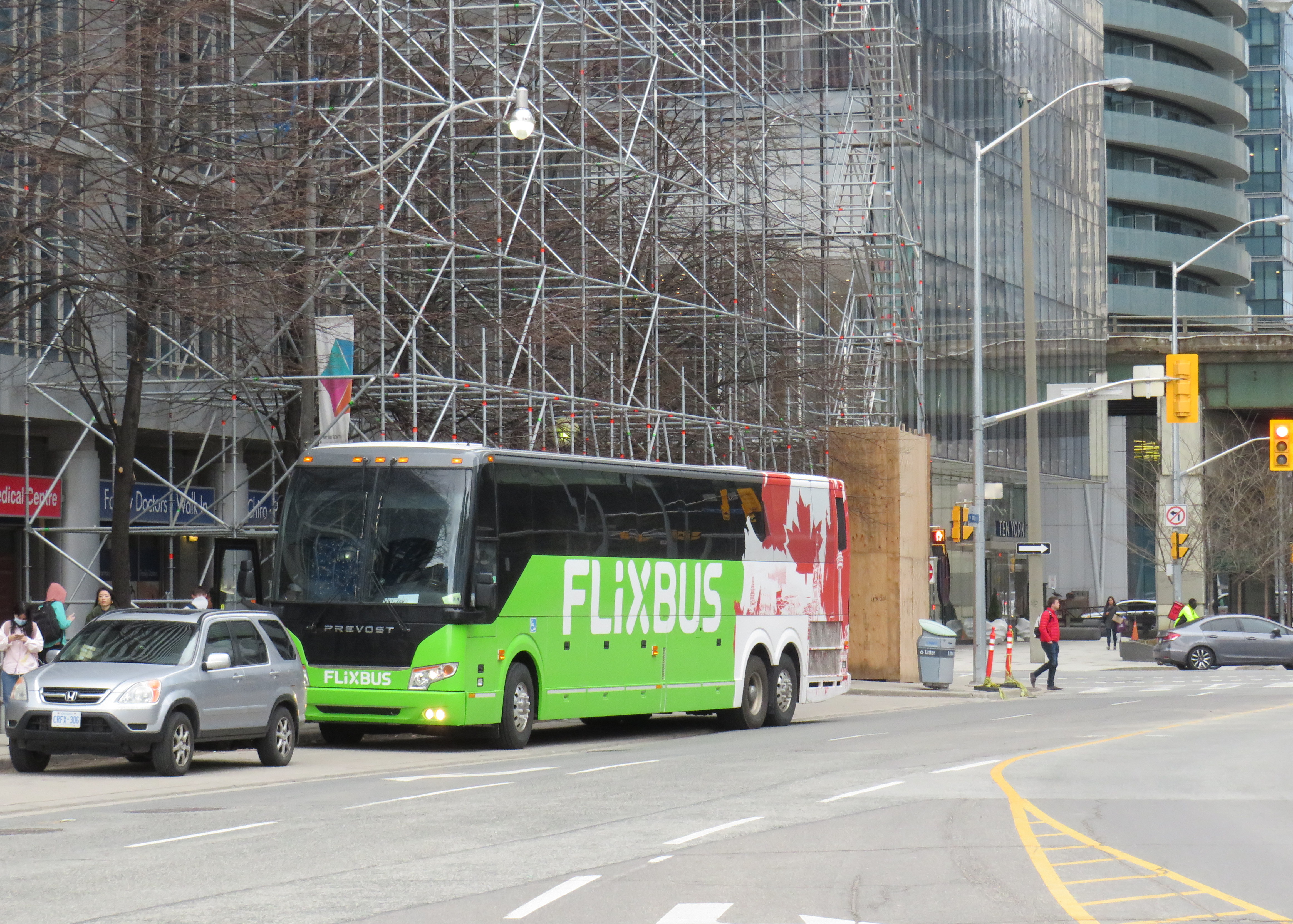
Flixbus is one of many intercity coach operators in Ontario right now
With university and college campuses reopening for in-class instruction, white-collar workers slowly returning to the office, and pandemic restrictions receding, there are more intercity transport options in Ontario than at any time prior to March 2020.
New operators, including Germany’s Flixbus, have arrived in Ontario (with routes between Toronto, Guelph/Kitchener, Niagara, and Ottawa), while Greyhound, which pulled out of Canada two years ago, restarted cross-border runs from Toronto, Montreal, and Vancouver. In Southern Ontario, intercommunity bus and van operations continued through the pandemic, with notable service improvements in Simcoe and Grey Counties, new routes in Eastern Ontario, as well as the expansion of “on-demand” services in rural communities and smaller urban centres, including parts of Niagara Region, as the regional government there slowly assumes responsibility for all municipal transit services.
Despite these advances, there are still many gaps in Ontario that need to be filled. The deregulation of Ontario’s motor coach industry has opened the highways up to more operators, but they are all chasing the same customers, rather than attracting new riders.
For getting between Toronto and Ottawa, passengers have a plethora of choices. They may fly — the fastest, but most expensive option — on Air Canada, WestJet or Porter. They may choose VIA Rail, which is comfortable, but slower. Or they may choose to book a ticket on a Megabus, Rider Express, or Flixbus coach, the slowest, cheapest, and least frequent option. (As of May 2022, only Megabus will begin operating daily buses between Toronto and Ottawa.)
Between London and Toronto, passengers can choose between a four-hour GO Transit train ride that departs at 5:33 AM, one of several daily VIA trains (approximately 2 hours), one of three daily Onex buses (2 hours, 35 minutes) or one of three daily non-stop Megabus trips (2 hours, 10 minutes).
Not all bus operators serve the same locations, either, creating new disconnections. In Toronto, GO Transit, Megabus, Rider Express TOK Coach, and Greyhound USA use the new Union Station Bus Terminal, which is directly connected to VIA and GO trains at Union Station and the TTC subway and streetcar system.
Flixbus stops at a curbside layby on York Street south of the Gardiner Expressway
To save on terminal fees, Onex stops beside the Royal York Hotel on York Street, across the street from Union Station, sharing the layby with the Toronto Island Airport shuttle. Flixbus uses a different coach bus layby on York Street south of the Gardiner Expressway, in the Harbourfront area. Neither curbside stop is marked for either company. Though Ontario Northland still sends some buses downtown to Union Station, some of its buses to and from Sudbury and North Bay now terminate at the Yorkdale Bus Terminal in North York.
The layby next to Royal York Hotel serves the Toronto Island Airport shuttle (which has a sign) and Onex bus (which has no bus stop sign)
In Ottawa, Ontario Northland and Orleans Express use the VIA Rail station (which is on the O-Train LRT system), while Megabus terminates at the St. Laurent O-Train station. Autobus Maheux and Flixbus use curbside stops in Downtown Ottawa. The London-Toronto Megabus route bypasses Downtown London on its route from Western University, while Onex Bus and VIA Rail stop right downtown, along with Strathroy-Caradoc’s intercommunity route.
Another issue is that apart from the Toronto-Kitchener-London, Toronto-Niagara, Toronto-Kingston-Ottawa, Toronto-Kingston-Montreal and Ottawa-Montreal corridors, there is still little choice in price, operator, or schedule.
Rider Express suspended service to Windsor last year, so that the three or four VIA rail trains to London and Toronto (or a flight from Windsor airport) are the only option available for anyone travelling without a car. (Transit Windsor’s Tunnel Bus to Detroit remains suspended, despite the continued loosening of border crossing restrictions.) Peterborough, once a major destination for Greyhound Canada on its Toronto-Ottawa corridor, now only has a nearly two-hour-long GO bus connection to Oshawa GO Station.
Gaps that I wrote about several years ago still remain on the map, which are only more evident as new intercommunity services start up and new carriers emerge. The City of St. Thomas and Elgin County remain the most visible of these gaps; St. Thomas is the only urban transit system in Ontario completely disconnected to any other community, despite its short distance to London. Haldimand County, despite its proximity to Brantford and Hamilton has also chosen to remain off the map. While neighbouring Perth, Lambton, Middlesex, and Grey Counties have developed useful transit connections, Huron and Bruce Counties have very limited links to the rest of the province.
Finally, the gaps between Hamilton and Brantford to the south and Guelph and Kitchener-Waterloo to the north remain to be filled despite the growing population and multiple post-secondary institutions in each urban area. Though the Hamilton-Guelph-Kitchener triangle should be a natural expansion for GO Transit, it has yet to announce its intentions. Meanwhile, no private coach operator has filled this obvious need.
The labour-backed Link the Watershed proposal would connect Guelph, Kitchener, Cambridge, and Brantford, but that plan requires the support of local government, but it still leaves the Hamilton corridor wide open.
As more students return to school full time, and more workers return to the office, the need for reliable and attractive transportation options across Ontario will only continue to grow. As housing prices to continue to increase higher than the already-high inflation rate, intercity transport will be one way to ensure students can stay at home while going to school, and workers don’t have to move or endure long and expensive highway commuting.
Hopefully by autumn, these gaps will finally close for good.
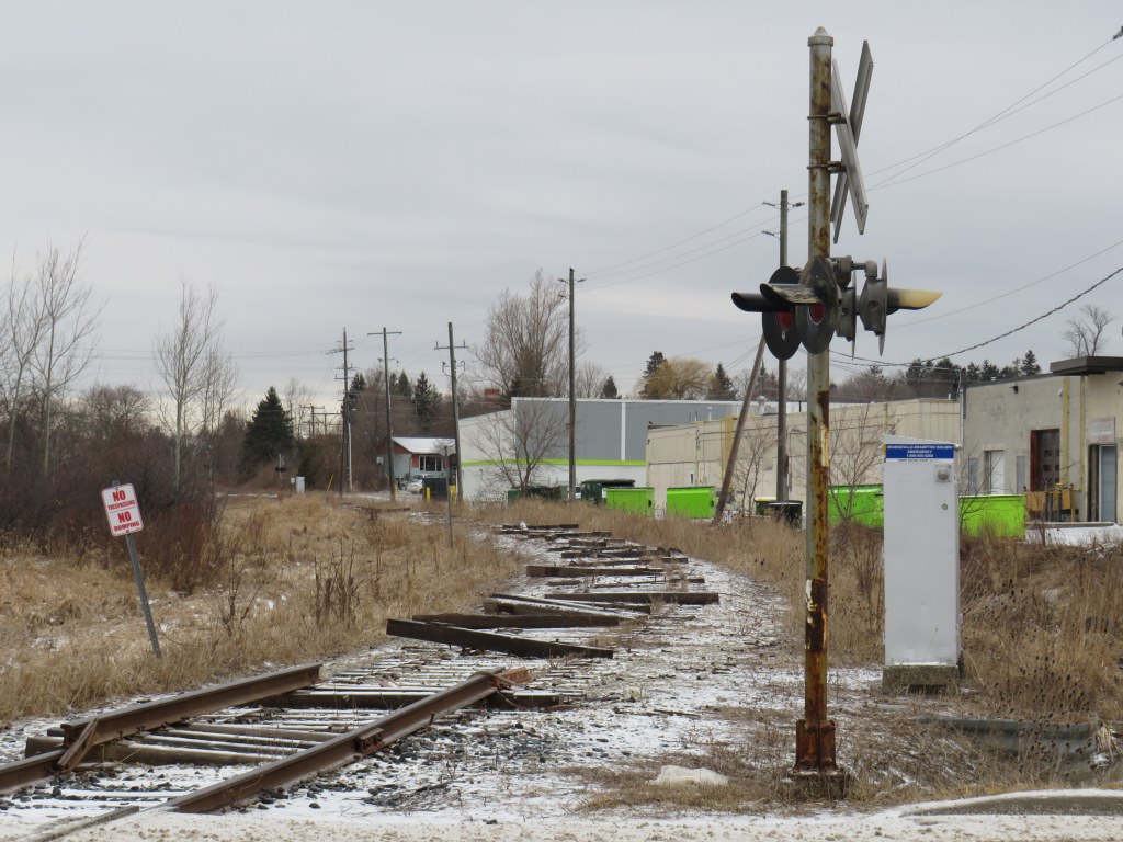
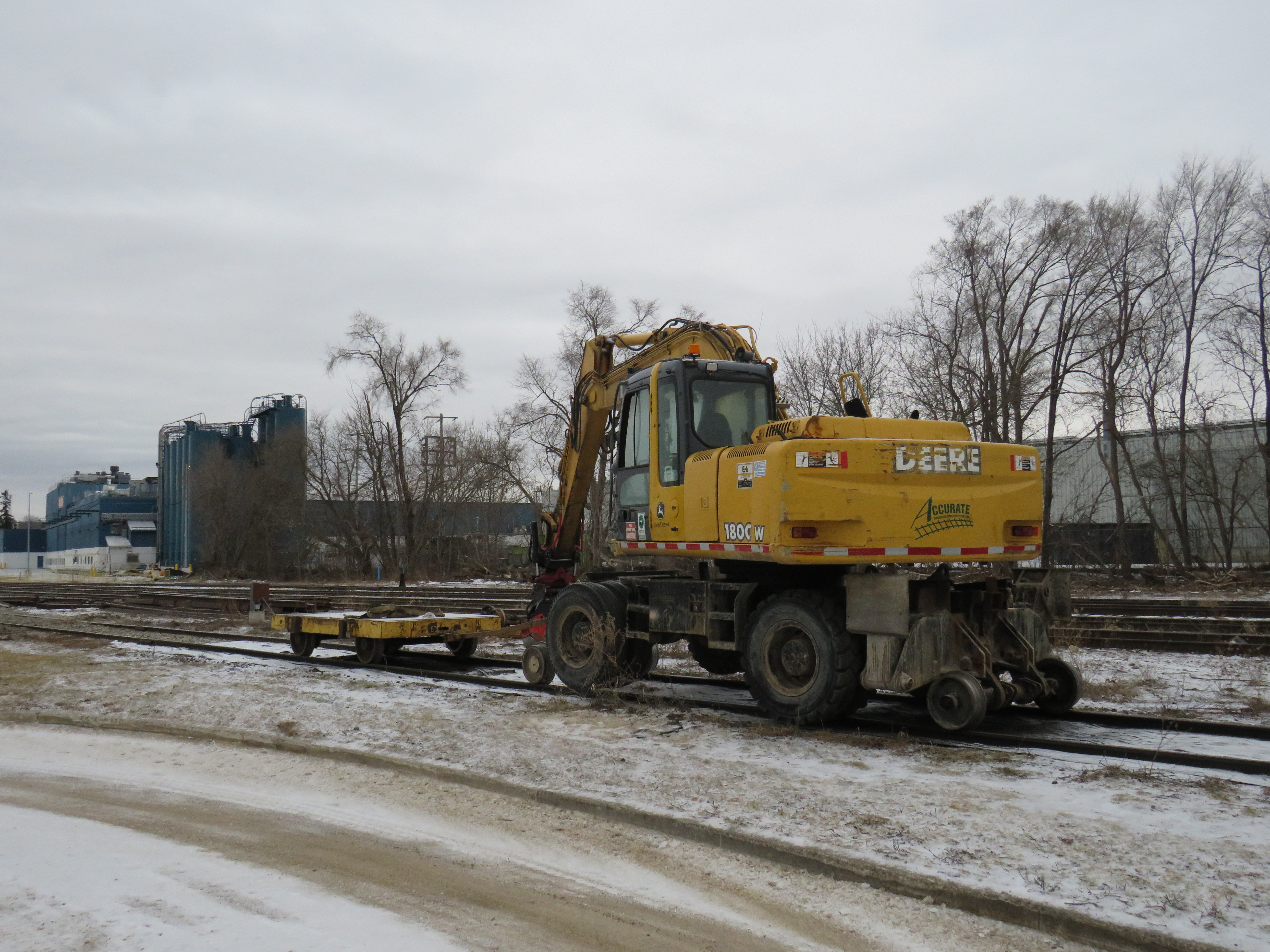
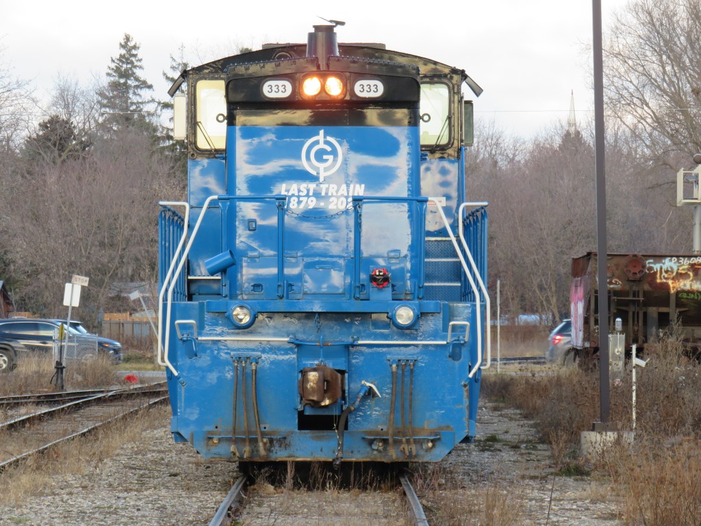
The tracks have been ripped out from the once-proud Orangeville-Brampton Railway
Despite calls for the preservation of the Orangeville-Brampton Railway since its discontinuation in December 2021, the removal of rails on the 150-year old line that once connected Toronto with Owen Sound, Teeswater, and points between began this week.
The Town of Orangeville aims to replace the tracks with a multi-use path through the municipality. The Region of Peel is likely to purchase most of the remaining section, with the right-of-way likely to become another recreational trail through Caledon and north Brampton. I will continue to document the railway’s demise and the route’s future.
In the meantime, the rusty rails await their removal.
Looking west at Centre Street, Orangeville, March 30, 2022The hi-rail excavator sitting in the Orangeville yard, March 30, 2022. A pile of removed rails sits in front. At Brampton, signals continue to protect the CN mainline despite the abandonment of the old CP routeA Sarnia-bound VIA Train crosses the Brampton diamond, March 25, 2022. Who knows how long it will be before the diamond is removed for good?
End of the line – video of track removal at Orangeville by Jeremy Williams
On Monday, February 14, Premier Doug Ford, Transportation Minister Carolyn Mulroney, and Mississauga Mayor Bonnie Crombie attended a photo-op at Cooksville GO Station to announce a new name for a transit project. With former mayor Hazel McCallion in attendance (who was celebrating her 101th birthday), it was no secret what the new name was going to be.
It was disappointing that the Hurontario LRT, a provincially-funded transit project operating within Brampton and Mississauga and intended to be part of a regional transportation network, would be named for a divisive former mayor of only one of the two cities the Hurontario LRT is supposed to directly benefit.
In North America, and around the world, transit lines and stations are named (with a few misguided exceptions) to reflect the geography of the route it represents and to provide optimal wayfinding, especially to visitors and people new to transit. In Greater Toronto, bus, streetcar, commuter rail and subway routes are named based on the major street they run on (the 501 Queen Streetcar or Line 4 Sheppard), the neighbourhood they serve (the 56 Leaside bus) or the destination it runs to (the GO Milton Line or 900 Airport Express).
Even new projects follow these conventions. The Crosstown LRT, which operates under and along Eglinton Avenue, is a crosstown route across the middle of the city. Even the Ontario Line partially gets its name from its two end points (Exhibition Place/Ontario Place and Ontario Science Centre). The Hurontario LRT reflected the name of the main street it operates along, even if it changes its name briefly though central Brampton.
The “Hazel McCallion Line” does not accomplish any of these goals.
Given Peel Region’s diverse population of over 1.4 million residents, it is also disappointing that a major project intended to unite the region is named for an affluent white public figure that already has two libraries, a public school and a college campus already bearing her name.
I suspect Premier Ford wanted to celebrate a political ally a few months before the next provincial election, but naming the Hurontario LRT after Hazel McCallion sends the wrong message.
Post script: The Hurontario Line may not be the only Metrolinx transit facility that will see its name change. In a MERX posting dated February 15, 2022, Metrolinx is looking for Expressions of Interest for station naming rights opportunities for at least four existing GO Transit rail stations. The summary is quoted below:
Expression of Interest
Expression of Interest No. RFI-2021-CCMX-097
Metrolinx is accepting Expressions of Interest for Station Naming Rights Opportunity.
Metrolinx is an agency of the Government of Ontario, overseeing GO Transit, PRESTO, and UP Express. We are embarking on a massive transformation of the GO Rail network – the backbone of regional rapid transit in the region – to give customers a faster, more convenient way to connect with the things that matter.
Metrolinx is seeking proposals from interested parties in any category for the Station Naming Rights Opportunity at the following stations:
Whitby GO Station Exhibition GO Station Clarkson GO Station Oakville GO Station
Metrolinx will consider proposals for other stations not listed here at the request of interested parties.
For more information about the GO Transit network and stations, please visit www.gotransit.com. We are committed to working together to create a partnership that will meet shared objectives, such as increase revenue, increase market share for our partners and provide a positive customer experience on public transit.
All four stations listed are on the Lakeshore Line, the backbone of the GO Transit rail network. Exhibition GO could be especially attractive for renaming, as it will become a major hub with the future connection to the Ontario Line and local TTC services. It is also worth noting that Metrolinx will entertain proposals for additional stations in the bid process.
It is hard to blame Metrolinx for these specific transit naming decisions; it is very likely that the Ford government demanded the McCallion Line and is pushing for the sell-off of naming rights. But it is ironic that after hiring consultants and going though a complex naming process for the Crosstown LRT, that previously held principles are quickly abandoned at the whim of Metrolinx’s superiors.
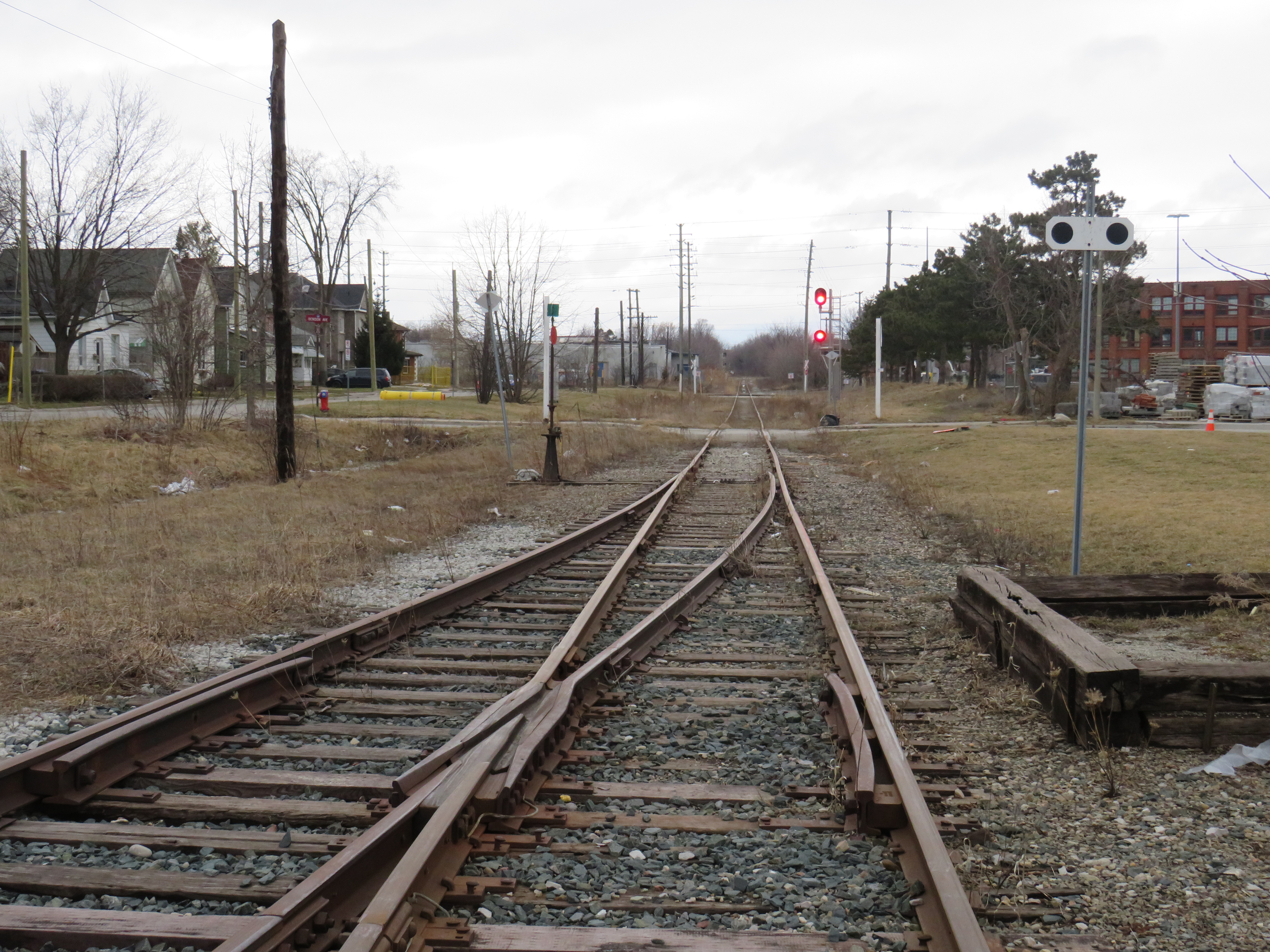
The current end of track of the once-important Owen Sound Subdivision, on the outskirts of Orangeville. Beyond, a new paved trail occupies the former right-of-way.
On Townline Road on the south end of Orangeville, across the street from the old railway yard and station grounds, two plaques stand, telling the history of the doomed railway next to them.
The first plaque, a faded provincial marker, commemorates the Toronto, Grey and Bruce Railway, which arrived in Orangeville in 1871 and completed to Owen Sound in 1873. The TG&B was combined with the rival Credit Valley Railway by the Canadian Pacific Railway, and Orangeville became the headquarters of a network of branch lines known as the CP Bruce Division. Passenger service to Owen Sound via Brampton and Orangeville continued until 1970.
The second marker, installed by the Town of Orangeville, commemorates the municipal takeover of the remnants of the Bruce Division, after CP abandoned all track west and north of Orangeville in the 1980s and 1990s. The plaque proudly boasts of a “successful passenger tourist operation” and how the new short line “enhanced opportunities for the long-term economic development of the region.”
The municipal plaque is sadly out of date. The Credit Valley Explorer tour train last operated in early 2018, and the Town of Orangeville lost interest in operating the railway, which was costing the municipality $450,000 a year. The last freight train departed Orangeville on Friday, December 17, 2021.
Toronto, Grey and Bruce Railway plaqueOrangeville-Brampton Railway plaque
Together with Dr. Brian Doucet, Canada Research Chair in Urban Change and Social Inclusion at the University of Waterloo, I toured the line in its waning days. At TVO.org, Doucet and I argue that the corridor is worth preserving, even if the Town of Orangeville is no longer interested in paying for the railway. We note how the province is looking to build a new highway through the very same lands that the dying railway cuts across.
Additional photographs and videos of the once-proud Orangeville and Brampton Railway can be found below.
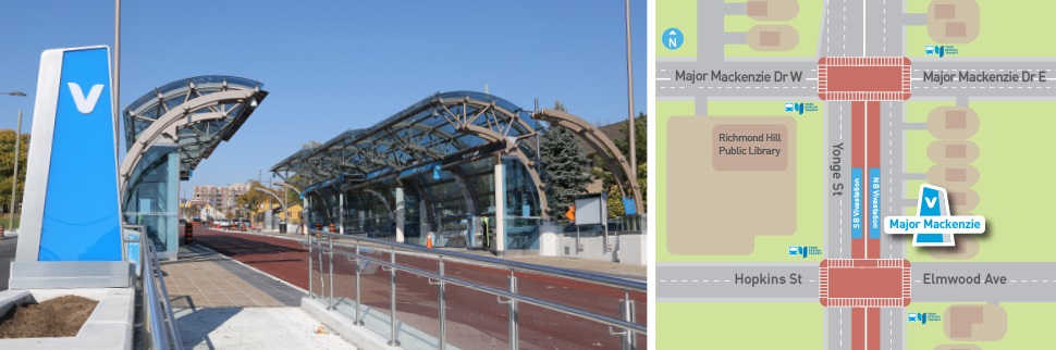
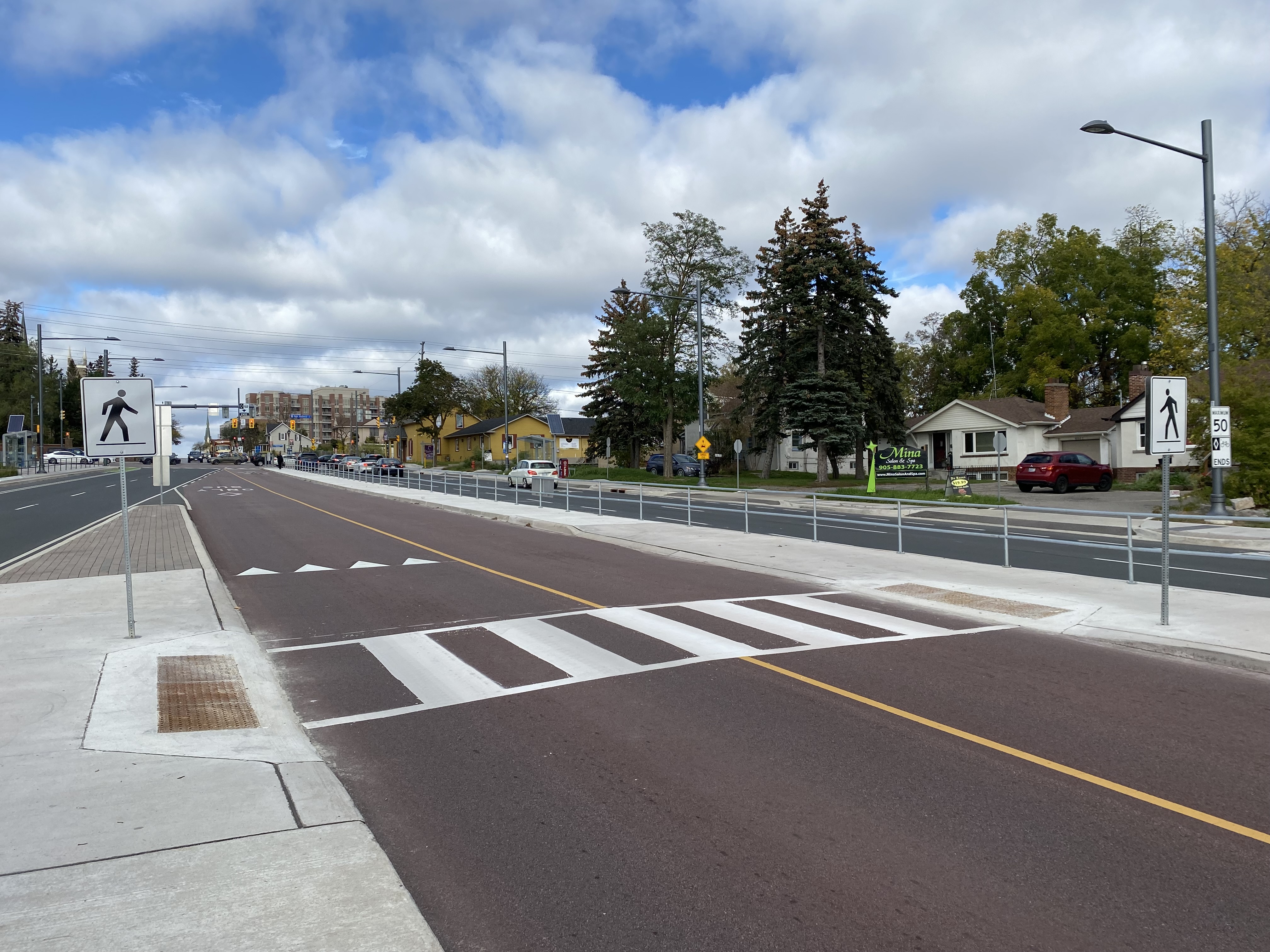
Earlier this year, I wrote about a major malfunction at a new Viva Rapidway station near Downtown Richmond Hill. The Major Mackenzie station on Yonge Street was built one block south of the busy east-west arterial road; passengers taking Viva buses were forced to walk from Major Mackenzie Drive south to the intersection of at the intersection of Elmwood Avenue and Hopkins Street, push a “beg button” and wait to cross to the bus platforms in the middle of Yonge.
The reason for this unusual situation was that the Yonge Street right-of-way narrows through Downtown Richmond Hill. At Major Mackenzie Drive, northbound Viva buses must enter mixed traffic for approximately two kilometres before returning to a median busway. (The northbound traffic signal at Major Mackenzie has a dedicated transit phase that allows Viva buses to exit the median ahead of general traffic.) This required the median Viva bus stop (called a VivaStation) to be located considerably south of the intersection of Yonge Street and Major Mackenzie Drive.
Back in February, temporary barriers and YRT transit enforcement officers were used to dissuade transit customers from Back in February, temporary barriers and YRT transit enforcement officers were used to dissuade transit customers from taking the faster and direct, yet more dangerous, route to Major Mackenzie Drive and connecting east-west buses by crossing midblock north of the platform, the faster and direct, yet more dangerous, route to Major Mackenzie Drive and connecting east-west buses.
The Major Mackenzie VivaStation and layout, February 2021
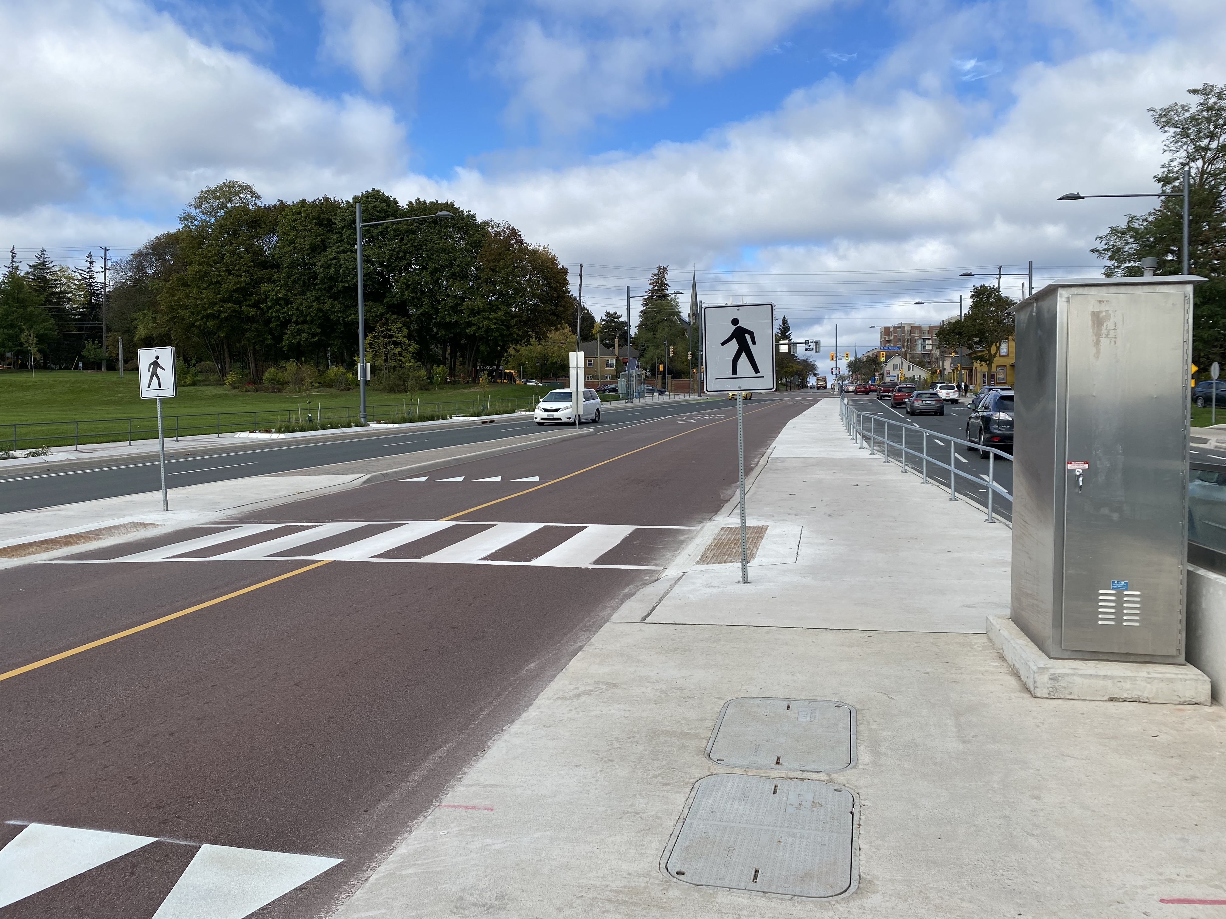
To my pleasant surprise, York Region fixed its mistake. Though the revised station is not ideal (it is still a long walk from Major Mackenzie Drive itself), a new walkway alongside the east side of the bus right-of-way from the VivaStation to the Major Mackenzie intersection makes the transfer to and from buses on Major Mackenzie much simpler.
Looking south from Major Mackenzie Drive
Just north of the bus platforms, a signed crosswalk allows passengers to go from the walkway and northbound platform to the southbound platform on the west side of the bus right-of-way.
Looking north towards Major Mackenzie Drive at the new crosswalk, which allows passengers to go between the southbound bus platform to a new walkway connecting the Major Mackenzie VivaStation to its namesake street.
Permanent metal rails prevent passengers from crossing Yonge Street until they get to the signalized intersection at Major Mackenzie. But transit enforcement officers were nowhere to be seen on this visit, on a Friday afternoon.
Metal barricades deter pedestrian crossings outside of signalized crosswalks.
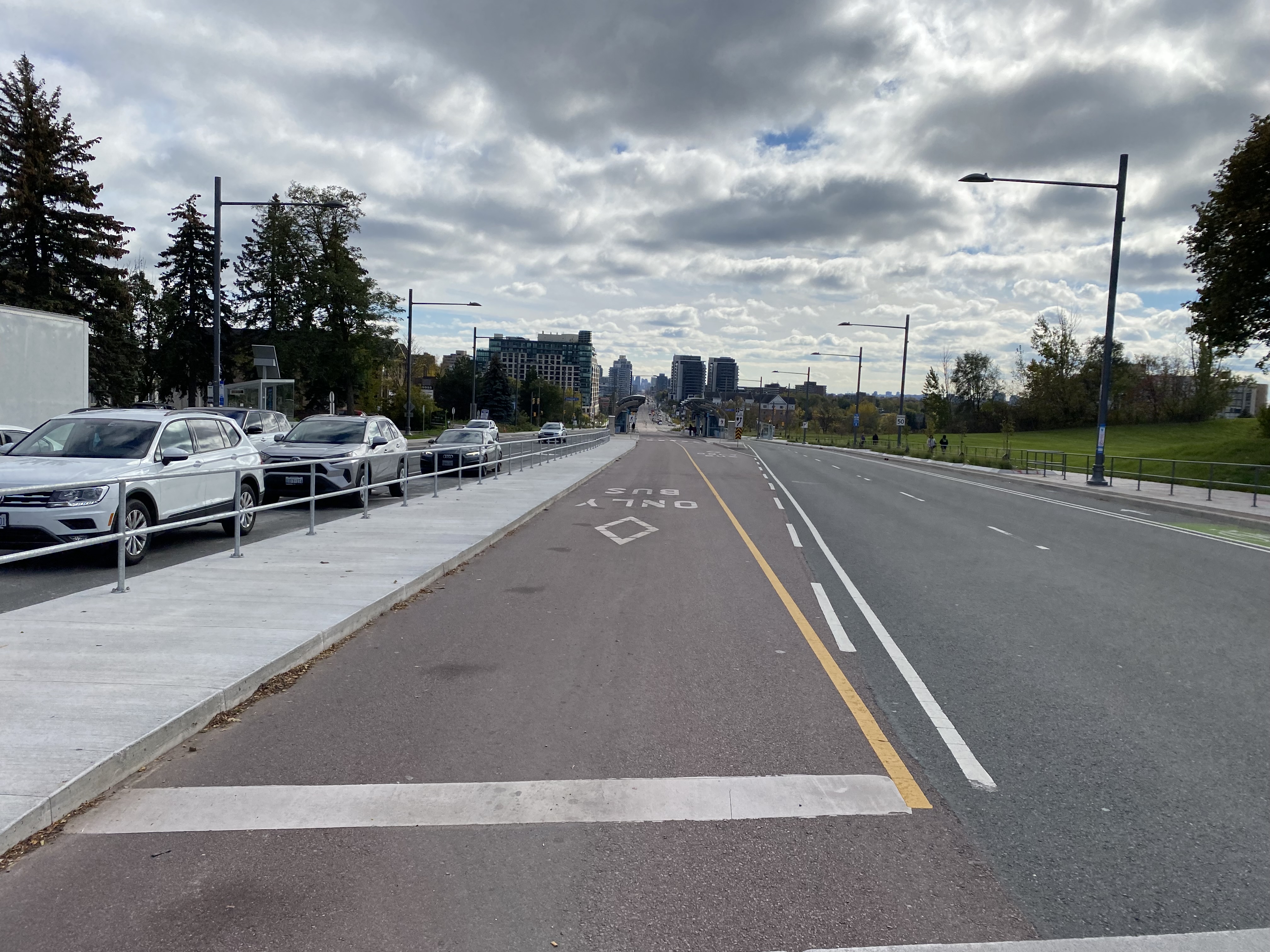
Unfortunately, to make room for the walkway between the station and Major Mackenzie Drive, the northbound bicycle lane was cut, and replaced with “sharrows.” Though the new bicycle lanes on Yonge ended at Major Mackenzie (not enough room if you have to maintain four through traffic lanes through a historic town centre), this diminishes the gains cyclists made with the reconstruction of Yonge Street for the BRT lanes.
When surface transit projects — like the Viva Rapidways — are designed to fit into existing suburban roadways, compromises to the passenger experience are made. At Richmond Hill, this meant maintaining two traffic lanes in each direction while trying to squeeze a bus rapid transit station into the roadway. This resulted in the original blunder, which should have been thought though earlier in the planning stages.
The fix is not perfect, but it at least addresses the problems with the Major Mackenzie BRT station. Perhaps, one day, we will plan for transit, walking, and cycling first in places like Downtown Richmond Hill, rather than planning for private motor traffic first.
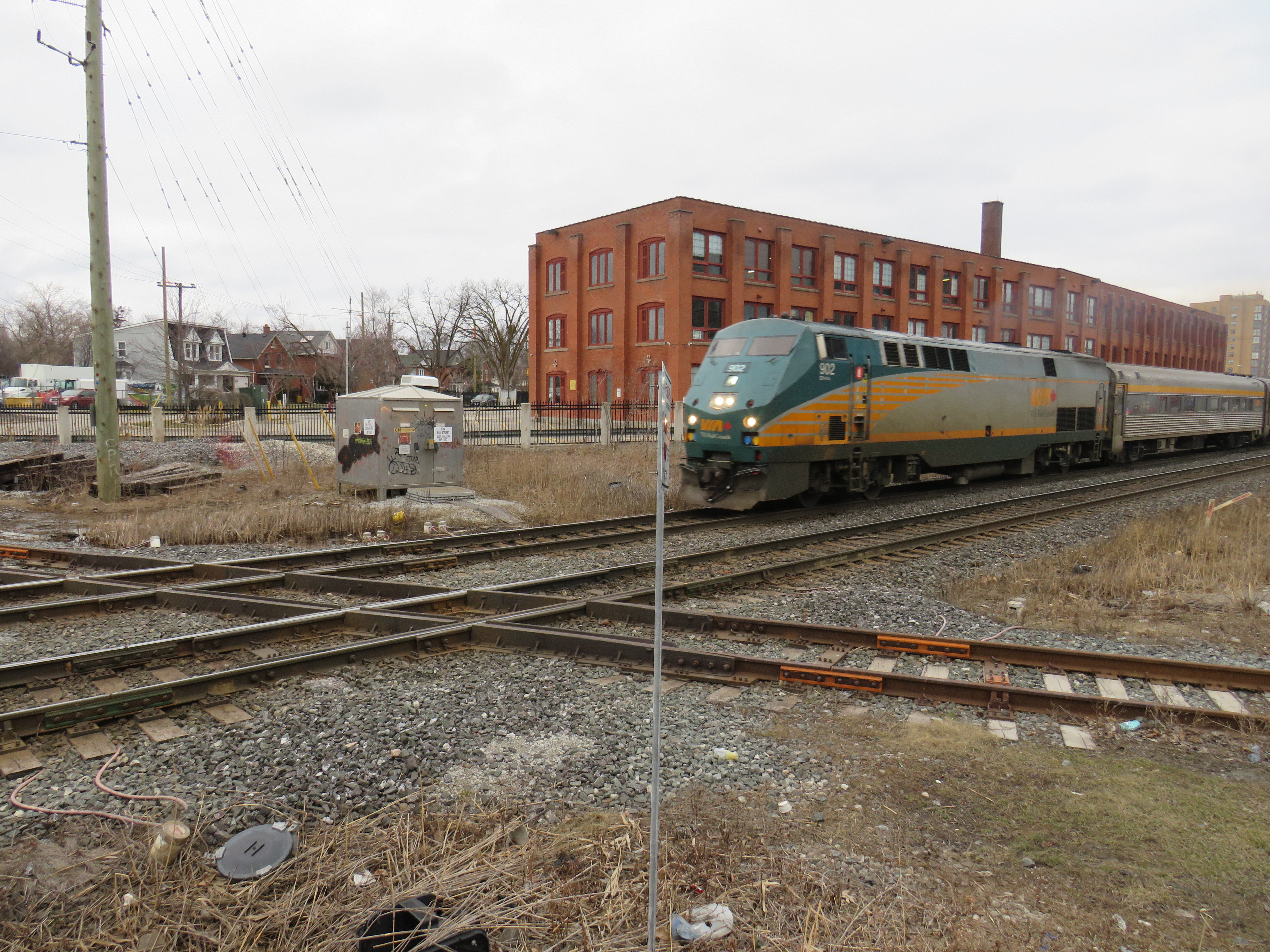
On Thursday, August 12, I rode the train to the very end of the Richmond Hill Line to check out GO Transit’s newest station.
In 2017, I made a similar trip to Gormley Station, just to the south of Bloomington GO, soon after that station opened to the public. Four years ago, I was critical of Metrolinx’s failures to support the urban intensification of the Greater Toronto and Hamilton Area (GTHA) by building new stations on the Greenbelt, on lands that will not support transit-oriented development.
Though I came away from Gormley Station disappointed, I wanted to see Bloomington Station for myself and give it an honest assessment. I came away with mixed feelings.
Most GO Stations outside the old City of Toronto put free car parking ahead of all other considerations. Some stations, such as Unionville, were even moved to sites where large surface lots could easily be built. Hamilton GO Centre, opened in 1996, was an exception: an urban station that combined a restored heritage building with a large bus terminal. A few other newer stations, such as Mount Pleasant in Brampton and Mount Joy in Markham, still had large surface parking lots, but also had easy walking connections to adjacent neighbourhoods. In Guelph and Kitchener, GO Transit used existing downtown stations instead of suburban stations, and Allandale Waterfront Station is located right across the street from Barrie’s gorgeous Kempenfelt Bay.
Gormley and Bloomington Stations represent a return to GO Transit’s old ways of putting parking ahead of all other considerations, despite Bloomington’s modern design.
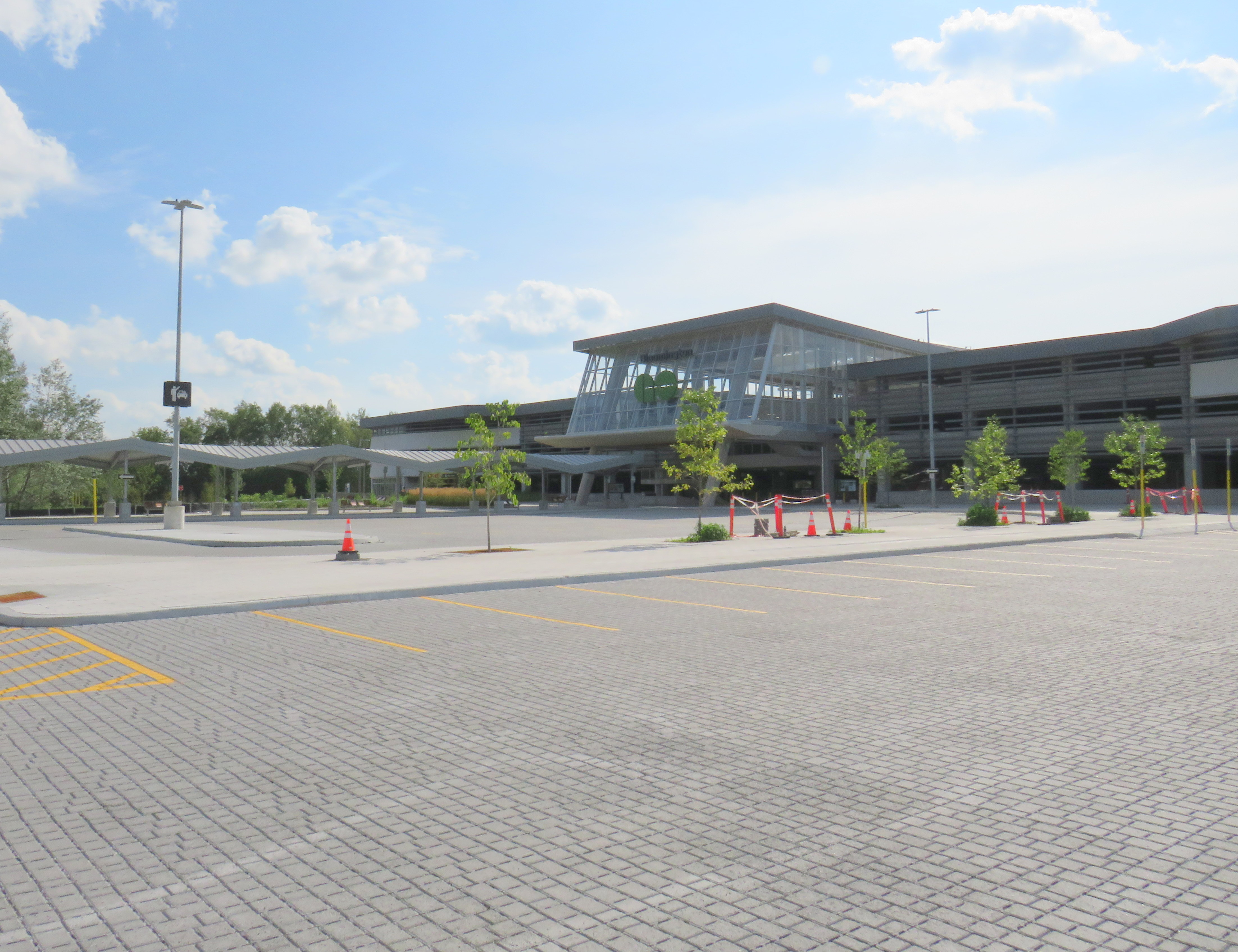
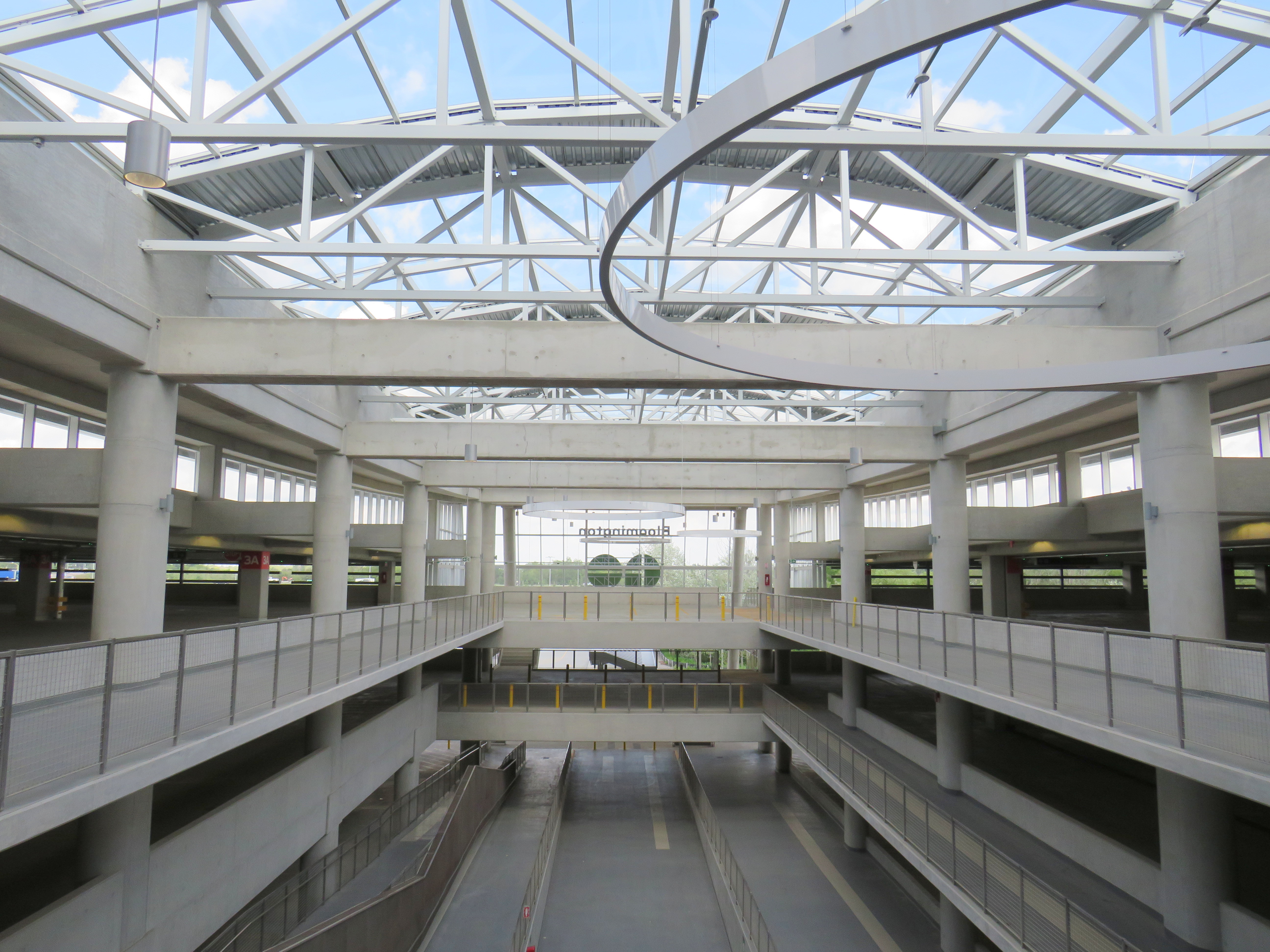
Metrolinx, the provincial agency responsible for planning and constructing transit infrastructure in the GTHA and for operating GO Transit, opened Bloomington Station on June 28, 2021. The station is located on Bloomington Road, adjacent to Highway 404, on the boundary between Richmond Hill and Aurora.
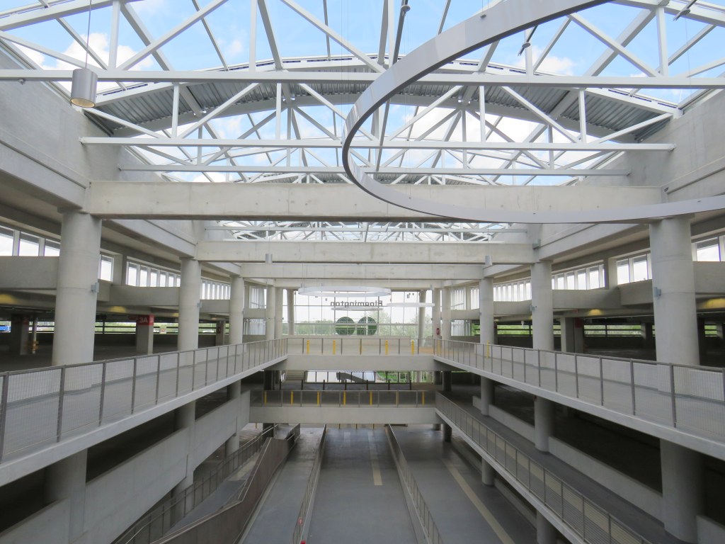
The station is built around a three-storey parking garage tucked into a hill, with the train platform and station amenities (an enclosed waiting room with washrooms and a ticket counter) on the second level. At the lower level, there is a six-bay bus loop almost directly below the rail platform, minimizing the distance between train and bus. Elevators, stairs, and ramps connect the three levels of parking, the bus bays, and the train platform.
The station’s central atrium, which contains the pedestrian passages between parking levels, station, and platforms, is the architectural highlight. Above the parking areas, solar panels collect some of the energy required to light and heat the station.
Atrium at Bloomington Station, with parking spaces on both sides
In its blog, Metrolinx expressed pride in the new station, noting it was built to achieve LEED Gold certification through features such as energy efficient lighting, a water-permeable surface lot, stormwater management, and a pond for local wildlife with an underground passage to help animals migrate away from the station complex. Like most new GO platforms, Bloomington’s train platform is heated to allow snow and ice to melt, reducing salt usage. Finally, as far as suburban GO stations go, Bloomington’s footprint is quite compact. It cost $82.4 million to build the new station.
Plaque adjacent to wetland at Bloomington GO StationPermeable surface at Bloomington’s outdoor surface lot and passenger pick-up and drop-off area
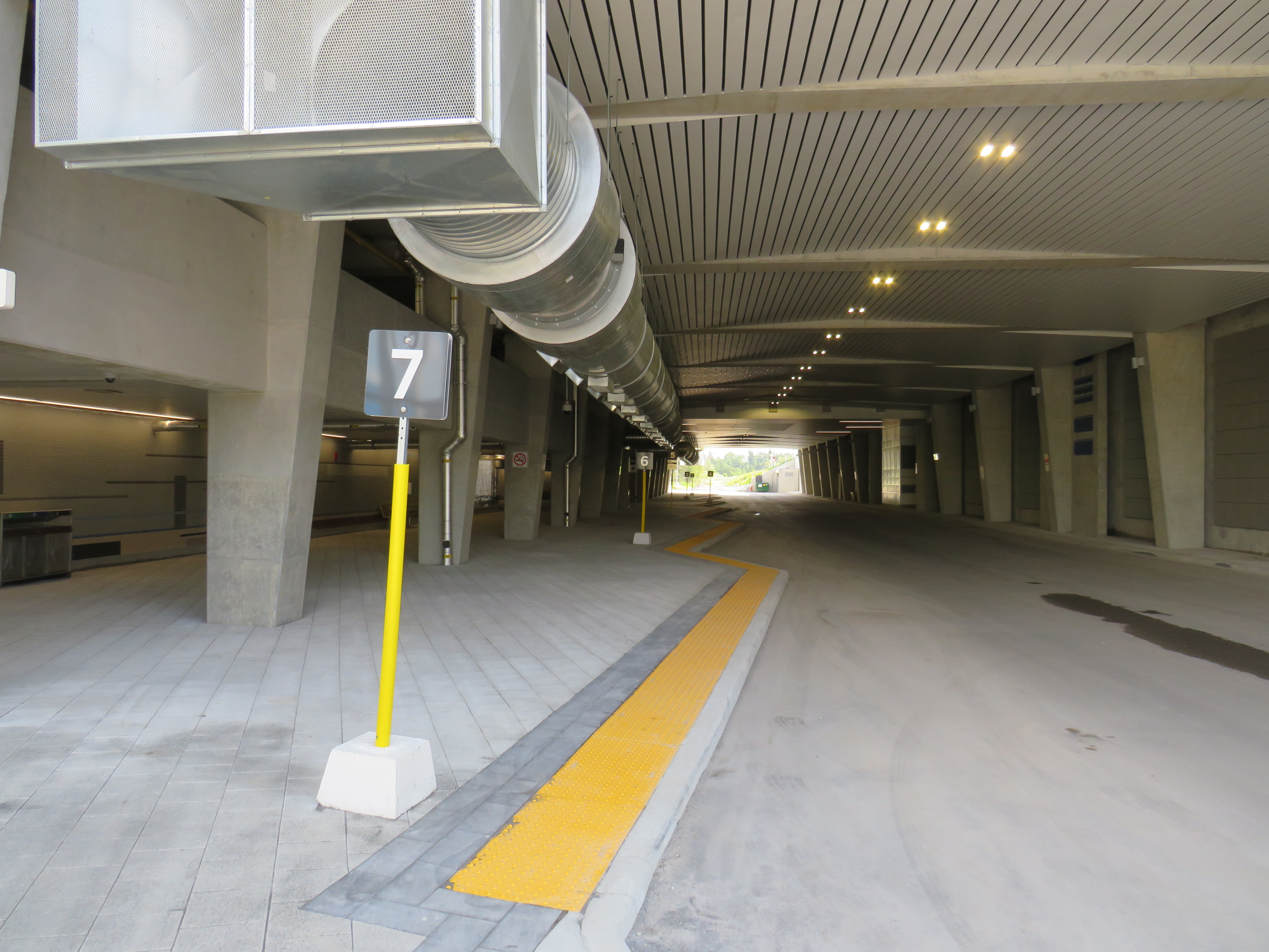
Despite these innovations, a LEED certification can only go so far when the GTHA’s newest transit station is only accessible by car, with over 1,000 parking spaces. Though transit ridership is down significantly during the ongoing pandemic, especially on GO’s Richmond Hill Line (which operates only in the weekday peak-period direction and currently uses four-car trains), there are no ongoing connections from Bloomington GO Station operated by GO buses or York Region Transit.
Though several GO rail stations do not have any local transit connections only Bloomington and Gormley have no bus connections at all. (In April 2020, YRT discontinued the limited-service Route 15 that ran past Gormley Station). At Acton, Georgetown, and Lincolnville, which also do not have any local transit connections, passengers can still connect to GO buses for points beyond, or make a return trip.
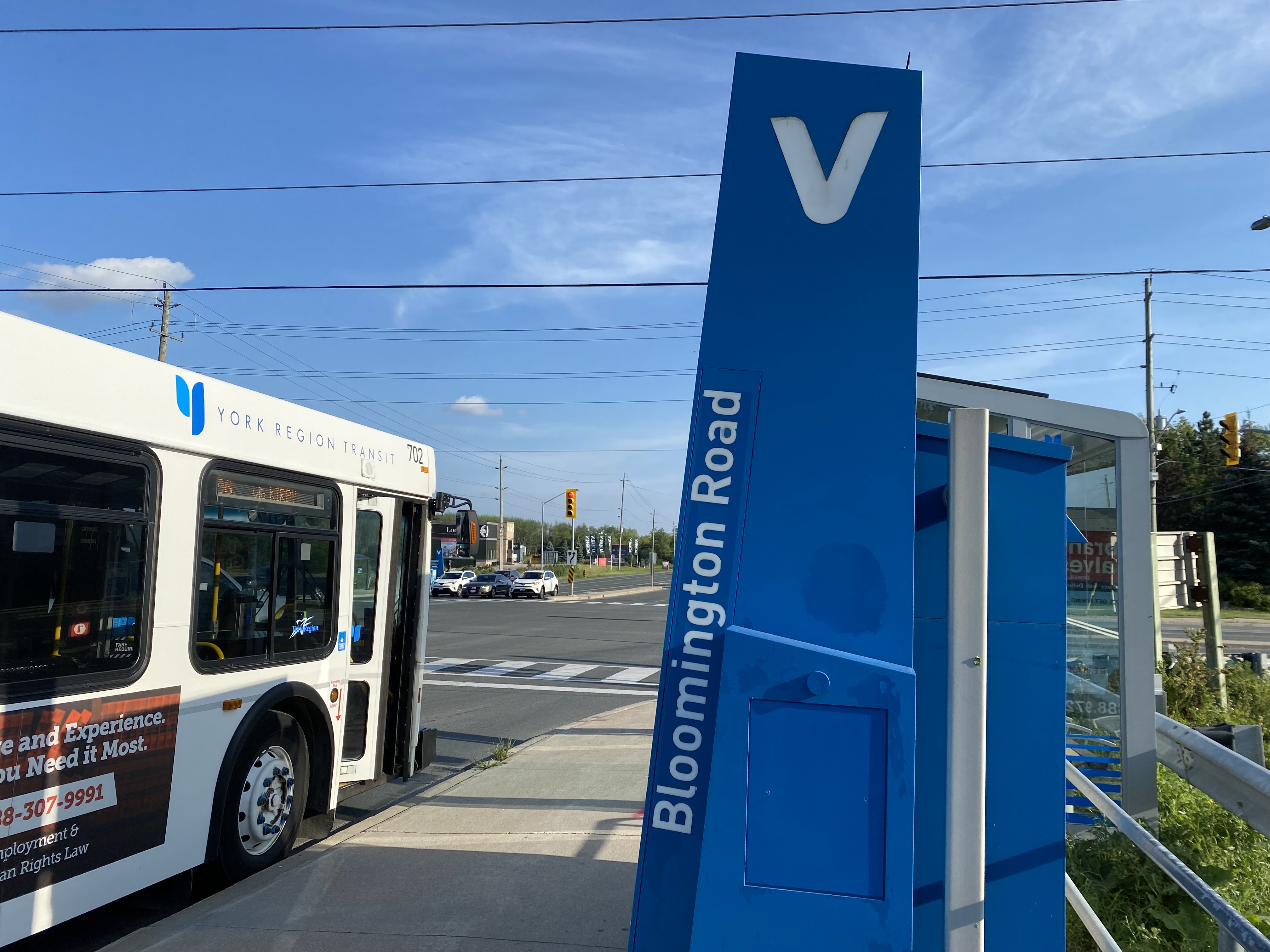
The only bus operating at Bloomington Station’s loop is GO Route 61, which provides supplemental weekday service between Union Station and Bloomington GO. But the last Route 61 bus leaves for Union at 1:55 PM.
There was no bus connection to be found at Bloomington GO Station
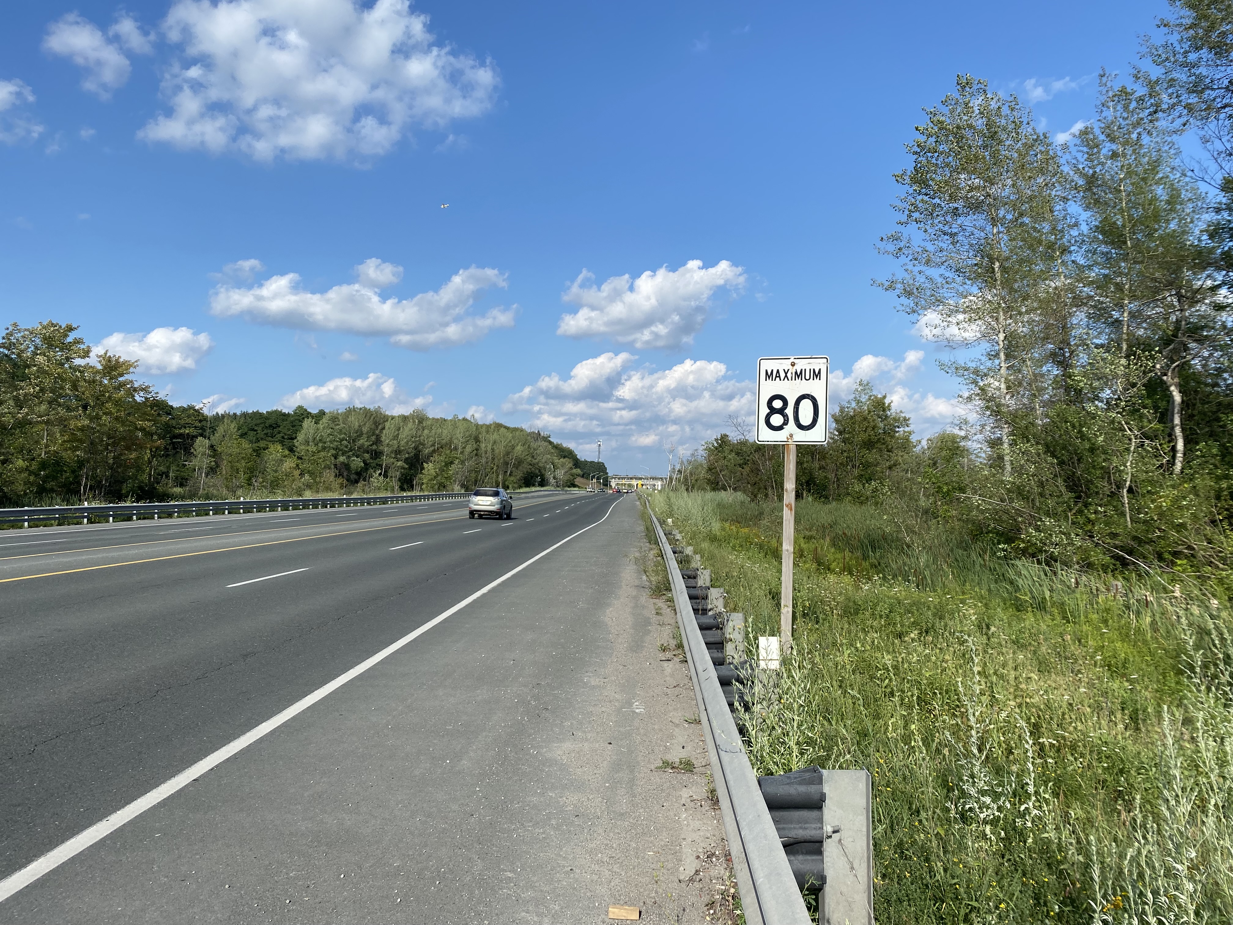
The nearest in-service bus stop is over one hour’s walk away, near Bloomington Road and Yonge Street. At least there was a paved shoulder along the busy five-lane road between the GO station and Bayview Avenue, where motorists were driving well in excess of the 80 km/h speed limit.
Looking east towards Bloomington GO at Leslie Street
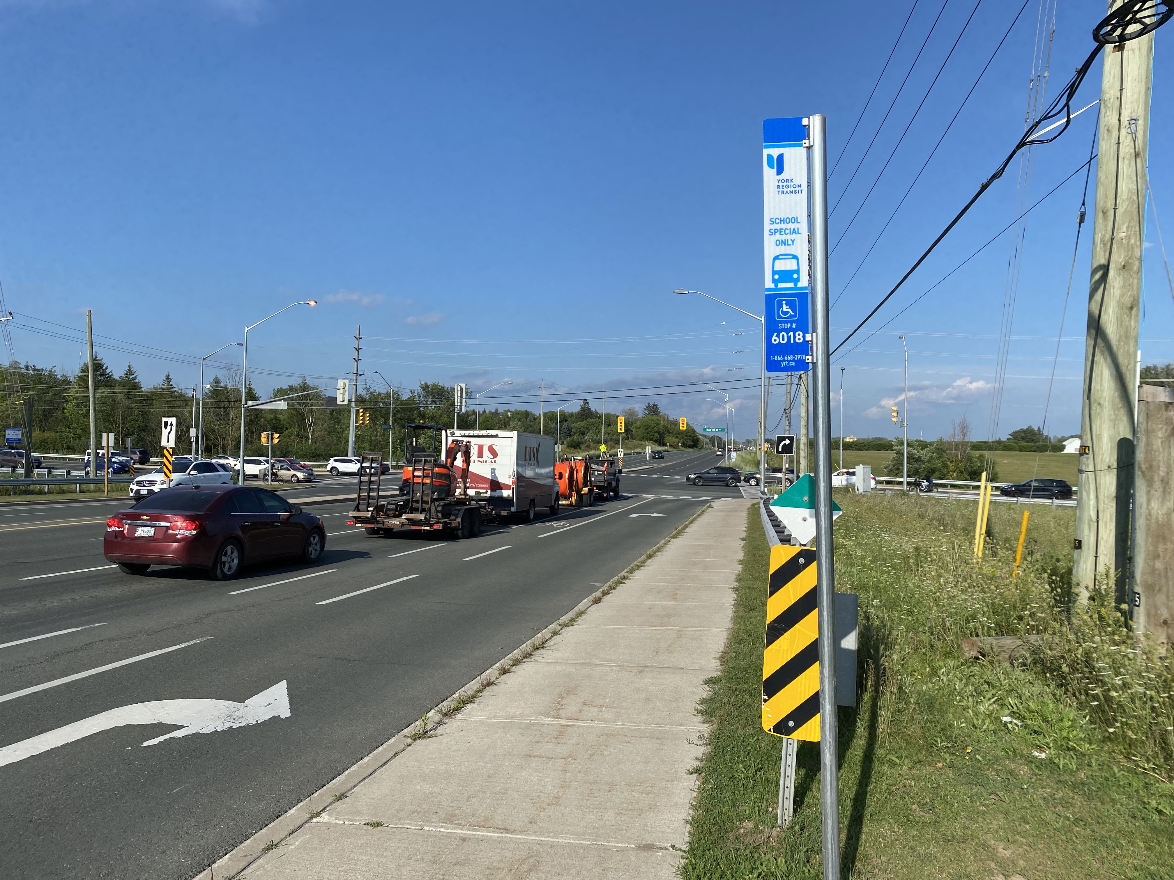
At Bayview Avenue, a sidewalk leads westerly to Yonge Street, with new residential subdivisions lining the south side of Bloomington Road. I noted a bus stop as I was walking west towards Bayview Avenue; alas, it was only for a high school special route.
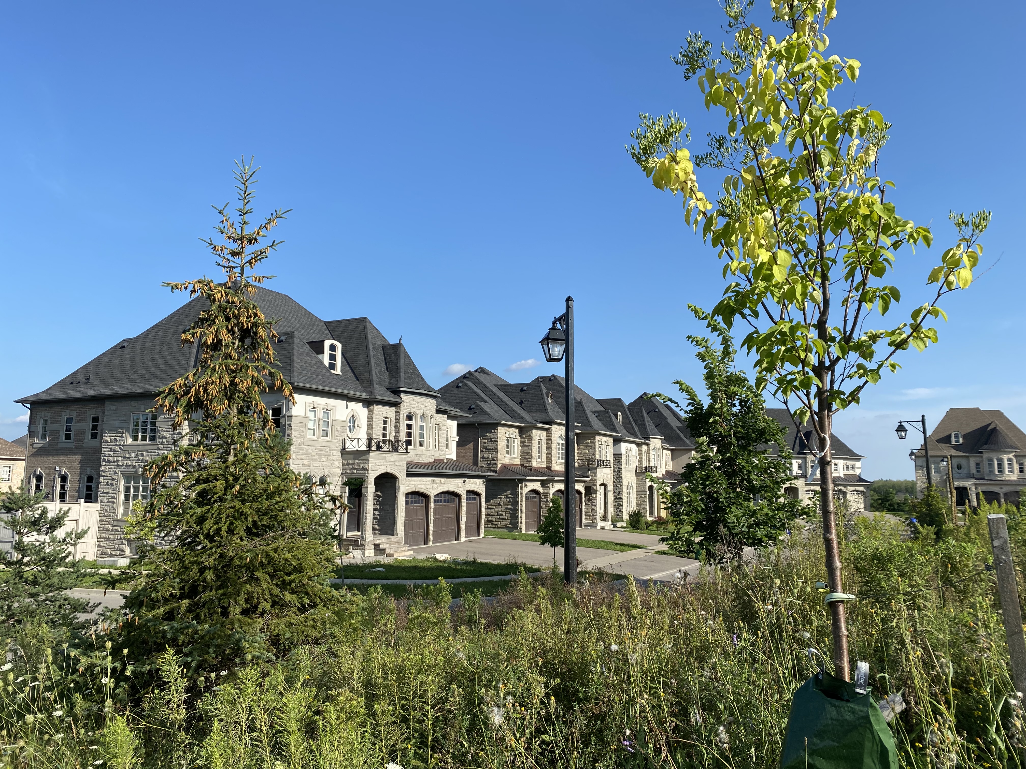
YRT stop at Bloomington Road and Bayview Avenue signed “school special only”New residential development along Bloomington Road featuring large houses with three-car garages was clearly designed for cars, rather than people
As I was nearing Yonge Street, I noted that the new subdivisions were set back far from the road, with many of the houses built with three-car garages. Building enough transit ridership here to support even a limited service bus route is going to be very difficult.
One hour and 8 minutes later, I arrived at the bus stop at Yonge Street, the closest place to Bloomington GO Station where I could get a bus to continue my journey.
The end of a long walk from Bloomington GO Station
Bloomington Station’s small footprint and environmental features might actually make it an ideal basic station design for more urbanized locations in the GTHA, where the compact design and logical layout could support easy bus connections and short walks to residential and employment areas. I liked the simplicity of the bus connections at Bloomington — if only there were any buses to connect to.
But Bloomington’s LEED Gold certification means little when it does not support sustainable development or sustainable access to the station.
Though its location adjacent to Highway 404 may entice some commuters to switch to parking at Bloomington and commuting downtown by train, Gormley, just one station to the south, already achieves a similar purpose.
For now, Bloomington Station is just a Garage Mahal — a grand monument to the old way of doing things at GO Transit.
Replacement high pressure sodium lamp on left, the white glow of Toronto’s classic “acorn” lamp on right.
Street lighting is an important, yet overlooked, part of any city’s standard infrastructure. For over seventy years, Toronto’s streets were lit with an elegant and increasingly unique streetlamp design. But modern standards and a desire for standardization will see this change, just as Toronto’s streetcars and street signs have.
Toronto Hydro, which is responsible for Toronto’s street lighting, is replacing the older “acorn” lamps with high pressure sodium (HPS) cobra head lamps (so-called due to their shape when seen from the top or bottom). While surrounding municipalities are switching to white-burning LED lights, Toronto Hydro is installing the older beige-orange glowing lamps.
I asked Toronto Hydro what their long-term plans were for the city’s street lighting infrastructure. Read more on Spacing’s website.