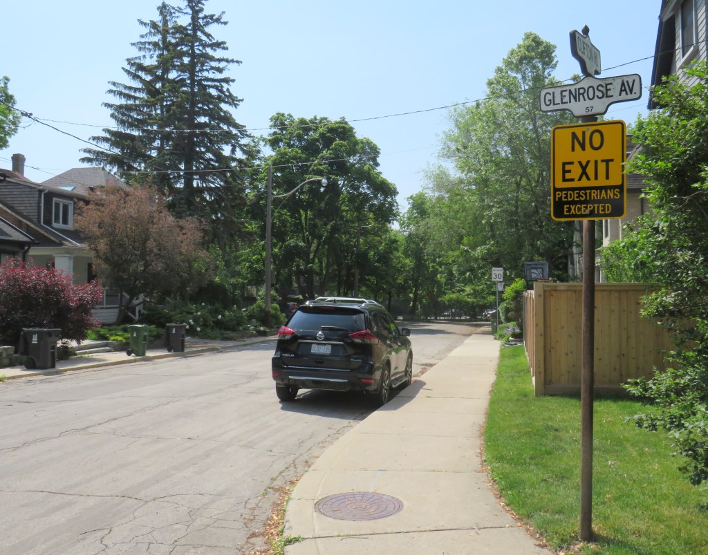
On April 8, Toronto City Council approved a motion brought forward by Councillor Paula Fletcher to change that. Councillor Fletcher’s motion was titled “I’m Walking Here.” Only two months later, new signs are already appearing across Toronto — in Scarborough, Monarch Park, and Swansea. For a city that often takes years to adopt what may seem like simple, easy solutions, this was implemented impressively quickly. The new signs look like standard yellow “no exit” signs, but with a “pedestrians excepted” note at the bottom.
My hope is that these signs will entice Torontonians to get outside, go for a walk, and check out some new streets and parks, enticed by these signs inviting through passage.
In related news, this week Toronto Council approved the expansion of sidewalk slow clearance to all of Toronto’s streets, a service that was previously provided only to suburban areas, where unobstructed sidewalks made municipal slow clearance easy to do. With new snow equipment able to navigate narrow urban sidewalks, Toronto is now finally able to provide universal snow clearance services, a boon for full accessibility.
As public health restrictions ease and stores and restaurant patios reopen this Friday (supported by the city’s willingness to reallocate road space on streets like Yonge and Danforth), there’s never been a better time to for a walk.
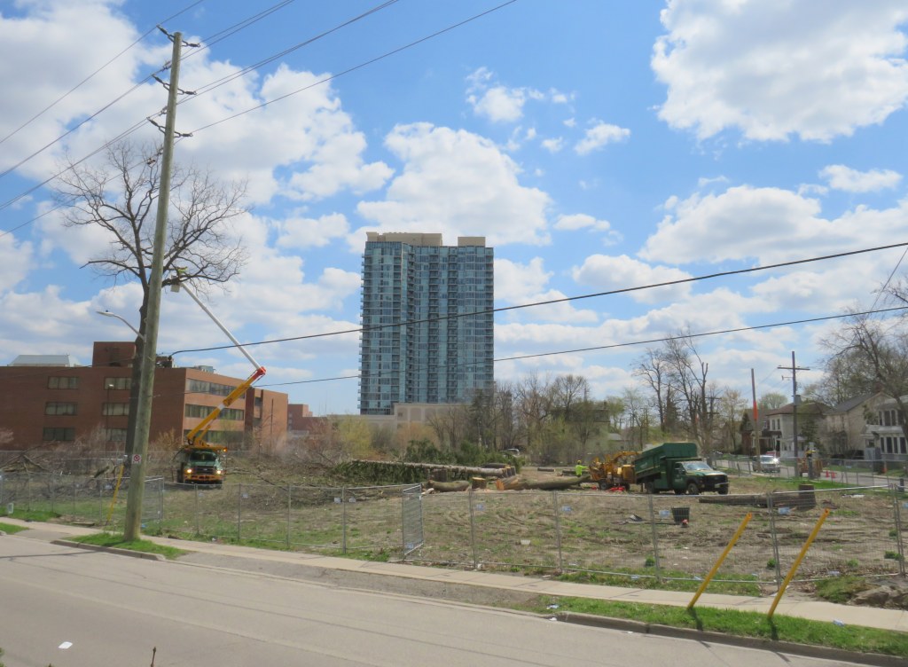
Cutting down trees to make way for a surface parking lot in Downtown Brampton
Earlier this April, contractors hired by Metrolinx cut down trees on its Downtown Brampton property, where twelve houses once stood. The work, originally scheduled for the week of March 22, did not begin until April 12.
The tree removal brings Greater Toronto’s regional transit operating and planning authority one step closer to building a new 200-plus surface parking lot in a city that hopes to renew its downtown core.
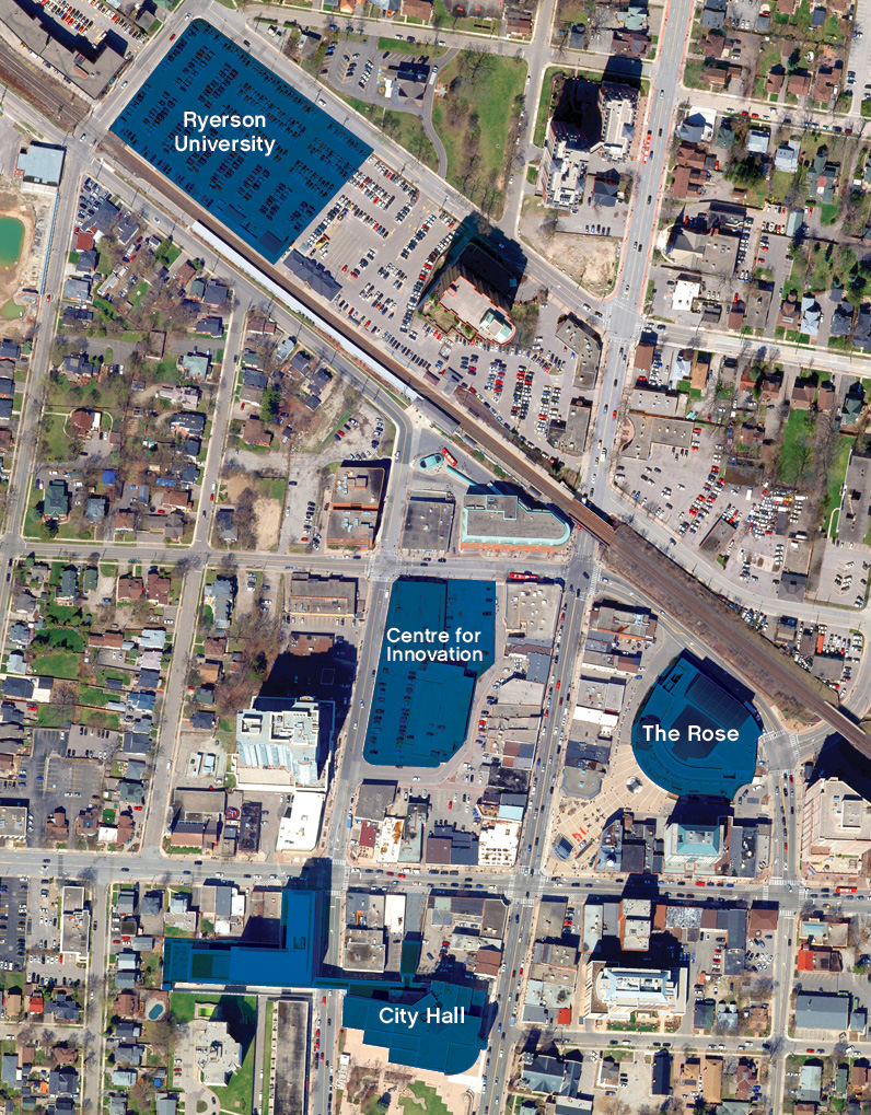
Starting in 2016, Metrolinx purchased over a dozen homes along with two four-storey office towers in an area bounded by Railroad, Nelson, and Elizabeth Streets, immediately south of the Brampton GO Station. It vacated and demolished the houses between 2016 and 2019, and left the two office buildings vacant. Metrolinx’s plan was to build a new surface parking lot to expand parking capacity, though in early 2018, the Liberal provincial government announced a new Ryerson University/Sheridan College campus on the existing main parking lot on the north side of the station. Metrolinx’s acquisition of occupied homes — including heritage-listed buildings and a rooming house — made more sense.
After the election of a new Progressive Conservative government led by Doug Ford, funding for the educational campus was pulled, though the City of Brampton and Ryerson University continued to advance plans for the downtown area. The city bought up more of the downtown core, including the southeast corner of George and Nelson Streets, across from the vacated office buildings, as well as the thirty-year old office building at 2 Nelson Street West, below which is the Brampton Transit downtown terminal. These newly acquired lands would be home to a larger bus terminal that would link to an expanded GO station and a proposed extension of the Hurontario LRT, and an Innovation Centre that would serve the education campus and include a new central library.
The old plans for the Ryerson Unversity/Sheridan College building on the GO Transit parking lot, and a Centre for Innovation on the southeast corner of George and Nelson Streets. The Metrolinx lands are in the block between the Centre for Innovation and the GO Station/proposed Ryerson building
Already, there are several high-rise developments in the downtown area under construction or in the planning phase. More development lands will be unlocked with the Riverwalk project, which will improve flood protection along Etobicoke Creek while providing an improved public space.
A two-tower rental highrise development is progressing on the old Dominion Skate Factory lands, across the tracks from the GO Station, bringing hundreds of new residents to the downtown core and right to the station.
Given Brampton’s urban aspirations for its downtown core, another surface parking lot — adding 200 spots to the existing 861 spaces — is not the right idea.
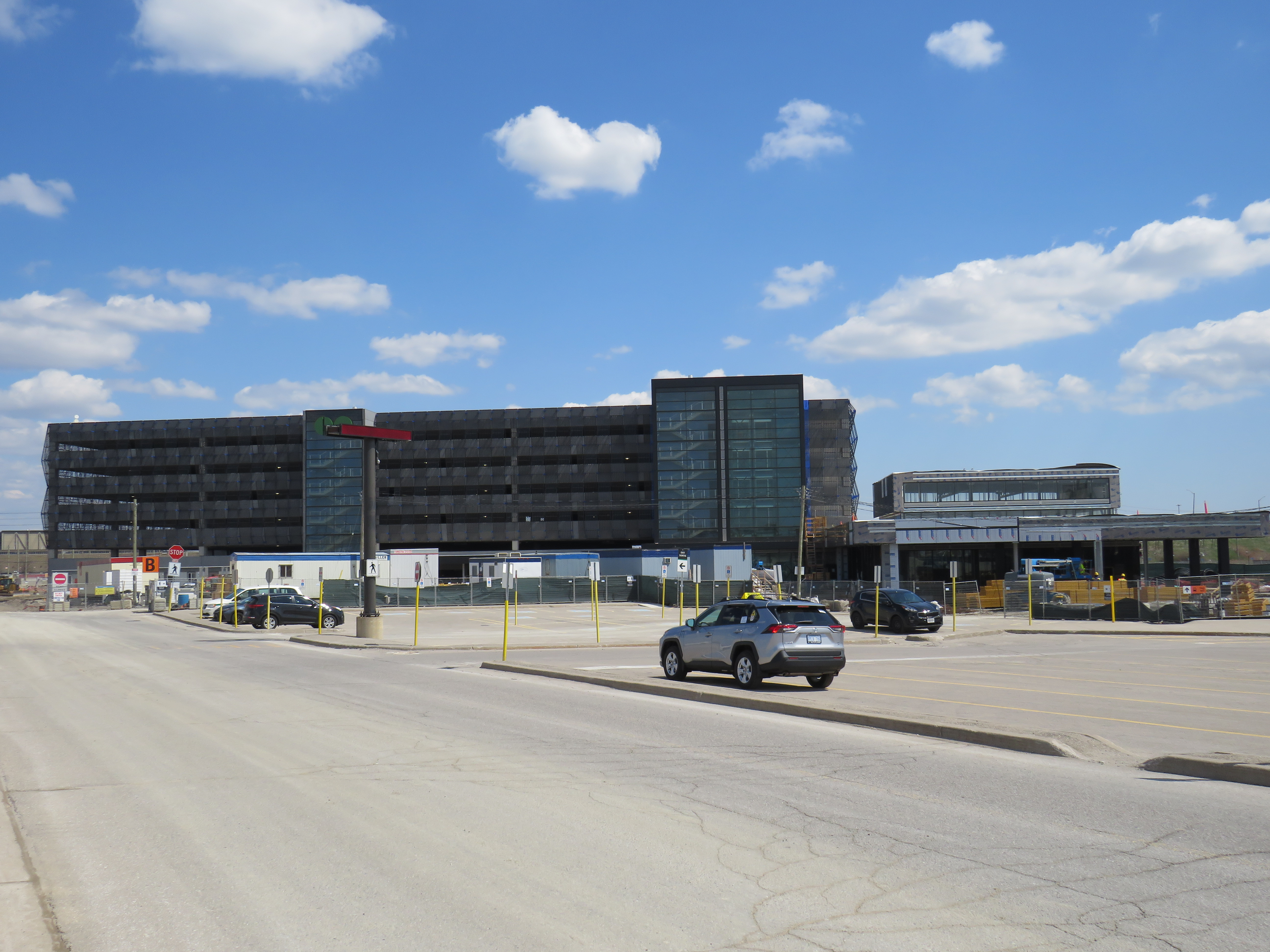
At Bramalea Station, construction has nearly finished on a 1,300 spot parking garage, part of a larger project that also includes a new, larger station building, a larger bus terminal, additional pedestrian tunnels, and improved platforms and security features. Bramalea already has over 2500 parking spaces, but unlike in Downtown Brampton, this is a logical space for parking expansion. The station is surrounded by warehouses and factories, at the intersection of two major truck routes, and close to highways. It is not a place that is easily urbanized. However, improved pedestrian and cycling access is very much warranted.
New garage nearly complete at Bramalea GO Station
With the expansion of parking at Bramalea GO, why is Metrolinx eager to add another parking lot in Downtown Brampton, especially with Ryerson’s downtown plans on hold?
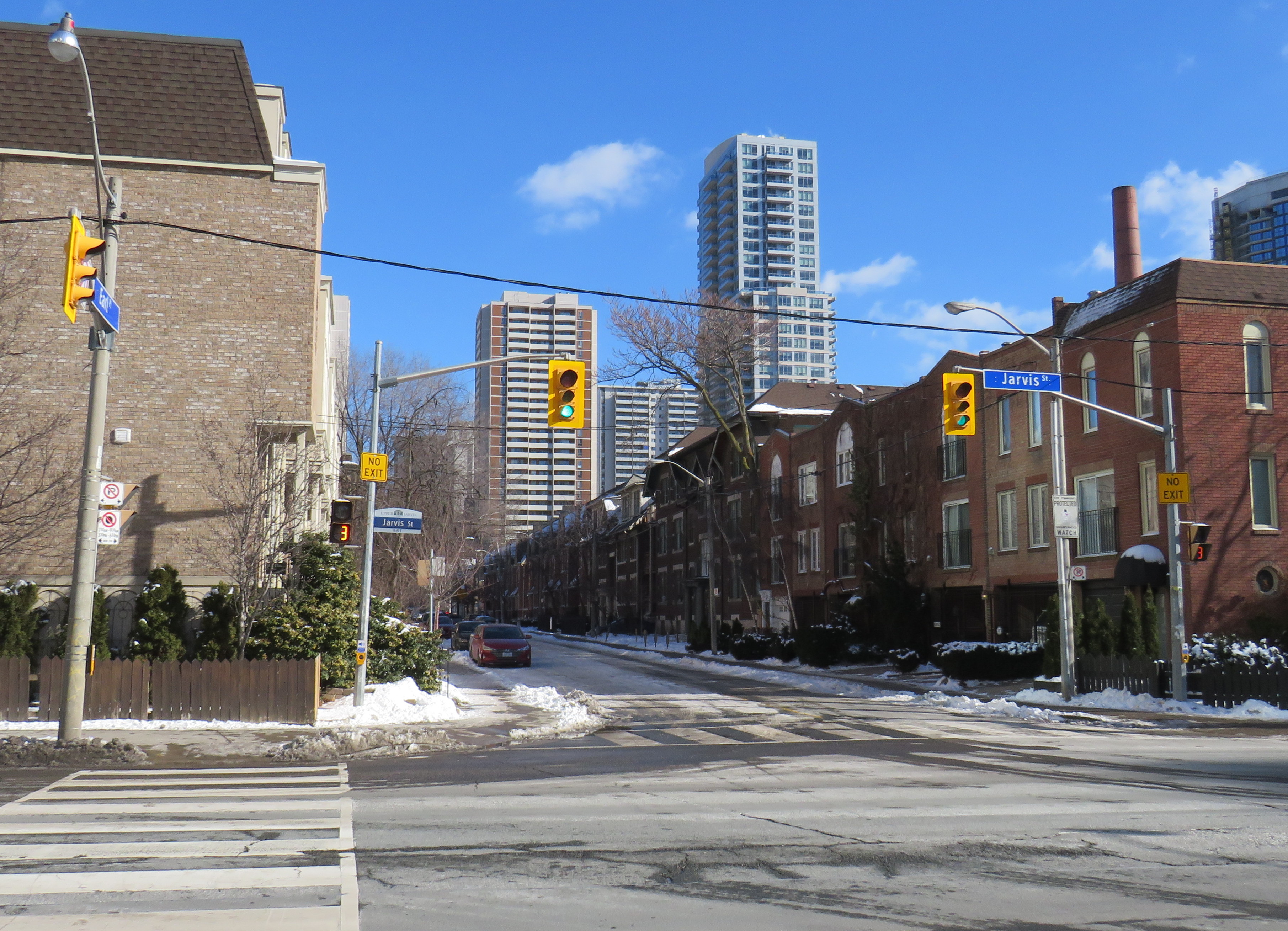
Misleading “no exit” signs, like these on Maitland Place at Jarvis Street, will soon be changed by the City of Toronto to indicate that indeed, pedestrians can continue through
Though these signs are required under traffic codes and regulations, they do not reflect that in many cases, there is an exit for pedestrians.
I quickly created a Google map of all locations in the City of Toronto marking such locations. Through a social media campaign led by Walk Toronto, we were quickly able to map over 450 locations where a pathway, sidewalk, or staircase allows a pedestrian to continue their way where motor vehicles are forced to turn around.
The motion, which was amended to strengthen the wording, requests city staff to develop a new signage standard to indicate where “no exit” signage betrays a pedestrian passage, and to begin installing these new signs this year.
Councillor Paula Fletcher’s motion (inspired by @Walk_TO) to have staff modify “No Exit” signage in places where there are, in fact, exits for pedestrians carries via show of hands, with some amended wording. https://t.co/owNfqtPgNUpic.twitter.com/eevn2bMwkN
The map that I created based on Dylan’s initial suggestion will be used to help identify these locations.
Given the ongoing pandemic, where we are all subjected to yet another lockdown, walking is one of the few permitted ways for each of us to get outside, enjoy the fresh spring air, and get much needed exercise. Knowing where one can walk, especially away from heavy traffic or busy sidewalks and paths, will only help unlock the city for more Torontonians.
I want to thank everyone who submitted locations for the map to Walk Toronto or to myself via Twitter or directly to me on this website. This couldn’t have happened without the help of fellow Torontonians.
At least the new Yonge Street Rapidway would serve York Region’s busiest transit corridor, supporting new high-density development in Richmond Hill. Unlike on Highway 7 or in Newmarket, there are no two-phase pedestrian crossings on this part of Yonge. Unfortunately, a botched connection between the new Rapidway at Major Mackenzie Drive created a new problem for the YRT/Viva transit network.
This issue — along with the other problems with York Region’s Rapidways that I discussed previously — should be held up as lessons on what not to do when building new transit rights-of-way in street medians, be it on Hurontario Street in Mississauga and Brampton, planned BRT lines on Dundas Street in Mississauga, or Queen Street in Brampton.
Earlier in September, I paid a visit to Woodstock, Ontario, to check out one of several new intermunicipal transit services that launched across the province this year. While in Woodstock, I paid a visit to the Highway 401 interchange at Highway 59.
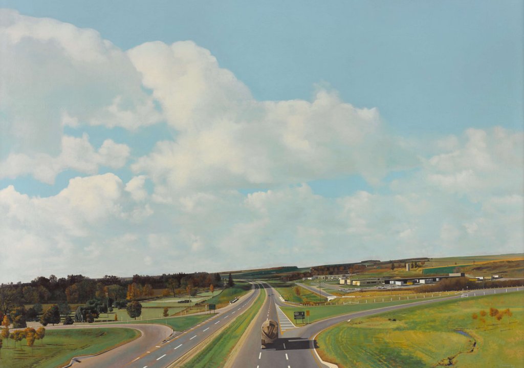
In 1968-1969, London, Ontario artist Jack Chambers painted 401 Towards London No. 1, which depicts a tranquil scene from the Highway 59 overpass, looking west. The highway, just two lanes in each direction, bends slightly to the southwest as it heads towards London and Windsor. On either side, autumn trees, farm fields, and gentle hills stretch out. The only buildings visible are farm silos, and two truck terminals on the north side of the highway. Only a few vehicles on Highway 401 are visible in the scene.
Chambers became well known for photorealism in his work. The scene in 401 Towards London No. 1 is slightly askew, as if this was a Kodachrome snapshot.
Highway 401 was only fully completed between Windsor and the Quebec border in 1968, the year the painting was started, though the section between Woodstock and London was completed in 1957, bypassing an especially congested section of Highway 2. Like many interchanges built by the province in the 1950s and early 1960s, the junction of Highways 59 and 401 was an eight-ramp cloverleaf.
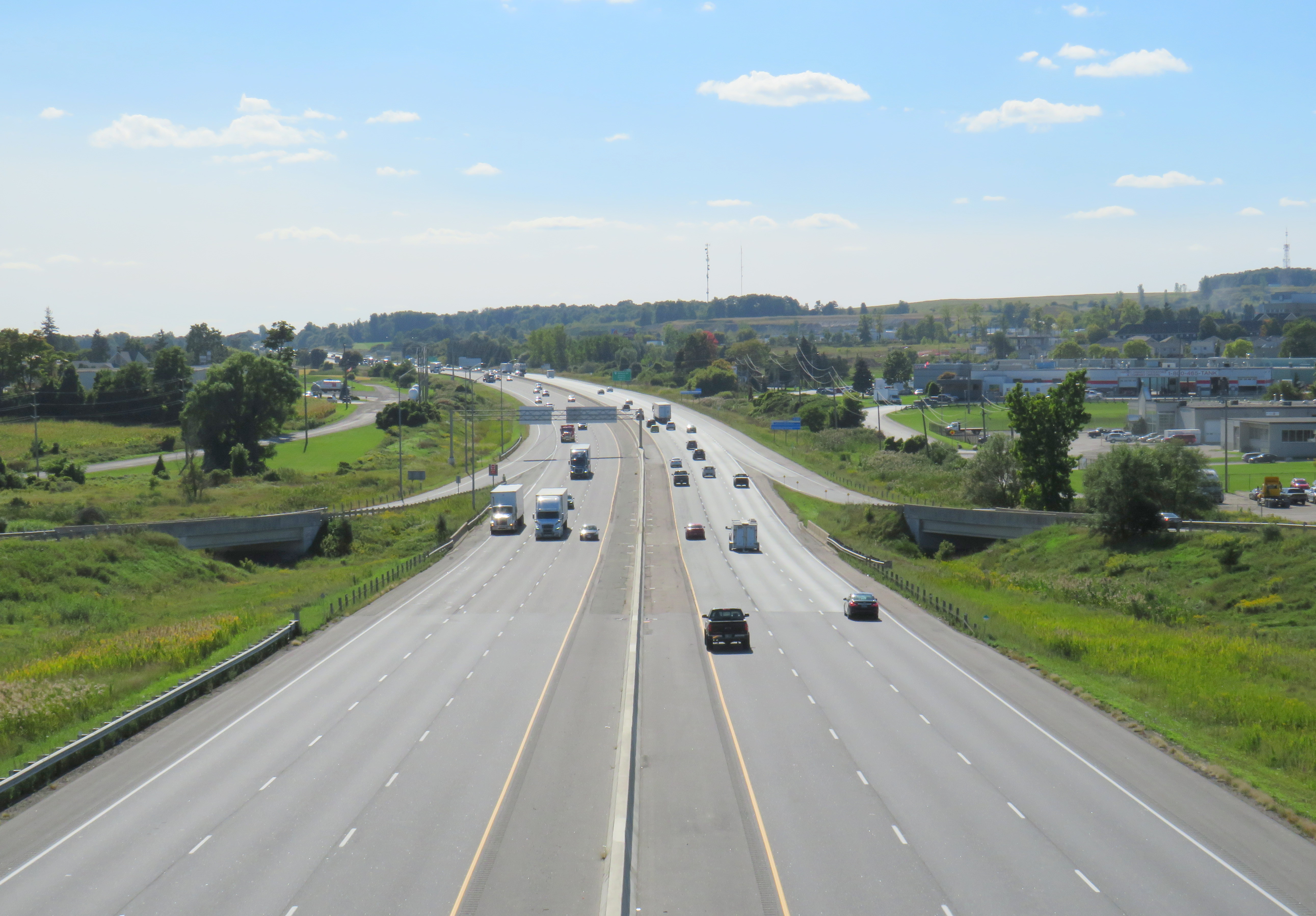
A contemporary view towards London
By the 1990s, Highway 401 was widened to six lanes. The cloverleaf interchange, like most others in Ontario, was removed and replaced by a simpler interchange. (As traffic levels increased, the danger of vehicles entering and exiting the highway with little space to merge became apparent.)
Woodstock’s sprawl caught up to the highway, with new warehouses, motels, subdivisions, and a hospital joining the original freight terminals. Though the distant trees and hills are the same as those in Chambers’ painting, the gentle curve in the distance remains the easiest way to match the two views, fifty years apart. Highway 59 itself was downloaded by the province in 1997. To the south, the old highway is Oxford County Road 59. To the north, it is simply Norwich Street.
Breezewood, Ontario: former Highway 59 looking north towards central Woodstock, where chain hotels, restaurants, and gas stations line the road
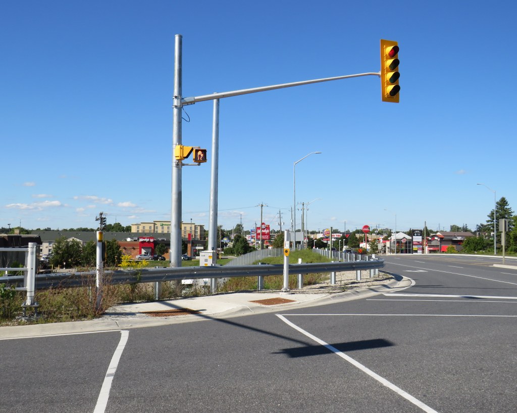
As I climbed over guardrails and navigated sidewalk-less embankments and road shoulders to capture the contemporary image of Jack Chambers’ painting, I was surprised by two things. The first were fully AODA-compliant crossing treatments at the highway ramps, despite there being no safe and marked way to get to those crosswalks.
I had to climb over the guardrail to get to this crosswalk at the westbound ramps to Highway 401
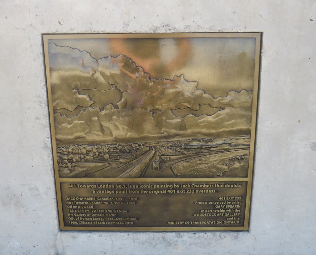
I was even more surprised to see an engraved version of the Jack Chambers painting embedded in the guardrail. When the Ministry of Transportation Ontario (MTO) rebuilt the overpass in 2017-2018, it thoughtfully included this nod to a local artist.
Plaque embedded in the guardrail at the Highway 59 overpass in Woodstock
Unfortunately, given the isolation of the plaque, few will actually see it, even if thousands pass by it daily. Larger signs mark the overpass as the Constable Jack Ross Memorial Bridge, in honour of a Ontario Provincial Police officer.
But it will always be the Jack Chambers bridge to me.
A larger sign right above the Jack Chambers plaque commemorates a different Jack
Though 401 Towards London No. 1 has long been one of my favourite Canadian paintings, it is not typically on display at the Art Gallery of Ontario. I would love to see this work put on permanent display, either at the AGO, or at another gallery that will appreciate the ode to Ontario’s mother road.
Over the past few years, I have been involved with the YongeTOmorrow project on behalf of Walk Toronto. It has been a very interesting and worthwhile experience being part of a stakeholder advisory group. Allied organizations working towards a more exciting and sustainable Yonge Street include Cycle Toronto, 8 80 Cities, and the David Suzuki Foundation.
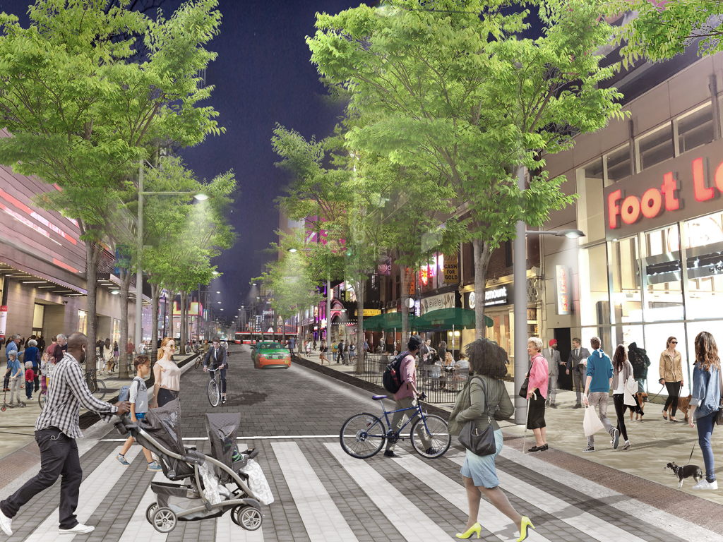
Rendering of proposed changes to Yonge Street , looking north towards Dundas Square. In this section, northbound traffic is permitted, with two-way cycling, and much wider sidewalks, along with new trees and improved street furniture.
Though the selected concept is not perfect, the proposed changes will provide significant improvements to Yonge Street between Queen and College Streets. These include wider sidewalks, patio space, bike facilities, and a pedestrianized zone between Dundas Square and Edward Street, allowing for better circulation, more flexibility for special events, and a more pleasant street.
With more high-rise development on the way (including the redevelopment of the Chelsea Hotel on Gerrard Street), it is only right that more space be given to residents, students, employees, and visitors. Compromises in the plan allow for access to parking garages, permit taxi and other vehicle drop-offs and pick-ups, as well as business deliveries.
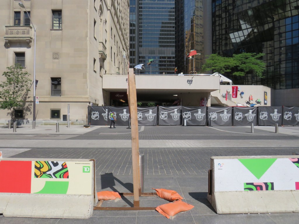
Over two years later, concrete Jersey barriers continue to disrupt pedestrians in front of Union Station
A year ago, I wrote about the unsightly Jersey barriers that were plopped down in front of Toronto’s Union Station in April 2018, creating bottlenecks at two of Toronto’s busiest pedestrian intersections. Though the city promised improvements in 2018and in 2019, the only changes were the application of decals to the existing Jersey barriers.
Though the front of Union Station looks slightly better, and the bottlenecks have been lessened by the ongoing COVID-19 pandemic, this is not a satisfactory solution, especially for Toronto’s busiest and most important transportation hub.
The Jersey barriers were hastily plopped down on Front Street after the April 23, 2018 van attack, where one man steered a rented cargo van onto busy sidewalks in North York, killing 10 and injuring 16 more before he was apprehended by police. As an iconic and crowded pedestrian area, it was felt that special protection was necessary. At the time, the assumption was that the van attack was an act of terrorism, requiring such drastic measures. (It was soon found the motives were not terrorist related.)
In 2018, city councillor John Campbell likened the front of Union Station to “a war zone” while a city spokesperson said that a broader security plan was “in the works,” including for protecting the station has been in the works for some time, including interim measures that would fit into the streetscape.
In March 2019, nearly a year after Jersey barriers were added, the Toronto Star’s Jack Lakey dismissed complaints about their awkwardness and appearance, calling them “effective in stopping a driver bent on another deadly attack.” However, Lakey noted that another city spokesperson said that “city is finalizing the design of permanent vehicle barriers around Union Station”, that would “be smaller, more aesthetically pleasing and easier to navigate for pedestrians.” Those barriers would be installed later in 2019.
Afternoon rush hour crowds navigate around the Jersey barriers at Front and Bay Streets, August 2019
It is now August 2020, and the concrete barriers are still there, creating a mess for anyone using a wheeled mobility device, or for anyone in a hurry.
Bay and Front Streets, August 2020
The only thing that has changed are new artistic vinyl stickers covering the bare concrete, with messages saying that “artwork is donated by TD [Bank].”
TD is the “premier sponsor and exclusive financial services partner” of Union Station, most of which is owned and operated by the City of Toronto. (Some sections used by GO Transit are owned by Metrolinx.) TD enjoys exclusive branding rights, ATM locations, and sponsors Union Station’s wifi and charging stations.
“Artwork is donated by TD”
Perhaps TD was embarrassed by the Jersey barriers (after all, it has its headquarters just up Bay Street). Or perhaps the city decided that something needed to happen here., after two years of unfilled promises.
While examining the barriers, I noticed construction signage wedged within the gaps, creating a trip hazard. I also saw the original metal bollards installed when Front Street was rebuilt for a more pedestrian-friendly streetscape in 2014-2015.
Construction signage creates a trip hazard in the gaps between Jersey barriers. Note the original metal bollard behind.
Though the inconvenience caused by the lingering “temporary” concrete barriers has been lessened as there are fewer pedestrians entering and leaving Union Station right now, it also makes it a good time to finally make the necessary renovations by installing permanent sturdy bollards.
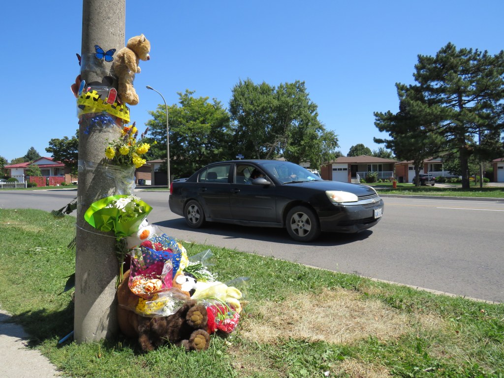
Roadside memorial to a three year old boy at The East Mall and Montebello Gardens, near Burnhamthorpe Road, Etobicoke
On Tuesday, August 11, just after 11AM, a father and his two children were attempting to cross The East Mall north of Burnhamthorpe Road. They were crossing from the west side of the minor arterial street, where there is the main entrance to a long term care home, to the corner of Montebello Gardens, a short residential street on the east side.
As the three pedestrians were crossing, an 81-year-old woman driving a black SUV turned left from Montebello Gardens to go south on The East Mall, crashing directly into the family.
All three pedestrians were rushed to hospital. A three-year-old boy was soon pronounced dead, while a seven-year-old girl was taken to a trauma centre. The driver remained on scene. It is not certain if charges will be laid.
The three-year-old’s death came only a day after the Toronto Star’s Ben Spurr reported that 2020 has been the safest year for pedestrians and cyclists since at least 2007. There were 63 collisions resulting in serious injury or death in the period from January 1 through July 1, down from an average of 99. The decline can be explained by considerably reduced traffic since COVID-19 lockdowns began in mid March, and by fewer pedestrians on city streets.
As traffic picks up with the loosening of restrictions and as people go out for strolls and exercise for physical and mental health, the need for improved road safety and a commitment for real Vision Zero implementation, especially in Toronto’s suburbs, remains crucial. The area near where the young boy was killed last week just shows how much further we need to go.
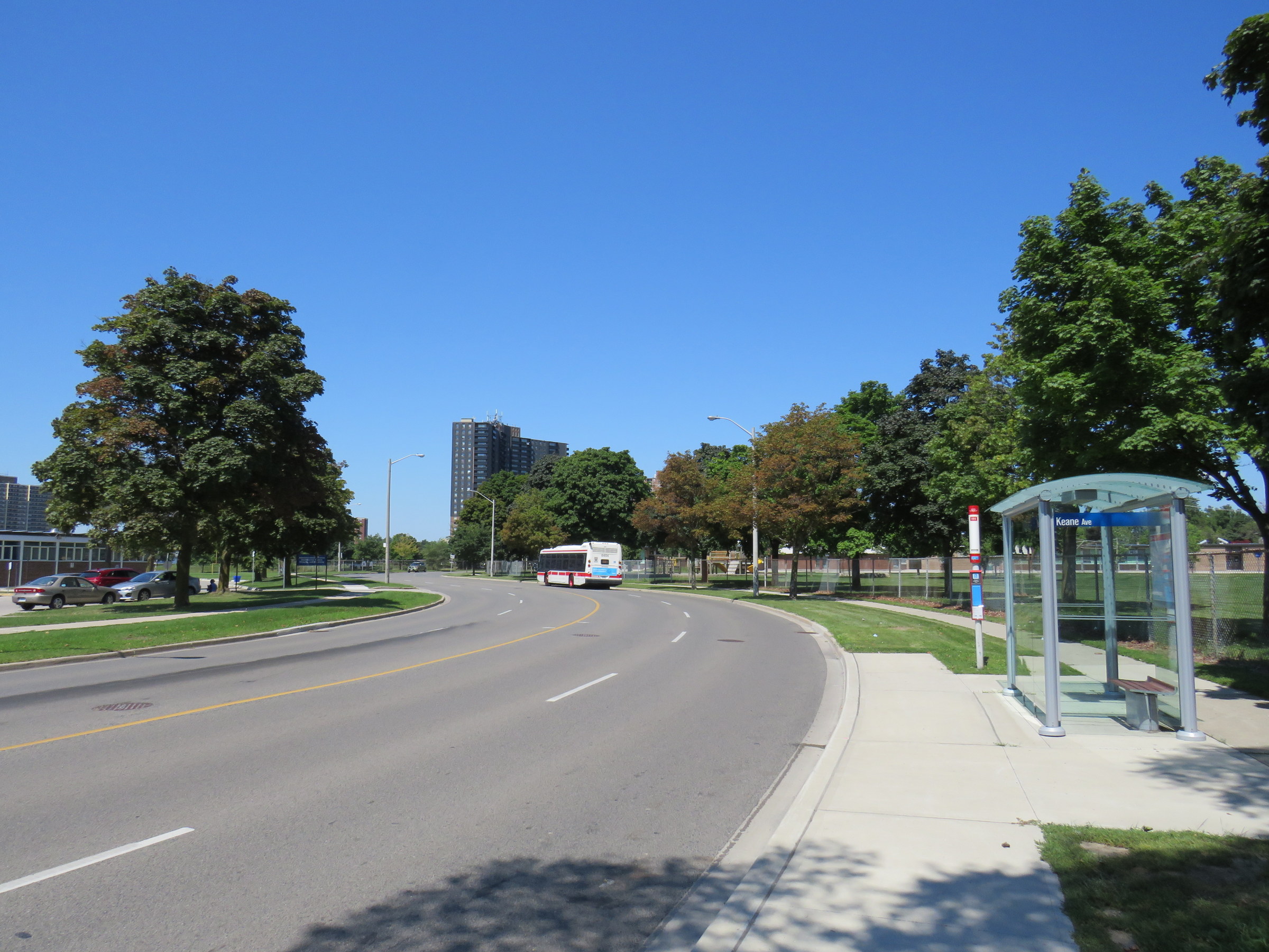
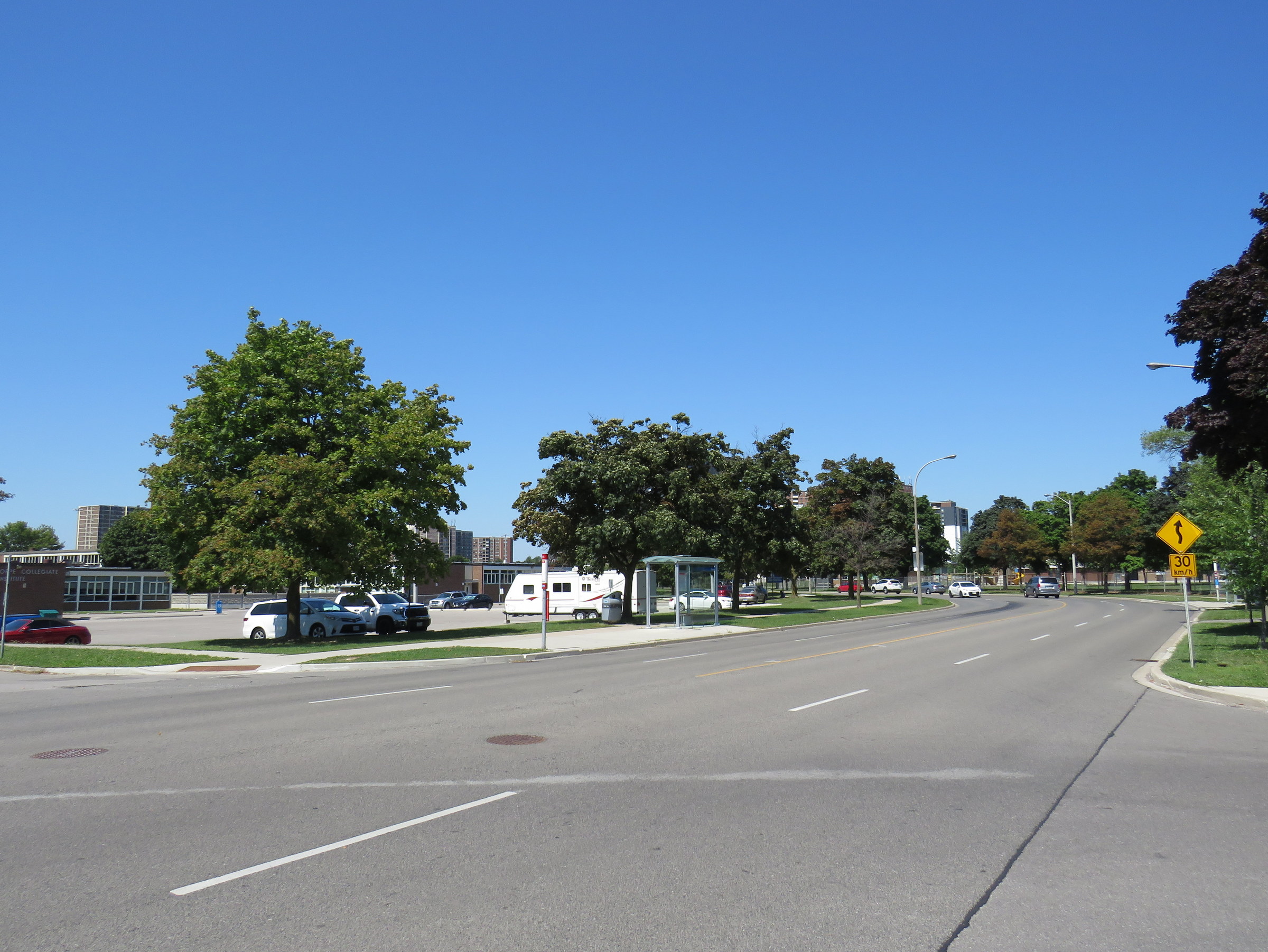
TTC bus stop on The East Mall, north of Keene Avenue
I visited The East Mall on a sunny Friday afternoon. I took the 111 East Mall bus from Kipling Station to Keane Avenue, the first stop north of Burnhamthorpe Road. The bus stop has a nice, clean shelter and a large concrete pad, but no where safe to cross the street. On the other side, there is a southbound stop for buses heading towards Cloverdale Mall and the subway, and Burnhamthorpe Collegiate Institute, a high school specializing in programs for mature students and adult learners.
The intersection of The East Mall and Keene Avenue, looking north. Burnhamthorpe CI is behind the southbound bus stop A sign warns drivers of a winding road, with an advisory speed of 30 km/h.
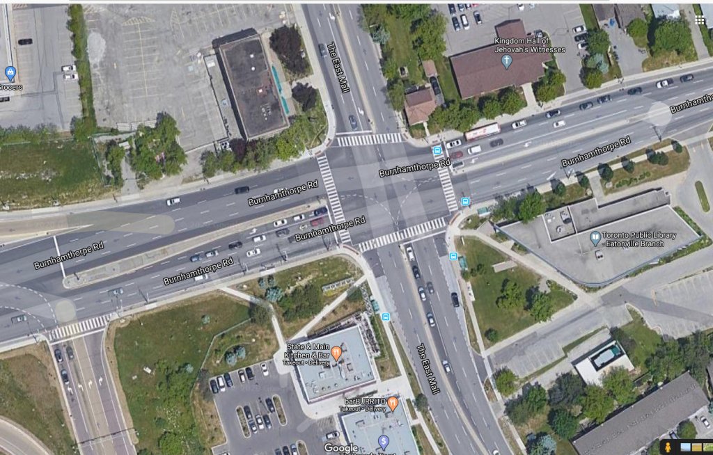
A signalized pedestrian crossover exists further north, in front of West Glen Junior Public School, but the next TTC stop, at Capri Road, is at yet another unsignalized intersection. The distance between Burnhamthorpe Road to the south, and the pedestrian crossover is over 550 metres, and neither designated crossing is visible from Keene Avenue nor Montebello Gardens due to the winding nature of The East Mall.
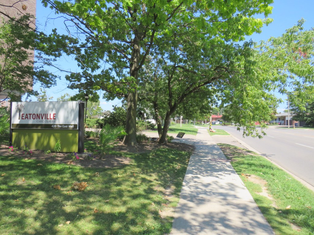
This part of Toronto has seen plenty of tragedy this year. The Eatonville Care Centre was one of several long term care homes where the Canadian Armed Forces were deployed due to deadly outbreaks of COVID-19 amidst poor working and sanitary conditions documented by CAF medical staff. Forty-two residents died during that outbreak.
Eatonville Care Centre, with the roadside memorial in the background
The presence of a long term care home, a library branch at the southeast corner of The East Mall and Burnhamthorpe Road, two nearby schools, and a large Loblaws supermarket and pharmacy on the southwest corner should have made this area a priority for improved, safer road infrastructure. Speeds along The East Mall are much higher than the posted 40 km/h limit, while the winding, roadway limits both drivers’ and pedestrians’ fields of vision. There should be no excuse for such long distances between safe pedestrian crossings, especially with the vulnerable populations living in this area.
Though the driver who killed the three-year-old boy was carelessly turning from a side street, and not speeding along The East Mall, another tragedy is inevitable without significant changes. Meanwhile, The East Mall is similarly laid out south of Burnhamthorpe, where there are older rental towers and townhomes and new condominium towers going in, yet nothing is done to calm traffic along a winding, busy street.
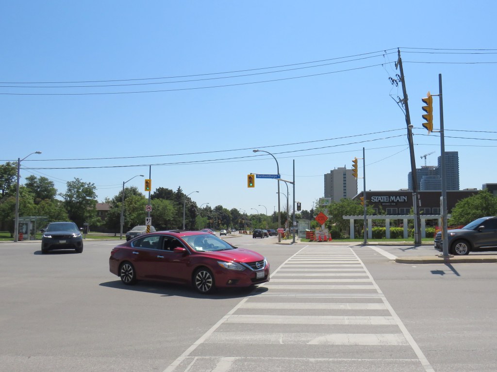
Though the intersection of The East Mall and Burnhamthorpe Road is signalized, it is also a dangerous intersection to cross. Burnhampthorpe Road widens to four westbound lanes leading towards Highway 427, while wide turning radii make it easy for motorists to turn right at all four corners. Drivers, rushing on and off Highway 427 take little notice or care for pedestrians, as I experienced trying to cross the street.
An Uber/Lyft driver in a red Nissan sedan and a Land Rover SUV driver turn left from The East Mall to Burnhamthorpe Road towards Highway 427 after the advance green signal disappears and the walk signal turns on, with me starting my crossing
While motorists are treated to generous geometries and easy turns, pedestrians are only an afterthought, despite the library, supermarket, offices, and several bus stops used by TTC and Mississauga bus routes. Meanwhile, a new townhouse complex on the northwest corner will add even more pedestrians to this area.
The intersection of Burnhamthorpe and The East Mall encourages high speeds, with pedestrians only an afterthought
Entering Montreal on Autoroute 20, with a sign reminding motorists of the blanket ban on right turns on red on Montreal Island
During the August long weekend, my spouse and I rented a car and drove to Montreal. Normally, I take the train, as it’s a long and boring drive on Highway 401, while VIA Rail offers a quiet, relaxing, and more interesting ride. But with the ongoing COVID-19 pandemic, driving seemed like a good idea. (In doing so, I finally drove the entire length of Highway 401 — I had not yet done the section between Cornwall and the Quebec border).
Despite Montreal’s infamous potholes, never-ending construction, and stereotypically aggressive motorists, I found driving around the city less stressful than in my own home city of Toronto. It may sound counter-intuitive, but a big reason for this was the city’s blanket ban on right turns on red.
Outside of North America, turning movements on red lights are generally prohibited. They were only widely introduced to the United States as part of an energy-saving measure in the 1970s, as a response to the first oil shock; a regulation was written into a 1975 federal bill that provided federal aid to states provided that they permit right turns on red lights (along with carpool programs and energy, thermal, and lighting efficiency measures), though many western US states had such laws on their books much earlier.
U.S. Energy Policy and Conservation Act, 1975, Section 362(c)

Each proposed State energy conservation plan to be eligible for
Federal assistance under this part shall include —
 (1) mandatory lighting efficiency standards for public buildings
 (except public buildings owned or leased by the United States);
 (2) programs to promote the availability and use of carpools,
 vanpools, and public transportation (except that no Federal funds
 provided under this part shall be used for subsidizing fares for
 public transportation);
 (3) mandatory standards and policies relating to energy efficiency
 to govern the procurement practices of such State and its political
 subdivisions;
 (4) mandatory thermal efficiency standards and insulation
 requirements for new and renovated buildings (except buildings owned
 or leased by the United States); and
 (5) a traffic law or regulation which, to the maximum extent
 practicable consistent with safety, permits the operator of a motor
 vehicle to turn such vehicle right at a red stop light after
 stopping.
The Province of Quebec was the last subnational holdout in North America, permitting the practice in 2003. However, the City of Montreal continued to outlaw turns on red, following New York City’s continued prohibition, while Mexico City introduced a new prohibition in 2018.
In my experience, though, I found driving less stressful when I knew I could not turn on red. I did not have to worry about a driver behind me inching forward, pressuring me to move past the stop line and into the intersection so they could turn. If I was waiting to turn right, I knew I could relax and wait for the green signal before I had to try to make the maneuver. The leading pedestrian interval common in central Montreal (which also allows through traffic — including cyclists — to go first) made pedestrians easier to see and predict as I was making my turn.
Montreal’s leading pedestrian interval signal
I might have saved a minute or two on each car trip had I been able to turn on a red light. But it did not feel like much of a difference. The reduced stress was worth it.
As a pedestrian and as a cyclist, I appreciated turn-on-red prohibitions whenever I was in a city where they are in place, as I did not have to worry about right-turning motorists not seeing me as I crossed at a street corner, or those motorists who rush red lights or refuse to stop before turning. As a driver, I appreciated it too.
Brampton Gateway Terminal from the southeast corner of Hurontario Street and Steeles Avenue, Brampton
Last month, Metrolinx held a virtual open house to present information on the progress of the Hurontario LRT project, planned work, and details on some of the stops along the line. For now, roadwork is limited to median removal and utility relocation, but by next year, heavy construction will commence along the 18-kilometre long corridor.
If Metrolinx goes ahead with their plans for a minimal station on the south side of the intersection, anyone connecting between modes will be forced to cross two sides of a busy, hazardous intersection at grade, impacting both accessibility and safety. We can thank politicians on the 2014-2018 Brampton City Council for this situation, which provide just one of many examples of how systemic racism manifests in transit decision making.