Category: Ontario

  • Crossride of death: how an Ajax girl was killed riding her bike

    Crossride of death: how an Ajax girl was killed riding her bike

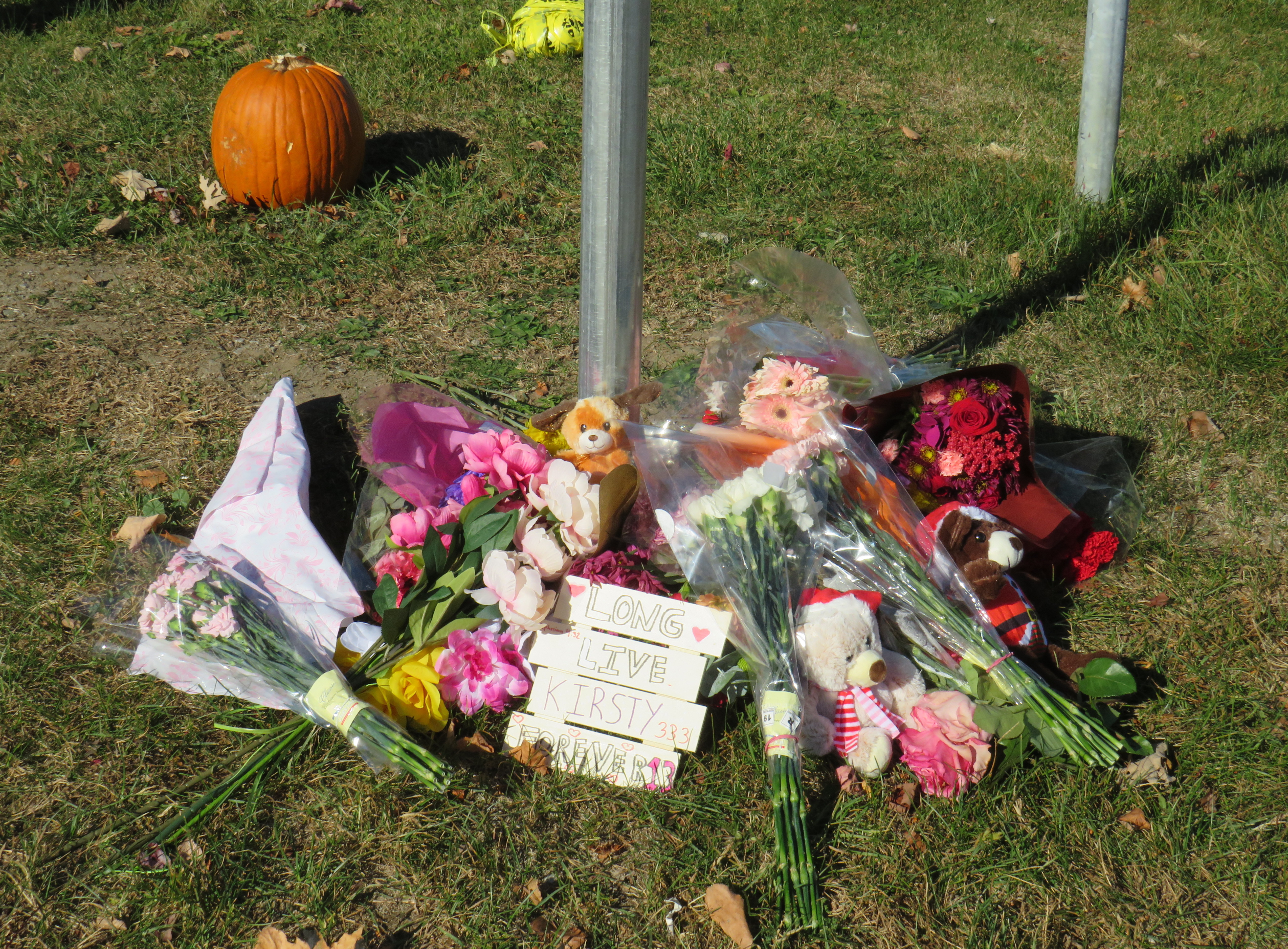
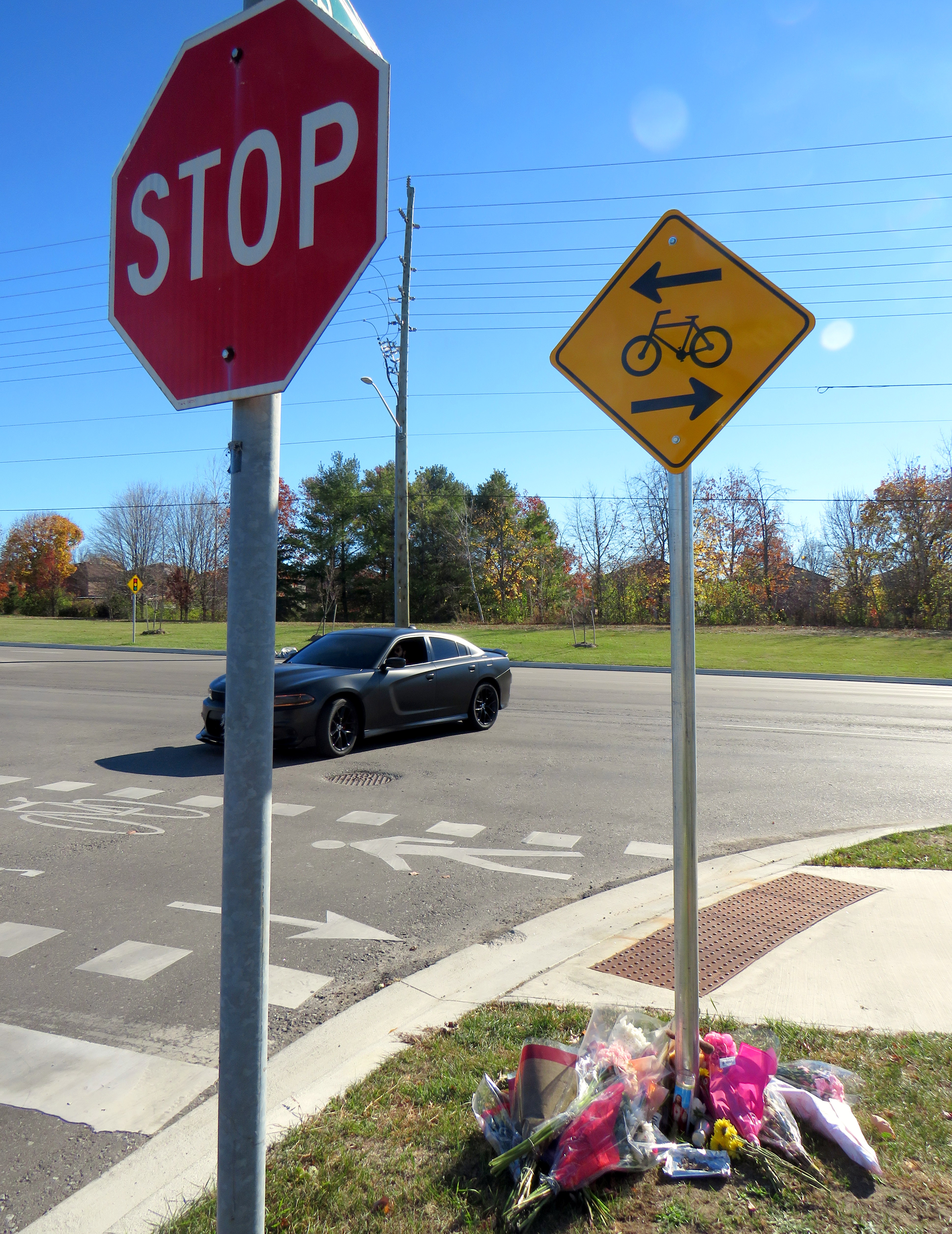
    Memorial for 13-year-old Kirsty, who was struck and killed while riding a bicycle in Ajax on November 7
    Memorial for 13-year-old Kirsty, who was struck and killed while riding a bicycle in Ajax on November 7

    January 13, 2025 update: A 44-year-old woman was charged by Durham Regional Police with careless driving causing death, over two months after this tragic collision.


    On Thursday, November 7, at approximately 7:35 AM, a 13-year-old girl was struck and killed by the driver of a Hyundai Santa Fe (a midsized crossover SUV) at Rossland Road and Stevensgate Drive. The girl was riding a bicycle in a marked crossride, a crossing designated for both pedestrians and cyclists along a multiuse path, when she was struck and pinned beneath the vehicle.

    Multiuse paths (MUPs) are typically found in parks, particularly along waterbodies such as lakes, rivers, and creeks such as Lake Ontario or the Don River. They are shared by all sorts of people, including walkers, runners, cyclists, dog-walkers, rollerbladers, and wheelchair users, often coming into conflict on busy, narrow sections such as the Martin Goodman Trail or the Lower Don Trail.

    In the suburbs surrounding Toronto (and in a few locations within the city, such as on Lake Shore Boulevard East and Eglinton Avenue West), MUPs are a popular form of cycling infrastructure along busier roads with higher speed limits. Older boulevard MUPs required cyclists to stop and dismount at road crossings (though these instructions were usually ignored). Newer and upgraded MUPs allow cyclists to ride across intersecting roadways, at marked crossrides. Signage advises motorists to watch for cyclists and advises cyclists to slow and watch for motorists and to yield to pedestrians. At signalized intersections, most new MUPs include dedicated bicycle signals.

    It was at one of these new crossrides that Kirsty was struck and killed. Though no official police press release or any follow-up news articles provided the girl’s name, that name was clearly visible at the makeshift memorial next to where she was killed.

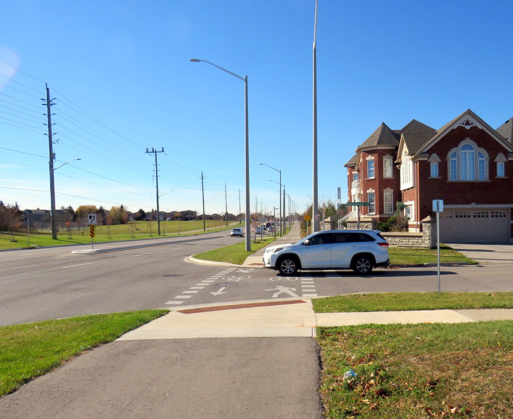
    Crossride at Stevensgate Drive, where a driver pulled out ahead into the crossride without stopping at the stop sign/stop line first.
    Crossride at Stevensgate Drive, where a driver pulled out ahead into the crossride without stopping at the stop sign/stop line first.

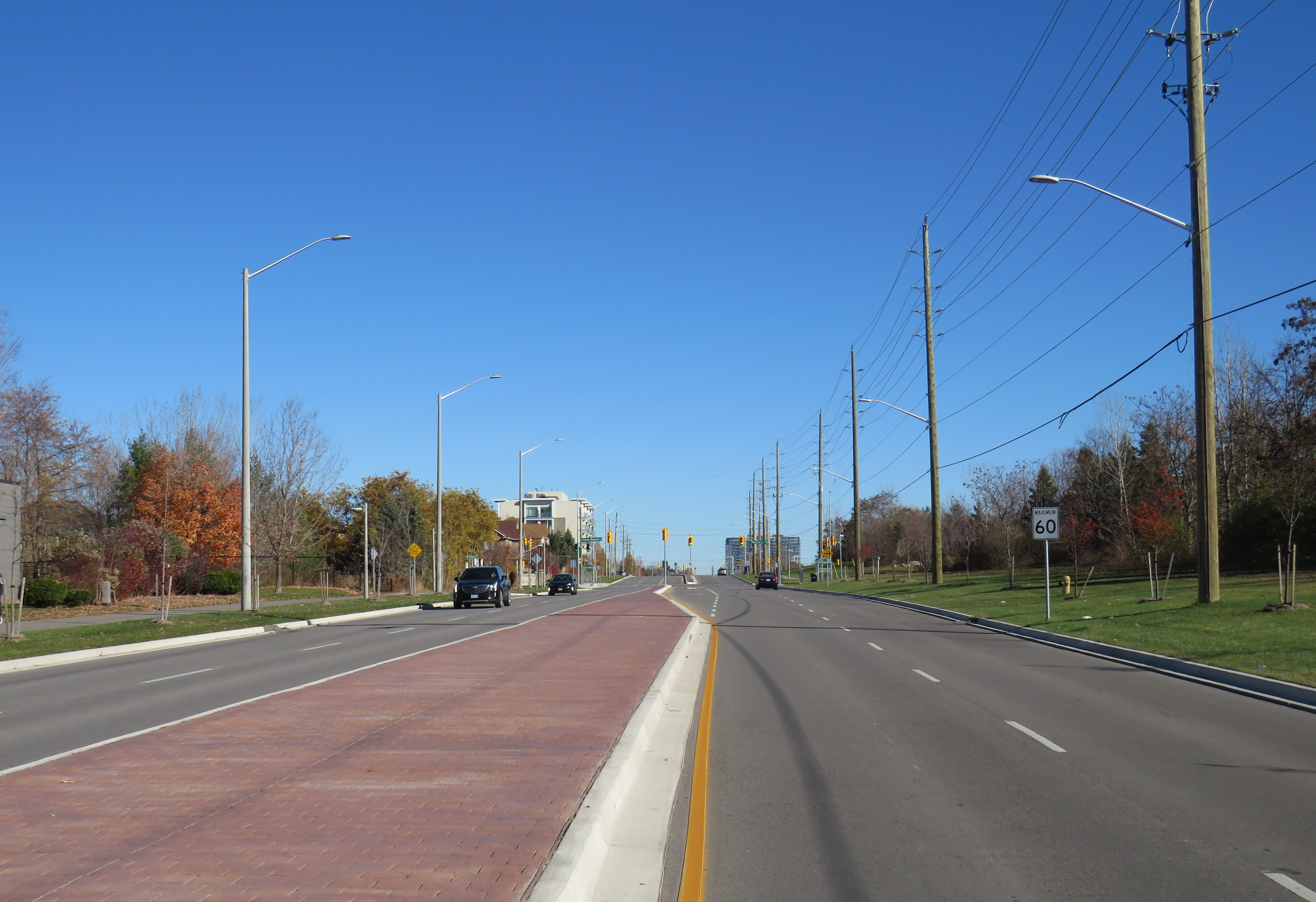
    Rossland Road was recently widened from two to four through lanes; a new multiuse path was built on the north side of the roadway, complete with crossrides and cyclist signals. Rossland Road is very much a road. There are no houses fronting onto the roadway, while the few driveways on Rossland provide access only to church and commercial plaza parking lots.

    Rossland Road in Ajax has two lanes in each direction, with a concrete median in between. The speed limit on Rossland is 60 km/h.

    Stevensgate Drive, which leads north from Rossland Road, is a quiet residential street with about two dozen homes and an evangelical church. A stop sign controls traffic at Rossland Road. Though Stevensgate connects to a large subdivision to the north, there are several other streets with signalized intersections that also provide access to the community.

    Motorists take wide turns pulling into Stevensgate Drive. The memorial is below.
    Motorists take wide turns pulling into Stevensgate Drive

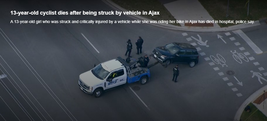
    When Kirsty was struck, it was by the southbound Santa Fe driver who would have passed a stop sign and a clearly painted stop line before entering the crossride. A CP24 news report clearly showed the vehicle being towed onto Rossland Road from the southbound direction. At 7:35 AM, it was daylight.

    Screenshot from CP24 report
    Screenshot from CP24 report

    Drivers rolling through stop signs are a common occurrence, even though the law clearly states that a full and complete stop at the stop sign and painted stop line is required before proceeding. Had the driver done so, this tragedy most likely would have been prevented.

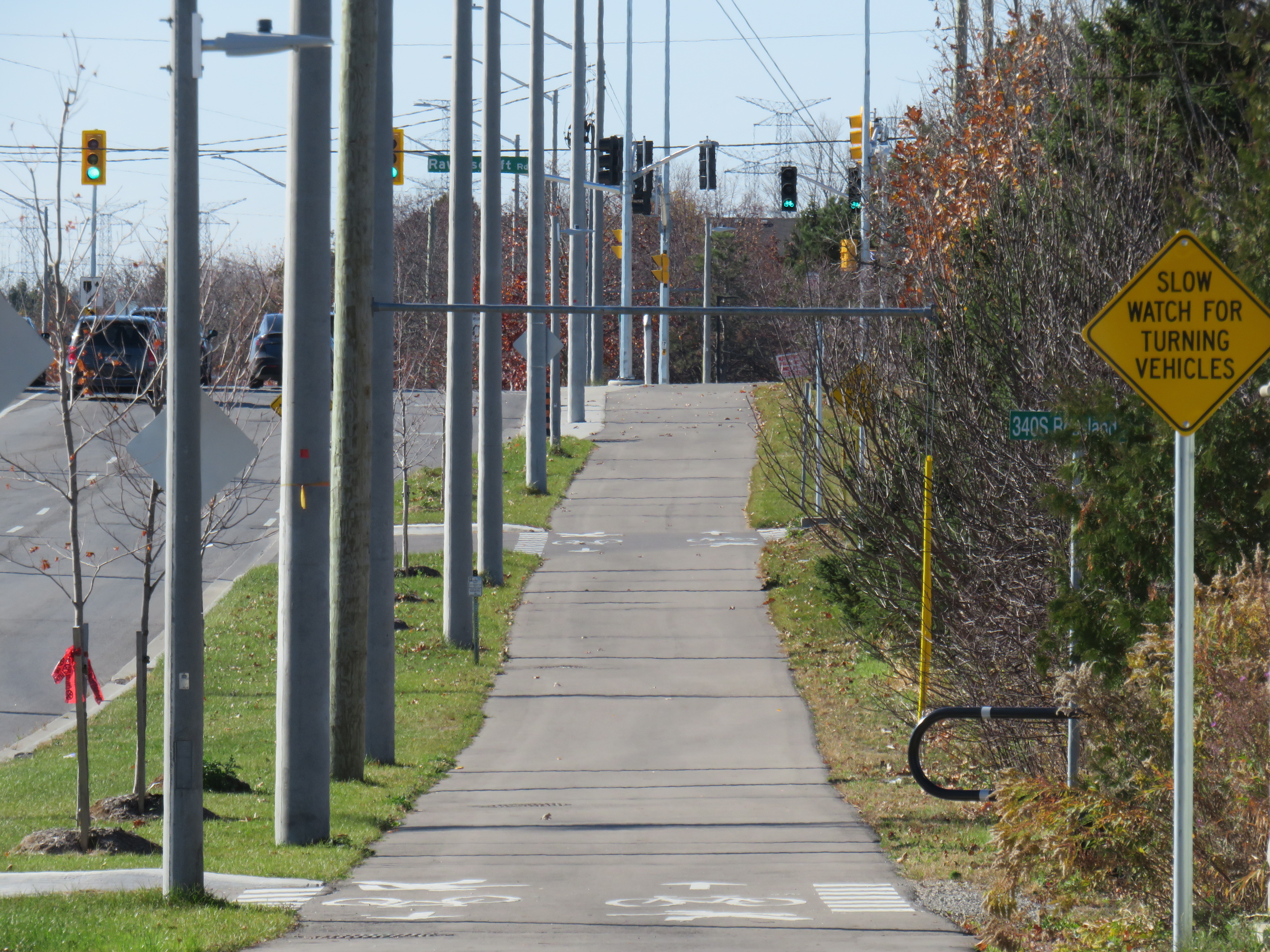
    Looking west along the multiuse path from Stevensgate Drive, towards Ravenscroft Road
    Looking west along the multiuse path, towards Ravenscroft Road

    Two days later, on Saturday, November 9, I visited the scene. I noted the roadside memorial next to the stop sign facing Stevensgate Drive. While I was there, several people stopped to visit the memorial; at least two people left flowers and cards of sympathy.

    While there, I mounted a small digital camera on the trunk of a car parked on the west side of Stevensgate, about 75 metres north of the intersection, in a legal parking spot. The camera, mounted on a mini-tripod, was mostly inconspicuous. Within 25 minutes, five motorists improperly stopped after the stop line and into the crossride; two properly stopped before creeping up to make their turn. Two drivers also made fast, wide right turns into Stevensgate during that time. The edited video below shows motorists’ actions during that 25 minutes

    Video taken on Saturday, November 9 showing motorists driving south on
    Stevensgate Drive towards Rossland Road (3 minutes, 7 seconds)

    While taking photographs and recording the videos, a resident, who lived a few houses north of the intersection, came to talk to me, and asked if I knew the girl. I explained why I was there, and we had a short, but good chat, about the collision and road safety. He noted that it is hard to see traffic from the stop line, and that he has to pull forward before turning. But he agreed that the stop line was there for a reason, and that drivers often rush to get onto Rossland.
    Police enforcement is not necessarily the answer. There are too many intersections to watch, and the careless driving behaviours exhibited are normalized. In Toronto, it is cyclists on quiet streets and in public parks who are typically targeted at stop signs, not motorists, even though cyclists are the more vulnerable road users.
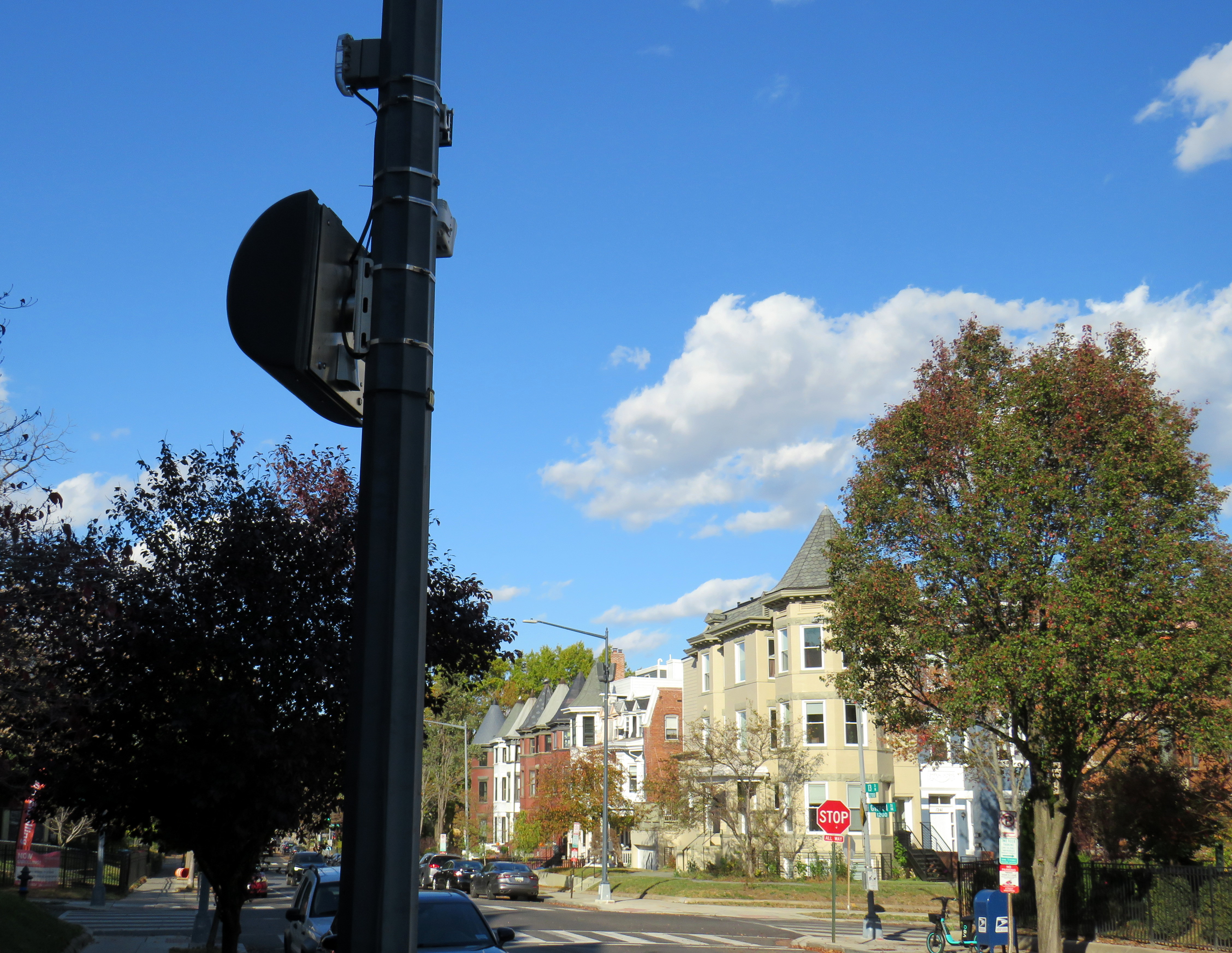
    In Washington DC, there are stop sign cameras mounted at specific locations, though there are only about a dozen of those throughout the city at any given time. These could provide a useful tool for targeted automated enforcement on Ontario’s roads to reinforce proper driving behaviour.

    A pole-mounted camera faces an all-way stop in Washington DC
    A pole-mounted camera faces an all-way stop in Washington DC

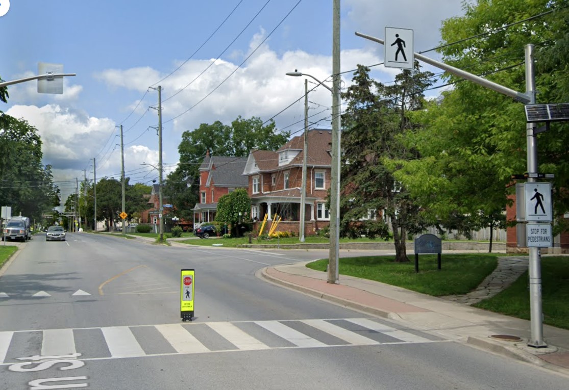
    Intersections should also be redesigned to improve the visibility of pedestrians and cyclists at crosswalks and crossrides and act to slow down motorists; raised sidewalks and path crossings would act as a speed hump as well as enhance visibility. A concrete island or short median at the stop sign would force motorists to approach the stop at a slower speed and prevent wide turns on to and off the intersecting street. A quick and inexpensive (though less-effective) solution could be to place wide knock-down bollards with supplemental crossing and stop sign messages in the middle of the roadway at each stop bar and crosswalk/crossride. Though this is best as a short-term measure.

    A wide knock-down bollard designed to provide additional visibility to a crosswalk
    (Milton, Ontario, via Google Streetview)

    As the provincial government vindictively overrides municipalities’ ability to provide safer on-road cycling infrastructure, off-street infrastructure, such as MUPs, will remain an important tool for promoting active transportation, especially in suburban areas and high-traffic neighbourhoods. Though boulevard MUPs provide separation from traffic in most cases, they are particularly hazardous at intersections, especially when motorists are distracted, aggressive, or just merely careless. There is much more that can and should be done to make them safer for all road users.

  • From Hamilton to Haldimand: a new transit link fills a major gap

    From Hamilton to Haldimand: a new transit link fills a major gap

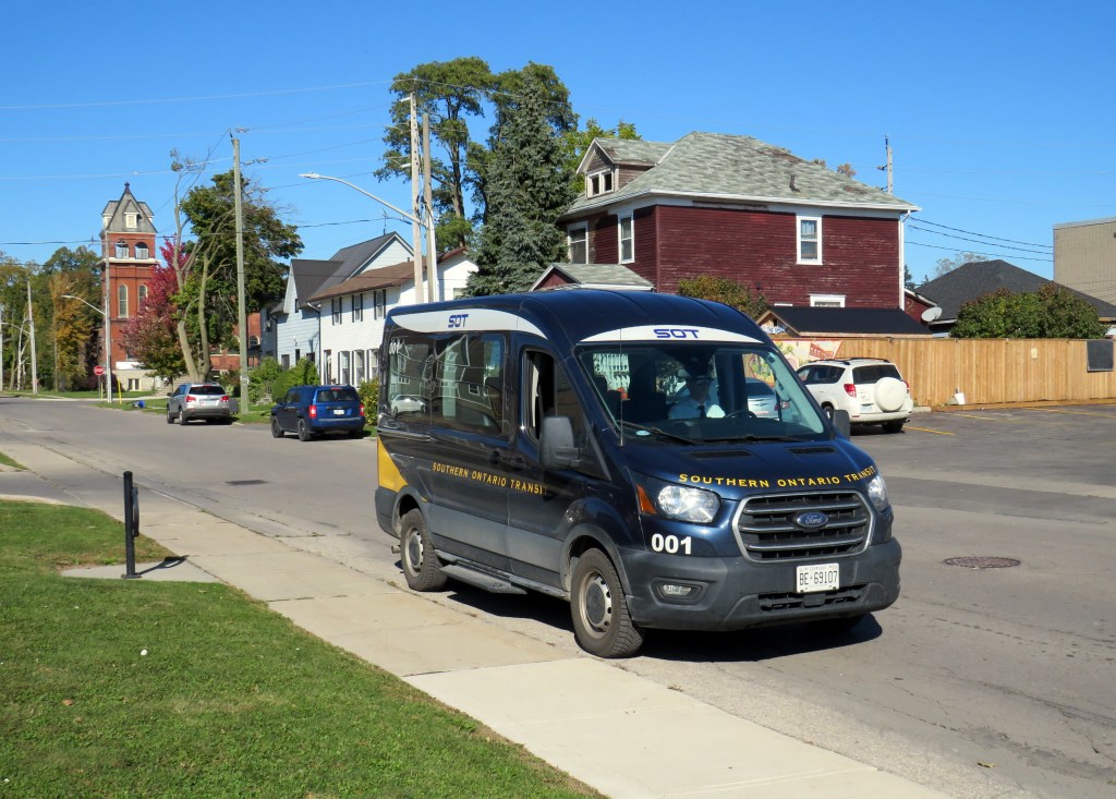
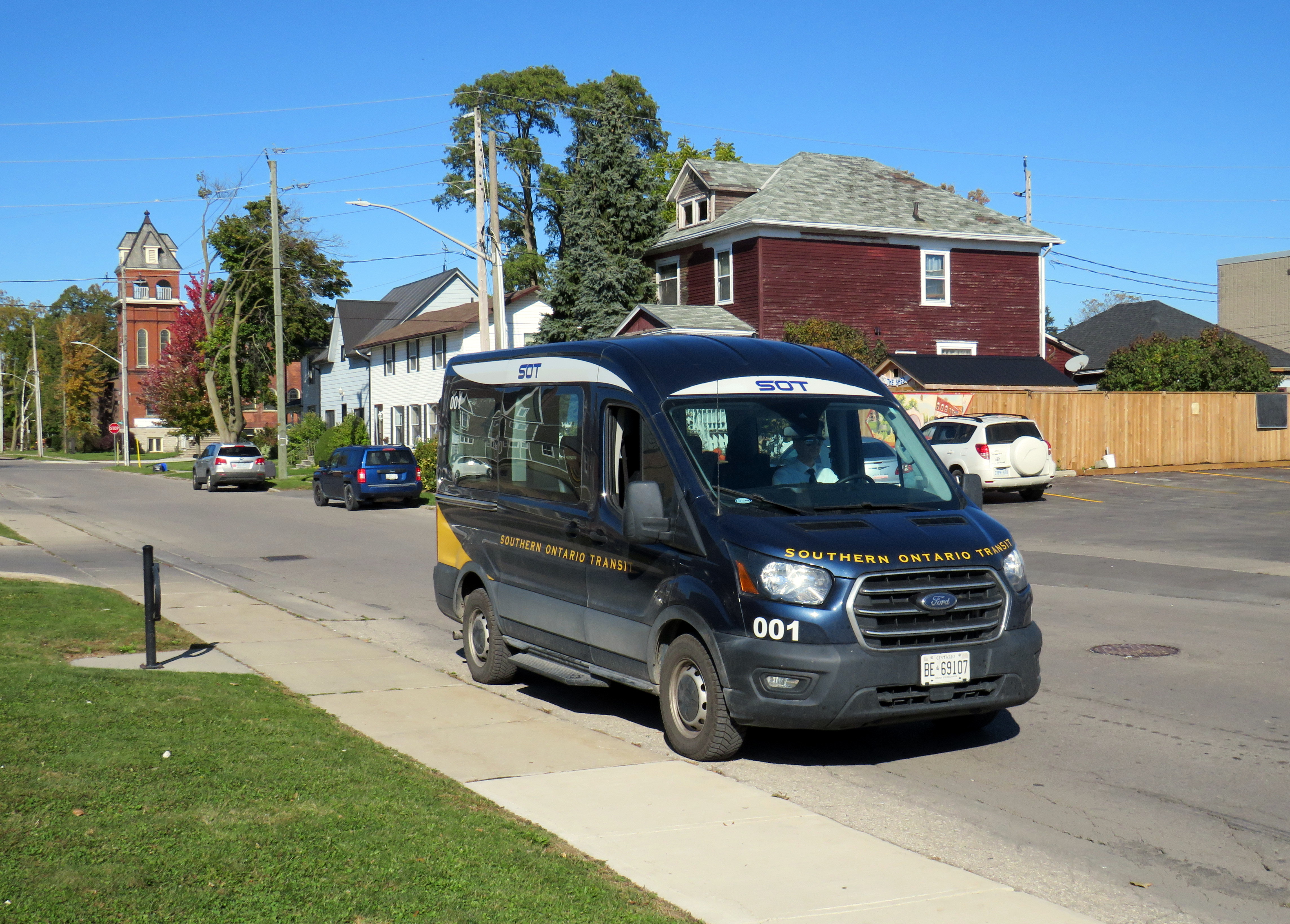
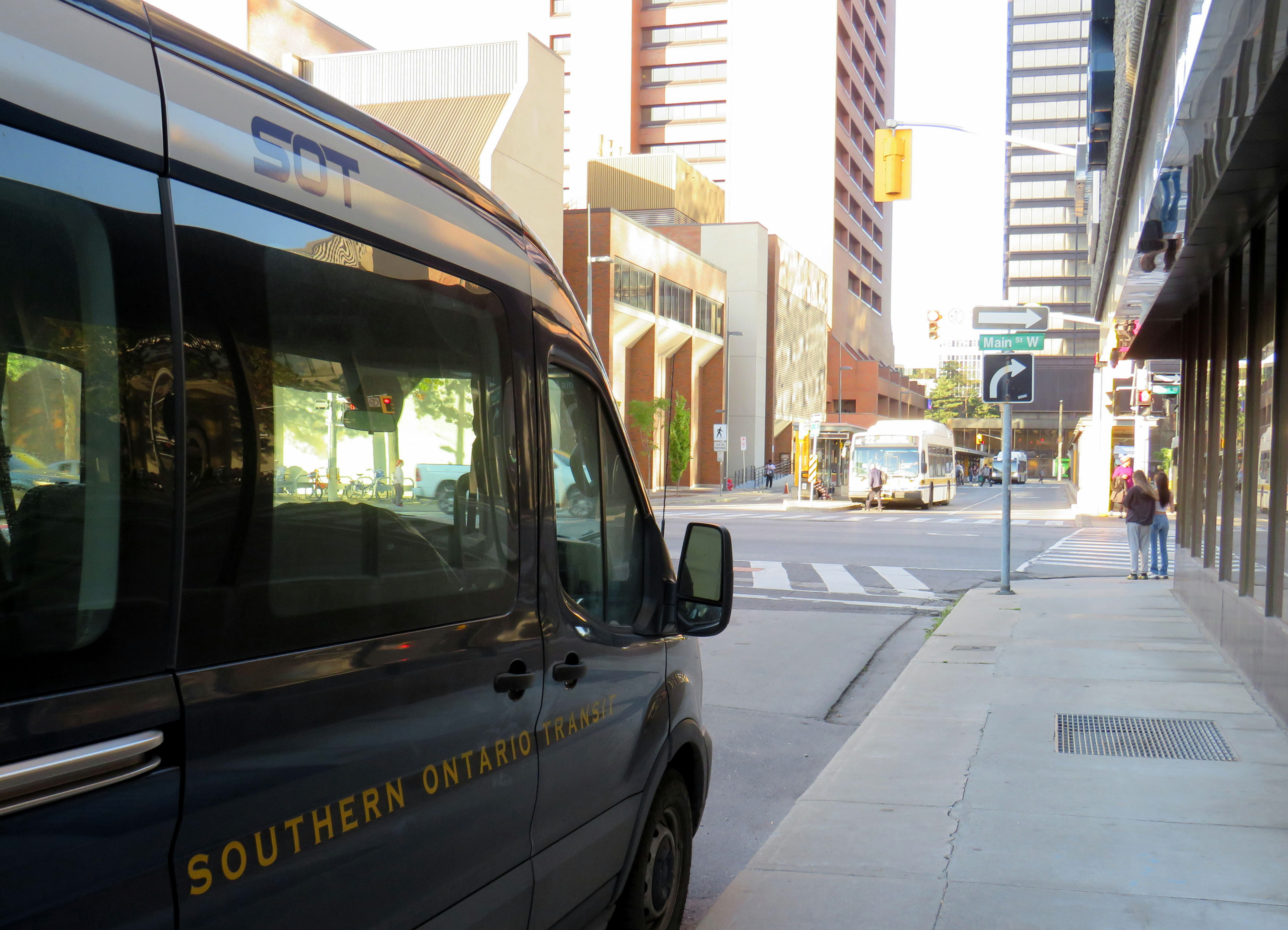
    Southern Ontario Transit minibus in Dunnville, October 2024

    Earlier in October, I got to meet Rae Rivard, owner-operator of Southern Ontario Transit (SOT), a new intercity transit operator currently serving Hamilton and Haldimand County. The route, which launched on September 16th, offers three weekday round trips between Downtown Hamilton and Dunnville, serving the communities of Caledonia, Hagersville, and Cayuga.

    Haldimand County, along with the neighbouring Six Nations and Mississaugas of the Credit First Nation reserves, remained unserved by intercity or local bus services since the early 2000s; in 1990, United Trails operated a daily bus between Port Dover, Hagersville, Caledonia, and Hamilton. Cayuga and Dunnville were served by a Greyhound route on Highway 3 between Niagara and London. More recently, as Niagara Region was building a regional transit service and Norfolk County successfully applied for provincial funding for a new service between Simcoe and Brantford, Haldimand County refused to take part. Enter SOT.

    SOT, which charges a $10 one-way fare, operates without the support of the municipal government, and is unable to put up bus stop signs or actively promote its service at municipal facilities such as libraries or community centres. For this reason, ridership remains low, despite growing populations in Caledonia and Hagersville and convenient links to Hamilton Airport, Mohawk College, St. Joseph’s Hospital, and to GO Transit and HSR services.

    Rivard will tell you that “the primary challenge we face today is slow uptake. Due to a number of limitations and challenges currently out of our control, the number of regular and new riders trends up every week, but not as fast as we need to cover expenses…. Many of the limitations we are dealing with right now can easily be addressed at no expense, but these choices are out of our control.”

    Rivard reached out to businesses and social service organizations, but was turned away, adding that “the entire operation has been entirely funded out of me and my wife’s savings, and we are really struggling to keep up with expenses at this rate.”

    Without approved bus stop locations with curb access, SOT is not able to provide fully-accessible service, though it already has a wheelchair-accessible vehicle. The lack of physical bus stops and publicity has made it difficult to attract riders, though while riding with Rivard on a beautiful October afternoon, it was clear that a demand exists as several residents came up to the minibus to find out more information.

    My hope is that word spreads about this unique and essential operation and that the local communities provide the needed support to make this service work. If this initial route succeeds, SOT would like to expand service in Haldimand and take on other gaps in the Ontario network.

    At the Hamilton terminus, at Main Street and MacNab, across from the HSR terminal

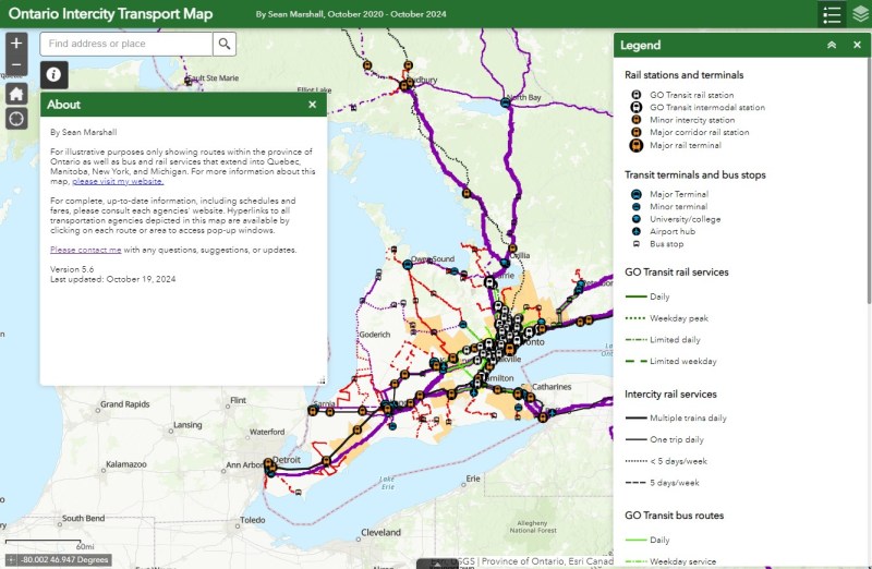
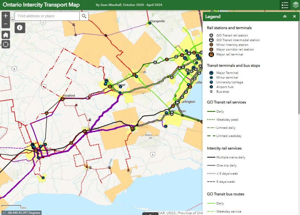
    A new version of my Ontario Intercity Transport Map is now available

    I updated my Ontario Intercity Transport Map to add Southern Ontario Transit’s route. Commuter Connect in Northumberland County ended service not long after VIA Rail finally resumed its early morning train from Kingston to Toronto. East Zorra-Tavistock Transit in Oxford County did not last long either, and service there has ended.

    Added to the map:

    • Southern Ontario Transit between Hamilton, Caledonia, and Dunnville
    • Red Arrow’s daily Toronto-Western University express, which replaces its Toronto-Niagara Falls run
    • A new daily Flixbus route between Toronto, Hamilton, and St. Thomas
    • A new OnexBus route between London, Goderich, and Port Elgin, operating Friday through Monday
    • OnexBus’s London-Pearson Airport-Brampton route, which operates several trips a day
    • Ourbus’s Toronto-Ottawa route
    • Kasper’s daily Winnipeg-Kenora-Sioux Lookout service
    • Revisions to on-demand services in Niagara Region
    • Some revised routings and service levels across the province

    Removed from the map:

    • Commuter Connect in Northumberland County
    • East Zorra-Tavistock Transit
    • Kasper’s on-demand service to Red Lake/Balmerton

    Though it is good to see Bruce County — particularly rapidly growing Saugeen Shores — get another link, that part of Ontario is still poorly served; there should be daily services between larger Bruce County communities like Saugeen Shores, Kincardine, and Walkerton at least to Owen Sound and Hanover. Lindsay is also left without any intercity services, after TOK ended service from Toronto to Haliburton last year. where a Peterborough-Lindsay-Pontypool service, perhaps extending to Durham College/Ontario Tech University in Oshawa could prove to be a very useful route.


    If you like this post and you would like to help out with my online mapping and webhosting costs, consider buying me a coffee. Thank you!

  • Deadcatting: Doug Ford’s big dig

    We need a Highway 401 Tunnel like we need a dead cat on the dining room table

    On Wednesday, September 25, Ontario Premier Doug Ford, along with transportation minister Pradmeet Sarkaria, announced that the provincial government would fund a feasibility study on building a new highway tunnel under Highway 401 from Peel Region to Durham Region, along with an unspecified new transit facility.

    Earlier this week, Doug Ford exclaimed that those living in homeless encampments and anyone else without housing who he thought could work should “get off their a-s-s and start working like everyone else.” The day before that, we learned that Ford’s Progressive Conservative government would prohibit new bicycle infrastructure if it took road space away from motorists.

    The old Doug Ford — the angry bull-in-a-china-shop we remember from 2018-2019 — is back, and it is clear that governing, in fact, has not changed him. After six years, and a rumoured early provincial election, Doug Ford will need to run on something, because there’s little to show for his promises of getting housing built, transit projects completed, and hospitals fixed. An RCMP investigation continues to look at the government’s Greenbelt land swaps, and it is rare for provincial or federal governments in Canada to get elected with a majority three times in a row. So here we are.

    But after three straight days of political red meat policy announcements, the strategy has become clear: Doug Ford is “deadcatting.” Dead cat theory, popularized during the leadership of former London mayor and British prime minister Boris Johnson, is the practice of suddenly throwing down an outrageous policy or statement to divert attention away from an unpleasant topic. The shocked audience is suddenly compelled to talk about the metaphorical dead cat thrown on the table. In the United States in recent weeks, dead cats have become less metaphorical, with baseless and racist accusations against Haitian migrants in Ohio spread by Donald Trump, vice-presidential candidate J.D. Vance, and far-right commentators.

    The strategy is thought to come from Lynton Crosby, an Australian conservative strategist who worked on Johnson’s mayoral and UK Conservative leadership campaigns, as well as Canada’s Conservative Party in 2015.

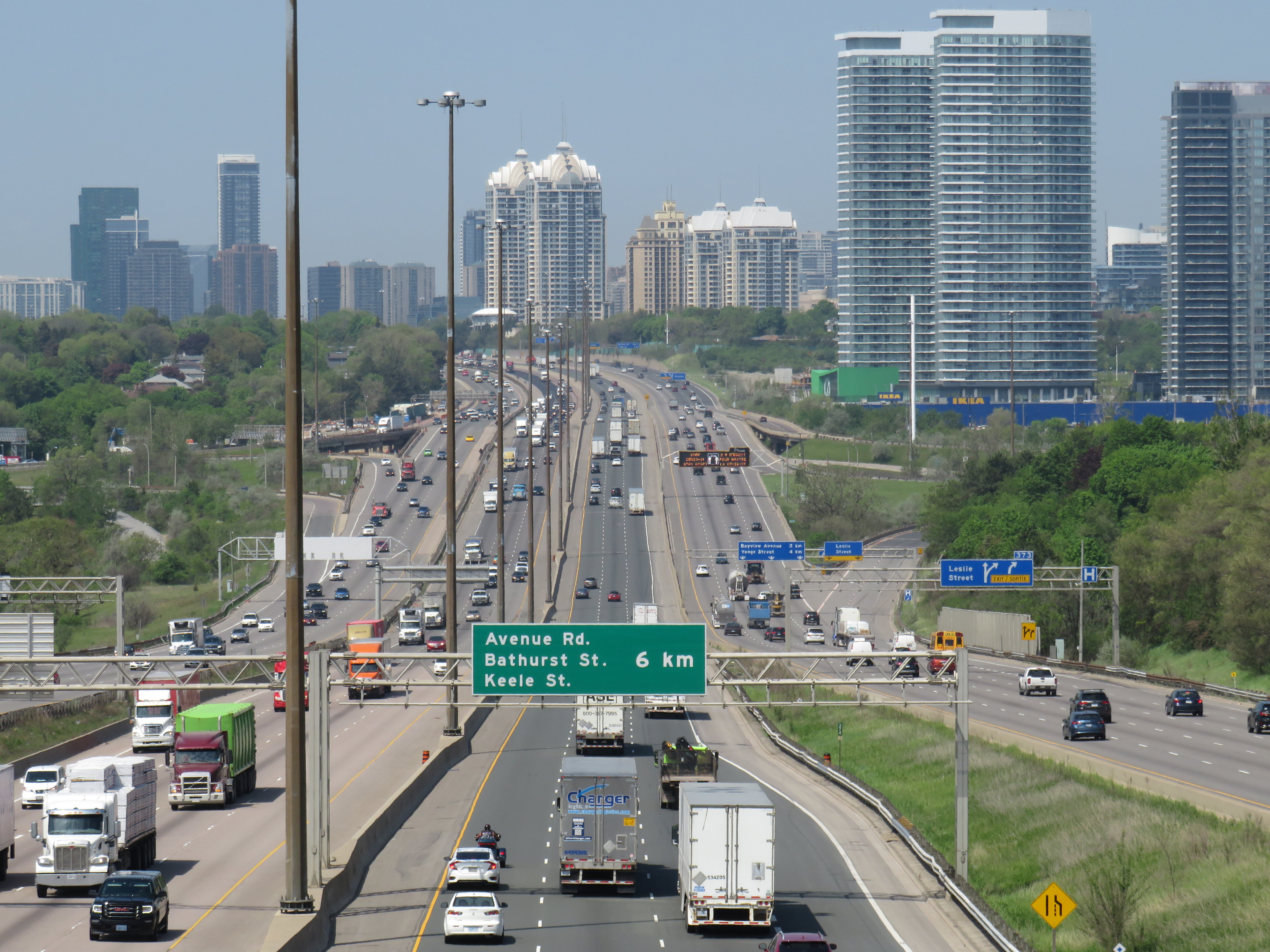
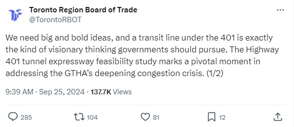
    There is no way a Highway 401 tunnel will be built. Not only would it be the longest road tunnel in the world, but the long on-ramps and off-ramps required to access a deep-bore urban highway tunnel will make it completely infeasible. The proposal also completely ignores the problem of induced demand, and it won’t solve the problem of where the traffic goes when it gets off that additional highway. For these reasons, it was especially disappointing to see the Toronto and Region Board of Trade (TRBoT) endorse the idea.

    TRBoT post on September 25, 2024

    There are things that can help alleviate traffic. One is ensuring that transit projects are completed, funded, and maintained. That doesn’t just mean building and completing projects like the Crosstown LRT and the Ontario Line, it’s also making sure the system remains in excellent condition to avoid problems like the persistent slow orders in the Toronto Subway. It also means making the best use of existing infrastructure, like Highway 407, for goods movement. Highway 407 passes by every major freight yard in Greater Toronto, but trucks clog Highway 401, Highway 7, and Steeles Avenue instead because of the high tolls. And it means active transportation improvements, like bike lanes and multi-use paths.

    What we don’t need are more dead cats to distract us from the real problems.

  • A bus to St. Thomas, finally

    A bus to St. Thomas, finally

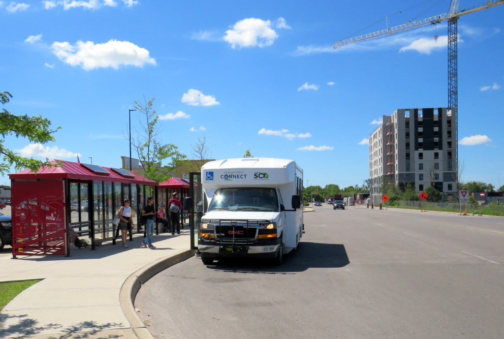
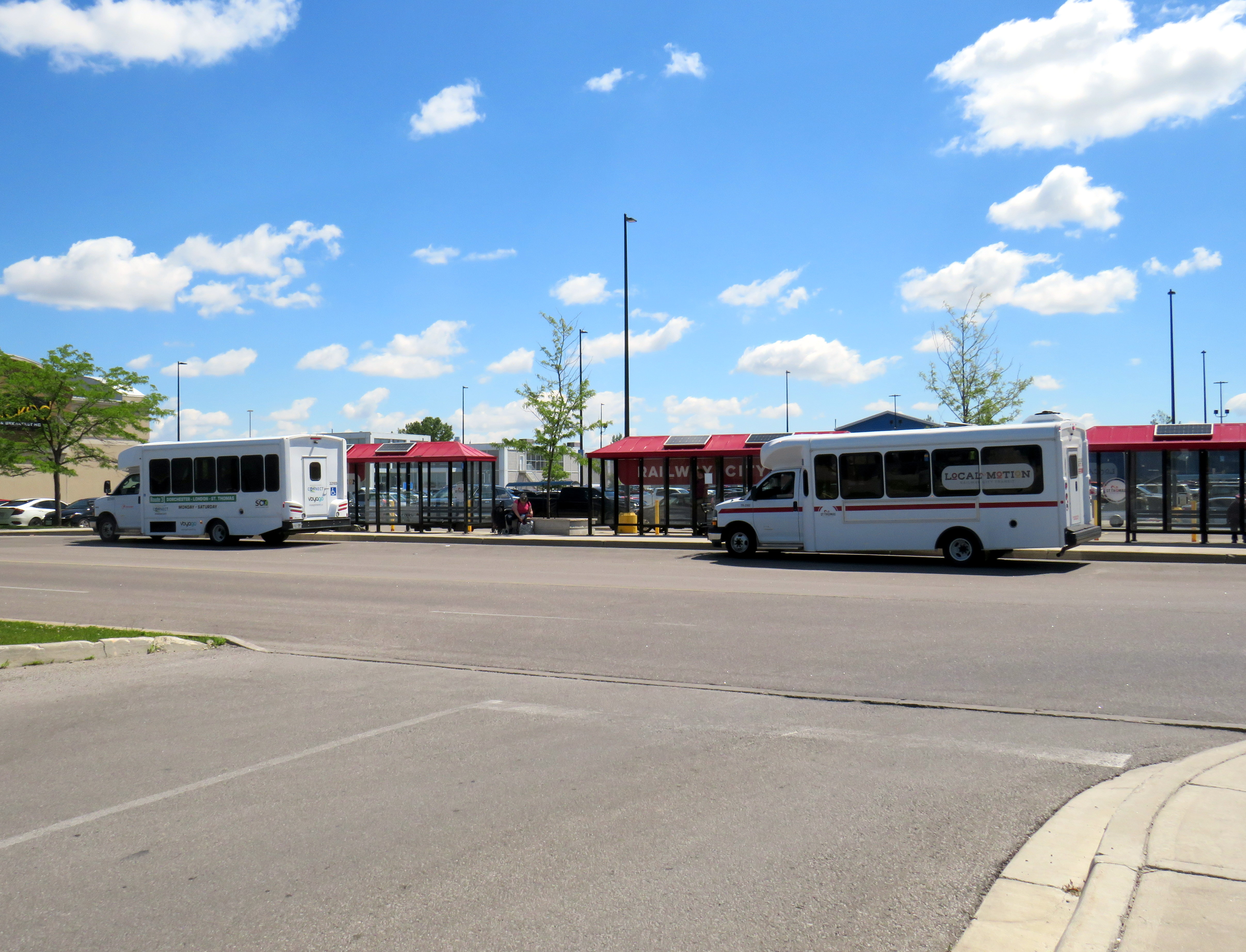
    Middlesex County Connect and “Local Motion” buses at St. Thomas, June 2024

    On Saturday, June 15, I took a trip that was not possible for over a decade: I went to St. Thomas, Ontario, without a car. This was possible because of one of several new intercity transit links that opened this year in Ontario, and I have updated my interactive map accordingly.

    (more…)
  • Ontario intercity updates for April 2024

    Ontario intercity updates for April 2024

    NOTE: Previous versions of the Ontario and Canada maps are retired; please see the new Canada Intercity Transport Map, launched March 30, 2025. This will now be the only interactive map that I will update.

    Since 2020, I have maintained an interactive map of bus and rail services in Ontario. Without a central repository of transit information, my maps have become one of the few comprehensive resources available. I am pleased to keep the resource going, and I appreciate the messages of support, as well as additions and corrections that you submit.

    There are a few updates for April 2024:

    • Middlesex County Connect launched a new route between Dorchester, White Oaks Mall in London, and St. Thomas. This route operates six days a week, with four round trips Mondays through Saturdays.
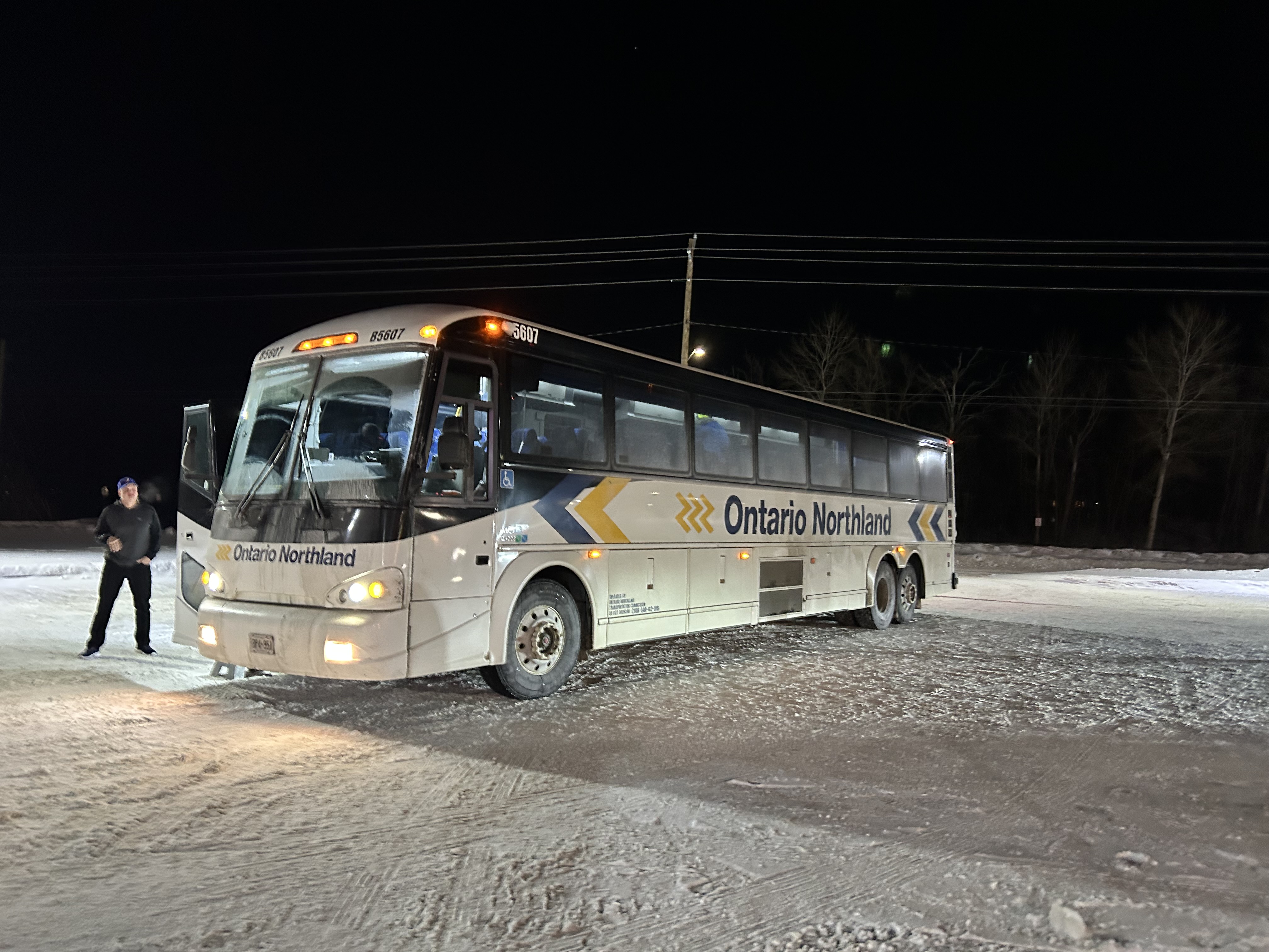
    • A new FlixBus route, operating six days a week, now runs between Downtown Toronto, Pearson Airport, and Sudbury, competing with Ontario’s Northland bus service.
    • Ourbus became the latest company to operate a coach service between Toronto, Kingston, and Ottawa. There are now five coach operators competing on the same route.
    • Grey Transit Route announced that they will be ending weekend services on most of its routes starting May 1.

    Though the gap between London and St. Thomas is now filled, there remains several other parts of the province without intercity transport links, even in Southwestern Ontario. For example, service in Huron and Bruce Counties is limited to a three day/week TOK coach service and a three day/week minibus service between Goderich and Grand Bend. There are still no links from Haldimand County and Six Nations to nearby large urban centres like Brantford, Hamilton, and Toronto.

    I plan to update this Ontario map again in July. At that time, I will also update my Canada-wide transportation map to reflect changes in the intercity transport industry.


    If you like my maps and you would like to help out with my online mapping and webhosting costs, consider buying me a coffee. Thank you!

  • Can on-demand transit meet your demand?

    Can on-demand transit meet your demand?

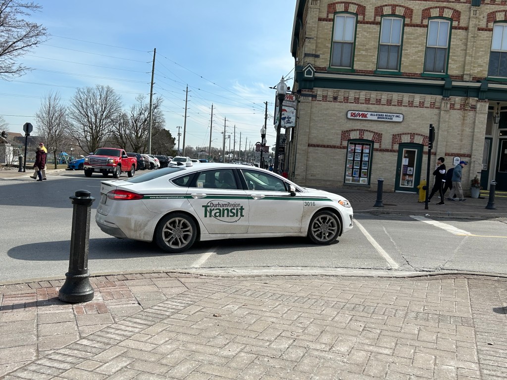
    Durham Region Transit On Demand sedan

    Earlier in March, as part of my quest to visit every town, city, and regional government office in the Greater Toronto and Hamilton Area (GTHA) without a car, I took my first on-demand transit rides in a decade. This was necessary to visit Brock Township’s municipal offices, located in the village of Cannington, north of Port Perry. (I will discuss more about this project in the coming weeks.)

    Brock Township’s municipal offices, at right, sits in the heart of the village of Cannington

    Brock Township is the GTHA’s most rural and least populated municipality, home to just over 12,000. Until April 2023, GO Transit ran a daily bus service between Whitby GO Station, Port Perry, Cannington, and Beaverton (Brock’s largest community), but was cancelled after a ridership review. (GO has quietly cancelled several other bus routes that don’t cross county or regional boundaries in the last decade.) However, Durham Region Transit (DRT) offered an alternative: on demand transit.

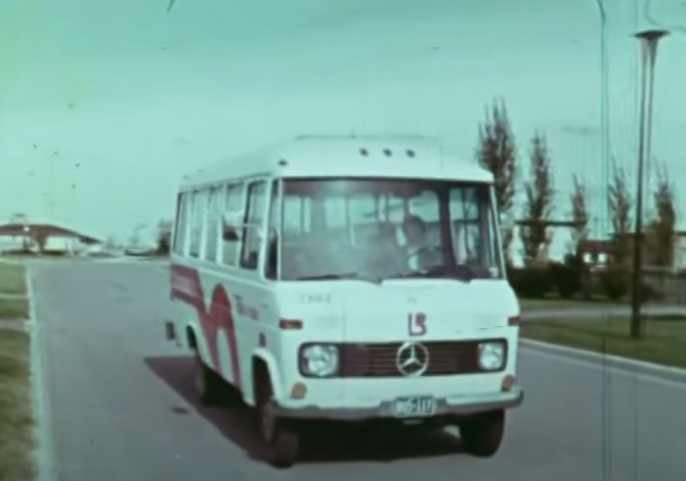
    On-demand transit is not a new idea. In the 1970s, GO Transit operated experimental dial-a-bus services in suburban parts of Toronto, offering door-to-door service to and from the nearest subway station or a designated transfer point to frequent fixed-route bus services. In Bramalea, Chinguacousy Township operated Bramalea Dial-a-Bus, which brought residents to local employers, schools, and Bramalea City Centre. The service was replaced by fixed-route services when Brampton Transit was established shortly after amalgamation, merging the dial-a-bus operation and a privately contracted transit service in the old town of Brampton.

    Still image from “People on the GO,” a 1973 film by the Ontario Ministry of Transportation and Communications. Bramalea’s Dial-a-Bus’ pink “lazy-b” logo was adopted by the successor transit agency, Brampton Transit during its first decade.

    “Trans-Cab” services continue to be used in outlying areas of communities such as Hamilton, Peterborough, and Sudbury, where transit agencies partner with local taxi companies to allow transit riders to begin or end their journey outside of urban or regional fixed-route areas, often at a premium fare.

    My first on-demand transit experience was taking Oakville Transit’s “zone bus” service in 2005. At the time, there was no fixed-route Sunday bus service in Oakville, but there were four zones for which you could call and request a ride, with a bus picking you up at the nearest bus stop. If your destination was in a different zone, you would transfer to another bus at Oakville GO Station. Today, Oakville offers on-demand service during late evenings from the Oakville GO Station and in new and outlying subdivisions where there are no nearby scheduled services.

    My other previous on-demand transit experience was in Winter and early Spring 2012, after I suffered a broken knee cap and had to rely on Toronto’s Wheel-Trans paratransit system. Though I was fortunate to be able to get around using Wheel-Trans during a temporary disability, it was often a frustrating experience trying to book trips, especially for social or leisure purposes. I quickly came to prefer the conventional system and used it as much as I could while recovering from that injury.

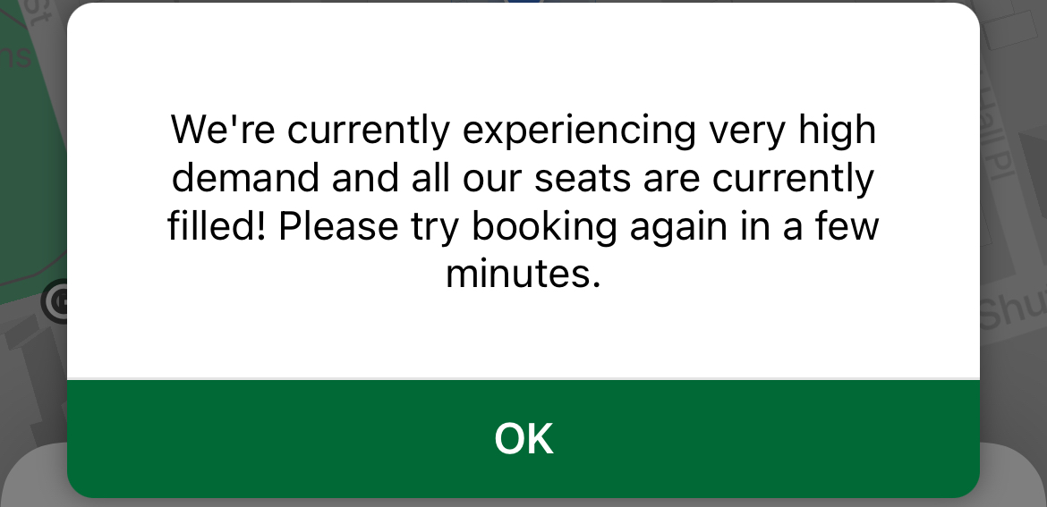
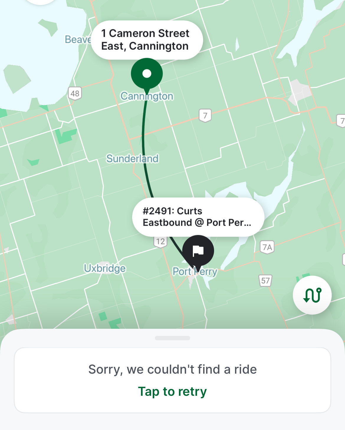
    A common message while trying to book rides on DRT On-Demand

    In 2024, there are over a dozen transit agencies providing on-demand transit services in Ontario and Quebec, either as standalone operations or in conjunction with fixed-route systems. You can find them in my interactive transport maps.

    Modern on-demand services, though they are typically accessed by mobile apps these days, present some of the same challenges, including cumbersome booking processes as well as high demand and limited availability for next-day and same-day trips.

    DRT offers on-demand transit trips for customers with disabilities (who are eligible for door-to-door service anywhere in the region), rural areas, and in designated urban areas (where pickups and drop offs are made at signed bus stops).

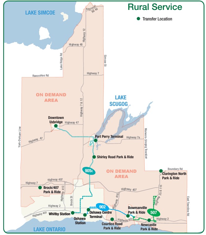
    DRT rural services, showing the rural on-demand service area and transfer points to fixed-route services (including GO buses at Downtown Uxbridge, Brock/407 and Clarington North)

    As Brock Township was the most distant and most difficult town hall in the GTHA to reach by public transport, I tried to book for the first day of my visits: Monday, March 11. After downloading the DRT app and inputting my information (name, email address, mobile phone number) I tried to book a return trip from Port Perry (which has a scheduled route connecting it to Uxbridge, Oshawa, and Whitby) the day before.

    At one point, I was able to get an outbound trip around 12:00 PM, but I could not get a return trip after multiple attempts. After failed attempts to book each ride, the app would go back to the beginning, requiring the user to input most of the same information multiple times. I gave up and went to northern York Region instead. After midnight, early Monday morning, when one could book trips for the following day, I tried again and managed to get a return trip that met my needs for Tuesday the 12th.

    Unable to book a return trip from Cannington to Port Perry for Monday, March 11, 2024

    Once I booked my trip, the rest of the experience was smooth. I got a text reminder of my upcoming trips, and on the app, I could track my upcoming ride, much like Uber or Lyft, with the driver’s name, vehicle description, and location. Each time, I paid with my Presto card, with DRT charging the same fare for on-demand as for conventional bus service. Drivers were professional and friendly. I was the only passenger for both trips, though they are often shared, and minibuses — such as accessible paratransit vehicles — are used for passengers with disabilities or larger groups.

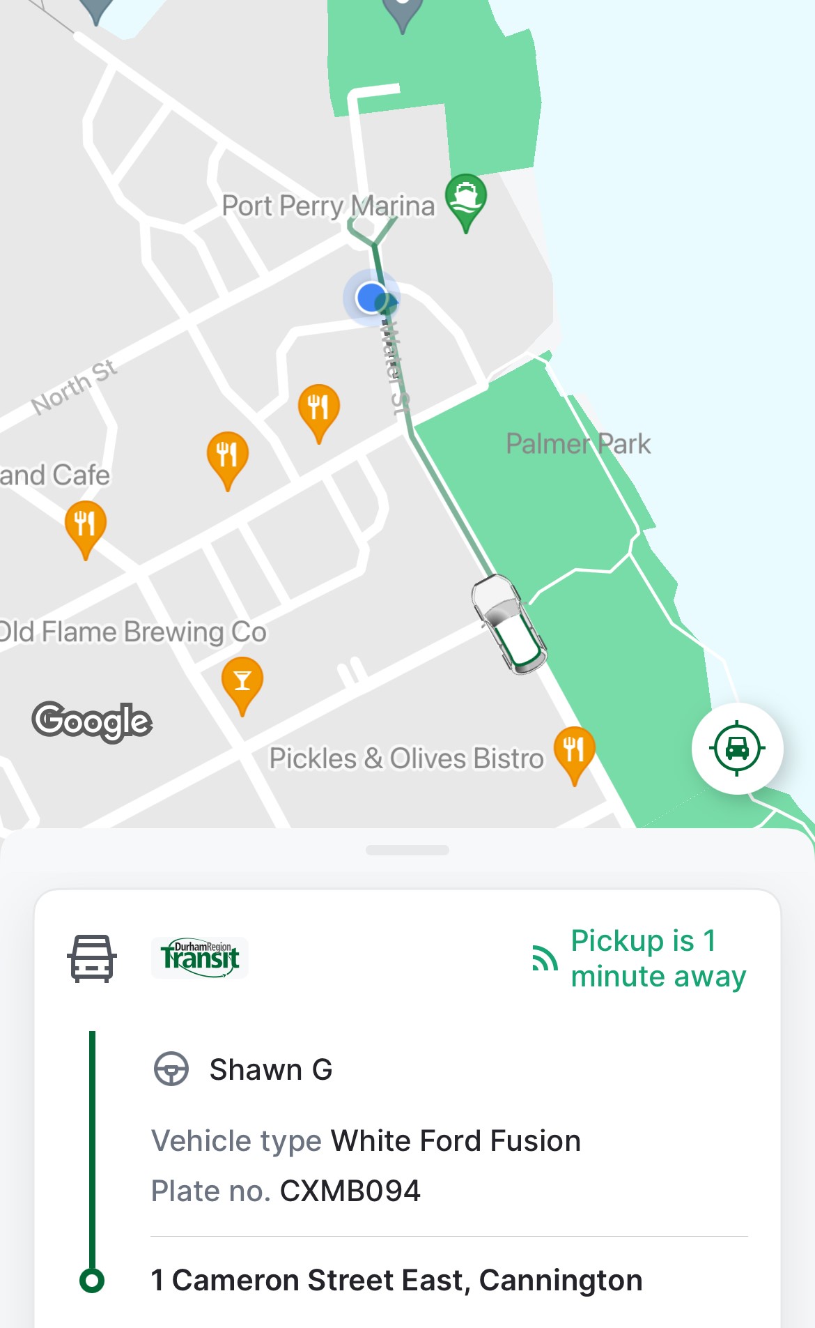
    Notice of pickup

    I learned that the service could be quite busy and the app sometimes problematic — there is also a toll-free number that passengers can call, and that sometimes the telephone agent would be able to find matching rides that the app would not show.

    I was lucky that my trip was discretionary, but I could see how on-demand transit can be difficult and/or frustrating to use.

    Though DRT has restored most urban bus routes (many were suspended during pandemic-related restrictions), it still struggles to meet demand on its busiest corridors, especially those serving colleges and universities in Oshawa, Whitby, and Scarborough. A fire in one of DRT’s garages last summer hasn’t helped either. As a result, some urban areas in Ajax, Pickering, Whitby, and Bowmanville still have on-demand areas where fixed-route services have yet to be restored.

    On-demand transit has its place, especially in rural and outlying suburban areas, or during times of low demand. If done right, it provides affordable mobility to people who might otherwise go without, and as an alternative to driving a car or paying an expensive taxi fare for those with travel options. Durham Region has done a good job covering the entire region with fixed-route and on-demand services, especially at night, where the urban south enjoys 24-hour transit access.

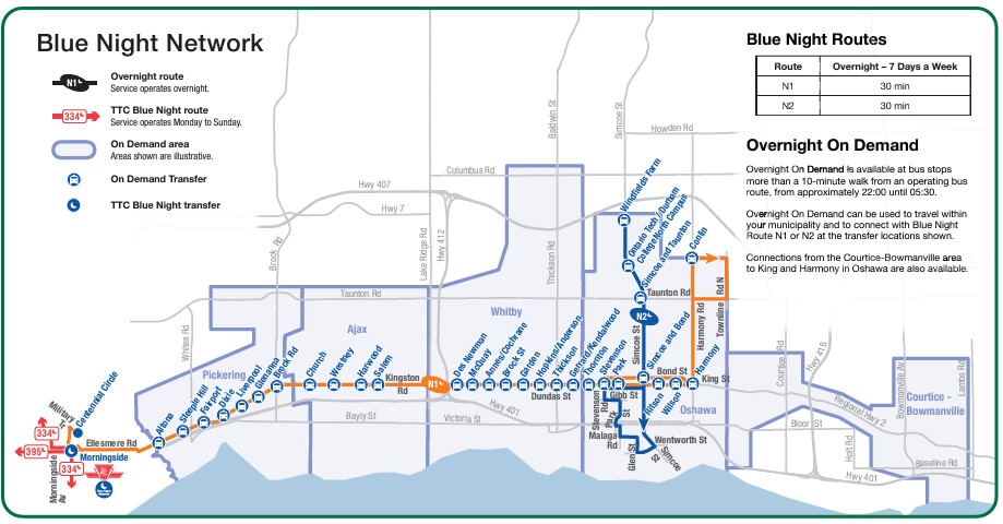
    DRT overnight services, which includes two scheduled buses and five on-demand zones in the urbanized part of the region.

    Despite Durham’s efforts, on-demand services can be costly to operate, less flexible for prospective passengers, and be frustrating to use, though they can cover much larger areas than line haul routes. Scheduled, fixed-route buses offer predictable, simple, and often faster service than point-to-point bespoke services. On-demand transit has its place, but it is only one tool in a vast toolbox of mobility solutions. This was true in the 1970s and remains true today.

  • Another bus to London

    Another bus to London

    Intercity Bus minibus on York Street at Royal York Hotel, February 13, 2024

    In late 2023, yet another intercity bus operator started serving the busy Toronto-London corridor, operating between Toronto and London. With the rather unimaginative name of “Intercity Bus,” this new company operates up to four trips a day between Toronto and London. It has since added a route between London and Sarnia; it also plans to run the much-needed link between London and St. Thomas.

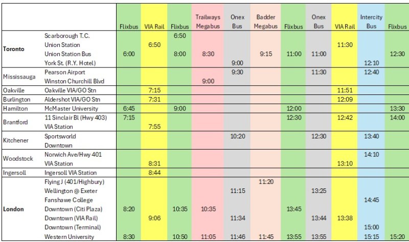
    There are now five bus companies on the Toronto-London route: Intercity Bus, Onex Bus, Trailways, and Megabus (in a partnership with local coach operator Badder Bus). Those five companies compete with VIA Rail, which operates up to six daily trips between the two cities, with up to 28 round trips daily between them.

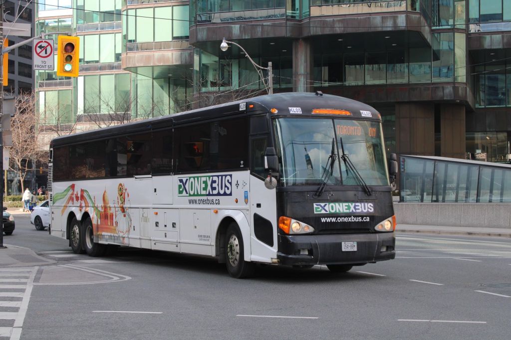
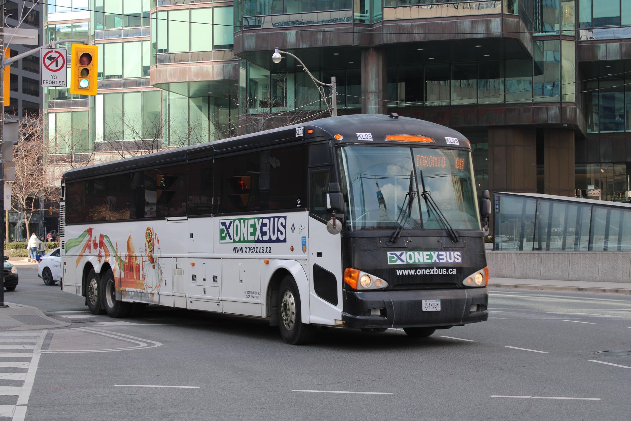
    Onex Bus departing Downtown Toronto, photo kindly provided by Chris Whitfield

    VIA Rail remains the fastest and most comfortable option, with full-service staffed stations in Downtown London and Downtown Toronto, but its fares are typically the most expensive. The private coach companies offer cheaper fares, and several of them directly serve Western University and/or Fanshawe College. Megabus has partnered with Trailways; its booking website includes both the Toronto-London-Detroit Trailways trips and the Toronto-London trips operated by Badder Bus. Otherwise, one must go to the individual companies’ websites to figure out the complete schedule and where each service stops at.

    The schedule below, saved as a PDF, includes all regular weekday trips between Toronto and London along with intermediate stops.

    Complete schedule showing all regular weekday trips between Toronto and London

    In Toronto, Flixbus, Trailways and Megabus/Badder call at the Union Station Bus Terminal, where connections can be made to other Flixbus and Megabus services, along with GO Transit and VIA Rail in the adjacent railway hub. Onex and Intercity Bus make use of a curbside stop on York Street next to the Royal York Hotel, which is shared with the Toronto Island Airport shuttle. These three stops are all within a few minutes’ walk from each other. Some Flixbus runs to London begin and end in Scarborough, and many buses also make a stop at Pearson Airport.

    In London, every bus carrier makes a curbside stop at Western University, the terminus of all bus trips from Toronto except Trailways, which continues to Windsor and Detroit. All carriers except Badder/Megabus also serve Downtown London. However, each has a different stopping location, with Flixbus and Trailways opting for a curbside stop on York Street near CitiPlaza (London’s downtown mall), and Onex utilizing the driveway at the VIA Rail station.

    Curbside stops are convenient for bus operators, as they’re easy to pull up to and depart from, there’s no rent, staffing, or maintenance costs. With smartphones and online ticketing, there is no need for a ticket agent, and passengers can be notified by text and/or email of any delays or changes. But curbside stops have no shelter and no washrooms.

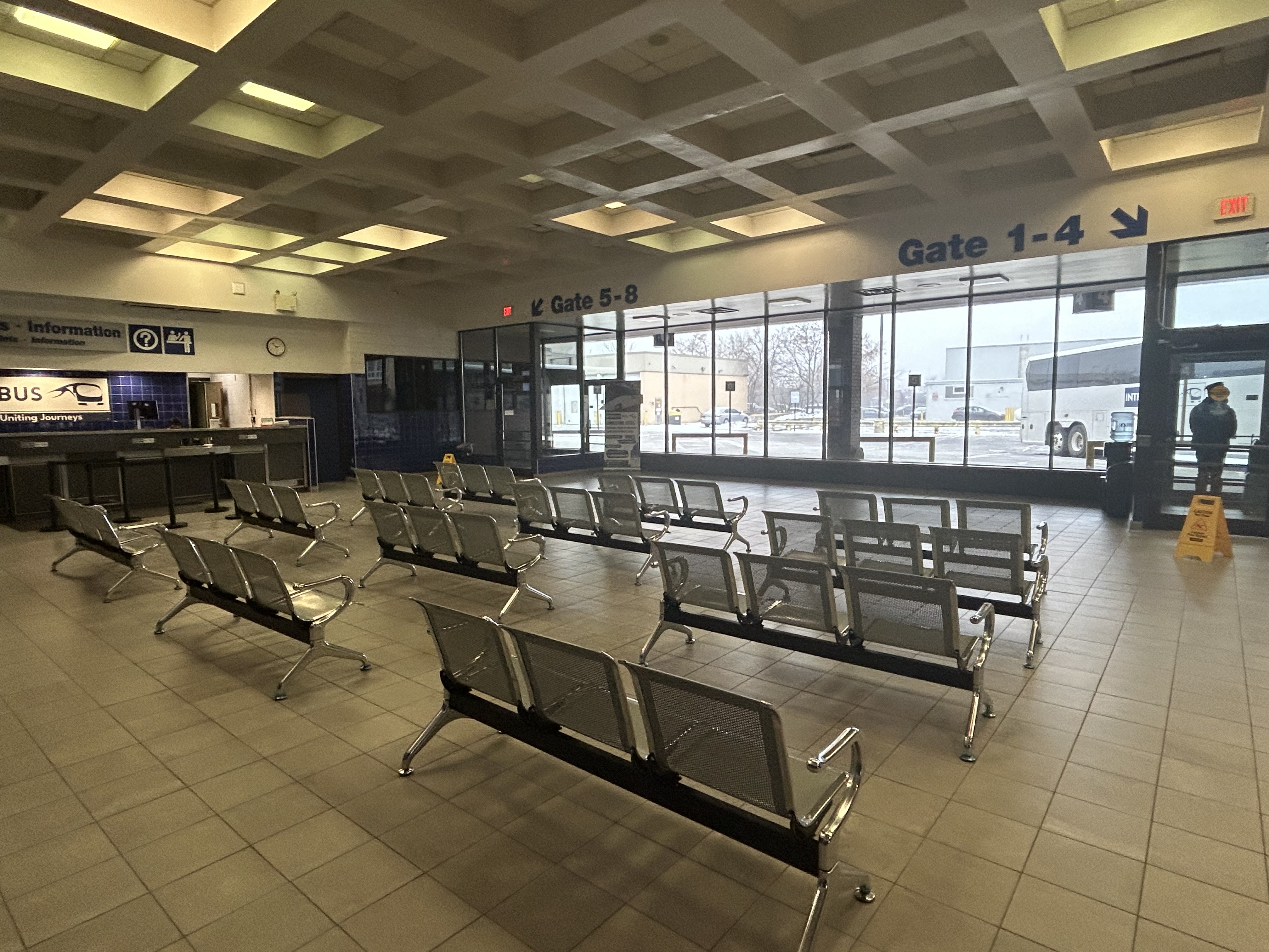
    Interestingly, Intercity Bus has taken over the old Greyhound terminal in Downtown London. At its peak, London’s terminal had dozens of daily departures to cities and towns all over Southwestern Ontario, serving multiple carriers at a time when intercity carriers acted more like a unified network.

    The old London Greyhound terminal

    The terminal offers seating, washrooms, and is staffed by an agent, a rarity in the post-Greyhound world. The washrooms are especially essential if — as on my recent trip — the bus does not have an on-board lavatory. These new smaller carriers save fuel and labour costs by operating smaller vehicles and matching capacity with demand. They often operate older coaches and minibuses.

    Inside the Intercity Bus terminal

    I recently took Intercity Bus from Toronto to London to try out Ontario’s newest carrier. Though the 12:10 departure from Toronto was on a minibus similar to those used by rural transit operators (there were only 10 passengers on that Tuesday afternoon run), the ride was comfortable enough, with cloth bucket seats. It was a fast trip: it skipped stops in Woodstock and Fanshawe College, and the driver made very good time on Highway 401, at times exceeding the posted speed limit by 25 or 30 kilometres per hour. Even with a stop for fuel (the driver asked if it was okay), we arrived 15 minutes early at the London terminal.

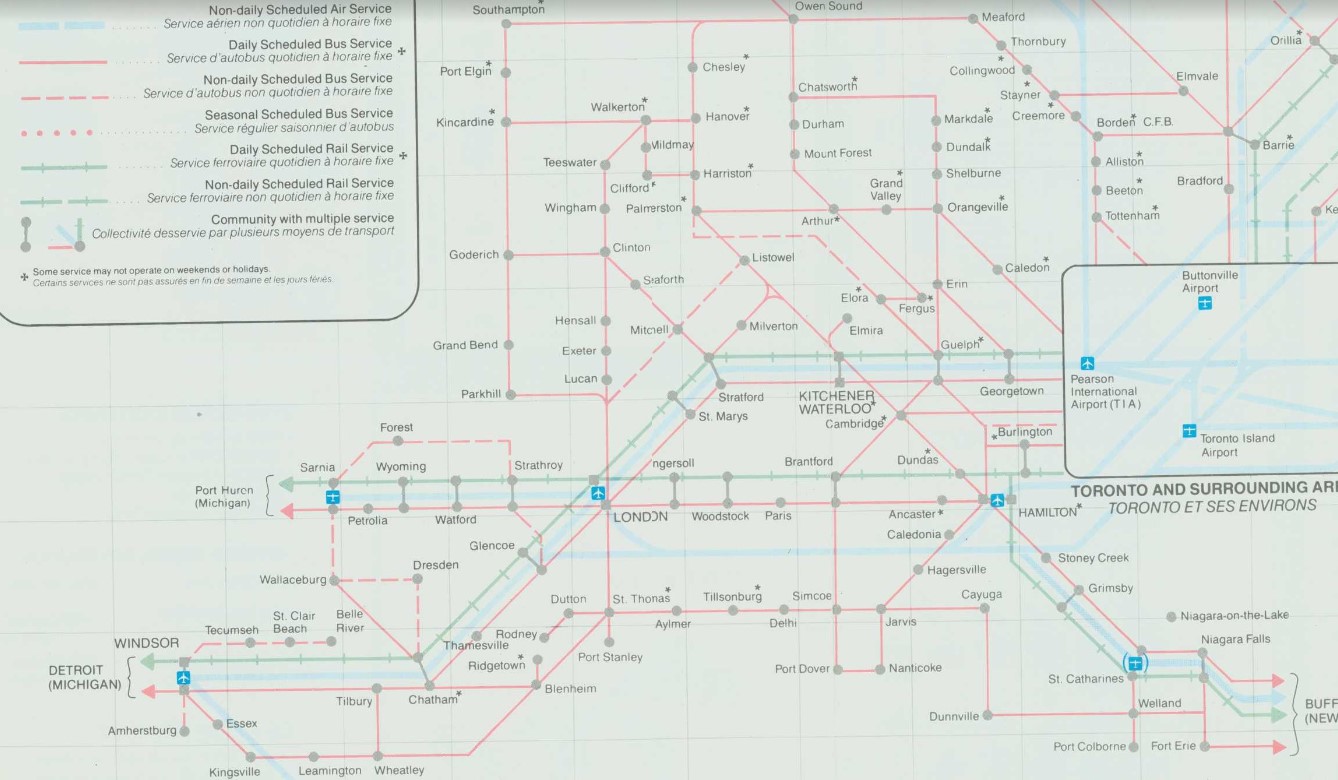
    At its peak in the 1980s, there were over two dozen daily departures from the London bus terminal. There were frequent Greyhound routes to Toronto via Kitchener and via Brantford and Hamilton as well as to Chatham, Windsor, and Detroit; there were also daily Greyhound routes to Niagara Falls via St. Thomas, Simcoe, and Welland and to Strathroy, Sarnia and into Michigan. Regional coach operators also ran from the Greyhound terminal to Stratford, Goderich, Rodney, Walkerton, Leamington, and Port Stanley. Today, there are just four — three to Toronto and one to Sarnia.

    Detail from 1990-1991 Ontario Intercity Transportation Guide, showing bus routes from London to points throughout Southwestern Ontario

    My hope for the next year is for more stability in the intercity bus industry, perhaps even mergers between some of the smaller players. Onex and Intercity Bus, which compete on the Toronto-London route and offer a similar service, could be beneficial, especially if it results in a network of routes radiating out of London, starting with Intercity Bus’s London-Sarnia service, its planned St. Thomas route, and Onex’s London-Stratford-Kitchener run.

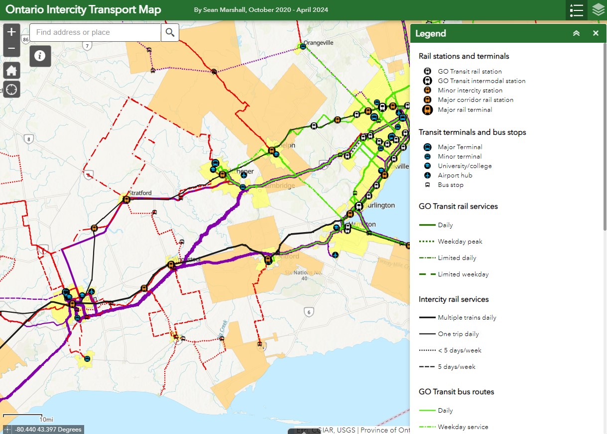
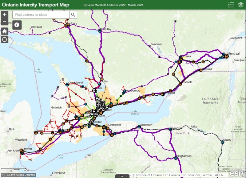
    I updated my map of Ontario’s intercity transport services for March 2024, including the new Onex Bus and Intercity Bus routes in Southwestern Ontario. There are new services in East Zorra-Tavistock, connecting to Stratford and Woodstock, and in North Grenville. Unfortunately, Lindsay and Haliburton lost their TOK coach service, Prescott & Russell ended its on-demand service, and gaps remain in Bruce, Elgin, and Haldimand Counties.

    Updated Ontario Intercity Map

    If you like this post and you would like to help out with my online mapping and webhosting costs, consider buying me a coffee. Thank you!

  • Heavy interference in a light rail transit project

    Heavy interference in a light rail transit project

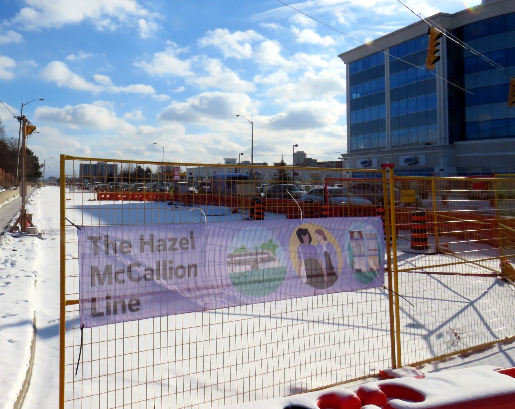
    Banner promoting “The Hazel McCallion Line” on Hurontario Street in Brampton, January 2024

    Previously on this website, I wrote about the renaming of two GO Transit stations: Oshawa and Brampton. I explained why renaming transit infrastructure is problematic, especially when they violate wayfinding standards, which call for simple, accurate, unique, and self-locating names.

    Both GO Transit stations were renamed by provincial agency Metrolinx, on behalf of the provincial government. Metrolinx operates GO Transit buses and trains, the UP Express airport link, administers the Presto fare payment system, and oversees the construction of new rapid transit projects in the Greater Toronto and Hamilton Area. The Hurontario LRT, which is currently under construction between Port Credit GO Station in Mississauga and Steeles Avenue in Brampton, is just one of many transit projects managed by Metrolinx.

    On February 14, 2022, at Cooksville GO Station, Premier Doug Ford, then Transportation Minister Caroline Mulroney, then Mississauga Mayor Bonnie Crombie, and Metrolinx CEO Phil Verster joined former Mississauga mayor Hazel McCallion announcing the name change from the Hurontario LRT to the Hazel McCallion LRT. The occasion also marked McCallion’s 101st birthday.

    Hazel McCallion with Metrolinx CEO Phil Verster, February 14, 2022 (Metrolinx photo)

    This is the first rapid transit line in North America to be named for a person, contradicting established standards for transit projects.1 Though McCallion was a formidable and popular mayor whose political career spanned seven decades, she was also very close to the Ford government in the last few years of her life. She also had many other public facilities named in her honour — a senior public school in Mississauga’s Streetsville neighbourhood, the library at University of Toronto’s Mississauga campus, the City of Mississauga’s central public library, a walkway leading to Square One Shopping Centre, and the Mississauga campus of Sheridan College. There is also the Hazel McCallion Auditorium at Mississauga Valley Community Centre and the Hazel McCallion Hall at Vic Johnston Community Centre. There was no need for yet another civic asset to be renamed for her.

    In Toronto, most former mayors have just one public asset named for them: David Crombie, Art Eggleton, June Rowlands, and Barbara Hall have parks dedicated in their honour. Mel Lastman — mayor of North York for 24 years before being elected mayor of amalgamated Toronto for another six — and Nathan Phillips have major public squares.2 In Mississauga, there was no need to rename yet another piece of civic infrastructure for the same person.

    Furthermore, there was no public consultation about the name change — even officials at the cities of Brampton and Mississauga were kept in the dark — while the name itself contravenes Metrolinx’s own naming conventions.

    In July, 2023, I submitted an access to information request to Metrolinx, the second time I went through the freedom of information process to find out more about the light rail transit project. There were several delays, and I did not receive my requested documents and communications until late January 2024.

    A deep dive into the background of the Hurontario LRT project, the person it is being renamed for, and my findings and impressions follow.

    (more…)
  • Taking stock of Ontario’s transport links in 2023

    Taking stock of Ontario’s transport links in 2023

    GO Transit’s new Route 17 between Kitchener-Waterloo, Guelph, and Hamilton was one of the good news stories of 2023

    At the end of 2023, there have been several changes reflected in my Ontario Intercity Transit Map. Intercity Bus, a London-based company that took over the closed Greyhound bus terminal there, launched a second route, offering three daily trips between London and Sarnia; they plan to launch a London-St. Thomas route as well. In January 2024, Deseronto Transit will start running a new fixed-route service between Belleville, Tynendiaga Mohawk Territory, Deseronto, and Napanee, with a route designed to serve major employers, shopping centres, and health services.

    This year, GO Transit finally began service connecting Kitchener-Waterloo, Guelph, and Hamilton and improved rail and bus service on the Kitchener Corridor. This was one of the most important changes in 2023, though, as I argued here, they could do even more.

    Unfortunately, some routes disappeared, including Grey Transit Route’s Walkerton-Flesherton Route 6, and Northumberland County’s service between Cobourg and Campbellford. At the end of January 2024, TOK Coachline’s bus serving Lindsay and Haliburton will also be gone for good. On-demand services have replaced fixed routes in parts of Durham Region and Norfolk County, while all service came to an end in Prescott & Russell and Manitoulin Island.

    Keeping track of the changes continues to be challenging, given the lack of a central repository of transport services in Ontario. For this reason, I have made the choice to not map services provided by Book-a-Ride, whose schedules, routes, and locations change frequently, as that company acts more like a charter airline (changing routes and schedules regularly to meet expected demand) than a traditional motor coach operator (which has more consistent schedules and routes). I tried doing that once, and I will not attempt to do so again.

    For now, gaps remain between London and St. Thomas, while Haldimand, and Elgin Counties remain entirely disconnected. Bruce County has just two bare threads connecting Saugeen Shores, Kincardine, and Goderich to the outside world, and Lindsay/Kawartha Lakes and Haliburton will soon lose their only public transport option.

    As always, please message me with any corrections, changes, comments, or suggestions.

    Ontario Intercity Transport Map

    This interactive map has been migrated to a newer ArcGIS Online account, on account of ESRI suddenly changing its monthly service account to charge for bandwidth. I previously hosted my maps on a pay-as-you go account that helped me get re-acquainted with the ESRI ArcGIS Online platform before I set up a full online subscription to support a small business I co-founded in 2021.

    What once cost me approximately US $8 a month to post maps such as my Ontario Intercity Map and these historical interactive maps cost me over US $1000 for November 2023. Though I got one email from ESRI US advising of the change in the billing, there was no way to expect that a monthly fee would go up over 1000%. As of December 27, I am still trying to get that addressed after several calls and emails and an unsuccessful attempt to contest the charge to my credit card.

    I’m hoping for some good news soon on that front.

  • A visit to GO Transit’s New Old Elm Station

    A visit to GO Transit’s New Old Elm Station

    The new Old Elm Station in Stouffville, Ontario

    On Monday, October 30, the new Old Elm GO Station opened in the town of Whitchurch-Stouffville, northeast of Toronto. Located two kilometres away from Stouffville’s small downtown core, Old Elm is focused on park-and-ride passengers arriving from nearby communities such as Goodwood, Uxbridge, Port Perry, Beaverton, and from within Stouffville itself.

    The new station is relatively simple, with a covered platform, a bus loop with several bays directly adjacent to the single platform, heated shelters, and a 673-spot parking lot. As a relatively quiet station with limited train service, there is no indoor waiting room or ticket office.

    The bus loop is directly adjacent to the train platform

    Though train service is limited to weekday rush hours and a few evening and weekend departures, there is regular GO Transit bus service connecting Uxbridge and Goodwood to Old Elm Station, and onwards to midday and weekend train connections at Mount Joy or continuing to Toronto Union Station. There are no York Region Transit connections at Old Elm.

    The Lincolnville layover yard, which was also the Lincolnville/Old Elm station location until October 2023

    Previously, Old Elm Station was located a few hundred metres away, northeast of the Tenth Line/Bethesda Side Road intersection at the Lincolnville layover yard, where Stouffville Line trains continue to be stored overnight and weekends. That station, originally named Lincolnville for a nearby hamlet, was opened in 2008 to accommodate service expansion and relieve the small station at Stouffville, which had no room for a bus loop or additional parking. Since Lincolnville was a yard terminus, passengers had to walk across tracks to reach the next departing train, and each departing and arriving train had to crawl through the yard before reaching the mainline. (As Georgetown GO Station is also within a layover yard, trains passing through on their way to and from Kitchener must also crawl through. A new layover yard near Heritage Road in Brampton will allow for a rebuilt Georgetown Station with faster arrivals and departures.)

    Lincolnville Station was confusingly renamed Old Elm in 2021, even though that new name referred to a tree on the new station site that didn’t open for two more years. Had the new name taken effect with the location change, it would have made more sense.

    The new station site, located outside of the Lincolnville yard, allows for smoother and faster arrivals and departures, shaving several minutes off the trip for passengers to and from Lincolnville.

    The station’s namesake, an old elm tree on the south end of the GO Transit property

    Though Lincolnville/Old Elm is located in the Greenbelt, and the station is unable to support transit-oriented urban development, there was a need for the layover yard. Adding a small, auto-focused station was quite sensible. This is no Garage Mahal.

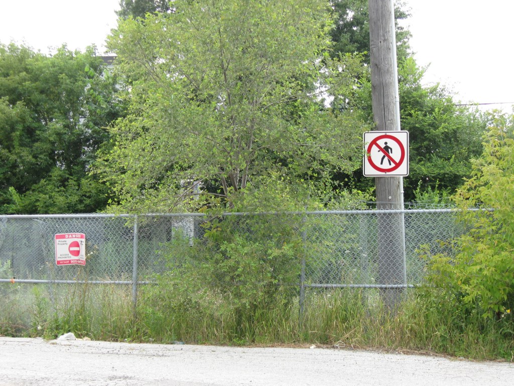
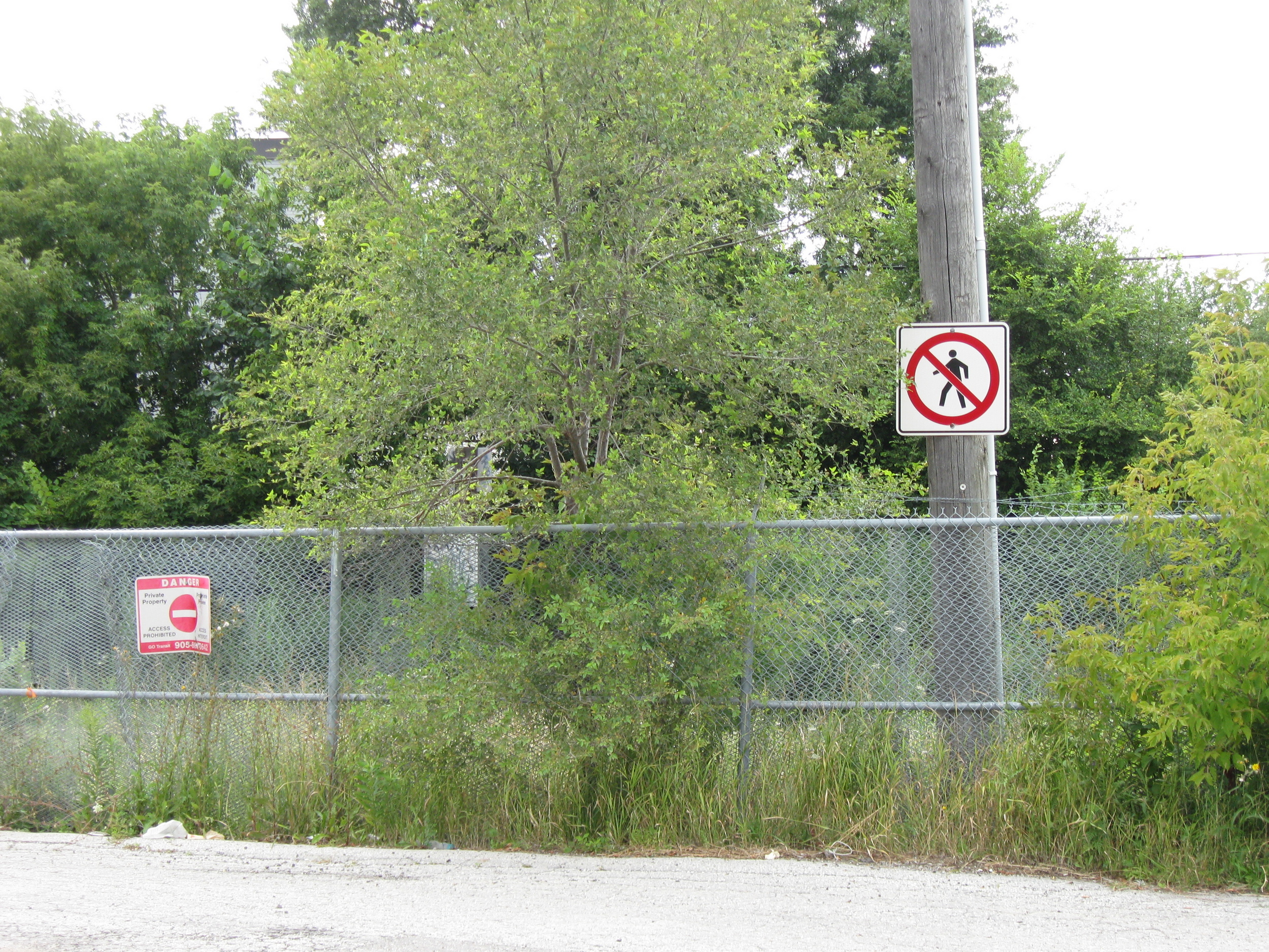
    The one unfortunate feature is the complete lack of active transportation access beyond the station property. Though Metrolinx built a wide concrete walkway from Tenth Line to the station platforms, there are no sidewalks, no crosswalks, and no pedestrian signals at either the main entrance or the bus loop entrance, which are both signalized intersections. Instead, there are “no pedestrians” signs facing all directions.

    “No pedestrians” sign placed in front of the new concrete pathway into Old Elm Station

    Once on Metrolinx property, though, there is a wide pathway, presumably for cyclists and pedestrians. Interestingly, the sign below shows that cyclists should keep to the left, on the wide pathway, while pedestrians are directed into the grass to the right.

    Beyond the “no pedestrians” sign at the intersection, another sign instructs cyclists to keep to the left and pedestrians to the right – into the grass

    I doubt Metrolinx intended for the hostile intersections to forbid any pedestrian activity. I note too that despite the rural locale, there are several neighbouring homes and businesses along Tenth Line and Bethesda Side Road. The nearest subdivision is less than a 15-minute walk away, a healthy stroll’s distance. A new residential development, Elm Villa, is planned for the site immediately to the south of the bus loop. Tenth Line is maintained by the Town of Whitchurch-Stouffville, so it is likely they are responsible for the oversight. Still, it is not a great look.

    No crossing at Old Elm