Category: Ontario

  • The end of another Eaton Centre

    The end of another Eaton Centre

    Main entrance to Hamilton City Centre, on James Street North. Note the awkward spacing of “City” over the entrance; it originally read “Eaton.”

    On December 26, 2022, Hamilton’s former Eaton Centre, opened just 32 years ago, will close for good. Early in the new year, demolition will begin on the failed downtown mall, making way for a new residential development.

    Hamilton Eaton Centre, fully opened in October 1990, was one of several downtown malls built in Ontario through a partnership between Eaton’s and commercial developer Cadillac Fairview, hoping to replicate the success of the Toronto Eaton Centre, which opened in phases between 1977 and 1979. It was the second major shopping centre to open in Downtown Hamilton; it followed the construction of the massive city-led Jackson Square development in the 1970s and 1980s in which entire city blocks were cleared to make way for urban renewal.

    With support from the Ontario and municipal governments, the T. Eaton Company and Cadillac Fairview built new malls in Ottawa, Peterborough, Brantford, Kitchener, Thunder Bay, Sudbury, Sarnia, Hamilton, and expanded London’s existing Wellington Square. These private-public partnerships seemed to be beneficial; smaller cities worried about the decline of their downtowns would get an attractive new shopping centre after expropriating and demolishing existing buildings and/or providing municipal lands for the project. The municipality would finance new parking garages to support the new development. Meanwhile, Eaton’s would help finance the construction and provide a lead anchor for the new development. Cadillac Fairview, which specialized in retail and office development, would arrange the construction and the leasing for the mall stores. (There were a few downtown shopping centre projects in Ontario that did not have Eaton’s involvement, including malls in Chatham, Cornwall, Tillsonburg, and Waterloo.)

    The old Eaton’s Hamilton Store in the 1920s, looking southwest from James Street North and (now disappeared) Merrick Street (Hamilton Public Library)

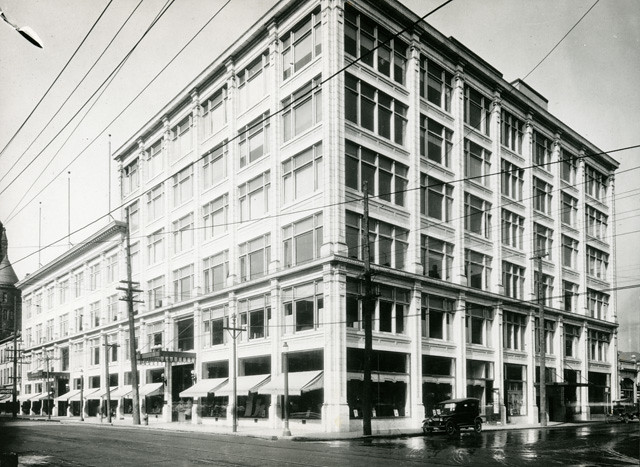
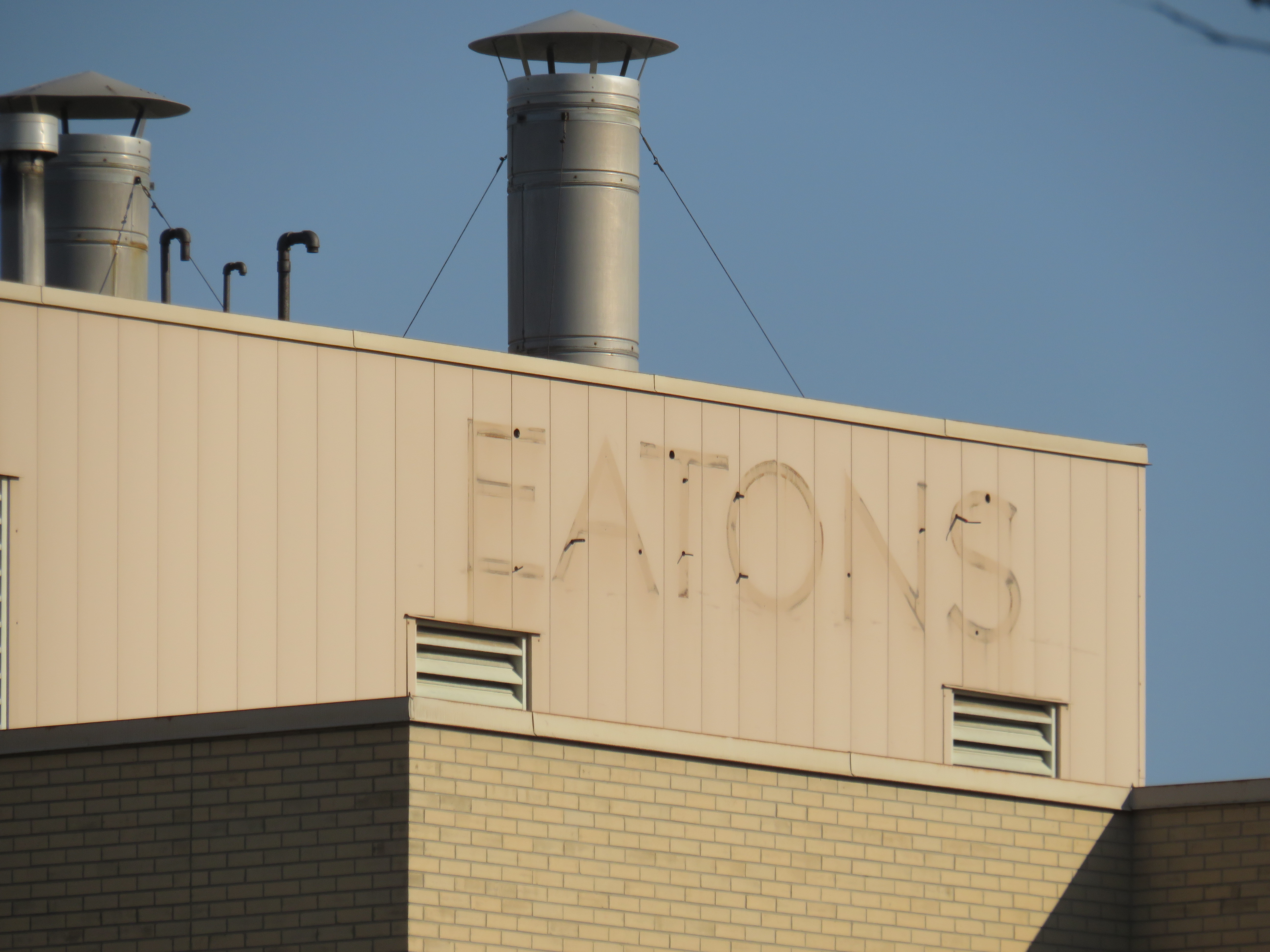
    Unlike malls in Kitchener, Sarnia, Brantford, or Guelph, the Hamilton Eaton Centre was mostly built upon lands already acquired by Eaton’s itself, much like the larger and more successful Toronto Eaton Centre (the city of Hamilton assisted by closing Merrick Street between York Boulevard and James Street and transferring the right-of-way for the new development). The first phase of the project, built on the site of the Merrick Street parking garage and the old Hamilton Farmers Market, became the home of a new four-storey Eaton’s store to replace the dilapidated building on James Street. When the new store opened in April 1989, the old store was quickly demolished to make way for the mall itself, which opened just 18 months later.

    The new Eaton’s Hamilton store on York Boulevard soon after opening in 1989. The store had exits to both Jackson Square and once completed, the new Eaton Centre mall. (Hamilton Public Library)

    At first, Hamilton’s Eaton Centre was able to attract prestigious tenants such as HMV and Eddie Bauer thanks to Cadillac Fairview’s expertise and new office development in Downtown Hamilton, including a new CIBC office complex. The new mall was also able to attract existing downtown businesses out of storefront retail and the older Jackson Square mall.

    YouTube video showing the exterior and interior of the old Downtown Hamilton Eaton’s store prior to closing, as well as its demolition in 1989 to make way for the new Hamilton Eaton Centre (via Hamilton Sight & Sound YouTube channel)

    However, as I discussed previously on this website, the malls developed by Eaton’s and Cadillac Fairview did not do well in most markets. New, full-line Eaton’s stores were a poor fit for smaller, industrial cities like Peterborough, Brantford, and Sarnia. The malls themselves were more difficult to get to by car, and shoppers usually had to pay for parking. The established suburban malls were typically larger, and they offered ample free parking. By 1990, the old, large industries were in decline due to free trade and industrial automation, and in the 1990s, a new retail format — the big box “power centre” — emerged as serious competition during a major recession. And in 1994, Walmart entered the Canadian market.

    The former Hamilton Eaton Centre (known as Hamilton City Centre since 2000) from the corner of James Street North and York Boulevard. The clocktower on the corner is an homage to the old Hamilton City Hall, which was demolished in 1960. The clocks themselves were originally installed in the old city hall and will be preserved when the current building is demolished.

    With low traffic and many national retailers unwilling to renew their leases, Cadillac Fairview divested itself of most of its downtown malls. It sold its half-stake of Hamilton’s Eaton Centre to the T. Eaton Company in 1995 (Of its downtown malls, Cadillac Fairview would only hold onto the flagship Toronto Eaton Centre, and the Rideau Centre in Ottawa). According to a Hamilton Spectator article from that year, one of the mall’s three floors was already closed, just five years after its grand opening.1 Among the tenants that left the mall early was upscale men’s clothier Harry Rosen. By 1996, only 50 of the 120 stores outside the Eaton’s department store were still occupied, with another six stores closing early that year.2 A McMaster University business school lecturer predicted that one of the two downtown malls — Eaton Centre or Jackson Square — would close within 10 years. (He was only 15 years off the mark.)2

    In February 1997 — after years of mismanagement and neglect by the fourth generation of the Eaton family — Eaton’s entered bankruptcy protection, allowing it to settle debts and restructure. Though stores in other downtown malls in Brantford, Sarnia, and Kitchener were among the first to go, the Downtown Hamilton store was left off the closure lists, as Eaton’s itself owned the property – losing the department store anchor would not help the mall in case of a property sale. In the meantime, Metrus Developments — which purchased the neighbouring Lister Block in 1989 — evicted its remaining tenants and boarded up the six-storey commercial building, hastening Downtown Hamilton’s visual and commercial decline.

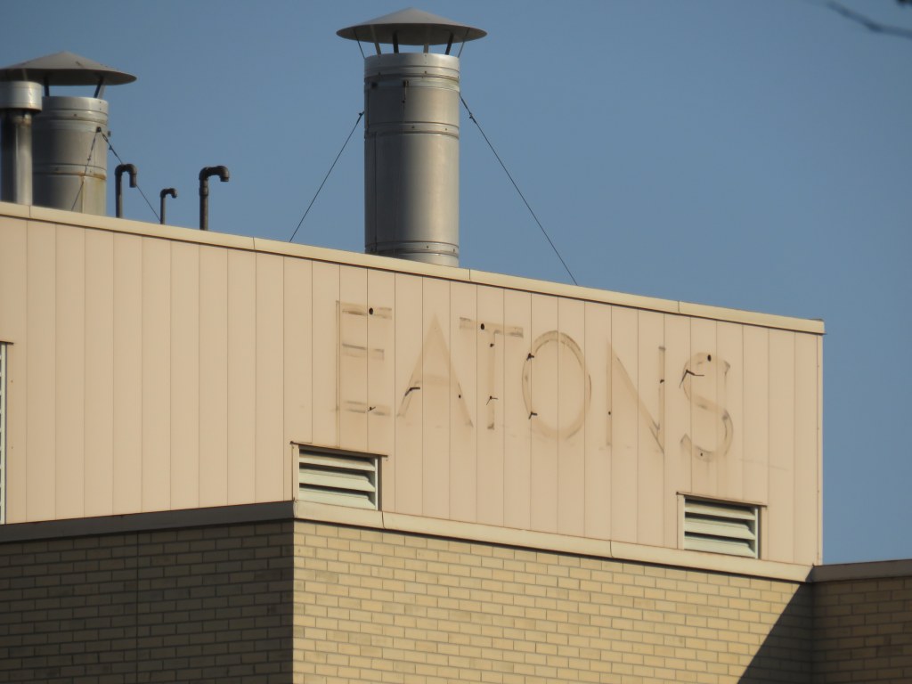
    In 1998, the Region of Hamilton-Wentworth (dissolved in 2001 after amalgamation) began leasing space on the formerly vacant third floor of Hamilton Eaton Centre, partly to help maintain the department store’s presence and support Eaton’s, which still owned the property. The City of Hamilton agreed to provide two hours of free parking at the attached York Boulevard garage and planned for the construction of a new store entrance to the Hamilton Farmers’ Market. This was just enough to keep the department store open until the company collapsed in 1999; the store closed for good in October of that year. The mall was rebranded Hamilton City Centre the year after, sold to a private real estate firm.

    View from the third floor in Hamilton City Centre; the conversion of retail space to offices on the top level is apparent
    The central atrium. All remaining stores must close by December 26, 2022.
    The connection between Hamilton City Centre and Jackson Square. This was originally the main route between the old Eaton’s store and the first phase of the 1970s-era mall. The larger Jackson Square will undoubtedly benefit from the residential re-development of the Eaton’s site.

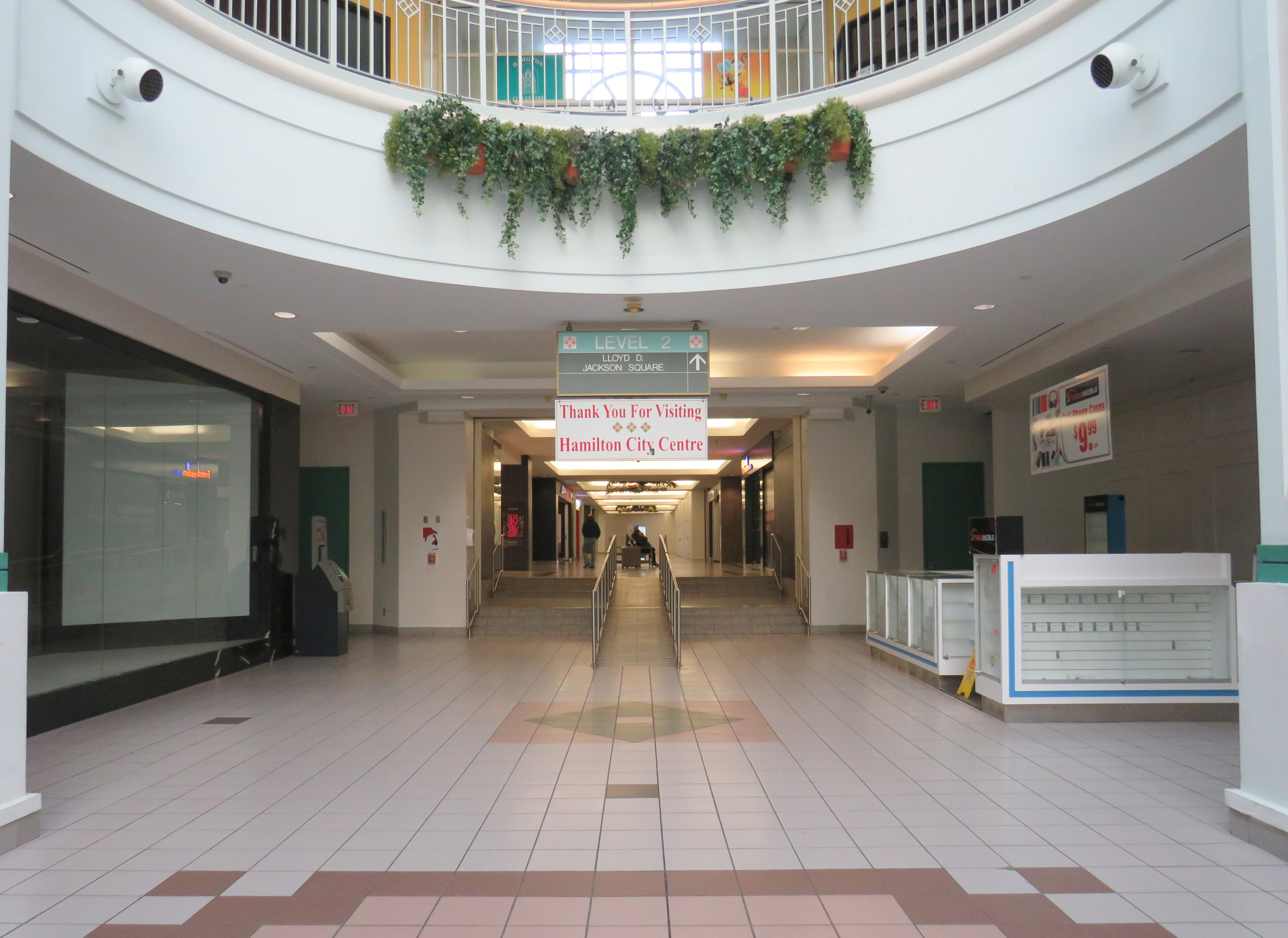
    After Eaton’s closed, part of the massive retail space was renovated and turned into a fitness club. The City of Hamilton leased additional space in the old Eaton’s store, especially as it undertook renovations to its modernist 1960s-era city hall. New windows were punched into the brick facade to provide natural light to the new occupants. But the remaining national retailers like HMV, Fairweather, and Eddie Bauer left the mall, while a few small, independent retailers came in, attracted by cheap rents.

    A fresh labelscar on the south-facing roof of the Eaton’s store, as seen from the patio on top of Jackson Square. Until 2021, a forgotten and unmaintained Eaton’s sign was left alone, hidden from street level.

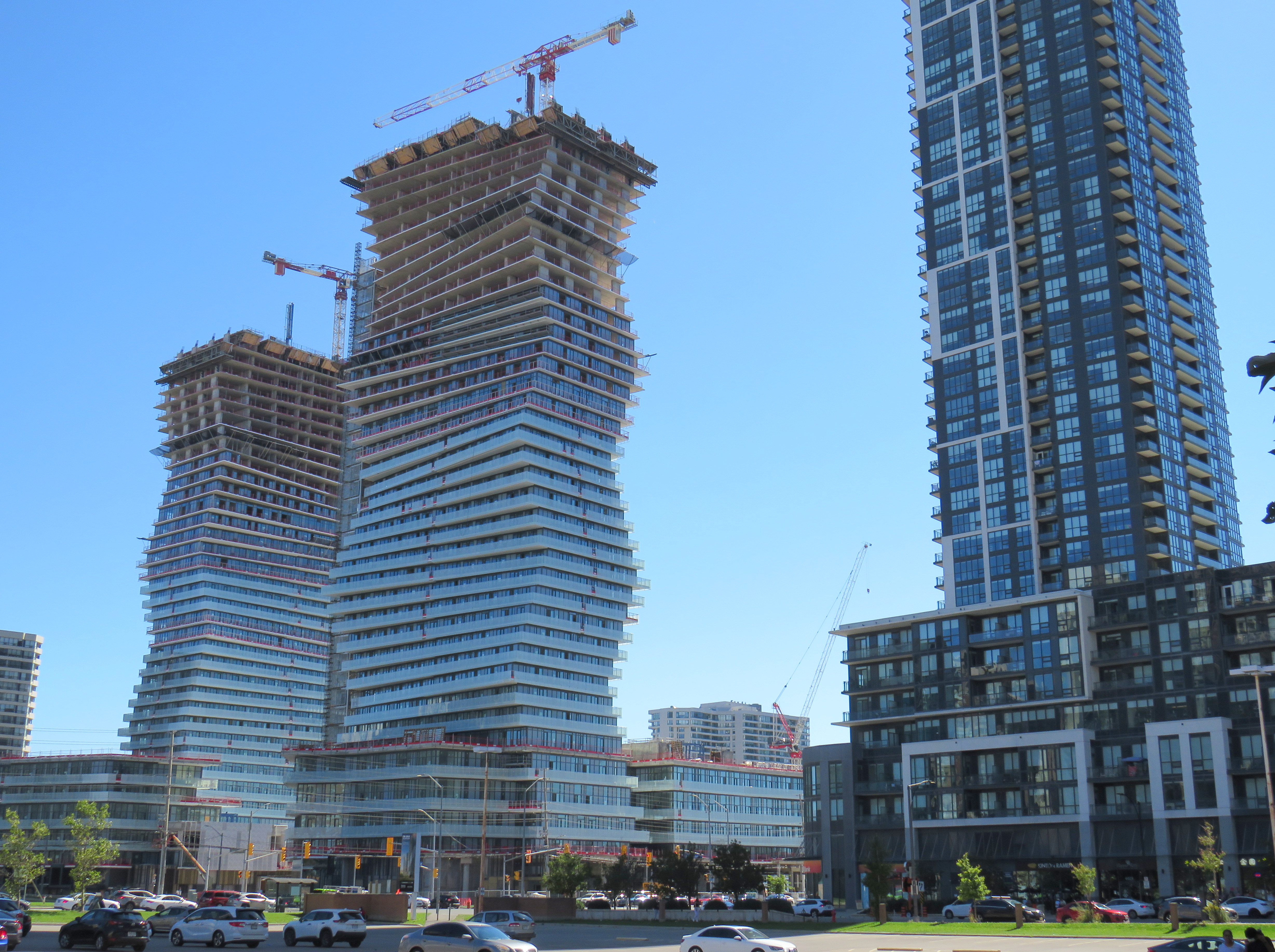
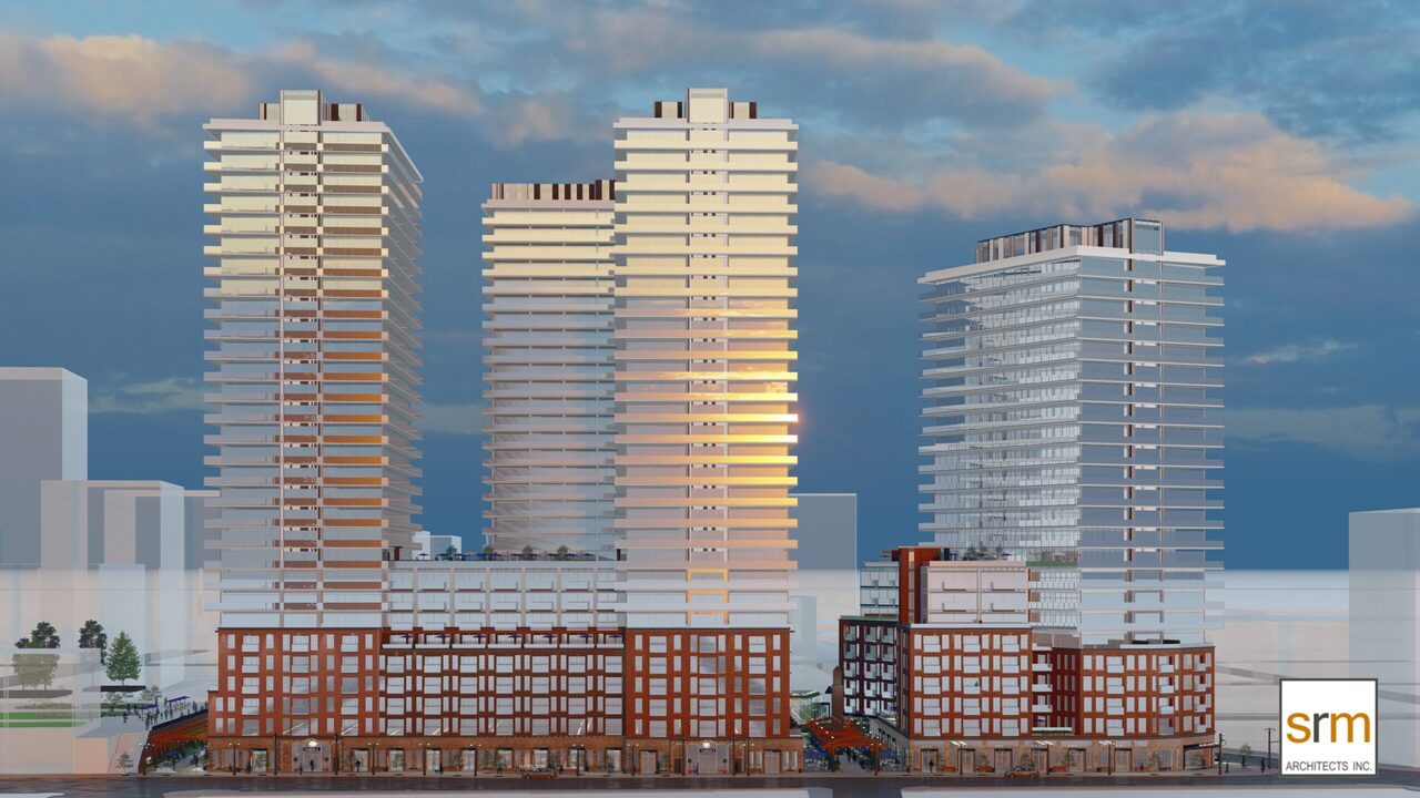
    The new development will have 1,940 residential apartments, along with street-level retail and office spaces, constructed in three phases. Walkways will allow the public to cut through the property, with one of those roughly following the old Merrick Street alignment. Unfortunately, it is being developed and planned independently of the rest of the Jackson Square superblock bound by James, King, and Bay Streets, and York Boulevard, and which also contains the farmers market, the central library, and Copps Coliseum, the sports venue built for an NHL franchise that never arrived.

    But with the influx of new residents, Jackson Square — which, despite is retail vacancies, holds its own due to the attached office, hotel, and civic functions, as well as the full-service Nations supermarket — will only benefit from the demise of its newer downtown competitor.

    Rendering for the new development on the Eaton Centre site by SRM Architects.
    1. “Eaton eyes the future after buying centre” Hamilton Spectator 13 July 1995: D12.
    2. John Burman. “A tough sell: Struggling Eaton Centre looks for new direction” Hamilton Spectator  13 Feb 1996: A1
  • Neither here, nor there: the folly of transit naming rights

    On Tuesday, October 4, Metrolinx announced a new name for Oshawa GO Station, the eastern terminus of its busy Lakeshore Corridor. In a ten-year agreement with Durham College, a publicly funded post-secondary institution, the station will now be known as “Durham College Oshawa GO.” This was announced on Metrolinx’s Twitter account, Durham College’s social media, and on the GO Transit Lakeshore East Twitter account, which usually advises passengers of train delays and cancellations.

    GO Transit Lakeshore East Train tweet on October 4
    “Allow us to reintroduce ourselves” – promotional poster at Oshawa Station proclaiming the new “Durham College Oshawa GO” name

    Metrolinx, the regional transit agency that operates GO Transit, claims that “the partnership allows us to better serve Durham Region and the GTHA” in its communications, including an informational poster in front of the station building.

    The news did not go over well with GO Transit customers and transit users across the Greater Toronto Area; Metrolinx later deleted its tweet after it was “ratioed” — meaning that negative comments and quote-tweets outnumbered the number of positive responses by a large margin. It is easy to understand why the station renaming was not popular.

    Firstly, though “Oshawa” remains in the station name, Durham College comes first with the new moniker. Schedules, signs, and maps will be updated to reflect the new name, while announcements by on-board staff and digital schedule information already reflect the new name. VIA Rail, which shares the station with GO Transit, is not a party to the agreement, and will likely continue referring to the station as “Oshawa.”

    Specific details of the agreement, such as how much Durham College is paying for the branding agreement, remain confidential.

    On GO Transit schedule boards, Oshawa Station now appears as “DC Oshawa GO”

    The new policy of naming rights agreements goes against years of Metrolinx policy for naming stations. When planning the Eglinton-Crosstown LRT, it developed five standards for naming stations and stops:

    1. Simple. Simple names are easier to remember

    2. Logical. Logical names provide a mental link when trip planning: they should be relevant to the area they reside

    3. Durable. Names should be relevant as long as the station exists

    4. Self-Locating. Names should allow users to mentally locate themselves within the region

    5. Unique. A unique name is one that cannot be confused with any other.

    Metrolinx principles for determining new names

    “Durham College Oshawa GO” violates most of the above principles. The name is now a mouthful, much like “Vaughan Metropolitan Centre” (another controversial station name that the TTC objected to, but was overruled due to political considerations), and is no longer simple. The agreement only lasts ten years, so it is not durable. As I will explain further, the name is also neither logical, self-locating, nor unique.

    Durham College has three campuses. Its main campus is located in the north end of Oshawa, on a site shared with Ontario Tech University. GO Transit has a bus stop there called “Ontario Tech/Durham College” that is served by GO Transit Route 56 on weekdays, and Route 52 on weekends and holidays. The main Oshawa campus is a two hour walk from the GO station, a 25-35 minute GO bus ride, or a 20 minute drive from the station. This was the main reason why transit users were ridiculing the new station name on Twitter.

    Durham College’s Whitby Campus is much closer to Oshawa GO Station, in fact, it is less than 500 metres from the Oshawa GO Station parking lot as the crow flies. Oshawa Station is actually right on the border of Oshawa and Whitby, with the “Welcome to Oshawa” signs next to the main GO Transit parking lot. The overflow lot for Oshawa GO is actually in the Town of Whitby.

    The “Oshawa: Prepare To Be Amazed” sign marking the city limit sits next to the GO Station parking lot.

    However, the Whitby campus is even harder to get to from Oshawa GO than the main Oshawa campus because it is separated by Highway 401. It is a 41 minute walk between the station and the Whitby college campus along Victoria Street (which has no sidewalks along most of its length), Thickson Road, Stellar Drive, and Champlain Avenue, though a footbridge over the highway would reduce the walking time to a more comfortable 15 minutes.

    Google Maps directions from Oshawa Station to Durham College Whitby Campus
    Looking northwest from the Oshawa GO parking lot towards Durham College Whitby Campus, the large grey building above and to the right of the green Thickson Road exit sign
    Looking east on Champlain Boulevard in front of the Whitby campus across Highway 401 towards Oshawa GO Station, which is marked by the tall digital billboard towering over the roadway

    The irony is that both major Durham College campuses are better reached from Whitby Station than the newly named “Durham College Oshawa GO.” There are no direct buses to the Whitby Campus from Oshawa Station, but Durham Region Transit (DRT) Route 917 provides regular service from Whitby Station. Furthermore, DRT operates more frequent service on Route 905 between Whitby Station and the Oshawa Campus than GO Transit does from Oshawa Station. Google Transit itself recommends transferring at Whitby to DRT, rather than at Oshawa, because the connections are more convenient. GO Route 56 operates only every hour on weekdays, and Route 52 runs every two hours on weekends and holidays. Meanwhile Route 905 stops in front of the Oshawa campus every 15-30 minutes, 7 days a week.

    The connection at Oshawa Station to Durham College’s main Oshawa Campus makes sense only when transferring from a VIA Train, or from GO Transit Route 88 from Peterborough and Clarington.

    Excerpt from Durham Region Transit system map, with Oshawa and Whitby stations and both Durham College campus locations highlighted

    Therefore, at this point, renaming Oshawa Station to “Durham College Oshawa GO” makes no sense. The new name violates basic wayfinding standards, while Durham College itself is better accessed from a different GO Station. Perhaps Durham College could operate a shuttle service to its campuses from the station, making the co-branding a more plausible.

    More concerning is that future renamings are in the work. In February, I noted that Metrolinx was looking for expressions of interest for station naming opportunities, specifically four Lakeshore Corridor stations: Whitby GO Station, Exhibition GO Station, Clarkson GO Station and Oakville GO Station, but noted that they would be willing to consider other proposals as well.

    Though I am critical of the process, I am sympathetic to Metrolinx’s position. I do not believe they were supportive of the province’s decision to rename a major LRT project for a political ally and paid advisor to Doug Ford’s Progressive Conservatives. I strongly believe there are many within the organization who are not happy about the station renaming agreements either. They must work with a very “hands on” government that is eager to promote new transit projects and benefit their supporters.

    Such is the state of things in Ontario.

  • GO Transit is broken – and other transit updates

    GO Transit buses stuck in Downtown Toronto gridlock in July, 2022

    While travelling through the Northeastern United States this spring and summer, I found myself feeling lucky to be living in Toronto. Though the New York City Subway and the PATH trains between New Jersey and Manhattan were operating pretty much as I remember them, in other big cities, the mass transit systems were in rough shape. In Washington, underfunding and incompetence led to the long-term withdrawal of over half of its Metro cars. During our visit in April, we were treated to long waits and crowded trains, though at least the system was clean. When we visited Philadelphia in late June, it was clear that the Southeastern Pennsylvania Transit Authority (SEPTA) had given up: poor communications, lengthy waits, unsafe subway stations, and general apathy among staff and passengers made my spouse and I resort to driving on our last day there.

    In Toronto, at least, the subway was still running frequently (with only minor service cuts due to the pandemic), the buses and streetcars as (un)reliable as ever, and despite more anti-social behaviour on some of its surface routes, I almost never felt afraid for my well-being when riding the Rocket, compared to my experience in Philly. GO Transit responded to the pandemic very well. Though it was forced to suspend many of its train and bus trips due to a sudden plunge in ridership, it maintained a basic service level on nearly all of its routes, slowly restoring certain services in 2021 as ridership slowly rebounded. Some corridors, like the Kitchener Line, had more service in the early Fall of 2021 than it did prior to the pandemic. As Metrolinx continued planning and construction of major transit projects like GO Expansion, the Ontario Line, and several LRT corridors, the future looked bright. In Spring 2022, GO Transit introduced a special weekend day pass for $10 per day or $15 per weekend, to help grow ridership.

    Unfortunately by late June 2022, GO began to fall apart.

    (more…)
  • An idea with merit

    An idea with merit

    Looking east on the CN mainline from Merritt Street in St. Catharines towards the Welland Canal

    The case for reviving Merritton Station

    On the morning of Saturday, July 9, a GO Transit train filled with hundreds of passengers heading from Toronto to Niagara Falls, was stuck at St. Catharines when a lift bridge over the Welland Canal was unable to lower the deck to allow trains to pass.

    After over an hour of holding at the St. Catharines VIA Station, GO Transit was forced to send the train back to Toronto. In an advisory on Twitter, GO informed customers that they “will need to make their own accommodations” for getting between St. Catharines and Niagara Falls, and would not be sending any shuttle buses.

    Needless to say, this left many families disappointed. With GO Transit understandably unable to muster enough buses on a summer weekend to quickly transfer 1500 passengers (which would require at least 25 coaches), the decision not to provide alternate transportation is understandable, if unfortunate.

    The summer weekend Toronto-Niagara train service is incredibly popular, especially the Saturday and Sunday morning departures from Union Station, and the evening return trip. Specially-outfitted bicycle coaches allow for dozens of bicycles to be transported by train; Niagara Region is an excellent cycling destination.

    Recent fare innovations, including the $10 weekend day pass and a special GO Transit-Niagara Parks package have only contributed to the route’s success. As GO Transit is able to carry 1500 passengers on each train between Toronto and Niagara, it is invaluable not only for supporting the local tourism industry, it provides an alternative to driving on the congested Queen Elizabeth Way.

    Unfortunately, the CN Grimsby Subdivision, which runs between Hamilton and Niagara Falls, is hardly ideal for frequent commuter and excursion service. Trains crawl through Hamilton, and much of the line is single-tracked, limiting capacity. Furthermore, trains to and from Niagara must back in to Hamilton’s West Harbour GO Station, which still does not have a direct connecting track to the east.

    But the Welland Canal lift bridge is the greatest barrier for providing frequent and reliable rail service to Niagara Falls. During the Great Lakes shipping season, train traffic must yield to the busy St. Lawrence Seaway. Constructing a bridge or a tunnel is difficult and costly as railways are limited to typically no more than a 2% grade, and the freighters require a high clearance (as evident with the nearby QEW Garden City Skyway). Constructing a tunnel is also difficult, as the railway begins climbing the Niagara Escarpment just east of the canal, and would need to climb an even longer distance from canal. (A railway tunnel south of Welland has no such constraints as it is well above the escarpment.)

    Looking east towards the Welland Canal lift bridge from Glendale Avenue. The disused CN Thorold Spur disappears into the weeds at right.

    As a short-to-medium term measure, Metrolinx should look at constructing a new station at Merritton, located southeast of Downtown St. Catharines and approximately three kilometres east of St. Catharines Station. Until 1961, Merritton was an independent town, an industrial centre served by both the Grand Trunk/CN and the electric Niagara, St. Catharines and Toronto Railway. With amalgamation with St. Catharines, the closure of the passenger railway stations, and the loss of the historic paper and textile mills, Merritt Street has seen better days.

    Merritt Street, just south of the CN Railway. The stone building at right is the former town hall.

    Merritton’s CN Station was located on the east side of Merritt Street. Passenger service ended by the 1960s, and industrial switching activity between the former NS&T and CN’s Thorold spur line declined, so the building was eventually abandoned. It burned down in 1994, and there is little trace of its existence.

    Unlike the active VIA station on the west side of St. Catharines, Merritton is quite close to the Welland Canal and the Niagara Circle Route. Merritt Trail, which follows the original Welland Canal route, is within a short walk from Merritton. It is also much easier for buses arriving from Niagara-On-The-Lake, Thorold, and Niagara Falls to access a station site at Merritton than the awkwardly-located St. Catharines Station, with four to five minutes saved, especially if there were direct access from Glendale Avenue.

    St. Catharines VIA/GO Station, off of St. Paul Street West. Awkwardly located for bus access, the station platform is a 25 minute walk to Downtown St. Catharines.

    Not too far from Merritton is St. Catharines Museum and Lock 3 Centre, which tells the history of the region and the Welland Canal; a platform provides excellent views of passing ships. Niagara College and the Outlet Collection are also close by, via Glendale Avenue. Whenever there’s a delay or failure at the lift bridge, there are more options at Merritton, especially if a proper bus transfer point is constructed.

    Ideally, a grade-separated Welland Canal crossing would become an integral part of a frequent Toronto-Hamilton-Niagara-Bufffalo rail service. In the meantime, a stop at Merritton for GO commuter and excursion trains would provide new transit and cycling connections, while serving passengers in eastern St. Catharines, Niagara-on-the-Lake, and Thorold.

    St. Catharines: where the Bruce Trail is at its least Bruce Trail-ish

    I travelled to St. Catharines on a lovely July Friday, taking GO Transit’s Route 18K bus from Aldershot Station through Hamilton, along the QEW, and to Brock University in St. Catharines. The university campus is at the top of the Niagara Escarpment, boasting direct connections with the Bruce Trail.

    Statue of General Brock at the main university entrance

    The walk eastwards towards Merritton from Brock University started out promising. The thick tree cover provided welcome shade, and apart from a rather dangerous crossing of Glenridge Avenue, felt little different than anywhere else on the southern part of the famous trail.

    A promising start
    Being watched by a young red-tailed hawk

    At Tremont Drive, the trail suddenly enters a subdivision, with only the tell-tale white blazers to assure hikers that yes, in fact, this is part of the Bruce Trail.

    Bruce Trail blazers are the only hint that this is part of Ontario’s greatest hiking trail

    The trail continues to busy Glendale Avenue, and crosses Highway 406 at the interchange. At each traffic light, pedestrians are required to press the “beg button” to get a walk signal, even if one is crossing in the same direction as the through traffic. In most other places, the walk signal comes on automatically in conjunction with the dominant traffic flow.

    Though the Bruce Trail also passes through Hamilton, a city nearly four times the size of St. Catharines, the trail there manages to remain separated from traffic and even from the city as a whole, much like Toronto’s ravine park systems.

    Glendale Avenue at Highway 406: the lowpoint of the 900 kilometres of Bruce Trail
  • From lake to lake: the story of Hurontario Street

    Looking north from Lake Ontario up Hurontario Street in Port Credit

    Ontario’s first roads were trade routes established by First Nations, including the Toronto Carrying Place, which linked Lake Ontario, Lake Simcoe, and Lake Huron. These routes followed the topology and existing water courses, making navigation simple and avoiding steep hills. Many modern streets, such as Toronto’s Davenport Road, follow these old trails.

    With the establishment of the British colony of Upper Canada, new roads were established that took straight lines, instead of following existing trails or the lay of the land. Governor John Graves Simcoe named two of these routes — Yonge Street and Dundas Street — after British officials. Though Yonge and Dundas Streets were established for military purposes, they soon became used for settlement.

    Hurontario Street — a portmanteau of “Huron” and “Ontario” — was among the first of a new wave of roads laid out by colonial officials, established for settlement purposes. These colonization roads were built across southwestern and south-central Ontario and became the basis for the concession land grant system that forms the grid of country roads and arterial avenues throughout Southern Ontario.

    Other roads surveyed and built in this period included Simcoe Street, which connected Lake Ontario (at Oshawa) with Lake Scugog (at today’s Port Parry); Brock Road, which ran between Hamilton Harbour and Guelph with branches towards Lake Huron near modern-day Port Elgin (Elora Road) and towards Owen Sound (Garafraxa Road). Huron Road led west from Guelph towards Goderich through lands held by the Canada Company.

    Hurontario Street followed a nearly straight line north from Lake Ontario, perpendicular to the shoreline, with only a slight bend near present-day Orangeville to reach Georgian Bay at a perpendicular angle. Together with the Toronto-Sydenham Road, which branched off northwest towards Owen Sound, it quickly became an important route.

    Taverns, villages, and towns were established along the way, including Cooksville, Buffy’s Corners (which incorporated as the Village of Brampton in 1853) and Collingwood. Collingwood proved to be an excellent harbour and became famous for its shipbuilding industry.

    Looking south from Georgian Bay up Hurontario Street in Downtown Collingwood

    But Hurontario’s straight trajectory was a problem. For the first 57 kilometres, the straight line was sufficient, as it followed a mostly flat route through present-day Mississauga and Brampton and climbed the Niagara Escarpment on a relatively gentle incline in Caledon. But through Dufferin and Simcoe Counties, the surveyed route went up and down several steep hills on the edge of the escarpment, including Hockley Valley and Boyne Valley. The final descent down the Niagara Escarpment towards Collingwood was very steep.

    Early settlers were granted low-cost or free land grants in exchange for clearing and improving their land and maintaining the new settlement roads being drawn across southern Ontario. They rerouted troublesome segments of the surveyed roadways and either abandoned the surveyed road allotments or designated new survey lines for through traffic. In Dufferin County, traffic switched to the first concession line to the west, which offered an easier path towards Owen Sound. The Town of Orangeville was established where the route deviated.

    Hurontario Street on the eastern outskirts of Orangeville, crossing the old alignment of Highway 9. Highway 10 curves on a bypass around Downtown Orangeville in the background.

    Like many early roads, Hurontario Street’s importance declined with the growing network of railways in Ontario. In 1855, the Ontario, Simcoe and Huron Railway reached Collingwood and the Great Western Railway opened between Toronto and Hamilton. The next year, the Grand Truck Railway opened its line through Brampton; the Toronto, Grey and Bruce Railway (TG&B) reached Orangeville 15 years later. Soon the TG&B built all the way to Owen Sound, closely following the Toronto-Sydenham Road.

    Hurontario Street is a discontinuous dirt road north of Island Lake at Orangeville.

    With the rise of motor vehicles in the 1920s, the Province of Ontario began establishing a highway network; the historical settlement roads became the foundation of this new system of roadways. Highway 10, one of the first 16 routes established by the province, followed the Toronto-Sydenham Road and Hurontario Street between Owen Sound and Port Credit, though it used the well-travelled First Line West through Mono Township, rather than the old, partially abandoned Hurontario Street alignment.

    Highway 10 increased in importance through the 20th century, especially when Toronto’s postwar growth reached Mississauga and Brampton. Highway 410 was built to relieve congestion on Highway 10 and other nearby routes; by 2019, the new highway connected with the old route north of Brampton, and Highway 10 through Mississauga and Brampton was no more, once-again simply known as Hurontario Street except in the older part of Brampton, where it remains Main Street.

    Meanwhile, the railways have fallen to the modern highway. The old TG&B, later acquired by Canadian Pacific, abandoned the Orangeville-Owen Sound line and its connecting branches by 1995. In 2021, the last train from Orangeville made its departure.

    As Mississauga and Brampton continue to grow, a new light rail transit line is being built on Hurontario Street. In a deviation from Metrolinx norms, instead of honouring the road on which this line is built, the PC-led government decided to name the LRT after Hazel McCallion, the former Mississauga mayor who, despite leaving some challenging legacies, has had many publicly funded spaces named for her. Time will tell whether residents will adopt the new name or, instead, favour a name that reflects the historical and contemporary importance of Hurontario Street. My hope is that transit users will continue to use the 200-year old name they’re most familiar with.

    What does First Line West or 2nd Line EHS mean?

    In Mono Township, the concession lines are numbered sequentially from how far east or west they are from Hurontario Street, which was the original basis for the land surveys. For example, 2nd Line EHS can be found two roads east of Hurontario Street. Highway 10 follows the first line west of Hurontario Street, a much gentler route than the original surveyed line. In the north half of Toronto Township (now the City of Mississauga), and in Chinguacousy and Caledon Townships (now Brampton and Caledon), these roads were similarly numbered before acquiring names. McLaughlin Road used to be known as First Line West, while Dixie Road used to go by Third Line East.

    As the centre line of several townships, Hurontario Street was often known as Centre Road, especially in Toronto Township (Mississauga) and Mulmur Township. In Mississauga, where Highway 10, Hurontario Street and Centre Road were once used interchangeably, it now goes exclusively by Hurontario Street.

    In Mono Township, north of Orangeville, 2nd Line E. H. S. can be found two survey lines east of Hurontario Street. Highway 10 follows 1st Line W. H. S. in Mono.

    Hurontario Street and other settlement roads

    As mentioned above, Hurontario Street was one of many early settlement and colonization roads established across the new colony, and later by the province. The first few roads, including Yonge and Dundas Streets, were surveyed and cleared by the colonial military as defensive routes first, but they quickly became important settlement roads. Roads such as Hurontario Street, established in the 1820s, had little military purpose, but became the basis for land surveys, which led to the establishment of townships and counties. Brock Road, Elora Road, and Durham Road are examples of these colonial settlement roads.

    In some cases, private companies or individuals who were given large land grants established their own roads to attract settlers and trade; Huron Road and Talbot Road are examples of these.

    Starting in the 1870s, the provincial government built new roads into less hospitable lands on the Canadian Shield, hoping to draw settlement further north as the supply of quality farming land was exhausted. In some cases, farmers were able to make a go of the marginal farmlands in northern Victoria, Hastings, and Lanark Counties, in other cases, the roads quickly fell into disuse. The Muskoka Road, built to Lake Nipissing, was a rare success: though there was little viable farmland along the route, it helped open up Northern Ontario for resource exploitation, tourism, and settlement. The Muskoka Road was upgraded in the 1920s and 1930s as the Ferguson Highway, before becoming part of Highway 11.

    The map below shows the routes of Hurontario Street and many other settlement and colonization roads in Southern and Central Ontario, along with the township system that followed these corridors.

    Map of settlement roads and townships in Ontario
  • The long way to London

    On Friday, May 13, I embarked on a day trip through Southwestern Ontario from Downtown Toronto. I wanted to ride more of Ontario’s new intercommunity transit services and try one of the new intercity bus operators that’s filling the vacuum left by Greyhound’s departure. I started my trip at Union Station, spent some time in Kitchener-Waterloo, then continued on to London, returning home that evening.

    Between Toronto and Kitchener, there are several options. VIA Rail is the fastest and most comfortable ride, but it now only operates one train a day between Toronto and Kitchener.

    GO Transit is the most frequent option, with several weekday trains between Toronto, Brampton, Guelph, and Kitchener, and connecting buses at Bramalea GO Station for Downtown Kitchener and Waterloo. The train and bus trip via Bramalea is just under 2 hours, costing $19.40. (Weekend GO service is much slower, requiring a change of bus at Square One, with a 2 hour, 33 minute ride.)

    The traveler might also choose one of the new private carriers. FlixBus has one daily departure at 7:45 AM from Downtown Toronto (on York Street, south of Union Station), with a second 2:15 PM trip departing Thursdays through Sundays. Though FlixBus is the cheapest option — only $14.24 with tax — it is slightly slower than GO Transit’s direct train or its Bramalea bus connection, as it deals with Downtown Toronto traffic and serves Guelph on its way to Kitchener. Onex Bus also stops at Kitchener on its Toronto-London route, but it stops at the Sportsworld Terminal near Highway 401, requiring a change to Grand River Transit’s buses.

    Because of the flexibility and convenience, I choose GO Transit, switching from train to bus at Bramalea. Because of continuing construction at Bramalea Station, I had trouble finding the bus stop for the Route 30 to Kitchener and University of Waterloo, but once work is complete on the bus loop, the transfer between modes will be quite easy.

    Route 30 is a fast bus route, stopping only at the Meadowvale Business Park in Mississauga, where connections can be made to several other GO Transit bus routes as well as Miway and Brampton Transit. In Kitchener-Waterloo, the GO bus stops at Downtown Kitchener, at Wilfrid Laurier University, and at a new terminal at University of Waterloo. This is in contrast to Route 25 between Square One and University of Waterloo, which exits the highway multiple times to make local stops, and is the only weekend GO service.

    The new bus terminal at University of Waterloo, serving local GRT routes, GO Transit, and the ION LRT.

    Between Kitchener and London, however, options are much more limited. Though the GO Transit Kitchener Line was recently extended to London, this is limited to one weekday train leaving London at 5:30 AM and returning to London at 8:37 PM. There is just one VIA train between the two cities as well. Onex Bus offers up to five trips daily between Sportsworld and Downtown London.

    The other option is PC Connect, a provincially-funded intercommunity service connecting Stratford and St. Marys with Kitchener-Waterloo and London, as well as towns within Perth County with each other. From Conestoga Mall in Waterloo, I took the 2:50 PC Connect trip to Stratford and St. Marys. At St. Marys, I changed to a connecting bus for Masonville Place Mall in London. Each ride cost $12 cash. Service was friendly and on-time.

    PC Connect Bus in St. Marys

    At London, PC Connect stops on Fanshawe Park Road, adjacent to Masonville Place Mall, but a ten-minute walk from the main LTC bus terminal where connections can be made to Western University and Downtown London. (Huron Shores Area Transit, with service to Exeter and Grand Bend, stops on the north side of Fanshawe Park Road).

    With VIA Rail’s service reduced between Windsor, London, and Toronto, the only trip back to Toronto after 5PM (on a Friday, a traditionally busy travel day) was an Onex Bus departure from the downtown VIA Rail station’s parking lot at 9:15 PM to Pearson Airport (the last trip of the evening continues to Bramalea City Centre, rather than Downtown Toronto). The VIA station at least is still open at that hour, with washrooms and an indoor waiting area.

    I expected a coach bus, but instead, the 13 people waiting were greeted with a 15-seater van. Though the seats were relatively comfortable given the size of the van, passengers had to sit in tight spaces and there was no on-board lavatory like those on Greyhound or Coach Canada coaches. The one-way fare was $38.

    The 15-seat van from London to Pearson Airport

    Though the van arrived late in London (helpfully, a text was sent out to passengers), the trip to Pearson was uneventful, though it arrived about 30 minutes later than scheduled. I still had an hour’s TTC ride home to look forward to, instead of a 20 minute walk from Union Station or the old Toronto Coach Terminal.

    As a private company operating in the newly deregulated intercity coach market, it made sense for OnexBus to utilize a smaller vehicle to minimize costs (the requirement for online advance booking makes this easier). But it was not up to the standards of legacy carriers such as Ontario Northland or Greyhound.

    As more Ontarians travel and as post-secondary institutions return to full on-site learning in September 2022, it will be interesting to see how intercity transit providers and customers adapt to the new normal. I certainly would look forward to taking the train again once VIA returns to its full schedule.

  • New carriers, old gaps: the state of Ontario’s intercity transportation network in 2022

    New carriers, old gaps: the state of Ontario’s intercity transportation network in 2022

    Flixbus is one of many intercity coach operators in Ontario right now

    With university and college campuses reopening for in-class instruction, white-collar workers slowly returning to the office, and pandemic restrictions receding, there are more intercity transport options in Ontario than at any time prior to March 2020.

    New operators, including Germany’s Flixbus, have arrived in Ontario (with routes between Toronto, Guelph/Kitchener, Niagara, and Ottawa), while Greyhound, which pulled out of Canada two years ago, restarted cross-border runs from Toronto, Montreal, and Vancouver. In Southern Ontario, intercommunity bus and van operations continued through the pandemic, with notable service improvements in Simcoe and Grey Counties, new routes in Eastern Ontario, as well as the expansion of “on-demand” services in rural communities and smaller urban centres, including parts of Niagara Region, as the regional government there slowly assumes responsibility for all municipal transit services.

    Link to interactive map
    New edition of the Ontario Intercity Transport Map

    Despite these advances, there are still many gaps in Ontario that need to be filled. The deregulation of Ontario’s motor coach industry has opened the highways up to more operators, but they are all chasing the same customers, rather than attracting new riders.

    For getting between Toronto and Ottawa, passengers have a plethora of choices. They may fly — the fastest, but most expensive option — on Air Canada, WestJet or Porter. They may choose VIA Rail, which is comfortable, but slower. Or they may choose to book a ticket on a Megabus, Rider Express, or Flixbus coach, the slowest, cheapest, and least frequent option. (As of May 2022, only Megabus will begin operating daily buses between Toronto and Ottawa.)

    Between London and Toronto, passengers can choose between a four-hour GO Transit train ride that departs at 5:33 AM, one of several daily VIA trains (approximately 2 hours), one of three daily Onex buses (2 hours, 35 minutes) or one of three daily non-stop Megabus trips (2 hours, 10 minutes).

    Not all bus operators serve the same locations, either, creating new disconnections. In Toronto, GO Transit, Megabus, Rider Express TOK Coach, and Greyhound USA use the new Union Station Bus Terminal, which is directly connected to VIA and GO trains at Union Station and the TTC subway and streetcar system.

    Flixbus stops at a curbside layby on York Street south of the Gardiner Expressway

    To save on terminal fees, Onex stops beside the Royal York Hotel on York Street, across the street from Union Station, sharing the layby with the Toronto Island Airport shuttle. Flixbus uses a different coach bus layby on York Street south of the Gardiner Expressway, in the Harbourfront area. Neither curbside stop is marked for either company. Though Ontario Northland still sends some buses downtown to Union Station, some of its buses to and from Sudbury and North Bay now terminate at the Yorkdale Bus Terminal in North York.

    The layby next to Royal York Hotel serves the Toronto Island Airport shuttle (which has a sign) and Onex bus (which has no bus stop sign)

    In Ottawa, Ontario Northland and Orleans Express use the VIA Rail station (which is on the O-Train LRT system), while Megabus terminates at the St. Laurent O-Train station. Autobus Maheux and Flixbus use curbside stops in Downtown Ottawa. The London-Toronto Megabus route bypasses Downtown London on its route from Western University, while Onex Bus and VIA Rail stop right downtown, along with Strathroy-Caradoc’s intercommunity route.

    Another issue is that apart from the Toronto-Kitchener-London, Toronto-Niagara, Toronto-Kingston-Ottawa, Toronto-Kingston-Montreal and Ottawa-Montreal corridors, there is still little choice in price, operator, or schedule.

    Rider Express suspended service to Windsor last year, so that the three or four VIA rail trains to London and Toronto (or a flight from Windsor airport) are the only option available for anyone travelling without a car. (Transit Windsor’s Tunnel Bus to Detroit remains suspended, despite the continued loosening of border crossing restrictions.) Peterborough, once a major destination for Greyhound Canada on its Toronto-Ottawa corridor, now only has a nearly two-hour-long GO bus connection to Oshawa GO Station.

    Gaps that I wrote about several years ago still remain on the map, which are only more evident as new intercommunity services start up and new carriers emerge. The City of St. Thomas and Elgin County remain the most visible of these gaps; St. Thomas is the only urban transit system in Ontario completely disconnected to any other community, despite its short distance to London. Haldimand County, despite its proximity to Brantford and Hamilton has also chosen to remain off the map. While neighbouring Perth, Lambton, Middlesex, and Grey Counties have developed useful transit connections, Huron and Bruce Counties have very limited links to the rest of the province.

    Finally, the gaps between Hamilton and Brantford to the south and Guelph and Kitchener-Waterloo to the north remain to be filled despite the growing population and multiple post-secondary institutions in each urban area. Though the Hamilton-Guelph-Kitchener triangle should be a natural expansion for GO Transit, it has yet to announce its intentions. Meanwhile, no private coach operator has filled this obvious need.

    The labour-backed Link the Watershed proposal would connect Guelph, Kitchener, Cambridge, and Brantford, but that plan requires the support of local government, but it still leaves the Hamilton corridor wide open.

    As more students return to school full time, and more workers return to the office, the need for reliable and attractive transportation options across Ontario will only continue to grow. As housing prices to continue to increase higher than the already-high inflation rate, intercity transport will be one way to ensure students can stay at home while going to school, and workers don’t have to move or endure long and expensive highway commuting.

    Hopefully by autumn, these gaps will finally close for good.

  • Off the rails

    Off the rails

    The tracks have been ripped out from the once-proud Orangeville-Brampton Railway

    Despite calls for the preservation of the Orangeville-Brampton Railway since its discontinuation in December 2021, the removal of rails on the 150-year old line that once connected Toronto with Owen Sound, Teeswater, and points between began this week.

    The Town of Orangeville aims to replace the tracks with a multi-use path through the municipality. The Region of Peel is likely to purchase most of the remaining section, with the right-of-way likely to become another recreational trail through Caledon and north Brampton. I will continue to document the railway’s demise and the route’s future.

    In the meantime, the rusty rails await their removal.

    Looking west at Centre Street, Orangeville, March 30, 2022
    The hi-rail excavator sitting in the Orangeville yard, March 30, 2022. A pile of removed rails sits in front.
    At Brampton, signals continue to protect the CN mainline despite the abandonment of the old CP route
    A Sarnia-bound VIA Train crosses the Brampton diamond, March 25, 2022. Who knows how long it will be before the diamond is removed for good?
    End of the line – video of track removal at Orangeville by Jeremy Williams
  • Wards and ridings: not quite representation by population

    Wards and ridings: not quite representation by population

    When Statistics Canada released the first batch of 2021 Census data, it made the new population counts available for a wide variety of geographies, from provinces and cities, to local census tracts and even city blocks. It also released data for the 338 federal electoral districts, better known as ridings.

    Because of constitutional requirements, the seats in the federal House of Commons are not allocated equally by population. For example, Prince Edward Island, with a population of 154,331, has four seats. At the other extreme, four electoral districts in Alberta and one in Brampton, Ontario have larger populations than Canada’s smallest province.

    Electoral DistrictProvince/Territory2021 Population
    LabradorNewfoundland & Labrador26,655
    EgmontPrince Edward Island35,925
    NunavutNunavut36,858
    CharlottetownPrince Edward Island38,809
    MalpequePrince Edward Island39,731
    Average109,444
    Banff-AirdrieAlberta155,580
    Calgary SkyviewAlberta159,642
    Brampton WestOntario162,353
    Calgary ShepardAlberta163,447
    Edmonton-WetaskiwinAlberta209,431

    The federal electoral districts were last drawn in 2013, following the 2011 census. As a result, fast-growing ridings, particularly in Southern Ontario, Calgary, and Edmonton, have huge populations compared to the national average.

    In Ontario, the provincial government uses the same boundaries for its provincial electoral districts, with the exception of Northern Ontario, where two additional seats help to compensate for the area’s vast and remote regions, where local MPPs may have to travel hours by car, train, or plane to meet constituents. The province imposed the same boundaries on the City of Toronto in 2018, in the middle of a municipal election for which new, fairer boundaries were just approved.

    By 2021, the population differences based on decade-old data became stark, as shown in the map below.

    Map depicting disparities in Toronto’s ward populations

    Ward 23 Scarborough North, represented by Cynthia Lai, has a population of 94,717. Ward 23’s population dropped by over 4% since 2016, as households age and few new housing units built in that ward. Ward 16, Don Valley East, has just 95,039 residents, with a stable population.

    On the other extreme, Ward 3 Etobicoke-Lakeshore, represented by veteran councillor Mark Grimes, has a population of 141,751, growing by 9.82% since 2016. New condominium developments in the Humber Bay neighbourhood and along the Queensway have driven much of that growth. Ward 10, Spadina-Fort York, saw an even greater number of new residents move in, growing by nearly 18% in the last five years.

    As Toronto is stuck with these ward boundaries until 2026, the population disparities will only grow larger, with downtown and South Etobicoke residents becoming even more underrepresented. Compounding the unfairness is that councillors representing high-growth wards have much higher workloads, as they deal with mountains of planning applications while ensuring their existing constituents have access to essential local services like schools, transit, and park space.

    The ward boundaries initially set for the 2018 municipal election would have accounted for future growth, ensuring that workloads would be more fairly distributed, and that city residents would have equal access to their local councillor.

    The 2021 population counts will be used to set new federal riding boundaries, which will be drawn next year after a consultation period and used in the first federal election held after 2023. The province will likely adopt the new boundaries for the 2026 election (assuming a majority government is elected in June).

    Perhaps in four years, Toronto will be able to set its own ward boundaries again. That, of course, will depend on electing a better provincial government and a council committed to equity and good governance.

  • Mapping Toronto’s population growth

    Despite new highrise development in its city centre, Mississauga lost 3,368 residents between 2016 and 2011

    On February 9, data geeks across Canada rejoiced when Statistics Canada released the first round of data from the 2021 Census of the Population.

    The data was released at all levels of geography made available by Statscan. At the federal level, Canada grew by 5.2% since the 2016 Census, with a total population of 36,991,981. Immigration, rather than natural growth (births vs. deaths) drove Canada’s population increase.

    Of course, this growth did not occur evenly across the country. Newfoundland and Labrador lost residents, while Prince Edward Island and British Columbia saw the biggest population increases.

    Within the Greater Toronto and Hamilton Area, Mississauga experienced population decline (-0.5%) for the first time since it became a city in 1974. Outer suburbs, such as Milton, East Gwillimbury, and areas just beyond the GTHA, such as New Tecumseth and Bradford saw population growth over 20%, driven by new greenfield development.

    In older Toronto suburbs, including much of Etobicoke, North York, Scarborough, and even Mississauga, population losses at the local census tract level can be explained by ageing households, where Millennial and older Gen Z children moved out on their own, particularly into fast-growing downtown areas. These areas, dominated by single-family housing, could accommodate much of the GTHA’s growth with gentle density, including secondary suites (such as basement apartments), garden suites, and zoning policies that would make it easier and more economical to build “missing middle” housing such as walkup apartments and multiplex homes.

    Toronto grew by 62,785 residents in the last five years, with only a few areas accommodating all that growth: the downtown core between Dufferin Street and Broadview Avenue, South Etobicoke, Yonge-Eglinton, and former industrial, instructional, and commercial lands stretching along the Highway 401 corridor through North York and West Scarborough. This corridor includes the Downsview Park development, a new condominium cluster at Wilson Subway Station, the former Canadian Tire lands near Sheppard Avenue and Leslie Street, and the intensification of the Fairview Mall area.

    You can take a look at the changes for each municipality and each census tract in Ontario with an interactive map I created here.

    Population Change for GTHA Municipalities

    Municipality2021 Population2016 PopulationChange (%)Change (Total)
    Toronto 2,794,3562,731,5712.362,785
    Mississauga717,961721,599-0.5-3,638
    Brampton656,480593,63810.662,842
    Hamilton569,353536,9176.032,436
    Markham338,503328,9662.99,537
    Vaughan323,103306,2336.016,870
    Oakville213,759193,83210.319,927
    Richmond Hill202,022195,0223.67,000
    Burlington186,948183,3142.03,634
    Oshawa175,383159,45810.015,925
    Whitby138,501128,3777.910,124
    Milton132,979110,12820.722,851
    Ajax126,666119,6775.86,989
    Clarington101,42792,01310.29,414
    Pickering99,18691,7718.17,415
    Newmarket87,94284,2244.43,718
    Caledon76,58166,50215.210,079
    Halton Hills62,95161,1612.91,790
    Aurora62,05755,44511.96,612
    Whitchurch-Stouffville49,86445,8378.84,027
    Georgina47,64245,4184.92,224
    East Gwillimbury34,63723,99144.410,646
    King27,33324,51211.52,821
    Scugog21,58121,617-0.2-36
    Uxbridge21,55621,1761.8380
    Brock12,56711,6427.9925