Category: Ontario

  • Punkeydoodle’s Corners and the world’s highest numbered address

    Punkeydoodles_Corners.JPG

    Last weekend, I went for a ride in Waterloo Region, particularly in Wilmot Township, to the west of Kitchener-Waterloo. Despite some deceptively difficult hills and a strong headwind going back east, it was a very pleasant ride. Outside of Toronto, motorists seem to be quite courteous towards cyclists, with most giving me plenty of room. It helped too that many of Waterloo Region’s rural roads have paved shoulders.

    I made several stops along the way, including Castle Kilbride in Baden, a wonderfully preserved Victorian home. It was built by the Livingston family, who made their fortune in flax and linseed oil. The house, a national historic site, is now a museum operated by Wilmot Township.
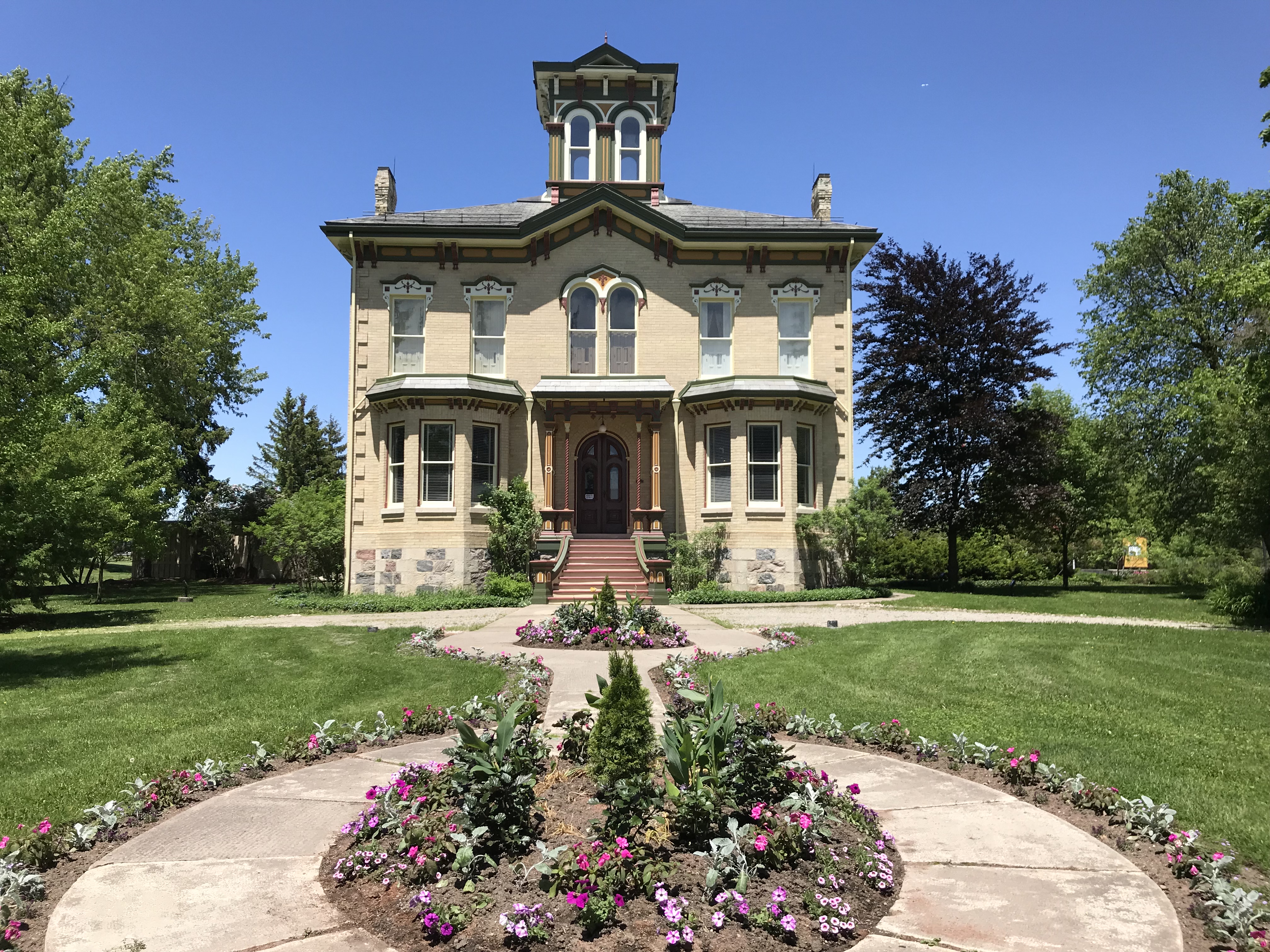
    Castle Kilbride.JPGCastle Kilbride

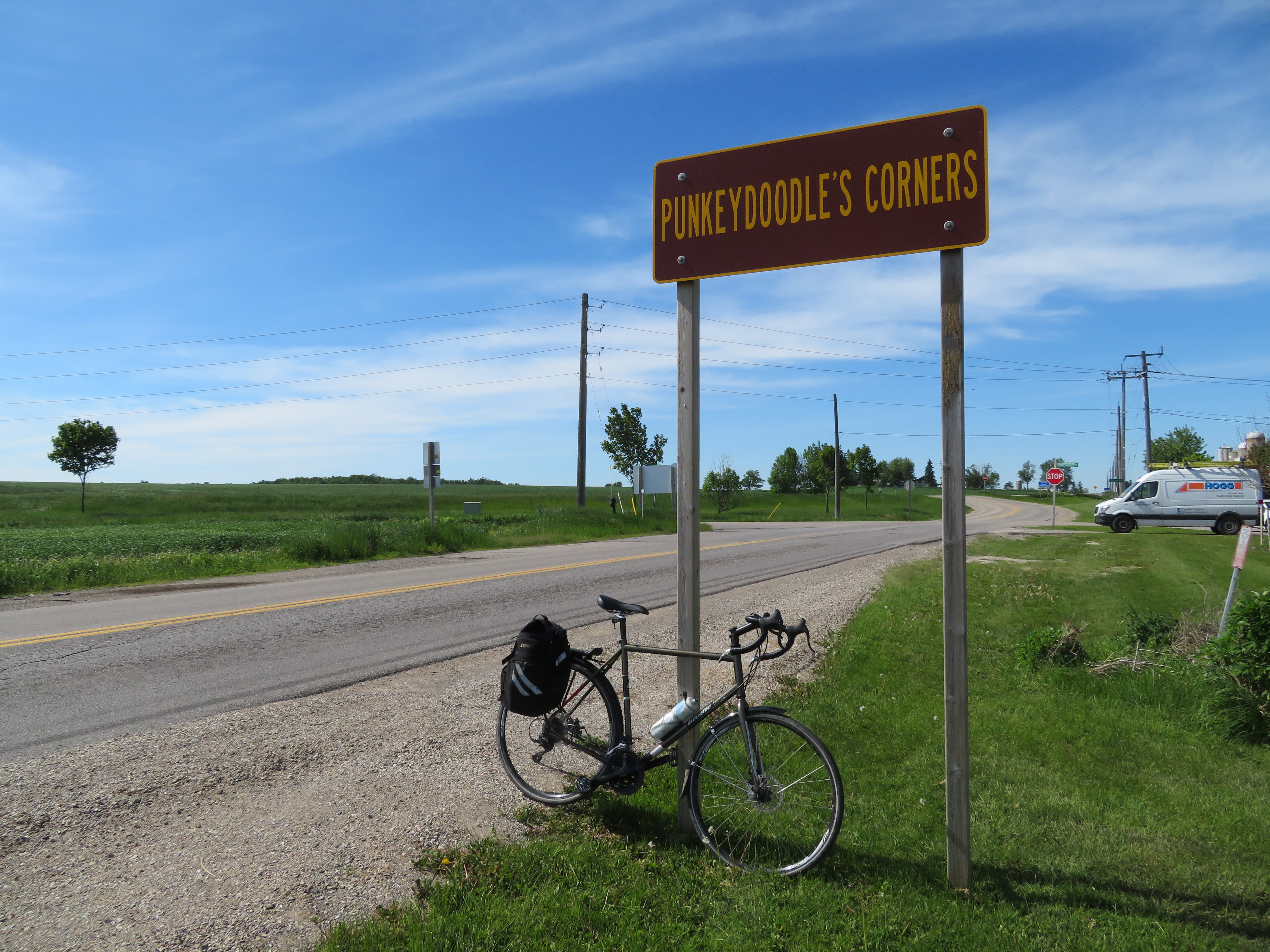
    I biked as far west as the interestingly named hamlet of Punkeydoodle’s Corners, located at the point where Waterloo Region, Perth County, and Oxford County meet.

    Though the origin of the crossroads’ name is not known for sure, the most common theory is that a local innkeeper on the old Huron Road (an early colonization road that connected Guelph with Goderich on Lake Huron) like to sing “Yankee Doodle,” but it sounded more like “Punkey Doodle” to his patrons. The hamlet is now bypassed by Highways 7 and 8, and local business migrated to nearby New Hamburg, located on the railway.

    The Punkeydoodle’s Corners signs are commonly stolen, and one of the signs was obviously missing when I visited. But there’s one more claim to fame: the world’s highest street address number: 986039 Oxford-Perth Road.
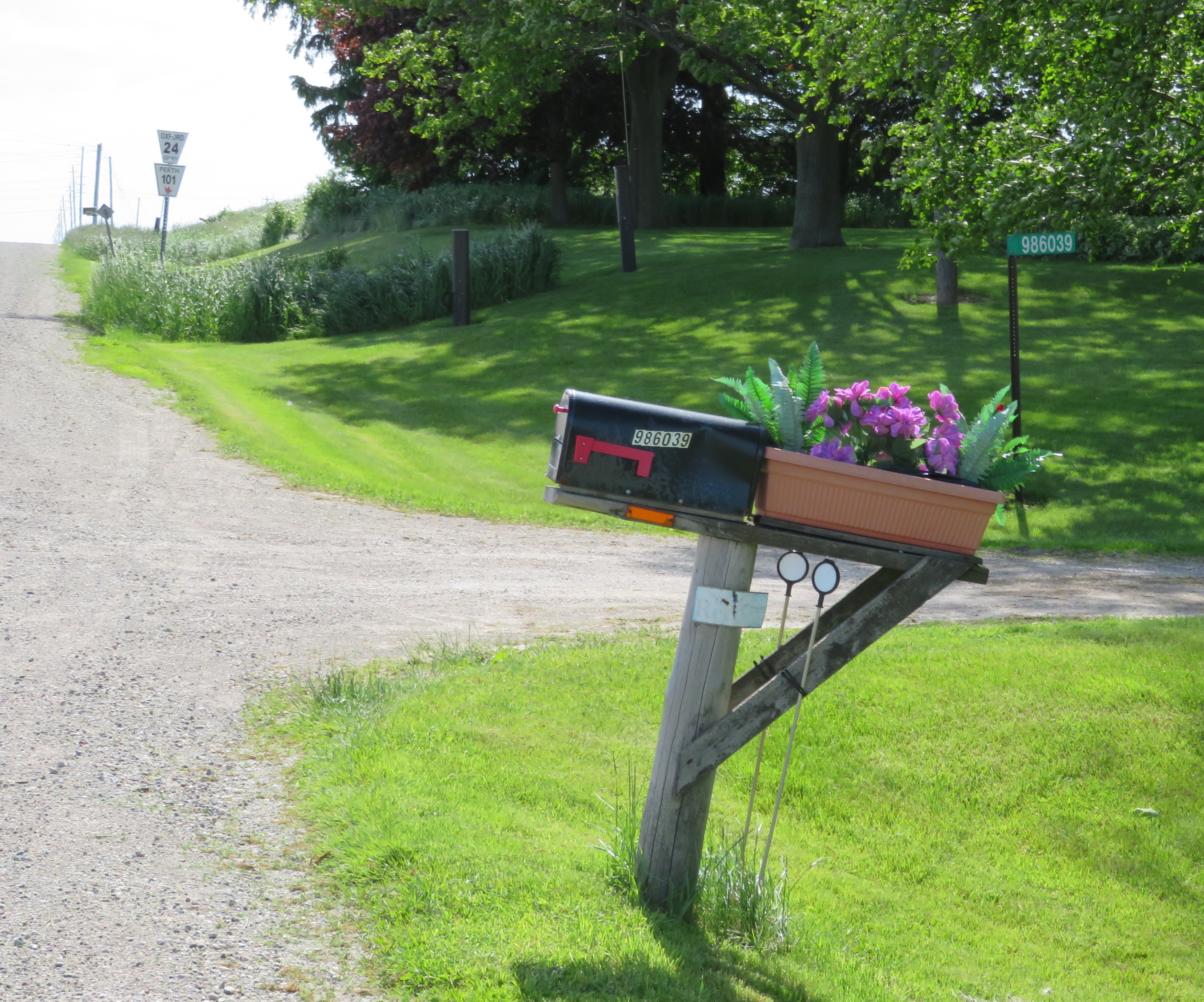
    986039.jpg986039 Oxford-Perth Road, a private residence with what is probably the highest numbered address in the world. Road markers for Oxford County Road 24 and Perth County Road 101 are in the background. 

    In many parts of Ontario, rural addresses have a six-digit number, often known as 911 or fire numbers. In Dufferin County, for example, the first two digits refer to the road itself, with each rural road assigned an unique number. Each road is then broken down into sections, represented by the third digit. The last three digits indicate the distance — in decametres — from the beginning of the road section to the property’s entrance, with even numbers on the west or south side of the road.

    Before 911 numbers were introduced, addresses might only consist of a family or business name, rural route number and the name of the village or town with the nearest post office, or by the property’s lot and concession numbers.

    For example, 795112 3rd Line East, Mono, is the address of Mono Cliffs Provincial Park. The number 79, an odd number, has been assigned to the 3rd Line East of Hurontario Street (which runs north-south), while the third digit, 5, represents the section of 3rd Line East north of Mono Centre Road. The entrance to the park is 1.12 kilometres north of Mono Centre Road, on the west side of the road.

    This system allows emergency responders to pinpoint an address quickly and accurately. This is especially important in rural areas, where emergency personnel may be volunteers arriving in their own vehicles. In many parts of southern Ontario, rural roads may simply go by a name, or they may also have a highway or county road number, or still be known by their concession or line numbers. Urban areas, like Orangeville and Shelburne in Dufferin County, have their own numbering systems, separate from the rural 911 addresses.

    Each county may have a slightly different system, but they all have the same purpose. 986039 Oxford-Perth Road just happens to be in the far southeast corner of Perth County, hence its high number. The lowest address numbers in rural Perth County can be found in the northwest corner, near Molesworth.

    It’s worth noting that not all rural areas developed similar numbering systems. In Toronto and York Region, road addresses are based on their origin point. For east-west streets that cross Yonge Street, street numbers start on other side. For example, Yonge Street’s numbering starts at 1 Yonge Street, the Toronto Star Building, and ends at 21137 Yonge Street, where it unceremoniously disappears into the Holland Marsh. 
  • Mind the gap: as Waterloo’s light rail line opens, other connections close

    44248408831_5f34e1eaaa_o.jpg
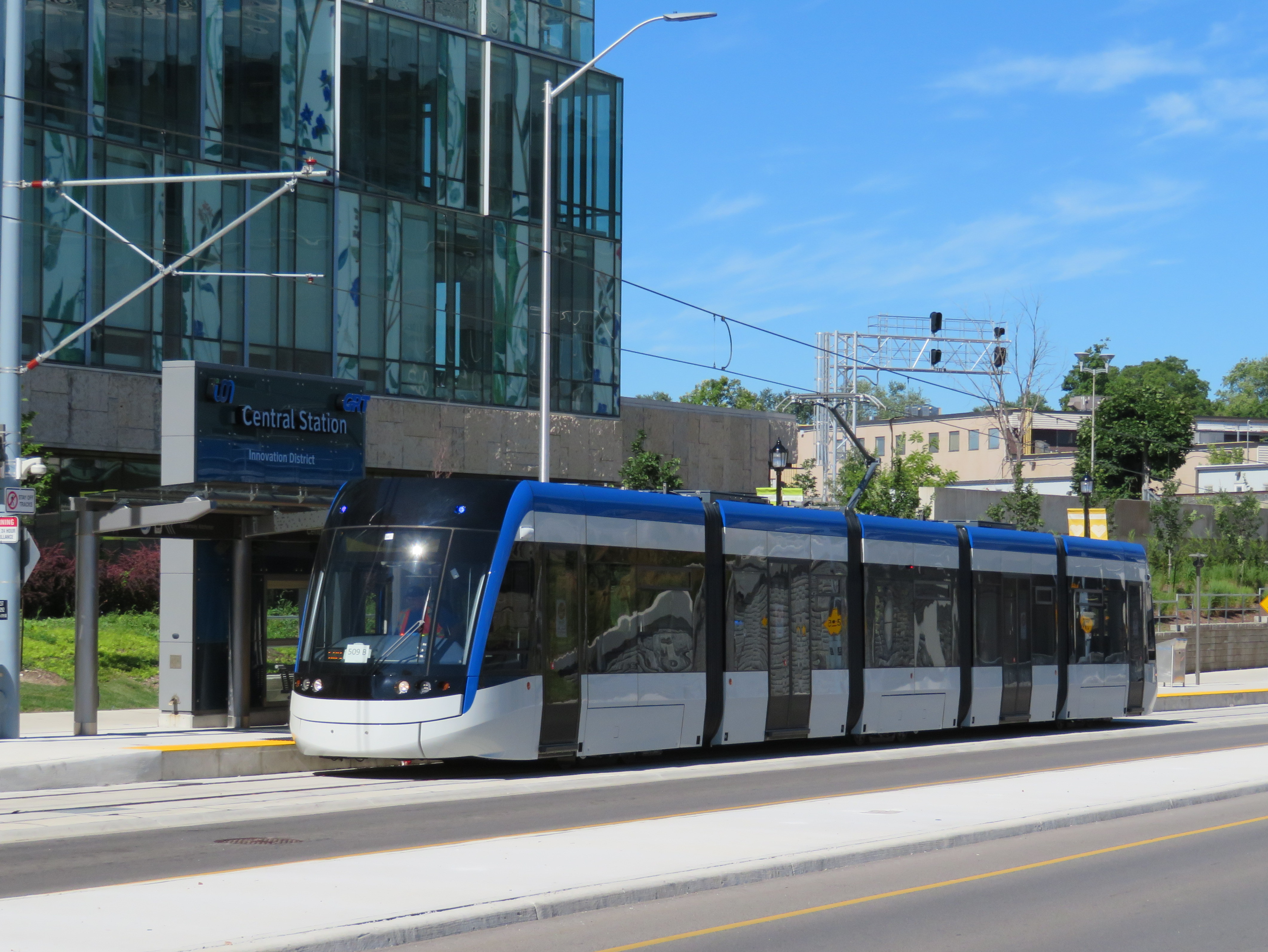
    ION LRT service will finally commence Friday June 21

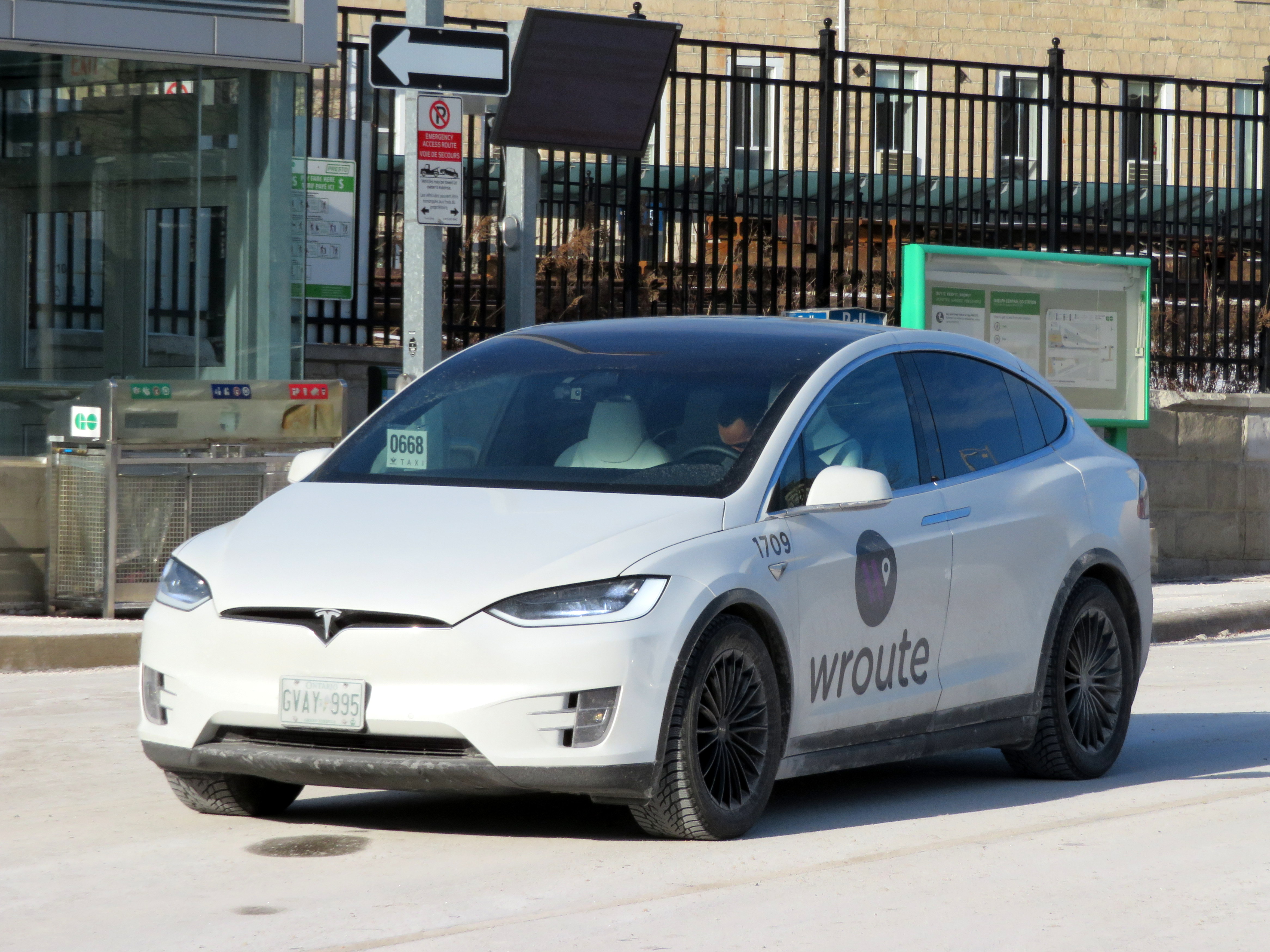
    Early in 2019, I had the opportunity to take a trip on Wroute, a new service that connected Guelph, Kitchener, and Burlington. Wroute was an interesting concept, a privately-operated option with characteristics of a bus service, a taxi company, and ride-hailing app. With a fleet of Tesla Model X electric SUVs, Wroute tried to fill a gap left by GO Transit and other intercity transportation operators in the Guelph-Kitchener/Waterloo-Hamilton Triangle. Unfortunately, Wroute ended operations on Thursday May 2.

    As I wrote in my article for TVO, fares were too high for a regular commuter, costing $20 for a single ride between Guelph and Kitchener, and $28 between Guelph and Aldershot, more than double the equivalent GO Transit fares.

    IMG_8407-001Wroute Testla at Guelph Central Station, January 2019
    When Waterloo Region celebrates the opening of the ION LRT on June 21, the bus system in Kitchener-Waterloo will be restructured to better connect with the corridor. Despite the improvements within Waterloo Region, links are still needed to surrounding communities. Hamilton and Guelph remain largely disconnected. With a growing employment base in Kitchener-Waterloo, as well large university and college campuses in all four city-regions, filling the gap is more important than ever.

    Hopefully this will come done soon.


  • Brantford’s downtown was the “worst in Canada” – but has it bounced back?

    IMG_7684-001
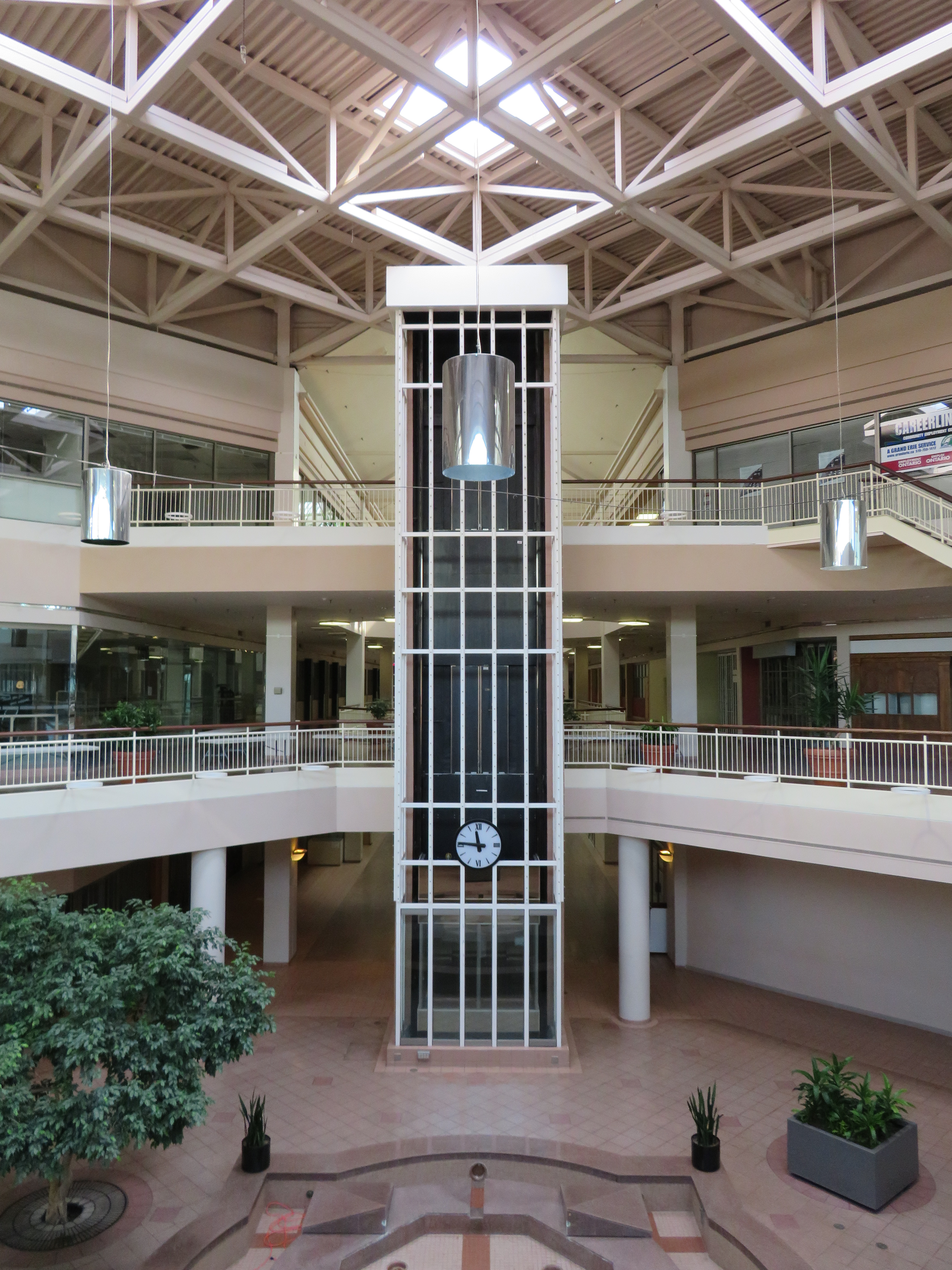
    Interior of former Eaton Market Square, 2018

    On Labour Day weekend, I paid a visit to Brantford. I brought my bike on GO Transit, taking a train to Aldershot and a bus from there to the Telephone City. I then biked from Brantford to Hamilton on one of Ontario’s best rail trails.

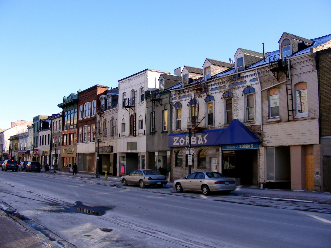
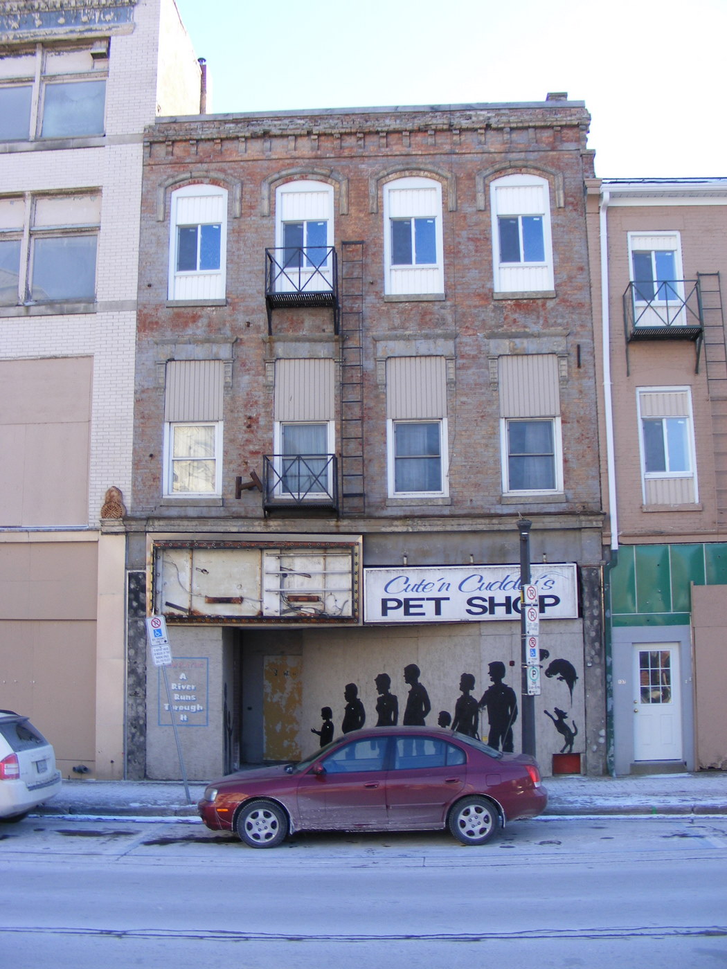
    Over a decade ago, Mayor Chris Friel called Brantford “the worst downtown in Canada.” It was not hard to understand why. Colborne Street, Brantford’s main street, was lined with neglected commercial buildings, many with boarded up streetfronts. In the 1990s, many of the plywood hoardings had been decorated with pretend business names and silhouettes of customers, either as an attempt at beautifying the street or recalling the variety of businesses that had once occupied the strip. Only a few stores and restaurants remained open.

    4360965559_d1aa044078_o.jpgBoarded up storefront, Colborne Street, 2010

    There were several reasons for Downtown Brantford’s decline. In the 1980s, Brantford’s major industries, including the once-mighty Massey-Ferguson, had shut down local operations. Other industries like Cockshutt (later White Farm Equipment) had also departed Brantford. By the early 1990s, the unemployment rate hit 24 per cent.

    Cockshutt plant offices in 2004, and the remains in 2018

    The city also made some questionable urban renewal decisions. The old open-air marketplace at Colborne and Market Street, along with a whole city block was cleared for Eaton Market Square, which opened in 1986. The city also built a new parking structure to the south, as well as a new office building across the street from the new mall. Like most downtown malls built in Ontario, Eaton Market Square was a commercial failure. Brantford already had two suburban malls — Lyndon Park Mall, anchored by Sears, and Brantford Mall, anchored by the Right House, a Hamilton-based department store, Woolco and Loblaws.

    While parking at the suburban malls was free and plentiful, customers had to pay to park downtown, and Eaton’s in the 1980s was too upmarket for a smaller, blue collar city. Brantford’s downtown parking garage, built by the municipality, was to be paid for with parking fees.

    IMG_7686-001
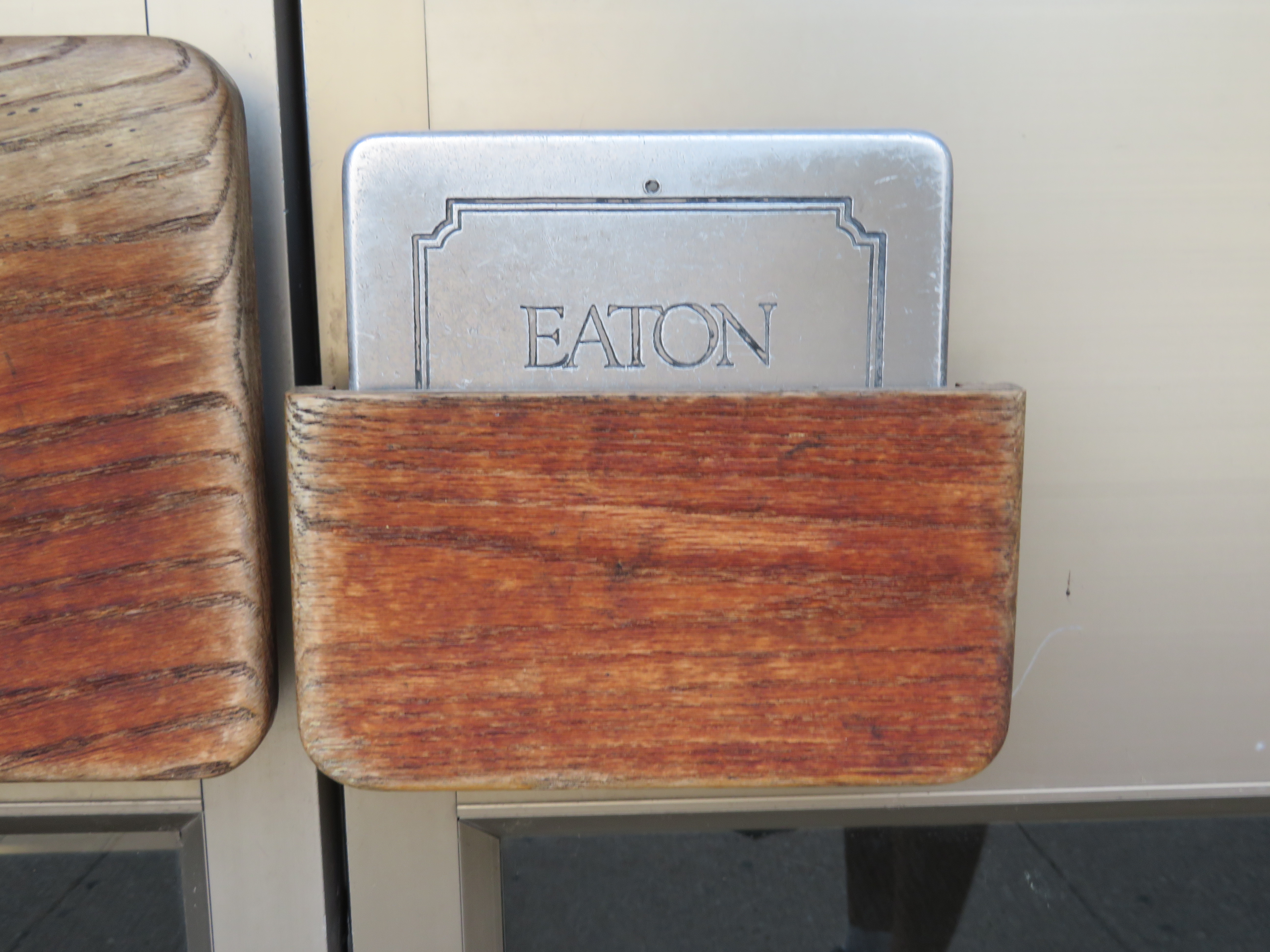
    Eaton Market Place dropped the Eaton name after its anchor closed, but the mall’s past has since revealed itself

    While Eaton Market Square brought in many of the remaining retailers that were left on Colborne Street when the mall opened, as the mall floundered, most major tenants left as soon as their leases were due for renewal. By 1997, when Eaton’s entered bankrupcy and closed the Brantford store, many of the other shops had already closed.

    But the mall wasn’t the only thing Brantford officials did to try to revitalize its city centre.

    Like Flint, Michigan’s efforts to attract tourists and shoppers downtown coincident with the decline of its manufacturing base (described in Michael Moore’s film Roger and Me), Brantford pursued other projects along with the new mall to revitalize its downtown core. The provincial government planned a new electronic processing centre, but was cancelled by the NDP-led government in the early 1990s due to budget pressures.

    Icomm was to be a new telecommunications museum, science centre, and research hub, built on an old industrial site just south of downtown. While the building was completed in the early 1990s, it was left vacant after Bell Canada pulled its funding for the venture. Though city officials hoped for a post secondary educational institution, the Icomm building became a casino. Next to the casino, a commercial plaza, including a supermarket, fast food restaurants and a LCBO store was built, along with free surface parking.

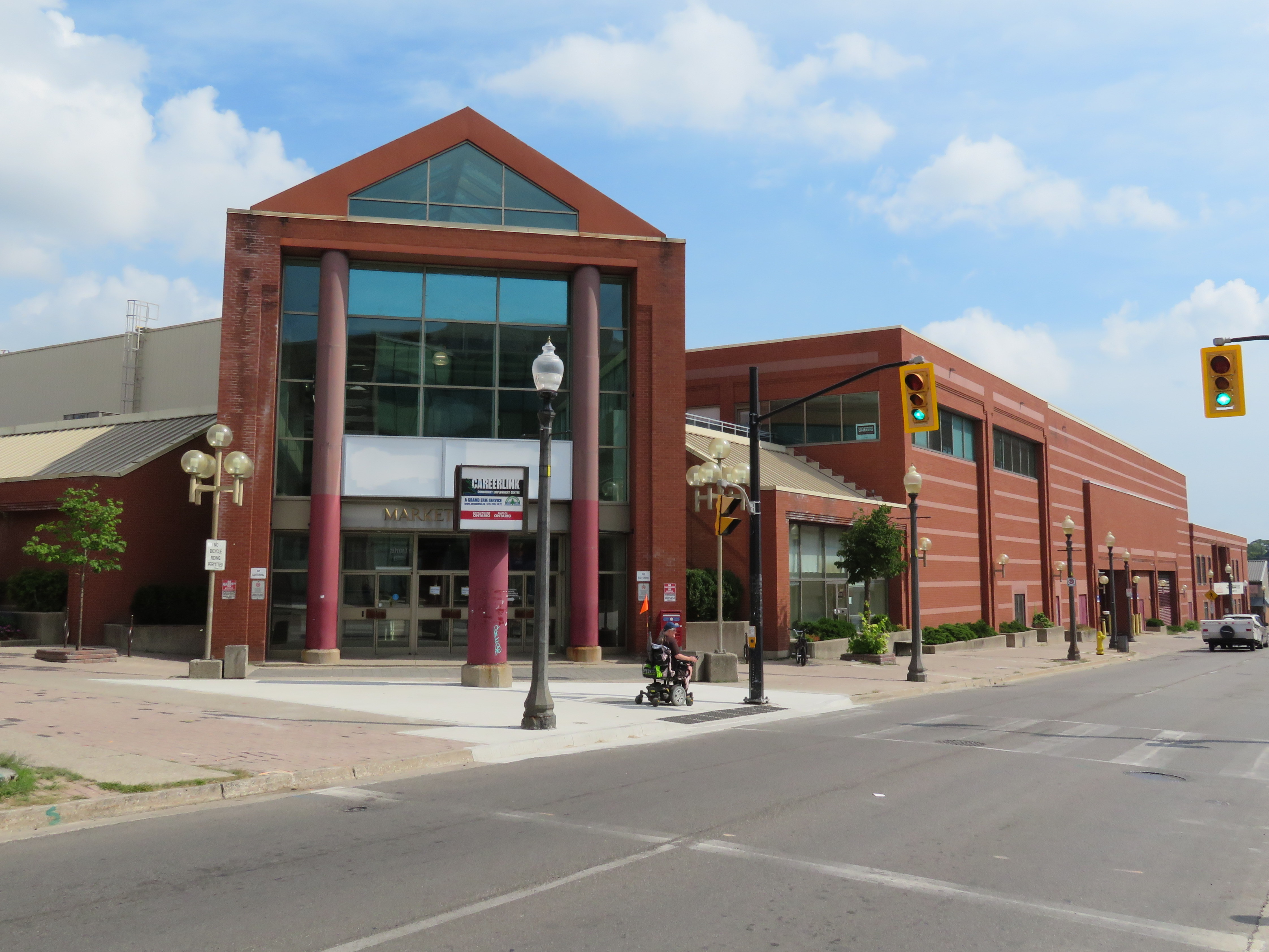
    IMG_7676-001.JPGMarket Square

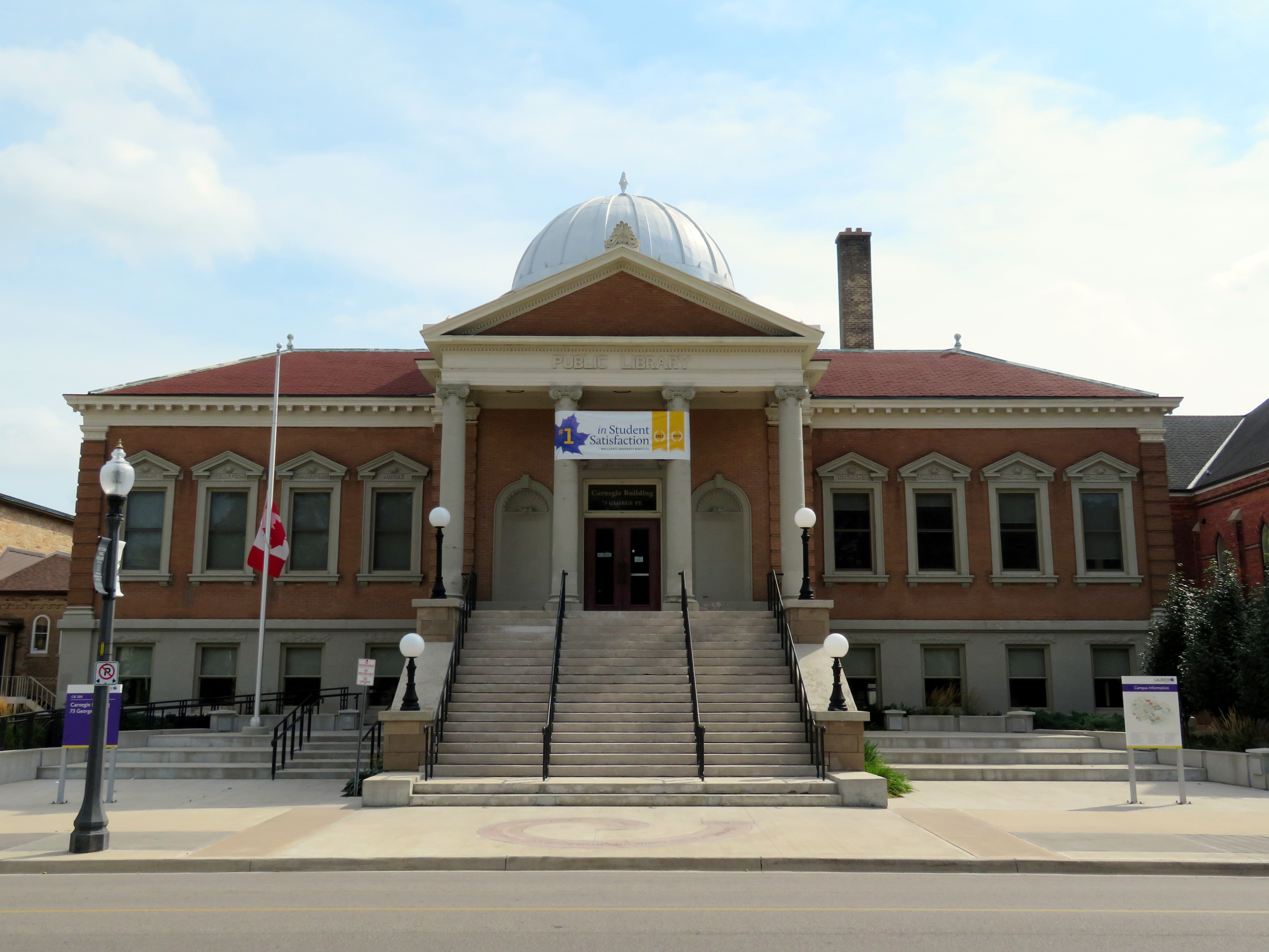
    Eventually, Brantford found a viable solution for revitalizing its downtown core. In 1999, Wilfrid Laurier University opened a satellite campus, starting out in the old Carnegie Library sold by the city for $1. By 2002, there were 340 students; today, enrollment is  about 3,000. Laurier now owns dozens of building downtown, including a previously abandoned movie theatre, and even the old old Eaton Market Square building. Hundreds of students live in local residences.

    IMG_7664-001The old Carnegie Library, Brantford

    Yet, there is still little retail downtown, though there are now several newer restaurants, bars, and coffee shops.

    It hasn’t been all good news. Nipissing University, based in North Bay, also established a satellite campus in Brantford. In December 2014 it announced that it would be winding down its presence there, including its joint programs with Laurier. The Ministry of Education had capped the number of funded spaces for Bachelor of Education students and reduced funding for the program. The joint programs were one of Brantford-Laurier’s main draws.

    4360965043_88fea24940_o.jpgColborne Street, January 2010

    Meanwhile Colborne Street continued to languish. In 2010, the city expropriated and demolished the entire south side of the street, including several commercial blocks still occupied. A new joint Laurier-YMCA athletics and recreation facility was built on the site, which will open by the end of the year. Sadly, the new building contributes very little to Brantford’s main street.

    IMG_7674-001The architecture of the new YMCA-Laurier athletic building is sterile compared to the old Colborne Street storefronts
    At the least, Laurier’s Brantford campus has brought some life back to a moribund downtown core that suffered through misguided urban renewal schemes, a major restructuring of the local economy, competition from suburban retail developments, and urban neglect.

    But a satellite post-secondary institution on its own isn’t necessarily a panacea for other suffering downtowns. As Norma Zminkowska pointed out recently in an article for TVO, satellite campuses aren’t necessarily permanent boosts to the local economy. In Barrie and Bracebridge, small campuses were closed for financial reasons. They weren’t able to attract enough students. Small campuses, especially those with fewer than 3500 students, often struggle to attract students and faculty — and scattering programs can weaken the institution. This is a warning worth considering as Laurier plans another satellite campus in Milton and Ryerson plans its second campus in Downtown Brampton.


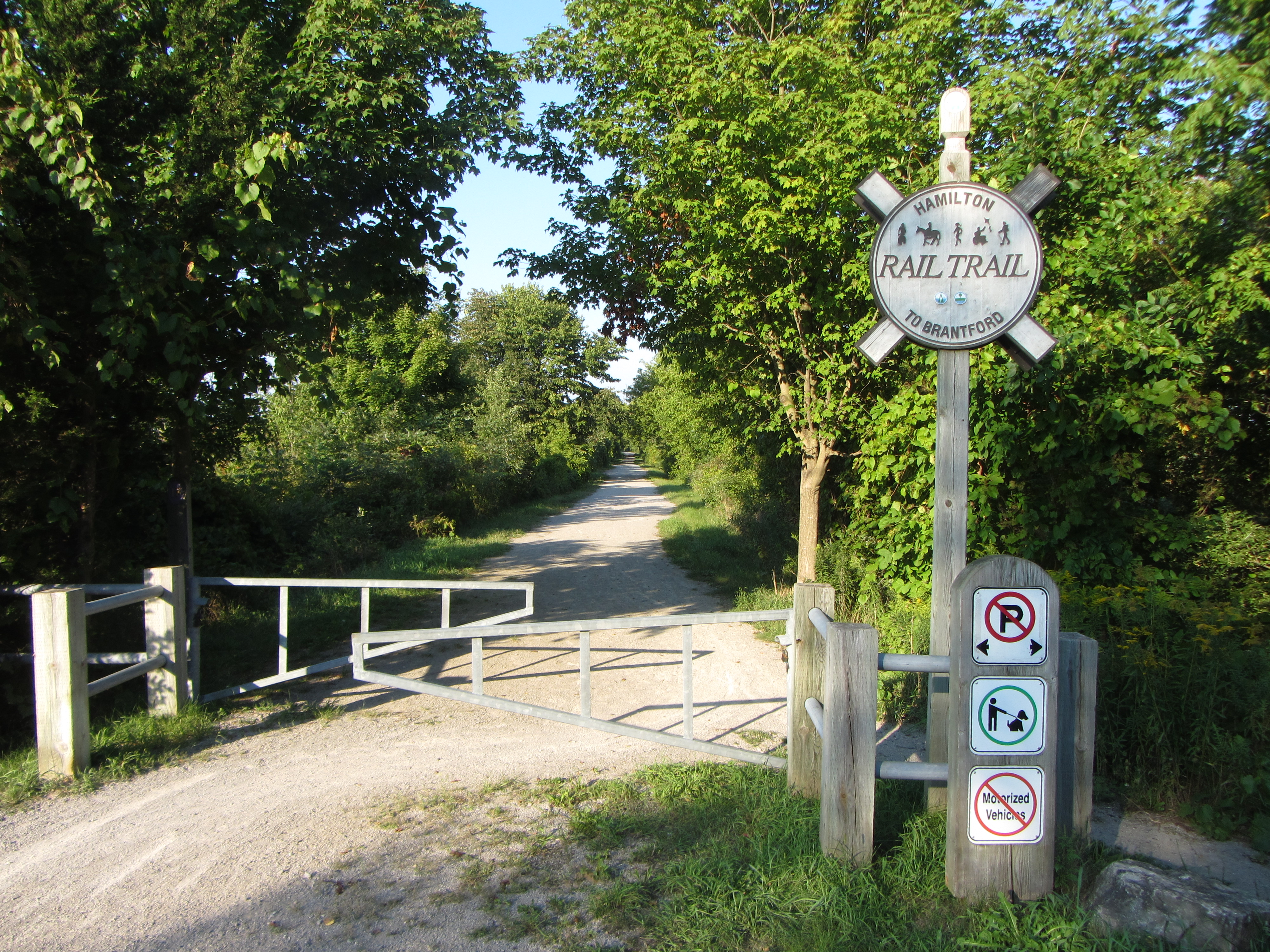
    As an aside, Brantford is an interesting town, and is well-positioned at the junction of three major cycling trails connecting it to Cambridge and Kitchener-Waterloo to the north, Simcoe and Port Dover to the south, and Hamilton to the east. The Hamilton-Brantford Rail Trail is one of Ontario’s best trails, in excellent condition, and a gentle grade climbing the Niagara Escarpment.

    IMG_4333
    Hamilton-Brantford Rail Trail

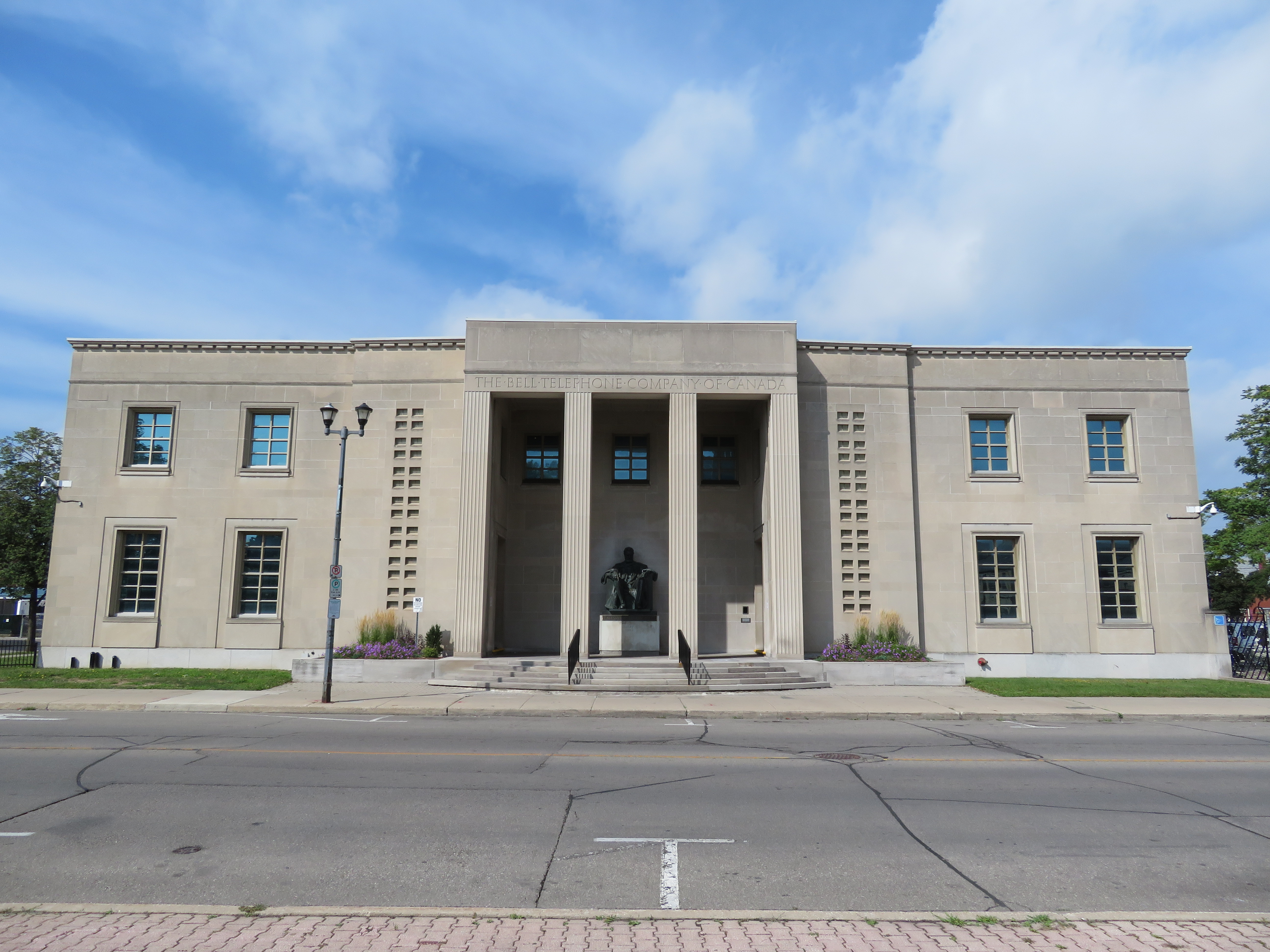
    Within Brantford itself, there are several interesting sights. The Bell Telephone building features a statue of Alexander Graham Bell, who resided just outside of town for a number of years. The world’s first long-distance telephone call was made between nearby Paris, Ontario and Brantford in 1876. The area surrounding Victoria Square north of Colborne Street and the mall is reminiscent of a New England town square.

    IMG_7649.JPGBell Telephone Building

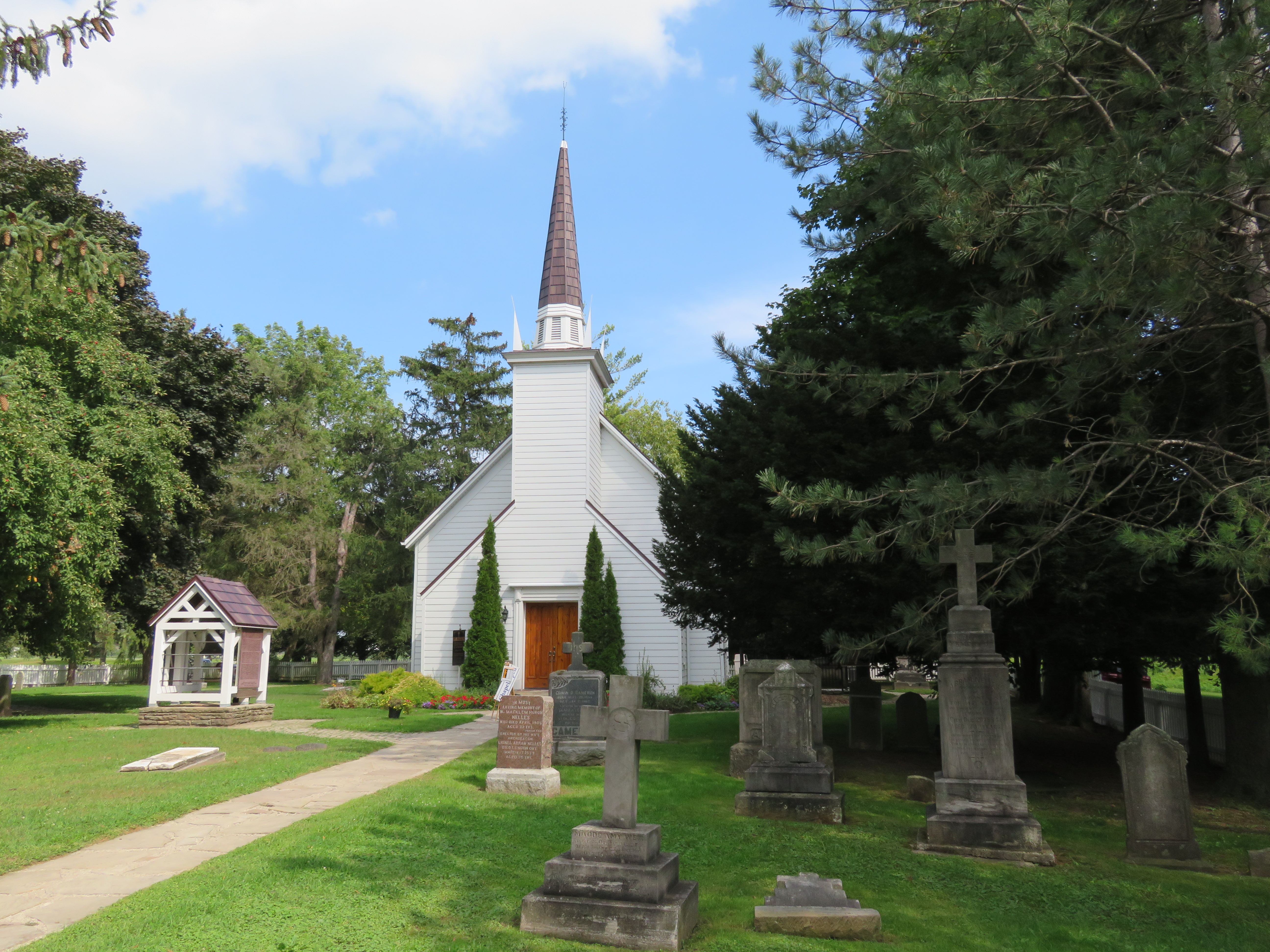
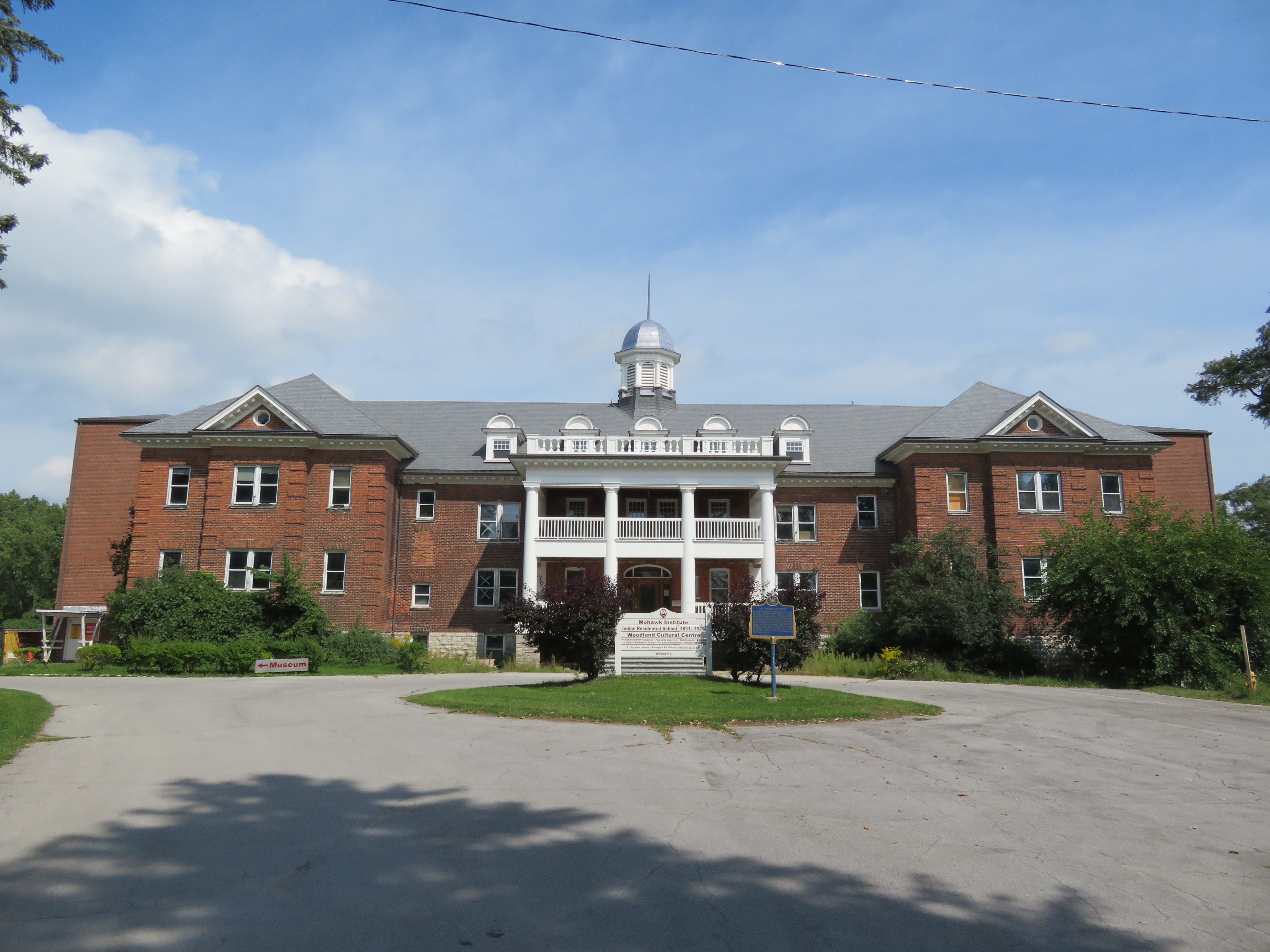
    Brantford was named for Joseph Brant, the anglicized name given to Thayendanegea, the Mohawk leader who allied with the British in the American War of Independence. His community, which previously resided in what is now Upstate New York, was given a large land grant on the Grand River. That land grant shrunk to what is now Six Nations. Her Majesty’s Royal Chapel of the Mohawks is one of the oldest buildings in Ontario, built in 1785. It is worth a visit. Nearby, the Woodland Cultural Centre is a museum and art gallery housed in a former residential school. The museum is dedicated to the history and future of the province’s First Nations.
    IMG_7727.JPGHer Majesty’s Royal Chapel of the Mohawks

    IMG_7709-001.JPGWoodland Cultural Centre. This building formerly housed the Mohawk Institute, one of many residential schools built as part of Canada’s shameful attempts at eradicating Indigenous heritage. It is now a First Nations museum and art gallery. 
     

  • How YRT service cuts at York University demonstrate a failure of regional transit

    IMG_4738-002.JPG
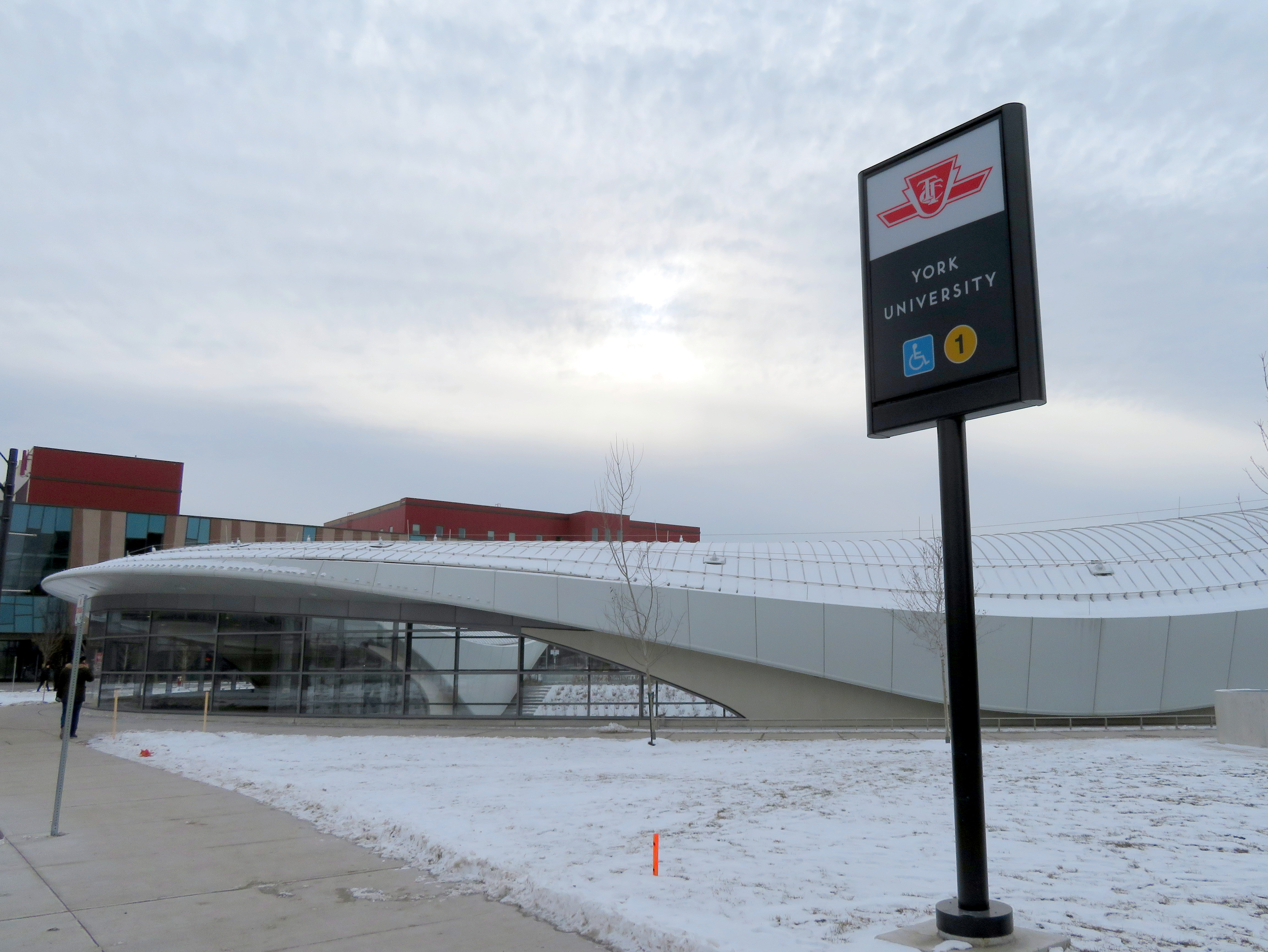
    York University Subway Station, opening day

    On Sunday, December 17, 2017, the TTC opened the long-awaited $3.2 billion Toronto-York Spadina Subway Extension to York University and the City of Vaughan. The extension of Line 1, which included six new stations, opened over two years behind schedule largely due to construction-related delays. It was the first subway to extend beyond Toronto’s boundaries; York Region is now pushing for another subway extension up Yonge Street to Richmond Hill.

    Unfortunately, fare integration between the TTC and suburban transit agencies was never completely worked out, despite many years’ notice that this would be an issue once the subway extension was opened. A new GO Transit terminal was built at Highway 407 Station, meant to handle GO Transit’s many buses currently serving York University. York University and York Region Transit (YRT) signed an agreement that YRT would remove its buses from campus after the subway opened. There was an assumption that transit riders destined for York University would simply transfer to the subway, but measures to prevent those riders from paying a second fare were never worked out.

    And now York Region is withdrawing its buses from the campus as of September 2, 2018. While Brampton Transit won’t be withdrawing completely from York University, it will reduce some of its service. For now, GO Transit will not be making any changes to its bus routes serving the campus, and will continue to serve the York University Commons.

    Many YRT passengers will have to pay the whole $3.00 each way, or be required to make a new transfer and/or walk a farther distance from the north terminal at Pioneer Village Station.

    The fact that there’s no fare agreement to allow YRT passengers to ride the subway from Vaughan Centre to York University without paying a full TTC fare is indicative of the failure to fully coordinate regional transportation in the Greater Toronto and Hamilton Area. And York Region’s complete abandonment of what used to be one of its most important hubs is indicative of that region’s lack of commitment to funding transit operations adequately, despite its ambitious capital spending and lobbying for subway extensions.

    (more…)

  • Requiem for Ontario’s regional malls

    IMG_8782-001Shoppers World Brampton, 2016, before the Target store was replaced by smaller stores, including Giant Tiger
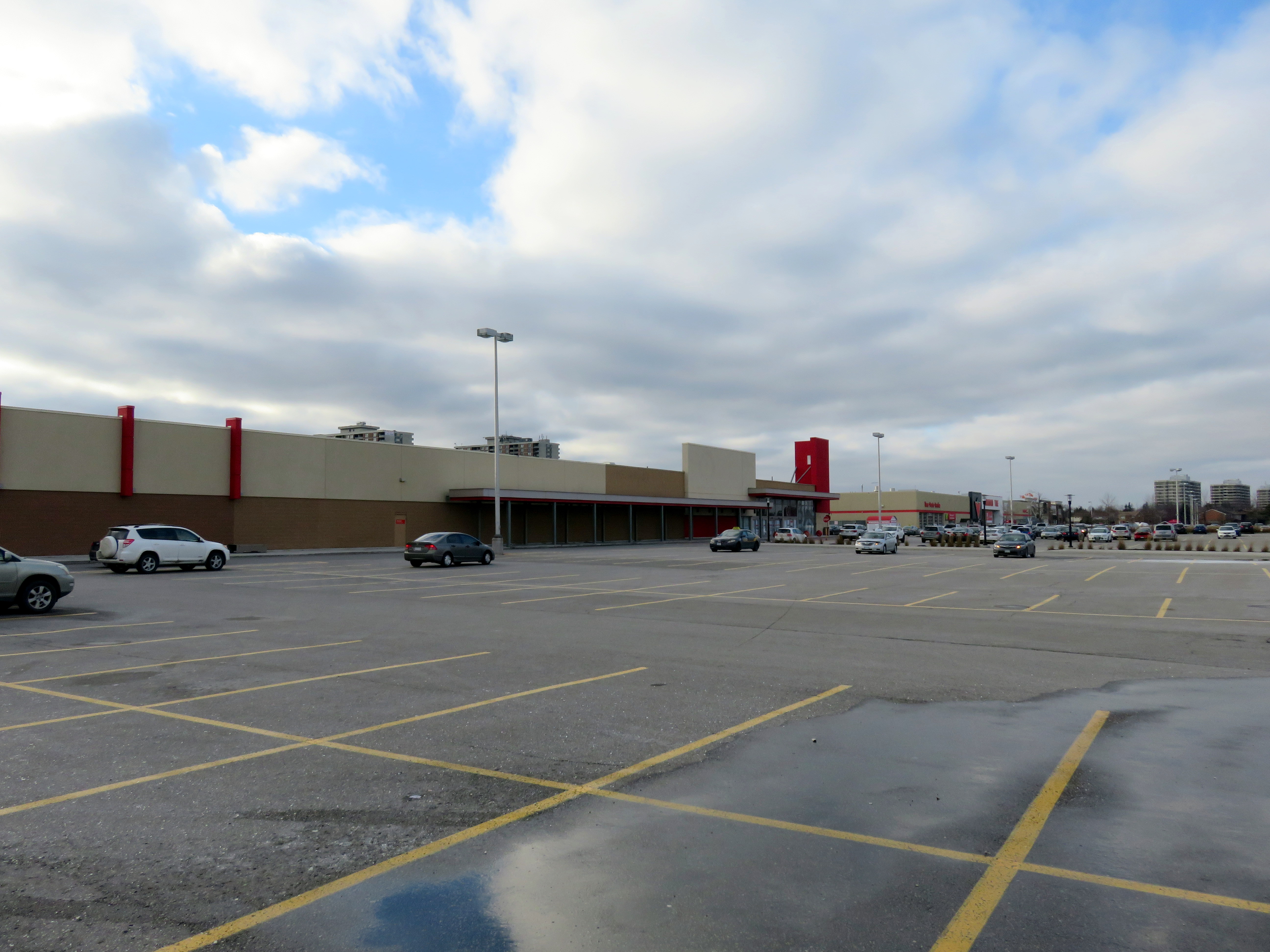
    Recently, I wrote about the history of Ontario’s downtown malls. Most of these shopping centres, built in the 1970s and 1980s in the downtown cores across the province, failed by the end of the 1990s. The collapse of the Eaton’s department store chain and competition from larger, suburban malls and new big-box retailers drove customers away from Ontario’s downtowns. Only in Toronto and Ottawa, with large downtown office employment, residential development, and good urban transit, did these major shopping malls thrive.

    But that does not mean that all suburban shopping centres are doing well, especially after the loss of Target in 2015 and Sears Canada in 2017. For TVO, I wrote more about how smaller regional malls in Ontario are re-positioning themselves.

    The Brampton house that I grew up in was a ten minute walk from Shoppers World, which, in the 1980s, had a full line department store, Simpson’s, as well as Marks and Spencer, K-Mart (where I had my first paying gig, delivering shopping carts back to the store abandoned in nearby parks), a Pascal hardware store, and two supermarkets, Food City and A&P. Larger, more popular malls like Mississauga’s Square One and Bramalea City Centre were one bus ride away, but Shoppers World held its own, even if it was second tier. By the 1990s, though, it was clear that the mall was in decline: national retailers were leaving and there was a noticeable lack of investment in the property.

    When RioCan REIT purchased Shoppers World in the late 1990s, it made some improvements and attracted big-box retailers like Canadian Tire, Staples, and Winners. Zellers took over the K-Mart store, which was expanded. But The Bay (which replaced Simpson’s) was closed down and the store later demolished. I had left Brampton in 2006, but I was still sad to see my one-time local mall decline. Now RioCan has talked about downsizing the mall, and redeveloping part of the property. Competition from larger, stronger shopping malls, newer retail power centres, the mismanagement of several retail firms, and internet shopping have all taken their toll. Shoppers World isn’t a dead mall, but like many smaller malls, it will be adapting to changing times.

    In the TVO article, I take a look at a few other malls, like London’s Westmount Mall, in similar circumstances.

    ShoppersWorld.jpgShoppers World, 2018. Despite many store vacancies, it’s still a community hub.
  • Where, exactly, is Northern Ontario?

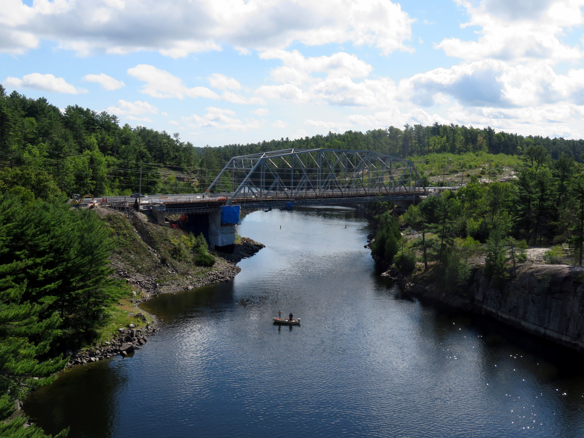
    29496350986_0f43c86857_k.jpgThe French River at Highway 69, where Northern Ontario truly begins
    Last week, the leaders of the three major provincial parties (Liberals, Progressive Conservatives, and the New Democrats) met in Parry Sound, at a debate dedicated to issues specific to Northern Ontario. It was the second of three debates scheduled ahead of the June 7, 2018 general election.

    But is Parry Sound, a town that’s only a two hour’s drive north of Toronto (when free of weekend Cottage Country traffic) really a part of Northern Ontario? That depends on who you ask. Even government agencies disagree. In my opinion, though, Parry Sound isn’t in Northern Ontario, even though the district it’s located in shares some characteristics of this vast part of the province.

    Despite living my entire life in the Greater Toronto Area, I have an affinity for Northern Ontario, particularly the northeastern part of the province. My father’s hometown is Timmins, one of my siblings lives in Sudbury, and I have visited both cities many times. I made a trip up to Sault Ste. Marie to ride the Algoma Central Railway passenger train between Sault Ste. Marie and Hearst and back before it was cancelled, and I still lament the loss of the Northlander, Ontario Northland Railway’s passenger train between Toronto and Cochrane that was terminated in 2012. I even made it all the way to Moosonee, on the James Bay coast.

    The northern part of this province covers a huge area — over 800,000 square kilometres, larger than France, Belgium, and the Netherlands combined — but has a population of just over 750,000. It is even crossed by a time zone boundary. Despite my connection to the region, I had yet to make a proper visit to Thunder Bay and Northwestern Ontario (I finally paid a visit in August 2019).

    The North includes many First Nations communities accessible only by plane or ice road. Other communities, with names like Dryden, Kapuskasing, Iroquois Falls, and Kirkland Lake, were established to serve mines or pulp mills — resulting in a very different economic landscape than the agricultural and industrial south. In recent decades, many of those mines and mills have closed, eliminating many towns’ only major employer.

    In a province dominated by the urban centres in the Greater Golden Horseshoe, Ottawa, and London, it’s too easy to ignore the North.

    So how do people actually define Northern Ontario?

    Traditionally, Northern Ontario begins at the French River, Lake Nipissing, and at the Mattawa River. North Bay, which calls itself the “Gateway to the North” sits right on this line. For administrative purposes, this includes the entirety of Sudbury and Nipissing Districts, which extend south of the French and Mattawa Rivers, and includes most of Algonquin Park. It also includes Manitoulin Island, which can only be reached year-round from the north, through Sudbury District.

    The Canadian Shield, the defining landscape of most of Northern Ontario, starts further south. Driving north from Toronto on Highways 400 or 11, the shield starts about where Simcoe County ends and Muskoka District starts. But the Canadian Shield also encompasses large sections of the City of Kawartha Lakes and Peterborough, Hastings, Frontenac, and Lanark Counties and the entirety of Haliburton County.

    NOntarioThe various definitions of Northern Ontario, including the county, regional and district boundaries. 

    But the provincial and federal governments both have special economic development funding programs whose boundaries take a more liberal definition of Northern Ontario. FedNor, the Government of Canada’s economic development agency, includes Parry Sound and Muskoka Districts. The Northern Ontario Heritage Fund Corporation, a provincial agency, includes Parry Sound District, but not Muskoka District.

    Whether Parry Sound and Muskoka are considered part of Northern Ontario is very much a political question. In 2004, the newly elected Liberal government chose to remove Muskoka from the areas eligible for provincial grants meant for northern communities — Muskoka being a reliable Progressive Conservative seat, and the riding of the previous PC premier, Ernie Eves.

    Parry Sound District, while not, in my view, part of Northern Ontario, at least shares some similar characteristics with neighbouring Sudbury and Nipissing Districts. It includes many isolated communities, and apart from the Town of Parry Sound itself, it has a very sparse population. Muskoka, on the other hand, is more urbanized with three larger towns, and is much more popular for recreation, particularly during the summer. Muskoka also has a regional government — the District Municipality — while much of Parry Sound District’s land is unorganized — meaning lands without any municipal government.

    And if one considers Muskoka to be part of Northern Ontario, why not also include Haliburton County, which also has a sparse population and is relatively isolated from the urbanized south? A line needs to be drawn somewhere, and there is no valid reason why Muskoka should ever be considered a part of Northern Ontario. There might be a case for Parry Sound District, but definitely not cottage country.

  • A tale of two university campuses

    BramptonParkingLot
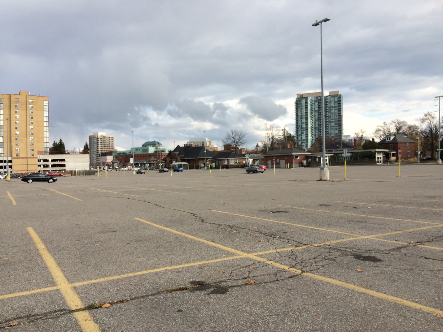
    Site of Brampton’s new Ryerson/Sheridan campus

    Last week, the provincial government announced two new post-secondary educational campuses in Toronto’s fast-growing western suburbs, due to open in 2022. Wilfrid Laurier University will be partnering with Conestoga College on a new facility in Milton. Brampton will be getting a new Ryerson University campus in partnership with Sheridan College. Both new campuses, each receiving $90 million in provincial capital funding, will be focused on undergraduate STEAM (science, technology, engineering, arts, and mathematics) programs. Both will host up to 2,000 students once the new facilities are fully operational.

    Despite the many commonalities between the new Milton and Brampton facilities, the announced campus locations could not be any more different. Milton’s Laurier/Conestoga campus (which I previously wrote about as an example of the problems of greenfield institutions) will be located on a new greenfield site on the southwestern outskirts of the town’s built-up area, while Brampton’s Ryerson/Sheridan campus will be located in that city’s downtown core, on a site currently used for commuter parking. But since GO Transit’s free commuter parking has to go somewhere, Metrolinx has been buying up and demolishing houses and offices on a nearby downtown block.

    I compared the two new campuses for TVO

  • Ontario’s failed downtown malls

    IMG_0392.JPG
    Bayside Mall, formerly the Sarnia Eaton Centre, on a Saturday morning in 2013. Most stores are vacant or occupied by non-profits or independent businesses.

    The Toronto Eaton Centre, large, famous, and vital, is only one of many malls built in the downtown cores of Ontario cities between the 1960s and 1990s. From Thunder Bay to Cornwall, the construction of new enclosed shopping centres were seen as a necessary tool to keep the old city centres vibrant and relevant in the face of competition from new suburban malls. But only in the province’s two largest cities did the concept work. Elsewhere, these urban shopping complexes were left largely vacant within ten years of opening, when leases expired. When the Eaton’s department chain went bankrupt in 1997, huge voids were left behind that developers and municipalities struggled to fill.

    The Toronto Eaton Centre was opened in two phases between 1977 and 1979. It added hundreds of shops and new office space to Downtown Toronto, anchored by a new Eaton’s flagship and was connected to the Simpson’s store across Queen Street. Today, the Eaton Centre is Canada’s second largest mall (including the Hudson’s Bay/Saks Fifth Avenue building) and the Toronto region’s second most productive shopping centre in terms of sales per square metre. In Ottawa, the downtown Rideau Centre, opened in 1983, is the busiest and most productive mall in that region (Retail Council of Canada, 2016).

    But elsewhere in Ontario, downtown malls — mostly built with municipal and/or provincial government support — have been, without exception, commercial and urban development failures. Not only did they suffer from high vacancy rates, they helped to wreck the downtown cores they are located in rather than foster the economic revitalization they once promised.

    (more…)
  • How intercity bus service is failing Ontarians

    4003585727_e8125d19a3_o.jpg
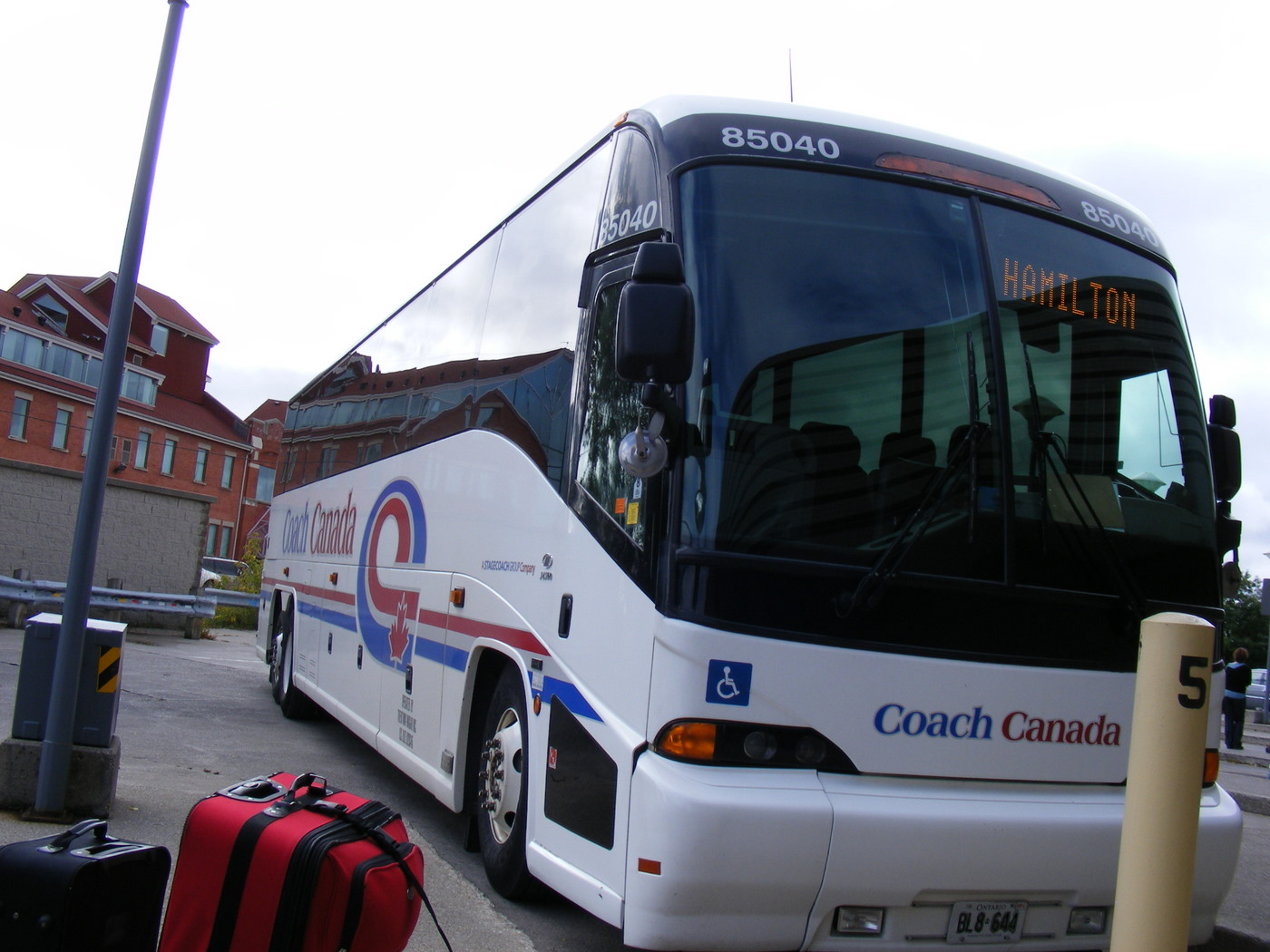
    Coach Canada bus at the Guelph Terminal, three weeks before it abandoned the Guelph-Hamilton service in 2009

    The state of intercity bus travel in Ontario is bleak. While there are still many bus options if you’re travelling between large cities, since the 1980s, hundreds of weekly bus trips and dozens of routes have been cut in Ontario, leaving many small cities and towns with minimal or no intercity transportation options. St. Thomas, a city of 45,000 located a mere 25 kilometres south of London, once had daily buses going in every direction. Today, it has none. Although studies on the modernization of the province’s beleaguered, skeletal bus system got underway in 2016, bus travel remains an afterthought.

    I wrote more about the sorry state of the intercity bus network in Ontario for TVO, my first contribution to the network’s great digital presence.