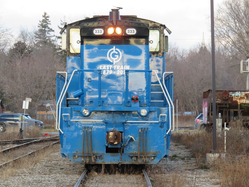
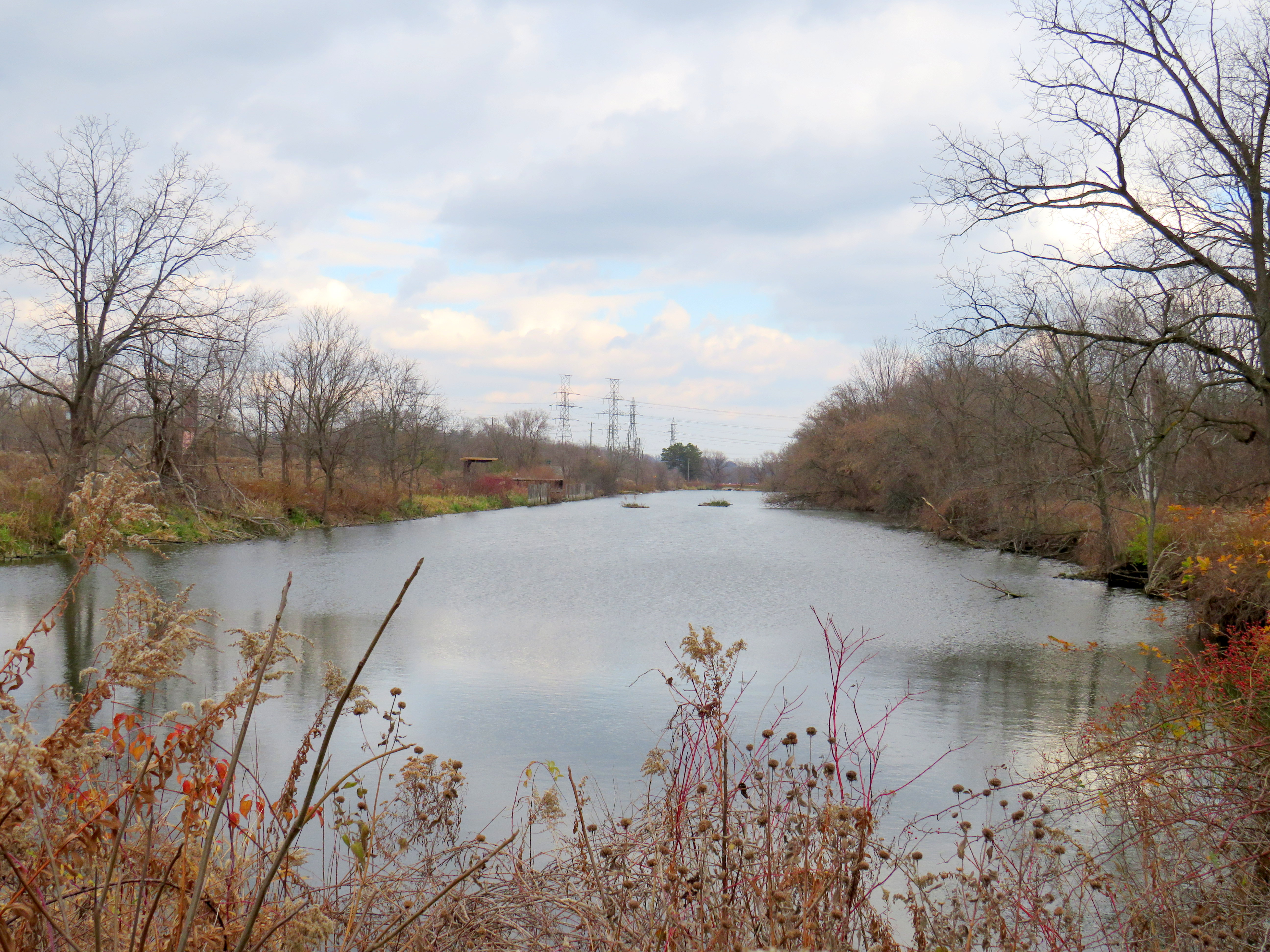
The current end of track of the once-important Owen Sound Subdivision, on the outskirts of Orangeville. Beyond, a new paved trail occupies the former right-of-way.
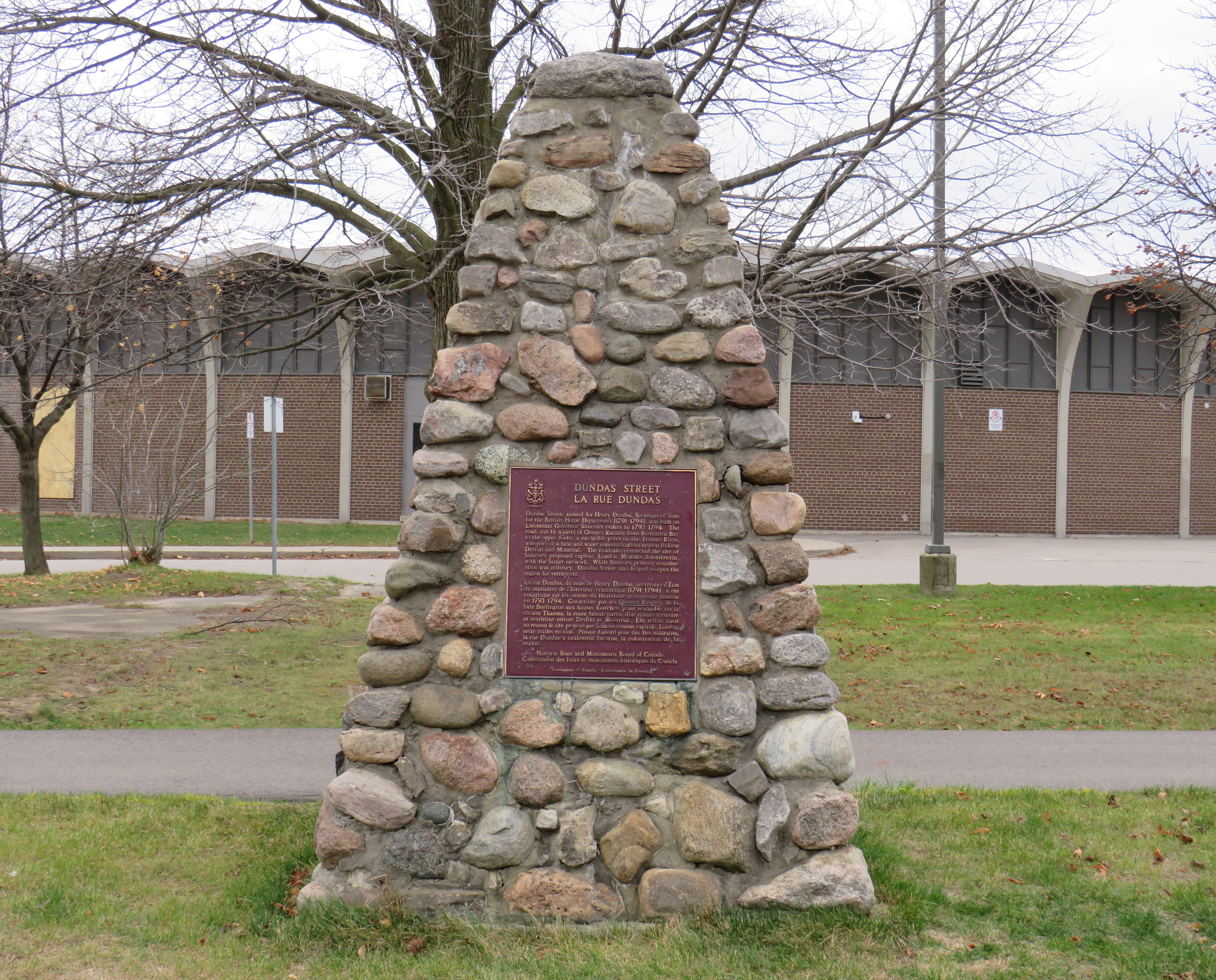
On Townline Road on the south end of Orangeville, across the street from the old railway yard and station grounds, two plaques stand, telling the history of the doomed railway next to them.
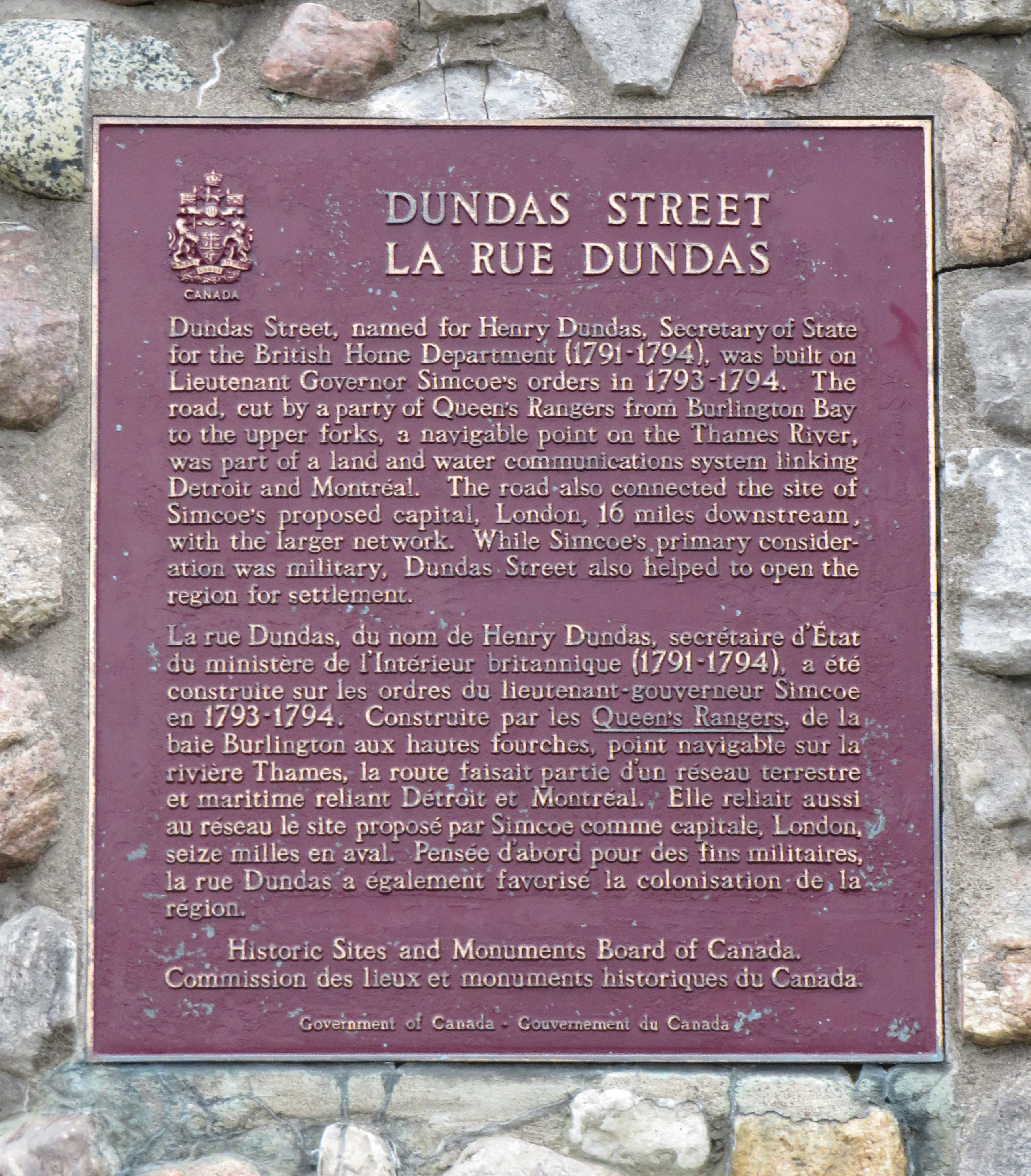
The first plaque, a faded provincial marker, commemorates the Toronto, Grey and Bruce Railway, which arrived in Orangeville in 1871 and completed to Owen Sound in 1873. The TG&B was combined with the rival Credit Valley Railway by the Canadian Pacific Railway, and Orangeville became the headquarters of a network of branch lines known as the CP Bruce Division. Passenger service to Owen Sound via Brampton and Orangeville continued until 1970.
The second marker, installed by the Town of Orangeville, commemorates the municipal takeover of the remnants of the Bruce Division, after CP abandoned all track west and north of Orangeville in the 1980s and 1990s. The plaque proudly boasts of a “successful passenger tourist operation” and how the new short line “enhanced opportunities for the long-term economic development of the region.”
The municipal plaque is sadly out of date. The Credit Valley Explorer tour train last operated in early 2018, and the Town of Orangeville lost interest in operating the railway, which was costing the municipality $450,000 a year. The last freight train departed Orangeville on Friday, December 17, 2021.
Toronto, Grey and Bruce Railway plaqueOrangeville-Brampton Railway plaque
Together with Dr. Brian Doucet, Canada Research Chair in Urban Change and Social Inclusion at the University of Waterloo, I toured the line in its waning days. At TVO.org, Doucet and I argue that the corridor is worth preserving, even if the Town of Orangeville is no longer interested in paying for the railway. We note how the province is looking to build a new highway through the very same lands that the dying railway cuts across.
Additional photographs and videos of the once-proud Orangeville and Brampton Railway can be found below.
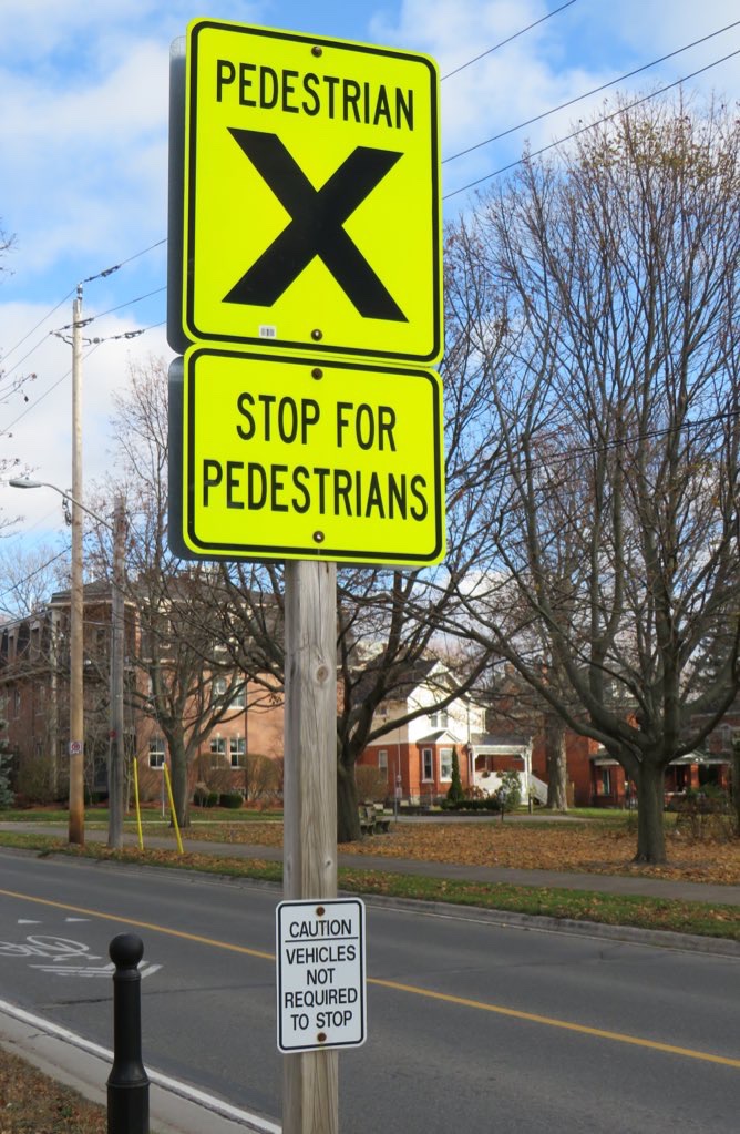
At the corner of King Street (former Highway 2) and College Street in Cobourg, adjacent to Victoria Park on the eastern edge of Downtown Cobourg, there’s a marked pedestrian crossing, with clear “zebra” road markings on the pavement.
The sign, in bright fluorescent yellow, reads “PEDESTRIAN X.” Below, a second sign, also in bright yellow, reads “STOP FOR PEDESTRIANS.” The message is clear enough.
However, a smaller white sign below, facing the sidewalk, reads “CAUTION – VEHICLES NOT REQUIRED TO STOP.”
On the morning of Thursday, August 19, I departed Toronto’s Union Station. My destination: Union Station. I set out to travel the longest distance possible by local and regional transportation services, taking advantage of several new routes set up by local and county governments to fill the gaps left by traditional intercity coach operators.
The round trip from Union Station required two trains and seven buses, operating on five separate transportation agencies. In some cases, the transfers were smooth and reliable; in Owen Sound, I waited several hours between connecting trips. For a casual traveler like myself, this was not a problem, but for more frequent commuters, the patchwork of various schedules and fares is not ideal.
I left Union Station on a westbound Kitchener Line train at 7:34 AM on Thursday, August 19. I returned to Union Station at 9:34 PM Friday evening, staying in Meaford overnight. I made time for short visits to Owen Sound, Meaford, Collingwood, and Barrie, with short stopovers in Guelph and at the Blue Mountain resort.
The following is a travelogue of sorts, concluding with a few conclusions on how parts of this trip can be made better for future passengers.
Thursday: Toronto to Owen Sound and Meaford
Intending to catch the morning GOST (Guelph-Owen Sound Transportation) minibus from downtown Guelph, I boarded the first westbound Kitchener Line train at Union Station at 7:34 AM. The train only goes as far as Bramalea Station, requiring a transfer to a bus to continue westward. Happily, the train arrived at Bramalea on time, so there was no problem taking the connecting bus that departs at 8:18 AM. (I had bad luck on a previous trip through Bramalea.)
The connecting bus from Bramalea to Guelph is a slow, local service, winding its way through Brampton, Georgetown, Acton, and rural Wellington County before arriving at Downtown Guelph at 10:13. Through GO Transit’s buses are comfortable, they lack lavatories, so a two-hour trip may be difficult on some passengers’ bladders. Though the 7:34 train to Bramalea connects to an express bus via Highways 407 and 401 to Kitchener, anyone headed to Guelph gets to ride the scenic route.
Though an express bus would be welcome, I noted the importance of the local GO bus for workers living in Brampton getting to jobs in Halton Hills, and residents in Acton and Rockwood commuting to Guelph. There is a need for both services.
At least I got a spot at the front of the double decker bus and was able to enjoy the ride.
This first leg on GO Transit between Toronto and Guelph cost $14.06, deducted from my Presto card.
Brampton Transit used to operate a double-decker bus. GO Transit has brought them back to the Flower City. Due to a construction project on Highway 7 in Rockwood, the double-decker bus took a scenic, yet unexpected detour on country roads. This must have turned some heads.
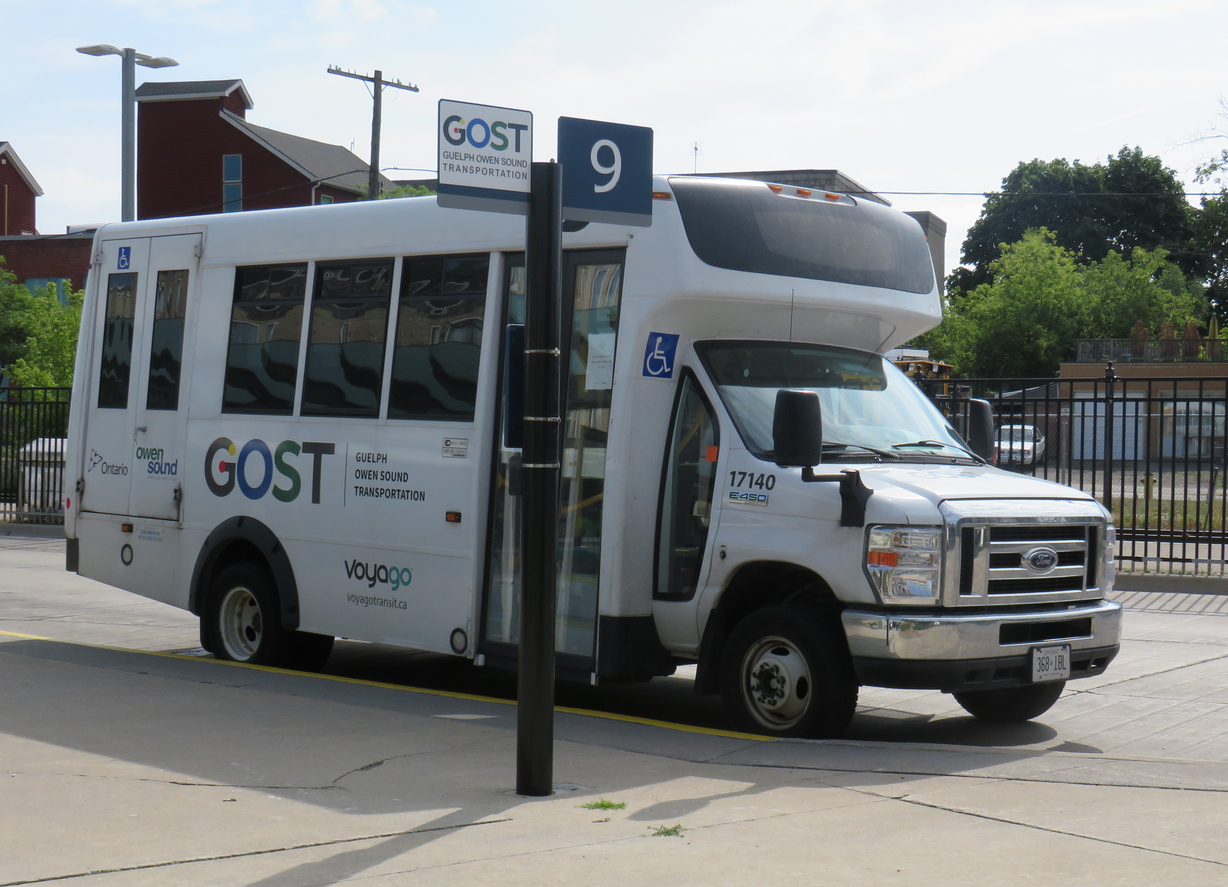
At Downtown Guelph, I had just under 20 minutes to use a washroom and have a quick coffee before switching to the GOST minibus. GOST serves the Guelph Central Station bus terminal, with easy connections to GO buses and trains and most Guelph Transit services.
A GOST minibus waiting for departure at Guelph Central Station
The GOST minibus service operates two round trips, seven days a week, between Guelph and Owen Sound, with stops in Elora, Fergus, Arthur, Mount Forest, Durham, Williamsford, and Chatsworth. Except for Fergus, all stops are located in or near each town’s commercial centre. The service is funded by Owen Sound and a provincial grant, and operated by London-based Voyago (which operates several other rural services in Western Ontario).
Until the mid 2000s, Greyhound ran buses six days a week between Toronto and Owen Sound via Highway 10 through Brampton and Orangeville or via Highway 6 through Guelph and Mount Forest, each route on alternating days. Gray Coach, the TTC-owned predecessor to Greyhound, ran several daily trips. The twice-daily GOST bus is a significant improvement over Greyhound’s schedule in its waning years.
On this Thursday midday northbound trip, there were two passengers going all the way up to Owen Sound, one getting off in Elora, one disembarking at Mount Forest, and one passenger who boarded at Williamsford for Owen Sound. The fare from Guelph to Owen Sound is $20 cash, with cheaper fares to ride shorter distances.
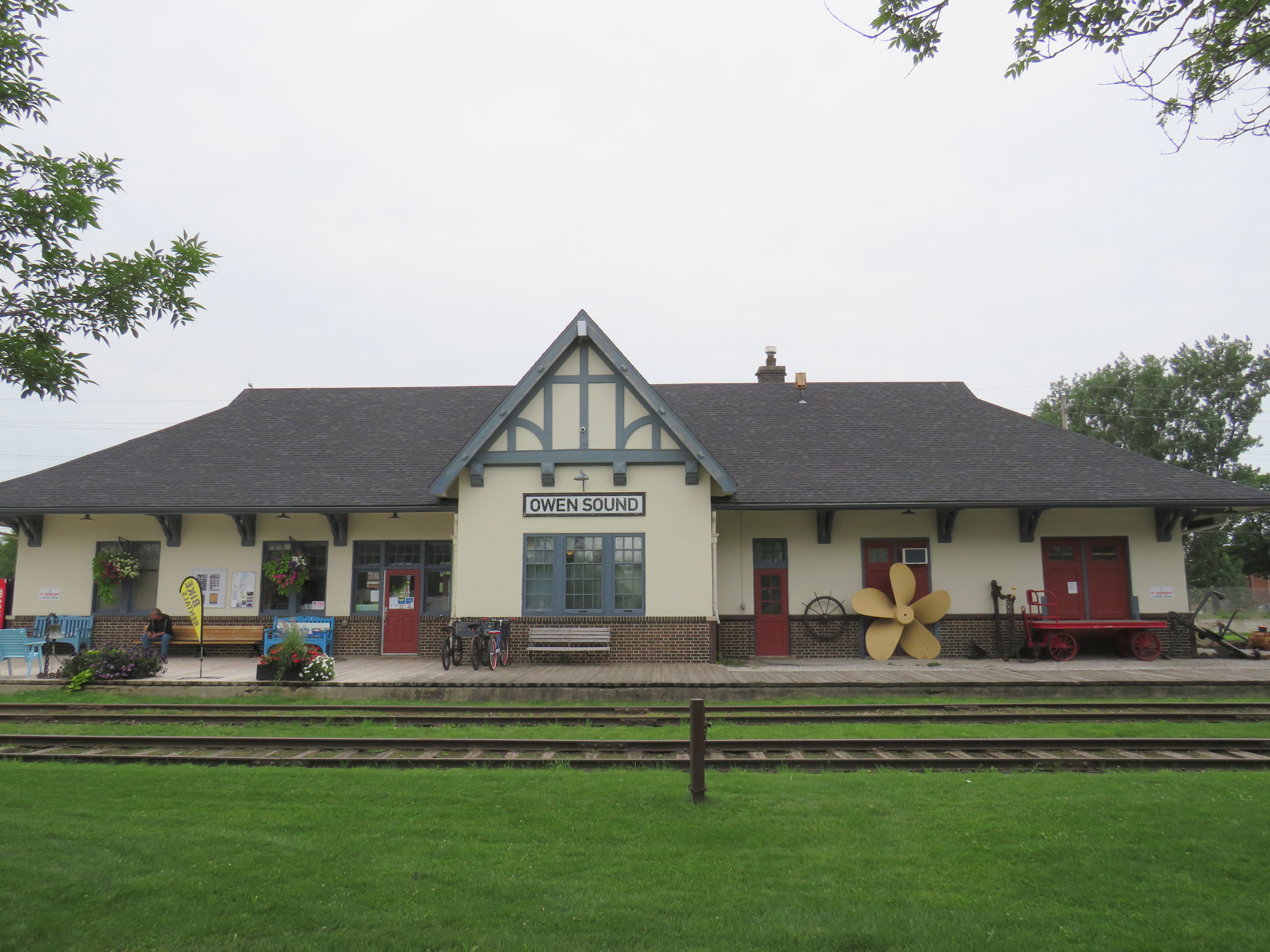
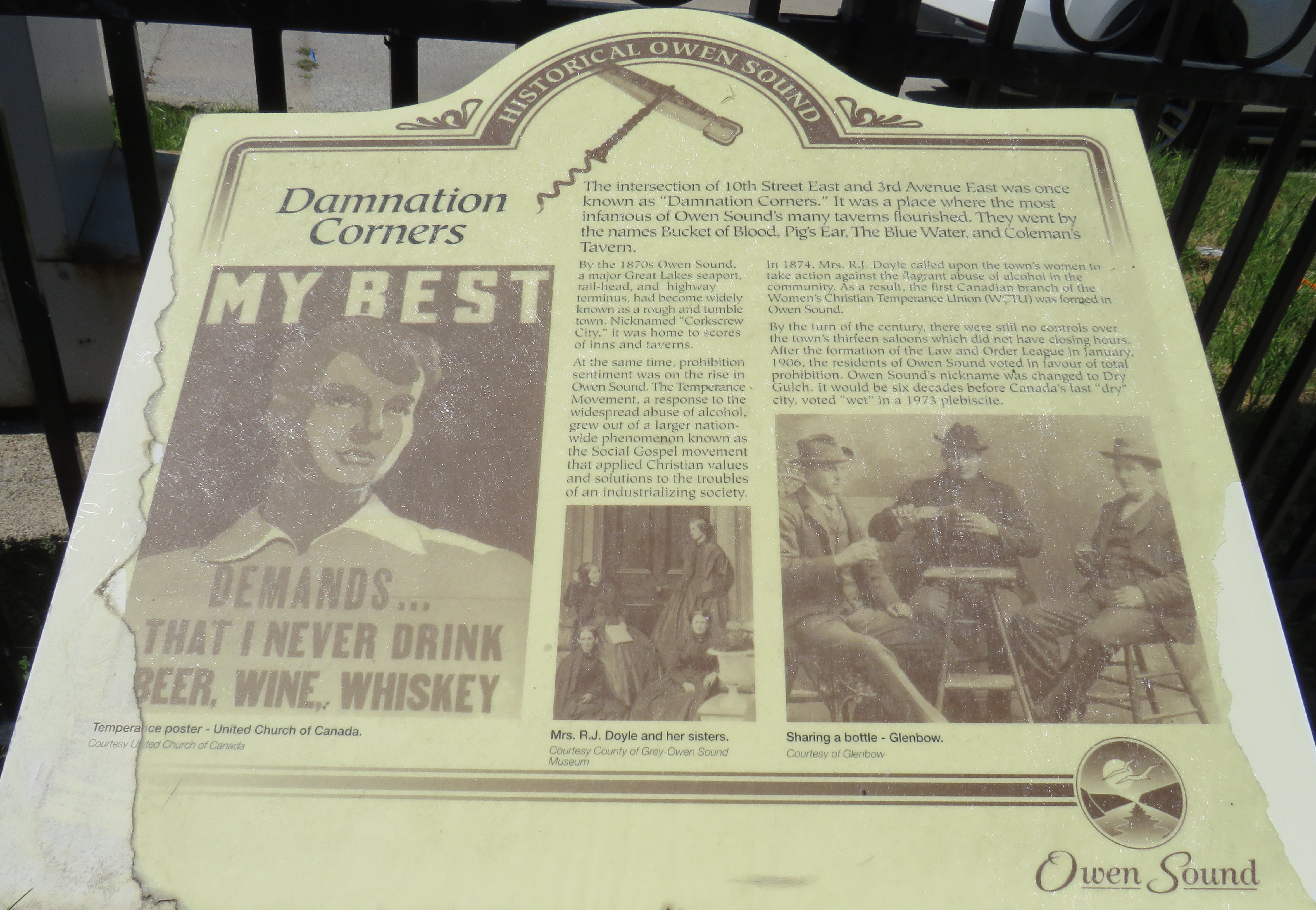
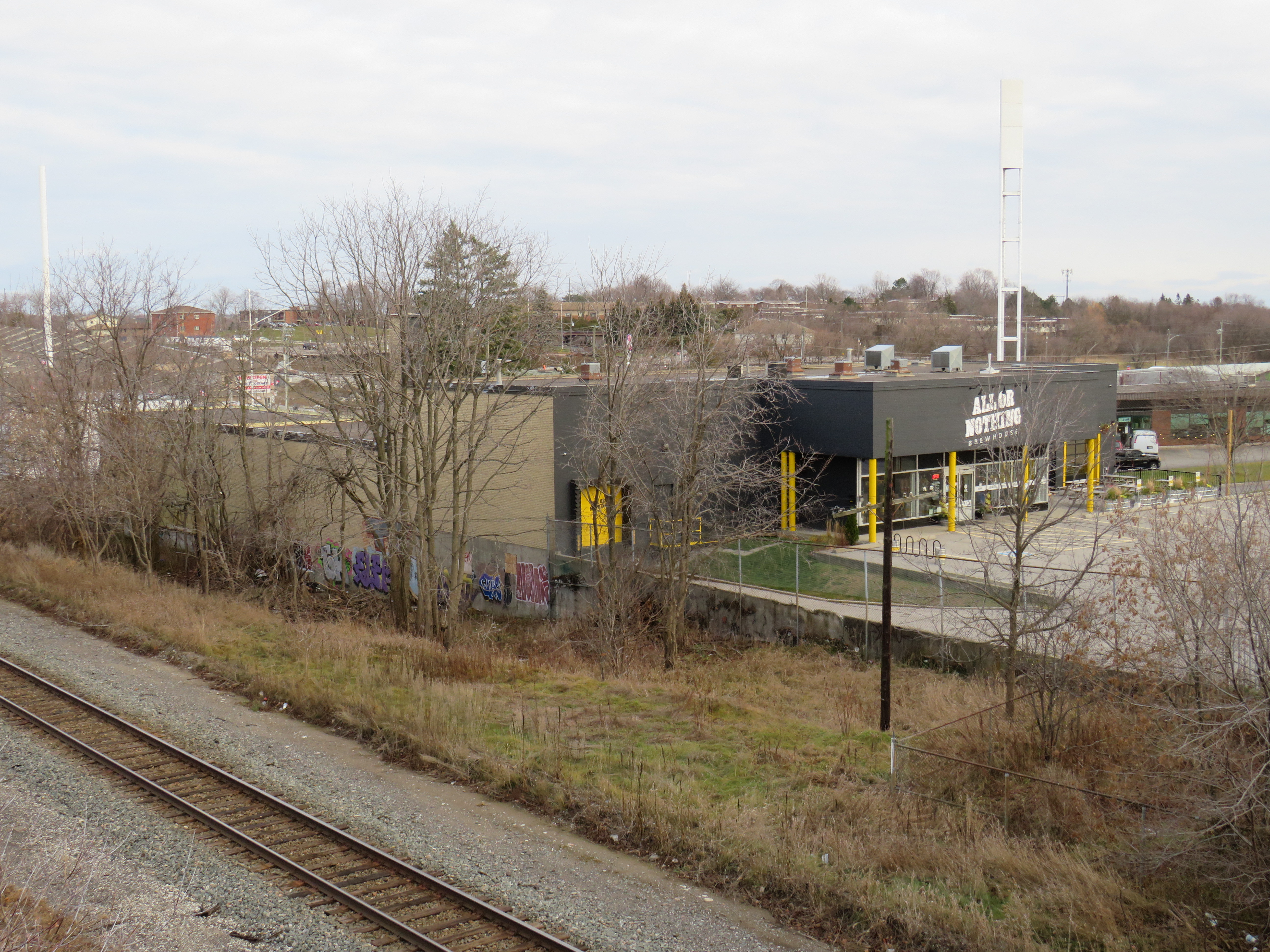
I arrived in Owen Sound a few minutes before 1:00 PM, with several hours to spend before my next ride to Meaford. Owen Sound, population 26,000, has an interesting history as a Great Lakes port and railhead for both the Canadian Pacific and Grand Trunk/Canadian National Railways. The maritime traffic and local industry gave Owen Sound a reputation as a hard drinking town; it became one of the first municipalities in Ontario to go “dry” in 1906. It remained that way until 1973.
With the construction of the St. Lawrence Seaway and the decline of branch lines across Ontario, the city declined as a port and both railways were torn up in the late 1990s. However, both stations remain standing – the Grand Trunk Station on the west side of the harbour is now a local museum, while the modernist CP station, built after the Second World War, is now a brewpub.
With a lovely downtown, harbour, parks, and heritage neighbourhoods to wander through, Owen Sound was worth a three-and-a-half stopover.
Owen Sound Marine and Rail Museum, the former Grand Trunk/CN StationMudtown Station, the old CP Station in Owen SoundPlaque commemorating “Damnation Corners” where taverns once stood on all four corners. One block to the east was “Salvation Corners” where four Protestant churches still stand.
I decided to stay in Meaford overnight. Though I could get as far east as Wasaga Beach via Grey Transit Route, Colltrans, and Simcoe County Linx, I would not have been able to continue my trip back to Toronto that night, missing the last Linx bus from Wasaga Beach to Barrie by one hour.
Meaford had cheaper accommodations than Owen Sound or Collingwood, and by staying there overnight, it gave me plenty of time in Meaford and Collingwood the next day. Before Greyhound Canada suspended operations in April 2020, there was one daily bus between Toronto, Barrie, Collingwood, and Owen Sound. PMCL, which Greyhound purchased in the 1990s, used to run several buses a day on that route.
I departed Owen Sound on a pre-booked GTR minibus at 4:30 PM, which cost $5 for the trip into Meaford. As I was the only one on that departure, the driver was kind enough to drop me off right by my motel. There are six daily trips between Owen Sound and Meaford, with four of those trips offering a timed connection or direct run to Blue Mountain Resort, GTR’s eastern terminus.
GTR minibus at Owen Sound Terminal (October 2020)
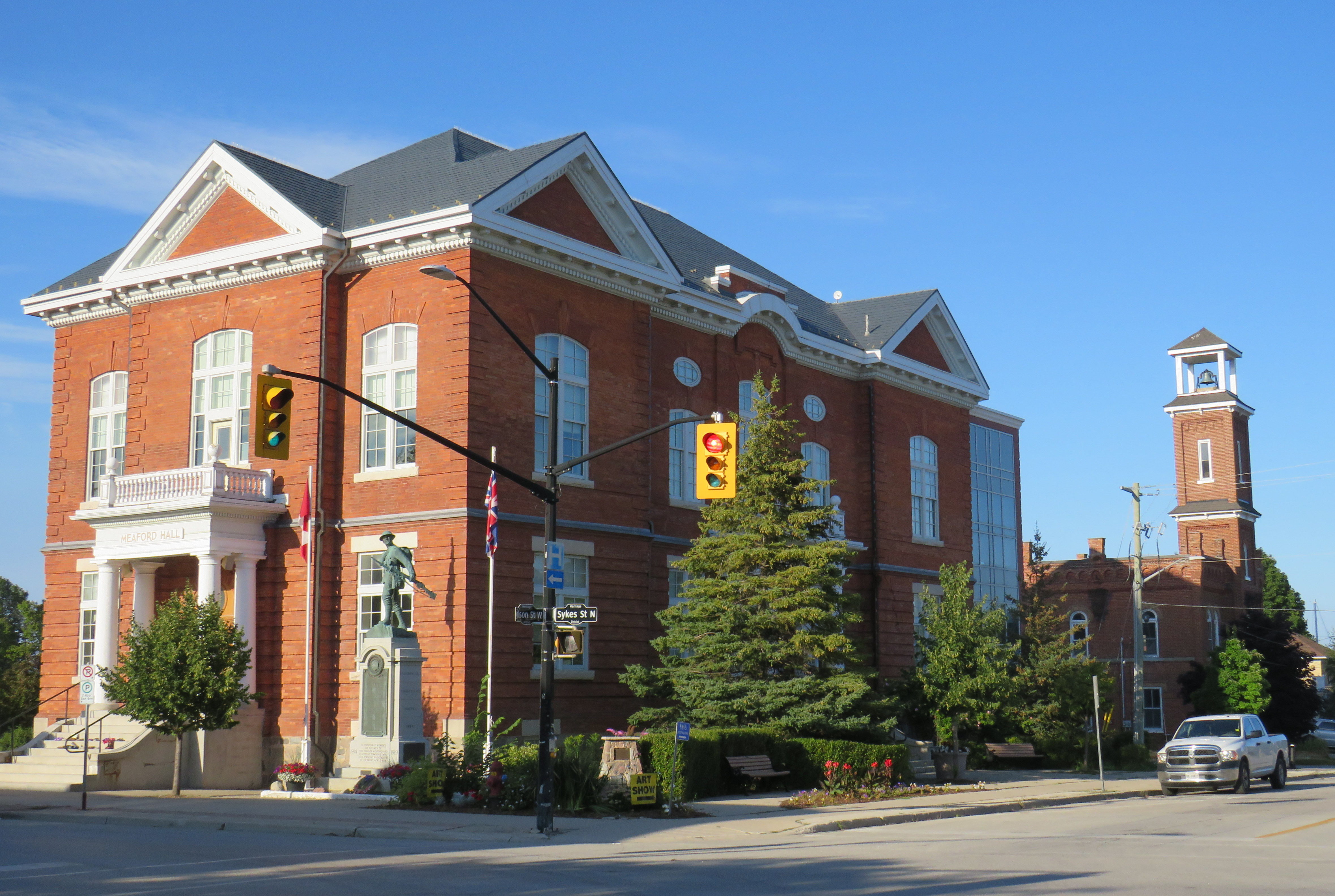
Meaford itself is a charming little town, with several good restaurants, and a lovely harbour. Meaford is the western terminus of the Georgian Trail to Collingwood, one of Ontario’s first rail trails. As GTR minivans and Simcoe Linx and Colltrans buses all have bike racks, Meaford would make for a nice cycling trip.
Meaford Hall, with the old fire station behindTerminus of the Georgian Trail, which continues to Collingwood, with connections beyond
Friday: Meaford to Collingwood and Toronto
The next morning, I departed Meaford on GTR Route 4 at 8:46AM, and arrived at Blue Mountain Village just after 9:30, another $5 pre-booked trip. The popular resort is also served by Colltrans’ Blue Mountain Link route to Downtown Collingwood, with connections to local buses and the Simcoe County Linx Route 4 to Wasaga Beach.
Approaching Blue Mountain, the driver helpfully asked me if I needed to catch the bus to Collingwood. Though the timetables between GTR Route 4 and Colltrans’ bus don’t permit an easy connection, if I got off at Craigleith, at the bottom of the escarpment, I would be sure to get the onward bus. I declined the offer, because I was curious to see Blue Mountain Village itself, and I needed a coffee.
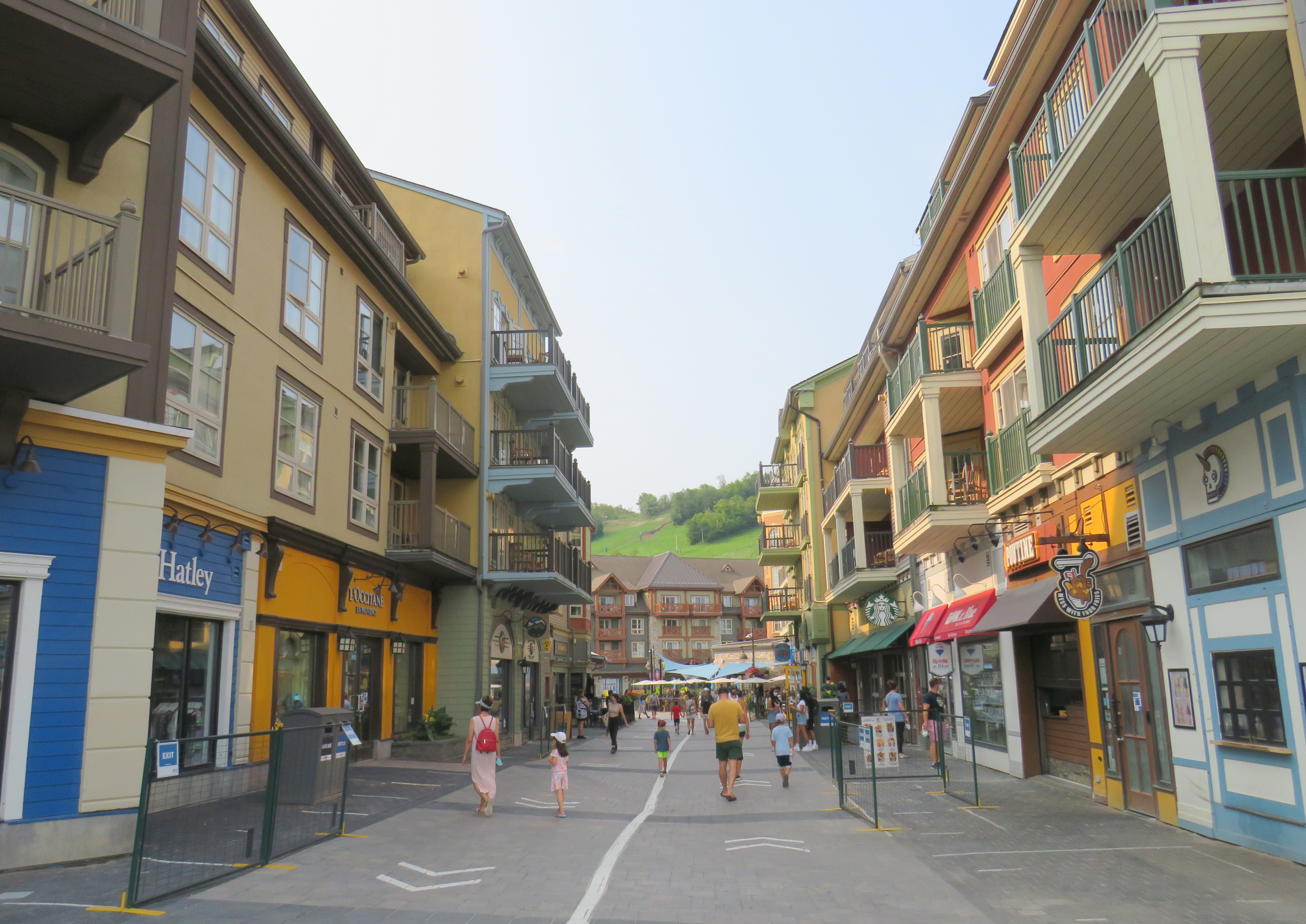
The Disneyland-like urbanity of Blue Mountain Village
Blue Mountain Village, the heart of the sprawling Blue Mountain resort, contains many shops, restaurants and bars, along with three hotels and timeshare apartment complexes with the architecture and walkways meant to invoke a European ski resort. Cars are not permitted in the internal streets, which gives it a somewhat surreal atmosphere. In the summer, tourists and vacationers are attracted by several golf courses, downhill mountain biking trails, rope courses, spas, nearby beaches, and, of course, the shops.
Having gotten my coffee and my morning walk, I paid my $2 fare and got on the 10:20 bus to Downtown Collingwood.
Colltrans and Simcoe County Linx buses at Downtown Collingwood
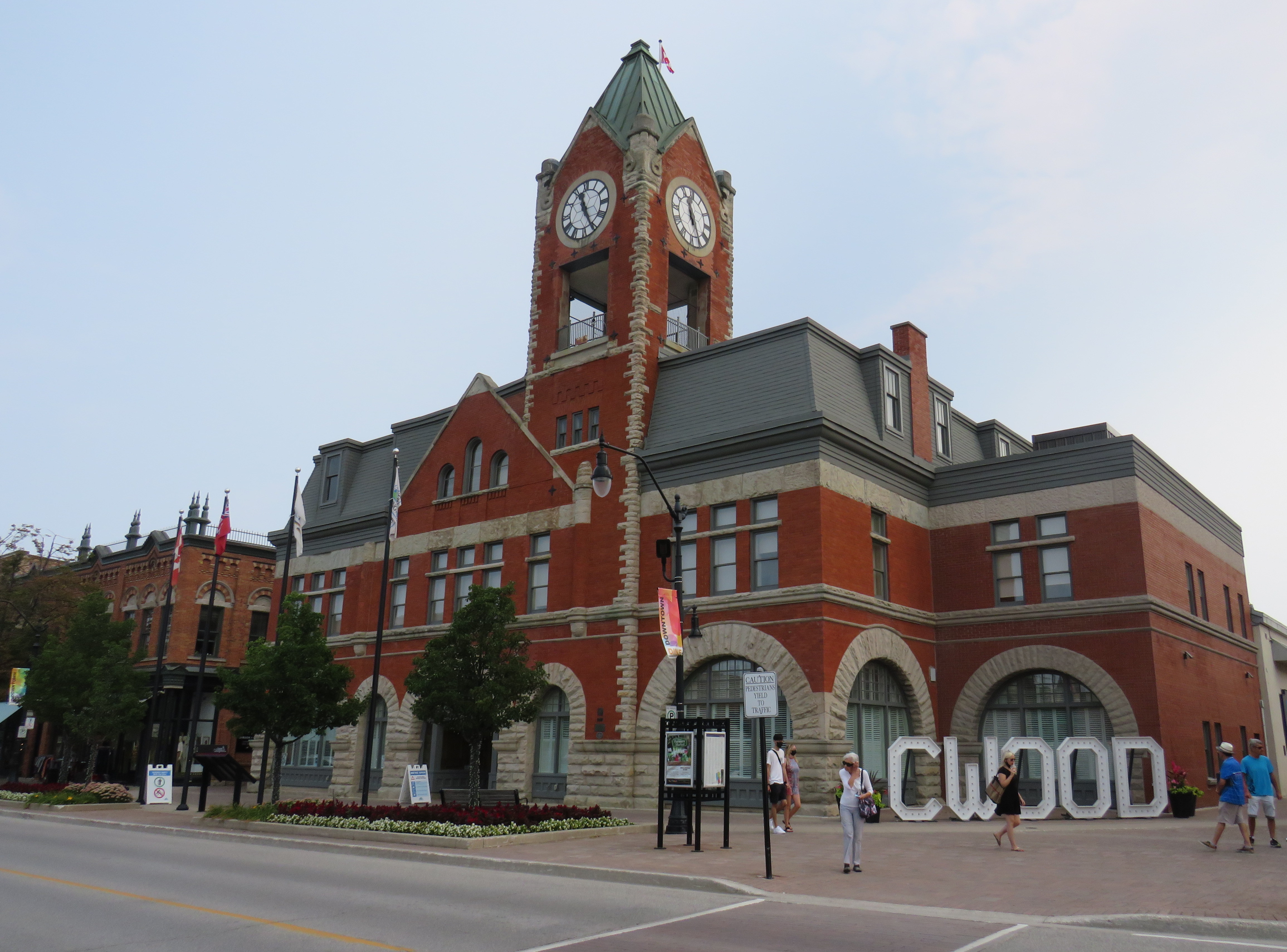
Like Owen Sound, Collingwood has a lovely and vibrant downtown core, with its own proud marine and railway history. Collingwood was the terminus of the Ontario Simcoe & Huron Railway, the province’s first rail connection, built in 1853-1854. The OS&H was built as a shortcut between the Upper Great Lakes and Toronto and prospered before merging with several other railways to become part of the massive Grand Trunk system. Sadly, passenger service to Collingwood ended in 1960, and the railway itself is abandoned and partially removed.
Collingwood Town Hall
After a hearty lunch in Downtown Collingwood and walk through the area, I paid another toonie and boarded Simcoe Linx Route 4 to Wasaga Beach.
In the back parking lot of a Loblaws Superstore in the west end of Wasaga Beach, two Simcoe County Linx buses, a Wasaga Beach Transit bus, and a Clearview Transit minibus meet to exchange passengers. The grocery store is distant from the main tourist area and the downtown commercial centre, but at least transfers between buses are easy. The Wasaga Beach Transit bus does pass by most motels, tourist traps, and beach areas. I changed to another Simcoe County Linx bus (Route 2) that passes through Stayner and Angus for Allandale Waterfront GO Station south of Downtown Barrie. The fare between Wasaga Beach and Allandale was $6.00 cash.
At a grocery store parking lot, Simcoe County Linx, Wasaga Beach Transit, and Clearview Township buses meetArrival at Allandale Waterfront GO Station
Allandale Waterfront GO Station, which hosts GO trains and buses and several Barrie Transit routes, is one of two Barrie terminal points for Simcoe County Linx’s buses. Buses to Orillia and Midland terminate at Georgian College and Royal Victoria Hospital in the northeastern corner of Barrie, with a Barrie Transit fare and a 30-minute local bus ride to get from one Linx route to another.
Kempenfelt Bay, Barrie
The ride back to Union Station, which included a bus to Aurora GO and a change to a train the rest of the way. That final trip cost me $13.76 on my Presto card.
In total, I paid $39.06 on Thursday and $28.76 on Friday to complete the round trip between Toronto and Georgian Bay.
Analysis and Conclusions
It is good to see Owen Sound, Grey County, and Simcoe County develop local solutions to replace and improve upon vanished coach services that ran on Highways 6, 10, and 26, better schedules and improved connections will only make their services better.
With limited schedules, particularly on Grey Transit Route and Simcoe County Linx, I could only do this exact trip by leaving Toronto on a Wednesday or Thursday. GTR’s Routes 3 and 4 between Owen Sound, Meaford, and Blue Mountain operates Wednesdays through Sundays. Though transit between Blue Mountain Village and Wasaga Beach runs 7 days a week, the Simcoe Linx bus between Wasaga Beach and Barrie only runs weekdays, with the last buses leaving Allandale GO and Wasaga Beach Superstore at 6:30 PM.
Later service hours and weekend service between Barrie and Wasaga Beach would allow GTHA residents to get to one of the Great Lakes’ great beaches without a car for a weekend getaway, without more congestion on Highways 400 and 26.
In addition, it would be good to see Simcoe County and municipal systems in Collingwood, Wasaga Beach, Barrie, Orillia, and Midland/Penetanguishene develop a coordinated fare structure, as transfers or fare discounts are not provided between each service, except between Linx and Midland/Penetanguishene. Simcoe County Linx already has its own farecard; if that were upgraded it would at least allow frequent riders to benefit from easy fare payments and transfer discounts.
These are relatively simple changes that can further drive ridership growth and improve mobility throughout fast-growing Simcoe County as well as attract more visitors from Toronto and beyond.
The Toronto-Guelph leg of my trip was unnecessarily slow, and will continue to be so until all-day, two way GO service is introduced on the entire Kitchener Corridor, or if express buses are added to the schedule. While all-day GO train service will take several years with several construction projects underway or necessary in Toronto, Brampton, and Guelph to provide the necessary capacity, improved bus service can provide a stopgap for the time being.
Without an express GO bus or competing services such as Greyhound (which used to operate multiple buses between Guelph and Toronto) or a morning VIA Rail train, it can take nearly three hours to get from Toronto to Guelph without a car.
Though GO Transit will introduce significant service improvements starting Labour Day, including new peak-direction express trains on the Kitchener Corridor. Unfortunately, there are no travel time improvements for getting between Toronto and Guelph weekday mornings. Given that there is currently no alternative access between the two cities, there’s a market that GO Transit is clearly missing right now.
On Thursday, August 12, I rode the train to the very end of the Richmond Hill Line to check out GO Transit’s newest station.
In 2017, I made a similar trip to Gormley Station, just to the south of Bloomington GO, soon after that station opened to the public. Four years ago, I was critical of Metrolinx’s failures to support the urban intensification of the Greater Toronto and Hamilton Area (GTHA) by building new stations on the Greenbelt, on lands that will not support transit-oriented development.
Though I came away from Gormley Station disappointed, I wanted to see Bloomington Station for myself and give it an honest assessment. I came away with mixed feelings.
Most GO Stations outside the old City of Toronto put free car parking ahead of all other considerations. Some stations, such as Unionville, were even moved to sites where large surface lots could easily be built. Hamilton GO Centre, opened in 1996, was an exception: an urban station that combined a restored heritage building with a large bus terminal. A few other newer stations, such as Mount Pleasant in Brampton and Mount Joy in Markham, still had large surface parking lots, but also had easy walking connections to adjacent neighbourhoods. In Guelph and Kitchener, GO Transit used existing downtown stations instead of suburban stations, and Allandale Waterfront Station is located right across the street from Barrie’s gorgeous Kempenfelt Bay.
Gormley and Bloomington Stations represent a return to GO Transit’s old ways of putting parking ahead of all other considerations, despite Bloomington’s modern design.
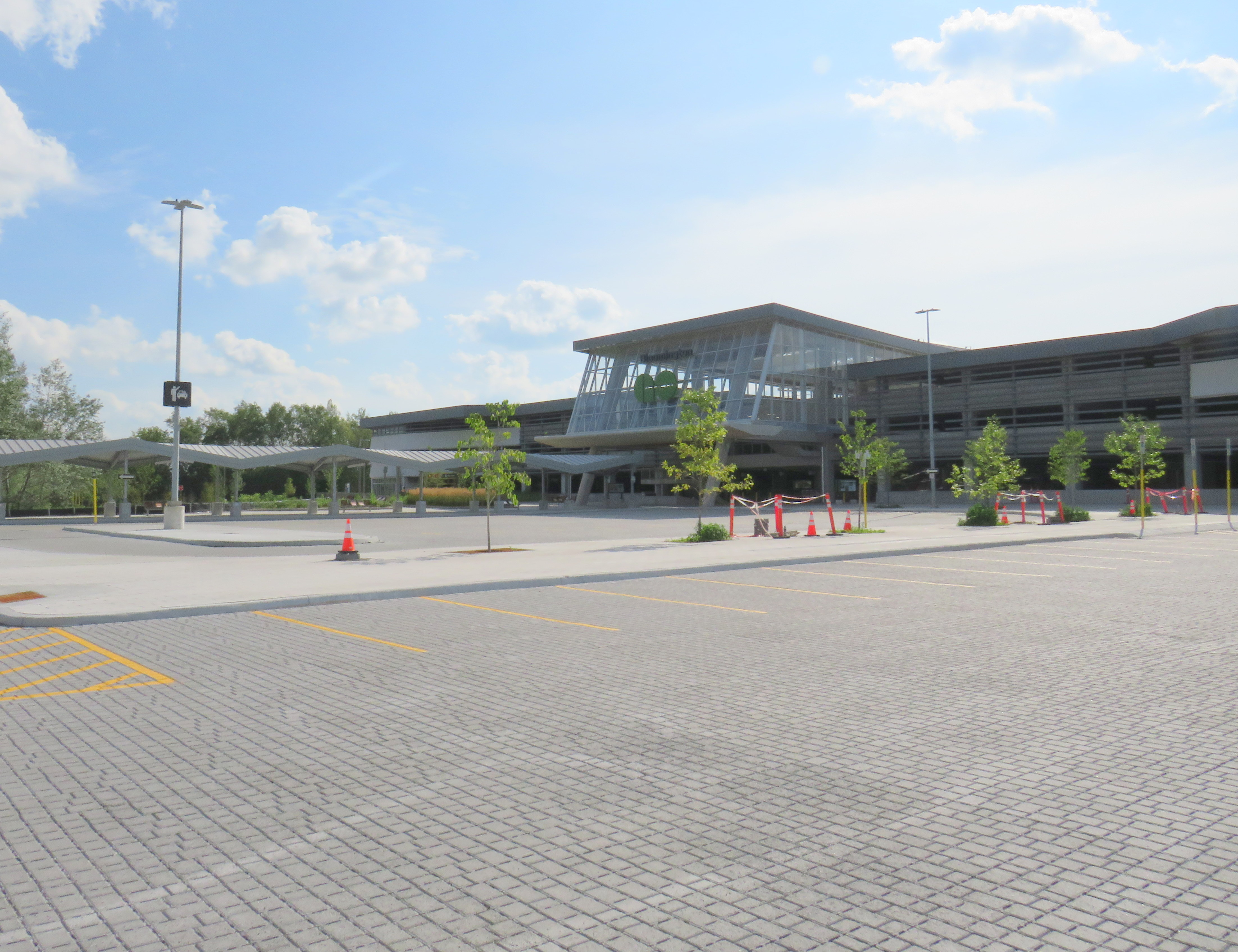
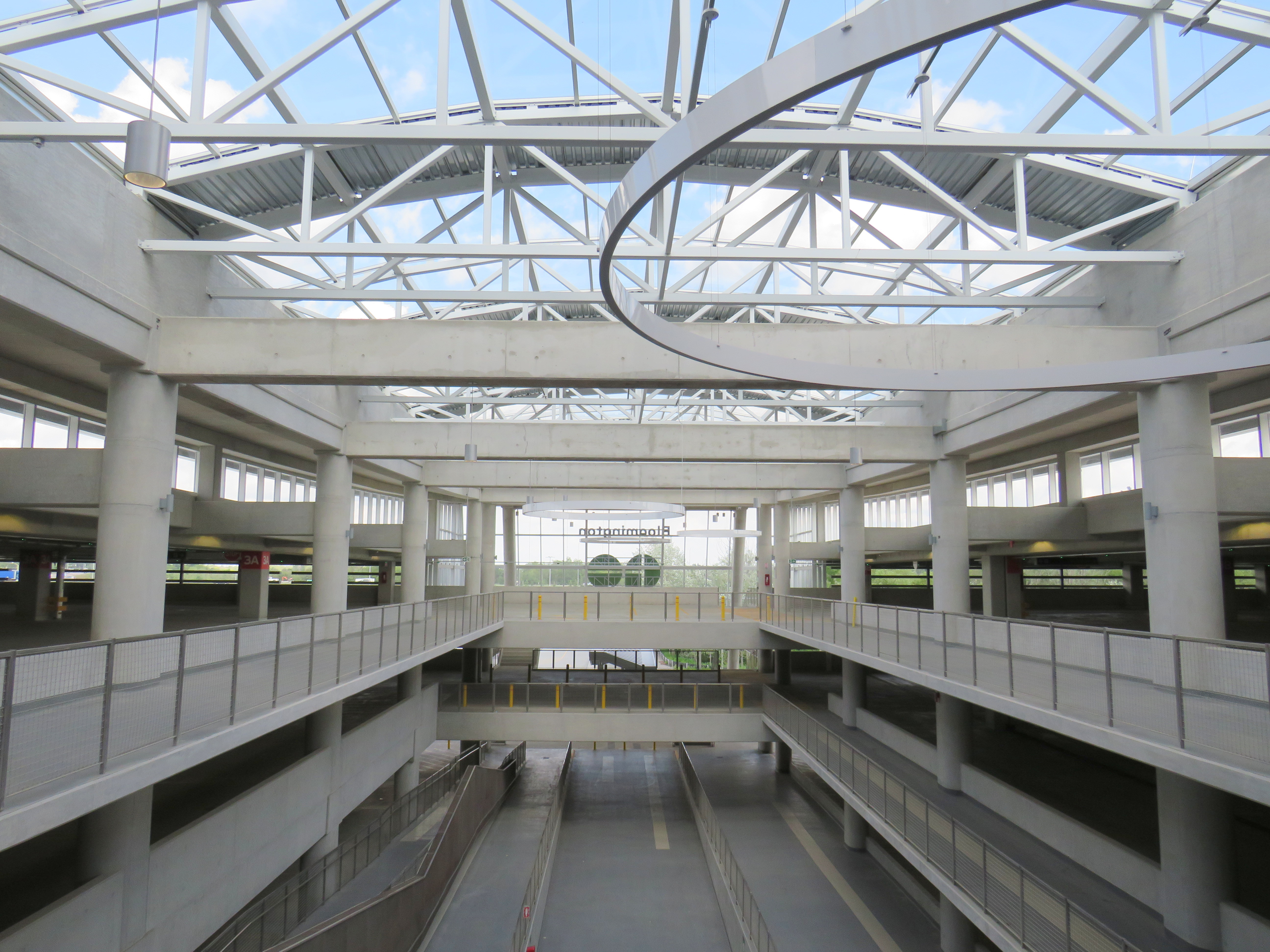
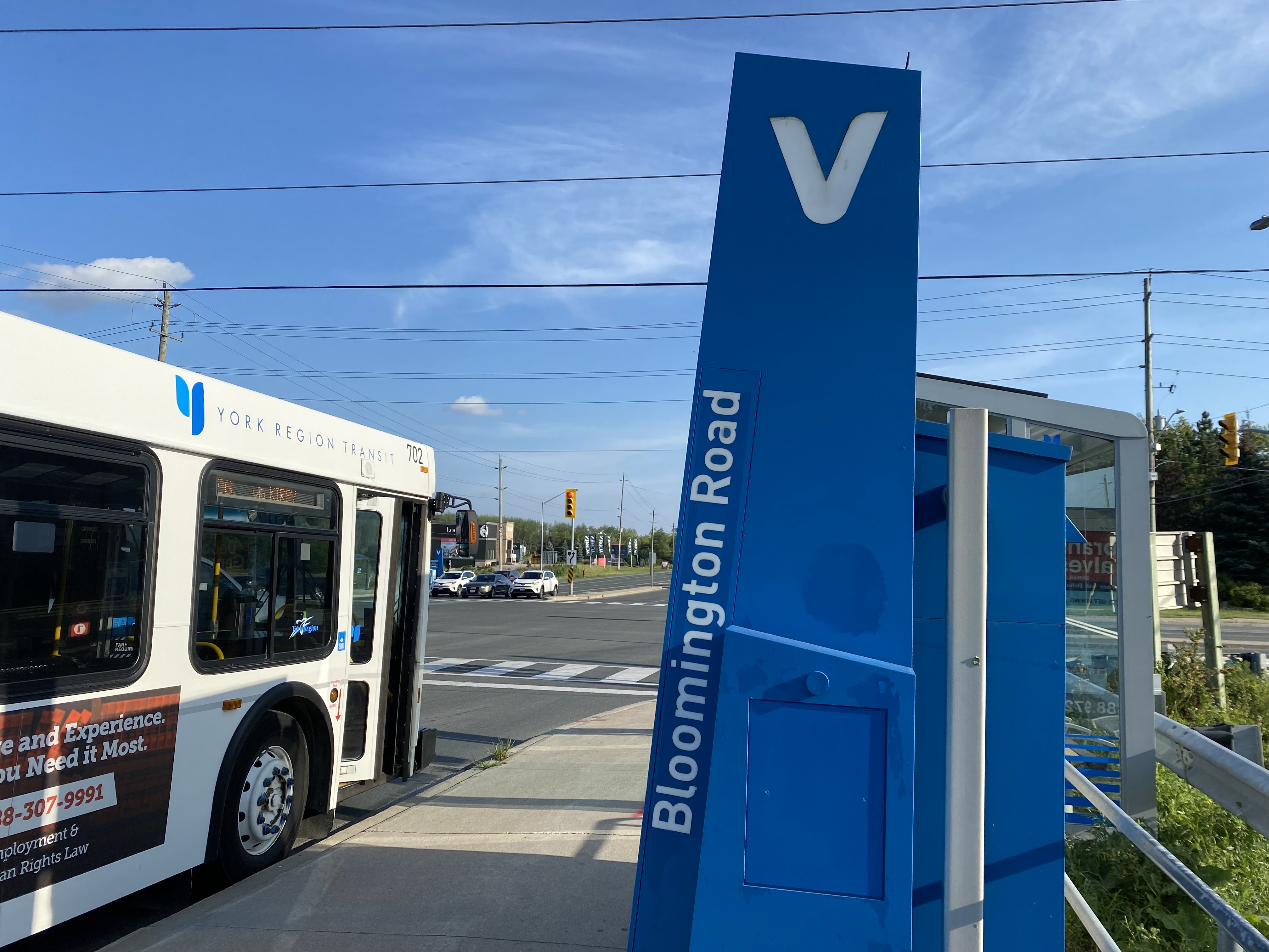
Metrolinx, the provincial agency responsible for planning and constructing transit infrastructure in the GTHA and for operating GO Transit, opened Bloomington Station on June 28, 2021. The station is located on Bloomington Road, adjacent to Highway 404, on the boundary between Richmond Hill and Aurora.
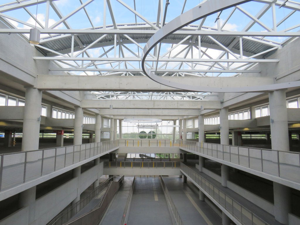
The station is built around a three-storey parking garage tucked into a hill, with the train platform and station amenities (an enclosed waiting room with washrooms and a ticket counter) on the second level. At the lower level, there is a six-bay bus loop almost directly below the rail platform, minimizing the distance between train and bus. Elevators, stairs, and ramps connect the three levels of parking, the bus bays, and the train platform.
The station’s central atrium, which contains the pedestrian passages between parking levels, station, and platforms, is the architectural highlight. Above the parking areas, solar panels collect some of the energy required to light and heat the station.
Atrium at Bloomington Station, with parking spaces on both sides
In its blog, Metrolinx expressed pride in the new station, noting it was built to achieve LEED Gold certification through features such as energy efficient lighting, a water-permeable surface lot, stormwater management, and a pond for local wildlife with an underground passage to help animals migrate away from the station complex. Like most new GO platforms, Bloomington’s train platform is heated to allow snow and ice to melt, reducing salt usage. Finally, as far as suburban GO stations go, Bloomington’s footprint is quite compact. It cost $82.4 million to build the new station.
Plaque adjacent to wetland at Bloomington GO StationPermeable surface at Bloomington’s outdoor surface lot and passenger pick-up and drop-off area
Despite these innovations, a LEED certification can only go so far when the GTHA’s newest transit station is only accessible by car, with over 1,000 parking spaces. Though transit ridership is down significantly during the ongoing pandemic, especially on GO’s Richmond Hill Line (which operates only in the weekday peak-period direction and currently uses four-car trains), there are no ongoing connections from Bloomington GO Station operated by GO buses or York Region Transit.
Though several GO rail stations do not have any local transit connections only Bloomington and Gormley have no bus connections at all. (In April 2020, YRT discontinued the limited-service Route 15 that ran past Gormley Station). At Acton, Georgetown, and Lincolnville, which also do not have any local transit connections, passengers can still connect to GO buses for points beyond, or make a return trip.
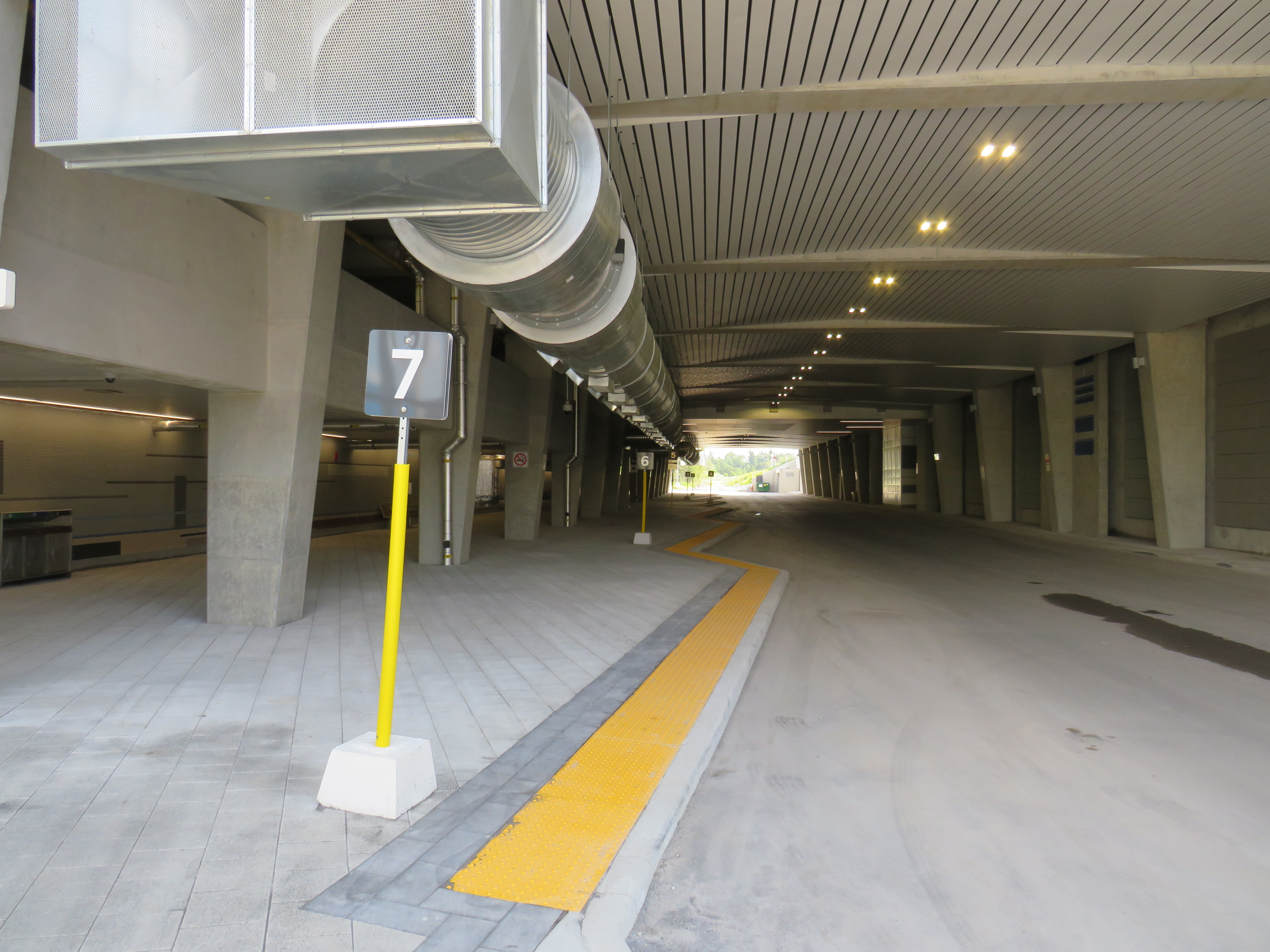
The only bus operating at Bloomington Station’s loop is GO Route 61, which provides supplemental weekday service between Union Station and Bloomington GO. But the last Route 61 bus leaves for Union at 1:55 PM.
There was no bus connection to be found at Bloomington GO Station
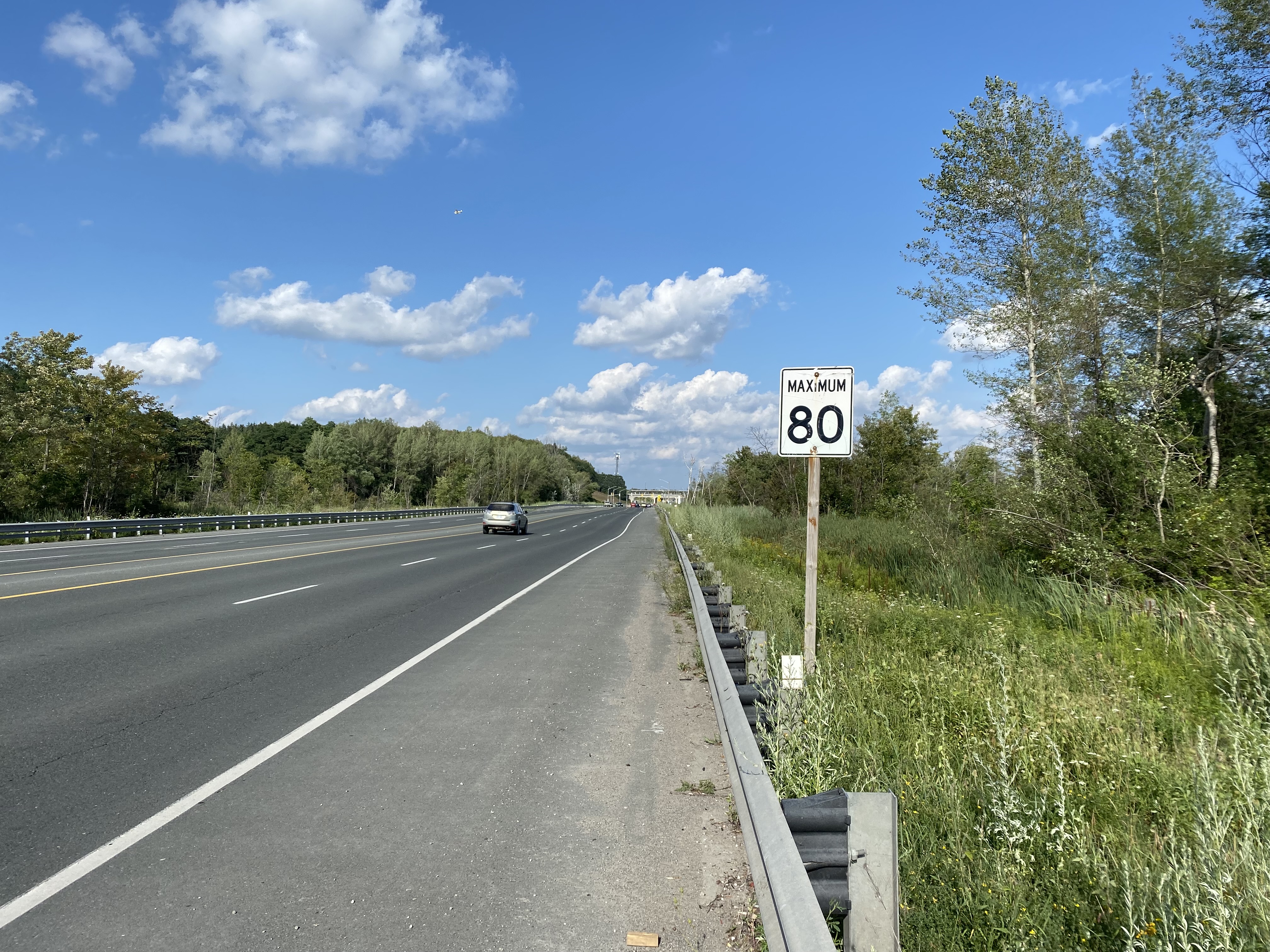
The nearest in-service bus stop is over one hour’s walk away, near Bloomington Road and Yonge Street. At least there was a paved shoulder along the busy five-lane road between the GO station and Bayview Avenue, where motorists were driving well in excess of the 80 km/h speed limit.
Looking east towards Bloomington GO at Leslie Street
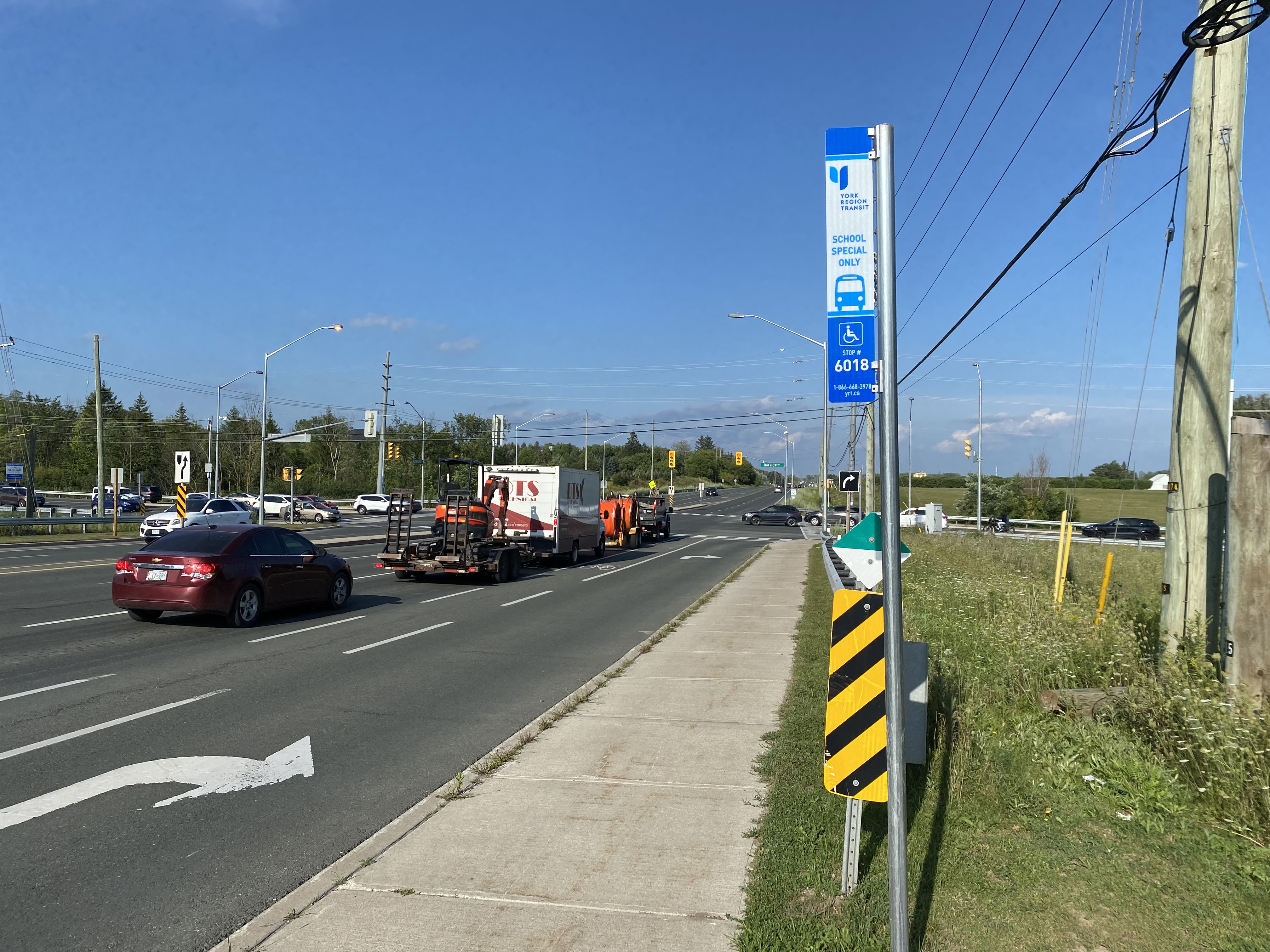
At Bayview Avenue, a sidewalk leads westerly to Yonge Street, with new residential subdivisions lining the south side of Bloomington Road. I noted a bus stop as I was walking west towards Bayview Avenue; alas, it was only for a high school special route.
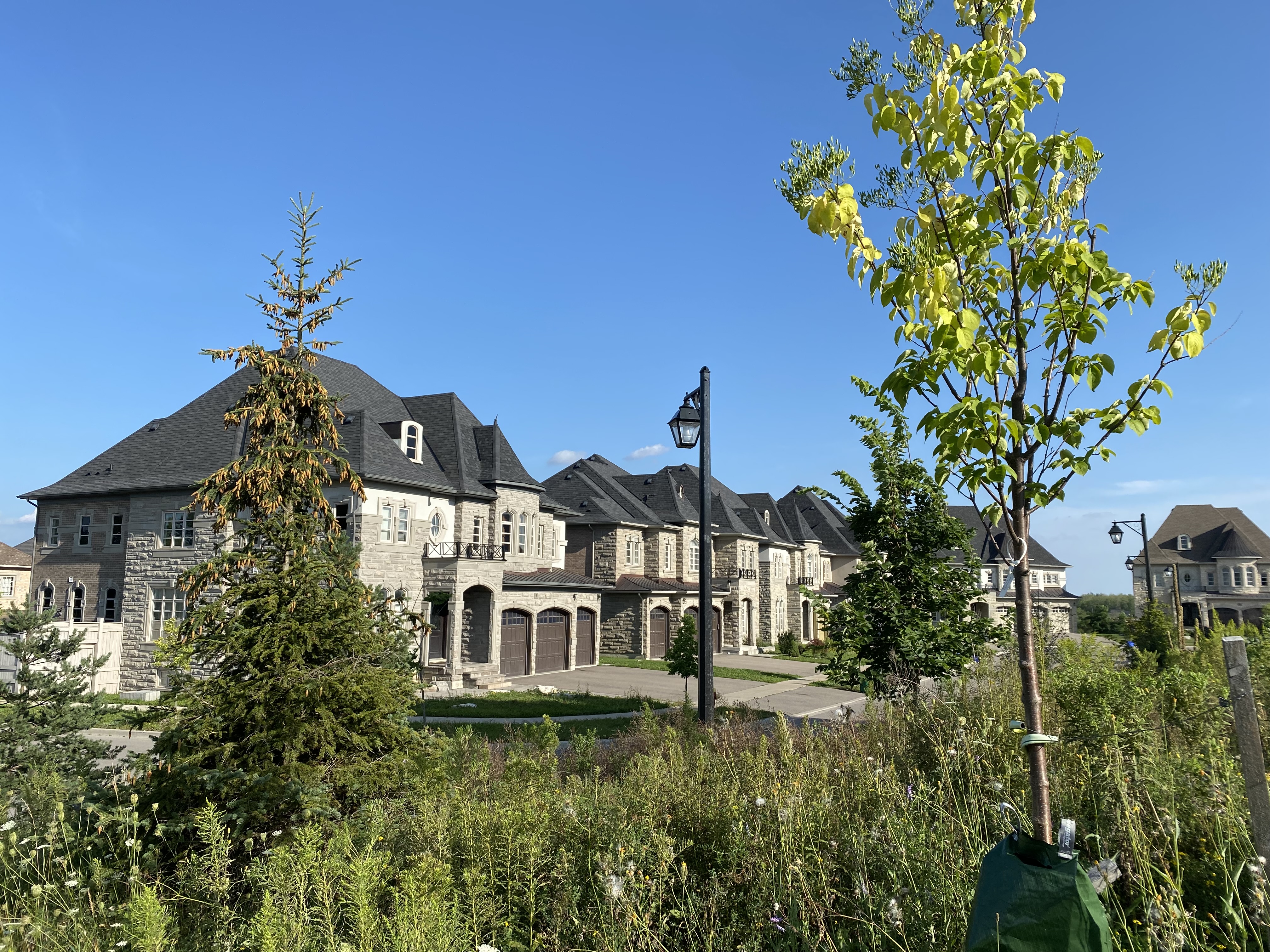
YRT stop at Bloomington Road and Bayview Avenue signed “school special only”New residential development along Bloomington Road featuring large houses with three-car garages was clearly designed for cars, rather than people
As I was nearing Yonge Street, I noted that the new subdivisions were set back far from the road, with many of the houses built with three-car garages. Building enough transit ridership here to support even a limited service bus route is going to be very difficult.
One hour and 8 minutes later, I arrived at the bus stop at Yonge Street, the closest place to Bloomington GO Station where I could get a bus to continue my journey.
The end of a long walk from Bloomington GO Station
Bloomington Station’s small footprint and environmental features might actually make it an ideal basic station design for more urbanized locations in the GTHA, where the compact design and logical layout could support easy bus connections and short walks to residential and employment areas. I liked the simplicity of the bus connections at Bloomington — if only there were any buses to connect to.
But Bloomington’s LEED Gold certification means little when it does not support sustainable development or sustainable access to the station.
Though its location adjacent to Highway 404 may entice some commuters to switch to parking at Bloomington and commuting downtown by train, Gormley, just one station to the south, already achieves a similar purpose.
For now, Bloomington Station is just a Garage Mahal — a grand monument to the old way of doing things at GO Transit.
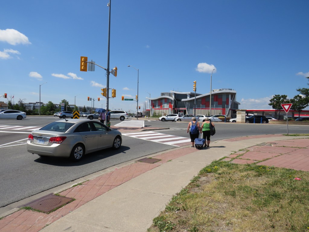
The intersection of Steeles Avenue and Main and Hurontario Streets
Last year, I wrote about a foreseeable problem coming to the corner of Steeles Avenue and Hurontario and Main Streets in Brampton: the planned Hurontario LRT terminus, to be located on the south side of Steeles Avenue, would require thousands of commuters to transfer to Brampton Transit buses on the north-west corner of the intersection.
This transfer would require crossing ten or eleven lanes of traffic at one of Peel Region’s busiest intersections, with crowding at the street corners, with passengers awaiting a walk signal two separate times to make the necessary connection.
After twice receiving unsatisfactory answers at a Metrolinx online town hall, and hearing no information about how the crossing at this intersection might be mitigated, on March 9, 2021, I took the step of making an Access to Information Request to Metrolinx under the province’s Freedom of Information and Protection of Privacy Act asking for communications between Metrolinx, the Ministry of Transportation, Mobilinx (the consortium awarded the contract to build and operate the LRT), and the City of Brampton.
I received a package with the requested materials from Metrolinx on July 29, 2021. The request cost me $360.00, plus a $5.00 application fee. Communications from Metrolinx’s privacy officer were professional, friendly, and very helpful.
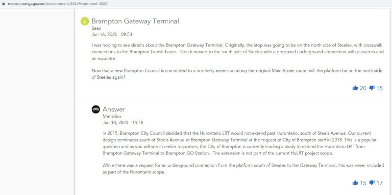
Through my request that covered the dates December 1, 2018 to March 11, 2021, I obtained several letters from Brampton officials, including City Councillor Gurpreet Singh Dhillon, Director of Transportation Special Projects Chris Duyvestyn, Chief Administrative Officer David Barrick, and Mayor Patrick Brown to Metrolinx and Ministry of Transportation Officials requesting restoration of the north side stop at Steeles Avenue/Brampton Gateway Terminal. I also obtained replies from senior Metrolinx staff, including President and CEO Phil Verster and the Deputy Minister and the Minster of Transportation.
What is the communications reveal is that decisions made during the 2014-2018 term of Brampton Council significantly tied the hands of everyone involved — both at the City of Brampton (which reversed its previous decisions when a new council was elected in October 2018) — and at Metrolinx, which was quickly working towards finalizing the contracts to construct the transit project. Unfortunately, important details, such as the final configuration of the Steeles-Hurontario/Main intersection, remain unknown. Neither Metrolinx nor the Ministry of Transportation, which funds Metrolinx, appear to grasp the problems that will be caused when thousands of commuters have to cross two major streets at an especially busy intersection.
Despite Brampton’s work since December 2018 to move the Brampton Gateway stop back north of Steeles Avenue, including formal requests to Metrolinx and the Ontario Ministry of Transportation (MTO), and despite a similar request from RioCan, owner of the massive Shoppers World Mall property at Main Street and Steeles Avenue, Metrolinx and the province have held firm in their decision.
While Metrolinx and the MTO cite the difficulties of reopening a project which was getting underway, and concerned about setting precedents for other changes to the Hurontario LRT or other transit projects, this would still be a minor change, costing just $15 to $20 million according to a 2020 letter from Metrolinx CEO and President Phil Verster to Brampton Mayor Patrick Brown.
Sadly, transit riders in Brampton – who do not have affluence or political might — have been left in the middle of this political back-and-forth between municipal politicians, the province, and Metrolinx. They will be forced to endure a more difficult transfer between LRT and bus than anything proposed to them in public consultations.
Following Greyhound Canada’s inevitable final departure, several other companies have begun to take over Greyhound’s busiest routes in Ontario and Quebec.
In May, Megabus Canada began service between Toronto, Kingston, and Ottawa, operating out of the new Union Station Bus Terminal. Megabus’ terminal in Ottawa is the St. Laurent Shopping Centre, with easy connections to Ottawa’s O-Train LRT and several bus routes.
In June, Rider Express, a new intercity carrier based out of Western Canada (where it picked up many of Greyhound’s abandoned routes there), began operating its own Toronto-Kingston-Ottawa route, in competition with Megabus.
Québec-based Orleans Express took over Greyhound’s former Ottawa-Montréal route, joining Ontario Northland and Rider Express at the Ottawa VIA Station. The VIA Station, like St. Laurent, offers a safe, enclosed waiting area, passenger amenities, and easy connections to the O-Train LRT.
While Ottawa has many options for getting to and from Toronto: VIA Rail, Megabus, Rider Express, and two frequent airlines, connections to other cities and towns are limited at best. Ontario Northland’s single daily bus from Sudbury and North Bay through Renfrew County arrives in Ottawa in the late evening, a time not convenient for most passengers. Commuter routes to nearby communities such as Perth, Carleton Place, and Cornwall remain suspended during the ongoing pandemic.
But at least there’s some bus service again, providing new capacity on some of Canada’s busiest intercity routes.
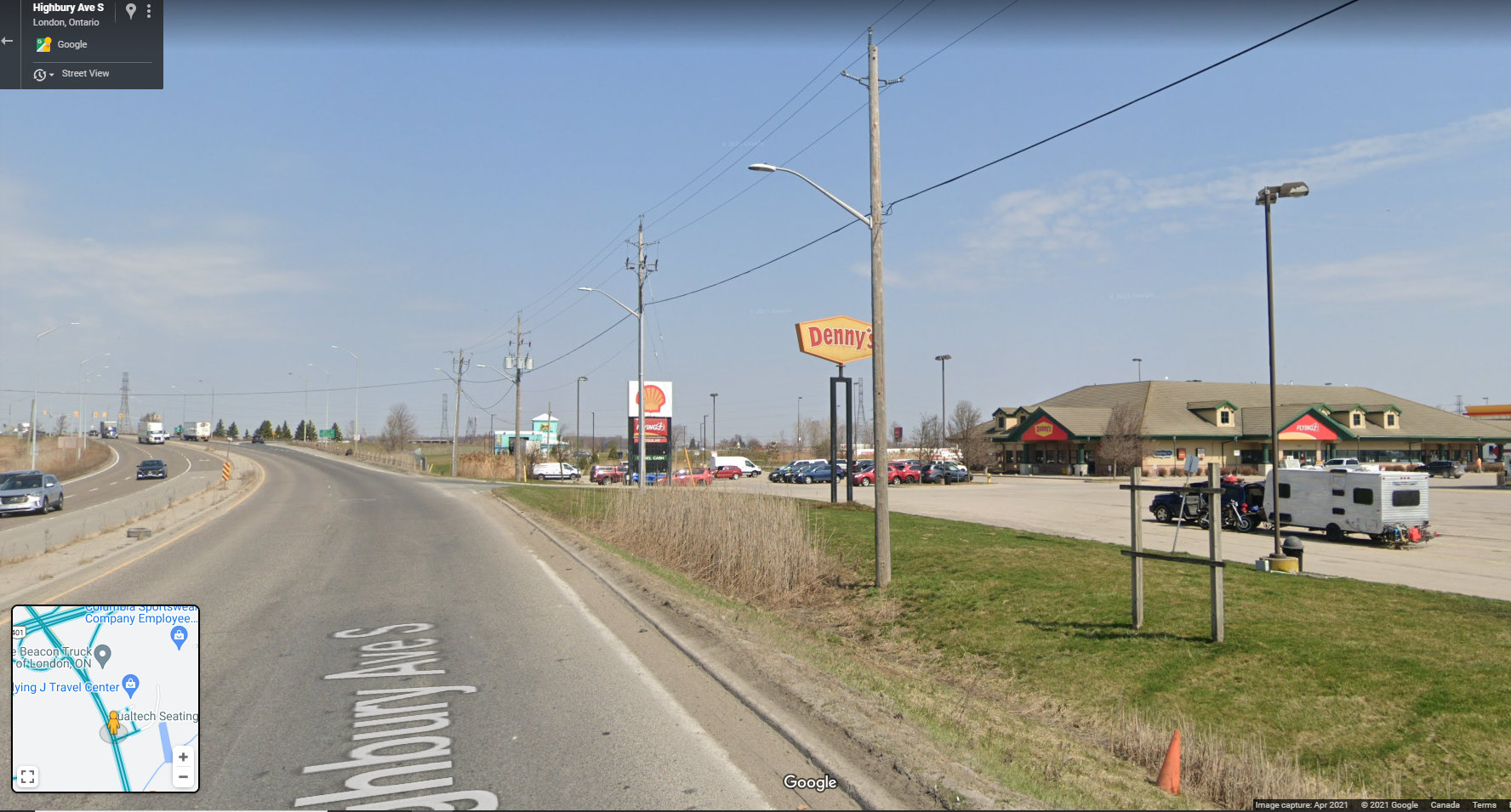
On Thursday, July 15, intercity coach service returns to Southwestern Ontario, with a new Toronto-London service operated through a partnership between Megabus and St. Thomas-based Badder Bus. The route will run non-stop twice daily between the Flying J Truck Stop at Highway 401 and Highbury Avenue and the Union Station Bus Terminal in Downtown Toronto.
Unfortunately, the Flying J truck stop, while convenient for truckers and other motorists, is a terrible place for a bus stop. The map below illustrates the truck stop’s location, on the southeastern outskirts of London.
The truck stop was likely chosen for its proximity to Badder Bus’ operations centre in nearby St. Thomas, and for the space available to park and load a bus in the RV/trailer parking area. The truck stop operates 24 hours, with an on-site convenience store, washrooms, and restaurant, so there are amenities for bus drivers and waiting passengers.
Unfortunately, Megabus and Badder Bus could not pick a less accessible place to catch a bus. The truck stop is surrounded by warehouses, light industry, and agricultural lands. Highbury Avenue is a high-speed highway connecting Highway 401 and central London, with a 100 km/h speed limit. Pedestrians and cyclists are prohibited from using Highbury Avenue (which, until the 1990s, was provincial Highway 126). There are no sidewalks leading south to Wilton Grove Road.
Looking north on Highbury Avenue towards Highway 401, with the Flying J truck stop on the right. Note no sidewalks — pedestrians and cyclists are prohibited from Highbury Avenue at and north of the 401. (Google Streetview – April 2021)
The only transit route within walking distance is London Transit Route 30, a rush-hour only service that serves the industrial area south of Highway 401. Downtown London is easily a 45 minute bus ride (when route 30 is operating), and Western University — a major market for Greyhound when it operated — is over an hour away by bus or a $50 taxi ride. Ironically, the northern outskirts of St. Thomas — that city remains disconnected to nearby London — are closer to the Flying J than Western University.
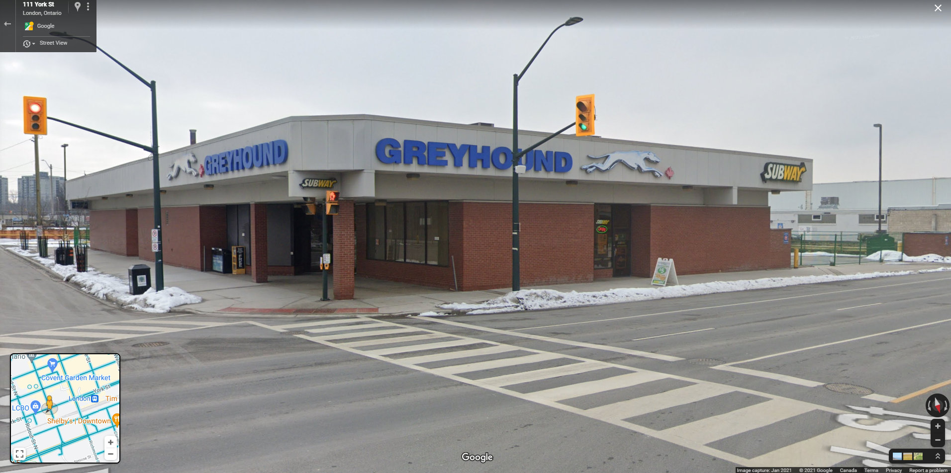
The Greyhound Terminal in downtown London, two blocks from the VIA Station. At its peak in the 1980s, the terminal served Greyhound, Gray Coach, Erie Coach, and Cha-Co Coach, with buses departing for Toronto, Detroit, Niagara Falls, Buffalo, and cities and towns throughout Southwestern Ontario. (Google Streetview – January 2021)
Greyhound Canada operated out of a terminal in Downtown London, two blocks west of the VIA Rail station. Greyhound shared its building with other carriers in the 1970s, 1980s, and 1990s, including Gray Coach, Cha-Co Trails, and Erie Coach Lines. From Downtown London, there were direct buses to Toronto, Detroit, Niagara and Buffalo, and cities and towns throughout Western Ontario. The terminal was a short walk to nearly all of London Transit’s bus routes, making connections to Western University, Fanshawe College, and the major hospitals easy.
Choosing a truck stop at the far edge of town, nearly inaccessible by public transit reminds me of the final years of Greyhound’s operations in Western Canada. Greyhound abandoned downtown terminals in Winnipeg, Edmonton, Regina, and Saskatoon in favour of new stops in outlying area.
In Edmonton, the downtown Greyhound terminal was expropriated for a new hockey arena, but Greyhound moved for the VIA station in the city’s northwest, which had no public transit access. (Red Arrow, a competing coach operator, maintained a downtown office and stop). In Regina, Greyhound moved from the downtown STC terminal to the airport, which has no public transit connection, and in Saskatoon, Greyhound moved to a truck stop — similar to London’s Flying J — in the northern outskirts of that city. It was clear that Greyhound Canada had no interest in attracting customers and was planning for an eventual withdrawal.
Given Greyhound’s experience, why would a new carrier choose such a poor location for an intercity bus stop, especially in a city as large and important as London? The terminal need not even be in Downtown London to be a major improvement; a stop at White Oaks Mall, just one interchange to the west at Wellington Street, would provide good local transit connections to Downtown London and even Western University while remaining close to the highway.
For now, Ontario’s newest bus stop might also be its worst bus stop.
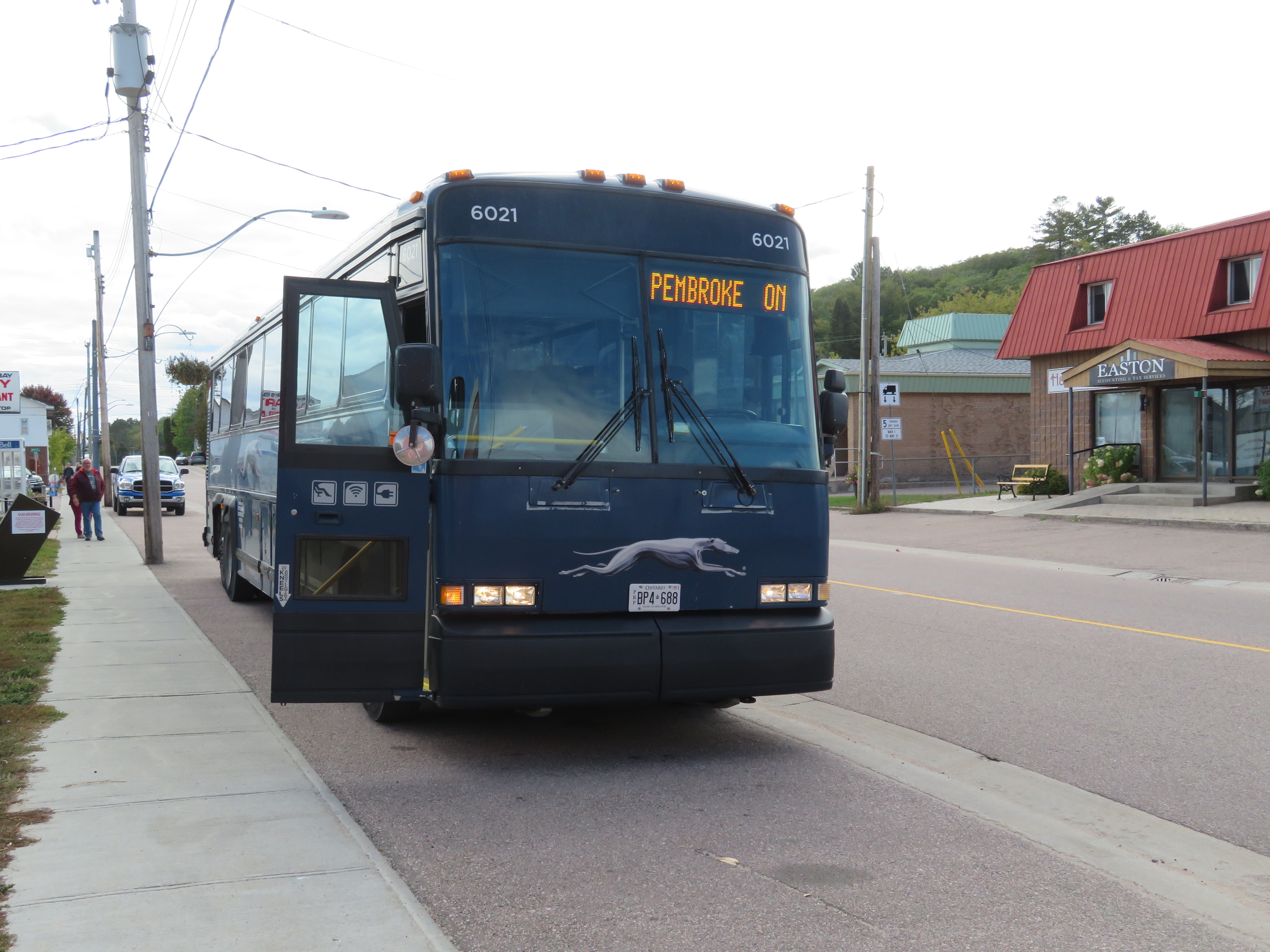
Barry’s Bay, on Greyhound’s Peterborough-Pembroke route, is one of many smaller towns and villages that permanently lost all intercity bus connections since the COVID-19 pandemic
On Thursday, May 13, Greyhound Canada announced that it was permanently ceasing operations. This should not have come as a shock to anyone following the intercity transport industry: for over three decades, intercity bus carriers in this country were privatized (Gray Coach and Canada Coach Lines in Ontario, shut down (Saskatchewan Transportation Corporation), or strangled by continued cutbacks and poor customer service (Greyhound). In 2018, Greyhound Canada ended all its remaining services between Vancouver and Sudbury. The loss of commuter and student traffic — Greyhound’s bread-and-butter in Ontario and Quebec — due to the pandemic led to a temporary, then permanent shutdown.
The next day, on Friday, May 14, Megabus — operated by Coach Canada, a subsidiary of UK-based Stagecoach — announced that it would begin service on the Toronto-Ottawa and Toronto-Kingston routes abandoned by Greyhound. Two buses a day will soon operate between Toronto, Scarborough Town Centre, Kingston, and Ottawa, daily except Tuesdays and Wednesdays, terminating at St-Laurent Shopping Centre, a stop on Ottawa’s new LRT. Though this provides a new option for travelers between the big three cities (VIA Rail continues to serve this route), it does not fill the gaps left by years of decline by private intercity bus operators.
Before Greyhound’s website disappeared, I downloaded the PDF schedules for Ontario and Quebec. In 2019, Greyhound operated three routes between Toronto and Ottawa: an express bus, with stops only in Scarborough, Belleville, Peterborough, Madoc, and/or Kanata, a local bus, making stops in cities and towns along Highway 7 between Peterborough and Carleton Place, and a Kingston-Ottawa bus via Smiths Falls. You can view and download the schedules below:
Peterborough loses two buses a day to and from Ottawa and express bus service to Downtown Toronto (which made the trip in less than two hours off-peak.) Though Peterborough is still connected to Toronto via GO Transit bus Route 88, it can take nearly three hours to go between Union Station and Downtown Peterborough, including a train connection at Oshawa, and many local stops in Clarington and along Highway 115. Other towns, such as Norwood, Marmora, Madoc, Perth, and Carleton Place, lose all bus services, except for a commuter-oriented weekday run between Ottawa and Carleton Place.
Greyhound has chosen to become irrelevant to most Canadians long before the final shutdown announcement. Northern Ontario, at least, still has Ontario Northland (which has expanded its reach), and the Greater Toronto and Hamilton Area has GO Transit (though gaps continue to exist in that network). If your rural community is lucky, your local or regional municipality launched a new, subsidized bus or microtransit service. There is also VIA Rail, which serves most larger communities that lost Greyhound services in 2020-2021 (Windsor, Chatham, Belleville, Ottawa, etc.), though it is typically more expensive.
Despite these continued and emerging services, there remains a need for government support of those crucial links left behind by Megabus, VIA, and GO Transit.
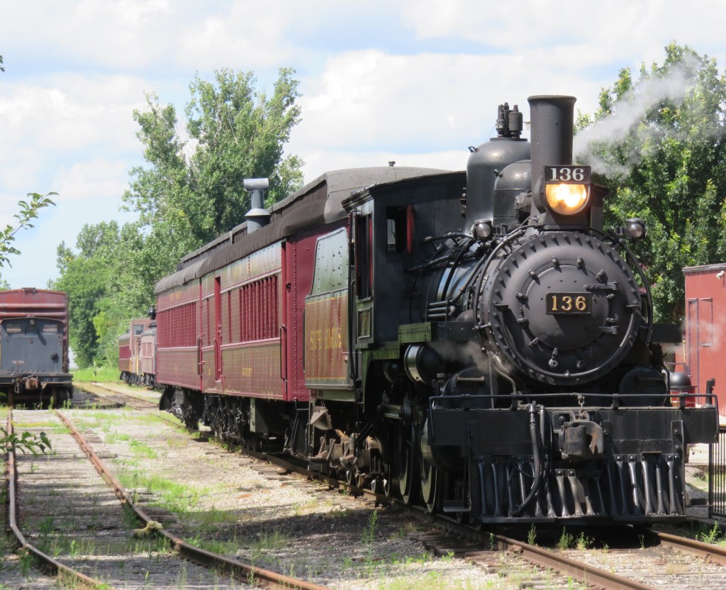
Former Canadian Pacific locomotive #136 hauls excursion trains at the South Simcoe Railway in Tottenham, Ontario
December 17, 2023: The complete map has been migrated to a newer ArcGIS Online account, on account of ESRI suddenly changing its monthly service account to charge bandwidth. That was a pay-as-you go account that helped me get re-acquainted with the ESRI ArcGIS Online platform before I set up a full online subscription to support a small business I co-founded in 2021.
However, I am happy to announce that I completed updates to the Ontario Intercity Transport Map and the 1955 Canada Passenger Rail Map, and that they are safely on a new subscription server at ESRI Canada. Please let me know if you have any suggestions or corrections to the maps, especially during the migration phase.
Sadly, passenger rail has faced a long, slow decline in Canada. Though commuter and regional rail systems in the Toronto and Montreal metropolitan areas have expanded tremendously over the last fifty years, rail service in general has declined in frequency, reliability, and even in speed. Prior to the COVID-19 pandemic, just six trains a day in each direction operated direct between Canada’s two largest cities, the fastest of those trains taking 4 hours 48 minutes to go 539 kilometres to get from Toronto to Montreal.
Seventy years ago, 28 trains on a typical weekday called at CN’s Hamilton Station, departing for Toronto, Niagara Falls, London, Guelph, Barrie, and Simcoe, with another 12 trains calling at the TH&B station on Hunter Street. In 2019, just six GO trains departed Hamilton for Toronto each weekday, with no direct connections even to Niagara, London, or Guelph.
There are several causes for the decline in passenger rail. In 1955, which the map below depicts, passenger train revenues were augmented by express cargo and mail, with the mail contracts alone helping to subsidize many branch lines. Lightly-travelled branch lines were served by mixed trains, which carry both passengers and freight. In Northern Ontario and Quebec, many highways were still of poor quality or unfinished — Highway 17 along the Lake Superior coast was not complete until September 1960. Construction of Highway 401 was just getting underway in 1955. In addition, the airline industry was still new, and air travel was expensive.
Improved highways drew more passengers to coach buses, while the move to trucks for cargo and mail deliveries made many branch lines unprofitable. Larger jet aircraft made air travel cheaper and more convenient for long distances. The major railways concentrated their energies on modernizing their freight networks, with CN and CP building new freight classification and intermodal yards outside of central Toronto, while focusing on bulk freight and shipping containers.
Though CN made efforts to win passengers back in the 1960s and early 1970s with new fare structures and equipment like the Turbo train between Toronto and Montreal, the government of Canada stepped in and took over most intercity passenger rail services in 1977. Though VIA Rail Canada acquired new modern locomotives and rail cars for the Ontario-Quebec corridor services, cuts to government subsidies made in 1981, 1989-1990, and 2012 forced further service cutbacks. British Columbia and Ontario also cut passenger services on their own rural railways.
I mapped the year 1955 for several reasons. I have CN and CP schedules for those years in my collection, while I found contemporary Ontario Northland and New York Central schedules online. It was also the year both railways inaugurated new transcontinental trains: CP launched the Canadian, while CN launched the Super Continental, luxurious diesel-hauled trains with modern sleeping cars and lounges. There were six trains a day leaving Montreal and Toronto for Vancouver that year. In 2019, there were just two trains a week.
In 1955, there were still many branch passenger and mixed trains in Ontario and Quebec, most of which were gone by 1965. Mixed trains were notoriously slow, though, but in many cases, there was a faster parallel highway coach. 1955 was also the last year for CP’s electric trains between Kitchener and Lake Erie, with the London & Port Stanley and Montreal & Southern Counties railways ending passenger runs a year later.
For Ontario and Quebec, I used Paul Delamere’s amazing Ontario Railway Map Collection and Quebec Railway Map Collection, adapting his work to identify those routes used by passenger trains in 1955, then mapping them on my own server. Mapping other routes was much more labourous.
Original version of interactive map
Please contact me if you have any suggestions, corrections, or other feedback.
In June 2020, Toronto-based artist and activist Andrew Lochhead launched a petition to rename Dundas Street, one of Toronto’s oldest, longest and best-known arterial roads. Lochhead states that Henry Dundas, 1st Viscount Melville “actively participated in obstructing the abolition of slavery in the British Empire from 1791 to the end of his political career in 1806.” While some historians may argue that Dundas was a pragmatic moderate, rather than an anti-abolitionist (unlike slave-owning Torontonians like William Jarvis or Peter Russell, who have streets named after them), it’s still worth wondering why Toronto has a street named after the Scottish politician, who had nothing to do with Toronto’s colonial history.
Until recently, I gave Dundas Street little thought. Years ago, I wrote about how the street was pieced together in the late 19th and early 20th century to provide a new through east-west route across central Toronto. Though I was aware that Dundas Street began at the present-day corner of Queen Street West and Ossington Avenue, I had long thought the road was named for the town of Dundas, to which it leads.
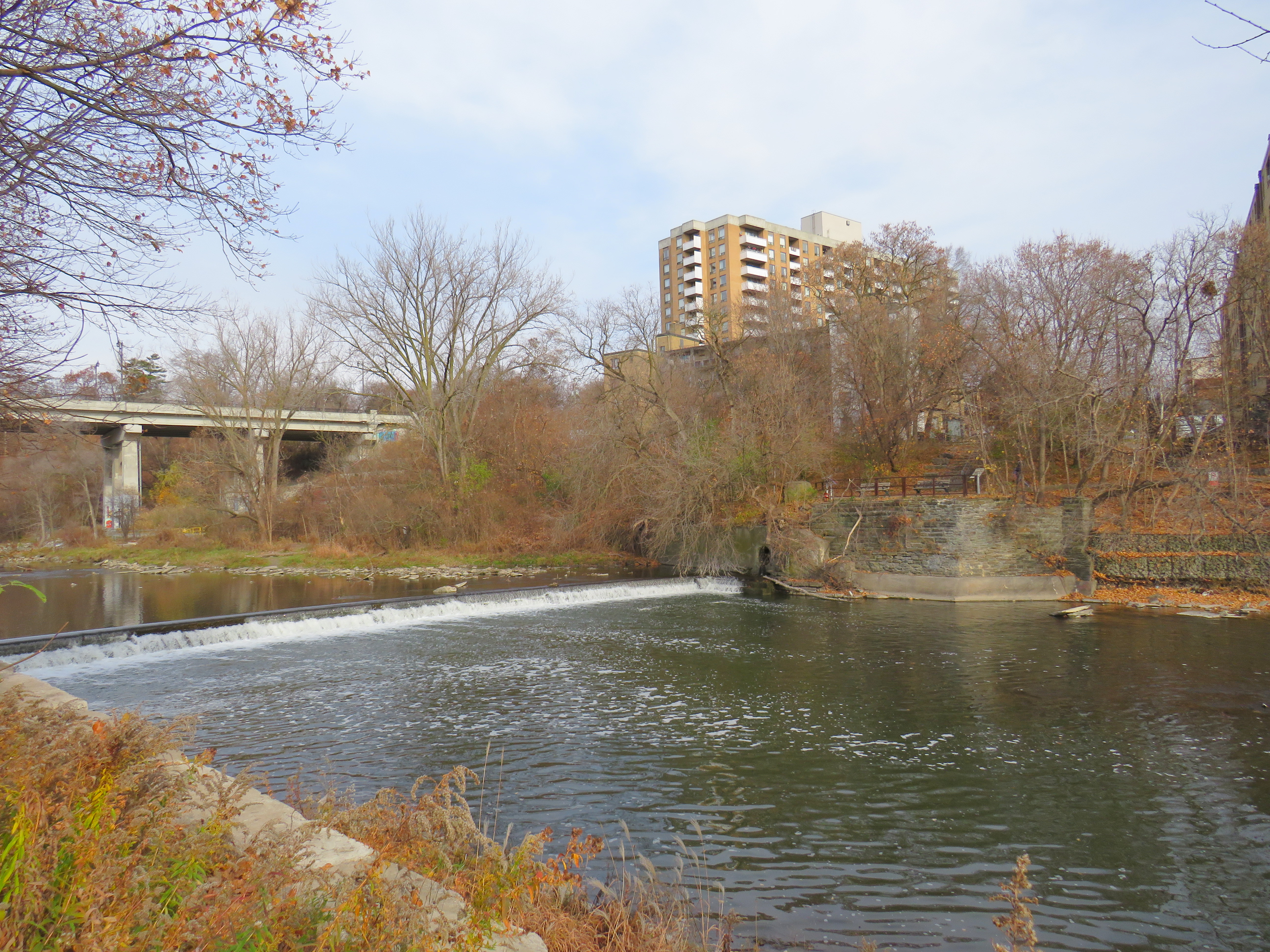
The end of Desjardins Canal, in the old Town of Dundas
Dundas Street was established as a military supply route by order of John Graves Simcoe, the first British governor of Upper Canada. At first, it was surveyed and cleared in 1794 and 1795 between Cootes Paradise (at the very end of Lake Ontario, beyond Burlington Bay) and the Upper Forks of the Thames River, at what is now Woodstock. From there, small boats could be used to travel downriver to London and to Lake St. Clair. Though there were several Indigenous trails connecting Lake Ontario and the Thames River (the western part of Mohawk Road in Hamilton follows one such route), the new British colonial government favoured a straight, direct road.
A federal plaque on a cairn in front of Dundas Valley Secondary School in Dundas
Though Dundas Street (which is known as Governor’s Road between Dundas and Paris) features a gentle climb up the Niagara Escarpment, detours were quickly established to get around challenging terrain, such as the confluence of Grand and Nith rivers near Paris. Dundas Street was soon extended westward, to Simcoe’s preferred capital site at London, and extended eastward, to York (Toronto).
Yonge Street, which was originally surveyed and cleared between Lake Ontario and the Holland River near Lake Simcoe, served a similar purpose as Dundas Street. Combined with Penetanguishine Road, Yonge Street provided a military supply route to Lake Huron, though bypassing the established Toronto Carrying Place trail. Though Dundas and Yonge Streets were built with military goals in mind, they, like many other early colonization roads, helped to promote new settlement of lands claimed from local First Nations. Like Dundas Street, Yonge Street was named for a senior British official — George Yonge, who was the British Secretary of War in 1793.
In its early years, Dundas Street’s position inland from Lake Ontario was advantageous as it provided an alternate route in case of invasion. The winding route through Etobicoke and West Toronto to Ossington Avenue allowed travellers to avoid deep ravines and Grenadier Pond.
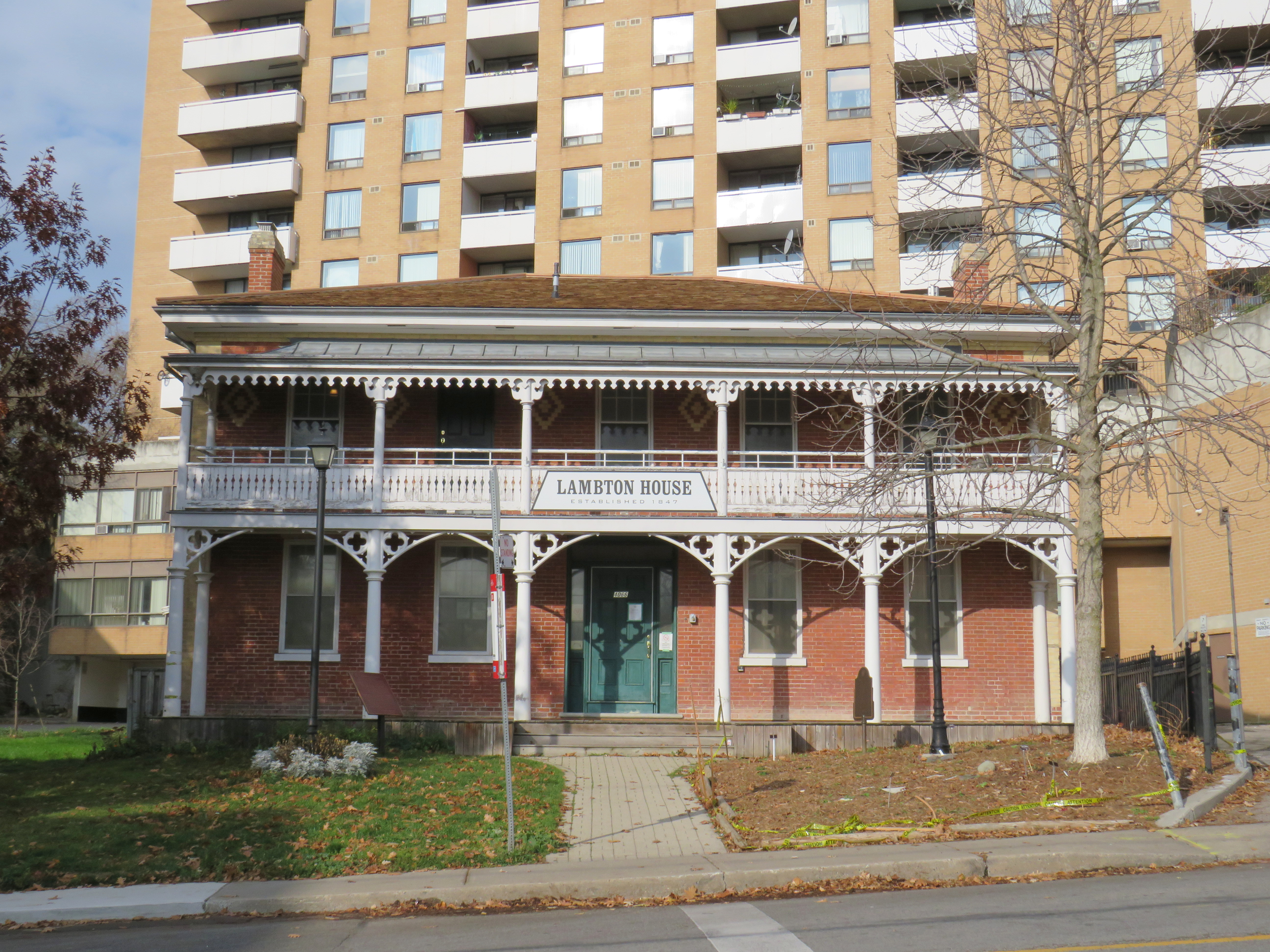
Lambton House, Old Dundas Street
Other early settlement routes, such as Weston Road, branched off of Dundas Street, leading to newly settled lands to the north and northwest of Toronto. Taverns dotted the route, providing accommodation and libation to travelers, several of which — including Lambton House and Montgomery’s Inn — survive to this day.
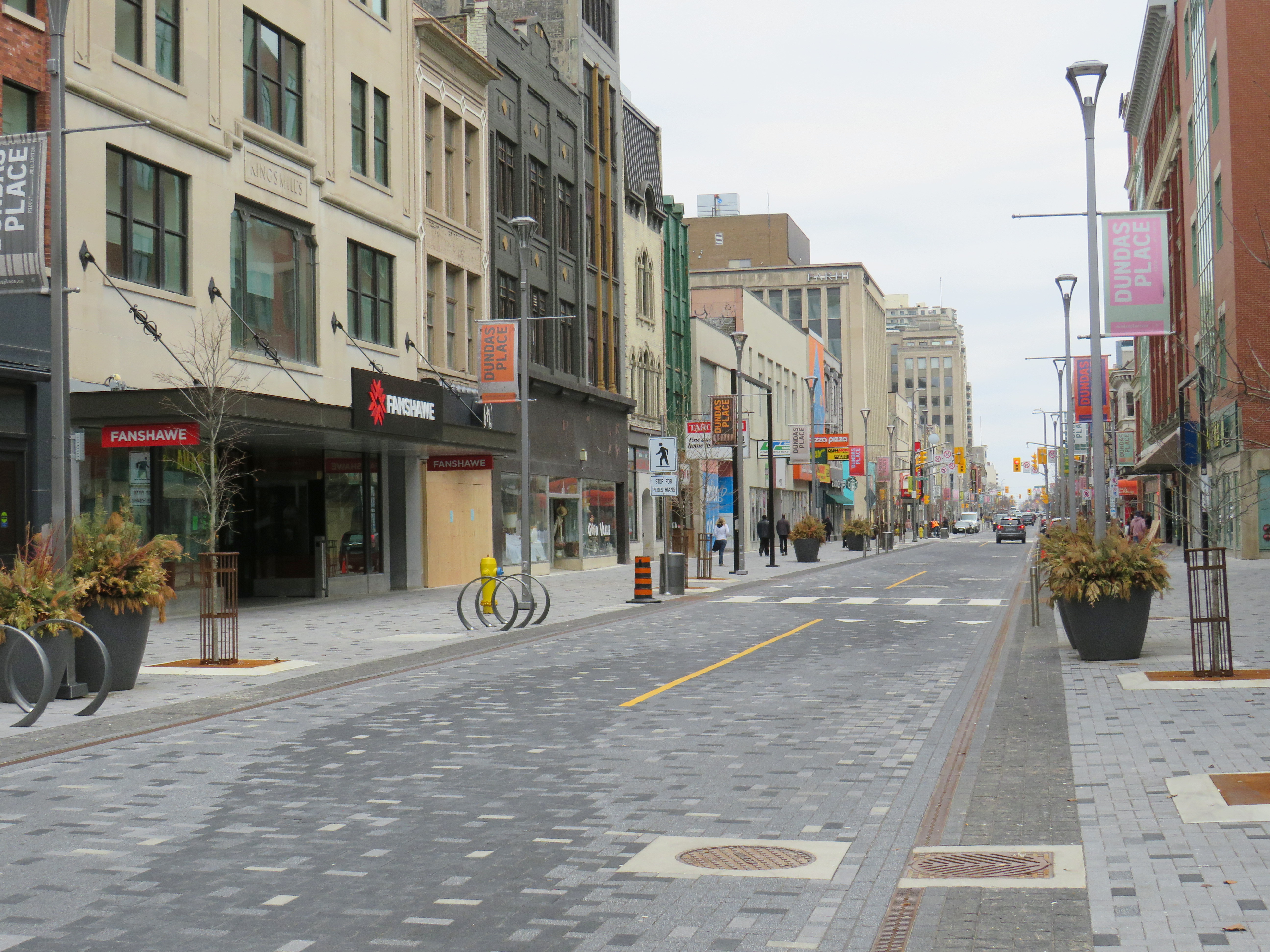
In London and Woodstock, Dundas Street formed the basis for each city’s downtown core. In London, it was recently rebuilt as a two-lane flexible street called Dundas Place, intended to host public events and revitalize the street, which has seen a loss of business to suburban malls and big box stores and to trendier bars and restaurants on Richmond Street, closer to Western University.
Dundas Street in Downtown London was recently rebuilt as a flexible street
Outside the cities, though, other routes surpassed Dundas Street in importance by the mid 1800s. The Lakeshore Road soon became the preferred route between Toronto and Hamilton (which overtook the town of Dundas in size and importance), while the railways, established between Toronto, Hamilton, and London in the 1850s, further eroded Dundas Street’s importance as a major through route until the automobile gained in popularity.
Much of the road between Paris and London became part of interprovincial Highway 2, which extended across Eastern Canada from Windsor, Ontario to Halifax, Nova Scotia. The Waterdown-Etobicoke section became part of Highway 5, while the lesser-travelled section between Paris and Dundas (which today is known as Governor’s Road) was established first as Highway 5B in 1938, then as Highway 99 in 1940.
The remains of the old Dundas Street bridge over the Humber, removed in 1928, looking west to the former settlement of Lambton Mills. The replacement high level bridge is seen to the left. The approaches to the old bridge are named Old Dundas Street.
The Dundas-Waterdown section, which winded its way up the escarpment (only to descend it again a short distance east), became a minor road, with part of the original alignment abandoned by the 1850s.
Though it never held the status of Toronto’s main street, Dundas Street would gain in importance and length in the 19th and early 20th centuries. As Toronto grew beyond its early street grid, it came up against the park lot system devised by Governor Simcoe and other officials to establish a landed gentry in the new colony (including the slaveholding Jarvis and Russell families, who worked to prevent Simcoe from instituting a complete abolition in Upper Canada). These lots which were long and narrow, extended north from Lot (now Queen) Street, and each were developed independently. This resulted in a mess of east-west streets that did not necessarily meet each other. Though College Street was laid out with minimal difficulty, there was no continuous east-west street between College and Queen Streets east of Ossington Avenue.
Dundas Street West, looking southeast from Dovercourt Avenue towards the downtown skyline. This is part of the 220-year old western extension of Dundas Street from the head of lake to York (Toronto).
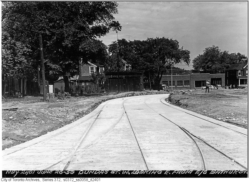
But by the early 1910s, Dundas Street was extended eastward, at first to Bathurst Street, following Arthur Street — which was widened to permit Toronto Railway Company streetcars — and then east to Yonge via St. Patrick, Anderson, and Agnes Streets. Jogs between these streets were slowly realigned, starting with the St. Patrick-Anderson-Agnes jogs between McCaul Street and University Avenue. However, it wasn’t until 1953 that the jog between former Arthur and St. Patrick Streets at Bathurst Street was eliminated. Scadding Court Community Centre now sits on the old roadway, though a small part survives as the centre’s staff parking lot.
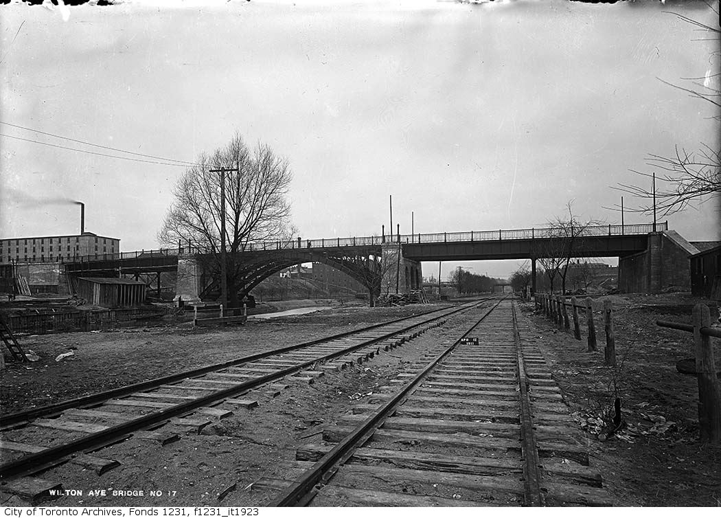
East of Yonge Street, Wilton Avenue was extended across the Don River in 1911, extending just east of Broadview Avenue, incorporating Elliot and Crawford Streets. Though the new bridge was built with streetcar tracks and overhead poles, through service did not begin until 1923, as part of a major TTC route restructuring.
By 1920, Wilton Avenue was renamed Dundas Street East, though the through connection across Yonge Street was not completed until 1922, with the block long section east of Yonge left over from the realignment renamed Dundas Square.
Though the early extensions of Dundas Street through the city simplified the street grid and allowed for through streetcar service between West Toronto and Broadview Avenue, the eastern extension built in the 1950s was done entirely for the benefit of the automobile.
Though Dundas Street extended east of Broadview for one block to Boulton Avenue, it was as a narrow residential street, and did not continue beyond (this is why the Harbord Streetcar took a convoluted route via Dundas, Broadview, and Gerrard to get to Carlaw and Pape Avenues). New roadways were planned to expand traffic access to Downtown Toronto from the burgeoning suburbs, including a new extension of Dundas Street east to Kingston Road.
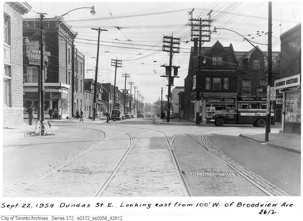
From Boulton Avenue, a new alignment was built east to Pape Avenue, resulting in the demolition of over a dozen houses on Boulton Avenue, De Grassi Street, West Avenue, and Wardell Street, before ducking under the Canadian National mainline in a new underpass built in 1953, and through an industrial area, avoiding major factory buildings.
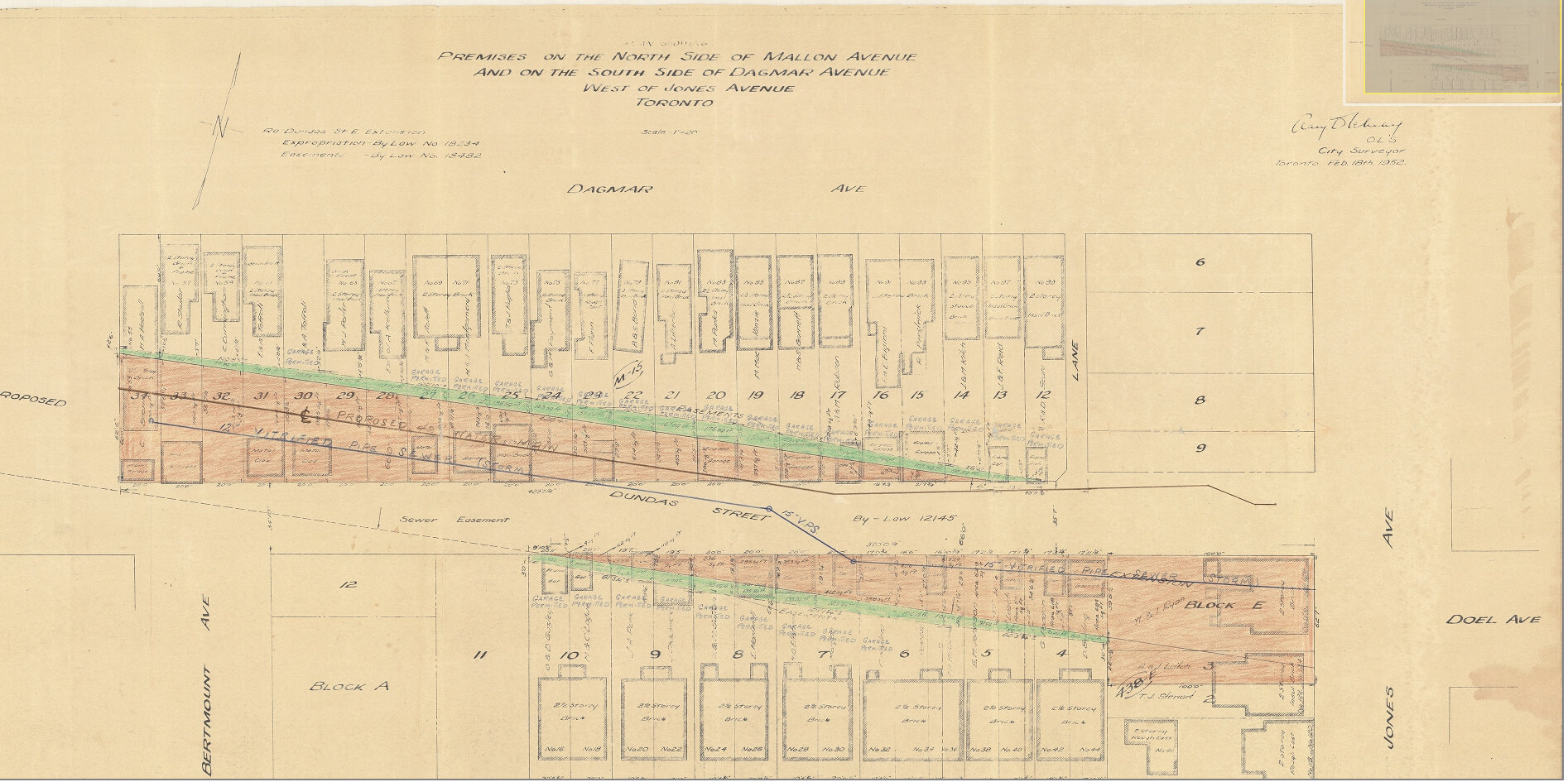
East of Pape Avenue, the new roadway followed a widened Dagmar Avenue, before bending south though a former alley to Jones Avenue to connect with former Doel Avenue to Alton Avenue. Between Alton and Woodfield Road, another new section of roadway was built, through an old brickyard in the late 1940s, connecting with Applegrove Avenue to Coxwell Avenue. The final section, between Coxwell Avenue and Kingston Road, was built through a minor ravine, connecting with, and replacing part of, Maughan Crescent and Edgewood Avenue.
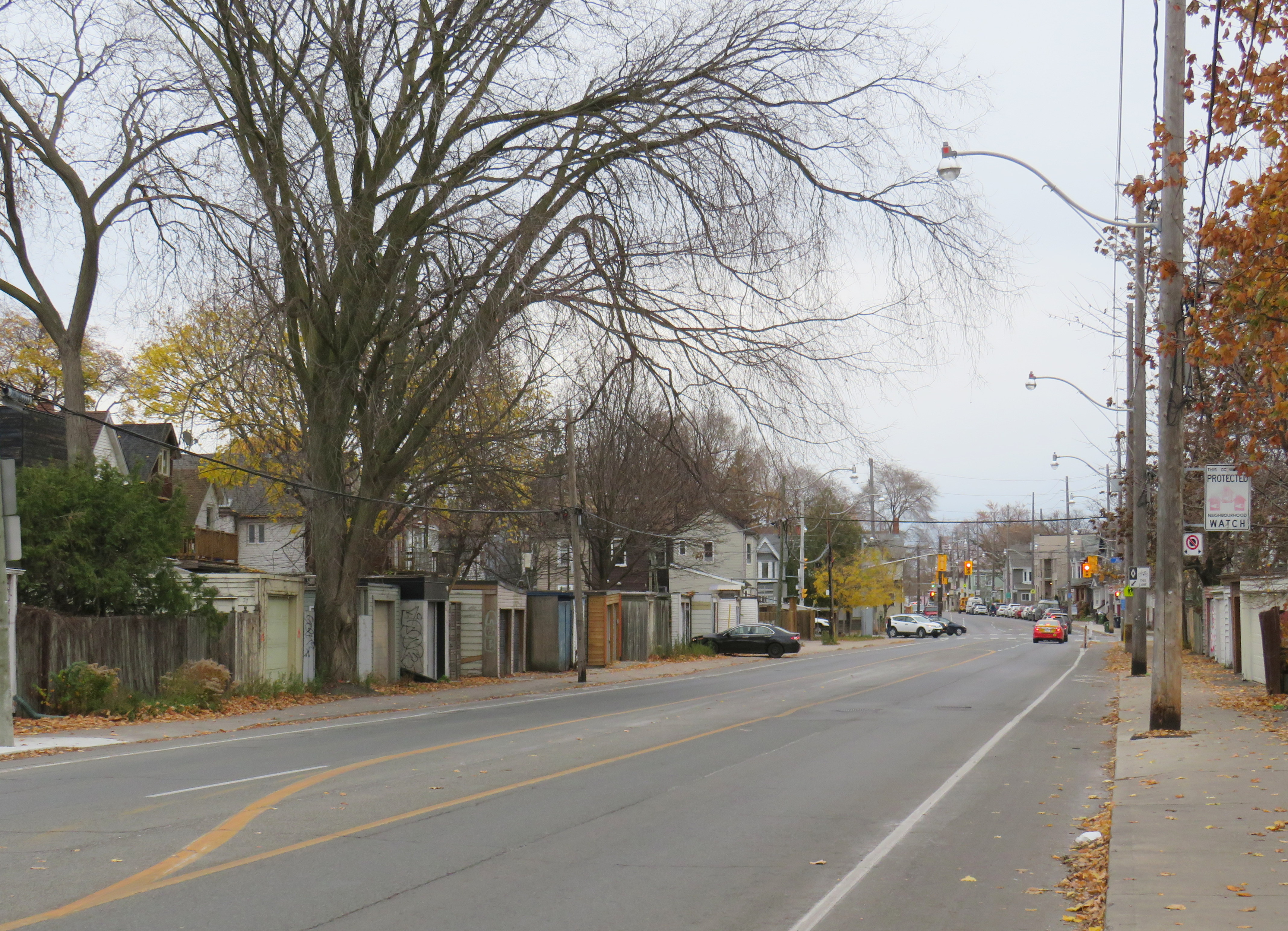
Plan for Dundas Street extension through the rear yards and laneway between Dagmar and Mallon Avenues. From City of Toronto Archives, Fonds 200, Series 2277, Item 32.Just west of Jones Avenue, Dundas Street East is lined with garages, as it passes through an old alley between Dagmar and Mallon Avenues.
Though Dundas Street East was shoehorned into several east-end neighbourhoods through the 1940s and 1950s to provide a new route for automobile traffic, over fifty years later it became an important cycling route. In 2003, the speed limit was reduced to 40 kilometres per hour, and the four traffic lanes reduced to two, with new bike lanes and a centre turning lane. Without streetcar tracks (unlike neighbouring Queen and Gerrard Streets), and with few storefronts, Dundas Street was simple to reconfigure. In 2020, the bike lanes were extended west across the Don River and into Regent Park, as part of the new ActiveTO measures.
Within Toronto, Dundas Street has gone by many names: Arthur, St. Patrick, Anderson, Agnes, Wilton, Elliot, Crawford, Dagmar, Doel, Applegrove, Maughan, and Edgewood. At various times in the first half of the last century, city officials have decided to change their names to Dundas Street.
It would not be without precedent to change Dundas Street’s name as well. Henry Dundas has no connection to local history, and even the historic road that bears his name did not extend any further east than Ossington Avenue.
Retain the legal street names with additional interpretation and recognitions
Retain the legal street names but rename those civic assets with Dundas in their name, except TTC facilities (there are three parks and one library branch that include the Dundas name, and Yonge-Dundas Square; there are two TTC subway stations and one streetcar line that also bear the Dundas name)
Rename the streets and all other civic assets now carrying the Dundas name (including Dundas Street East, Dundas Street West, Dundas Square, and Old Dundas Street).
I would agree with at least the third option, and likely the fourth option, even in part. As one of the city’s most famous and popular meeting places, a better name can be found for Yonge-Dundas Square. As Dundas Street East is a 20th century construct, and less than half the age of the historical road, it too, would be a great candidate for renaming to something meaningful. There are many other streets, towns, and parks in Toronto and elsewhere in Ontario that carry names given by early colonial officials, eager to leave their mark on newly claimed lands. Some are also worthy candidates for renaming.
Other municipalities, including Mississauga, Oakville, Burlington, Woodstock, and London, will also have to decide what they will do with their sections of Dundas Street. There is also the matter of the former Town of Dundas, the Dundas Valley, the United Counties of Stormont, Dundas, and Glengarry in Eastern Ontario (and two townships within it). There are also Dundas Streets in Belleville, Trenton, and Napanee along Highway 2, but otherwise unrelated to the historic road.
But the process must be thoughtful and considerate, and not just a another feel-good exercise that distracts from the real economic and racial inequities in our city.
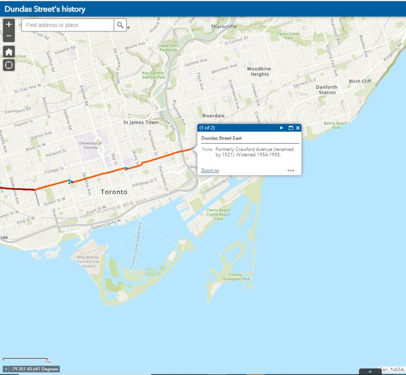
The interactive map below illustrates the history of Dundas Street, from London to Kingston Road.
A classic Brewers Retail Store in South River, Ontario featuring the 1980s-era branding
While taking a geographic analysis program during my undergraduate years at university, I developed a fascination with retail geography. My 2005 Masters’ paper examined the geographic distribution of payday lenders — which combined my interests in retail geography, urban planning, and social justice. Though my career took me in a different direction, I have maintained my interest in the role of geography in the success — or failure — of retail businesses.
Despite being one of Ontario’s oldest and most influential retailers, there is very little written about the history of The Beer Store. Contrary to common belief, The Beer Store is a private company — not a government monopoly. Following the end of prohibition in 1927, the provincial government established a crown corporation to distribute wine and spirits — the Liquor Control Board of Ontario, or LCBO. However, the province’s breweries were granted authorization to establish their own corporation — the Brewers Warehousing Company Ltd. — to distribute their own products. At first, alcoholic beverages were only permitted to be sold for at-home consumption (while customers were required to obtain licenses to purchase beer, wine, and spirits). Gradually, rules were slowly relaxed to permit drinking in hotels, restaurants, and taverns. Eventually, the company became known as Brewers Retail.
Though the number of breweries declined since the 1930s due to consolidations and bankruptcies, Brewers Retail expanded its retail operations in the 1960s and 1970s. It produced highway maps showing all the locations where thirsty Ontarians could buy “ale & beer.” Customers, freed from having to write out and sign purchase orders by 1971, would place their order with a clerk, then wait for their case(s) of beer to roll out from the cold storage in the back. Though a self-serve store was introduced in December 1971, it proved to be an unpopular concept, especially as the beer was kept warm, rather than in a cold warehouse in the back.
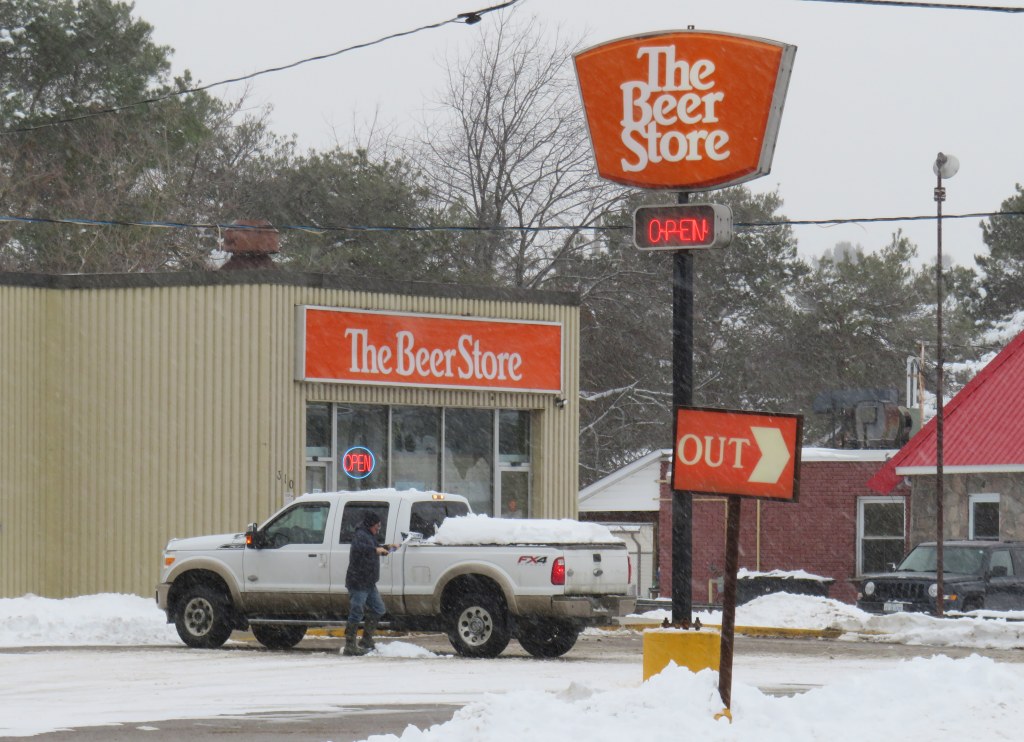
In 1985, Brewers Retail began rebranding its stores as “The Beer Store” with bright orange signage. Two further rebrands have occurred since (it now uses a grey and black colour scheme), yet the 1980s look can still be seen at many stores, especially in northern Ontario.
Though the rise of small independent craft breweries in Ontario, the LCBO’s expanded beer selection, and the recent moves to allow supermarkets to sell beer in limited quantities (singles and six-packs) have made it easier to purchase beer, The Beer Store remains the dominant player in the distribution of suds.
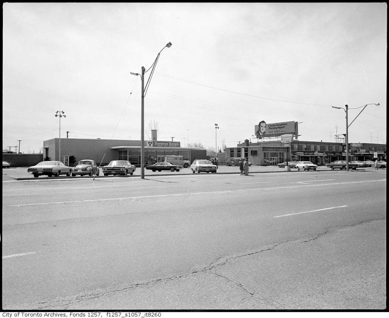
Brewer’s Retail, Eglinton Avenue East, 1974. Though the location has seen several renovations and rebrandings, this beer store still stands near the corner of Eglinton and Brimley in Scarborough. Toronto Archives Fonds 1257, Series 1057, Item 8260.
Not only does Brewers Retail sell direct to consumers, it also delivers bottles and kegs to businesses, so it had to establish a distribution network across the province. Most of the large breweries were located in Toronto or in southwestern Ontario, though there were smaller, regional brands such as Soo Falls Brewing and Sudbury’s Northern Brewery. Those products had to be shipped hundreds or even thousands of kilometres. Empty bottles had to be returned to the breweries for cleaning, re-labelling and refilling. Most large breweries, like Labatt’s in London and Molson’s Fleet Street plant, were located next to rail lines for easy shipping.
This is why, in Northern Ontario, many beer stores are found adjacent to rail lines. Though rail shipments to local beer stores have ceased — with one notable exception — this legacy can still be seen, from Pembroke to Kenora.
A thread on old Brewers Retail locations in Northern Ontario.
Unlike the south, most Beer Store locations in the North still have the retro orange signs.
But there’s something more interesting about these stores…
In some cases, such as in New Liskeard, The Beer Store is out of the way, an unusual strategy for a consumer-focused retailer. But since Brewers Retail holds a monopoly on bulk beer sales (not needing an especially visible location), and since rail access was important for the chain until the 1970s, the location makes sense.
In larger cities, such as North Bay, Sudbury, and Sault Ste. Marie, one Brewers Retail store would handle rail shipments, distributing products to restaurants and bars and to nearby beer stores. Thunder Bay had its own dedicated distribution centre in Port Arthur, next to the railway.
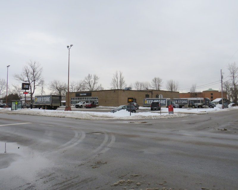
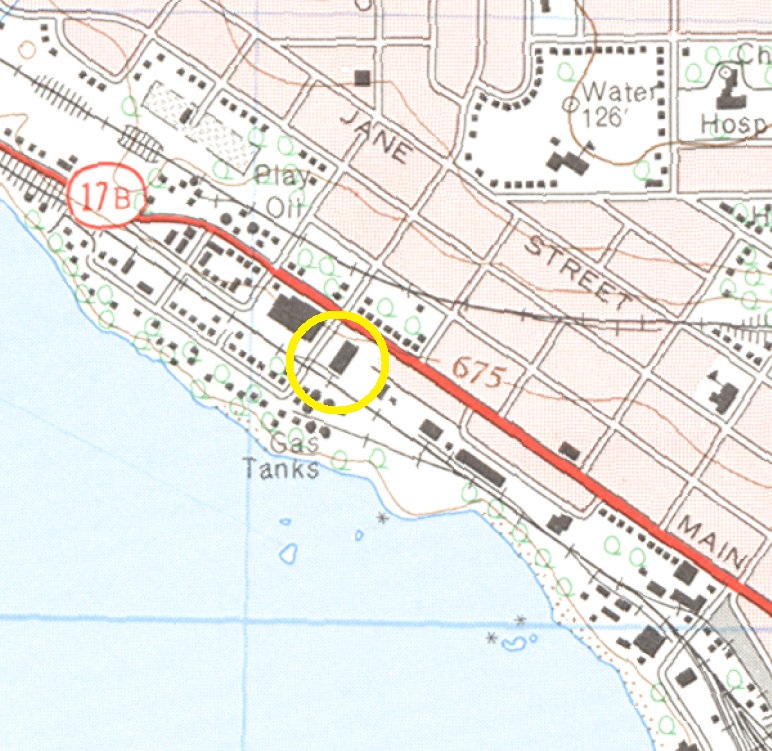
Since the 1960s, refrigerated trucks took the place of dedicated box cars. The railway spurs are gone and the loading docks have since been covered or bricked up. Yet in many cases they remain visible, especially during this time of year, such as North Bay’s Main Street store, below.
The Main Street beer store in North Bay has a large warehouse in the back, with the old rail docks still very visible. A 1964 topographic map shows the spur serving the store.
There were a few regional warehouses in Southern Ontario that had rail loading docks. Ottawa’s Bank Street Brewers Retail location, built in 1958, was designed by John B. Parkin and Associates and backed on to a Canadian Pacific freight spur. The warehouse was moved to a modern suburban location and the rail line was removed, though the building survives, with a beer store still operating at the front.
Similarly, the Ritson Road store in Oshawa was built next to the Canadian Pacific Railway, and saw rail service in its early years as it also functioned as a regional distribution centre. The store has since moved to a new big-box plaza built on an old General Motors plant to the north, with the old location now a local craft brewery.
In Oshawa, the old railside Brewers Retail store and warehouse is now a craft brewery. The shuttered rail docks -covered with metal sheeting – are barely visible behind the trees to the rear.
Interestingly, one Brewers Retail store still ships beer by rail — the Cochrane, Ontario location. Mike Robin kindly sent me photographs of Ontario Northland Railway box cars parked on the beer store’s spur. This allows for beer bottles and kegs to be shipped north to Moosonee, which is accessible only by rail or by plane for most of the year.
Cochrane Beer Store, November 21, 2020 – Courtesy Mike Robin