near Burnhamthorpe Road, Etobicoke
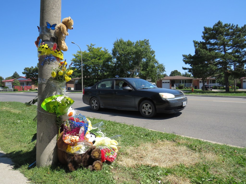
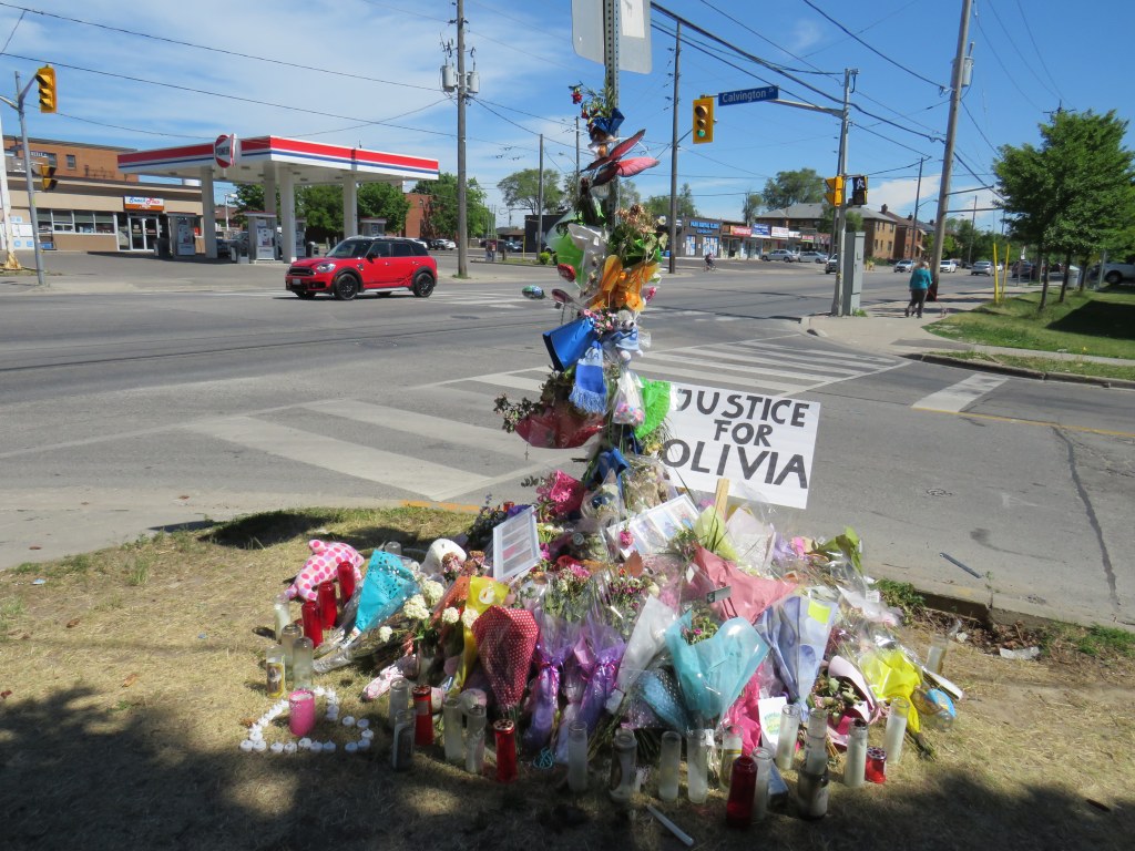
On Tuesday, August 11, just after 11AM, a father and his two children were attempting to cross The East Mall north of Burnhamthorpe Road. They were crossing from the west side of the minor arterial street, where there is the main entrance to a long term care home, to the corner of Montebello Gardens, a short residential street on the east side.
As the three pedestrians were crossing, an 81-year-old woman driving a black SUV turned left from Montebello Gardens to go south on The East Mall, crashing directly into the family.
All three pedestrians were rushed to hospital. A three-year-old boy was soon pronounced dead, while a seven-year-old girl was taken to a trauma centre. The driver remained on scene. It is not certain if charges will be laid.
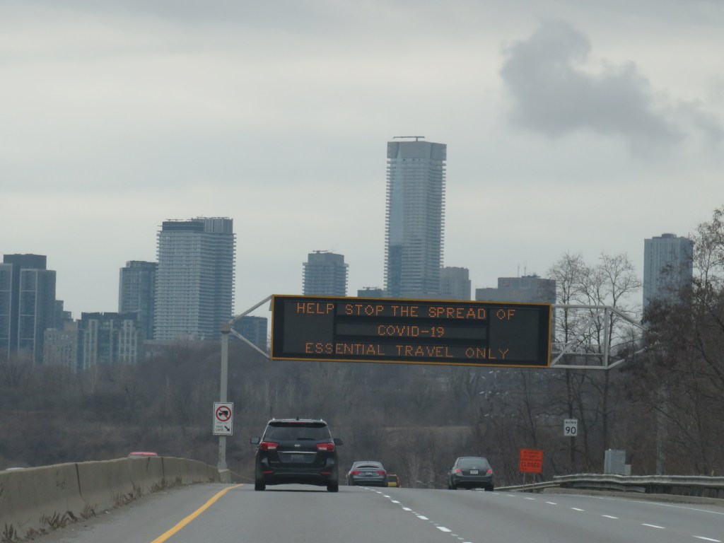
The three-year-old’s death came only a day after the Toronto Star’s Ben Spurr reported that 2020 has been the safest year for pedestrians and cyclists since at least 2007. There were 63 collisions resulting in serious injury or death in the period from January 1 through July 1, down from an average of 99. The decline can be explained by considerably reduced traffic since COVID-19 lockdowns began in mid March, and by fewer pedestrians on city streets.
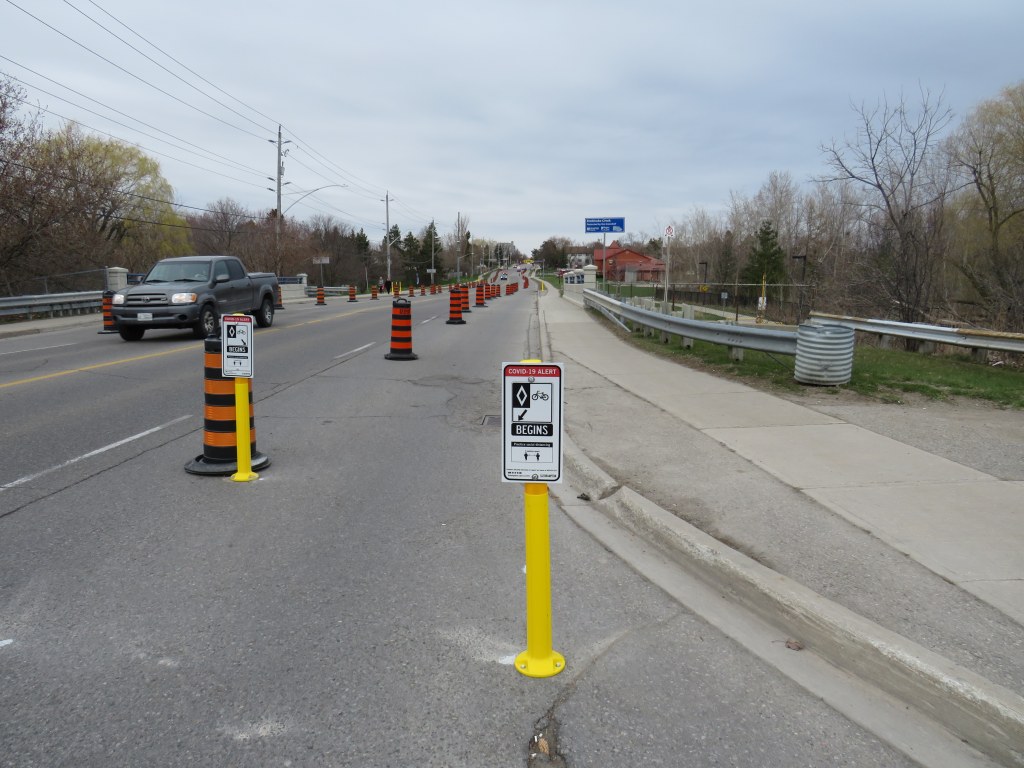
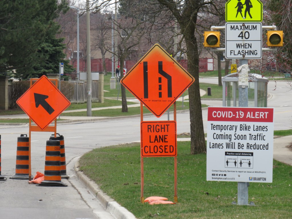
As traffic picks up with the loosening of restrictions and as people go out for strolls and exercise for physical and mental health, the need for improved road safety and a commitment for real Vision Zero implementation, especially in Toronto’s suburbs, remains crucial. The area near where the young boy was killed last week just shows how much further we need to go.
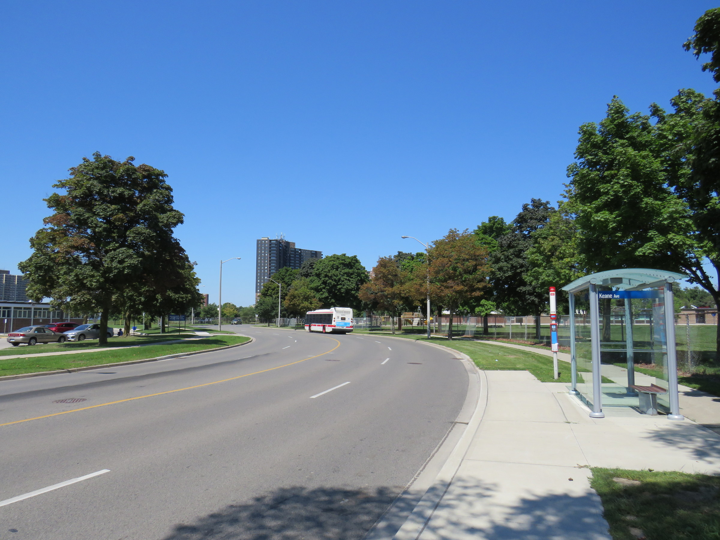
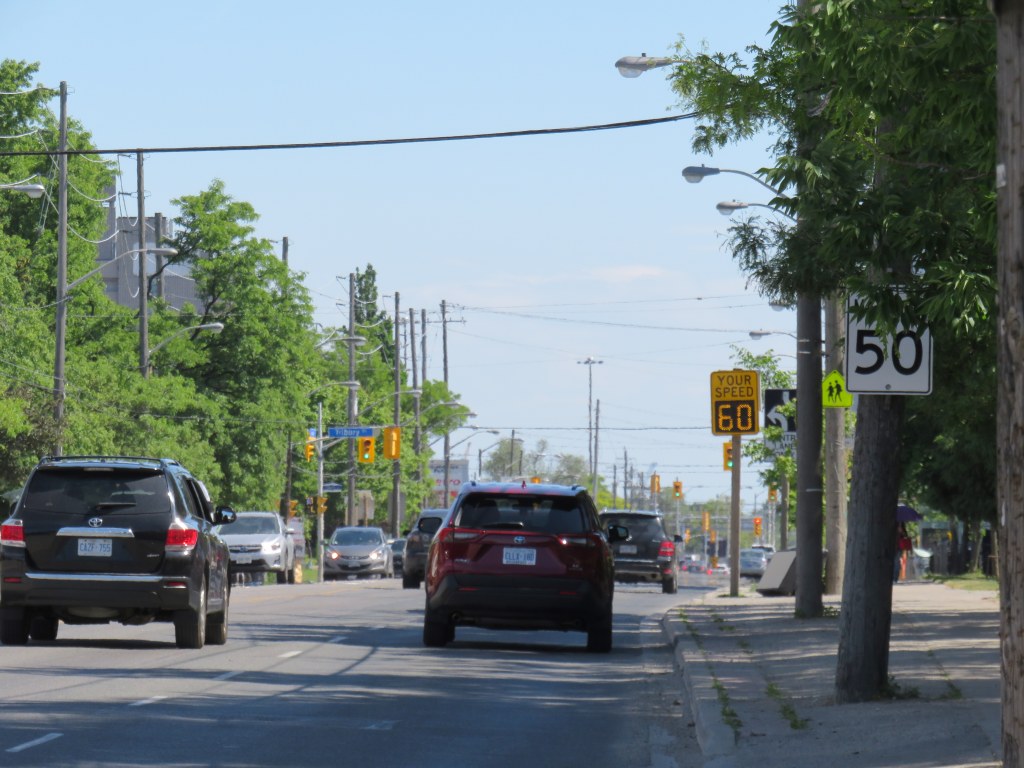
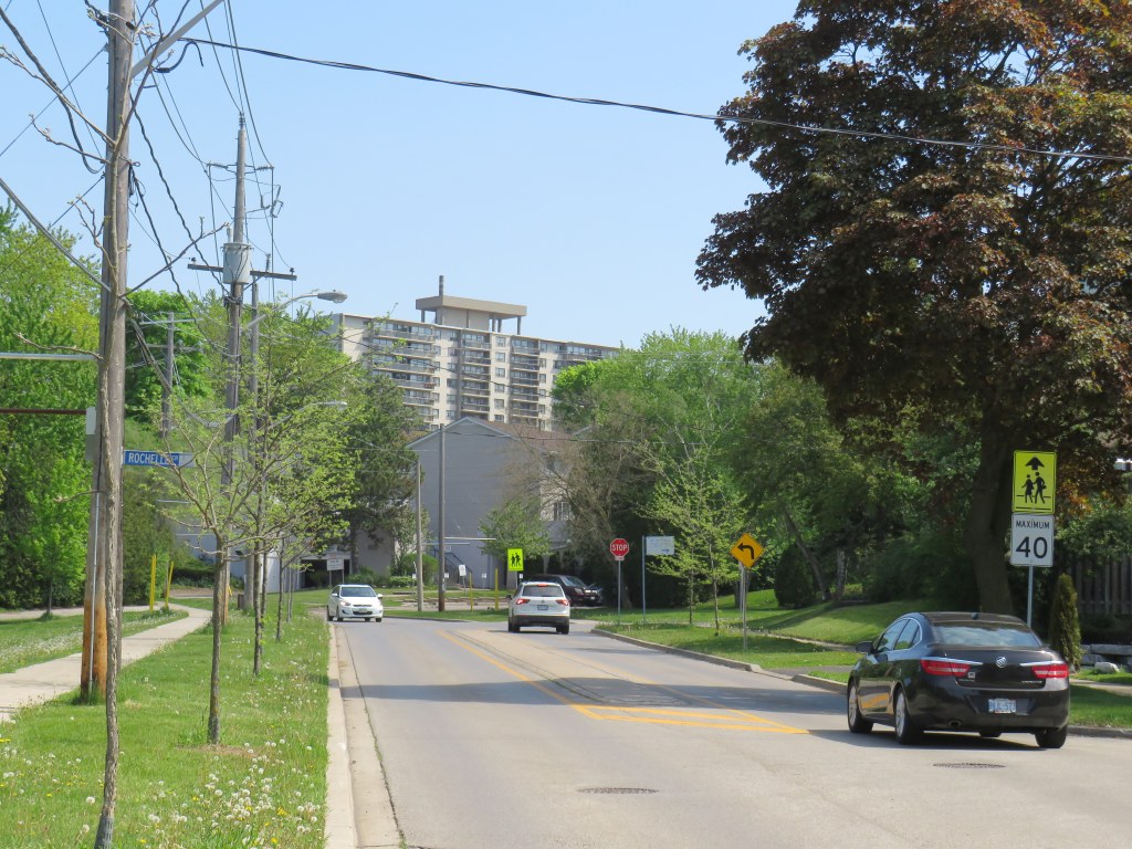
I visited The East Mall on a sunny Friday afternoon. I took the 111 East Mall bus from Kipling Station to Keane Avenue, the first stop north of Burnhamthorpe Road. The bus stop has a nice, clean shelter and a large concrete pad, but no where safe to cross the street. On the other side, there is a southbound stop for buses heading towards Cloverdale Mall and the subway, and Burnhamthorpe Collegiate Institute, a high school specializing in programs for mature students and adult learners.
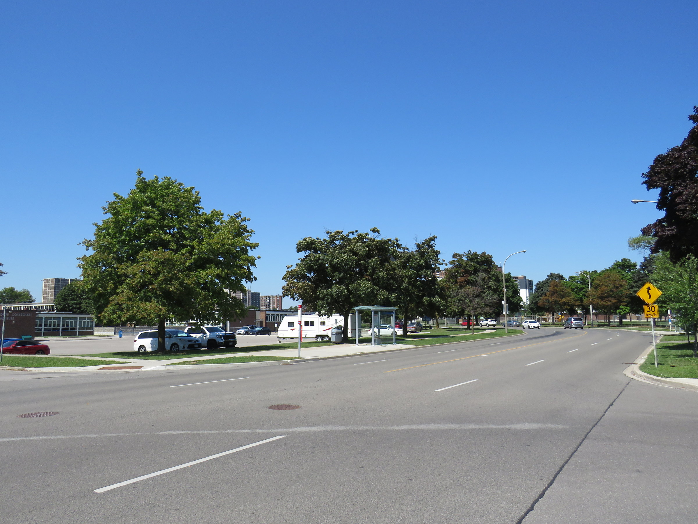
A signalized pedestrian crossover exists further north, in front of West Glen Junior Public School, but the next TTC stop, at Capri Road, is at yet another unsignalized intersection. The distance between Burnhamthorpe Road to the south, and the pedestrian crossover is over 550 metres, and neither designated crossing is visible from Keene Avenue nor Montebello Gardens due to the winding nature of The East Mall.
This part of Toronto has seen plenty of tragedy this year. The Eatonville Care Centre was one of several long term care homes where the Canadian Armed Forces were deployed due to deadly outbreaks of COVID-19 amidst poor working and sanitary conditions documented by CAF medical staff. Forty-two residents died during that outbreak.
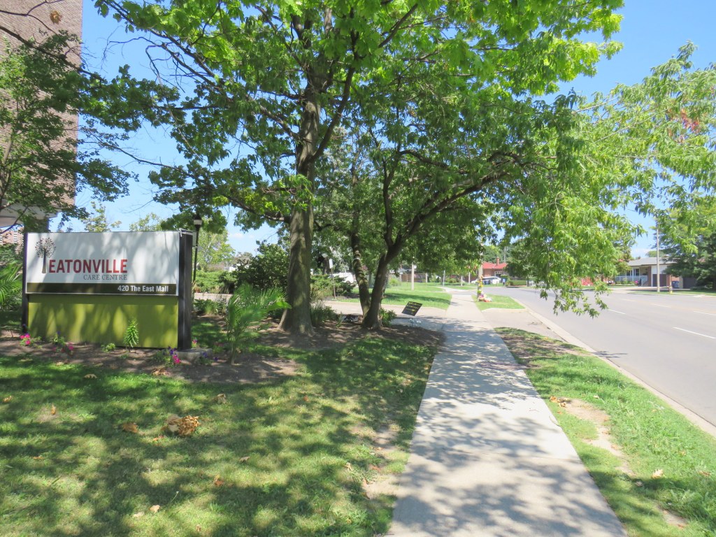
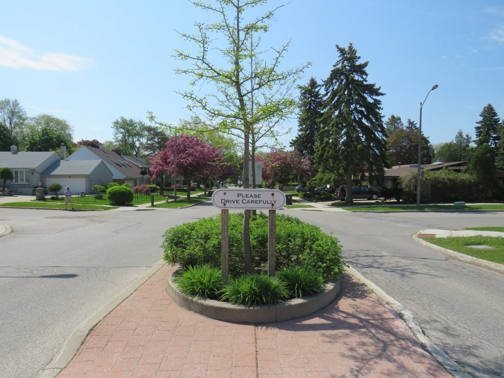
The presence of a long term care home, a library branch at the southeast corner of The East Mall and Burnhamthorpe Road, two nearby schools, and a large Loblaws supermarket and pharmacy on the southwest corner should have made this area a priority for improved, safer road infrastructure. Speeds along The East Mall are much higher than the posted 40 km/h limit, while the winding, roadway limits both drivers’ and pedestrians’ fields of vision. There should be no excuse for such long distances between safe pedestrian crossings, especially with the vulnerable populations living in this area.
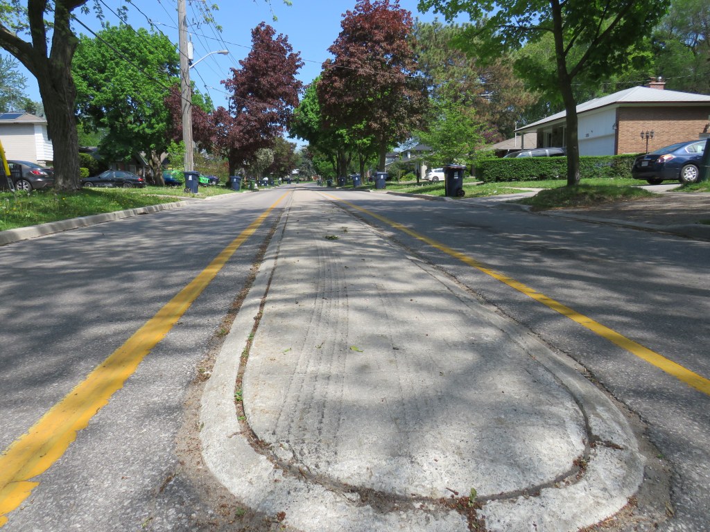
Though the driver who killed the three-year-old boy was carelessly turning from a side street, and not speeding along The East Mall, another tragedy is inevitable without significant changes. Meanwhile, The East Mall is similarly laid out south of Burnhamthorpe, where there are older rental towers and townhomes and new condominium towers going in, yet nothing is done to calm traffic along a winding, busy street.
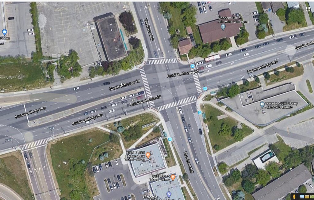
Though the intersection of The East Mall and Burnhamthorpe Road is signalized, it is also a dangerous intersection to cross. Burnhampthorpe Road widens to four westbound lanes leading towards Highway 427, while wide turning radii make it easy for motorists to turn right at all four corners. Drivers, rushing on and off Highway 427 take little notice or care for pedestrians, as I experienced trying to cross the street.
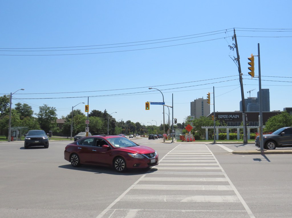
While motorists are treated to generous geometries and easy turns, pedestrians are only an afterthought, despite the library, supermarket, offices, and several bus stops used by TTC and Mississauga bus routes. Meanwhile, a new townhouse complex on the northwest corner will add even more pedestrians to this area.
This part of Etobicoke is simply unforgiving of pedestrians and cyclists — it is one of only a few parts of the city where no ActiveTO measures have been introduced and where the local councillor, Stephen Holyday, has demonstrated consistent opposition to safe and effective active transportation measures. Holyday describes himself as taking “a tough stance against congestion-causing initiatives” such as bike lanes and the King Street Transit Pilot. He was only one of two councillors to vote against the ActiveTO bike plan in May.
If we value lives, support healthy lifestyles, and are deeply committed to Vision Zero, central Etobicoke will need to see big changes.


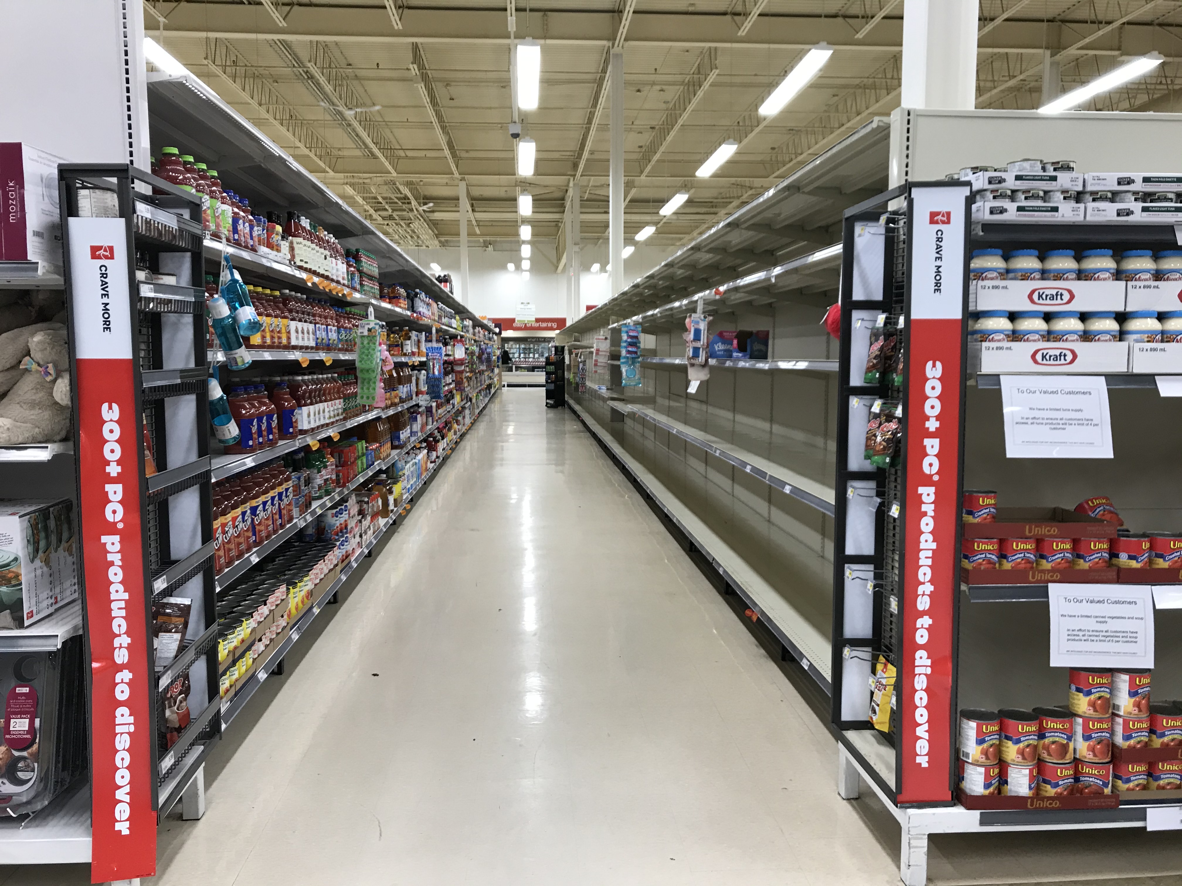 Empty shelves at the supermarket