Category: Toronto

  • Toronto’s killing streets

    IMG_2560.JPG
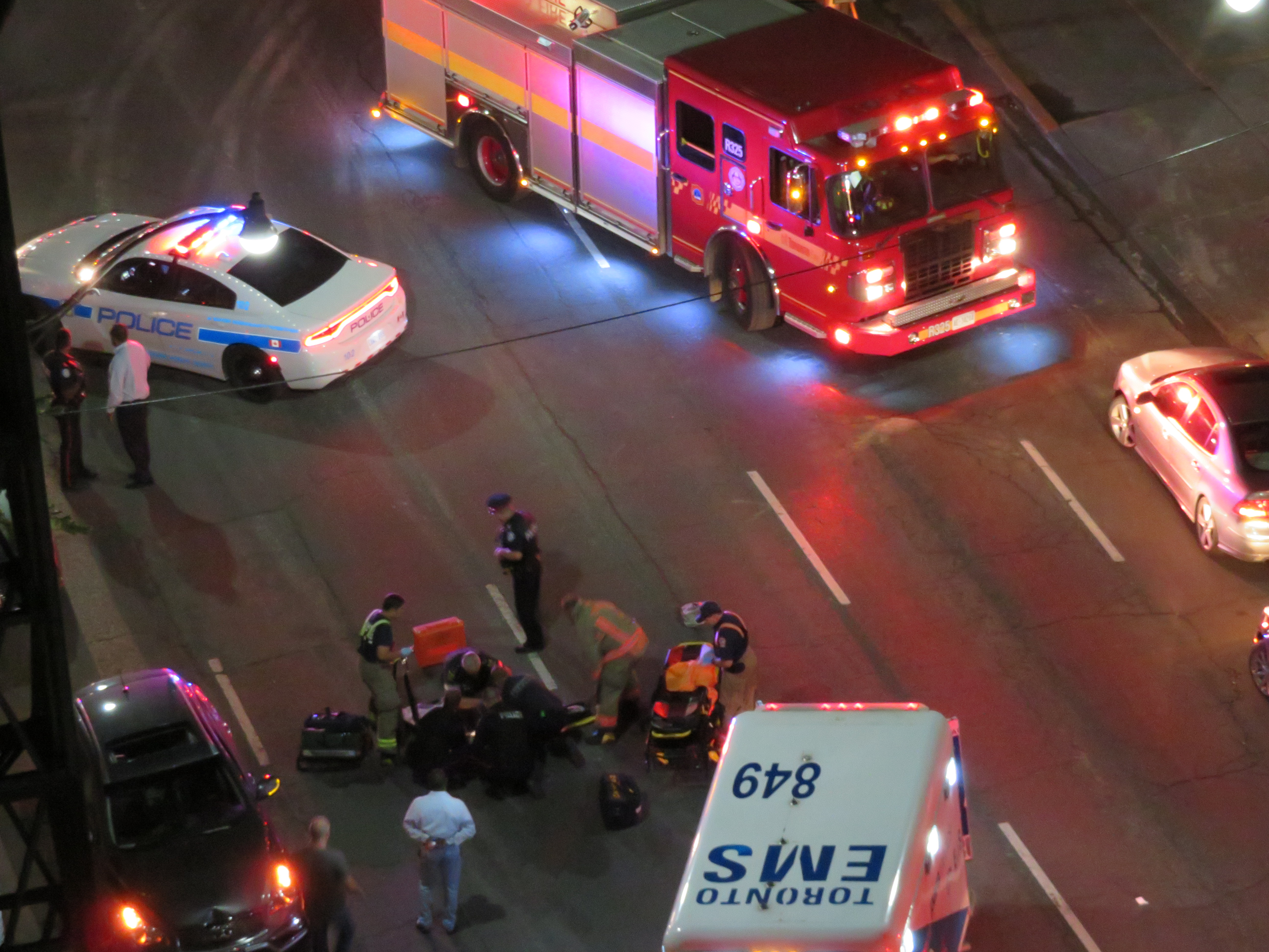
    A collision involving a pedestrian on Jarvis Street, 2017

    If there’s a “war on the car” in Toronto, the car is still winning.

    On Tuesday, Gideon Fekre was acquitted of dangerous driving causing death, after he sped on Dundas Street East, crossing a bike lane, mounting a sidewalk, and struck a pedestrian, Kristy Hodgson, killing her and one of the two dogs she was walking at the time. Both the prosecution and the defense agreed that Fekre was distracted at the time, reaching for a water bottle that fell. But Fekre was acquitted because his driving was not deemed dangerous enough to be worthy of a “dangerous operation of a motor vehicle” conviction. As Ed Keenan — an excellent Toronto Star journalist who covered the trial — pointed out, the Supreme Court ruled the same way in a similar case.

    Surveillance video showing Kristy Hodgson walking her dogs, before Gideon Fekre’s car crosses the bike lane and mounts sidewalk before hitting and killing her. (Toronto Star/YouTube)

    In the second case, Deriba Wakene was acquitted of leaving the scene of a collision after a 2015 hit-and-run that killed Nelisa DaMota as she was crossing Bloor Street mid-block. The judge in that case explained that he believed Wakene when he said he did not hear, see or feel any impact, even though Wakene’s neighbours could see the damage to his car after he parked it in his driveway.

    Both these judgments have made me angry. I hit a raccoon once while driving on a dark, rural highway, and heard and felt that impact, and I was shook up by that, even though there was no damage to the car, and there was’t much that I could do. If you hit a pedestrian, and don’t even know it, you shouldn’t be behind a wheel. If you’re distracted enough that you mount a curb and hit a pedestrian, there should be consequences to that.

    These two trials were the result of criminal charges, rather than lesser Highway Traffic Act (HTA) charges more commonly laid by police. For most HTA offences, the accused does not need to appear in court, even after a pedestrian or cyclist is injured or killed, and penalties are light — often a small fine. A proper vulnerable road users law, like that proposed by NDP MPP Cheri DiNovo, is necessary. Her bill sets out mandatory probation orders and community service for careless drivers that cause death or serious injury to a pedestrian or cyclist. DiNovo’s Bill 158 passed first reading at Queen’s Park, but may not be passed in time before the legislature breaks for the June 2018 general election.

    Sadly, there’s not enough action on pedestrian and cyclists’ safety here in Toronto. The city’s Vision Zero plan is modest as best, as I recently discussed. Drivers are too often unaccountable for their careless dangerous operation of their potentially deadly machinery. Sidewalks and bike lanes are debated at length, while opportunist politicians and reactionary pundits complain about a “war on the car.” If there is such a war, the cars are still winning.

  • Toronto’s Zero Vision and the folly of Seniors Safety Zones

    IMG_4386-001Eglinton Avenue East near Brimley Road, one of twelve Seniors Safety Zones in the City of Toronto
    Despite its status as a global city, a city that’s often ranked as one of the world’s safest, a city that likes to think of itself as both progressive and a top place to do business, Toronto does a lousy job of protecting its residents from injury and death on its roads.

    Although there have been a few positive steps — the new King Street Pilot, launched last week, or the Bloor Street bike lanes, made permanent between Avenue Road and Shaw Street in October — Toronto does far too little to protect pedestrians and cyclists in this city. The installation of sidewalks in residential neighbourhoods are often opposed by local residents resistant to losing driveway space on which to park their cars, or unhappy about having to clear sidewalks of snow and ice. Affluent neighbourhoods might be dotted with “drive slow – kids at play”  lawn signs, but their residents and elected representatives will oppose new bike lanes and lower speed limits on the arterial roads they use to commute downtown.

    The general idea of reducing road violence is a popular one. But specific actions are often opposed. The city’s own Vision Zero strategy — weak as it is — is a good indication of the ambivalence to road safety we have in this city.

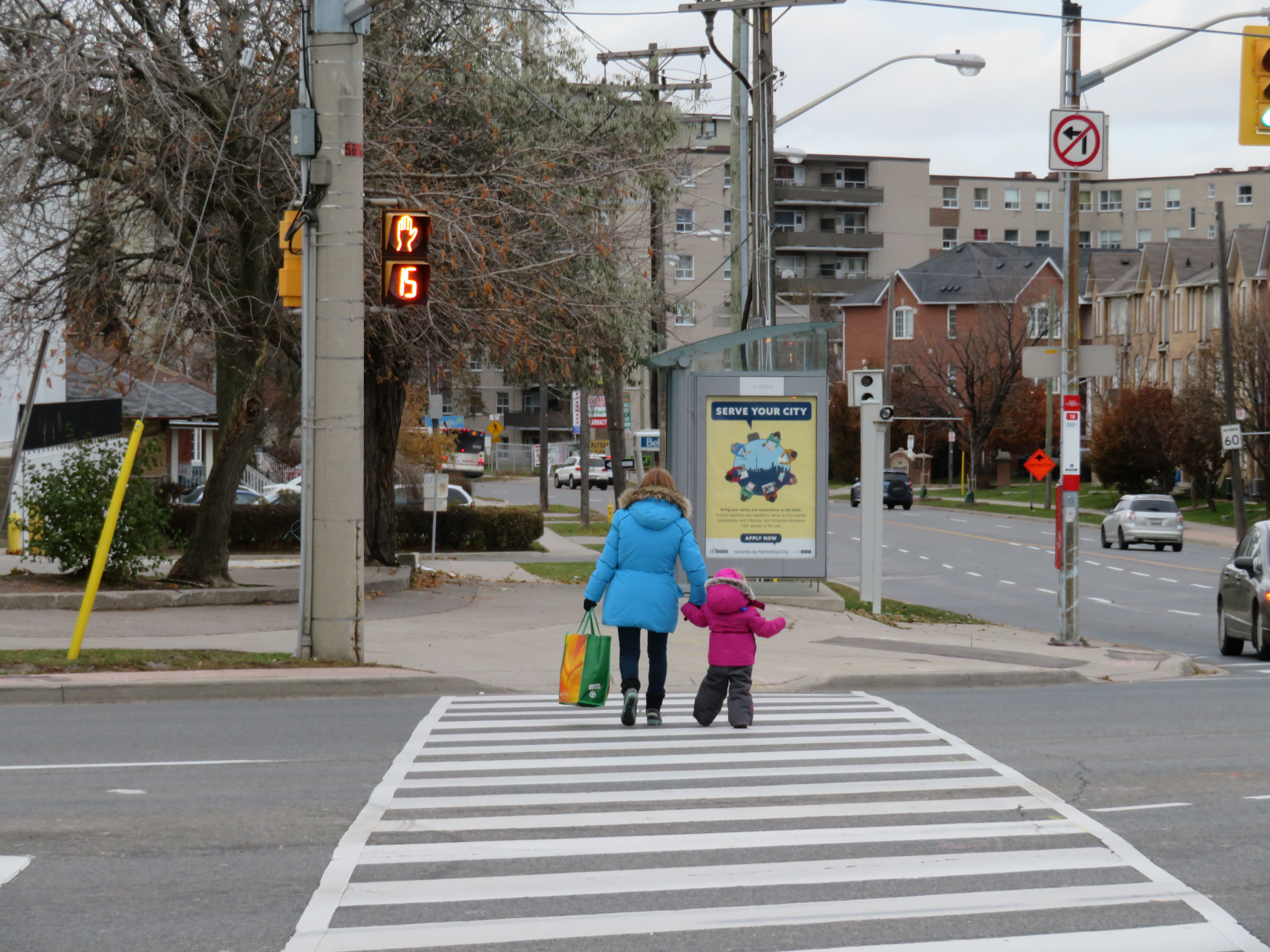
    IMG_4403-001Woman and young child cross seven lanes of traffic at a crosswalk at Eglinton Avenue East and Danforth Road
    Vision Zero, which originated in Sweden, is the road safety philosophy that no loss of life is acceptable, and that all road users are human, that humans make mistakes, and road design must minimize the impacts of those mistakes. Complete streets that accommodate all road users (pedestrians, cyclists, motorists, and transit users), and road engineering measures to protect pedestrians and cyclists and reduce traffic speeds are in the spirit of Vision Zero.

    But when Mayor John Tory and Public Works and Infrastructure Committee Chair Jaye Robinson (Councillor, Ward 25) originally announced the city’s Vision Zero plan in June 2016, it merely aimed to reduce serious collisions involving pedestrians and cyclists by 20 per cent over a ten year period, allocating $68.1 million over five years.  The plan itself was modest. After a social media backlash and criticisms from active transportation activists (including Walk Toronto, of which I am a co-founder and a steering Committee member), the plan was revised, with an additional $10 million allocated and the goal to eliminate serious collisions, rather than simply reduce that number.

    One of the specific measures in the city’s Vision Zero plan is the creation of seniors safety zones, areas with high volumes of older adult pedestrians and higher risk of collision. Older adults make up a majority of pedestrian deaths in Toronto; 37 of the 43 pedestrians killed  in 2016 were over the age of 55. According to the City of Toronto’s Vision Zero Road Safety Plan, seniors safety zones will feature changes intended to improve pedestrian safety, such as lower speed limits, improved street lighting, advanced and extended walk signals at signalized intersections, red light cameras and radar speed signs, improved sidewalks and additional crosswalks, and increased enforcement.

    Twelve seniors safety zones were designated across the entire city of Toronto. Five are in the old City of Toronto, including Dundas Street at Bloor, Dundas at College/Lansdowne, and Dundas at Spadina. Six are in Scarborough, and one is in North York.

    IMG_0643
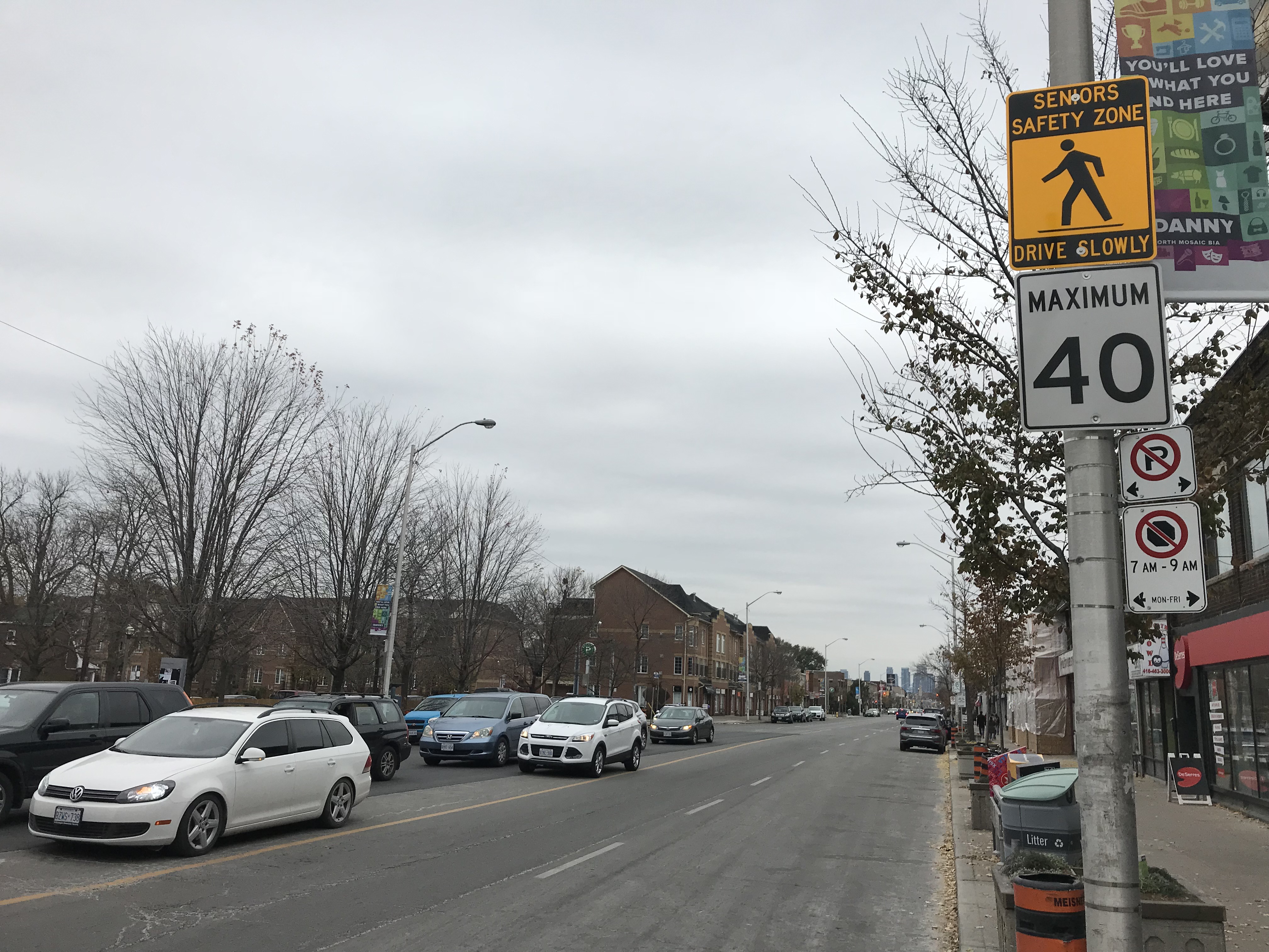
    Senior Safety Zone sign and 40 km/h speed limit, Danforth Avenue at Coxwell

    On Danforth Avenue, two senior safety zones were identified: near Coxwell Avenue and near Main Street. The speed limit on Danforth Avenue was reduced from 50 km/h to 40 km/h in 2016, but few other visible changes are apparent. Danforth Avenue is a five lane street, including a centre lane for left turns, and is paralleled by a subway line. The curb lanes on Danforth are unusually wide, and are used for parking outside of weekday rush hours. There are no bike lanes on Danforth either.

    Despite the 40 km/h speed limit, the wide lanes, dedicated turning lanes, and the absence of daytime local transit promote high speeds. The design speed of Danforth is simply too high; simply reducing the speed limit and putting up “senior safety zone” signs will do far too little.

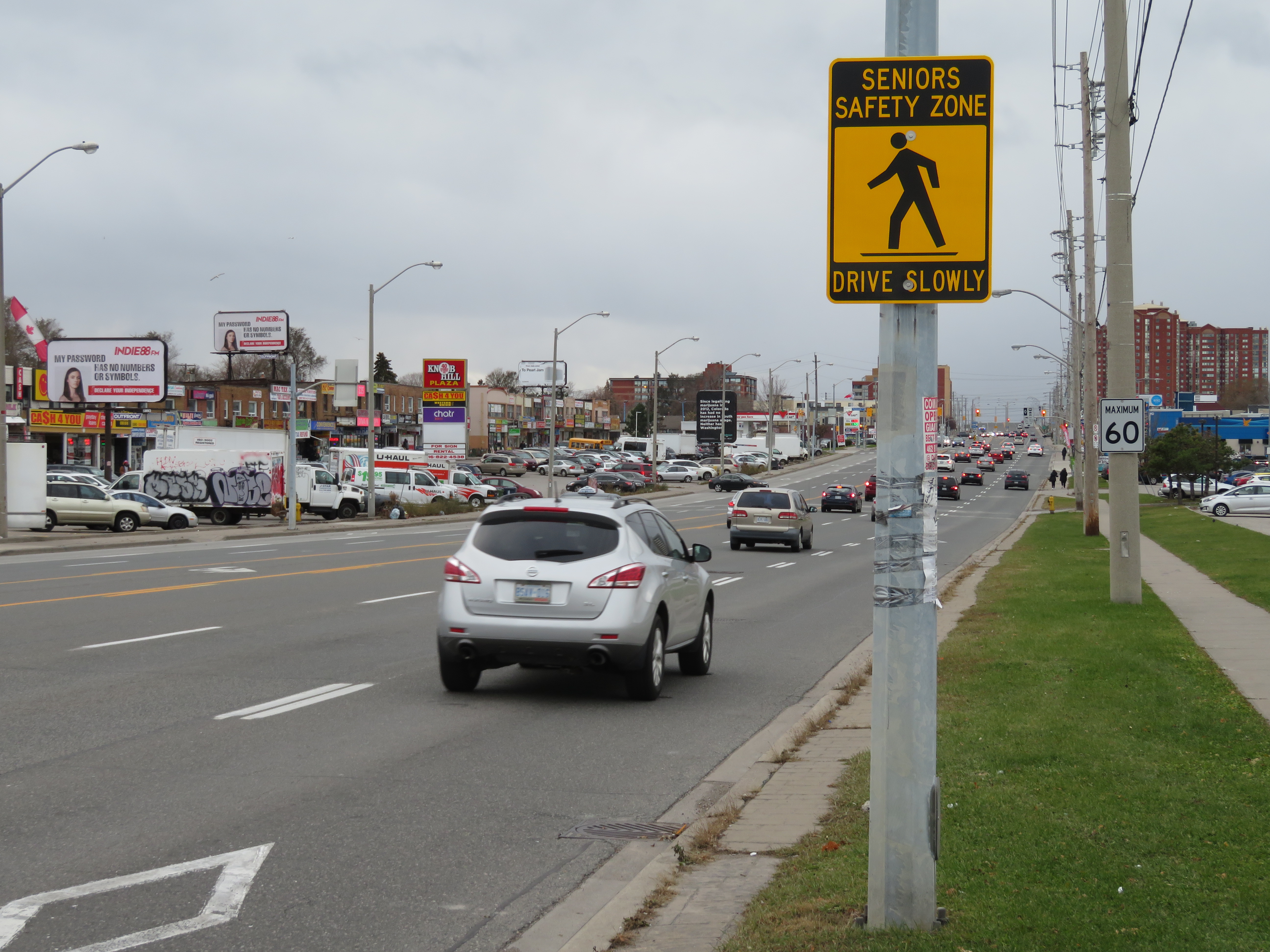
    IMG_4396-001Seniors Safety Zone sign on Eglinton Avenue East, at Brimley Road. Note the 60 km/h speed limit sign
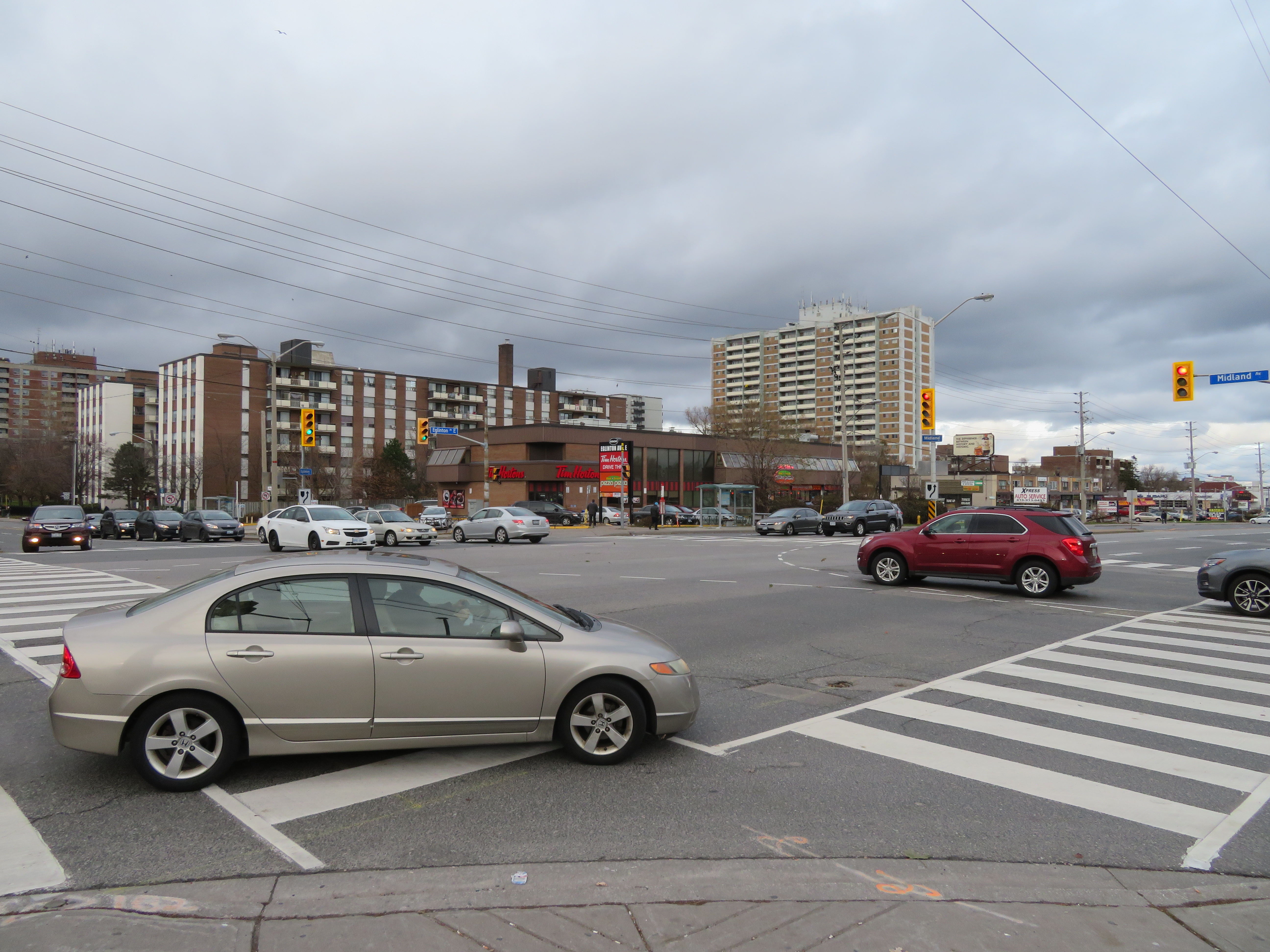
    Eglinton Avenue East, between Midland Avenue and Danforth Road in Scarborough, is another senior safety zone. Two pedestrians were killed on this stretch of road in 2016.

    Eglinton Avenue through Scarborough is seven lanes wide, including a centre left-turn lane to cross streets and commercial properties that line the wide street. Traffic signals  are typically 500 metres apart; many TTC bus stops on Eglinton Avenue East are located far from a designated crosswalk. Buses are frequent between Midland and Brimley; four frequent routes feed into the Kennedy subway station to the west. Again, there is no cycling infrastructure to be found.

    The senior safety zone here is a joke. Not one safety intervention was made here. The yellow-and-black safety zone signs that read “drive slowly” are merely advisory, and do not stand out among other traffic  and commercial signage. The 60 km/h speed limit was not changed, and intersections were not altered at all to improve pedestrian safety.

    IMG_4374-001At Eglinton and Midland Avenues, wide curb radii encourage speedy right turns into crosswalks; many drivers do not stop at the red light before making a right turn
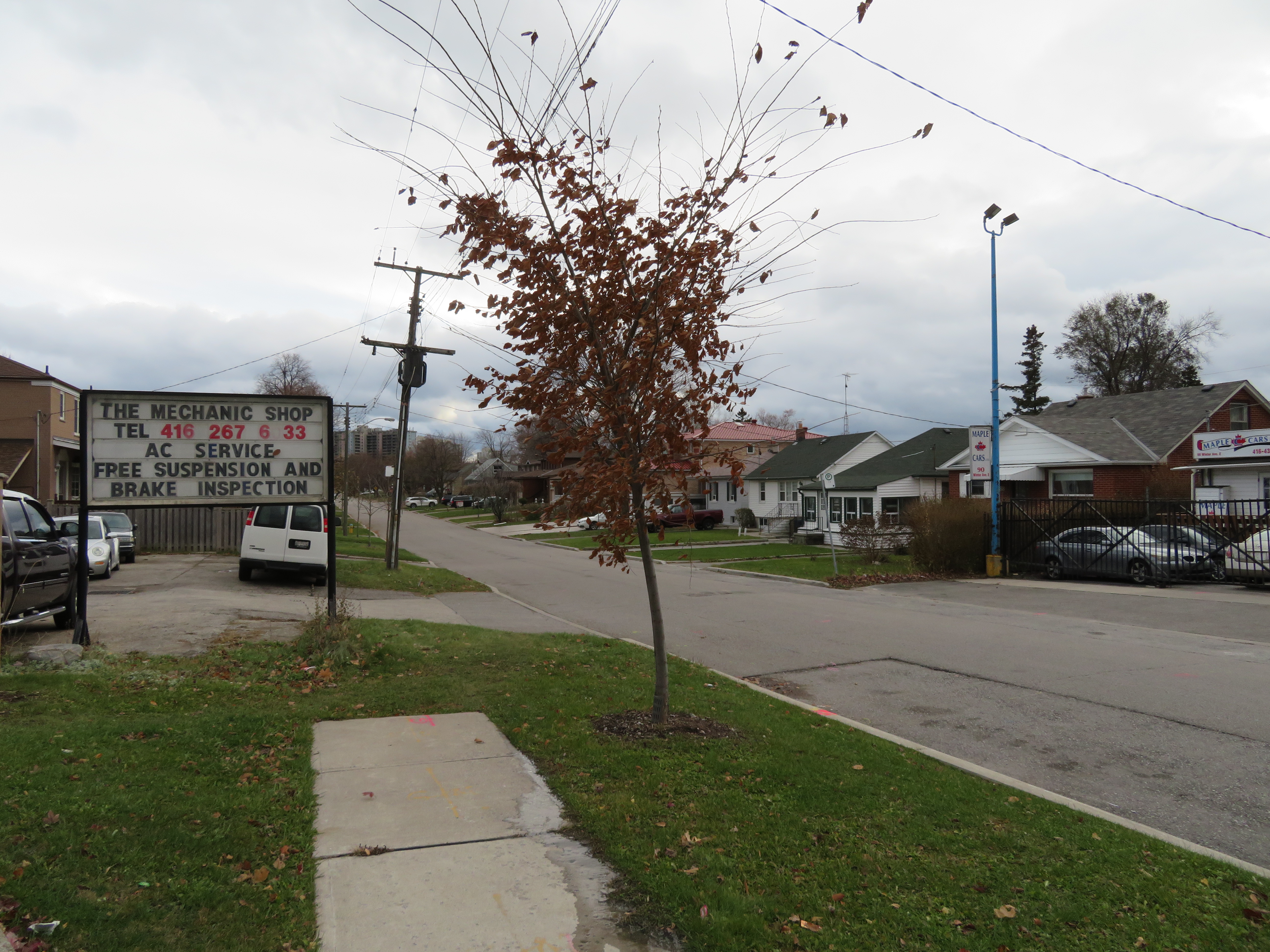
    Several residential side streets off of Eglinton, such as Winter Avenue, do not even feature sidewalks. The signs might say “seniors safety zone” but there is no evidence that pedestrian safety is taken seriously at all here.

    IMG_4379-001
    Winter Avenue’s sidewalks disappear a mere 50 metres south of Eglinton Avenue

    Physical interventions, such as narrower lanes (which could make room for cycling infrastructure and/or wider sidewalks), bump-outs at crosswalks to improve pedestrian visibility and slow down right-turning vehicles, would be more effective. Police enforcement, or speed radar cameras, would be an additional deterrent against dangerous driving.

    At least the city has taken notice of the unacceptable numbers of pedestrians and cyclists killed in Toronto, but simply putting up new speed limit and safety zone signs are not enough. Without road engineering works to slow traffic down, and without effective police enforcement against speeding and drivers’ failures to obey traffic signs and yield the right of way to pedestrians, we only get feel-good measures and ineffective signs. A real commitment to Vision Zero requires political will, which so far is lacking at City Hall. Instead, we get zero vision.

  • New TTC subway stations have great architecture, but they may not attract enough riders

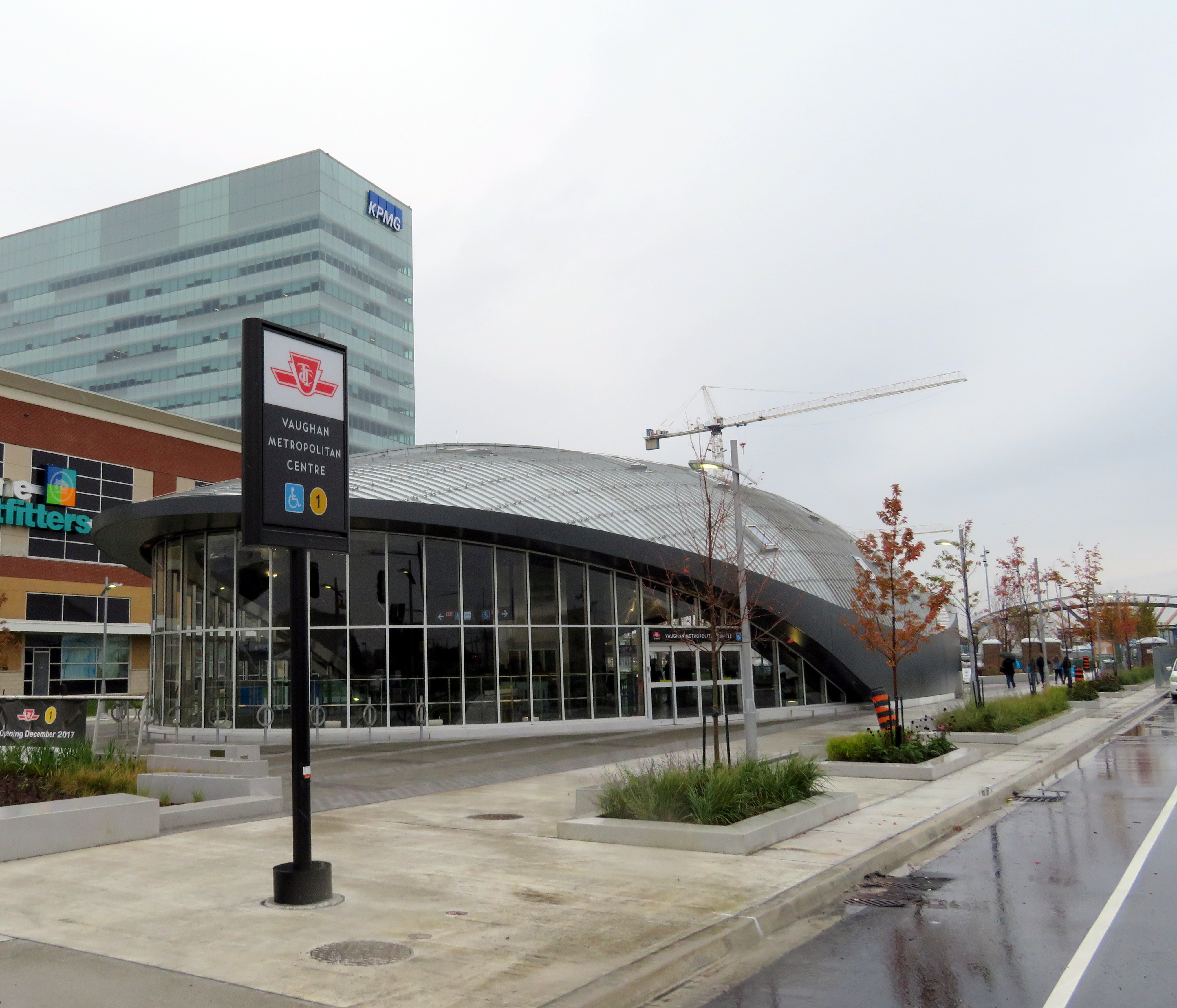
    IMG_4071-001.JPGVaughan Metropolitan Centre Station

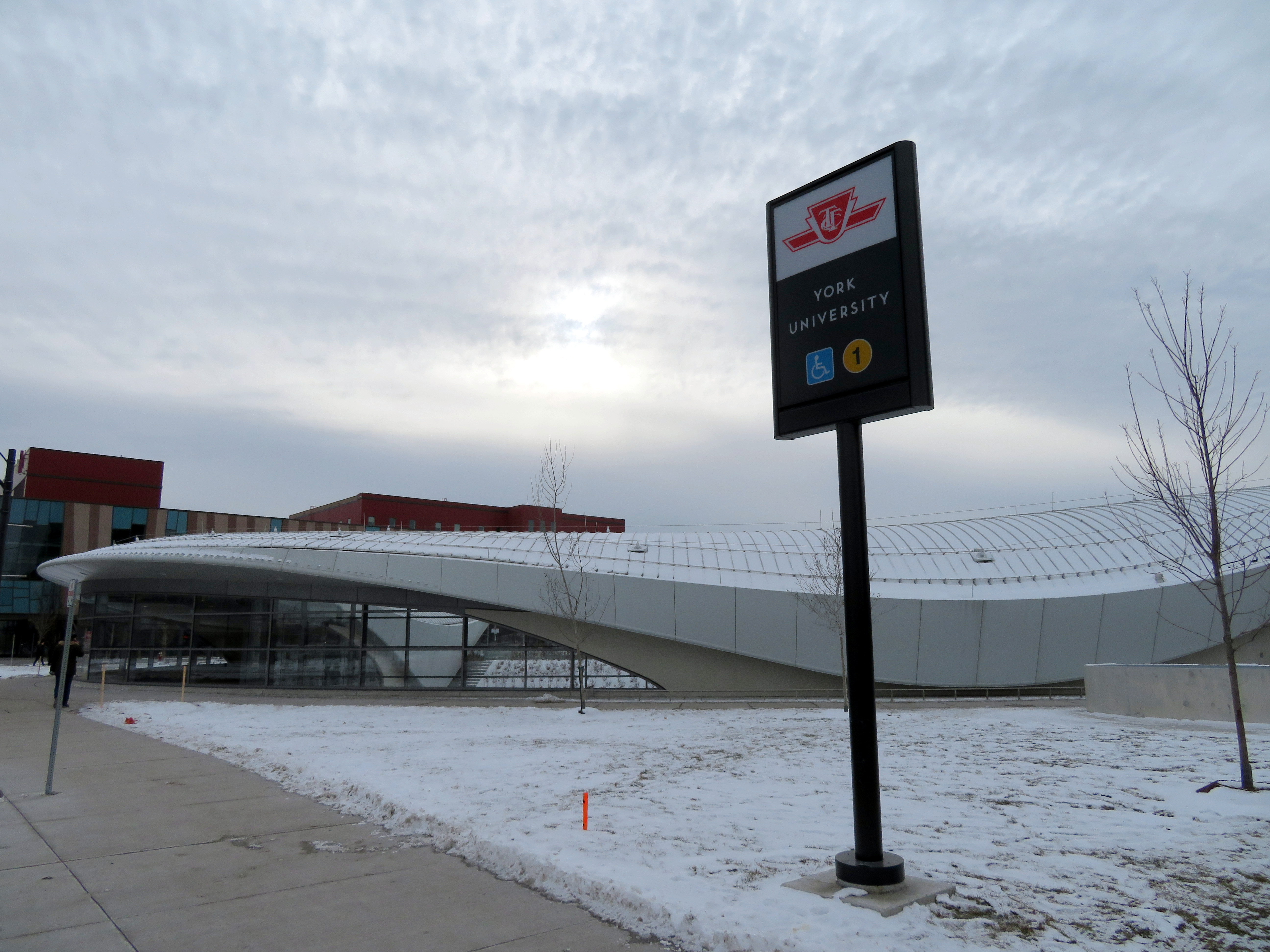
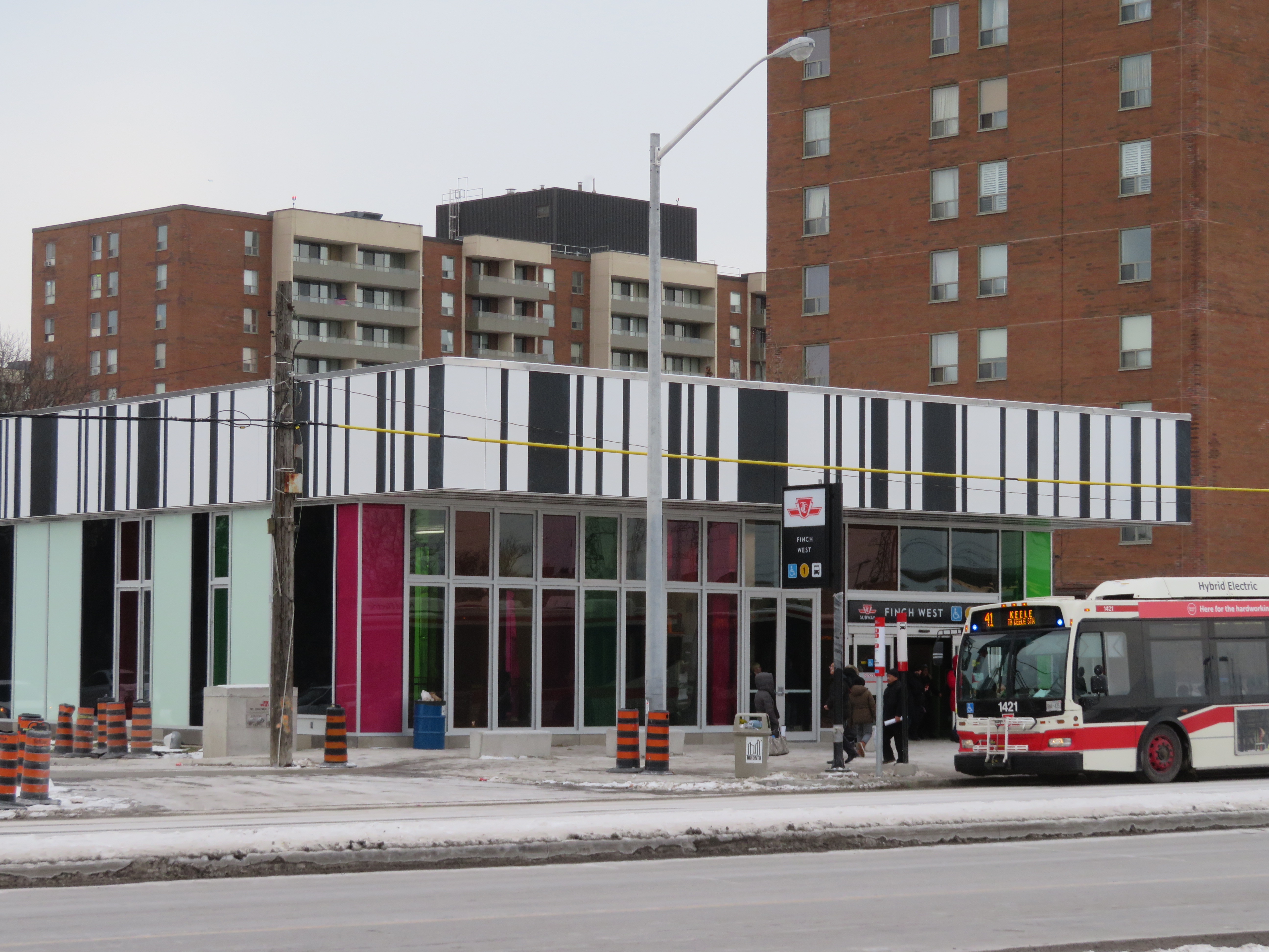
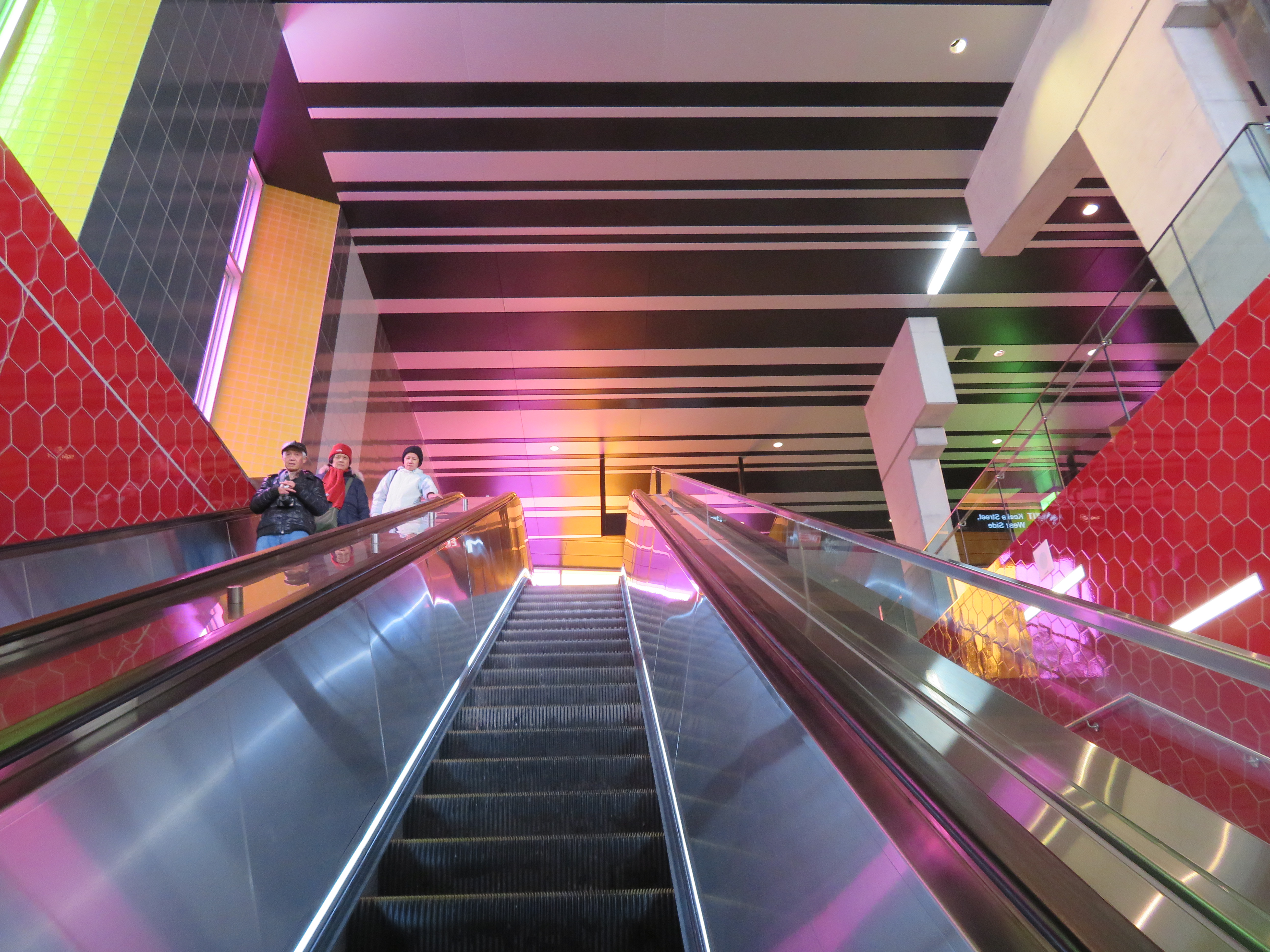
    On Saturday, October 28, the Toronto Transit Commission (TTC) held open houses at three of the six new subway stations set to open on December 17, 2017 when the Line 1 subway is extended to York University and Vaughan. It was a fun afternoon with friends, checking out the architecture and the layout of Vaughan Metropolitan Centre,* Highway 407, and Pioneer Village Stations.

    Some of the station architecture was stunning, and I came away feeling much less skeptical about Vaughan’s commitment to building a new urban district around its station. Most stations along the subway corridor will be well-used. However, I remain critical about the issue of transfers between transit agencies, and the usefulness of at least one station.

    (more…)

  • The ravine run around

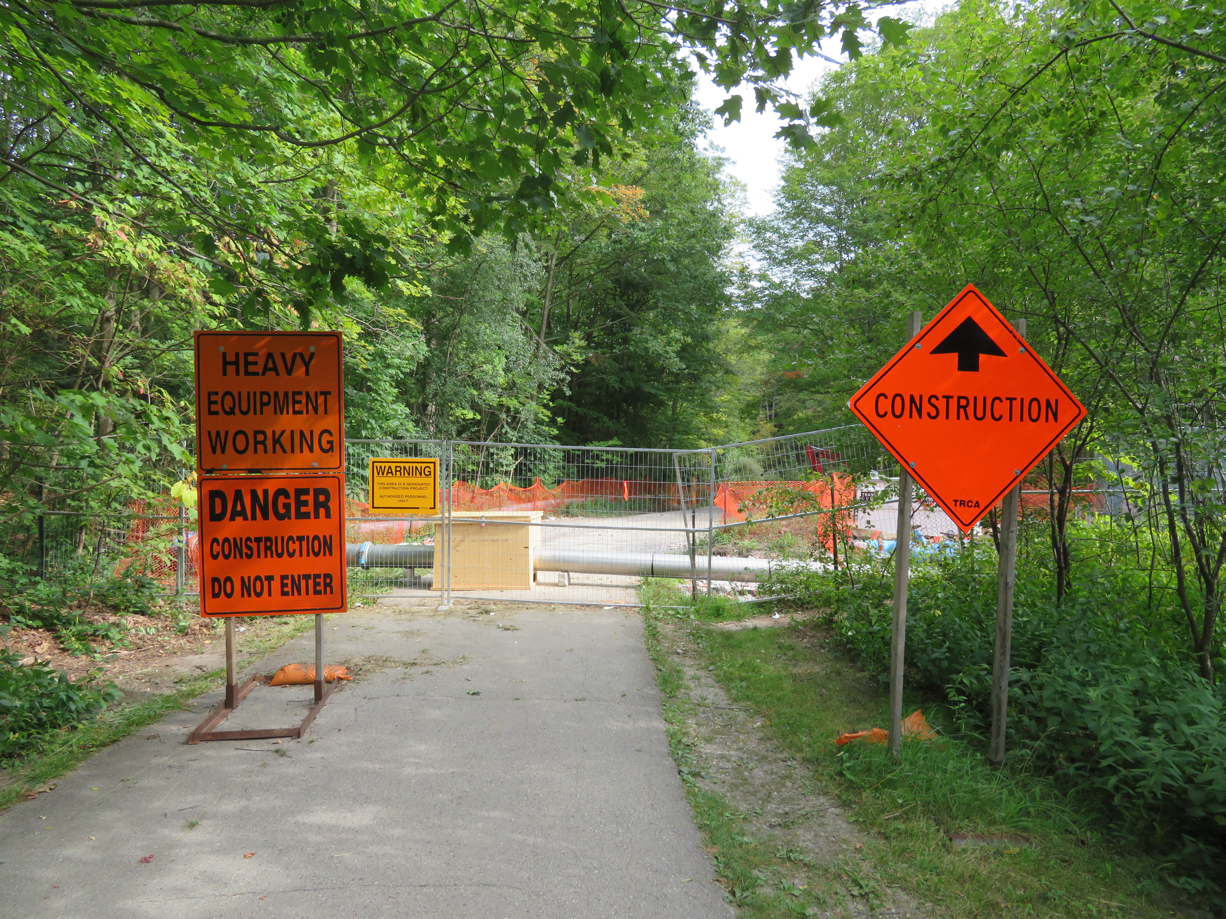
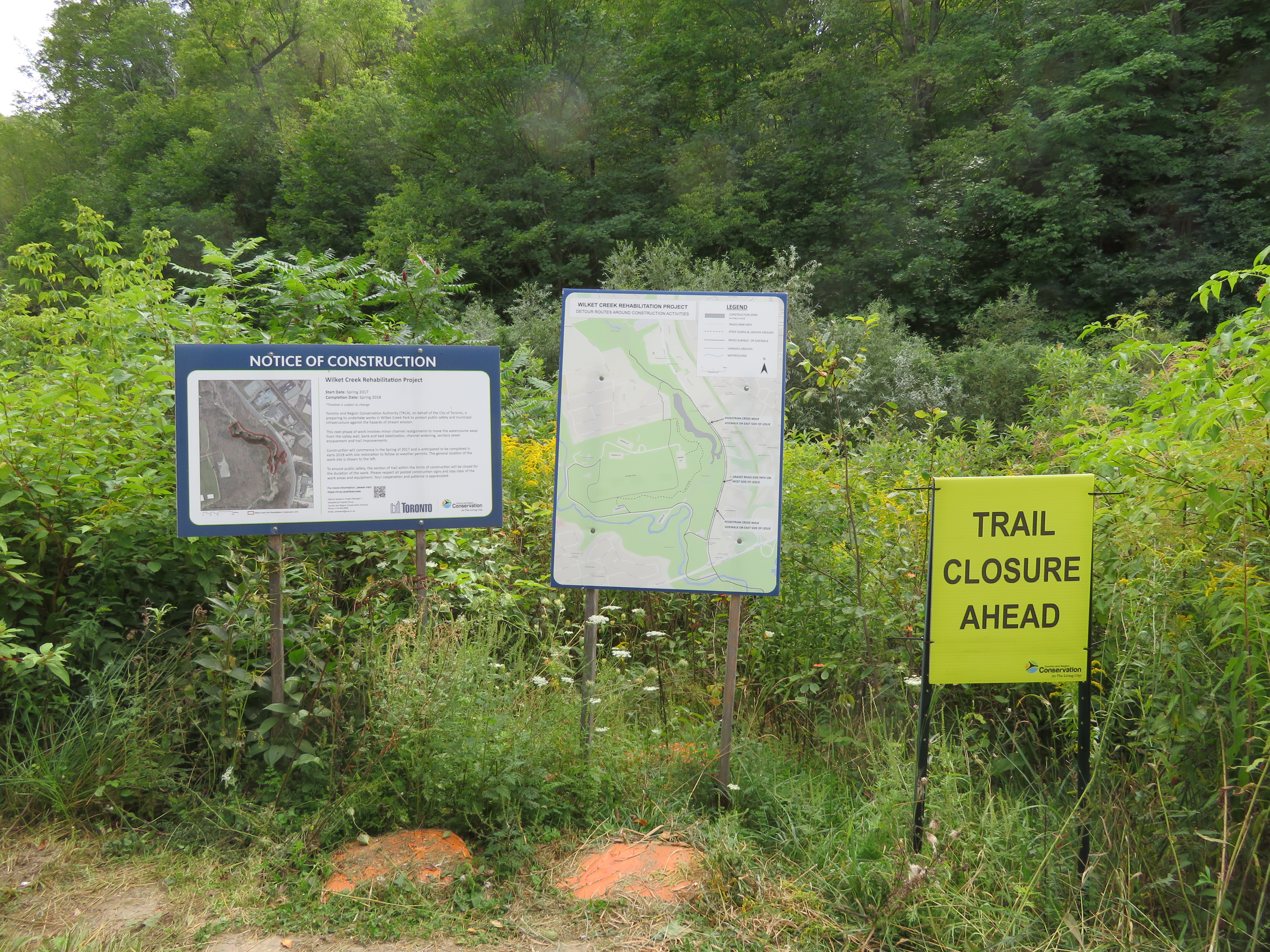
    IMG_2475-001Wilket Creek trail closure, September 2017
    Last week,  my wife and I went for a walk through the Toronto Botanical Gardens, Edwards Gardens, and Wilket Creek Park, all part of Toronto’s wonderful and extensive ravine system. The ravines are one of Toronto’s greatest assets, and many are connected by multi-use trails, allowing pedestrians and cyclists to experience nature, close to home. Some trails, like the Lower Don, are also important commuter routes for those who walk or cycle to school or work.

    Unfortunately, several of these trails are closed for long periods for construction, and they do not get the same attention that roads and highways get.

    The Wilket Creek Trail, between Edwards Gardens and Sunnybrook Park, has been closed since Spring 2017, and will remain closed until Spring 2018. The Toronto Region Conservation Authority (TRCA) is repairing damage caused by erosion, and restoring the local ecosystem. The same trail was closed two years ago for similar construction work.

    The pedestrian detour on Leslie Street is straightforward, and does not deviate too far from the route. However, Leslie Street is busy and motorists drive at high speeds, so it is not a good safe route for cyclists. To the City of Toronto and TRCA’s credit, at least, the detours are well mapped and construction notices are signed well in advance. (I’ve experienced trail closures without any warnings or suitable marked detour routes.)

    IMG_2476-001Advance warnings and a detailed detour map on the Wilket Creek Trail
    Further south, the Lower Don Trail between Pottery Road and the footbridge at Riverdale Park will re-open on September 23, 2017, fourteen months late. That work was done to replace an underpass at a disused rail corridor owned by Metrolinx.

    As Metro reporter David Hains points out, that re-opening was re-scheduled several times between July 2016 and August 2017 — unexpected soil conditions and wet weather were blamed for the delays.  Pedestrians and cyclists were directed to use either Broadview Avenue or Bayview Avenue to get around the closure; both are busy roads, and Broadview Avenue is at the top of a steep grade from the Don Valley.

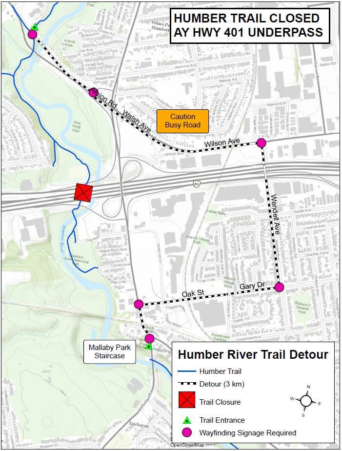
    Other major closures included the Humber River Trail under Highway 401 near Weston Road, which was closed for several months in 2016 so that trail users would not be in the way of construction vehicles. The suggested detour, a 3 kilometre long circuitous route, followed Wilson Avenue, a busy suburban road.

    This year, the Etobicoke Creek Trail under Highway 401 in Mississauga is also closed for two years for bridge work. There are no safe alternatives for crossing Highway 401 in that area.

    Humber.jpgThe circuitous and dangerous 2016 Humber River Trail detour at Highway 401. Source: MTO.
    The long and dangerous closures of major pedestrian and cycling routes can be compared to the way road repairs are prioritized. Mayor John Tory announced $3.4 million to speed up construction on the Gardiner Expressway in 2015, when the elevated highway was reduced to two lanes in each direction from three. In August, Tory announced additional funds to speed up watermain and streetcar track construction on Dundas Street between Yonge and Church Streets, perhaps not coincidentally a route many city councillors drive to get to City Hall.

    If only there were some additional money and attention given to projects affecting pedestrians and cyclists in Toronto. It would also be nice to ensure any detours were well signed, and made as safe and comfortable as possible.

  • Wandering the Waterfront Trail in Scarborough

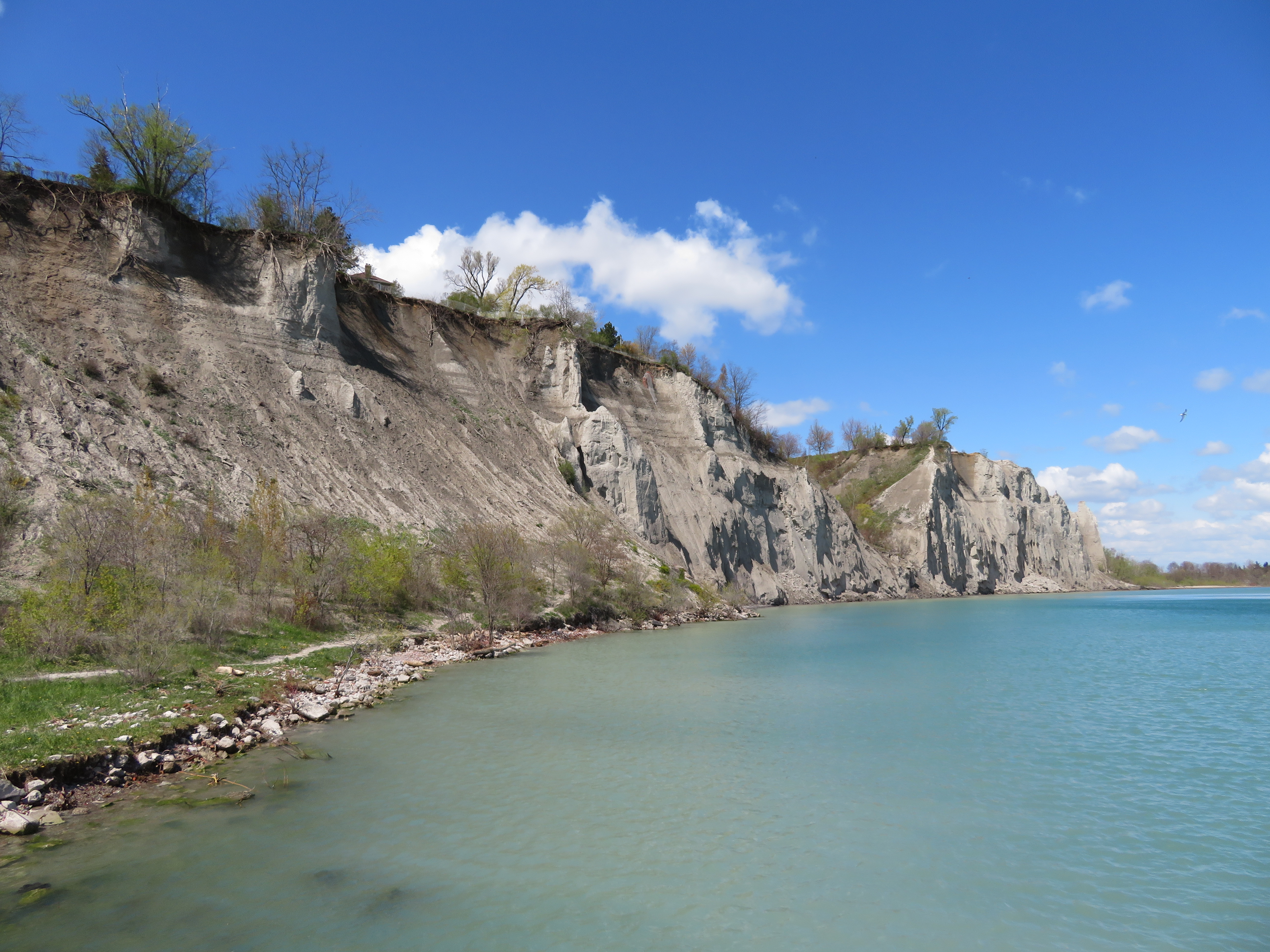
    IMG_8897-001At the bottom of the Scarborough Bluffs, west of Bluffer’s Park
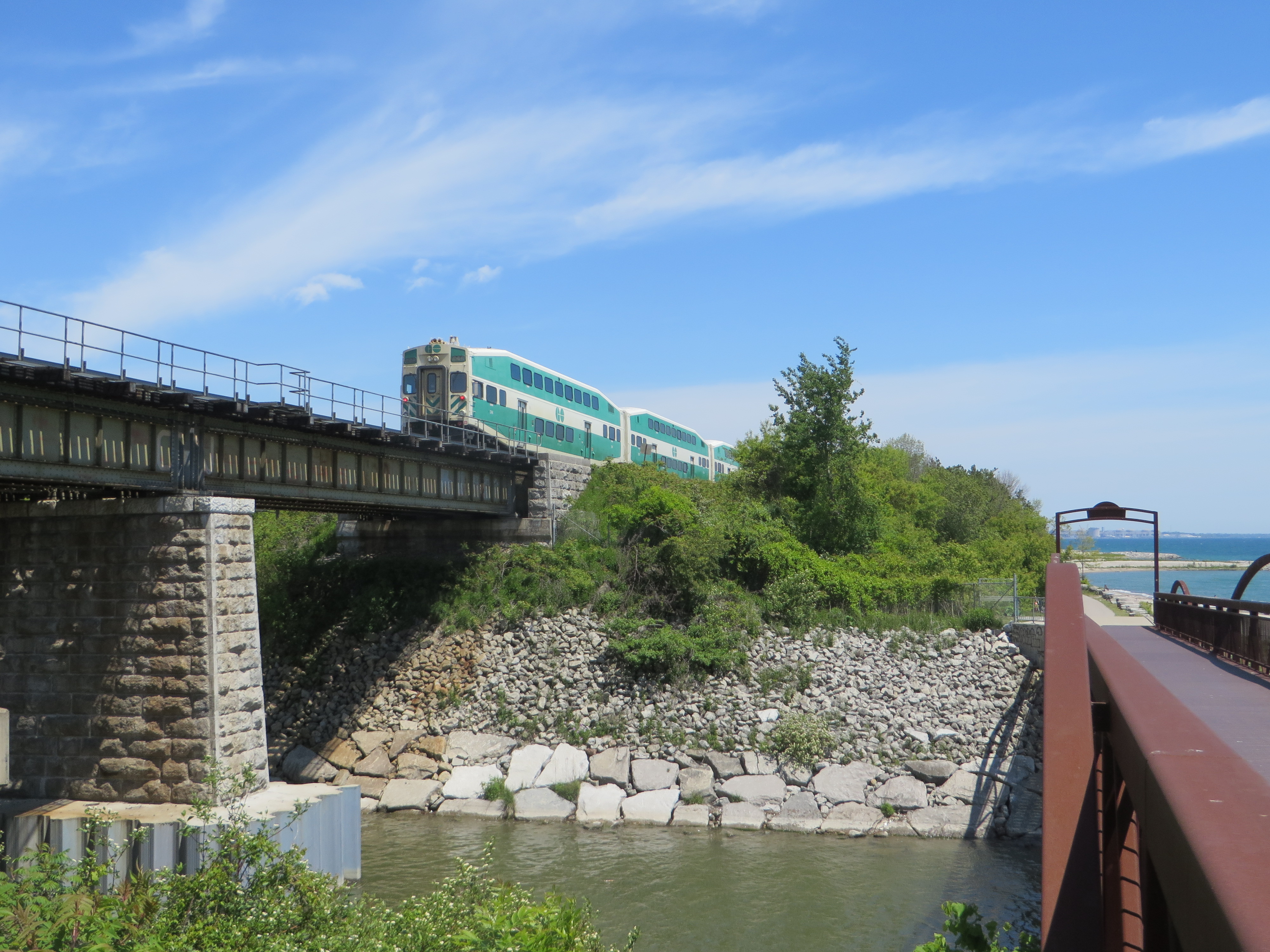
    Lake Ontario, like all five of the Great Lakes, is more a freshwater sea than merely a lake. It’s over three hundred kilometres long, from Hamilton to Kingston, bordering two countries, with several inhabited islands, and features a varied and fascinating landscape. Lake Ontario’s vastness is best appreciated from its shore, whether it be the Toronto Islands, on the east side, on the beaches at Presqu’ile or Sandbanks Provincial Parks, or from the top of the Scarborough Bluffs.

    The Waterfront Trail, at least in theory, is a wonderful way to explore these varied shorelines of Ontario’s vast Great Lakes on foot or by bicycle. Founded in 1995, the trail now extends from the Quebec border, west along the St. Lawrence River, through Niagara, along the north shore of Lake Erie, and up the Detroit and St. Clair Rivers to Lake Huron. I cycle the Waterfront Trail between Toronto and Hamilton several times a year, an 85-kilometre trip. GO Transit’s trains and buses follow the Waterfront Trail from Durham Region to the Niagara River, making it easy to walk or cycle one-way, returning by train and/or bus.

    IMG_0834-001.JPG
    The Waterfront Trail crosses Highland Creek in eastern Scarborough. (2015 photo)

    But the Waterfront Trail is dependent on municipal infrastructure, or the lack of it. Most of the trail’s route winds through rural areas, following country roads and highways where segregated multi-use trails aren’t built: in many places, the Waterfront Trail is neither close to the water, nor is it a ‘trail’ of any kind. At least in Northumberland County and Niagara Region, paved shoulders and bike lanes are found along the busier country roads. But this is not always the case.

    In urban areas, though, like the City of Toronto, there is both the demand and the resources for safe pedestrian and cycling infrastructure along the waterfront. In the old city of Toronto, the Waterfront Trail follows the Martin Goodman Trail, and is nearly completely segregated from motor traffic.

    But in Etobicoke and in Scarborough, much of the trail is routed via on-street sections; in sections, pedestrians must follow sidewalks next to busy sections of Lake Shore Boulevard and Kingston Road; for cyclists, there aren’t even any bike lanes — they have the choice of either riding with traffic, or illegally riding on the sidewalks.


    Route of the Waterfront Trail within the City of Toronto

    (more…)

  • A call for a progressive Toronto

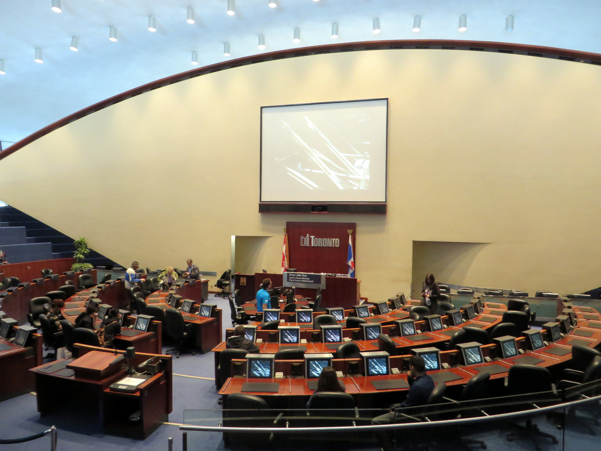
    18506683800_6c96dcc66b_k.jpgI created this website two and a half years ago as a repository for the series of maps I created documenting the results of the 2014 municipal election. Unlike many political observers, I focused not just on the mayoral race, but also on each of the 44 council races; I created poll-by-poll maps illustrating how each ward voted, for both mayor and councillor. I thought that the information might be useful for the 2018 election.
    I kept this blog going by sharing my thoughts on public transit, land use planning, electoral reform, as well as other diversions, such as out-of-town bike rides and my trip on Cuba’s Hershey Train. It has been a lot of fun sharing those thoughts. Yet I remain interested in city politics, especially in electing better people to Toronto City Hall.

    The last municipal election was very disappointing. I originally supported Olivia Chow, before turning my attention to David Soknacki, who ran on a campaign of ideas and honesty, but dropped out in early September 2014. I was repulsed by the incumbent mayor, Rob Ford, and his brother, Doug, yet I couldn’t trust John Tory, who ran on a centre-right platform of low tax increases, a since-discredited transit plan called “SmartTrack” and not being Rob or Doug Ford.

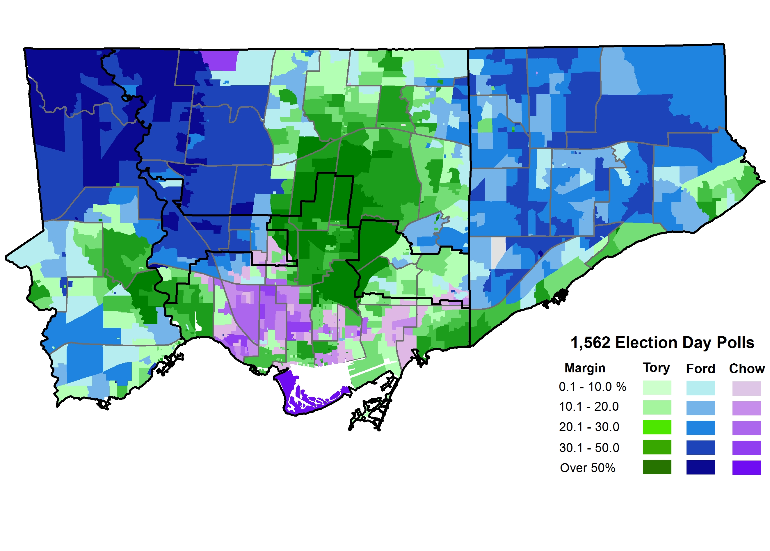
    Tory won that election, of course, beating Doug Ford and Olivia Chow. Tory’s support came from his midtown base of relatively affluent, mostly white, home-owning voters. Tory also did well in other affluent neighbourhoods, such as Etobicoke’s Kingsway, Swansea, the Beaches, and Cliffside, and in neighbourhoods where condominium apartments are a common housing type. As Chow’s campaign floundered, Tory picked up the votes from progressive electors afraid of a Doug Ford win. In the end, Olivia Chow did best in west-end, older downtown neighbourhoods like the Annex, Seaton Village, Parkdale, and Trinity-Bellwoods.

    2014 Election - Mayor Votes by Sub 2014How Toronto voted in 2014

    Giving Tory some benefits of my doubts, I had hoped that he would push a strong city-building agenda, balancing business interests with the needs of disadvantaged residents. Instead, Toronto got an austerity agenda with the top goal of keeping property taxes low, leaving essential city services underfunded and public housing units falling apart. He resisted police reform, including flip-flopping on the elimination of the racist carding program. His signature transit plan, SmartTrack, was watered down to a point where it’s nearly unrecognizable, wasting valuable time and capital that could have been spent developing the Relief Line subway. It’s almost as if we re-elected Rob Ford, but without the homophobia, overt racism, and self-destructive behaviour.

    Tory is backed by a council that has mostly supported his agenda. Had a few council races gone another way, the mayor would have had a harder time freezing or cutting budgets for housing and shelters, transit, libraries, planning services, and other essential programs. Last week, Tory and his council allies endorsed a budget freeze for 2018, defeating motions to exempt homeless shelters, poverty-reduction programs, and long-term care homes. Accounting for inflation, this is in effect, another budget cut of two percent.

    John Tory will run for re-election in 2018, and he is already in campaign mode, targeting the province for funds to repair TCHC housing and the Relief Line. It’s possible that Doug Ford will run for mayor again, on a right-wing populist message. So far, no one has indicated that they will run to the left. At least there’s still city council, with 44 members, which is difficult, but possible to change. Council, not the mayor, holds the power.

    In 2014, only one incumbent —John Parker, in Ward 26 — was defeated. Parker, a thoughtful and reasoned conservative, lost his seat to Jon Burnside, a former Toronto police officer endorsed by John Tory. In total, only seven new councillors were elected to City Council that year, though there were two by-elections since.

    But each of those newcomers were elected either on a second run for city council, came from another level of political office, or had family political ties. There’s hope for next year.

    Right-leaning councillors Burnside and Justin Di Ciano (Ward 5) ran unsuccessful campaigns in 2010 and won office on the second try. John Campbell (Ward 4) was the previous Chair of the Toronto District School Board, and Jim Karygiannis (Ward 39) was a Liberal MP. Stephen Holyday (Ward 3) is the son of former Etobicoke mayor and councillor Doug Holyday, and Joe Cressy (Ward 20) is also the son of two former Toronto city councillors. Christin Carmichael Greb is the daughter of defeated Conservative MP John Carmichael. Carmichael Greb also enjoyed John Tory’s endorsement; Tory’s robocalls supporting her campaign  helped her win in a hotly contested open race.

    To win a seat on Toronto City Council, especially without a party system, you need name recognition or you need connections. Having political connections makes it a lot easier to raise money and attract talent to run a campaign. That name recognition gives you attention from the media and helps at the ballot box. It’s a lousy system that shuts out too many fine, talented people who are unable to spend the money and time to run a serious campaign, and it creates political dynasties, for better or for worse.

    With only 18 months before the 2018 municipal election, it’s time for anyone who opposes the Ford/Tory agenda to organize.

    It’s likely that Mayor Tory will likely win re-election, but we still need a strong, progressive candidate for mayor, willing to take Tory to task for the consequences of his budget cuts, his dithering on transit infrastructure, and his resistance to police reform. If nothing more, it will make the mayor accountable, and energize progressive voters.

    But even more importantly, it’s necessary to back progressive candidates for city council, ideally replacing weak representatives on City Council, and especially against unreasonable and uncooperative politicians like Giorgio Mammoliti (Ward 7), and councillors who actively resist change, like Tory ally Justin Di Ciano (Ward 5),who blocked municipal voting reform and is now fighting Toronto’s new ward boundaries.

    Council, too, needs even more diversity. It needs more women and people of colour to better reflect the city it is supposed to represent. And there are good people working towards that. For example, on Wednesday, June 7, Women Win Toronto, will launch.

    I will be backing several progressive candidates next year — some of whom will be running a second time — by contributing my time and money in key races. (I’ll share my endorsements next year.) Only a few new faces need to be elected to change the dynamic at City Hall. And even if you doubt your chances of winning in 2018, run anyway. You will have the chance to have your voices heard, and set the stage for running again in 2022. That’s how politicians get elected.

    Good luck!

  • A new low for the Scarborough Subway champion

    Note: a version of this article has been cross-posted to Spacing Toronto

    For 2016’s annual Torontoist Heroes and Villains feature, I nominated Toronto Councillor Glenn De Baeremaeker (Ward 38, Scarborough Centre) as villain of the year. (“Pedestrian blaming” won that dubious honour.) But I remain proud of my choice. As I wrote back in December:

    De Baeremaeker’s record of environmentalism has been overshadowed by an increasingly antagonistic tone, pitting supposedly downtrodden Scarborough against the rest of the city in his one-track quest to build a one-stop subway extension to his ward. In his myopic support of the subway, De Baeremaeker is opportunistic and vindictive, takes the low road, insults critics who engage in good faith debates, and in the process does a disservice to the community he represents.

    Councillor De Baeremaeker hasn’t changed his tone.

    Yesterday, May 10, the City of Toronto held a public consultation at Scarborough Civic Centre on the next phase of planning for that one-stop, 6.2-kilometre subway extension, which is estimated to cost $3.35 billion, and open no earlier than 2026.

    I wish I was able to attend last night’s meeting, as disgruntled Scarborough residents questioned the merits of that transit plan. And Councillor De Baeremaeker shamelessly blamed “downtown councillors” for the shortcomings of that one-stop subway. For a councillor who is rightly proud of his past environmental advocacy, it was surely a low point.

    Toronto Star reporter Jennifer Pagliaro, an excellent local journalist, covered the meeting. 

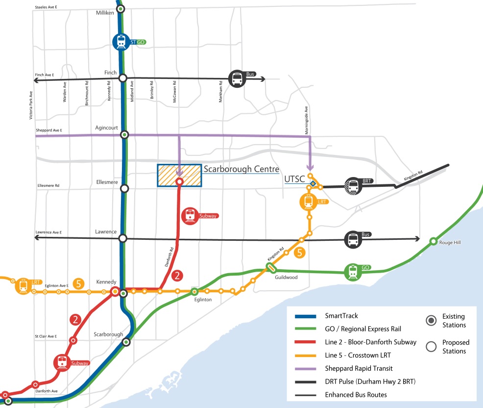
    City Scarborough MapCity of Toronto map from February 2016 illustrating current plans for the Scarborough Subway and connecting transit.

    At the public consultation, TTC and City planning staff answered queries from members of the public, many questioning the utility of the single-stop subway. There are no additional funds to rough in future stations, such as at McCowan Road and Lawrence Avenue, where the line would intersect the busy 54 Lawrence East bus and serve Scarborough General Hospital. As building future stations later would require an extended shut-down of the line, the one-stop subway extension will likely be forever a one-stop subway.

    (The eastern extension of the Eglinton-Crosstown LRT from Kennedy Station to University of Toronto’s Scarborough Campus is also part of the new plan for Scarborough, but the LRT component is unfunded.)

    Shameless as ever, Councillor De Baeremaeker resorted to strawman arguments, talking up a “suburban/urban divide”:

    [De Baeremaeker] blamed “downtown councillors,” who represent the most densely populated wards in the city, for not wanting to fund more frequent transit stops like their residents enjoy.

    Yes, it is true that all councillors representing central Toronto opposed the subway extension, but so did several suburban politicians, most notably Councillor Paul Ainslie (Ward 43 – Scarborough East). Yet not one of those councillors wanted less transit for Scarborough. Instead, they backed a seven-stop LRT replacement for the ageing Scarborough rapid transit line, including an extension to Centennial College and Sheppard Avenue in Malvern. That less-expensive line was fully funded by the provincial government, which would have permitted scarce funds to be spent on other transit projects across Toronto.

    Meanwhile Mayor John Tory was most interested in pushing SmartTrack, a fantasy rail project that got pared down as parts of the line were found to be impossible to build, and costs increased. The eastern end of SmartTrack conflicted with the Scarborough Subway extension. The three-stop subway plan was cut to a single stop at Scarborough Centre, to keep costs down and to not cannibalize SmartTrack.

    Yet Tory and De Baeremaeker are allies on the subway extension; Tory named him one of his Deputy Mayors to champion the line. But Tory’s push for his own project put him at odds with De Baeremaeker’s focus on the subway extension, any subway extension, to his ward.

    It is also worth noting that until 2012, De Baeremaeker supported Transit City, the transit plan championed by David Miller that would have delivered three new light rail lines to Scarborough.

    I am not surprised by De Baeremaeker’s shameless politics. But his performance last night was especially crass and dishonest. Backed into a corner, faced with angry local residents, he lashed out at imaginary villains. But subway backers largely have themselves to blame; despite winning every recent vote on the subway plan, they have only one stop to show for it.

  • Exploring Earl Bales Park

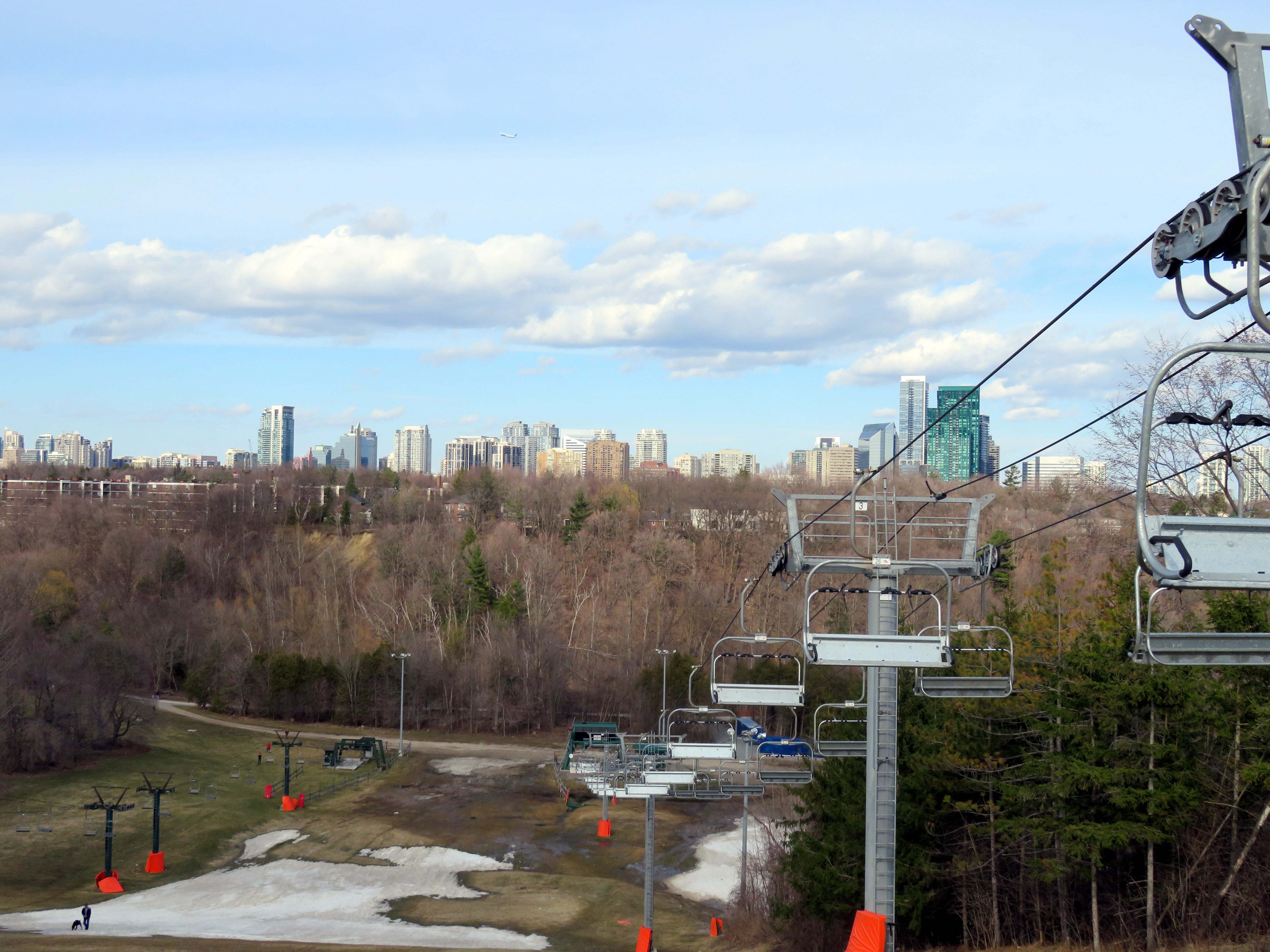
    IMG_8535-001View from the top of the ski hill at Earl Bales Park
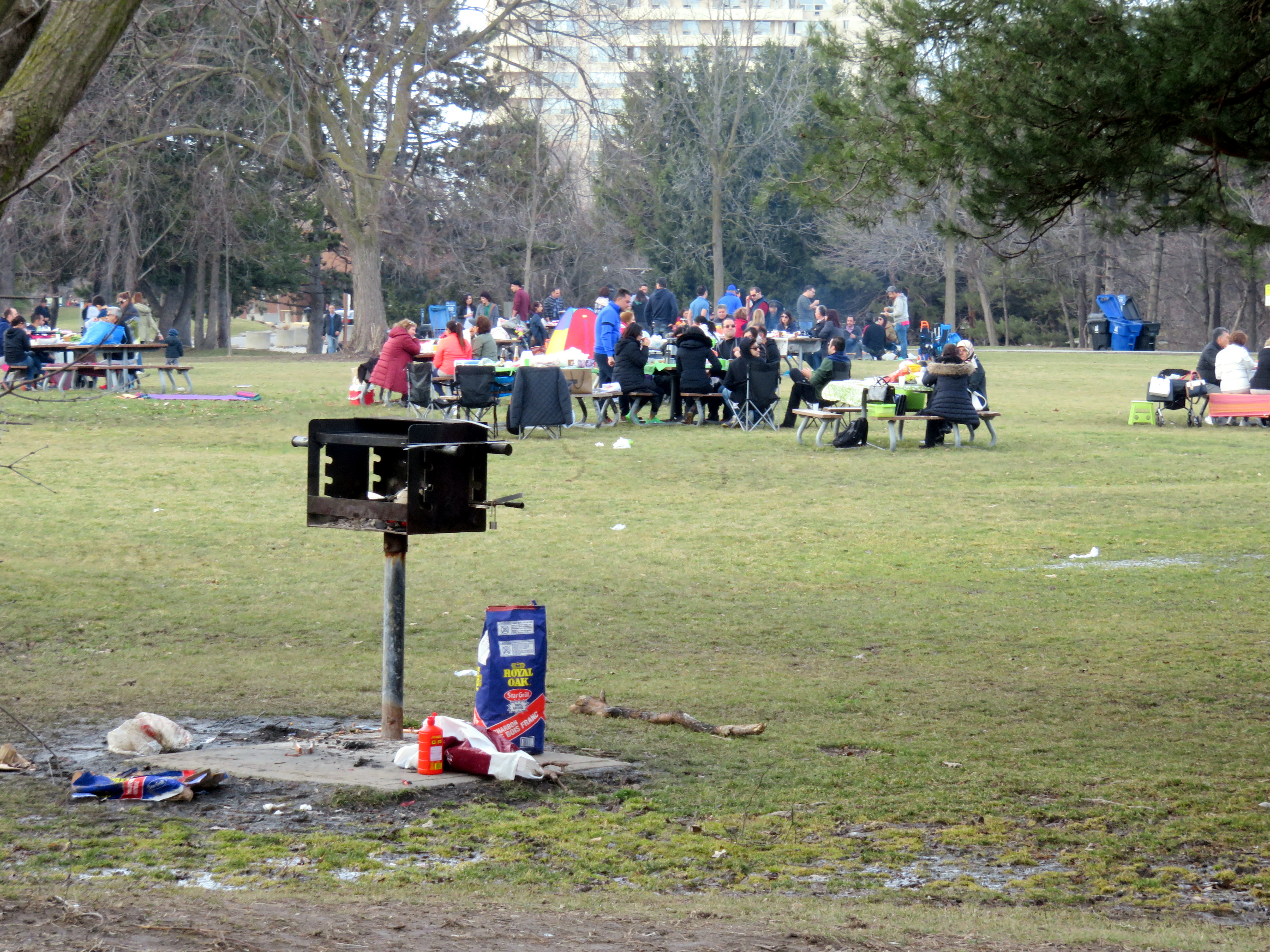
    Last Sunday afternoon, I went for a walk around Earl Bales Park. The large, multiuse green space is located near the corner of Bathurst Street and Sheppard Avenue in North York; it also descends into the West Don Ravine. It was a delight to explore this park, but as I discuss below, it could be much better connected to the city on the south end.

    Earl Bales Park originally was a farm established in 1824 by English settler John Bales and his family; their house still stands in situ. The land later became a private golf course, and was purchased by the Borough of North York in 1975, named for one of the Baleses’ great-grandsons.

    A lot is packed into this popular green space: walking trails, playgrounds, picnic areas, a community centre, an amphitheatre, an off-leash dog park, a memorial, a seniors’ woodworking shop, and even a ski hill. Even on the first weekend of April, the park was full of picnicking families and groups; families represented a diverse cross-section of suburban Toronto.

    After English, the most commonly spoken languages I heard were Russian and Tagalog — the Bathurst Street corridor north of Highway 401 is popular among immigrants from the Philippines and Eastern Europe; many businesses and community organizations in the area cater to these communities.

    IMG_8530-001Picnicking at Earl Bales Park, April 2, 2017
    (more…)

  • Mapping Toronto’s population growth

    Data geeks across Canada were eagerly awaiting this day — February 8, 2017 — the first release of the 2016 Canadian Census of the Population. Today’s release only covers population and dwelling counts, further information on age, sex, household characteristics, as well as language, immigration status, employment, income, and other variables will be released later in 2017. The 2016 Census included the mandatory long-form census, which will provide a robust snapshot on the socioeconomic status of all 36 million Canadians.

    I created three quick maps showing the population growth in the City of Toronto by census tract. The City of Toronto grew by 116,511 people over five years to 2,731,571 in 2016, a 4.45% increase. Some suburban municipalities grew much faster, like Brampton  (13.3%, with a 2016 population of 593,638), but Toronto has been able to absorb one-third of the Toronto Census Metropolitan Area’s growth.

    Toronto’s population makes up 46.1 % of the Toronto CMA (population 5,928,040). The rest of that growth was found in mature suburbs such as Brampton, Mississauga, and Markham, but also in quickly-growing towns such as Milton (population 110,128, up 30.5% from 2011). While some suburbs — Mississauga and Markham in particular — have been establishing higher-density urban centres with mid and high rise condominiums, most of the suburban growth has come from single-family homes and townhouses on formerly agricultural lands. If the Greenbelt is to continue being successful in containing sprawl and preserving productive farms and natural areas, Toronto needs to absorb even more growth in the next few decades. Land developers, speculators and the real-estate industry, however, are pushing back.

    The first of the three maps shows the percentage increase or decrease in population by census tract. Areas with higher growth are concentrated in Downtown (particularly along Yonge Street and in the Entertainment District, City Place, Liberty Village-Fort York and St. Lawrence-Distillery-Corktown), as well as Etobicoke Centre, on Humber Bay, Midtown, and along the Sheppard Subway corridor in North York. Not surprisingly, these are areas in which new housing developments, particularly condo towers, are being built. Other neighbourhoods, for the most part, are seeing minor increases or decreases in population, likely related to changes in household/family size.

    gta-2016-census
    Population change between 2011 and 2016 by percentage by census tract, Toronto
    (Alternate colour scheme available here and here)

    But more interesting is the map showing absolute population increases or decreases between 2011 and 2016. It better illustrates areas of high population growth and neighbourhoods with population decline. The inner suburbs, especially parts of Scarborough and North York, clearly show slight a population decline compared to the high-growth areas described above.

    gta-2016-census-absolute-changePopulation change between 2011 and 2016 by absolute numbers by census tract, Toronto
    (Alternate colour scheme available here and here)

    The final map shows the 63 census tracts (out of a total of 1,426 CTs) with growth of at least 2,000 persons. It very clearly shows where high population growth has taken place.

    GTA 2016 Census Toronto High Growth.jpgCensus tracts that grew by at least 2,000 persons between 2011 and 2016

  • Hallam Street and the Harbord Streetcar

    img_7439-001Hallam Street looking east from Dufferin Street, January 2017

    Hallam Street, which runs east-west from Shaw to Dufferin, north of Bloor Street, is unusually wide for such a quiet, short road. Hallam Street doesn’t provide a convenient thoroughfare for motorists, and nearly every storefront is either vacant, or converted to other uses. Despite being located in a dense urban area of Toronto, Hallam Street has a ghostly feeling when walking or cycling across it.

    So why is Hallam Street so wide? And why does it have so many vacant or former storefronts?

    img_7428-001
    Former storefront on Hallam Street at Delaware Avenue, one of several on Hallam that were converted to residential uses

    For thirty-one years, from 1916 to 1947, Hallam and Lappin Streets hosted the Harbord Streetcar, an interesting and circuitous route that served the northwest portion of the City of Toronto, and later, the east end of the city. Unlike most streetcar routes in Toronto, the Harbord Car refused to follow a grid. It wound its way through several working class neighbourhoods, tying together parts of Toronto otherwise underserved by its transit network.

    The Harbord Car was re-routed from Hallam Street and Lappin Avenue to Dovercourt and Davenport Roads in 1947, as part of a re-organization of transit services in Toronto’s west end (more on that below). The streetcar was fully abandoned in 1966, when the first phase of the Bloor-Danforth Subway opened. (more…)