Returning to Downtown Pittsburgh across the Roberto Clemente Bridge after the game and a fireworks display
Earlier in June, a friend and I took a weekend road trip to Pittsburgh, a five-hour drive southwest of Toronto. On our first night there, we took in a ballgame at PNC Park, where the hometown Pirates hosted the Minnesota Twins.
Though I do not follow the Pirates (who are in the National League) nor the Twins (who are in the AL Central), I was excited to take in a ballgame in Pittsburgh because I have heard about the park’s intimate confines, the great view of the Pittsburgh skyline, and the fireworks that follow certain Friday and Saturday night games. PNC Park lived up to the hype.
Among the major North American sports leagues, Major League Baseball has the most significant differences between venues. Unlike hockey, basketball, soccer, and football fields, the dimensions of each playing surface vary considerably, as does the architecture. PNC Park was built in the retro-classic style similar to Baltimore’s Camden Yards; it opened in 2001. When the naming rights for the new publicly-financed stadium was purchased by local bank PNC, the city renamed the adjacent 6th Avenue Bridge for beloved Pirates player Roberto Clemente, a Hall of Famer and a humanitarian. That bridge is closed before and after each game to motor vehicles so that fans can walk and bike across the Allegheny River to and from downtown.
Statue of Roberto Clemente located between the stadium and the bridge renamed in his honour. No statues of cable tycoons can be found here.
The skyline view from behind home plate is spectacular, showcasing the most iconic buildings and some of the many bridges crossing the three rivers in the downtown area. With lots of washrooms, a wide concourse, and plenty of food and drink concessions, the stadium felt intimate, yet uncrowded. Lineups were always short, and where play wasn’t visible (such as in the washrooms), speakers played the radio broadcast. Ushers were very friendly and helpful as well.
View from up behind home plate
The game was followed by a 10-minute fireworks display, with the rockets launched off a barge in the Allegheny River.
Finale of fireworks show
Though transit access is quite good — there is a station one block away on Pittsburgh LRT’s North Shore extension — many fans walked part of the way home. Downtown parking garages — built for office commuters — provide much of the parking demand, so there are few surface parking spaces surrounding the stadium. Even the football stadium, a few blocks to the west, is mostly served by parking garages and another LRT station. Hotels, restaurants, museums, and apartments neighbour the two North Shore stadiums.
Walkability and transit access are the key to fostering a great fan experience. Walkable stadiums promote safe, accessible, and sustainable travel to and from sports venues, and help support local businesses. Downtown locations have the advantage of having better transit access, existing parking facilities, and in the case of Pittsburgh (or Detroit, or Minneapolis), a downtown ballpark can be a point of civic pride, showing off the city to its inhabitants, and to a much larger audience.
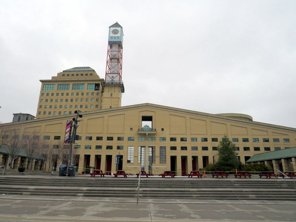
Mississauga City Hall, one of the most walkable municipal buildings in Ontario
In late March 2024, with a streak of mild, sunny days, I was eager to get outside and walk. As I have long been interested in local politics and planning issues, public transit, active transportation (especially walking advocacy), I thought I would try to get to every city, town, and township hall in the Greater Toronto and Hamilton Area (GTHA) without a car.
This was a fun project, even if there were times I felt really frustrated at times by poor transit and long hikes. The highlight of my quest was a tour of Mississauga City Hall from Councillor Joe Horneck. Mississauga’s civic centre is one of Ontario’s most iconic — and walkable — government buildings.
Mississauga Council Chambers
Of the three levels of government (federal, provincial, municipal), the municipal level has the most impact on the day-to-day lives of most Canadians; it is also the closest level of government to all. Residents can depute at committee meetings, get meetings with their local councillor and city staff, and obtain building permits, marriage licenses, or pay bills at city and town halls. Therefore, they should be as accessible as possible, especially to those without cars.
Only one GTHA town hall (Caledon) was completely inaccessible without a car, though several other town halls required long walks from the nearest transit stop, making them inaccessible to some residents. But I could get to Brock Township, the least-populated and most-rural municipality in the GTHA, thanks to Durham Region Transit’s On-Demand service, though I had some difficulty there.
The complete list of GTHA city and town halls, along with photographs and a map can be accessed here.
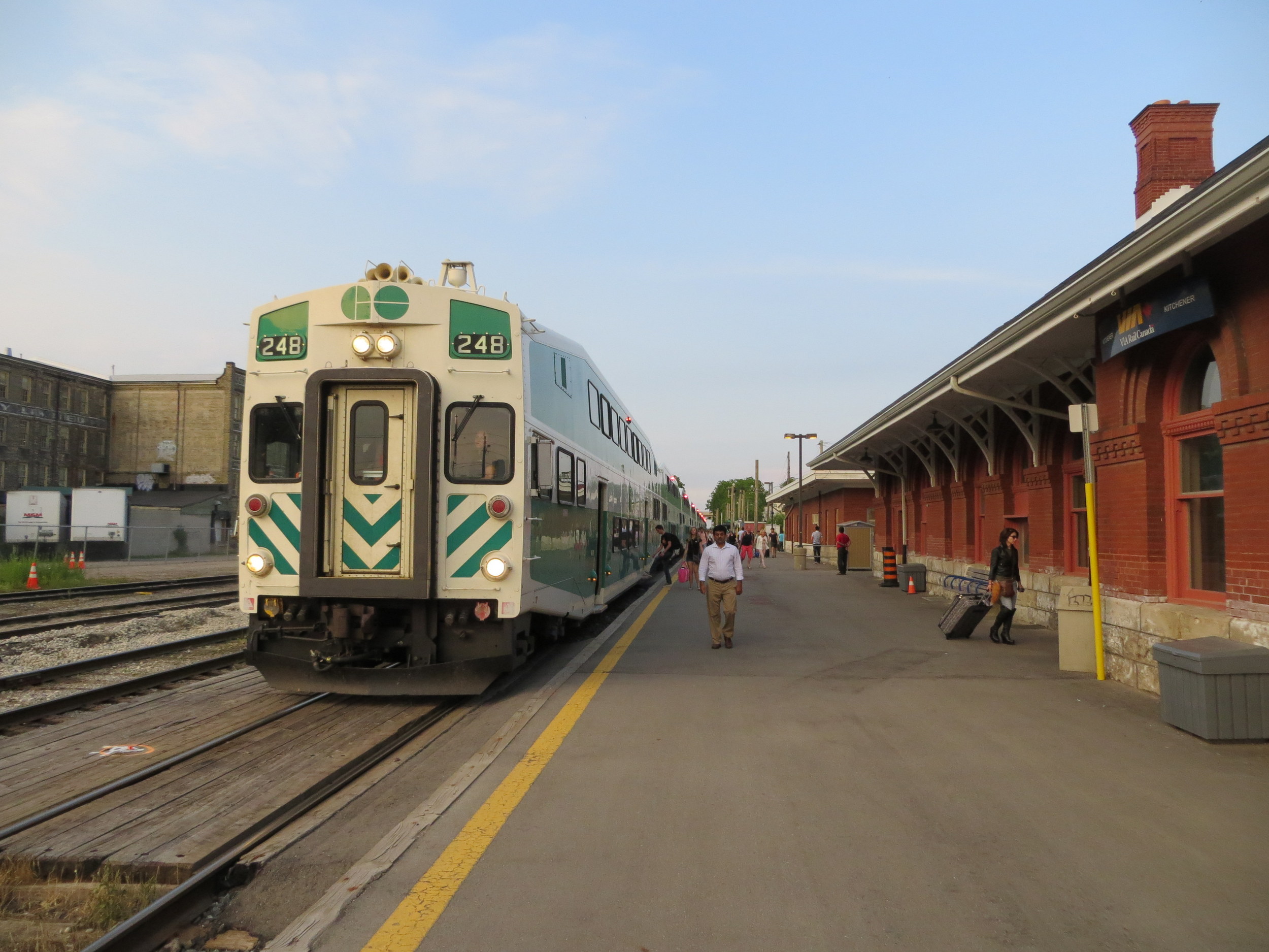
With a GO train serving as a backdrop, Premier Doug Ford, along with Transportation Minister Prabmeet Sarkaria, announced major changes to GO Transit service, with 300 new weekly trains (a 15% service increase). The service changes will take effect on Sunday, April 28, 2024.
Though most new trains will be added on the Lakeshore West, Lakeshore East, and Kitchener Lines (the Milton Line gets just one additional weekday round trip in the peak direction), the media event was held in Milton, where a byelection was called to replace outgoing PC MPP Parm Gill. With a competitive race between PC candidate Zeeshan Hamid and Liberal candidate Galen Naidoo Harris, the choice of venue made it an especially political event.
News of the pending service changes was publicized in regular Metrolinx email newsletters in March, but was since taken down, likely to allow for the news to be shared first by the premier and minister of transportation. It is quite clear that Metrolinx is entirely beholden to the provincial government these days, where communications are tightly controlled by its political masters.
The new GO Transit schedules are now available online. Though there is plenty of good news, some of the added trains are merely restoration of previous service levels. Meanwhile, there will be a significant service cut for two Toronto stations.
Lakeshore Corridor
Fifteen-minute train service returns on the busy Lakeshore line on weekend afternoons and evenings, between Oshawa and Oakville Stations only. Service will still run every half-hour on weekdays, weekend mornings, and to Bronte, Appleby, Burlington, and Aldershot Stations, and every hour to West Harbour GO in Hamilton.
However, weekend 15-minute service starts late in the afternoon. Frequent service from Oakville to Union starts at 2:30 PM Saturdays and Sundays and at 3:14 at Union Station. This additional service starts too late for family day trips to the city or for getting to afternoon Blue Jays games.
Bus route 18K, which operates between Aldershot, West Harbour, St. Catharines, and Brock University, is renumbered to Route 11.
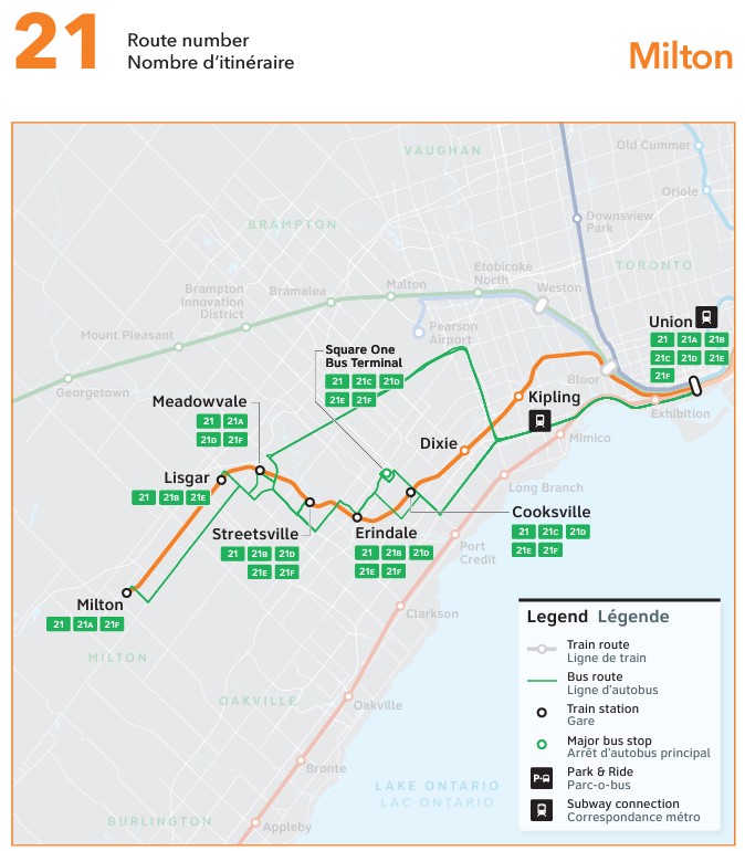
Milton Corridor
Map of Route 21
There will be one new peak-period round trip leaving Milton at 6:43 AM and leaving Union at 4:10 PM.
More importantly, Route 21 will return to its previous routing, operating directly into Union Station Bus Terminal. When I wrote about the April 2023 changes, I commented that the changes simplified the complicated Route 21 while improving reliability and predictability for Milton Line passengers. However, the changes proved to be unpopular, with poorly timed connections between buses and trains.
But with the Gardiner Expressway down to two lanes between Dufferin Street and Strachan Avenue for long-term construction, and with downtown Toronto’s traffic, I am wondering how much better the ride will be.
Route 21A, which ran between Milton and Oakville, will be replaced by Route 22, which offers much more limited service — every two hours, weekdays only. Route 21A offered useful connections to GO buses at Trafalgar Road Park & Ride for Highway 407 services to McMaster University, Downtown Hamilton, Square One, and beyond. It is a shame to see that service reduced, though perhaps Milton Transit should begin serving it.
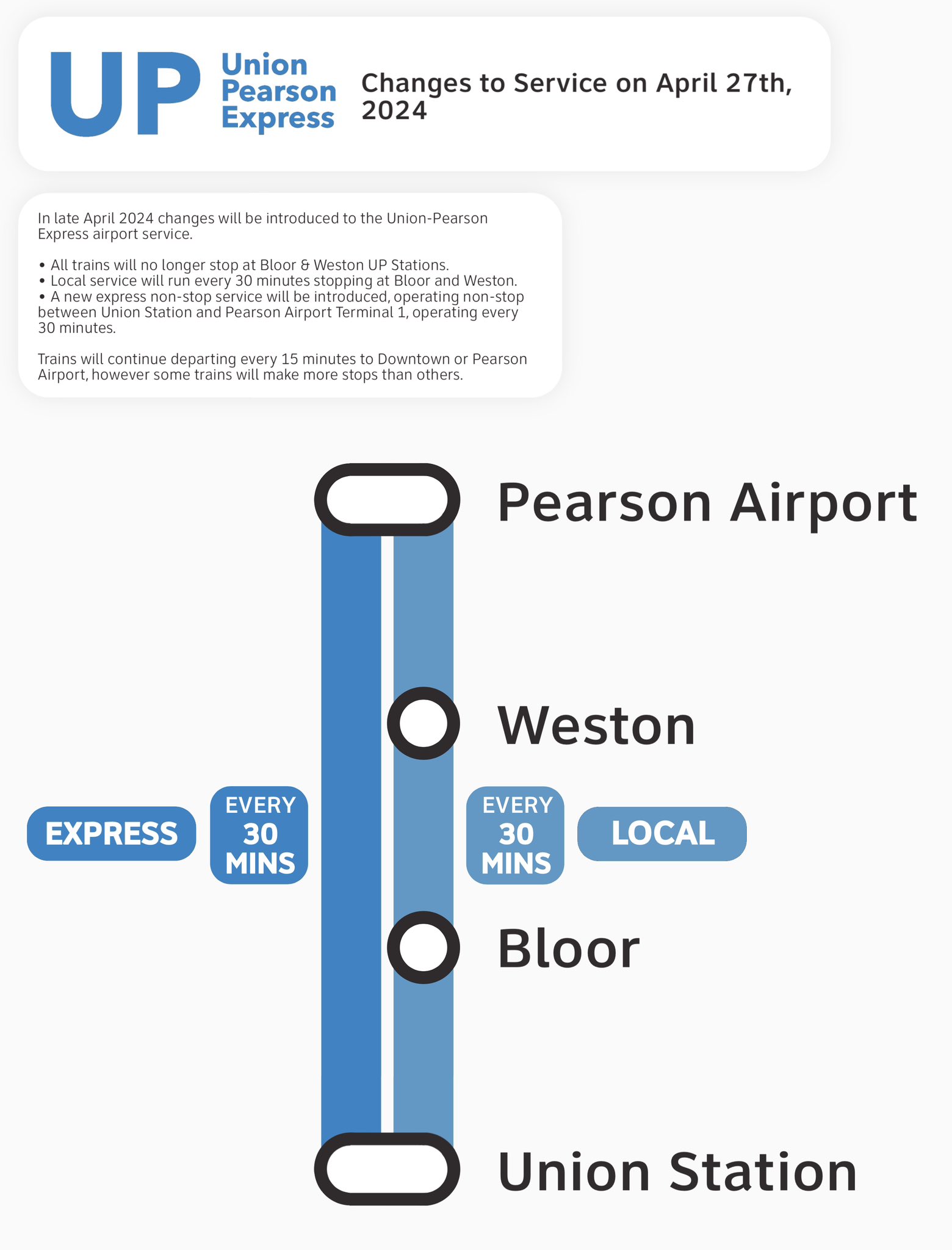
Kitchener Corridor and UP Express
New UP Express service pattern
The good news? There will be new weekday half-hourly train service between Bramalea and Union Stations during midday and early evening periods. (Hourly service between Bramalea and Union will remain in the counter-peak direction.) There are no changes to rail service between Kitchener, Mount Pleasant, or Union Station and only minor changes to connecting GO buses. Not all trains will stop at Etobicoke North, which only has one platform.
The bad news? UP Express service will be split into express and local services, with non-stop service between Union Station and Pearson Airport every 30 minutes, and local trains every 30 minutes stopping at Bloor and Weston. Both local stations will see improved weekday GO service, but this still amounts to a service cut, especially at Bloor, an important connection to the Line 2 Subway and local TTC services. This is also at a time when the connection between Dundas West Station and Bloor Station is finally being improved.
Other changes
Weekday evening train service will be restored on the Stouffville Line on April 28.
Elsewhere, there are minor schedule adjustments — it’s always a good idea to check your trip before you depart.
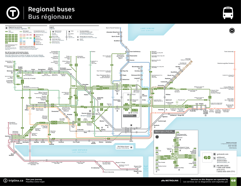
One last thing worth commenting about is a brand new, well-designed GO Transit bus map that clearly shows each route and how they connect to the rail network. Bus routes are sorted into “core” and “train support” services, a useful distinction.
My only criticism is that they should show frequency or level of service — some “train support” routes run hourly or better, seven days a week (like Route 30) while some of the “core” routes do not operate evenings and weekends.
Regional bus map
Finally
Apart from my observations and criticism above, I would have liked to have seen more changes to the bus network. For example, service to Peterborough remains too slow, while there should be weekend service between Kitchener, Guelph, and Hamilton. Hopefully, there will be more changes in September.
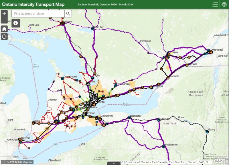
NOTE: Previous versions of the Ontario and Canada maps are retired; please see the new Canada Intercity Transport Map, launched March 30, 2025. This will now be the only interactive map that I will update.
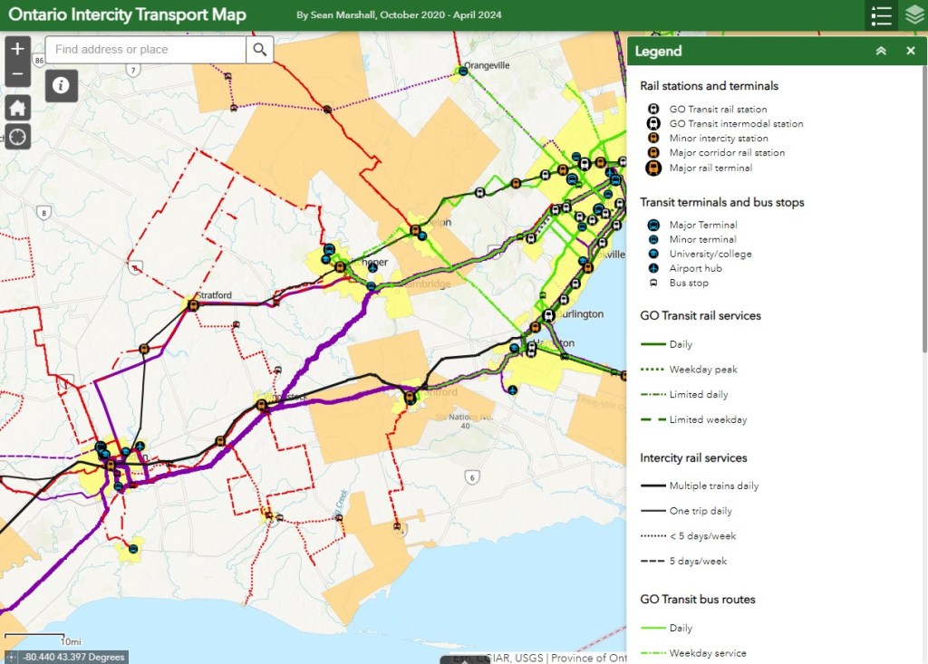
Since 2020, I have maintained an interactive map of bus and rail services in Ontario. Without a central repository of transit information, my maps have become one of the few comprehensive resources available. I am pleased to keep the resource going, and I appreciate the messages of support, as well as additions and corrections that you submit.
There are a few updates for April 2024:
Middlesex County Connect launched a new route between Dorchester, White Oaks Mall in London, and St. Thomas. This route operates six days a week, with four round trips Mondays through Saturdays.
A new FlixBus route, operating six days a week, now runs between Downtown Toronto, Pearson Airport, and Sudbury, competing with Ontario’s Northland bus service.
Ourbus became the latest company to operate a coach service between Toronto, Kingston, and Ottawa. There are now five coach operators competing on the same route.
Grey Transit Route announced that they will be ending weekend services on most of its routes starting May 1.
Though the gap between London and St. Thomas is now filled, there remains several other parts of the province without intercity transport links, even in Southwestern Ontario. For example, service in Huron and Bruce Counties is limited to a three day/week TOK coach service and a three day/week minibus service between Goderich and Grand Bend. There are still no links from Haldimand County and Six Nations to nearby large urban centres like Brantford, Hamilton, and Toronto.
I plan to update this Ontario map again in July. At that time, I will also update my Canada-wide transportation map to reflect changes in the intercity transport industry.
If you like my maps and you would like to help out with my online mapping and webhosting costs, consider buying me a coffee.Thank you!
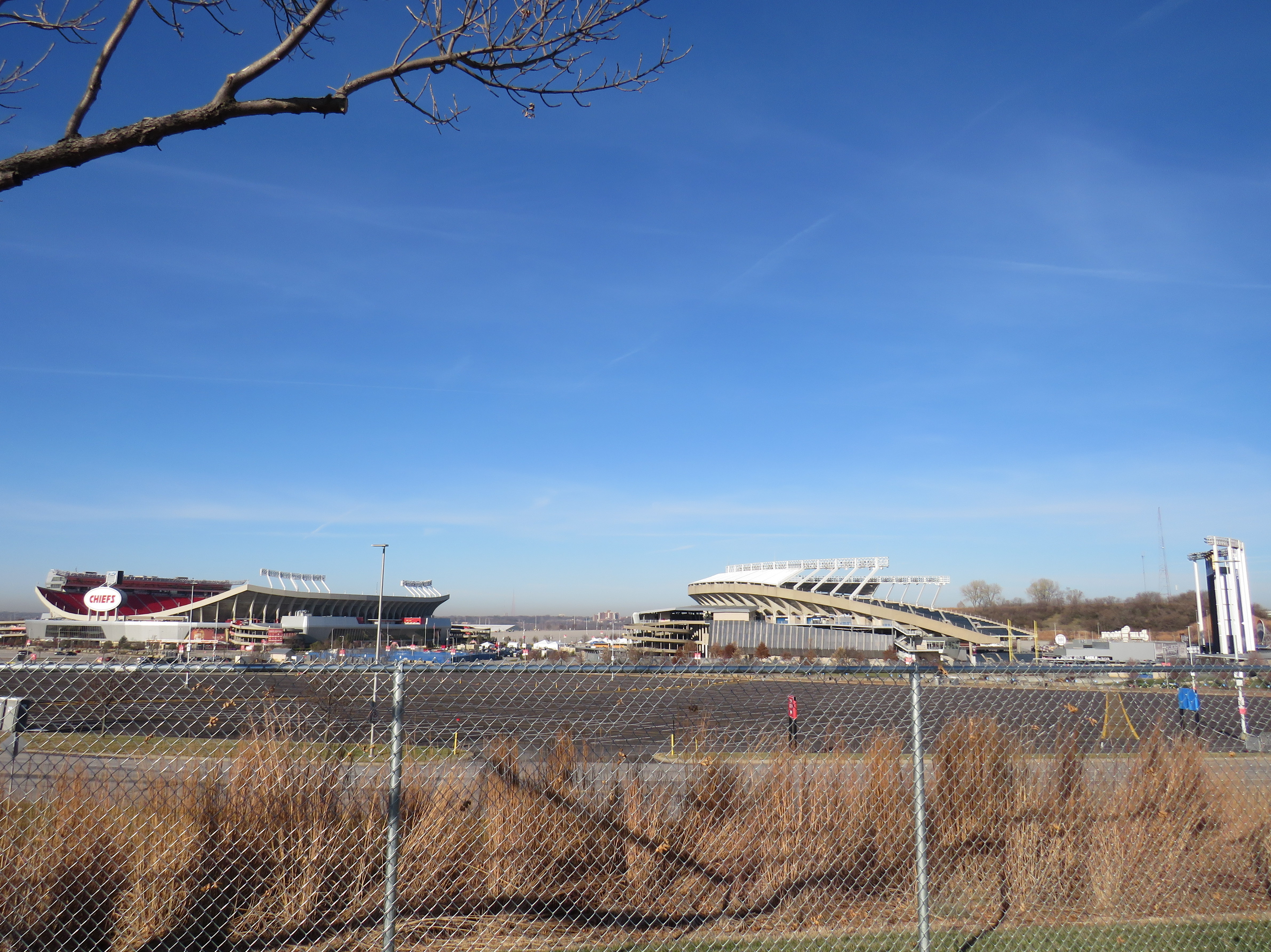
Truman Sports Complex, Kansas City, Missouri. Kauffman Stadium (MLB Royals) on right, Arrowhead Stadium (NFL) on left. Kauffman Stadium has the lowest Walk Score in the league. Both sports venues have especially poor transit access, even for Kansas City.
One of the best — or worst — experiences in North America can be going to see a ball or hockey game, concert, or other special event at a sports arena or stadium. Perhaps you want to make a day of it, taking in the city, going for a meal or drinks first and meeting up with friends or family. Or maybe you want just to park in a lot hours before game time and have a cookout.
But the trip to and from that venue can make or break the experience. Does it involve hours in gridlock? Does it mean a long line in the outdoors for a shuttle bus? Or can it mean a short walk to a transit stop and quickly getting on your way?
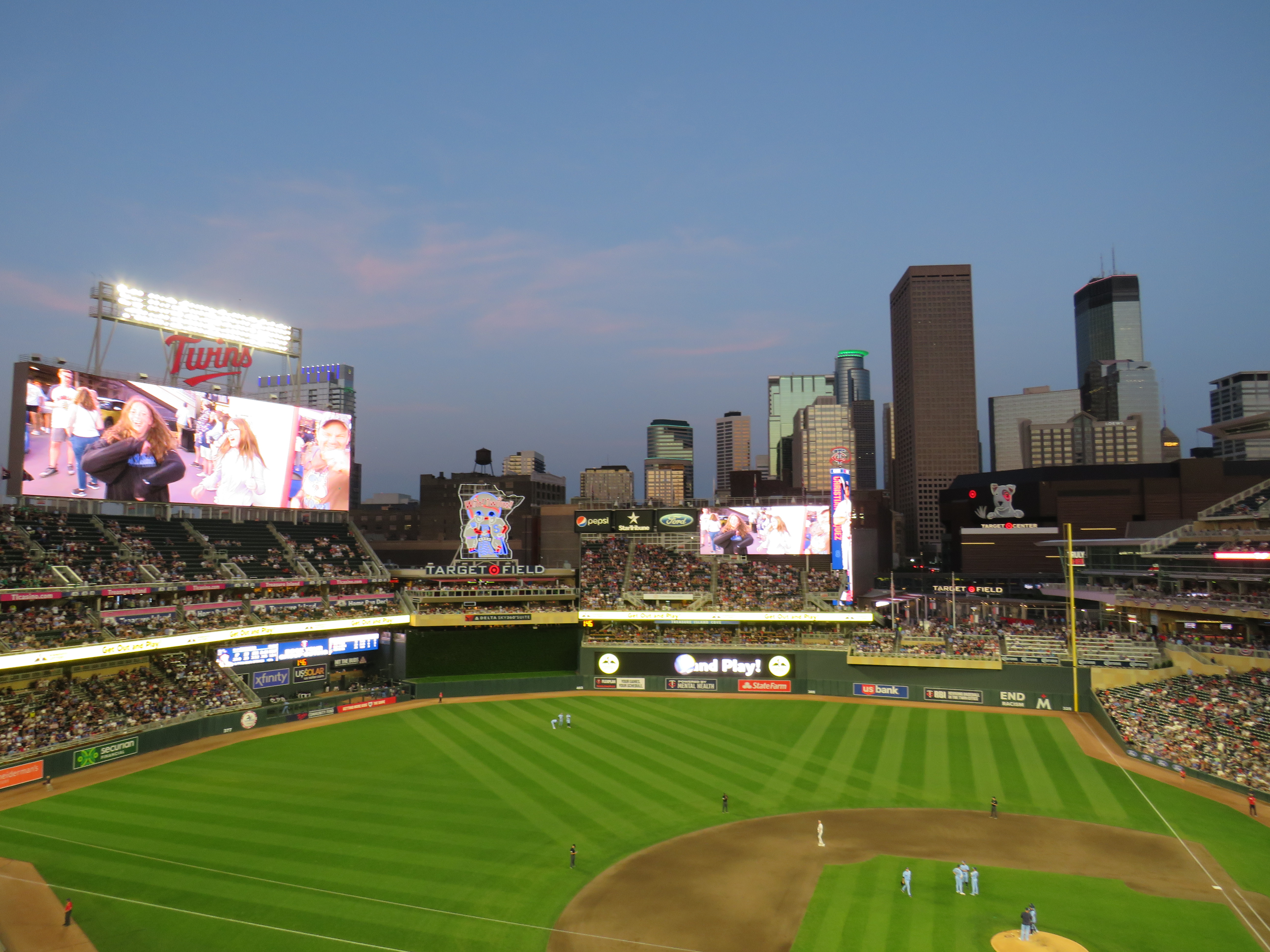
Target Field, in Downtown Minneapolis. Both light rail lines stop right next door.
Last summer, I got to see the Toronto Blue Jays play at Target Field in Downtown Minneapolis. The Jays have a Canada-wide fan base, and the Twin Cities have the closest baseball venue to places like Thunder Bay, Winnipeg, and even Regina and Saskatoon. It felt like a home game with a very pro-Toronto crowd.
Earlier that day, I noticed plenty of people wearing Jays hats and jerseys that were making the most of their road trip. They flooded local restaurants and bars. They checked out museums and the city’s signature parks. The Mall of America, at the other end of the Metro Blue Line LRT, was also full of Canadians. Minneapolis has a lively downtown, with very good bus and rail connections to the airport, the malls, St. Paul, and elsewhere.
Walkability and transit access are the key fostering a great fan experience, for promoting safe, accessible, and sustainable travel to and from the venue, and for supporting local businesses. Though economists and urban experts will — rightly — dispute the economic benefits of subsidizing new sports stadiums, if they must be built, they should allow spectators to get around without a car as much as possible to reduce congestion, curtail impaired driving, and create a vibrant urban environment that everyone can enjoy.
I used Redfin’s Walk Score tool to rank the venues of six major leagues in Canada and the United States: the CFL, MLB, MLS, NBA, NHL, and NFL; I also comment on their transit connections. Toronto’s three venues do very well, as do NBA/NHL venues in major cities like New York, Washington, and Los Angeles. Not surprisingly, football stadiums — especially NFL venues — do poorly.
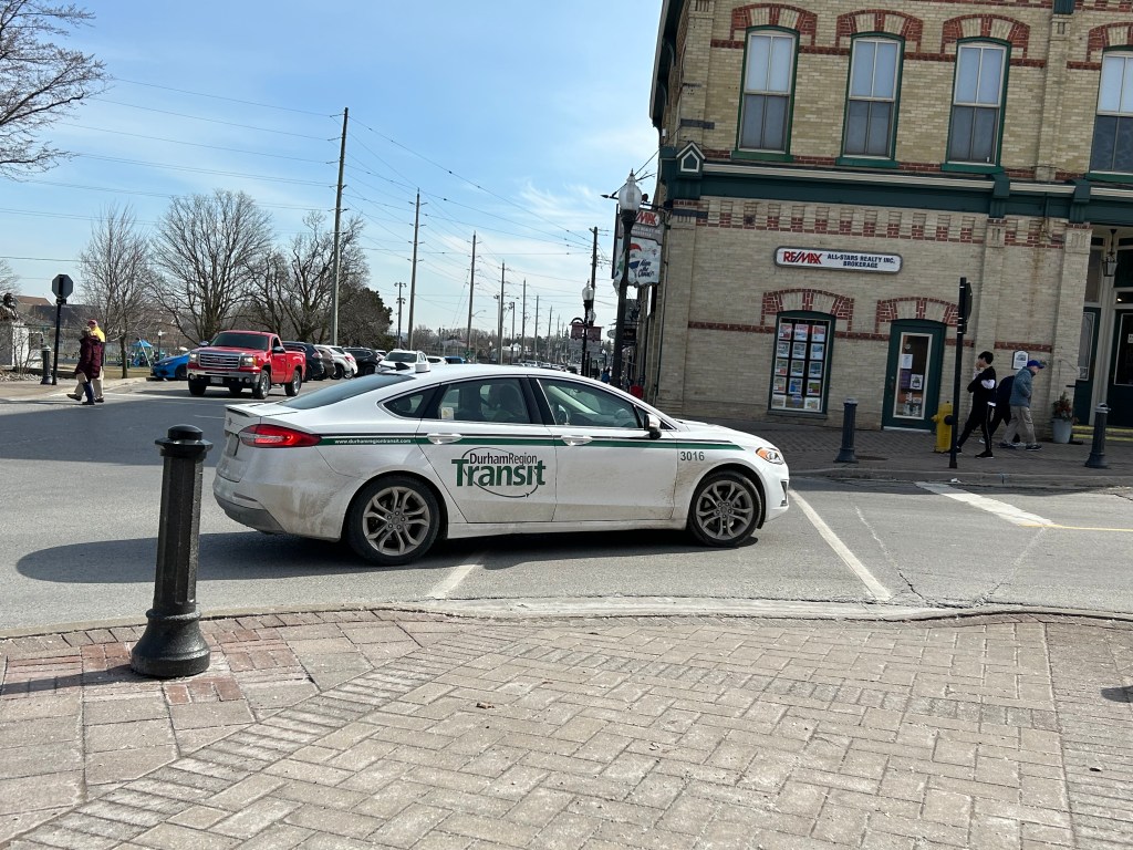
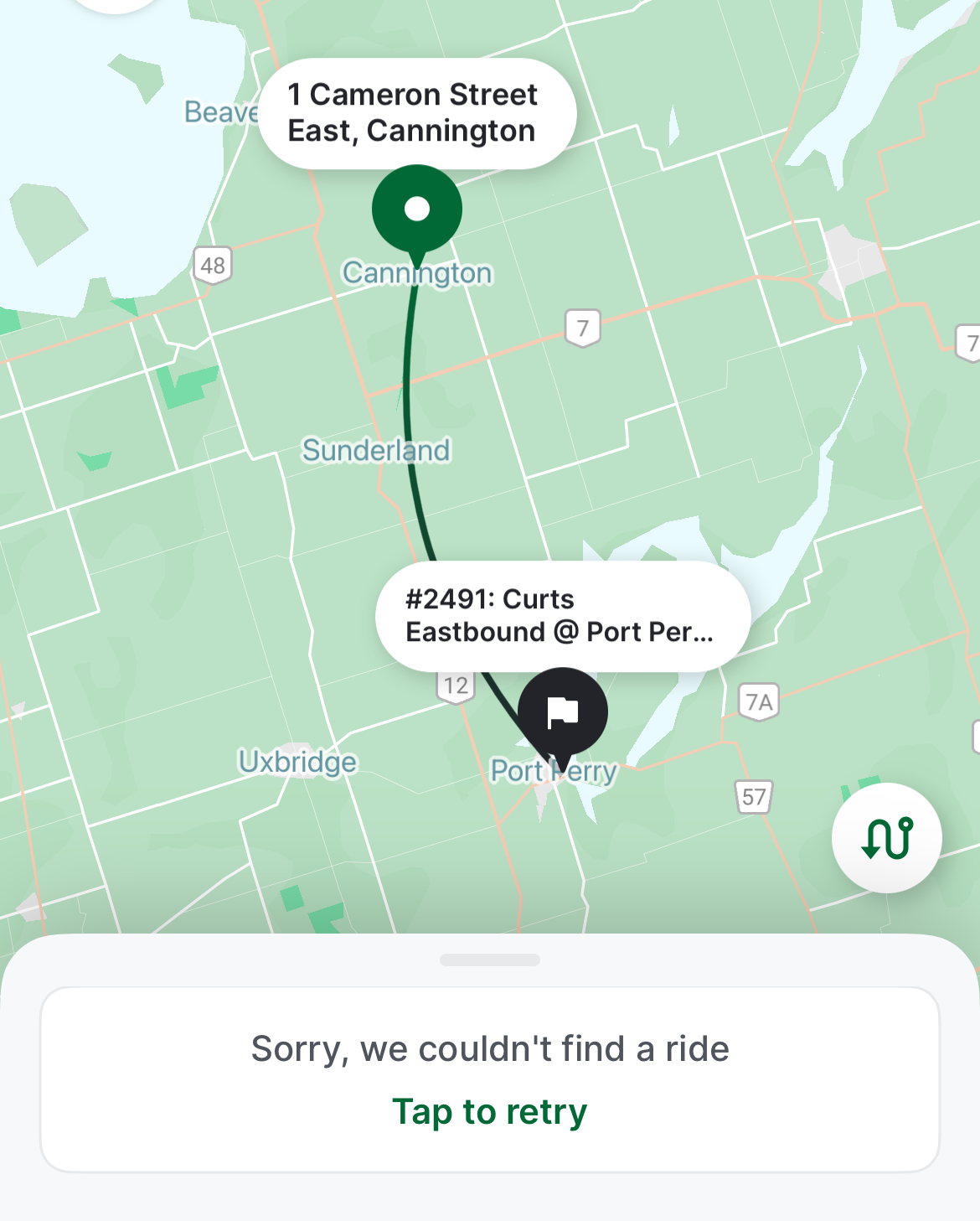
Earlier in March, as part of my quest to visit every town, city, and regional government office in the Greater Toronto and Hamilton Area (GTHA) without a car, I took my first on-demand transit rides in a decade. This was necessary to visit Brock Township’s municipal offices, located in the village of Cannington, north of Port Perry. (I will discuss more about this project in the coming weeks.)
Brock Township’s municipal offices, at right, sits in the heart of the village of Cannington
Brock Township is the GTHA’s most rural and least populated municipality, home to just over 12,000. Until April 2023, GO Transit ran a daily bus service between Whitby GO Station, Port Perry, Cannington, and Beaverton (Brock’s largest community), but was cancelled after a ridership review. (GO has quietly cancelled several other bus routes that don’t cross county or regional boundaries in the last decade.) However, Durham Region Transit (DRT) offered an alternative: on demand transit.
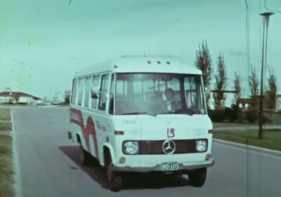
On-demand transit is not a new idea. In the 1970s, GO Transit operated experimental dial-a-bus services in suburban parts of Toronto, offering door-to-door service to and from the nearest subway station or a designated transfer point to frequent fixed-route bus services. In Bramalea, Chinguacousy Township operated Bramalea Dial-a-Bus, which brought residents to local employers, schools, and Bramalea City Centre. The service was replaced by fixed-route services when Brampton Transit was established shortly after amalgamation, merging the dial-a-bus operation and a privately contracted transit service in the old town of Brampton.
Still image from “People on the GO,” a 1973 film by the Ontario Ministry of Transportation and Communications. Bramalea’s Dial-a-Bus’ pink “lazy-b” logo was adopted by the successor transit agency, Brampton Transit during its first decade.
“Trans-Cab” services continue to be used in outlying areas of communities such as Hamilton, Peterborough, and Sudbury, where transit agencies partner with local taxi companies to allow transit riders to begin or end their journey outside of urban or regional fixed-route areas, often at a premium fare.
My first on-demand transit experience was taking Oakville Transit’s “zone bus” service in 2005. At the time, there was no fixed-route Sunday bus service in Oakville, but there were four zones for which you could call and request a ride, with a bus picking you up at the nearest bus stop. If your destination was in a different zone, you would transfer to another bus at Oakville GO Station. Today, Oakville offers on-demand service during late evenings from the Oakville GO Station and in new and outlying subdivisions where there are no nearby scheduled services.
My other previous on-demand transit experience was in Winter and early Spring 2012, after I suffered a broken knee cap and had to rely on Toronto’s Wheel-Trans paratransit system. Though I was fortunate to be able to get around using Wheel-Trans during a temporary disability, it was often a frustrating experience trying to book trips, especially for social or leisure purposes. I quickly came to prefer the conventional system and used it as much as I could while recovering from that injury.
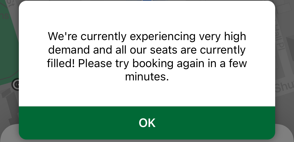
A common message while trying to book rides on DRT On-Demand
In 2024, there are over a dozen transit agencies providing on-demand transit services in Ontario and Quebec, either as standalone operations or in conjunction with fixed-route systems. You can find them in my interactive transport maps.
Modern on-demand services, though they are typically accessed by mobile apps these days, present some of the same challenges, including cumbersome booking processes as well as high demand and limited availability for next-day and same-day trips.
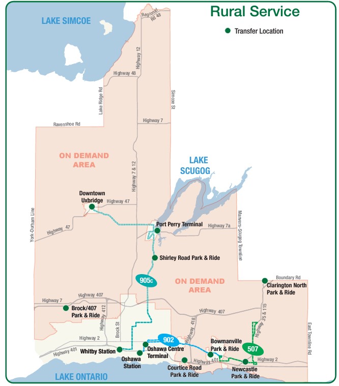
DRT offers on-demand transit trips for customers with disabilities (who are eligible for door-to-door service anywhere in the region), rural areas, and in designated urban areas (where pickups and drop offs are made at signed bus stops).
DRT rural services, showing the rural on-demand service area and transfer points to fixed-route services (including GO buses at Downtown Uxbridge, Brock/407 and Clarington North)
As Brock Township was the most distant and most difficult town hall in the GTHA to reach by public transport, I tried to book for the first day of my visits: Monday, March 11. After downloading the DRT app and inputting my information (name, email address, mobile phone number) I tried to book a return trip from Port Perry (which has a scheduled route connecting it to Uxbridge, Oshawa, and Whitby) the day before.
At one point, I was able to get an outbound trip around 12:00 PM, but I could not get a return trip after multiple attempts. After failed attempts to book each ride, the app would go back to the beginning, requiring the user to input most of the same information multiple times. I gave up and went to northern York Region instead. After midnight, early Monday morning, when one could book trips for the following day, I tried again and managed to get a return trip that met my needs for Tuesday the 12th.
Unable to book a return trip from Cannington to Port Perry for Monday, March 11, 2024
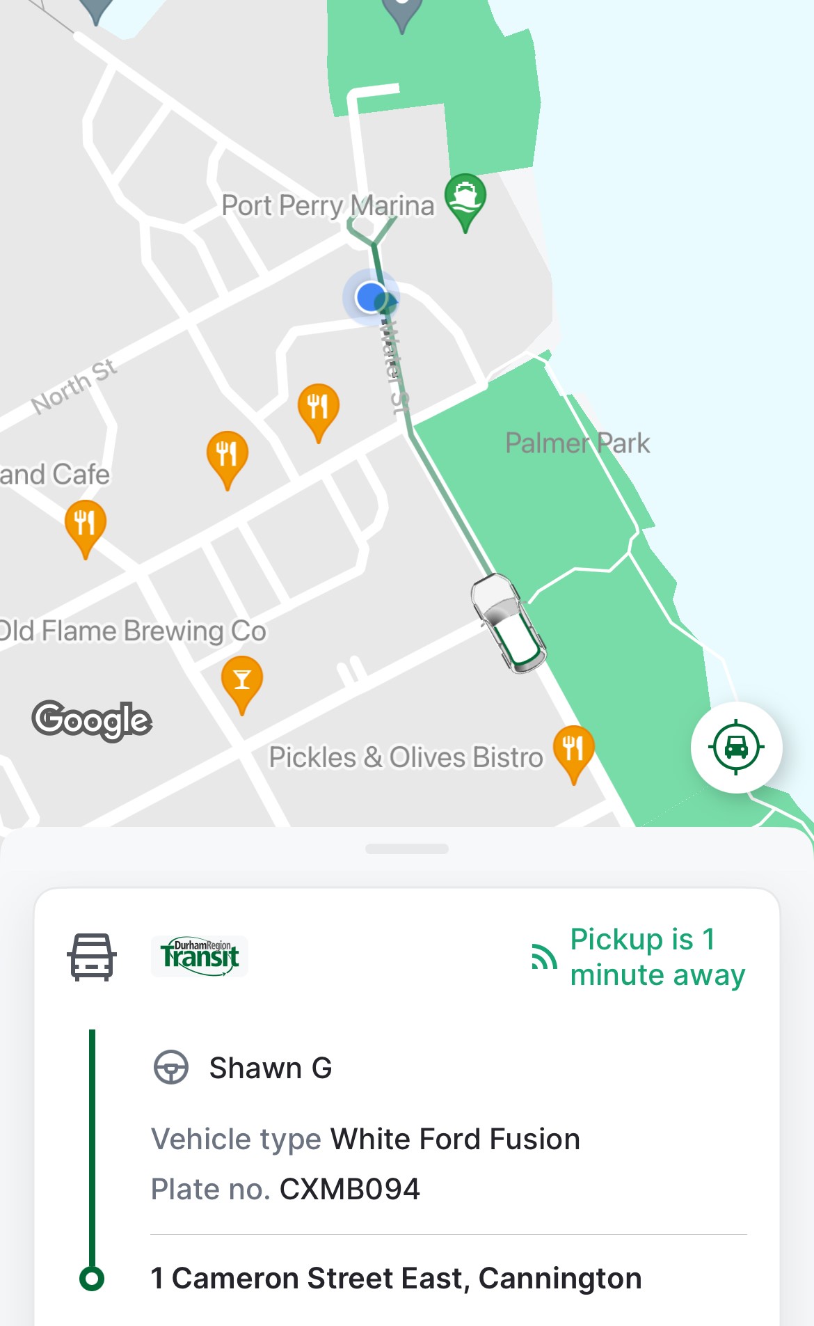
Once I booked my trip, the rest of the experience was smooth. I got a text reminder of my upcoming trips, and on the app, I could track my upcoming ride, much like Uber or Lyft, with the driver’s name, vehicle description, and location. Each time, I paid with my Presto card, with DRT charging the same fare for on-demand as for conventional bus service. Drivers were professional and friendly. I was the only passenger for both trips, though they are often shared, and minibuses — such as accessible paratransit vehicles — are used for passengers with disabilities or larger groups.
Notice of pickup
I learned that the service could be quite busy and the app sometimes problematic — there is also a toll-free number that passengers can call, and that sometimes the telephone agent would be able to find matching rides that the app would not show.
I was lucky that my trip was discretionary, but I could see how on-demand transit can be difficult and/or frustrating to use.
Though DRT has restored most urban bus routes (many were suspended during pandemic-related restrictions), it still struggles to meet demand on its busiest corridors, especially those serving colleges and universities in Oshawa, Whitby, and Scarborough. A fire in one of DRT’s garages last summer hasn’t helped either. As a result, some urban areas in Ajax, Pickering, Whitby, and Bowmanville still have on-demand areas where fixed-route services have yet to be restored.
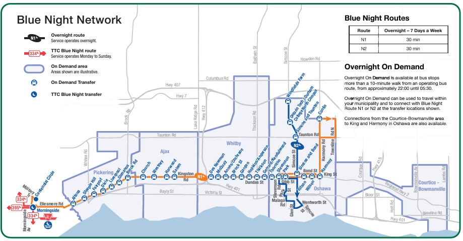
On-demand transit has its place, especially in rural and outlying suburban areas, or during times of low demand. If done right, it provides affordable mobility to people who might otherwise go without, and as an alternative to driving a car or paying an expensive taxi fare for those with travel options. Durham Region has done a good job covering the entire region with fixed-route and on-demand services, especially at night, where the urban south enjoys 24-hour transit access.
DRT overnight services, which includes two scheduled buses and five on-demand zones in the urbanized part of the region.
Despite Durham’s efforts, on-demand services can be costly to operate, less flexible for prospective passengers, and be frustrating to use, though they can cover much larger areas than line haul routes. Scheduled, fixed-route buses offer predictable, simple, and often faster service than point-to-point bespoke services. On-demand transit has its place, but it is only one tool in a vast toolbox of mobility solutions. This was true in the 1970s and remains true today.
Intercity Bus minibus on York Street at Royal York Hotel, February 13, 2024
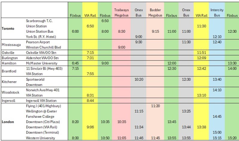
In late 2023, yet another intercity bus operator started serving the busy Toronto-London corridor, operating between Toronto and London. With the rather unimaginative name of “Intercity Bus,” this new company operates up to four trips a day between Toronto and London. It has since added a route between London and Sarnia; it also plans to run the much-needed link between London and St. Thomas.
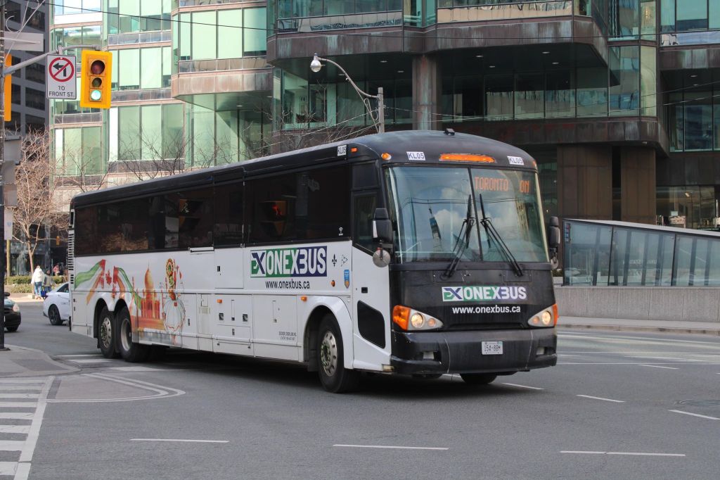
There are now five bus companies on the Toronto-London route: Intercity Bus, Onex Bus, Trailways, and Megabus (in a partnership with local coach operator Badder Bus). Those five companies compete with VIA Rail, which operates up to six daily trips between the two cities, with up to 28 round trips daily between them.
Onex Bus departing Downtown Toronto, photo kindly provided by Chris Whitfield
VIA Rail remains the fastest and most comfortable option, with full-service staffed stations in Downtown London and Downtown Toronto, but its fares are typically the most expensive. The private coach companies offer cheaper fares, and several of them directly serve Western University and/or Fanshawe College. Megabus has partnered with Trailways; its booking website includes both the Toronto-London-Detroit Trailways trips and the Toronto-London trips operated by Badder Bus. Otherwise, one must go to the individual companies’ websites to figure out the complete schedule and where each service stops at.
The schedule below, saved as a PDF, includes all regular weekday trips between Toronto and London along with intermediate stops.
In Toronto, Flixbus, Trailways and Megabus/Badder call at the Union Station Bus Terminal, where connections can be made to other Flixbus and Megabus services, along with GO Transit and VIA Rail in the adjacent railway hub. Onex and Intercity Bus make use of a curbside stop on York Street next to the Royal York Hotel, which is shared with the Toronto Island Airport shuttle. These three stops are all within a few minutes’ walk from each other. Some Flixbus runs to London begin and end in Scarborough, and many buses also make a stop at Pearson Airport.
In London, every bus carrier makes a curbside stop at Western University, the terminus of all bus trips from Toronto except Trailways, which continues to Windsor and Detroit. All carriers except Badder/Megabus also serve Downtown London. However, each has a different stopping location, with Flixbus and Trailways opting for a curbside stop on York Street near CitiPlaza (London’s downtown mall), and Onex utilizing the driveway at the VIA Rail station.
Curbside stops are convenient for bus operators, as they’re easy to pull up to and depart from, there’s no rent, staffing, or maintenance costs. With smartphones and online ticketing, there is no need for a ticket agent, and passengers can be notified by text and/or email of any delays or changes. But curbside stops have no shelter and no washrooms.
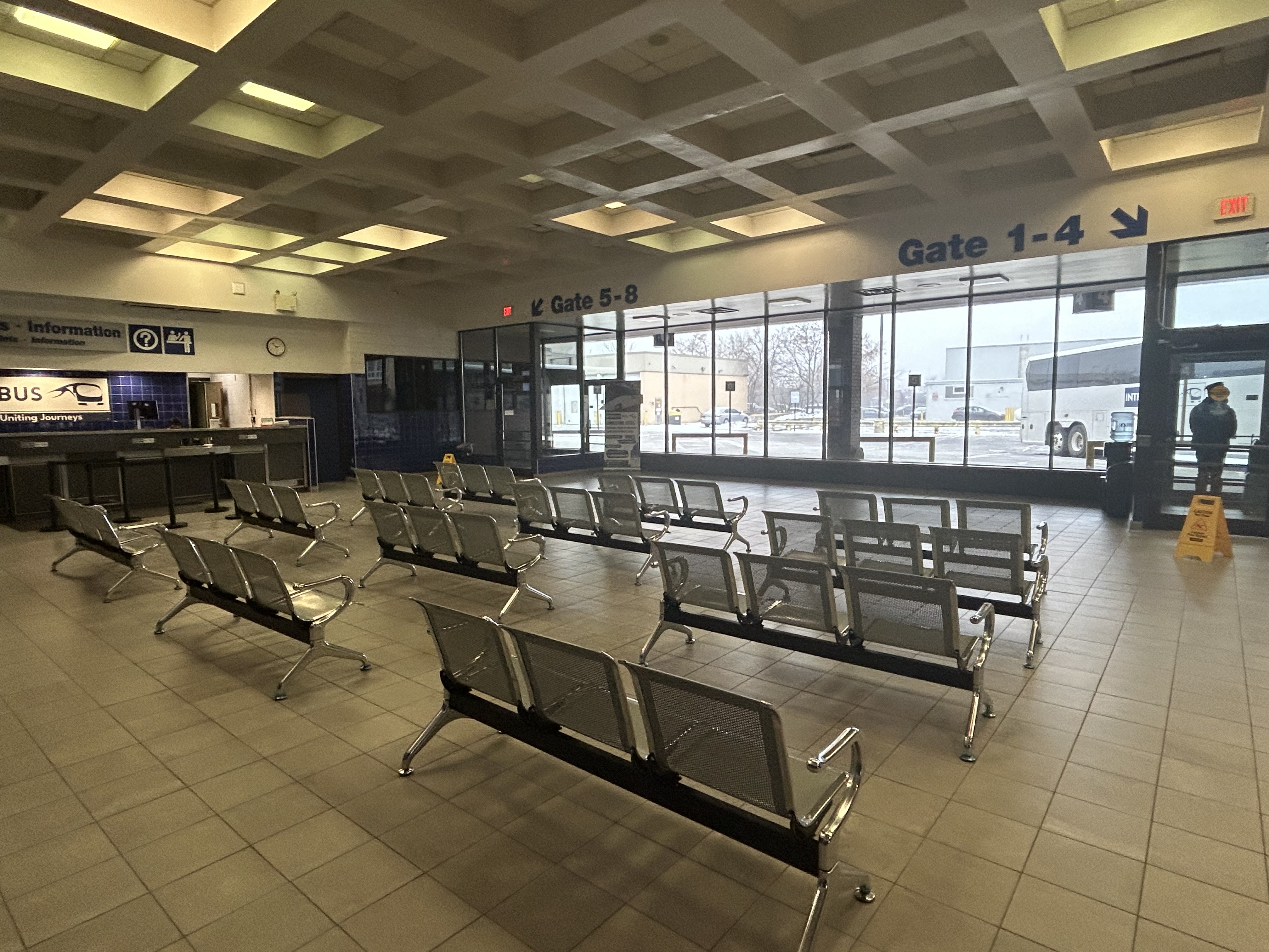
Interestingly, Intercity Bus has taken over the old Greyhound terminal in Downtown London. At its peak, London’s terminal had dozens of daily departures to cities and towns all over Southwestern Ontario, serving multiple carriers at a time when intercity carriers acted more like a unified network.
The old London Greyhound terminal
The terminal offers seating, washrooms, and is staffed by an agent, a rarity in the post-Greyhound world. The washrooms are especially essential if — as on my recent trip — the bus does not have an on-board lavatory. These new smaller carriers save fuel and labour costs by operating smaller vehicles and matching capacity with demand. They often operate older coaches and minibuses.
Inside the Intercity Bus terminal
I recently took Intercity Bus from Toronto to London to try out Ontario’s newest carrier. Though the 12:10 departure from Toronto was on a minibus similar to those used by rural transit operators (there were only 10 passengers on that Tuesday afternoon run), the ride was comfortable enough, with cloth bucket seats. It was a fast trip: it skipped stops in Woodstock and Fanshawe College, and the driver made very good time on Highway 401, at times exceeding the posted speed limit by 25 or 30 kilometres per hour. Even with a stop for fuel (the driver asked if it was okay), we arrived 15 minutes early at the London terminal.
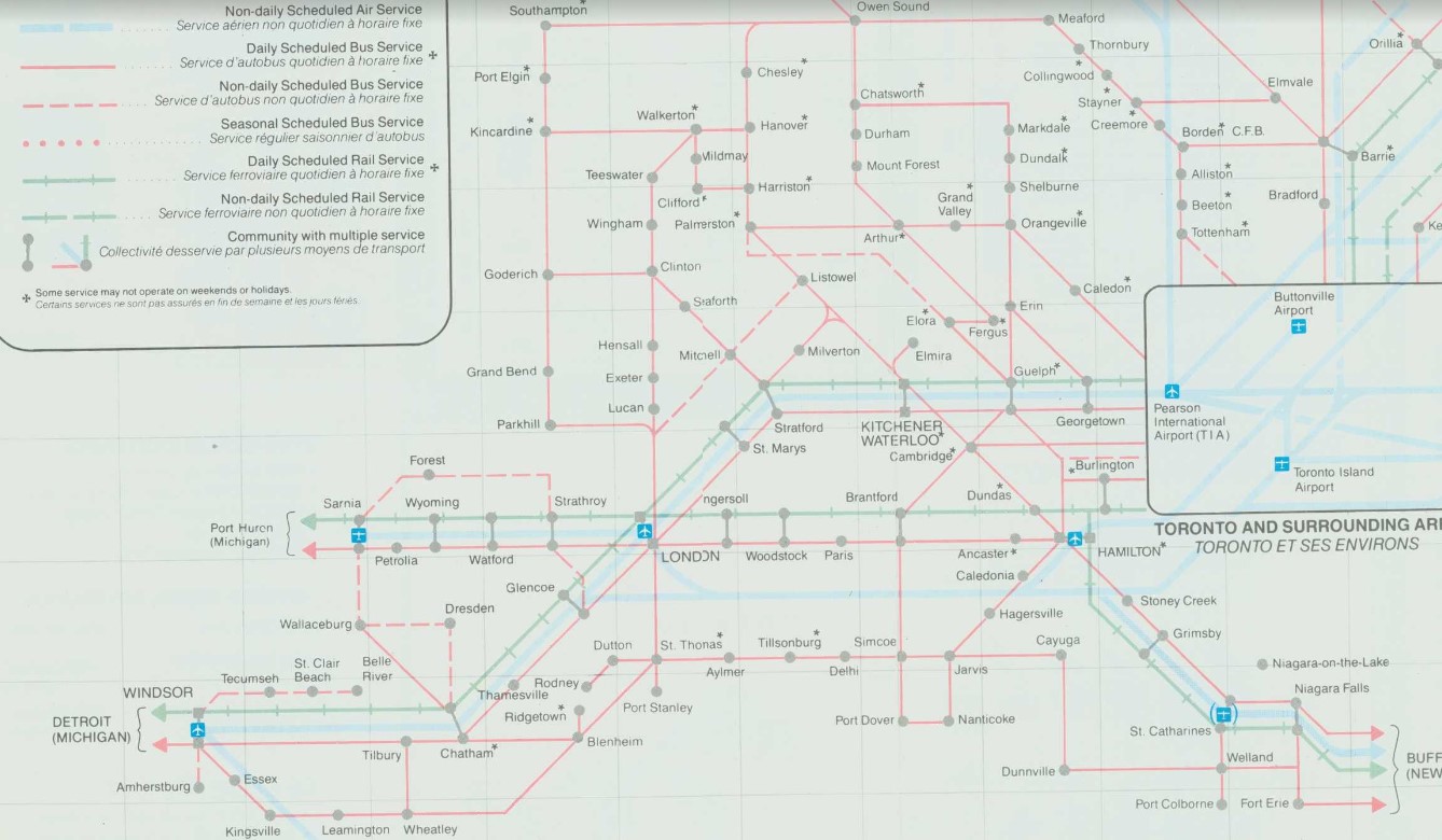
At its peak in the 1980s, there were over two dozen daily departures from the London bus terminal. There were frequent Greyhound routes to Toronto via Kitchener and via Brantford and Hamilton as well as to Chatham, Windsor, and Detroit; there were also daily Greyhound routes to Niagara Falls via St. Thomas, Simcoe, and Welland and to Strathroy, Sarnia and into Michigan. Regional coach operators also ran from the Greyhound terminal to Stratford, Goderich, Rodney, Walkerton, Leamington, and Port Stanley. Today, there are just four — three to Toronto and one to Sarnia.
Detail from 1990-1991 Ontario Intercity Transportation Guide, showing bus routes from London to points throughout Southwestern Ontario
My hope for the next year is for more stability in the intercity bus industry, perhaps even mergers between some of the smaller players. Onex and Intercity Bus, which compete on the Toronto-London route and offer a similar service, could be beneficial, especially if it results in a network of routes radiating out of London, starting with Intercity Bus’s London-Sarnia service, its planned St. Thomas route, and Onex’s London-Stratford-Kitchener run.
I updated my map of Ontario’s intercity transport services for March 2024, including the new Onex Bus and Intercity Bus routes in Southwestern Ontario. There are new services in East Zorra-Tavistock, connecting to Stratford and Woodstock, and in North Grenville. Unfortunately, Lindsay and Haliburton lost their TOK coach service, Prescott & Russell ended its on-demand service, and gaps remain in Bruce, Elgin, and Haldimand Counties.
On Monday, February 26, the new Ontario One Fare Program will take effect. Transit riders who previously had to pay a second fare when transferring from GO Transit or suburban transit agencies (York Region Transit, MiWay, etc.) to the TTC, will now benefit from a free transfer. Passengers will also be able to transfer free from the TTC to suburban buses or get the TTC fare discounted if transferring to GO Transit.
The new fare program, subsidized by the provincial government, is only available to customers who pay using a Presto card or other contactless payment options (credit card, debit card, mobile app). It is also not applicable to and from UP Express.
This is good news for many transit users, and it fixes several flaws in the existing fare structure. For example, when GO Transit moved its Highway 407 buses — originally designed to ferry commuters to York University — to Highway 407 Station in Vaughan, students and staff had to pay the TTC fare just to go two stops or endure an unfriendly walk. For a short time, there was a $1.50 discount for GO-TTC transfers, but that was allowed to expire under the Ontario PC government.
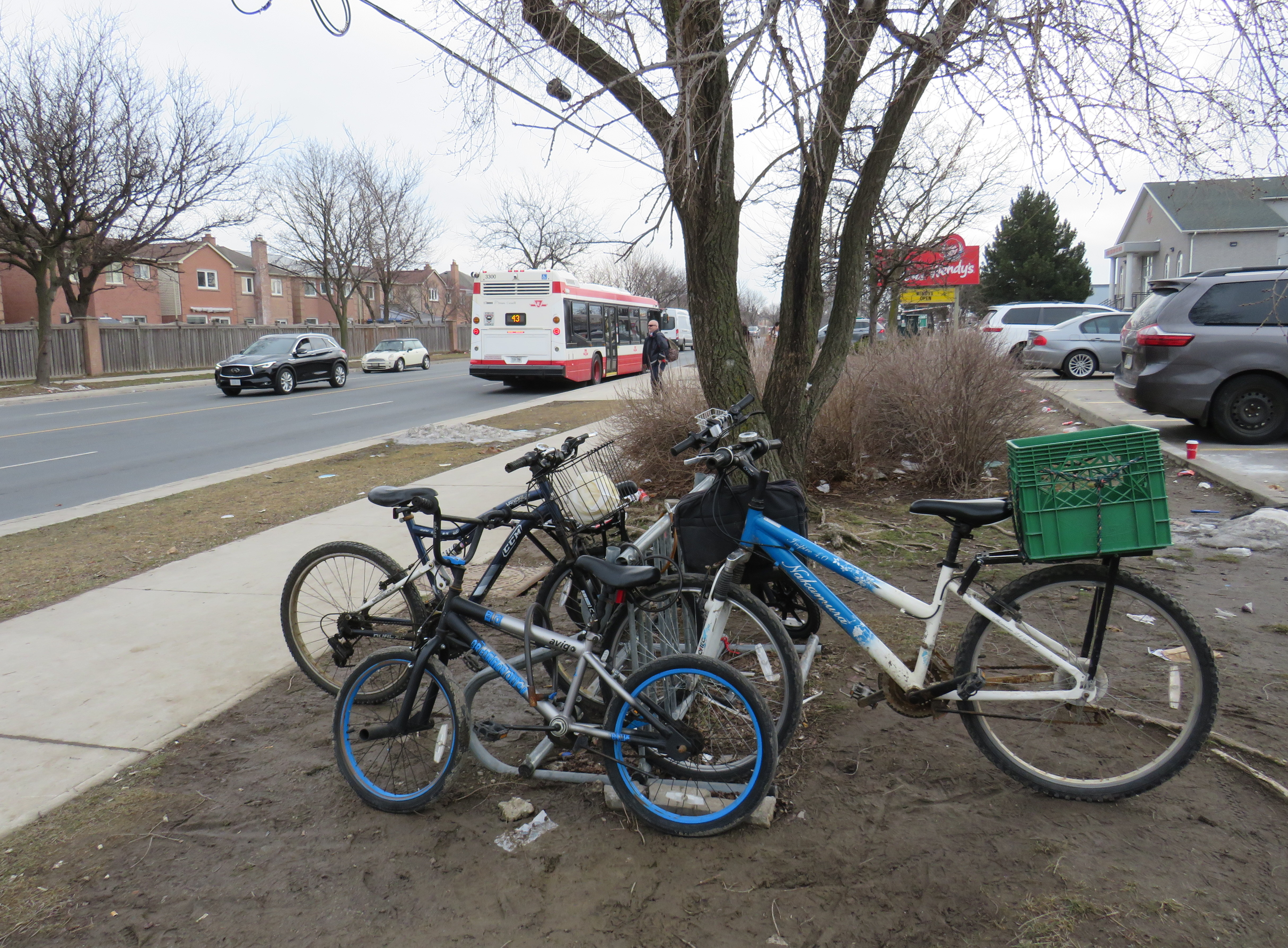
The elimination of the double fare will also benefit transit passengers who live or work near the border of Toronto and York, Peel, and Durham Regions. On the boundary between Markham and Toronto, it is common to see lots of bicycles locked up at bus stops along or near Steeles Avenue at TTC stops. These bicycles are owned by York Region residents who ride south to avoid the double fare and benefit from one less transfer. Once the new free transfer comes into effect, it will be interesting to see if there is a bump in YRT ridership.
Bicycles parked on the south side of Steeles Avenue, February 2024
Though the new free TTC transfer should — at least in theory — eliminate a barrier to integrating GO Transit with local transit, the TTC really isn’t set up to feed the GO Transit rail network, nor are many GO stations set up to serve TTC riders. There are historical reasons for these poor connections, but they will need to be fixed.
GO Transit started off in 1967 as a commuter rail pilot project, with the Government of Ontario (the “GO” in GO Transit) looking to keep costs down in case the three-year experiment was unsuccessful. Many station sites were selected for their proximity to major roads and highways and parking access. As the service was intended to attract suburban commuters from their cars and mitigate the need for expensive highway widenings, transit access was only a secondary consideration. The initial Lakeshore Line exceeded expectations and so GO added new lines to Georgetown (1974), Richmond Hill (1978), Milton (1981) and took over CN commuter operations to Bradford/Barrie and Stouffville.
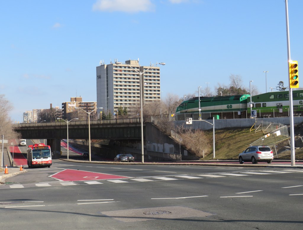
An example of this era of GO Transit station placement is Old Cummer Station, which opened in 1978. It was built where the Richmond Hill Line crossed the Finch hydro corridor, with land underneath the transmission lines easily paved over for parking. A walkway leads south to Finch Avenue, where one can connect to TTC buses, but the station building and the platform are oriented towards the parking.
As the Richmond Hill Line only operates during the peak periods, and is the only GO train service not destined for service expansion, this is not a major problem.
In the 905 suburbs, such as Mississauga, Brampton, Oakville, and Whitby, local transit connections are often quite good. For decades, commuters in those cities have benefitted from discounted or free fares on local transit when heading to or from GO rail stations (with Presto, connections to and from GO buses are now also free). Many transit agencies, particularly Durham Region, Oakville, and Burlington along the Lakeshore Line, centre their bus systems around the GO stations. Brampton built its downtown bus terminal adjacent to the GO station in 1989, and in 2023, Metrolinx opened a new bus terminal at Bramalea Station, allowing for easy transfers between buses and trains.
Bramalea GO Stationbus loop
On the other hand, the TTC bus network was designed around the subway network, with nearly every route serving at least one rapid transit station. Though TTC buses would pass by GO stations, transfers between the two were limited because of the extra fare and the infrequent GO services compared to the subway. The only TTC loop on GO station property is at Rouge Hill Station, though Exhibition Loop and Long Branch Loop are short walks to GO station entrances.
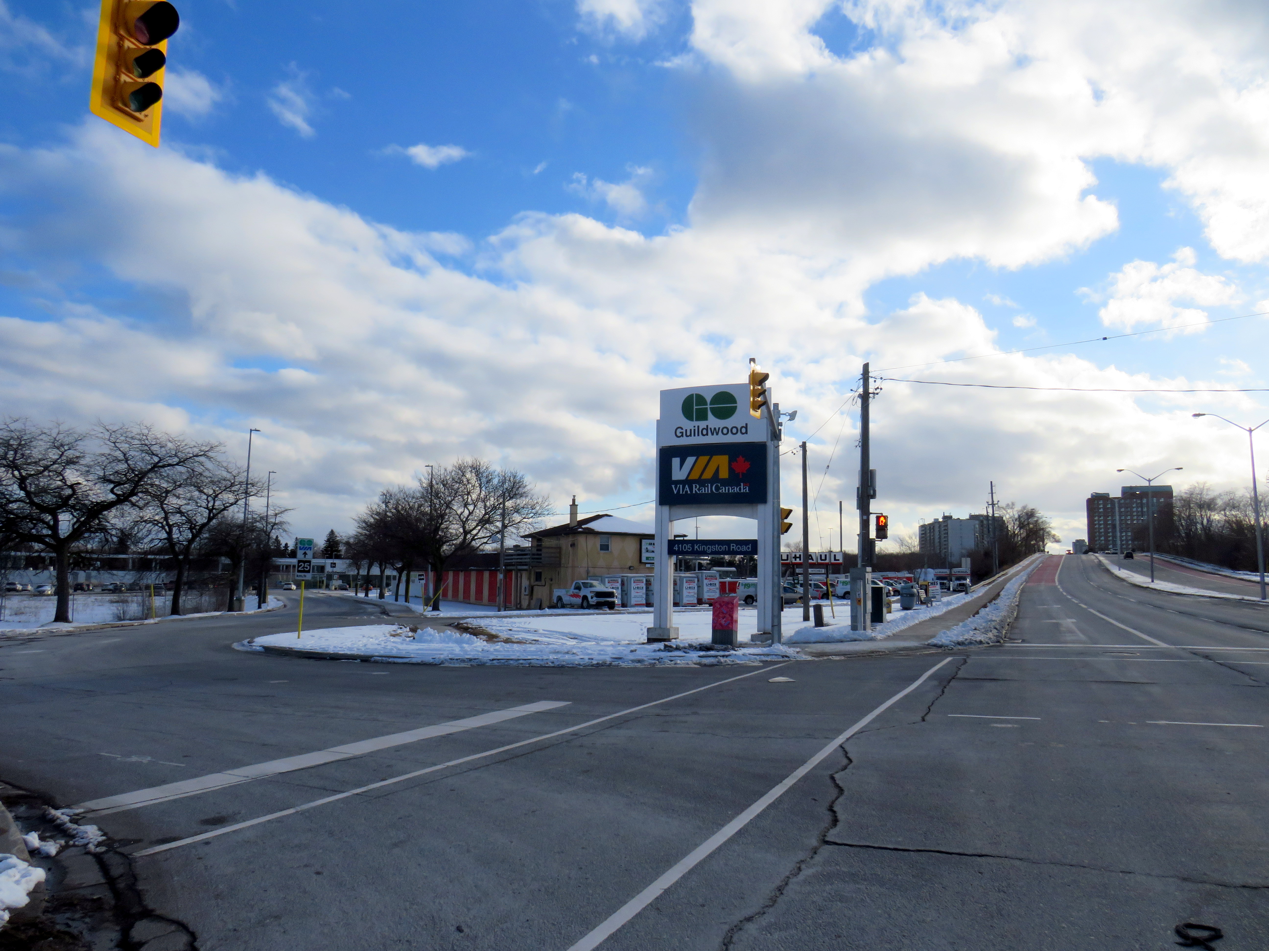
Entrance to Guildwood GO Station at Kingston Road. TTC passengers looking to connect with GO trains must cross a busy intersection than then walk through a parking lot to reach the station building.
As GO Transit continues to expand, and fare integration finally becomes a reality, there is both an opportunity and a need to change. Though there are plenty of examples of poor GO-TTC connections, there are also some promising moves towards physical integration between the two systems.
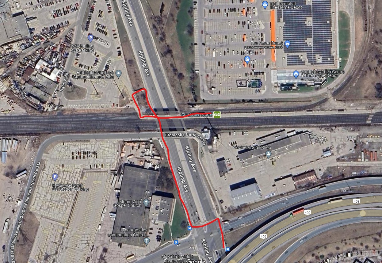
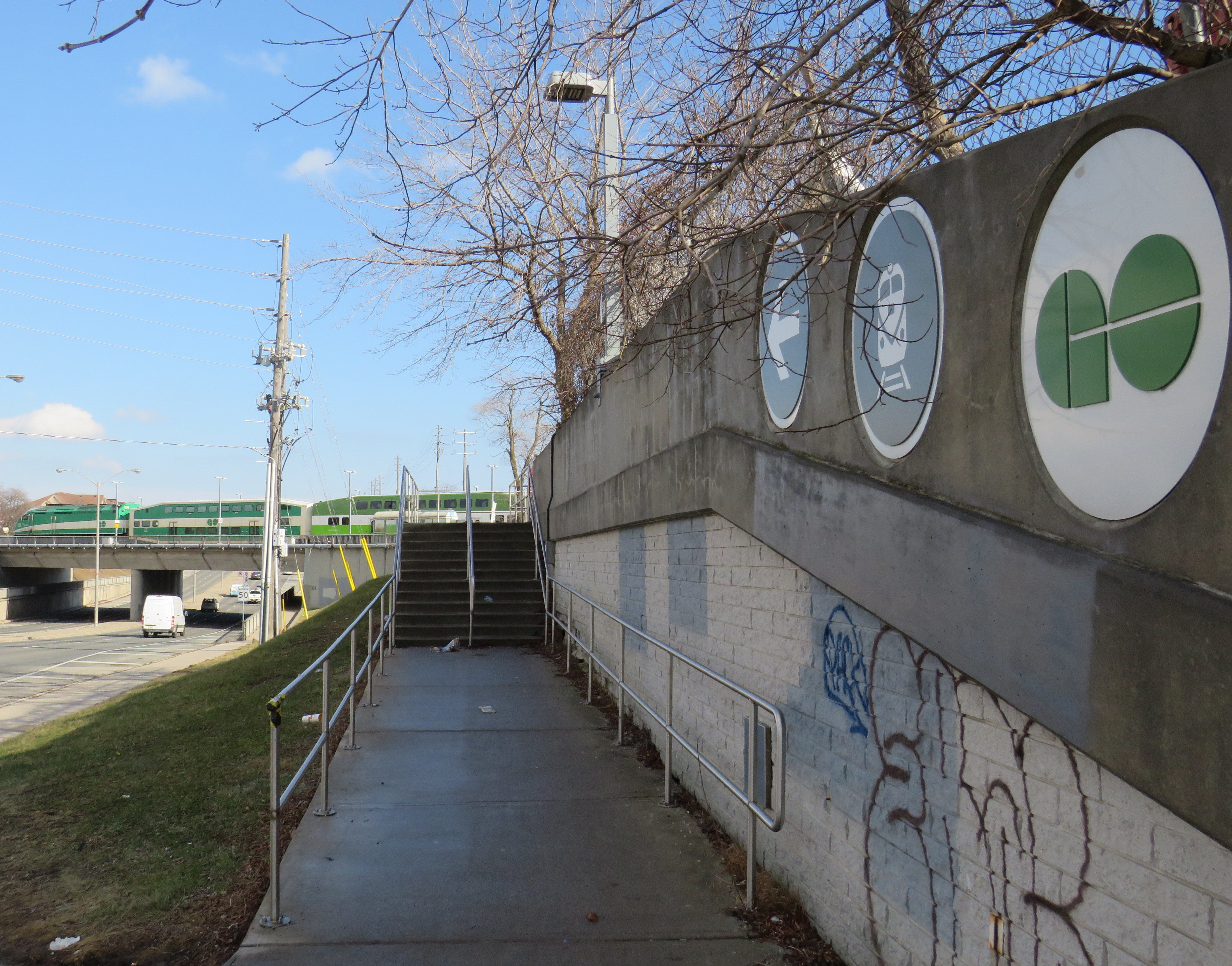
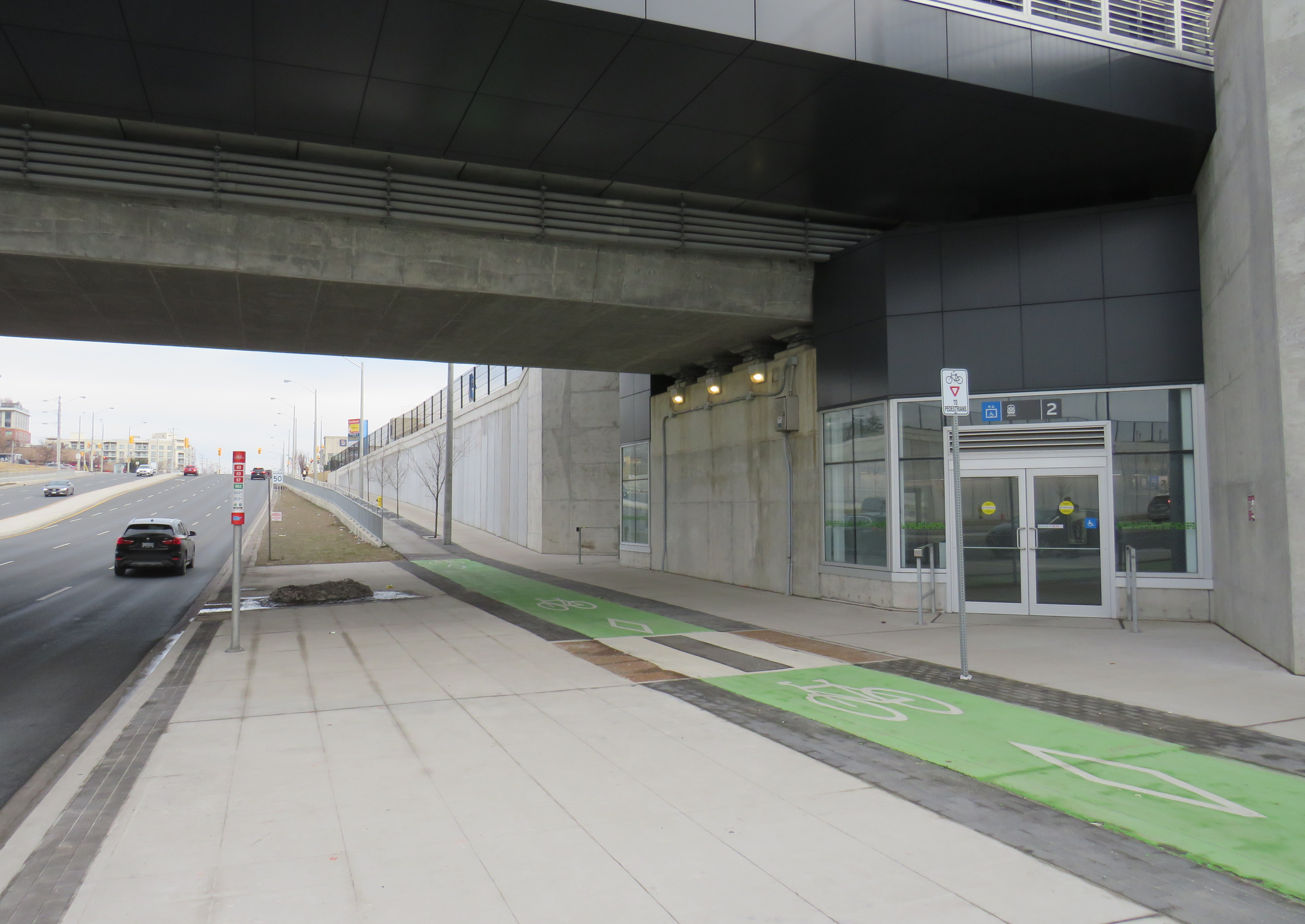
The worst GO-TTC connection: Etobicoke North
Red path shows walking route between northbound 45 Kipling bus stop and Etobicoke North GO platform
Etobicoke North station opened in 1974 as part of the Georgetown (now Kitchener) GO Line. The station and parking lot were built on Ministry of Transportation property and in a hydro corridor. Though the frequent 45 Kipling bus passes under the rail corridor, the transfer between bus and train requires crossing two sides of the busy Kipling/Belfield/Highway 409 off-ramp intersection, continuing on a narrow sidewalk, and climbing a flight of stairs before reaching the main walkway to the station platform. Though a passenger could save a lot of time by transferring to the train (especially as it now runs seven days a week), the long and uncomfortable transfer makes this very uninviting.
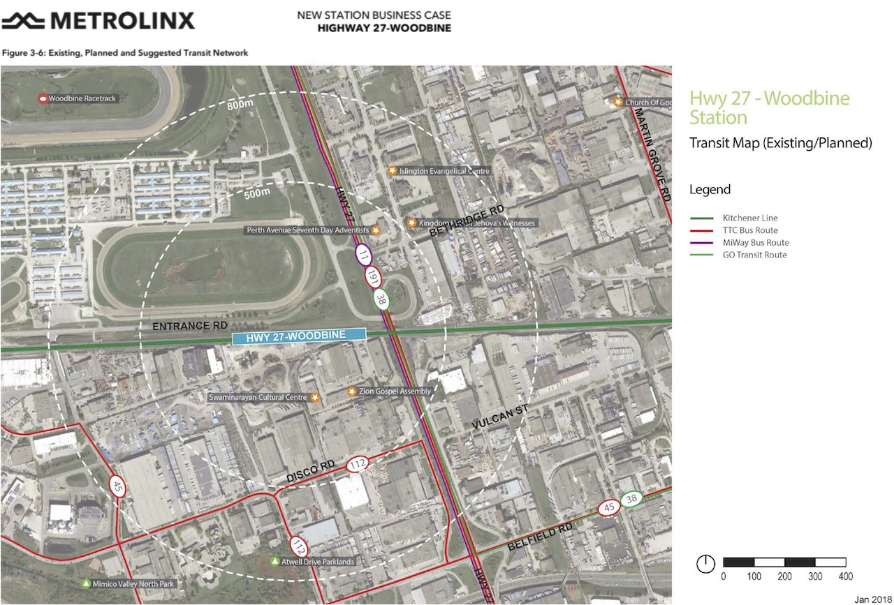
A new station at Woodbine Racetrack is proposed, but work has yet to begin. The station at Etobicoke North will eventually have to be closed and demolished to make way for track expansion required for 15-minute GO service. There’s an opportunity to build a great transit hub at Woodbine, especially with an extension of the Finch West LRT.
Metrolinx map of the potential Highway 27-Woodbine Station
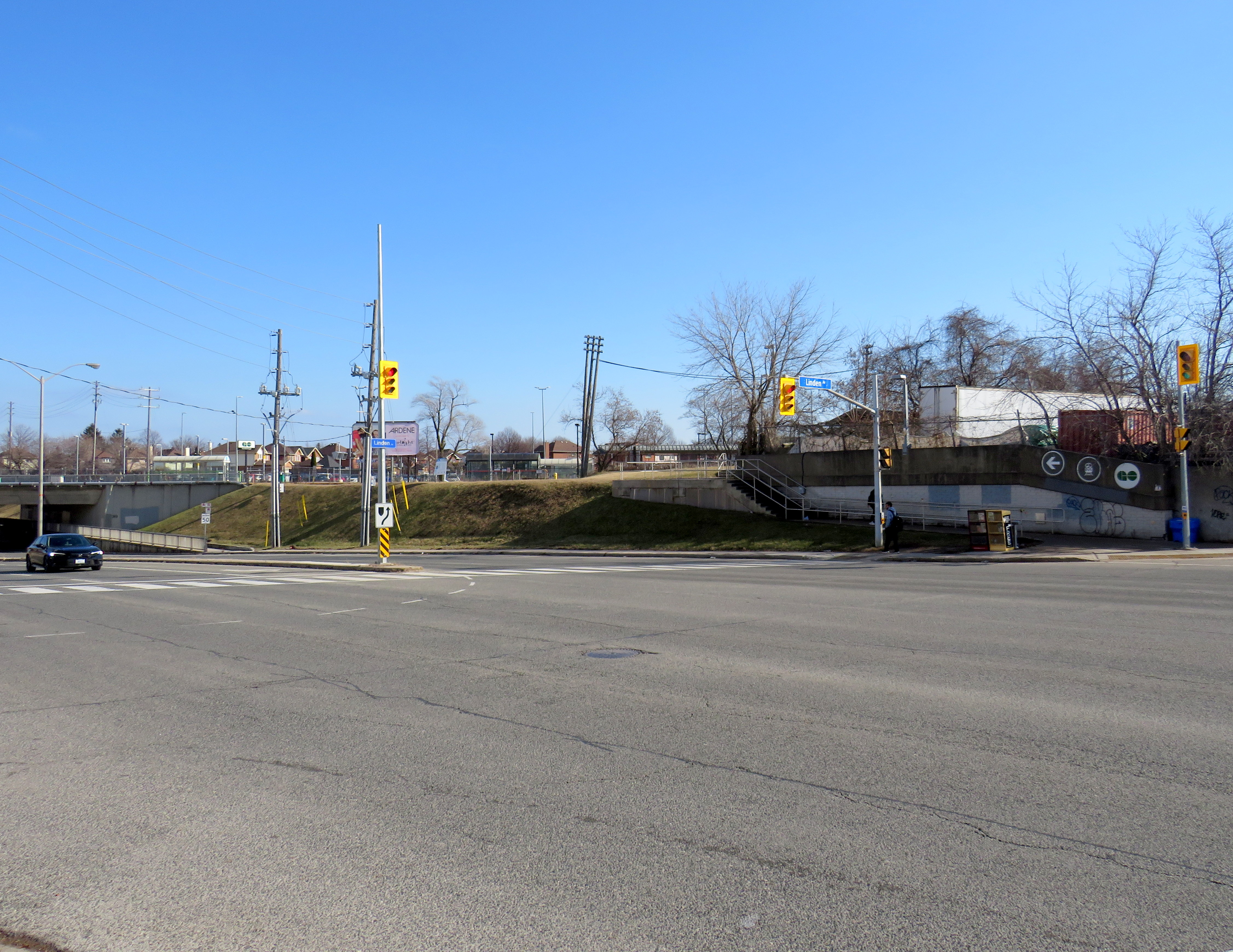
An accessibility failure: Scarborough GO
Scarborough GO Station, from St. Clair Avenue East
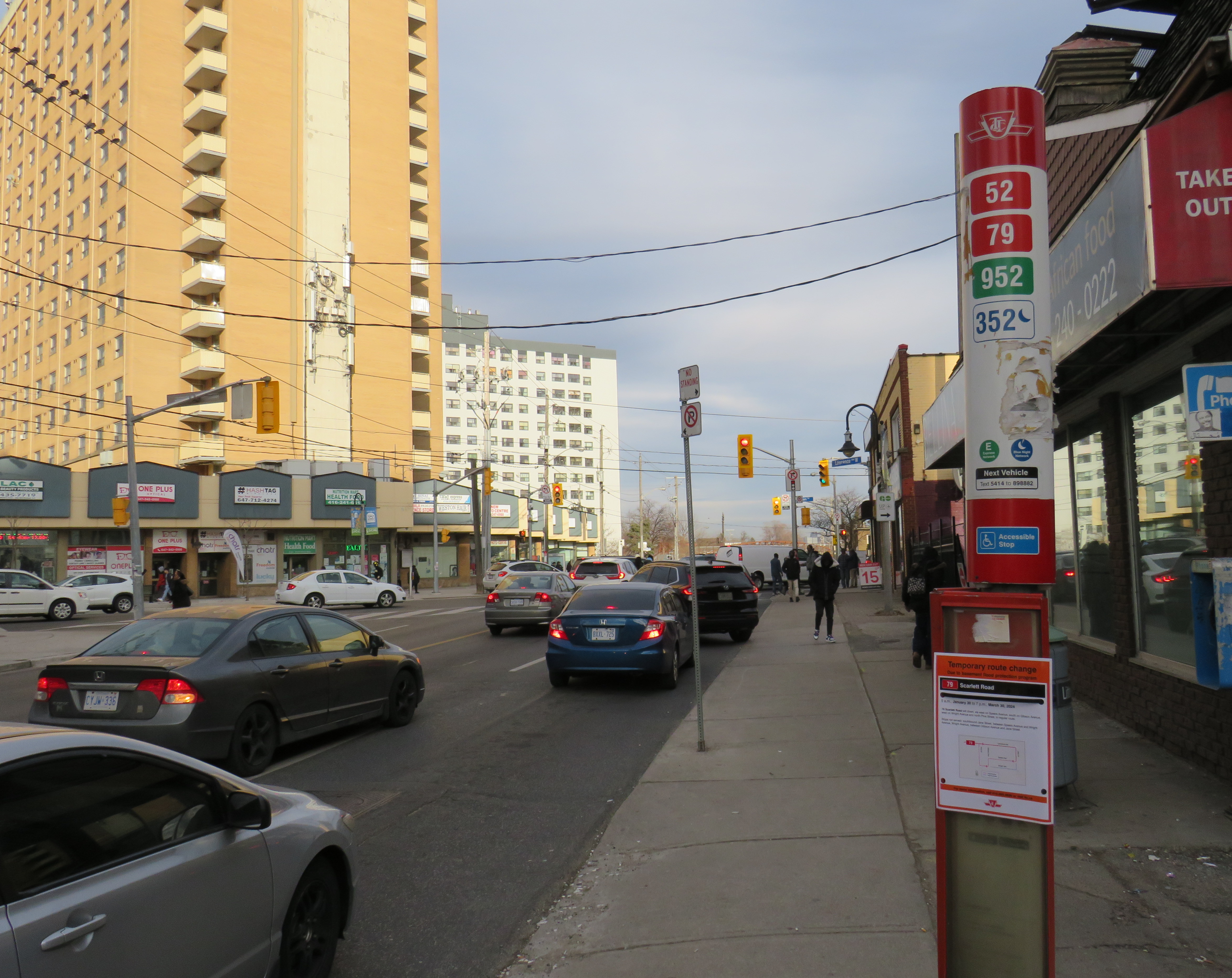
Scarborough GO Station, near St. Clair Avenue East and Kennedy Road, is located where the GO Stouffville Line splits off from the Lakeshore Line; the station was originally known as Scarborough Junction, as it was the point where the Midland Railway of Canada met the Grand Trunk Railway. (This is where Midland Avenue gets its name from.) The station building and parking lot is located on the south side of the tracks, accessible from Midland and Reeve Avenues. A walkway on the north side of the station leads to St. Clair Avenue East, but it involves several staircases and is not fully accessible to the street, where the 9 Bellamy and 102 Markham Road buses stop.
The Scarborough Junction Masterplan development proposal includes a new connection to St. Clair Avenue as part of a transit-oriented mixed-use community. It promises to better integrate GO and TTC services but will likely be several years before construction begins and even longer until a fully accessible connection is possible.
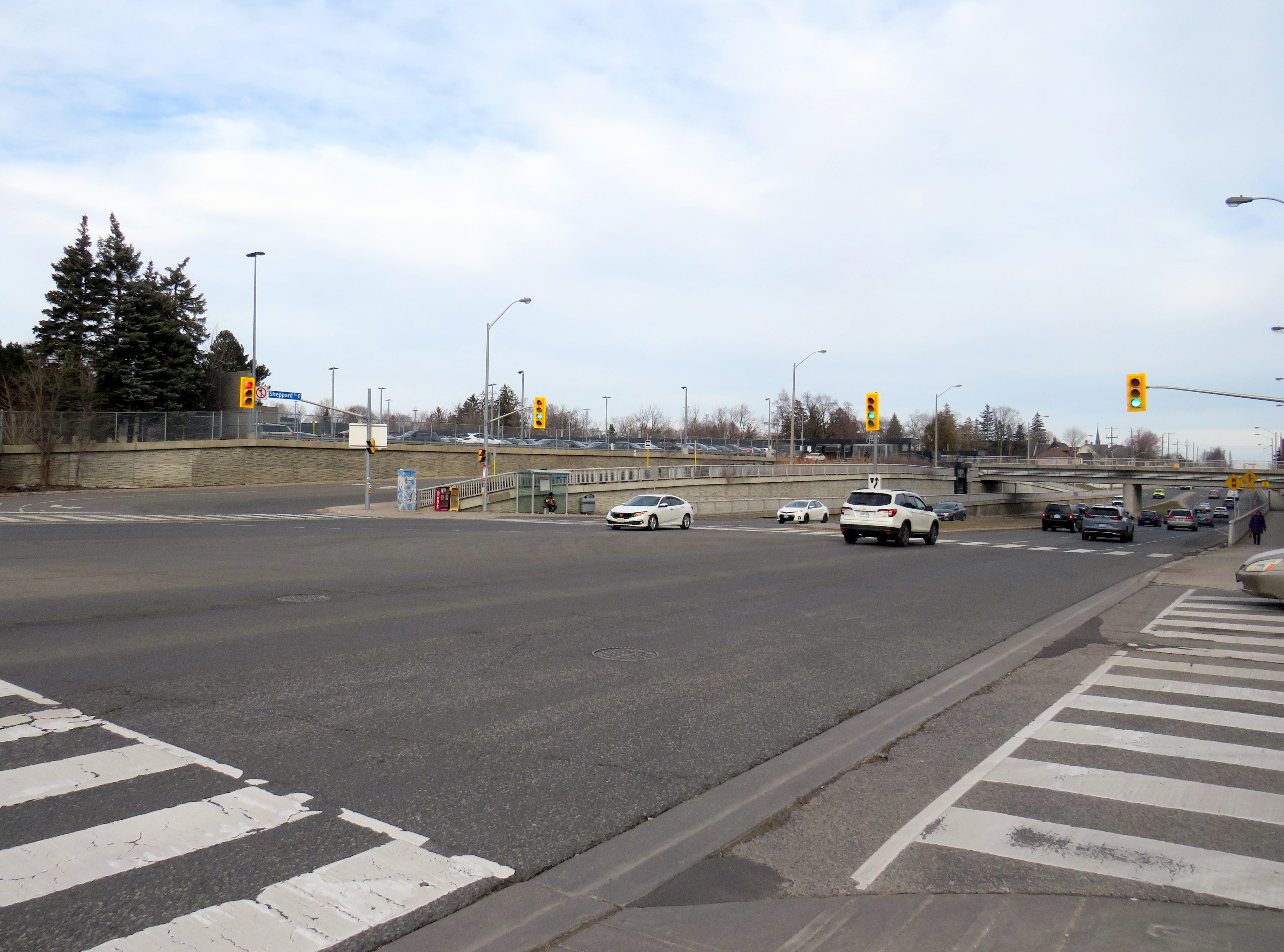
A more typical transfer: Agincourt GO
Agincourt GO Station, looking northeast from the south side of Sheppard Avenue East
Agincourt Station, in service since 1871, was taken over by GO Transit in 1982. The station building was always located several hundred metres north of Sheppard Avenue, and even in CN commuter rail days, featured a small parking lot. In 2012, an overpass was built separating Sheppard Avenue from the tracks; this allowed for a future Sheppard East LRT as well as train service expansion (a grassy median marks where the light rail line was planned to go). The TTC bus stops are located where the parking lot driveway exits onto Sheppard at a signalized intersection.
Unfortunately, the station platforms were not moved south on the overpass, reducing the walking distance between the train and bus stops and sidewalks on Sheppard Avenue. Though there’s a proper walkway between the TTC stops and the station itself, the station remains oriented mainly to the surface parking lot. Transfers are definitely possible, but not particularly easy.
The nearest eastbound TTC bus stop to Weston GO/UPX Station, located a five-minute walk to the east
Similar situations exist at Weston GO/UP Express station, where the TTC stops are several hundred metres away from the GO platforms at Weston Road and Lawrence Avenue, and at Oriole Station, where the walk from the GO platform to Leslie subway station is still unnecessarily lengthy and also requires crossing a busy intersection.
Milliken GO: A promising direction
A Steeles East TTC bus stops at Milliken GO Station
As part of the Stouffville Line corridor upgrades (which includes double-tracking the line between Scarborough Junction and Unionville) Milliken GO Station was recently rebuilt. It now features a new grade separation over Steeles Avenue, along with two new pedestrian overpasses on either side of the tracks. Though the station building is still oriented to the parking lot south of Steeles Avenue, the new layout provides excellent connections to buses on Steeles Avenue, including TTC routes 53/953 Steeles East, 43A Kennedy, and 57 Midland. Entrances on both sides of Steeles Avenue offer stairs and elevators to platform level.
TTC bus stop, separated bike lane, and access to GO trains
The one issue at Milliken Station — as with many GO stations — is that the wayfinding from platform level to TTC buses is completely missing. Ideally, signage should indicate not only the route to TTC buses, but the connecting bus routes as well.
Unfortunately, signage at Milliken Station does not indicate TTC bus connections
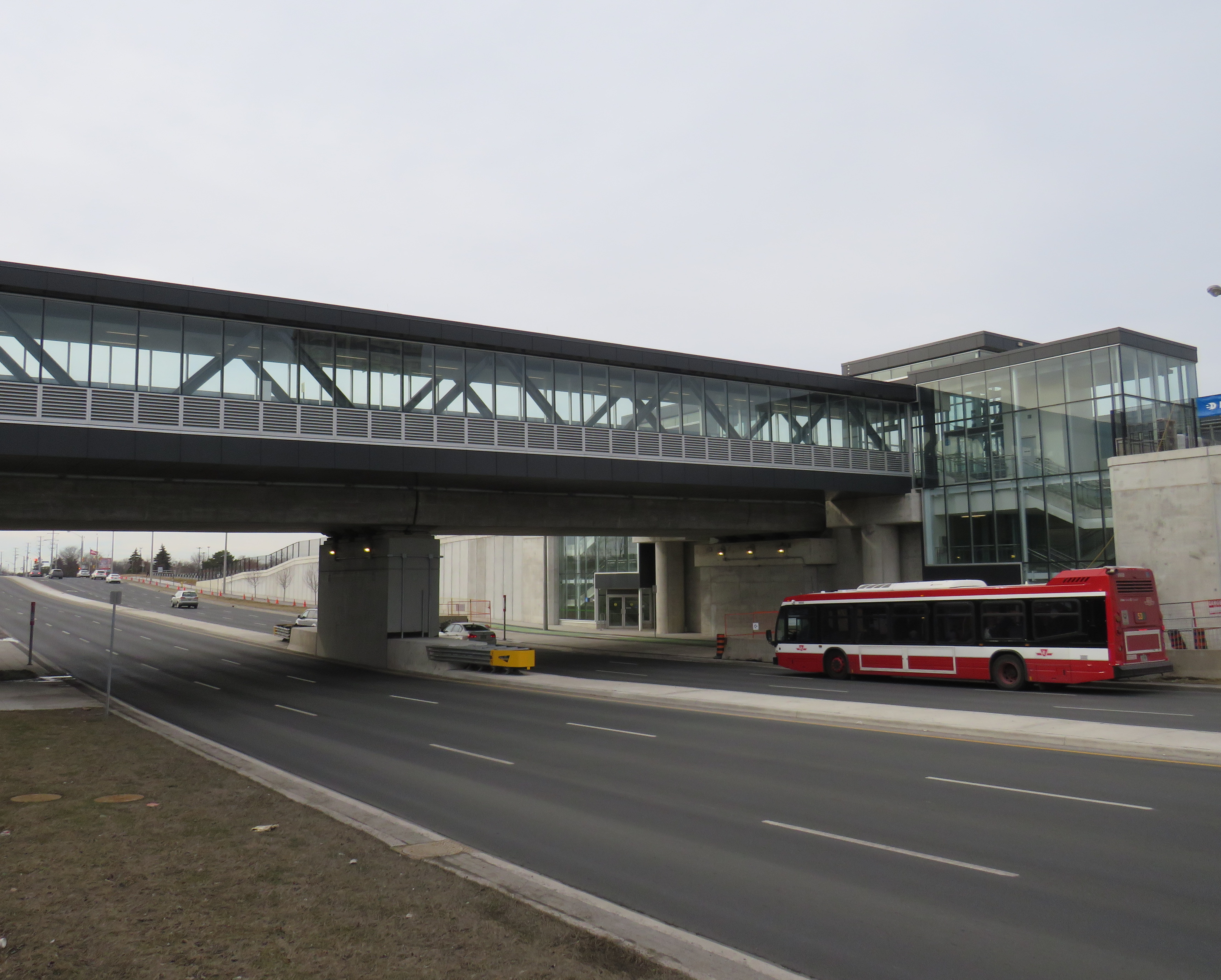
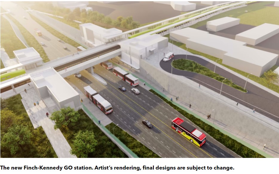
A new GO Station, nearly three kilometres to the south, will feature a similar layout. As platforms will extend over Finch Avenue, transfers between train and bus will be even more convenient at Finch-Kennedy as they are at Milliken. With minimal parking and optimized transit connections, this should be the norm as GO Transit transforms into a frequent, regional rail network. As of February 2024, preliminary work has started on the grade separation.
Rendering of the future Finch-Kennedy GO Station
Concluding thoughts
The new Ontario One Fare Program is a long-overdue step towards integrating the Greater Toronto and Hamilton Area’s disparate transit agencies and addressing unfair tariff boundaries at Steeles Avenue and elsewhere. It also recognizes GO Transit’s future as a regional rapid transit network that not only connects the suburbs to Toronto, but a solution to providing better transit within the city as well.
Most importantly, TTC-GO transfers should be simple, easy, and direct. Happily, there is some momentum to making this happen — Downsview Park Station, opened in December 2017, is a great example of physical integration between GO and TTC — but as shown above, there is much work to be done.
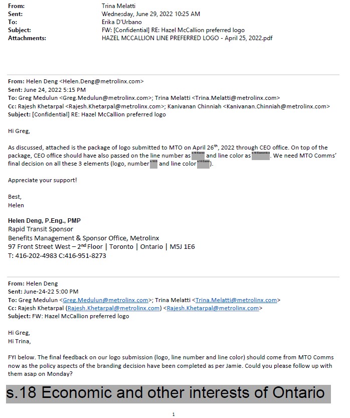
Though much of the information I received was redacted, I was able to learn that the Cities of Brampton and Mississauga had already come up with a brand for the new transit line. Metrolinx and the provincial government had to reimburse them for the costs once the Minister of Transportation intervened to force a new name upon the project, which cumulated with a love-in photo op on February 14, 2022.
Among the information redacted in the information package sent to me, six months after my initial Freedom of Information request, was the LRT line’s colour and number. They were redacted under Section 18(1) of the provincial Freedom of Information and Privacy Protection Act, citing economic and other interests of Ontario.
Redacted line colour, number, and logo
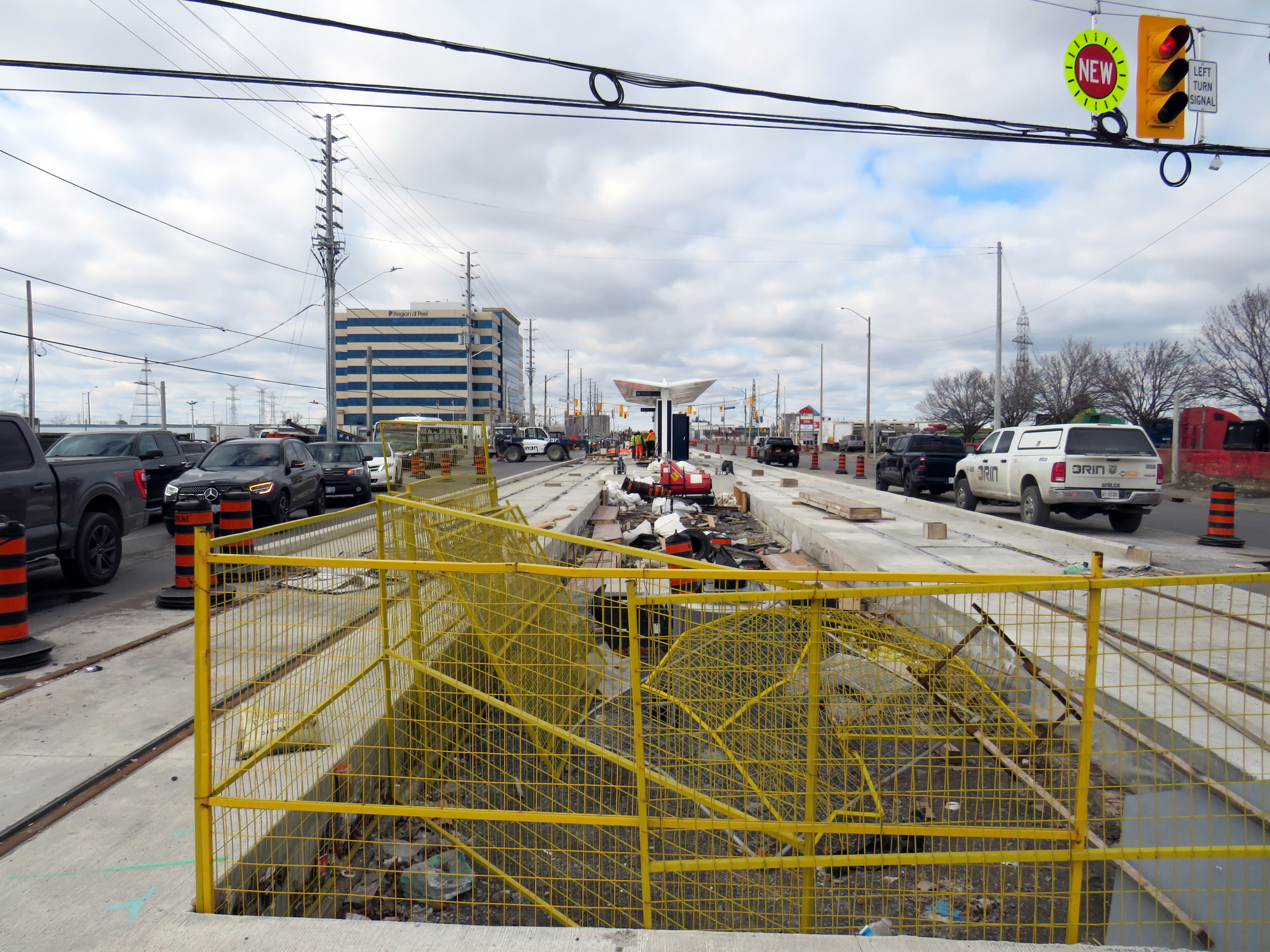
At Derry Road, though, the secret is out. The Hurontario Line will be Line 10, represented by a bright blue colour similar to the former Line 3 Scarborough RT.
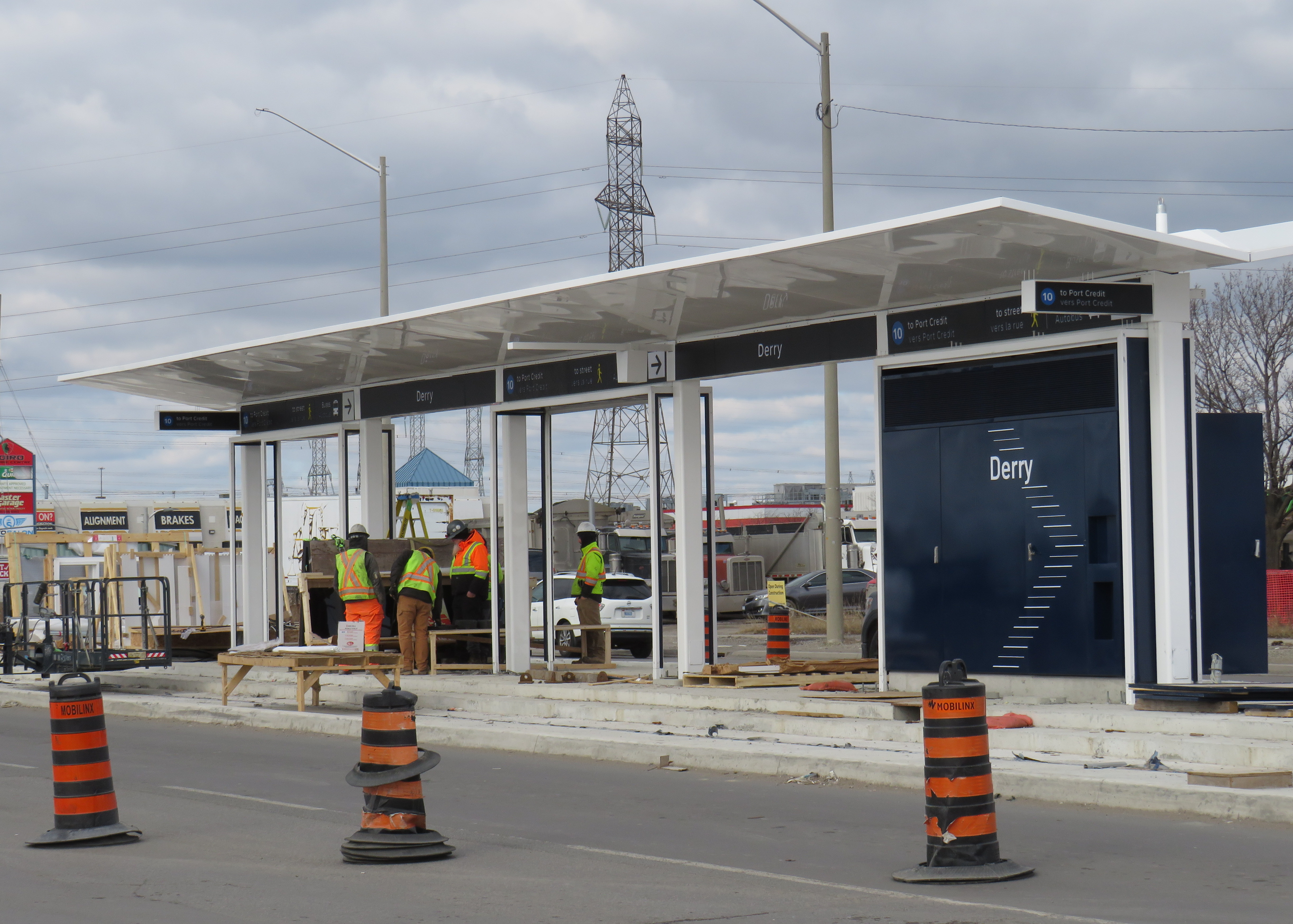
Derry LRT station under construction
Line 10 is a good choice for this corridor. Hurontario Street and Main Street through Mississauga and Brampton used to be part of provincial Highway 10, which was later bypassed by Highway 410 and downloaded to the two cities between the 1980s and the 2000s. It will also be the first Metrolinx-managed rapid transit project completely outside the City of Toronto, where Lines 1 through 6 are already assigned to the existing subway and the Eglinton-Crosstown and Finch West LRTs (with Line 3 reused for the Ontario Line when it opens).
Brampton Transit and Miway currently operate bus services with that route number (10 South Industrial and 10 Bristol-Britannia), but those should be easy to change in advance of the LRT’s opening, which will take place in late 2025 or early 2026, given the construction progress so far.
I remain puzzled and somewhat annoyed that this information was kept secret, and for what reasons. Revealing a line number and colour in a freedom of information request should not have been important. If it was to protect for another government photo opportunity, then that is now moot. Who is the Hurontario LRT for? The Doug Ford-led provincial government, or the people who will ride it?
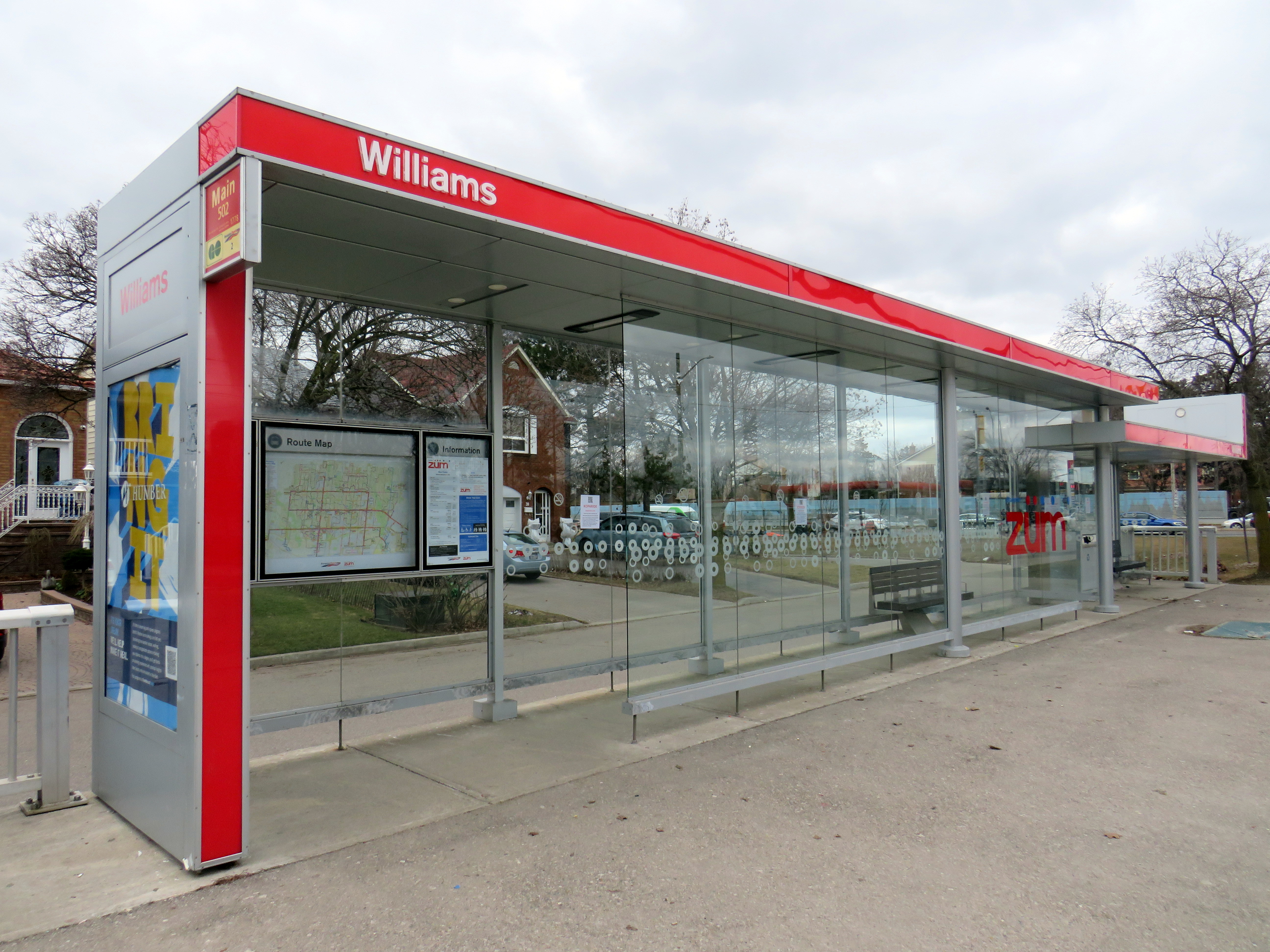
Finally, I note that like the shelters going up for the Finch West LRT and the surface stops of the Eglinton LRT, there is very little protection from the elements at the Hurontario LRT stops, with only a canopy and a single wall supplying shade and cover from the rain or snow. Compare the Derry Road LRT stop with older Brampton Züm shelters, which include enclosed waiting areas, benches, and even winter heating.
Brampton Züm stop with full glass enclosure, benches, and a button to activate a heater in the winter
One more thing…
To my longtime followers as well as my occasional readers, thank you for your interest and support. Last year’s FOI request cost me $525.00. Sadly, freedom of information isn’t free. If you like my work and want to contribute to my online mapping and webhosting costs, please consider buying me a coffee.
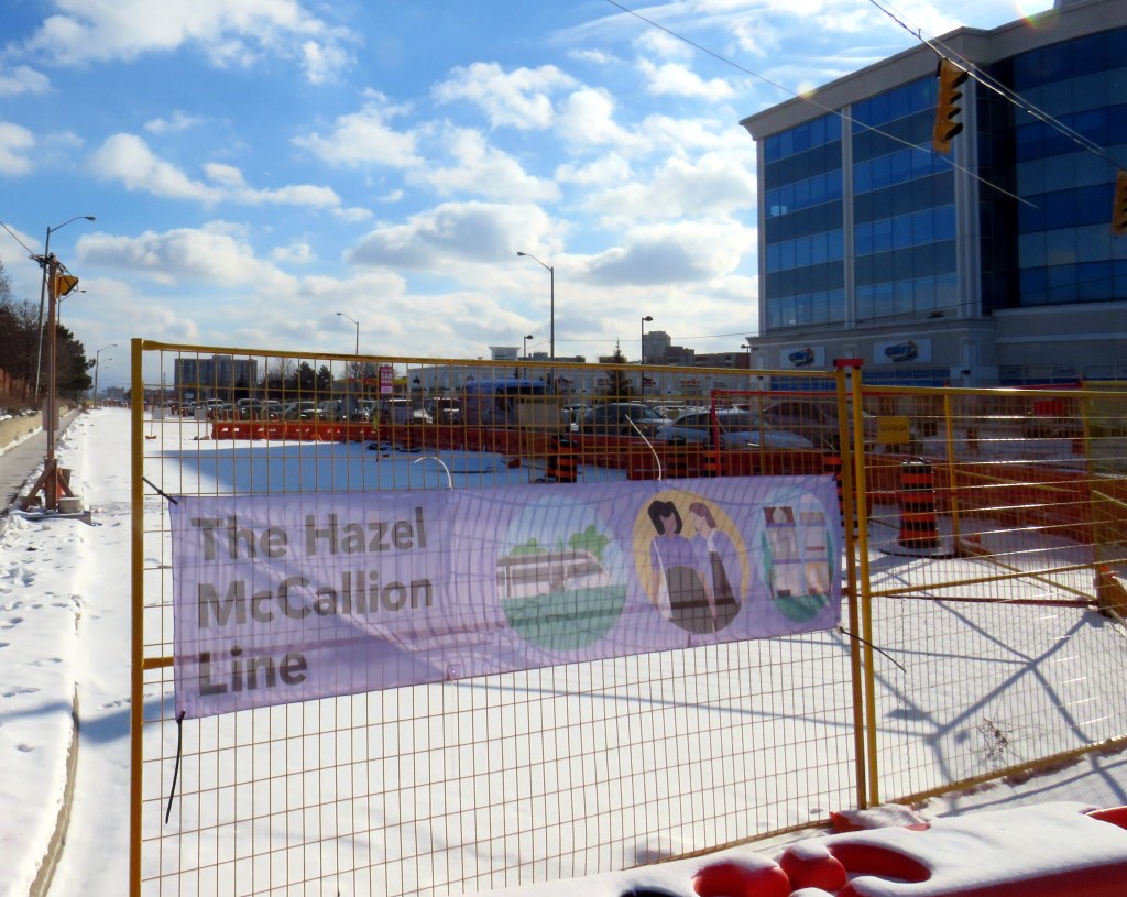
Banner promoting “The Hazel McCallion Line” on Hurontario Street in Brampton, January 2024
Previously on this website, I wrote about the renaming of two GO Transit stations: Oshawa and Brampton. I explained why renaming transit infrastructure is problematic, especially when they violate wayfinding standards, which call for simple, accurate, unique, and self-locating names.
Both GO Transit stations were renamed by provincial agency Metrolinx, on behalf of the provincial government. Metrolinx operates GO Transit buses and trains, the UP Express airport link, administers the Presto fare payment system, and oversees the construction of new rapid transit projects in the Greater Toronto and Hamilton Area. The Hurontario LRT, which is currently under construction between Port Credit GO Station in Mississauga and Steeles Avenue in Brampton, is just one of many transit projects managed by Metrolinx.
On February 14, 2022, at Cooksville GO Station, Premier Doug Ford, then Transportation Minister Caroline Mulroney, then Mississauga Mayor Bonnie Crombie, and Metrolinx CEO Phil Verster joined former Mississauga mayor Hazel McCallion announcing the name change from the Hurontario LRT to the Hazel McCallion LRT. The occasion also marked McCallion’s 101st birthday.
Hazel McCallion with Metrolinx CEO Phil Verster, February 14, 2022 (Metrolinx photo)
This is the first rapid transit line in North America to be named for a person, contradicting established standards for transit projects.1 Though McCallion was a formidable and popular mayor whose political career spanned seven decades, she was also very close to the Ford government in the last few years of her life. She also had many other public facilities named in her honour — a senior public school in Mississauga’s Streetsville neighbourhood, the library at University of Toronto’s Mississauga campus, the City of Mississauga’s central public library, a walkway leading to Square One Shopping Centre, and the Mississauga campus of Sheridan College. There is also the Hazel McCallion Auditorium at Mississauga Valley Community Centre and the Hazel McCallion Hall at Vic Johnston Community Centre. There was no need for yet another civic asset to be renamed for her.
In Toronto, most former mayors have just one public asset named for them: David Crombie, Art Eggleton, June Rowlands, and Barbara Hall have parks dedicated in their honour. Mel Lastman — mayor of North York for 24 years before being elected mayor of amalgamated Toronto for another six — and Nathan Phillips have major public squares.2 In Mississauga, there was no need to rename yet another piece of civic infrastructure for the same person.
Furthermore, there was no public consultation about the name change — even officials at the cities of Brampton and Mississauga were kept in the dark — while the name itself contravenes Metrolinx’s own naming conventions.
In July, 2023, I submitted an access to information request to Metrolinx, the second time I went through the freedom of information process to find out more about the light rail transit project. There were several delays, and I did not receive my requested documents and communications until late January 2024.
A deep dive into the background of the Hurontario LRT project, the person it is being renamed for, and my findings and impressions follow.