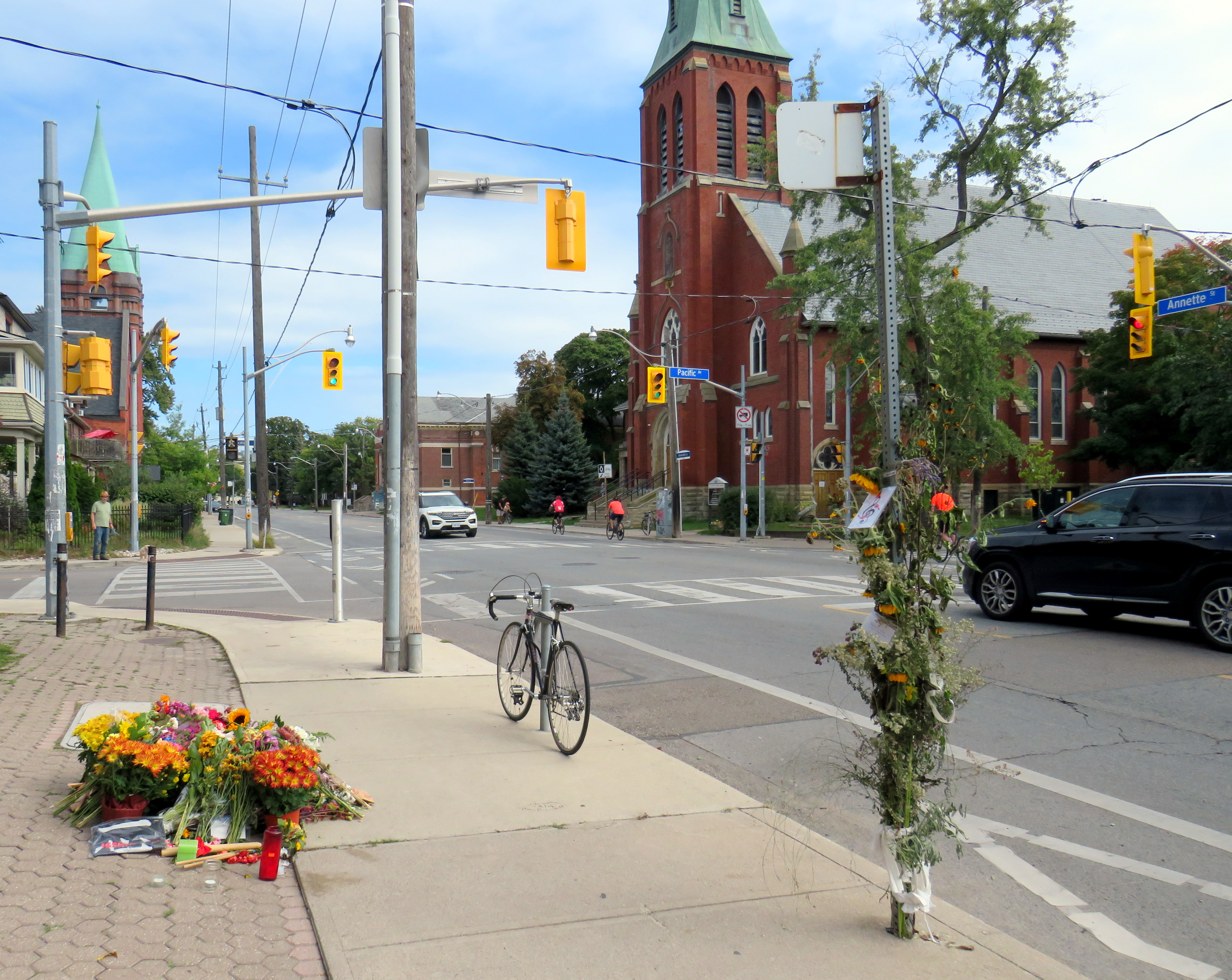
On Monday, September 23 at 8:06 PM, the driver of a 2024 Hyundai Elantra sedan travelled north on Pacific Avenue. The driver of a 2017 Hyundai Tucson crossover SUV drove west Annette Street. The two vehicles collided in the intersection with enough force that the Tucson continued into the sidewalk on the northwest corner, striking two pedestrians. A man, aged 50, was injured and taken to hospital. Julia Cleveland, 46, died at the scene.
As of Thursday, October 3, charges have yet to be laid.
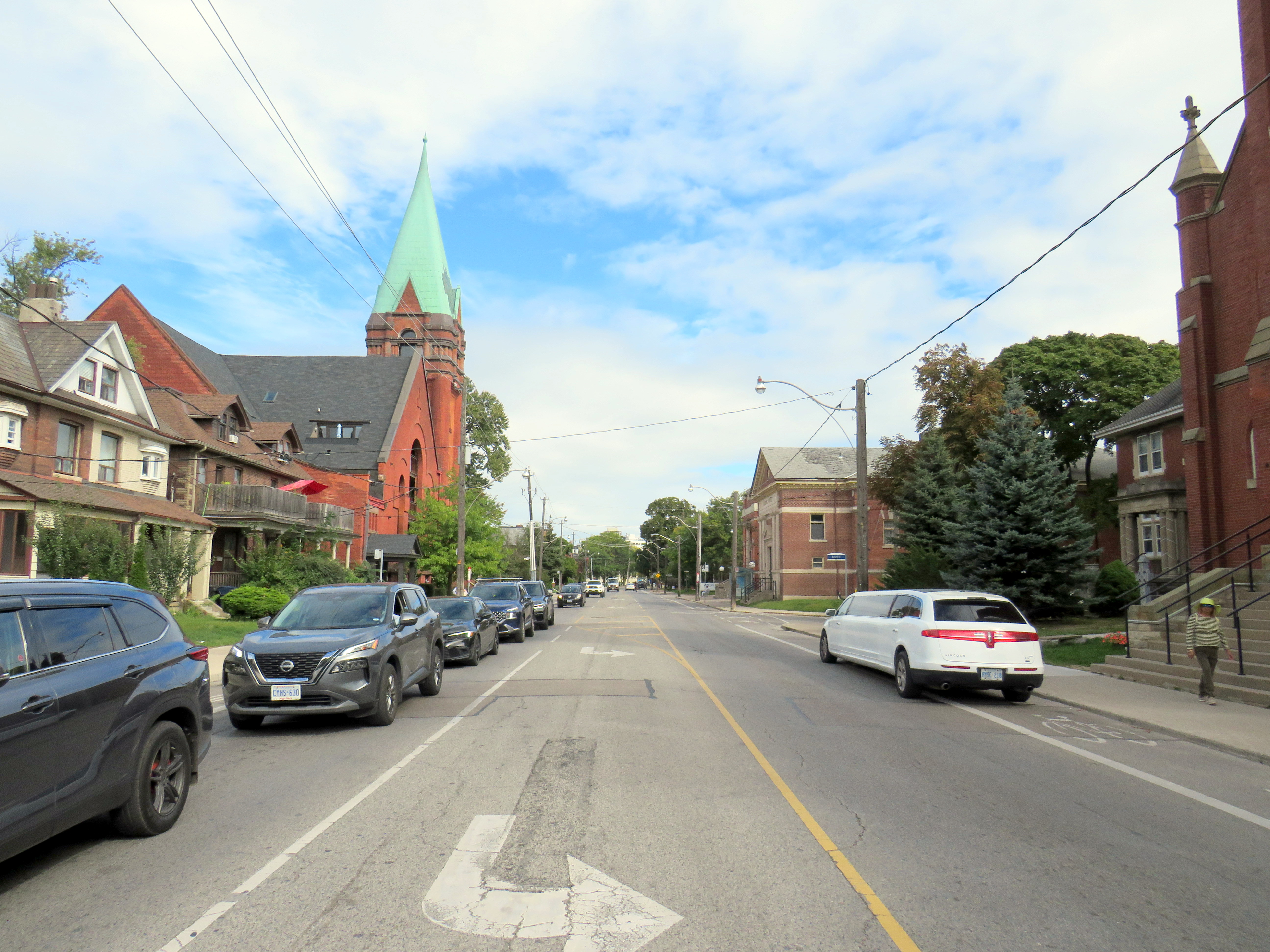
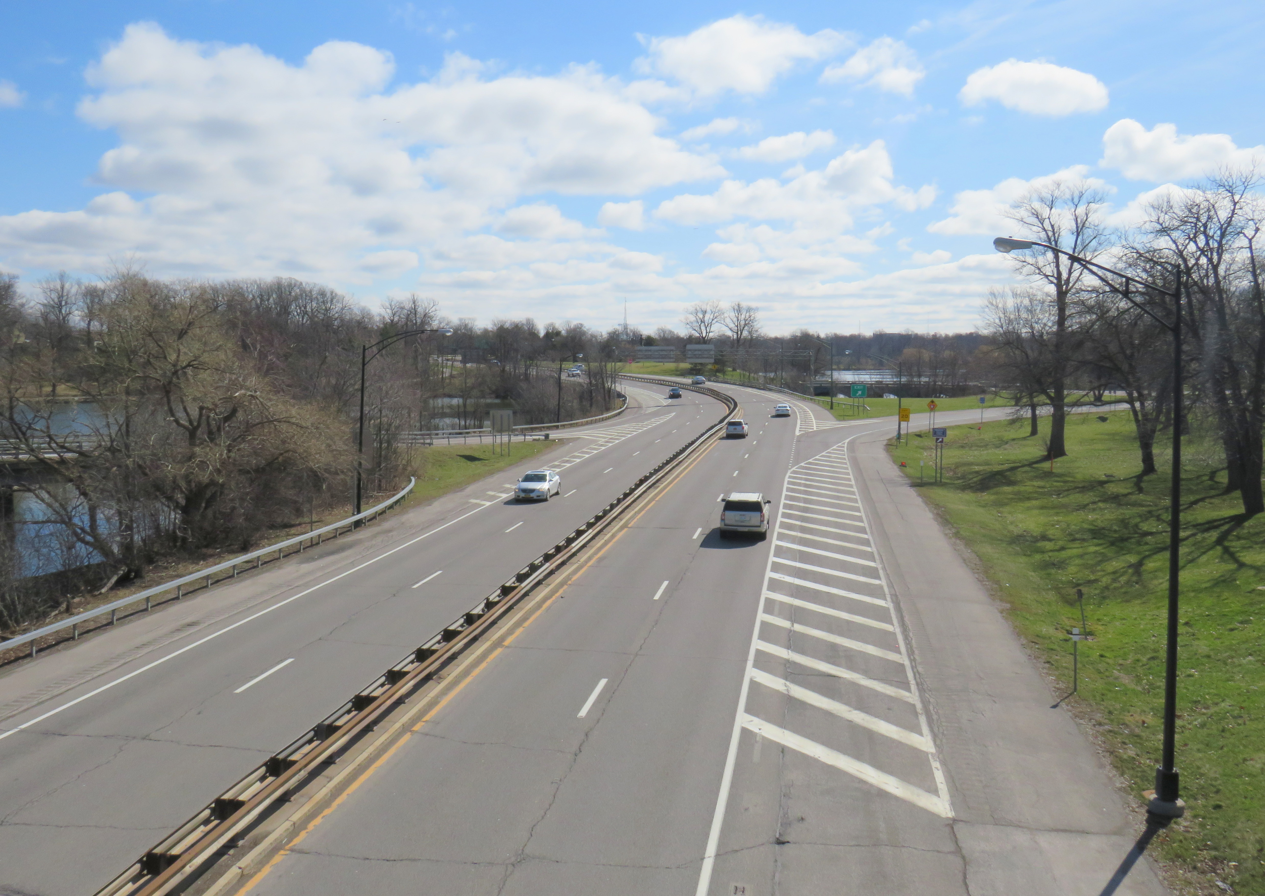
Looking west on Annette Street towards Pacific Avenue
On Saturday, September 29, I paid a visit to Annette and Pacific. A roadside memorial of flowers, cards, and tributes were laid next to the sidewalk where she and a fellow pedestrian were struck. I also took note of the streetscape, the surroundings, and driver behaviour on a Saturday afternoon.
While at the intersection, I observed many examples of distracted, aggressive and inconsiderate driving, as the video compilation depicts. Drivers intentionally drove through stale amber and solid red lights, blocked crosswalks, and swerved around slower vehicles. These motorist behaviours are commonplace.
Video shows driver behaviour at Annette Street and Pacific Avenue
I also noted many pedestrians and cyclists. There’s a No Frills grocery store on Pacific Avenue between Annette and Dundas. Two blocks east, there’s a Toronto Public Library branch. There were several families with young children, as well as older pedestrians.
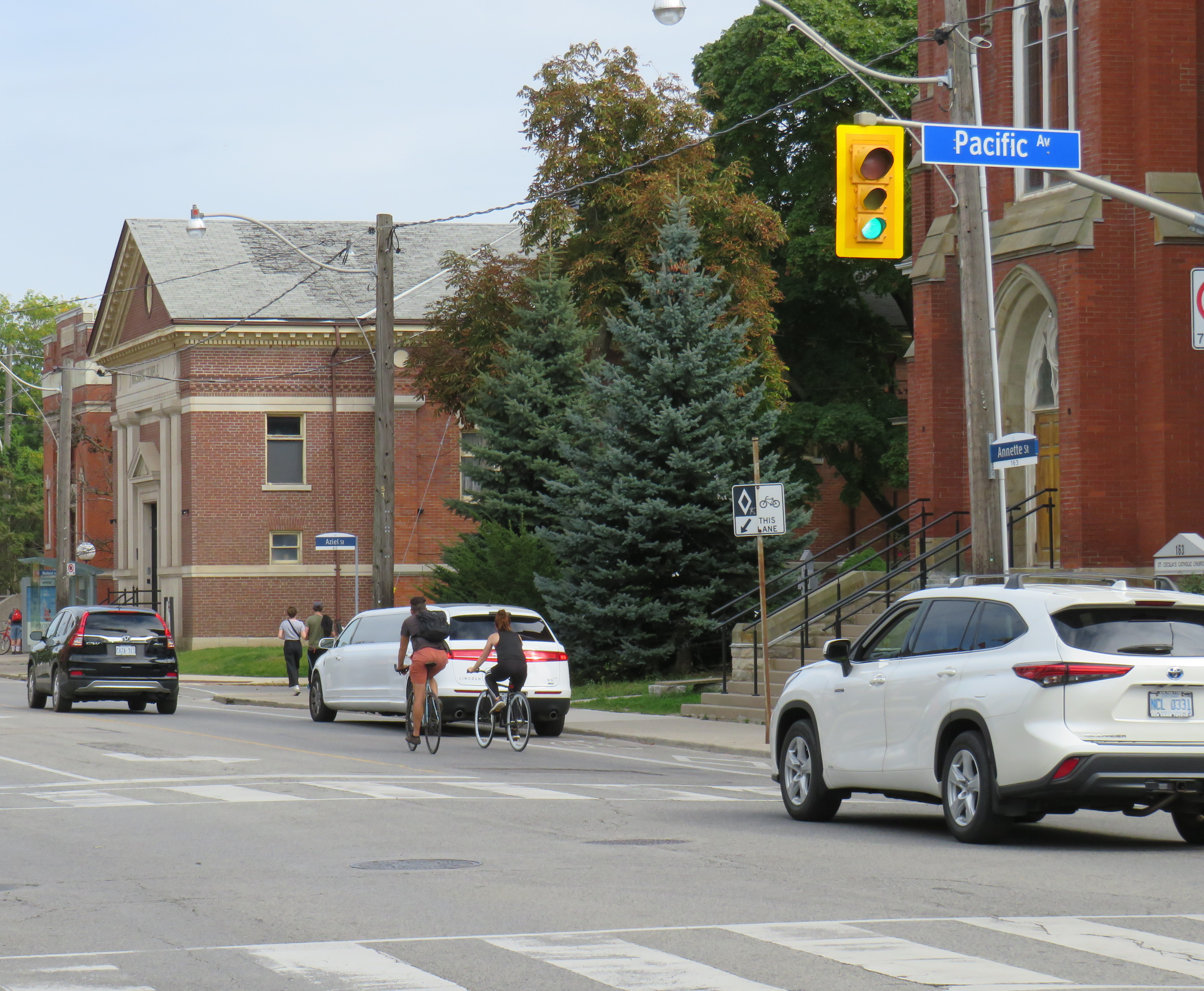
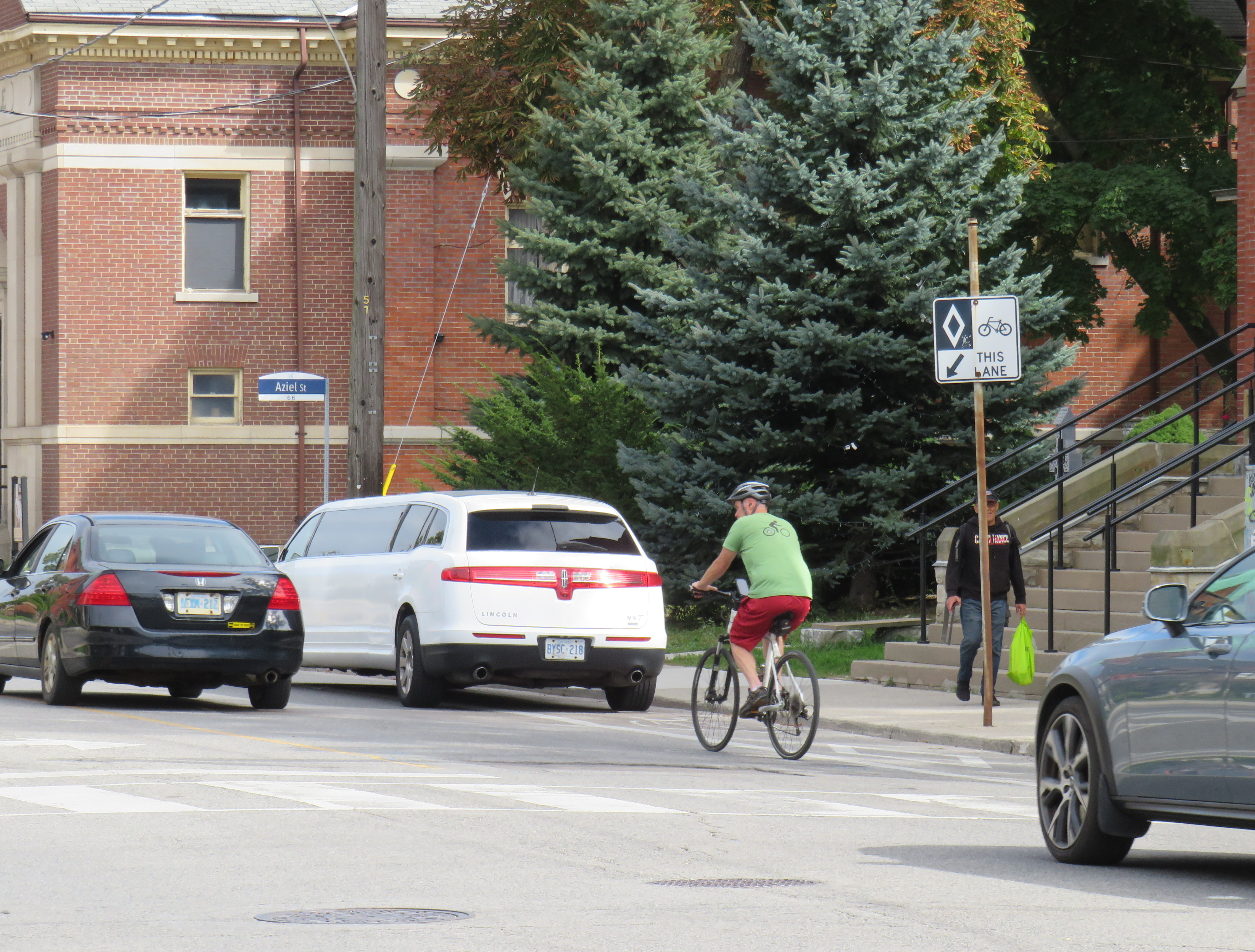
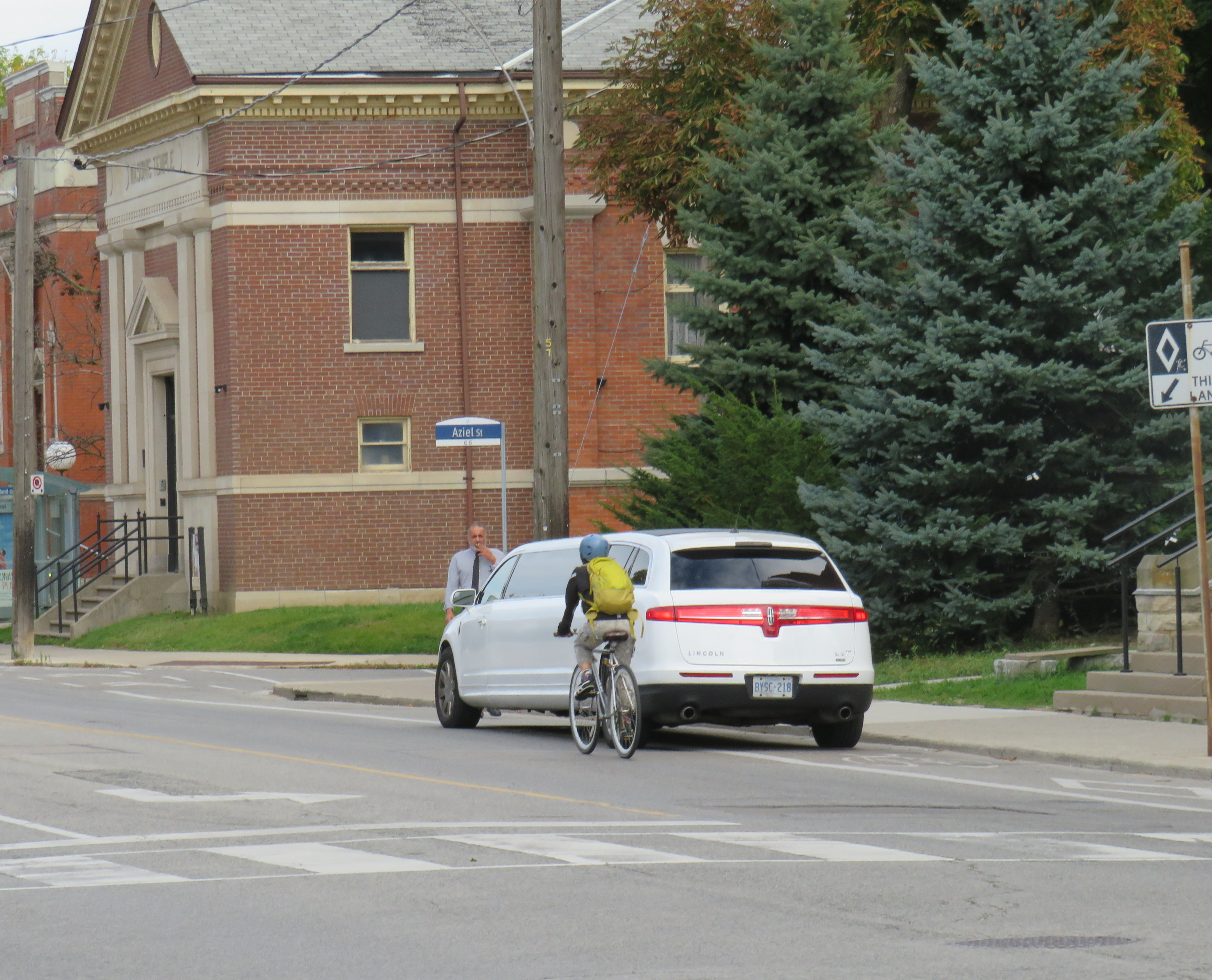
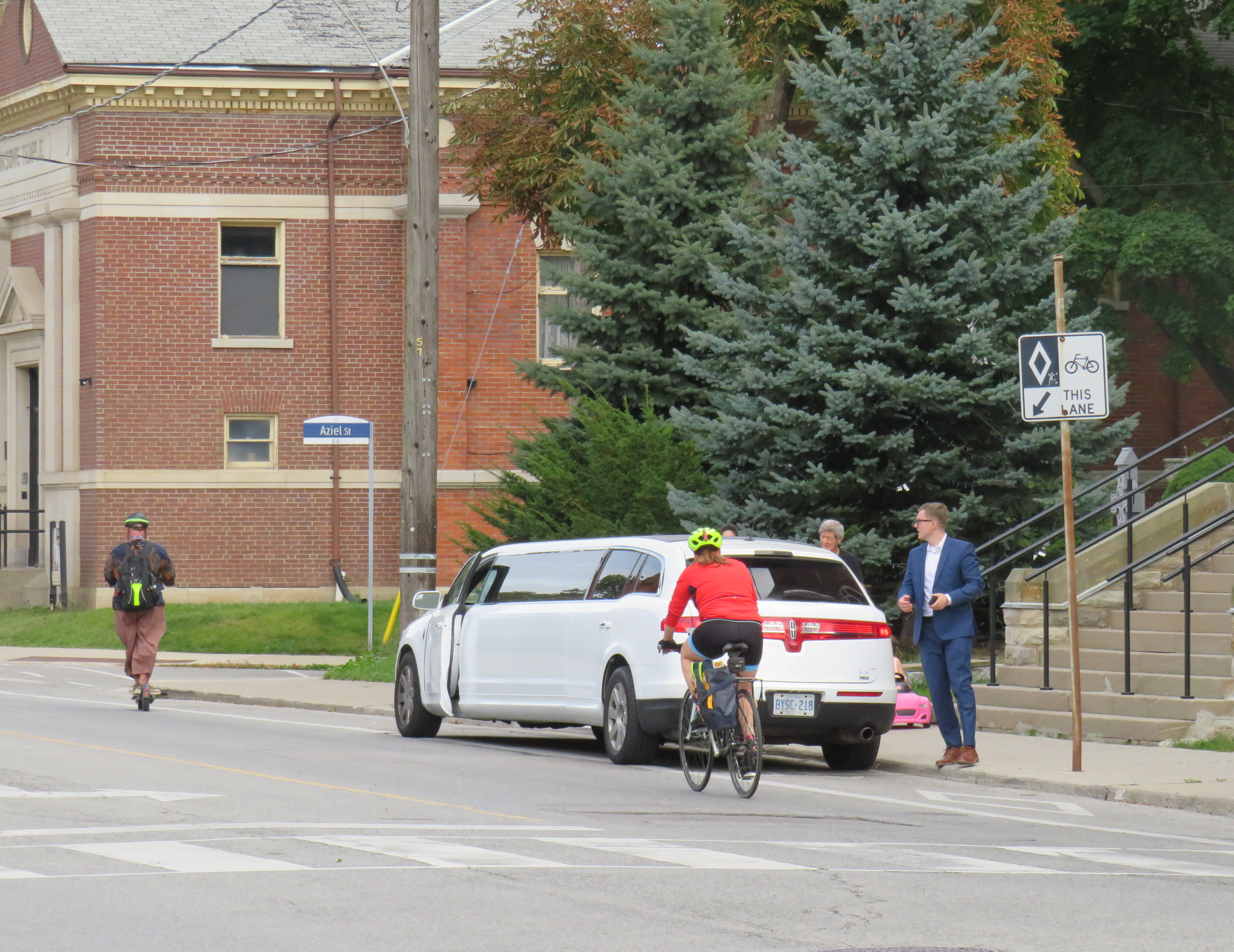
In 2008, Annette Street was reconfigured from a four-lane cross-section to include bike lanes and centre left turn lanes. Though it is a busy east-west cycling route, connecting to bike lanes on Dupont Street and Runnymede Road, the lanes are unprotected and are only marked with solid white lines and signage. The limited protection offered to cyclists was made clear when a stretch Lincoln limousine pulled out front of St. Cecilia’s Catholic Church and idled in the bike lane for over 30 minutes. Though the driver was likely waiting out front for a wedding party to emerge, I noted at least two dozen cyclists forced to merge into traffic to get around it.
Cyclists merging around a limo idling in the unprotected bike lane
The intersection itself offers minimal protection to pedestrians. Sidewalks are flush against the roadway, with very shallow curbs. There are unnecessarily wide turning radiuses at intersections. On the northwest corner of Pacific and Annette, there are metal bollards, but they are positioned to protect the small apartment building, not the sidewalk itself.
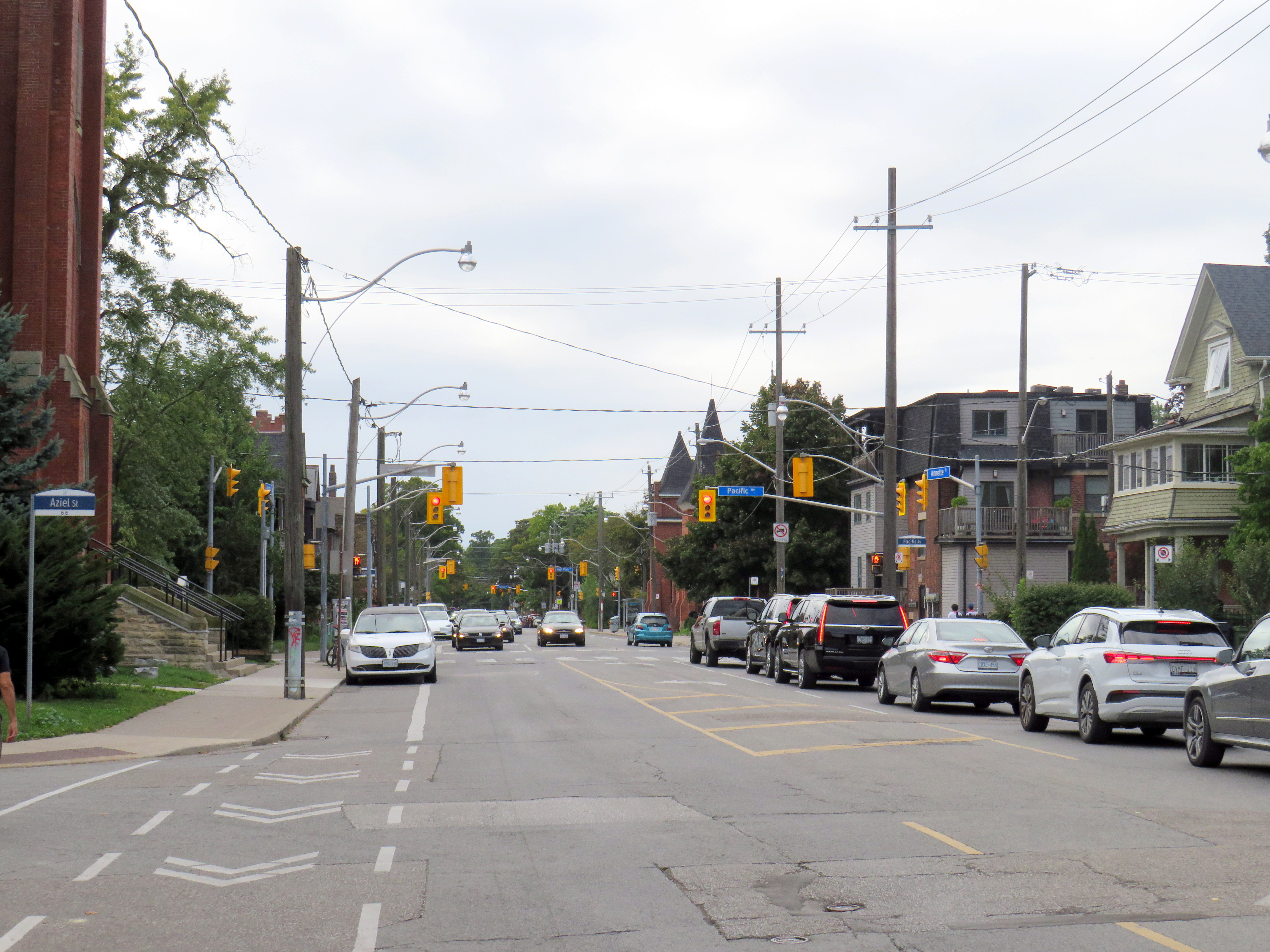
Looking east on Annette from Pacific Avenue. On the right is St. Cecilia’s Catholic church, beyond is a masonic lodge and a Toronto Public Library branch
Annette and Dupont Streets make up a useful bypass around traffic on Bloor Street to the south. There are three blocks between Pacific Avenue and the first traffic signals to the east, at Keele Street. To the west, however, there are traffic signals at the next three intersections: at High Park Avenue, Quebec Avenue, and Clendenan Avenue. Motorists might be tempted to speed through amber and red signals. Without better protection — protected bike lanes, for example, pedestrians and cyclists are especially vulnerable. Despite the 2008 road diet, the roadway has not been significantly altered.
A few days later, on Wednesday, October 2, there were two more collisions in which drivers struck pedestrians at signalized intersections, at Avenue Road and Davenport Road in Midtown Toronto, and at Islington Avenue and Finchley Road/Odell Avenue in central Etobicoke.
At Avenue and Davenport Roads, a pedestrian was struck when the drivers of three cars collided. One vehicle, a Mercedes-Benz SUV, stopped on the sidewalk after hitting a concrete pole.
Pedestrian seriously injured at Avenue Road and Davenport. Road safety improvements on Avenue Road are scheduled to start soon, which unfortunately was not soon enough to prevent another injury. Via@ARSCSafetyhttps://t.co/CspQr8isoZpic.twitter.com/MqppOVd2PV
In Etobicoke, a family of five were struck by a left-turning motorist turning from Finchley Road south onto Islington Avenue. The driver, a 77-year old woman likely visually impaired by the late afternoon sun, hit the family; the entire family — including a one-month old baby — were sent to hospital with serious injuries, while the mother was sent to a trauma centre with life-threatening injuries. Traffic signals were installed there in 2022 to help pedestrians cross Islington Avenue. Despite the new signals, locals continue to complain of drivers rushing the lights.
The problem on Toronto’s roads isn’t simply an engineering one, though protected bike lanes and physical traffic calming measures on Annette Street likely would have prevented Julia Cleveland’s death. Aggressive driving, including speeding, sudden lane changes, and red light running, along with distracted driving is increasingly a problem in Toronto and across the region. Engineering changes can help curb speeds, but there needs to be more done to rein in dangerous behaviour. That means more automated enforcement (red light and speed cameras) but also active enforcement to curb dangerous driving.
On Friday, May 10, Mississauga City Councillor and mayoral candidate Dipika Damerla posted a message and video on Twitter/X, stating that “it will be up to the residents to decide on who best represents the vision of the Mississauga they want.” She followed that by saying that she “will not be silenced in my opposition to remove two lanes from Bloor Street and create more gridlock in Mississauga.”
It will be up to the residents to decide on who best represents the vision of the Mississauga they want.
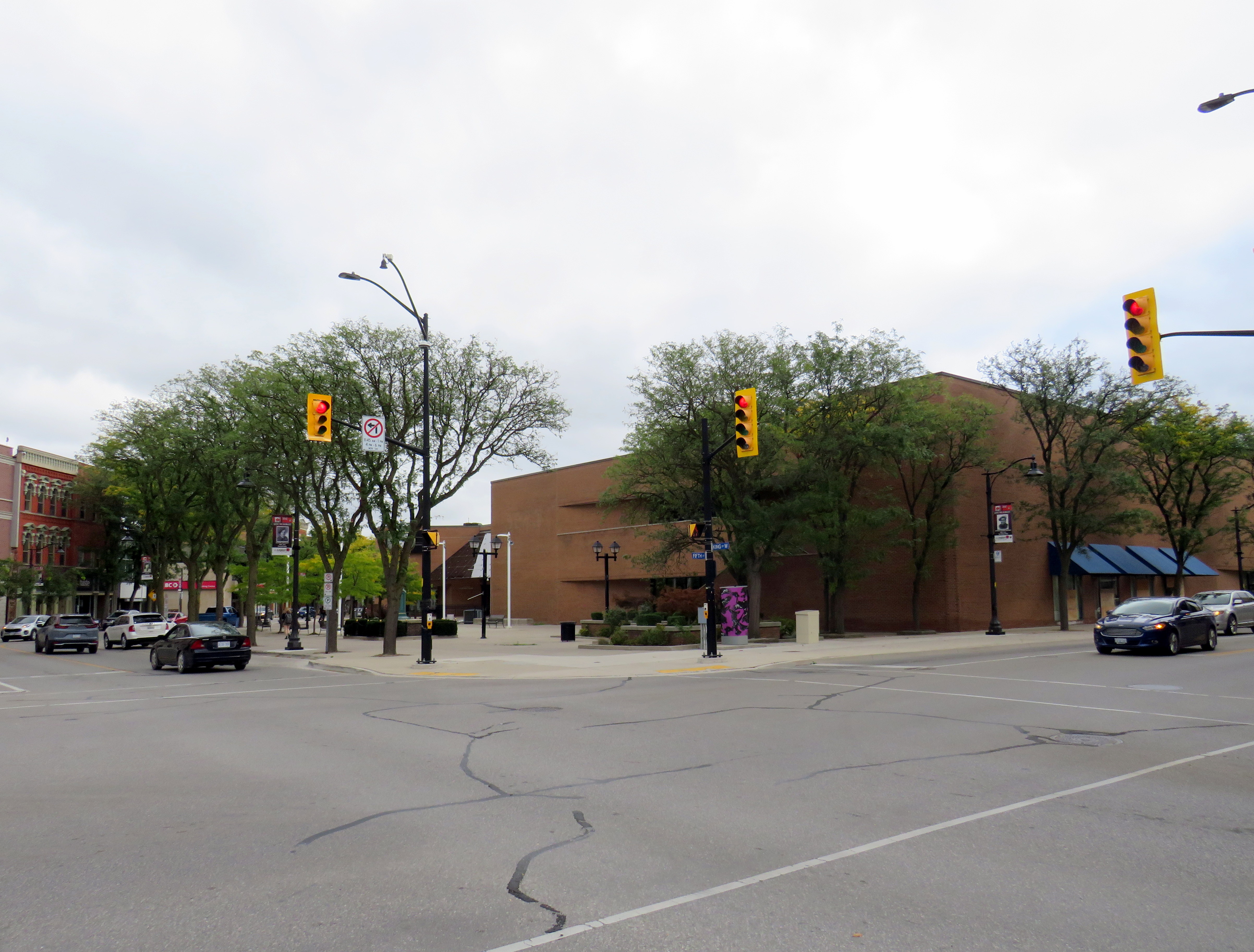
In the video, she is standing on Bloor Street West at Yonge Street in the heart of Toronto’s Bloor-Yorkville business district, 16 kilometres east of the Mississauga border at Etobicoke Creek. Needless to say, this is a very different built environment than anywhere in Mississauga.
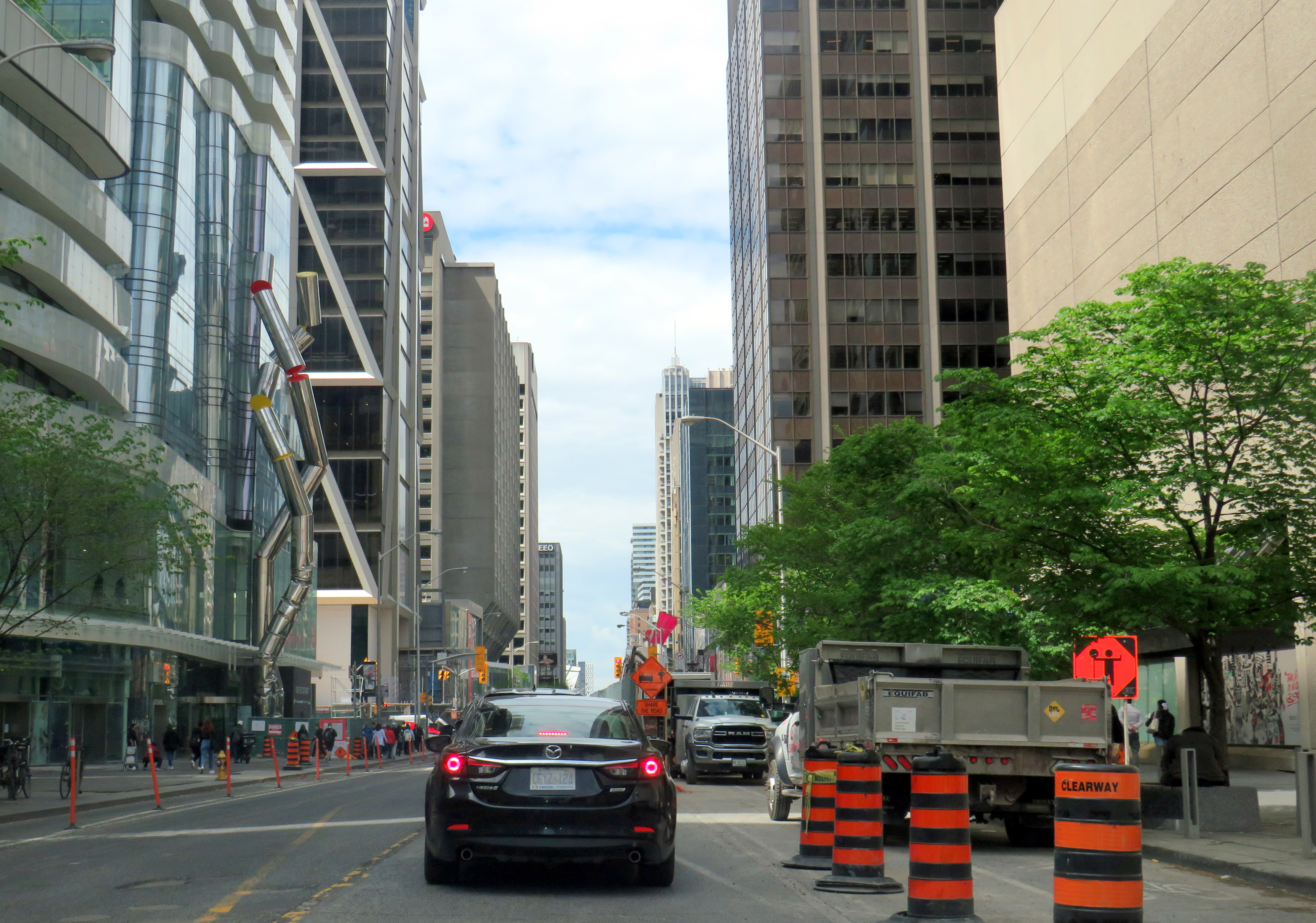
Toronto’s Bloor-Danforth bike route, which stretches from Danforth Avenue and Dawes Road on the east to Bloor Street West at Aberfoyle Crescent (near Islington Avenue) is very well used by cyclists, including commuters, couriers, and casual riders. There is also a subway paralleling the entire corridor. Behind Councillor Damerla, there is heavy traffic, but it is unfair to blame the bike lanes for this congestion. The vehicles are stopped at a red light at Yonge Street, one of the busiest intersections for pedestrians and cyclists in the city. There’s a dedicated scramble crossing at the intersection, which does reduce the green light time for traffic on Bloor, though it makes it safer for pedestrians, who outnumber all other road users there.
There is also considerable construction in and around the intersection. Work continues on the troubled “The One” condominium tower, blocking off some of the southwest Yonge-Bloor corner. Just east of Yonge, pedestrians, cyclists, and motorists are squeezed as the TTC works to expand the Bloor-Yonge Subway Station below.
Furthermore, before the bike lanes were installed, the curb lanes were used by stopped cars and delivery trucks; Bloor Street was never a traffic clearway, and it is a ridiculous argument that the bike lanes have caused congestion.
Construction on Bloor Street is the cause of some of the congestion in the area
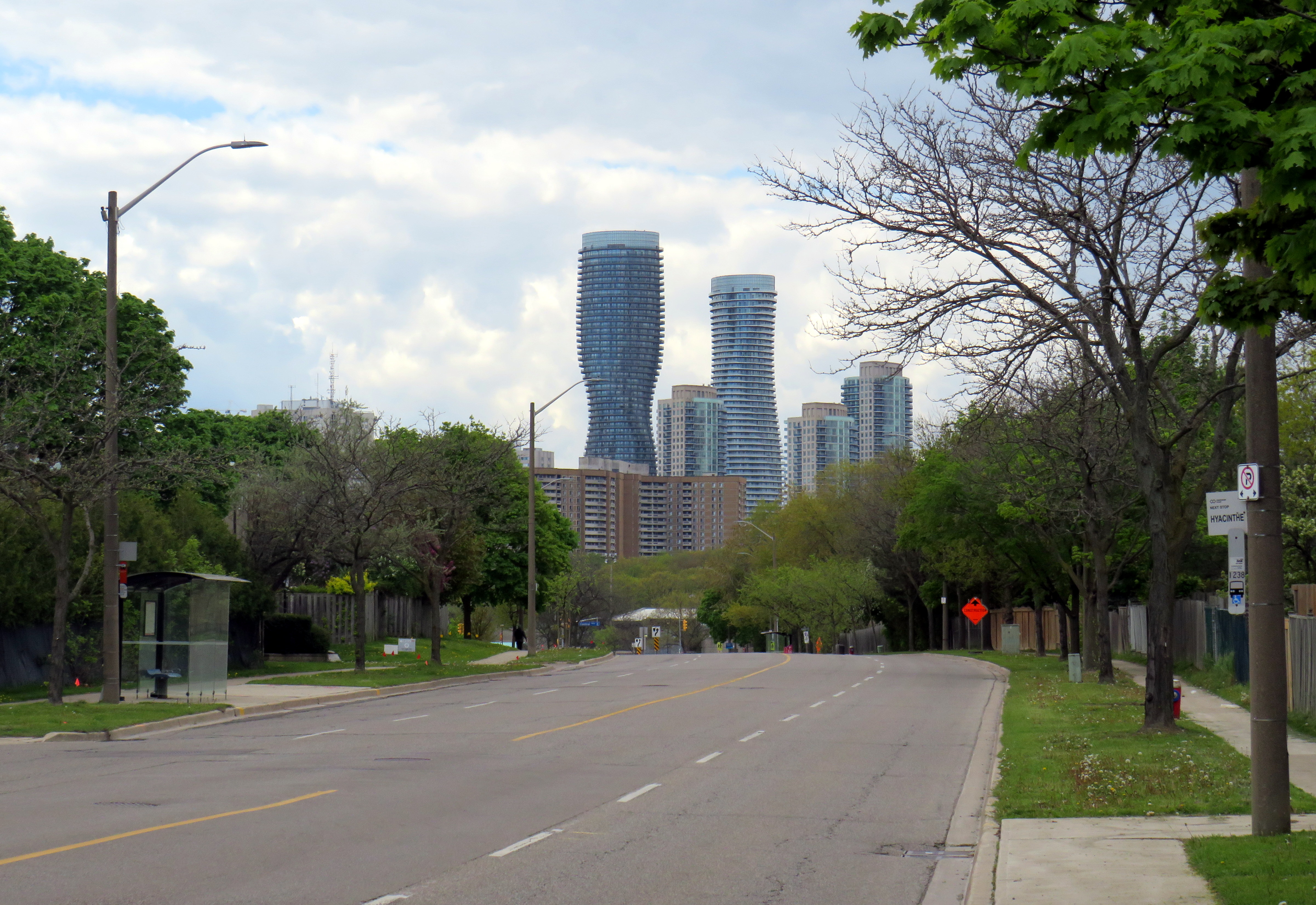
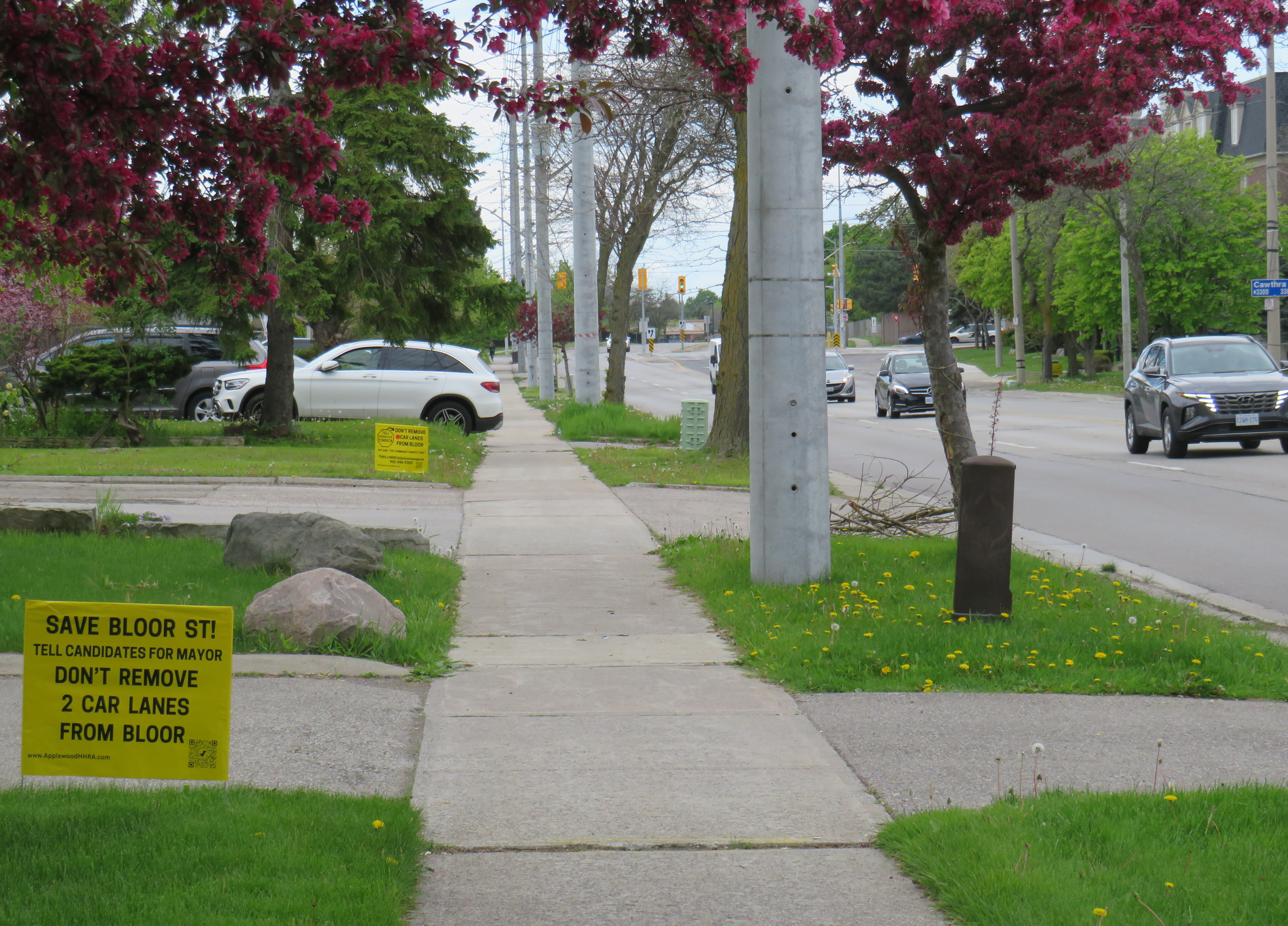
In Mississauga, Bloor Street is a minor arterial road that extends as far west as Central Parkway. Between Etobicoke Creek and Royal Orchard Drive (just west of Dixie Road), Bloor is lined with rental and condominium apartment buildings and townhouse complexes. From Royal Orchard to Cawthra, the street is lined with low-density dwellings, a shopping plaza, and a high school. The western-most section is lined with fences as the houses back onto Bloor, more typical of major suburban arterial roads.
Bloor Street in MississaugaLooking west towards Central Parkway and the Mississauga City Centre skyline
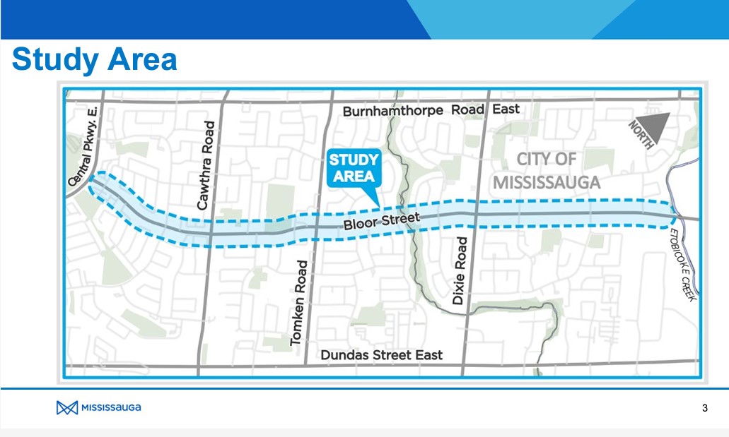
The City of Mississauga was already planning to resurface Bloor Street, but took advantage of the timing to completely study the corridor with the goal of promoting active transportation and improving road safety while maintaining traffic flow.
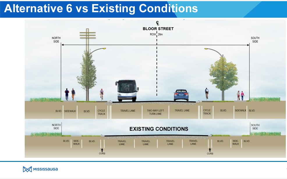
After extensive community consultation, Mississauga city staff recommended Alternative 6 for Bloor Street which widens the sidewalks, adds new separated cycle tracks, and a boulevard for trees and street lighting between the roadway and cycle tracks and the sidewalks and property lines. A continuous two-way left turn lane would allow motor vehicles to turn in and out of side streets and private driveways without conflicting with through traffic. This was approved by City Council in June 2023. Construction is scheduled to begin in October 2024.
This plan balances the needs of all road users, particularly students and seniors. It is great to see suburbs like Mississauga and Brampton rethink their streets to better serve all of their residents.
Bloor Street, looking east from Havenwood Drive. Note the “school route” sign and the cyclist using the sidewalk in the distance.Yellow lawn signs with the slogan “Save Bloor Street.” Note the SUV parked in a way that partially blocks the narrow sidewalk.
Bloor Street, whether it be a residential roadway in Mississauga, or a commercial street in Downtown Toronto, is not a place where drivers should expect nor be given ultimate priority over pedestrians, cyclists, or public transit riders.
Luckily, many Mississauga politicians already get it. Reporting for the Mississauga News, Steve Cornwell noted that fellow councillor and mayoral candidate Alvin Tedjo “stands by the approved Bloor project”, while Carolyn Parrish, another city councillor running for mayor declared that a reversal of last year’s council vote would not pass, saying that the “issue’s dead” at one mayoral debate. Ward 3 Councillor Chris Fonseca — whose ward covers most of Bloor Street — championed the changes.
Though Parrish has led several polls (with Damerla and Tedjo in second and third place), it is unfortunate to see a top-three candidate and sitting councillor using the Bloor Street redesign as a wedge issue. Mississauga is growing up. Some of its politicians should too.
It is no secret that I am fascinated by Ontario’s failed downtown malls. Over the last decade, I have visited most of these half-dead shopping centres, from Thunder Bay to Sarnia to Peterborough. All of these malls were built in smaller centres hoping to revitalize their urban cores, especially after the successes of the Toronto Eaton Centre and Ottawa’s Rideau Centre.
A majority of downtown shopping centres in Ontario counted Eaton’s as an anchor, starting with London’s Wellington Square in 1960. New malls in Sudbury (1970), Hamilton (Jackson Square, 1972-1975) and Kitchener (Market Square, 1974) followed, with the pace of downtown mall openings quickening in the late 1970s and 1980s as the provincial government provided assistance through the Ontario Downtown Redevelopment Program (ODRP).
A few downtown malls did not secure Eaton’s as the lead anchor. These malls, which were anchored by Sears, included King Centre (Downtown Kitchener’s second indoor mall), Cornwall Square, and Downtown Chatham Centre. I visited the latter mall in late September 2023.
Chatham, a small city located halfway between London and Windsor, has had bad luck ever since the 1950s. City growth was curtailed when neighbouring townships fought the city’s annexation efforts to develop new industrial lands on the urban outskirts. Political pressure from exurban residents kept the city rather isolated from the new Highway 401, which passes south of the old city limits; residents of the hamlet of Charing Cross opposed a highway interchange that would have provided direct access into Downtown Chatham. Meanwhile, a new Multi-Malls shopping development was approved for a site north of Chatham; an appeal to the Ontario Municipal Board by the city was dismissed, and the new Woolco and Loblaw-anchored plaza helped to draw customers — and tax revenues — from the city proper.
This unfortunate situation was only rectified in 1998, when the City of Chatham was amalgamated with not just its neighbouring townships, but the entire county, creating the new municipality of Chatham-Kent, coming far too late for the industrial and commercial development Chatham had hoped for. In the meantime, a new downtown mall that would not only retain shoppers but hopefully attract new visitors to the city, was seen as the solution.
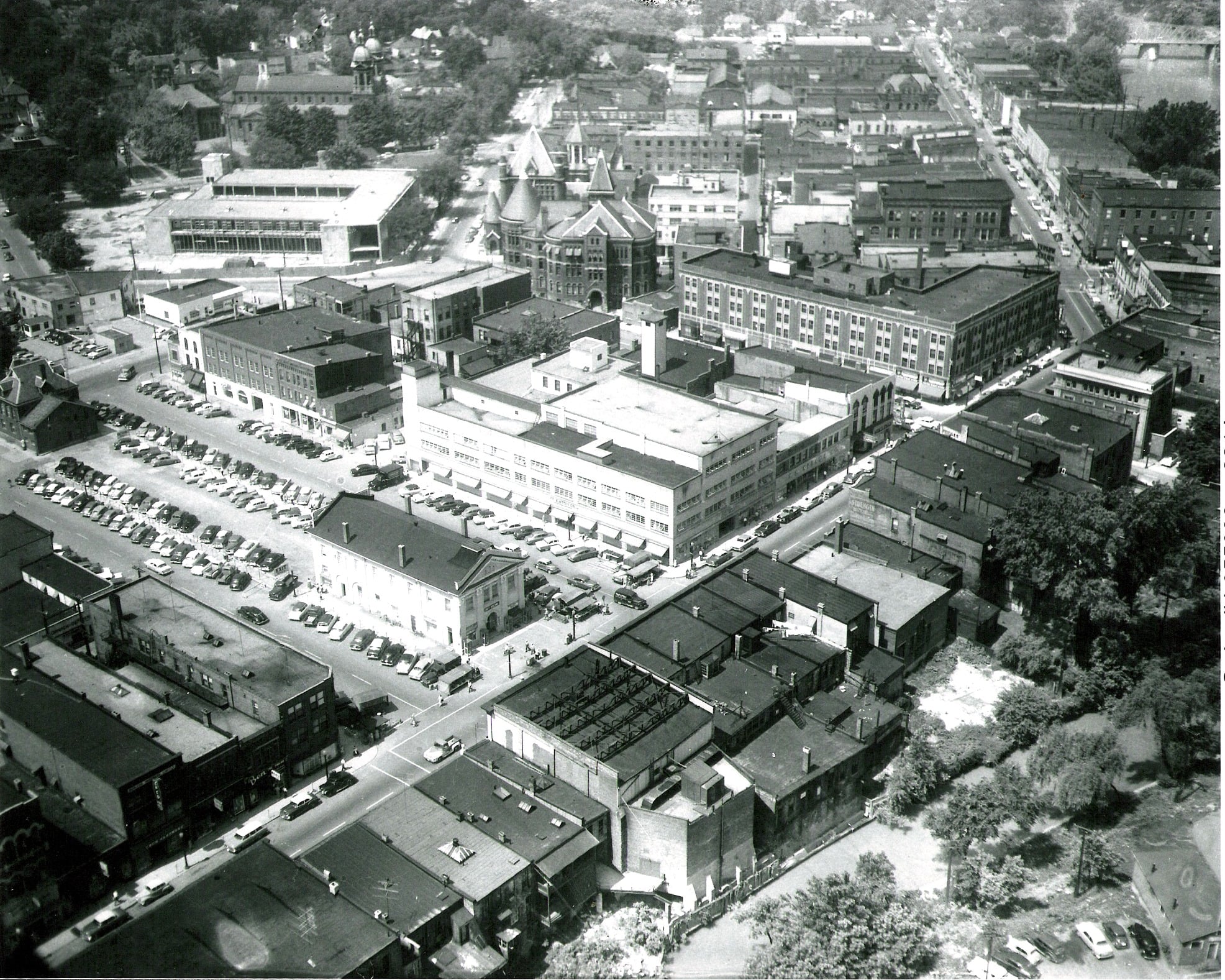
While most downtown malls built during the ODRP era were led by Eaton’s and Cadillac Fairview, the Downtown Chatham Centre (DCC) was managed by Cambridge Shopping Centres. The city of Chatham conducted the land assembly (using its powers of expropriation where necessary), and cleared two city blocks, including the Garner Hotel, the old market square, the Romanesque Harrison Hall, and several commercial blocks, including a shuttered Eaton’s store.
Downtown Chatham in the 1950s. Most of the buildings in the foreground and midground have since been demolished. The old market square became a parking lot by the 1950s; to the immediate left of the old market is the 3-4 storey Eaton’s store. Harrison Hall, with its conic tower, stands behind Eaton’s.The Downtown Chatham Centre soon after opening in 1983(Chatham-Kent Museum)
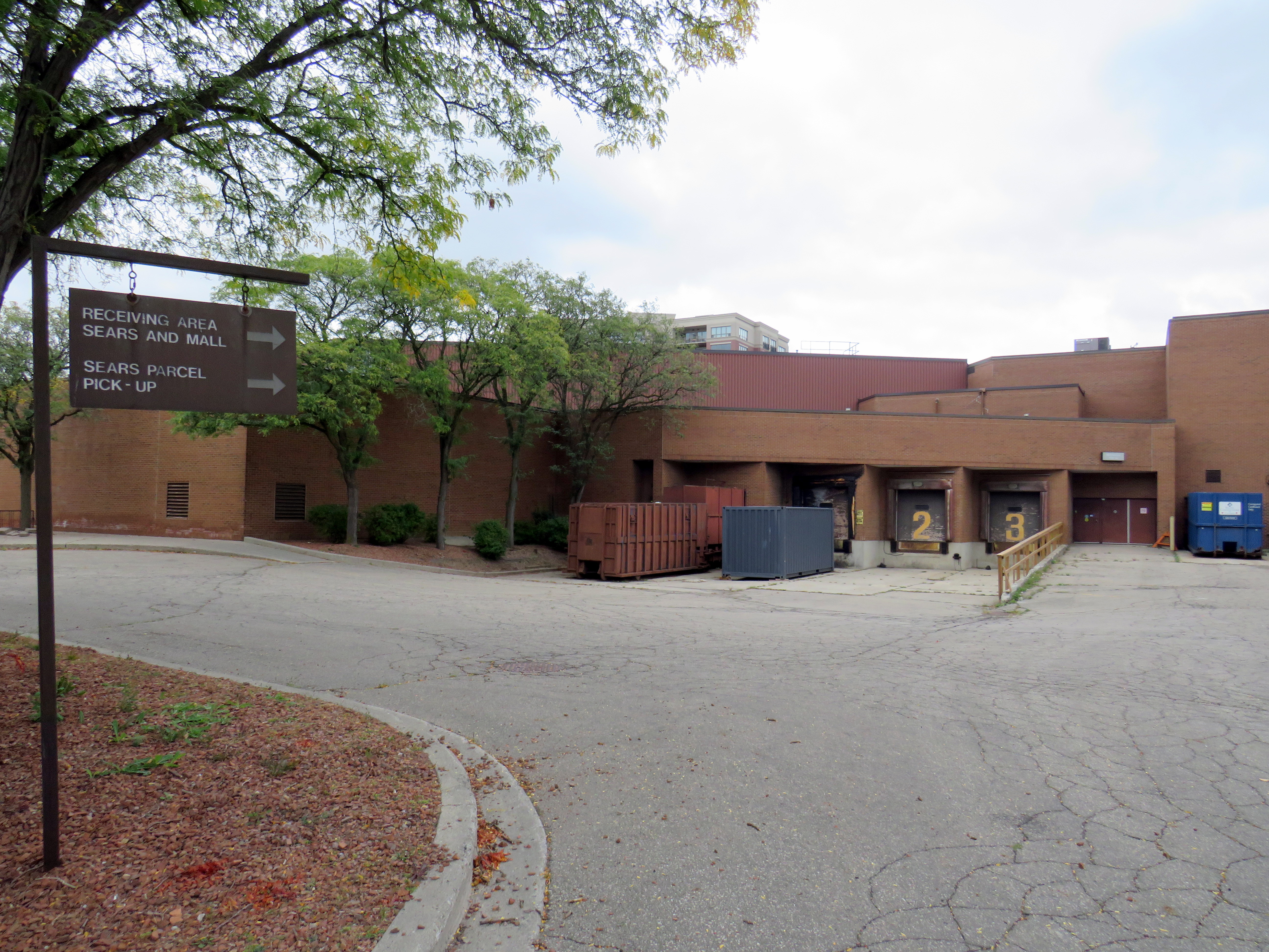
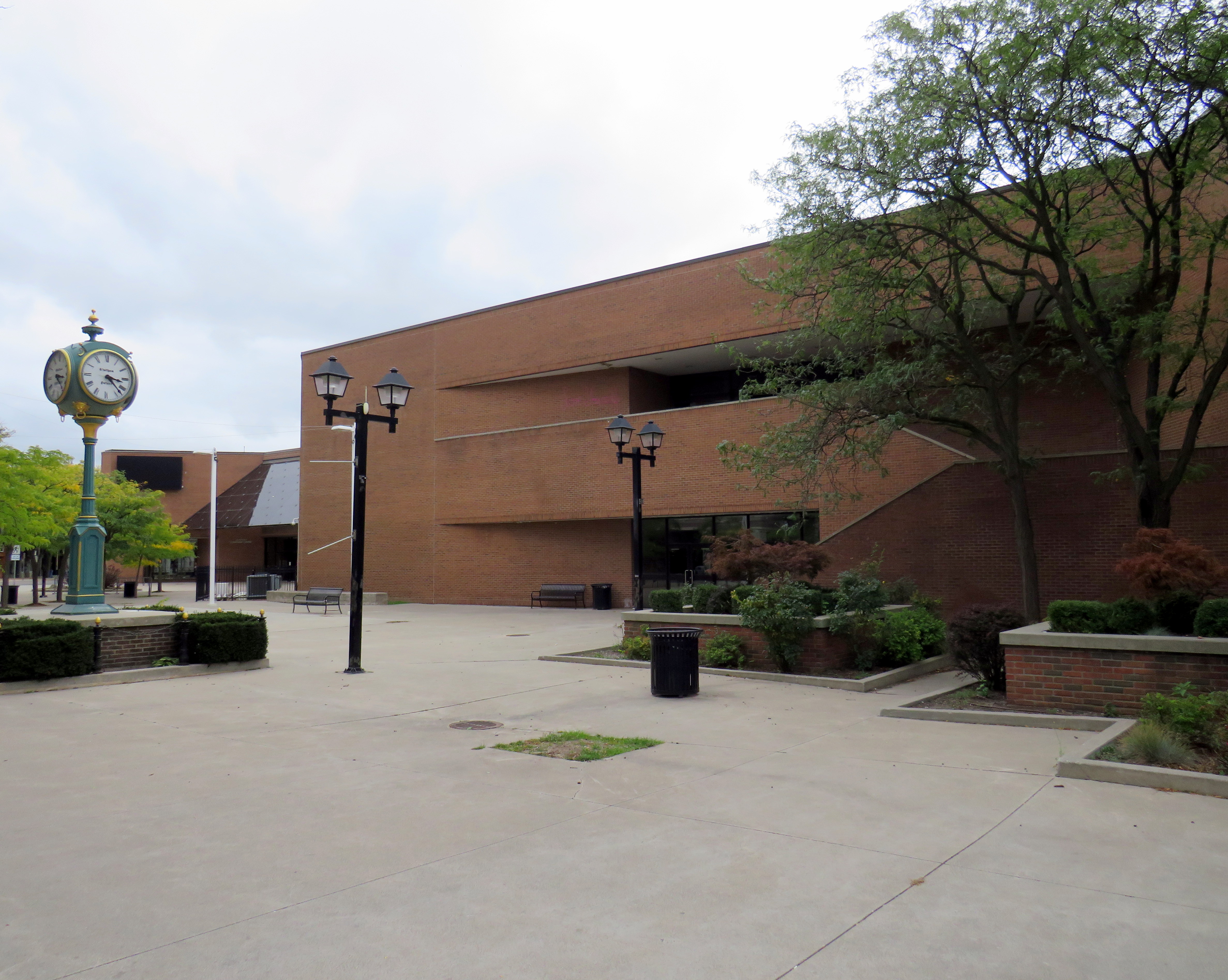
Instead of Eaton’s — which closed its Chatham store in 1974 — the lead anchor would be Sears, which was expanding its Canadian footprint at the time, as it just pulled out from its 25-year partnership with Simpson’s. Unlike most downtown malls built in Ontario, DCC had always offered ample customer parking, located in a garage linked to both of the mall’s two shopping levels, as well as an adjacent surface lot, with mall visitors able to get their parking validated. On the south side of the mall, there was a Miracle Food Mart, along with a food court on the second floor. Downtown Chatham offered the only full-line department store in town; the mall also had the city’s only escalators. The plaza out front featured a fountain in the summer and a public skating rink in the winter.
Harrison Hall, which was home to both the City of Chatham and Kent County before demolition in 1978 to make way for the Downtown Chatham Centre. (Chatham-Kent Museum)The site of demolished Harrison Hall in 2023. Asign still directs drivers to the Sears receiving area and the parcel pick-up.
For a time, DCC held its own. Sears was a much more suitable department store for a smaller industrial/agricultural city like Chatham than Eaton’s would have been. Though the Multi-Mall development north of the city on Highway 40 and the Thames-Lea plaza in the suburbs provided competition, the downtown mall’s regional market dominance was undisputed in the 1980s and most of the 1990s. Unlike Eaton’s, Sears Canada was particularly healthy until the early 2000s as it catered to the suburban middle class; in 1999, it purchased the remains of the bankrupt T. Eaton Company, converting many better performing Eaton’s stores to its own brand.
Unlike Chatham’s peer cities like Brantford and Sarnia, the mall’s tenant mix stayed relatively healthy well into the new millennium (see the 1992 and 2014 tenant lists below). Though Miracle Food Mart closed, that space was remised into a Sport Chek and a Goodlife Fitness gym. It wasn’t until the last decade that serious decline began to set in.
What happened?
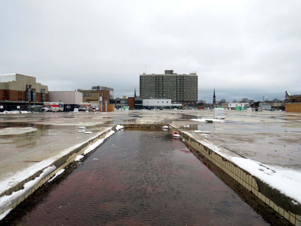
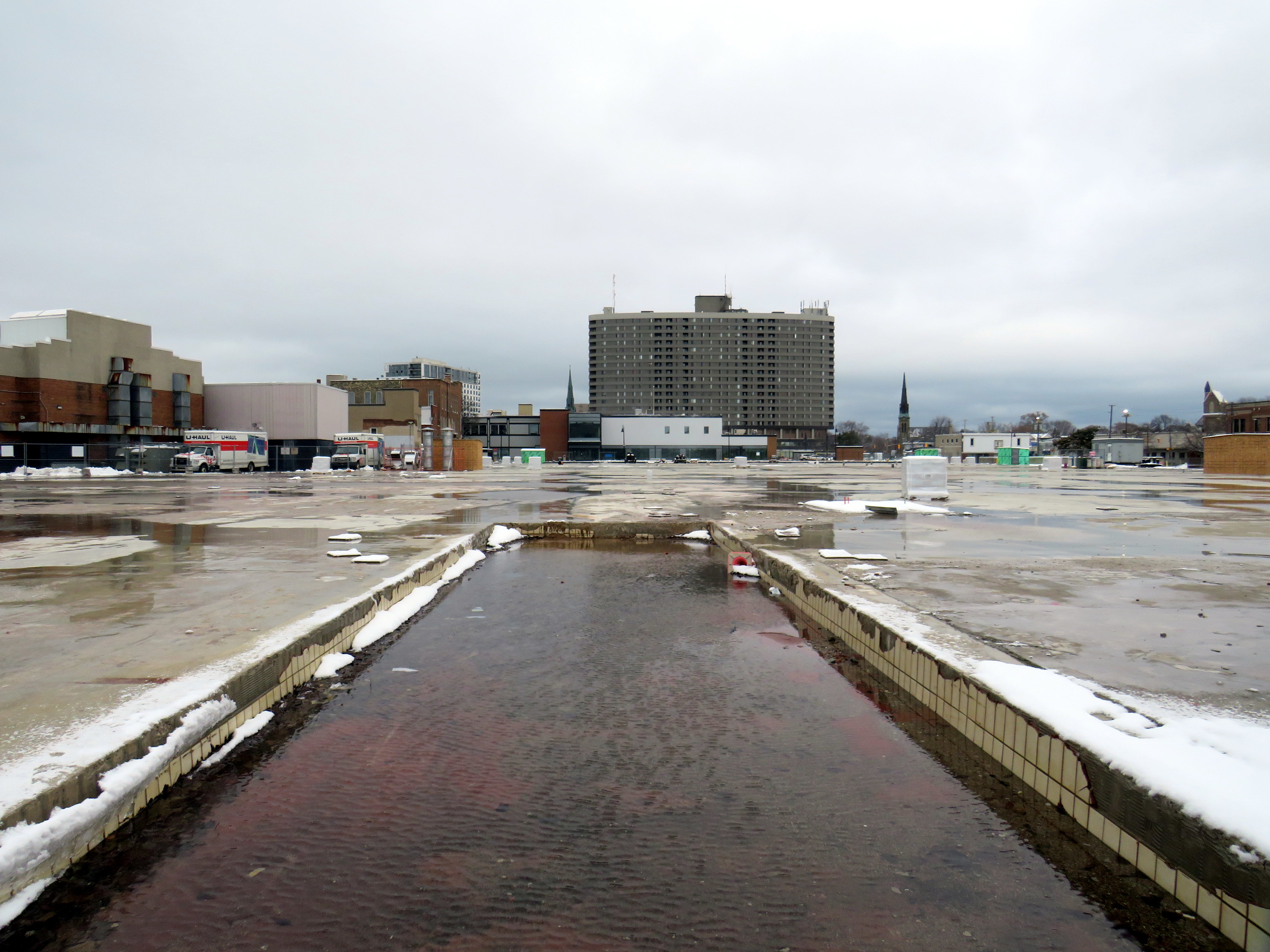
The empty public plaza outside the vacant Sears store
There were several factors that led towards the decline of Downtown Chatham Centre, similar to the reasons why most downtown malls failed. The main difference is that the decline came later than most others.
Chatham’s economy, like most smaller Ontario centres, was in flux, particularly in the 1990s and early 2000s. Free trade agreements affected the local industrial economy, which was already weaker than neighbouring cities like Sarnia, Windsor, and London-St. Thomas.
Factory closures included the Navistar plant. For nearly a century, International Harvester was one of Chatham’s largest employers. The Chatham plant, which assembled International truck tractors and employed 2400 workers in 2001, closed for good in 2011. The rise of Walmart, which moved into the old Woolco store on Highway 40 along with other big-box retailers, also hurt the downtown mall. But Sears Canada entered its own death spiral in the mid-2000s. In 2005, the company was taken over by the private equity firm Pershing Square, whose CEO, Edward Lampert, was already slowly sucking the American parent company dry. Sears Canada sold off its credit card division, its Downtown Toronto headquarters, and eventually the leases for its most attractive stores in 2012 and 2013, including the former Eaton’s flagship in Toronto Eaton Centre.
By 2014, the DCC Sears was converted to an outlet store, foreshadowing its eventual closure in 2017, less than year before the entire chain disappeared from Canada.
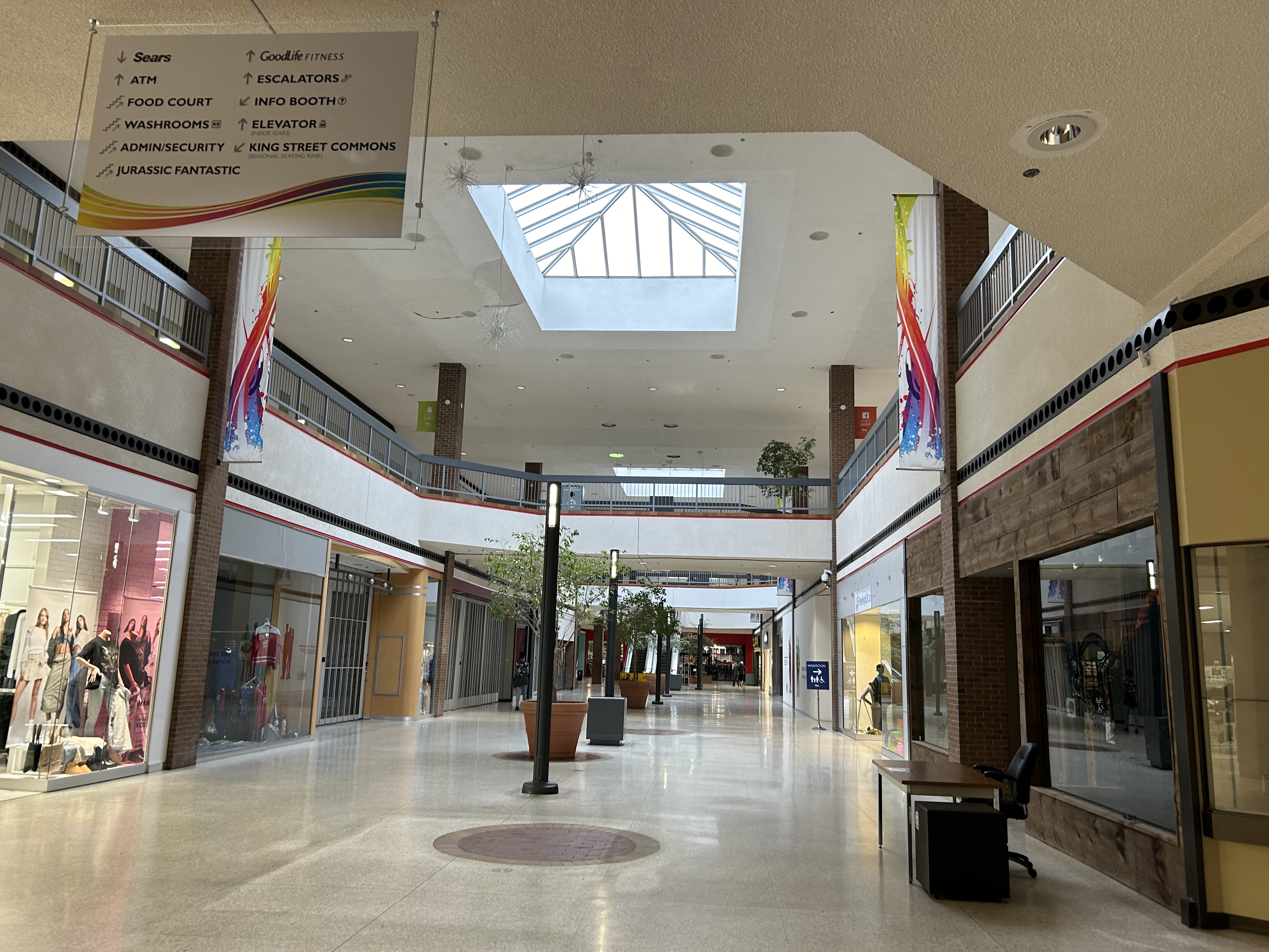
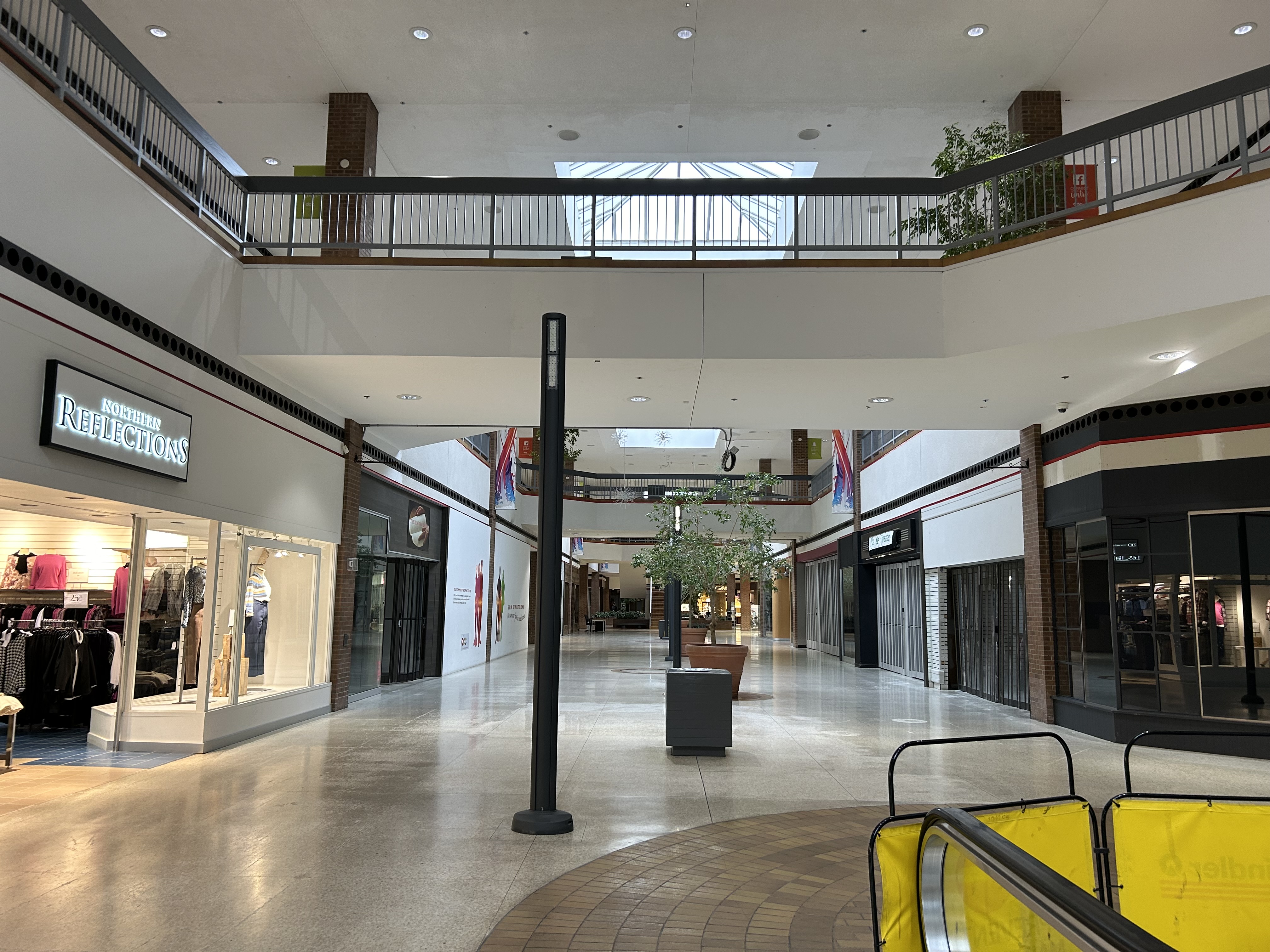
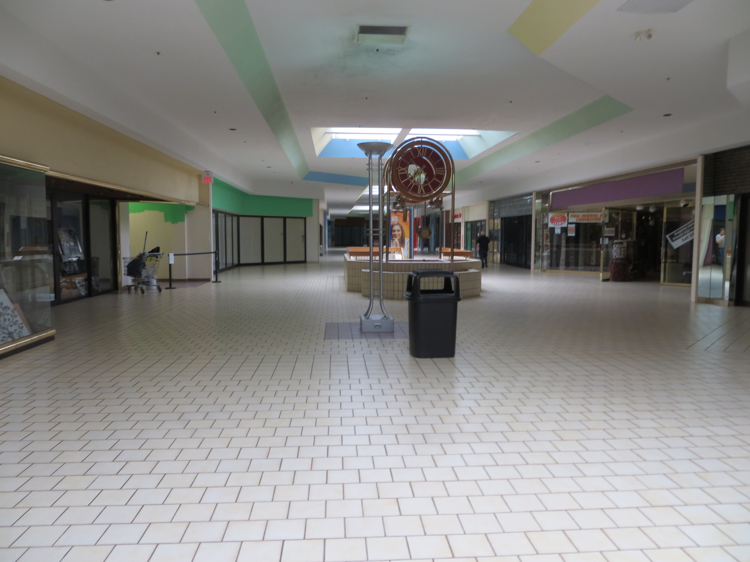
Mall interior looking east, September 2023
In September 2023, there were only a handful of open stores left inside DCC, including Northern Reflections, a Dollarama, Fit4Less (a budget brand of Goodlife Fitness), Ardene, an independent jewellery store, and a Hart discount department store located in the old Miracle Food Mart/Sport Chek space. All open retail spaces were on the first floor; the escalators were completely blocked off. The Ardene store was already in the process of moving to the Thames-Lea plaza.
Security guards were stationed at both public entrances, likely to ensure the mall did not become a hangout for Chatham’s unhoused.
Mall interior, looking west
The mall also has a pharmacy and medical office, but since 2015, they are accessed only from the outside, in a storefront facing King Street.
What’s next?
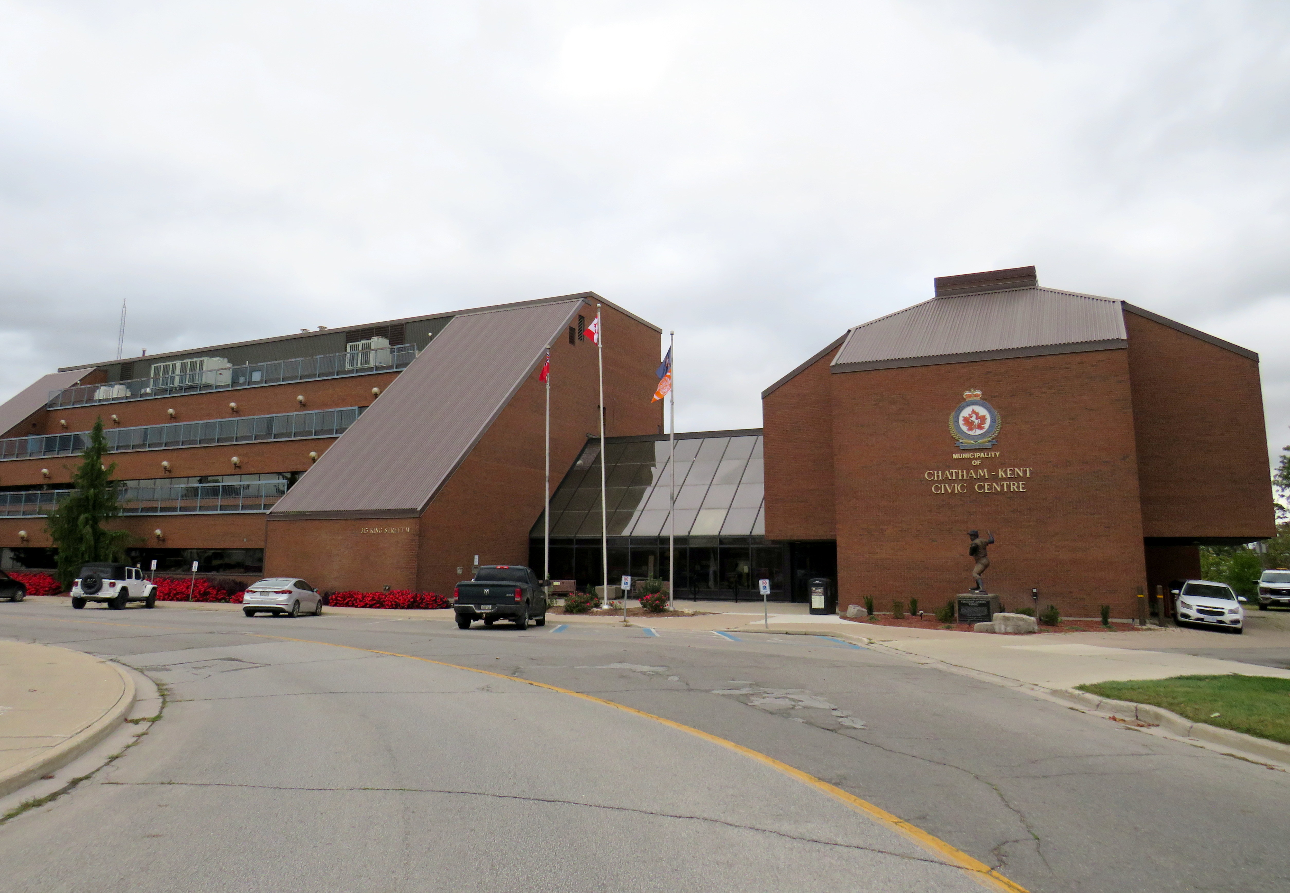
Chatham-Kent Civic Centre, built in 1975-1976
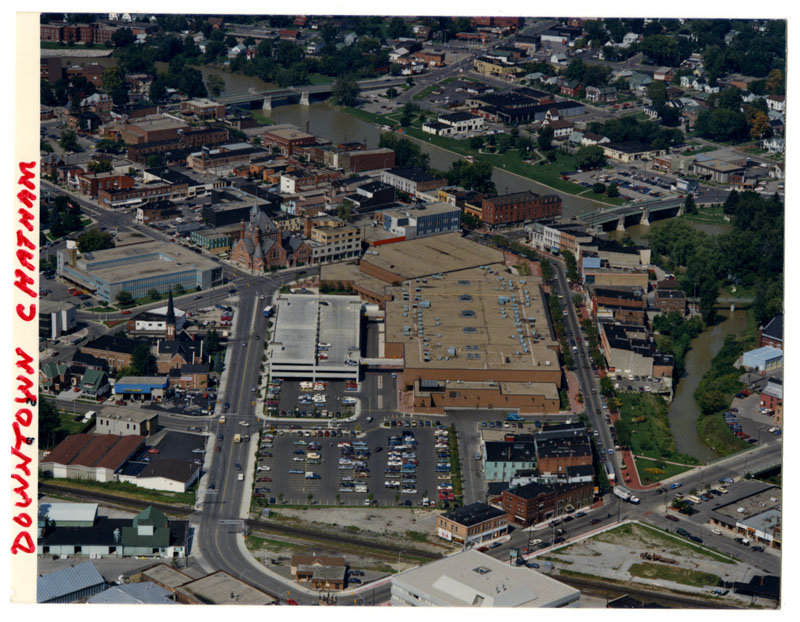
The Municipality of Chatham-Kent currently occupies the Chatham Civic Centre, which was built in the late 1970s on the site of a former gas works on the Thames River. The Civic Centre requires major renovations or replacement, and the municipal government is considering purchasing part of the Downtown Chatham Centre, and moving the municipal government, the main library, and the art gallery/museum into the Sears store, which would be heavily renovated. Staff report that the cost of purchasing and renovating part of the DCC ($42,387,400) was similar to renovating the existing Civic Centre, library, and museum ($38.7 million to $45.8 million) and nearly half the cost of building brand new.
Earlier plans also included a new entertainment centre to host concerts and the Chatham Maroons minor hockey team, replacing an existing municipal arena constructed in 1949. Those plans were later dropped by the mall’s owners.
If Chatham-Kent agrees to purchase and renovate the vacant Sears store, they will relocate to nearly the same site as the old Harrison Hall.
The proposed relocation of the civic centre and library to a central location, adjacent to the RideCK transit terminal (which serves the old City of Chatham as well as many smaller population centres within the municipality) is certainly a more sustainable and equitable outcome than building a new civic centre outside the downtown core. It repurposes an existing building and helps to support downtown business. However, more housing, both on the surface lot and on any vacated civic properties would help bring even more people into the downtown core, which can use the boost. Though retailers may not flock back into the mall once renovations are complete, the storefronts offer flexible space for community programs and small business incubators.
For a small city like Chatham, this is likely the best outcome.
1992 Tenants
Below is the list of tenants at Downtown Chatham Centre in 1992, obtained from the 1993 Canadian Directory of Shopping Centres, published by Maclean-Hunter.
Fashions and footwear Children’s wear: Just Kids Unisex/family wear: Cotton Ginny, Le Château, Pantorama, Stitches, Work World Ladies’ wear: Addition-Elle, Born Free, D’Allairds, Fairweather, Irene Hill, Just Petites, Lady Foot Locker, The Lady’s a Champ, Mariposa, Northern Reflections, Pennington’s, Personally Yours, Reitman’s, Ricki’s, Station Cotton, Suzy Shier, Thyme Maternity Menswear: Tip Top Footwear & leather goods: Foot Locker, Joggers, Kinney, The Shoe Place Jewellery/accessories: Lady Jewellery Company, Ostranders, Young’s Jewellers
Other retailers Books: Classic Bookshop, Coles Drugs/health & beauty: Pharma Plus, The Soap Emporium Department/mass merchandiser: A Buck or Two Electronics: Radio Shack Gift: Den For Men, Things Engraved Hardware/paint & paper: Tool Den Housewares: Junor’s, Stokes Music/Records: Sam the Record Man Pet: Pet Paradise Photo/Camera: Black’s, Japan Camera 1 Hour Photo. Restaurant/fast food: A&W, Crumbles Muffins, Frankfurters, Lumberjack Restaurant, Manchu Wok, Mulligan’s Roadhouse, Sorrento Specialty Food & Drink: Bright’s Wines, Laura Secord, The Gourmet Cup Stationery/Card: Carlton Cards, Hallmark, Willson Stationers Toy: Toys & Wheels Variety/Convenience: News Room Dry Cleaners: La Moderna Dry Cleaning. Hairstyling/Esthetics: The Golden Razor Theatre/Entertainment: Fun & Games Miscellaneous: Infoplace
2014 Tenants
The 2015 Canadian Directory of Shopping Centres tenant list was shorter, though still much more robust than former Eaton’s-anchored downtown malls in comparably-sized cities like Sarnia, Brantford, or Peterborough at the time.
Across Canada, our biggest cities are building new transit. Here in Toronto, the Crosstown and Finch West LRTs are well underway (though the first phase of the Eglinton-Crosstown is already three years late), as well as the Scarborough subway expansion, the Ontario Line, and GO Transit corridor improvements. Vancouver is building a major expansion to its Skytrain network, the Broadway Subway. Ottawa, Calgary, and Edmonton are all expanding their LRT networks. And in Montreal, the first phase of the Réseau express métropolitain (REM) will open for service, while major work on the Blue Line Métro extension has just begun.
While Greater Montreal has been busy with rail transit projects, it has also opened two new busways: on Boulevard Le Corbusier in Laval, and on Boulevard Pie-IX on Montreal’s east side. The Laval busway was completed in late 2017. The SRB Pie-IX corridor was mostly completed by the end of 2022, though a section near Boulevard Jean-Talon remains under construction for the Blue Line Métro extension.
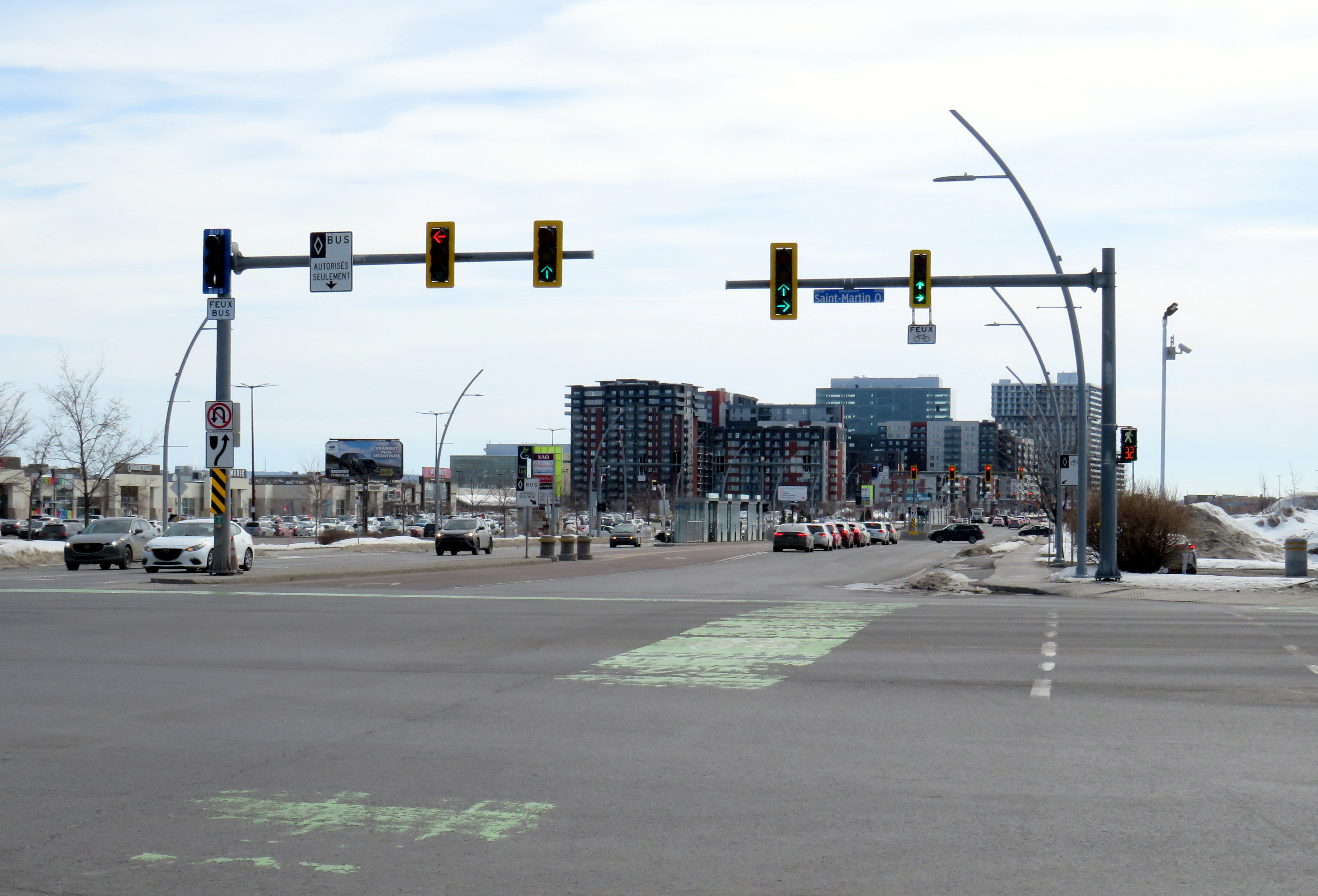
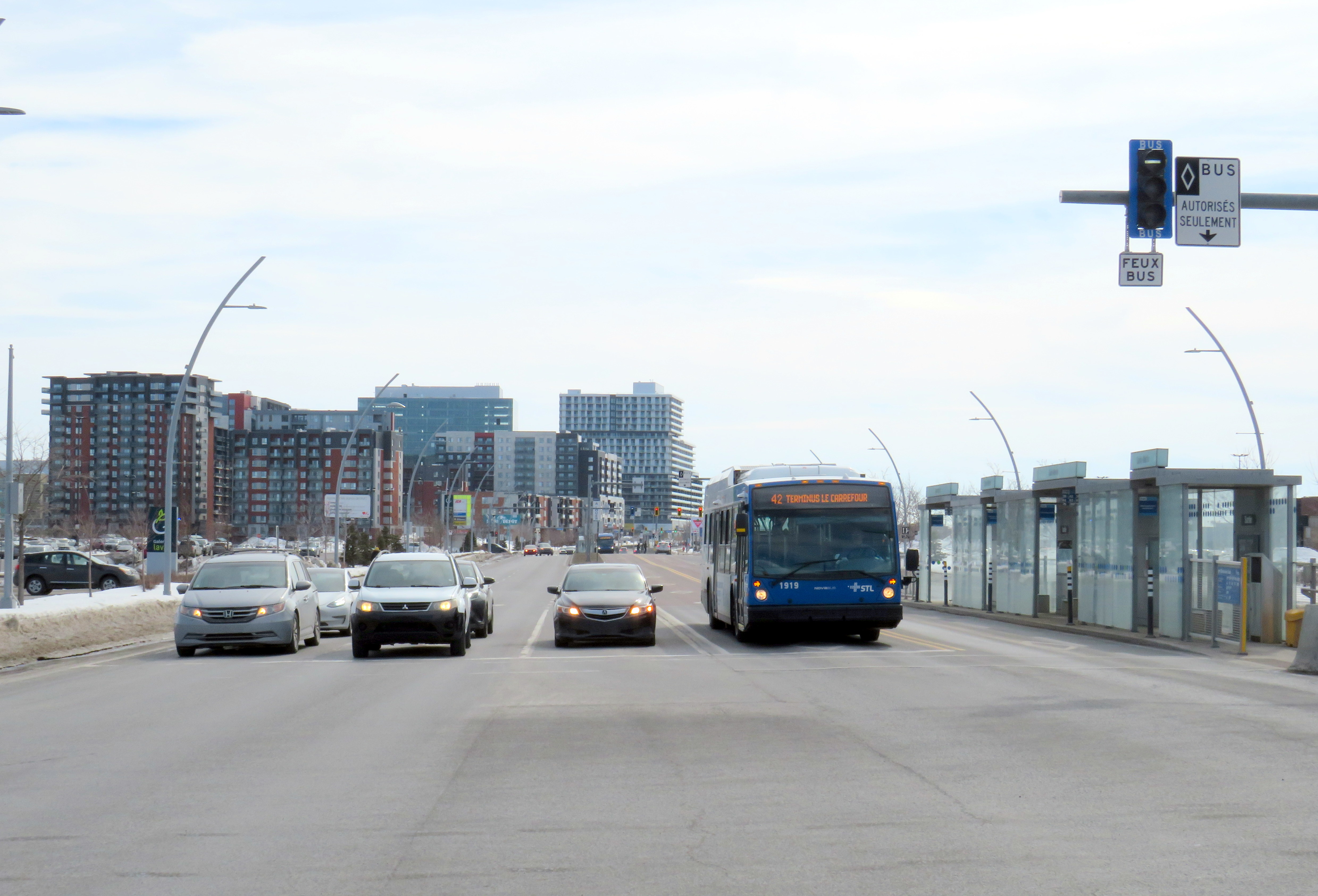
Laval’s Boulevard Le Corbusier
Looking south on Le Corbusier at Boul. Saint-Martin
Laval, a sprawling suburban municipality immediately north of Montreal Island, has a population of over 400,000. Though the large island has several historical town and village centres, the municipality is mostly made up of suburban subdivisions, shopping centres, low-rise apartment buildings, crisscrossed by several autoroute highways, including the A-13, A-15, A-19, A-25, and A-440. Despite the post-war sprawl and auto infrastructure, the far eastern end of the island remains largely agricultural.
After the extension of the Orange Line Métro into Laval in 2007, the city of Laval has worked towards urbanizing its geographical centre into “Centre-Ville Laval.” Laval’s new downtown core would consist of new and expanded educational institutions, new cultural and entertainment venues, office and high-tech employment, along with new higher-density, urban-scaled residential development. The new city centre would be focused on Boulevard Le Corbusier northward from Montmorency Métro Station, in an area lined with aging commercial properties.
During my March visit to Laval, some of the progress on Centre-Ville Laval was evident. A new sports and concert venue, Place Bell, opened in 2017, luring the Montreal Canadiens’ AHL affliate from St. John’s. (Place Bell should not be confused with Centre Bell, the home of the Canadiens, also located on the Orange Line). The Université de Montréal also opened a suburban campus next to the Métro station. Slowly, mid-ride condo buildings were built on the south end of Le Corbusier, within walking distance from the campuses and transit links.
New residential development on the south end of Boul. Le Corbusier, in the near distance
To support the planned growth of Laval’s city centre, a new busway was built northward, towards the massive Carrefour Laval shopping centre, a Cadillac Fairview-owned mall that dominates Montreal’s north suburbs. The busway passes between older, smaller shopping malls, such as Centre Laval and Galleries Laval, which will one day get redeveloped. Building the new busway, along with semi-protected cycling lanes, was clearly a way of indicating the municipality’s urban planning goals.
Unfortunately, the Laval busway reminded me of the things I disliked most about York Region’s Viva Rapidways. For one, the Laval busway doesn’t speed up bus service. It is only one kilometre long, and does not properly connect with either the bus terminal at Montmorency Métro or the bus terminal across the street from Carrefour Laval. Buses must re-enter mixed traffic at both ends of the route. As in Toronto and York Region, left-turning cars are prioritized at each traffic light, and there was no apparent transit priority.
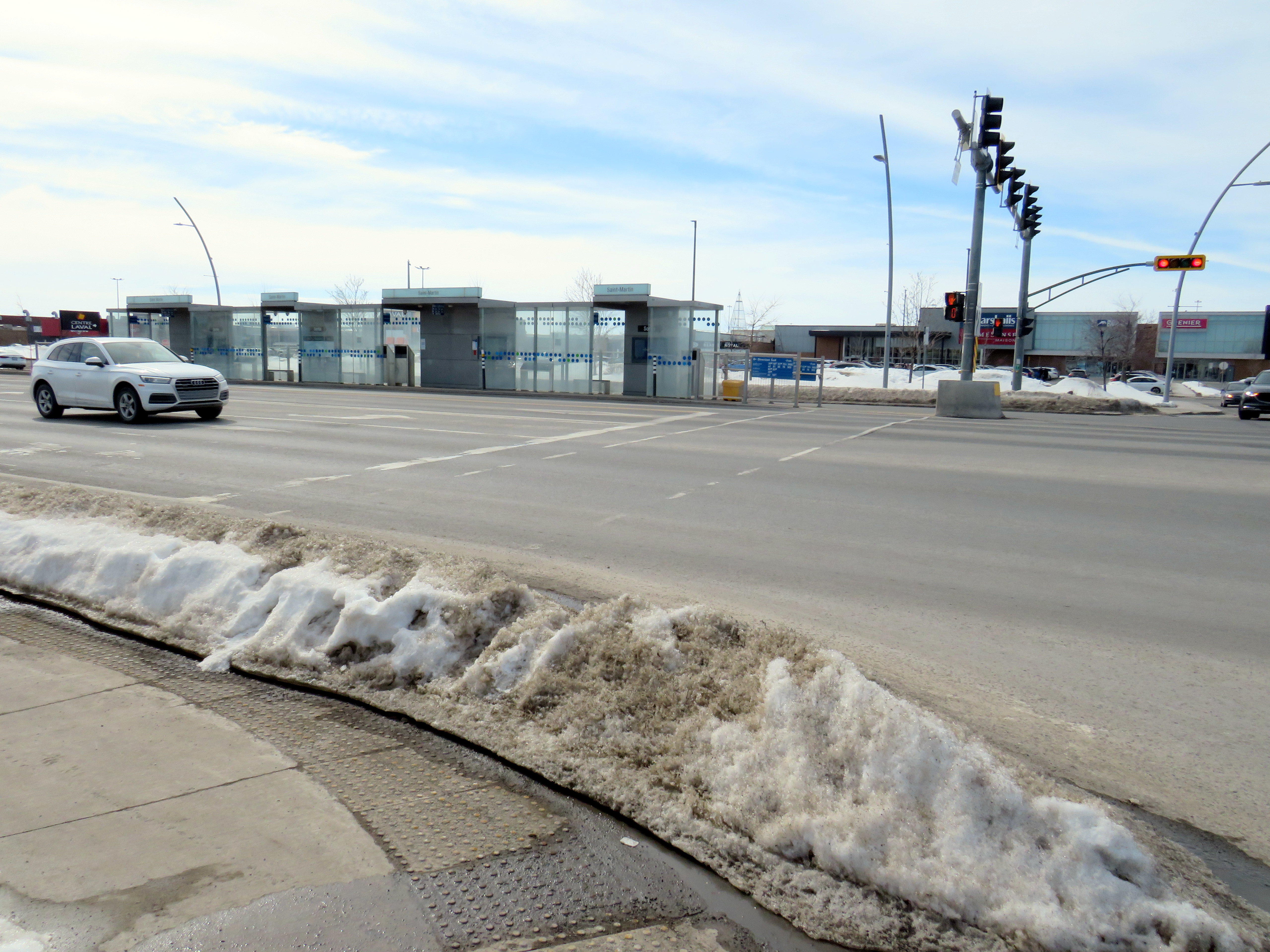
The median bus stops are also difficult to get to. Despite many days since Montreal’s last significant snowfall, and bone-dry sidewalks and roadways, the curbs and crosswalks were left uncleared. This forces pedestrians to either mount the piles of old, packed, crusty snow, or divert into the roadways to cross the street. The bike lanes were merely a convenient snow storage space.
Laval should be embarrassed by its inaccessible crosswalks and bus infrastructure
For a Saturday morning, transit service on the busway was adequate, but not especially impressive. The Société de transport de Laval, the municipal transit agency, operates a free shuttle bus on weekends, holidays, and summer weekdays between Montmorency Métro and Carrefour Laval every 20 minutes. Otherwise, bus service was sporadic despite multiple routes using the busway: two or three buses would come at once, followed by a gap of 10 or 15 minutes.
Quebec’s unique traffic signals were both interesting for out-of-province visitors and frustrating for pedestrians. In Ontario and most other jurisdictions, a right green arrow indicates absolute right-of-way for right-turning motorists. In Quebec, it merely indicates that motorists have a green signal to turn right, regardless of conflicting movements. Outside of Montreal, motorists are permitted to turn right on a red light, unless signed otherwise. This is not great signalization, especially on high-speed suburban roadways.
Right-turning motorists have the green arrow to turn right, conflicting with pedestrians (which have the walk signal) and cyclists
However, bus signals are unmistakable from general traffic signals, with white bar aspects (and a white triangle instead of an amber light). That’s one thing that is done better than here in Ontario.
Montreal’s SRB Pie-IX
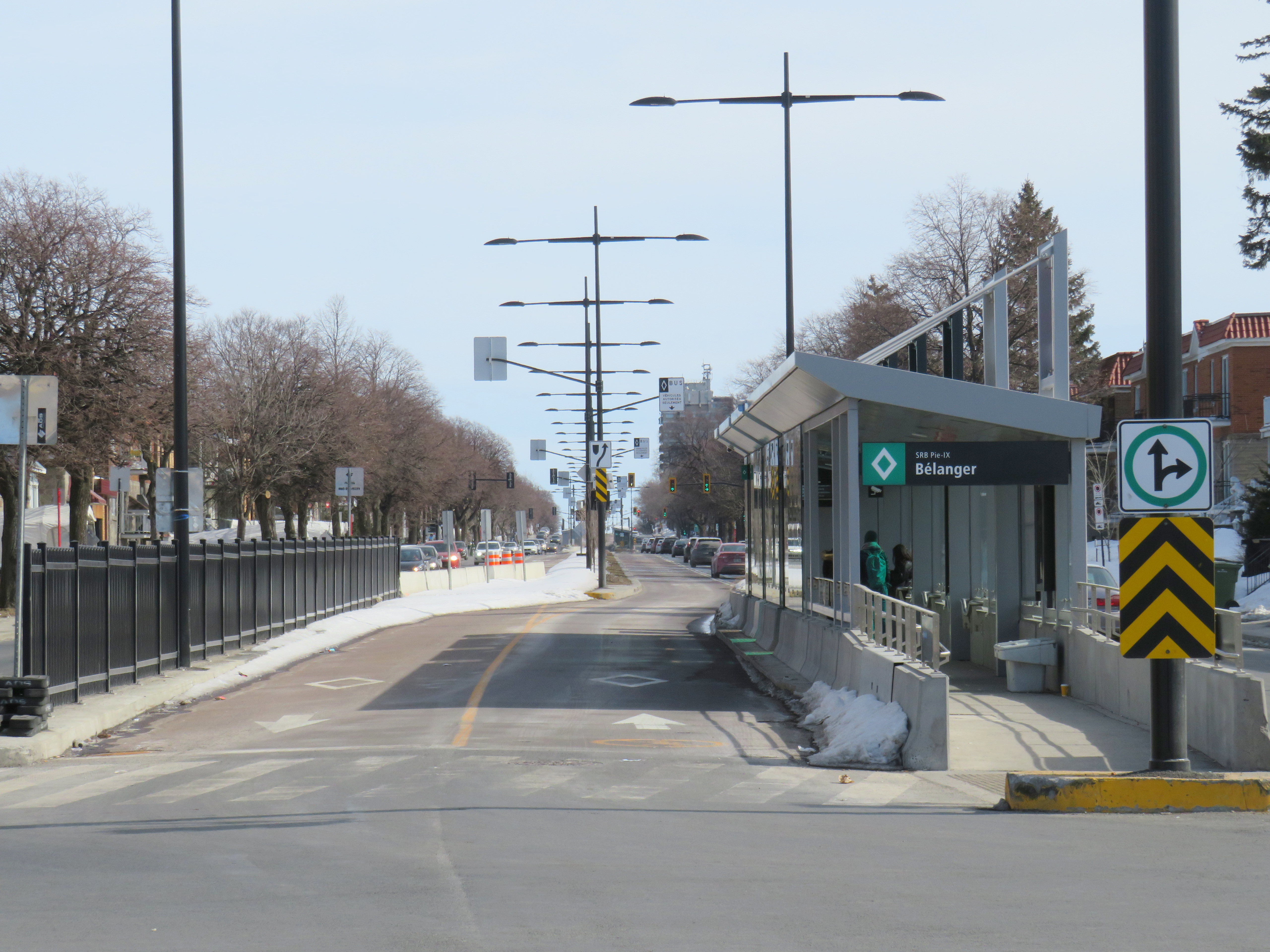
Looking south on Boul. Pie-IX from Rue Bélanger
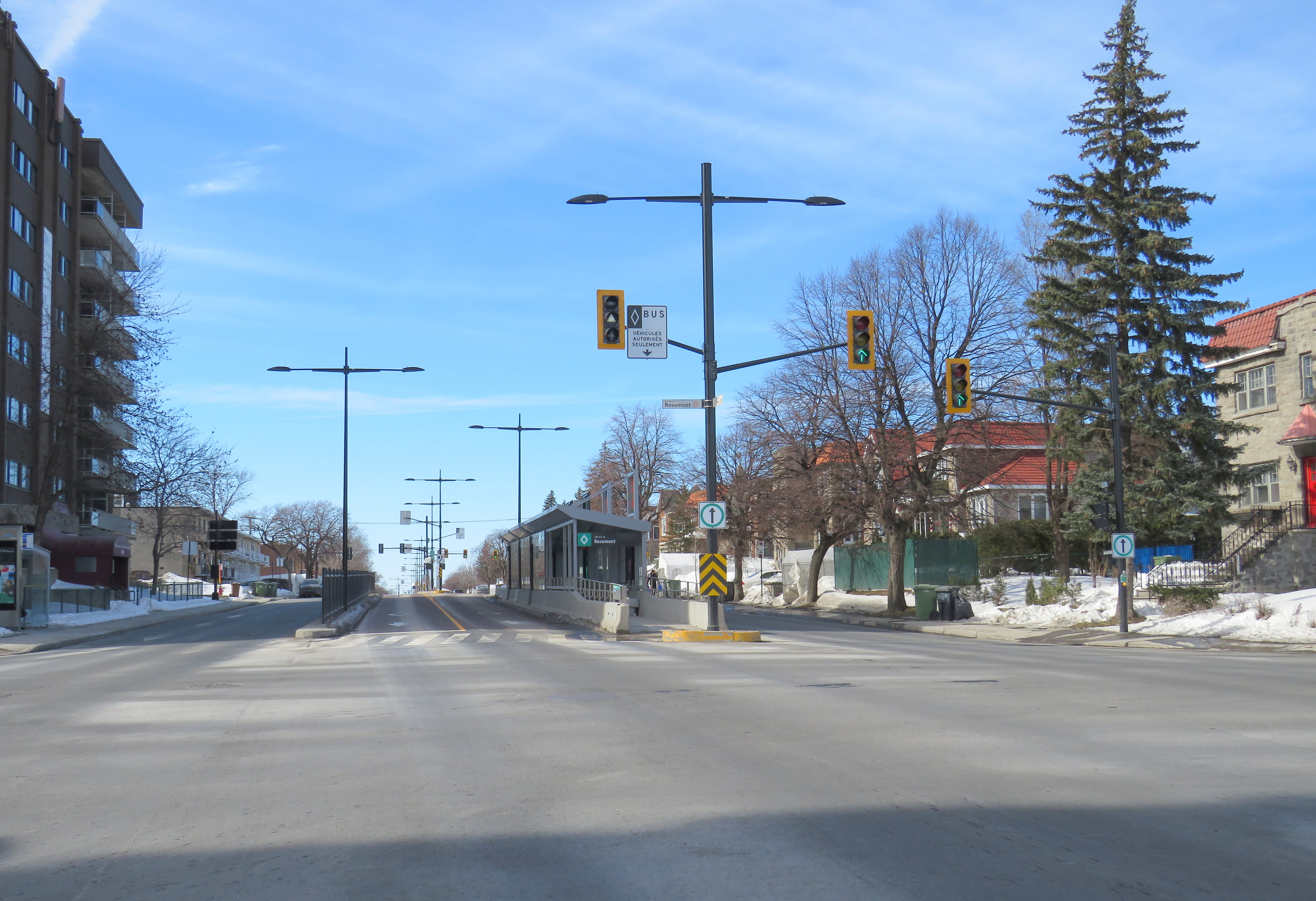
The SRB (BRT) corridor on Montreal’s Boulevard Pie-IX, which I visited later the same day, was a welcome contrast to Laval’s implementation. Boulevard Pie-IX (named for Pope Pius IX, the founder of the dogma of papal infallibility), is a wide north-south boulevard on Montreal’s east side, passing through Hochalaga, past Olympic Stadium and the Botanical Gardens, all the way into Laval. It’s a busy bus corridor, feeding into the Métro Green Line as well as the future extension of the Blue Line to Anjou.
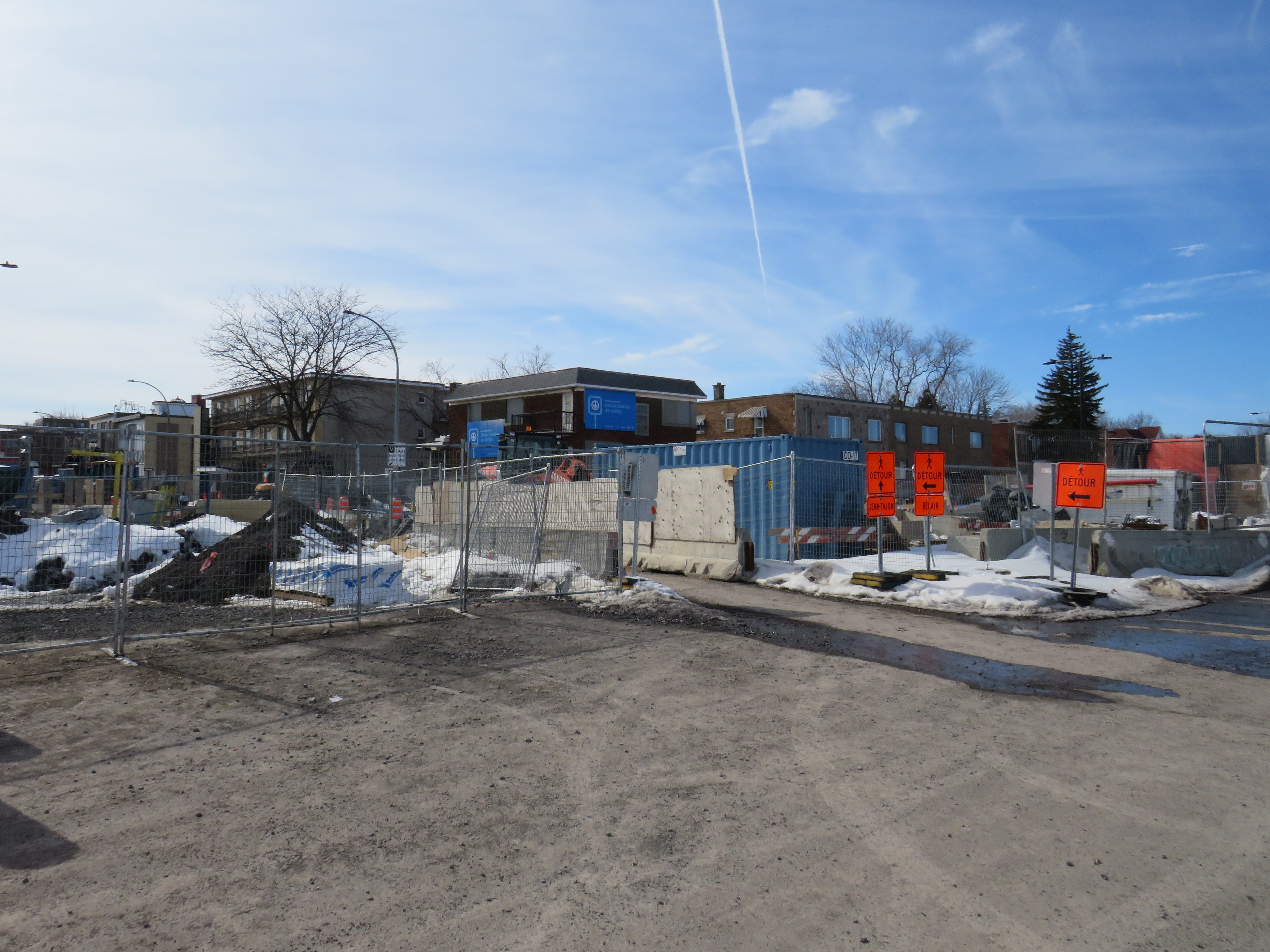
The intersection of Pie-IX and Jean-Talon, where a new Métro station is under construction
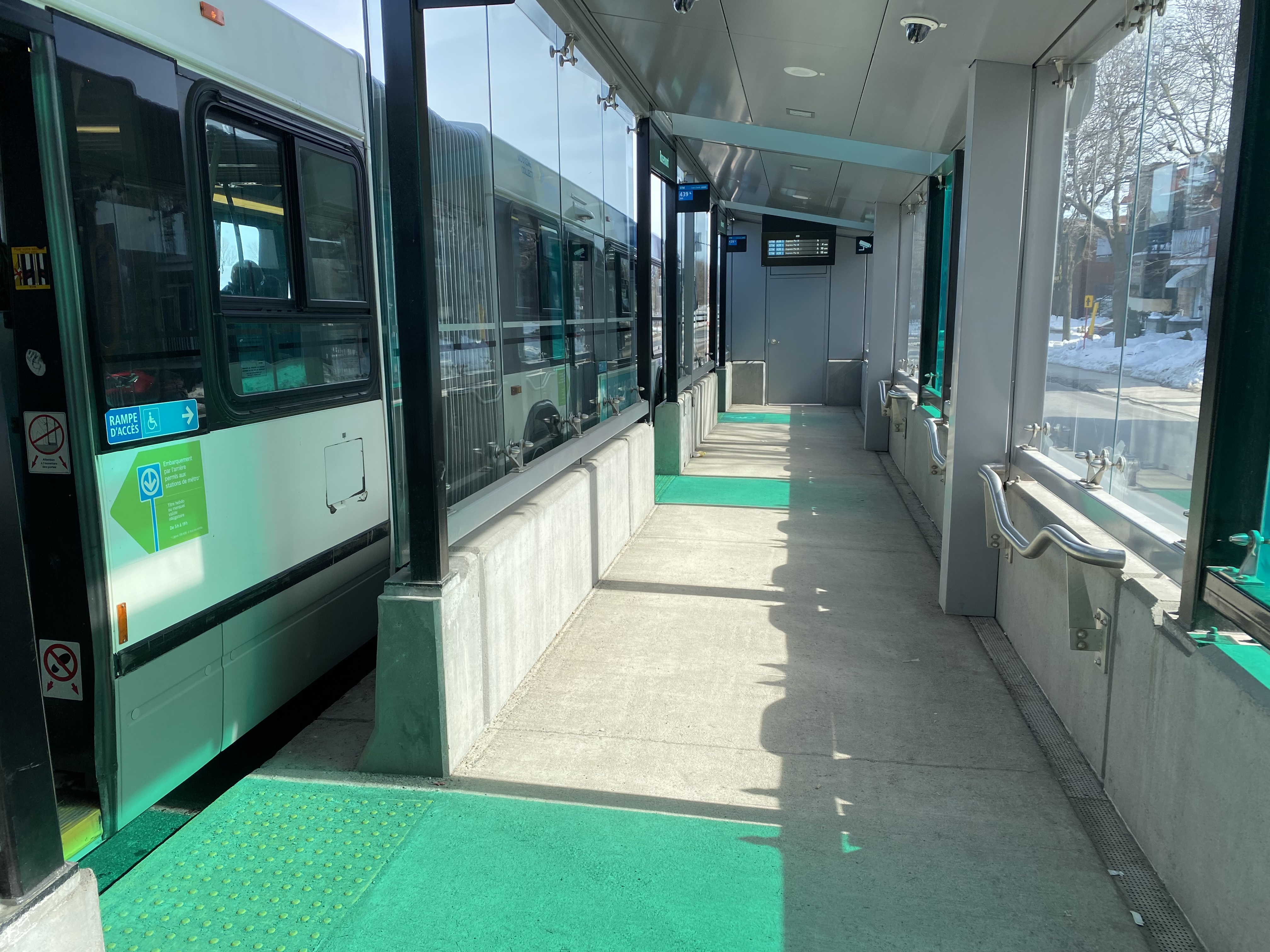
The 439 SRB route parallels the local 139 Pie-IX bus, and like other median busways, passengers board and exit at stops at the far side of the intersection. Though there is no fare pre-payment, passengers are permitted to board at rear doors with a valid Opus card or ticket. Shelters are simple, but the stained green glass lines up nicely with the gaps where the bus doors open.
Inside a SRB shelter
Unlike median busways elsewhere in Ontario or Quebec, buses are not slowed down by left-turning motorists as left turns are prohibited along the entire SRB corridor. This simplifies operations, allows for easier transit priority, and reduces the space required at intersections for dedicated left turn lanes. Unlike Laval, the crosswalks in Montreal were cleared and easy to traverse in winter.
Left turns are banned along the entire SRB corridor. Note the triangle light on the bus signal.
The current bus rapid transit alignment replaces an older, more dangerous set up where there was a central median where the inner lane was dedicated to buses in the opposite peak (contraflow) direction during weekday rush hours. Buses assigned to Pie-IX were equipped with special flashing arrows to warn oncoming motorists, along with overhead lights indicating the lane restriction. After several serious collisions, the arrangement was abandoned.
2009 Google Streetview image of the old Pie-IX express bus arrangement, where buses in the AM peak used the leftmost northbound lane to travel south, stopping at the median shelter. In the PM peak, northbound buses used the rightmost southbound lane.
Once again, Montreal shows how buses can be sped up without compromising safety or road space. Restricting left turns along the entire corridor was the right choice, and a solution that should be considered along some of Toronto’s busiest bus corridors as well.
Finally, rapid transit corridors on arterial roads are reliant on walk-up traffic, and should therefore be as easy and safe as possible to walk up to the transit service. This means effective and quick snow removal at crosswalks, pedestrian priority (there should be no beg buttons to push to access BRT/LRT stops), and proper pedestrian infrastructure and a walkable realm. The Viva Rapidways and the Laval Boul. Le Corbusier fail this basic criteria, while Montreal does a better job.
As Greater Toronto area plans more arterial LRT and BRT corridors, such as on Dundas Street in Mississauga/Oakville, and on Queen Street in Brampton, it would be wise to put transit and active transportation first, even if it means sacrificing a few left turn lanes.
Late last year, I wrote about the closure of the Hamilton City Centre mall, the last of Ontario’s downtown Eaton Centres to open. But Hamilton’s failed shopping centre wasn’t the only old downtown mall to close in recent years: Sarnia’s Bayside Centre, opened in 1982 as the Sarnia Eaton Centre, was recently demolished, with a seniors’ residence and long-term care home set to take its place.
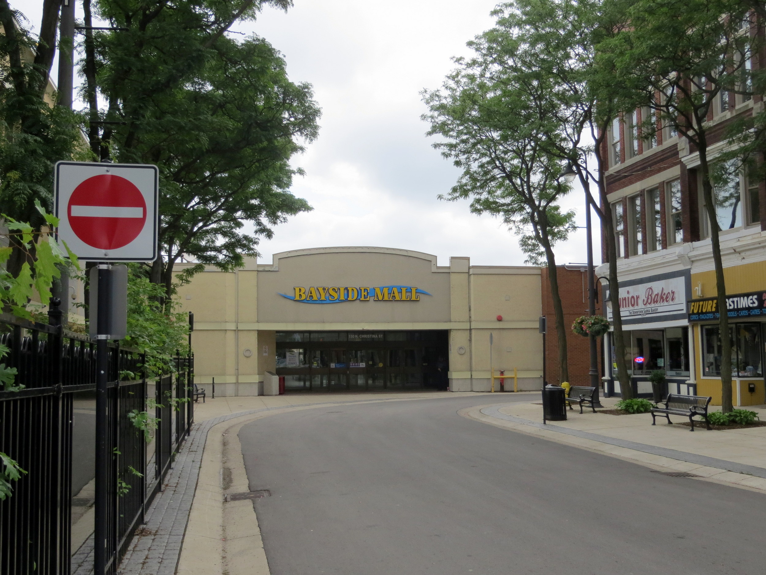
Bayside Mall in 2013
I previously visited Sarnia’s Bayside Mall in 2013, when the mall was already mostly dead. Community uses, such as a local museum, a Canadian Blood Services clinic, a seniors’ drop-in centre, and a March of Dimes office predominated, with only Hong Kong Express and Subway left in the food court, and a few other shops — a rug store, an optician, a beauty salon, and a pharmacy — scattered amongst the vacant storefronts. The old Eaton’s department store was already converted into offices for Lambton County’s social services department.
The old fountain at the main entrance to Bayside Mall in 2013.
As I discussed previously on this website, there was a downtown redevelopment boom across Ontario in the 1970s and 1980s, with municipalities and the province eager to support the construction of new shopping centres to help them compete with suburban malls.
The Sarnia Eaton Centre was the first of several malls funded by the Ontario Downtown Redevelopment Program, though previous downtown shopping centres, such as Hamilton’s Jackson Square and the Sudbury City Centre, were built with municipal support.
The case for Sarnia Eaton Centre was always weak, but it was the result of inter-municipal rivalry as much as it was an attempt to revitalize Downtown Sarnia. In the 1970s, Lambton Mall opened in the city’s outskirts, near the intersection of Highways 40 and 402. But Lambton Mall was built outside the city limits, in suburban Sarnia Township. Lambton Mall’s anchors included Sears, Canadian Tire, and Toys R Us.
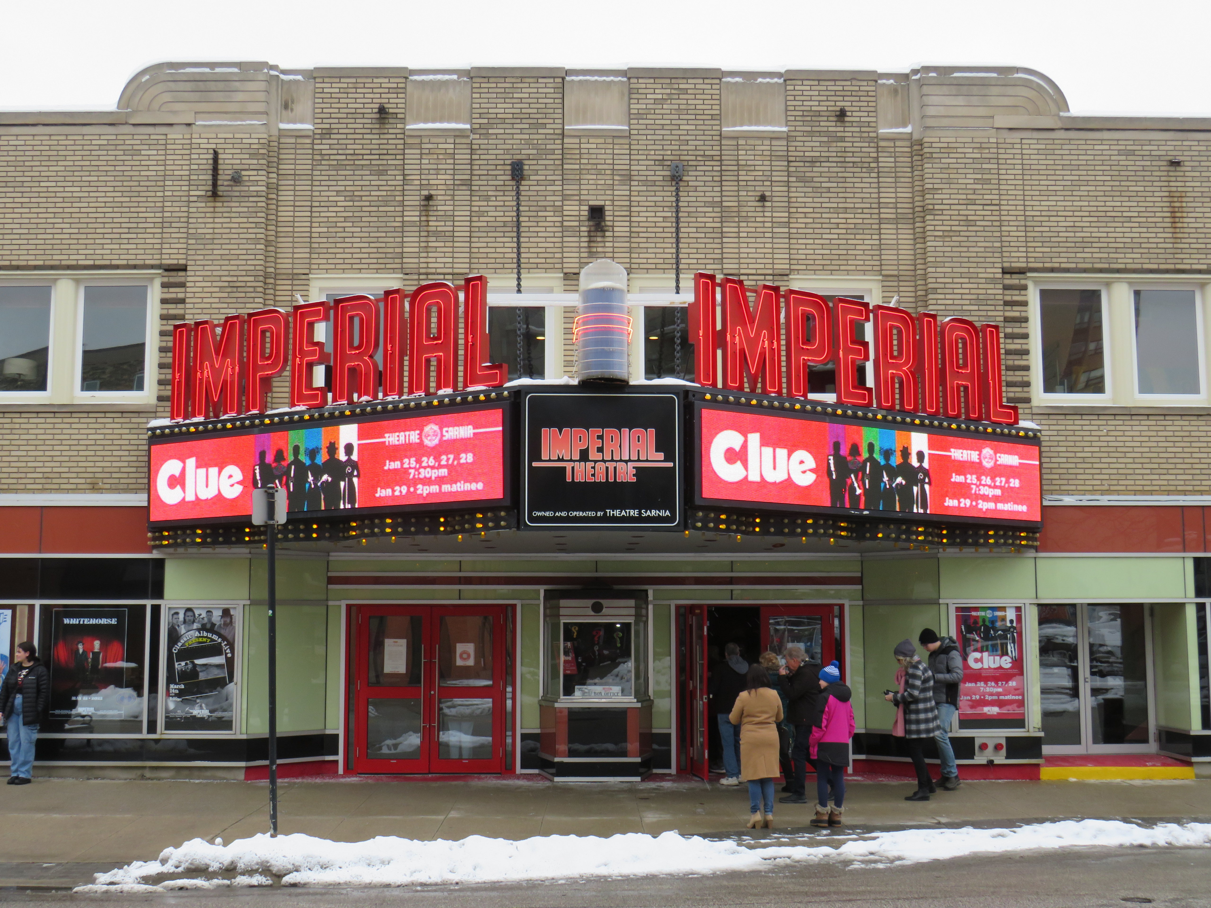
While Sarnia Township’s population was growing due to residential, industrial, and institutional growth (Lambton College’s main campus was also established in the township, near Lambton Mall), the City of Sarnia’s population declined. Along with the new Eaton Centre, the city also encouraged new highrise residential development in the downtown core, and two new office buildings were also constructed. The city – with support from Imperial Oil, a major employer – renovated the old movie theatre, converting it to a playhouse for local productions and touring shows.
The Imperial Theatre remains a popular attraction
When it opened in 1982, Sarnia Eaton Centre was the centrepiece of Sarnia’s downtown comeback. It filled in nearly four blocks of Downtown Sarnia, with Lochiel Street closed between Christina and Vidal Streets, and Victoria Street closed north of Cromwell.
The mall was anchored, of course, by Eaton’s, a smaller, two-storey store with 91,470 sq. ft. of floor space (just under 8500 square metres), and an A&P supermarket on the southern end. Sarnia Eaton Centre’s 1993 Canadian Directory of Shopping Centres, showed that the mall still had a healthy assortment of national retailers, along with some local businesses. But many retailers refused to renew their store leases, and when Eaton’s entered bankruptcy for the first time in 1997, the Sarnia store was among the first to close.
The City of Sarnia merged with Sarnia Township in 1991, while the area surrounding Lambton Mall continued to grow as the region’s commercial centre. Big-box stores such as Walmart and Home Depot clustered around the older mall, and even with Sears Canada’s closure, Lambton Mall continued to do well, with Marshalls/Home Sense taking over the old Sears store.
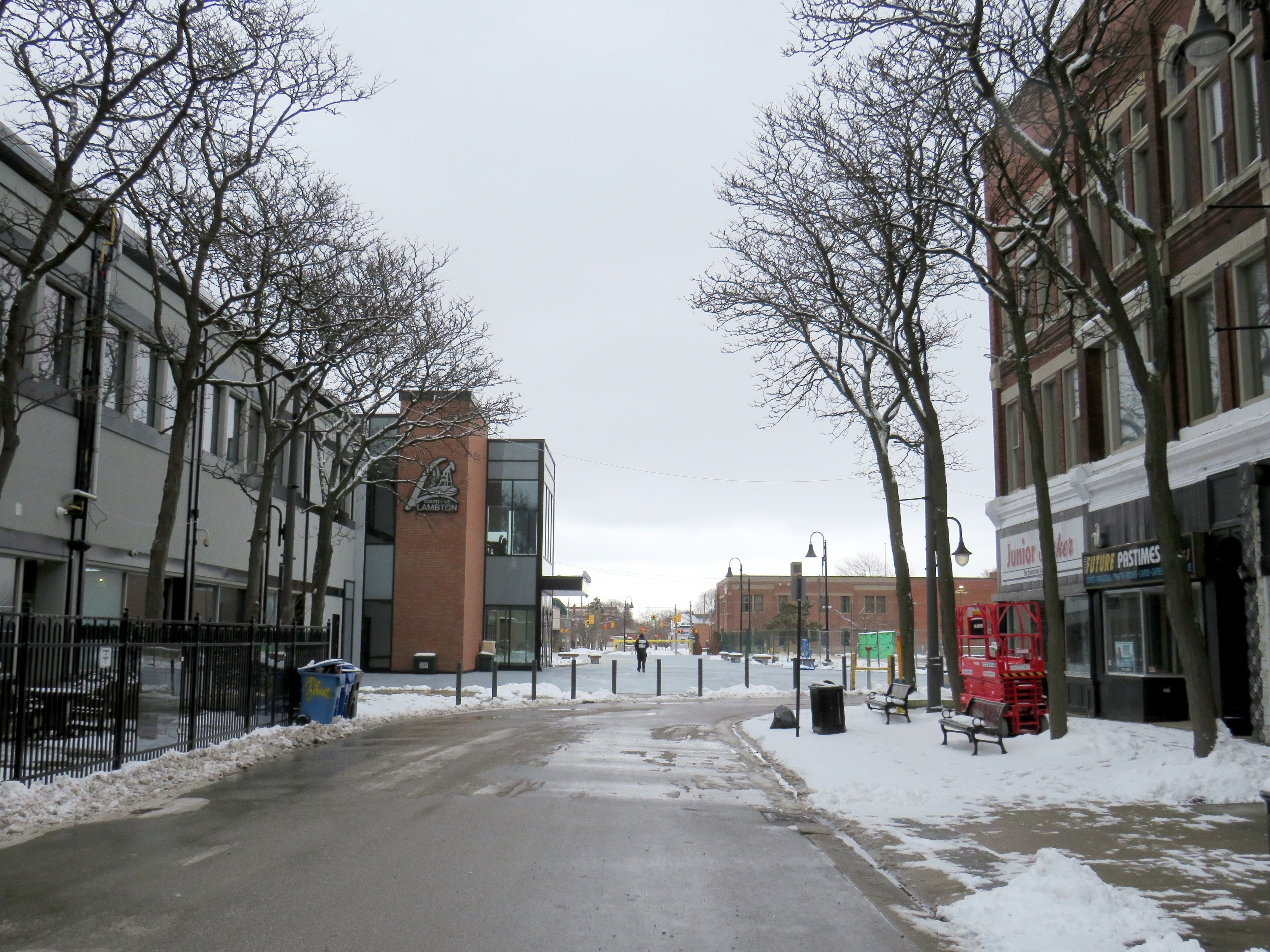
20132023
The Bayside Mall property was purchased by Seasons Retirement Communities in 2017, and most of the mall was demolished in 2021-2022. Lambton County, which operated its social services offices in the former Eaton store, expanded its footprint, with a new municipal courthouse located next to the old Eaton’s store, which was renovated.
Lochiel Street has been partially restored as a pedestrian walkway across the site, while the southern half of the old mall will be redeveloped for mid-rise seniors’ homes, with a central plaza.
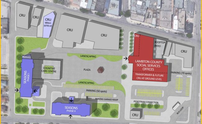
Map showing the redevelopment of Bayside Mall, with the Lambton County building, in red, already complete in early 2023. The top of the map faces west.
Meanwhile, Downtown Sarnia will continue to hold its own. It has a few nice restaurants, cafes and pubs, and the highrise development of the 1970s and 1980s ensures that there’s a local population that will frequent the businesses there. The addition of seniors housing won’t hurt either.
Below is the list of tenants at Sarnia Eaton Centre in 1992, obtained from the 1993 Canadian Directory of Shopping Centres, published by Maclean-Hunter. In 1992, the collection of retailers was still quite strong, largely driven by Cadillac Fairview’s leasing team.
Anchors
A&P (26,512 sq ft), Eaton’s (91,470 sq. ft)
Fashions and footwear Children’s wear: Just Kids Unisex/family wear: Le Chateau, D’Gala, Pantorama, Stitches, Thrifty’s Ladies’ wear: Fairweather, Irene Hill, Just Petites Lady Foot Locker, Lindor, Reitmans, Smart Set, Suzy Shier Menswear: Tip Top Footwear/leather goods: Agnew, Baronessa, Bata, Belinda & Brother, Joggers, Kinney, Mr. Minit Shore Repair Jewellery/accessories: Ardene, People’s
Other retailers Books/stationery: Carlton Cards, Garfield, WH Smith Health and beauty: Caryl Baker Visage, Shoppers Drug Mart Department store/mass merchandiser: Marks & Spencer, A Buck Or Two Electronics: Radio Shack Entertainment: Fun & Games Furniture & furnishings: Brass Collections Gifts: Things Engraved Hardware/paint & paper: St. Clair Paint and Wallpaper Housewares: The Royal Douton Store, Stokes Music/ records & tapes: Discus, Music World Pets: Tropicarium Pet Centre Photo/camera: Black’s, Japan Camera Restaurants & fast food: Elephant & Castle, Global Donuts, Hamby’s, Hong Kong Express, Kernels, Mykie’s, Viva Pasta Specialty food & drink: Laura Secord, mmmarvellous mmmuffins, Second Cup
Services Banks/financial: Canada Trust, TD Bank Hairstyling/esthetics: Regis Hairstylists Medical/dental: Tridont Dental Travel: Marlin Travel Misc: Infoplace
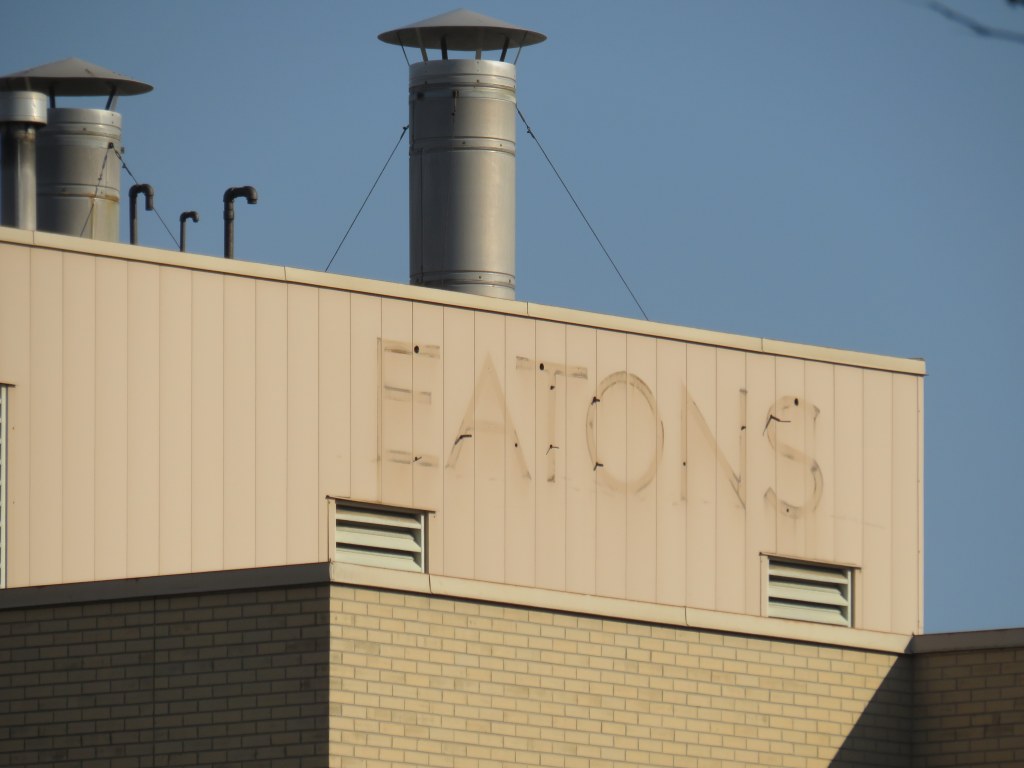
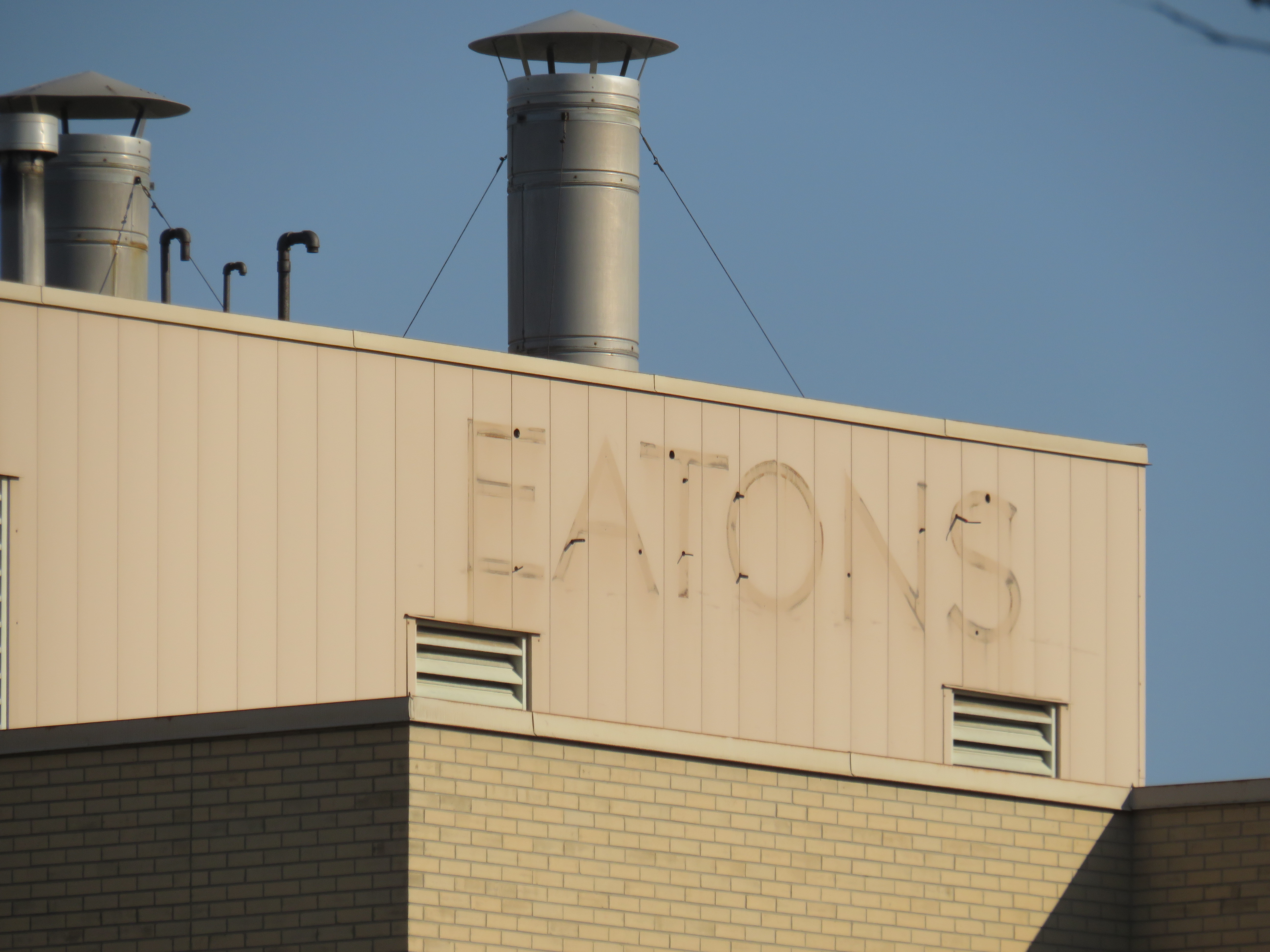
Main entrance to Hamilton City Centre, on James Street North. Note the awkward spacing of “City” over the entrance; it originally read “Eaton.”
On December 26, 2022, Hamilton’s former Eaton Centre, opened just 32 years ago, will close for good. Early in the new year, demolition will begin on the failed downtown mall, making way for a new residential development.
Hamilton Eaton Centre, fully opened in October 1990, was one of several downtown malls built in Ontario through a partnership between Eaton’s and commercial developer Cadillac Fairview, hoping to replicate the success of the Toronto Eaton Centre, which opened in phases between 1977 and 1979. It was the second major shopping centre to open in Downtown Hamilton; it followed the construction of the massive city-led Jackson Square development in the 1970s and 1980s in which entire city blocks were cleared to make way for urban renewal.
With support from the Ontario and municipal governments, the T. Eaton Company and Cadillac Fairview built new malls in Ottawa, Peterborough, Brantford, Kitchener, Thunder Bay, Sudbury, Sarnia, Hamilton, and expanded London’s existing Wellington Square. These private-public partnerships seemed to be beneficial; smaller cities worried about the decline of their downtowns would get an attractive new shopping centre after expropriating and demolishing existing buildings and/or providing municipal lands for the project. The municipality would finance new parking garages to support the new development. Meanwhile, Eaton’s would help finance the construction and provide a lead anchor for the new development. Cadillac Fairview, which specialized in retail and office development, would arrange the construction and the leasing for the mall stores. (There were a few downtown shopping centre projects in Ontario that did not have Eaton’s involvement, including malls in Chatham, Cornwall, Tillsonburg, and Waterloo.)
The old Eaton’s Hamilton Store in the 1920s, looking southwest from James Street North and (now disappeared) Merrick Street (Hamilton Public Library)
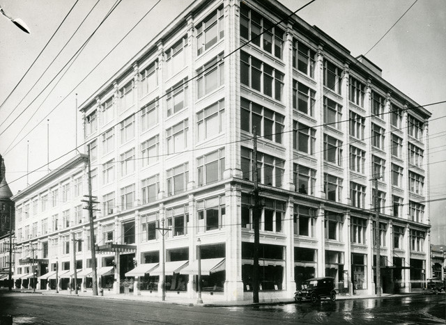
Unlike malls in Kitchener, Sarnia, Brantford, or Guelph, the Hamilton Eaton Centre was mostly built upon lands already acquired by Eaton’s itself, much like the larger and more successful Toronto Eaton Centre (the city of Hamilton assisted by closing Merrick Street between York Boulevard and James Street and transferring the right-of-way for the new development). The first phase of the project, built on the site of the Merrick Street parking garage and the old Hamilton Farmers Market, became the home of a new four-storey Eaton’s store to replace the dilapidated building on James Street. When the new store opened in April 1989, the old store was quickly demolished to make way for the mall itself, which opened just 18 months later.
The new Eaton’s Hamilton store on York Boulevard soon after opening in 1989. The store had exits to both Jackson Square and once completed, the new Eaton Centre mall. (Hamilton Public Library)
At first, Hamilton’s Eaton Centre was able to attract prestigious tenants such as HMV and Eddie Bauer thanks to Cadillac Fairview’s expertise and new office development in Downtown Hamilton, including a new CIBC office complex. The new mall was also able to attract existing downtown businesses out of storefront retail and the older Jackson Square mall.
YouTube video showing the exterior and interior of the old Downtown Hamilton Eaton’s store prior to closing, as well as its demolition in 1989 to make way for the new Hamilton Eaton Centre (via Hamilton Sight & Sound YouTube channel)
However, as I discussed previously on this website, the malls developed by Eaton’s and Cadillac Fairview did not do well in most markets. New, full-line Eaton’s stores were a poor fit for smaller, industrial cities like Peterborough, Brantford, and Sarnia. The malls themselves were more difficult to get to by car, and shoppers usually had to pay for parking. The established suburban malls were typically larger, and they offered ample free parking. By 1990, the old, large industries were in decline due to free trade and industrial automation, and in the 1990s, a new retail format — the big box “power centre” — emerged as serious competition during a major recession. And in 1994, Walmart entered the Canadian market.
The former Hamilton Eaton Centre (known as Hamilton City Centre since 2000) from the corner of James Street North and York Boulevard. The clocktower on the corner is an homage to the old Hamilton City Hall, which was demolished in 1960. The clocks themselves were originally installed in the old city hall and will be preserved when the current building is demolished.
With low traffic and many national retailers unwilling to renew their leases, Cadillac Fairview divested itself of most of its downtown malls. It sold its half-stake of Hamilton’s Eaton Centre to the T. Eaton Company in 1995 (Of its downtown malls, Cadillac Fairview would only hold onto the flagship Toronto Eaton Centre, and the Rideau Centre in Ottawa). According to a Hamilton Spectator article from that year, one of the mall’s three floors was already closed, just five years after its grand opening.1 Among the tenants that left the mall early was upscale men’s clothier Harry Rosen. By 1996, only 50 of the 120 stores outside the Eaton’s department store were still occupied, with another six stores closing early that year.2 A McMaster University business school lecturer predicted that one of the two downtown malls — Eaton Centre or Jackson Square — would close within 10 years. (He was only 15 years off the mark.)2
In February 1997 — after years of mismanagement and neglect by the fourth generation of the Eaton family — Eaton’s entered bankruptcy protection, allowing it to settle debts and restructure. Though stores in other downtown malls in Brantford, Sarnia, and Kitchener were among the first to go, the Downtown Hamilton store was left off the closure lists, as Eaton’s itself owned the property – losing the department store anchor would not help the mall in case of a property sale. In the meantime, Metrus Developments — which purchased the neighbouring Lister Block in 1989 — evicted its remaining tenants and boarded up the six-storey commercial building, hastening Downtown Hamilton’s visual and commercial decline.
In 1998, the Region of Hamilton-Wentworth (dissolved in 2001 after amalgamation) began leasing space on the formerly vacant third floor of Hamilton Eaton Centre, partly to help maintain the department store’s presence and support Eaton’s, which still owned the property. The City of Hamilton agreed to provide two hours of free parking at the attached York Boulevard garage and planned for the construction of a new store entrance to the Hamilton Farmers’ Market. This was just enough to keep the department store open until the company collapsed in 1999; the store closed for good in October of that year. The mall was rebranded Hamilton City Centre the year after, sold to a private real estate firm.
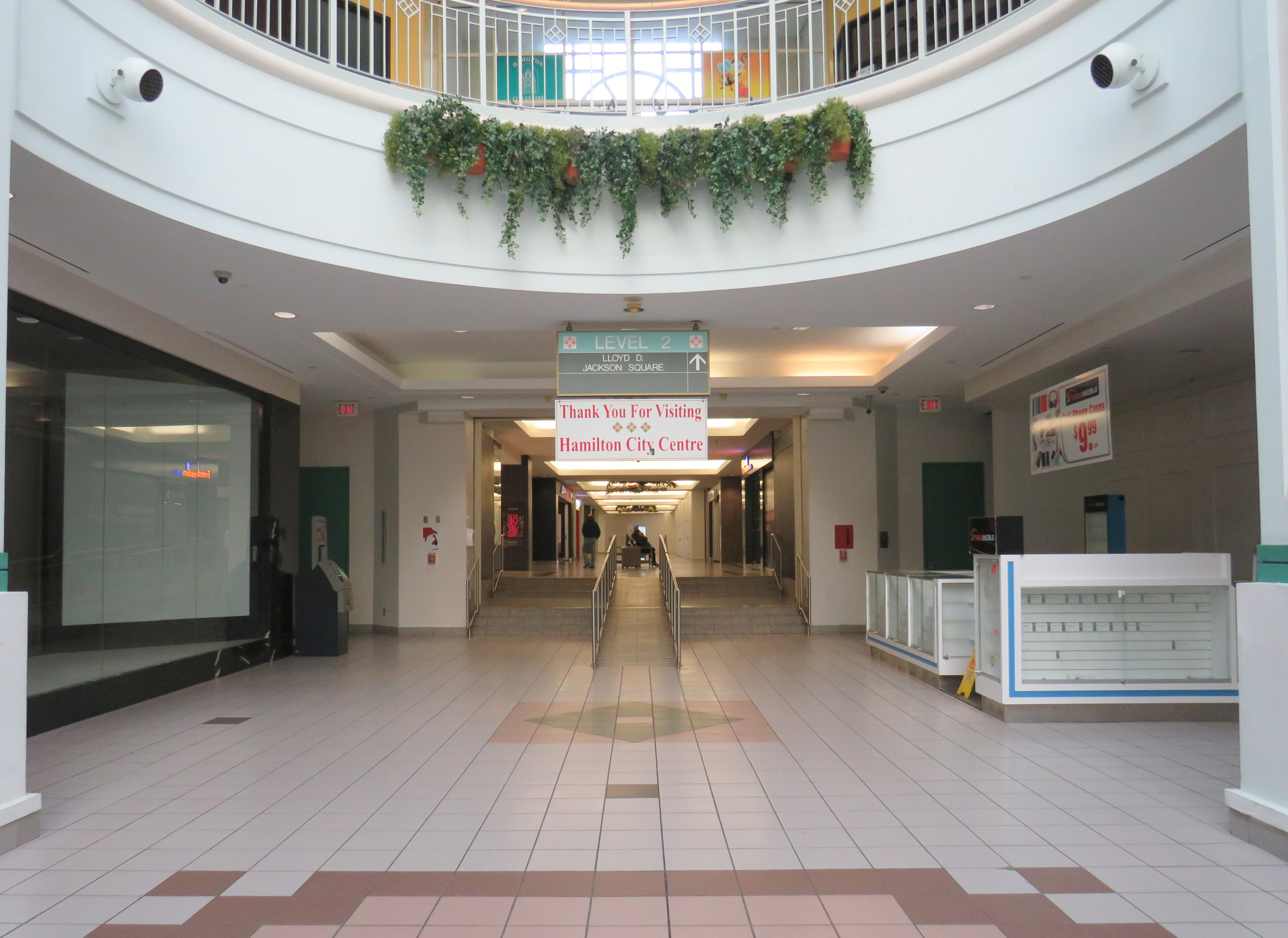
View from the third floor in Hamilton City Centre; the conversion of retail space to offices on the top level is apparentThe central atrium. All remaining stores must close by December 26, 2022.The connection between Hamilton City Centre and Jackson Square. This was originally the main route between the old Eaton’s store and the first phase of the 1970s-era mall. The largerJackson Square will undoubtedly benefit from the residential re-development of the Eaton’s site.
After Eaton’s closed, part of the massive retail space was renovated and turned into a fitness club. The City of Hamilton leased additional space in the old Eaton’s store, especially as it undertook renovations to its modernist 1960s-era city hall. New windows were punched into the brick facade to provide natural light to the new occupants. But the remaining national retailers like HMV, Fairweather, and Eddie Bauer left the mall, while a few small, independent retailers came in, attracted by cheap rents.
A fresh labelscar on the south-facing roof of the Eaton’s store, as seen from the patio on top of Jackson Square. Until 2021, a forgotten and unmaintained Eaton’s sign was left alone, hidden from street level.
The new development will have 1,940 residential apartments, along with street-level retail and office spaces, constructed in three phases. Walkways will allow the public to cut through the property, with one of those roughly following the old Merrick Street alignment. Unfortunately, it is being developed and planned independently of the rest of the Jackson Square superblock bound by James, King, and Bay Streets, and York Boulevard, and which also contains the farmers market, the central library, and Copps Coliseum, the sports venue built for an NHL franchise that never arrived.
But with the influx of new residents, Jackson Square — which, despite is retail vacancies, holds its own due to the attached office, hotel, and civic functions, as well as the full-service Nations supermarket — will only benefit from the demise of its newer downtown competitor.
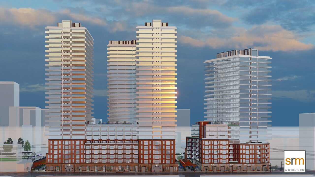
Rendering for the new development on the Eaton Centre site by SRM Architects.
“Eaton eyes the future after buying centre” Hamilton Spectator 13 July 1995: D12.
John Burman. “A tough sell: Struggling Eaton Centre looks for new direction” Hamilton Spectator 13 Feb 1996: A1
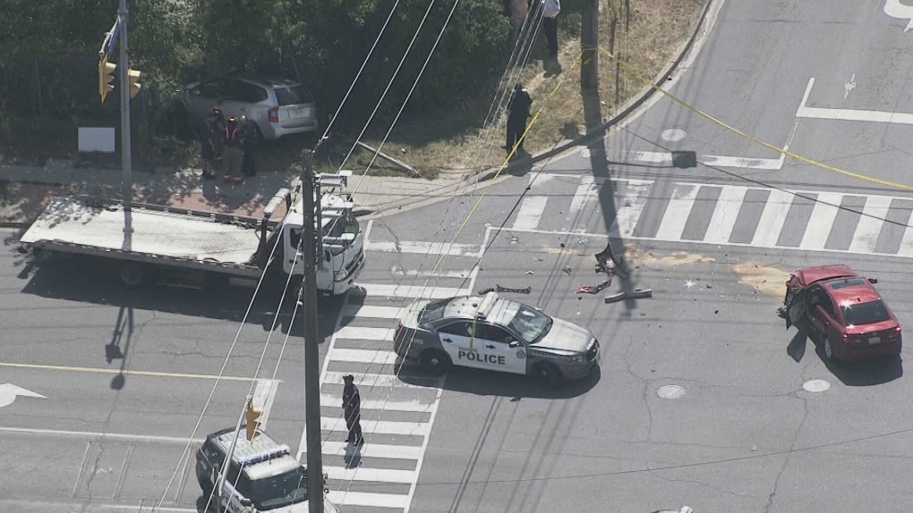
On Thursday, July 21, 2022, at 3:10 PM, a 38-year-old man was standing at a street corner in Scarborough, waiting for a signal to safely cross to the other side. Before he even had the chance to enter the intersection of Warden Avenue at Comstock Road, a driver of a 2009 silver Kia minivan heading south on Warden struck a 2012 red Lexus, whose driver was making a left turn from Warden to Comstock.
Aerial view of the collision, courtesy of CTV News. The Kia minivan struck a 38-year-old man waiting at the corner before plowing into a fence protecting a vacant lot.
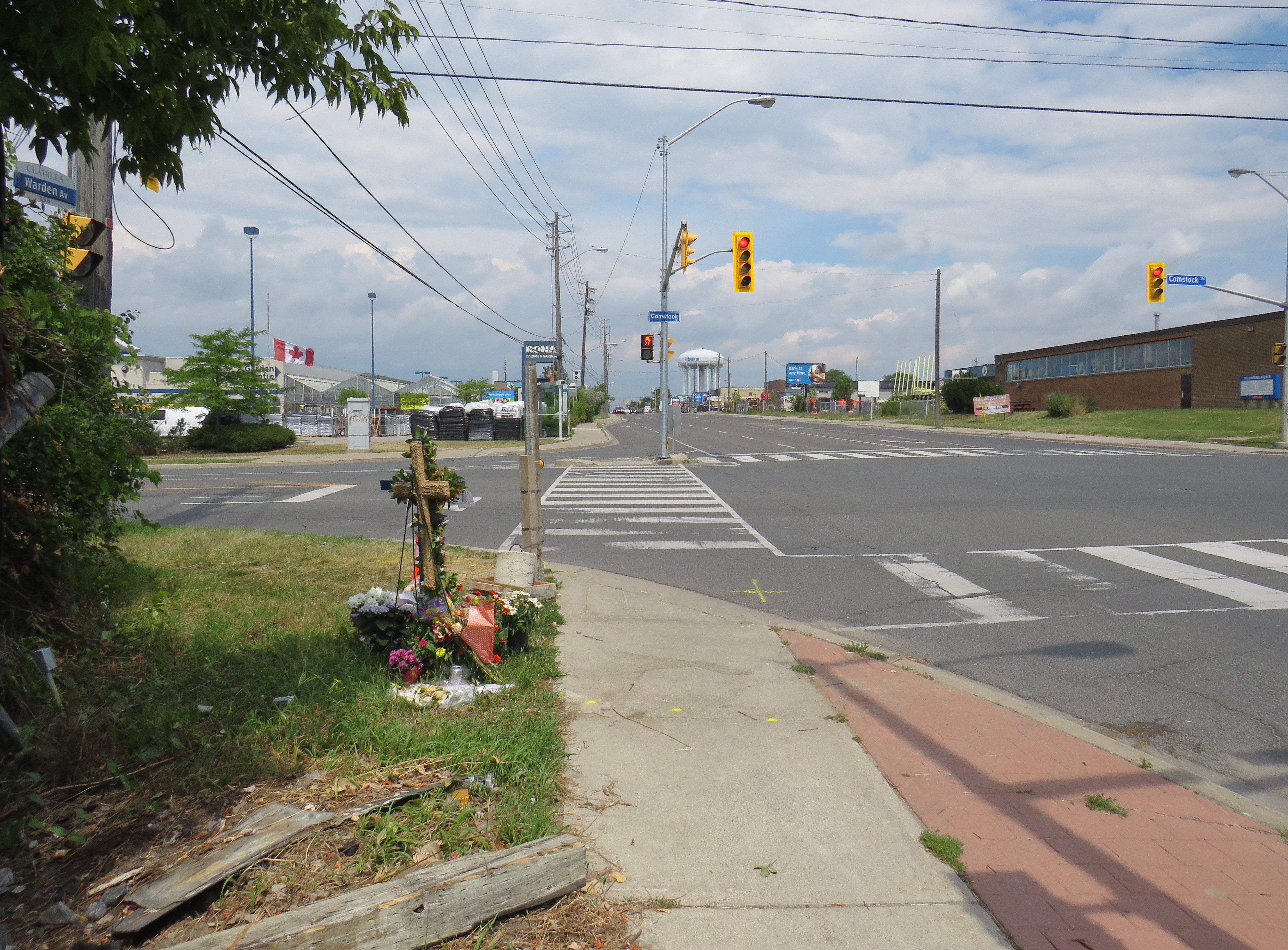
A week after the deadly collision, I visited the intersection. On the southwest corner of Warden and Comstock, a roadside memorial was set up with flowers and a wooden cross. A temporary wooden pole held up a new pedestrian “beg button” for walkers to get across Warden Avenue. The Kia’s path into the sidewalk and the fence was very much visible, though all debris from the collision was cleaned up.
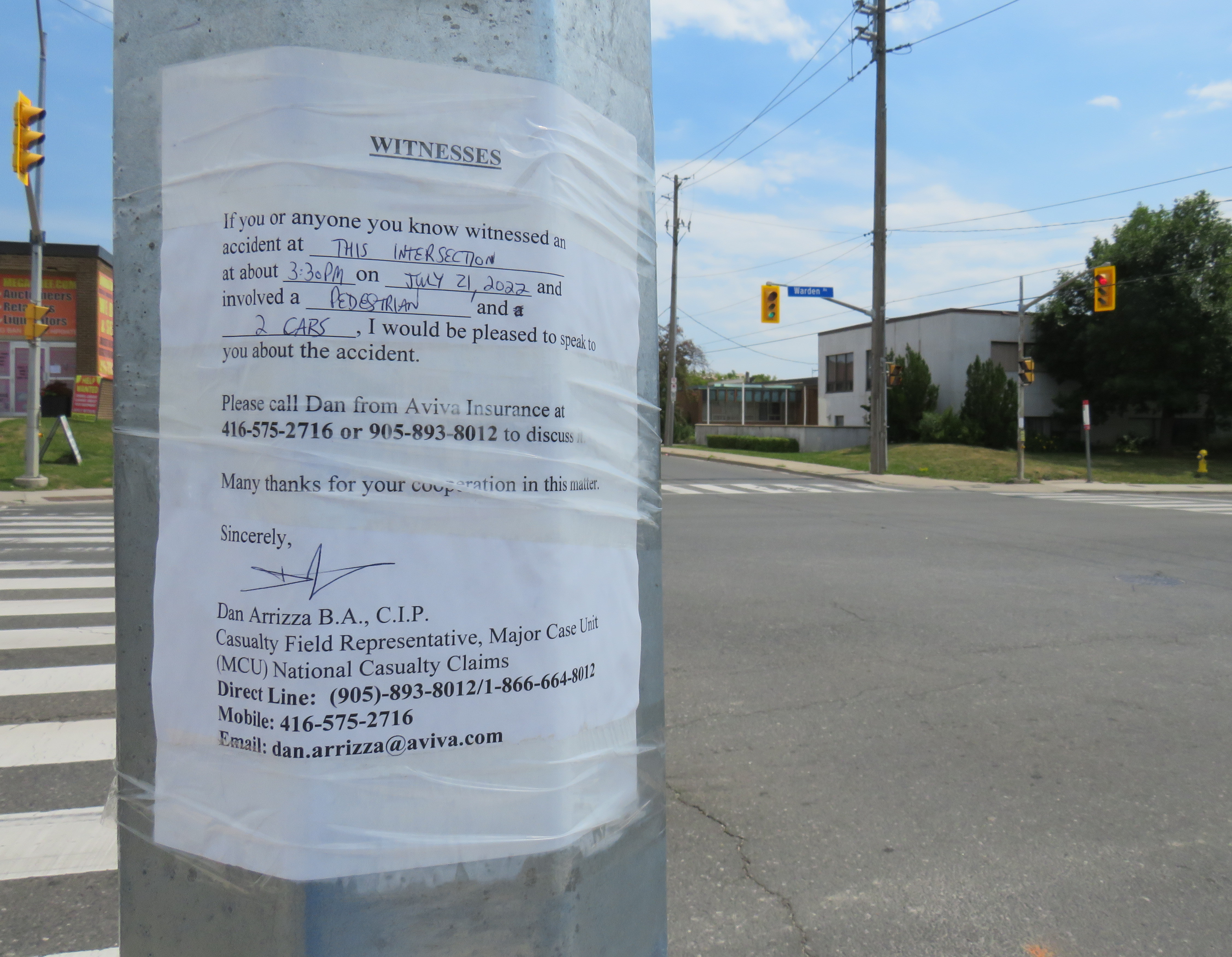
Appeal to witnesses following a deadly collision at Warden Avenue and Comstock Road
The collision was still being investigated. While the Toronto Police were looking for witnesses to the collision, an investigator from Aviva Insurance was also looking for witnesses; several notices were taped to nearby traffic poles.
Without knowing all the facts of the collision — which are unlikely to be reported in the news media — it would be fair to assume that speed and/or inattentive driving were at fault, but the design of the intersection — as well as Warden Avenue and Comstock Road themselves — are also to blame.
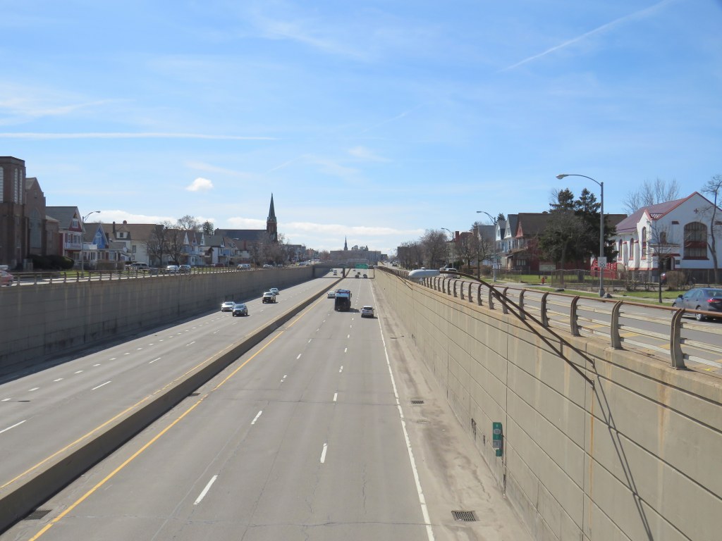
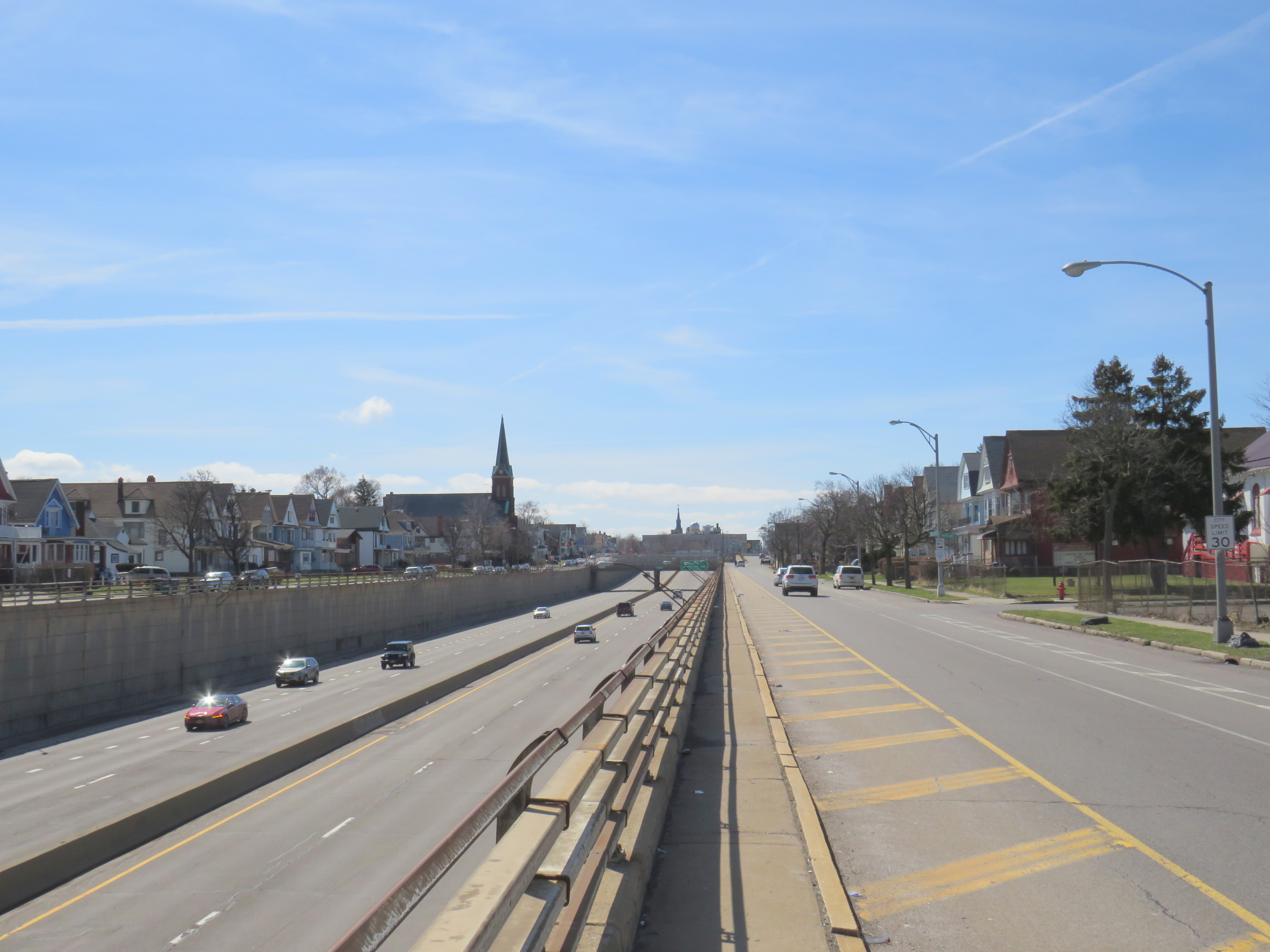
Just two blocks away from the Jefferson Avenue Tops supermarket is Buffalo’s Kensington Expressway.
The high-speed roadway, built with New York State funding, was built in the late 1950s to connect Downtown Buffalo with the New York State Thruway and the airport. The highway went through Buffalo’s East Side, historically Polish-American neighbourhoods that were becoming home to working-class and middle-class African-American families.
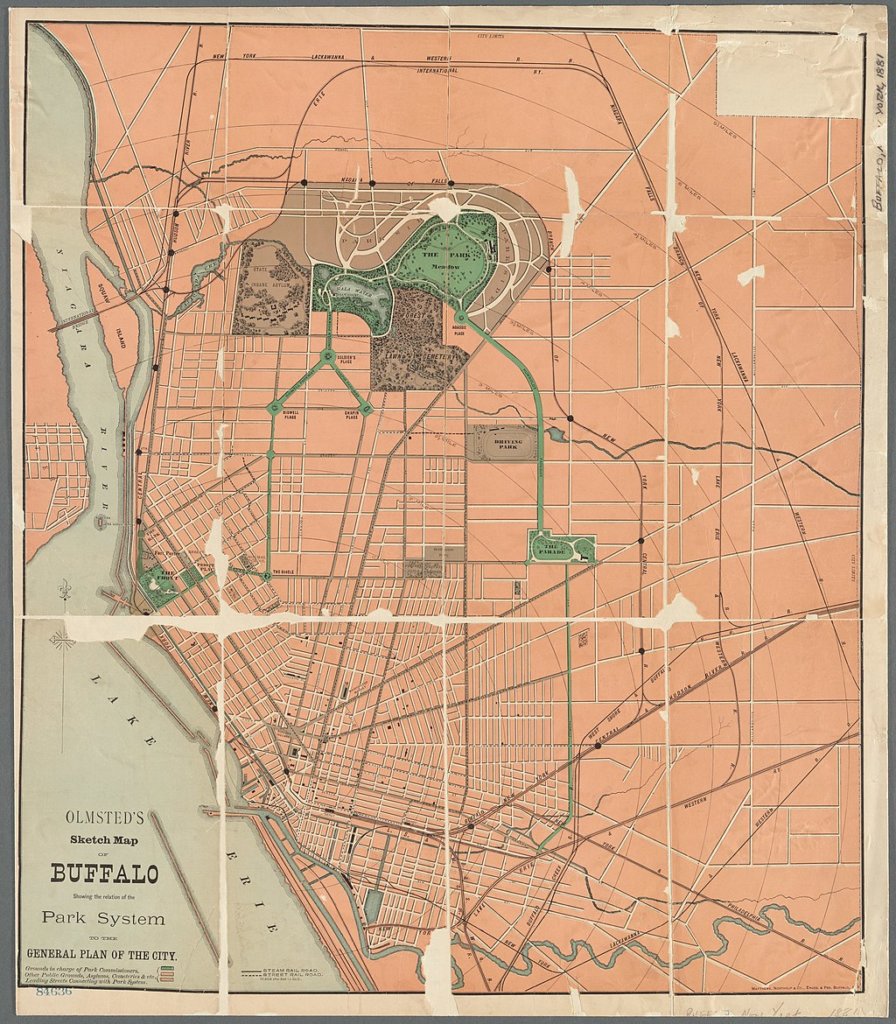
Ironically, a parkway system planned by famed landscape architect Frederick Law Olmsted beginning in the 1860s helped highway planners 90 years later route their new highway. Olmsted had planned large park spaces throughout the city, with wide, treed parkways connecting the spaces together. Delaware Park, to the north, was the largest of these green spaces. In 1901, it was the site for the Pan-American Exposition (which became infamous as the location of the assassination of President William McKinley), while Humboldt Park, on the city’s east side, became a popular neighbourhood gathering place. Humboldt Parkway connected these two parks with a wide, gentle curve.
Part of the Olmsted Parks and Parkways plan, Buffalo. Humboldt Parkway curves southeast from Delaware Park near the top of the map.
Of course, city planners of the day, who were guided by the “City Beautiful” movement, never conceived of a time when automobiles would present a new challenge to urban places. From the opening of the Erie Canal in the 1830s to the exploitation of cheap, renewable hydro-electric power at nearby Niagara Falls in the 1890s and early 1900s, Buffalo was going to be a jewel of the Great Lakes, and it needed skyscrapers and public spaces to match its optimism and ambition.
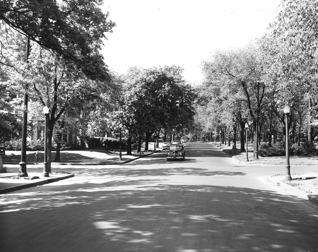
Humboldt Parkway in 1953, with a wide, treed median on the right (The Buffalo History Museum)
By the 1950s, Buffalo’s growth had plateaued, and the city started losing population to the suburbs, as white middle class families took advantage of generous federal mortgage incentives, and the automobile made suburban living easy. Redlining — a practice in which banks and federal mortgage underwriters graded neighbourhoods based on their physical and socioeconomic statuses — made mortgages in “declining” or “hazardous” areas difficult or impossible to get. These resulting grades discouraged investment in the housing stock and made it especially difficult for Black families to purchase homes. Racism and xenophobia was embedded in the system: areas that Eastern European immigrants were seen to be “infiltrating” were typically marked as “definitely declining” and areas settled by Black households were marked as “hazardous.”
In Buffalo, a 1937 redlining map reflected the segregation that would define the city to this day: most of the city east of Main Street was classified as “definitely declining” or “hazardous.” Houses facing Humboldt Parkway were marked as “still desirable” as it is “a small area which maintains its desirability because of location on both sides of an attractive parkway.” That parkway would disappear 20 years later.
Though the Niagara branch of the New York State Thruway connected Downtown Buffalo to Niagara Falls, the main Thruway, and Canadian border crossings, mostly following rail corridors, city leaders felt that without additional urban highways, Buffalo would lose investment and that more residents and employers would leave the city for the suburbs.
In 1954, City Planning Director Russell Tryon declared that the new ring highway “would be a major step forward in alleviating the traffic blight that has diseased our neighborhood communities” while believing that highway construction might help keep people in the city, rather than literally drive them to suburbia. “If we make Buffalo a better place in which to live, the people will stay and not move out.”
The Scajaquada Expressway through Delaware Park
To build the new highway, planners looked for the paths of least resistance: Olmsted’s parkway system and redlined neighbourhoods where properties could be bought up cheap. None of the parkways on Buffalo’s West Side (which was, and remains, mostly white and middle class) would be sacrificed, but the Humboldt Parkway, on the East Side, would be. The Scajaquada Expressway, across the city’s north side, ran right through the signature Delaware Park. The Kensington Expressway — New York State Route 33 — required the demolition of hundreds of homes. Many displaced residents moved into public housing towers on Fillmore Avenue — which were later abandoned and demolished.
The abandoned Kensington Heights public housing buildings on Fillmore Avenue in 2010
The highway only helped to destroy Buffalo’s urban fabric and contributed to the economic and population decline in the East End.
Buffalo was not alone. In Detroit, Interstates 75 and 375 were routed right along Hastings Street, the commercial and cultural hub for the Motor City’s Black community. In Baltimore, Interstate 70 was to go right downtown through the city’s West Side. The section through a Black neighborhood was built, but the western extension through Baltimore’s western suburbs was never completed, leaving behind a scar known as the “Highway to Nowhere.”
Baltimore’s Highway to Nowhere
In Buffalo, the East Side community struggled for decades to get a full-service supermarket after A&P left in the 1960s after the new highway was built. It finally landed Tops Friendly Markets on the A&P site in 2003. This grocery store — the only one serving over 100,000 residents in Buffalo’s East End — became the site of Buffalo’s worst mass shooting, in which a white teenager targeted Black shoppers. The closure of that store only compounds the tragedy as fresh and affordable food has become, once again, even harder to access.
Despite new highrise development in its city centre, Mississauga lost 3,368 residents between 2016 and 2011
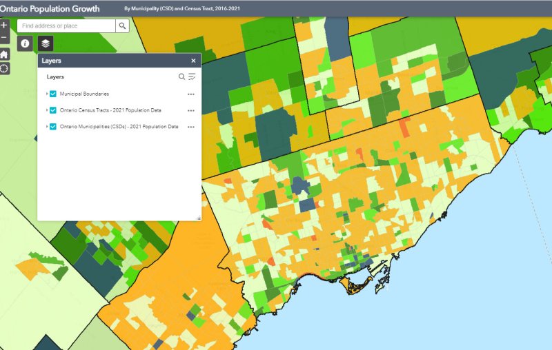
On February 9, data geeks across Canada rejoiced when Statistics Canada released the first round of data from the 2021 Census of the Population.
The data was released at all levels of geography made available by Statscan. At the federal level, Canada grew by 5.2% since the 2016 Census, with a total population of 36,991,981. Immigration, rather than natural growth (births vs. deaths) drove Canada’s population increase.
Of course, this growth did not occur evenly across the country. Newfoundland and Labrador lost residents, while Prince Edward Island and British Columbia saw the biggest population increases.
Within the Greater Toronto and Hamilton Area, Mississauga experienced population decline (-0.5%) for the first time since it became a city in 1974. Outer suburbs, such as Milton, East Gwillimbury, and areas just beyond the GTHA, such as New Tecumseth and Bradford saw population growth over 20%, driven by new greenfield development.
In older Toronto suburbs, including much of Etobicoke, North York, Scarborough, and even Mississauga, population losses at the local census tract level can be explained by ageing households, where Millennial and older Gen Z children moved out on their own, particularly into fast-growing downtown areas. These areas, dominated by single-family housing, could accommodate much of the GTHA’s growth with gentle density, including secondary suites (such as basement apartments), garden suites, and zoning policies that would make it easier and more economical to build “missing middle” housing such as walkup apartments and multiplex homes.
Toronto grew by 62,785 residents in the last five years, with only a few areas accommodating all that growth: the downtown core between Dufferin Street and Broadview Avenue, South Etobicoke, Yonge-Eglinton, and former industrial, instructional, and commercial lands stretching along the Highway 401 corridor through North York and West Scarborough. This corridor includes the Downsview Park development, a new condominium cluster at Wilson Subway Station, the former Canadian Tire lands near Sheppard Avenue and Leslie Street, and the intensification of the Fairview Mall area.
On Thursday, August 12, I rode the train to the very end of the Richmond Hill Line to check out GO Transit’s newest station.
In 2017, I made a similar trip to Gormley Station, just to the south of Bloomington GO, soon after that station opened to the public. Four years ago, I was critical of Metrolinx’s failures to support the urban intensification of the Greater Toronto and Hamilton Area (GTHA) by building new stations on the Greenbelt, on lands that will not support transit-oriented development.
Though I came away from Gormley Station disappointed, I wanted to see Bloomington Station for myself and give it an honest assessment. I came away with mixed feelings.
Most GO Stations outside the old City of Toronto put free car parking ahead of all other considerations. Some stations, such as Unionville, were even moved to sites where large surface lots could easily be built. Hamilton GO Centre, opened in 1996, was an exception: an urban station that combined a restored heritage building with a large bus terminal. A few other newer stations, such as Mount Pleasant in Brampton and Mount Joy in Markham, still had large surface parking lots, but also had easy walking connections to adjacent neighbourhoods. In Guelph and Kitchener, GO Transit used existing downtown stations instead of suburban stations, and Allandale Waterfront Station is located right across the street from Barrie’s gorgeous Kempenfelt Bay.
Gormley and Bloomington Stations represent a return to GO Transit’s old ways of putting parking ahead of all other considerations, despite Bloomington’s modern design.
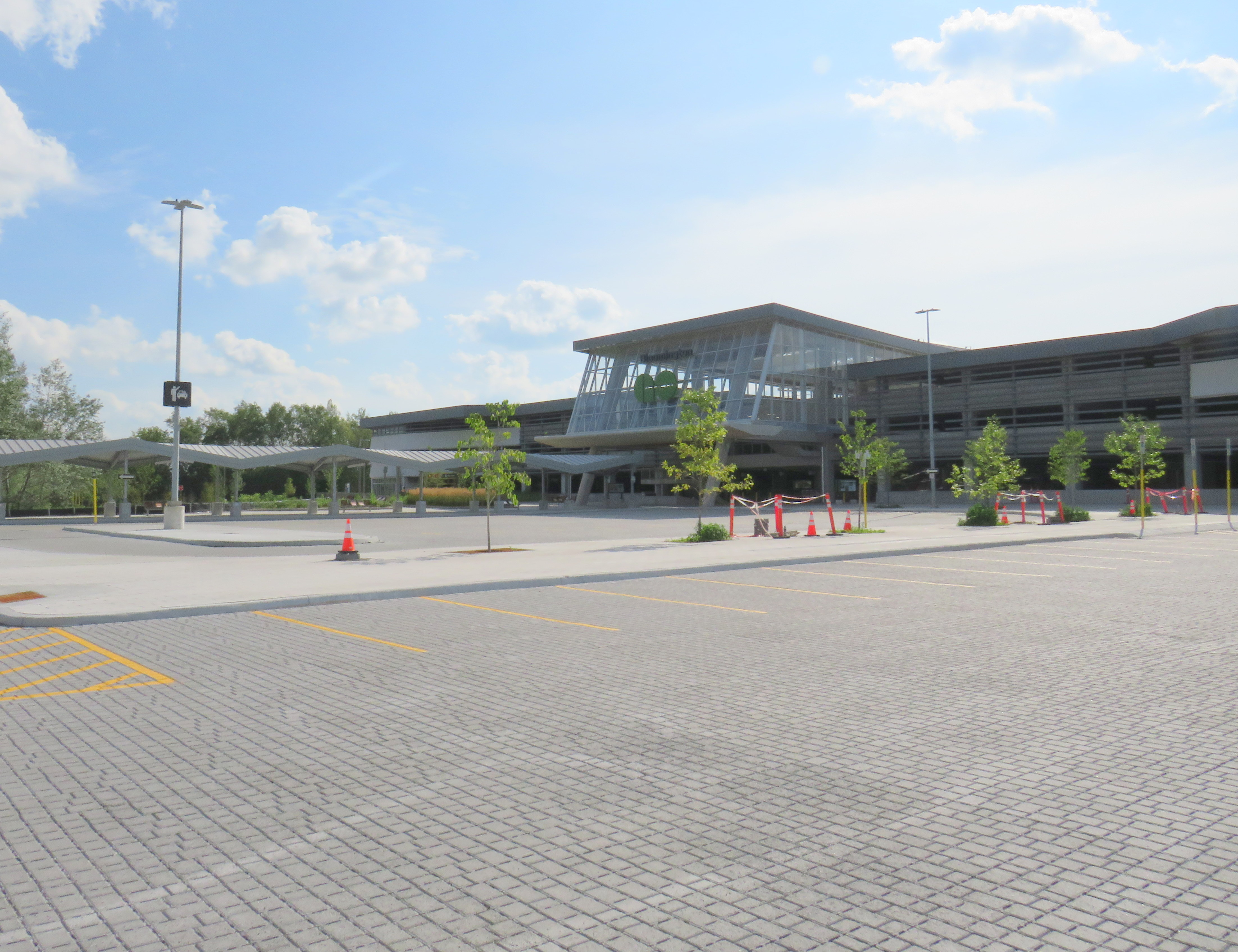
Metrolinx, the provincial agency responsible for planning and constructing transit infrastructure in the GTHA and for operating GO Transit, opened Bloomington Station on June 28, 2021. The station is located on Bloomington Road, adjacent to Highway 404, on the boundary between Richmond Hill and Aurora.
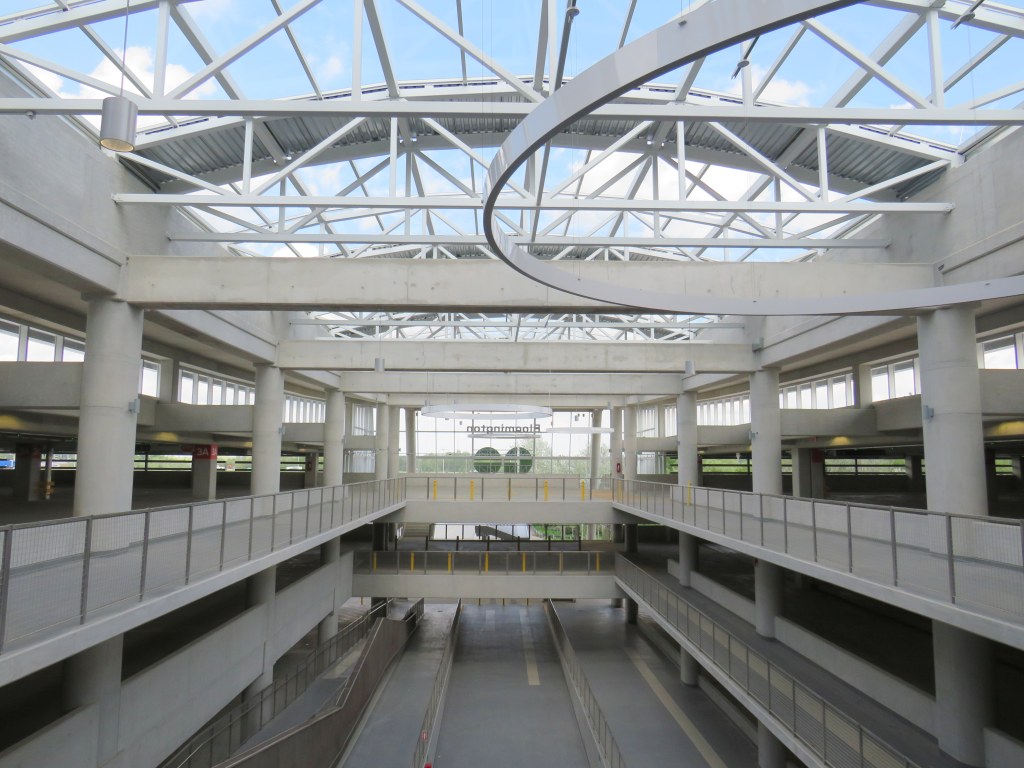
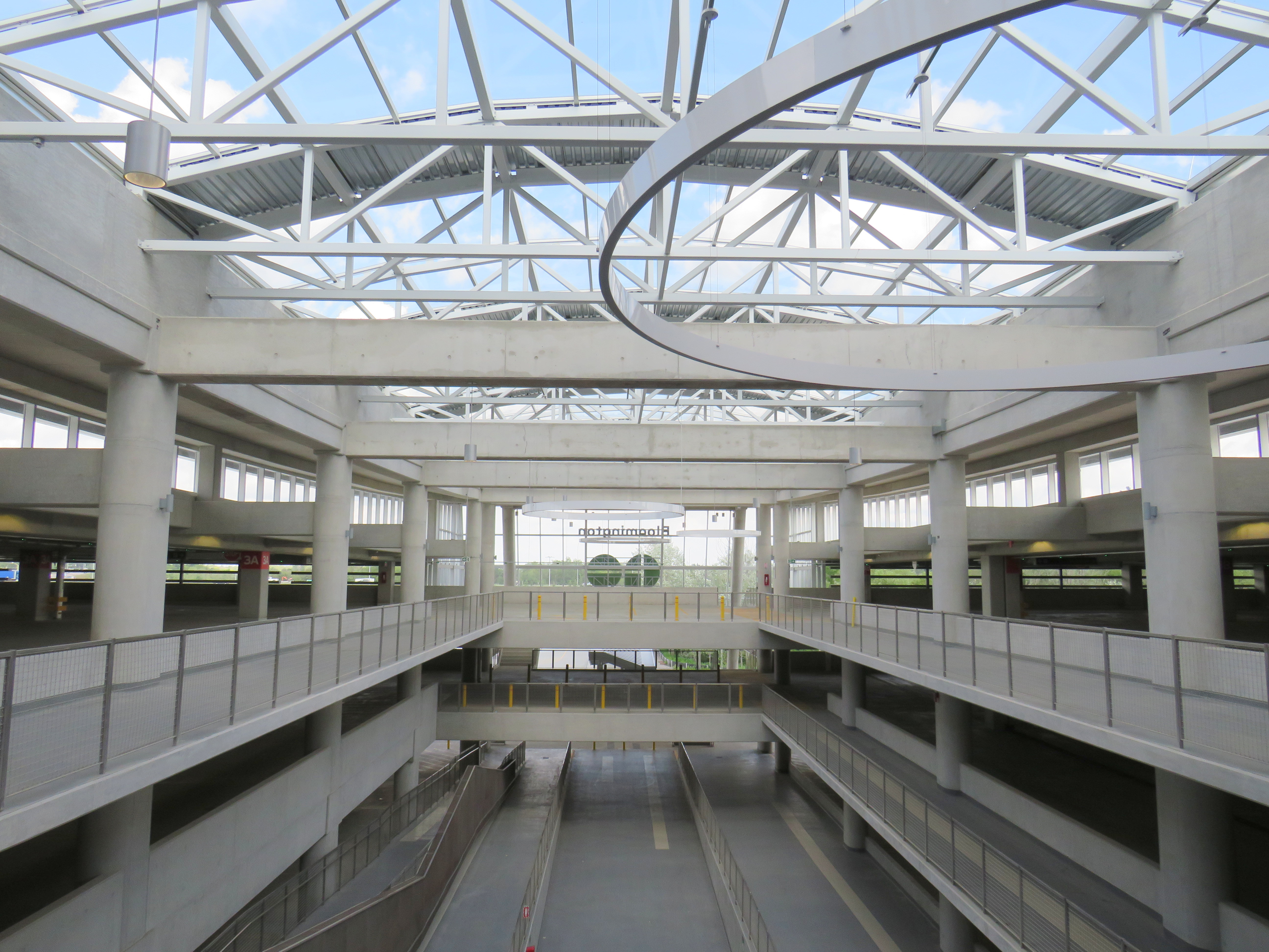
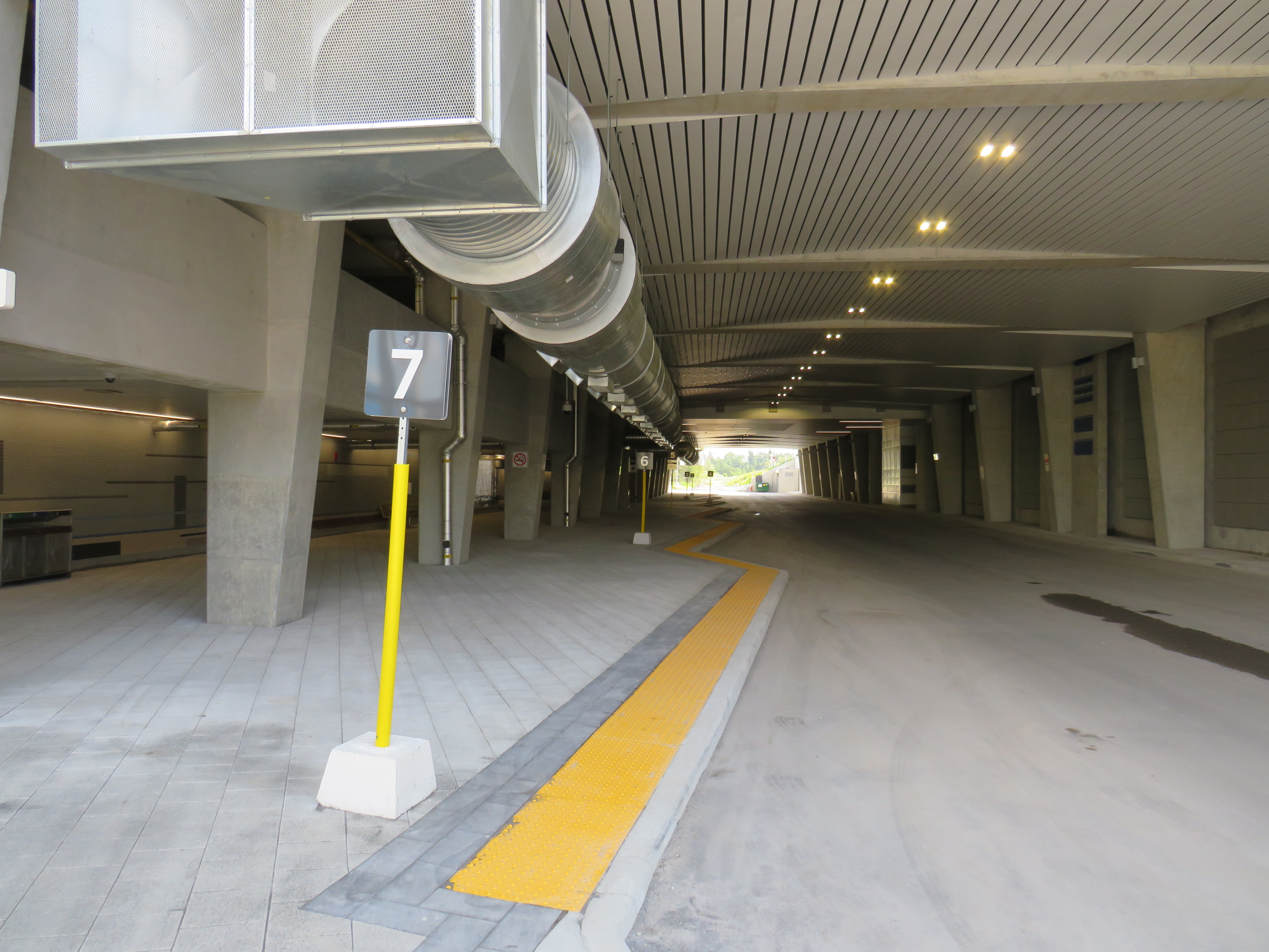
The station is built around a three-storey parking garage tucked into a hill, with the train platform and station amenities (an enclosed waiting room with washrooms and a ticket counter) on the second level. At the lower level, there is a six-bay bus loop almost directly below the rail platform, minimizing the distance between train and bus. Elevators, stairs, and ramps connect the three levels of parking, the bus bays, and the train platform.
The station’s central atrium, which contains the pedestrian passages between parking levels, station, and platforms, is the architectural highlight. Above the parking areas, solar panels collect some of the energy required to light and heat the station.
Atrium at Bloomington Station, with parking spaces on both sides
In its blog, Metrolinx expressed pride in the new station, noting it was built to achieve LEED Gold certification through features such as energy efficient lighting, a water-permeable surface lot, stormwater management, and a pond for local wildlife with an underground passage to help animals migrate away from the station complex. Like most new GO platforms, Bloomington’s train platform is heated to allow snow and ice to melt, reducing salt usage. Finally, as far as suburban GO stations go, Bloomington’s footprint is quite compact. It cost $82.4 million to build the new station.
Plaque adjacent to wetland at Bloomington GO StationPermeable surface at Bloomington’s outdoor surface lot and passenger pick-up and drop-off area
Despite these innovations, a LEED certification can only go so far when the GTHA’s newest transit station is only accessible by car, with over 1,000 parking spaces. Though transit ridership is down significantly during the ongoing pandemic, especially on GO’s Richmond Hill Line (which operates only in the weekday peak-period direction and currently uses four-car trains), there are no ongoing connections from Bloomington GO Station operated by GO buses or York Region Transit.
Though several GO rail stations do not have any local transit connections only Bloomington and Gormley have no bus connections at all. (In April 2020, YRT discontinued the limited-service Route 15 that ran past Gormley Station). At Acton, Georgetown, and Lincolnville, which also do not have any local transit connections, passengers can still connect to GO buses for points beyond, or make a return trip.
The only bus operating at Bloomington Station’s loop is GO Route 61, which provides supplemental weekday service between Union Station and Bloomington GO. But the last Route 61 bus leaves for Union at 1:55 PM.
There was no bus connection to be found at Bloomington GO Station
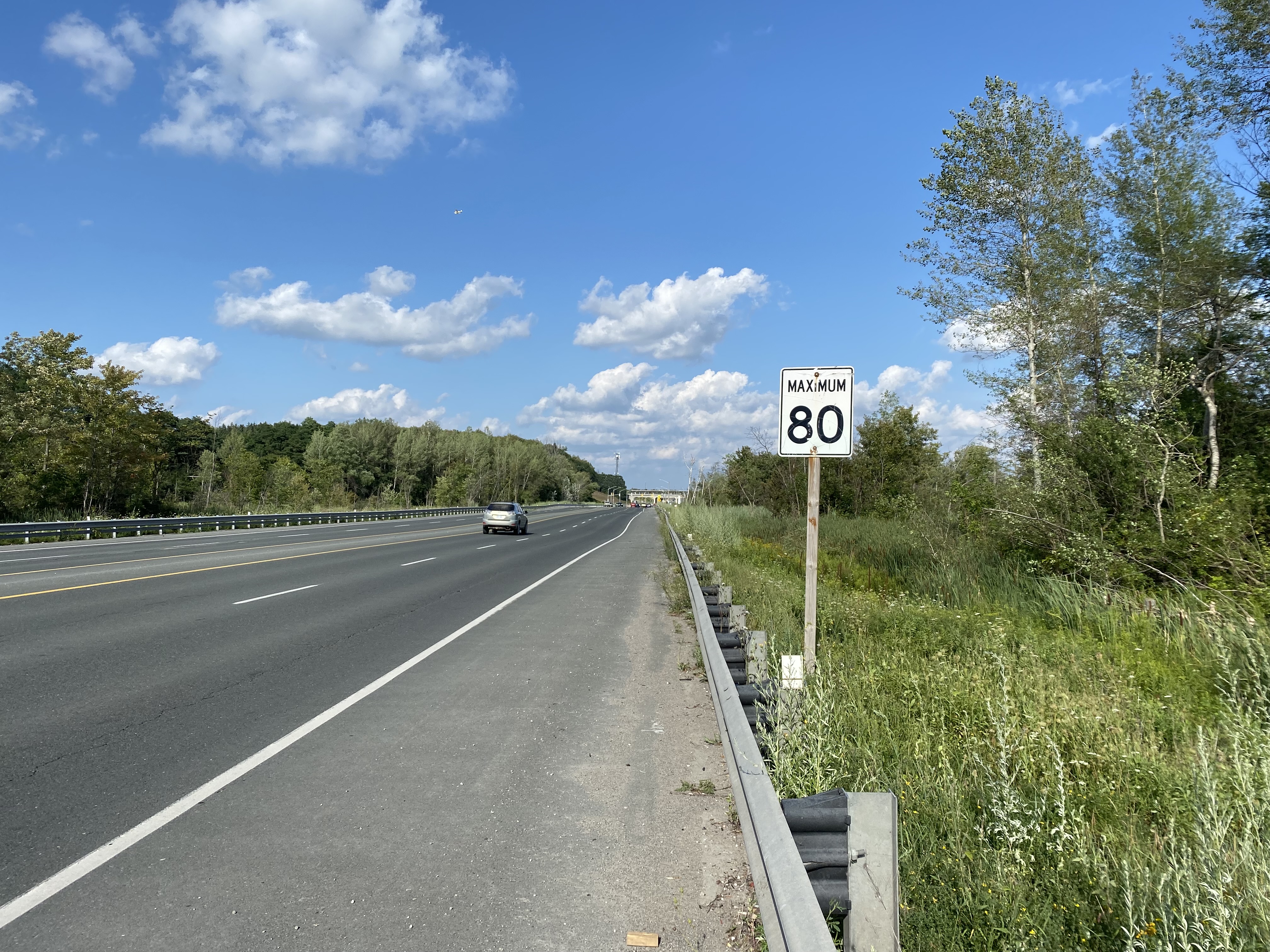
The nearest in-service bus stop is over one hour’s walk away, near Bloomington Road and Yonge Street. At least there was a paved shoulder along the busy five-lane road between the GO station and Bayview Avenue, where motorists were driving well in excess of the 80 km/h speed limit.
Looking east towards Bloomington GO at Leslie Street
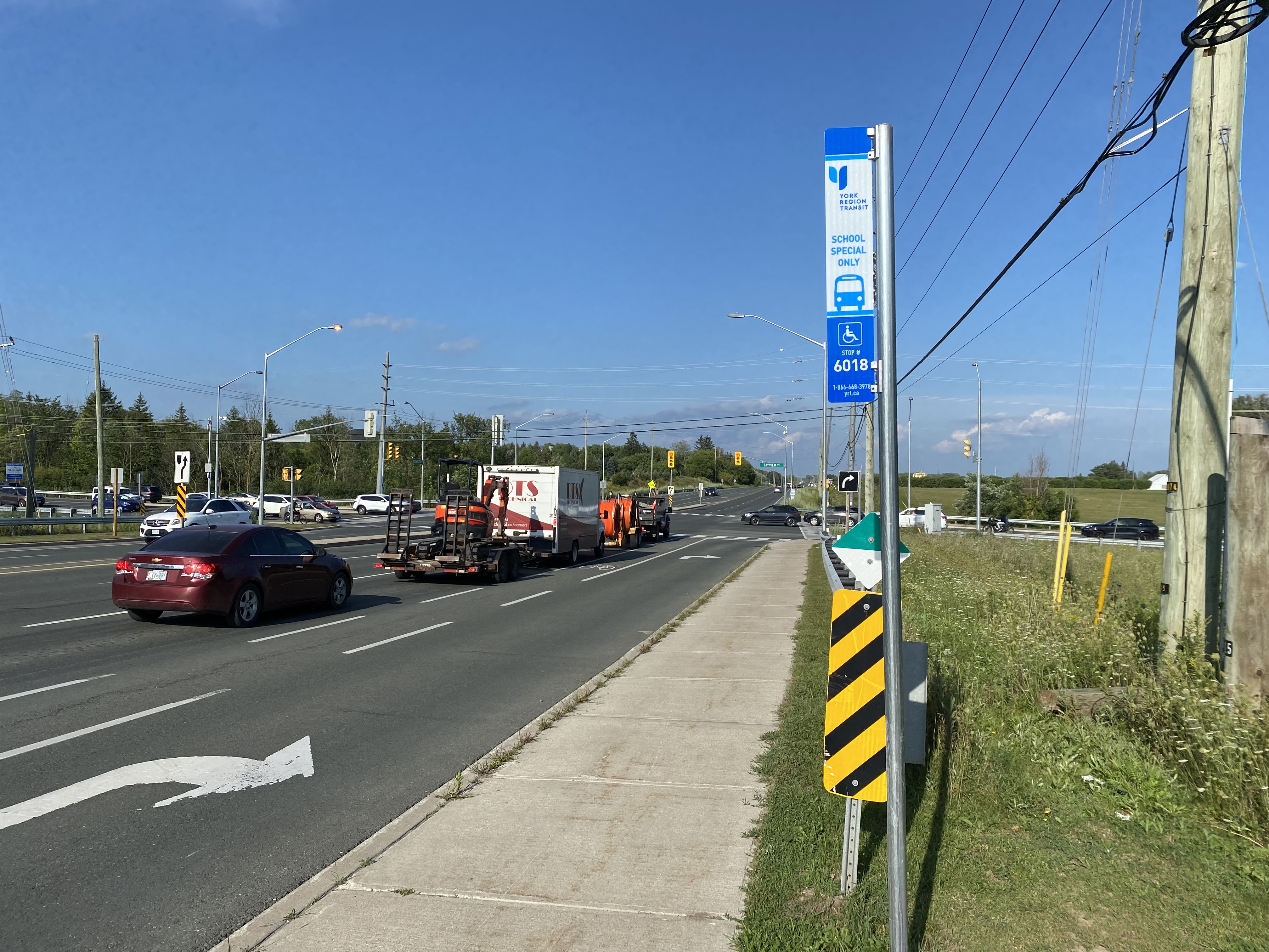
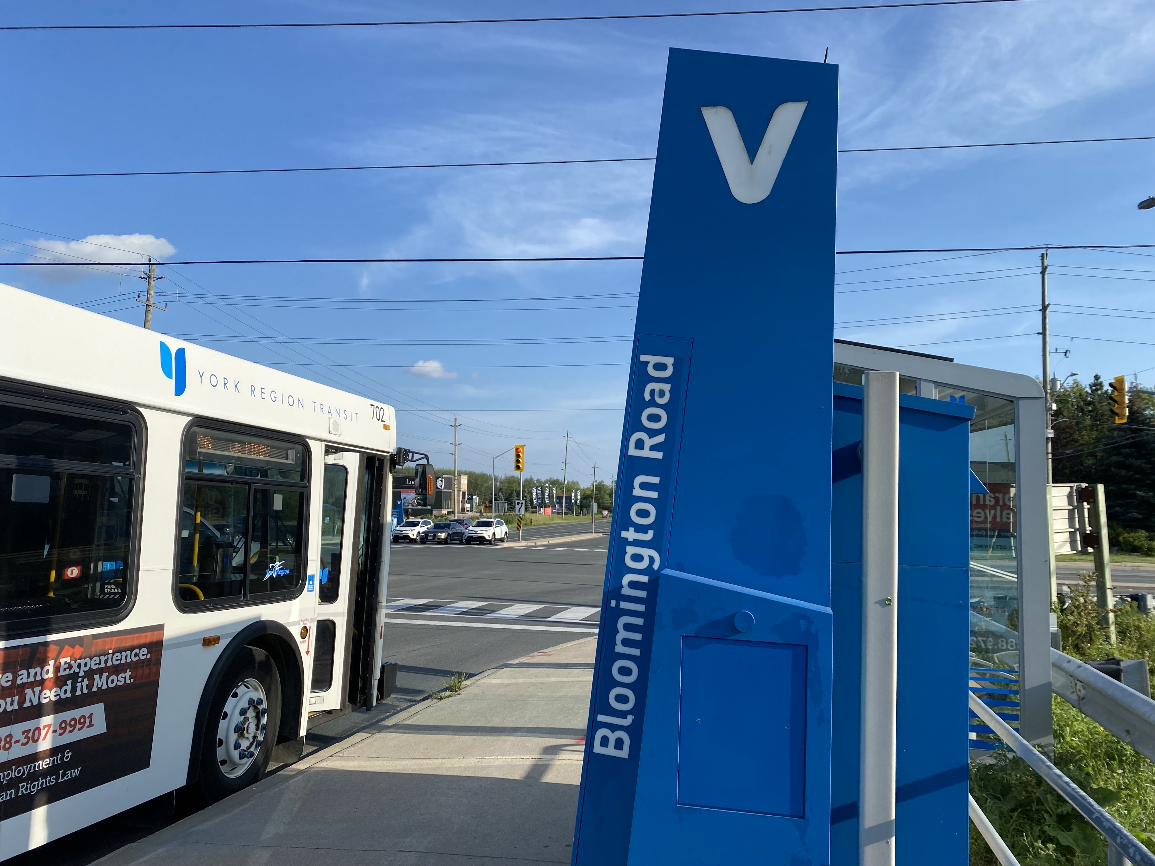
At Bayview Avenue, a sidewalk leads westerly to Yonge Street, with new residential subdivisions lining the south side of Bloomington Road. I noted a bus stop as I was walking west towards Bayview Avenue; alas, it was only for a high school special route.
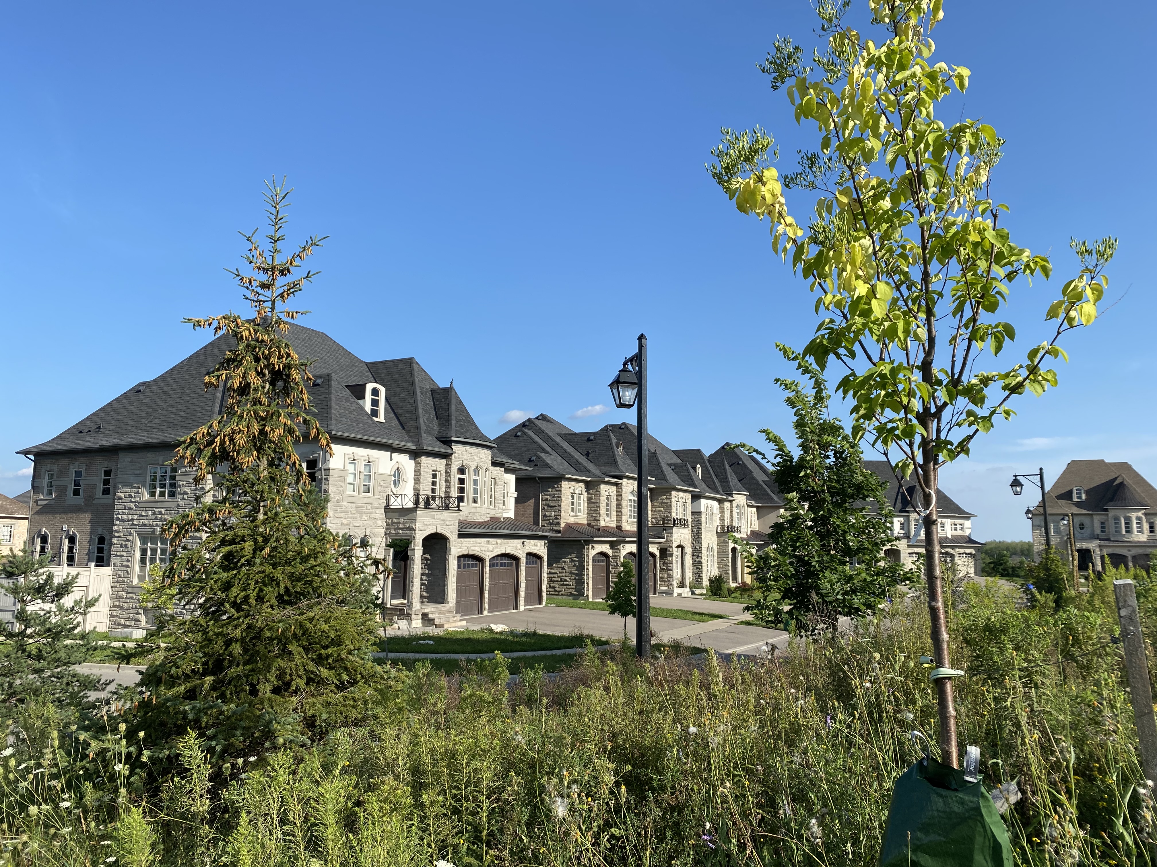
YRT stop at Bloomington Road and Bayview Avenue signed “school special only”New residential development along Bloomington Road featuring large houses with three-car garages was clearly designed for cars, rather than people
As I was nearing Yonge Street, I noted that the new subdivisions were set back far from the road, with many of the houses built with three-car garages. Building enough transit ridership here to support even a limited service bus route is going to be very difficult.
One hour and 8 minutes later, I arrived at the bus stop at Yonge Street, the closest place to Bloomington GO Station where I could get a bus to continue my journey.
The end of a long walk from Bloomington GO Station
Bloomington Station’s small footprint and environmental features might actually make it an ideal basic station design for more urbanized locations in the GTHA, where the compact design and logical layout could support easy bus connections and short walks to residential and employment areas. I liked the simplicity of the bus connections at Bloomington — if only there were any buses to connect to.
But Bloomington’s LEED Gold certification means little when it does not support sustainable development or sustainable access to the station.
Though its location adjacent to Highway 404 may entice some commuters to switch to parking at Bloomington and commuting downtown by train, Gormley, just one station to the south, already achieves a similar purpose.
For now, Bloomington Station is just a Garage Mahal — a grand monument to the old way of doing things at GO Transit.