Last weekend, a few of us visited Cathedraltown, a newer subdivision near Highway 404 and Elgin Mills Road in northern Markham. We came to see ‘Brookview Tony Charity,’ a new chrome sculpture of a prize-winning dairy cow that was once the pride of a hobby farm that was on the site before it was developed. The metallic bovine made the news as local residents opposed the sculpture, located in an otherwise empty and unremarkable Cathedraltown parkette.
One homeowner objected as the cow, raised on stilts and wearing a prize garland, faced the nearby cathedral, likening it to the golden calf from The Ten Commandments: “I come from a Christian background and this is actually one of the worst things you can do, is to raise a calf; it’s facing the cathedral.”
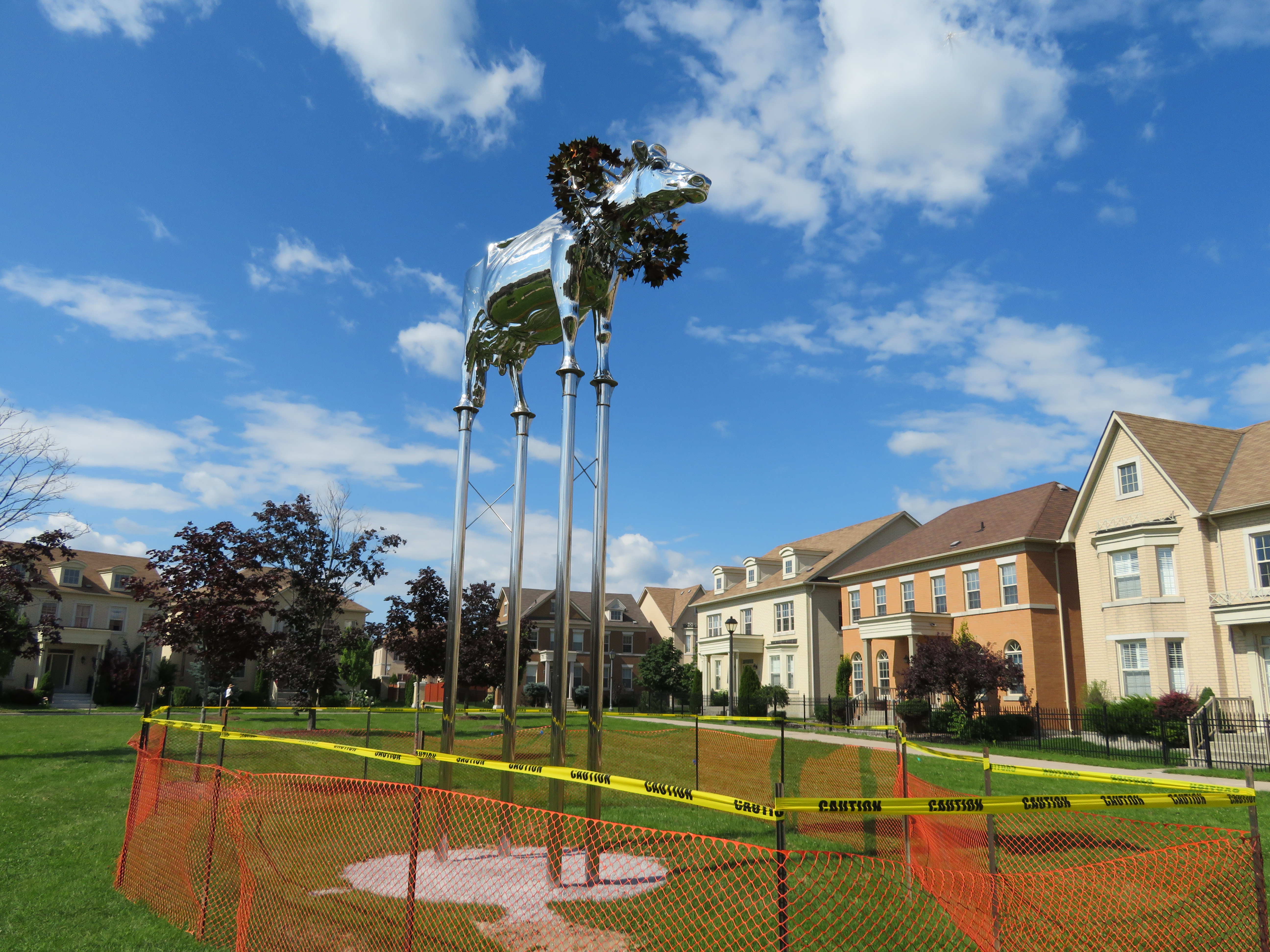
Ironically, the NIMBY rage only drew attention to the statue; later that week, it became a local tourist attraction. On Saturday, my wife, a good friend, and I went up to Markham to have a look at it ourselves.
Cathedraltown
Markham, on Toronto’s northern boundary, isn’t simply a cookie-cutter 905 suburb. The city of over 325,000 people is known for its high-technology sector, Pacific Mall and many other Chinese-Canadian shopping districts, and several heritage districts. The historic settlements of Unionville and Markham are well-preserved and vital, with interesting shops and restaurants. North of the old village of Markham, Markham Heritage Estates is a surreal subdivision dedicated to preserving old houses that would otherwise be demolished; it looks a little bit like a Tim Burton movie set.
In recent years, Markham has tried to urbanize some of its suburban landscape. Highway 7 is lined with midrise condominium towers and office buildings. Cornell, on Markham’s eastern edge, was Canada’s first “new urbanist” subdivision, intended to promote a less car-dependent lifestyle with higher densities, local retail and mixed use development, and street-focused parks. The new Downtown Markham development, a work in progress, is a mix of office, higher-density residential, retail, and institutional development near GO Transit’s Stouffville corridor and a new VIVA bus rapid transit line.
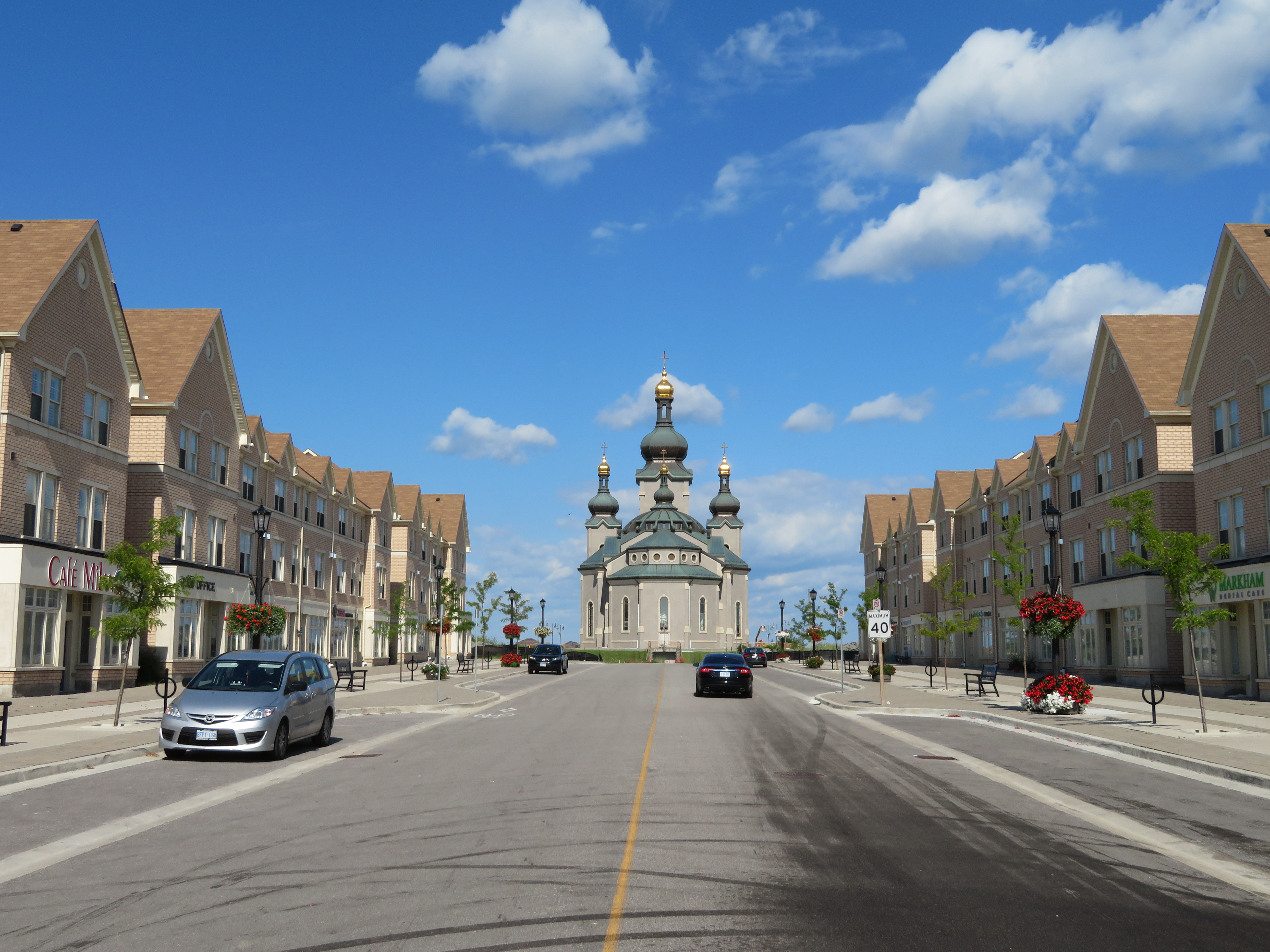
And then there’s Cathedraltown. Like Cornell, it’s a “new urbanist” development; it even has a main street lined with storefront. But it doesn’t quite work, at least not yet.
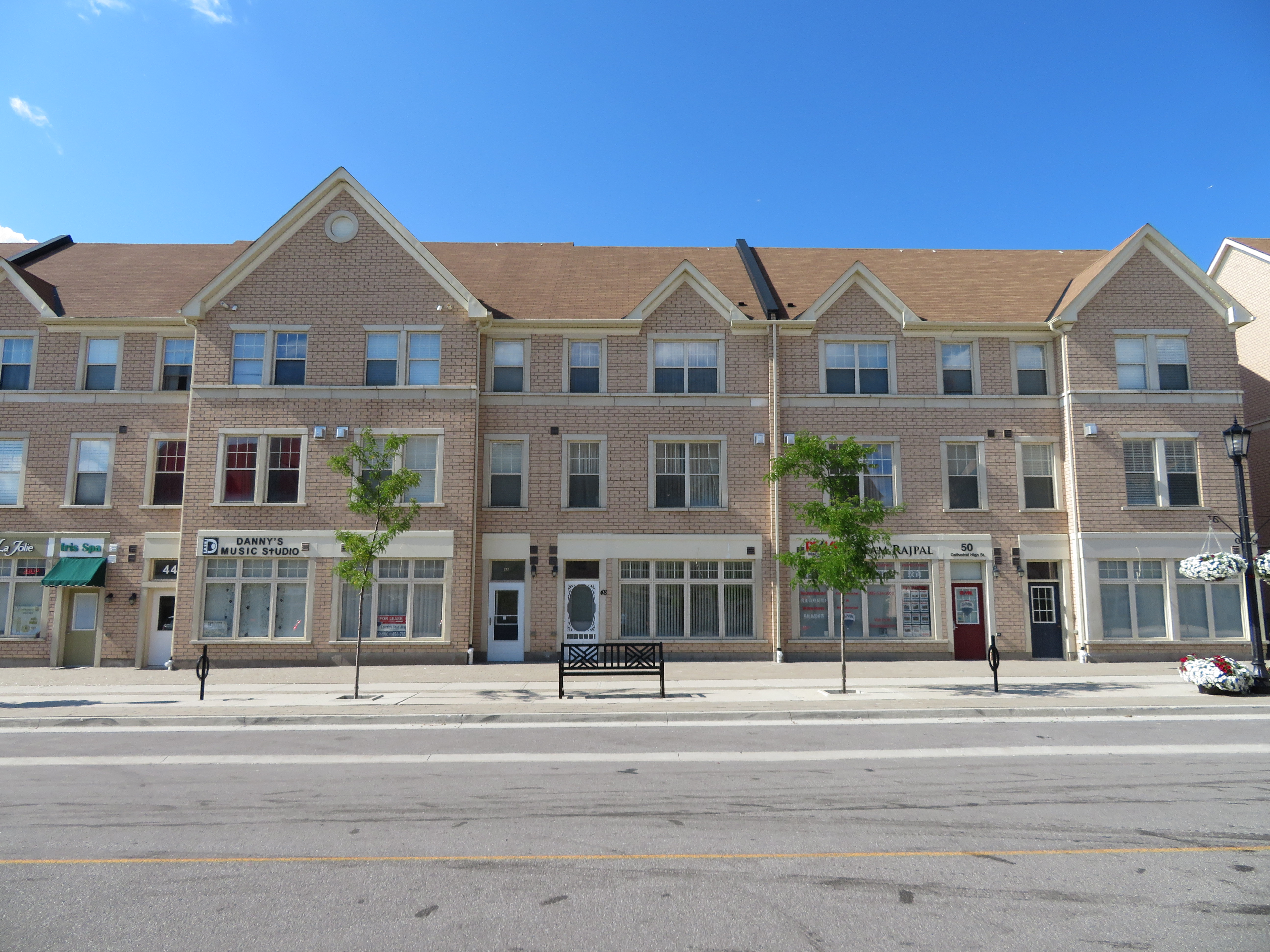
 A mostly empty Cathedral High Street
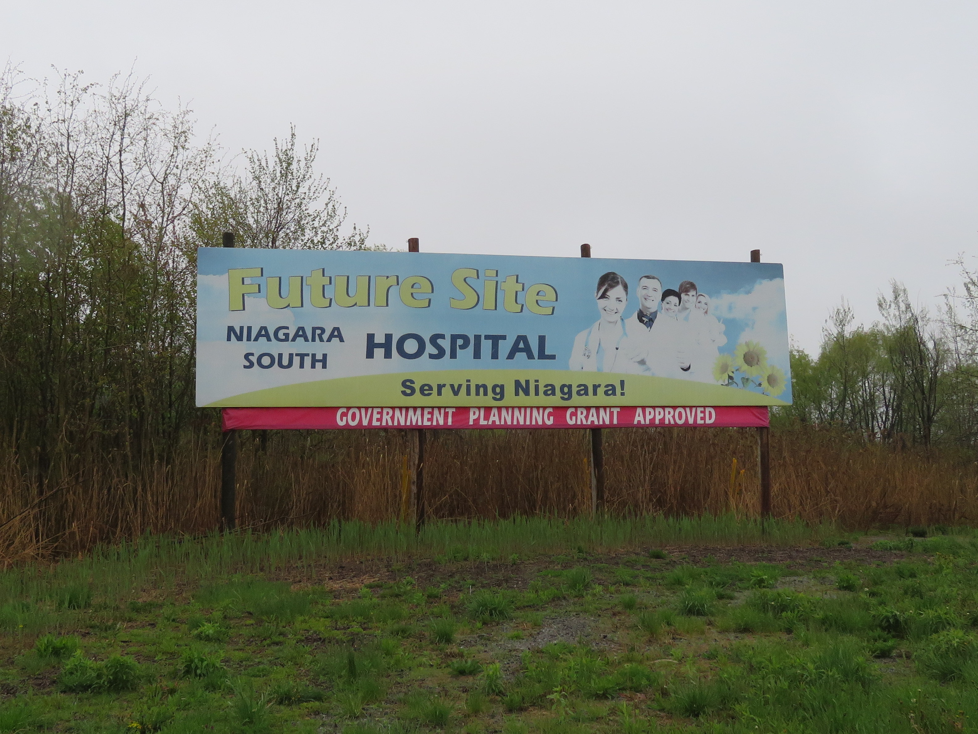
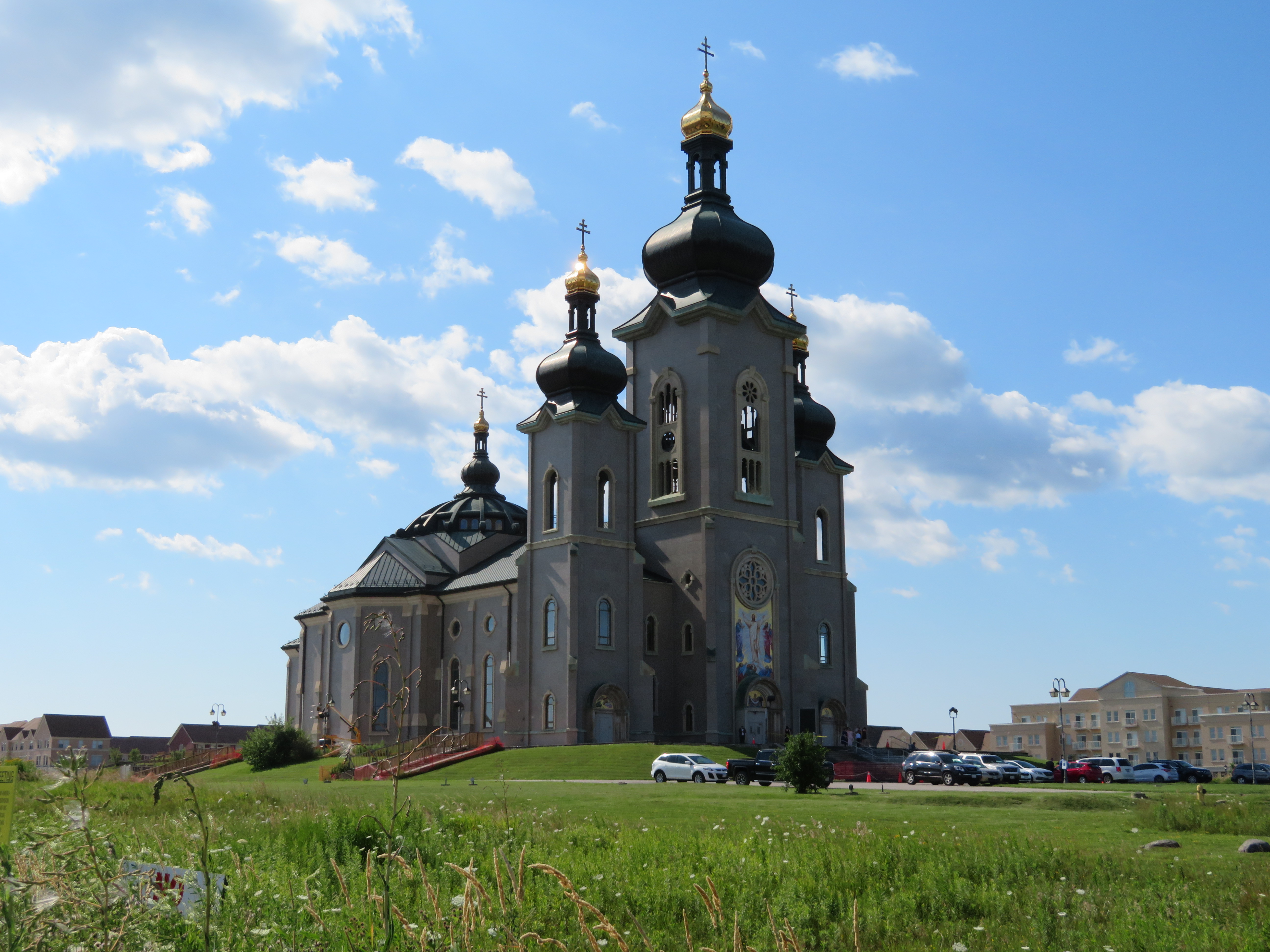
Cathedraltown was the idea of Stephen Roman, who made a fortune in mining and had a a farm on Woodbine Avenue in Markham to build upon. The new community, on a family owned hobby farm, would have a spectacular new Slovak-Catholic cathedral as its centrepiece, with houses, parks, and stores surrounding the landmark. Stephen Roman’s daughter, Helen Roman Barber, took over the development in 1988. The church — which remains incomplete — was opened for a while, but the building was the subject of a dispute between the development company and religious leadership and was closed from 2006 through 2016.
Meanwhile, the residential community was slowly built around the Cathedral in the last ten years.
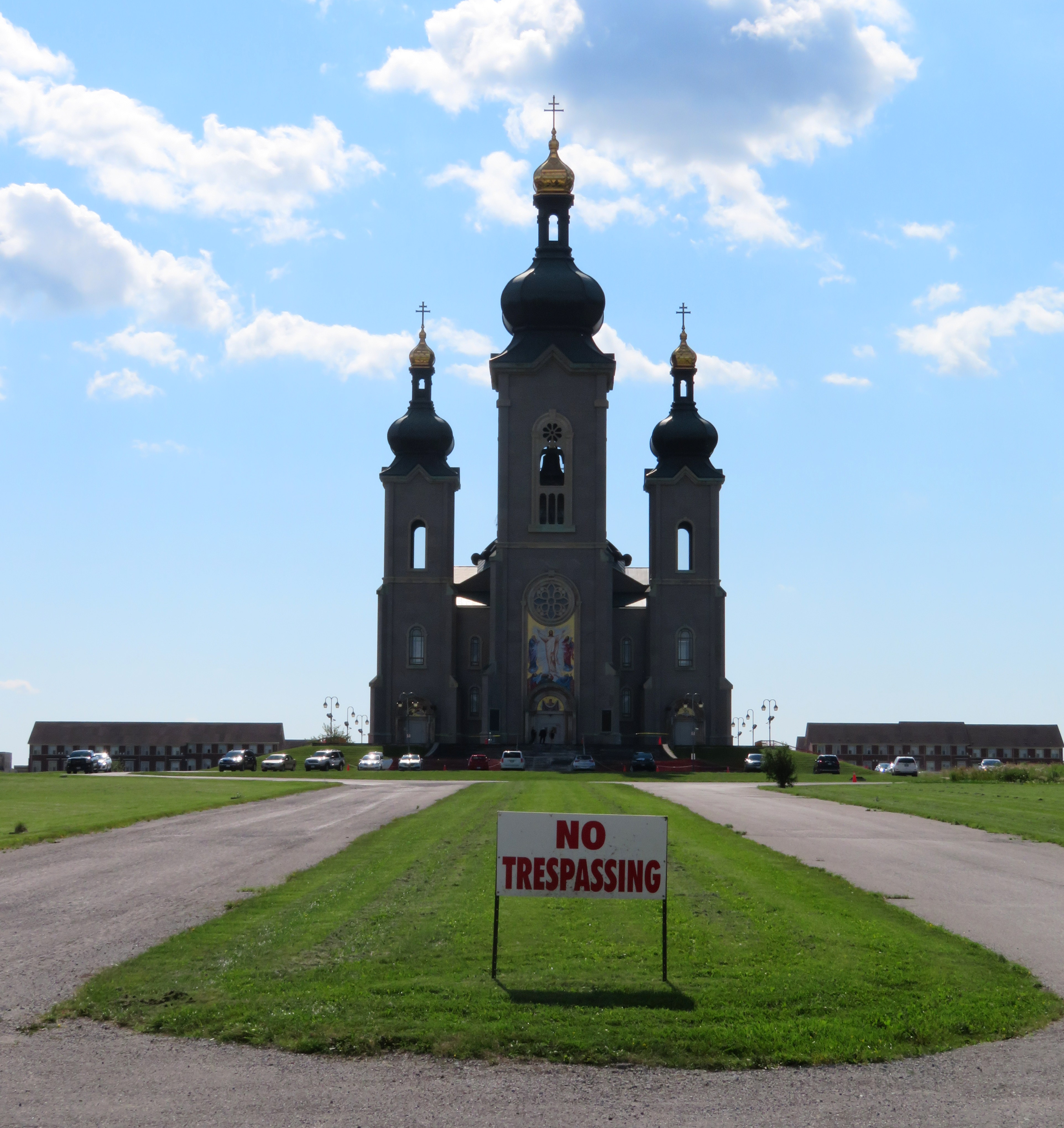 A “no trespassing” sign still stands outside the recently re-opened Cathedral of the Transfiguration
Like other “new urbanist” developments, the garages and service areas are found not on the residential streets themselves, but in back alleys. Parkettes and playgrounds face the street, rather than behind houses. Dwellings are built close together, for higher densities than traditional suburban tract housing. There are townhouses, as well as semi-detached and fully detached homes, as well as some low-rise condominium apartments.
There’s a Main Street, which is called Cathedral High Street. It is lined with storefronts, but many are empty. Those that are occupied host dental offices, real estate agents, an insurance broker, beauty and nail salons, and after-school tutoring companies. Only one store, a nail salon, was visibly open on our visit on a Saturday afternoon.
A few thousand more residents might help. Building the retail along Woodbine Avenue itself, which gets far more traffic, might have also helped support sustainable retail. Nearby, however, is a pedestrian-unfriendly plaza on Major Mackenzie Drive that’s fully leased, anchored by banks, a Canadian Tire, a Shoppers Drug Mart, Starbucks, and Boston Pizza.
 Storefronts on Cathedral High Street…
 …While a nearby auto-centric plaza is busy
Despite its new urbanist ideals, Cathedraltown is as auto-dependent as any other suburb. Only two bus routes serve the centre of the development: York Region Transit bus routes 24 and 80. Route 24, which goes to the TTC Don Mills Subway Station, operates every 51 minutes on Saturdays, and only until about 6:30 at night (Sunday service is similar; weekday service is slightly better). Route 80, which goes west to Yonge Street, operates every 45 minutes on weekends, until about 8:00 or 9:00 PM. Getting to GO Transit trains requires a car or a YRT bus ride involving a transfer between two infrequent routes.
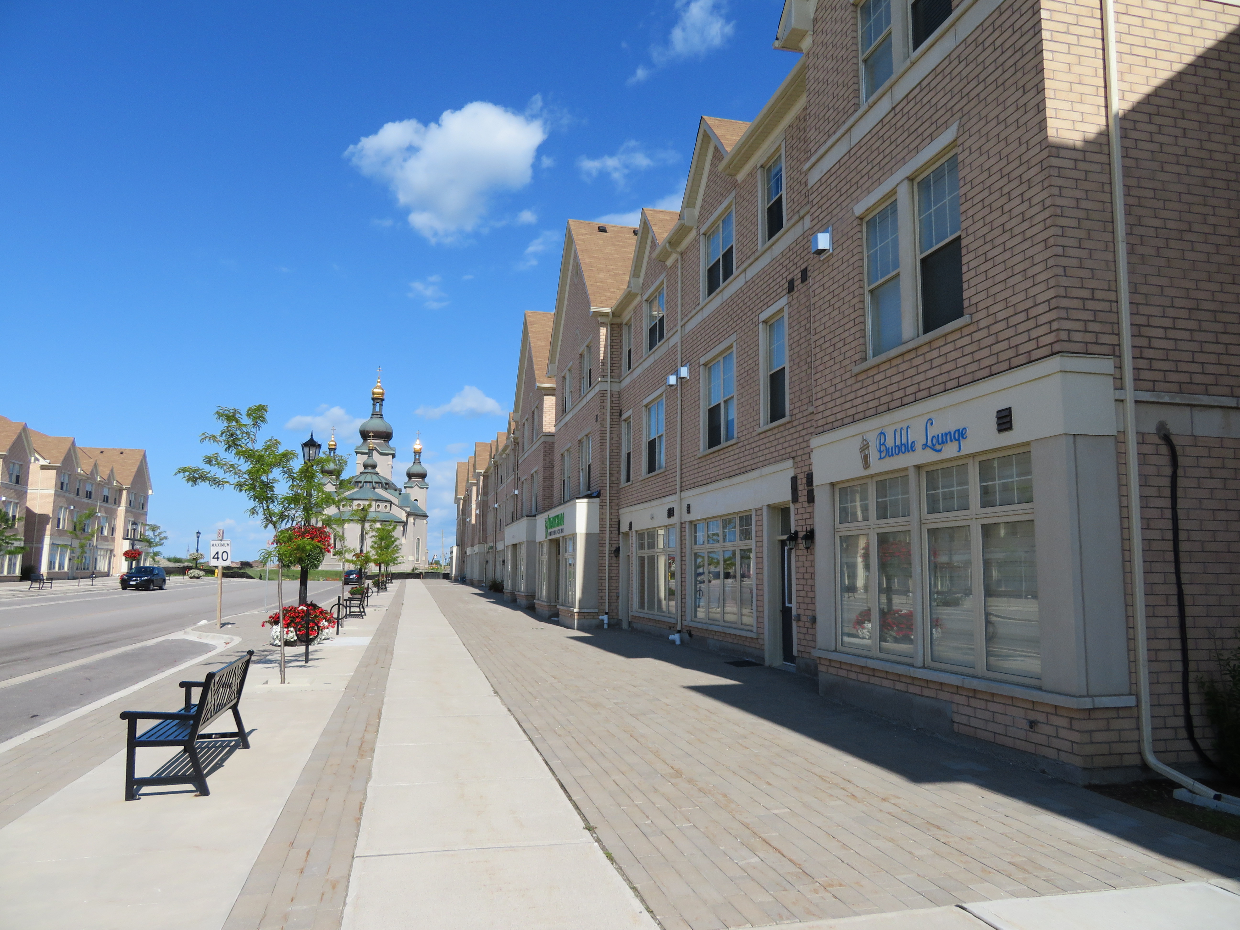 Empty streetscape on a sunny Saturday afternoon
Without transit, and without places to walk to (apart from a church, a few parks, and an elementary school), the ideals of new urbanism aren’t matched by reality. Unless things change drastically, it will still be a place where residents will get in their cars to go anywhere. Better transit could be a start, but so would adding more people, and jobs.
Maybe one day, this community will be completed

 5 Railroad Street, on the City of Brampton’s heritage registrar, is one of several houses recently boarded up in Downtown Brampton
 Offices at 37 George Street are moving out
 46 Elizabeth Street North, a rooming house with heritage status, is now boarded up, with the electricity disconnected.
 Yonge Street between Sheppard and Finch Avenues would have seen new separated bike lanes, wider sidewalks, and new public art.
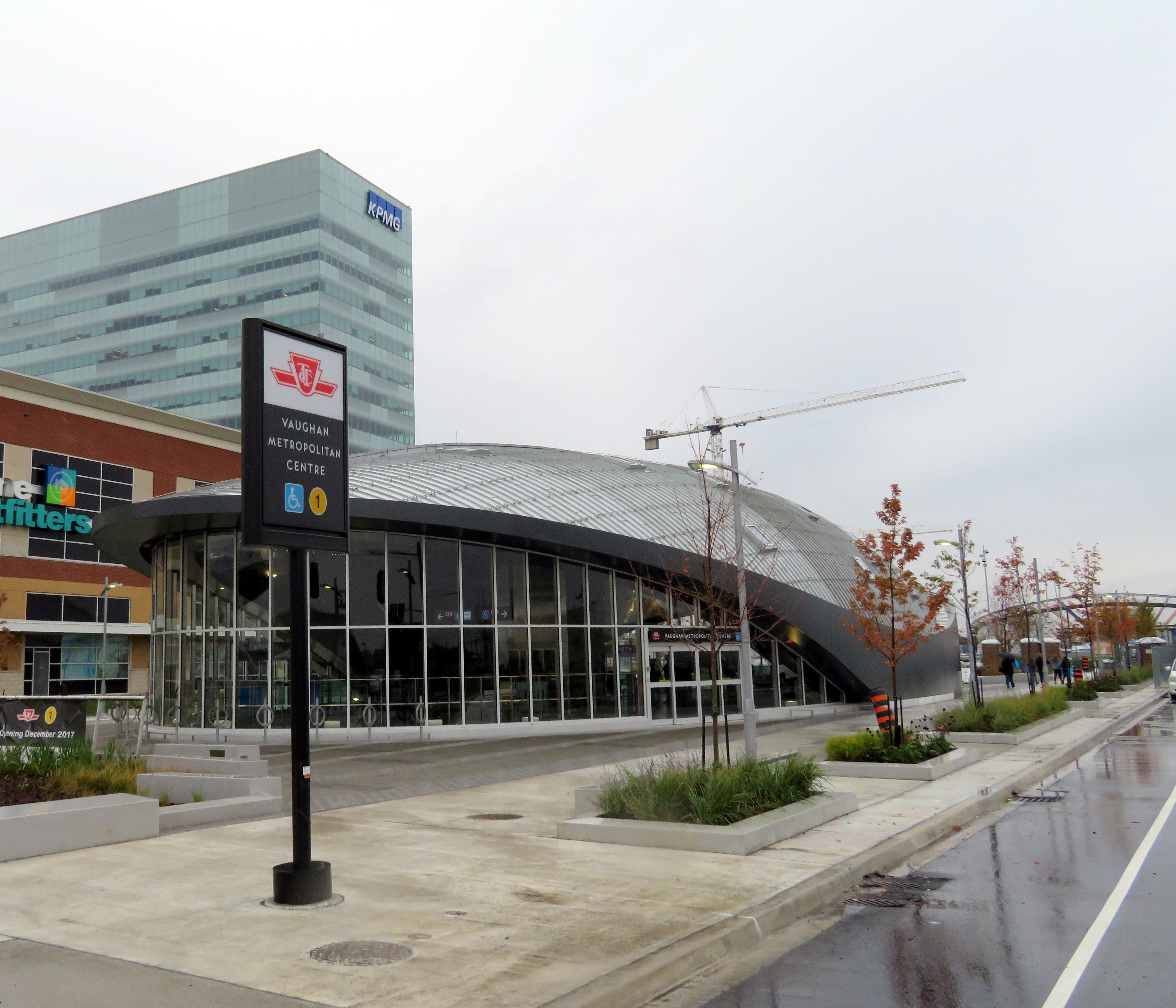 Vaughan Metropolitan Centre Station
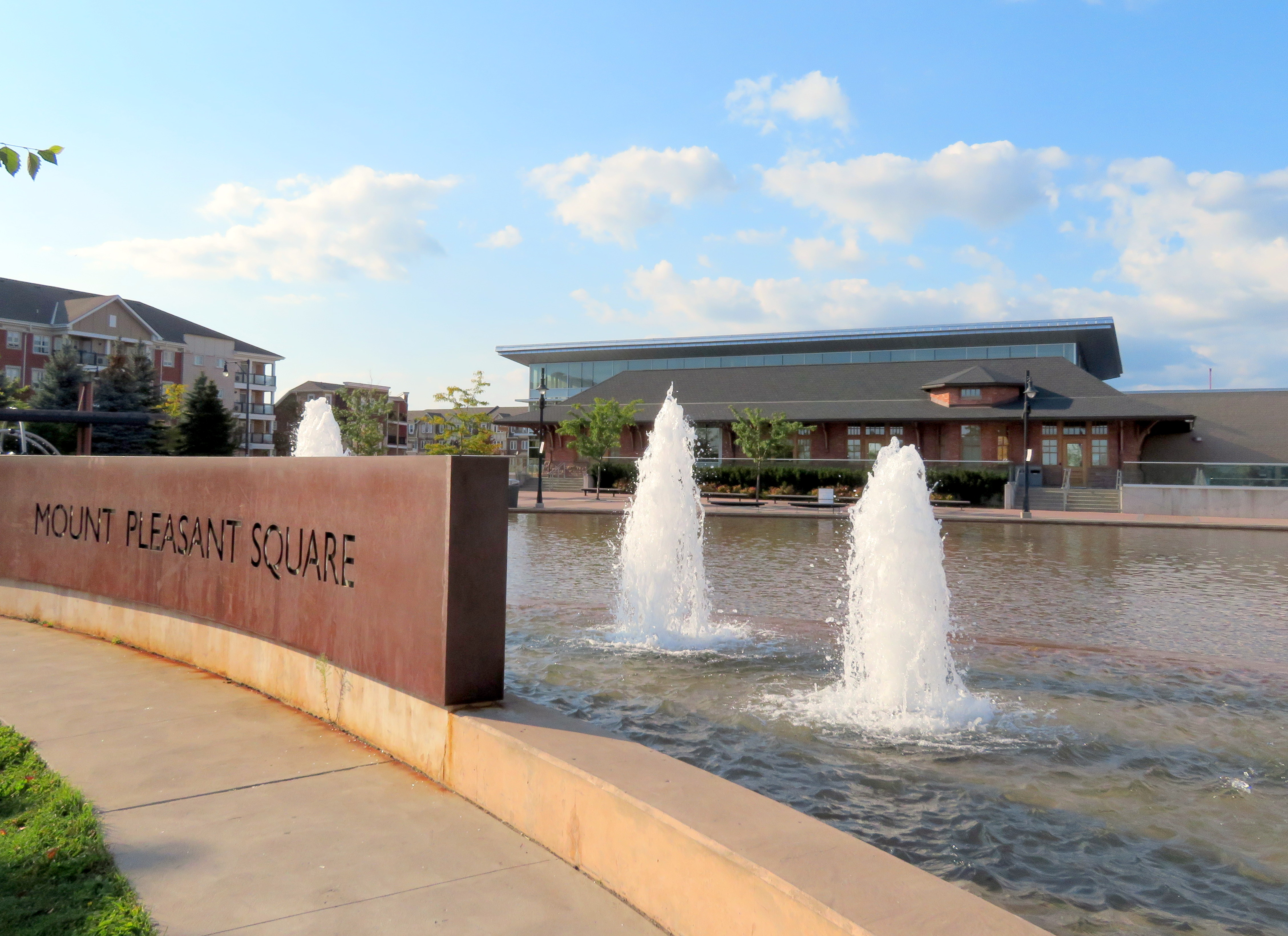 Mount Pleasant Square, Brampton
 Mount Pleasant’s old Presbyterian church is now a mosque.
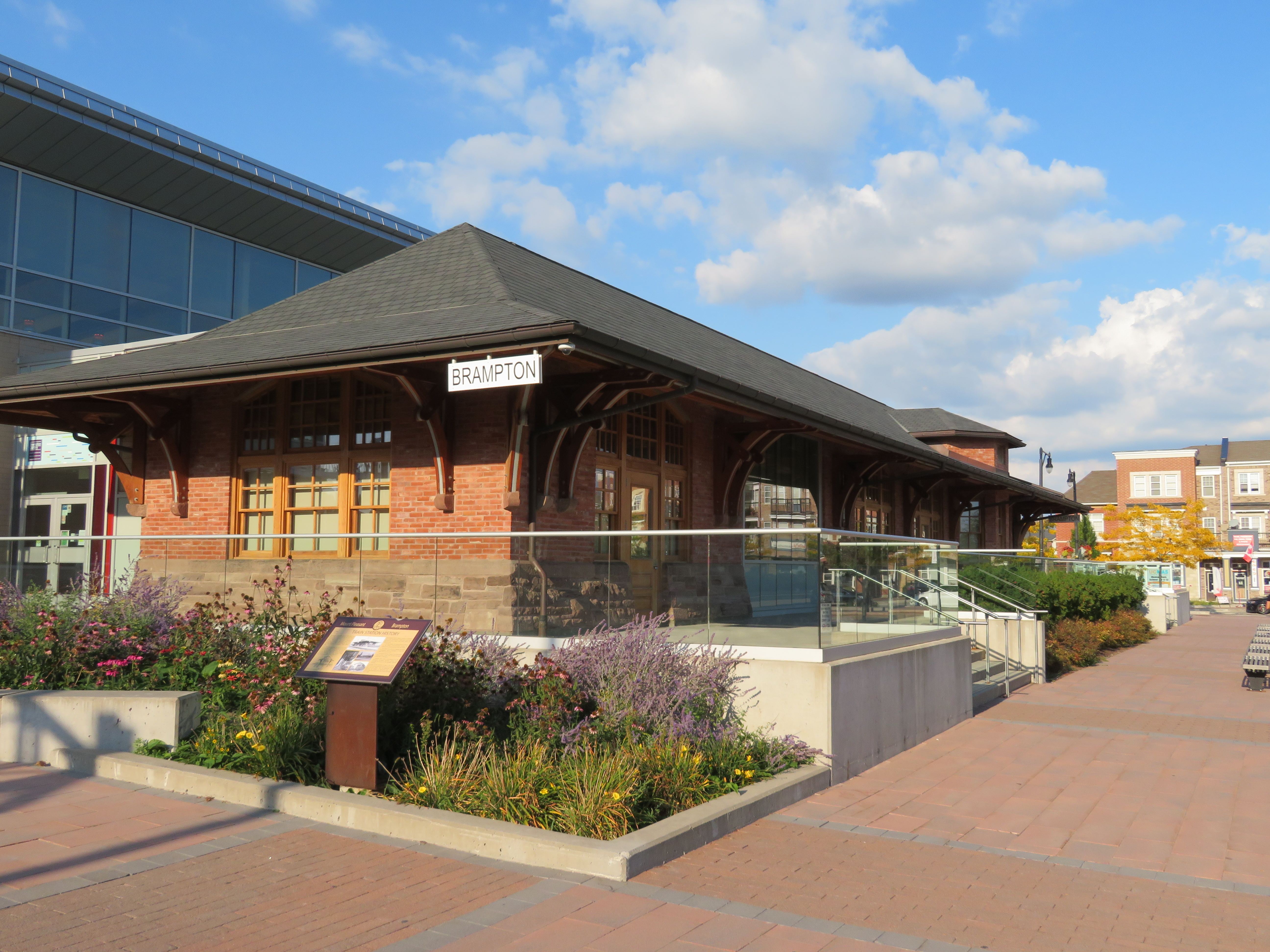 The Brampton Public Library incorporates the former Brampton CPR Station, rebuilt here at Mount Pleasant Village
 GO Train at Gormley Station