Tag: Transit

  • Buses to the big box

    Buses to the big box

    Timmins Transit bus headed west from downtown to Wal-Mart

    Last month, I found myself intrigued by American transit consultant Jarrett Walker’s observations about the difficulties of getting to Walmart stores by public transit in US cities. On Bluesky, Walker examined the long walks through hostile environments between Walmart stores and the nearest bus stops, and it is an interesting thread.

    In many US cities, Walmarts are often some of the busiest transit destinations.Here is the typical relationship between a Walmart (far right) and its nearest bus stop (far left).Note the details of the pedestrian experience between one and the other. 1/🧵

    Jarrett Walker (@humantransit.bsky.social) 2025-07-19T18:33:32.331Z
    Jarrett Walker’s BlueSky thread on US Walmart locations

    In response, I noted the more typical experience in midsized Ontario cities. Though American and Canadian land use policies are similar in many ways, complete with the post-1990s proliferation of “big box” retail developments, there are some significant differences. For example, local transit systems will often make an effort to serve big box retail clusters, particularly Walmart stores.

    This is something we do a bit better here in Canada. Below are Google Map screenshots of four Walmarts in small Ontario cities.

    Sean Marshall (@seanyyz.bsky.social) 2025-07-19T18:48:29.558Z
    BlueSky post that shows Walmart stores and bus stops in four small Ontario cities: Orillia, St. Thomas, Belleville, and Brockville

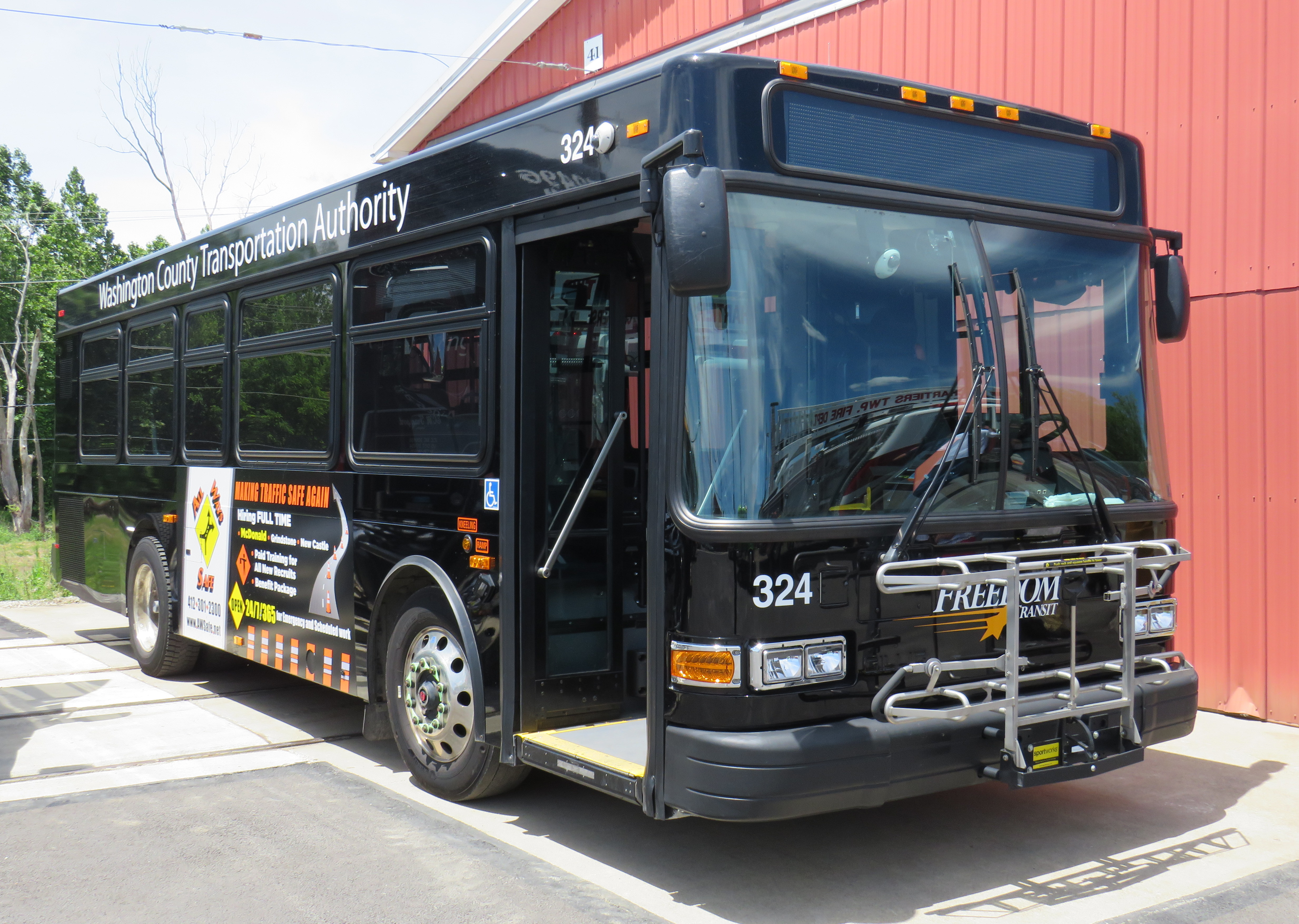
    Walmart stores are important to transit riders, especially in smaller urban centres that have few or no other major shopping centres. Most Walmart stores now have an in-store pharmacy, carry a full selection of groceries, and have ancillary services, such as medical clinics, haircutters, and opticians. Walmart itself will typically anchor a larger commercial development with other big-box retailers such as Home Depot or Canadian Tire. These commercial developments and surrounding areas will have up to have several hundred employees, some of which may also rely on transit.

    From the 1960s to the early 2000s, regional shopping malls were often major transit hubs in mid-sized cities and suburban municipalities in Canada, typically located in space set aside in the mall parking lot. For the most part, Canadian commercial landlords were willing to provide the space; in some cases, the terminal was even right outside one of the main entrances.

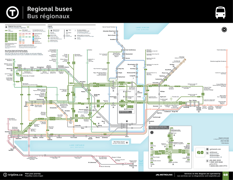
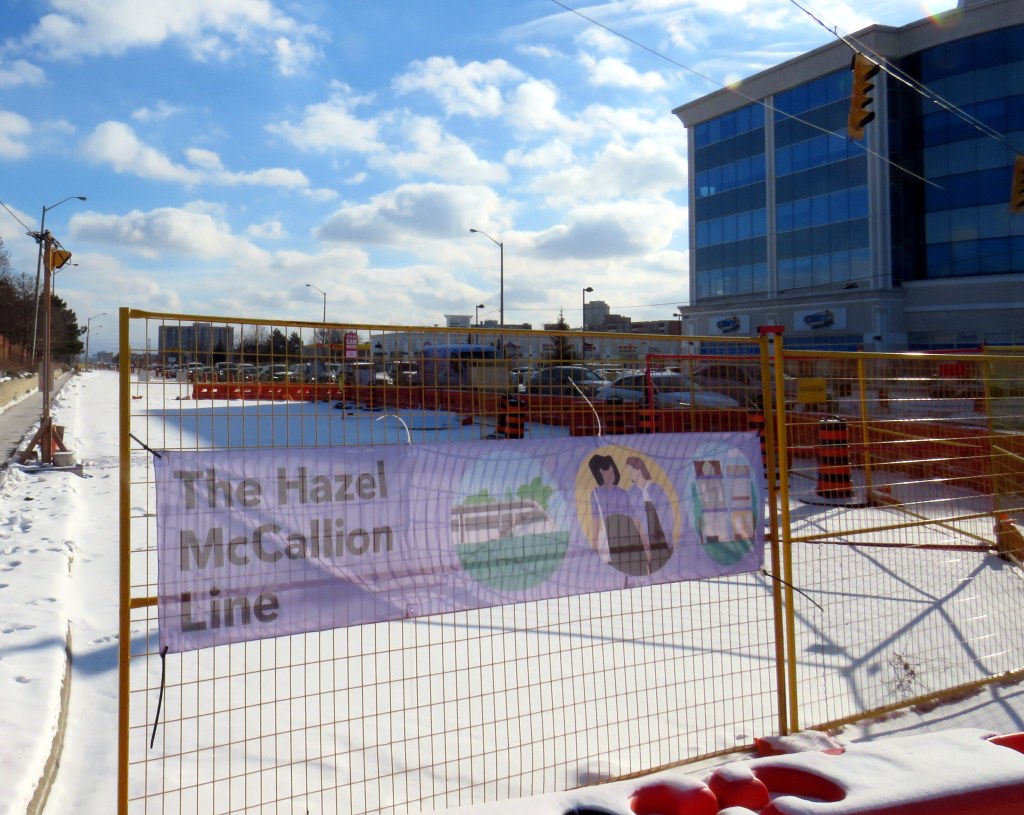
    In my hometown of Brampton, for example, two of the three major transit terminals were Bramalea City Centre and Shoppers World. Mississauga’s main transit hub is at Square One mall; Hamilton has large bus loops at Limeridge and Eastgate malls, and London has transit hubs at Masonville Place and White Oaks Mall. Smaller cities and towns such as Belleville, Orillia, and Peterborough would also be sure to serve the local shopping mall with at least one route stopping on the mall property, typically in a space set aside on a mall driveway.

    Sometimes, these mall terminals become too small or too difficult for buses to get in and out of. Brampton Transit grew, the Shoppers World and Bramalea City Centre terminals were moved to larger facilities off-site with better road access, but still close to the malls. In smaller cities, where the importance of enclosed shopping malls (anchored by traditional retailers such as Sears Canada, Zellers, and Hudson Bay) declined in favour of big-box retail, often located on the urban outskirts, the buses followed where their passengers needed to go.

    St. Thomas (Railway City Transit) and Middlesex County Connect minibuses wait for passengers in front of Walmart and Real Canadian Superstore

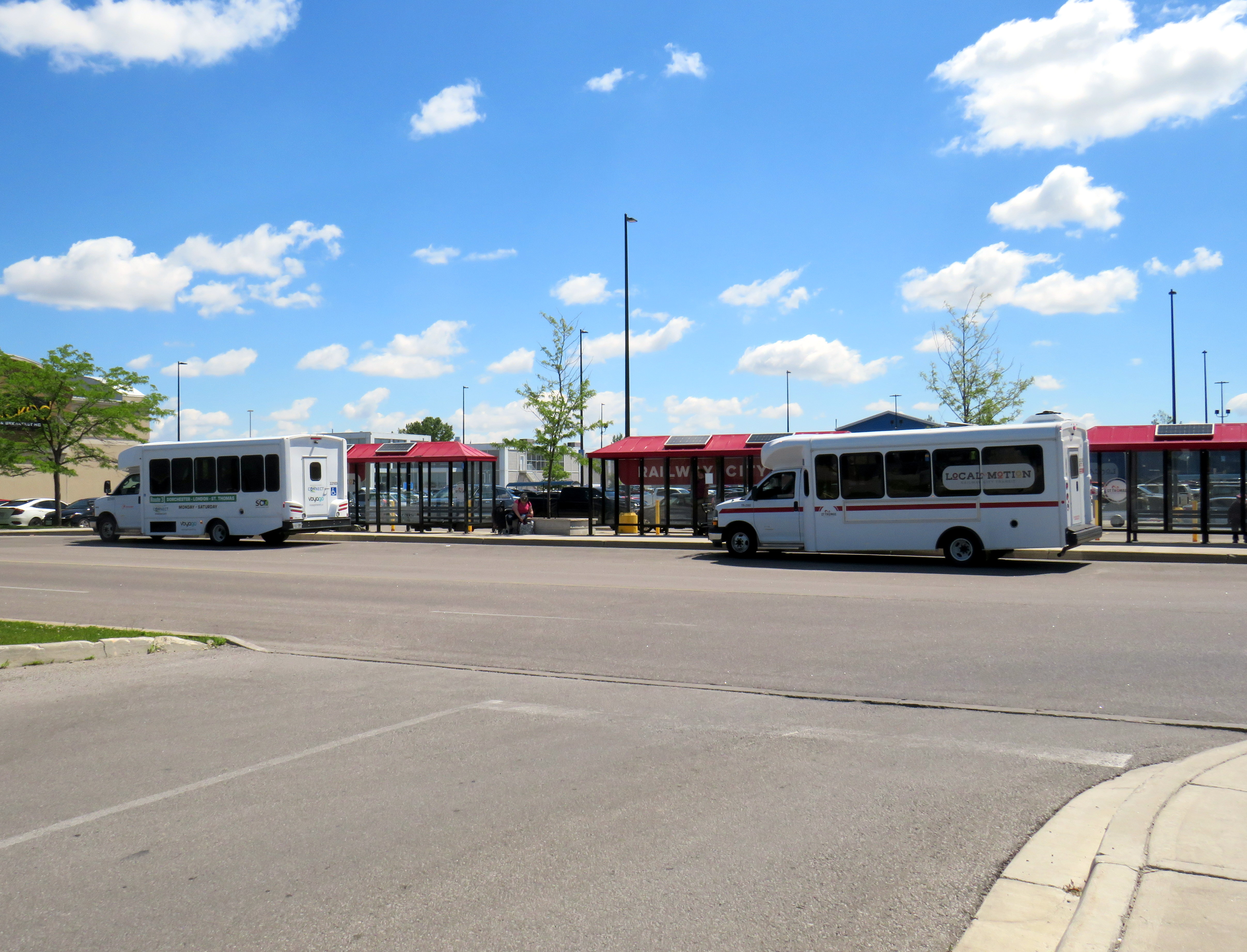
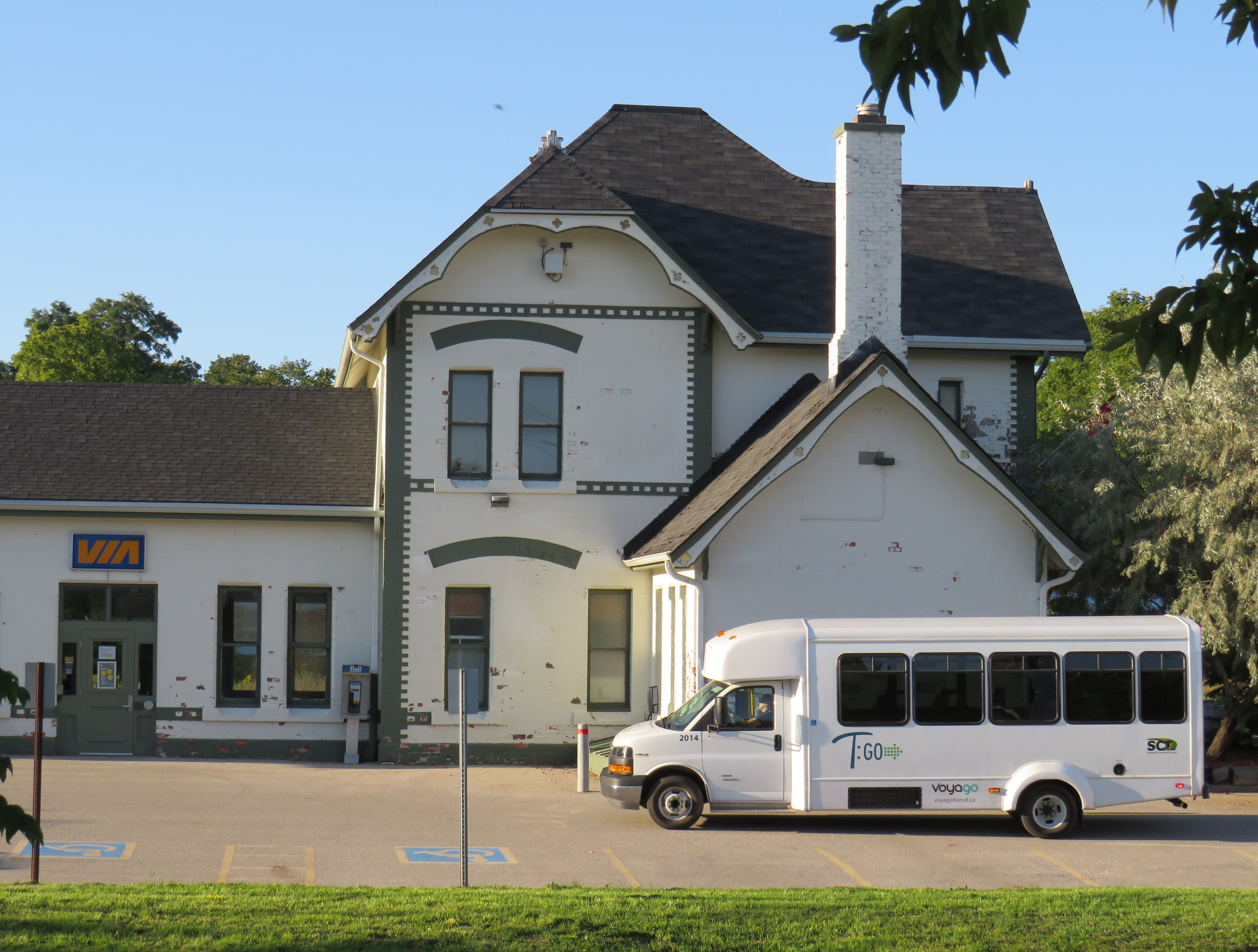
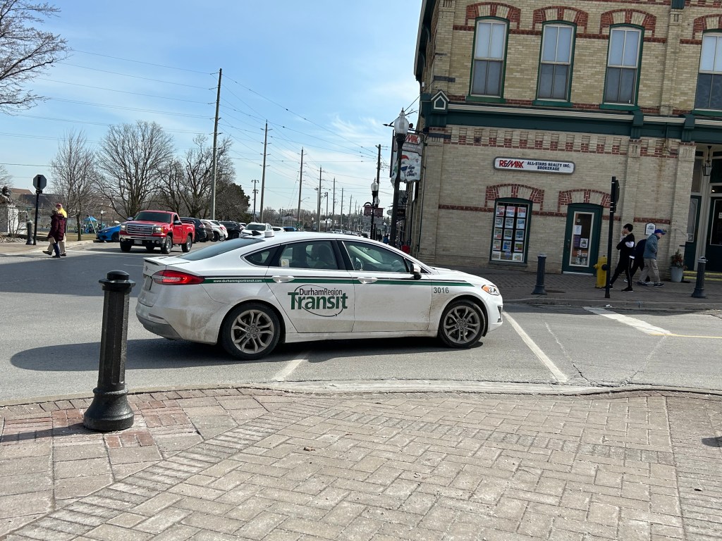
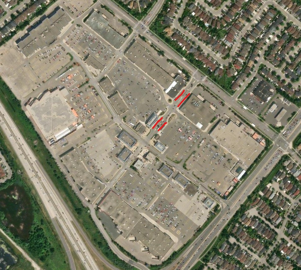
    In St. Thomas, a small city of about 45,000 people, the main transfer point is in front of the Walmart store parking lot, meaning that every bus rider gets a one-seat ride to the SmartCentres-managed property, which also includes a Loblaws grocery store, Canadian Tire, and over a dozen smaller stores, restaurants, and banks. The recent relocation of the transit hub from a struggling downtown to the big box centre to the west — which is actually closer to the city’s geographic centre — makes sense. It now also serves as the transfer point to the regional bus service to London.

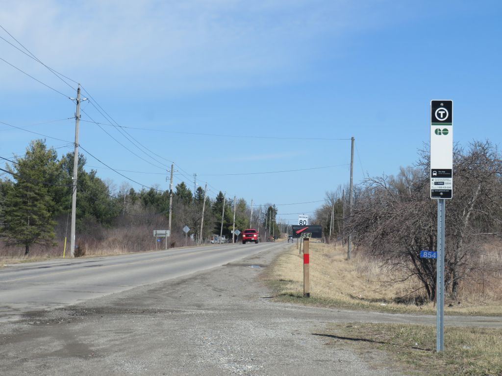
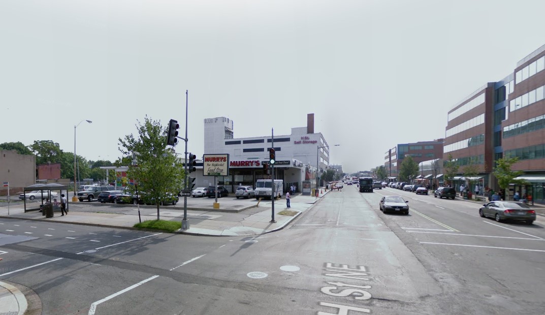
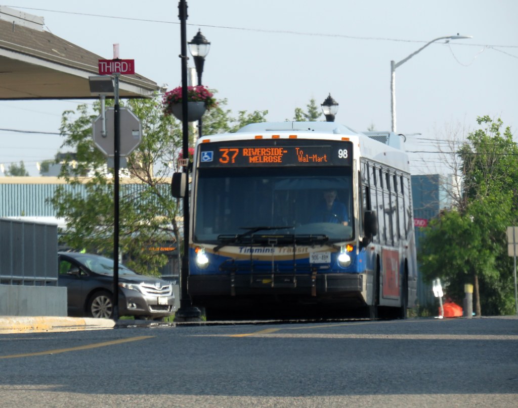
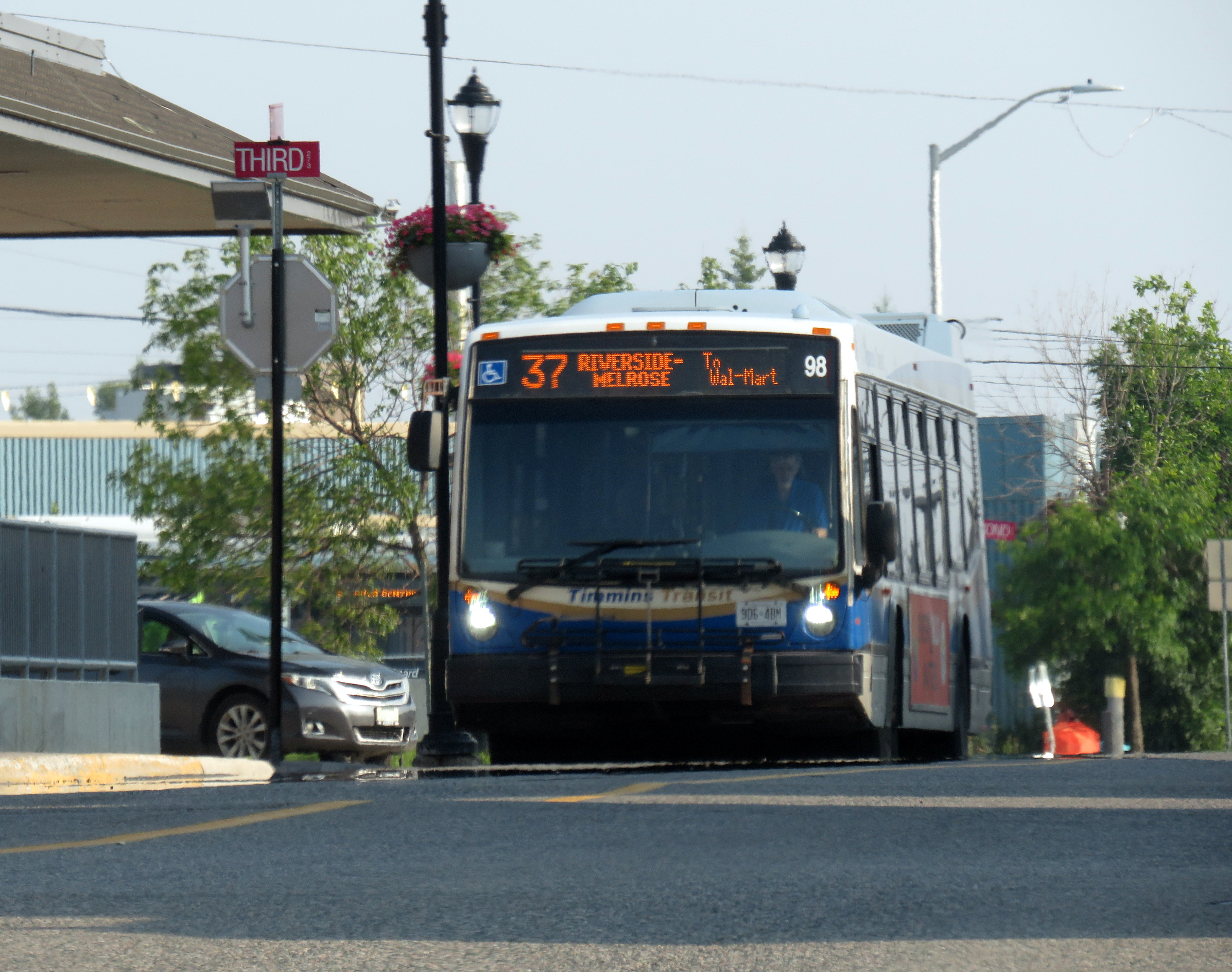
    In Brockville, another small city in Eastern Ontario, the two transfer points are in the downtown and at “Box Stores Transfer” in the northeastern corner of the municipality. The latter is also the transfer point to the inter-municipal River Route to Prescott and Cardinal. In other smaller Ontario cities, including Belleville, Chatham, Orillia, Sarnia, and Timmins, there is at least one bus route extending to the end of the urbanized area to serve the Walmart and/or other large big box retailers. Often the stop will simply be called “Walmart” or “SmartCentres.”

    Sometimes, larger cities will have transit terminals in the middle of big box parking lots. On the south end of Sudbury, GOVA’s Route 1 Mainline terminates in front of a Walmart parking lot, with connections to three local feeder routes. A similar set up can be found in the north end of Guelph. In Waterloo, a large big box complex on the edge of the region’s urban boundary, Boardwalk, was designed with a central transit hub.

    Though the examples here are all Ontario examples, the pattern generally holds across Canada, from St. John’s, Newfoundland to Nanaimo, British Columbia, though there are many exceptions. It also helps that many Canadian Walmart stores are located in shopping malls as they are in renovated and/or expanded former Woolco or Zellers stores.

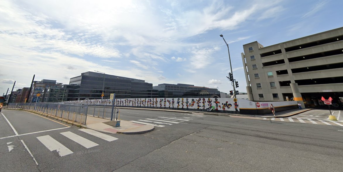
    Despite these attempts to provide transit services to retailers like Walmart, these are not ideal set ups. Shopping malls were designed as pedestrian environments within large parking lots. As long as there is a convenient, safe, and short walkway to the mall entrance, transit riders could be well-served. This is much harder with contemporary big box retail, as they are designed completely different. With malls, parking lots surround a cluster of stores. Most big box developments have the stores surround gigantic parking lots. Even if walkways and bus facilities were included in the site plan, there are still long, unsheltered walks between the bus stops and store entrances.

    Trinity Common Shopping Centre at Highway 410 and Bovaird in Brampton. The red lines mark where the buses stop.

    An early attempt to create a more transit and pedestrian site plan in a big box centre was Trinity Common in Brampton, which opened in stages in the early 2000s. There were distinct roadways, complete with sidewalks and street lighting; in the centre, surrounded by restaurant pads, were several bus bays and a transit terminal office. Several busy Brampton Transit bus routes converge here rather than simply stop on the adjoining multi-use roadways. Even so, the distances between retailers — which include Canadian Tire, a Metro supermarket, Home Depot and Brampton’s only multiplex cinema — make walking unpleasant.

    But at least, unlike the American examples Jarrett Walker highlighted, there’s an attempt at doing better. Hopefully, the next generation of retail centres — mixed use developments with residential uses on upper levels — do better with incorporating the needs of pedestrians, cyclists, and transit users.

  • Intercity map updates for April 2025

    Intercity map updates for April 2025

    New GO Transit bus stop on Chiefswood Road at Six Nations

    As we enter Spring 2025, there are a few significant changes in Ontario’s intercity transportation services. A new daily GO Transit route will now connect Six Nations and the Mississaugas of the Credit First Nation with Brantford, Hamilton, and Greater Toronto. A new seasonal Waterloo-Burlington weekend express could foreshadow more direct service between Kitchener/Waterloo and Hamilton in the future. Flixbus moved its Ottawa terminal stop to the VIA Rail station, joining Ontario Northland and Orleans Express.

    However, there are also some cuts, triggered by the end of the Ontario Intercommunity Transportation Grants. Grey County will terminate all GTR services with the exception of Route 1 between Dundalk, Shelburne, and Orangeville. T:GO is ending its intercommunity services outside of Tillsonburg, including routes that connect with Woodstock and London. PC Connect is cutting its rural route that serves places like Mitchell and Milverton (though routes connecting Listowel, Stratford, and St. Marys to Kitchener/Waterloo and London will continue).

    Unfortunately, T:GO will end all intercommunity bus routes outside of Tillsonburg, including the link to Woodstock

    Recently, I provided my expertise mapping Canada’s intercity transit links to Transport Canada, which allowed me to enhance and update the interactive map. I am also working with Transport Action Canada to support their efforts advocating improved intercity transport across the country.

    I will be retiring my older Ontario and Canada intercity maps; a new version of my Canada Intercity Map for 2025 can be found here. I will make all updates to a single map for now on. The new map depicts discontinued bus routes, shown in light grey.

    Preview of the new Canada Intercity Transport Map

    As always, please contact me with feedback, corrections, or updates. It is a challenge continually maintaining a Canada-wide map given how frequently things change.

  • Another American streetcar, another disappointment

    Another American streetcar, another disappointment

    DC Streetcar eastbound on H Street

    In mid-November, I found myself in Washington DC, accompanying my spouse as she had multiple days of work-related meetings. While I spent part of my time visiting cities in Delaware, Maryland, and Virginia, I also visited several neighbourhoods in Washington itself. Among the things I wanted to see for the first time was the D.C. Streetcar, one of nearly a dozen systems built across the United States in the last two decades. I had already taken rides on modern streetcars in Atlanta, Detroit, Kansas City, Cincinnati, as well as Portland and Seattle, coming away mostly unimpressed — though Portland, Detroit, and Kansas City show some promise. Washington’s small implementation didn’t win me over either.


    I grew up in Brampton, a suburb of a city that maintained a large legacy streetcar fleet. Growing up, I thought streetcars were the greatest thing: big, smooth, quiet, gliding through some of Toronto’s most interesting neighbourhoods. I watched as the city expanded its street railway network along the waterfront and up Spadina Avenue before I had the opportunity to move to the big city.

    Living in Toronto, and reliant on the streetcars, I got to experience the highs and the lows of street railway operation: traffic congestion, bunching, diversions, bustitutions, but also the sweet late-night rides when the streetcar really felt like the king of the road. The new low-floor Flexity streetcars brought even larger vehicles, but they were subject to the same constraints as the smaller CLRVs.

    The TTC’s indifference to line management and the insistence on slow operation in the name of safety (without actually addressing problems like obsolete switches) made streetcar travel less magical with every passing year. But in Toronto, streetcars are still a workhorse, and there is still no easy way for buses to permanently substitute for the demand on routes like King Street.

    Visiting cities elsewhere in the world, like Vienna or Hiroshima, makes me realize that trams can and should work, something that Toronto has largely forgotten. Or something that American cities rediscovering the streetcar haven’t even figured out.

    Former D.C. Transit streetcar in the distinctive 1956-1962 Trans Caribbean Airlines colour scheme, at Seashore Trolley Museum in Maine

    Like all large American cities, Washington once had a robust streetcar network, with several private operators that consolidated into Capital Transit in 1933. Streetcars extended throughout the District and into Maryland suburbs, with separate companies providing service into Virginia’s sprawling suburbs until 1941.

    Within central Washington, streetcars were required by law to draw electric power from an underground conduit for aesthetic reasons, though outlying areas did not have this this obligation. Therefore, many streetcars in DC, including the modern PCC streetcars acquired in the 1930s and 1940s, had both overhead trolley poles and underbody current collectors.

    The last streetcar line in DC was abandoned in January 1962. Fourteen years later, the first section of the Washington Metro opened for service. Unlike the streetcars, the new Metro system was more of a regional service, reaching far out into the Maryland and Virginia suburbs. (Famously, the affluent and congested Georgetown area of Washington is not served by Metro, which was designed mainly as a commuter service.) Though bus service was consolidated throughout the region, there were parts of Washington left underserved by Metro and local bus. The District government began operating its own bus service, DC Connector, and began planning new streetcar services to serve traditionally underserved and rejuvenating neighbourhoods.


    Map of the proposed Phase I streetcar network. Only the thick red line was completed. 

    The first planned route would have connected Anacostia, a historic neighbourhood with a majority Black population, with the Metro and with the gentrifying Navy Yards district on the north side of the Anacostia River. At first, the new light rail would have followed a disused CSX freight spur line, but disagreements with the railroad and land title issues changed the route to a shorter, on-street alignment. After several false starts, work started in 2009 on a “demonstration line” between Anacostia Metro Station and Joint Base Anacostia–Bolling, a major military installation, with an extension to Minnesota Metro Station to follow.

    Looking east on Firth Sterling Ave SE with the tracks suddenly ending before Suitland Parkway. The abandoned CSX spur line right-of-way is on the right.

    Work was suspended indefinitely in 2010. Today, less than a mile of track remains abandoned in place.

    Looking west on Firth Sterling Ave SE toward Joint Base Anacostia–Bolling, where curb-side streetcar tracks installed in 2009-2010 are left abandoned

    An abbreviated 2.4 mile (3.9 km) H Street-Benning Road Line did open, however, in 2016, several years late. The route, which begins on the H Street overpass north of Union Station, extends east to Oklahoma Avenue, at a public park and sports complex north of the abandoned RFK Stadium. Service, which is currently fare-free, operates every 12 minutes during daytime hours. A parallel bus route, the X2 Benning Road–H Street Line, operates as frequently, but has a much longer route and is considerably faster.

    H Street, in the city’s east side, has long been a lower-income, majority Black neighbourhood, hit hard by disinvestment, civil unrest (especially after the assassination of Dr. Martin Luther King Jr. in 1968), crime, and depressed property values. But its proximity to the governmental, cultural, and commercial centres of the city made it an attractive corridor for redevelopment.

    A westbound streetcar shifts into the median on H Street on the way to Union Station

    Though Union Station is the western terminus of the short streetcar line, the connection to the Metro Red Line, Amtrak, MARC, and VRE trains is awkward. H Street is to the north of Union Station, crossing over the multitude of tracks leading into the station platforms on a long overpass. The streetcar stops halfway across, in the median. Passengers getting off the streetcar must walk further west on the median, then cross the eastbound lanes of H Street at a traffic signal controlling a driveway exit from the Union Station parking garage. A poorly marked sidewalk provides the connection into the parking garage (which also houses the Union Station intercity bus terminal) and down towards the main station building.

    The path from DC Streetcar, through a parking garage, towards Union Station

    Like most modern streetcar lines in the United States, the DC Streetcar runs in mixed traffic, in the outer driving lane. This allows for platform level boarding from the sidewalk at each stop, but it also leaves the streetcar susceptible to traffic delays due to congestion and from stopped cars and trucks. Though there are parking and layby spaces to the right of the streetcar track, a wide or improperly stopped vehicle can easily disrupt service. Streetcars regularly squeeze past properly parked delivery vans, as in the photo below.

    A streetcar squeezes past a stopped Amazon delivery van on H Street

    But new streetcar lines in North America are typically less about moving people than it is about sparking new urban development. On H Street, this has definitely happened. New mid-rise rental and condominium residential buildings line the western end, towards Union Station. A Whole Foods grocery store is at the base of one of those buildings, where previously, there was a parking lot and local grocery store.

    Streetcar passes a Whole Foods grocery store at the base of a mew seven-storey rental apartment building, northeast corner of H Street and 6th Street NE
    The same corner in 2008, with a neighbourhood grocery store on the northeast corner of H Street and 6th Street NE (Google Streetview)

    Still, I wonder how much the streetcar itself contributed to the gentrification of H Street. The streetscape is greatly improved, but streetcar ridership is low, despite the free fare. The close proximity to Union Station, government offices, and commercial areas, along with rezoning of vacant lots would have made a bigger impact. However, government investment on the corridor made it attractive for speculators and developers to assemble land and build.

    In the meantime, as rents skyrocket, crime remains a concern. New stores such as Whole Foods do not serve long-term residents and local businesses have been displaced. Like Whole Foods, the streetcar was designed to support the new community, while others continue to take the bus and shop at the Safeway on Benning Road.

    Looking east at H Street and 3rd Street, 2008 (Google Streetview)
    Looking east towards 3rd Street, November 2024

    If the H Street-Benning Road Streetcar was extended in both directions based on the original plans, it could prove to be a useful, albeit slow, transit service filling in one of the gaps left by the Washington Metro system. But as Washington struggles with its city budget, this is very unlikely. By the end of the year, the DC Circulator bus system will disappear for good, further orphaning the single short streetcar line operated by the District.

  • Why transit system maps matter

    Why transit system maps matter

    I love maps, especially physical, paper maps. I like to visualize the places I travel to and determine how each city and region’s transit networks work. Though online interactive maps can be very helpful (like the ones I created to show all intercity transport services in Ontario and across Canada, filling a much-needed gap), there is still nothing like a well-designed static map, especially when it is in print and easily accessible to the public.

    This means providing maps that accurately and clearly depict the entire transit system, along with landmarks, connections, and frequency. Los Angeles Metro’s system map does a reasonable job for a map that covers a very large region.

    The Los Angeles Metro system map depicts the complex bus and rail network, including non-LA Metro agencies like Culver Citybus and Santa Monica’s Big Blue Bus. Colours and line width used to denote operator, service type, and frequency.

    Thankfully, most urban transit systems in North America continue to provide proper system maps both on their websites and in print, provided free on request at subway booths or terminal offices. (Some, however, have charged a small fee for a physical copy of their transit maps, such as San Francisco’s Muni.) In Europe, complete transit maps often have to be purchased, such as in Berlin or Vienna.

    I recently visited two mid-sized American cities that have done away with physical maps for their transit systems: Pittsburgh, Pennsylvania and Denver, Colorado. In those cities, figuring out how to get around by tram and bus was frustrating, even in an age of Google and Apple maps and transit planning apps accessible to anyone with a smartphone.

    Pittsburgh Regional Transit (formerly known as Port Authority Transit) operates a complicated web of bus routes that radiate from the city’s downtown core, along with a few cross-town and feeder routes. There are three busways and a light rail service to the southern suburbs. However, there is no proper system map, either in print or online as PDF or image file that allows the new or casual user to make sense of the network.

    Individual bus and LRT route schedules can be found under the Schedules tab on the PRT website, but one needs to know what route they are looking for. Under Rider Info, there is a link to a system map, but it takes the user to an ESRI interactive map.

    Screenshot of the system map page of the PRT website

    The user can then select a service by route name or number in a drop-down tool, but the map itself is difficult to figure out. Zooming in reveals the location of fare vendors and park-and-ride lots, but not important service details like route numbers or service frequency.

    Zooming in, park-and-ride lots become the most prominent feature

    Even at the neighbourhood level the map is difficult to read. The screenshot below shows Pittsburgh’s Oakland district, home to University of Pittsburgh, Carnegie Mellon University, several other educational institutions, medical centres, parks, museums, and cultural venues. Many bus routes follow Forbes Avenue and Fifth Avenue, but as each route is layered on top of each other, it is difficult to discern where each route runs and where they go.

    PRT’s ESRI interactive system map, zoomed into the Oakland District

    Denver’s Regional Transportation District (RTD) also uses ESRI interactive maps to show bus routes (rail services are depicted in a static image map as well). At a small scale, only the light rail and commuter/regional rail services appear, along with transit park-and-ride locations. Denver’s bus system is less complicated than Pittsburgh, operating largely on a grid, but still, a proper map would make it much easier to get a sense of the network.

    RTD System Map zoomed out

    Zoom in, and bus routes appear, along with route numbers, but there is nothing to show the level of service for each route.

    Though online-only interactive maps have their purpose (my Ontario and Canada intercity maps are designed to show where connections exist, or not, and how to obtain schedule information), they are not well suited for urban transit systems and are very difficult to read on a mobile device. Properly designed static maps, in web image or PDF format do much better jobs.

    It is worth comparing Pittsburgh and Denver to the Toronto Transportation Commission (TTC). The TTC’s complete system map is provided to customers for free at subway stations, with smaller, simplified versions available as tear-away pamphlets. Large-format versions are also displayed across the network in bus shelters and subway stations. A PDF version can also be easily found on the TTC website in the main Routes and Schedules page. Surface routes are categorized by service level (express, frequent service, regular service, limited service, seasonal, and community routes) with major landmarks and transfer points to connecting services clearly indicated.

    I have some minor complaints about the TTC’s map (like regular routes, express routes should be categorized in the map based on their service levels, for instance) but it is a reasonable, easy to read map that is also quite easy to find.

    Unfortunately, more transit systems are moving away from easily accessible paper maps. Durham Region Transit, for example, no longer provides copies of its system map. Fortunately, a proper, well-designed PDF copy remains accessible on its website.

    When travelling, or looking to understand a city’s transit network though, there is nothing quite like poring through a well-designed, easy-to-read paper map. It would be a shame if more agencies went the way of Denver and Pittsburgh.

  • A bus to St. Thomas, finally

    A bus to St. Thomas, finally

    Middlesex County Connect and “Local Motion” buses at St. Thomas, June 2024

    On Saturday, June 15, I took a trip that was not possible for over a decade: I went to St. Thomas, Ontario, without a car. This was possible because of one of several new intercity transit links that opened this year in Ontario, and I have updated my interactive map accordingly.

    (more…)
  • Transit museums’ transit dilemma

    The Pennsylvania Trolley Museum now features a new main entrance and exhibition hall, along with an on-street boarding area complete with vintage signage.

    While visiting Pittsburgh earlier in June, I also paid a second visit to the Pennsylvania Trolley Museum (PTM), located 45 minutes south of Downtown Pittsburgh in Washington PA. I had visited the museum a few years prior as part of a visit to the Pittsburgh area, but since then, a new section of the museum opened to the public, and there were additional cars in operation.

    While I went to PTM with a friend who planned to stick around until the evening, I planned to return to downtown Pittsburgh earlier in the afternoon. I found information on a local transit service operated by Washington County — called Freedom Transit — that ran a route to and from Pittsburgh that stopped not too far from the museum’s main entrance. That plan did not go well at all.

    It is an unfortunate irony that most North American transit museums have poor or non-existent transit access. There are historical reasons why this came to be, but some of the continent’s best transportation exhibitions are inaccessible to newer generations of transit fans, historians, and enthusiasts, many of which do not or cannot drive.

    Washington County Transportation Authority, or “Freedom Transit,” doesn’t offer much freedom
    (more…)
  • A review of Metrolinx’s April 2024 service changes

    A review of Metrolinx’s April 2024 service changes

    With a GO train serving as a backdrop, Premier Doug Ford, along with Transportation Minister Prabmeet Sarkaria, announced major changes to GO Transit service, with 300 new weekly trains (a 15% service increase). The service changes will take effect on Sunday, April 28, 2024.

    Though most new trains will be added on the Lakeshore West, Lakeshore East, and Kitchener Lines (the Milton Line gets just one additional weekday round trip in the peak direction), the media event was held in Milton, where a byelection was called to replace outgoing PC MPP Parm Gill. With a competitive race between PC candidate Zeeshan Hamid and Liberal candidate Galen Naidoo Harris, the choice of venue made it an especially political event.

    News of the pending service changes was publicized in regular Metrolinx email newsletters in March, but was since taken down, likely to allow for the news to be shared first by the premier and minister of transportation. It is quite clear that Metrolinx is entirely beholden to the provincial government these days, where communications are tightly controlled by its political masters.

    The new GO Transit schedules are now available online. Though there is plenty of good news, some of the added trains are merely restoration of previous service levels. Meanwhile, there will be a significant service cut for two Toronto stations.

    Lakeshore Corridor

    Fifteen-minute train service returns on the busy Lakeshore line on weekend afternoons and evenings, between Oshawa and Oakville Stations only. Service will still run every half-hour on weekdays, weekend mornings, and to Bronte, Appleby, Burlington, and Aldershot Stations, and every hour to West Harbour GO in Hamilton.

    However, weekend 15-minute service starts late in the afternoon. Frequent service from Oakville to Union starts at 2:30 PM Saturdays and Sundays and at 3:14 at Union Station. This additional service starts too late for family day trips to the city or for getting to afternoon Blue Jays games.

    Bus route 18K, which operates between Aldershot, West Harbour, St. Catharines, and Brock University, is renumbered to Route 11.

    Milton Corridor
    Map of Route 21

    There will be one new peak-period round trip leaving Milton at 6:43 AM and leaving Union at 4:10 PM.

    More importantly, Route 21 will return to its previous routing, operating directly into Union Station Bus Terminal. When I wrote about the April 2023 changes, I commented that the changes simplified the complicated Route 21 while improving reliability and predictability for Milton Line passengers. However, the changes proved to be unpopular, with poorly timed connections between buses and trains.

    But with the Gardiner Expressway down to two lanes between Dufferin Street and Strachan Avenue for long-term construction, and with downtown Toronto’s traffic, I am wondering how much better the ride will be.

    Route 21A, which ran between Milton and Oakville, will be replaced by Route 22, which offers much more limited service — every two hours, weekdays only. Route 21A offered useful connections to GO buses at Trafalgar Road Park & Ride for Highway 407 services to McMaster University, Downtown Hamilton, Square One, and beyond. It is a shame to see that service reduced, though perhaps Milton Transit should begin serving it.

    Kitchener Corridor and UP Express
    New UP Express service pattern

    The good news? There will be new weekday half-hourly train service between Bramalea and Union Stations during midday and early evening periods. (Hourly service between Bramalea and Union will remain in the counter-peak direction.) There are no changes to rail service between Kitchener, Mount Pleasant, or Union Station and only minor changes to connecting GO buses. Not all trains will stop at Etobicoke North, which only has one platform.

    The bad news? UP Express service will be split into express and local services, with non-stop service between Union Station and Pearson Airport every 30 minutes, and local trains every 30 minutes stopping at Bloor and Weston. Both local stations will see improved weekday GO service, but this still amounts to a service cut, especially at Bloor, an important connection to the Line 2 Subway and local TTC services. This is also at a time when the connection between Dundas West Station and Bloor Station is finally being improved.

    Other changes

    Weekday evening train service will be restored on the Stouffville Line on April 28.

    Elsewhere, there are minor schedule adjustments — it’s always a good idea to check your trip before you depart.

    One last thing worth commenting about is a brand new, well-designed GO Transit bus map that clearly shows each route and how they connect to the rail network. Bus routes are sorted into “core” and “train support” services, a useful distinction.

    My only criticism is that they should show frequency or level of service — some “train support” routes run hourly or better, seven days a week (like Route 30) while some of the “core” routes do not operate evenings and weekends.

    Regional bus map
    Finally

    Apart from my observations and criticism above, I would have liked to have seen more changes to the bus network. For example, service to Peterborough remains too slow, while there should be weekend service between Kitchener, Guelph, and Hamilton. Hopefully, there will be more changes in September.

  • Can on-demand transit meet your demand?

    Can on-demand transit meet your demand?

    Durham Region Transit On Demand sedan

    Earlier in March, as part of my quest to visit every town, city, and regional government office in the Greater Toronto and Hamilton Area (GTHA) without a car, I took my first on-demand transit rides in a decade. This was necessary to visit Brock Township’s municipal offices, located in the village of Cannington, north of Port Perry. (I will discuss more about this project in the coming weeks.)

    Brock Township’s municipal offices, at right, sits in the heart of the village of Cannington

    Brock Township is the GTHA’s most rural and least populated municipality, home to just over 12,000. Until April 2023, GO Transit ran a daily bus service between Whitby GO Station, Port Perry, Cannington, and Beaverton (Brock’s largest community), but was cancelled after a ridership review. (GO has quietly cancelled several other bus routes that don’t cross county or regional boundaries in the last decade.) However, Durham Region Transit (DRT) offered an alternative: on demand transit.

    On-demand transit is not a new idea. In the 1970s, GO Transit operated experimental dial-a-bus services in suburban parts of Toronto, offering door-to-door service to and from the nearest subway station or a designated transfer point to frequent fixed-route bus services. In Bramalea, Chinguacousy Township operated Bramalea Dial-a-Bus, which brought residents to local employers, schools, and Bramalea City Centre. The service was replaced by fixed-route services when Brampton Transit was established shortly after amalgamation, merging the dial-a-bus operation and a privately contracted transit service in the old town of Brampton.

    Still image from “People on the GO,” a 1973 film by the Ontario Ministry of Transportation and Communications. Bramalea’s Dial-a-Bus’ pink “lazy-b” logo was adopted by the successor transit agency, Brampton Transit during its first decade.

    “Trans-Cab” services continue to be used in outlying areas of communities such as Hamilton, Peterborough, and Sudbury, where transit agencies partner with local taxi companies to allow transit riders to begin or end their journey outside of urban or regional fixed-route areas, often at a premium fare.

    My first on-demand transit experience was taking Oakville Transit’s “zone bus” service in 2005. At the time, there was no fixed-route Sunday bus service in Oakville, but there were four zones for which you could call and request a ride, with a bus picking you up at the nearest bus stop. If your destination was in a different zone, you would transfer to another bus at Oakville GO Station. Today, Oakville offers on-demand service during late evenings from the Oakville GO Station and in new and outlying subdivisions where there are no nearby scheduled services.

    My other previous on-demand transit experience was in Winter and early Spring 2012, after I suffered a broken knee cap and had to rely on Toronto’s Wheel-Trans paratransit system. Though I was fortunate to be able to get around using Wheel-Trans during a temporary disability, it was often a frustrating experience trying to book trips, especially for social or leisure purposes. I quickly came to prefer the conventional system and used it as much as I could while recovering from that injury.

    A common message while trying to book rides on DRT On-Demand

    In 2024, there are over a dozen transit agencies providing on-demand transit services in Ontario and Quebec, either as standalone operations or in conjunction with fixed-route systems. You can find them in my interactive transport maps.

    Modern on-demand services, though they are typically accessed by mobile apps these days, present some of the same challenges, including cumbersome booking processes as well as high demand and limited availability for next-day and same-day trips.

    DRT offers on-demand transit trips for customers with disabilities (who are eligible for door-to-door service anywhere in the region), rural areas, and in designated urban areas (where pickups and drop offs are made at signed bus stops).

    DRT rural services, showing the rural on-demand service area and transfer points to fixed-route services (including GO buses at Downtown Uxbridge, Brock/407 and Clarington North)

    As Brock Township was the most distant and most difficult town hall in the GTHA to reach by public transport, I tried to book for the first day of my visits: Monday, March 11. After downloading the DRT app and inputting my information (name, email address, mobile phone number) I tried to book a return trip from Port Perry (which has a scheduled route connecting it to Uxbridge, Oshawa, and Whitby) the day before.

    At one point, I was able to get an outbound trip around 12:00 PM, but I could not get a return trip after multiple attempts. After failed attempts to book each ride, the app would go back to the beginning, requiring the user to input most of the same information multiple times. I gave up and went to northern York Region instead. After midnight, early Monday morning, when one could book trips for the following day, I tried again and managed to get a return trip that met my needs for Tuesday the 12th.

    Unable to book a return trip from Cannington to Port Perry for Monday, March 11, 2024

    Once I booked my trip, the rest of the experience was smooth. I got a text reminder of my upcoming trips, and on the app, I could track my upcoming ride, much like Uber or Lyft, with the driver’s name, vehicle description, and location. Each time, I paid with my Presto card, with DRT charging the same fare for on-demand as for conventional bus service. Drivers were professional and friendly. I was the only passenger for both trips, though they are often shared, and minibuses — such as accessible paratransit vehicles — are used for passengers with disabilities or larger groups.

    Notice of pickup

    I learned that the service could be quite busy and the app sometimes problematic — there is also a toll-free number that passengers can call, and that sometimes the telephone agent would be able to find matching rides that the app would not show.

    I was lucky that my trip was discretionary, but I could see how on-demand transit can be difficult and/or frustrating to use.

    Though DRT has restored most urban bus routes (many were suspended during pandemic-related restrictions), it still struggles to meet demand on its busiest corridors, especially those serving colleges and universities in Oshawa, Whitby, and Scarborough. A fire in one of DRT’s garages last summer hasn’t helped either. As a result, some urban areas in Ajax, Pickering, Whitby, and Bowmanville still have on-demand areas where fixed-route services have yet to be restored.

    On-demand transit has its place, especially in rural and outlying suburban areas, or during times of low demand. If done right, it provides affordable mobility to people who might otherwise go without, and as an alternative to driving a car or paying an expensive taxi fare for those with travel options. Durham Region has done a good job covering the entire region with fixed-route and on-demand services, especially at night, where the urban south enjoys 24-hour transit access.

    DRT overnight services, which includes two scheduled buses and five on-demand zones in the urbanized part of the region.

    Despite Durham’s efforts, on-demand services can be costly to operate, less flexible for prospective passengers, and be frustrating to use, though they can cover much larger areas than line haul routes. Scheduled, fixed-route buses offer predictable, simple, and often faster service than point-to-point bespoke services. On-demand transit has its place, but it is only one tool in a vast toolbox of mobility solutions. This was true in the 1970s and remains true today.

  • Heavy interference in a light rail transit project

    Heavy interference in a light rail transit project

    Banner promoting “The Hazel McCallion Line” on Hurontario Street in Brampton, January 2024

    Previously on this website, I wrote about the renaming of two GO Transit stations: Oshawa and Brampton. I explained why renaming transit infrastructure is problematic, especially when they violate wayfinding standards, which call for simple, accurate, unique, and self-locating names.

    Both GO Transit stations were renamed by provincial agency Metrolinx, on behalf of the provincial government. Metrolinx operates GO Transit buses and trains, the UP Express airport link, administers the Presto fare payment system, and oversees the construction of new rapid transit projects in the Greater Toronto and Hamilton Area. The Hurontario LRT, which is currently under construction between Port Credit GO Station in Mississauga and Steeles Avenue in Brampton, is just one of many transit projects managed by Metrolinx.

    On February 14, 2022, at Cooksville GO Station, Premier Doug Ford, then Transportation Minister Caroline Mulroney, then Mississauga Mayor Bonnie Crombie, and Metrolinx CEO Phil Verster joined former Mississauga mayor Hazel McCallion announcing the name change from the Hurontario LRT to the Hazel McCallion LRT. The occasion also marked McCallion’s 101st birthday.

    Hazel McCallion with Metrolinx CEO Phil Verster, February 14, 2022 (Metrolinx photo)

    This is the first rapid transit line in North America to be named for a person, contradicting established standards for transit projects.1 Though McCallion was a formidable and popular mayor whose political career spanned seven decades, she was also very close to the Ford government in the last few years of her life. She also had many other public facilities named in her honour — a senior public school in Mississauga’s Streetsville neighbourhood, the library at University of Toronto’s Mississauga campus, the City of Mississauga’s central public library, a walkway leading to Square One Shopping Centre, and the Mississauga campus of Sheridan College. There is also the Hazel McCallion Auditorium at Mississauga Valley Community Centre and the Hazel McCallion Hall at Vic Johnston Community Centre. There was no need for yet another civic asset to be renamed for her.

    In Toronto, most former mayors have just one public asset named for them: David Crombie, Art Eggleton, June Rowlands, and Barbara Hall have parks dedicated in their honour. Mel Lastman — mayor of North York for 24 years before being elected mayor of amalgamated Toronto for another six — and Nathan Phillips have major public squares.2 In Mississauga, there was no need to rename yet another piece of civic infrastructure for the same person.

    Furthermore, there was no public consultation about the name change — even officials at the cities of Brampton and Mississauga were kept in the dark — while the name itself contravenes Metrolinx’s own naming conventions.

    In July, 2023, I submitted an access to information request to Metrolinx, the second time I went through the freedom of information process to find out more about the light rail transit project. There were several delays, and I did not receive my requested documents and communications until late January 2024.

    A deep dive into the background of the Hurontario LRT project, the person it is being renamed for, and my findings and impressions follow.

    (more…)
  • Bussing the gap: Scarborough transit after the SRT

    Bussing the gap: Scarborough transit after the SRT

    Scarborough Centre Station, September 2023

    On July 24, 2023, 38 years of Line 3, the Scarborough RT, came to an ignoble end when a car came off the tracks just south of Ellesmere Station, four months ahead of the scheduled closure of the deteriorating line. Though the City of Toronto and the Toronto Transit Commission (TTC) were hesitant to say so at the time, it was apparent that the July derailment meant Line 3’s permanent closure. A farewell party, with two SRT cars, was held at Scarborough Centre Station on September 23, 2023, allowing the public to have one last sit in the venerable cars.

    I went to check out the new temporary bus lanes on Midland and Kennedy, installed ahead of a planned busway between Kennedy and Ellesmere Stations. The busway, which will open in 2025 after the old SRT right-of-way is decommissioned, will include a new stop at Tara Avenue, at the Meadoway trail.

    In the meantime, most drivers appear to be respecting the new painted lanes, even on busy Kennedy Road. With several bus routes from north and east Scarborough diverted to Kennedy Station to provide a more pleasant ride, the bus lanes are very well used.

    Northbound buses on Kennedy Road

    You can read more about the planned busway on Urban Toronto, where I am now a contributor.