Tag: Transit

  • GO Transit is broken – and other transit updates

    GO Transit buses stuck in Downtown Toronto gridlock in July, 2022

    While travelling through the Northeastern United States this spring and summer, I found myself feeling lucky to be living in Toronto. Though the New York City Subway and the PATH trains between New Jersey and Manhattan were operating pretty much as I remember them, in other big cities, the mass transit systems were in rough shape. In Washington, underfunding and incompetence led to the long-term withdrawal of over half of its Metro cars. During our visit in April, we were treated to long waits and crowded trains, though at least the system was clean. When we visited Philadelphia in late June, it was clear that the Southeastern Pennsylvania Transit Authority (SEPTA) had given up: poor communications, lengthy waits, unsafe subway stations, and general apathy among staff and passengers made my spouse and I resort to driving on our last day there.

    In Toronto, at least, the subway was still running frequently (with only minor service cuts due to the pandemic), the buses and streetcars as (un)reliable as ever, and despite more anti-social behaviour on some of its surface routes, I almost never felt afraid for my well-being when riding the Rocket, compared to my experience in Philly. GO Transit responded to the pandemic very well. Though it was forced to suspend many of its train and bus trips due to a sudden plunge in ridership, it maintained a basic service level on nearly all of its routes, slowly restoring certain services in 2021 as ridership slowly rebounded. Some corridors, like the Kitchener Line, had more service in the early Fall of 2021 than it did prior to the pandemic. As Metrolinx continued planning and construction of major transit projects like GO Expansion, the Ontario Line, and several LRT corridors, the future looked bright. In Spring 2022, GO Transit introduced a special weekend day pass for $10 per day or $15 per weekend, to help grow ridership.

    Unfortunately by late June 2022, GO began to fall apart.

    (more…)
  • It’ll always be the Hurontario Line to me

    Metrolinx map of the Hurontario LRT route

    On Monday, February 14, Premier Doug Ford, Transportation Minister Carolyn Mulroney, and Mississauga Mayor Bonnie Crombie attended a photo-op at Cooksville GO Station to announce a new name for a transit project. With former mayor Hazel McCallion in attendance (who was celebrating her 101th birthday), it was no secret what the new name was going to be.

    It was disappointing that the Hurontario LRT, a provincially-funded transit project operating within Brampton and Mississauga and intended to be part of a regional transportation network, would be named for a divisive former mayor of only one of the two cities the Hurontario LRT is supposed to directly benefit. 

    In North America, and around the world, transit lines and stations are named (with a few misguided exceptions) to reflect the geography of the route it represents and to provide optimal wayfinding, especially to visitors and people new to transit. In Greater Toronto, bus, streetcar, commuter rail and subway routes are named based on the major street they run on (the 501 Queen Streetcar or Line 4 Sheppard), the neighbourhood they serve (the 56 Leaside bus) or the destination it runs to (the GO Milton Line or 900 Airport Express).

    Even new projects follow these conventions. The Crosstown LRT, which operates under and along Eglinton Avenue, is a crosstown route across the middle of the city. Even the Ontario Line partially gets its name from its two end points (Exhibition Place/Ontario Place and Ontario Science Centre). The Hurontario LRT reflected the name of the main street it operates along, even if it changes its name briefly though central Brampton.

    The “Hazel McCallion Line” does not accomplish any of these goals.

    Given Peel Region’s diverse population of over 1.4 million residents, it is also disappointing that a major project intended to unite the region is named for an affluent white public figure that already has two libraries, a public school and a college campus already bearing her name.

    Furthermore, McCallion’s legacy as a longtime mayor of Mississauga is tarnished by racist statements after visiting a local hospital in 2001two conflict of interest scandals, her recent involvement with a troubled for-profit long term care provider, and by land use policies that kept taxes low for decades, but did little to ensure a financially or environmentally sustainable future for the city. 

    I suspect Premier Ford wanted to celebrate a political ally a few months before the next provincial election, but naming the Hurontario LRT after Hazel McCallion sends the wrong message. 

    Post script: The Hurontario Line may not be the only Metrolinx transit facility that will see its name change. In a MERX posting dated February 15, 2022, Metrolinx is looking for Expressions of Interest for station naming rights opportunities for at least four existing GO Transit rail stations. The summary is quoted below:

    Expression of Interest

    Expression of Interest No. RFI-2021-CCMX-097

    Metrolinx is accepting Expressions of Interest for Station Naming Rights Opportunity.

    Metrolinx is an agency of the Government of Ontario, overseeing GO Transit, PRESTO, and UP Express. We are embarking on a massive transformation of the GO Rail network – the backbone of regional rapid transit in the region – to give customers a faster, more convenient way to connect with the things that matter.

    Metrolinx is seeking proposals from interested parties in any category for the Station Naming Rights Opportunity at the following stations:

    Whitby GO Station
    Exhibition GO Station
    Clarkson GO Station
    Oakville GO Station

    Metrolinx will consider proposals for other stations not listed here at the request of interested parties.

    For more information about the GO Transit network and stations, please visit www.gotransit.com. We are committed to working together to create a partnership that will meet shared objectives, such as increase revenue, increase market share for our partners and provide a positive customer experience on public transit.

    All four stations listed are on the Lakeshore Line, the backbone of the GO Transit rail network. Exhibition GO could be especially attractive for renaming, as it will become a major hub with the future connection to the Ontario Line and local TTC services. It is also worth noting that Metrolinx will entertain proposals for additional stations in the bid process.

    It is hard to blame Metrolinx for these specific transit naming decisions; it is very likely that the Ford government demanded the McCallion Line and is pushing for the sell-off of naming rights. But it is ironic that after hiring consultants and going though a complex naming process for the Crosstown LRT, that previously held principles are quickly abandoned at the whim of Metrolinx’s superiors.

  • A welcome revision at Major Mackenize

    Earlier this year, I wrote about a major malfunction at a new Viva Rapidway station near Downtown Richmond Hill. The Major Mackenzie station on Yonge Street was built one block south of the busy east-west arterial road; passengers taking Viva buses were forced to walk from Major Mackenzie Drive south to the intersection of at the intersection of Elmwood Avenue and Hopkins Street, push a “beg button” and wait to cross to the bus platforms in the middle of Yonge.

    The reason for this unusual situation was that the Yonge Street right-of-way narrows through Downtown Richmond Hill. At Major Mackenzie Drive, northbound Viva buses must enter mixed traffic for approximately two kilometres before returning to a median busway. (The northbound traffic signal at Major Mackenzie has a dedicated transit phase that allows Viva buses to exit the median ahead of general traffic.) This required the median Viva bus stop (called a VivaStation) to be located considerably south of the intersection of Yonge Street and Major Mackenzie Drive.

    Back in February, temporary barriers and YRT transit enforcement officers were used to dissuade transit customers from Back in February, temporary barriers and YRT transit enforcement officers were used to dissuade transit customers from taking the faster and direct, yet more dangerous, route to Major Mackenzie Drive and connecting east-west buses by crossing midblock north of the platform, the faster and direct, yet more dangerous, route to Major Mackenzie Drive and connecting east-west buses.

    The Major Mackenzie VivaStation and layout, February 2021

    To my pleasant surprise, York Region fixed its mistake. Though the revised station is not ideal (it is still a long walk from Major Mackenzie Drive itself), a new walkway alongside the east side of the bus right-of-way from the VivaStation to the Major Mackenzie intersection makes the transfer to and from buses on Major Mackenzie much simpler.

    Looking south from Major Mackenzie Drive

    Just north of the bus platforms, a signed crosswalk allows passengers to go from the walkway and northbound platform to the southbound platform on the west side of the bus right-of-way.

    Looking north towards Major Mackenzie Drive at the new crosswalk, which allows passengers to go between the southbound bus platform to a new walkway connecting the Major Mackenzie VivaStation to its namesake street.

    Permanent metal rails prevent passengers from crossing Yonge Street until they get to the signalized intersection at Major Mackenzie. But transit enforcement officers were nowhere to be seen on this visit, on a Friday afternoon.

    Metal barricades deter pedestrian crossings outside of signalized crosswalks.

    Unfortunately, to make room for the walkway between the station and Major Mackenzie Drive, the northbound bicycle lane was cut, and replaced with “sharrows.” Though the new bicycle lanes on Yonge ended at Major Mackenzie (not enough room if you have to maintain four through traffic lanes through a historic town centre), this diminishes the gains cyclists made with the reconstruction of Yonge Street for the BRT lanes.

    When surface transit projects — like the Viva Rapidways — are designed to fit into existing suburban roadways, compromises to the passenger experience are made. At Richmond Hill, this meant maintaining two traffic lanes in each direction while trying to squeeze a bus rapid transit station into the roadway. This resulted in the original blunder, which should have been thought though earlier in the planning stages.

    The fix is not perfect, but it at least addresses the problems with the Major Mackenzie BRT station. Perhaps, one day, we will plan for transit, walking, and cycling first in places like Downtown Richmond Hill, rather than planning for private motor traffic first.

  • A visit to GO Transit’s new Garage Mahal

    A visit to GO Transit’s new Garage Mahal

    Bloomington GO Station

    On Thursday, August 12, I rode the train to the very end of the Richmond Hill Line to check out GO Transit’s newest station.

    In 2017, I made a similar trip to Gormley Station, just to the south of Bloomington GO, soon after that station opened to the public. Four years ago, I was critical of Metrolinx’s failures to support the urban intensification of the Greater Toronto and Hamilton Area (GTHA) by building new stations on the Greenbelt, on lands that will not support transit-oriented development.

    Though I came away from Gormley Station disappointed, I wanted to see Bloomington Station for myself and give it an honest assessment. I came away with mixed feelings.

    Most GO Stations outside the old City of Toronto put free car parking ahead of all other considerations. Some stations, such as Unionville, were even moved to sites where large surface lots could easily be built. Hamilton GO Centre, opened in 1996, was an exception: an urban station that combined a restored heritage building with a large bus terminal. A few other newer stations, such as Mount Pleasant in Brampton and Mount Joy in Markham, still had large surface parking lots, but also had easy walking connections to adjacent neighbourhoods. In Guelph and Kitchener, GO Transit used existing downtown stations instead of suburban stations, and Allandale Waterfront Station is located right across the street from Barrie’s gorgeous Kempenfelt Bay.

    Gormley and Bloomington Stations represent a return to GO Transit’s old ways of putting parking ahead of all other considerations, despite Bloomington’s modern design.

    Metrolinx, the provincial agency responsible for planning and constructing transit infrastructure in the GTHA and for operating GO Transit, opened Bloomington Station on June 28, 2021. The station is located on Bloomington Road, adjacent to Highway 404, on the boundary between Richmond Hill and Aurora.

    The station is built around a three-storey parking garage tucked into a hill, with the train platform and station amenities (an enclosed waiting room with washrooms and a ticket counter) on the second level. At the lower level, there is a six-bay bus loop almost directly below the rail platform, minimizing the distance between train and bus. Elevators, stairs, and ramps connect the three levels of parking, the bus bays, and the train platform.

    The station’s central atrium, which contains the pedestrian passages between parking levels, station, and platforms, is the architectural highlight. Above the parking areas, solar panels collect some of the energy required to light and heat the station.

    Atrium at Bloomington Station, with parking spaces on both sides

    In its blog, Metrolinx expressed pride in the new station, noting it was built to achieve LEED Gold certification through features such as energy efficient lighting, a water-permeable surface lot, stormwater management, and a pond for local wildlife with an underground passage to help animals migrate away from the station complex. Like most new GO platforms, Bloomington’s train platform is heated to allow snow and ice to melt, reducing salt usage. Finally, as far as suburban GO stations go, Bloomington’s footprint is quite compact. It cost $82.4 million to build the new station.

    Plaque adjacent to wetland at Bloomington GO Station
    Permeable surface at Bloomington’s outdoor surface lot and passenger pick-up and drop-off area

    Despite these innovations, a LEED certification can only go so far when the GTHA’s newest transit station is only accessible by car, with over 1,000 parking spaces. Though transit ridership is down significantly during the ongoing pandemic, especially on GO’s Richmond Hill Line (which operates only in the weekday peak-period direction and currently uses four-car trains), there are no ongoing connections from Bloomington GO Station operated by GO buses or York Region Transit.

    Though several GO rail stations do not have any local transit connections only Bloomington and Gormley have no bus connections at all. (In April 2020, YRT discontinued the limited-service Route 15 that ran past Gormley Station). At Acton, Georgetown, and Lincolnville, which also do not have any local transit connections, passengers can still connect to GO buses for points beyond, or make a return trip.

    The only bus operating at Bloomington Station’s loop is GO Route 61, which provides supplemental weekday service between Union Station and Bloomington GO. But the last Route 61 bus leaves for Union at 1:55 PM.

    There was no bus connection to be found at Bloomington GO Station

    The nearest in-service bus stop is over one hour’s walk away, near Bloomington Road and Yonge Street. At least there was a paved shoulder along the busy five-lane road between the GO station and Bayview Avenue, where motorists were driving well in excess of the 80 km/h speed limit.

    Looking east towards Bloomington GO at Leslie Street

    At Bayview Avenue, a sidewalk leads westerly to Yonge Street, with new residential subdivisions lining the south side of Bloomington Road. I noted a bus stop as I was walking west towards Bayview Avenue; alas, it was only for a high school special route.

    YRT stop at Bloomington Road and Bayview Avenue signed “school special only”
    New residential development along Bloomington Road featuring large houses with three-car garages was clearly designed for cars, rather than people

    As I was nearing Yonge Street, I noted that the new subdivisions were set back far from the road, with many of the houses built with three-car garages. Building enough transit ridership here to support even a limited service bus route is going to be very difficult.

    One hour and 8 minutes later, I arrived at the bus stop at Yonge Street, the closest place to Bloomington GO Station where I could get a bus to continue my journey.

    The end of a long walk from Bloomington GO Station

    Bloomington Station’s small footprint and environmental features might actually make it an ideal basic station design for more urbanized locations in the GTHA, where the compact design and logical layout could support easy bus connections and short walks to residential and employment areas. I liked the simplicity of the bus connections at Bloomington — if only there were any buses to connect to.

    But Bloomington’s LEED Gold certification means little when it does not support sustainable development or sustainable access to the station.

    Though its location adjacent to Highway 404 may entice some commuters to switch to parking at Bloomington and commuting downtown by train, Gormley, just one station to the south, already achieves a similar purpose.

    For now, Bloomington Station is just a Garage Mahal — a grand monument to the old way of doing things at GO Transit.

  • How Brampton commuters are caught in the middle at Steeles

    How Brampton commuters are caught in the middle at Steeles

    The intersection of Steeles Avenue and Main and Hurontario Streets

    Last year, I wrote about a foreseeable problem coming to the corner of Steeles Avenue and Hurontario and Main Streets in Brampton: the planned Hurontario LRT terminus, to be located on the south side of Steeles Avenue, would require thousands of commuters to transfer to Brampton Transit buses on the north-west corner of the intersection.

    This transfer would require crossing ten or eleven lanes of traffic at one of Peel Region’s busiest intersections, with crowding at the street corners, with passengers awaiting a walk signal two separate times to make the necessary connection.

    After twice receiving unsatisfactory answers at a Metrolinx online town hall, and hearing no information about how the crossing at this intersection might be mitigated, on March 9, 2021, I took the step of making an Access to Information Request to Metrolinx under the province’s Freedom of Information and Protection of Privacy Act asking for communications between Metrolinx, the Ministry of Transportation, Mobilinx (the consortium awarded the contract to build and operate the LRT), and the City of Brampton.

    I received a package with the requested materials from Metrolinx on July 29, 2021. The request cost me $360.00, plus a $5.00 application fee. Communications from Metrolinx’s privacy officer were professional, friendly, and very helpful.

    Through my request that covered the dates December 1, 2018 to March 11, 2021, I obtained several letters from Brampton officials, including City Councillor Gurpreet Singh Dhillon, Director of Transportation Special Projects Chris Duyvestyn, Chief Administrative Officer David Barrick, and Mayor Patrick Brown to Metrolinx and Ministry of Transportation Officials requesting restoration of the north side stop at Steeles Avenue/Brampton Gateway Terminal. I also obtained replies from senior Metrolinx staff, including President and CEO Phil Verster and the Deputy Minister and the Minster of Transportation.

    What is the communications reveal is that decisions made during the 2014-2018 term of Brampton Council significantly tied the hands of everyone involved — both at the City of Brampton (which reversed its previous decisions when a new council was elected in October 2018) — and at Metrolinx, which was quickly working towards finalizing the contracts to construct the transit project. Unfortunately, important details, such as the final configuration of the Steeles-Hurontario/Main intersection, remain unknown. Neither Metrolinx nor the Ministry of Transportation, which funds Metrolinx, appear to grasp the problems that will be caused when thousands of commuters have to cross two major streets at an especially busy intersection.

    Despite Brampton’s work since December 2018 to move the Brampton Gateway stop back north of Steeles Avenue, including formal requests to Metrolinx and the Ontario Ministry of Transportation (MTO), and despite a similar request from RioCan, owner of the massive Shoppers World Mall property at Main Street and Steeles Avenue, Metrolinx and the province have held firm in their decision.

    Though Metrolinx’s mandate is to “improve the coordination and integration of all modes of transportation in the Greater Toronto and Hamilton Area,” terminating the LRT on the south side of Steeles Avenue will only reduce the integration of transit modes at Brampton Gateway.

    While Metrolinx and the MTO cite the difficulties of reopening a project which was getting underway, and concerned about setting precedents for other changes to the Hurontario LRT or other transit projects, this would still be a minor change, costing just $15 to $20 million according to a 2020 letter from Metrolinx CEO and President Phil Verster to Brampton Mayor Patrick Brown.

    Sadly, transit riders in Brampton – who do not have affluence or political might — have been left in the middle of this political back-and-forth between municipal politicians, the province, and Metrolinx. They will be forced to endure a more difficult transfer between LRT and bus than anything proposed to them in public consultations.

    (more…)
  • Why Durham Region is going the microtransit route during the pandemic – and what it means for other transit systems

    Why Durham Region is going the microtransit route during the pandemic – and what it means for other transit systems

    Durham Region Transit and GO Transit buses meeting at Durham College/Ontario Tech University

    Previously on this site, I expressed my skepticism about Durham Region’s commitment to improving transit service. But in the five years since, the region east of Toronto has done exactly that by creating a route grid along major corridors, fusing together a network from four separate municipal systems.

    While the ongoing COVID-19 pandemic has seen transit ridership plummet across the province, followed by service cuts to match the reduced demand, Durham is doing two interesting things: firstly, it is adding additional service on its main corridors, and it is replacing twenty-five low ridership routes with on-demand transit.

    In my latest article for TVO.org, I take a closer look at Durham Region Transit’s response to shifting ridership during a pandemic and the benefits and pitfalls of microtransit as a potential solution.

  • A sudden drop in transit usage across the Toronto Region

    A sudden drop in transit usage across the Toronto Region

    IMG_6299-001Last week, I wrote about how several TTC routes were facing overcrowding, despite the COVID-19 pandemic, and a severe drop in system-wide ridership since early March. I shared this analysis on Spacing’s website, and Ben Spurr at the Toronto Star reported more about the story this week.

    Though detailed ridership data is not freely accessible, I wanted to see how ridership on the TTC, GO Transit, and other Greater Toronto and Hamilton Area transit agencies was faring. Helpfully, the team behind the Transit app, a trip-planning smartphone tool, made their usage data available to transit agencies, journalists, and data nerds to track transit demand during the pandemic. Although there are some limitations to using this data (more on that later), it’s an excellent metric for tracking transit ridership for dozens of major transit authorities across Canada and the United States, representing nearly every major metropolitan region.

    The numbers used to determine transit ridership demand is based on usage of the Transit app. (While Transit is one of several apps that can be used to plan trips, including Metrolinx’s own Triplinx app, Transit is my favourite). Normal usage is defined by Transit as app sessions observed on the same day of the week one year ago, averaged over three weeks and corrected for yearly growth in the corresponding transit agency. Hence, a rapidly-growing system, such as Brampton’s, can be represented accurately by the app.

    Data was available for every transit agency in the Greater Toronto and Hamilton Area, apart from paratransit services (e.g. Wheel-Trans, Transhelp, DARTS, etc.) and Milton and Caledon Transit, the smallest fixed-route services. The graph below shows the how the usage of the Transit app fluctuated based upon the expected value, reflected as a percentage.

    GTHA Transit app usage from Feb 15 2020
    Transit app usage compared to expected for GTHA transit agencies, February 15 to April 6, 2020 (click for larger image)

    Note how the actual Transit app usage dropped by over 40% for every transit agency on Monday, February 17, which was Family Day, a provincial holiday in Ontario. Most transit services were operating on a weekend or holiday service, while students and many workers did not take transit. This was likely compared with normal Mondays, hence the one-day drop.

    It wasn’t until the second week of March that ridership began to decline as the number of COVID-19 cases began to surge in Canada and the United States, and governments began announcing new measures to reduce the rate of infection. On Thursday March 12, Ontario announced that public schools, scheduled to close for March Break, would stay closed for two additional weeks (the shutdown has since been extended). That day, the National Basketball League suspended the season, followed quickly by all other sports leagues. Employers began to implement contingency measures, such as work-from-home arrangements. By Monday the 16th, all restaurants were closed to sit-down clientele, and most entertainment venues closed.

    By the week of March 29, transit demand was down by 75 to 82 percent across the Greater Toronto Area. Although many workers were either laid off or were sent home to work, employees in the healthcare, personal care, logistics, essential retail service (i.e. grocery workers), and food manufacturing industries remained on the job. This is evident in the difference between the demand for the subway (-81%) and the surface network (buses and streetcars, -76%) as they serve very different employment centres. Transit’s numbers are comparable to the TTC’s own ridership estimates.

    GTA_Ridership_COVID
    Map depicting estimated drops in transit demand for GTHA transit agencies compared to expected use for week of March 29 to April 5, 2020. Data from Transit app.

    Brampton Transit had the lowest estimated reduction in demand, at -75%. This could be for the same reasons that several bus routes in Toronto saw crowding despite a system-wide drop in ridership. Brampton’s population is relatively lower-income than many other suburban municipalities in Halton, Peel, and York Regions. Brampton also has many large food processing employers, such as Maple Lodge Farms, and many warehouses and distribution centres, including two major Amazon Fulfillment Centres. Brampton Transit connects to other major manufacturing and logistics employment areas in Mississauga, Vaughan and Toronto, including Pearson Airport.

    Oakville Transit had the greatest drop, which can be explained by two factors. The first is that Oakville, is a relatively more affluent municipality, with fewer logistics and food industry employers. Secondly, its bus network is designed entirely to connect with GO Transit’s Lakeshore Line, which feeds Downtown Toronto. Therefore, the ridership dependent on Oakville Transit is more likely to be working from home than Brampton’s.

    It must be noted that Transit’s figures are not the same as detailed ridership numbers collected by each transit agency. For example, Metrolinx cited a 90% drop in ridership across the GO Transit train and bus network, compared to Transit’s 79% estimate drop. Nonetheless, Transit’s data is a valuable metric.

    With the sudden drop in ridership, there’s also a sudden drop in revenue. While many systems, including Brampton Transit and GO Transit have made service reductions, they have been careful to ensure enough capacity remains to safely meet demand. Every system has also increased vehicle and station cleaning, and most have stopped collecting fares to protect both passengers and operators. Just like laid-off employees, students, and freelance workers, transit too will need a bailout of some kind to rebuild lost ridership and maintain safe and healthy services.

    Transit projects such as the Eglinton-Crosstown LRT, the new relief transit service for central Toronto (be it the Relief Line or Ontario Line), and GO Transit expansion must go on, as does the progress made in building ridership at suburban systems such as Brampton and Durham Region.

  • Viva Rapidways: hurry up and wait

    Viva Rapidways: hurry up and wait

    IMG_6574.JPGA broken system

    When York Region Transit was formed in 2001, it promised great things for the large, growing suburban region north of Toronto. It amalgamated four local transit systems, and took over local services provided by GO Transit, and extended service to outlying communities, including Stouffville, King City, and Holland Landing. In 2005, YRT introduced Viva, a series of limited-stop bus routes along major corridors, offering distinct, comfortable buses, off-board fare payment, and signal priority to speed up service.

    Since YRT formed, Durham Region amalgamated its municipal transit systems, Brampton introduced Zum, a similar network of limited-stop bus routes, and Mississauga and Toronto rebranded and expanded their express bus routes. For a while, it appeared that York Region was leading the way in growing transit ridership in the suburbs.

    Unfortunately, by focusing on building new Rapidways in the median of Yonge Street, Highway 7, and Davis Drive while neglecting service levels, — even cutting back bus service on Viva routes — York Region has fallen behind. I also found that those Rapidways — meant to speed buses through congested arterials — are poorly designed for pedestrians and transit riders. (more…)

  • Going for a ride on the Bolton Bus

    IMG_6666-001.JPG

    Caledon, a town of 66,000 located northwest of Toronto, is known for charming villages, fall colours, and horse farms. Its most popular landmarks include the waterfall at Forks of the Credit Provincial Park, the unique Cheltenham Badlands, and the vast Albion Hills Conservation Area. Much of the municipality lies within Niagara Escarpment and Greenbelt protected areas, with lands set aside for farms, estates, parks, and golf. That’s how many Caledonians like it.

    Despite its green reputation, Caledon is urbanizing its southeastern quadrant, filling it up with warehouses, truck terminals, and low-density residential subdivisions, all adjacent to the built-up areas of Brampton and Vaughan. Bolton, once a small village, now has a population of 20,000. New subdivisions north of Mayfield Road are indistinguishable from Brampton’s residential development.

    Though two GO Transit bus routes ran through Caledon, it had no transit system of its own. This was becoming more of a problem as new warehouses employing thousands of workers opened. GO Transit’s buses were scheduled to connect with trains to and from Downtown Toronto, not to serve reverse commuters. Though Brampton Transit operated several routes close to Caledon’s borders, it could not extend north of Mayfield Road without an agreement with the town.

    Despite Caledon’s historical resistance to public transit, its attitude slowly changed for the better.

    In May 2010, Brampton Transit’s 30 Airport Road bus was extended to the AMB (now Prologis) warehouse complex just north of Mayfield Road. This was done at the request of AMB, though the Town of Caledon had to agree to the request for service.

    In 2015, Caledon began to study the need for a local transit system, retaining consultants from Steer Group to evaluate and develop options for new transit services, including routes, operators, and service hours. In April 2019, the report to council recommended starting with a route on Kennedy Road in Mayfield West (contracted by Brampton Transit) and a route connecting employment areas in Bolton with Brampton Transit and YRT at Highways 7 and 50 (contracted to a third party), with a demand-response service within Bolton and an extension of a future Brampton Transit route along Mayfield Road provided within a second phase.

    Meanwhile, GO Transit announced the abandonment of Route 38 in June, citing the planned new local transit service as justification for the cut, even though it wasn’t yet setup. Though GO partially restored the service (two daily round trips to Malton GO continue, for now), it remains a short-term solution.

    The Mayfield West service — Brampton Transit Route 81 — began in September, connecting with the 502 Züm at Sandalwood Parkway. On Monday, November 11, 2019, the Bolton Route began service, contracted to Voyago. Both routes operate on 30 minute frequencies, weekday peak hours only.

    IMG_4900-001.JPG
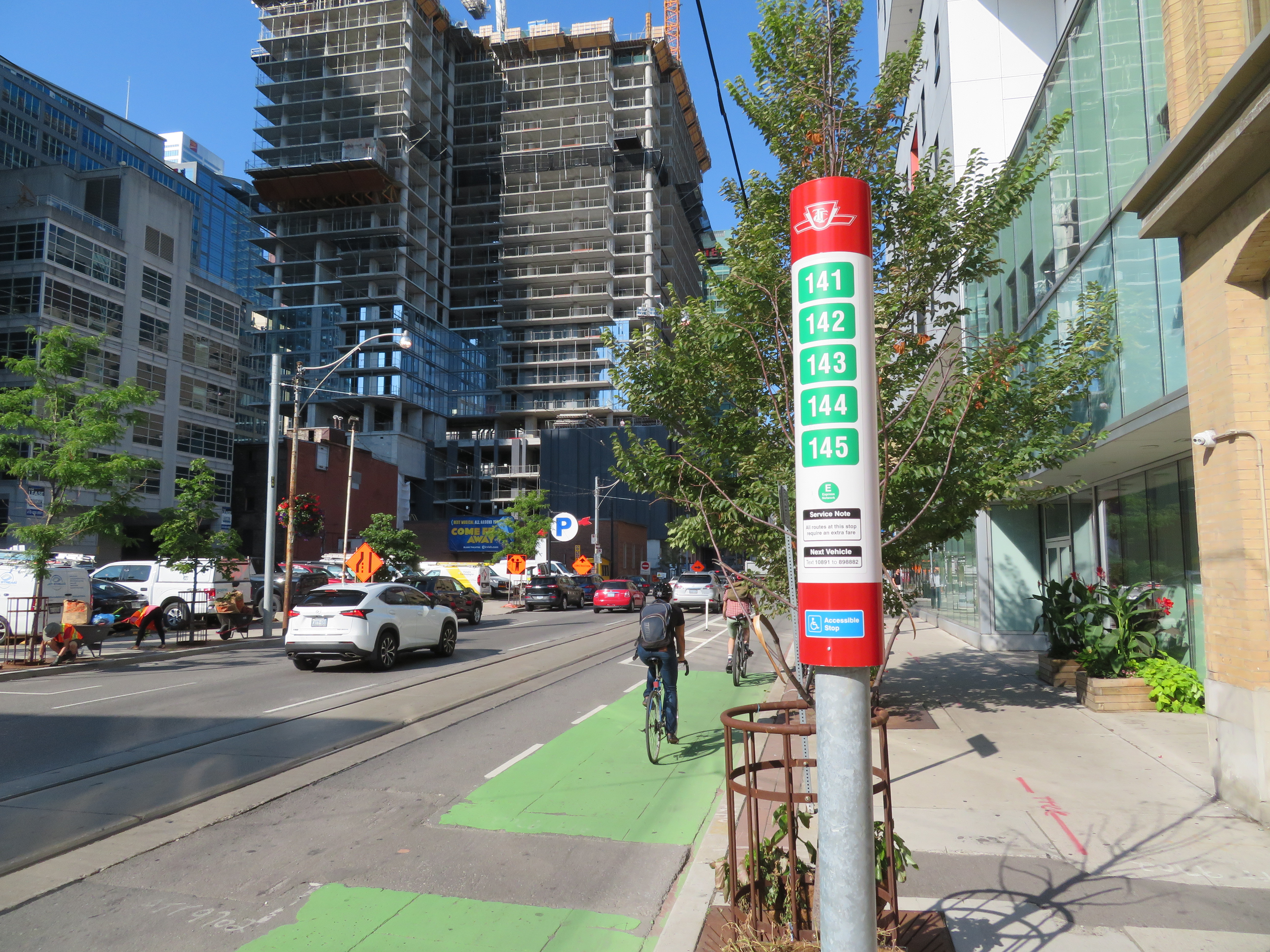
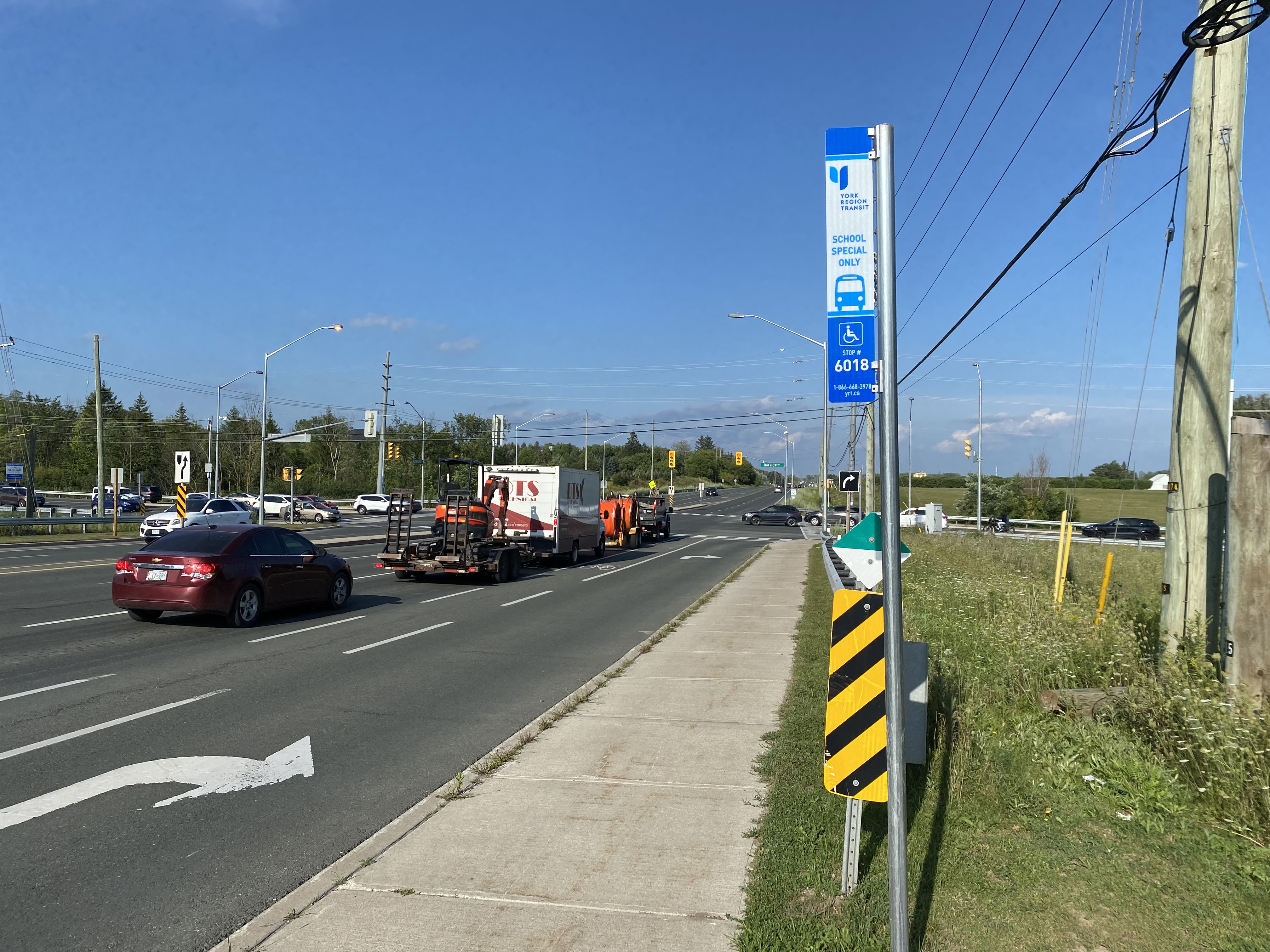
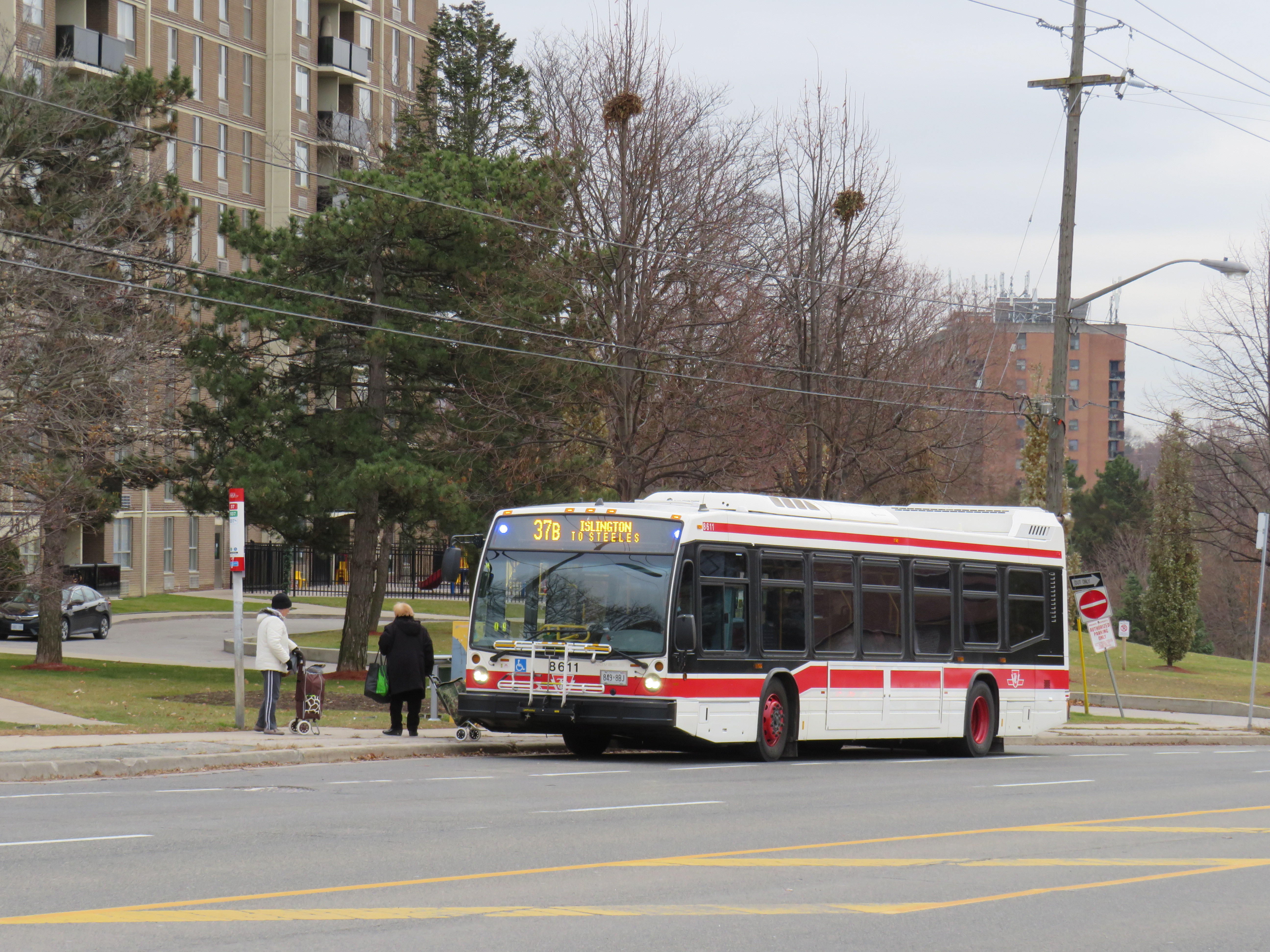
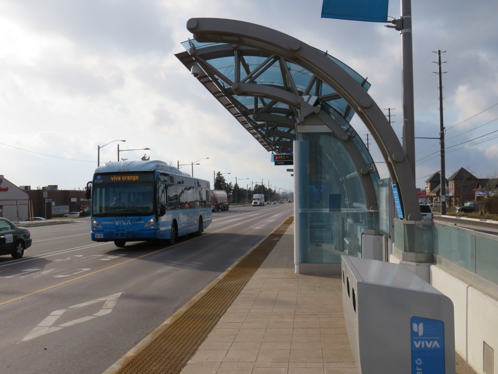
New Brampton Transit stop on Kennedy Road in Caledon

    The two separate agreements don’t work that well for creating a unified transit service.

    Though Route 81 and the Bolton Route both have a $4.00 cash fare, the Brampton Transit-contracted service operates on that agency’s fare structure. There’s a discount for Presto card users and a two-hour transfer valid on any other Brampton Transit route. The 80 cent co-fare to and from GO Transit also applies (Route 81 connects with the frequent 502 bus to Downtown Brampton). It’s a good deal for residents in west Caledon.

    However, the Voyago-contracted buses serving Bolton are only equipped with a fare box, and only accept $4.00 cash fares. There are no free transfers to or from connecting buses at Highways 7 and 50. (Brampton Transit routes 501 Züm, 1, 23, and 36 connect there, as does YRT route 77. It’s a few minutes’ walk to BT routes 31 and 50.)

    Last week, I took the new Bolton bus to get a feel for the new service. The Bolton line operates with two minibuses with twenty seats each and a spot for mobility devices at the rear. Within Bolton, the bus makes a long loop, primarily serving the industrial area in the southwestern quadrant.

    I boarded an afternoon bus from Highway 7 at 3:26 PM and rode to Downtown Bolton. I returned on the bus leaving Bolton at 4:30 PM. I was the only passenger each way; I was told by one driver that was typical. By riding the bus, I was able to learn about some of Caledon’s challenges.

    Transit options from Caledon council reportCaledon Transit high-priority route options from the April 2019 council report

    If the Bolton Line were integrated with York Region Transit and Brampton Transit and made more stops within Brampton, it’d be a useful service, attracting many more passengers. There are several major employers on the Vaughan side of Highway 50, including XPO Logistics, Home Depot, and the Canadian Pacific Intermodal Yard. Additional stops at Major Mackenzie/Coleraine, Rutherford/Castlemore, Trade Valley/Bellechase, and Zenway/Cortrelle would make the bus more accessible and useful to residents and employers. Another stop at Queen Street (Highway 7) and Gore Road would improve connections to Route 50, which serves Humber College.

    Those additional stops would likely require a third bus, but the current route struggles to maintain a 60-minute round trip even with the limited stops currently in place. But with fare integration and local service, it could then attract more passengers, defraying the cost of the additional vehicle and operator.

    In the long term, it would be good to see more cooperation with Brampton Transit, especially as Brampton continues to develop new subdivisions and industrial lands in the northeast, in the areas bordering Caledon and Vaughan. If GO Transit goes ahead and abandons the remnant of Route 38 an express route between Bolton and Malton GO will still be necessary; ideally, that would would be a partnership between Brampton and Caledon.

    Hopefully, Caledon will continue its commitment to building a transit service within its urbanized area. Despite very low ridership at present, the potential is there as population and employment continue to grow. It will take time to tweak the service, improve connections, and build ridership that can count on affordable, reliable transit.

    It’s also time for Halton Hills — now the last GTHA municipality without local transit — to step up and follow Caledon’s lead.

  • A departure from TTC wayfinding improvements

    IMG_3566-001.JPG
    TTC stops have improved with the addition of route numbers, but this bus stop is deceiving 

    In the last few years, the TTC has made significant improvements in its maps, signage, and wayfinding standards. It also introduced new streetcar and subway fleets, retrofitted elevators into older stations (all but one streetcar line and a majority of subway stations are now fully accessible), and opened a new subway extension. Though overcrowding, bunching, and weekend closures continue to be aggravations, it is important to recognize where the TTC has improved.

    Specific changes to TTC wayfinding include a new simplified system map, better signage at subway stations, introducing standard signage for diversions, scheduled closures and construction notifications, and revising the classic TTC bus stop.

    However, two recent changes represent an unfortunate departure from these improvements. (more…)