Tag: Transit

  • How to run a street railway: riding trams in Central Europe

    How to run a street railway: riding trams in Central Europe

    Vienna low-floor tram in the Leopoldstadt district

    Back in October, my spouse and I had the opportunity to visit several countries in Central Europe: Austria, Slovakia, Hungary, and the Czech Republic, though we spent the majority of our time in and around Vienna, as that is where my spouse attended business meetings for several days; we also took time to explore the city and surrounding areas together.

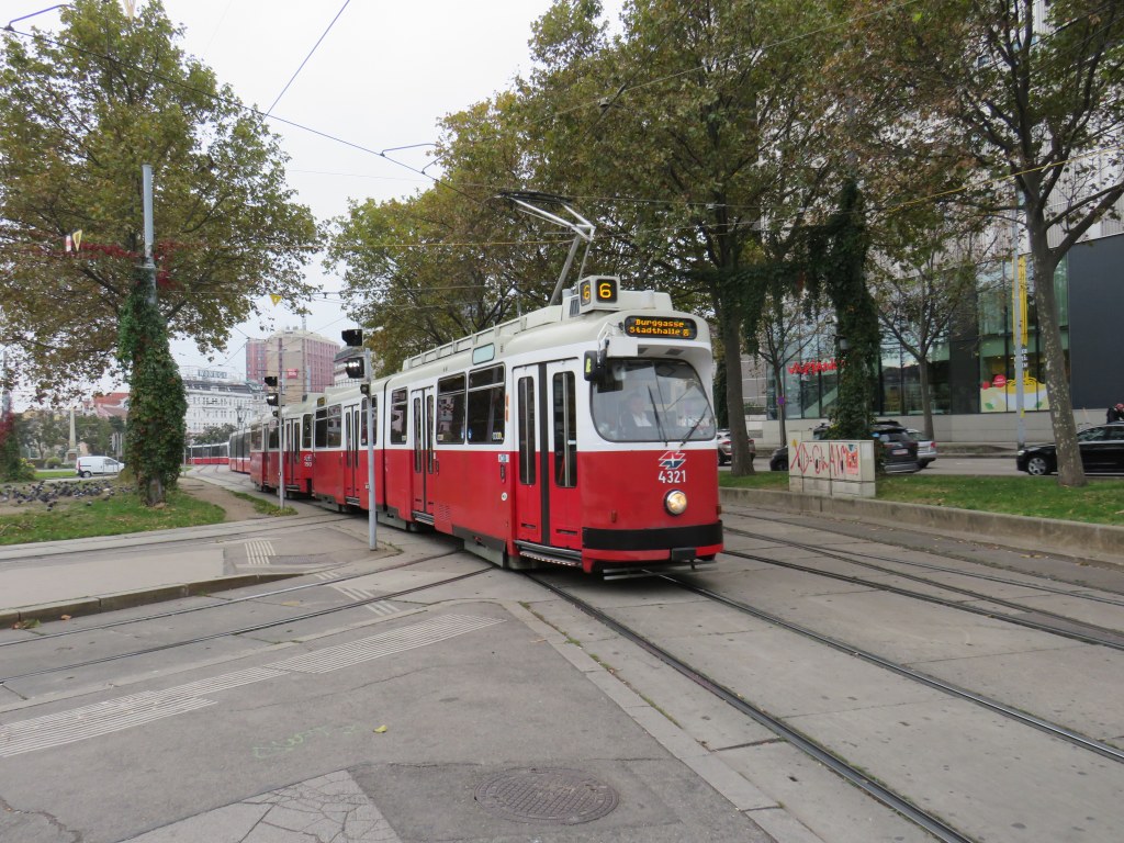
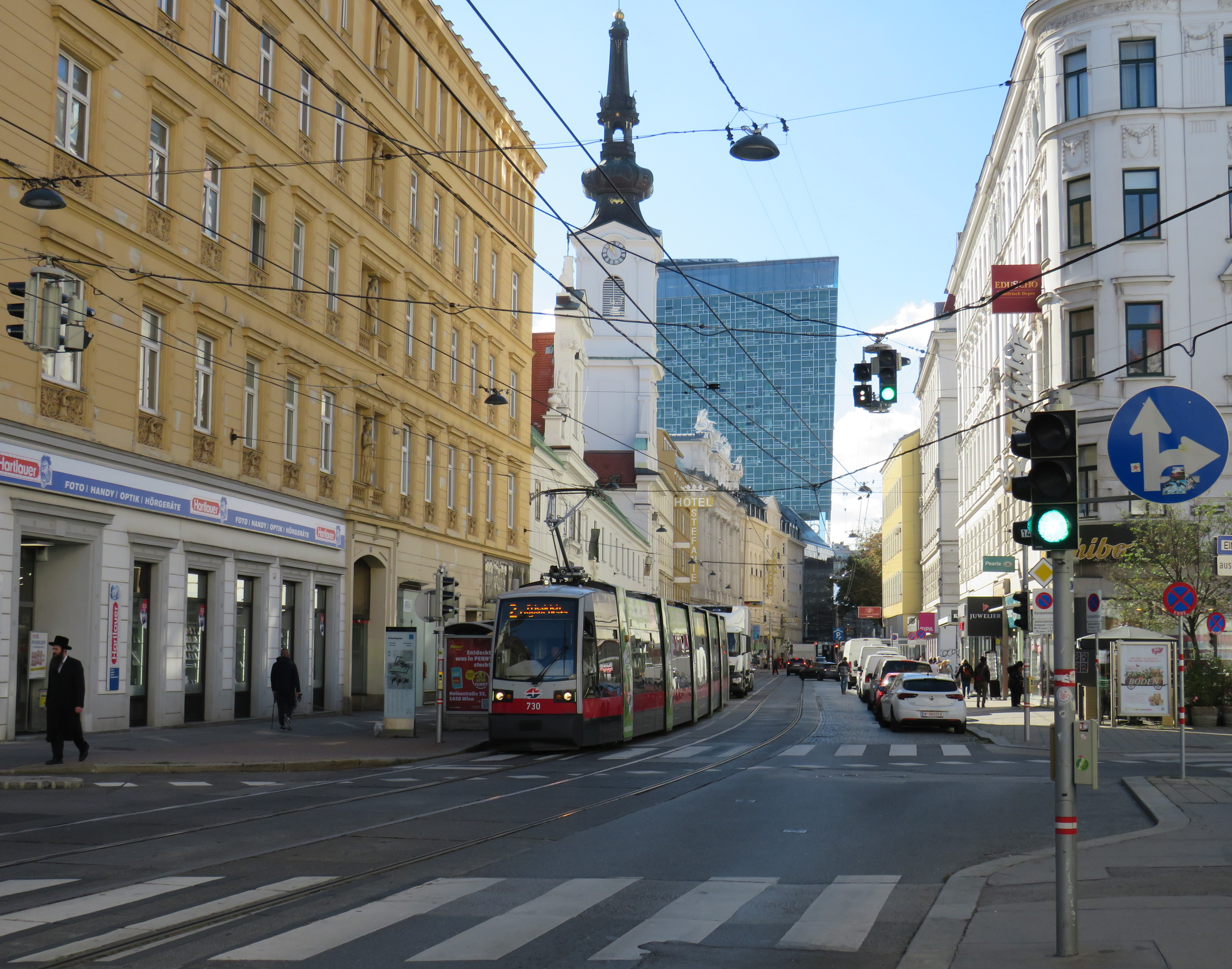
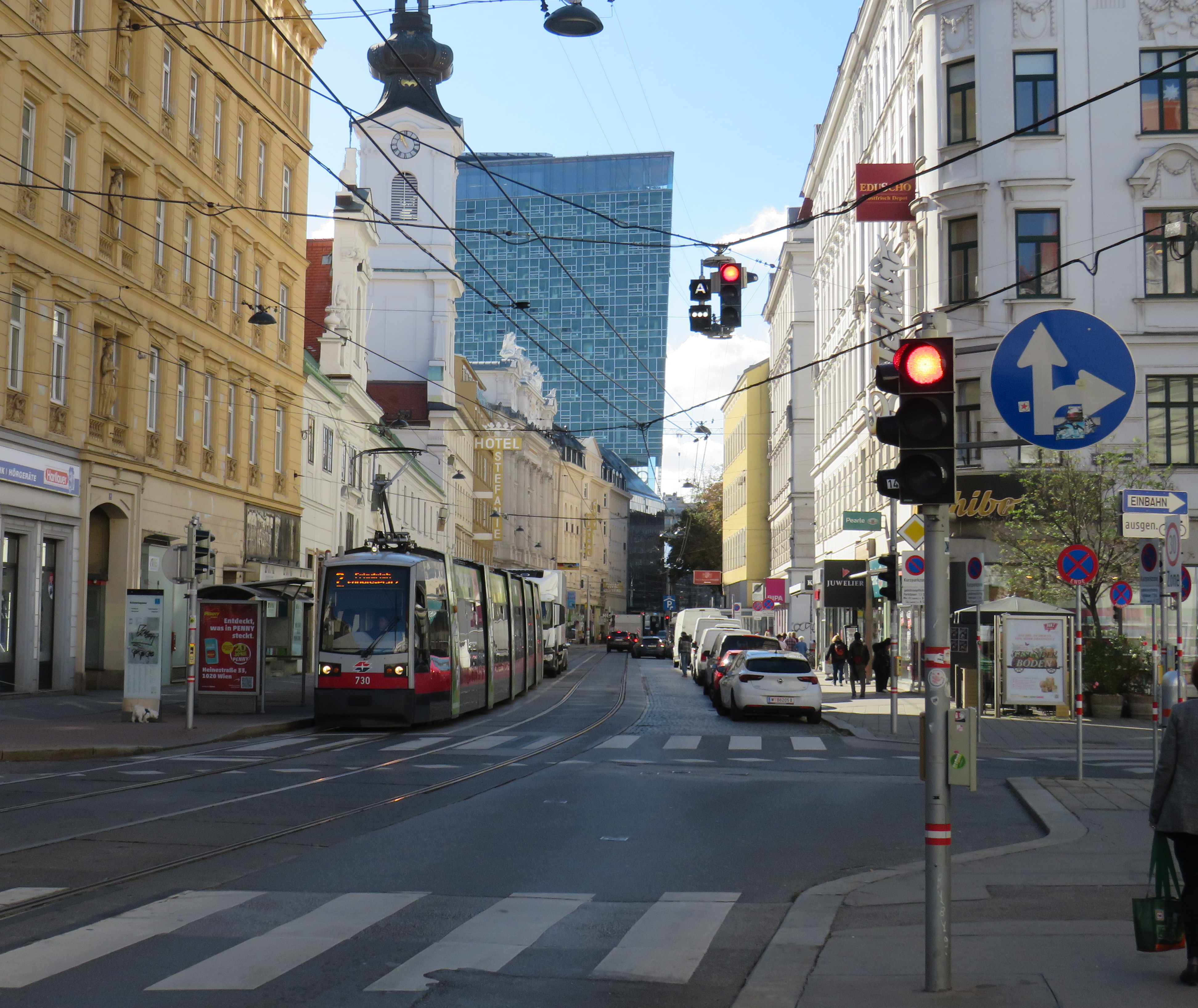
    While there, I experienced how serious cities operate trams seriously. In Bratislava, I saw how a streetcar priority corridor can work in a busy downtown core. In Prague, trams made it through watermain construction zones without detours or unreliable bus shuttles. In Budapest, I rode the world’s longest trams that move more people per hour than many metro lines. In Vienna, where I spent the most time, I experienced a city where transit passengers are treated with respect, and where the trams are reliable, despite no discernable signal priority and plenty of mixed-traffic operations.

    Vienna is an amazing city to visit. It’s been described to me as “what people think Paris is.” That’s pretty much true. It’s a very walkable city with a fantastic café culture full of independent konditorei cafés (which offer sit-down service), with an assortment of rich, tasty cakes and great coffee. It has great art galleries and grand imperial palaces, but without the crushing crowds of Paris and Versailles. As the original Music City, it’s easy to find shows and performances to suit your tastes. (We attended the famous Wiener Staatsoper, where I took in my first live opera, ever, at a surprisingly reasonable price). It’s also a compact city, easy to walk, though the transport system is excellent. Vienna is also a great base for visiting other cities in Central Europe, where Salzburg, Bratislava, Budapest, and Prague are only a few hours away by (frequent and relatively speedy) train.

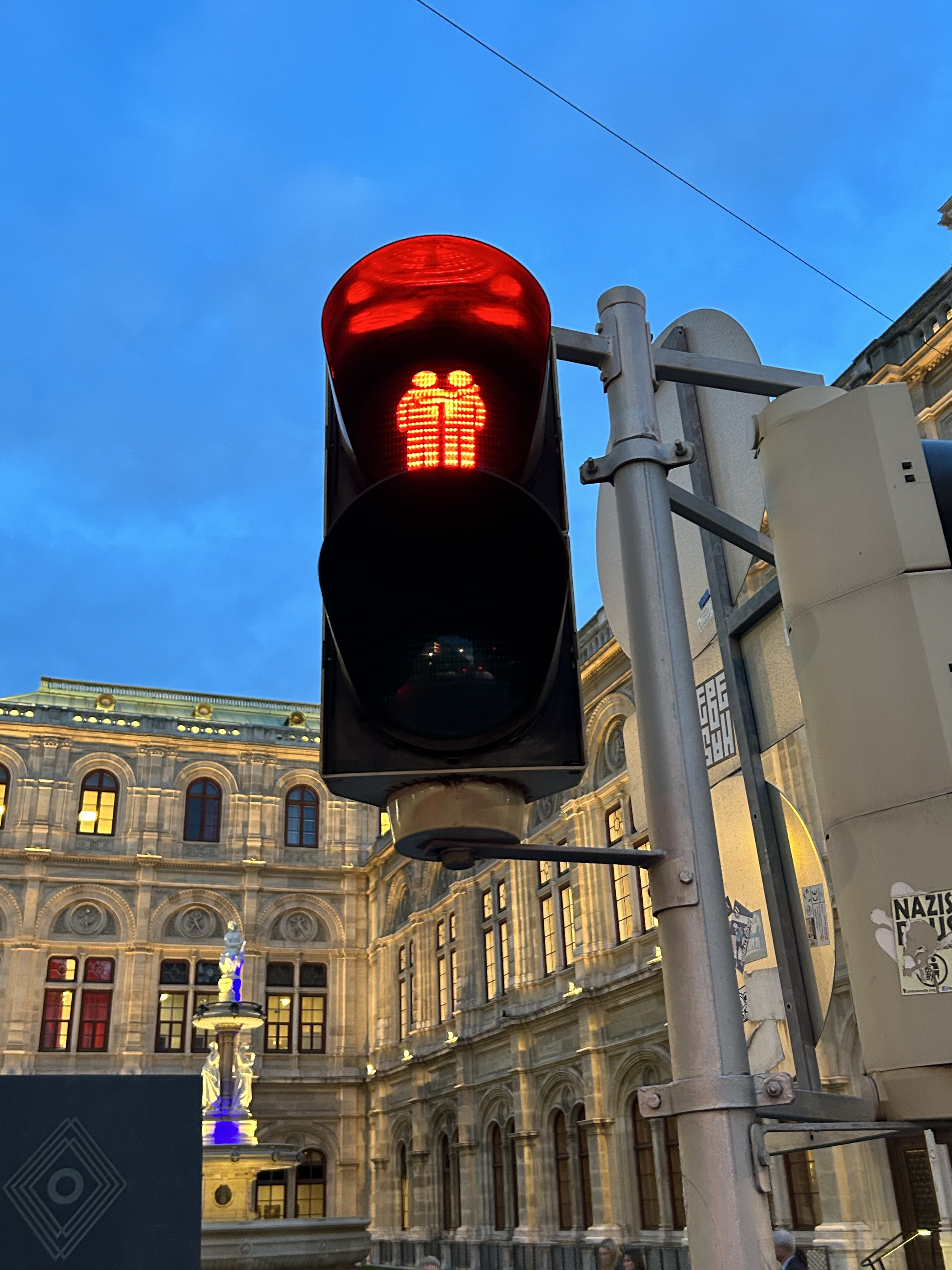
    We noticed several pedestrian signs showing loving couples, rather than the standard, like this one in front of the Wiener Staatsoper (Opera House)

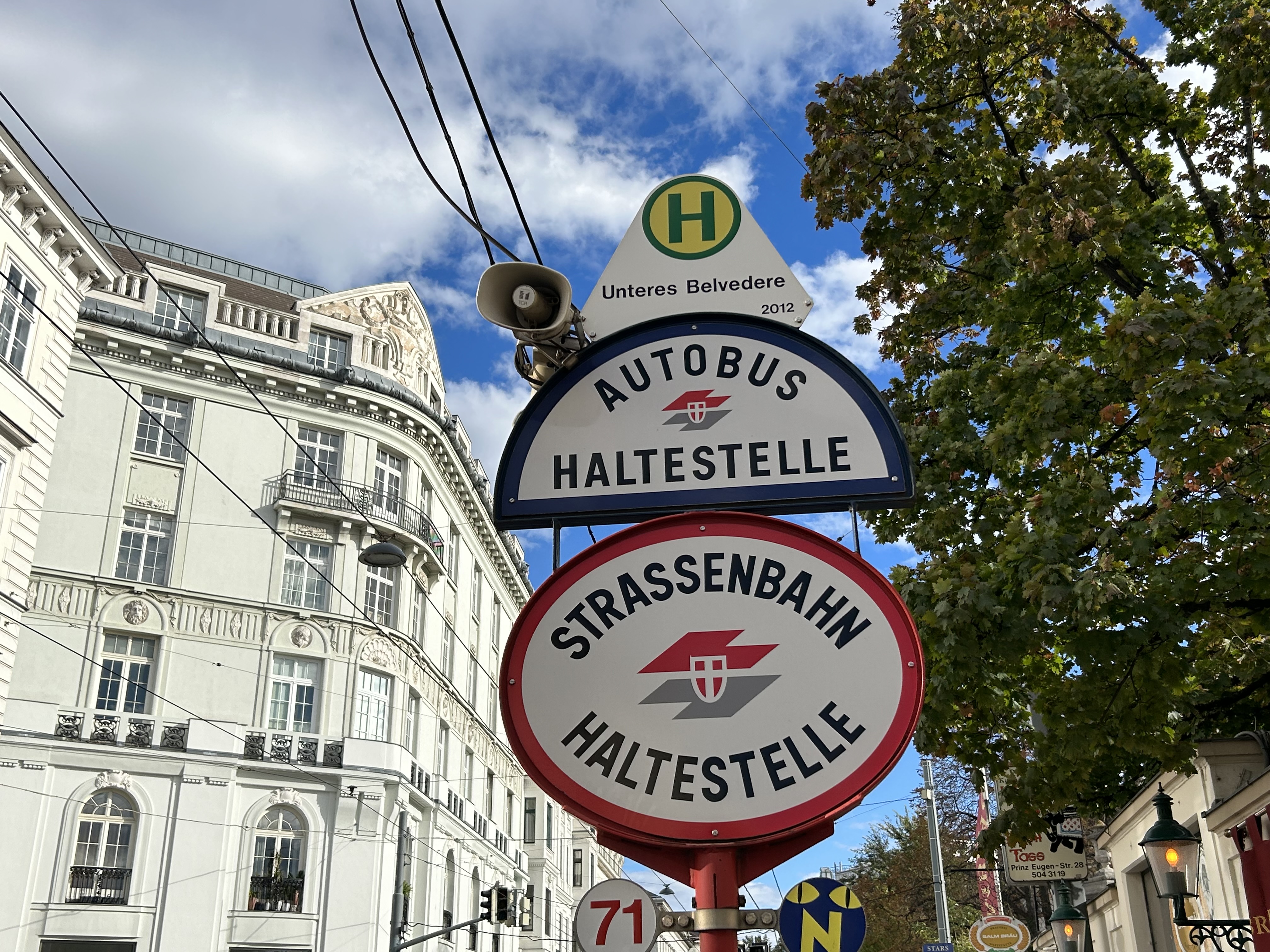
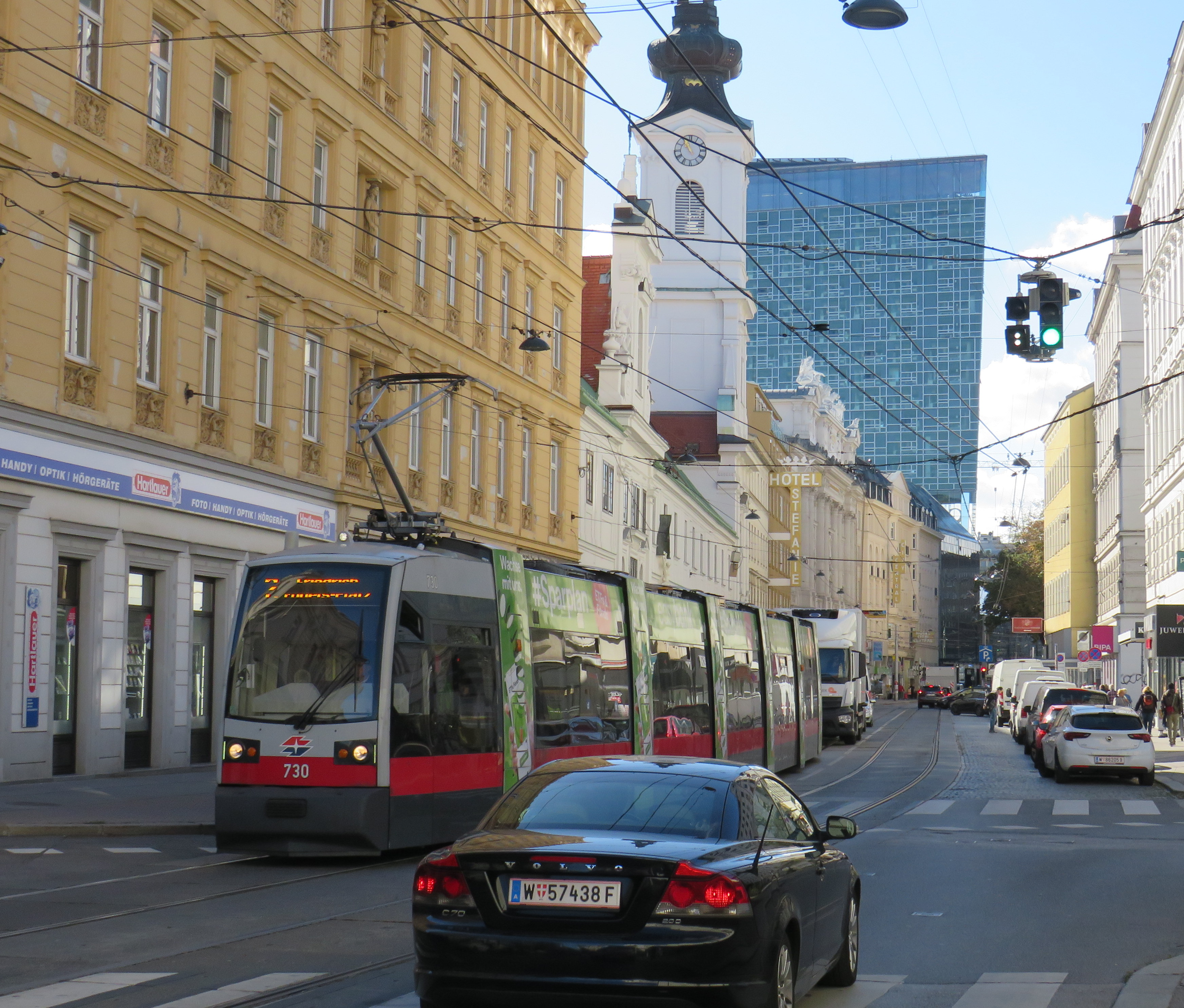
    Vienna has one of the largest tram systems in Europe, with 30 lines over 176.9 kilometres, and a fleet of 525 cars, including modern articulated LRVs and older trams and trailers. In Vienna, trams alone carry approximately 300 million passengers a year. They run in many different environments: on-street in mixed traffic, reserved lanes, dedicated median and side-of-street rights-of-way; there is also a tram tunnel south of the city centre. Until the 1980s, Straßenbahnen (the German name for trams) were the backbone of Vienna’s transport network, with a small Stadtbahn system (now incorporated into the modern U-Bahn) and regional and suburban (S-Bahn) trains providing limited rapid transit services. Though there are now five U-Bahn lines (two of which evolved from the Stadtbahn), the tram system remains robust and very useful for getting around.

    Like all four cities mentioned in this post, Vienna operates a mix of low-floor trams built in the last 25 years, as well as older high-floor trams, many of which are accompanied by an unstaffed trailer. Vienna’s entire network — trams, buses, U-Bahn, and S-Bahn — is a proof-of-payment system. Fare inspections appeared to be infrequent; neither my spouse nor I were checked during our eight days in Vienna. Tickets and passes can be purchased from a machine (found at every U-Bahn entrance and at many tram stops) or on the WienMobil app.

    An older Type E2 high-floor tram and trailer at Gumpendorfer Straße. Behind is the old Stadtbahn viaduct, which is now part of Line U6. Note the large red “Strassenbahn Haltestelle” sign to the left, a classic Viennese icon that indicates a tram stop.

    There is also a separate interurban tram service called Badner Bahn, which extends to the historic spa town of Baden bei Wien, an hour south of Vienna’s city centre.

    Badner Bahn tram, laying over at Josefsplatz in Baden bei Wien

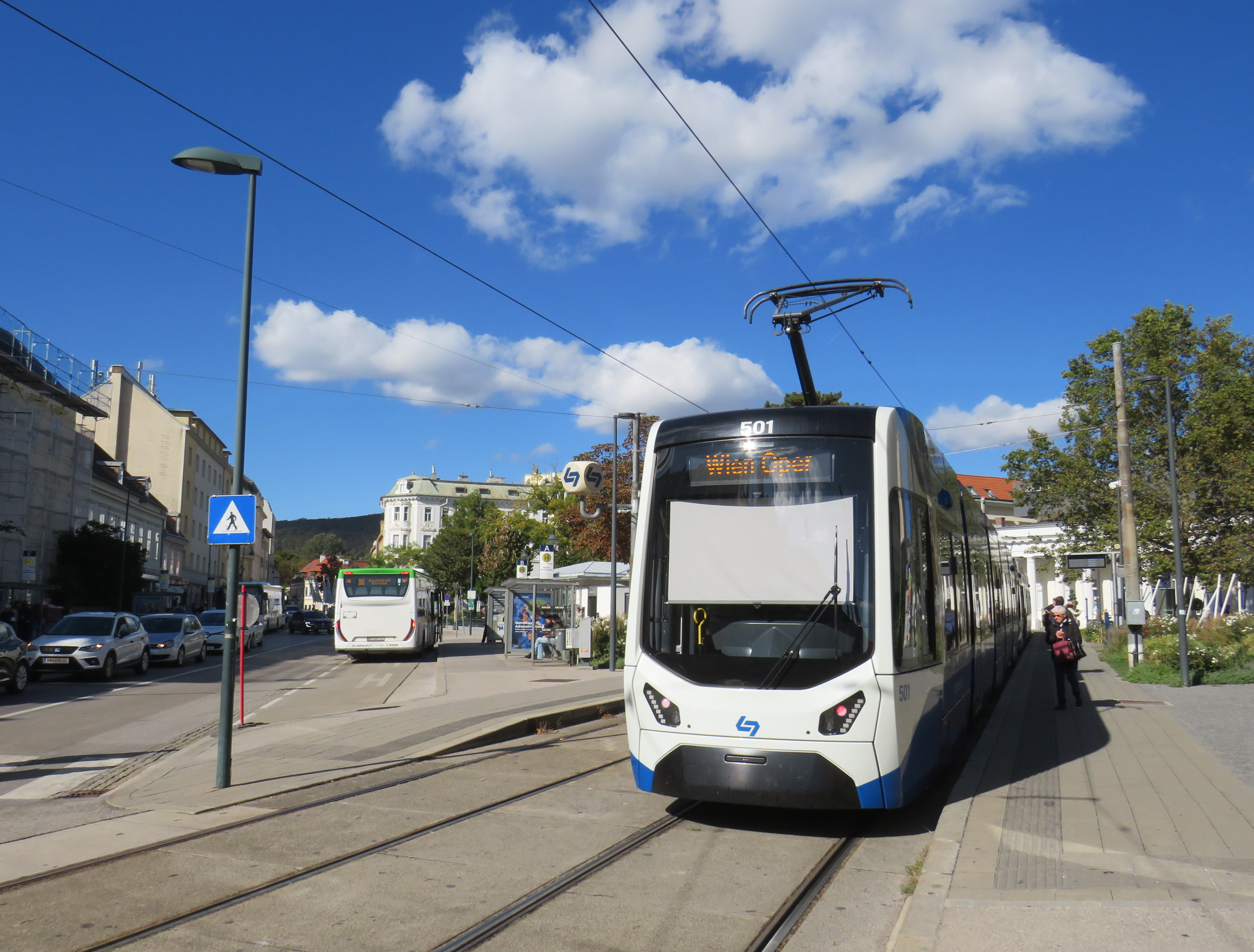
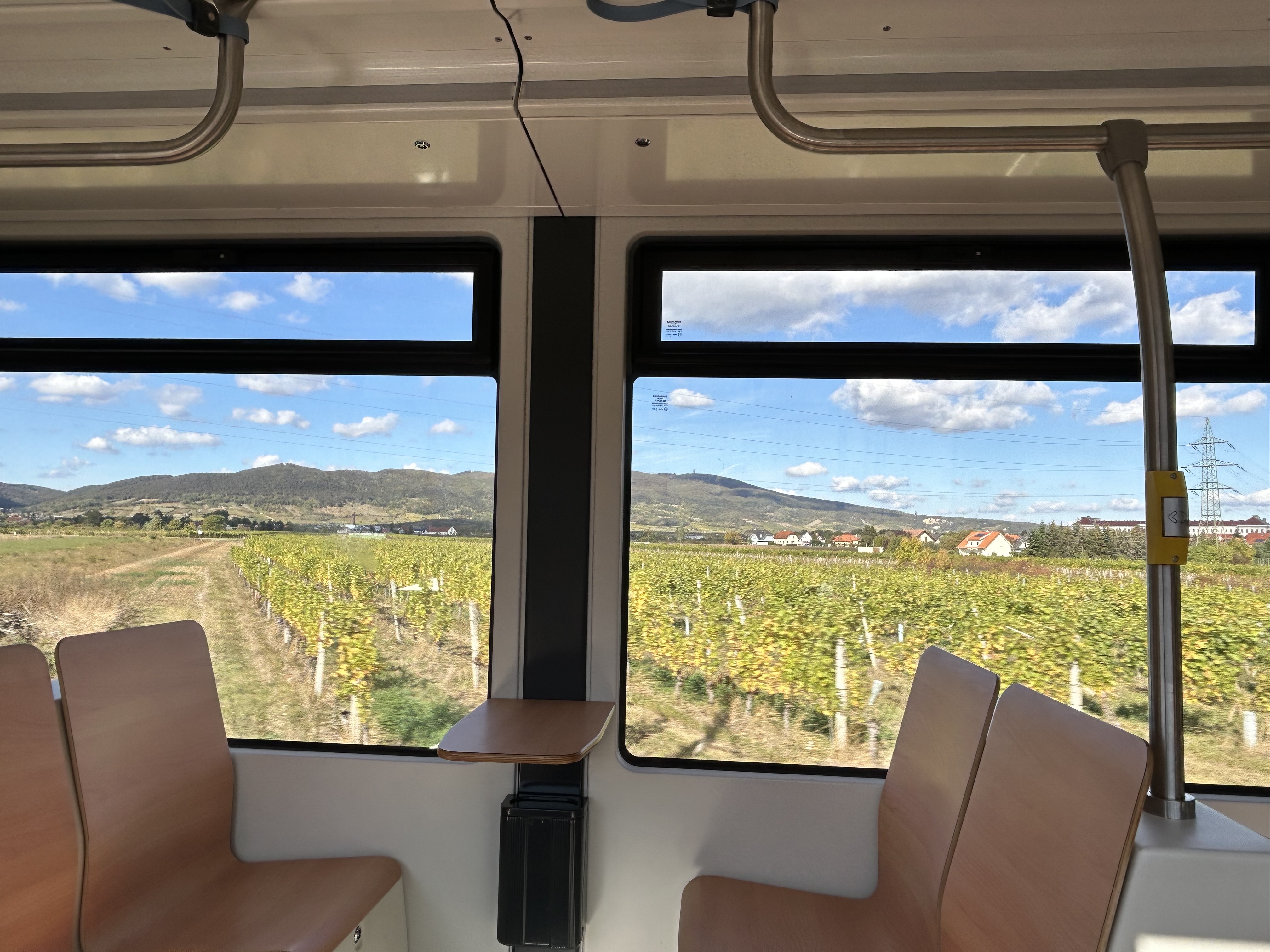
    The modernized interurban originates in the heart of Vienna — across the street from the Wiener Staatsoper (Opera House) — then along local tram tracks and through the tunnel before entering its own right-of-way through the southern suburbs, and onwards through small towns, farms, and vineyards before arriving in Baden. There are several spurs leading to local industries; the regular passenger service shares the tracks with local freight trains.

    View of the vineyards from Badner Bahn
    A sample of the journey aboard Badner Bahn. Arriving southbound at Guntramsdorf, heading towards Baden bei Wien.

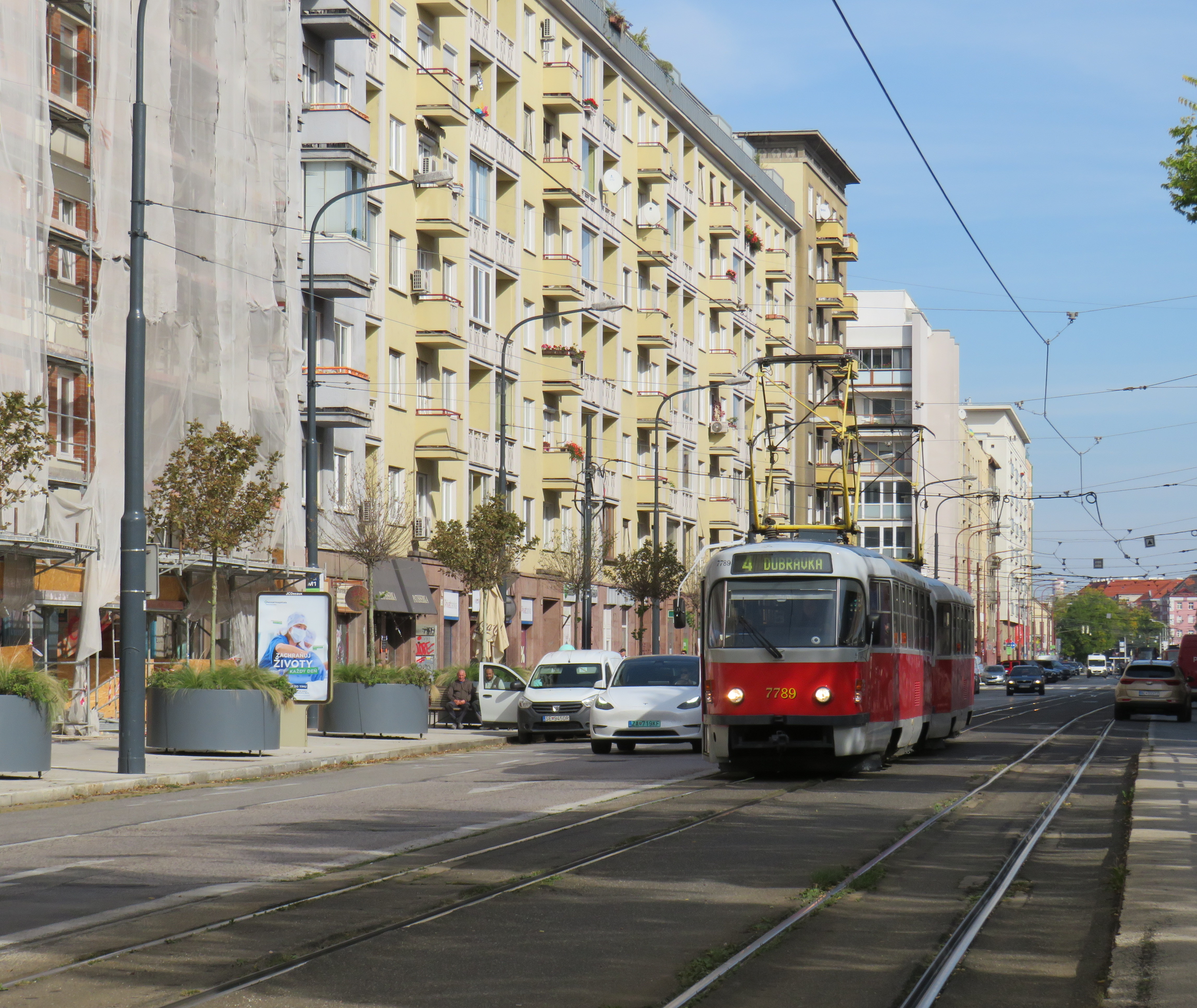
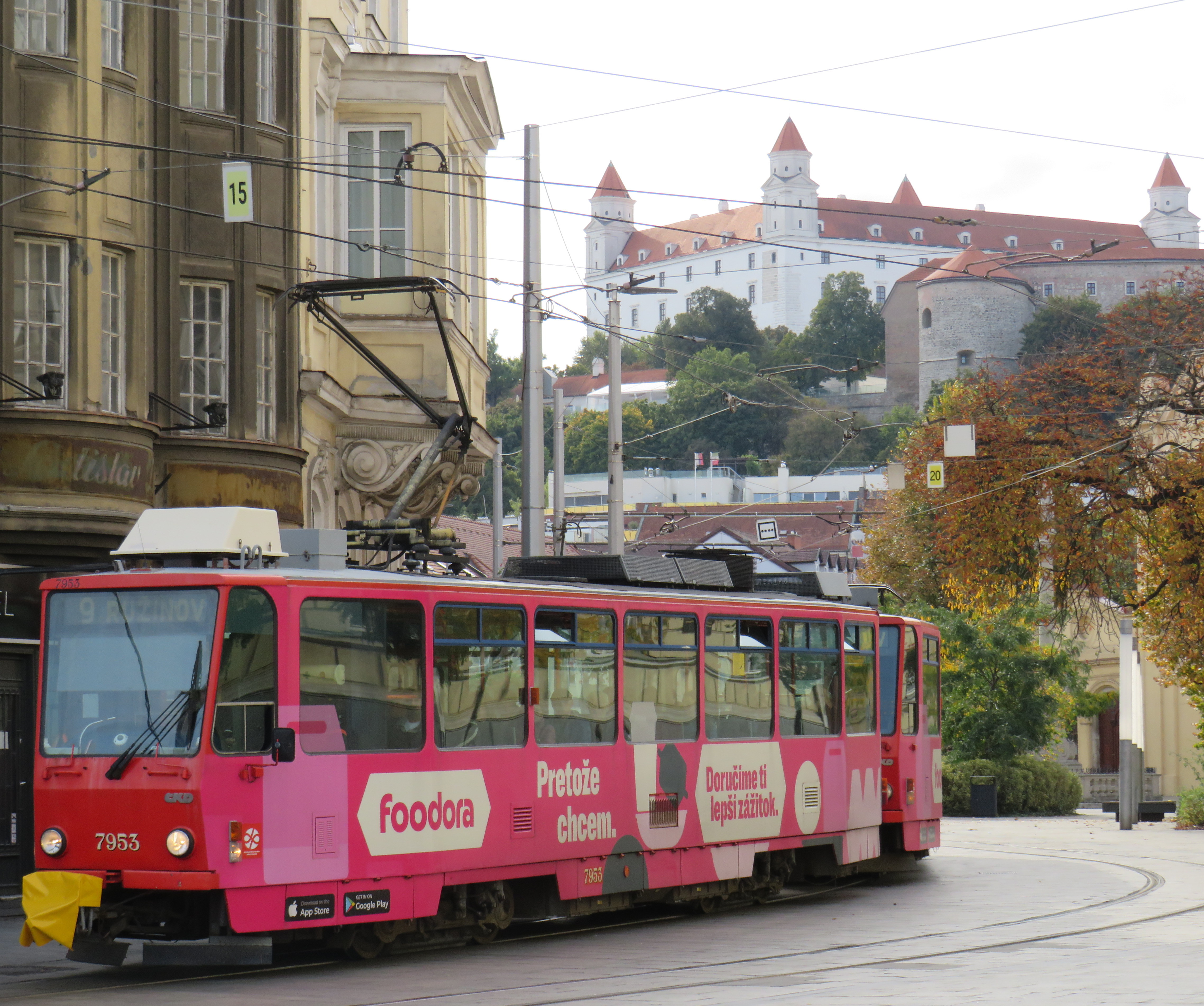
    Bratislava, just over one hour away from Vienna by train (or by catamaran), is served by a network of metre-gauge trams, trolley buses, and diesel buses, though trams predominate in the city centre. On Obchodná, several tram lines, pedestrians, cyclists, and the occasional delivery or emergency services vehicle share a narrow, but busy shopping street. It just works.

    Obchodná, Bratislava

    Outside the congested urban core, trams are afforded reserved lanes, sometimes separated from general traffic with curbs (and even grass medians), sometimes just painted lines. Bratislava’s tram system is smaller than Toronto’s, with 211 cars and 42 kilometres of revenue track, carrying around 70 million riders a year in 2019 (Toronto’s streetcars carried 108 million that year). It is also a much smaller city, with a population of around 660,000. I only visited Bratislava for a day, but I got to ride much of the tram network; I found it an easy and convenient way to get around.

    Reserved, painted tram lanes just outside Bratislava’s city centre

    Budapest, Hungary has the largest street railway system in the world by ridership, with Route 4/6 on Budapest’s Grand Boulevard (Hungarian: Nagykörút), often cited as the world’s busiest tram line. Route 4/6 also operates 53.99 metre long Combino Plus trams, which, when introduced in 2006, were the world’s longest. The Combinos are almost twice the length of Toronto’s new Bombardier Flexity cars, which are 28 metres long. Even with the huge capacity these trams have (they require two pantographs to draw enough power to operate), they operate on Line 4/6 every few minutes, all day long, every day.

    A Combino Plus tram on Line 4 traverses Budapest’s Nagykörút (Grand Boulevard)

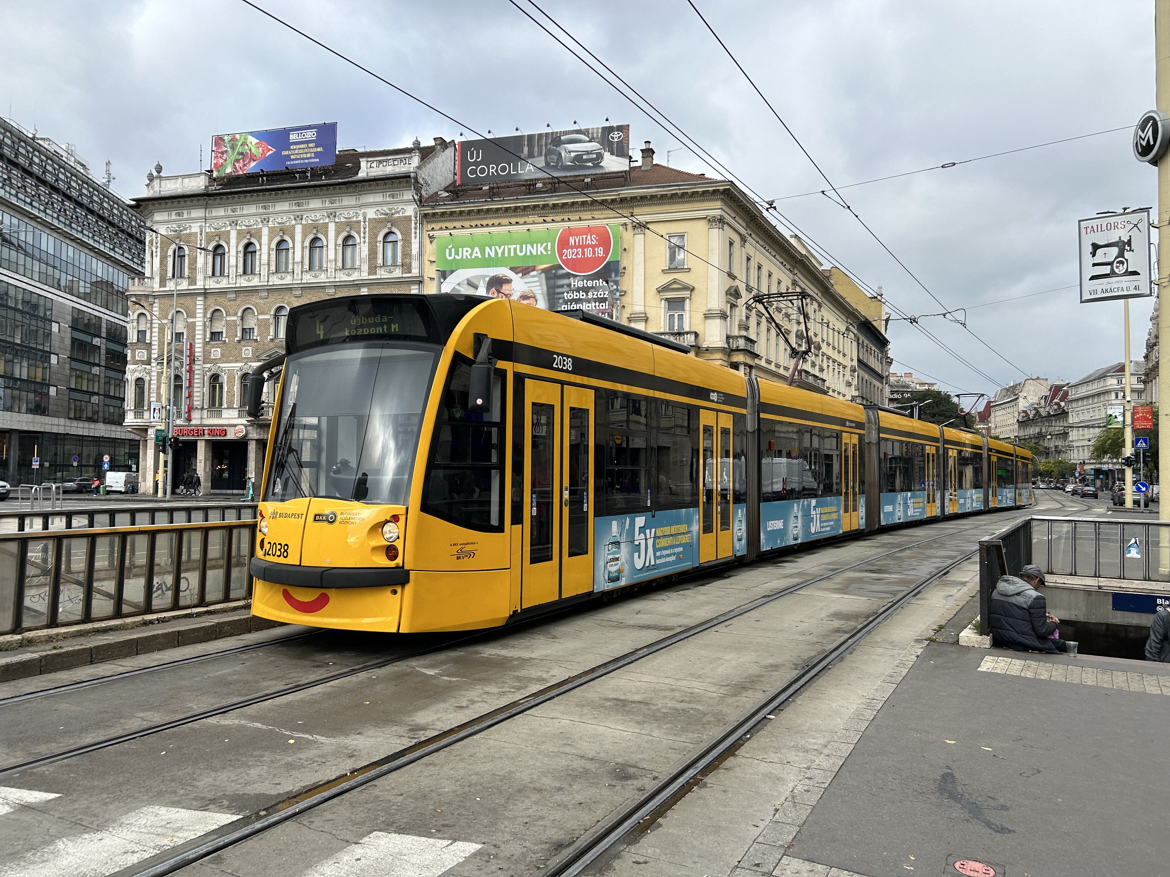
    Through the 1970s and 1980s, Budapest’s tram network was slowly cut back in favour of buses, trolley buses, and metro construction. By the 1990s, however, there was a street railway renaissance in Hungary’s capital because of the capacity and economy trams offered. With high frequencies, a private median, and high-capacity low-floor vehicles, Line 4/6 easily matches the capacity of a metro, at comparable speeds. Elsewhere, dedicated lanes and private rights-of-way make it clear that transit riders come first.

    Older trams running along the Danube dip under road bridges on a private right-of-way

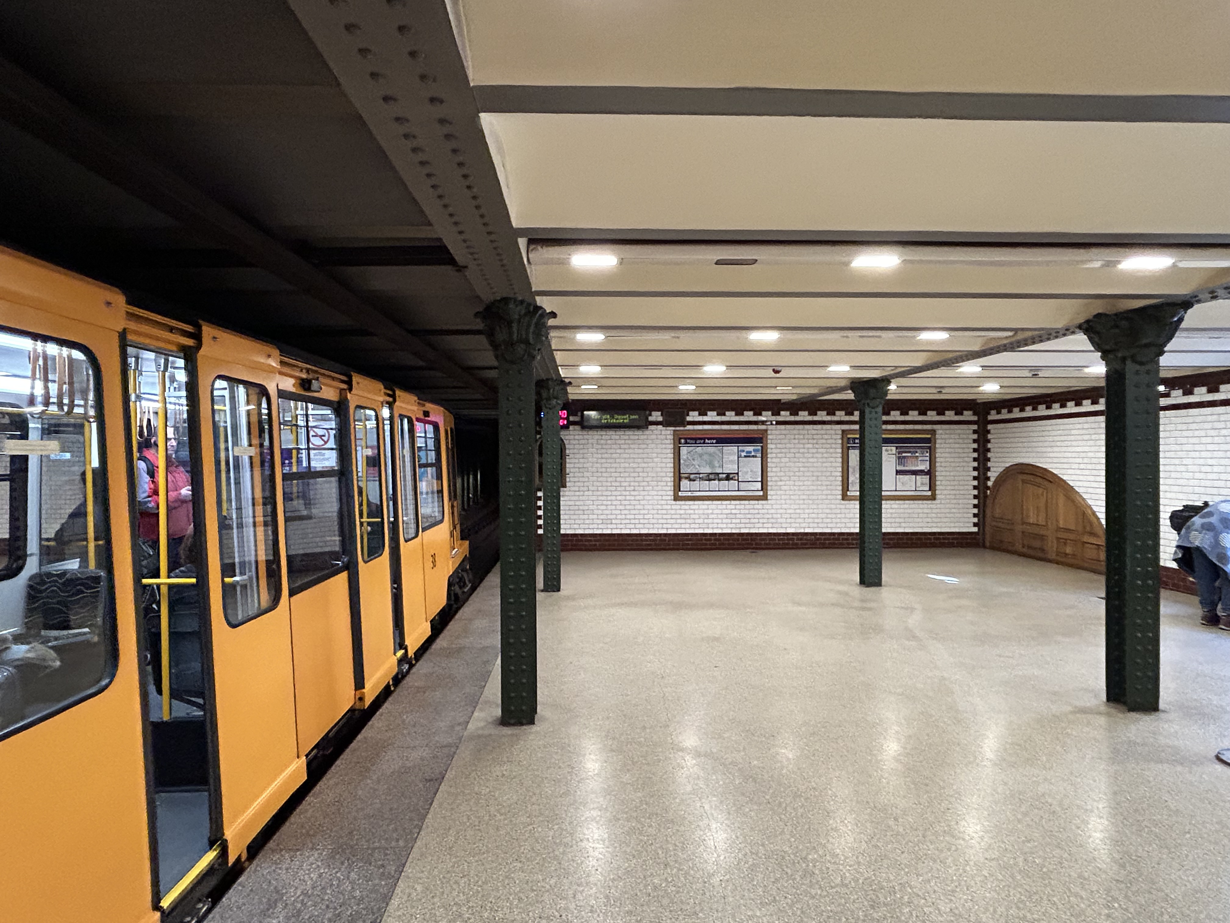
    Though Budapest has a large metro network, most of it was not constructed until the l970s and 1980s. However, Line M1 was opened in 1896 as a shallow subway under Andrássy Avenue, the first electric underground metro in the world, and only the second subway, after London’s initial Underground line. Uniquely among urban transit routes, it it is listed as part of an UNESCO World Heritage Site.

    Budapest Line M1 stations, restored to their original appearance, look like miniature New York stations, only cleaner

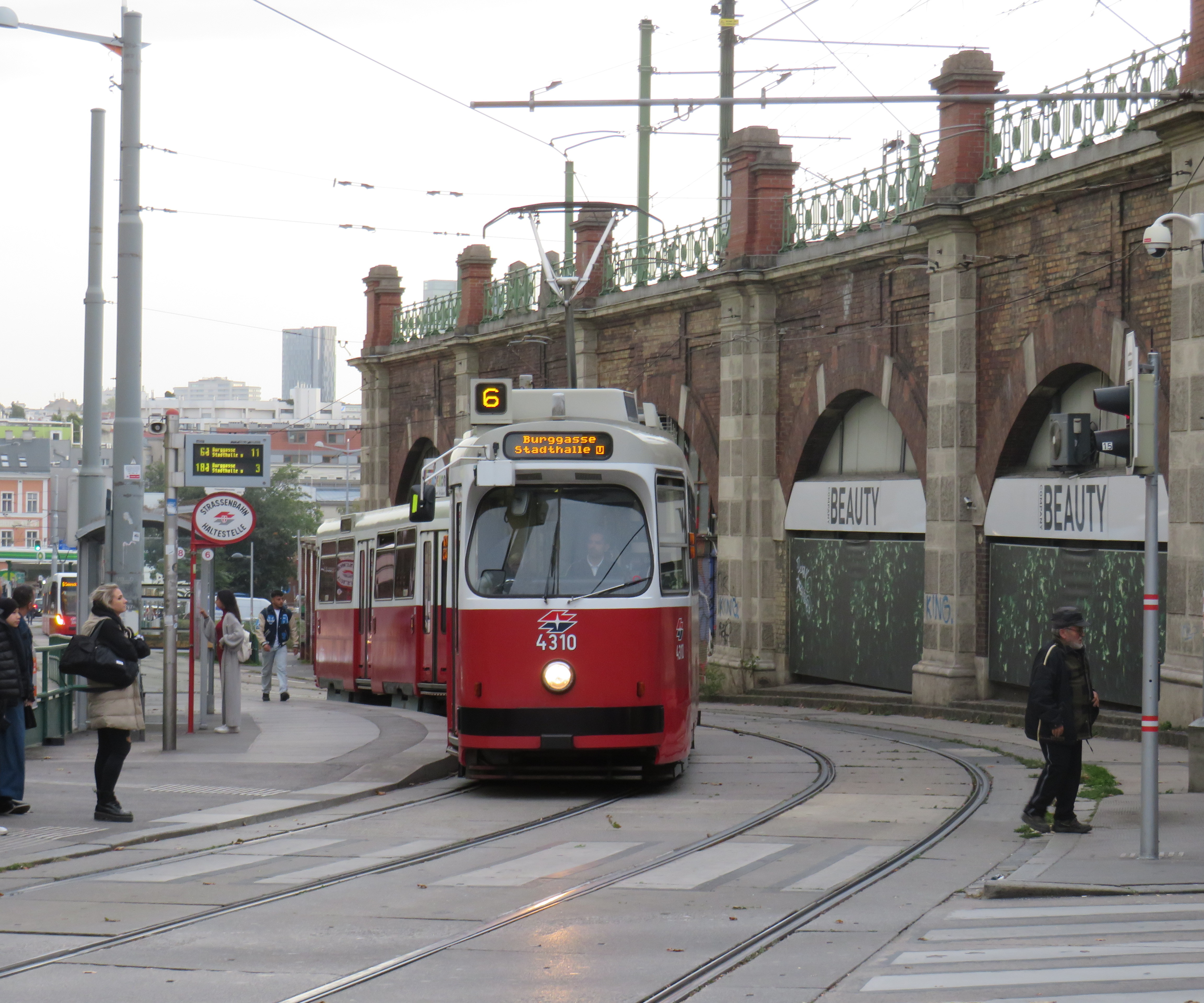
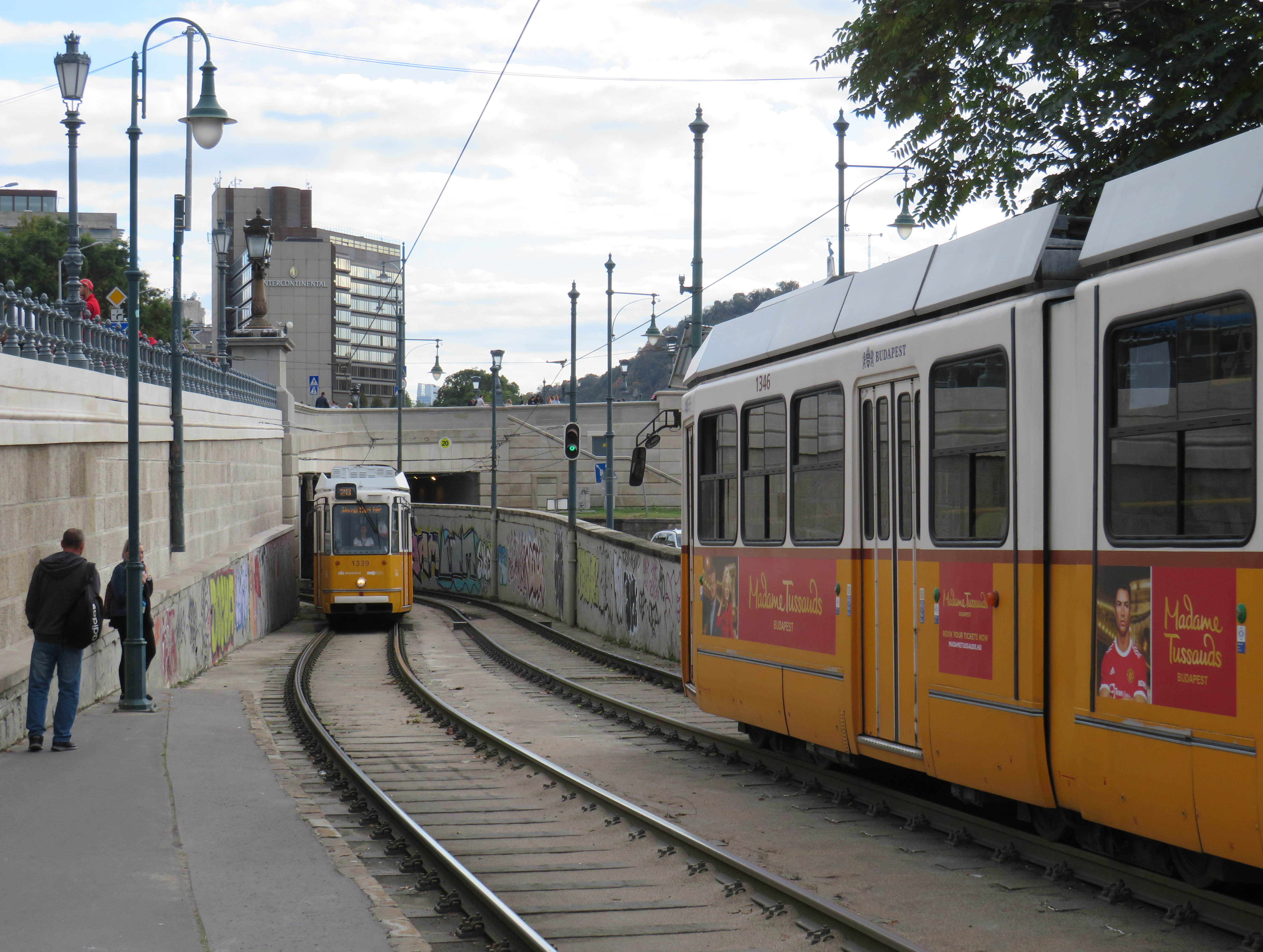
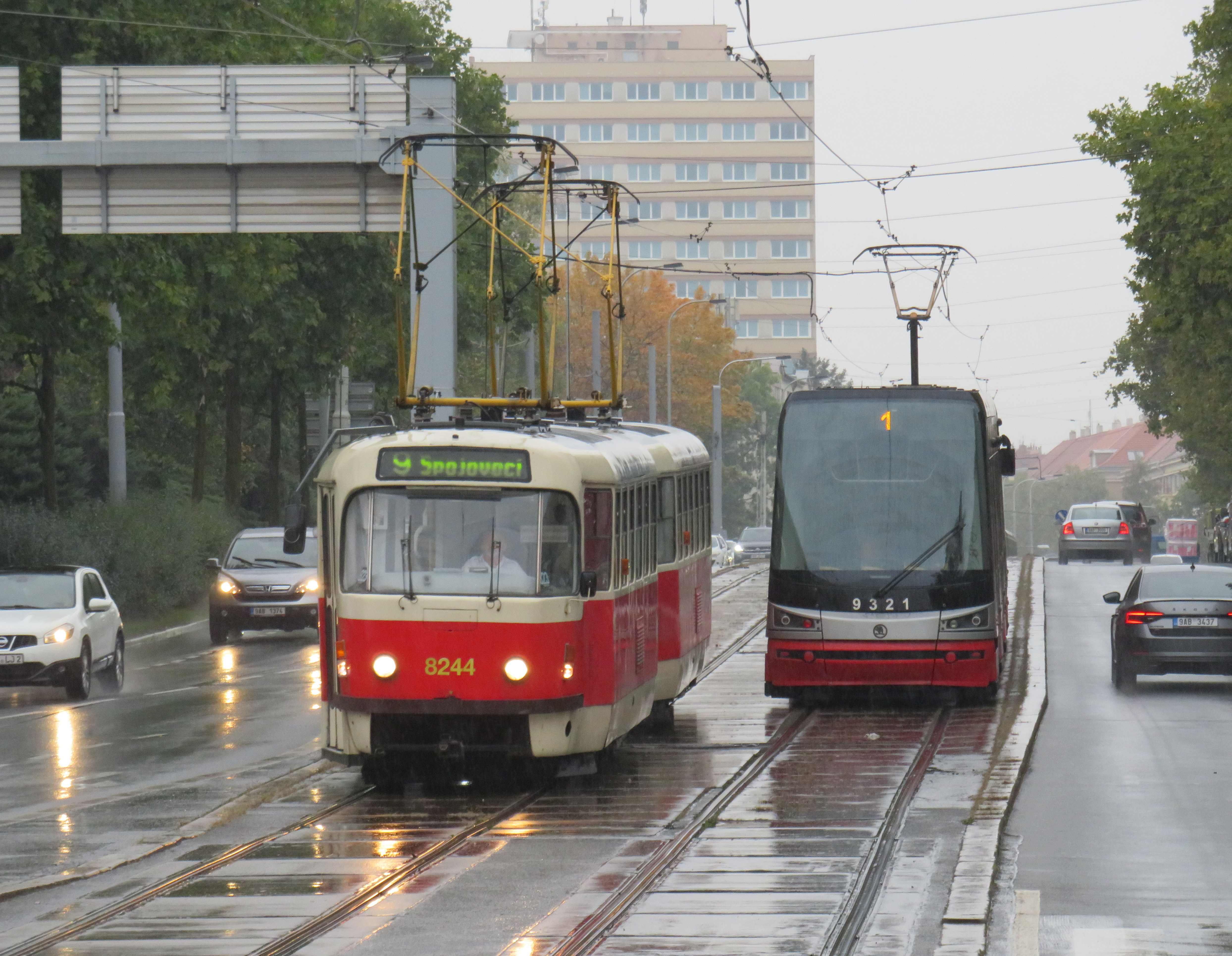
    Finally, in Prague, we took several trams to take shelter from the rains that greeted us after arriving from Budapest, but also to see the city outside the crowded tourist spots. We took Line 1 from the city centre to the suburban district of Hrdlořezy, and returned via Line 9, taking a slightly different route back. Like Budapest, a metro system was planned and built in the 1970s and 1980s, but trams remained important, often providing local services parallel to deep underground metro lines.

    Old two-car tram train on Line 9, passing a newer low-floor tram on Line 1, Sokolovská, Prague. Most trams run on reserved rights-of-way.

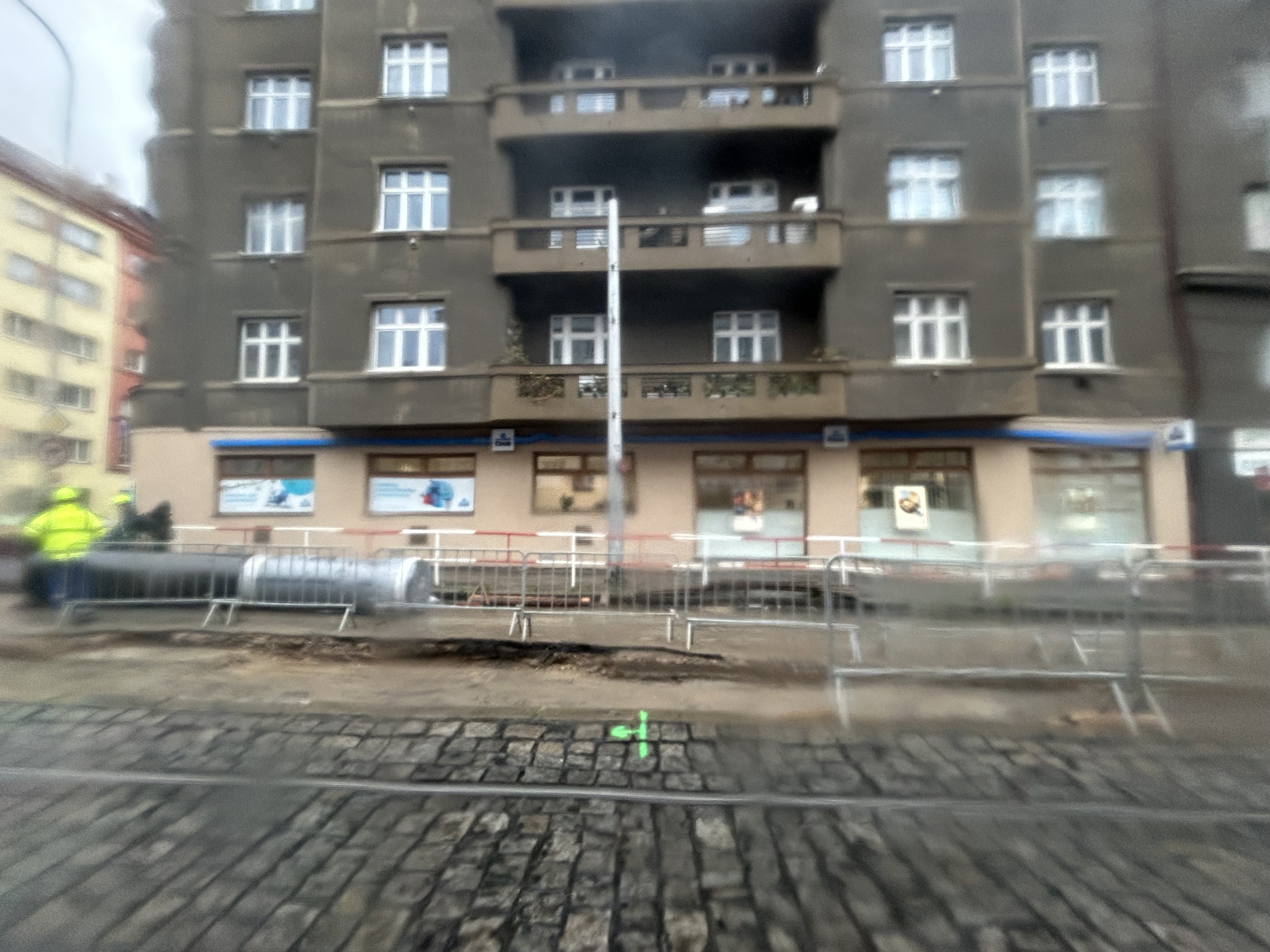
    What interested me was seeing major watermain work along the line. Through trams slowed where work was adjacent, there were no diversions or shuttle buses. The trams ran through.

    Watermain replacement in Prague, with trams still running (taken on a rainy morning)

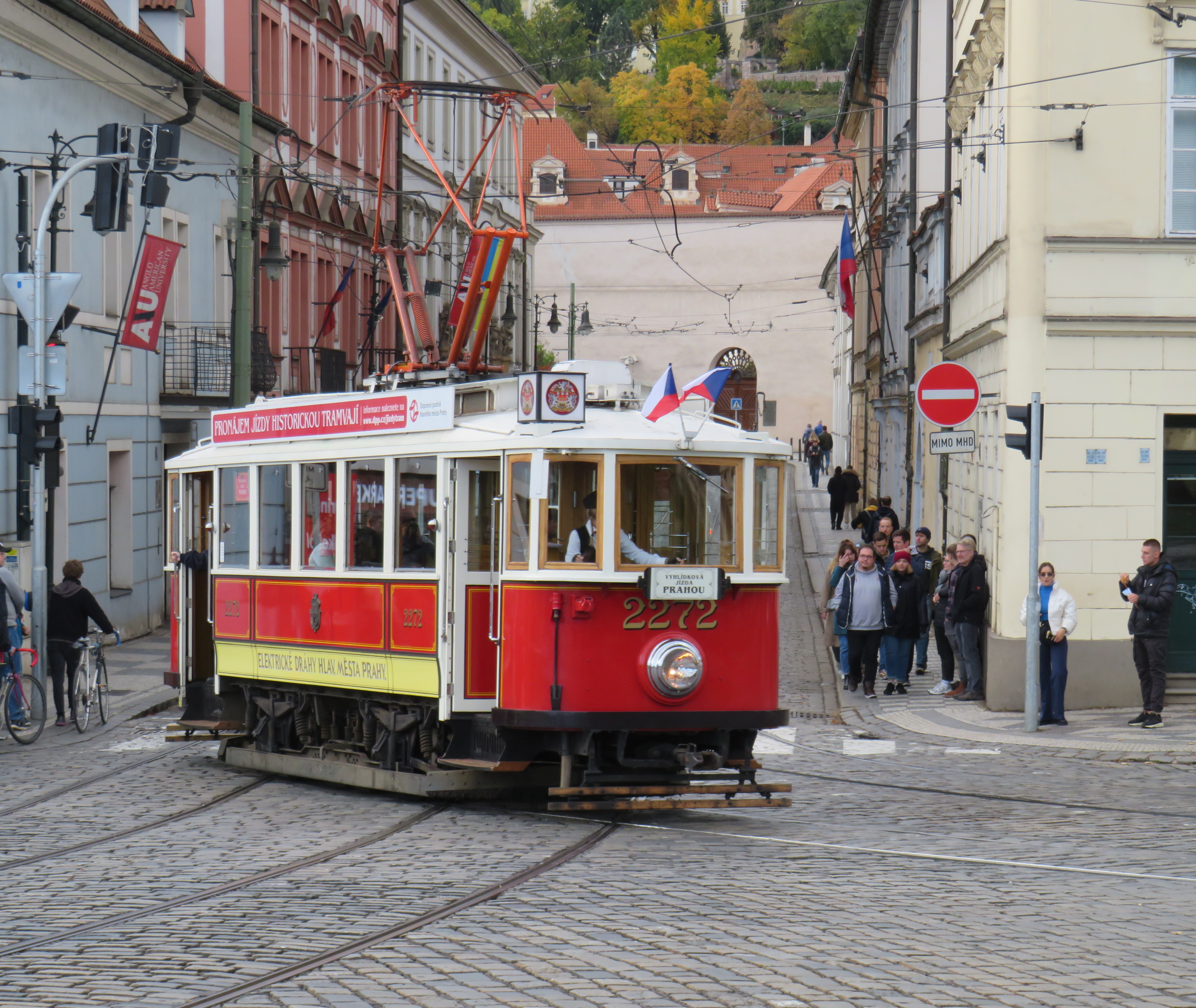
    Like Vienna, Bratislava, and Budapest, Prague operates a mixed fleet of older high-floor trams and modern low-floor light rail vehicles, similar to Toronto’s new fleet. But in Prague, heritage trams could often be spotted in service, especially on the west bank of the Vltava near Prague Castle.

    Heritage tram #2272 in Prague

    Lessons for Toronto

    After travelling, it can be easy to spot one’s hometown flaws and faults. But I spent a lot of time riding Vienna’s metros, trams, and buses, and mindfully experiencing the transport networks in Bratislava, Budapest, Prague, and Salzburg (which does not run trams, but has a large trolleybus network), I was left with some key takeaways on how to do transit here.

    First and foremost, transit riders were respected. Not necessarily in terms of personable customer service, but the feeling that the next tram or bus was going to arrive on time, and a reliable interval. If there was a delay, it was very well communicated.

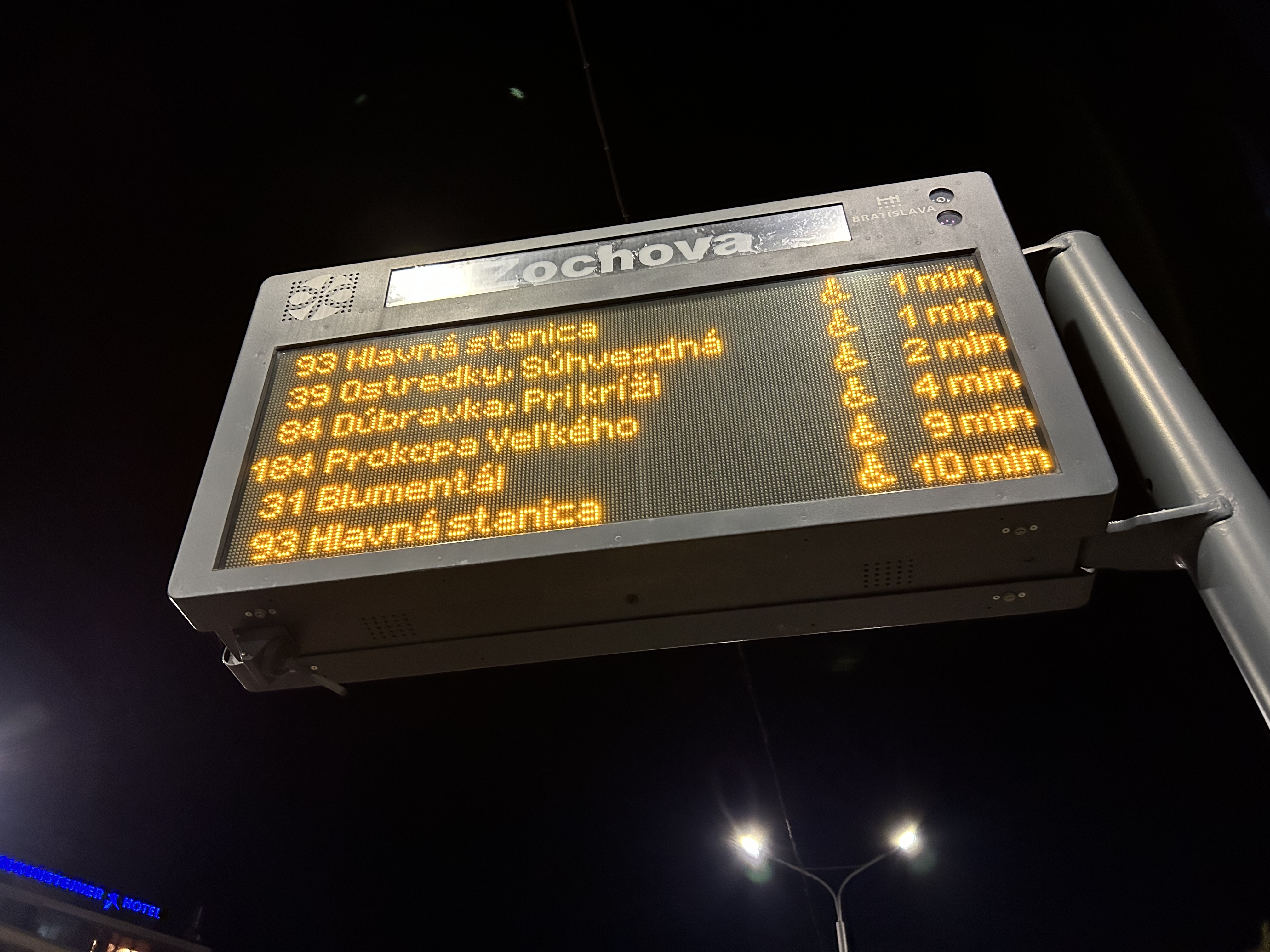
    For instance, while waiting for a tram in Vienna, we experienced an unusually long wait. The next tram display kept showing the next two arrivals at 3 and 4 minutes. Not long after, a voice came on a loudspeaker posted above the tram stop sign announcing (in German, translated in English to us by one of my spouse’s colleagues) a delay because of a collision along the route. The blockage cleared after a few minutes, and we boarded a crowded tram. I appreciated the audio announcement, especially as it was a basic tram stop.

    The classic Vienna tram stop. Note the loudspeakers atop the blue bus stop sign (at night, buses take over, hence the Strassenbahn and Autobus stop signs).

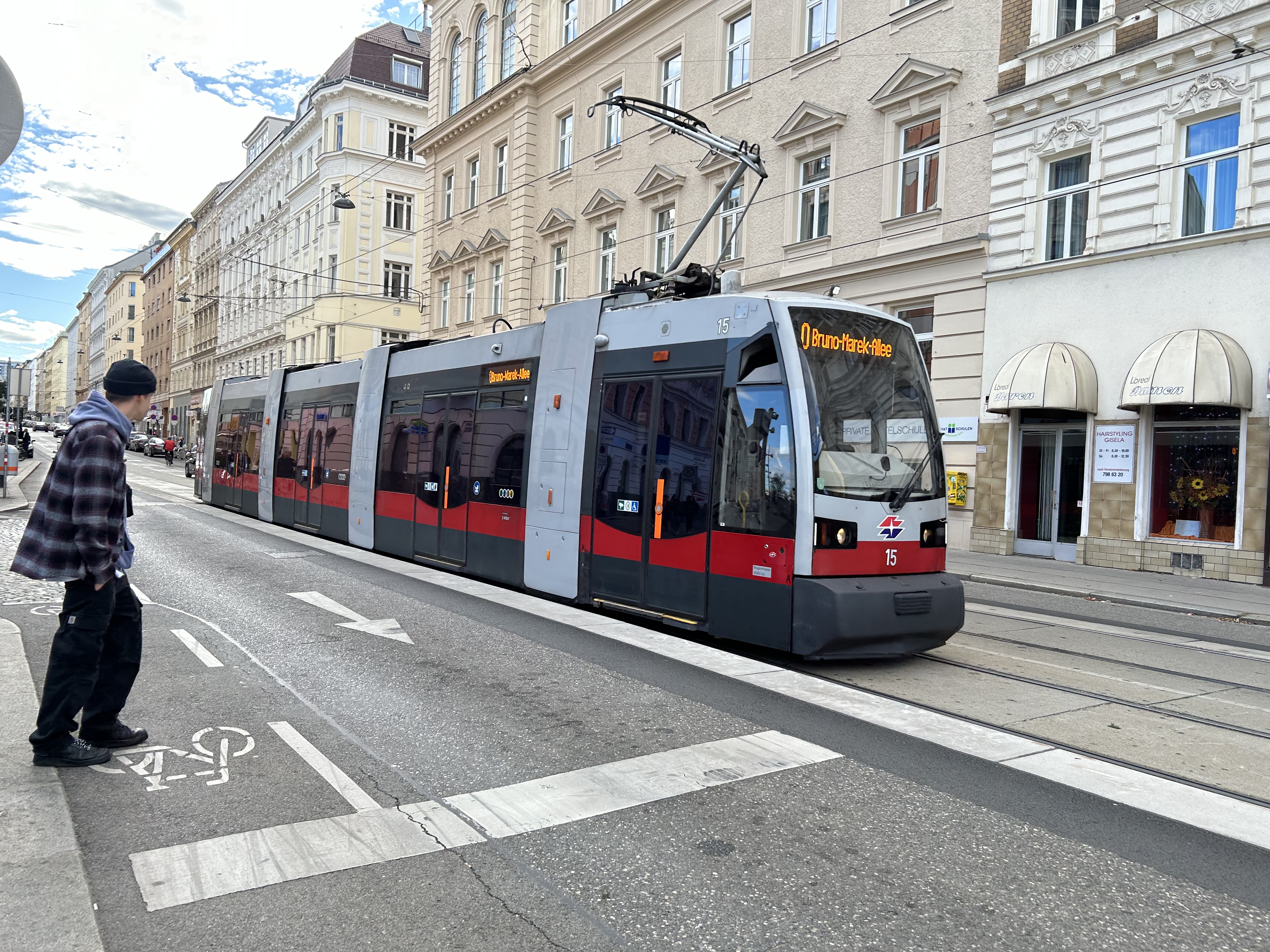
    Next vehicle displays were common in every city we visited. They would list — in real time — the next several buses or trams, as well as if the vehicle was low-floor accessible or not with a wheelchair symbol. All buses are now fully accessible, but the information is useful for the tram lines, where there are still many older high-floor vehicles.

    Next vehicle display at a bus stop in Bratislava

    I also noted that in Vienna, and for the most part elsewhere, vinyl advertisement wraps did not cover passenger windows on trams and buses. Bratislava’s wrapped trams had some ads that used window areas, but these were kept to a minimum.

    In Vienna, advertisement wraps kept windows completely free of obstructions
    Advertisement wraps in Bratislava had minimal window coverage

    It was also clear that trams had dedicated signals on their routes, if not necessarily signal priority. But with smaller intersections and relatively short signal timings, the waits at each signalized intersection were generally minimal.

    Note the white tram signals next to the overhead traffic signal. The “A” indicates that a proceed signal will soon appear, and the operator can cancel the door release, so that no more passengers can enter or exit.

    Tram signaling in Vienna and other Central European cites also includes remotely operated electric switches. Overhead signals indicate which direction the switch is set to; operators can pass through junctions at speed. While this is how trams operate in most places around the world, in Toronto, streetcar operators are required to stop before each switch and then crawl.

    Trams pass through a track junction, along with an ambulance and a transit maintenance van. The overhead horizontal signal indicates the switch direction.

    Though many tram stops are in private rights-of-way, in-street tram stops are designed for passenger safety and accessibility. These stops, depicted by the photograph below, have the curb lane raised to the level of the low-floor trams. This increases the visibility of passengers boarding and egressing, and also simplifies ramp deployment. Operators need not exit the cab and manually deploy the accessibility ramp, a timesaver versus the TTC’s ramp deployment on major streets. In the winter, this also helps keep the slush away from the tram stops.

    The raised on-street curb lane at an on-street tram stop in Vienna.

    Though Toronto is a very different city than Vienna, Budapest, or Prague, there are some clear takeaways. Keep the tram windows free of advertisements. Improve communications. Fix the track switches and signalize them. Raise the curb lanes at streetcar stops for safety, convenience, and accessibility. Fix the King Street Transit Priority corridor with a permanent streetscape and tighter vehicle restrictions. If it can be done on a narrow commercial street in Bratislava’s historic centre, there’s no reason why it can’t be done in a world financial capital.

    These can even be done incrementally, but they need to be done if transit riders are deserving of respect and reliable surface transit.

  • A visit to GO Transit’s New Old Elm Station

    A visit to GO Transit’s New Old Elm Station

    The new Old Elm Station in Stouffville, Ontario

    On Monday, October 30, the new Old Elm GO Station opened in the town of Whitchurch-Stouffville, northeast of Toronto. Located two kilometres away from Stouffville’s small downtown core, Old Elm is focused on park-and-ride passengers arriving from nearby communities such as Goodwood, Uxbridge, Port Perry, Beaverton, and from within Stouffville itself.

    The new station is relatively simple, with a covered platform, a bus loop with several bays directly adjacent to the single platform, heated shelters, and a 673-spot parking lot. As a relatively quiet station with limited train service, there is no indoor waiting room or ticket office.

    The bus loop is directly adjacent to the train platform

    Though train service is limited to weekday rush hours and a few evening and weekend departures, there is regular GO Transit bus service connecting Uxbridge and Goodwood to Old Elm Station, and onwards to midday and weekend train connections at Mount Joy or continuing to Toronto Union Station. There are no York Region Transit connections at Old Elm.

    The Lincolnville layover yard, which was also the Lincolnville/Old Elm station location until October 2023

    Previously, Old Elm Station was located a few hundred metres away, northeast of the Tenth Line/Bethesda Side Road intersection at the Lincolnville layover yard, where Stouffville Line trains continue to be stored overnight and weekends. That station, originally named Lincolnville for a nearby hamlet, was opened in 2008 to accommodate service expansion and relieve the small station at Stouffville, which had no room for a bus loop or additional parking. Since Lincolnville was a yard terminus, passengers had to walk across tracks to reach the next departing train, and each departing and arriving train had to crawl through the yard before reaching the mainline. (As Georgetown GO Station is also within a layover yard, trains passing through on their way to and from Kitchener must also crawl through. A new layover yard near Heritage Road in Brampton will allow for a rebuilt Georgetown Station with faster arrivals and departures.)

    Lincolnville Station was confusingly renamed Old Elm in 2021, even though that new name referred to a tree on the new station site that didn’t open for two more years. Had the new name taken effect with the location change, it would have made more sense.

    The new station site, located outside of the Lincolnville yard, allows for smoother and faster arrivals and departures, shaving several minutes off the trip for passengers to and from Lincolnville.

    The station’s namesake, an old elm tree on the south end of the GO Transit property

    Though Lincolnville/Old Elm is located in the Greenbelt, and the station is unable to support transit-oriented urban development, there was a need for the layover yard. Adding a small, auto-focused station was quite sensible. This is no Garage Mahal.

    The one unfortunate feature is the complete lack of active transportation access beyond the station property. Though Metrolinx built a wide concrete walkway from Tenth Line to the station platforms, there are no sidewalks, no crosswalks, and no pedestrian signals at either the main entrance or the bus loop entrance, which are both signalized intersections. Instead, there are “no pedestrians” signs facing all directions.

    “No pedestrians” sign placed in front of the new concrete pathway into Old Elm Station

    Once on Metrolinx property, though, there is a wide pathway, presumably for cyclists and pedestrians. Interestingly, the sign below shows that cyclists should keep to the left, on the wide pathway, while pedestrians are directed into the grass to the right.

    Beyond the “no pedestrians” sign at the intersection, another sign instructs cyclists to keep to the left and pedestrians to the right – into the grass

    I doubt Metrolinx intended for the hostile intersections to forbid any pedestrian activity. I note too that despite the rural locale, there are several neighbouring homes and businesses along Tenth Line and Bethesda Side Road. The nearest subdivision is less than a 15-minute walk away, a healthy stroll’s distance. A new residential development, Elm Villa, is planned for the site immediately to the south of the bus loop. Tenth Line is maintained by the Town of Whitchurch-Stouffville, so it is likely they are responsible for the oversight. Still, it is not a great look.

    No crossing at Old Elm

  • Line 3: struck from the maps

    Line 3: struck from the maps

    2018 view of the Scarborough RT, looking north towards Ellesmere Station

    On Monday July 24, at 6:45 AM, a Scarborough RT car on Line 3 derailed soon after departing Ellesmere Station. Forty-five passengers were on board, and five suffered minor injuries. The Scarborough RT, which opened in March 1985, was suspended, and then permanently closed, four months ahead of its planned shutdown on November 18, 2023. For the first time in its history, Toronto’s rapid transit map has shrunk.

    (more…)
  • Automatic for the people: Riding Montreal’s new REM

    Automatic for the people: Riding Montreal’s new REM

    North America’s newest rapid transit service, the Réseau express métropolitain (REM), opened on Monday, July 31, 2023 after a weekend of free public rides. I took my first ride several weeks later, on August 22, 2023. The five stop, 16.6-kilometre line between Central Station and Autoroute 30 in Brossard, is the first of four phases of the initial REM network, with branches north and west of Downtown Montreal to open in the next few years.

    Built by the CDPQ Infra, a division of Caisse de dépôt et placement du Québec (a provincial public pension fund), REM is a light metro network connecting suburban communities with Montreal’s urban core. With limited stops, a downtown-suburban focus, and frequent service, REM has similarities to Bay Area Rapid Transit (BART) in the San Francisco metro region, to S-Bahn systems in Germany and Austria, or RER in metropolitan Paris. Like Vancouver’s SkyTrain or the future Ontario Line here in Toronto, the trains are short, and operate fully automatically, running every 3.5 minutes during weekday peak periods, and every 7.5 minutes at all other times, from 5:30 AM until after midnight.

    As REM is being built by a pension fund — which seeks to make an 8% return on building and operating the service — financing the line is a bit different. Though it received financing from the Canada Infrastructure Bank and support from the provincial government, much of the funding comes from other sources, such as development levees. It is also guaranteed a share of fare revenue from the provincial government.

    Rail car interior. All seats face inwards, there are 64 seats per car, with standing room for up to 300.

    Though several notable transport enthusiasts have already documented the new REM during its opening weekend, I wanted to wait for some of the excitement to wane; I also wanted to experience the service from a regular passenger’s point of view, including checking out the stations and transfers to other transit operators.

    For the most part, I came away satisfied. However, I encountered several shortcomings, particularly with service integration and transfers between modes.

    (more…)
  • Toronto’s saddest subway stop

    Toronto’s saddest subway stop

    Islington Station, opened in 1968 as part of a major expansion of the Toronto subway system into Etobicoke and Scarborough, is now literally falling apart.

    At platform level, Islington looks little different than most stations on the Bloor-Danforth Line with the faded wall tile, coated with a layer of brake dust. Upstairs, on the concourse level and the old bus terminal, the station is in far worse shape. Wear and tear from hundreds of buses entering and exiting the station every day, along with water seepage from an underground stream, has caused the station to look much older than it actually is.

    From 1968 to 1980, Islington Station was the Bloor-Danforth Line’s western terminus, with buses branching out to points all over Etobicoke. The bus terminal boasted six bus bays, each with its own driveway. One of the six platforms was dedicated for Gray Coach services, which included an express bus to Pearson Airport.

    An arriving bus would first pull into the east side of the terminal, with all passengers descending a set of stairs to the subway concourse, either to transfer to the subway, exit the station, or transfer to another bus route. The bus, once the operator took their break, would then pull forward to the boarding area, where a second set of stairs emerged from a waiting area. Below, on the concourse level, a flashing light would alert waiting passengers that their bus was boarding. The terminal design was similar to the original bus terminal at Eglinton Station; at Warden Station, the levels are reversed, with the bus bays below the passenger concourse.

    Aerial view of Islington Station’s bus terminal in 1975, City of Toronto Archives, Series 836, Subseries 4, File 46. Note the Mississauga Transit bus passing by on Bloor Street.
    Looking northwest toward the sealed-off bus terminal, May 2023

    In 1980, the subway was extended one stop westward to Kipling. The extension allowed the TTC to reroute most of its Etobicoke routes from Islington, which provided new space for Mississauga Transit, whose buses now loaded inside the bus terminal. (As the bus bays are inside the station’s fare-paid area, Mississauga Transit buses off-loaded passengers outside the station’s main entrance on Islington Avenue.) A seventh bay, located to the south of the original structure, was added to provide additional capacity for Mississauga Transit, however, only simple bus shelters provided protection from the rain and snow.

    But by 2016, the bus terminal area was starting to crumble, and bus bays 1 and 2 (the bus bays closest to the subway platforms) were closed permanently to prevent further structural damage. Mississauga and GO Transit planned for a new terminal adjacent to Kipling Station, but it was delayed by several years. Part of the delay was caused by Hydro One — owner of the transmission lines that parallel the subway and adjacent Canadian Pacific Railway corridor — who refused to allow a terminal building under its wires.

    The opening of the new Kipling terminal for GO and Mississauga Transit buses in May 2021 (repositioned to avoid the hydro corridor) allowed the TTC to permanently close the crumbling bus terminal bays. All remaining buses — 37/937 Islington, 50 Burnhamthorpe, and 110 Islington South — began only using the outer bus loading area in late 2021.

    Bus passage, Islington Station. Stairways to the old bus bays are sealed off, with the signs above the old stairways blacked out. Passengers transferring to TTC buses must walk to the far end of this corridor and then up a stairway to access the outer bus bay.

    With little room remaining for buses to load, offload, and layover, passengers on TTC buses arriving at Islington are now let off on the street and must walk to the main entrance and show their transfer or tap their Presto card to enter the subway or transfer to another bus. Though Route 37/937 and 50 buses stop right in front of the station entrance on Islington Avenue, Route 110 buses off load on Bloor Street, a two-minute walk to the subway entrance.

    A Route 110A Islington South bus off loads on Bloor Street; passengers must walk north to the subway entrance on Islington Avenue, to the right of this photograph

    Since the bus terminal closure, the decay at Islington Station has extended beyond the bus area. On the mezzanine level, ceiling tiles were removed, while black netting catches chunks of broken concrete. Removed wall tiles reveal crumbling concrete and exposed rebar. Water leaks cover the mezzanine floor. There are no signs advising passengers of work underway or future construction, though there have been several plans to rebuild the station and promote new development on the site.

    Fare gates partially obscured by temporary columns

    Not only is reconstruction needed to rectify the deteriorating state of the station, Islington is also one of 15 subway stations that still do not have barrier-free access for passengers using wheelchairs or other mobility devices. Islington and Warden were left at the bottom of the list for station retrofits largely due to the difficulty of providing barrier-free access. The outdated bus terminal layouts at those stations require complete redesigns, and both stations are good candidates for urban development.

    Netting keeps chunks of concrete from falling onto passengers’ heads
    Crumbling terrazzo floor in the passageway underneath Islington Avenue
    Water leak on the concourse level

    There have been several proposals for redevelopment at Islington, taking advantage of its large bus terminal area and parking lot. The city first looked at redevelopment in 2006. At that time, there was a proposal from engineering firm SNC-Lavalin for a new office building that would incorporate a rebuilt station. However, that proposal deal fell through.

    In 2021, a new plan to rebuild the station was presented to the public. It would include a new six-bay bus terminal in the commuter parking lot north of the existing terminal. Upon completion, the old bus area would be redeveloped under the city’s CreateTO housing program. Aberfoyle Crescent, which connects Islington Avenue and Bloor Street, would be extended through the station property to provide bus access and allow for development of the rest of the station property. The site is constrained by the same Hydro One corridor that stymied construction of the new Kipling terminal (much of the parking lot is under hydro wires), but this is a much smaller bus terminal, and hopefully lessons were learned this time.

    Work on station construction was scheduled to begin in Spring 2023.

    Rendering of new bus terminal and station entrance
    Schematic of the TTC station redevelopment
    CreateTO development blocks at Bloor and Islington, from 2021 presentation
    Create TO conceptual plan for Islington Station site

    It is now mid-June 2023, and for now, there is no sign of work. Inside the station, there are no signs informing customers of impending construction, even if only to reassure passengers that the decrepit conditions are being addressed.

    The many delays at Islington Station are also indictive of the difficulties of redeveloping even city-owned properties for new, much needed housing. It won’t be until 2026 — at the earliest — that new development can take place.

    Until then, TTC customers must put up with a rapidly deteriorating station.

  • A transit tour of Southwestern Ontario

    Huron Shores Transit bus stop in Grand Bend

    In January 2023, while visiting the site of the now-demolished Sarnia Eaton Centre, I took advantage of two new rural transit services serving Southwestern Ontario: Strathroy-Caradoc Transit and Huron Shores Area Transit. While both services connect London and Sarnia, they operate as separate services with different fares; they also have different terminals.

    Strathroy-Caradoc Inter-Community Transit bus at Lambton Mall in Sarnia

    Strathroy-Caradoc Transit offers the most direct service between London and Sarnia, with stops at London International Airport, Downtown London (on York Street near the VIA Station), Komoka, Mount Brydges, Strathroy, Lambton Mall, and Downtown Sarnia.

    The regular cash fare between London and Sarnia is $20, though from London or Sarnia to Strathroy, the fare is $10. On my westbound trip on Sunday, January 29, the schedule allowed for a quick washroom and coffee break in Downtown Strathroy, a necessity given the long ride on a small minibus.

    Returning the next day from Sarnia, I opted to ride Huron Shores Area Transit (HSAT) back to London. HSAT, which is also contracted to Voyago, connects several communities in Lambton, Huron, and Middlesex Counties. All four HSAT routes converge in the summer resort town of Grand Bend. Two routes operate seven days a week (Route 1, connecting Sarnia, Forest, Thedford, and Kettle Point & Stoney Point First Nation, and Route 2, serving Exeter, Lucan, Centralia, and London). There are two additional routes operating two days a week from Grand Bend to Goderich and to Parkhill and Strathroy.

    Unlike Strathroy-Caradoc, HSAT operates on a flat $5 cash fare. Even though I was traveling the long way between Sarnia and London, with an hour-long layover in Grand Bend, I was offered a slip of paper marked by the driver that allowed me to board the second bus without a second fare. Huron Shores buses have bike racks, though the operator recommends calling ahead to ensure their availability.

    While Strathroy-Caradoc Transit serves downtown London and Sarnia, HSAT’s buses go only as far as the first major destination in both cities. The Sarnia stops for Route 1 are at Lambton College and nearby Lambton Mall, while the London stops on Route 2 are on London’s north end, near Masonville Place and at the University Hospital on the Western University campus. Getting downtown requires a transfer to Sarnia or London Transit.

    Huron Shores Area Transit bus at London’s University Hospital. Note the bike rack.

    Though VIA Rail still operates one daily train between Toronto, London, and Sarnia, it is not on a convenient schedule for most passengers (it leaves Sarnia early in the morning and arrives late in the evening), so the new bus services fill a key role in providing mobility options. Though it is more expensive, the Strathroy-Caradoc route is the direct and the fastest connection. But Huron Shores trip is the more scenic and cheaper ride.

    I updated my Ontario intercity transportation map for April 2023 to include the major GO Transit service changes, the gradual resumption of some Ottawa commuter bus routes, the start of Travelways bus service between Detroit, London, and Toronto, and minor route and service changes elsewhere in the province.


    The hour-long layover in Grand Bend gave me a chance to wander the town. On the main street, almost every business was closed for the season. There was very little traffic on Main Street, so it had a bit of a ghost town feel. On Highway 21 and to the east, however, typical chain stores like Tim Hortons, Sobey’s, and Shoppers Drug Mart serve the year-round population.

    Grand Bend’s famous beach — in January
    Hello Sunshine
  • Middle America’s transit oddities

    Pittsburgh Regional Transit Red Line train in the Brookline neighbourhood

    In 2022, with travel restrictions eased, I had the opportunity to take several road trips throughout the Northeast and Midwestern states, from New York and Maryland to Kentucky and Michigan. Previously on this site, I wrote about my visit to Philadelphia’s Rail Park, a lesser-known, yet ambitious project to repurpose former Reading Railroad corridors in the city’s north end. I also wrote about Dayton’s trolley bus network, which, if operated to its full potential, could be a model for electrifying transit across North America.

    In this post, I write about some of the other interesting transit services in Pennsylvania, Ohio, and West Virginia that I visited on my travels late last year, including a personal rapid transit prototype, the remnants of a huge legacy streetcar system transformed into a modern light rail line, bus rapid transit lines, and a new streetcar service I last visited while under construction in 2015. I even got to ride TANK.

    Cleveland

    Cleveland Red Line train on one of the many bridges spanning the Cuyahoga River and the Flats. The arched double-decked bridge beyond the Rapid train once carried a streetcar subway into Downtown Cleveland from the west.

    I visited Cleveland, Cincinnati, and Dayton in September 2022.

    Cleveland, like most American cities, once had an expansive streetcar and interurban tram network. The city streetcars lasted until the early 1950s (its PCCs were acquired by the TTC), though the separate Shaker Heights Rapid Transit, which also used PCCs, continued in service.

    The Cleveland system, made up of the heavy-rail Red Line, and the light-rail Blue and Green Lines (the former Shaker Heights services), run almost entirely on the surface, largely adjacent to railway rights-of-way. The Red Line, built between the 1930s and 1960s, was North America’s first airport rail link when that extension opened in 1968. Unfortunately, the service suffers from low ridership, so it operates in two-car trains, every 15 minutes during daytime hours.

    A Greater Cleveland RTA light rail vehicle heads eastbound from Downtown Cleveland, headed towards Shaker Heights. Terminal Tower in the centre background.

    The Red Line follows an old passenger railway alignment into Terminal Tower, the massive transportation hub, office tower, and commercial development on Public Square. The complex included a hotel, Higbee’s Department Store (made famous by its appearance in A Christmas Story) and local and intercity train platforms. With the decline of passenger rail, the trains moved to a much smaller station on the waterfront, and the Higbee’s store later became a casino.

    Both the Red Line and the former Shaker Heights light rail lines share the same tracks east of Downtown Cleveland, and both services run on overhead catenary.

    As the Red Line doesn’t follow city streets, Cleveland built a bus rapid transit line, branded “The HealthLine” on Euclid Avenue between Public Square and East Cleveland. The HealthLine is sponsored by the University Hospital and Cleveland Clinic health care corporations which it serves along with Case Western University and the art and cultural institutions clustered east of Downtown.

    HealthLine bus with left-side doors

    Though the HealthLine operates with special articulated buses with doors on both sides (to serve dedicated median stations, like that shown below), dedicated bus lanes are limited, and buses do not enjoy signal priority. However, the route is frequent and reliable, which is better than most urban bus services in the United States.

    HealthLine bus on Euclid Avenue in Downtown Cleveland

    Cincinnati

    Cincinnati Connector

    Like Cleveland, Cincinnati once had a large streetcar network, with trams also feeding into the city from communities in Northern Kentucky. Cincinnati abandoned its streetcars in the early 1950s, with the TTC acquiring its old PCC fleet.

    The last time I visited Cincinnati, in January 2015, work had started on a new urban streetcar line that would connect its waterfront, the sports stadiums, the central downtown core, and the Over-the-Rhine area, a gentrifying neighbourhood north of the city core.

    Like the modern urban streetcars in Atlanta, Detroit, Kansas City, and Portland, Cincinnati’s Connector serves a small area on a route practically geared to young urban residents and visitors. Though I came away with positive impressions of Kansas City’s streetcar (which is undergoing a lengthy extension), I felt that Cincinnati’s streetcar — like Atlanta’s and Detroit’s — was too slow, too infrequent, and too short to be of great use. At least the service was free to use.

    Junction to yet-to-be-built extension to University of Cincinnati

    One thing I did note is that, unlike Toronto’s busy — and useful — legacy streetcar network, the small Cincinnati Connector loop was built with modern tram standards. The few switches (like the one shown above) are double-point switches, with dedicated signals. This allows streetcars to pass intersections at normal speed, unlike the TTC’s insistence on stopping and then proceeding at a dead slow pace over its manual, single-point track switches.

    Switches were even installed to the proposed, but postponed, extension to University of Cincinnati (a cutback due to Republican opposition to transit projects at the State Capitol), shown in the photo above.

    As a Torontonian, where streetcars form the backbone of transit in the dense, urban downtown area, it’s frustrating to see a small, novelty streetcar line build proper track infrastructure, while our crowded trams are forced to crawl at every intersection because of indifference at the TTC and at City Hall.

    A Cincinnati Bell Connector Streetcar, followed by a SORTA bus

    One of the amusing oddities of transit in the Cincinnati area are the acronyms used by the two local agencies. Cincinnati and the surrounding Ohio municipalities are served by the Southwest Ohio Regional Transit Authority, or SORTA. The agency wisely uses “Metro” as its public brand. Covington and other Kentucky communities are served by the Transit Authority of Northern Kentucky, or TANK. To their credit, the two agencies cooperate on fares, a $5 day pass purchased on one bus is good for all regular services on both agencies. Many TANK routes enter Downtown Cincinnati as well.

    Pittsburgh

    In late October, my spouse and I visited Pittsburgh to attend a conference. Pittsburgh has one of North America’s most fascinating cityscapes, with the downtown core situated where the Allegheny and Monongahela join to form the Ohio River, with steep hills immediately to the north and south. The steep topography is the main reason why Pittsburgh maintained two historic incline railways, where many other cities (including Hamilton) abandoned theirs.

    The Duquesne Incline, on a very bright autumn afternoon

    Pittsburgh was also a leading operator of PCC streetcars until the late 1960s, with a fleet of 666 PCCs — North America’s third-largest — at its peak. Because of Pittsburgh’s many hills, often requiring private rights-of-way or tunnels for streetcars to serve outlying areas, Pittsburgh was late to abandoning its street railway, but with highway projects in the 1950s, a public takeover in the 1960s, declining ridership, and a desire to modernize, most of the lines were abandoned and replaced by buses by 1971. Only a few South Hills lines, which used a lengthy tunnel to access Downtown Pittsburgh, remained.

    Red Line train in Beechview

    The two core southern lines were gradually upgraded to light rail standards, with a downtown tunnel replacing the on-street trackage there. Only a short section of Red Line in Beechview still operates on-street, betraying the service’s streetcar legacy. In 2012, the downtown subway was extended north under the Allegheny River to serve the North Shore, particularly the baseball and football stadiums.

    Steel Plaza Station, part of the Downtown Subway

    In the 1980s, the Port Authority of Allegheny County, the public agency tasked with operating the city’s transit system, designed and built several busways radiating out of the city centre. Like Ottawa’s Transitway before construction of the Confederation Line LRT, the Pittsburgh busways follow former or current railway rights-of-way, with grade-separated road crossings, and with on-street operation in the downtown core. The busways offer rapid transit service, though stations are quite simple, with at-grade pedestrian crossings at most locations and basic shelters.

    Dr. Martin Luther King Jr. (East) Busway, Swissvale

    Pittsburgh’s problem though is that the busways and LRT managed to avoid the main university campuses and many of the city’s most vibrant neighbourhoods. Oakwood, the home of University of Pittsburgh, Carnegie Mellon University, many of the city’s arts and cultural institutions and some of its densest neighbourhoods, has only local bus service. Not coincidentally, Oakwood was one of the last parts of Pittsburgh to lose its streetcars in 1967.

    South of Pittsburgh, streetcars operate on an abandoned interurban line near Washington, Pennsylvania. Unlike the Halton County Radial Railway, the Washington interurban line’s tracks were not yet removed when the Pennsylvania Trolley Museum was formed. The museum, which operates several streetcars and hosts a large collection of static displays, is well worth the visit.

    Former Pittsburgh Railway Company trolley #4398 carries autumn crowds at the museum in Washington, PA. Behind is a former Philadelphia Suburban Lines (Red Arrow) trolley.

    Morgantown, West Virginia

    Only a 90-minute drive south of Pittsburgh is the city of Morgantown, West Virginia, home of the sprawling West Virginia University. What makes the public university especially unique is the automated transit system that serves the university and connects it to Downtown Morgantown.

    The one-of-a-kind Morgantown PRT, opened in 1975, has five stations between Downtown Morgantown and the main campus to the north. What makes the line a “personal” rapid transit system is passengers, upon paying the fare or swiping their university ID card, select their destination station, and wait for a car that will take them to their desired point, skipping any stations in between. Though the technology can be described as a “gadgetbahn” it fills a unique niche, and still runs with the original rolling stock and guideways, though software and motor upgrades were required. Because of the limited road space between Morgantown and the university facilities to the north and the mountainous topology of West Virginia, traditional bus service gets caught in traffic, especially on game days.

    Walnut Street Station in Downtown Morgantown

    Each car has eight seats and allows for twelve standees, so despite the name, the service isn’t precisely “personal.” As it is operated by the university mostly for staff and students, it does not run on Sundays, holidays, or when classes are not in session. During off-peak periods, the PRT usually runs in an all-stops configuration.

    The video below shows how the PRT operates, including the bypass of Towers Station.

    Part of the nine-minute ride on the Morgantown PRT at the University of West Virginia

    I will follow up with posts covering my return to Toronto, Ohio (which is just an hour’s drive west of Pittsburgh), and some thoughts after visiting a local history museum.

  • Ontario intercity transportation at the end of 2022: More choices, fewer routes

    A Red Arrow coach lays over at a Harvey’s restaurant in Kingston on the way to Ottawa

    On December 7, I took a trip out to Kingston to ride the newest coach operator to arrive in Ontario: Red Arrow. A division of Pacific Western, Red Arrow is the latest carrier to stake a claim to the busy Toronto-Kingston-Ottawa route, which is now served by five private companies.

    Between Toronto and Ottawa, five intercity coach carriers–Megabus, Rider Express, Flixbus, Book-A-Ride, and Red Arrow–compete for the same passengers, along with VIA Rail and three airlines (Air Canada, WestJet, and Porter).

    There is also fierce competition for the Toronto-London route. Passengers have the choice of taking Megabus, Rider Express, Onex, Flixbus, Book-A-Ride, VIA Rail, or a very slow weekday-only GO train. Along with VIA, Flixbus also continues west, to Windsor (where the Tunnel Bus connection to Detroit has finally been restored). The Toronto-St. Catharines-Niagara route is also served by multiple bus and rail services.

    Red Arrow coach seating

    Despite new intercity coach players like Red Arrow (which provides a high-end coach service, with comfortable seating in a 2+1 arrangement, along with complimentary soft drinks and light snacks) and Book-A-Ride (which operates like a charter airline, with schedules that change frequently based on demand), many other routes still have limited or no service. Flixbus quietly dropped its Kitchener-Hamilton-Niagara route earlier this year, eliminating service on a corridor that once had frequent Canada Coach Lines buses; that route had been sold in 1990 to Trentway-Wagar/Coach Canada. Flixbus also ended service to Guelph, instead concentrating on its other corridors. Early next year, Megabus will end its route between Toronto, Buffalo, Philadelphia, and Washington DC.

    The deregulation of motor coach services within the Province of Ontario may have made some sense. The old bargain of providing exclusive franchises for busy, profitable routes made sense when operators would use those cash cows to help subsidize less-trafficked rural services. But as Greyhound, Stagecoach, and other large companies bought up smaller carriers (such as Gray Coach, Canada Coach Lines, and PMCL) in the 1980s and 1990s, they were allowed to slowly abandon the smaller routes. Greyhound itself divested most of its network before disappearing altogether. As the franchising scheme didn’t work, there was no point keeping it.

    But now, there’s the absurd situation where there are up to 25 daily buses and trains between Toronto and Ottawa (see table below). In contrast, there is not a single daily bus service connecting Hamilton and Kitchener-Waterloo–two urban centres of over 500,000 people each, just an hour apart, with three large universities (Waterloo, Wilfrid Laurier, and McMaster) and two major colleges (Conestoga and Mohawk) between them.

    Available trips from Toronto to Ottawa, December 2022, with times for Kingston and Peterborough. Bus and rail tips to Montreal via Kingston are not included.
    A PDF version can be found here.

    Elsewhere, where GO Transit and government-subsidized regional connections have filled gaps, the services are often slower and less direct than the old coach bus service. PMCL used to operate daily bus service between Owen Sound and Toronto via Collingwood and Barrie. Today, the same trip is possible via Grey Transit Route, Colltrans, Simcoe County Linx, and GO Transit, but the trip will take the better part of a day. Meanwhile, other gaps remain. Elgin County (Aylmer and St. Thomas) and Haldimand County (Caledonia, Dunnville, Hagersville, and Jarvis) are left without any outside connections.

    Such is the state of the intercity transportation network (if you can call it that) in Ontario.


    Though I enjoyed the trip on Red Arrow to Kingston (especially as I took advantage of a special $25 fare), I wondered how well the service will do here in Ontario. Its base price is over $100 one-way to Ottawa, more expensive than other coach operators and priced more like VIA Rail, which itself is slightly faster (as long as CN freight trains do not get in the way). Red Arrow uses the same locations in Ottawa (the VIA Rail Station itself) and Toronto (Union Station Bus Terminal) as the train. Red Arrow does well in Alberta, where there is no useful passenger rail service (Pacific Western also offers a no-frills coach bus service on the same Calgary-Edmonton route).

    The latest version of my interactive intercity transit map is below:

    Link to the newest version of my map of Ontario’s Intercity bus and rail connections

  • Why the future of transit might be found in Dayton, Ohio

    Why the future of transit might be found in Dayton, Ohio

    Dayton, Ohio is probably best known as the hometown of Wilbur and Orville Wright, the two bicycle mechanics who made the first successful controlled heavier-than-air flight. The city has remained a centre of the aviation industry. The US Air Force (and its predecessors) have operated a major base in Dayton for over a century, which includes an impressive museum of military aviation history.

    But among transit buffs, Dayton is notable for another reason. It is one of only a handful of cities in North America that continues to operate and maintain an electric trolley bus system. The Greater Dayton RTA is also the smallest transit system to have operated trolleys since the mid 1970s.

    Though there were early adopters of “trackless trolleys” in the late 1910s and early 1920s, the technology was particularly popular between the late 1930s and early 1950s. For street railway operators burdened with ageing streetcars and worn out infrastructure, electric trolleys offered several advantages. They could make continued use of electric substations, poles, and overhead wires, without the need for maintaining tracks and rights-of-way. Trolley buses were quiet and smooth-running, unlike gasoline and early diesel buses, and had larger capacities. They were cheap to operate and easy to maintain, and were especially adept at climbing steep grades.

    TTC trolley bus on Ossington Avenue in the 1950s. The Ossington trolley was established as part of a major post-war route restructuring.

    Most of the big cities in Canada and the US continued operating streetcars into at least the 1950s, as newer PCC streetcars helped keep those fleets going. But trolley buses were ideal for smaller and midsized cities that still had robust transit demand that buses could not yet meet. Even cities that retained streetcars into the 1950s — like Toronto — used trolley buses to replace marginal streetcar lines and allow for major route restructurings.

    In Canada, fourteen cities established trolley bus fleets between 1936 and 1951. In Halifax, the Nova Scotia Light and Power Company replaced its decrepit streetcar system and its feeder bus network with an all-electric fleet in 1949; at the system’s peak, there was even a trolley route across the Macdonald Bridge to Dartmouth. Cities as small as Cornwall and Port Arthur/Fort William (now Thunder Bay) even replaced their streetcars with trolley buses.

    By the 1970s, the coach bodies purchased 30 years earlier were showing their age, and many agencies had decided to simplify their fleets and go with modern diesel buses, which had improved in size, power, and capacity since the 1940s. In Canada, only Toronto, Hamilton, Edmonton, and Vancouver decided to renew their fleets, while only five cities in the United States (Boston, Dayton, Philadelphia, San Francisco, and Seattle) kept their electric trolley systems. Since then, Hamilton, Toronto, Edmonton — and most recently, Boston — gave up when the latest generation of trolleys were due for replacement.

    But of all places, the small, deindustrialized city of Dayton took a very different direction. In 2020, the Greater Dayton Regional Transit Authority (GDRTA) received the last of its 45 new Kiepe/Gillig Next Generation trolley buses, equipped with large, powerful battery packs and computer systems that allow for long-distance, full speed off-wire capability. (The previous generation of trolleys, like what Translink in Vancouver currently operates, allow only for limited, low-speed off-wire operation).

    The new NexGen trolley on Third Street on Dayton’s West Side
    A trolley on Route 4 running with its poles down. I captured this photo just after getting off the bus on September 16, 2022.

    The extended off-wire capability has allowed the GDRTA to extend two of its trolley bus routes further into the suburbs without extending wire. Route 7 was extended 5 kilometres northwest, while Route 1 was extended 6 kilometres east to Wright State University. Though the corridors were already served by longer-distance diesel bus routes, it provided additional service to some of Dayton’s major suburban trip generators.

    North Main Street at Elm Hill Drive, where the Route 7 trolley wire ends (note the “poles down” sign), but trolley buses can continue another 5 kilometres onward.

    Unfortunately, despite the new fleet and plenty of wire to run it, the GDRTA has only been operating its trolley buses on a single route in the last few months, despite four routes being fully capable of electric service. When I visited Dayton on September 15, not a single trolley was out. Though I did go visit the US Air Force Museum and the Wright Brothers National Historic Site (where one of the brothers’ bicycle shops were preserved on site; the family home and another of their shops were moved to Henry Ford’s Greenfield Village), I was really disappointed. But having a car, and a hotel reservation less than an hour away, I went back the next morning to see these new vehicles in action and take a ride.

    A line up of diesel buses, including the trolley-capable Route 7, in Downtown Dayton, just south of the main bus terminal on September 15, 2022. Note the trolley wire, completely unused.

    Happily, Route 4 was operating with trolleys, though on a Saturday schedule, imposed by GDRTA because of an ongoing driver shortage that has plagued transit systems across North America. During the daytime, three buses offer 30 minute service on the route. Between Downtown Dayton and the West Side, my first ride that morning was interesting as the bus was operating with its poles down for some reason. But riding the bus, I couldn’t tell: it was a smooth, quiet, and quick jaunt. I took two more trips on Route 4 to the east end, to get the most out of my visit.

    A NextGen trolley outbound on Wayne Avenue at East 5th Street, September 16

    Despite my disappointment with the GDRTA’s utilization of its fleet, I came away still confident about the technology’s future. Though many transit systems are re-electrifying their bus fleets, they have been purchasing battery-electric fleets that do not have any in-motion charging, unlike Dayton’s advanced trolleys. Some agencies, like the TTC, have battery buses that are charged only at the garages. Other cities, like Brampton, Winnipeg, and Montreal have en-route charging stations at terminal points as well as garage charging points. But bus batteries are extremely heavy, and they have not yet gone through a complete life cycle yet in the harsh Canadian climate.

    Brampton Transit electric bus charging at Mount Pleasant Village

    The TTC in particular is suited to restoring its trolley network using modern on-wire charging buses like those used in Dayton, as it has much of the infrastructure already in place, including substations (that feed the subway and streetcar network) and existing overhead wire systems. With long-distance off-wire capability, there is no need for complex wire junctions and short-turn loops, unlike older trolleybus networks. Busy, straight routes such as Dufferin and Bathurst would be ideal.

    Though Dayton isn’t using its new fleet of electric buses to its potential, it does show the way to renewing sustainable electric transit services for cities like Toronto.

  • Visiting America’s other urban railway park

    Visiting America’s other urban railway park

    An abandoned railway signal towers over Philadelphia’s Rail Park

    On a road trip early this summer, my spouse and I paid a visit to New York and Philadelphia. In New York, we walked the famous High Line, which revitalized an abandoned elevated freight railway corridor, transforming it into a popular grade-separated walking path on Manhattan’s Lower East Side.

    New York’s High Line

    While in Philadelphia, I made a point of visiting another abandoned rail viaduct — Rail Park. It’s as ambitious as New York’s famed public space, but — for now — it is much less known.

    The viaducts, cuts, and tunnels that will make up Philadelphia Rail Park trace their origin to the golden age of railroading. The Philadelphia and Reading Railroad, which connected Philadelphia with its northern and western suburbs, industrial towns to the northwest, and the lucrative anthracite coal fields of northeast Pennsylvania. For many years, the Reading Railroad, as it was known, was one of the United States’ most profitable companies. In 1893, the railway opened its Philadelphia Terminal, which became famous for the public market that was established below the station platforms. To this day, the Reading Terminal Market remains a vital city landmark. In the 1930s, most of the commuter services were electrified.

    The 1893 Reading Terminal headhouse, now the entrance to the Pennsylvania Convention Center

    By the 1970s, both the Reading and PRR were bankrupt. PRR merged with its New York-Chicago rival New York Central in 1968, before it too went into insolvency. Conrail took over many failing railways in the US Northeast and Midwest, consolidating operations, abandoning or transferring redundant track, and transferring most remaining commuter train operations (which were not assumed by Amtrak) to regional and state transit authorities.

    In the mid-1980s, the Southeast Pennsylvania Transit Authority (SEPTA), which assumed control of the regional rail services formerly operated by the PRR and the Reading undertook an ambitious project to unite the separate regional rail systems. A new four-track tunnel was constructed east from PRR’s Suburban Station, and a new station — Market East — built to replace the old Reading Terminal. For the first time, trains could run through central Philadelphia, providing improved regional rail services.

    Though the historic Reading Terminal headhouse and the famous market were preserved, the station platforms were removed to make way for a new convention centre. For years, the abandoned viaducts and tunnels leading into Reading Terminal sat unused. At least they did, until June 2018.

    Entrance to the first phase of Rail Park, at Noble and 13th Streets

    In 2018, a short, initial phase of Rail Park opened to the public. Spanning just two blocks, from Noble and 13th Streets to Callowhill and 11th Streets, it is still a remarkable public space. Like New York’s High Line, the short section of viaduct provides new viewpoints over gritty city streets, with temporary and permanent public art installations along the route.

    A map of the proposed extensions of Rail Park, with the opened first phase marked. Interactive map here.
    Looking north up 13th Street, towards the gentrifying Spring Garden neighbourhood
    “Workshop of the World” – an interpretive plaque provides information on the industries that lined the Reading Company’s route through Philadelphia
    An art map of local industries that existed immediately north of Reading Terminal, made from punched Corten steel
    Looking east to the intersection of Callowhill and 11th Streets. For now, the only fully accessible entrance to Rail Park is at Noble and 13th Streets. The viaduct from the north is visible at left; this will be part of a future phase of Rail Park.
    A stairway leading up from Callowhill Street. The metal frames at the right hold swings for the public to enjoy.

    Future park extensions will continue westward from 13th Street to a below-grade cut starting at Broad Street. It will continue west to the Benjamin Franklin Parkway and the Philadelphia Museum of Art (where the Rocky statue can be found outside), where it will enter a tunnel before emerging at Girard Avenue near Fairmount Park, the greatest of Philadelphia’s urban green spaces. Another section will connect the existing Phase I to the abandoned north-south viaduct between Vine Street and Fairmount Avenue, where the old route to Reading Terminal meets the 1980s rail diversion to Market East Station. Eventually, it will reach 3 miles (5 kilometres) in length.

    The formerly abandoned viaduct offers a view of more recently abandoned transit infrastructure: the remnant tracks of the 23-Germantown trolley route, once the longest streetcar line in North America. In the early 1990s, SEPTA was forced to abandon three of its legacy street railway lines due to budget pressures and deteriorating PCC equipment. (Newer Kawasaki-built streetcars were only deployed on the surface-subway routes in West Philadelphia and on the former Red Arrow suburban lines from 69th Street Station.) The 15-Girard Line was later rebuilt with refurbished streetcars, but the 23 and 56-Erie lines were left to rot in a state of “temporary suspension.”

    SEPTA has a wealth of transit infrastructure, which I wrote about after my first visit to Philadelphia in 2009, but it hasn’t put enough of it to good use. It has a massive, fully electric regional rail network, yet trains operate only every hour on most routes outside of peak periods. There’s a four-track subway tunnel under Broad Street that’s grossly underused, and unlike Toronto, there are even a few active trolley bus routes. And sadly, it’s allowed much of its infrastructure, like its trolley network, to remain in disuse.

    A view down from Rail Park to long-disused trolley tracks on 12th Street