Author: Sean Marshall

  • Toronto’s Zero Vision and the folly of Seniors Safety Zones

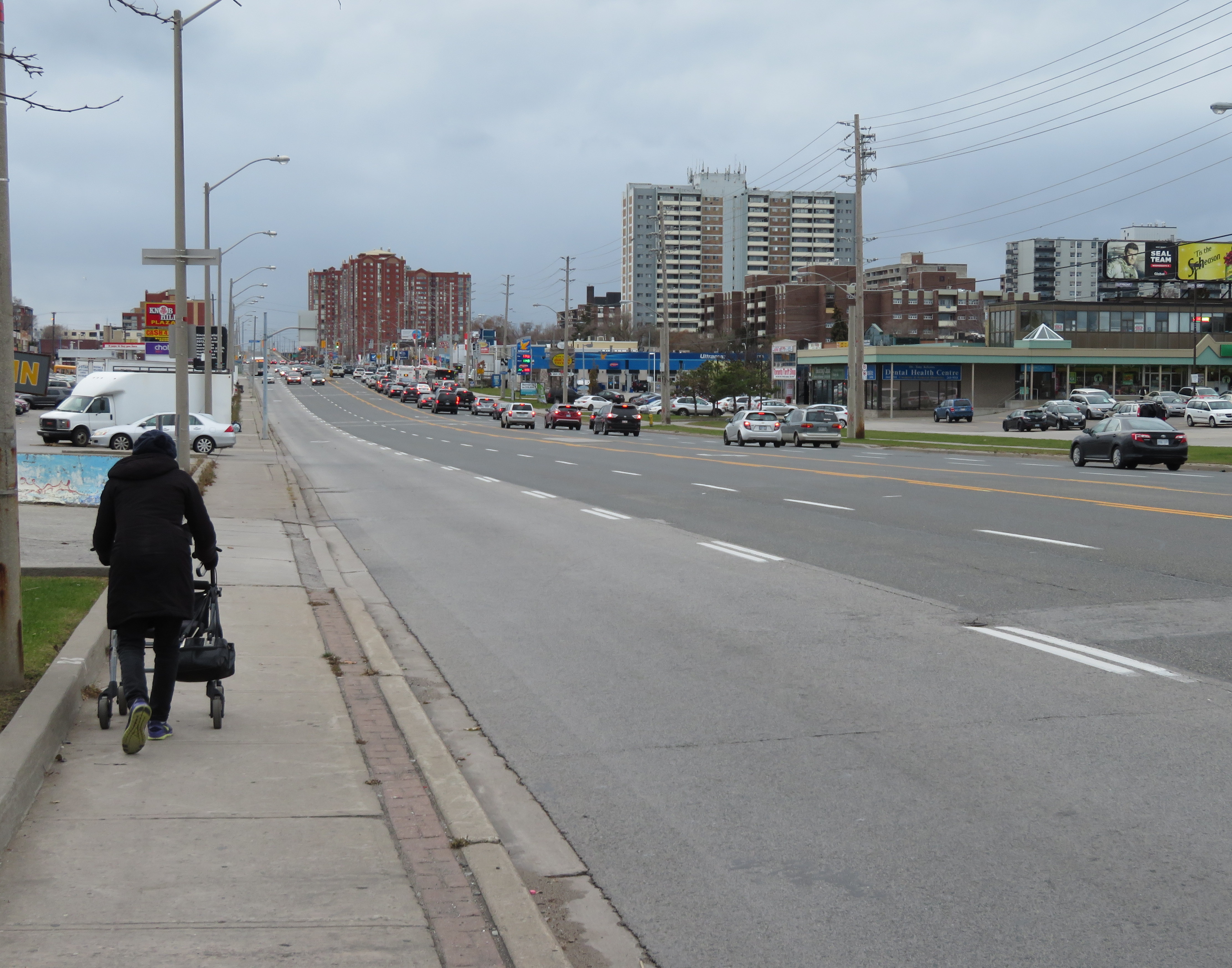
    IMG_4386-001Eglinton Avenue East near Brimley Road, one of twelve Seniors Safety Zones in the City of Toronto

    Despite its status as a global city, a city that’s often ranked as one of the world’s safest, a city that likes to think of itself as both progressive and a top place to do business, Toronto does a lousy job of protecting its residents from injury and death on its roads.

    Although there have been a few positive steps — the new King Street Pilot, launched last week, or the Bloor Street bike lanes, made permanent between Avenue Road and Shaw Street in October — Toronto does far too little to protect pedestrians and cyclists in this city. The installation of sidewalks in residential neighbourhoods are often opposed by local residents resistant to losing driveway space on which to park their cars, or unhappy about having to clear sidewalks of snow and ice. Affluent neighbourhoods might be dotted with “drive slow – kids at play”  lawn signs, but their residents and elected representatives will oppose new bike lanes and lower speed limits on the arterial roads they use to commute downtown.

    The general idea of reducing road violence is a popular one. But specific actions are often opposed. The city’s own Vision Zero strategy — weak as it is — is a good indication of the ambivalence to road safety we have in this city.
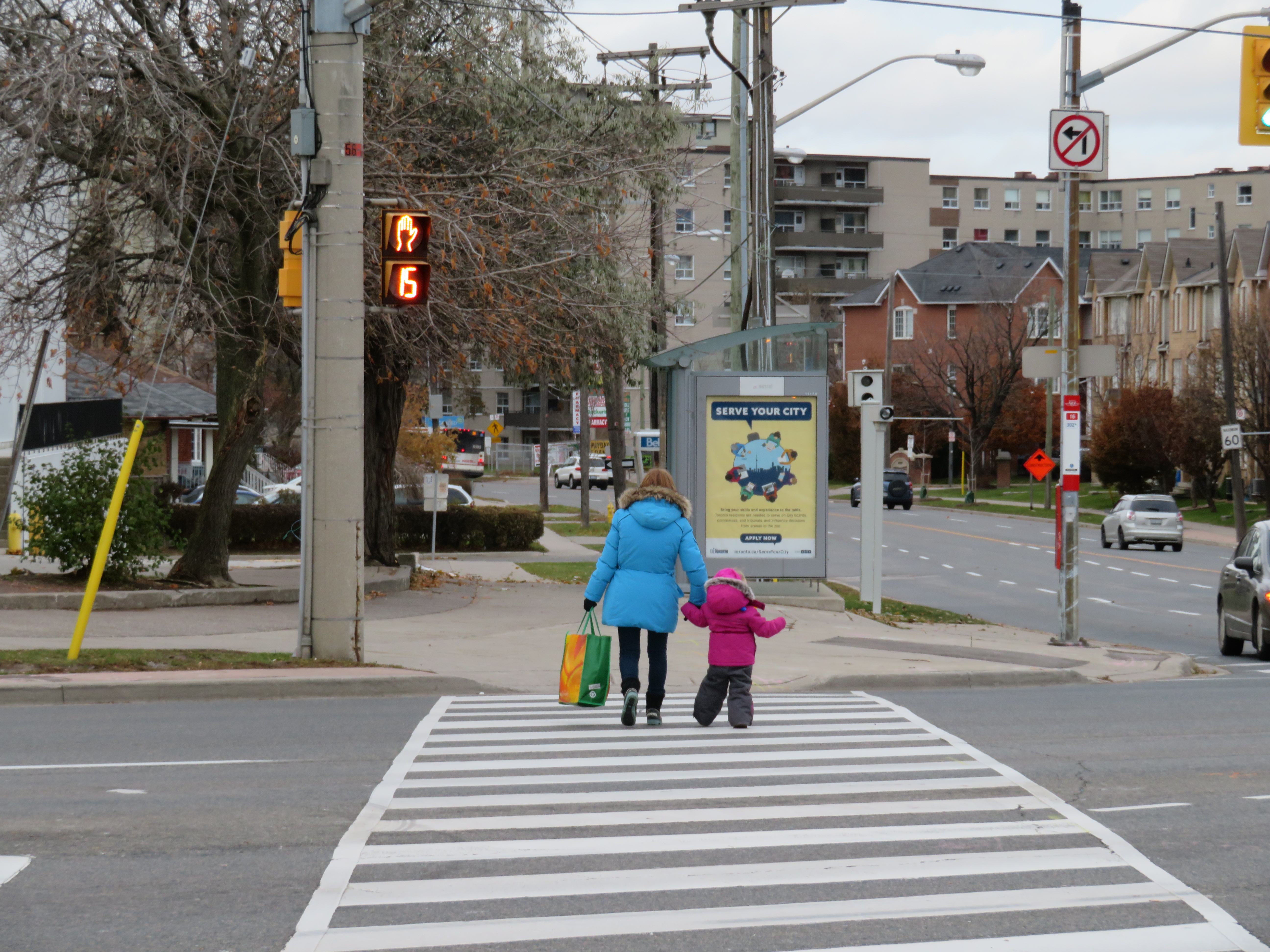
    IMG_4403-001Woman and young child cross seven lanes of traffic at a crosswalk at Eglinton Avenue East and Danforth Road

    Vision Zero, which originated in Sweden, is the road safety philosophy that no loss of life is acceptable, and that all road users are human, that humans make mistakes, and road design must minimize the impacts of those mistakes. Complete streets that accommodate all road users (pedestrians, cyclists, motorists, and transit users), and road engineering measures to protect pedestrians and cyclists and reduce traffic speeds are in the spirit of Vision Zero.

    But when Mayor John Tory and Public Works and Infrastructure Committee Chair Jaye Robinson (Councillor, Ward 25) originally announced the city’s Vision Zero plan in June 2016, it merely aimed to reduce serious collisions involving pedestrians and cyclists by 20 per cent over a ten year period, allocating $68.1 million over five years.  The plan itself was modest. After a social media backlash and criticisms from active transportation activists (including Walk Toronto, of which I am a co-founder and a steering Committee member), the plan was revised, with an additional $10 million allocated and the goal to eliminate serious collisions, rather than simply reduce that number.

    One of the specific measures in the city’s Vision Zero plan is the creation of seniors safety zones, areas with high volumes of older adult pedestrians and higher risk of collision. Older adults make up a majority of pedestrian deaths in Toronto; 37 of the 43 pedestrians killed  in 2016 were over the age of 55. According to the City of Toronto’s Vision Zero Road Safety Plan, seniors safety zones will feature changes intended to improve pedestrian safety, such as lower speed limits, improved street lighting, advanced and extended walk signals at signalized intersections, red light cameras and radar speed signs, improved sidewalks and additional crosswalks, and increased enforcement.

    Twelve seniors safety zones were designated across the entire city of Toronto. Five are in the old City of Toronto, including Dundas Street at Bloor, Dundas at College/Lansdowne, and Dundas at Spadina. Six are in Scarborough, and one is in North York.
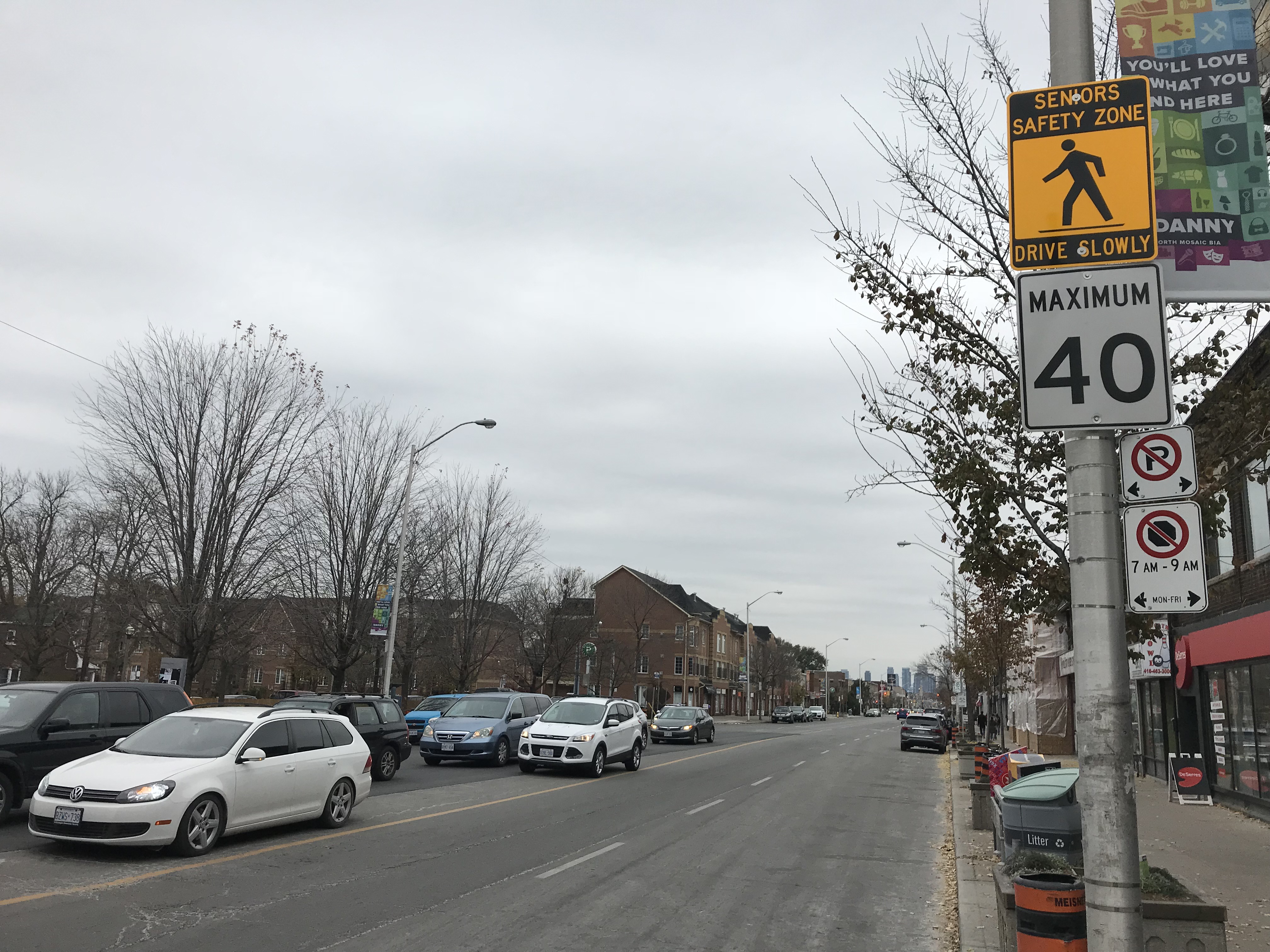
    IMG_0643
    Senior Safety Zone sign and 40 km/h speed limit, Danforth Avenue at Coxwell

    On Danforth Avenue, two senior safety zones were identified: near Coxwell Avenue and near Main Street. The speed limit on Danforth Avenue was reduced from 50 km/h to 40 km/h in 2016, but few other visible changes are apparent. Danforth Avenue is a five lane street, including a centre lane for left turns, and is paralleled by a subway line. The curb lanes on Danforth are unusually wide, and are used for parking outside of weekday rush hours. There are no bike lanes on Danforth either.

    Despite the 40 km/h speed limit, the wide lanes, dedicated turning lanes, and the absence of daytime local transit promote high speeds. The design speed of Danforth is simply too high; simply reducing the speed limit and putting up “senior safety zone” signs will do far too little.
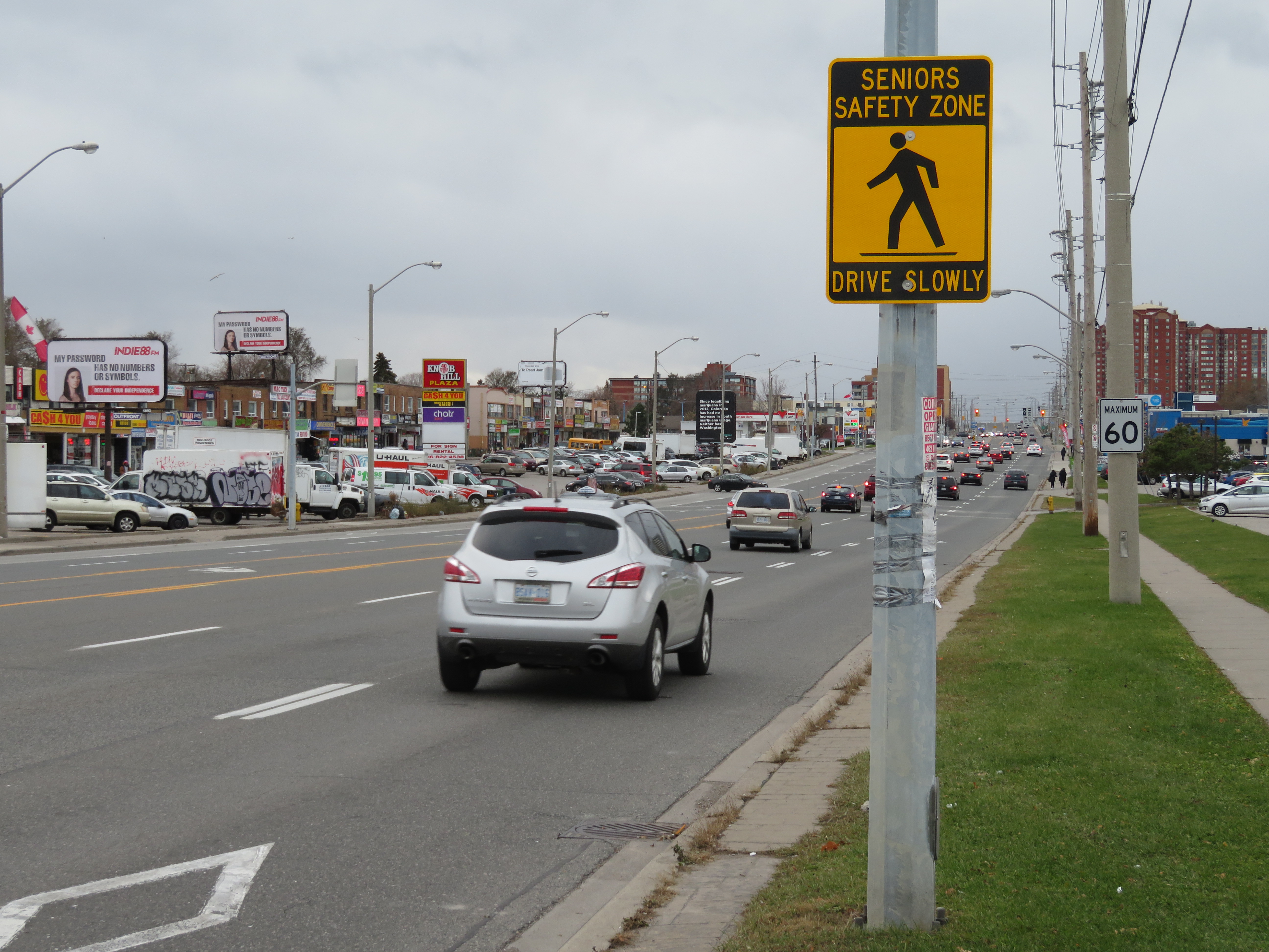
    IMG_4396-001Seniors Safety Zone sign on Eglinton Avenue East, at Brimley Road. Note the 60 km/h speed limit sign

    Eglinton Avenue East, between Midland Avenue and Danforth Road in Scarborough, is another senior safety zone. Two pedestrians were killed on this stretch of road in 2016.

    Eglinton Avenue through Scarborough is seven lanes wide, including a centre left-turn lane to cross streets and commercial properties that line the wide street. Traffic signals  are typically 500 metres apart; many TTC bus stops on Eglinton Avenue East are located far from a designated crosswalk. Buses are frequent between Midland and Brimley; four frequent routes feed into the Kennedy subway station to the west. Again, there is no cycling infrastructure to be found.

    The senior safety zone here is a joke. Not one safety intervention was made here. The yellow-and-black safety zone signs that read “drive slowly” are merely advisory, and do not stand out among other traffic  and commercial signage. The 60 km/h speed limit was not changed, and intersections were not altered at all to improve pedestrian safety.
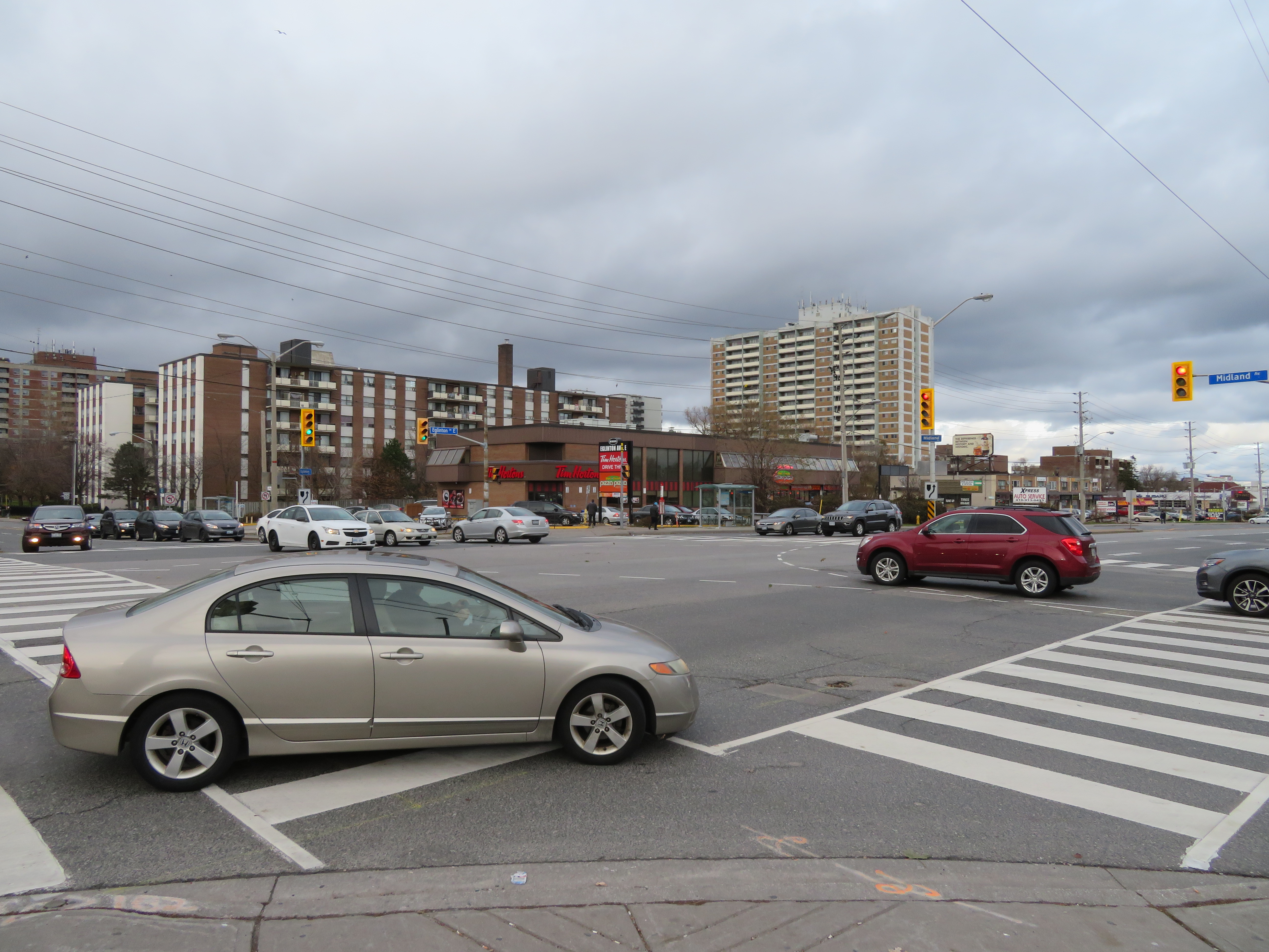
    IMG_4374-001At Eglinton and Midland Avenues, wide curb radii encourage speedy right turns into crosswalks; many drivers do not stop at the red light before making a right turn

    Several residential side streets off of Eglinton, such as Winter Avenue, do not even feature sidewalks. The signs might say “seniors safety zone” but there is no evidence that pedestrian safety is taken seriously at all here.
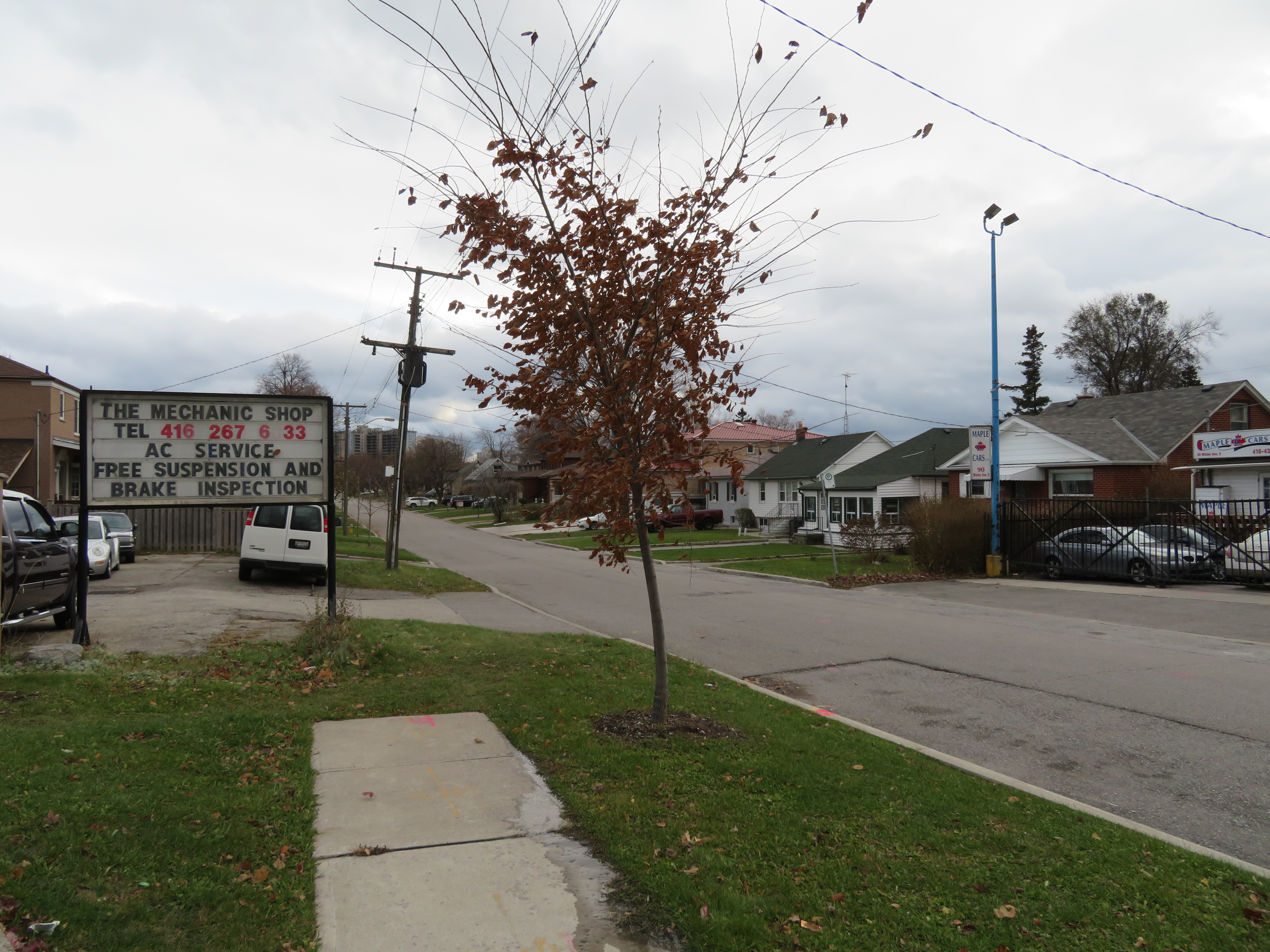
    IMG_4379-001
    Winter Avenue’s sidewalks disappear a mere 50 metres south of Eglinton Avenue

    Physical interventions, such as narrower lanes (which could make room for cycling infrastructure and/or wider sidewalks), bump-outs at crosswalks to improve pedestrian visibility and slow down right-turning vehicles, would be more effective. Police enforcement, or speed radar cameras, would be an additional deterrent against dangerous driving.

    At least the city has taken notice of the unacceptable numbers of pedestrians and cyclists killed in Toronto, but simply putting up new speed limit and safety zone signs are not enough. Without road engineering works to slow traffic down, and without effective police enforcement against speeding and drivers’ failures to obey traffic signs and yield the right of way to pedestrians, we only get feel-good measures and ineffective signs. A real commitment to Vision Zero requires political will, which so far is lacking at City Hall. Instead, we get zero vision.
  • The trouble with those “cyclists dismount” signs

    IMG_3940

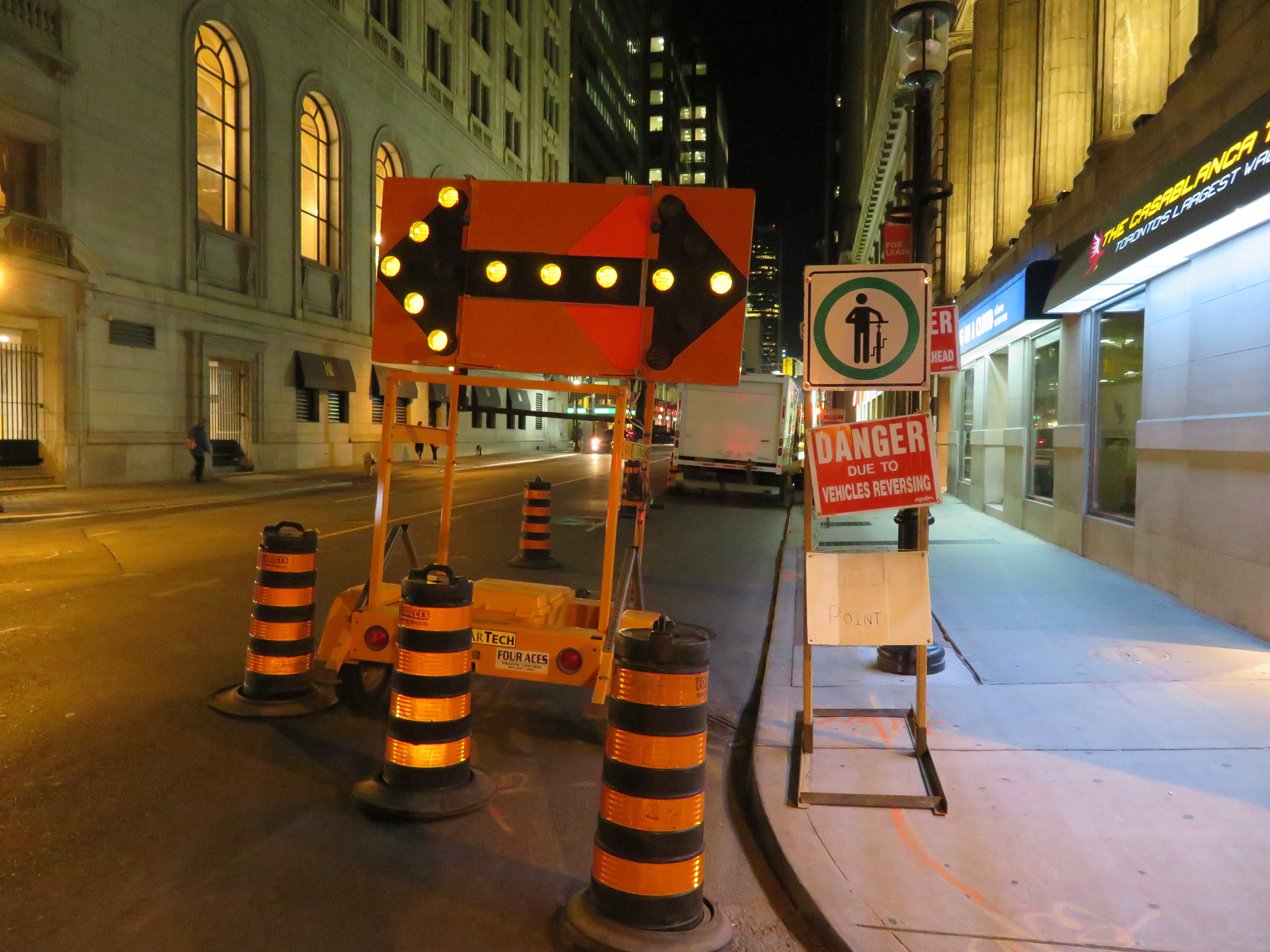
    Recently, I wrote about inconsistent, misleading, and problematic signage at road construction sites. Too often, cyclists are instructed to dismount and walk when a bike lane or general traffic lane is closed for construction.

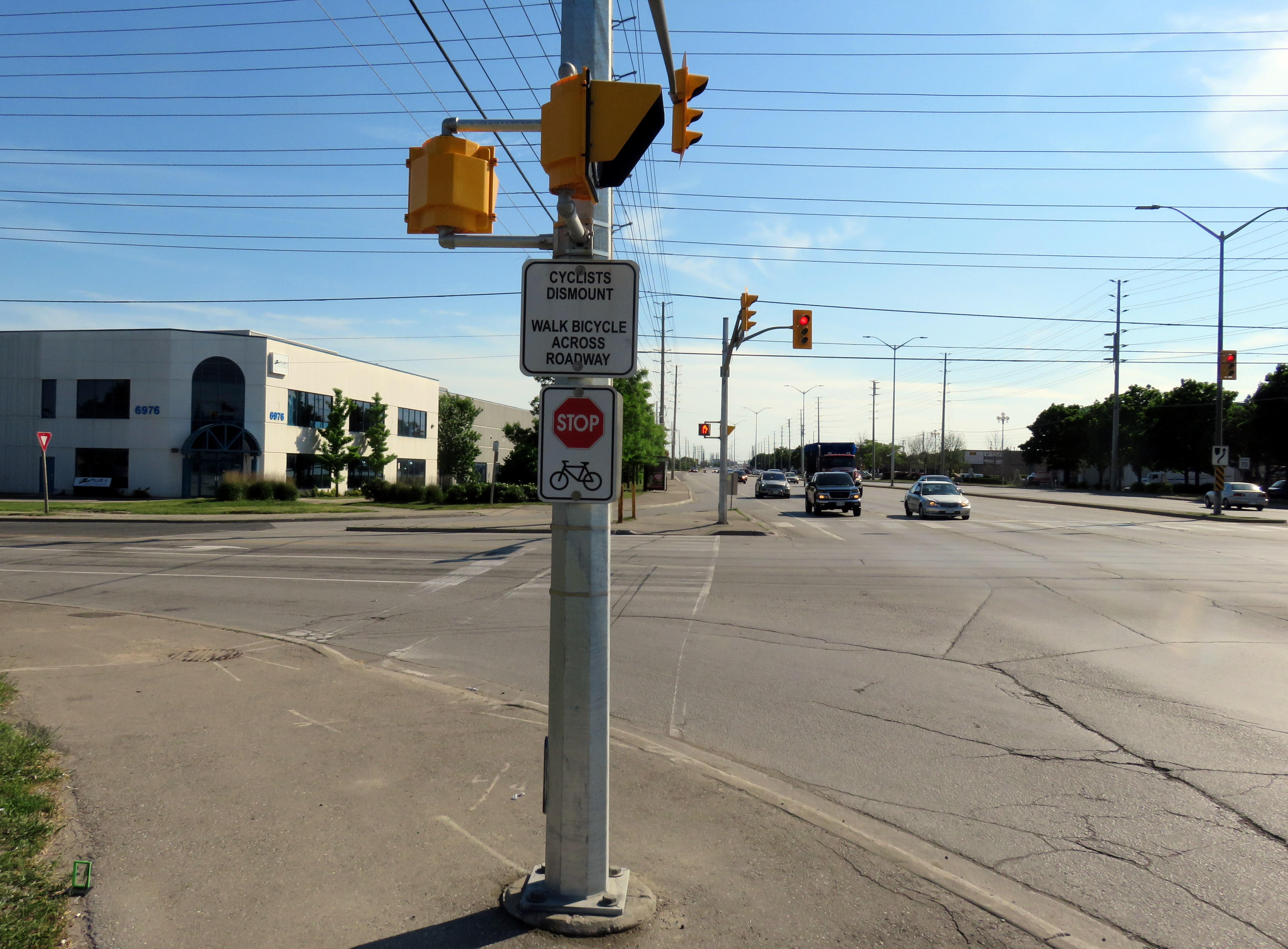
    But these signs also exist where many multi-use trails and paths cross intersections. In suburban municipalities such as Brampton and Mississauga, multi-use paths adjacent to major roadways are preferred over on-street bike lanes (protected or not). But they too, are littered with signs instructing cyclists to stop, get off their bikes, and walk across the intersection, such as the example illustrated below, in Mississauga.

    IMG_2302-001

    The trouble is, the Ontario Traffic Manual (OTM), used by transportation planners and engineers to design roadways and install the appropriate signage, takes a dim view of signage requiring cyclists to dismount when on roadways or on multi-use trails:

    “It is sometimes necessary for cyclists to dismount their bicycle and walk when the terrain or cycling conditions are difficult and no alternatives exist. However, the option of asking cyclists to dismount and walk their bikes should not be relied upon in lieu of adequately accommodating cyclists through appropriate road design.”

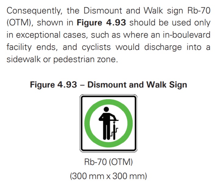
    Book 18 of the OTM (available here as a PDF) states that the “dismount and walk” sign should “be used only in exceptional cases, such as where an in-boulevard facility ends, and cyclists would discharge into a sidewalk or pedestrian zone.” This clearly means that these signs should not exist when a bike route or multi-use trail crosses a driveway or an intersection, but only when the route ends and becomes a sidewalk, or at a pedestrian mall where cycling is not permitted. (Page 118, OTM Book 18, 2013 edition.)

    OTM Book 18 page 118Excerpt from page 118, book 18 of the Ontario Traffic Manual, December 2013 edition
    The OTM also says that “…cyclists usually find it difficult to rationalize why “dismount and walk” restrictions are in place, and conclude that they were a poor, illogical or arbitrary decision. Thus, if facility designs cause cyclists to make what they consider to be unnecessary stops, this will increase the likelihood that they will ignore or disobey traffic controls.”

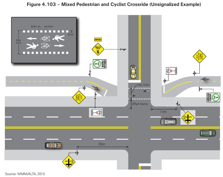
    What the Ontario Traffic Manual does specify, is how signage, road markings, and design should be made to clearly mark crossing locations, warn motorists to watch for cyclists, and to remind cyclists to yield to pedestrians. Figure 4.103 from OTM Book 18, shown below, illustrates how a mixed pedestrian and cyclist route on the side of a road — like those in Brampton and Mississauga — should meet an intersection. While signs warn motorists and cyclists to watch out for each other, and for cyclists to yield to pedestrians, there are no “cyclists dismount” signs to be seen in the diagram.

    OTM Book 18 page 124 .jpg
    Illustration of how a multi-use trail should meet an intersection. Figure 4.103, from page 124, book 18 of the Ontario Traffic Manual, December 2013 edition
    Multi-use trails are an effective way of providing safe cycling infrastructure, especially in the suburbs, where traffic speeds are higher and politics may not make installing bike lanes an easy sell. Traffic engineers have figured out that those ubiquitous “cyclists dismount” signs are not effective and developed designs that instead accommodate cyclists.

    It’s time that municipalities figured this out.

  • New TTC subway stations have great architecture, but they may not attract enough riders

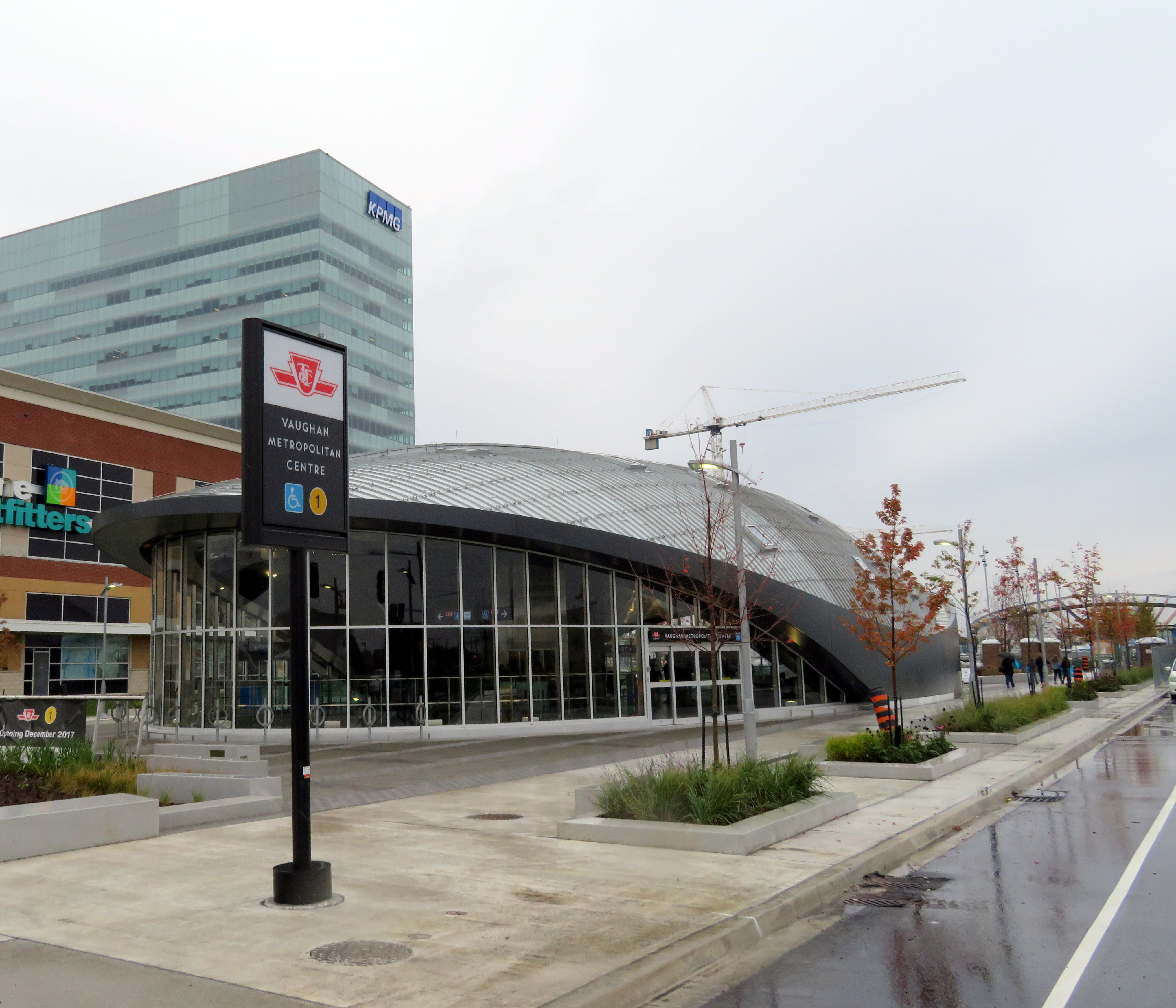
    IMG_4071-001.JPGVaughan Metropolitan Centre Station

    On Saturday, October 28, the Toronto Transit Commission (TTC) held open houses at three of the six new subway stations set to open on December 17, 2017 when the Line 1 subway is extended to York University and Vaughan. It was a fun afternoon with friends, checking out the architecture and the layout of Vaughan Metropolitan Centre,* Highway 407, and Pioneer Village Stations.

    Some of the station architecture was stunning, and I came away feeling much less skeptical about Vaughan’s commitment to building a new urban district around its station. Most stations along the subway corridor will be well-used. However, I remain critical about the issue of transfers between transit agencies, and the usefulness of at least one station.

    (more…)

  • Toronto can do better for cyclists at construction sites

    For years, cyclists in Toronto have not been getting enough respect. In 2011, City Council voted to remove bike lanes on three streets — Jarvis Street, Pharmacy Avenue, and Birchmount Avenue. Major off-road cycling routes are closed for months or years at a time, while additional funds are found to accelerate road closures and construction on the Gardiner Expressway. Mayor Tory is committed to spending $1 billion to maintain the eastern section of the Gardiner, despite low traffic volumes and lost opportunities for the revitalization of the eastern Harbourfront. Yet funding for a comprehensive grid of safe cycling routes remains hard to come by.

    There have been some positive news, however. The new Bloor Street bike lanes — officially a pilot project — between Avenue Road and Shaw Street were recommended for retention by the Public Works and Infrastructure Committee this month. New bike lanes were added on Woodbine Avenue this year. And the Toronto Police Services’ parking enforcement officers have been targeting cars and trucks stopped in bike lanes.

    But one problem that still needs to be addressed is proper messaging at construction sites where bike lanes or general-traffic curb lanes are closed for construction. Too often, cyclists are told to dismount and walk their bikes, despite their status as vehicles, entitled to use the road as any other vehicle. (There are, of course, exceptions such as freeways and some high-speed roads where pedestrians and cyclists are expressly not permitted.)

    For example, cyclists heading west from Danforth Avenue over the Prince Edward Viaduct were greeted with a sign reading “bicycle lane closed – cyclists dismount and use sidewalk.” Next to that sign was a “sidewalk closed” sign, directing pedestrians to the south side of the viaduct.

    https://twitter.com/andreabodkin/status/903318305192247296

    The Ontario Highway Traffic Act says that cyclists are to ride as close to the right of the roadway as practicable. But this does not necessarily mean cyclists must ride right next to the curb either, especially if there are blockages, debris, or other hazards. Motorists must also pass cyclists at a distance of at least one metre, and must wait for a safe opportunity to pass.

    147 (1) Any vehicle travelling upon a roadway at less than the normal speed of traffic at that time and place shall, where practicable, be driven in the right-hand lane then available for traffic or as close as practicable to the right hand curb or edge of the roadway.  R.S.O. 1990, c. H.8, s. 147 (1).

    …

    4) Every person in charge of a vehicle on a highway meeting a person travelling on a bicycle shall allow the cyclist sufficient room on the roadway to pass.  R.S.O. 1990, c. H.8, s. 148 (4).

    …

    (6.1) Every person in charge of a motor vehicle on a highway who is overtaking a person travelling on a bicycle shall, as nearly as may be practicable, leave a distance of not less than one metre between the bicycle and the motor vehicle and shall maintain that distance until safely past the bicycle. 2015, c. 14, s. 42.

    After several complaints, new signage directing cyclists and motorists to yield and share the lane was installed on Danforth Avenue approaching the viaduct.

    On Yonge Street, where construction between Wellington and Richmond Streets has reduced the road to two lanes, “cyclists dismount” signs have appeared as well. While this part of Yonge does not have bike lanes, the signage is still wrong. Cyclists have the same right to take the lane. I complained to a construction worker nearby after spotting these signs, who complained about cyclists riding through anyway, not getting my point.

    IMG_3940.JPGConstruction signage on Yonge Street, south of King Street

    Signs telling cyclists to dismount are generally ignored, like those on multi-use paths in suburban Toronto. They’re placed at intersections and at narrow pinch-points for safety (drivers not expecting cyclists to cross; conflicts with pedestrians on sidewalks), but they are poor substitutes for solutions such as traffic calming, painted cross-rides at road crossings, and gentler, more effective measures to slow fast-moving cyclists, such as speed humps and barriers where necessary. At construction sites, it is far better to remind motorists to yield to cyclists and share the road, than expect cyclists to get off their bikes and walk around the construction zone. That said, “cyclists dismount” signs and enforcement is necessary and useful in pedestrianized zones, such as street festivals and pedestrian malls.

    Signage telling cyclists to dismount at construction areas is lazy, de-legitimatizes cycling, and sends the wrong message to motorists. I hear enough complaints about “cyclists who break all the rules.”

    Of course, it’s best to provide a safe passage for cyclists at construction zones, such as detouring a bike lane around the construction. On Richmond and Adelaide Streets, some building construction sites have shifted the separated bike lane around the site, an encouraging development. Where it’s not possible or feasible to maintain a bike lane through the construction zone, the signage still can be improved.

    At a construction site on Simcoe Street, confusing signage and a poorly marked diversion endangered northbound cyclists, forced out of the separated northbound lane and into oncoming traffic. This resulted in at least one close call.

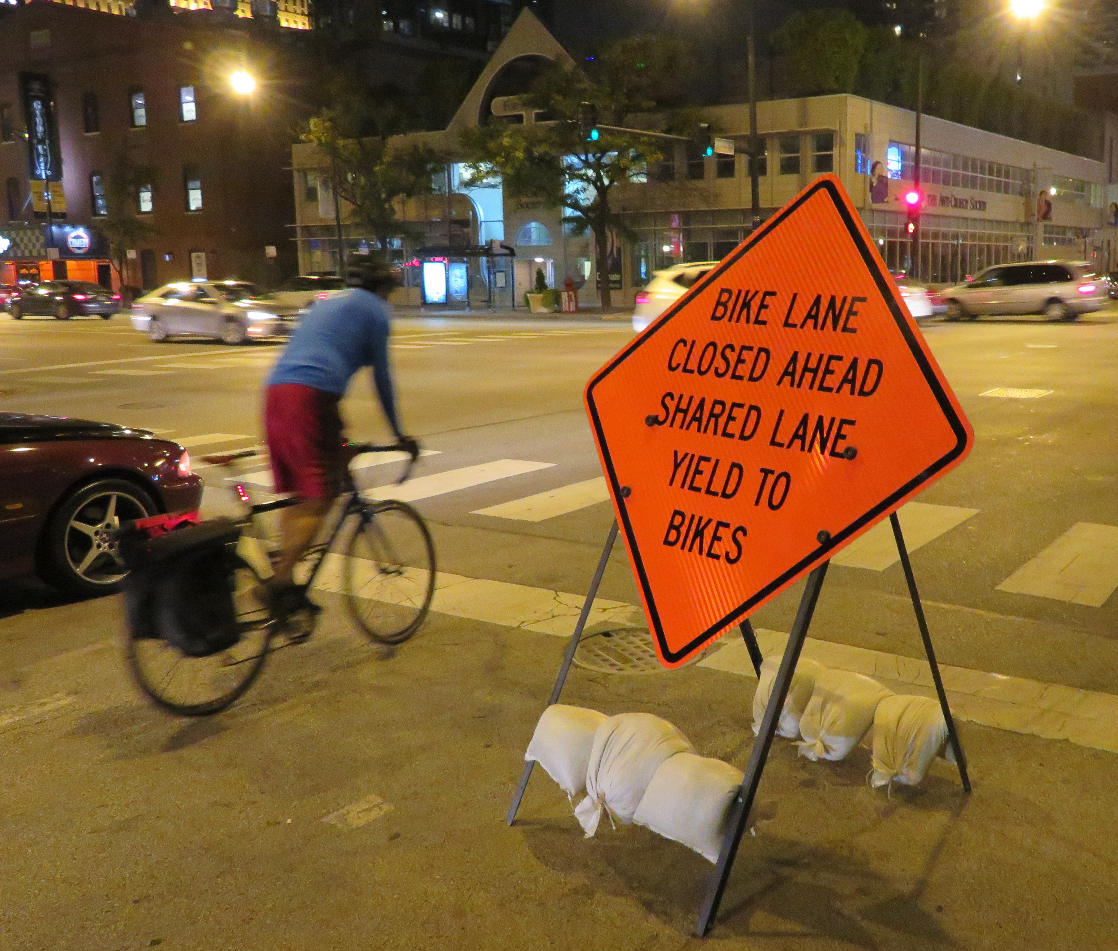
    On a recent visit to Chicago, I came across a sign that delivers the right message. It read: “bike lane closed ahead — shared lane — yield to bikes.” The large orange sign was mounted in the road, in a way that it would be seen by motorists. It also makes it very clear that cyclists not only have the right to use the general traffic lane, it also makes it clear that motorists must give way to cyclists detouring around the closed bike lane. Toronto would do well to follow this example.

    The City needs to develop mandatory standards for bike lane and curb lane blockages, in order to reduce confusion, as well as promote the safety and legitimacy of cycling in this city. It must also enforce those standards vigorously.

    IMG_2904-001.JPGSign in Chicago sends the right message
  • Some answered questions about Toronto’s next subway extension (updated)

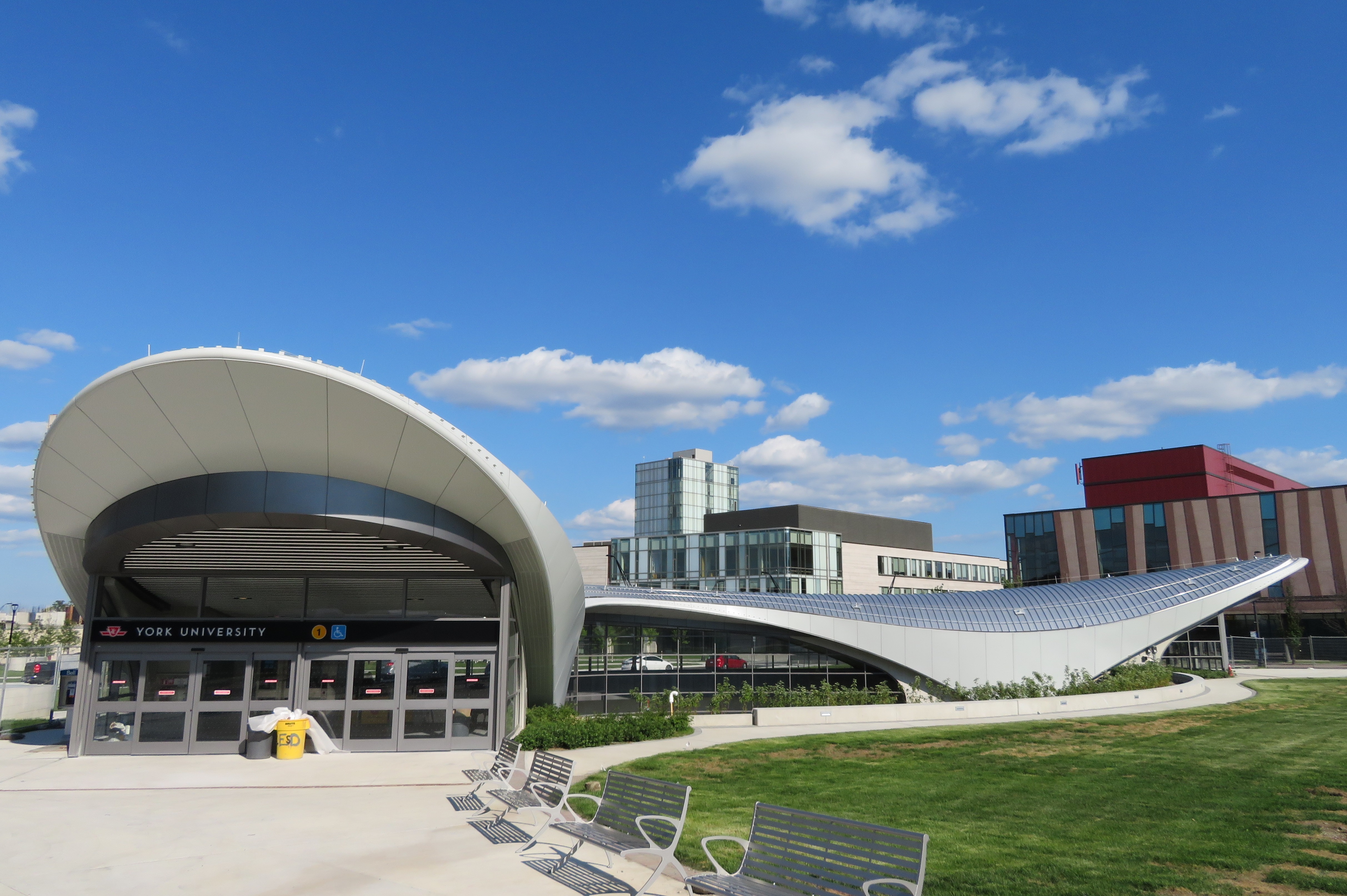
    36354175911_632dc72411_o.jpgYork University Station, August 2017

    Updated October 10, 2017

    Ten months ago, I wrote about some of the unanswered questions about the Toronto Transit Commission’s Line 1 subway extension to York University and Vaughan. At the time, I was concerned about fare integration once the subway opened, especially if suburban GO, YRT, or Brampton Transit passengers headed to York University were required to make new transfers to the subway at Vaughan Centre or Highway 407 Stations.

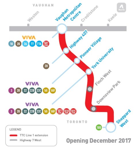
    We now know the day the six new subway stations will open: Sunday, December 17, 2017. We also know how the TTC, York Region Transit, and Brampton Transit will serve the new extension and York University. And today, we also have some indication of how GO Transit passengers will be affected by the changes.

    YRT Subway Map.jpg
    How YRT and Brampton Transit will serve the Line 1 subway extension
    (from the YRT website)

    On Friday, Premier Kathleen Wynne and Transportation Minister Stephen Del Duca will announce a new co-fare between the TTC and Metrolinx services (GO Transit and Union Pearson Express), to take effect in January 2018. (The Star previously reported that the fare change will take place as soon as the subway extension opens.)

    Transfers from GO Transit or UPX to the TTC will cost $1.50 for passengers using Presto cards, a 50% reduction from the full adult fare of $3.00. Passengers transferring from the TTC to GO or UPX will get a $1.50 fare discount. It is expected that the new co-fare subsidies will cost the provincial government $18 million a year. The fare discount will not apply to passengers using fare media other than Presto cards, including TTC tokens, Metropasses, or paper one-way tickets or day passes.

    These are similar to the co-fares offered between GO Transit and transit agencies outside the City of Toronto, including MiWay, York Region Transit, Brampton Transit, and Hamilton Street Railway. However, these co-fares are generally more generous — ranging from $0.60 in Hamilton to $1.00 in York Region.

    There was no news on reducing the fare penalty for transferring between the TTC and connecting local bus systems such as York Region Transit and MiWay.

    For many commuters, the new TTC co-fare is great news, and it represents a good first step towards proper fare integration. It helps to make GO Transit more useful for trips within the City of Toronto, and it helps suburban commuters who use the TTC for part of their trip, such as University of Toronto students, who are located too far a walk to Union Station.

    (John Tory is also claiming a victory, calling it “a step in the right direction” for his SmartTrack proposal. At this point, “SmartTrack” is little more than a GO/TTC fare agreement and a few new proposed GO stations.)

    However, this could also affect York University students as well. Previous plans for the Line 1 subway extension saw GO Transit buses serve the Highway 407 station, requiring a transfer to the subway to get to campus. York University has been long eager to remove the buses from the York Commons area, which GO and the TTC use as their campus terminals.

    York Region Transit will continue to operate many bus routes into York’s campus, on the Ian Macdonald Boulevard ring road, and Brampton Transit’s Queen Züm bus route will remain on campus. Their university-bound passengers won’t be required to transfer to the subway and pay an additional fare. But it appears, for now, that GO Transit passengers will have to make a connection, costing $1.50 each way. (This will not be the case for in the short term, see update below.) This will also apply to GO train customers on the Barrie Line who currently use York University Station, if that station closes as planned when the subway connection at Downsview Park opens.

    This will be a blow for GO Transit customers who commute to and from York University, accustomed to a one-seat ride direct to campus. But it will be an improvement for GO operations on the Highway 407 corridor, with buses no longer stuck in traffic in the Keele Street and Steeles Avenue area. It will also benefit GO Transit passengers who aren’t headed to York University. Providing good public transit is not be about giving everyone a one-seat ride.

    Despite these benefits, if GO Transit serves Highway 407 Station as planned, it will impact many passengers with a new transfer and an additional $3.00 cost per day. I’m curious what GO Transit’s messaging and final plans will be, because they have yet to communicate their new schedules and connections when the subway extension opens. Hopefully, we will learn the answers to the rest of those questions soon.


    Update: According to the CBC and Metrolinx’s Anne Marie Aikins, there are now no immediate plans to re-route GO Transit buses from York University. at least in the short term. This is a short-term solution, however, because the Highway 407 station was designed with a large terminal for GO Transit buses, and York University has been vocal about wanting the hundreds of GO and TTC buses a day out of the York Commons area.

    I don’t see this as a long-term solution, however. Hopefully Metrolinx and the TTC can figure out how to best serve York University passengers, though that should have been figured out a long time ago. After all, the subway was originally supposed to open by the end of 2015.

  • Mount Pleasant: New Urbanism that almost works

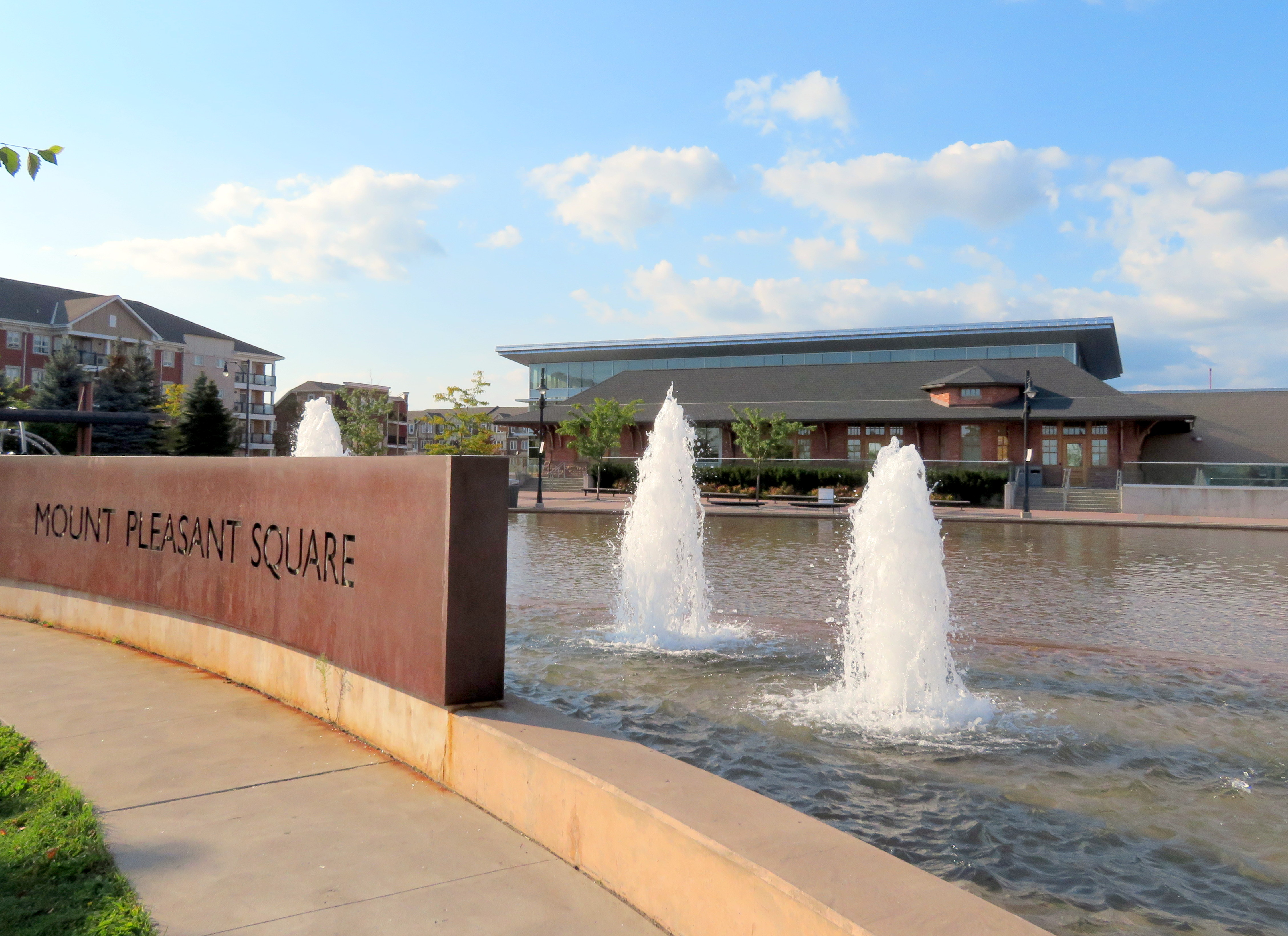
    IMG_2706-001Mount Pleasant Square, Brampton

    A few weeks ago, I visited Cathedraltown, a subdivision in north Markham built in the new urbanist style. Cathedraltown made the news thanks to a controversial metallic sculpture of a cow installed in a parkette. (Last week, Markham City Council voted to move the sculpture.)

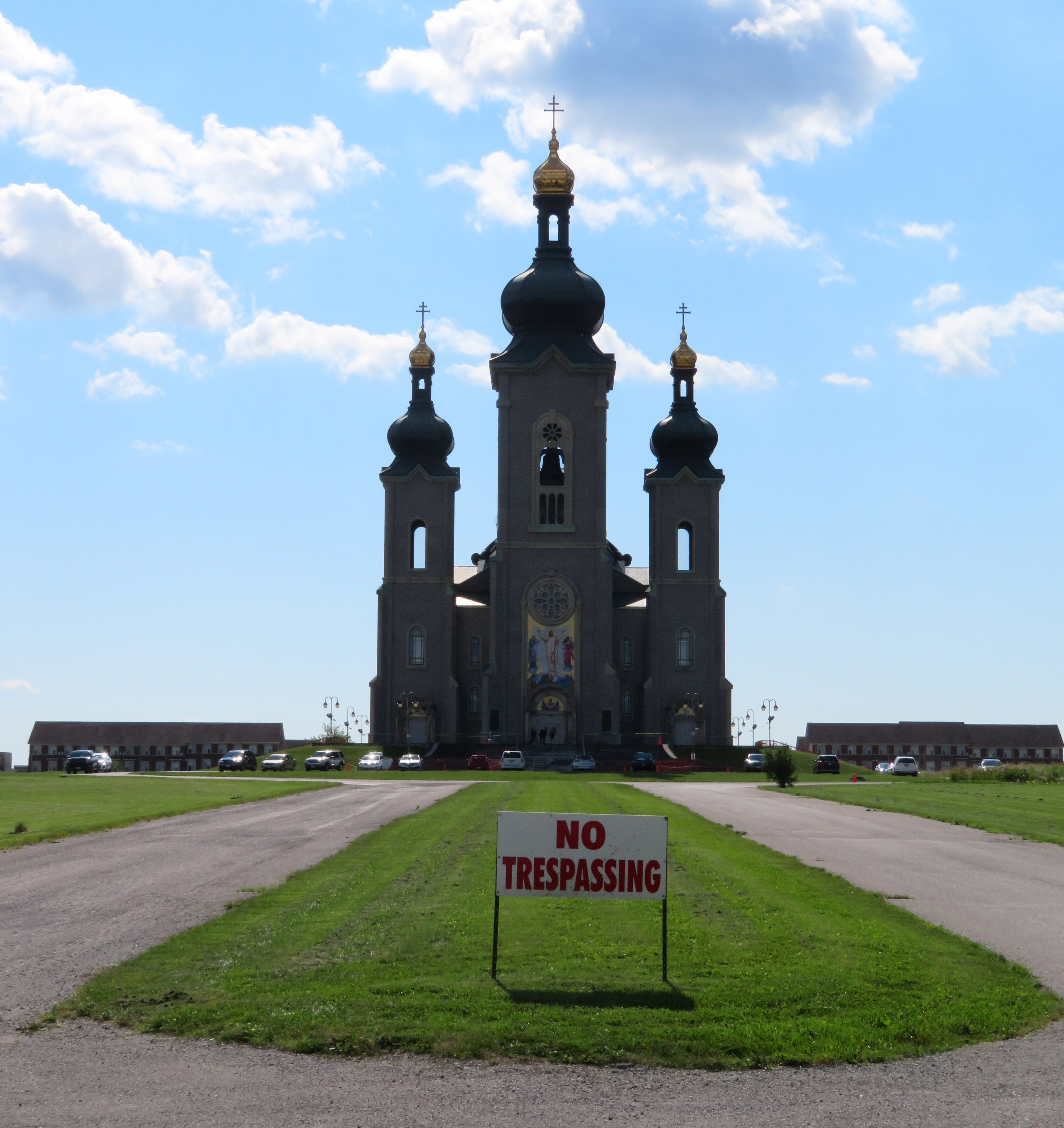
    I came away disappointed by Cathedraltown. Despite a dense built form, and a main street lined with storefronts, it did not live up to the new urbanist promise: it was still a very car-centric subdivision, without the retail, nor the density required to make it a walkable community. The central focus is a Slovak-Catholic cathedral, recently re-opened after lengthy dispute between the development company and religious leadership. “No trespassing” signs still stand in front of the imposing church. Transit connections are poor, making a car virtually necessary to get even to nearby employment areas.

    Mount Pleasant, in Brampton, fares somewhat better, despite some similar issues to Cathedraltown. What distinguishes it though are superior transit connections, and a better-programmed central focus.


    Satellite view of Mount Pleasant via Google Maps 

    Mount Pleasant started off as a small settlement between Brampton and Georgetown, where Highway 7 and 3rd Line West (later Creditview Road) crossed the Canadian National railway line between Toronto and Guelph. For most of its existence, it was little more than a collection of houses, two churches, a motel and a service station. By the 1960s, the local trains no longer served the flag stop there, and Highway 7 — now Bovaird Drive — bypassed the hamlet on a new railway overpass in the 1960s, also severing Creditview Road.

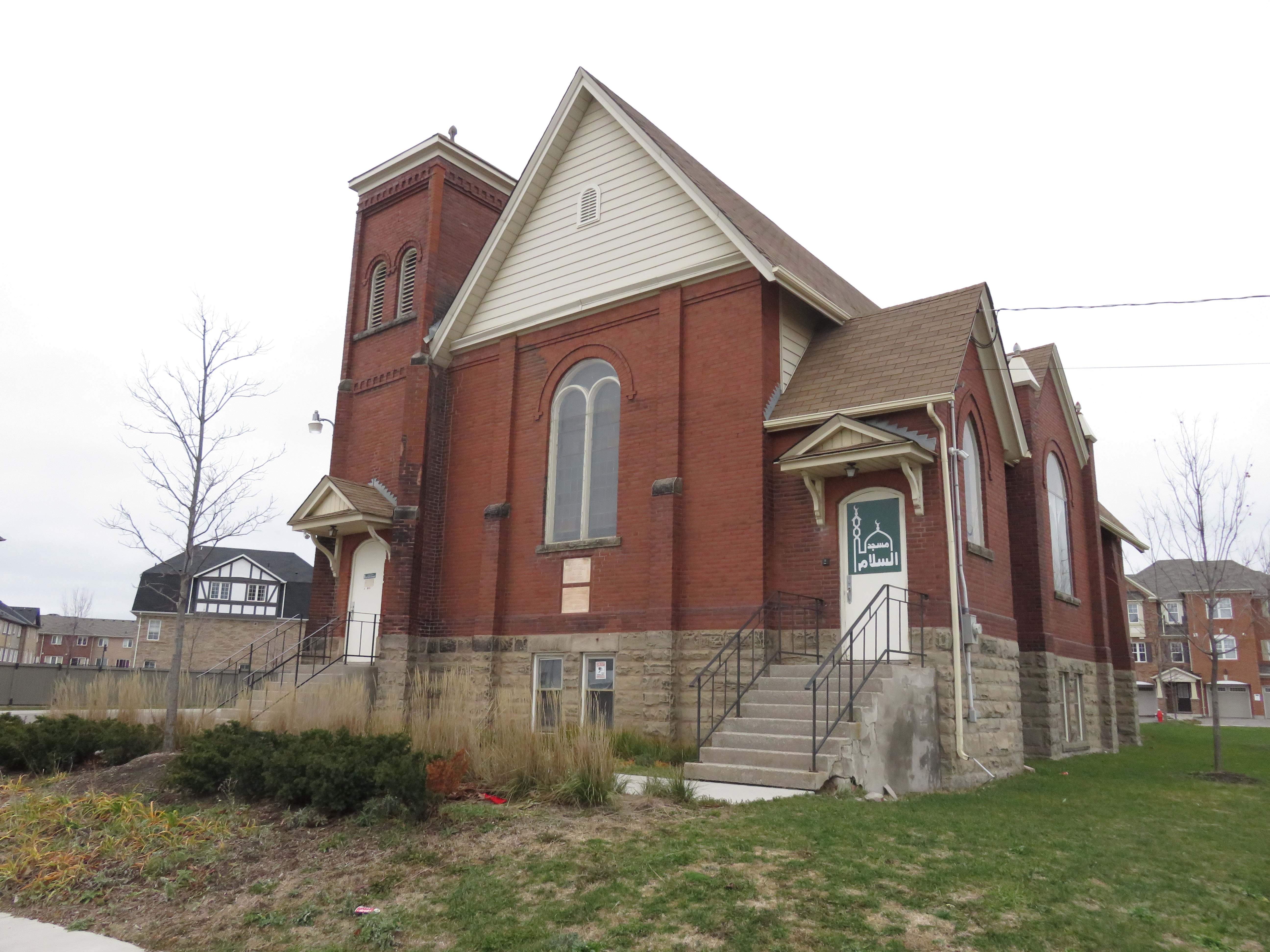
    A few buildings — two houses and a former Presbyterian church, now a mosque — remain at the former crossroads. New subdivisions now surround the historical community.

    IMG_6725Mount Pleasant’s old Presbyterian church is now a mosque.
    Mount Pleasant GO Station opened in 2006, just as northwest Brampton was transforming from farmland to new subdivisions. The GO Station was built like any other in Toronto’ suburbs: a large parking lot, bus loop, and pick-up and drop-off area, with easy access to Bovaird Drive. But on the north side of the tracks, the City of Brampton, and the developer, Mattamy, tried something different.

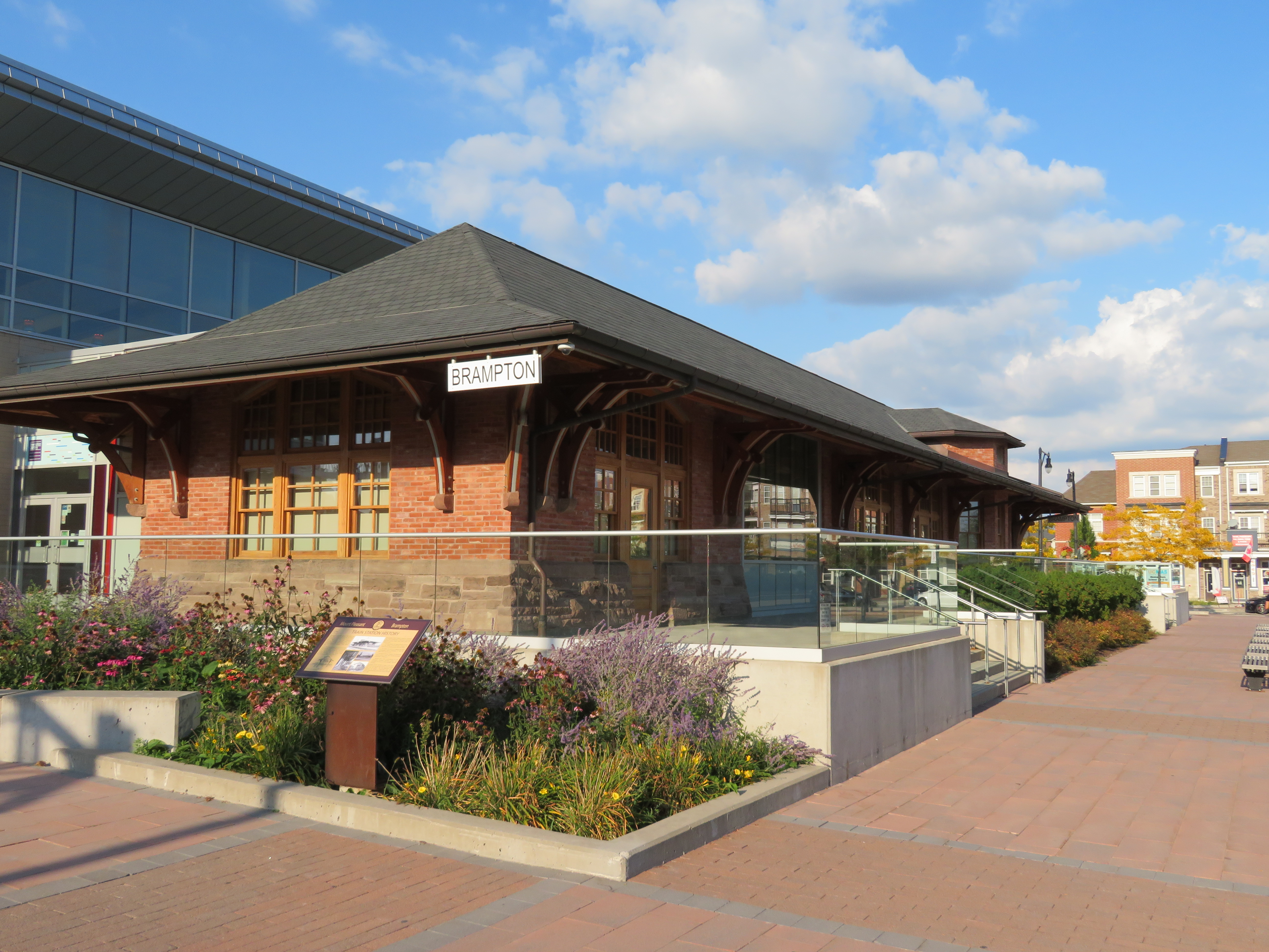
    At the core, the City of Brampton built a new library branch that incorporates the dismantled Canadian Pacific Railway station that used to stand on Queen Street in Downtown Brampton. (The station was moved in 1980 to a then-rural site on Creditview Road when it was threatened by demolition by the CPR. But the station building was left to rot before heritage conservationists carefully dismantled the structure.) Behind the library is a public school. In front, there’s a public square that includes a small playground, as well as a reflecting pond that’s a skating rink in the winter.

    IMG_2709-001The Brampton Public Library incorporates the former Brampton CPR Station, rebuilt here at Mount Pleasant Village

    To the west of the square are several low-rise apartment buildings, the sort of “missing middle” housing needed in Toronto’s established urban neighbourhoods. To the east are several retail/residential blocks, the sort of mixed use buildings that are uncommon in new subdivisions. The storefronts are all mostly occupied with businesses serving the local neighbourhood, such as hair salons and spas, a convenience store, a dentist’s office, and a restaurant. To the south are entrances to the GO Station and the bus loop for GO and Brampton Transit buses.

    (more…)

  • How two Ontario cities are re-imagining abandoned railway relics

    Brockville and St. Thomas are two small Ontario industrial cities that wouldn’t normally attract much attention. But both communities are working on remarkable projects that re-purpose former railway infrastructure to create interesting public spaces that don’t just lure out-of-town visitors, but add a significant asset to be enjoyed by the entire community. The St. Thomas Elevated Park and the Brockville Railway Tunnel are the type of local, community-driven projects that I can get excited about.

    St. Thomas likes to call itself the Railway Capital of Canada. One hundred years ago, five separate railway companies served the city. The Canada Southern (CASO) Railway, later purchased by the Michigan Central Railroad (which became part of the New York Central empire), built its headquarters and shops here; its double-tracked corridor was the fastest route between Buffalo and Detroit. St. Thomas was a stop on the London and Port Stanley Railway, a busy electric railway that ran regular passenger services until 1957. On the edge of town is the Jumbo monument, near the site where the famous Barnum and Bailey circus elephant was killed during a train stop.

    IMG_1330-001Jumbo Monument, at the westerly entrance to Downtown St. Thomas
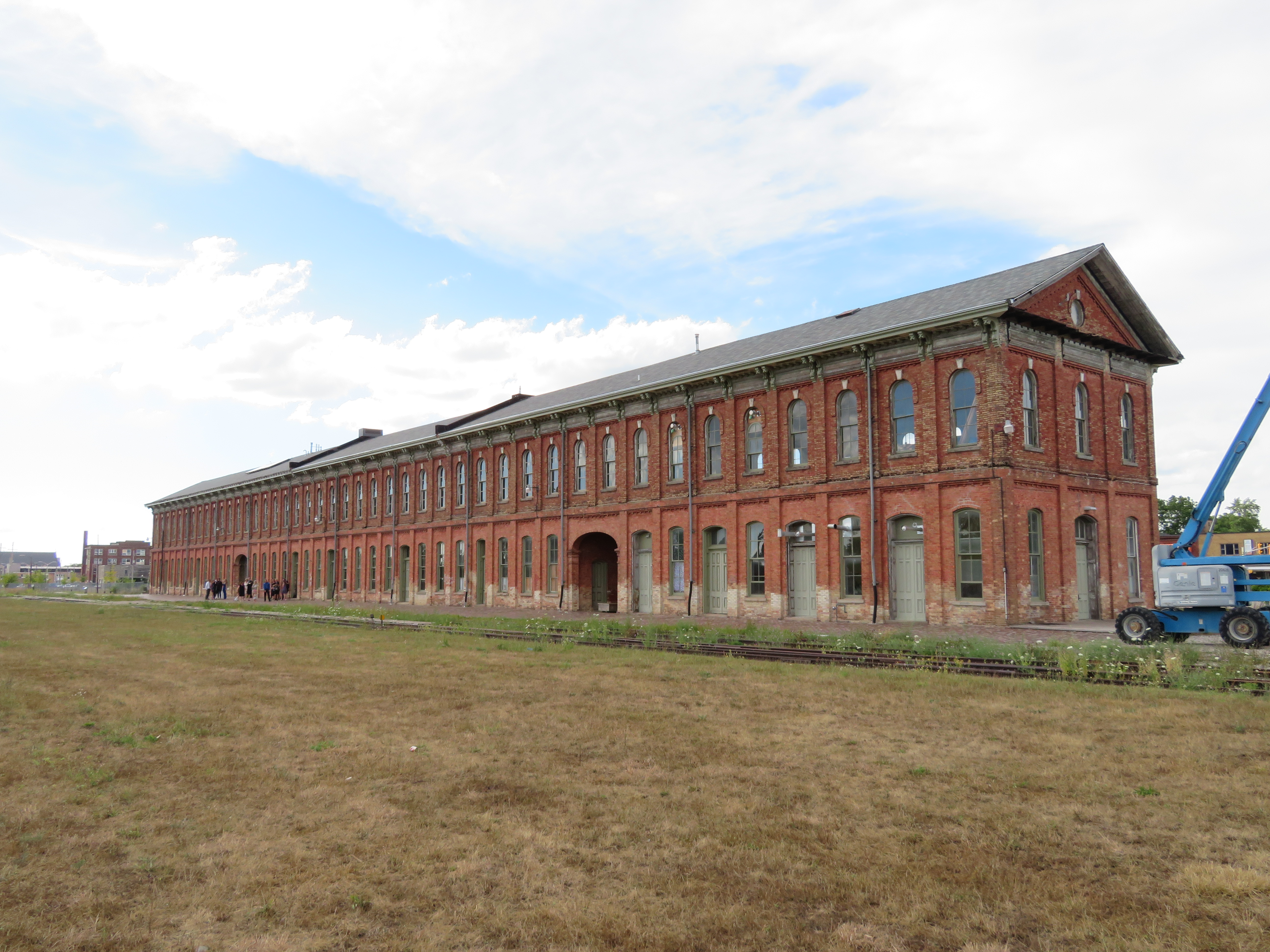
    IMG_1310-001The 1873 Canada Southern Station. The tracks it once served have disappeared.
    Today, most lines into St. Thomas are abandoned, including the once-mighty Canada Southern; major rail customers such as Ford Motor Company closed local factories. The last passenger train, Amtrak’s Niagara Rainbow, departed from St. Thomas in 1979. The Port Stanley Terminal Railway runs tour trains along part of the old L&PS route, but its trains — for now — only board in Port Stanley.

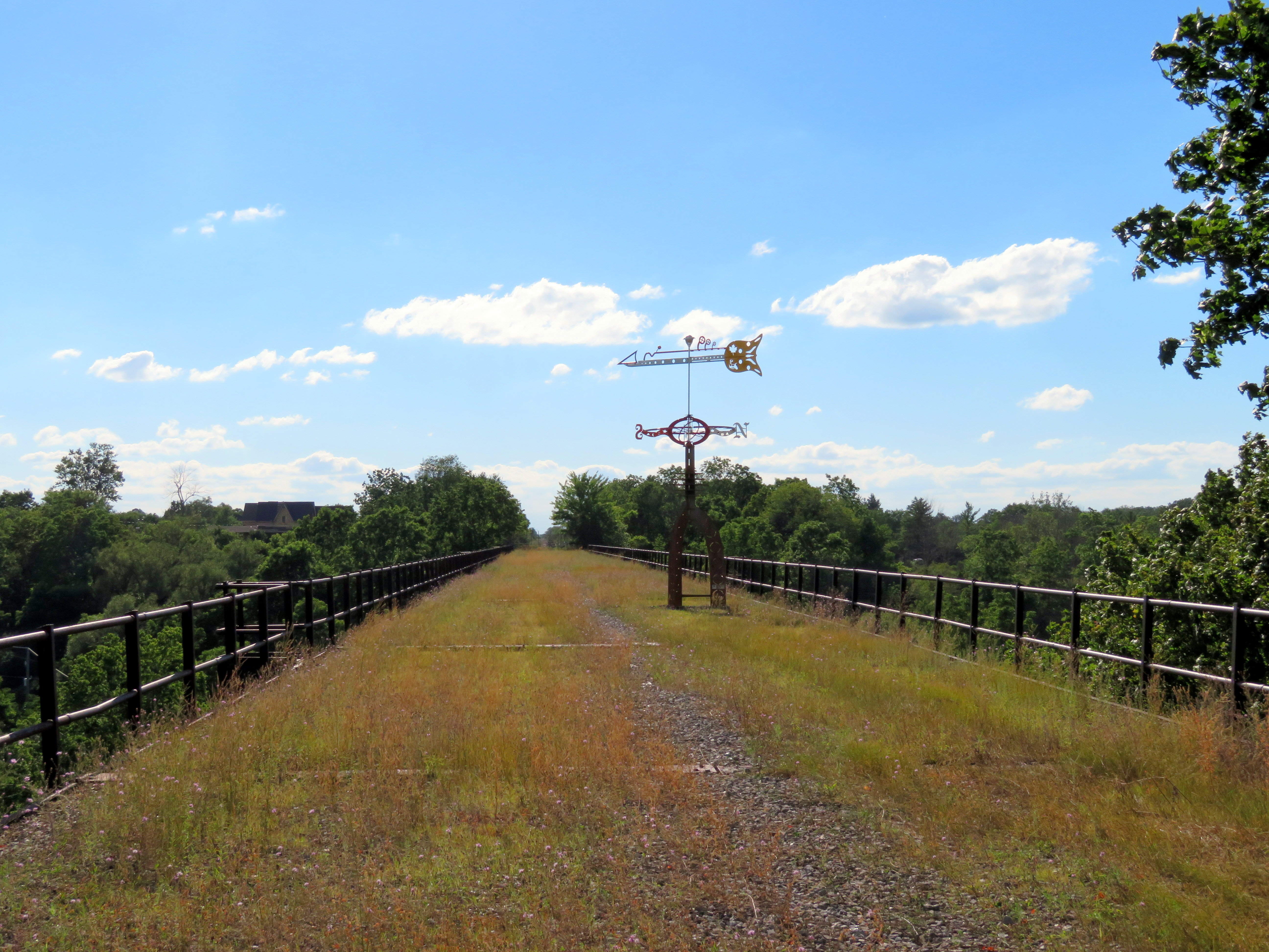
    Despite the loss of the railways, St. Thomas has retained much of its railway heritage. The Elgin County Railway Museum has made its home in the old Michigan Central shops. The station building still stands too — built in 1873, it is one of the longest stations in Canada, extending 108 metres. It was recently renovated and houses offices and retail businesses. A replica of the LP&S station was built downtown, with the hopes of accommodating Port Stanley-bound tour trains. Just west of Downtown St. Thomas is the Kettle Creek Viaduct, which is slated to become a new signature park.

    IMG_1326-001Kettle Creek Viaduct, the future St. Thomas Elevated Park, in August 2017

    (more…)

  • The ravine run around

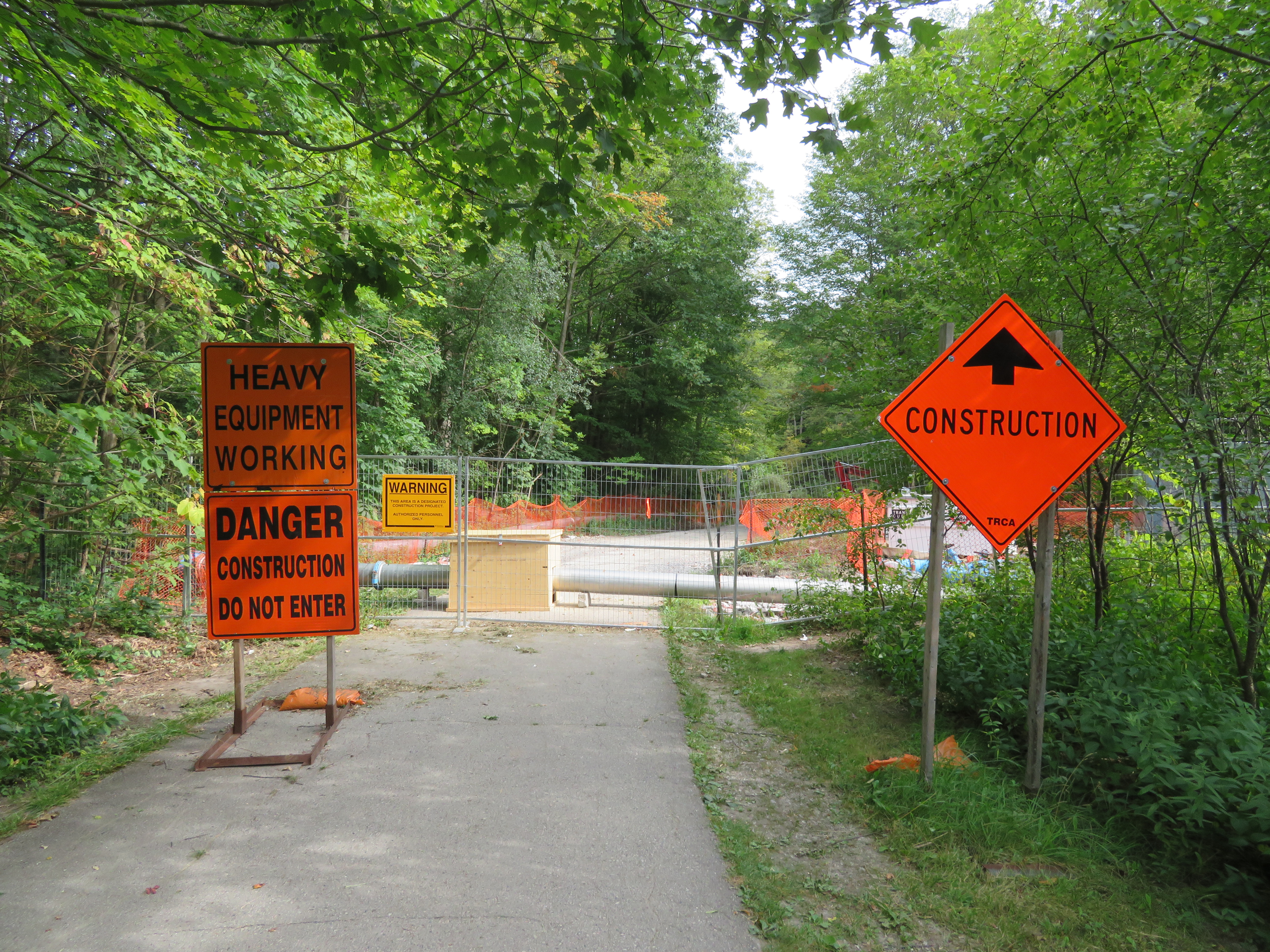
    IMG_2475-001Wilket Creek trail closure, September 2017
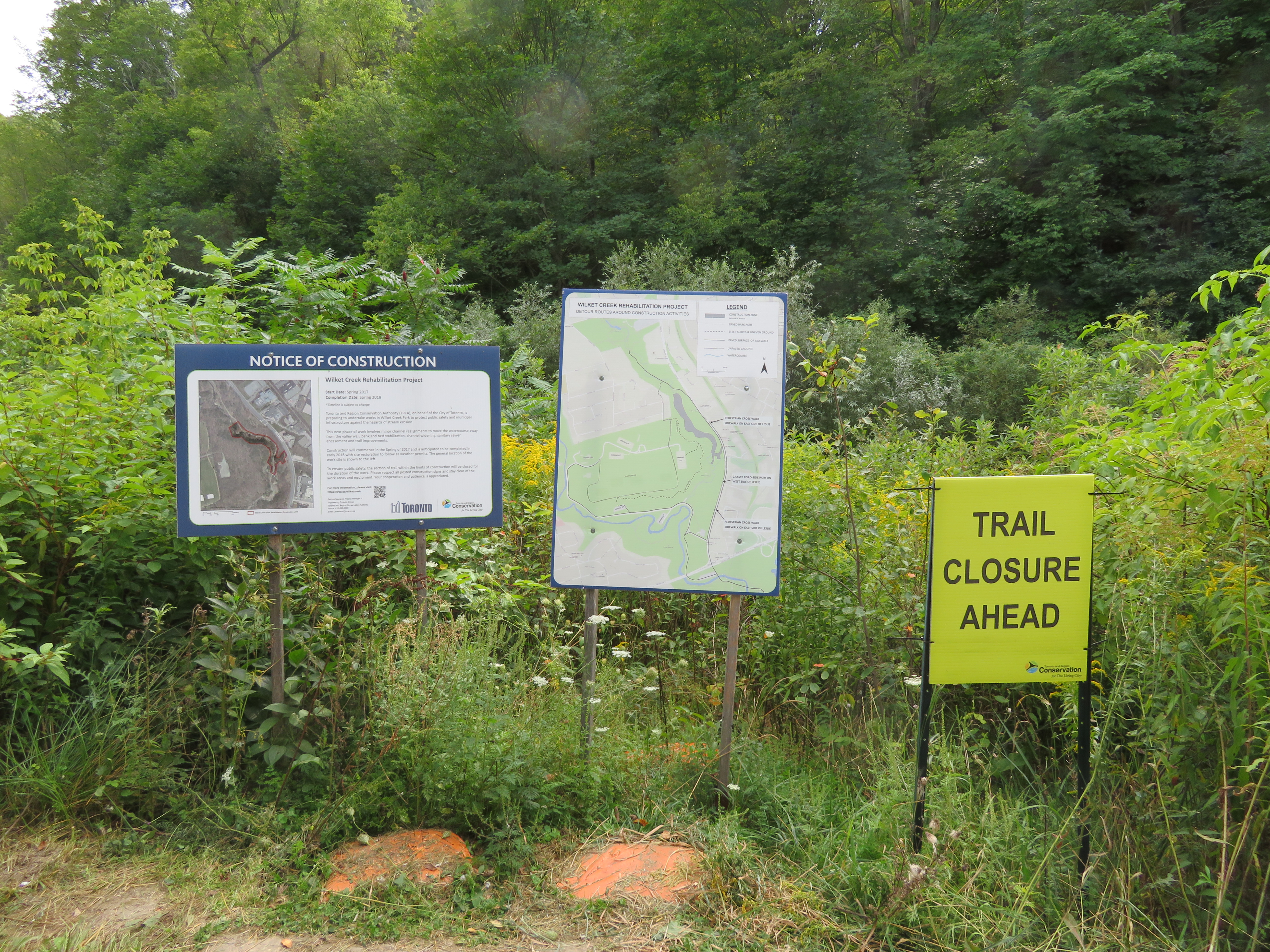
    Last week,  my wife and I went for a walk through the Toronto Botanical Gardens, Edwards Gardens, and Wilket Creek Park, all part of Toronto’s wonderful and extensive ravine system. The ravines are one of Toronto’s greatest assets, and many are connected by multi-use trails, allowing pedestrians and cyclists to experience nature, close to home. Some trails, like the Lower Don, are also important commuter routes for those who walk or cycle to school or work.

    Unfortunately, several of these trails are closed for long periods for construction, and they do not get the same attention that roads and highways get.

    The Wilket Creek Trail, between Edwards Gardens and Sunnybrook Park, has been closed since Spring 2017, and will remain closed until Spring 2018. The Toronto Region Conservation Authority (TRCA) is repairing damage caused by erosion, and restoring the local ecosystem. The same trail was closed two years ago for similar construction work.

    The pedestrian detour on Leslie Street is straightforward, and does not deviate too far from the route. However, Leslie Street is busy and motorists drive at high speeds, so it is not a good safe route for cyclists. To the City of Toronto and TRCA’s credit, at least, the detours are well mapped and construction notices are signed well in advance. (I’ve experienced trail closures without any warnings or suitable marked detour routes.)

    IMG_2476-001Advance warnings and a detailed detour map on the Wilket Creek Trail
    Further south, the Lower Don Trail between Pottery Road and the footbridge at Riverdale Park will re-open on September 23, 2017, fourteen months late. That work was done to replace an underpass at a disused rail corridor owned by Metrolinx.

    As Metro reporter David Hains points out, that re-opening was re-scheduled several times between July 2016 and August 2017 — unexpected soil conditions and wet weather were blamed for the delays.  Pedestrians and cyclists were directed to use either Broadview Avenue or Bayview Avenue to get around the closure; both are busy roads, and Broadview Avenue is at the top of a steep grade from the Don Valley.

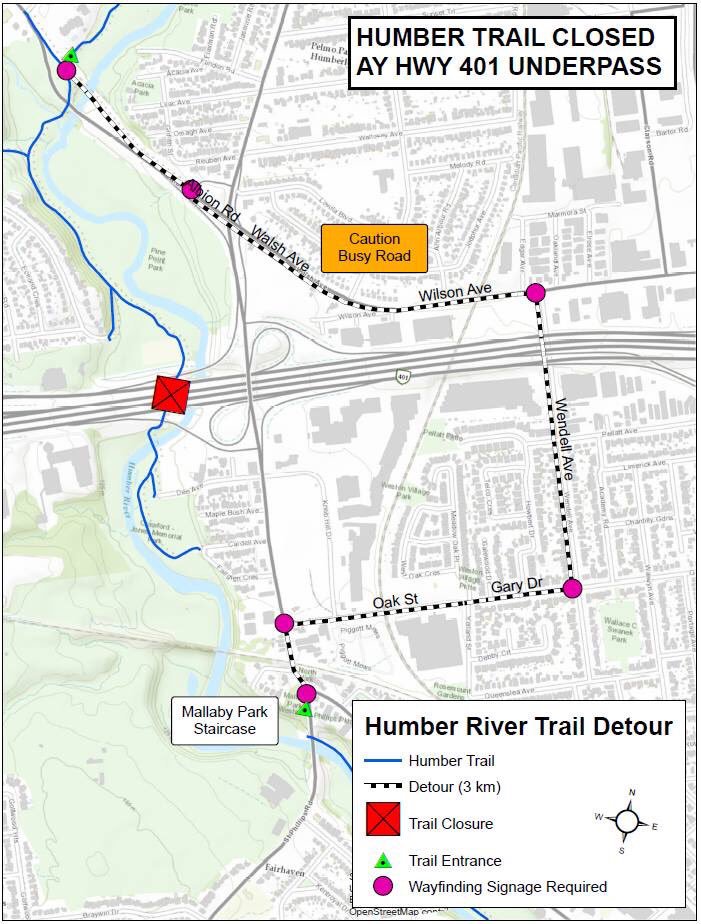
    Other major closures included the Humber River Trail under Highway 401 near Weston Road, which was closed for several months in 2016 so that trail users would not be in the way of construction vehicles. The suggested detour, a 3 kilometre long circuitous route, followed Wilson Avenue, a busy suburban road.

    This year, the Etobicoke Creek Trail under Highway 401 in Mississauga is also closed for two years for bridge work. There are no safe alternatives for crossing Highway 401 in that area.

    Humber.jpgThe circuitous and dangerous 2016 Humber River Trail detour at Highway 401. Source: MTO.
    The long and dangerous closures of major pedestrian and cycling routes can be compared to the way road repairs are prioritized. Mayor John Tory announced $3.4 million to speed up construction on the Gardiner Expressway in 2015, when the elevated highway was reduced to two lanes in each direction from three. In August, Tory announced additional funds to speed up watermain and streetcar track construction on Dundas Street between Yonge and Church Streets, perhaps not coincidentally a route many city councillors drive to get to City Hall.

    If only there were some additional money and attention given to projects affecting pedestrians and cyclists in Toronto. It would also be nice to ensure any detours were well signed, and made as safe and comfortable as possible.

  • The streetcar returns to Detroit – but who benefits?

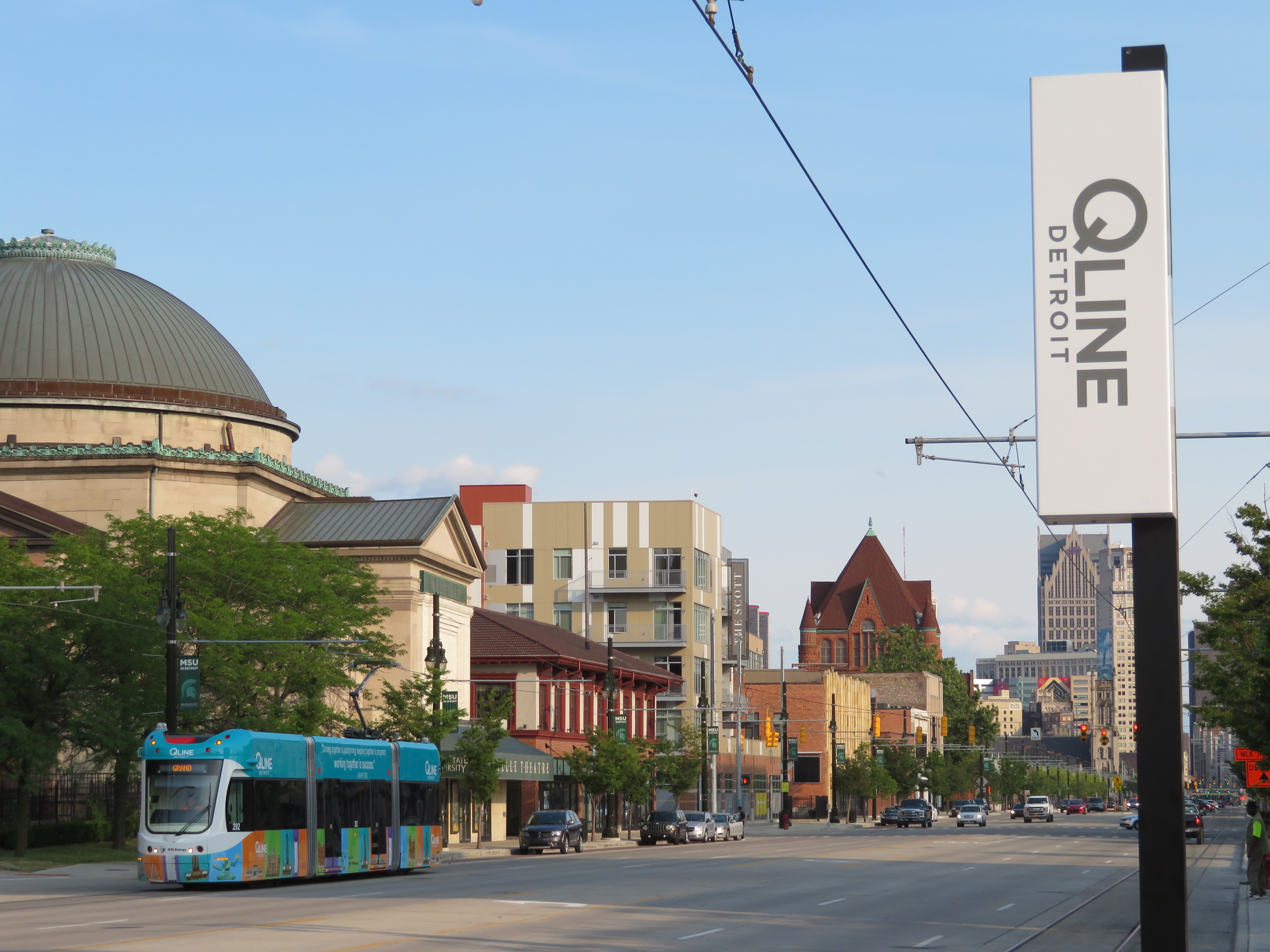
    IMG_1489-001Woodward Avenue at Mack Avenue, August 2017

    I grew up in Brampton, a suburb of Toronto. Our family could not justify long, expensive vacations, but we did make several trips to Detroit and the region, usually to visit the Henry Ford Museum and Greenfield Village. We’d stay at a hotel outside Detroit, usually one with a swimming pool. Besides the museum visit and the pool, my parents would usually include a stop at an outlet mall. We’d also drive through Detroit itself, sparking my enduring fascination with the city.

    Since my first visit in the mid-1980s, the Hudson’s Department Store has been demolished, the Michigan Central Station has been permanently closed and allowed to deteriorate, and several downtown skyscrapers have closed and been abandoned. The city itself continued to lose population as more auto plants closed in the city and surrounding suburbs, and city services declined.

    But on recent trips, on my own or with friends, we started to see the beginnings of what looked like a comeback. New downtown baseball and football stadiums, followed by new office buildings, the re-opening of the long-abandoned Book-Cadillac and Fort Shelby Hotels, the opening of the Detroit Riverwalk and Dequindre Cut multi-use paths, and new residential development Downtown and Midtown.

    On the last trip to Detroit, my wife and I stayed downtown, at a hotel in the David Whitney Building, a formerly-abandoned office tower. We walked around Downtown Detroit and Eastern Market, visited the famous Art Deco Fisher Building, and went to several museums, including the Charles H. Wright Museum of African-American History, and the Detroit Historical Museum, both of which had special exhibitions marking the 50th anniversary of the 1967 Detroit Rebellion (also known as the 12th Street Riot). We ate at great local restaurants as well.

    And I went back to the Henry Ford Museum and Greenfield Village, both of which were as fun and as interesting as I remember.

    We also took the new QLine Streetcar. It was a fun ride, and I’m happy to report that the service was well used by both residents and tourists alike. But I have some serious concerns as well.

    (more…)

  • We came for the cow, but we had no reason to linger in Cathedraltown

    IMG_1226-001

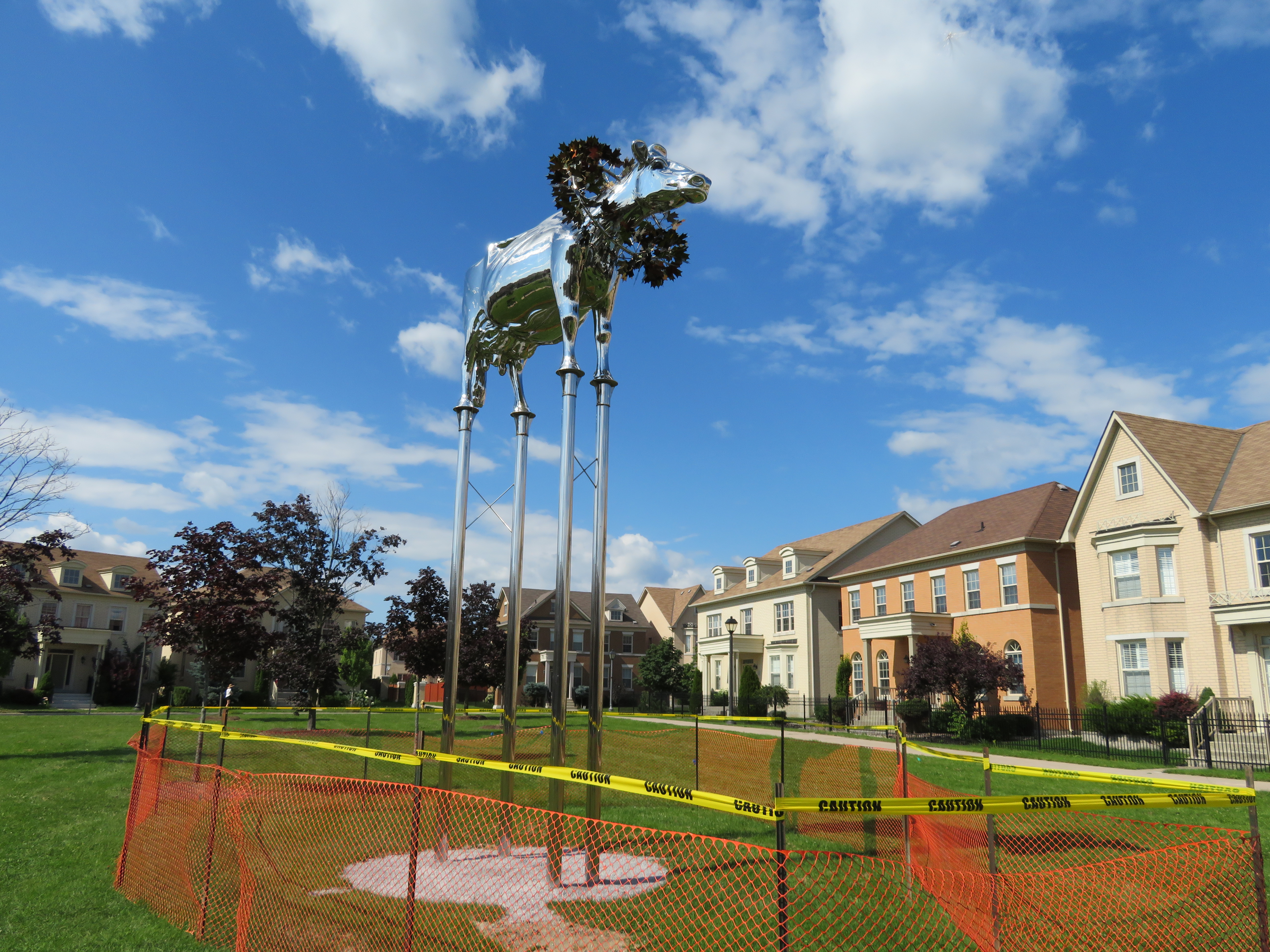
    Last weekend, a few of us visited Cathedraltown, a newer subdivision near Highway 404 and Elgin Mills Road in northern Markham. We came to see ‘Brookview Tony Charity,’ a new chrome sculpture of a prize-winning dairy cow that was once the pride of a hobby farm that was on the site before it was developed. The metallic bovine made the news as local residents opposed the sculpture, located in an otherwise empty and unremarkable Cathedraltown parkette.

    One homeowner objected as the cow, raised on stilts and wearing a prize garland, faced the nearby cathedral, likening it to the golden calf from The Ten Commandments: “I come from a Christian background and this is actually one of the worst things you can do, is to raise a calf; it’s facing the cathedral.”

    IMG_1230-001

    Ironically, the NIMBY rage only drew attention to the statue; later that week, it became a local tourist attraction. On Saturday, my wife, a good friend, and I went up to Markham to have a look at it ourselves.


    Cathedraltown

    Markham, on Toronto’s northern boundary, isn’t simply a cookie-cutter 905 suburb. The city of over 325,000 people is known for its high-technology sector, Pacific Mall and many other Chinese-Canadian shopping districts, and several heritage districts. The historic settlements of Unionville and Markham are well-preserved and vital, with interesting shops and restaurants. North of the old village of Markham, Markham Heritage Estates is a surreal subdivision dedicated to preserving old houses that would otherwise be demolished; it looks a little bit like a Tim Burton movie set.

    In recent years, Markham has tried to urbanize some of its suburban landscape. Highway 7 is lined with midrise condominium towers and office buildings. Cornell, on Markham’s eastern edge, was Canada’s first “new urbanist” subdivision, intended to promote a less car-dependent lifestyle with higher densities, local retail and mixed use development, and street-focused parks. The new Downtown Markham development, a work in progress, is a mix of office, higher-density residential, retail, and institutional development near GO Transit’s Stouffville corridor and a new VIVA bus rapid transit line.

    And then there’s Cathedraltown. Like Cornell, it’s a “new urbanist” development; it even has a main street lined with storefront. But it doesn’t quite work, at least not yet.

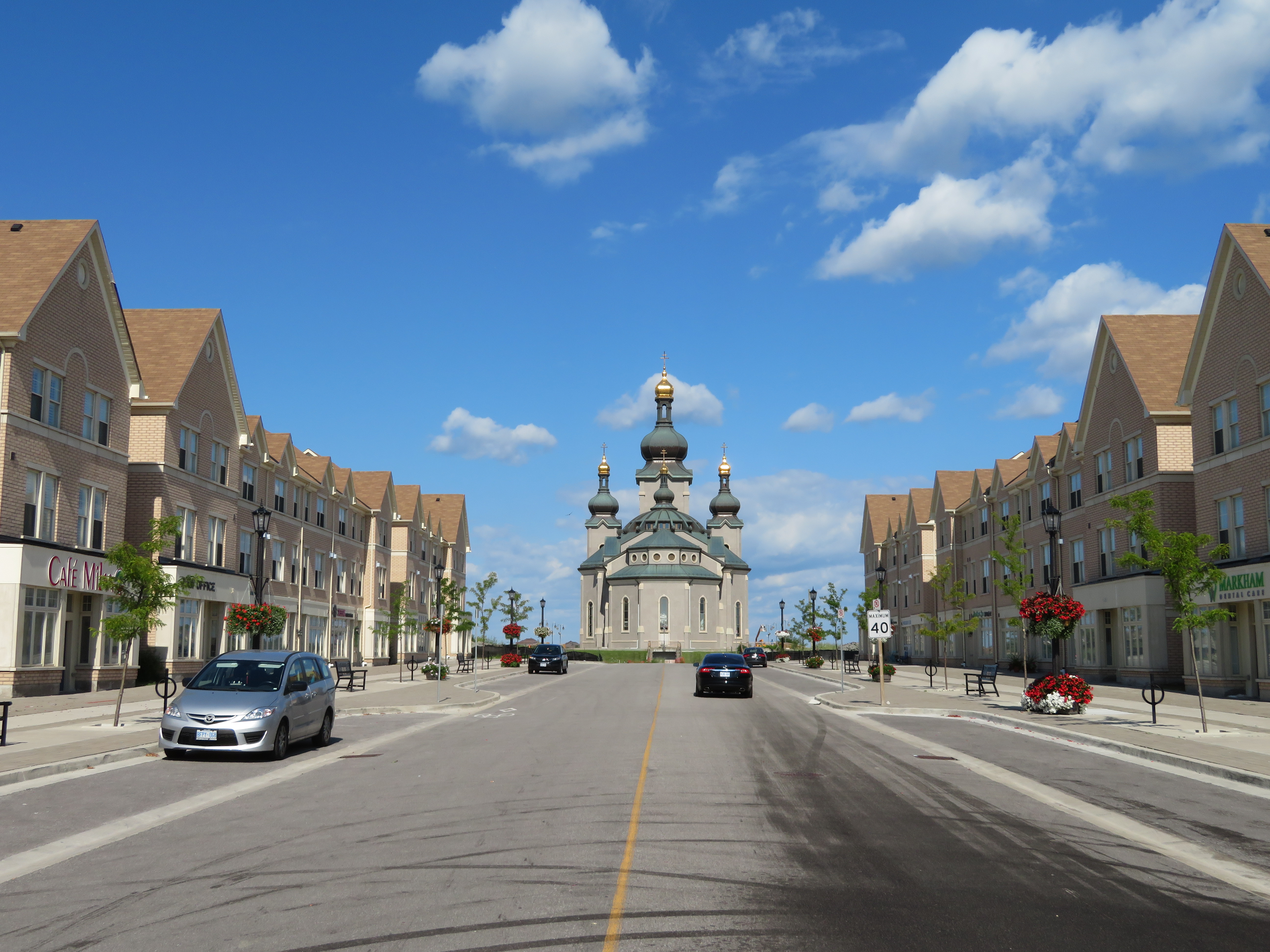
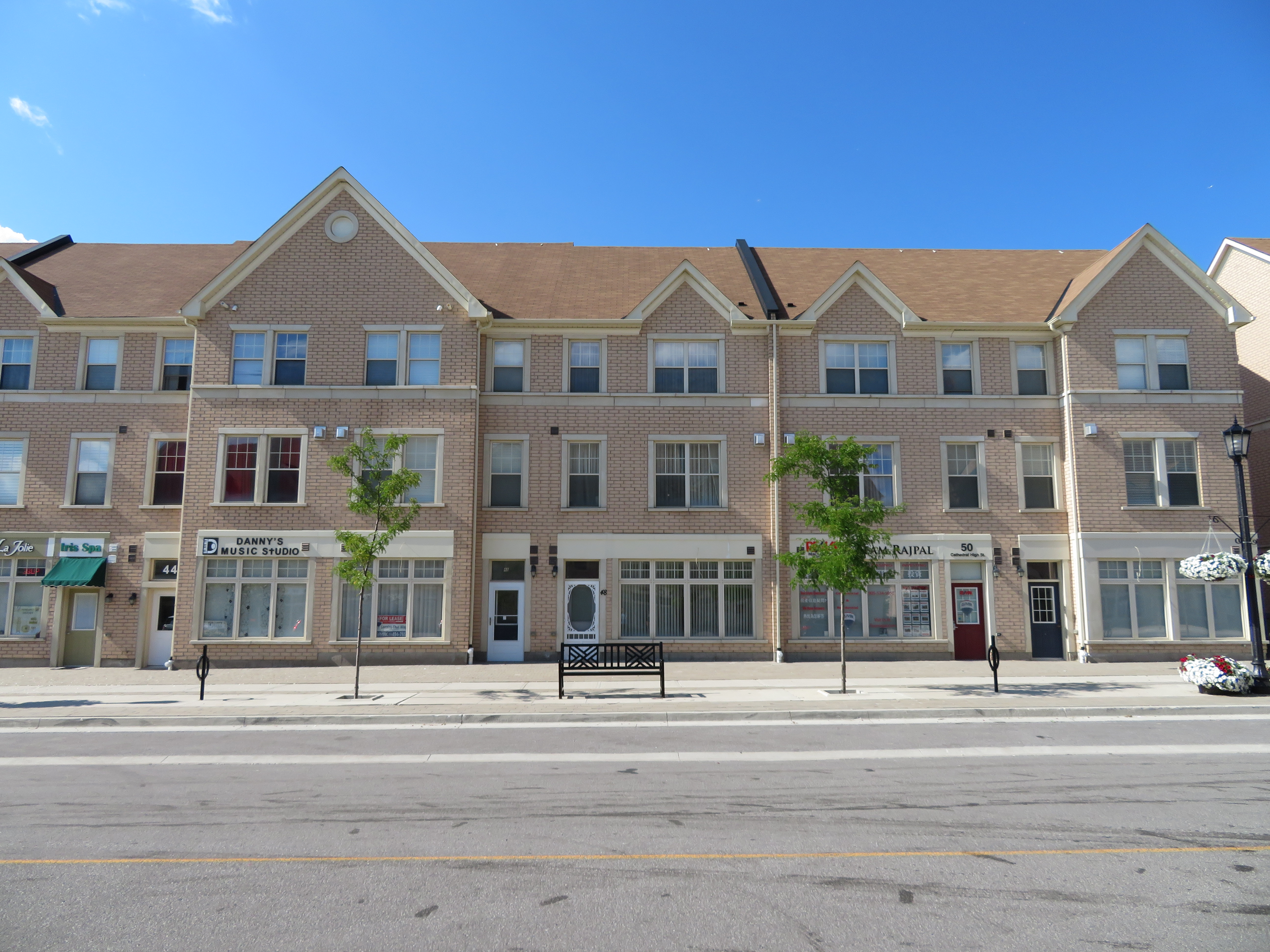
    IMG_1251-001A mostly empty Cathedral High Street

    Cathedraltown was the idea of Stephen Roman, who made a fortune in mining and had a a farm on Woodbine Avenue in Markham to build upon. The new community, on a family owned hobby farm, would have a spectacular new Slovak-Catholic cathedral as its centrepiece, with houses, parks, and stores surrounding the landmark. Stephen Roman’s daughter, Helen Roman Barber, took over the development in 1988.  The church — which remains incomplete — was opened for a while, but the building was the subject of a dispute between the development company and religious leadership and was closed from 2006 through 2016.

    Meanwhile, the residential community was slowly built around the Cathedral in the last ten years.


    IMG_1242-001A “no trespassing” sign still stands outside the recently re-opened Cathedral of the Transfiguration
    Like other “new urbanist” developments, the garages and service areas are found not on the residential streets themselves, but in back alleys. Parkettes and playgrounds face the street, rather than behind houses. Dwellings are built close together, for higher densities than traditional suburban tract housing. There are townhouses, as well as semi-detached and fully detached homes, as well as some low-rise condominium apartments.

    There’s a Main Street, which is called Cathedral High Street. It is lined with storefronts, but many are empty. Those that are occupied host dental offices, real estate agents, an insurance broker, beauty and nail salons, and after-school tutoring companies. Only one store, a nail salon, was visibly open on our visit on a Saturday afternoon.

    A few thousand more residents might help. Building the retail along Woodbine Avenue itself, which gets far more traffic, might have also helped support sustainable retail. Nearby, however, is a pedestrian-unfriendly plaza on Major Mackenzie Drive that’s fully leased, anchored by banks, a Canadian Tire, a Shoppers Drug Mart, Starbucks, and Boston Pizza.

    IMG_1253-001Storefronts on Cathedral High Street…

    IMG_5598.JPG…While a nearby auto-centric plaza is busy
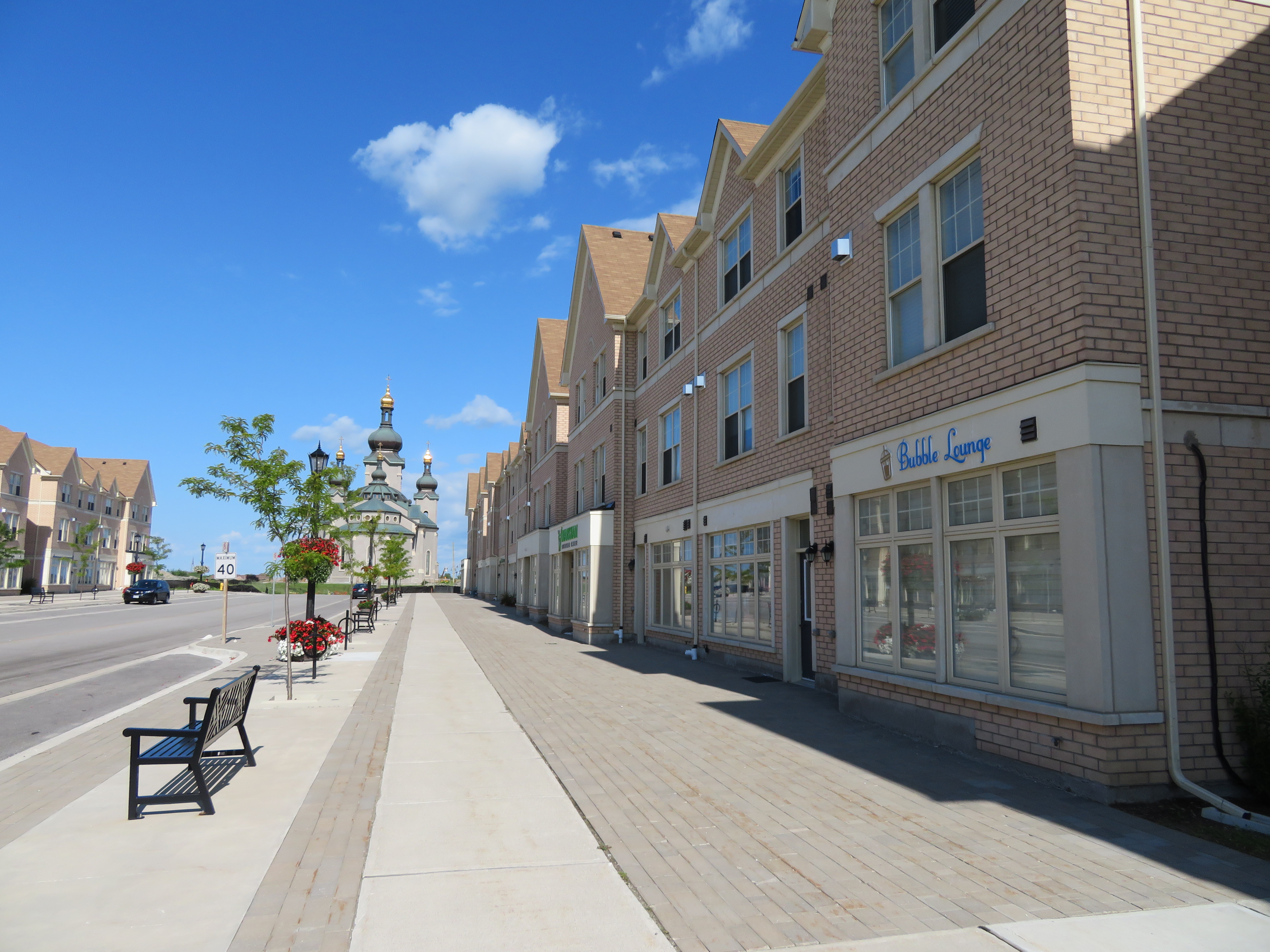
    Despite its new urbanist ideals, Cathedraltown is as auto-dependent as any other suburb. Only two bus routes serve the centre of the development: York Region Transit bus routes 24 and 80. Route 24, which goes to the TTC Don Mills Subway Station, operates every 51 minutes on Saturdays, and only until about 6:30 at night (Sunday service is similar; weekday service is slightly better). Route 80, which goes west to Yonge Street, operates every 45 minutes on weekends, until about 8:00 or 9:00 PM. Getting to GO Transit trains requires a car or a YRT bus ride involving a transfer between two infrequent routes.

    IMG_1254-001Empty streetscape on a sunny Saturday afternoon
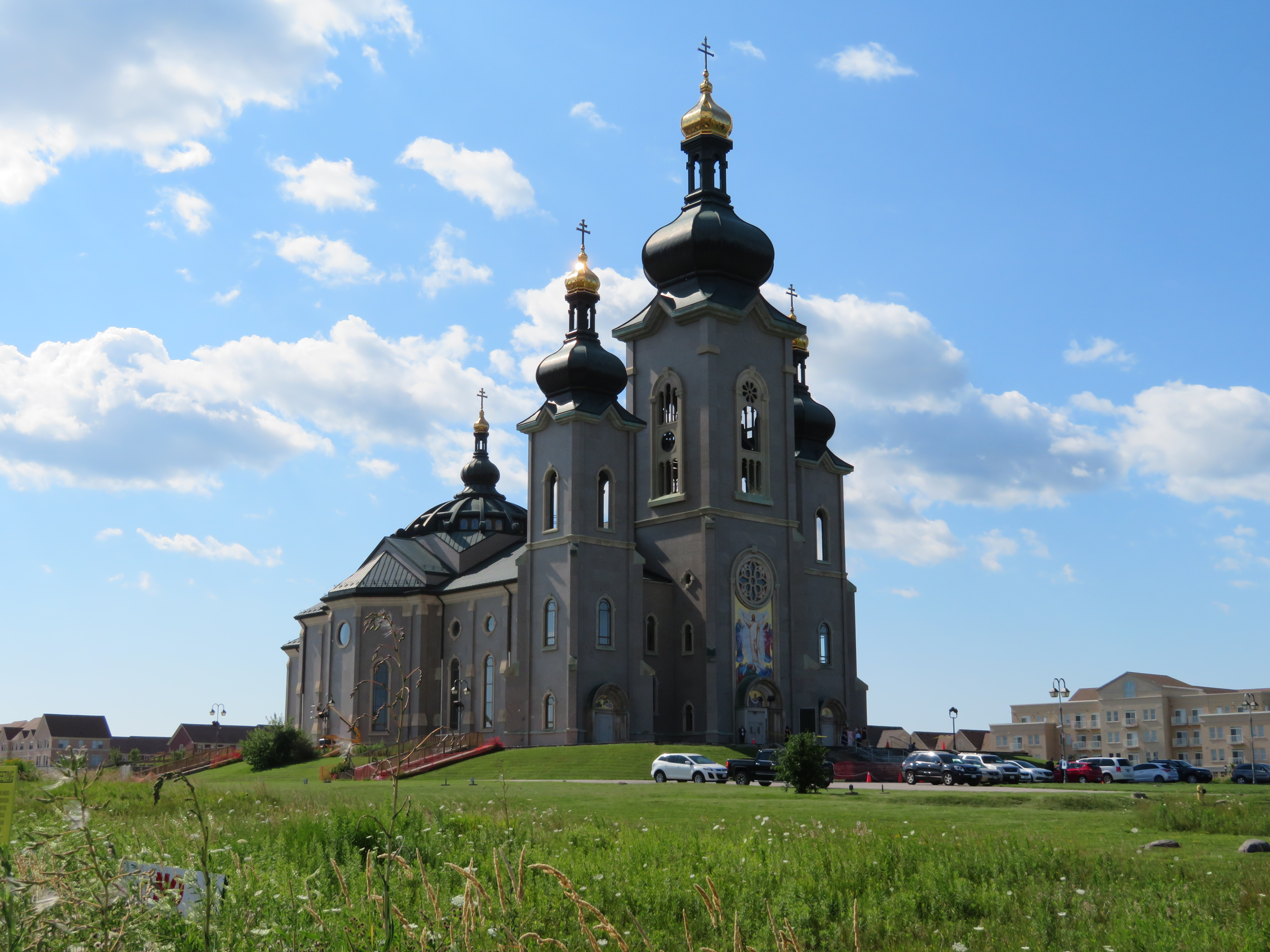
    Without transit, and without places to walk to (apart from a church, a few parks, and an elementary school), the ideals of new urbanism aren’t matched by reality. Unless things change drastically, it will still be a place where residents will get in their cars to go anywhere. Better transit could be a start, but so would adding more people, and jobs.

    IMG_1250-001
    Maybe one day, this community will be completed