I recently visited two Ontario cities, St. Catharines and Orillia, to illustrate the problems of building new medical and educational institutions on isolated greenfield sites.
Large greenfield lands have several advantages: they’re easy and inexpensive to build on, they can accommodate large parking lots, and offer room for future expansion. But by the nature of their isolation, they’re more expensive to serve with road and water infrastructure, and more difficult to connect to transit. Students, patients, and employees must travel farther, and they don’t foster economic and social connections with the local community as well.
St. Catharines
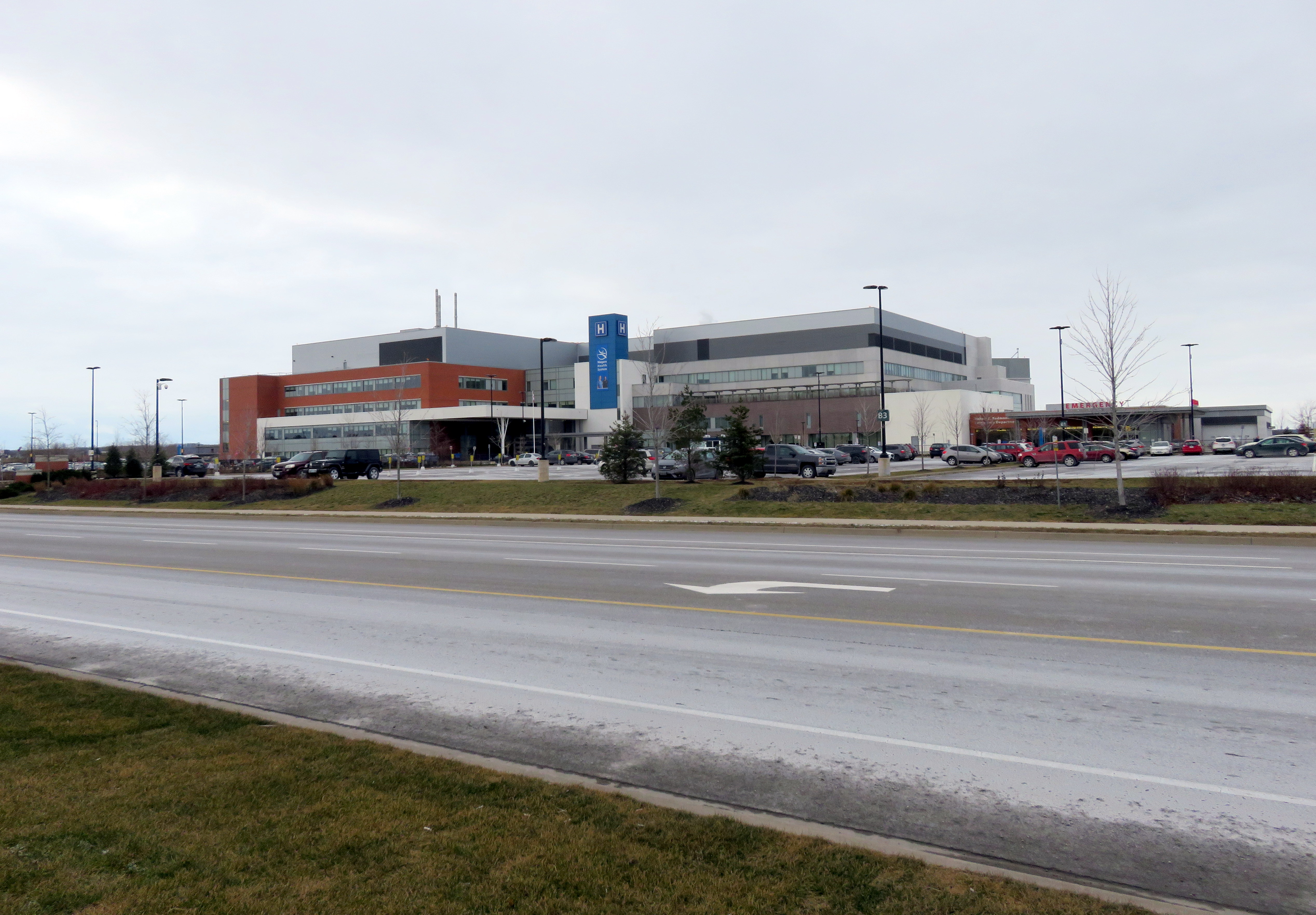
In 2013, a new hospital campus opened in St. Catharines, replacing two smaller, run-down hospital sites just outside of the city’s downtown core. The new Niagara Health System site offers new and improved services, such as regional cancer centre, a spacious and bright dialysis unit, and a modern mental health centre. When the site opened, it was a vast improvement over the older facilities.
But there was one, major, drawback: the new hospital site is located on the far western edge of St. Catharines’ suburban sprawl, almost inaccessible without a car.
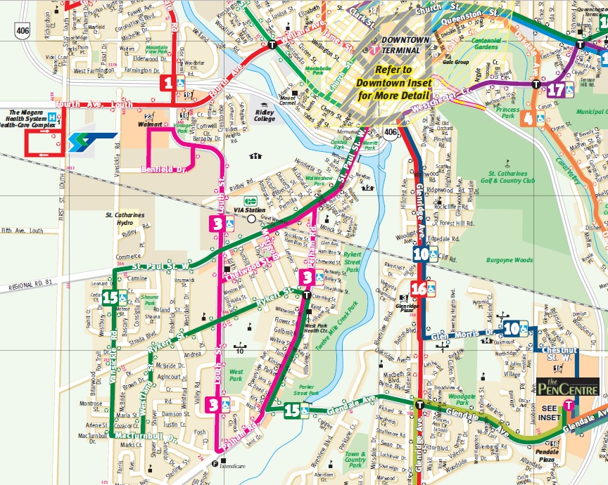
Location of current and former St. Catharines hospital sites
St. Catharines Transit re-routed a bus route (Route 1) to serve the new hospital site, but it costs the transit system nearly $400,000 a year to do so. The old General Hospital had four bus routes within walking distance to its urban location. Passengers from Thorold, Merritton, or several other neighbourhoods are required to make an additional transfer at the downtown bus terminal in order to access the new site. The distance makes taxi trips more expensive for the majority of St. Catharines residents and more difficult to get to by foot or by bike.
(more…)
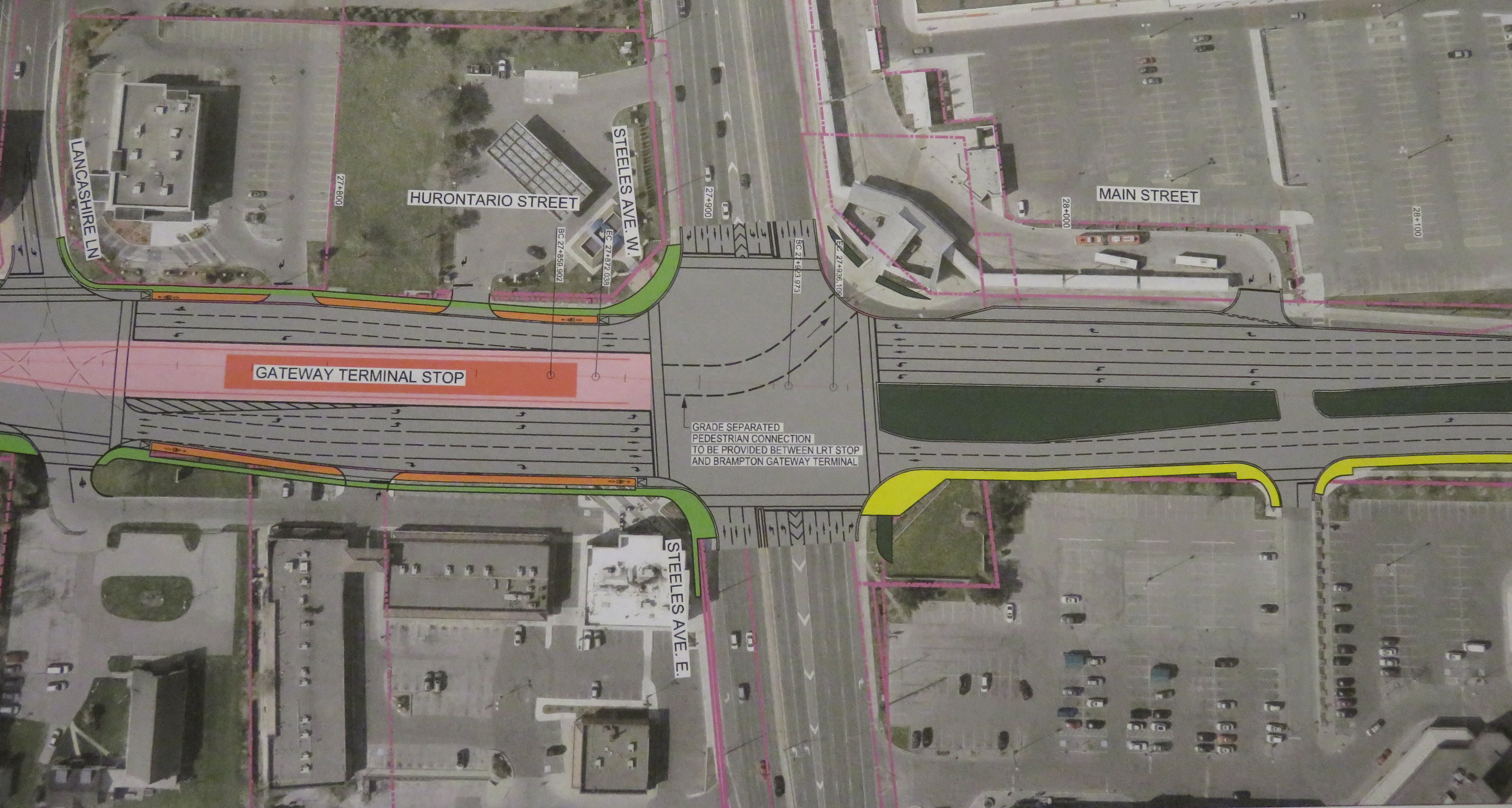
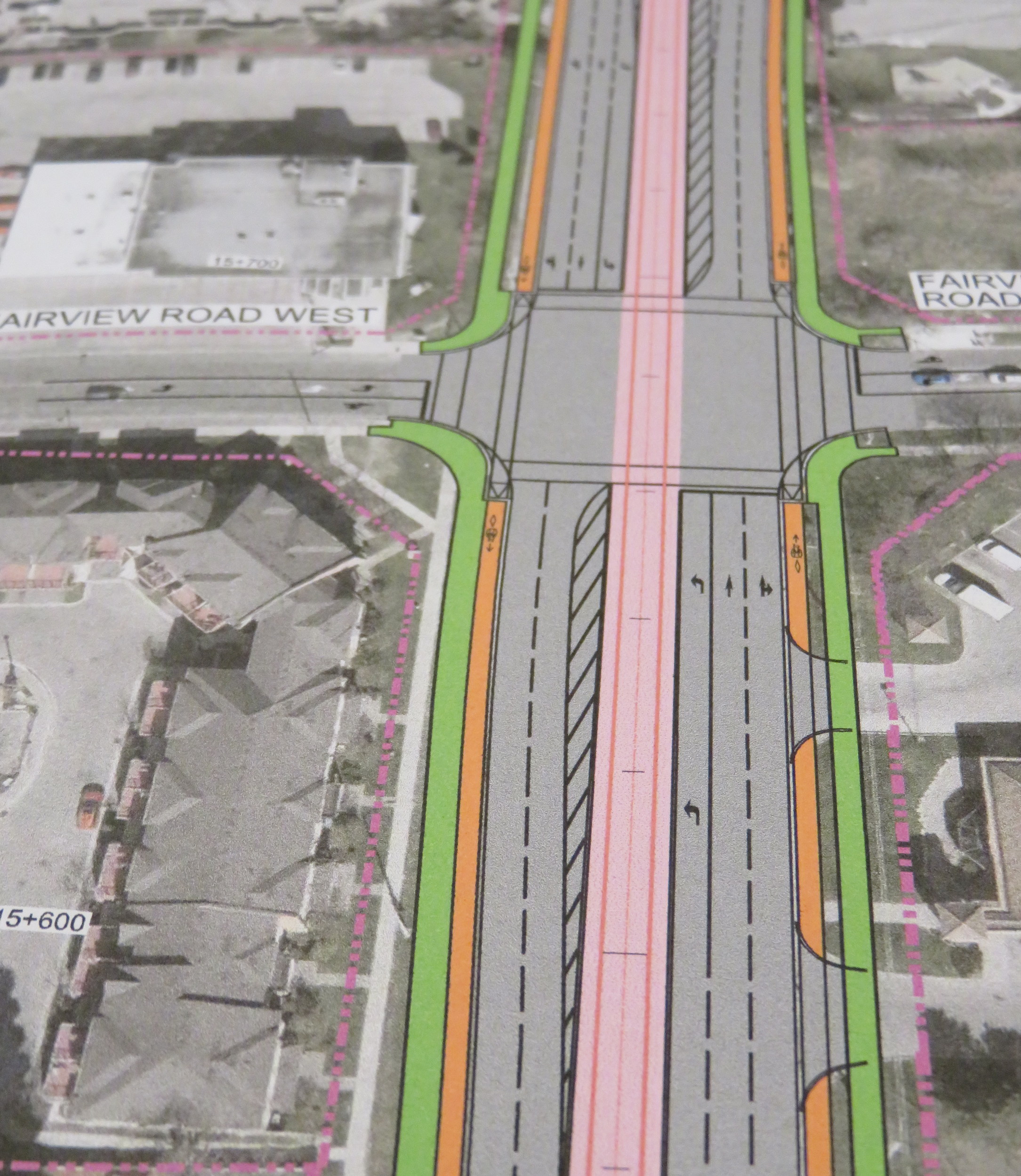 Typical cross-section once the LRT is built. The orange paths are the separated bike lanes, the green paths are sidewalks. Hurontario Street will only have two traffic lanes in each direction.
 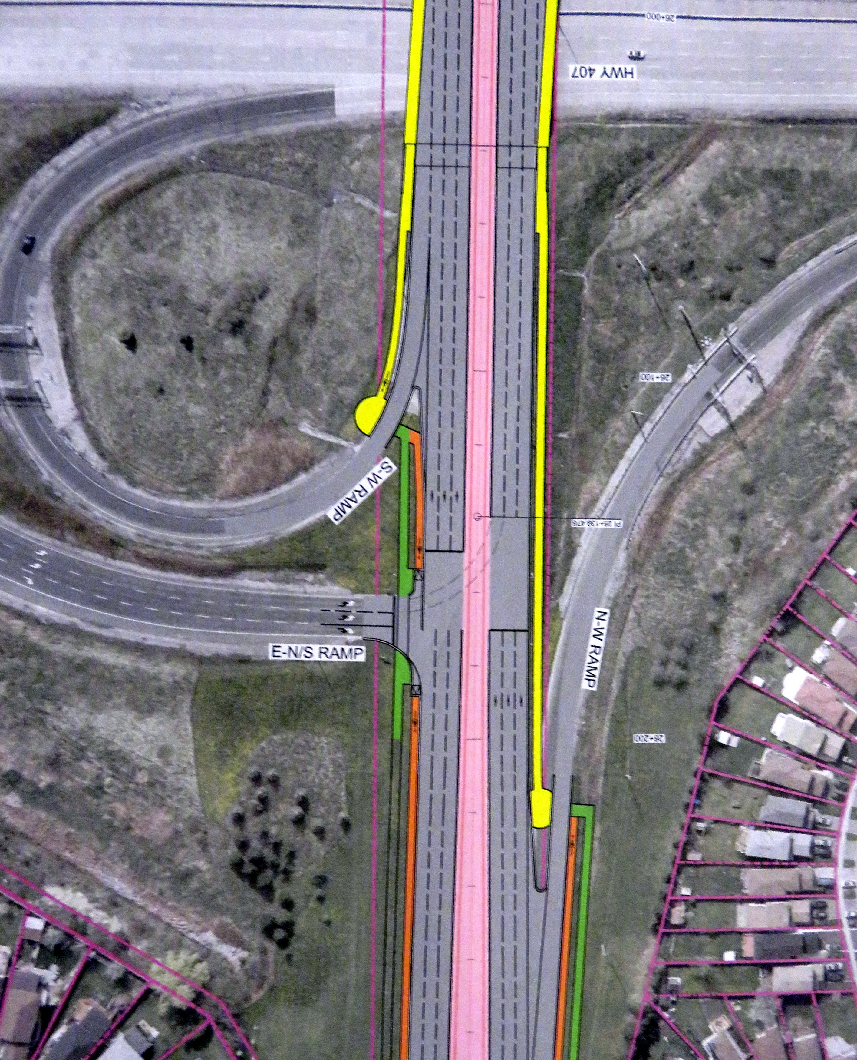 At expressways, like at Highway 407, pedestrians and cyclists still must yield to motor traffic at on-ramps.
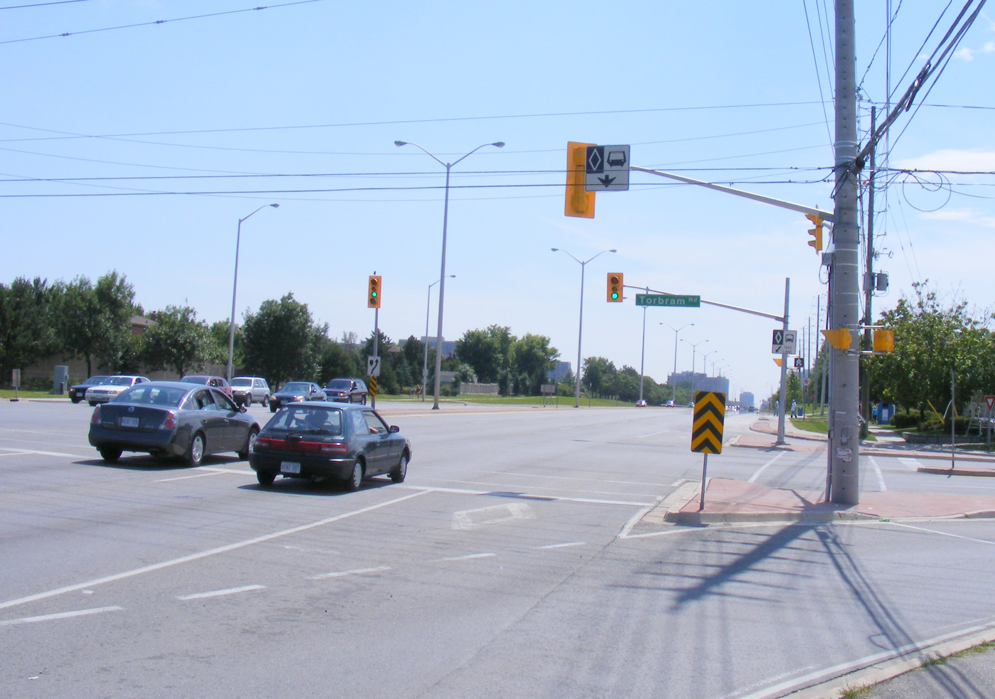
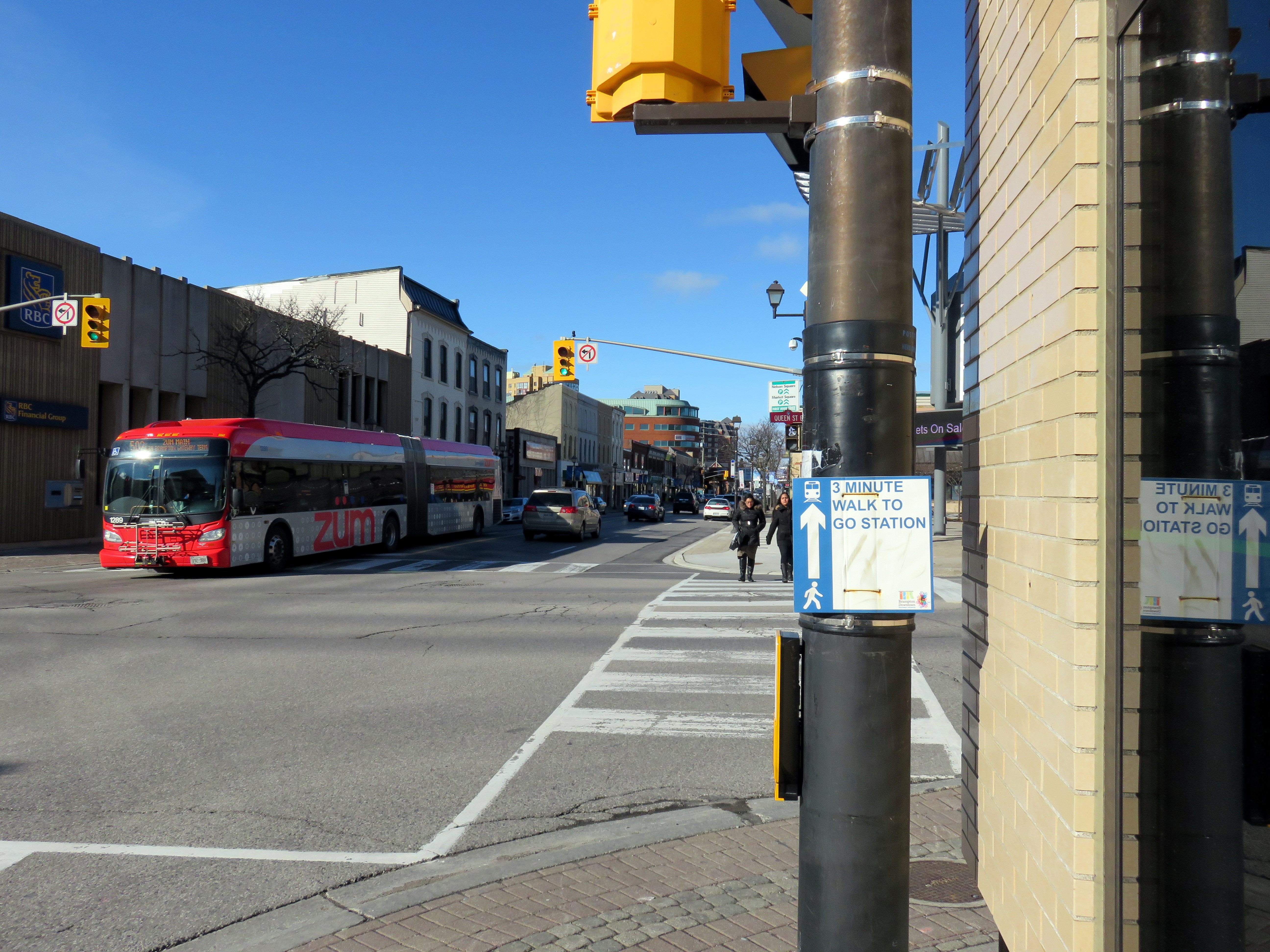 Main Street looking north at Queen Street, Downtown Brampton
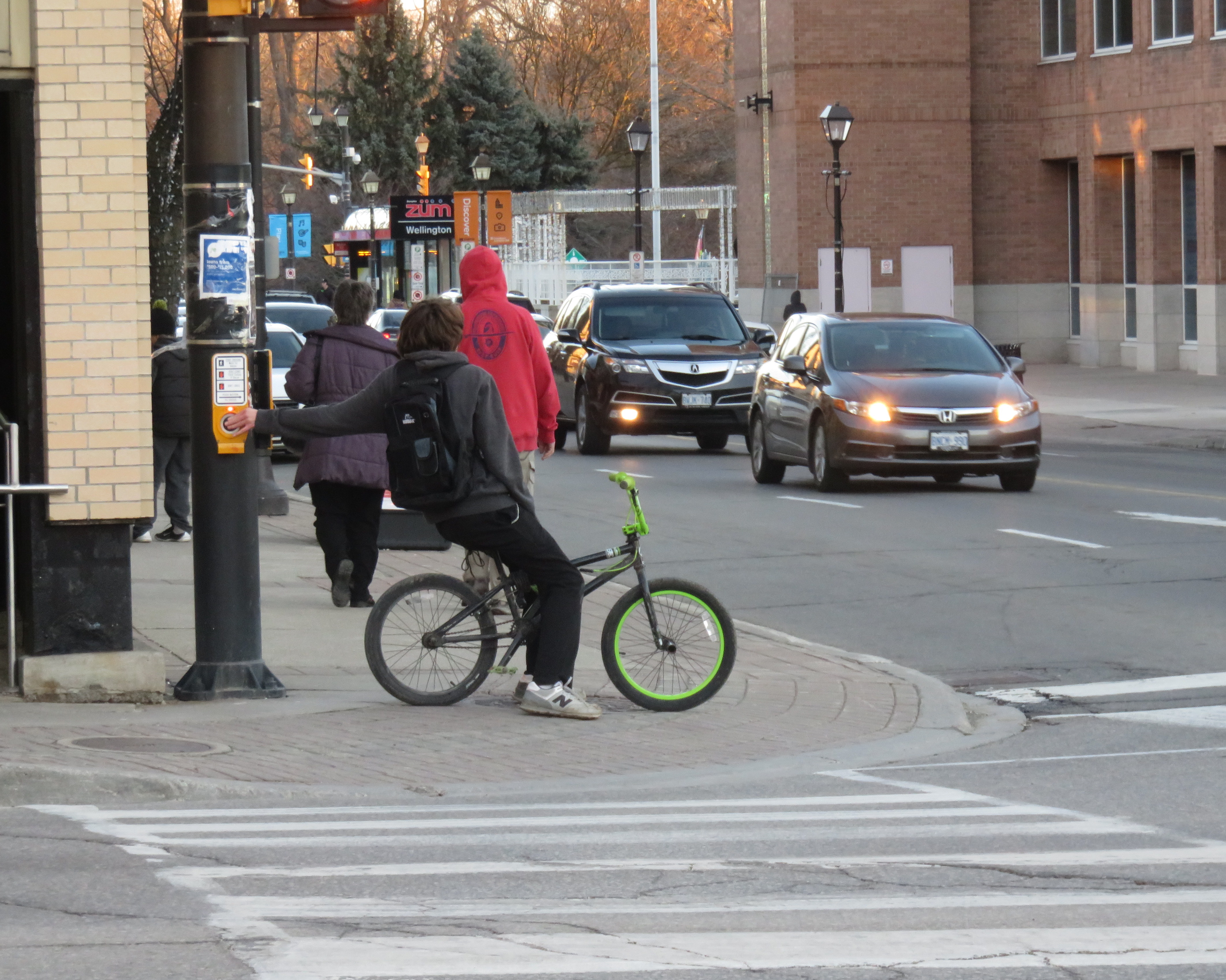 Sidewalks are narrow, and cyclists often take the sidewalks in Downtown Brampton.
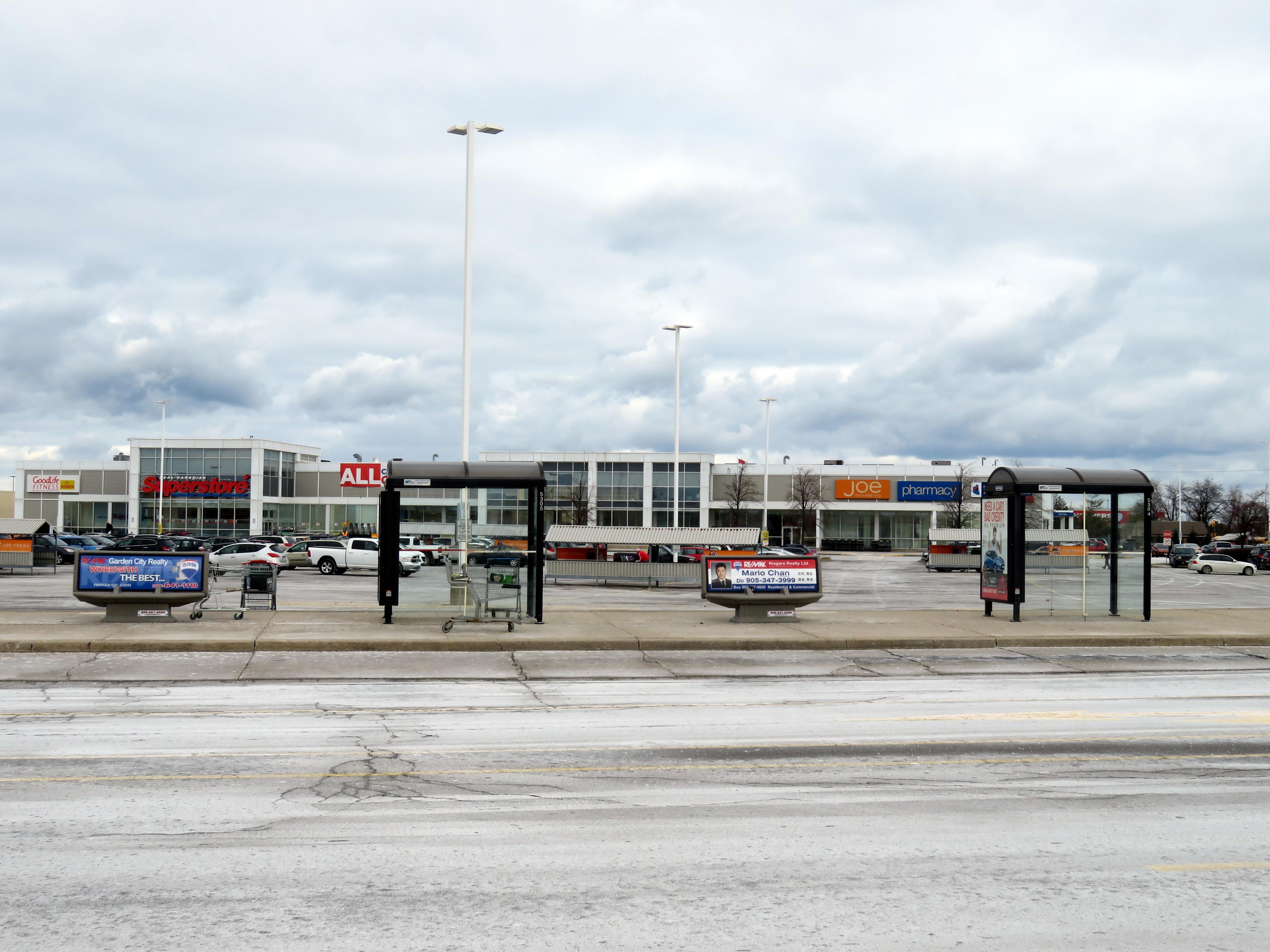
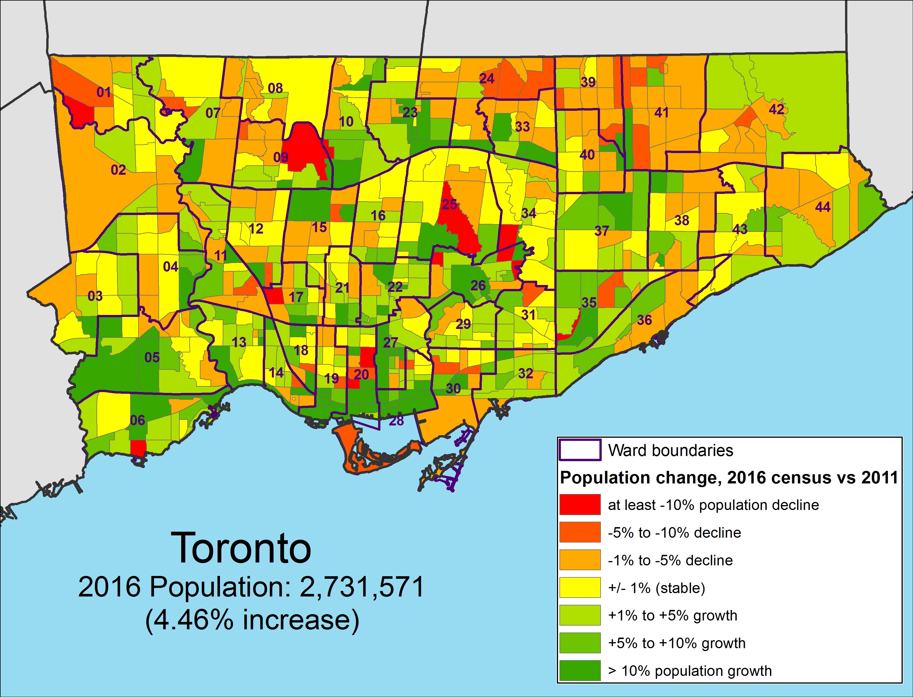
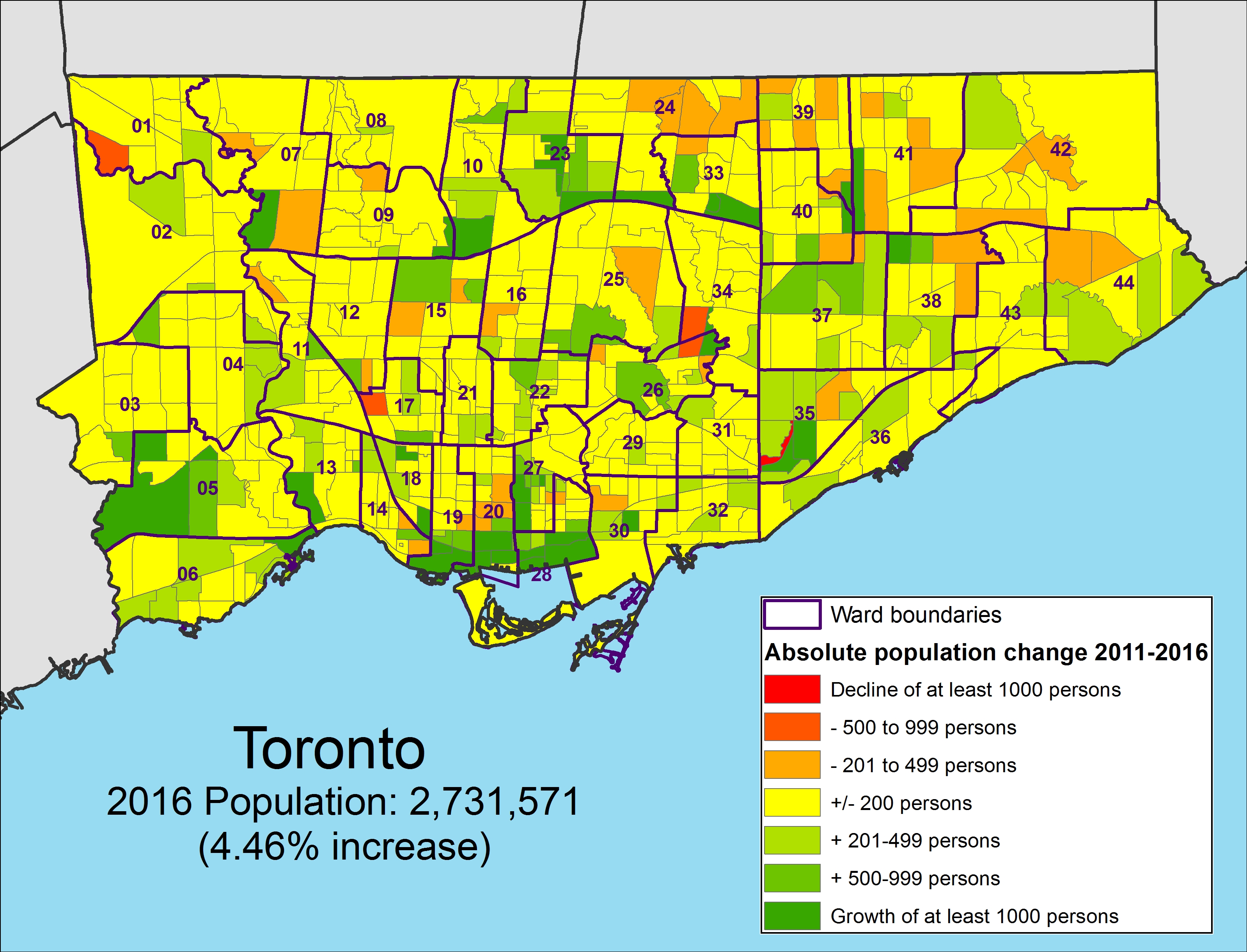 Population change between 2011 and 2016 by absolute numbers by census tract, Toronto
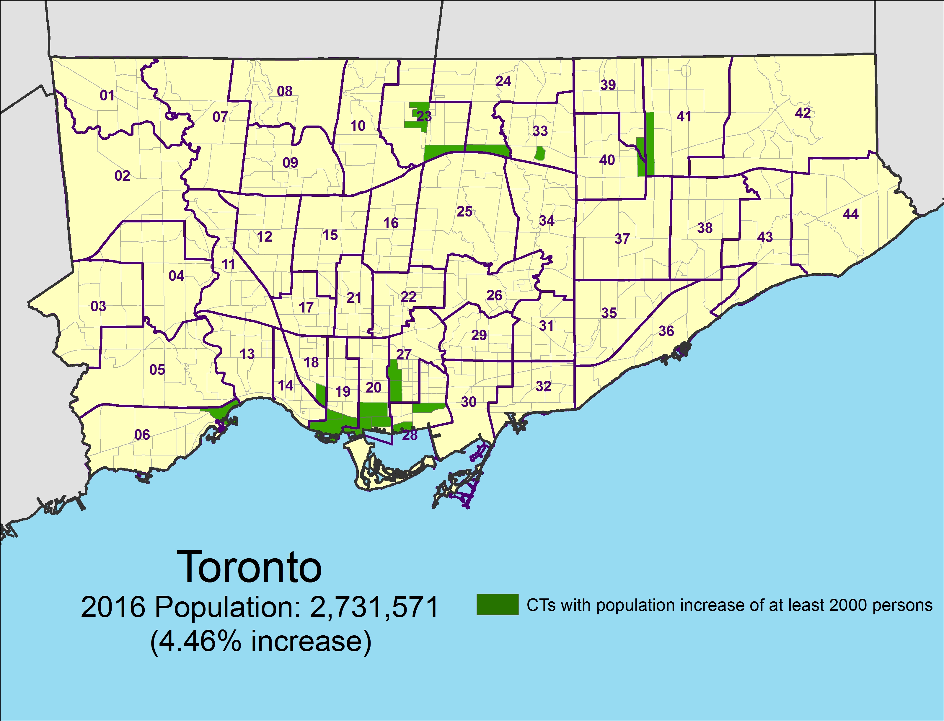 Census tracts that grew by at least 2,000 persons between 2011 and 2016
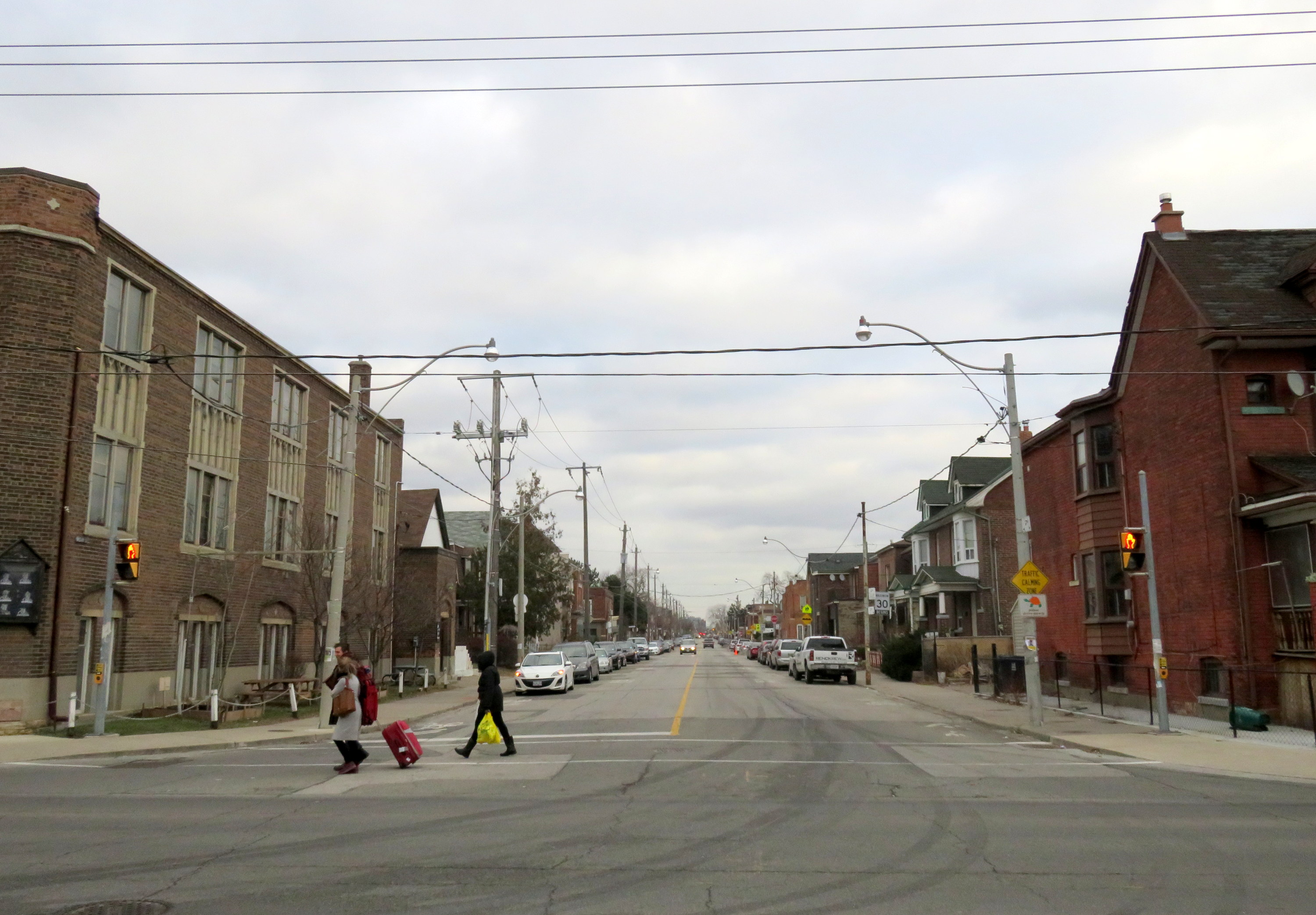 Hallam Street looking east from Dufferin Street, January 2017
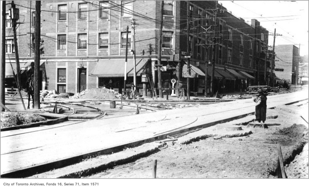
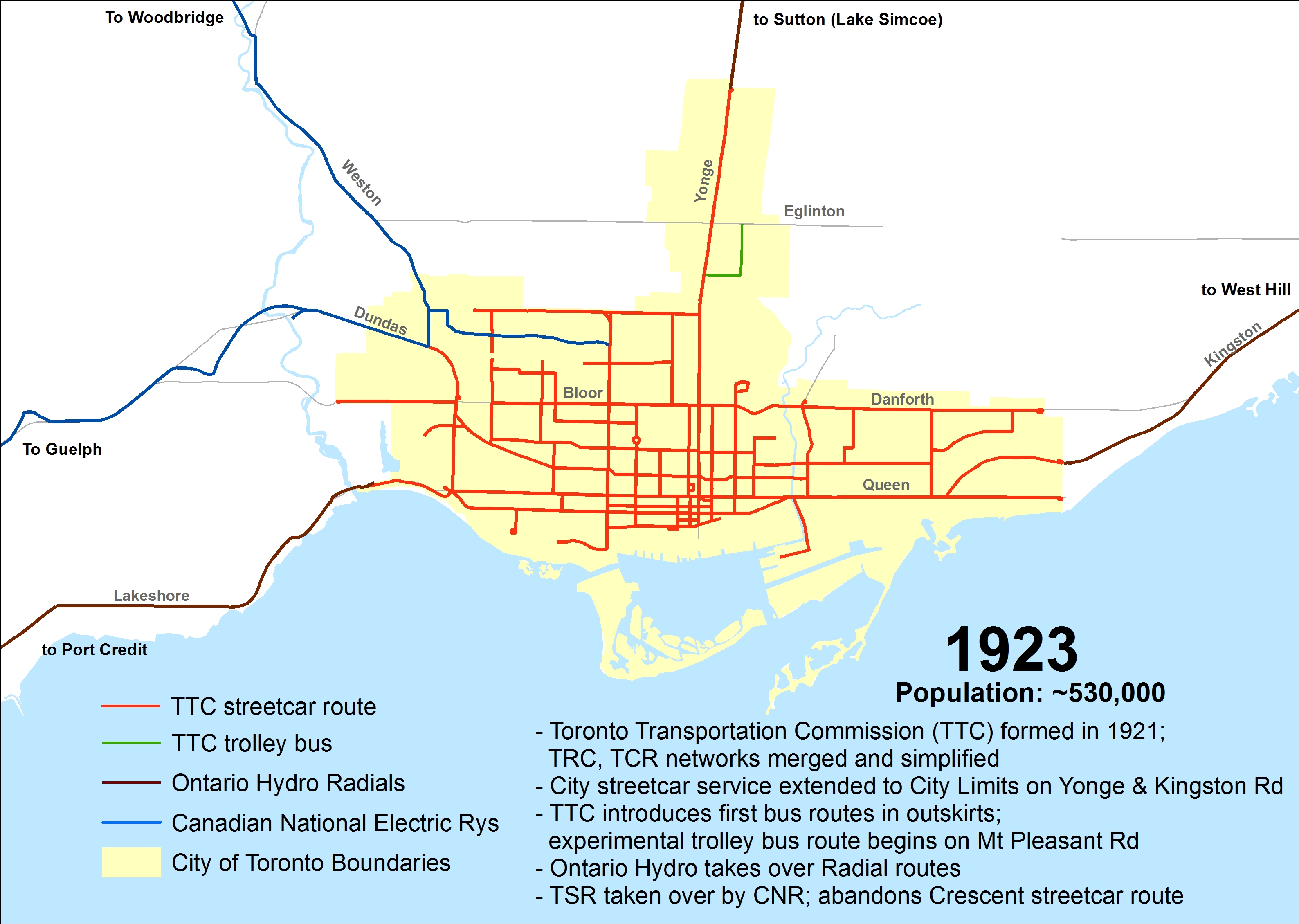
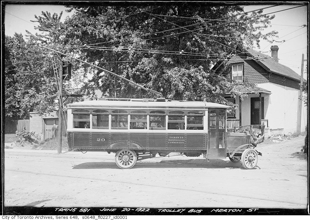 Trolley bus on Merton Street, June 20, 1922. City of Toronto Archives, Series 648, Fonds 227, Item 1
![People & Historic shots. - [1920?]-1987](https://seanmarshall.ca/wp-content/uploads/2016/11/trc-queen-s1465_fl0722_it0018.jpg)
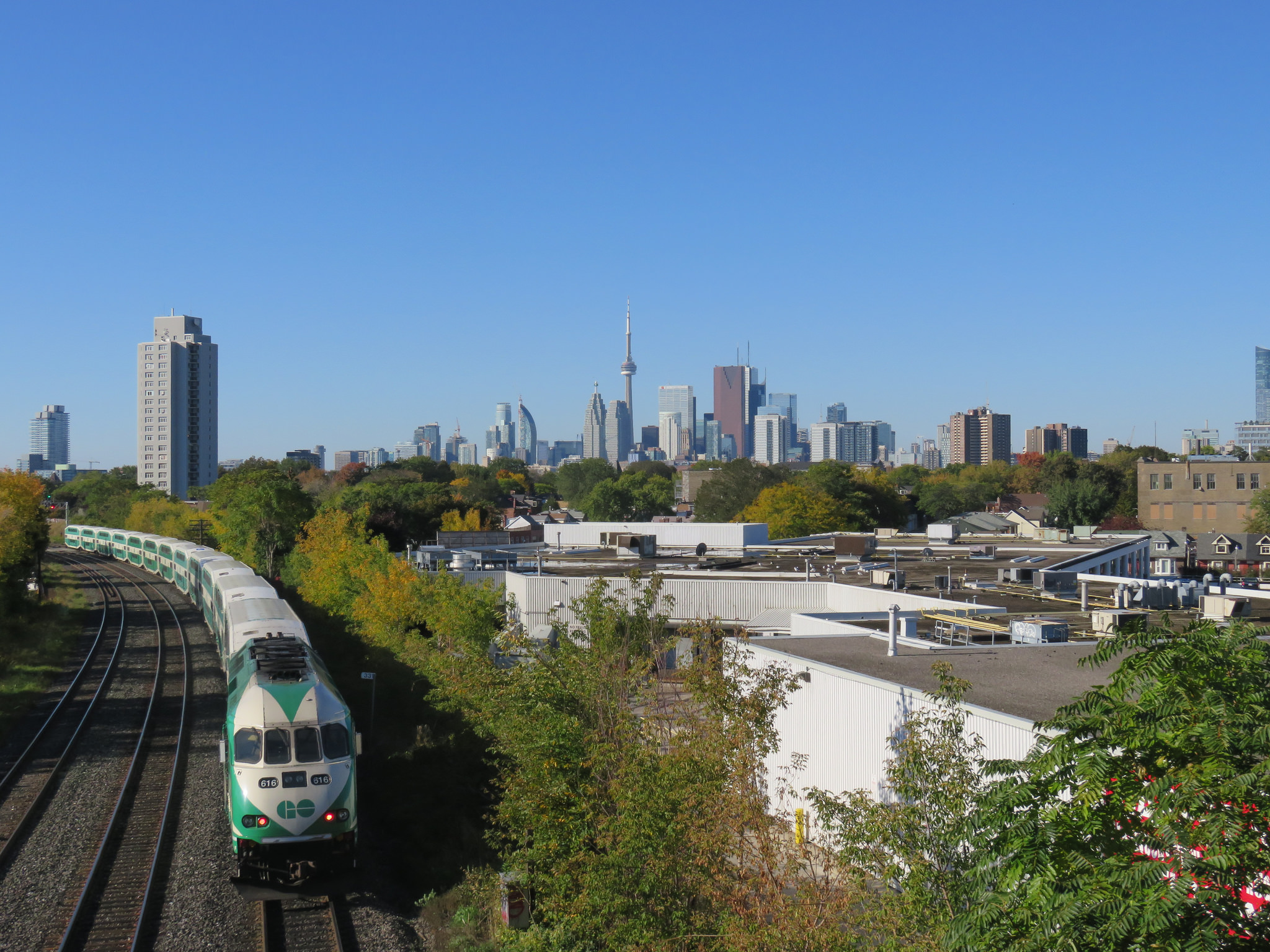 GO Transit train from the Pape Avenue footbridge, near the proposed site of Gerrard Station