Category: Walking

  • The ravine run around

    IMG_2475-001
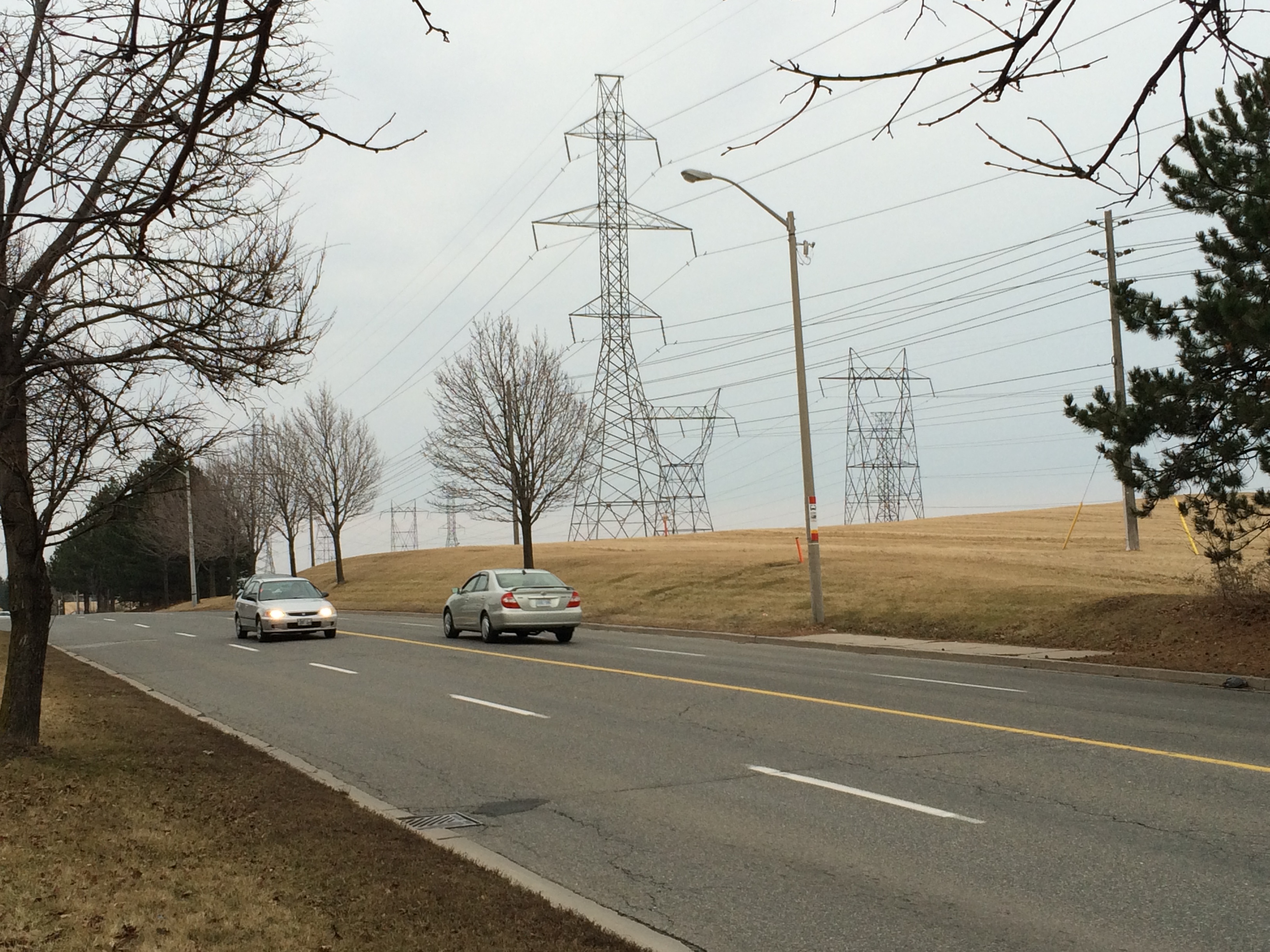
Wilket Creek trail closure, September 2017

    Last week,  my wife and I went for a walk through the Toronto Botanical Gardens, Edwards Gardens, and Wilket Creek Park, all part of Toronto’s wonderful and extensive ravine system. The ravines are one of Toronto’s greatest assets, and many are connected by multi-use trails, allowing pedestrians and cyclists to experience nature, close to home. Some trails, like the Lower Don, are also important commuter routes for those who walk or cycle to school or work.

    Unfortunately, several of these trails are closed for long periods for construction, and they do not get the same attention that roads and highways get.

    The Wilket Creek Trail, between Edwards Gardens and Sunnybrook Park, has been closed since Spring 2017, and will remain closed until Spring 2018. The Toronto Region Conservation Authority (TRCA) is repairing damage caused by erosion, and restoring the local ecosystem. The same trail was closed two years ago for similar construction work.

    The pedestrian detour on Leslie Street is straightforward, and does not deviate too far from the route. However, Leslie Street is busy and motorists drive at high speeds, so it is not a good safe route for cyclists. To the City of Toronto and TRCA’s credit, at least, the detours are well mapped and construction notices are signed well in advance. (I’ve experienced trail closures without any warnings or suitable marked detour routes.)

    IMG_2476-001
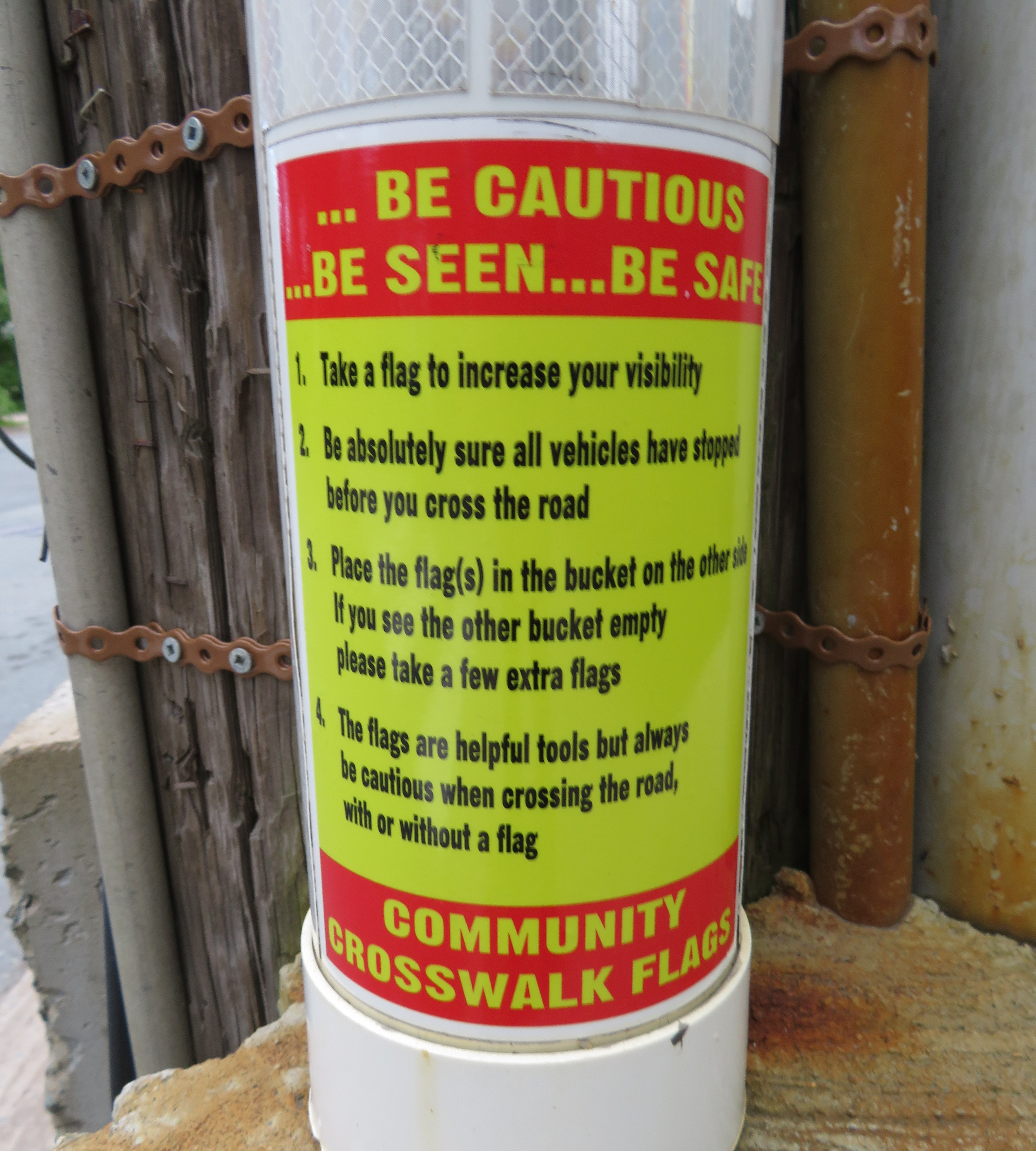
Advance warnings and a detailed detour map on the Wilket Creek Trail

    Further south, the Lower Don Trail between Pottery Road and the footbridge at Riverdale Park will re-open on September 23, 2017, fourteen months late. That work was done to replace an underpass at a disused rail corridor owned by Metrolinx.

    As Metro reporter David Hains points out, that re-opening was re-scheduled several times between July 2016 and August 2017 — unexpected soil conditions and wet weather were blamed for the delays.  Pedestrians and cyclists were directed to use either Broadview Avenue or Bayview Avenue to get around the closure; both are busy roads, and Broadview Avenue is at the top of a steep grade from the Don Valley.

    Other major closures included the Humber River Trail under Highway 401 near Weston Road, which was closed for several months in 2016 so that trail users would not be in the way of construction vehicles. The suggested detour, a 3 kilometre long circuitous route, followed Wilson Avenue, a busy suburban road.

    This year, the Etobicoke Creek Trail under Highway 401 in Mississauga is also closed for two years for bridge work. There are no safe alternatives for crossing Highway 401 in that area.

    Humber.jpgThe circuitous and dangerous 2016 Humber River Trail detour at Highway 401. Source: MTO.

    The long and dangerous closures of major pedestrian and cycling routes can be compared to the way road repairs are prioritized. Mayor John Tory announced $3.4 million to speed up construction on the Gardiner Expressway in 2015, when the elevated highway was reduced to two lanes in each direction from three. In August, Tory announced additional funds to speed up watermain and streetcar track construction on Dundas Street between Yonge and Church Streets, perhaps not coincidentally a route many city councillors drive to get to City Hall.

    If only there were some additional money and attention given to projects affecting pedestrians and cyclists in Toronto. It would also be nice to ensure any detours were well signed, and made as safe and comfortable as possible.

  • The Halifax Department of Silly Walks

    IMG_0772-001.JPG

    As part of our trip through the Maritime Provinces a few weeks ago, we visited Halifax. Nova Scotia’s capital and largest city is the economic, cultural and transportation hub for Atlantic Canada. In 1996, the City of Halifax was merged with surrounding towns and suburbs, as well as rural Halifax County; the Halifax Regional Municipality is now 5,490 square kilometres, nearly nine times the size of the City of Toronto.

    Like many amalgamated cities in Canada, Halifax has a historic, densely populated inner core, surrounded by urban neighbourhoods. Beyond the old cities of Halifax and Dartmouth is a ring of suburban homes and businesses, such as Bedford, Cole Harbour, and Bayer’s Lake. And like Hamilton and Ottawa, there’s another, even larger ring of rural farms, woodlands, small villages, and exurban estates. Peggy’s Cove, for example, is near Halifax’s eastern boundary. Councils of these amalgamated cities must reconcile the needs and desires of the urban centre with those of suburban and exurban residents. In Toronto, bike lanes are held up, or even removed, for the benefit of motorists living outside the urban core. The debate over Hamilton’s LRT has pitted suburban councillors against those representing the lower city. Halifax is no exception.

    Halifax’s urban core is worth exploring, despite construction detours around the new convention centre, the waterfront, and new condominium development. Downtown includes the historic Citadel, Province House, and the Art Gallery of Nova Scotia, among other museums. Halifax Common and the Public Gardens are welcoming public spaces in the classic New England style.

    Halifax Transit operates a ferry service to Dartmouth — only $2.50 per person, with the return trip free if taken within 90 minutes — which offers great views of the city and the various commercial and naval ships in the harbour. The ferry is also fully integrated with the local bus system. The new Halifax Central Library is one of Canada’s greatest new public buildings: the five storeys are bright and user-friendly, and there is even a rooftop patio and café to visit.

    Downtown is compact and a pleasure to walk abound.

    IMG_0903-001.JPGThe spectacular new Halifax Central Library

    But once you stroll beyond Halifax’s urban core, the landscape changes. Signed crosswalks are fewer and farther between, even in older residential neighbourhoods.

    Maritimers are famously courteous to pedestrians; most motorists will slow or stop if they see a pedestrian about to cross the street, whether or not there’s a marked crosswalk. But that slower pace of life in itself does not prevent collisions. As in any North American city, Halifax’s arterial roads and suburban streets are built to move cars through quickly and efficiently.

    That’s where the flags come in. What was intended as a well-meaning, inexpensive measure to promote pedestrians’ safety at crosswalks has become one of the most ridiculous pedestrian initiatives.

    Crosswalk flags were the idea of just one man, Norm Collins, a Dartmouth retiree. The flags and buckets only cost $200 per crosswalk, compared to $15,000-25,000 per crosswalk for proper signal lights. In 2015, municipal staff were cool to pedestrian flags, though the idea enjoyed support from HRM councillors, particularly suburban politicians, and the flags were approved by council.

    Now, at most crosswalks outside Halifax’s urban core, there are buckets of bright orange flags for pedestrians to take when crossing the street. These buckets and flags can even be found at signalized crossings with flashing amber lights activated by pressing a button. Each bucket has instructions printed on how to “be cautious…be seen…be safe.”

    IMG_0966-002.JPG
    One of the buckets, with instructions on how to use the flags left inside

    Yes, even when there are flashing lights at an intersection, Halifax Regional Council expects pedestrians to use these flags (even if city staff disagree). The instructions above clearly indicate that the onus for safety is entirely on the pedestrian crossing the street, not on motorists taking care by driving safely and attentively.

    Vision Zero is the Swedish road safety philosophy that seeks to end traffic fatalities by minimizing the effects of mistakes made my all road users. Lower speed limits, enforced by road re-engineering works (such as bump-outs, speed humps, and tighter corners at intersections) that slow down cars and trucks is one such effective measure. So are complete streets, designed to improve the safety and comfort of pedestrians and cyclists. Cheap pedestrian flags, which do not address the root problem, are not within the spirit of Vision Zero.

    If Halifax Council — or any municipal government — was serious about improving pedestrian safety, features that would help include improved lighting, narrowing the roadways at pedestrian crossings, and raising the crosswalks closer to the curb level, forcing motorists to slow down (and also improving drainage. Flags and high-visibility clothing are useful for temporary conditions and for traffic control personnel, but not for everyday conditions and everyday people. The onus should always be first on the licensed motorist to be attentive to the road and drive according to the conditions.

    A ridiculous pedestrian safety measure deserves a ridiculous walk, as I demonstrated in Dartmouth.


  • Wandering the Waterfront Trail in Scarborough

    IMG_8897-001At the bottom of the Scarborough Bluffs, west of Bluffer’s Park

    Lake Ontario, like all five of the Great Lakes, is more a freshwater sea than merely a lake. It’s over three hundred kilometres long, from Hamilton to Kingston, bordering two countries, with several inhabited islands, and features a varied and fascinating landscape. Lake Ontario’s vastness is best appreciated from its shore, whether it be the Toronto Islands, on the east side, on the beaches at Presqu’ile or Sandbanks Provincial Parks, or from the top of the Scarborough Bluffs.

    The Waterfront Trail, at least in theory, is a wonderful way to explore these varied shorelines of Ontario’s vast Great Lakes on foot or by bicycle. Founded in 1995, the trail now extends from the Quebec border, west along the St. Lawrence River, through Niagara, along the north shore of Lake Erie, and up the Detroit and St. Clair Rivers to Lake Huron. I cycle the Waterfront Trail between Toronto and Hamilton several times a year, an 85-kilometre trip. GO Transit’s trains and buses follow the Waterfront Trail from Durham Region to the Niagara River, making it easy to walk or cycle one-way, returning by train and/or bus.

    IMG_0834-001.JPG
    The Waterfront Trail crosses Highland Creek in eastern Scarborough. (2015 photo)

    But the Waterfront Trail is dependent on municipal infrastructure, or the lack of it. Most of the trail’s route winds through rural areas, following country roads and highways where segregated multi-use trails aren’t built: in many places, the Waterfront Trail is neither close to the water, nor is it a ‘trail’ of any kind. At least in Northumberland County and Niagara Region, paved shoulders and bike lanes are found along the busier country roads. But this is not always the case.

    In urban areas, though, like the City of Toronto, there is both the demand and the resources for safe pedestrian and cycling infrastructure along the waterfront. In the old city of Toronto, the Waterfront Trail follows the Martin Goodman Trail, and is nearly completely segregated from motor traffic.

    But in Etobicoke and in Scarborough, much of the trail is routed via on-street sections; in sections, pedestrians must follow sidewalks next to busy sections of Lake Shore Boulevard and Kingston Road; for cyclists, there aren’t even any bike lanes — they have the choice of either riding with traffic, or illegally riding on the sidewalks.


    Route of the Waterfront Trail within the City of Toronto

    (more…)

  • Exploring Earl Bales Park

    IMG_8535-001View from the top of the ski hill at Earl Bales Park

    Last Sunday afternoon, I went for a walk around Earl Bales Park. The large, multiuse green space is located near the corner of Bathurst Street and Sheppard Avenue in North York; it also descends into the West Don Ravine. It was a delight to explore this park, but as I discuss below, it could be much better connected to the city on the south end.

    Earl Bales Park originally was a farm established in 1824 by English settler John Bales and his family; their house still stands in situ. The land later became a private golf course, and was purchased by the Borough of North York in 1975, named for one of the Baleses’ great-grandsons.

    A lot is packed into this popular green space: walking trails, playgrounds, picnic areas, a community centre, an amphitheatre, an off-leash dog park, a memorial, a seniors’ woodworking shop, and even a ski hill. Even on the first weekend of April, the park was full of picnicking families and groups; families represented a diverse cross-section of suburban Toronto.

    After English, the most commonly spoken languages I heard were Russian and Tagalog — the Bathurst Street corridor north of Highway 401 is popular among immigrants from the Philippines and Eastern Europe; many businesses and community organizations in the area cater to these communities.

    IMG_8530-001Picnicking at Earl Bales Park, April 2, 2017
    (more…)

  • Rethinking Downtown Brampton’s streetscape

    IMG_8755-001Main Street looking north at Queen Street, Downtown Brampton

    On Thursday, February 23, I went back to my hometown to check out plans for re-configuring Main and Queen Streets in Downtown Brampton. As the Region of Peel needs to replace water and wastewater infrastructure in the area, the timing is right for re-imagining what the streetscape should look like.

    The same conversations are taking place in Downtown Toronto. There there are proposals for transforming King Street to prioritize transit and pedestrians; on Yonge Street, city planners, Ryerson University, and local businesses are looking to provide more space for pedestrians and cyclists, as well as street furniture (such as benches and trees), patios, and special events. Of course, re-imagining downtown streets where cars are given priority will generate opposition, but it’s necessary in dense, urban cities were people, and not necessarily their cars, are given priority.

    Downtown Brampton has great bones; it has numerous heritage buildings, several great public spaces, and GO Transit and VIA Rail trains stop right here. The Saturday Farmers’ Market is popular, as is ice skating at Gage Park. But despite some interesting new restaurants and bars, most retail has struggled here, and even new residential development in the area is sluggish. Improving the public realm, especially wider sidewalks and more attractive streetscaping, would be a relatively inexpensive, yet symbolically important, step to making downtown a more desirable place to be.

    img_8159-001Sidewalks are narrow, and cyclists often take the sidewalks in Downtown Brampton. 

    (more…)

  • They call this a “SmartCentre”

    img_7608-001

    The word “smart,” like many buzzwords, is thrown around a lot, to the point that it has lost meaning. SmartTrack, for instance, might have been a catchy name for a transit plan, but in the end, it didn’t turn out to be all that smart.

    There’s also the case of SmartCentres, the retail arm of SmartREIT, a real estate investment trust. SmartCentres are ubiquitous in suburban Canada; the firm owns retail properties in all ten provinces and is Wal-Mart Canada’s largest landlord.

    I was recently in St. Catharines, a mid-sized city of 125,000 on the Niagara Peninsula. I’ll have more to say about my visit there in a few upcoming posts.

    I was walking from the VIA Rail station, on the west side of Twelve Mile Creek, opposite downtown, towards the new St. Catharines hospital on the city’s western outskirts. My route to the hospital (more on that later) took me through a SmartCentre big-box retail complex at Louth Street and Fourth Avenue. Tenants include Real Canadian Superstore (a large supermarket part of the Loblaws group), Wal-Mart Supercentre, Canadian Tire, Best Buy, and LCBO.


    Google map of the big box complex in west St. Catharines

    Like most big box centres, the stores are laid out surrounding a large parking lot. Pedestrians are an afterthought – there are few walkways or connections to surrounding sidewalks.

    A token measure — a bus stop — is located within the property. The bus stop is on the main driveway, but a considerable distance from the front entrances of Wal-Mart or the supermarket, especially for anyone carrying groceries, using a mobility device and/or with young children. Shopping carts are left next to the bus shelters, and there are no other supermarkets in western St. Catharines. Anyone without a car must either visit Superstore, Walmart, or shop at higher-priced local convenience stores. The property owner is SmartREIT, a real estate investment trust with retail properties in all ten provinces.

    stcatharinestransit
    Excerpt from St. Catharines Transit daytime map. Only route 3 serves the big box centre from the south. 

    Only one St. Catharines Transit bus route, 3 Pelham Road, serves the SmartCentre stop (evenings and weekends, route 115 replaces route 3), and only from the south. Traditional shopping areas, such as Downtown St. Catharines and the Pen Centre mall, are much better served by local transit. Route 1, which directly connects downtown and the new hospital and serves neighbourhoods to the north, runs nearby, but it doesn’t enter the property.

    St. Catharines, once an industrial powerhouse, has struggled with de-industrialization and poverty. The census metropolitan area has the lowest median family income in Ontario; the city also has one of the highest obesity rates. Access to fresh, affordable food, especially for those without automobiles, should be a priority. It’s a shame that the built form isn’t smart enough to help.

  • Brampton’s Etobicoke Creek: floods, concrete, and new public spaces

    20438289892_d6cd9cb6c9_z

    Over at Spacing, I wrote about a recent Jane’s Walk that I led on Downtown Brampton and Etobicoke Creek.

    Until a concrete diversion channel was built in the 1950s, Downtown Brampton would regularly flood as it was built right on top of the creek. The concrete diversion, fenced off and cut off from both the downtown core and the rest of the Etobicoke Creek ravine to the north and south, is an eyesore.

    Happily, the City of Brampton is planning to revitalize the channel, which is nearing the end of its useful life and must be reconstructed. The proposed concept, pictured below, includes new public spaces and urban development.

    Etobicoke Creek
    Conceptual drawing of revitalized Etobicoke Creek 

    Of course, during the walk, there was a discussion of the Hurontario-Main LRT, a subject I’ve written about here several times before. Some local councillors and one local advocacy group, Citizens for a Better Brampton, opposed the Main Street surface alignment, and want to push for an Etobicoke Creek route into Downtown Brampton. It would not only wreck a lovely ravine (where one can spot plenty of wildlife), but it would be located in a floodplain, and near the backyards of less-wealthy residents. There’s now a petition to nix that route. Of course, the cheapest and most logical route is along Main Street itself, but a dysfunctional and misguided Council continues to refuse to accept that fact.

    It was a pleasure leading a Jane’s Walk, and I learned a lot myself from the conversations that we had along the way; a good Jane’s Walk is when local residents participate and share their knowledge. Leading a walk is a lot of fun, and something that’s quite easy to do. And it need not be on the “official” Jane’s Walk weekend (this year, it was May 6-8), but anytime of the year.

    I’ll be leading another walk on Sunday June 12 at 3PM, in Bramalea, meeting at the civic centre across from the mall. Bramalea , billed as “Canada’s first satellite city” when planned and constructed starting in the early 1960s. There’s an interesting diversity of housing types, and an effort to build great greenspaces and linear parks, with a civic centre and shopping mall anchoring the large development.

  • On Toronto’s newest ten-year cycling plan

    The newly completed Finch Hydro Corridor
    The Finch Hydro Corridor

    The City of Toronto has released a new proposed Ten Year Cycling Network Plan, which establishes a minimum grid of cycling infrastructure across the entire city. It will be presented to the Public Works and Infrastructure Committee next week; city staff, who have worked long and hard on this project, consulting many stakeholders and members of the public, recommend its adoption by City Council. It will create over 500 kilometres of safer cycling routes, while connecting existing bike lanes and trails to each other. The plan would cost just over $150 million over ten years, a bargain.

    Of course, we’ve been down this road before. Only a fraction of the cycling infrastructure approved in previous plans has been built. And many new trails that were built — following hydro corridors and abandoned railways in suburban parts of the city — don’t connect to nearby ravines and parks. And railways and highways remain major barriers; there are only three places where the city’s designated cycling network crosses Highway 401.

    Last week’s Council approval of the Bloor Street bike lanes between Shaw Street and Avenue Road — a simple pilot project — didn’t look like a sure thing, even though it ended up voting 38-3 in favour.

    Deputy Mayor Denzil Minnan-Wong warned of “bike lane creep,” afraid that a safe bike route would extend to Danforth Avenue (which it should). And Councillor Stephen Holyday (Ward 3, Etobicoke Centre) ridiculously claimed cycling advocates were “trying to build a wall” around the downtown core, ignoring the fact that there’s a subway along the same corridor, which moves many times more people than two lanes of Bloor Street, and there are other options — such as the Gardiner Expressway, which we are needlessly committed to keeping up — for getting downtown with a car.

    Some of the highlights of the new plan:

    • Long distance cycling corridors, such as Bloor/Danforth from Etobicoke to Kingston Road in Scarborough, Kingston Road from the Beaches to West Hill, and Yonge Street from Downtown to Steeles Avenue.
    • New connections across railways, ravines and highways.
    • Extensions to popular off-road trails, such as the West Toronto Railpath.

    Highways are very dangerous for pedestrians and cyclists to cross: high-speed ramps are marked with signs telling pedestrians to wait for gaps. Cyclists must navigate cars quickly changing lanes and exiting freeways. And railways can create long, impenetrable barriers unless pedestrians trespass on railway property. I wrote about it at more length in Spacing.

    The worst example might be where Bridgeland Road ends on one side of the Metrolinx-owned Newmarket Subdivision (GO Transit’s Barrie Line) and Floral Parkway ends on the other side. Highway 401 conspires to make this an exceptionally bad case. Happily, this is one of the places where the city seeks to build a new bridge or tunnel to allow cyclists and pedestrians to cross safely, and I am glad to see other gaps addressed in this latest plan.


    An example of how railways and highways create barriers to active transporation

    There are four large maps (large PDF files) that show the existing cycling network and the proposed new routes. They correspond to the four community council boundaries.

    Toronto and East York
    North York
    Etobicoke-York
    Scarborough

    It’s not only important that City Council approve this new plan, it’s also crucial that proponents of active transportation keep on top of the city to actually build the new cycling infrastructure and multi-use paths and bridges. We’ve seen this play out before: council approves a great plan for cycling, for transit, for urban development, and then rests on its laurels. Let’s do better this time around.

  • Mapping Major League Baseball’s stadiums by walkablity, transit access

    22078160783_012aad4fb6_k

    What major league ballpark is the easiest to get to by public transit? Which stadium has the highest walk score? And where does the phrase “take me out to the ball game” absolutely require getting in a car and fighting traffic to do so?

    Over at Torontoist, I explore these questions in more detail. I created a map of all thirty major league stadiums (and the 2017 home of the Atlanta Braves). About half the stadiums are located in downtown areas or urban neighbourhoods, close to transit stations, bars, restaurants, and shopping; the other half are generally surrounded by parking lots.

    SkyDome isn’t a great ballpark, especially when the dome is closed, but in these rankings, it does really well.

  • Where the sidewalk ends in Toronto (Updated)


    IMG_3357
    McNicoll Avenue at Boxdene Avenue. There’s no sidewalk on the south side of this busy Scarborough road.

    Update: I posted a revised and updated version of the map and article on Spacing Toronto. There, I mention a new absurdity in the war on sidewalks: on Glen Scarlett Road, near the old Stockyards in Toronto’s Junction neighbourhood, the city is proposing  a new sidewalk for 2016 as part of a road reconstruction project.

    The local councillor, Frances Nunziata, is siding with local industry in opposing a sidewalk. Local industries — including slaughterhouses and warehouses — oppose a sidewalk as it would cross their loading docks; Nunziata’s office claims that since the street “is unsafe for pedestrians to be walking on due to heavy traffic, [the City] should not be encouraging pedestrians to use this road by installing a sidewalk.”

    This logic is completely counter-intuitive. It ignores the needs of workers walking to work, and local residents walking to the streetcar loop at St. Clair Avenue and Gunns Road, or to nearby shopping and residential areas.


    There was a very interesting interview on CBC Radio’s Metro Morning on Tuesday, February 16). Host Matt Galloway spoke with Fiona Chapman, the City of Toronto’s manager of pedestrian projects, on missing sidewalks. Nearly one-quarter of all local streets in Toronto don’t have a sidewalk; many more only have a sidewalk on one side of the street. Chapman was discussing a presentation to the City’s Disability, Access, Inclusion and Advisory Committee on staff recommendations that would seek to fix this problem.

    CityData - SidewalksStatic map showing the City of Toronto’s sidewalk inventory as of 2011.

    Most local streets that don’t have sidewalks are found outside the old Cities of Toronto, East York and York, particularly in parts of Etobicoke, North York and Scarborough built in the 1950s and 1960s. Some of these residential and industrial streets were built with ditches instead of storm drains; others were laid out without sidewalks in mind. In the master-planned Don Mills development, there are many walkways connecting parks, major roads, and schools; it was likely intended that these would be used for getting around on foot rather than sidewalks. In other post-war subdivisions, particularly affluent areas like those in central Etobicoke, it was probably assumed that everyone would get around by car.

    The City of Toronto is hoping to change this. As roads come up for reconstruction, the new policy, recommended by staff, is to install a sidewalk where there isn’t one already, even despite local opposition. The current policy, in place since 2002, is that a new sidewalk could only be installed on an existing local street after the local councillor completed a consult of the neighbourhood and there was a consensus supporting the installation.

    In Toronto, the installation of new sidewalks has been surprisingly controversial. But the city’s presentation lists some of the reasons why sidewalks are often opposed. Sidewalks have to be cleared by the adjoining landowner. Residents can’t park their cars in the driveway if they block the sidewalk. They might result in the removal of landscaping or trees. And there is a minority who just want to keep outsiders out of their neighbourhoods. You could call this NIMBY-ism, even though sidewalks are technically is in the front yards, not the backyards, of local opponents.

    Sidewalks provide safe, accessible routes for pedestrians, especially important for people using strollers or mobility devices. They promote the city’s initiatives encouraging children to walk to school, for all persons to engage in physical activity, and for seniors to age at home. City policy, including the Toronto Pedestrian Charter, supports sidewalks.

    On Chine Drive, in an affluent part of Scarborough near the Bluffs, local residents opposed the construction of a sidewalk, even though it would provide a safe path to a nearby school. Since 2004, some residents opposed the sidewalk, claiming that they were afraid it would “take away from the rustic look of the neighbourhood.” Supporters, including parents with young children, wanted a safe route to the local school. It took ten years, but in 2014, the sidewalk was installed.

    Last year, on nearby Midland Avenue South, there was a similar fight to keep sidewalks off of that street. This is despite the fact this section of Midland Avenue is designated as a collector road, and is part of the Waterfront Trail’s route in the Scarborough Bluffs area. The city owns the land, known as a boulevard, where the sidewalks would go, but without the consent of local homeowners, the city was left in a bind. This new city policy will hopefully solve this problem.

    Below, I created an interactive map of the City of Toronto’s sidewalk inventory, created with data from the City of Toronto’s Open Data Initiative. It shows each public street in the city of Toronto (excluding private roads and laneways), as of 2011. I made a few edits, such as including the new Chine Drive sidewalk, and correcting a few errors that I was aware of.

    Almost every arterial and collector road in Toronto has a sidewalk on at least one side of the street. Exceptions include Highway 27 and Black Creek Drive, where, like expressways, pedestrians and cyclists are prohibited, the Bayview Drive Extension though the Don Valley, and in the far northeastern part of Scarborough, in Rouge Park. But it’s the local streets, marked in orange and red that are most apparent.

    https://seanmarshall1.cartodb.com/viz/3f206014-d4f2-11e5-b47b-0e787de82d45/public_map


    Providing safe, accessible, and consistent pedestrian infrastructure is simply the right thing to do. The city owns the land on which sidewalks can be put down, if they aren’t already. There are legitimate concerns that need to be taken into account when new sidewalks are proposed — trees and landscaping especially — but at the end of the day, the needs of vulnerable road users need to be addressed first and foremost.